Bhutan - The Mysterious Mountain Kingdom
In early 2026, the Gulf War caused a little bit of a mess to my travel plans, but on the bright side, the situation led me to Bhutan, one of the more peaceful spots on the planet.
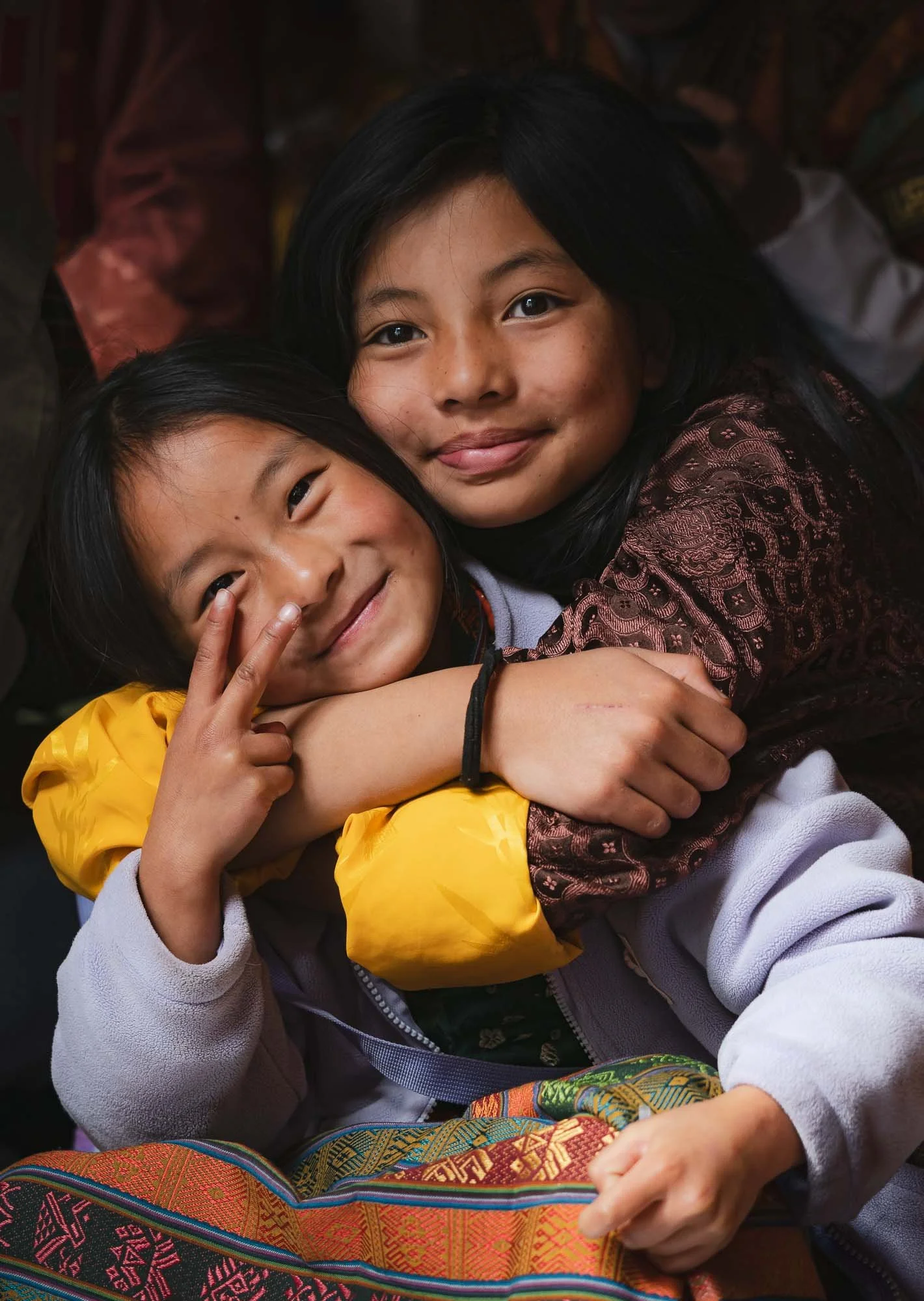
Bhutan is probably one of the most enigmatic places on earth, rarely heard of and removed from most (but not all) geopolitics. Maybe that’s what makes it so intriguing. I spent a little less than two weeks in the country - intense ones with a lot of moving around, hiking, sights, people, culture, festivals, architecture, and more, and yet I know there is still more to see here, especially towards the centre and east.
Nevertheless, this blog will probably end up having almost 200 images, such is the richness of angles to cover. Stay with me until the end, which features some of my favourite photos of the trip.
Getting There…
Bhutan is a relatively small landlocked country in the eastern Himalayas of South Asia. Although you can enter through a few land borders from India (but not from China in the north - the border is disputed) most tourists would arrive via its only international airport in Paro. That is easier said than done, for two reasons: first, Bhutan levies a USD 100 per day Sustainable Development Fee on tourists from almost every country, and an official guide is mandatory, there is no self-driving tourism here for example. My guide Chencho and driver Nima were both excellent, so no complaints here.
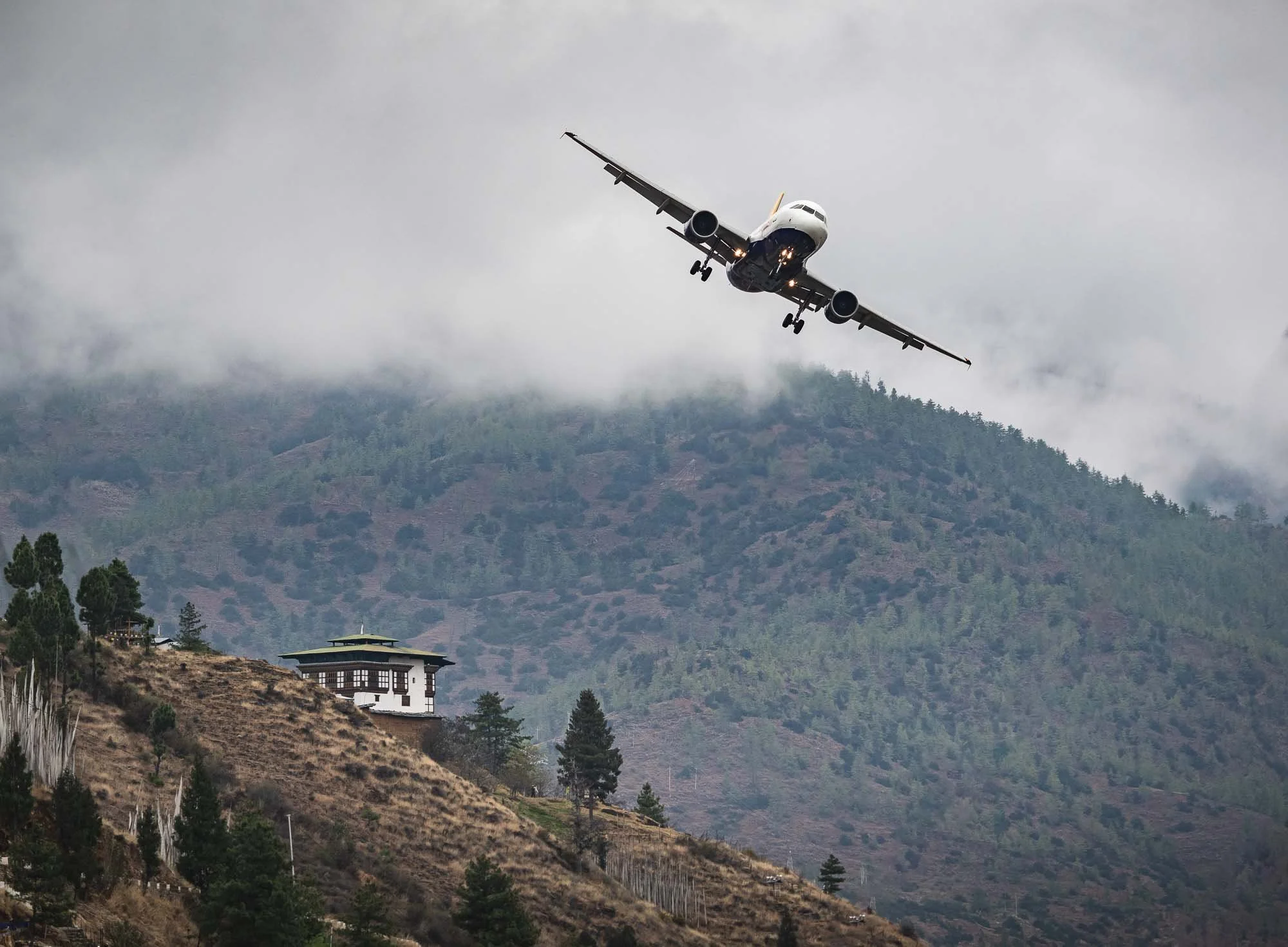
The second reason is its only international airport, generally considered one of the most difficult landings in the world due to its location in a narrow valley, with frequent poor visibility. Only a handful of airlines fly to and from a few countries, and only a few specially trained pilots are allowed to make the banked manual visual approach without the standard instrument-assisted landing systems.
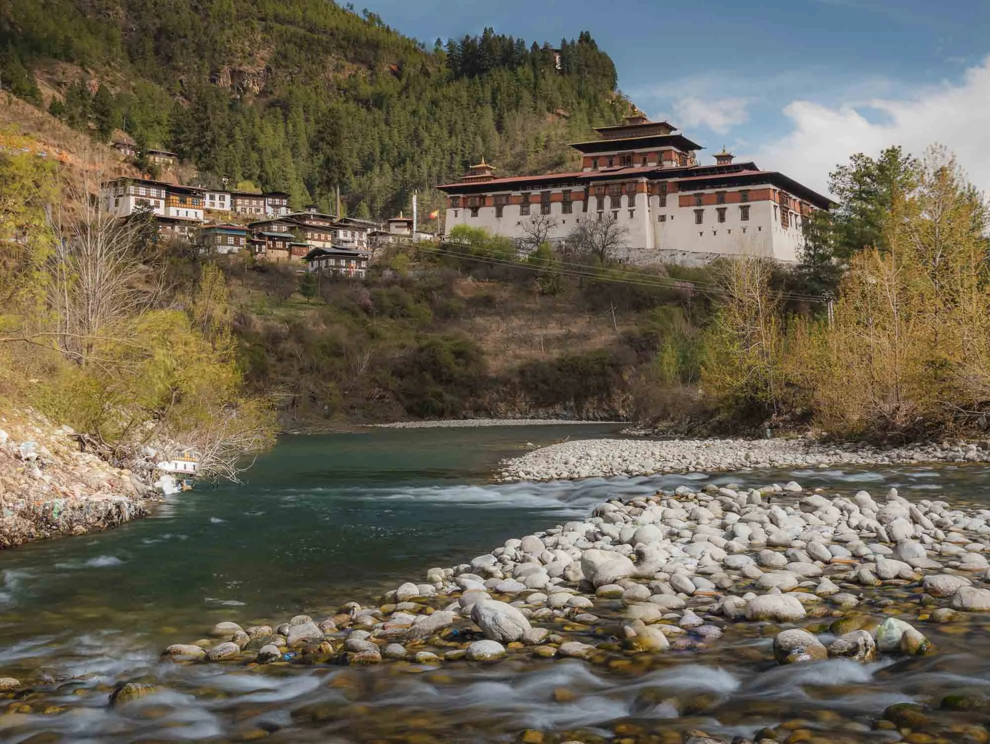
My own arrival flight was delayed a few hours due to clouds (making such a visual approach impossible) - while I was in Paro I made sure to observe a few of the rather interesting landings with the backdrop of one of the many forts, more on that to come.
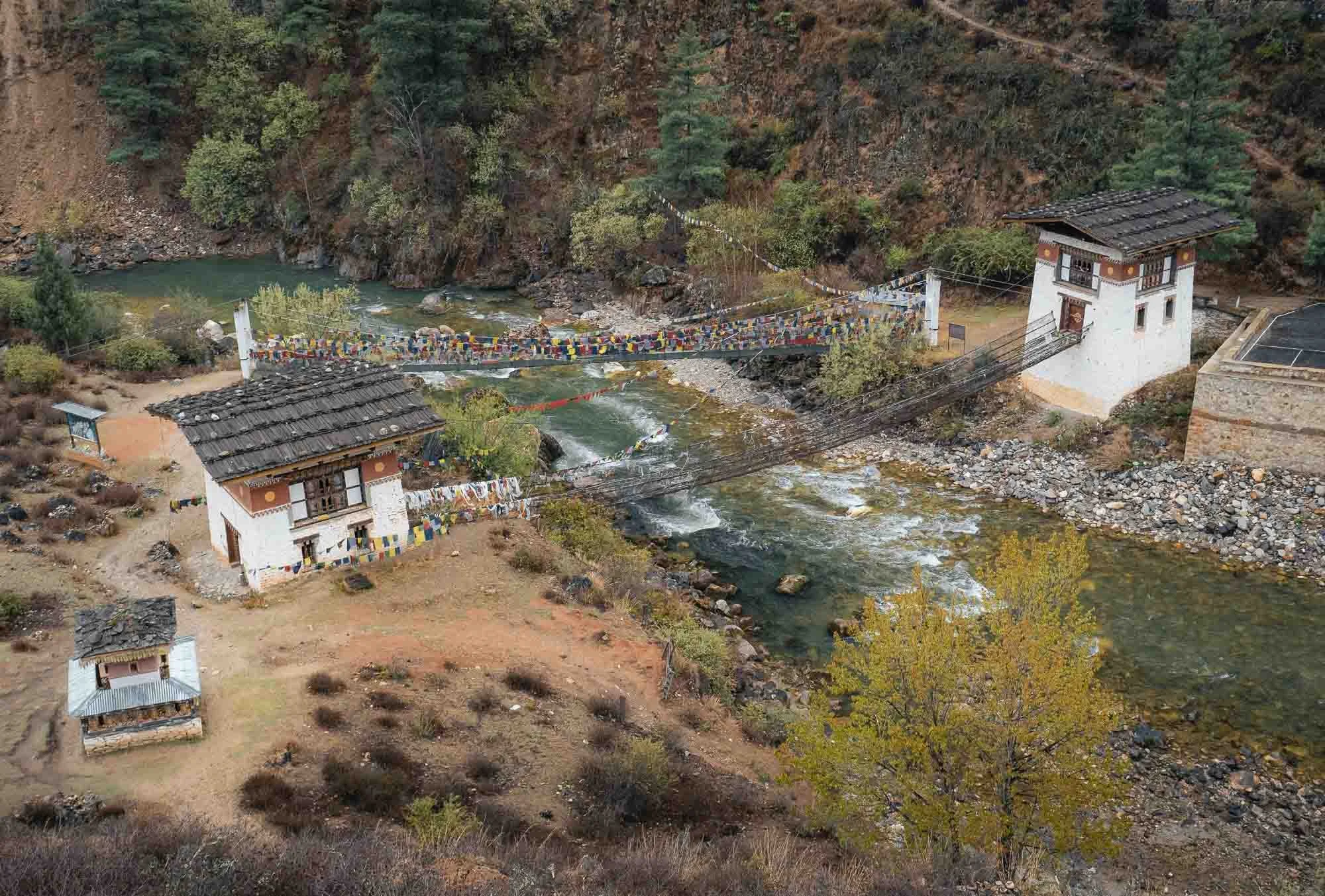
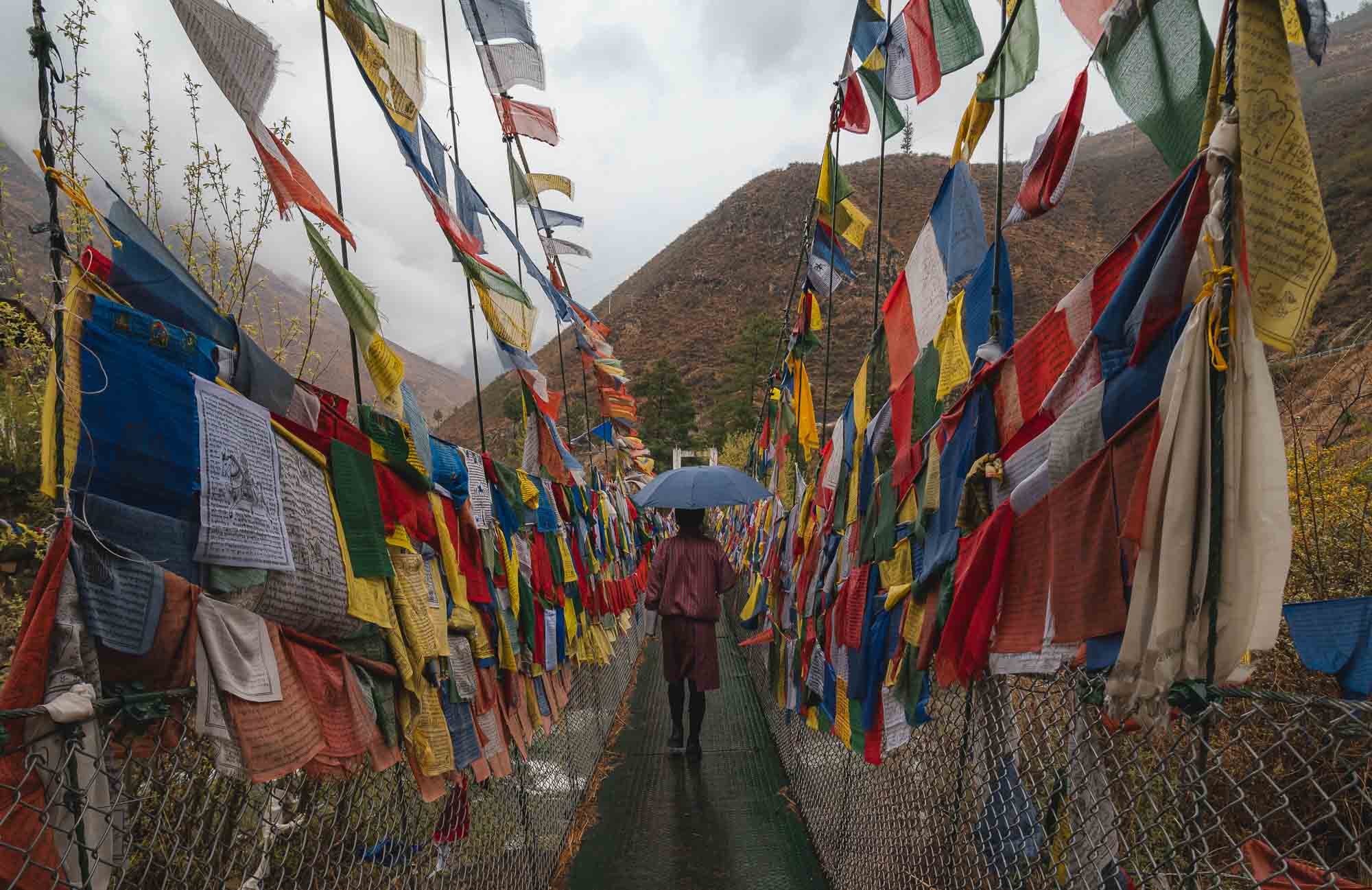
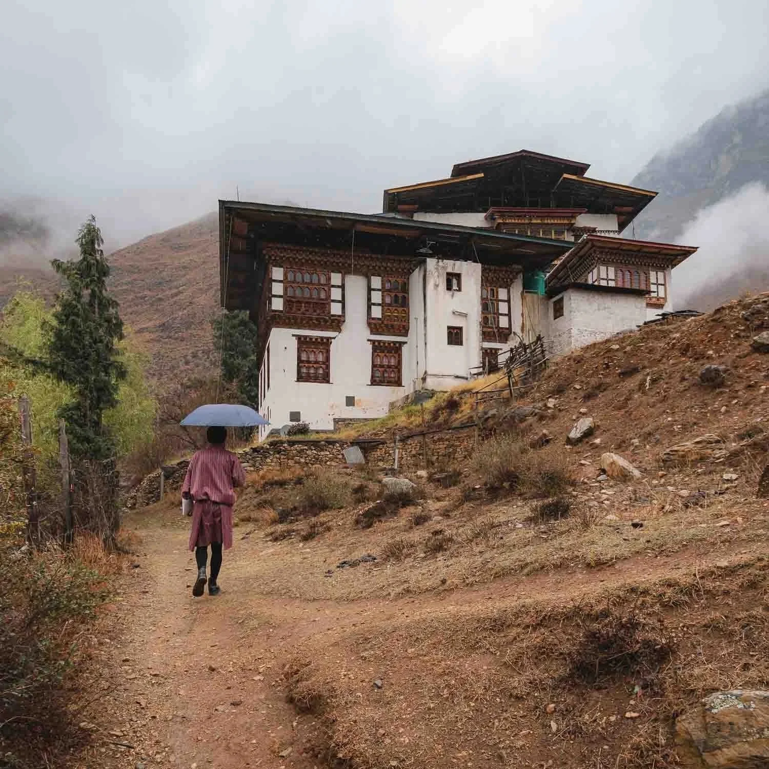
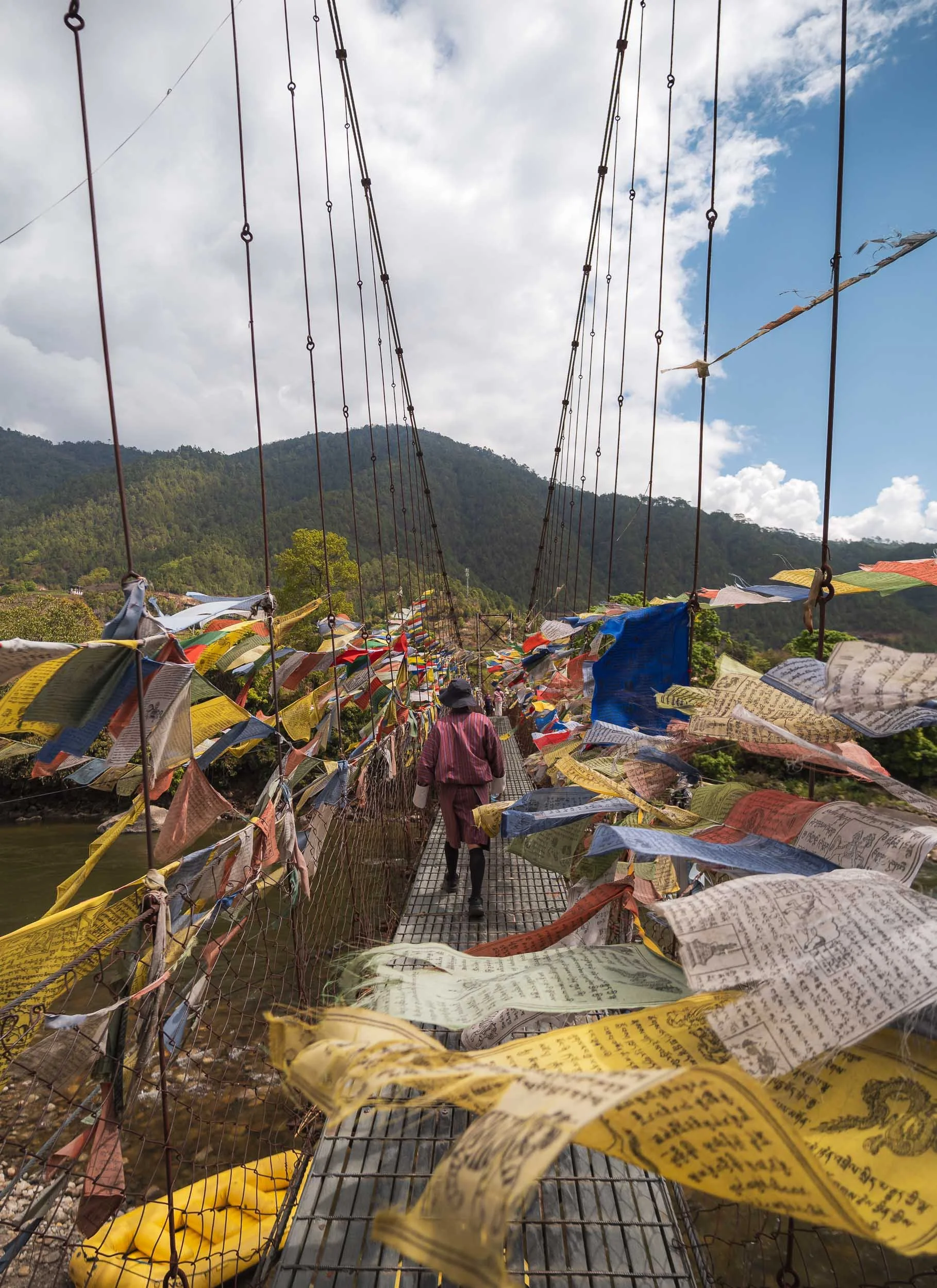
Once I made it a few hours later than planned, it was still rainy. A drive to Thimphu, the capital was on the agenda, with a short stop at a picturesque monastery of Tachog Lhakhang, accessible through one of the many rope bridges in the country. If you look closely, you’ll see there are actually two bridges here, the one without flags being the oldest in the country (from 1420) and - possibly for this reason - not in use anymore.
At this point I also had my first encounter with the political system of the country: Wikipedia says it’s a unitary parliamentary semi-constitutional monarchy - in effect a Kingdom, ruled by the so-called Dragon King (what a title). In practice, it holds general elections in a parliamentary form of government, but the royal family is present everywhere and from what I observed and been told, highly respected.
My guide Chencho and I walked up to the temple, where he showed me a statue of the so-called “Bearded Master”: Guru Rinpoche. He is omnipresent in the temples of the country, and considered the civilizational founder who established Buddhist Vajrayana practice across the region.
It also featured a rather curious artifact inside (no photos - none of the temples in Bhutan allow photography or videos inside and they’re quite strict about it): a spot where a woman had prayed so many times for so long that her footprints were eternalized in the stone floor.
Buddhism covers more than 75% of the around 800,000 people in the country, and its evidence is everywhere. The balance is mostly Hinduism, mostly from Indian influence in the south.
Thimphu
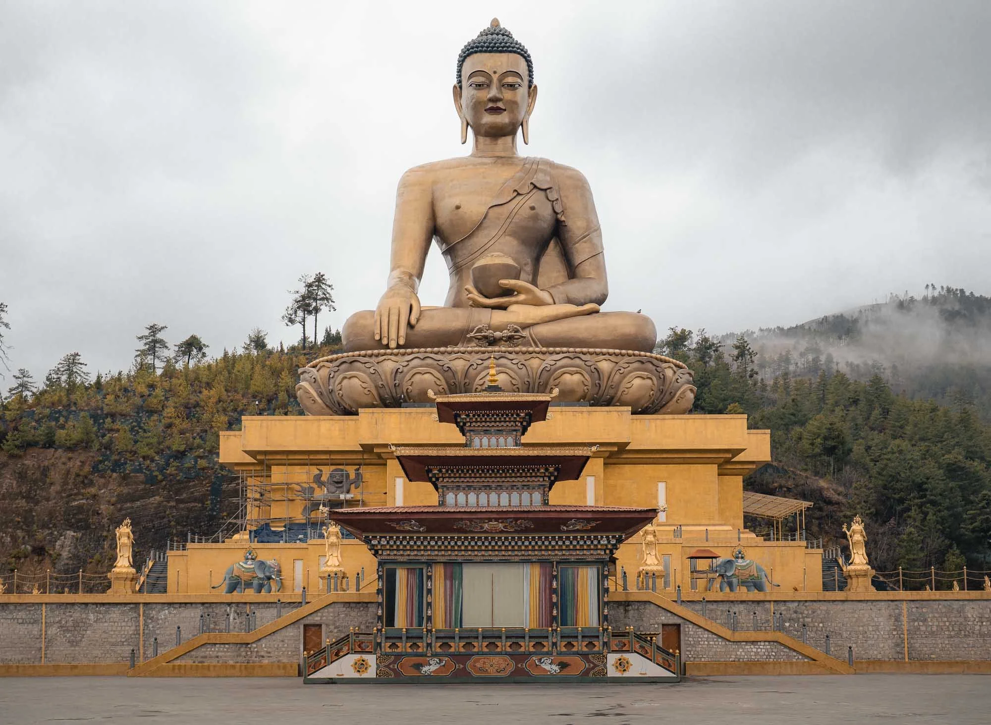
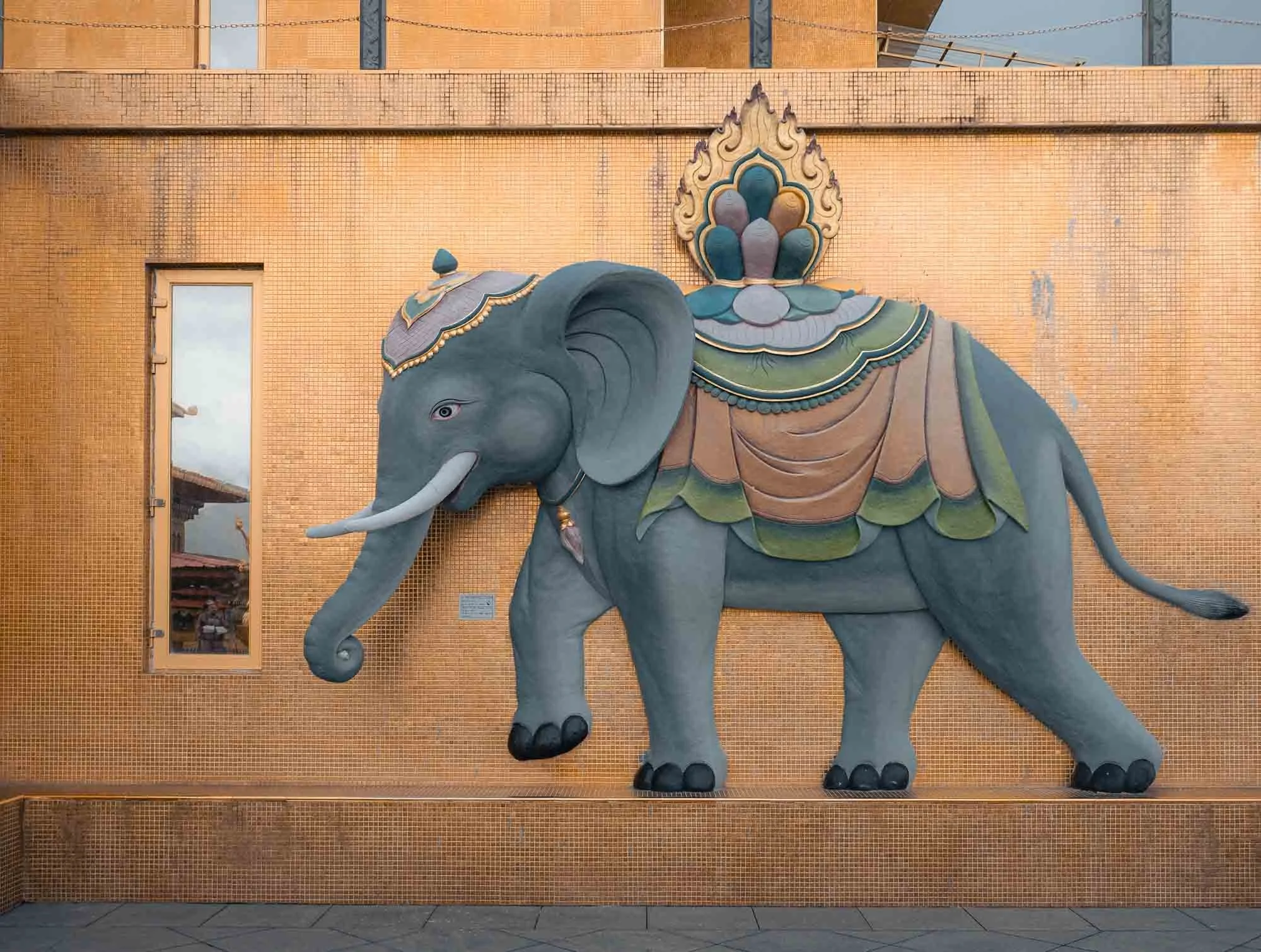
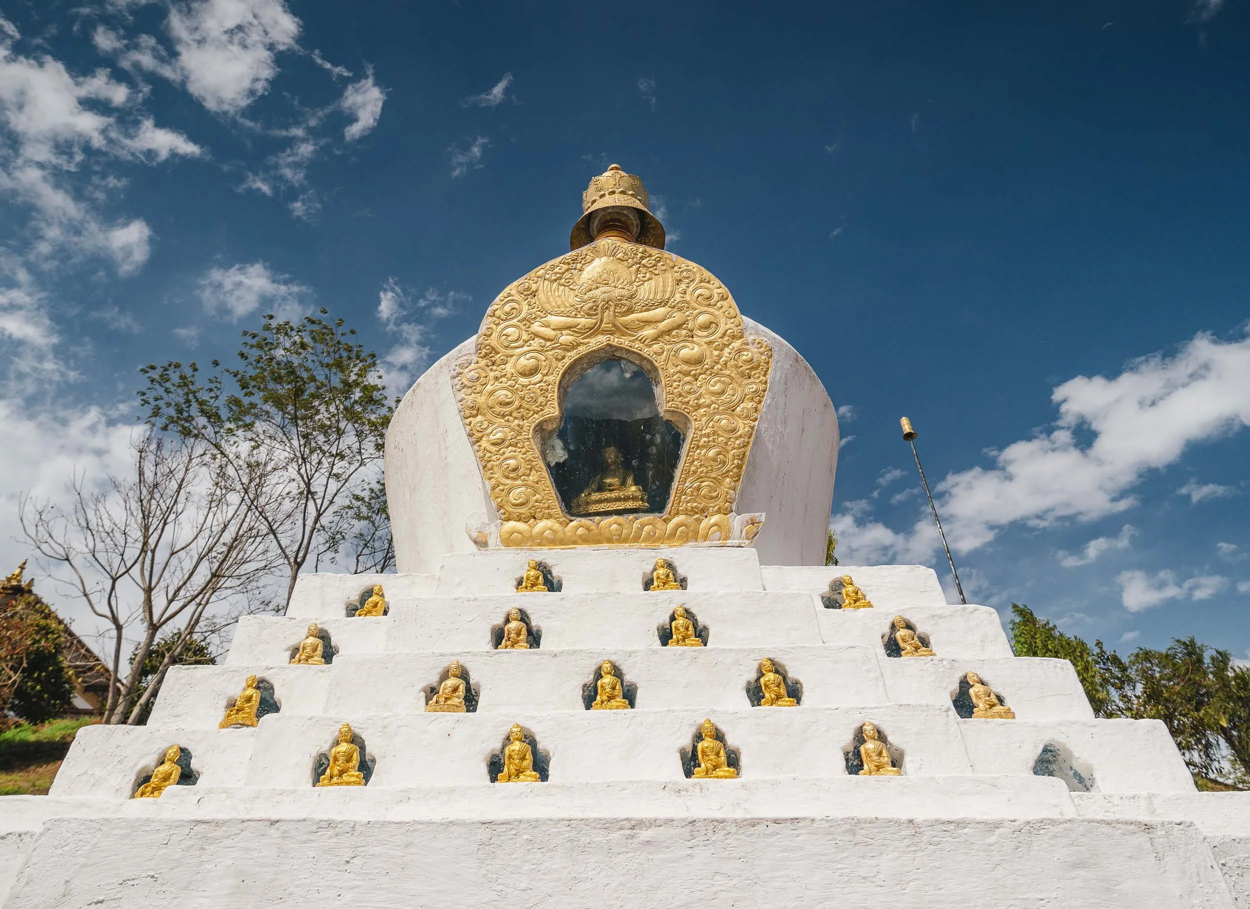
After about an hour drive we arrived at the capital, or more specifically, the Great Buddha Dordenma, a 50- metre-tall bronze statue overlooking the city. It was completed in 2015 and houses over 100,000 smaller Buddha statues inside and was built to emanate peace to the world, so they say. Indeed Bhutan has been ranked 21st on the Global Peace Index in 2025.
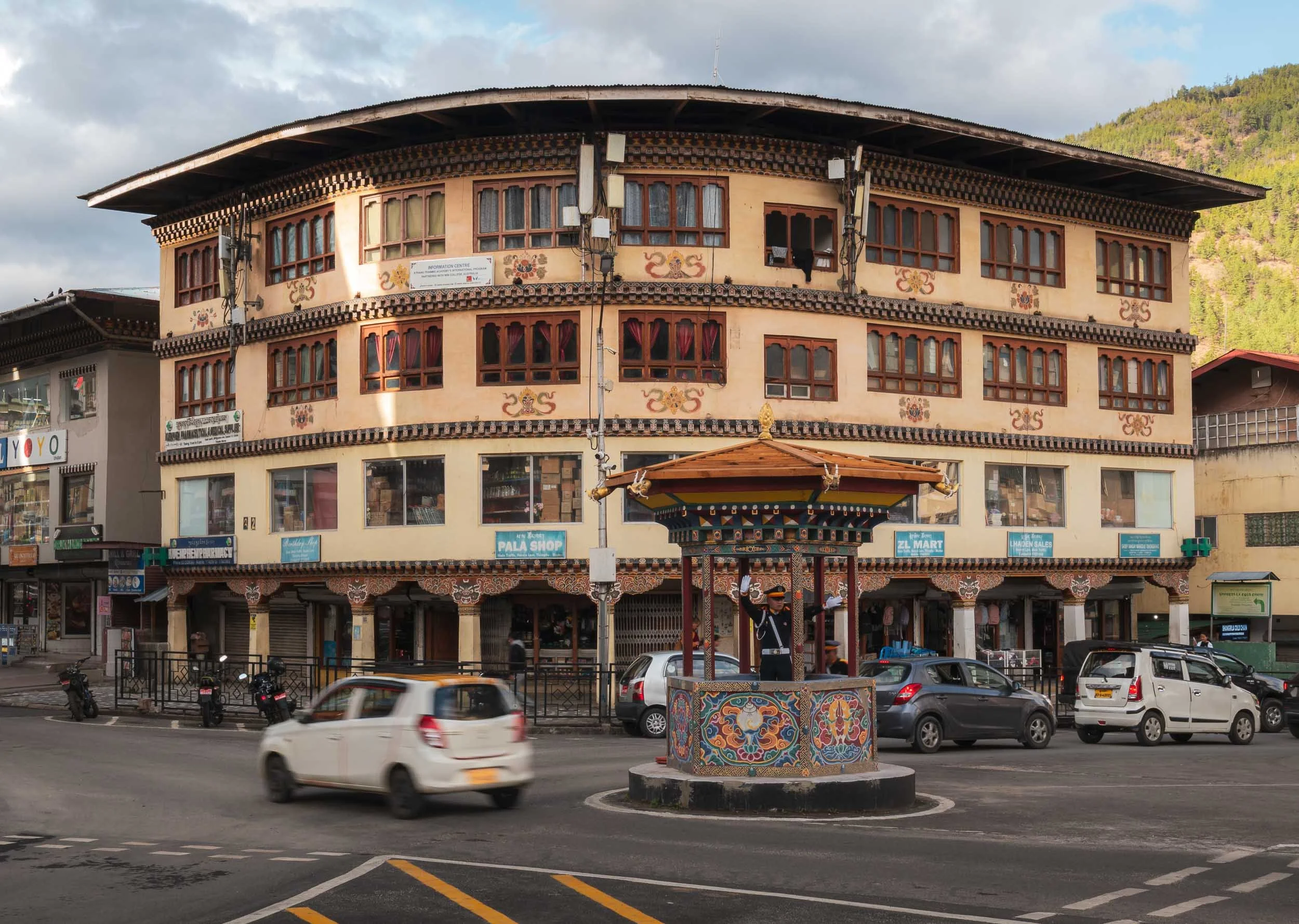
Thimphu is a relatively small capital, with a population of just over 100,000 people. In the Bhutanese spirit of calm, honking is not allowed on its road, and this is more or less adhered to from my observation - a stark contrast to neighboring India. The city also doesn’t have any traffic lights, the main intersection is managed by a white-gloved police offer housed in a little structure in a more human-centric approach.

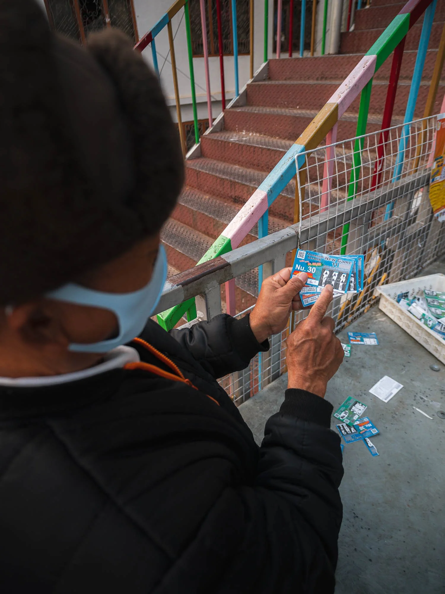
It otherwise has not that much to offer - the busiest spot I encountered was a local lottery stall. Gambling is frowned upon in Buddhism, but not forbidden. This man was not lucky according to his explanation of the various insignia on his ticket.
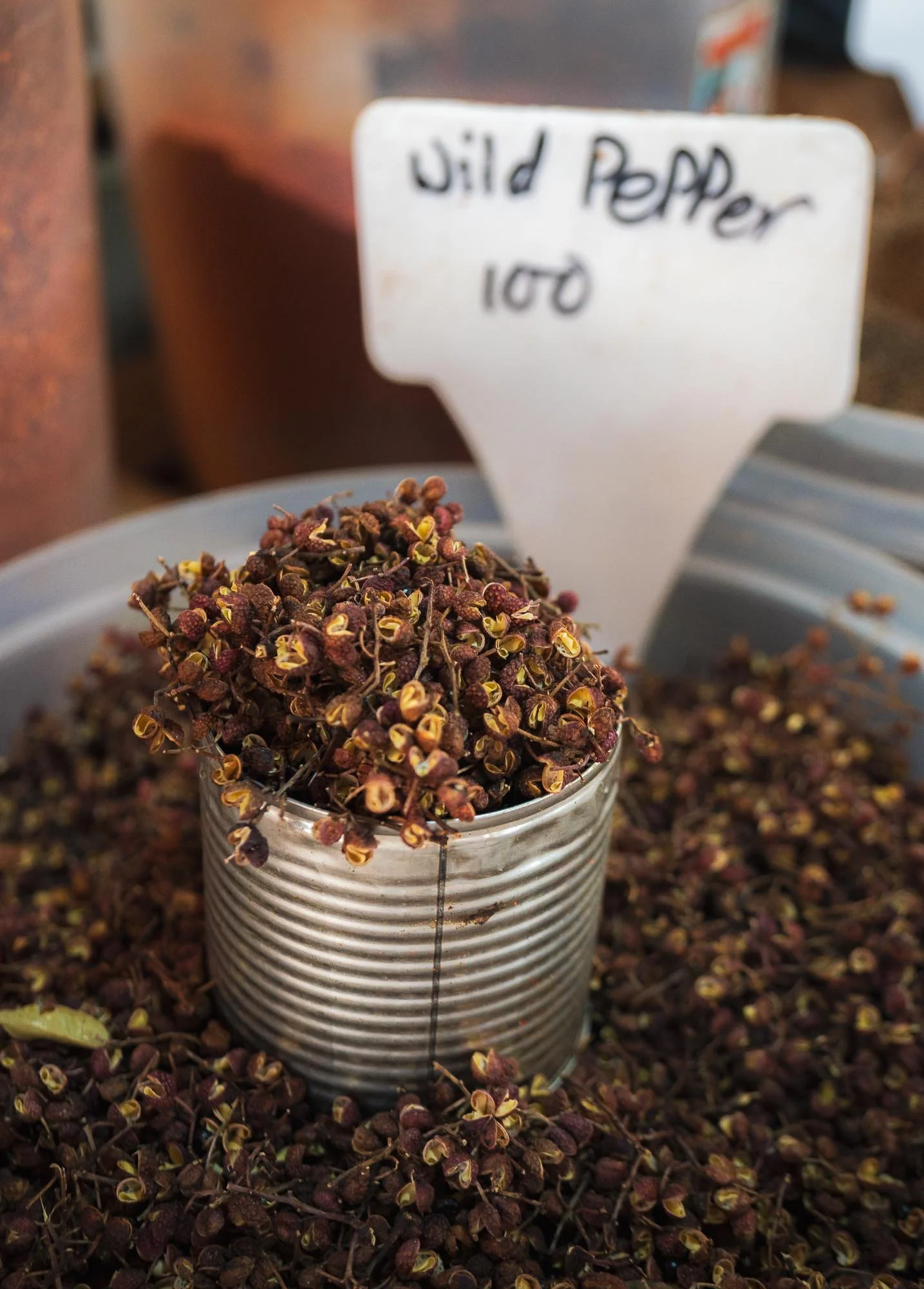
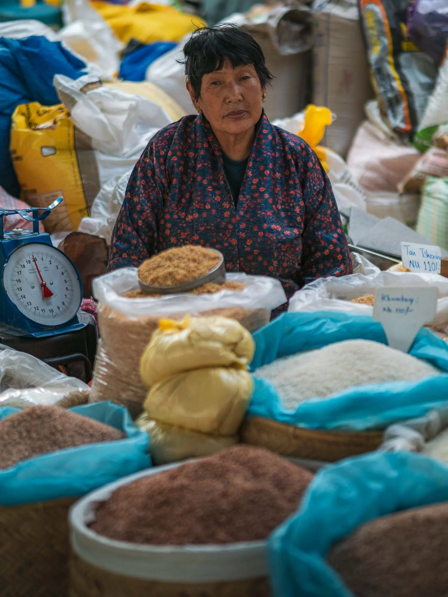
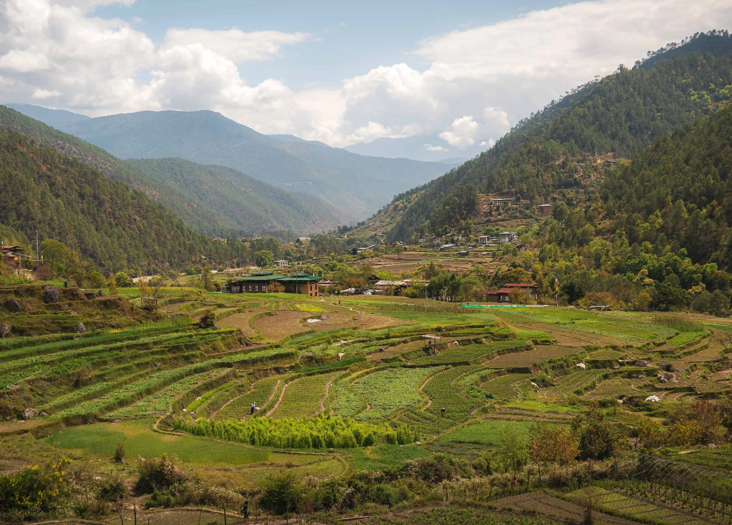
The market had a little more to offer than lottery tickets - mainly of agricultural nature, such as wild pepper. Agriculture makes up a large portion of the country’s economy despite the rugged terrain (almost 99% is considered mountainous), with significant subsistence farming.
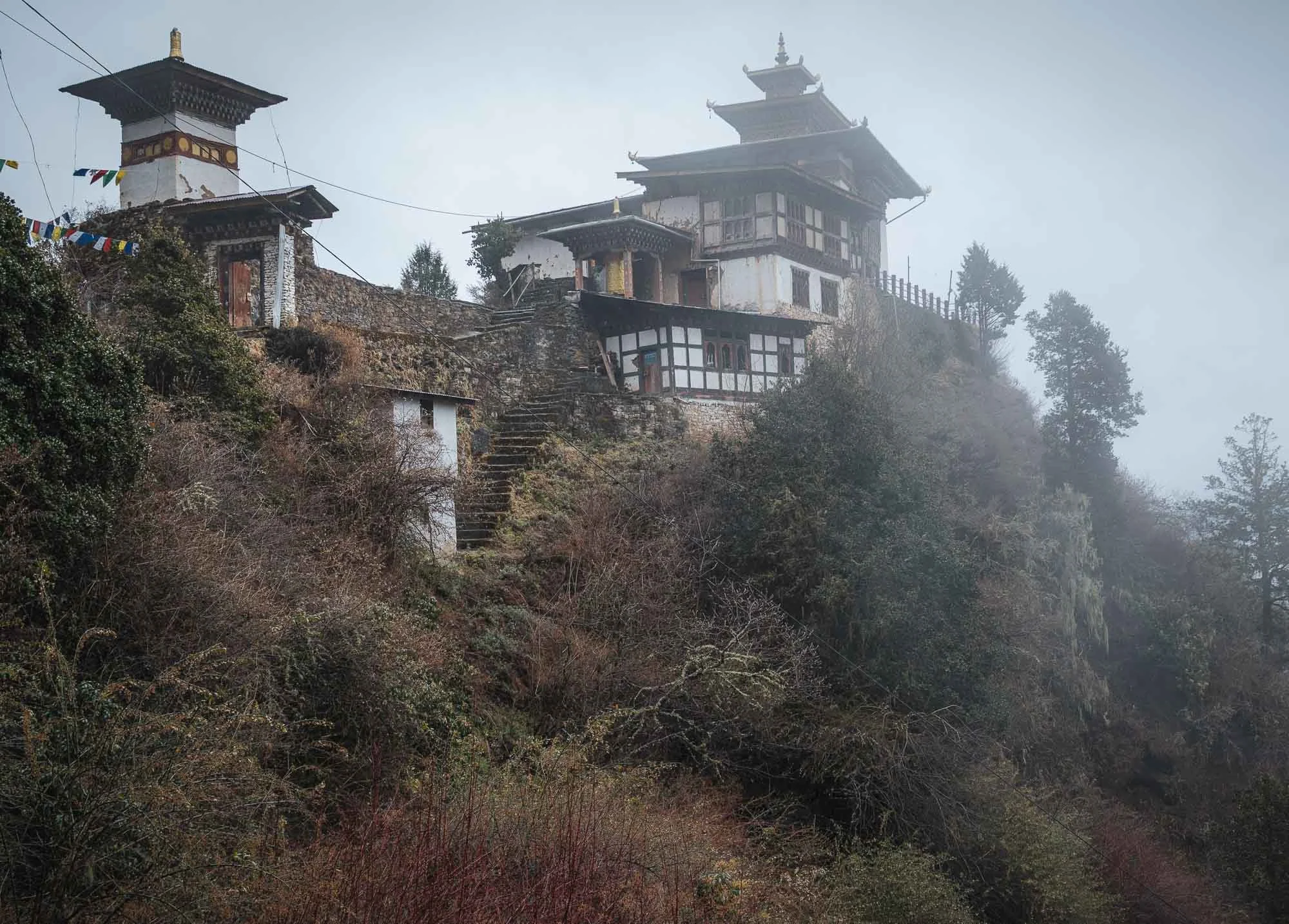
Cheri Monastery
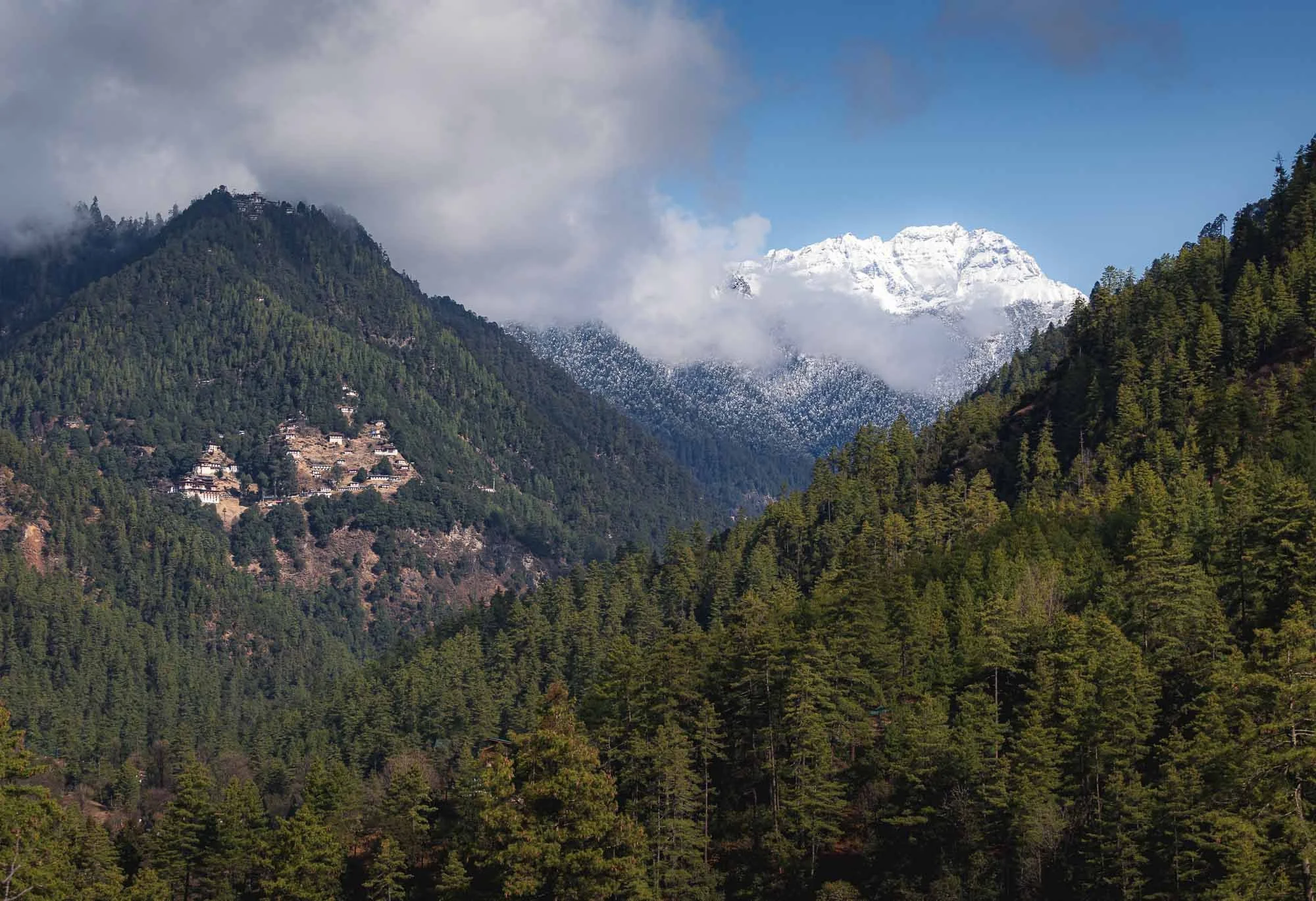
The next day brought brighter conditions and a chance for a first small hike to another monastery, visible on the left here, with a second outpost even higher up the mountain - visible just below the clouds on the left.
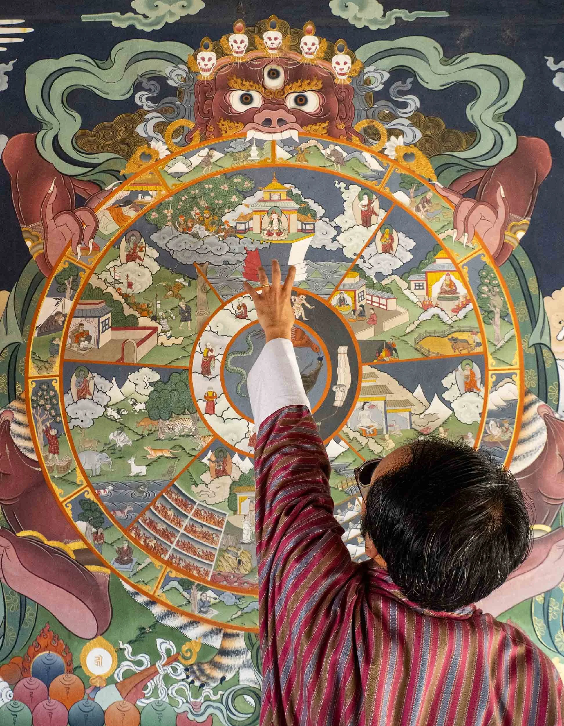
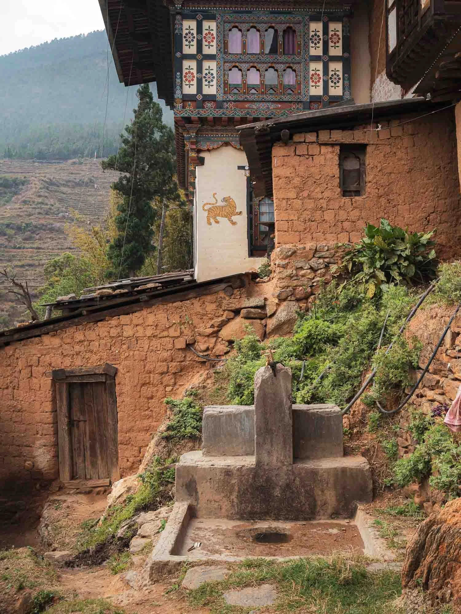
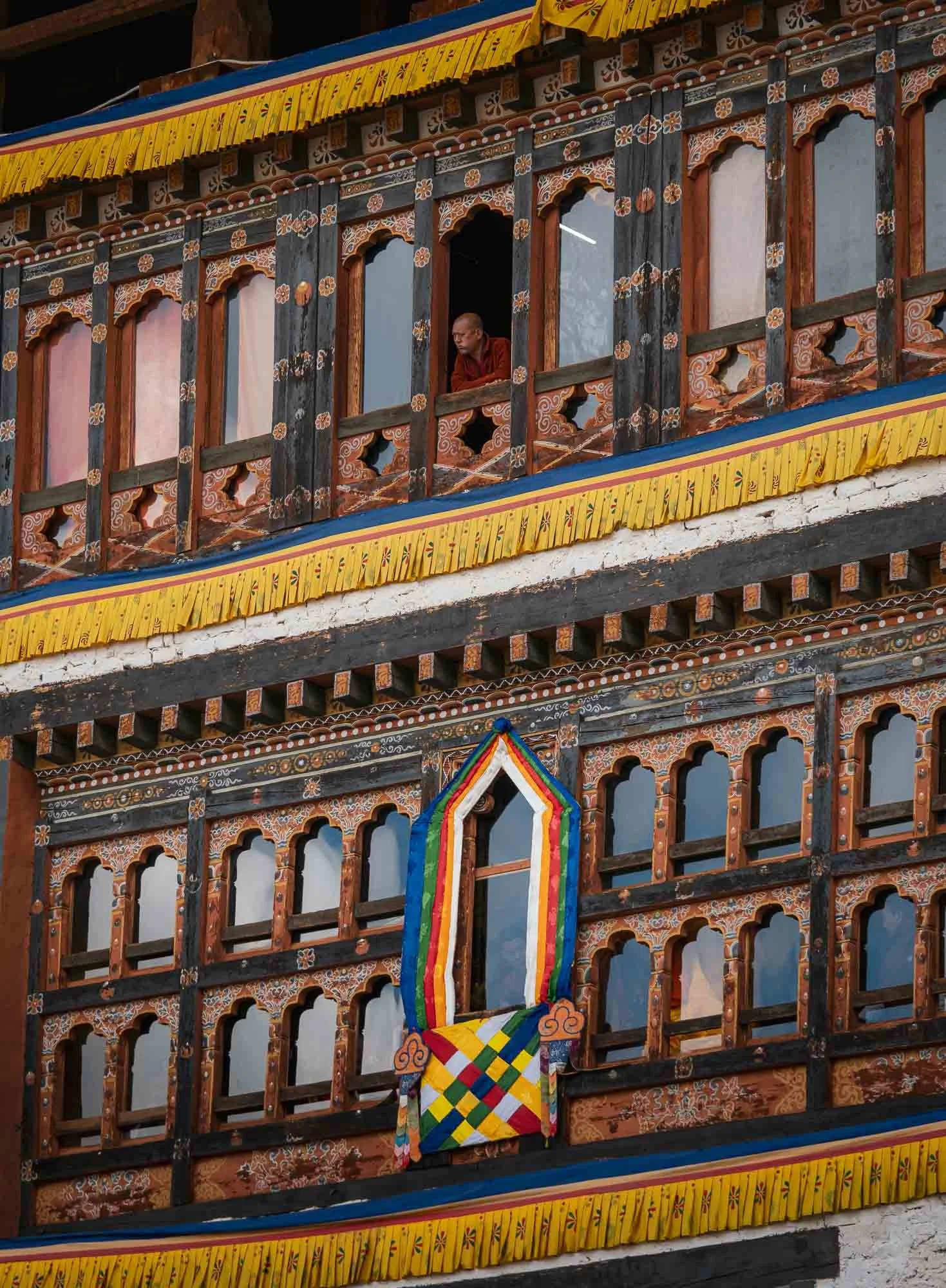
The monastery gave my first glimpse at the incredible architecture all around Bhutan, which is more or less unique to the country - only Tibet seems to feature a similar style. Mostly a mix of compacted earth, stone masonry and the amazingly detailed wooden elements, arranged in interlocking patterns without supporting nails or metal brackets.
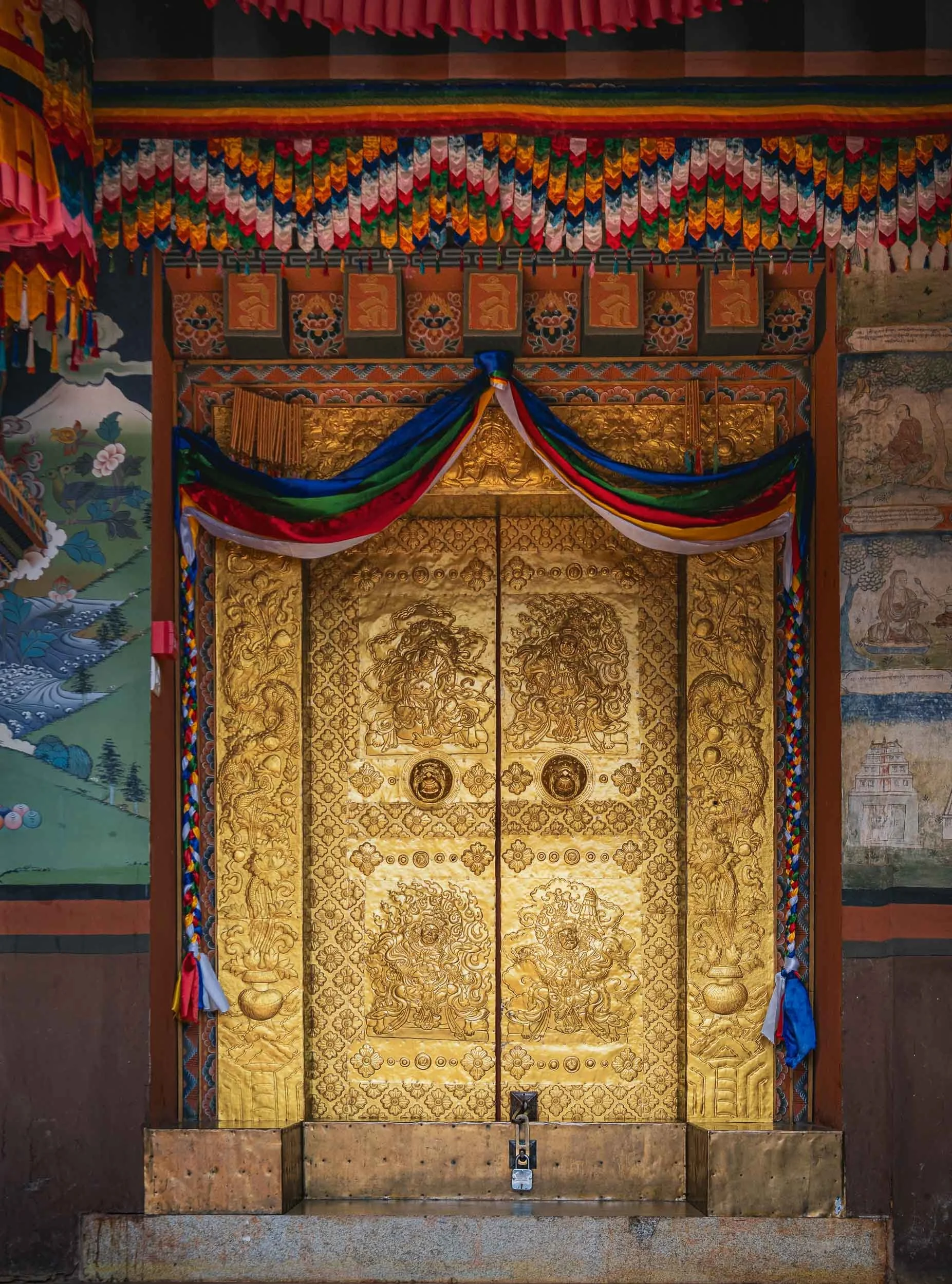
Thick, gold-slated doors protect the entrance, mostly wooden with carvings and gold leaf or powder mixed into paint. Chencho explained the Buddhist wheel of life that can be found painted at many of the temples, representing a kind of circle of existence in Buddhist cosmology.
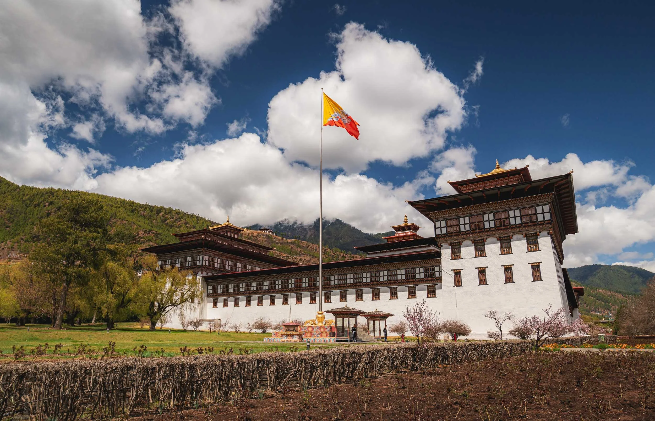
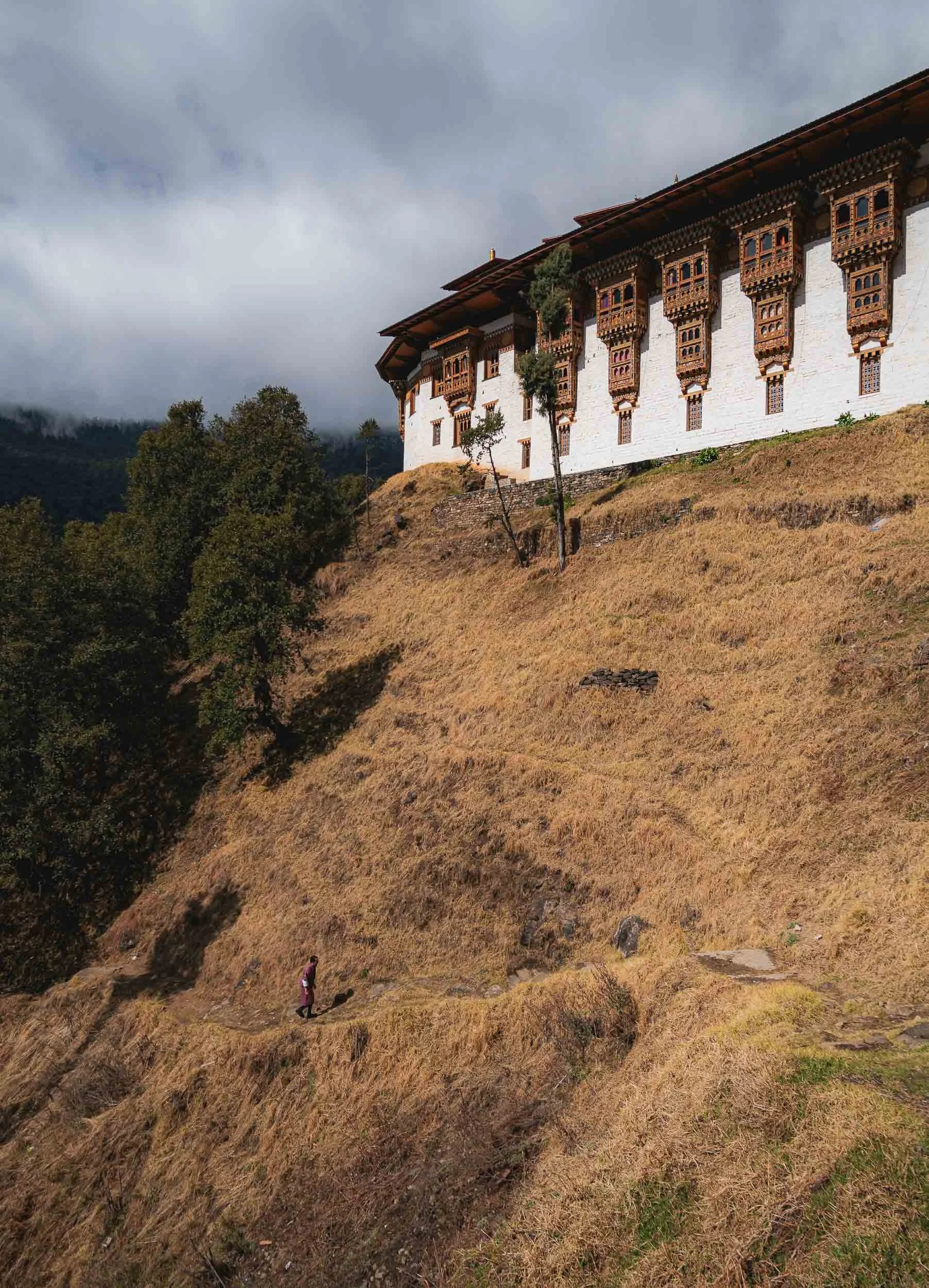
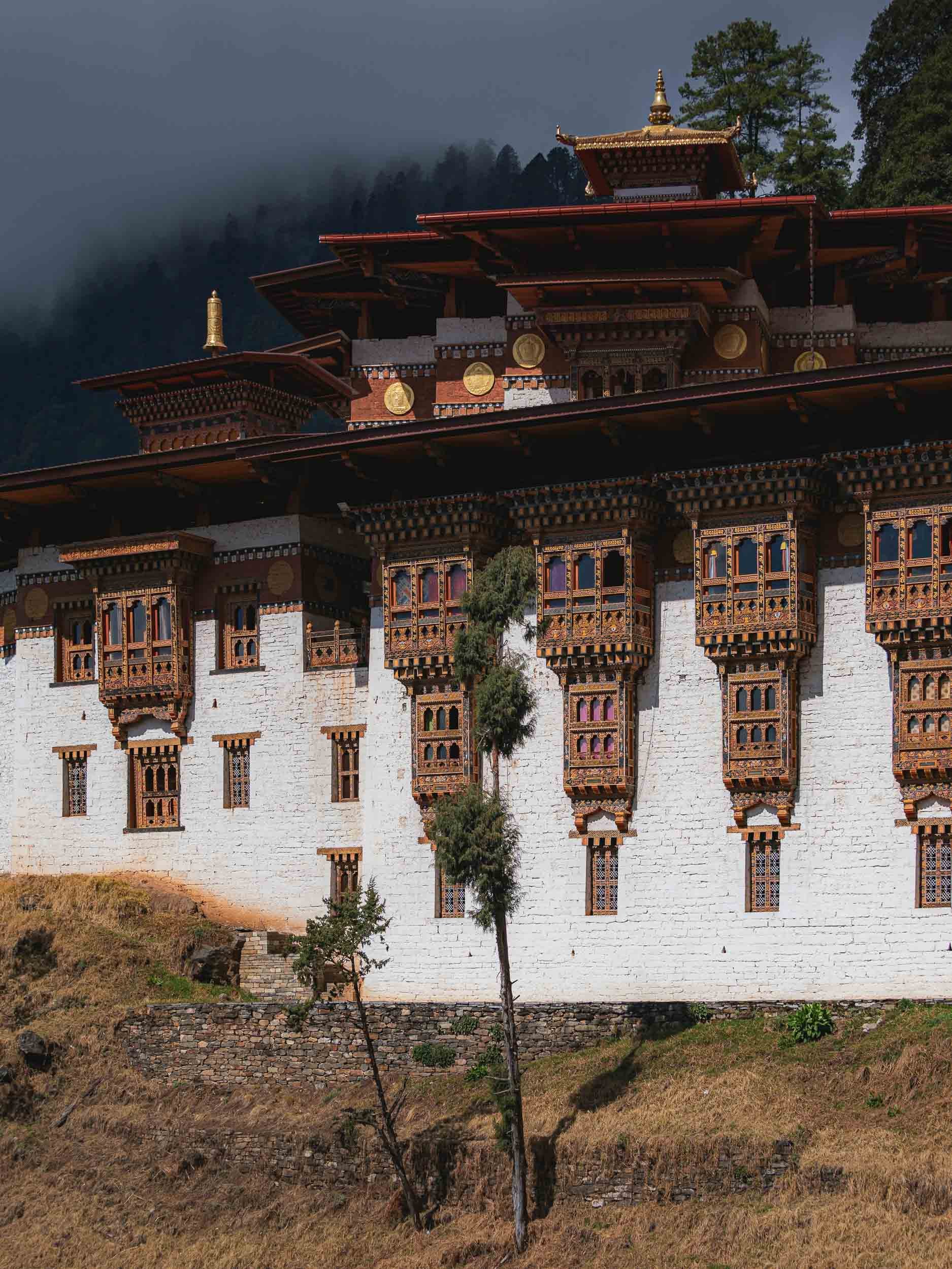
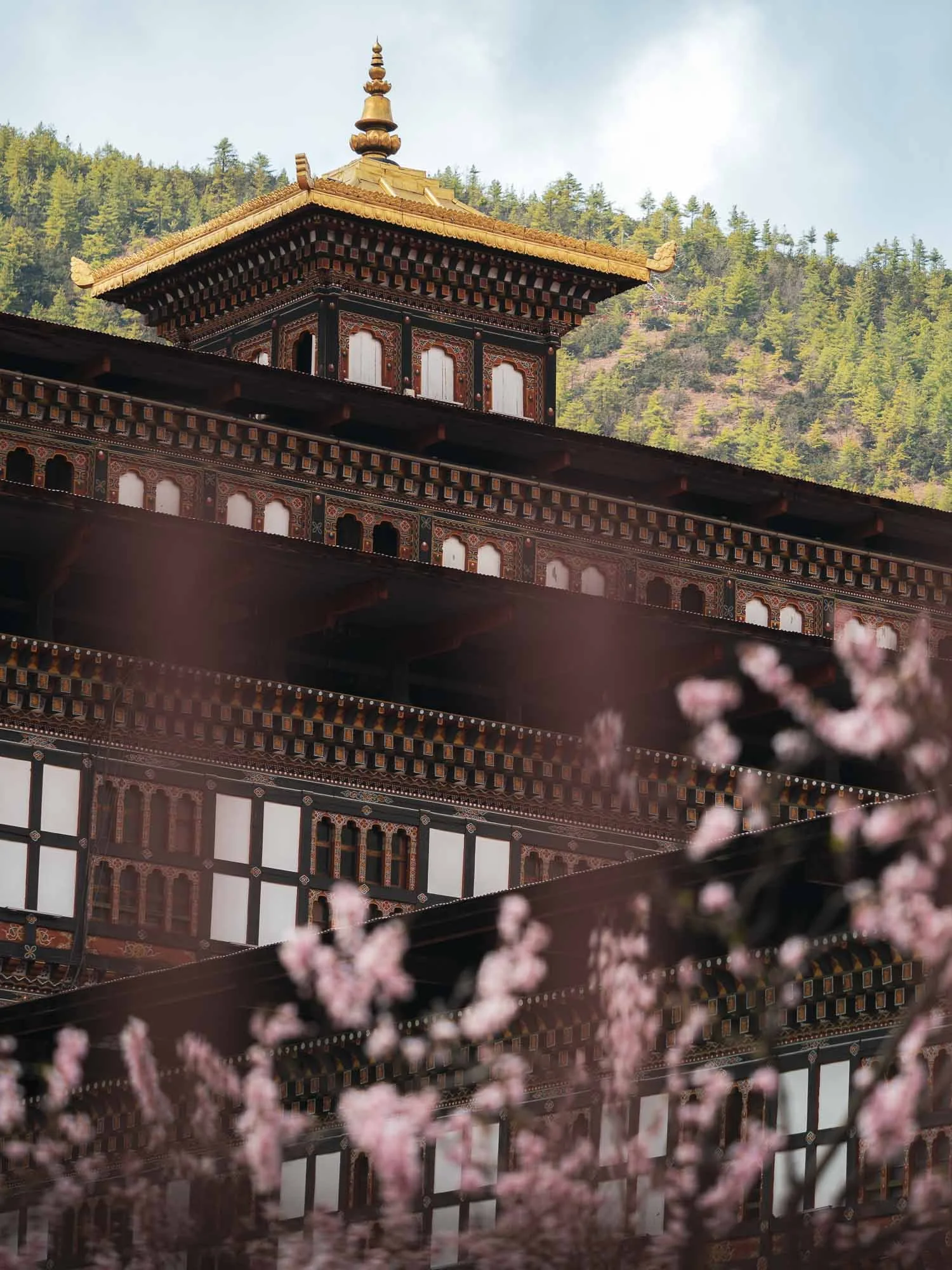
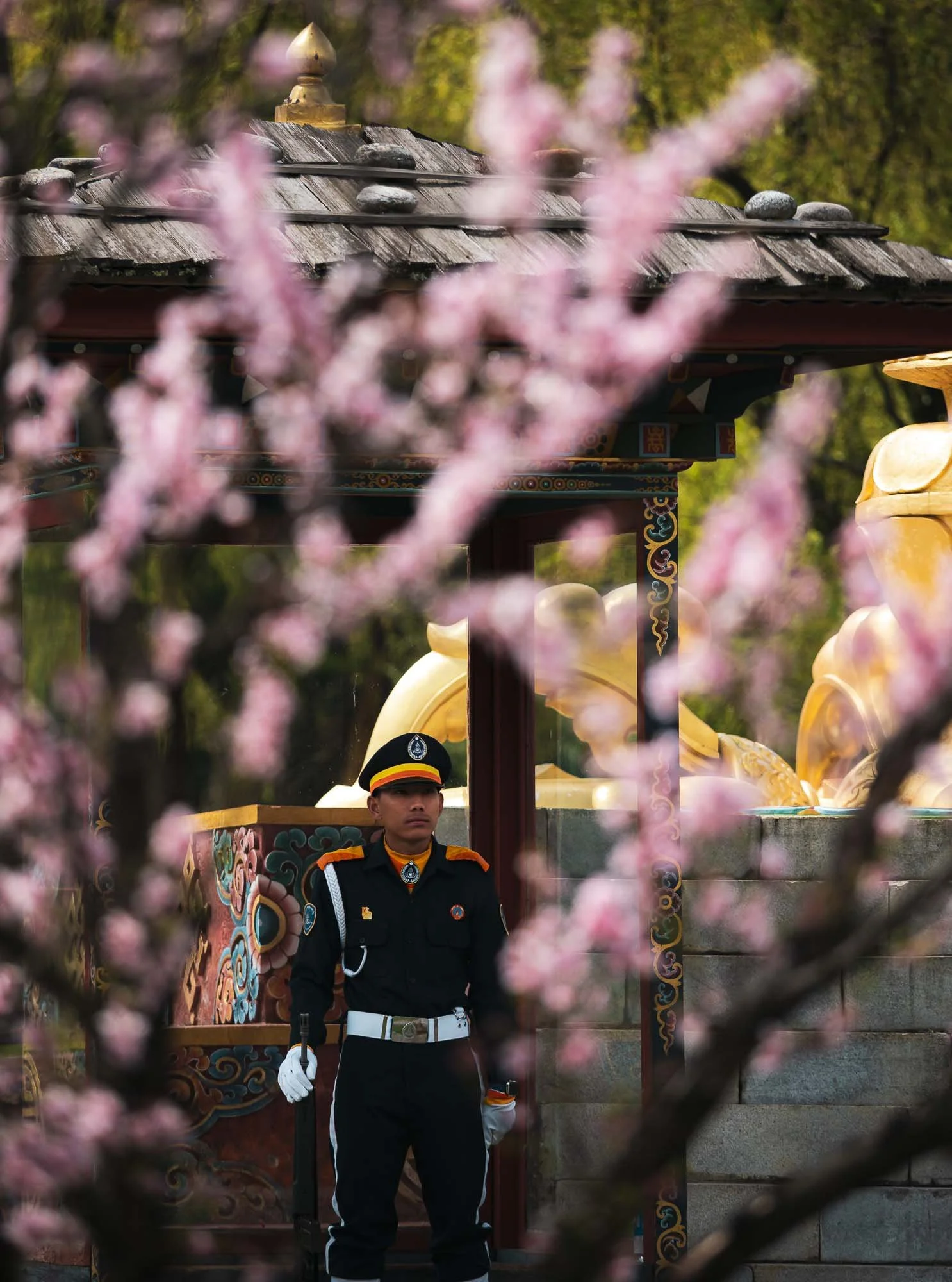
Tashichho Dzong
Back in the city, we visited its primary “Dzong” - meaning fort - an impressive structure serving a dual religious and secular function as the seat of the central monastic body and government offices of the King, including the throne room. Note Bhutan’s amazing flag - absolute winner!
The impressive structure originally dates back to the mid 17th century, but was damaged several times due to fire (a common story among the many heavily wooden structures in Bhutan) and earthquake. Its last restoration into the current form was largely finished in the 1960s.
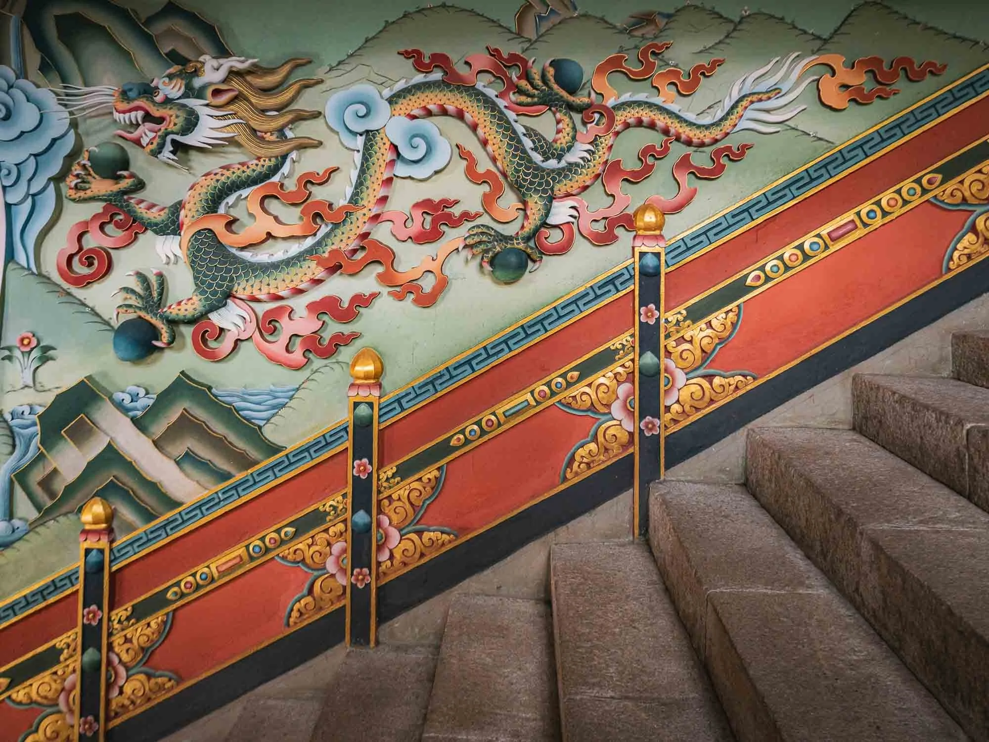
🐉
The dragon relief at the entrance staircase, Bhutan’s central national and religious symbol. The country is literally called Druk Yul - “Land of the Thunder Dragon”.
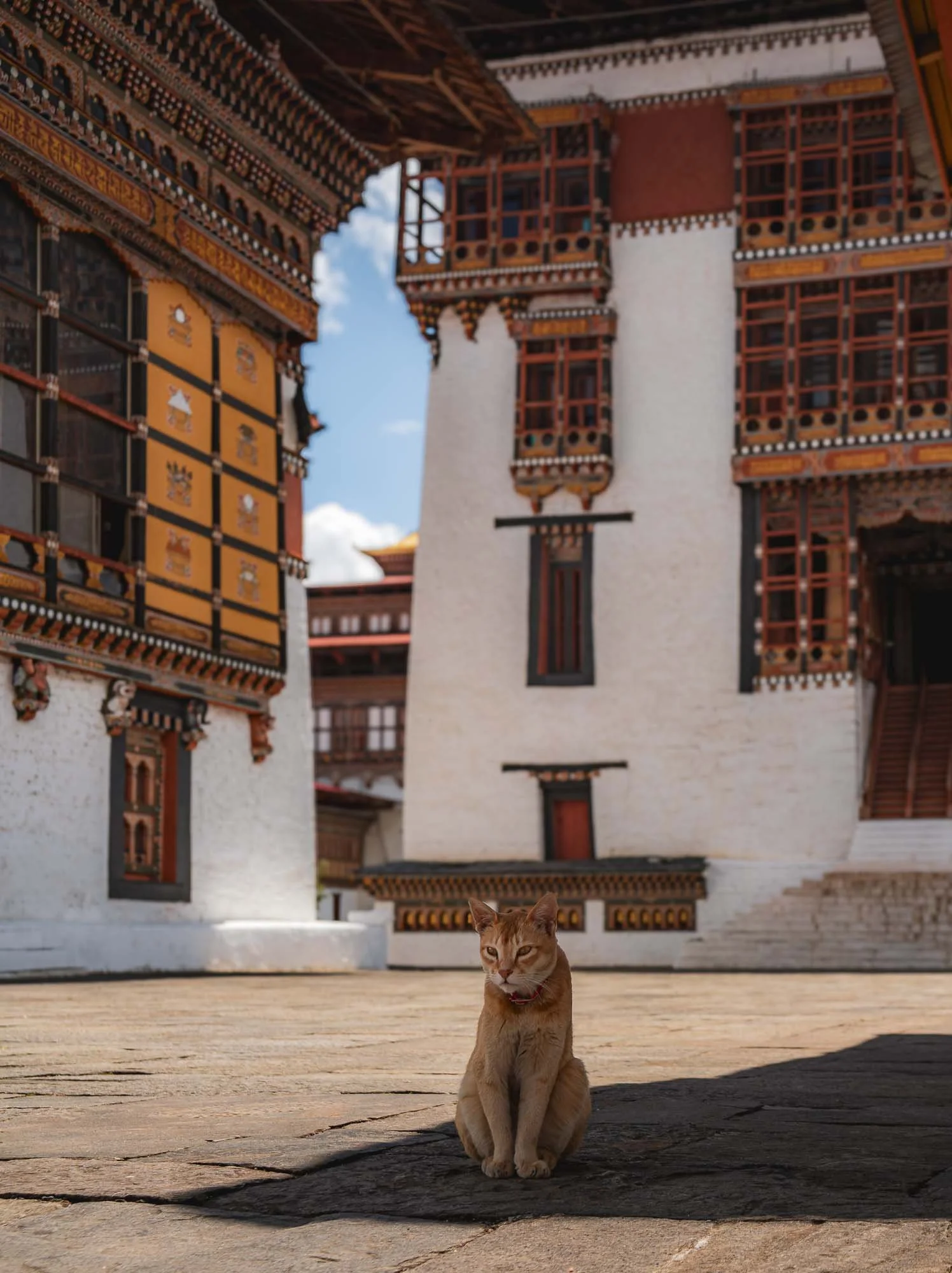
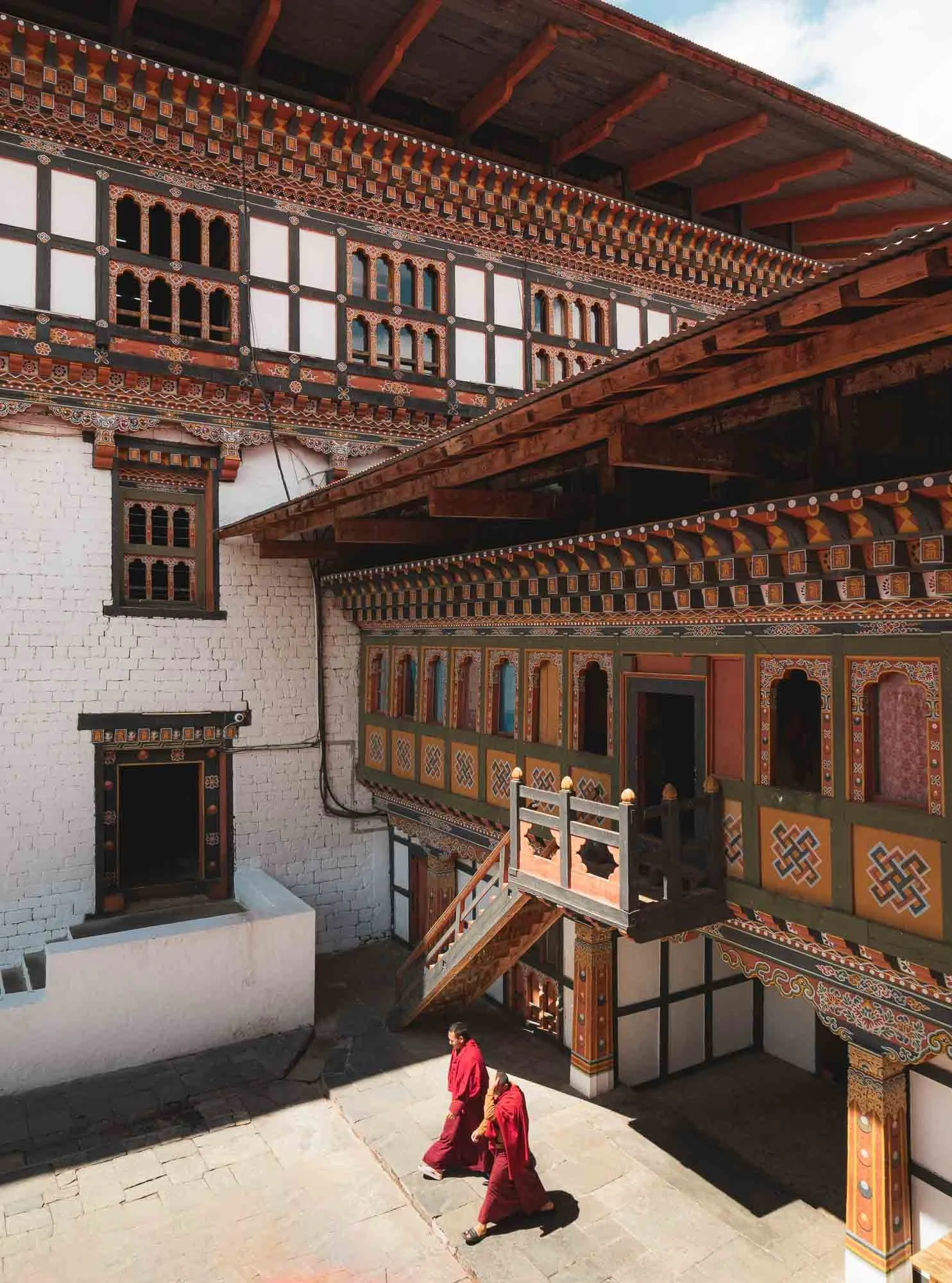
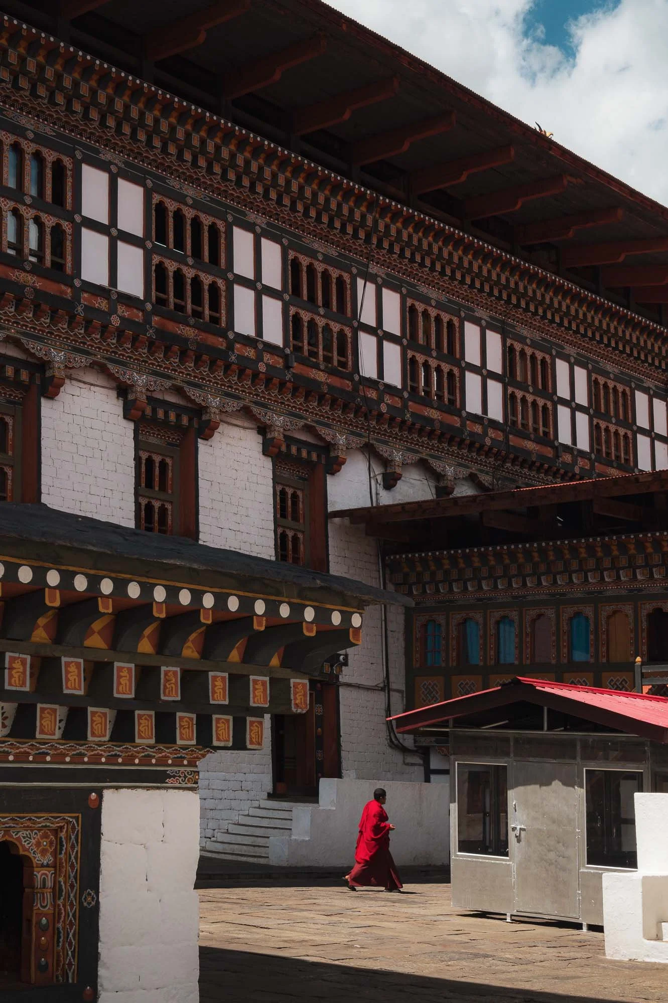
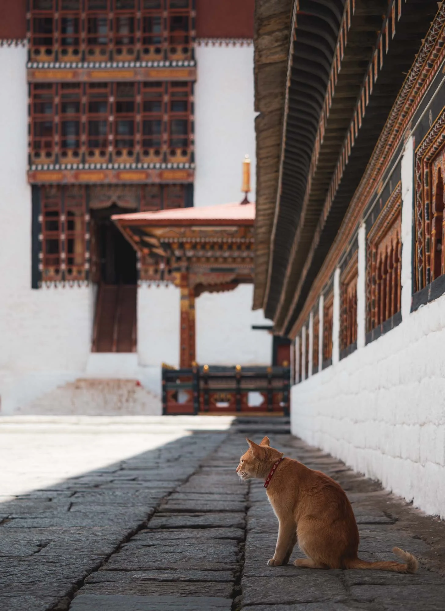
I spent a couple of hours here soaking up the calm atmosphere, virtually without any other tourists, waiting for monks or cats to move into position for a good photograph. They were obedient.
The spring cherry blossoms around the fort, which is formally guarded due to its administrative functions - not all areas are accessible to the public.
The Dzong is lit up beautifully at night, and I found two more viewpoints in the city to document it from.

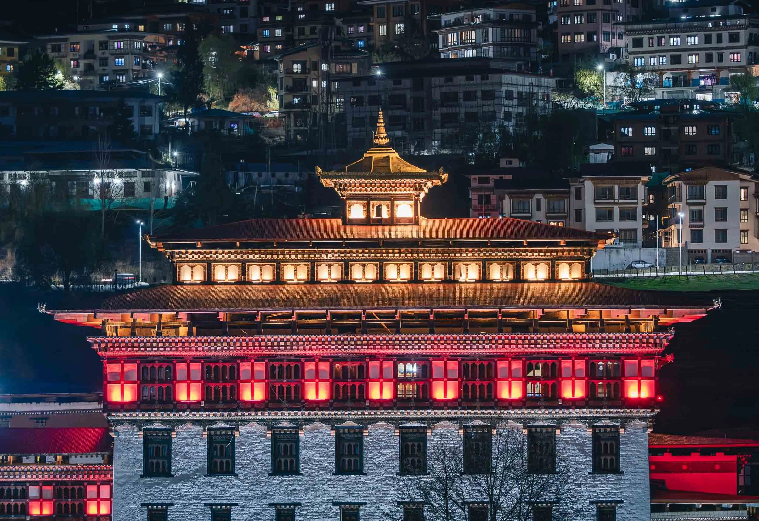
Bhutan Takin
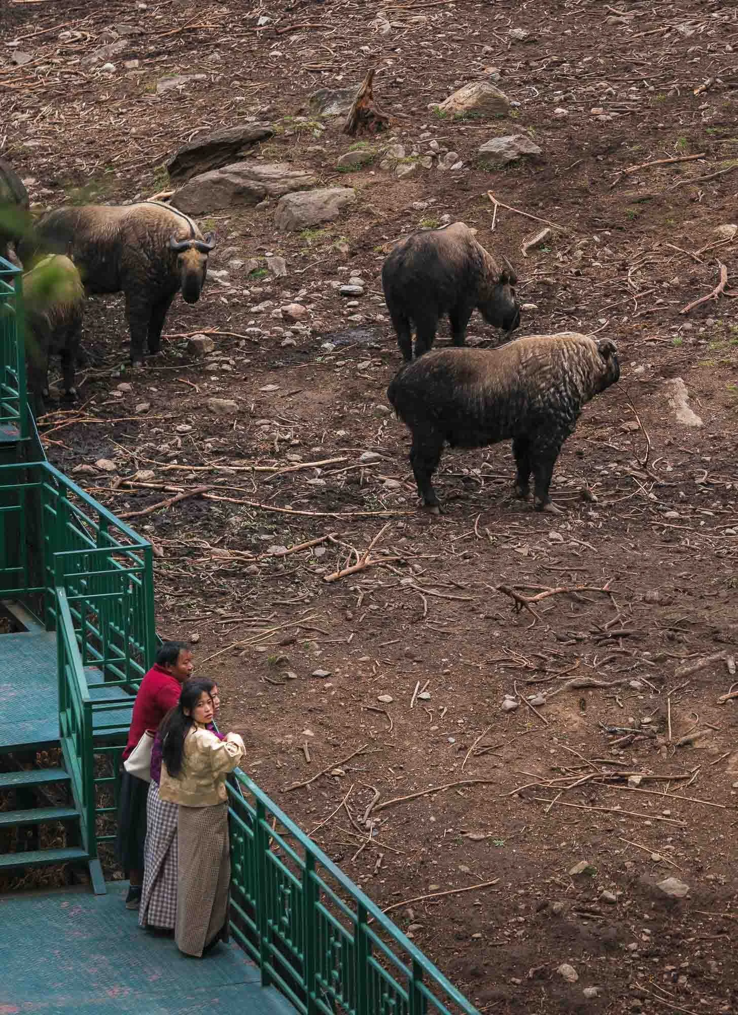
Beyond the mythical dragon, Bhutan features significant biodiversity, likely owing to a combination of factors such as its focus on sustainable development, the extreme geographical spread (its lowest point is just 100m above sea level, whereas its tallest mountain reaches over 7000m), and forest cover of more than 70%. One of the lesser known and more peculiar mammals is its national animal: the Bhutan takin.
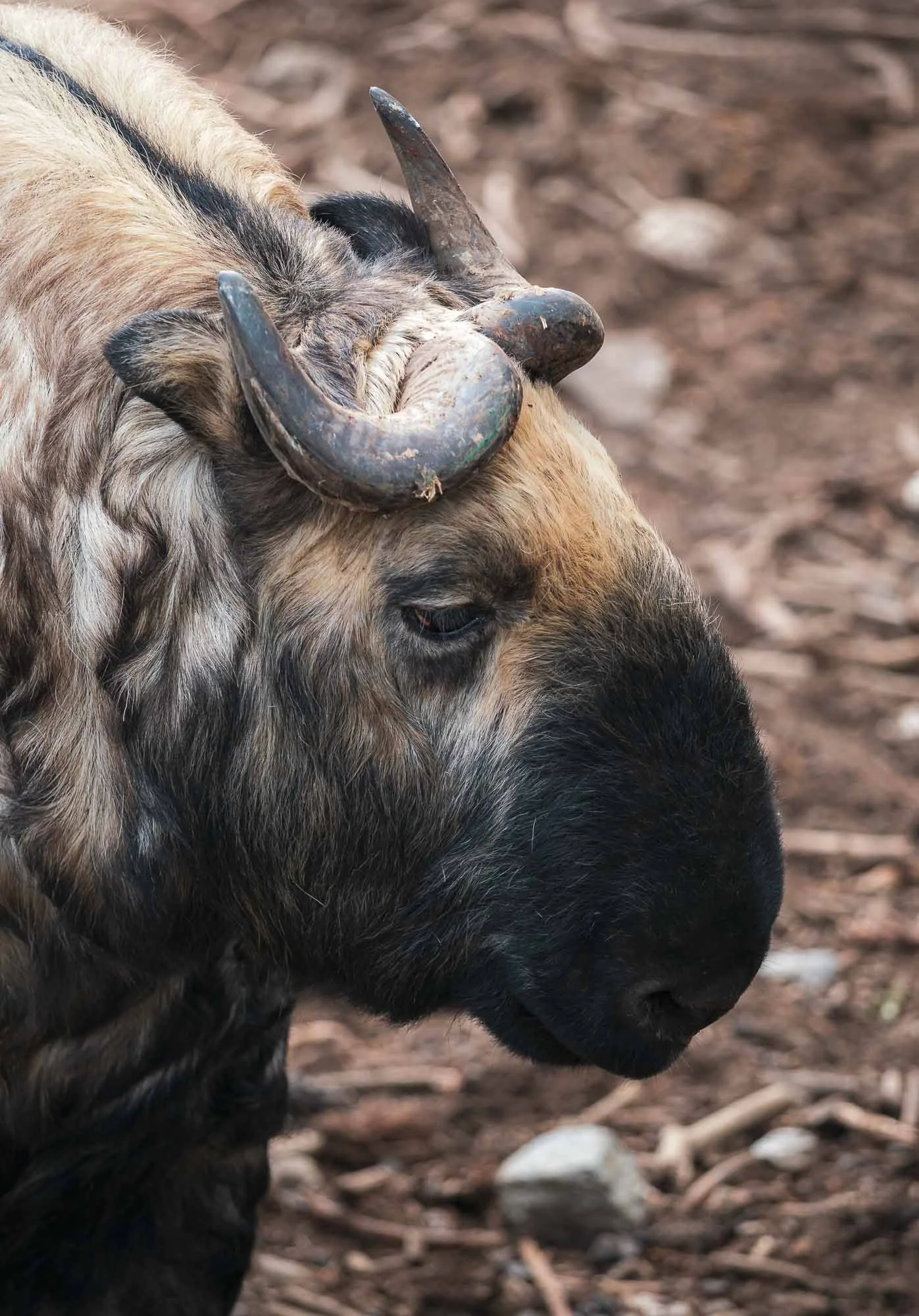
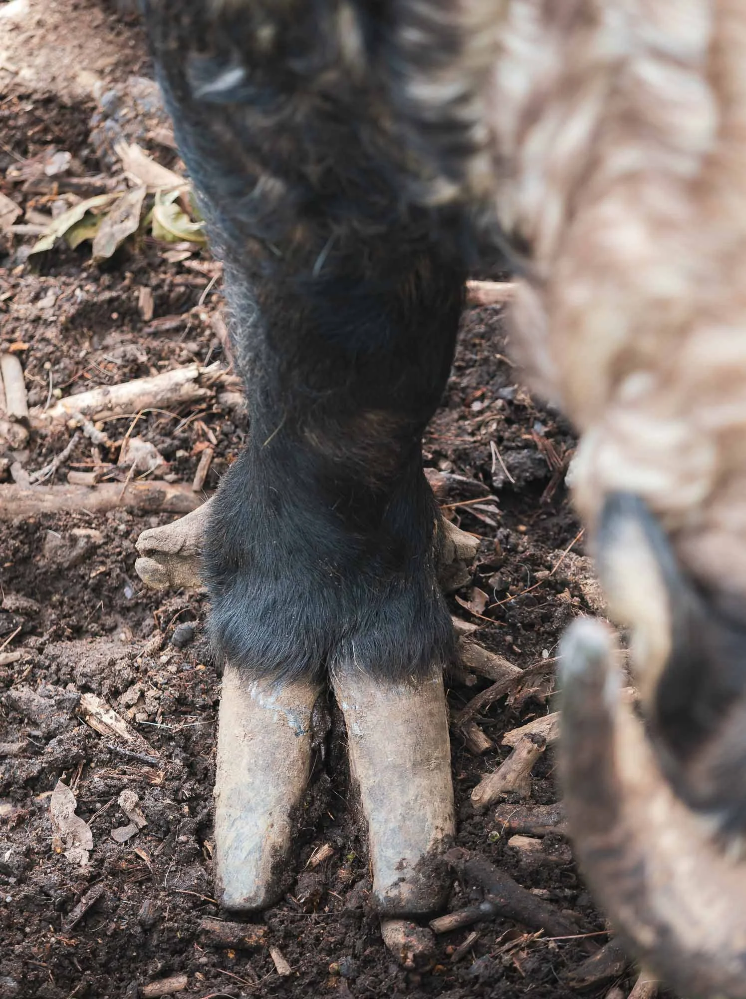
Spotting it in the wild is a rather difficult endeavor, but Thimphu is home to quite a decent and well-frequented mountain zoo, which houses a good number of them. While classified as vulnerable, the animal is protected in the country, probably for its cultural significance: as the legend of Drukpa Kunley (the Divine Madman, he would appear again later in the trip, read on…) goes, villagers asked him to perform a miracle. He told them to first bring a cow and a goat for dinner. After they served the animals, he ate them completely, leaving only bones. He then placed the goat’s head on the cow’s skeleton, clapped, and the animal combination came back to life and ran into the meadow. One can’t help but see the resemblance in the takin.
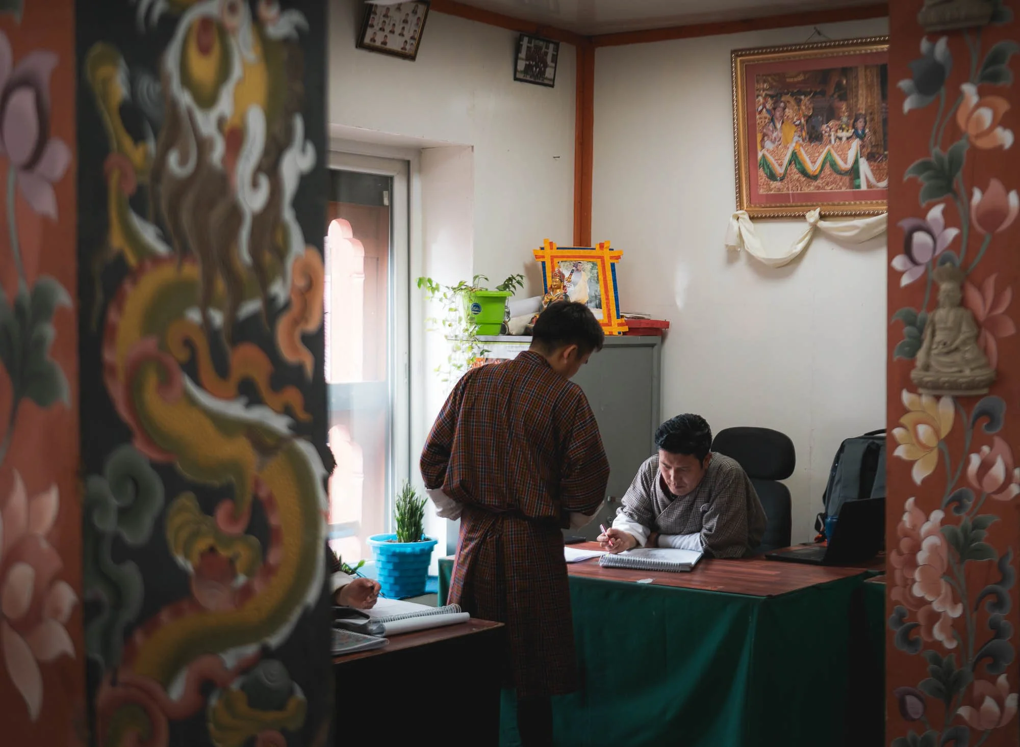
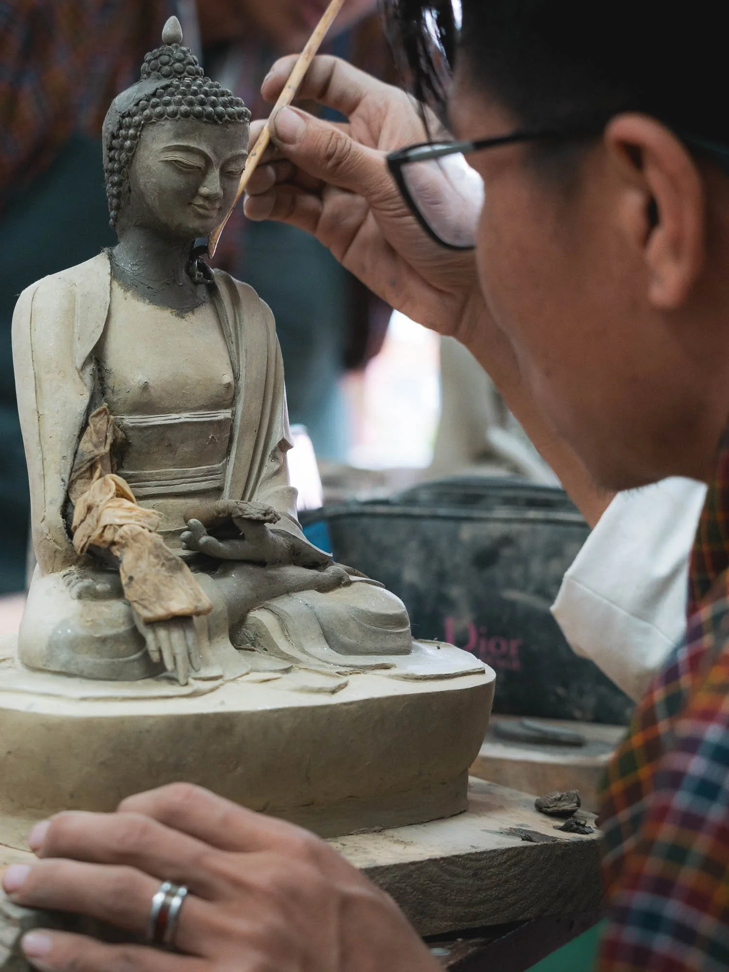
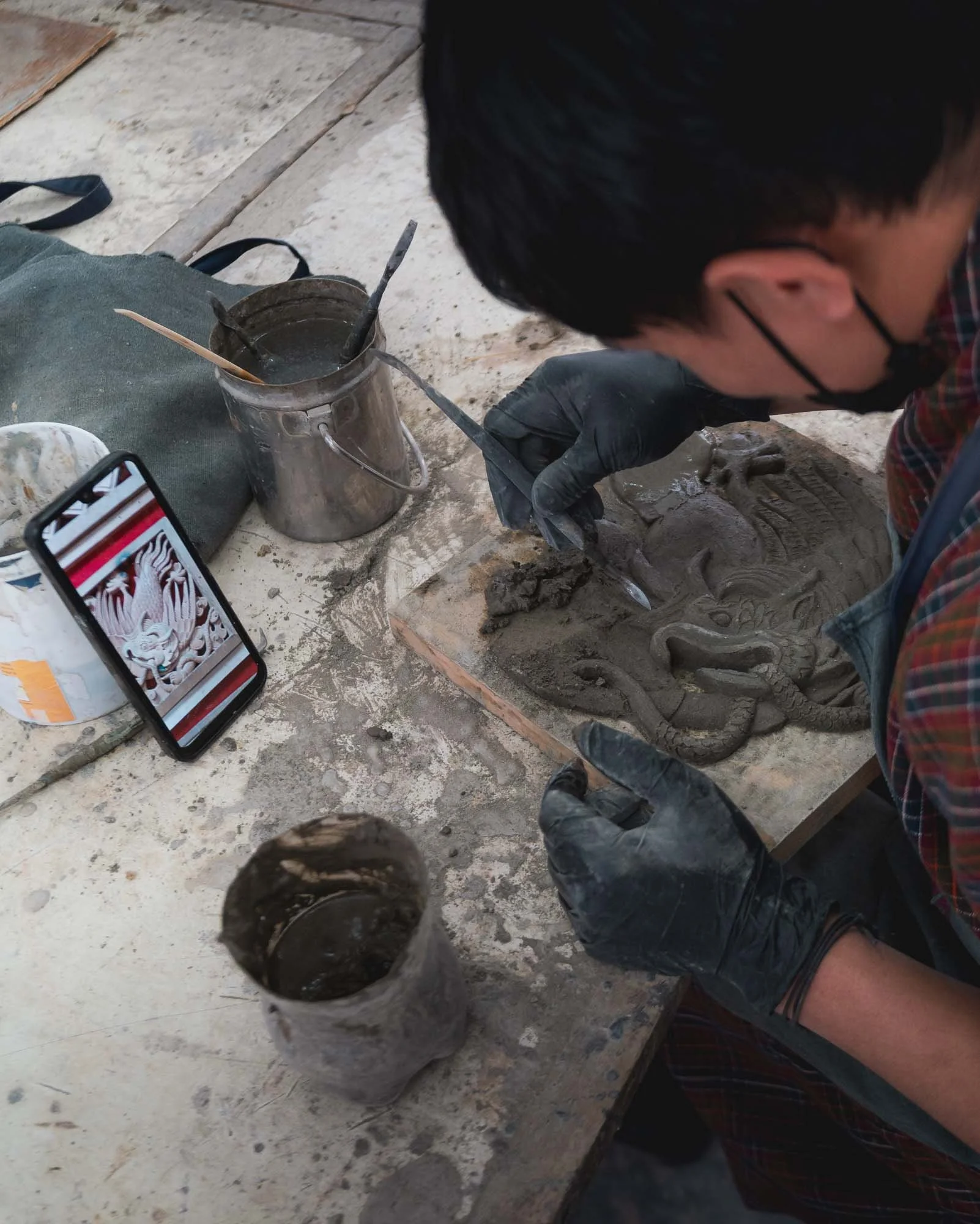
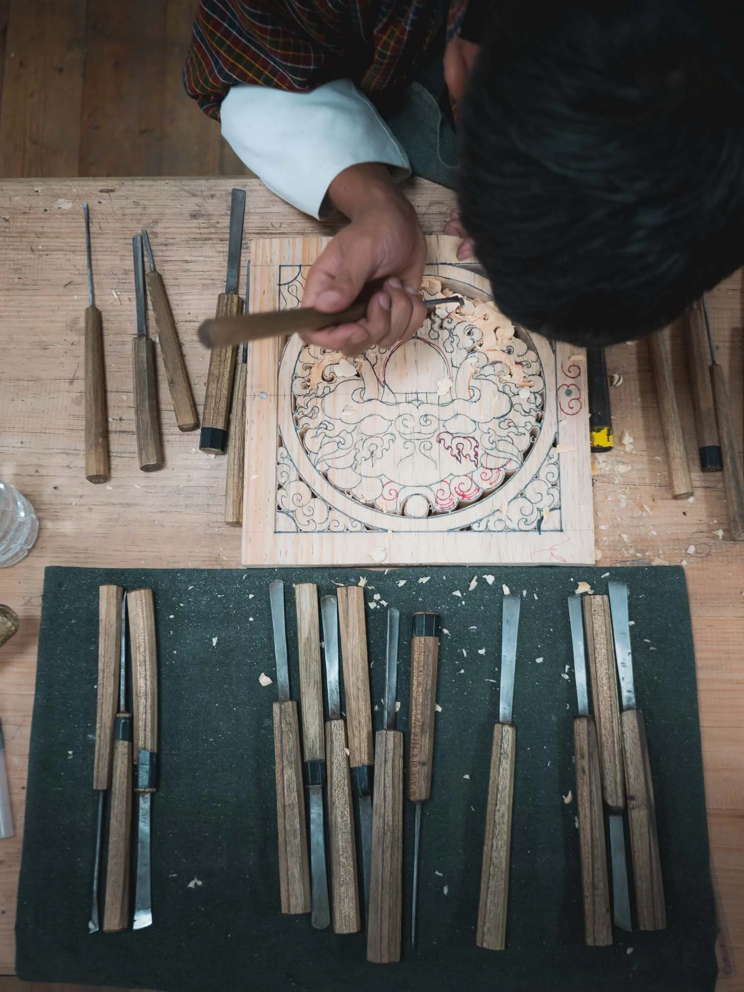
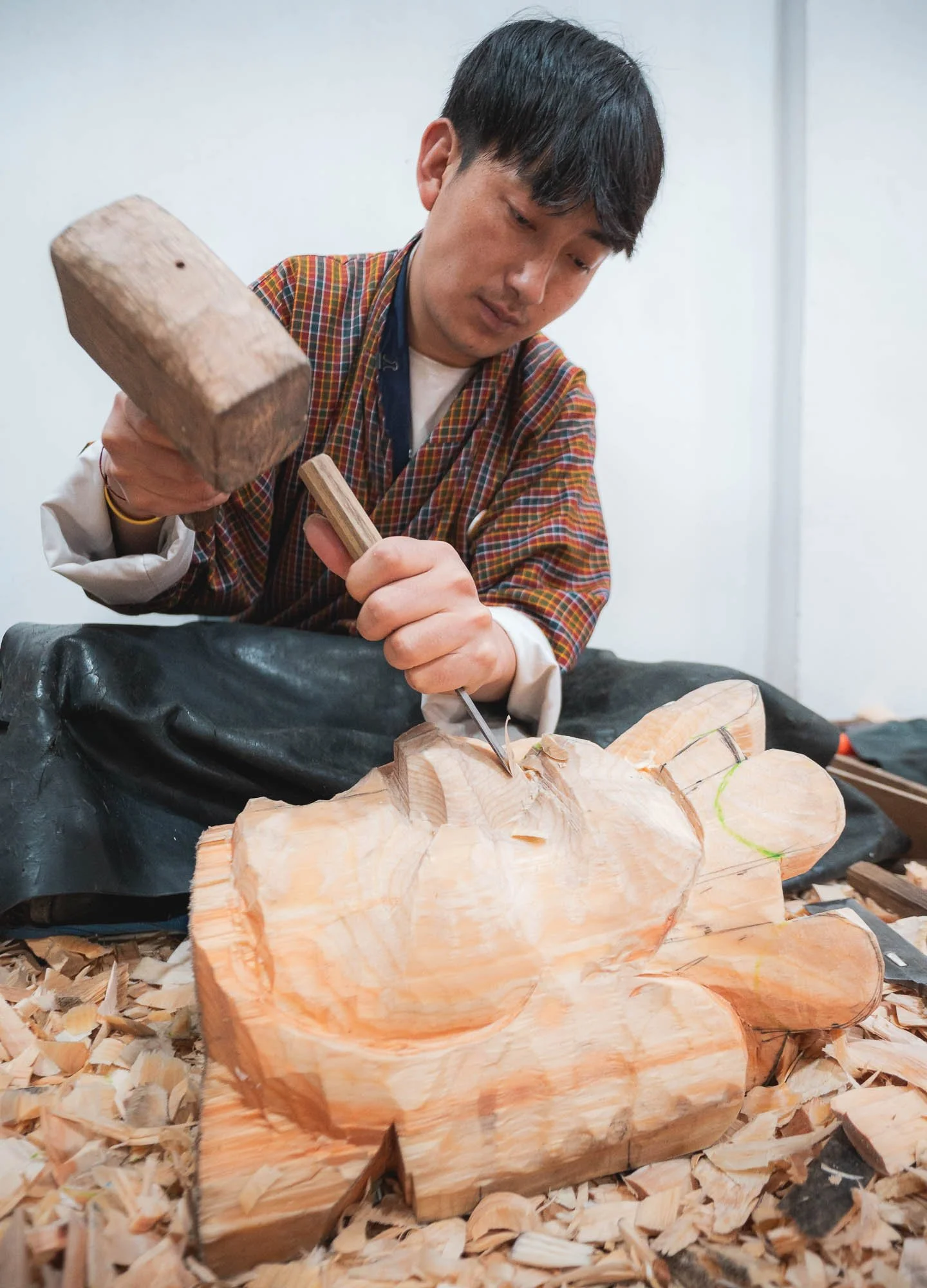
Moving on to a different kind of workmanship. For my time in Thimphu I had planned to visit a few places housing local artisans and craftsmen. No better spot to start this than the “Institute of thirteen Arts and Crafts” - collectively called Zorig Chusum and representing the formal classification of the country’s traditional disciplines.
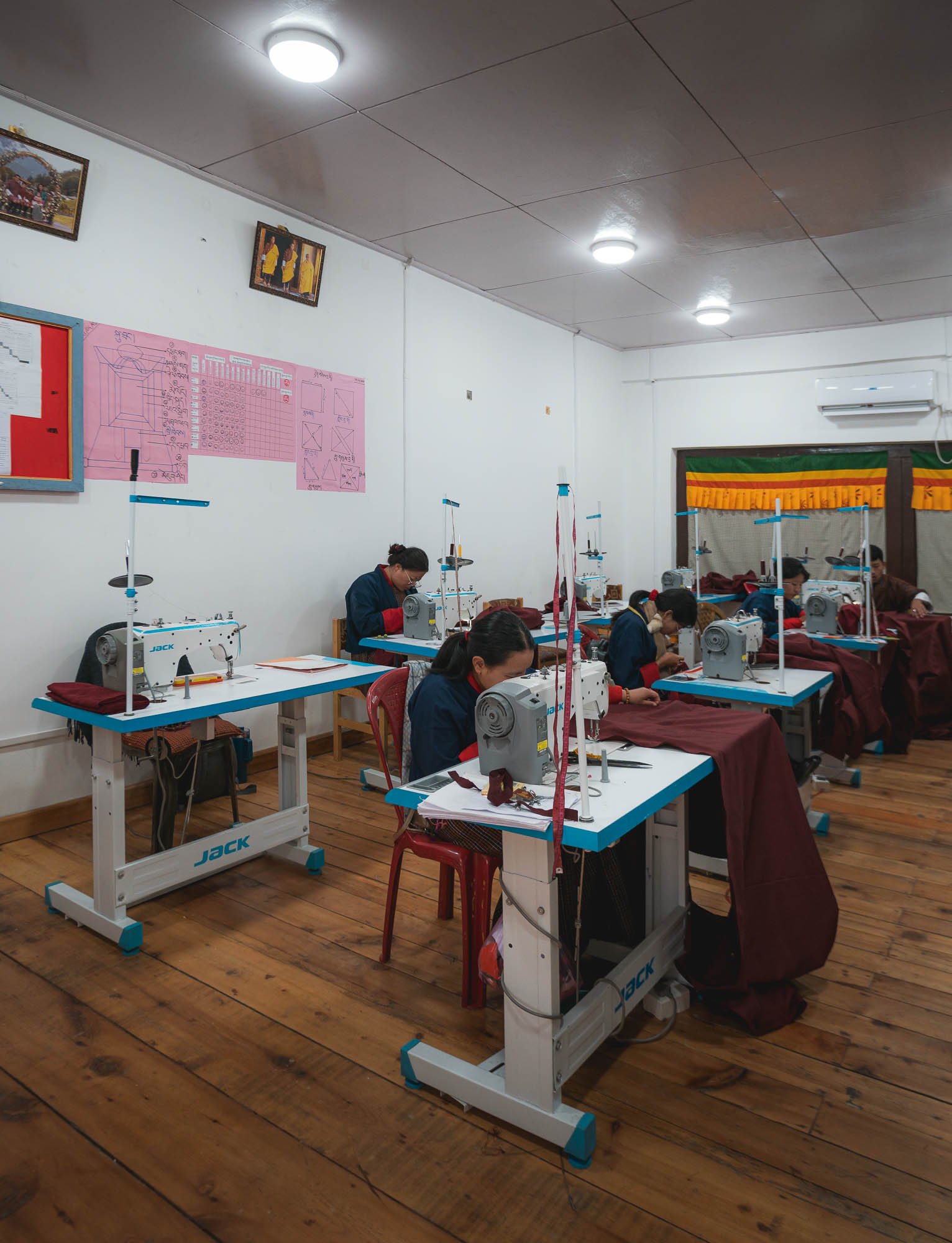

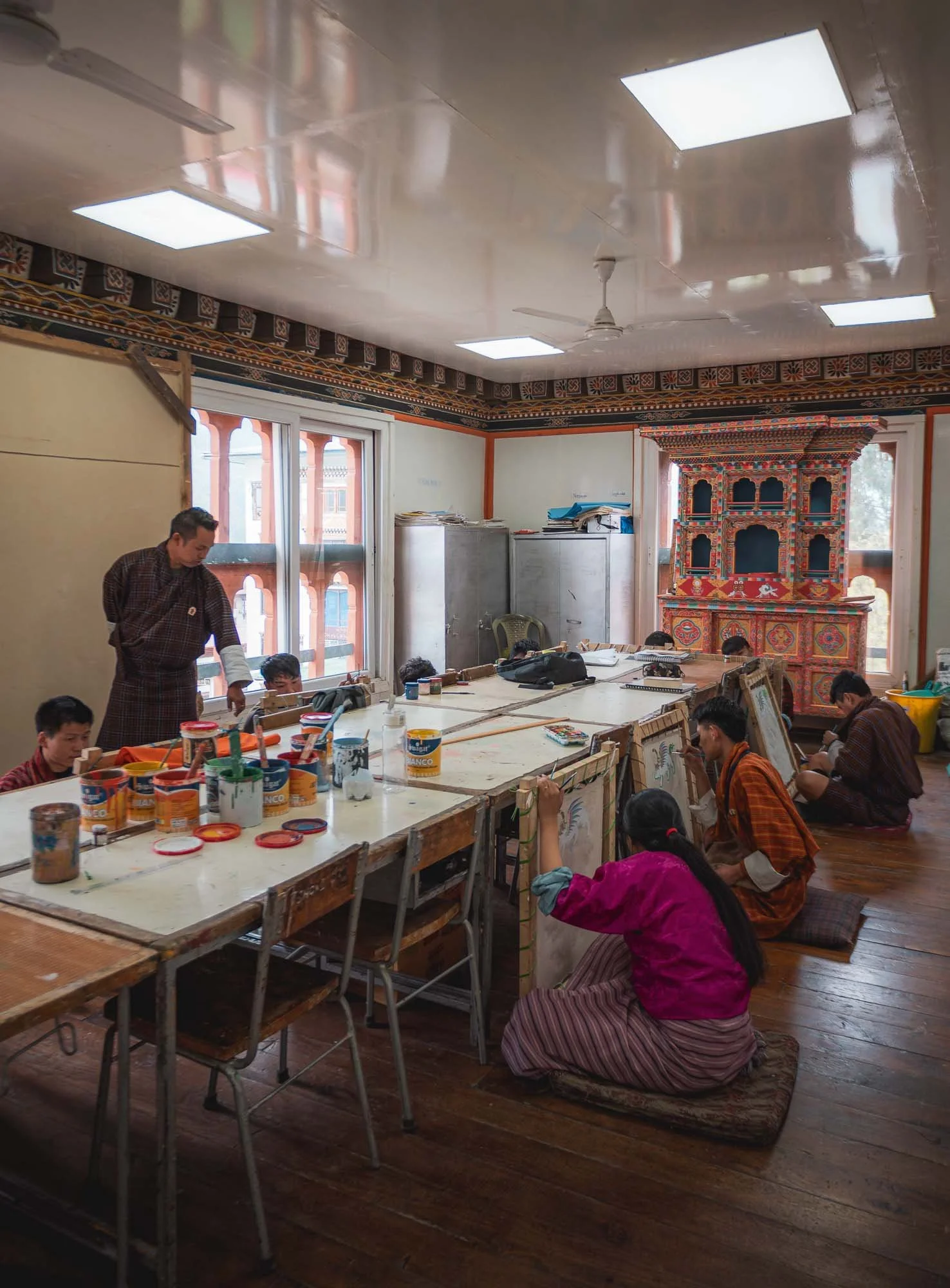
The school is not far from the city centre and dedicated to vocational training and encouraging entrepreneurial activities around tailoring, painting, sculpture, carving and more, many of them tied closely to the construction aspects of Dzongs and monasteries, or the various religious uses such as mask making and paintings for temples.
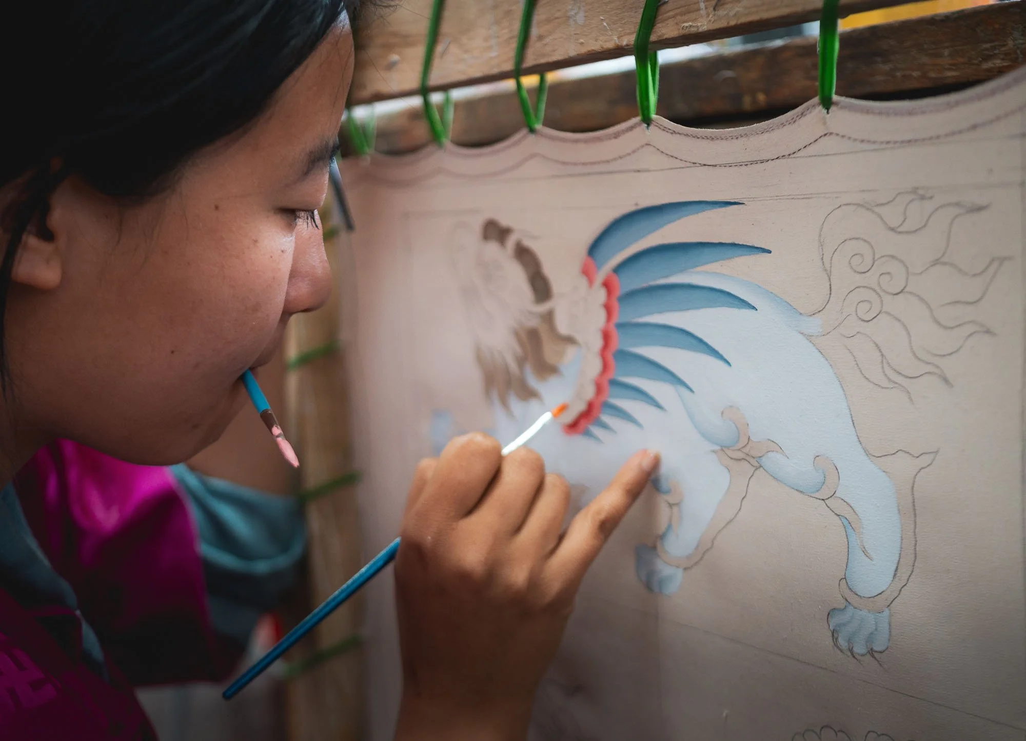
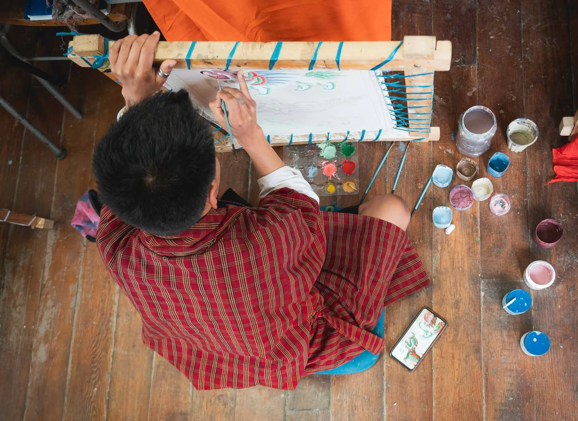
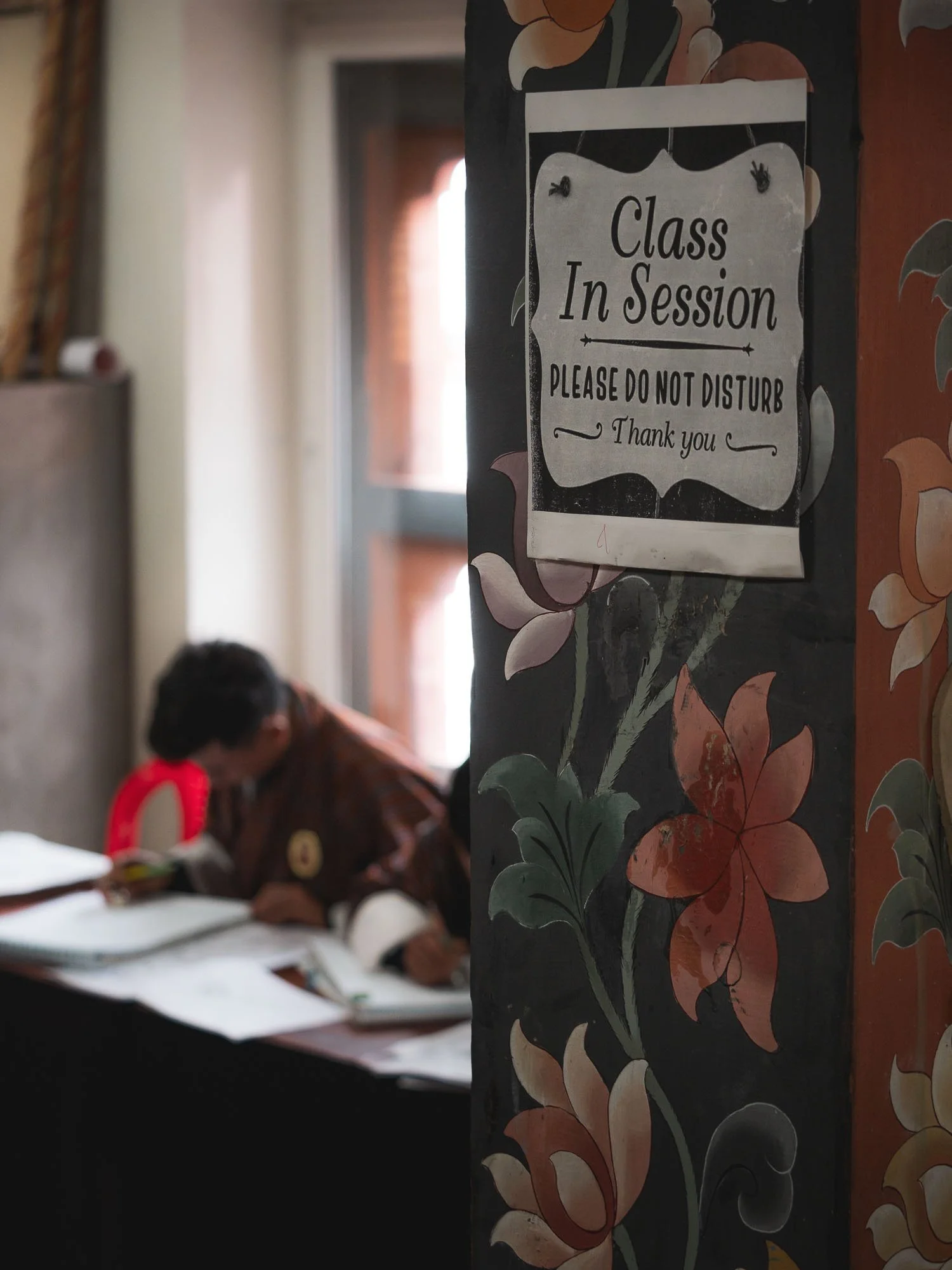
For a small fee, visitors are allowed to walk through the institute and check out the various classes in progress, such as the painting class here. Students attend courses anywhere from 3 months to 2 years depending on the level of skill and certification they want to attain.
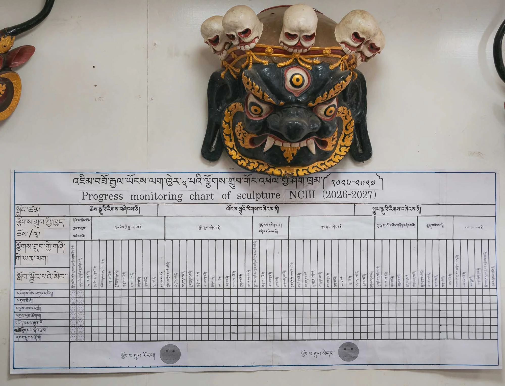
Schedules, performance, and quality monitoring don’t seem to be very relaxed! Indeed, a lot of the cultural aspects of Bhutan are not purely organic, but heavily institutionalized with skill development through formal training and government programs that preserve and regulate the national heritage.
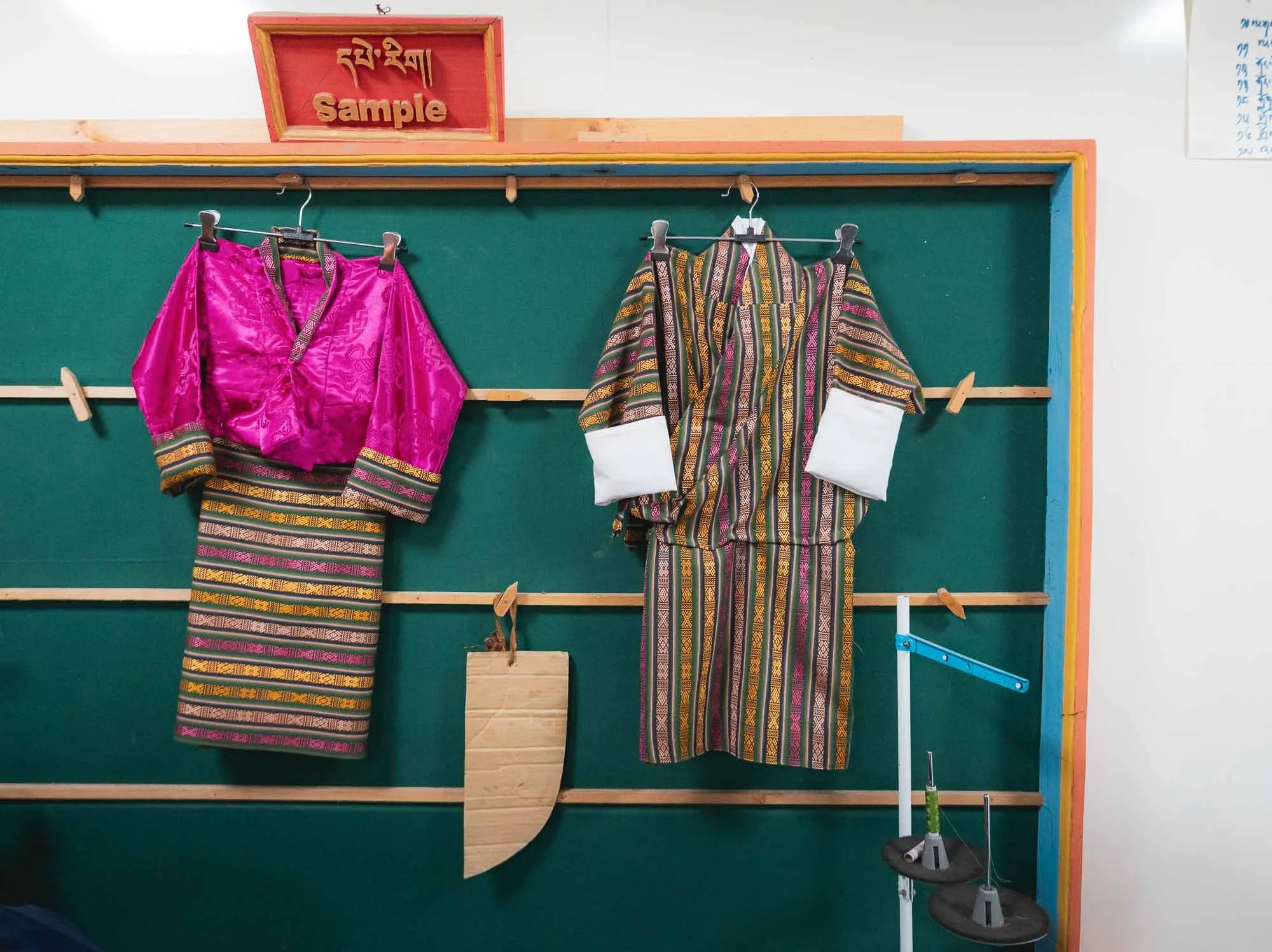
This is evident in the day to day architecture of local houses and dress style as well - it encourages a unified visual identity wherever you go, but for better or worse arguably may also be a little restrictive to evolution and individualism.
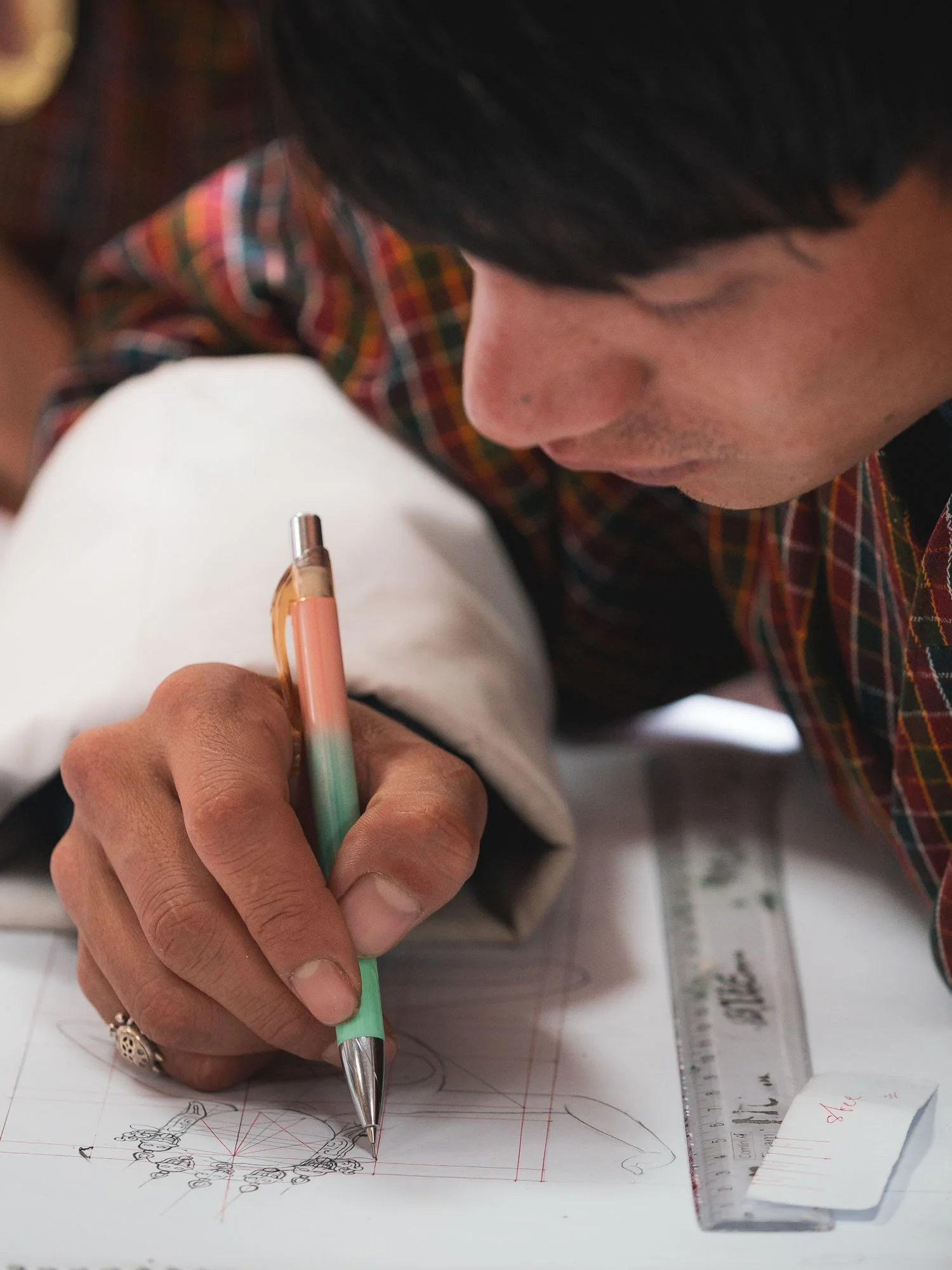
Experienced professors provide feedback and observe the student’s work, which seems largely focused on replication more so than creative expression.
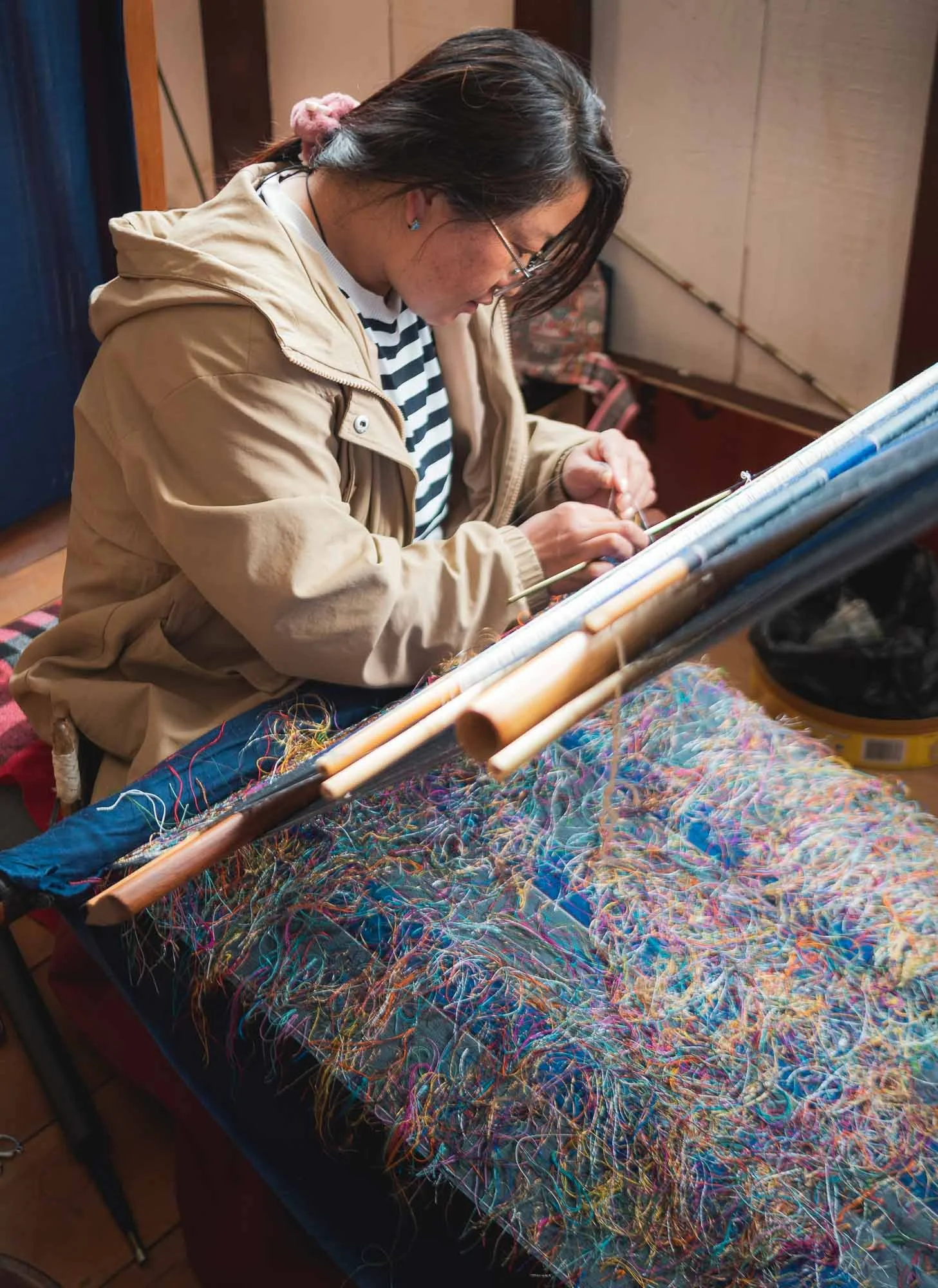
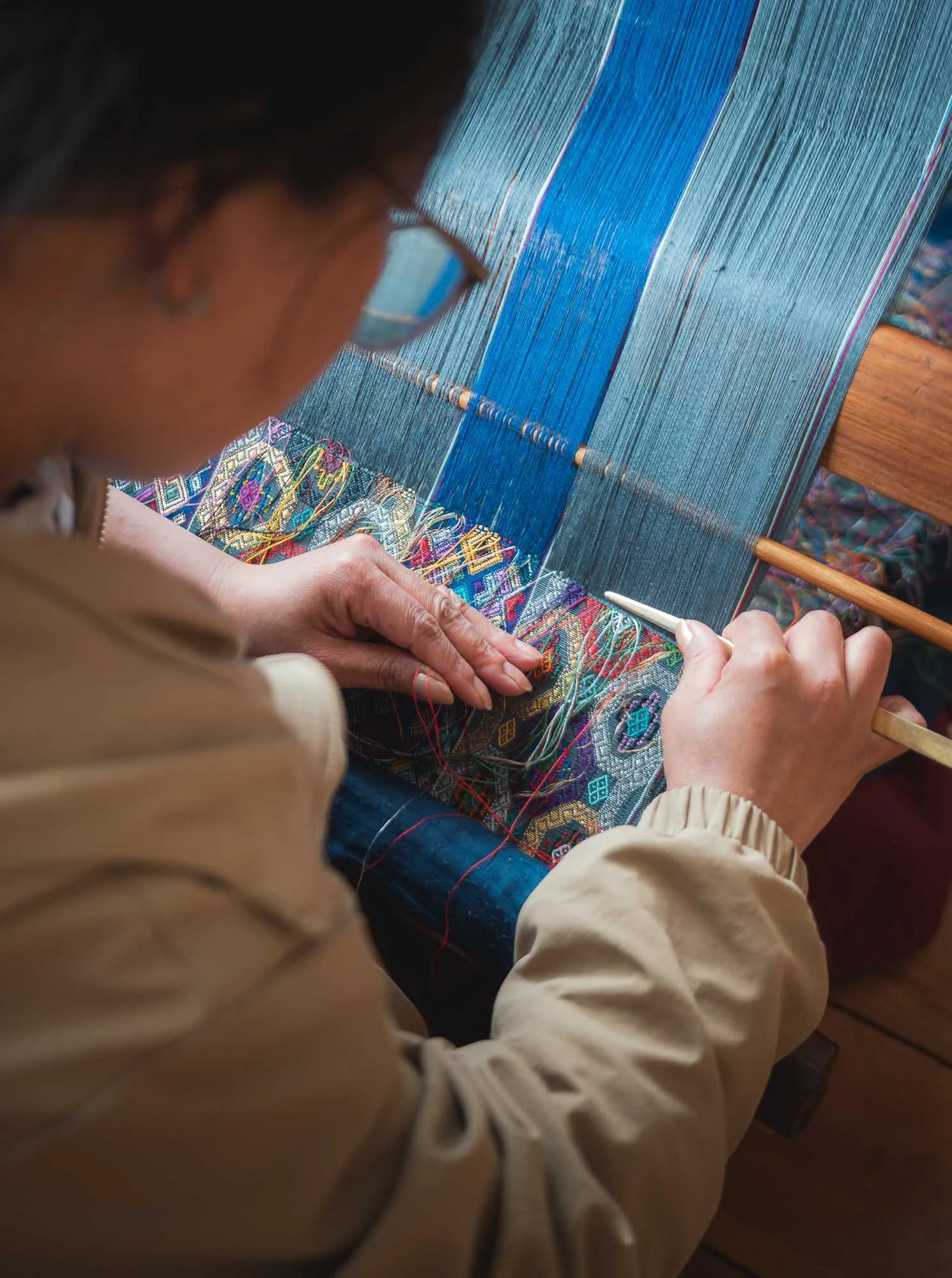
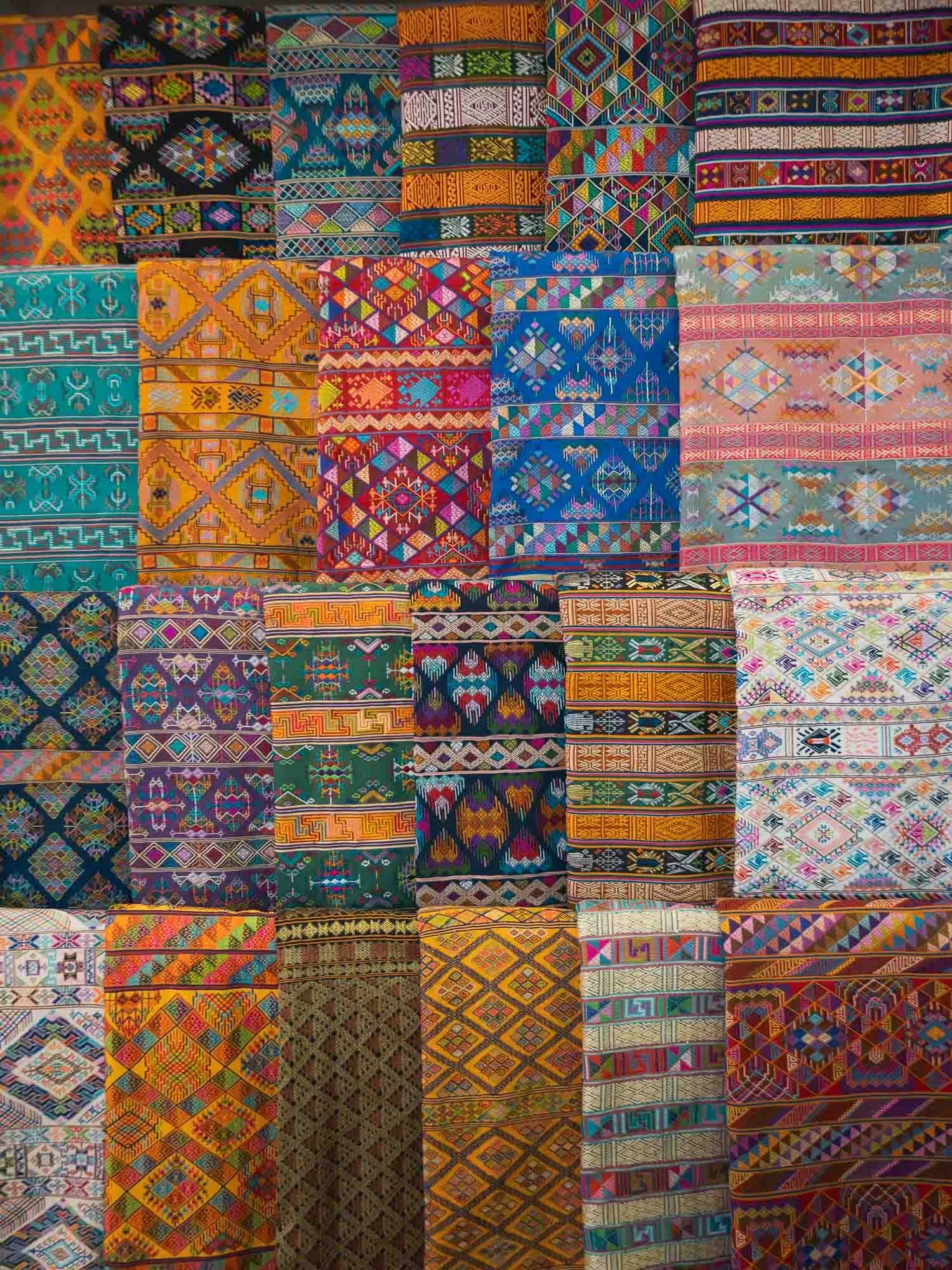
Weaving is one of the thirteen disciplines, and the dedicated Royal Textile Academy manages classes, market access opportunities, and a museum for this discipline, mainly practiced by women. It was closed for some renovations during my visit, but there are several other weaving centers dotted around the city.
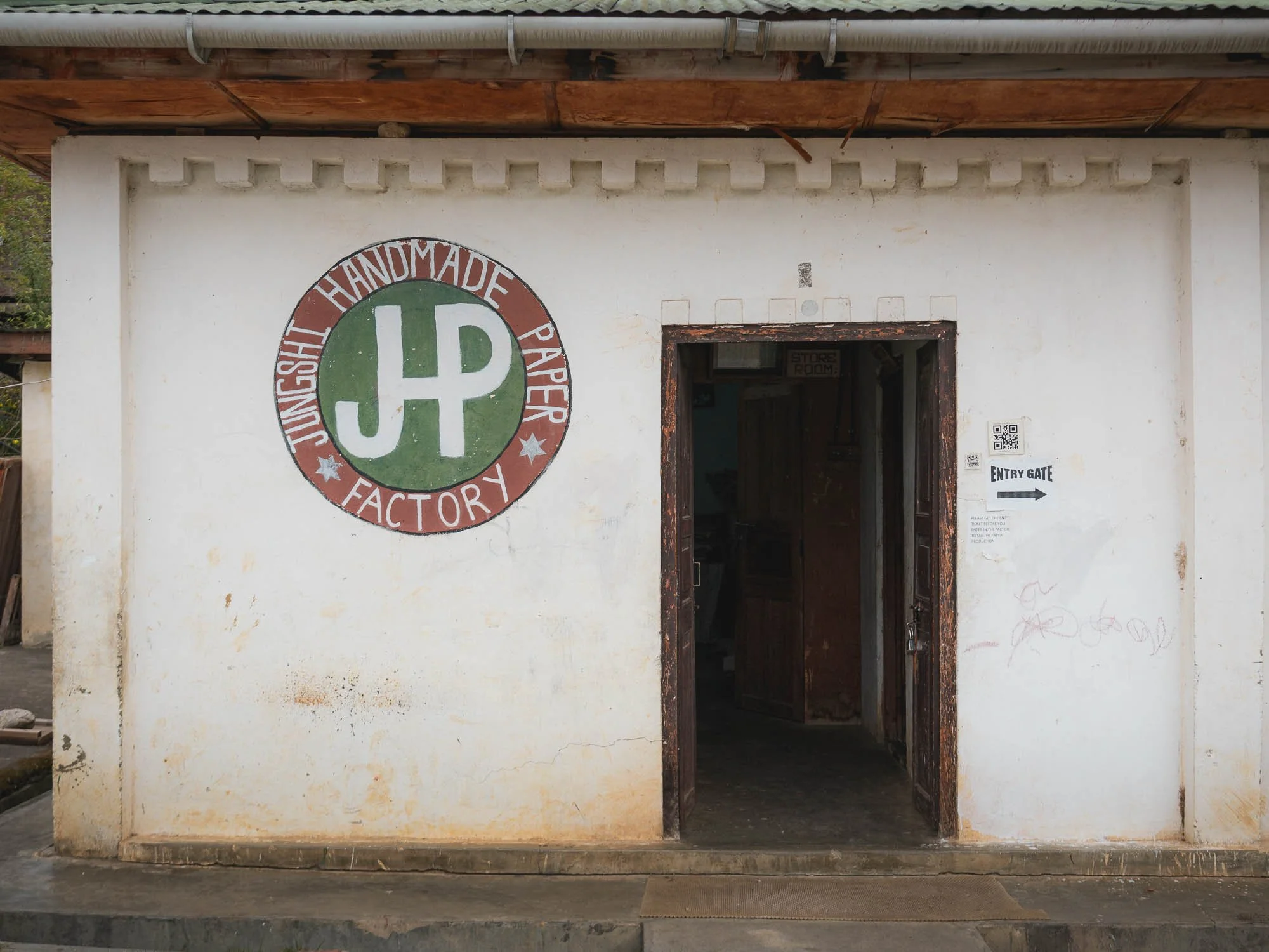
📜 Traditional Paper Making
A little less formal and codified was the next place I visited, and it turned out to be one of my favorite spots.
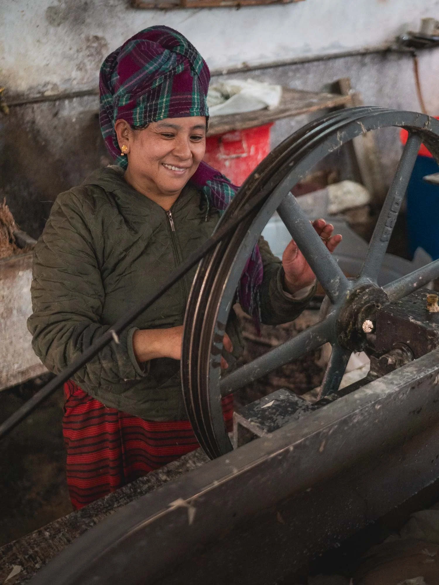
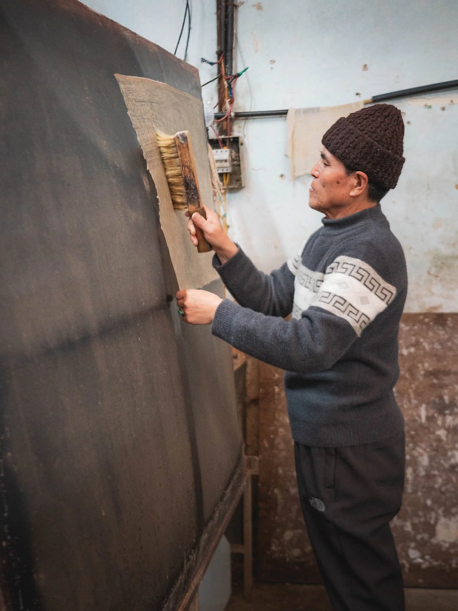
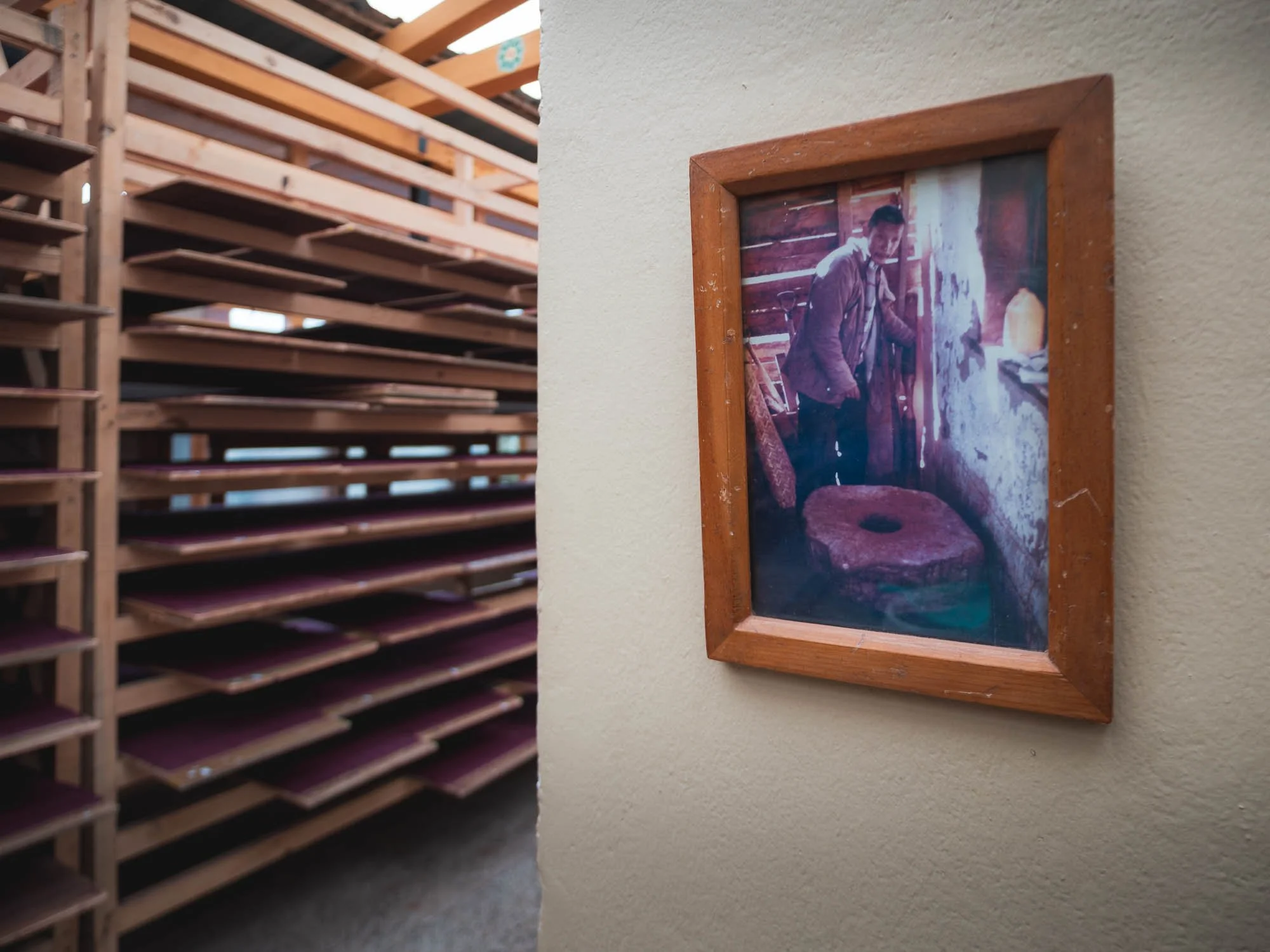
To make the paper here, Daphne plant fibers are first extracted by soaking and boiling the bark, then cleaned and broken down into pulp manually. This is mixed with water and a natural binder and spread in thin layers onto a screen to form sheets.
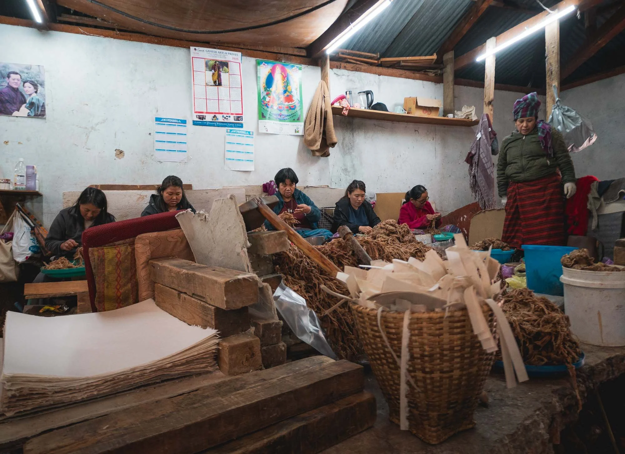
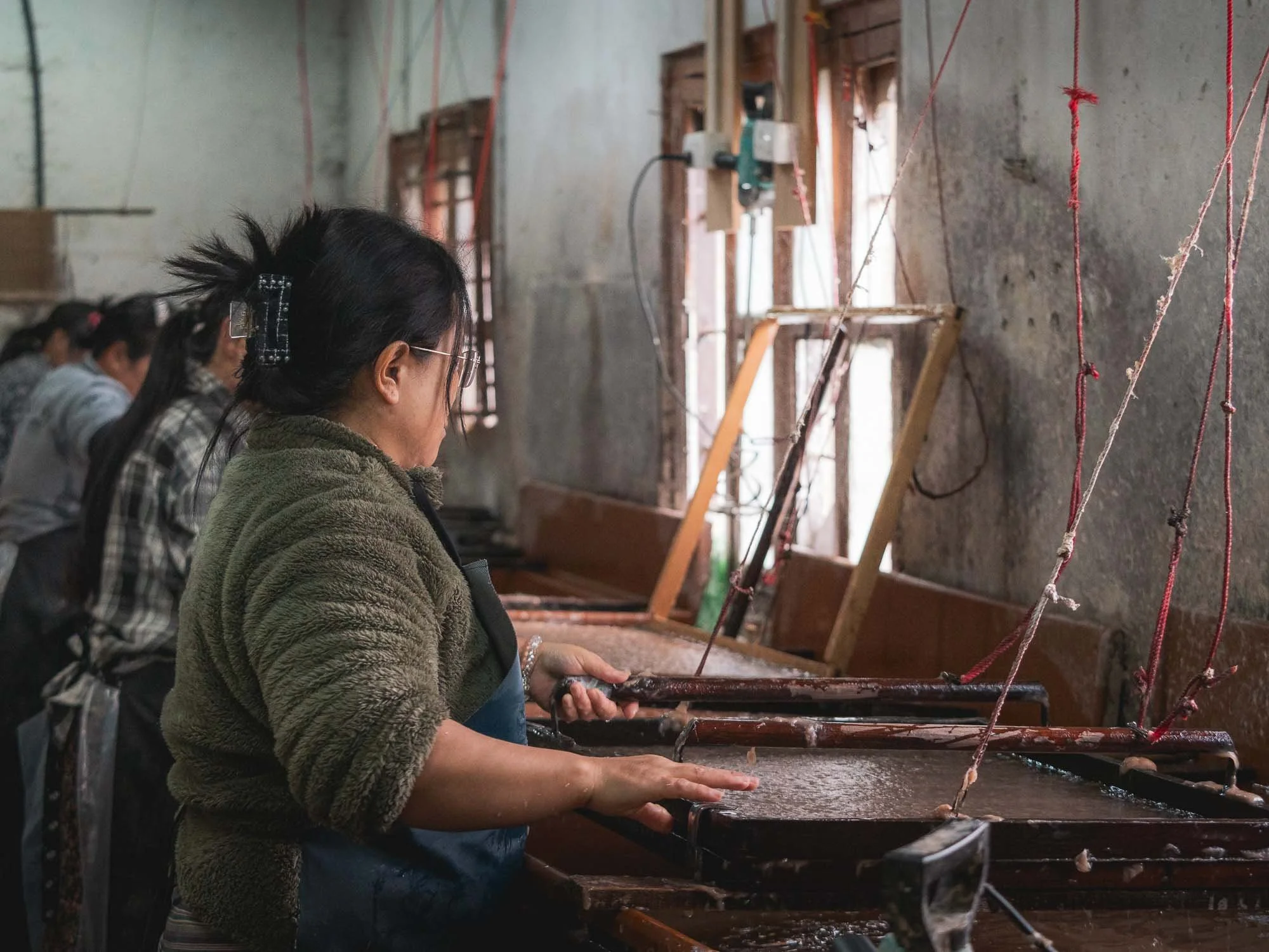
The sheets are then pressed to remove excess water, and dried individually on heated boards. They last for decades without chemical treatment.
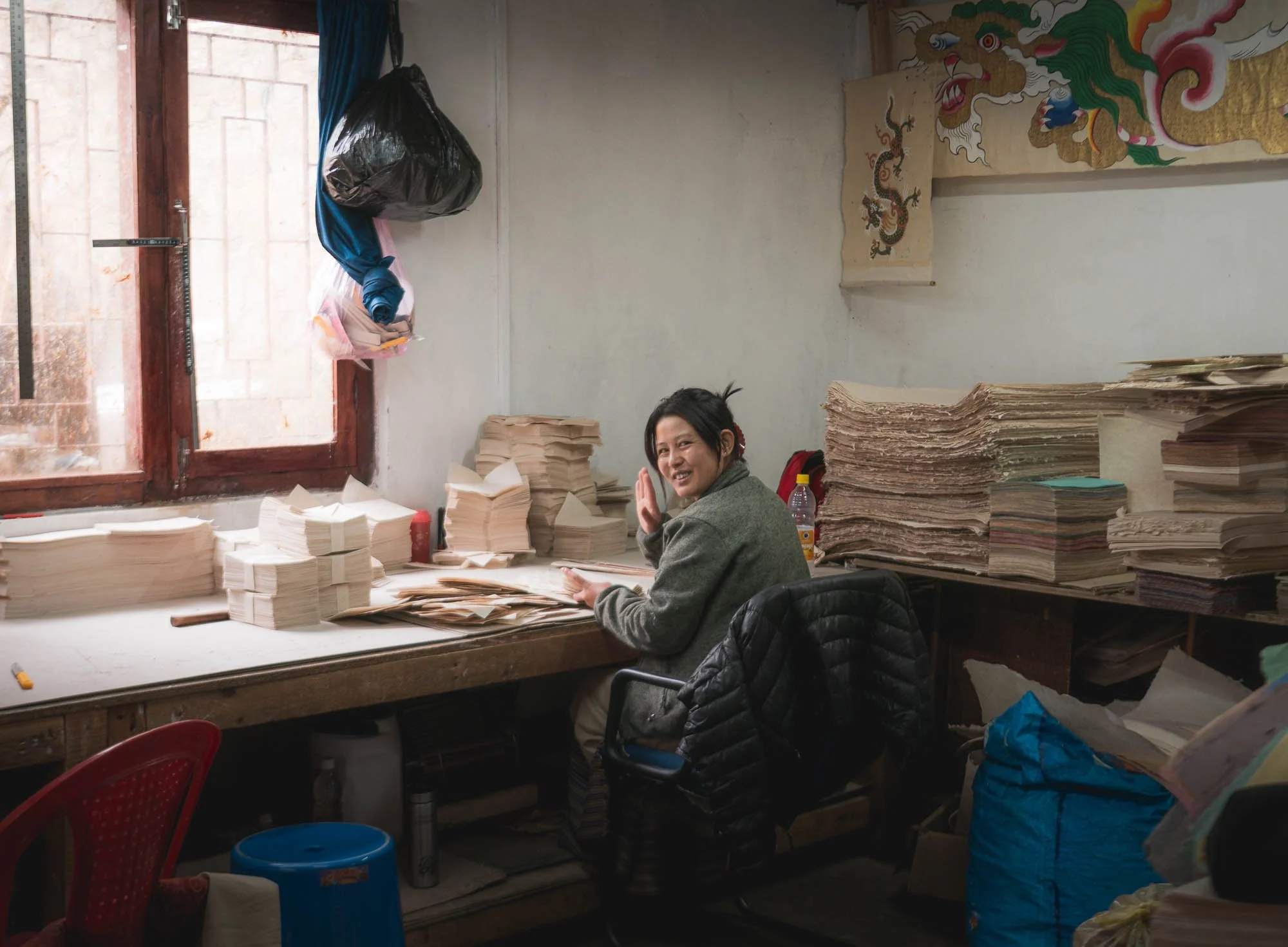
Historically, it was used for religious texts and official documents, nowadays it is commonly used for more industrial applications like packaging, and some of the paper is packaged and sold in their in-house shop as small postcards, note books, and similar items.
Although those are very expensive (overpriced, one could say), I couldn’t resist and bought plenty of sheets to try and print some photos on.
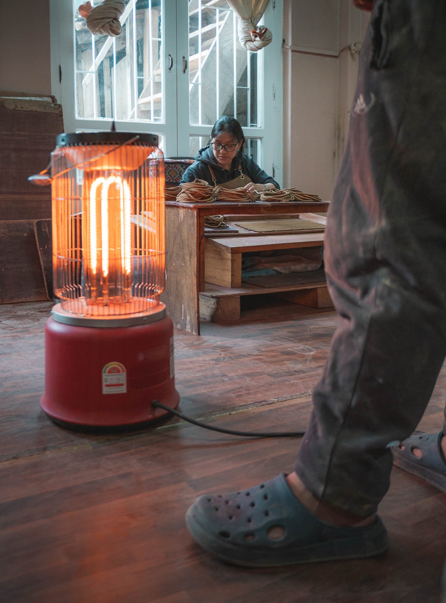
Incense Making
My last exploration into the world of Bhutanese crafts was at a local incense factory, which has been running for over 50 years, as the second generation owner told me.
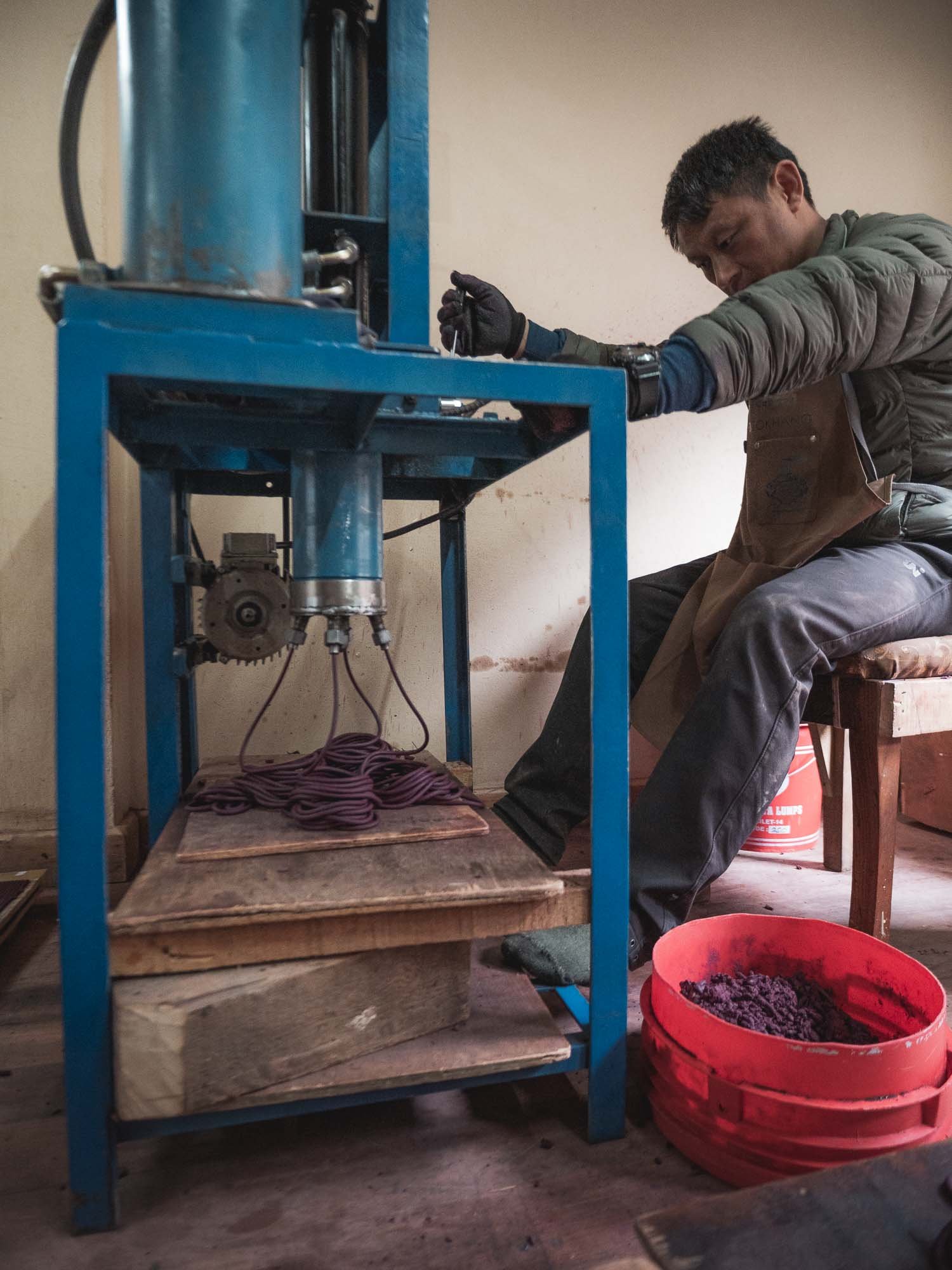
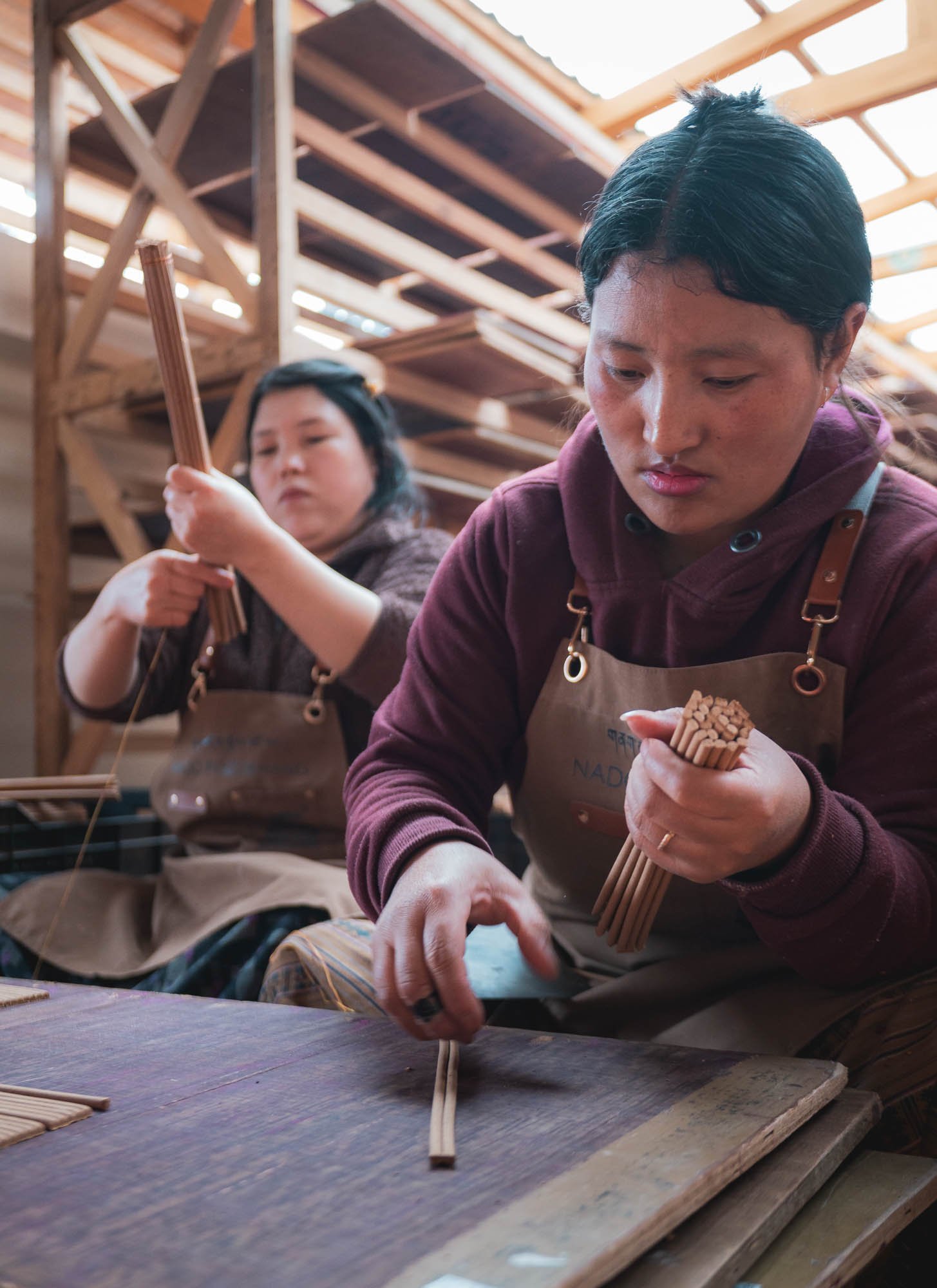
Incense here is mostly plant-based, from herbs, roots, and resins. They are first ground and dried (which produces a really strong stench and eye-watering sharp dust), then mixed with water into a paste, pressed into long tubes and then rolled and cut by hand, before being air-dried.
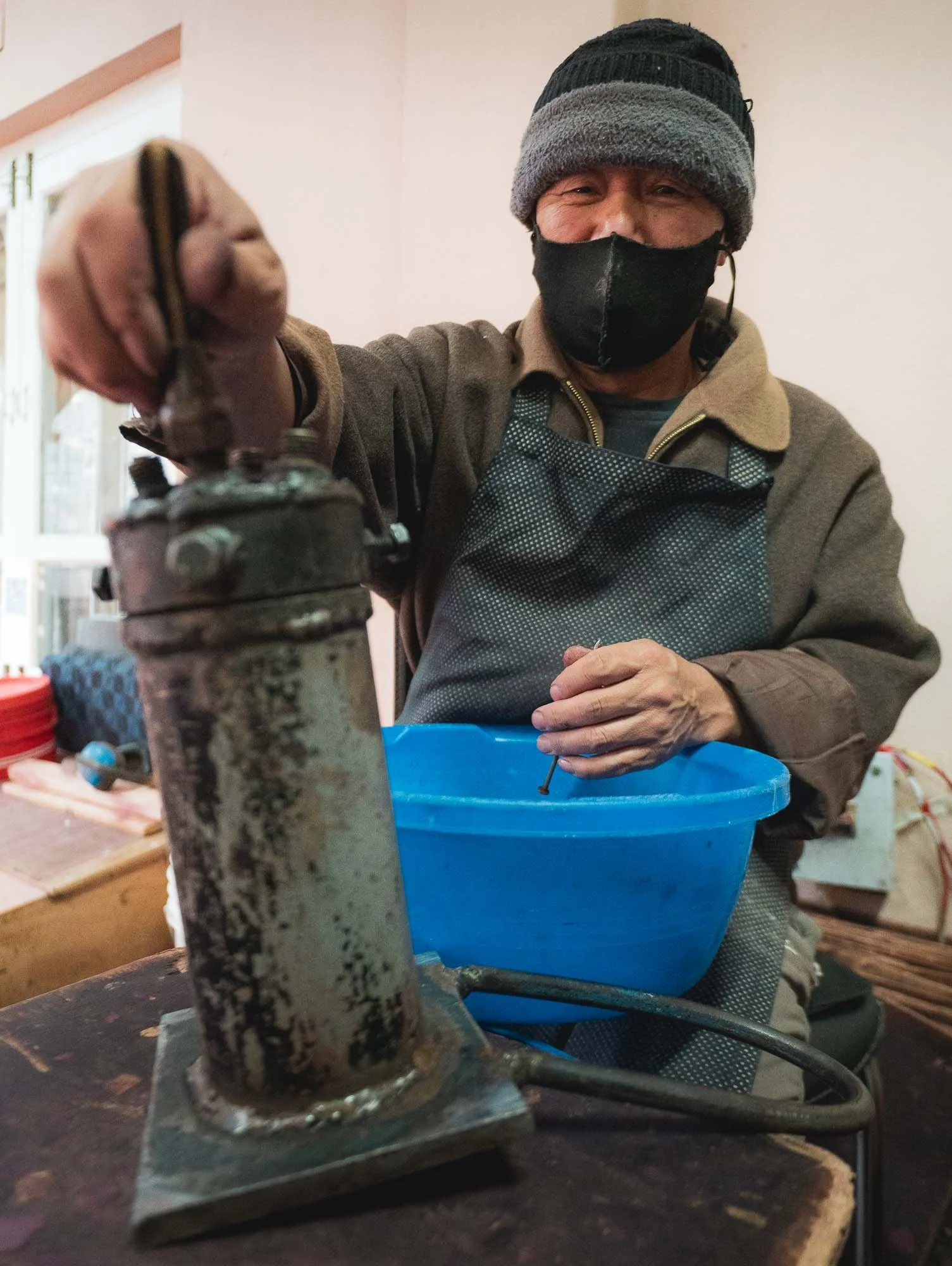
In house machine repairing… wearing a mask is a good idea in here, the dust filling the air from the finely ground base ingredients is definitely not healthy. With this, it was time to leave the capital and move a little further east.
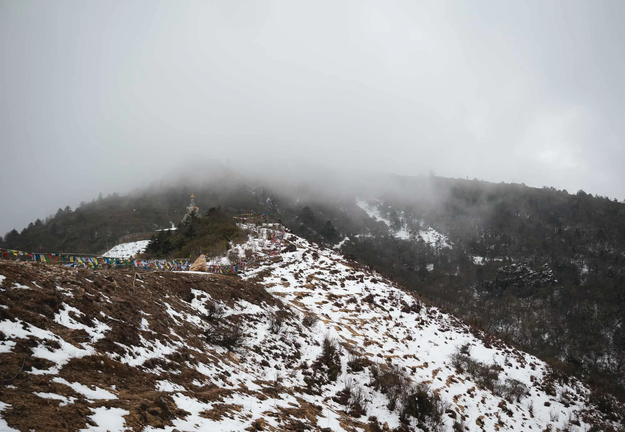
Dochula Pass & Beyond
To do so, you cross the Dochula pass at around 3100m following a winding, but decent (not a guarantee everywhere as I’d later find out) road.
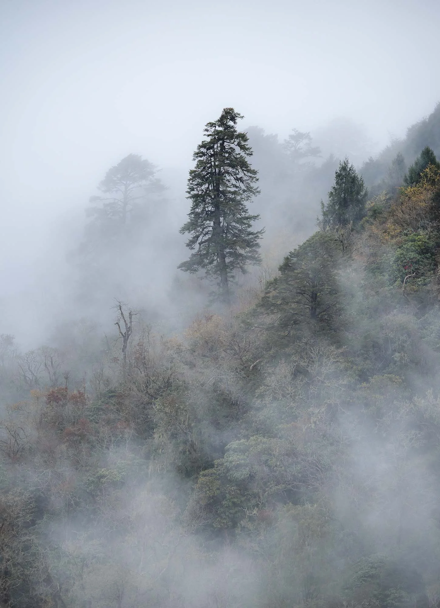
On a clear day it offers a view of the eastern Himalayas, alas that was neither the case on the way there or the return trip, which is quite common. Clear days in the mountains here can mostly be enjoyed in October or November, but the misty atmosphere also had its charm.
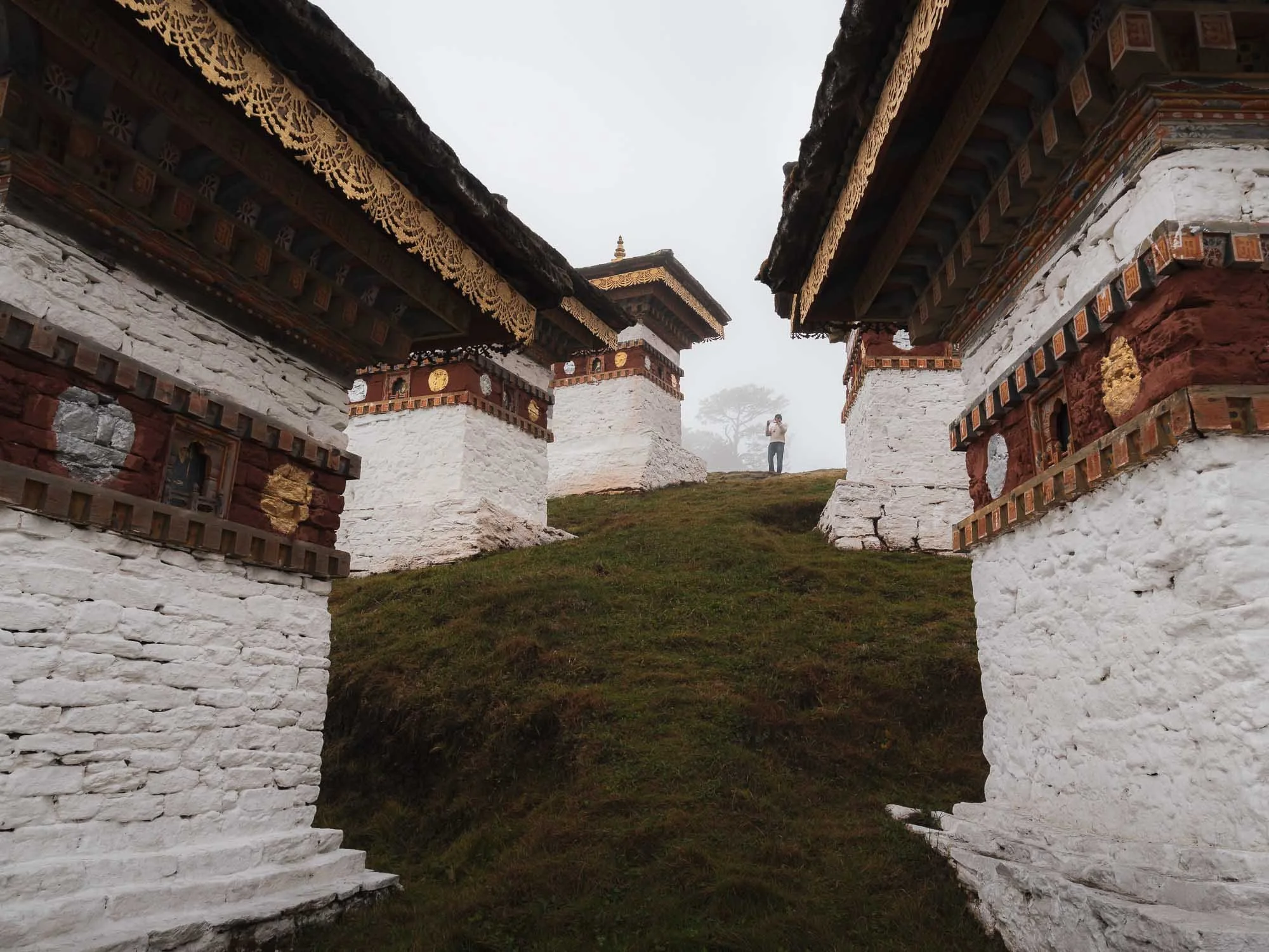
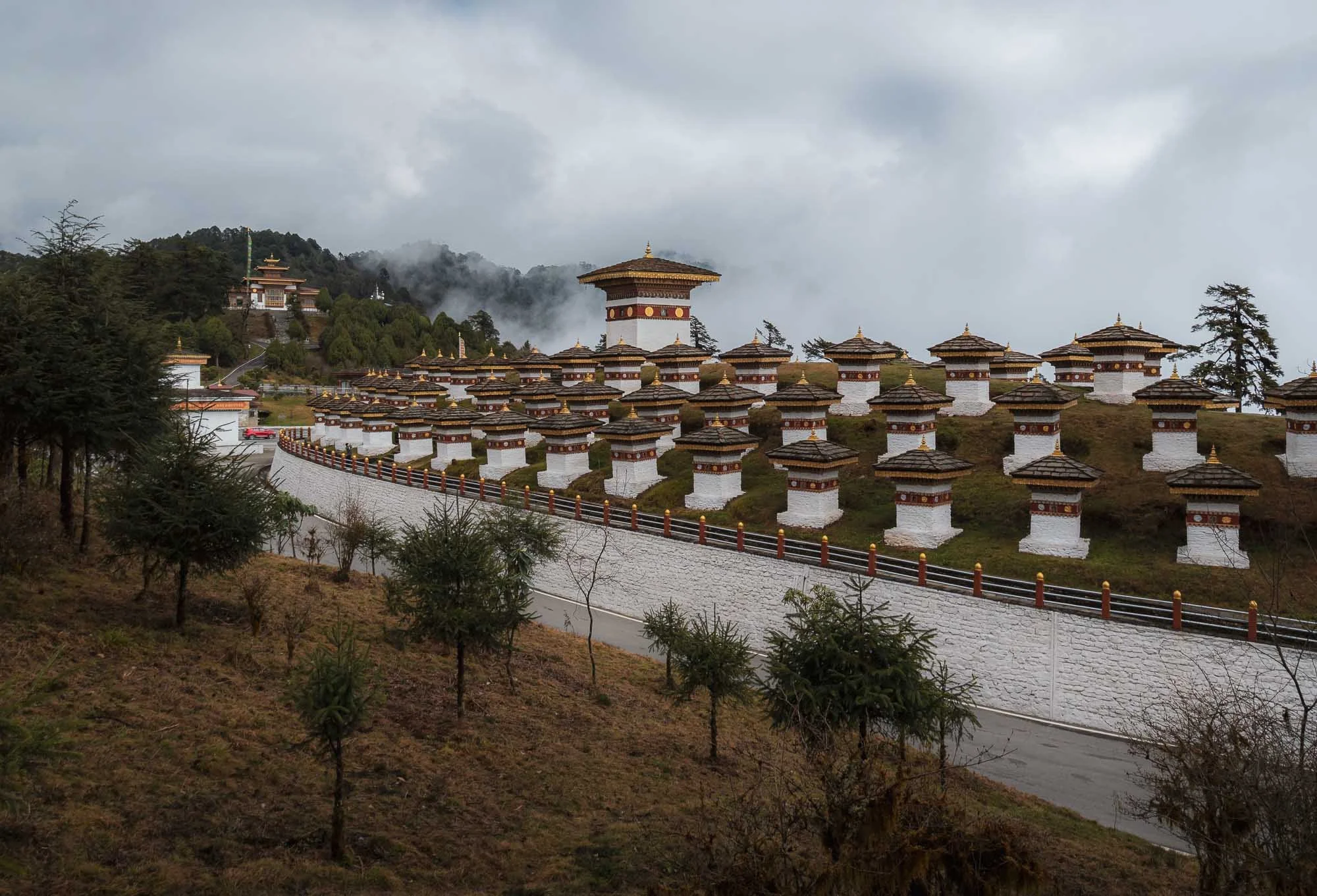
Many people visit the pass for the 108 chortens, a memorial constructed in 2004 at the very top in honor of the Bhutanese soldiers killed in military operations in the south against Indian insurgents the year before.
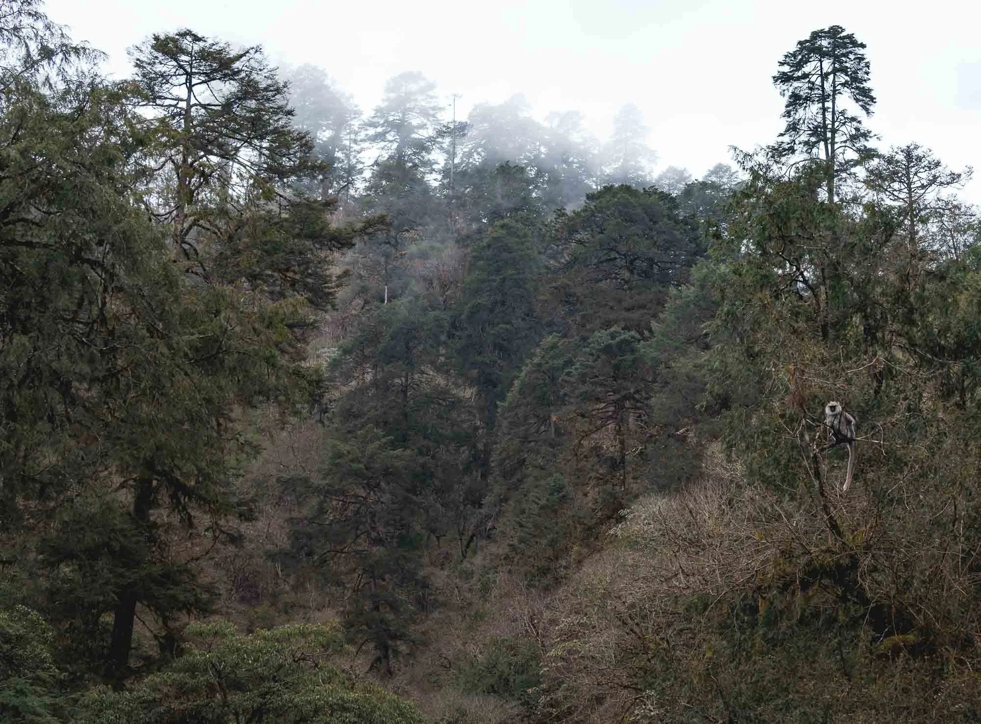
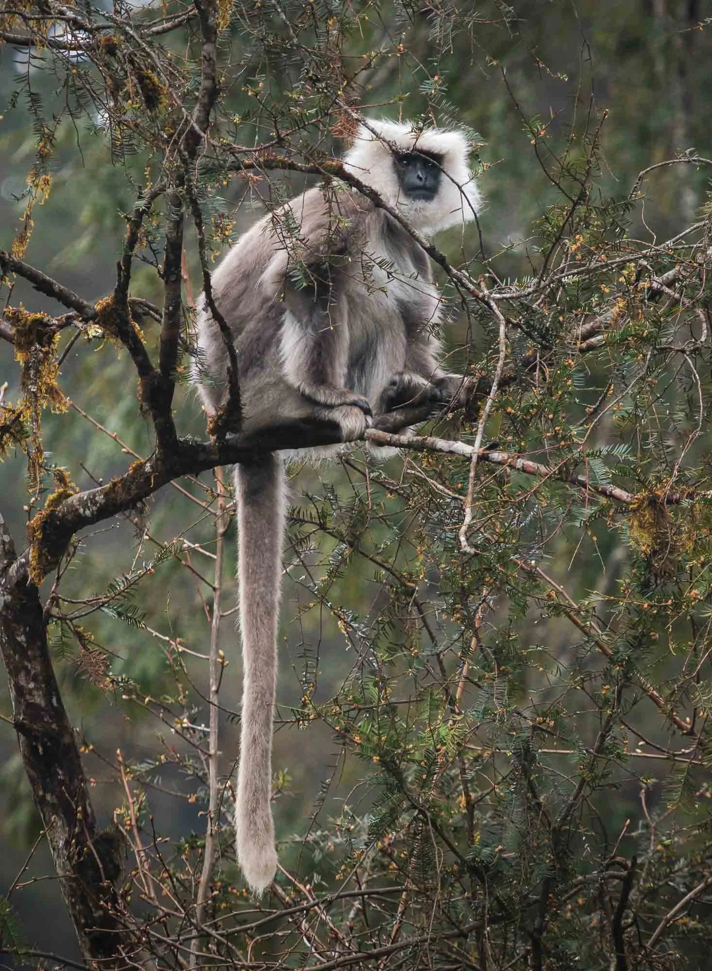
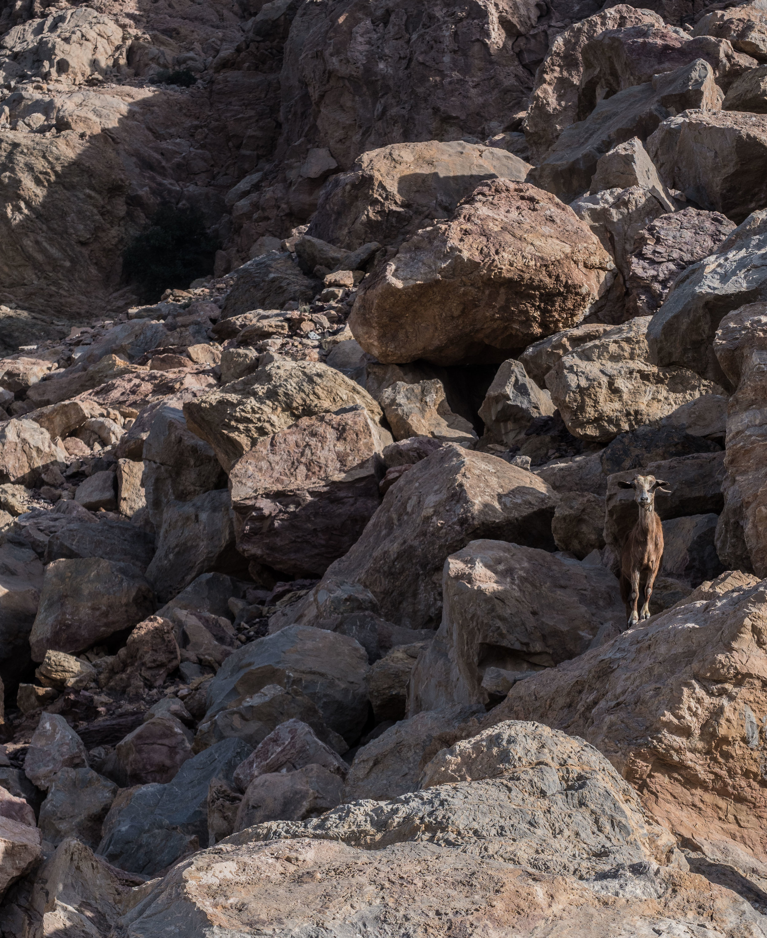
Instead of returning back, we made our way down the other side into the valleys, and had the chance to spot a grey langur with its characteristic black face on the roadside. It’s very rare golden cousin is endemic to Bhutan and small parts of India, and much harder to spot in the wild.
Once descended, we crossed the Puna Tsang Chu river and its valley and headed further east, but not without a short stop for a photo of the Wangdue Phodrang Dzong, at the ridge above the river confluences. It was almost fully destroyed by fire in 2012, and has been reconstructed over the last years.
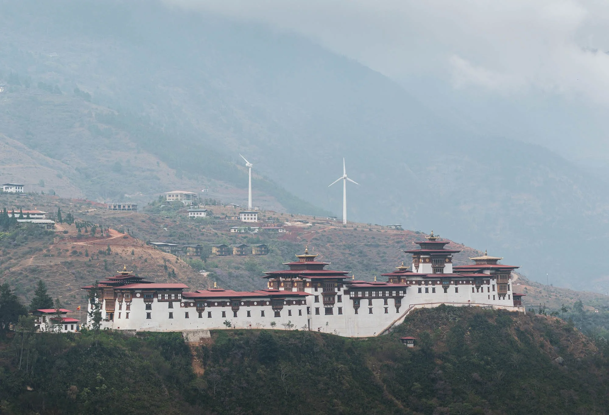
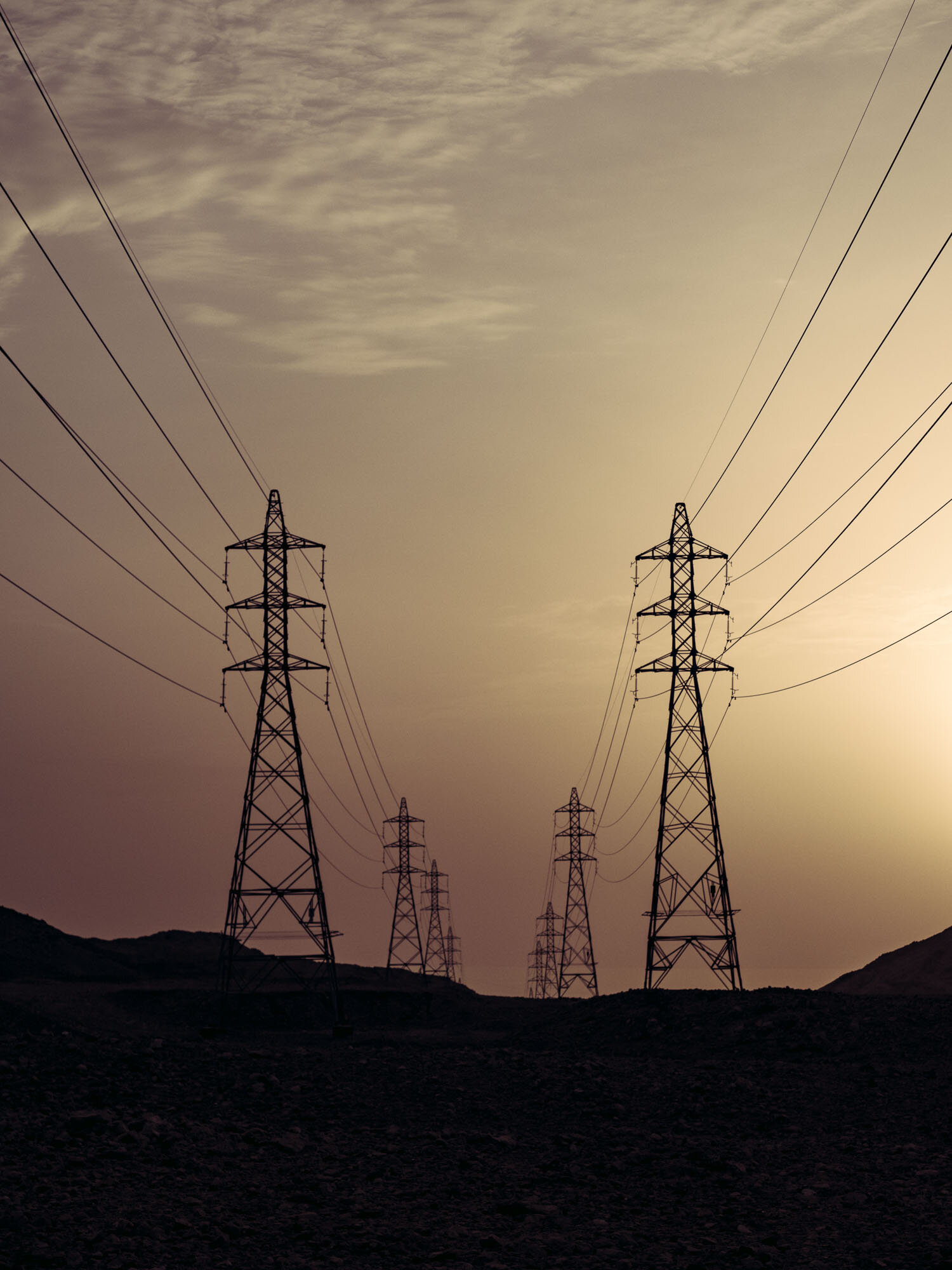
Despite the wind farm in the background, Bhutan’s electricity is almost entirely generated from hydropower owing to its many rivers. In fact, exports of energy to India are a major revenue source for the country, although it still imports fuel for local generators and uses biomass for heating, for instance.
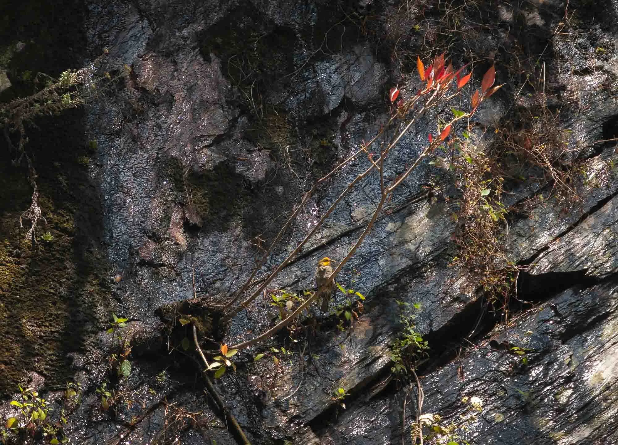
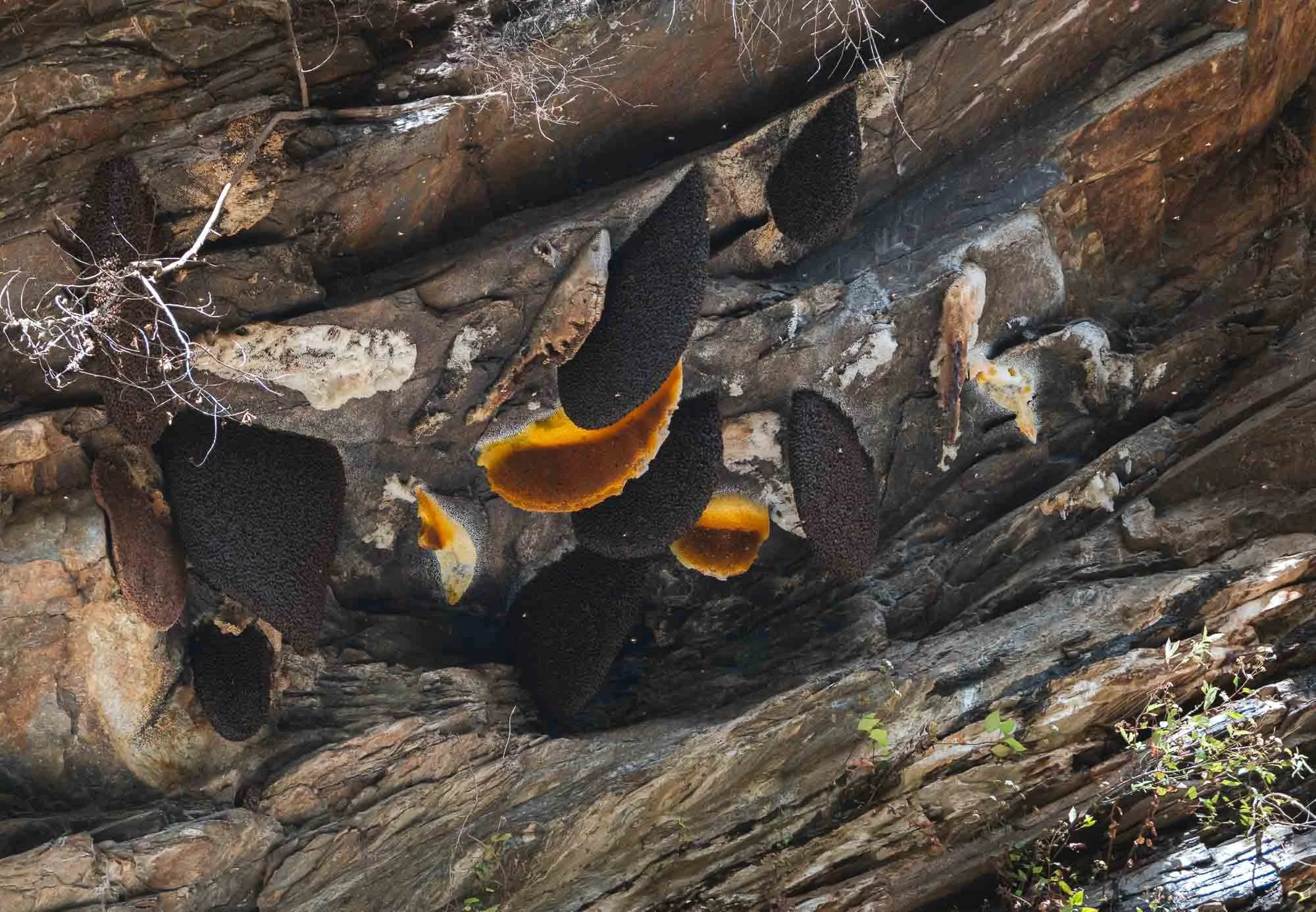
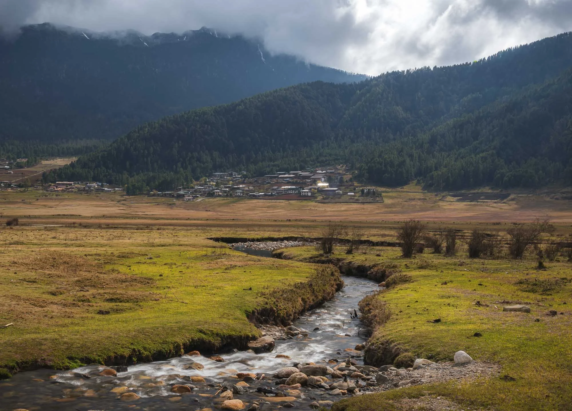
We continued our way to cross Lawala Pass at 3300m into the Phobjikha basin - the roads here were demonstrably worse, and recent rains didn’t help. An interesting sight a bit lower on the slopes were cliff-nesting giant honey bees and the accompanying yellow-rumped honeyguide, which I only spotted because a group of birders had stopped by the side of the road to photograph it - Birding tourism is quite common in Bhutan owing to its many rare and endemic avian species.
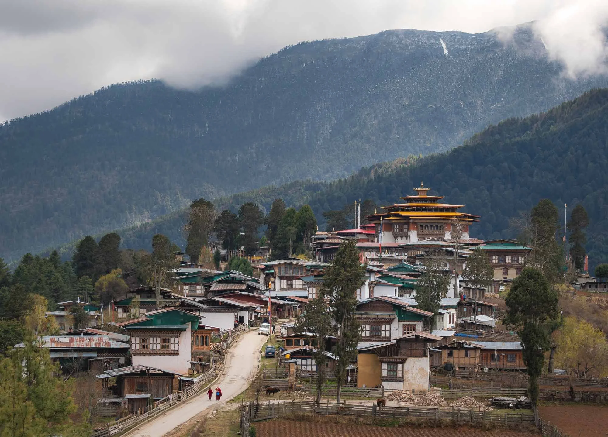
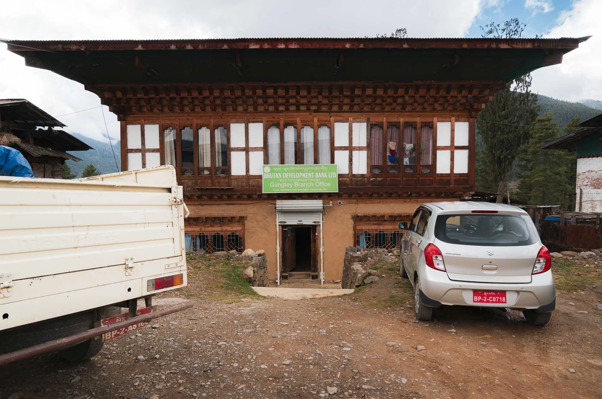
Gangtey
We finally arrived at one of my favorite spots in the country, this view of the small town of Gangtey and its monastery overshadowing the local houses.
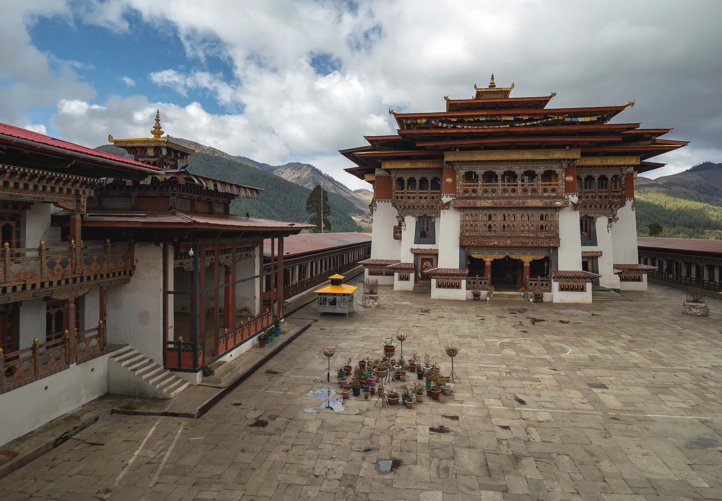
The 17th century monastery was renovated in the early 2000s - while a bit smaller and less monumental than the more famous Dzongs it’s quite beautiful with a lot of intricate details.
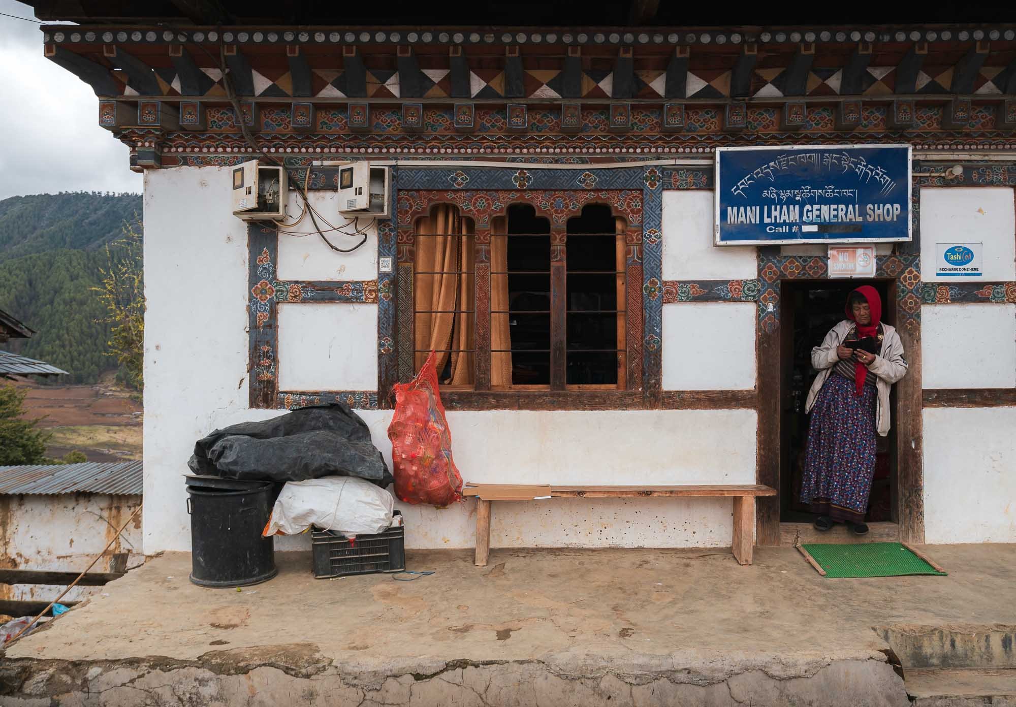
Things are quite rural here otherwise - the main shop on the left and the local branch of the Bhutan development branch on the right. I wonder what collateral they accept for a loan?
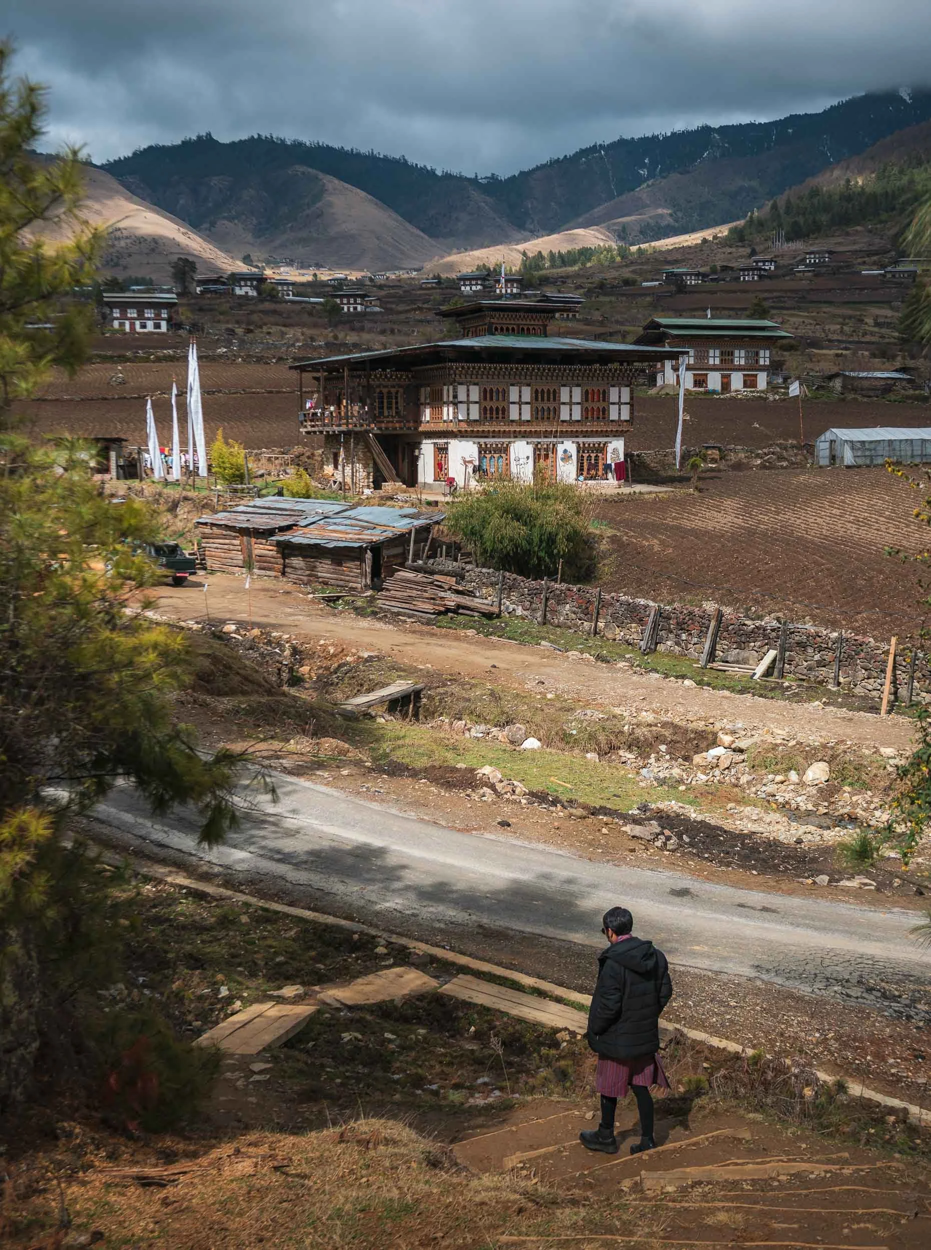
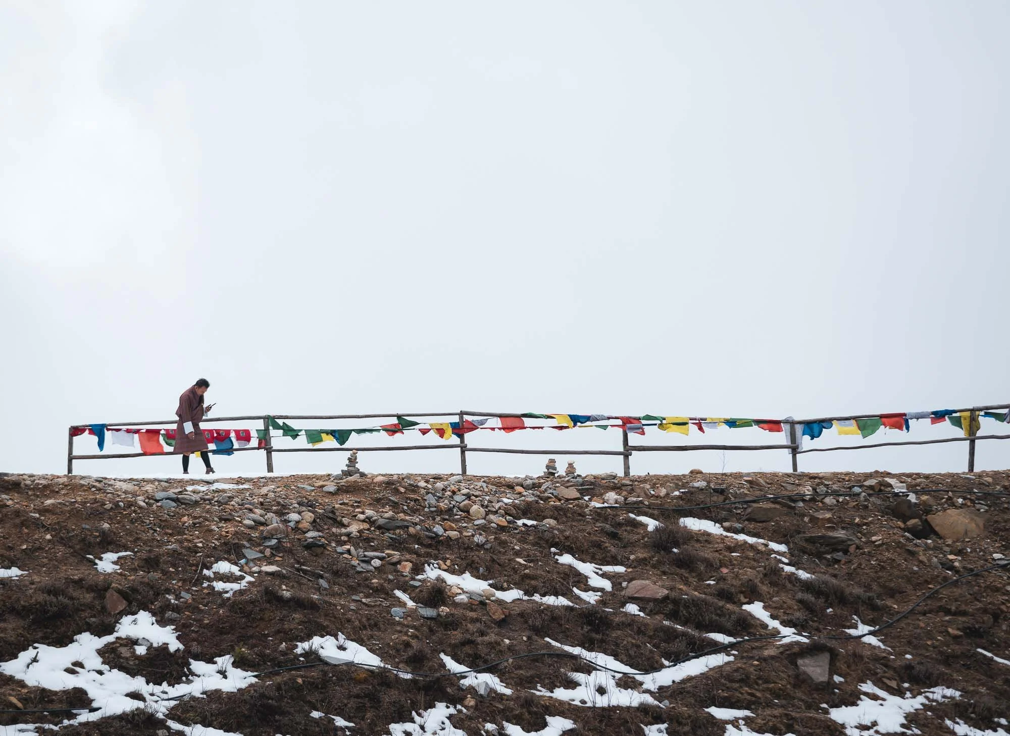
From here, we took a beautiful walk into the Phobjikha Valley along the Gangtey nature trail, crossing river trails and spotting a few of the tall white prayer flags, marking mourning rituals for the deceased.
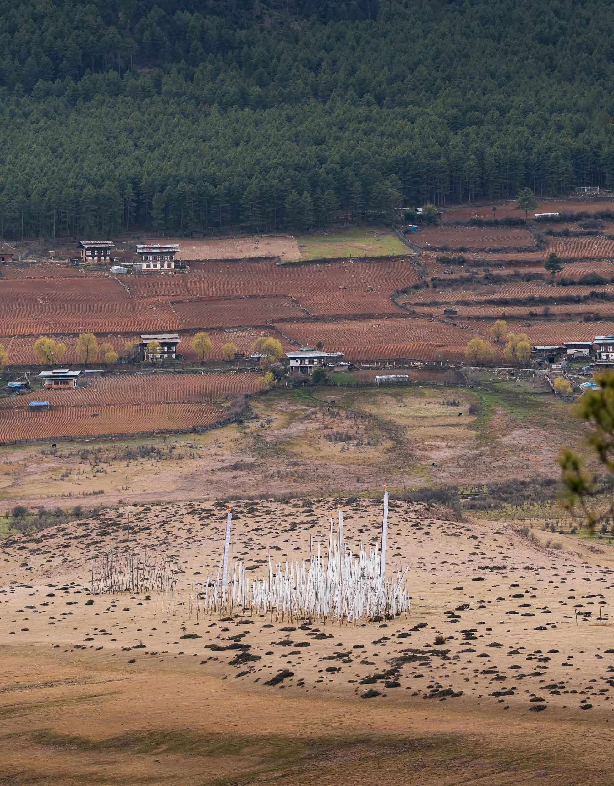
The valley itself is famous for its seasonal black-necked cranes, which arrive here in November and stay until March, using the wetlands around the central river as a wintering site. They are heavily protected - even power lines have been moved underground to reduce risk - and have a cultural relevance to the area.
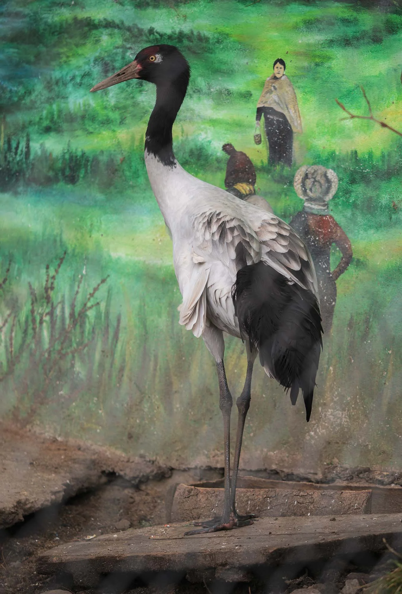
The cranes had already left by late March, so I didn’t get to see a wild one. The local visitor centre specifically built around these birds is home to two rescued individuals, which suffered injuries - they are prey for leopards in the area, for example.
Despite its remoteness, the area attracts quite a few of the aforementioned birding tourists, and the edge of the wetland is home to very small high-end results such as Six Senses (which has 5 resorts in the country), reflecting the upper scale tourism approach of the country.
Oddly, Bhutan’s national bird is the raven, rather less ecologically significant, but a representing a protective deity in Bhutanese Buddhism.
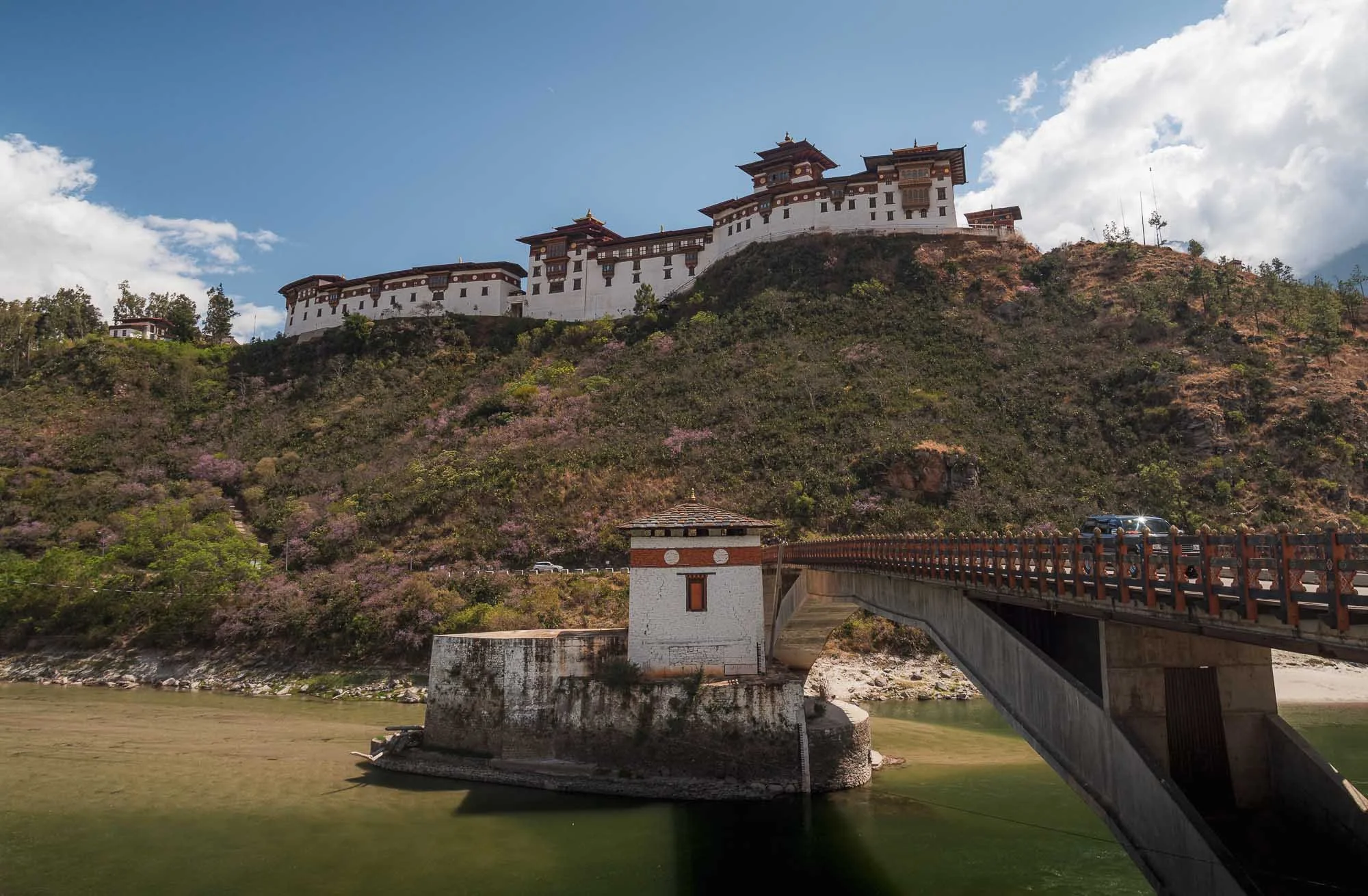
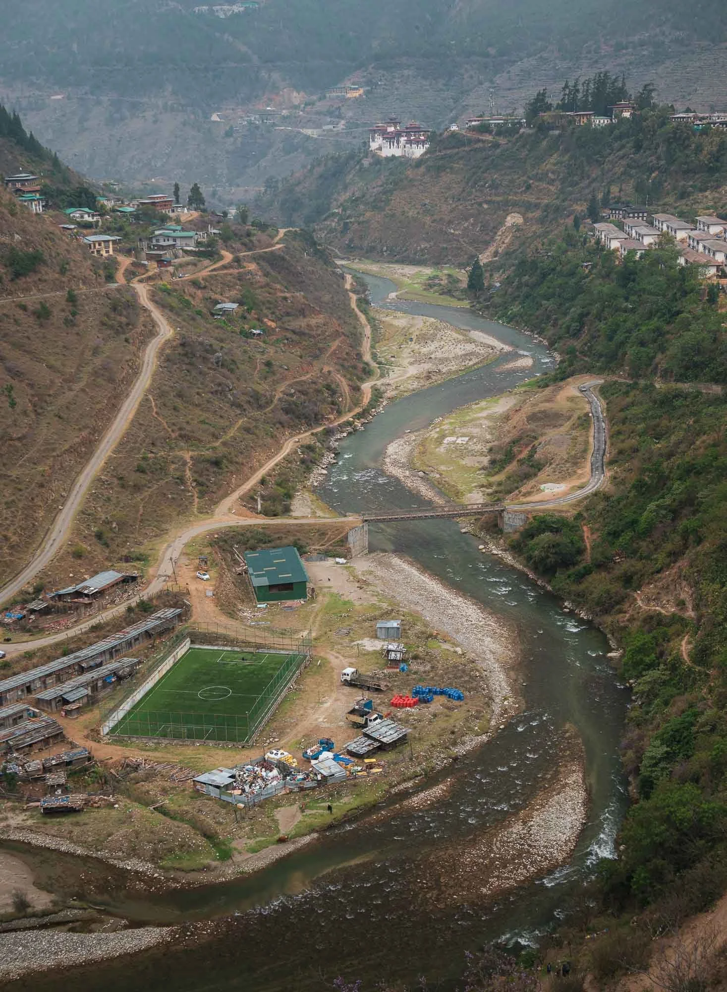
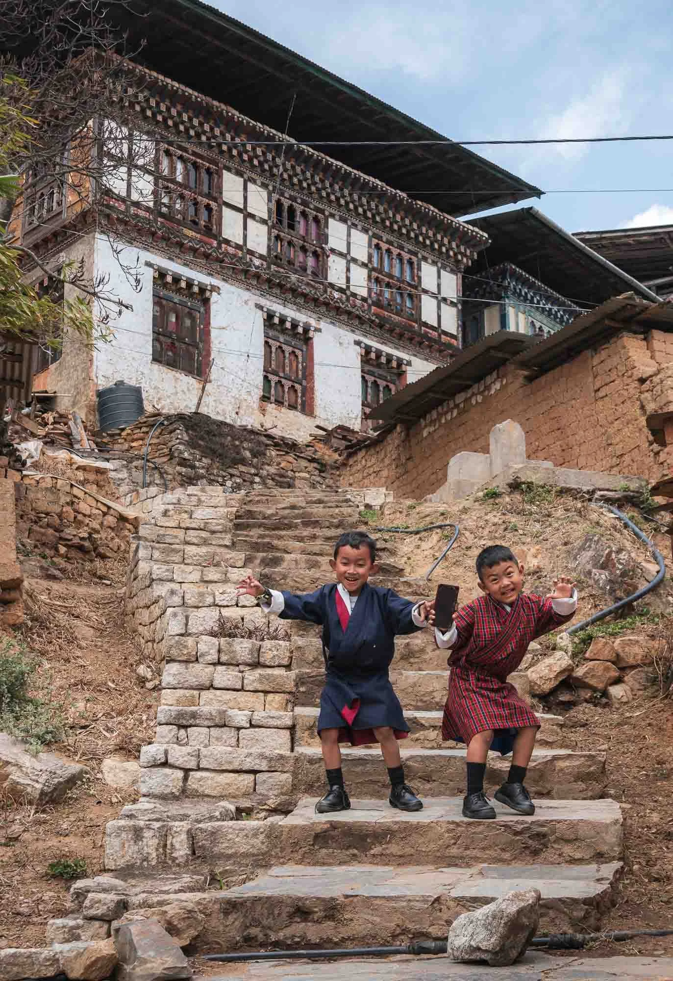
We headed back the next day, once again spotting the elevated Dzong of Wangdue, and a rather interesting football field, as well as the old village of Rinchengang across the river, which I explored a little.
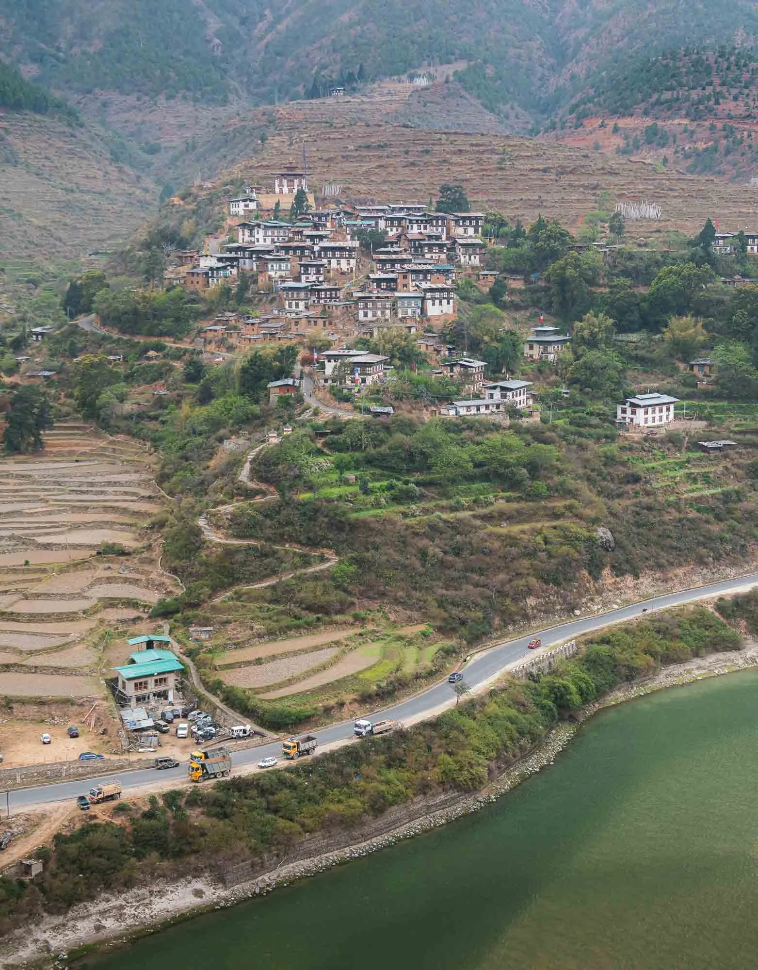
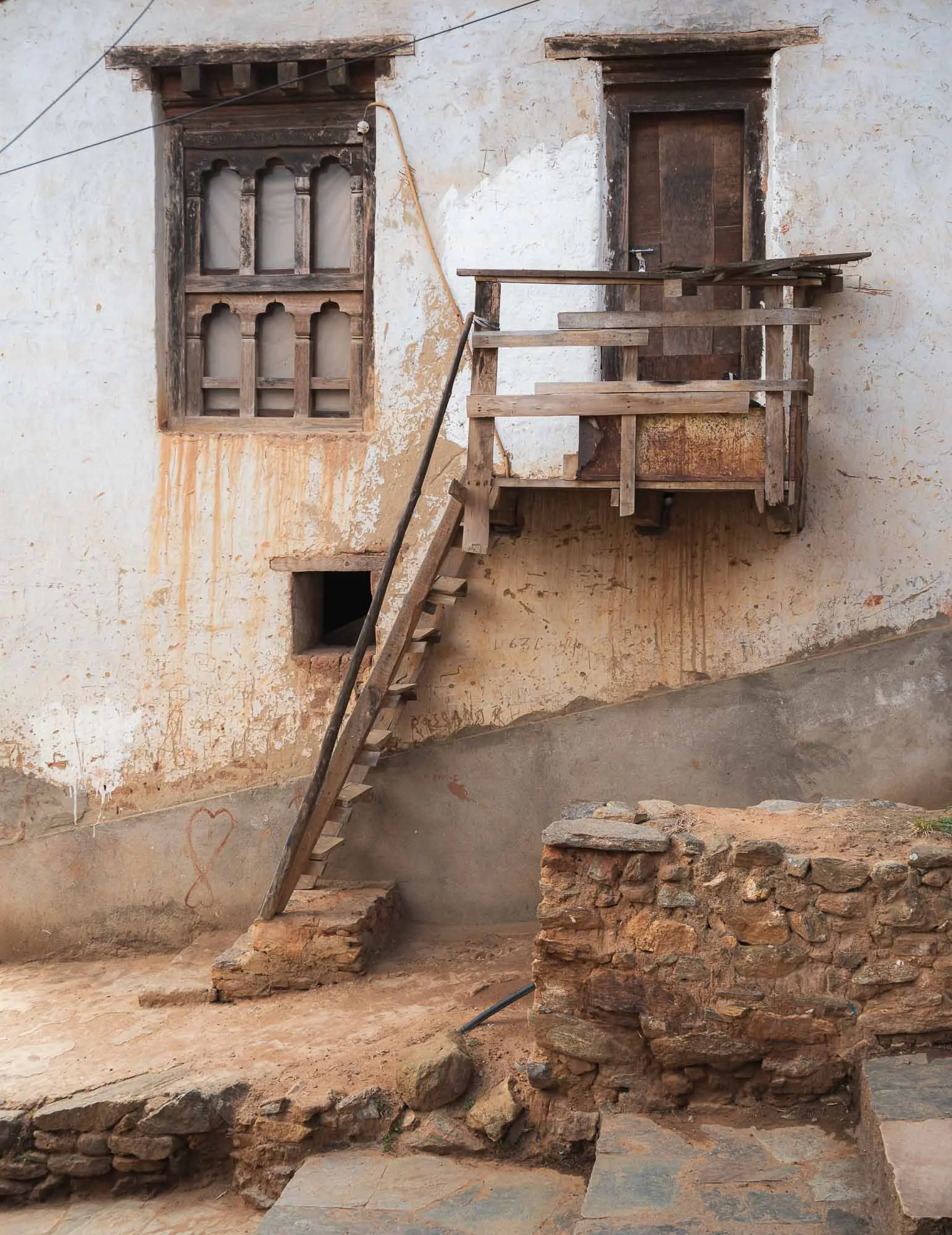
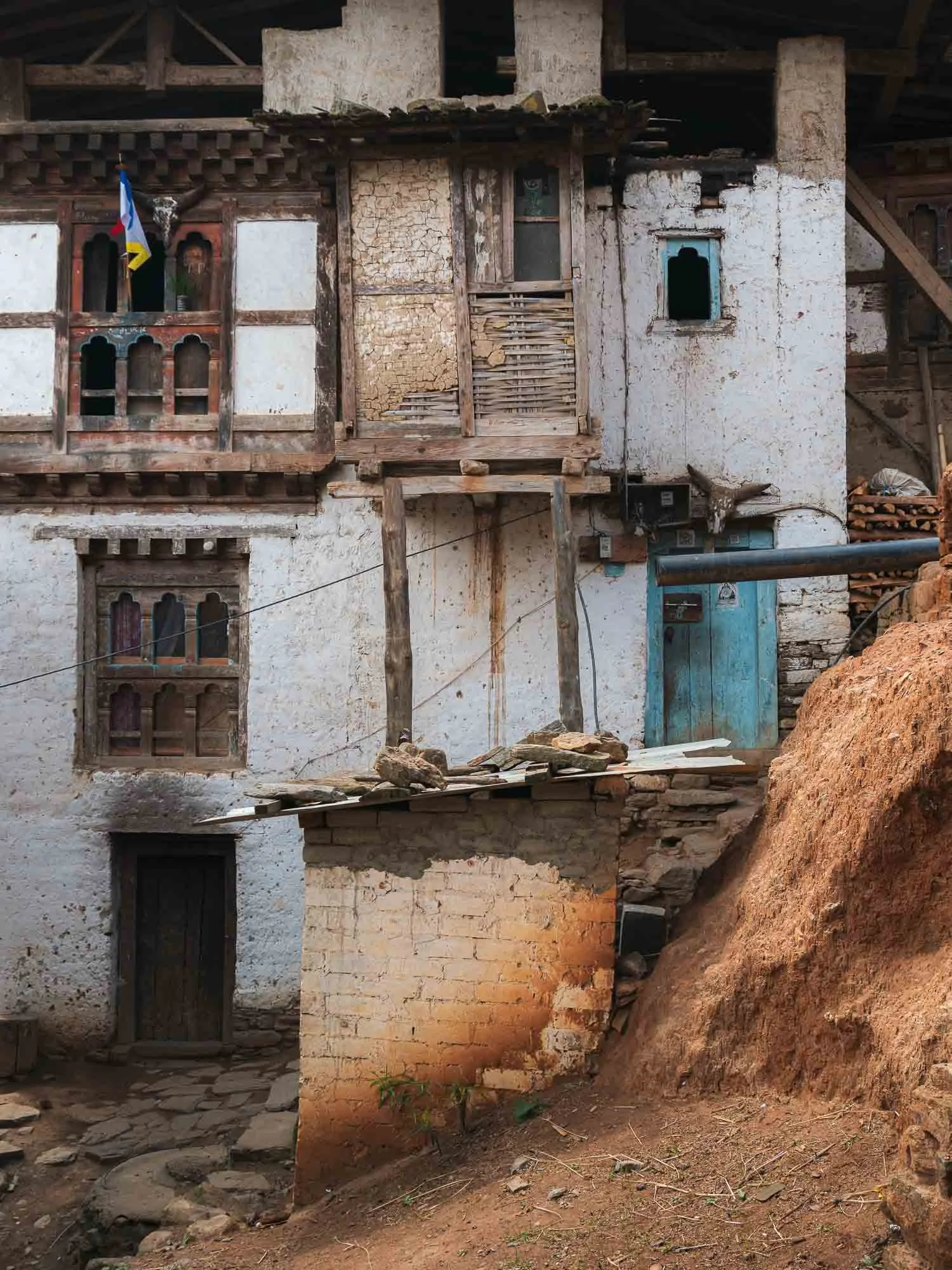
The rather unusually compact traditional village is said to be one of the oldest in Bhutan, and characteristic by tightly packed houses with stone roads inaccessible for cars. It was renamed to Drinchengang and is slowly being revived as a cultural reference village - many of the houses now have QR codes to learn about their history and past inhabitants.
The Fertility Temple
Do you remember the Divine Madman from the story of the takin?
We visited the 1499 temple dedicated to this Buddhist master next - his story and what remains is probably the main attraction for tourists in this region. But not only - it’s also couples praying for children and women hoping to get pregnant that come here.
This is because the temple is known for its ability to bless people with babies, evident by a book full of pictures of parents from all around the world holding their rose-cheeked newborns - often unexpectedly so due to illness or other struggles to conceive - after having visited the temple and subduing themselves to one of the various rituals that supposedly address any obstacles to having a child.
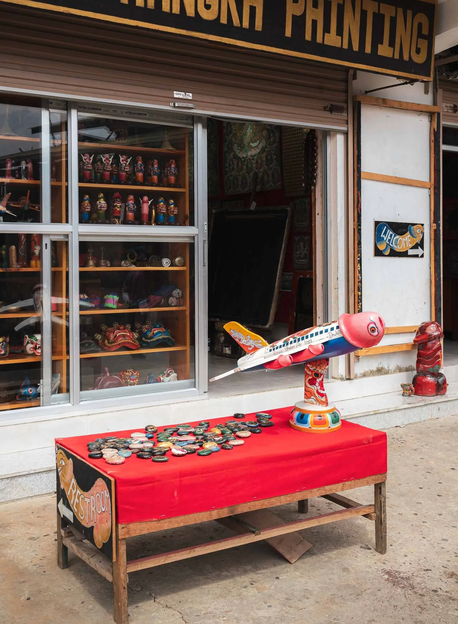
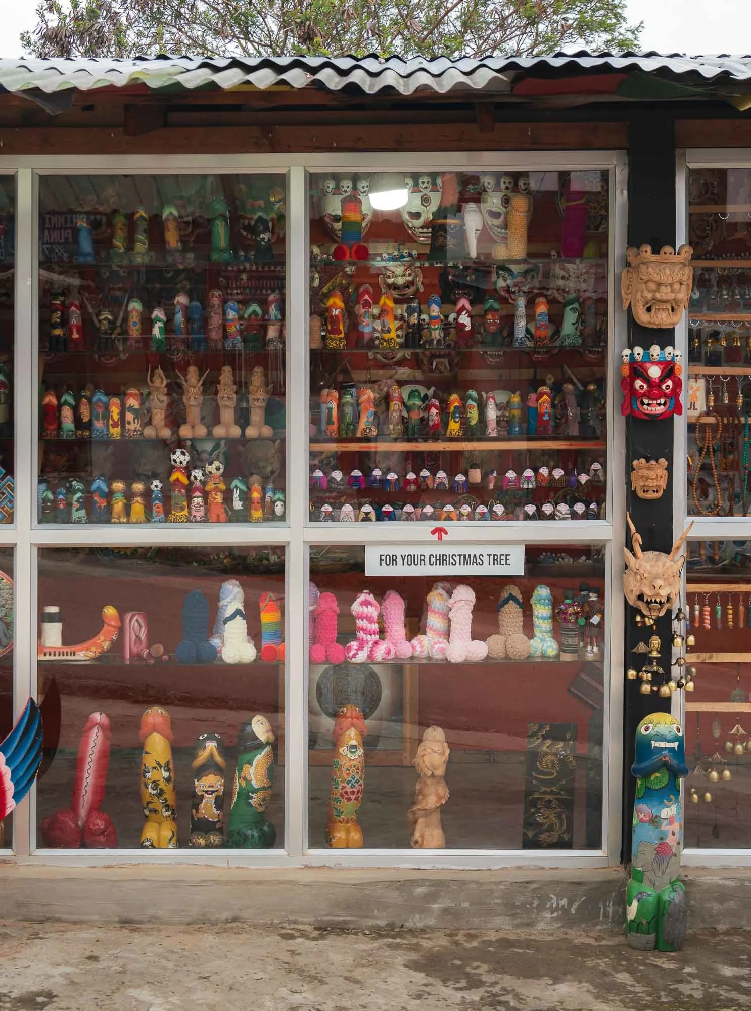
This belief is rooted in the stories of the Buddhist master known as the “Divine Madman,” who rejected traditional conventions and taught through more unconventional behavior, often using sexual themes and his (many) interactions with women as a way to make things memorable. The primary symbolism to reflect his powers follow a phallic theme, mirrored in the many small shops selling relevant artifacts accordingly. In general it’s hard not to notice the symbols around door frame carvings and paintings all around Bhutan.
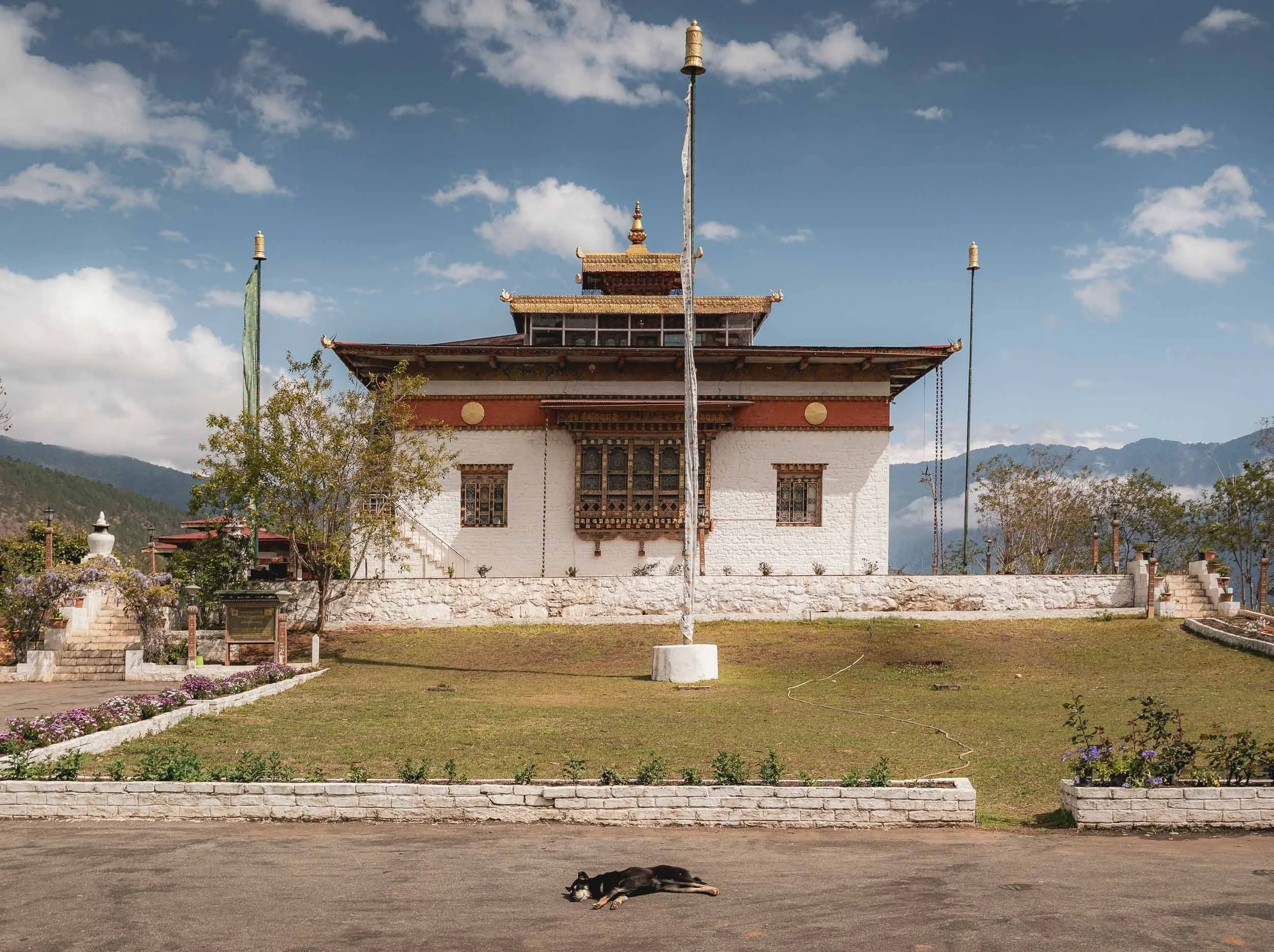
Wolakha Nunnery
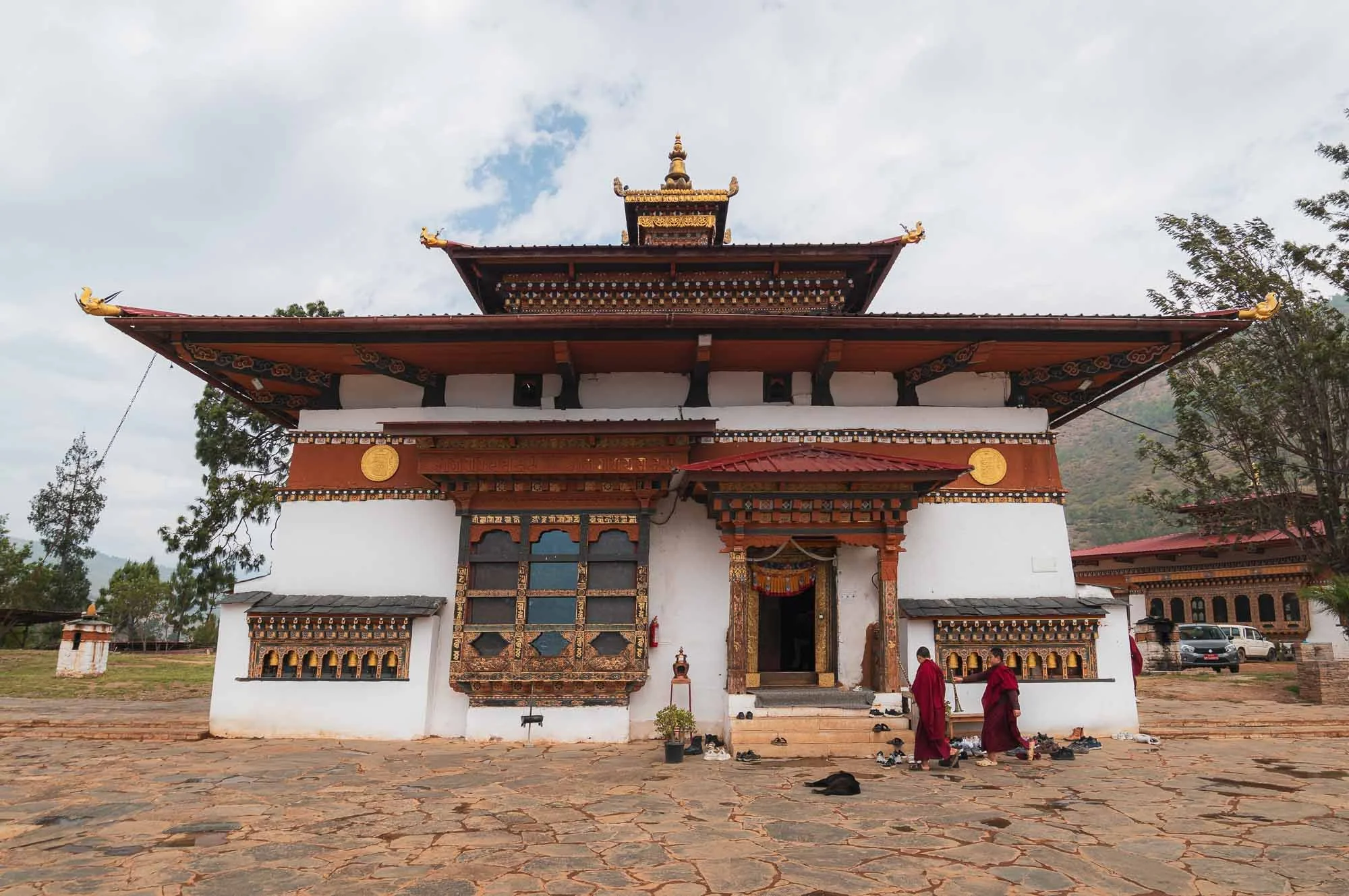
In what one might describe as an antithesis to the above, we next visited the nunnery of Wolakha.
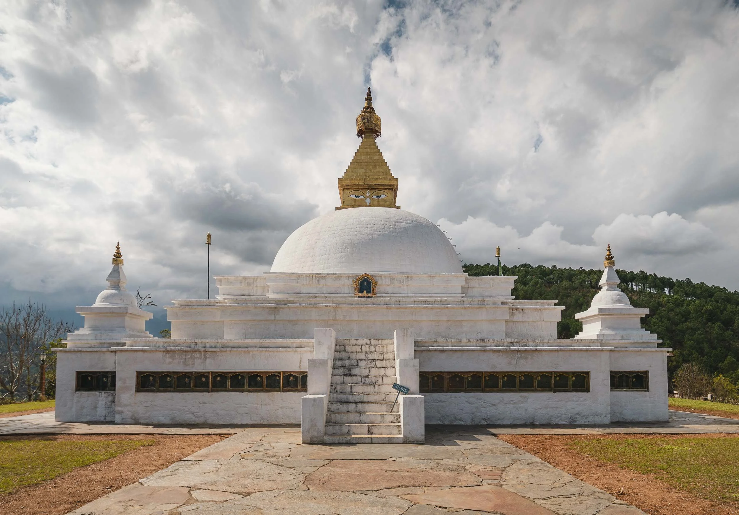
Aside from the beautiful views over the valleys, it features interesting architectural aspects such as the primary stupa following the design more common in Nepal (with painted eyes) as opposed to the more abstract, less adorned Bhutanese chorten style of the Vajrayana tradition.
On the right, the temple for the thousand-armed Avalokiteśvara, a deity for compassion and support in suffering.
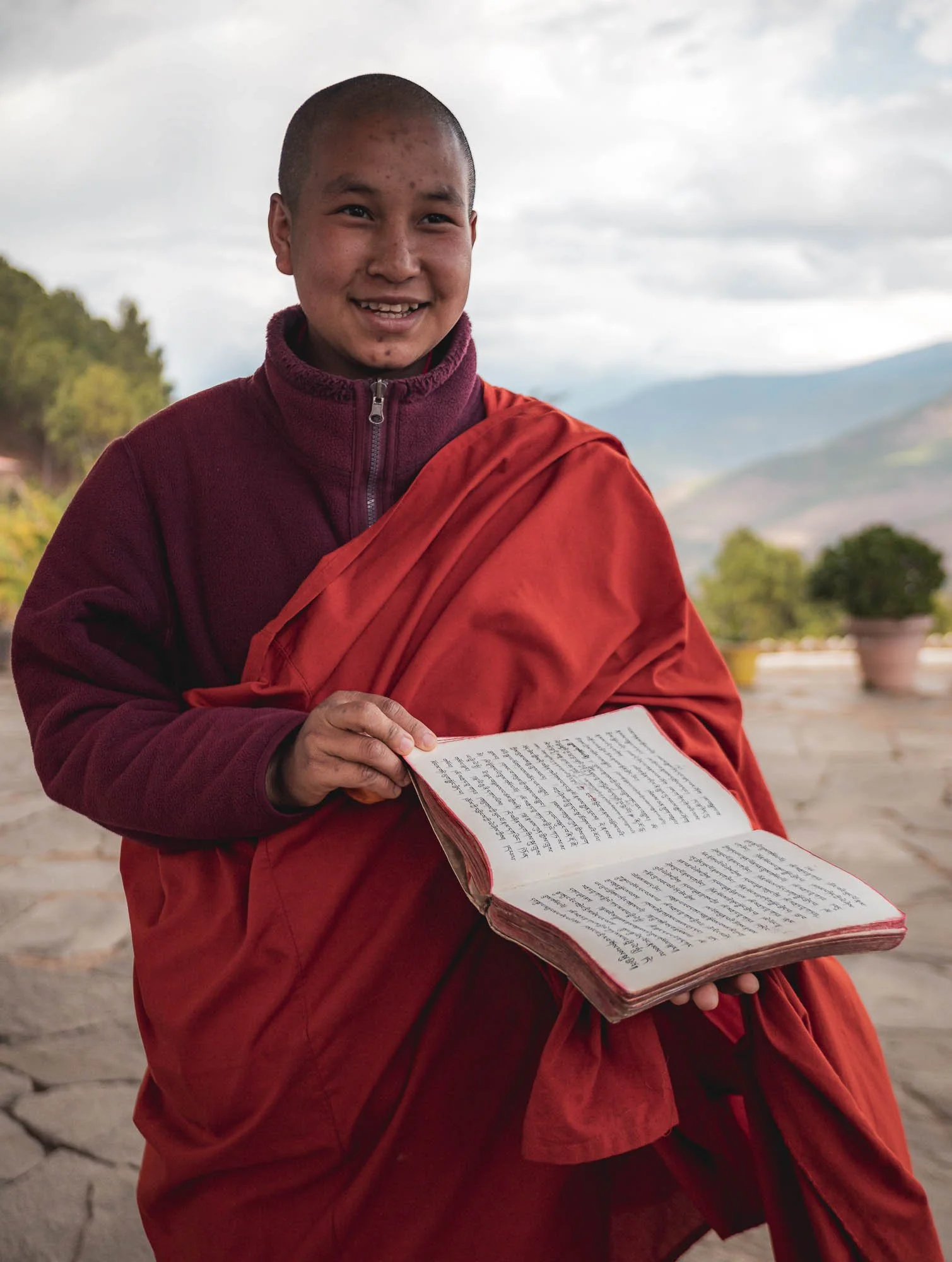
The nunnery features education and vocational activities and its pupils - mostly aged 6 to 18 or so - happily showed me their evolving skills and the readings and writings they practiced. While nuns historically had less institutional support than monks, there are now quite a few nunneries around the country.
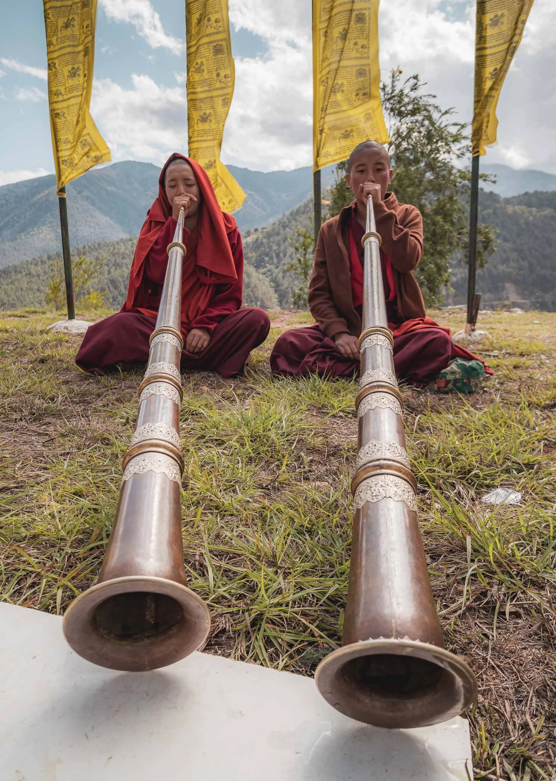
They were also practicing the Dungchen, a long kind of horn producing a deep drone sound used during monastic rituals and festivals. It takes them several years to master it.
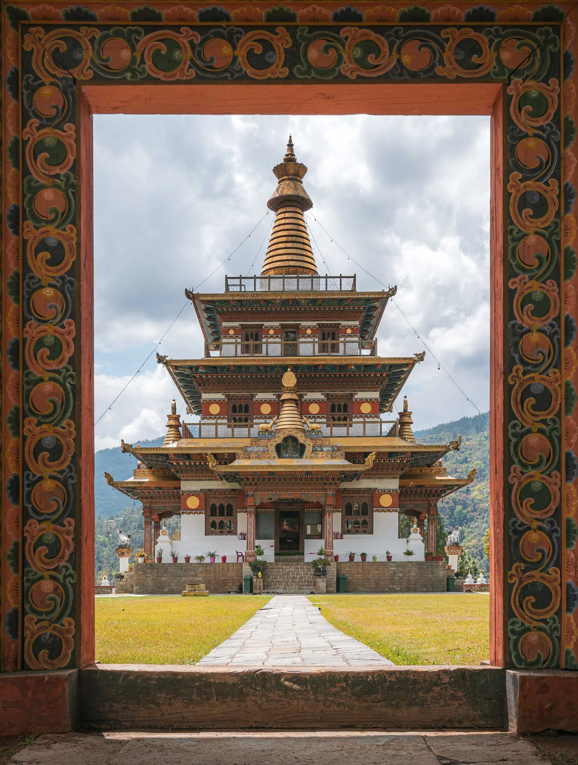
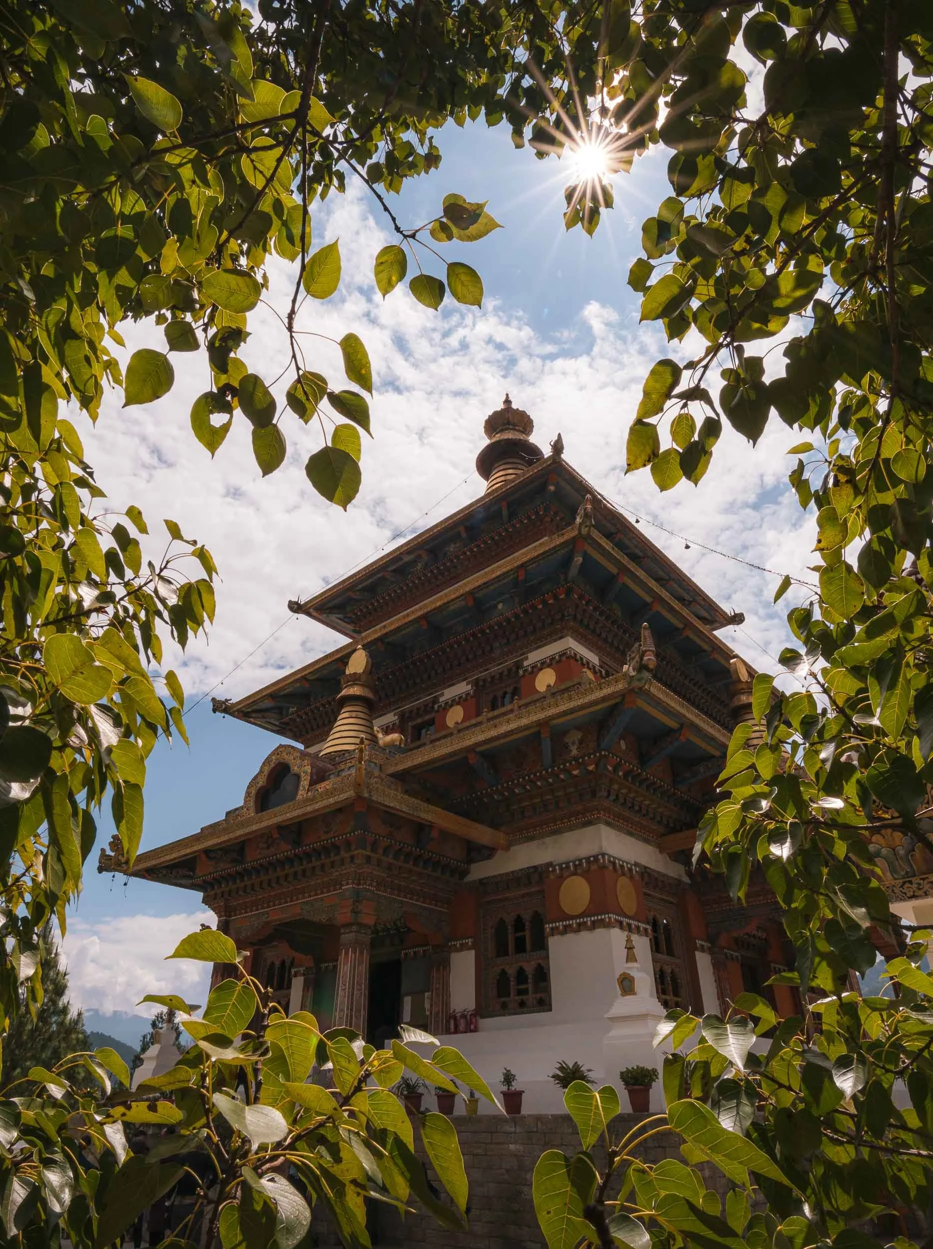
Khamsum Yulley Namgyal Chorten
Not far from here lies another picturesque monastery, reachable after crossing another flagged suspension bridge, followed by a short walk through the rice paddies, and a brief hike up the hill.
This one was built fairly recently and opened in 2004 - unlike many of the other chortens it has an accessible, multi-level interior, centered around promoting stability and peace in the region.
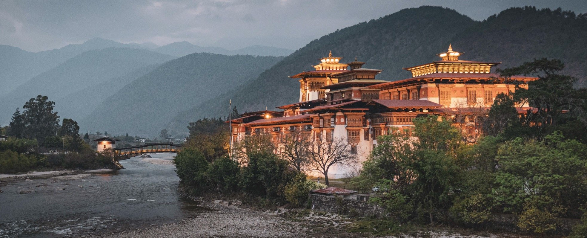
The Palace of Great Happiness
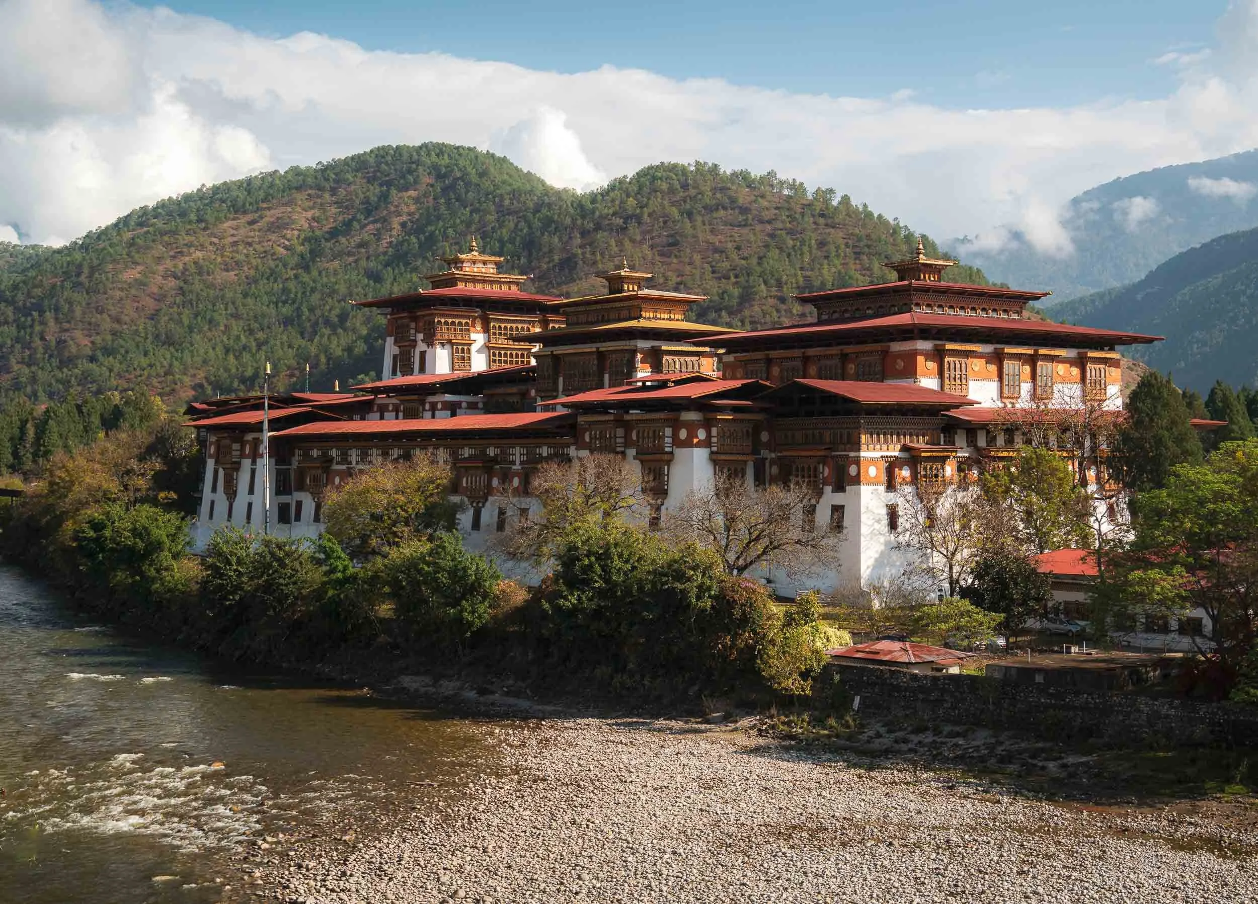
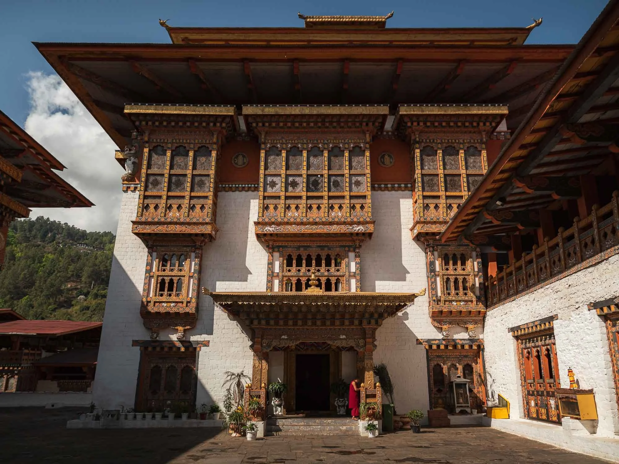
Despite the many interesting sights in the area, it’s undeniable that the Punakha Dzong steals the show, and also became one of my personal favourite places in the country. Its beautiful location at the confluence of the Pho Chhu and Mo Chhu rivers (representing male and female parts), the amazing architecture and its historic significance as the old capital of Bhutan until 1955 are some of the reasons for its appeal.
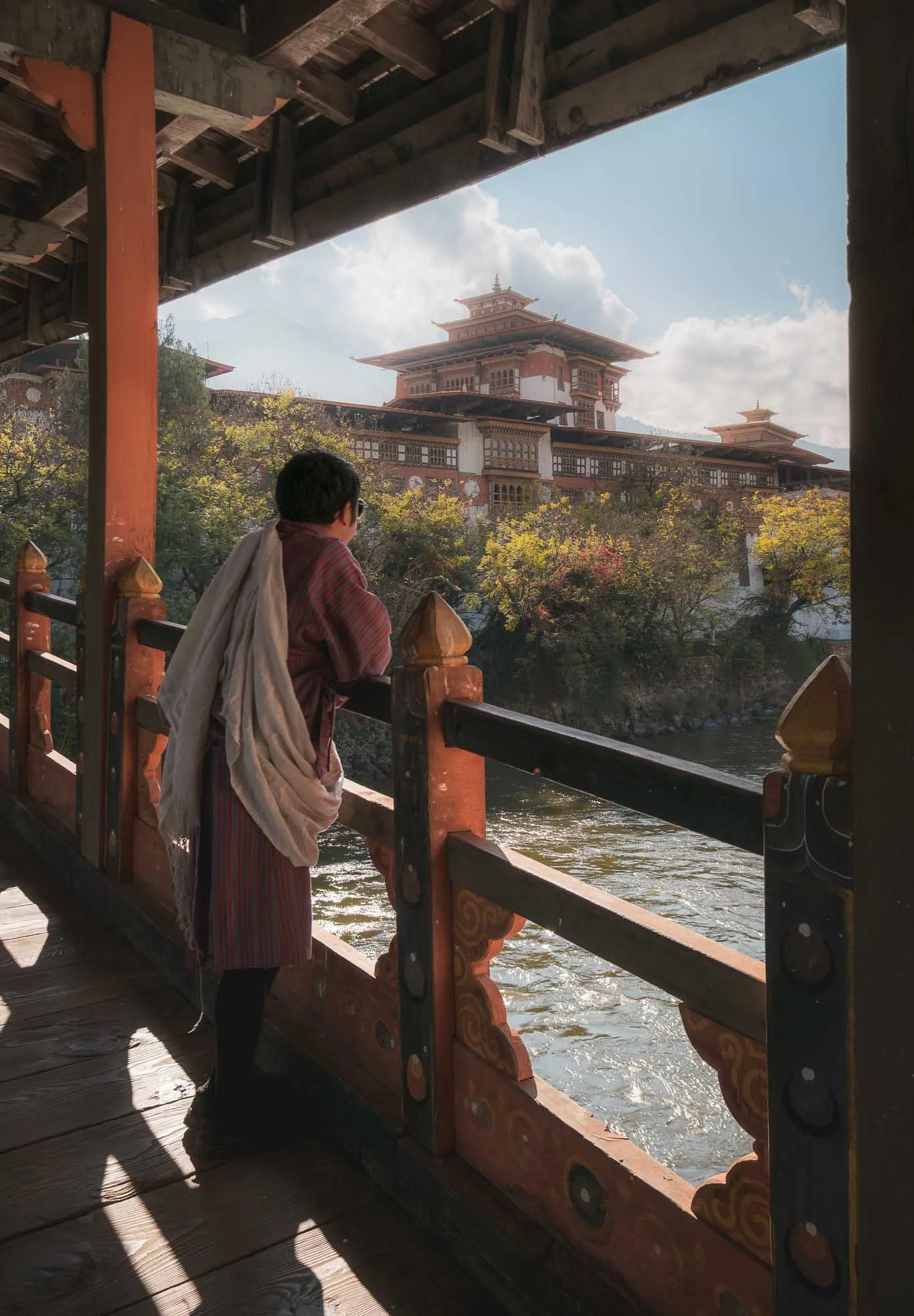
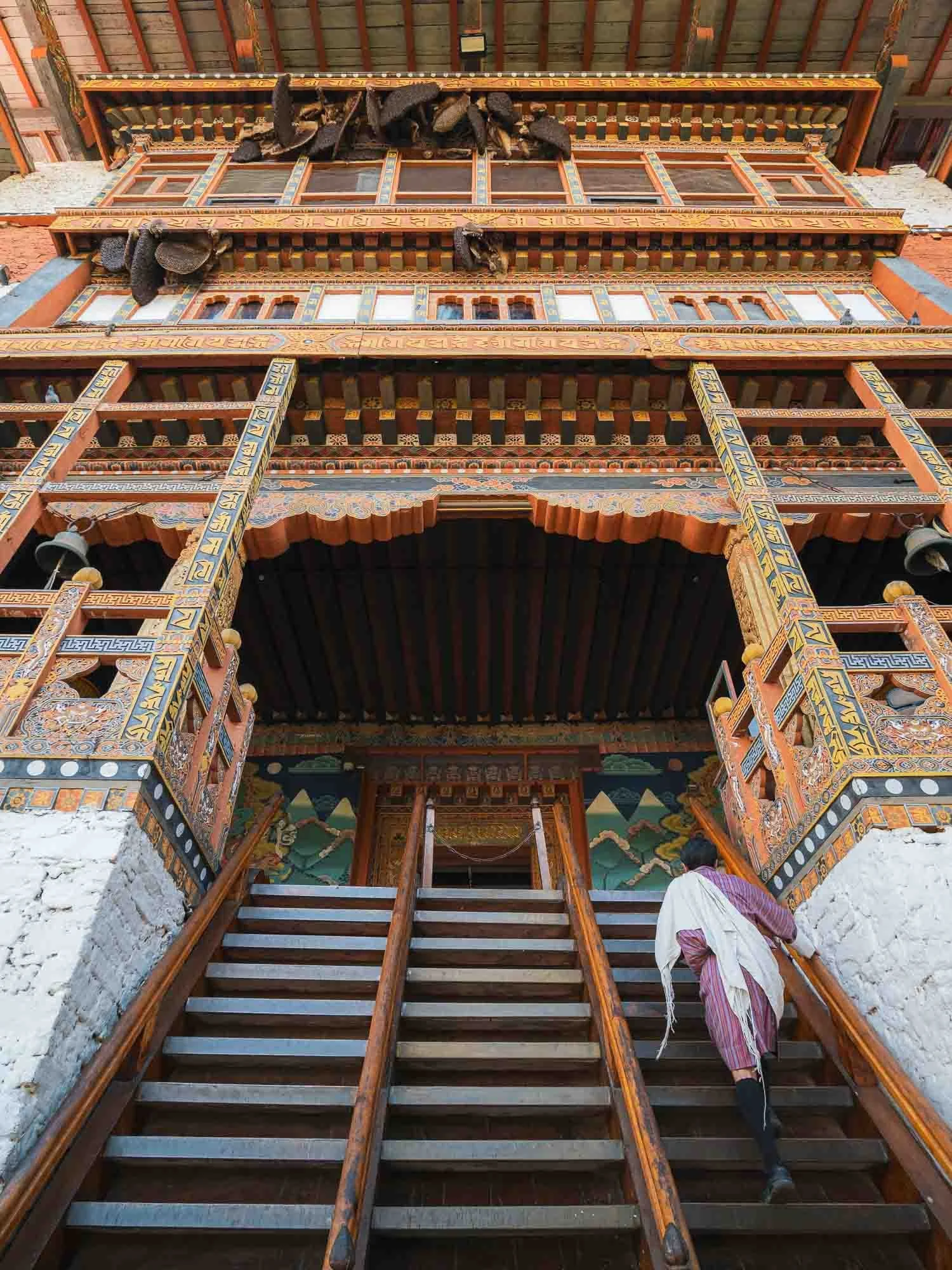
To enter, you cross the traditional timber cantilever bridge (re-built several times due to flood damages, last time in 2008) and then climb the steep stairs designed as a defensible entry point towards the courtyard. Always glad to have Chencho here as an involuntarily model - it is mandatory for guides to wear the local traditional outfit, and the more formal scarf is required for a Bhutanese to enter administrative buildings, which many Dzongs still serve as.
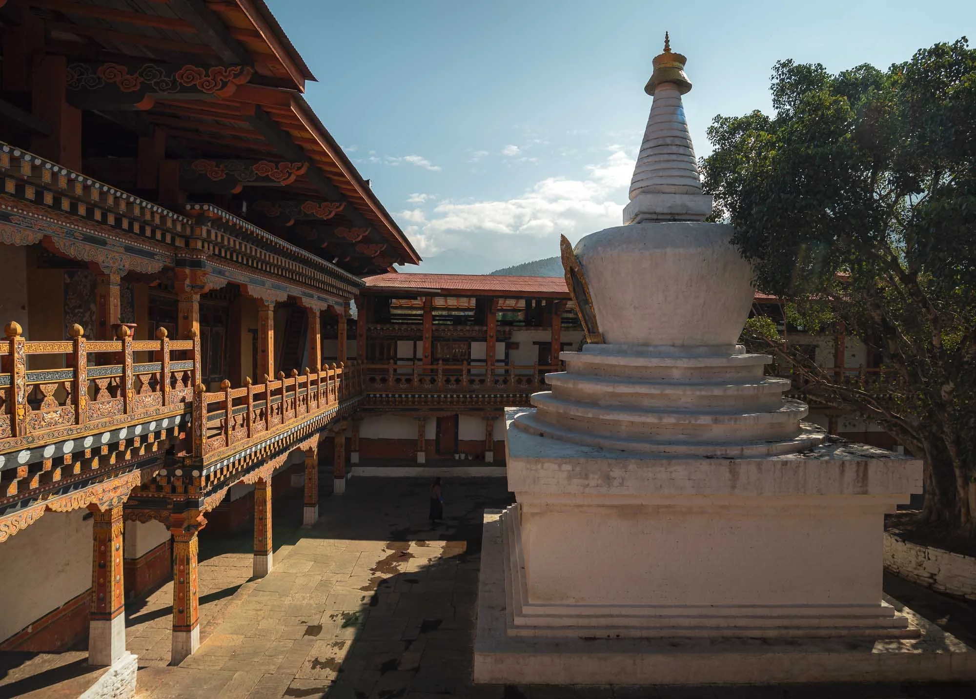
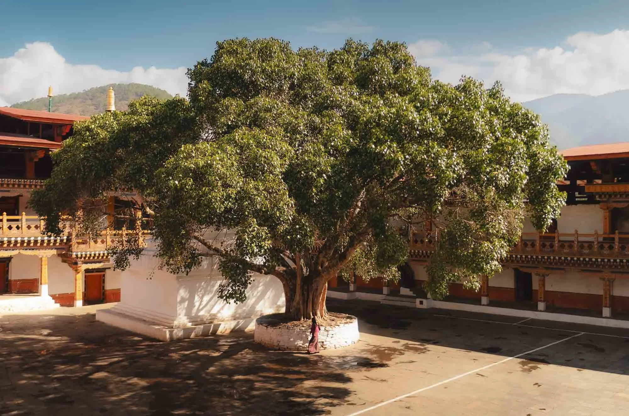
The courtyard is home to a large stupa and a jacaranda tree. The fort is surrounded by them which must be quite pretty during the few weeks when they show their purple bloom in the spring, but I wasn’t lucky enough to see that.
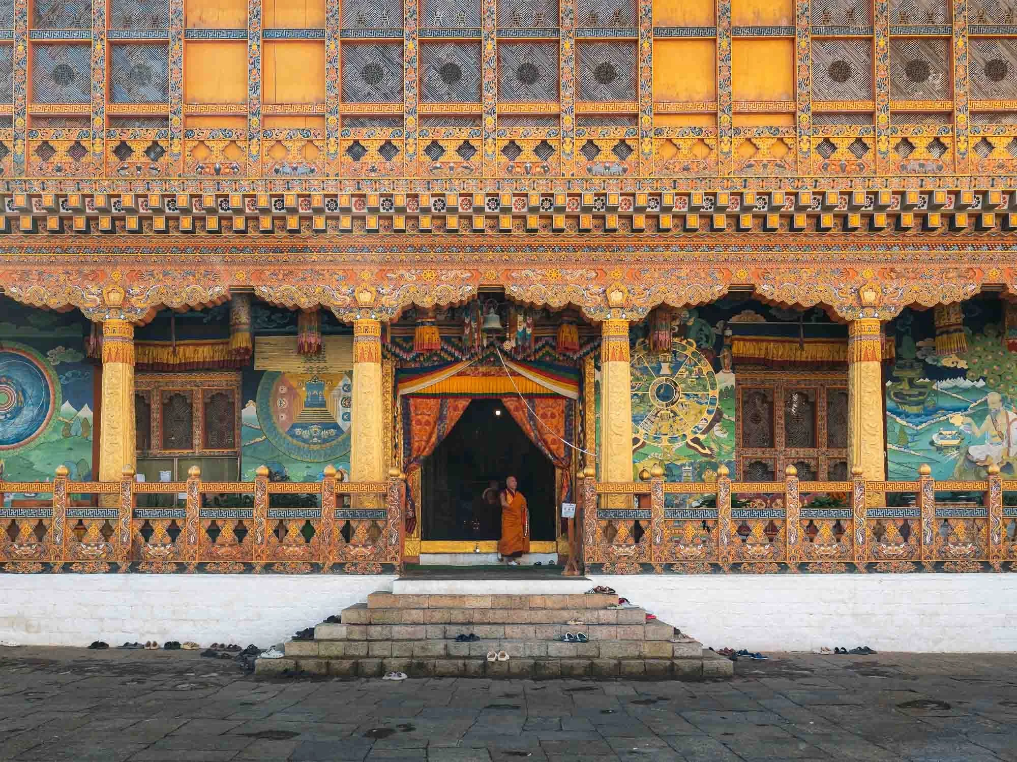
While some temples and courtyard spaces are public, several parts are off limits, such as the administrative areas and specific inner buildings housing some of the most important local religious relics.
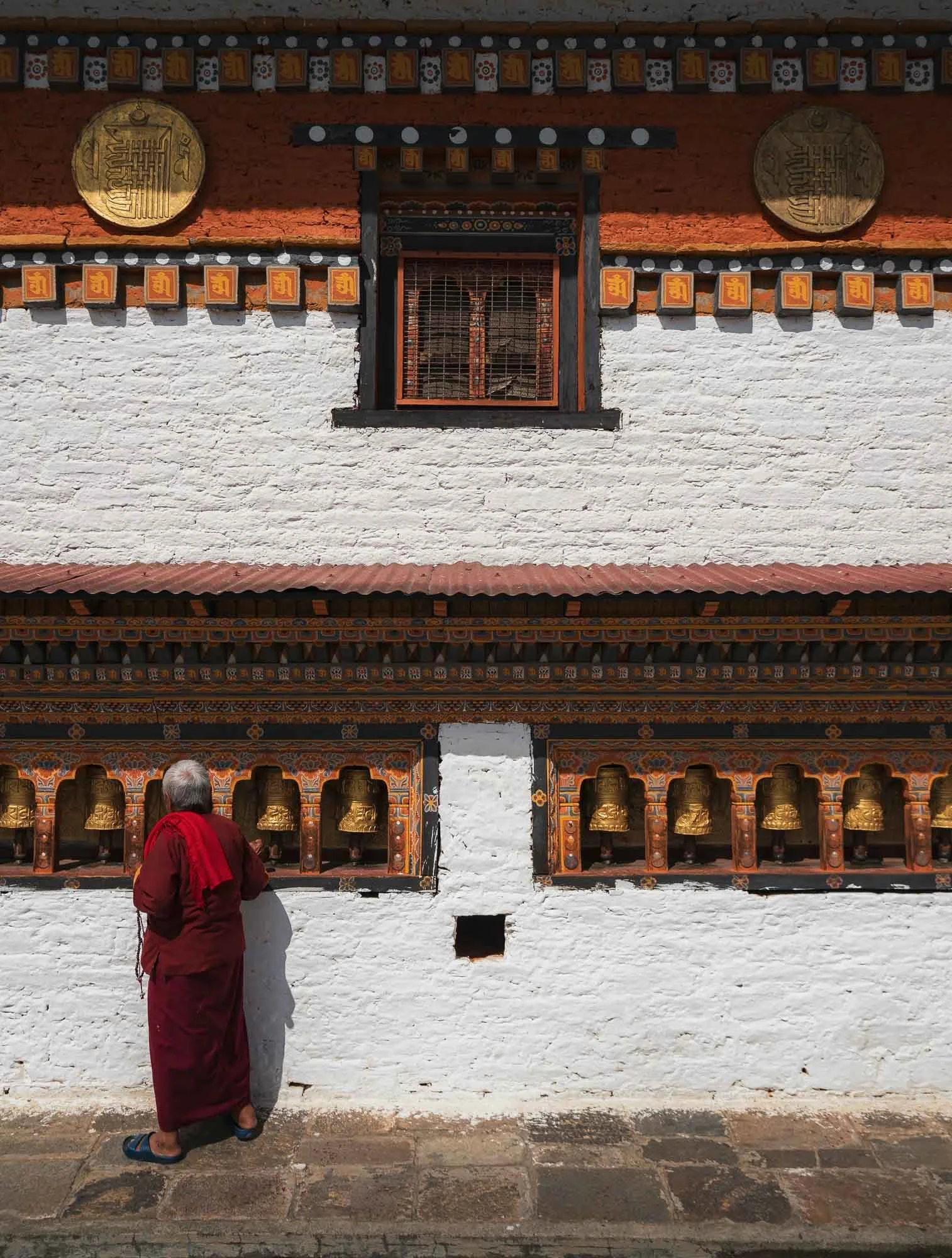
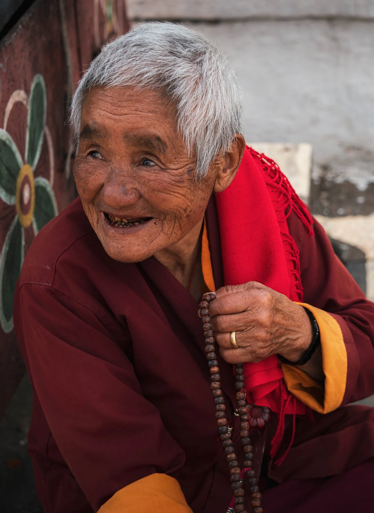
Just outside the main structure lies a smaller building where this elderly lady conducted her daily ritual of clockwise rotation around the temple, spinning the prayer wheels. She also showed me her string of the 108 prayer beads used to count mantra recitations and - I can’t validate this - told Chencho that she accumulates 30,000 counts every day.
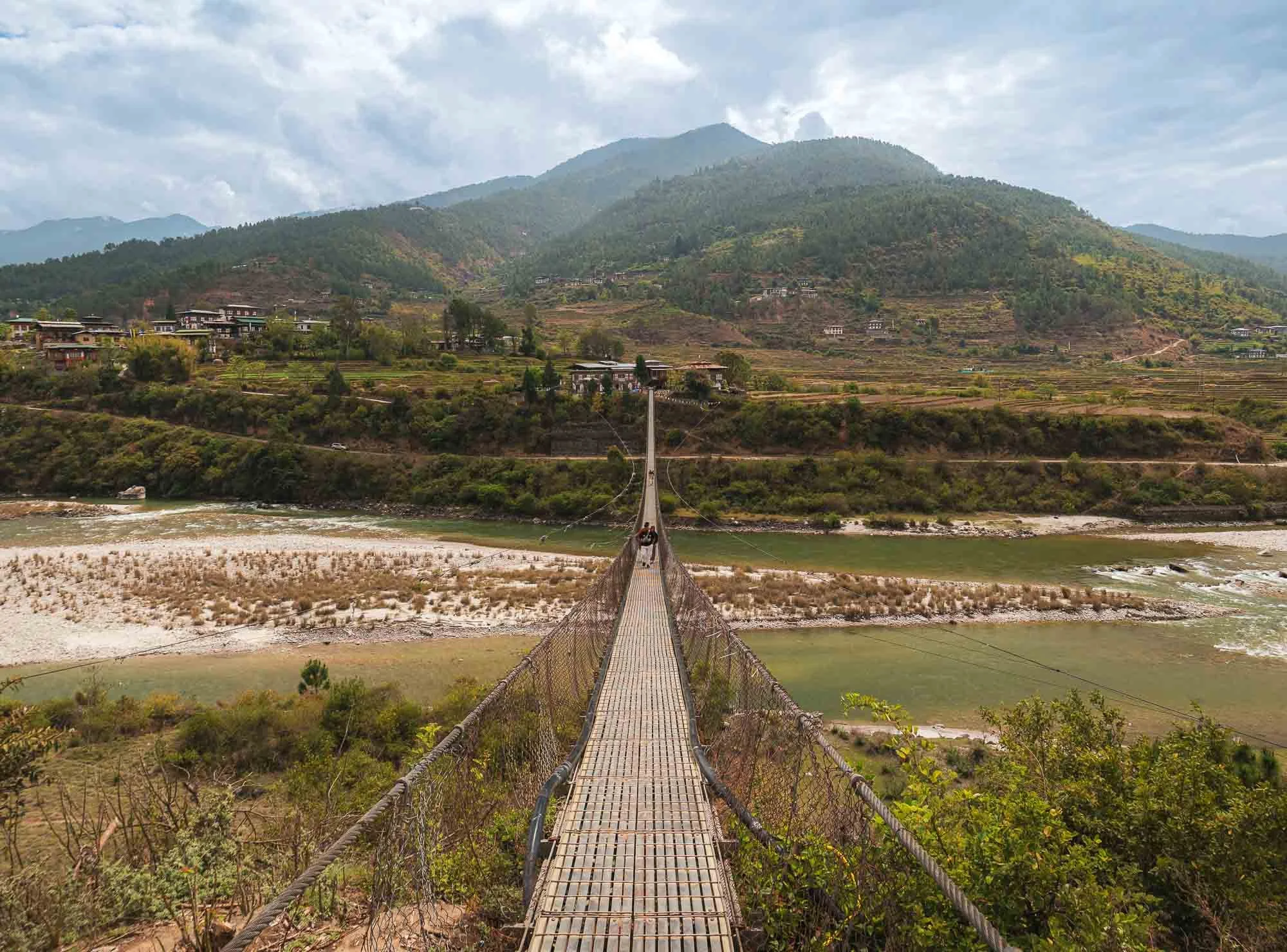
Just a few hundred metres from here you can cross the Pho Chhu river on Bhutan’s longest suspension bridge (around 180m) - it’s not so much a tourist attraction but provides actual connectivity between the Dzong and the nearby villages on the opposite side of the main entrance.
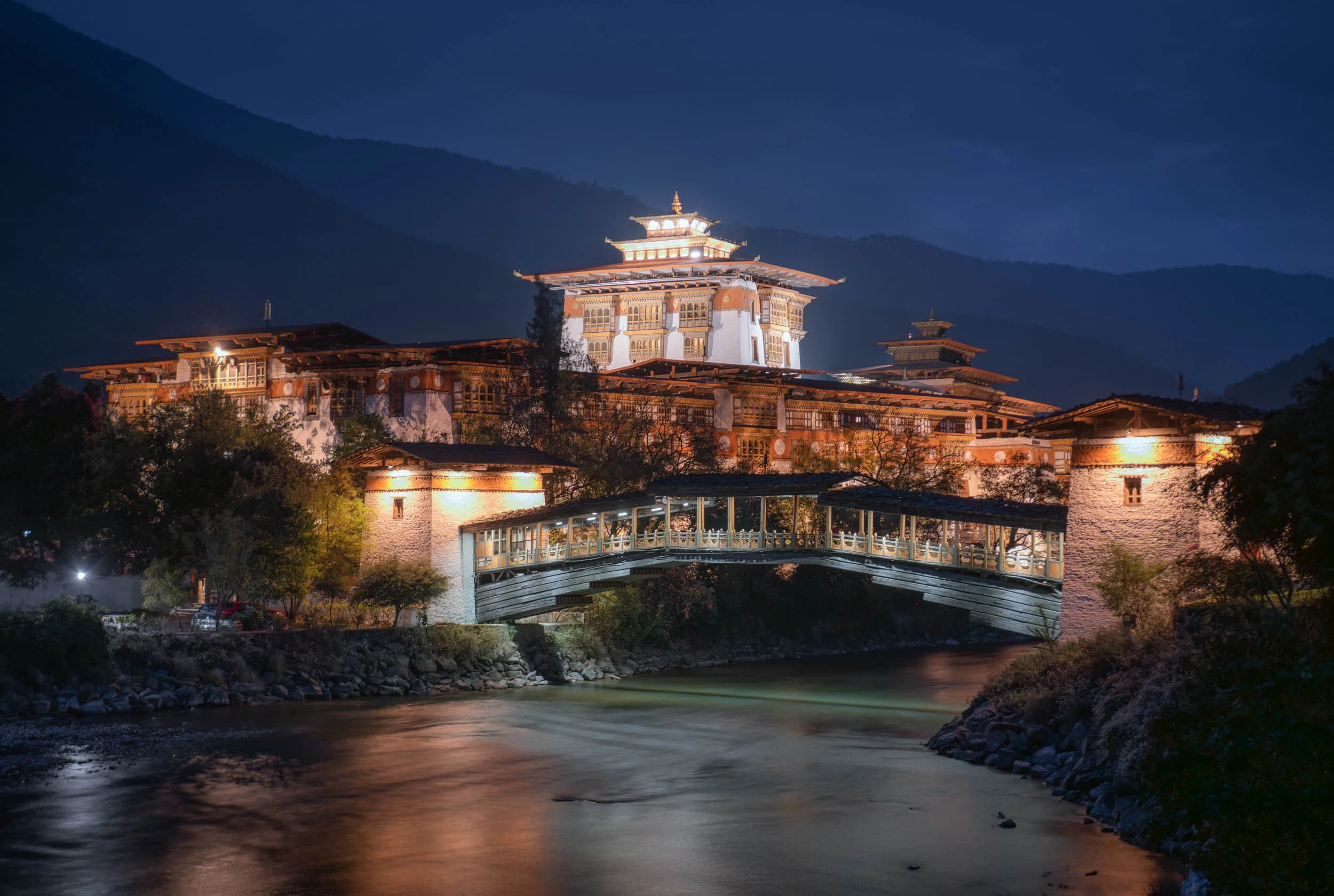
Night View
We came back in the evening for a night view - like many of the Dzongs, this one is beautifully illuminated as well.
Return to Paro
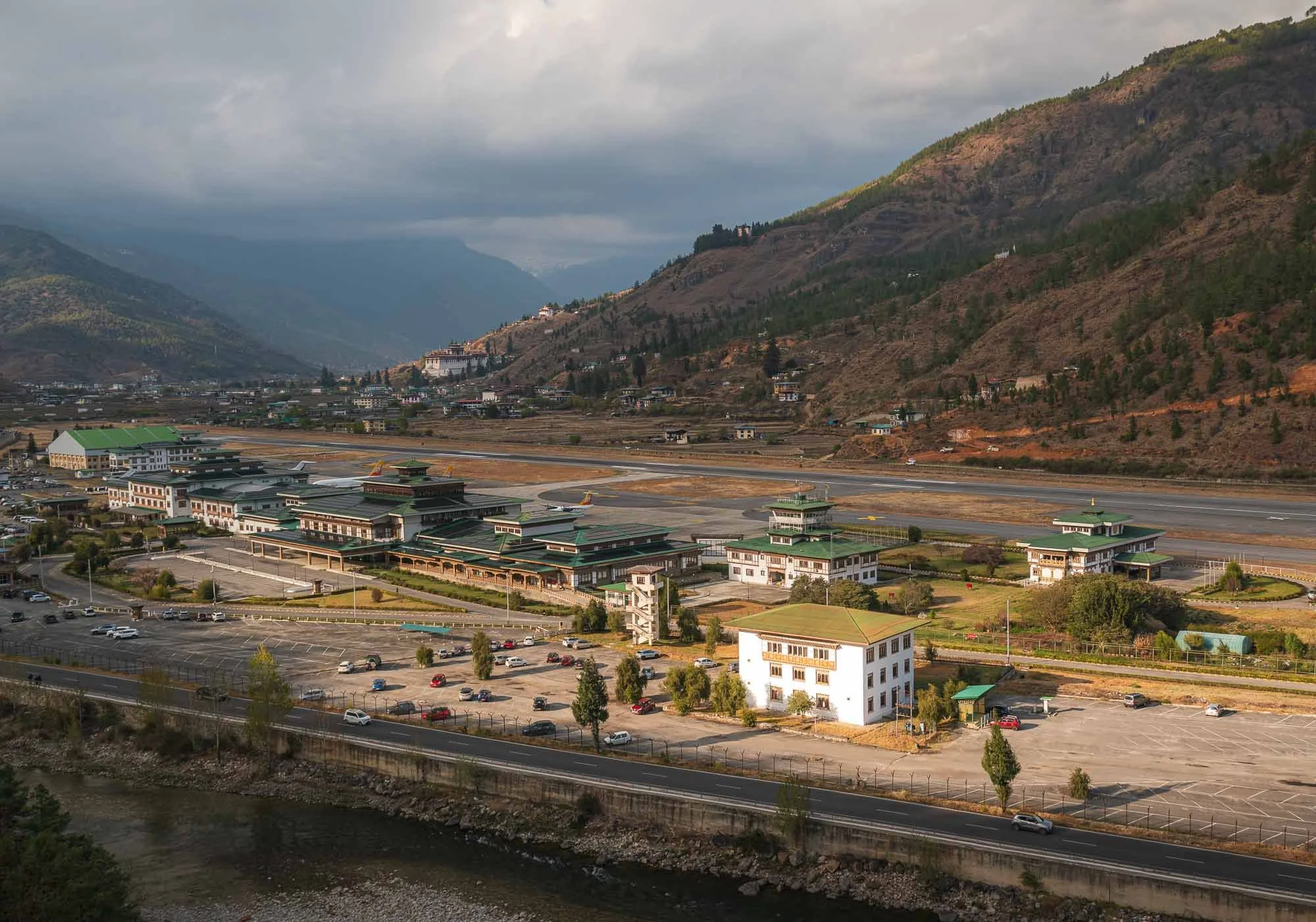
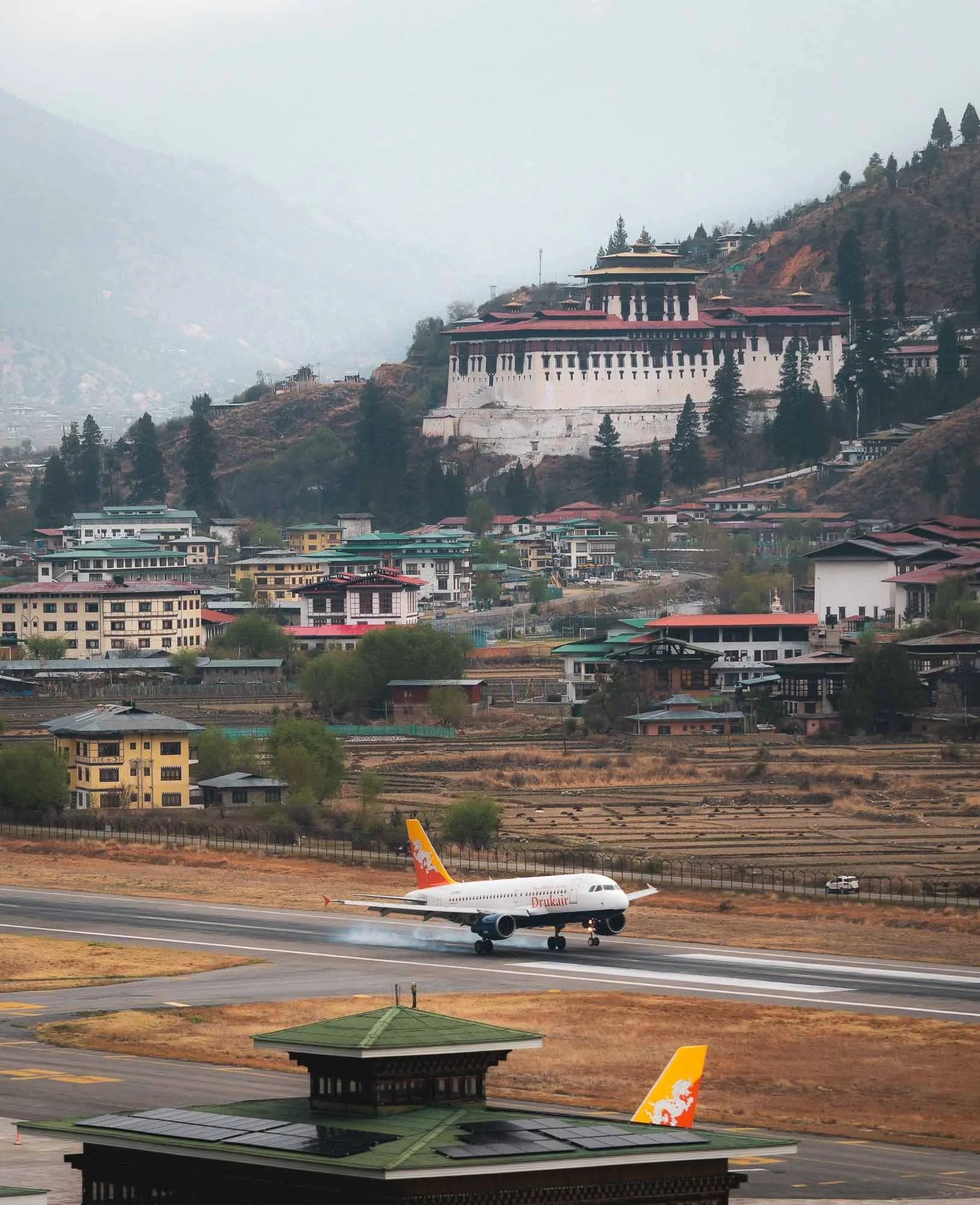
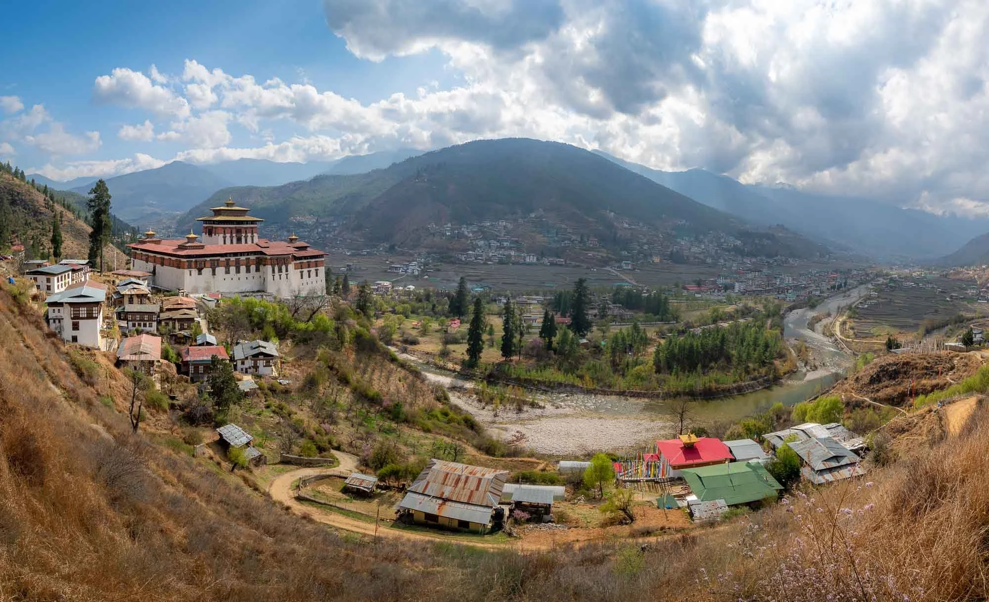
And with this, we headed back to where the trip started, but there were a few more things on the agenda. Paro‘s valleys are a little more open and wider than most of the rest of the country, resulting in a lot of agricultural space and it being home to the (still barely fitting) airport. Of course, the city features another Dzong as well, built in 1646 and seen here on the left - more on that later…
Chele la pass
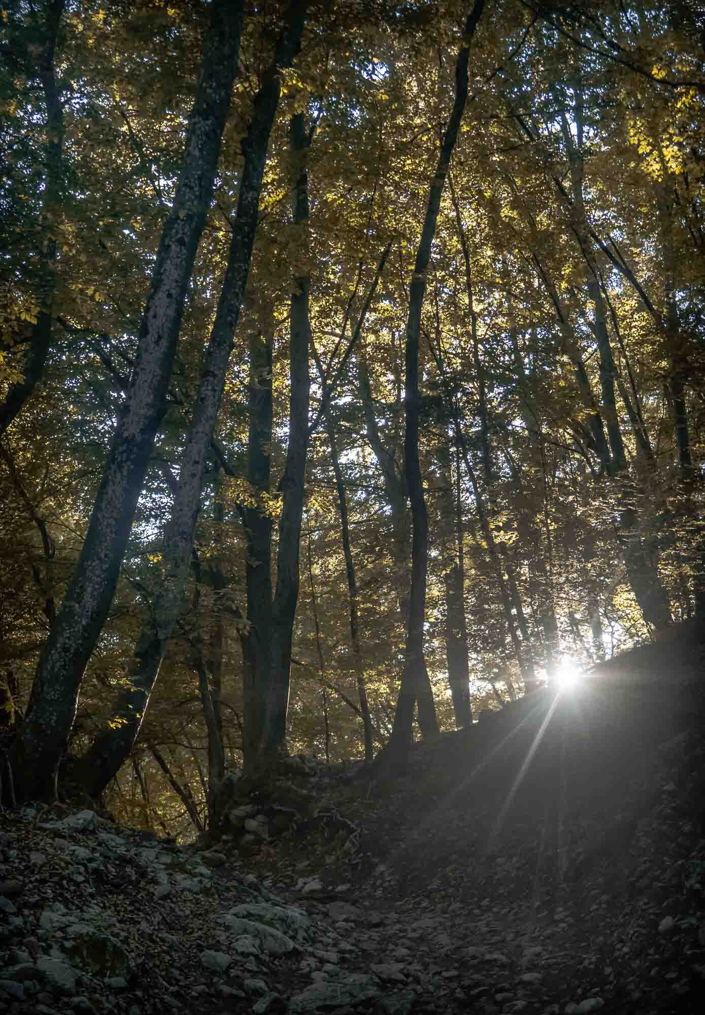
Having said that, we left the valleys on the next morning for the highest motorable road in Bhutan, passing through a beautiful forest, and reaching the 3980m summit with a small temple at the top. That’s still far from the highest peak of Bhutan, Gangkar Puensum at 7570m, which is also the highest unclimbed mountain in the world. It has been designated as off-limits by the government to protect its sanctity.
I’m not sure this drive was worth it given the cloudy conditions - nevertheless it gave me a little close up glimpse at the Himalayan snow. Born near the Alps, that was not quite as exciting to me as to the many Indian tourist families who arrived as we left and excitedly grabbed and lay down in whatever white patches were left next to the road. Surprisingly this is quite a rare occurrence: I was told snow has been quite spare in the valleys of Paro and Thimphu over the last years, something the locals attributed to global warming multiple times.
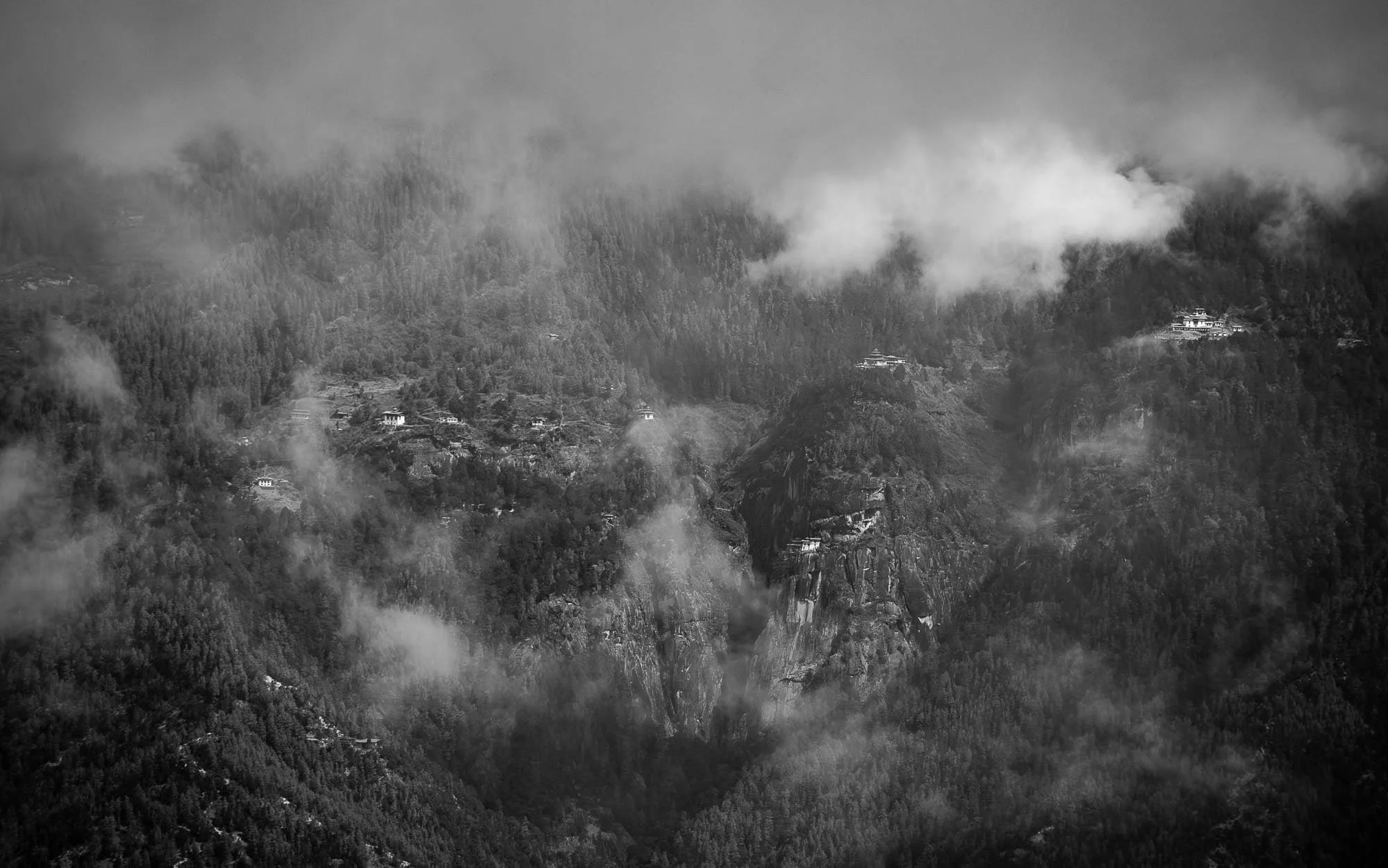
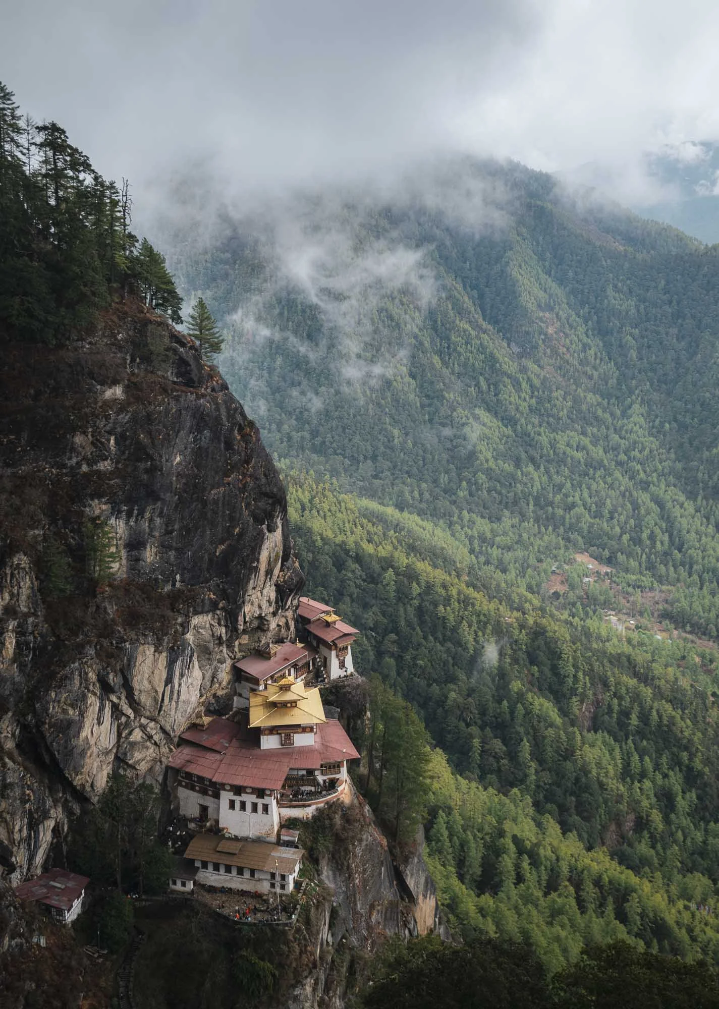
As the clouds opened up for a brief moment, my driver pointed at something in the opposite mountains I didn’t expect to see from here: Bhutan’s most famous sight, at a distance of what I suspect must be 20km or so made an appearance right in the centre of this image. It would be my destination for the next morning, read on…
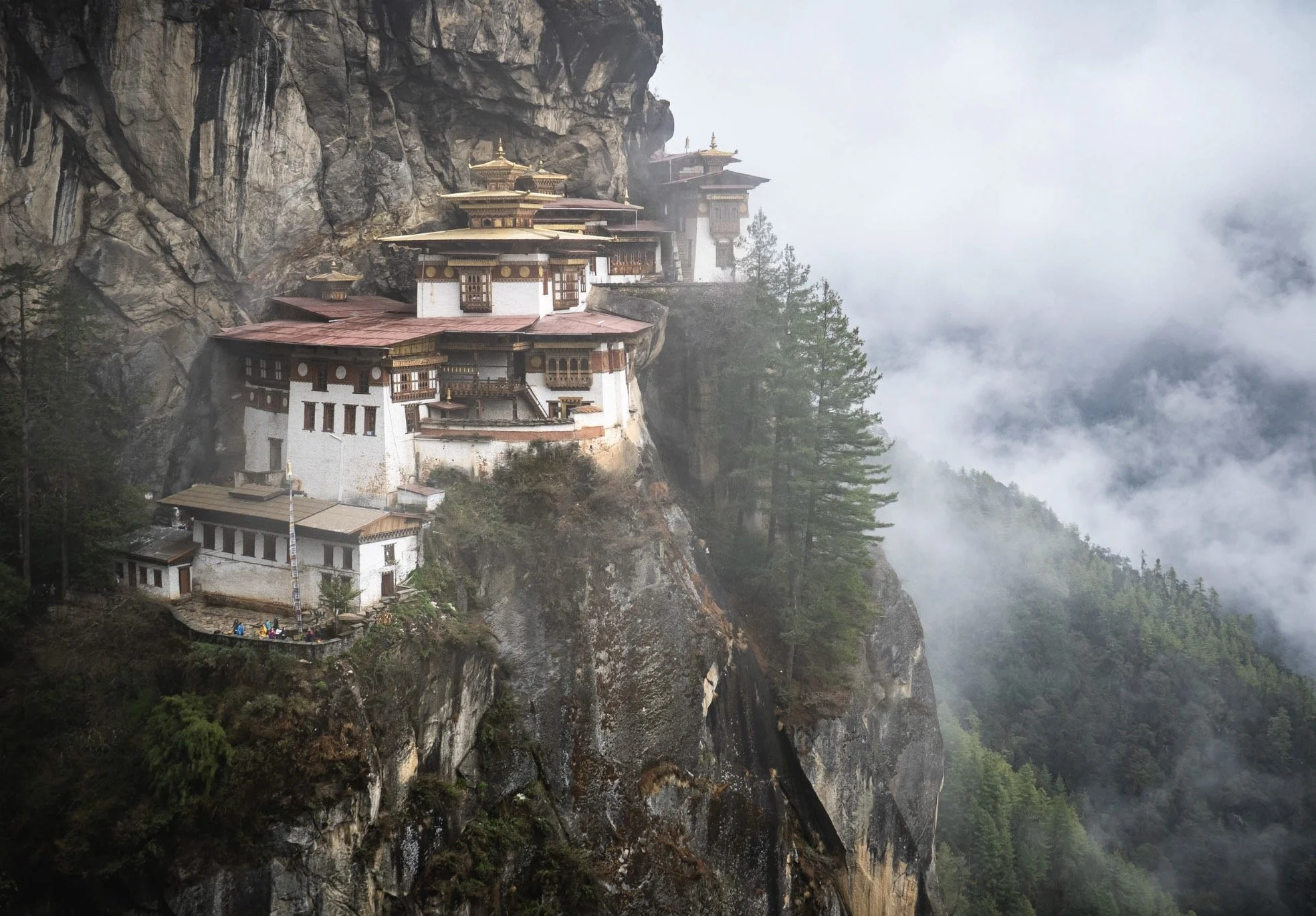
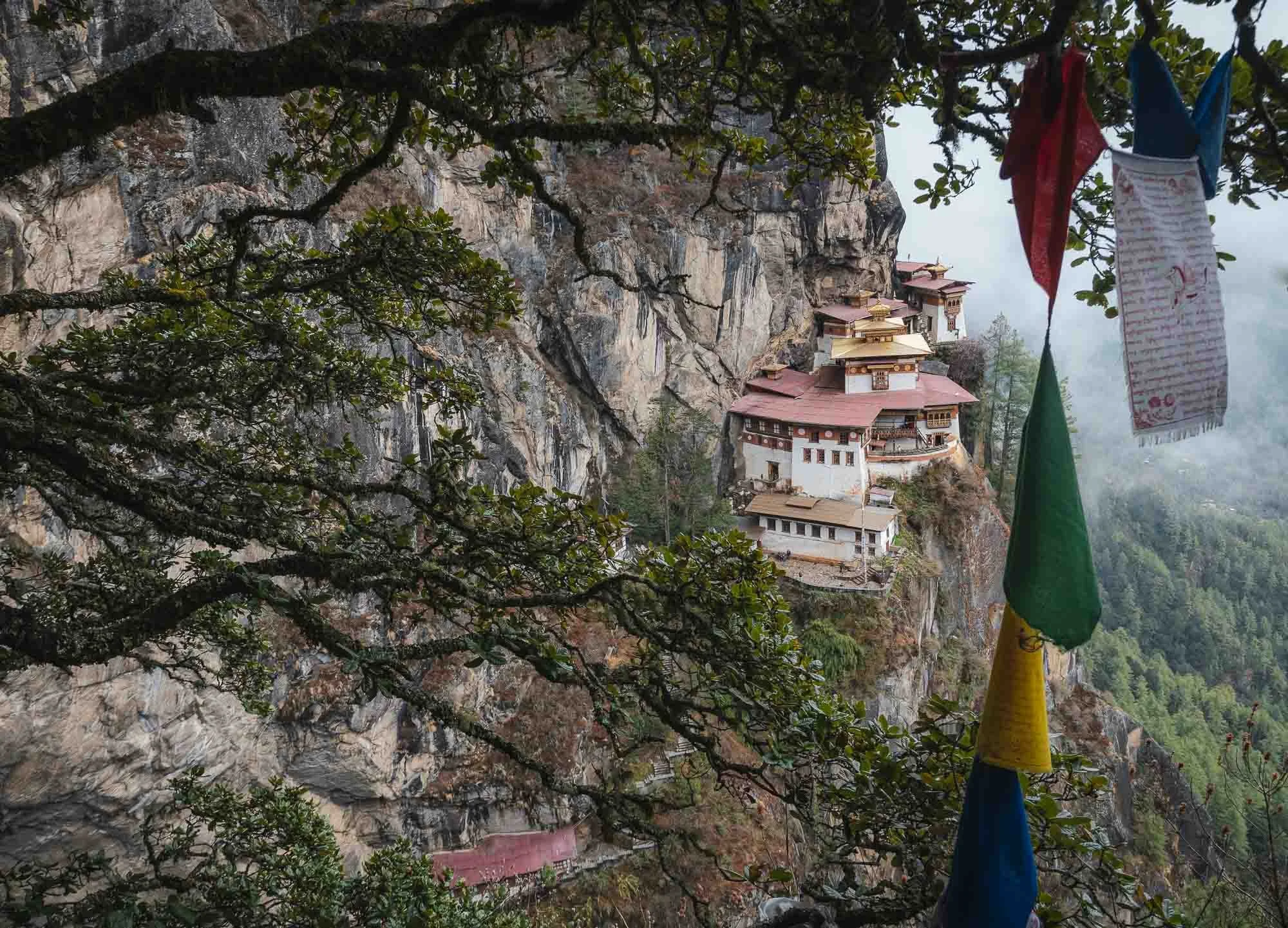
Bhutan’s Crown Jewel
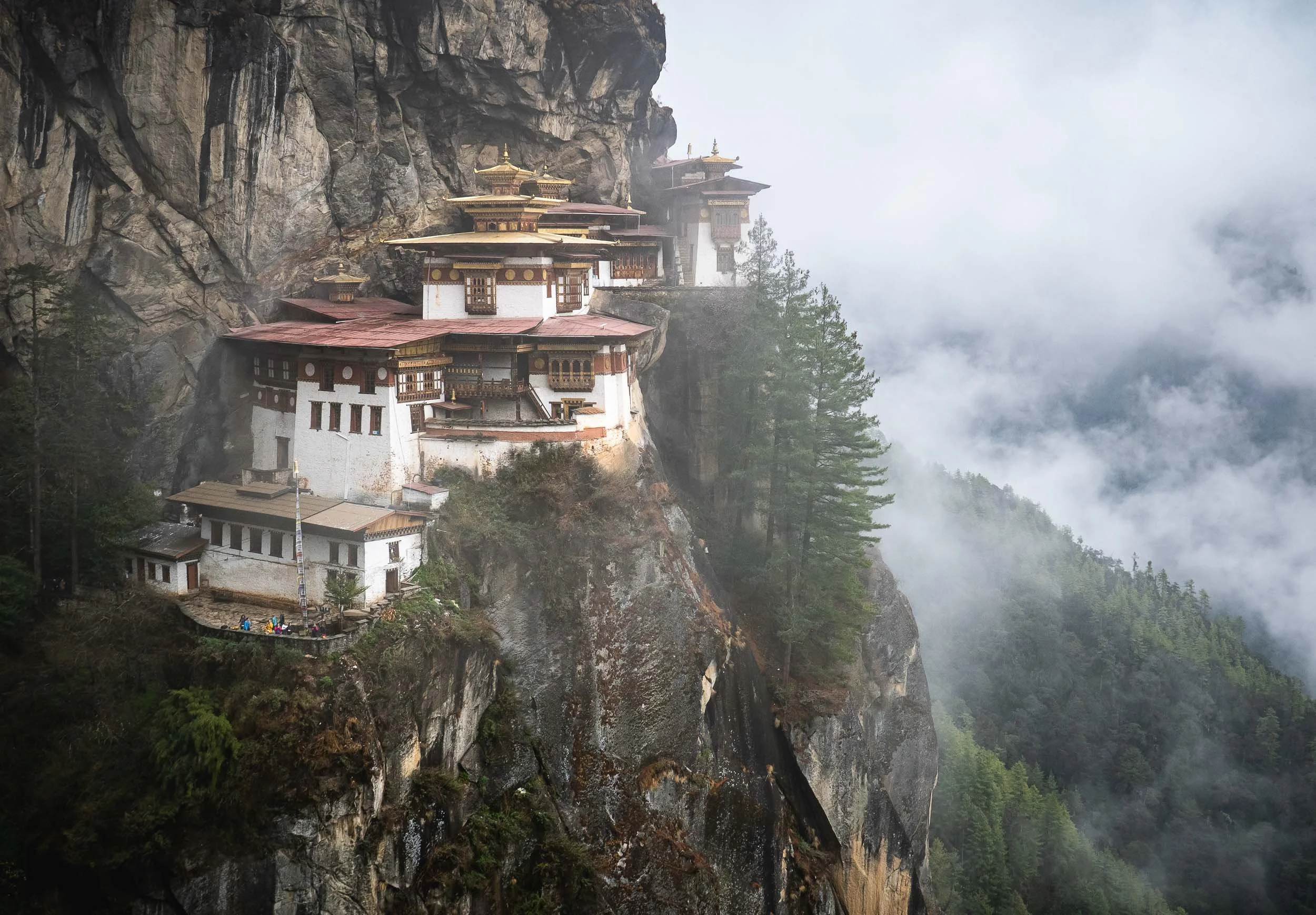
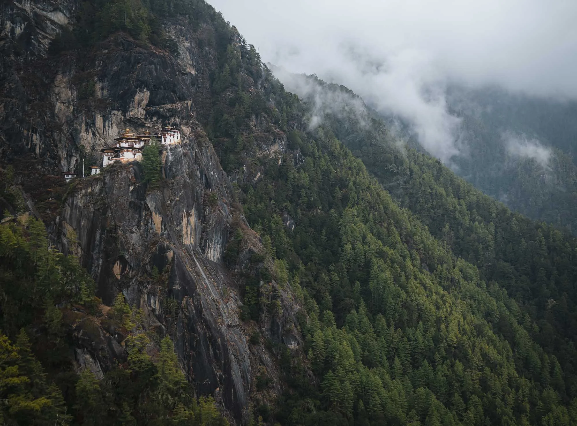
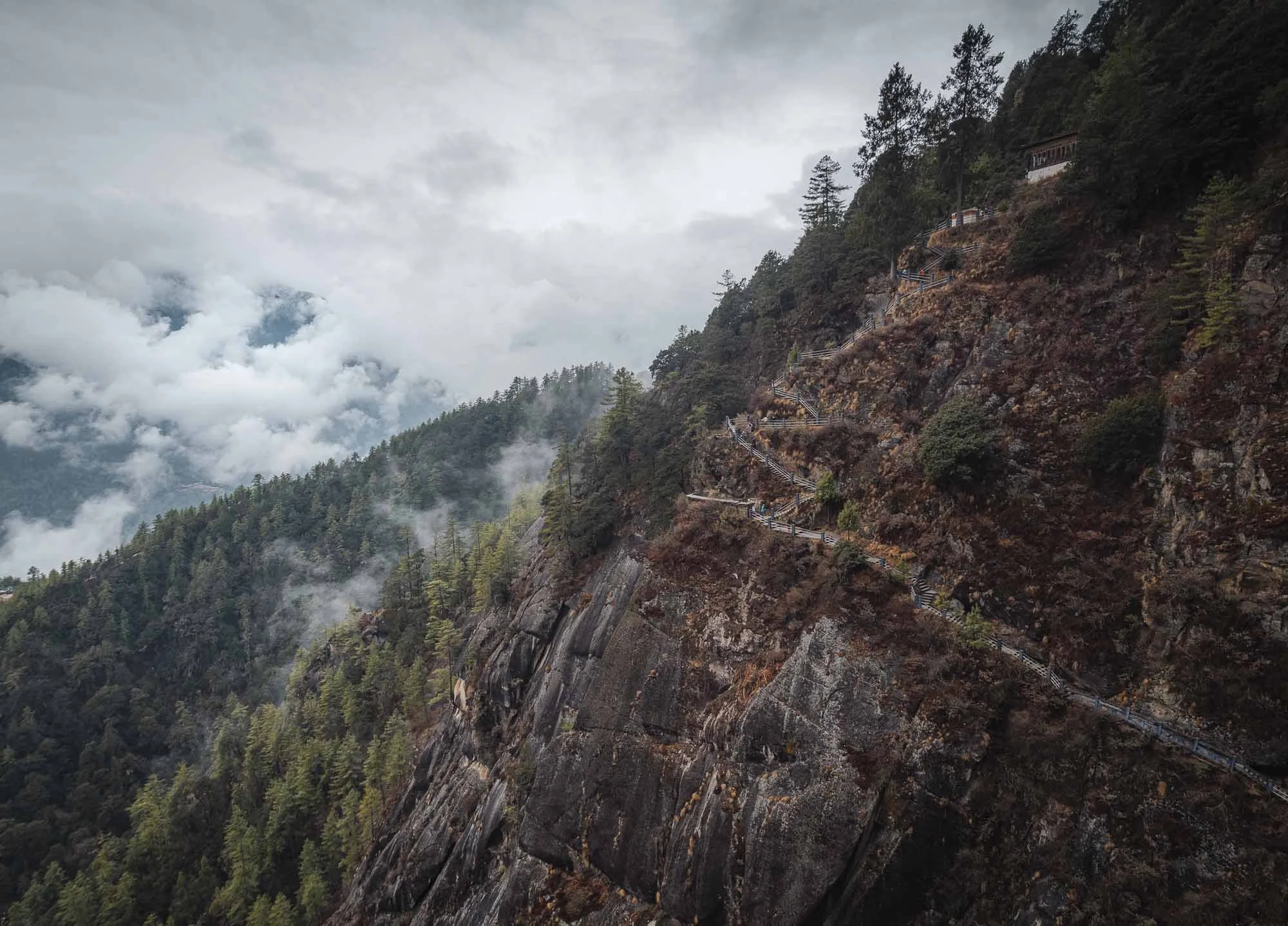
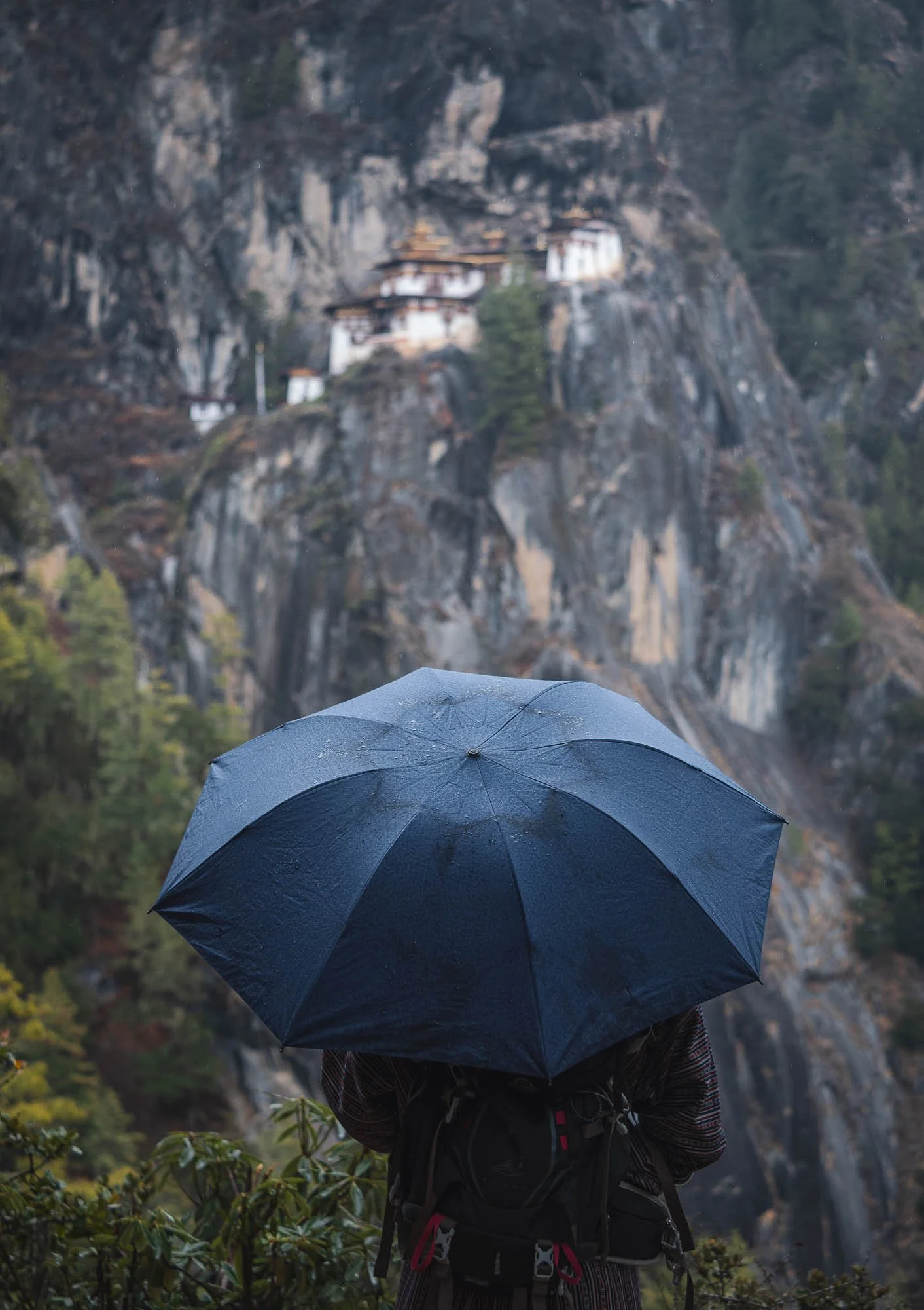
Opinions may vary on whether it’s justified (even my own mind isn’t quite so clearly settled, because I really enjoyed the Dzongs), but one thing is undoubtedly true: the so-called Tiger’s Nest monastery is Bhutan’s most iconic sight, and it doesn’t disappoint. We set off very early in the morning for the 30min drive to try and beat the crowds, but frankly speaking, no place I’ve visited in Bhutan felt particularly busy (sometimes it was the opposite). The same was true here as well, despite a few buses in the parking lot and some groups making their way up the trail.
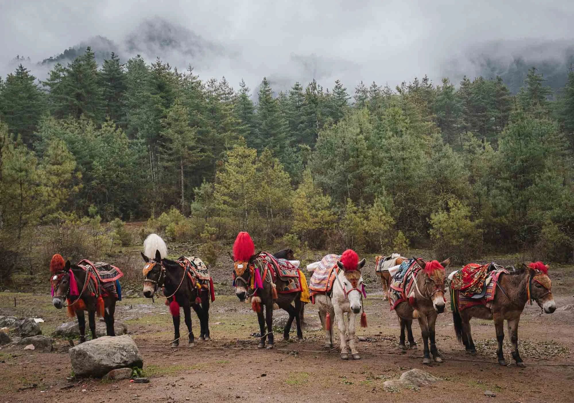
Speaking of the trail, to reach the cliffside monastery requires about 2-3h of hiking, depending on your speed and the amount of breaks you take. Part of it can be done by horses waiting at the bottom, but the second half has a few steeper elements, culminating in a lot of stairs at the end, so you won’t escape a little bit of physical exercise. Nothing extreme, but not a relaxed walk either, especially given the monastery’s altitude of 3,120 metres.
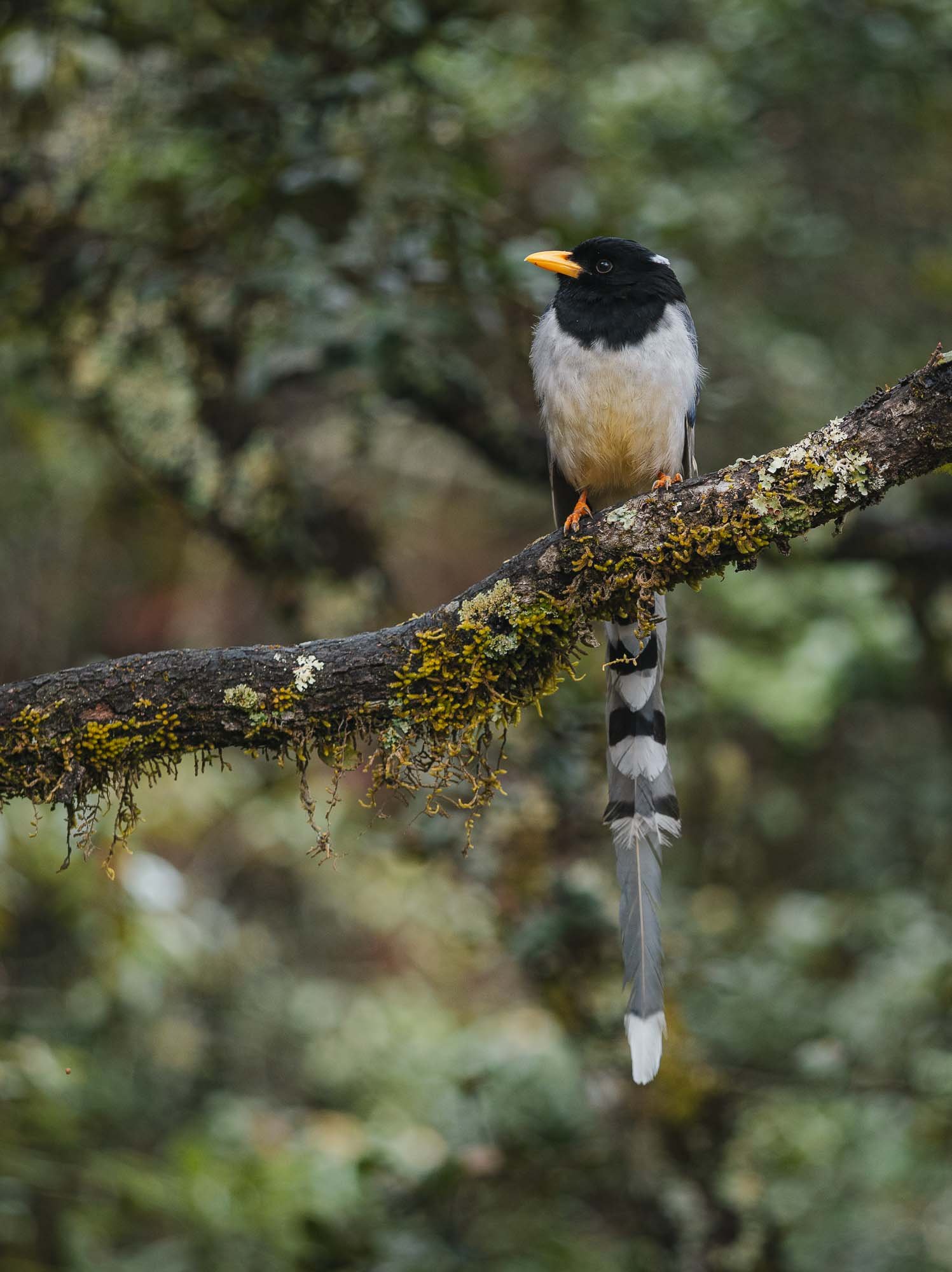
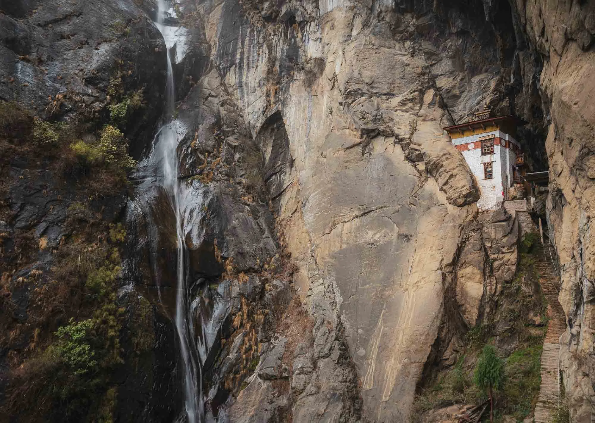
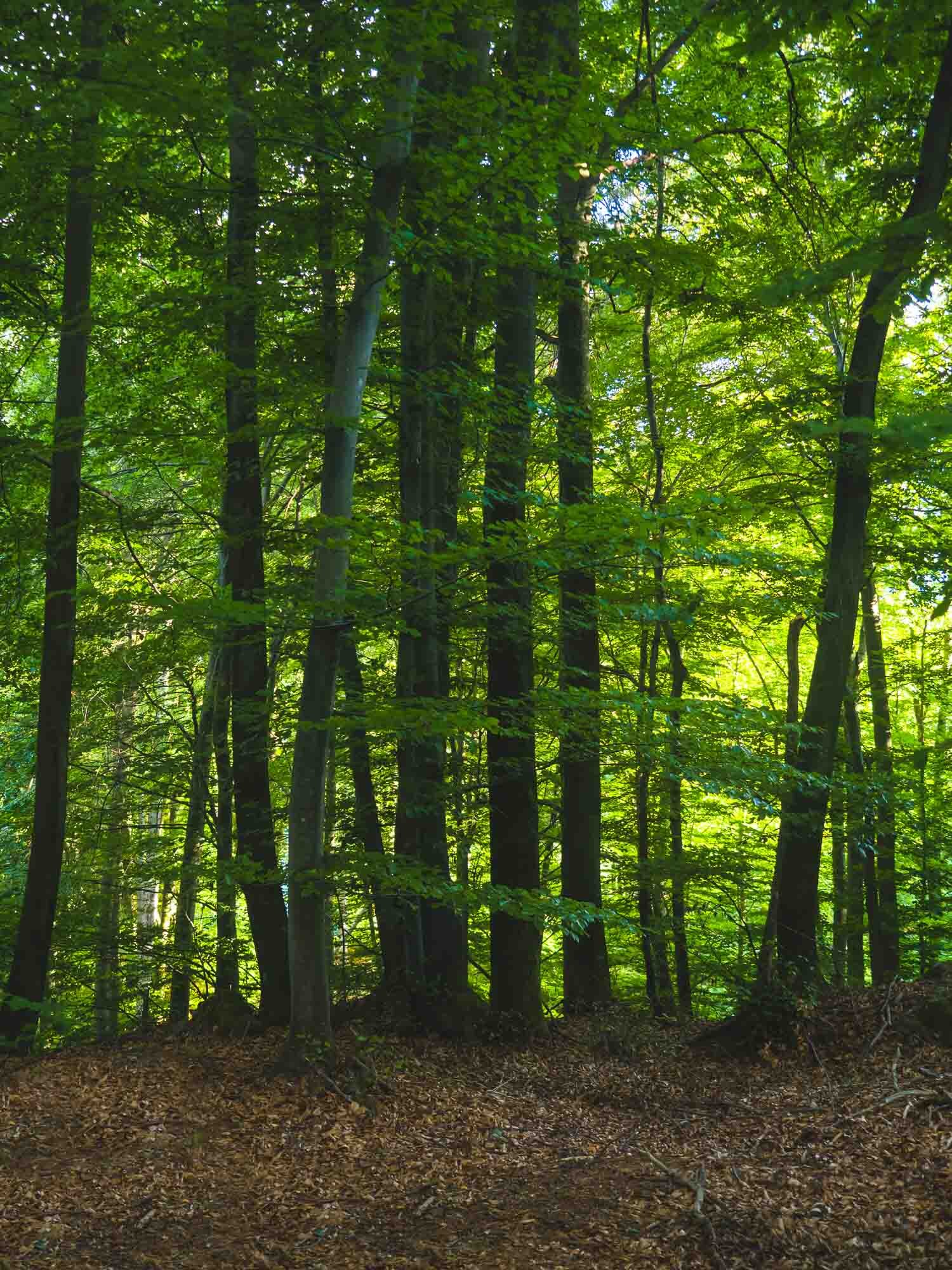
It’s worth it though, not only for the final destination, but also the forest, its inhabitants such as the beautiful magpies, and smaller temples and waterfalls on the way.
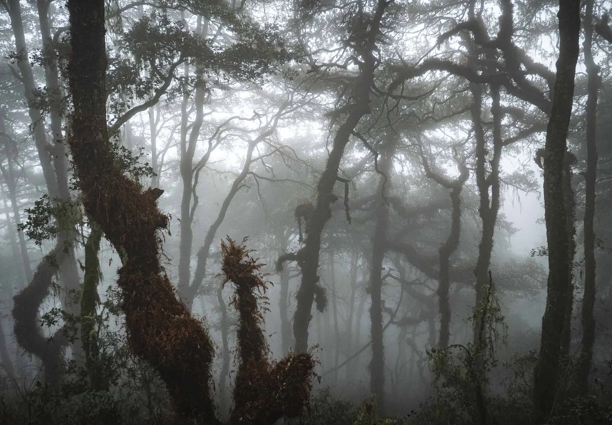
As we left in the morning I was a little afraid it would rain, but also had hope that the moody clouds would hang around and create a mysterious atmosphere in the scenery, and wasn’t disappointed…
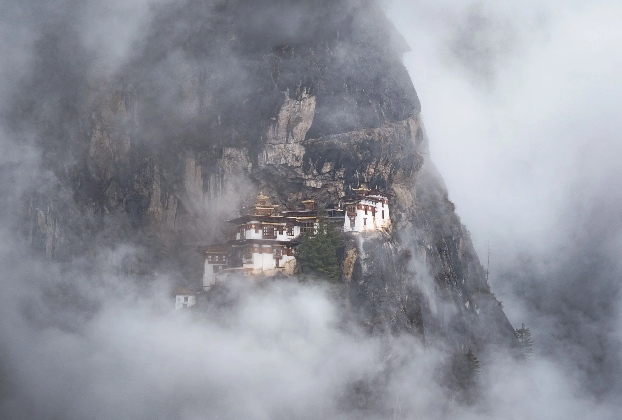
Even though the monastery was was occasionally completely covered in clouds, as is often the case, with a bit of patience conditions that wouldn’t generally be considered ideal produce some of the more intriguing and less common photos - I still want to see it in the snow one day as well though!
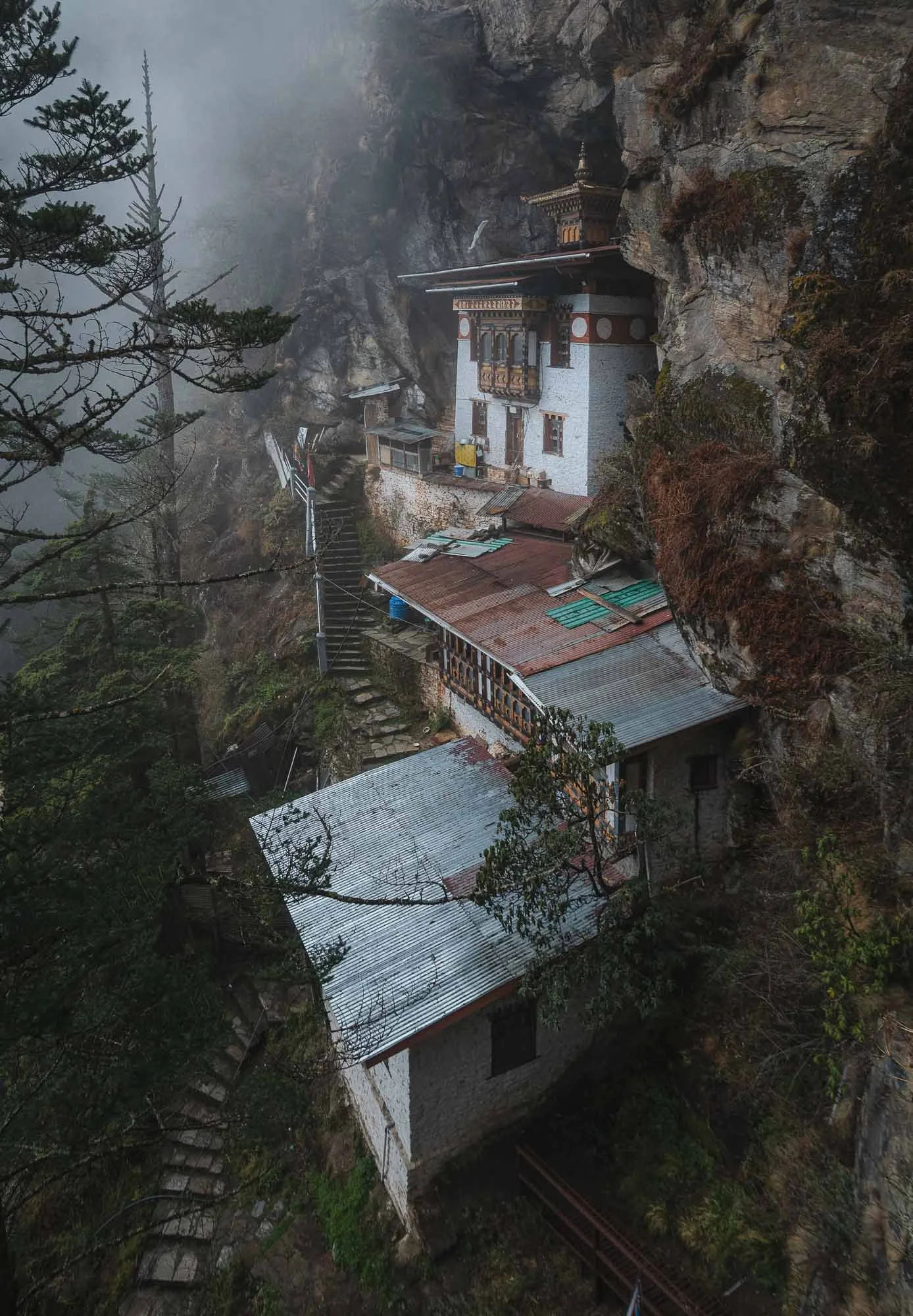
The complex actually consists of several main temples and residential shelters adapted into the rocky terrain. It was restored in 2005 after (you know the story by now) a fire broke out in 1998.
The monastery was originally started more than 300 years ago, and marks the site where Guru Rinpoche is said to have meditated in the 8th century after arriving on the back of a tigress (hence the colloquial term Tiger’s Nest - its actual name is Paro Taktsang), establishing Buddhism in the region. This makes it one of the most important religious sites in the country. Once you arrive, visitors need to lock away their cameras and phones and are searched before entering the interior courtyard and various temples holding some of Bhutan’s most sacred artifacts.
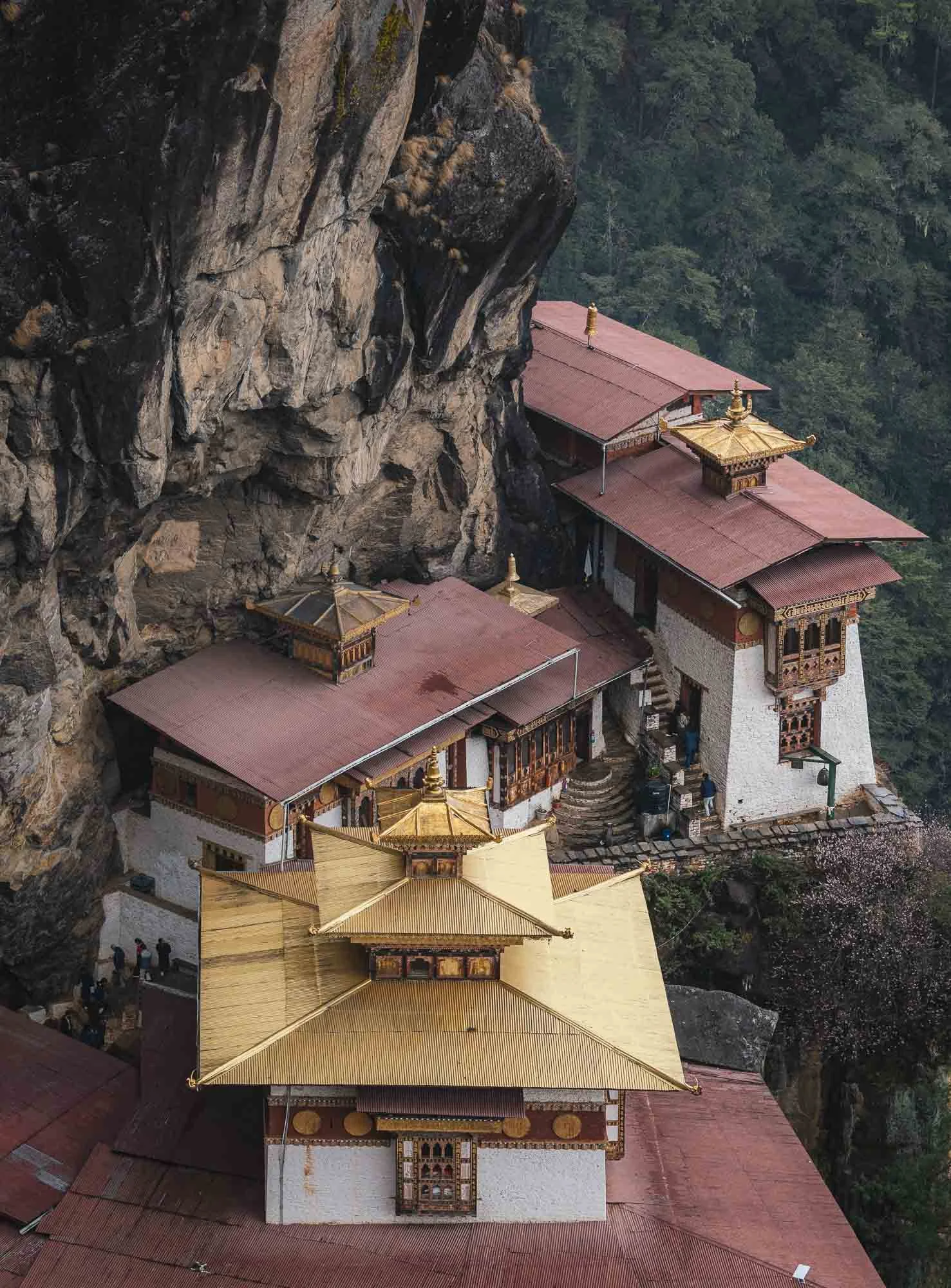
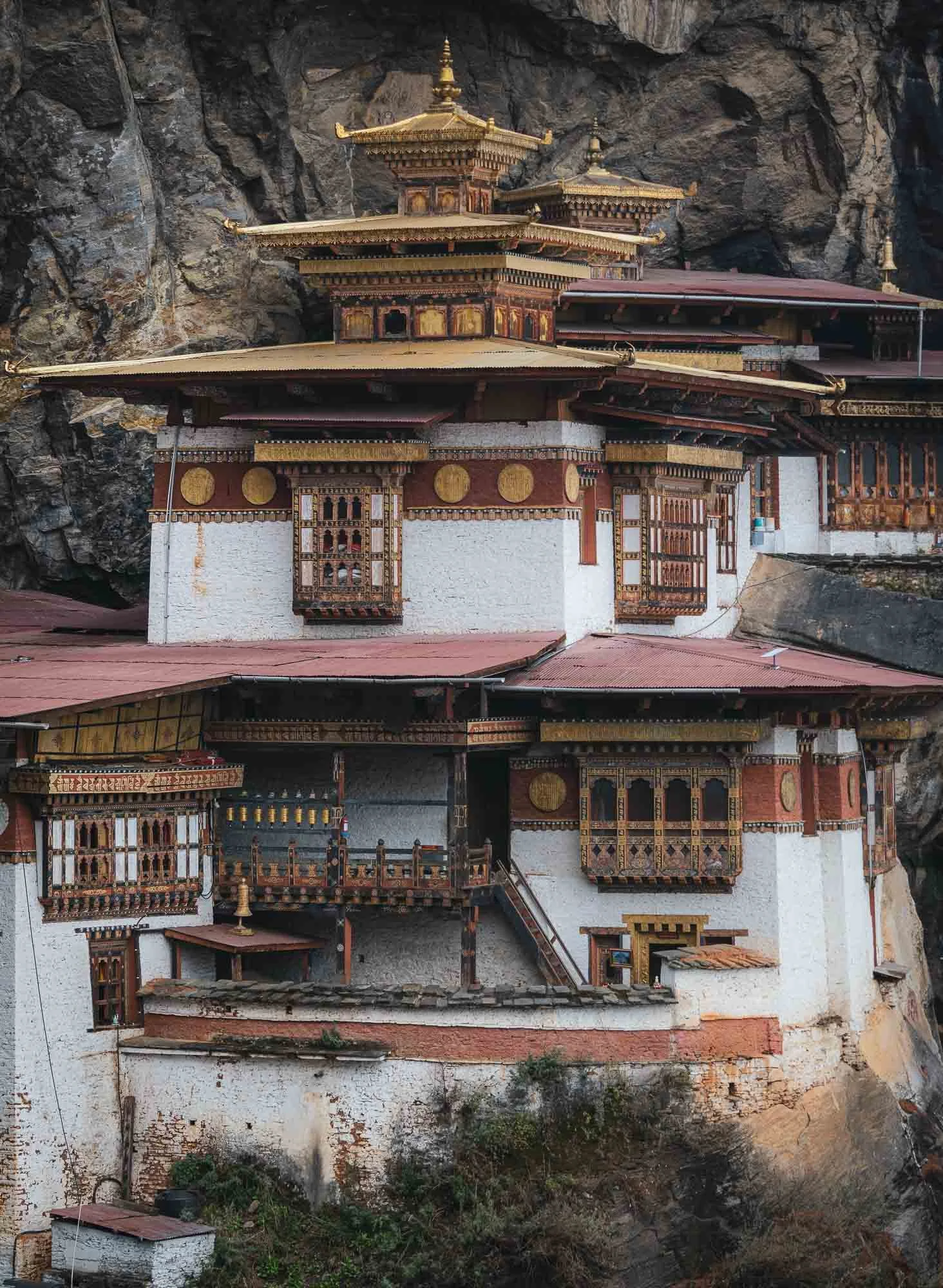
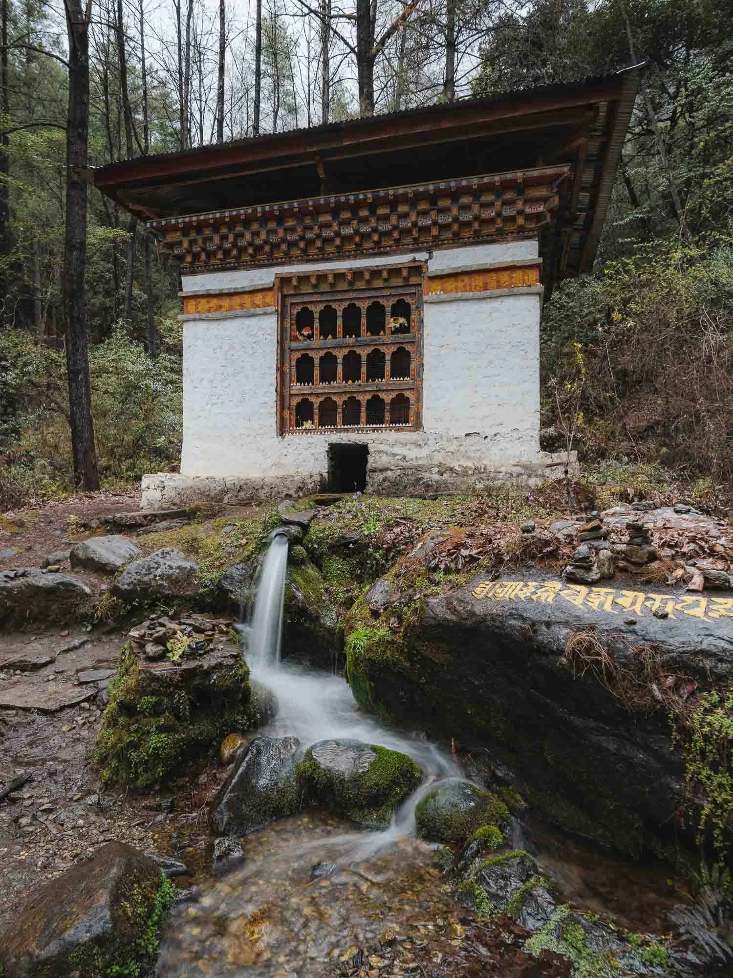
Looking backwards from the monastery you can see the tall waterfalls on the right with a small shrine embedded into the bedrock, and the stairs along the cliffs on the left. My guide told me that when he first came to Tiger’s Nest a few decades ago, accessing it required a bit more questionable climbing than nowadays.
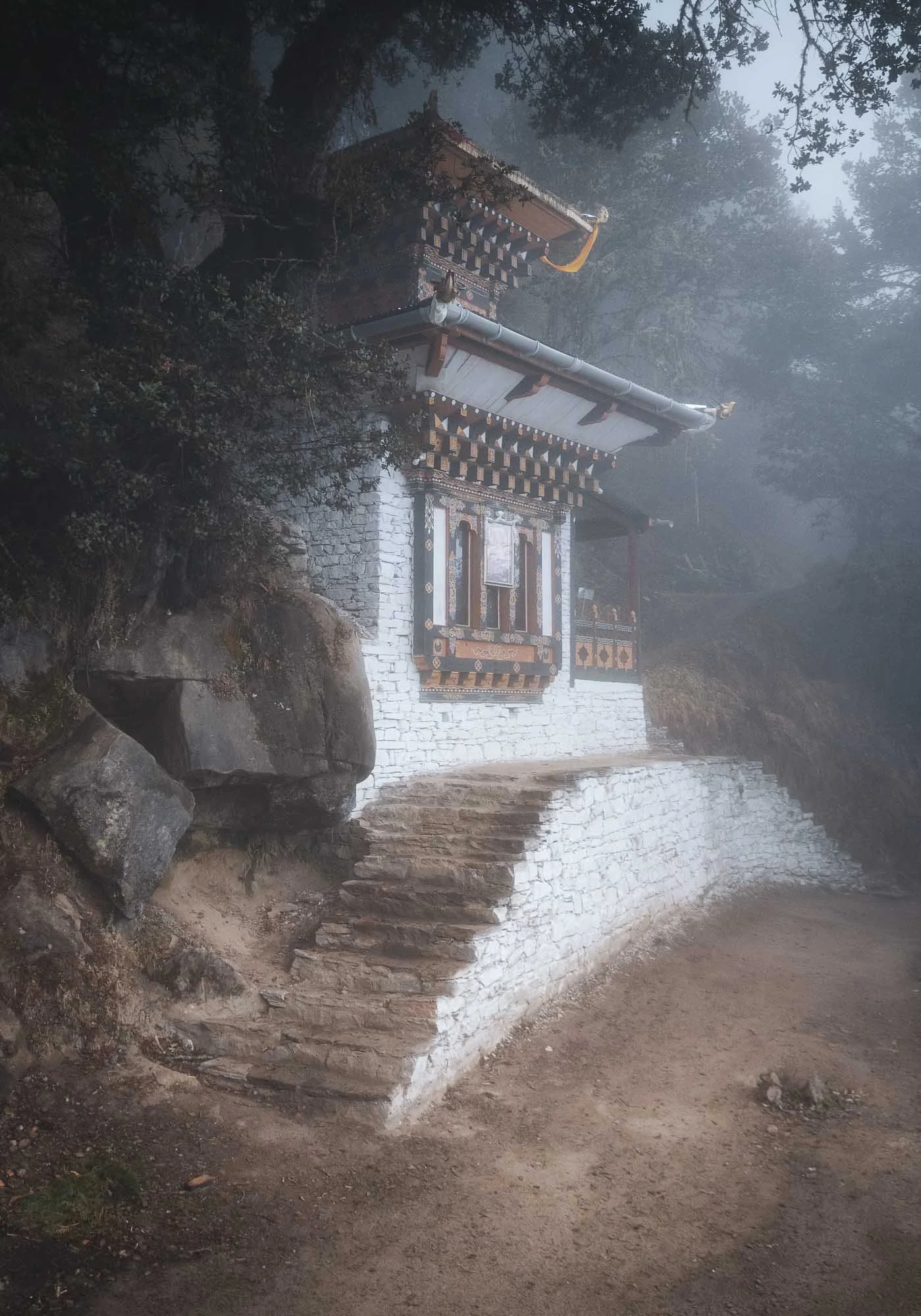
After all those stairs you’d be forgiven for just wanting to head back down, but it’s worth to continue the climb a little higher, where several more important religious spots and temples await.
Throughout the entire hike there are several viewpoints along the way if you keep your eyes open - a few more angles below.
If you look back at the photo from Chele la pass, you’ll see that Tiger’s Nest is not as isolated as it may first seem, in fact it’s accessible from multiple places and surrounded by several more structures featuring the consistent local architectural style.
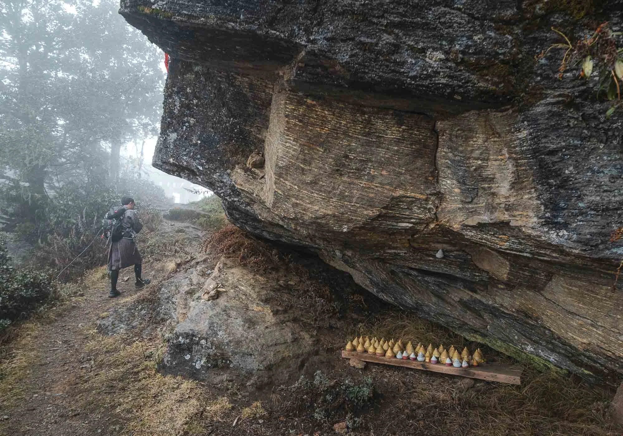
Despite this, not many people seem to make their way further up, possibly because the path is a lot rougher here and features a few questionable metal ladders. We were the only people as we arrived at the Zangdok Pelri temple.
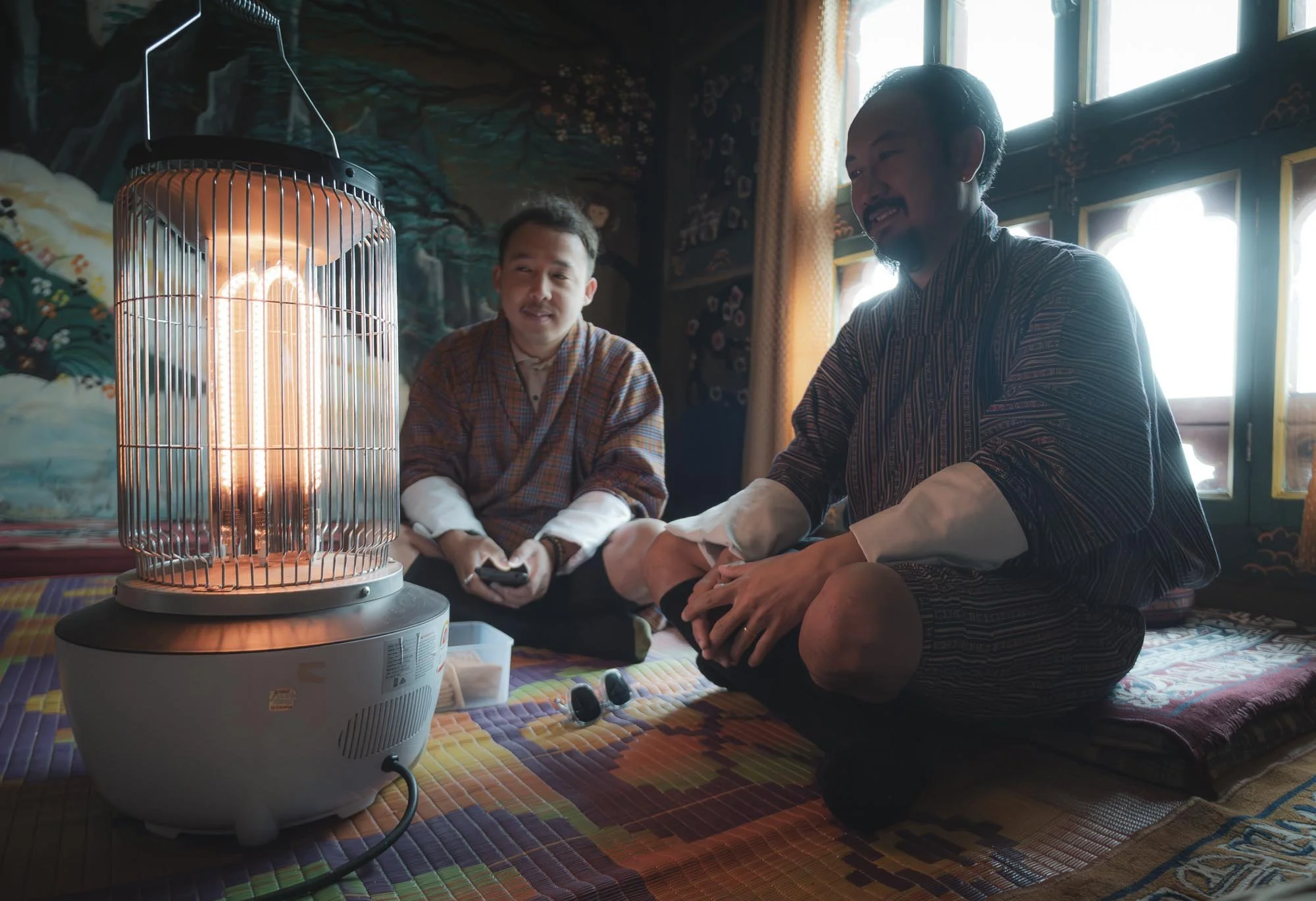
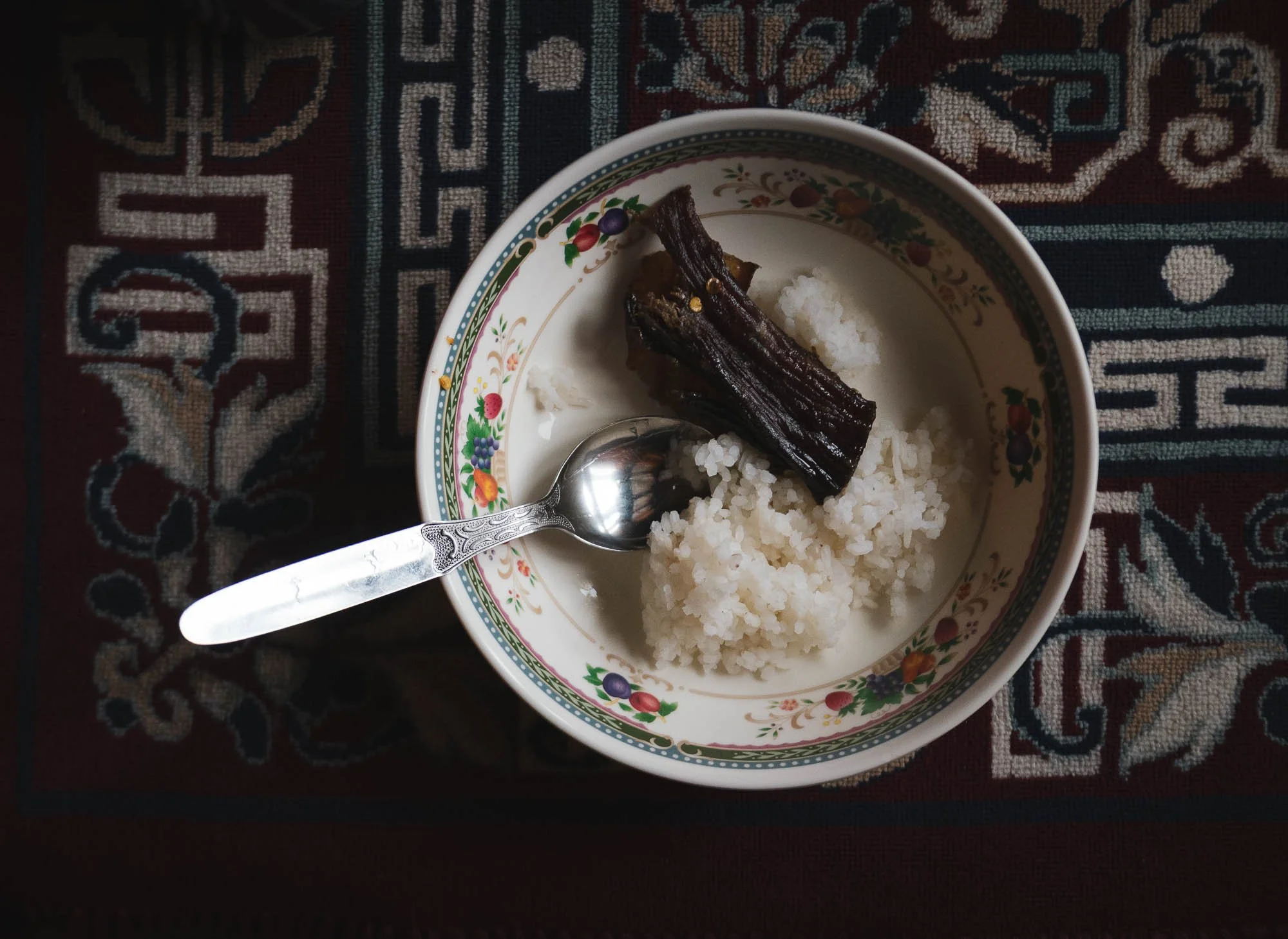
Shortly after, the clouds and some rain caught up with us - luckily the resident lama (a respected monk teacher) who is staying here for several months to perform rituals, let us into his cabin, offering some heat and food that local ladies had brought for him the day before. No chance I could eat it and live to see the next day 🌶️🥵, but Chencho and Nima enjoyed themselves.
We left shortly after - with quite a few photography breaks and the extra temples beyond the monastery, and lunch at the little cafe on the way down, it took a total of a very worthwhile six hours from start to finish.
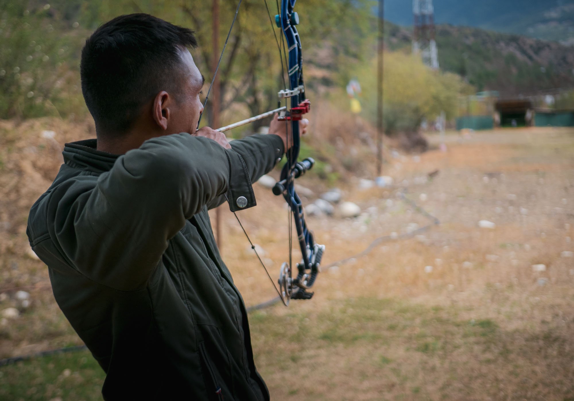
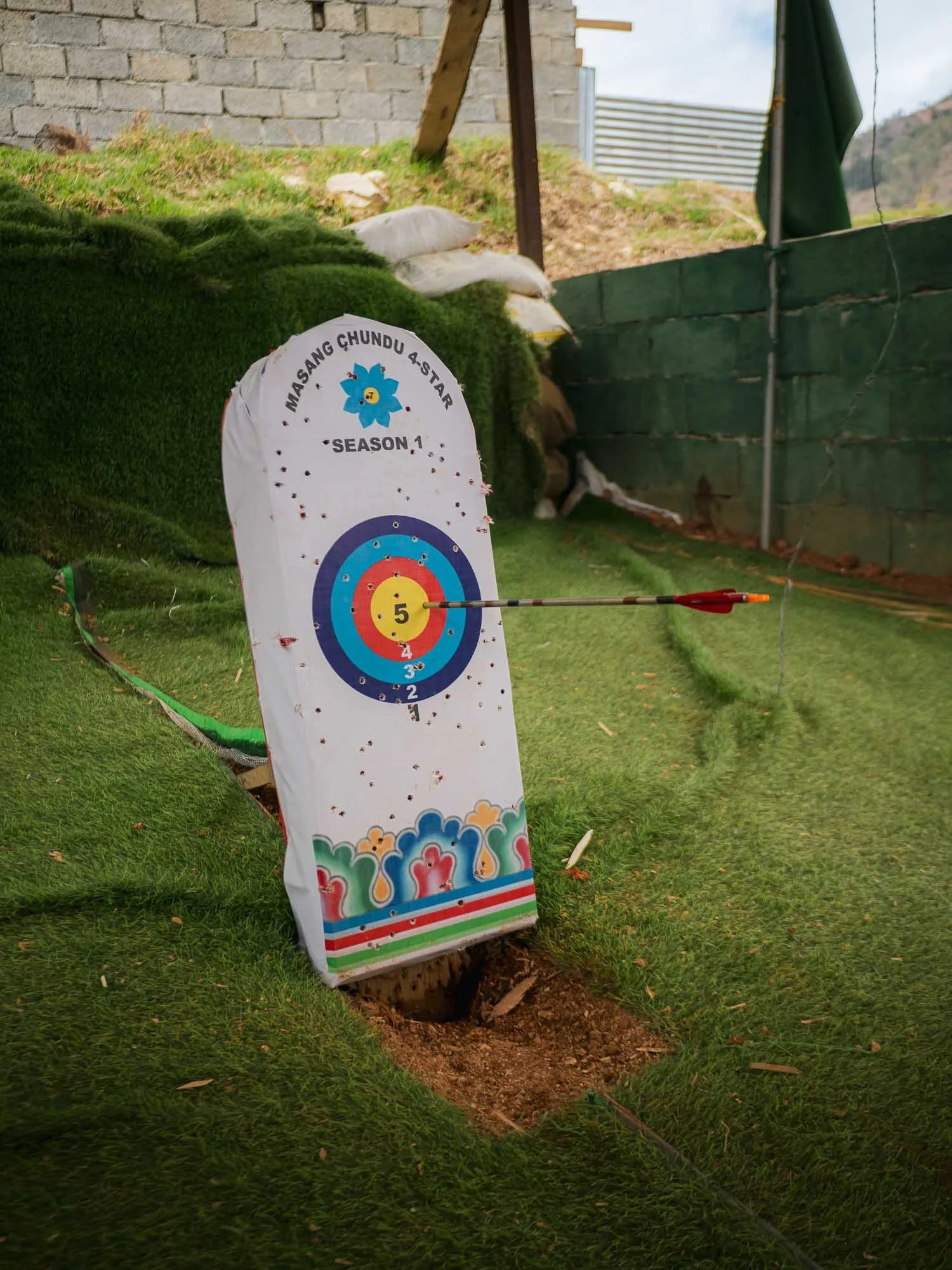
Driving back, we passed a group of people performing Bhutan’s national sport: archery. But here, it comes with a twist. Traditional matches are shot from a distance of about 140-145 meters (!), that’s roughly double the Olympic distance of 70 meters. Not difficult enough? The target is even smaller, with the bullseye being just 6cm in diameter, half of the Olympic version. It’s pretty ridiculous to see this first-hand: on the left picture you can just about make out the white dot in the centre of the little wooden structure in the distance - that’s what the rings are printed on.
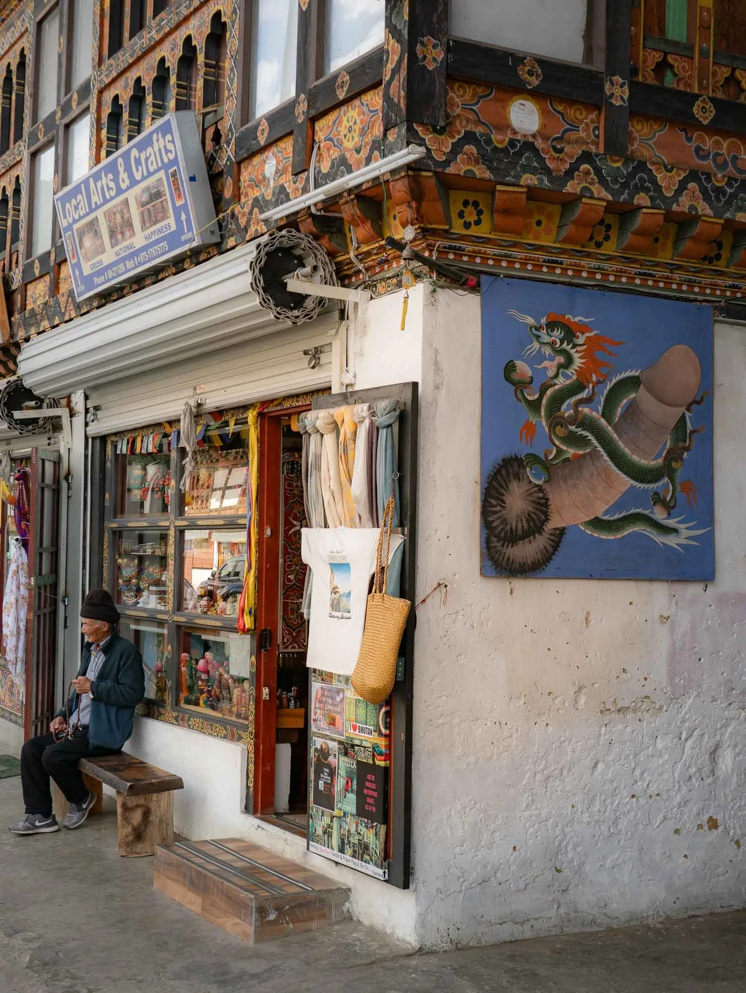
I also took a short walk through Paro - as the primary gateway into the country it’s relatively touristic, but the main street is still interesting and features the traditional architecture and symbolism, albeit mostly housing touristic shops and restaurants or cafes.
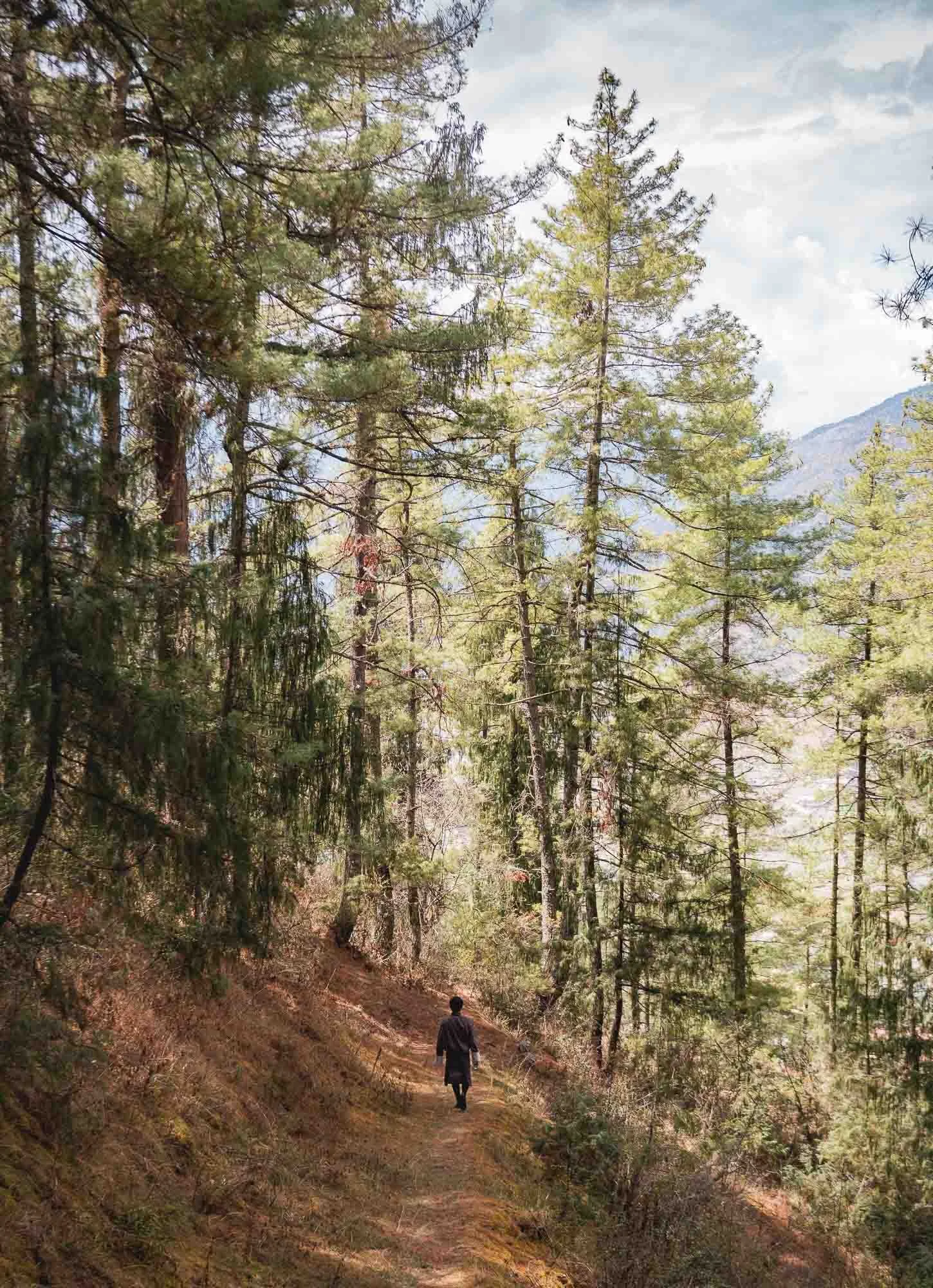
Another small hike followed through the woodlands around the city - Chencho grew up just around the corner of the Dzong, often roaming between the tall Himalayan Cypress - Bhutan’s national tree.
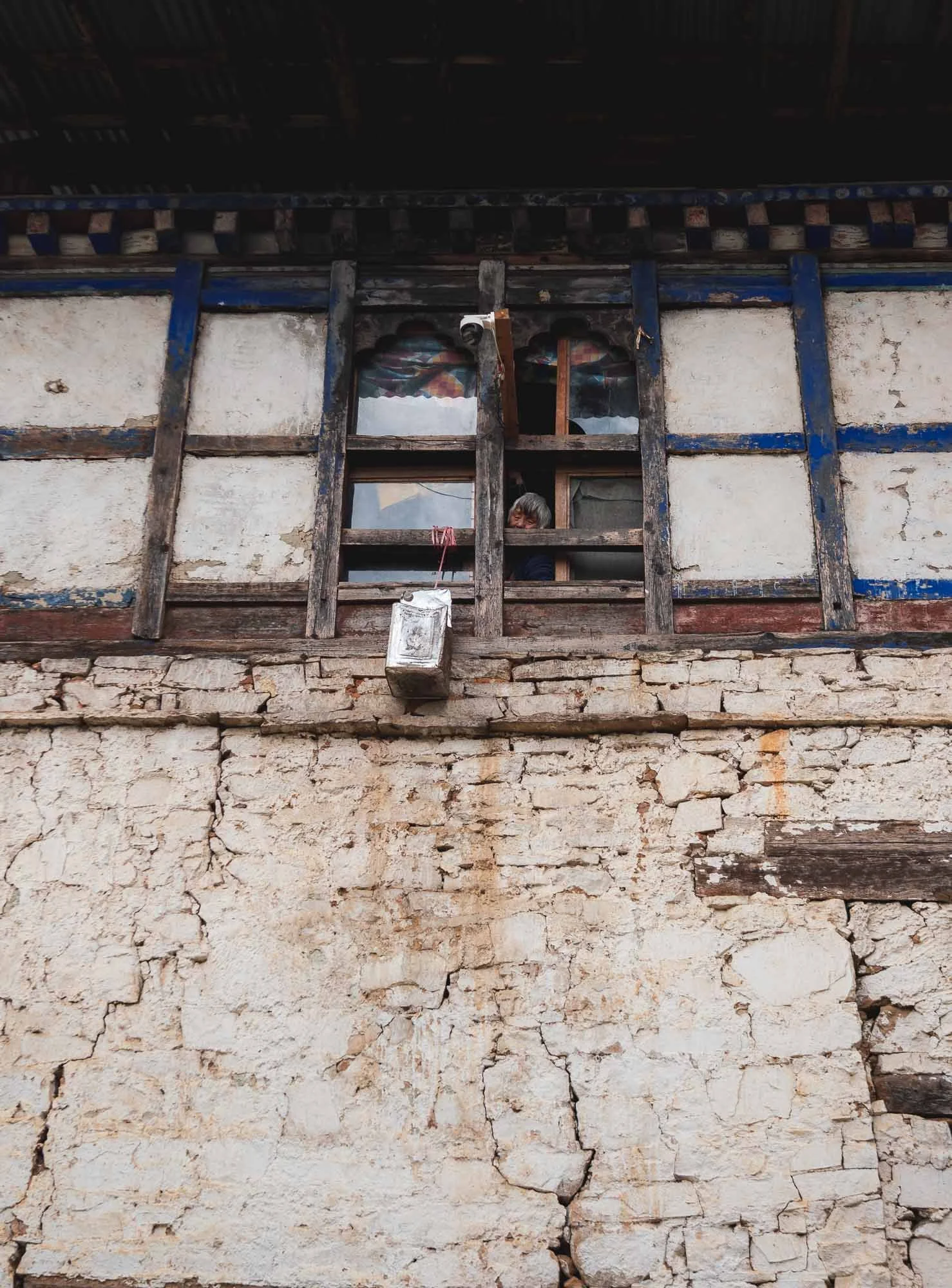
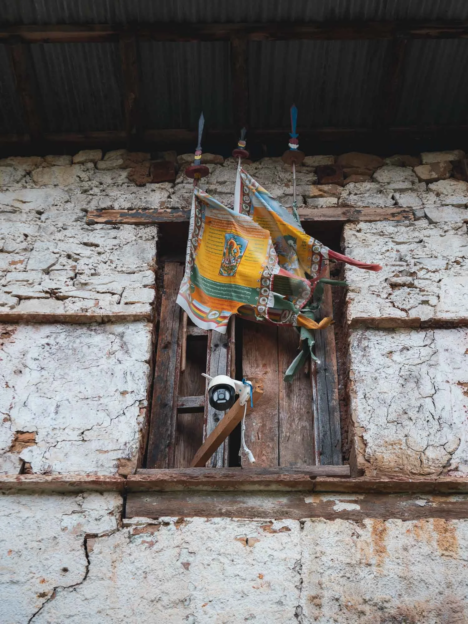
The leisurely path led to one of the oldest surviving forts in the country, said to date back to 1352, but now seemingly a mostly abandoned relic.
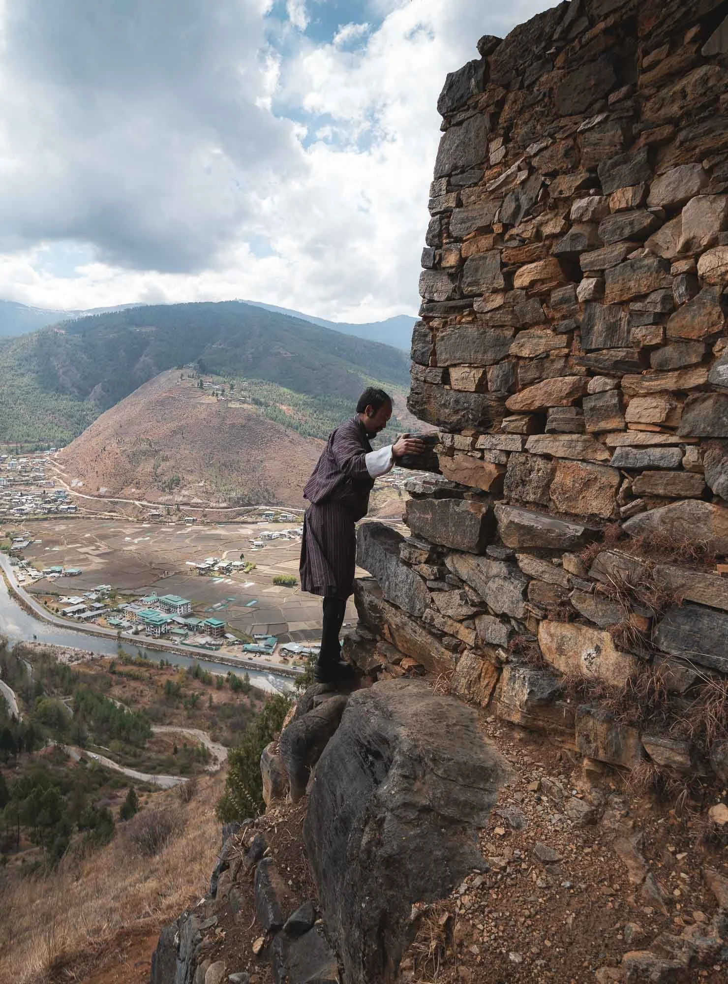
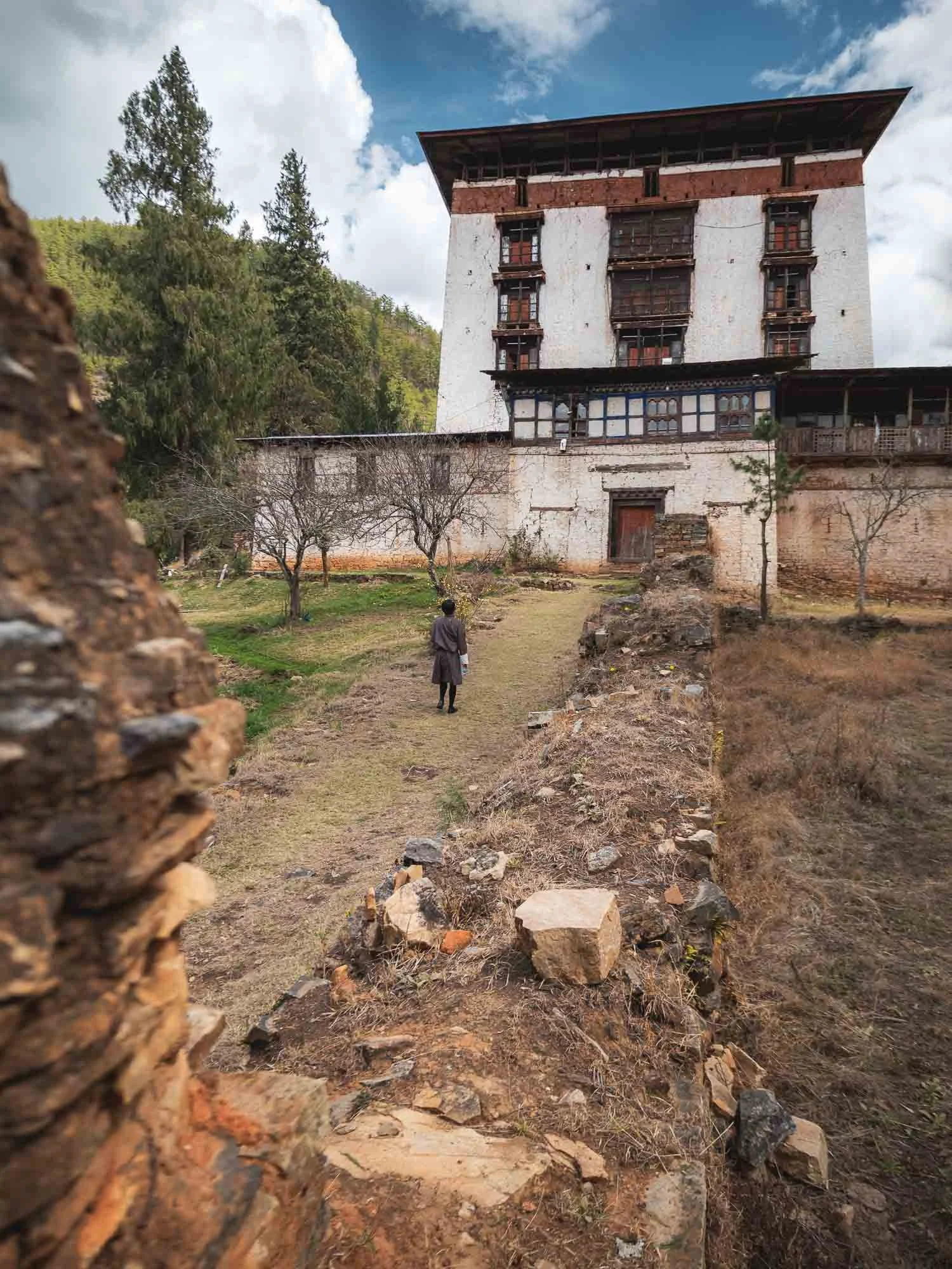
That’s not to say it is unoccupied. As we approached, I noticed a high pitched sound emanating from the building, and realised it was a motion activated camera that alerted an older lady of visitors. She promptly looked out the window to greet us but sadly the fort is not open to the public.
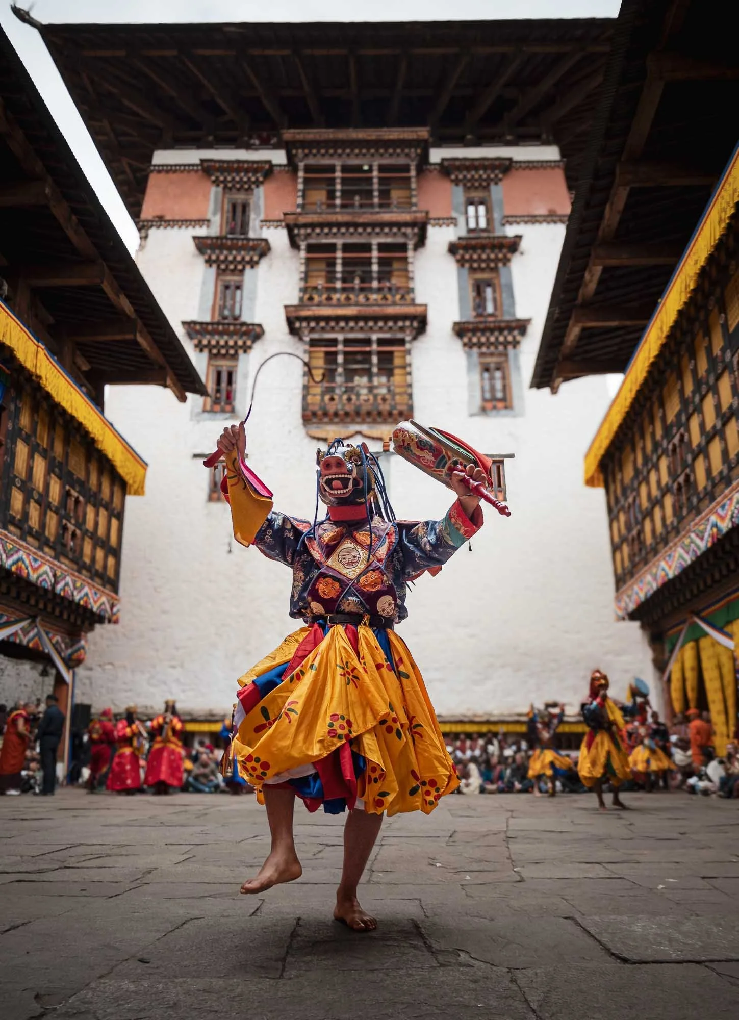
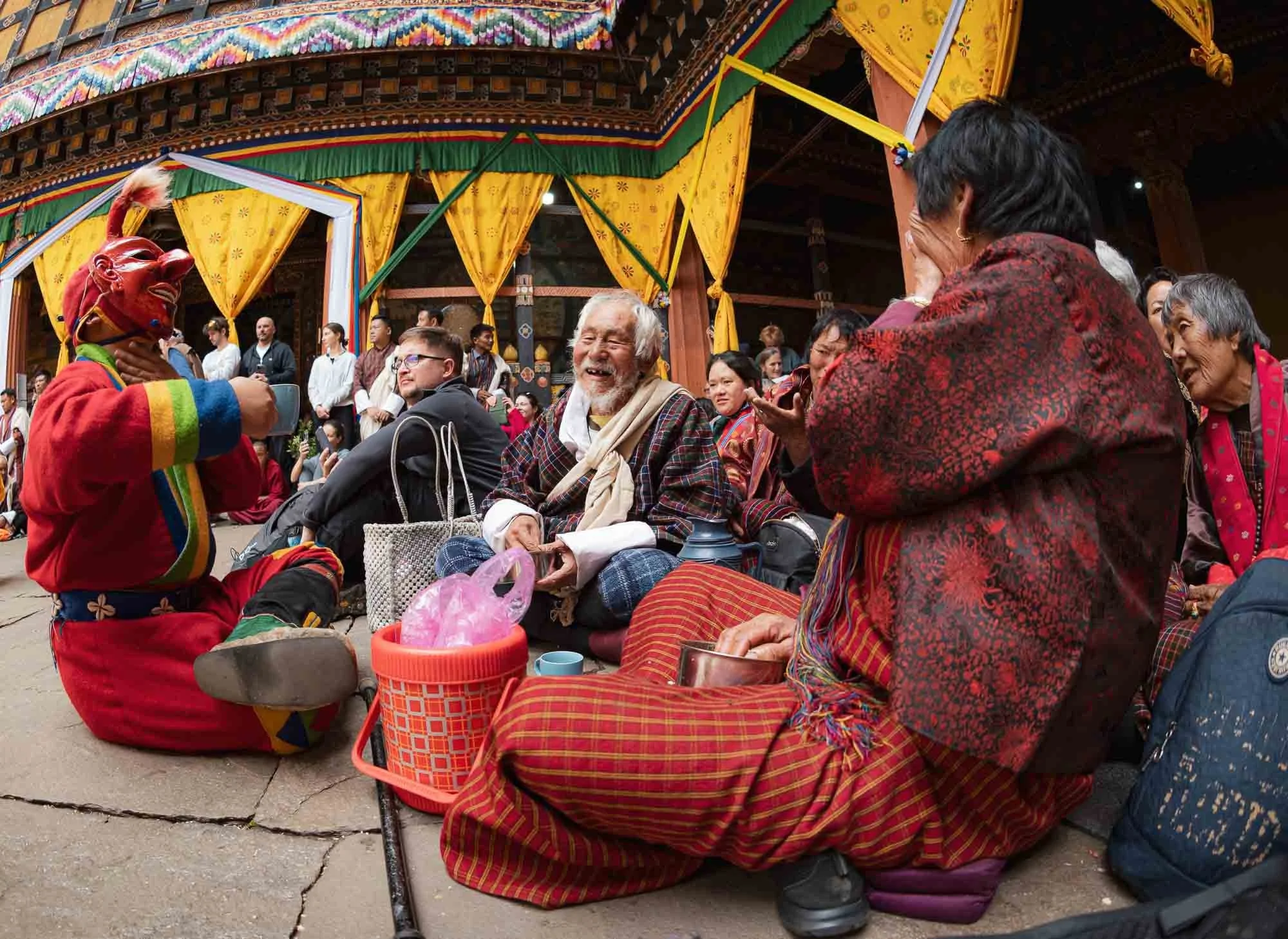
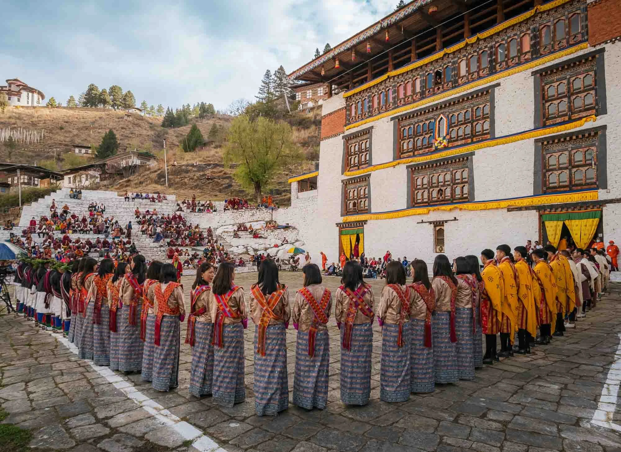
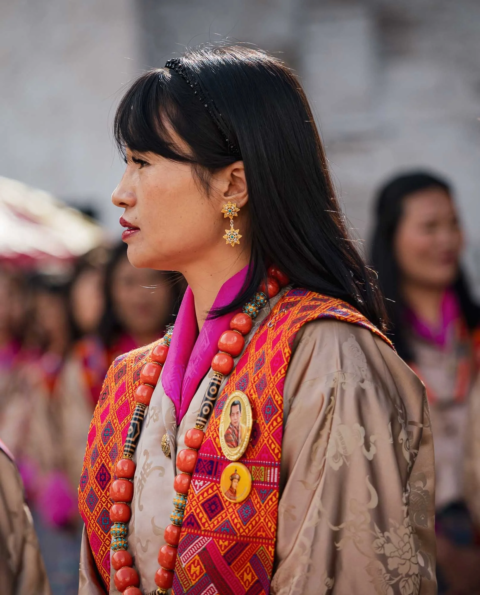
The Paro Tshechu
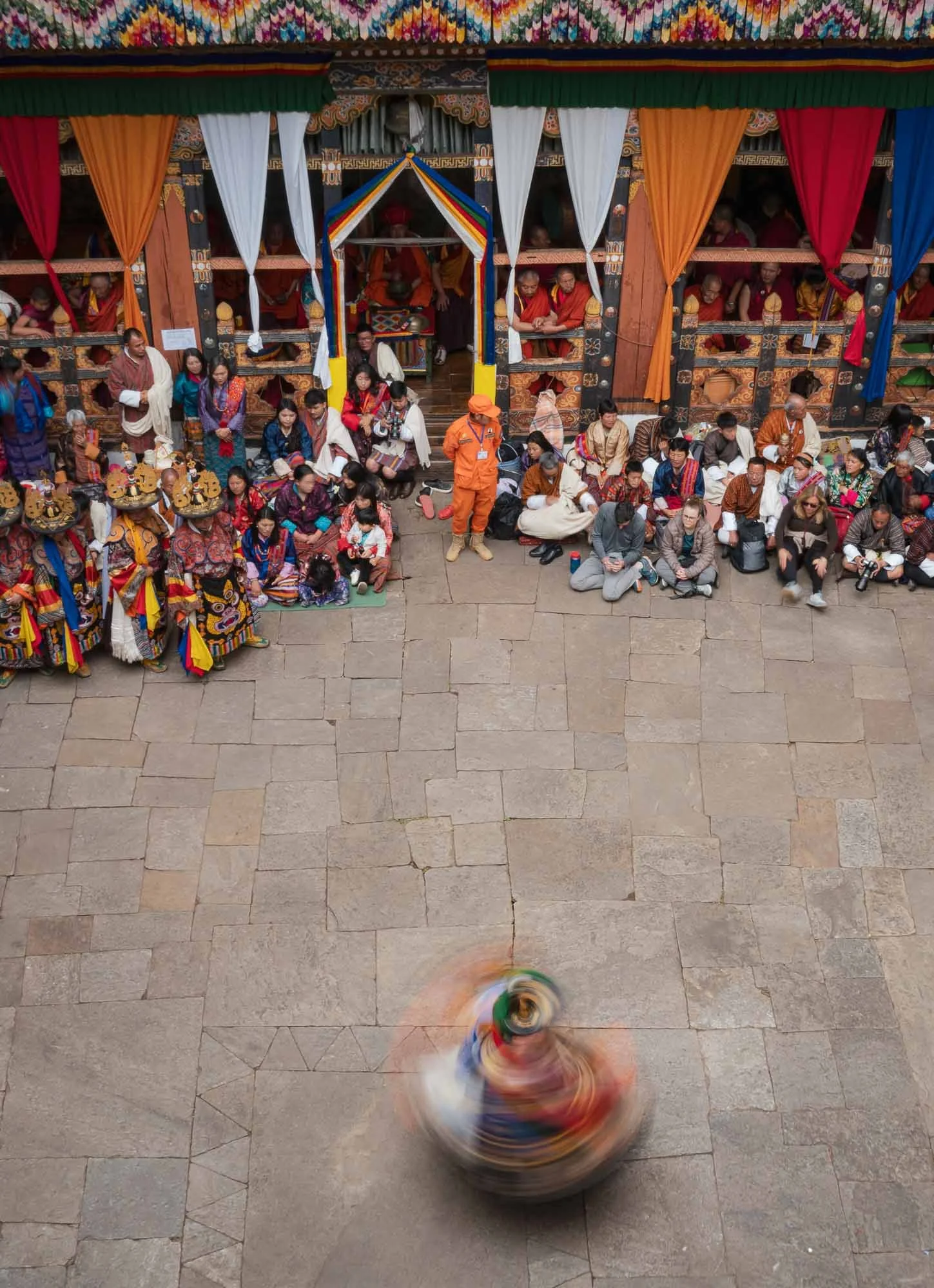
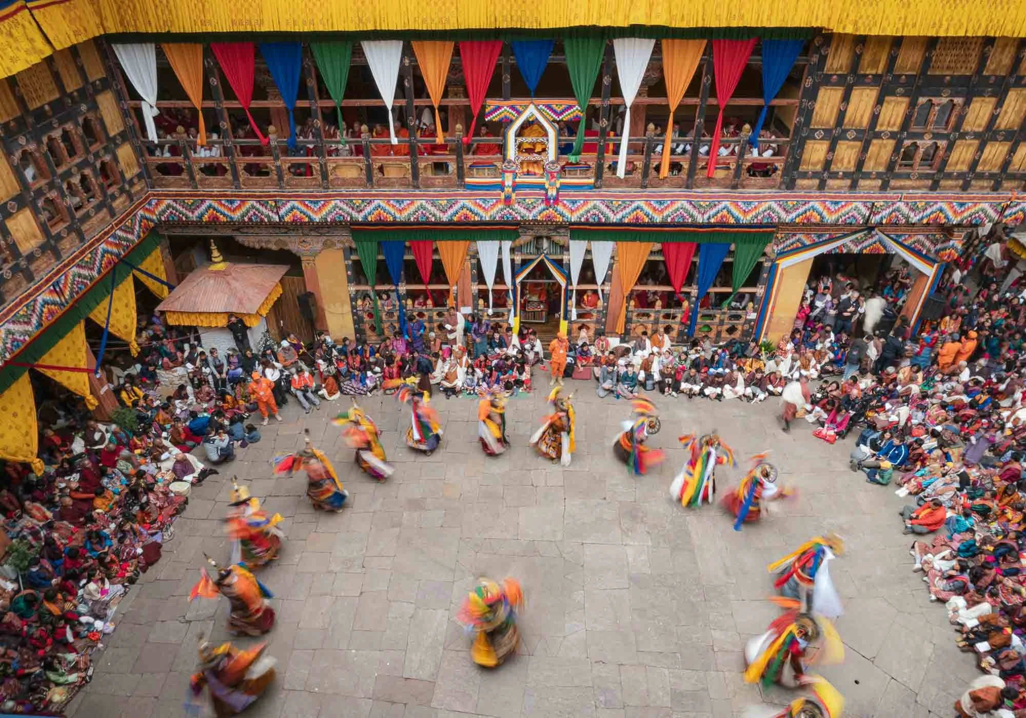
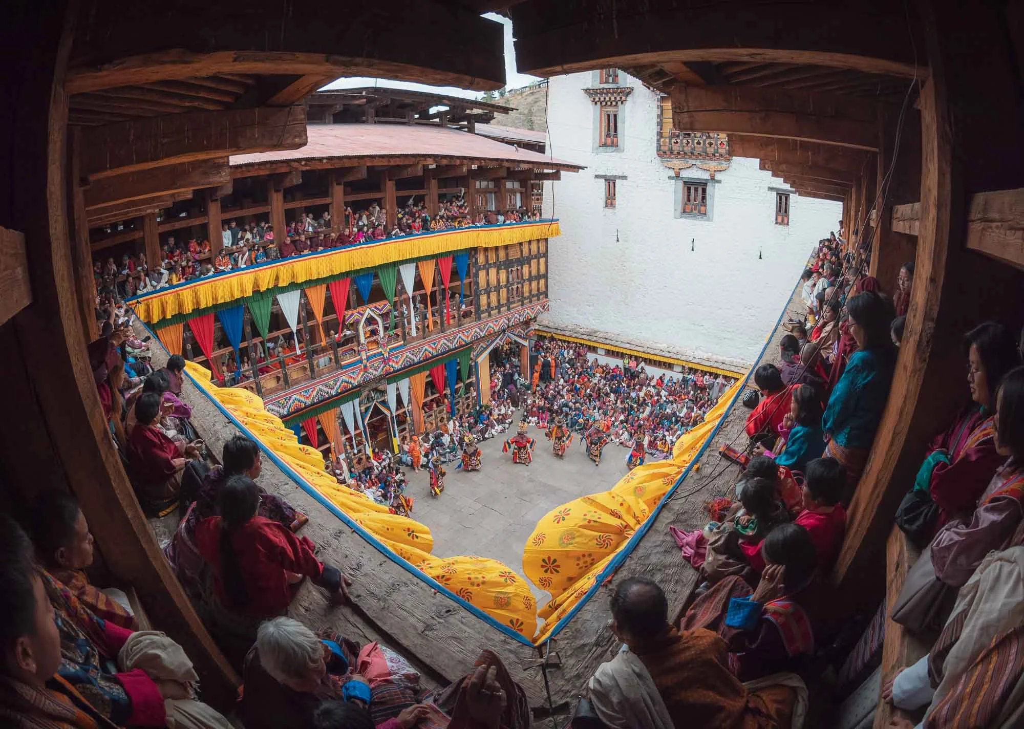
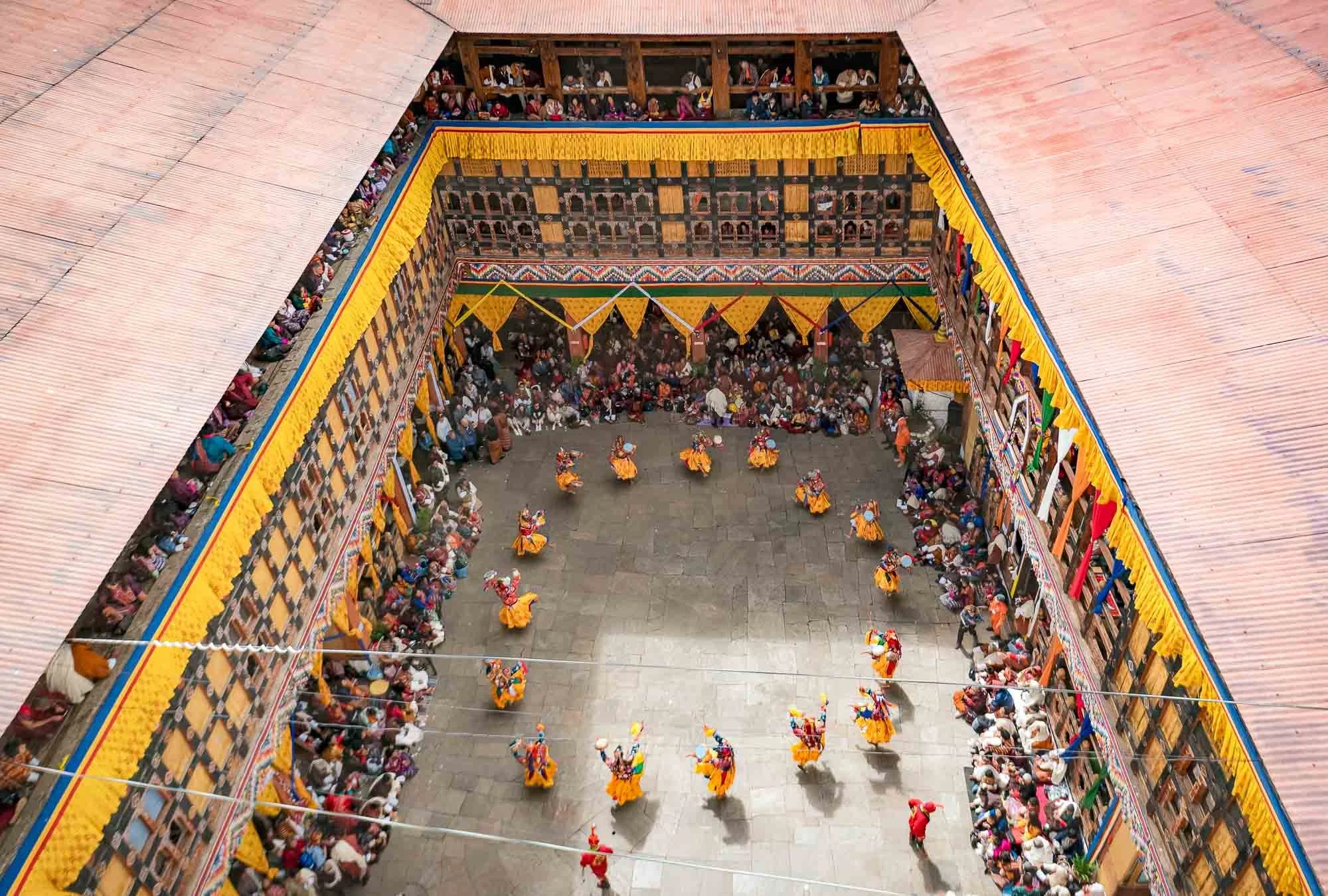
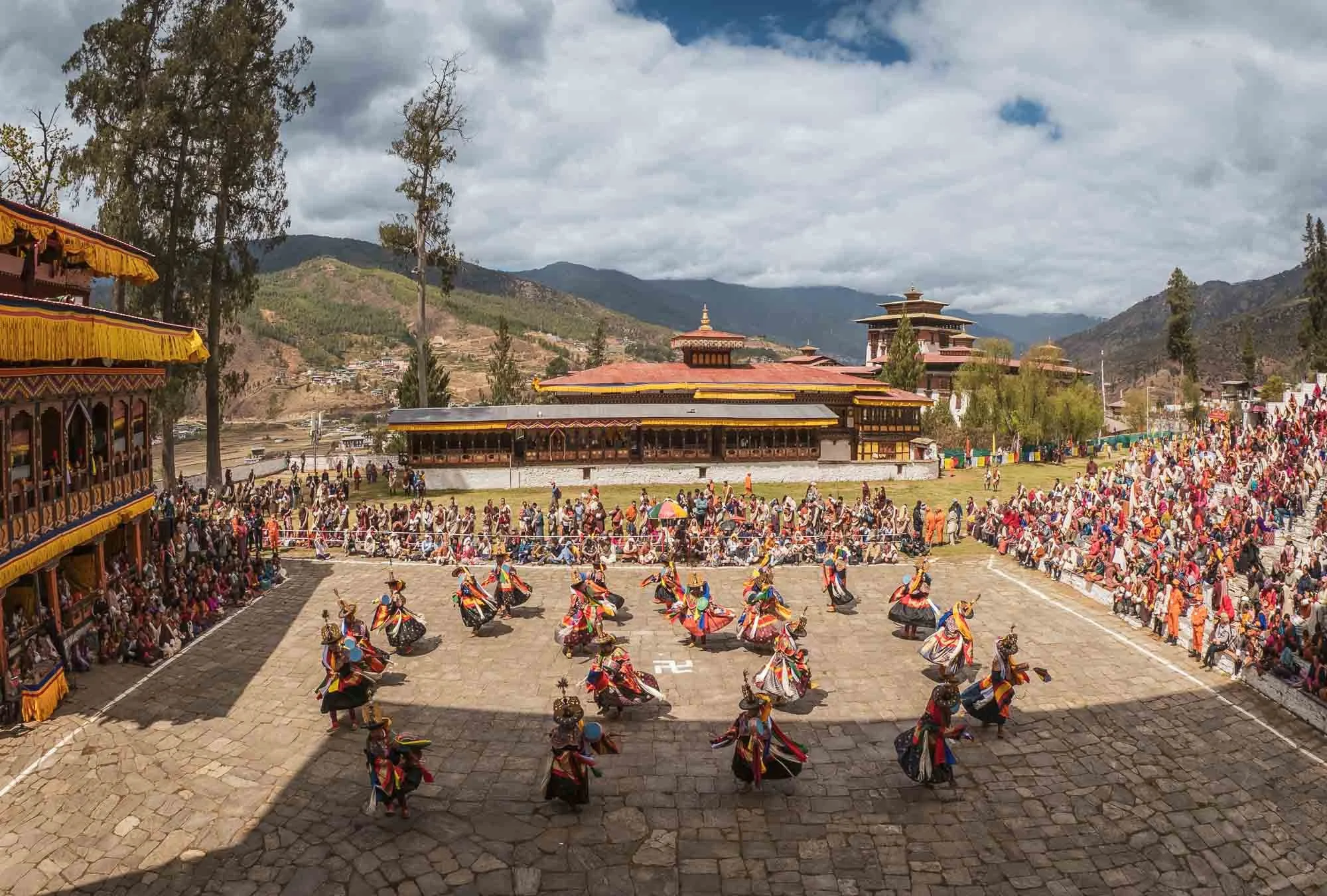
But aside from the Tiger’s Nest, there was a second main reason to spend a few days here, particularly in late March: over five days, the city is home to one of the most important and largest Tshechu (10th day in lunar calendar marker) festivals in Bhutan. It serves to generate merit and transmit the teachings of Guru Rinpoche through sacred dances, traditional music, and historic costumes. Its first day takes place inside Paro Dzong.
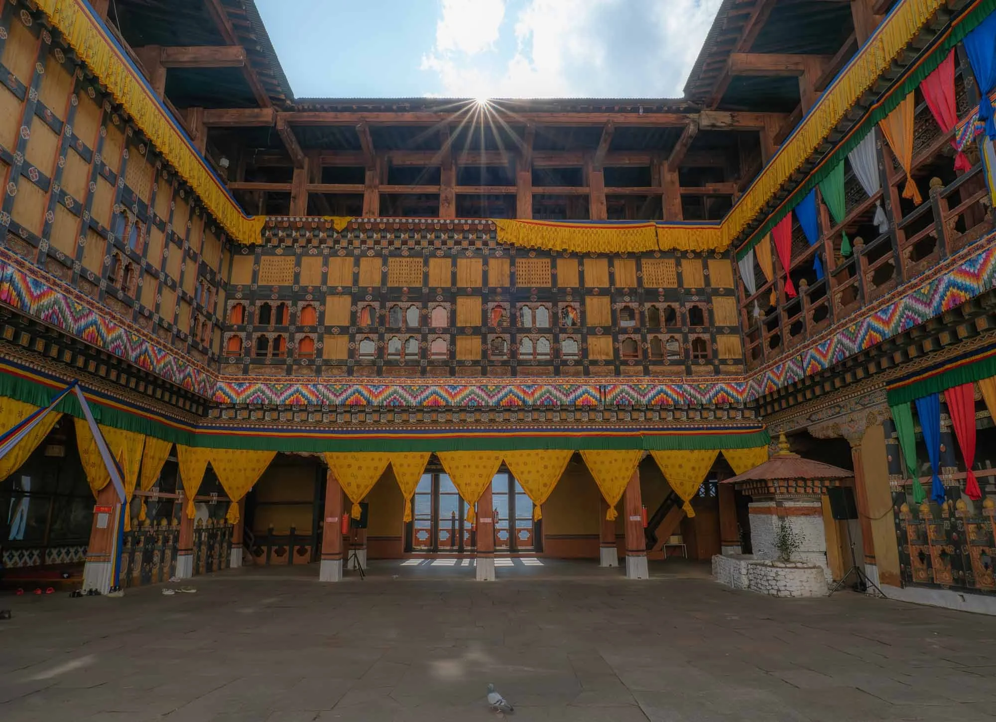
I visited the day before the festival for a quiet moment where the only other visitor was this pigeon, but the colorful decoration (and a few last minute dancing and singing practice) gave away that things were to become a lot more crowded soon.
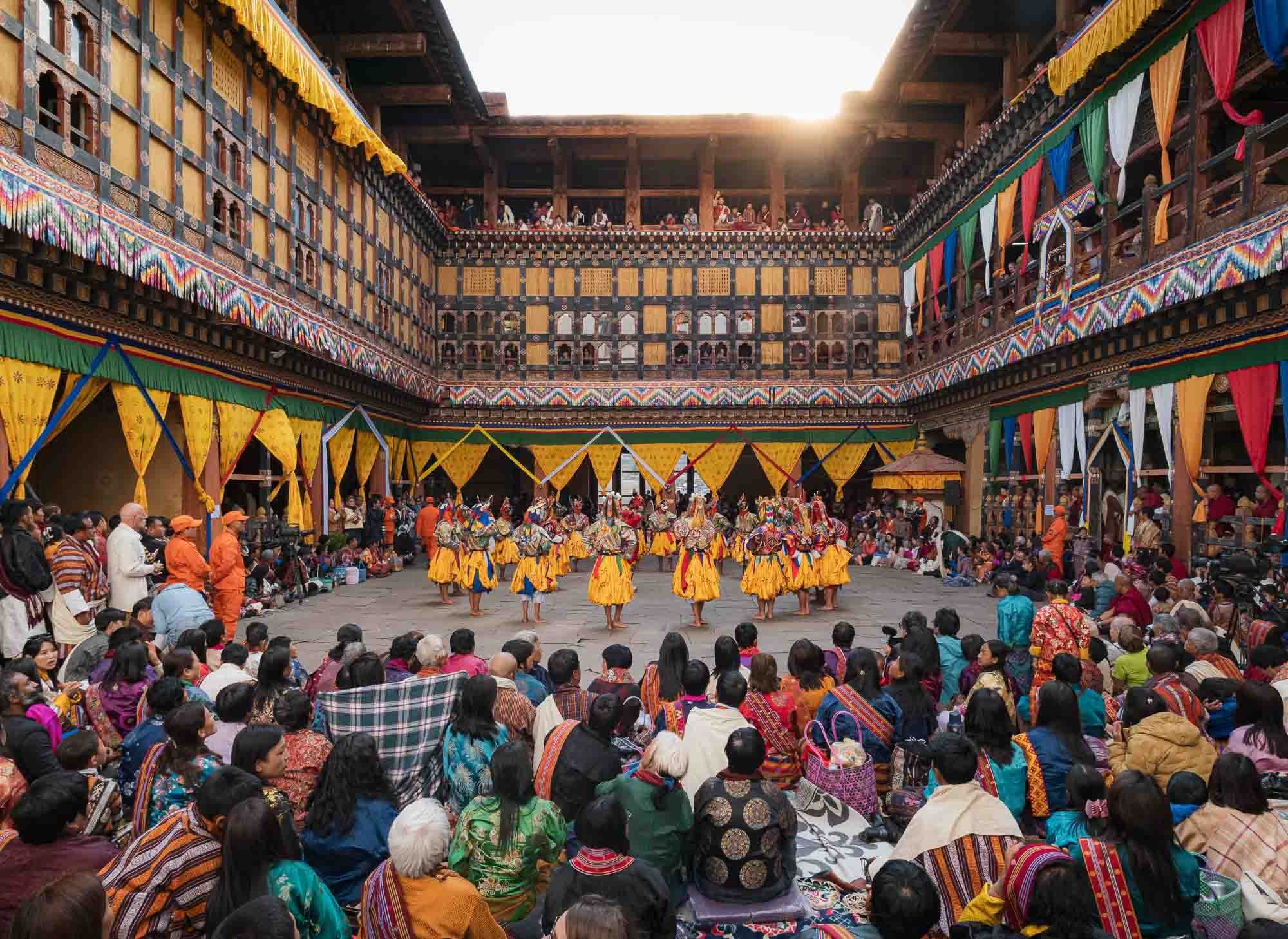
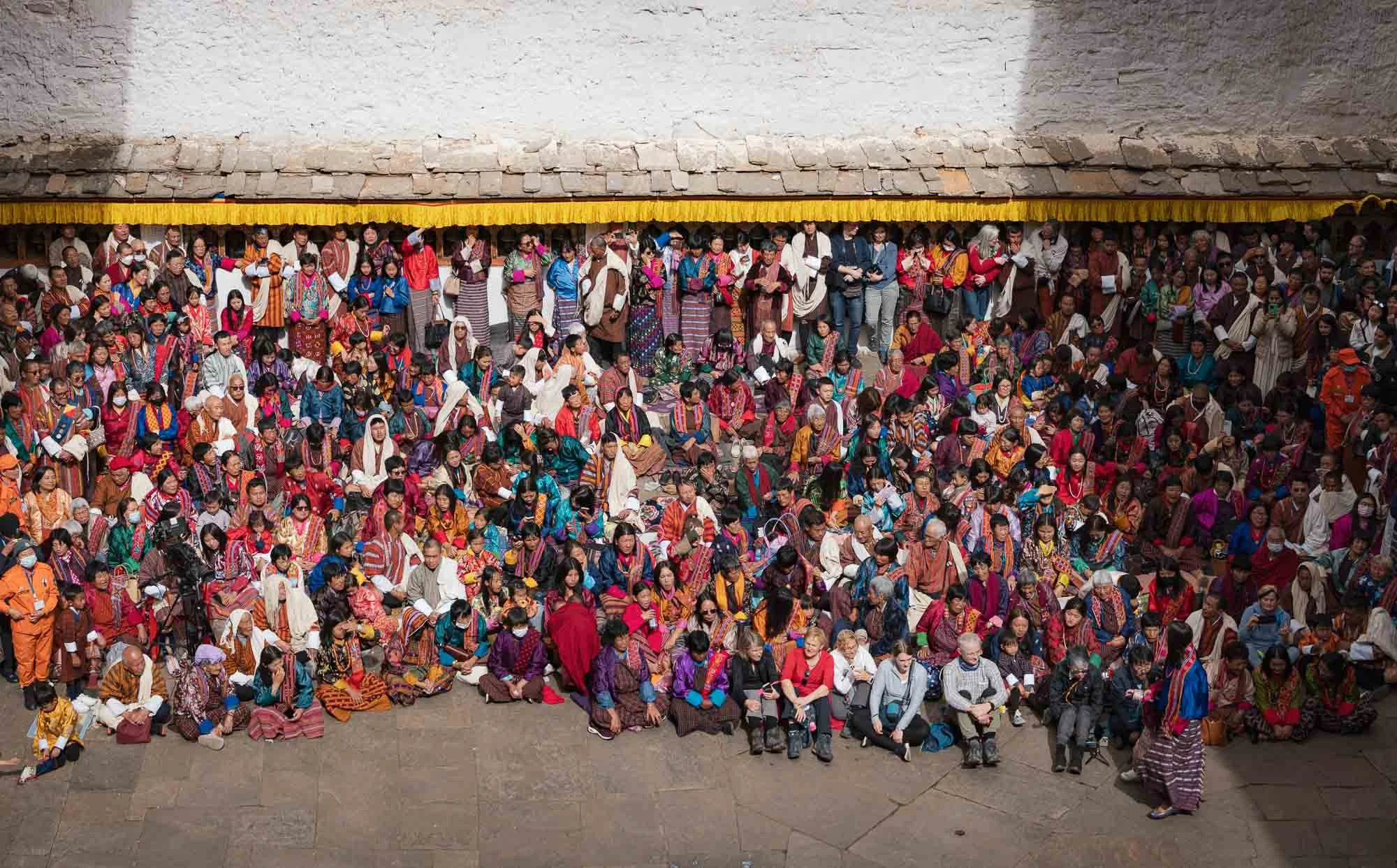
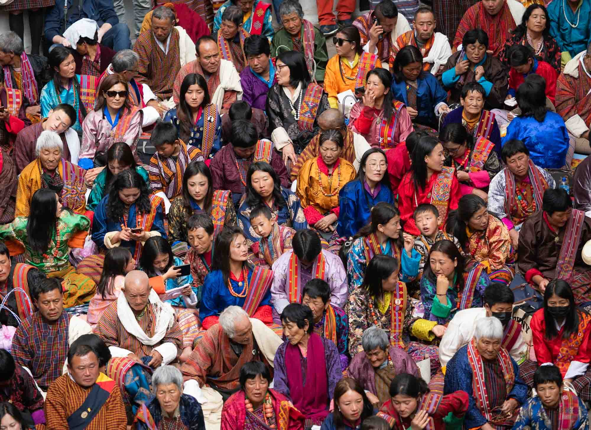
And indeed, this was the same spot the next day during the opening of the festival - crowds occupying every floor, nook, and cranny of the courtyard, with dancers performing in the centre. But one step at a time…
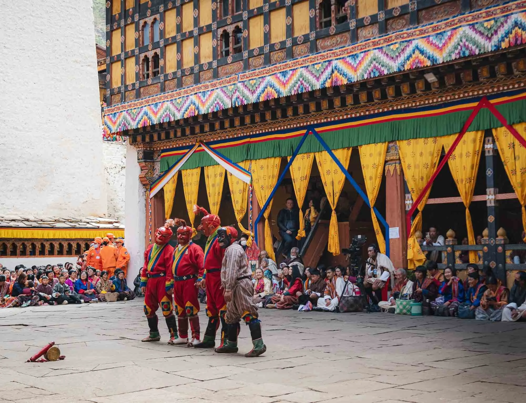
The proceedings are kicked off and hosted by the so-called Atsara (sacred clowns), who serve various roles, from teaching moral lessons and keeping the audience engaged, to managing the flow of performances all day, at times using their wooden phallic symbols seen in front of them here to do so...
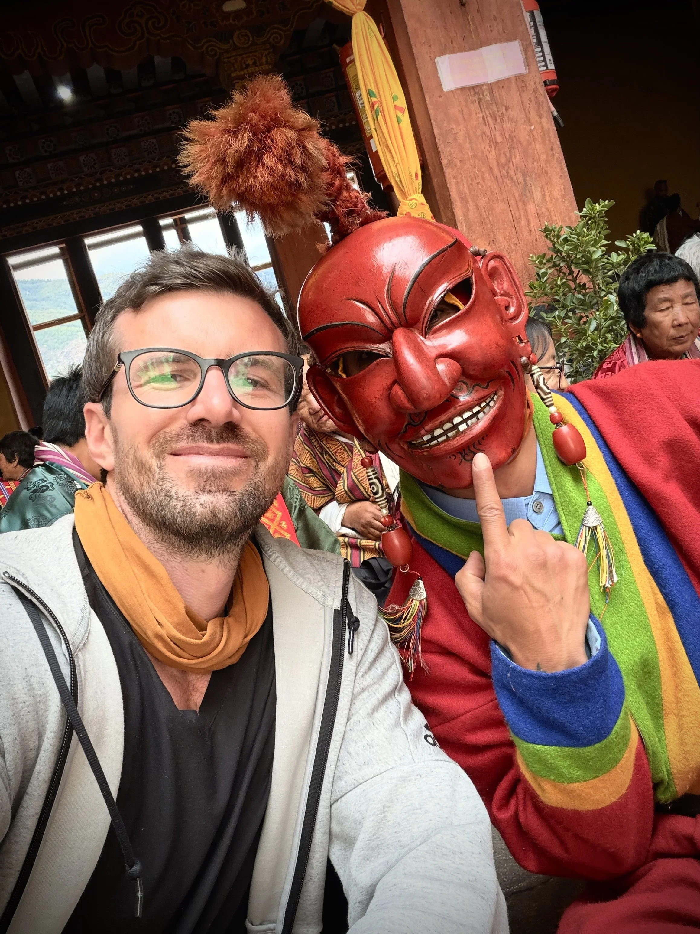
I had a chance to chat and take a selfie with one of them, and they seem to be born entertainers.
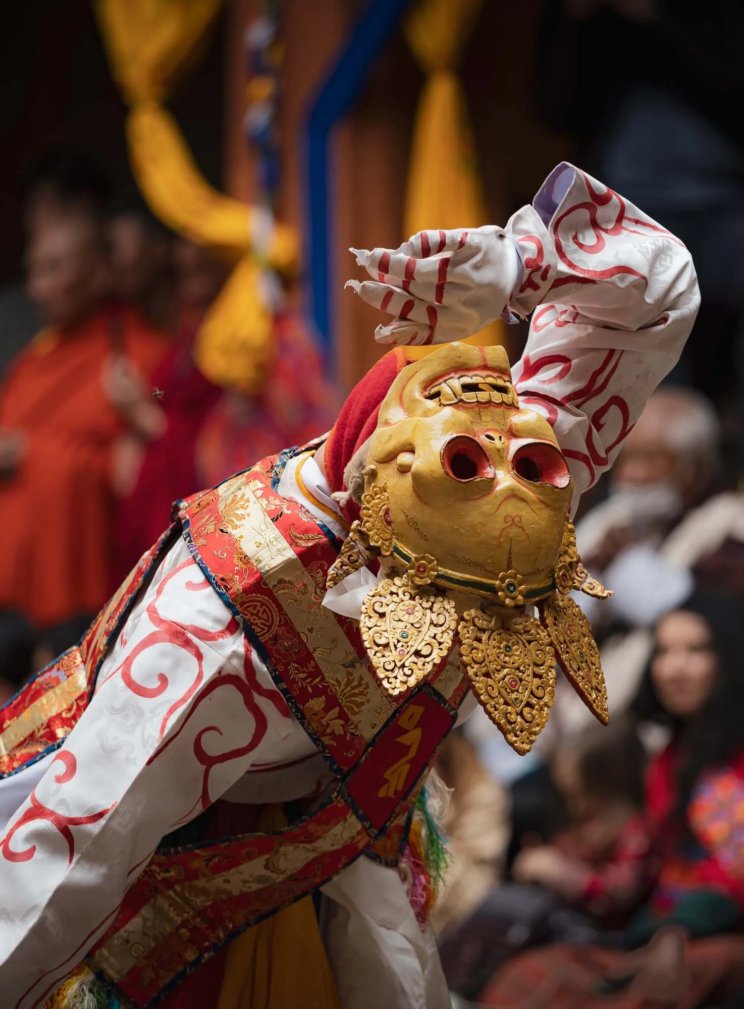
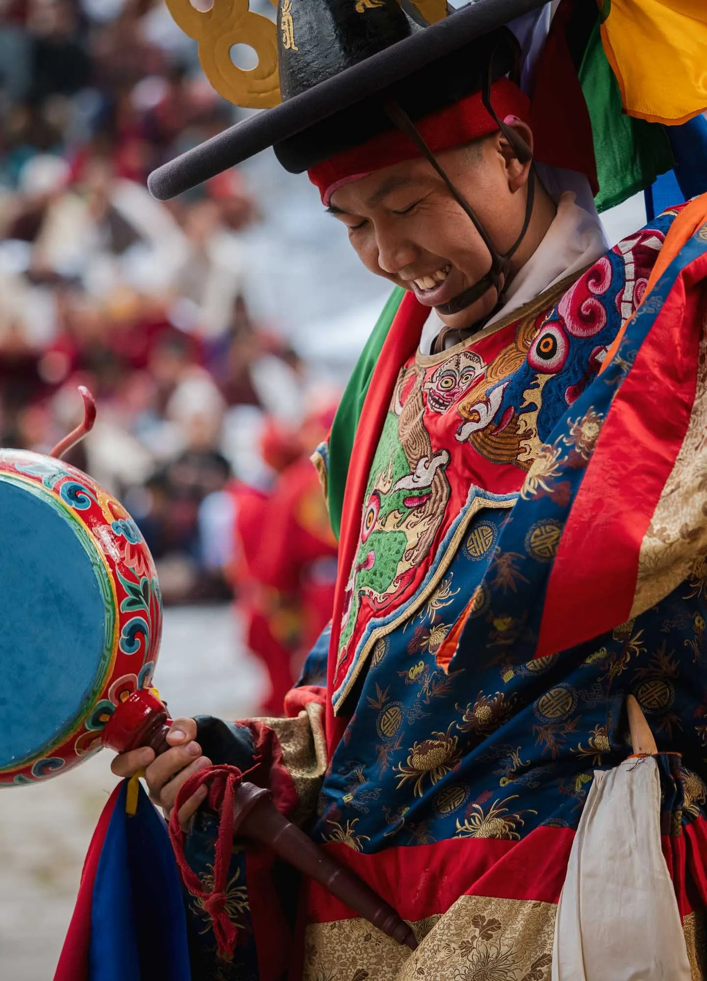
It’s a colorful affair of different dances and performances accompanied by varying music, with spectators in traditional local dresses all around. It’s often a family day out with three or more generations sitting together, bringing lunch and watching the activities.
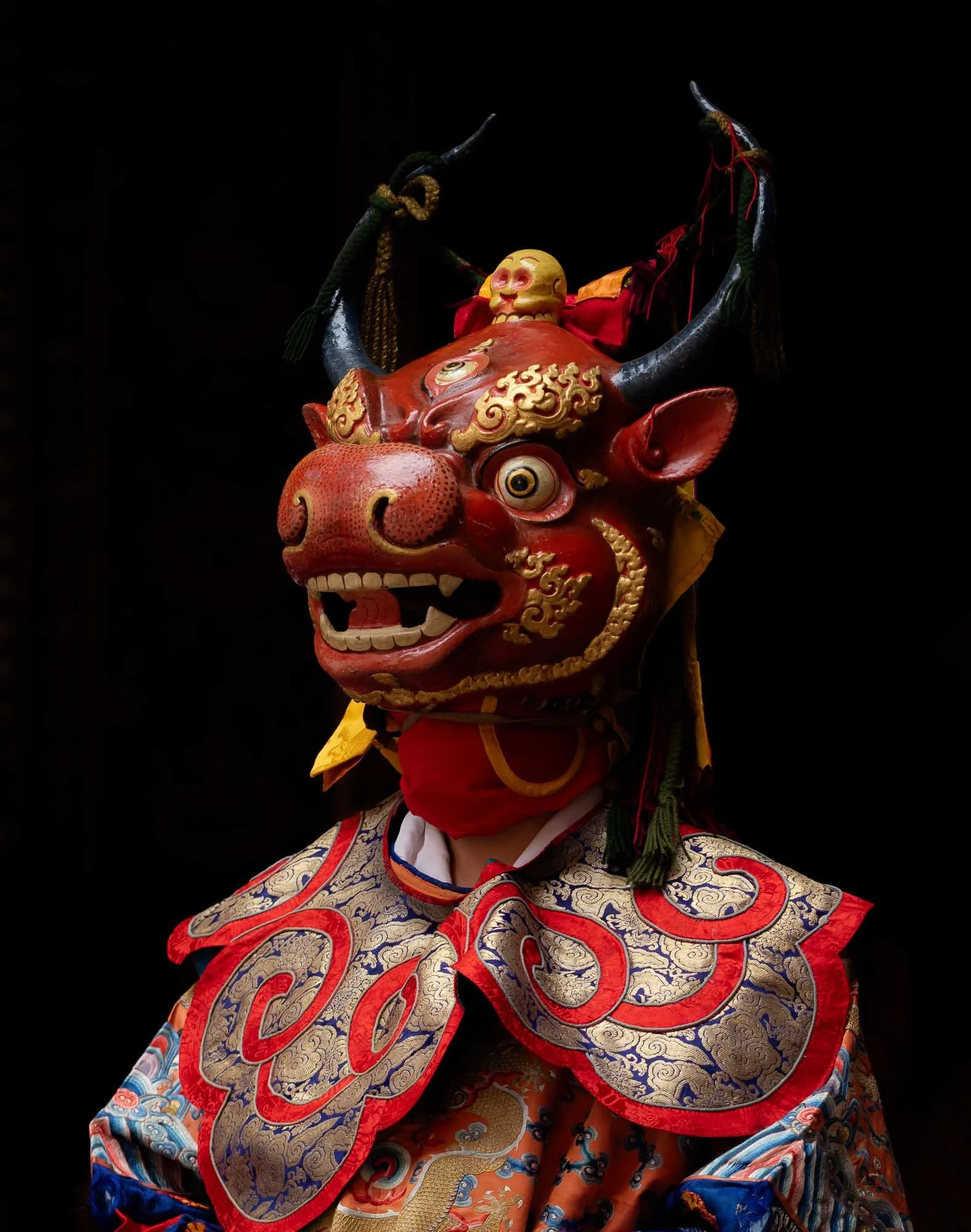
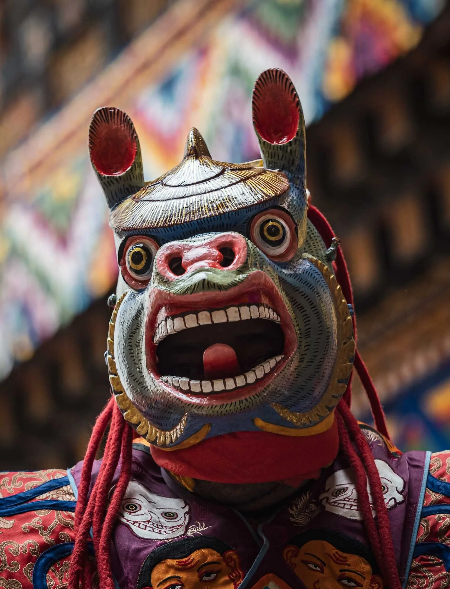
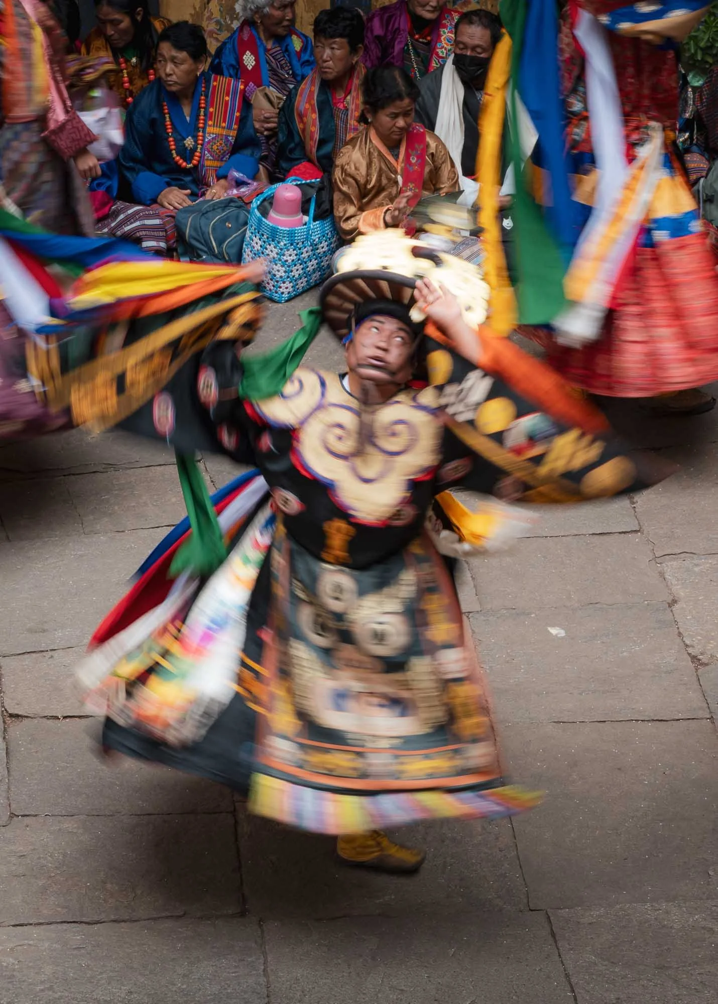
Equally colorful but sometimes a little more scary are the wooden masks of the performers, such as this one. If I recall it is part of the first dance related to overcoming the forces of death and blessing the ground for subsequent dancers.
The masks and dresses change as the day progresses, so does the music, rhythm, and choreography.
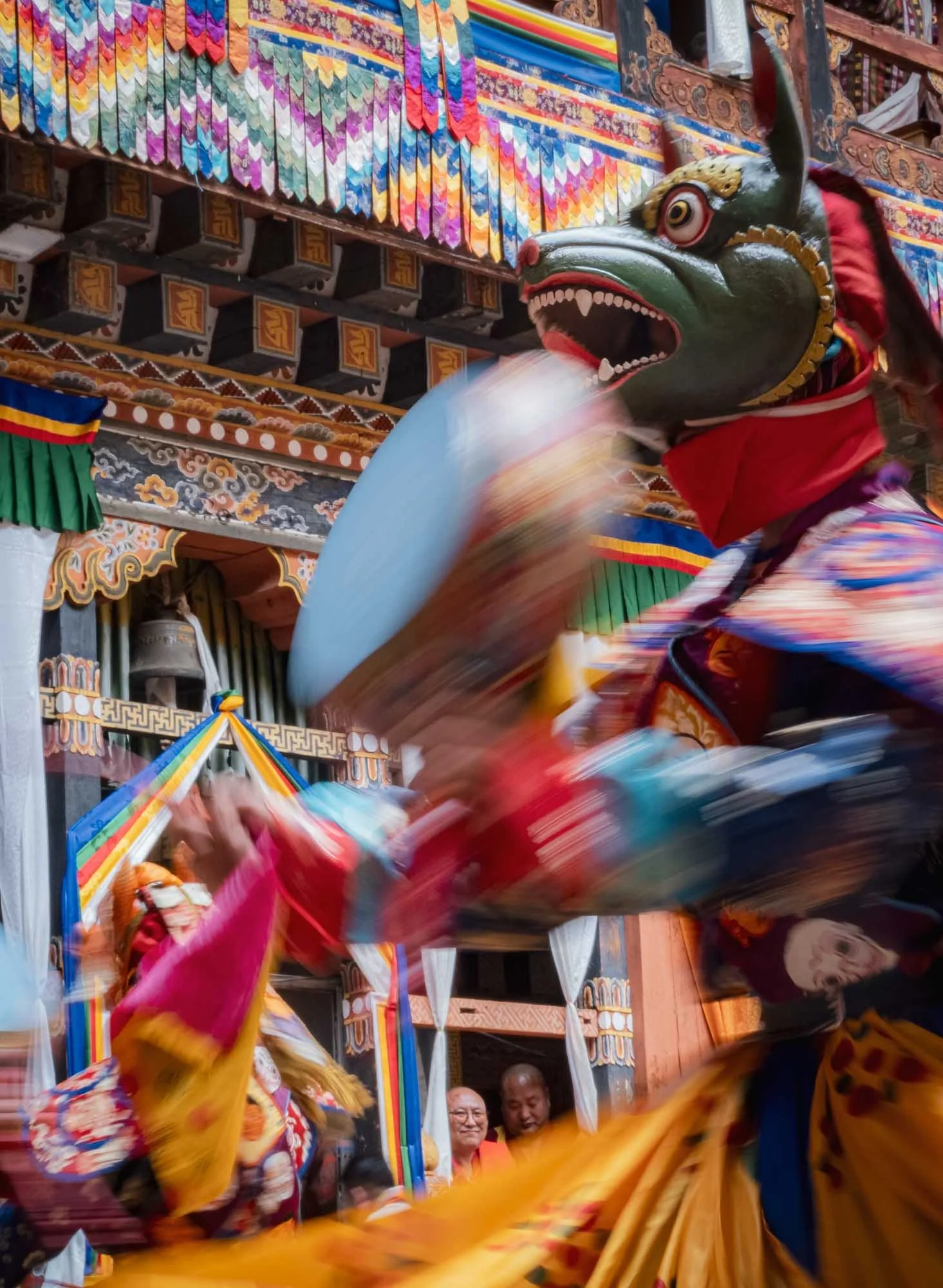
Every performance symbolizes a certain practice or teaching: the Black Hat Dance with its elaborate costume serves to celebrate the victory of good over evil and the purification of space, for example.
While quite a crowded affair at times, the very limited space makes the festival feel intimate and connects the spectators to the performers closely.
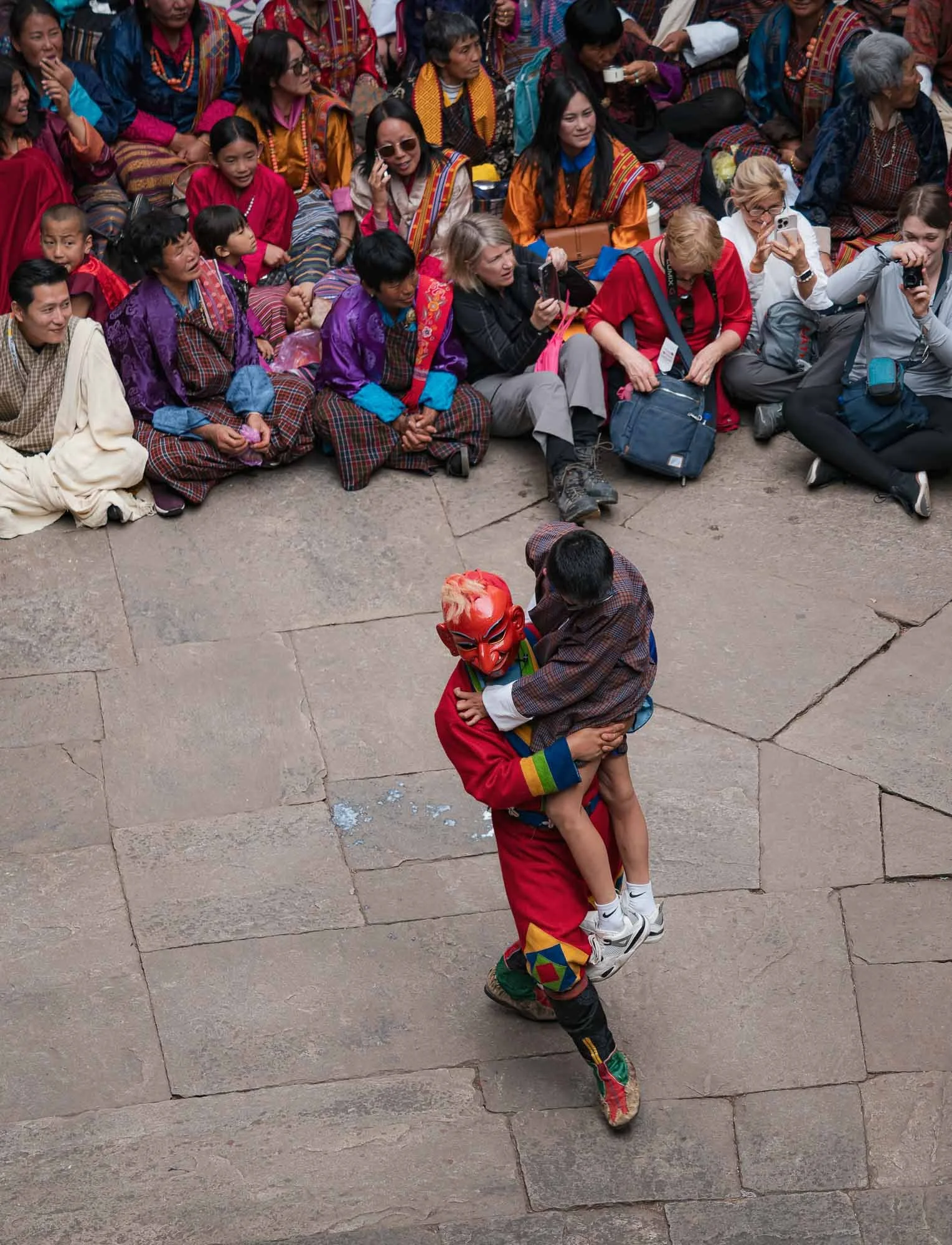
Sometimes a little too closely - audience participation is not always optional…
…but mostly a pleasant and humorous affair. I can’t be sure what this Atsara said though - given the expression of the women on the right, it may have been quite audacious. Not unlikely, from what I observed.
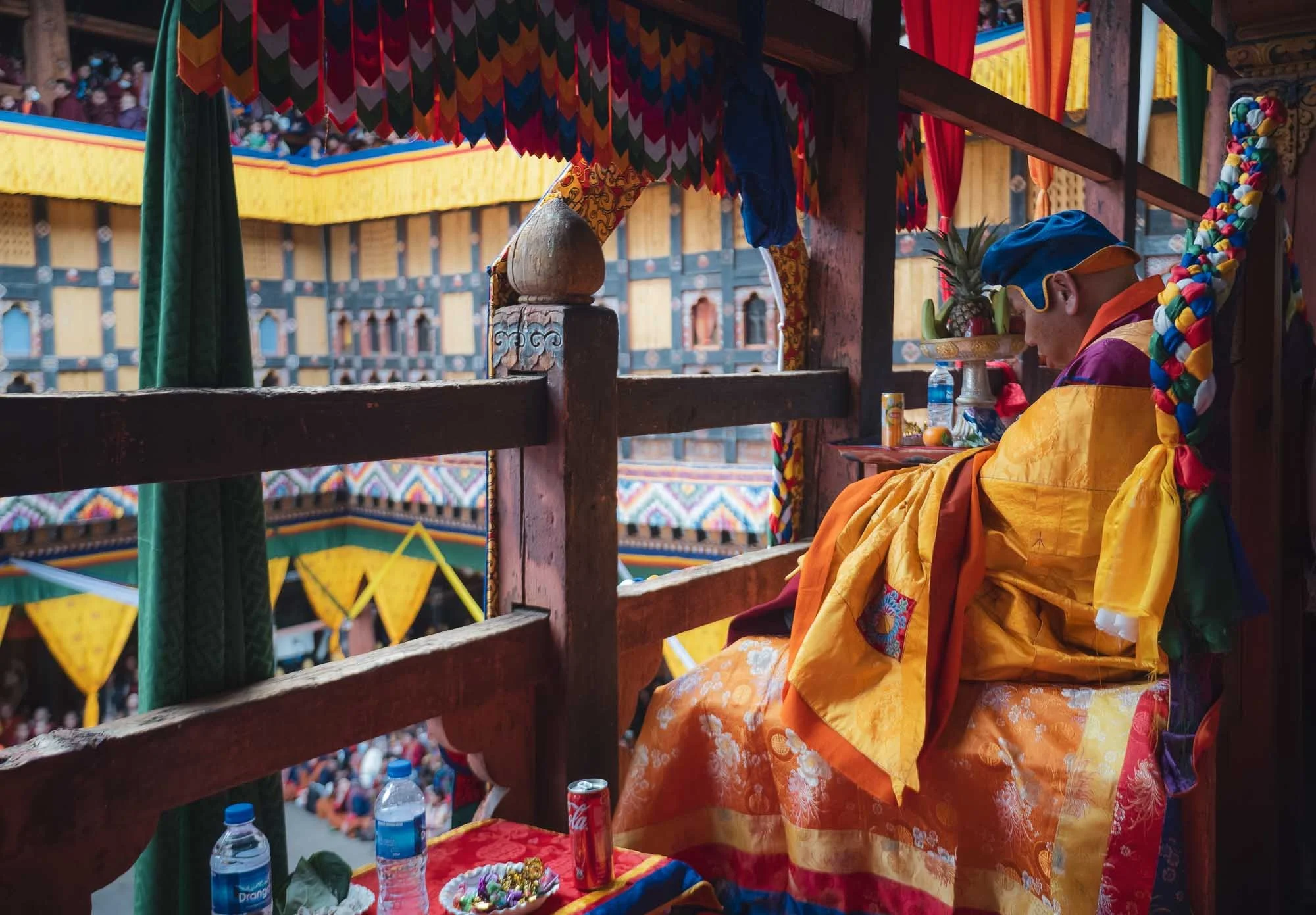
A dedicated section (into which I had the chance to sneak in for a bit) houses seats for the most important lamas and senior monks of highest monastic authority. If I recall, this one was the most respected person, immediately appealing to me for his choice of drink (and offering me some sweets).
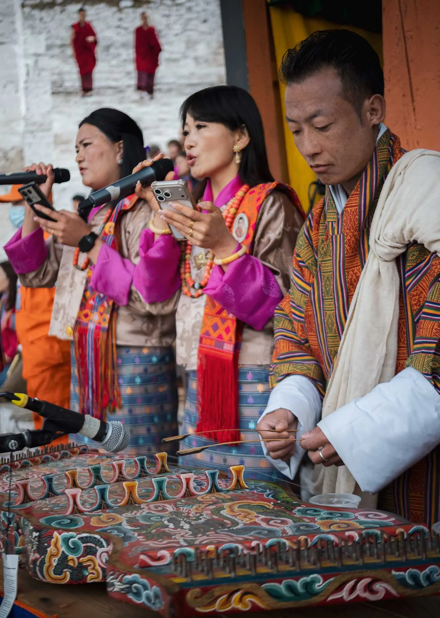
I spent almost the full day here - the photographic opportunities are endless, and the cultural aspects quite interesting - part of the commentary is done in English and explains the purpose and background of the performances. Below are some clips of the day.
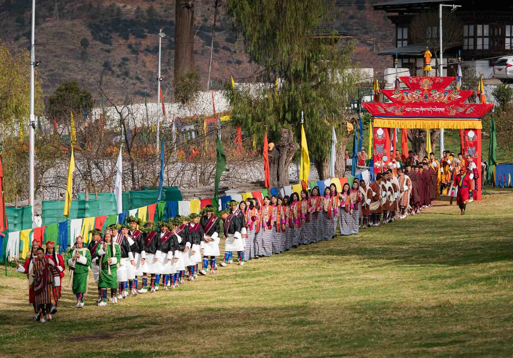
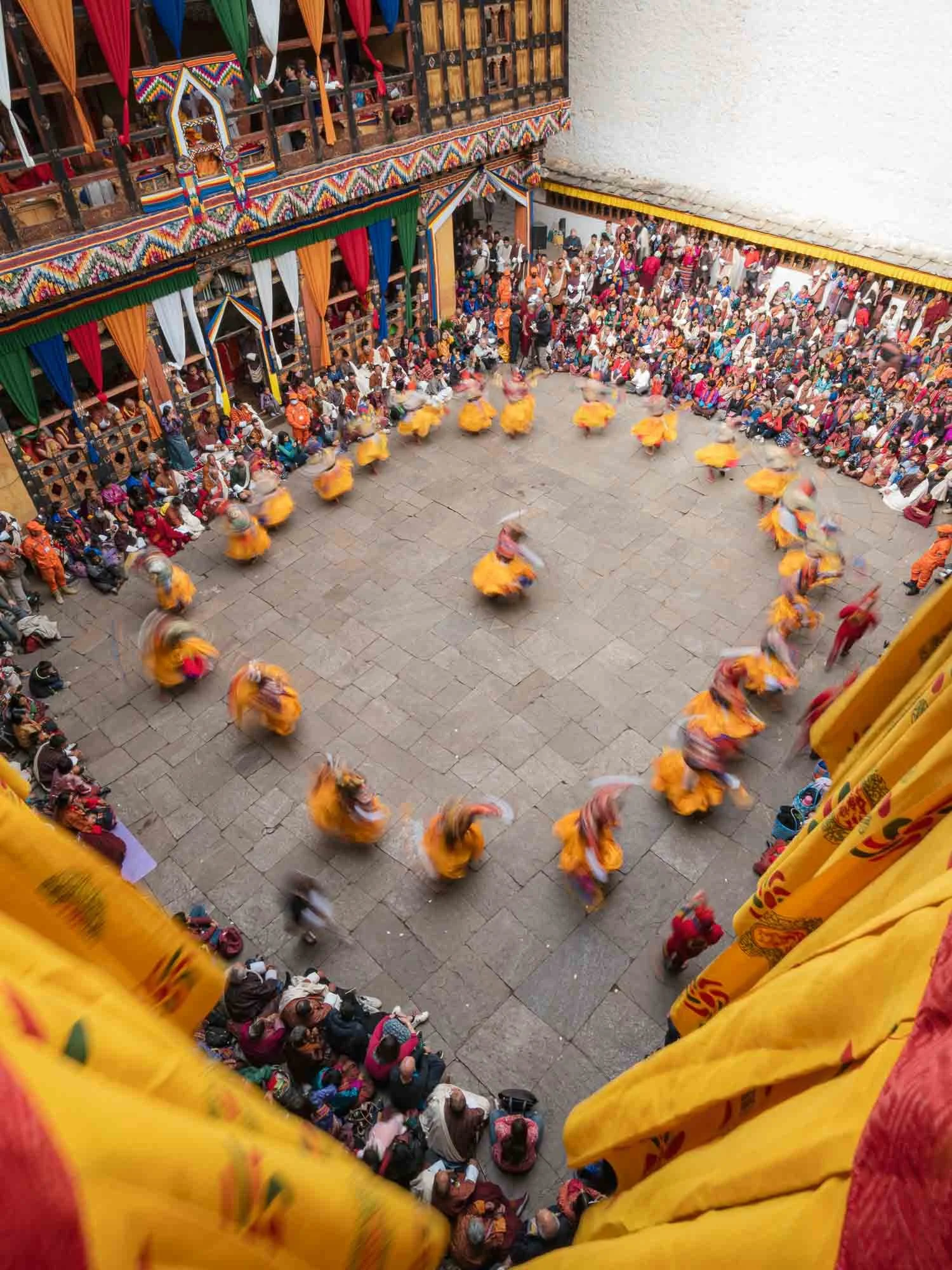
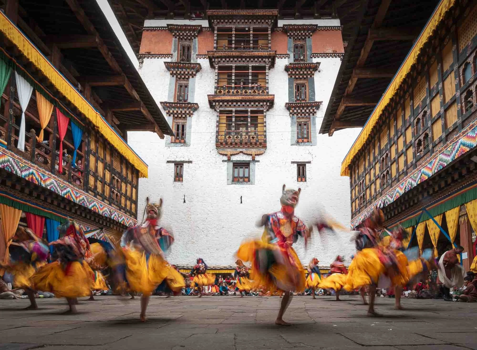
The second and subsequent days take place in the outer courtyard in front of the Dzong, with a procession of the participants arriving in the morning.
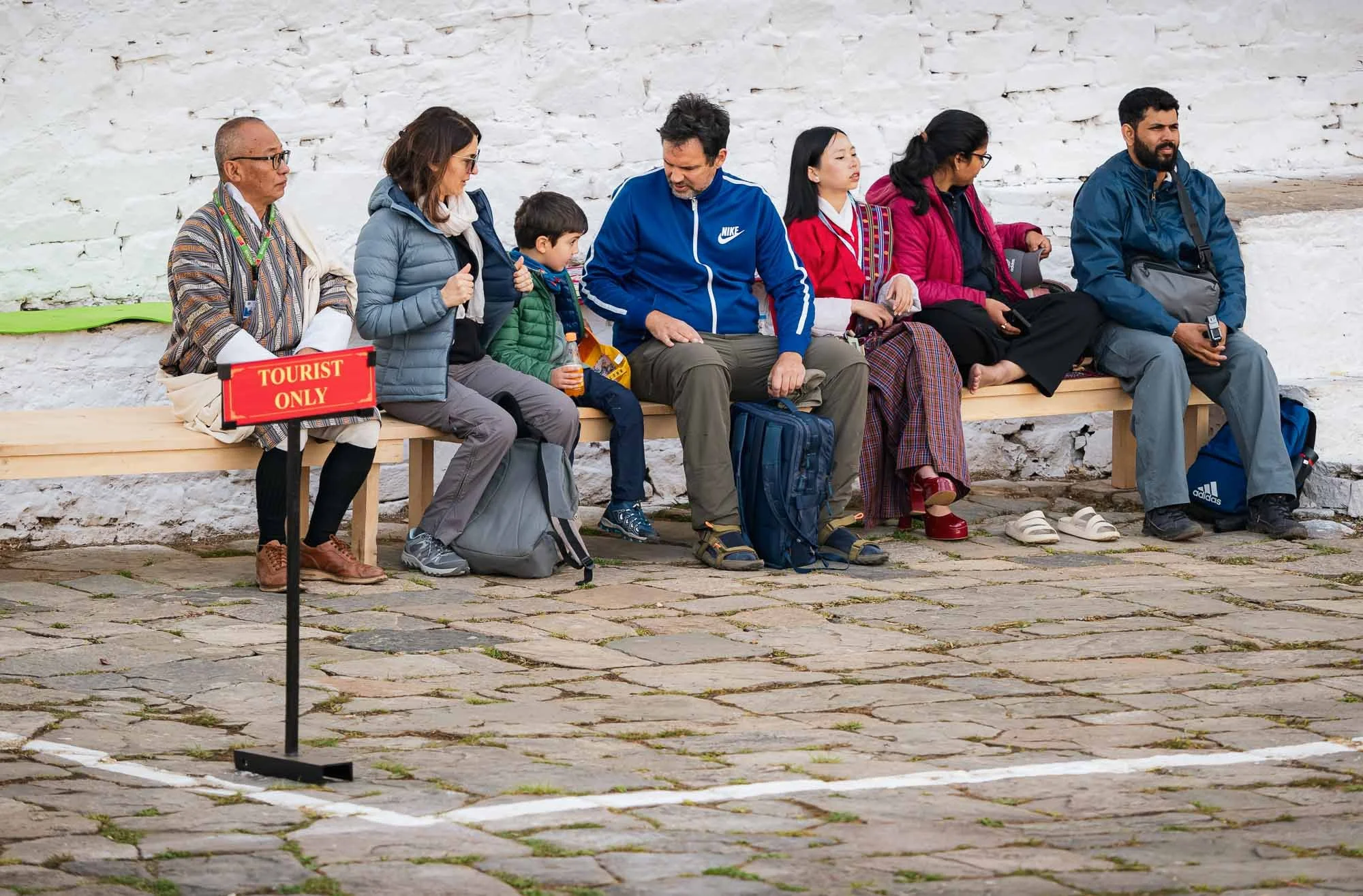
I couldn’t help but chuckle at this well-intended but somewhat awkward tourist section, which I of course didn’t let myself get confined to. While there were a few international tourists around, the vast majority of the attendees were locals.
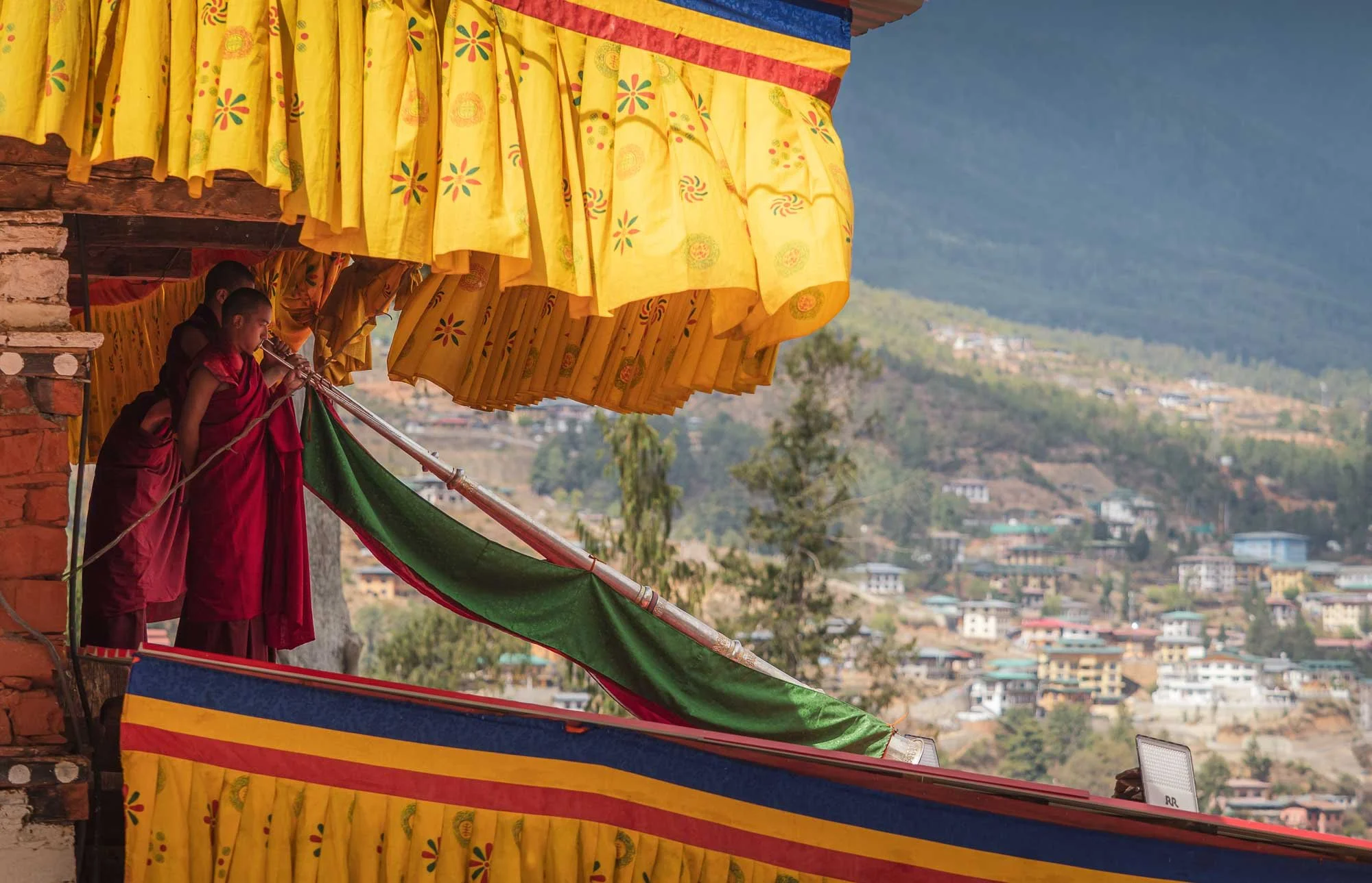
The Dungchen being played during the entry of the performers - it was nice to hear them played skillfully after observing the practice at the nunnery.
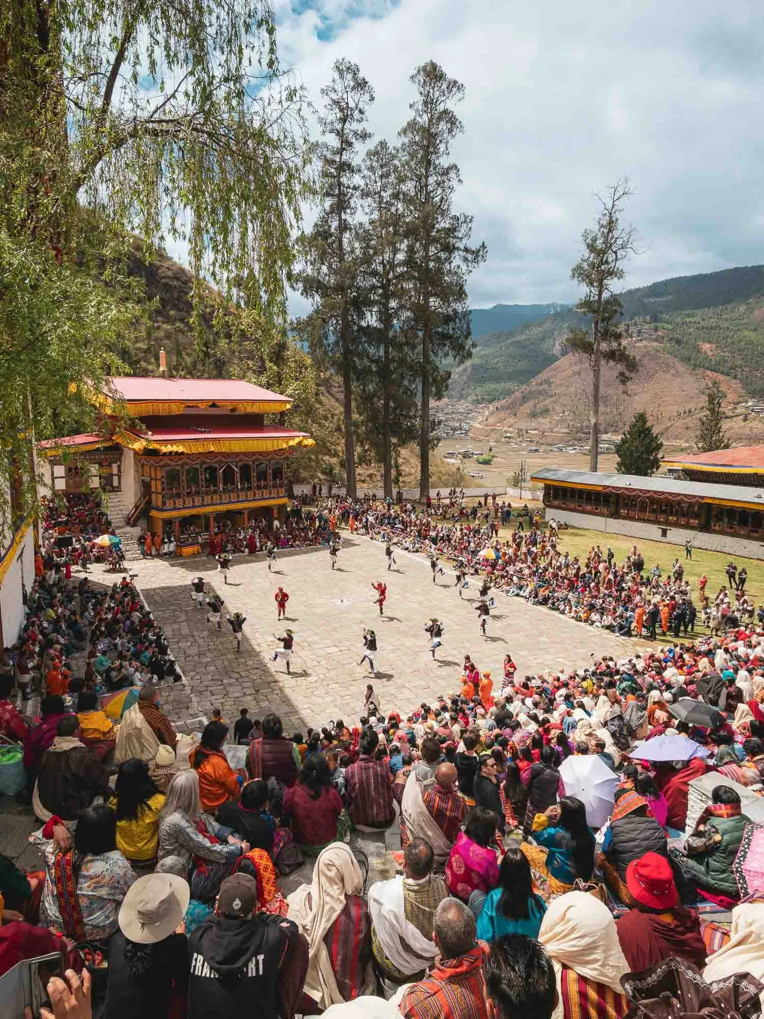
The location out in the open gives the festival a much more casual atmosphere. I preferred the first day but this was the perfect slightly more relaxed follow up.
This is also where on the final day the festival culminates in the revealing of the thongdrel, a sacred tapestry of Guru Rinpoche - I didn’t get to see this part anymore though, as this was the end of my time in Bhutan. Nepal was next.
There is clearly a large amount of focus on preserving its roots and national unity, and Bhutan’s development model has long been famous for its idea of Gross National Happiness, prioritizing well-being, culture and environmental protection over pure economic output. Nevertheless, things may (have to?) undergo some change. While GNH remains an ideological basis, more conventional metrics have played an increasingly significant role in recent times.
For example, Gelephu Mindfulness City was announced in 2023 as a special economic zone three times the size of Singapore, designed to attract investment as a multi-sector economic hub, and also housing a new airport given its location in the lowlands near the Indian border.
Financing is meant to be driven by the country’s Bitcoin reserves. Bhutan held one of the largest national Bitcoin funds, at its peak estimated at $1.5Bn, mostly created through mining from its hydropower surplus (unlike US and Chinese holdings which were mostly seized). Its exposure has since been heavily reduced but remains significant.
We shall see if the country can maintain its sustainable happiness approach while at the same time creating attractive opportunities for its next generation - emigration, particularly to Australia, seems to be surging in recent years.
Subscribe to my newsletter to get notified and don’t miss out on more Wonders of the Globe.
Other Recent Posts:


Patagonia - Pumas & Peaks
The Chilean side of Patagonia is home to incredible landscapes and wildlife, and I spent a week here to document some of it during the winter months.

In August of 2024 I finally embarked on a trip to one of the last regions on earth I had not explored at all: South America. The first blog posts are in: Tales of the Atacama Desert and the Wildlife of the Pantanal. There is more to come, and this is the third post covering my trip to Brasil and Chile: The beautiful mountain landscapes of Patagonia, and one of the incredible animals that inhabits them…
From Puerto Natales to the Peaks
I arrived in the small city of Puerto Natales from Santiago (with a short stopover, there are barely direct flights in the winter time), but didn’t spend much time in town, other than a short photography walk to the shoreline with my great expedition guide Rodrigo and his wife, who were to become friends with a lot of laughs on the following days.

Puerto Natales was formally founded in 1911, but its history goes back further than that, with Spanish explorers making visits to the area in the early 16th century in search of the Strait of Magellan and indigenous people having occupied this remote part of the world. First human evidence dates back more than 10,000 years.

Two black-necked swans with the Hotel Costaustralis of Puerto Natales in the distance. My actual destination here was the Torres Del Paine National Park, around 100km to the north, a UNESCO World Heritage Site (one day I should make a list of which ones I’ve seen…).

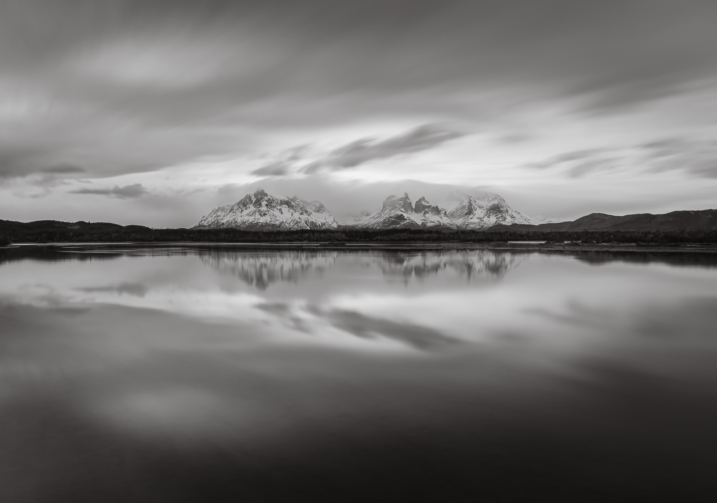
Torres del Paine
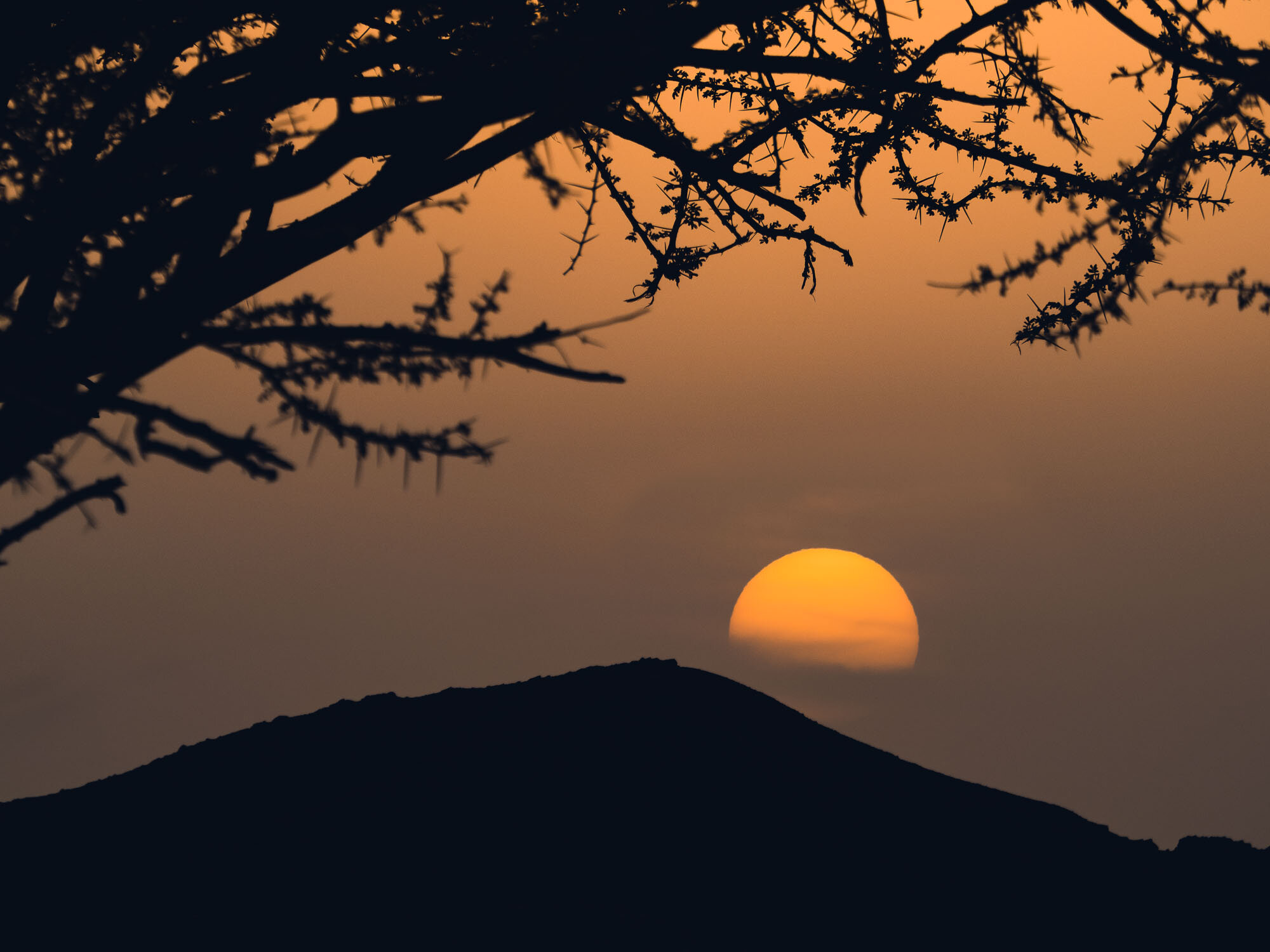
As we drove towards the park, the namesake mountain range came into view, with a beautiful sunrise awaiting at the Amarga lagoon.

Calm Waters
While the weather is a little colder in the winter, it’s much less windy (reflections galore!) and the late sunrise and early sunset makes the life of a photographer a little more enjoyable…Here is the same spot a few days later in different conditions.
The Paine massive with its three individual peaks reaching almost 2500 meters above sea level are definitely its most iconic sight, and the many lakes and lagoons provide a beautiful foreground. The peaks make for endless compositions, and we spent quite a bit of time around the area.


The park is quite popular - but that still only means around 250,000 tourists a year. Most of those come during the summer months, making the trails, camping spots and roads a little more busy - in August when I visited other people and cars were a rare sight.


The same can’t be said for the guanacos, which were definitely quite a common encounter. Closely related to the llama (and their cousin the vicuñas, which you will see in my Atacama blog), they generally live in herds and don’t mind the high altitude - their blood has 4 times the number of red blood cells as humans.

To the north of the park entrance is this viewpoint of the Cascada Rio Paine, a small waterfall on the Rio Paine, the water of which finally makes it into the Lago del Toro.

We made our way through the park for the rest of the day, stopping at a few more spots, including the Salto Grande waterfall that comes from Lake Nordenskjöld away from the mountains. Can you spot my guide in the left photo?


The waterfall flows through a narrow canyon into Lago Pehoé. A bridge once crossed the lake here, but it collapsed during flooding from what I recall.

Konkashken Lodge
My sleeping place for the next few days was this little hut on the banks of the Serrano river, just outside the park boundaries - amazing place to stay with a very hospitable owner and his family.

The river landscape in this area is incredible, with a number of small lodges and hotels scattered around on the right, and the nearby confluence of the blue Serrano river and the discharged water of the grey glacier - the latter was still on the agenda for my last days here, keep reading!


Contrasts
A few dozen semi-wild horses live around the park, one of which was grazing in the muddy waters and spotted by my drone.
A sunrise like no other…

The next morning had what was probably the most beautiful sunrise I’ve ever seen in store - and I almost missed it. In fact, I did miss the early blue hour, because for what was maybe the first time in my traveling life I actually properly overslept, falling back asleep after waking up and getting ready a little too early…Luckily Rodrigo banged on my door and we were off to capture the colors lighting up the mountain peaks from a small lagoon.


Cerro Paine Grande mountain is the tallest mountain in the park at 2884m, and reflected back on us in a different colour every 5 minutes. It’s peak has only been climbed four times.


The Cuernos (Horns) getting kissed by the first light. No editing needed - sometimes nature increases its saturation without human help…take a look at this clip of a few more beautiful landscape moments taken with my drone (flying outside the perimeters of the park is permitted).

Not every morning was equally as colorful of course, so sometimes you need to add your own bit of human made colour. This little red bridge leads to a small island which houses the Hosteria Pehoe, a restaurant and refugio - it was still closed, just preparing for its summer season.

Icey Start
While overall bearable, Patagonian winter temperatures at night fall way below freezing.
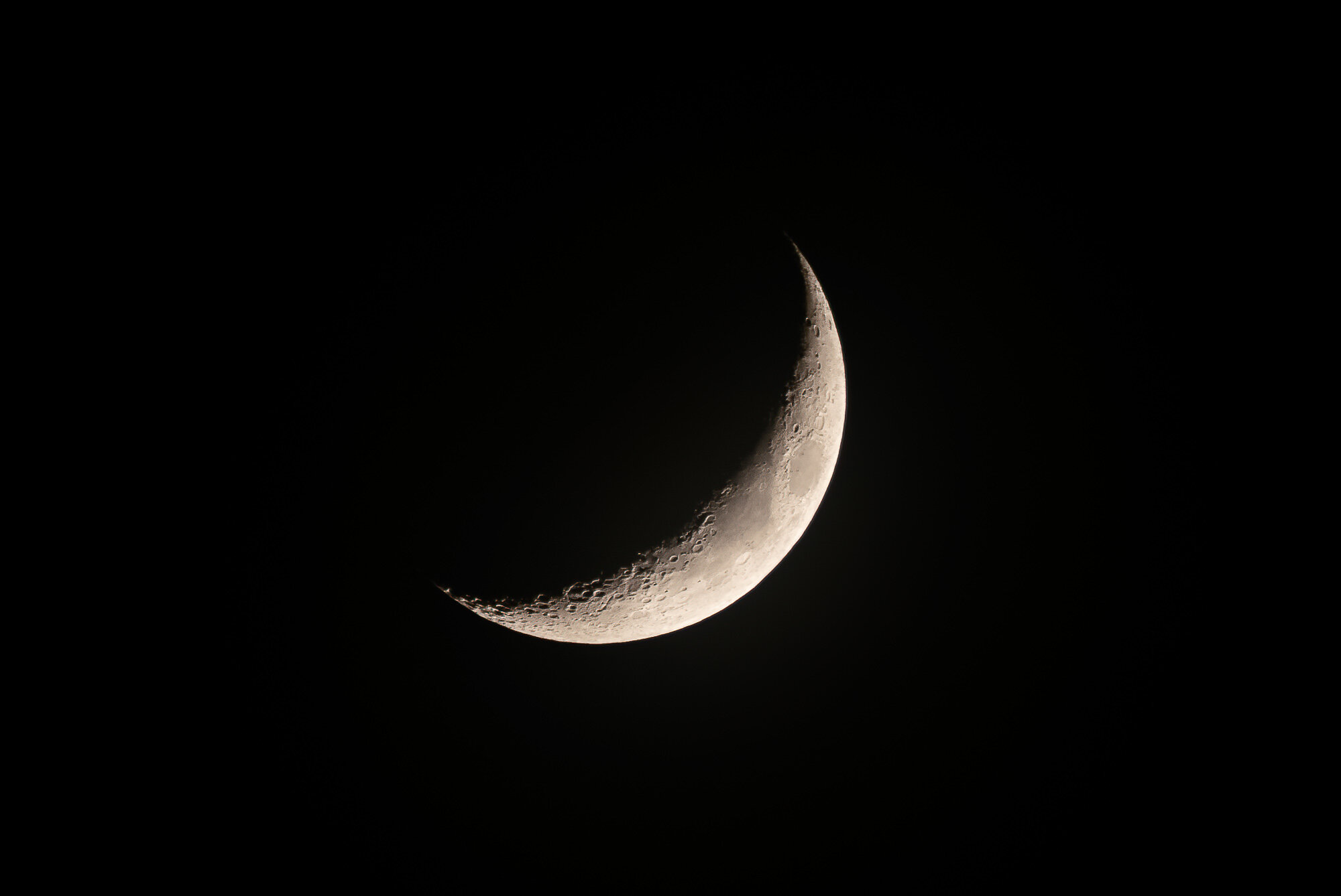
A morning photo as the moon set, and an evening impression from one of the many little lagoons around the park, with a small lenticular cloud wrapping itself around a peak. Winter is the time for reflections here, with very little wind, which is rare in the summer, when there are warning signs on many of the roads and wind speeds commonly exceed 100 km/h.


Burnt Victims
A few parts of the park show the devastating effects of fires caused by tourists. Over the last decades, three incidents that destroyed over 150 sqkm each occurred, the last one in 2012.


While the dead trees that remain make for beautiful haunting photos, they are a reminder of how fragile the ecosystem is. Having said that, research has shown that naturally occurring fires have not been uncommon in the area for thousands of years.
Puma Quest
Although the landscapes were beautiful and not to be missed, my primary priority was to find and photograph another big cat for the collection (see here for some jaguar, snow leopard, and leopard photos, for example). This area is probably the world’s most famous to see the puma, often referred to as cougar and - aptly, given their appearance - mountain lion. Many documentaries by the BBC and National Geographic have been shot in and around the park, which would probably mean it’s good enough for me as well, just about…

On the lookout
Rodrigo scanning the mountain ranges for signs of the elusive cats.
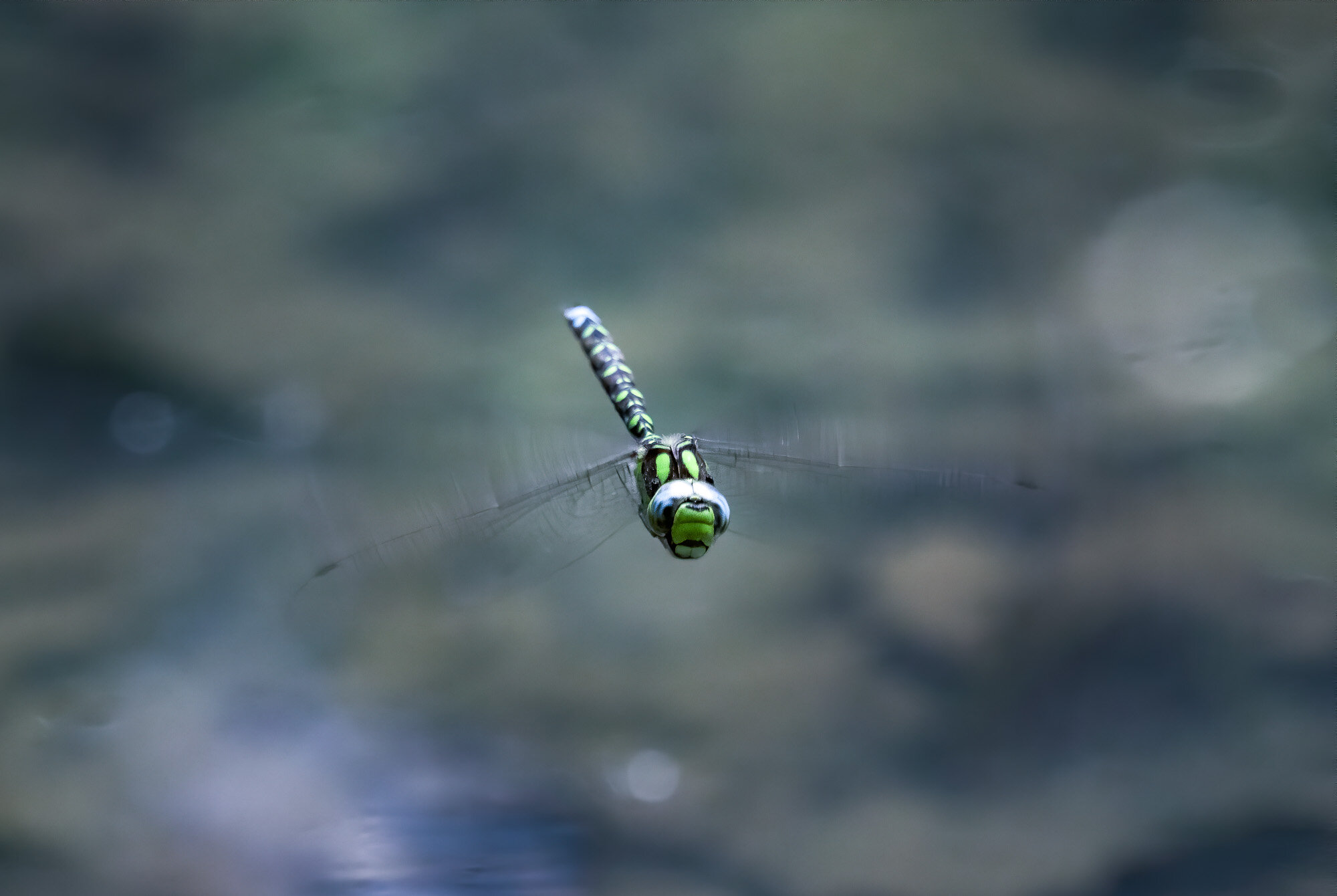
We dedicated most of the mornings and late afternoons of the six days I spent in Patagonia to areas where pumas are frequently sighted, keeping an eye out for alert guanacos (or their complete absence, which is also a good indicator), prints, or other cars tracking them. Although there are estimated to be around 200 individuals in the territory, the first three days were not successful, and as the days dwindled, so did my hope for a good sighting.


While there was no pumas to be found for the moment, the guanacos served as decent alternative wildlife subjects.


Another common sight is the crested caraca, one of the large birds in the area, and they have gotten used to humans. In fact, the ones living near the Pehoe camping site, where we stopped a few times, are almost pets.


One more interesting species to observe when looking for pumas is the Andean condor, as they often follow the cats in the hope to scavenge on the remains of a kill, or even harass them to get their share. With a wingspan of over 3m and weighing 15kg, they are considered the largest bird of pray in the world and have an impressive lifespan of 70 years. The species is considered vulnerable today.


On the fourth afternoon, we once more made our way through one of the roads less travelled in and around the park, sleepily looking for puma clues after a nice lunch. But the sleepy vibe changed within a second, when suddenly, not one, or two, but three puma appeared just a hundred meters away from us as we crossed a small hill. Before we even realised what was happening, two of them dashed off over the hills into the distance. We suspected they were two younger brothers but could barely catch a glimpse of them. That left a large female gently walking on the slope besides the car, just 20 meters away.

The Sighting
At first she stalked and smelled the tracks of the two young puma that had just ran away, but didn’t seem particularly eager to chase after them.


A few moments of focused observation in the taller grass and bushes seemed enough to be sure the youngsters would not bother her again.

Crossing
Once she had made sure the intruders were nowhere to be seen, she changed direction, came down the slope and crossed the road, at which point we slowly scrambled backwards to give her space. Pumas in this area have gotten used to humans around, and don’t see them as a threat (or source of food) - that’s unlike anywhere else in the world, where this would be a very dangerous situation.
That’s not to say you should try and pet these large cats - keeping a distance, never cornering them, avoiding sudden movements and sounds, and observing their behaviour closely, are the key.

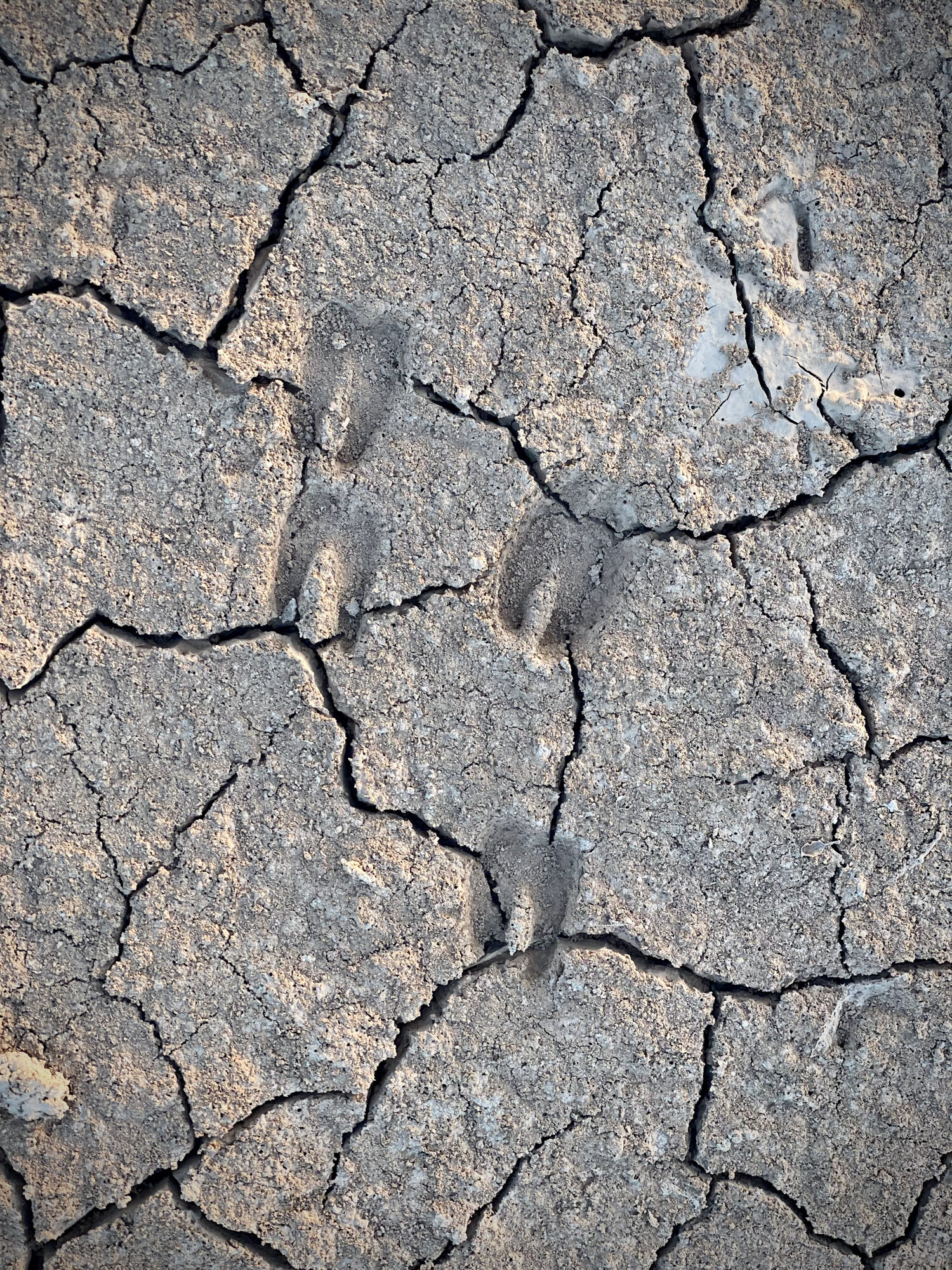
Notice the huge paws, the cut in her ear and slightly grumpy face, which gives her a very characteristic look - if anyone knows the name of this individual, please leave a comment!


She took a moment to chill in the short grass on the other side of the road, with the dramatic Patagonian mountain ranges in the distance, before making her way across the ridge, where it became impossible to follow her.

Queen
What an encounter! We probably spent almost 1h with her, observing different behaviors with no other soul in sight, in beautiful conditions.
Tip: One thing that I always find really useful when photographing unpredictable scenes like wildlife is to carry two camera bodies with different lenses with me - it’s hard to switch lenses in the field, and you risk missing the action. I used a previous Olympus flagship model for the wider angle photos here, and it is quite affordable nowadays, perfect for these situations.
Take a look at this video for a few clips of this amazing moment.

A few days later we did in fact have another Puma sighting in the very last light of the evening - this is the best photo I could get before it disappeared, putting the quality of the first sighting into perspective…

Puma Presence
We came back to the same area the next day, but she and her two companions were nowhere to be found. Instead, we opted for a small hike along the hills - probably crossing her territory. Guides are mandatory due to the presence of the cats, but the goal this time was to see evidence of humans, rather than cats.
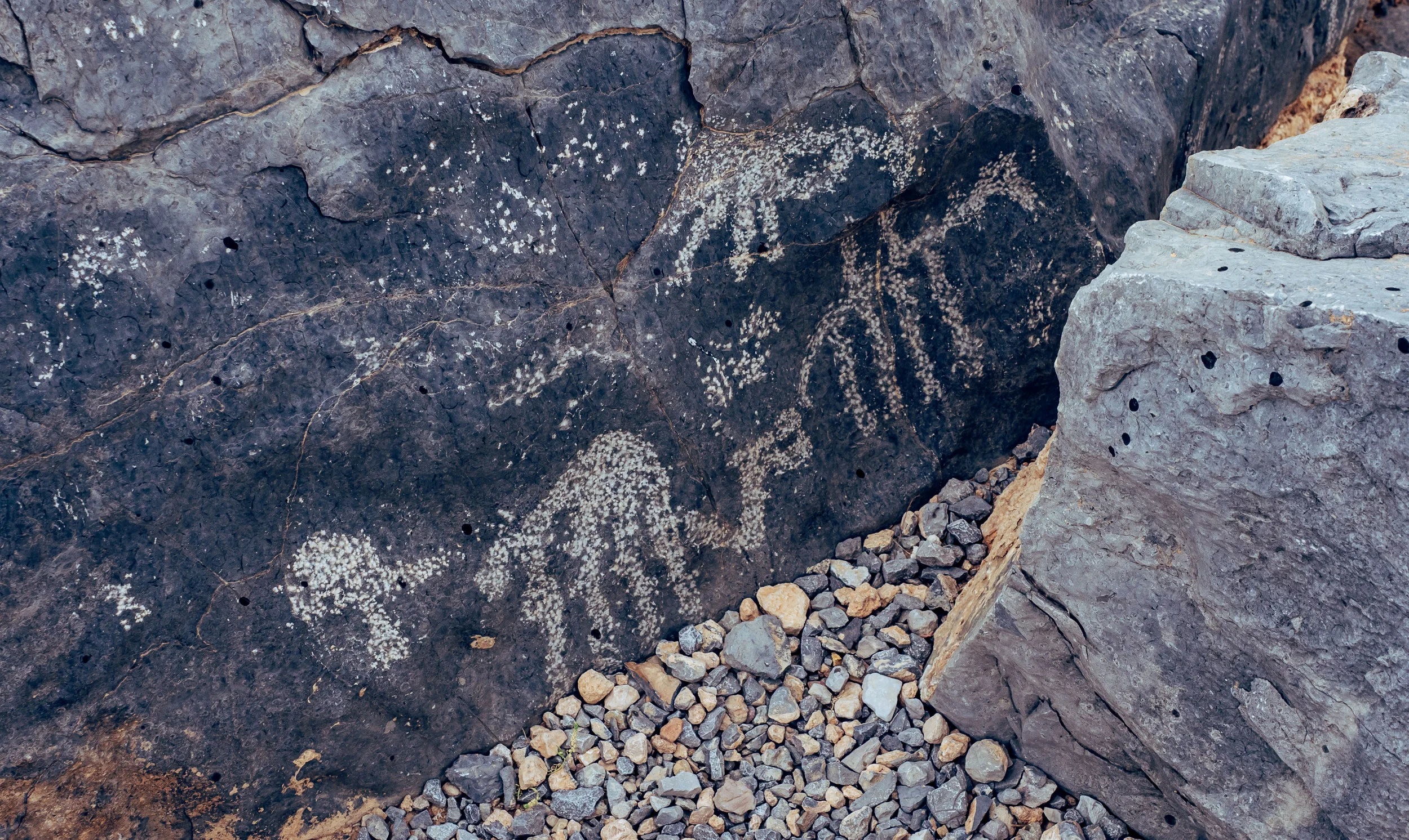
There are a few places in and around the park with pre-historc rock art - this one is fairly easily to reach after about an hour of moderate hiking. These petroglyphs are from the ancient Aonikenk / Tehuelches culture, the nomadic tribes that once inhabited this area. The paintings on the cave ceiling in the left image are about 6500 years old.


Lago Grey & its Glacier

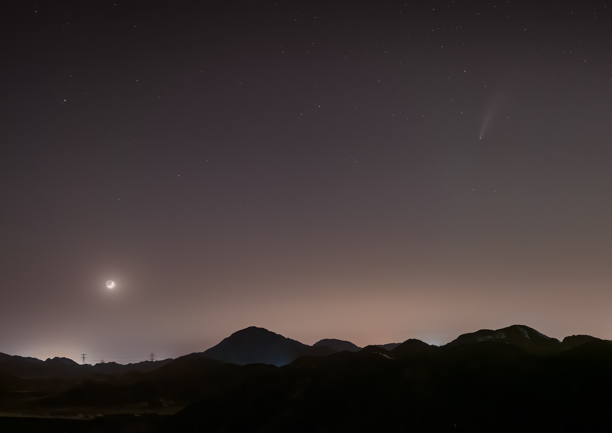
The quest for these big cats was also the reason landscapes and the longer hiking routes to or around the peaks (which can take 5-10 days) had to take a backseat - plus, the rising moon (and frequent clouds) didn’t make Milky Way photography an option during my visit, but I may be back for that…
Having said that, I moved to a different hotel for the last two nights, this time on the west side inside the park to explore its most famous glacier, feeling a little bit more relaxed after the successful Puma quest.

The calm shoreline of Lago Grey at sunrise, with the glacier just about visible as tiny bright blue spec in the distance on the left. In fact though it’s almost 6 kilometers wide, and the front face over 30 meters tall.

Iceberg Alert
It regularly calves, leaving large floating icebergs in the water, which gently make their way to the shores of the lake, where they slowly melt away.
The goal was to get much closer though, taking a boat across the glacier lake for a better look at the details. I had the chance to explore glaciers in Alaska before, and while there are always similarities, every one is its own incredible feat of nature, with the heavily compressed blue ice slowly pushing its way down the slopes.


As the boat approaches, temperature drop noticeably and more and more ice appears on the lake, with the beautiful backdrop and earthy colors of the mountain ranges.
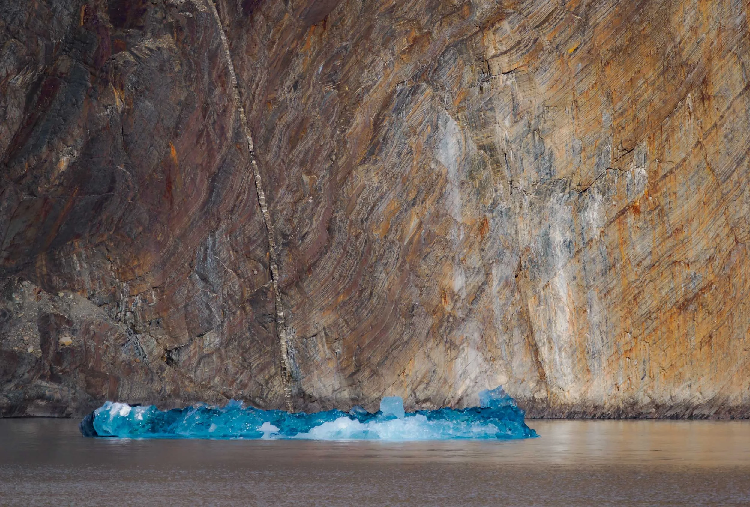

The glacier belongs to the Southern Patagonian Icefield - at almost 17,000 sqkm, it the world's second largest contiguous extrapolar ice field (the biggest being in Alaska).


Patagonia Aesthetics
Thev view towards the glacier from Hotel Lago Grey. Look closely to spot the boat that takes you close to the glacier.


One last morning view over the Cerro Paine Grande and its icey snowcapped mountaintop from a small waterfall near the (very expensive) Explora hotel. We saw a number of Puma prints here, and the accompanying smell also indicated they may have been here the night before, leaving their marks, but remaining unseen - to us anyway. But we had our moment.
And that was it from my trip to Patagonia, but I would say chances are high I might be back...
Disclaimer: This post contains a sponsored link from which I earn a small amount, but all the content absolutely represents my true opinion and is factual to the best of my knowledge.
Subscribe to my newsletter to get notified and don’t miss out on more Wonders of the Globe.
Other Recent Posts:
The Bavarian Alps - Blue Skies and Fluffy Clouds
Over the last year I took the chance to photograph a few of the highest peaks of the Alps around my hometown in Bavaria, Germany.

Over the last year I took the chance to photograph a few of the highest (and most accessible - yes I was lazy and mostly used railways and chairlifts to get to the top) peaks around my hometown in Bavaria, Germany. Below is a collection of images from the trips.
Wendelstein
This is one of the highest peaks in the Bavarian Alps, at over 1800m. It features a railway originally built in 1912 on one side, and a cable car on the other, and the top is home to a church, a weather station and an observatory.


Kampenwand
At almost 1700m and an impressive rock formation to top it off, this is a very impressive peak of the Bavarian alps. It features a 12m cross on its peak. A cable car from 1957 takes you close to the top, but the final peak is a steep hike.


Hochries
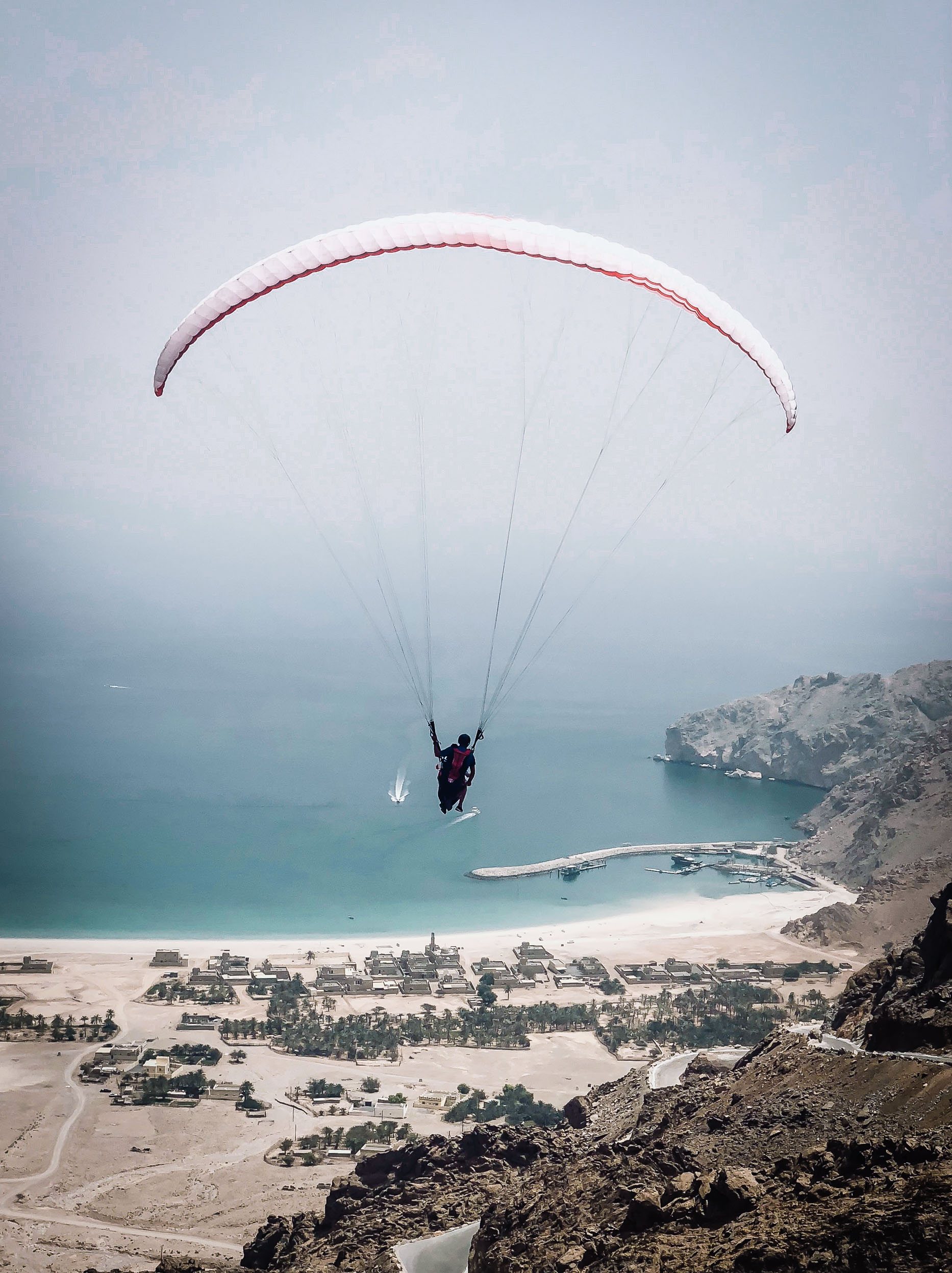
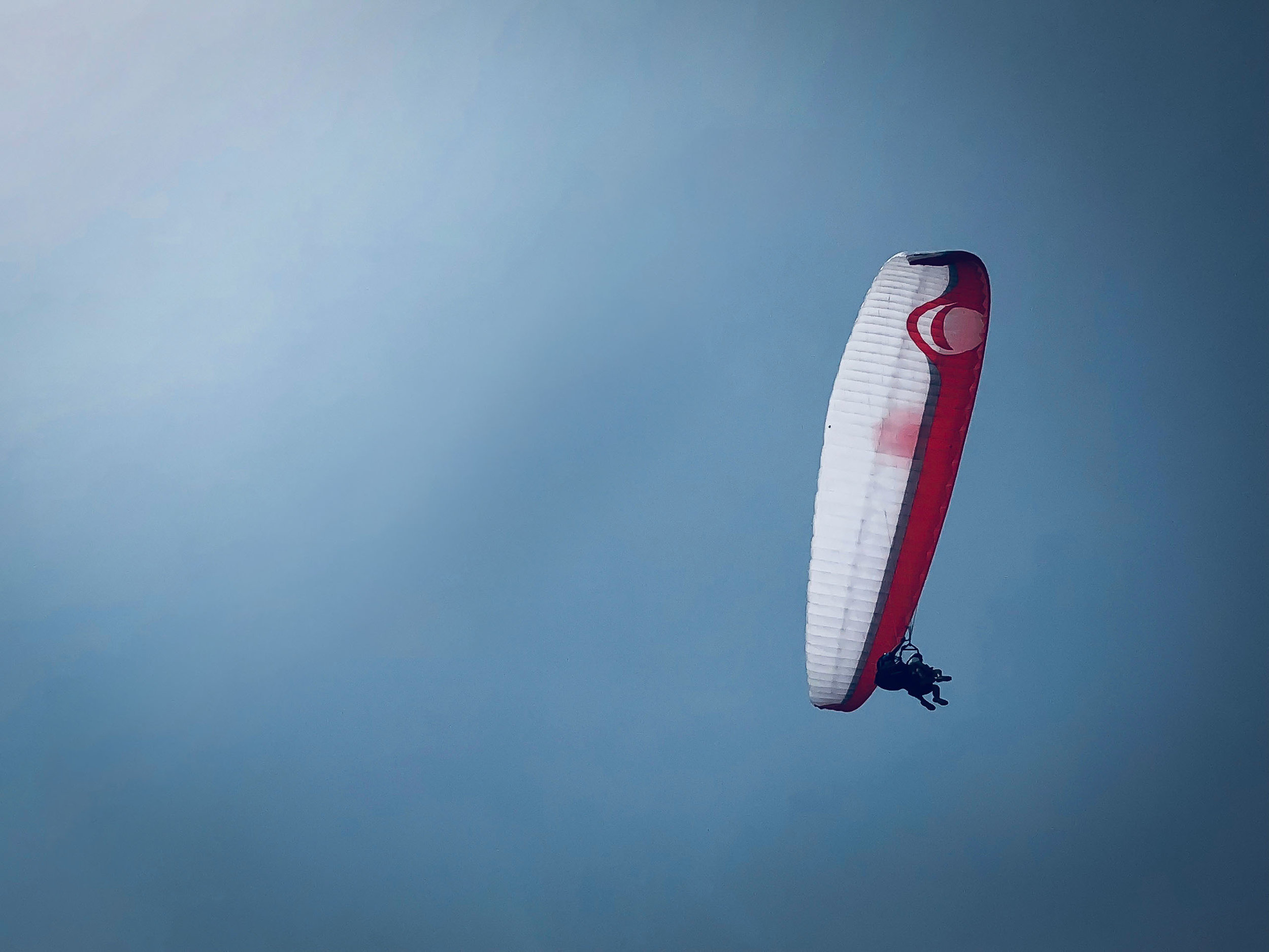
At just short of 1600m, this is the smallest of the three peaks I’ve visited. It takes a short chairlift and a cable car to reach the top, which offers beautiful views over the valley below. This area is very popular with paragliders.


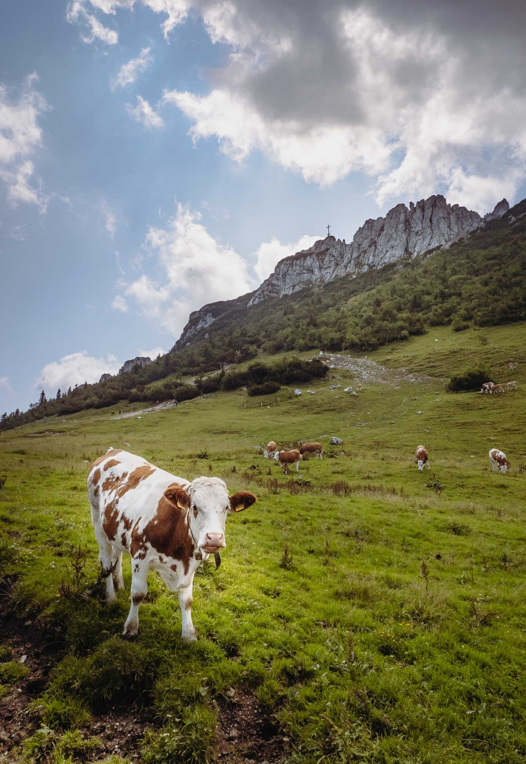
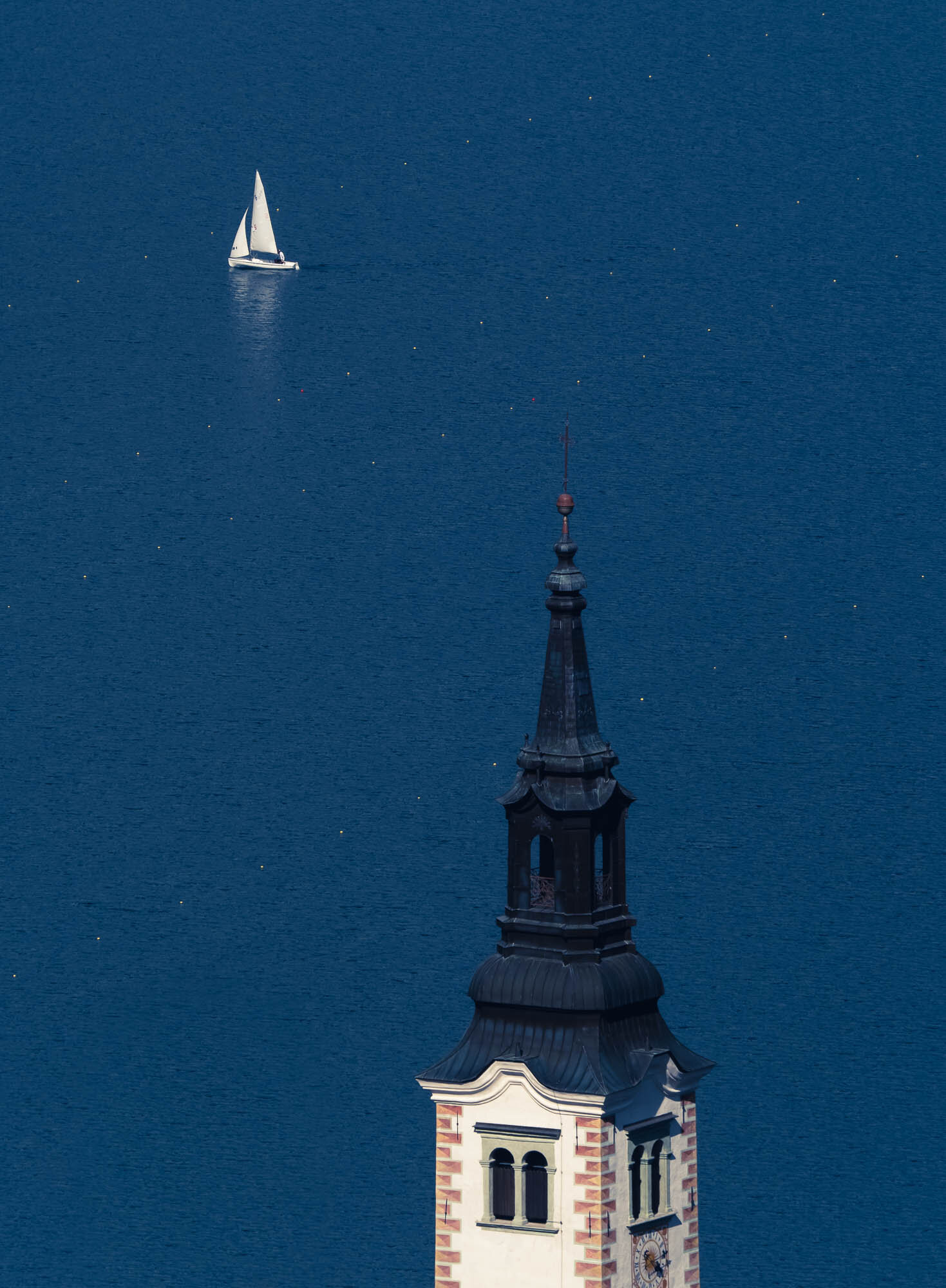
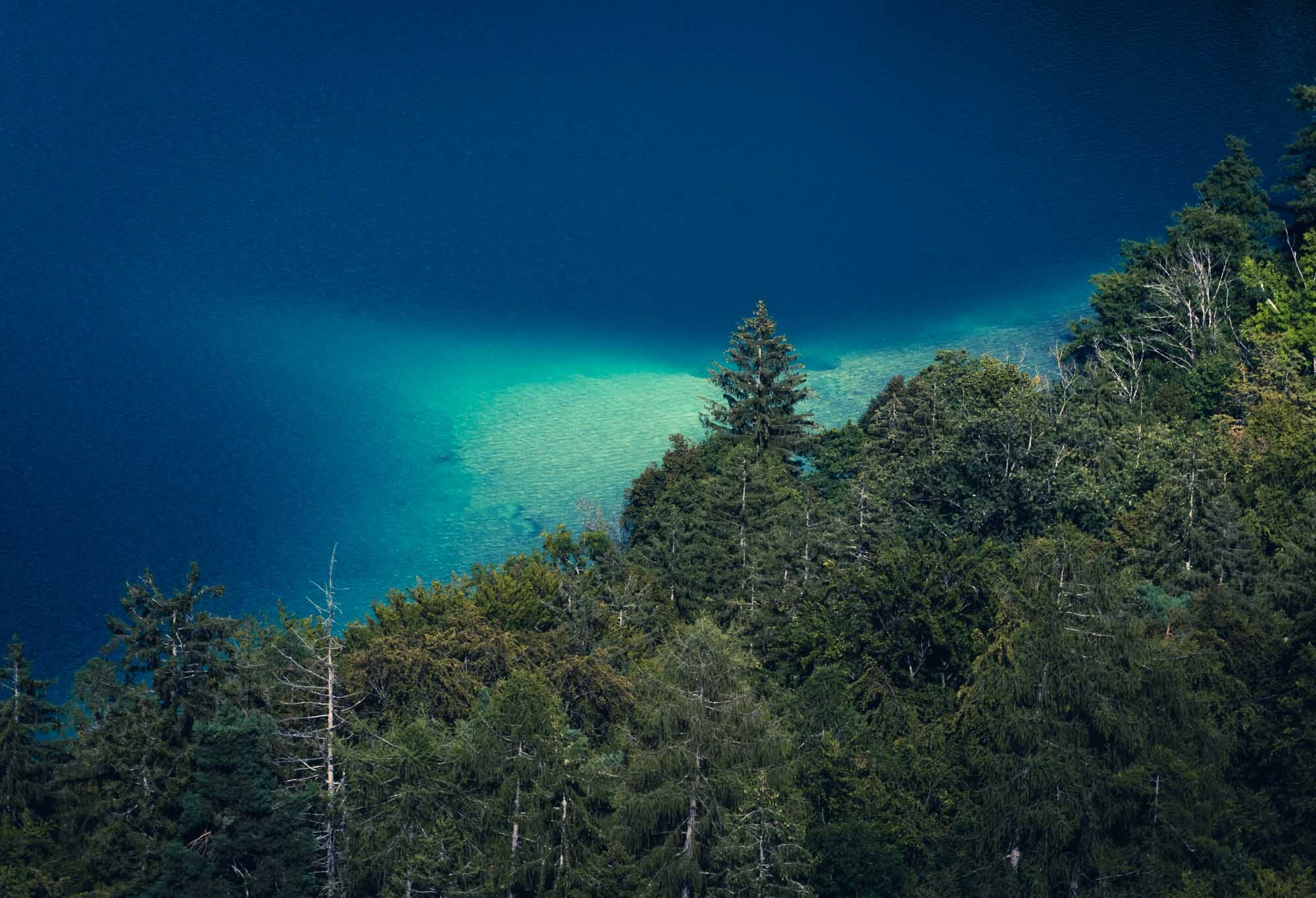
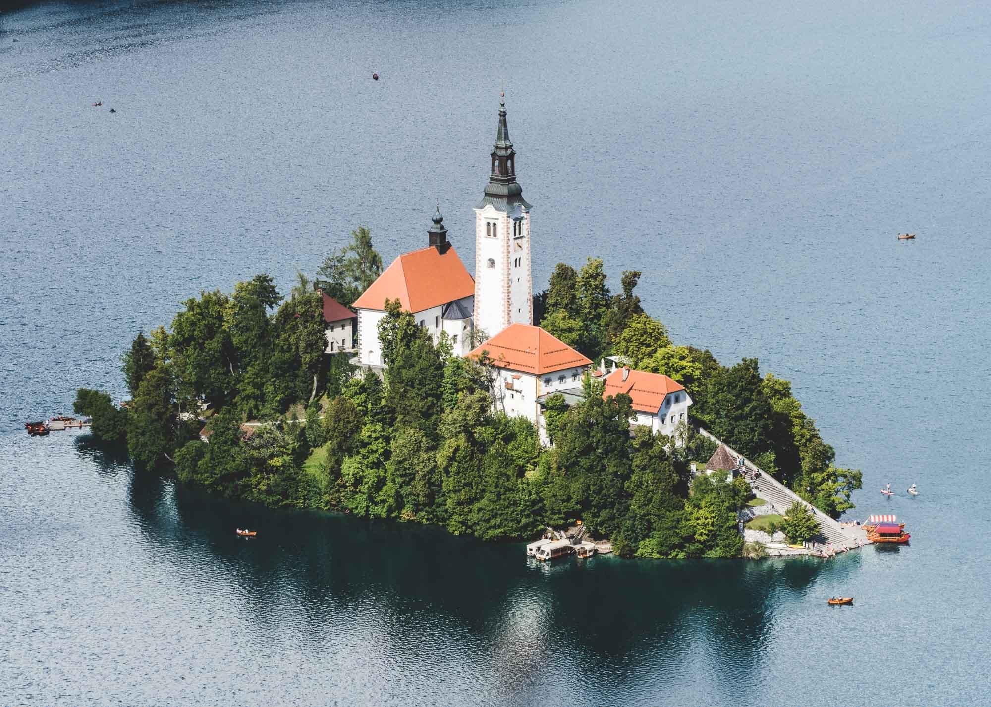
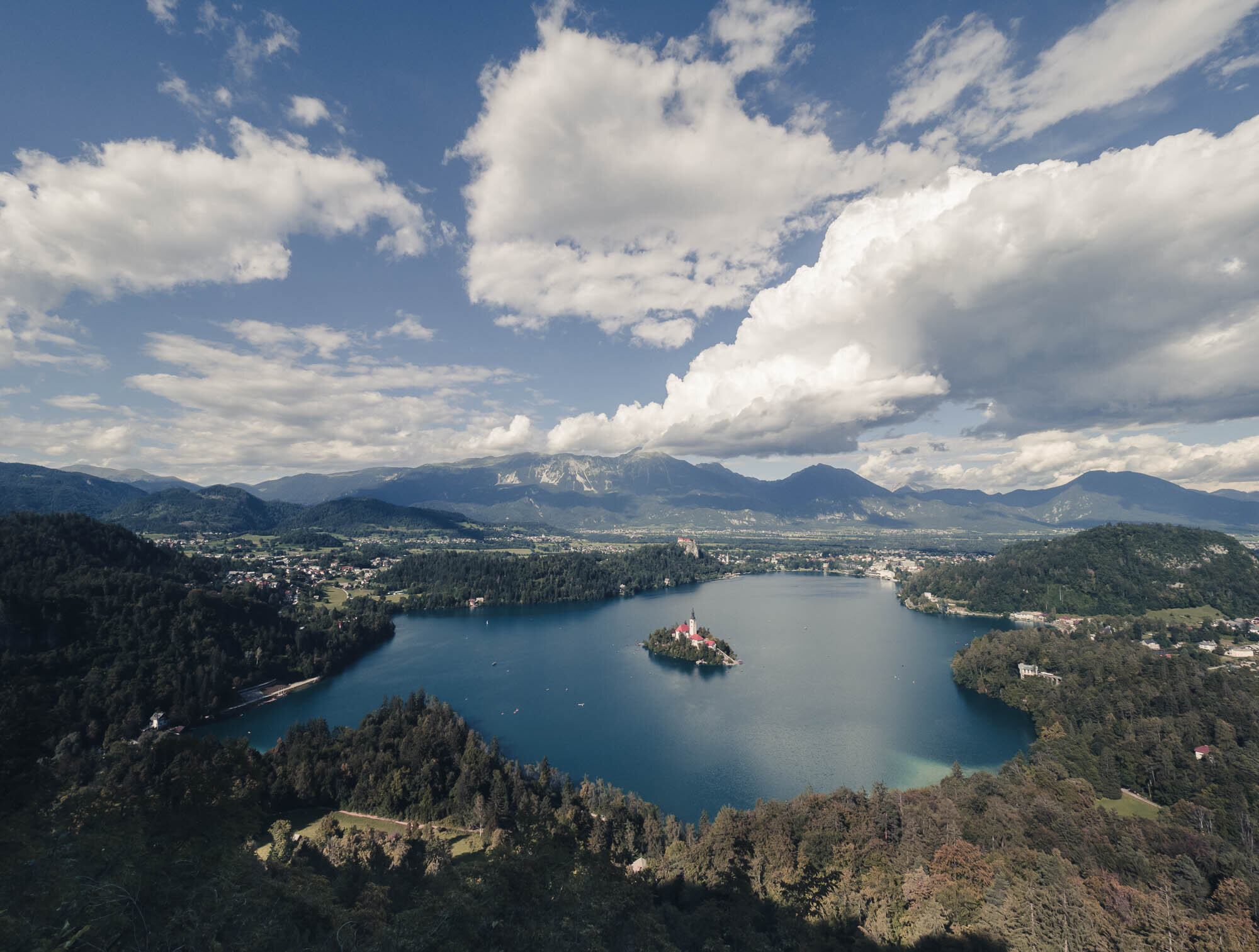
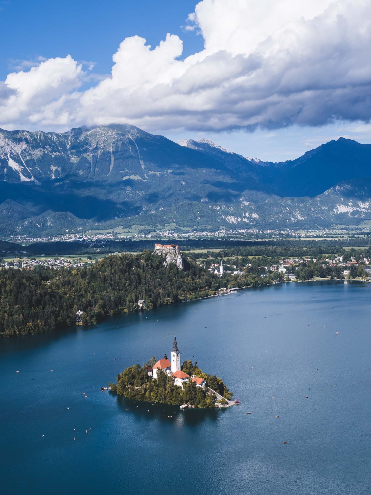
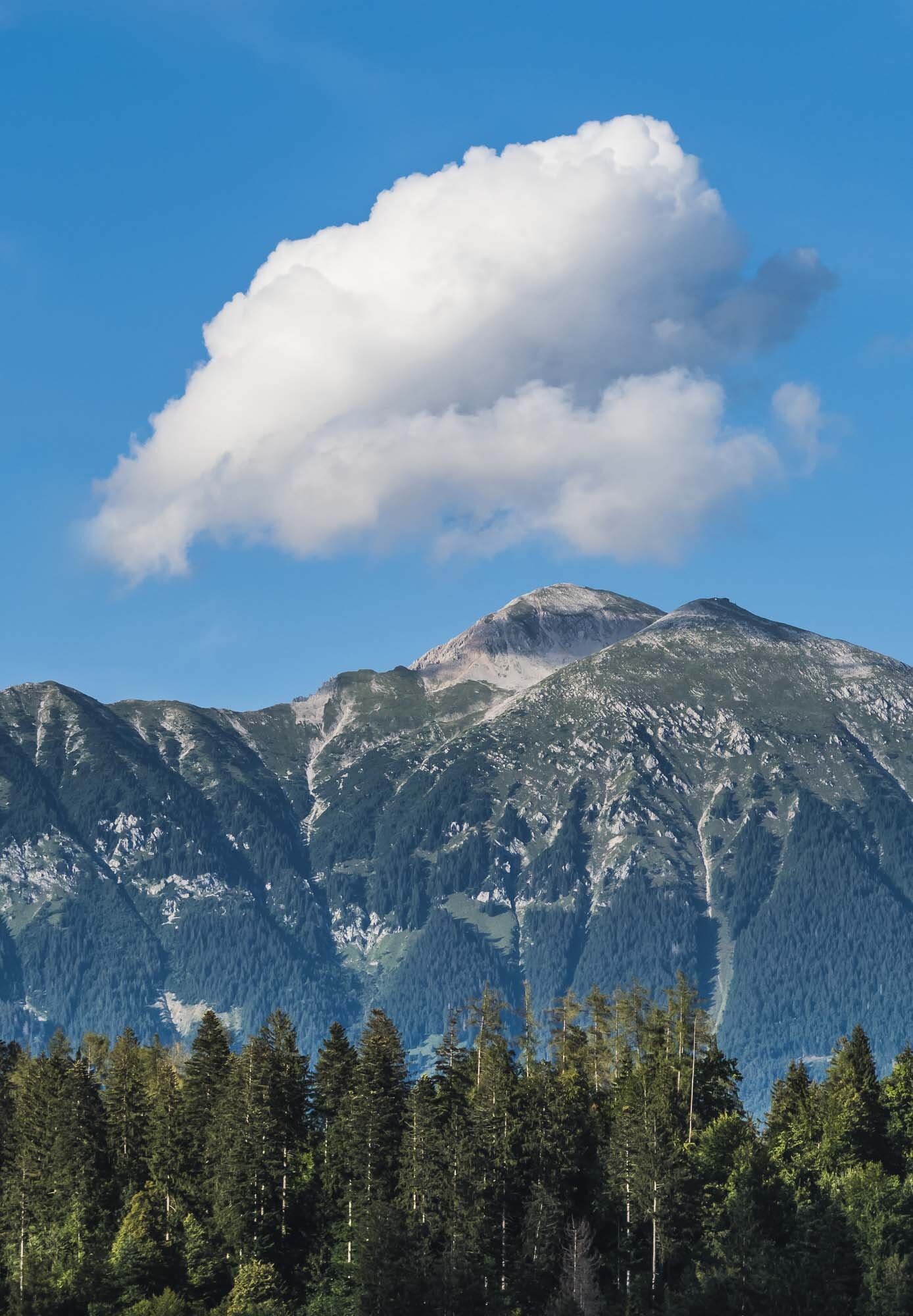
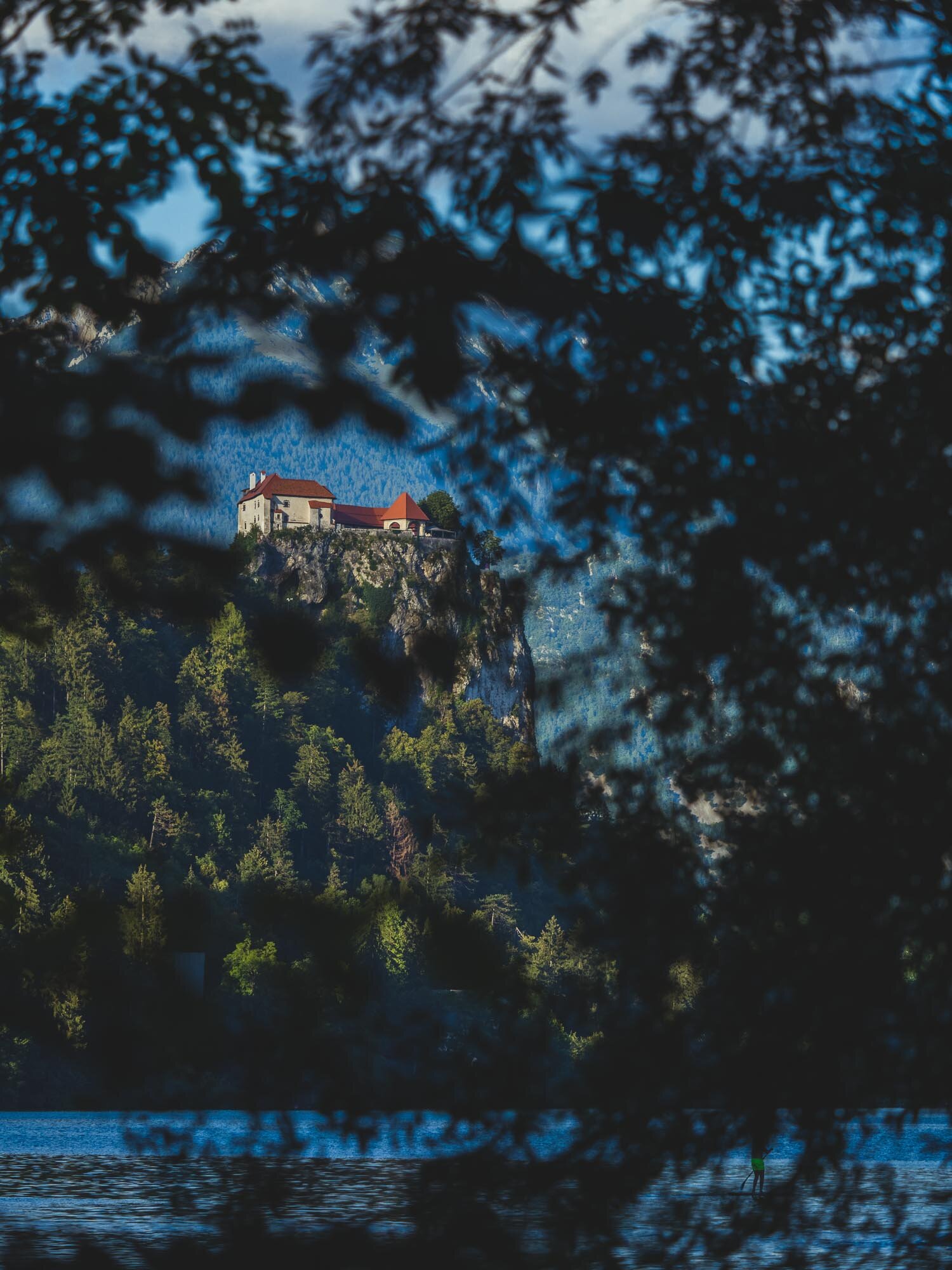
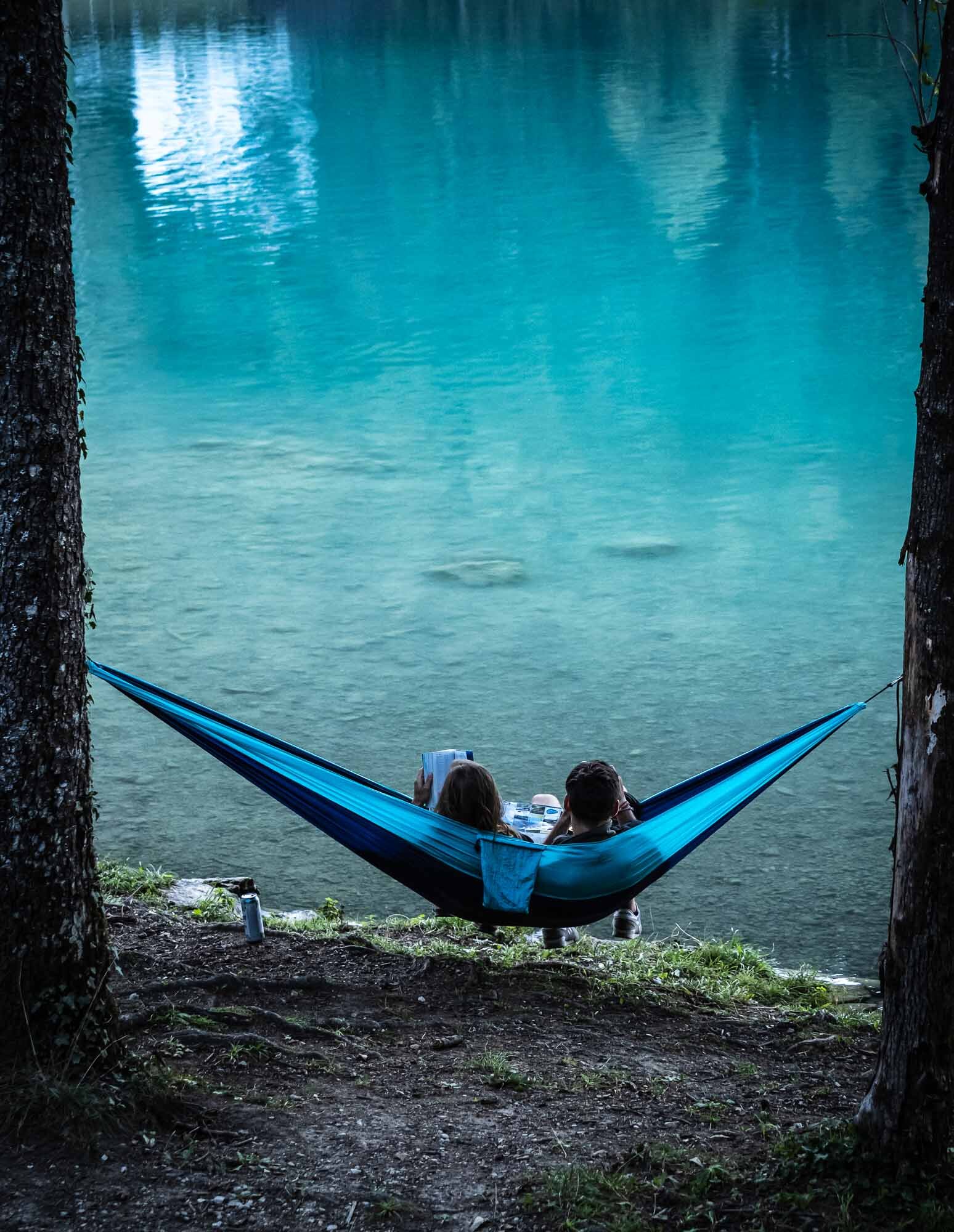
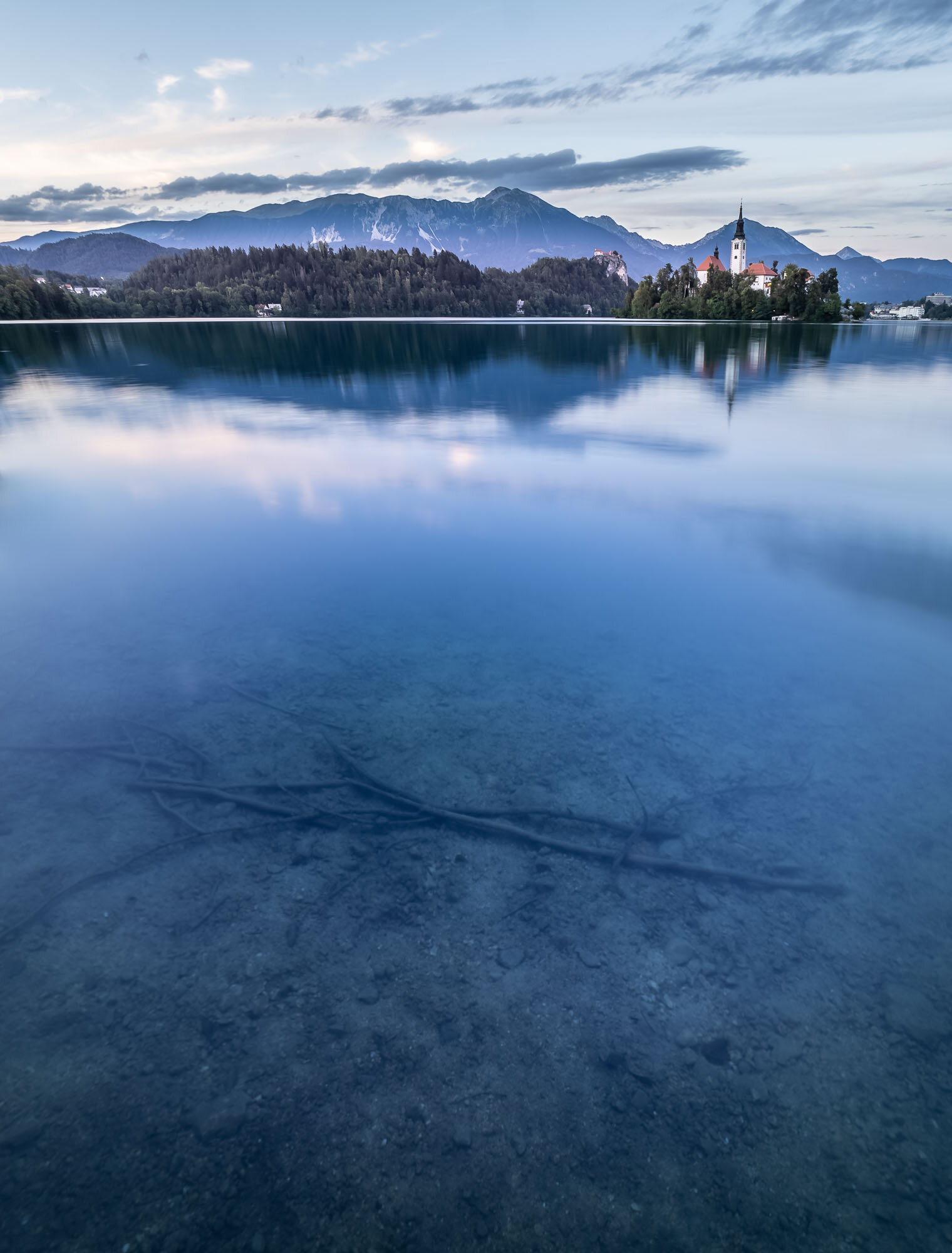
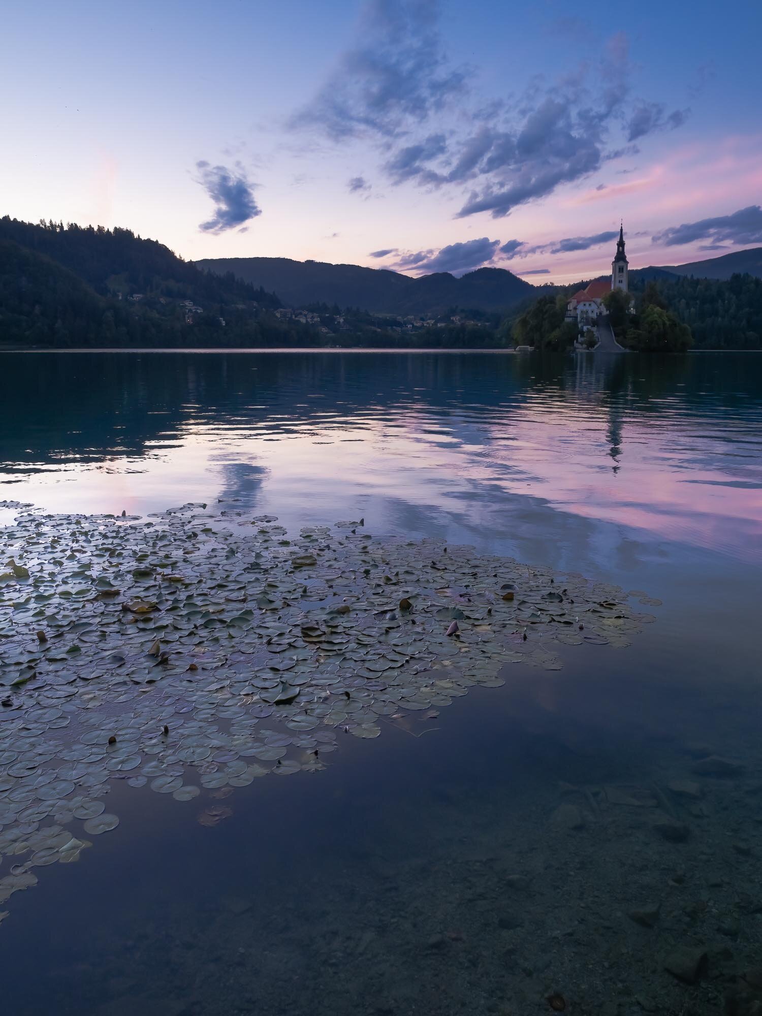
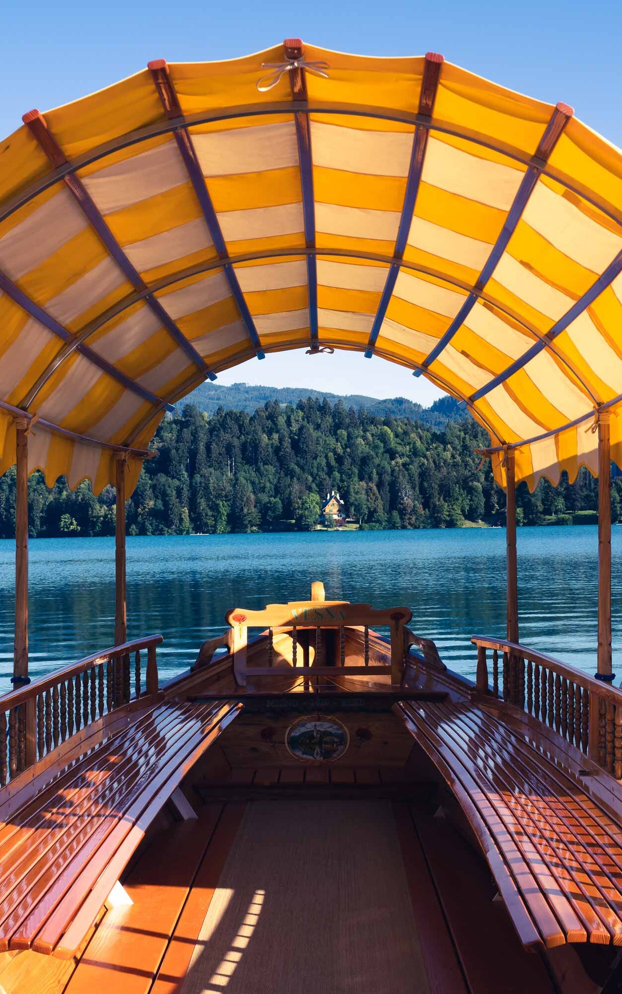
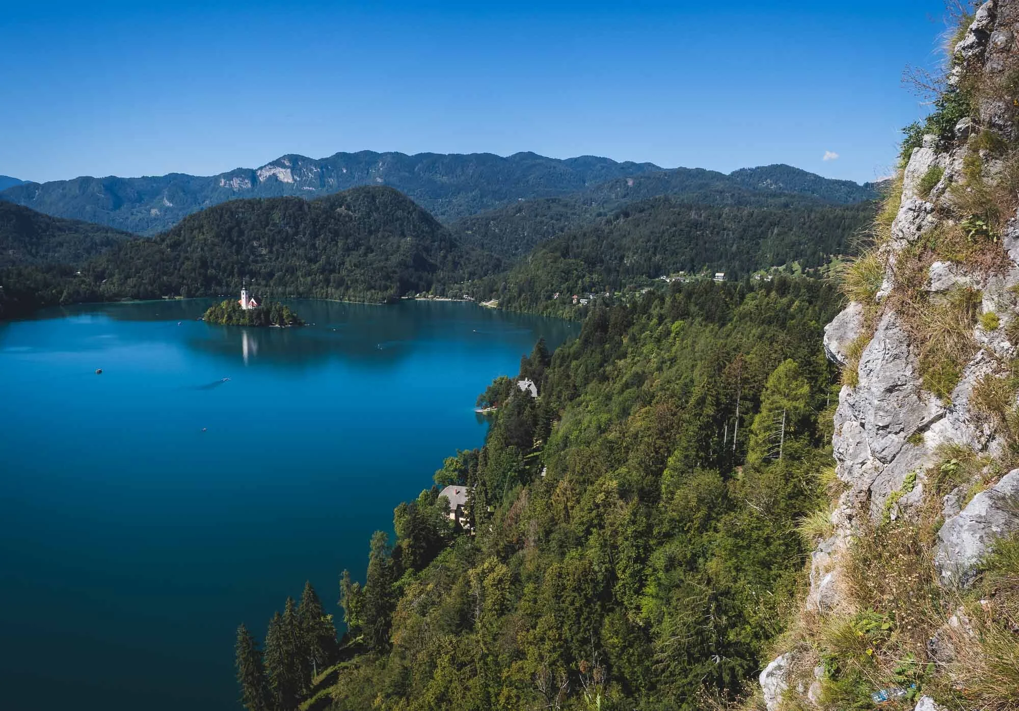
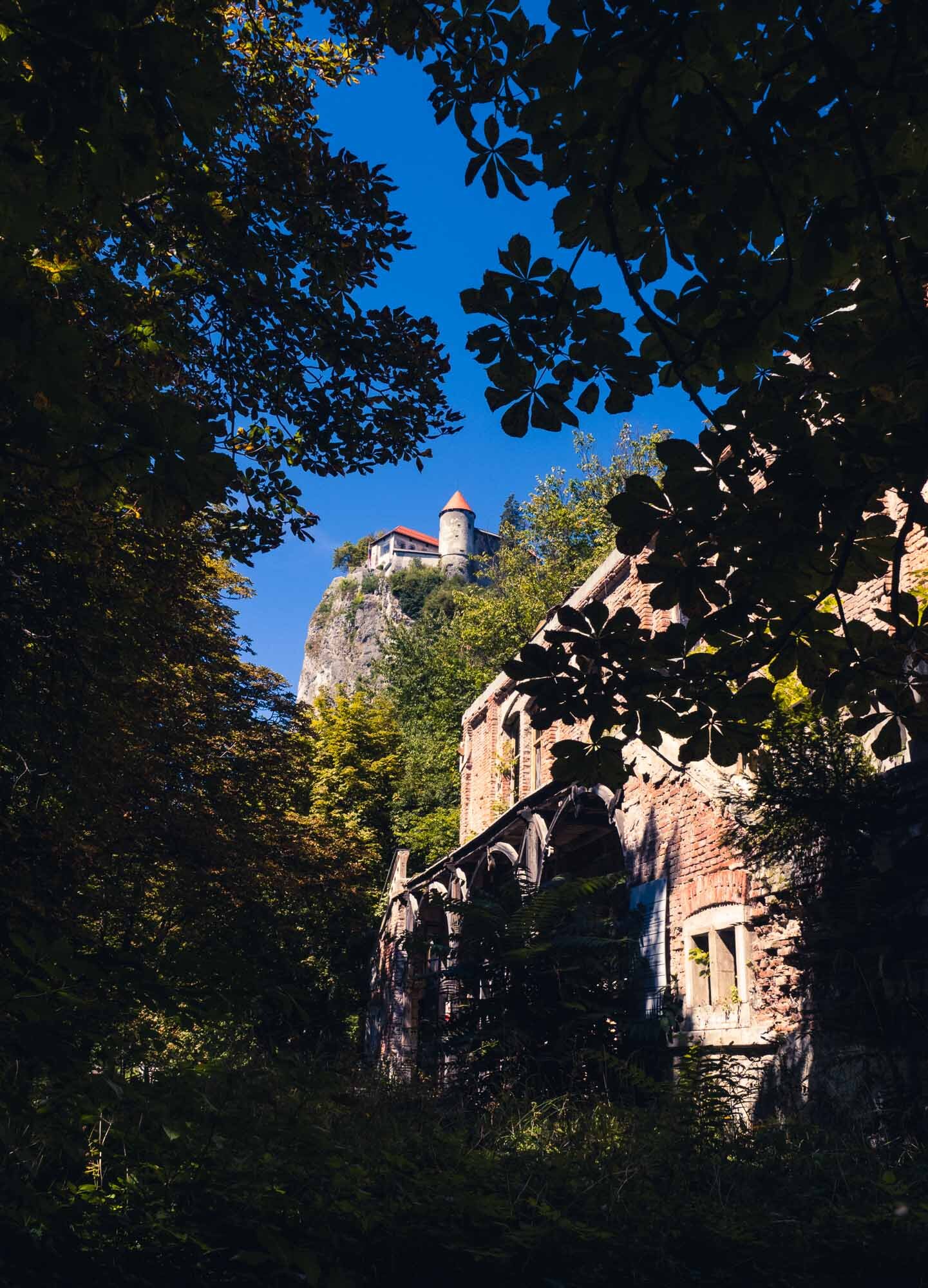
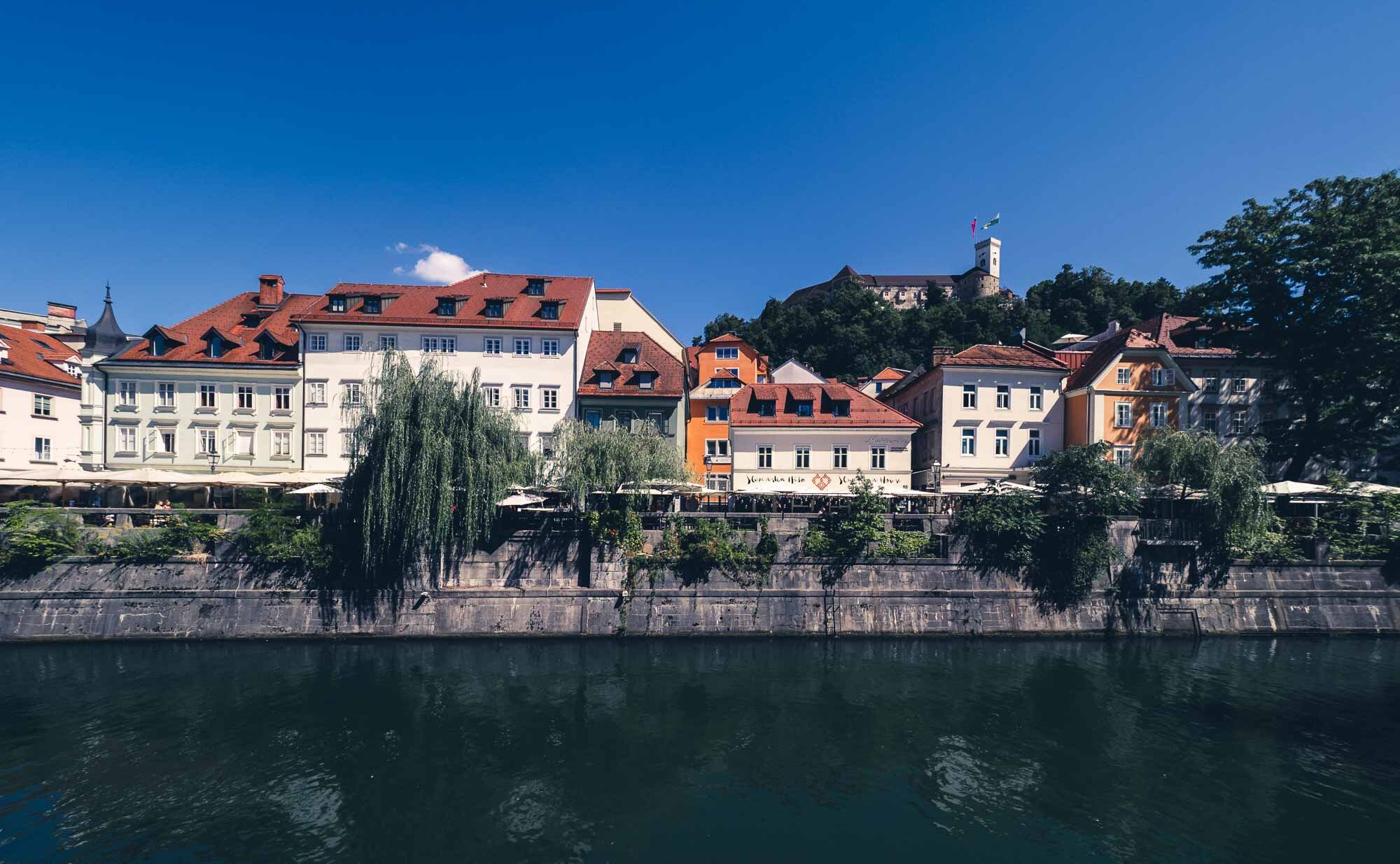
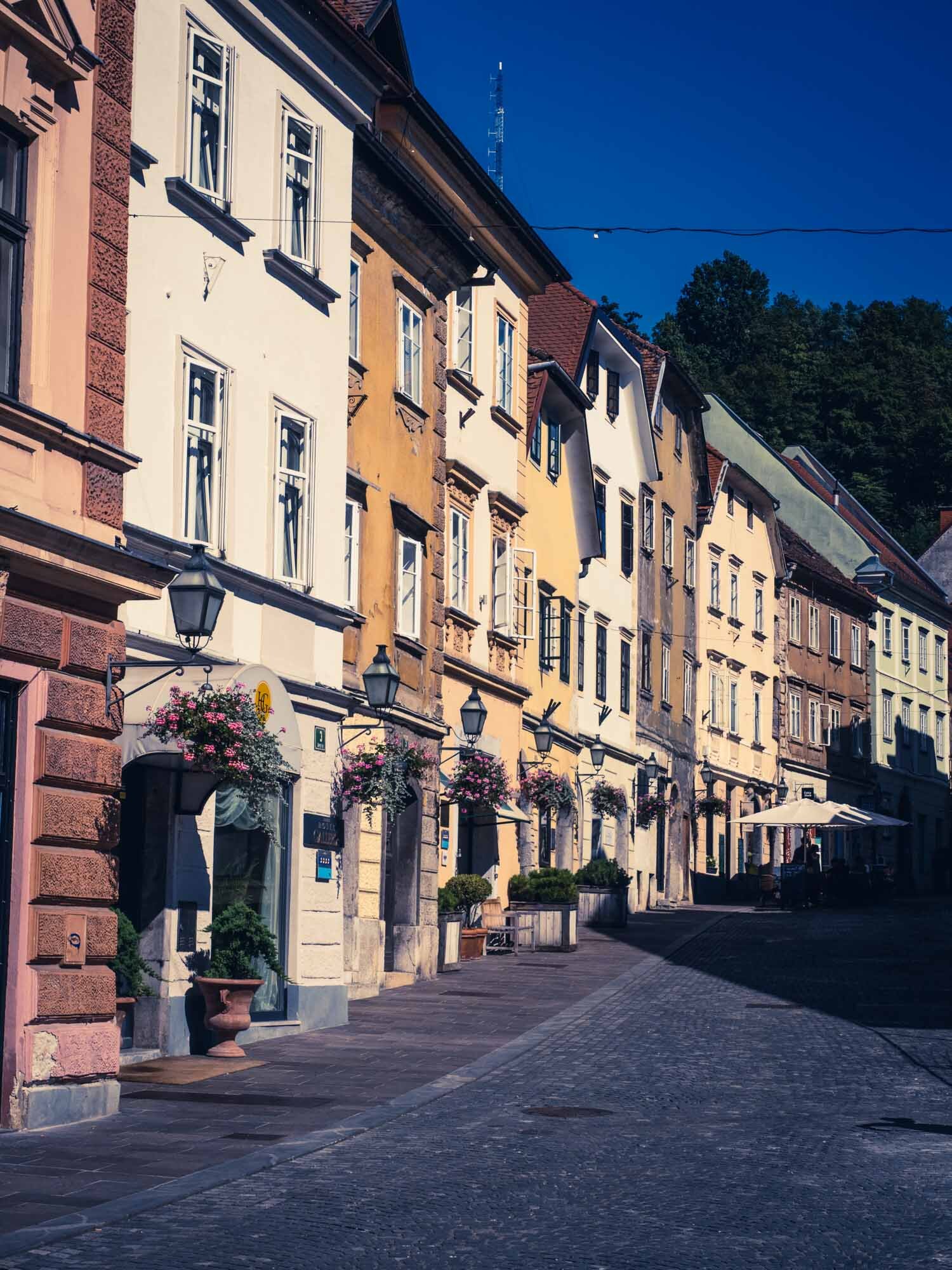
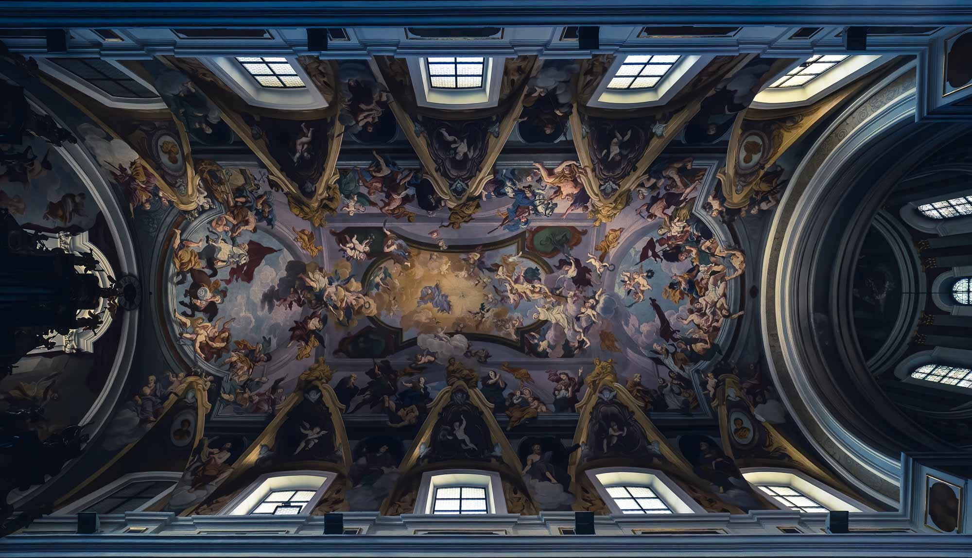
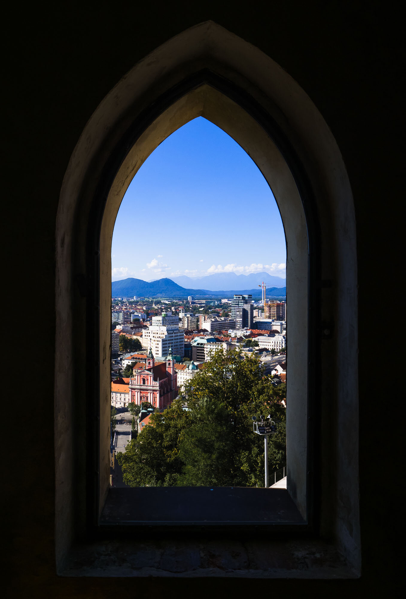
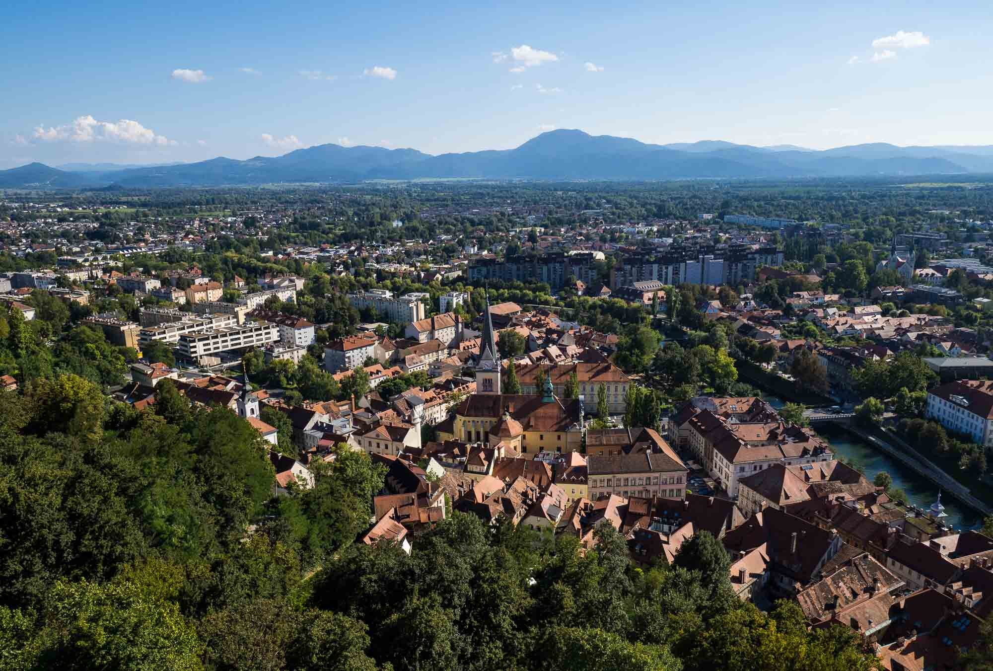
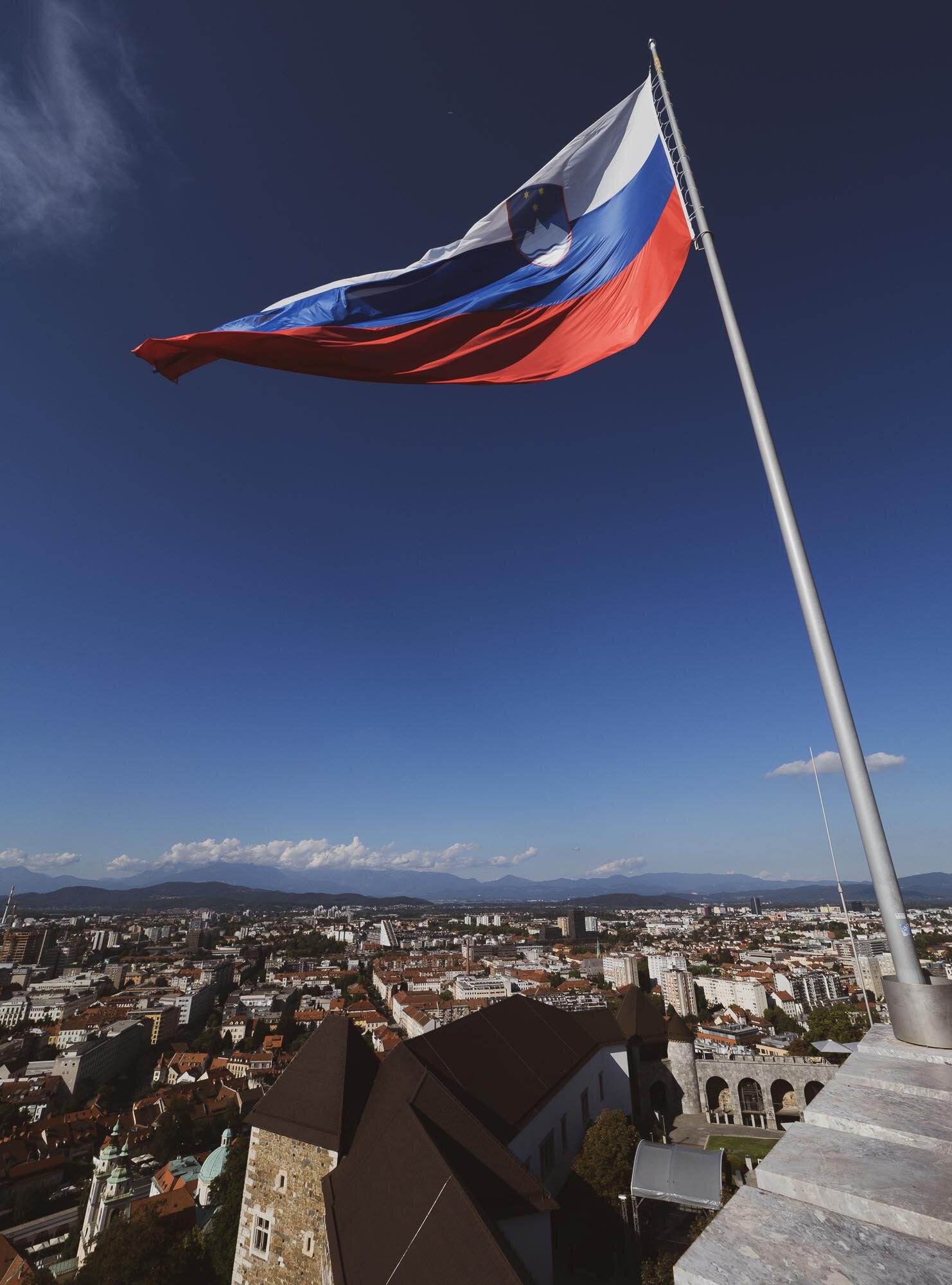
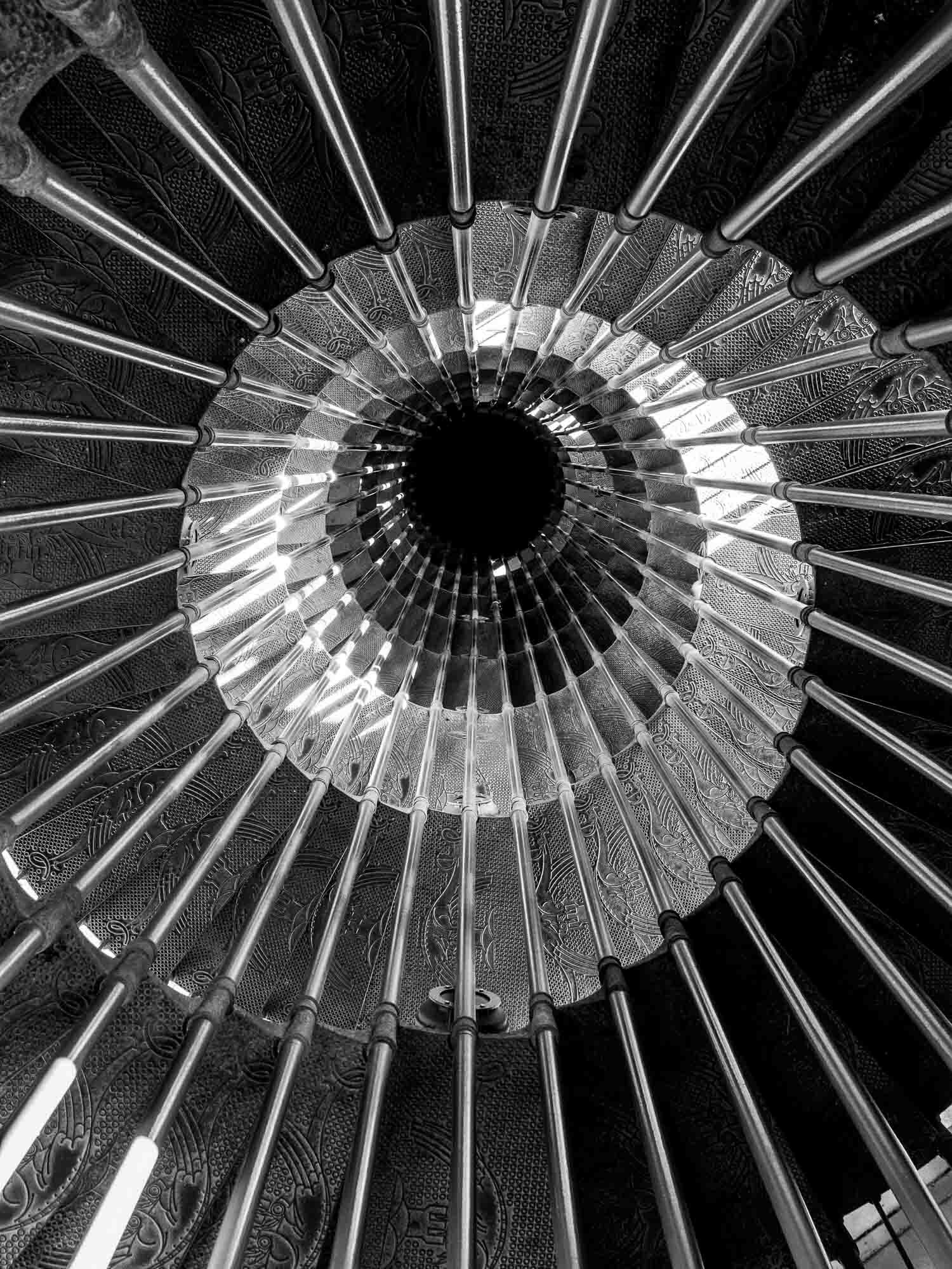
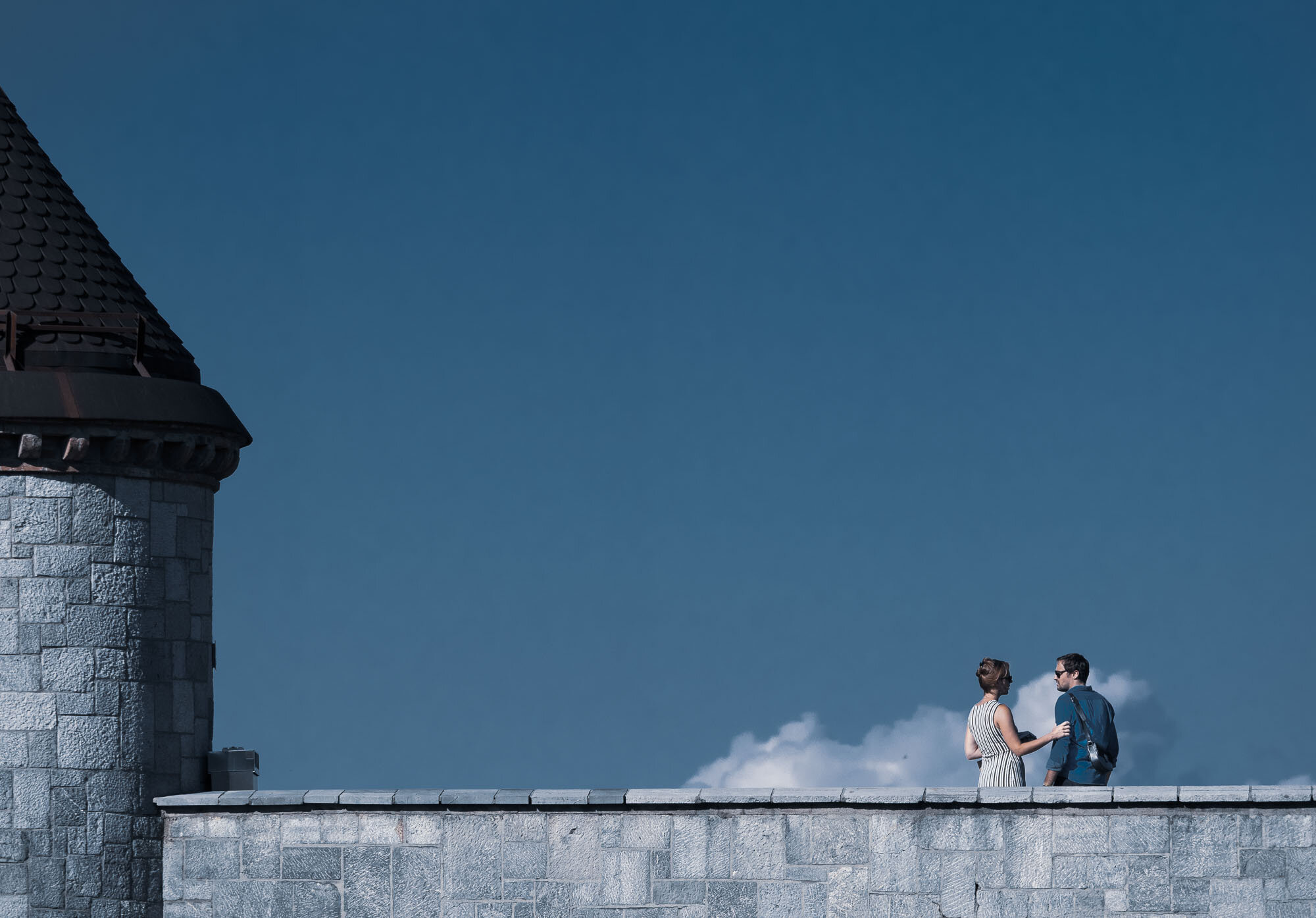
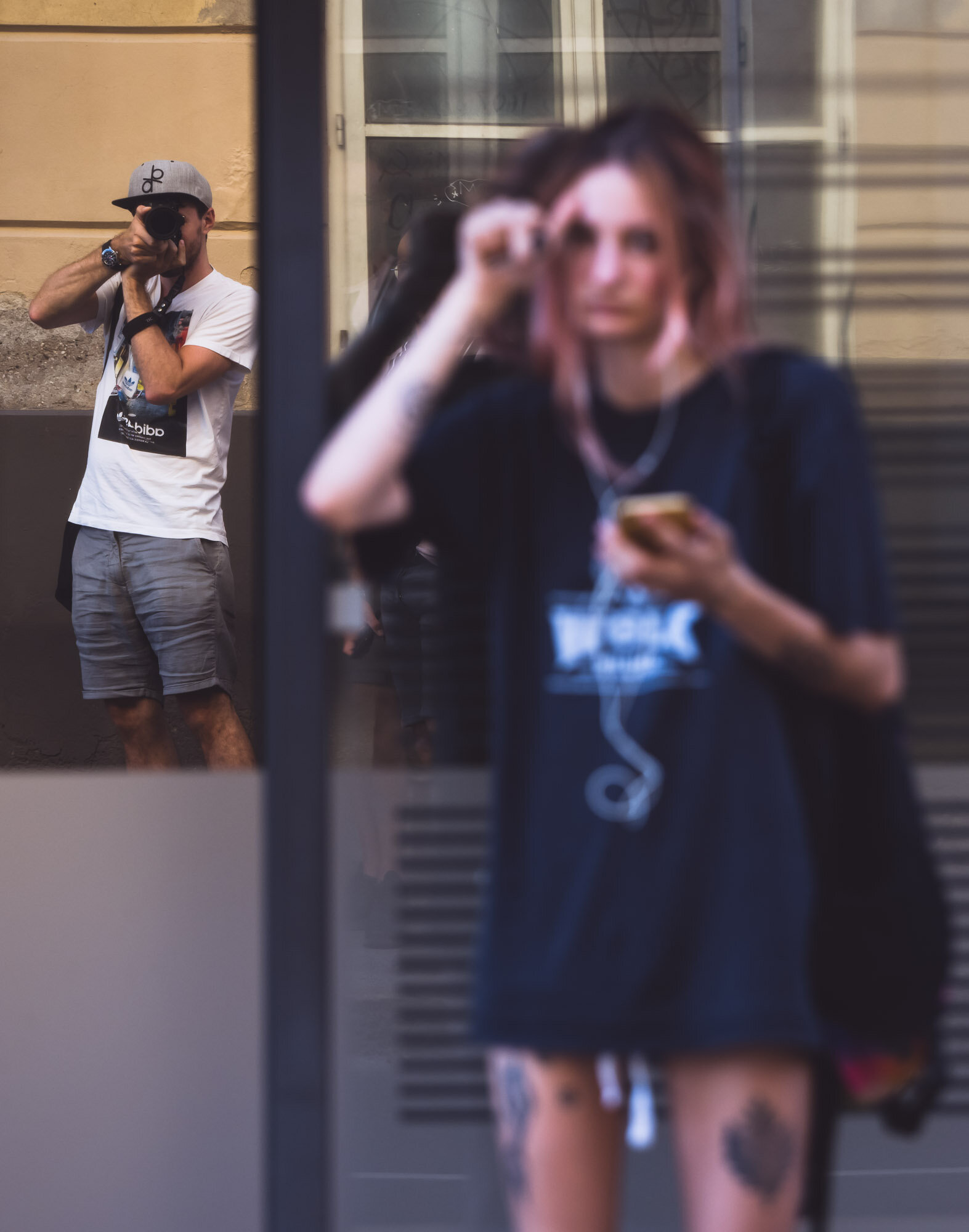
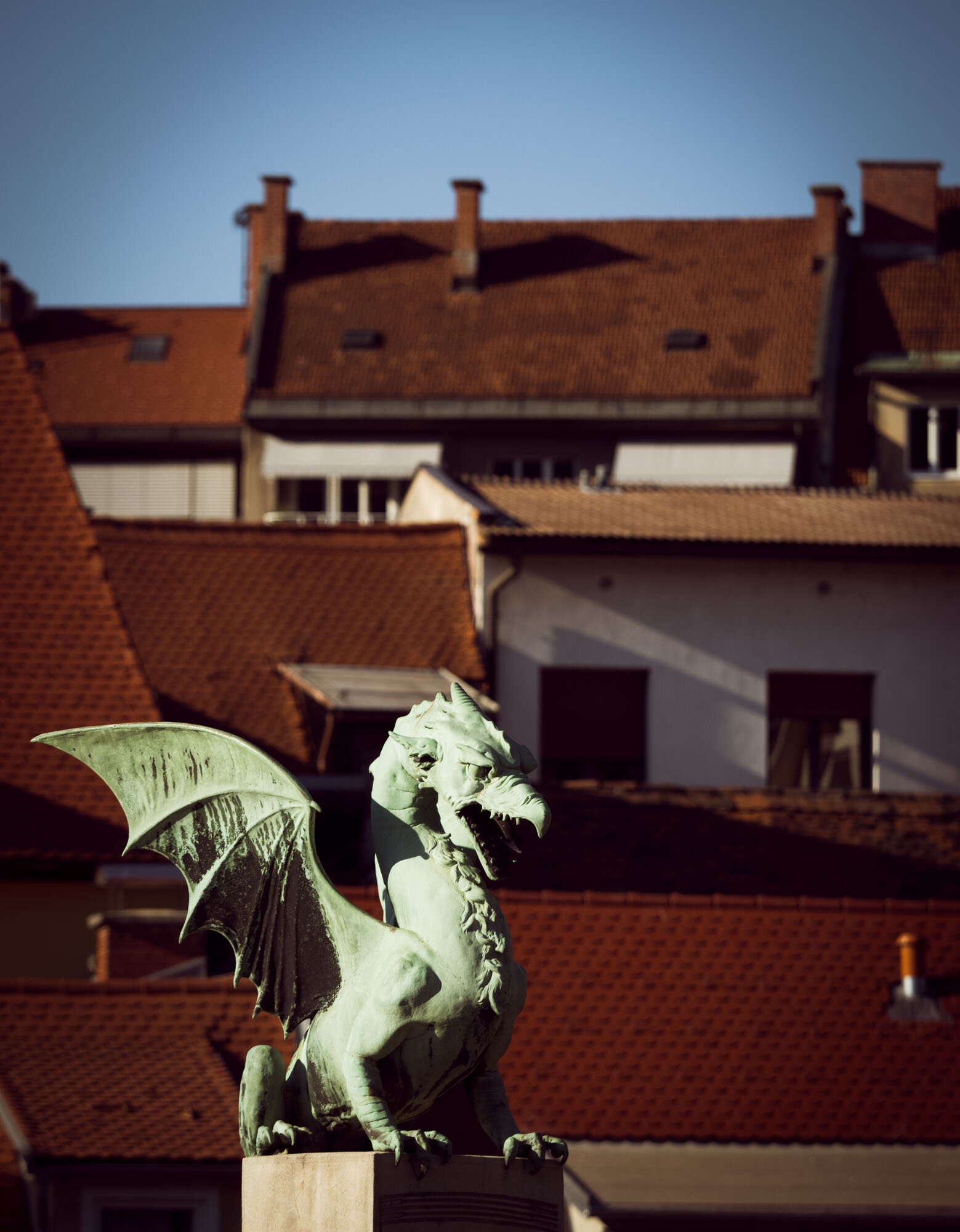
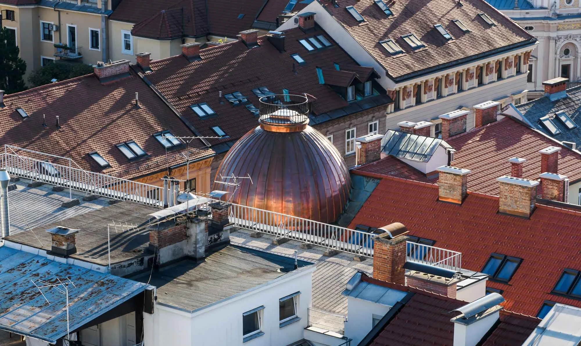
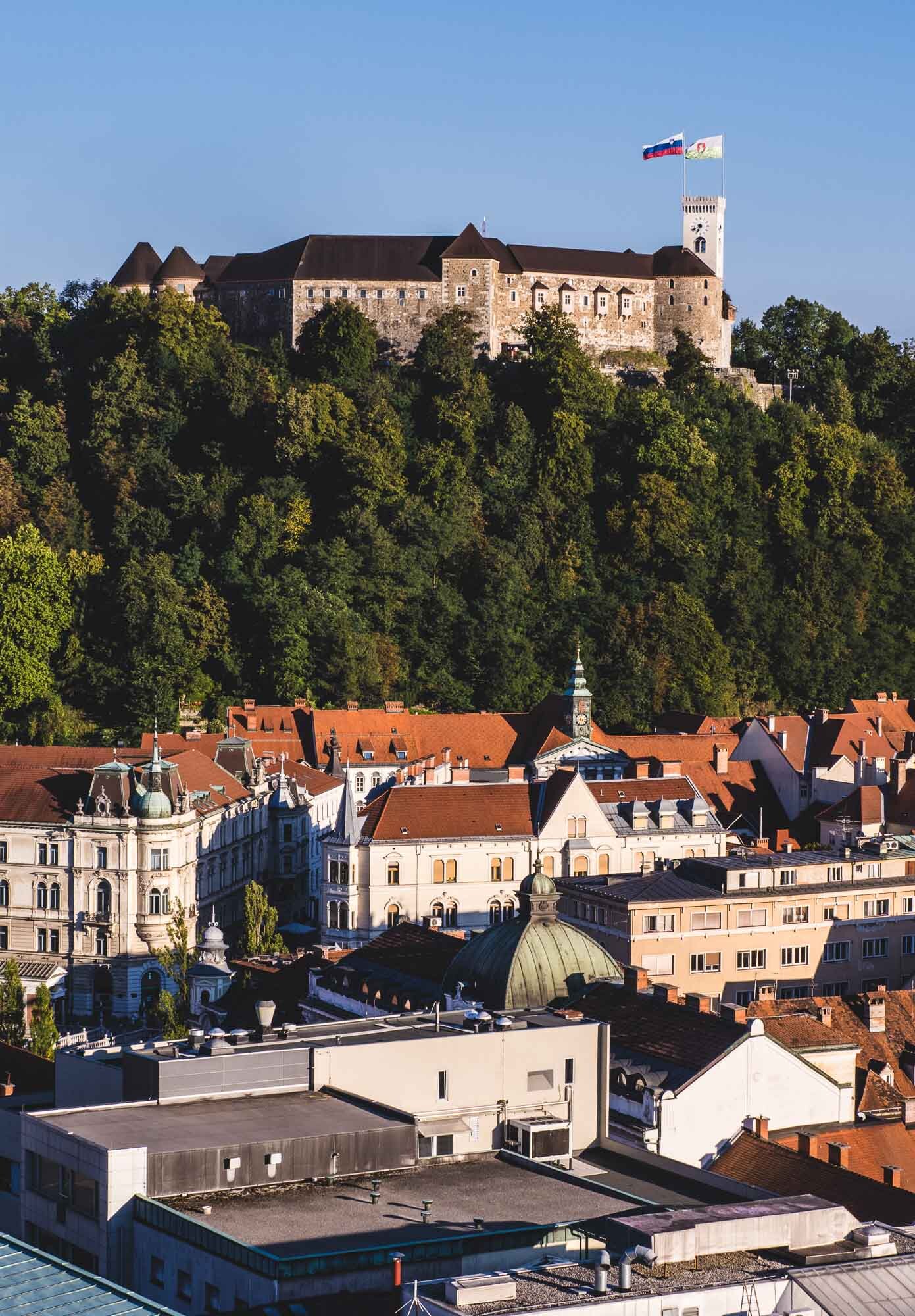
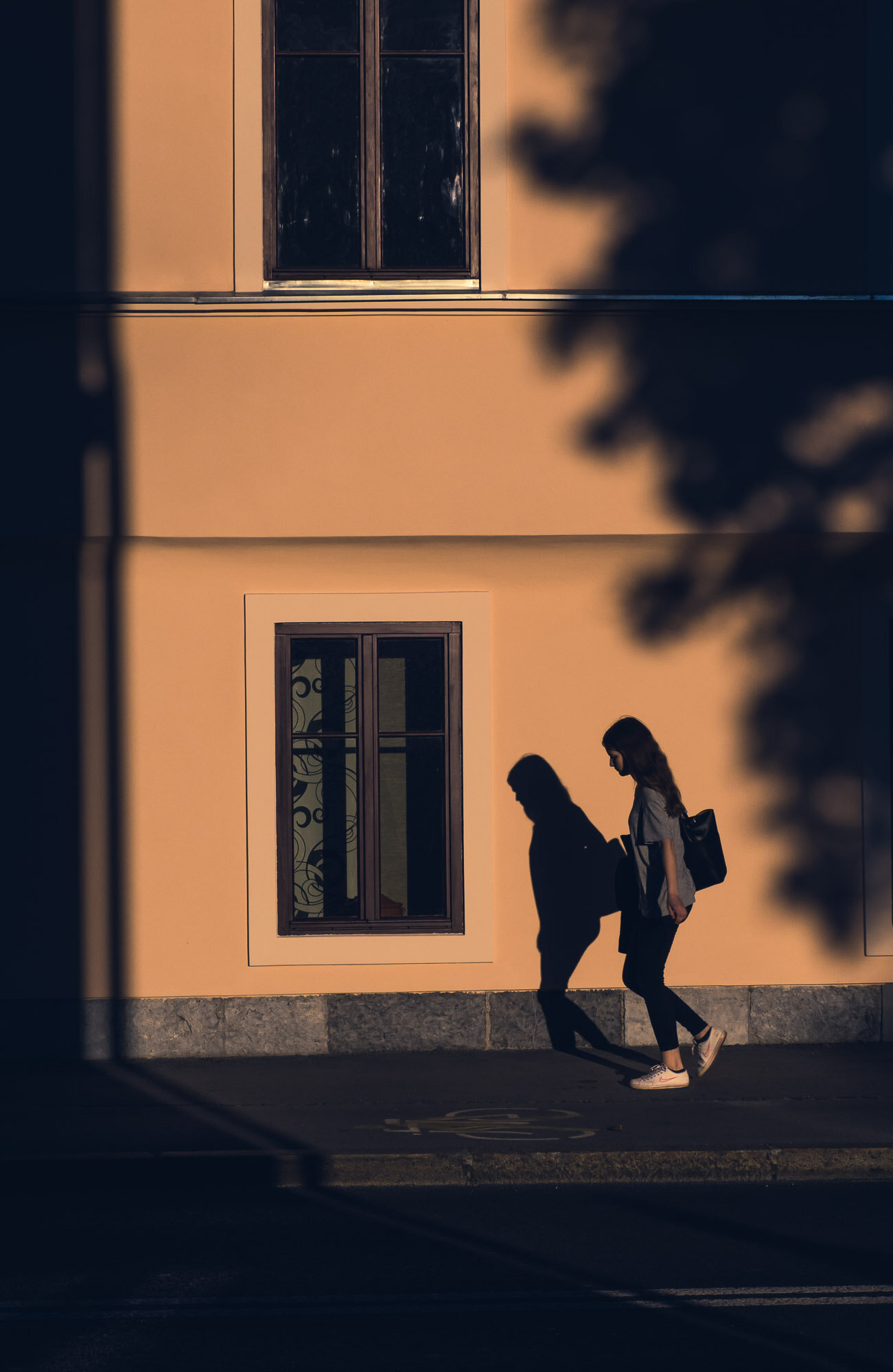
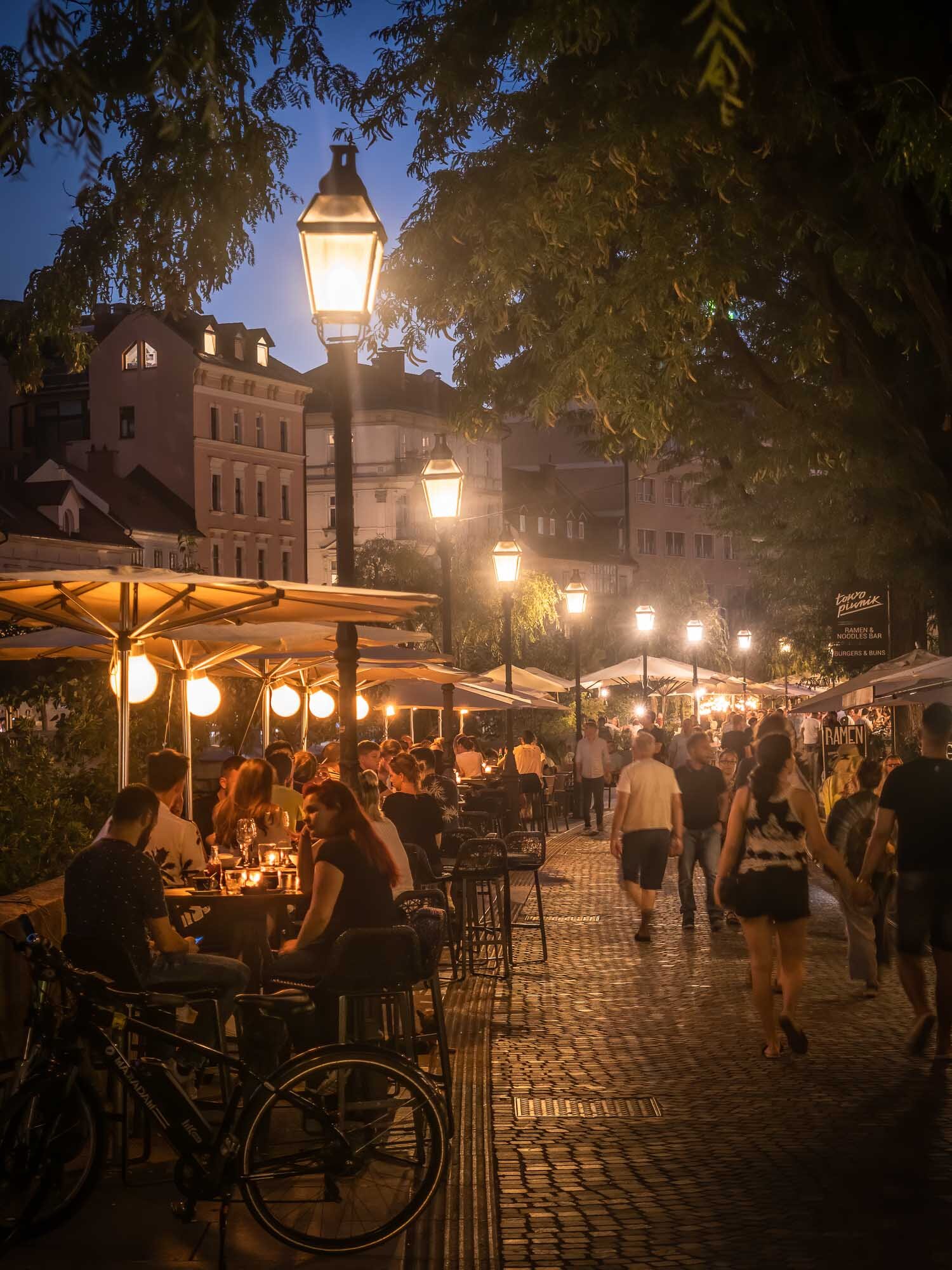
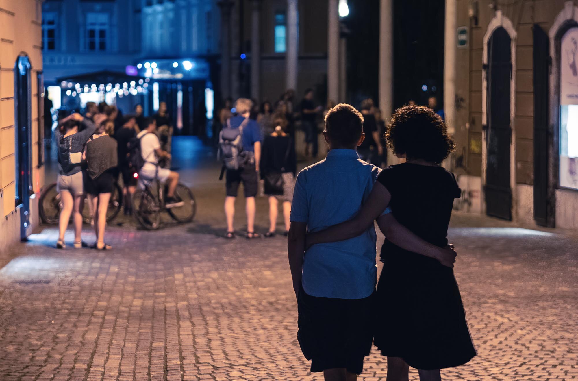
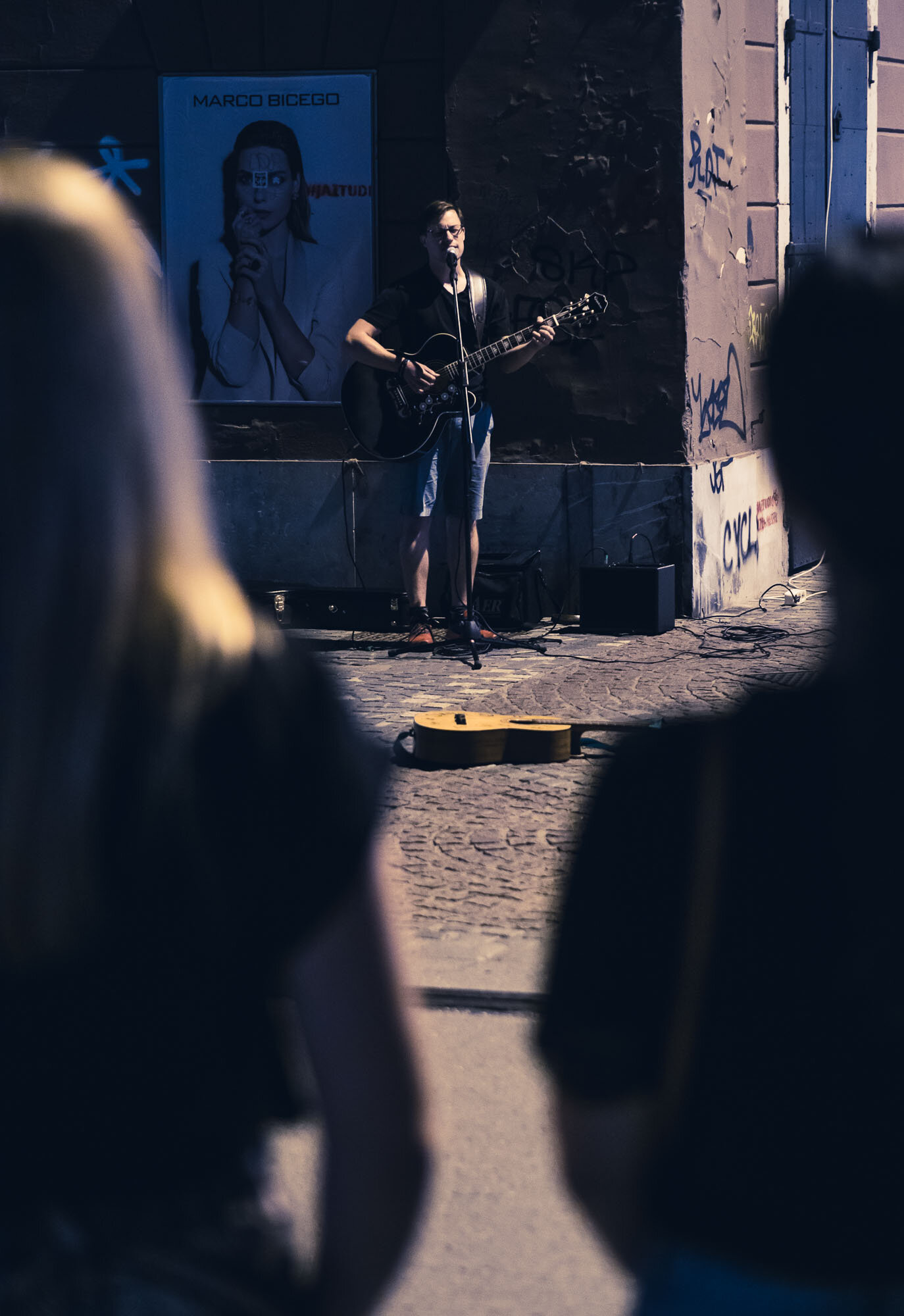
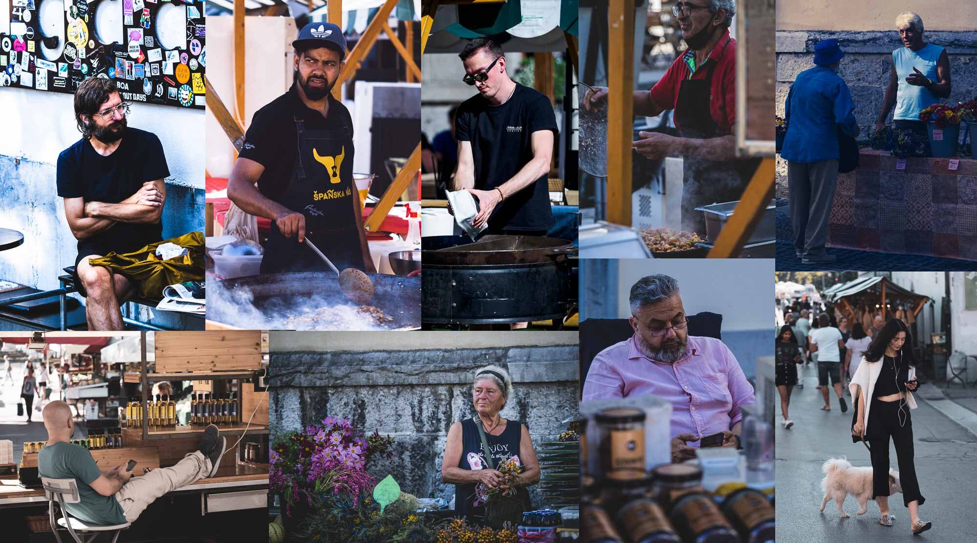
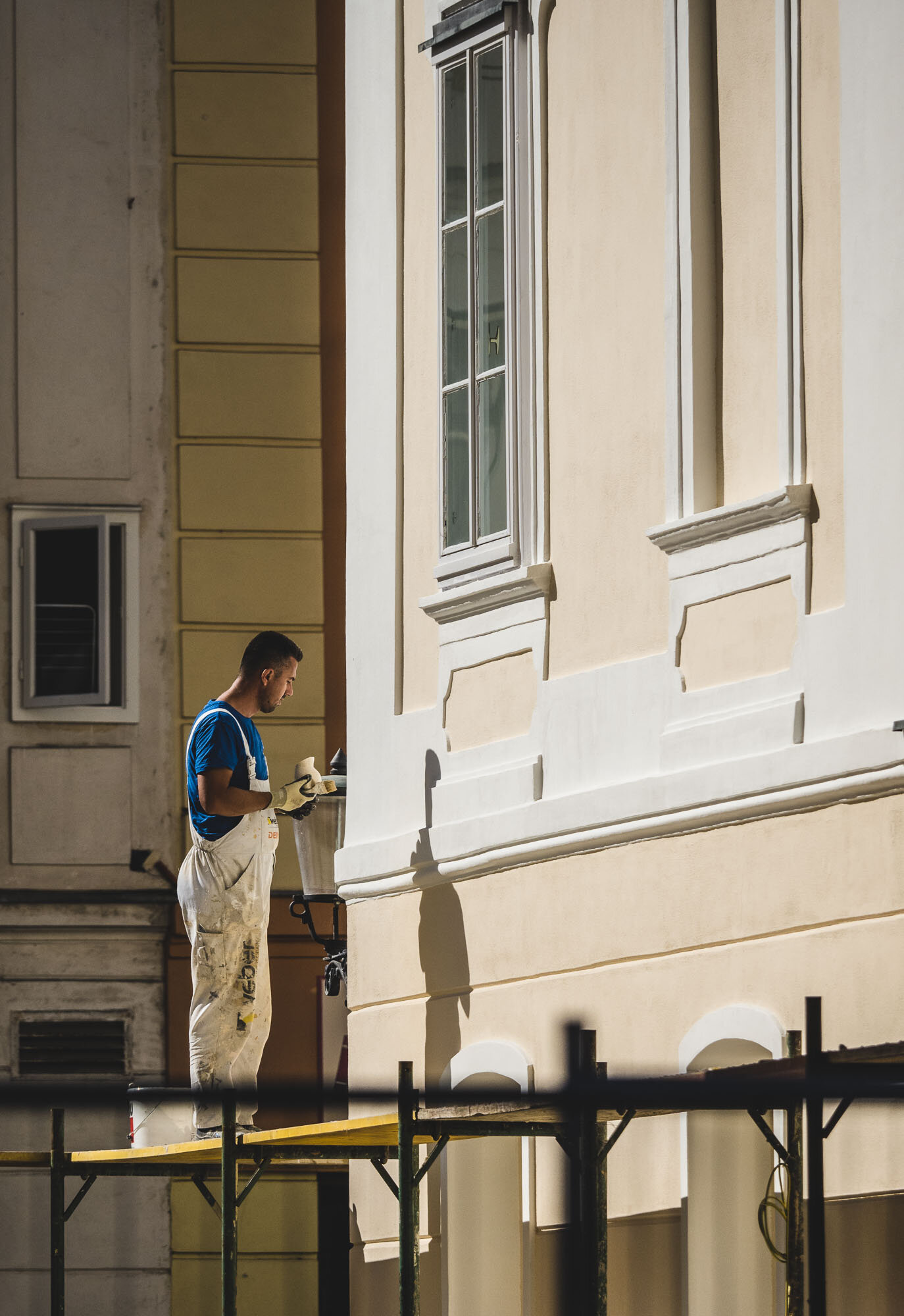
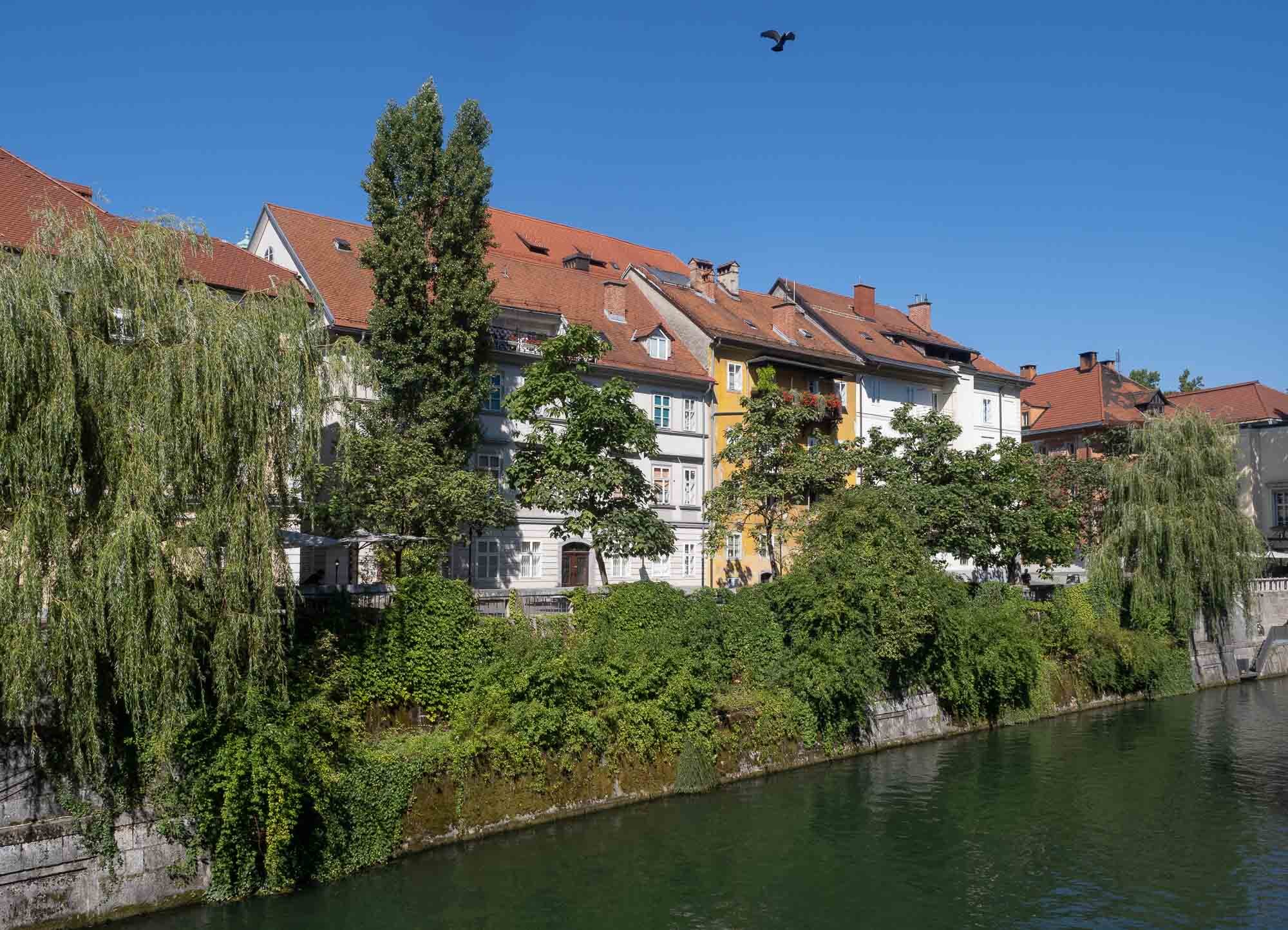
Slovenian Beauty - Lake Bled & Ljubljana
A two day trip to Slovenia brought us to the picturesque Lake Bled with its famous church island, and the beautiful capital Ljubljana.

While travel restrictions with health and safety requirements are still omnipresent, trips within certain countries in Europe are manageable with the right precautions. A two day trip to Slovenia brought us to the picturesque Lake Bled with its famous church island, and the beautiful capital Ljubljana.


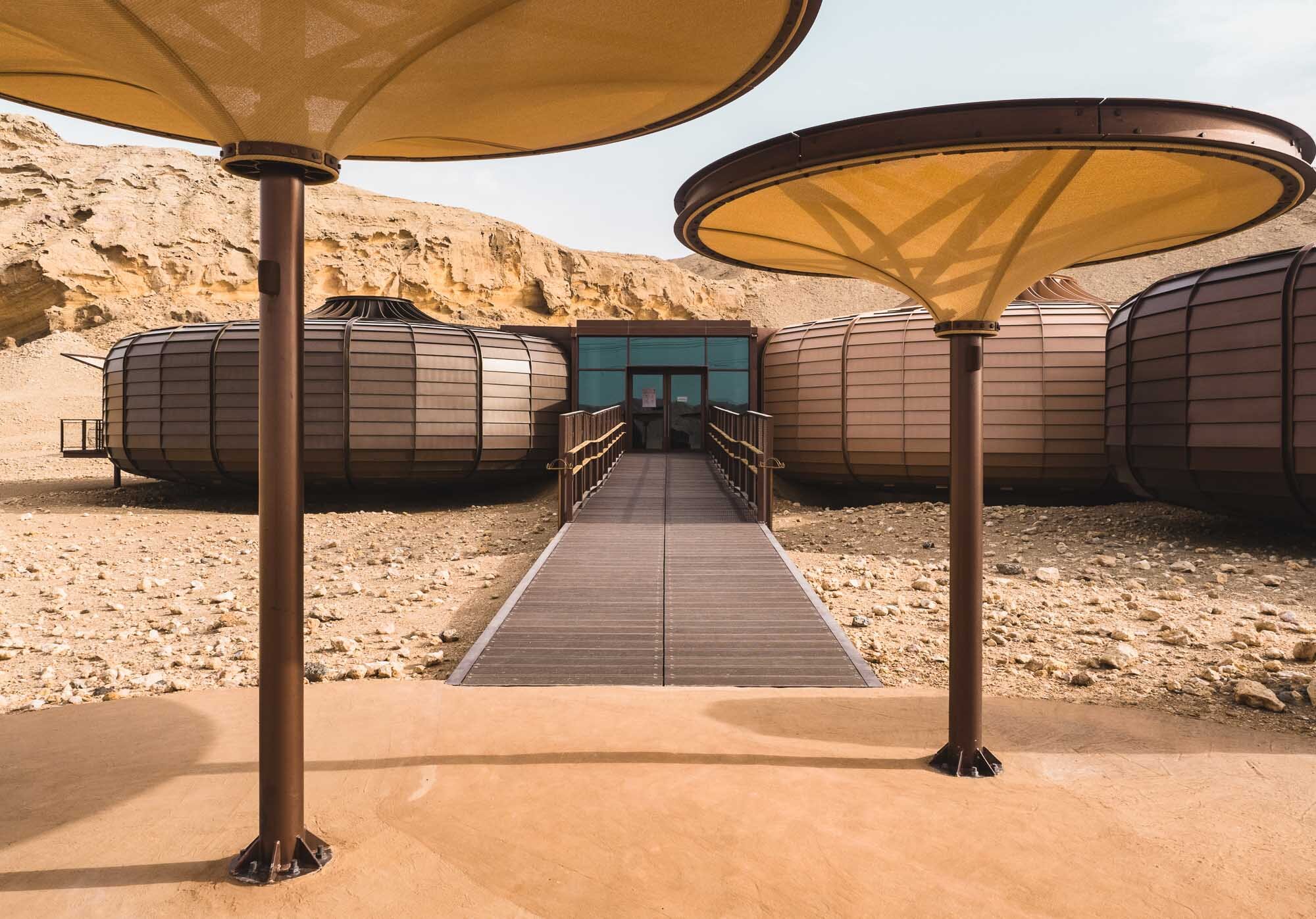
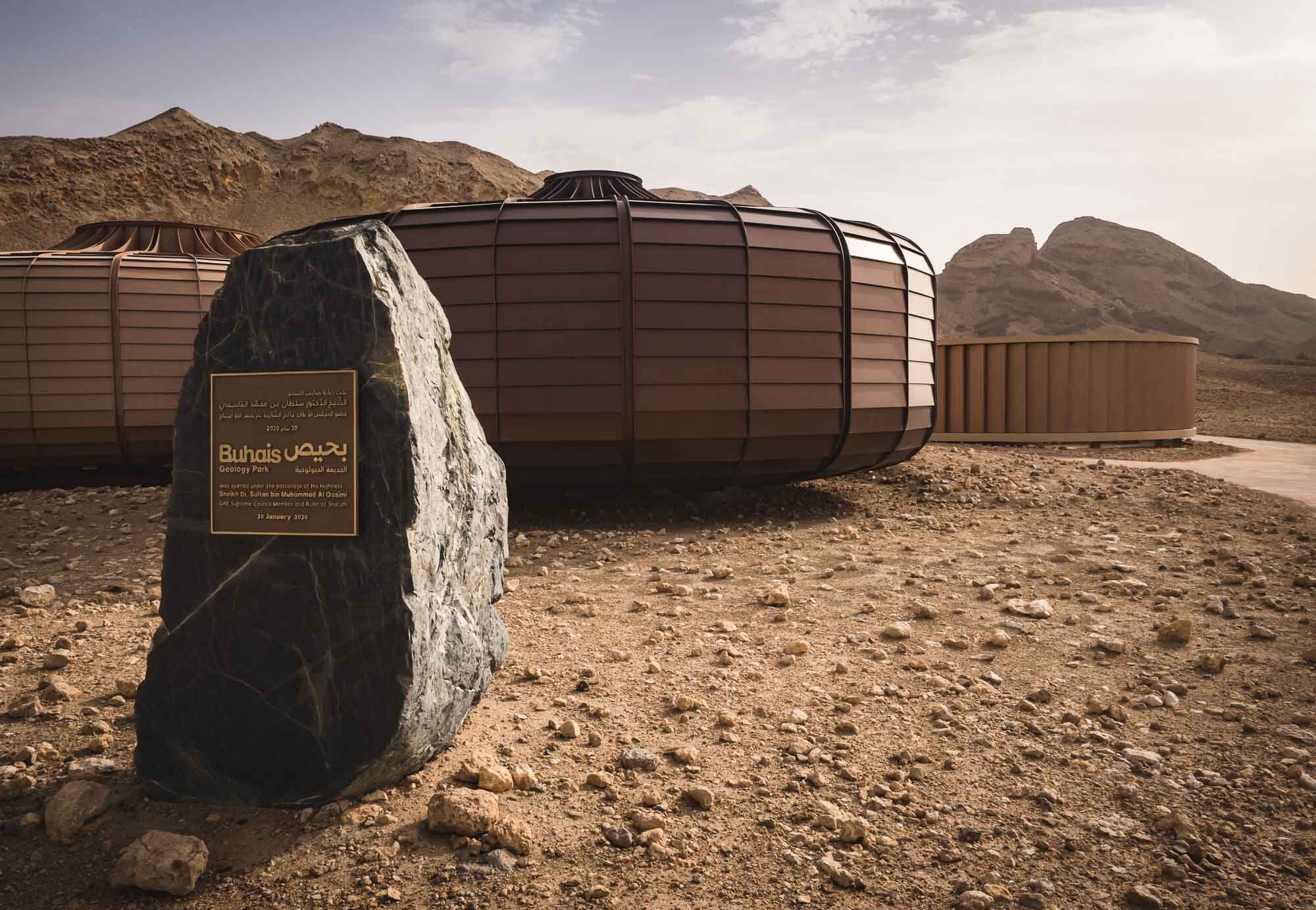
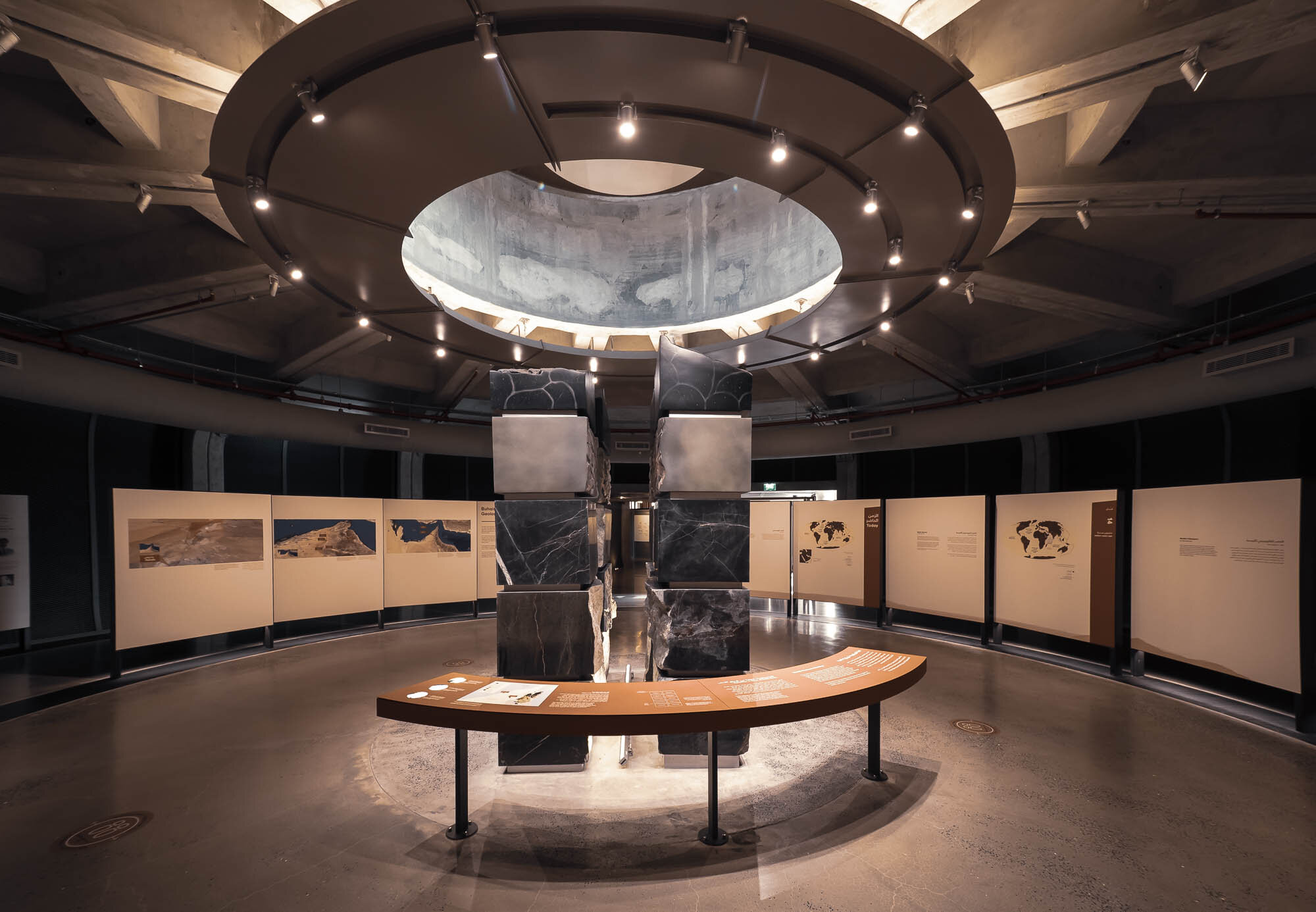
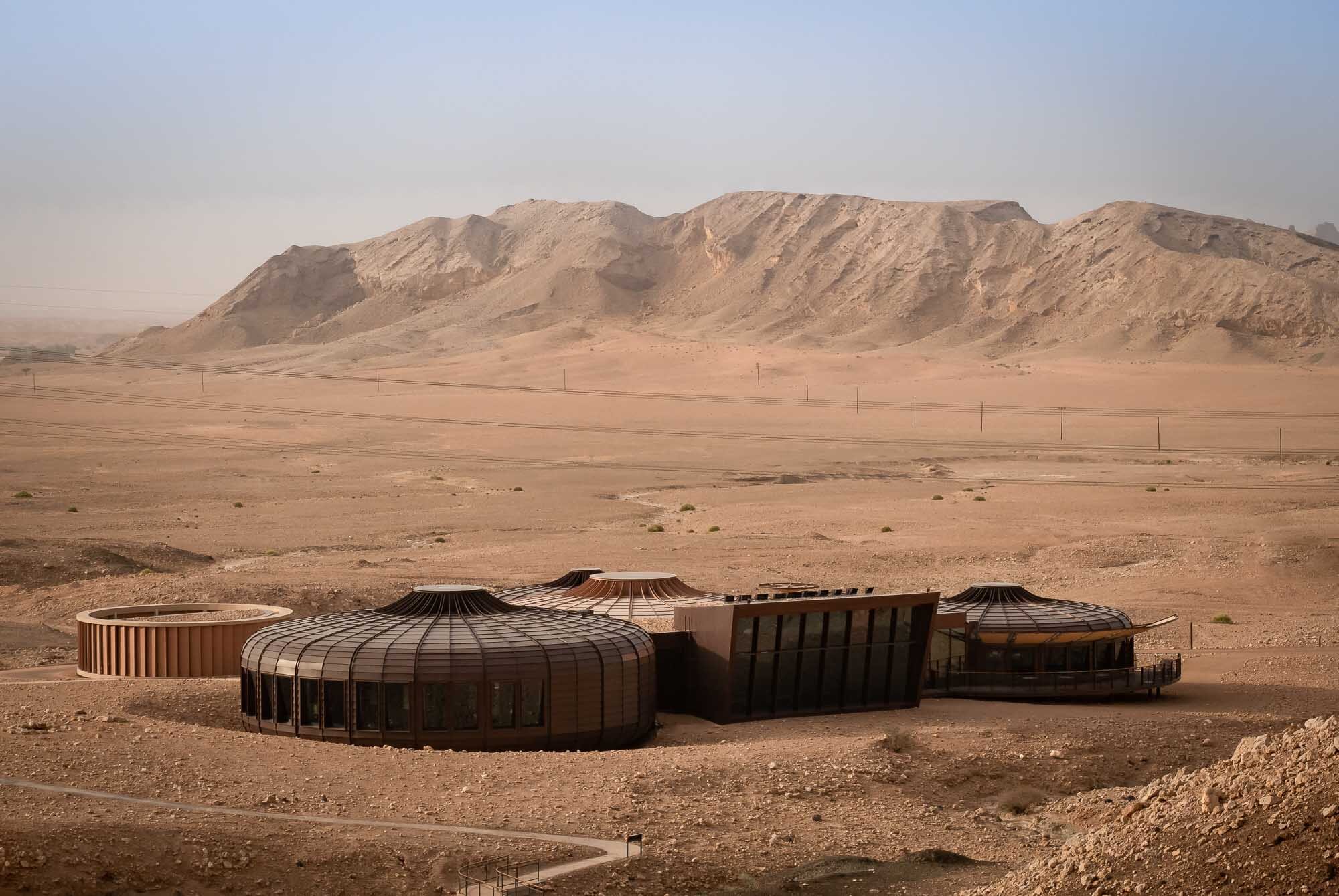
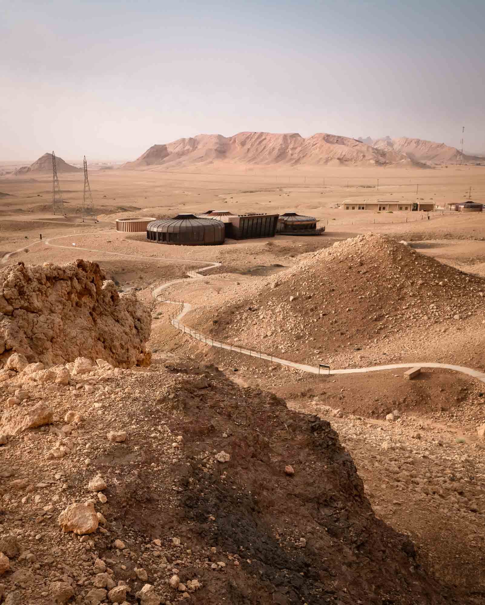
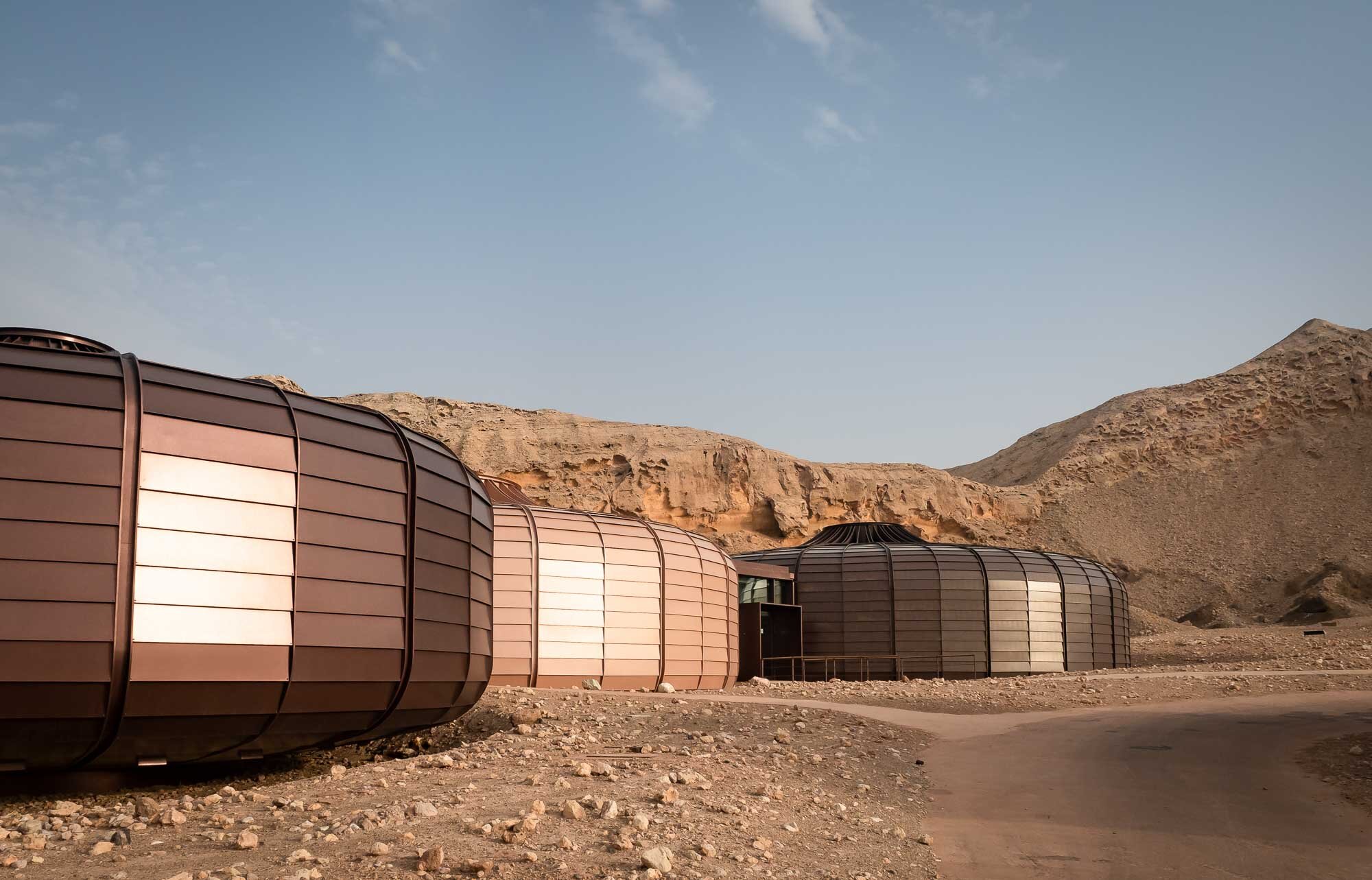
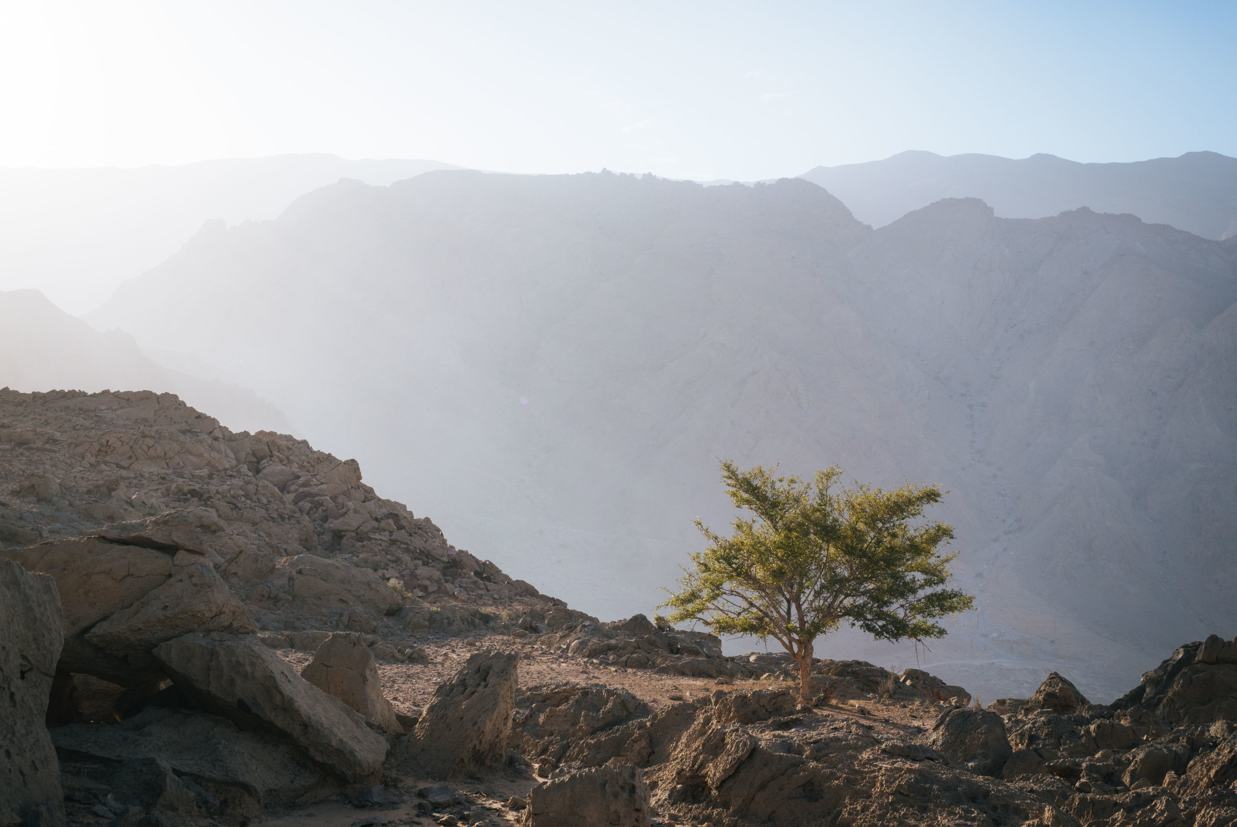
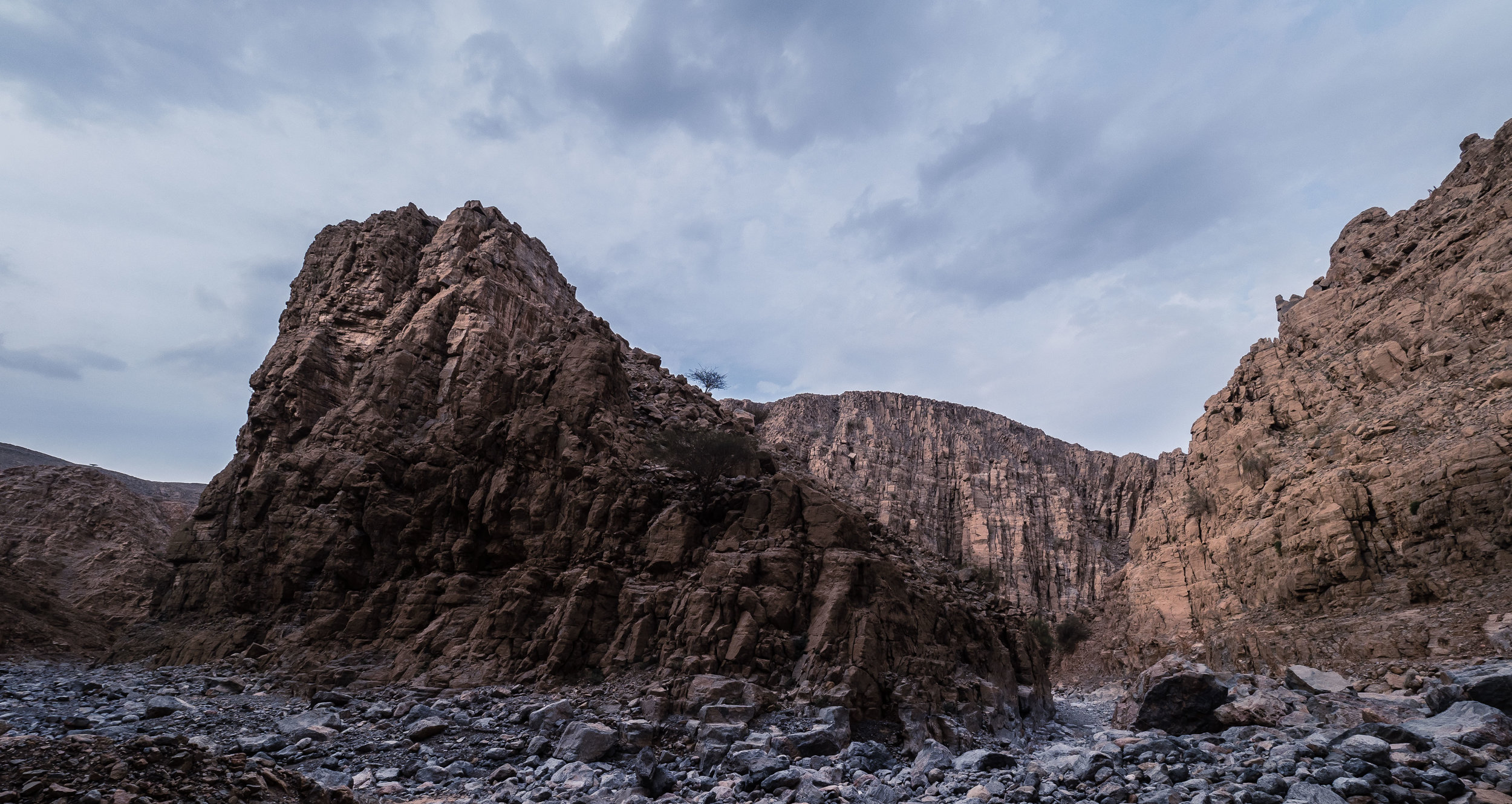
Buhais Geology Park in Sharjah, UAE
Sharjah is always in the shadows of its larger and flashier neighbouring emirates, yet it has made a name for itself for its historical, cultural and art related venues.

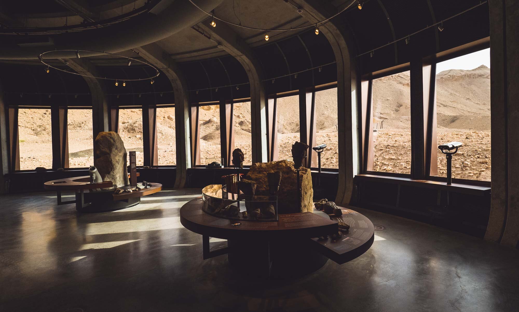
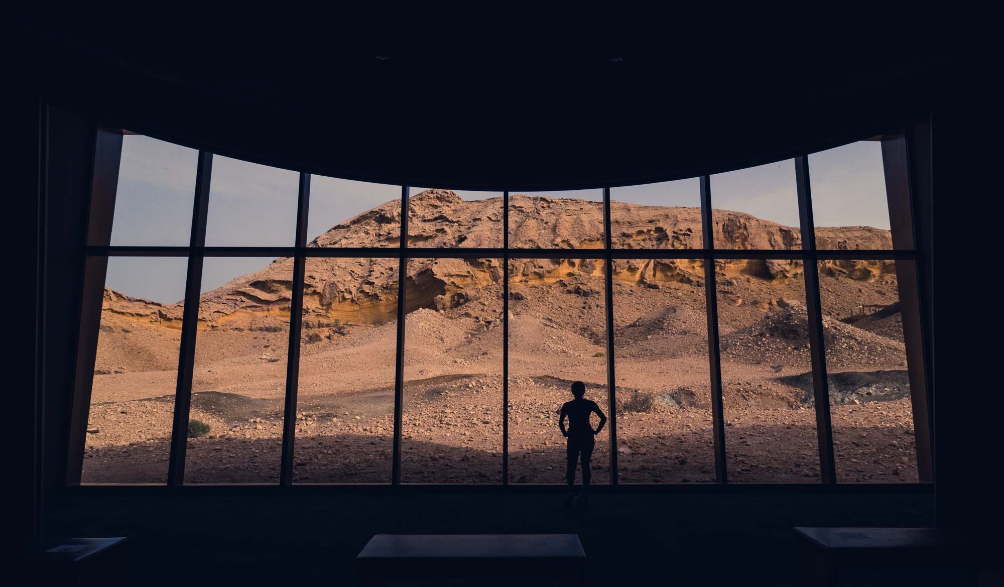
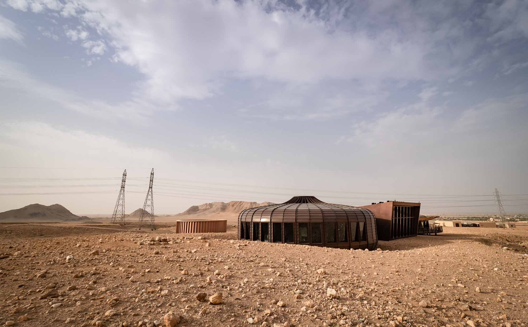
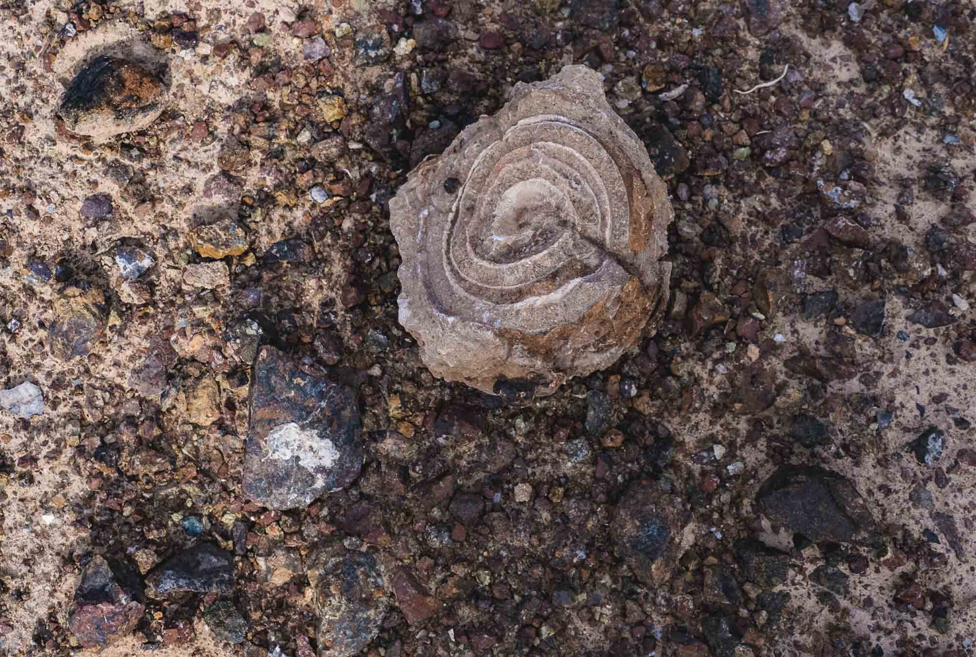
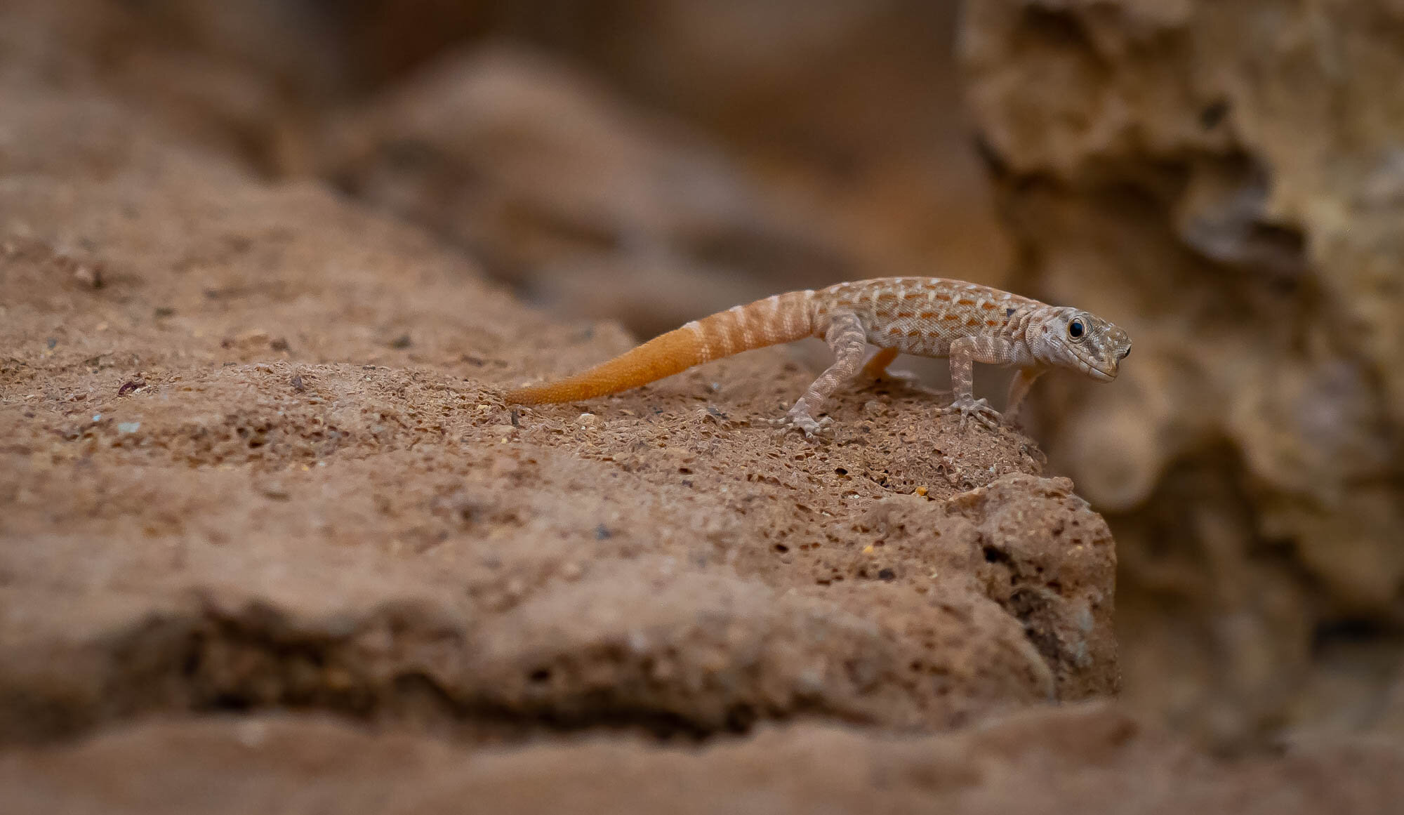
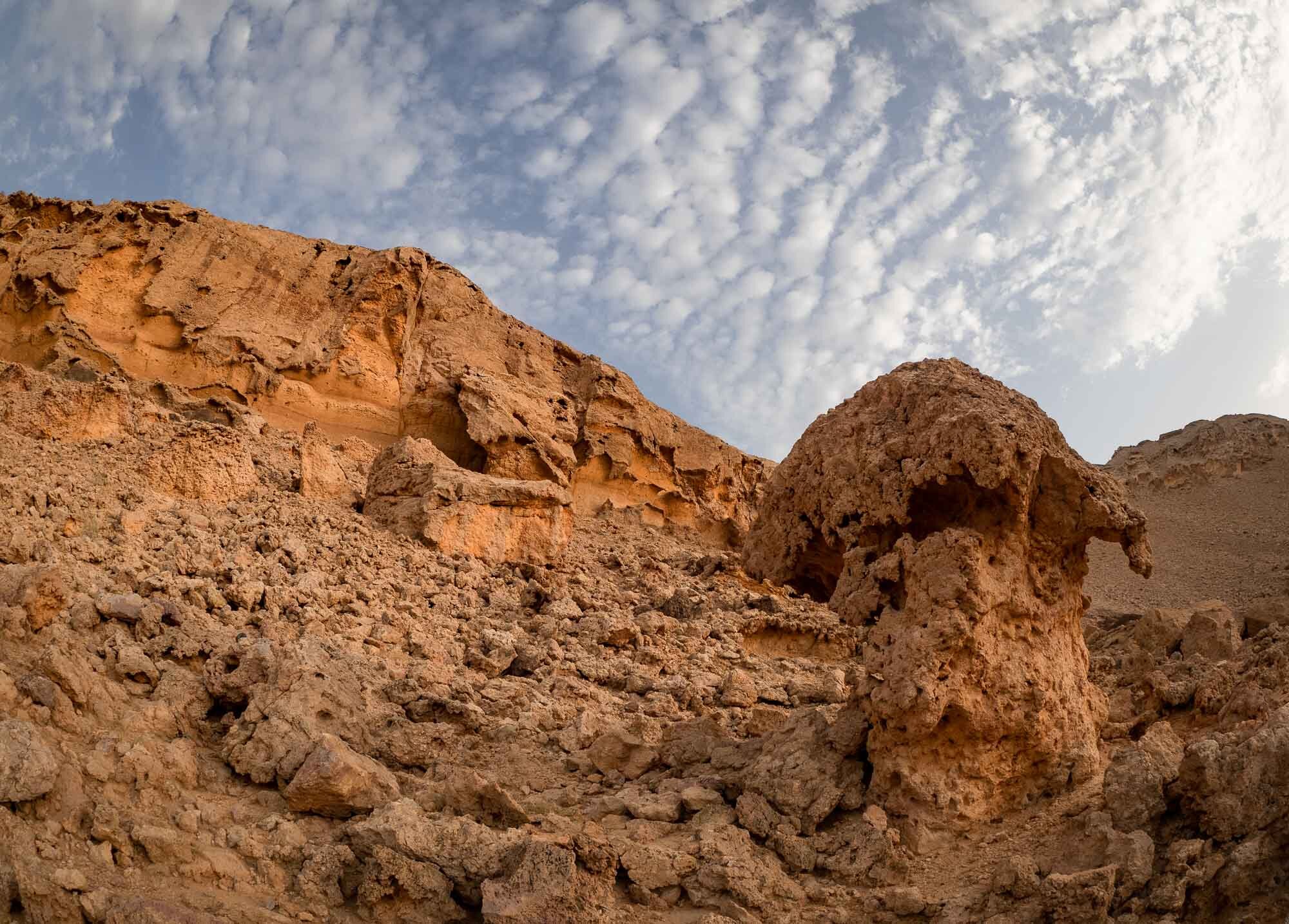
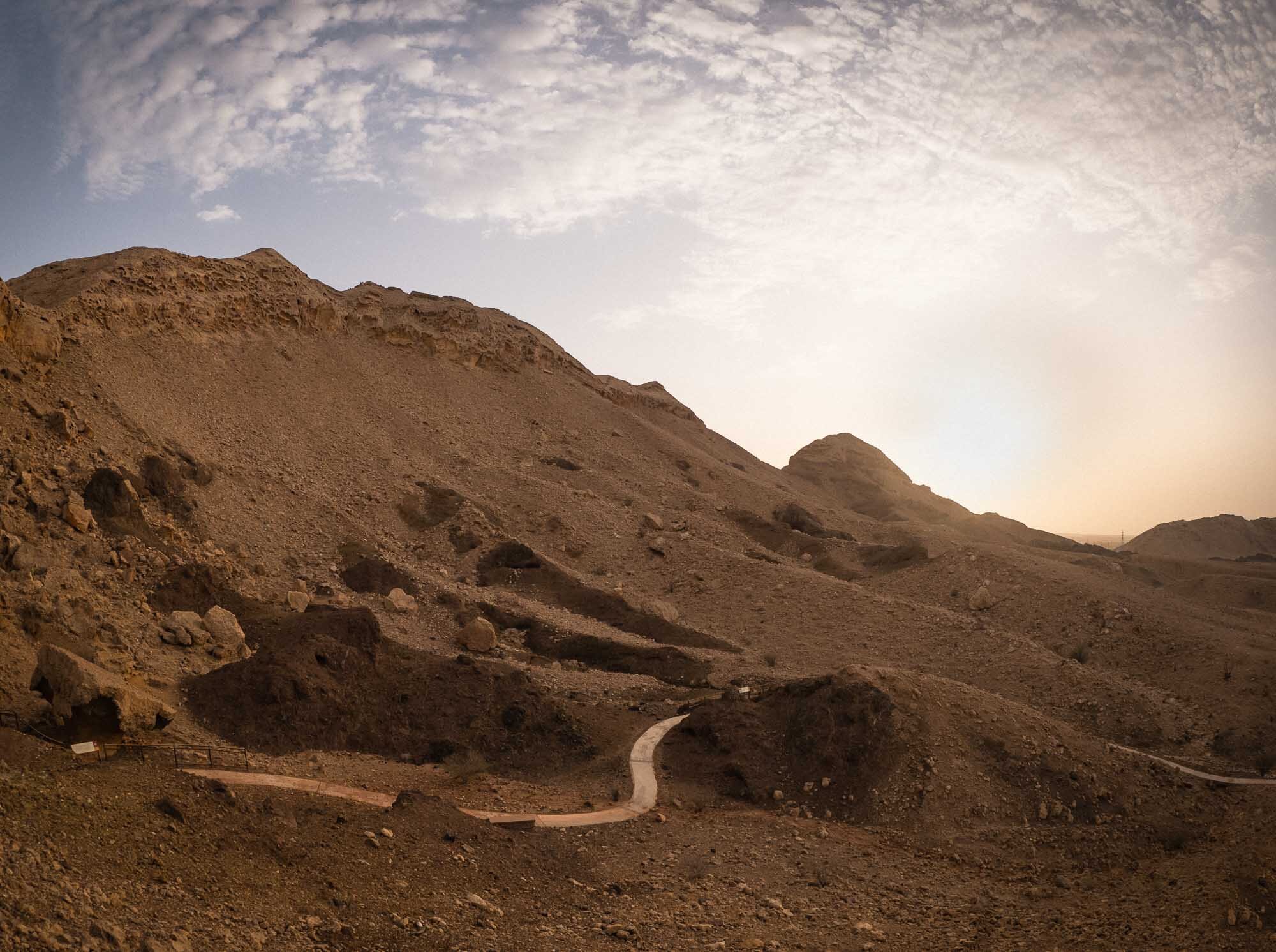
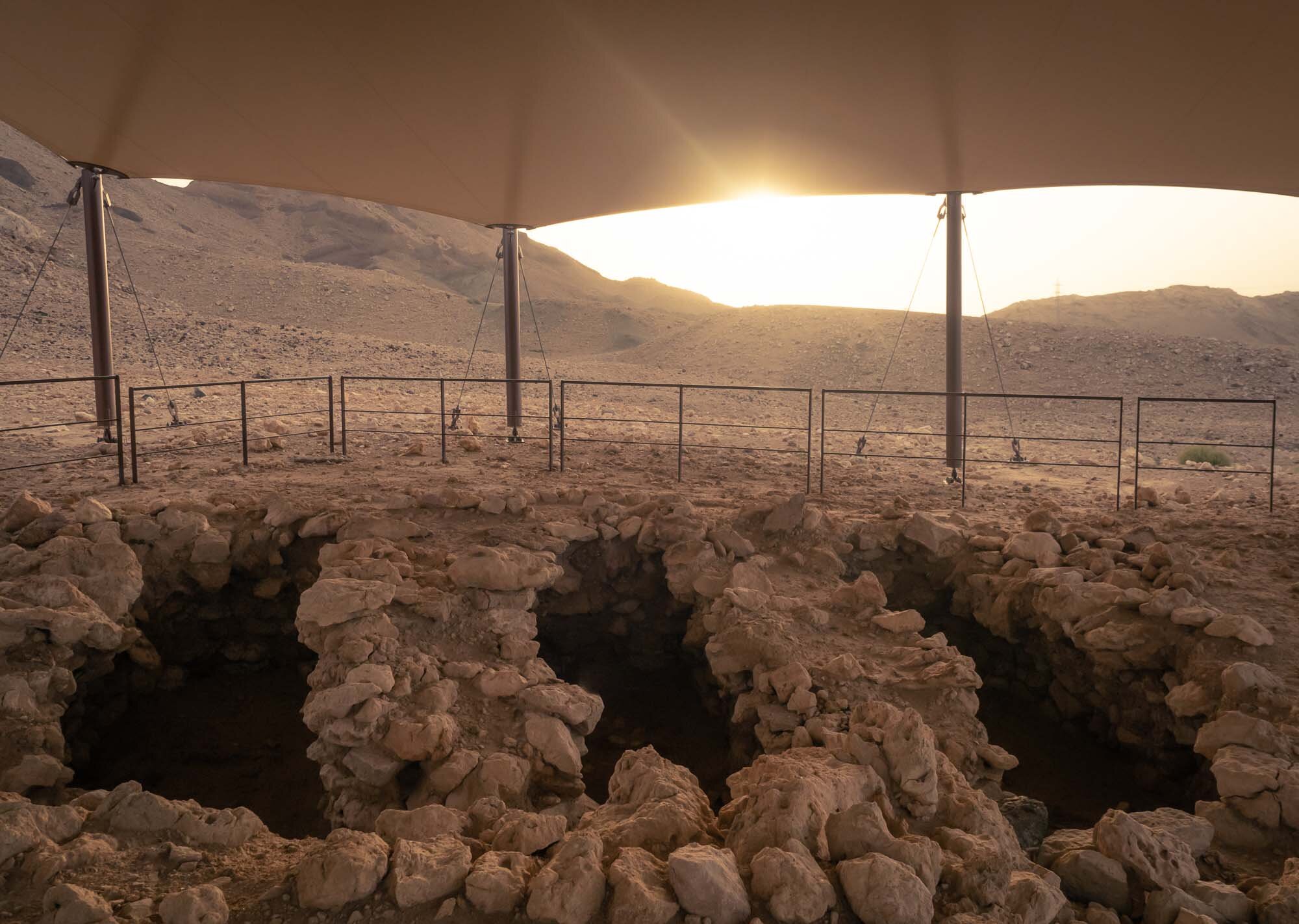
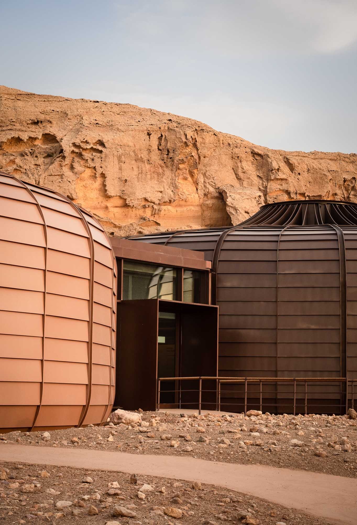
Sharjah is always in the shadows of its larger and flashier neighbouring emirates, yet it has made a name for itself for its historical, cultural and art related venues. A host of museums and destinations like the Mleiha archeology centre are always worth a trip. One of the latest additions to the emirate’s portfolio of somewhat more obscure but nevertheless amazing list of activities is the Buhais Geology Park near the mountain range of the same name, just before the desert slowly gives way to the Hajar mounts. While the architecture of the building embedded into the former seabed - designed by Hopkins Architects - is worth a visit, the exhibits and explanation of the unique geological history of the region make it all the more interesting.


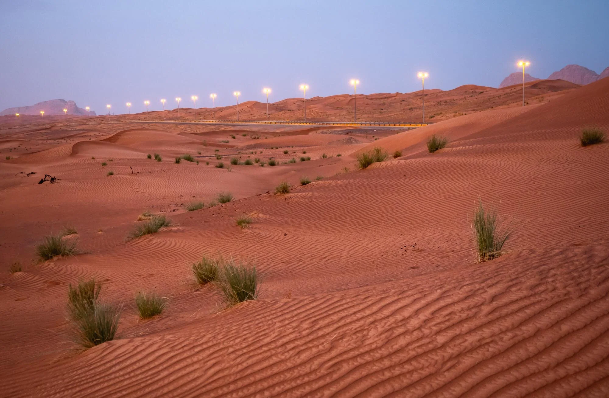

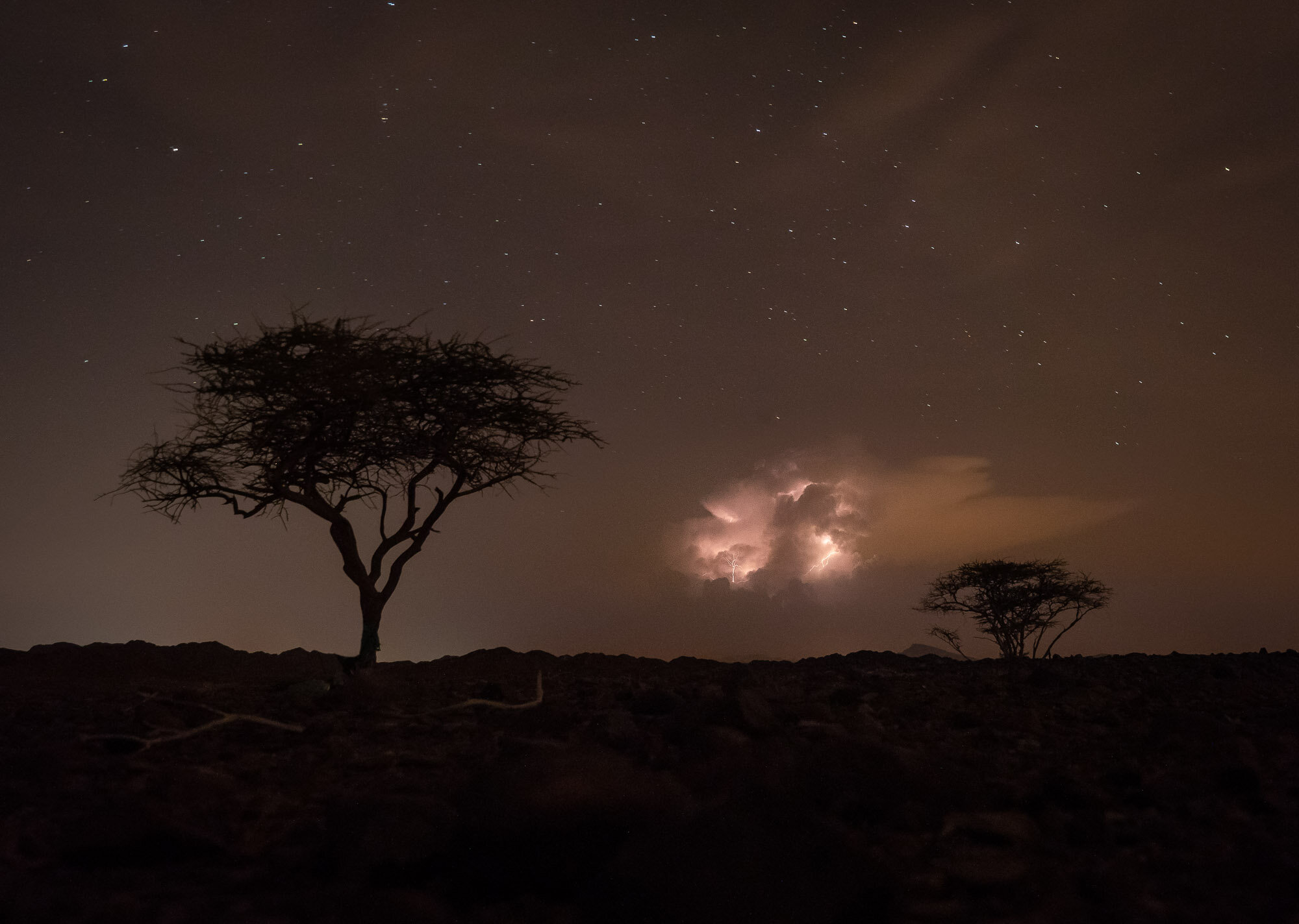
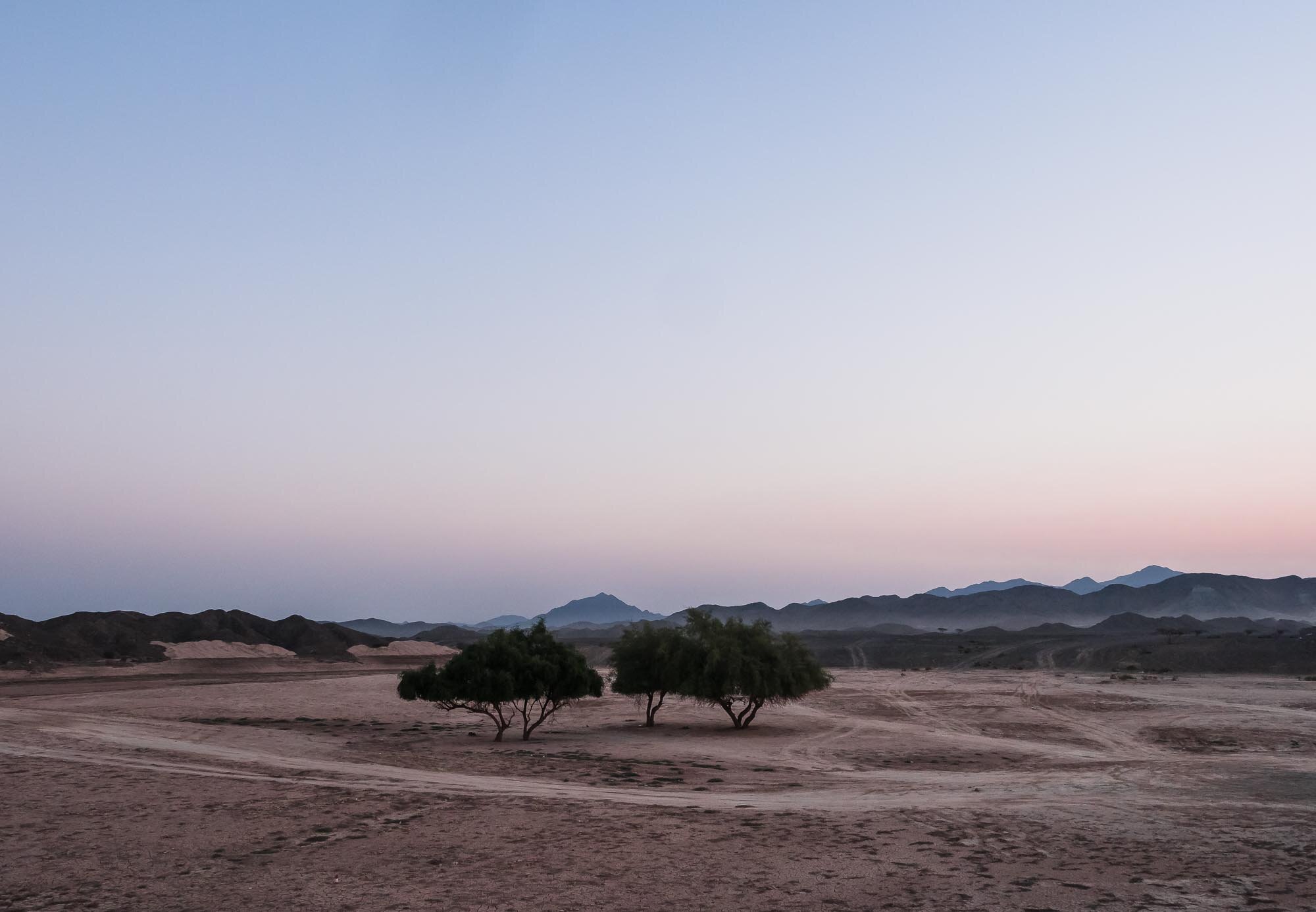
Summer Nights at Buraq Dam, UAE
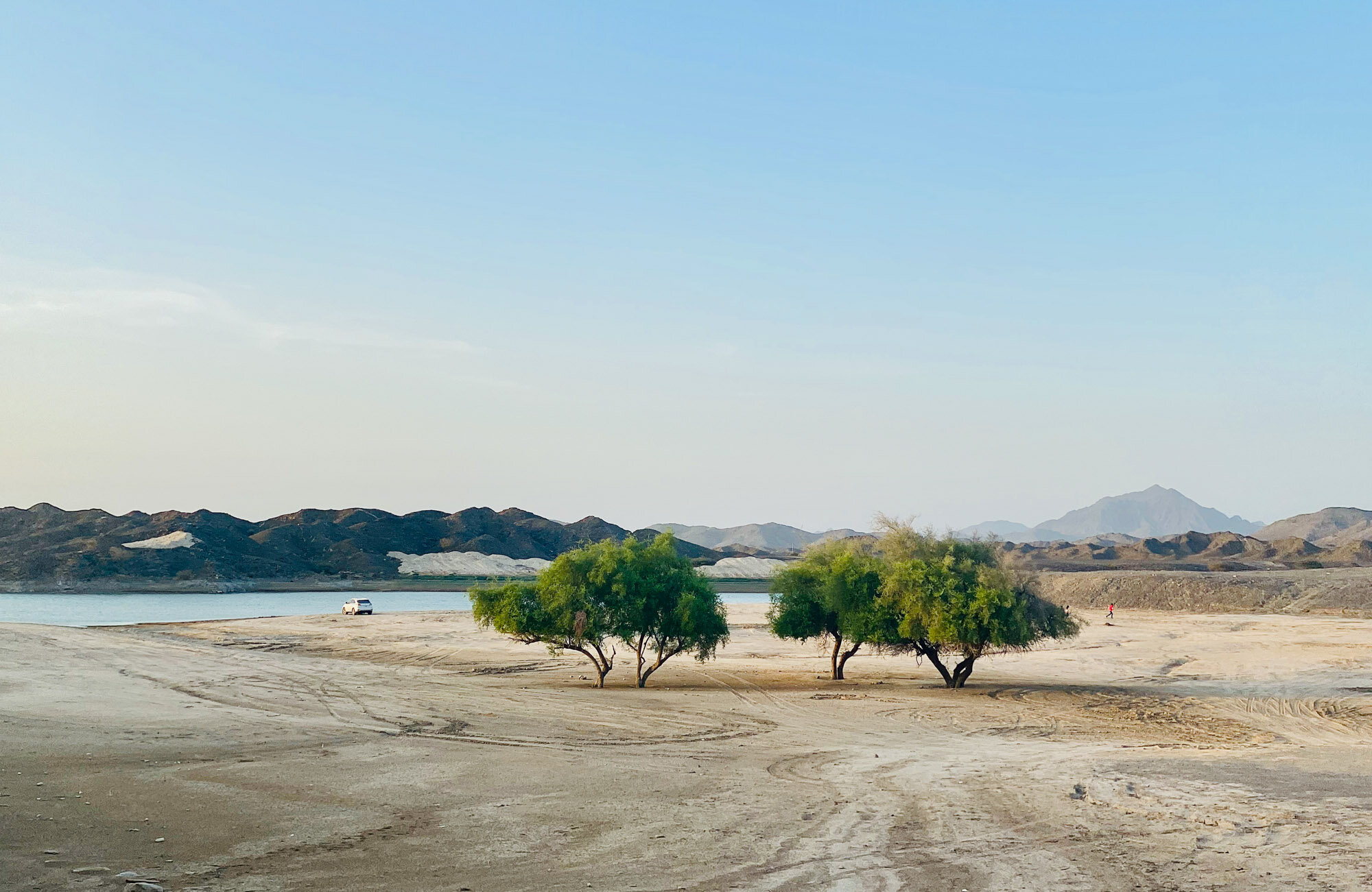
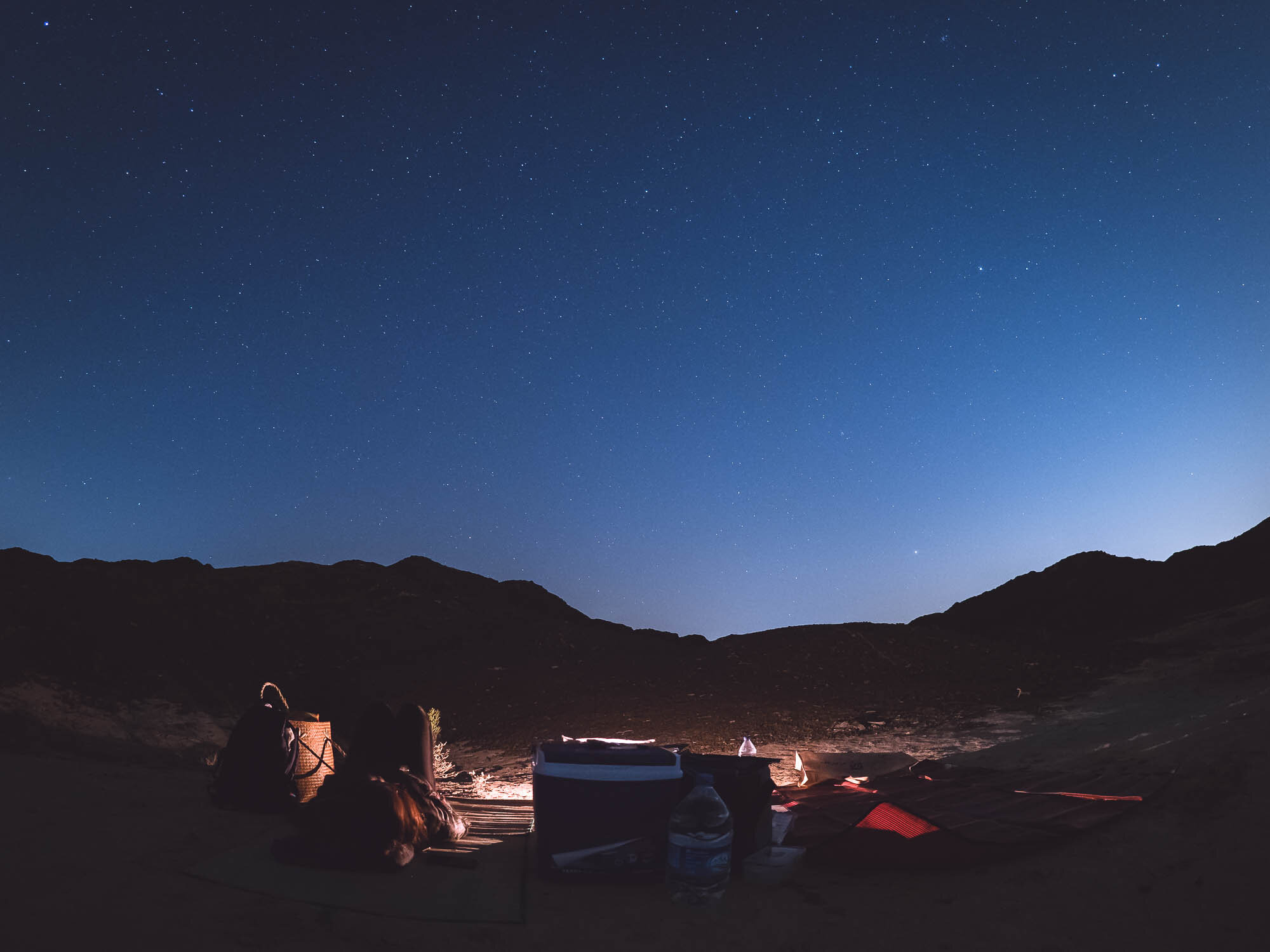
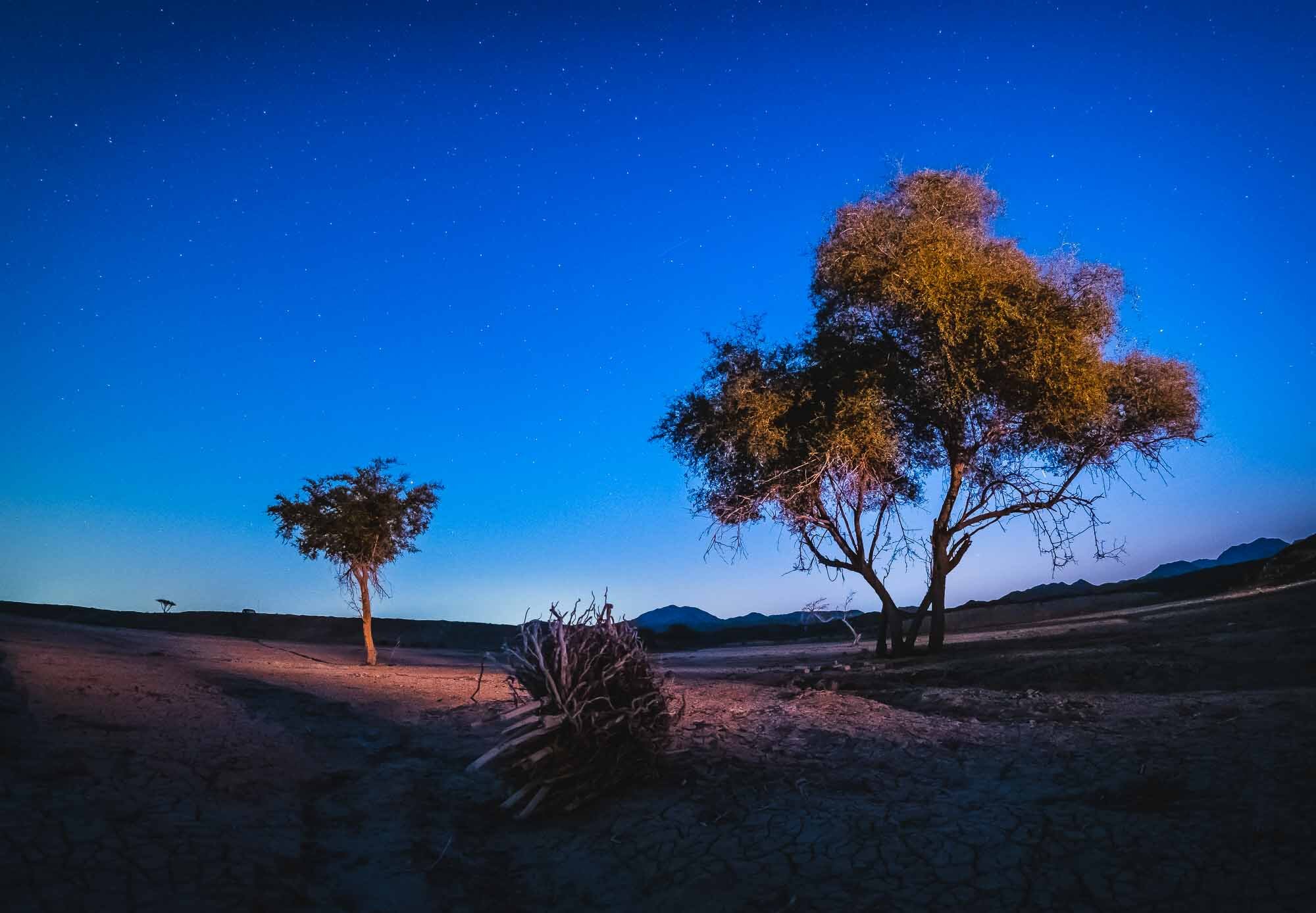
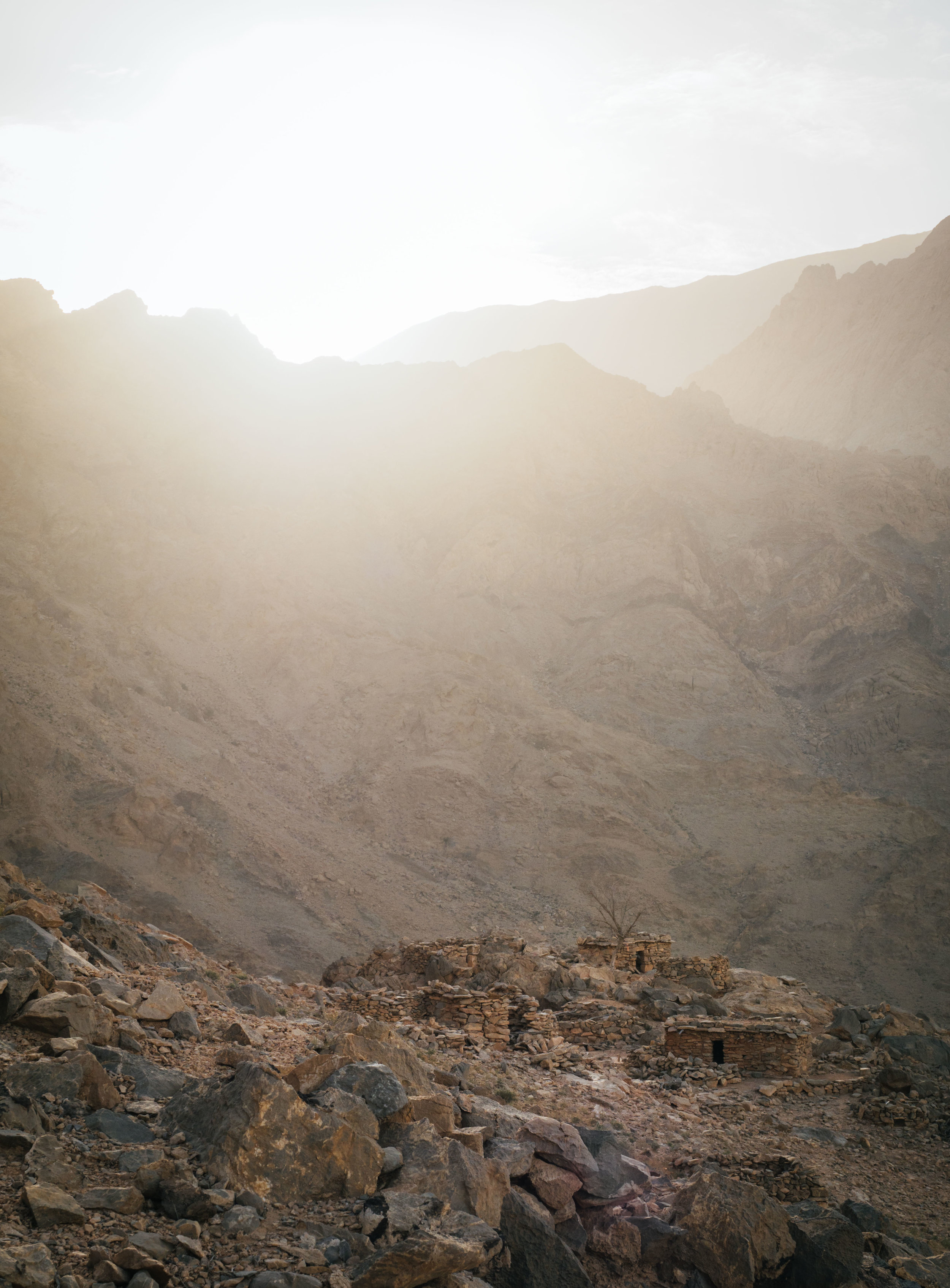
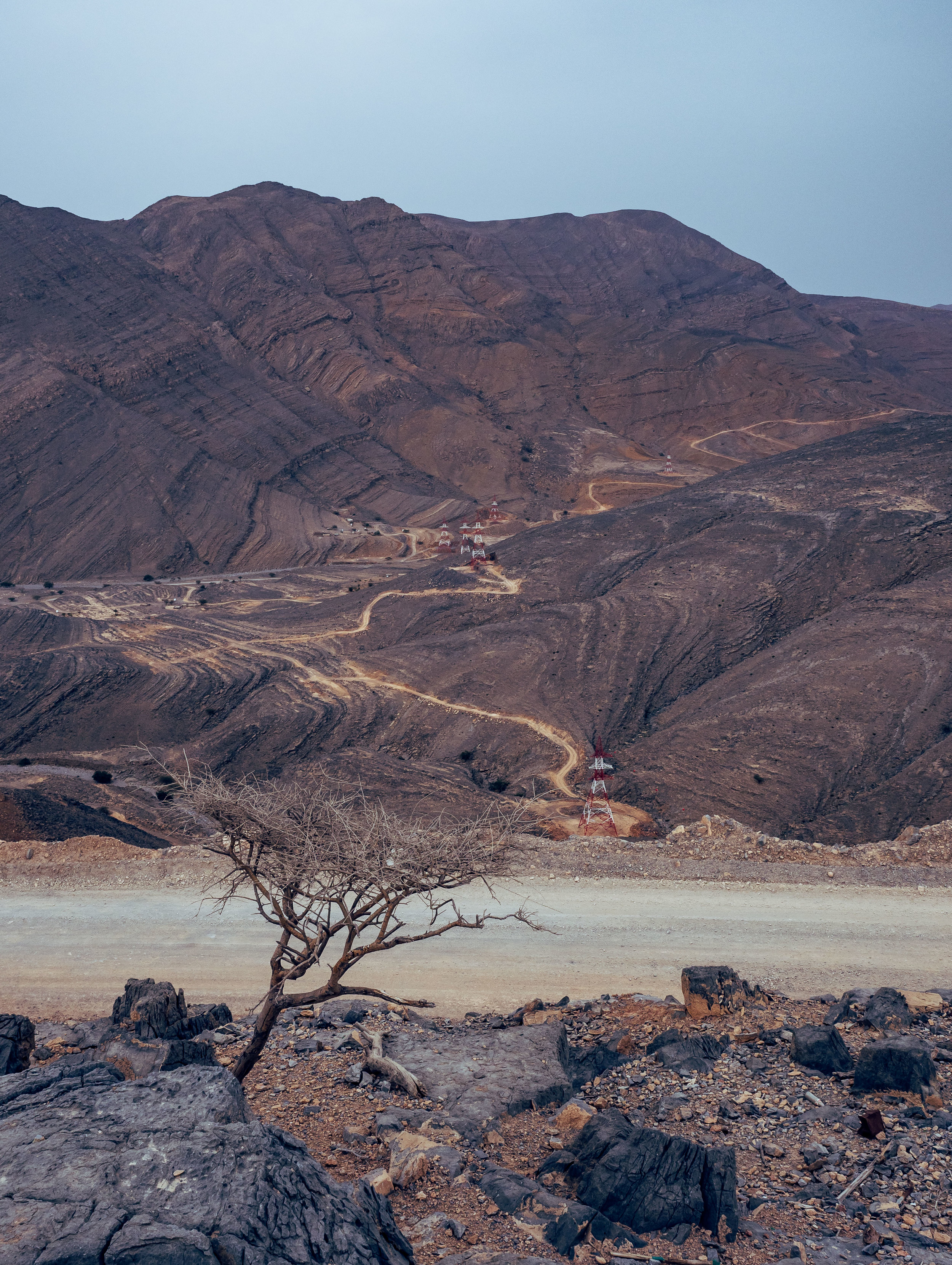
The UAE is not famous for its landscapes and mountains, but once you dig a little deeper, the country is full of amazing and unexpected scenery. A short drive from Dubai, about 1h, brings you to Buraq Dam, close to the Omani border.

The UAE is not famous for its landscapes and mountains, but once you dig a little deeper, the country is full of amazing and unexpected scenery. A short drive from Dubai, about 1h, brings you to Buraq Dam, close to the Omani border. If you’re lucky, you can see the filled with water and birds flocking its shores. Regardless, the mountainous terrain and cooler air makes for a great hiking or camping spot. Because the location is quite far form city lights, it’s also an excellent spot for some stargazing!

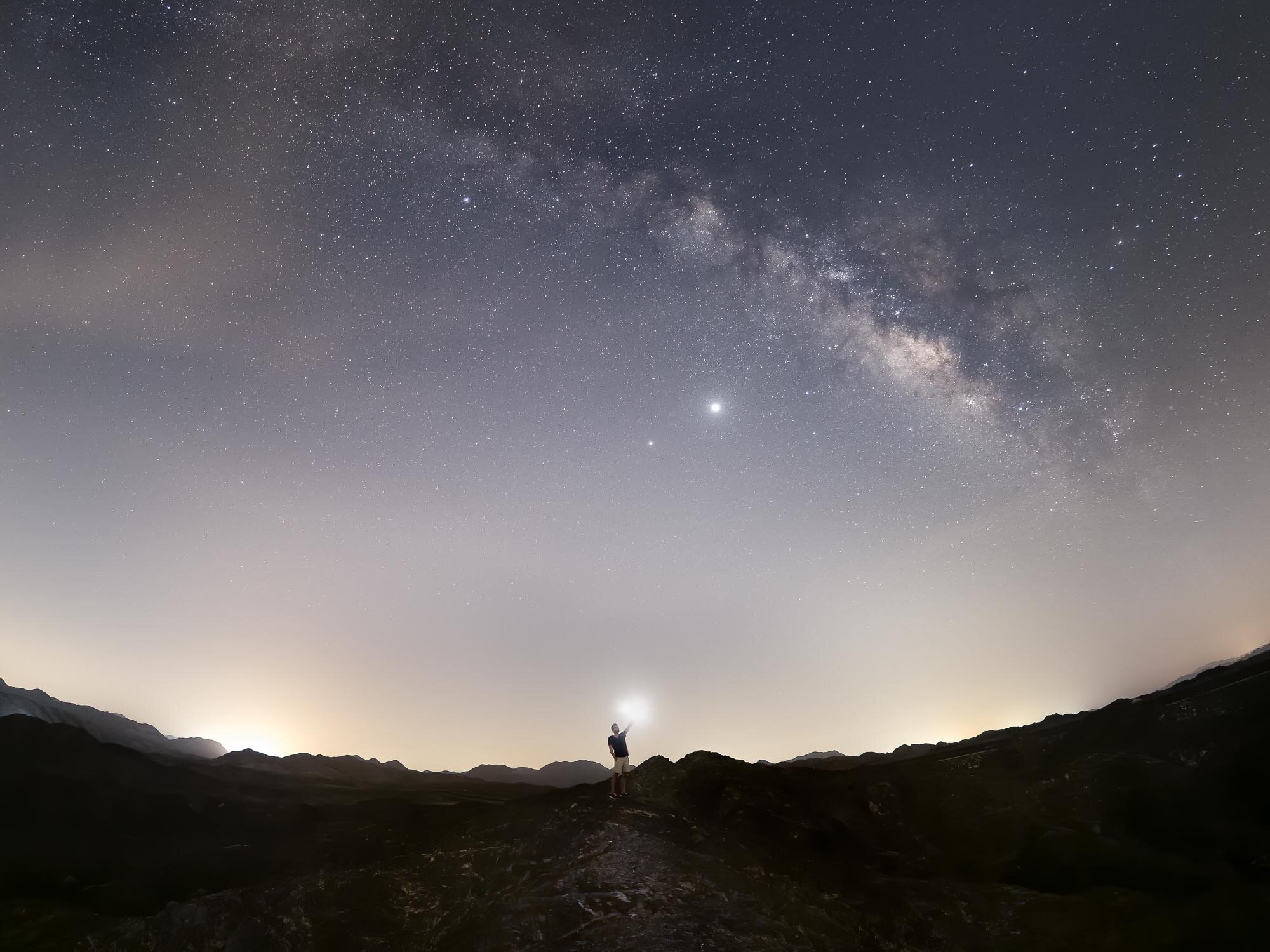
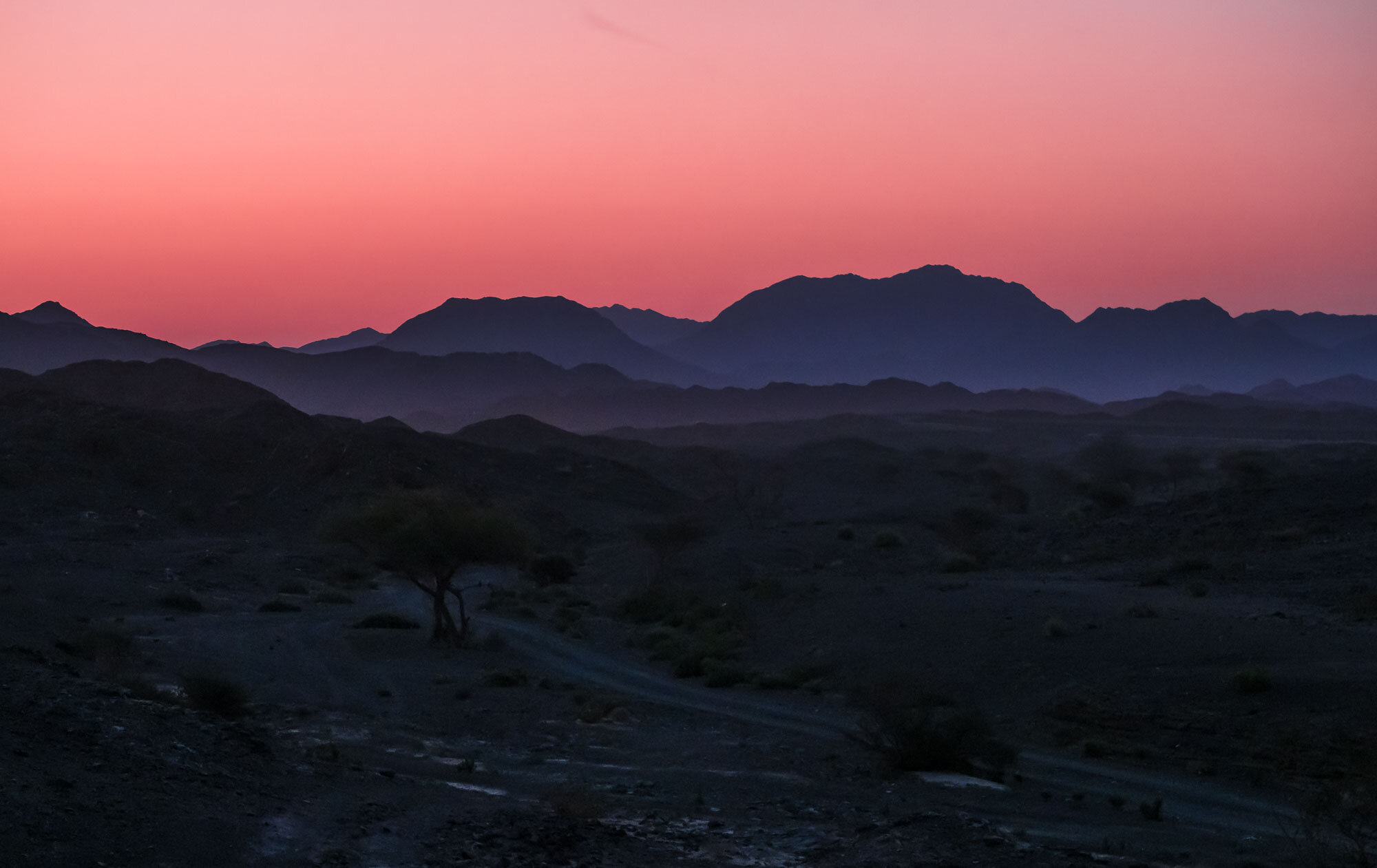
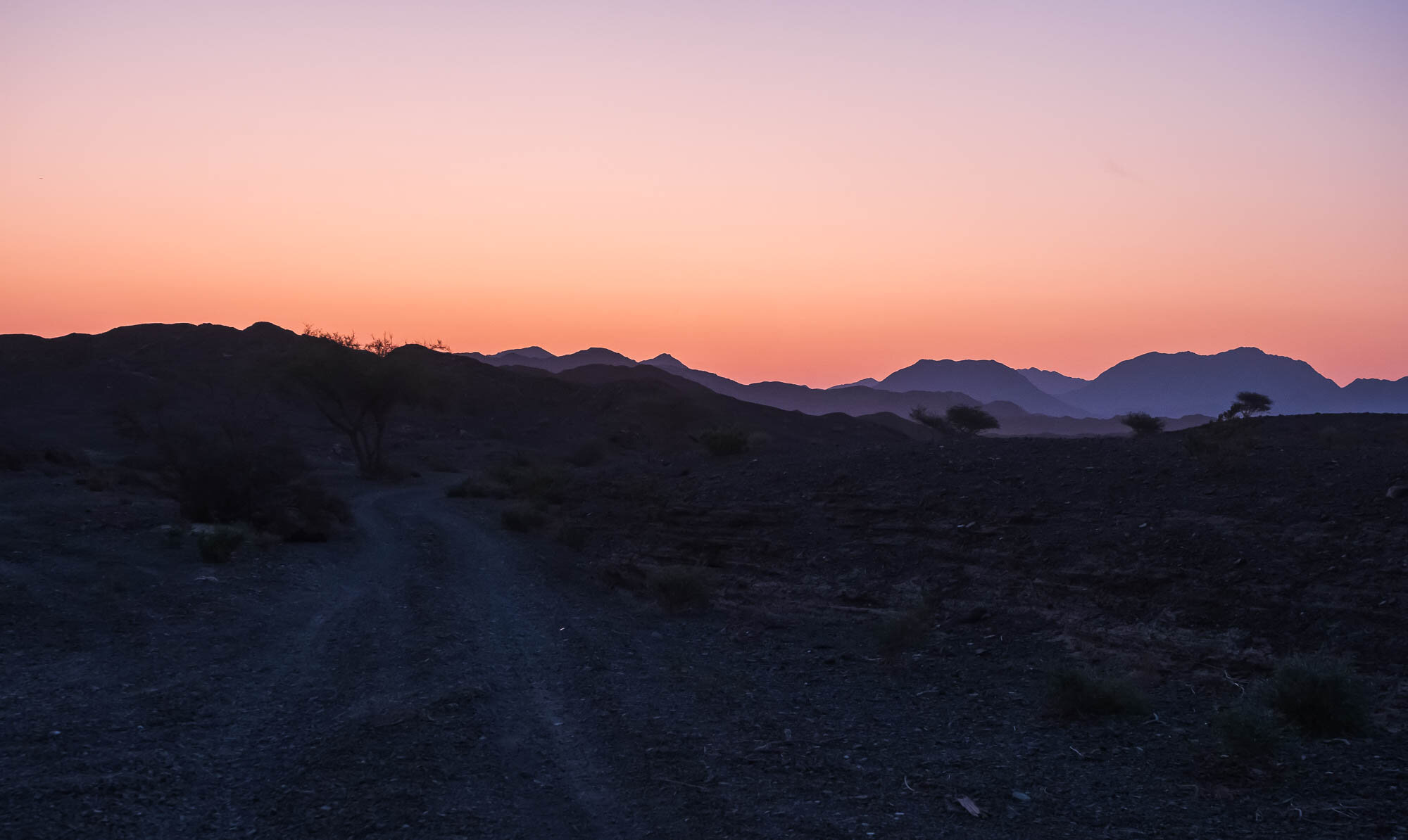
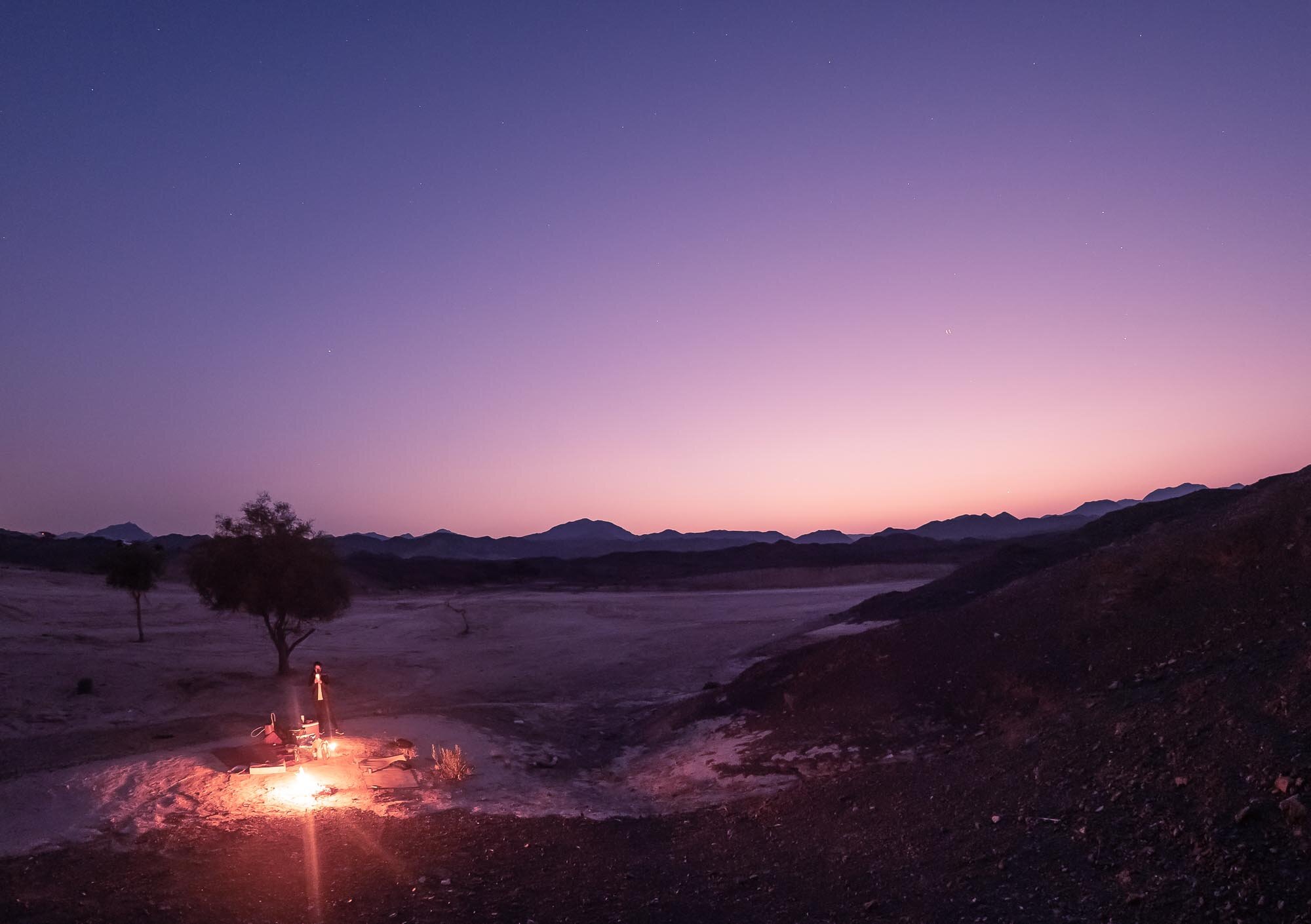
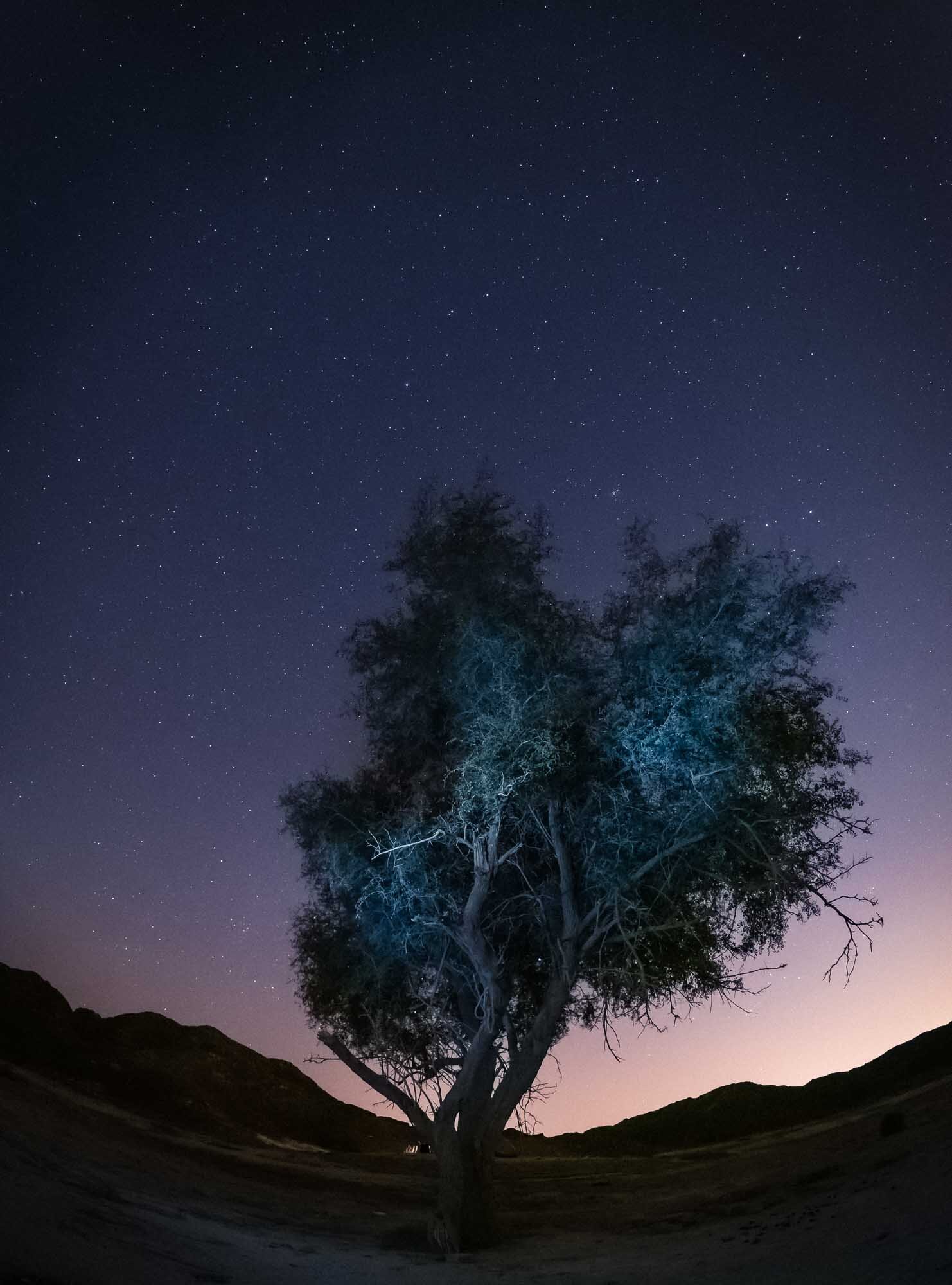
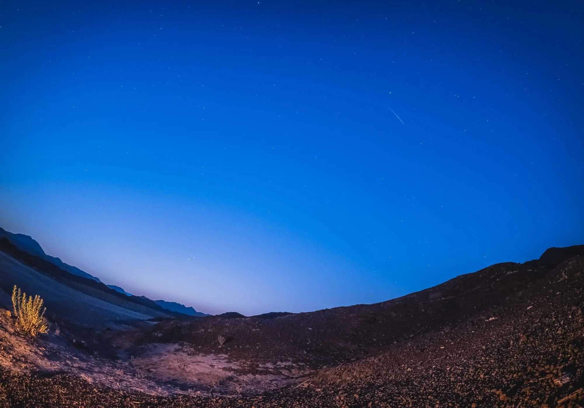
Buraq Dam - UAE Mountain Bliss
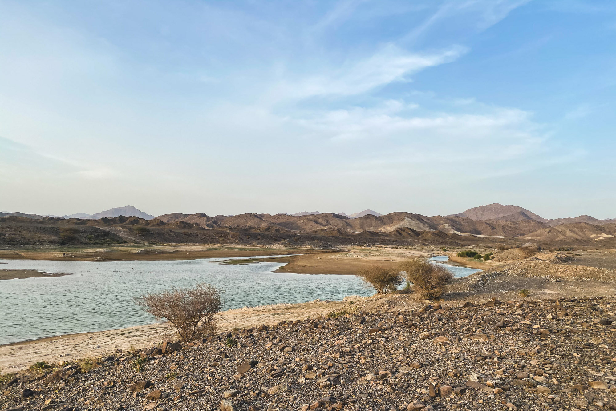
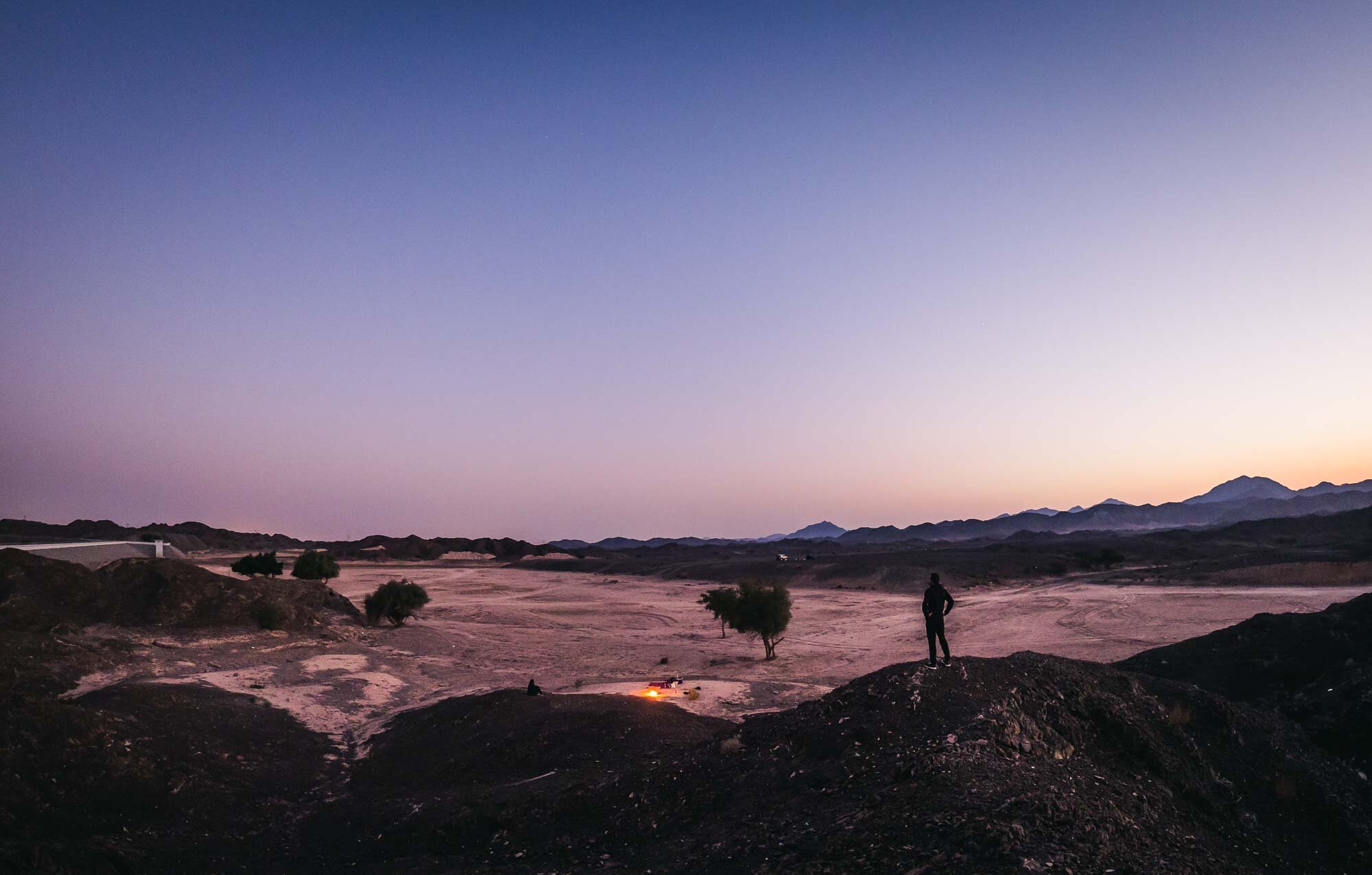
For the Quadrantid meteor shower in early January. we chose to explore a new spot up in the Hajar mountains of the UAE - Buraq Dam.

For the Quadrantid meteor shower in early January. we chose to explore a new spot up in the Hajar mountains of the UAE - Buraq Dam.
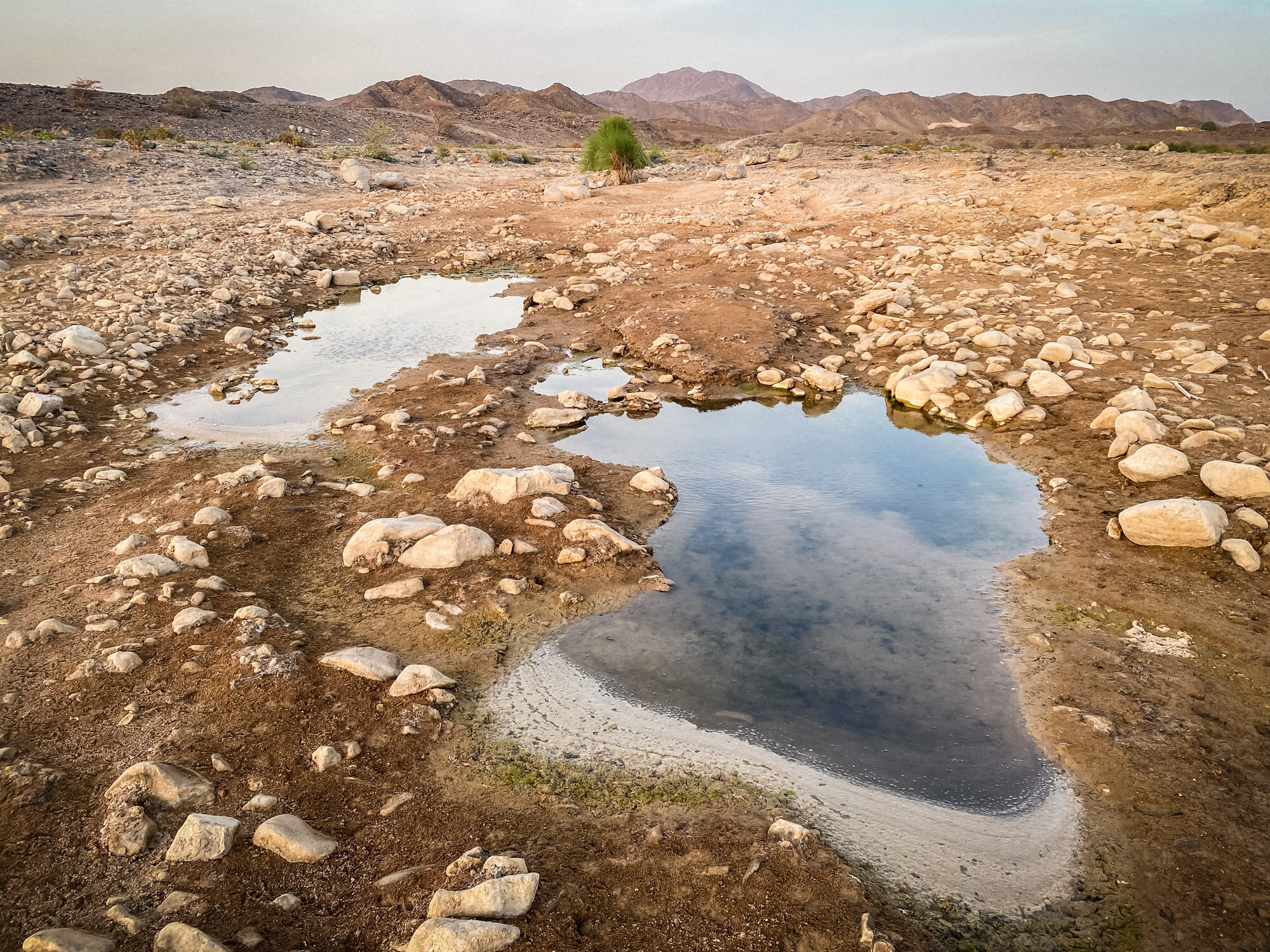
While the dam didn’t have any water - in fact most of it looked very dry - during out visit, it offered a beautiful quiet and dark spot to look into the night sky, surrounded by mountains. The only downside: The flight path of the DXB runway runs almost directly above this area, so you get a lot of planes in the sky.
It’s a relatively easy drive about an hour out from Dubai, and only the last few hundred meters need a bit of careful driving if you’re not in a 4x4.
We had a few lucky moments dawn, starting to see some meteors after midnight on the northeastern side, but I could only capture two on photos - can you spot them?


This short timelapse video below gives an idea of the amounts of planes flying into DXB during the night, slightly disrupting the peace and quiet of the Hajar mountains.
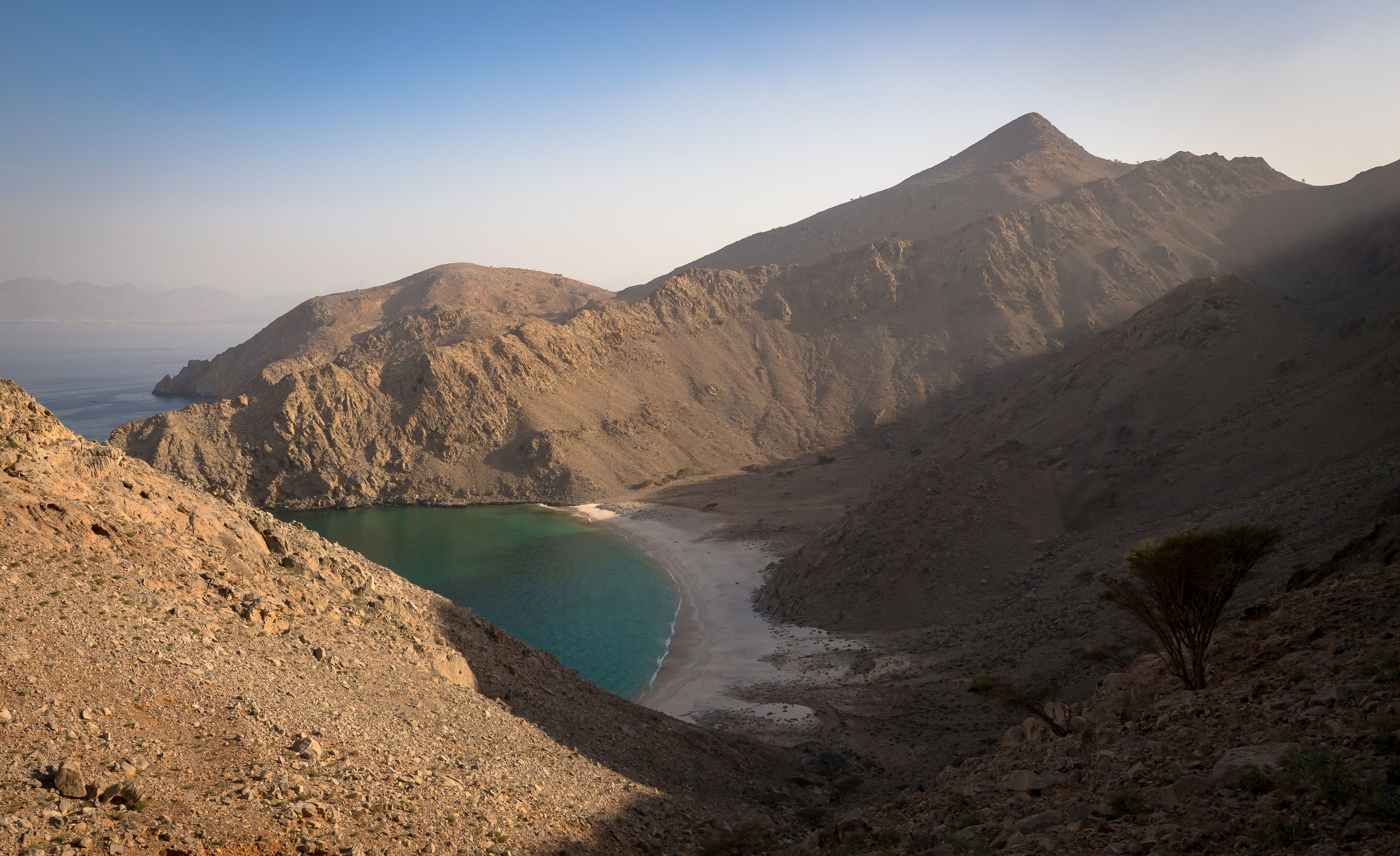
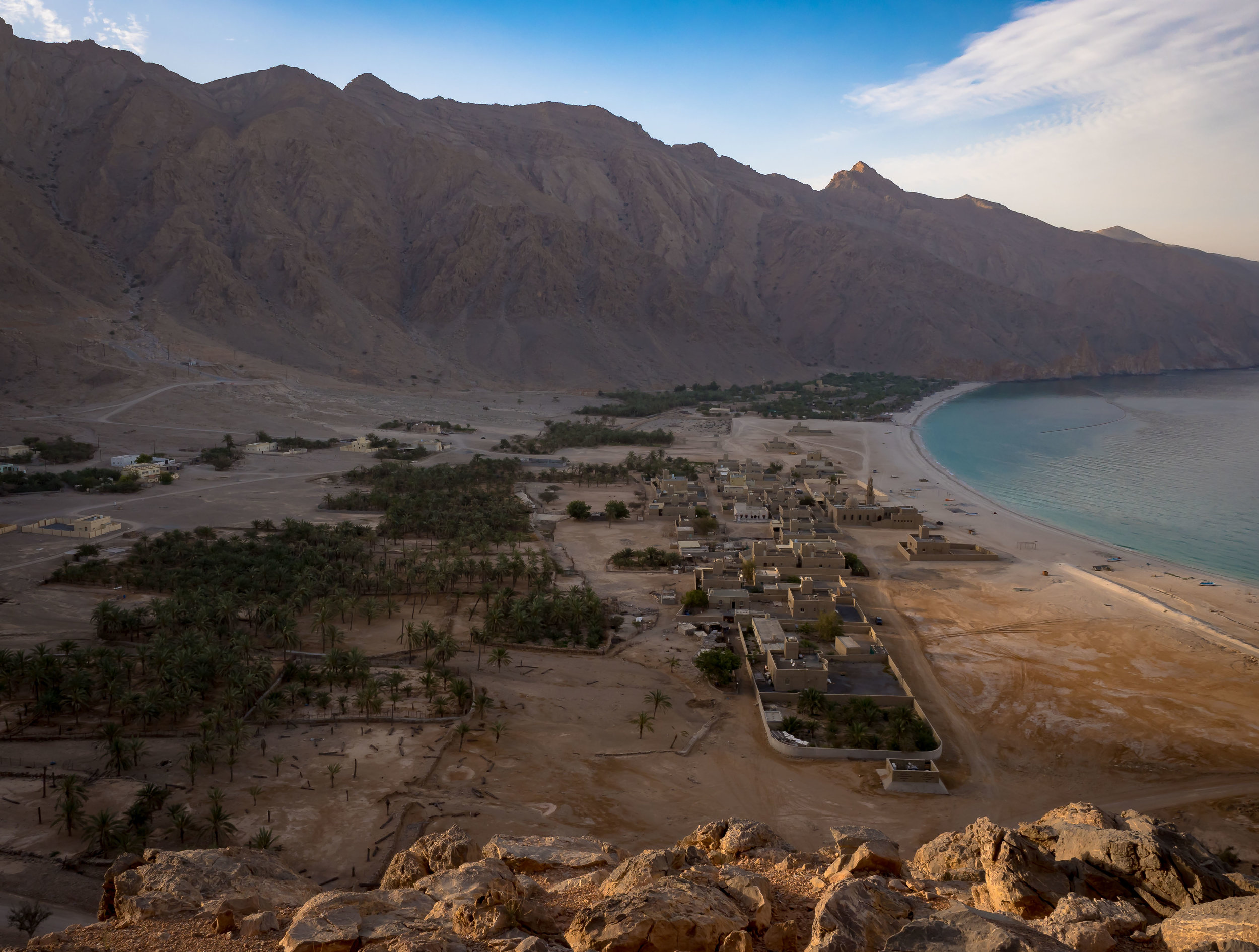
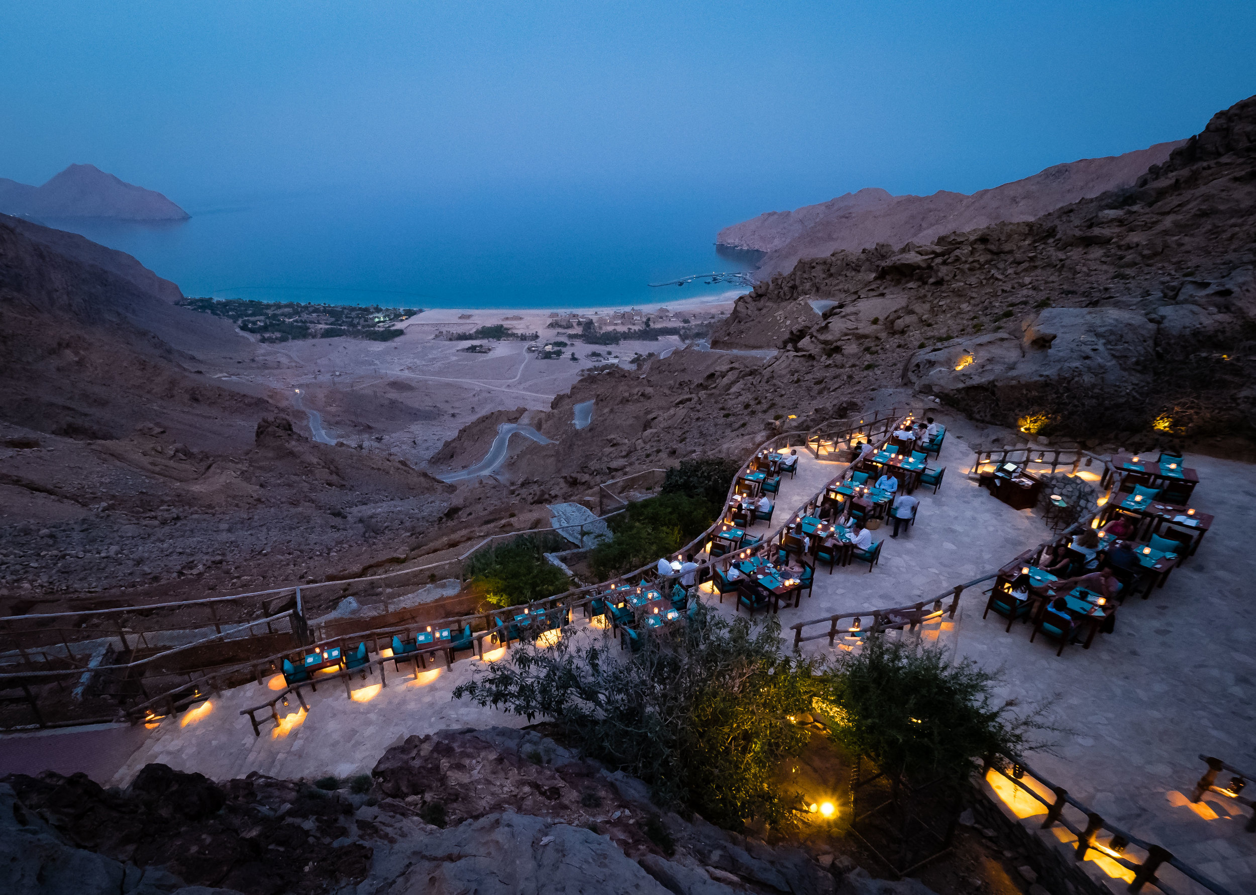
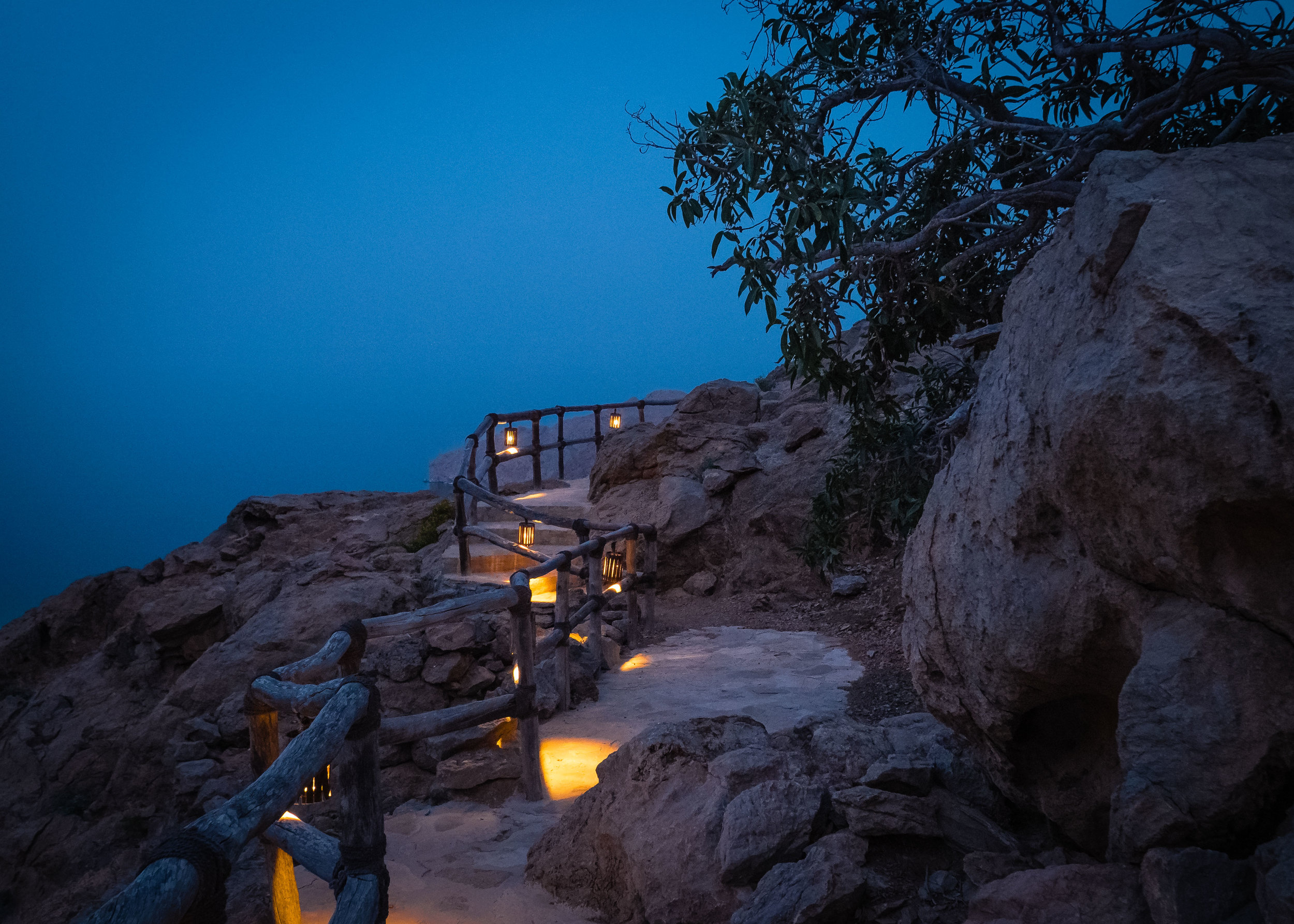
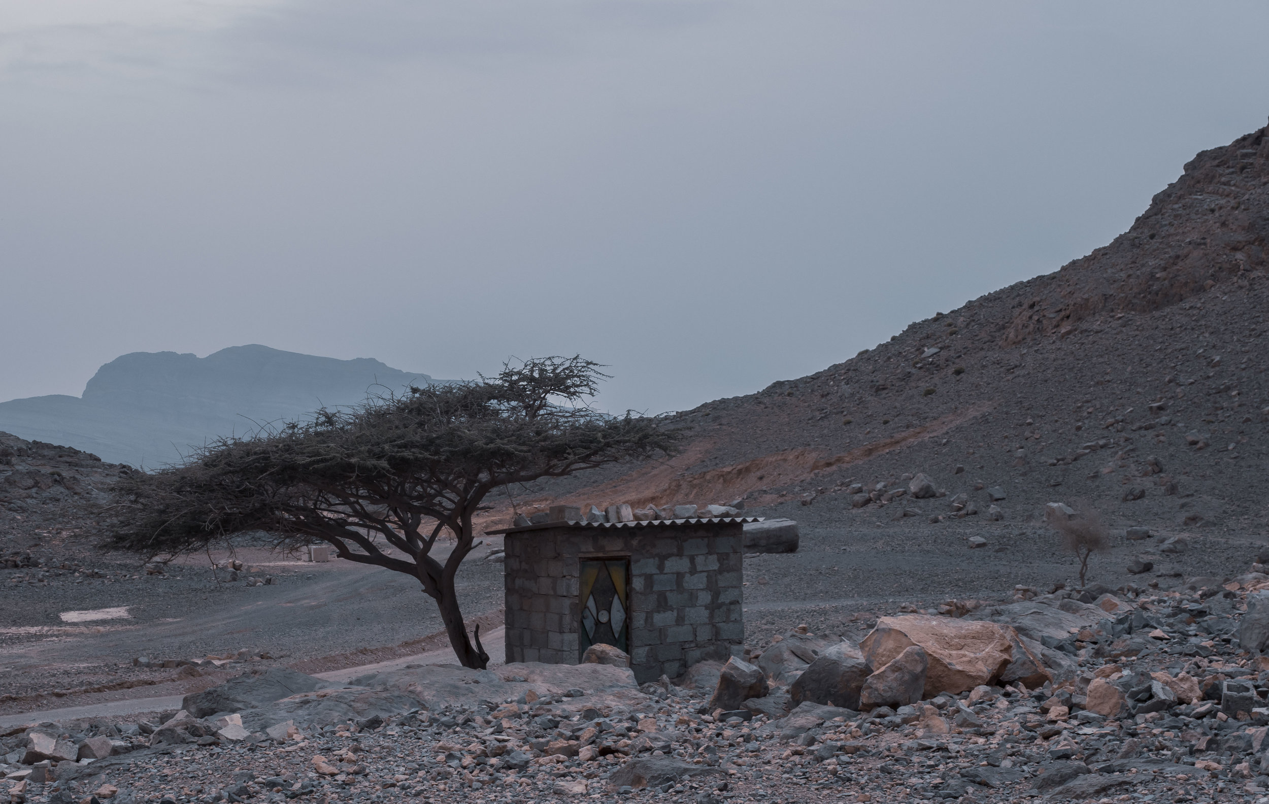
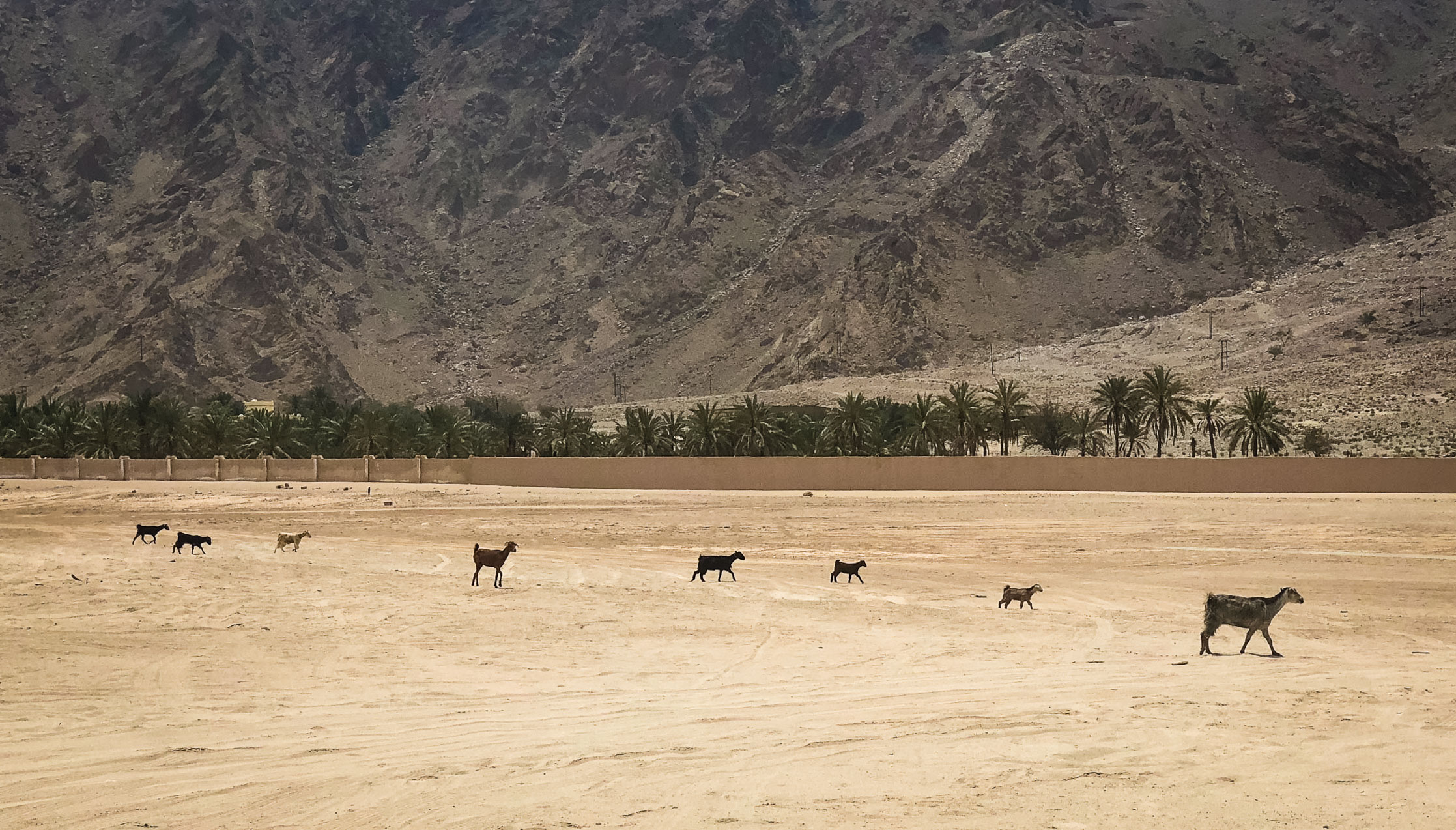
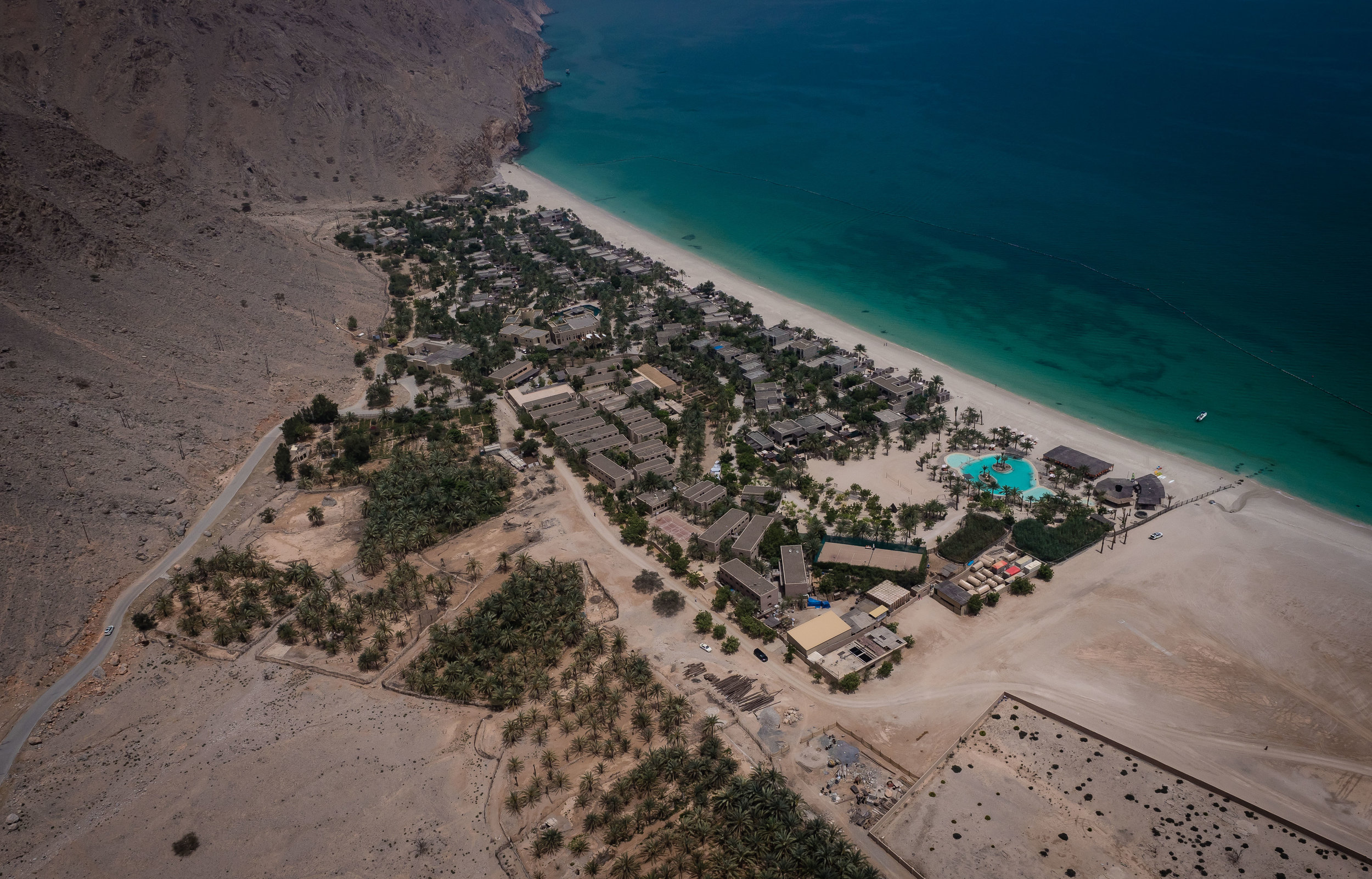
Six Senses Zighy Bay - A Musandam Refuge
The Six Senses Zighy Bay on the Musandam Peninsula, named after the small fishing town right next to it, just off the UAE boarder at Dibba, has always been on my list of must see places. This April I was lucky enough to spend a few days at the resort.

The Six Senses Zighy Bay on the Musandam Peninsula, named after the small fishing town right next to it, just off the UAE boarder at Dibba, has always been on my list of must see places. This April I was lucky enough to spend a few days at the resort.
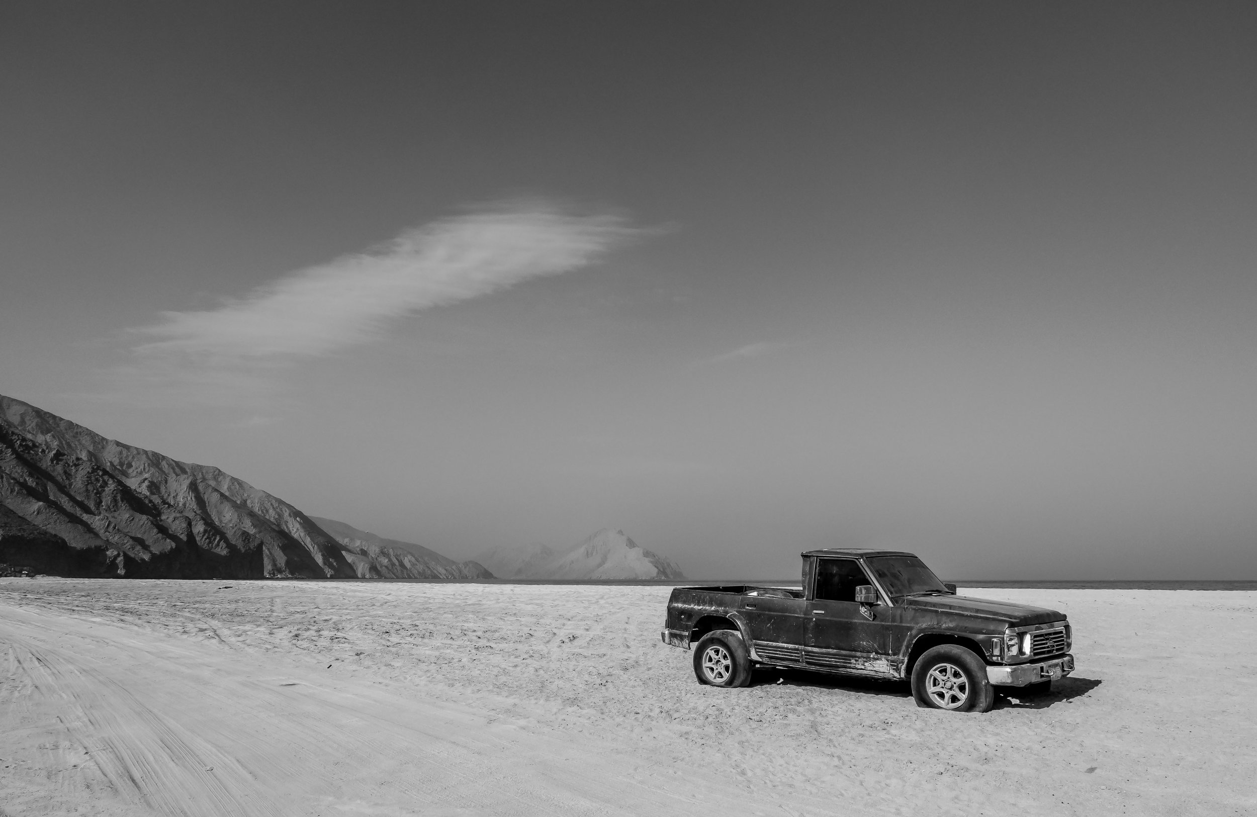


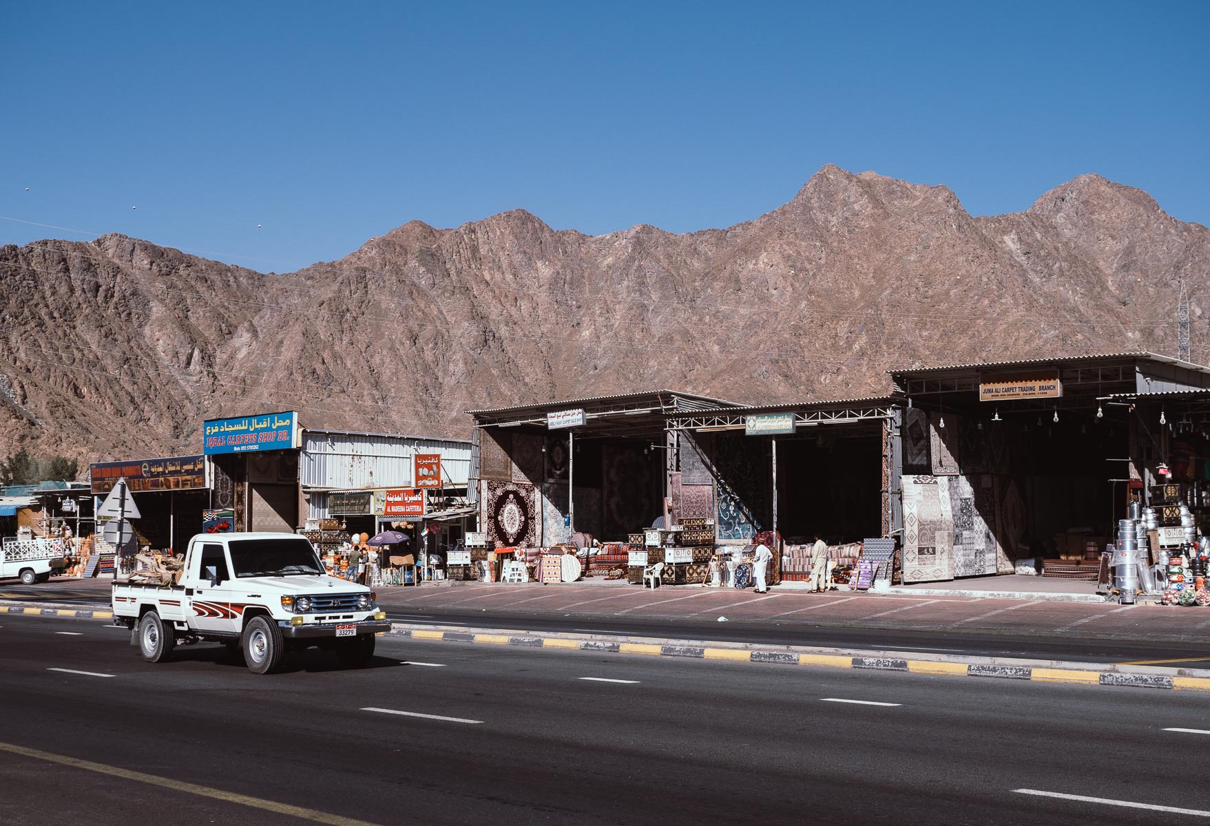
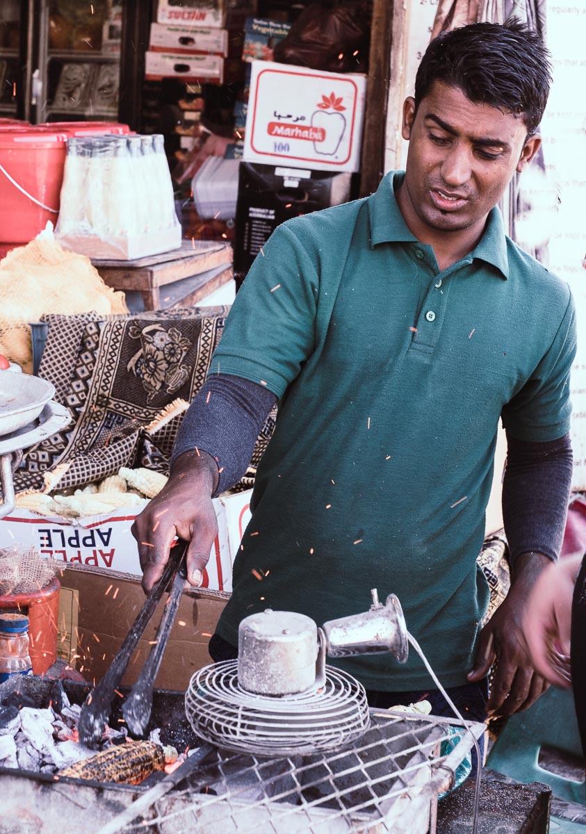
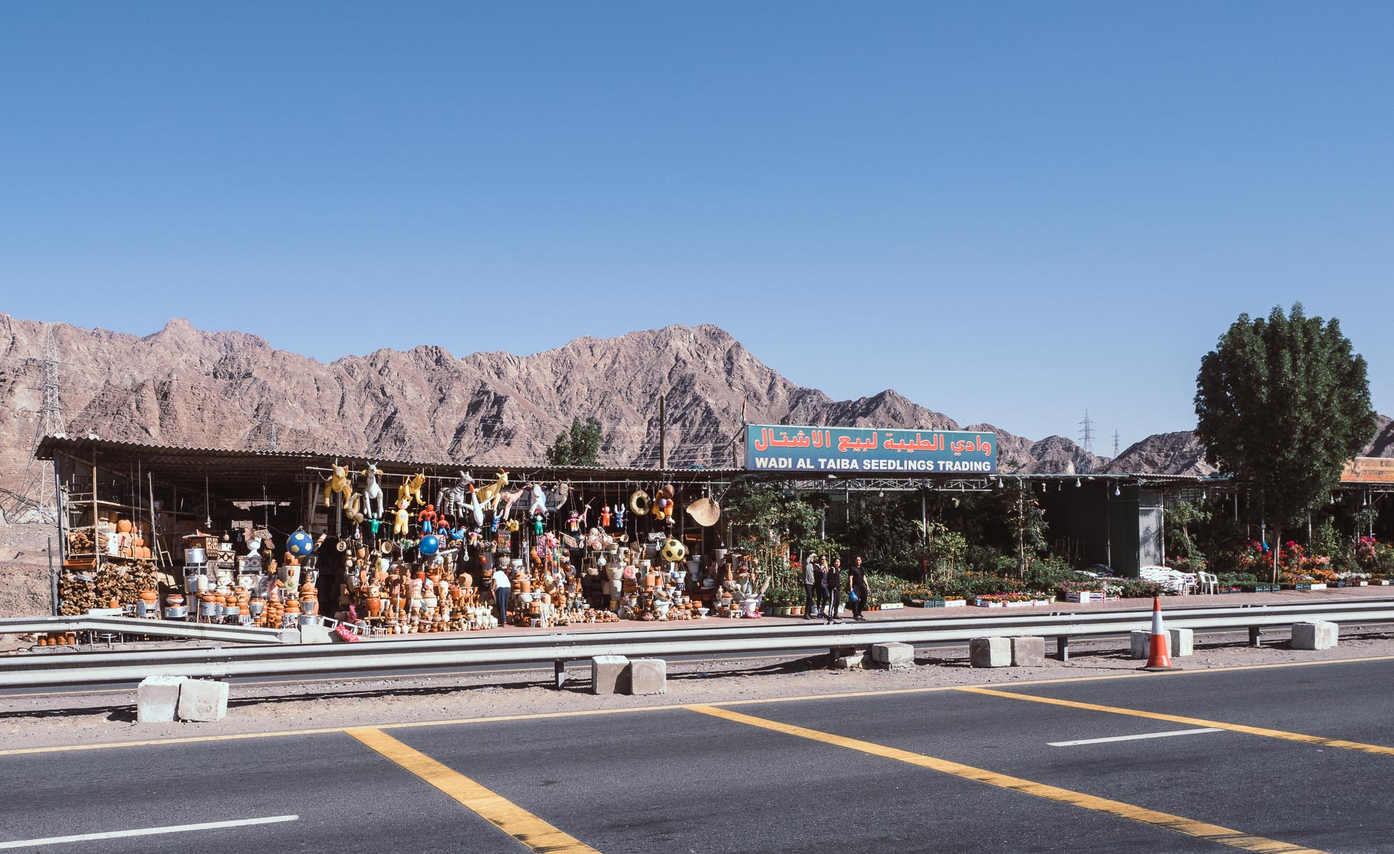
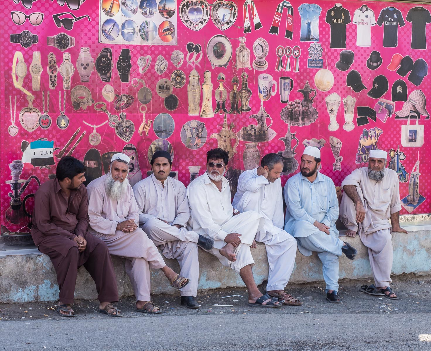
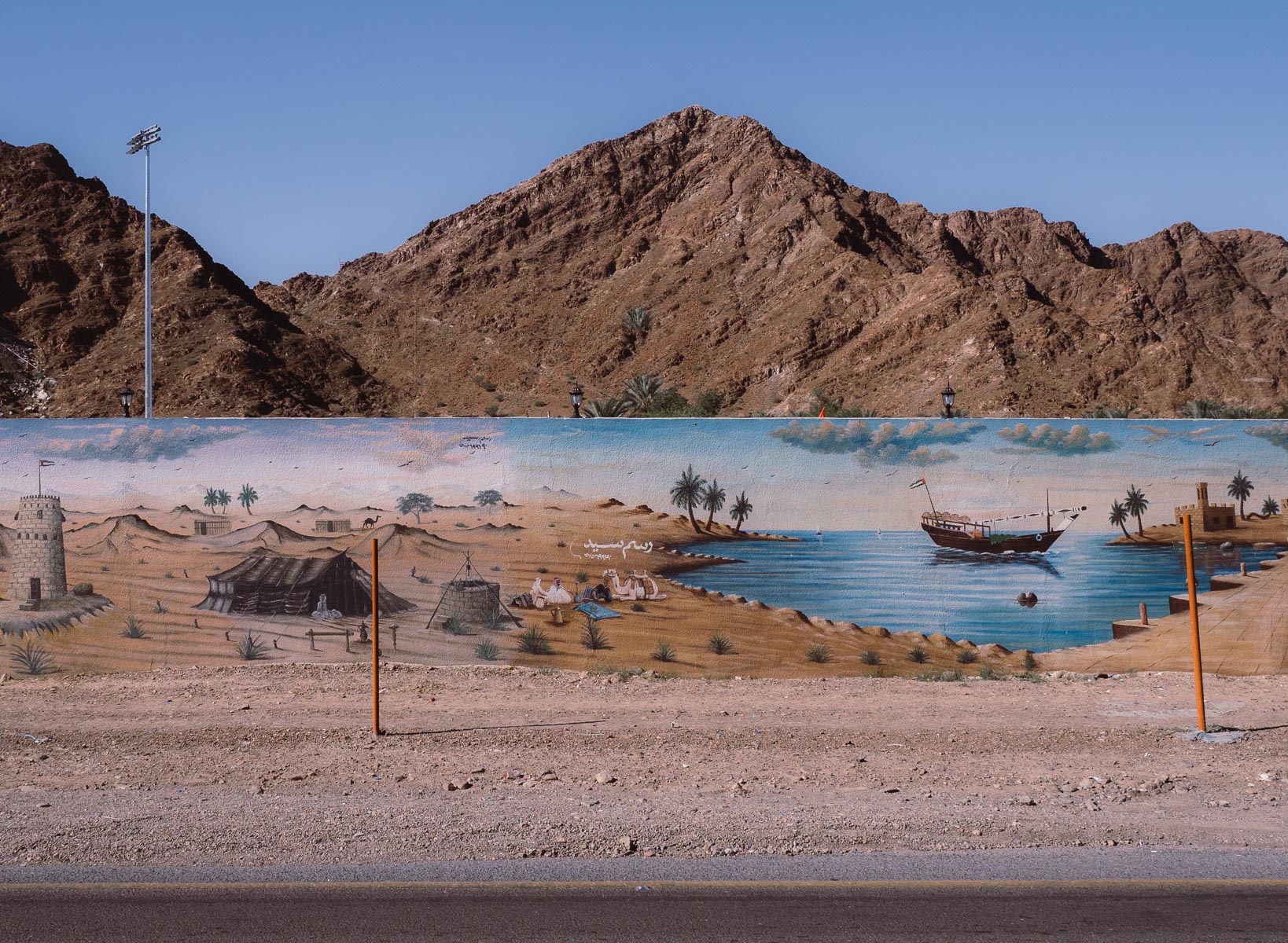
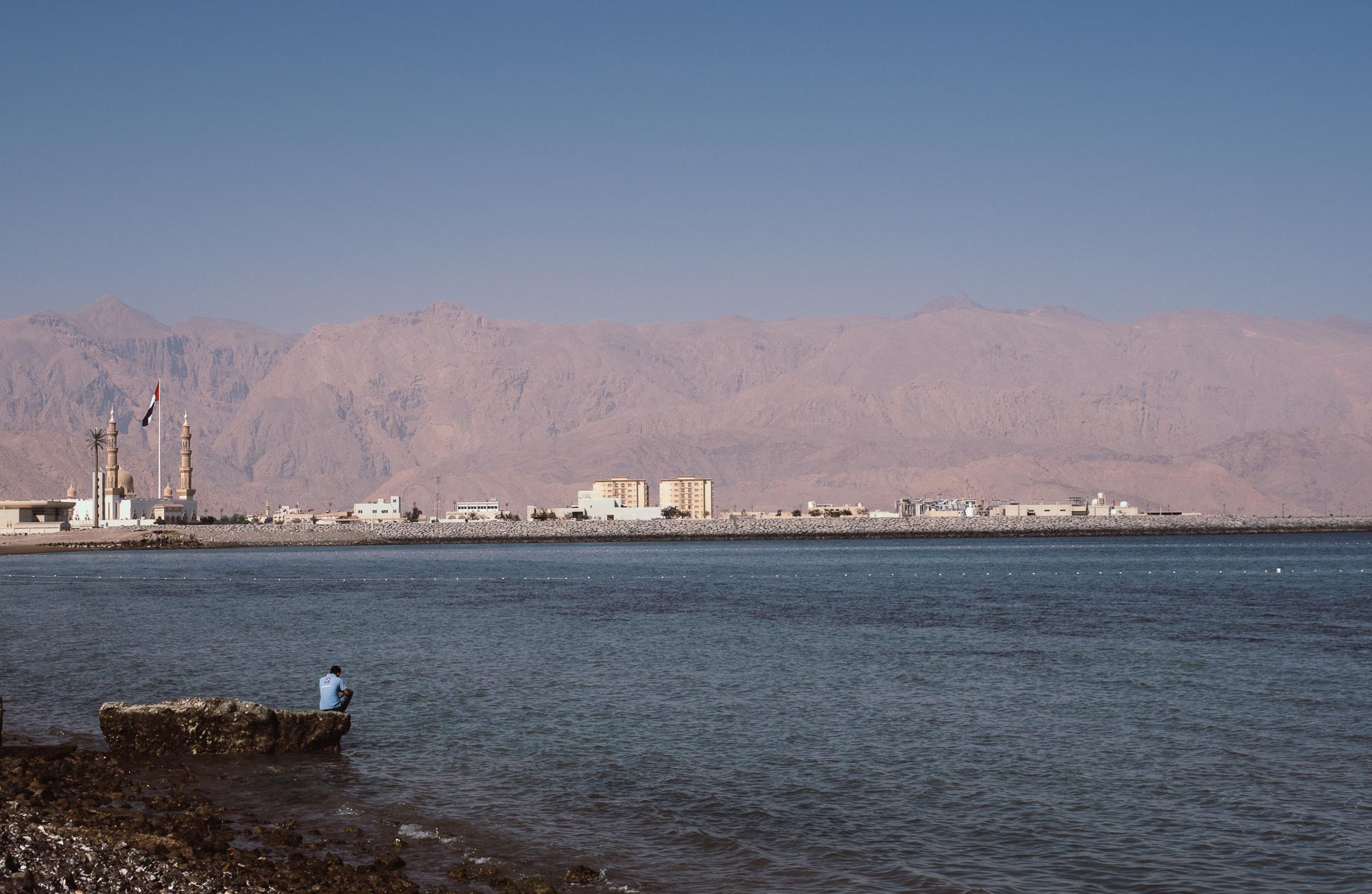
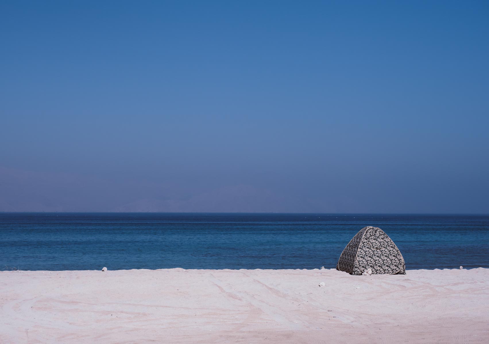
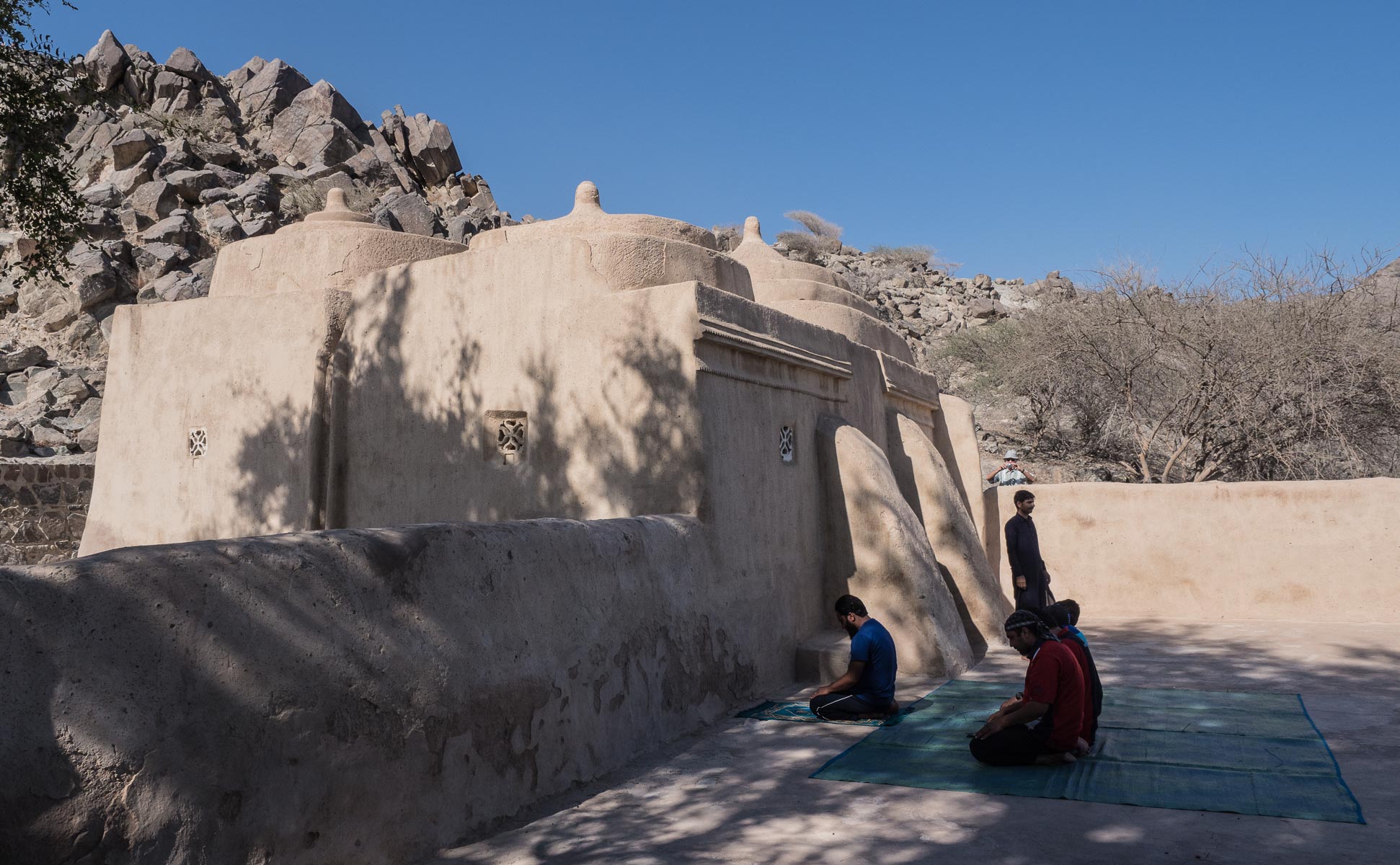
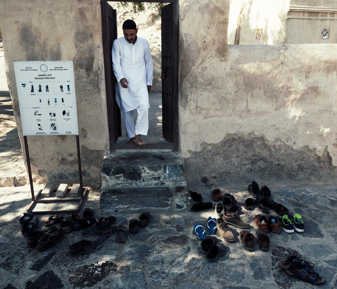
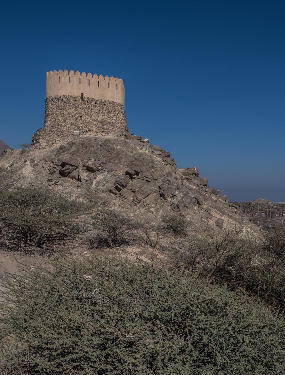
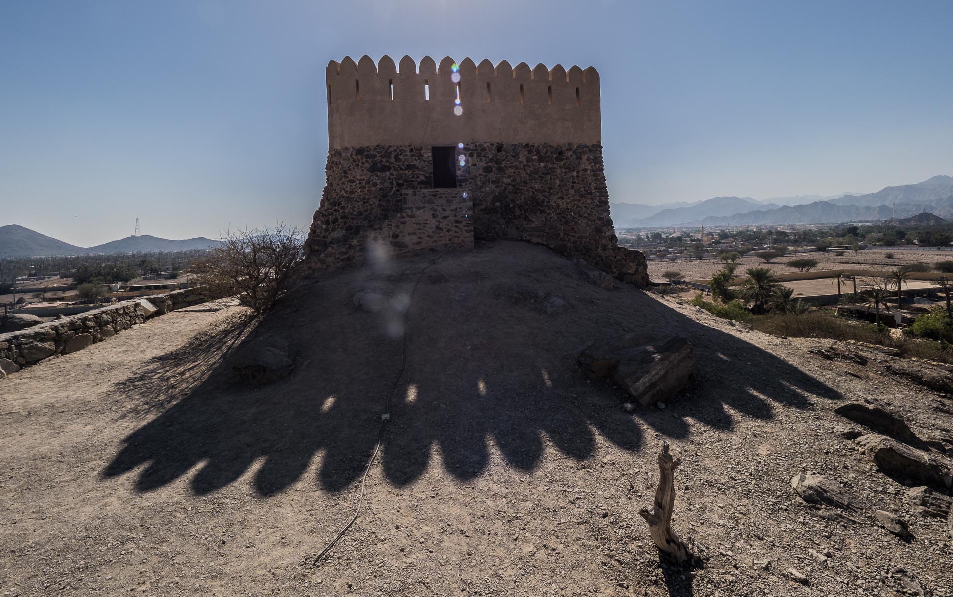
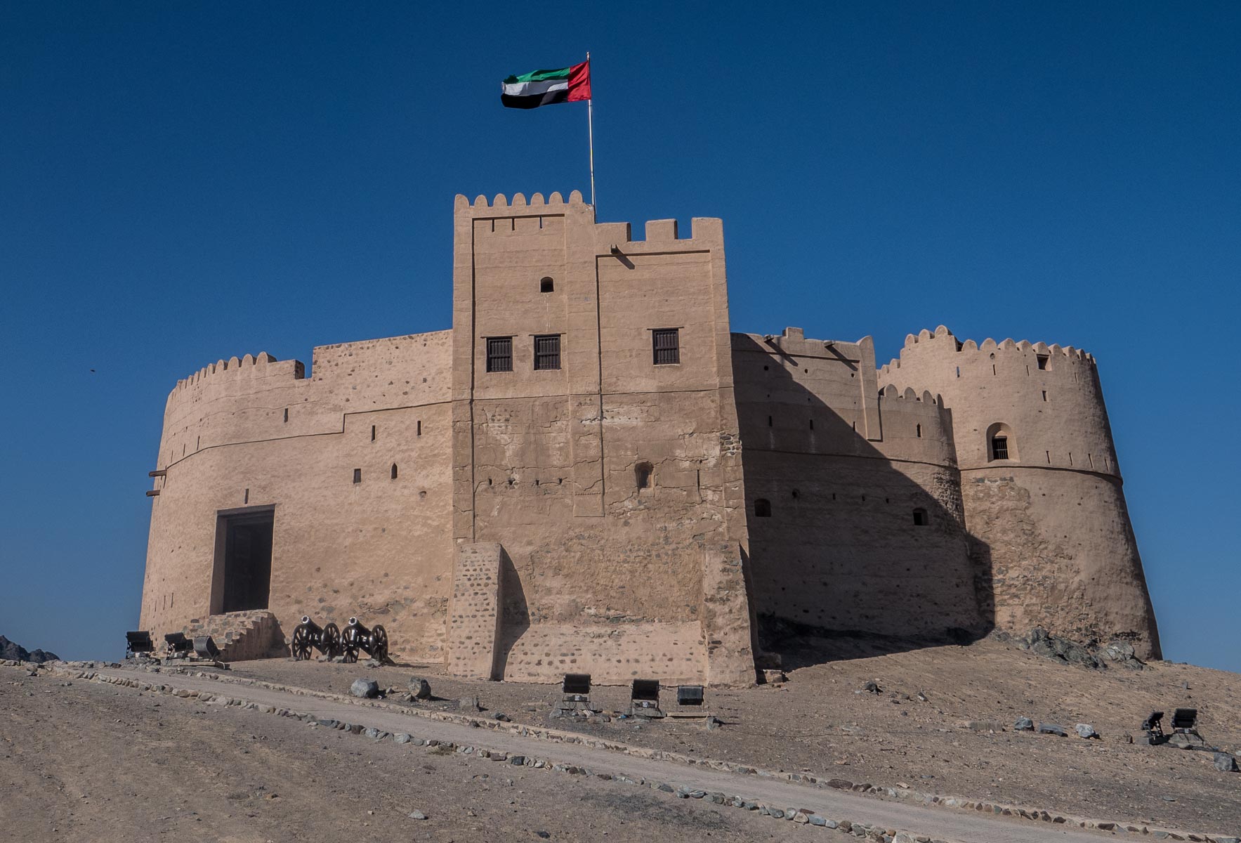
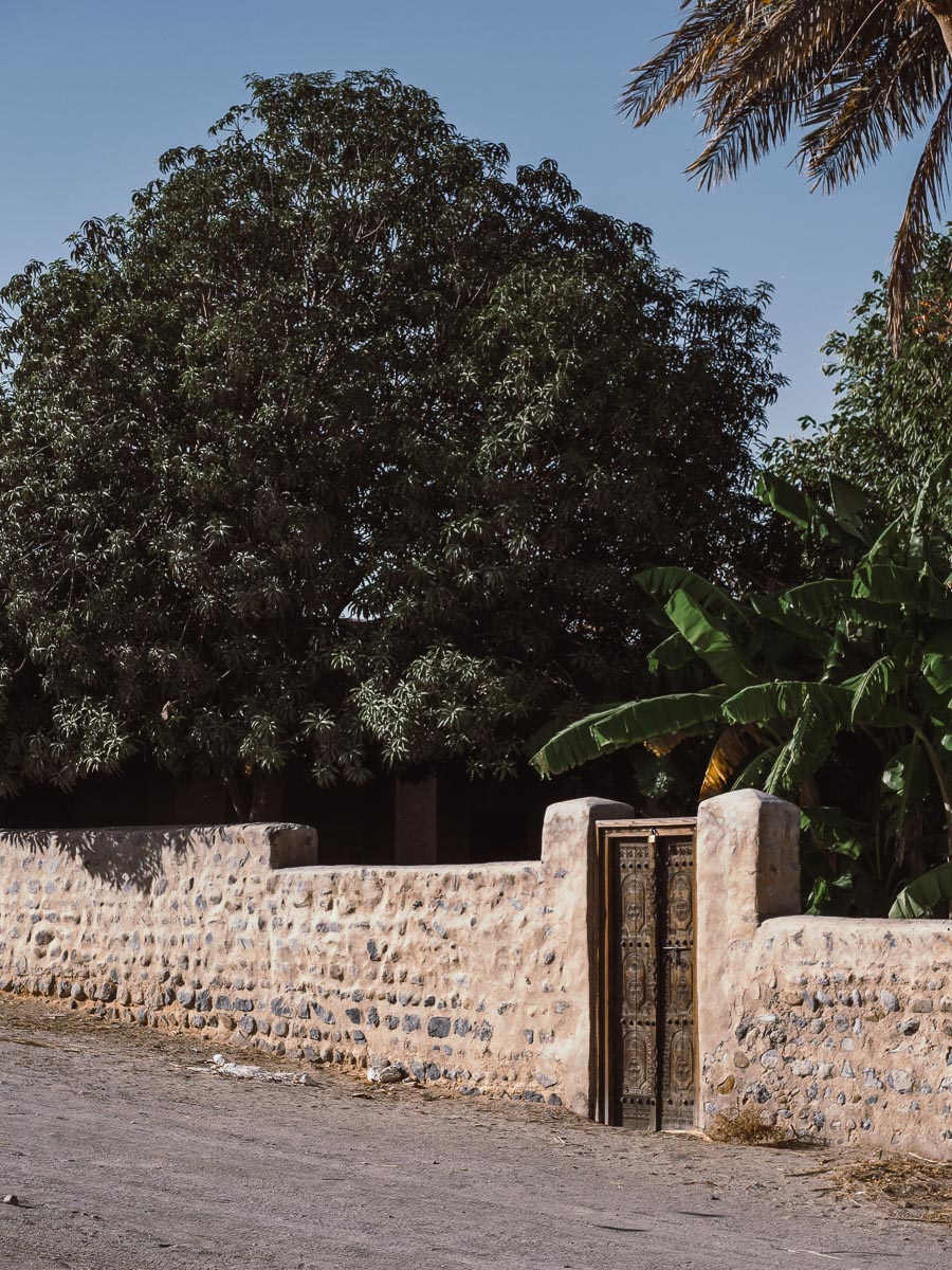
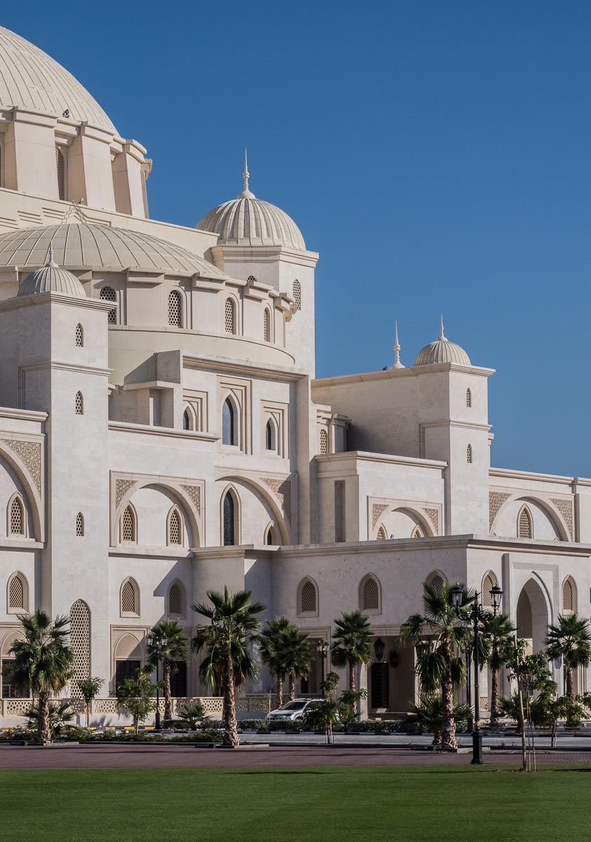
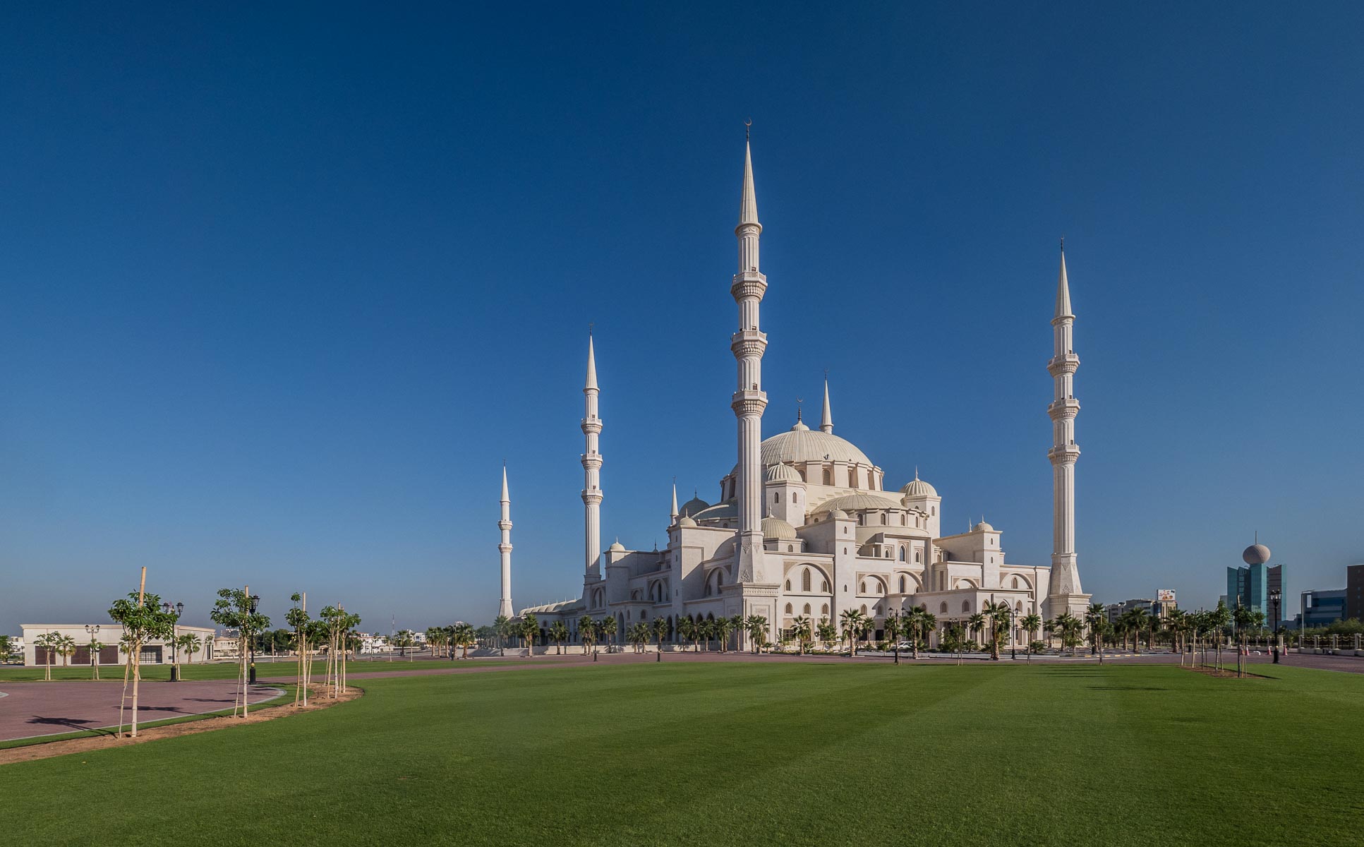
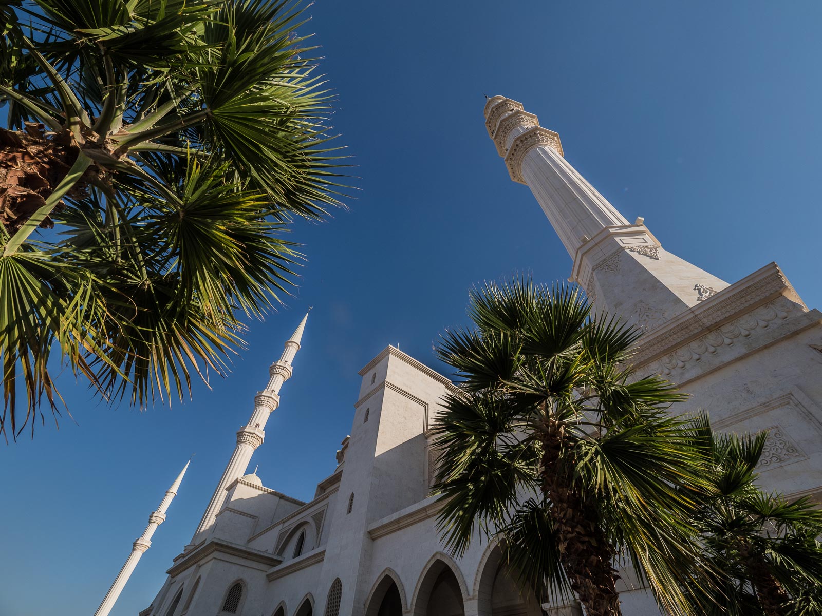
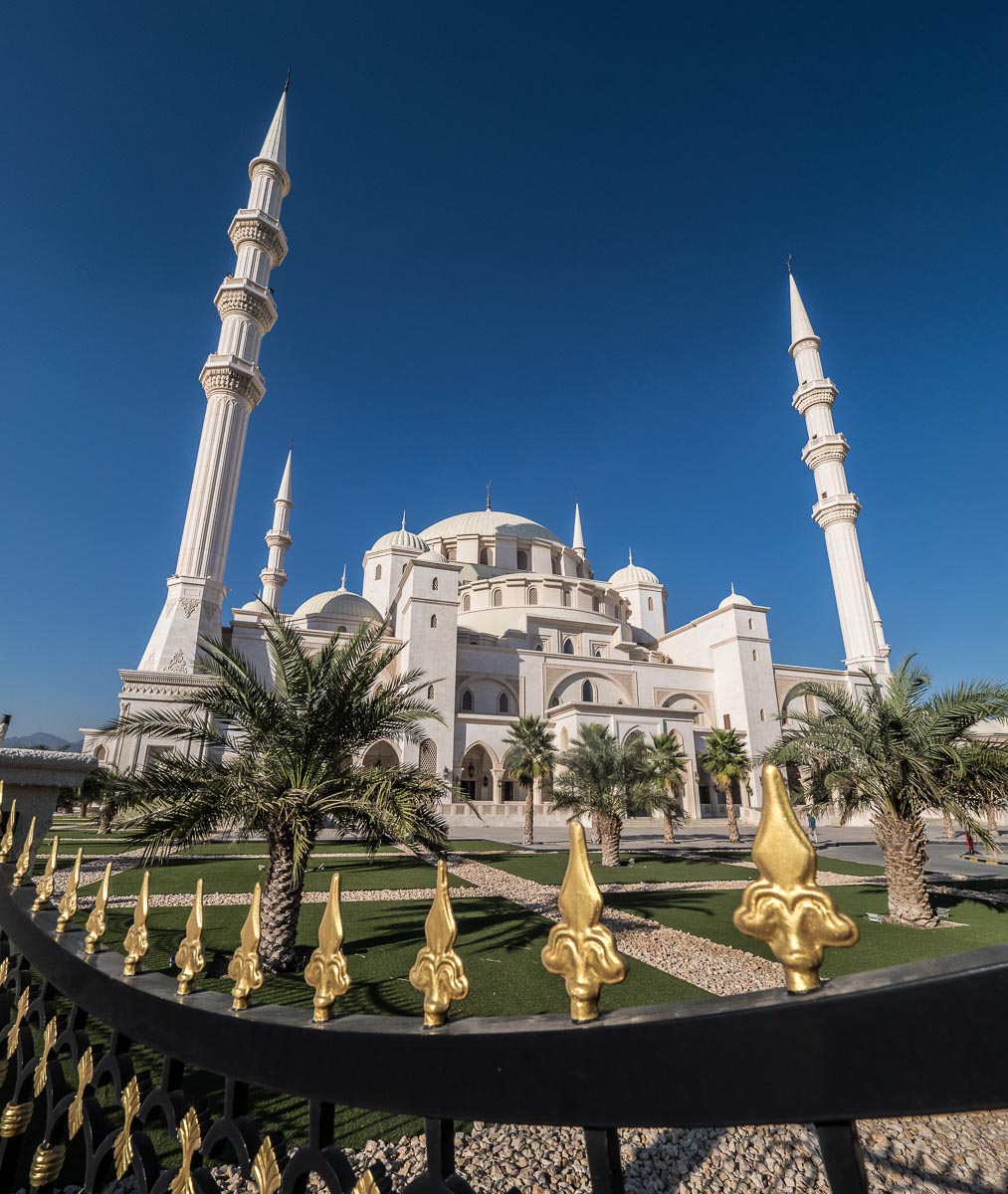
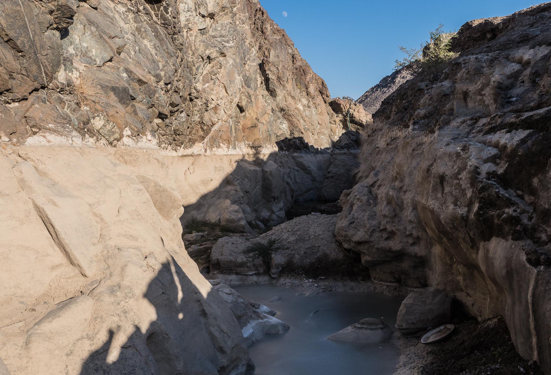
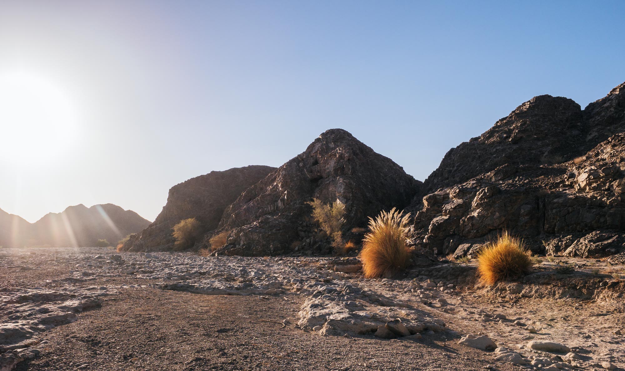
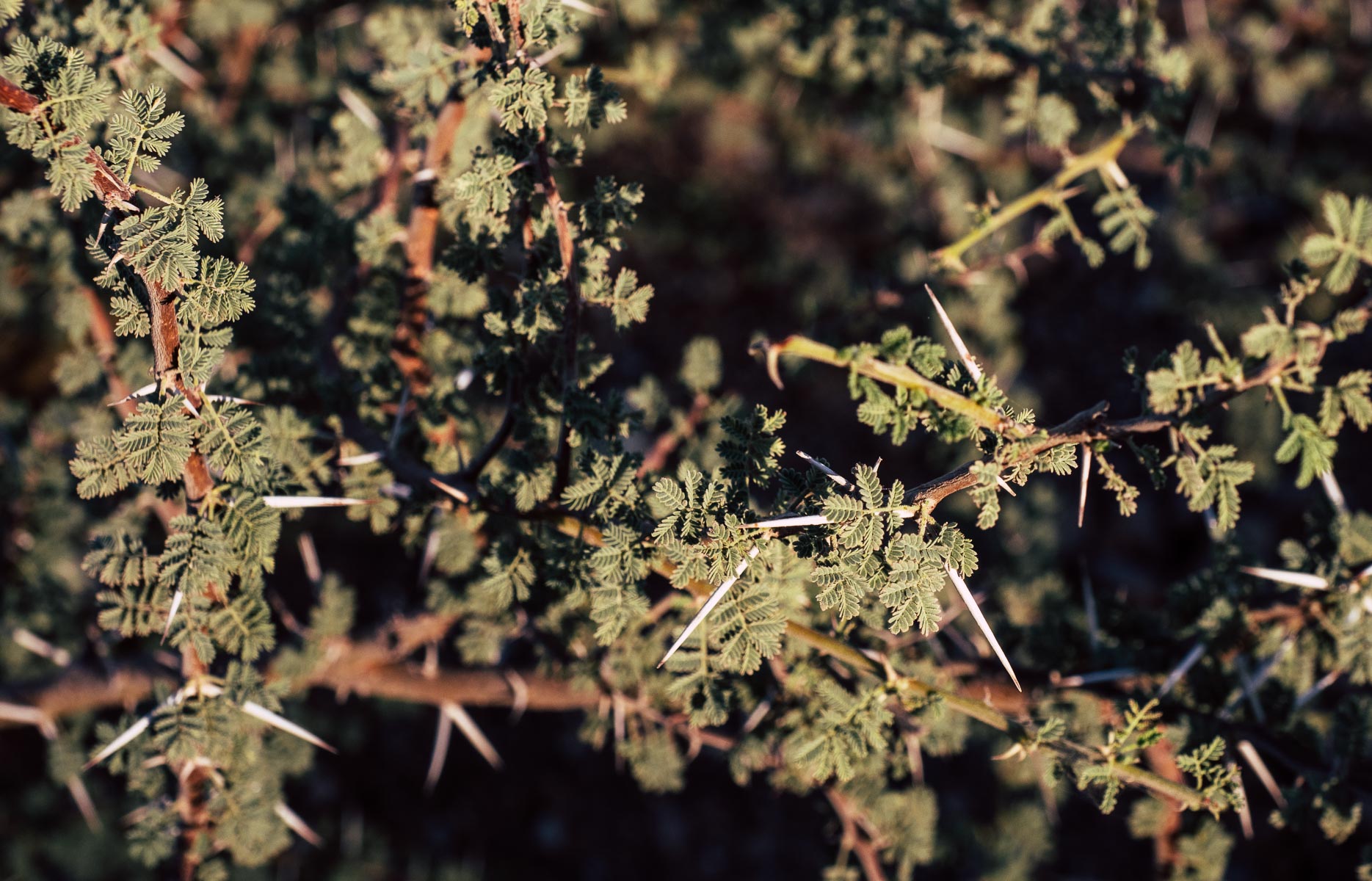
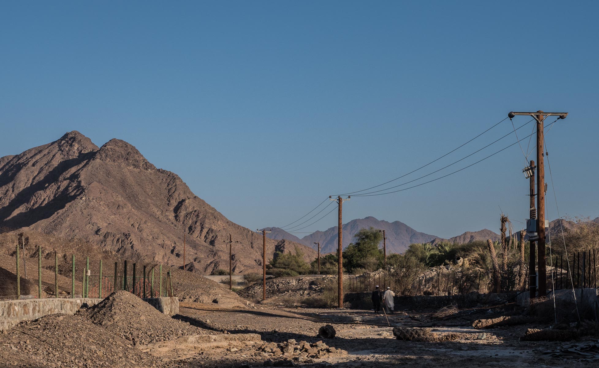
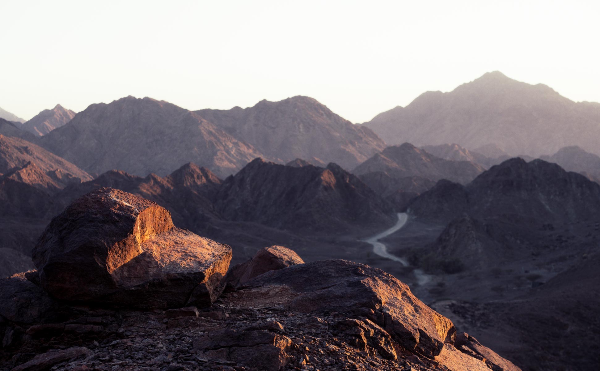
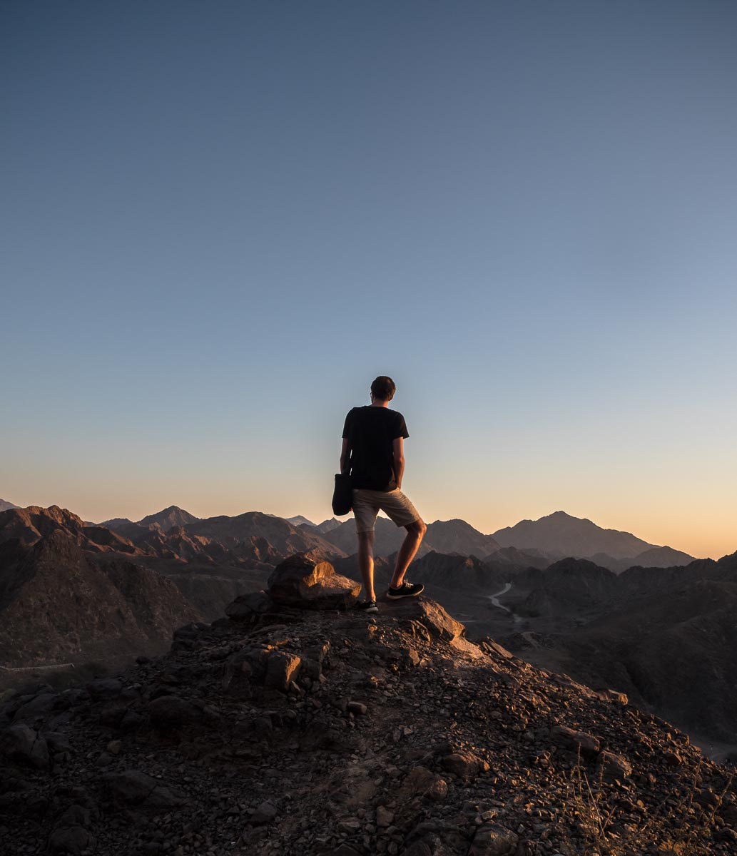
Fujairah - The other side of the UAE
Took a day trip to Fujairah, passing Masafi Town, Dibba, Khor Fakkan and Fujairah City on the way and stopping at Wadi Shawka on the drive back. Time well spent for sure.

Took a day trip to Fujairah, passing Masafi Town, Dibba, Khor Fakkan and Fujairah City on the way and stopping at Wadi Shawka on the drive back. Time well spent for sure.