Ol Pejeta - Kenya’s Rhino Capital
One of the strongholds for both black and white rhino, and home to the last two northern white rhinos in the world, Ol Pejeta’s conservation work is critical to the species.
This blog isn’t really meant to be a wildlife portfolio, but I can’t deny that the wilderness of Africa is one of my favourite travel destinations. That’s partly for the landscapes (Namibia stands out), the unexpected (check out the dinosaur footprints in Zimbabwe), or the conservation efforts (see my trip to Amboseli for IFAW), but of course also for the animals you can find here. This is another blog focused on the latter. I promise though there will be future entries again covering other parts of the world, with cityscapes, landscapes, and possibly a few humans as well…
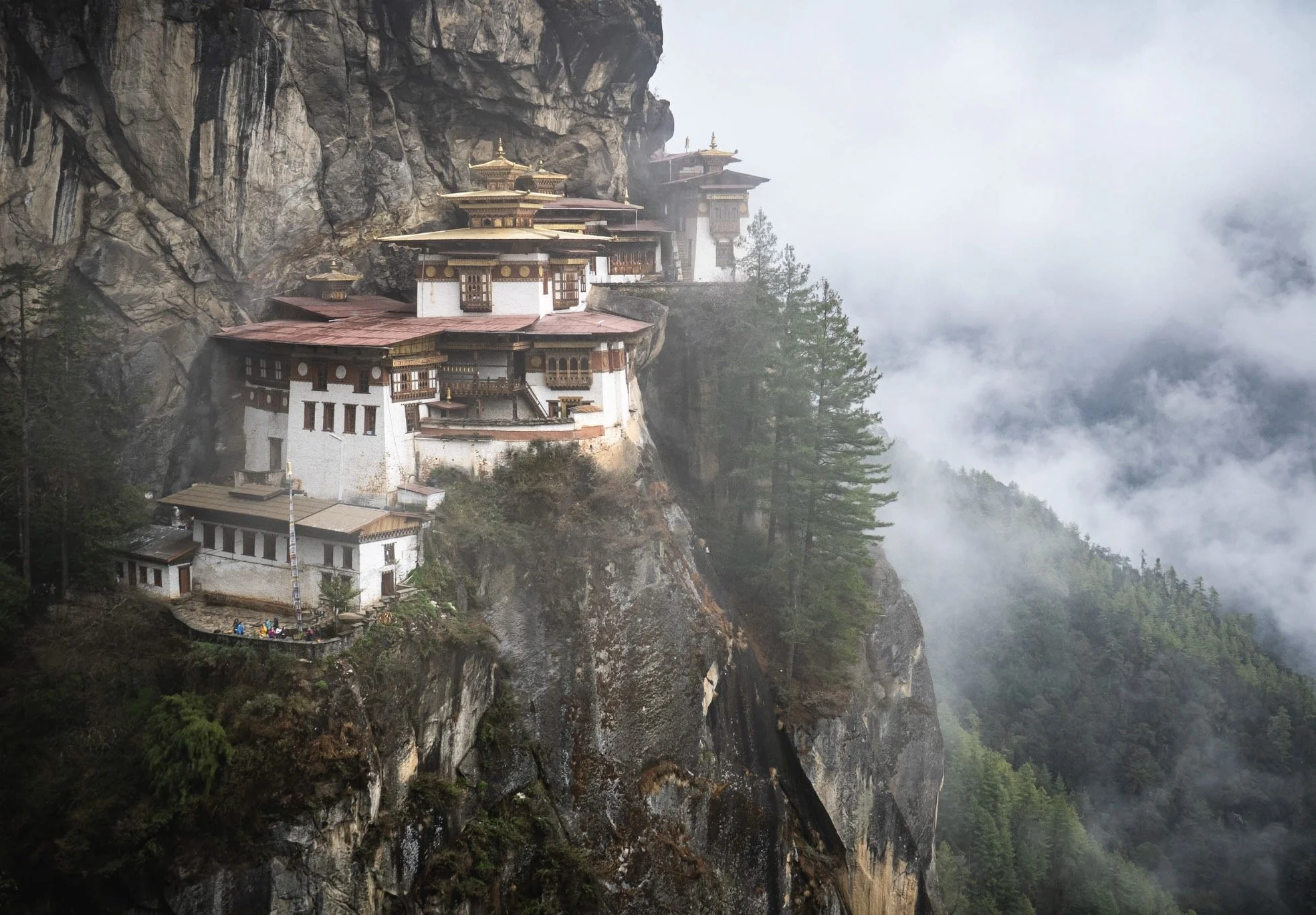
For now, we are going back to Kenya, not far from where I had the joy to photograph Giza, the famous black leopard. Specifically, a conservancy called Ol Pejeta, at the foot of Mount Kenya. This region is rich in wildlife, but stands out for one species more than all others: Rhinoceros.
I’ve wanted to come here for a few years, having followed the faith of a specific type of rhino for a while…but one thing at a time.


I stayed at the aptly named Porini Rhino Camp, a simple tented camp in the quiet north-eastern side of the conservancy. It’s a beautiful small camp in a very calm location, with wildlife just metres away from your tent. It was also completely empty - the season had just started (this was in mid-May) and we were the first guests after they re-opened. Could not ask for more!

The Water Hole
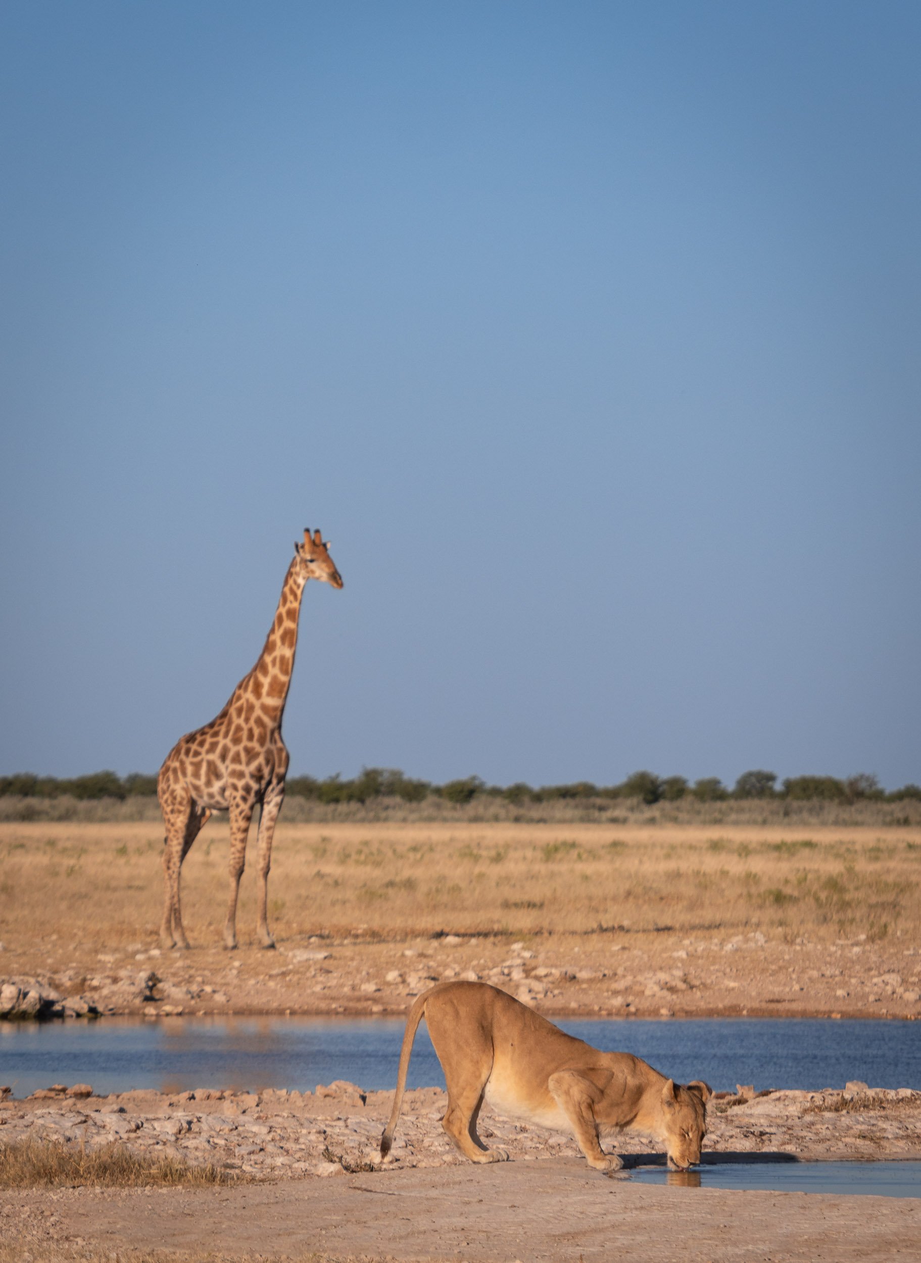
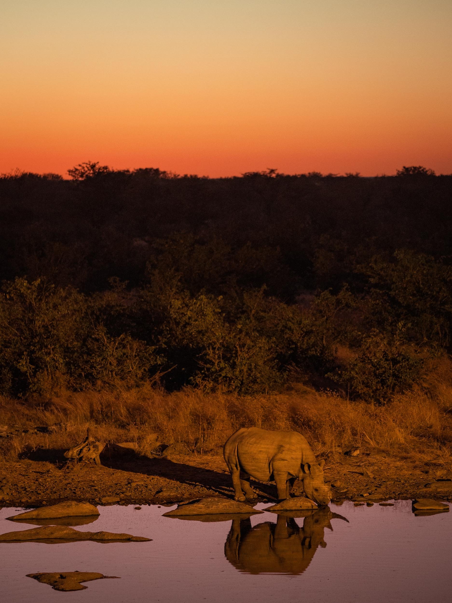
The camp also features a small hide directly at the local waterhole - always a great option to get some eye level close ups of animals coming to drink - giraffe, impala, warthogs were among the visitors as we arrived.

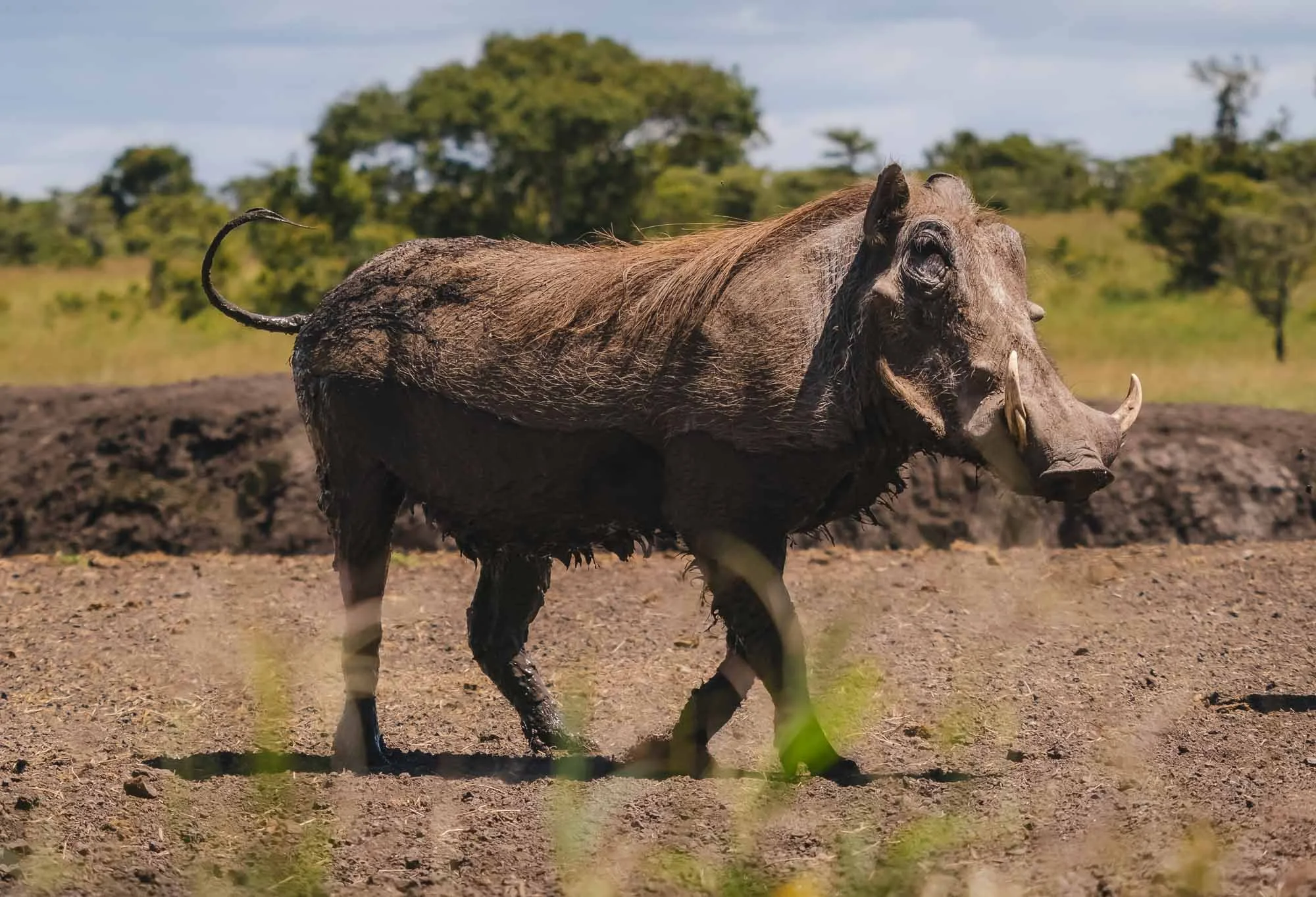
This brave warthog came pretty close to the hide but was rightfully skittish - the smallest sound and movement made it scuttle away quickly.
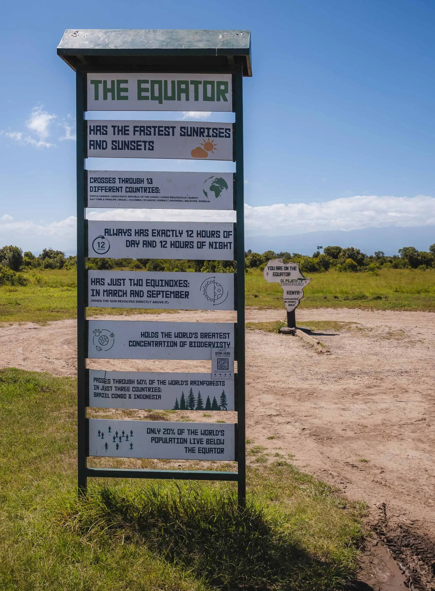
Centre of the World
The conservancy lies in the north of Kenya at the equator, which runs through its borders, marked by a small sign post. I’ve had the chance to cross the equator on foot a few times before, but it’s still a cool little quirk to move from one half of our planet to the other.
Ol Pejeta is also home to a large variety of birds. I’m still learning to appreciate our flying companions more, but even with my limited knowledge seeing one of these colorful bee-eaters in action is always a joy…


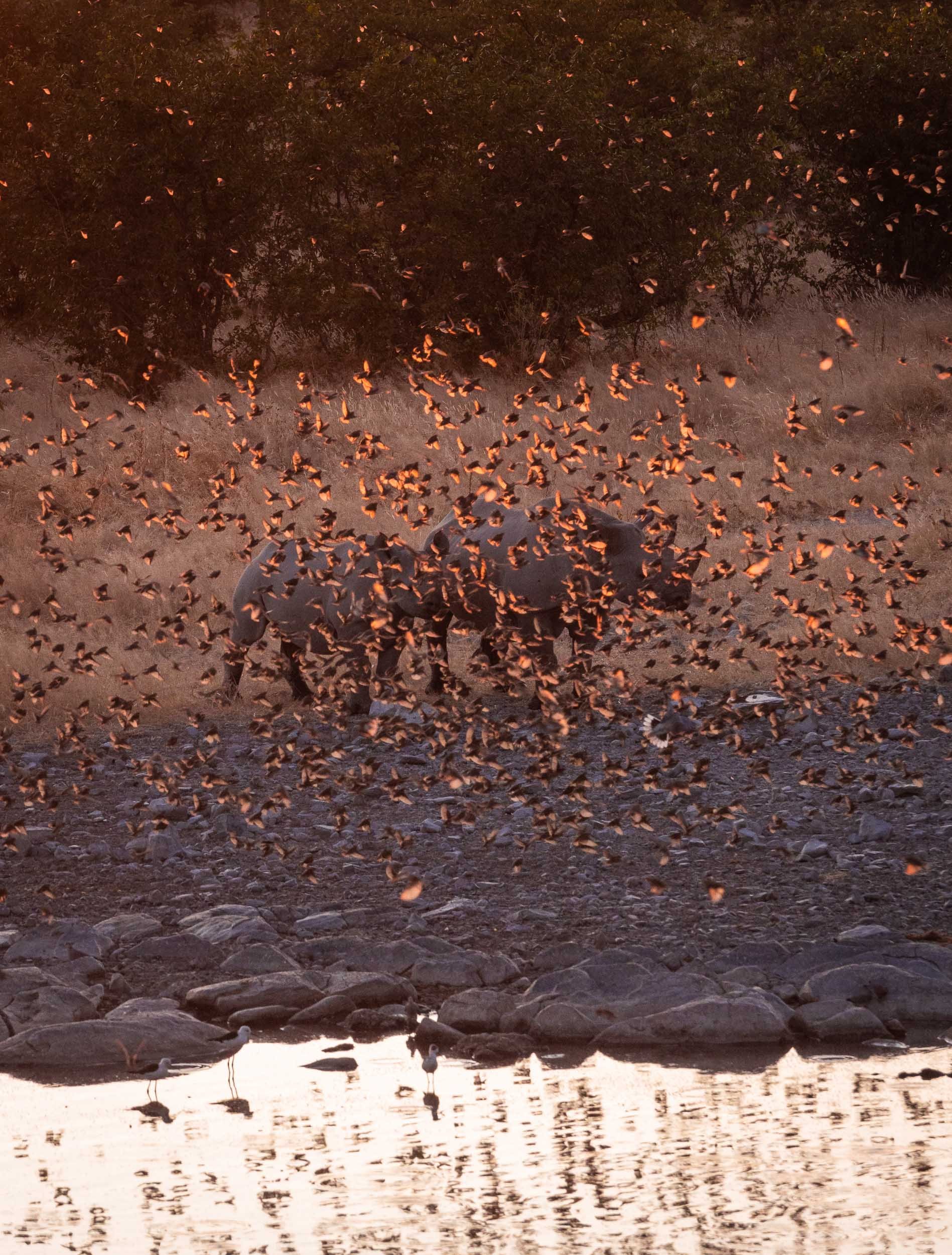
… as was this incredible and rather unusual (so I was told) sight of probably more than a hundred pelicans gathering in a small pond just off the dirt-road leading through the part of the conservancy.


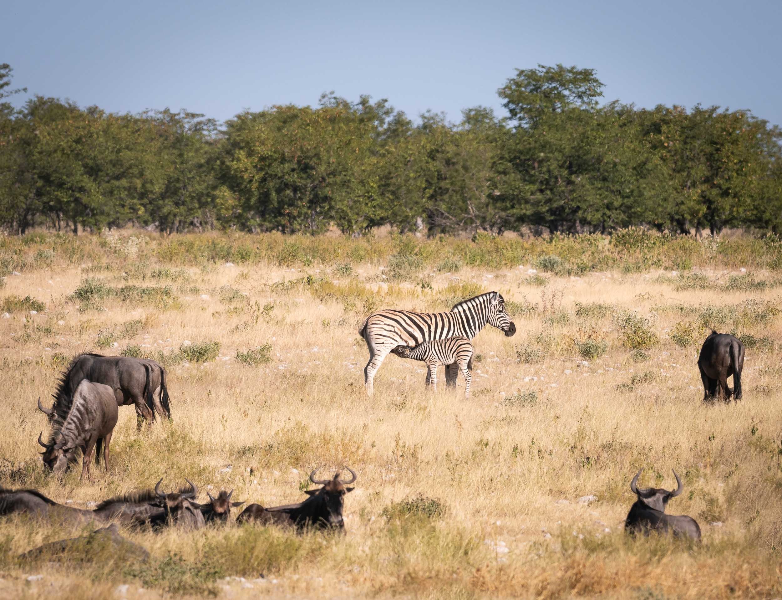
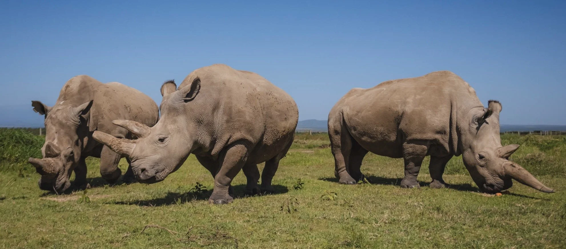
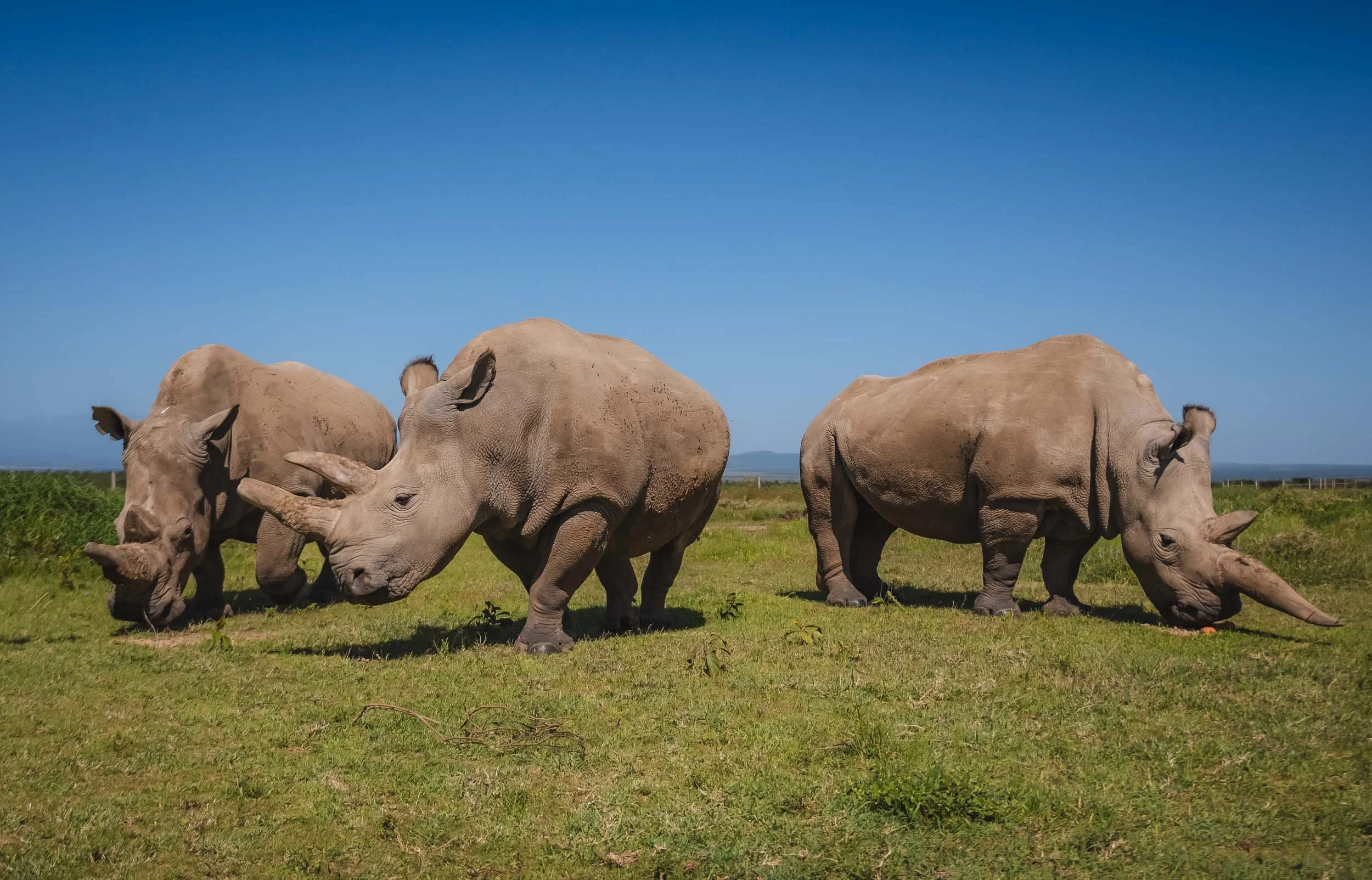
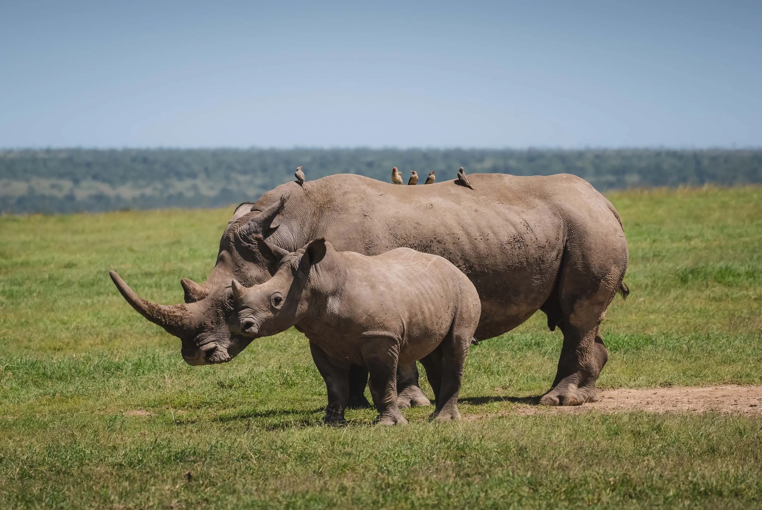
Rhino Capital
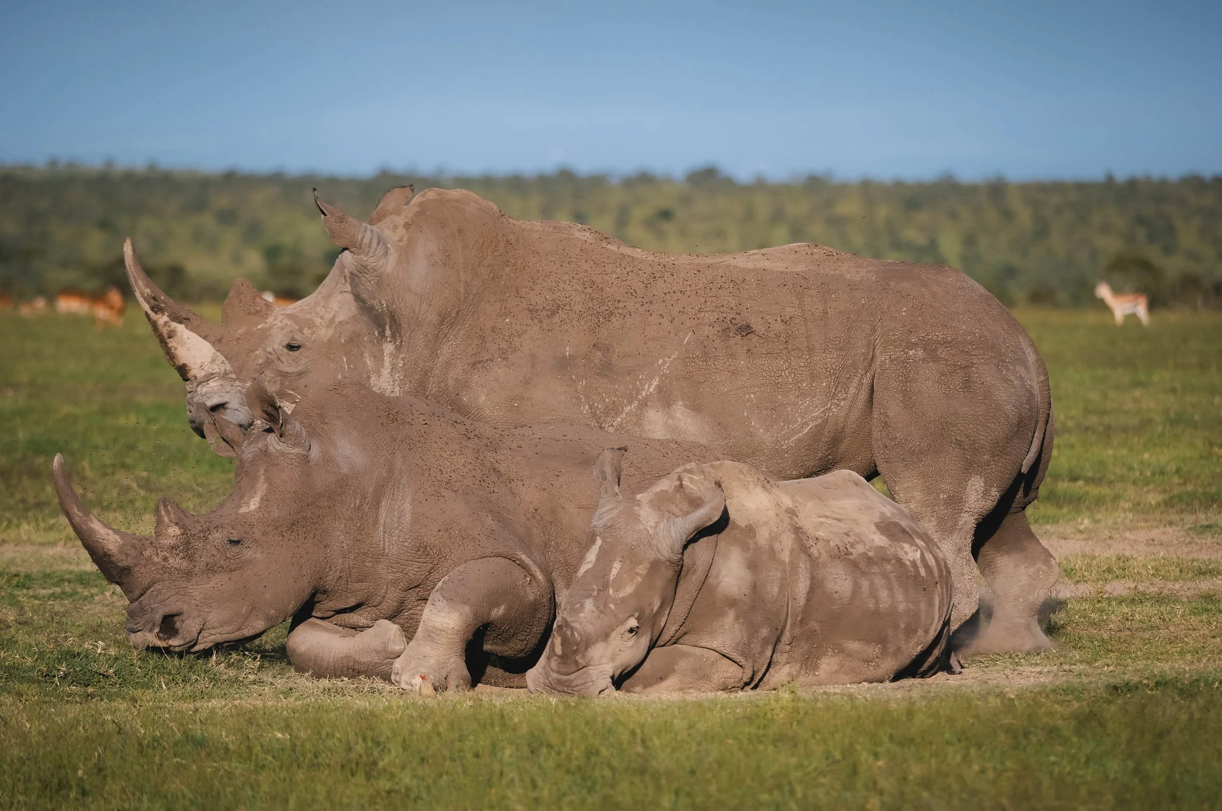
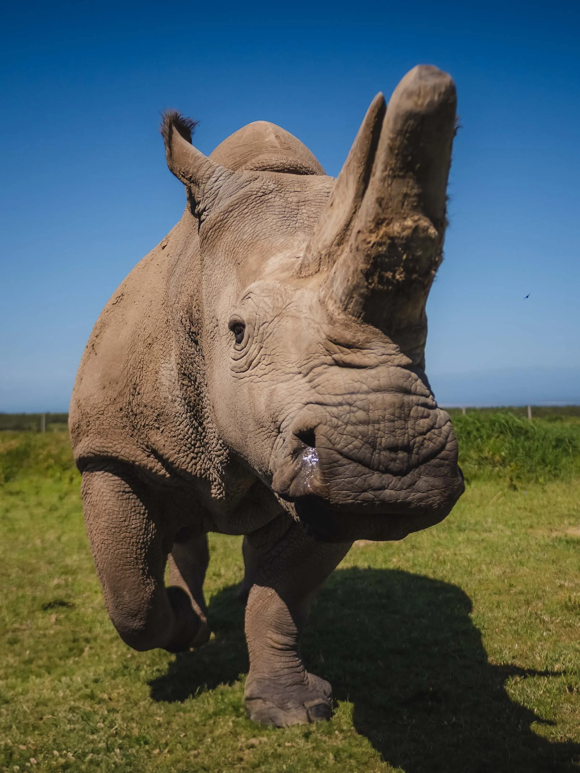
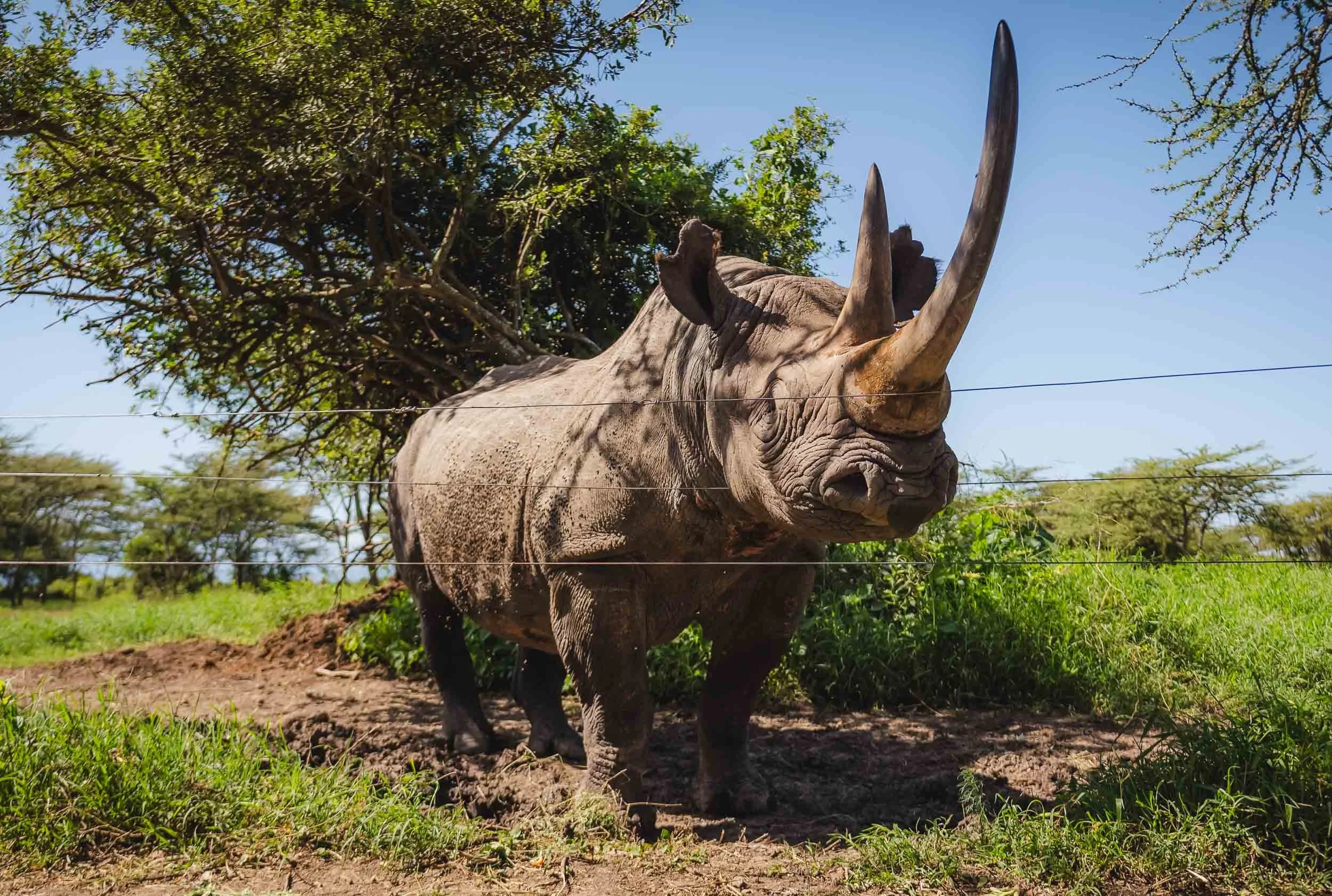
Admittedly it wasn’t the birds why I came here. It was for Rhinos. Ol Pejeta is one of their strongholds in Africa, with around 50 southern white rhinos such as these ones, more than 150 critically endangered black rhinos (the much more shy variant) and the last two northern white rhinos on the planet (yes - the last individuals of the species anywhere, whether in the wild or captivity).
We had at least a dozen rhino encounters over the 5 days here, with several groups spread around the conservancy. Its borders are designed in such a way that rhinos cannot move beyond its boundaries with specific type of fences and deterrents that only allow all other animals to pass and migrate. This is for their own protection: Ol Pejeta employs highly trained rhino protection squads, partners with international veterinary experts and gathers data on all of the individuals to support their conservation across Africa.


The Northern White Rhino
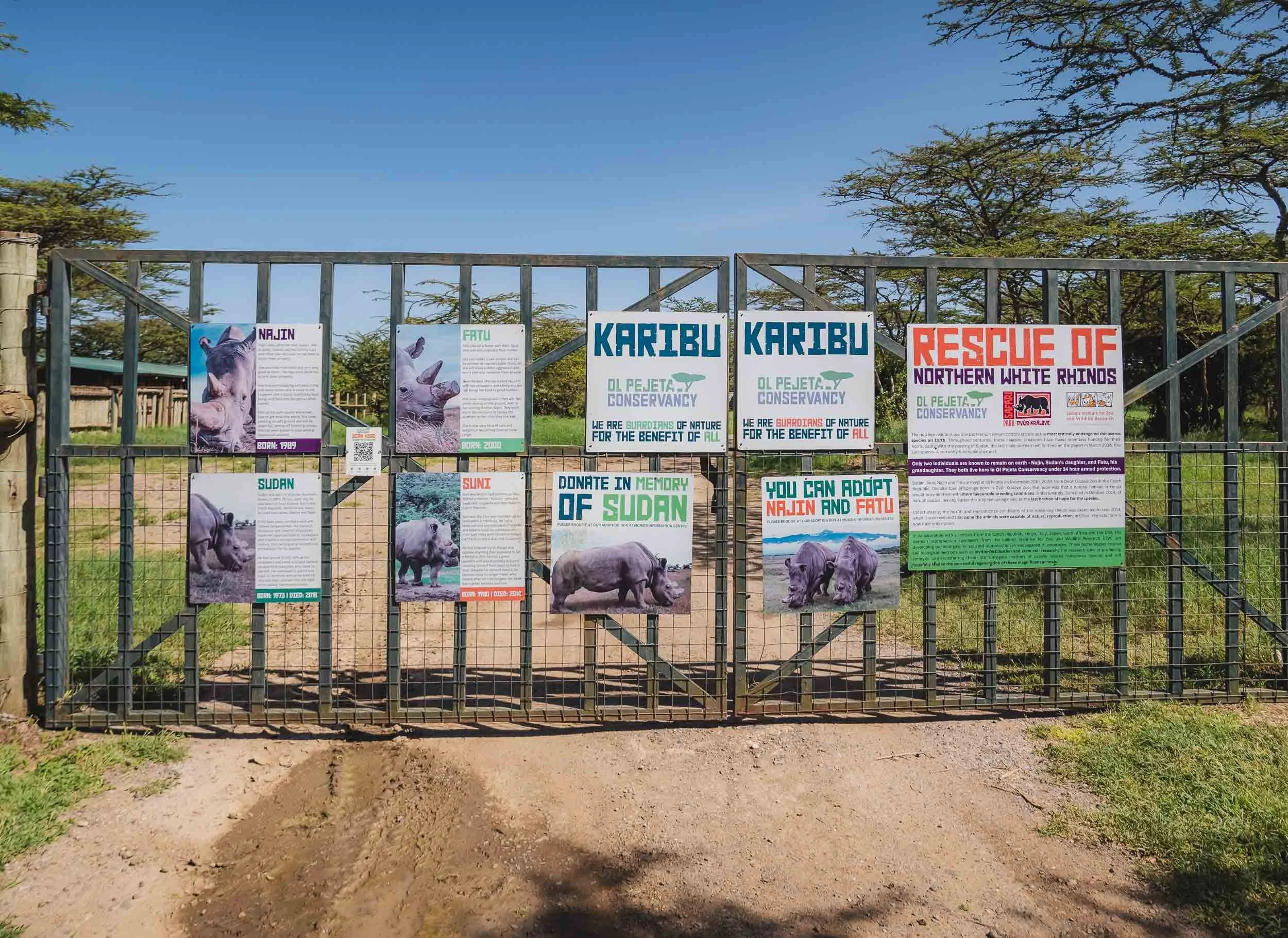
The pinnacle of the conservancy’s conservation work sits behind this fence: the enclosure of its two Northern White Rhinos, the last of their kind.
I’ve been following their faith for a few years and had been looking forward to learn and see more of them in person for a while - it was an exciting moment to stand in front of these gates.
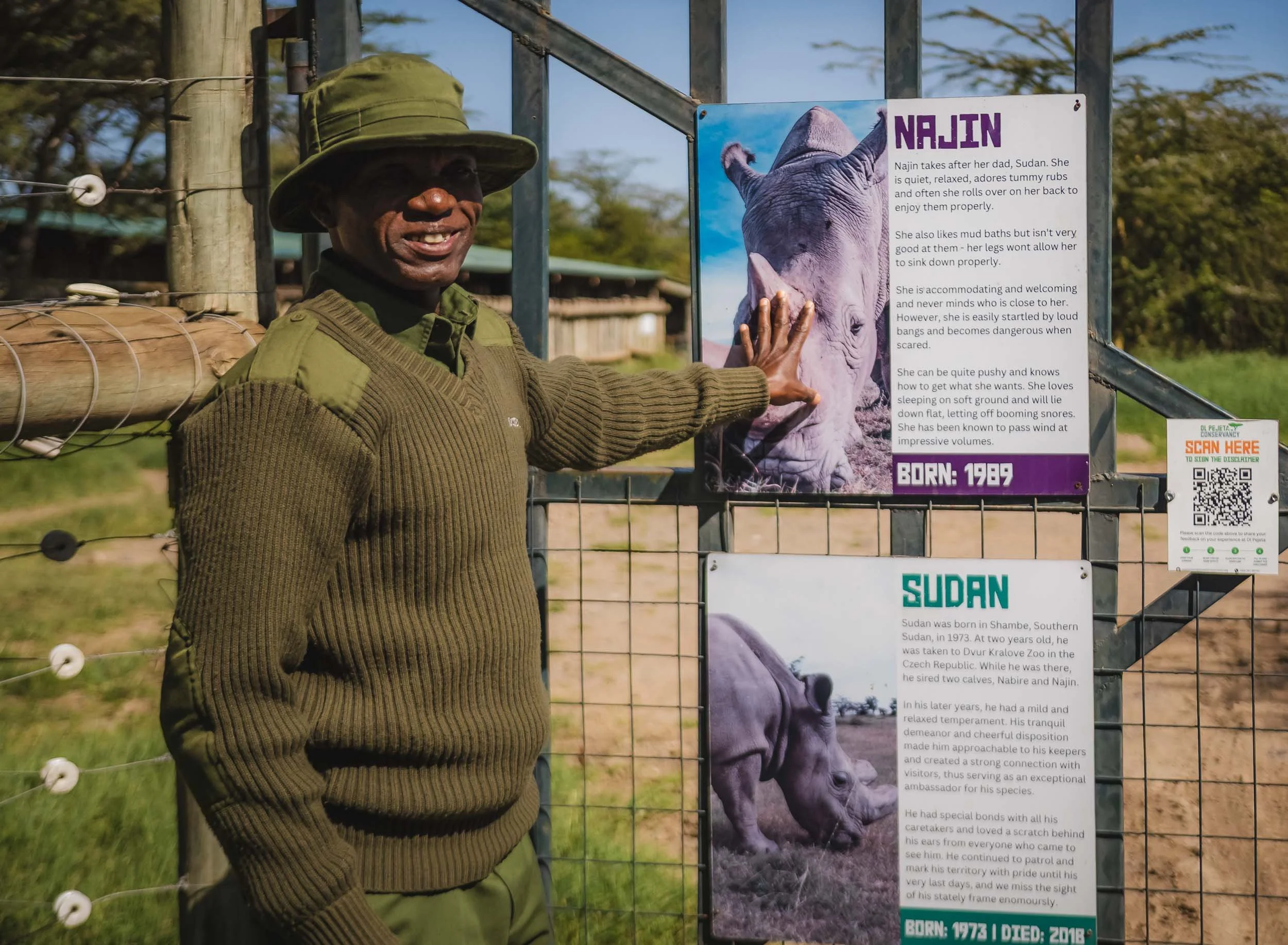
One of their caretakers (I think his name was Noah) tells the story of Fatu and Najin (her daughter): In 2009 four of the world's last remaining seven northern white rhinos at the time arrived at Ol Pejeta.
Najin, Fatu, Sudan and Suni were a family that had been living in a zoo in the Czech Republic, where previous breeding attempts had been unsuccessful.
The hope was they would reproduce here in their native habitat, but this didn't materialize. By 2018, Sudan, the last male of the species, died, leaving only the two females we have now.
Several attempts were made to mate them with a southern white rhino, which now lives with them in the enclosure, but this also proved futile.
The Last of their Kind
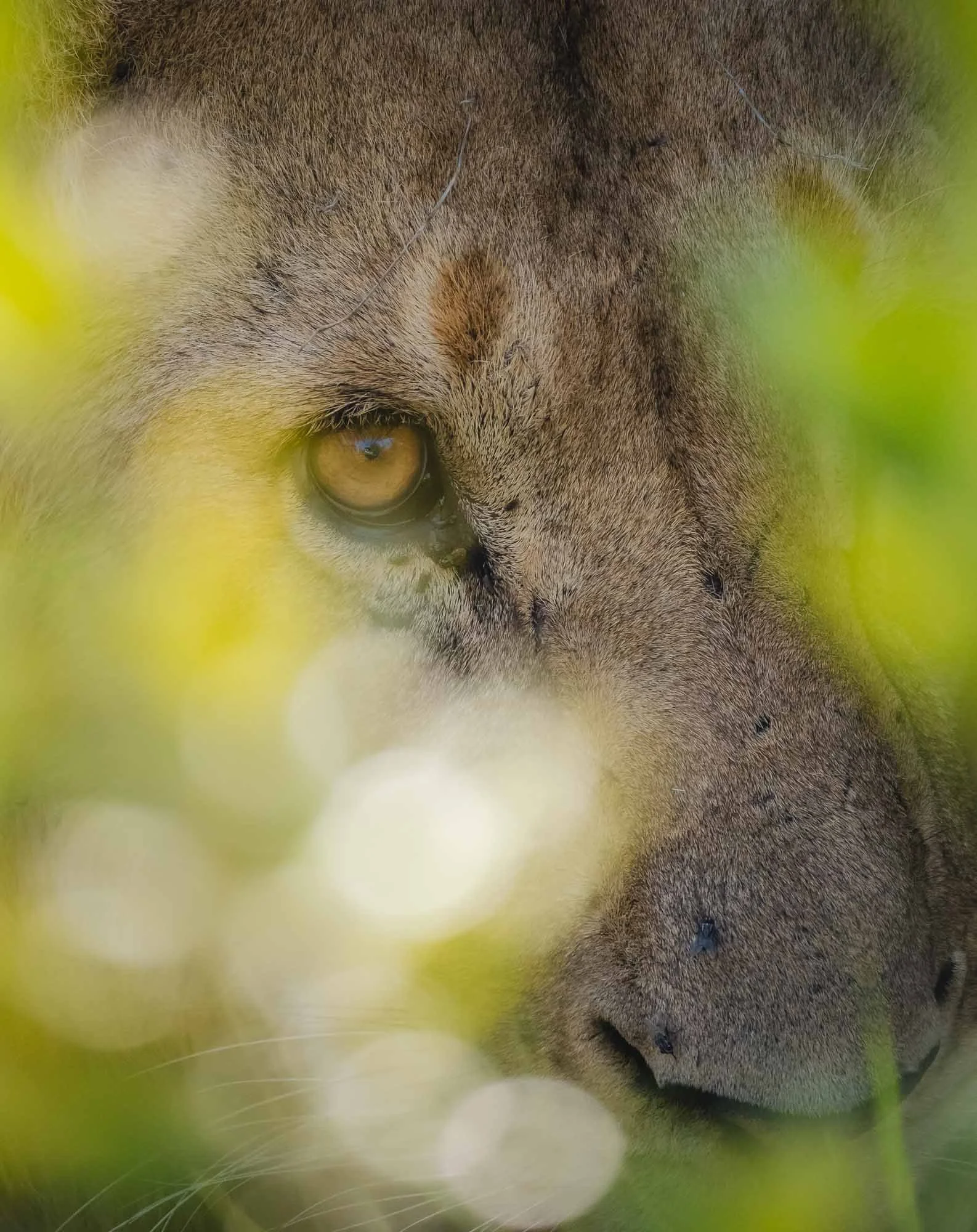
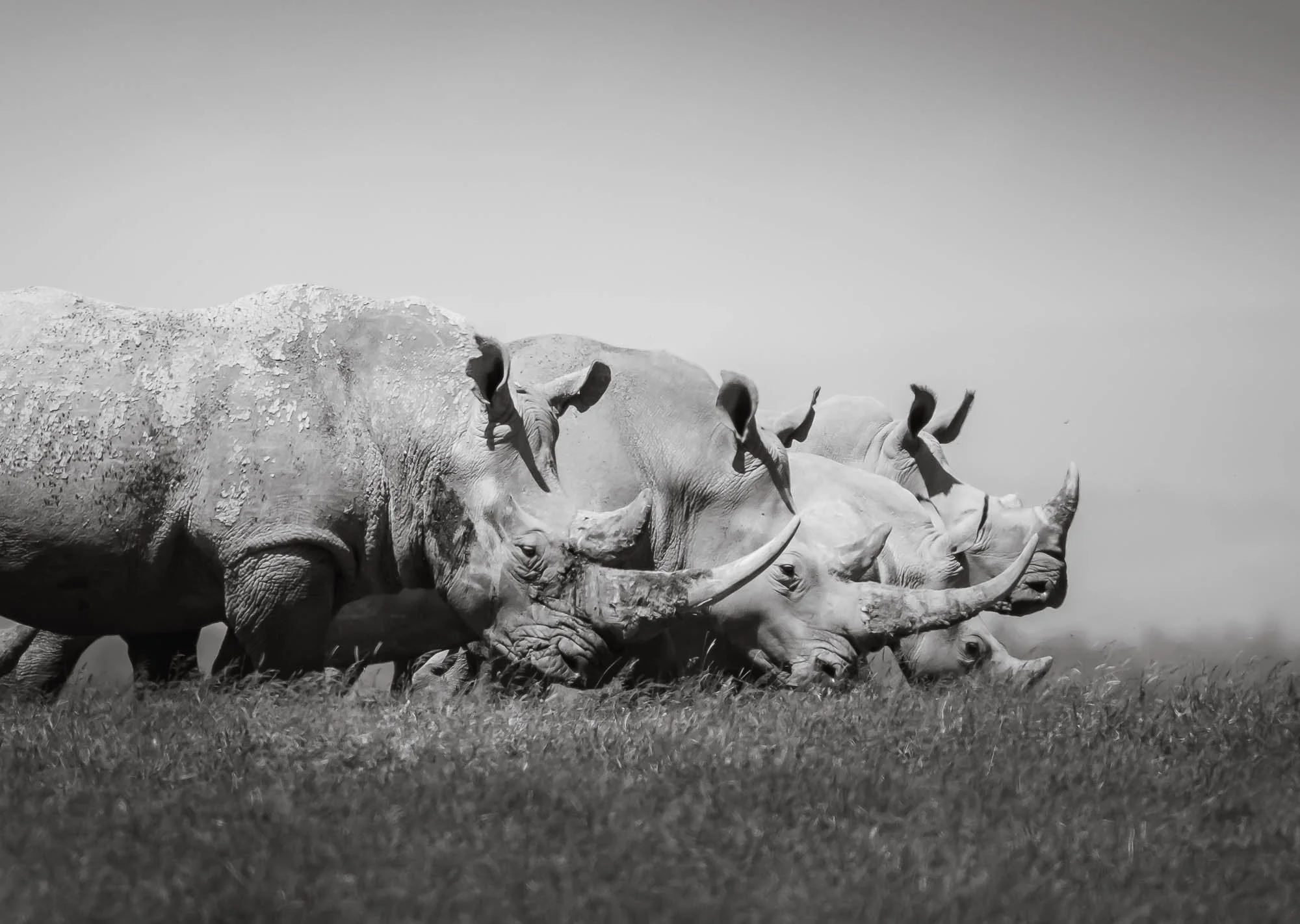
As we entered the huge fenced area, the three rhino in the area weren’t all that far: Najin and Fatu to the left, with their southern white rhino companion on the right side. The northern variant is a bit smaller, less hairy, has a straighter back, flatter skull, and shorter horns. The group is protected 24/7: in total, the conservancy has almost 250 people in security, with over 40 armed rangers, and the protection of the rhinos costs $1.5m per year - mostly financed from donations.
Owing to their history in a zoo, these rhinos are quite accustomed to humans, and may even let you feed them - a moment where you can feel their strength even in the most docile of movements.
The last wild members of the species are said to have been spotted in the mid 2000s in the DRC - with no sightings in the last 15 years they are considered extinct in the wild. With no other captive population either, these two are probably the rarest mammals on Earth.
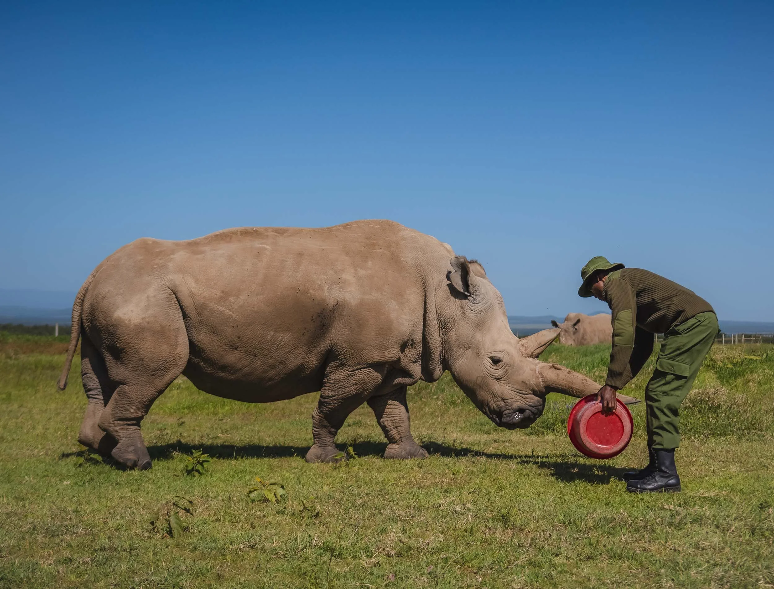

Both females are no longer be able to produce offspring on their own. The last hope of the species now lies in the development of in vitro fertilisation techniques and stem cell technology. The rangers told us excitedly that just a few days before my visit, researchers had attempted an in vitro process using a southern white rhino surrogacy female. This has unfortunately not been successful - read more here.

One last touch
We got to spend almost an hour with these (mostly) gentle giants. Even a few months later it gives me goosebumps to think back the feeling to encounter these creatures so closely and be able to touch their skin and horn - the last remnants of an entire species of animal that may not exist anymore in a few years from now. A sober reminder of the fragile environment we live in these days, given that rhinoceros have been around for 50-60 million years.
Baraka - the blind black rhino
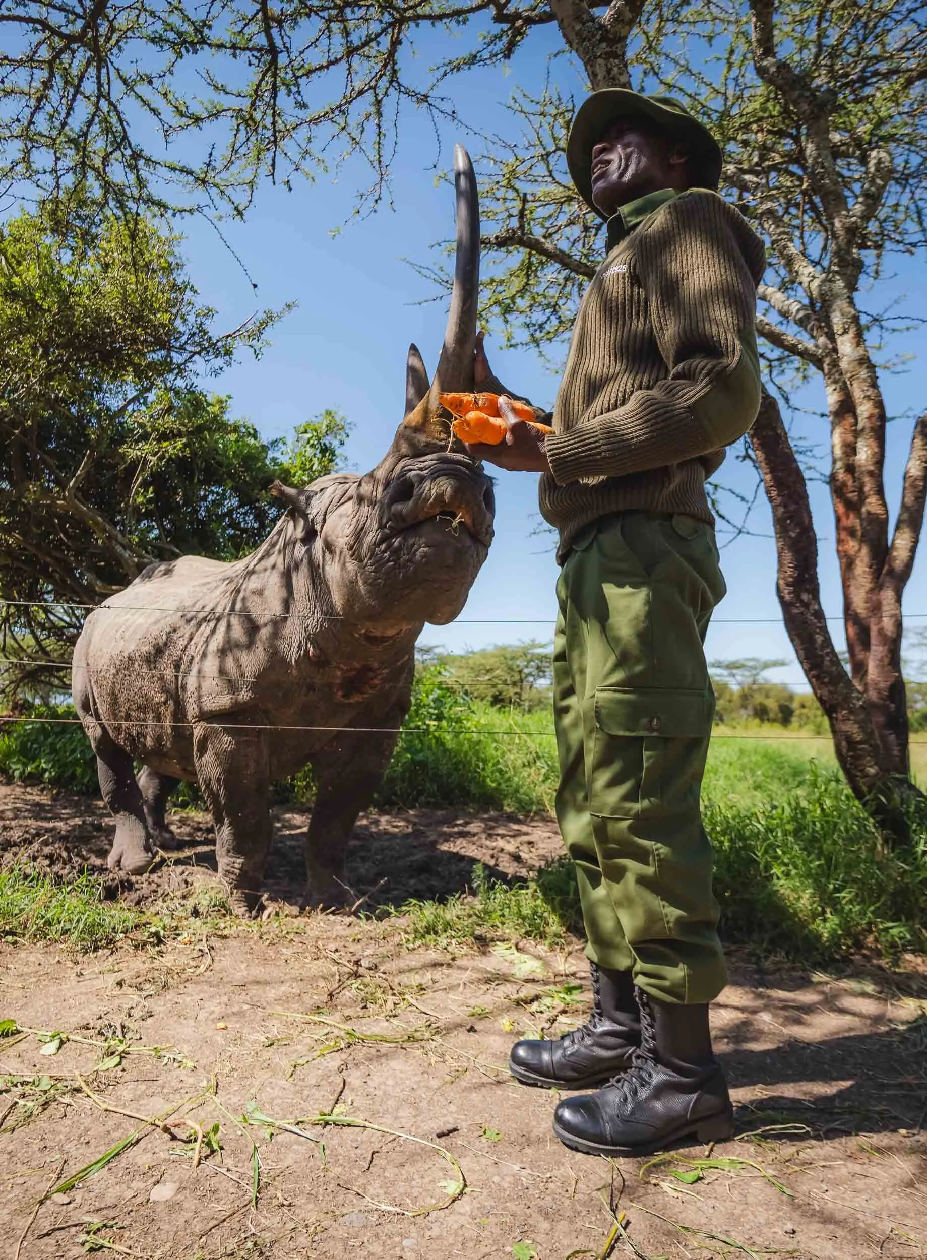
Another close encounter you can have here is with a rhino that was saved from certain death in the wild: Baraka, meaning “blessing".
He lost sight on one eye due to a battle with another male, and a bit later his other eye was affected by an infection, rendering him completely blind.
Luckily for him, rhinos generally have poor eyesight, and instead mostly rely on touch and hearing to navigate the world around them. That made it possible for Baraka to enjoy a relatively peaceful life in a huge enclosure.

Although he got used to humans around him and is generally calm, his massive horn makes Baraka an imposing creature. It’s not surprising that when a local school class approached, not all the kids were confident in handing him a carrot. Ol Pejeta regularly hosts education trips for the local community to bring them closer to the animals and teach them about the conservation efforts.
White vs black: the names of the species have little to do with their color - they’re all grey. White rhinos are generally bigger and heavier, but also calmer, a little more social than their black counterpart. The name however comes from the shape of their mouth, an anglicized version of the Dutch “wijd”, meaning wide, representing their wide mouth. This shape is linked to their feeding habit: wide rhinos are grazers, eating grass from the ground in large bites, whereas black rhinos use their much more pointy mouth to browse on shrubs and leaves in bushes and trees.
The Pride
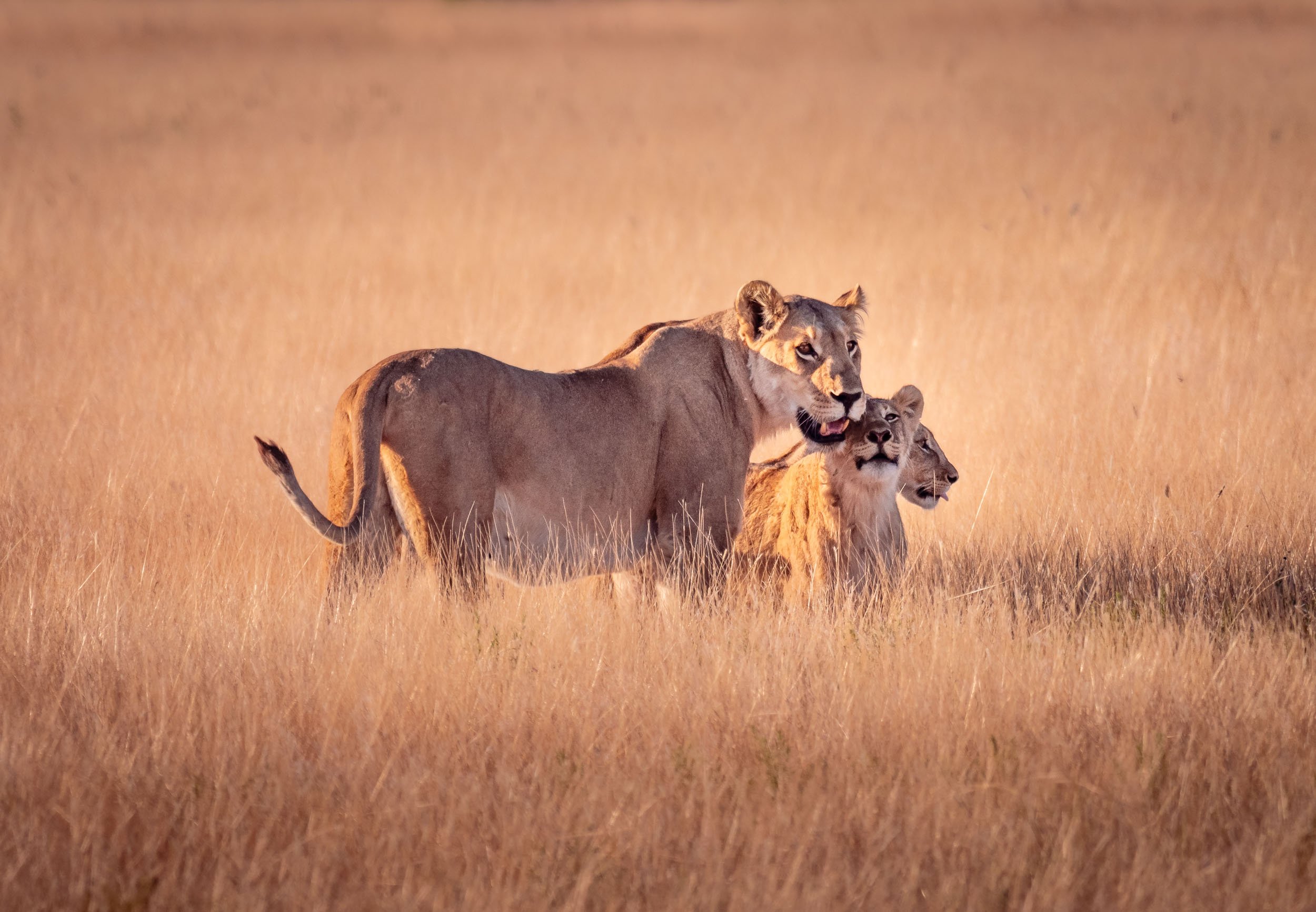
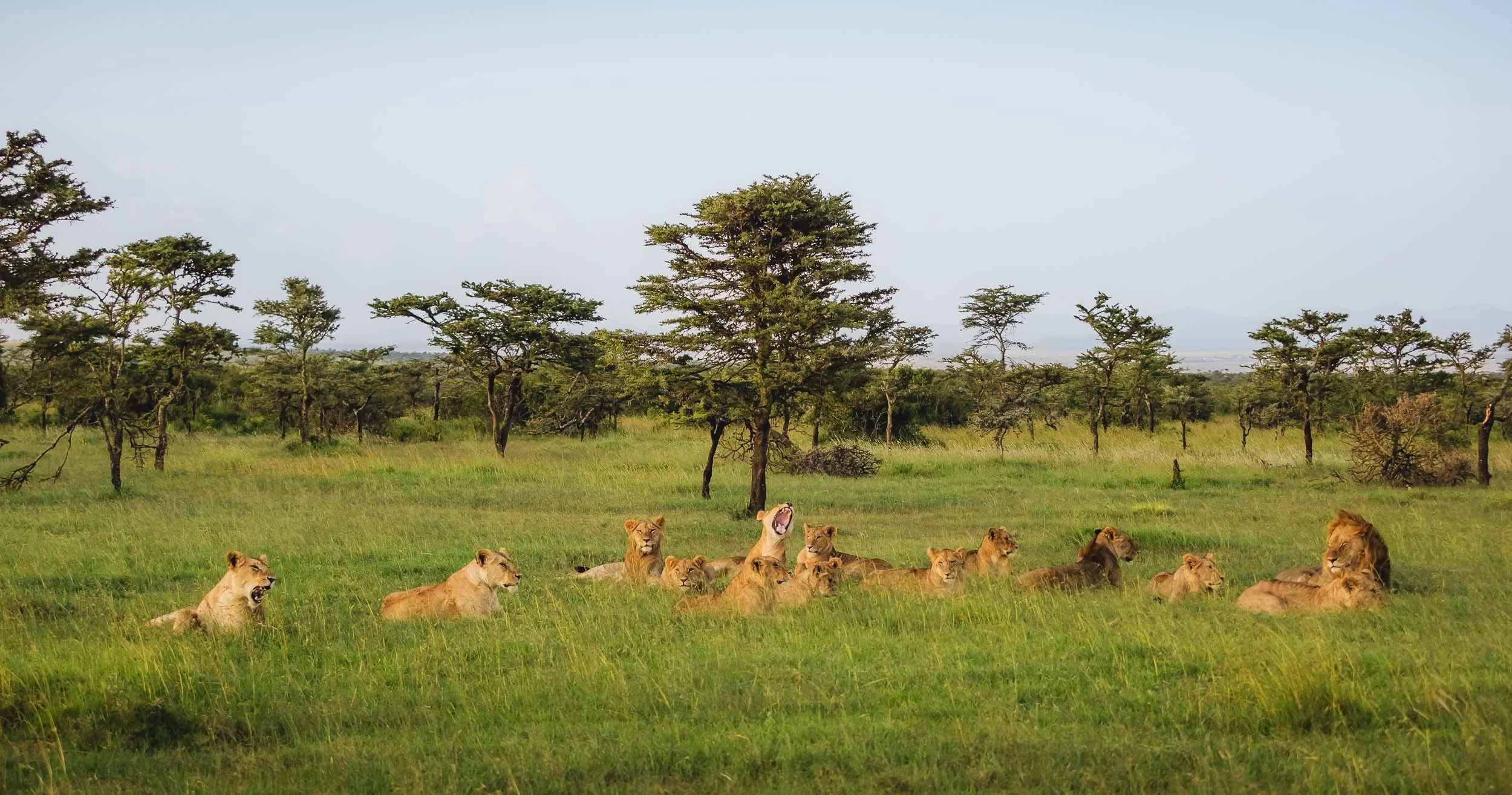
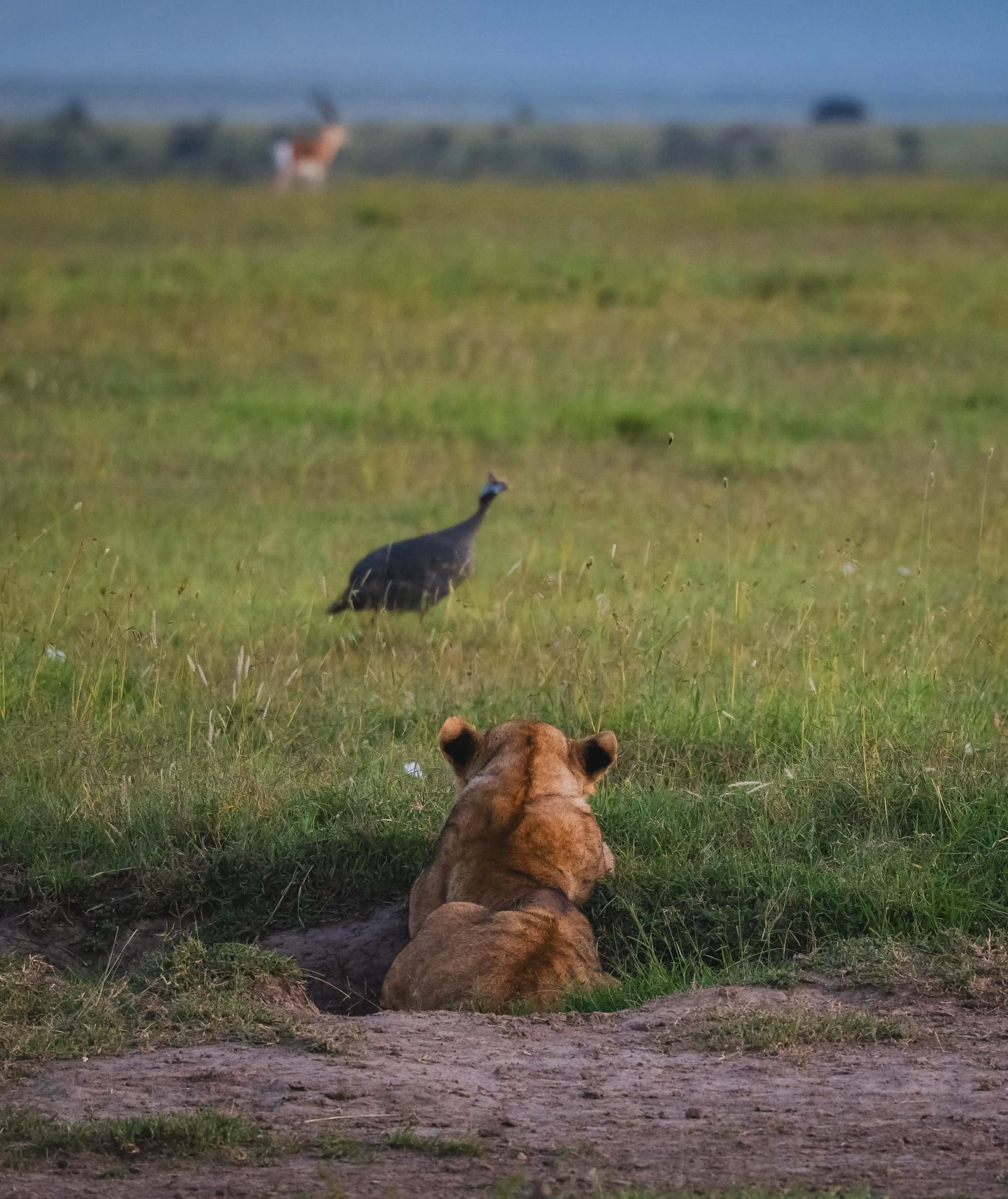
Ol Pejeta is also home to six lion prides with over 70 members, and we saw a lot of them during this sighting, with over 20 individuals resting together in the late afternoon; slowly becoming more active, stretching and scratching, as the sun set.
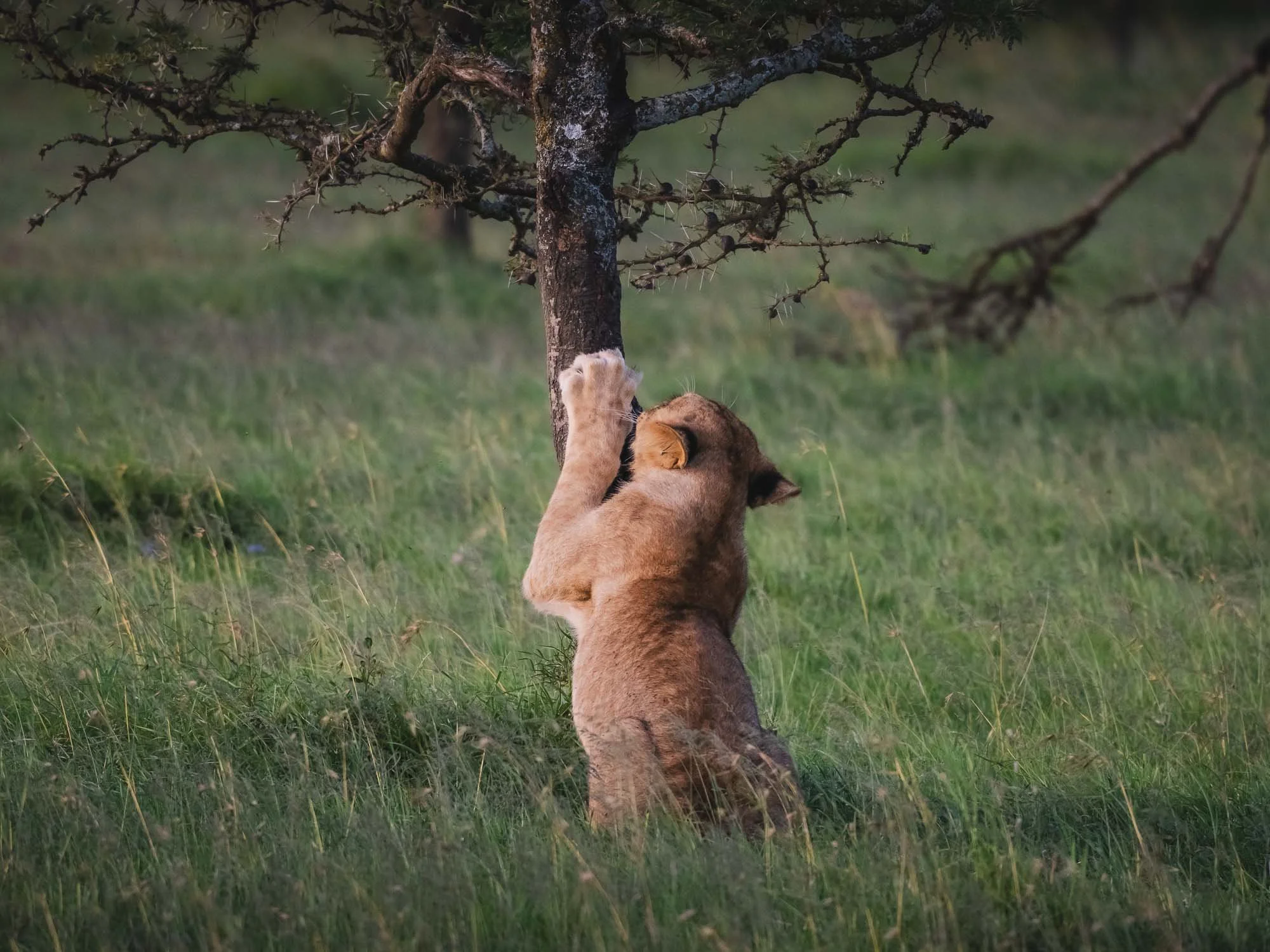
One of the youngsters also made an attempt at catching some guinea fowl - completely unsuccessful, and even the distant herd of gazelles had long seen him stalking the bird.

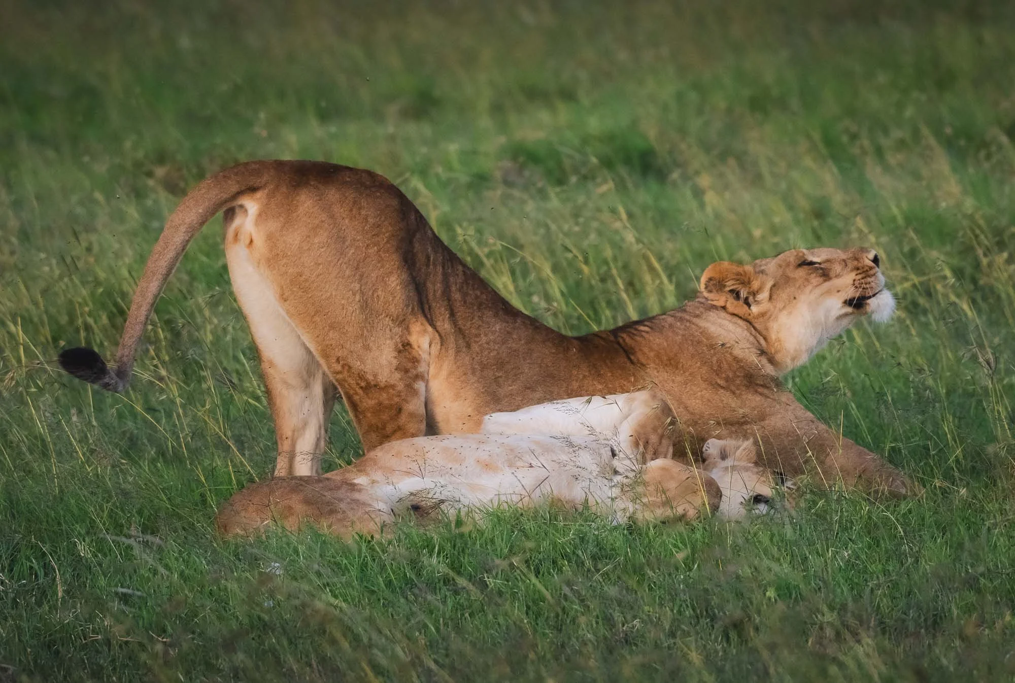
As the light faded the large male decided to get up, greet everyone, and ended the shenanigans - they made their way off into the forests and it was probably time to look for today’s meal.
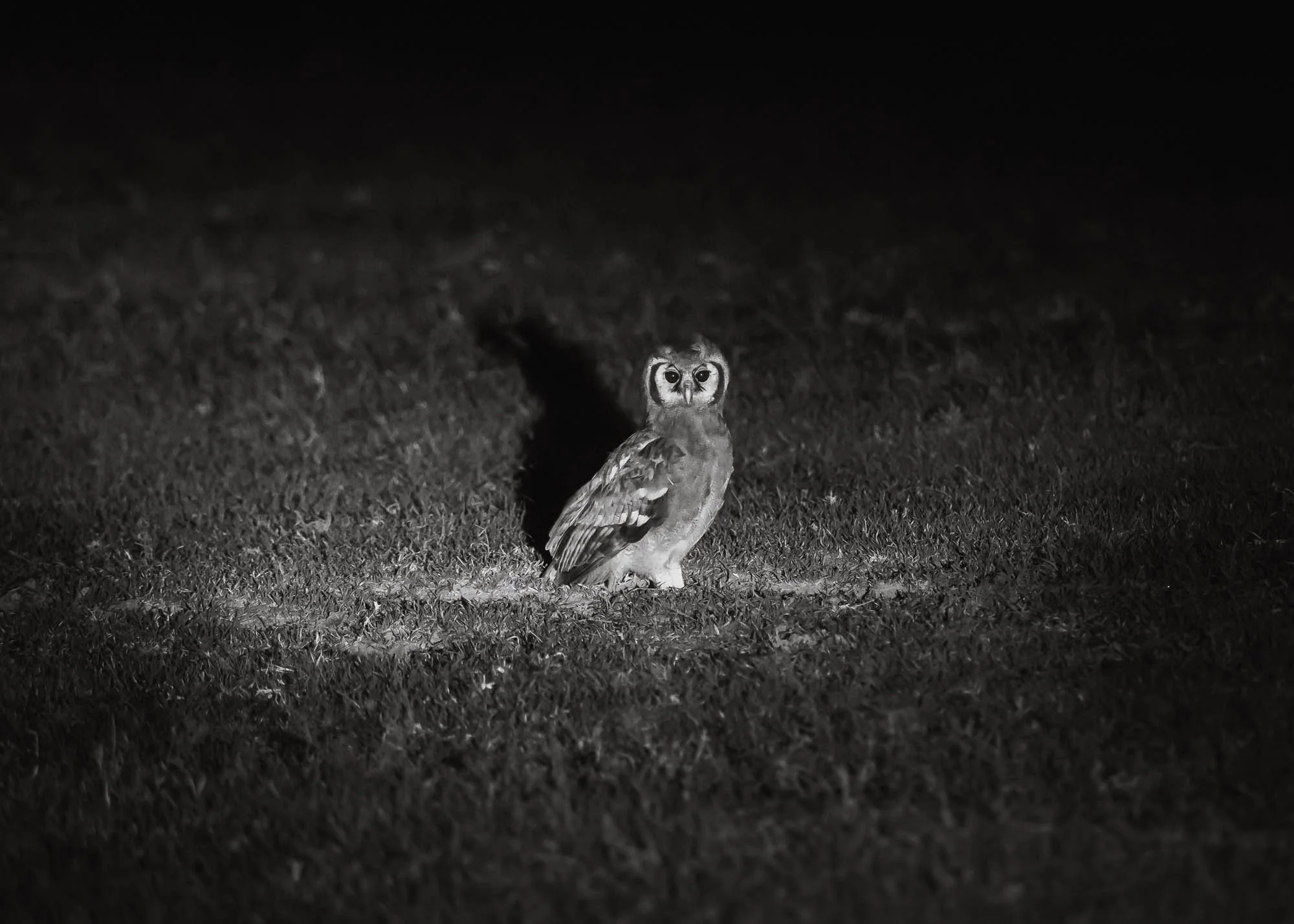
It’s very hard to follow lions at night, but we did spot what I suspect is a Verreaux’s Eagle Owl (the largest African owl) in the grass on our way back.
The next morning…
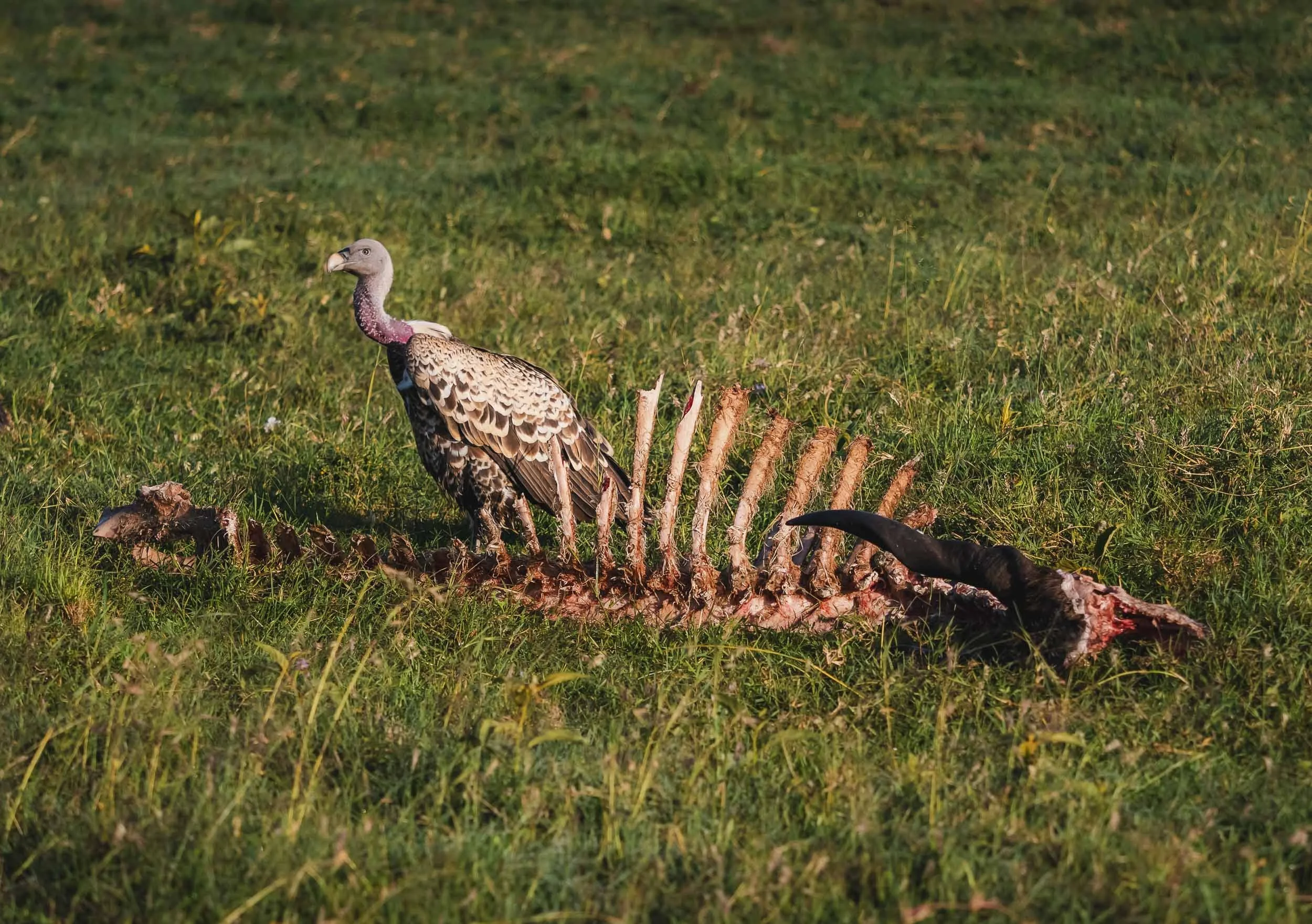
I can’t say for sure whether the leftover Kudu skeleton this vulture is sitting on is related to the pride going for a hunt the night before, but some predators certainly had a filling meal.
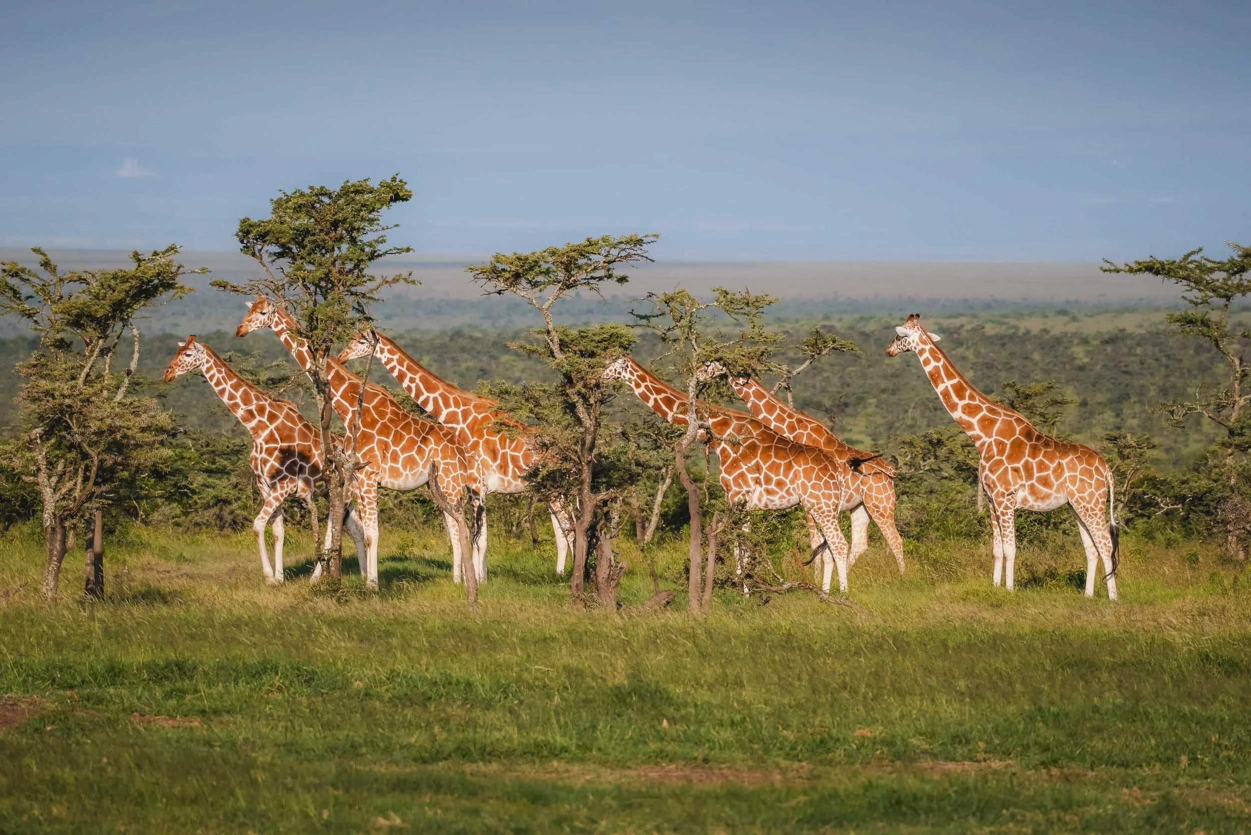
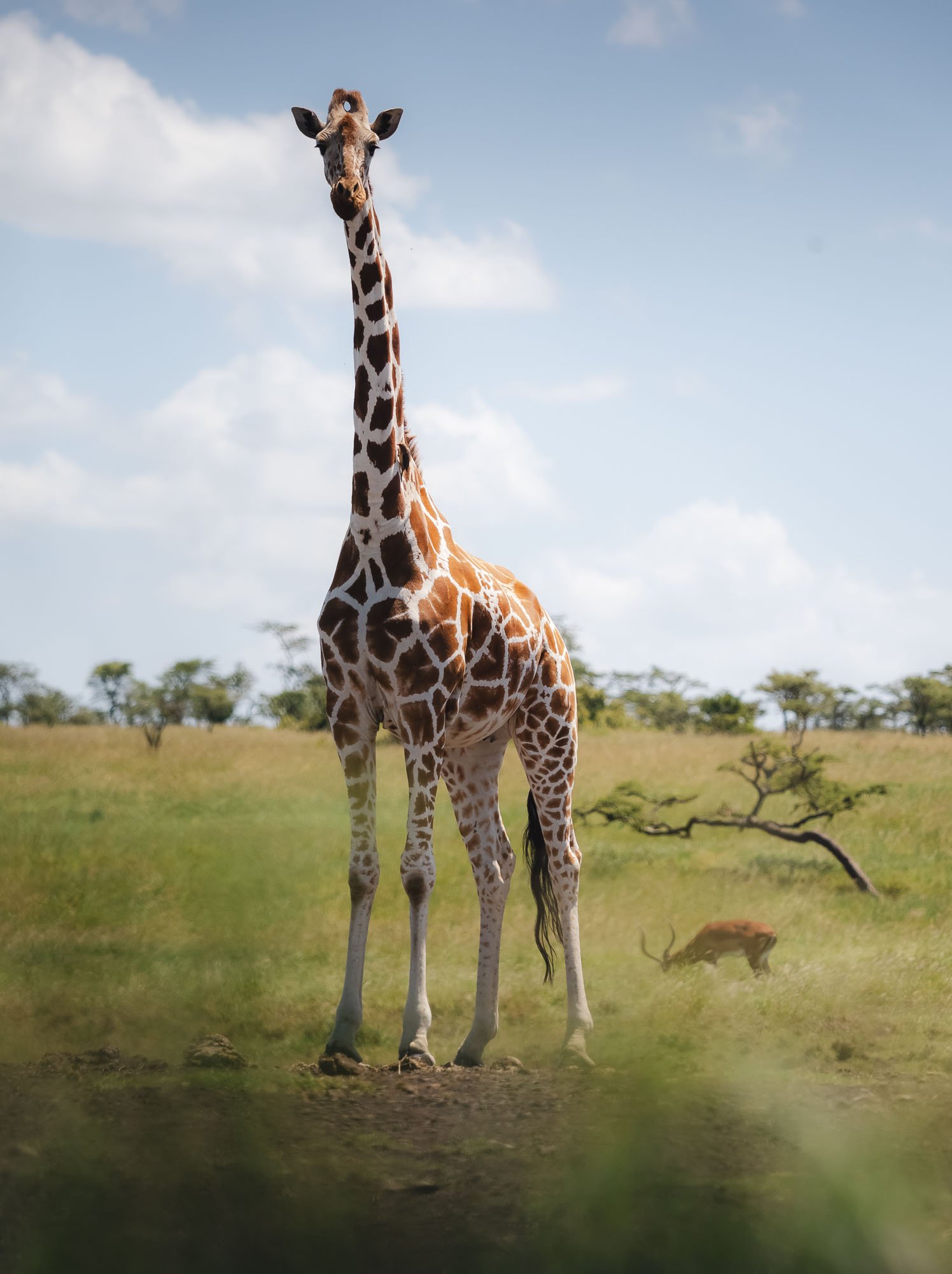
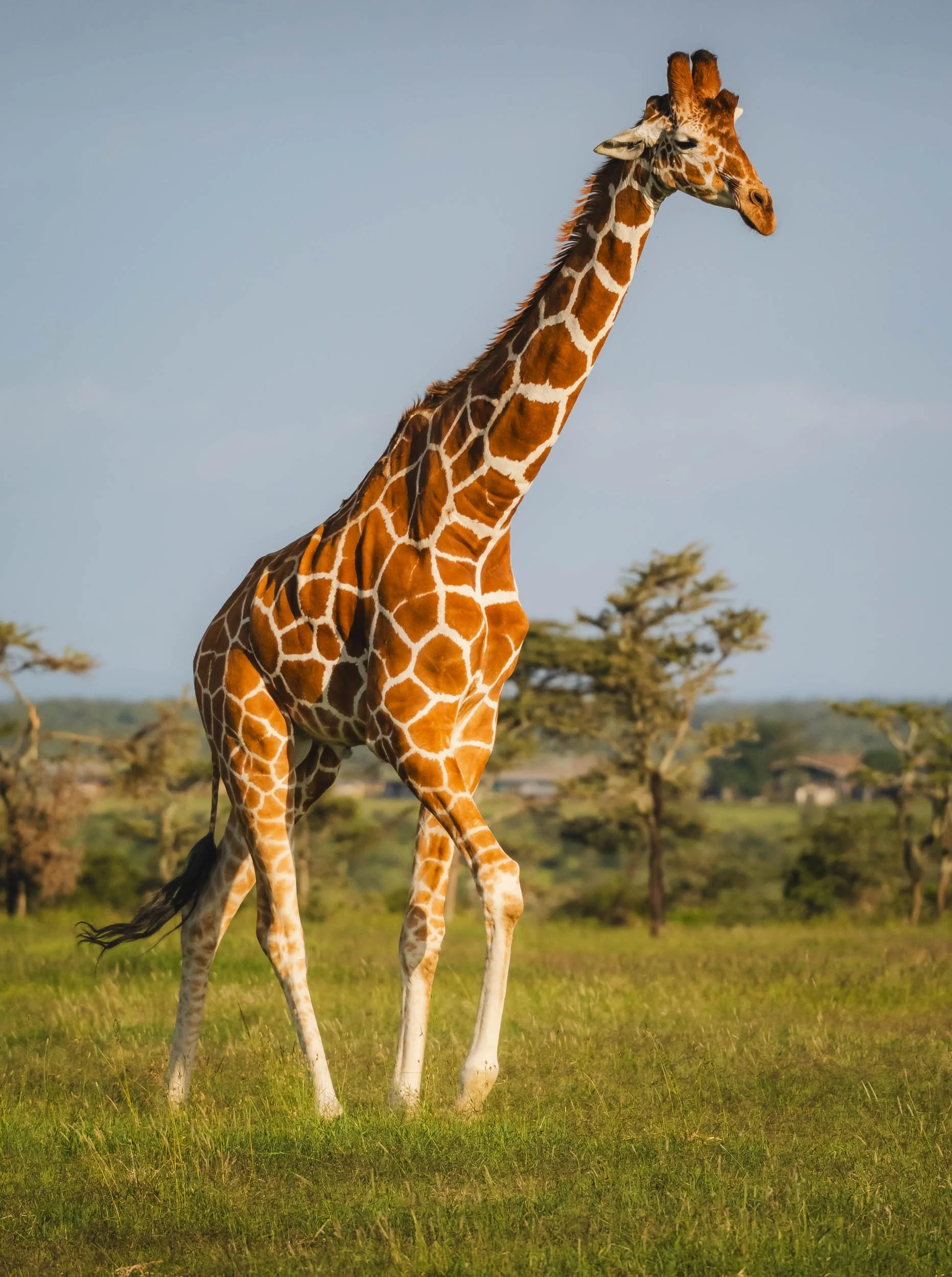
The Reticulated Giraffe
The northern part of Kenya also features a special type of Giraffe - did you know there are multiple species?
With up to 6 meters in height, the Reticulated Giraffe is the largest of them and the tallest land animal on Earth.
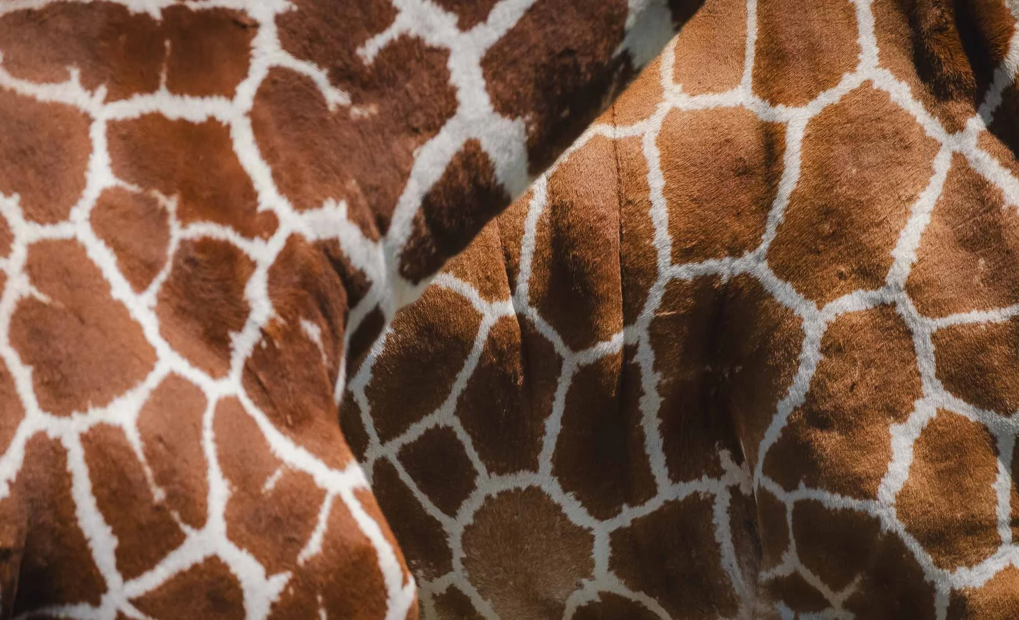
Aside from their impressive height, it’s the fur coat pattern that gives away this type of giraffe -the bright lines between the brown patches are much thinner and clearly defined than the common Masaai Giraffe.
They are an endangered species, with about 9000 individuals left in the wild. We got lucky to see a big herd with over 20 or so individuals together.


Melman
The cartoon character from the Madagascar movie is a Reticulated Giraffe, although I didn’t see any of the same tendency to hypochondria in the wild individuals we observed here…
The Northern 5
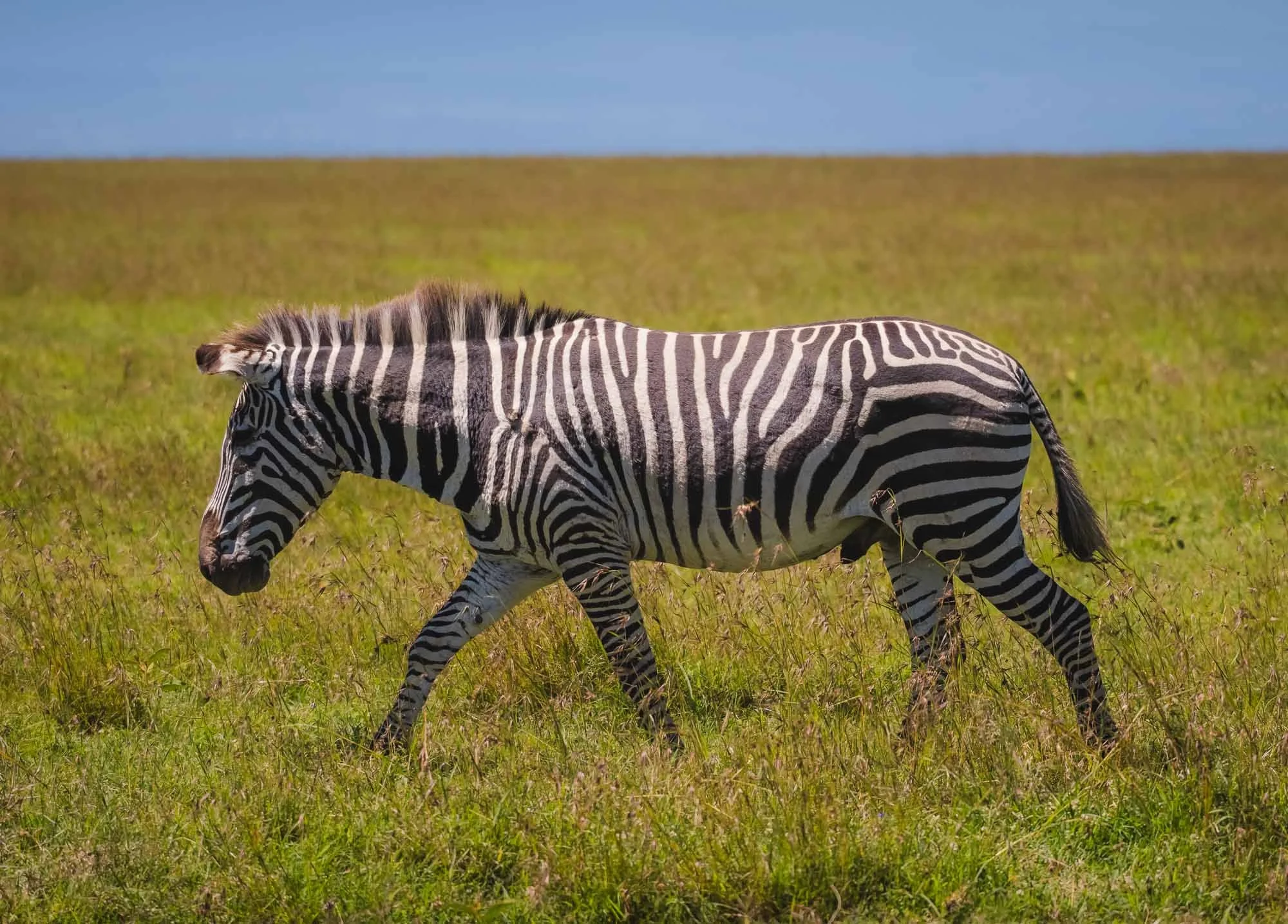
Reticulated Giraffe are part of the so-called “Northern 5” - give species commonly found only in the northern parts of Kenya and beyond. The Grevy’s Zebra is one of them, and while not common in Ol Pejeta there are plenty in Laikipa. This specific individual is a hybrid between the plains and Grevy’s individual. The brown-ish colour, smaller size, rounder ears and fewer stripes on the belly give it away.

The third Northern 5 is the Beisa Oryx - allegedly there are only three of them in the conservancy, and we managed to get a very distant and very lucky glimpse of them.
The other two members of this elusive group are the Gerenuk (which can actually also be found in other parts of the country including as far south as Amboseli) and the Somali Ostrich, for which you need to go further north.

On the Lion’s Path
The conservancy tracks a few lion prides with collars to observe their movements and health - normally that information is not accessible to tourists, but the park management sometimes offers visitors to join the rangers for lion tracking in the mornings. Despite having seen a huge pride already, this is never something to miss!
And what a good decision it was - we learnt that the collared female was heavily pregnant and probably about to give birth, or may have already done so. That meant she was going to be very difficult to find. A lioness that’s about to have cubs will usually separate from the pride and hide deep in the thickets. Indeed, we spent a couple of hours driving to different areas and listening for the ominous beeping sound on the receiver until we managed to hear anything.
As expected, she did hide far into the thick bushes, and only after half an hour of heavy off-roading (the benefit of being with rangers!) did we manage to come close… but it was all worth it - it turns out, she was not alone anymore.


The lioness had given birth a few days ago - the youngsters had barely opened their eyes. It was the first time anyone had seen the cubs, and even the rangers were surprised. They had expected them in a week or two. We observed a total of four cubs, but they were deep inside a group of bushes and very difficult to spot - I suppose that’s the point, well done to the lioness.
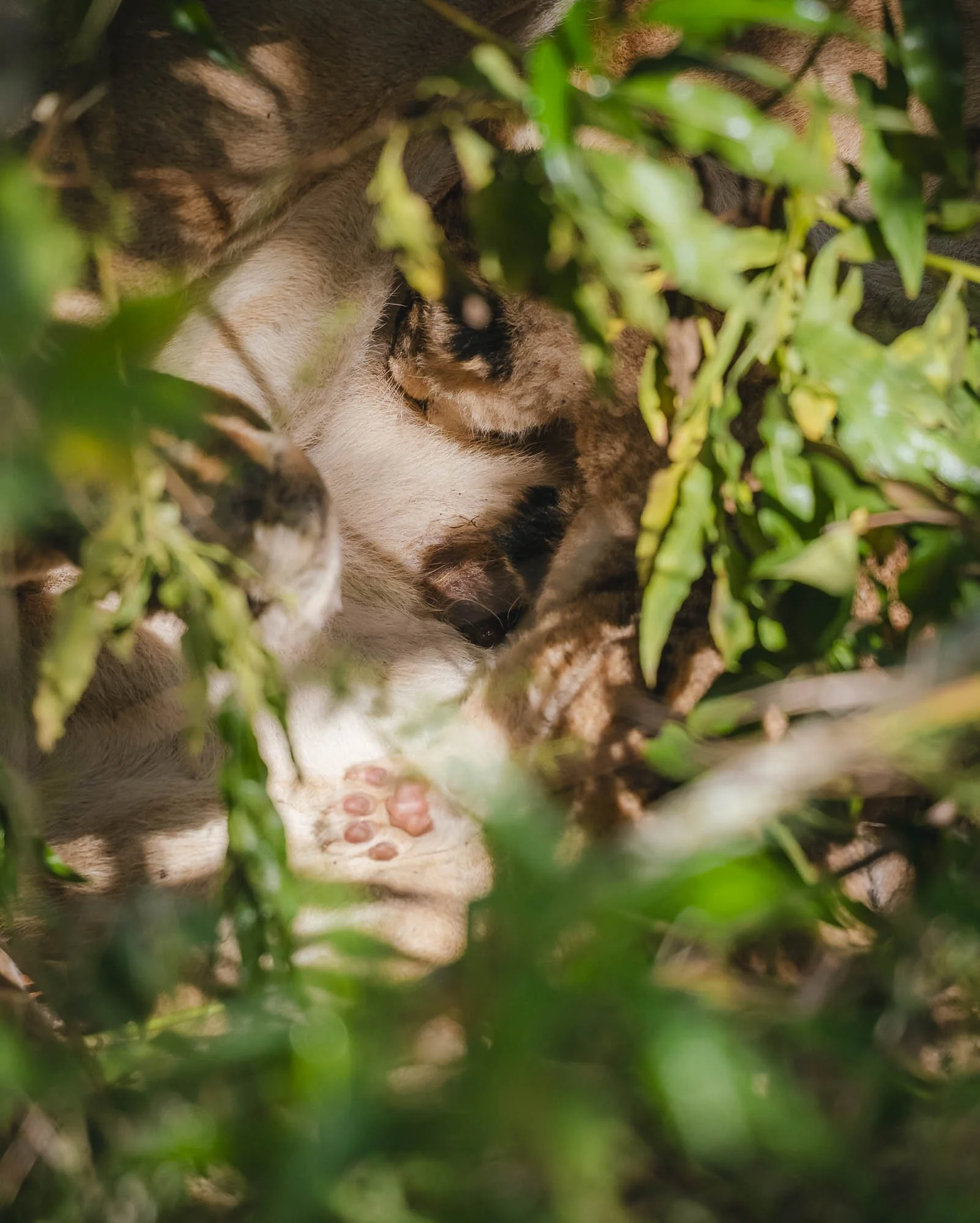
We observed them for a few minutes more and got a chance to see one of the tiny cubs (look at the paw!) enjoying a meal before deciding to leave them alone. A lioness and her cubs are extremely vulnerable to hyena and rival lions during the first weeks after they’re born, and we didn’t want to draw more attention to their location or trigger the lioness to move them, which is always risky.
Another male and female were sleeping not far away in the bushes, which is quite uncommon, and the rangers decided they would not visit them again for at least a couple of weeks to avoid any disturbance. As a result, I’m not sure what happened to this litter.

In a rather sad turn of events we encountered this black-backed jackal on the road on our way back, which had seemingly been hit by a car the night before - speeding is also a problem inside a conservancy. We saw its lonely companion a few hundred meters from the site of the incident - jackals live in pairs and generally mate for life.
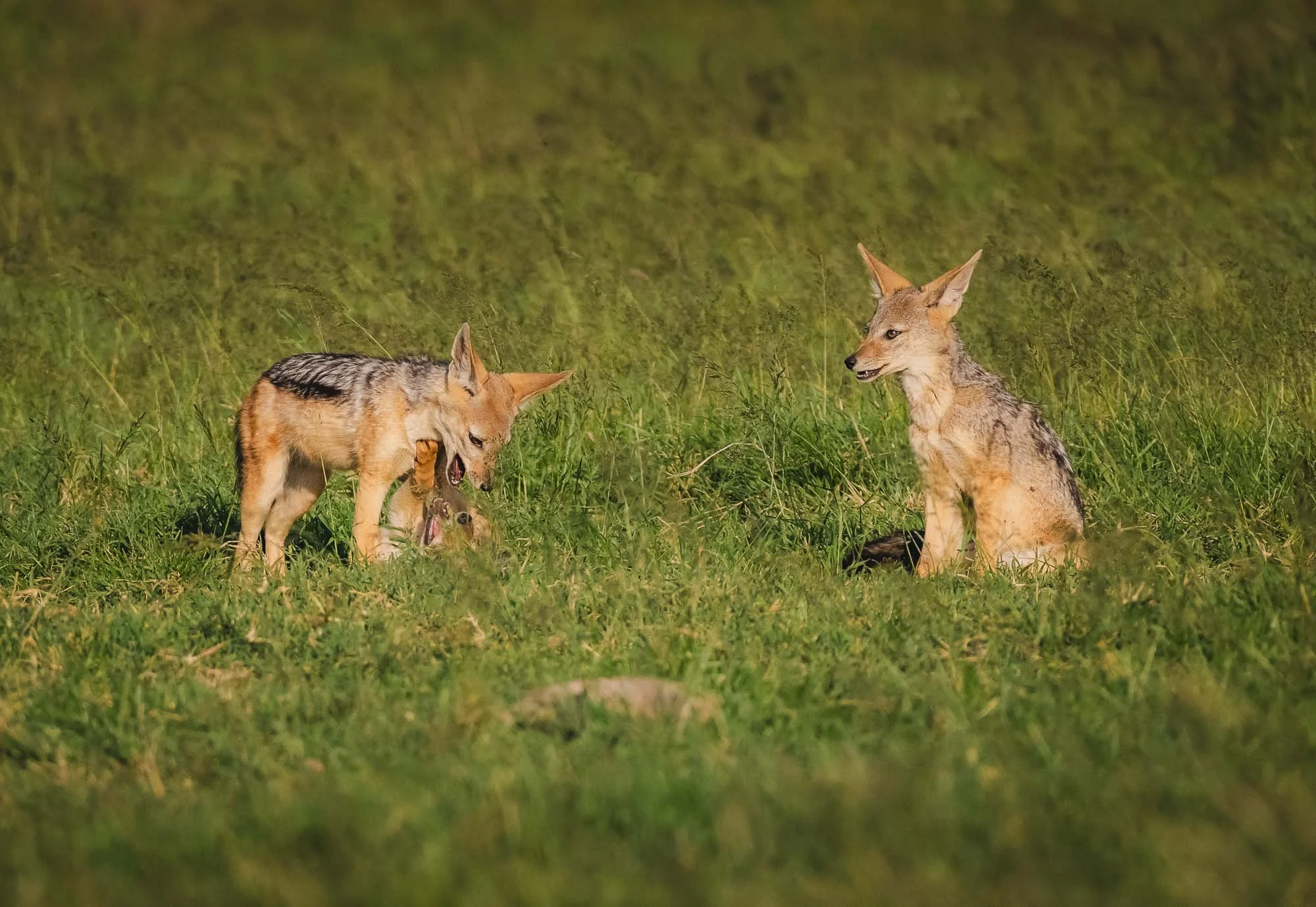
On the positive side we spotted this family with a few young pubs peeking out from the burrow a little later. Jackals are always extremely amusing to watch - they constantly give the impression of being up to no good.
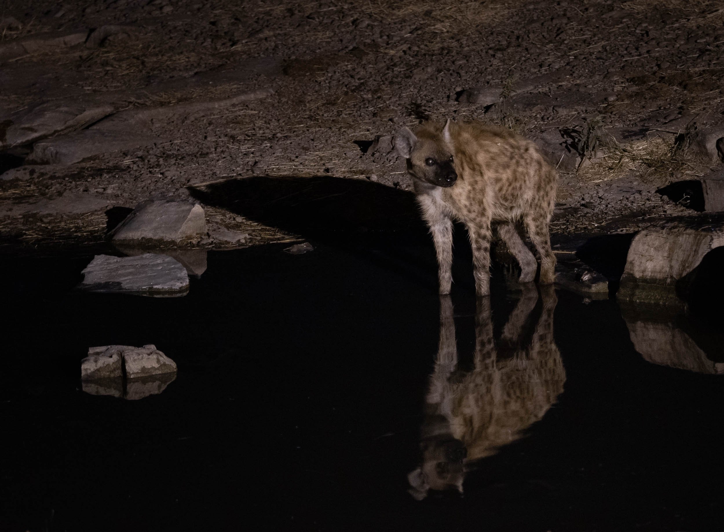
Spotted Hyena
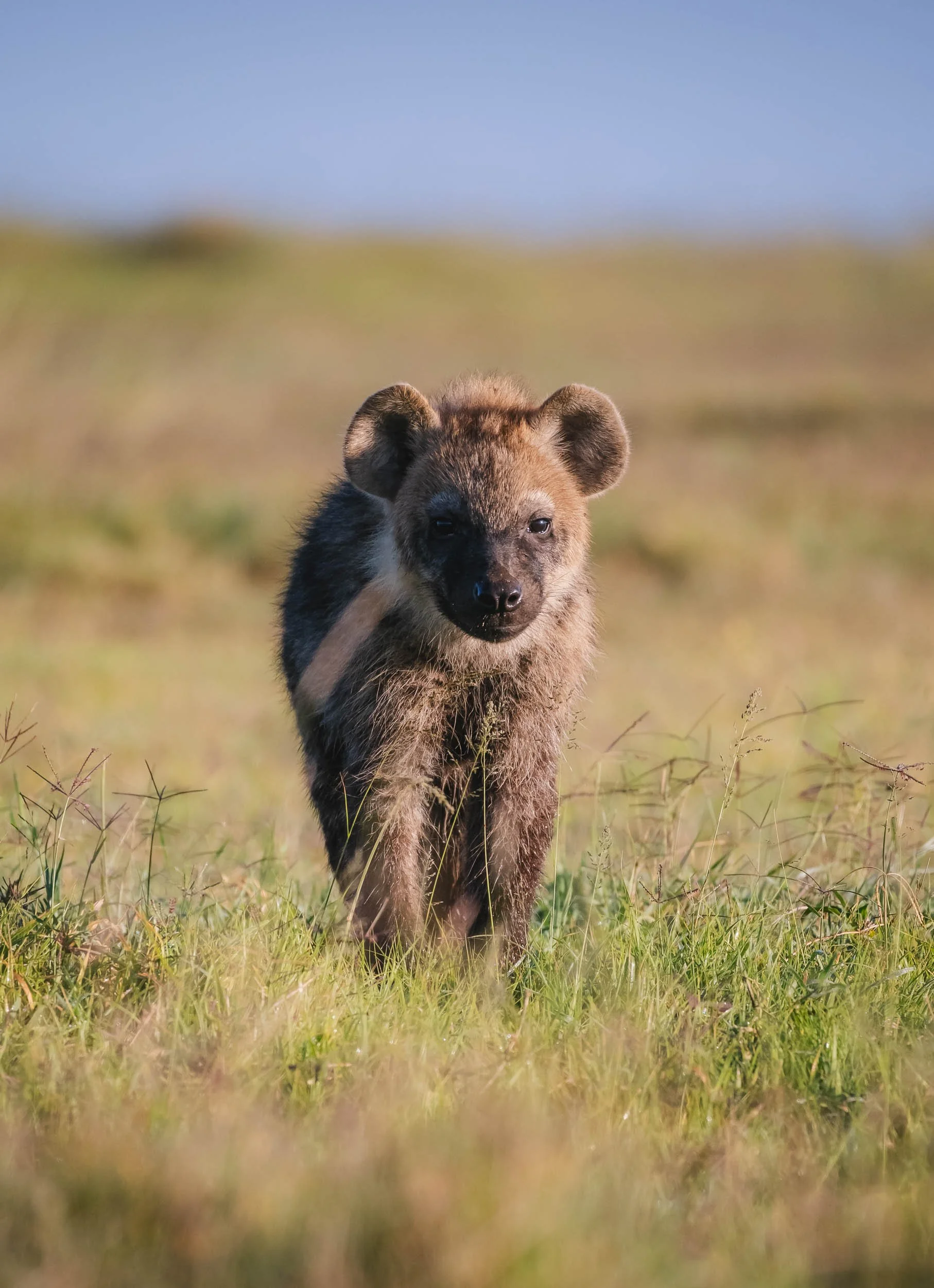
Speaking of pubs, we also had the chance to come close to a hyena den with very young cubs, that occasionally stuck their head out, but didn’t seem quite confident enough to come out and play in our presence.


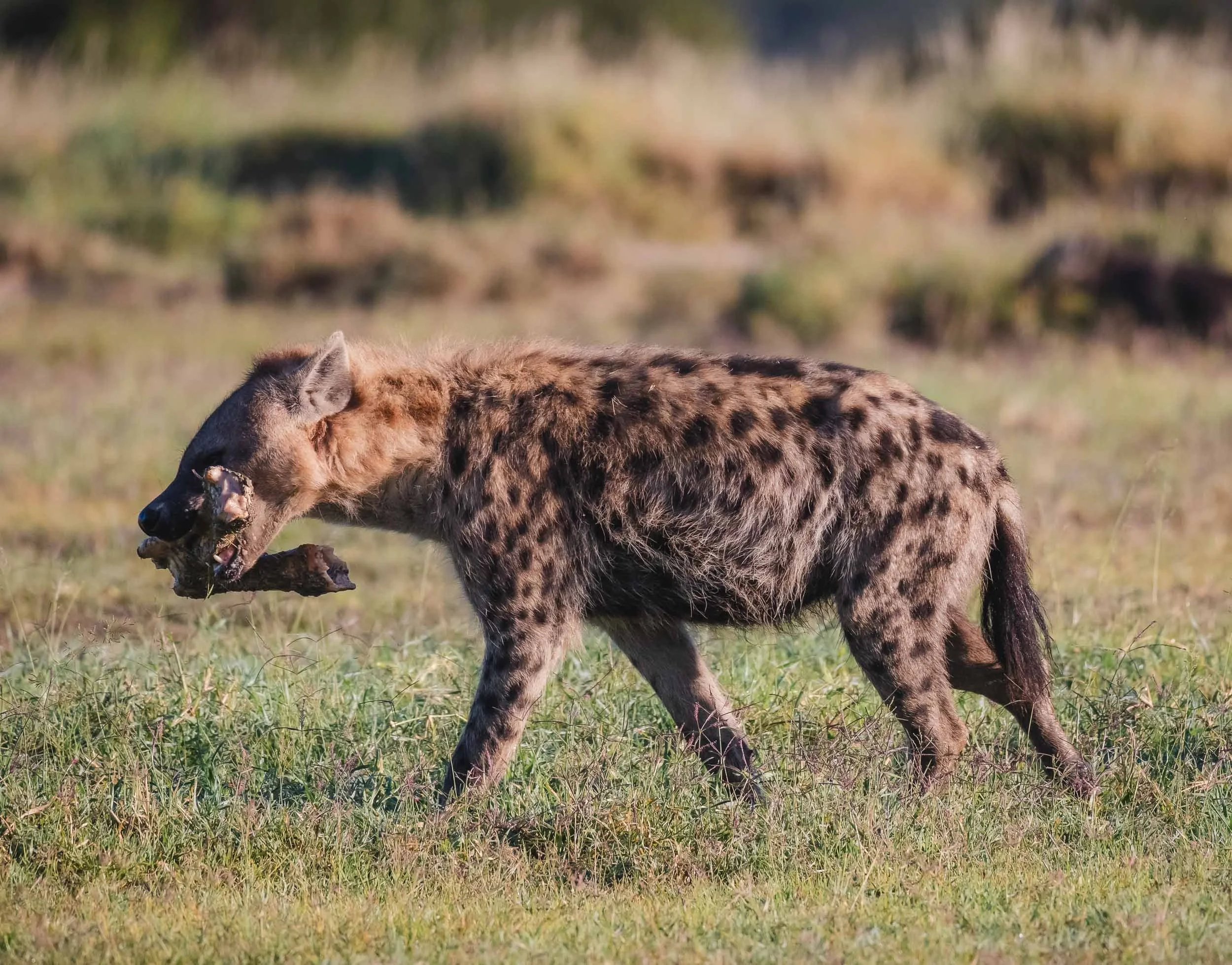
Even the large bone with some leftover meat didn’t seem to be intriguing enough for the small ones - maybe it’s because their survival rate into adulthood is as low as 50%.
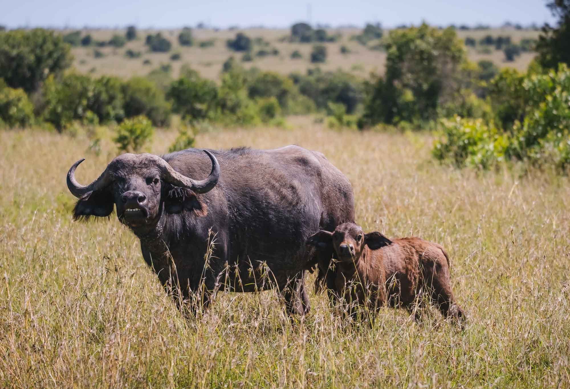
Buffalos are common in Ol Pejeta as well - it’s home to all of Africa’s Big 5. They are often the species that suffers the earliest and most during dry seasons, as they rely on constant availability of green grass.

One more species…
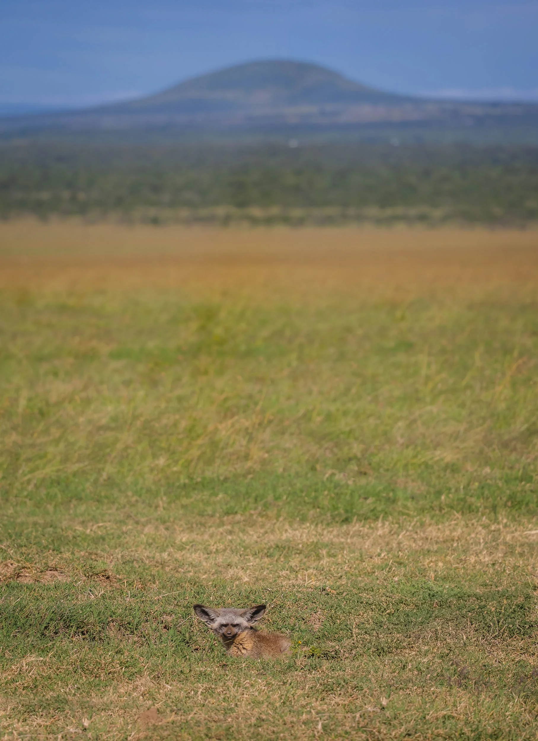
A bat-eared fox taking a look at us from its den in the grasslands. These animals with their amusing ears mostly live in social groups, but it seems the rest of his clan was sleeping.
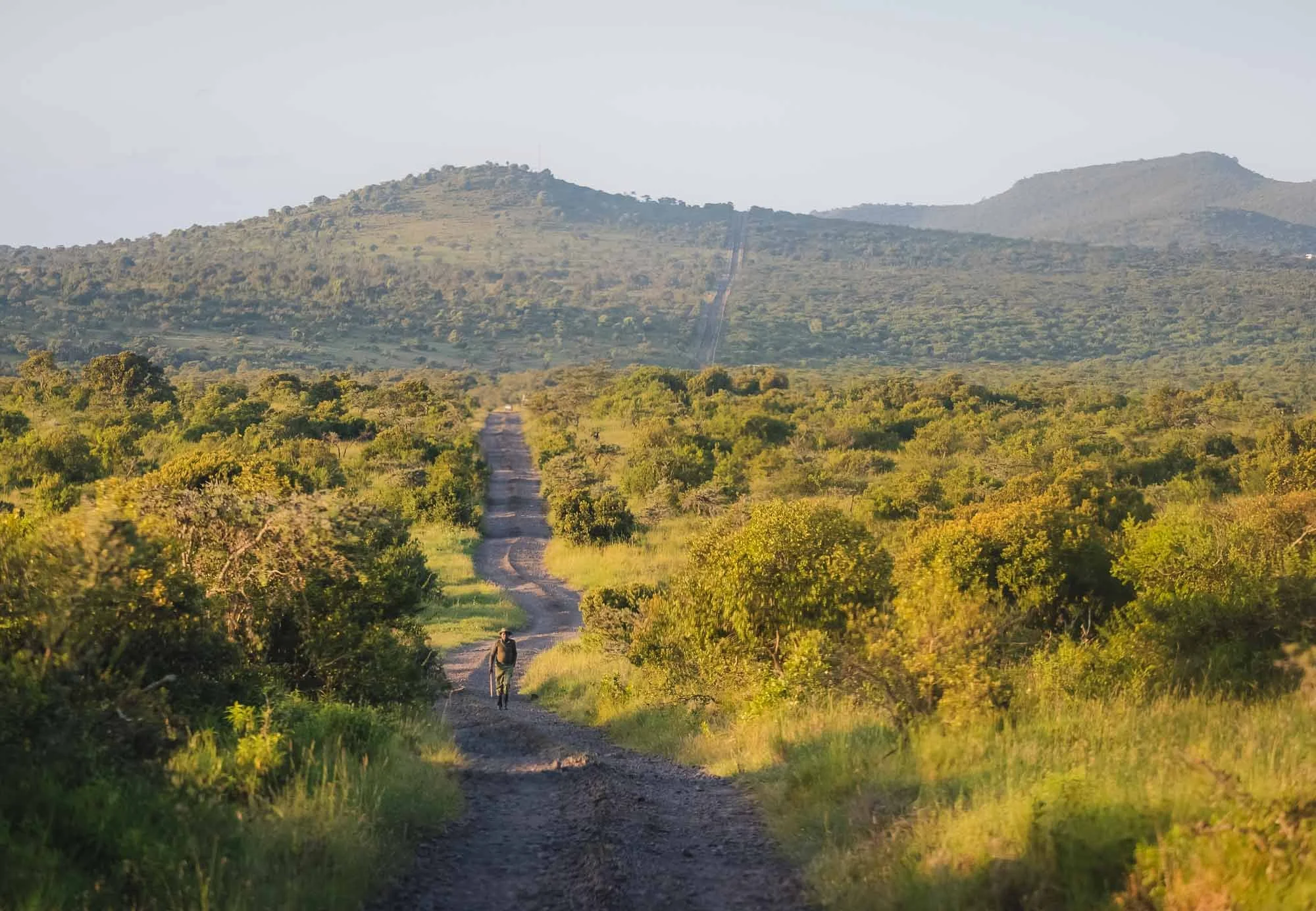
On Foot
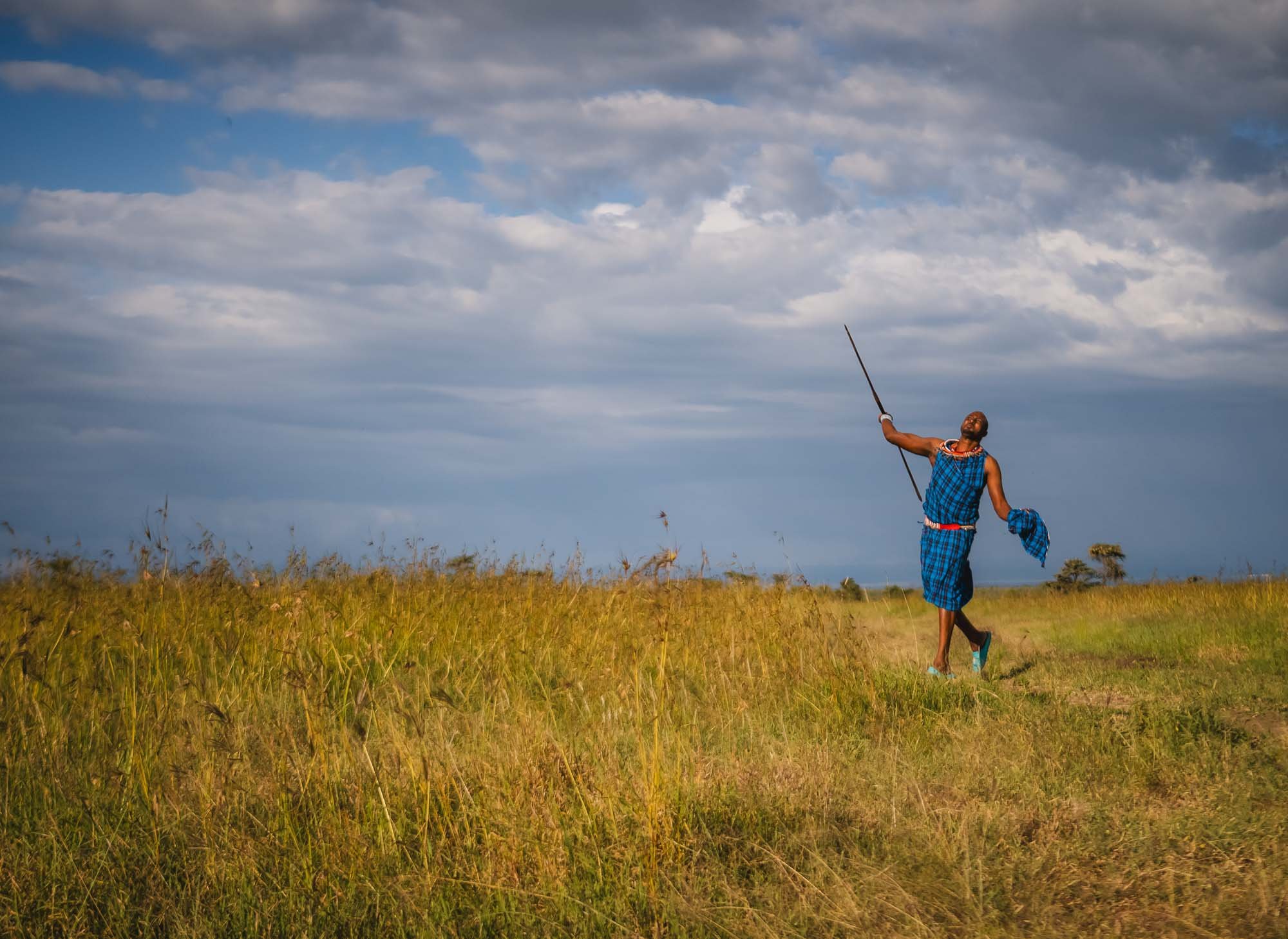
I’m never one to miss out on an opportunity to explore the bush on foot - it’s always a very different feeling than in the car. A walk through the area with the local team (including some Maasai from the southern parts of Kenya) was a welcome opportunity.


Brave Souls
While we were well-protected, the local rangers often make their way through the conservancy on foot, with nothing more than a stick to fend off the odd curious animal…
Landscapes
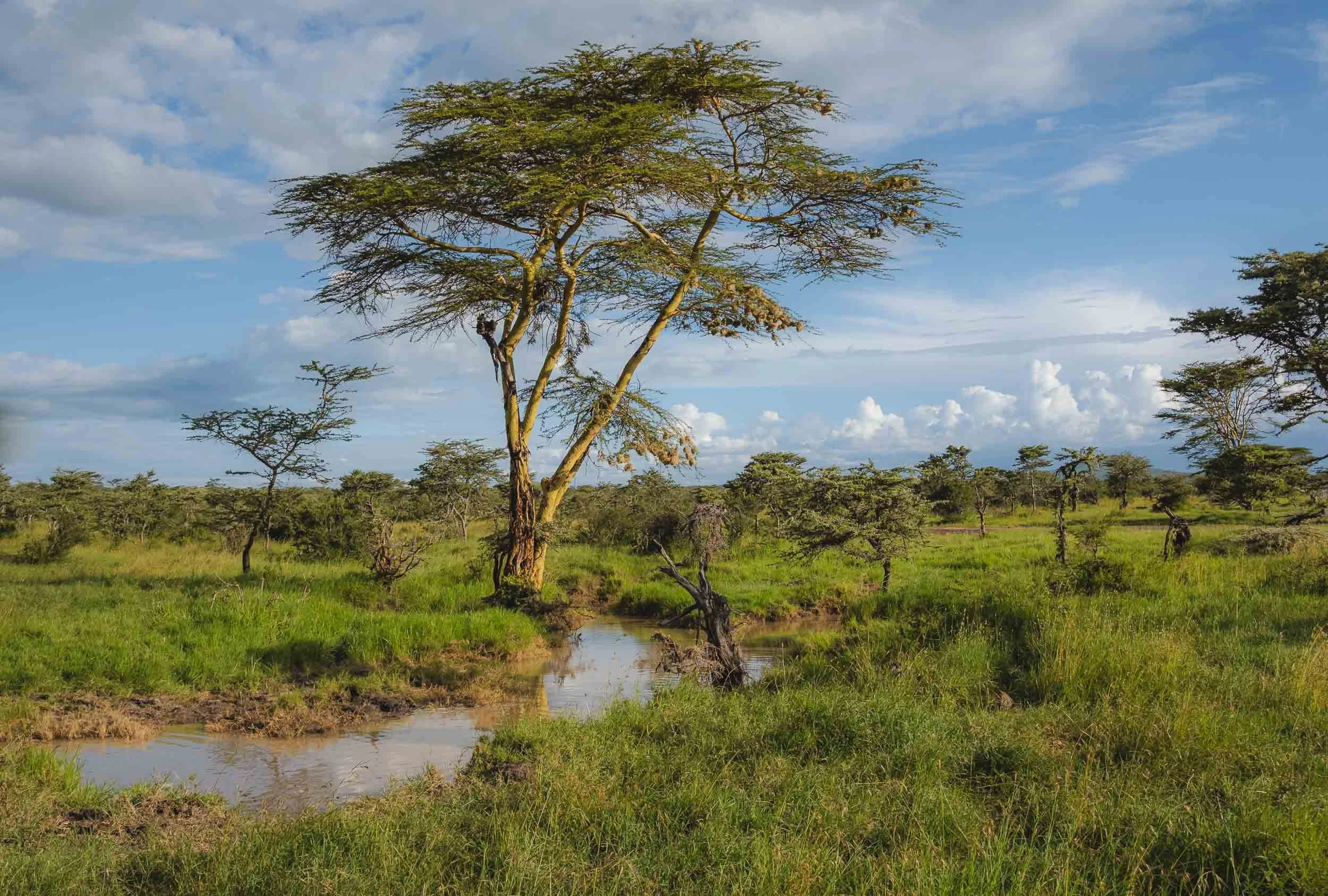
The green bushes and trees along the many small rivers and ponds of the post-rain season make it a beautiful landscape as well - a hint at what was to come in the amazing Laikipia area I was going to visit next.
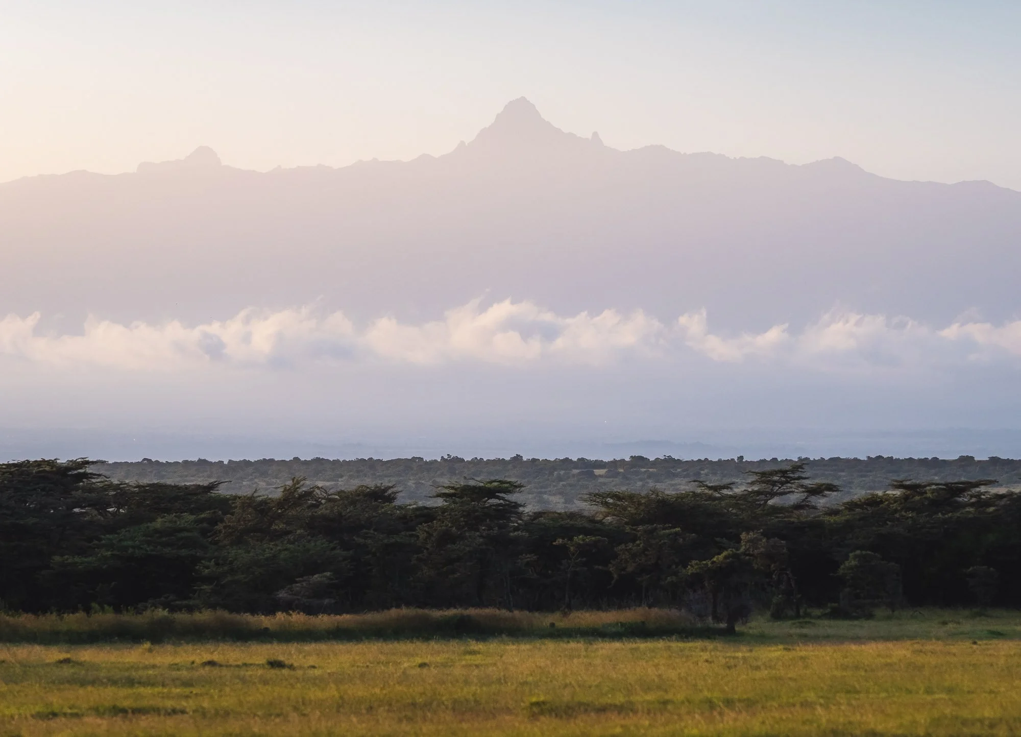
Mount Kenya
On clear days, Africa’s second-tallest mountain makes an appearance with its various peaks. While not quite as tall, climbing it can be a little more demanding than what it took to summit Kilimanjaro.


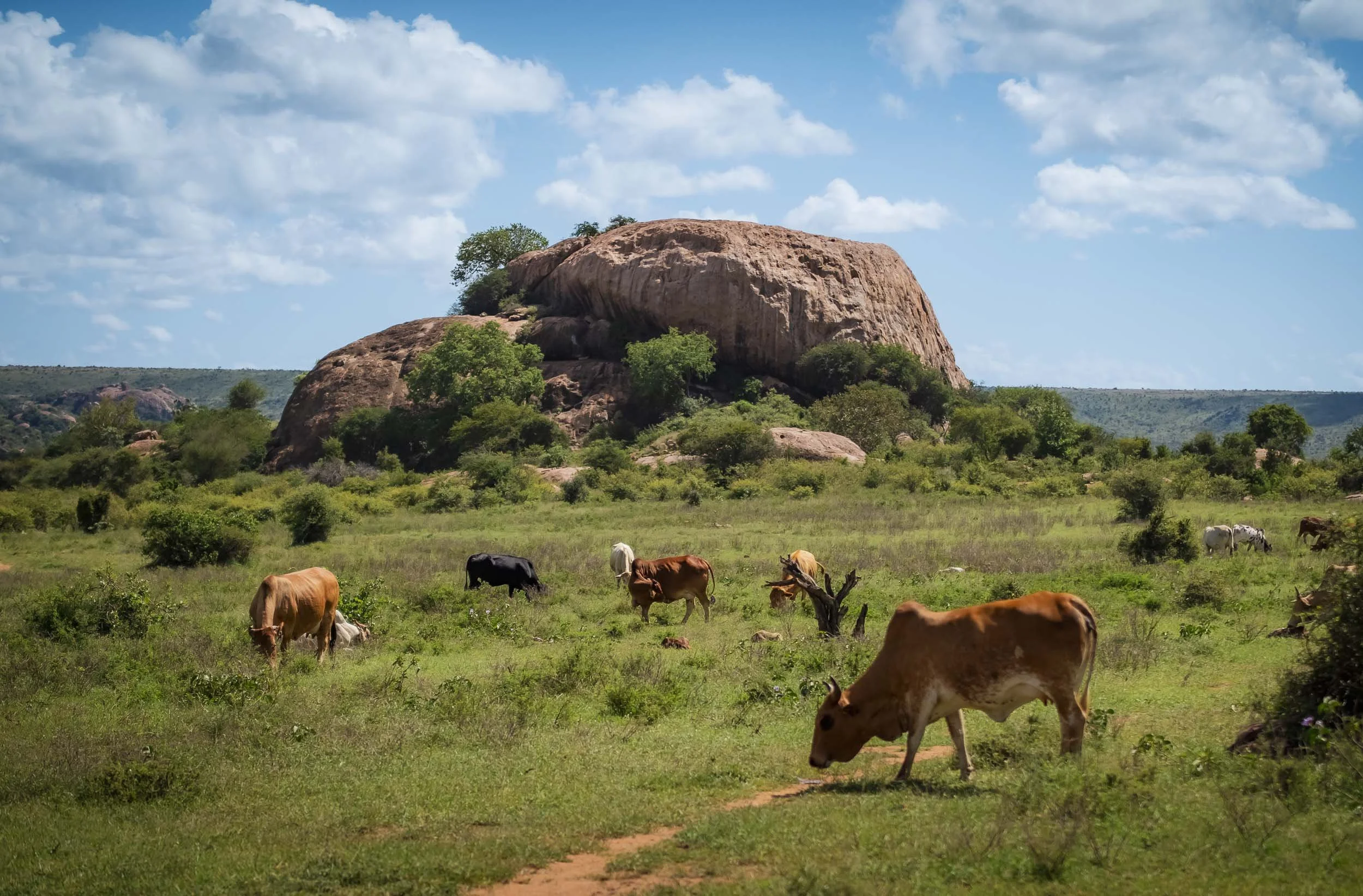
The conservancy is a shared environment: wildlife and the local pastoralists live side by side, in what is generally a well-managed and balanced approach. This is not always easy to maintain, as I’ve learned first-hand during my time with the IFAW rangers of the Amboseli ecosystem. Ol Pejeta used to be a cattle ranch and prides itself in its integrated conservation effort, contributing to dozens of community projects from education, food and water security, to energy.
While the cattle traffic is amusing, elephant traffic is obviously a lot more intriguing, especially when a curious youngster wants to inspect your car a little closer.


Ol Pejeta is typically home to a few hundred elephants, but they are not a resident population. Instead, they use the wildlife corridors in the surrounding areas to migrate across the Laikipia / Samburu ecosystem - in fact, all animals are able to freely roam, with the exception of rhinos. Of course this also puts them at risk of human-wildlife conflicts and one of the community engagement aspects is to mitigate and manage these situations to avoid crop raids and similar issues.


As readers of this blog will know, elephants have become one of my favourite animals. I could observe them for hours, particularly the large bulls or family groups with young calves like this one, probably barely a few weeks old.


Mother & Calf
Speaking of calves: We spotted this mother and her young one relaxing in a wide open area, with the characteristic oxpeckers sitting on top of the female.
The Battle
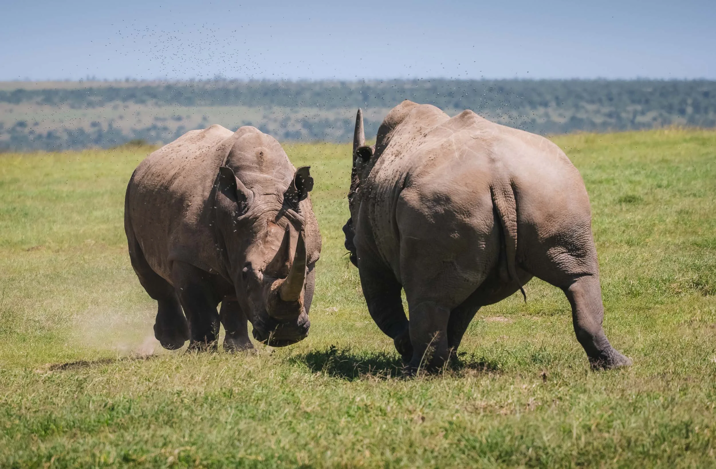
What seemed like an innocent family gather quickly turned intense when two males started to compete for the spot by the female’s side. It’s only when they move like this you realize the force of a white rhino that weighs up to 4 tons and can run up to 60km/h - twice as fast as an average human.


After a short altercation they decided she wasn’t worth the risk of an injury with their huge horns - a white rhino’s horn can grow up to 150cm in length. Despite its impressive shape and size, it’s difficult to understand why a single horn can fetch around 50,000 USD on the black market, when the horns are made of keratin, just like human fingernails. It's this demand that continues to make them an attractive target for poaching.
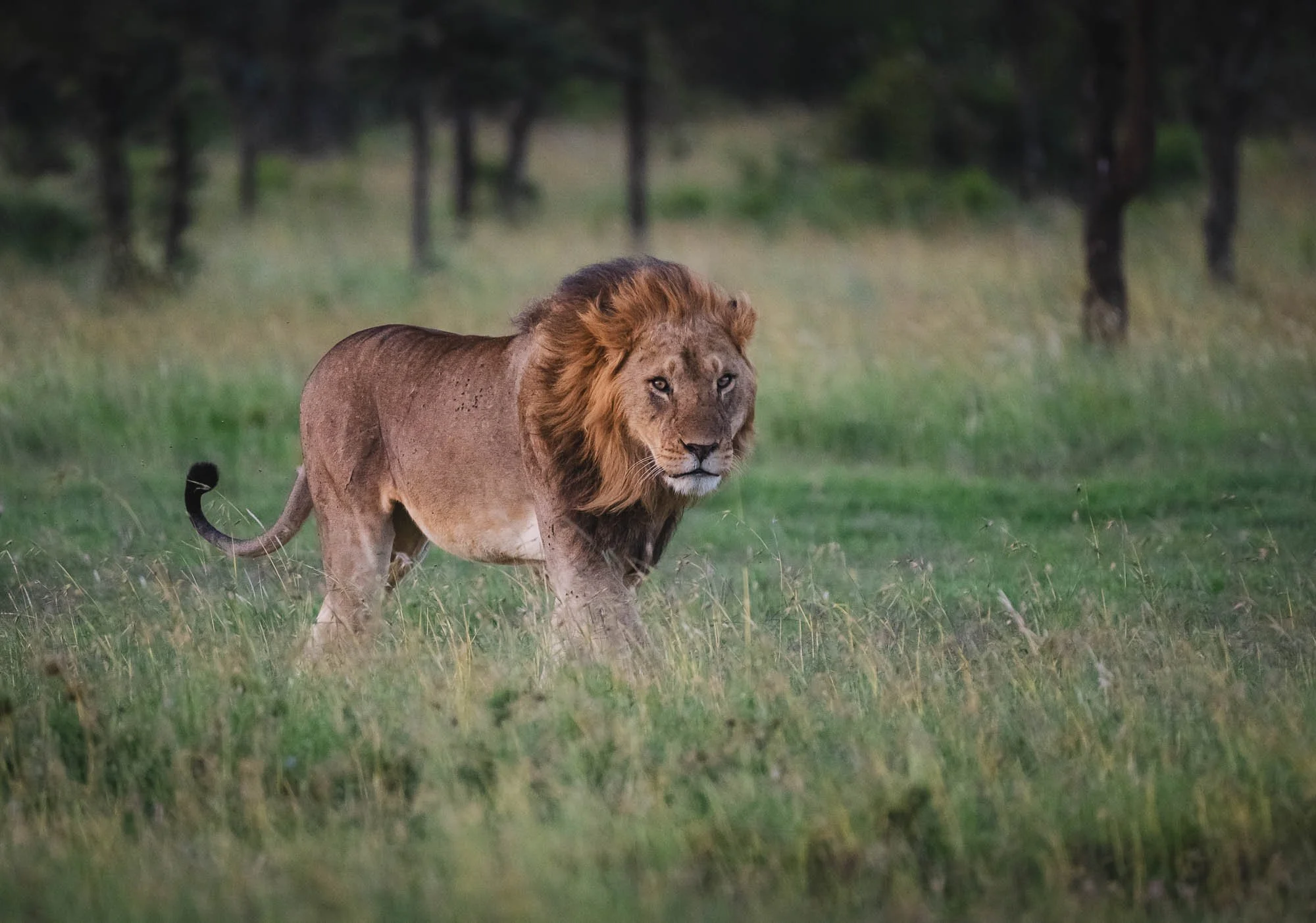
Sitting not far from the rhinos were two lions, including this magnificently strong individual.


Chimpanzee Conservation
Aside from the rhino conservation work, Ol Pejeta is also home to the Sweetwater Chimpanzee Sanctuary, established with the Kenya Wildlife Service (KWS) and the Jane Goodall Institute.


Chimpanzees are not native to Kenya, but the 35 or so individuals here are mostly rescued from illegal trade, orphans, or have suffered severe injuries. They are being nursed to health and then join the two groups living in a very large enclosed area in the conservancy.
🌈 Lucky Moments
Although the rainy season had just ended, we barely felt a few drops during our time in Ol Pejeta. On the contrary, the last remnants of the clouds and their contents made for one of the most beautiful moments as a rainbow appeared behind the airfield, where many animals were grazing in the late afternoon, giving me the opportunity for some unique compositions.


One Last Rhino Encounter
As the rainbow faded and the sun slowly set in the other direction, we spotted a black rhino mum and her calf in the distance - a chance for some silhouette photos, if they were to remain calm as we approached. More alert and shy than white rhino, this was not a given. They eyed us cautiously as we positioned ourselves, but luckily felt we were not going to be bothering them, and continued grazing.


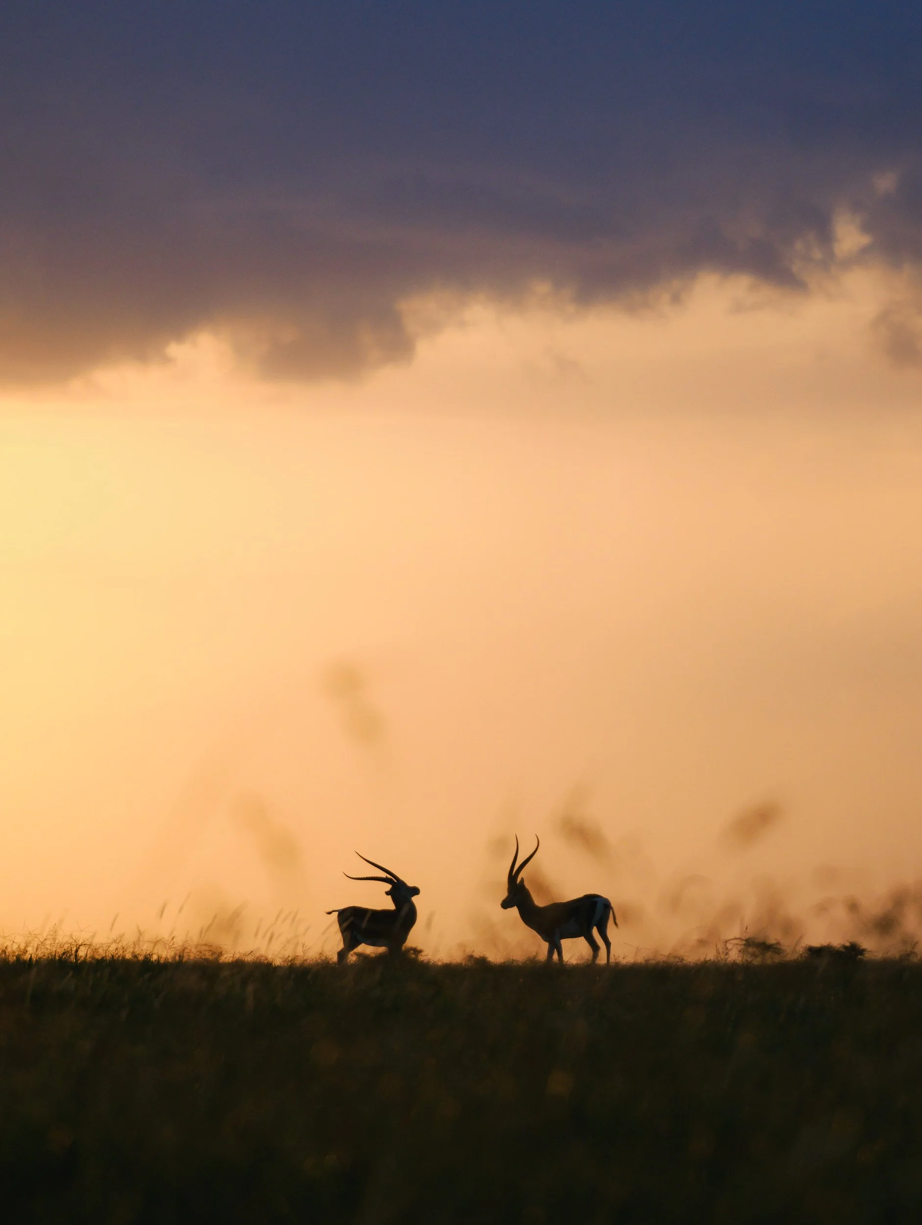
We spent almost 30 minutes with the family until the sun disappeared below the horizon, and during this time I managed to take what are probably my favorite images of the trip.
Not wanting to be left out, these two impala posted for another silhouette image just a few minutes later. A beautiful end to the day and my time in Ol Pejeta.
The End
It’s only after you spend dedicated time with these animals and observe them beyond a quick drive-by that you appreciate their behavior and beauty - let’s hope they’ll roam our planet for longer than what the recent trajectory would indicate. I’m sure Ol Pejeta will continue to play a role in this quest, and maybe give us a chance at seeing Northern White Rhinos in the wild again soon.
Subscribe to my newsletter to get notified and don’t miss out on more Wonders of the Globe.
Other Recent Posts:


In Search of a Black Leopard
For several years I’ve been following the journey of a special variant of what is probably my favourite animal - the elusive black leopard.

Ever since reading Will Burrad-Lucas’ incredible book “The Black Leopard” (go check it out, his work is truly pioneering and inspiring) I’ve been keeping my eyes open for sightings of black leopards, so that I could take my chances at seeing one myself. It’s been several years since I had my mind set on finding this melanistic version of my favourite cat in the wild, and Kenya’s Laikipia area seems to be the hotspot in Africa for this rather rare genetic mutation.
Although several black leopards have been spotted here, a specific individual has been rising to prominence in recent years: a female that has become quite habituated around humans, having grown up near a camp.
This presented what is probably the best chance since forever to see one in the wild. In mid 2025 I finally had an opportunity to visit Kenya again, owing to a planned trip to Amboseli National Park for IFAW, and so it was time to make this sighting a reality! It was also going to be a new wildlife photography experience for me, as my sister happened to join for this leg of the trip - clearly, no one can escape the allure of a black leopard.
A Black What?
At this juncture, it might be worth answering a question a few people asked me when I told them I was going to find a black leopard: “Don’t you mean a panther?” - you could be forgiven for thinking so, but actually there is no distinct species called ‘panther’. The blackness is caused by a recessive gene that causes leopards to be melanistic due to an overproduction of melanin. It needs two leopards with this recessive gene to meet and mate for a black cub to develop, making this exceedingly rare. The umbrella term panther is a colloquial description for any black big cat, and also includes black Jaguars - those can only be found in South America and look very similar to leopards, although generally a little bigger.


The journey to the lodge in Laikipia county in central Kenya was a rather short one. I had already spent a few days in the area, visiting Ol Pejeta, one of the strongholds of white and black rhinos in the world, and also home to the two last northern white rhinos on our planet - more on that in a future blog (subscribe!). The drive takes you through a number of farming areas, with an animal you’d not really expect it in Kenya: Camels. They are however kept quite frequently in the north of the country for trade and export.
The Northern 5
Another rather interesting animal we encountered on the way was one of the so-called “Northern 5”, in reference to the local version of the typical African Big 5 animals (did you know there are also the Small 5?): The Grevy’s Zebra. This species of Zebra is a little more shy and taller than the regular plains Zebra, and has thinner stripes that end at the belly. Most notably, it can be recognized by its round Mickey Mouse ears - distinctly different from the Zebras one usually sees.


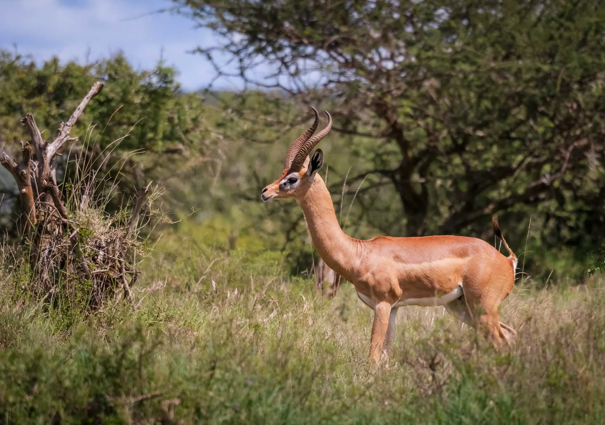
A second animal that’s part of the Northern 5 is the gerenuk, a long-necked, medium-sized antelope. Frankly, I’ve also seen it in the south of Kenya, which tells you a little bit about how strict the classification of the Northern 5 might be…

Glimpses of Laikipia
As you continue deeper into the wilderness, signs of human evidence fade away, with the incredible landscapes of the area coming into focus: low-lying plains around the Ewaso Nyiro and Ewado Narok rivers, dotted with ancient dryland forest remnants and rocky ridge lines. One of the most incredible bush landscapes I’ve ever seen, more on that later…
There was however some temporary human presence in the area: during my time here, we had several encounters (sometimes visible and sometimes only audible) with the British military, which is conducting troop exercises here every year. Why they need to conduct their field work in central Kenya is anyone’s guess. Speaking to various locals, I have some rather qualified assumptions, based on the post-colonial challenges and conflicts around land leasing that have become more prominent in recent years.


After around 3h of driving we arrived at the lodge in the afternoon and had the chance to speak to the owner of the camp, Steve, who told me that the resident black leopard here has mostly been sighted in the evening. She had two cubs recently (before you ask, unfortunately they’re not melanistic, it’s a recessive trait, and either way they had barely been spotted at all so far), and has been more cautious in her outings, but also more focused on hunting to provide them with their daily meals. That means, sightings during the day would be unlikely, but on the other hand, the chances of seeing her with a kill would go up…
The good news is, we would not have to go far, the leopard’s territory is literally the hill of the camp and a small portion across the river, which she used to cross occasionally. Leopards in Laikipia have relatively small territories, owing to the amount of prey almost year-round - in fact, their ranges overlap quite closely sometimes, as we’d experience first-hand.
We stuck to a clearing near the camp and kept our eyes open, spotting a few elephants that had just come back from a dust-bath in the mineral rich brown soil of the area - some remains of their ancestors could be seen nearby.


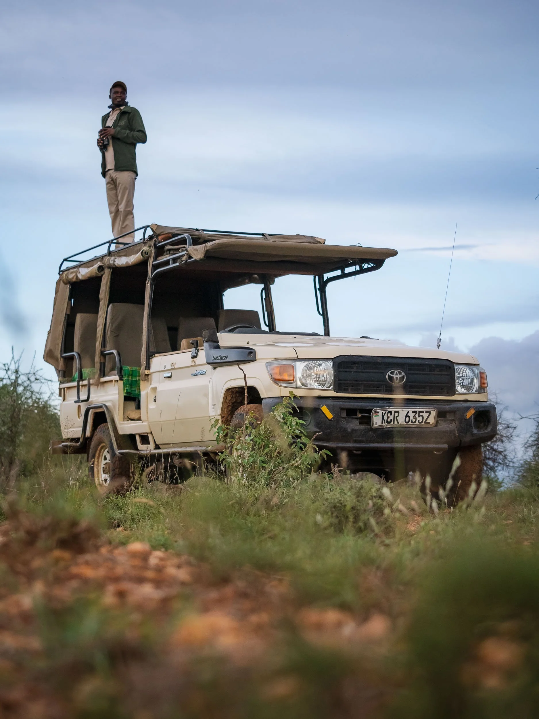
As in many private conservancies, off-roading is possible here - and almost necessary for good sightings - and it shows on the land cruiser, which has been modified with removed doors for more freedom during photography.


Darkness arrives quickly near the equator, with a short golden and blue hour. It was my first day and I didn’t have many expectations to see a leopard, let alone a black one, but my (excellent) guides Paul & Francis were confident - our target had been seen for most days in the past week. They suggested we start to make a move through the dark paths around the camp, using the car’s lights and a dedicated lamp to see if we could spot the distinct yellow eyes of the cat - seeing her fur would be hard, given her colour (or lack thereof). We drove for around thirty minutes, more or less in circles, with a couple of other cars from the camp covering the rest of the area to increase our chances. It feels pointless to drive in circles, looking for a black cat moving quietly through the tall grass and bushes in the darkness of the endless wilderness. But this is what makes it special. And special it was.
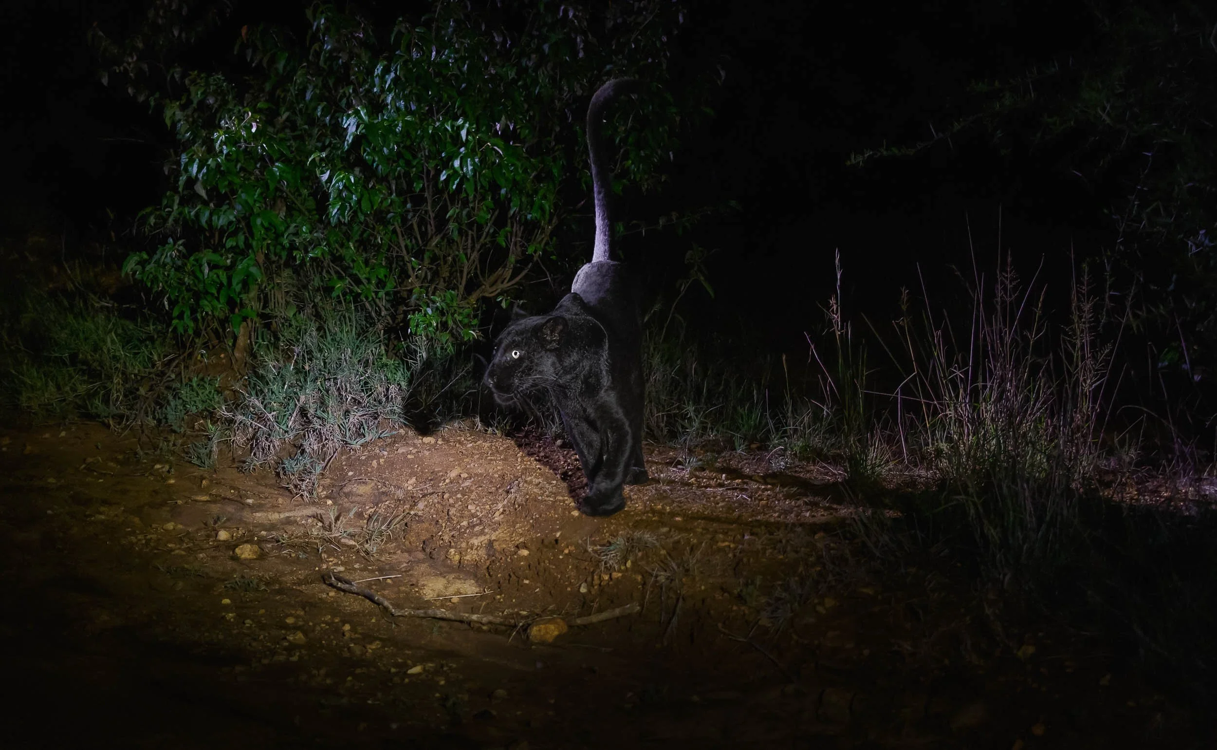
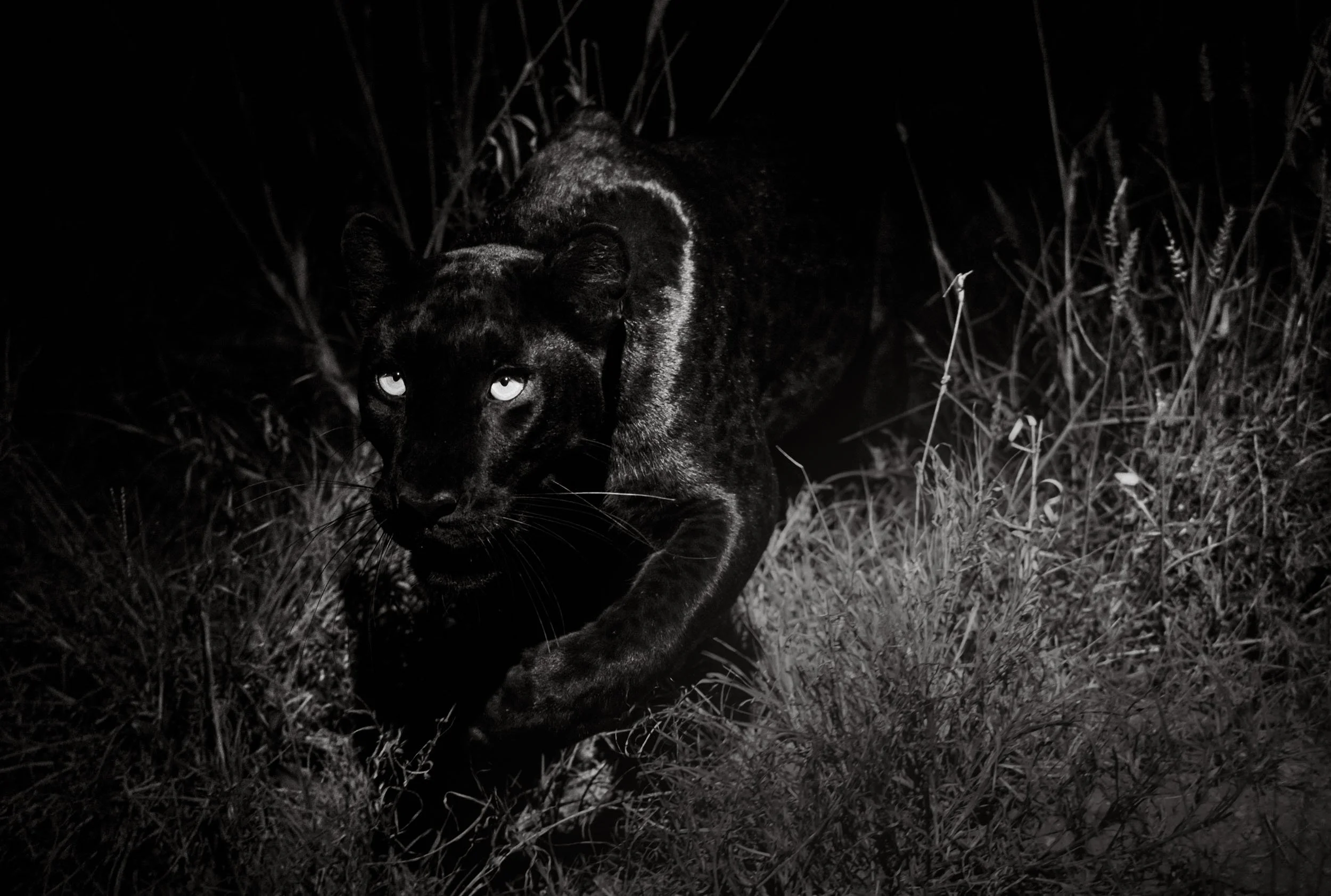
Giza
We passed a tight curve, and she suddenly made her appearance out of nowhere, crossing the path in front of us: the elusive black leopard, Giza.
With silent but determined steps, carrying what seemed to be a hare in her mouth into the thicket, she had given me the moment I was looking for.
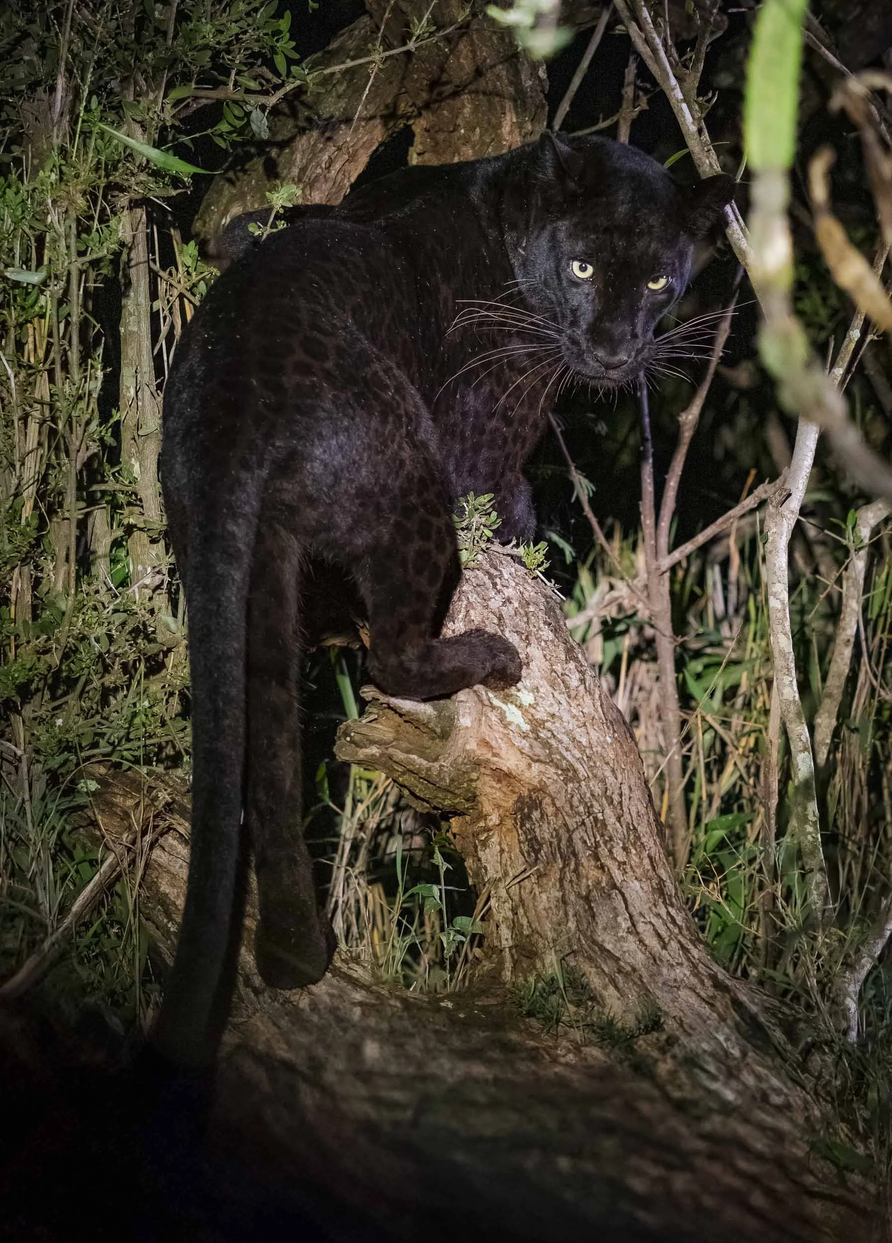
I was too in awe and too slow to get my camera set up for the dim light of the lamp quick enough to capture the moment, but she jumped onto a tree stump and started to devour her catch, giving me the chance to get some photos as she looked back for a moment. She was close to us, which means you could clearly make out the characteristic leopard spots on her majestic coat.
She disappeared into the tall grass once she finished her meal, and I had to catch my breath for a moment to process what happened.
Looking at my images, and learned that I had missed quite a few photos: A fast cat in the dim light of the handheld lamp, moving like a black shadow through tall grasses, really makes for some of the toughest photographic conditions you can encounter - but a few tweaks to the focus setting and exposure behavior should make things better. Now we just had to hope this would not be our only encounter…

Ghost of the Night
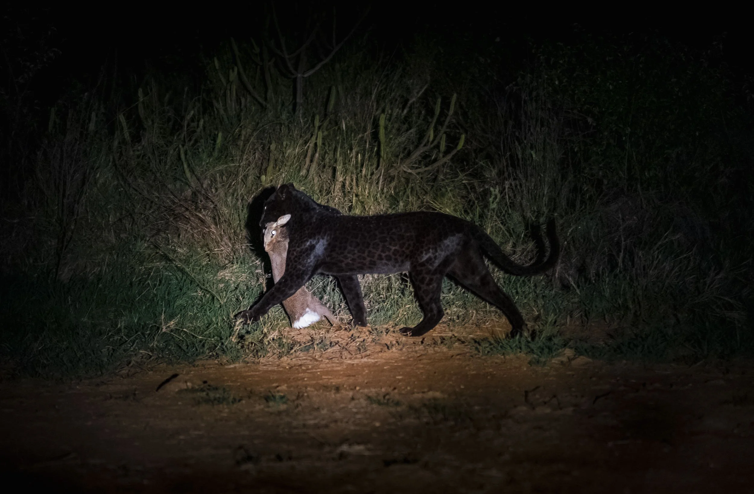
My concerns were unfounded. As we followed her through the thickets we could see her stalking a small antelope.
We switched off the lights and engine, and a few seconds later everything was over - a single squeak of her target, and silence again. And then she walked out of the bush, carrying her prey, most probably with the goal to feed the two cubs hidden away somewhere.
We let her wander off in peace to do just that, not wanting to attract too much attention on her, but just a few dozen meters past the car, we heard the distinct sound of two leopards in a brief altercation. We switched on the light, and just saw Giza run off into the distance, as a large male walked into the other direction, carrying her kill away.


Kijana is a strong leopard whose territory just borders Giza’s, and this was seemingly not the first time he took advantage of her predatory skills - his size and the fact Giza has cubs now makes it less likely she would risk an injury and try to fight him off. As we learned over the next days, catching another Dik-dik seems to be the far easier task for her, and it is what she did this time as well: we left her alone, but another guide told us they saw her with a fresh kill a few minutes later. What a first encounter!


One of the reasons Laikipia is such a stronghold for leopards, and why there can be multiple individuals in very close proximity with smaller territories, is the local density of these peculiar small antelopes: Dik-diks. You will see dozens every day, roaming around in the dense bush, and making alarm calls whenever they see or smell or hear something unusual - a great indicator if you’re on the lookout for predators.
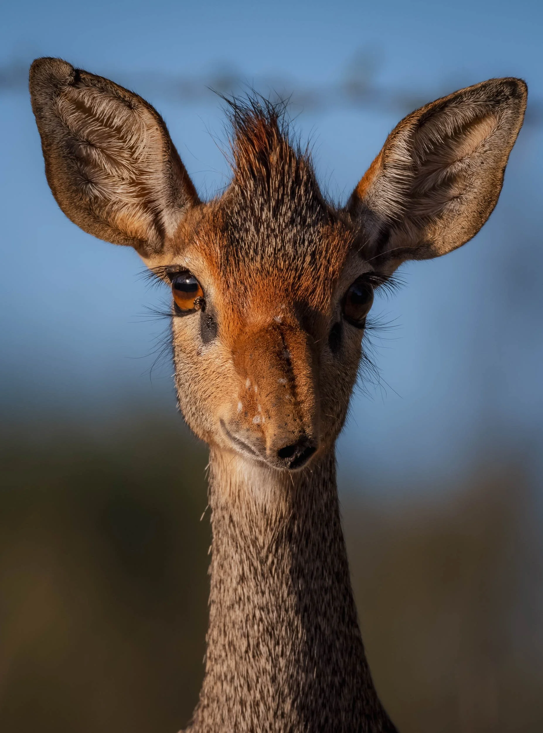
Guenther's Dik-dik
The sub-species here has a rather funny looking nose, long, flexible, and bent downwards over the snout. They live monogamously, so you’ll mostly spot them in pairs - which also means that every morning you can congratulate those who didn’t turn into a widow/er the night before…


We spent the morning of day 2 exploring the area - it was unlikely that we’d see Giza again during the day, but there are plenty of leopards around. For now, rich birdlife was on the agenda, with common cuckoo, pied king fisher, bee eater, and even a nubian woodpecker among the sightings.
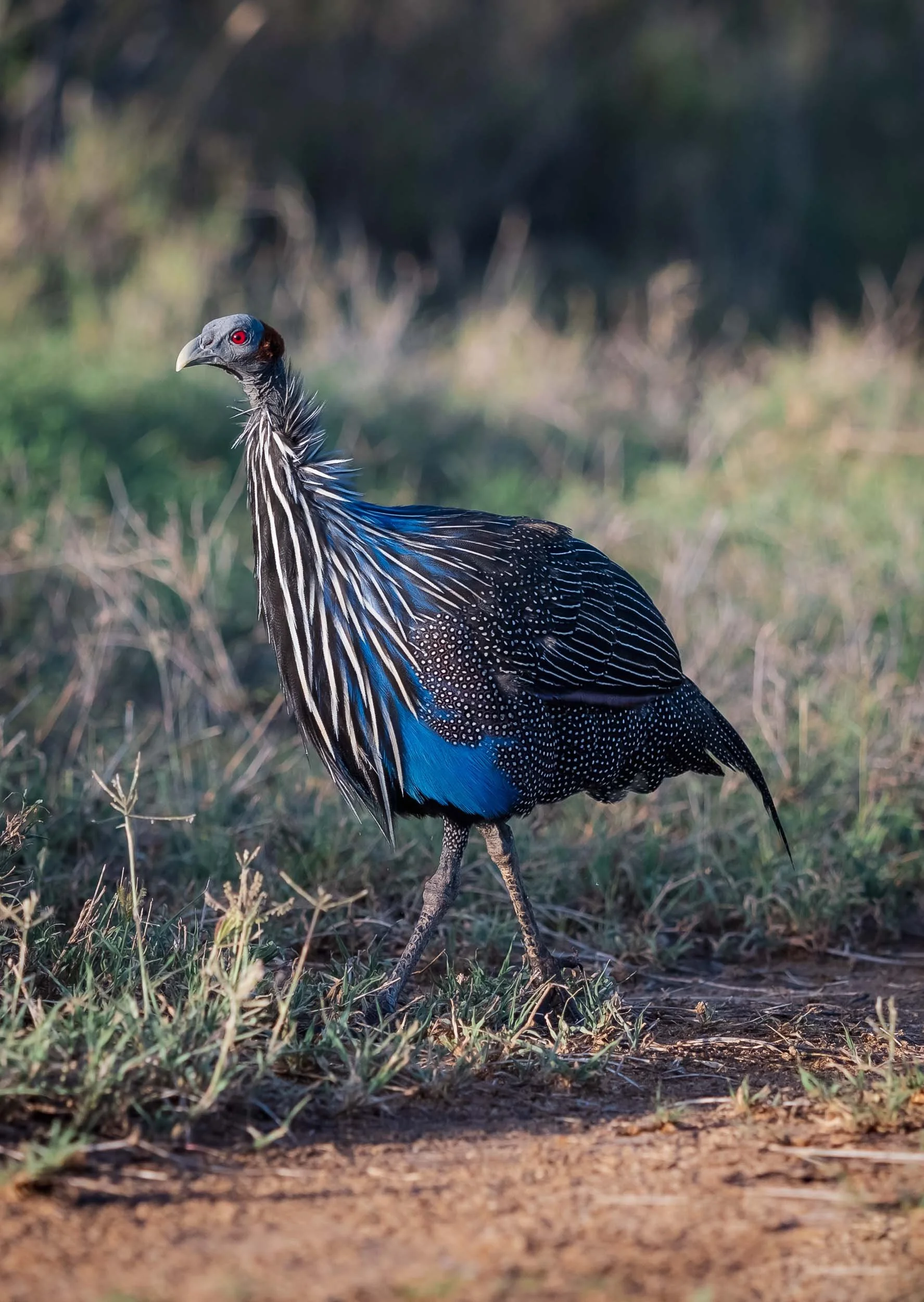
Laikipia is also home to the largest and probably most striking extant guinea fowl, the vulturine guinea fowl. It typically lives in flocks of about 20 birds.


Although less appreciated by birds, when it’s quiet on safari black-backed Jackals often add some entertainment - this couple was quite chilled and minding their own business though. Laikipia is home to lions, wild dogs, and also striped hyena - all animals I wouldn’t mind seeing - particularly the latter is one of the missing large mammals on my Africa list.
After lunch and an afternoon break from the heat, it was time to head out again and focus on our special black cat. The camps location on a hillside makes for a perfect viewpoint over the incredible scenery here - although it was a relatively dry year, the rainy season turned much of the landscape green. Around October, most of the region will turn brown and dusty again, with very little respite for grazing animals and a consequentially happy time for predators.


As the sun set, some of the camp team are using their binoculars from the viewpoint on the top of the hill to look for signs of Giza.

And this time it was another guide who told us she was out: just as the last light of the day faded, Giza appeared, walking casually past the front of our car - I caught a glimpse. If you look closely, this image also shows the little distinct kink at the end of her long tail, maybe a remanent of an accident, or just another idiosyncratic feature of this special animal.
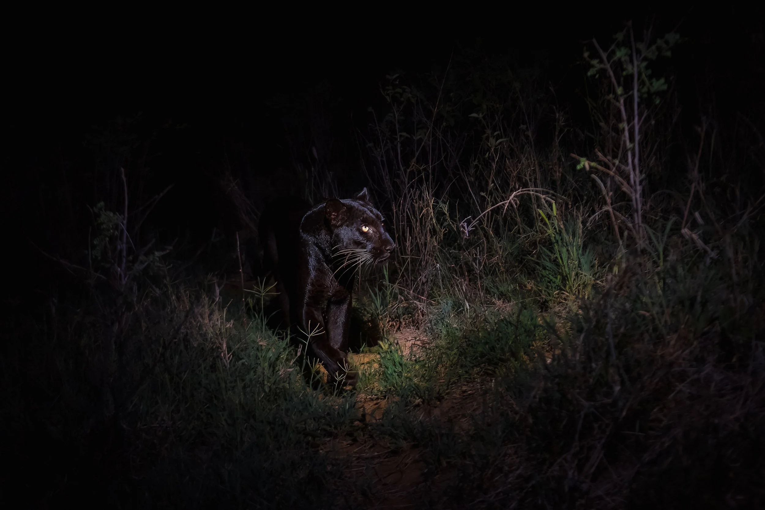
“Giza Mrembo”
That’s the full name she was given after her birth a few years ago. It means “beautiful darkness” and I couldn’t think of a more suitable name.


After a few minutes of traversing the rocks and long grass, she once again started to stalk for her favourite prey, and once again, it was only a matter of minutes before a quick rustle in the bushes was followed by a high-pitched squeak. A few seconds later, the master huntress appeared with her kill.

The rhythm of the first full day became our routine: exploring the surrounding area in the morning, enjoying the scenery, see what animals we can find, before staying close to the camp and waiting for Giza’s appearance in the early evening. We got lucky and spotted her almost every day, only the rain made things difficult one night. Nightly outings in the bush are always interesting, for instance, we spotted a striped polecat, also referred to as African skunk or zorilla - hard to photograph, so you’ll have to live with this image.
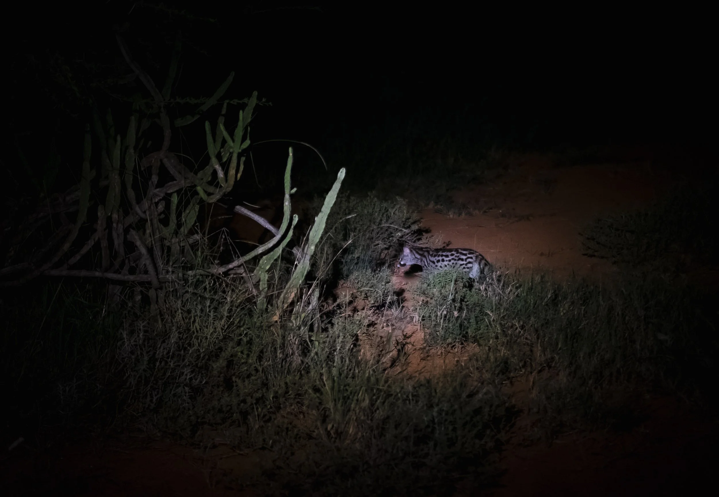
Somewhat more common to see, but still an interesting nightly sighting, was this genet. Related to civets, they have a cat-like body with short legs.
Nevertheless, the daylight adventures were equally as enjoyable, for example watching these rock and bush hyraxes coming out to sunbathe in the morning. Everyone who has ever seen these has probably been told that they are the closest living relatives to elephants and assumed it’s a joke, but well, it’s not, they are.


My knowledge of birds remains very limited, but over the years I slowly began to appreciate them more and more as part of the ecosystem.
We encountered several trees with dozens of weaver nests, such as the one on the left (with soft, green grass built during the wet season) and the Village Weaver on the right, using dry branches to make its hanging nest.


A pair of speckled mousebird on the left, with their characteristic long tail, and two spurfowl to the right.


A long-tailed widowbird in breeding season with its extensive tail feathers, and what I think was a pair of spotted eagle owls, relaxing in the exposed roots of a tree on the eroding river banks.


Like many of the more rural areas that are not national parks, Laikipia is also a mix of conservancies, farmland, ranches, and community lands. That often comes with conflicts, not just among wildlife and humans, but also different interest groups. Settler descendants, investors, ranch operators, and the indigenous tribes are often at odds as to the most efficient use of the land.
Either way, it’s always useful to build a good rapport with the locals around. The herders bring their cattle and goats through parts of the conservancy, and are always on the lookout for predators - helpful for us!


We discussed a new leopard that had been spotted near the river banks in this area, and were able to observe him twice over the following days.

Spot the cat?
The first time was more of a typical encounter: from a distance across the river, in the high grass, with hours of no movement beyond a flapping ear and a quick tilt of the head. Can you see him?
But on the second encounter, this adult male put on a show for us, starting on our side of the river bank and calmly watching a heard of Impala on the other side. After a while, he decided they might be worth a closer look - but that meant crossing the river…


… and that involved a few jumps over several meters, which he made appear effortless and elegant. One reason I love cats. Unfortunately by the time he made it, the impala headed for safer grounds and he just watched them from a distance.


We followed him for a few hundred metres on the river bank, before he decided to lie down exactly in the spot where we had (barely) spotted him the day before - cat routines.

More Big Cats
After a rainy night, we spotted a few prints in the sand - clearly too big for leopards, and definitely also very big for a typical lion: these were of a massive male for sure.

The Laikipa region is in fact also home to a large number of lions, although their density in this area isn’t as high - to the benefit of the leopards. We did spot a female for a brief moment, which, as we learned, had cubs recently - but no signs of them. Admittedly, lions were not my focus.

The Young Male
Instead, the leopard encounters continued beyond Giza - their density in this area is really amazing, and in just a few days I saw more individuals than in all my previous trips throughout Africa (of which there were quite a few).


And what beautiful encounters we had, such as with this pretty young male, who posed for us for several minutes. We had hoped his mother, who is still close by, would join, and we heard a few calls but didn't manage to spot her.


He was a curious fellow, which is to be expected with young cats. On the other hand, you don’t want habituation to go too far, and it’s a fine line between animals seeing the car as being part of their environment and ignoring it, or going a step further and interacting with humans more directly, which is not desirable.

Close Encounter
Did I say he was curious?
We moved away from him at this point to not give him more opportunities to come even closer.

Laikipia Landscapes
Although nothing could top these leopard sightings, the landscapes came close. Of course, the greenery at this time of the year helped, but the combination of rocky outcrops, the river banks, gentle waterfalls, and the endless plains and bushland really made this one of my favorite African landscapes ever.
We spent one morning exploring a few of the outcrops on foot for a better view, hoping we wouldn’t get pushed off the steep ridges by a mean baboon....


Luckily that didn’t happen and we got to enjoy the sprawling plateau, encircled by some of the hills of the Great Rift Valley to the west. The scenery here could have escaped straight from Lion King - incredibly beautiful.
The seeds of some of these palm trees are carried for hundreds of kilometres through the river, before settling on the banks during periods of flood - in turn, elephants then carry their seeds further through the landscapes.

Even if you never get to see a single leopard (hopefully that won’t ever be the case) this area is worth a visit.
My guide couldn’t resist lifting the camera up to capture some of this beauty either.
The Master Huntress
At night though, only one thing was on our mind - more sightings of Giza. And we were rewarded almost every evening. Her hunting prowess and the need to bring home at least two kills to her cubs every day meant that no evening passed where we didn’t hear the characteristic squeal of a dik-dik in distress. For better or worse, it never lasted more than a few seconds, so efficient was the leopard in her attempts.


We can’t know for sure, but it may be her black coat that makes Giza a more efficient predator at night, even more difficult to spot, and reversely also the cause for her to develop a preference to hunt in complete darkness - indeed, the brown bushland is not a very suitable environment to stay undetected during the day if you look like Giza.
Patterns
In the right light and angles, her coat truly shone, literally and with its intricate black pattern.

With the Boss
On our last day we had the pleasure to be guided by Steve, the lodge owner, himself. That was a privilege, as his experience in the bush of this area is unmatched, and we also got to chat a bit about his time in Zimbabwe - for example, he happened to know the amazing Steve Edwards of Musango, and Barry of Chewore. Read about my time at their lodges, standing in dinosaur footprints (yes, for real) and taking one of my favorite images ever.
I always love being out in the bush for a walk as well, so we went for a morning trek along one of the river banks - it’s just such a different feeling compared to being in the car, and I can recommend it whenever you have the possibility.

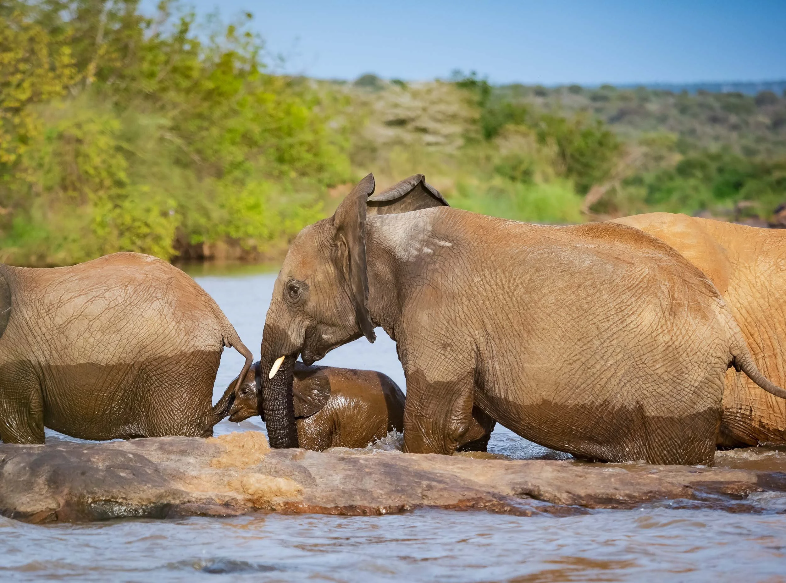
Over the last years I’ve developed a soft spot for elephants, and Steve took us with him on foot to see this family cross the river, forcing their youngest to become a temporary submarine.

He also showed us these makeshift beehives the locals hang from trees to encourage honey production. However, this is a tricky endeavor: honey badgers often outsmart even the most stable human construction and manage to climb down the ropes and open the wooden boxes, as seems to have happened here with a few of them.
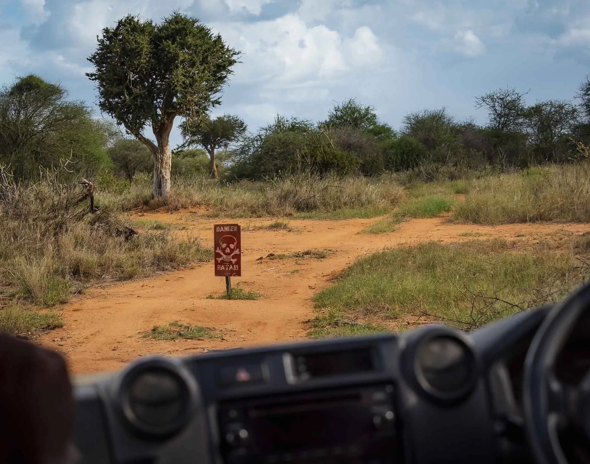
Back in the car, we decided to venture out a little further into new areas of the conservancy and beyond - only a few roads were off limits due to the military exercise: Hatari! (That’s danger in Swahili, and also the name of a classic 1962 movie with John Wayne everyone who loves Africa should watch!)
We spotted another leopard who had just hunted a hyrax - once again, observing the prey is often the best way to make out the predator. A group of rock hyrax seemed very agitated and made alarm calls, which gave away the presence of the cat. He hid in the tall grass with his meal, giving us only a brief moment to make out that he was a shy individual, less commonly seen.


Striped Hyena
We also managed to tick off another of my goals for this trip - seeing a striped hyena. They are more common in the northern half of Africa, the Middle East, and parts of India, whereas their spotted and brown cousins as well as the aardwolf (the latter two still on my list) are more frequently seen in the southern half of the continent. They are shy animals, and we had to be quite strategic to get these images before it disappeared into the bush - Steve’s knowledge of their behaviour paid off.


There are around 10,000 individuals left in the wild, primarily nocturnal and mostly observed alone or in pairs (they are monogamous), unlike the spotted variant, which is usually found in groups. They are heavily featured in folklore and mythology in the Middle East.

The Last Morning
In the early hours of my final day, we launched an attempt at finding the local pack of wild dogs - another amazing underrated African mammal species.
One of them is collared, so the radio would increase our chances of finding them. It still depends on line of sight, and with the many ravines and a dog that may be sleeping in one of them, it’s still a challenge.
Too much of a challenge for us this time, as even after several attempts we didn’t get a signal.

Instead, we were blessed with a final leopard sighting. It was a distant one, but a very interesting observation. The cat moved close to a giraffe, which watched him very carefully (although leopards don’t really pose a threat to them), and a small group of waterbuck (whose young might be a risk).
Can you spot it? It’s testament to the Steve’s observation skills that he was able to determine the presence of a leopard by the watchful alert behavior of the other animals, from several hundred meters away - while driving.

One last amazing bird sighting was this martial eagle - with a wingspan of over 2 meters and almost 1 meter in length, this is Africa’s largest eagle. An apex predator, but by now unfortunately endangered due to habitat loss.

The Queen of the Darkness
It goes cats -> leopards -> black leopards - we reached the end of the funnel of my favourite animals, it doesn’t get much better than this.
One can only hope that Giza will be with us for several years, and produce more offspring. With some luck, we might get to see a few more iterations of a beautiful darkness in the area, given the presence of the gene in the local leopard population - I’m here for it.
For now, it’s a true privilege to get to see a rare animal like this in the first place, and even more so to observe her up close. It may sound corny, but there is undeniably a certain aura around her beyond just the color of her fur, although one might be the antecedent of the other.
Subscribe to my newsletter to get notified and don’t miss out on more Wonders of the Globe.
Other Recent Posts:

Island of Wonders - Mauritius
A family trip to Mauritius gave me a few opportunities to document some the island’s amazing sights, from the underwater-waterfall to the 7-coloured earth, and resident sperm whales.
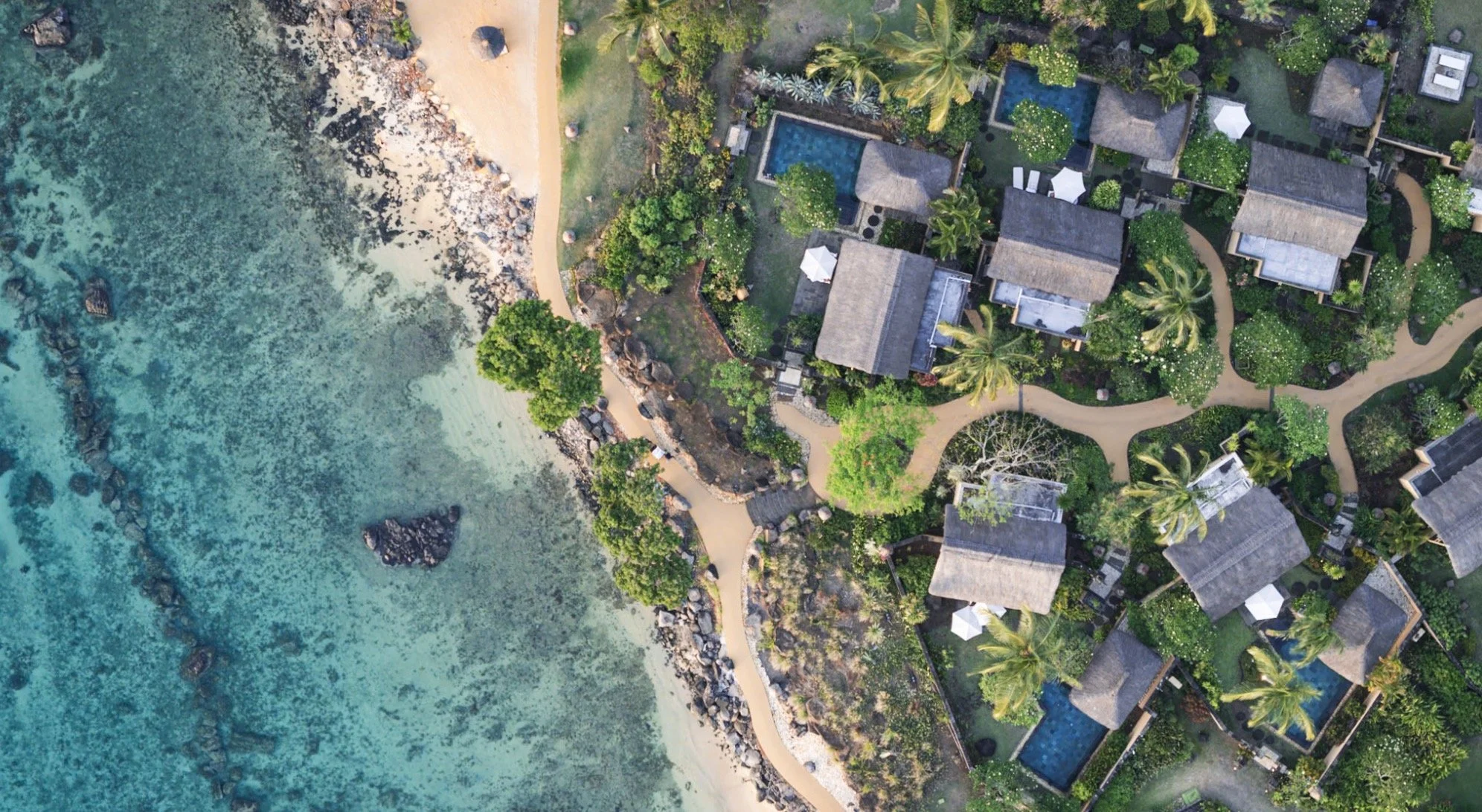
In late 2024 a family trip took me to the amazing island of Mauritius, east of Madagascar and south of the equator. In fact, it was not my first trip to the country, but the last one was cut rather short due to some unfortunate circumstances, so this time I actually got to see a little bit more of the island. Having said that, it was a family trip, and as a result, what you read in this blog is the result of less than 2 days of photography. It mainly covers some of the more famous spots, but I know Mauritius has a lot more to offer - maybe next time.
Highlights
With only a day and a half of time allocated to exploring, I tried to optimise my time to see most of the interesting places on the western side of the island, where we were staying. The main island is just 65km by 45km, but it’s mountainous and the roads are not always the most efficient. It can take a few hours to go from one place to the next. Take a quick look at this video for two of the highlights - you’ll read about them below.
Grand Bassin Temple
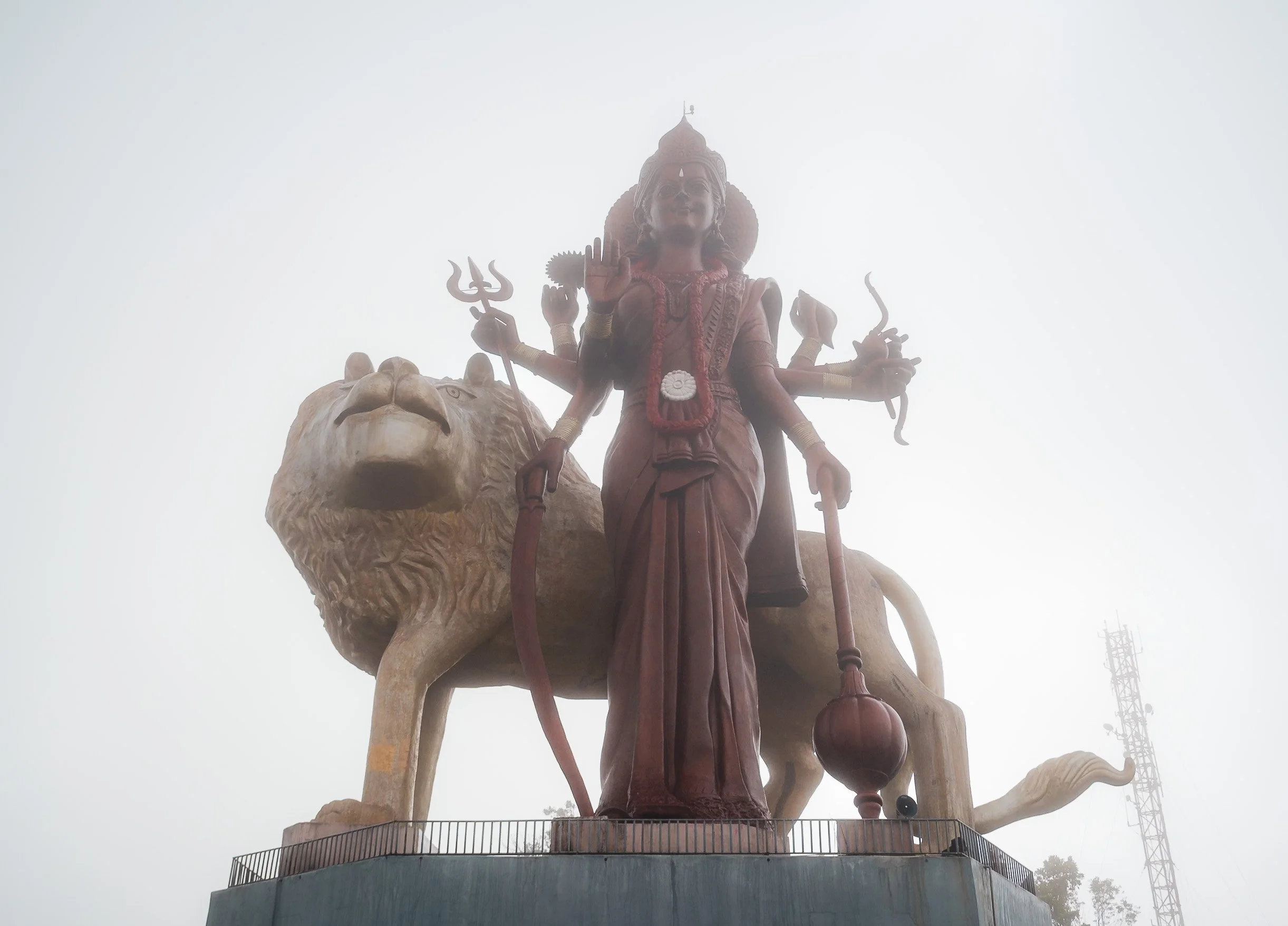
But first, I started in the early morning from the north-west of the island towards to the Grand Bassin Temple, situated in a volcanic crater in the forest areas at higher altitudes. Its history dates back almost 150 years, and it features the tallest Hindu Goddess Durga statue in the world, completed in 2018.


The temple is the most sacred Hindu temple in Mauritius, dedicated to Shiva. Almost half of the population follows Hinduism, while the rest is quite mixed across Christianity, Islam, and others. The foggy weather created a kind of eerie atmosphere here, especially with the statues around, and the temple was almost empty - that is not the case later in the day or in festivals, when the whole area gets extremely crowded

Kovil Montagne Temple
Another beautiful Hindu temple sits on the foot of the Corps de Garde mountain, with a beautiful view over the Quatre Bornes district.


It was originally established in 1907 by an Indian laborer and now features intricate colorful decorations, even covering the drainage system - and some remnants from the various festivals being held here during the year.


Trou Aux Cerfs Volcano
Just a few kilometers away lies one of the many volcanic craters of the island - in fact, Mauritius as a whole is was entirely formed by eruptions millions of years ago.
This one is rather interesting, as it sits in the middle of the city, and the crater is surrounded by a road.
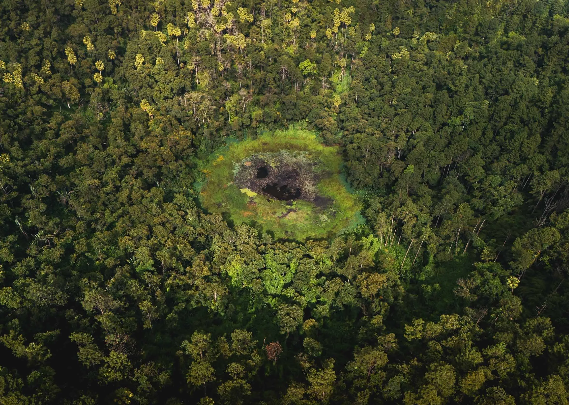
The crater is 80m deep with a small lake in the middle, but not accessible. It last erupted 700,000 years ago. It’s quite an interesting place, with a few endemic plants, as well as fruit bats and monkeys calling it home. Having said that, the zebra doves shown below are not actually native here and have been introduced from Southeast Asia.


⛵️
Not far from here you can observe a traditional craft of the country: Mauritius is known for its tradition of model ship building, with several workshops producing detailed replicas of historical boats. Nowadays this activity is mostly aimed at tourists, but still practiced by hand.


The level of detail on the model is amazing, and it takes the artisans days to finish a single ship. They split the work by different activities and skills.


For someone like me who enjoys building things by hand and has been dabbling with making models since childhood, I can absolutely appreciate this work. Having said that I’m not so sure how I’d feel about having to do it daily for a living…

Le Morne
We moved on th the very southern tip of the island, to one of the country’s two UNESCO World Heritage Sites, chosen for its representation of the resistance to slavery. The mountain was used as a fortress for shelter at the time of the slave trade on the east coast of Africa. In front, the newly opened Riu hotel - can’t say it adds to the scenery…

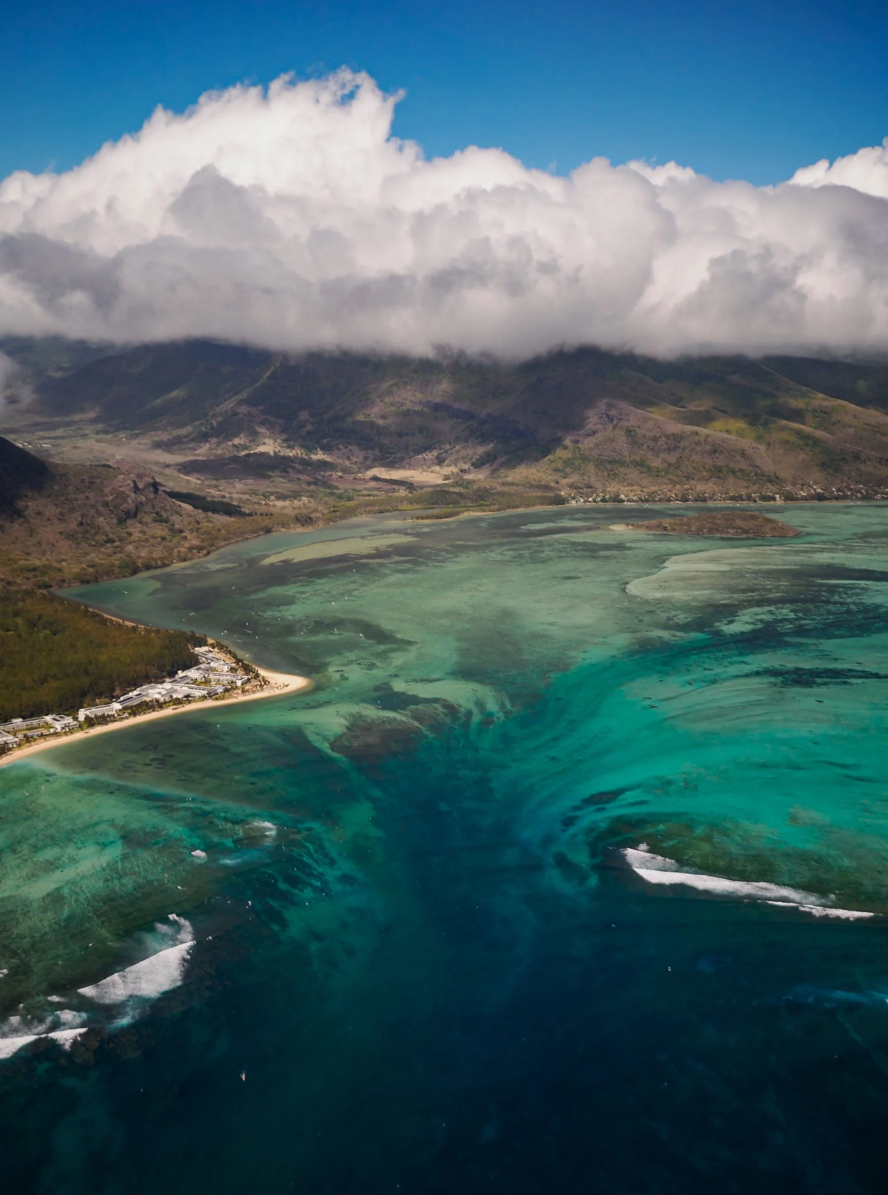
An Underwater-Waterfall?
But the very special sight here is actually in the water just off the coast: an optical illusion, making the sediment pattern being carried by the current appear like a waterfall on the edge of the ocean shelf. There are two ways to see this curious visual phenomenon: by drone, or by seaplane.
I tried to do both. Both came with challenges, mainly caused by the tropical cyclone raging with heavy wind and rain in the north-east of the island during our visit, and in both cases, it took more than one attempt to make it… but in the end it did happen.

These first two images were taken by drone. The flight from the beach is not an easy one - to get this photo, you need to fly almost 2km into the sea under - in my case at least - heavy westward winds, which probably would have been enough to carry a small drone into the open ocean. On my first day of exploring I didn’t dare to fly here for this reason, but the second day was a little calmer.
To get the perspective, a panorama shot is necessary (3 x 3 photos at least), but it does give a very cool effect of the island being sucked into the depth of the ocean.
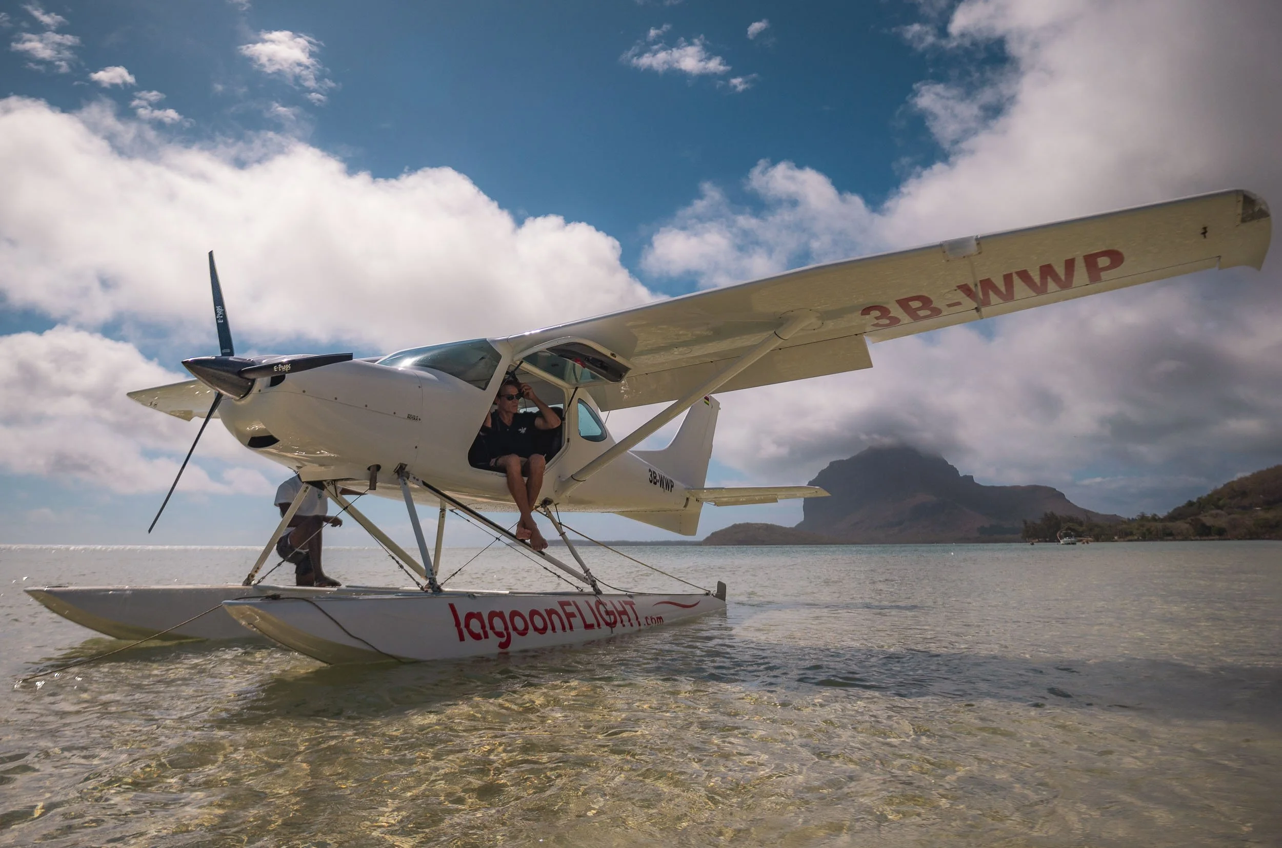
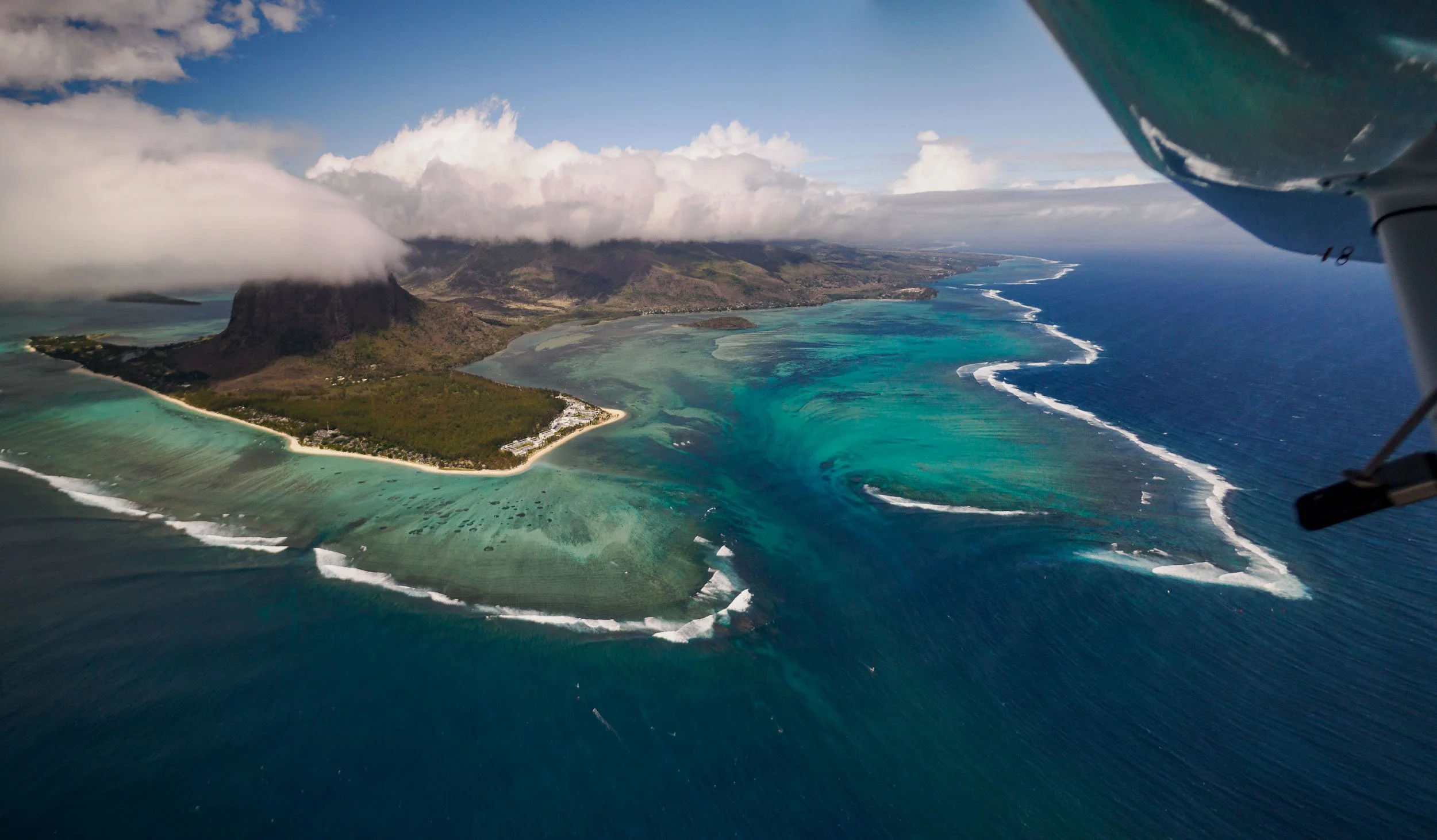
From from the sea plane
I also tried my luck with sea plane in slightly different conditions. Funnily enough it’s similarly nerve-wrecking as flying the drone under over the open ocean in the wind, but a little more fun, especially as the pilot decided it would be a great idea to do a brief nosedive over the waterfall.
The panoramic view from the drone makes the landscape look a little more extreme, but I like the light on the seaplane photos better.

We also saw this little palm shaped channel on the southern edge of the island, and a few beachgoers and windsurfers enjoying the coastline.


Chamarel Geopark
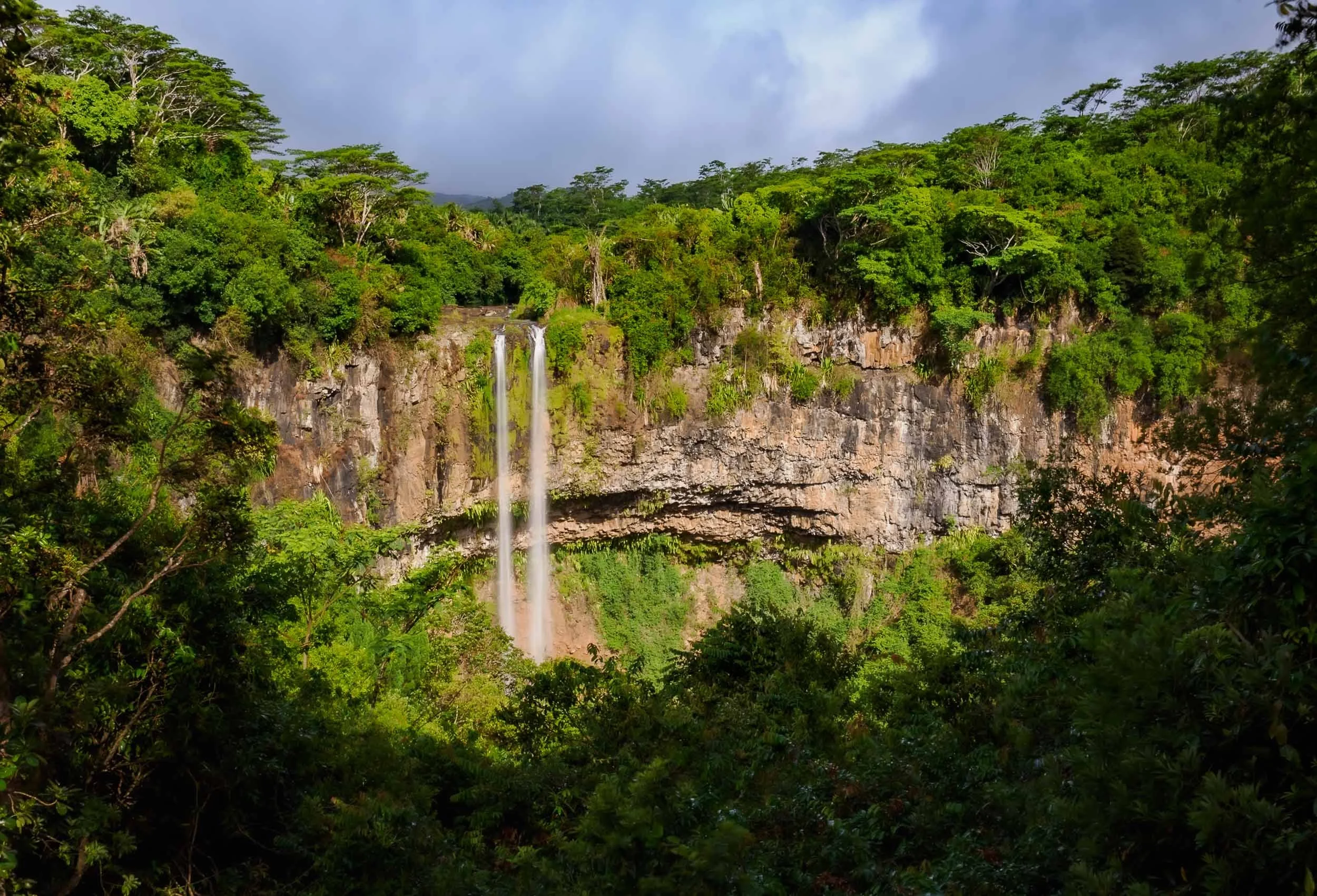
After the seaplane ride, we had one more destination on the agenda before the sun went down: The Geopark of Chamarel.
🐢
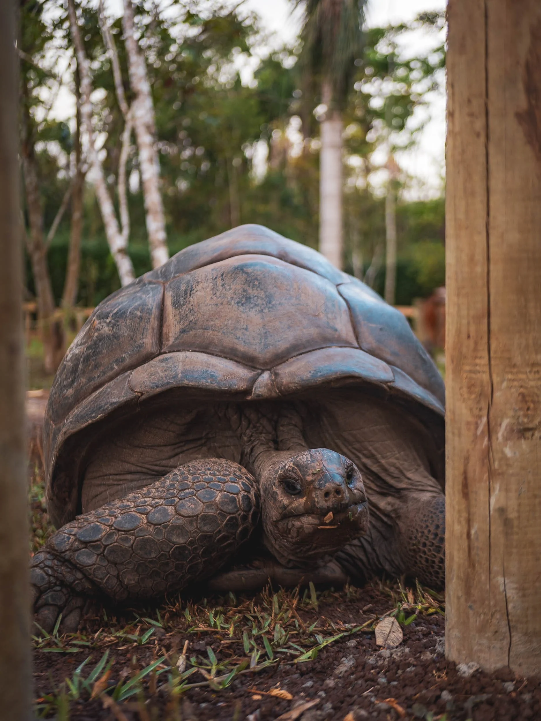
This beautiful nature park is actually famous for a specific attraction, but also features the tallest single drop waterfall on the island at almost 100m, seen above, a beautiful ebony forest (closed by the time I got there), and a small tortoise park. Mauritius was once home to its own giant tortoise species, which went extinct in the 1700s. Nowadays they’re imported from nearby Seychelles.
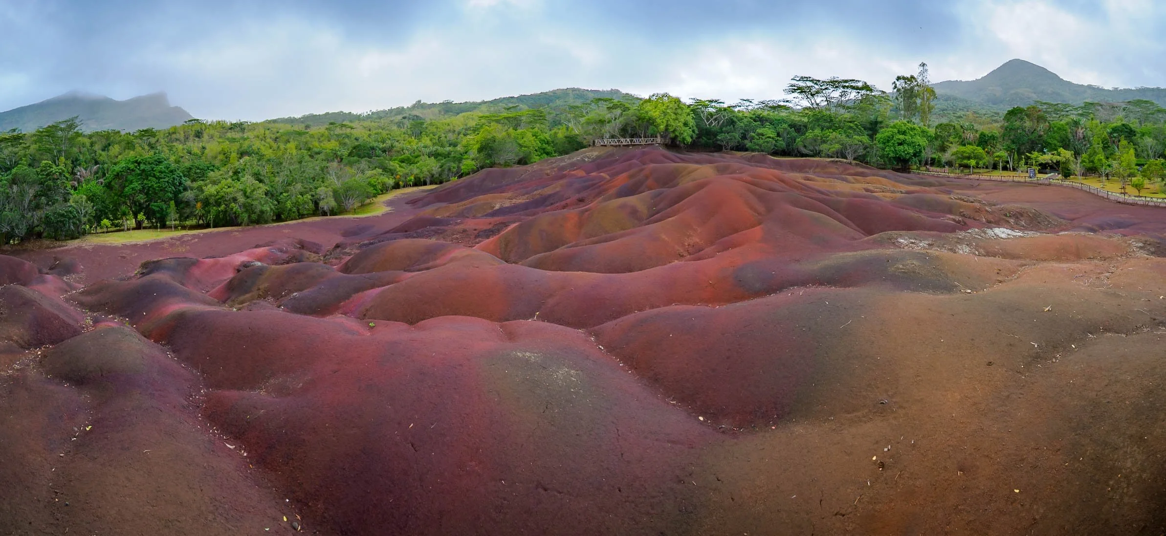
The 7 Colored Earth.
.


What most people come here for though is this natural phenomenon: a relatively small area of sand dunes that have very distinct colors - whether there are seven is probably down to your definition.
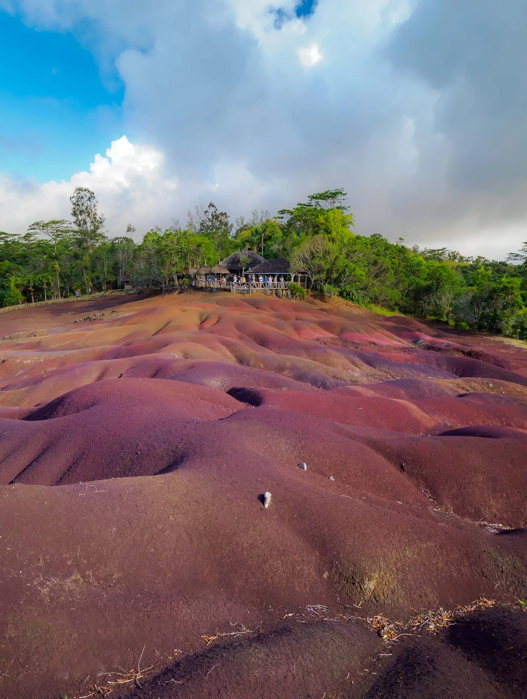
Either way it’s quite a fascinating place, as the rains have carved out lots of channels into the landscape, creating small hills in the area. We had a moment of sunshine which immediately changed the hues.
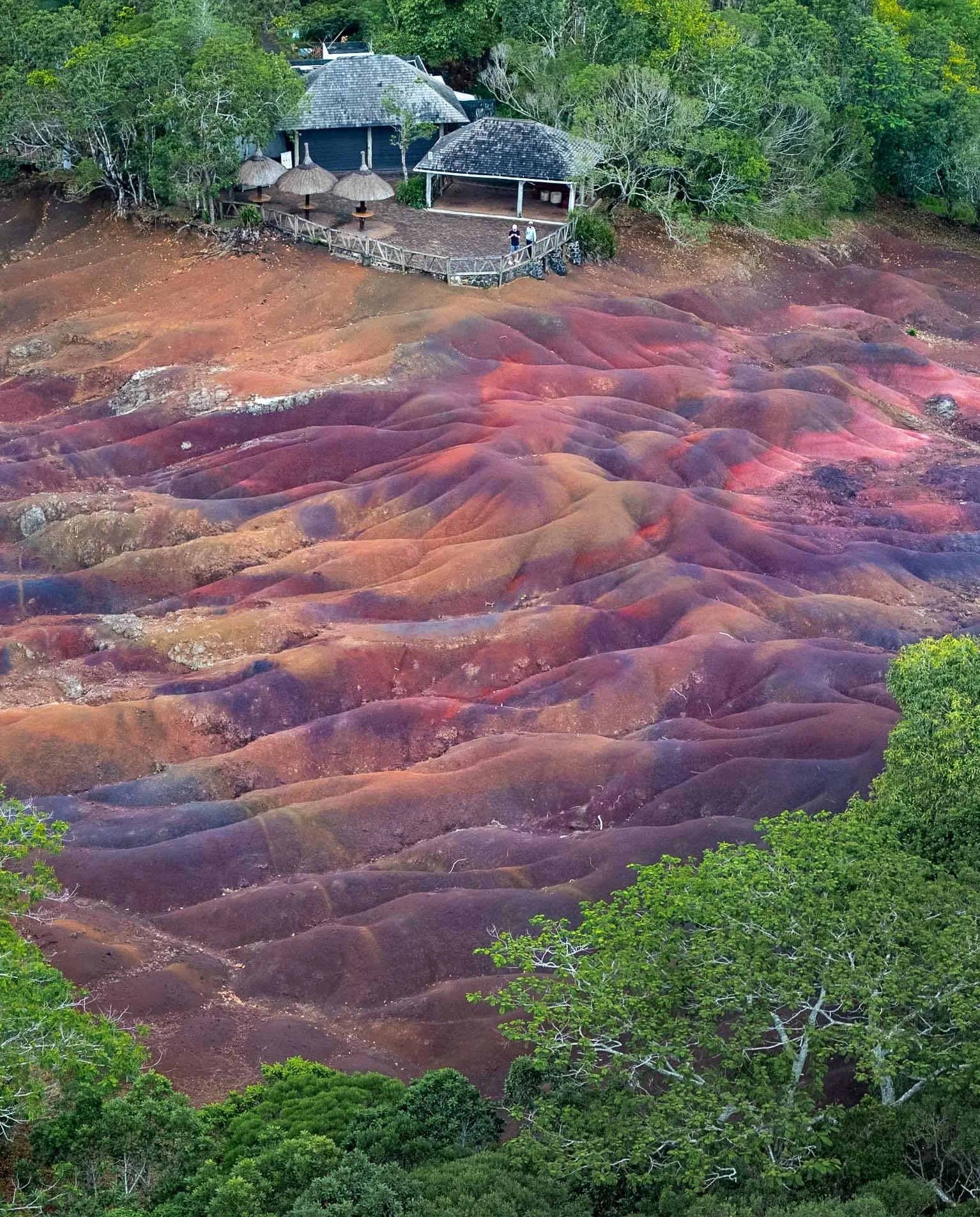
I had pre-arranged to come shortly before official opening hours ended, meaning I had a few moments with no people here. On top of that, the management kindly granted me permission to fly a drone after the park closes, which is normally forbidden (and monitored). Unfortunately by the time everyone was out, heavy rain clouds had moved in and I had about 5 minutes in the air before the rain got too heavy for my drone (or my risk appetite for losing it). It’s a very unique spot in the forest though, worth visiting.


Ocean Giants
I had half a day reserved to try and go out and see what is maybe Mauritius’ most famous animal sight: its resident pod of sperm whales, on the east coast. I was hoping to be able to get some underwater photos of these majestic creatures. It’s a double-edged sword though - the country has recently enacted much stricter laws on swimming with dolphins and whales due to tourist overcrowding, but there is a mix of tour operators that still do it - illegally, or by (allegedly?) having a permit. It does seem like there are regulations allowing people in the water with whales under certain conditions, but there is undoubtedly some “noise” and questionable operators out there.
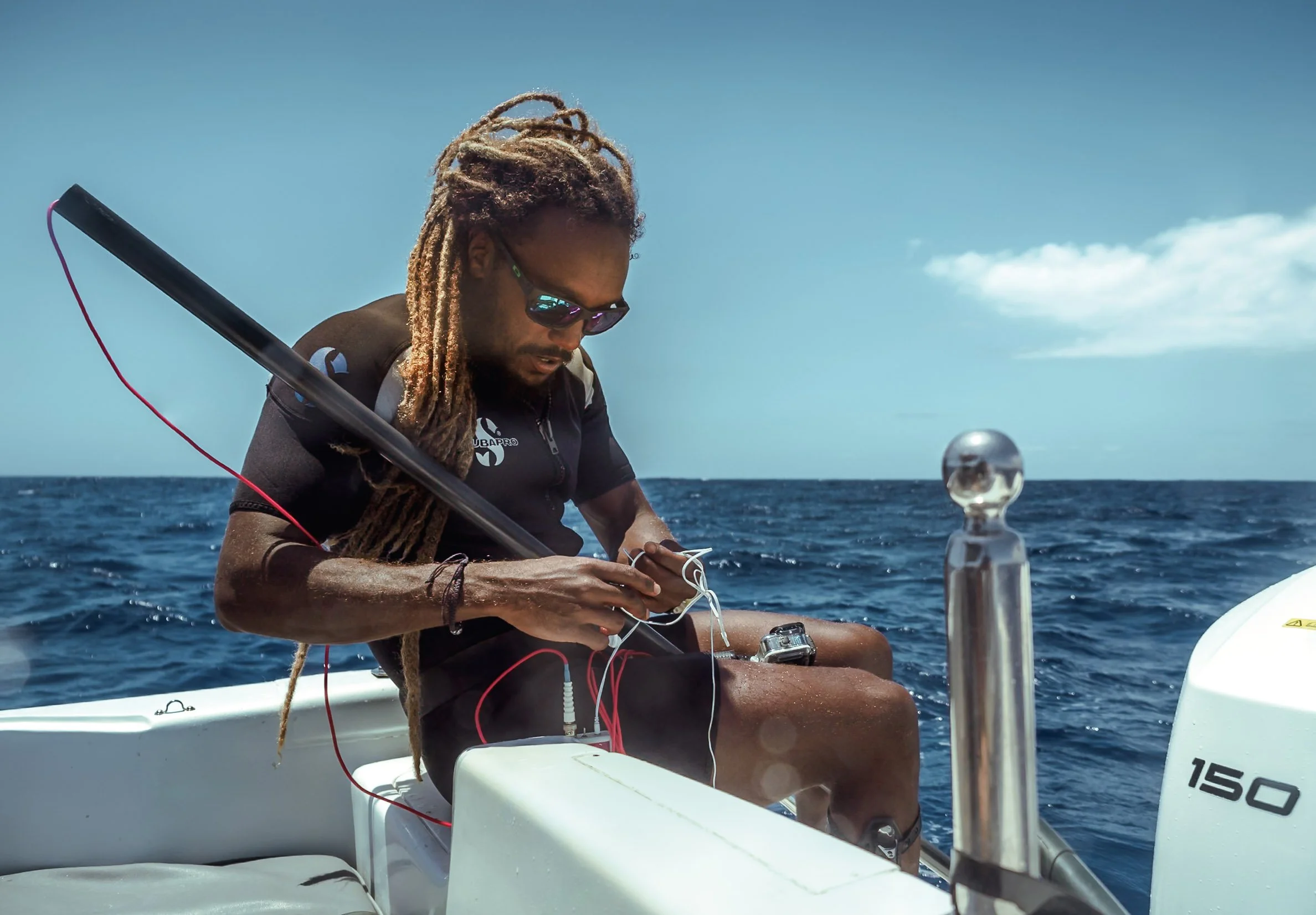
Either way we rented our own boat with a great guide who claims to adhere to the rules, to be able to avoid possible crowds and have more flexibility on timings. The first challenge was the weather - the active cyclone bringing winds and occasional rain with it didn’t exactly create the best conditions for a boat trip into the open sea. After two cancelled attempts, we managed to go out as the winds and waves subsided.
I hoped we’d at least get to see these animals, and my backup plan, if going into the water would have been problematic or unethical, was to try get some photos with the camera in its case held under water from the boat. First, you need to find them though.
For most whales, that means looking for the huge spouts and the associated blow as they exhale and breathe at the surface - this also works with sperm whales. However, they have another feature that makes it possible to find them: Sperm whales use a powerful form of echolocation, emitting loud clicks that bounce off objects for them to form an idea of their surroundings.
Equipped with a hydrophone (a kind of underwater microphone), we hoped to pick up these sounds and find the pod.
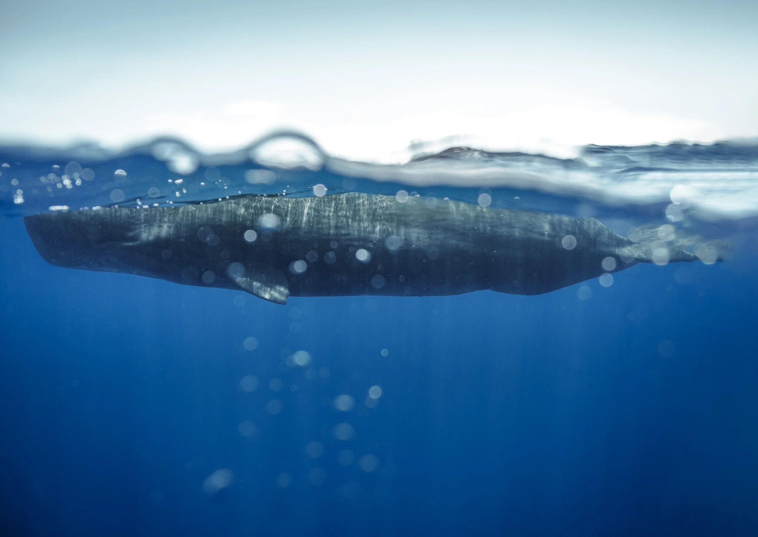
After about an hour at sea, the plan worked - we saw (& heard) them in the distance. We were the only boat, slowly approaching a large whale gently swimming along the surface.
Our captain told us to quietly get in the water as we were a good 30m away from them, and I got my first photo while being minimally invasive to the whale’s behavior.
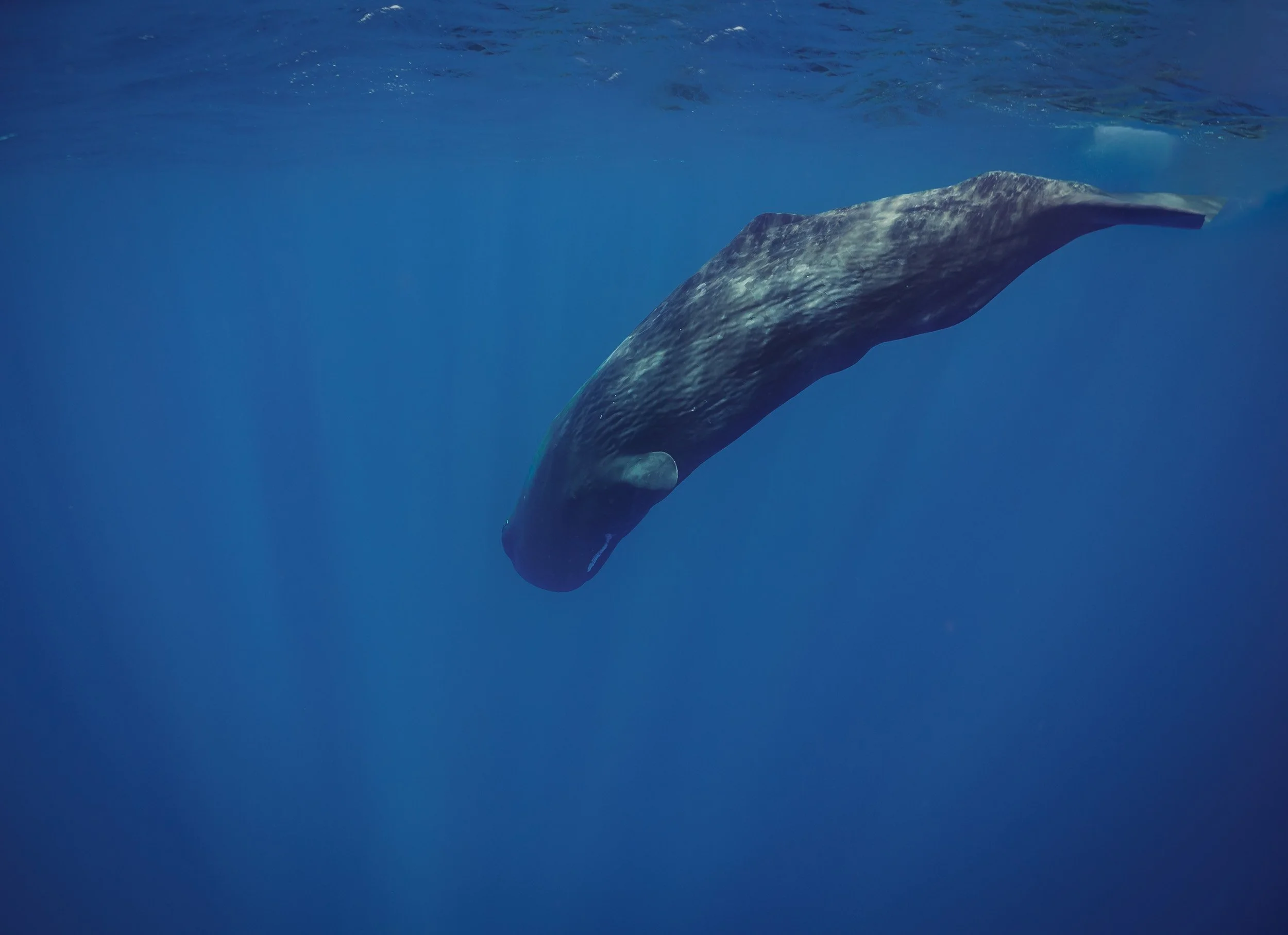
Into the Deep
A few minutes later, the whale started to dive. Sperm whales generally hunt giant squid, often reaching more than 1000m depth and spending 45min or so under water. It is also one of the purposes of their echolocation abilities.
In this photo you can see the white line around their very narrow lower jaw - this is the area where the mouth houses huge teeth, weighing up to 1kg each. As it happens though, it seems they don’t really need or use them for hunting.
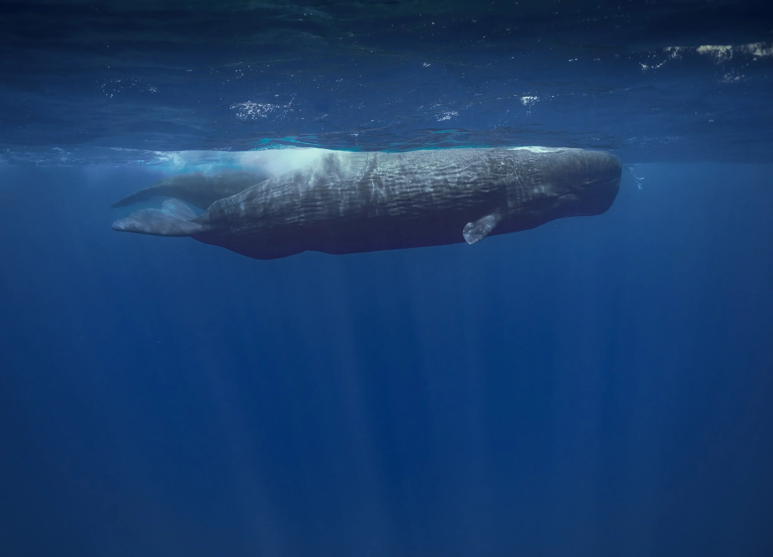
We made our way to another location where a group had been sighted, possible of the same pod. There are just around 50 resident sperm whales in Mauritius, living in a matriarchial society, with migratory groups and males joining them seasonally. They are quite social and intelligent, with the largest brain of any living animal (five times heavier than a human brain), and live up to 70 years.
It was at the point where there were more boats around, and groups of snorkelers jumped into the water in a manner that was way less respectful (and way closer) to the animals than one would hope for.
It gave me the chance to put the size of these whales into perspective - can you see the human legs for scale in this image?
Sperm whales can be up to 16m long and weigh 45 tons, making it the largest toothed predator.
As is often the case with wildlife encounters, there is a fine line between experiencing and documenting these creatures in their natural habitat, but not disturbing them - especially vulnerable species.
Luckily these whales are no longer hunted today - in the past they were sought after for whale oil, as anyone who read Moby Dick will know.

While what I saw here was nothing in comparison to some of the dolphin, whale shark, or manta ray watching tours in many places around the world, it still seems like there needs to be more oversight - I include myself in this problem, although we kept a very reasonable distance, and didn’t cut off their path like some other boats that arrived later.
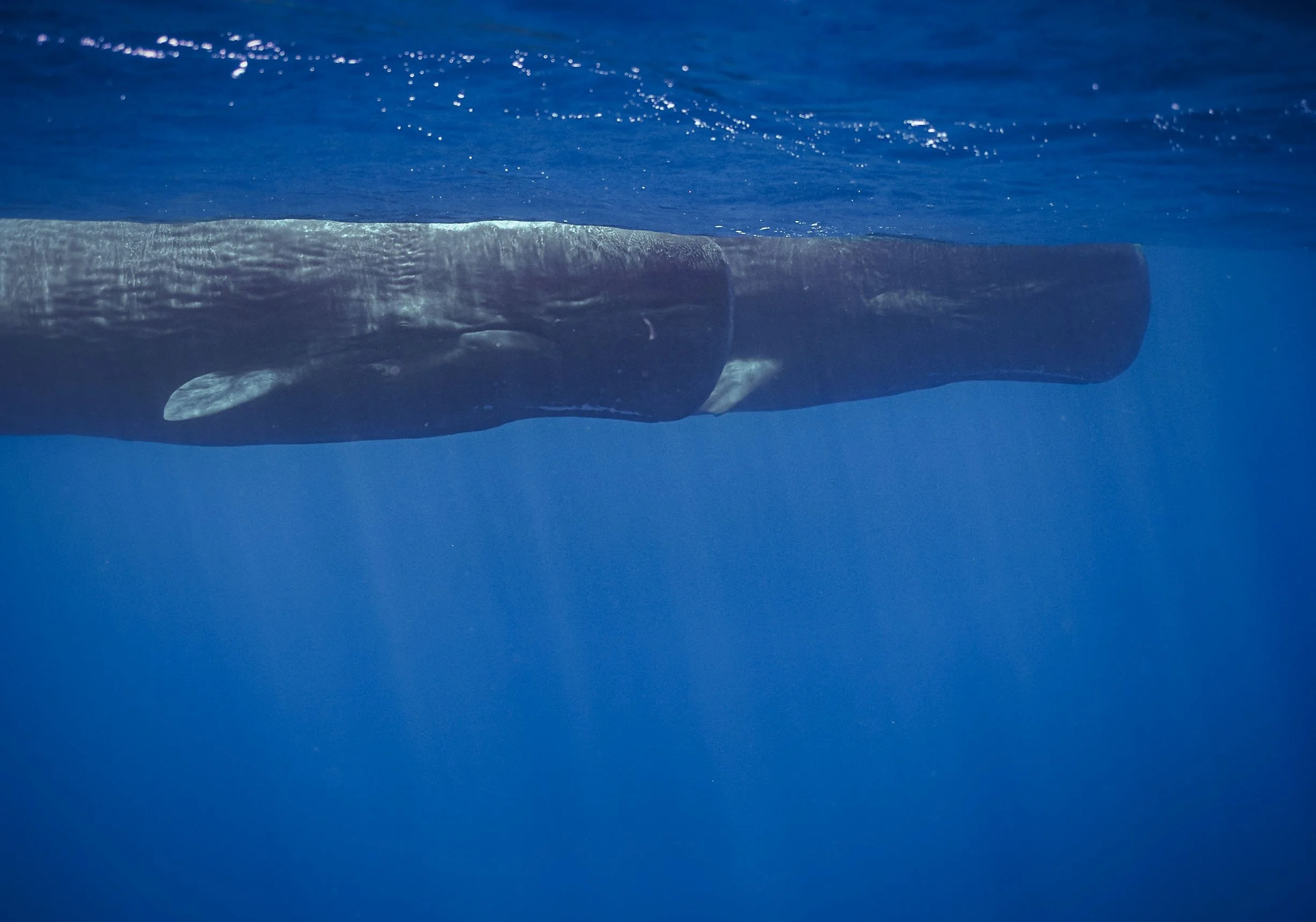
With this in mind, we left these amazing animals behind, saying goodbye to a young one that dove under is, down into the depths of the ocean.
Watch them moving
Take a look at the video to see them gliding through the ocean, and listen closely for the click sounds in some of the clips.


Goodbye ☀️
A much more enjoyable second visit to Mauritius came to an end with a few relaxing days, but I still feel like this island has a lot more to offer - amazing dive sites, the rich cultural history, monuments to the slave routes, including Aapravasi Ghat (its second UNESCO site), one of the oldest horse racecourses in the world, amazing hikes, critically endangered plants, and more.
We shall see if I’m back - or rather, when.
Subscribe to my newsletter to get notified and don’t miss out on more Wonders of the Globe.
Other Recent Posts:

Climbing Kilimanjaro: Africa’s Tallest Mountain
After several visits to Kenya and Tanzania, each time admiring the snow-capped peaks of Kilimanjaro, it was time to get a little closer, and attempt to summit.

Above the Clouds
Kilimanjaro seen during a balloon flight in Amboseli, Kenya
During my previous visits to Tanzania and Kenya, I’ve come pretty close to one of the continent’s most imposing landmarks: Mount Kilimanjaro. Although I’ve never considered myself a hiker, I did see the appeal of the challenge, particularly as Kilimanjaro is considered quite a safe and manageable climb. No difficult technical parts aside from a bit of scrambling, and longer routes with slow ascent, allowing for gentle acclimatization - you still need to make it up to almost 6000m though.
In addition, Kilimanjaro’s unique snow-capped peak topped with a number of (quickly receding) glaciers, the various ecosystems as you make your way up, and its title as the world’s tallest free-standing mountain, make the challenge even more appealing. Plus, I was sure I’d find some interesting photographic opportunities up there.
In late 2024, an opportunity presented itself: I was given the chance to visit Amboseli National Park in the southeast of Kenya again, documenting its amazing elephants and the conservation work of IFAW (more on that coming soon - subscribe!). The trip would take place at the end of May 2025 and bring me close to the border with Tanzania, making it an easy hop to the foot of the mountain. June is also the time when climbing Kilimanjaro becomes feasible again after the rainy months. It was time to make this happen!
Choices
When planning a Kilimanjaro summit, you have a few choices to make before you even start: What time of the year, what time of the month, and what route? The first two questions are not too difficult: Avoid the rainy seasons (although escaping the wetness completely might be impossible), and consider picking a period where you will summit around full moon-ish - the extra light makes it just a little easier to start the summit push at midnight.

The Lemosho Route
Deciding which route to take can be a bit more tricky - there are a few trade offs (discussed extensively online) between difficulty, scenery, crowds, acclimatization, and duration.
All of them take anywhere from 5-9 days and 50-80km total distance - longer in this case is sometimes better, as you will have more time to acclimatize.
From my research, discussions, and now experience, the route you take is ultimately not so decisive, and almost all of them merge closer to the summit anyway.
I picked the Lemosho route because it covers beautiful forests and the large western plateau, is quite long with gentle altitude gains, and is not the most crowded but neither the most remote. Its ascent path is also quite different from the descent, adding another layer of interest.
I’m happy with my choice - if I were to climb again, I’d consider one of the northern routes as they follow a different summit path, and are generally a little less used.
The base for all Kilimanjaro routes is Moshi, a small-ish but decent town that has everything you need for a some days before and after the trek, and is reachable within a couple of hours from the Kenyan border or from Kilimanjaro airport. Arusha airport is also not too far. The town also has plenty of places to rent equipment - depending on your mountaineering aspirations, I’d say don’t bother buying too many things and making your luggage heavier than you need to. Instead, down-jacket, sleeping bag, gaiters, walking sticks, and thick jacket and pants are things you can consider renting instead. There are plenty of packing lists available online, and they all say more or less the same thing, and I have not much more to add to them from my experience - importantly, consider taking around 40,000 mAh of extra battery capacity if you want to charge phone (Airplane mode), camera, AirPods and flashlight throughout the trip. A solar pack (which I didn’t take) can help.

I opted for a solo-trek - as in, no other hikers with me, but of course you still have a crew - and met Paul, my guide, for a short briefing the day before. We agreed an early morning pickup time, and would stop on the way to rent what I still needed and buy a few snacks for the hike, mainly some nuts and chocolate. The drive to the starting point is around 3-4h - that is indeed a downside of the Lemosho route, as it starts on the western side of the mountain, rather than the southern edge where Moshi is located. You’ll get to take a few more looks at the cloud covered peak before you start the climb.

After a while we reached the lower slopes of the mountains, also called the cultivation zone, where agriculture is still permitted, in addition to forest department managing wood collection. This area is occupied by the Chagga people, the historic population around the region that has heavily relied on the fertile soil of the volcano, and does so until today.
Our little van was filled with the team and our equipment: A typical 8 day Kilimanjaro climb comes with a guide, a chef, a camp helper, and several porters to carry tents, food, and equipment.
We reached the starting point of the Lemosho route shortly after, where everyone registers and organizes themselves. It can appear quite busy here - and the same is true for some of the camps as you make your way up - but ultimately I didn’t feel like the hike was crowded . Yes, it’s a touristic place and you will rarely be completely alone (although it does happen - more on that below), but for the most part I didn’t experience it too negatively.

Day 1
Starting point: 2100m
Elevation gain: 472m
Camp altitude: 2650m
Total hiking distance: 6.09km
Total hiking hours: 1h 54min
Vegetation zone: Montane Forest
I tracked this with my Apple Watch Ultra on low power mode, which reduces accuracy a bit.

The Before!
A quick lunch, and one last photo at the gate - which also tells you the distance and estimated walking hours to the upcoming camps until the summit - and we were off into the forest.


This was a relatively short hike on a decent path, with the exception of a few muddy bits, crossing through beautiful thick rainforest and a few lush valleys around the streams that make their way down from the mountain.


We also ran into some flora and fauna, including the indigenous so-called elephant flower, its shape resembling a trunk, and a curious blue monkey. Kilimanjaro is home to a lot of wildlife including mongoose, hyrax, and even leopard, but it is rare to spot most of the species around the hiking routes.


By the time I arrived at camp, my crew had already set up the tent and prepared some tea - luxury life on Kilimanjaro! They knew I was keen to take some photos, too, and so we found a nice spot at the edge of the camp area, away from some larger groups.

Dinner shortly after also gave me the first chance to get to know the crew a little more while they enjoyed their Ugali - Tanzania's national dish, a staple food made from maize flour. Christian, the chef, had a surprising variety of dishes for me in store - more on that later...

Day 2
Elevation gain : 995m
Camp altitude: 3610m
Total hiking distance: 9.92km
Total hiking hours: 4h 13min
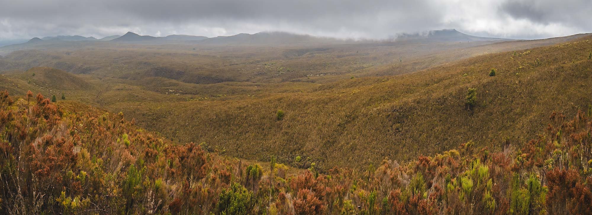
Vegetation zone: Moorland
We began the hike in the early morning through the forest, but soon approached a zone with a lot less trees, and most plants being around human height at most.


With almost 1000m elevation gain, this day was lot more work than the first day, but still manageable. Despite the clouds rolling in, we got beautiful views over the large plateau on the western side of the peak.
After a good 4 hours we arrived at Shira 1 camp after midday, making our way through the muddy moor lands towards the end, when a few rain drops caught us as well. The camps are mostly situated by the rivers, serving as a source of fresh water for cooking, basic cleaning, and drinking.


Drying stuff is a constant challenge on the mountain, whether the root cause is sweat, rain, dirt, or humidity in the tent. Use all the sunny hours you can get, and have enough backups and separate bags to keep your things organized.
A panoramic view of Sihra 1 camp - once again, we had our own little spot, across the river and away from the bigger groups. This camp is in some ways an optional one: despite the altitude gain, the hike to reach it is relatively short. This allows you to skip it and continue to Shira 2 directly, which is at roughly the same altitude, cutting the Lemosho route to 7 days.


Pole Pole
I was in no rush. Pole, pole as they say in Swahili, meaning slowly, is something you will hear a lot on the mountain. Going slowly but consistently is your best bet to make it to the top.
At the same time, the extra time gave me more chances for clear nights such as this one: the first time we got to see the peak since the start of the hike still quite a distance away. Although the moon was out, even the Milky Way made a faint appearance above my tent.
As mentioned, Day 3 is in theory a little shorter, and some people combine it with Day 2 - I didn’t do that, which had another benefit: we had the opportunity to take a small detour to another peak on the plateau. That helped with additional acclimatization, but also included a few beautiful landscapes, and best of all, no other people at all for almost the entire hike.

Day 3
Elevation gain : 522m
Camp altitude: 3850m
Total hiking distance: 11.26km
Total hiking hours: 3h 41min
Vegetation zone: Moorland
We passed the remnants of an animal you rarely see on the slopes of the mountain (luckily if you ask me) before being engulfed by the clouds in the ever-changing conditions. Kilimanjaro is so big it has its own local weather system, influenced by the proximity to the equator and its height. Conditions change really quickly, and a single day can include everything from dry hot sun, thick clouds, foggy humidity, strong winds, heavy rains, frosty nights, and even snow.


Our detour had the goal to reach Cathedral Point at 3872m, and lead us through an area of bushes and smaller trees covered in beautiful lichens. Kilimanjaro is home to several species, including some native ones. They can be found at an altitude of more than 4000m, where very little other vegetation exists.


Beautiful canyons and moss colors were all around as we made our way through the area. Shira plateau shows the remains of an ancient caldera, one of the three that make up the mountain system here (Kibo being the name of the primary one).


Arriving at the peak of foggy Cathedral Point - we didn’t get the nice view into the valley one seemingly can experience here, but the fog and clouds created a special outer-worldly atmosphere instead.


One of my favorite places on the mountain. A great detour for the 8 day Lemosho route, recommended.
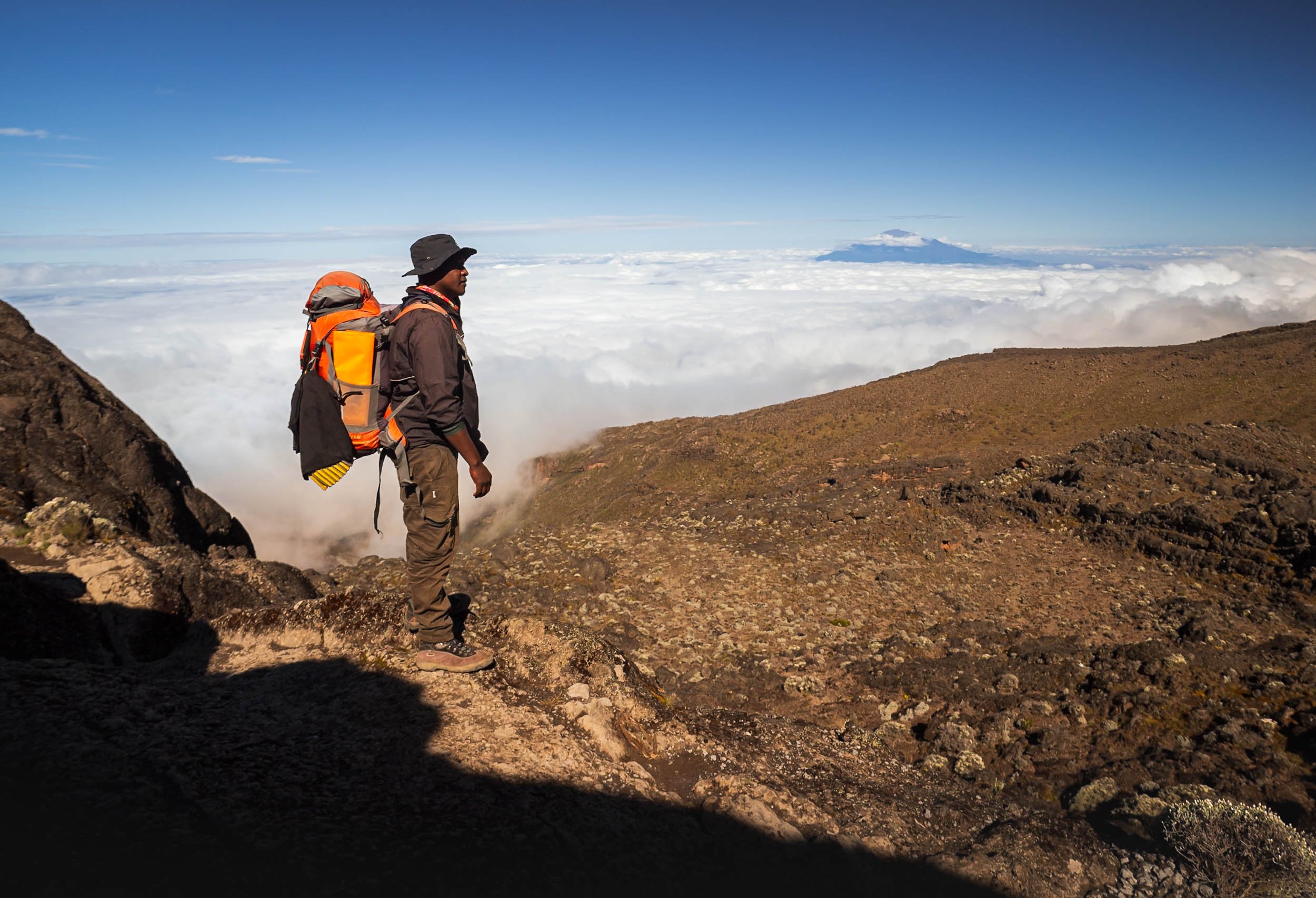
On the way back down and towards Shira 2 camp we passed some of the last signs of civilization on the mountain - a helicopter landing spot and a 4x4 road used for emergency evacuation and day-excursions to Cathedral peak. This time Paul posed for me knowingly, otherwise I mostly used him to create some human context in my photos without his knowledge - the orange backpack made a perfect colour contrast. You’ll see a lot more of it…


Day 4
Elevation gain : 939m
Camp altitude: 3900m
Total hiking distance: 15.29km
Total hiking hours: 6h 36min
Vegetation zone: Alpine Desert & Moorland
This was the first day where temperatures at night approached freezing, and my tent reflected that in the morning. It had cleared up again though, giving us another glimpse at the peak in the distance.
In the other direction, a few cloud layers got stuck in the mountain ranges, and we got a glimpse at Mount Meru, 70lkm to the west, standing at 4,566m tall.


But our path continued eastwards, and it would be the longest hiking day of the trip. That however, was a choice I made with Paul. After the enjoyable detour on Day 3, he proposed another opportunity to improve my acclimatization… luckily the team was still in a good mood, as we got closer and closer to the peak.


Lava Tower
We first had to reach a place called Lava Tower, at 4600m elevation. This rock formation is about 50m tall and over 150,000 years old, created as the result of a volcanic vent.
There’s a water source not far from the tower, so we stopped here for lunch with some other groups. To the right, we have Mr. Gangster, as he introduced himself - one of our porters and always happy when it was time for a meal.


It was a special lunch indeed! The backstory? In the van on our way to Lemosho gate, chef Christian asked me what my favorite food was. I told him that he’d struggle to cook that on the mountain, but answered “Pizza” anyway. Well, I underestimated him. He somehow managed to make something that was Pizza-adjacent with his little gas cooker, and whatever ingredients he brought with him for our 8 day journey! It was not bad at all, and he was rightfully proud.


After lunch, Paul and I left Lava Tower and followed a different path than everyone else: He decided it would be good to try and reach Arrow Camp, a site that once offered a different path to the summit, which closed a few years ago due to frequent rock slides. It meant another 300m ascent, reaching almost 5000m altitude. We made our way through the fine volcanic ash and sand that accumulated in this area. I’m not a geologist (very far from it sadly) but this part seemed to have interesting remnants of lava flow structures, and quite a few Obsidian rock fragments scattered around (some of which may or may not have made their way into my pocket).


From here, it is only another 6-7 hours to the peak, but it was hazardous route. The camp is named after the Arrow Glacier, itself named after its shaped, or rather, its past shape. The glacier has now all but disappeared, with only a few snowy remnants left. The entire ice cap of Kilimanjaro is rapidly shrinking, with over 80% lost in the 20th century alone.

Going up this far also meant we had to make it back down, as our next destination, Baranco Camp, was almost a full 1000m lower.
Altitude sickness is the most common reason people need to stop their hike and don’t reach the summit, and a slow ascent with the principle of “climb high, sleep low” is one of the best ways to avoid this issue.
The Giant Groundsel
But the way down brought us to an area I had been looking forward to see since I first researched the climb: a river valley that is home to Kilimanjaro’s most unique plants, called Dendrosenecio kilimanjari, a type of Giant Groundsel. Why are they special? Look at these photos…


Have you ever seen a tree or plant like this? Although they look like a cross between pineapple and cactus, they are members of the sunflower family (yes, really), and only grow in the mountain areas of east Africa, usually in the alpine zone and in proximity to water. One such area is Baranco Camp, our next stop.

While there are different species, this particular one is endemic to the mountain, and cannot be found anywhere else. Many grow to 5 meters and more, at only a few centimetres per year, meaning some of these plants are 100+ years old.
Once more, the crew set up my tent at a perfect spot, which was great, because I had some plans for the night! I was hoping for the fog and clouds to clear…


… so that I could get up around 4am after the moon had set, and capture these photos! My goal for the trip was to make it to the summit, but a second hope I had was to be able to have chance at photographing some Giant Groundsel under clear skies at night. Mission accomplished.


At this altitude, the most common animal you will encounter is the white-necked raven, often using the campsites to scout for sources of food, such as here at sunrise.
I did spot a four striped mouse around my tent as well one day, but it luckily didn’t find the way inside.

Day 5
Elevation gain : 430m
Camp altitude: 3995m
Total hiking distance: 6.50km
Total hiking hours: 3h 30min
Vegetation zone: Alpine Desert
Admittedly, I was not sure if I’d regret my nightly escapades in the freezing cold (I was only out for about 30min) the next morning, because one of the toughest parts of the climb laid ahead - the Baranco Wall, formed when Kilimanjaro went dormant around 150,000 years ago. In fact, it’s just a rather steep ridge of around 250m with a very narrow zig-zag path, that requires a single file approach - this makes it one of the busier spots on the mountain for sure.
The good news was that after you pass the wall, things would become a lot flatter, as the next camp was almost at the same altitude we started from. While feared, the ascent of the wall is ultimately not difficult or dangerous - there is some scrambling involved (long legs help), and a few very tight passages, but it is manageable. And your’e rewarded with some beautiful views of the Giant Groundsel gardens below - maybe the most special place here.


Beautiful views also await at the plateau on the top - you’re generally above the cloud layer at this point, so if it’s not foggy, Mount Meru will peak out above the clouds in the distance again.
At this altitude, you will find fewer and fewer plants in the area - the everlasting flowers on the left are an exception. These dry flowers can bloom all year round at up to 5000m.


All in all a relatively short day of less than 4h hiking, but it starts with a step ascent, and ends with one too. Not gaining much net altitude does feel a little frustrating after all the ups and downs, but in the end it all helps to prepare for the final summit (is that a metaphor for life?)

Karanga Camp
We arrived at our next destination in the early afternoon, and the rain hit hard shortly after. It cleared around evening, making for an interesting sunset atmosphere at camp.

Day 6
Elevation gain: 576m
Camp altitude: 4673m
Total hiking distance: 4.23km
Total hiking hours: 2h 45min
Vegetation zone: Alpine Desert
A rainbow woke us up this morning, which some would deem as a good omen - let me tell you, in terms of weather, it was not.

Today would take us to Barafu basecamp, from where you make the summit attempt just after midnight. It’s a relatively short day, which makes sense considering you will only sleep for a few hours until 11pm or so after you get to camp.
The peak is getting closer, and was still visible when we started…
… but that would change rapidly, as heavy winds of 50+ km/h started to blow down the mountain, while it began to rain at the same time. It’s generally relatively ok to deal with either: a windbreaker, or a poncho respectively, help. But the combination of your poncho getting blown in all kinds of directions, and the wind forcing the rain into every little opening of your clothing for 2 hours, makes for a less enjoyable experience. I took these two photos and then saved my camera from being drenched more than necessary.


All in all, this became the most miserable day of the journey, and the afternoon was spent trying to somehow use the gas burner fire to dry the most important pieces of clothing that would be needed again for the midnight summit attempt - no backups for gloves and shoes, and trying to reach the freezing peak with either of them in a wet state was a non-starter.

By the time dinner was on the agenda, the rain, which had temporarily turned into a snowy hail-like form, gradually faded, however the winds did not, and neither did the clouds on the summit. This was not looking promising - an ascent in heavy wind and low visibility was not really my preference, let alone the fact it would reduce any photographic opportunities at the peak and crater area to a minimum. At least the equipment was dry. Maybe things would look better after the four hours of sleep I was hoping to get before waking up and getting ready for the midnight start. As I went to bed, the tent was still shaking vigorously in the wind.

Day 7 - Summit Night & Descent
Elevation gain: 1190m
Camp altitude: 5895 peak to 3100m after summit
Total hiking distance: 10.58km to the peak + 10.81km down from basecamp
Total hiking hours: 9h 38min + 3h 14min
Vegetation zone: Arctic Zone to Moorland
As I got up after a few hours of not-so-deep sleep I heard the familiar rattling of the tent sheets: the wind hadn’t subsided much, but at least it was almost clear outside. The temperature had fallen and the air felt even colder due to the wind, so we expected -10C at the peak before sunrise. That is, if I’d make it to the summit! So far things had been very manageable, even approaching 5000m at Arrow camp was not am major issue: no symptoms of Altitude sickness, and my heart rate also barely scratched 150bpm.

But summit night is a little more tricky: starting at midnight and a total hike of almost 10h, up 1200m elevation in the first 7 hours taking you to the summit, it’s nonstop elevation gain, no level ground or downward slope to be seen. Oxygen levels at the summit would be less than half of what your body gets at sea level.
The moon was shining brightly though, making it almost possible to walk without headlamps - much more comfortable than during a really dark night I imagine.

Stella Point
We reached the first milestone at 5,756 meters, named after the first women who made it this far in 1925, about 45min before sunrise.
It’s not the end yet, but the last 1h or so before this point were the toughest - physically and mentally. It’s not a given to make it - during my ascent, I noticed a few people who had to give up here, and some that needed support to make it back down again.
It felt like the switchbacks on the way up would never end anymore, but once you see the golden glow in the distance and get to take some photos to distract yourself, everything becomes just a little more relaxed.
The path here leads to Gilman’s Point. Climbers coming from the northern routes pass it on their way to the summit, which lies in the opposite direction of the path, less than an hour walk away now.
To the Peak
I knew that the toughest part was done, but we still had to make it to the highest point - Uhuru Peak. Another 200m in altitude to go, but it is a gentle slope along the Kibo crater. You get beautiful views of the glaciers and the landscape below, and also a glimpse at the second highest peak of the mountain, the jagged walls of Mawenzi, in the distance.


Around half-way, the sun came up in the distance, illuminating the edges of the crater we were walking along. At this point, the wind had subsided, and the rays slowly warmed my fingers and cheeks. At the same time, you need to be careful as the sun gets intense very quickly, and much more so at this altitude than at lower levels.


The destination was close now - Uhuru peak is just behind the right rocky area in the image. On the left side, Mawenzi peak casts a triangular shadow into the distance.
The remaining smaller glaciers on the southern side of Kilimanjaro feature some incredible structures.


Peak Happiness!
Reaching Uhuru Peak - the Swahili word for “freedom. The name was adopted in 1961 when today’s Tanzania gained independence.
We took it slow for the last few hundred meters, enjoying the views - my final summit time was just before 7:00am. It was quiet at the peak: around 40,000 people attempt the summit each year, and the success rates are around 60-70% depending on the route. That makes around 100 people at the peak daily if you consider that most summits happen outside of rainy season - of course those are spread out over 4-5h in the morning. Just a few people were joining me at the peak during the 30 minutes we spent up here.
The first (recorded European) climb to this spot took place in 1889, while the fastest summit was in 2014 in a ridiculous time of 4h and 56min, which puts any feeling of accomplishment into perspective. Humans are crazy.
It’s easy to forget sometimes, but the panorama below shows most of the “flat” Kilimanjaro peak - it’s not just a small tip. The snowy hill to the left covers the Reusch Ash pit, a central hole of more than 100m in diameter that still emits faint sulfurous vapors. The last eruption of the volcano is estimated to have happened more than 350,000 years ago.

Visiting the pit takes another 4-5h from the peak, and in the current conditions would likely require snow shoes, so we did not make our way down into this area. Seeing it would be one of the reasons I might consider doing this climb again at some point.
To the very left of the panorama can see the northern ice fields, holding a cluster of large glaciers. It’s these ones you see in the famous “typical” Kilimanjaro photos from the northern side - as they say (and I feel I can confirm) “Tanzania has the mountain, but Kenya has the view”. It’s true that the perspective from Amboseli of the iconic flat top shape of the mountain with the white snowy tip is always the one used on any Kilimanjaro merchandise or marketing material.

Snow Patterns Close Up
On both the southern and northern side, the retreat of the ice field has been extreme, even satellite images from 20 years ago show a huge difference. It is estimated that by the middle of the century, the glaciers on the mountain will have completely disappeared.

The Way Down
We started our descent next, and it’s almost a little annoying that the feeling of triumph has to make way to the slightly irritating task of losing all this altitude again for the next 3 hours: your knees and ankles will not be happy at all.

Basecamp was in sight again, but we’d only spend an hour here to pack up, have some breakfast, and then continue our way down. The faster you descend, the less likely altitude sickness will catch up on you. There are two camps on the way down, and our goal was to make it all the way down to the lower one at 3100m.
While I survived the summit and celebrated with a tiny coke that I brought all the way up here, my shoes did not quite make it in the same cheerful state - but luckily still held up until the end.


If your physical state is closer to how my shoe looked like, then this is how they will bring you down to the nearest accessible helicopter landing spot - in the past, they used these carts to bring people all the way to the bottom.
There is also another variant that was used to bring down the bodies of people who passed away while trying to summit - luckily that has not happened in years, and with better emergency services, the mountain is now a very safe one.
The way down leads through an area that was recently affected by wildfires causes by human activities, leaving a huge trail of burnt trees behind. Fires have unfortunately been common in the National Park, with an incident happening almost every year.


We continued our descent through the ecosystems, finally arriving at Mweka camp near the beginning of the rain forest, at an altitude of 3100m. This was going to be our last night on the mountain!


Day 8
Total hiking distance: 9.48km
Total hiking hours: 3h 06min
Vegetation zone: Moorland & Montane Forest
Our last day led us through the beautiful rainforest zone again, this time on the southern slopes.


The forest here is incredibly beautiful, and worth a hike on its own if you don’t want to make it further up the mountain. It’s in this area where Africa’s tallest known tree was discovered in 2016, measuring over 80m and almost 500 years old.


The last bit of the path ends in a 4x4 road that is used for emergency purposes, and makes its way to Mweka Gate - the exit.

Arrived!
The final sign board at the exit, where I received my summit certificate and our van would pick us up and take us back to Moshi.

Time to Clean
It was time to clean. My shoes, my clothes, my bag, my camera, myself. 8 days without a shower take their toll.
Some Final Thoughts
On the last night in my tent, I wanted to write down what it was like, on the one hand to record it for a few people who asked me, and also to process it myself. So here goes, sorry for all the text, which is probably slightly repetitive. I’d summarise my experience in three areas:

The Emotional Part
A main concern I had was to be offline for so long, because I like to keep up with the world (for example, i subscribe to a few geopolitics and economics newsletters) and especially read a lot on technology (missed Apple’s WWDC for example). Secondly, I travel alone a lot, and (mainly) WhatsApp becomes a primary aspect of social interaction in those cases. This trip was also a solo expedition, and thus my connectivity-deprived socialising was limited to the interaction with my guide, and the occasional chats with the rest of the team helping one to conquer the mountain: learning some Swahili at dinner, or figuring out why one of them is called Gangster. Having a great team makes a difference!
I’m definitely not unhappy I didn’t do this trip in a group though: too many times did we pass teams that stopped because one person suffered one of an assortment of small problems, or encountered people being overly vocal or just constantly feeling the need to chit-chat or even play music while hiking, or witnessed discussions on what speed was the appropriate average for everyone. No thanks, I prefer my own rhythm, connection to the environment, and introvert downtime (I read Gambling Man during the trip, a biography about Masayoshi Son, the legendary SoftBank founder).
Having said all that, I’ve been offline for a few days before, but not 8 days. Funnily enough, knowing in advance and accepting it (and telling the people for whom it might matter) made it less of a factor - indeed so much so that I successfully resolved to ignore the unexpected appearance of a data connection in one or two spots, and the satellite WiFi they’re setting up in some of the lower camps (I don’t know if it works). FOMO - beaten! Getting back to reality of course requires some catching up regardless.
The Mental Part
The mental challenge to push yourself through the effort of climbing this mountain wasn’t - in my case at least - so much rooted in the difficulty of the hike. This was maybe because I felt physically quite able (see next section) and aside from summit day didn’t have to push extremely hard on any of the previous stages to make it to the destination for that portion of the climb.
Summit night (day 6/7) was different though indeed - it’s the anticipation of the highest altitude gain required on the trip (over 1200m), reaching almost 6000m where oxygen intake is half compared to sea level, the midnight start, the freezing temperature, and in my specific case, the intense wind and icey rain on the preceding afternoon, and not knowing whether those conditions would improve (or worsen) as you make your way up. Accepting all this, you’re just setting one foot in front of the other at this point, and finding some comfort in the fact that this routine takes you closer and closer to the goal. After over 4 hours of endless uphill hiking, you know the goal is close, but the remaining 1 hour up to the pre-summit milestone did require some mental grit to conquer - battling the endless switchbacks and non-stop elevation gain during that period was the most difficult moment of the entire journey.
Aside from the summit push, what was almost more taxing for me than the hikes was the general discomfort that comes with 8 days of sleeping in a tent on a mostly cold, often rainy and foggy, and very tall mountain: it’s less the absence of luxuries (like taking a shower, using a proper bathroom, sleeping in a normal bed, or picking what food you like that day), but more the fact that your stuff is effectively constantly wet or dirty (or worse, both): tent, shoes, socks, hat, toiletries, you name it, and there is hardly anything you can do to fix it or avoid it in the first place. I’m not a mountaineer by any stretch of the term, so maybe there are ways to manage it a little better than I did, but I found this almost more of an irritant on a daily basis than anything else. I brought a large-ish towel to help with some basic hygiene, and after a sweaty first day where I drenched it in a bit of water to clean, it literally stayed wet for the next 6 days. It makes you look forward to leave the tent behind and start walking.

The Physical Part
I consider myself reasonable fit, going to the (sometimes home-) gym two or three times a week, running 5 or 10km from time to time, and generally being active. I also walk a lot on most city travel for example, 15-20km per day are not unusual. Combined with the fact that Kilimanjaro isn’t considered a technically difficult climb, but rather a long strenuous hike, I felt confident, even though I didn’t specifically train for this adventure. An unknown was the altitude: I’ve been at 5000m + in the Himalayas on my snow leopard trip for example, but barely walked a few kilometres. Luckily, I didn’t have any signs of altitude sickness, and the long acclimatisation ups and downs of the 8-day Lemosho route help in this regard (as did our detours, I presume). We also didn’t look to finish the daily stretches quickly (pole pole!) and nevertheless were usually among the fastest third or so (especially compared to the groups) from what I observed. My heart rate never rose above 150 and usually stayed in the 120-140 zone 2 range during all hikes, with a decently low resting heart rate below 90, and blood oxygen never dropping below 90%. One of my struggles was surprisingly not breathing or legs, but the shoulders and back from carrying the weight of the backpack while mostly adopting a slightly hunched position as you ascend. In my case, that meant around 7-10kg, with 2L of water plus camera and two lenses making up the bulk of that.
The summit day was a slightly tougher story, I definitely felt exhausted once I fell back into my tent with various painful body parts, but it was still manageable. The way down wasn’t that much fun, perhaps unsurprisingly I arrived at the exit gate with a few blisters on my toes from spending 25km on a declining slope during the last 2 days. All in all, for someone of good health this is definitely doable. It’s not to be underestimated and you should have a good understanding of your fitness, the level of grit you can conjure, and how disciplined you are in the face of adversity. If you’ve never hiked at this altitude, you might need to push yourself beyond your known limits.
All in All…
Would I do this a second time? Probably not, but I can’t rule it out. I’m not a huge fan of hiking for hiking’s sake. If it comes with an interesting challenge (or more than one) and the opportunity to take some unique-ish photos, I’m always up for trying things though - and who knows, there are other interesting routes on Kilimanjaro, and the ash pit is also a place worth seeing... If this was a 3-4 day trip I might be more inclined, but it’s just a lot of overall sacrifice otherwise. So, I’m very happy to have stood on the top of Africa, but for now it will probably be the only time. There are other mountains to climb out there, literally and metaphorically.
Subscribe to my newsletter to get notified and don’t miss out on more Wonders of the Globe.
Other Recent Posts:

🐘 An Award for Craig
I was lucky enough to win the Pexels “Wild World” award recently with an image of Craig, and will be visiting the Amboseli National Park again in 2025!
One of my favorite wildlife experiences ever was observing the elephant herds of the Amboseli and Tsavo ecosystem in the south of Kenya - to read about my time in the country, check the blog!
This region is a special place to see these magnificent animals for a few reasons, not the least of which is the presence of the so-called Super Tuskers: Elephants with tusks weighing more than 100 pounds each, often taking 50 years or more to grow until they literally scrape the floor.

Craig
The king of them all is Craig, the elephant with the largest tusks in Africa. In his 50s, he has seen it all, a large, gentle, imposing bull, with slightly withered skin and tusks that have scraped more than a few trees in their lifetime.
There are just over 20 or so of these Super Tuskers left on earth, split between the Kruger National Park in South Africa, and this area of Kenya. Poaching, human wildlife conflict, and age has been a challenge over the last decades, although the local population is now more sensitive than ever to their plight, and rangers and park officials have increased efforts to keep them safe.

When I saw that Pexels was looking for photos to celebrate our wild world in collaboration with the International Fund for Animal Welfare as part of their 2024 global competition, I thought that Craig would make a pretty good subject, and submitted my favourite photo of him.

Side profile of Craig - the winning photo.
It seems to have been a good choice, because a few weeks ago, I got an E-Mail telling me I had won the competition! And I can’t deny, the price for the competition was kind of the reason I signed up in the first place: A trip back to Amboseli! Sometimes things come full circle and I can’t wait to visit again in the summer of 2025.
Watch the video to hear the story behind the photo and see some behind the scenes clips!

The Matriarch
The dried-up lake bed of Lake Amboseli also witnesses a regular ritual for large elephant families lead by the matriarch. In the mornings, they cross from the forest areas on one side towards the swamp lands on the other, in search of water. With a little bit of patience, you can photograph their amazing formations as they walk in line and, if you’re brave enough, you might be able to do so from the ground for that extra special perspective. To witness the behaviour of these magnificent creatures and how it reflects their social ties and emotions is an eye-opening experience with a lasting impact. Their plight for survival in a world that continues to hunt them for ivory is a topic that deserves more attention.

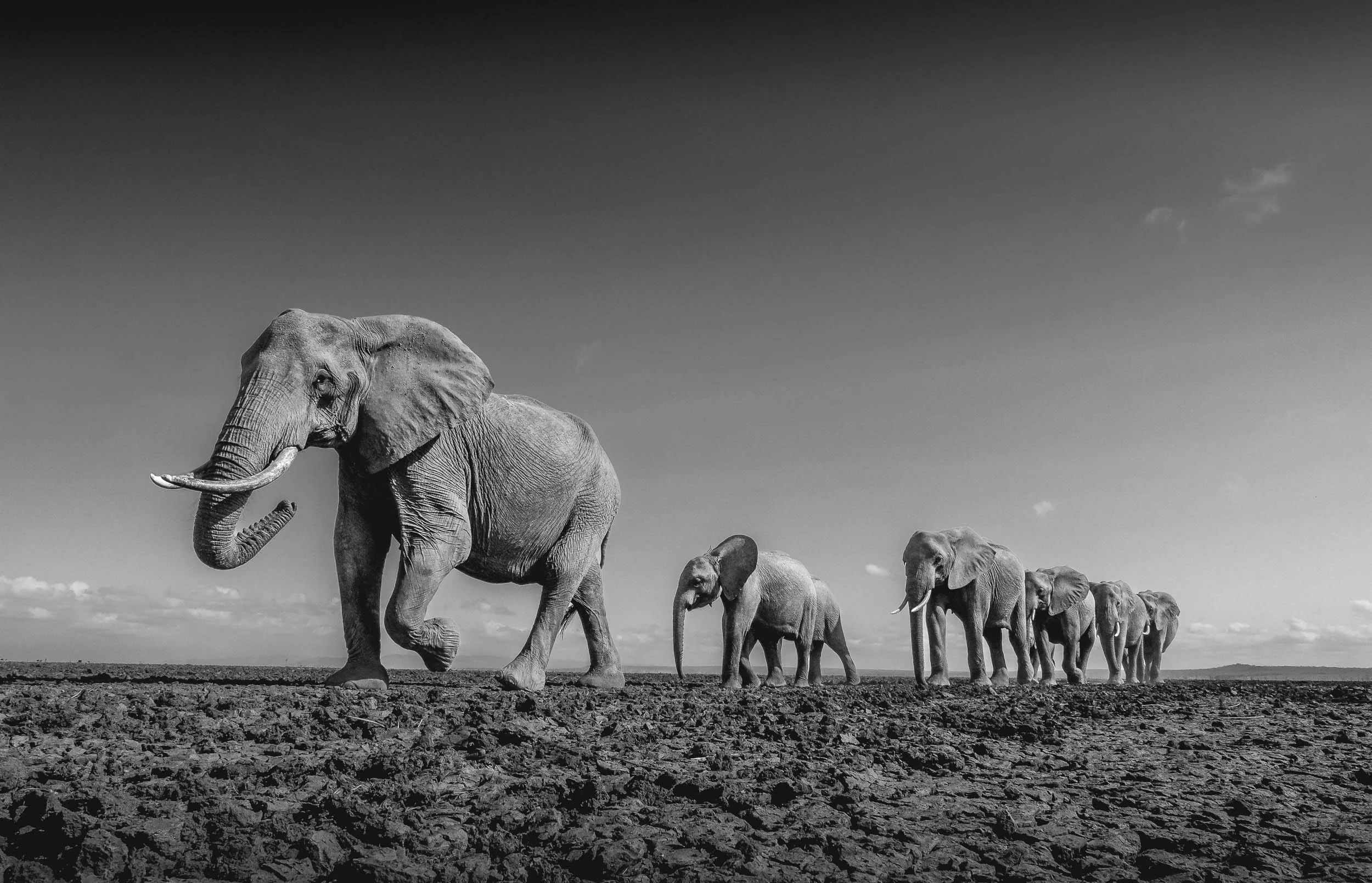


Draught is a major issue for the animals in this area: every year, dozens of elephants don’t make it through the dry season, as they need in excess of 100L of water per day, and a large bull can drink over 200L in a day.

For the winning trip, I am currently working with IFAW and Pexels on a plan to document the work of their rangers and conservationists, hopefully highlighting the amazing work they do to support the wildlife and create sustainable community engagement in the region.


Despite the challenges, the area boasts Kenya’s largest elephant population: more than 15,000 individuals call the Tsavo / Amboseli ecosystem home.

Craig blowing dust in the air as he walks past Africa’s tallest mountain (and the tallest free-standing mountain in the world), the mighty Kilimanjaro. The ice glacier on the tallest peak has gradually receded, and is now less than 2 sqkm. It is estimated that by 2060 no ice will remain on the Kilimanjaro due to global warming. The mountain is actually located across the border in Tanzania, but elephants of course don’t care about human borders, making it even harder to properly track and protect them.

I’m looking forward to be back here - subscribe below to stay up to date.
Subscribe to my newsletter to get notified and don’t miss out on more Wonders of the Globe.
Other Recent Posts:

Rwanda - A Gem Of Africa
Rwanda - one of the smallest African countries, but for sure with a lot to offer.

Rwanda - one of the smallest African countries and one of the youngest populations in the world. The “land of a thousand hills” (its lowest elevation is just under 1000m) suffered from terrible tragedy less than 30 years ago, and since then has been on an incredible path of recovery - economically, socially and through its conservation efforts.
We only had 6 days in Rwanda, so the schedule was relatively packed as there is a lot to see - and as I learnt, more to explore than what I had time for. The first impression of Rwanda is Kigali, and it’s a positive one - the city is modern and clean, and well organized. Corruption is rare, and the country is united in building a better future for themselves - so far, relatively successfully.
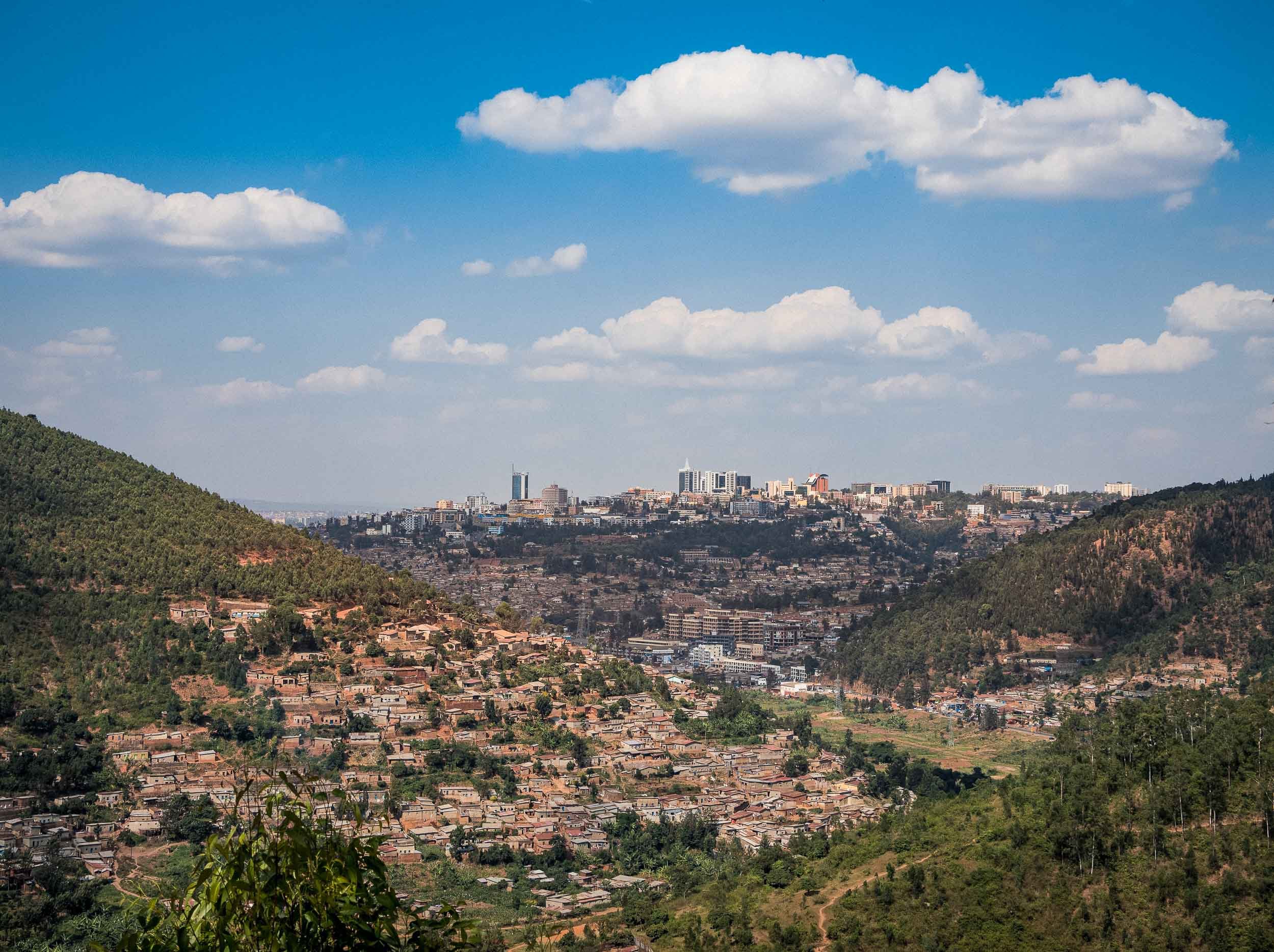
Great Apes and Golden Monkeys
More on Kigali and Rwanda’s history later, as we immediately left towards the country’s western parts: The Volcanoes National Park in the Virunga mountains, home to the world’s second remaining Mountain Gorilla population, aside from Bwindi Impenetrable Forest, about which you can read in my Uganda blog.
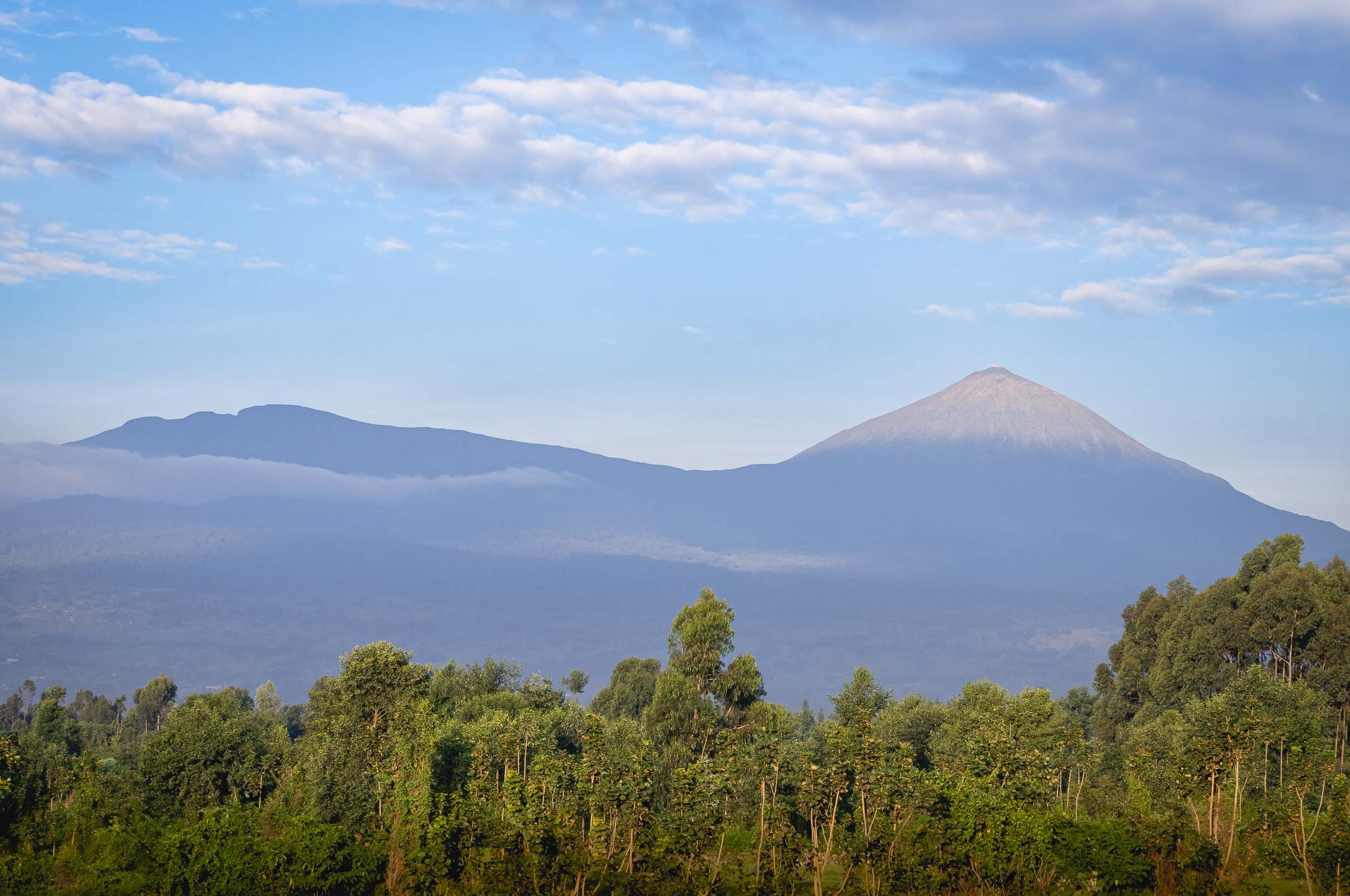
In Dian Fossey’s Footsteps
This was also the mountain we had to climb to see Rwanda’s most famous attraction - luckily not all the way to the top! With our guide, porters, and armed rangers, we started from the very western part, just a few kilometers from the border to the Democratic Republic of the Congo, where the national park area is currently closed due to the civil war. The trek was intense, although less so than in Uganda’s aptly named impenetrable forest.

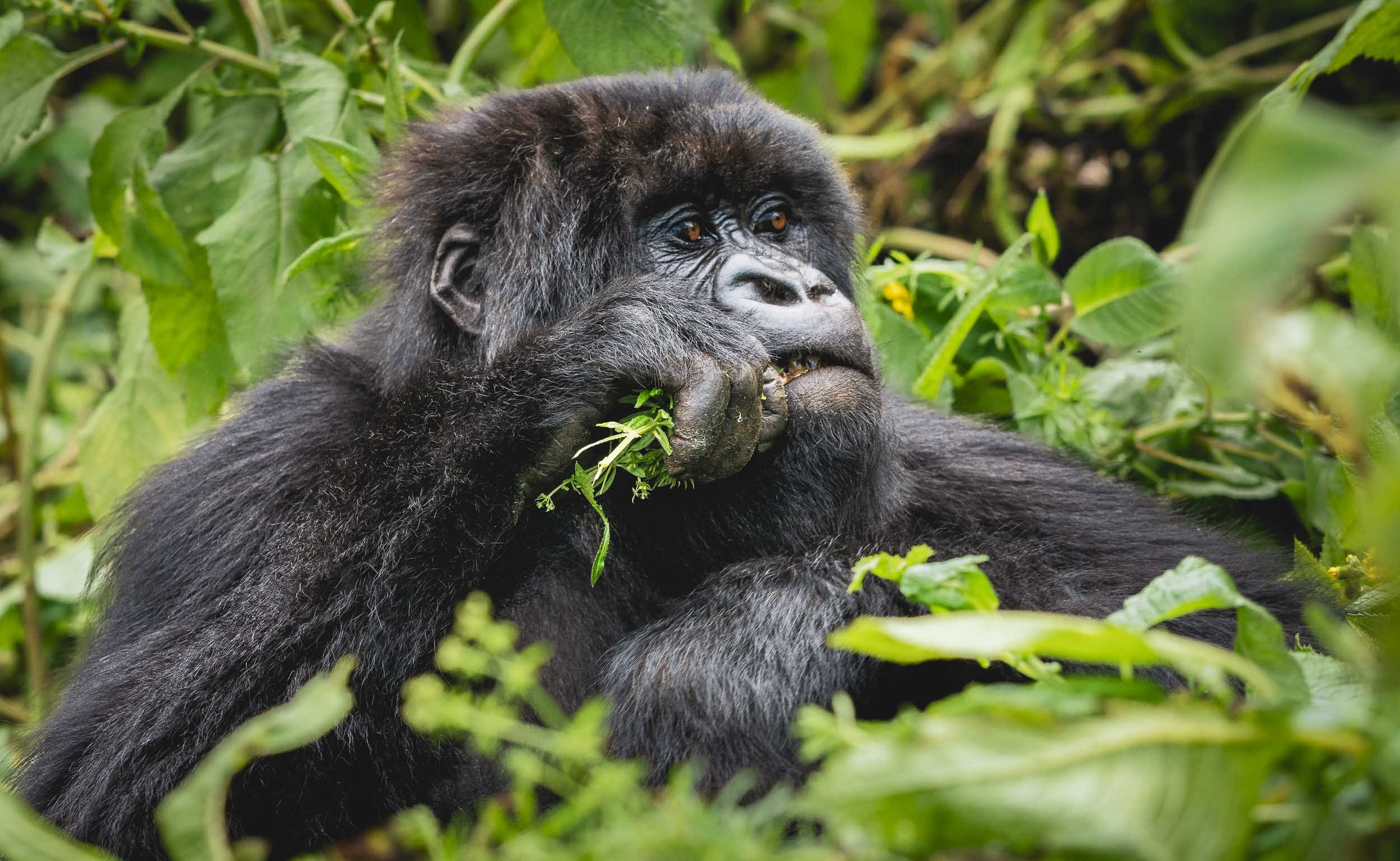
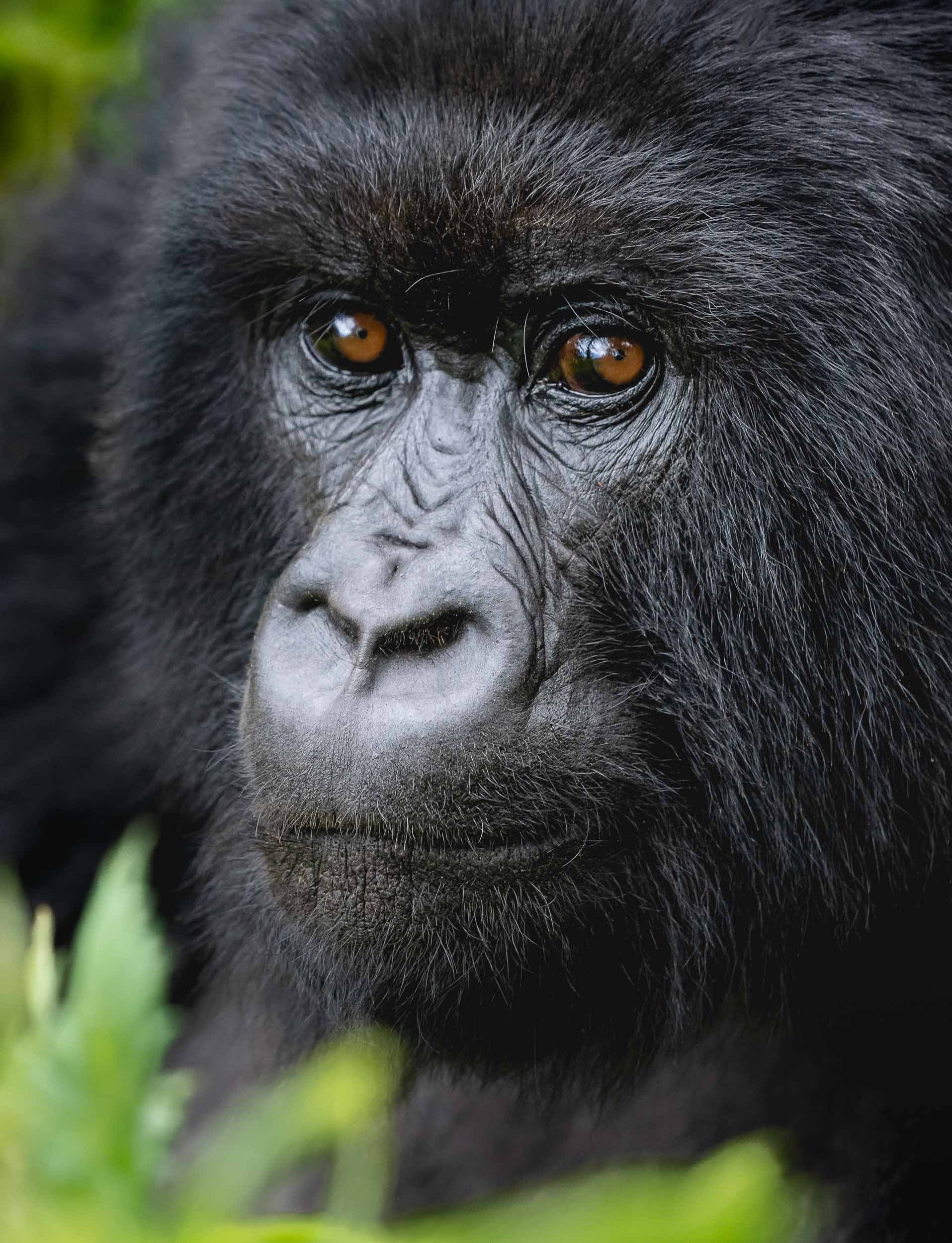
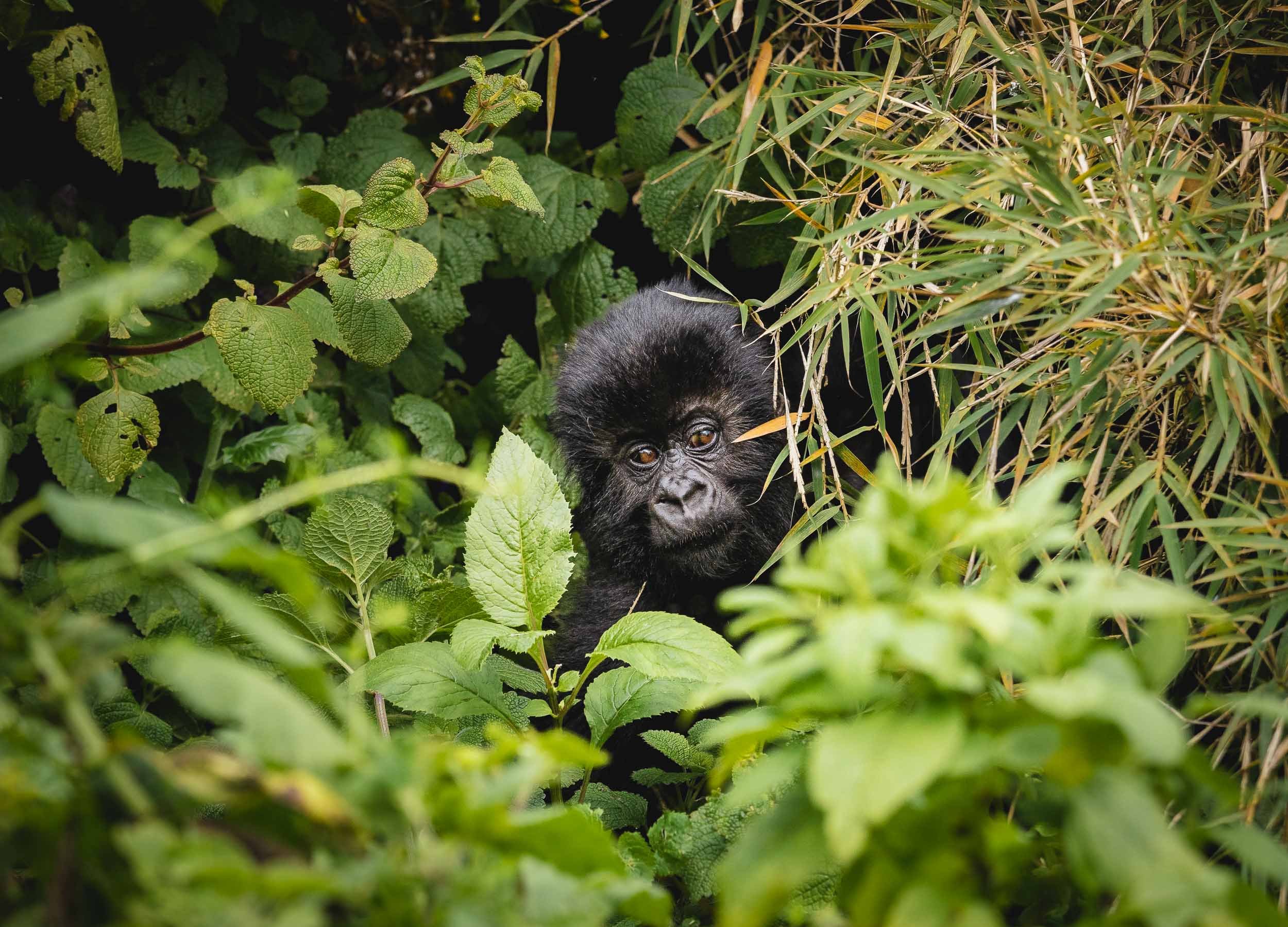
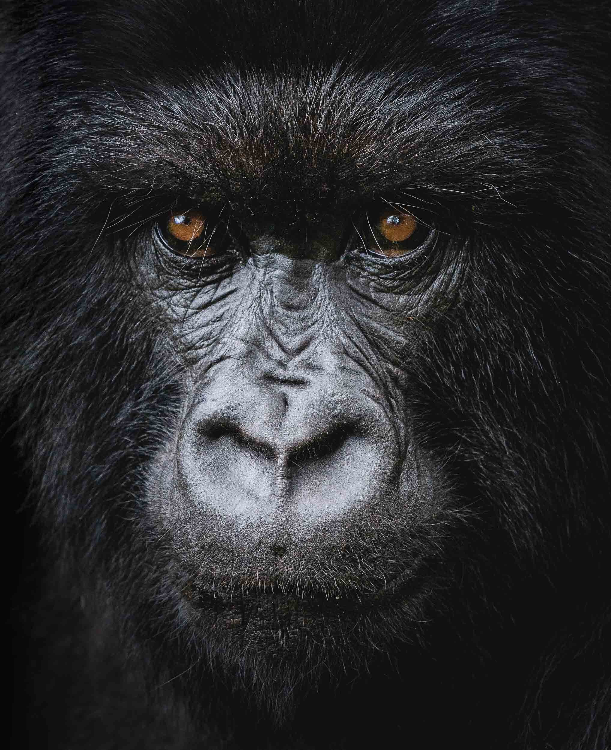


Even though it was my second Gorilla trek, it was not one bit less exciting than the first one. The varied behavior of the Gorillas, the different natural setting, and simply the fact you only have one hour with them definitely makes you want to experience more of it once you had a taste.
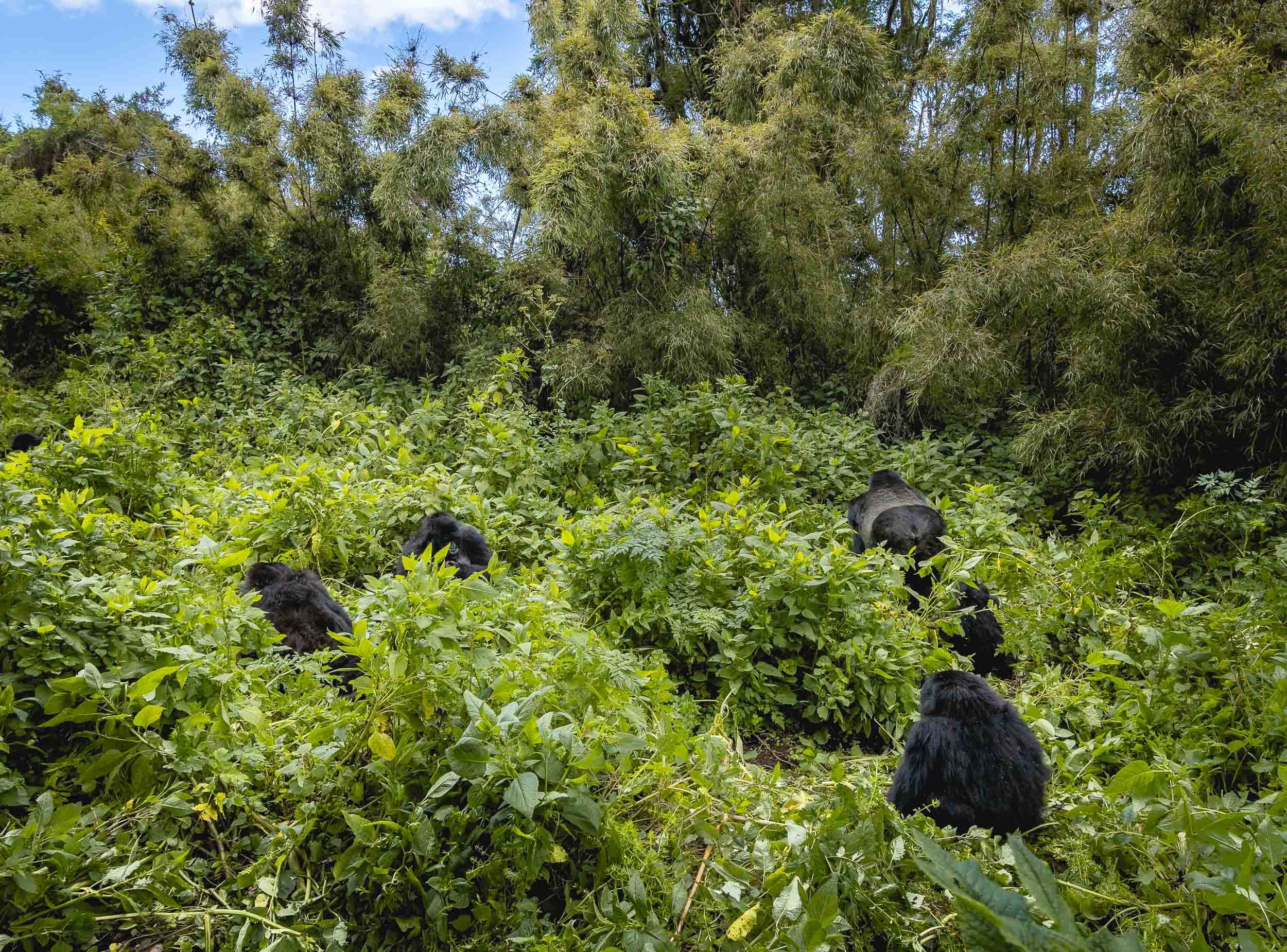
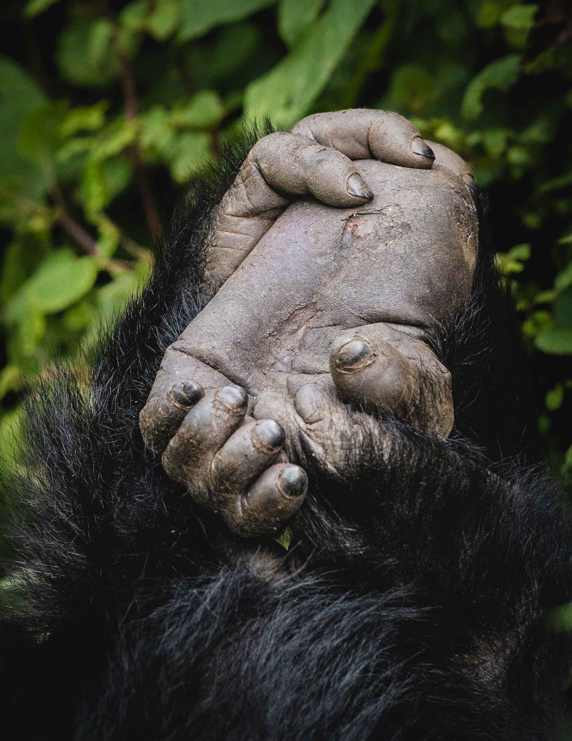
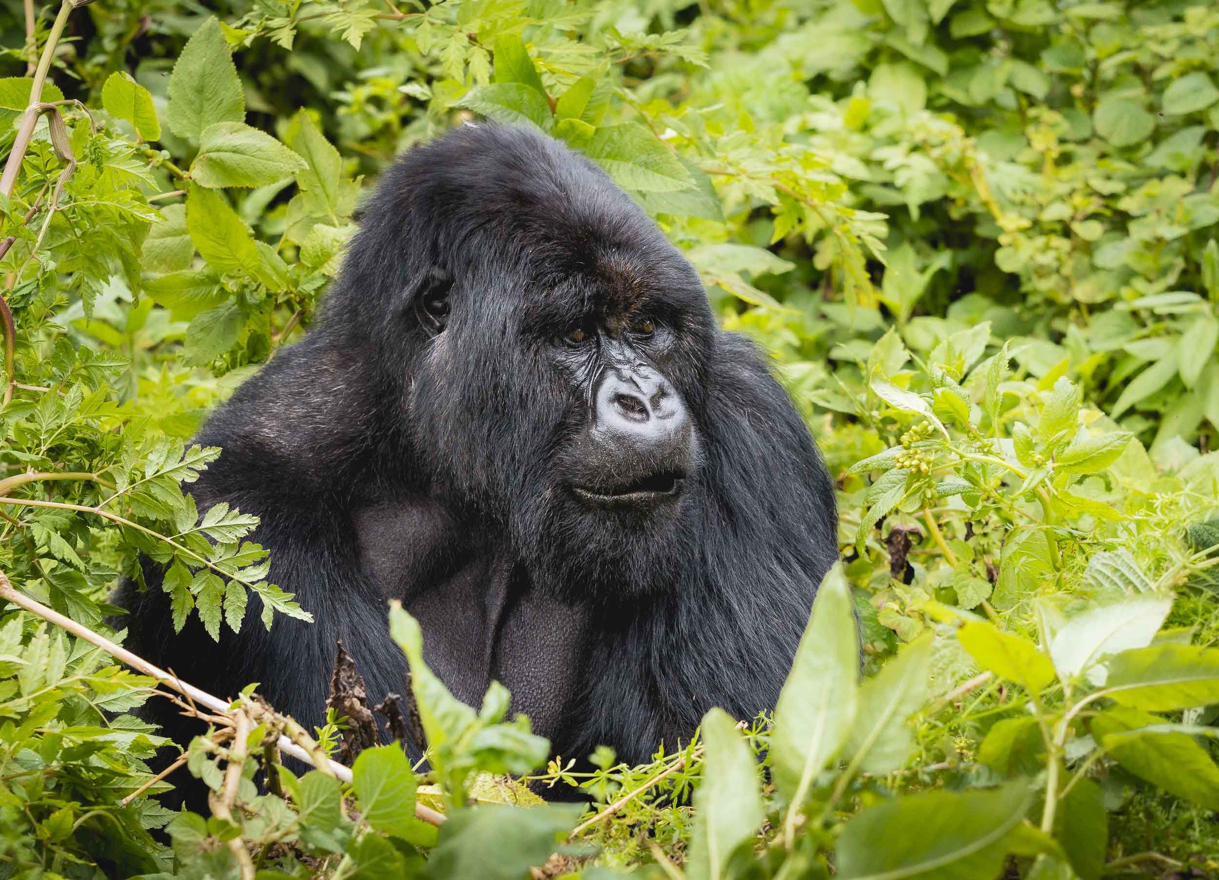
Rwanda’s Gorilla conservation effort and the conflict with poaching has been in the global spotlight for many years, starting with Dian Fossey’s work from the 1960s, culminating in her famous book “Gorillas in the Mist”, later adapted into a movie. She was instrumental in stopping the decline of the Mountain Gorilla population, and her work is now eternalized in the newly opened “Ellen DeGeneres Campus of the Dian Fossey Gorilla Fund”, a modern research centre and museum dedicated to the plight of these animals - definitely worth a visit when you’re in the area. Fossey’s life was not without controversy, and ended in her murder, which remains a mystery until today.
A Feast
The second species of primate that is special in this area are Golden Monkeys, an endangered animal that can only be found in the Virunga volcanic mountains, with an estimated population of 2000-4000.

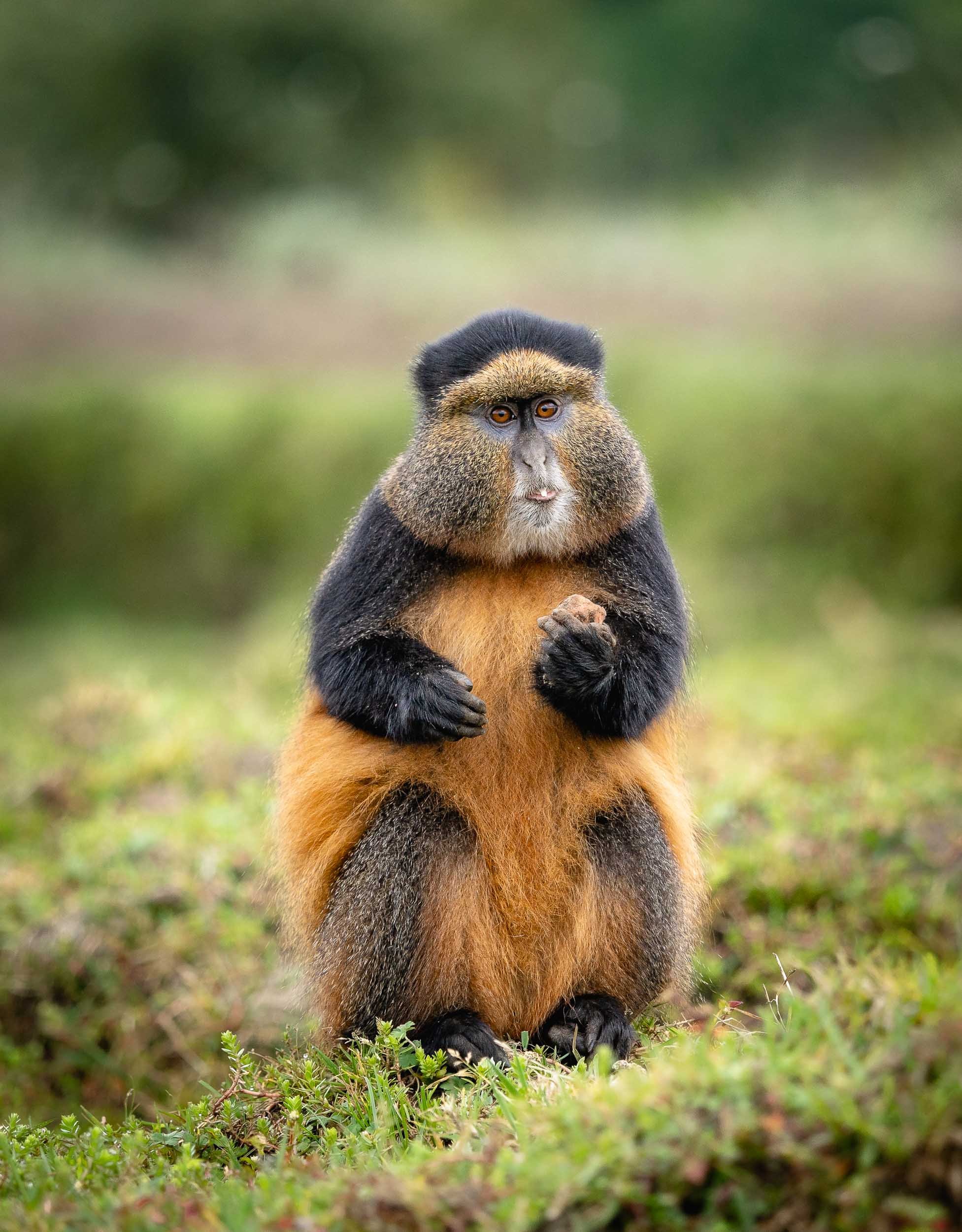


Watch one of them stuffing its face.
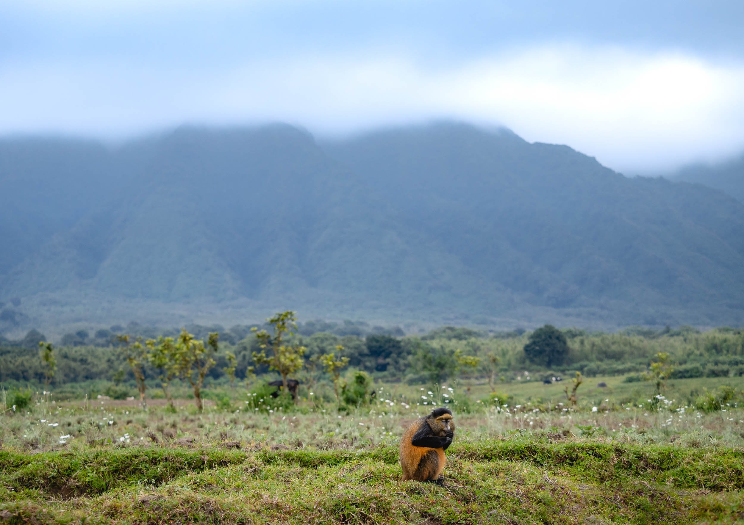
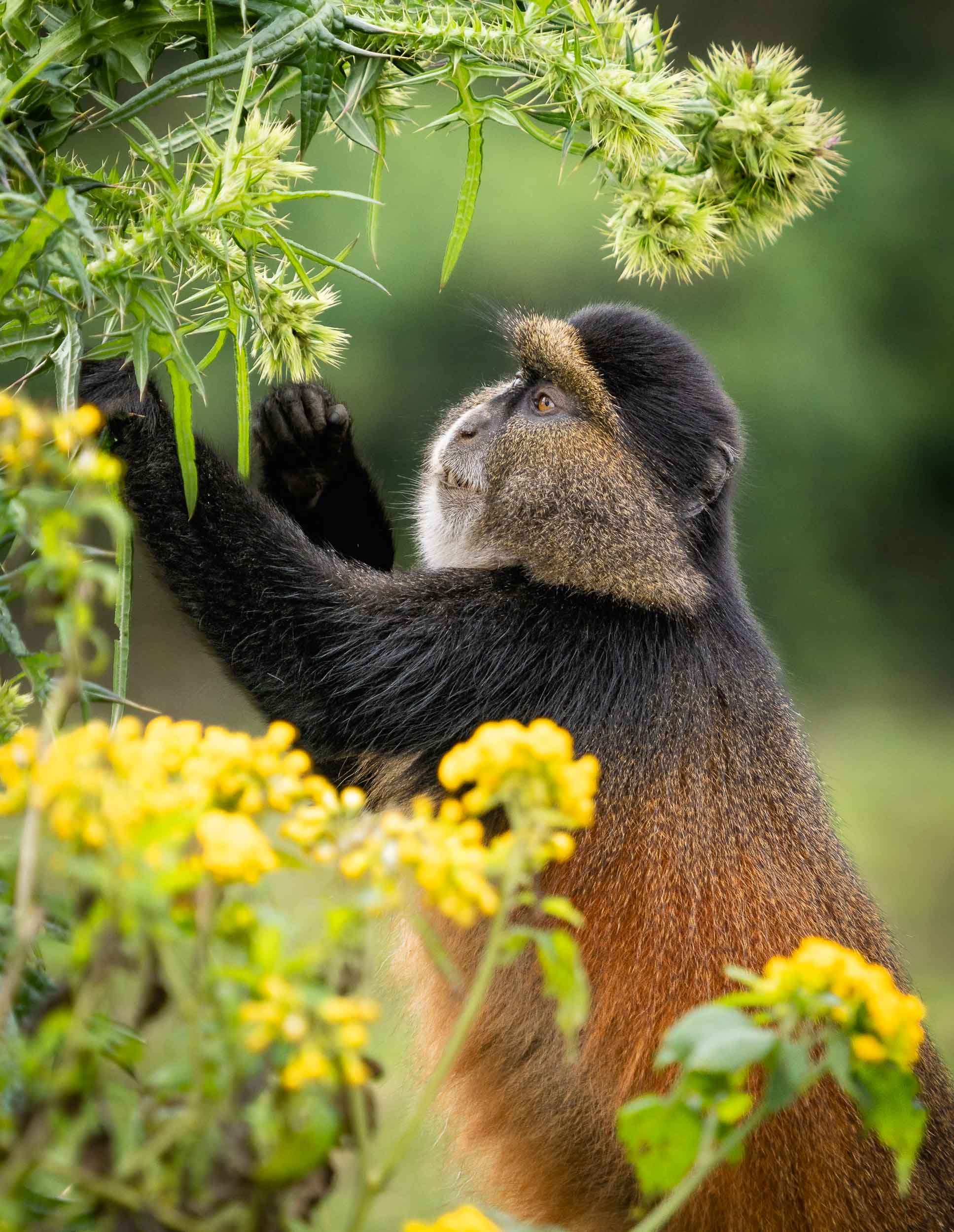
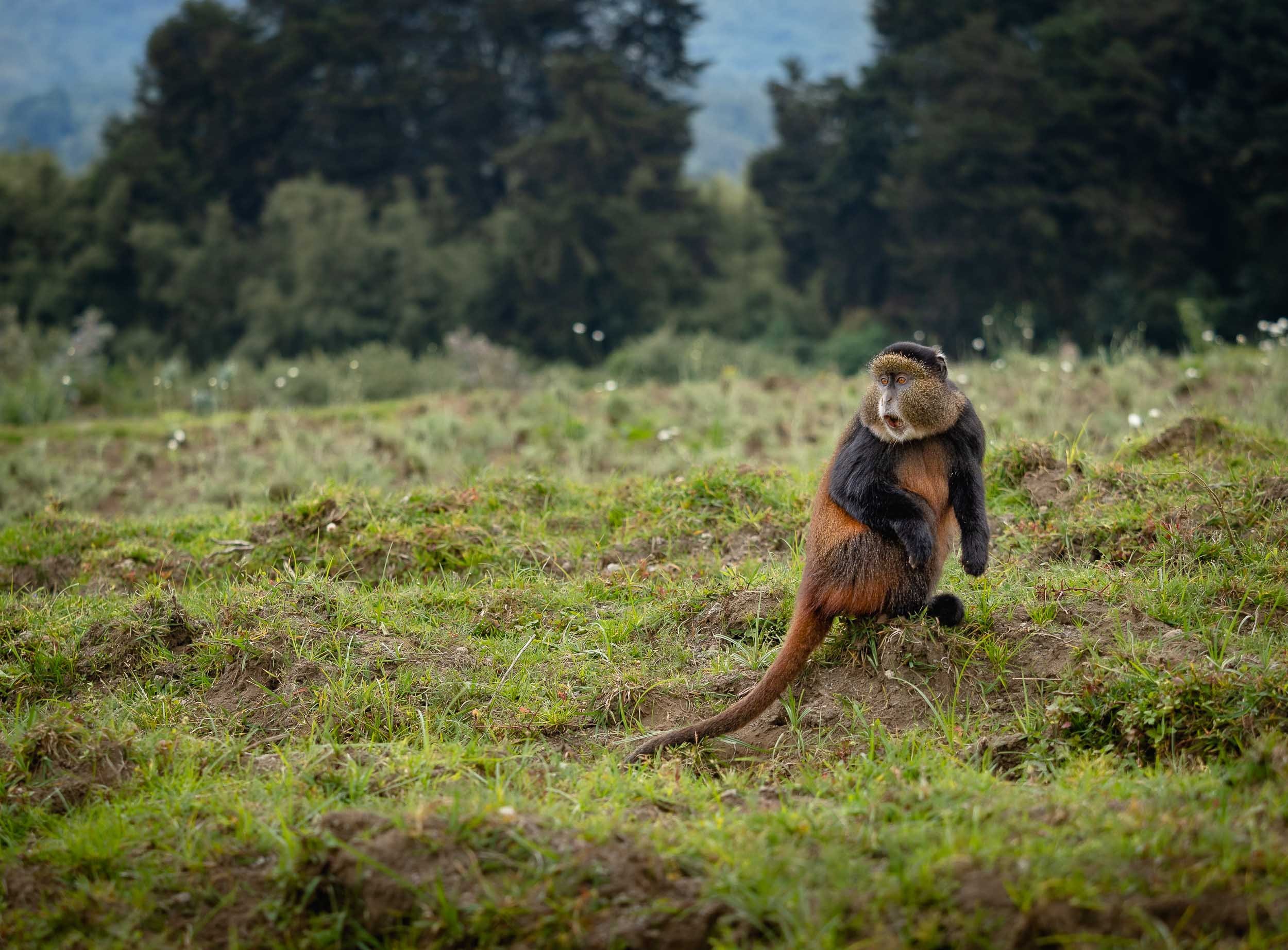
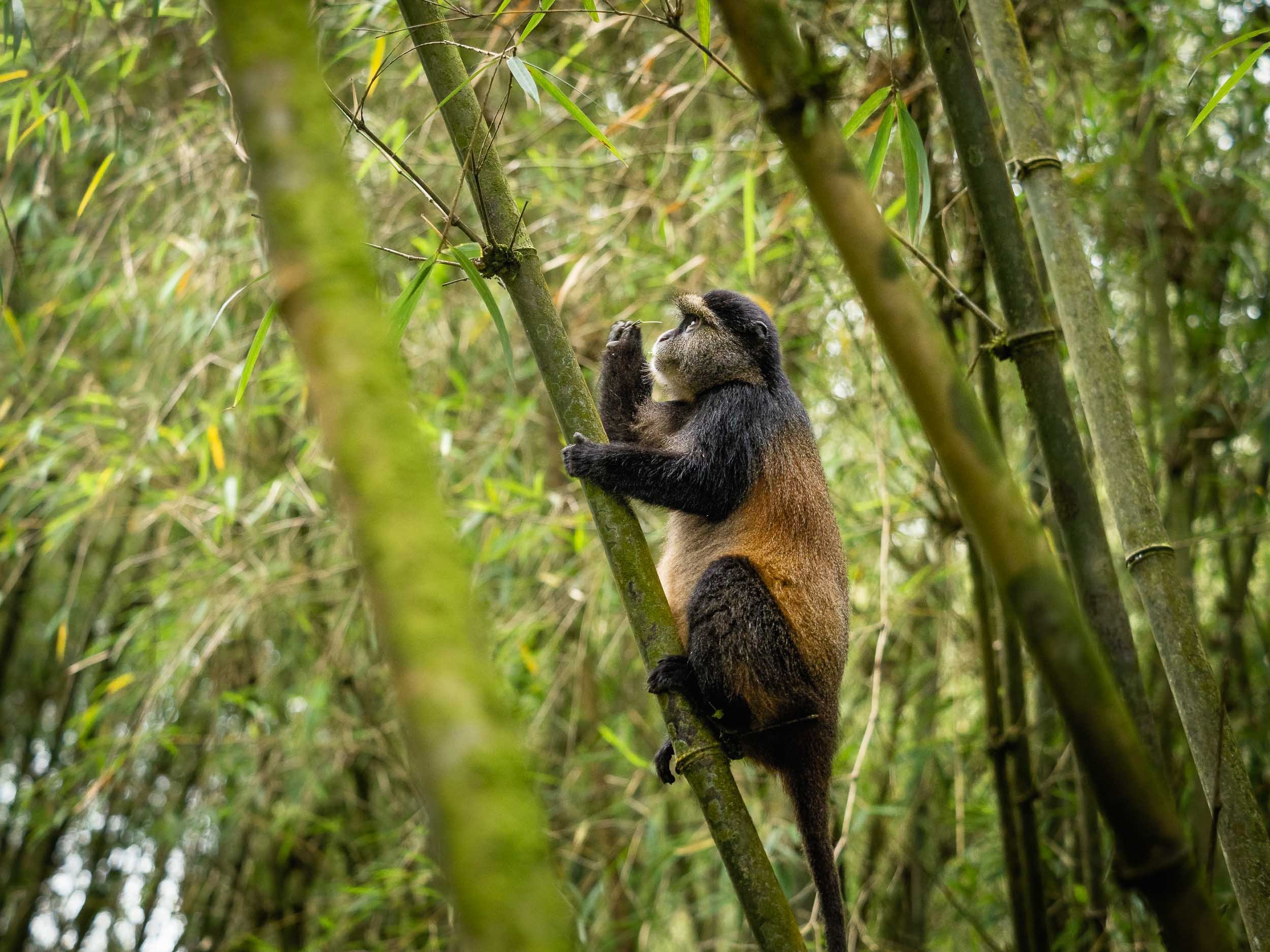
The Golden Monkey Trek is a lot less intense (and the permit much cheaper) than the Gorillas, and while not quite comparable they’re an interesting species, so it’s definitely worth combing the two if you visit Rwanda.
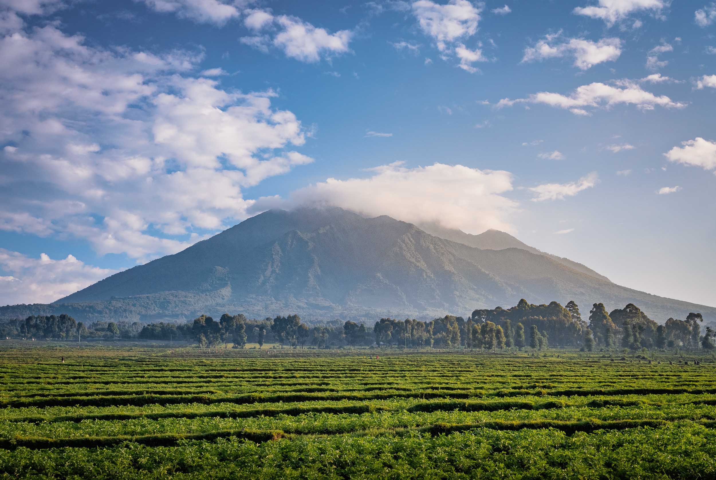
Into the Darkness and a Nice Place to Stay
A rather obscure attraction (my favorite ones) of the park are the Musanze caves. Their entrance lies literally under the main road through the area, and you’d never know what lies beyond unless you descend down for the guided tour.
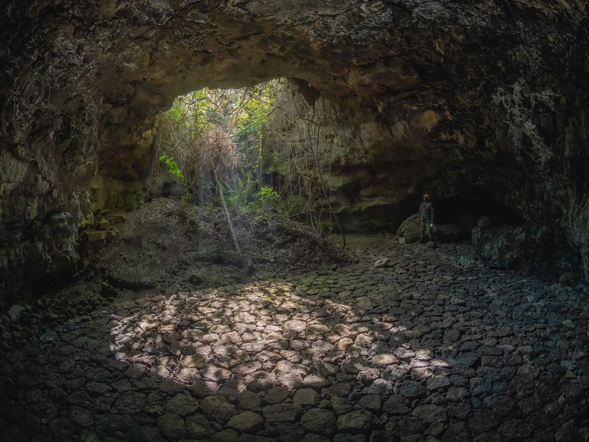
The last night at Volcanoes National Park was spent at One & Only Gorilla’s Nest. Definitely the most spectacular place to stay in the area, located in its own private Eucalyptus forest, featuring the restored cottage of wildlife expert Jack Hanna.
From Lakes and Volcanoes
I had one more place to see before heading back to Kigali - the Twin Lakes of Burera and Ruhondo, on the border to Uganda. These two lakes have an almost identical shape (hence the colloquial name), although they are at different elevations. The existence of a small channel (now a hydropower pipe) meant that water was flowing from one lake into the other in the past. They are separated by a small elevated hill, from which you get to experience beautiful views of the volcanoes and lakes - Byiza Lodge is probably the best spot.
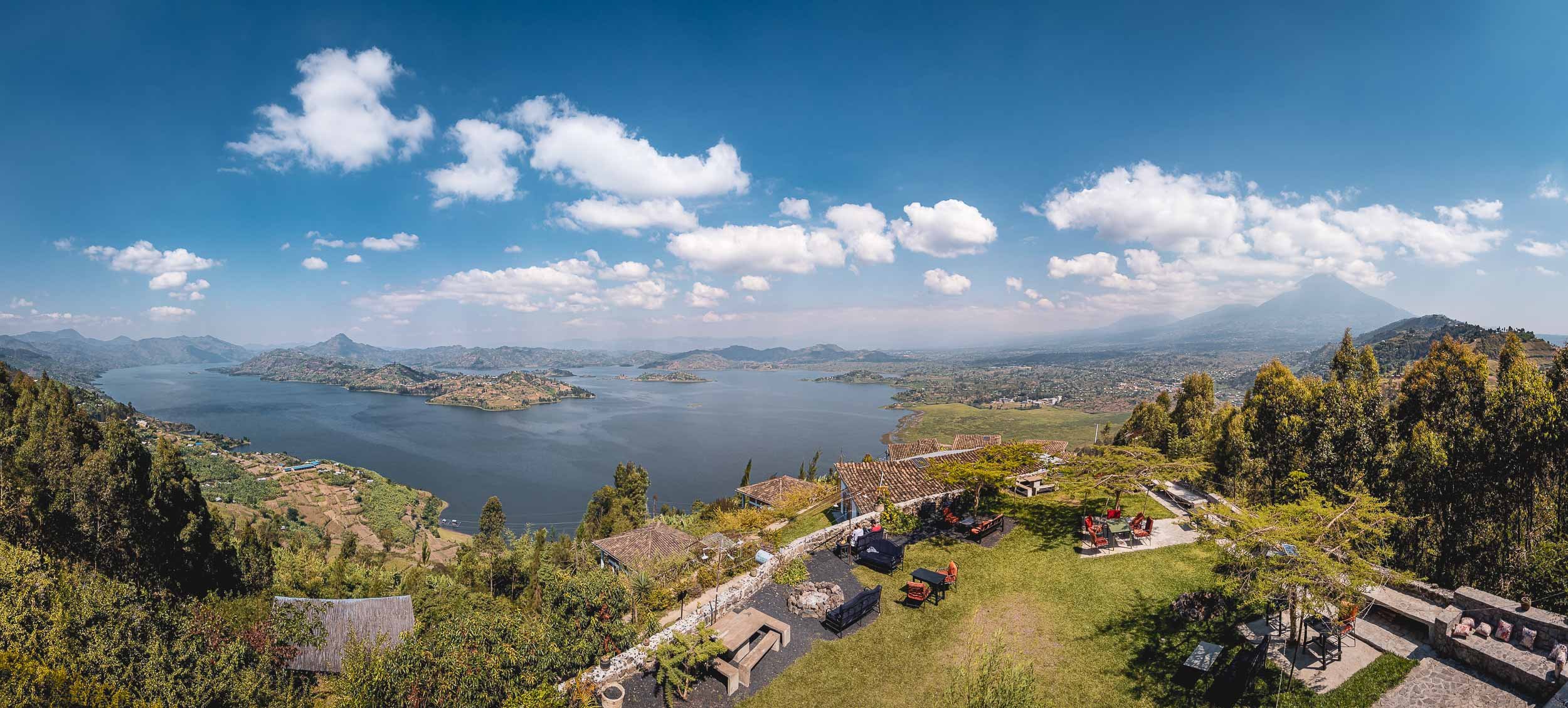
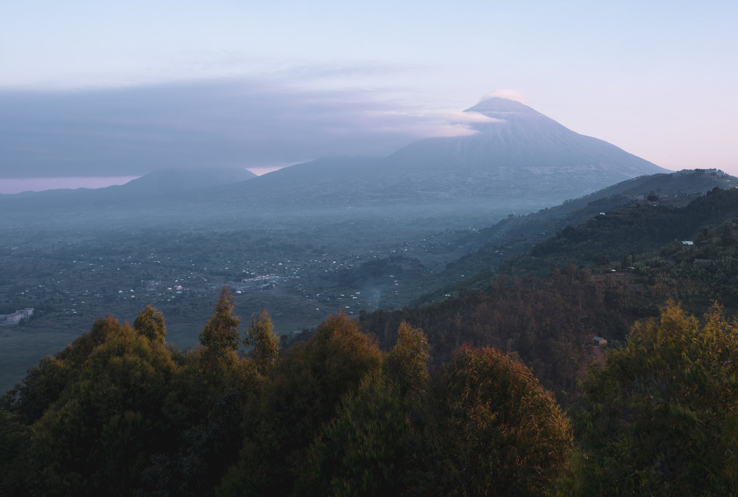
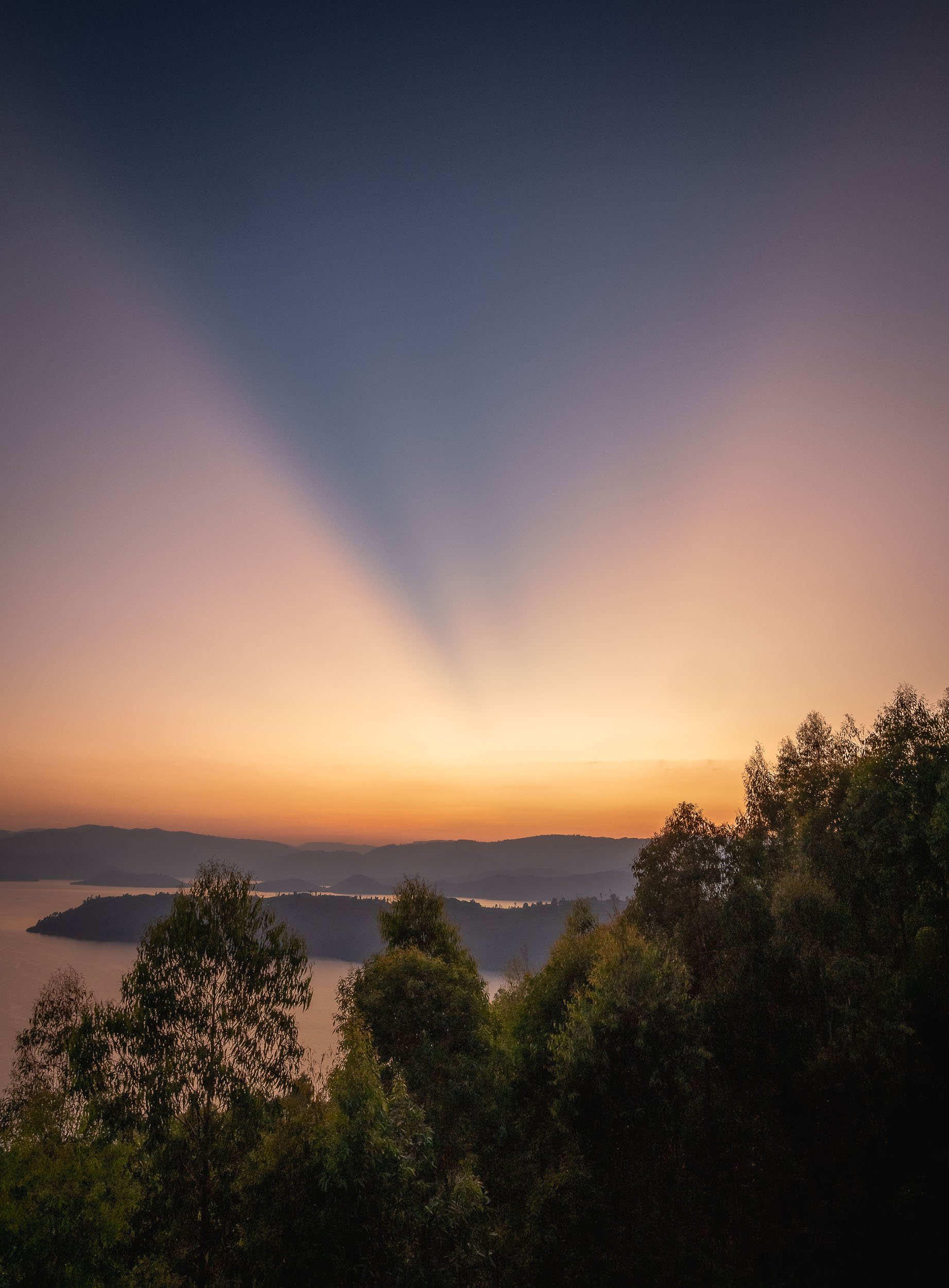
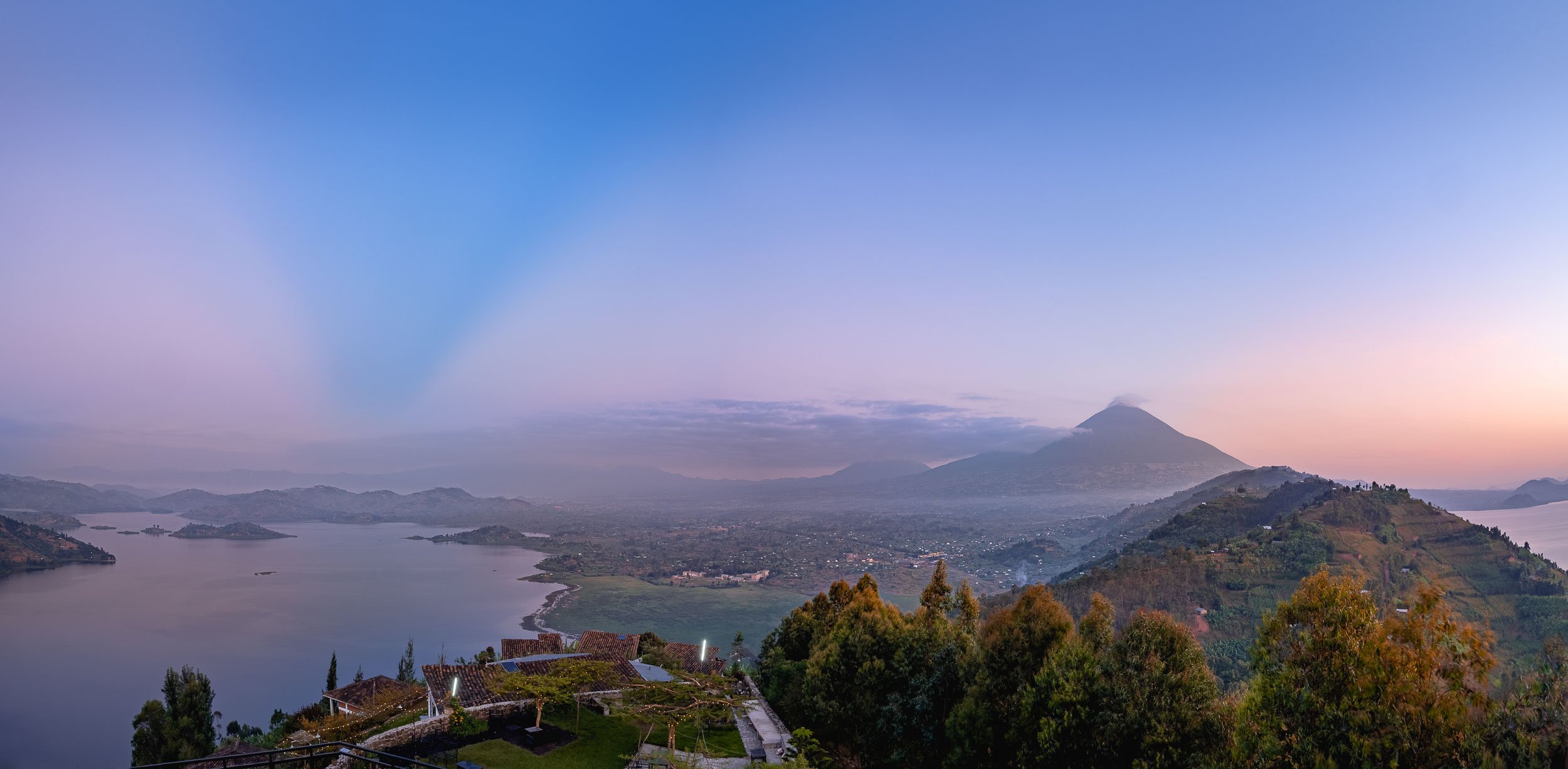
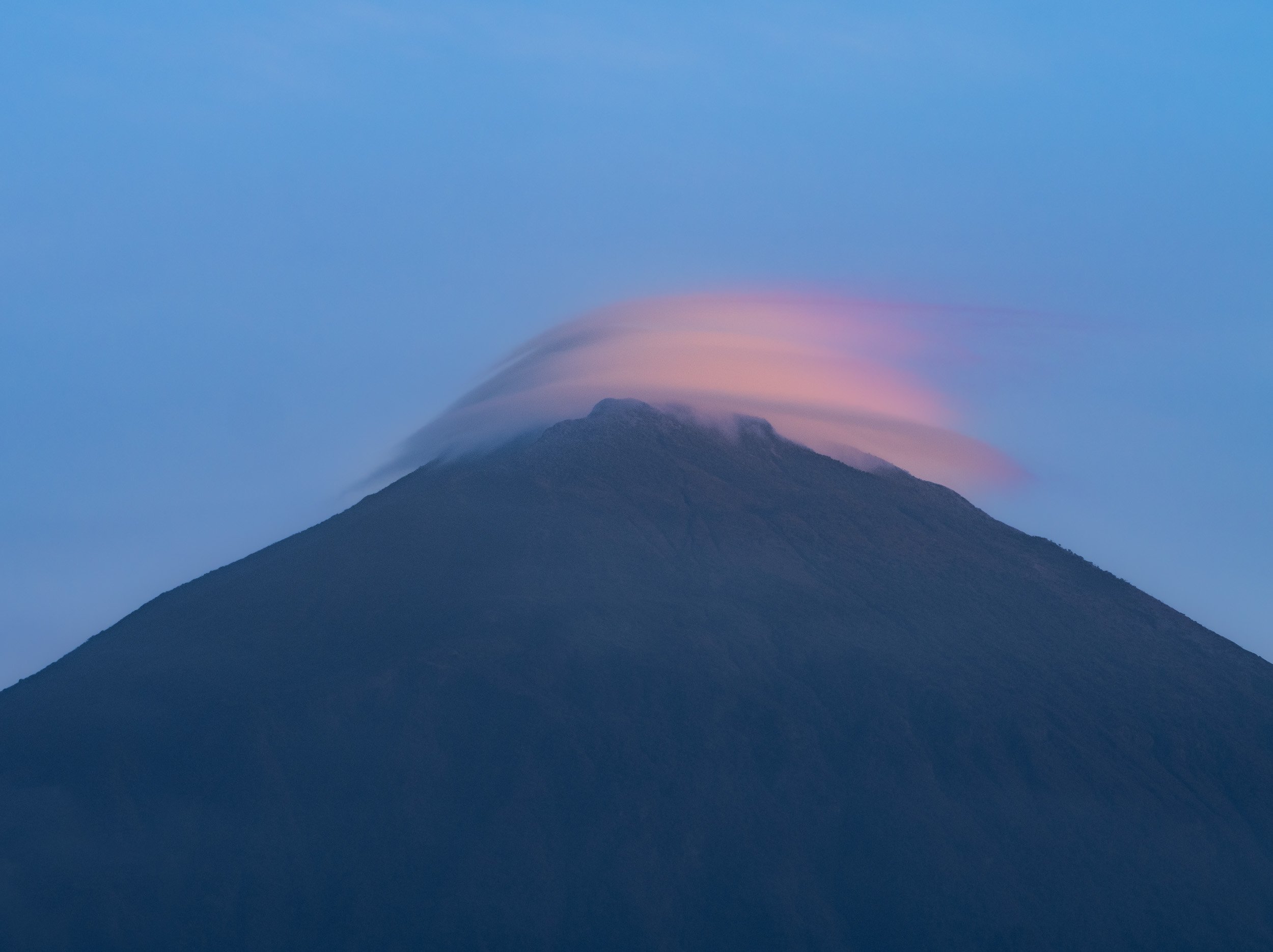
My last day in Rwanda was spent exploring Kigali and its surrounding areas. That includes one of its last independent milk bars (yes, that’s a thing) called Kuruhimbi, for the famous Ikivuguto drink. If you know me, you’ll know that’s my kind of bar, but the story behind the importance of cows and milk in Rwanda is an interesting one, worth a read in this article - there’s a reason why the phrase for “wishing someone well” here literally means “may you have a cow”.

Lessons Learnt from History, or not?
Beyond that, an agenda point no one should miss out when visiting Rwanda is to explore some of the country’s most significant monuments of the genocide in 1994. We visited three such places: Kigali Genocide Memorial, Nyamata Church, and Ntarama Church Memorial Centre, the latter two about an hour outside the city. They each provided a different insight and perspective on the genocide, but the theme of invoking incredible sadness about what occurred here is shared across all of them - it’s a rough emotional journey. For instance, Nyamata church still features holes in the wall that were used to throw grenades into the building when people looked for shelter, and blood stains on the altar cloth caused by machete massacres. Over 50,000 people are buried here, many of them displayed as rows of skulls and in coffins filled to the brim with bones, often unidentified. New victims are still found in mass graves of the area.
While I recommend reading the articles linked above, another way to start is the (albeit Hollywood-ized and not without its controversy) movie “Hotel Rwanda” which took place in the historic Hotel des Mille Collines, (where I stayed, as it happens).
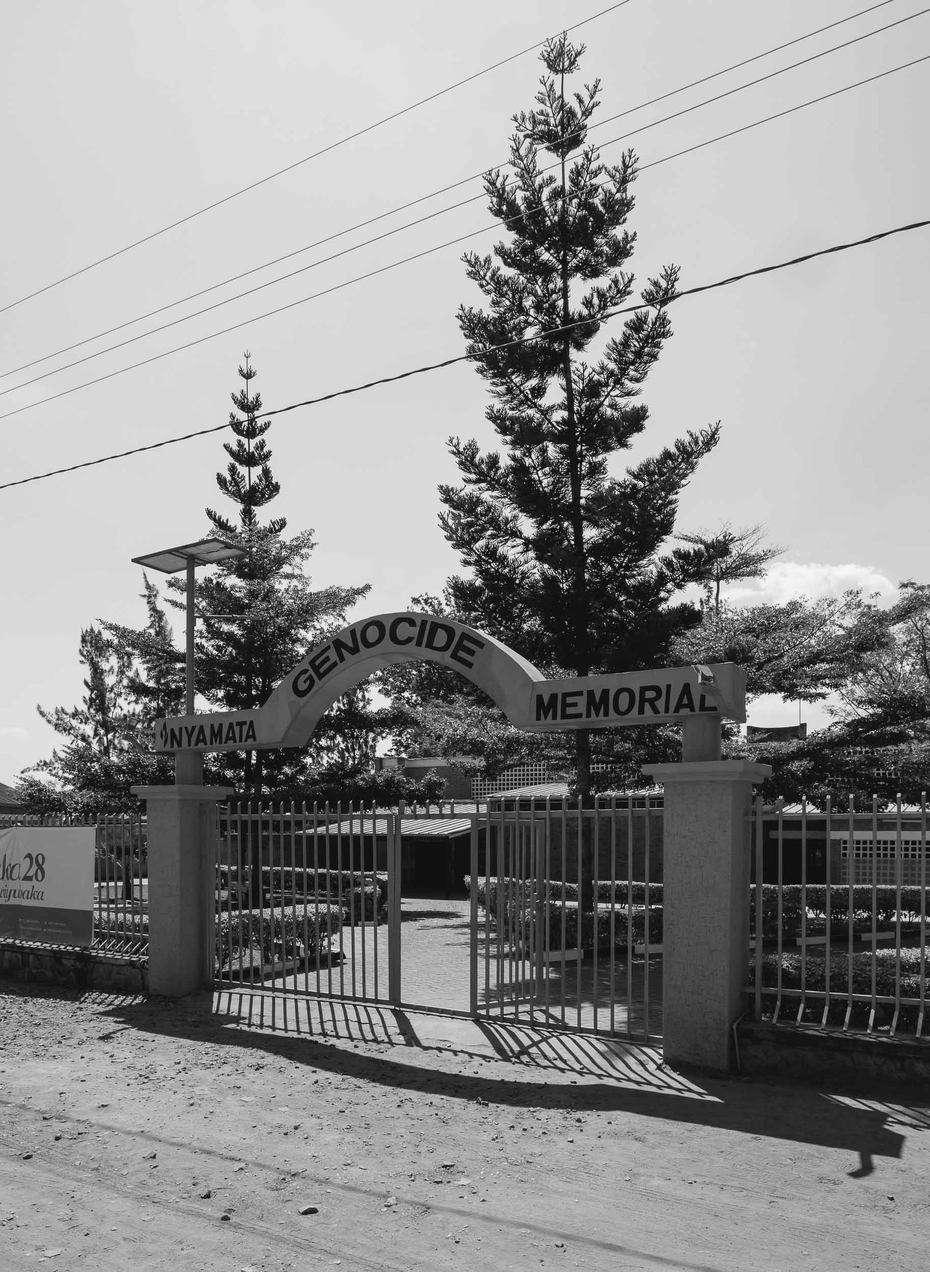
While estimated numbers vary, around 800,000 people were killed in the span of just over 3 months, the vast majority of Tutsi ethnicity, slaughtered by the Hutu perpetrators with the most brutal means. What makes learning about the events of this period particularly intense is their recency - as a consequence, literally everyone you meet in Rwanda is somehow directly or indirectly affected - and secondly, how the seeds for the genocide were planted long before, and, as so often, by Western occupants. At the same time, the country has taken a path of unification and forgiveness, and you don’t ever have the feeling of lingering tension or divide. While Rwanda is not without its political challenges, it makes the progress and development over the last 25 years all the more impressive.
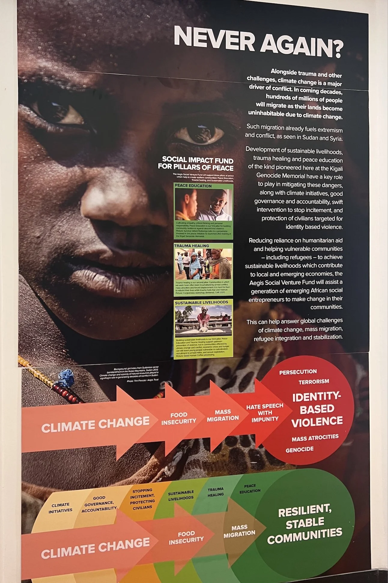
When visiting memorials such as these, one often has the feeling that “this can never happen again” or “it wouldn’t happen today” - the problem is, that’s what everyone thought after genocides in Armenia over 100 years ago, or the Holocaust 80 years ago, and yet history keeps repeating itself. I found this banner particularly prescient and it makes you think about where the next risk lies and how to prevent it, given the complexity of the root causes.
A Sunset in Kigali
The last evening was spent on capturing the city from day to night. We found this elevated viewpoint which was perfect for capturing some cityscape scenes and this timeslice video.


Uganda - From Lakes to Apes
The Republic of Uganda was another East African country on my journey, and it had beautiful lakes, rural villages, savannah landscapes, and a forest that deserved its name on the agenda.

The Republic of Uganda was another East African country on my journey, and it had beautiful lakes, rural villages, savannah landscapes, and a forest that deserved its name on the agenda.
Entebbe and Lake Victoria
I started my trip from Entebbe, a small city south of the country’s capital Kampala, and home to its only international airport (famous for the 1976 hostage situation), but also place of residence and office for the president. Our first mission was to visit Mabamba Swamp on Lake Victoria, to find what they call the “holy grail of birding”: The endangered Shoebill.


Alas, it was not a successful trip beyond a very brief glimpse, but the area was still beautiful and it turns out this would not be the last chance to see this rare animal...
Tarzan’s Home
We also visited Entebbe’s botanical garden, which was started in 1898 and contains both endemic and imported trees, some of them more than 400 years old.

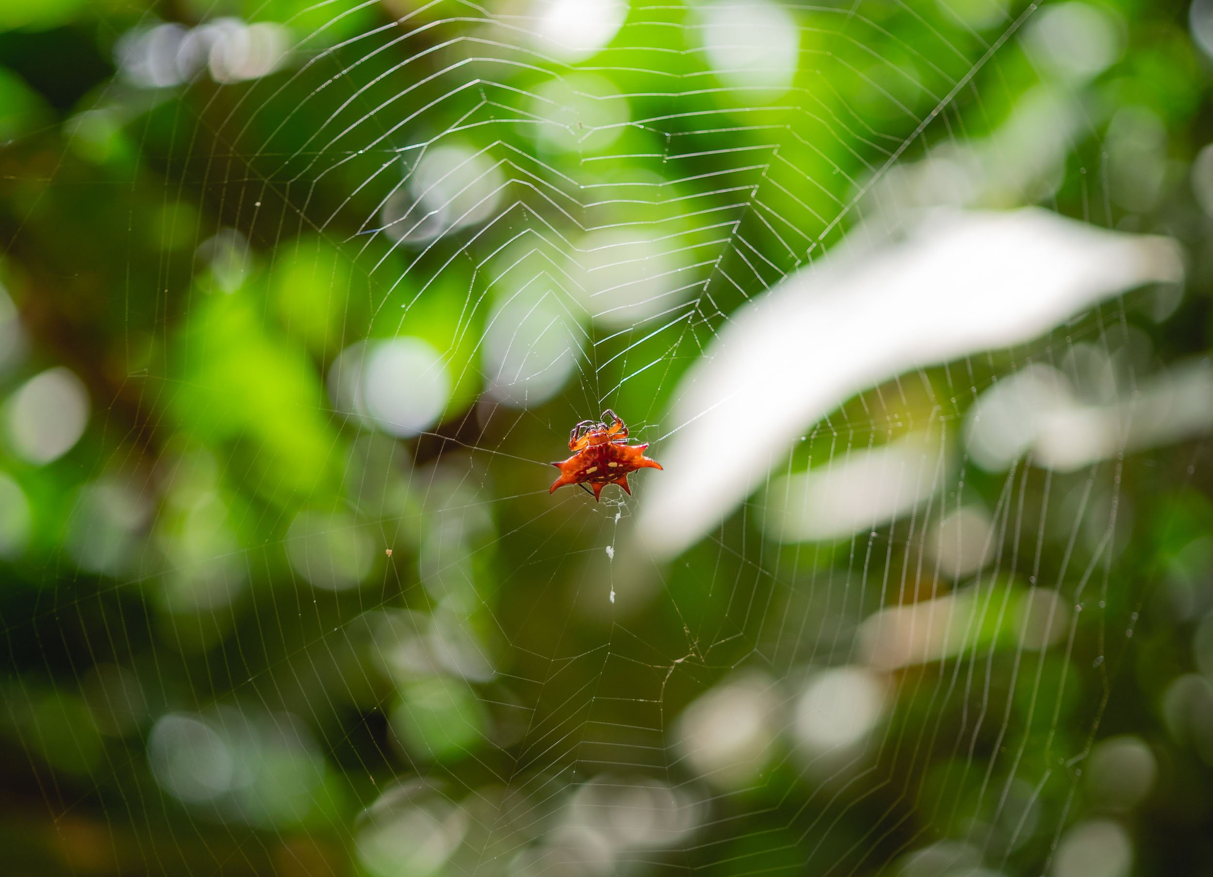
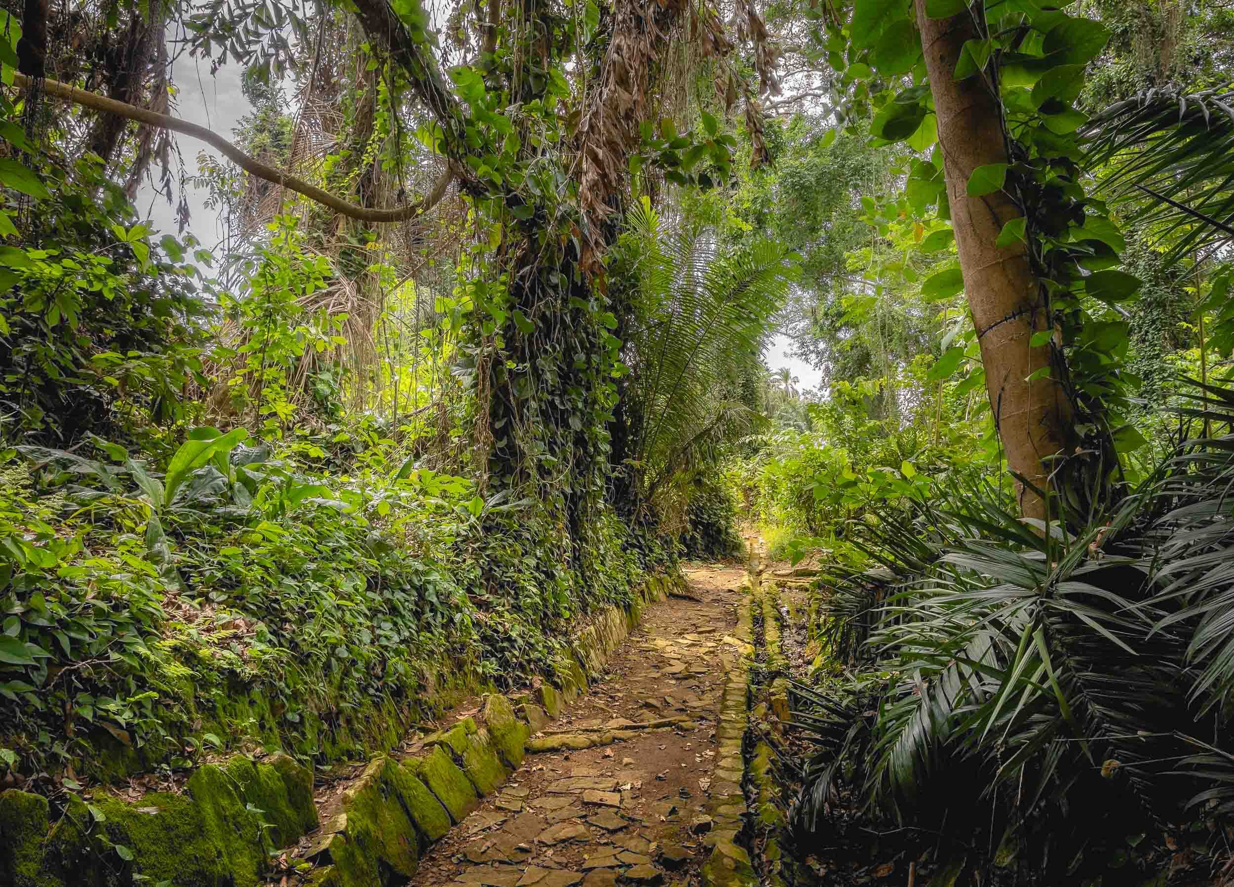
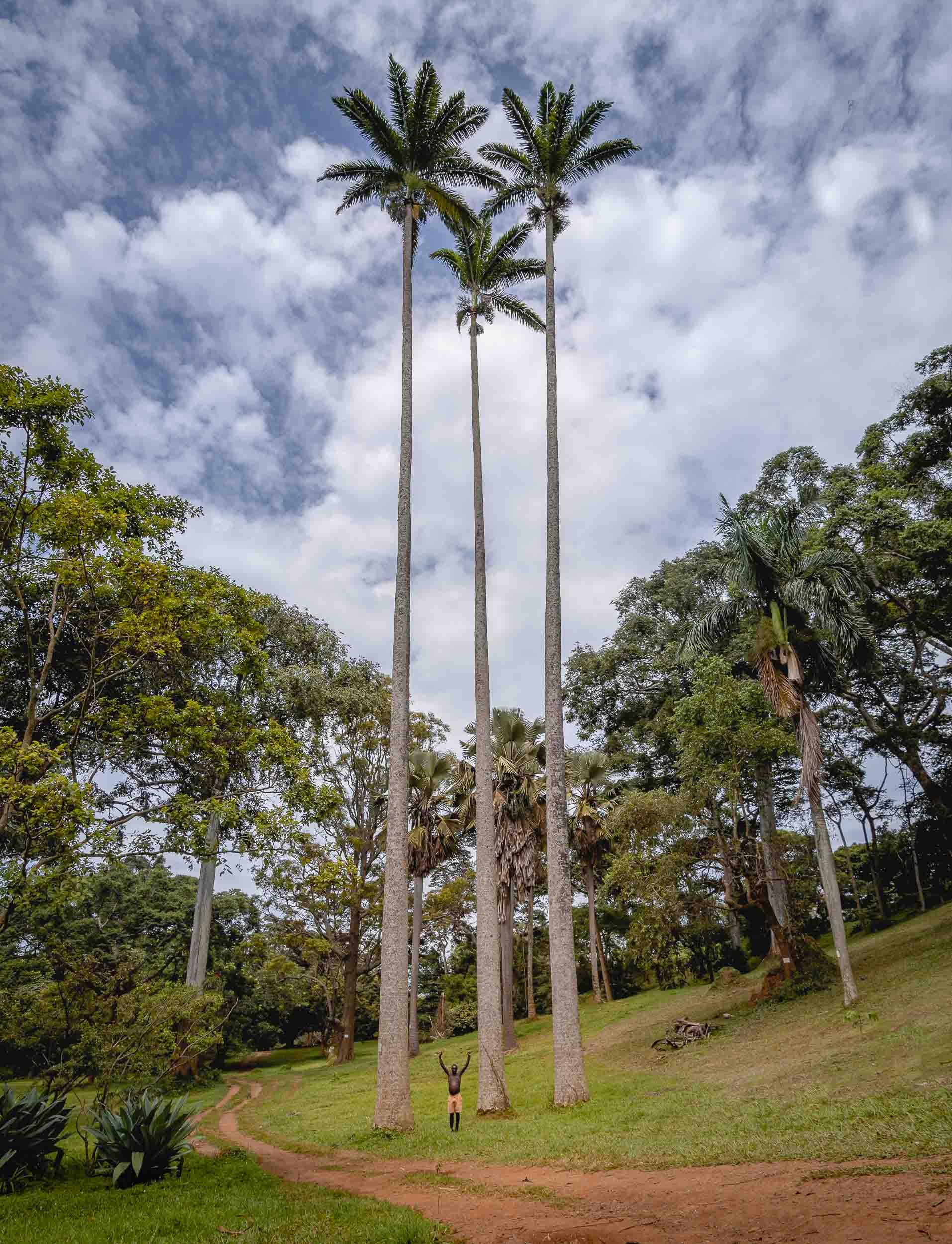
Punishment Island, and 28 more
A long drive from Entebbe through the beautiful landscapes and towns of southern Uganda brought us to Lake Bunyonyi, a 46 sqkm lake very close to the border of Rwanda.


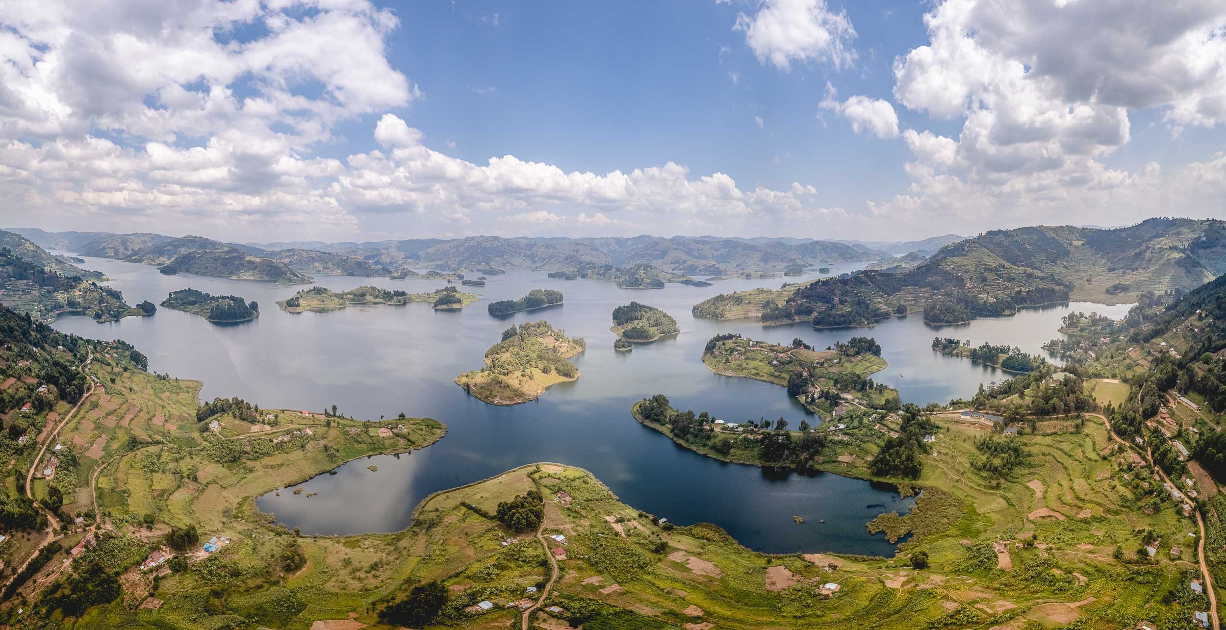
A Flight Above the Lake


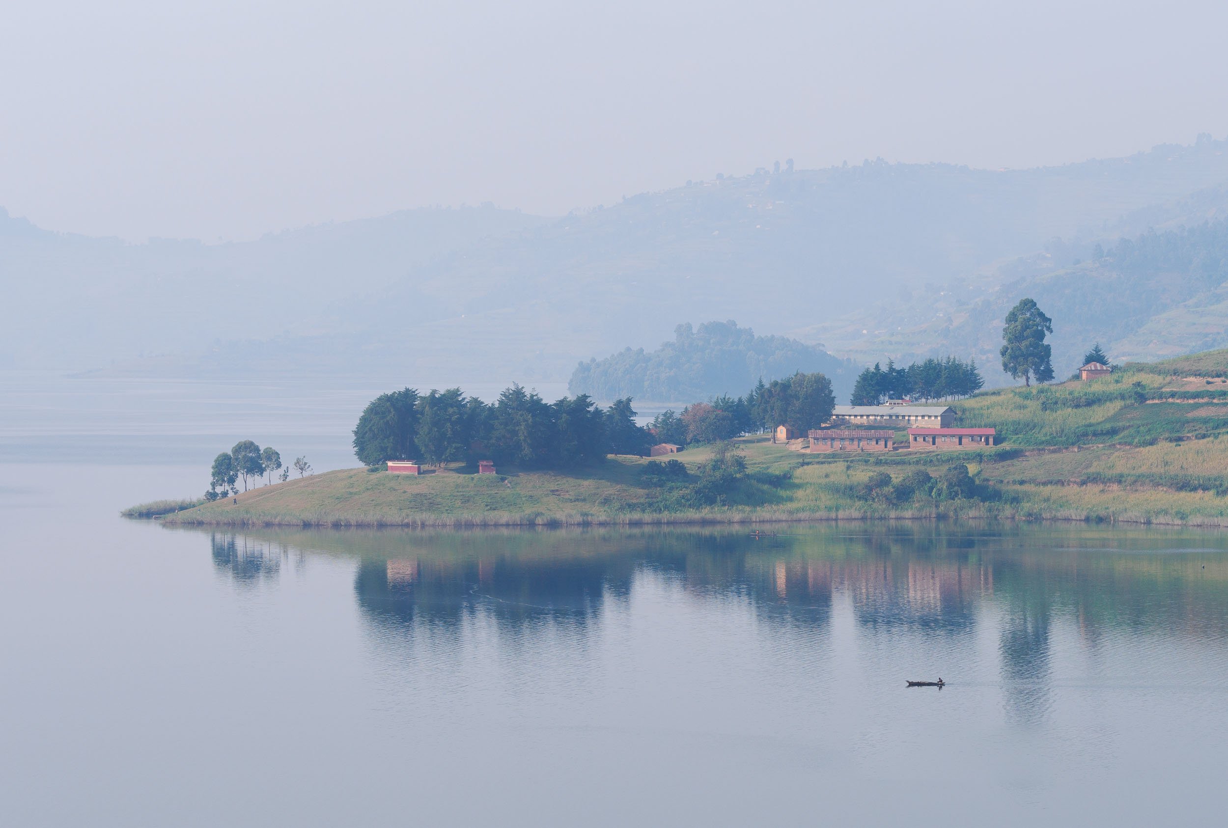

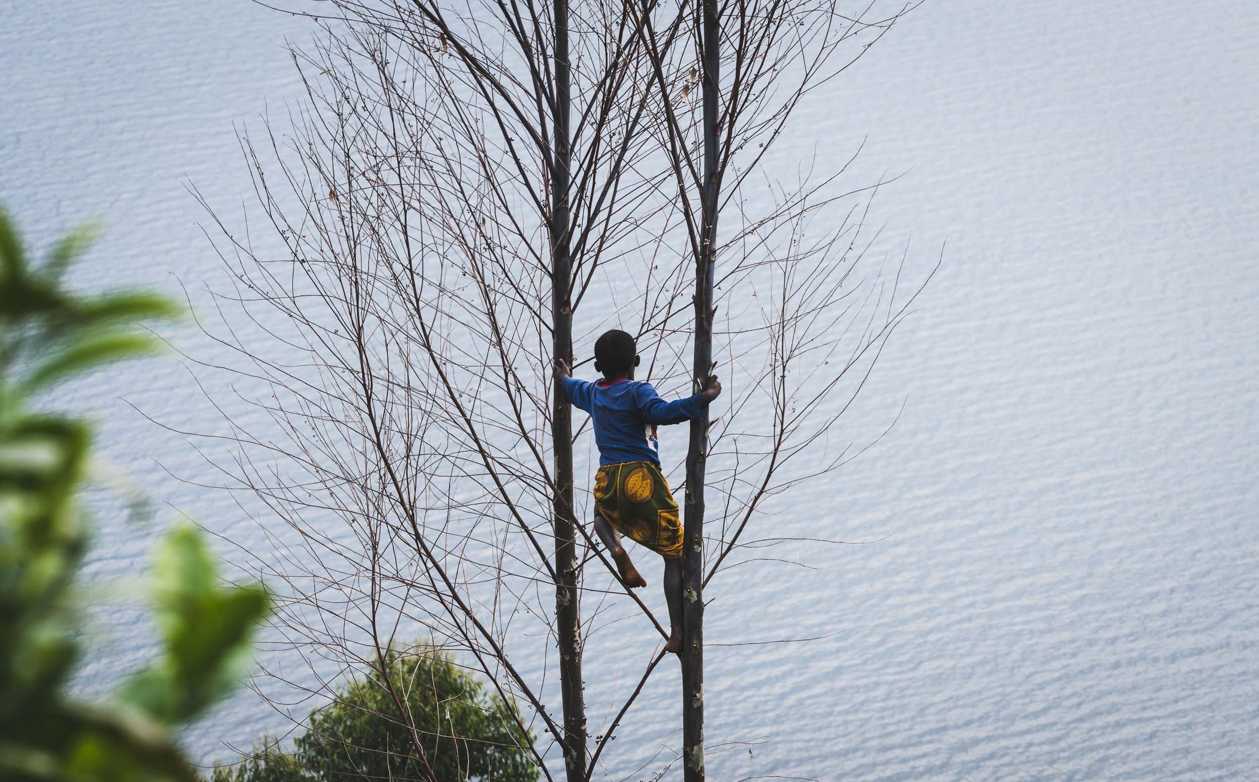
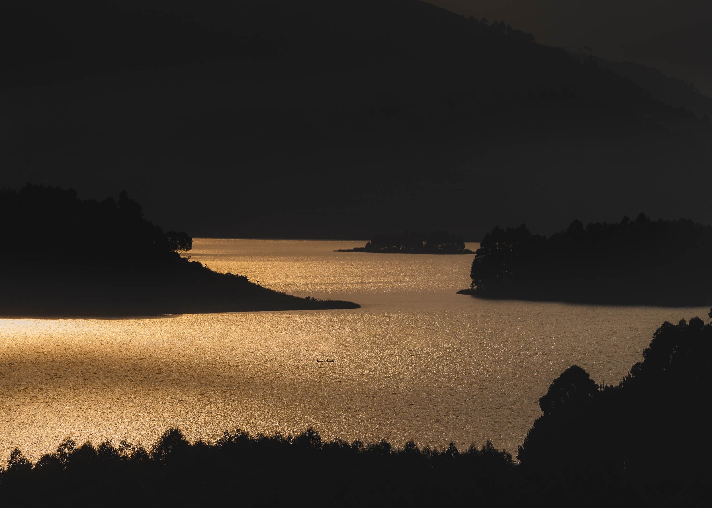
Towards the Impenetrable
After two days at Lake Bunyonyi, it was time to head further west, approaching the border of the Congo. On route, we passed some of Uganda’s beautiful mountainous areas, dominated by farmland and small rural villages.


Our goal was a different one though, bordering the farm land. The Bwindi Impenetrable Forest, and its corresponding National Park. One of the most biologically diverse areas on earth, it is World Heritage Site that truly deserves its name, as I would later find out.
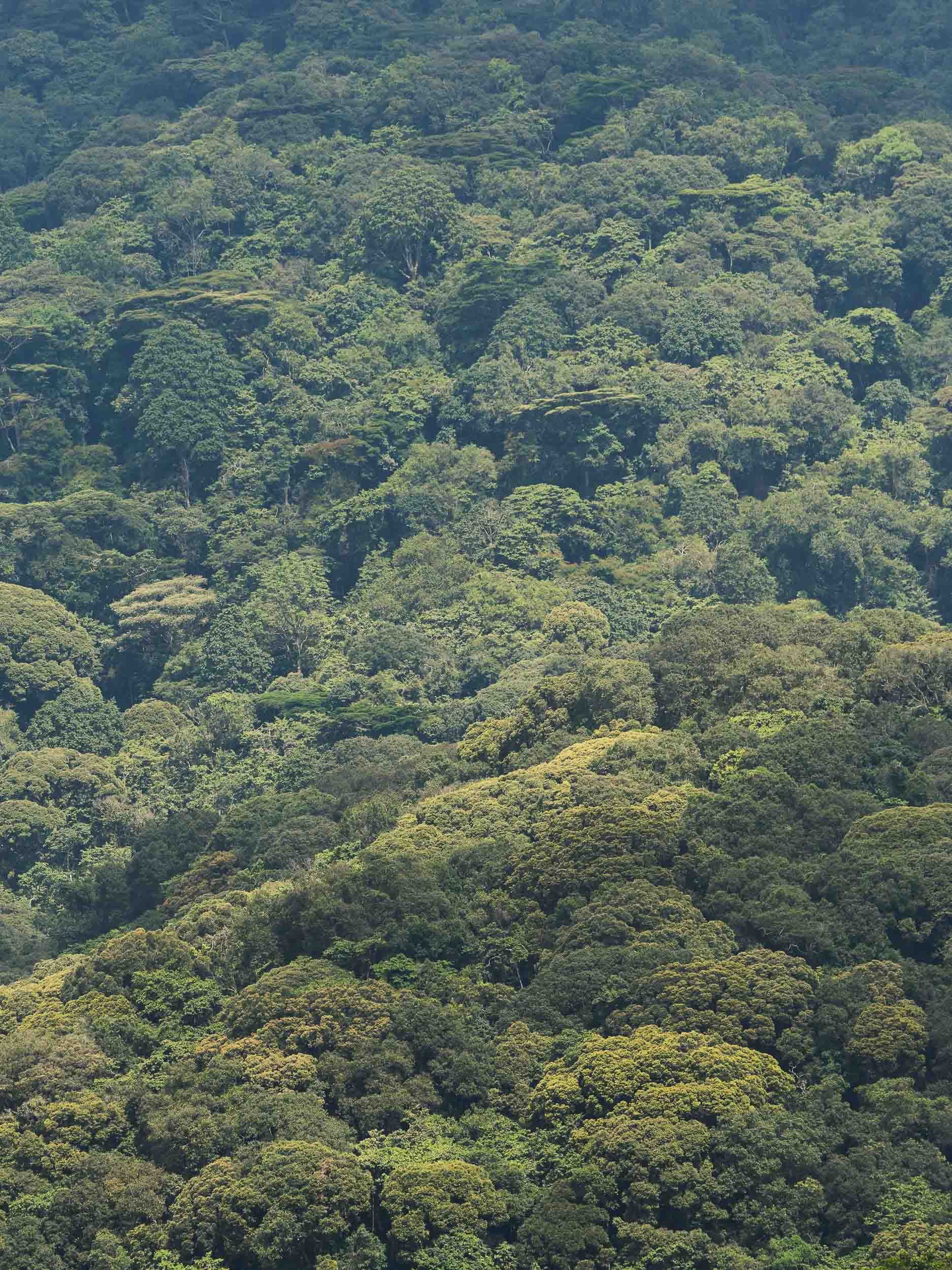
Parts of the forest are accessible - with a guide - through very basic hiking paths, and lead to some beautiful waterfalls, small rivers, and diverse flora and fauna.


The Greatest of the Great Apes
However, the real attraction of the Bwindi Impenetrable forest lies in something much less accessible, and it’s for a reason the meaning of the forest’s name in the local language is “a place full of darkness” . An armed ranger, a guide, and the stamina and shoes to survive several hours of trekking in the thick cover of plants and over muddy ground, climbing slippery and steep slopes, and wading through many small rivers, are all requirements to find the reason most people come here: The Mountain Gorillas.
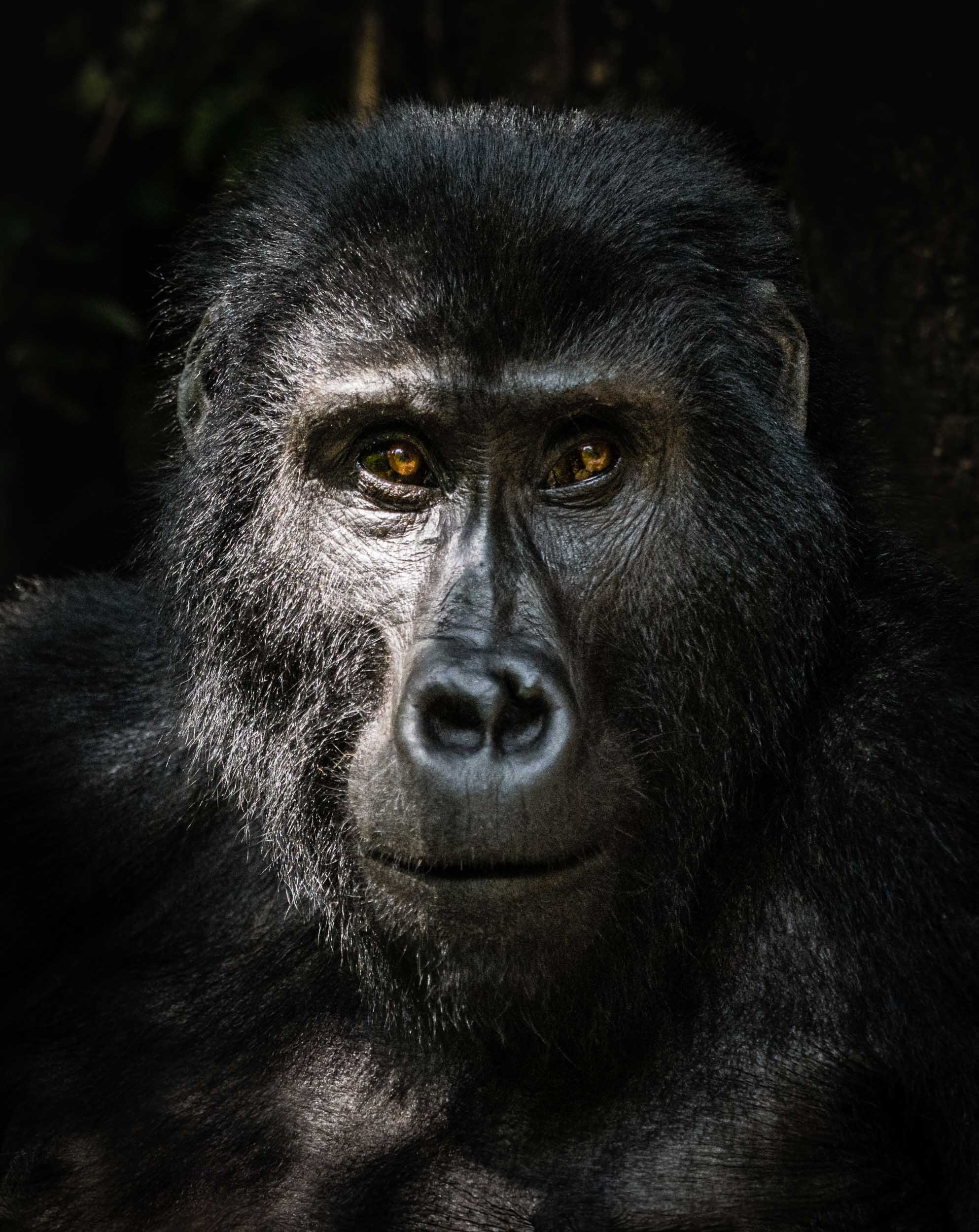
There are only just over 1000 individuals left on earth, living in two populations. One of them makes up about half of the entire species and lives in this forest, broken down into around 50 families. Only 21 of them are habituated, i.e. used to human presence, and can be visited. The one I trekked was the Oruzogo family made up of 17 individuals, led by the dominant silverback Bakwate.


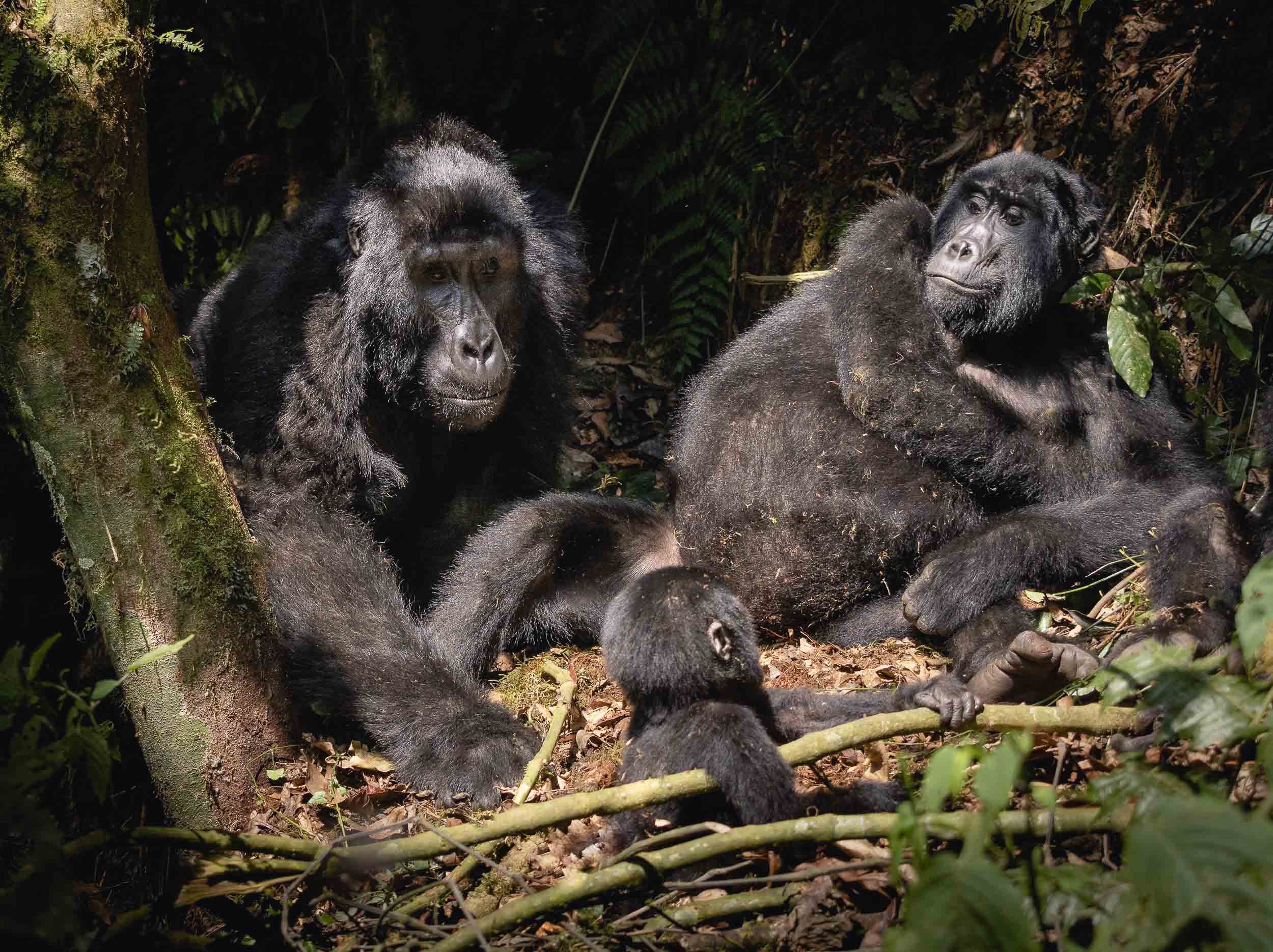
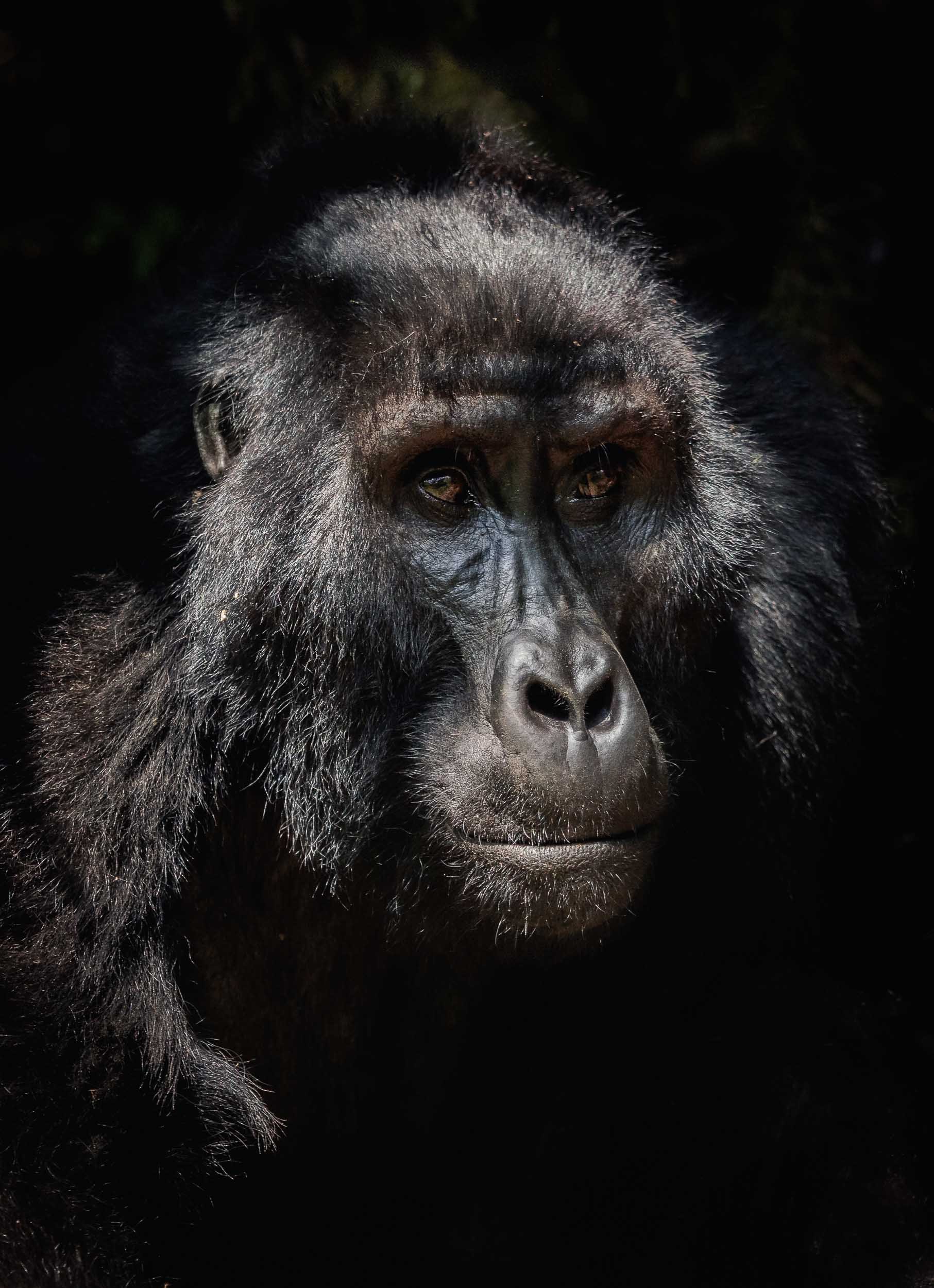
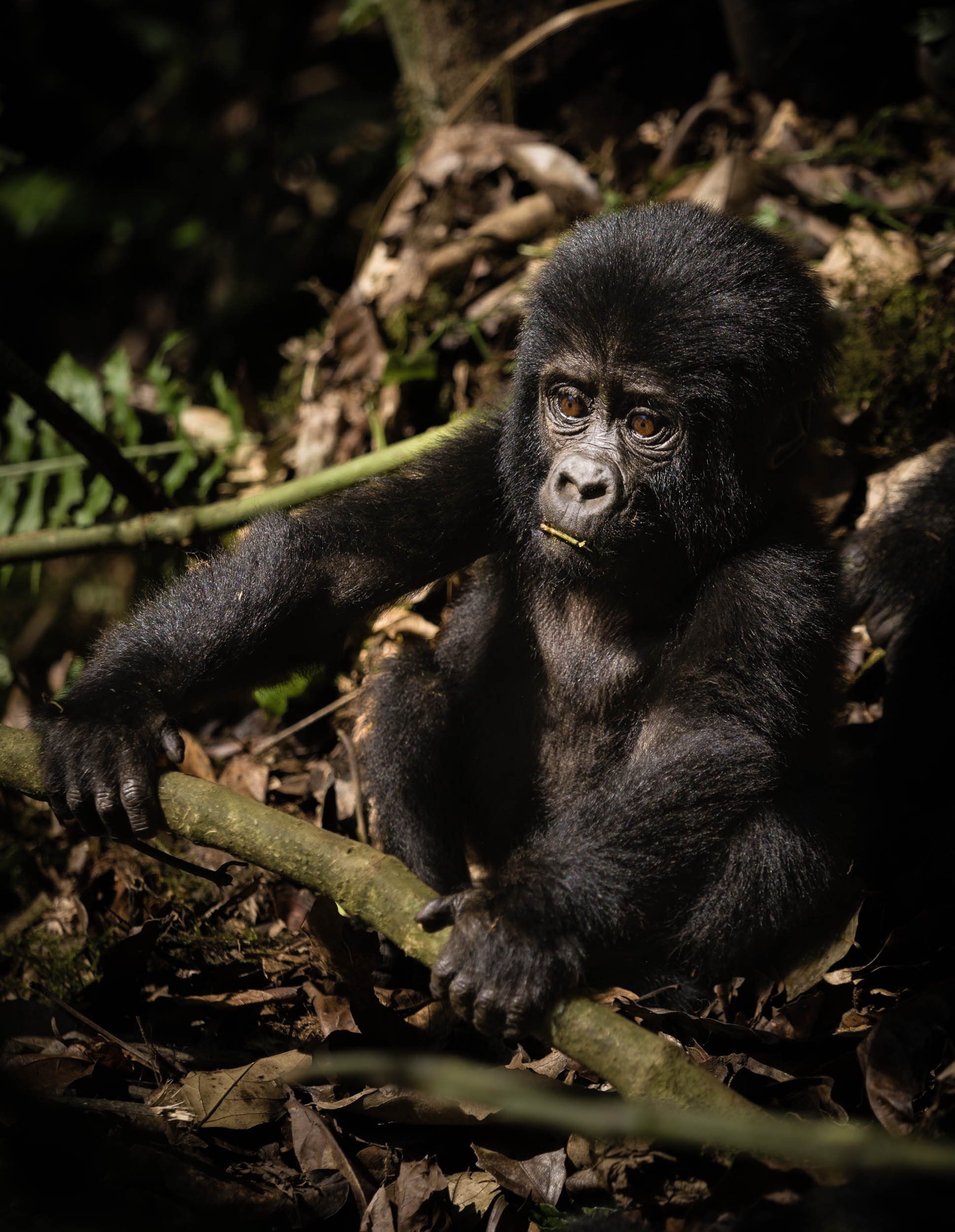
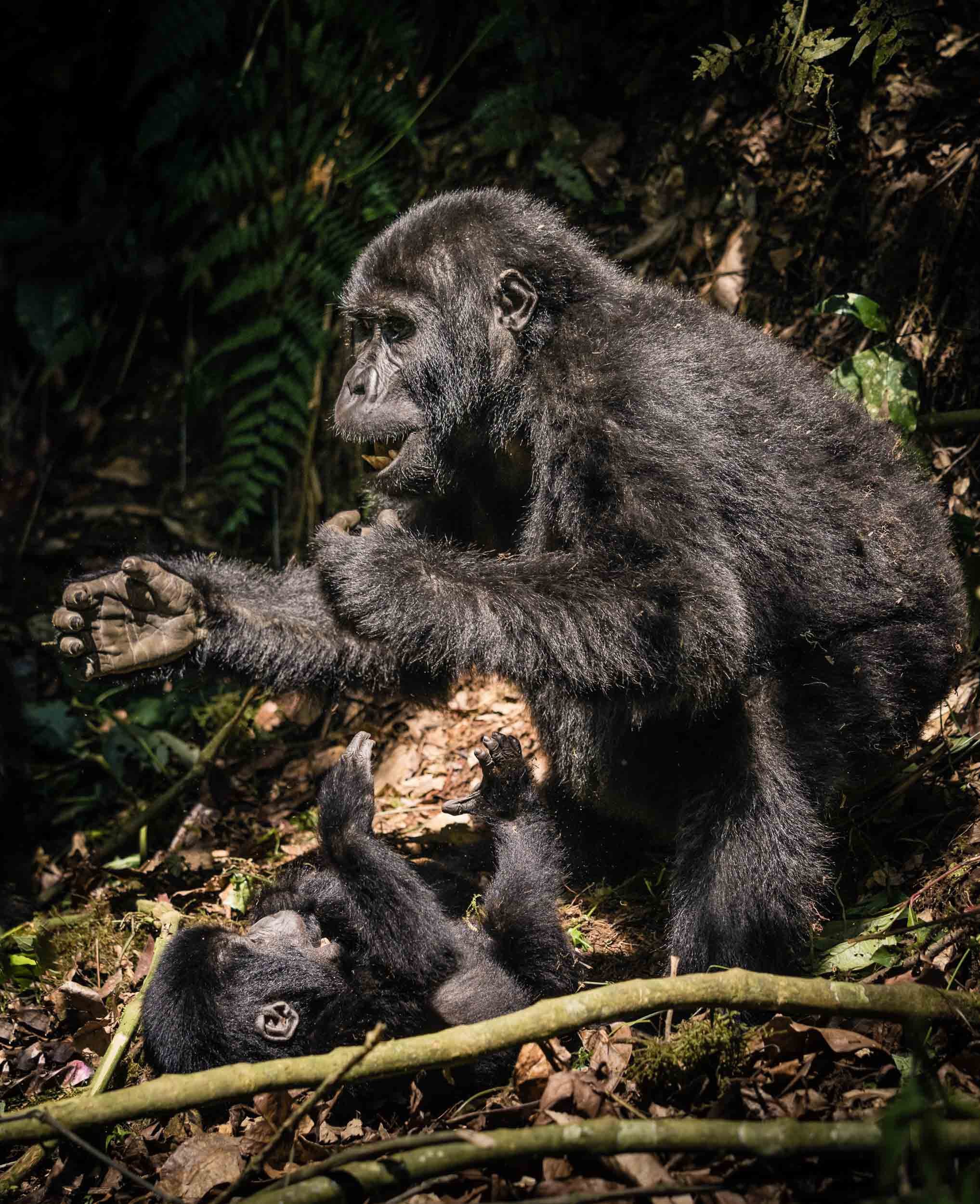
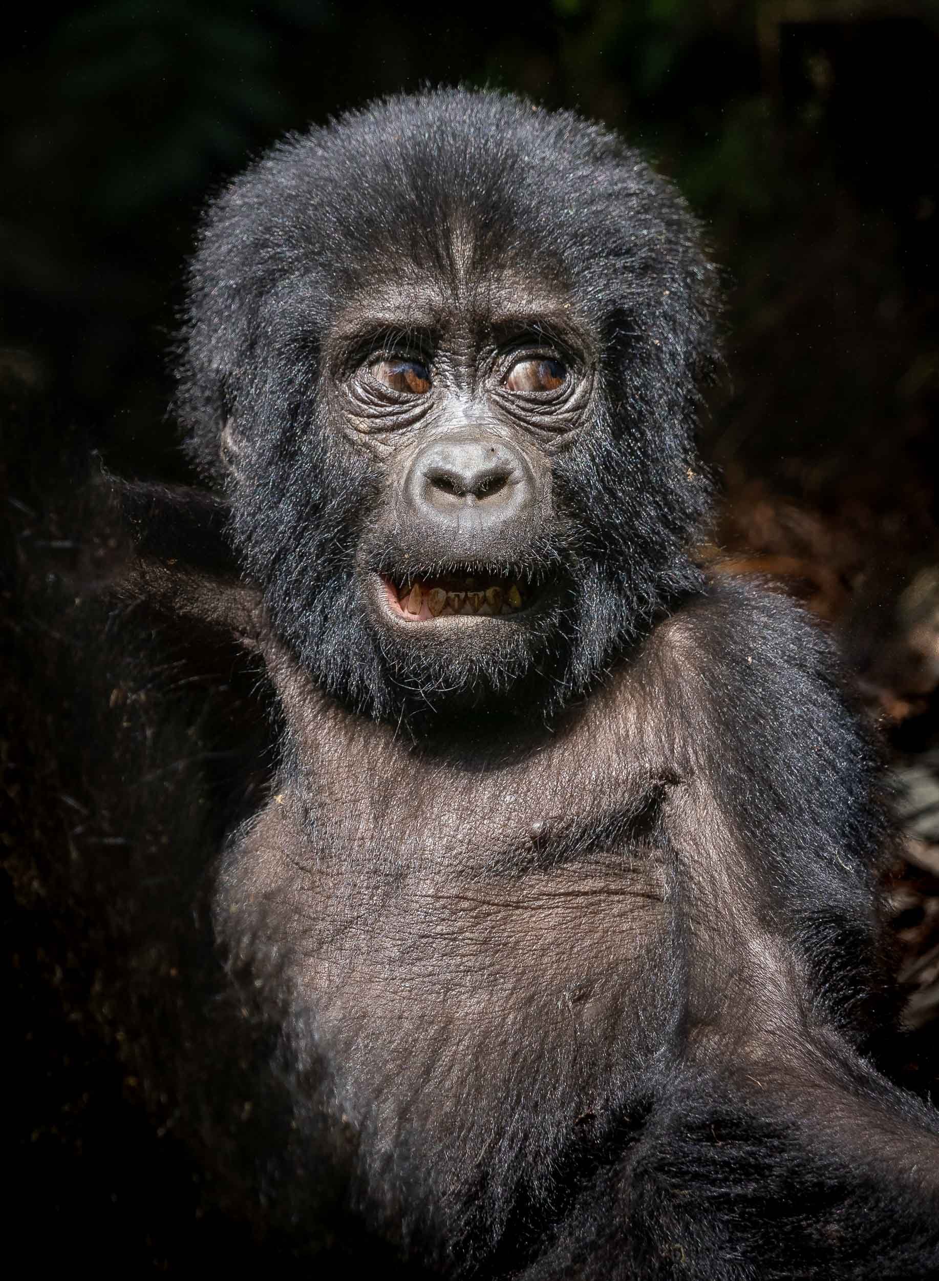
Seeing these rare and endangered animals in the wild, and observing their gentle and social behavior for an hour (this is the maximum amount of time you can stay with them) from just a few meters away is an experience that is hard to describe in words or photos.

From Tree Climbing Lions to Gorge Climbing Chimpanzees
Leaving Bwindi with a sad eye, I made my way northwards to the Queen Elizabeth National Park and the Kazinga Channel.


We encountered these young lions in a tree, where they spent the afternoon being lazy. Tree climbing lions are not common, but Queen Elizabeth National Park in Uganda is famous for them. They usually move up for a better view, shade, and to escape insects.


The Infamous Shoebill
Remember the quest for this elusive bird? Well, after an unsuccessful try in the swamps, the park came through for us. It is home to several of them, and one individual put on a show, even circling above our heads, which is quite rare as these birds are very large and heavy - up to 1.5m in size, weighing 7 kg - and rarely fly long distances. Their peculiar look and the large beak make them appear almost prehistoric - a modern dinosaur!

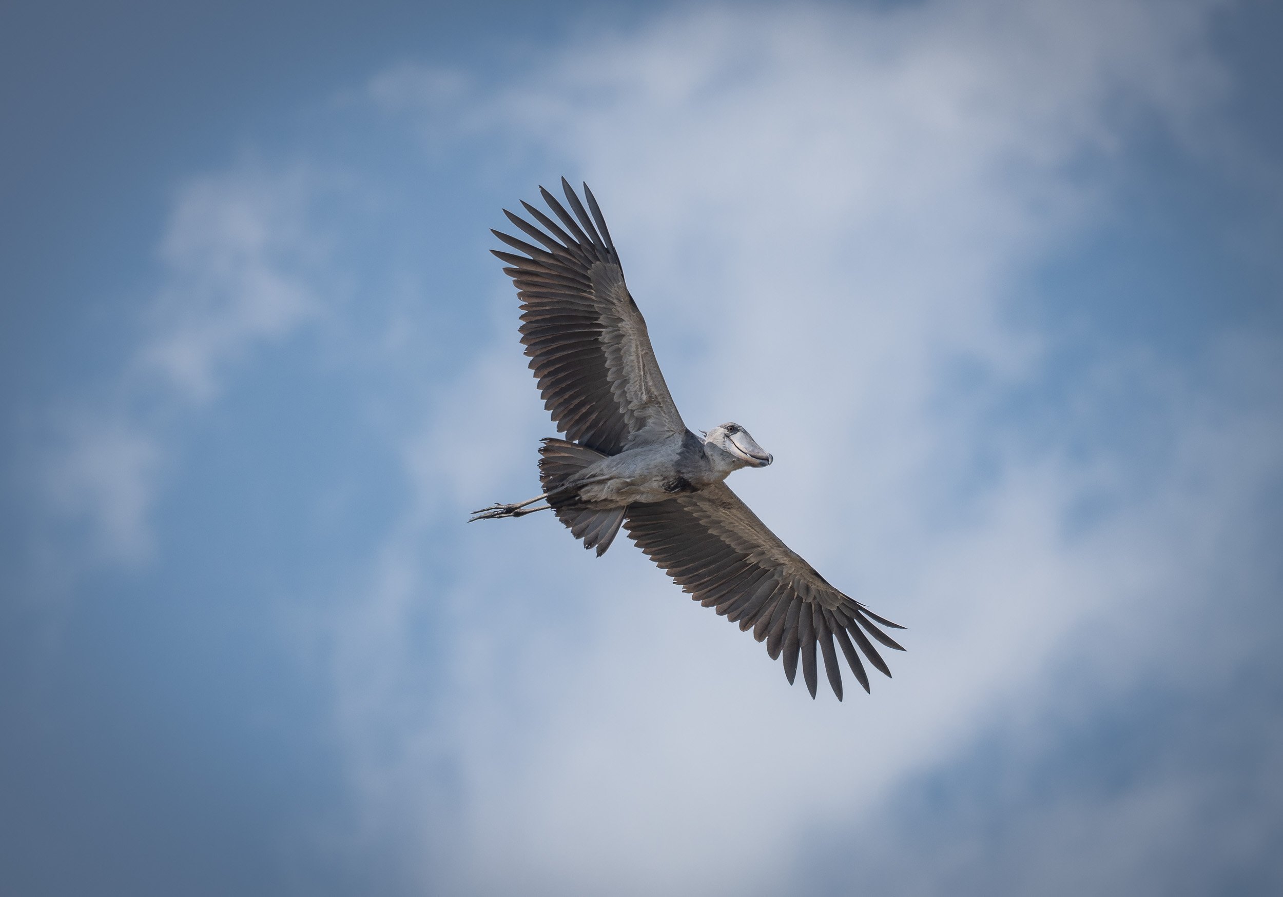
A Cruise on the Channel


Great Apes - The Second Round
The park is also home to another Great Ape species which can be tracked and observed closely in the wild: Chimpanzees. The location is equally as spectacular as the Bwindi Forest: The Kyambura Gorge.
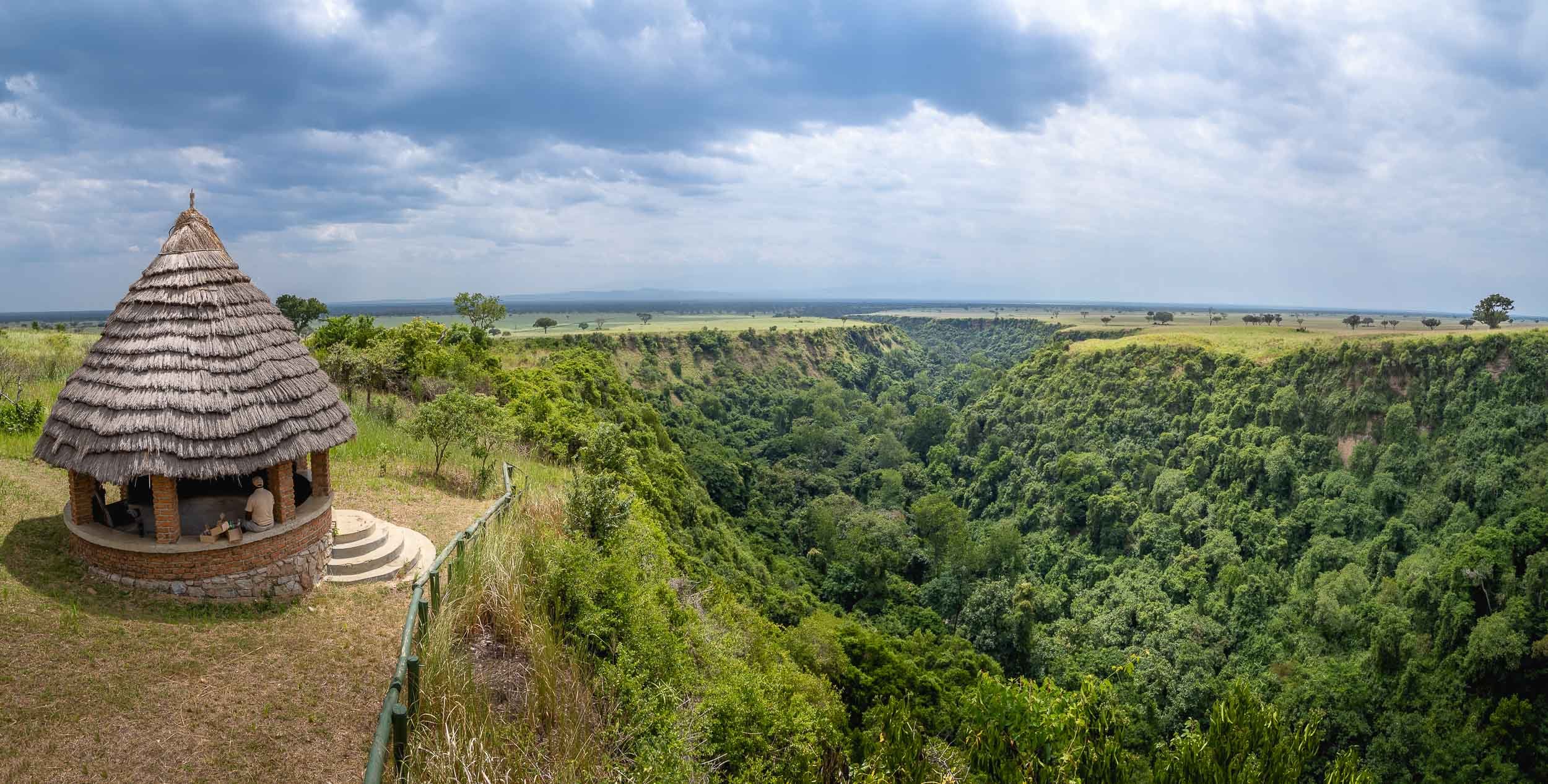
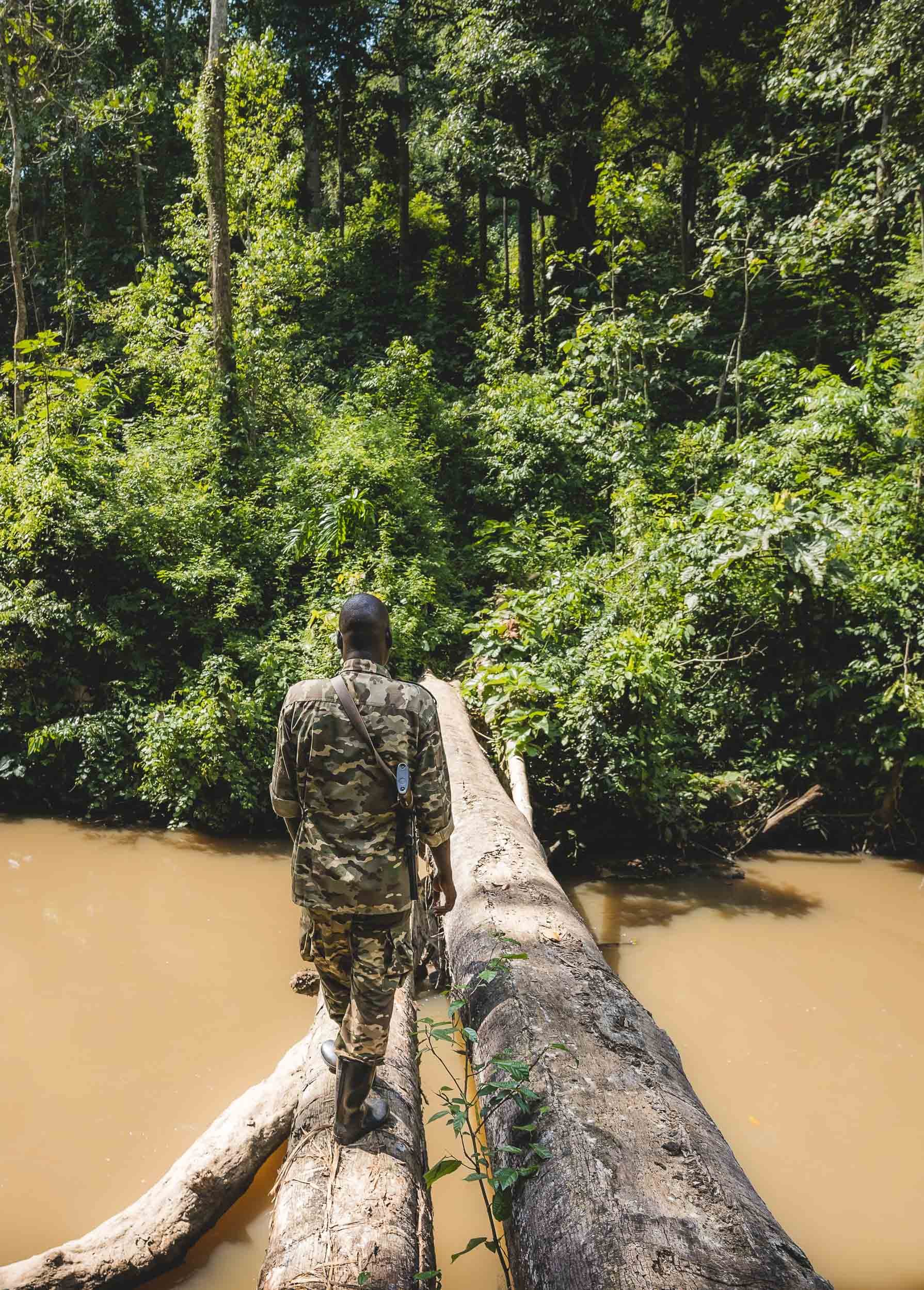
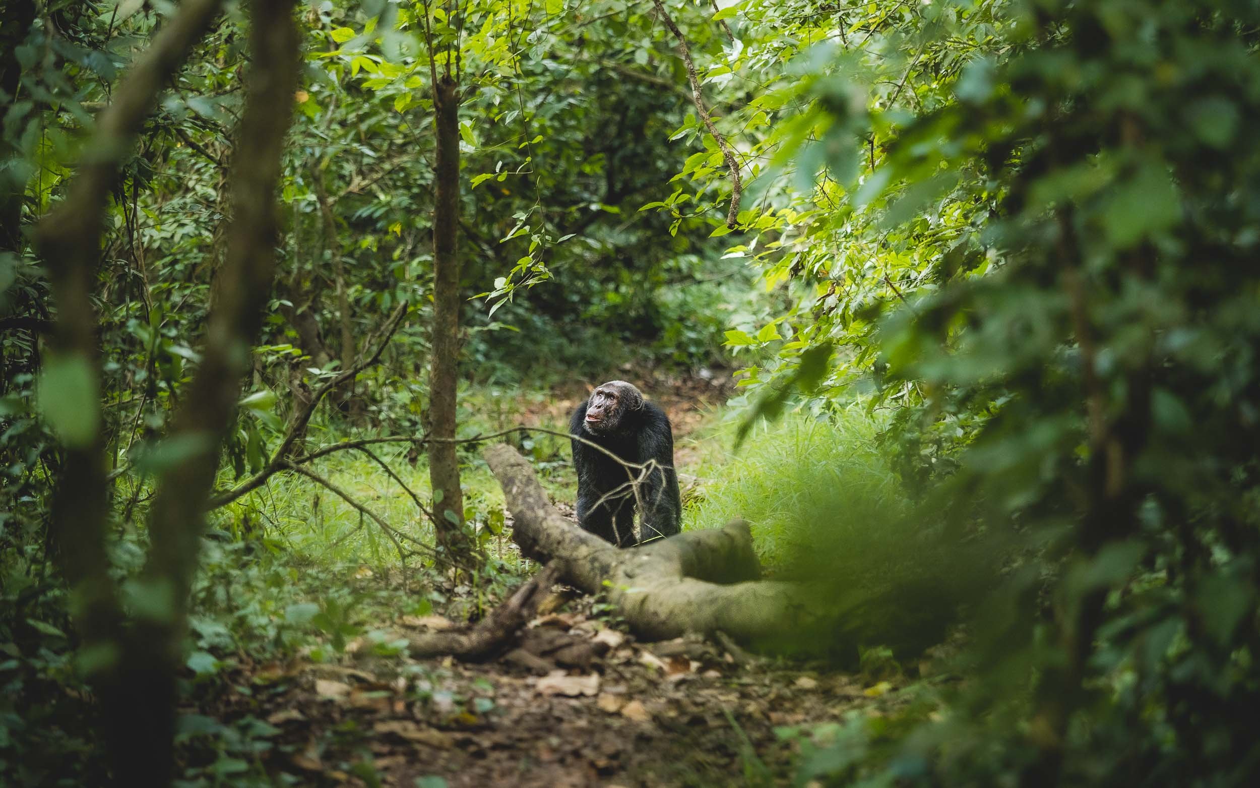
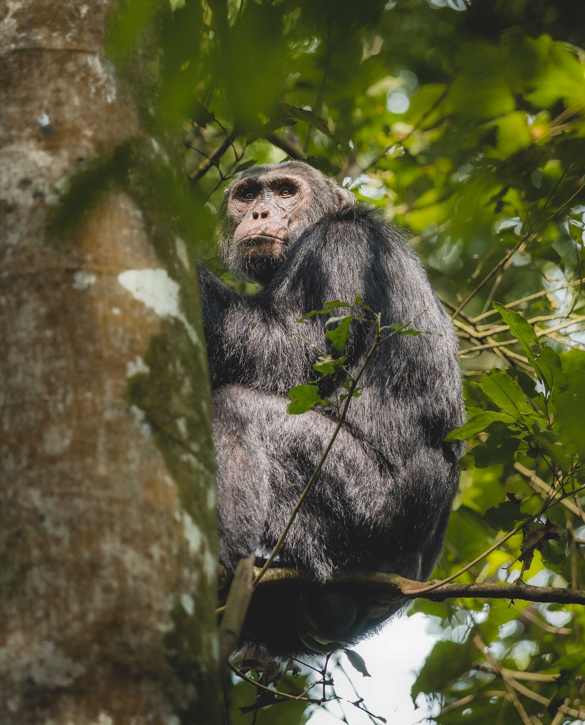
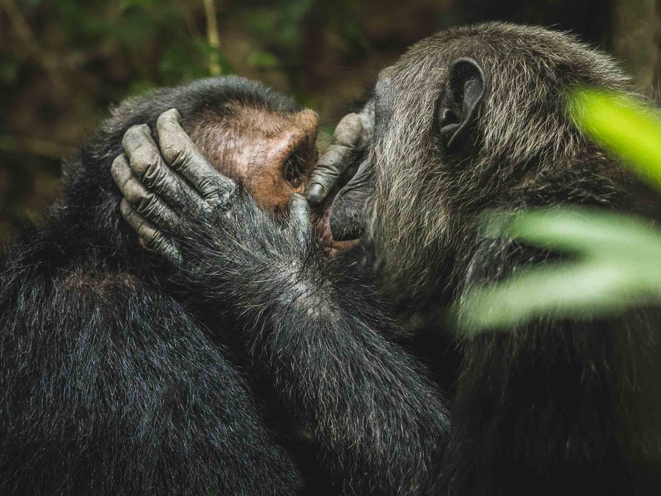
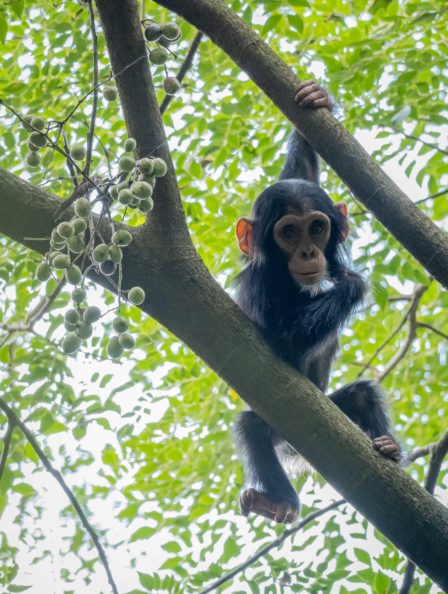


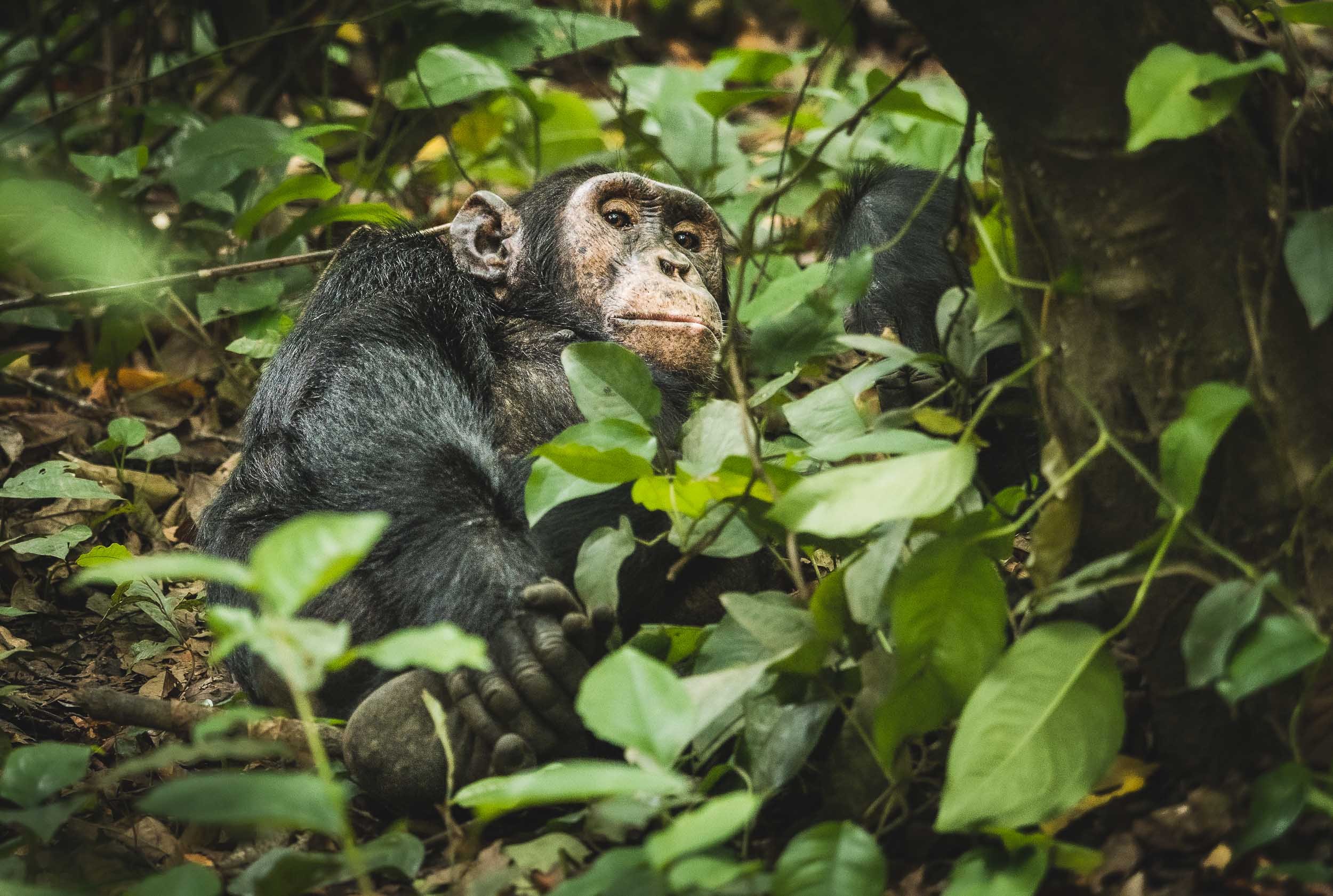
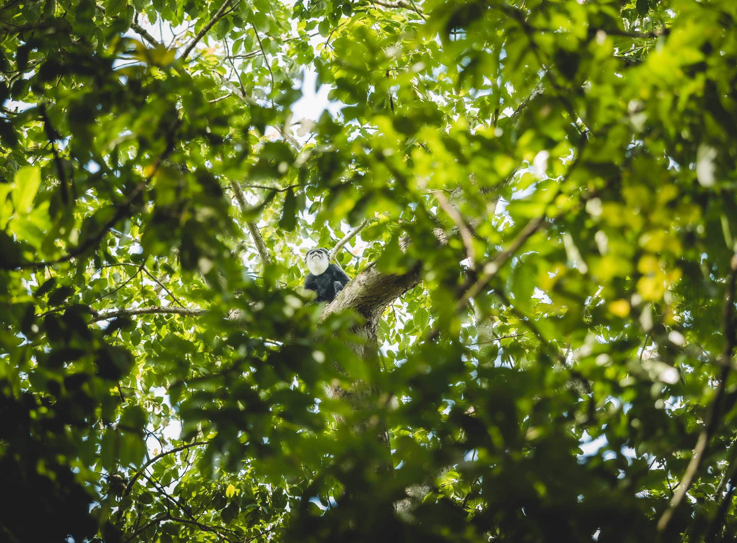

While they are both part of the Great Ape family, Chimpanzee observation feels very different from trekking and observing Mountain Gorillas. It’s a very distinct experience that I’m glad I didn’t miss.
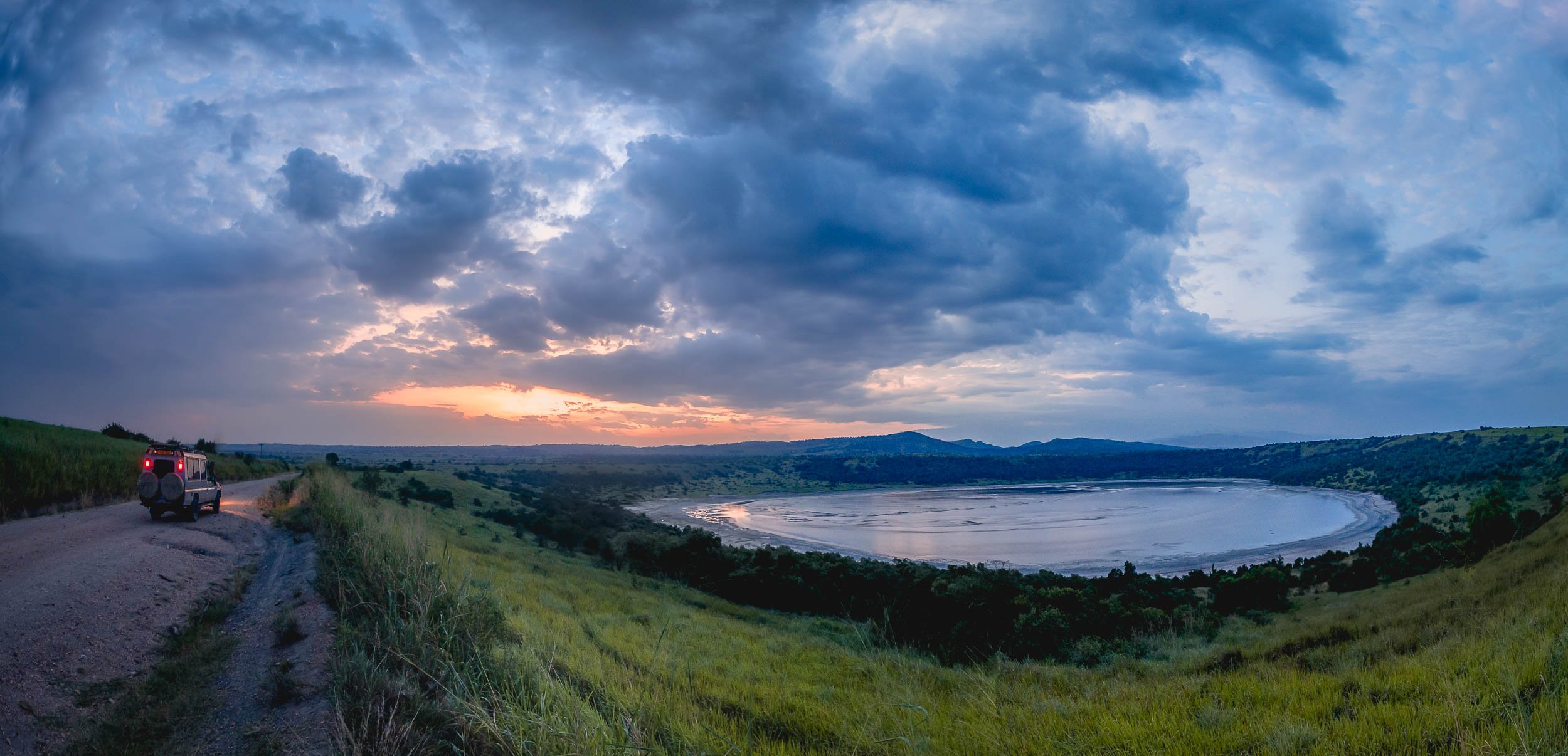
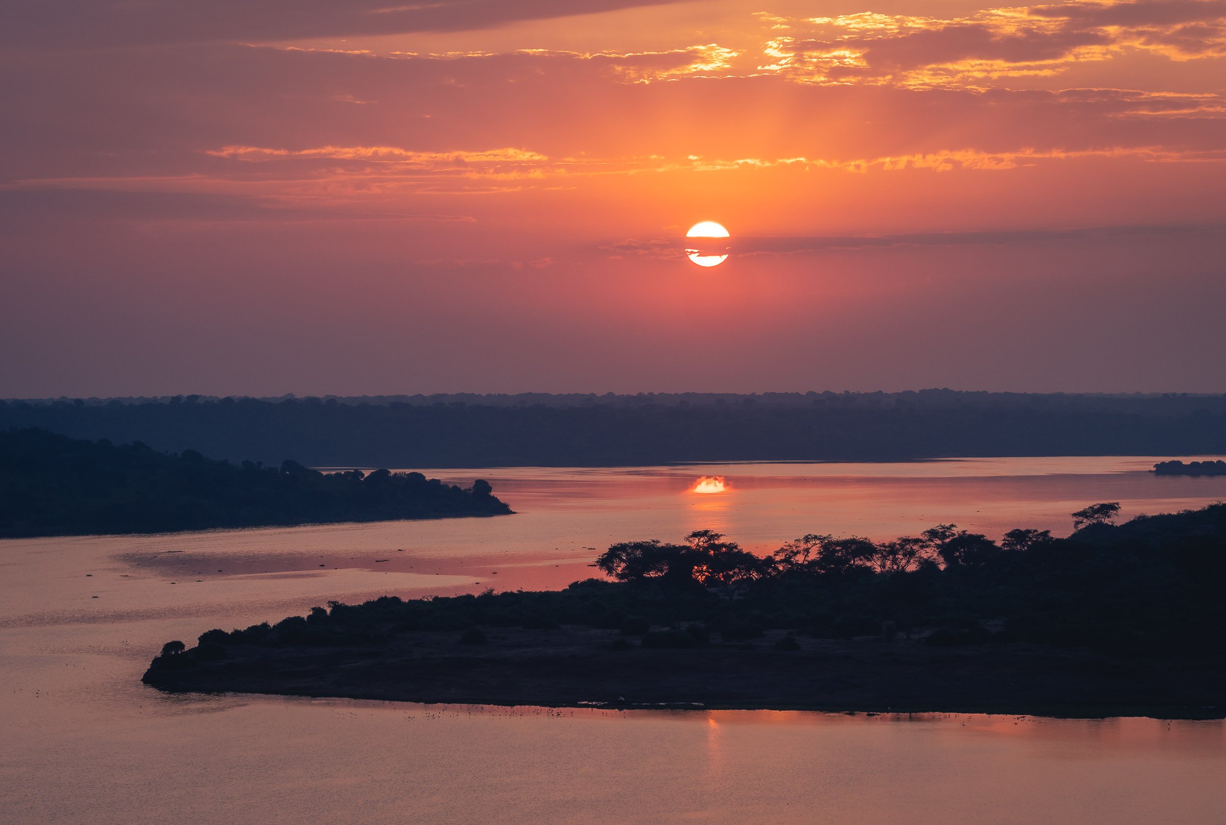

Kenya - Giraffe in the City and Gentle Giants
The land of giants, and some the most incredible animal encounters I ever experienced.

My journey through Kenya was a relatively short one, and focused on only two parts of the country: Nairobi and the Amboseli National Park. Despite that, the days here included some of my most memorable moments in Africa - read on to find out what they were.
A Day in Nairobi
Nairobi National Park
My trip began with a very early morning pickup in order to explore the country’s first game reserve , and the only National Park in the world literally situated within a capital city. The park is fenced on three sides, but the southern border allows migration of animals.
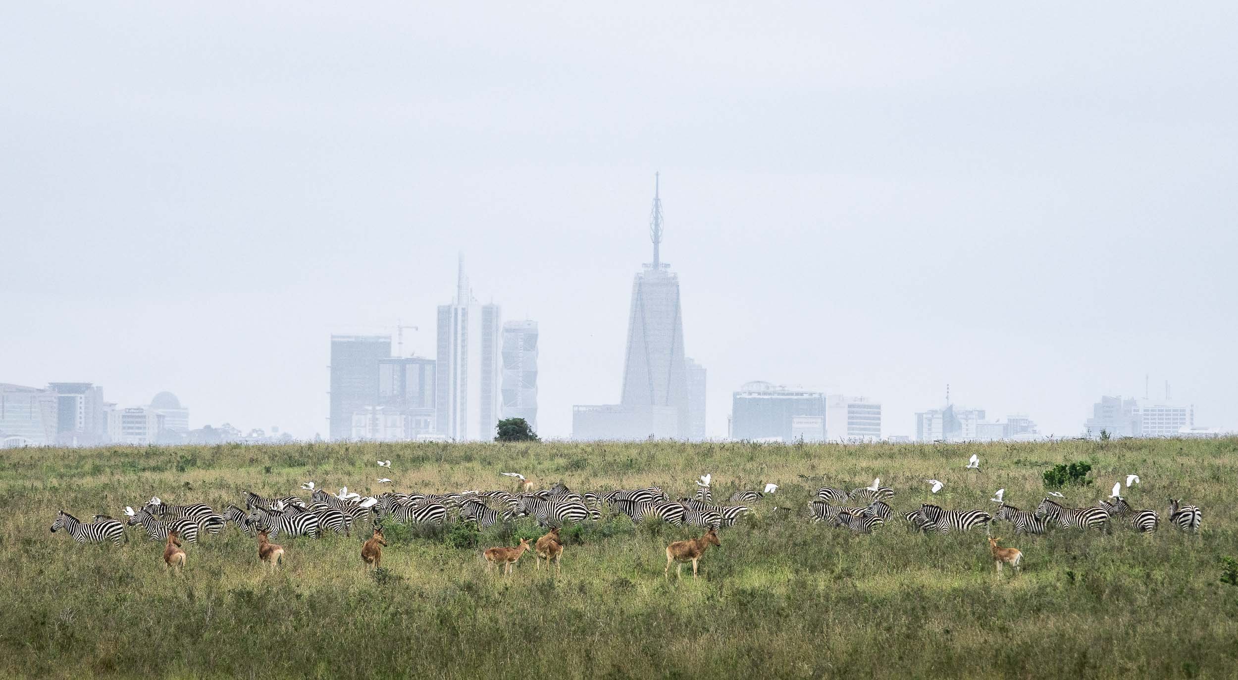
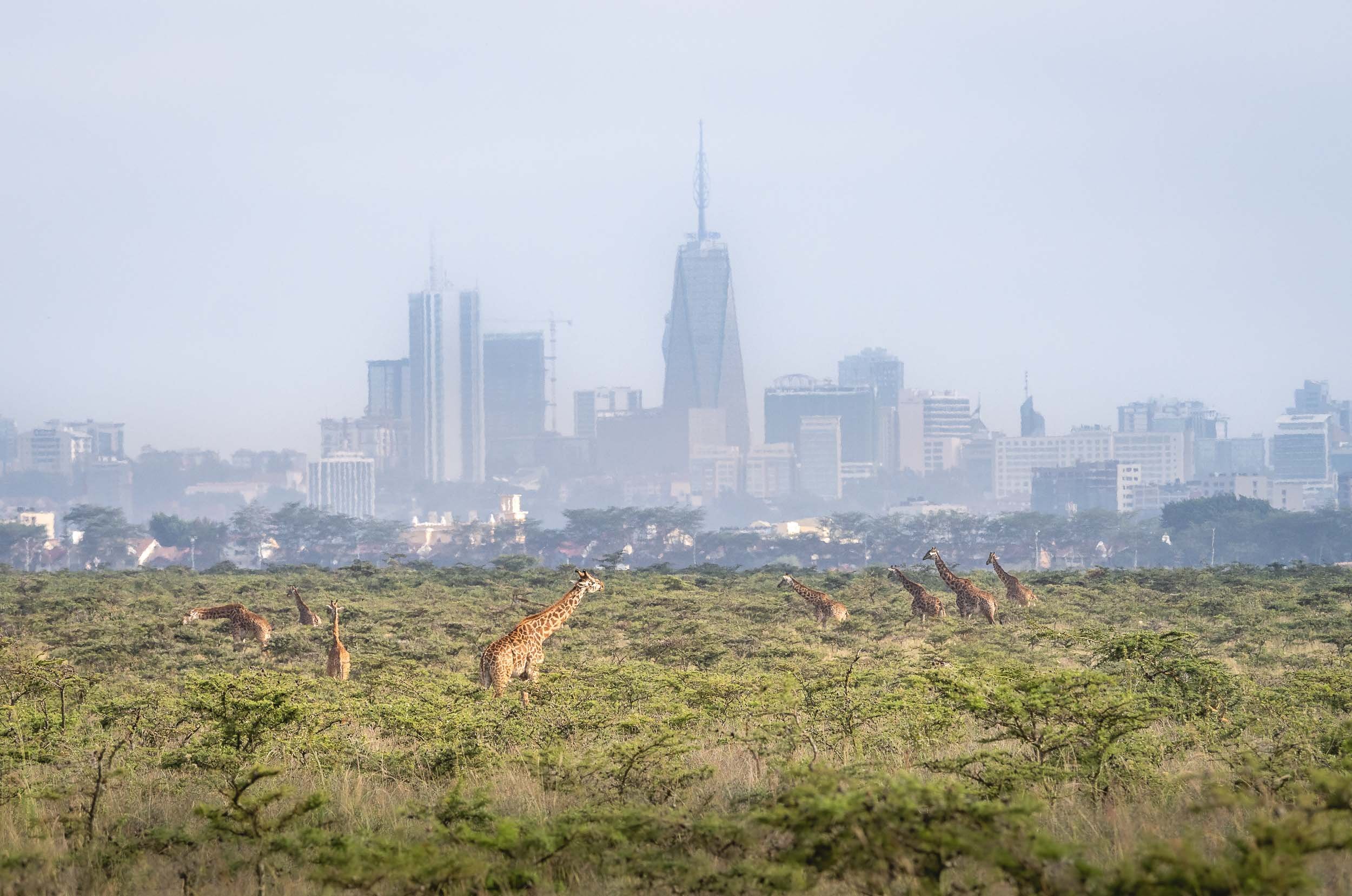
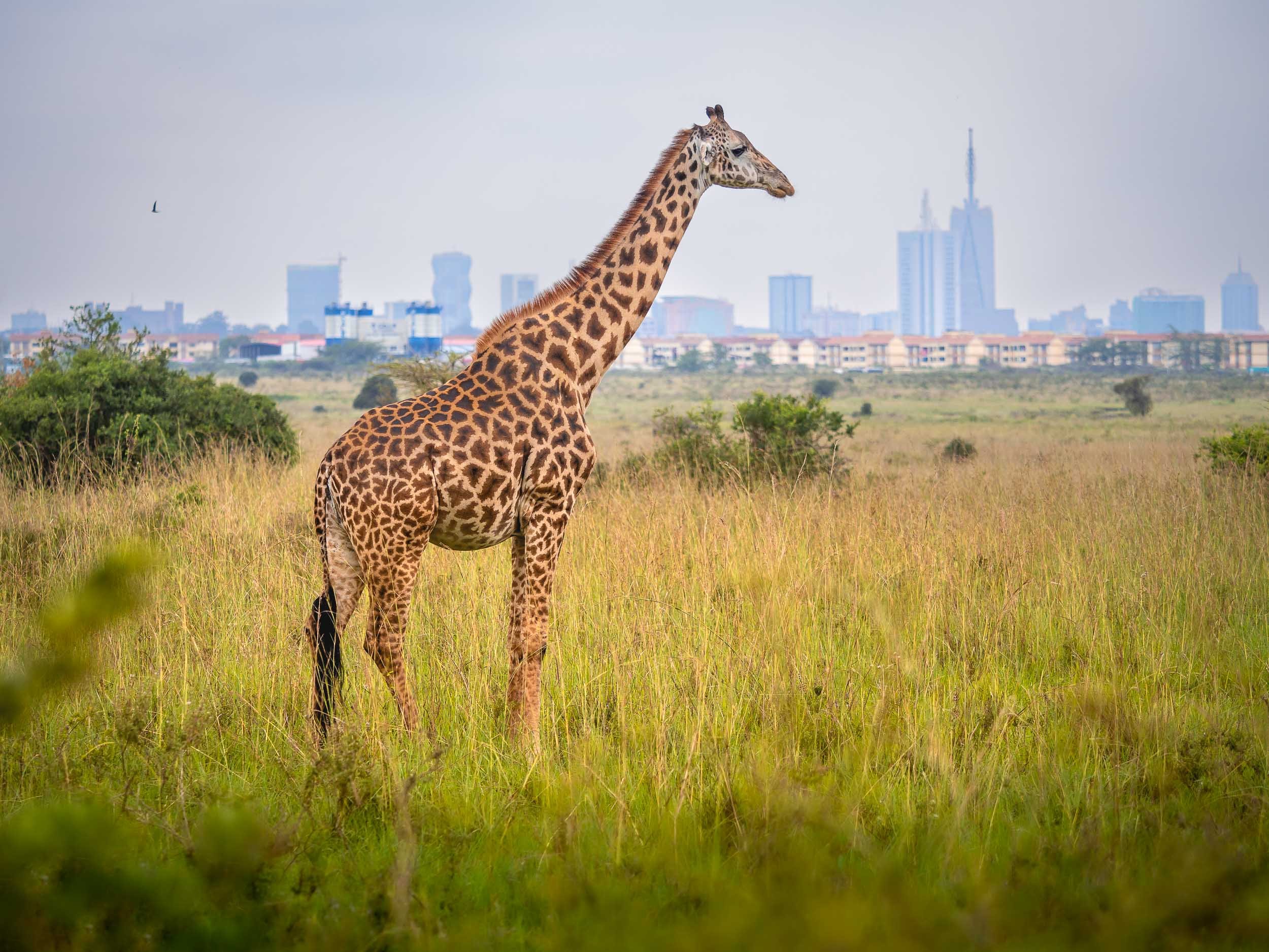
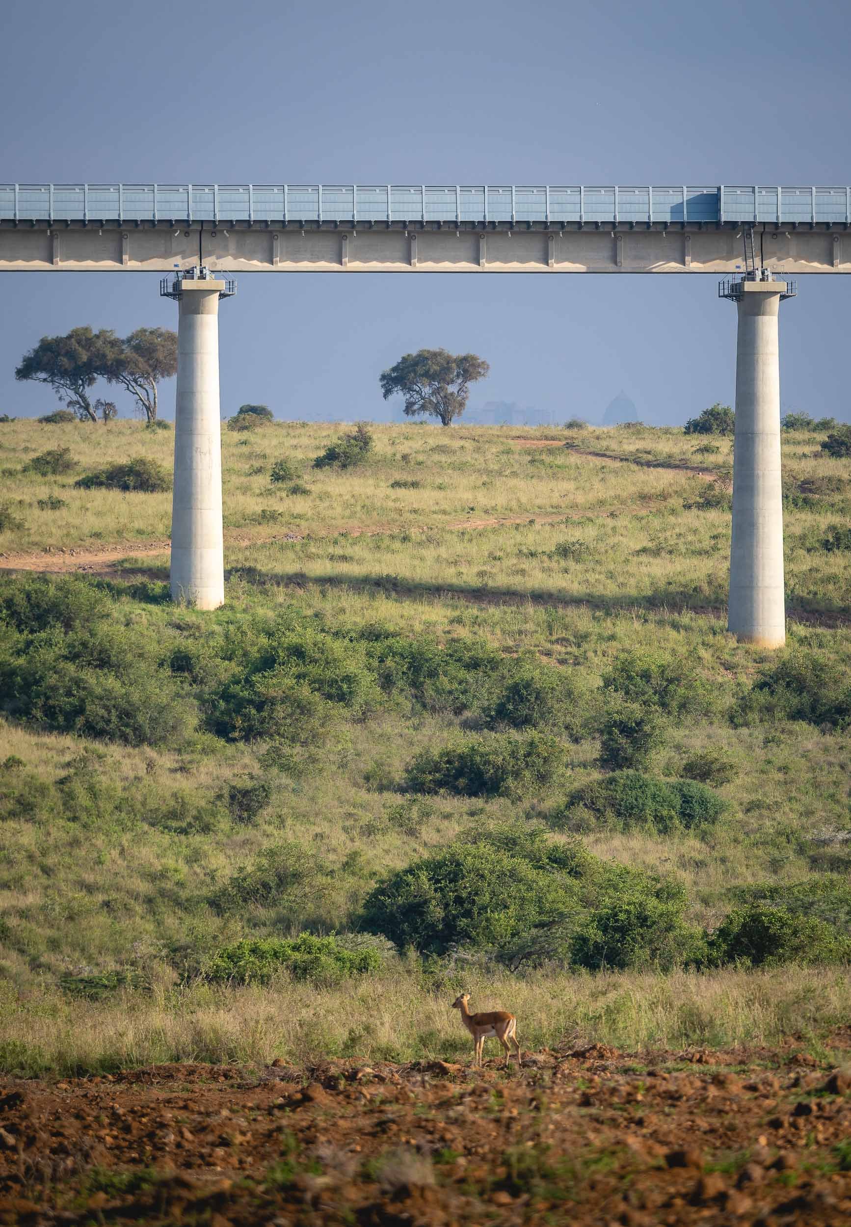
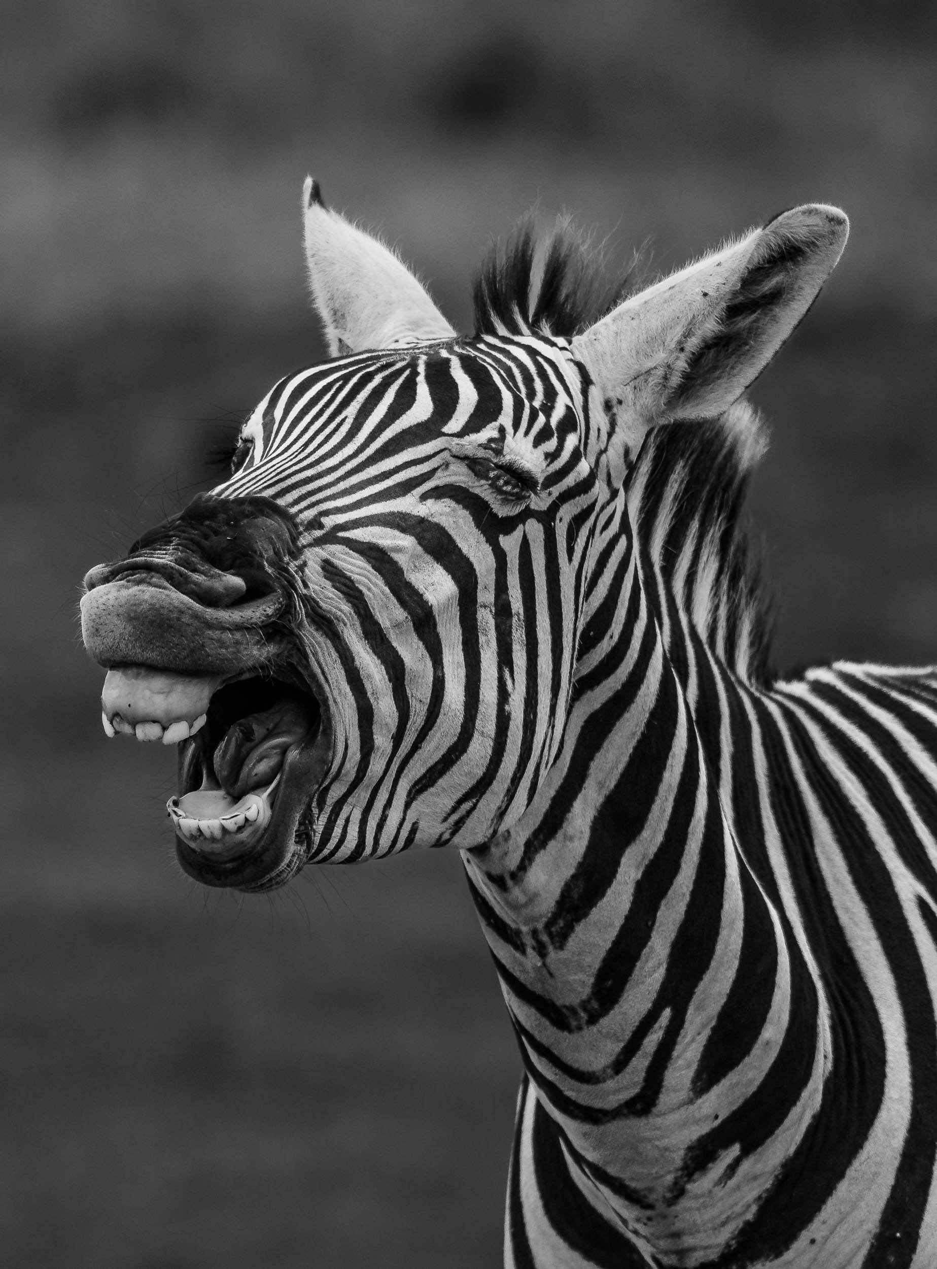
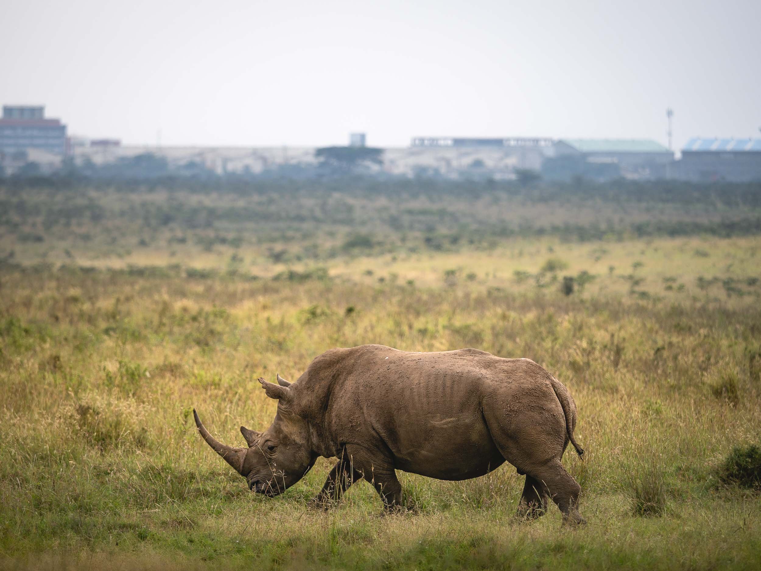
The Sheldrick Wildlife Trust
Close to the National Park are the grounds of the SWT, the most successful orphan elephant rescue and rehabilitation program in the world. Aside from taking care of abandoned elephant babies, they do much more though, such as conducting anti-poaching activities, veterinary missions, as well as water relief and community projects. You can learn more here.
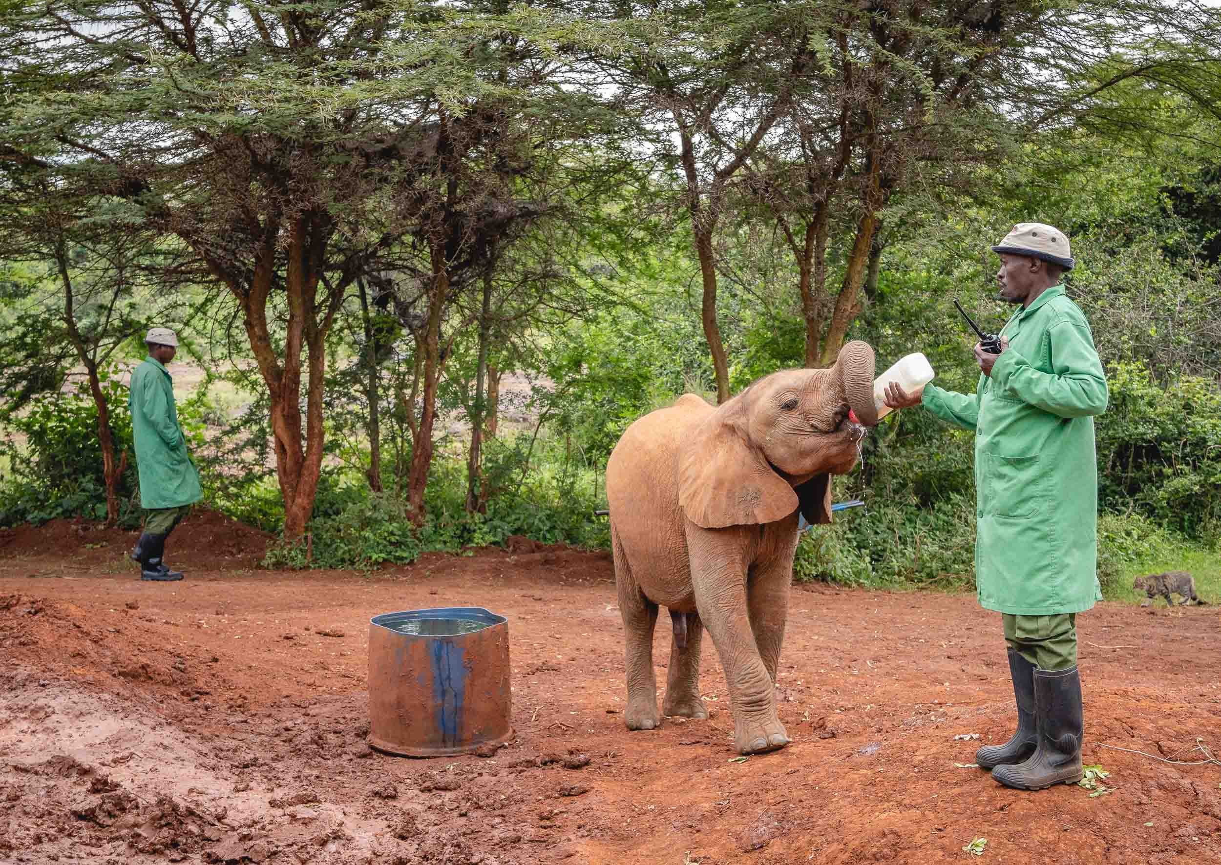
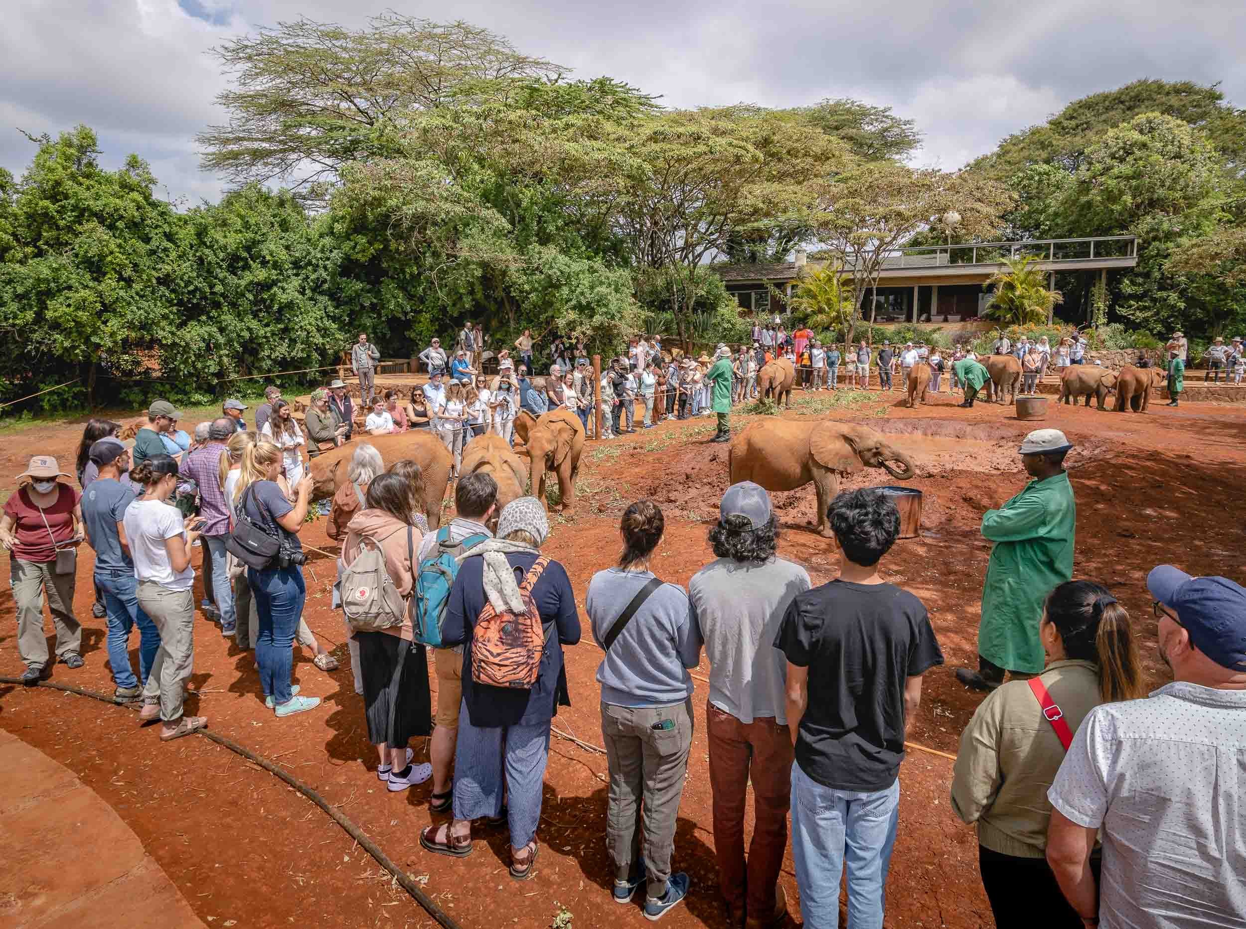
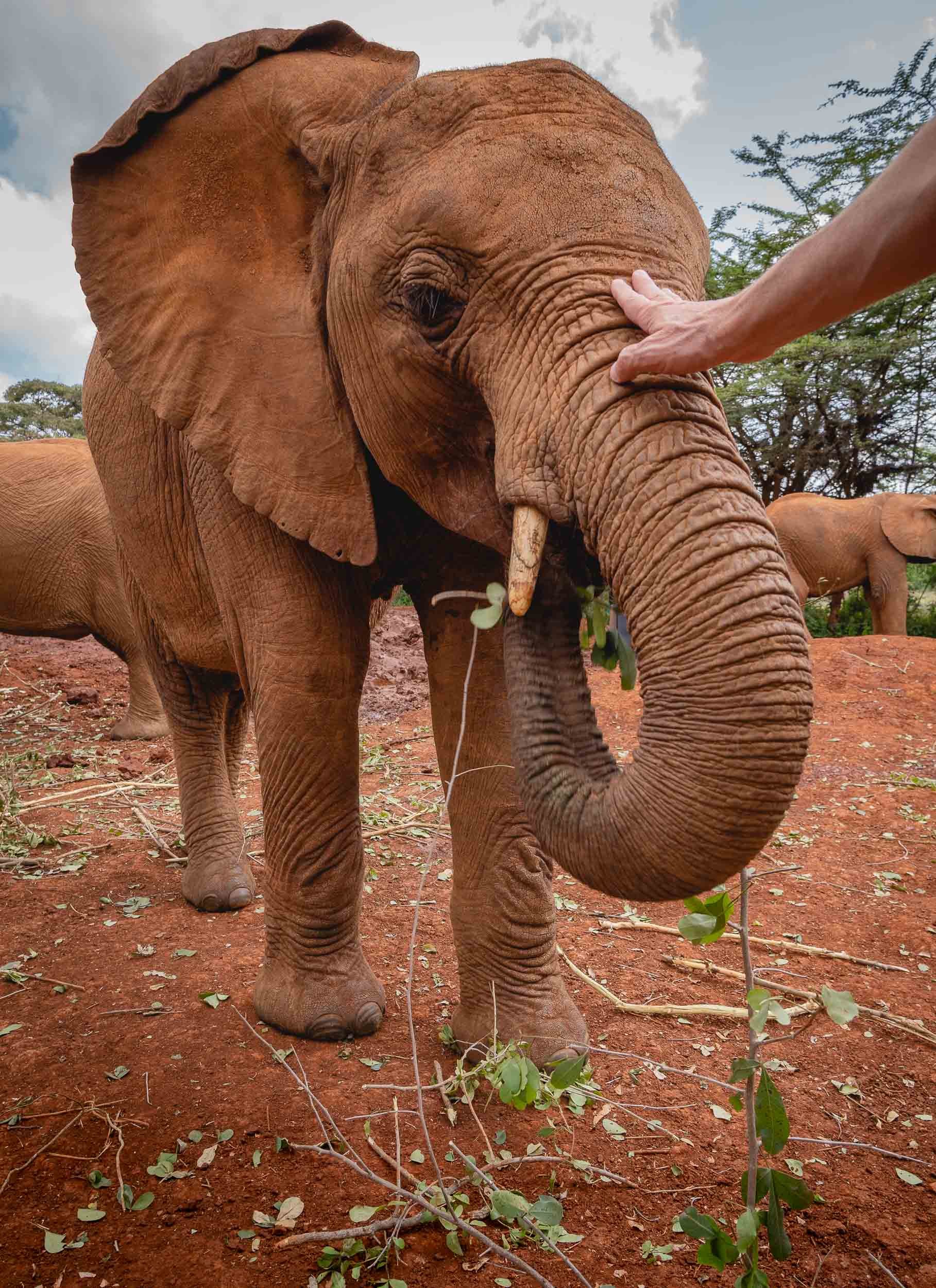
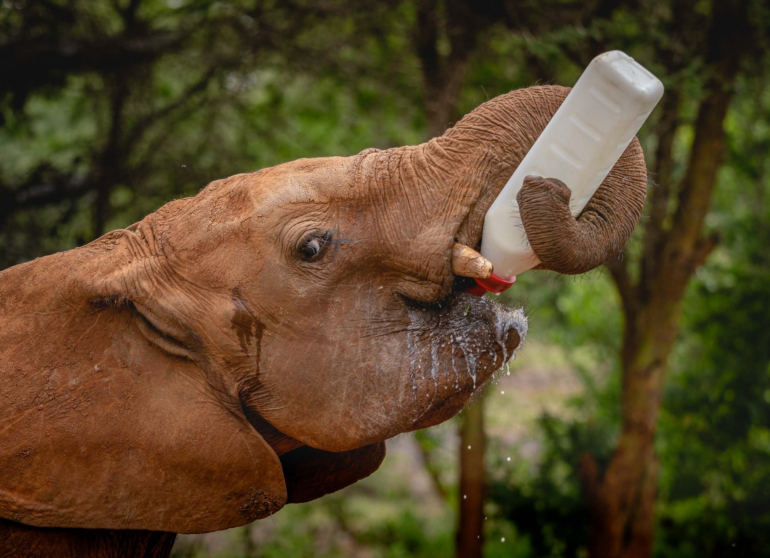
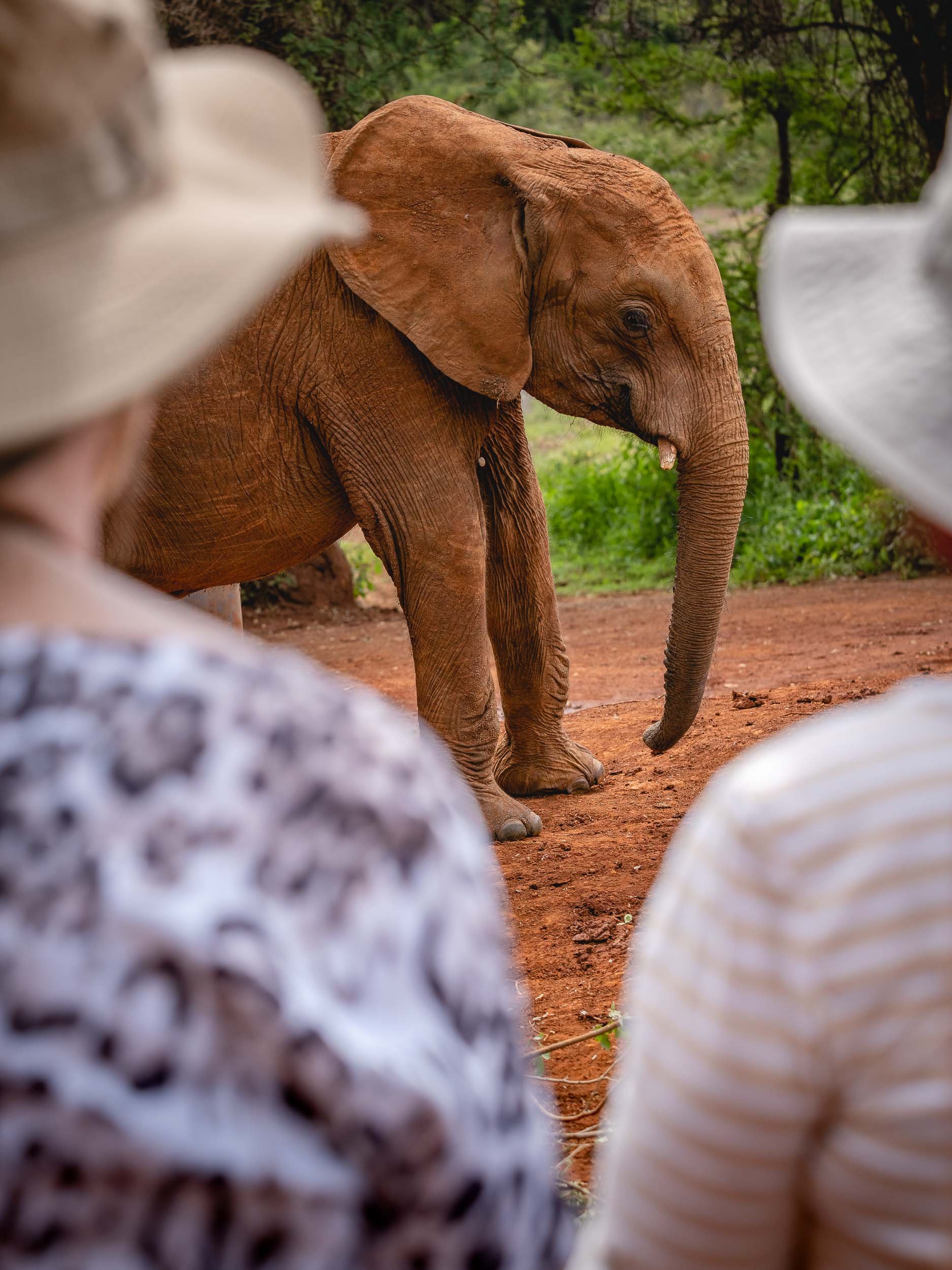
The Giraffe Centre
Next on the agenda was a visit to this sanctuary, which began its story in 1979 when Jock and Betty Leslie-Manville set out to save the nearly extinct Rothschild giraffe. In the early 1980s the centre opened to the public and is now home to several of these animals, of which there are only 1200 left in the wild. Learn more here.
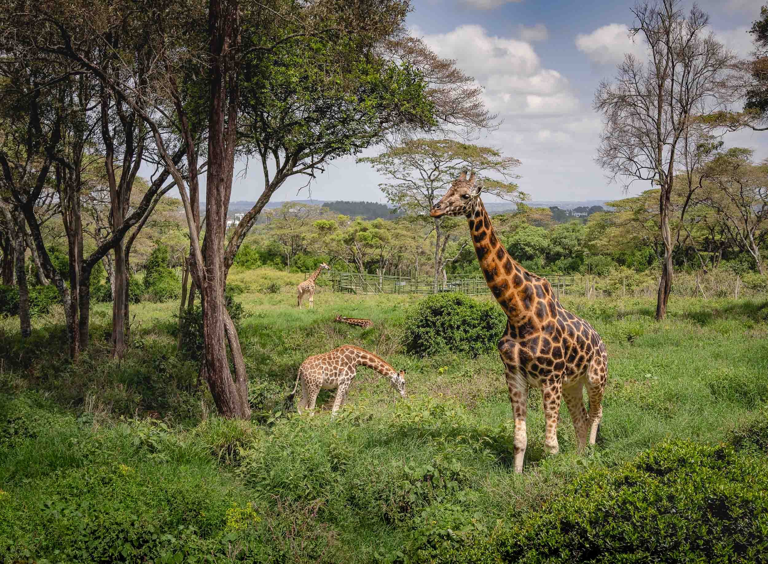
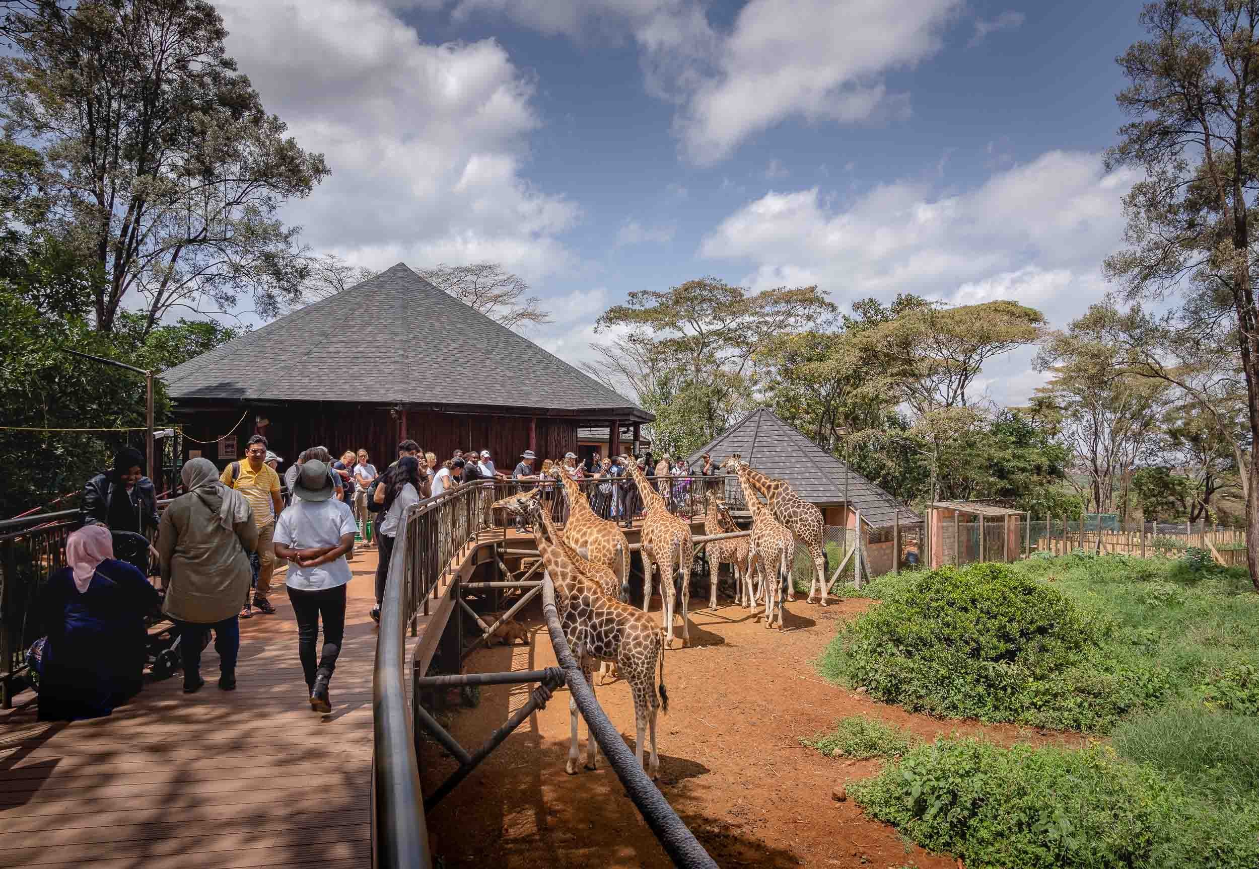
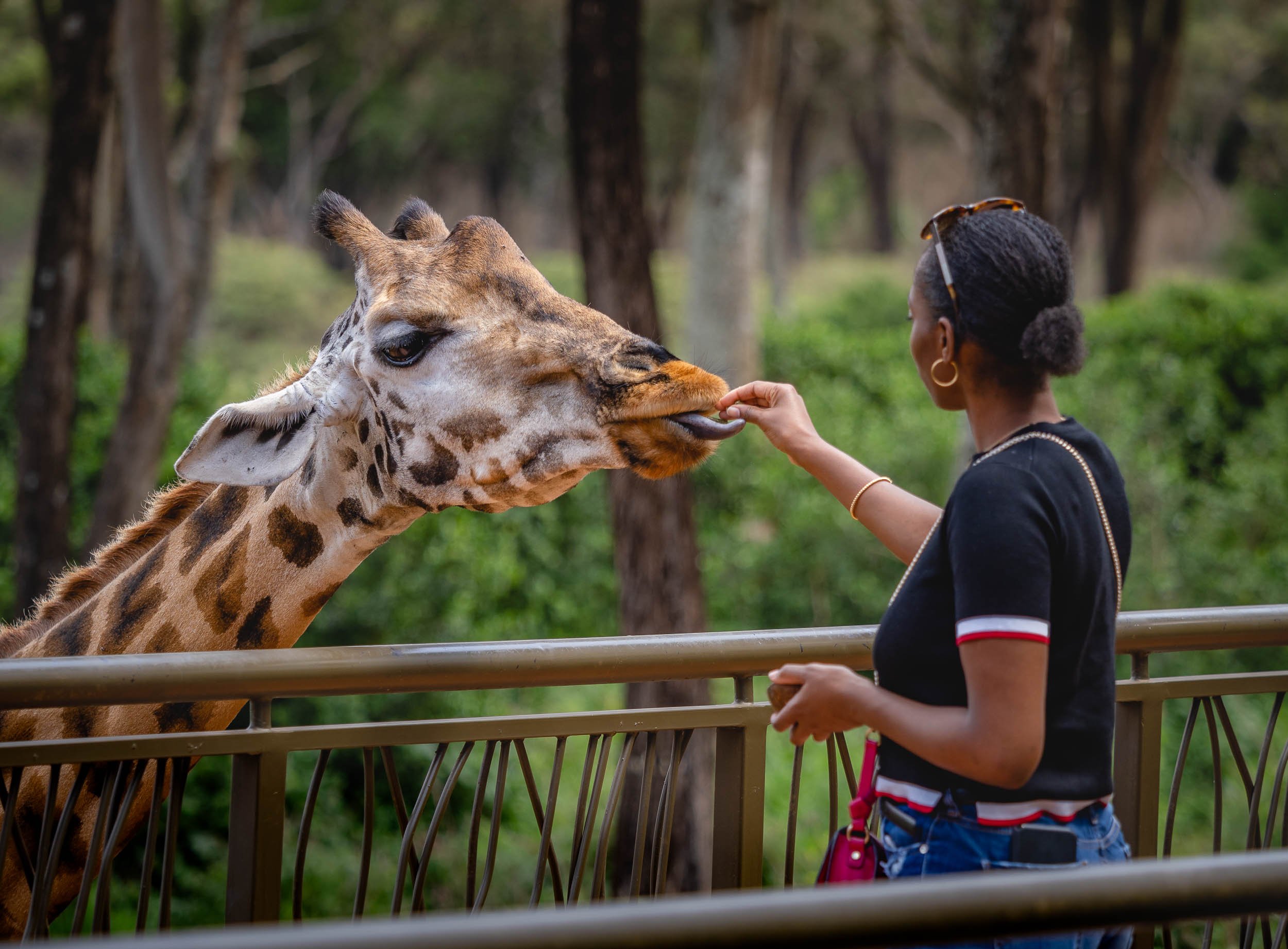
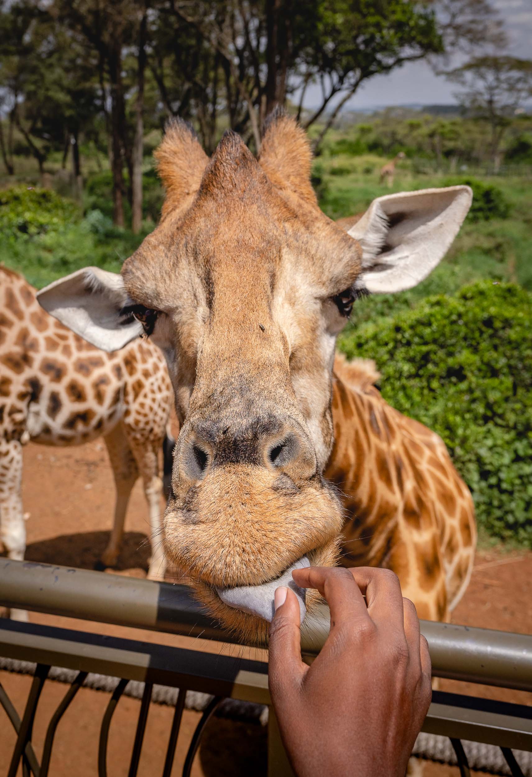
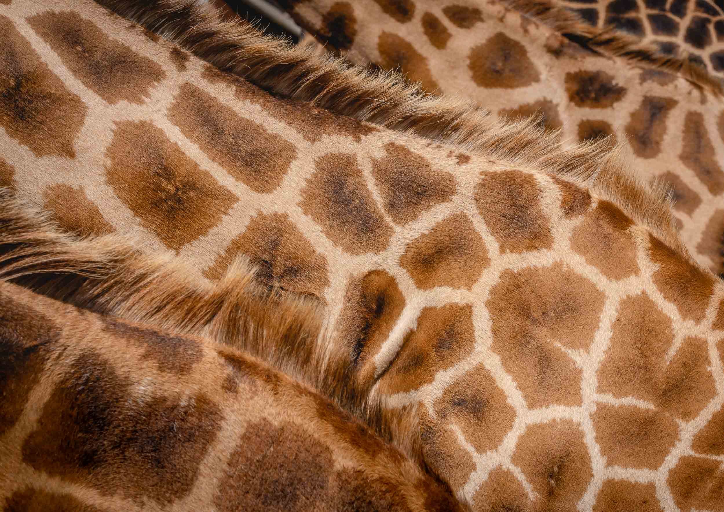
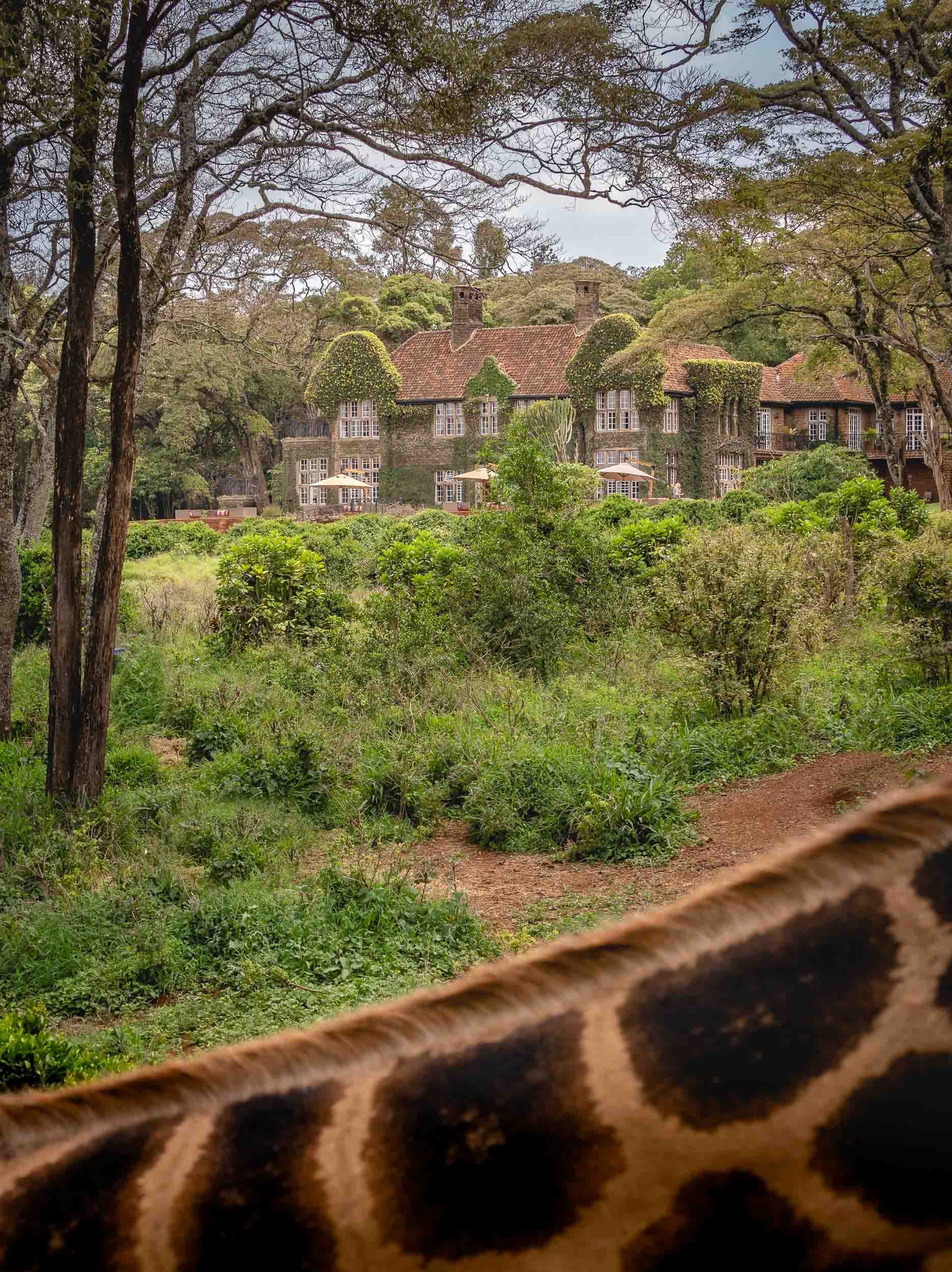
Exploring the City
The last few hours of Day 1 in Kenya were spent on a walk through the city, and a view from above.
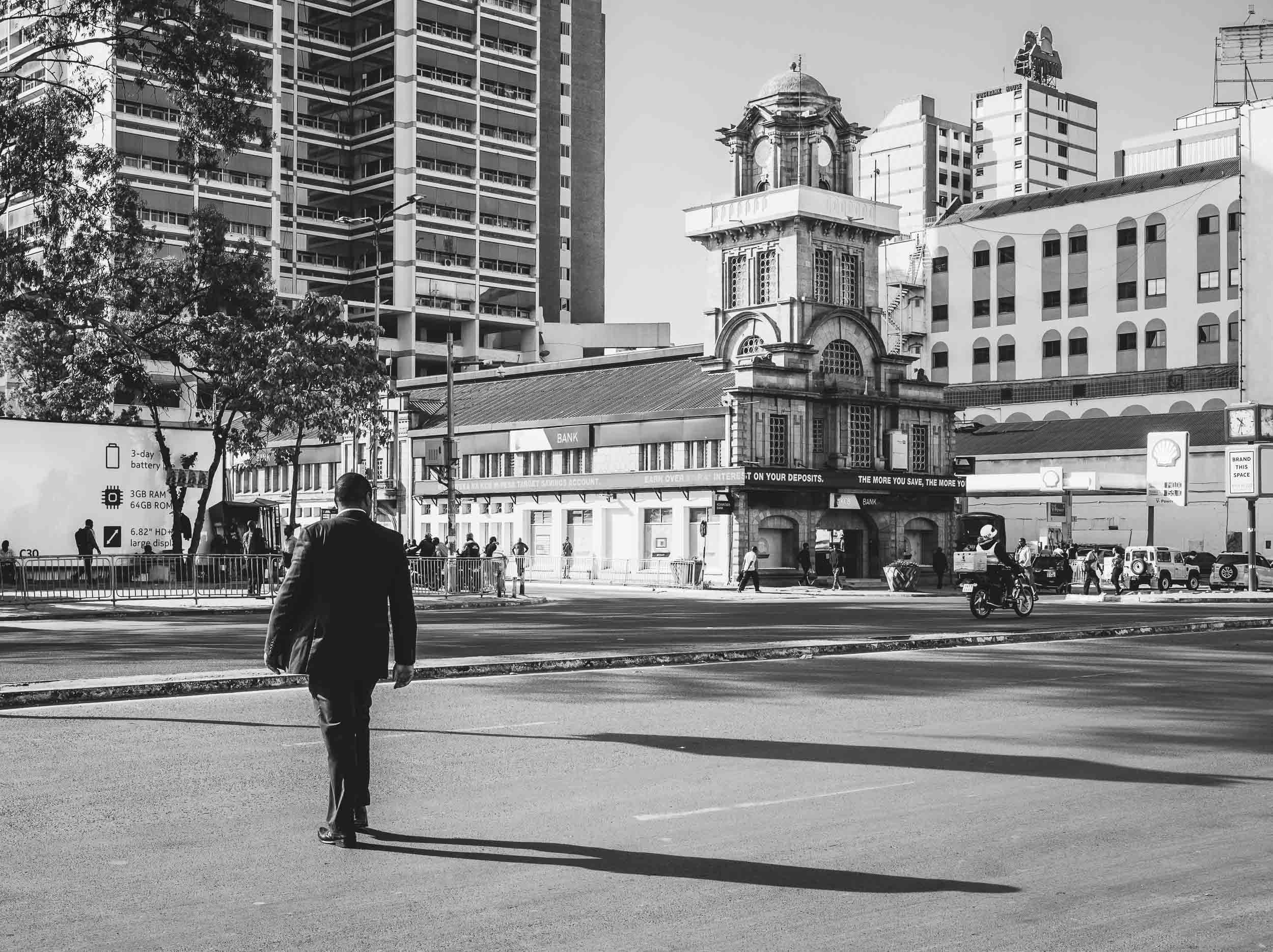
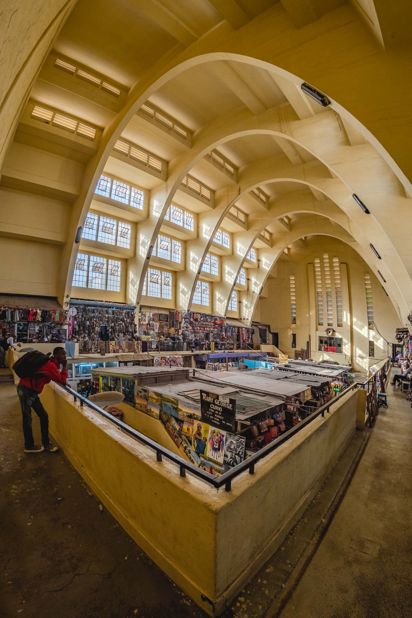
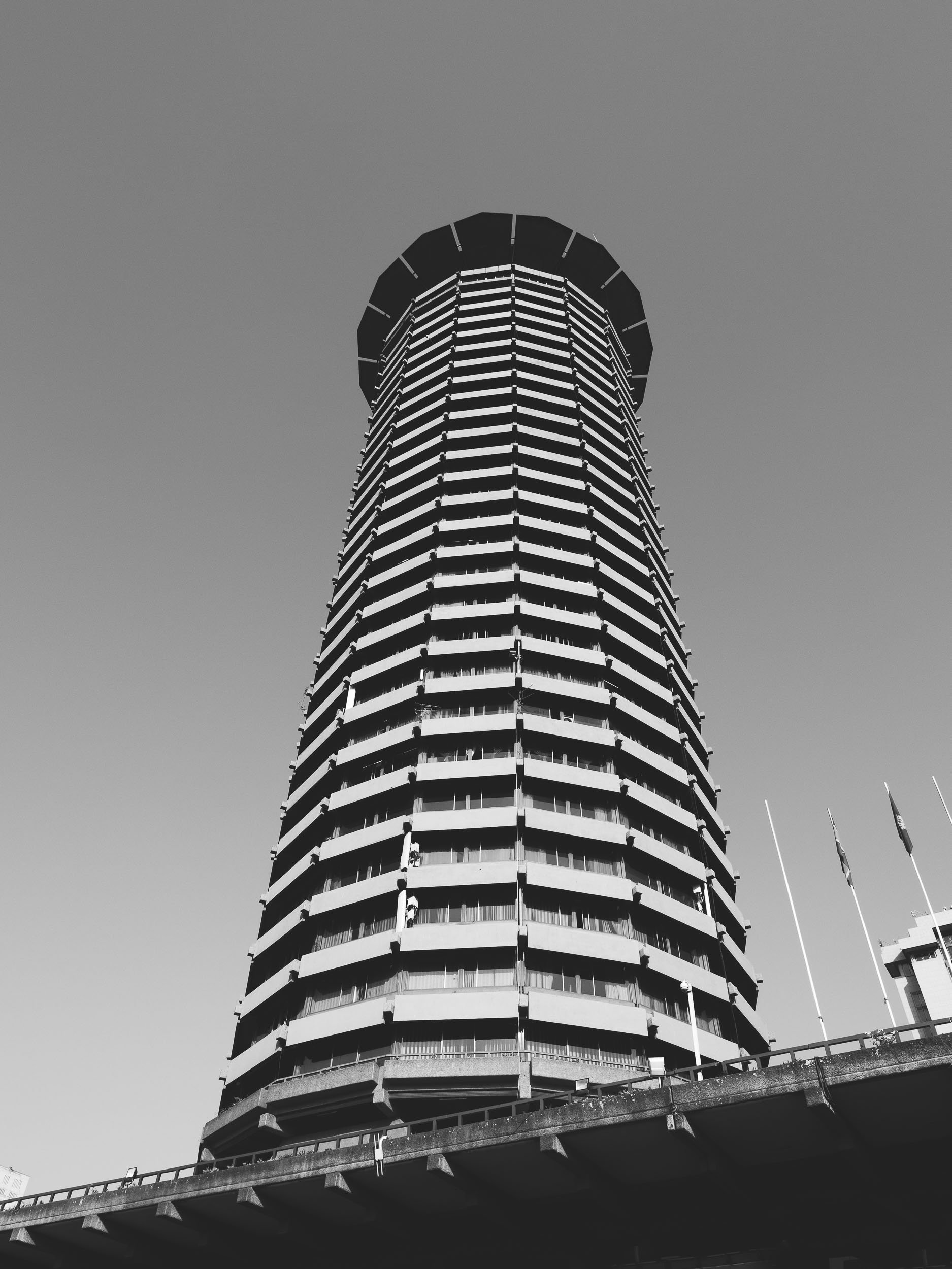
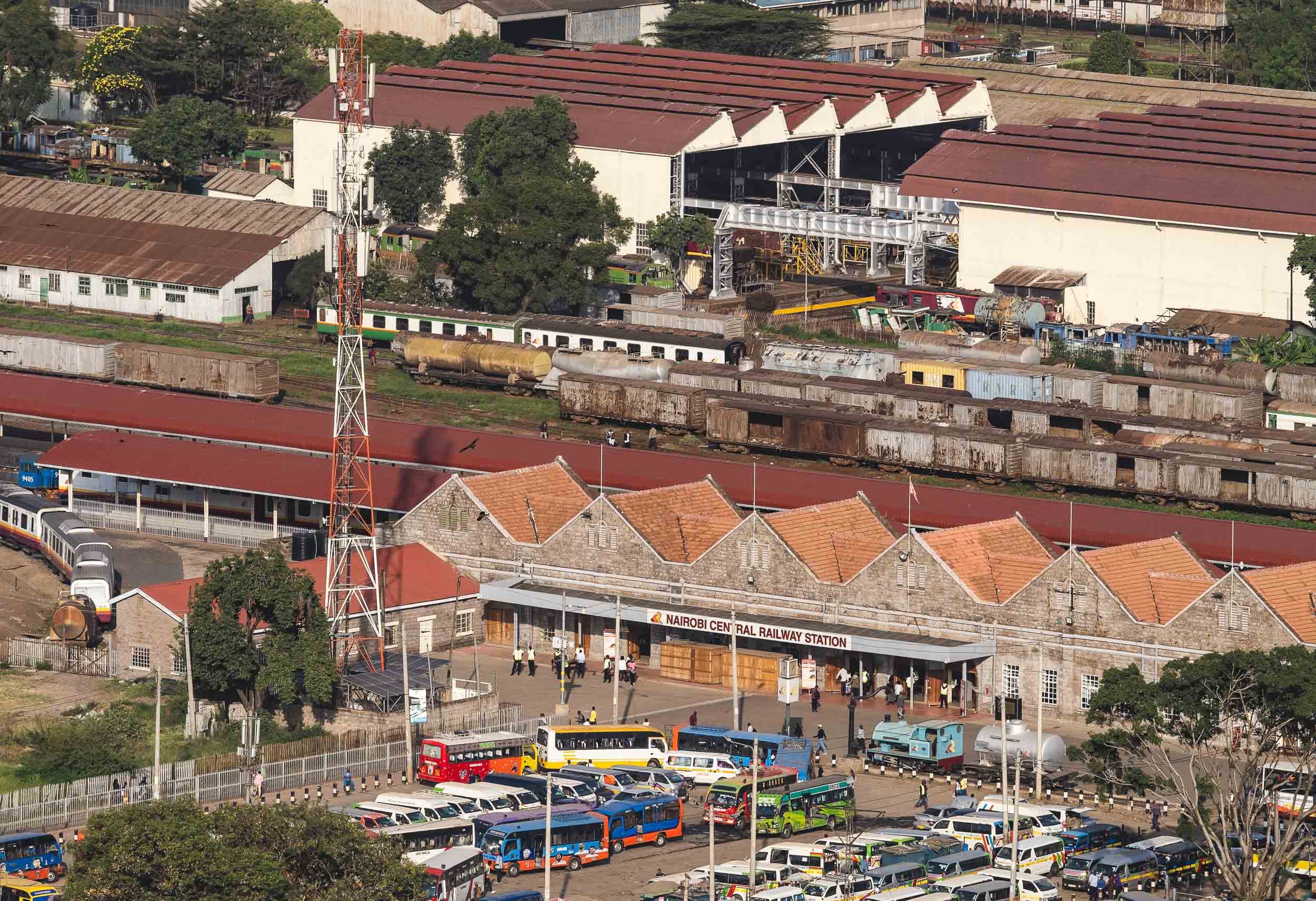
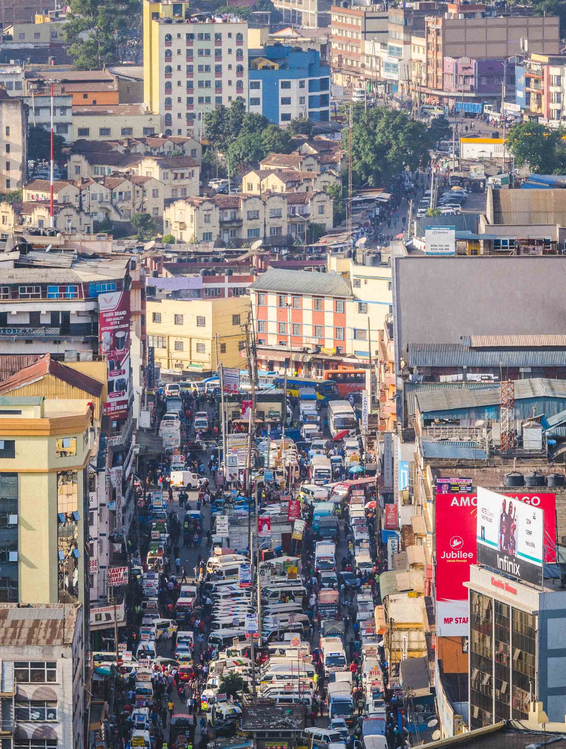
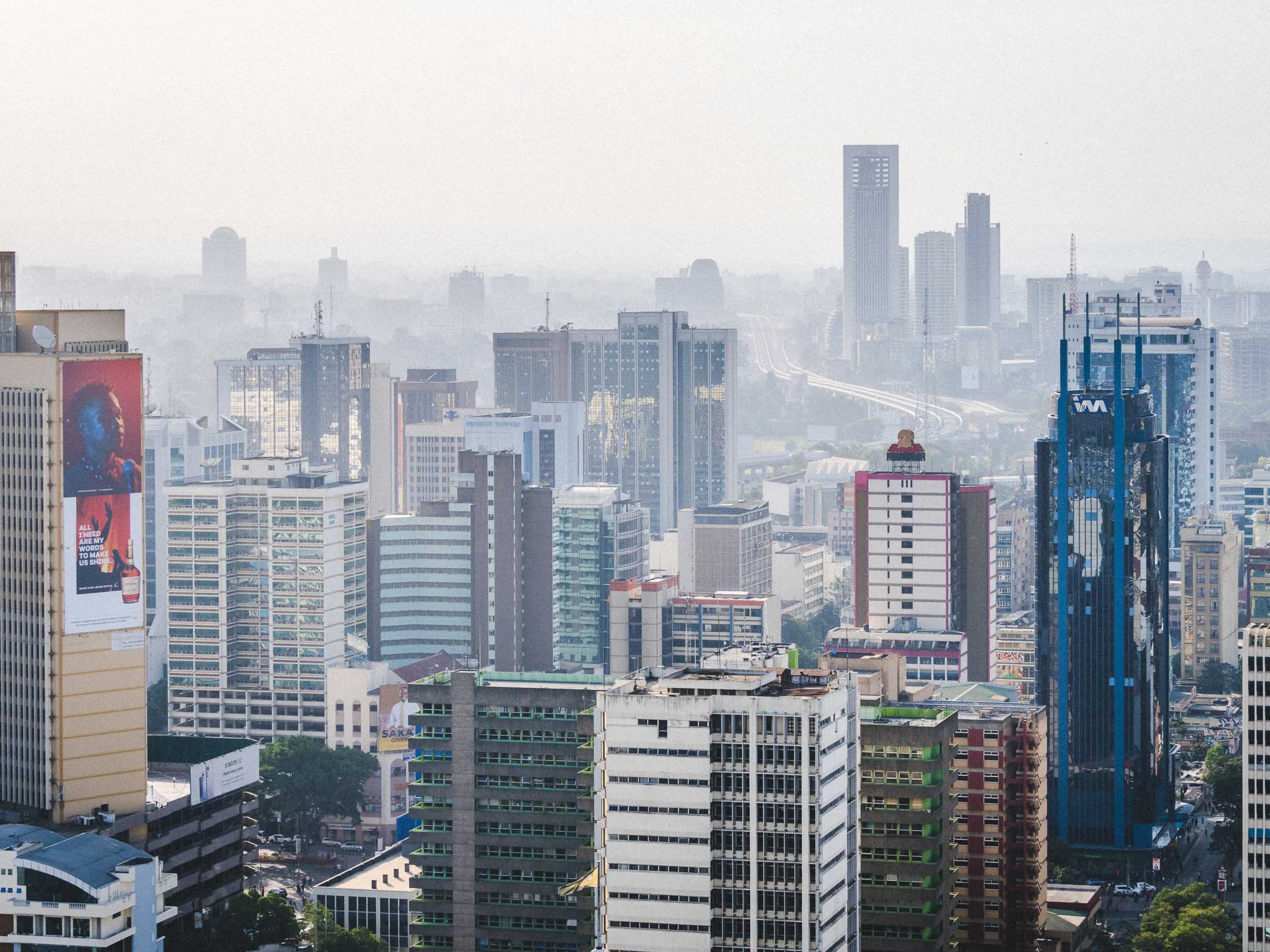
Onwards to Amboseli
After my day in Nairobi, I spent 3 days in the Amboseli National Park. I came for the elephants, and I did find them, but in a way that was much more incredible than I had imagined.
The Kilimanjaro
Africa’s tallest mountain and the tallest free standing mountain in the world, with its Kibo peak reaching 5895m, is actually not located in Kenya, but the views from Amboseli are some of the best you can get. That is, assuming the dormant volcano’s highest portions aren’t covered in clouds, as does happen frequently.
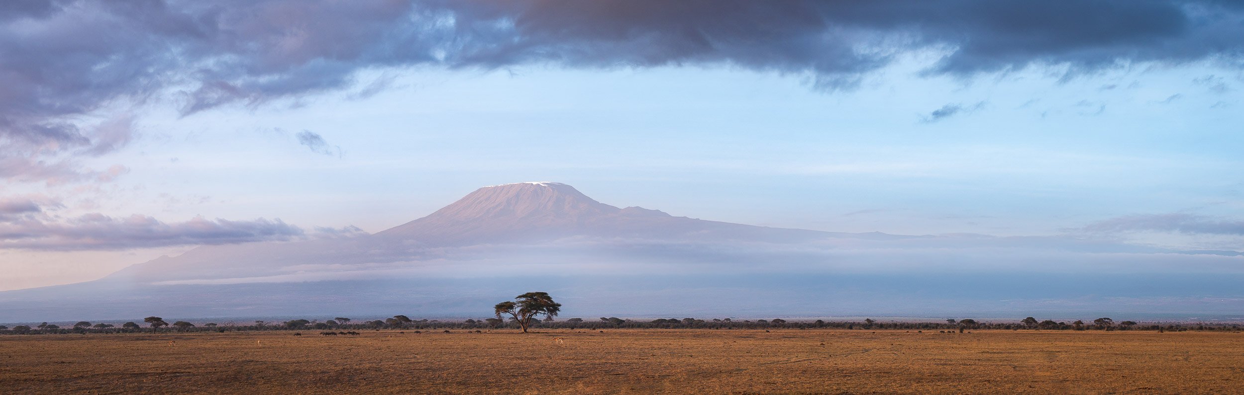
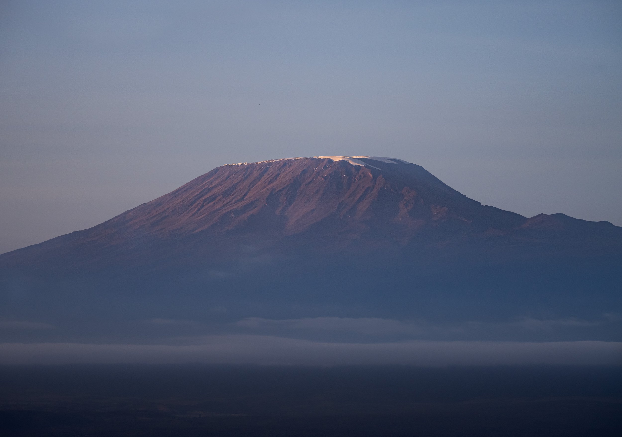
Gentle Giants
Right after landing at the park’s small airstrip in the morning, my amazing guide Dickson took me into the dry lake bed of Lake Amboseli. This location is home to a daily ritual for large elephant families: They cross it from the forest areas on one side towards the swamp lands on the other. With a bit of patience you can photograph their amazing formations, and if you’re brave enough and have the right guide, you can do so from the ground for that extra special perspective.
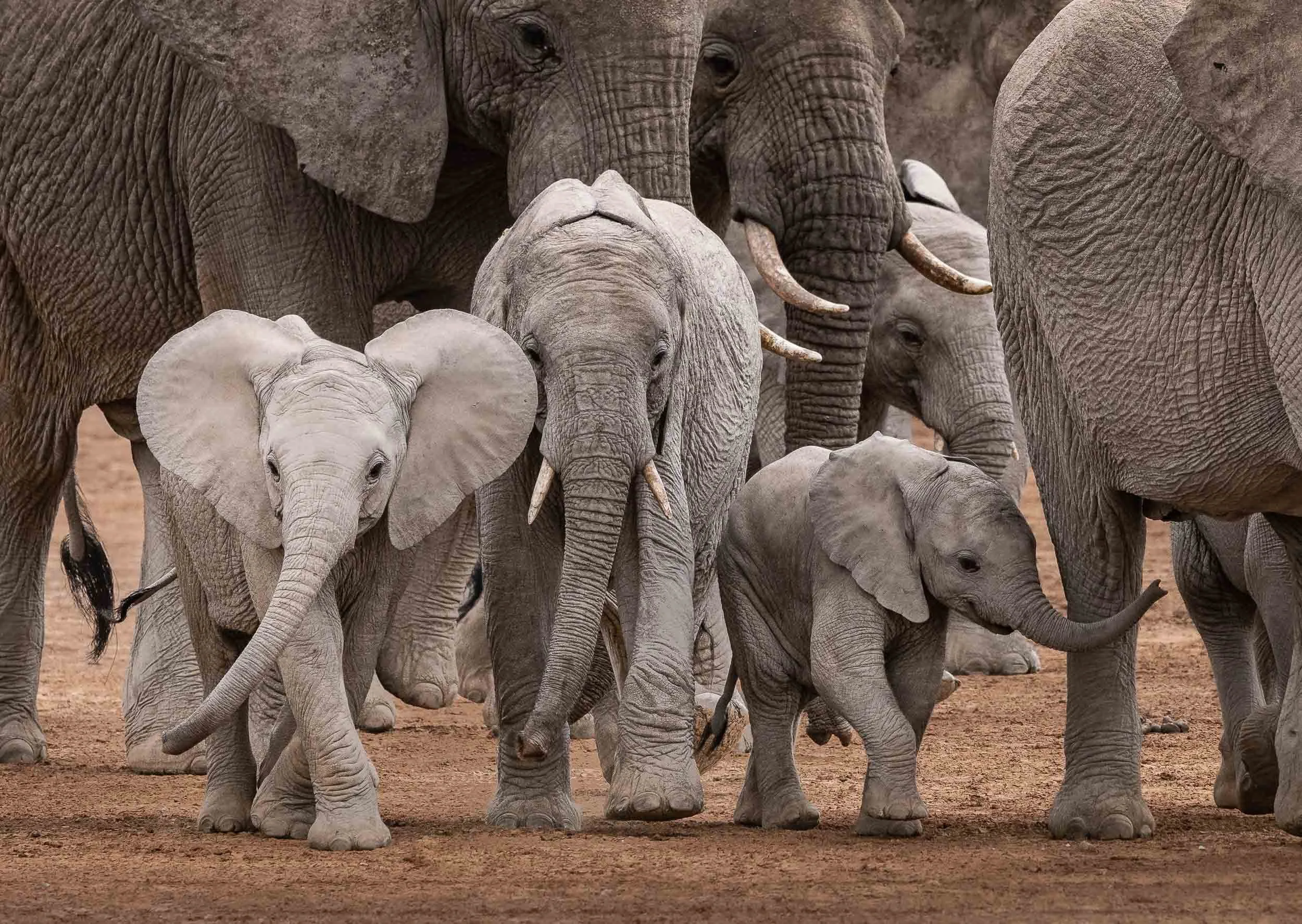


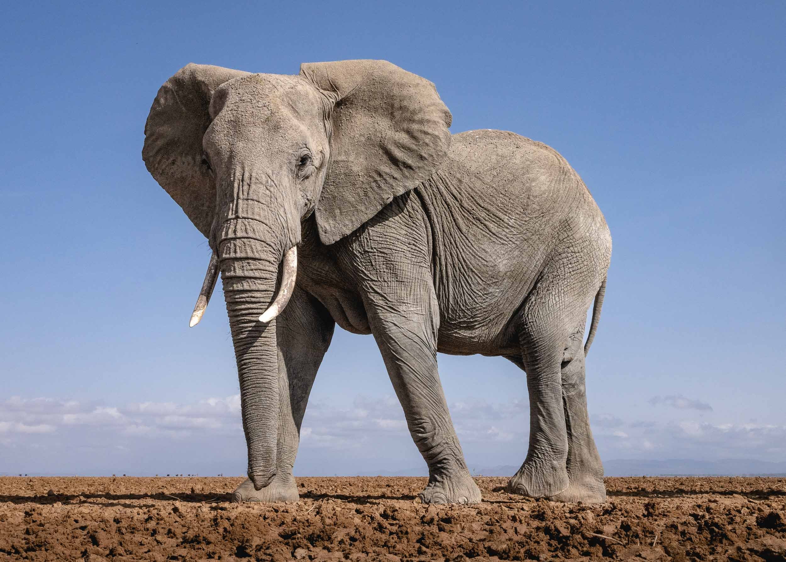
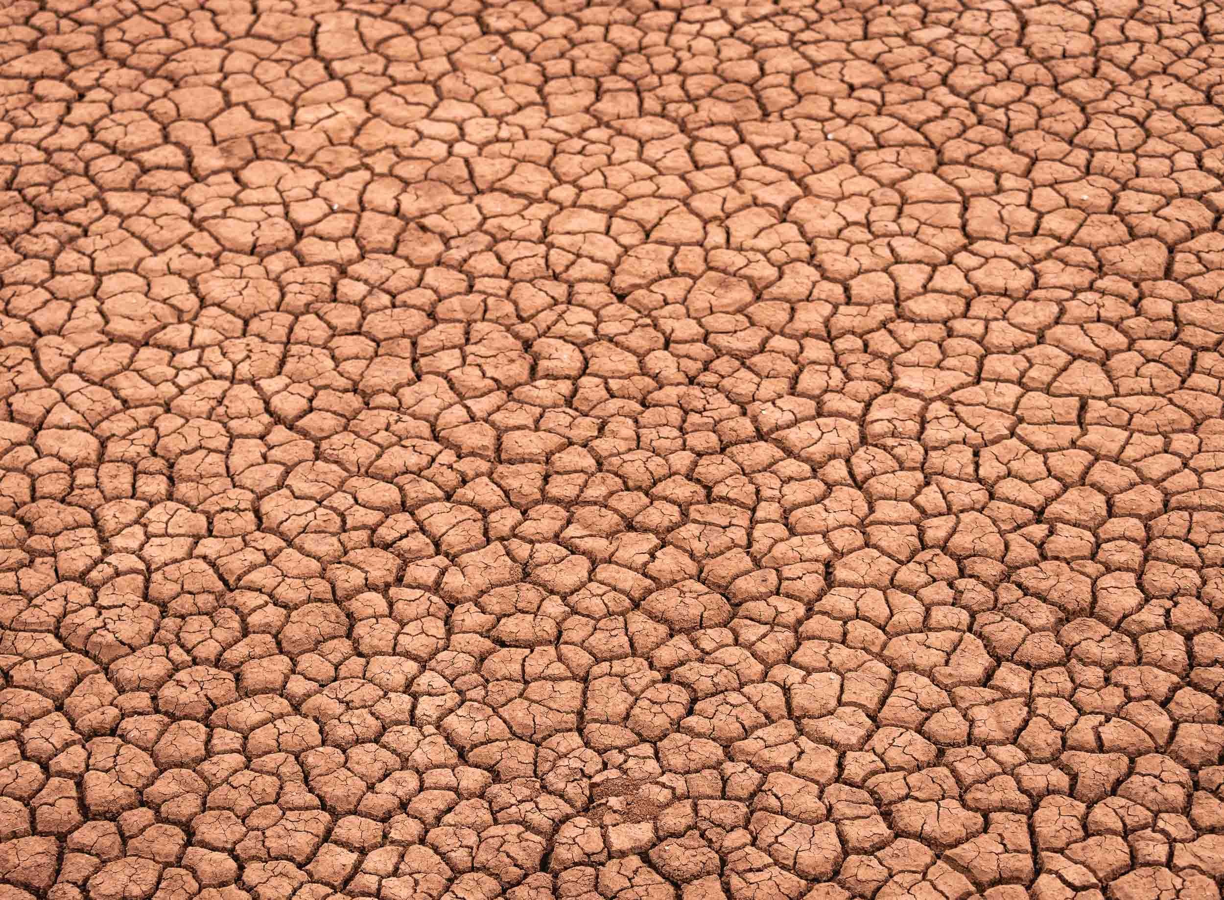
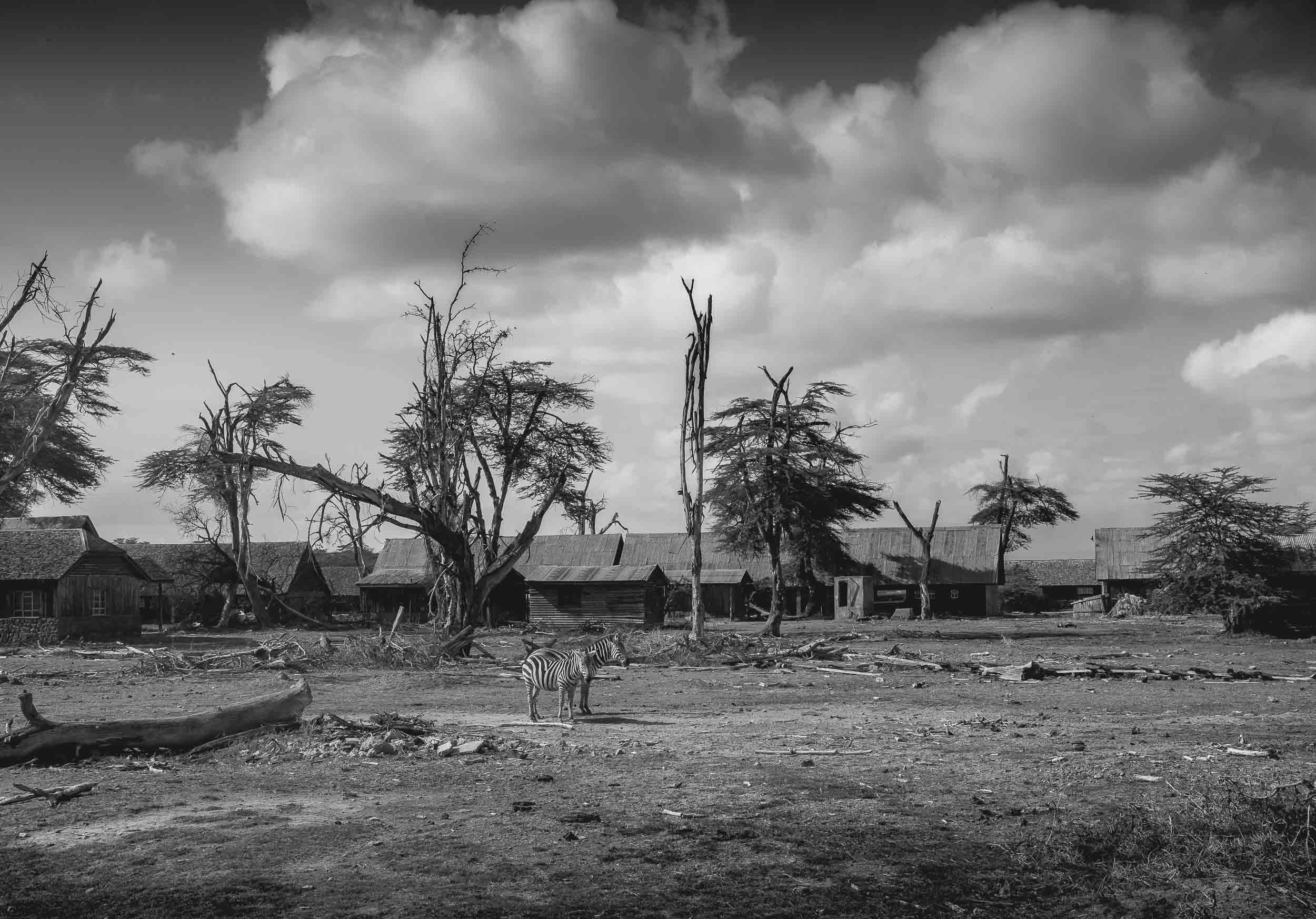
Craig - Africa’s Largest Tusks
Amboseli and its surrounding areas are also home to a very special kind of elephant: The Super Tuskers. Bulls whose tusks weigh in excess of 100 pounds, often reaching all the way to the ground. There are said to be only just over 20 left on earth, spread between this area of Kenya and the Kruger park in South Africa. The most famous one of them is probably Craig, a 52 year old bull believed to have the largest tusks of any African elephant alive today. When I heard of his existence, seeing and photographing this magnificent creature became the highest priority of my time in Kenya. However, elephants can roam large distances daily, and there are no boundaries stopping them from crossing parks and even countries, as they often venture into Tanzania.
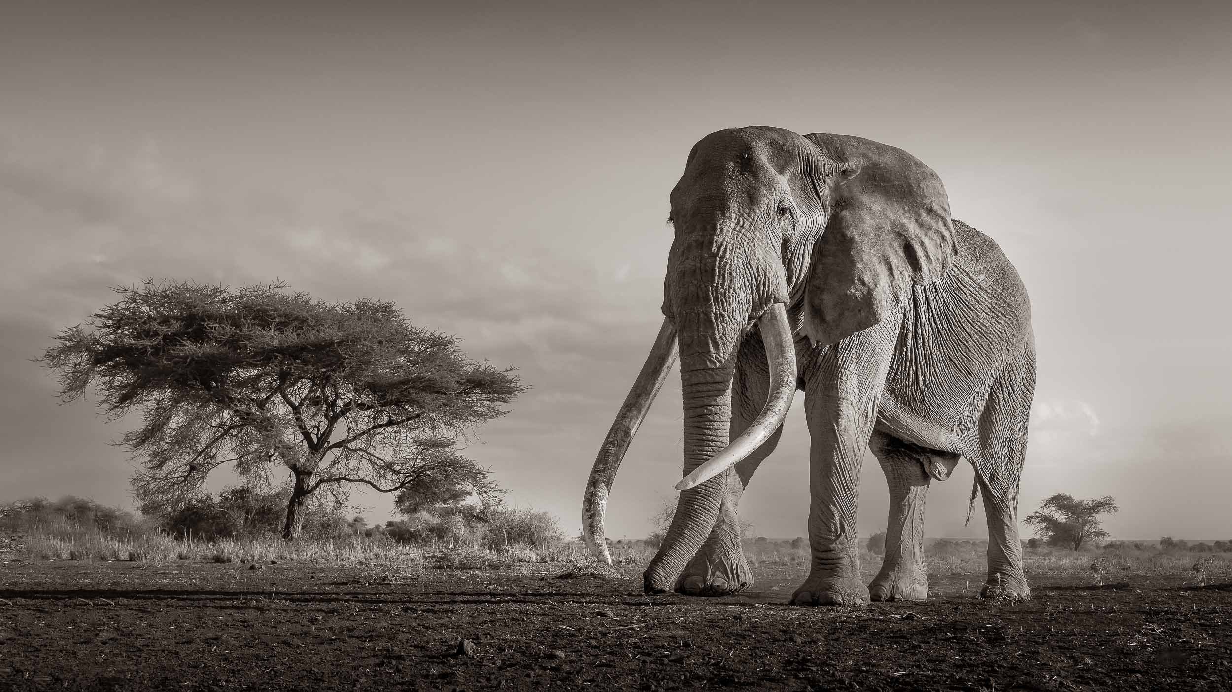
Luckily, an elephant like Craig is closely monitored by the local Maasai population and many rangers in the park, given the high risk of poaching - his tusks are easily worth $25,000 each in their raw form from what I was told. This means with the right network and a little bit of incentive, you may be able to hear of his whereabouts, or at least get a rough idea. For us, this meant a 1 hour drive in the very early morning into the bush to a nearby private concession. It was worth it…
My spot as we found Craig looking for the best trees to feed on, and the resulting photo below.
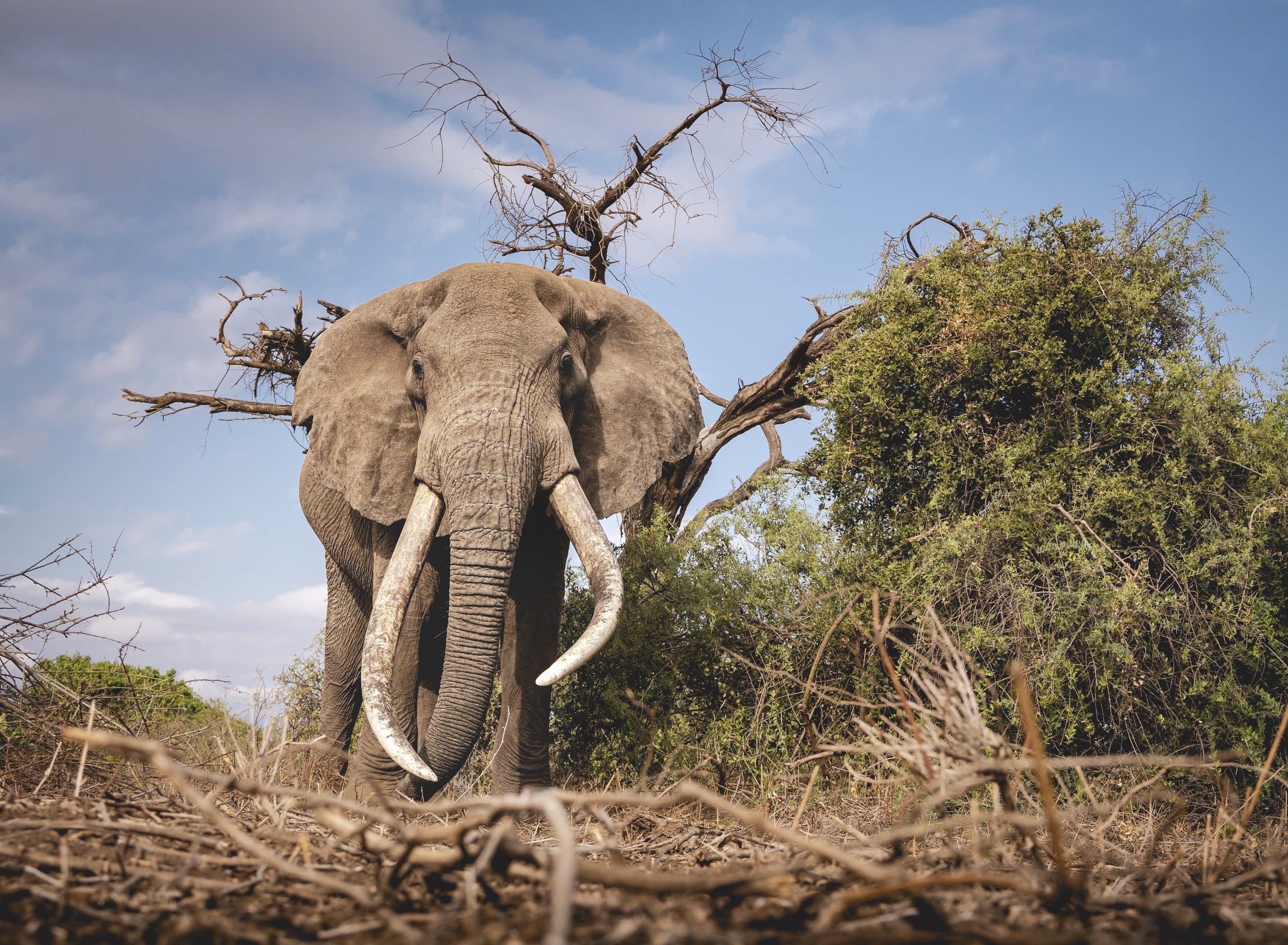
The feeling of sitting on the grass while an elephant of Craig’s size, with his incredibly large tusks scraping the ground, walking by slowly with his calm and majestic demeanor is indescribable and was definitely one of the most memorable experiences of my life.
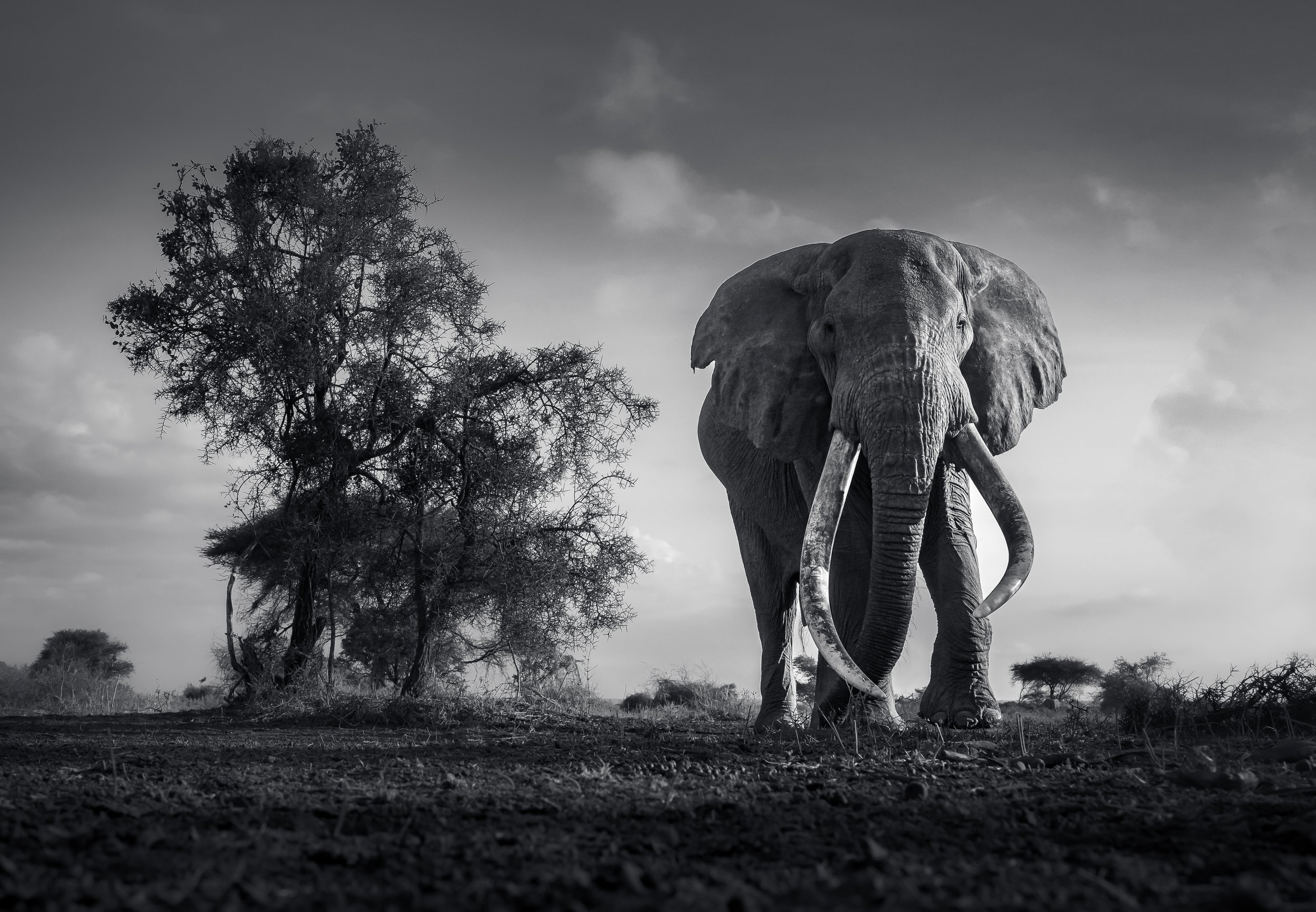
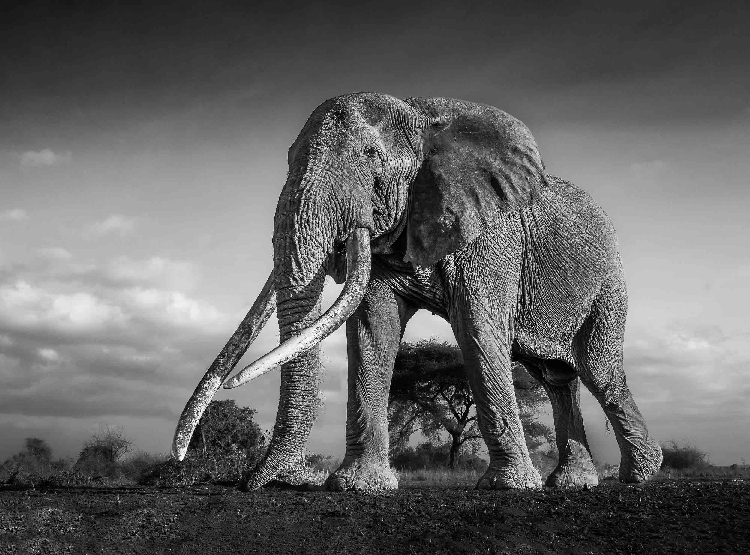
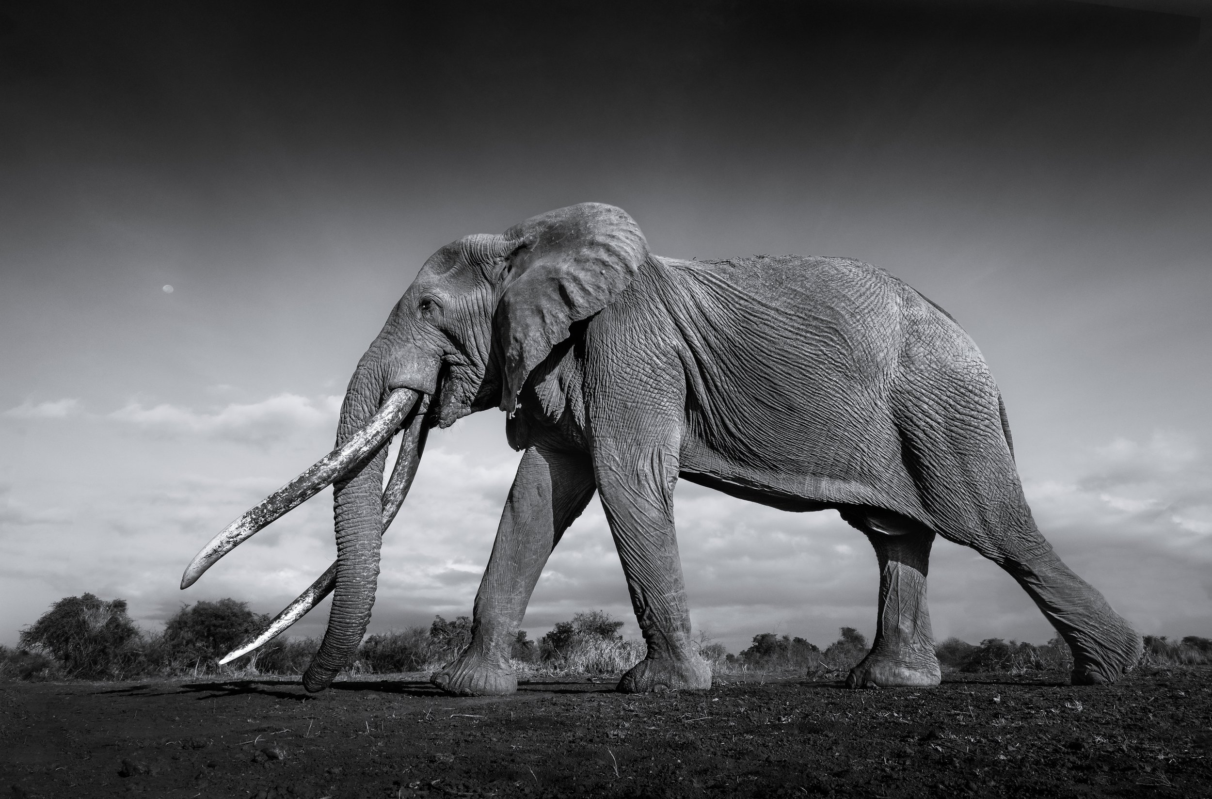
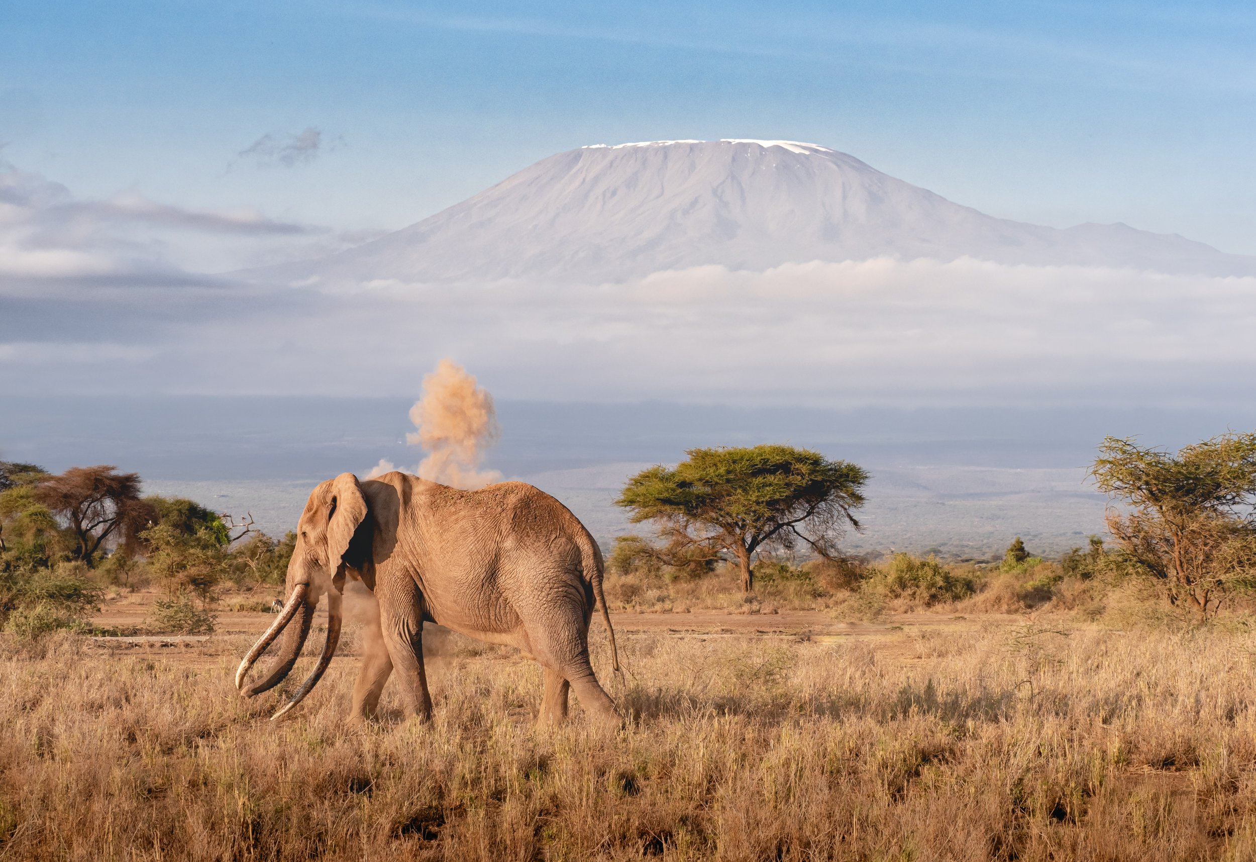
A few more Impressions
Granted, not much could top the experience of observing the elephants in Amboseli, but the park is home to beautiful views and a large variety of wildlife.


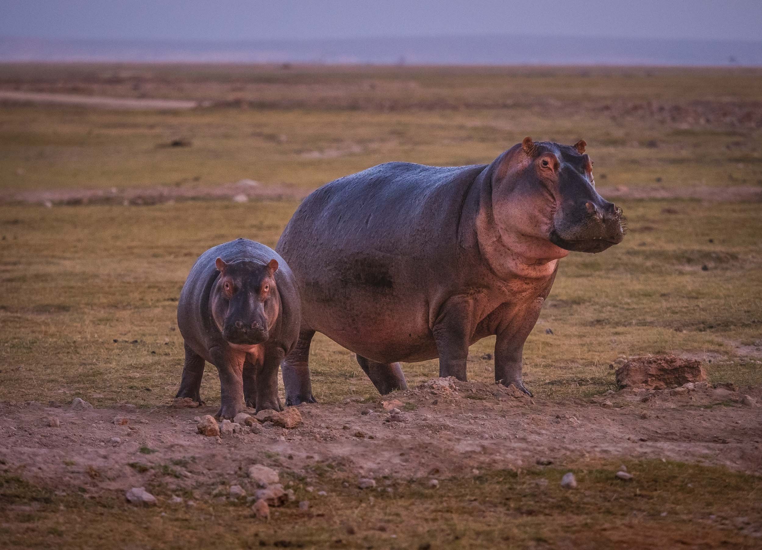


A Lasting Impact
I’ve certainly had an appreciation for the sheer size and the social behavior of elephants prior to my visit to Amboseli, but this experience has given me a totally new perspective of these gentle giants.
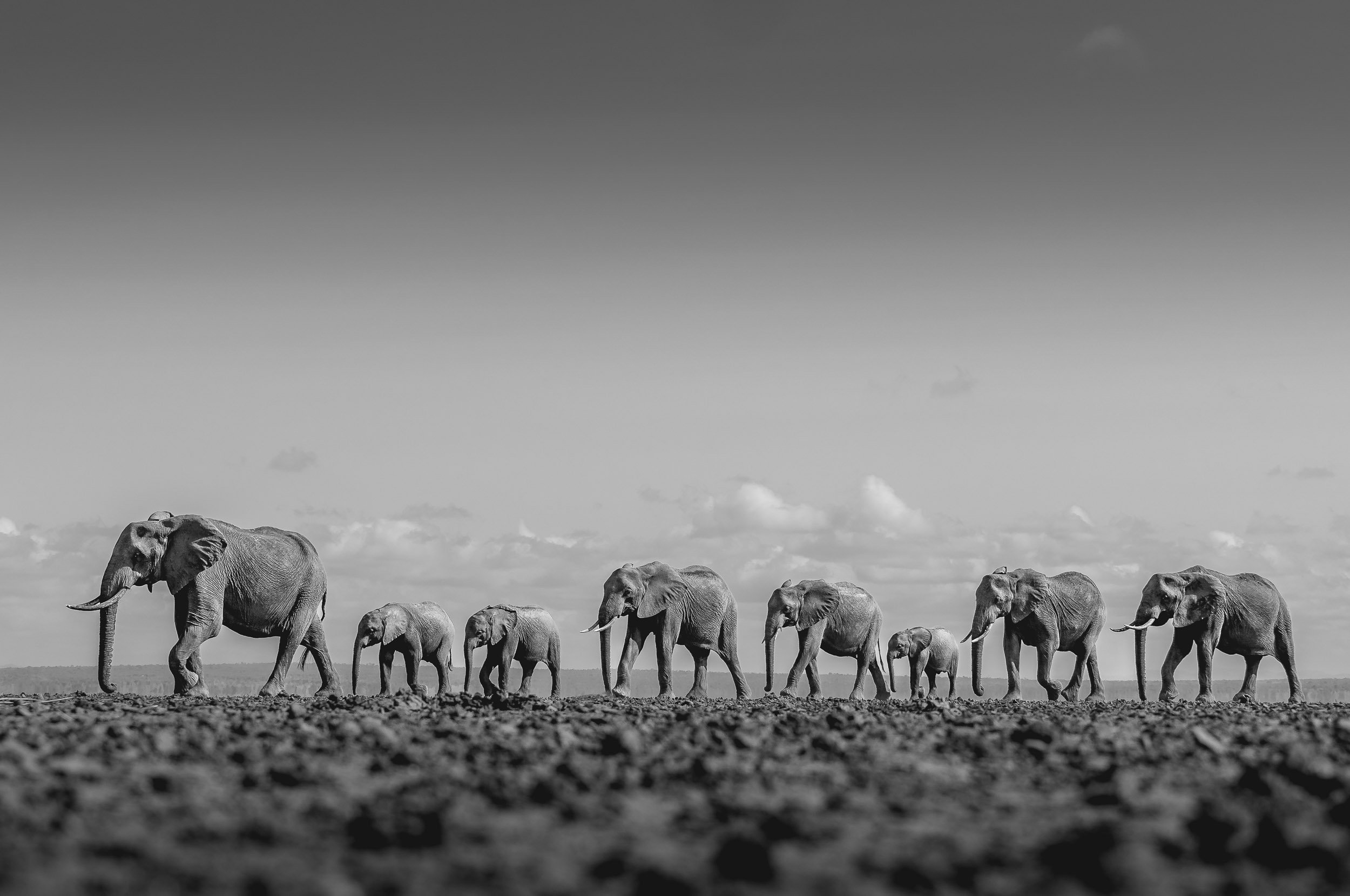


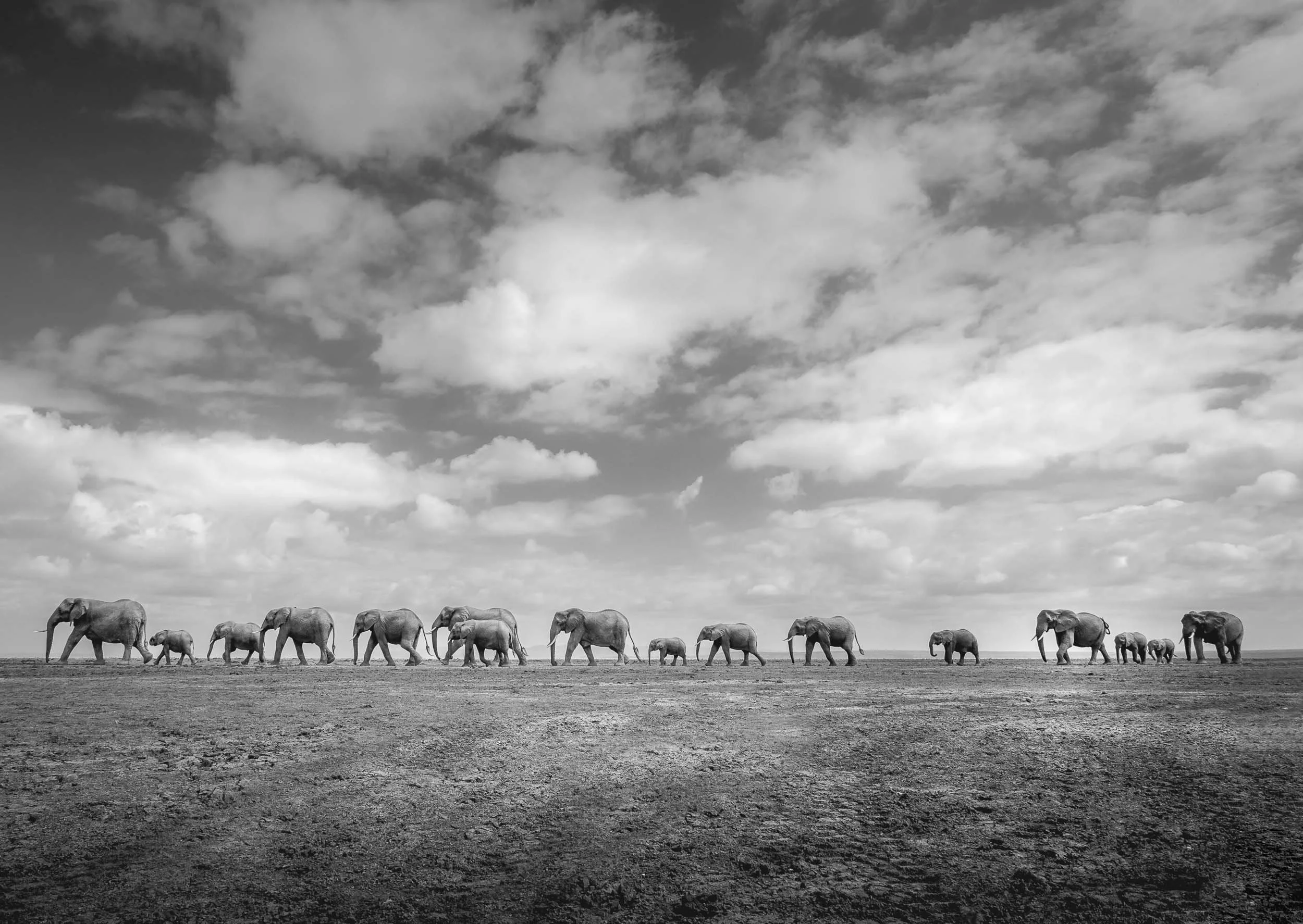

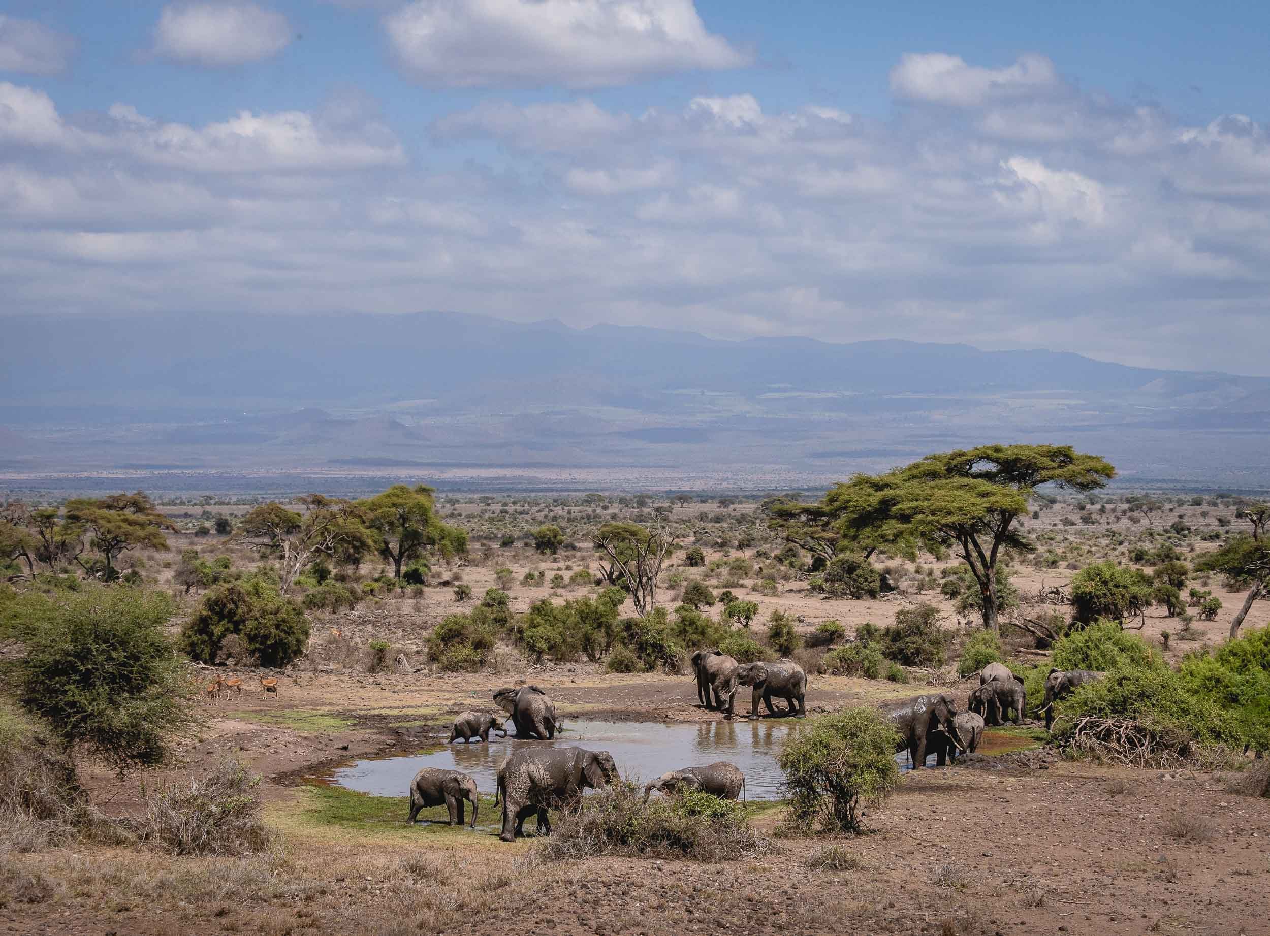
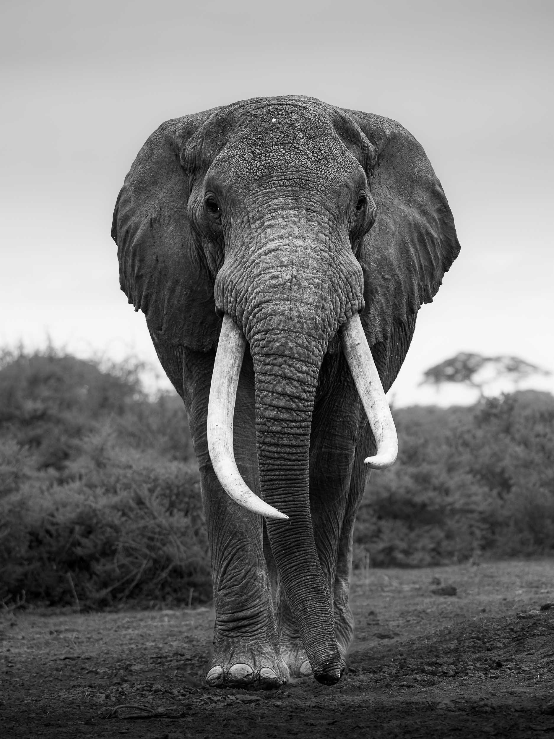
Let’s hope that their legacy will live on for a very long time, despite the threats of human poaching and wildlife conflict - you can support their pledge at https://tsavotrust.org

Tanzania - National Parks and the Origins of Humanity
After visiting Zanzibar back in 2016, it was time to add mainland Tanzania to the travel itinerary.

After visiting Zanzibar back in 2016, it was time to add mainland Tanzania to the travel itinerary. Despite visiting Lake Natron and four National Parks as well as some of the country’s most important sites of human history, I still feel there’s a lot left to explore, particularly the lesser known southern parts. Read on for what I did manage to see, which includes incredible landscapes, amazing wildlife sightings from the ground and the air, and some of the most significant places in the development of our species.
The trip started at Kilimanjaro airport, landing with the backdrop of Africa’s tallest mountain around sunrise - as it happens though, the peak is better photographed from the Kenyan side. As they say, you go to Tanzania to climb Kilimanjaro (which I didn’t) and to Kenya to photograph it (which I did). More on that in another blog post…
Kikuletwa Springs
Hence, the first photos I took were of a little unknown gem east of Kilimanjaro: Kikuletwa Springs, a small hot spring which on the morning I visited was luckily also completely empty, resulting in the calm, clear, colorful waters you see below.
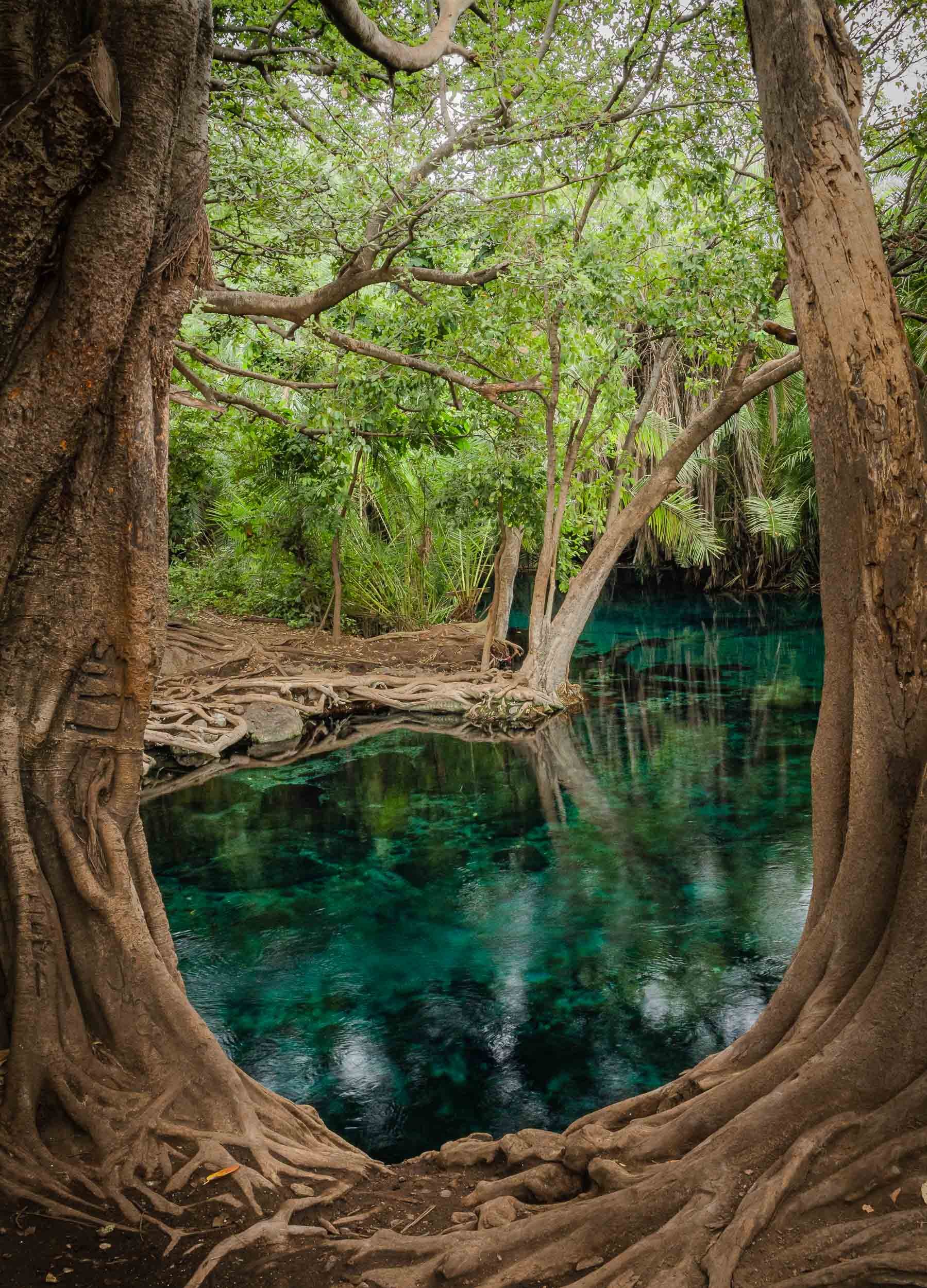
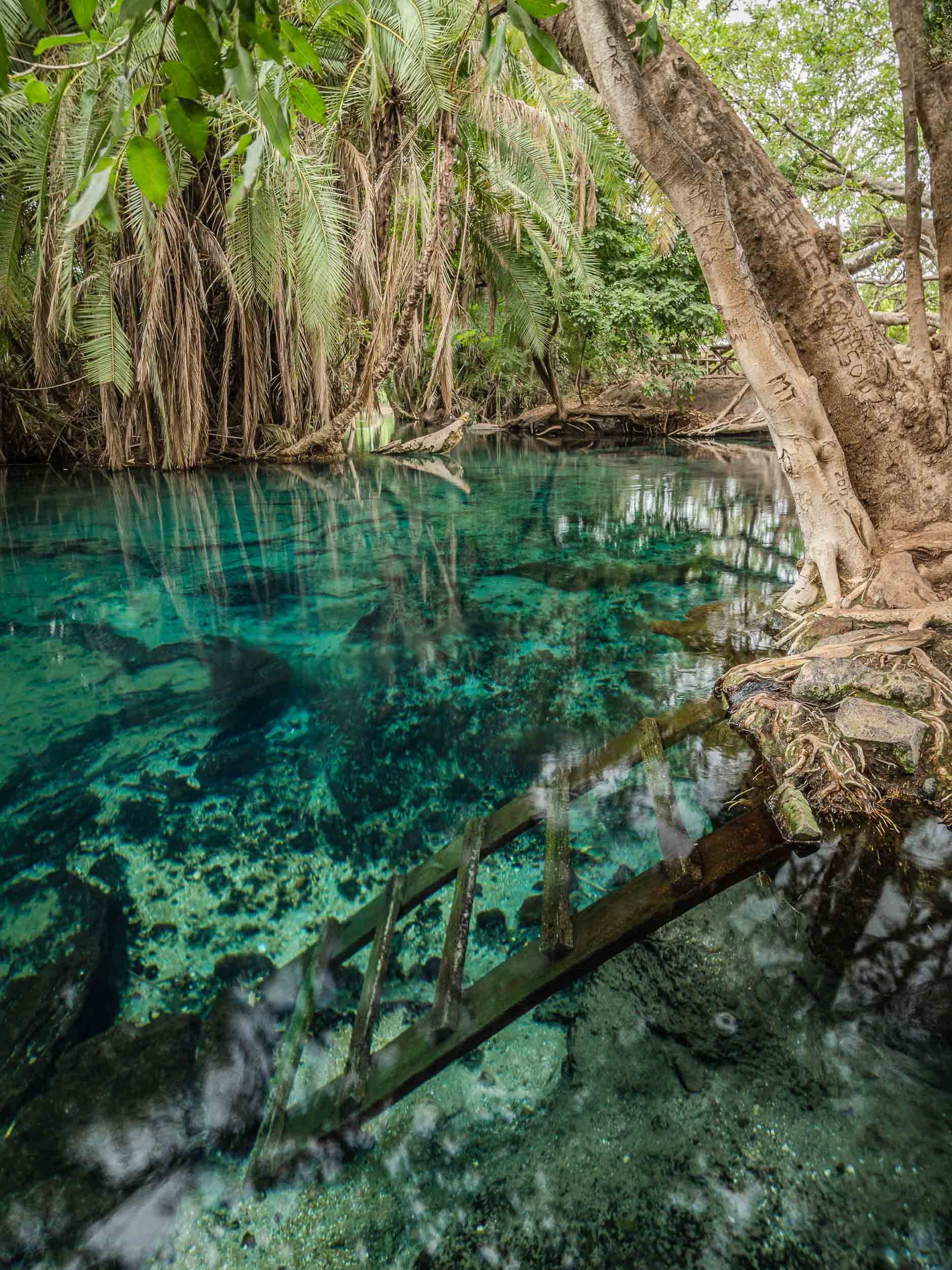
Take a look under water and see what I found…
Lake Natron & The Mountain of God
A 6h drive through mostly bumpy dirt roads brought us to Lake Natron by the late afternoon, where I spent 2 days. The area is full of incredible natural wonders to explore, which I did with my great guide Mohammad, and a local Maasai called Mwenga, who was incredibly helpful, knowledgeable and friendly - and became a model for some of my photographs in the process.
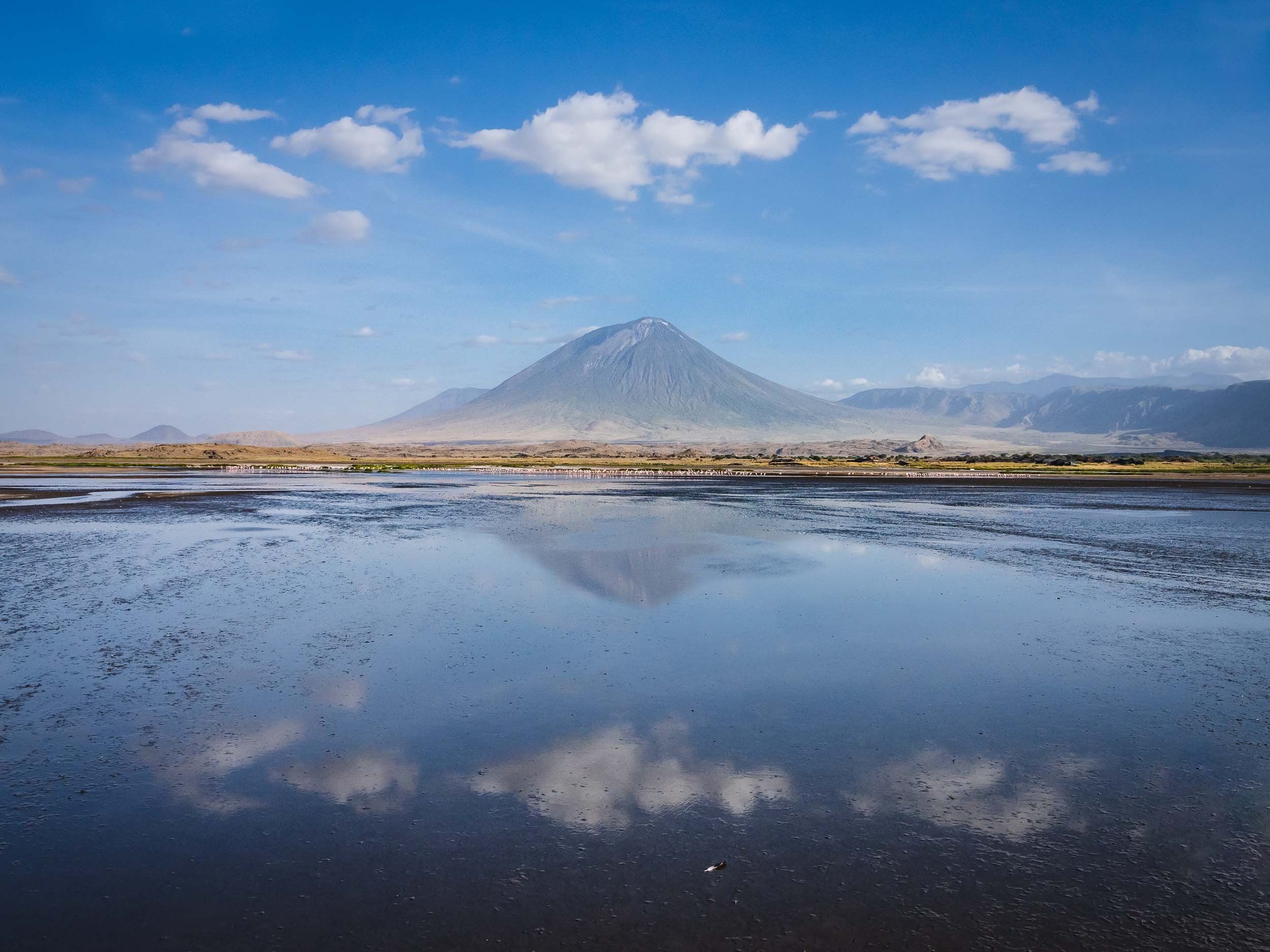
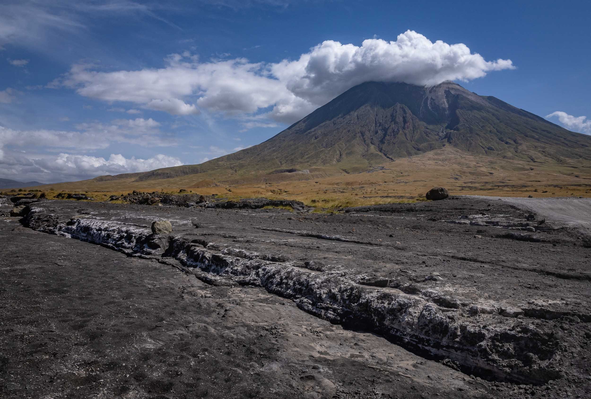

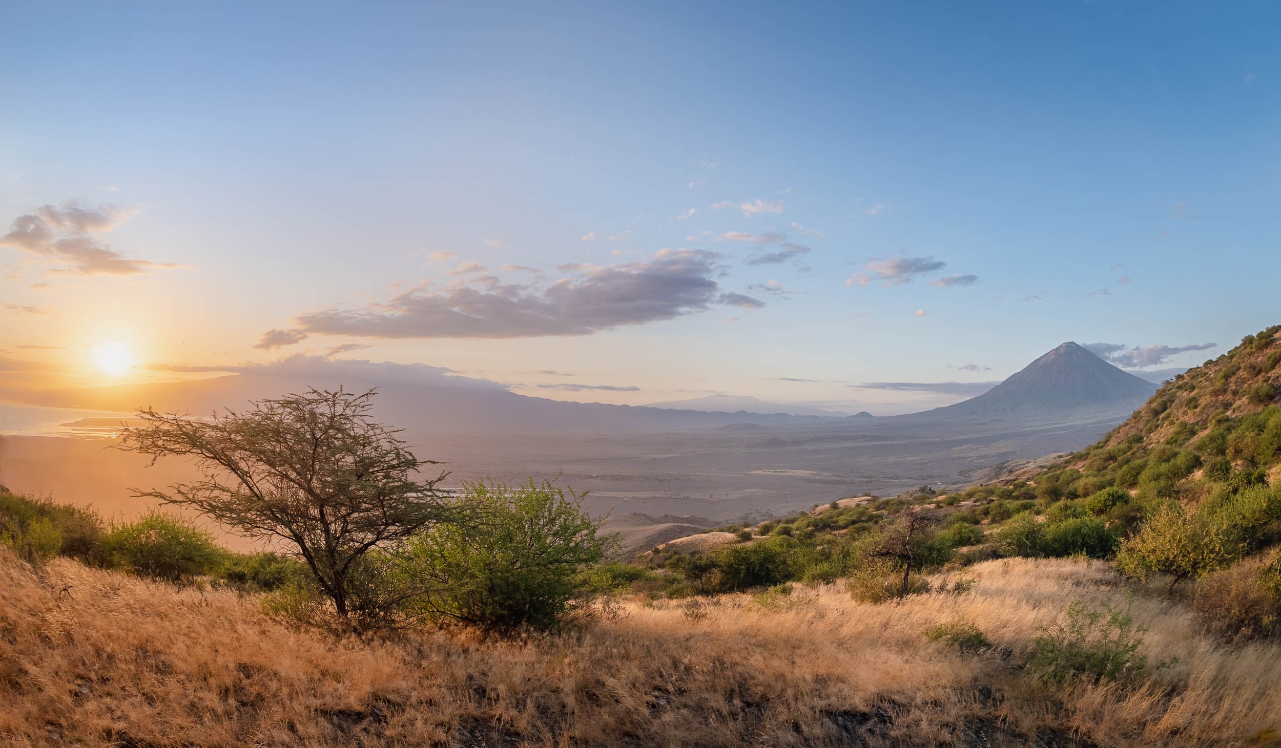
The area is also home to the beautiful Ngaresero Waterfalls - a small hike through the canyon rewards you with these views and an optional very wet exploration of a small cave under the waterfall.


Flamingo Lake with Special Features
The lake is the only regular breeding area in East Africa for the 2.5 million lesser flamingoes, and also home to Greater Flamingo and many other bird species such as Pelicans. Its high salt content and temperatures up to 60C make it inhospitable for many other animals, including predators, but supports the development of organisms these birds feed on. These organisms are also responsible for the lake’s reddish hues, best seen from space. Despite the lake’s massive size (a maximum of 57 kilometres x 22 kilometres), it is only up to 3m deep.
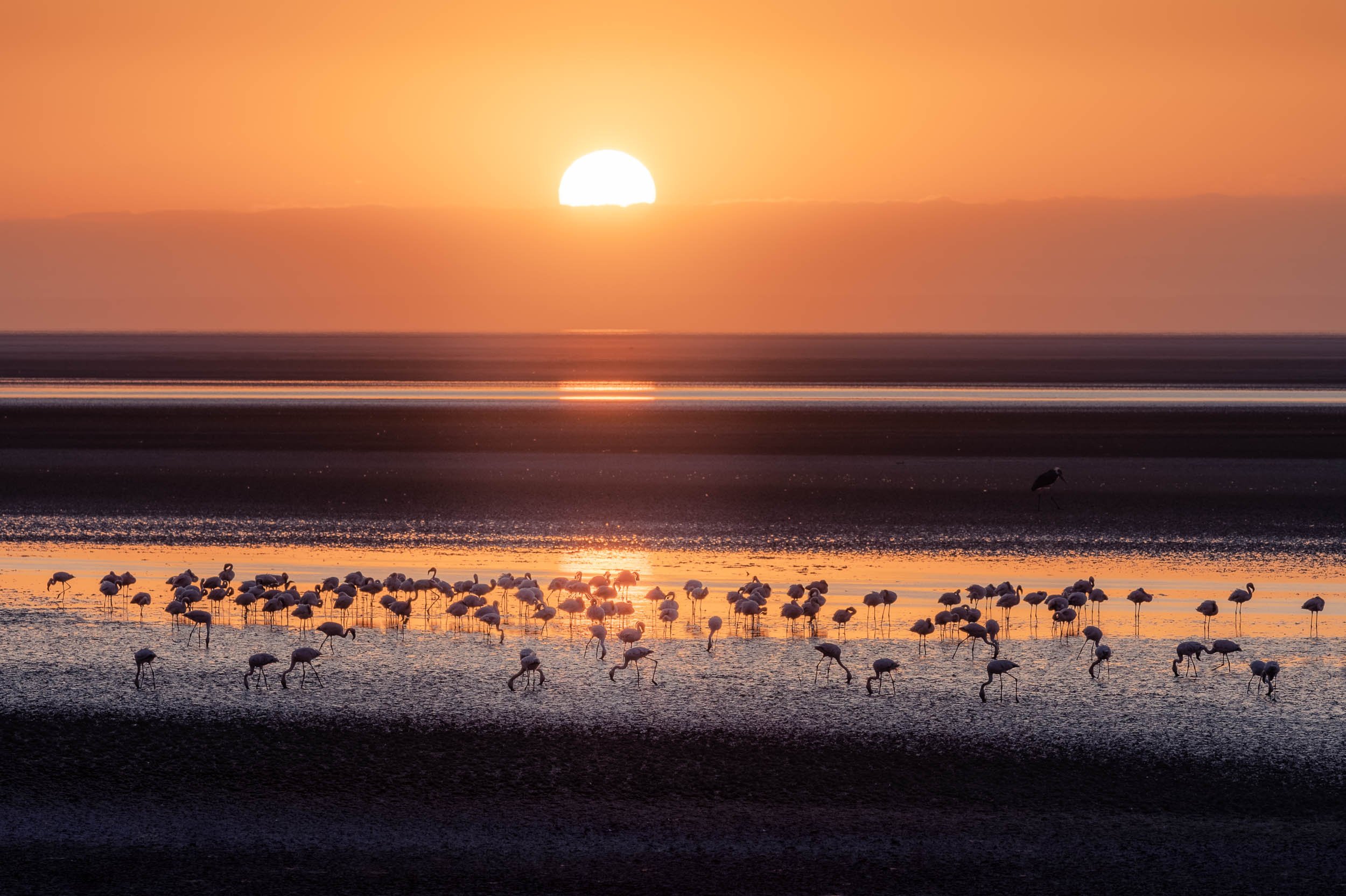
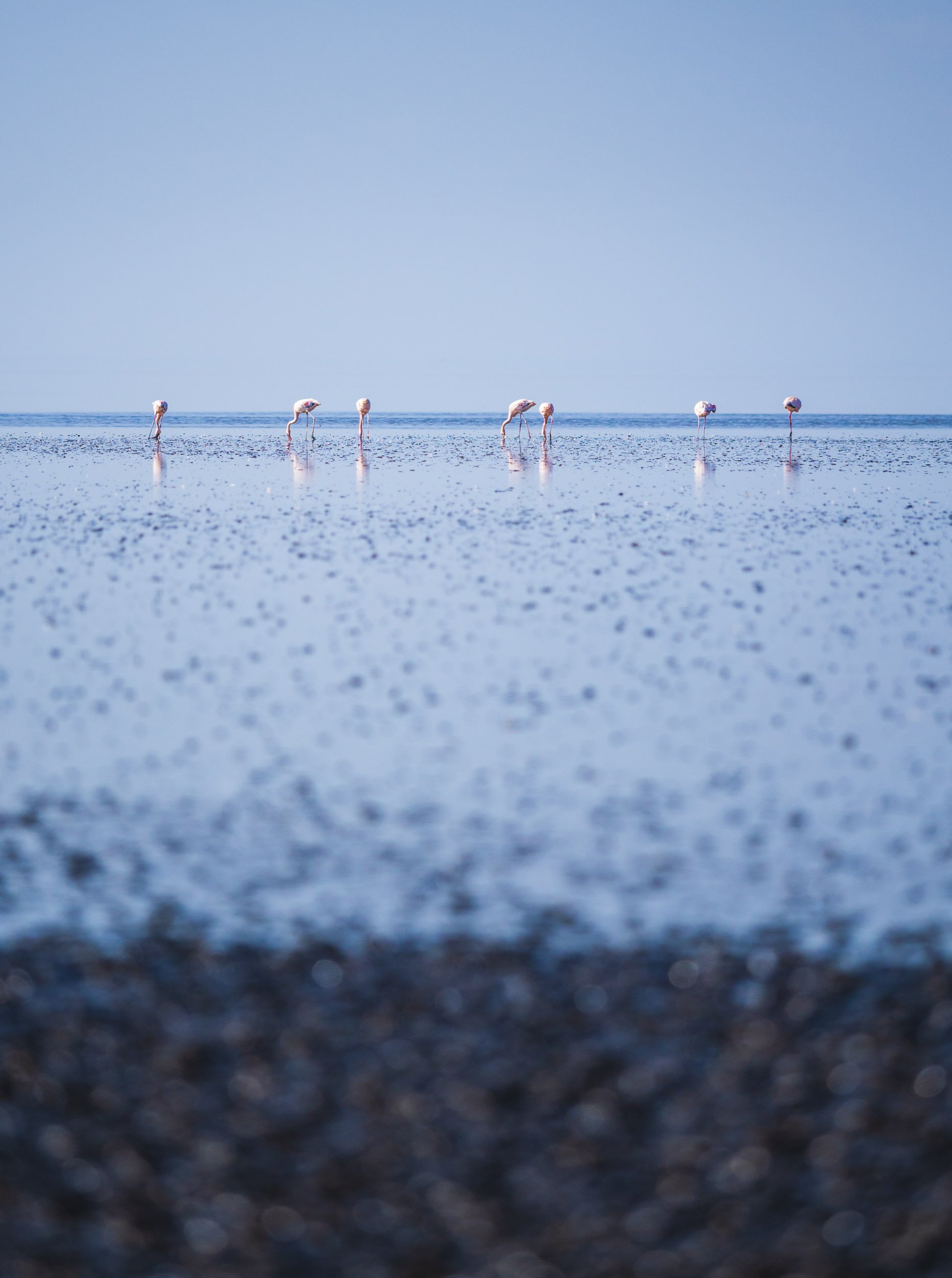
Human Traces
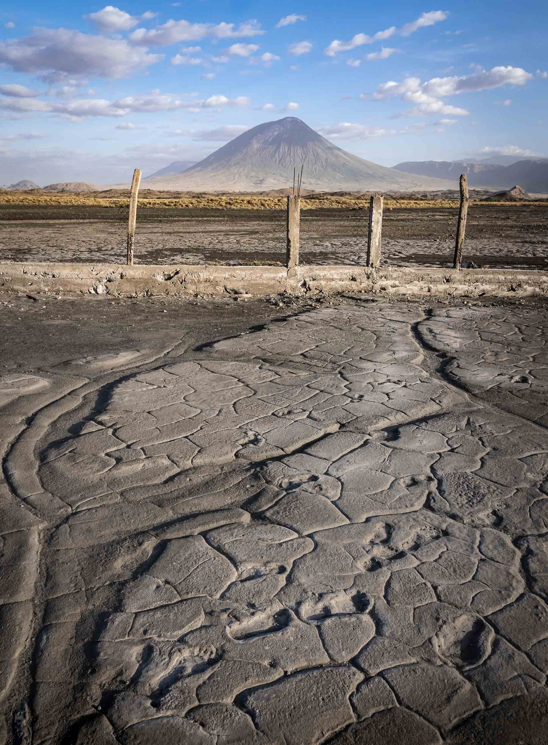
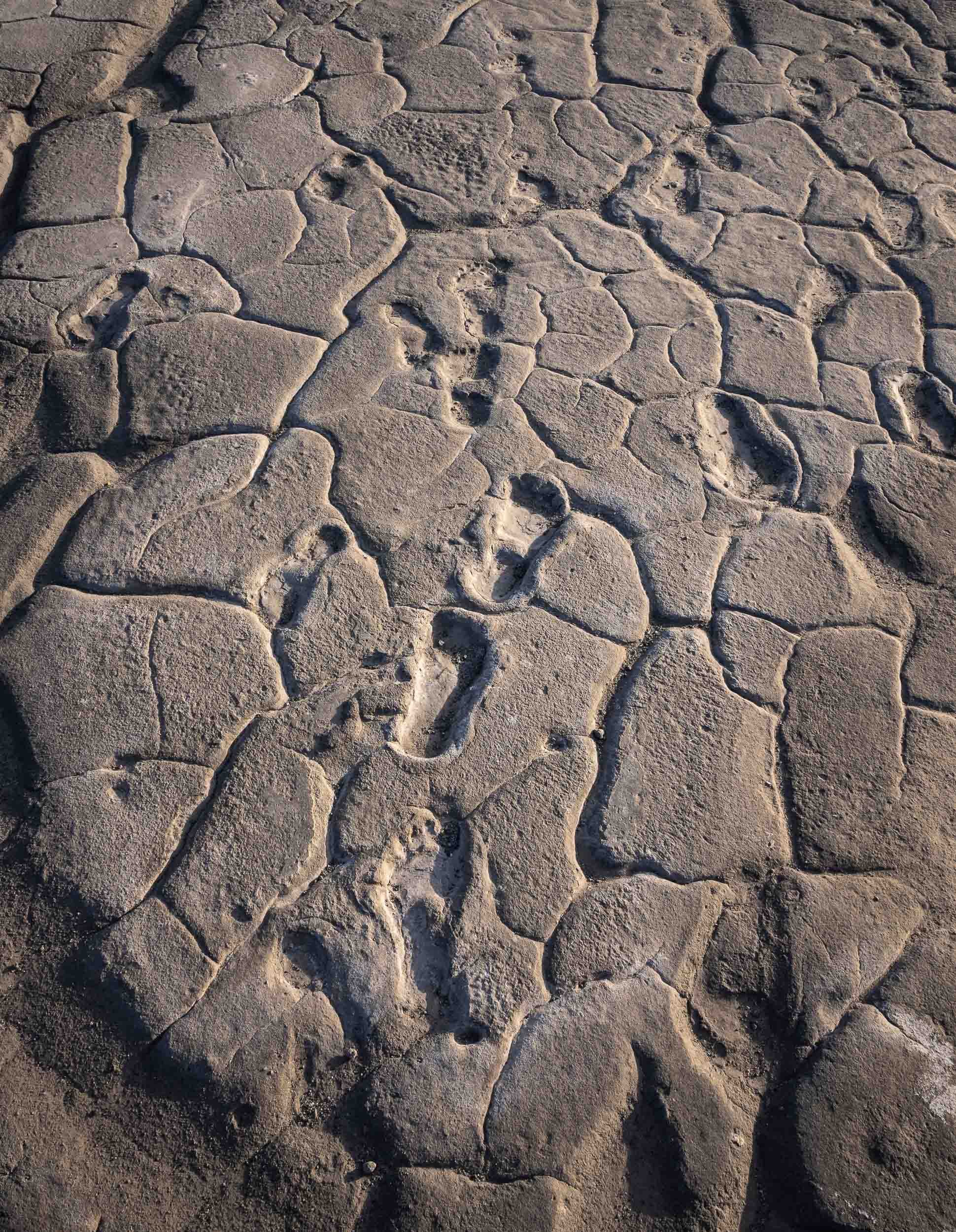
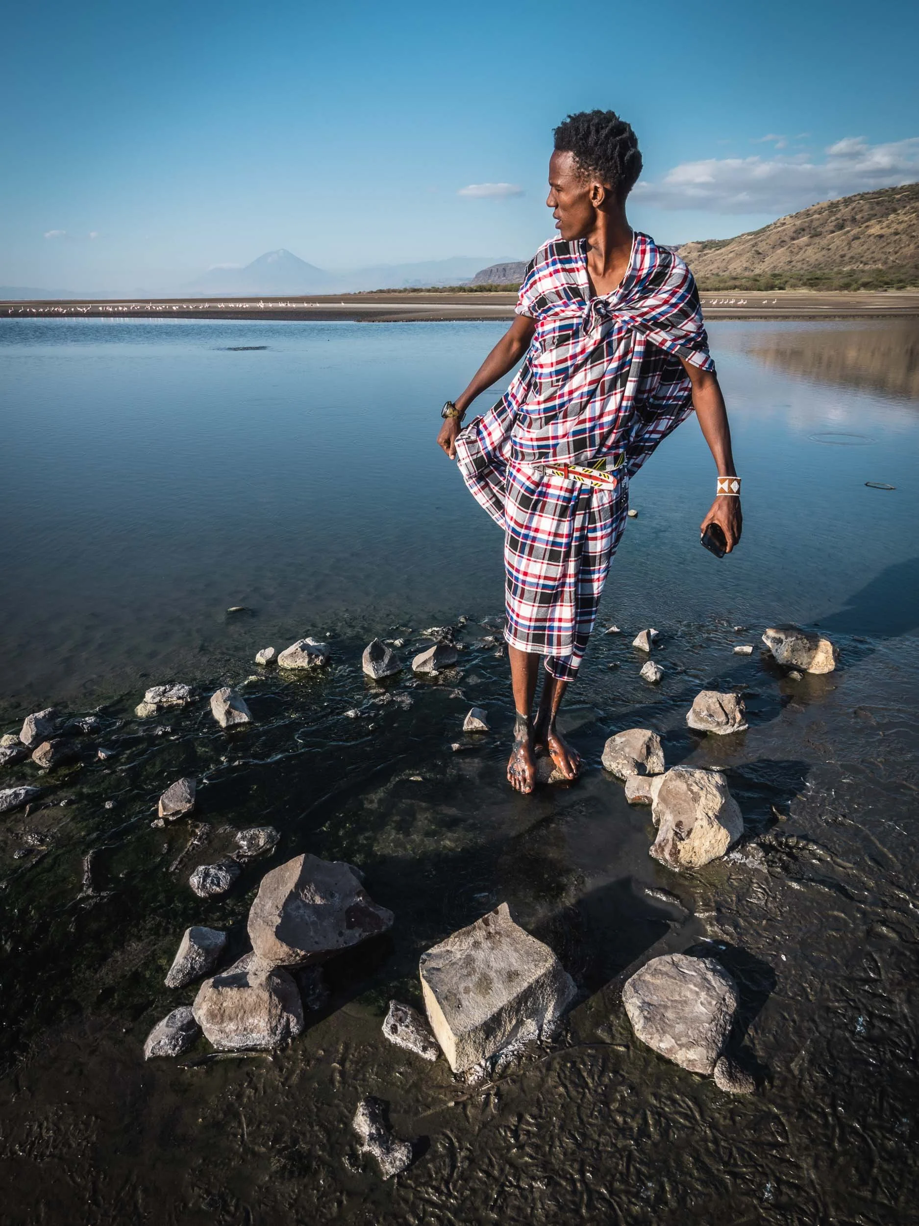
Tanzania’s Wildlife Parks
Arusha was the starting point for the second part of my Tanzania trip, a wildlife photography journey with Andrew Goddard, organized by Guiding the Wild. We started the trip through the country’s parks in the north with Tarangire, followed by Lake Manyara and its national park, and the Ngorongoro crater and region, as well as the Serengeti.
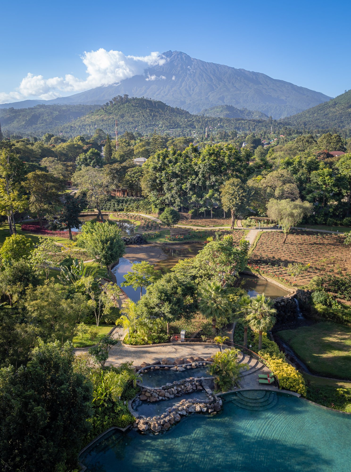
Tarangire
An afternoon game drive in the park.
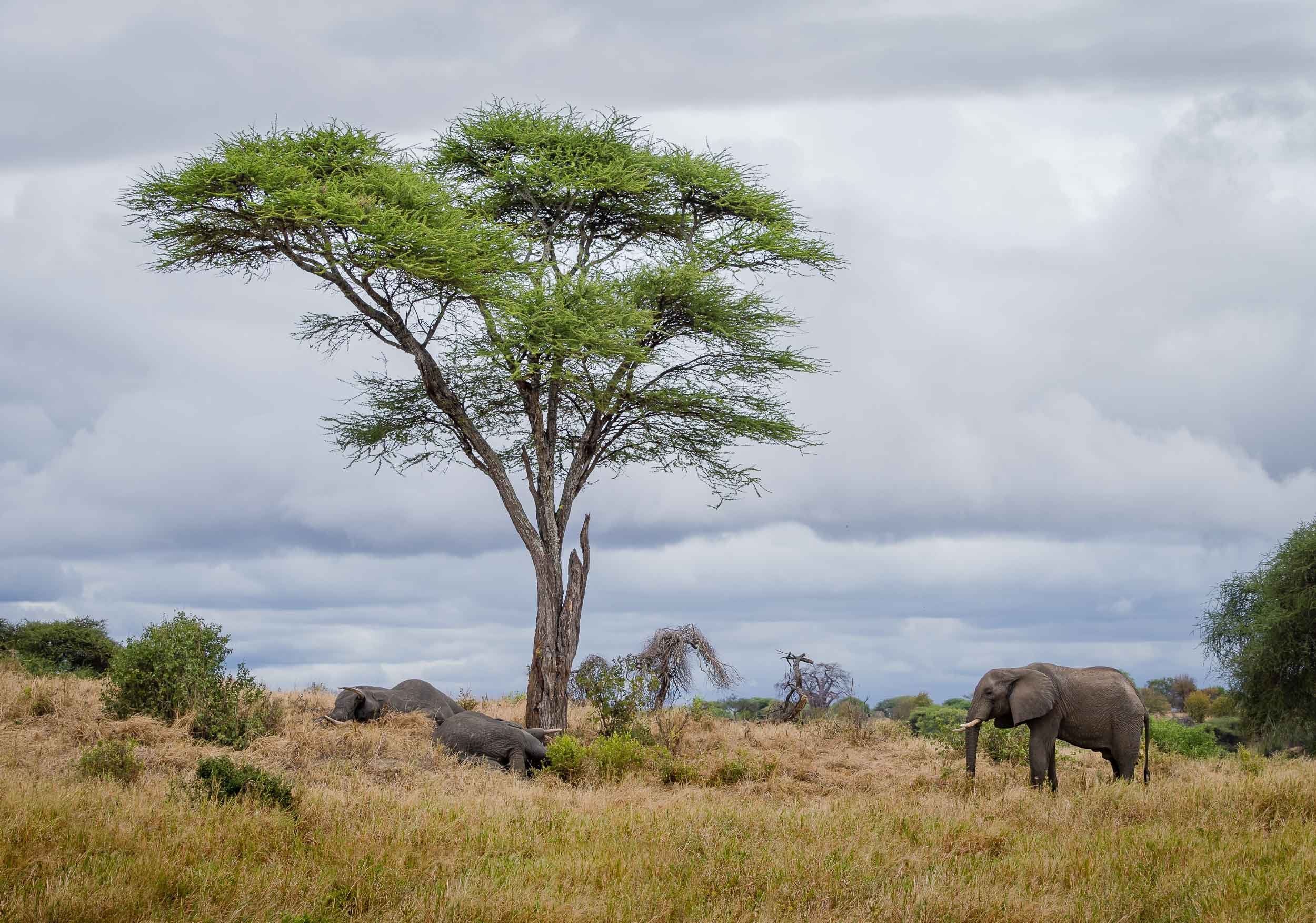


Lake Manyara
A walk on the lake followed by a visit to the thick rainforest of the Lake Manyara National Park, both together a UNESCO Biosphere Reserve.


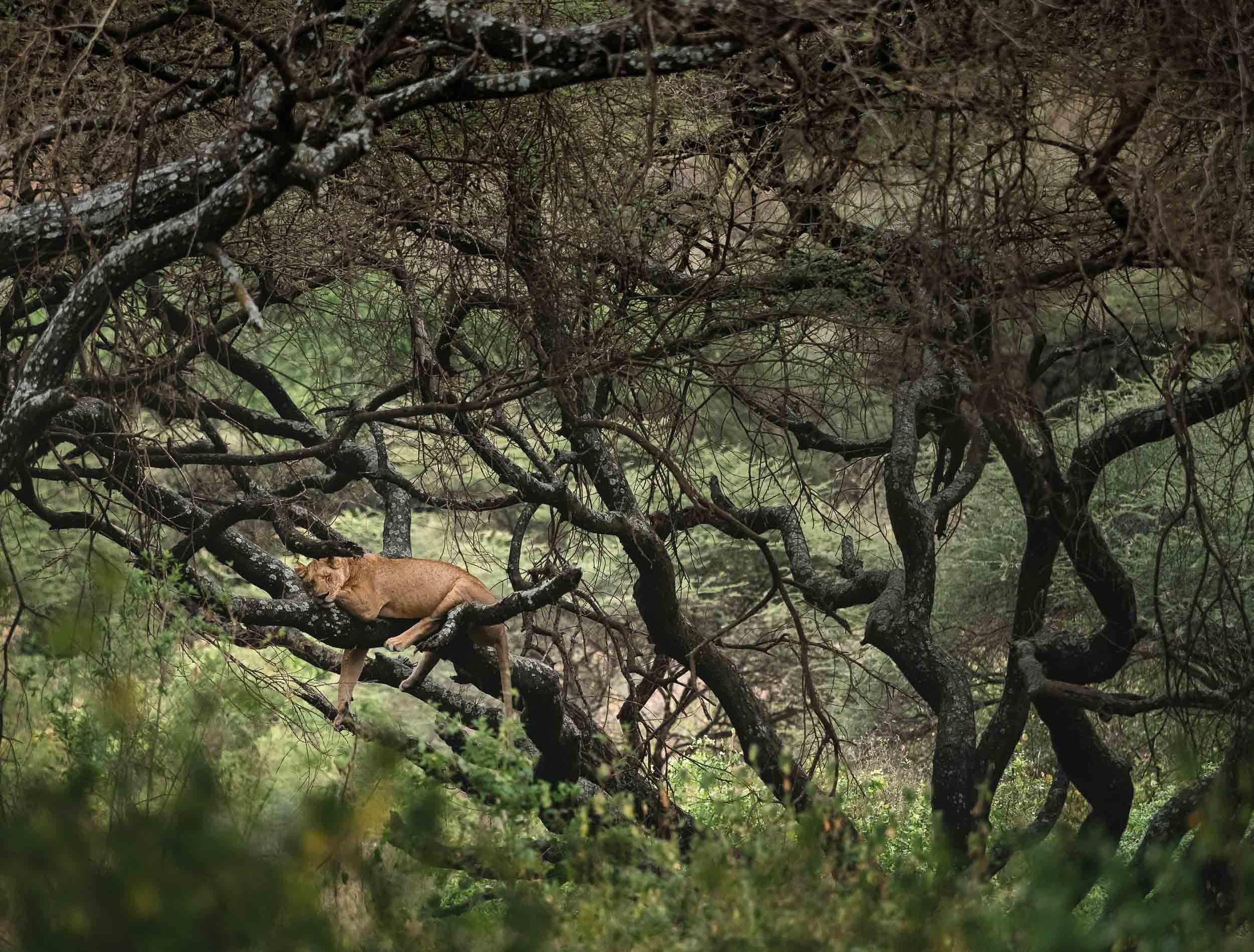
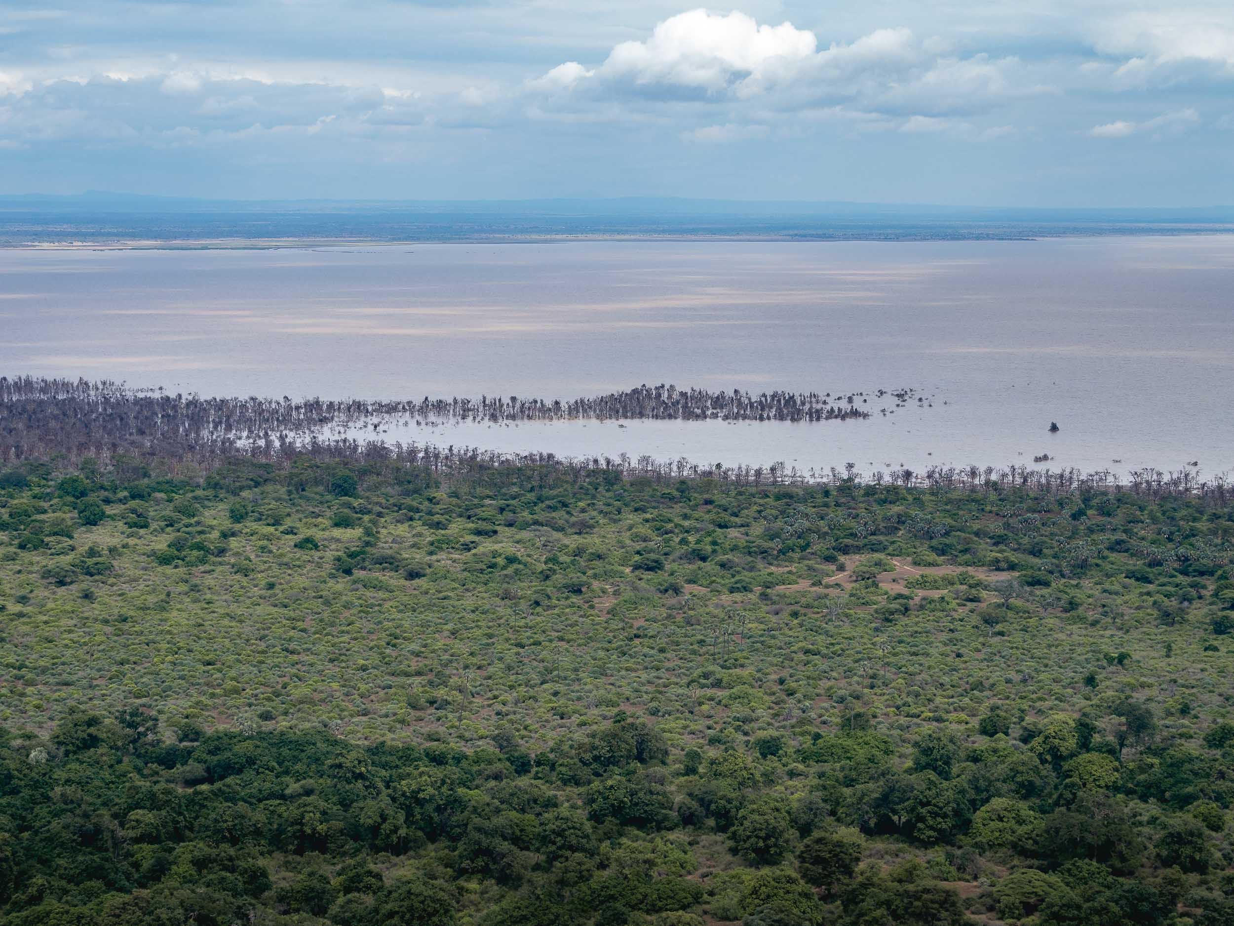
Ngorongoro Conservation Area and its Crater
The highlands and their famous volcano, with the world's largest inactive, intact and unfilled volcanic caldera, were our next destination - a UNESCO World Heritage Site.
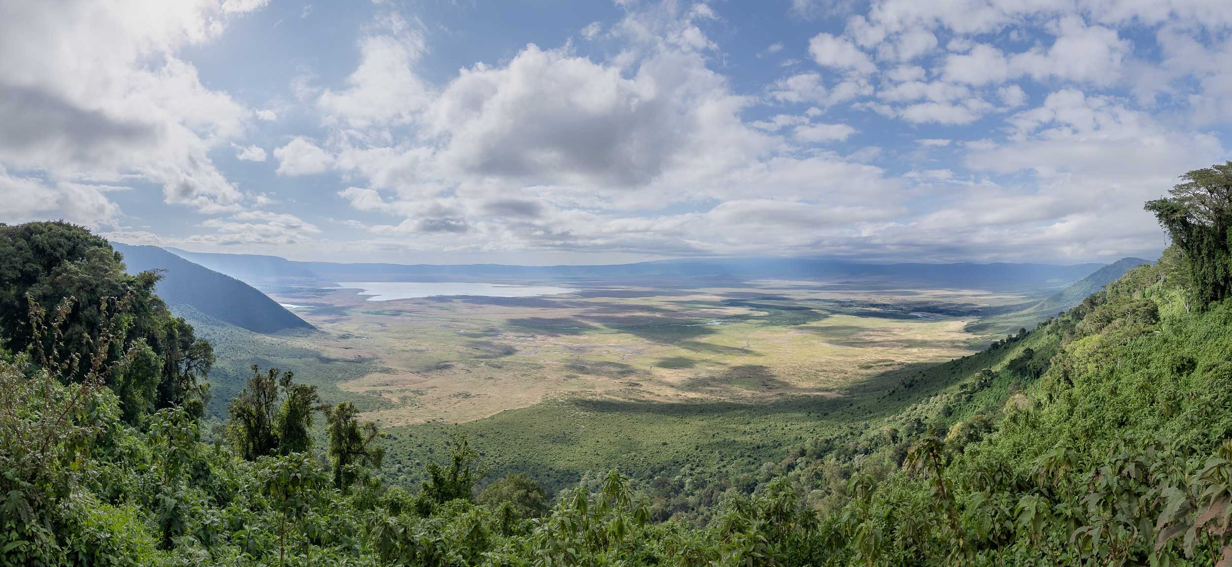


In the Ngorongoro Conservation Area, we encountered this Cheetah mother and her two cubs with a fresh kill near the Ndutu lake. One of the cubs happened to look for some shade under our vehicle for a while, with barely its tail sticking out beside the tire. The mother had a GPS tracker for ongoing research, due to the declining population in the area.


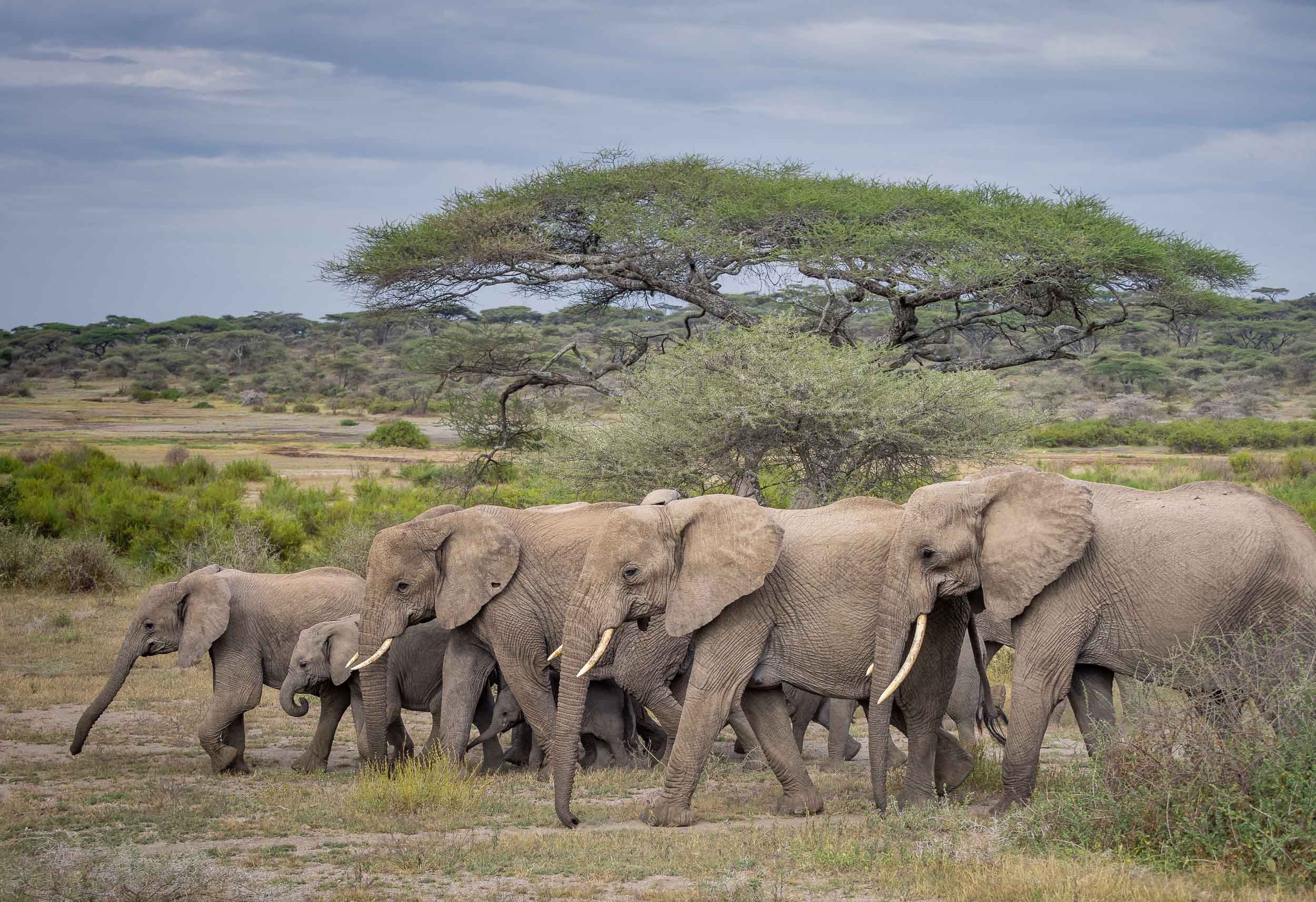
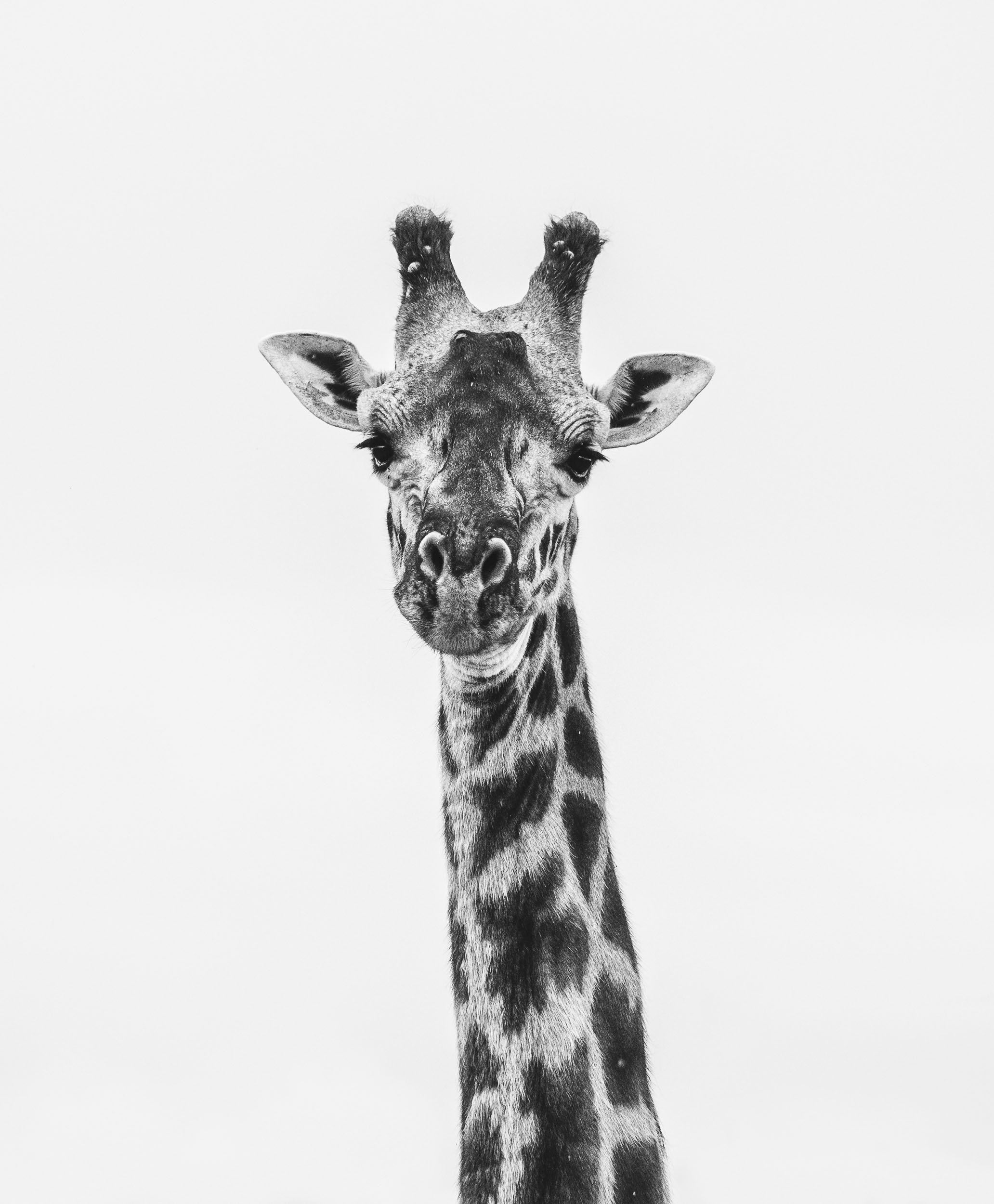
The Seat of Humanity
The Ngornogoro region is also home to Tanzania’s most treasured prehistoric sites, which played an essential role in understanding human evolution. I took some detours from the standard route to reach two such places.
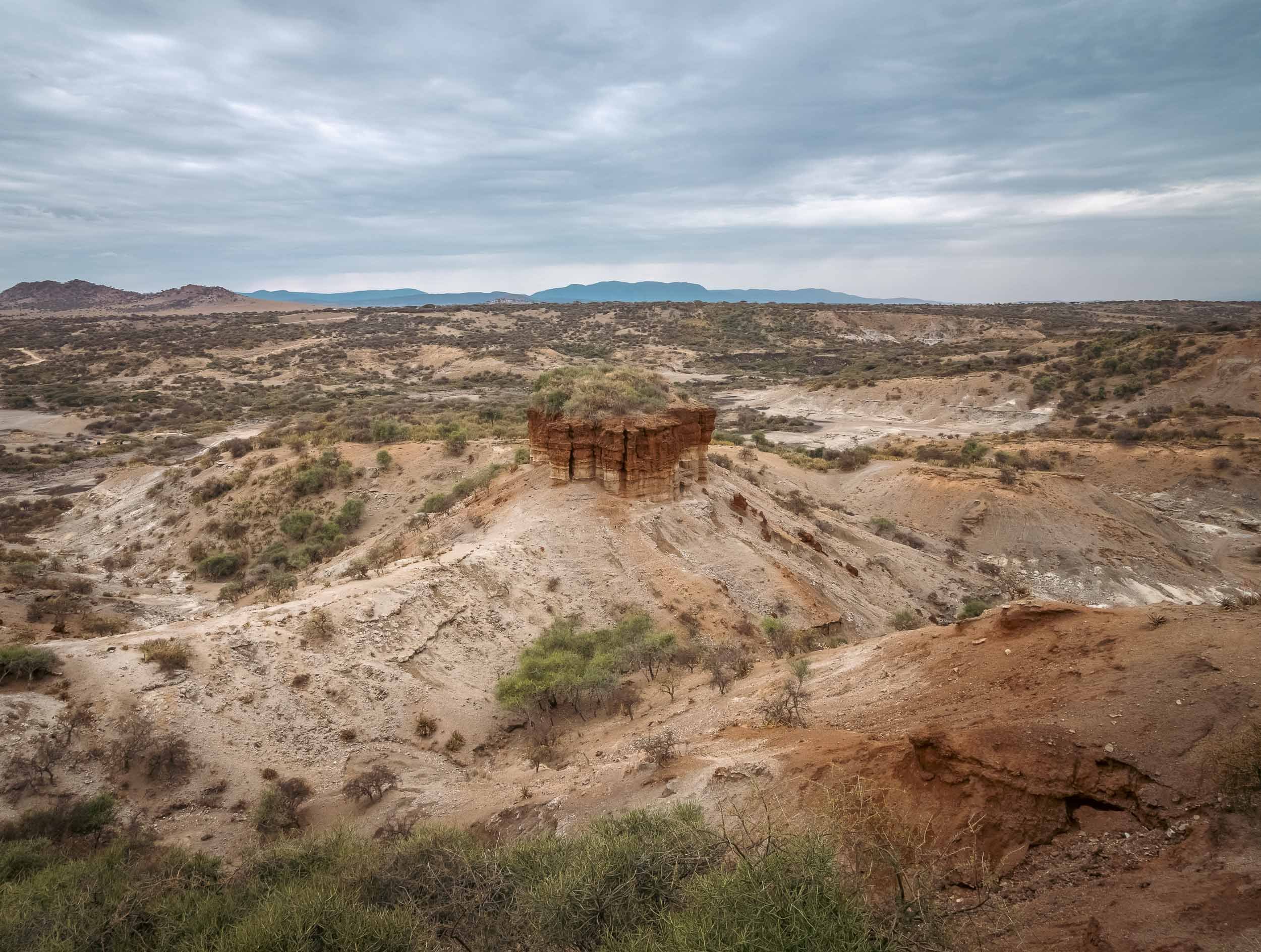
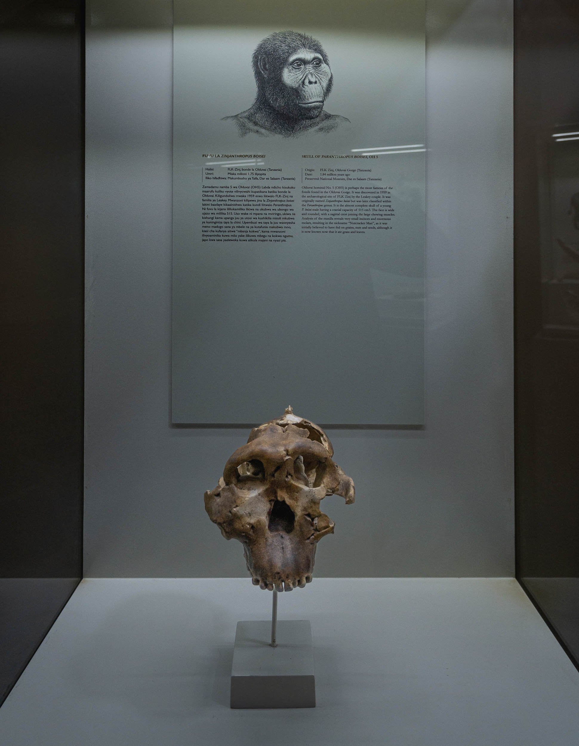
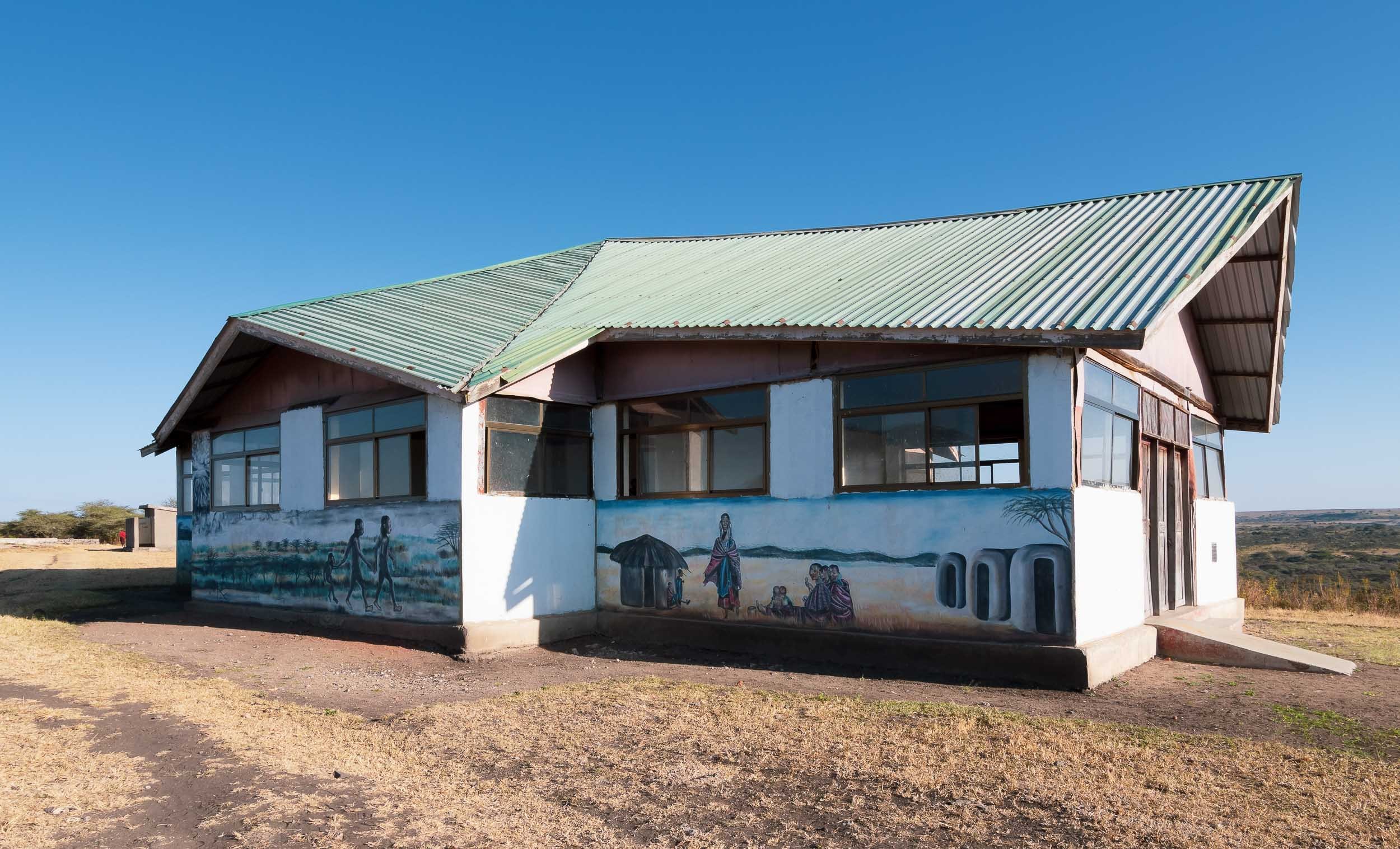
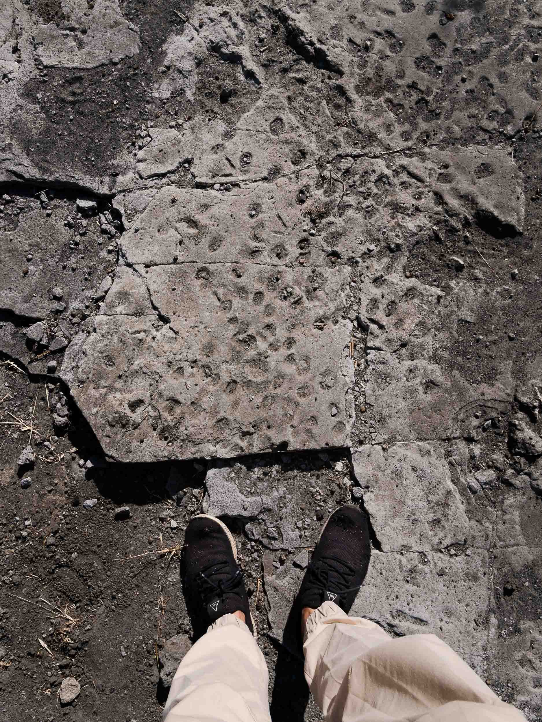
The Serengeti from the Ground - and from Above
A collection of wildlife images from what is maybe the most famous National Park in Africa, covering almost 15,000 sqkm - it is aptly named after the Maasai word siringet, meaning "the place where the land runs on forever".
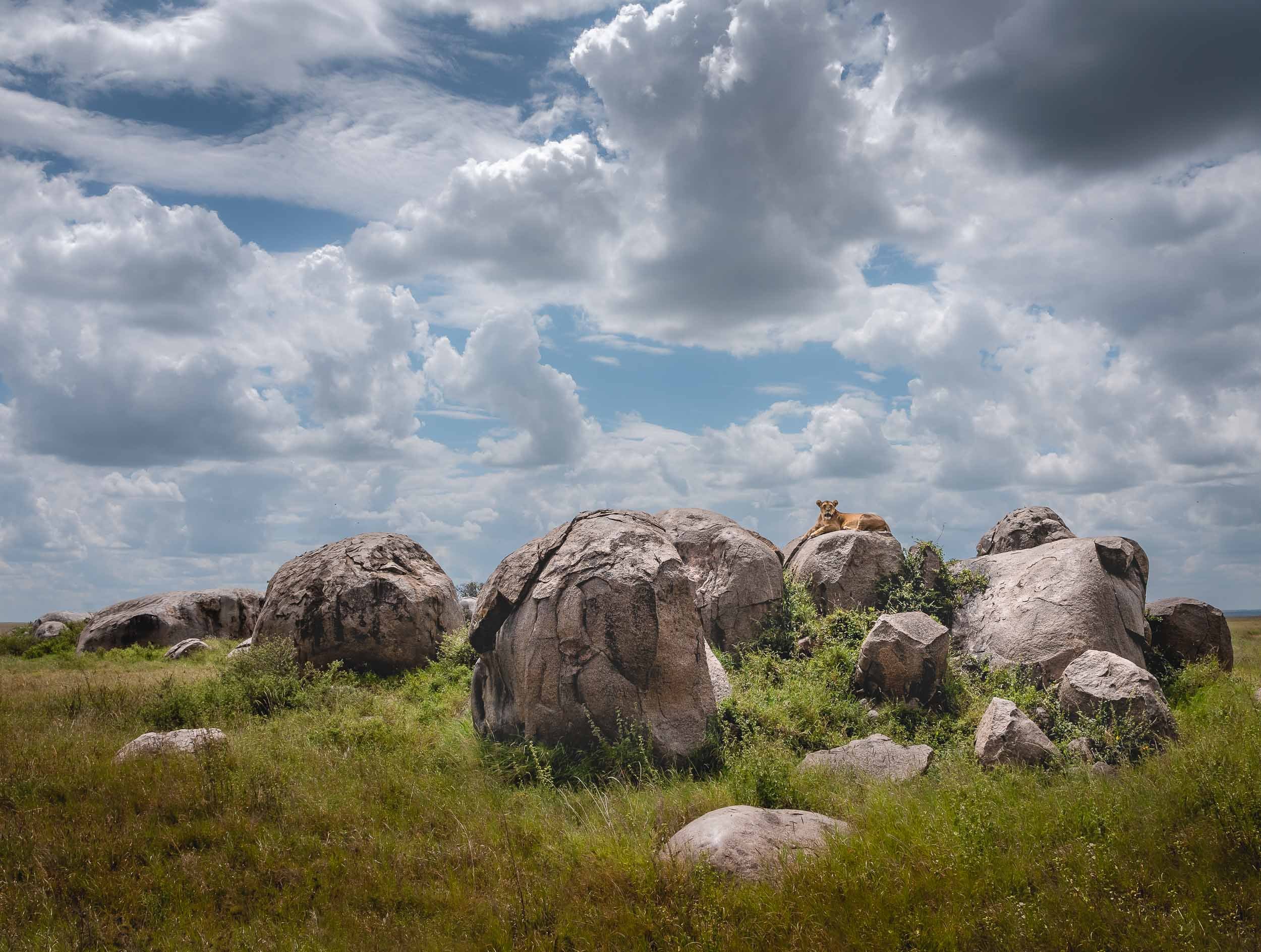
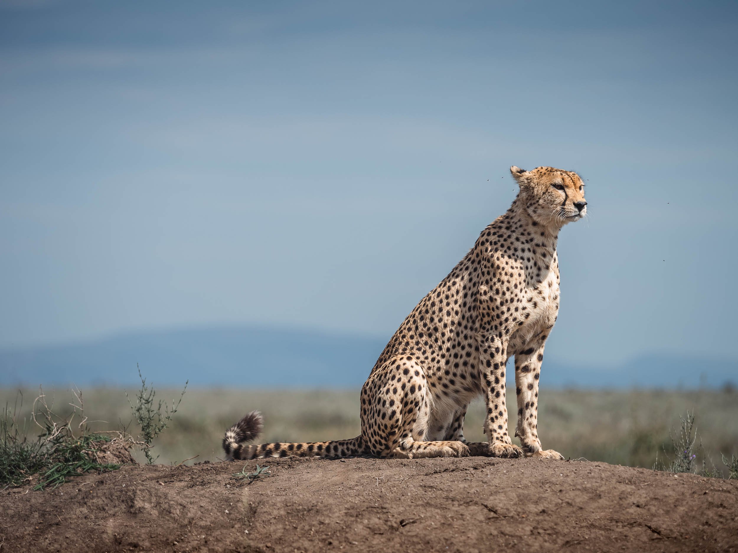


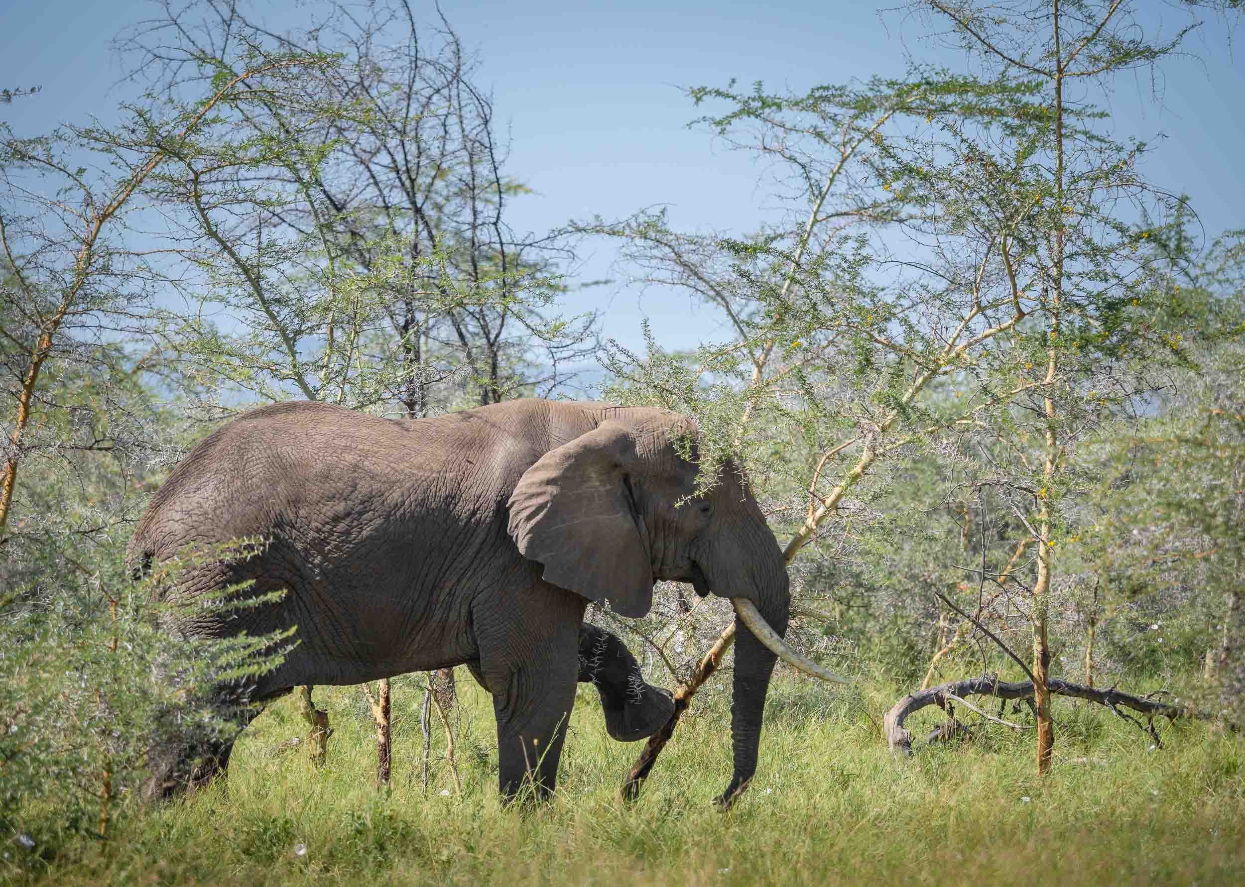


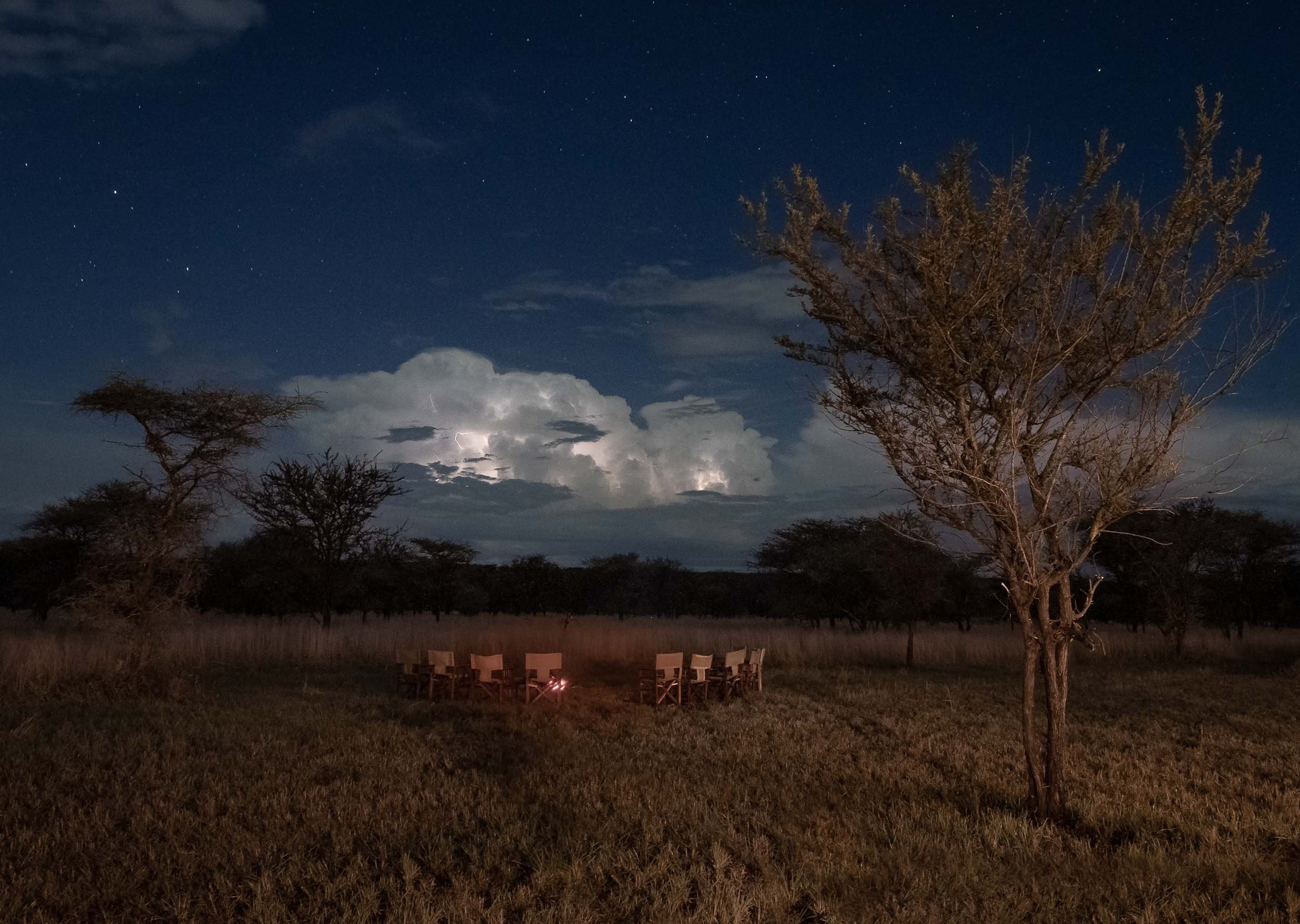


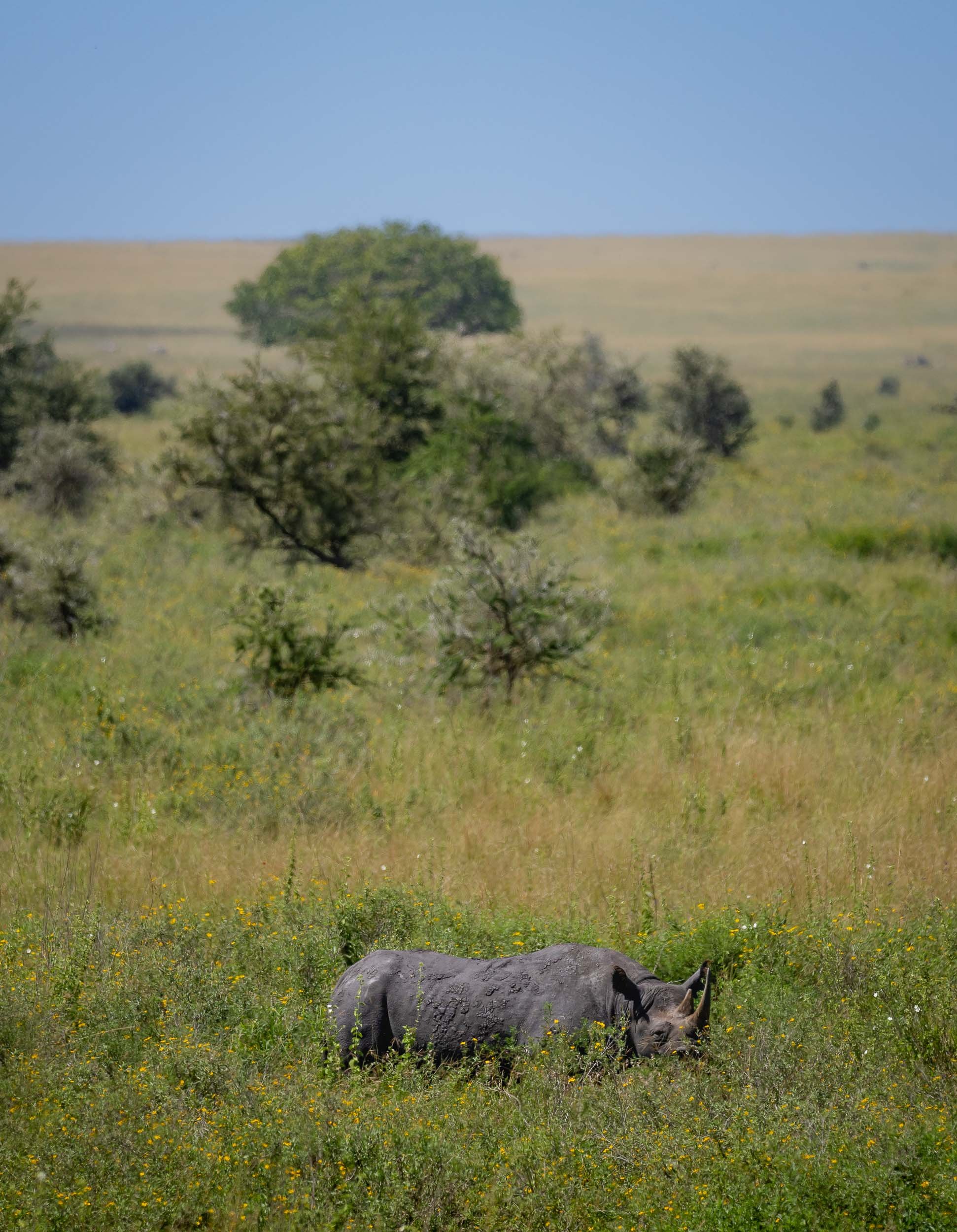
While the Serengeti is impressive from the ground, an aerial view of its vast savannah and many animal herds take things to another level. After a - literally - bumpy start, we had a great balloon flight with Miracle Experience Balloon Safaris.


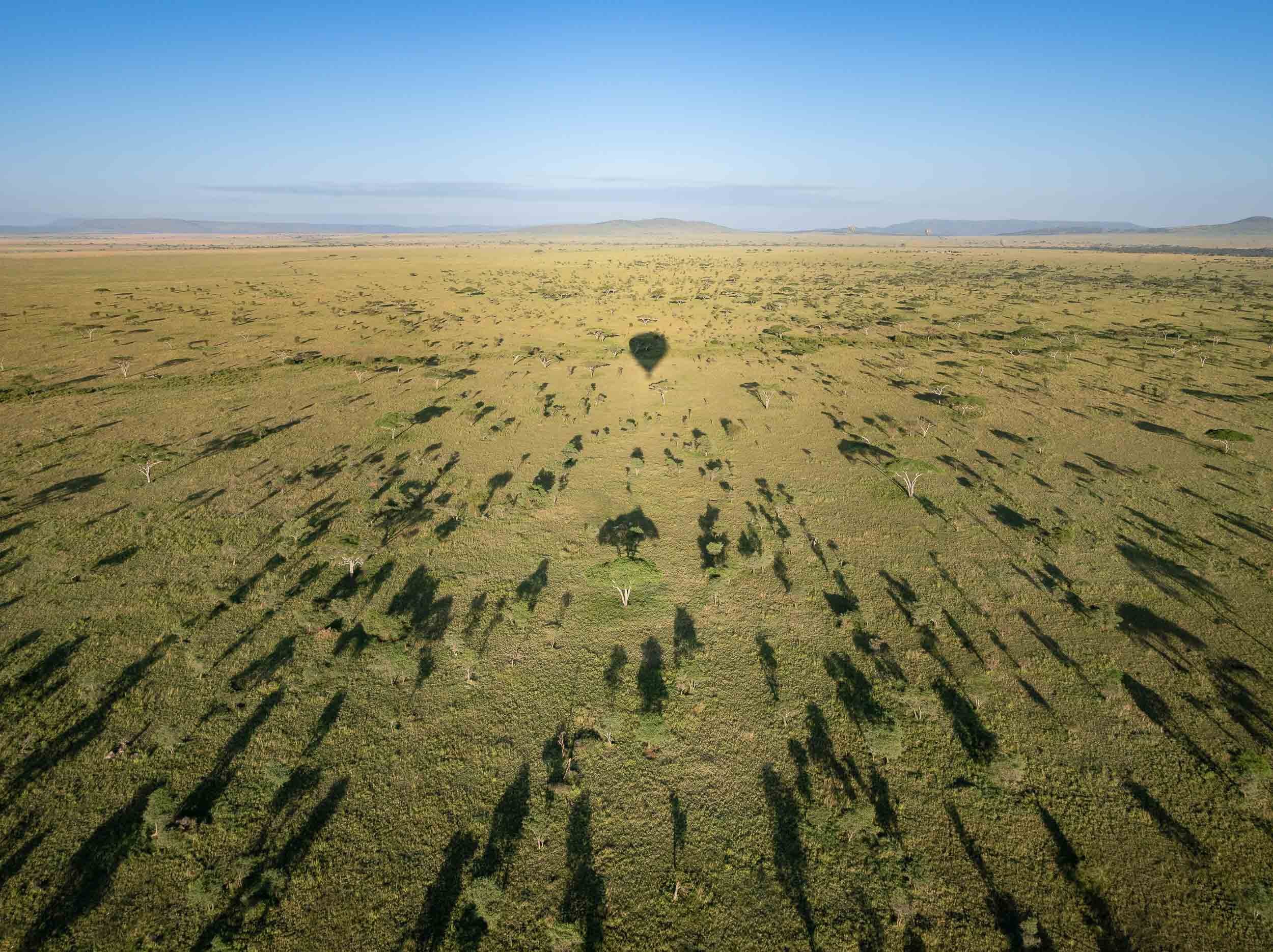
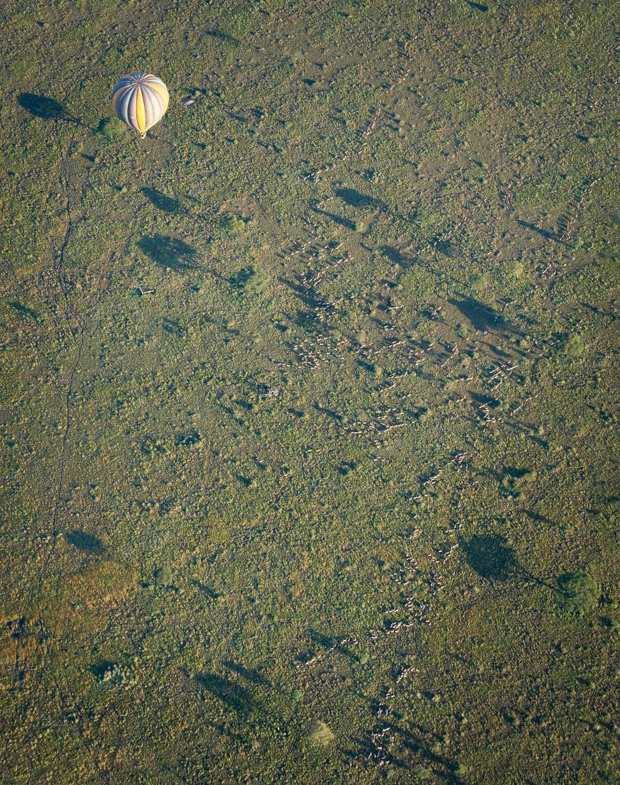
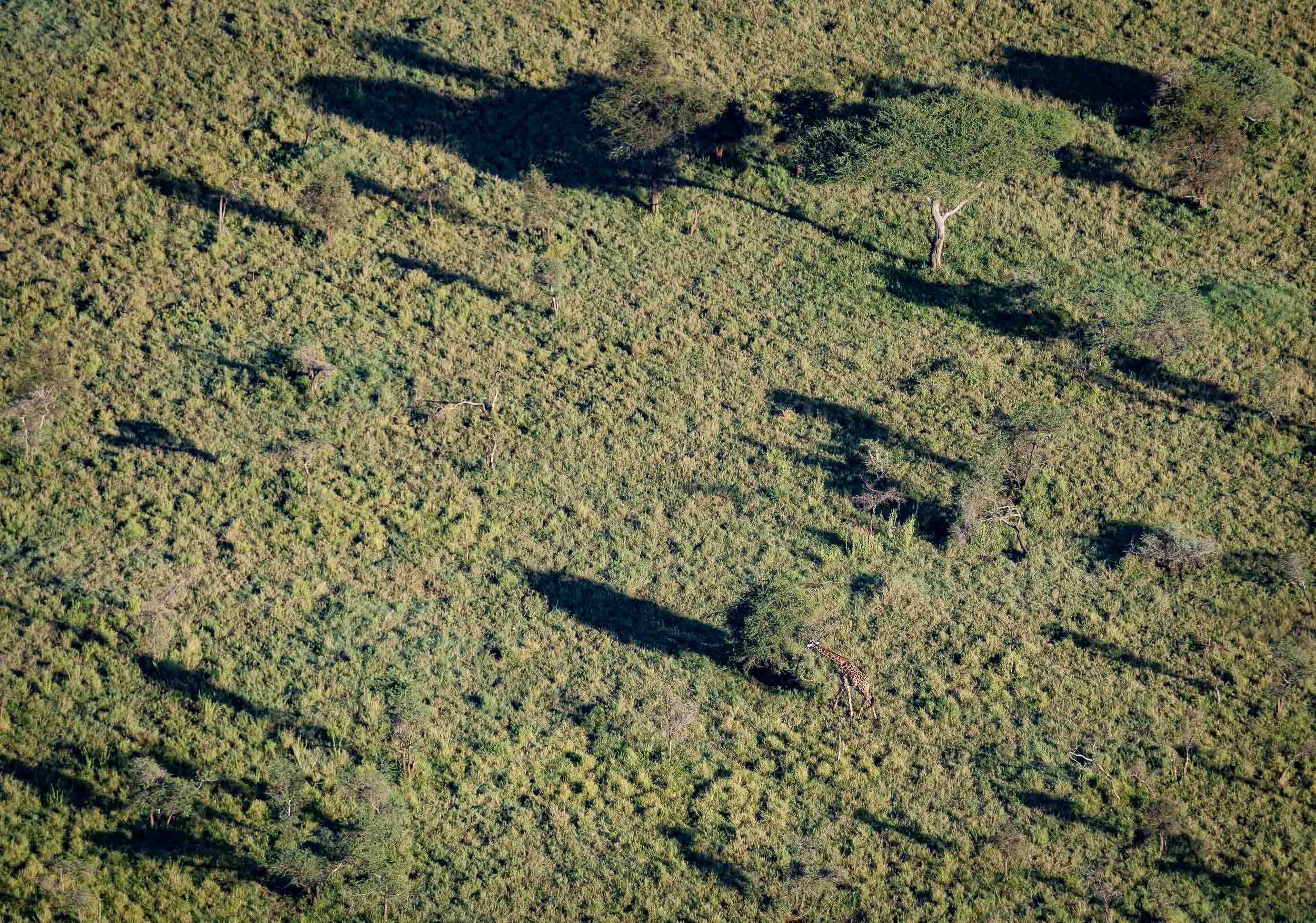

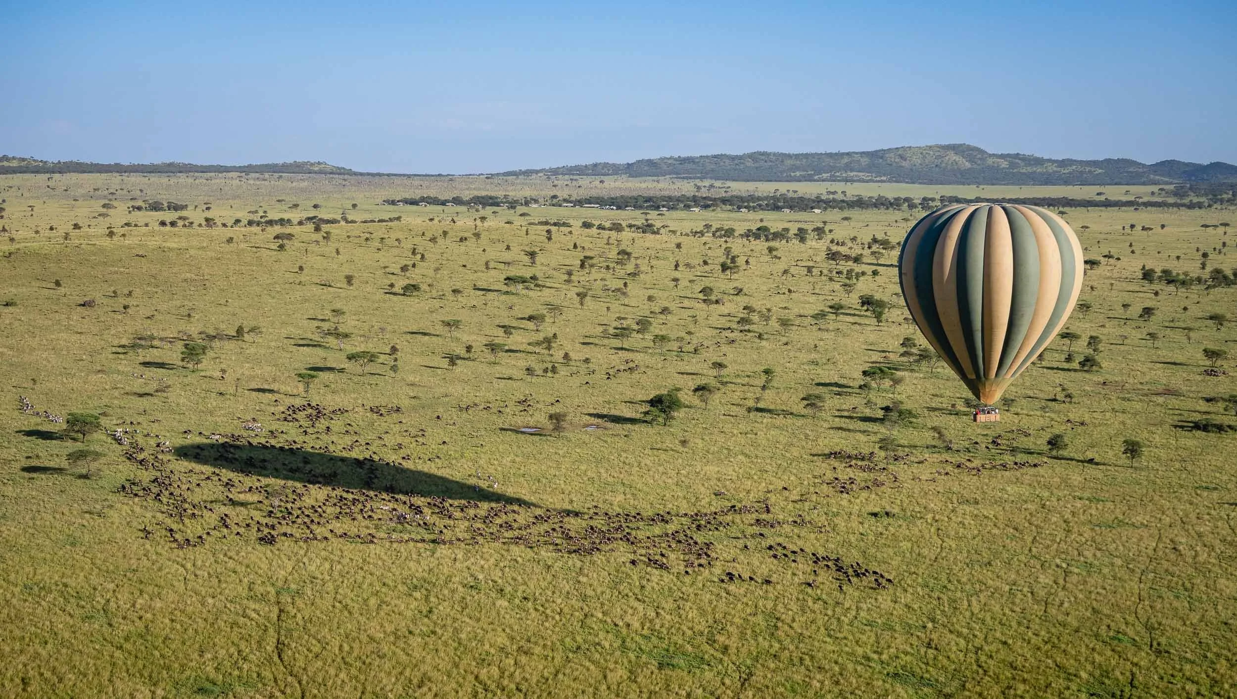
The Great Migration
Why we came to the Serengeti: The world’s longest animal migration, with 1.5 million wildebeest and 250,000 zebras following the rains in an 800km circular route every year. We caught it in full swing, with the largest herd we saw approaching 300,000 wildebeest according to our guides - it was an incredible sight difficult to capture in pictures.
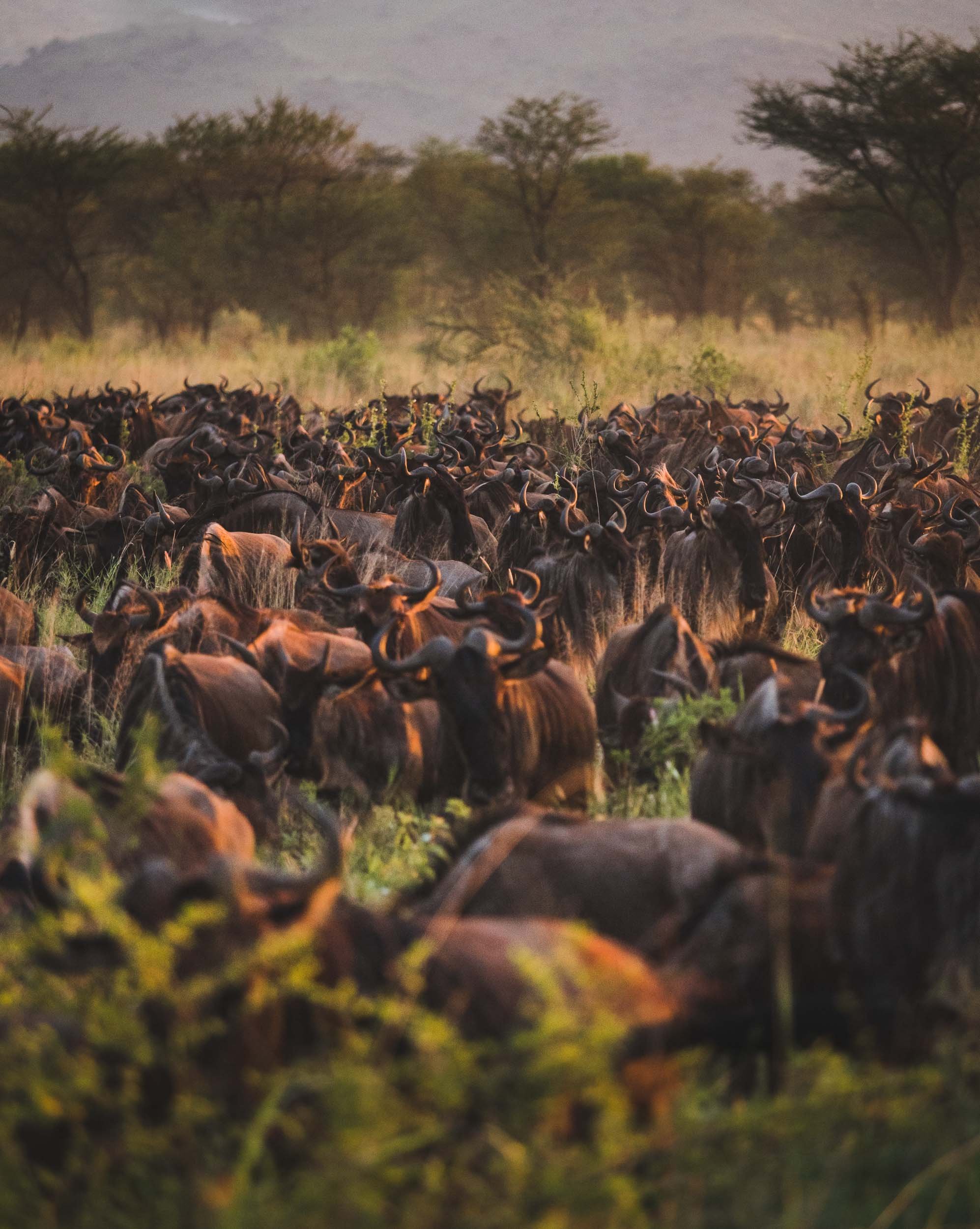

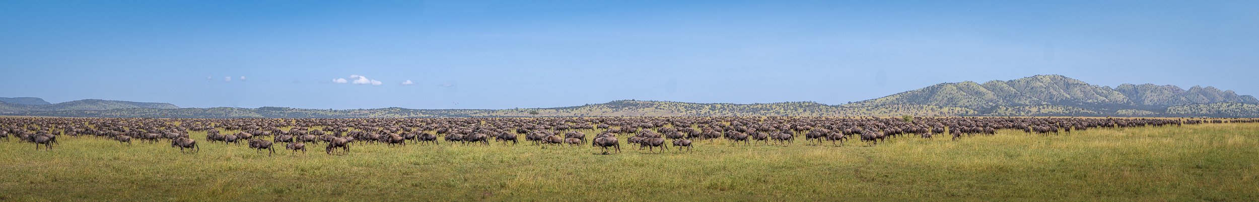
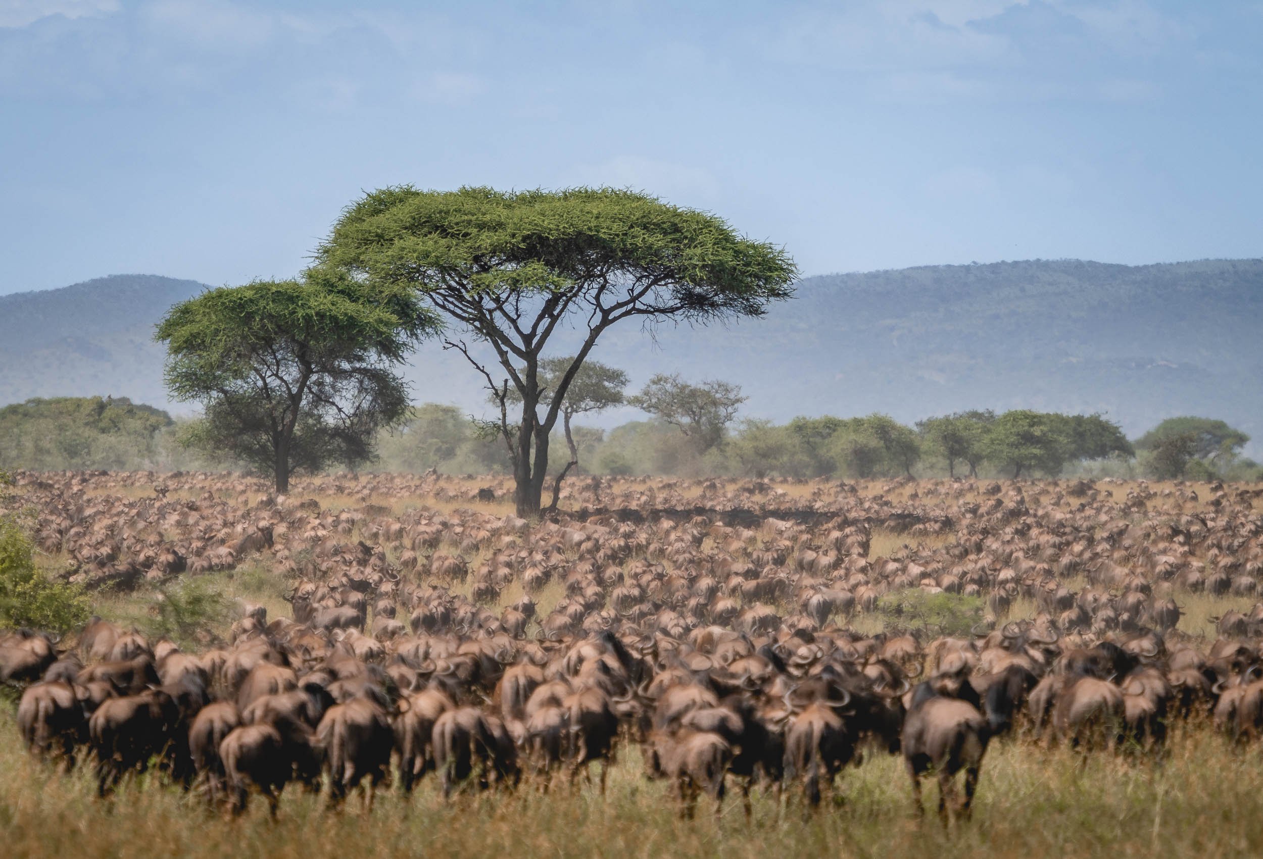
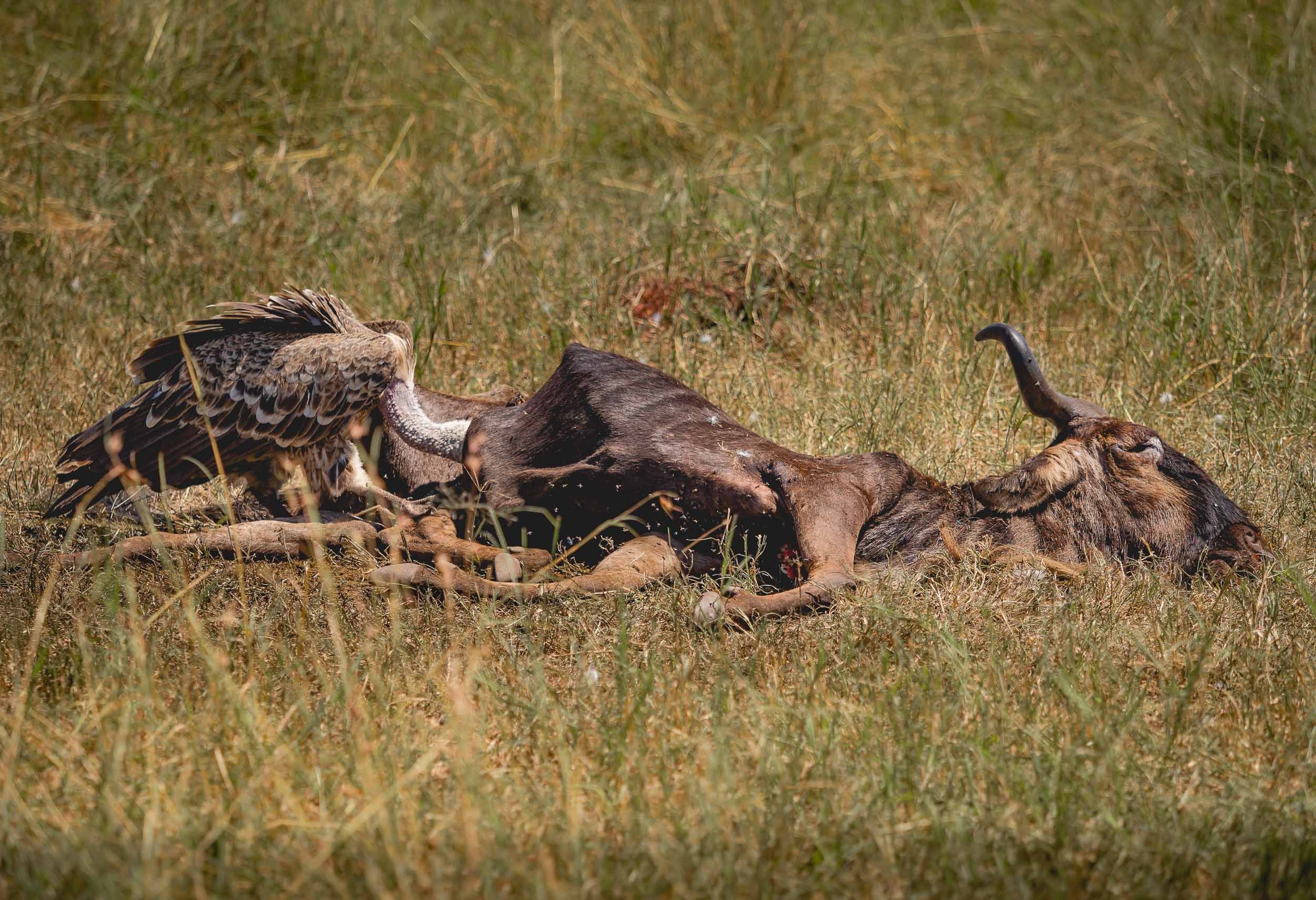
My journey wasn’t as long and dangerous - hopefully still enjoyable to follow along.

Botswana - On The River, Above the Ground, And Under The Stars
My time in this landlocked country on south-western Africa was mainly focused on animal photography.

The third destination I visited during my Africa trip, was Botswana. My time in this landlocked country on south-western Africa was mainly focused on animal photography. Having said that, I could not help sneaking in a few rather unexpected Milky Way photos, read on to find out why that was the case.
This trip was with Pangolin Photo Safaris, specifically their 10 day - 3 location trip, which was well organized and covered a variety of wildlife and landscapes.

The Chobe River
Over the first 3 days in the country, we spent time on a houseboat cruising and mooring along the Chobe river. In fact, we were anchored on the Namibian side, so one could argue that some of these photos show Namibia, and some show Botswana, depending on which side of the shore the animals stood ;).

Elephants in the Water
It was the first time I was able to observe elephants in the water, not just bathing and drinking, but properly swimming - in fact, literally under water. The park is widely known for its many elephants. Botswana has the largest elephant population in Africa estimated at over 200,000, to the extent that their presence causes pressure on the environment and other animals, as well as conflict with humans.
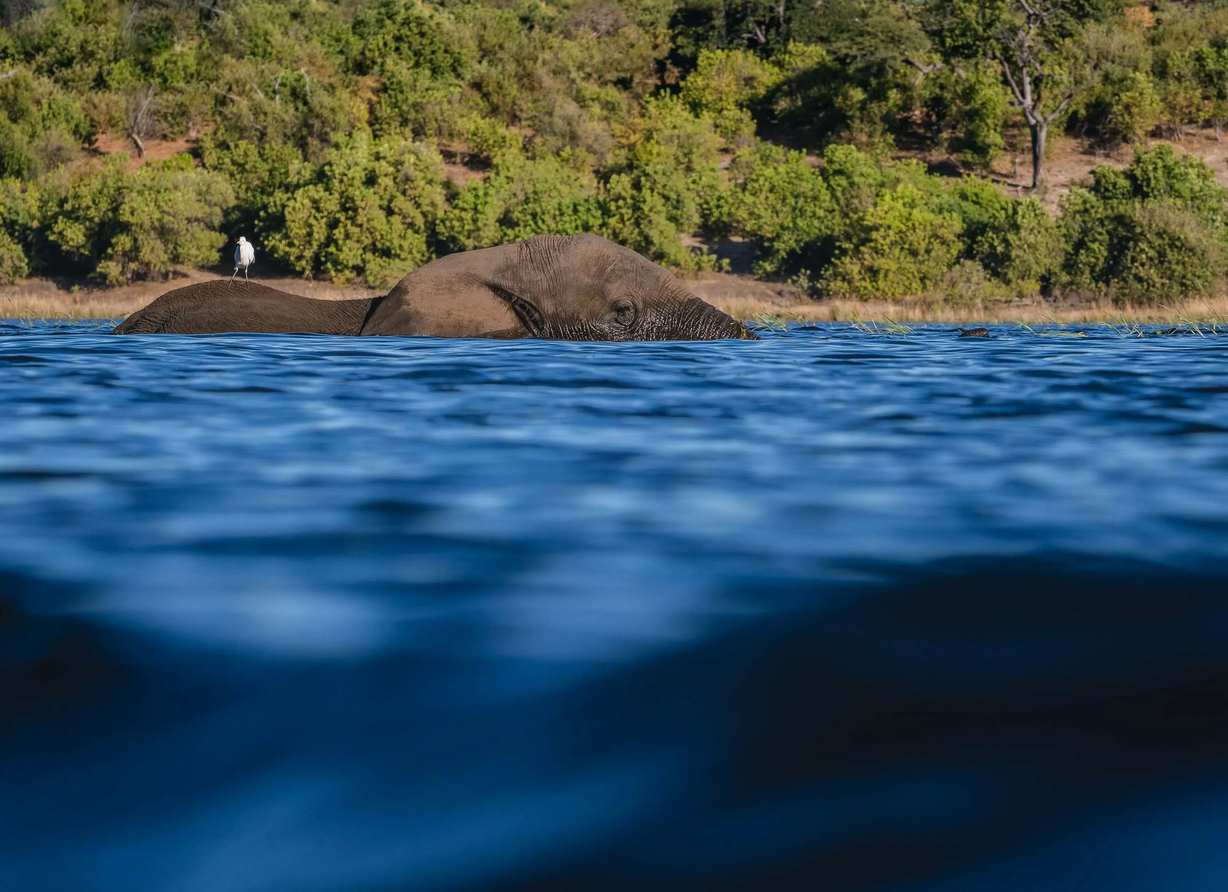
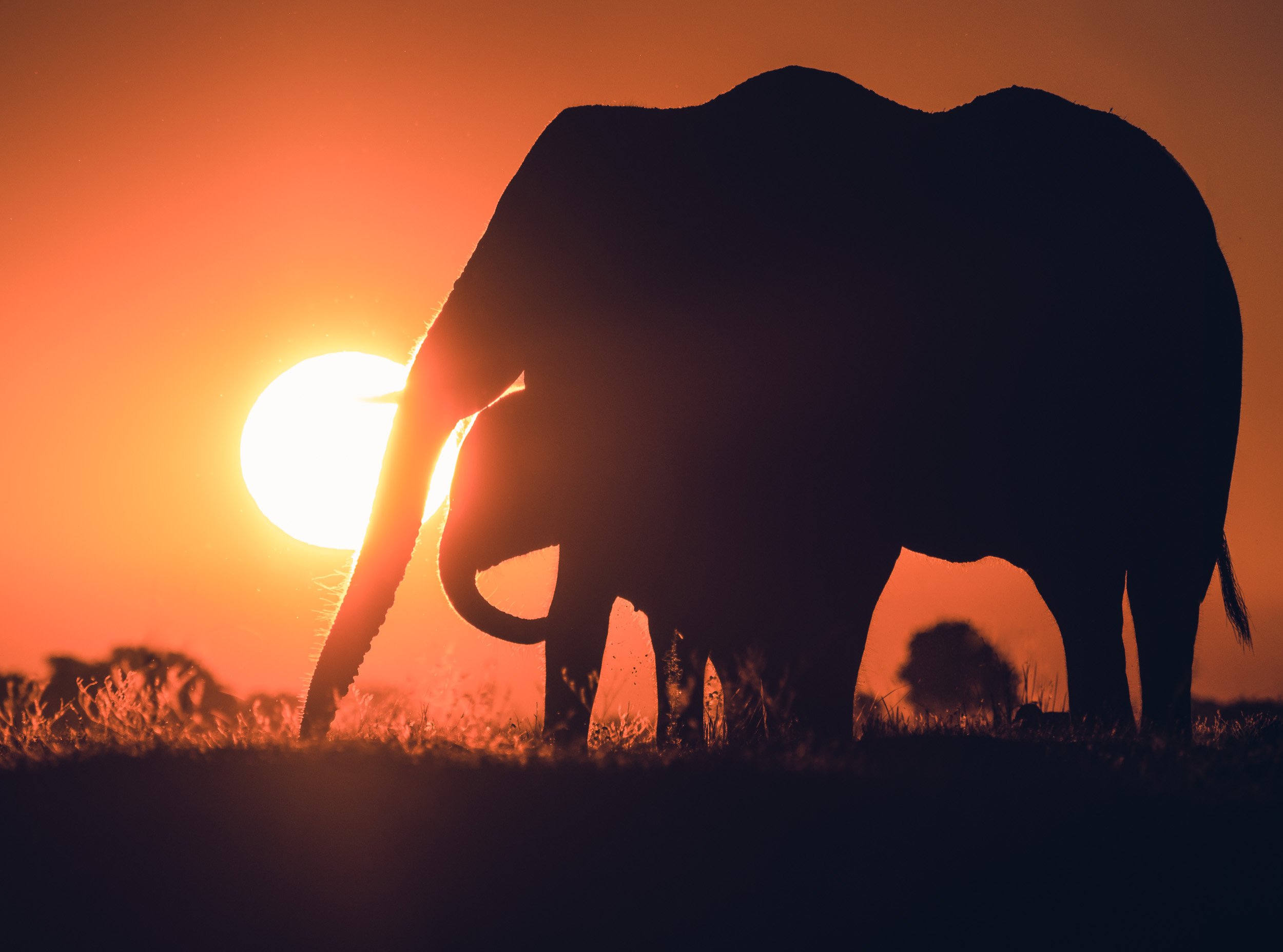
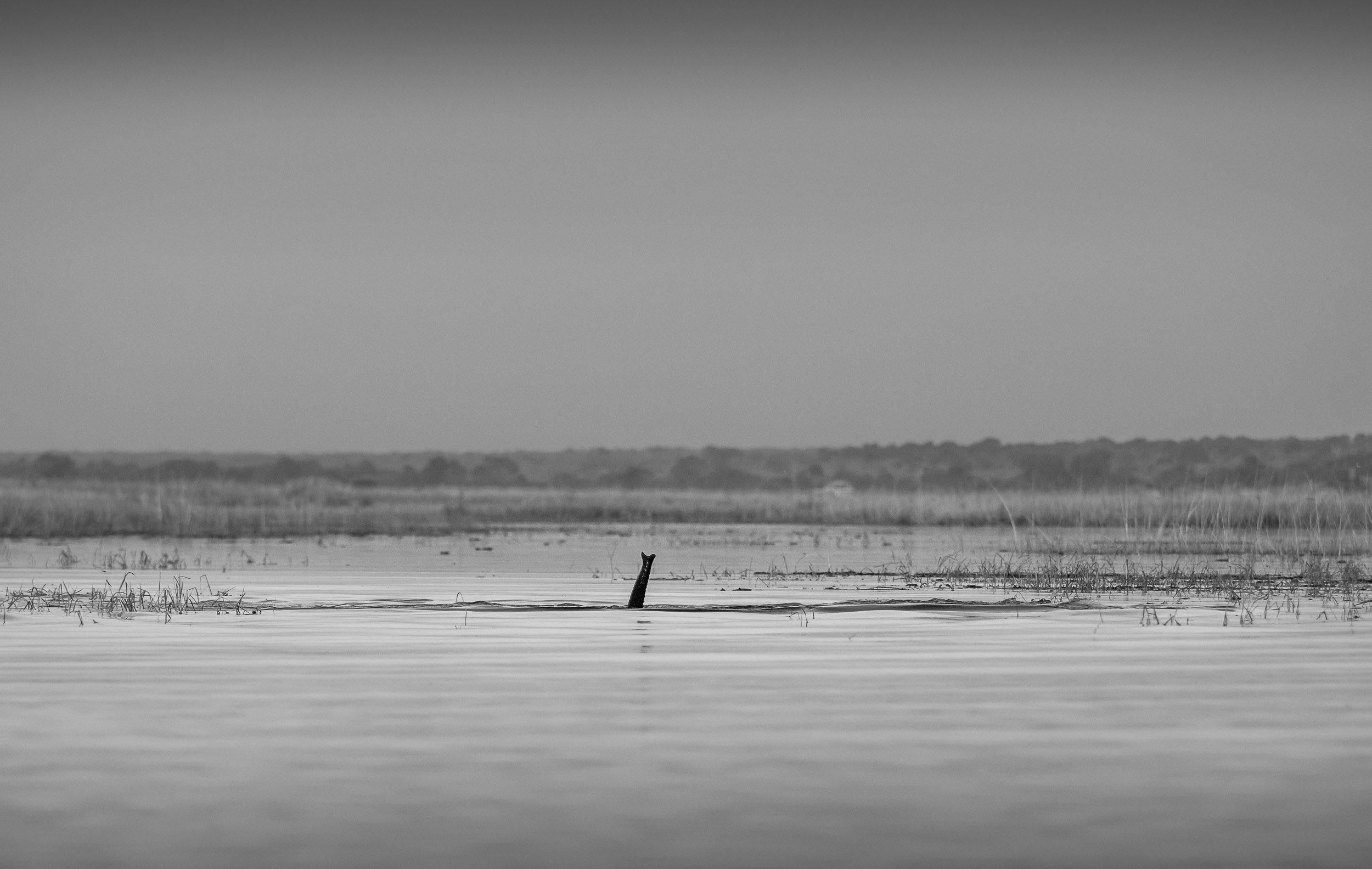
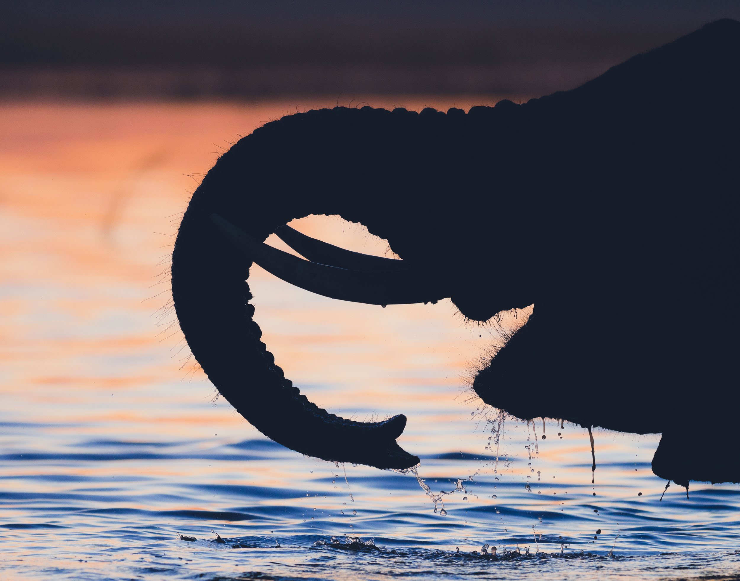
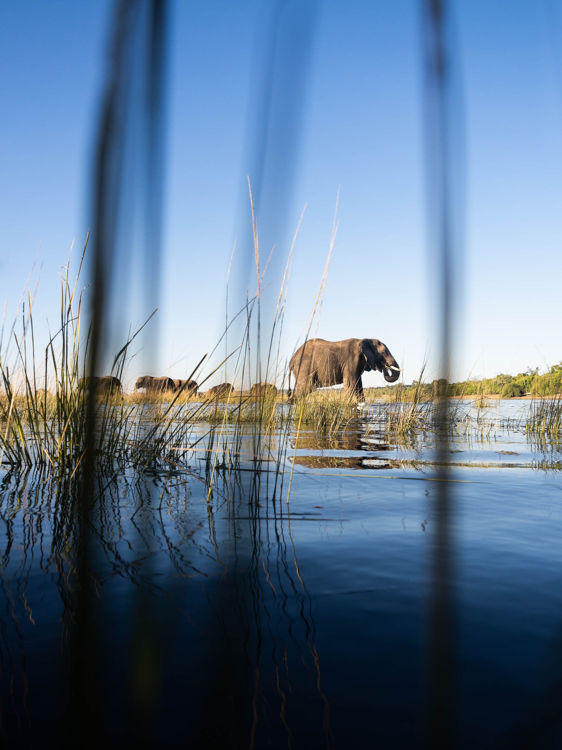
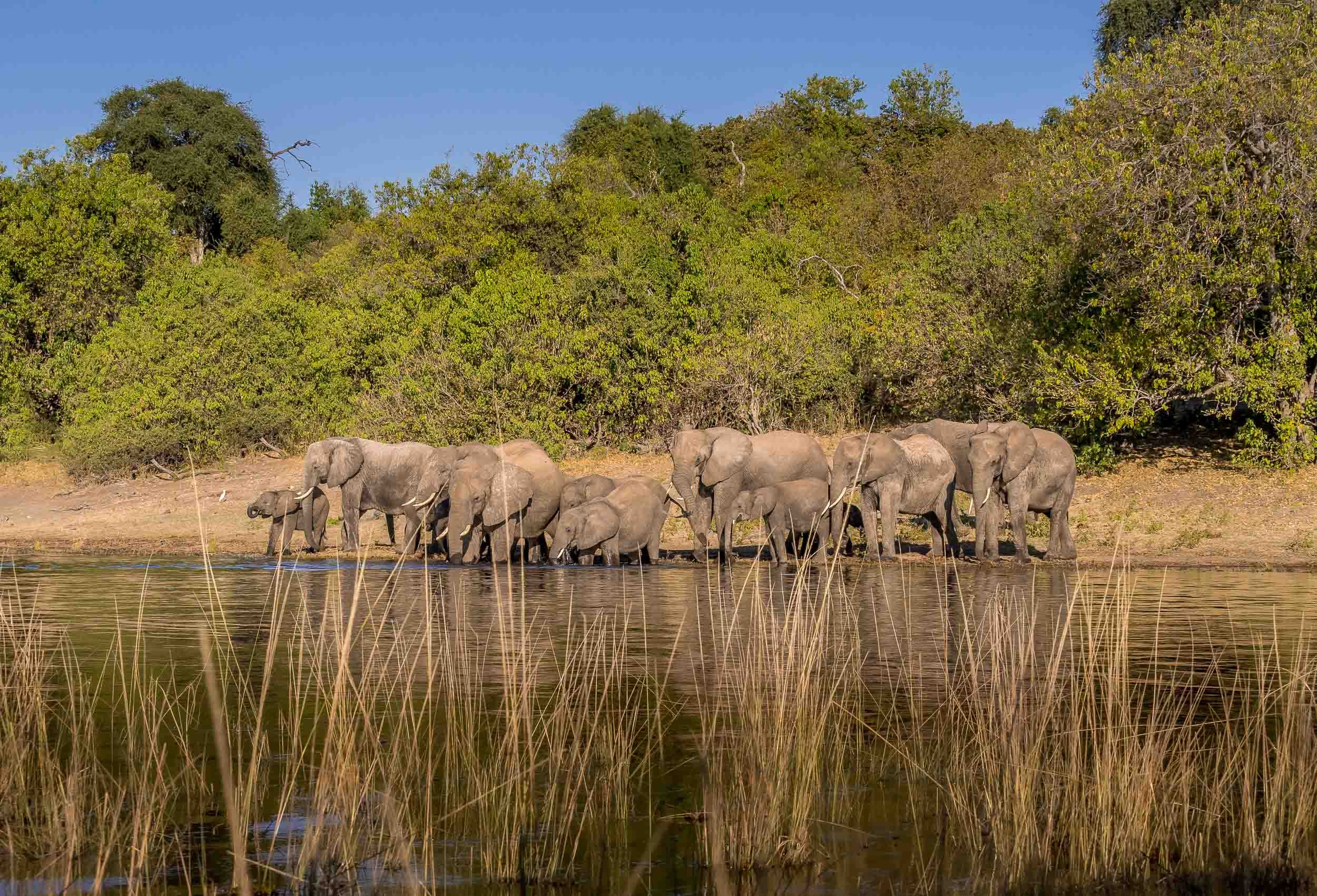
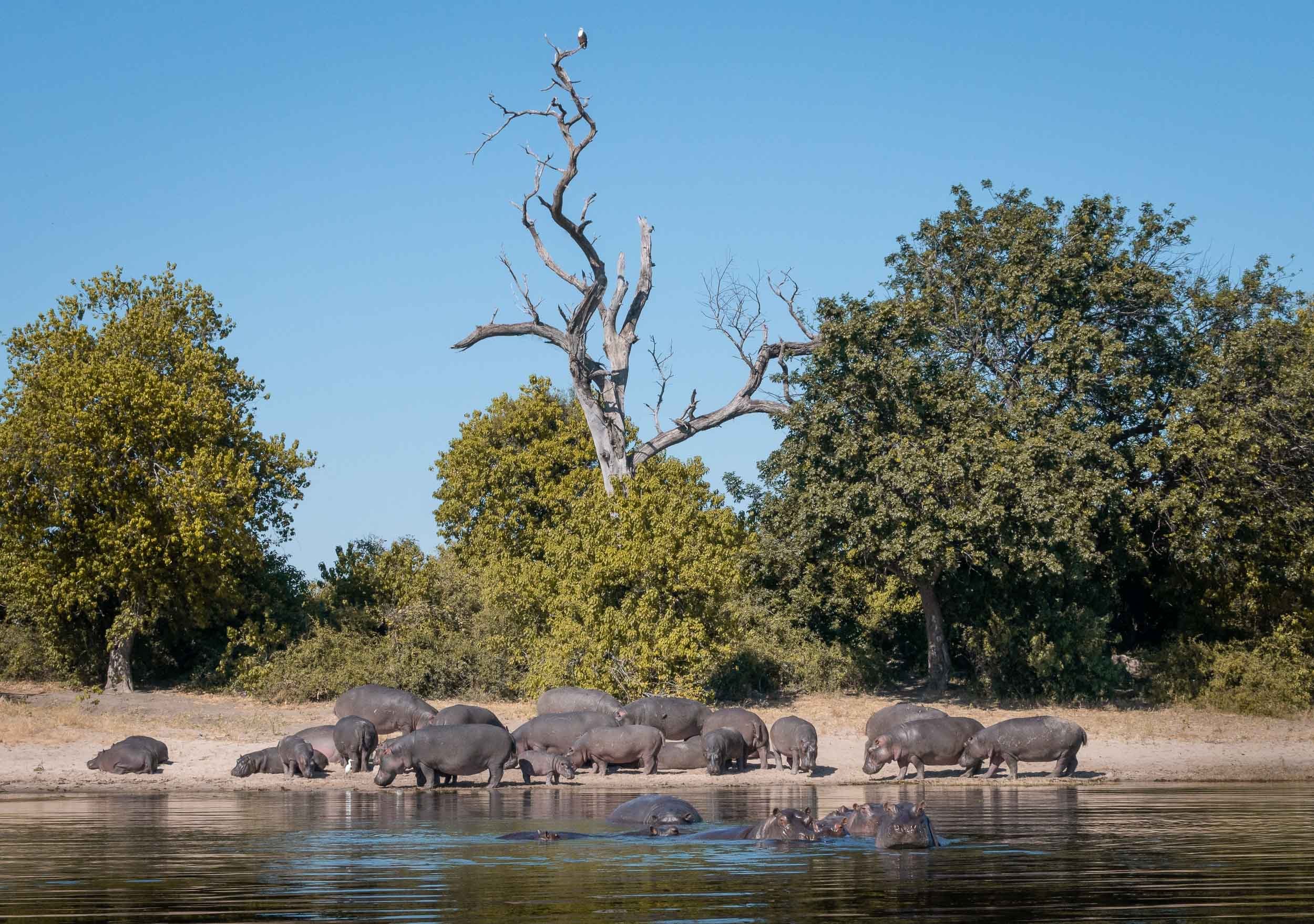
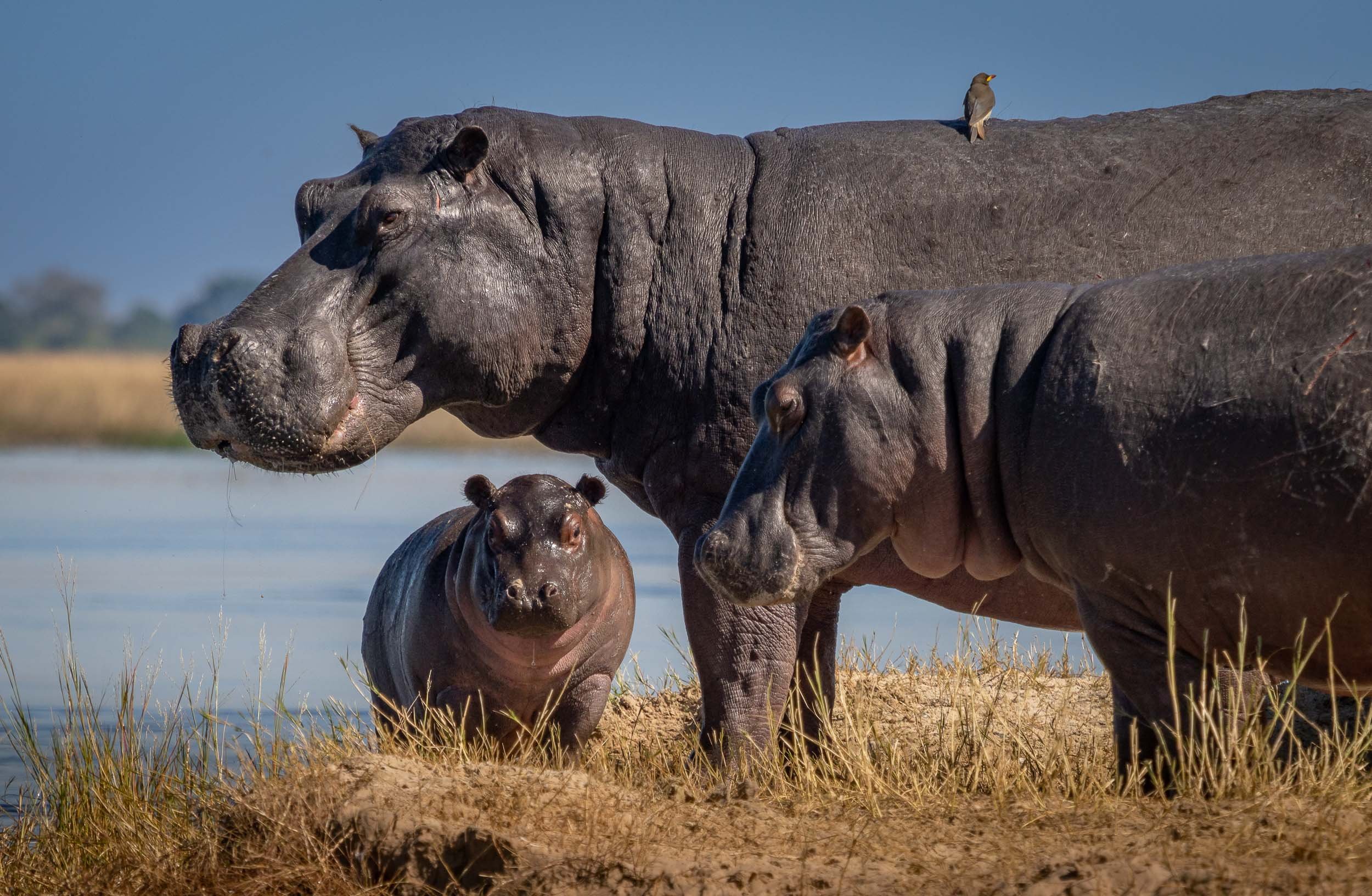
Bird Life
The river has amazing bird life, from Kingfishers, to Fish Eagles, Storks, and Jacanas. Not something I was previously too interested in, but observing their behaviors is intriguing, and trying to catch them in flight is a photographic challenge (which I never shy away from).
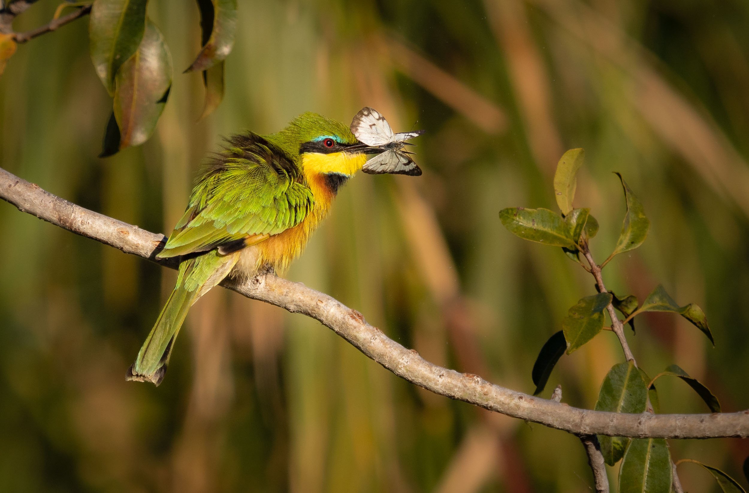
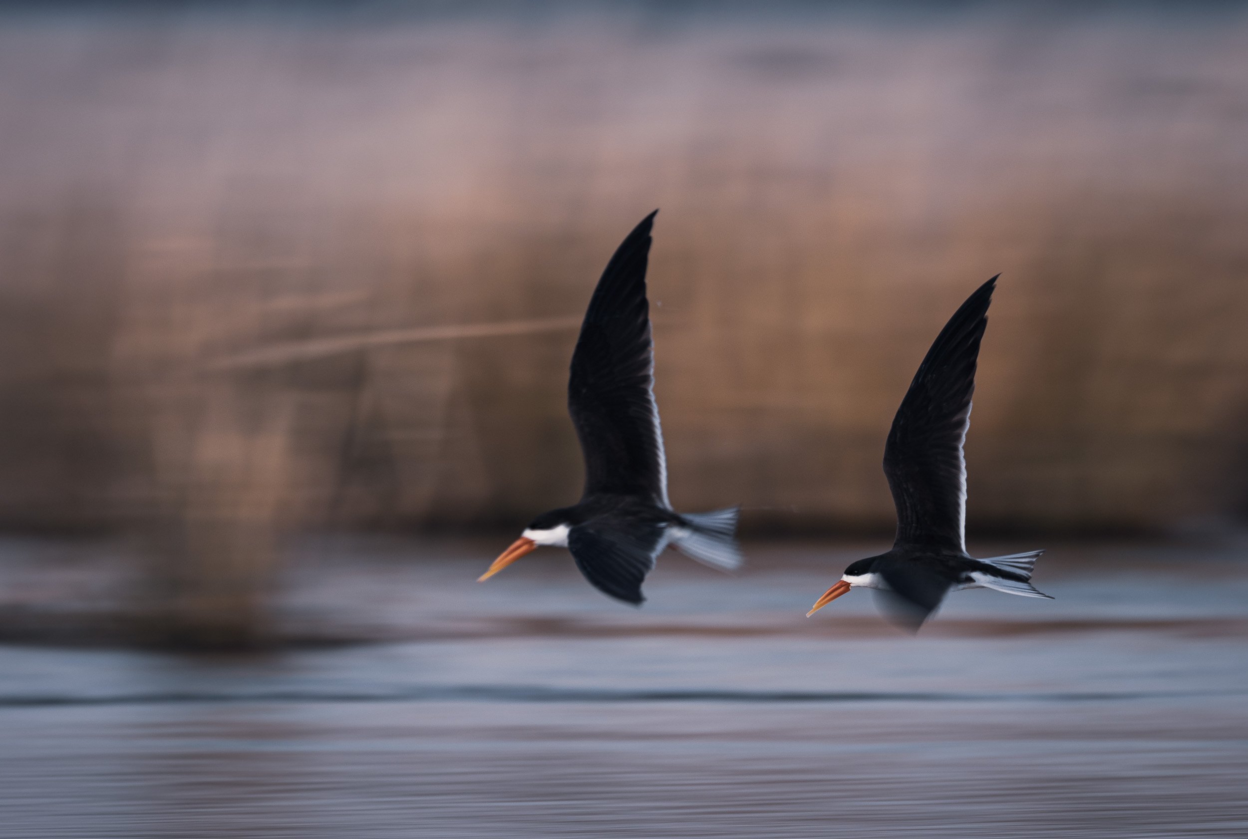
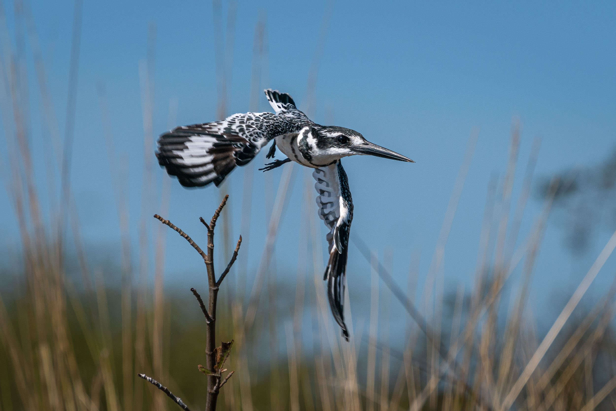
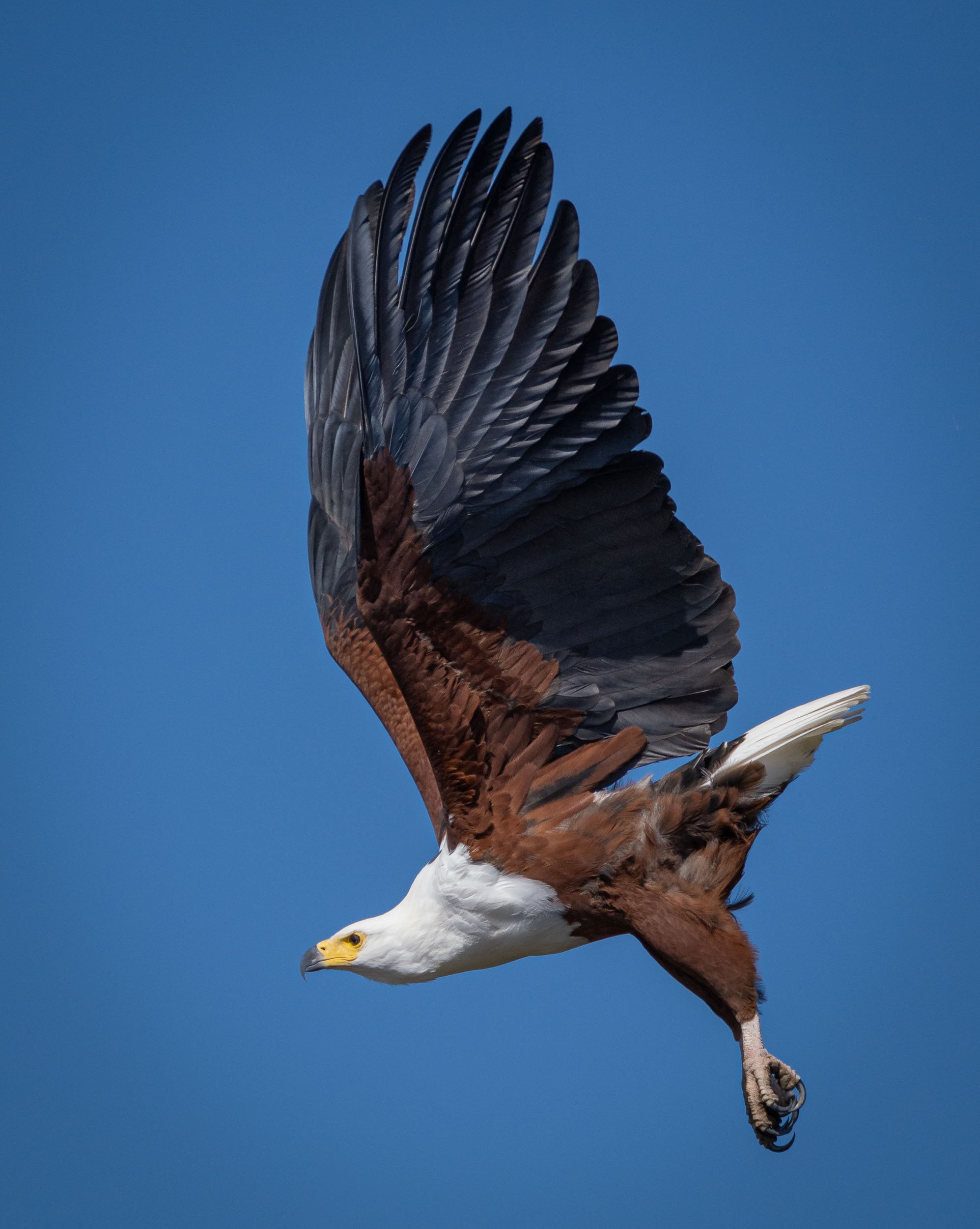
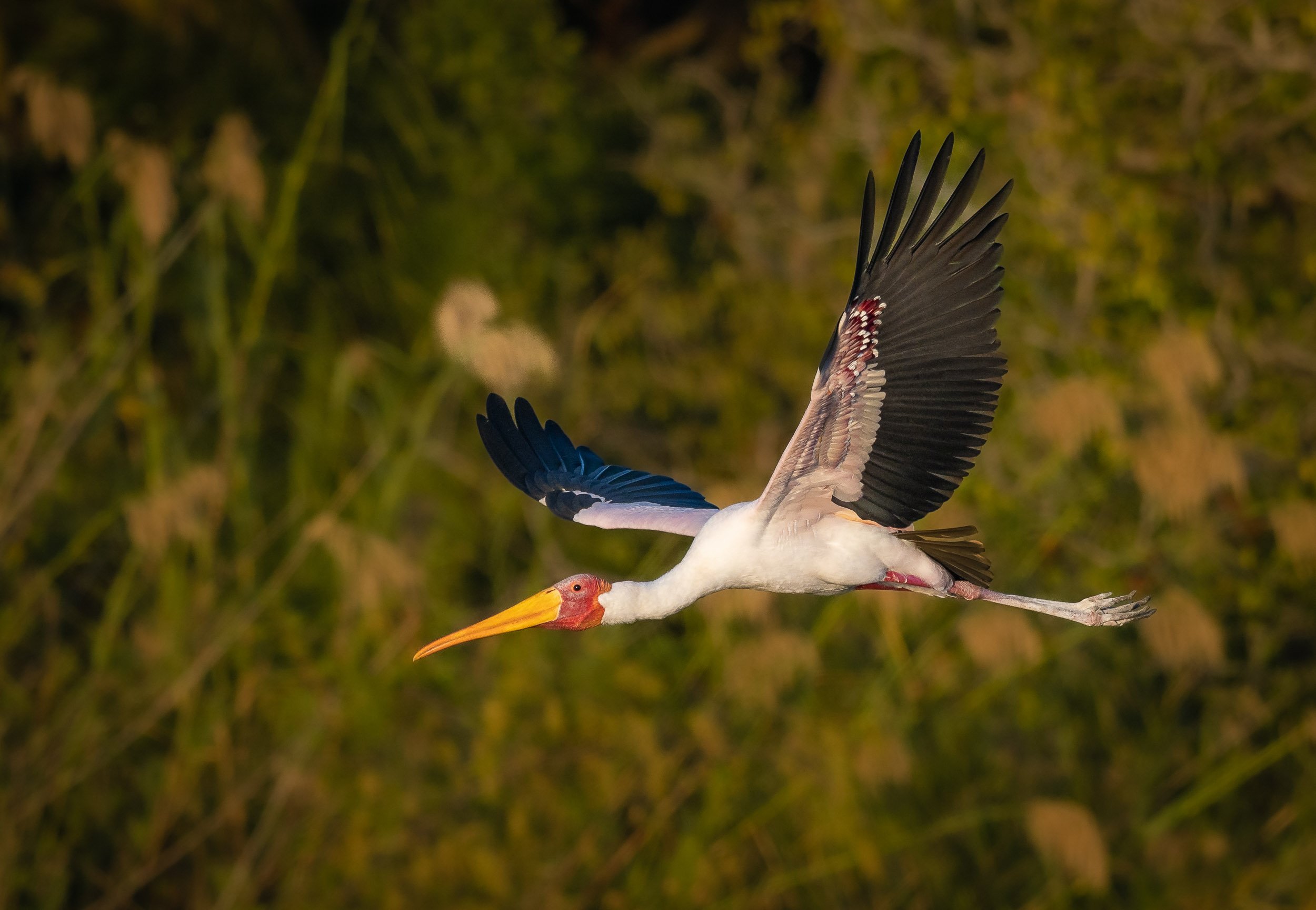
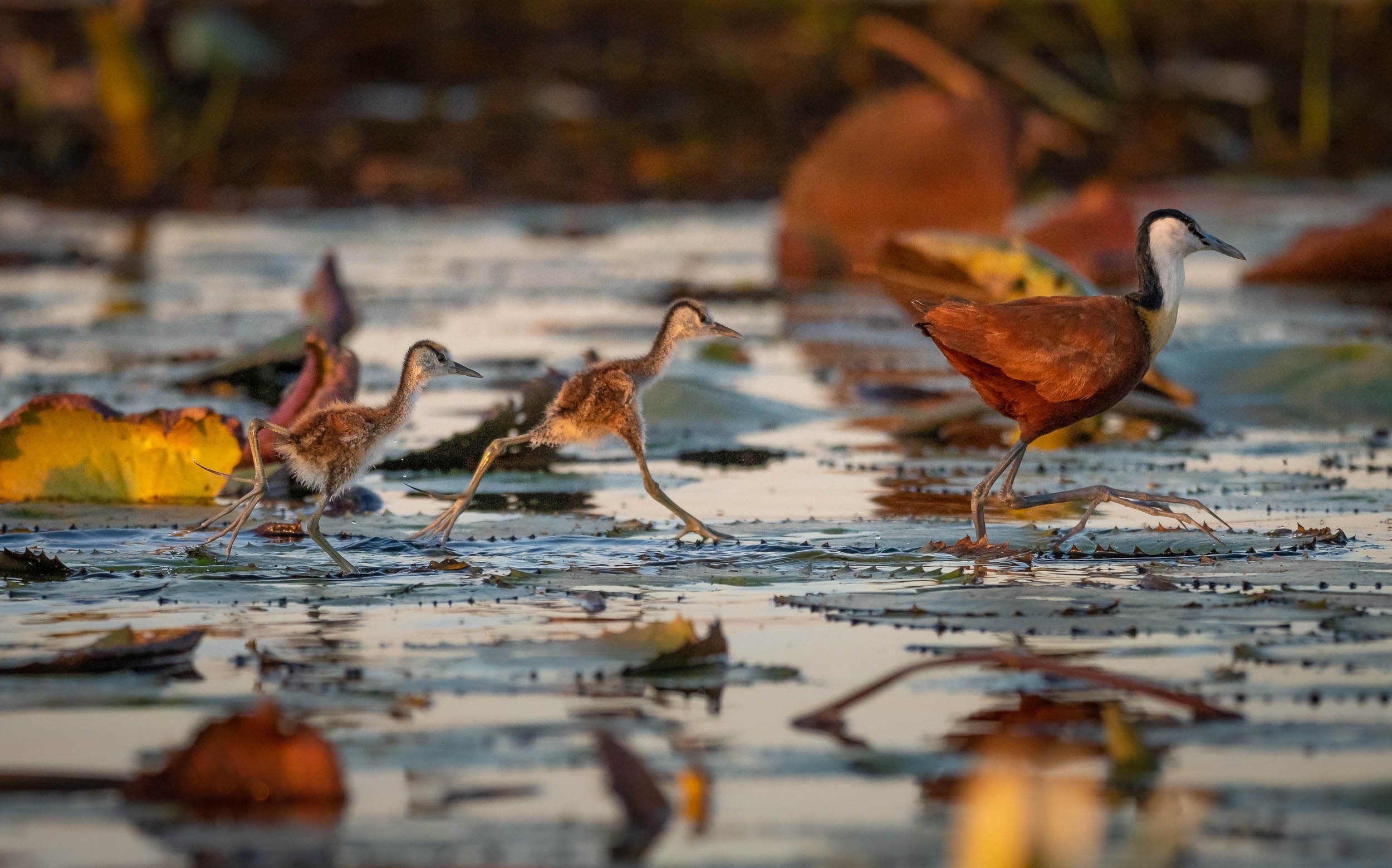
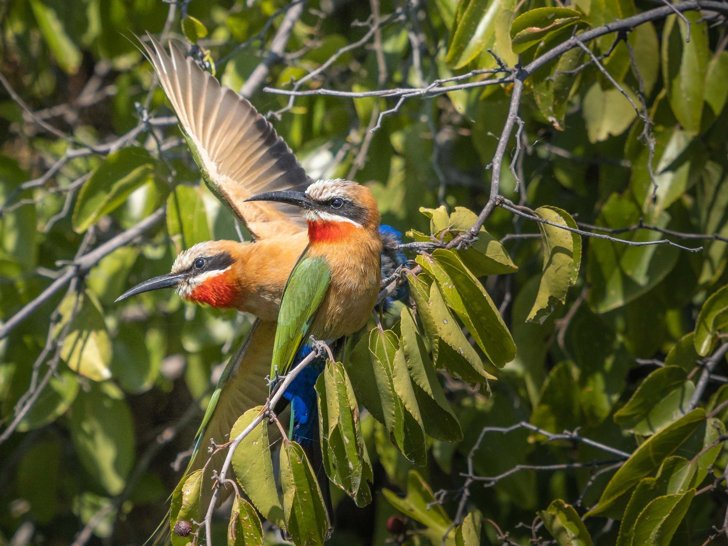
We were also lucky enough to observe some lions with a kill directly under the bushes on the shore.
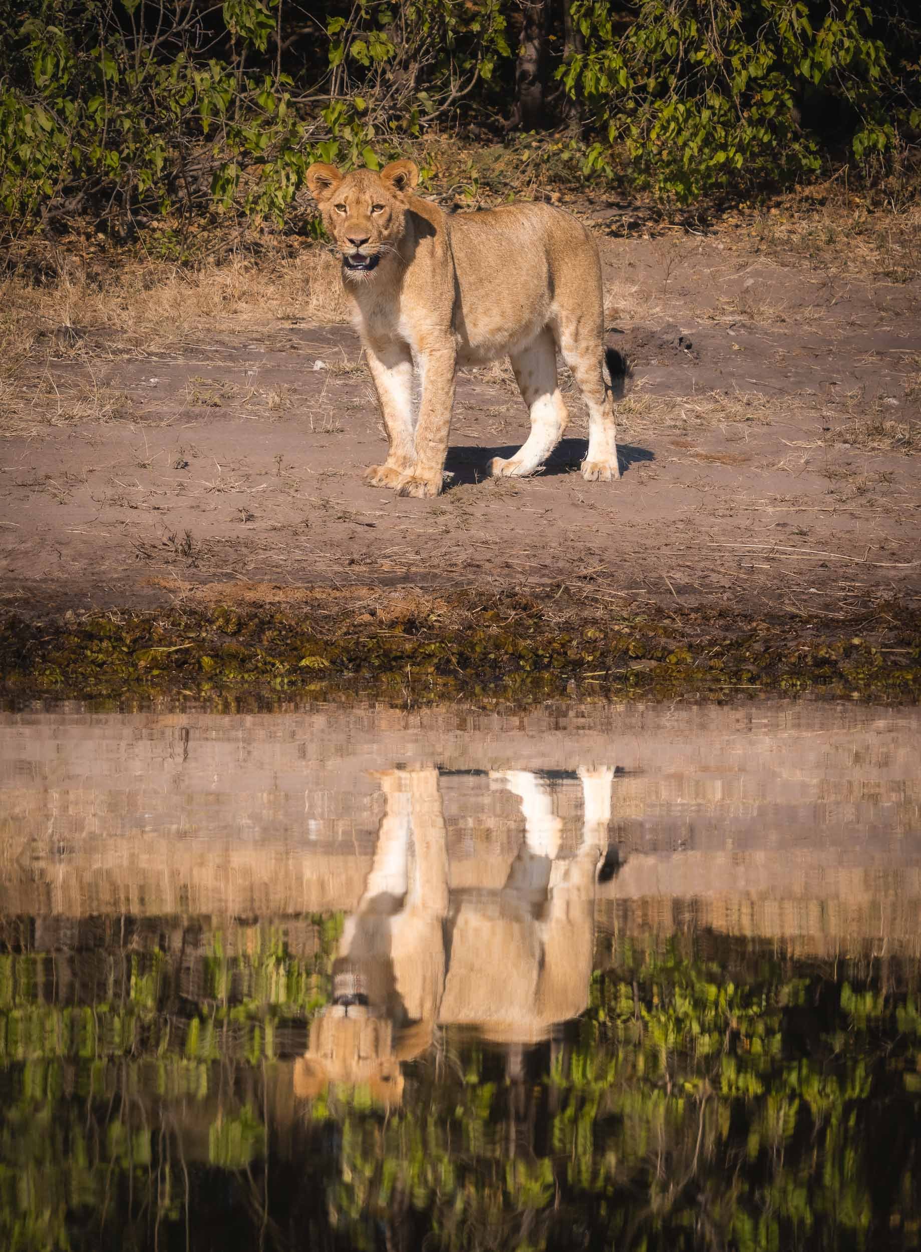
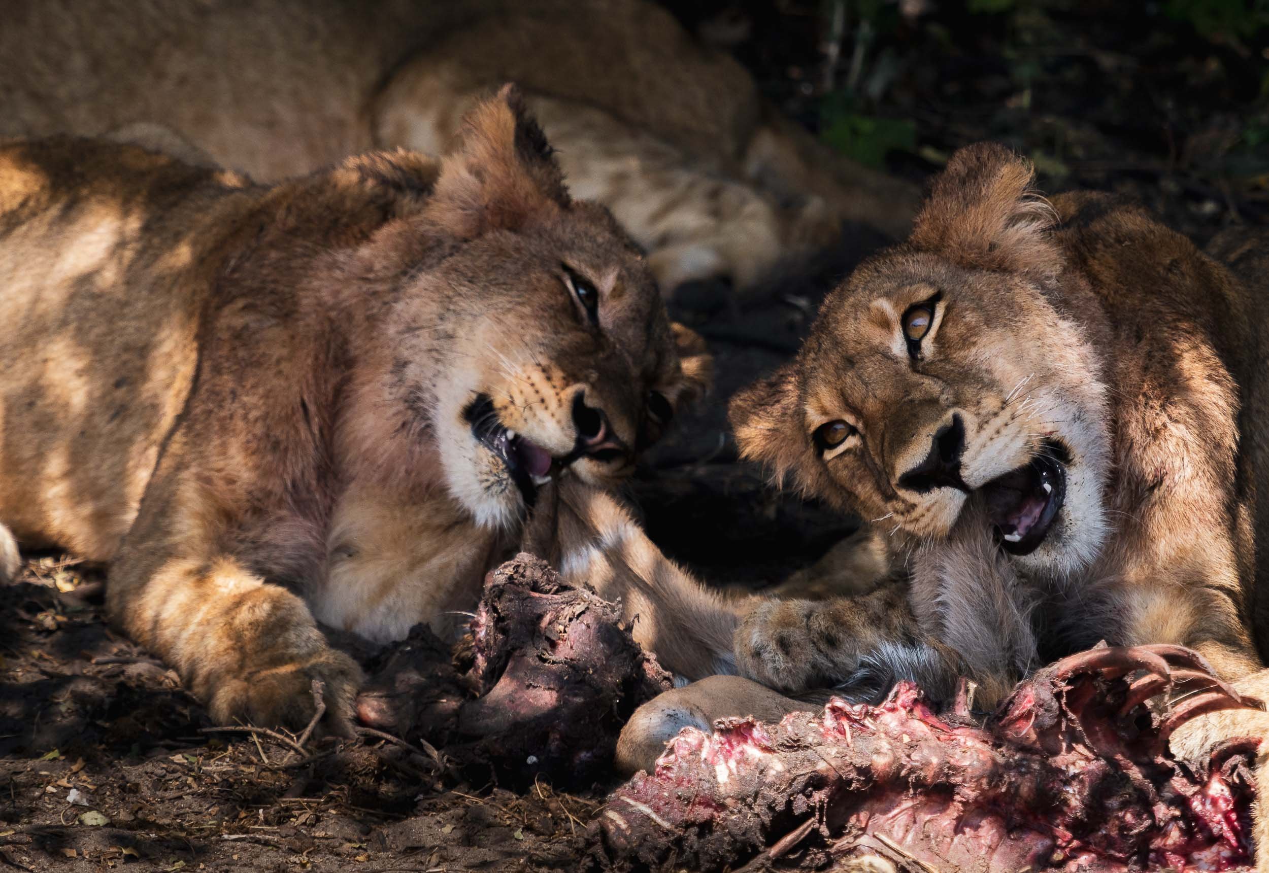
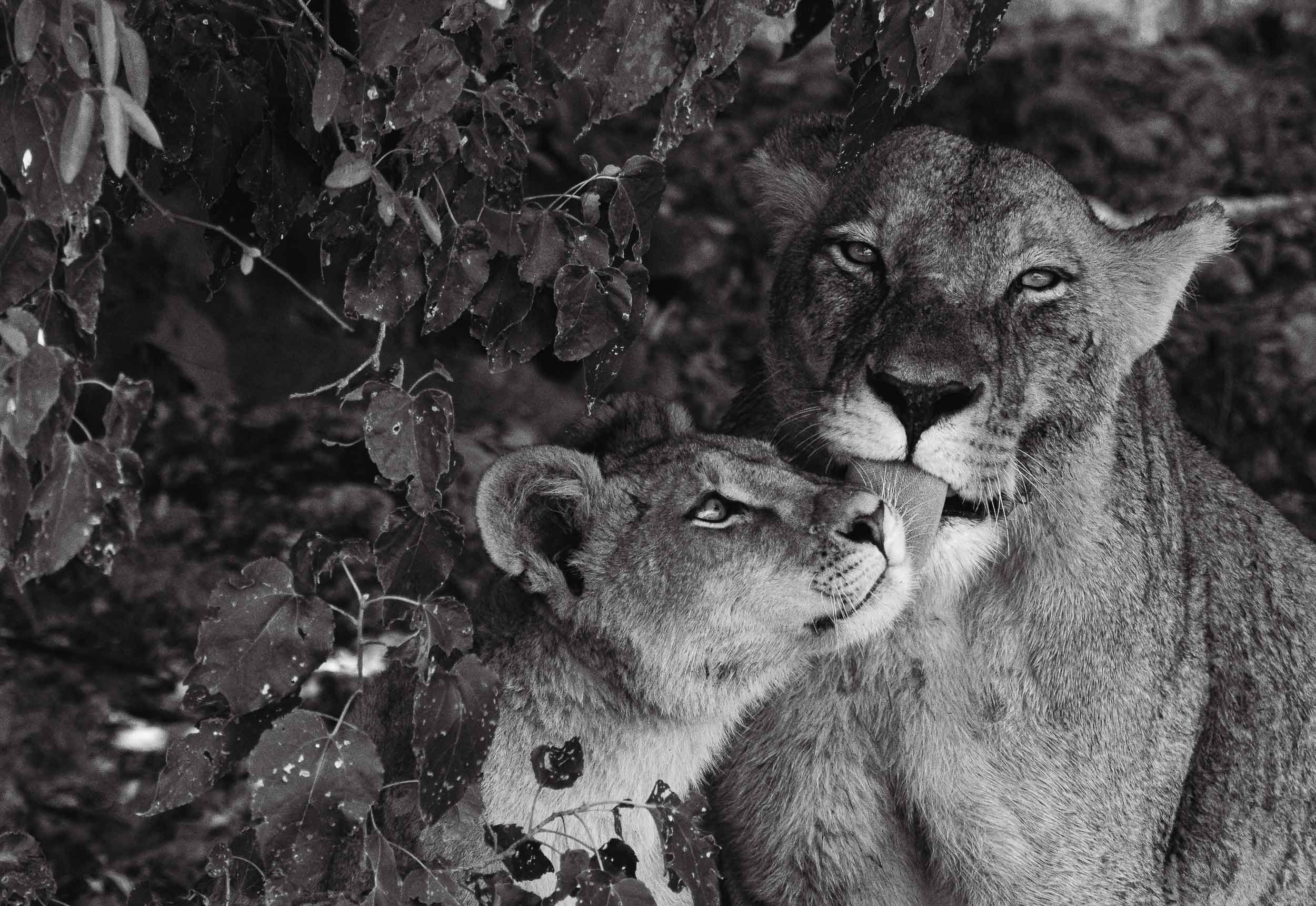
A few more animals by the water…
The Chobe river is actually the name of the eastern Cuando river, before it flows into the Zambezi. The National Park around it was Botswana’s first, and is its most biologically diverse.


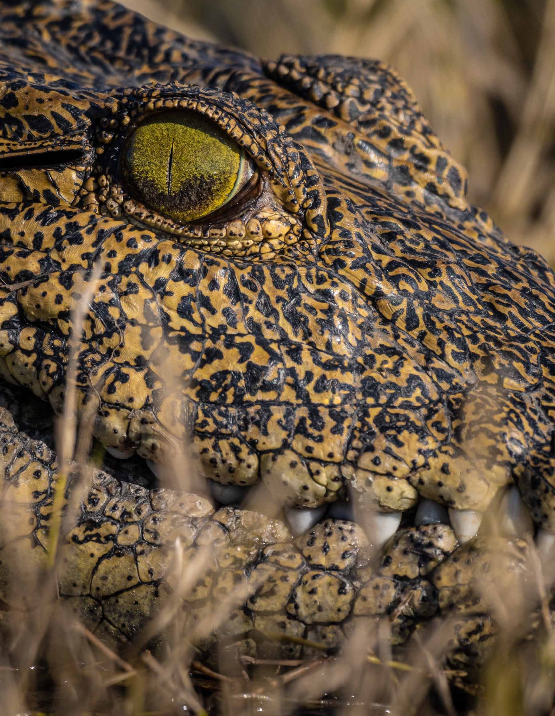

The Selinda Reserve
From Chobe we took a short flight to Selinda, a private concession in the greater Okavango Delta region. The Selinda spillway links the Delta with the Linyanti Swamps, and up until 2009 has been dry for decades. Now, its floodplains and channels have water flowing for many months of the year, becoming a home for wide variety of wildlife.
From Above
It was a good place for some aerial views, and what’s better for that than a helicopter? A 45min flight above this amazing landscape is the source of these bird’s eye views of elephants, crocodiles, heartbeests, and hippos in their environment.
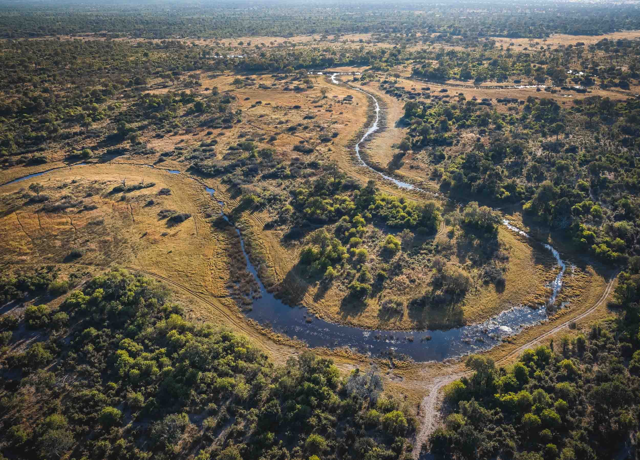
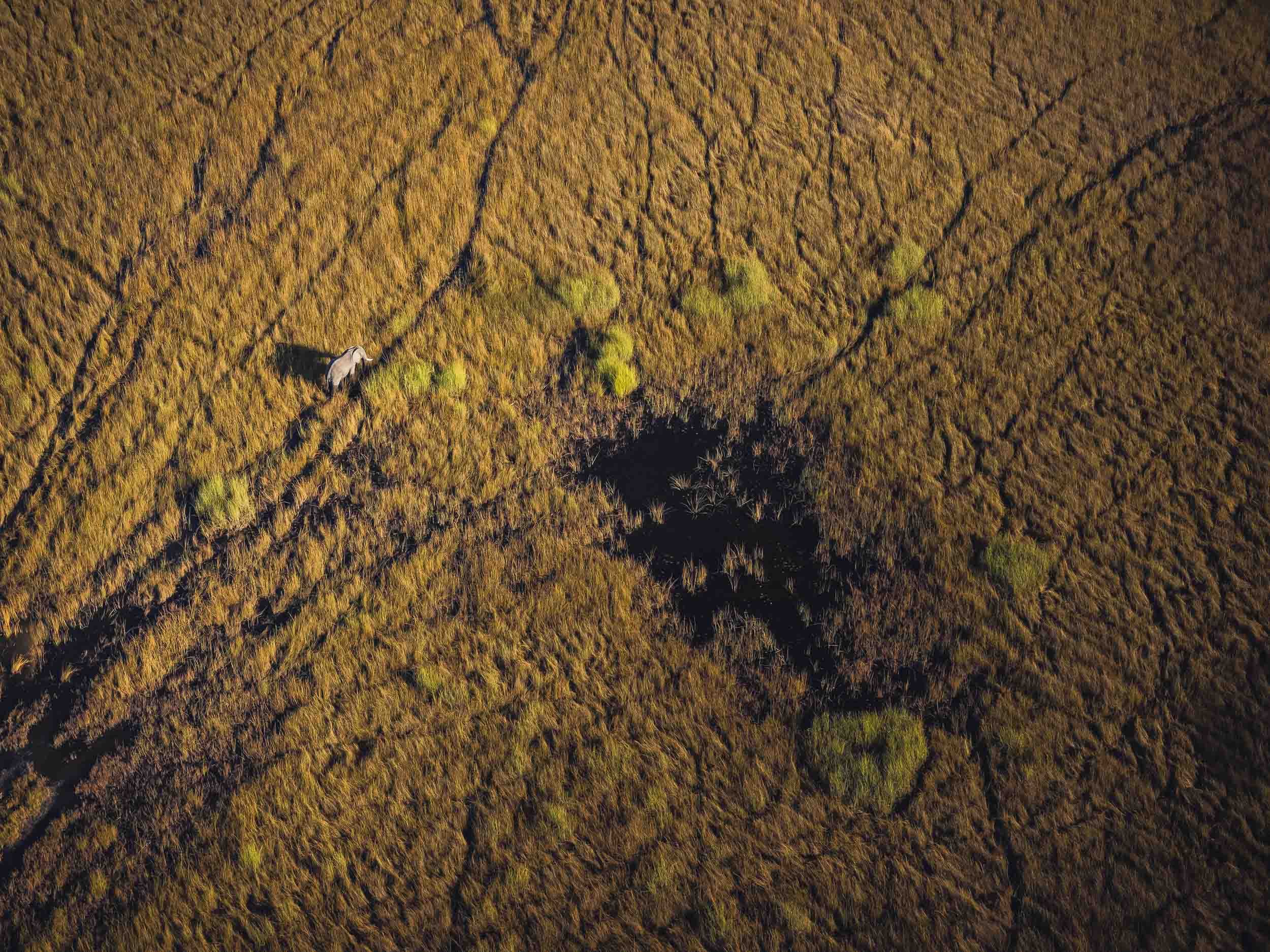
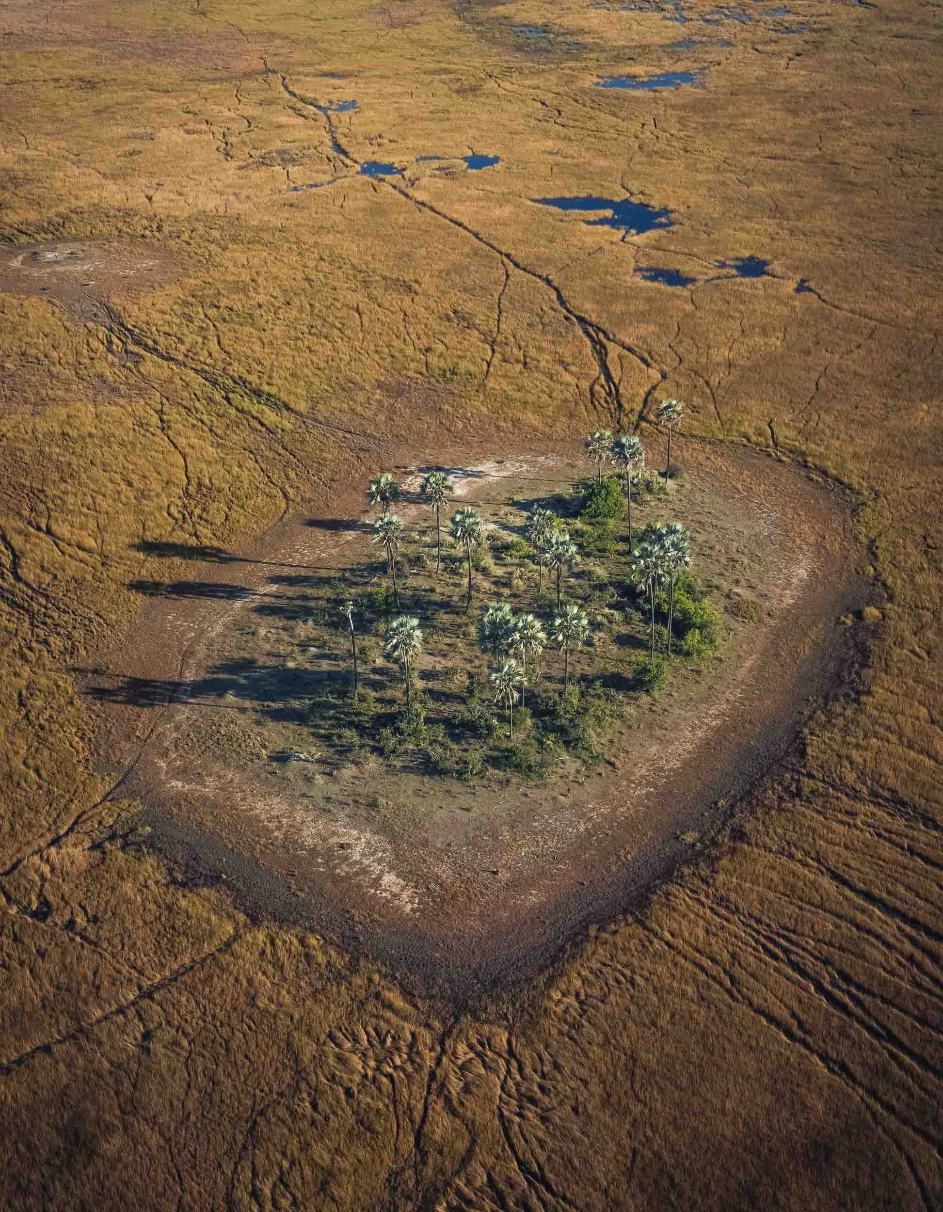
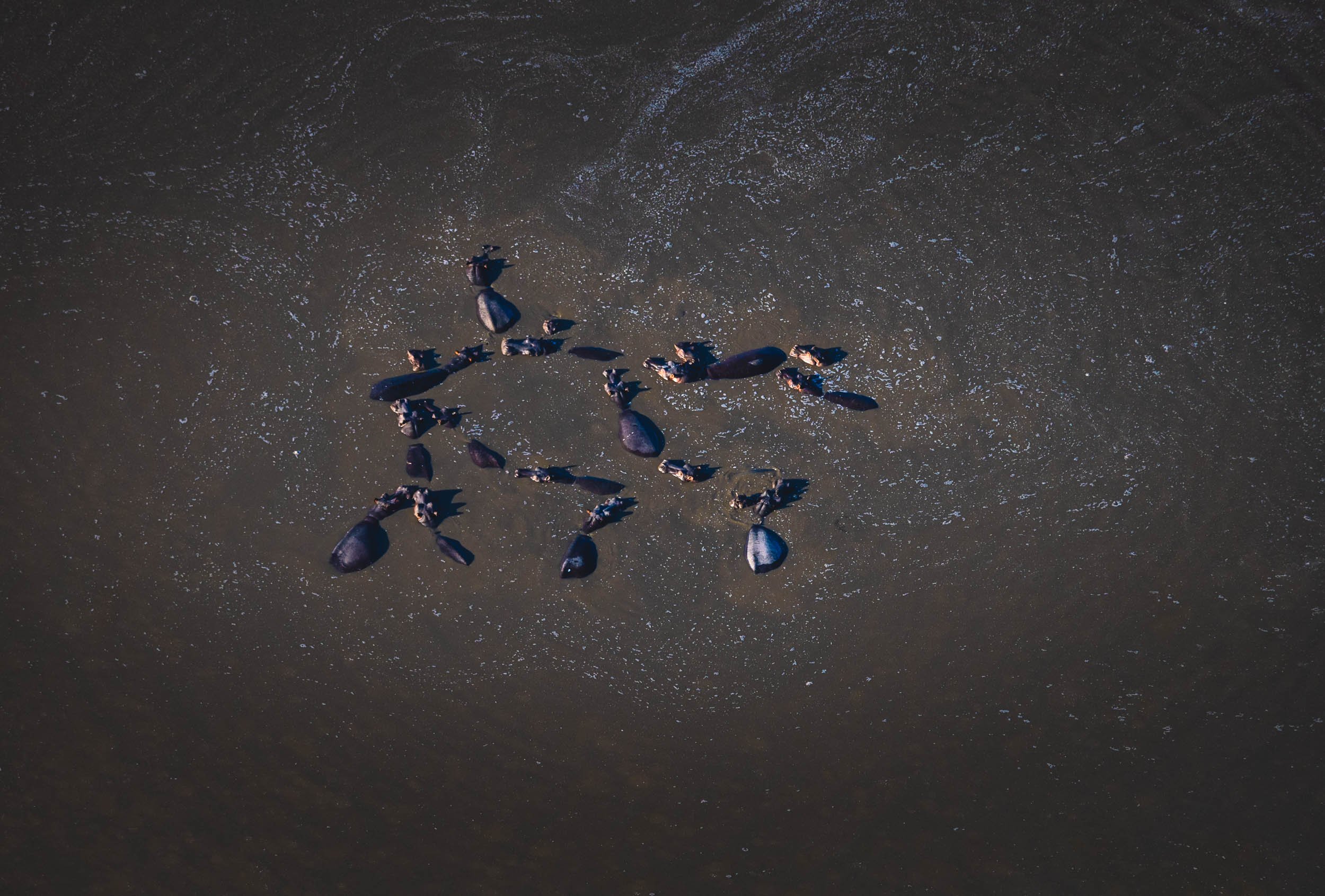
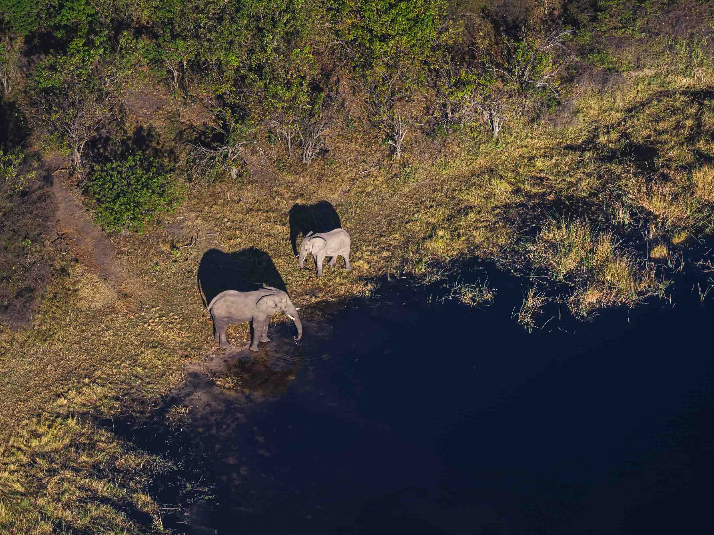
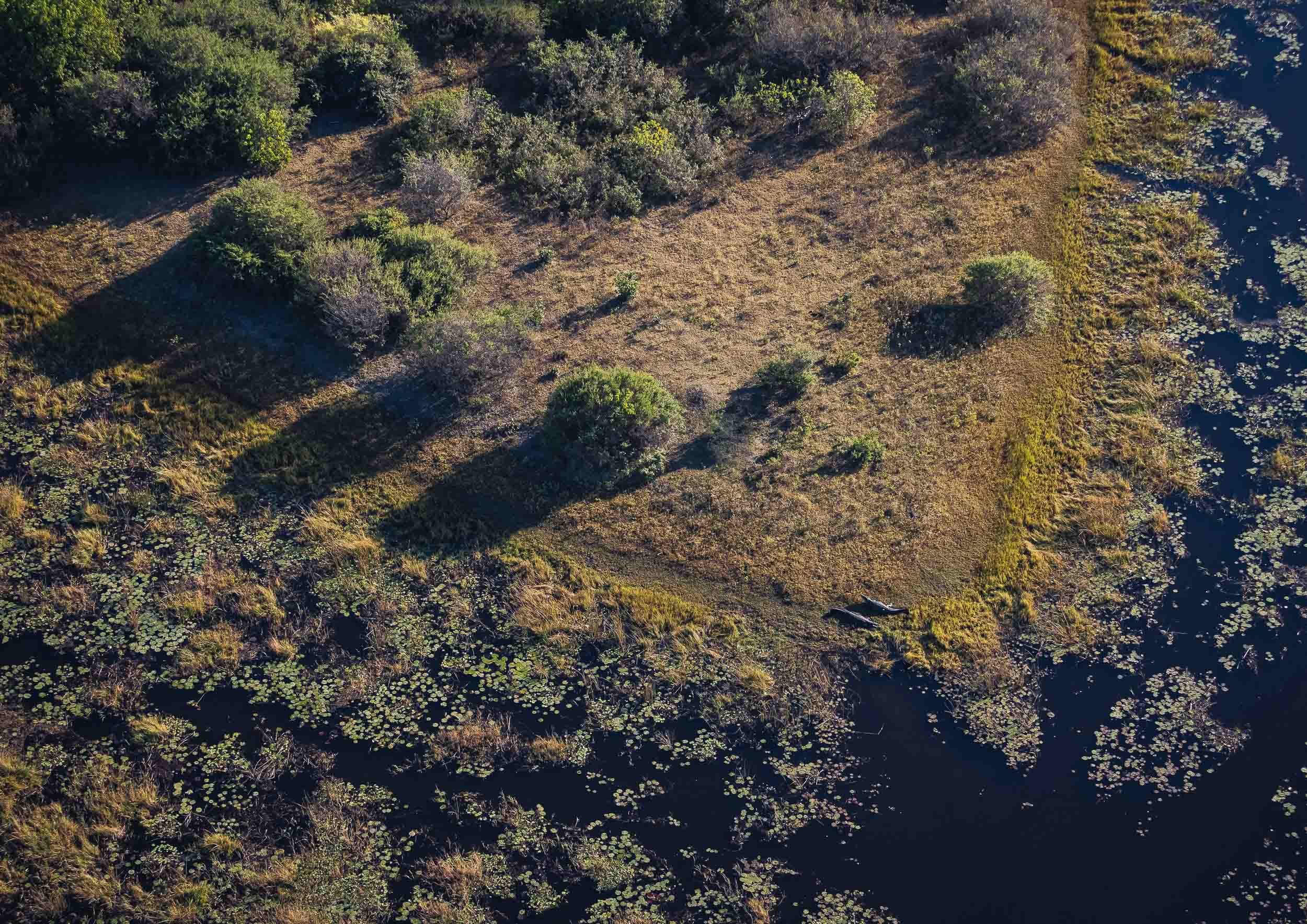
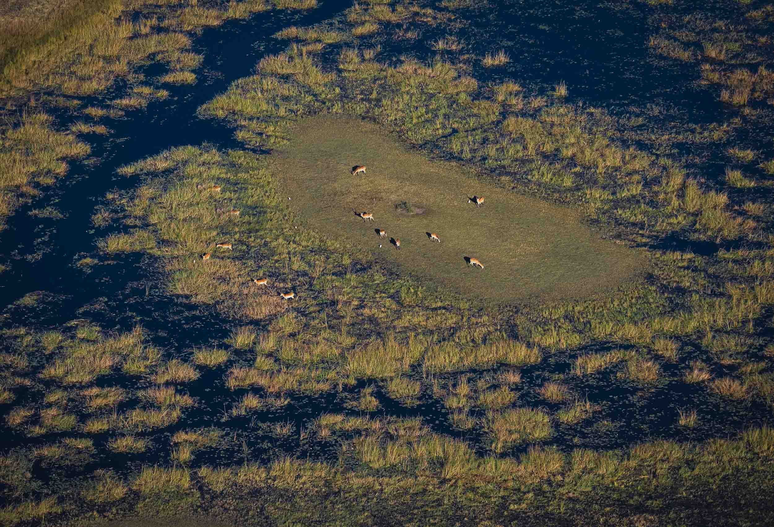
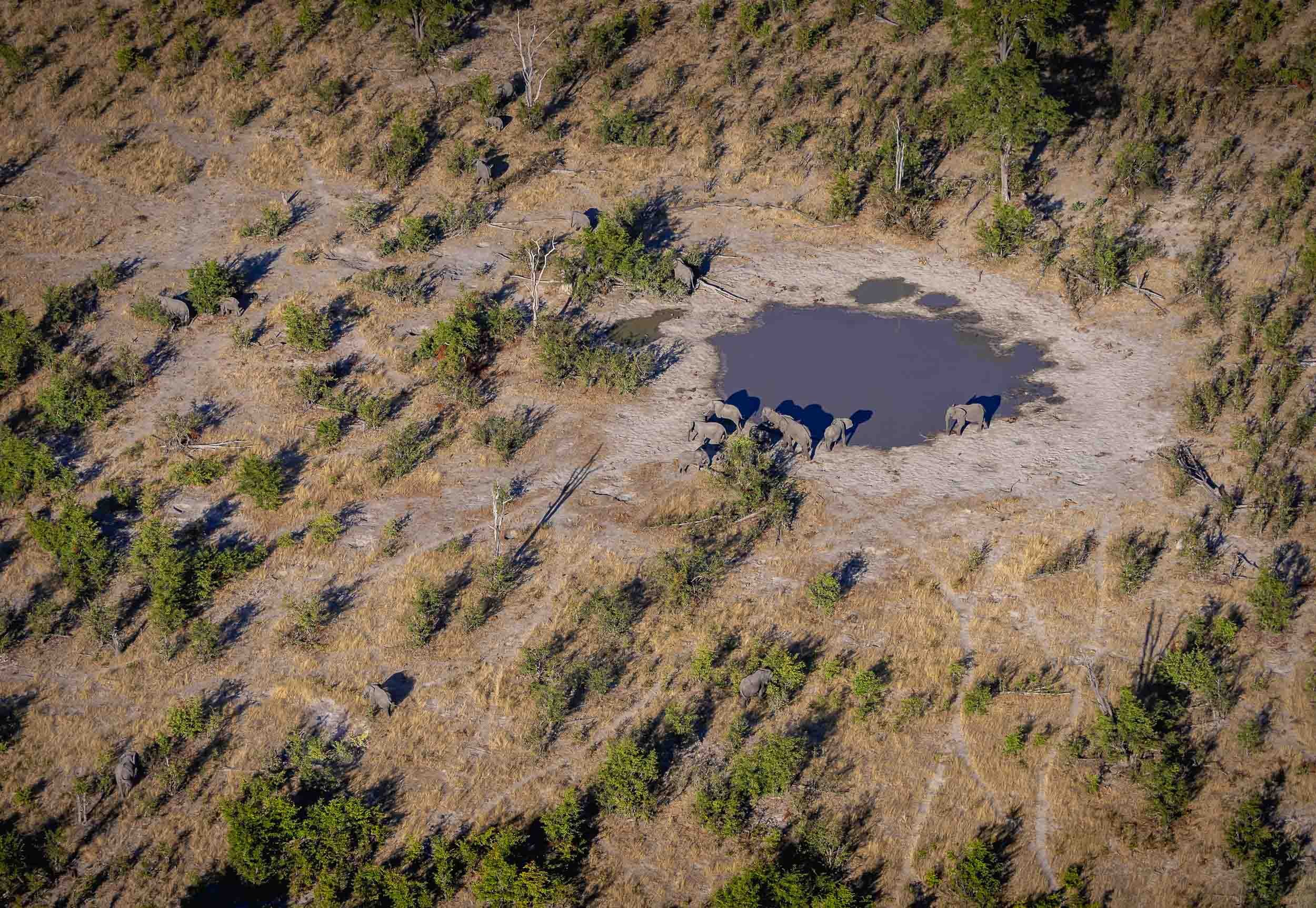
Lions
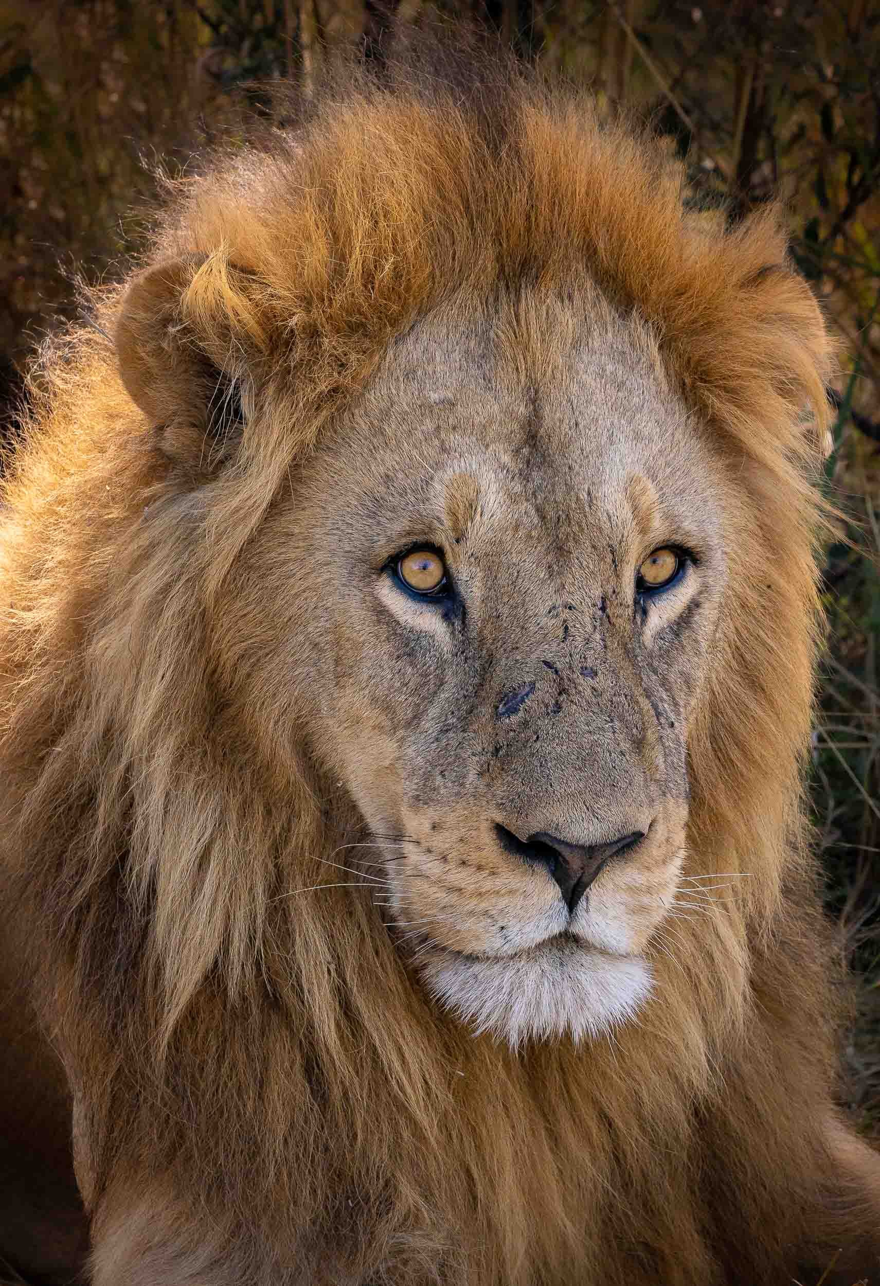
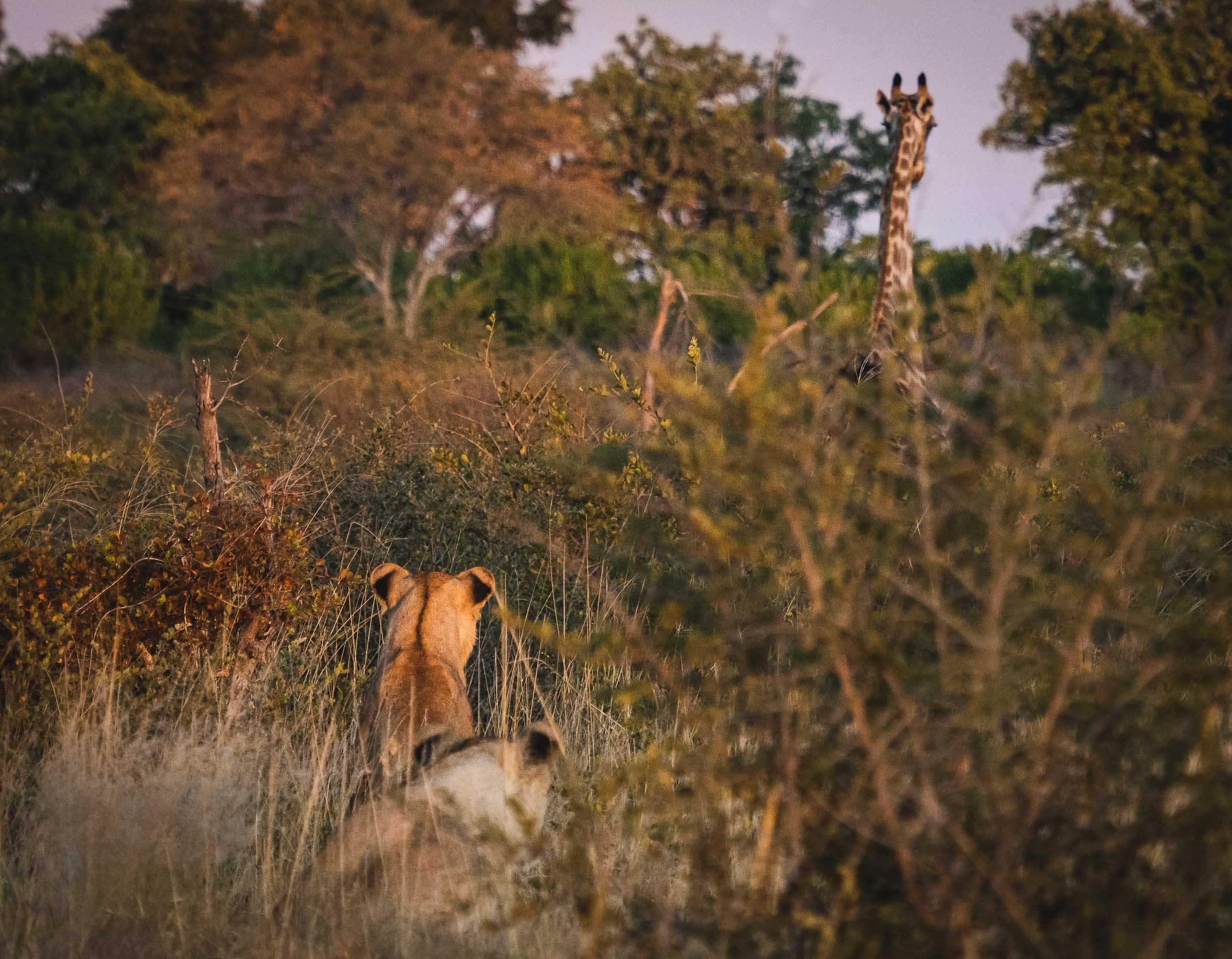
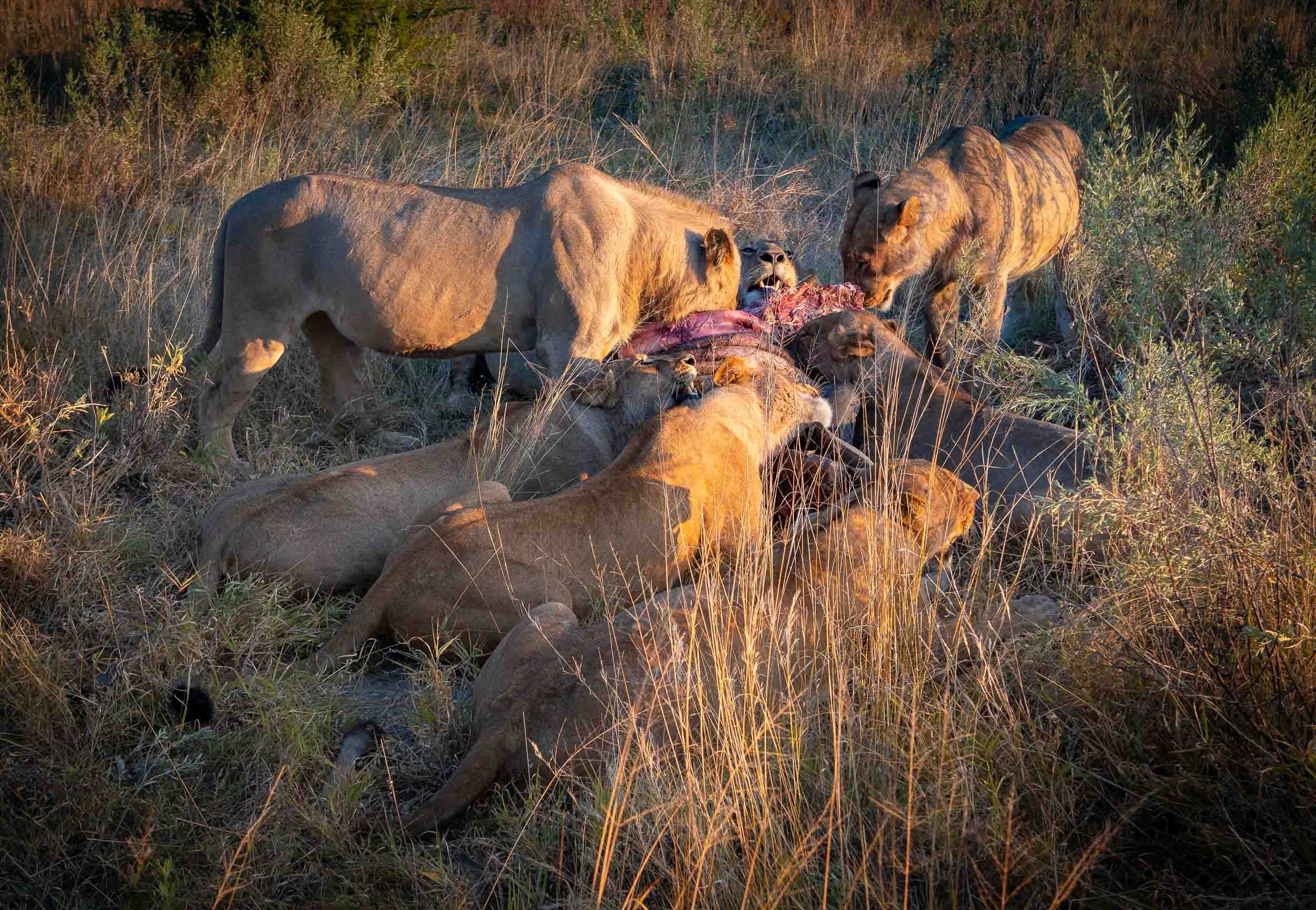
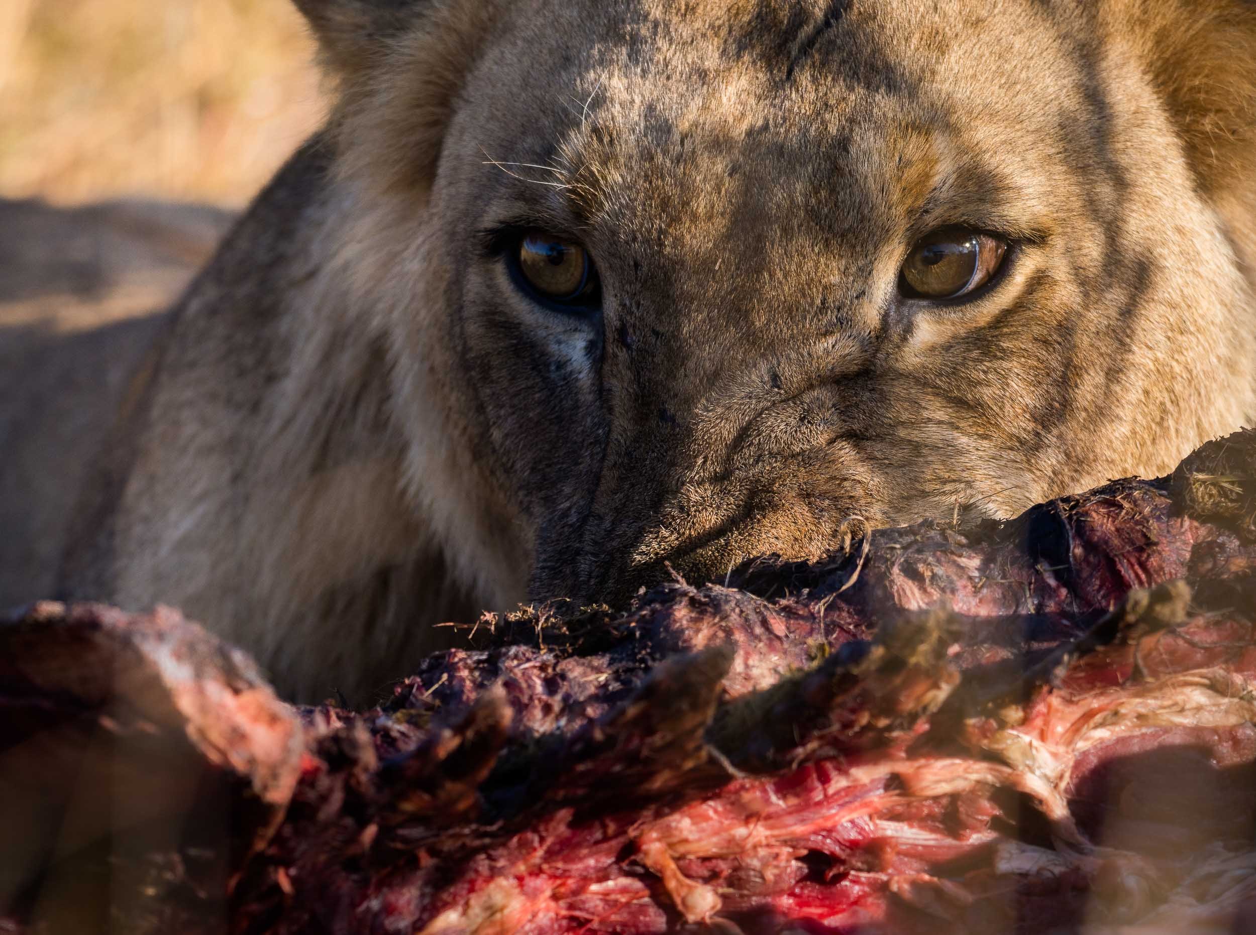
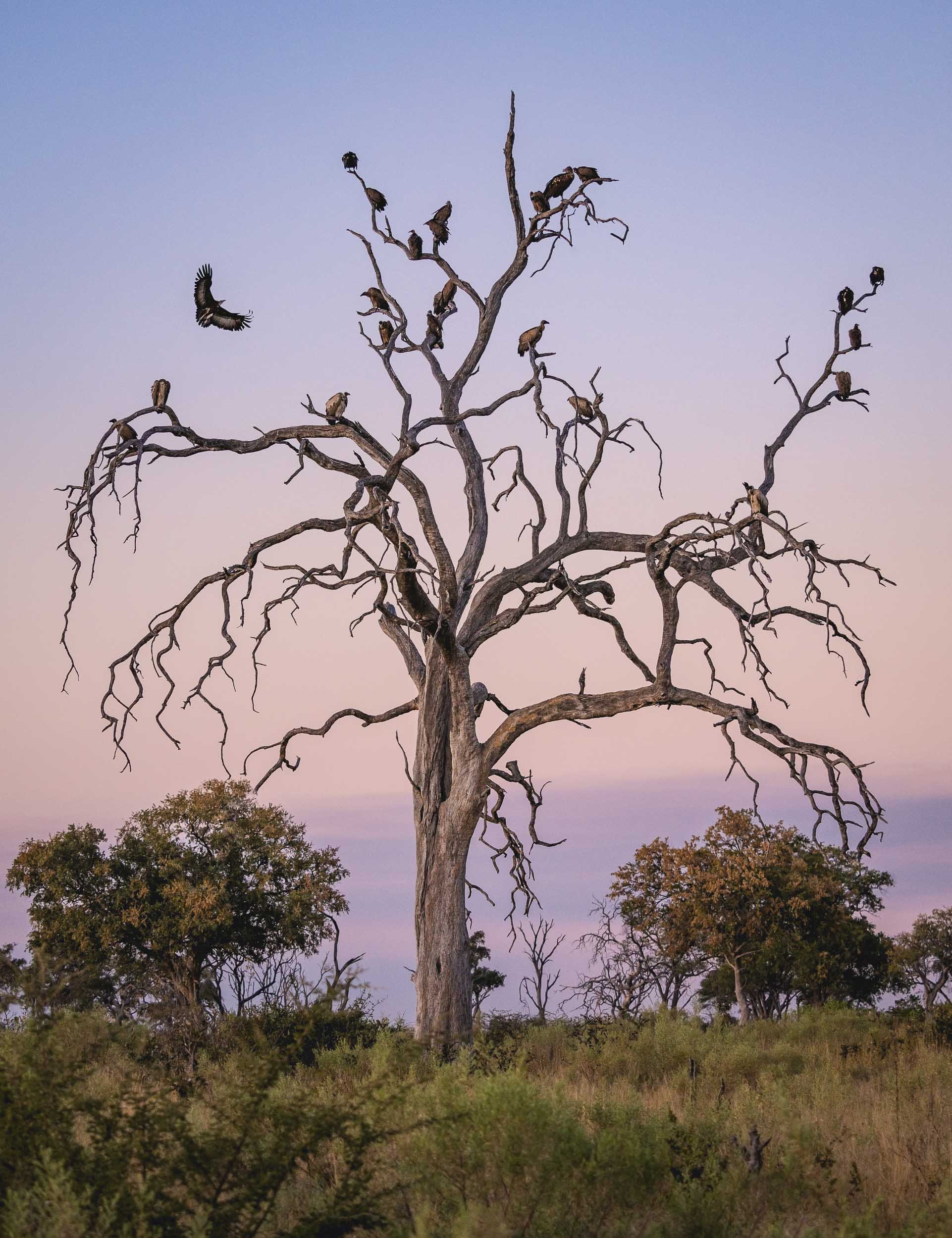
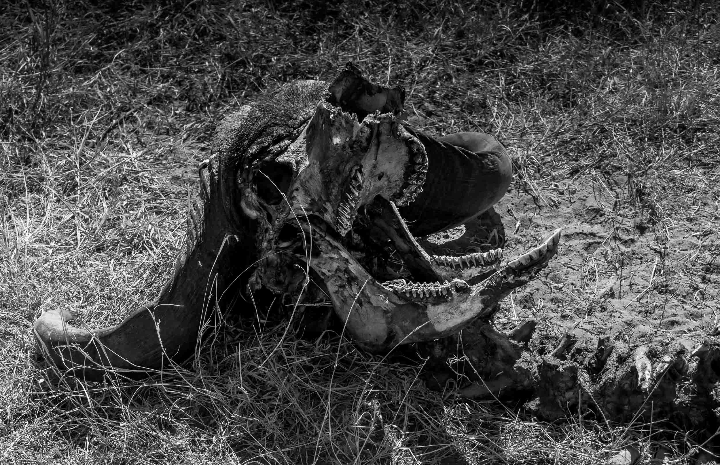
The Leopard
It’s always special to see your favourite animal in the wild, but a sighting like this makes it even more breathtaking. We spent four days, 8 hours a day, looking for this Leopard female and her 3 month old cub. On the very last morning, our guide - Stitcht, who called himself a legend and lived up to it - saw her sitting on a termite mount in the distance. We followed her when she called for her little one, and then climbed a nearby tree. They spent 15 min cuddling and cleaning before she rushed off to try and catch some breakfast, telling her cub to hide in the thick crown of the tree.


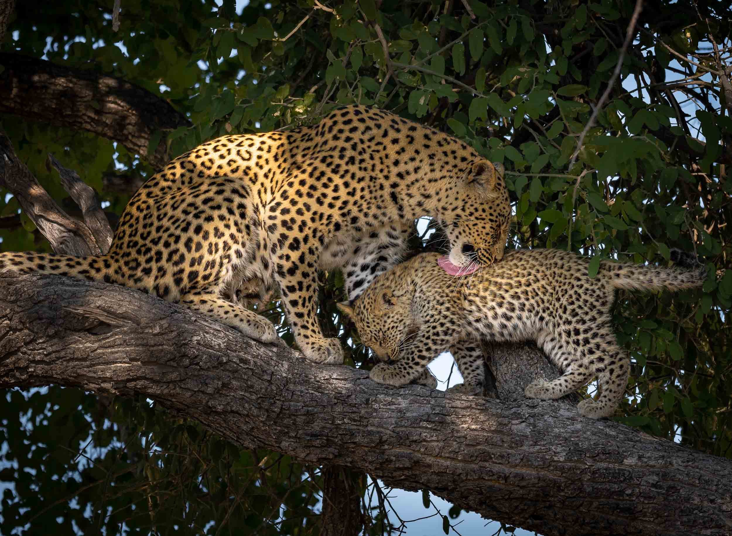


Watch them in motion
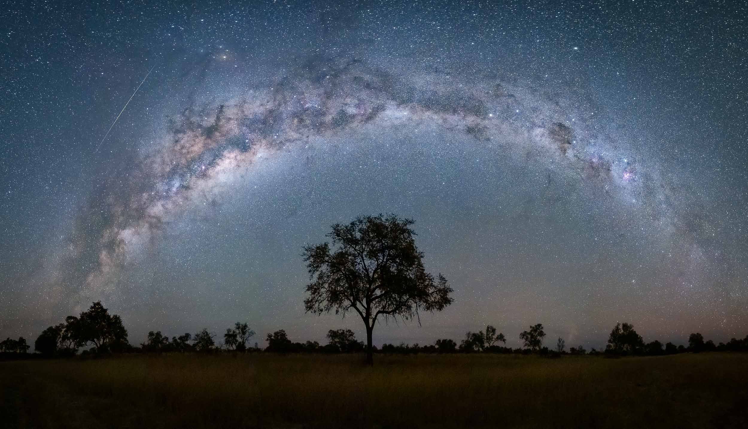
A few more…


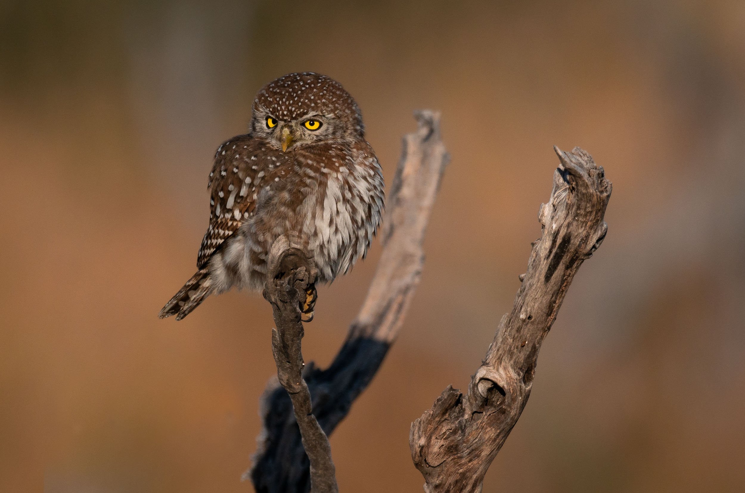

Dinaka
The last stop was in Dinaka, about 100km north of Maun, and bordering the central Kalahari. It’s a dry area this time of the year, but it did have a few special places to photograph from (and sleep in).
Jackals - Always Up To Something
After having observed them for a good amount of time, these mammals have climbed up in a my favorite animal rating list. A constant source of entertainment, and always giving an impression of being up to no good, I’ve seen these mischievous omnivores catch doves, chase away animals much larger than them, and strut around like they are the kings of Africa.
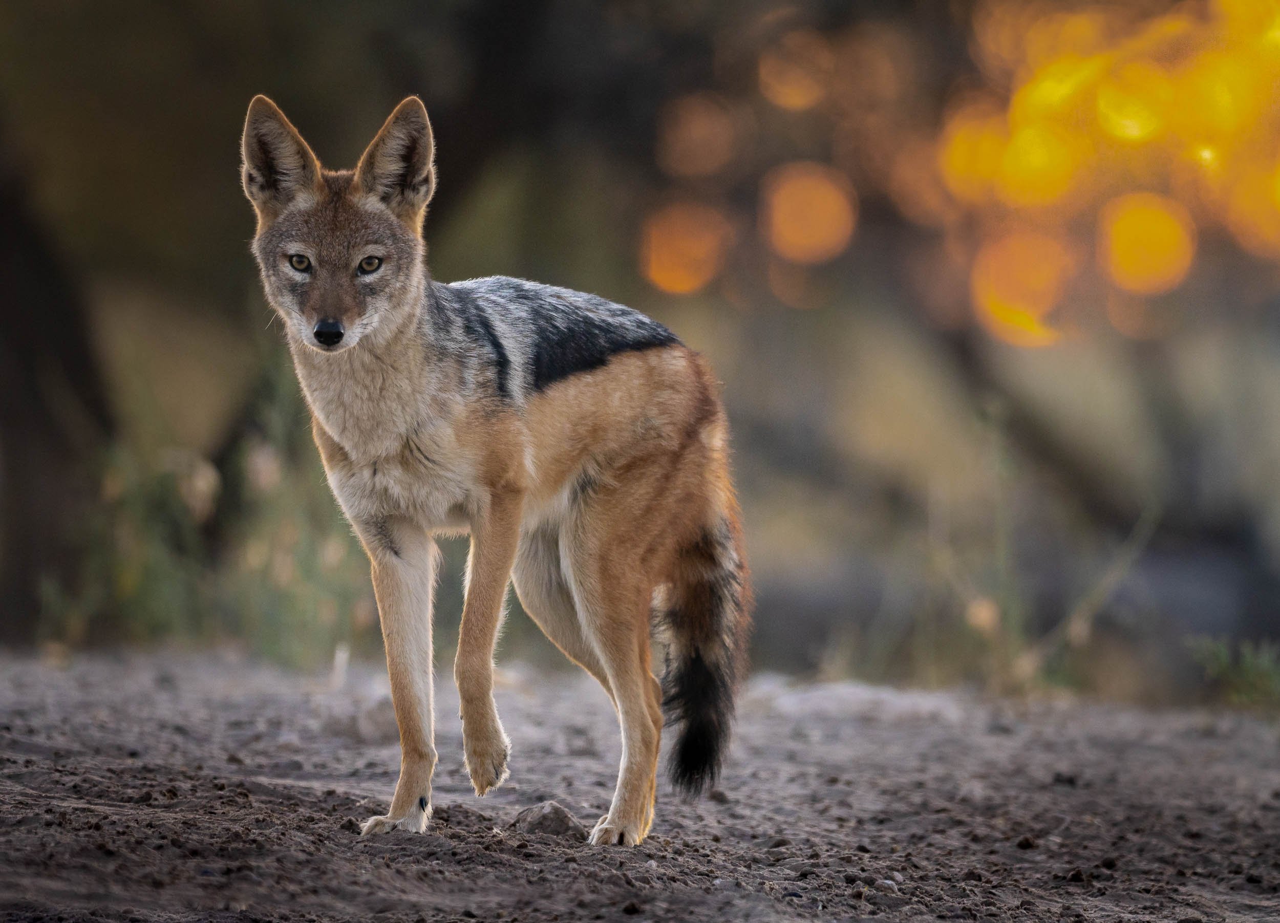
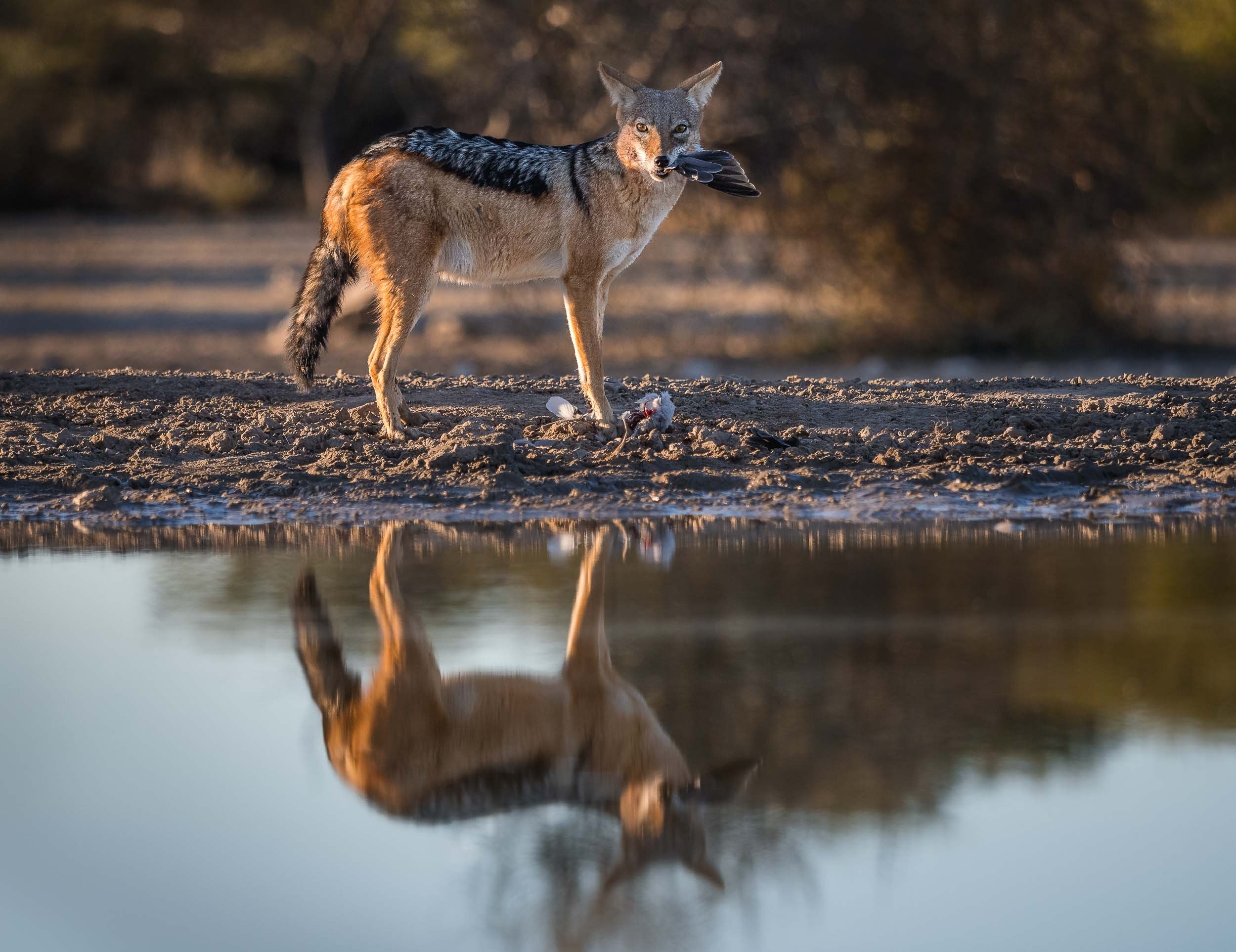
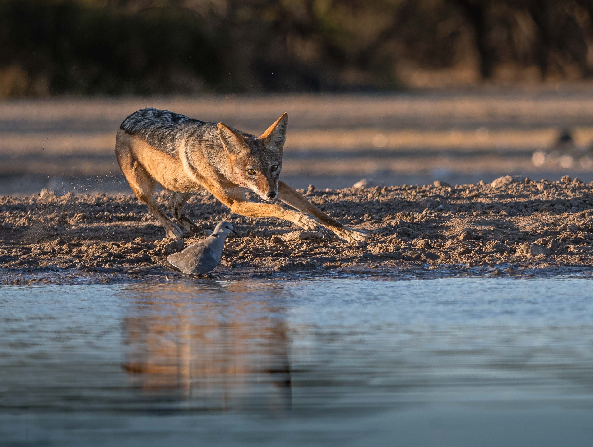
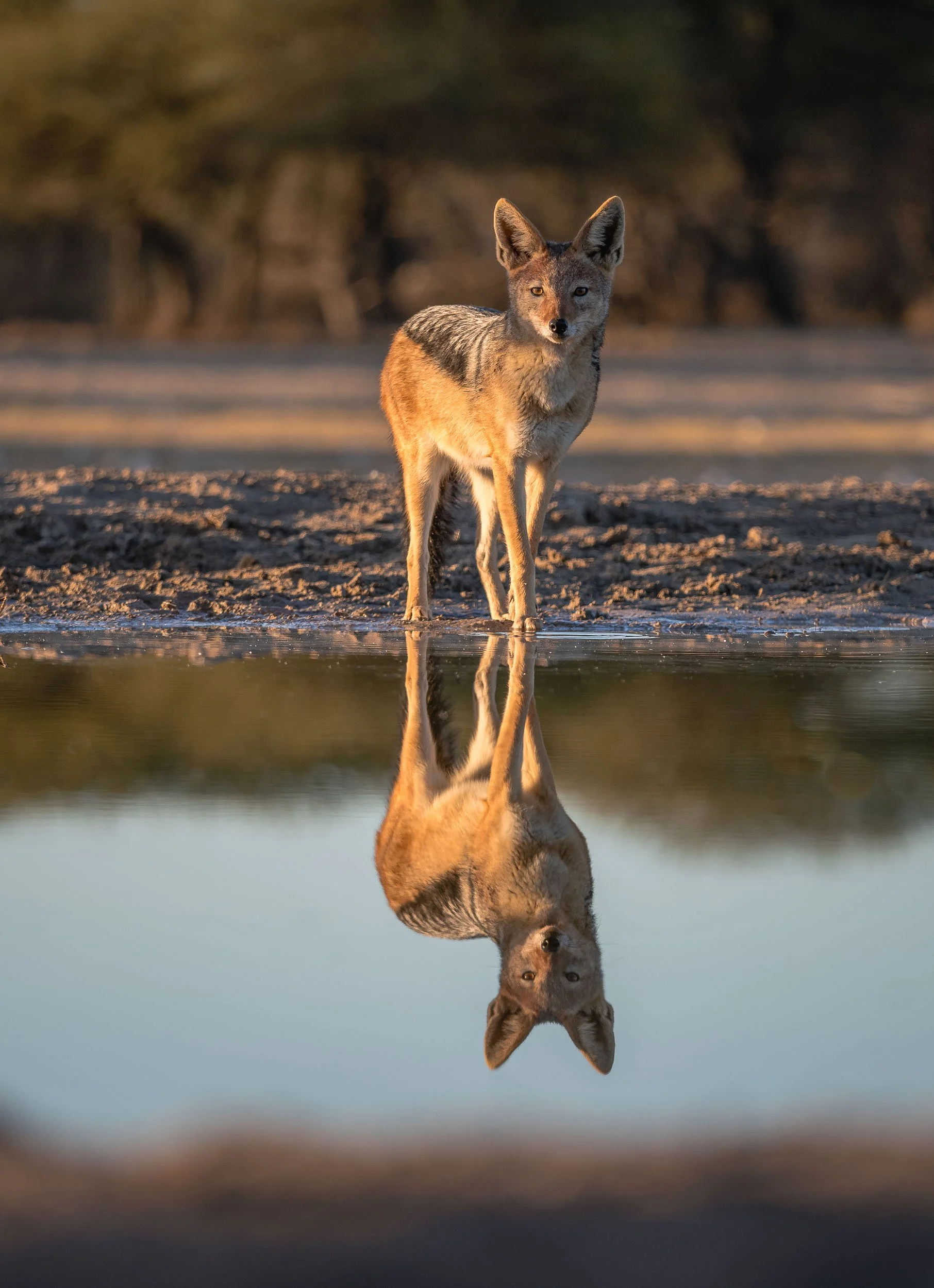
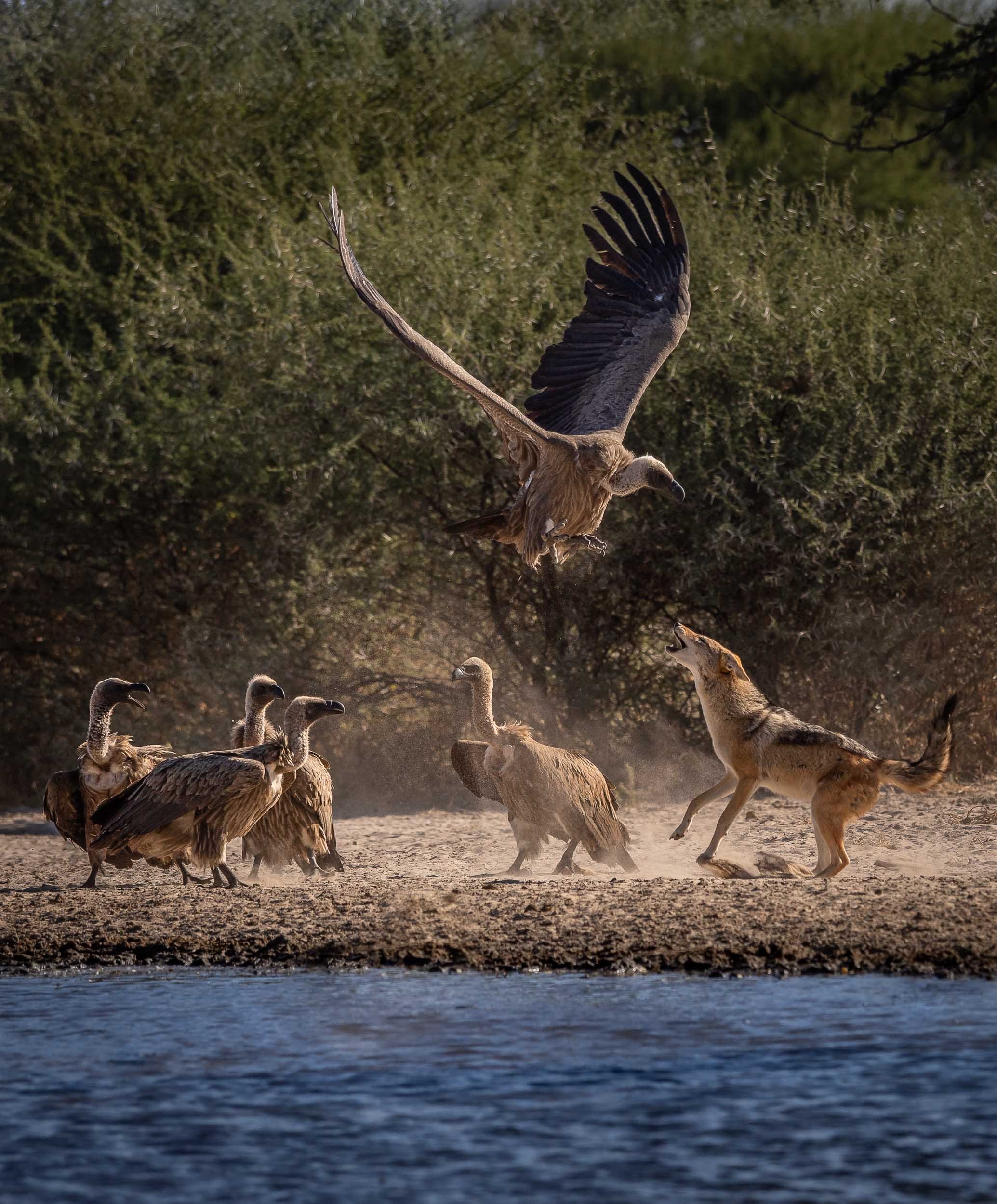
Starry Bedroom
Our lodge offered this special experience: A night under the stars, sleeping on an elevated platform in the bush - an opportunity I couldn’t miss out on, so one evening after dinner, I was dropped off 20min away from the camp to see what it feels like to sleep with a Milky Way view. See below for an impression!
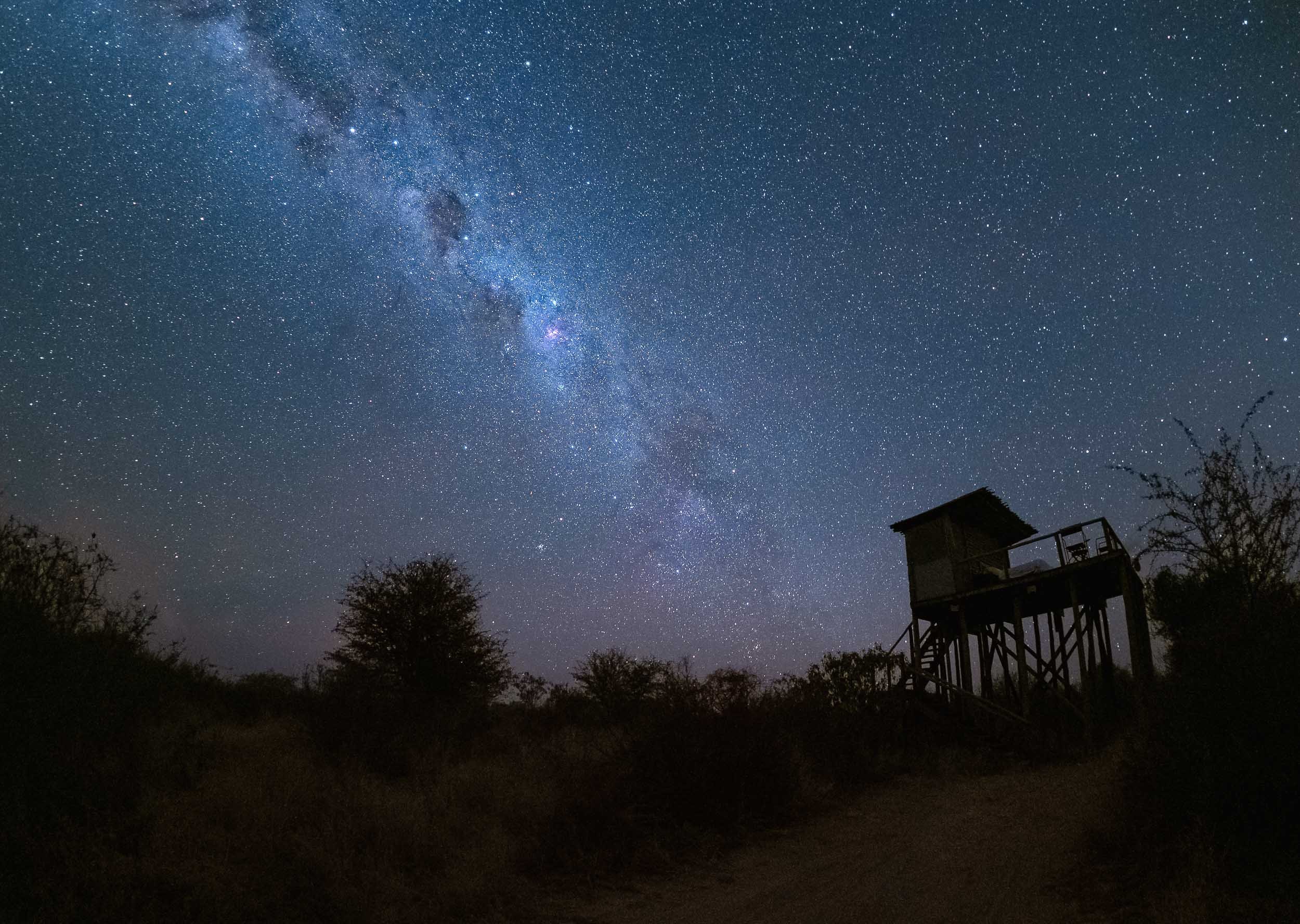

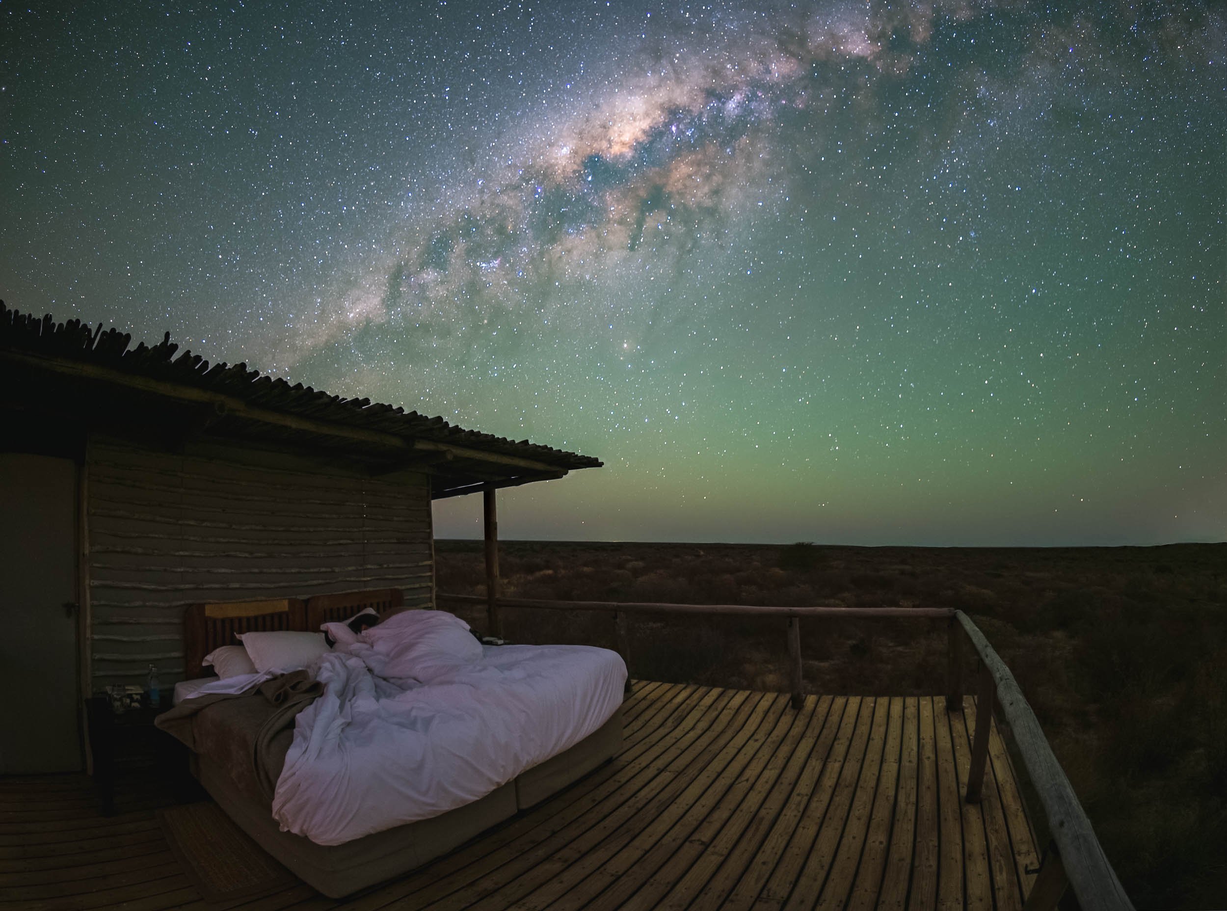
Watch Earth in Motion below…
The Waterhole
A second special spot is found a bit closer to the ground - in fact, it’s almost underground: A bunker-type hide to view animals up close at the waterhole, for some ground level perspectives. We spent a lot of time here, watching antelopes, giraffe, jackals and many other animals come to drink and interact without being bothered much by our presence.
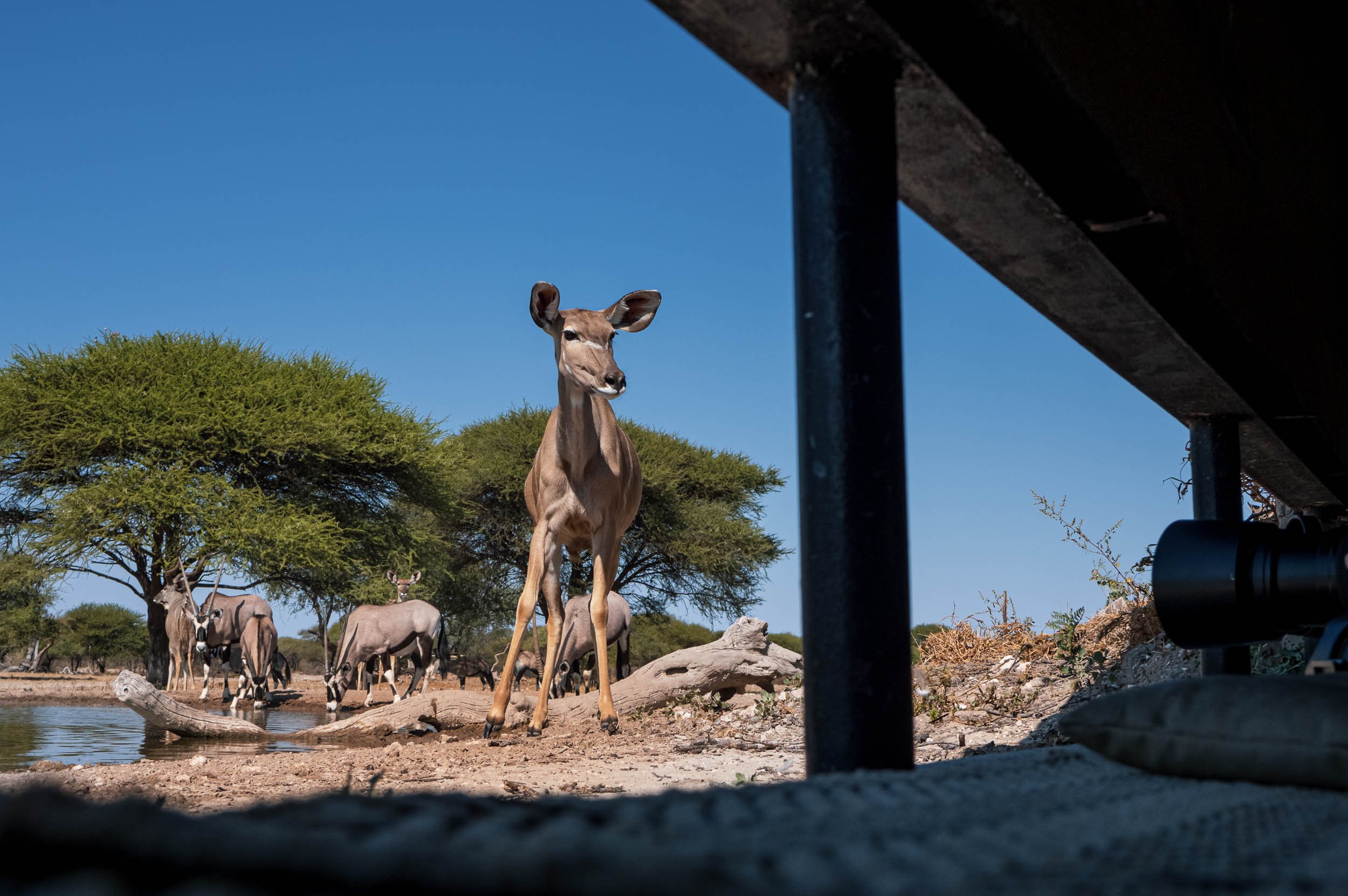
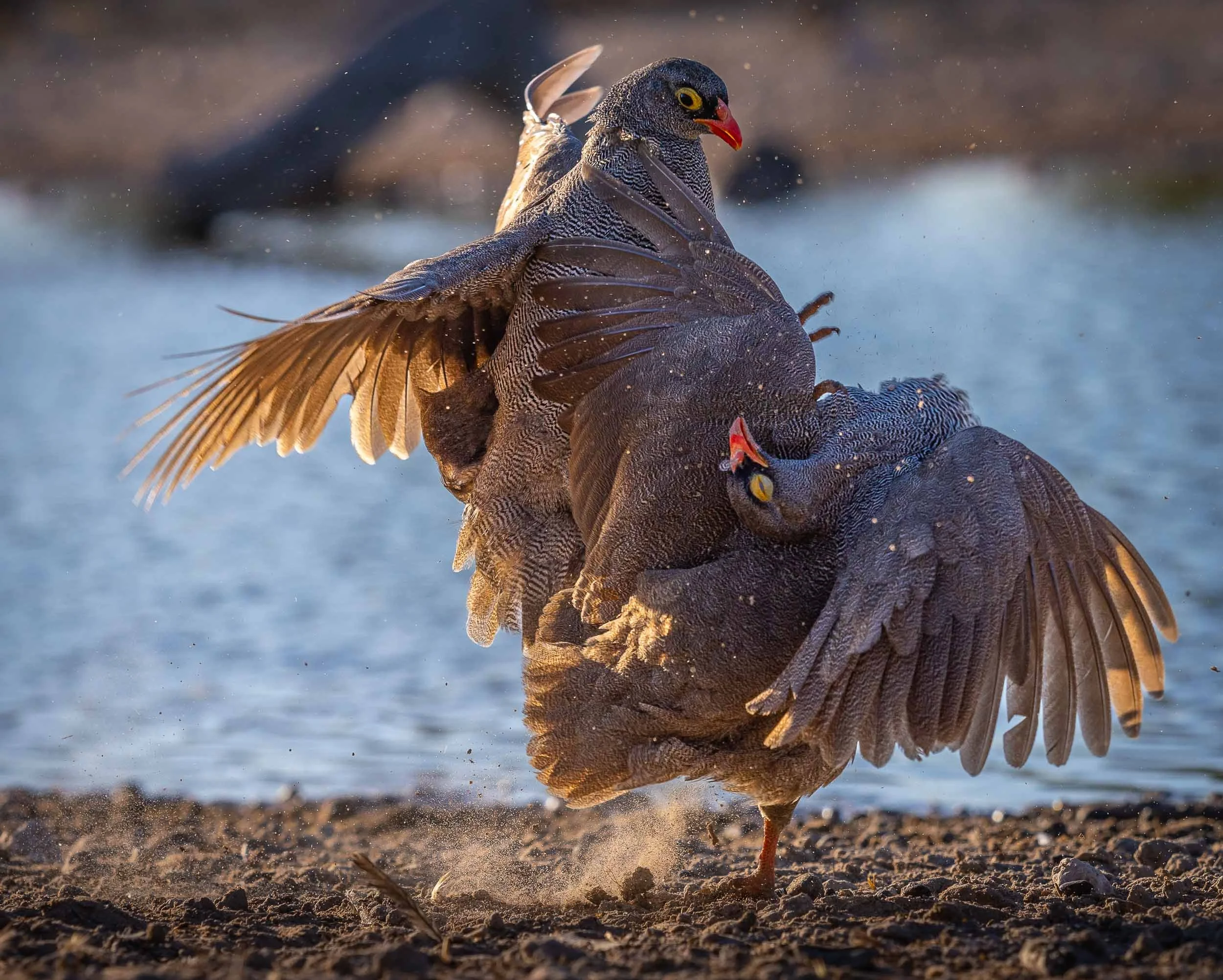


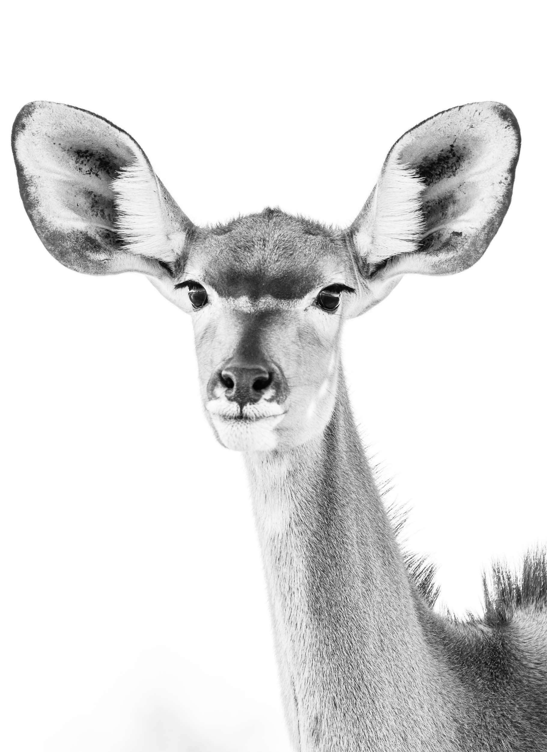
At Night
Private concessions (as opposed to National Parks) often come with the benefit of being allowed to stay out beyond sunset, opening the way for some nightly discoveries…


Lastly, the reserve is also home to a population of white rhino, which have been de-horned to deter poachers, a practice that some question in terms of its effectiveness in doing so, as the base is still attractive for the market.
Zimbabwe - Tracking Dinosaurs & Lunar Wonders
The second country of my trip was Zimbabwe - a place which up until planning of this adventure hadn’t really grabbed my attention.

The second country of my trip was Zimbabwe - a place which up until planning of this adventure hadn’t really grabbed my attention. That has definitely changed after spending two weeks in Harare, Mana Pools, Chewore, Kariba, Matusadona and the Victoria Falls. This journey was full of incredible experiences, read on to find out what the country once known as the "Jewel of Africa" had in store.
Harare and some unique rocks
I had one day to spend in the capital city before making my way into the northern parts of the country. A brief tour and looking at one of its most unusual sights was all I could fit in.
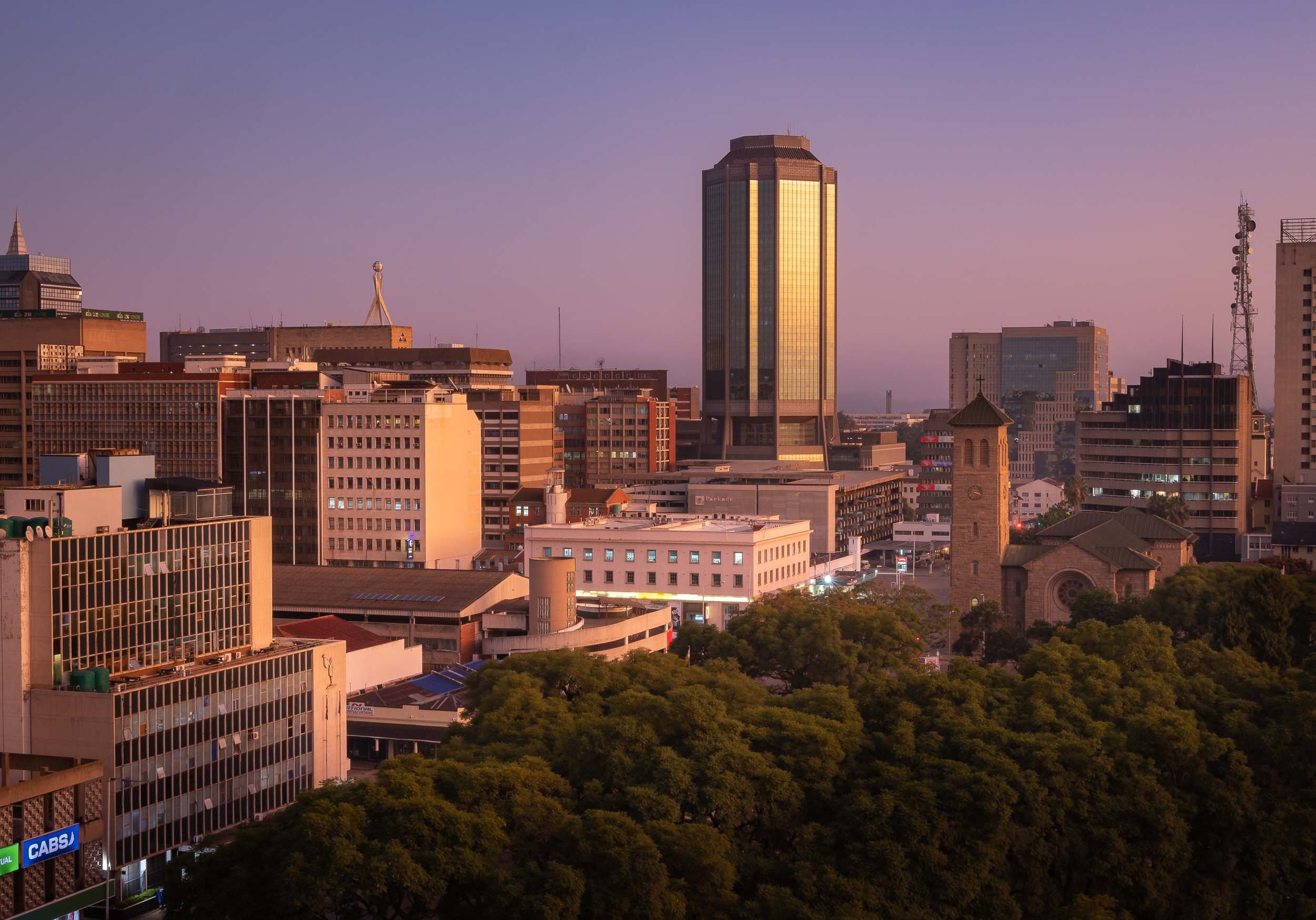
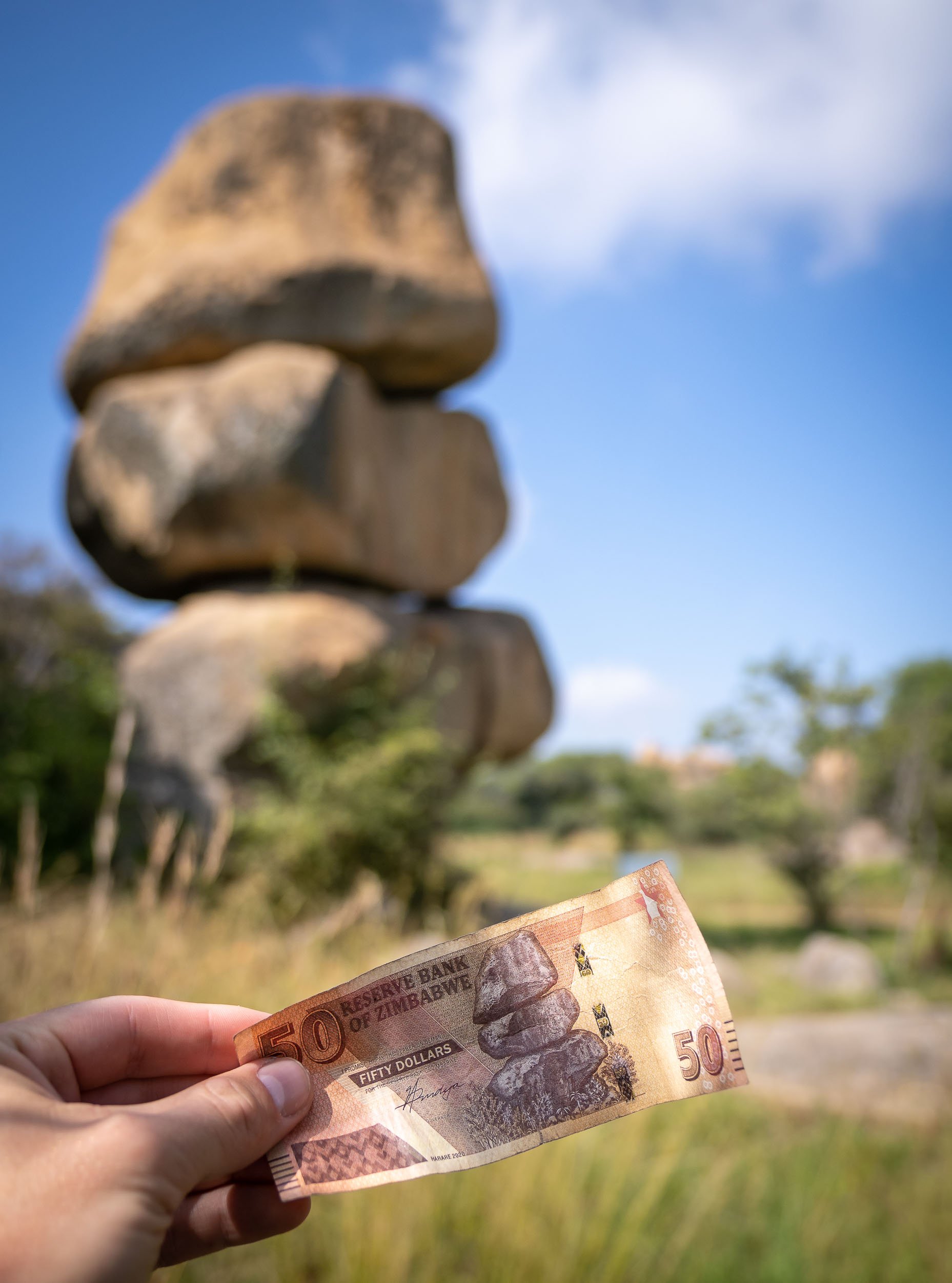
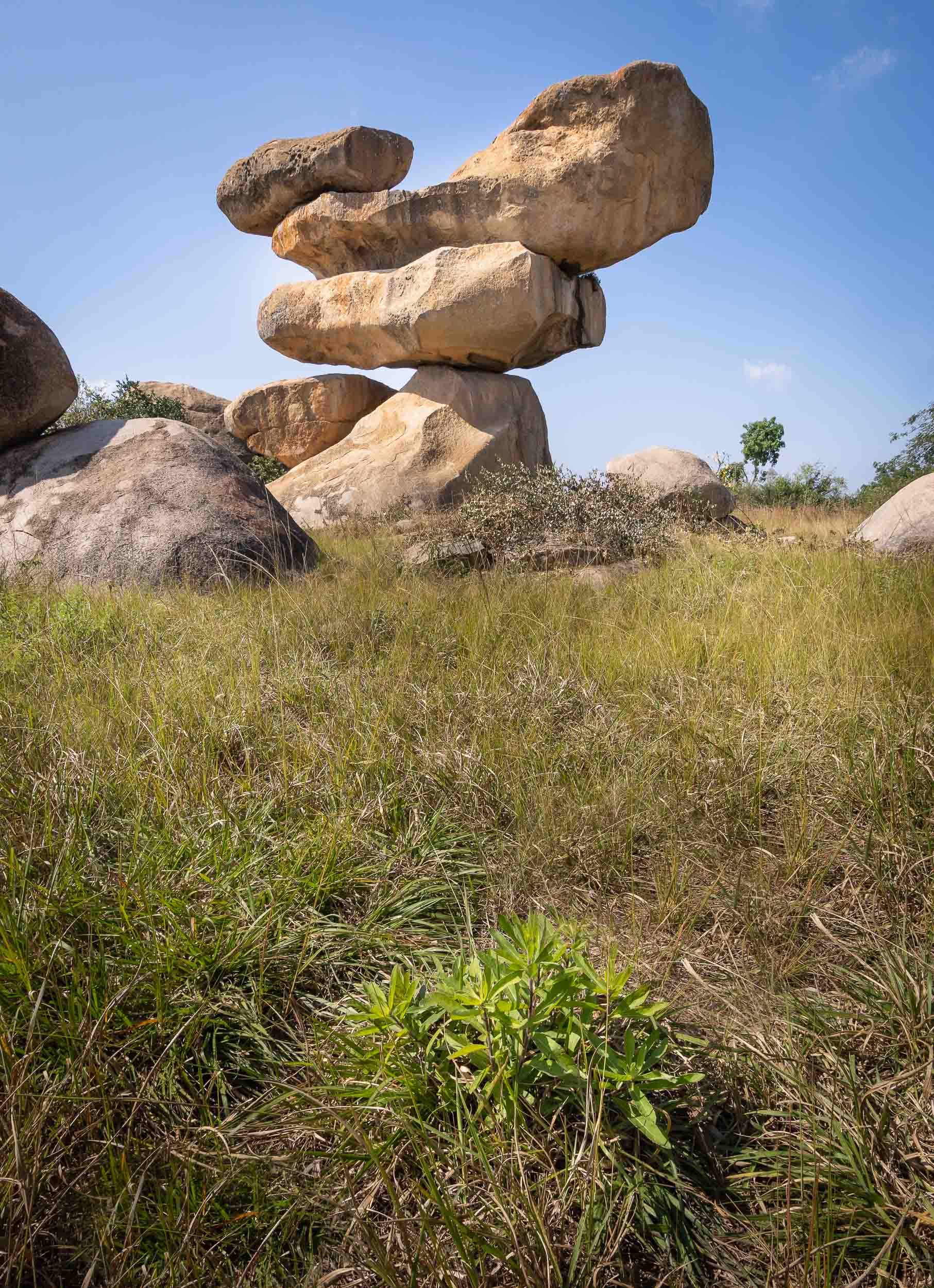
Mana Pools - Wildlife in a different way
I then spent 2 days at Mana Pools National Park in the northern part of the country, bordering the Zambezi river and the Zambian mountains on the other side of its shores. It’s this setting and the fact walking and canoeing are possible here, providing a much more intimate experience than the typical bush game drives, that made this a special place.

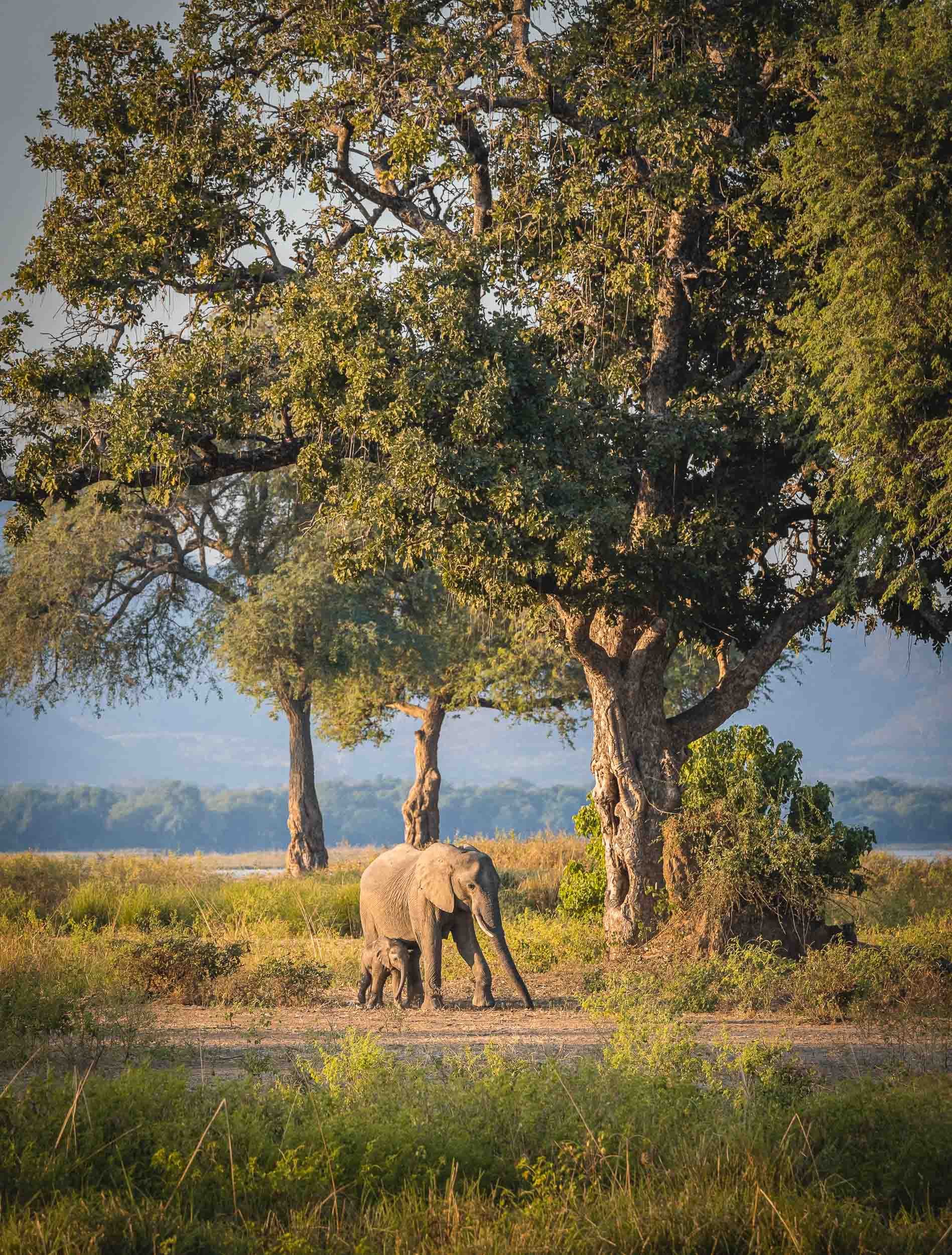
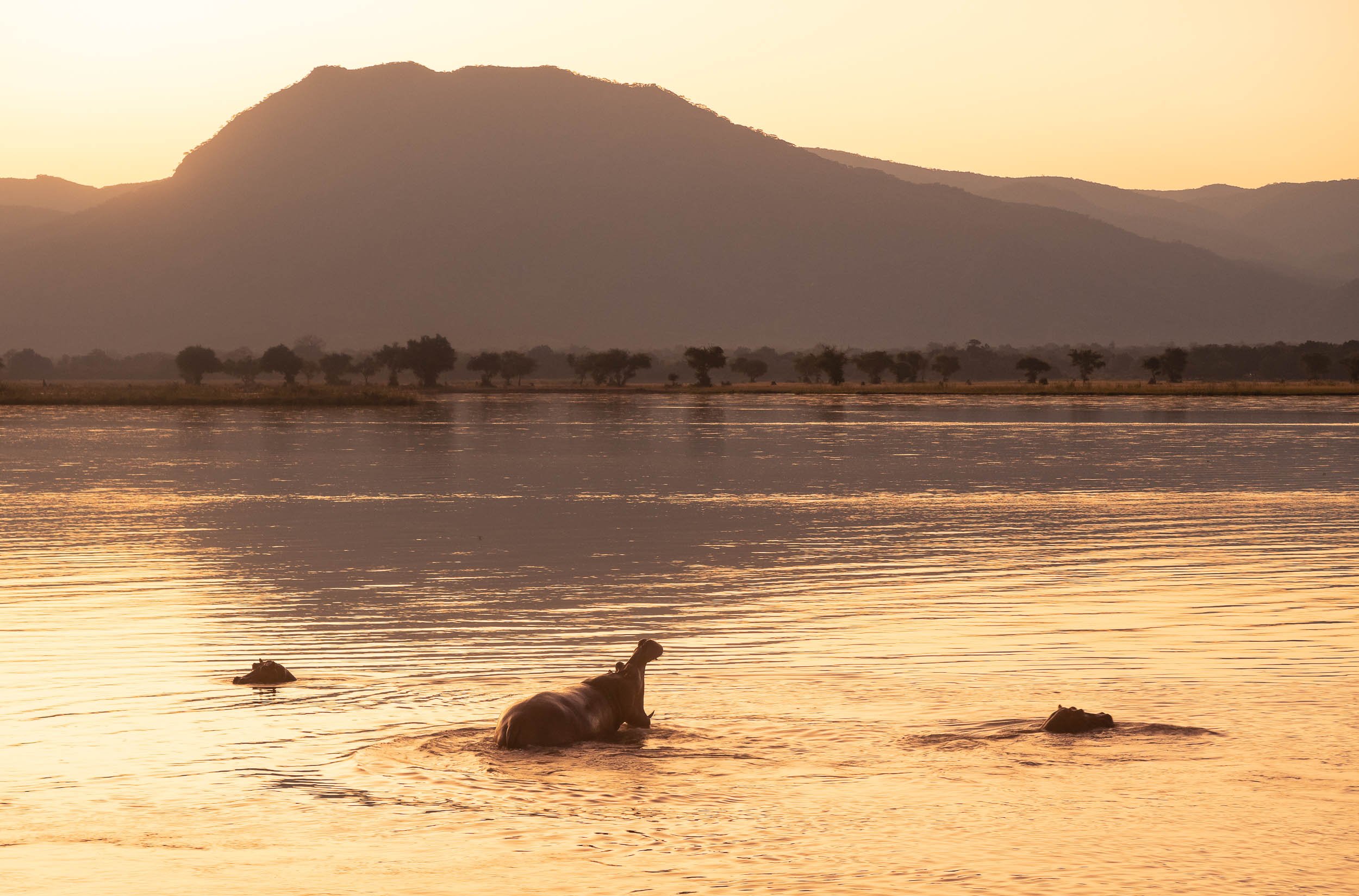
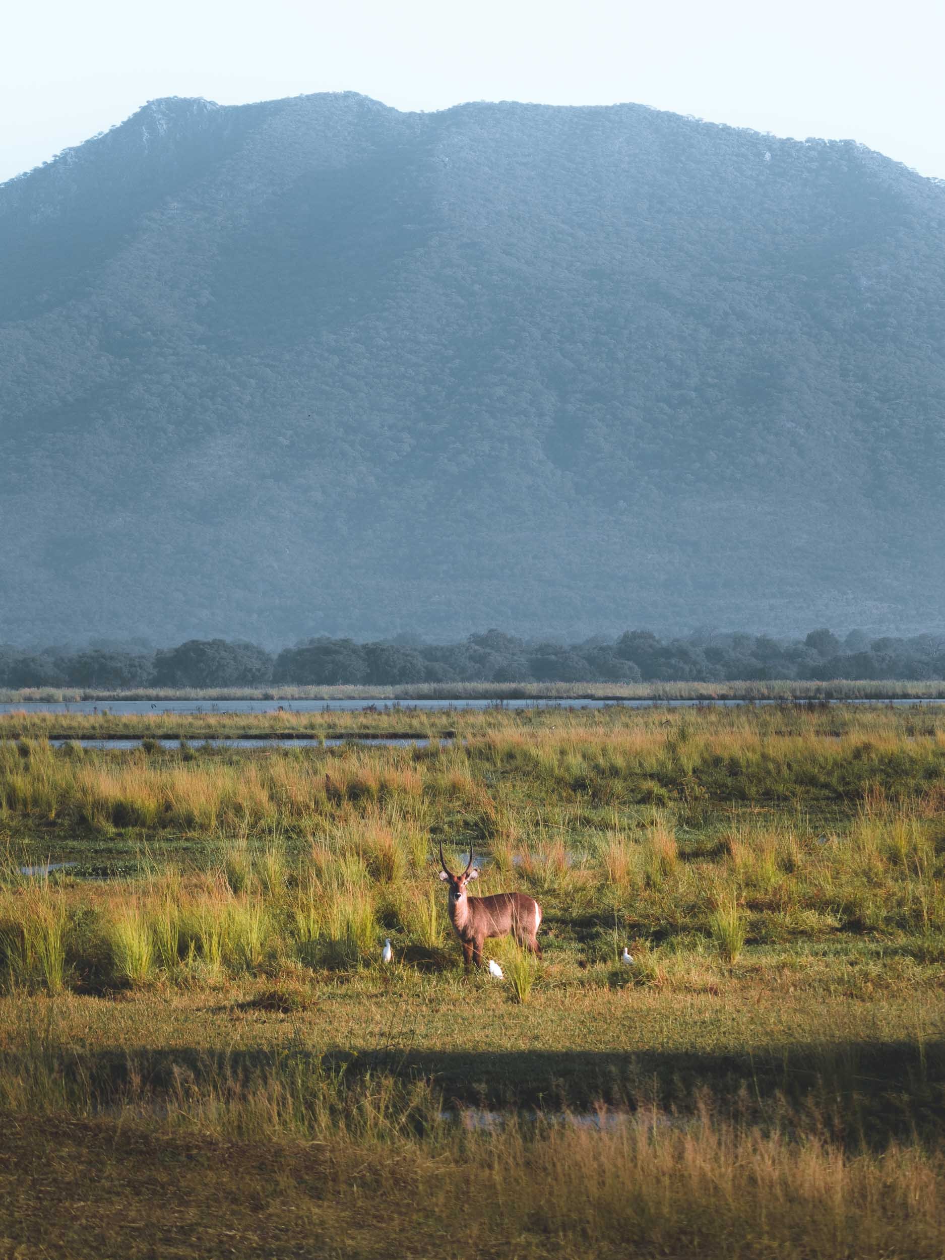
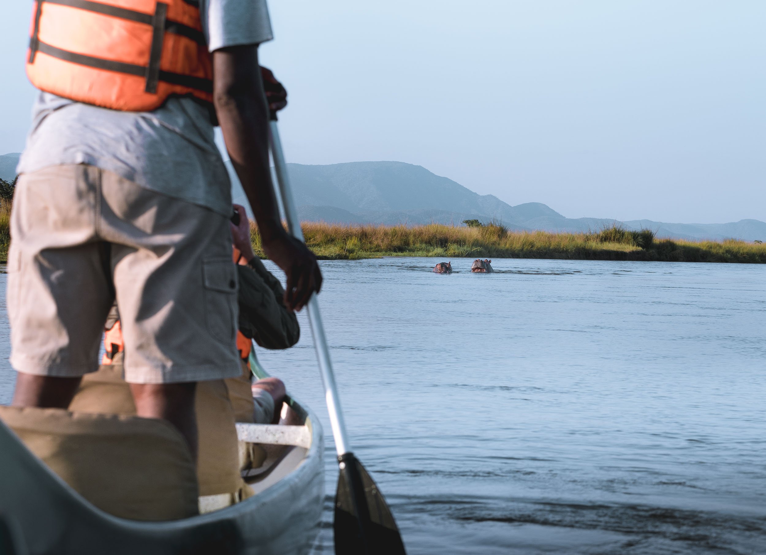

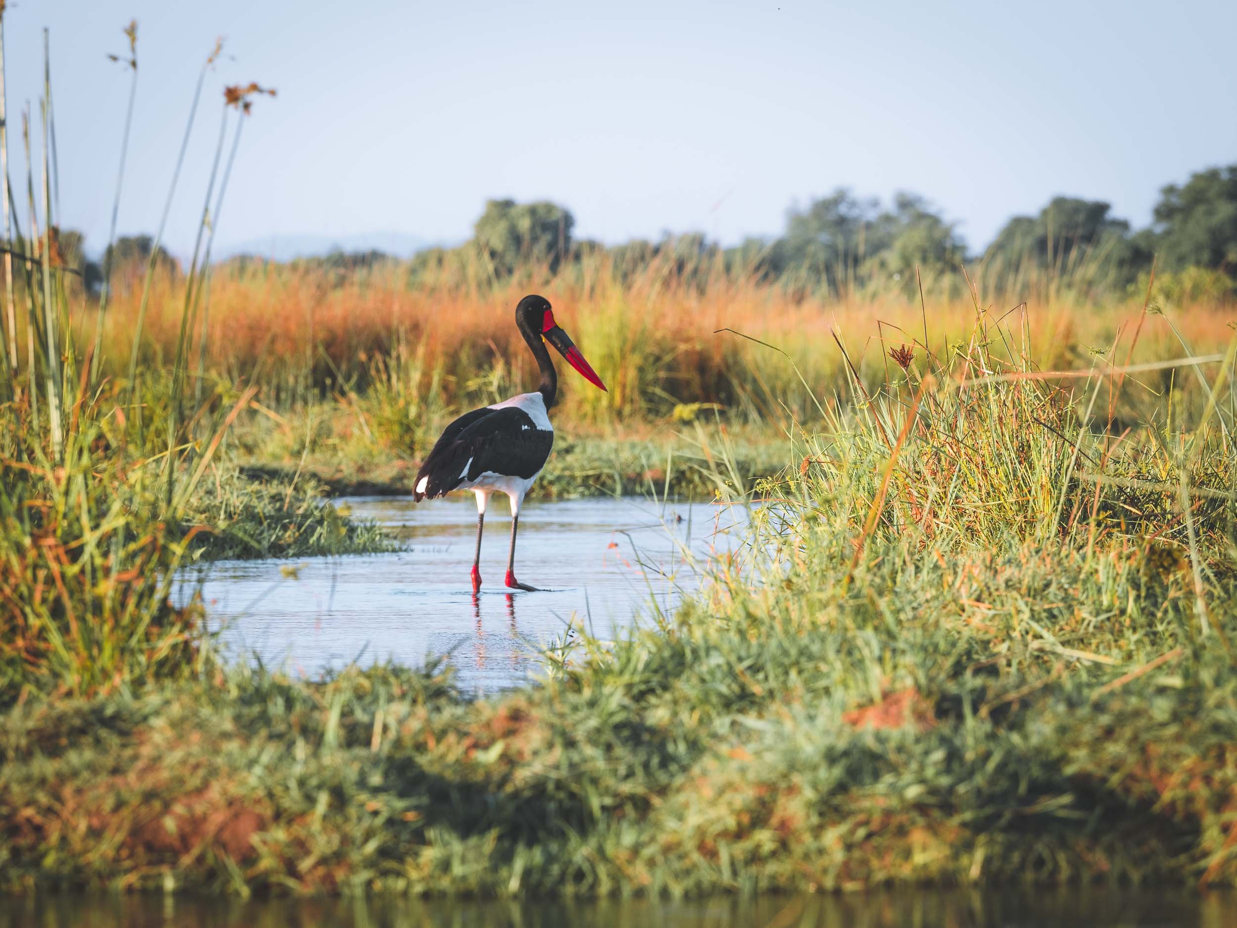


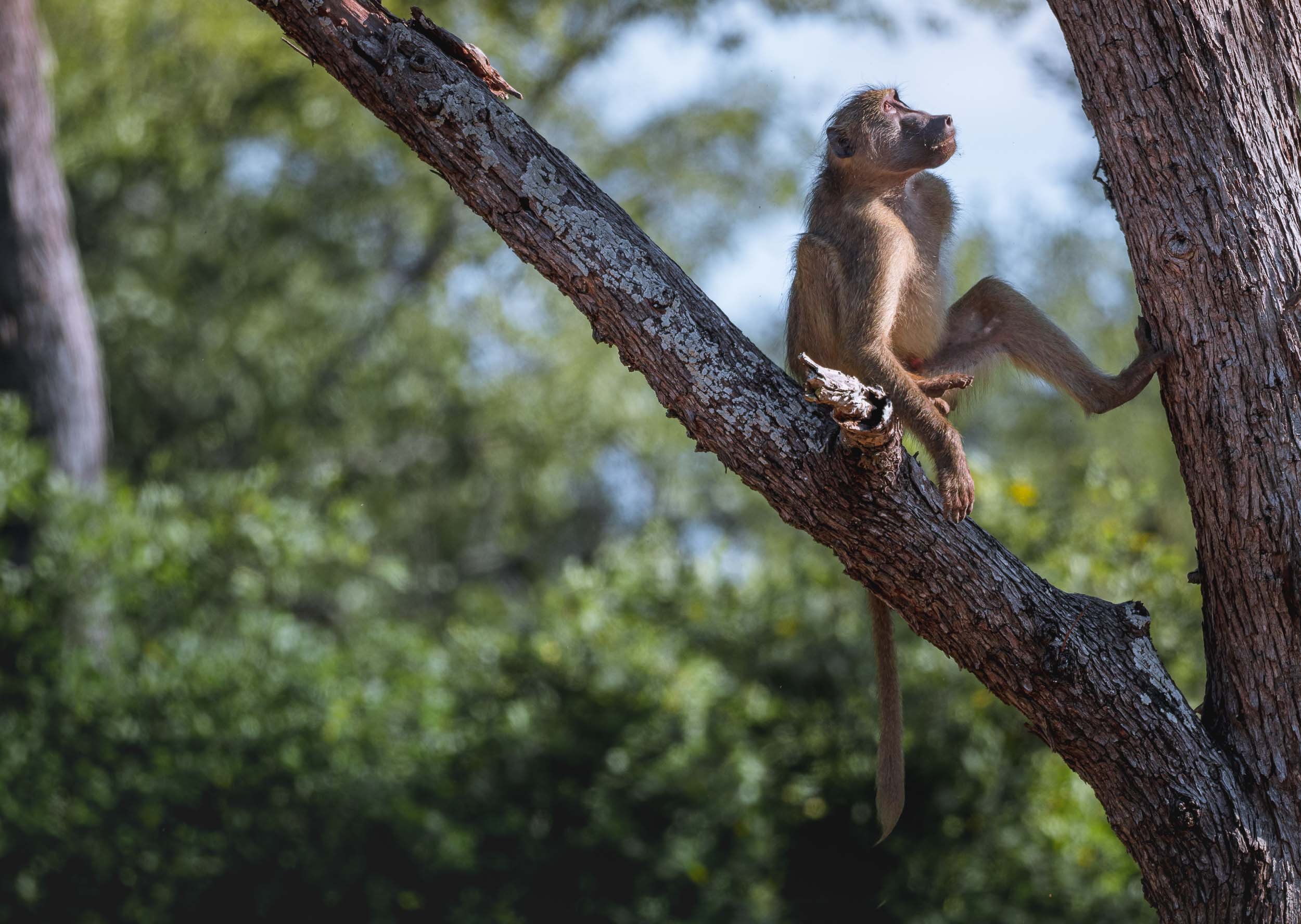
Chewore - Off the beaten, and onto the Dinosaur track
From Mana Pools, it was a good 4h drive on dusty and bumpy roads in a 1960s land cruiser owned by my wonderful host Louisa to a remote hunting concession - here. Hunting wasn’t the reason I kept annoying quite a few people before being able to come here: In fact, this place has some of the most remote and untouched dinosaur footprints in the world, which triggered my interest. Before that though, the universe had another special sight in store .
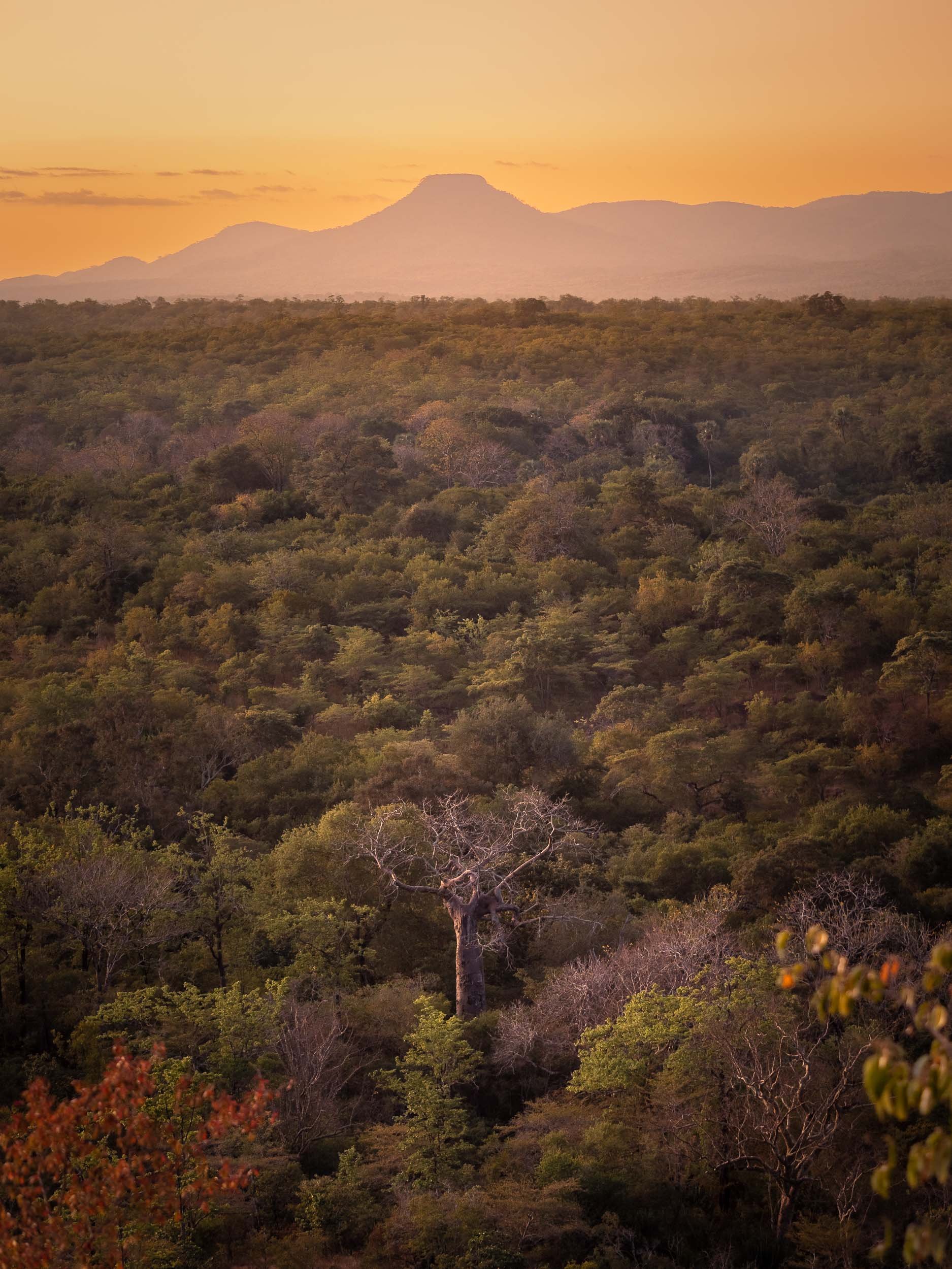
The Lunar Eclipse
My time in Zimbabwe coincided with the a full lunar eclipse on 16th of May, 2022, and luckily our location was just about within the areas of the globe that could experience this rare phenomenon, so I had to find a way to capture it. What a sight it was - and not only that, also an audible experience, as the lions and baboons roared in the background.

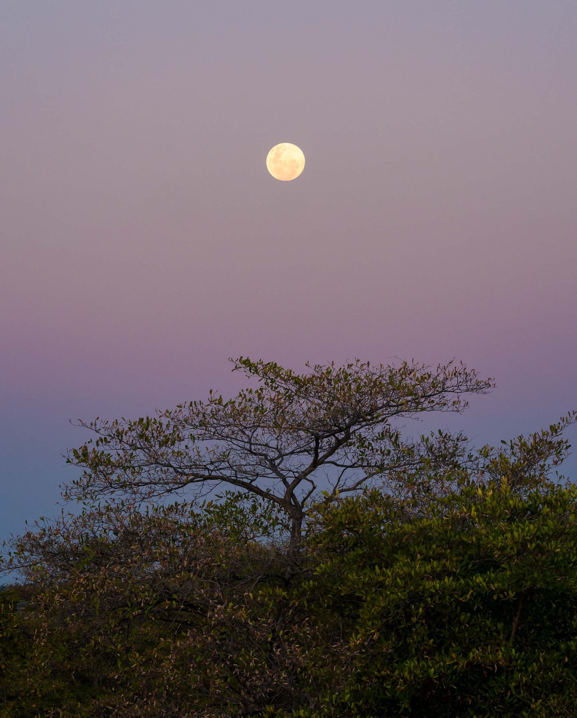
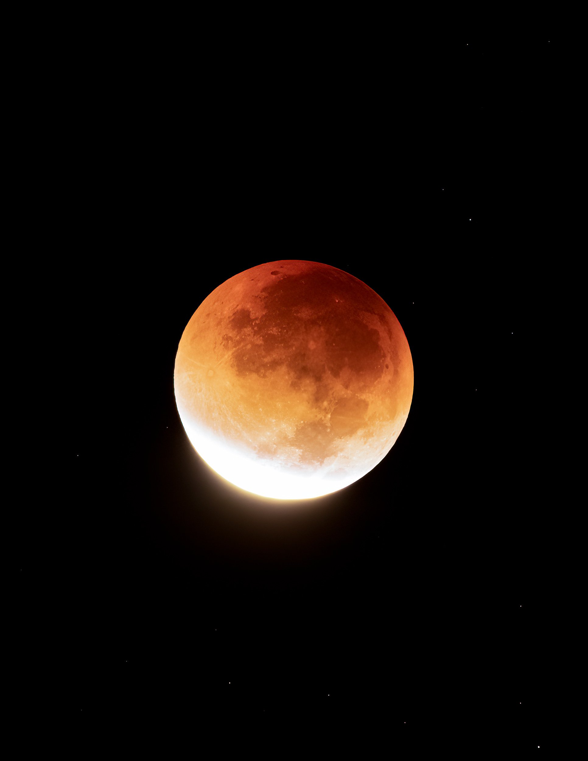
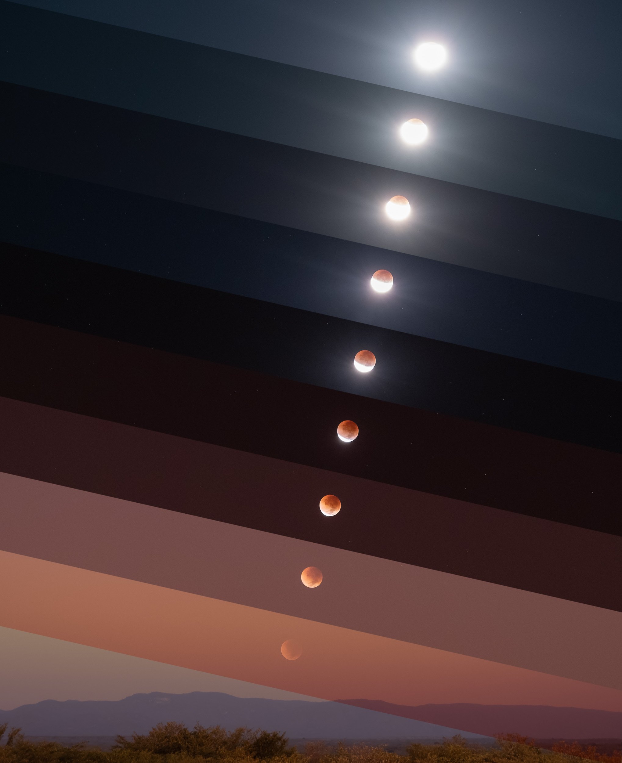
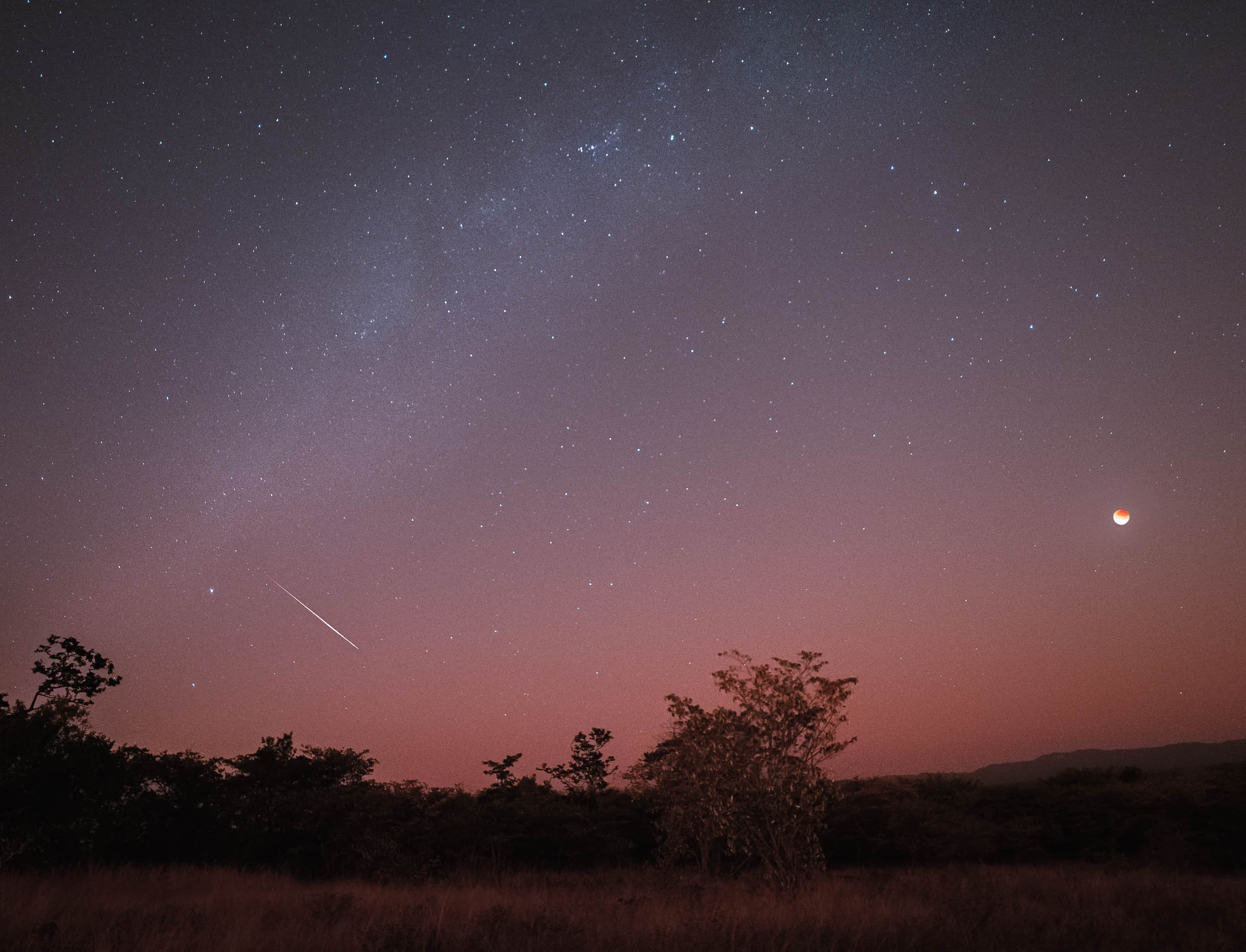
Here’s a timelapse video of the event, both a wider view from 3am to sunrise, and a close up of the eclipse progression.
The Dinosaur Footprints
The real reason for venturing this far and deep into the Zimbabwean bush can be found in the next photos. The country and specifically the Chewore area is home to a very special paleontological sight: Dinosaur Footprints from 150 million years ago. It took a large amount of research, planning and nagging to make this happen, but it was definitely worth it and I’m grateful to to everyone who made it possible and was a part of it with all their knowledge, Barry, Louisa and Neil. The owner of the concession estimates only 200 people have ever seen these - 201 now.
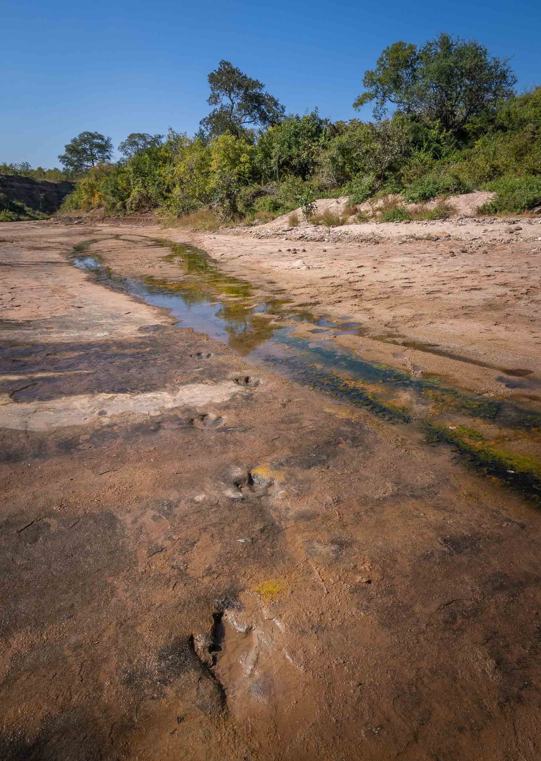
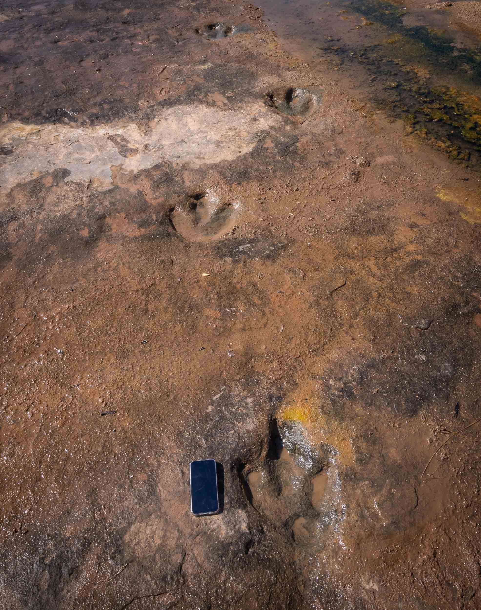
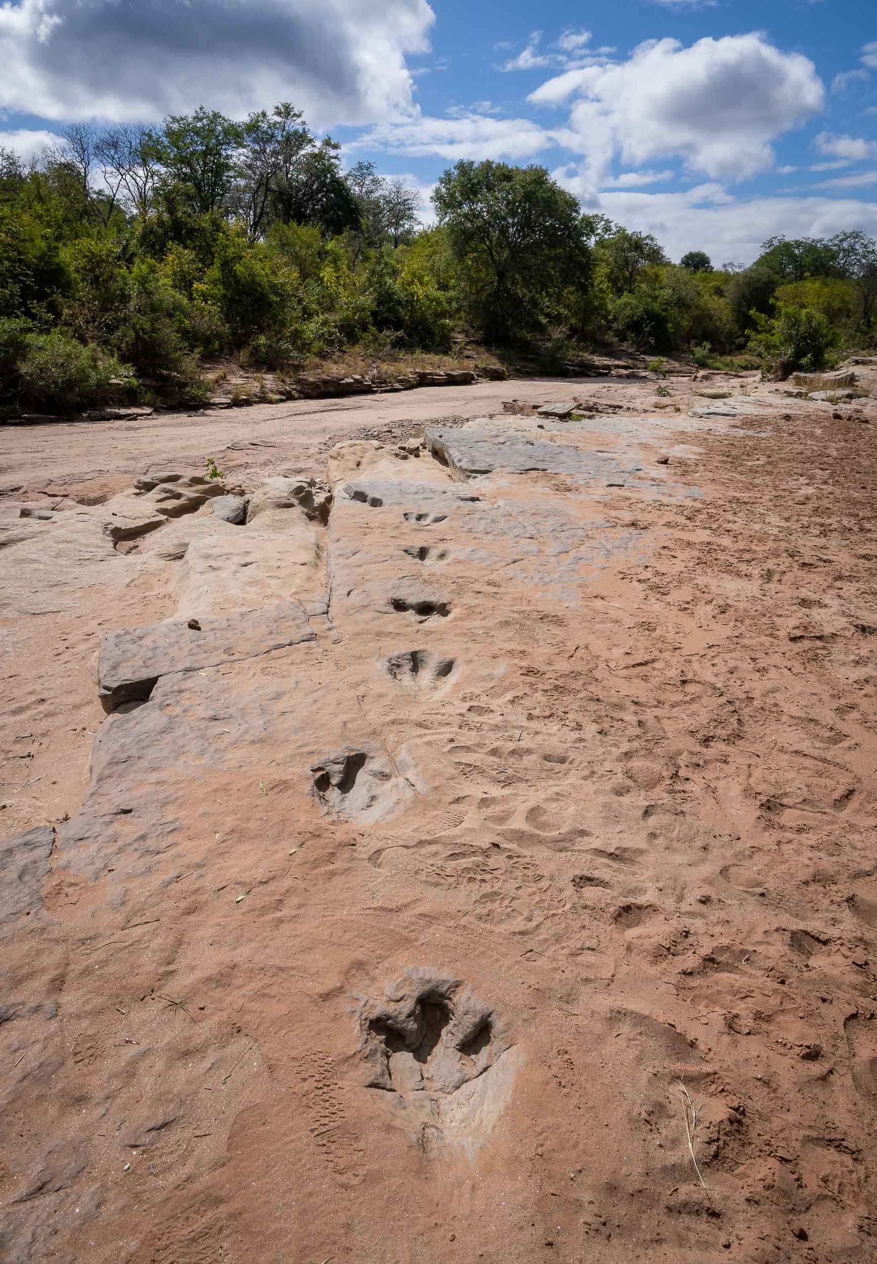
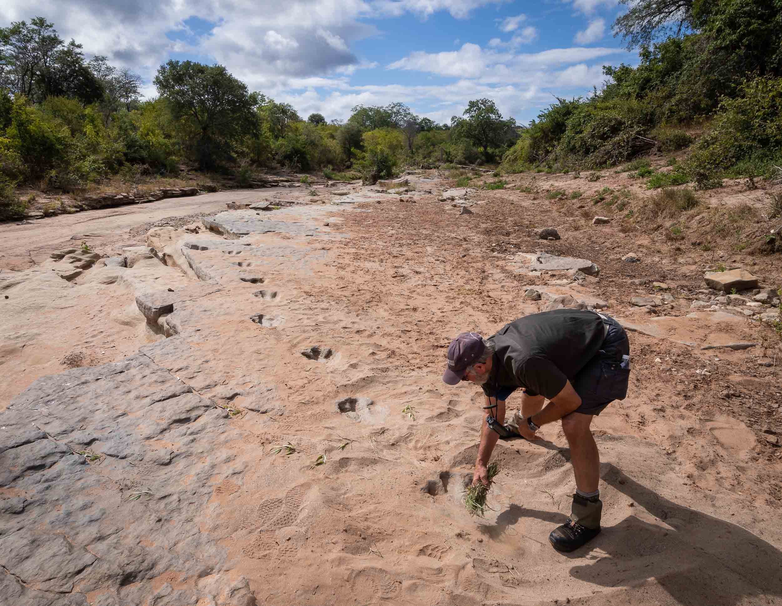
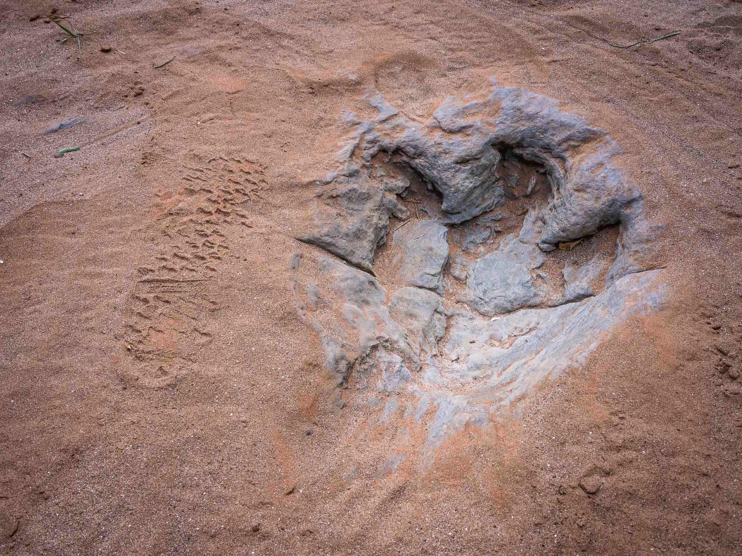
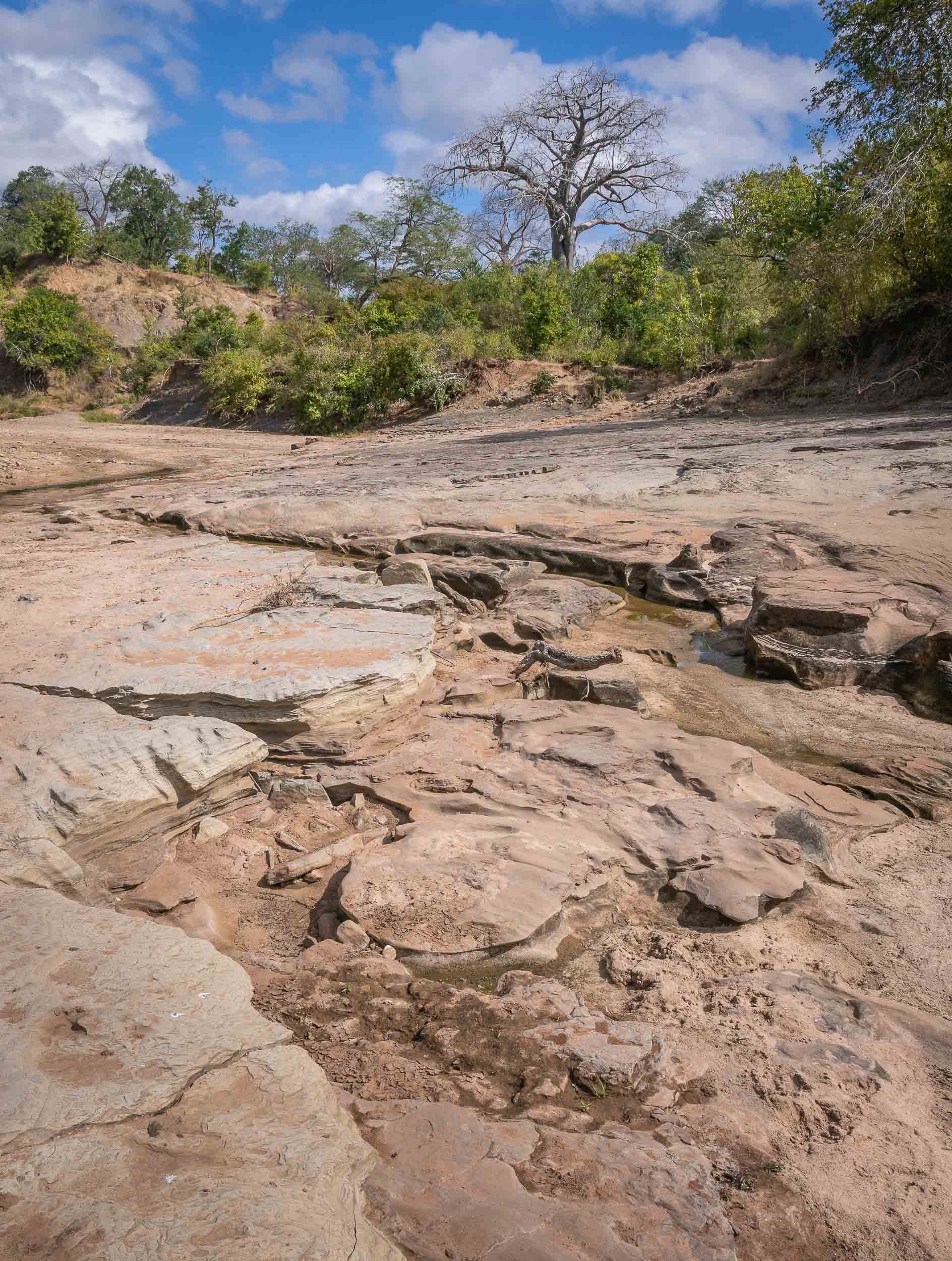
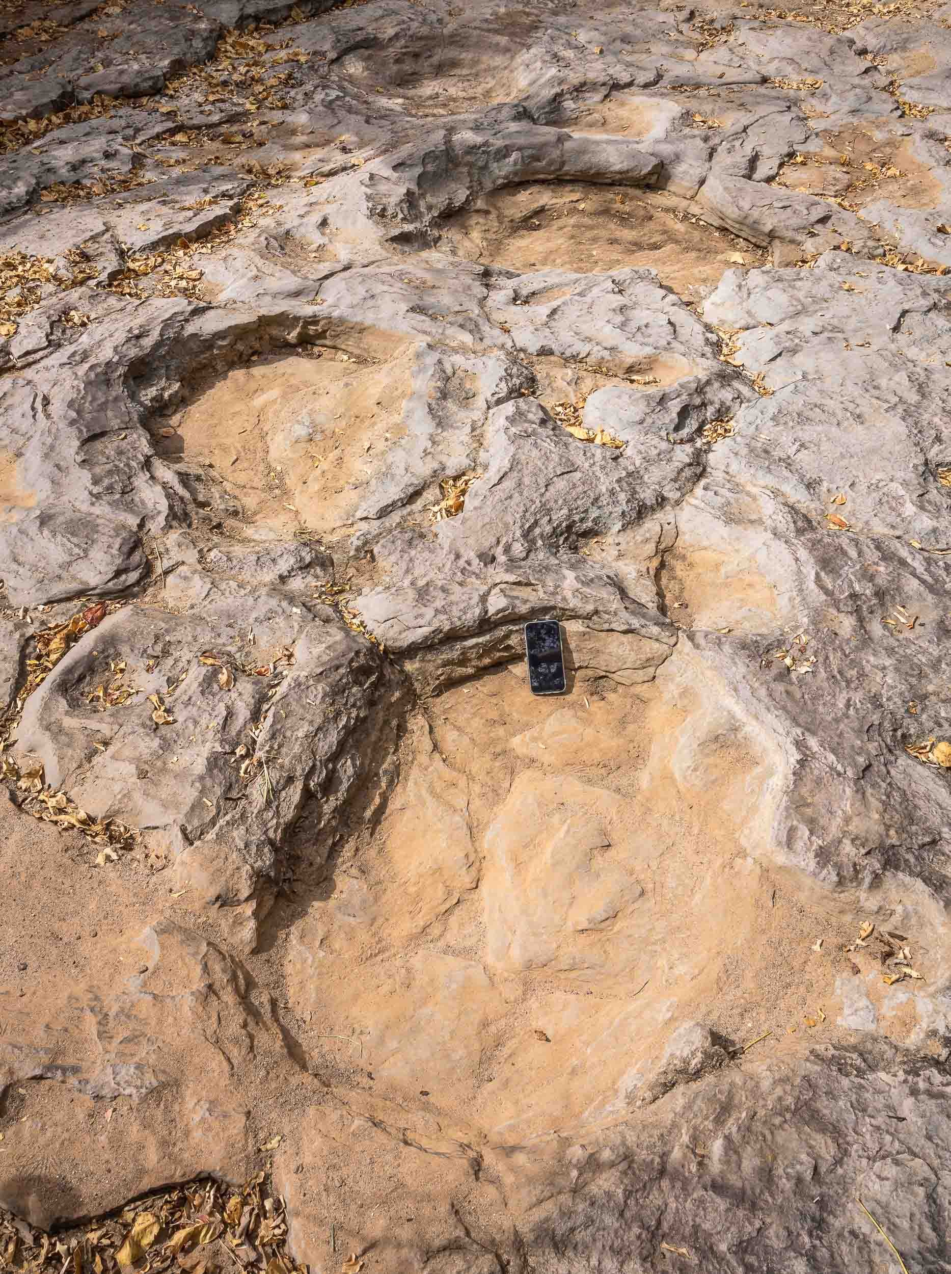
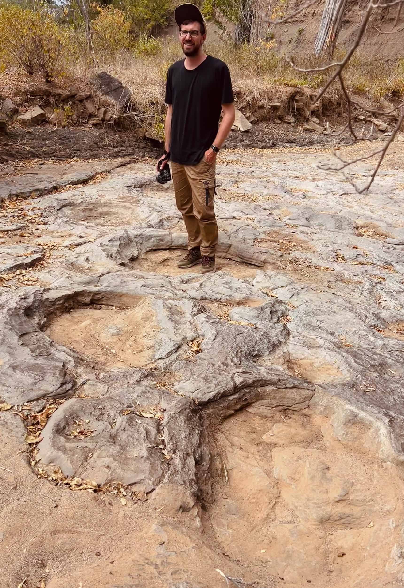
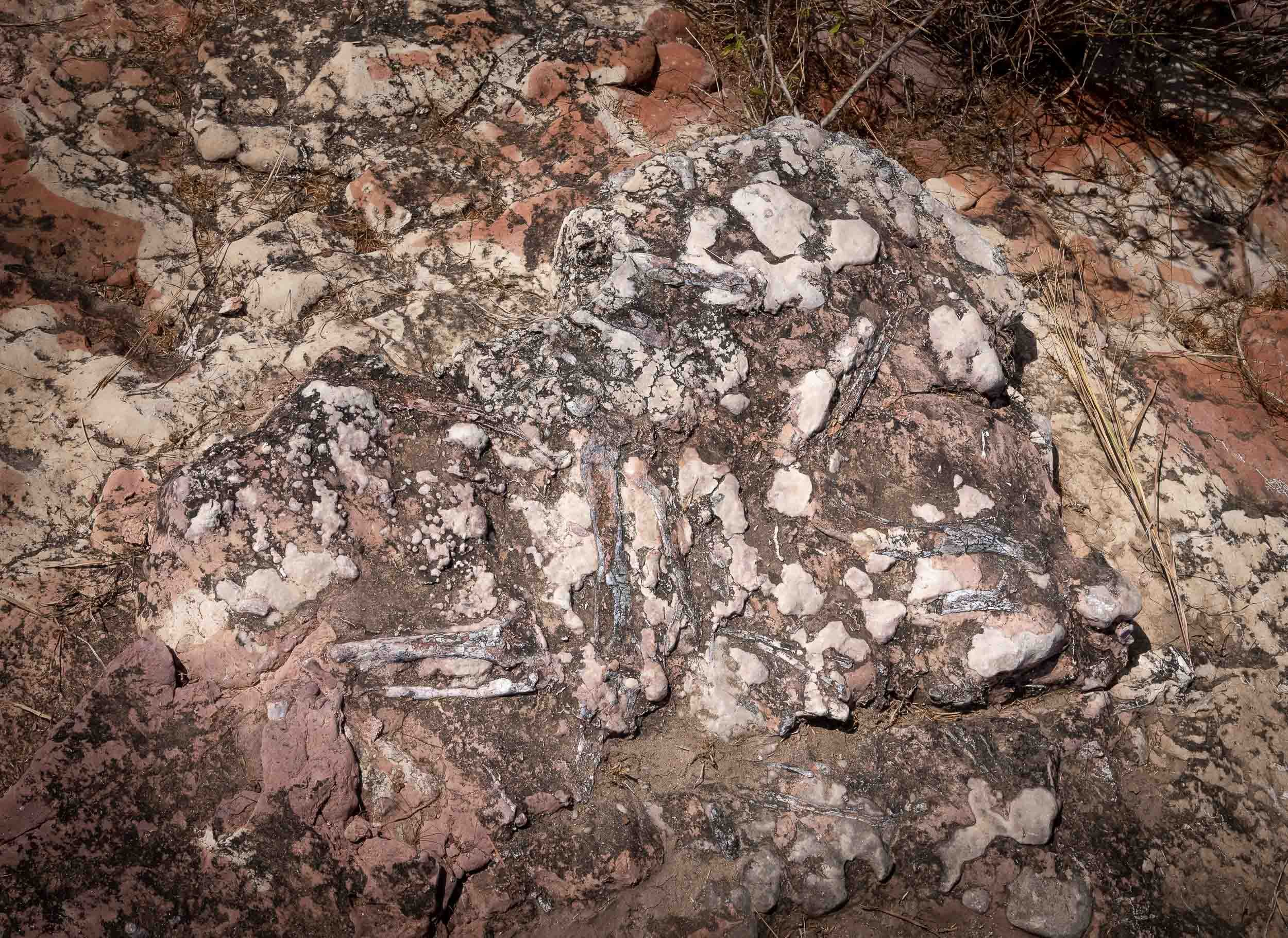

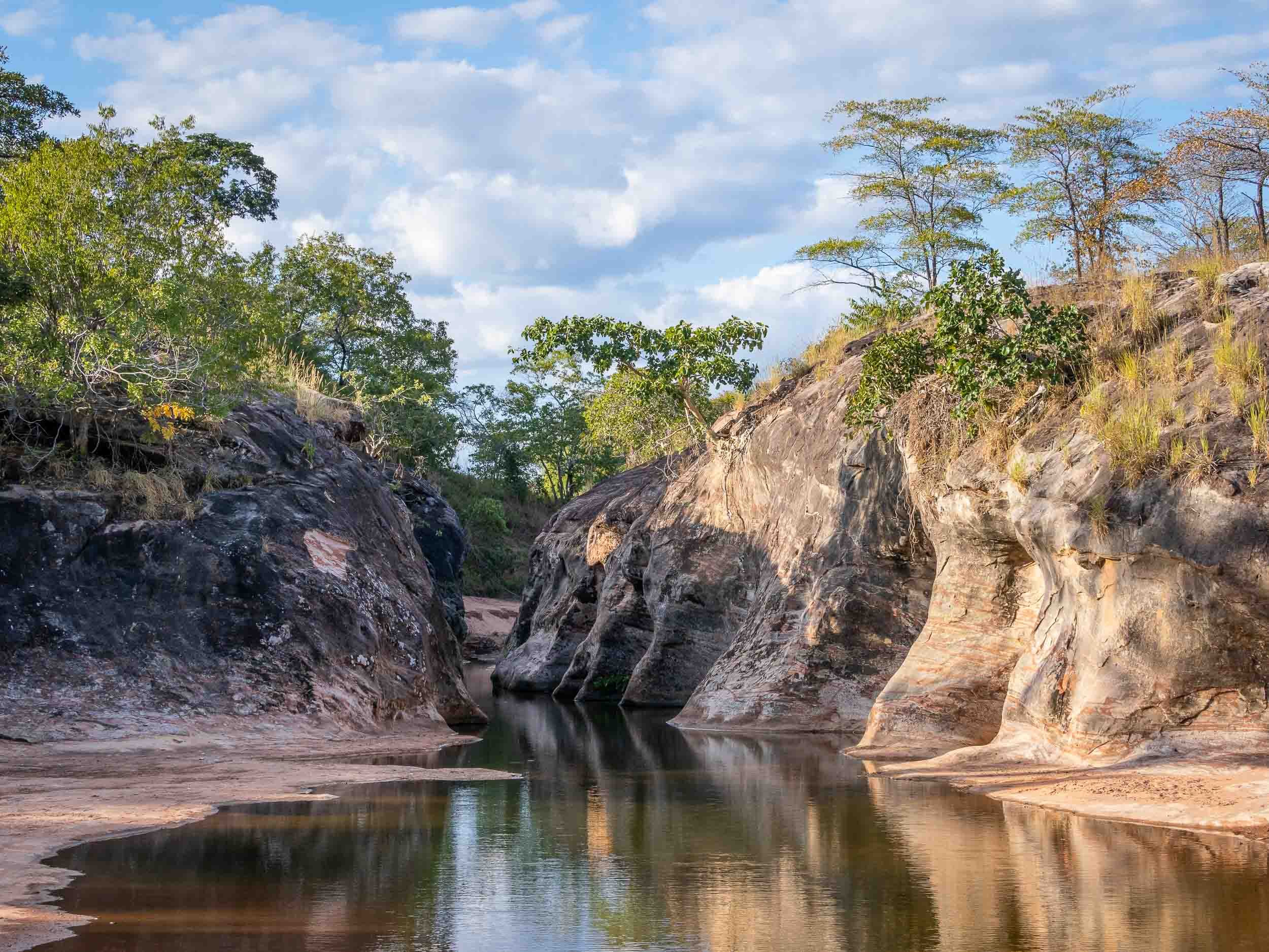
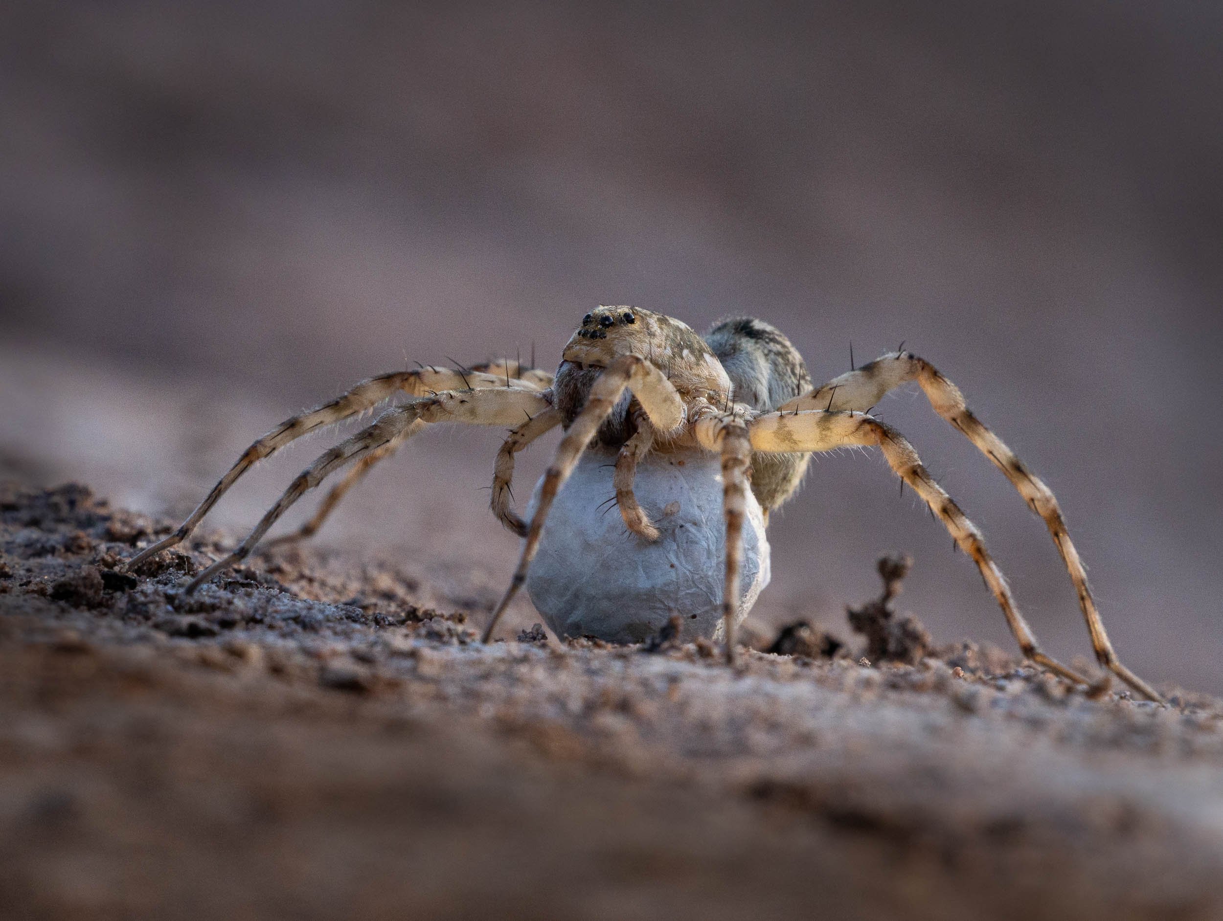
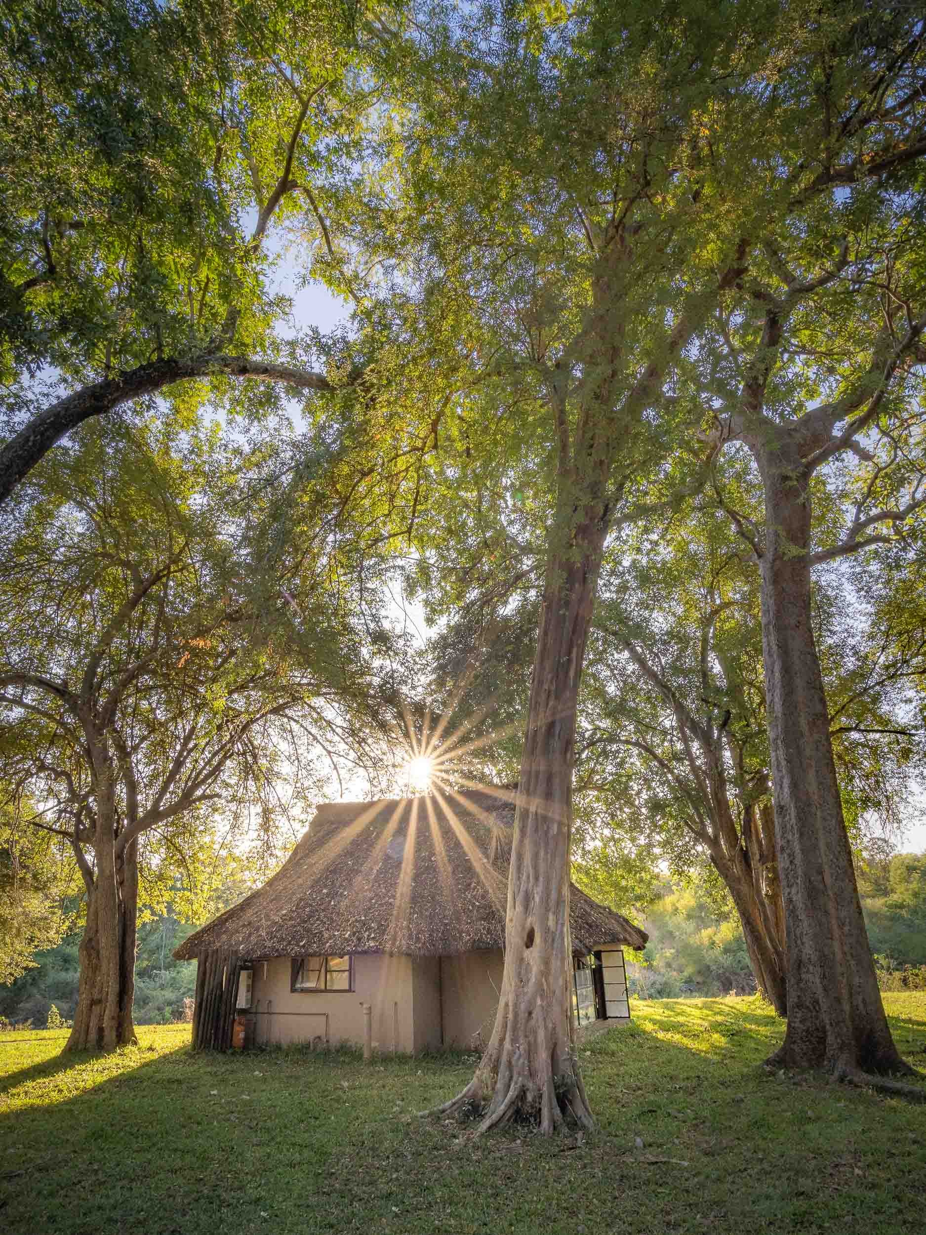
Lake Kariba and the Matusadona
After a long drive, I arrived at Lake Kariba and the Warthogs camp for a few nights on the shores of the world’s largest man-made lake in Musango Safari Camp, both operated independently by incredible people.
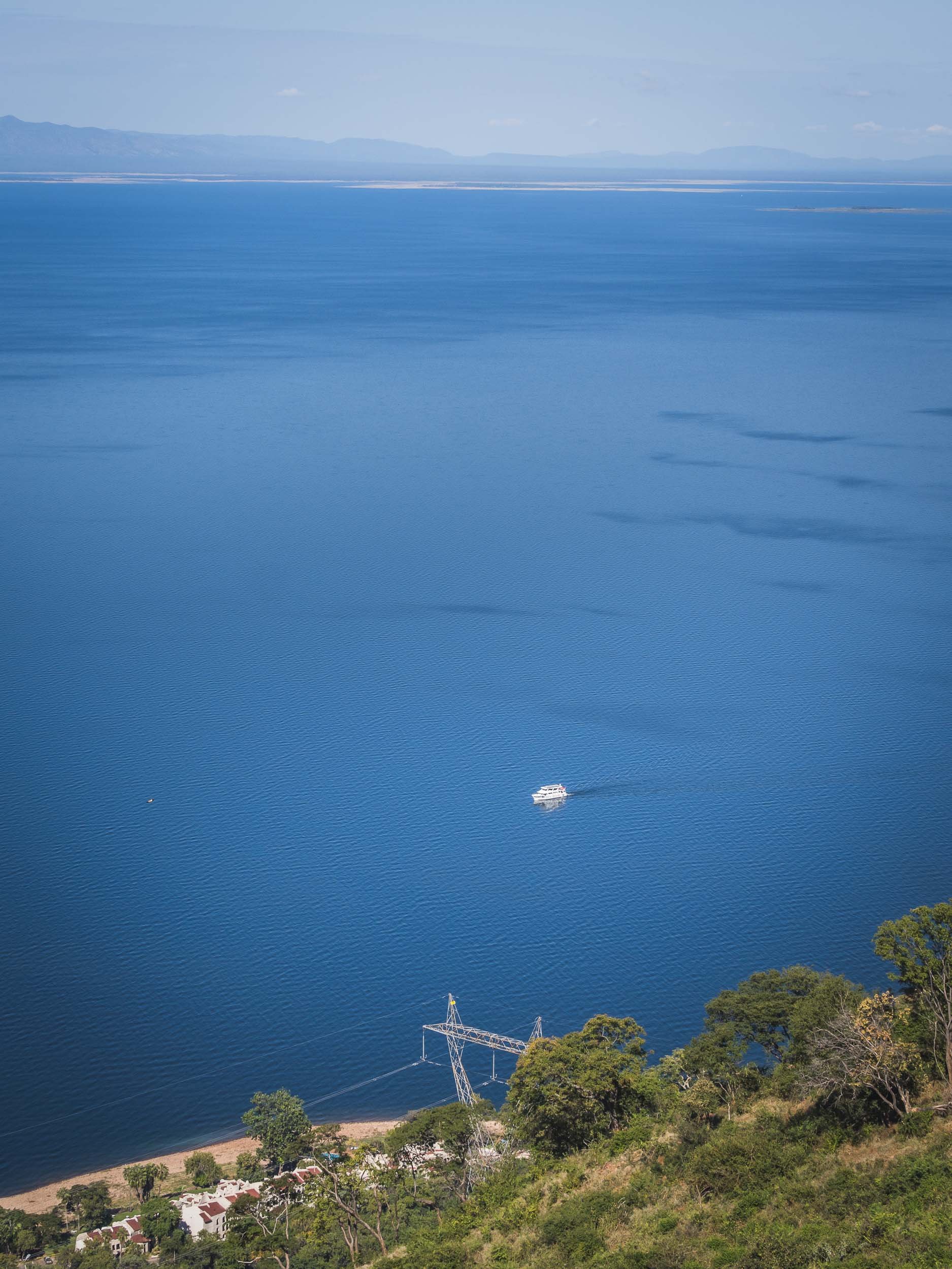
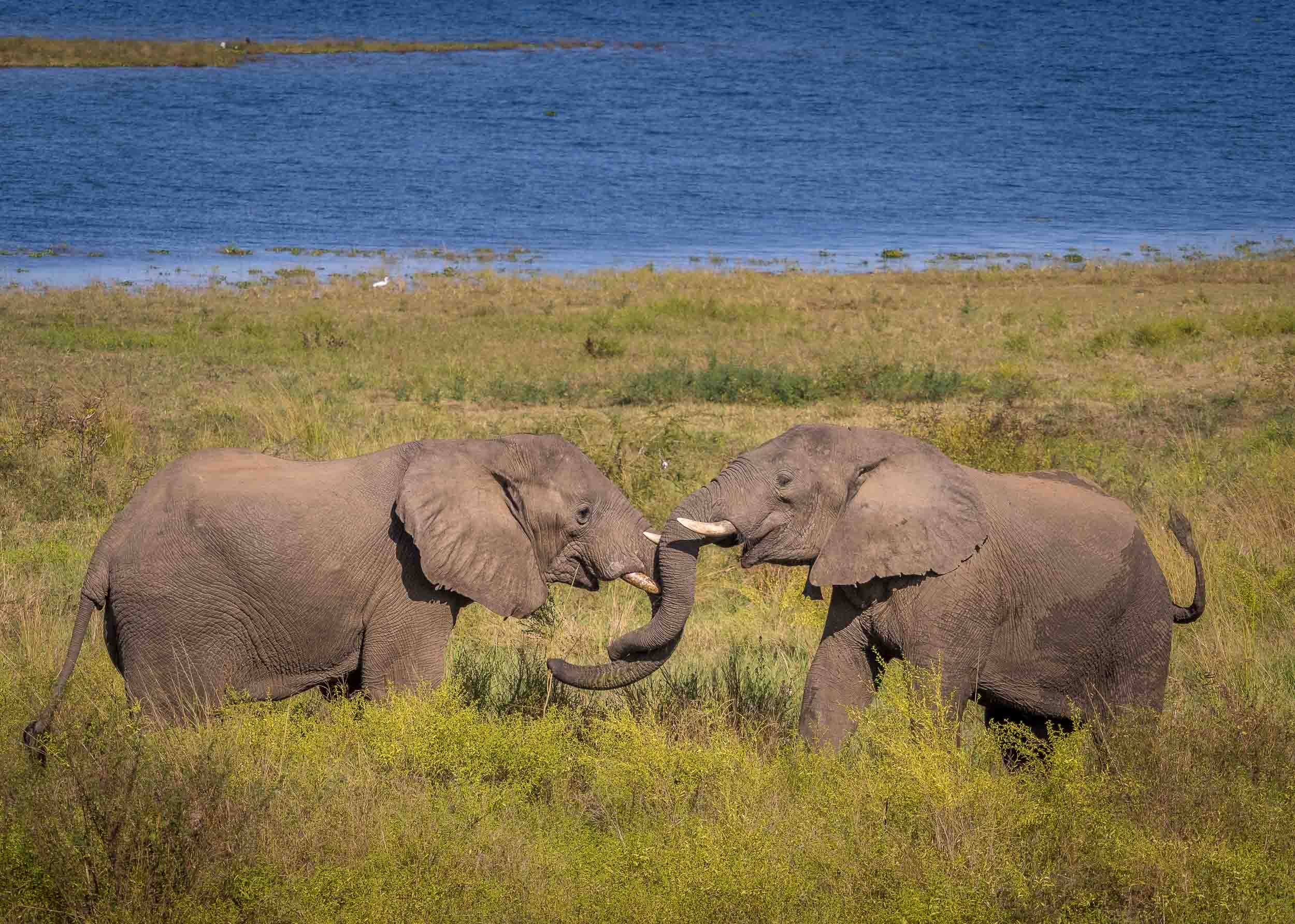

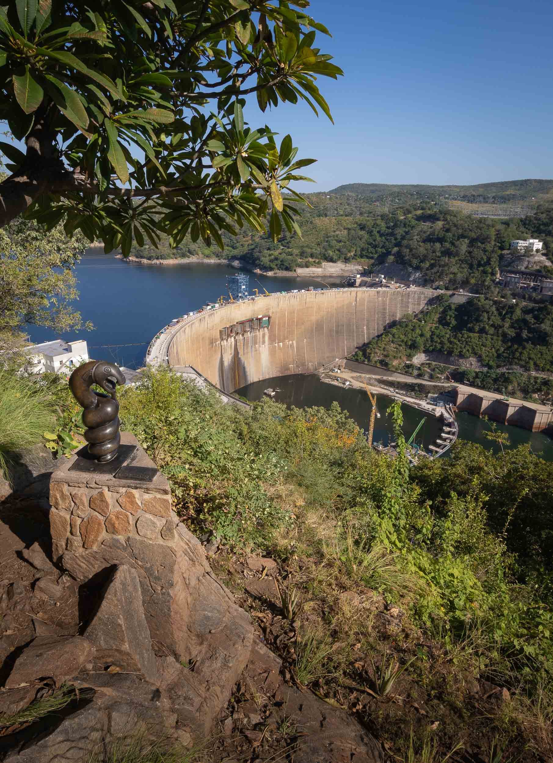
Following my time in Kariba at Warthogs Bush Camp (Elephants and Zebra visit the small pool there to drink!) I moved across the lake into the Matusadona National Park. An hour boat ride took me to a very unique lodge, called Musango, run by its owners Wendy & Steve.
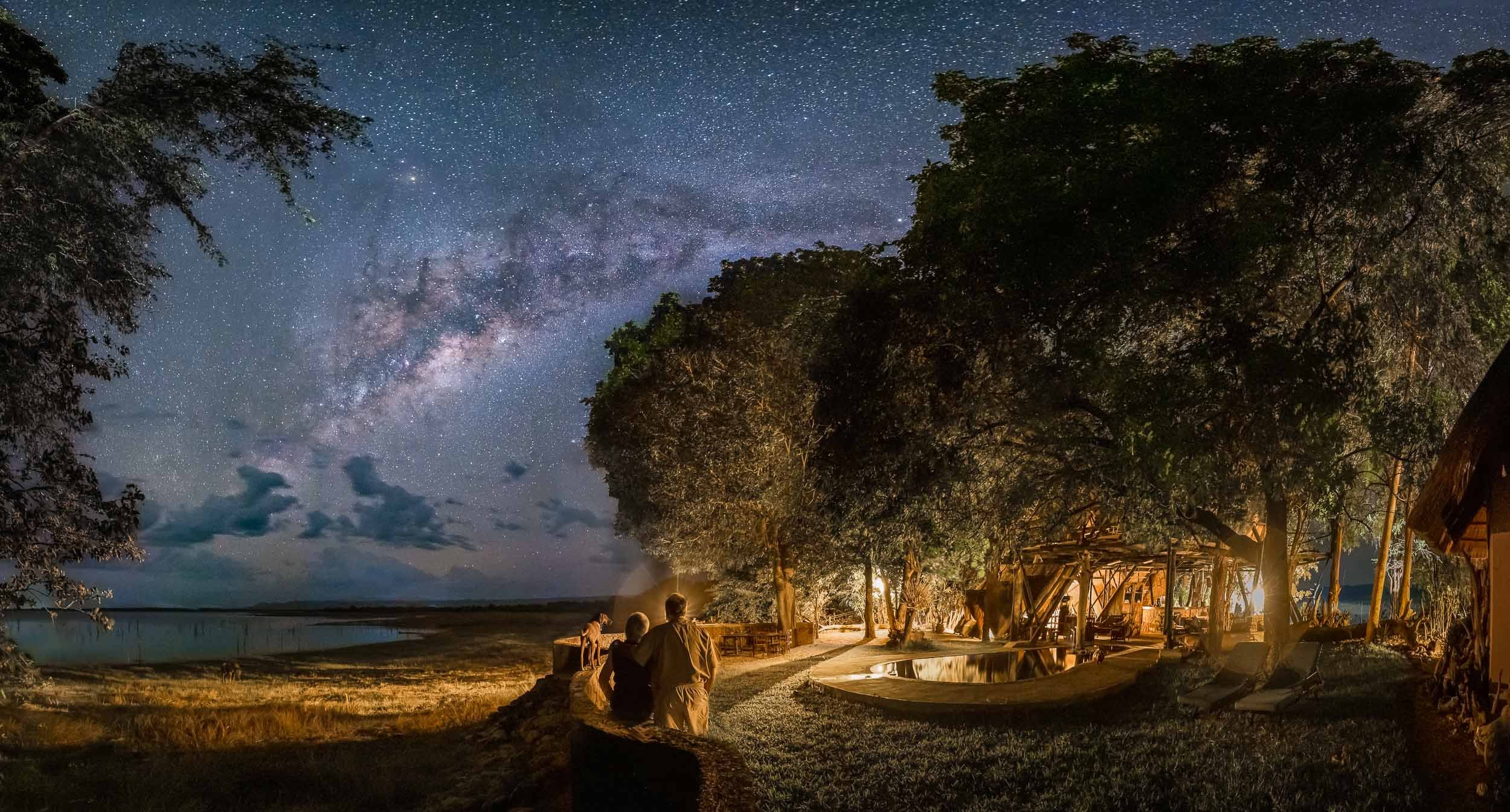
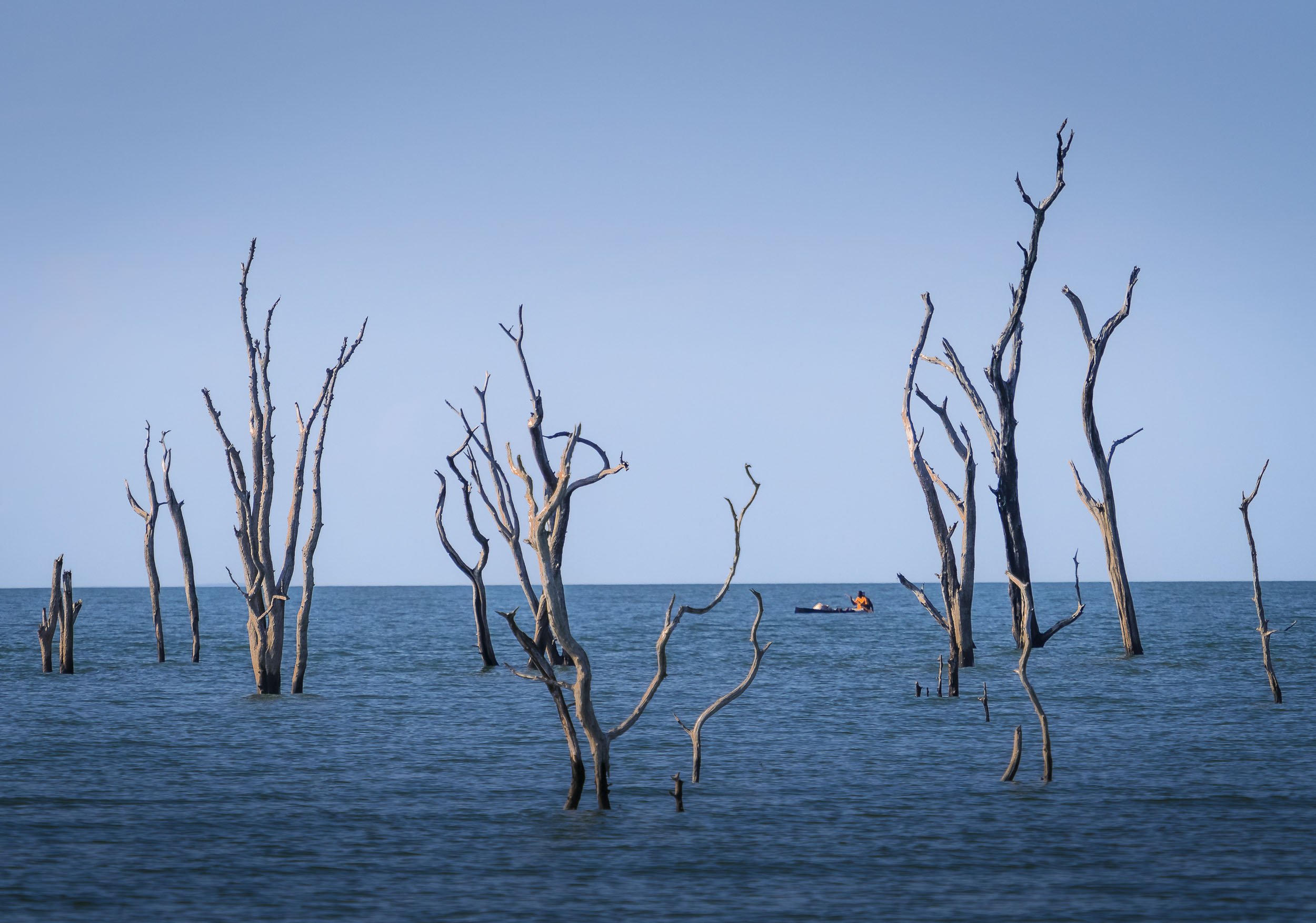
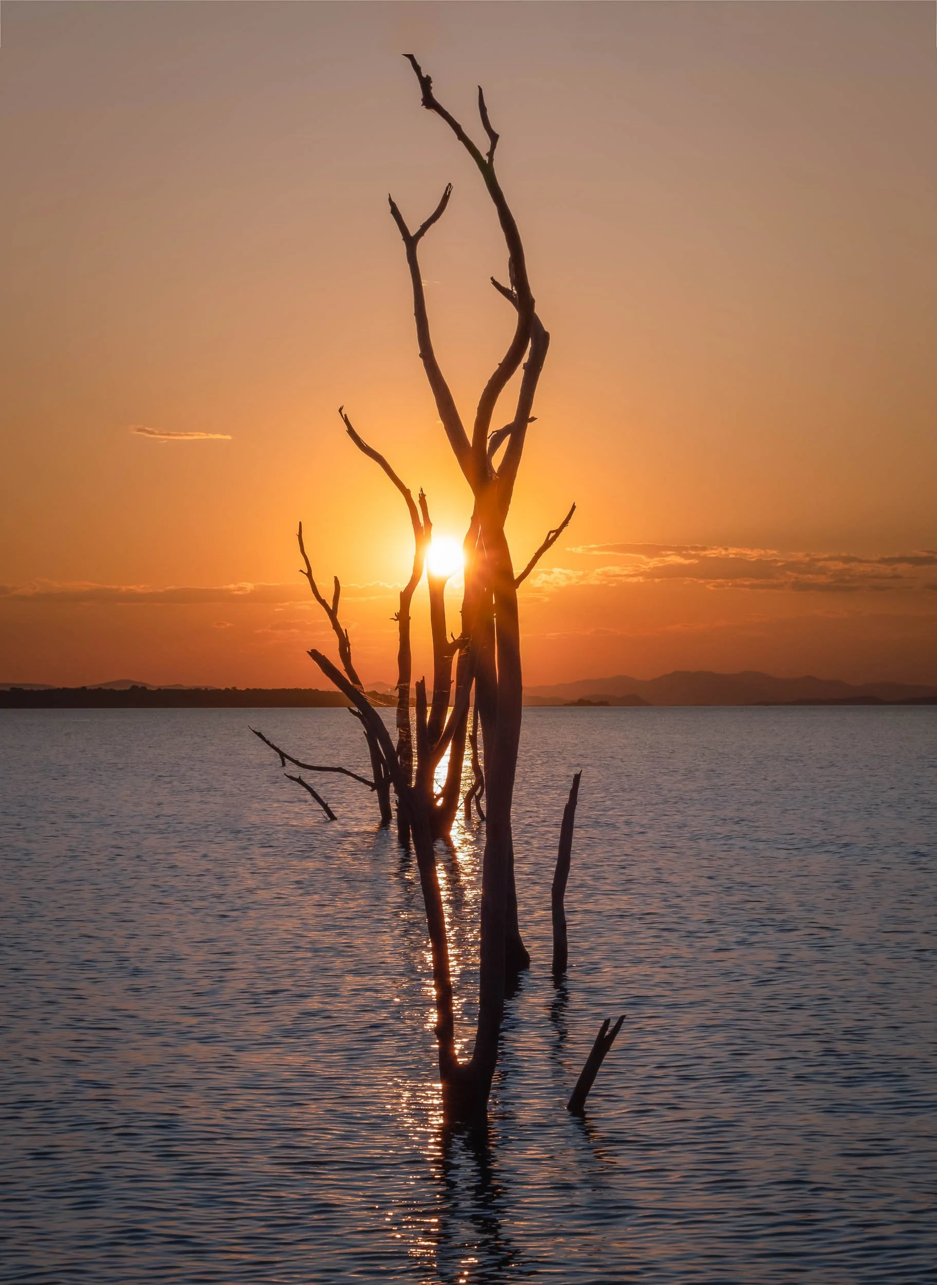
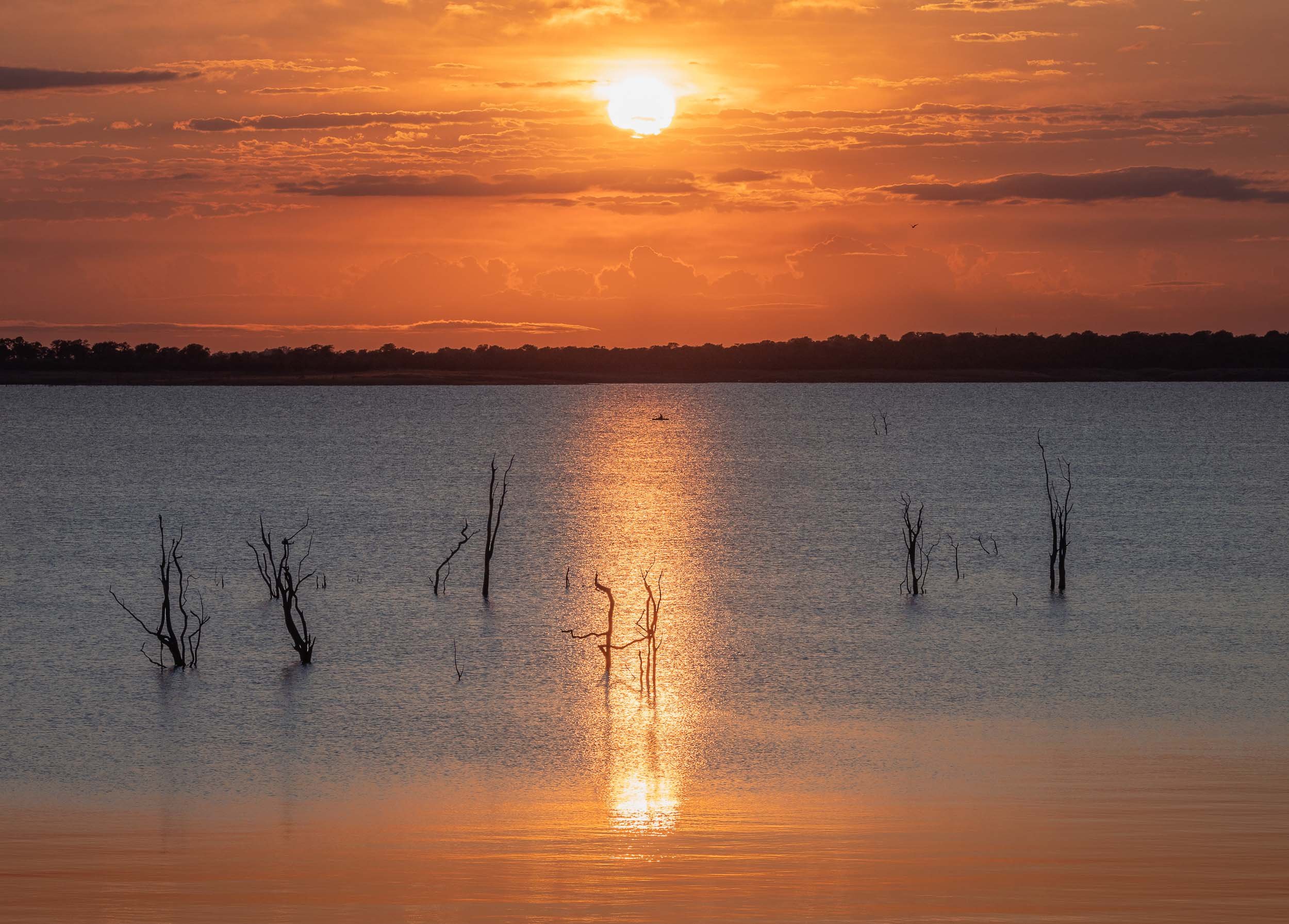
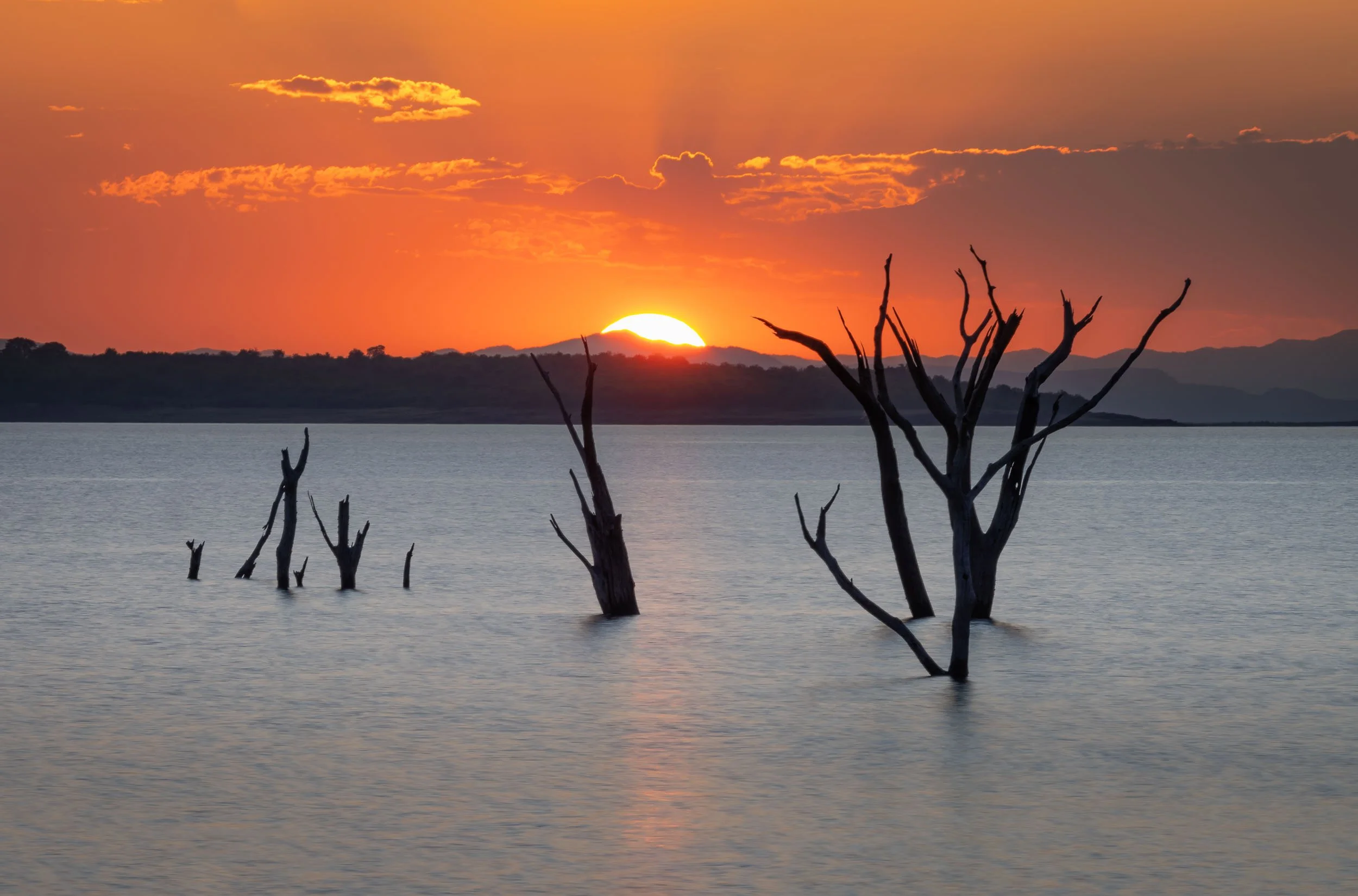
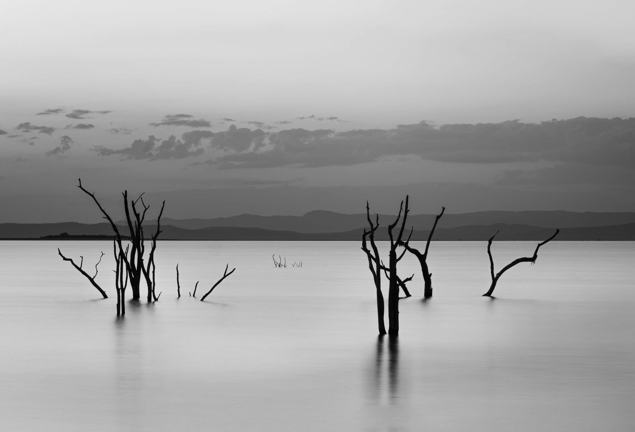
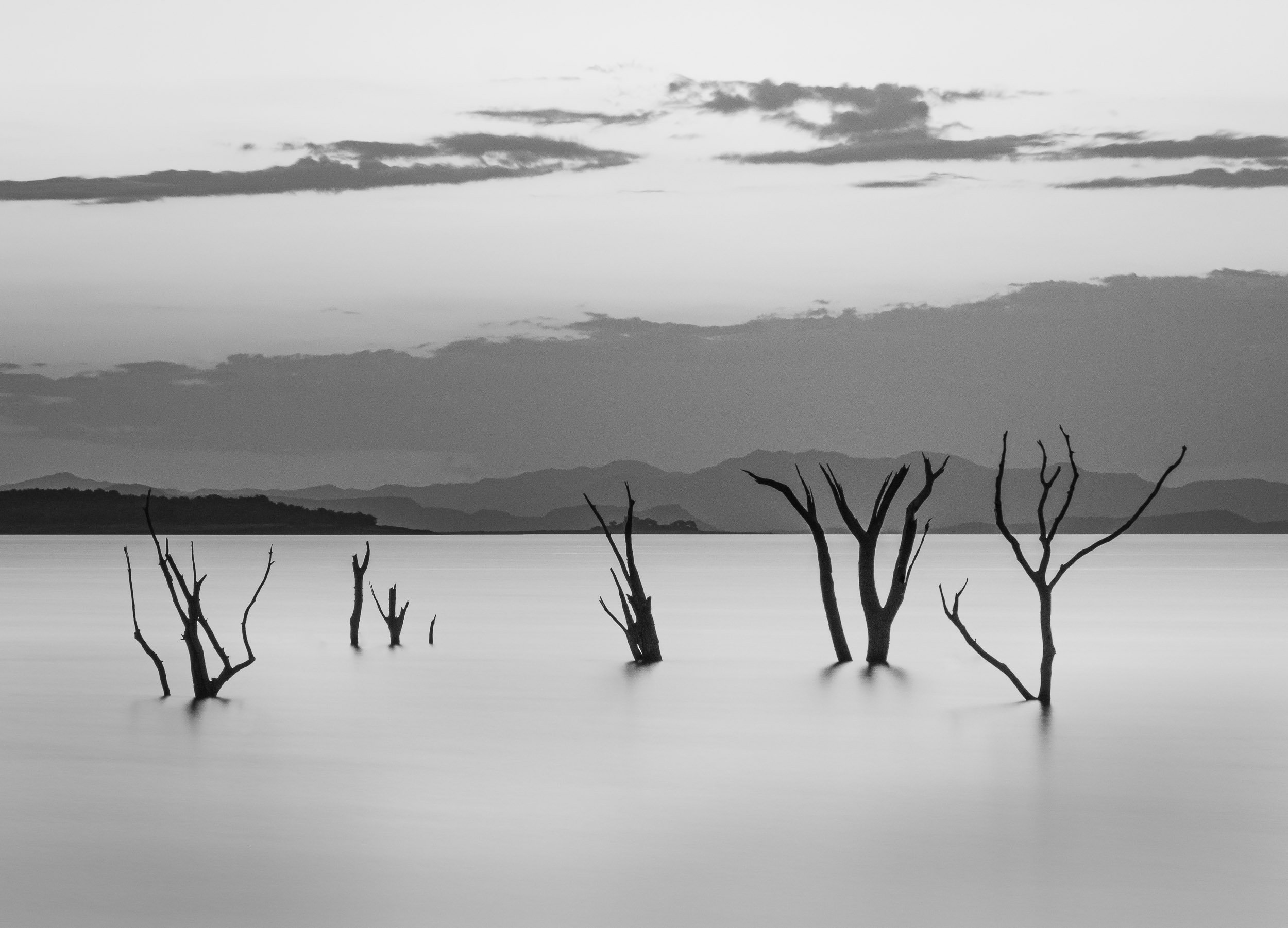

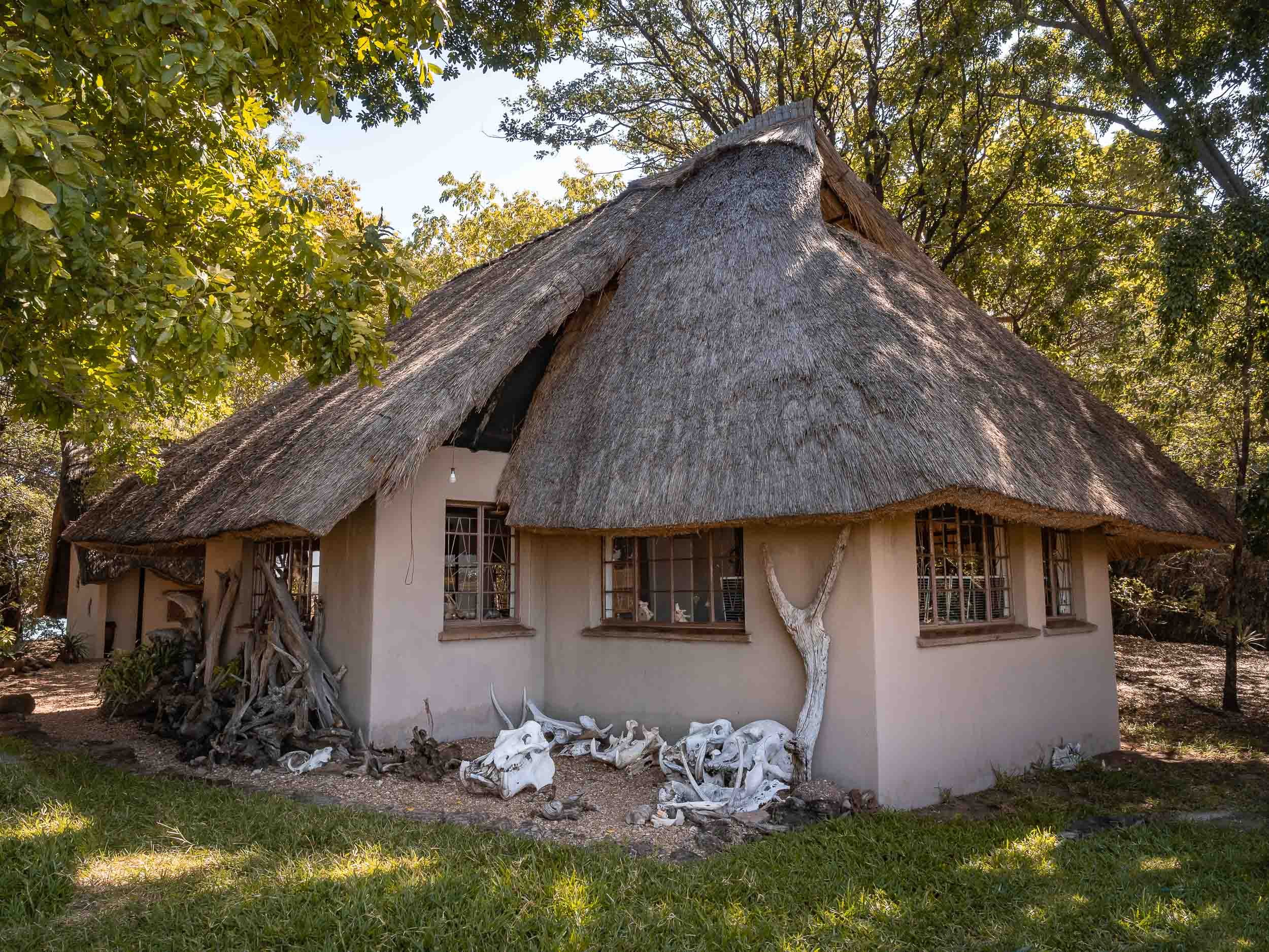
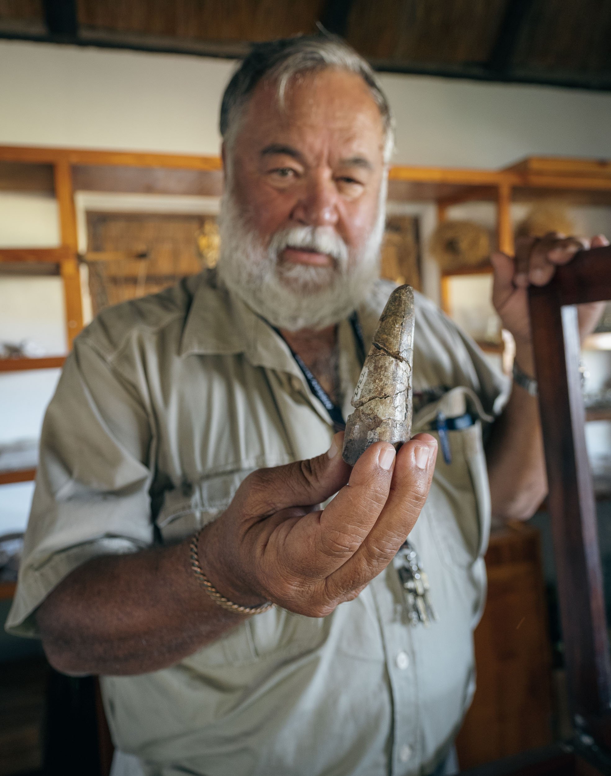
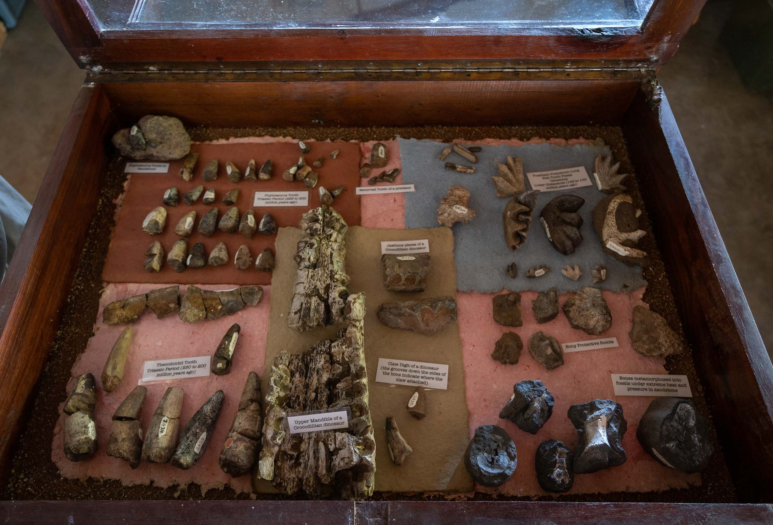
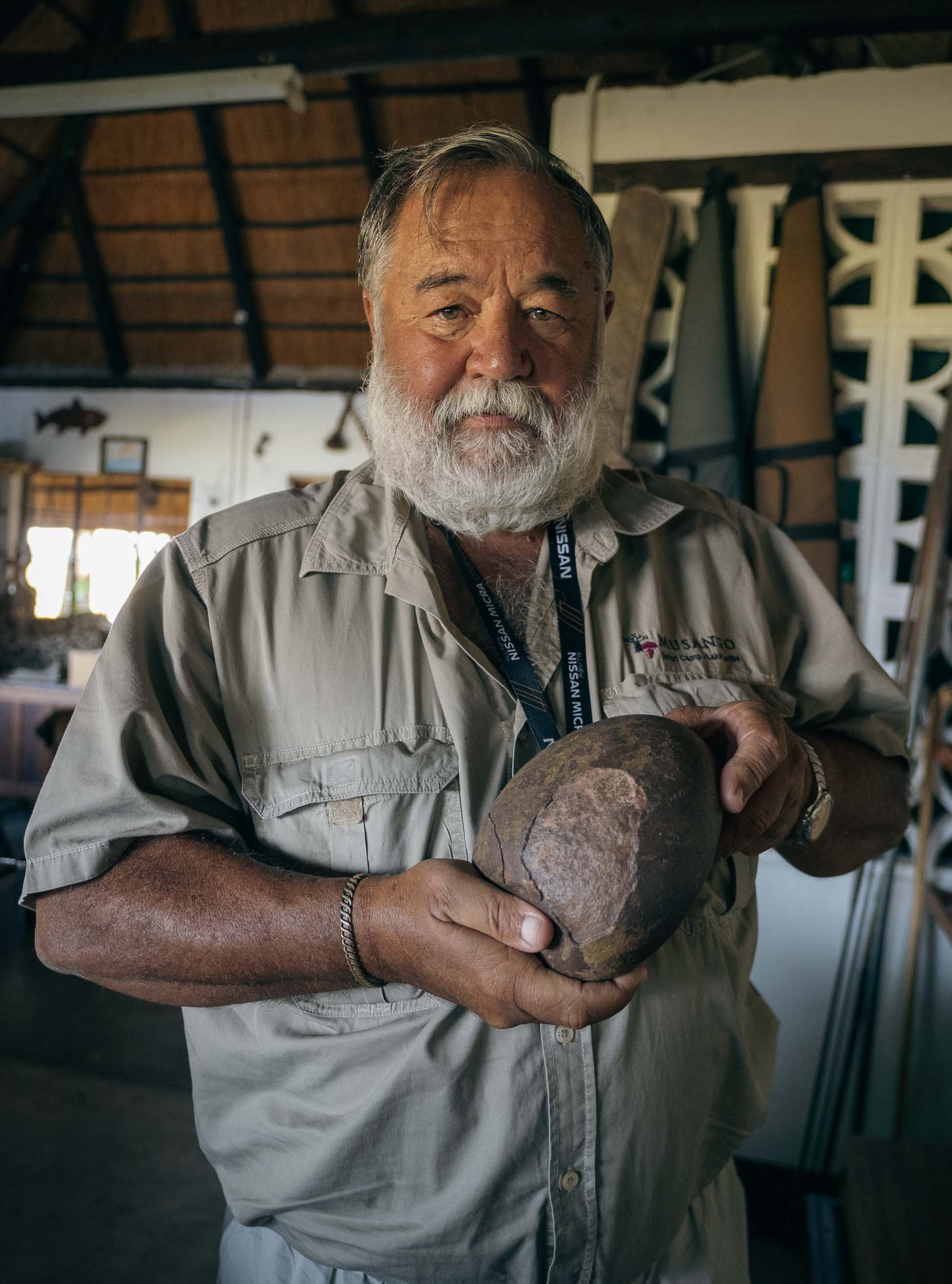
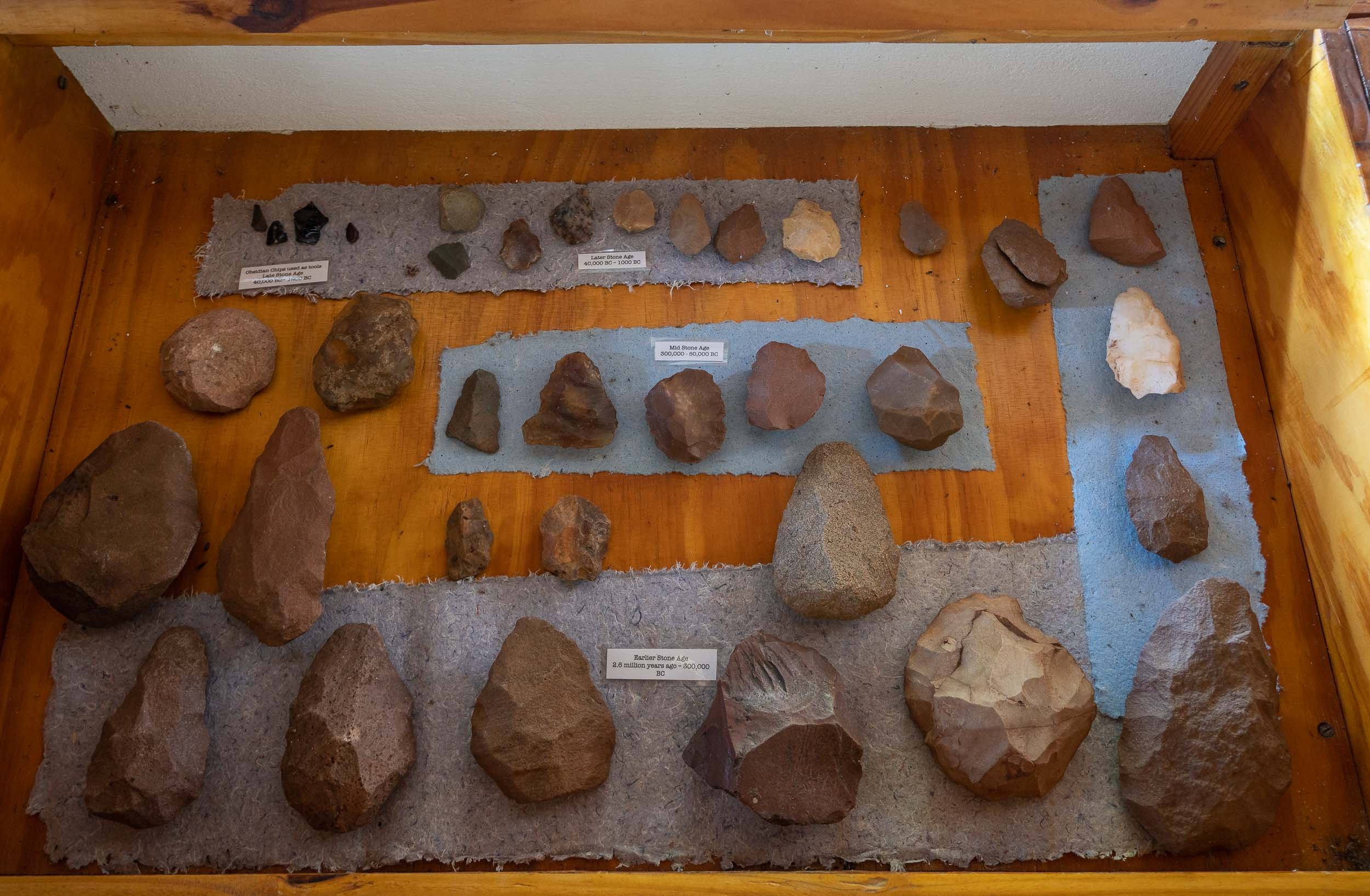
A night at the Falls
Before moving on to Botswana, I had a night at Victoria Falls, my second visit after having explored the Zambian side back in 2011. It is as fascinating now as it was then, and I’m glad to have seen both sides.
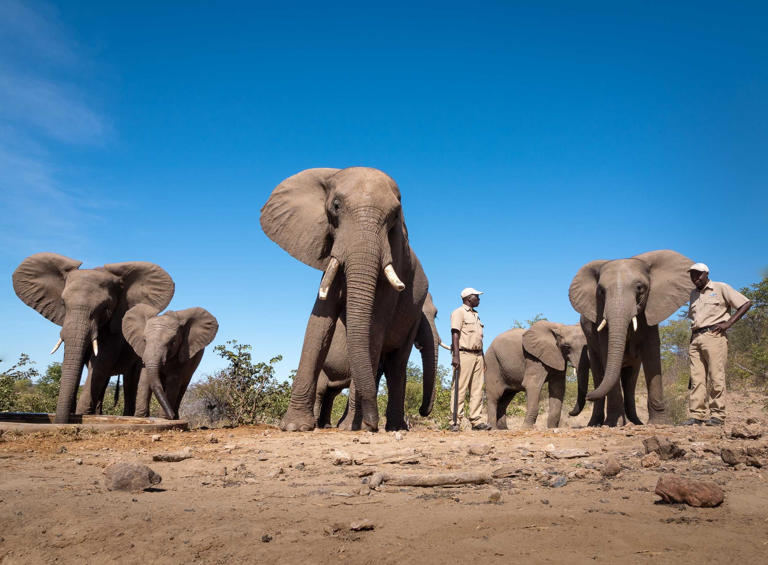
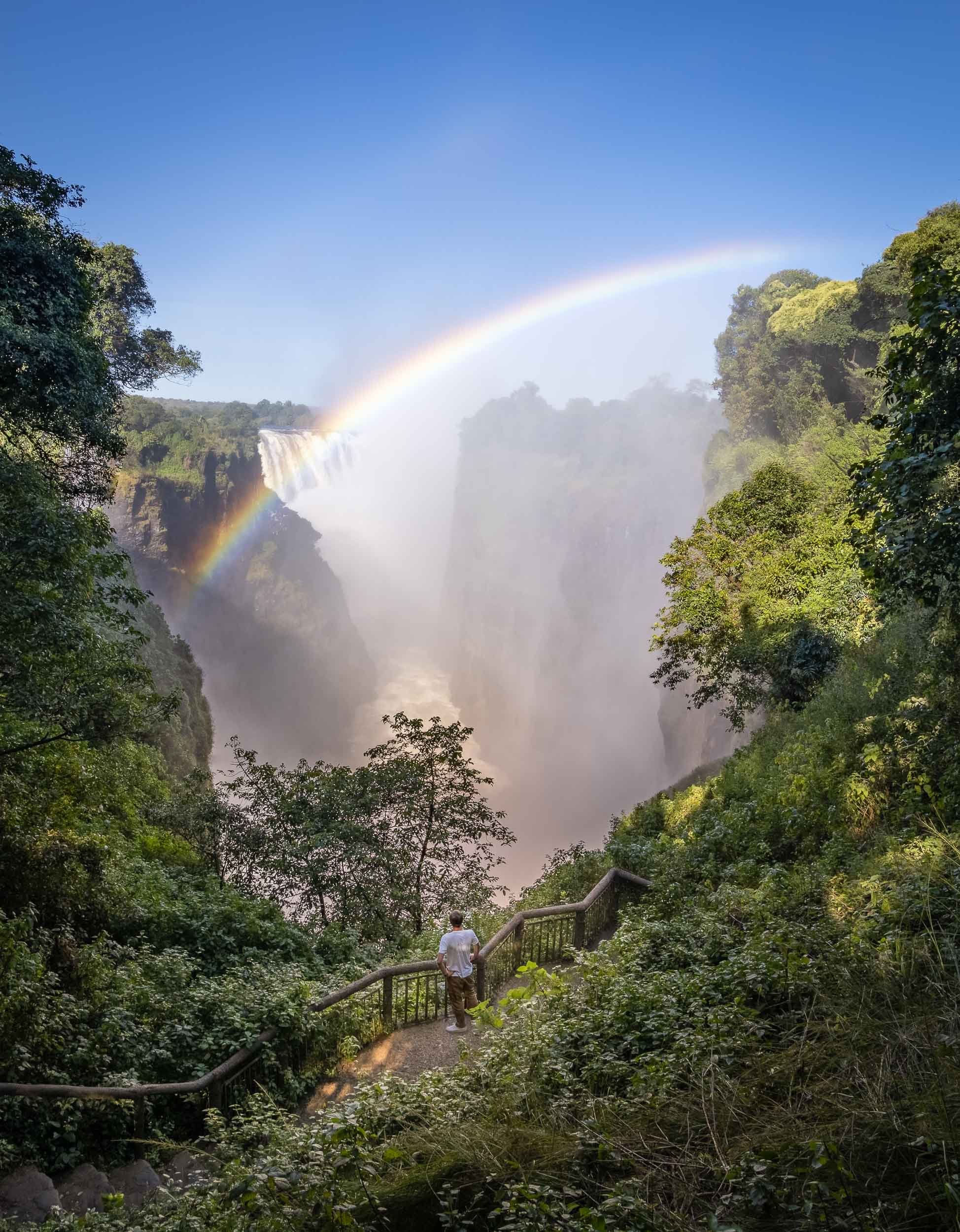
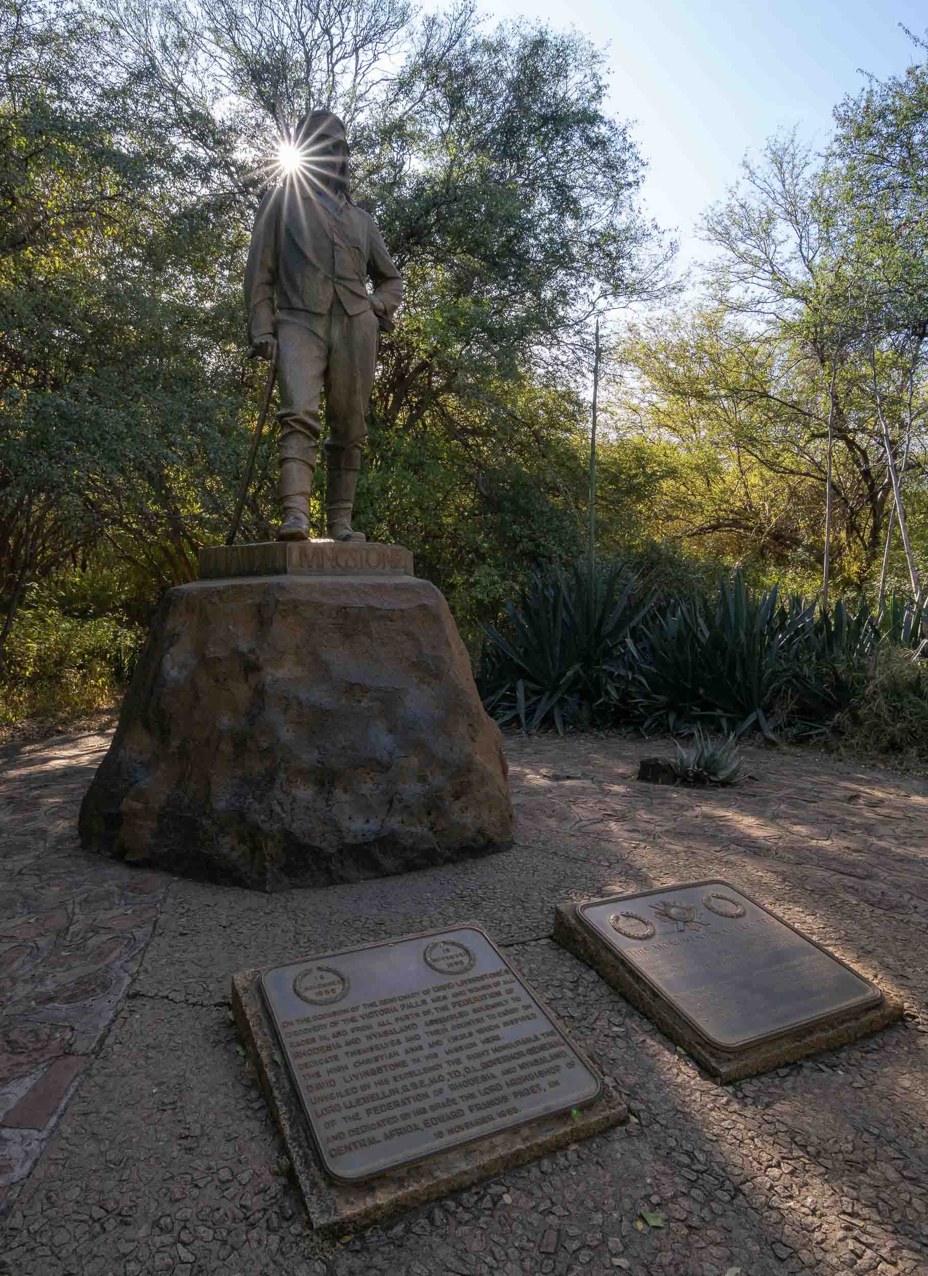

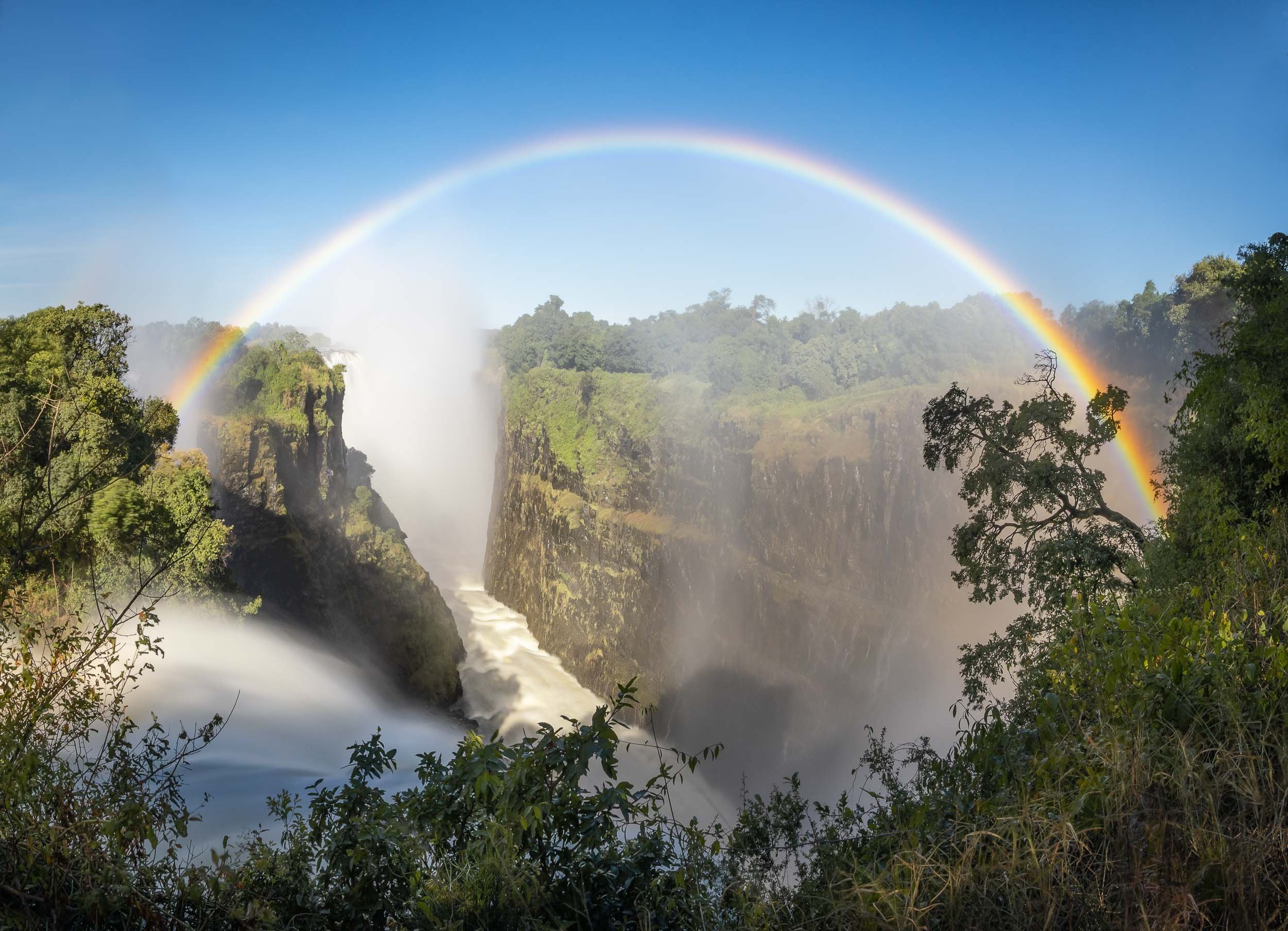
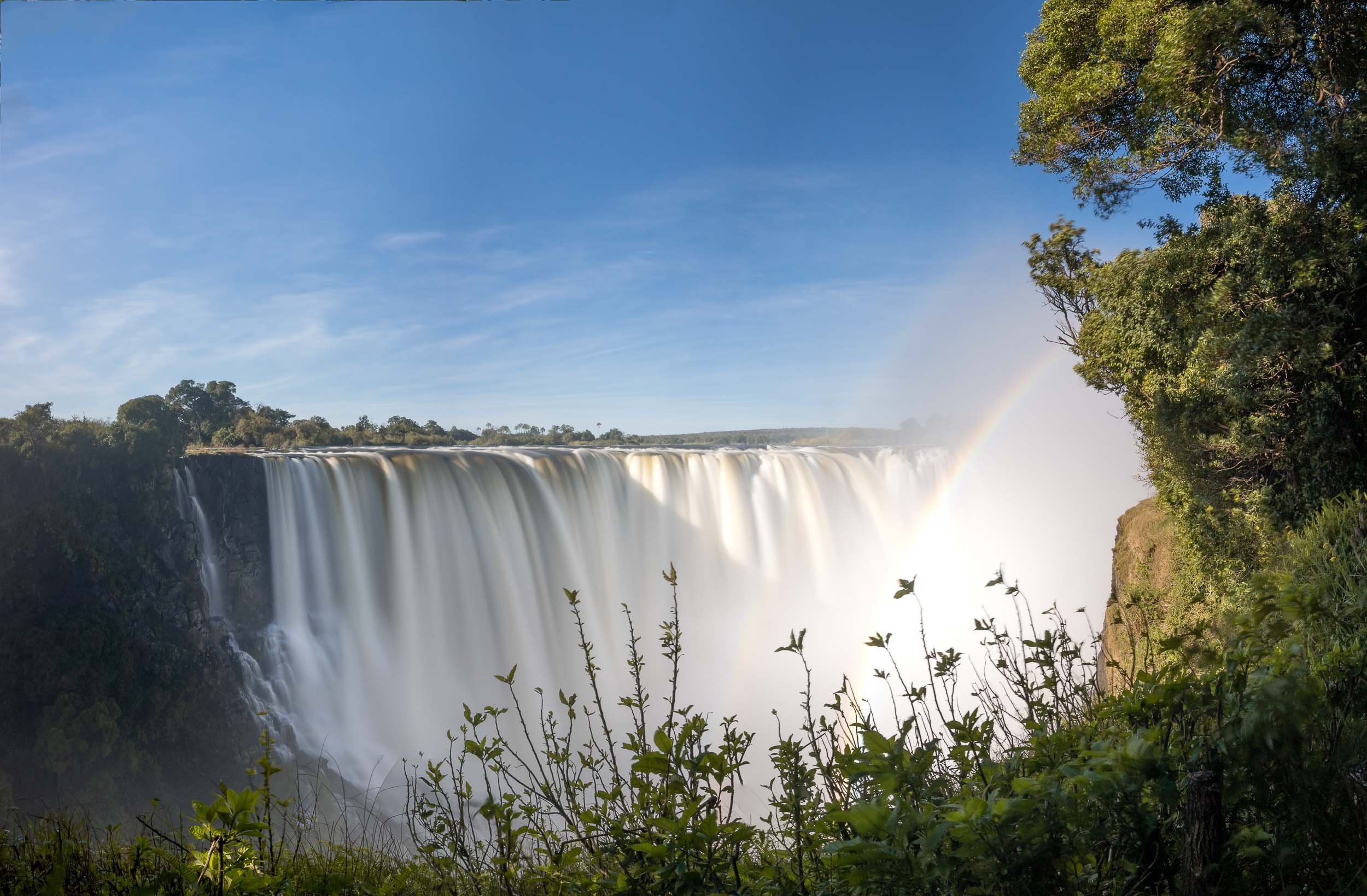
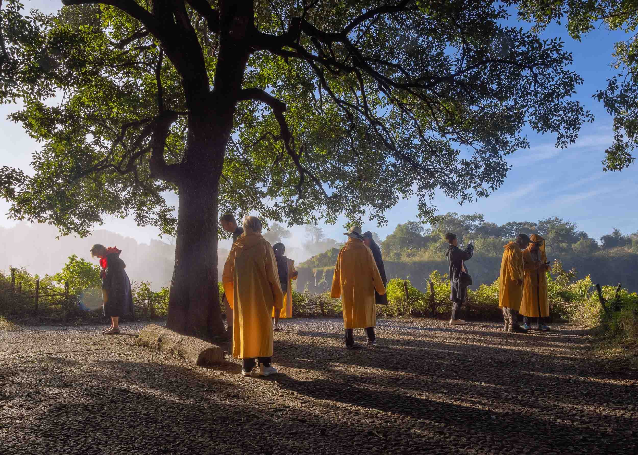
That brings us to the end of my trip through Zimbabwe!

Namibia - The Most Amazing Night Sky, But So Much More
Namibia was the first destination for my two-month-seven-country Africa trip, and maybe the one I was most excited about.
Namibia was the first destination for my two-month-seven-country Africa trip, and maybe the one I was most excited about.

This part of the journey was organised by https://www.stefanliebermann.de, Sony Ambassador for Germany as a 12 day workshop in collaboration with Richard Morsbach, a local tour guide.
The trip was focused on astrophotography, as Namibia has some of the best dark skies in the world and the Milky Way was visible all night during new moon. We did however also have the opportunity to take some daylight cityscape, sunrise and sunset, wildlife, and landscape images.
Namibia is incredible and definitely a destination I’d come back to. Read on to find out what you can see in this country, and the photos I captured to document it.
You can also head over to my Instagram (www.instagram.com/djflore) and check my Story Highlights for a bit of background info.
The Quiver Tree Forest
Our first destination after flying into Windhoek was the Quiver Tree Forest, north-east of Keetmanshop, where we arrived just in time for sunset after a 5h drive and lunch break.
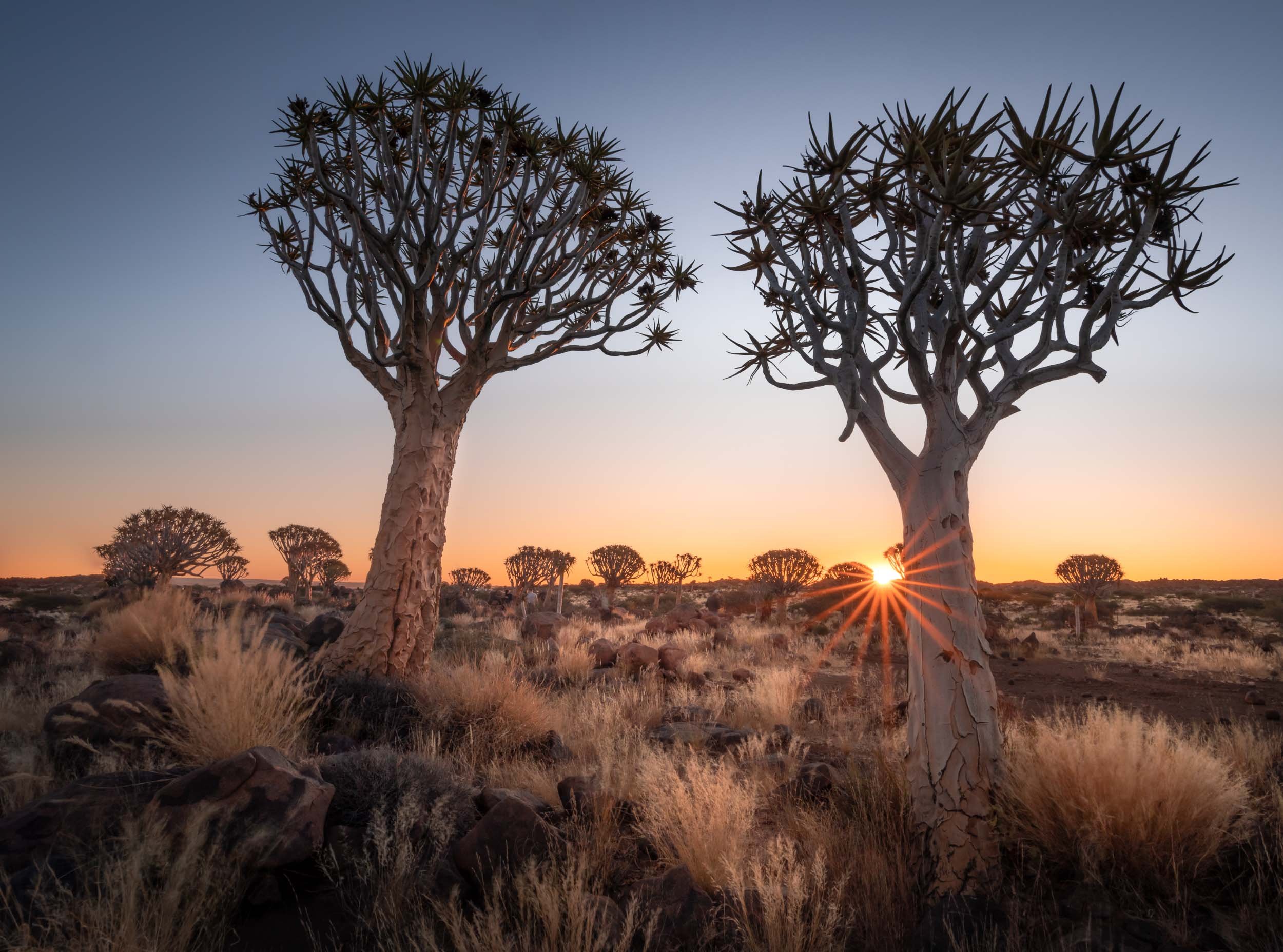
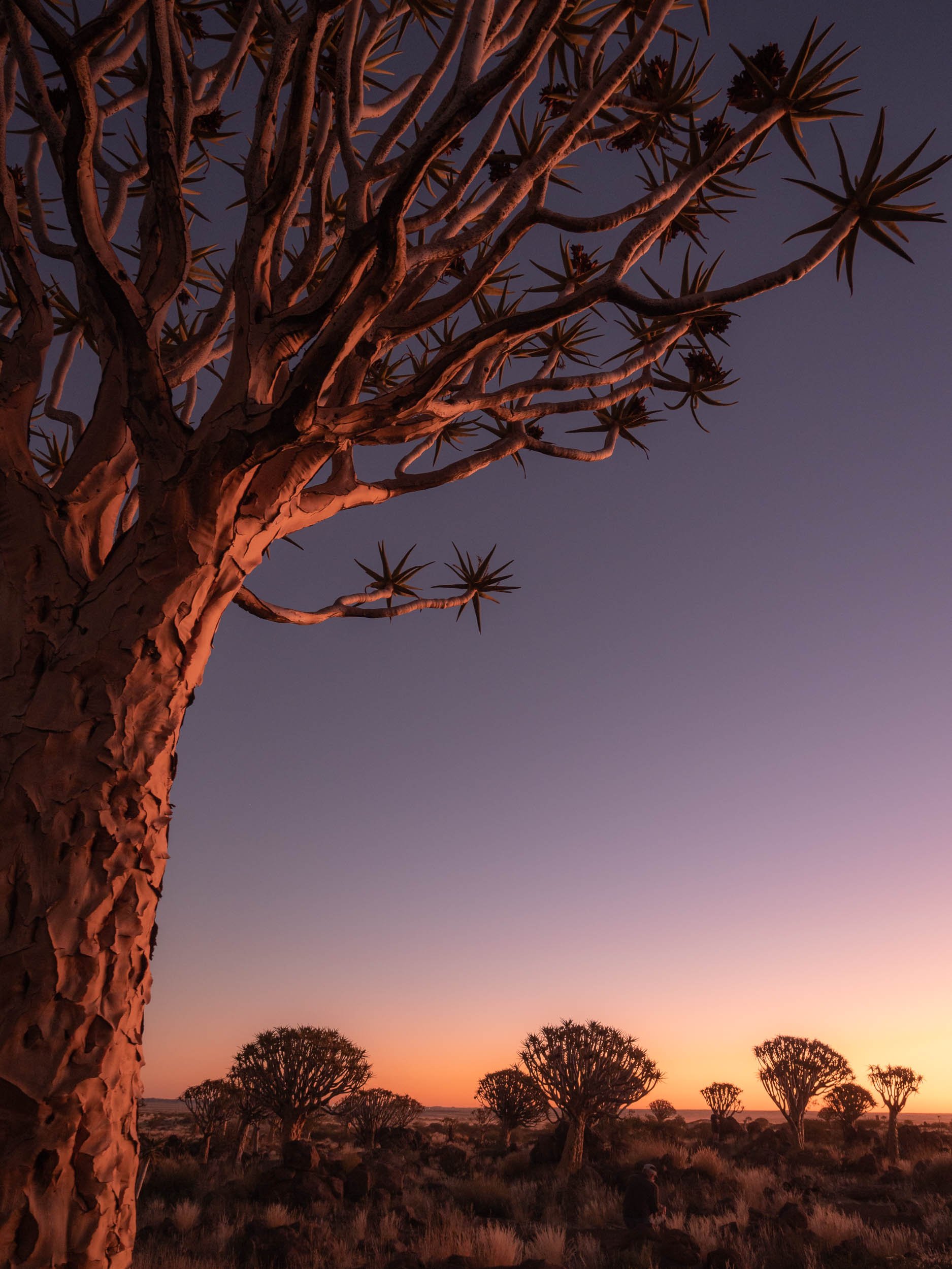
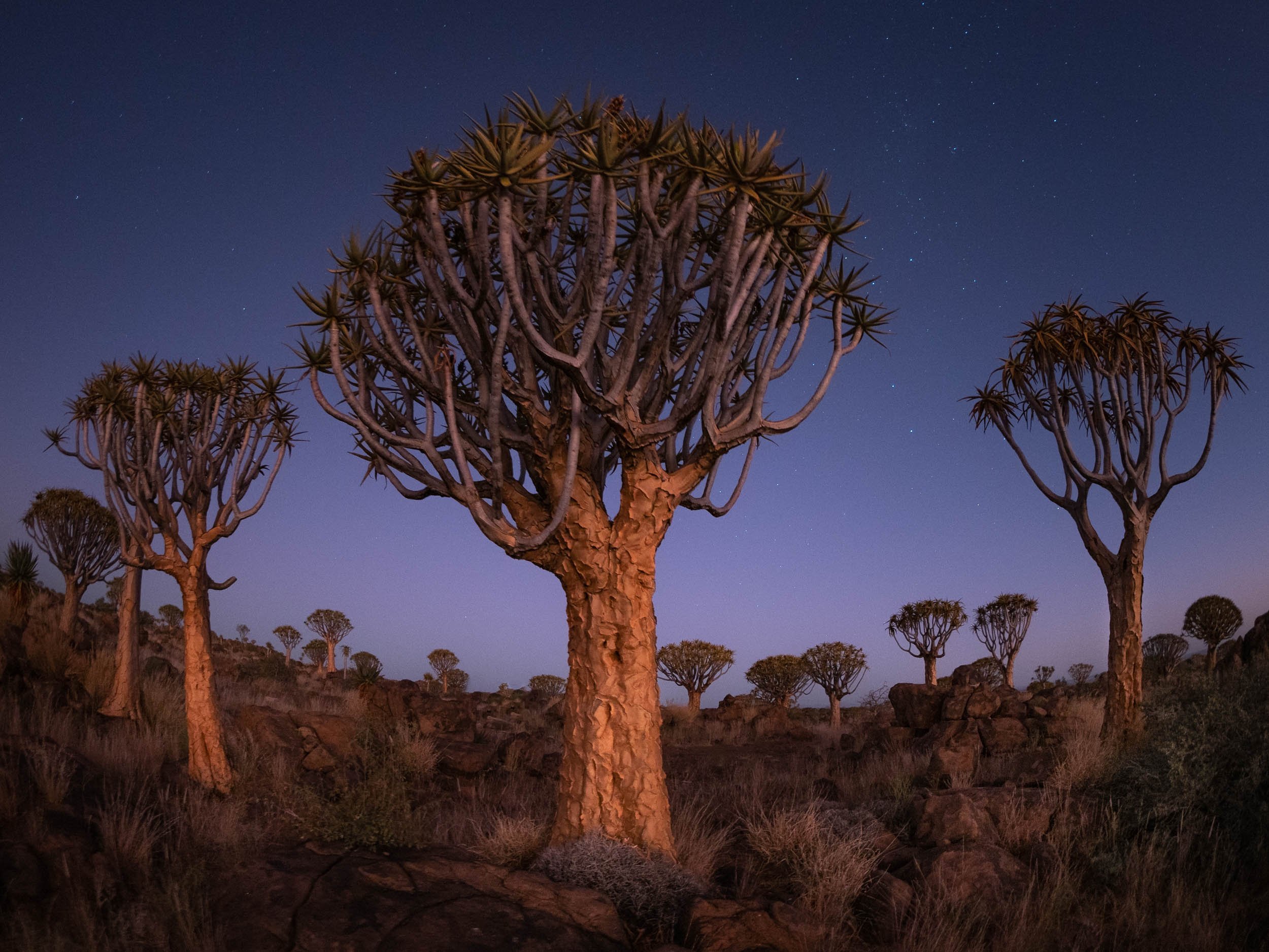

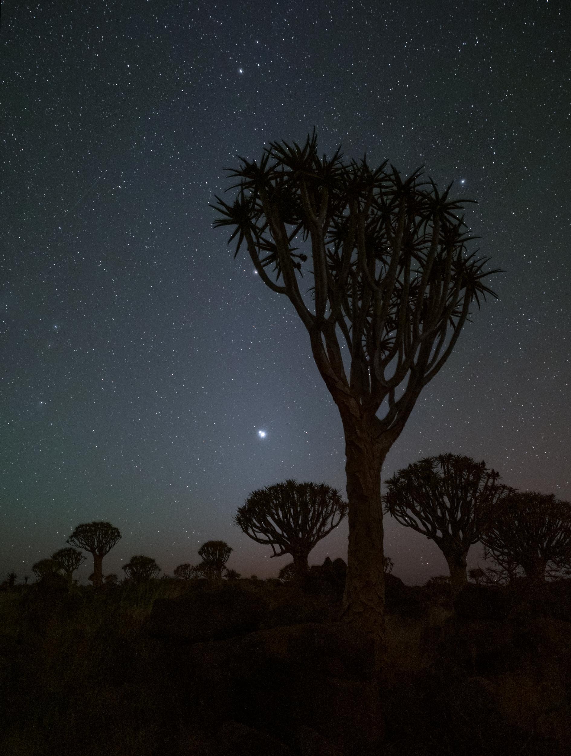
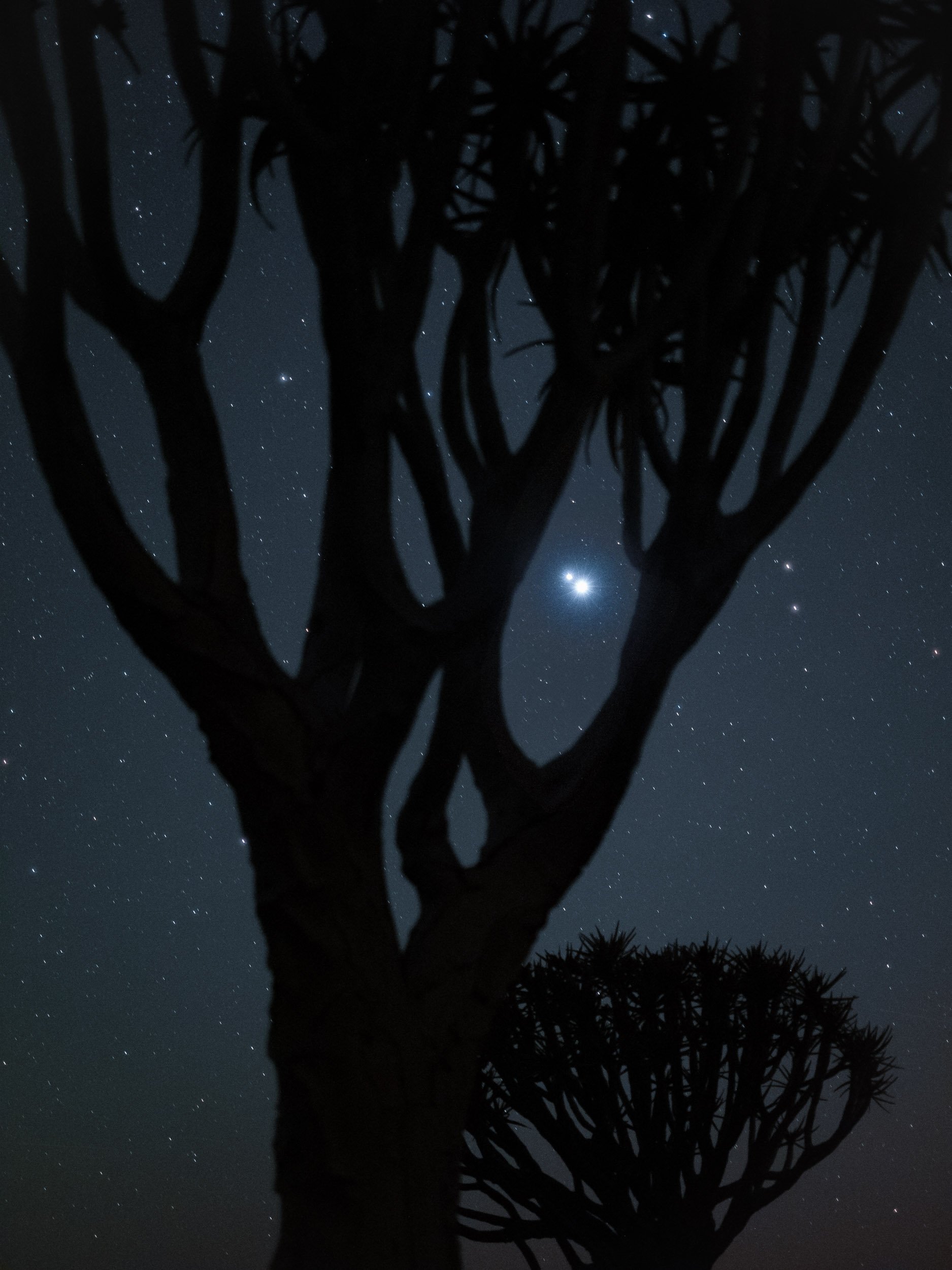

Onwards
After a sunset, night, and sunrise at the Quiver Trees, we moved straight on to the next spot., Fish River Canyon for a night, and then into Lüderitz, one of the country’s most famous towns.


The Abandoned Town of Kolmanskoop
About 10km from Lüderitz you can find one of Namibia’s most popular destinations - a ghost village!
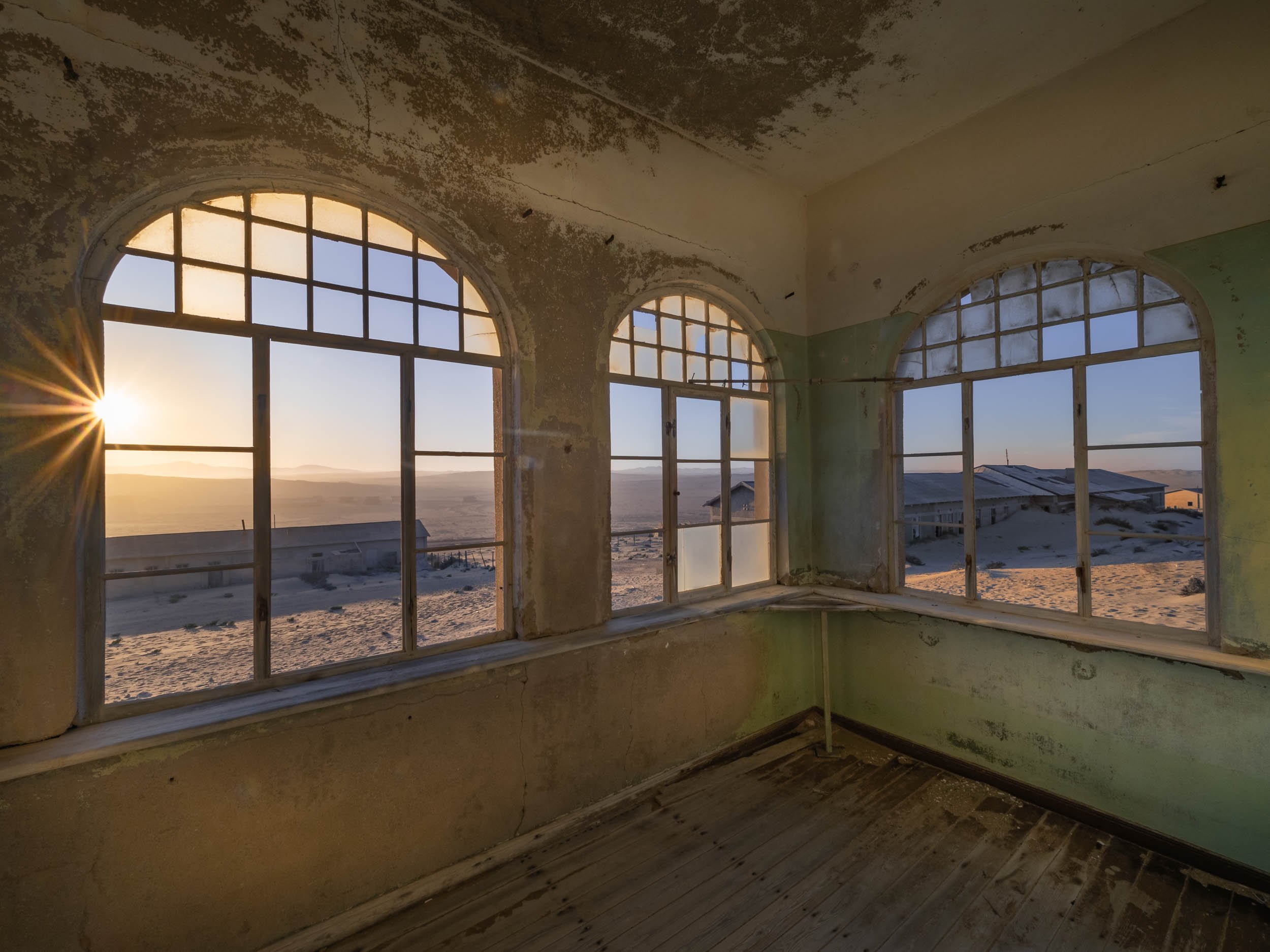
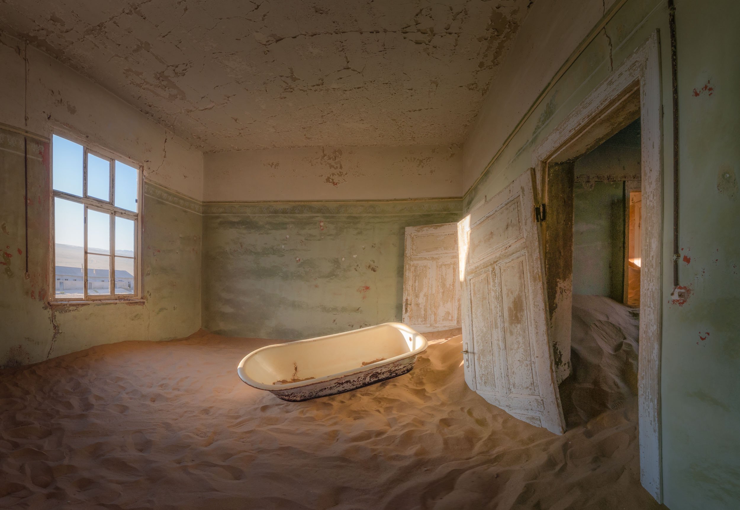

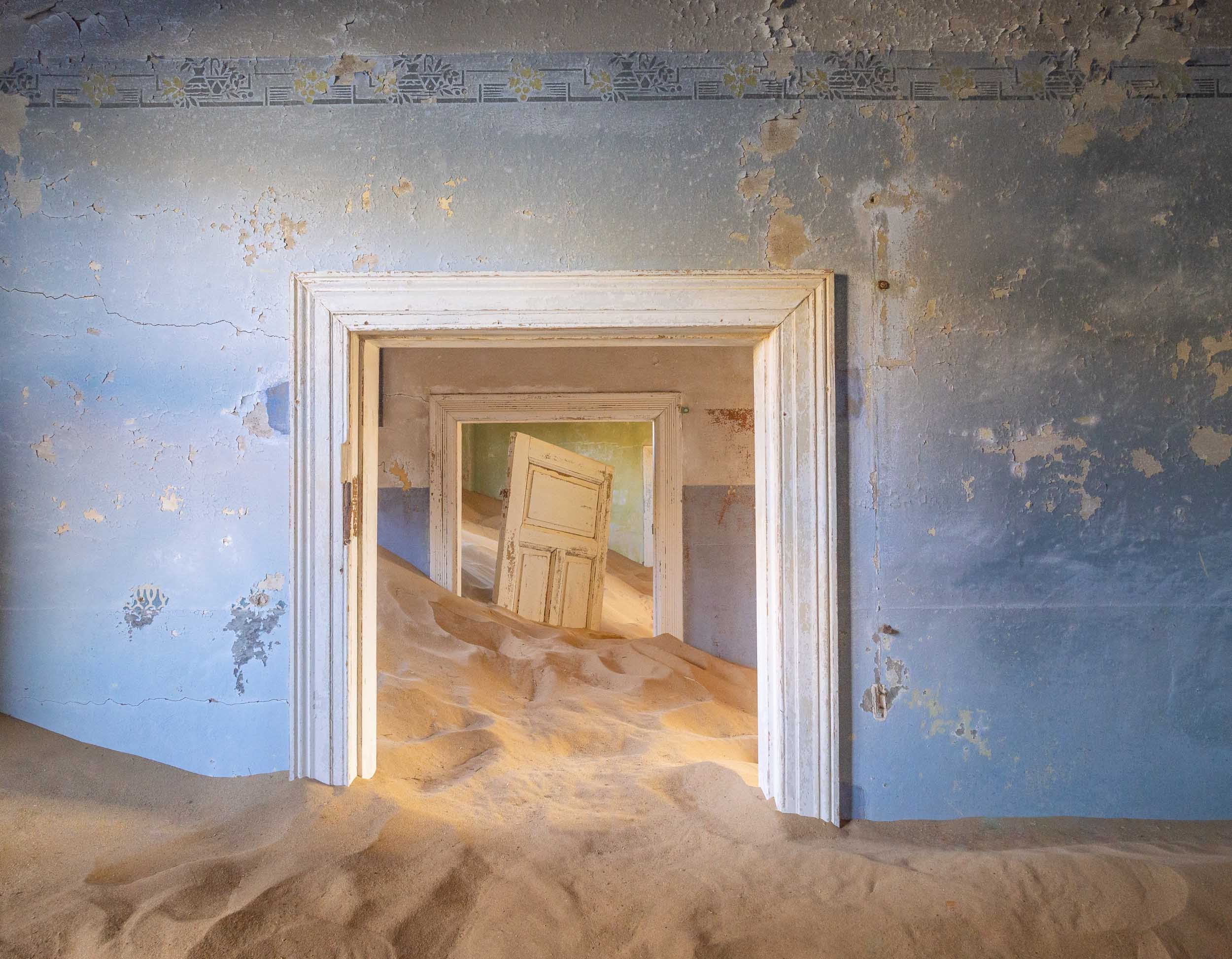
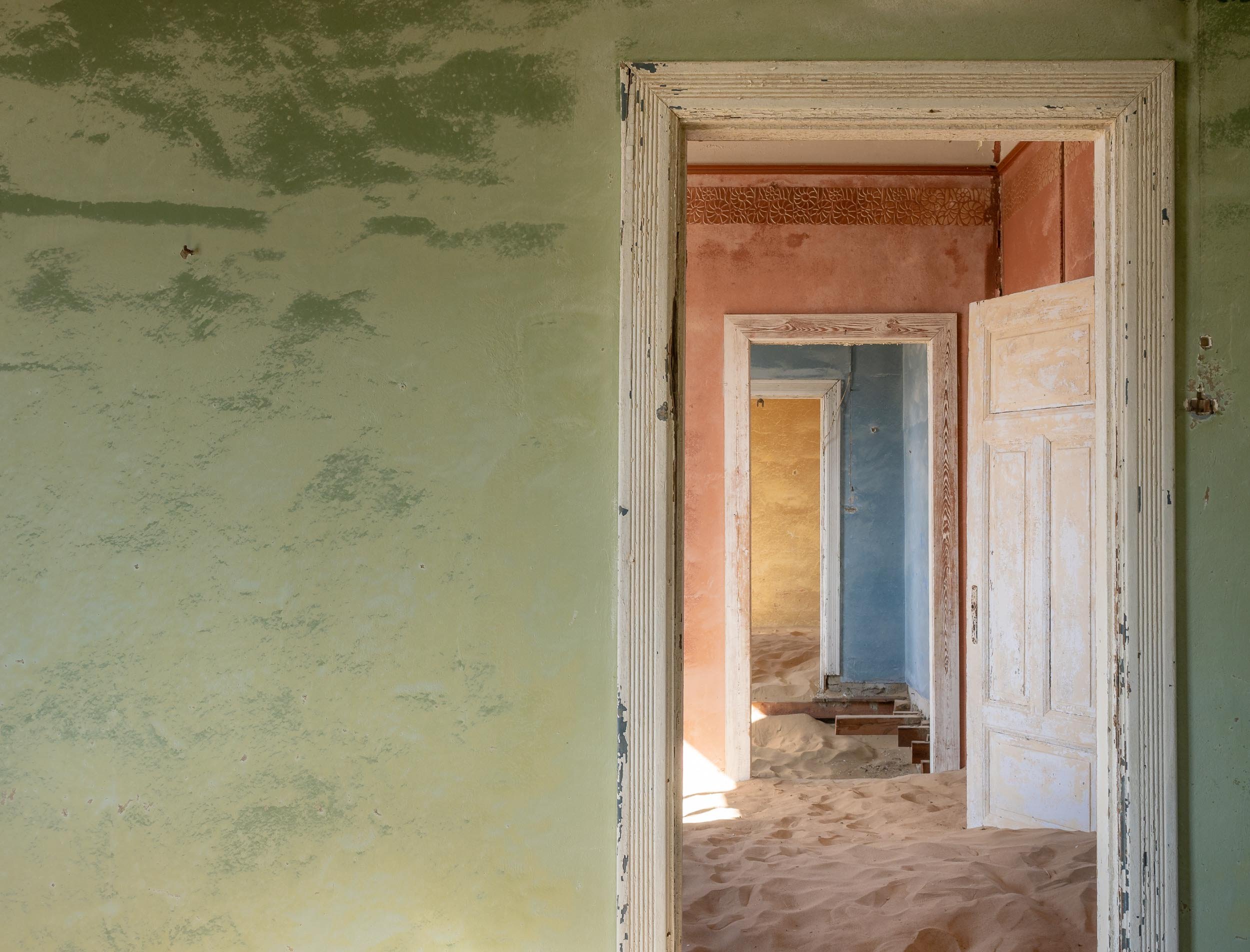
Onwards to Sossusvlei
After Lüderitz and the abandoned town, our next destination was the famous dunes of the Namib Naukluft National Park a bit further north of the country.
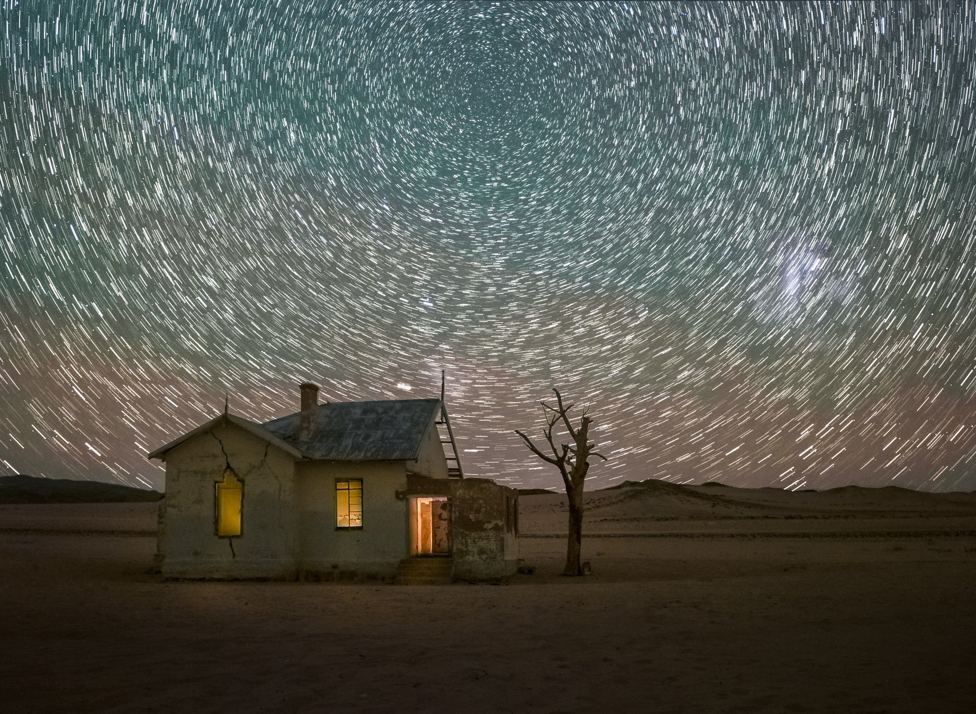
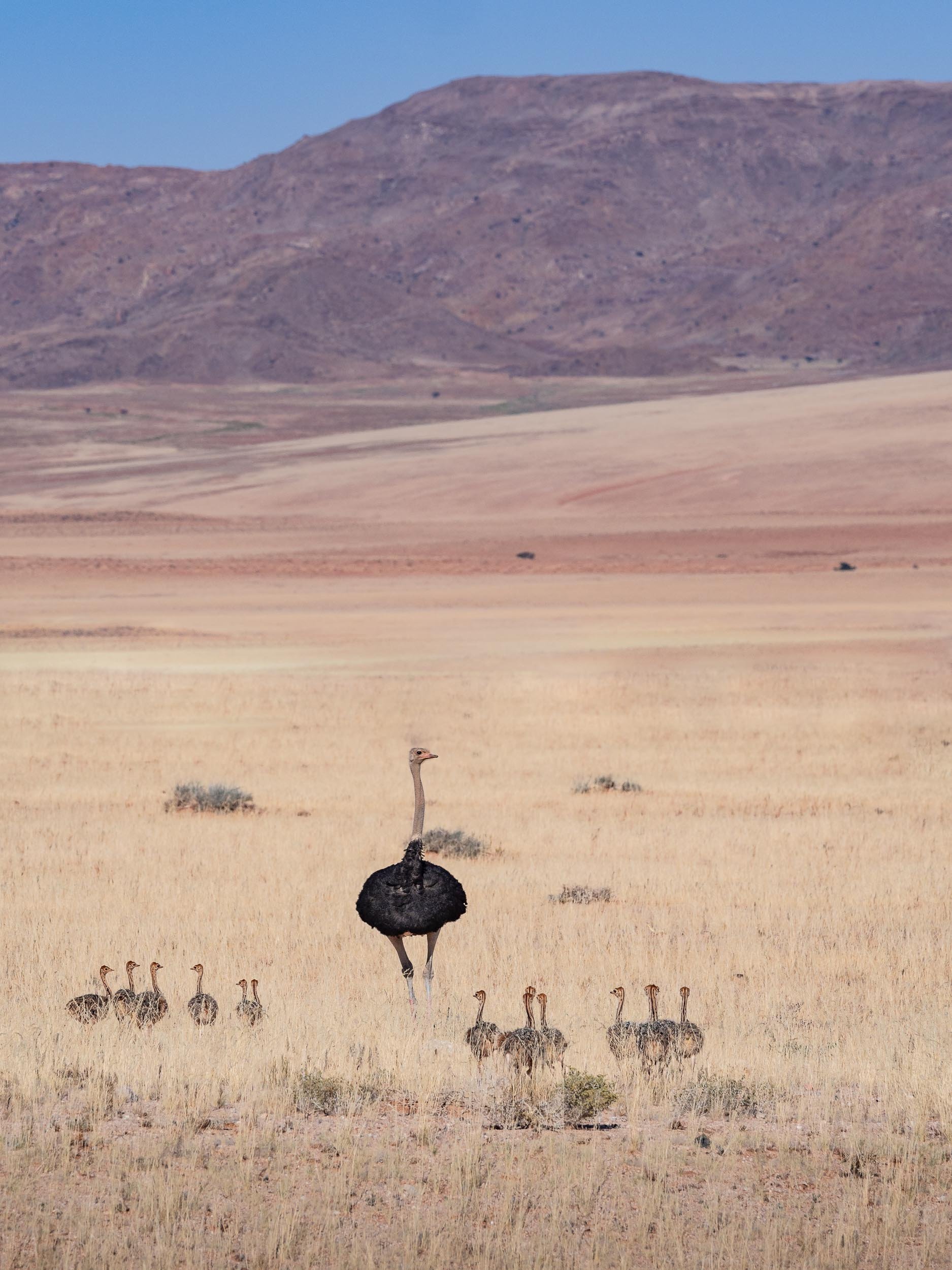
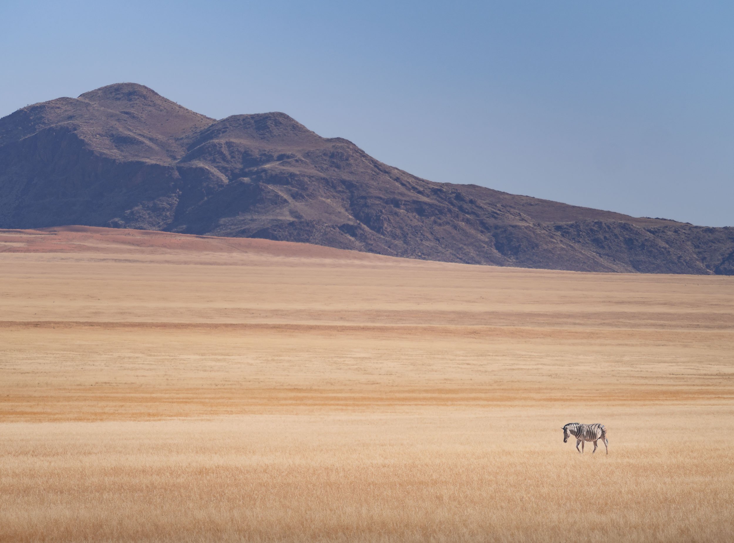
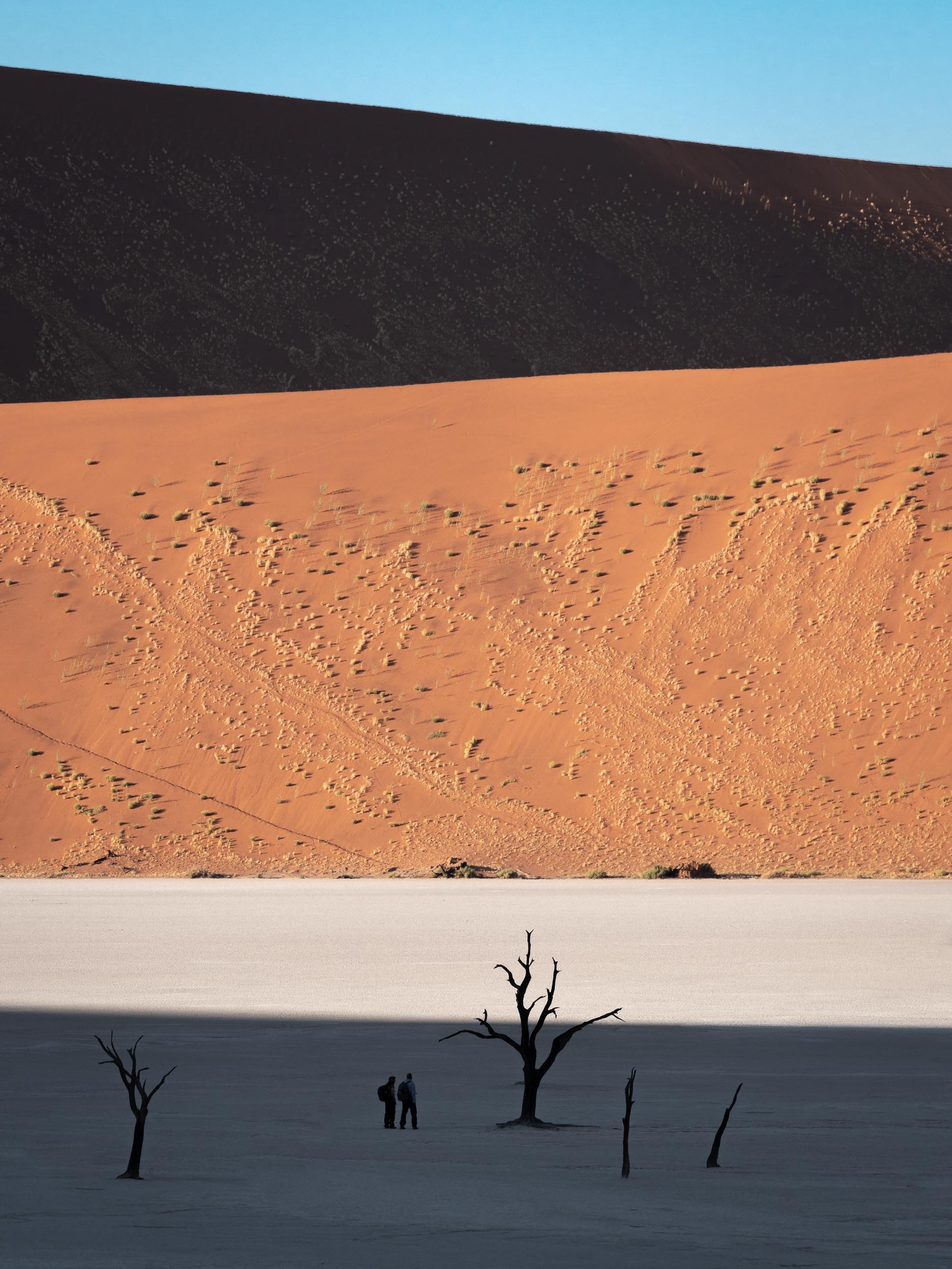


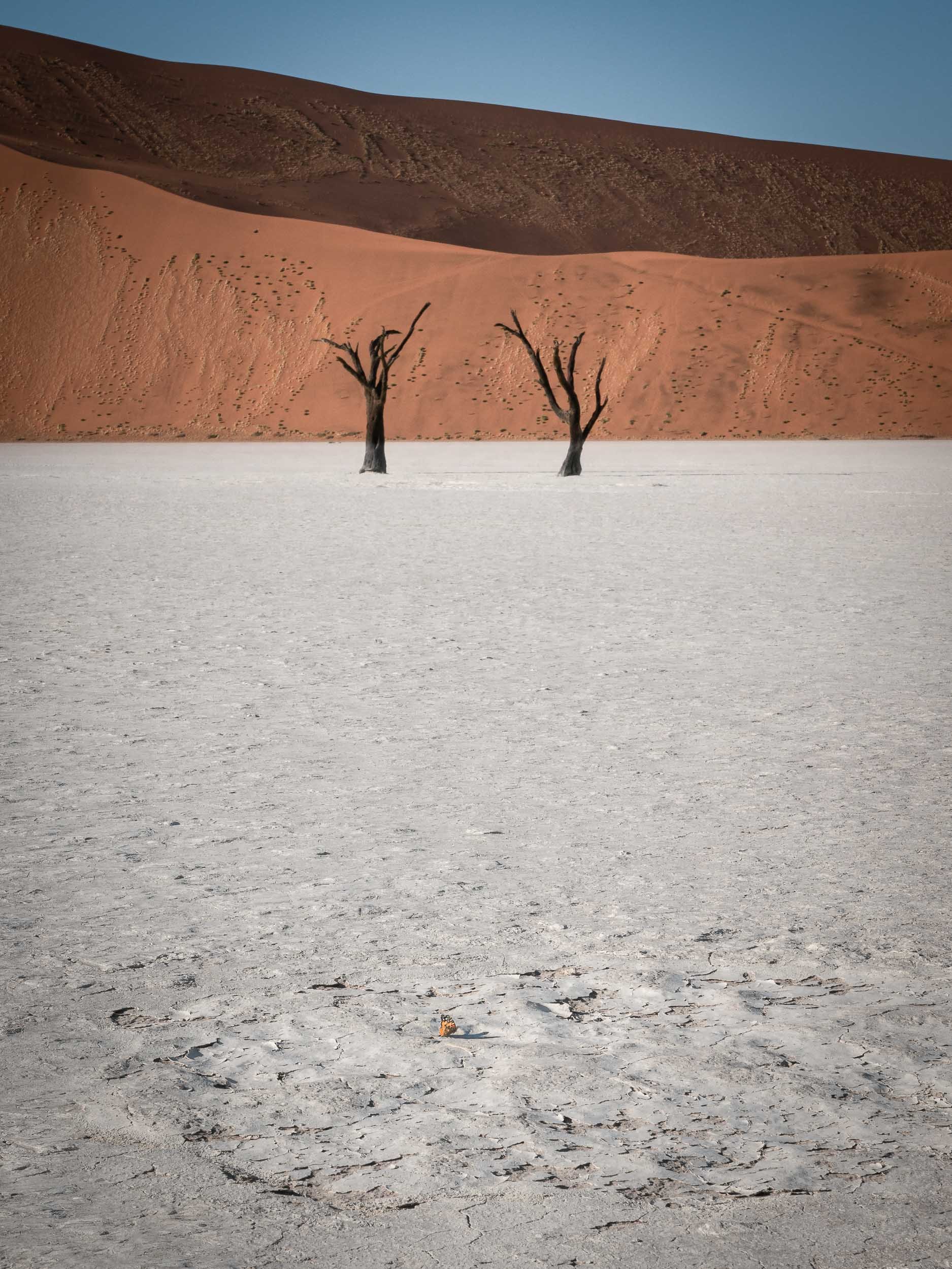
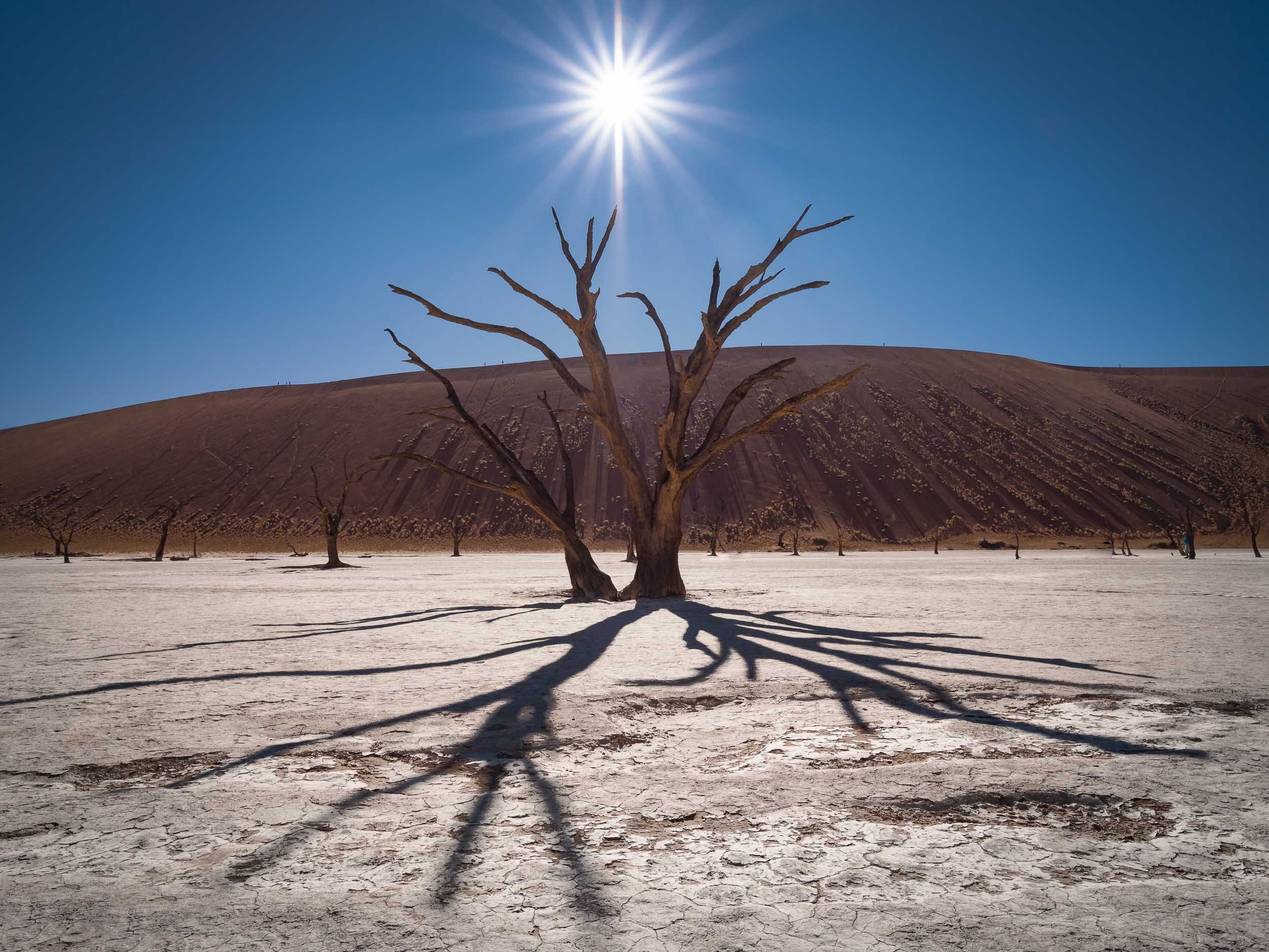
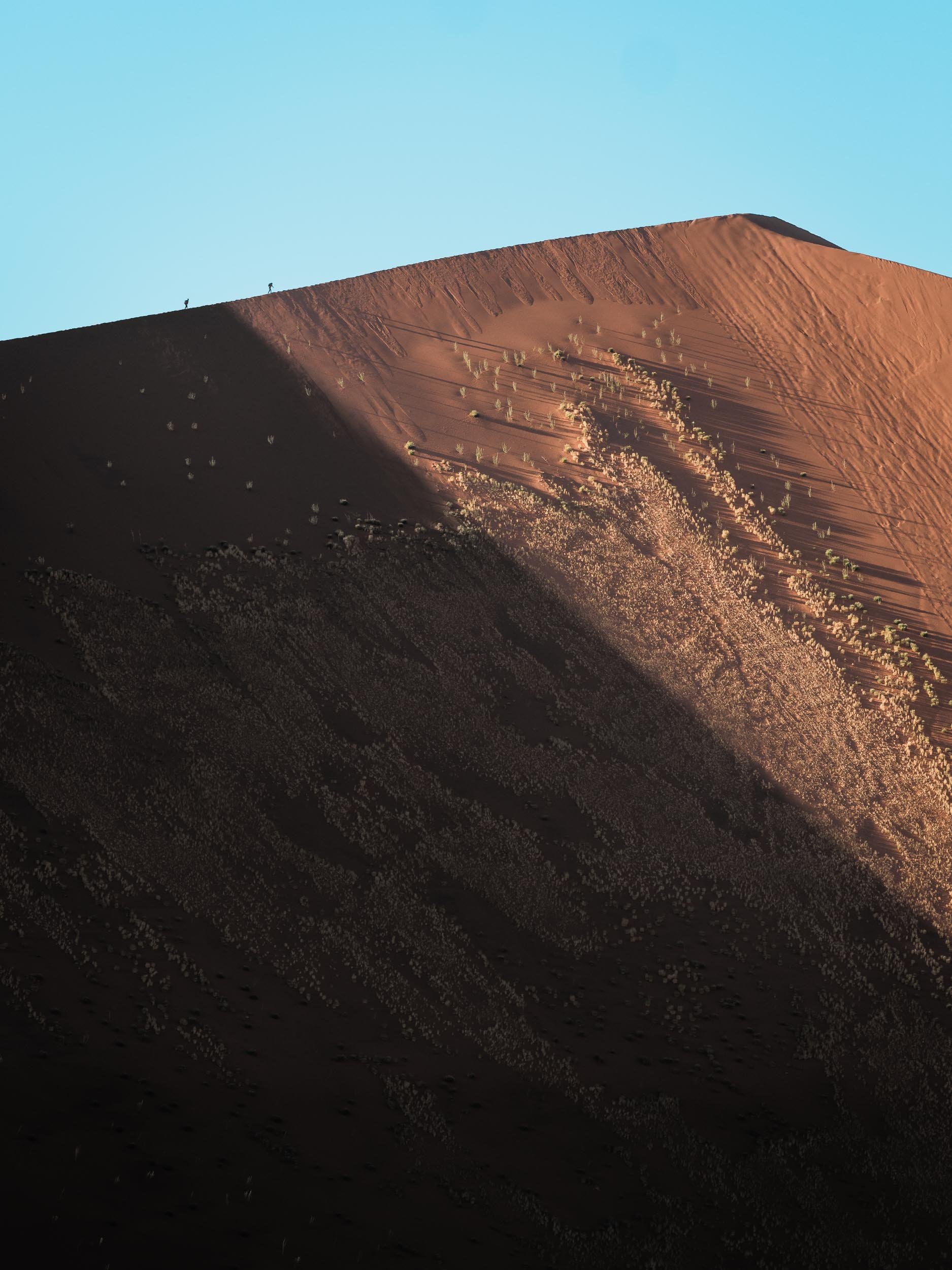
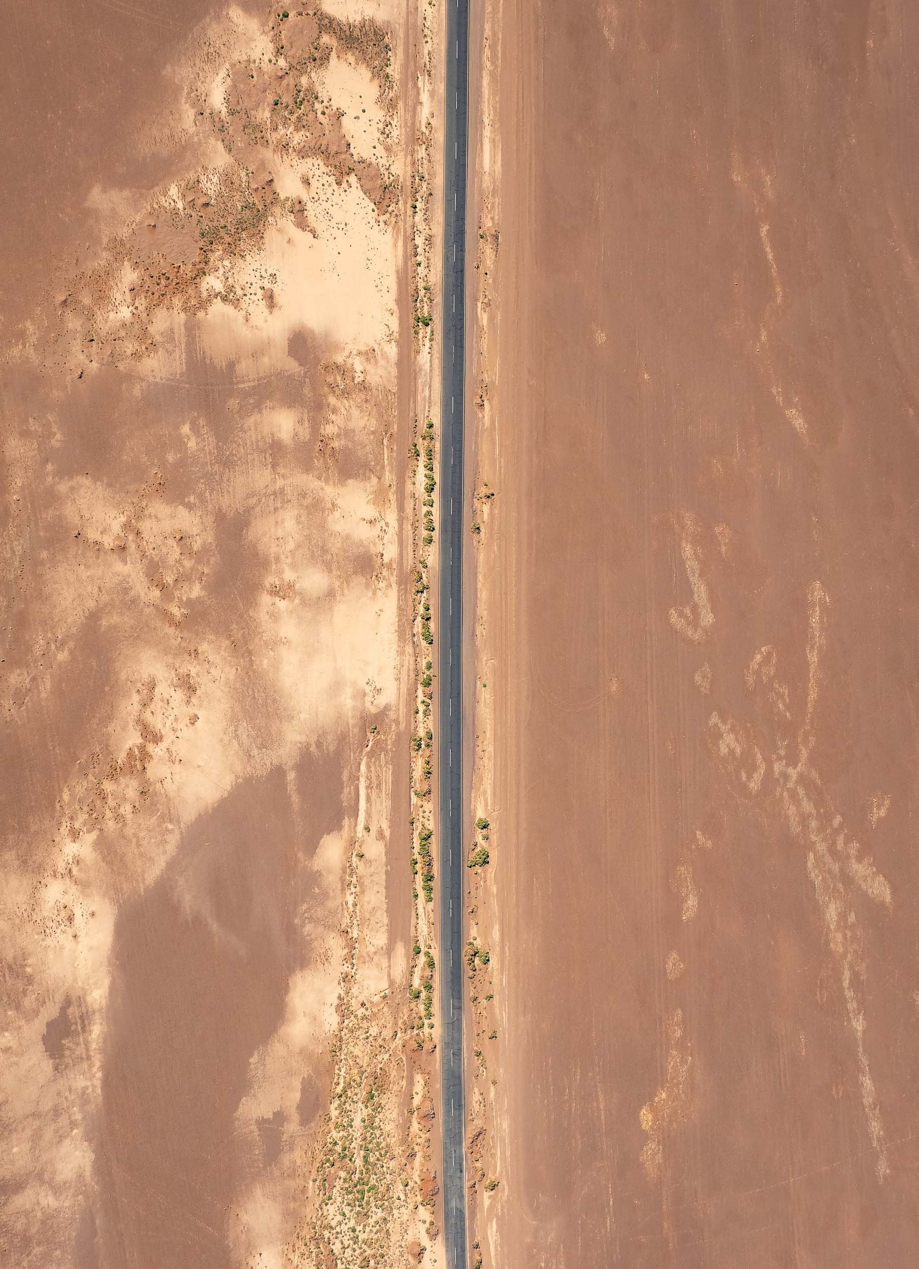
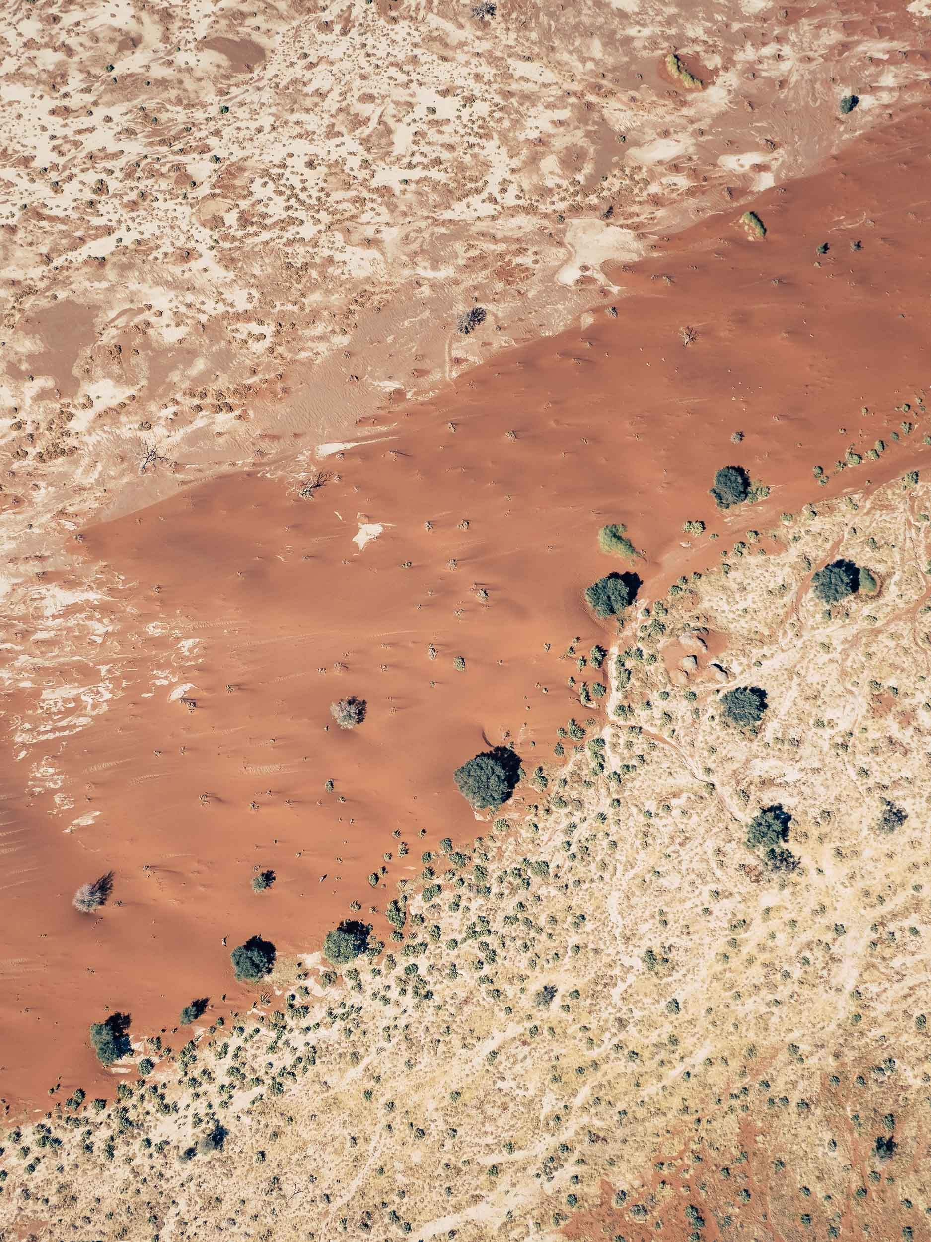

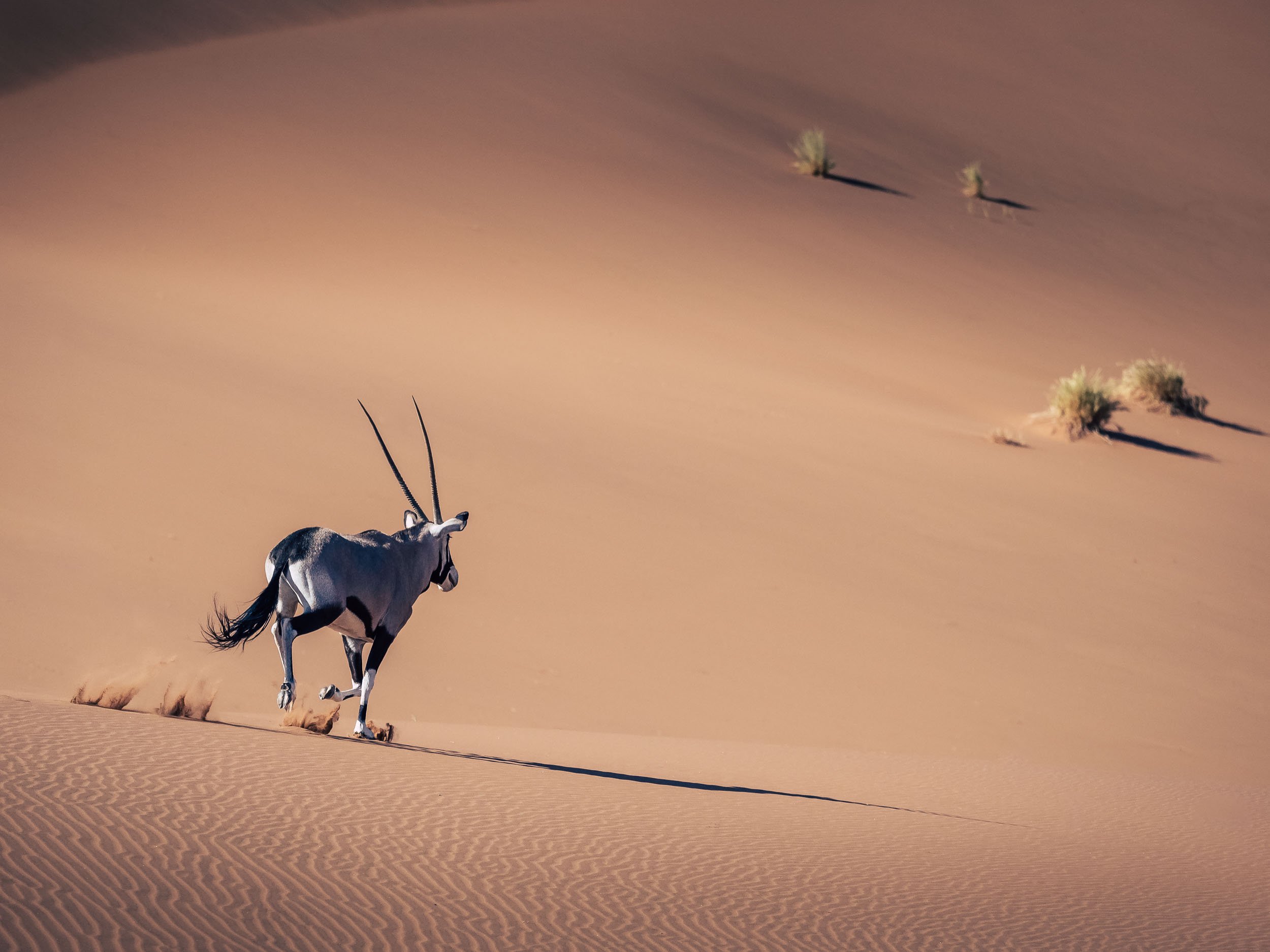
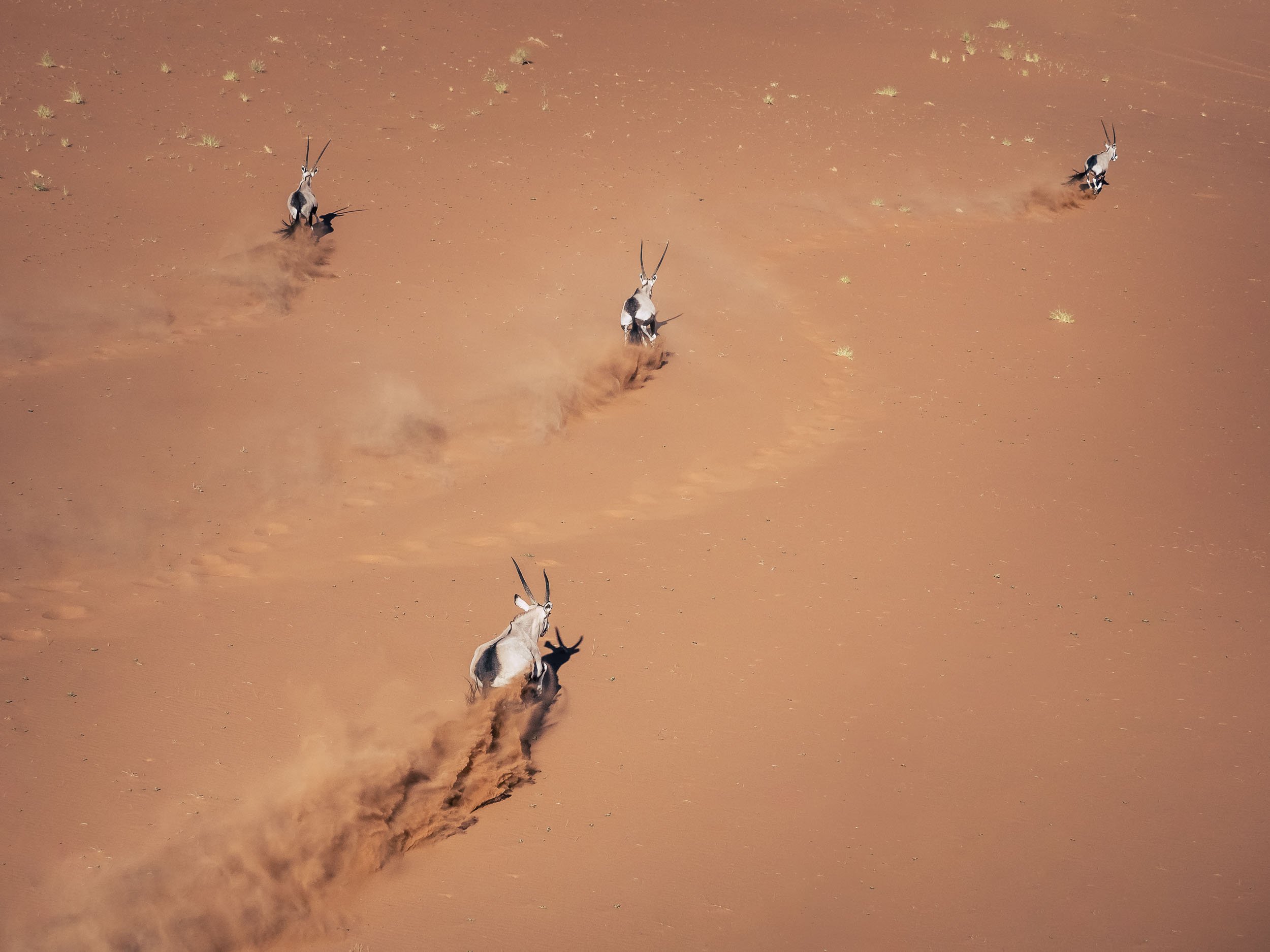
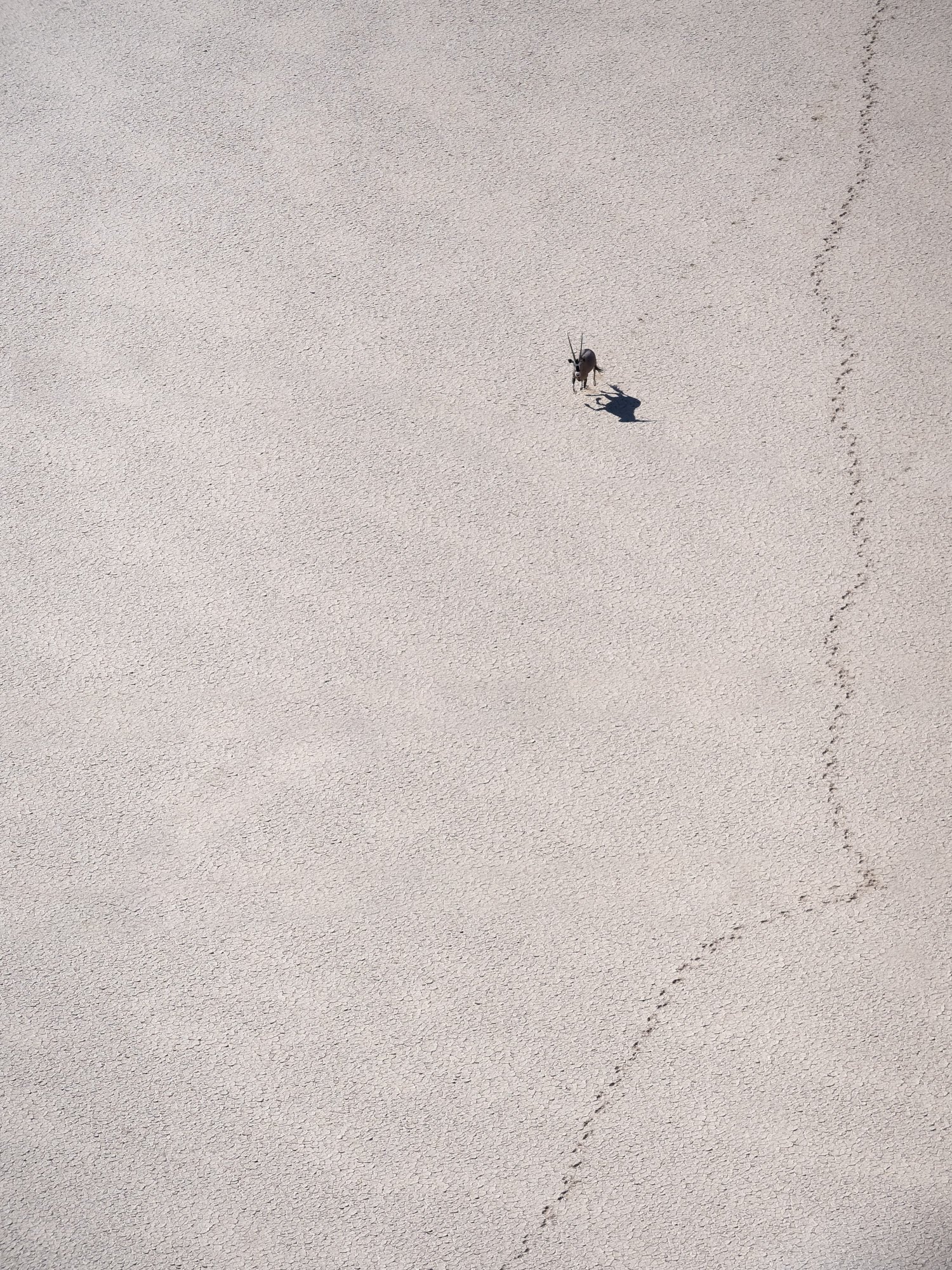

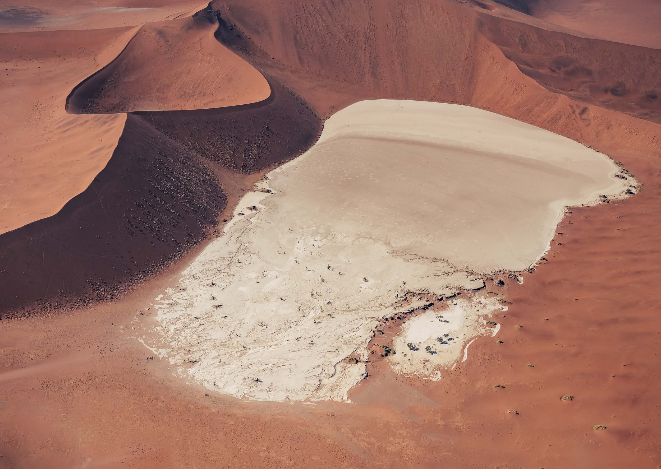
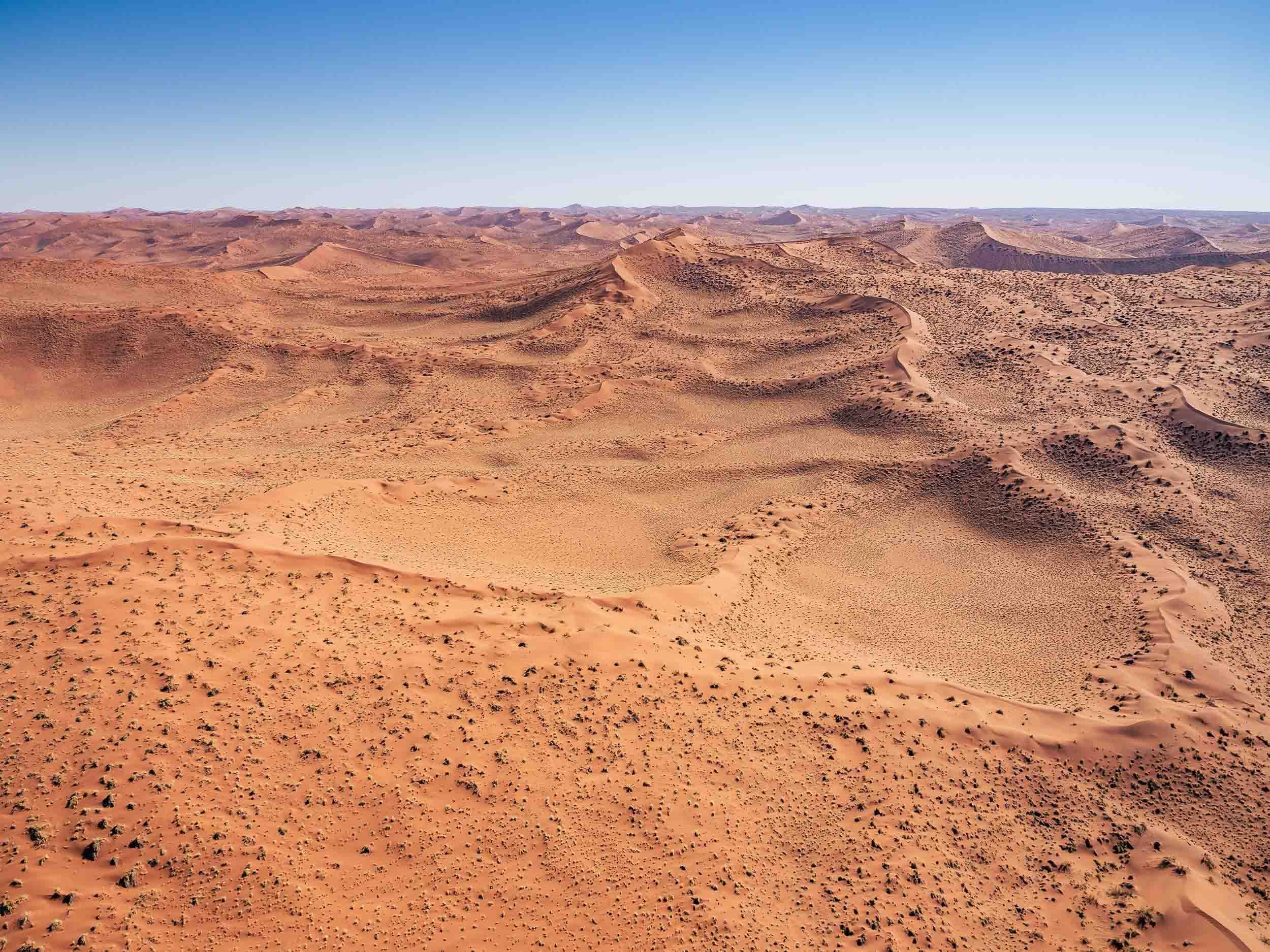
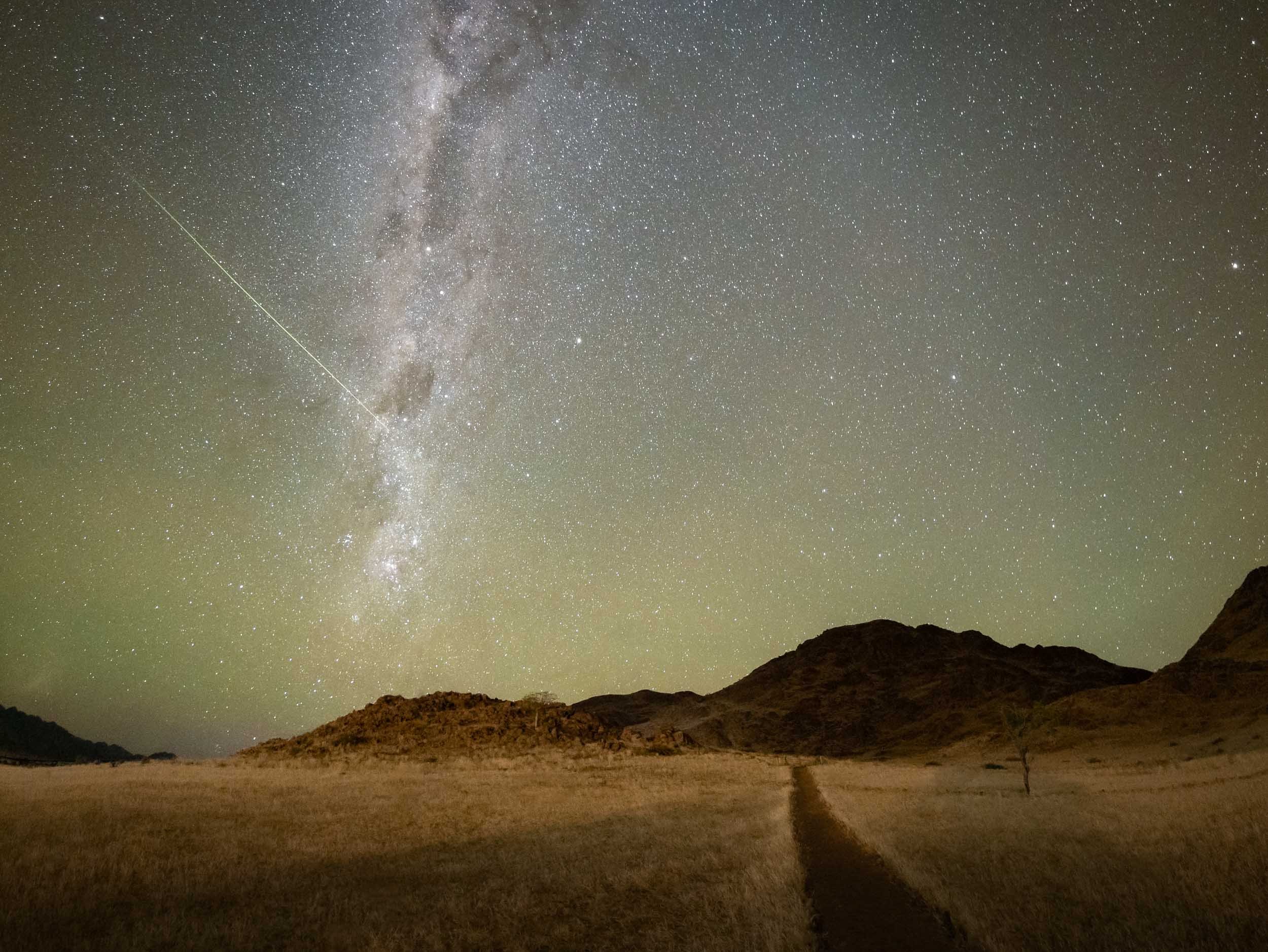
Swakopmund
To the northern end of the park lies this small city and its attractions.
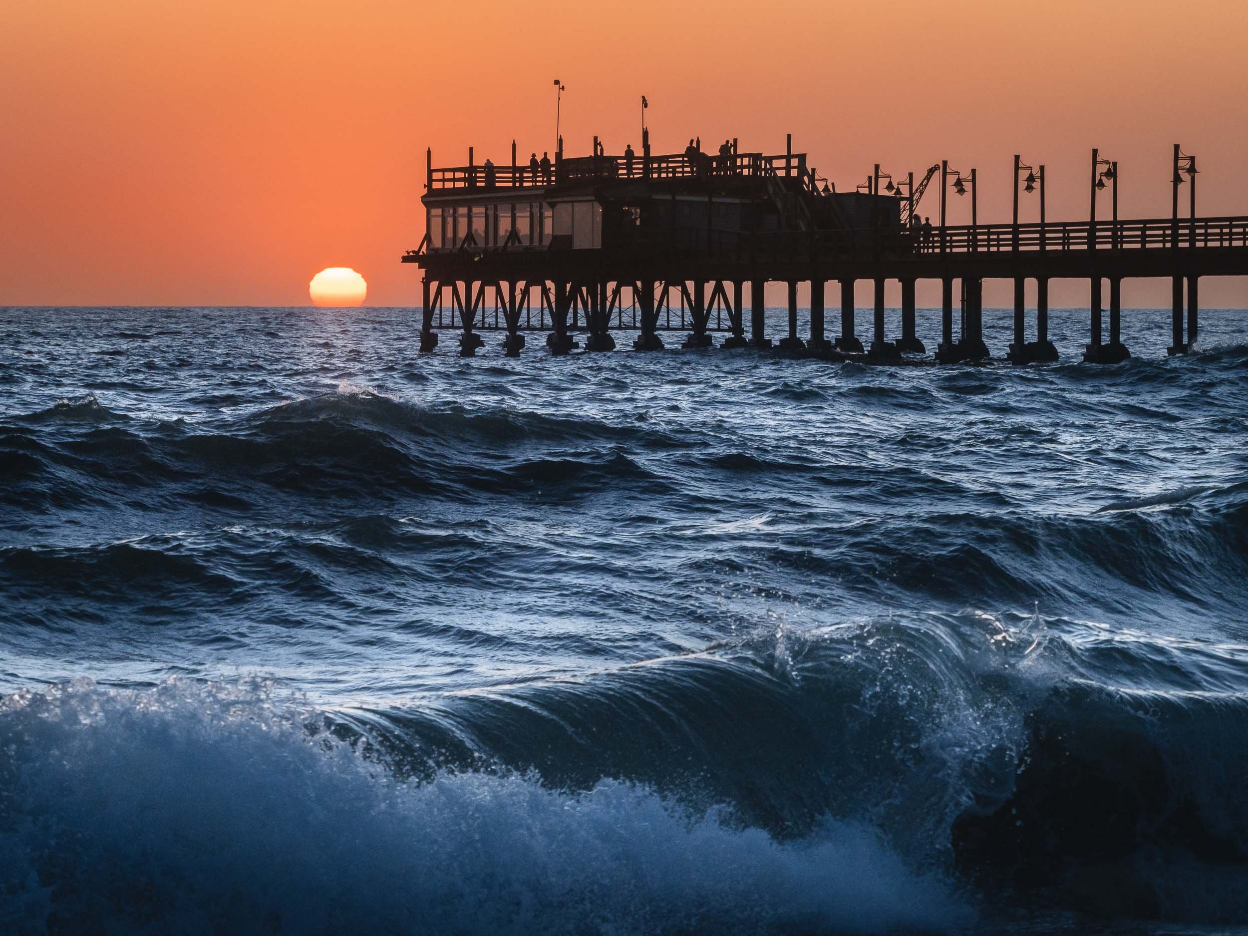

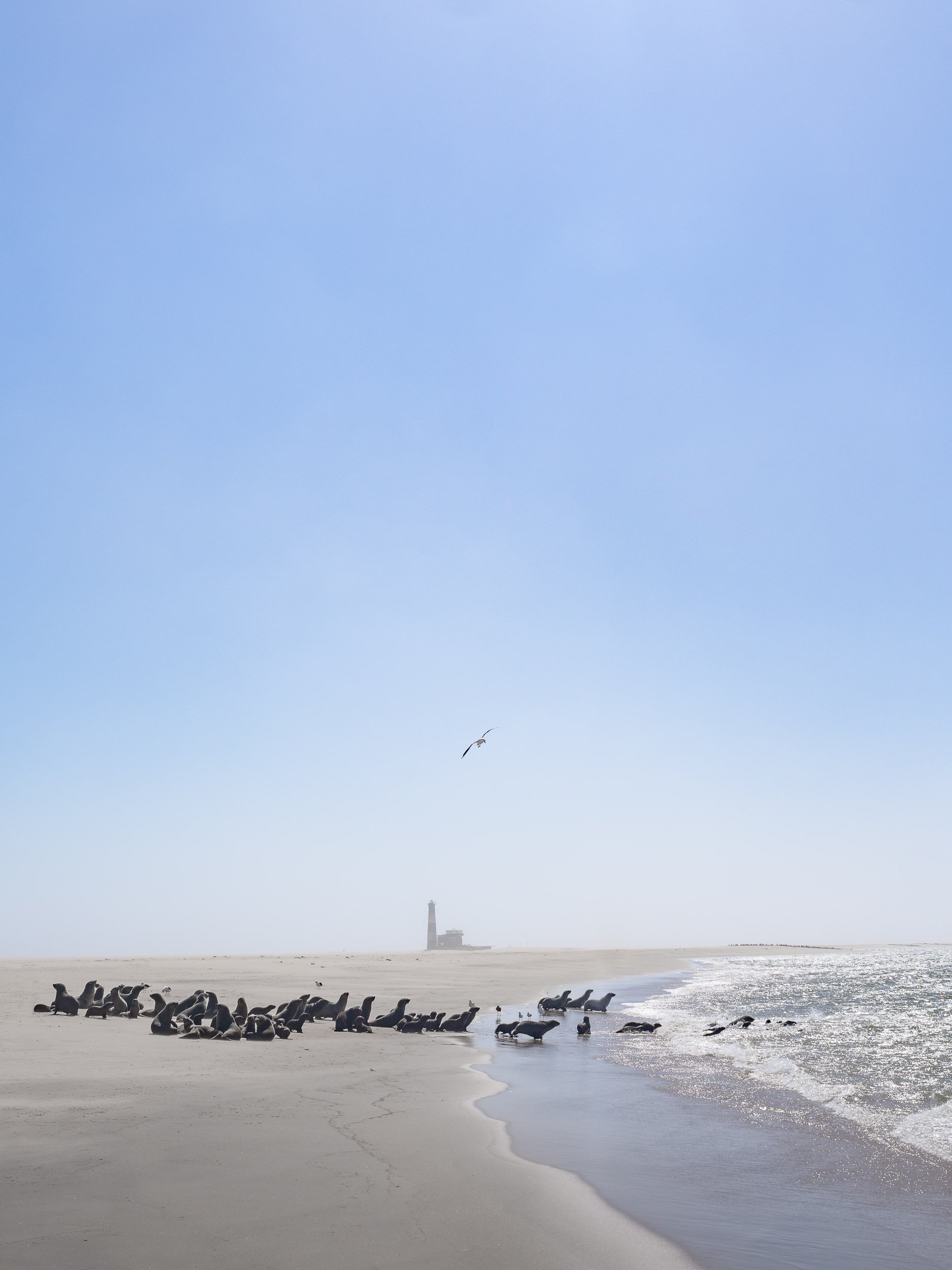
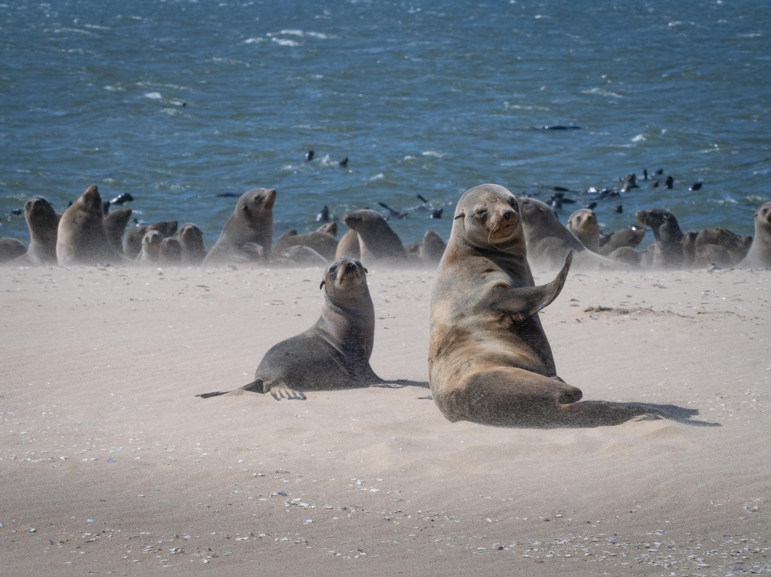
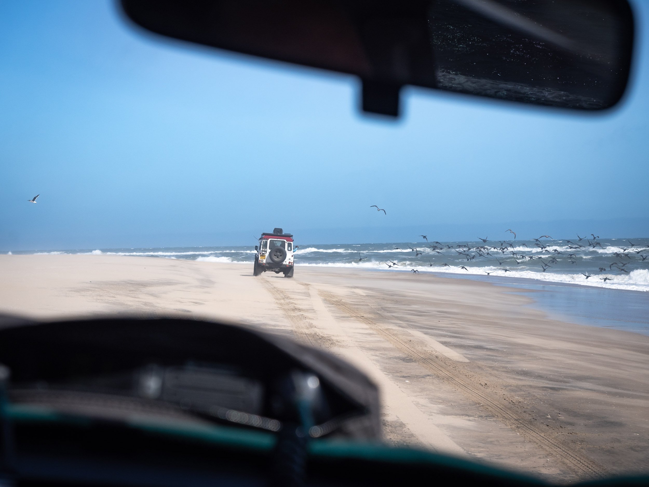
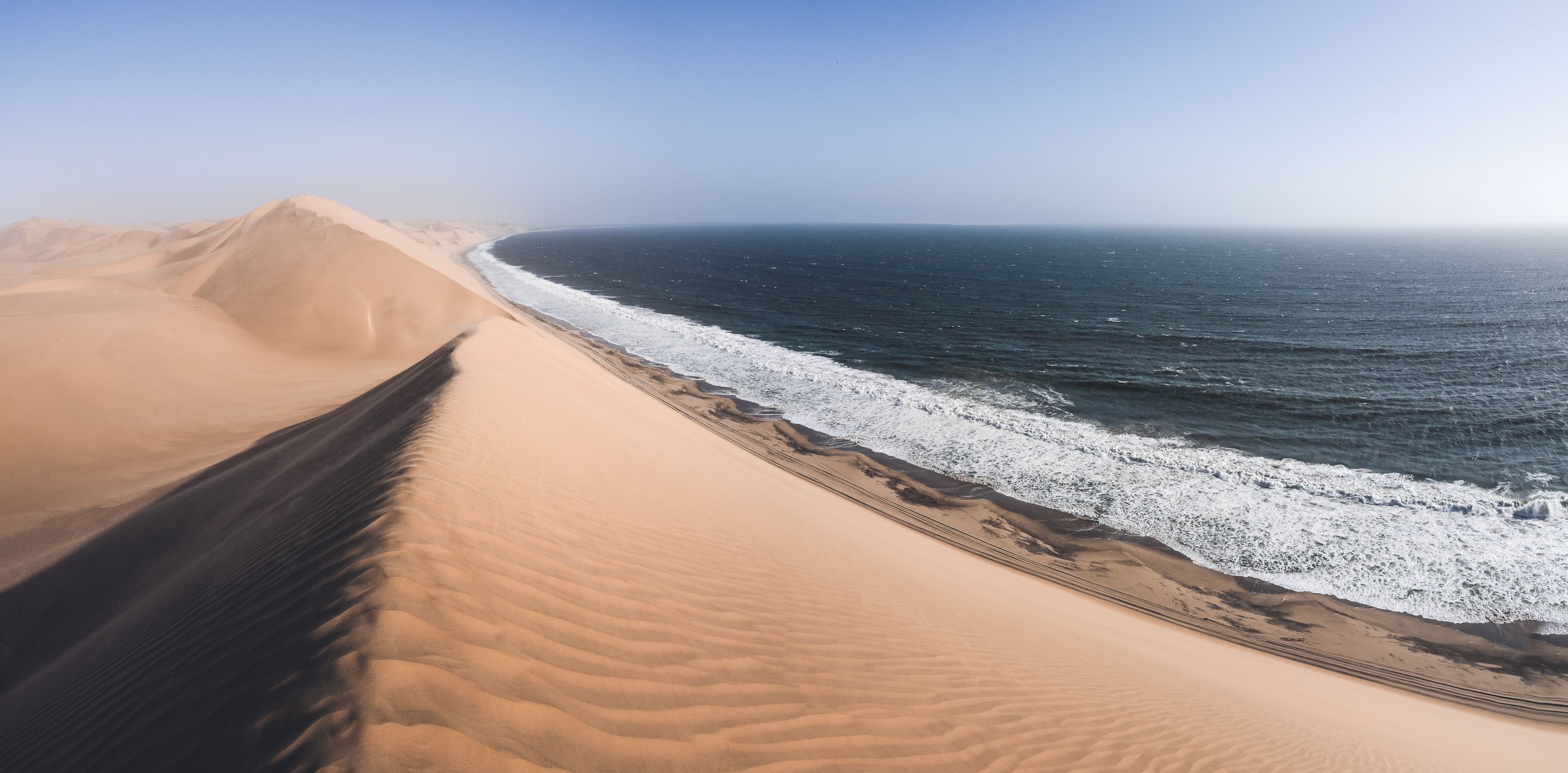
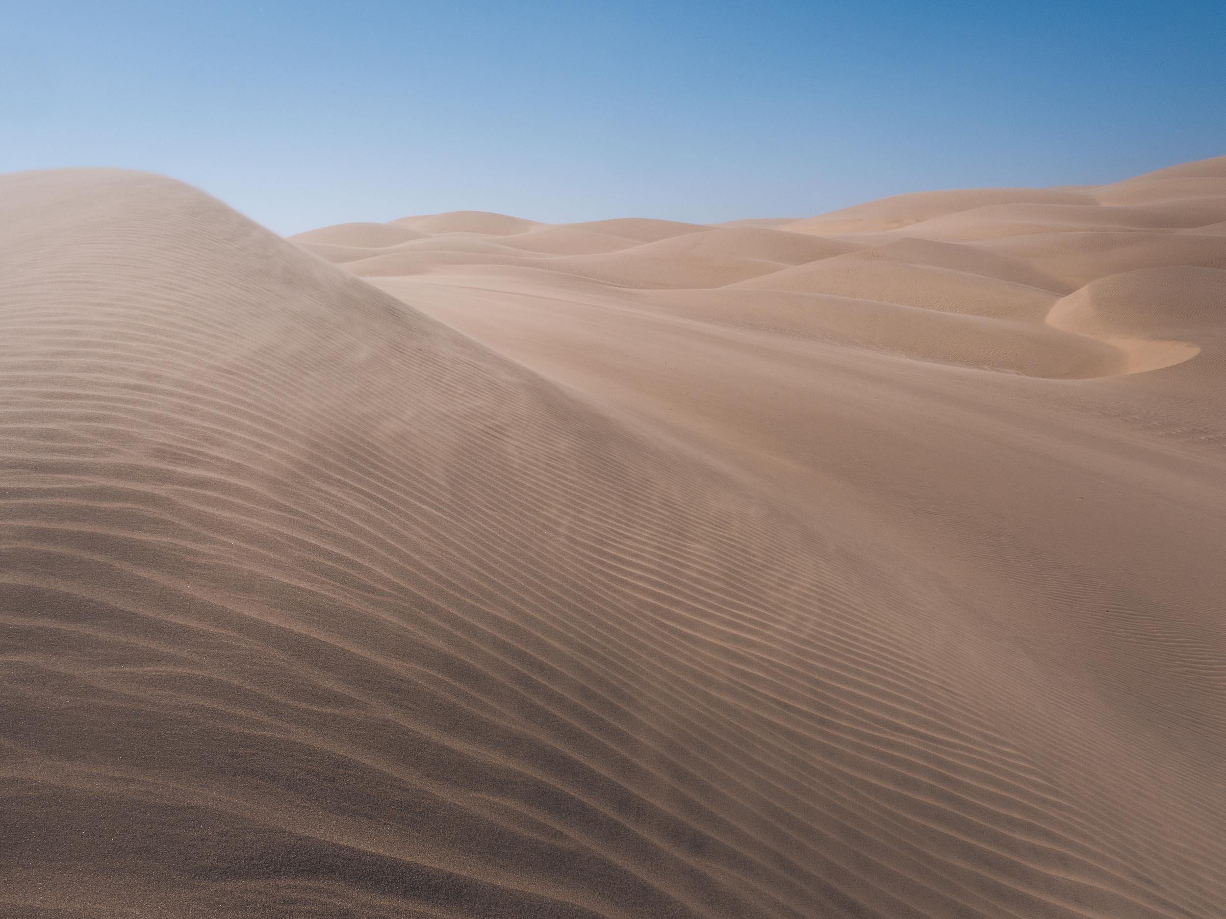
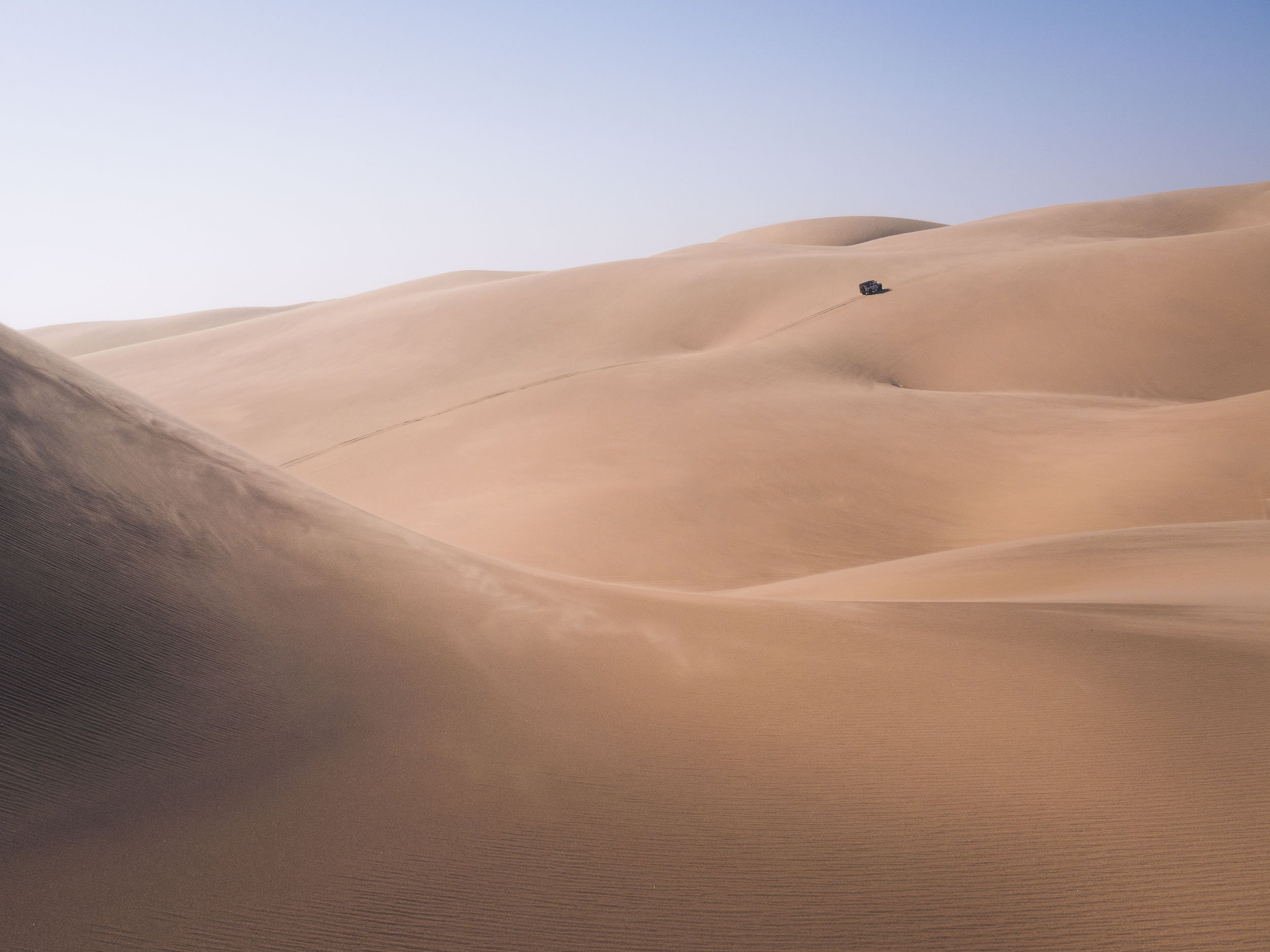
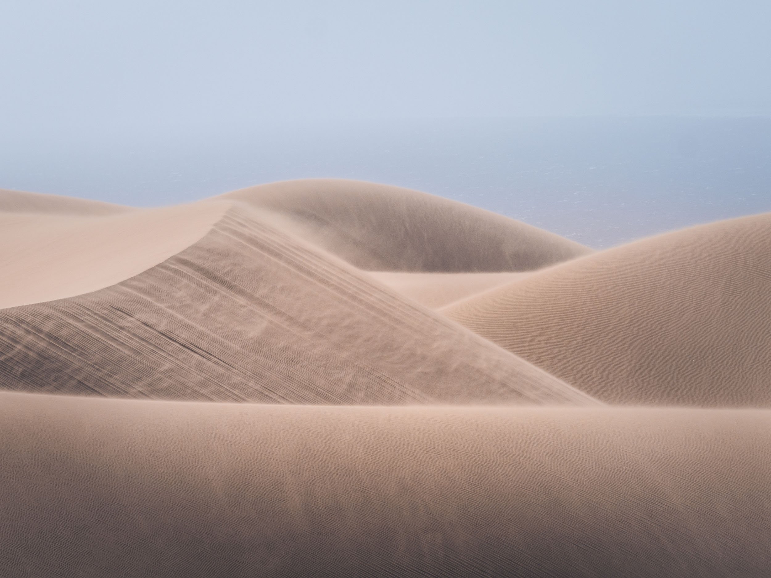
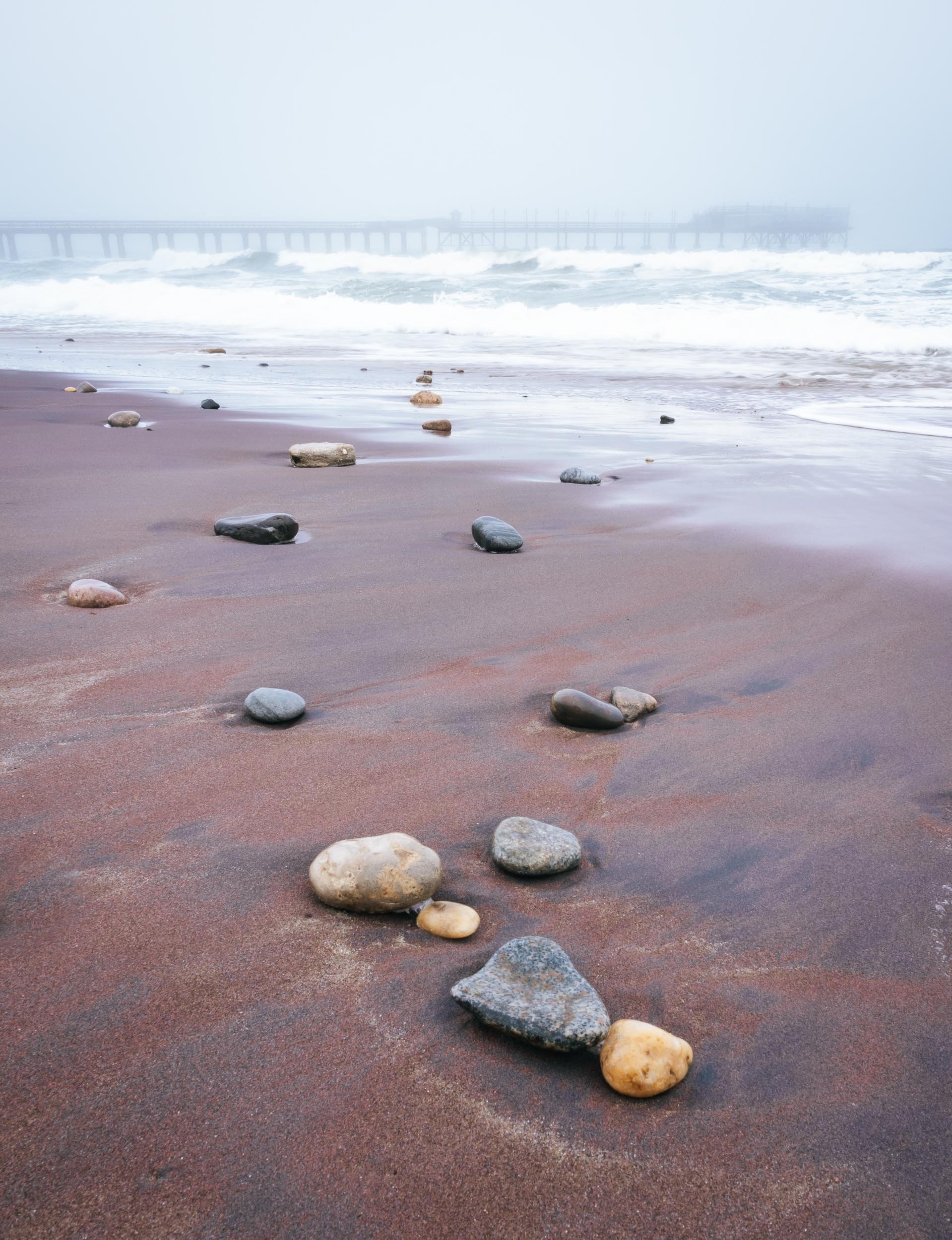
The Spitzkoppe
or Africa’s Matterhorn, as they call it.
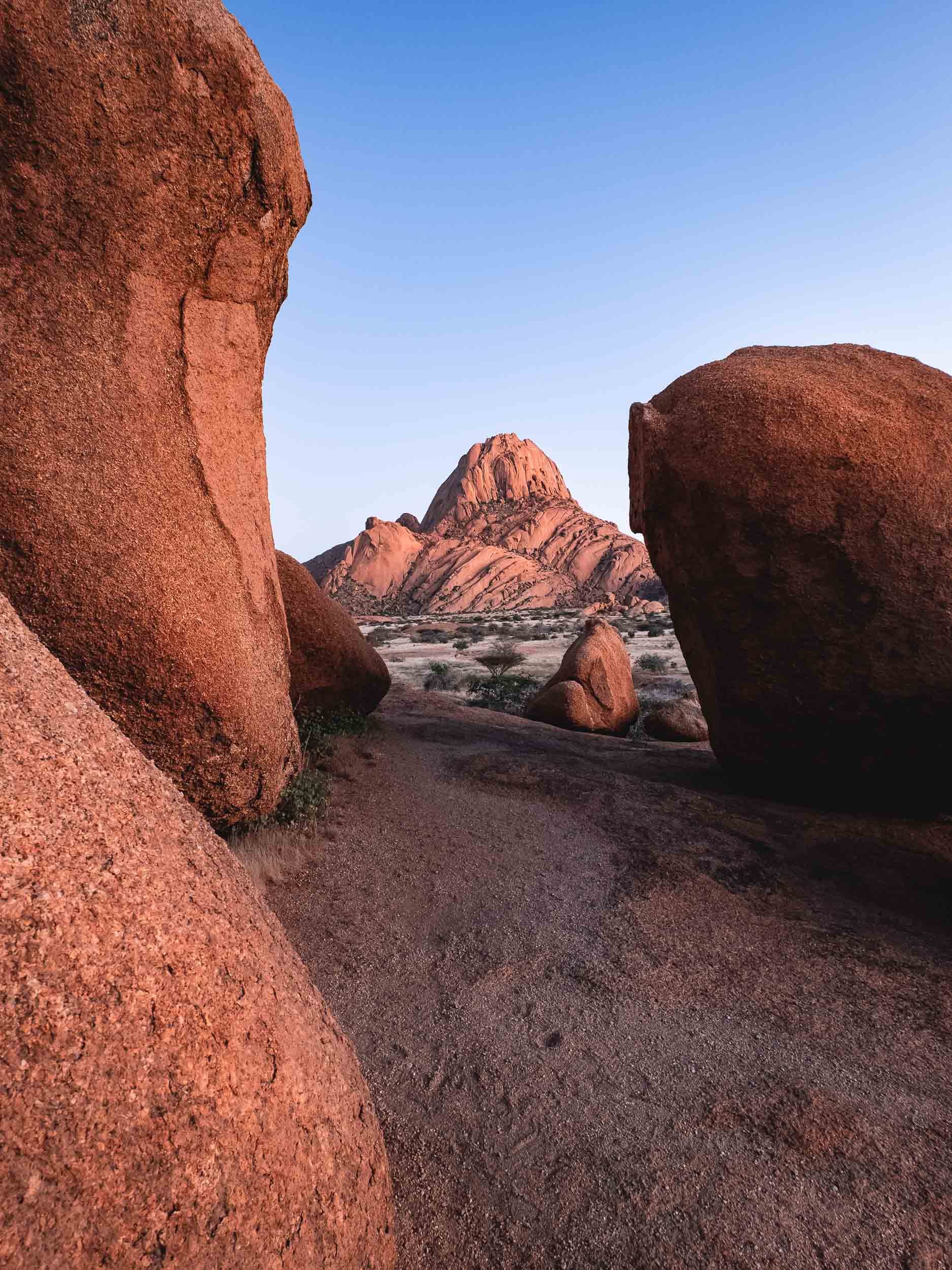
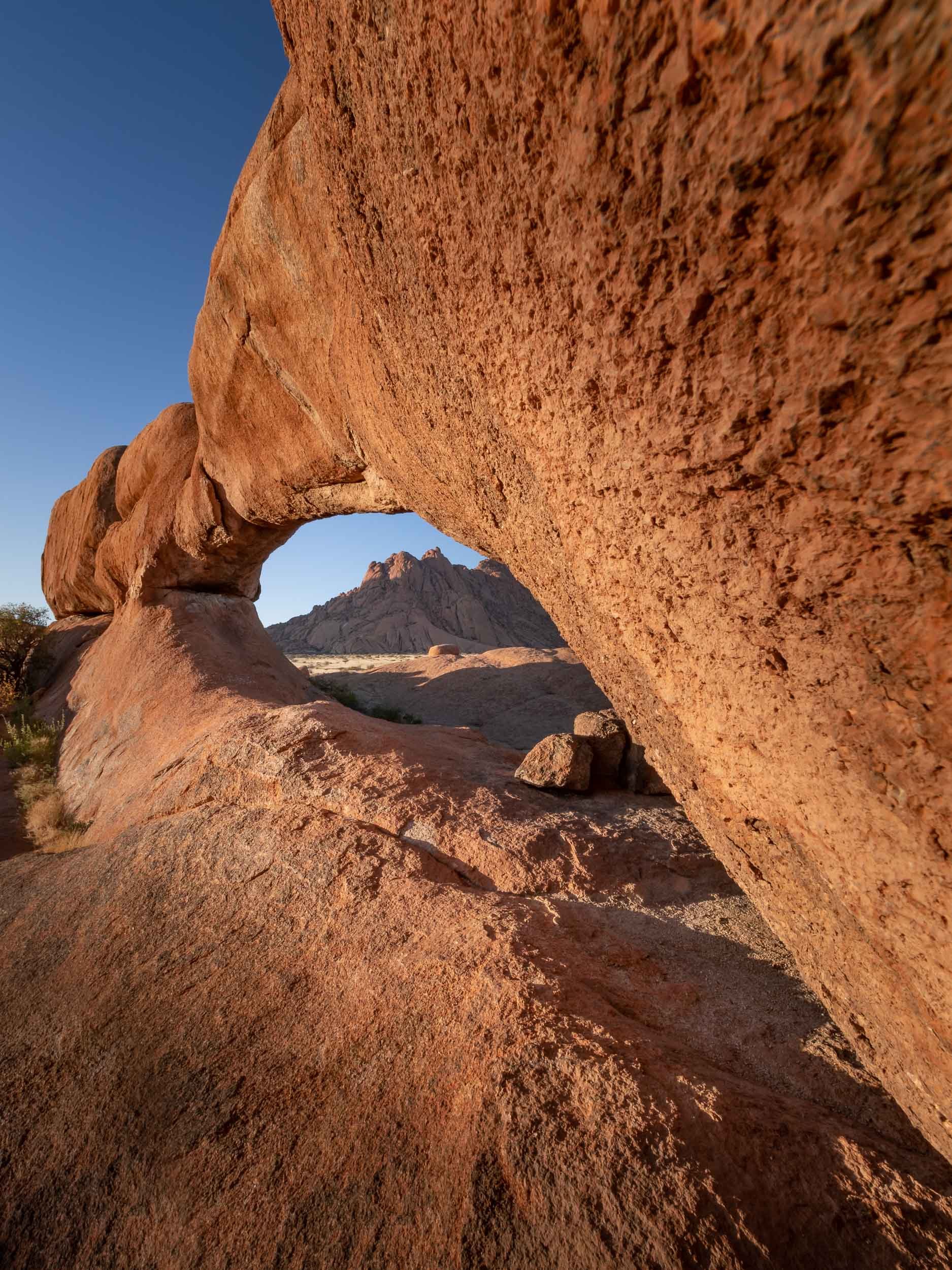
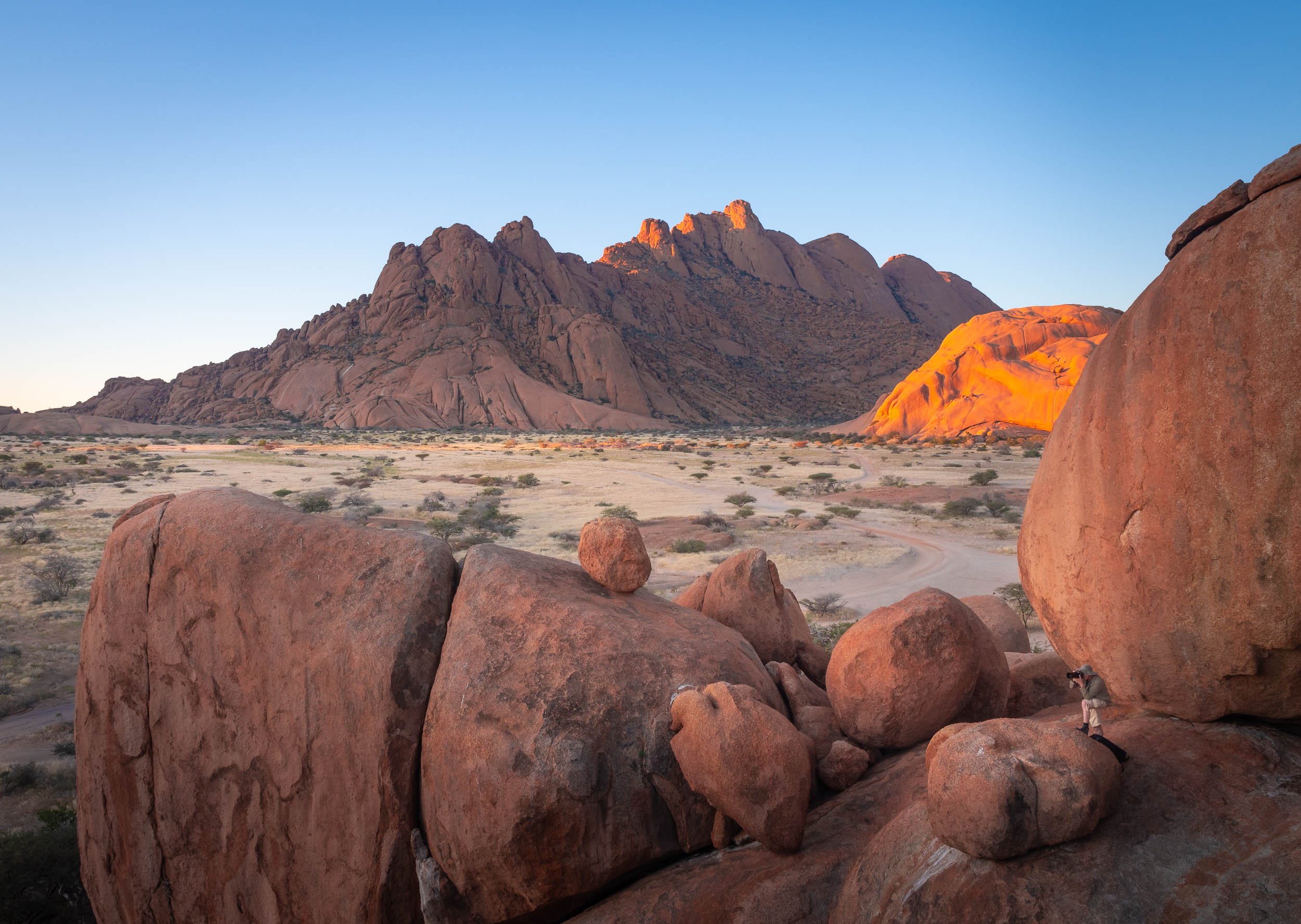


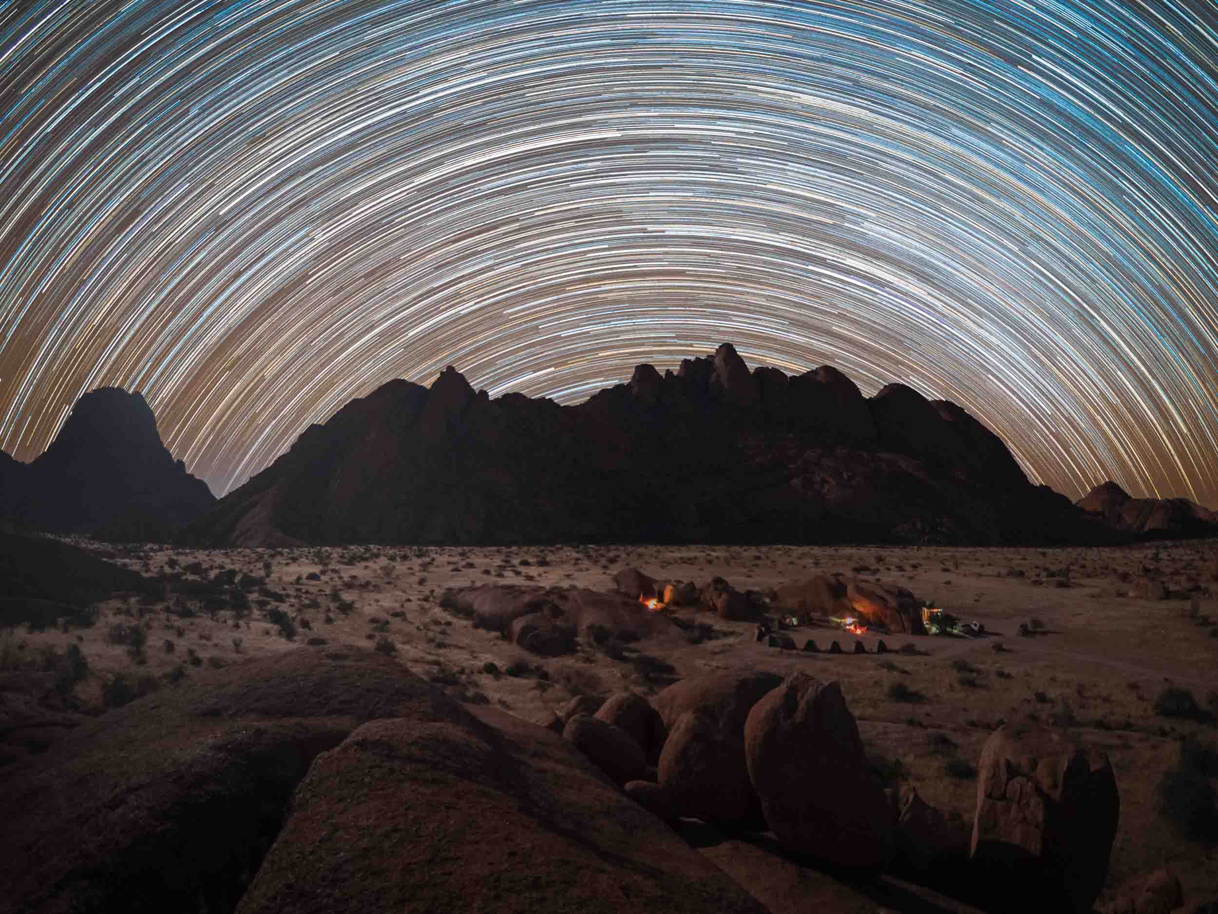
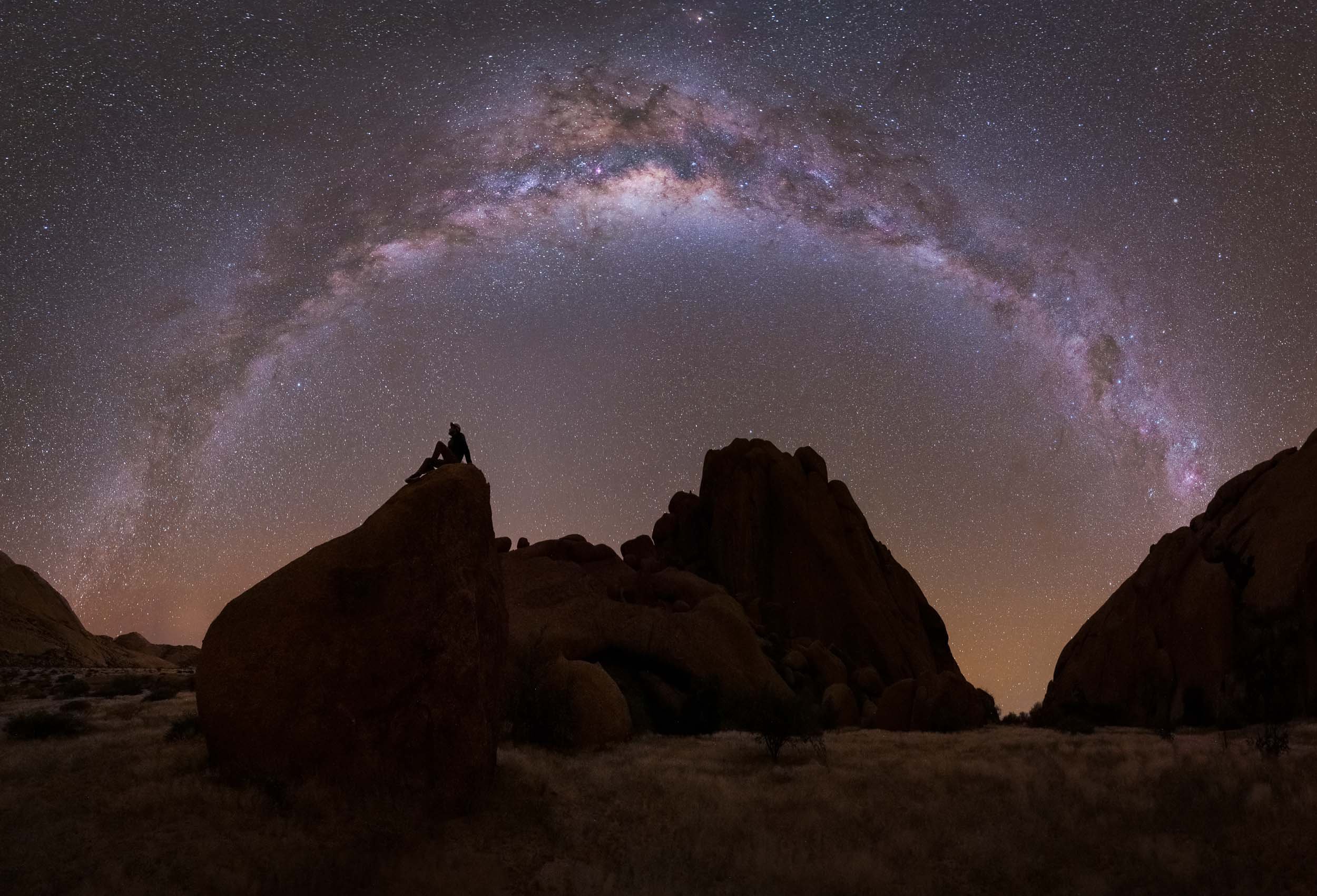
Etosha National Park
Our last destination was in the northern part of the country for some wildlife viewing.
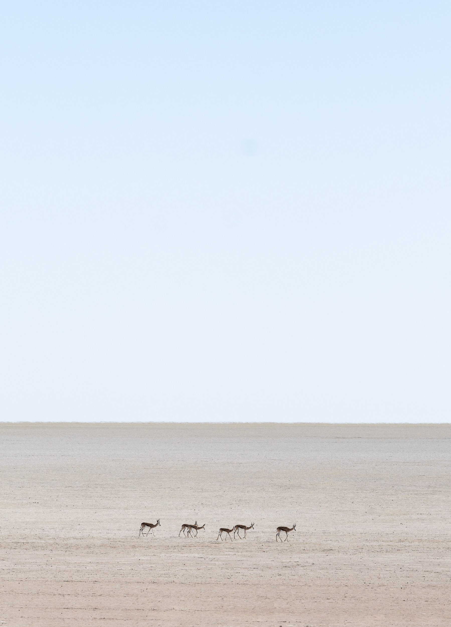
Scroll through the gallery for some of the animals we captured during the 2 days.