Java’s Volcano Heaven - Indonesia Part 2
Java is - unbeknownst to many - the world's most populous island and - maybe more well known - full of amazing places. I spent around 10 days here during my time in Indonesia (see also my blogs on Flores Island & Komodo, and subscribe for more upcoming ones, including a trip to the Orangutan’s of Borneo) and was visited some of the sights this home to over 150 million people has to offer.
Start here for a few aerial impressions, and read on to learn (and see) more about each of those incredible spots, and a few more…
I came to Java by car ferry from Bali, and had a short night before a 3am alarm to make it to the starting point of the trail that takes you up an amazing volcano formation, on the very eastern edge of the looooong island.
The Ijen Volcano Complex
Blue fire and an acidic lake await
This may be unsurprising to some of you, but I was the first tourist that day to complete the 2h hike and still got to witness a bit of starry night above the smoke filled caldera. After a few minutes though I started the 45min hike down into the dark crater to find the infamous blue fire and see the acidic lake up close.
The way down is not that simple if you arrive before blue hour, because it’s completely dark in the crater, there is hardly a recognizable path, and you scramble over rocks and slippery steep sections. The photo below was taken after I had already arrived at the bottom and the sky slowly developed a purple hue. You’ll notice a few flash lights on the edge at the top just starting to make their way down - arriving early has the benefit of a few undisturbed moments to take in the bizarre scenery, before the very small space at the bottom of the lake gets a little crowded.
Equipped
This last part of the adventure also requires you to wear a proper gas mask, as the sulfuric gases make it almost impossible to breathe otherwise once you get close to the lake - trust me, I tried.
Blue Flames
Ijen volcano is famous for its blue fire - one of only two places in the world where such a phenomenon occurs permanently. The blue flames originate from sulfuric gas that escapes from the cracks at very high temperatures. A rumor told me that the blue fire isn’t very active these days, so better check before you go (and if it is, go soon to witness it in case it’s too late some day).
The same gas is actually channeled through pipes at this spot to support sulfur mining, which has happened here for many decades. The yellow bricks that develop after the molten sulfur hardens are then transported by workers up the crater and down the mountain. While - from what I heard - this work is paid comparatively well, it’s also dangerous and very strenuous. The laborers fill the baskets with 70kg or more of hardened sulfur, and then complete the entire journey to deliver it at the foot of the mountain to get paid. Most of them do it twice a day.
The workers and various researches sometimes cross the crater lake that developed here in these kind of self-made barrages - a dangerous affair, given that the lake is considered the largest highly acidic crater lake in the world, with a ph of <0.5.
When you arrive in the darkness it’s actually difficult to understand the scenery around you and how this otherworldly environment really looks - only as I walked back up was it bright enough to grasp the scale of the crater, the lake, and the amount of smoke escaping from the cracks and pipes where the sulfur is mined. Look closely and you see the small barrage from above at the shore of the lake.
Abstract
Once I made it back up the sun had come out and I had a moment to fly the drone, capturing this abstract top down view of the crater’s edge, with the mountain on the left and the path towards the lake on the right. The small colorful dots at the top centre are the carts of the workers. Look closely and you’ll see some yellow spots, showing the sulfur rocks they had carried up already.
Shadow
Our home star was still low, so the nearby Merapi volcano, part of the Geopark Ijen is situated in, cast its huge shadow over us.
Bromo
Another volcanic wonder.
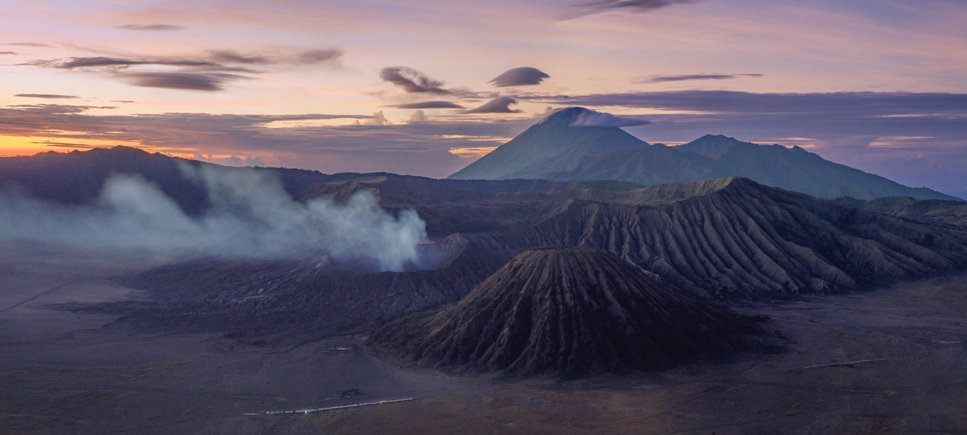
Straight after climbing down from Ijen a long drive westwards took me to Java’s most famous volcanic landscape: The National Park of Bromo Tengger Semeru. I arrived just after this beautiful sunset, and would go explore this area the next morning before sunrise.
Volcano-ception
This place is home to five volcanos (four of which are active) that have developed inside the caldera of another huge ancient volcano, with another volcano - Semeru - towering above them in the distance. Yup.
While I wasn’t lucky enough to experience the beautiful sight of the ancient caldera filled with a layer of fog (it wasn’t the right season), the conditions up there are always incredible, making for some very atmospheric photos around sunrise.
Semeru in Action
The tallest of the volcanoes in this area at over 3600m had just started to erupt in December 2022 a few days before I was there, and huge ash clouds developed from its crater in the distance that morning. If by now you are thinking “there are a lot of volcanoes here”, you are right - the entire island of Java is of volcanic origin, and there are no less than 45 active ones.
While Semeru is about 20km further south, Bromo is the most active of the volcanoes inside the actual caldera, and depending on the wind conditions you’ll need to watch out for the smoke and gases that emit from the crater - access to Bromo closes regularly due to safety concerns.
It is a relatively easy climb up a few hundred stairs (visible on the right photo in the corner on the bottom right) once you make it through the so-called “Sea of Sand” - the sand filled caldera - in one of the dozens of modified Jeeps the locals use to transport tourists. It can get busy here, but as always, arriving early and taking an extra little hike along the crater rim will bring you some peace and quiet - can you spot me (and my shadow) in the left photo?
The base of Bromo is also home to a rather interesting Hindu temple built in 2000, visible on the bottom in this photo - who thought it would be a good idea put a temple there I wonder? The Tengger people in this area are one of the last remaining Hindus in Java, which is overwhelmingly muslim. There is a small offering installed at the edge of the crater to please their sacred mountain.
Two of the aforementioned Jeeps making their way through the Sea of Sands in the distance, with the rugged slopes of Bromo in the foreground, seen from the crater’s edge.
For a touch of color after all that brown and grey around the volcano these four wonderful ladies posed happily in the sand canyon as I was leaving.
A Splash
Speaking of colours, I then made my way to the city of Malang, which is home to an interesting set of villages, namely Kampung Tridi (left), Warna Warni (top), and Biru Arema (bottom right), which have turned their districts into a little paradise of colours.
Pioneers
As the story goes, Kampung Warna Warni was the original of the colorful villages in Indonesia. While one might dismiss it as a tourism stunt, the idea actually came from a few students who wanted to revitalize this community, which had fallen into disarray, poverty, and pollution, alongside the nearby river. In 2015 they partnered with a local painting company and the resulting work didn’t just bring in tourists (who pay a small entrance fee) but also revitalized the surrounding community and created a social obligation to beautify and maintain the environment. It became a successful role model for the village across the river, and another one across the bridge, as well as a few others in the country.
Kampung Tridi is connected to Warna-Warni by a small footbridge. Both of the village are full of small whimsical details, murals, and friendly locals.
It’s an interesting thought to imagine how the world would look if all our cities were so colorful, considering the sea of brown and grey surrounding these villages. I happened to get another glimpse at the colorful roofs when I left Malang by train (excellent way to travel in Java!) on my way westwards towards the Special Administrative Region of Yogyakarta.
Tumpak Sewu
Before moving on though I got to experience what is probably the most incredible waterfall I’ve ever been to, about 3 hours south east of Malang. The active Semeru volcano mentioned earlier providing a beautiful backdrop.
The way down to the falls is a tough affair - it takes at least 30 minutes over muddy semi-paths, climbing long rope assisted vertical ladders, stepping on metal brackets fixed into the side of the canyon, crossing the river by jumping from stone to stone, and then being totally soaked by the waterfall’s wind induced layer of rains and fog at the bottom. But the views are worth it (I still thought so after the way up, but was less convinced then). Pro tip: It seems the descent on the eastern side is a little easier than the one I took, but who wants that?
My guide posing in the rain for scale here.
The views from above are equally amazing though, even more so with a drone, but the viewing platform on the side of the canyon also provides some nice angles and opportunities to set up a tripod for long exposures.
The conditions changed quite a bit during the few hours I spent here, depending on the wind direction and the flow of the river. On top of that, as the sun moves across the horizon, the angle of the omnipresent rainbows shift as well, creating ever so slightly different compositions. A place you could come back to many times. An extra bonus - I was there on a regular weekday morning (not even that early) with almost no people - a very different picture compared to some of the (comparably boring) waterfalls in Bali.
What’s in a Name
Tumpak Sewu loosely translated means "a thousand waterfalls" in the Javanese language - an apt description.
What a place. Just missing some dinosaurs!
Back in Malang I took the aforementioned train onwards to the west into Central Java, more specifically the Special Region of Yogyakarta. A kind of unique autonomous province of Indonesia, the Sultanate has a few distinct administrative powers owing to its former status is an independent kingdom before it joined the Indonesian independence movement after the Second World War.
Prambanan
Three religious sights were on my mind for this part of the island, starting with the 9th century Prambanan temple, the largest Hindu temple in ancient Java and the second largest in the world. It’s dedicated to the Hindu trinity of God as the Creator (Brahma), the Preserver (Vishnu) and the Destroyer (Shiva). My hopes for some good photos were slightly destroyed by the weather, as I only had a few minutes before the pouring rain kicked in.
UNESCO World Heritage Site
The temple and its many beautiful reliefs have been inscribed since 1991. The pattern of lion in niche flanked by kalpataru trees is one of the most common panels in the temple.
The temple compound lay more or less abandoned for over 1000 years and lost a lot of its individual temples - there were 240 in total - as people used the stones for other construction or collected them. Only in the 1930s an effort to properly reconstruct it started, which is ongoing until today. An earthquake caused significant damage in 2006, and various volcano eruptions pose a constant danger to the site.
Standing Out
I once again had the chance to add a dash of color when I came across another group of four ladies that were happily swinging their umbrellas to pose for me.
Last Moments
The rain took over shortly after, and although I’m not one to shy away from some water, this storm was a bit too much for my camera to handle, and marked the end of my time here.
Borobudur
Next on my list was the world’s largest Buddhist temple, another UNESCO World Heritage Site and situated a bit further north near the city of Magelang.
Just like Prambanan, Borobudur was also lost to civilization and abandoned for hundreds of years in the jungle under volcanic ash. It was in fairly poor condition when re-discovered, to the extent that it was suggested to simply transfer the remains into a museum and rebuild them there. Followed by decades of looting the temple was finally restored in the early 20th century, but deteriorated quickly again, necessitating a more permanent in-depth restoration in the late 1970s.
It’s rather difficult to get nice photos of the temple from a distance, owing to the thick and high vegetation around it, and while beautiful drone shots exist, getting a permit proved difficult, and I tend to avoid breaking the local rules, especially around religious sites.
On top of that, climbing the temple was not allowed, owing to several restoration and cleaning projects. This used to be possible in the past, and from what I know, was allowed again shortly after my visit.
Procession
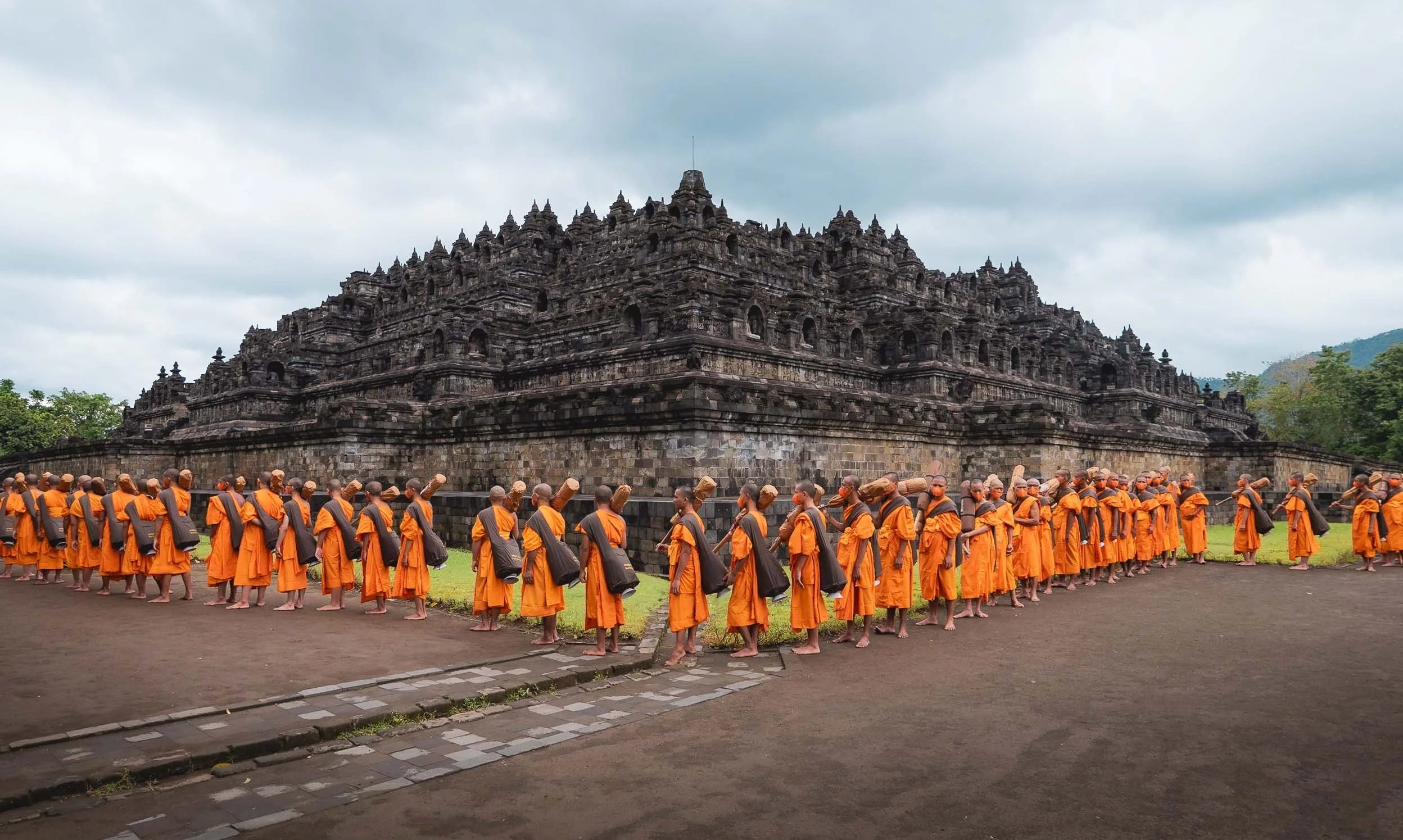
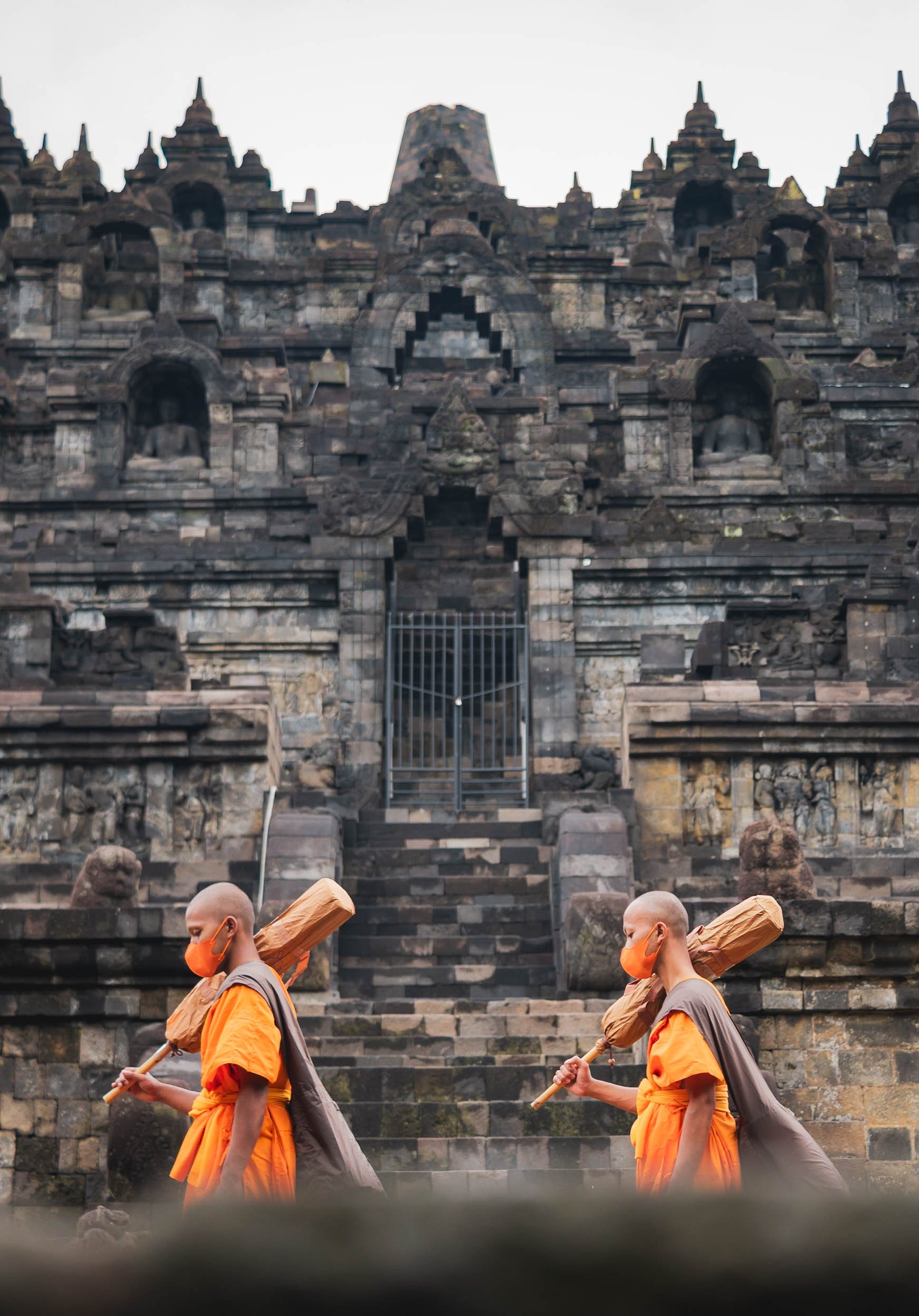
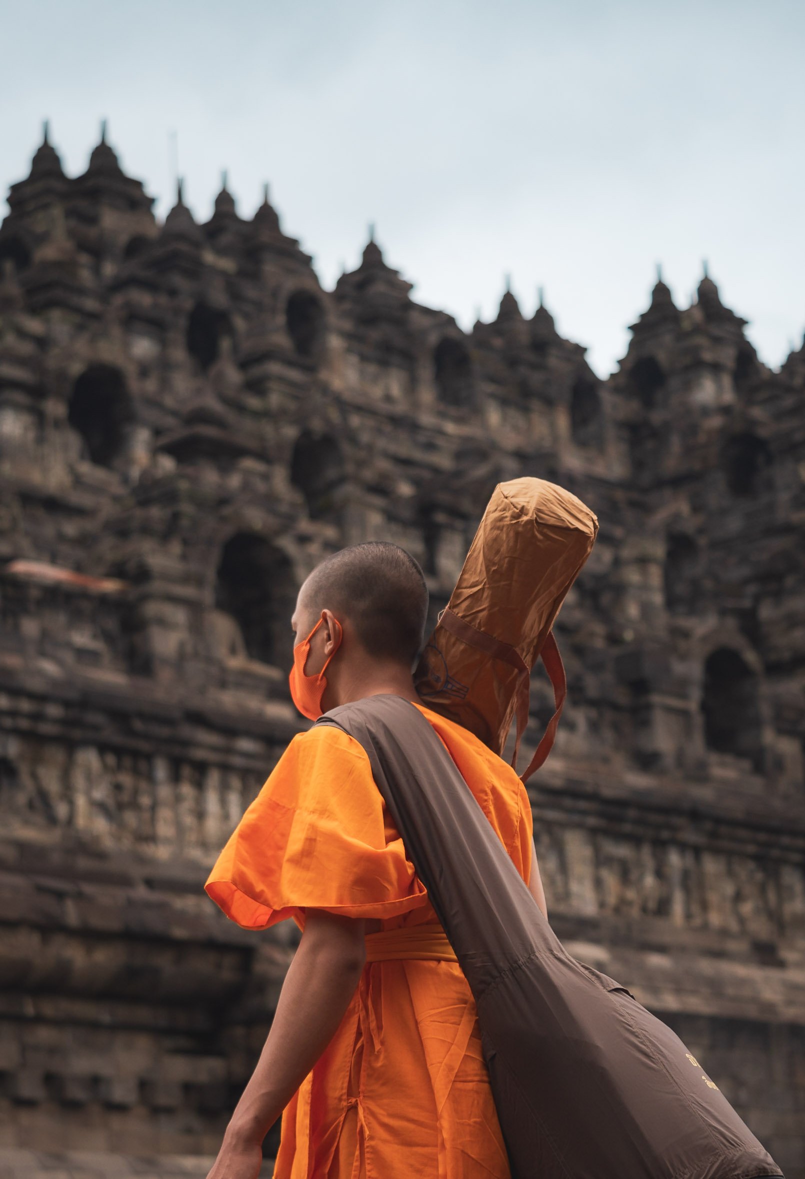
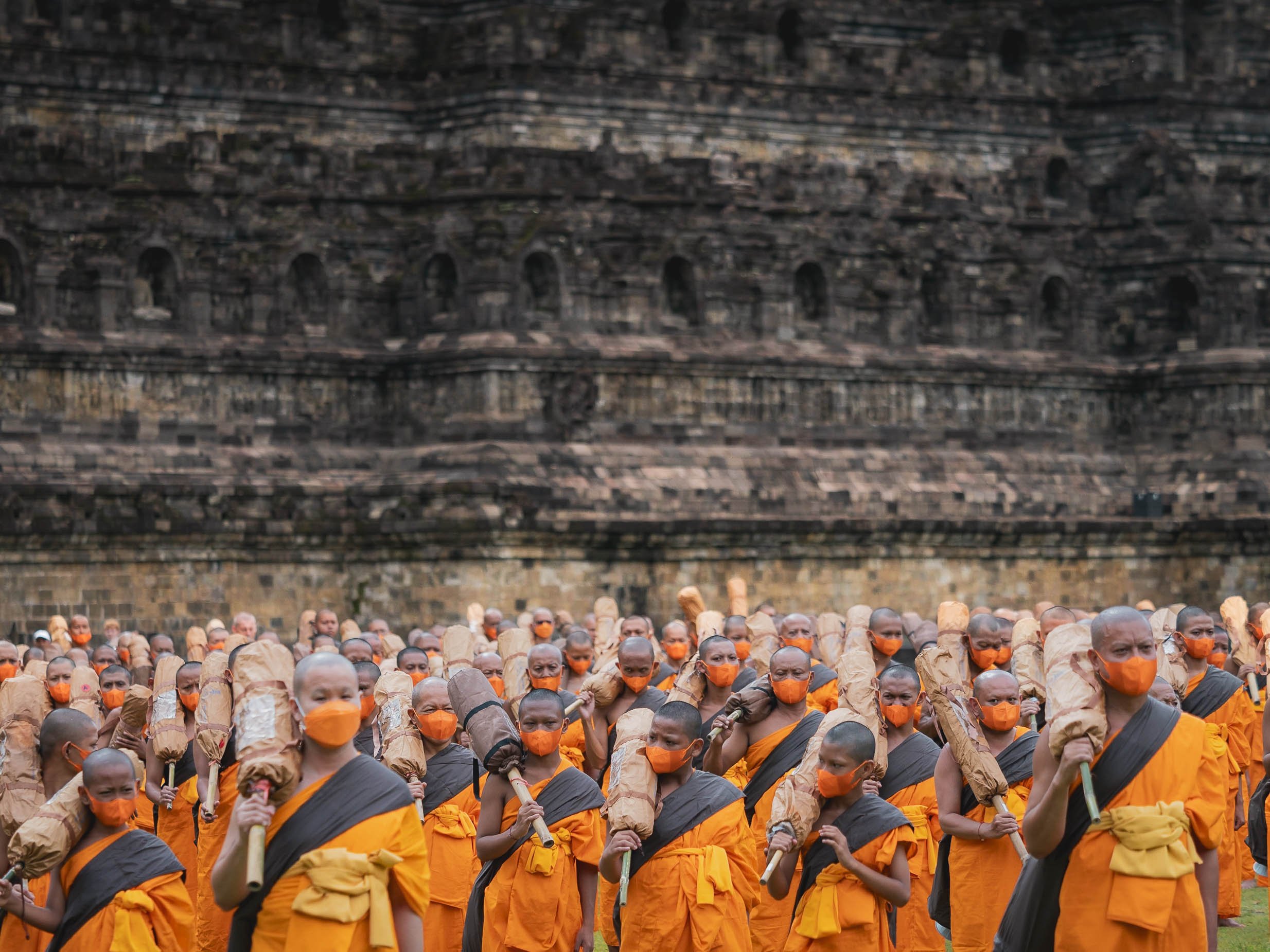
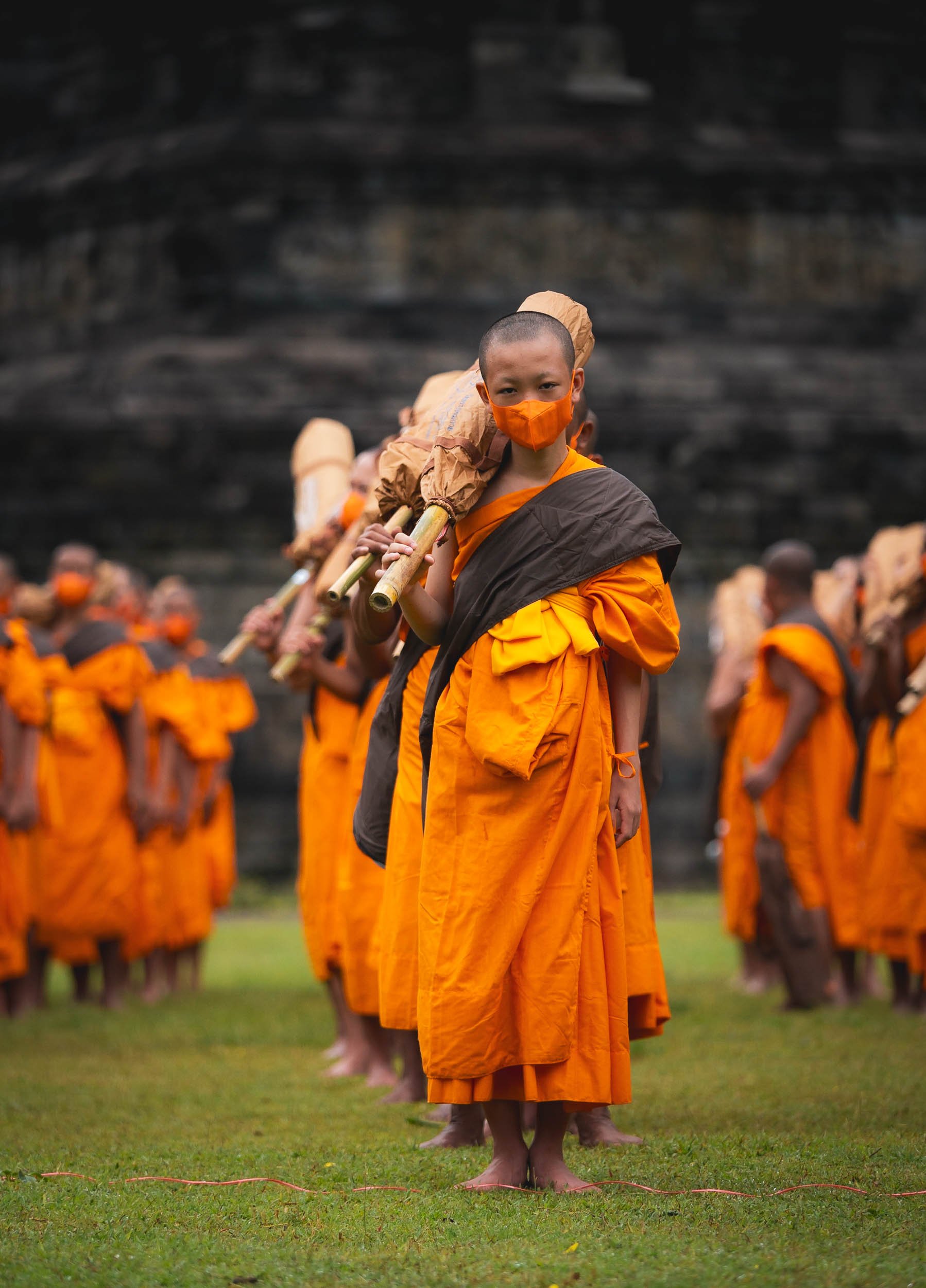
Despite those disappointments, I did get lucky with something else: Shortly after my arrival early morning, a procession of Buddhist monks made their way to the temple as part of their ordination ceremony. It made for a pretty extraordinary sight with the traditional buddhist dresses of 100s of pilgrims contrasting the temple.
Borobudur’s architecture consists of six square and three circular pyramid layers with originally 504 buddha statues. Its design is closely aligned with Buddhist beliefs and cosmology.
Climbing to the Top
The monks of course were allowed to take the steps up the temple, seen here from the mouth of the Chicken Church I visited later (yes, you read that right, just continue below…)
Gereja Ayam
That brings us to the last of the temple trio on my route - and while the above is its official name, calling it the Chicken Church is just inevitable, although the real design intent was to resemble a dove with a crown as a symbol of peace and coexistence.
The story of this poultry shaped religious institution goes back to a dream of a man called Daniel Alamsjah, whose divine visions made it his mission to establish a cross-cultural sanctuary for anybody seeking some spiritual guidance. The mission proved difficult, first due to protests by the locals who assumed he wanted to build a Christian church in a muslim neighborhood, then the complexity of permits, the need for money, and his general lack of experience with building projects.
It took 20 years until his idea become an avian inspired reality. Then international media attention and the shooting of a famous Indonesian movie started to draw in more tourists and he could charge a small entrance fees and complete his dream, including a visitor cafe (the food quality of which is luckily in stark contrast to its location at the butt of the chicken rear of the building).
From the Chicken’s Mouth
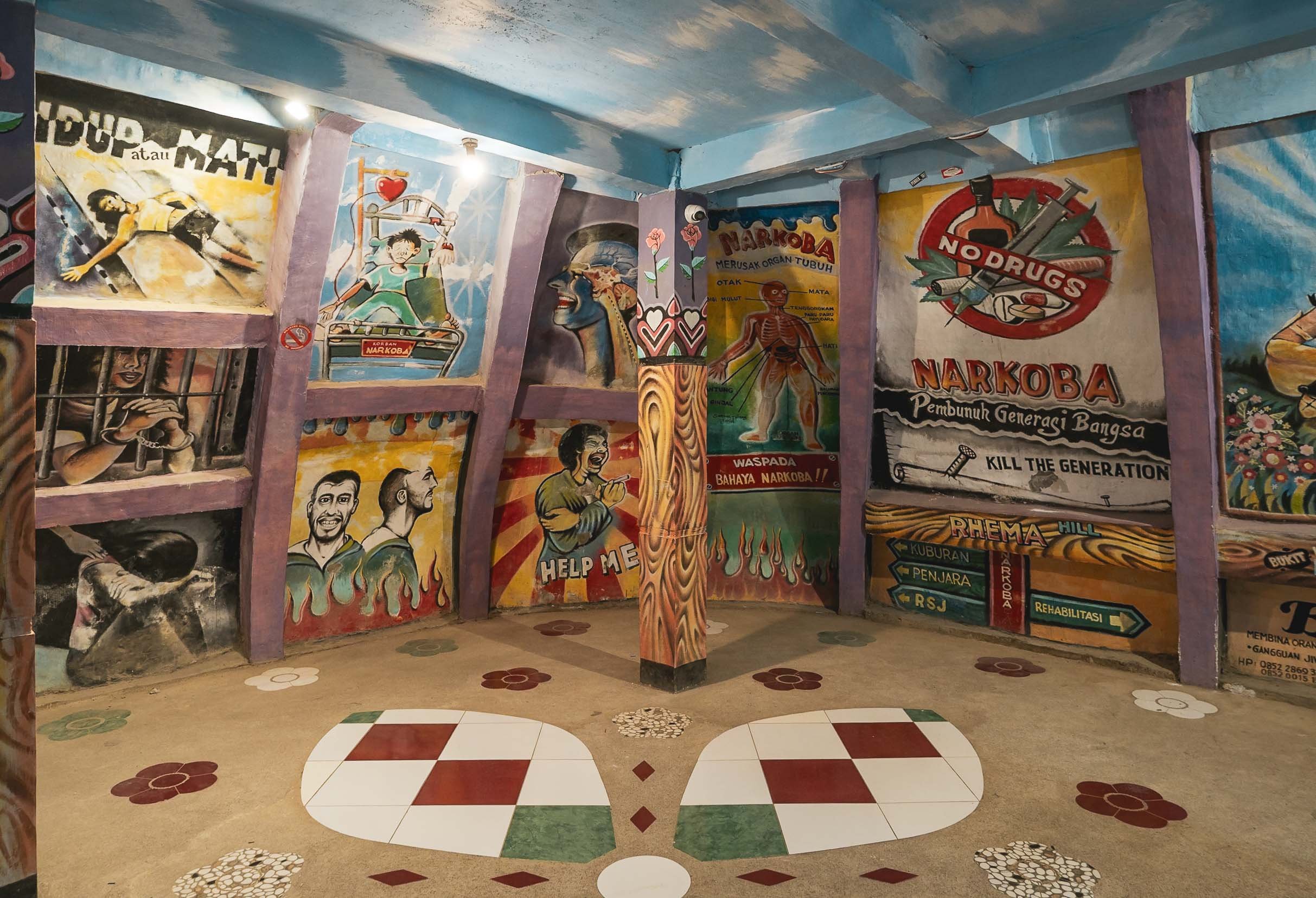
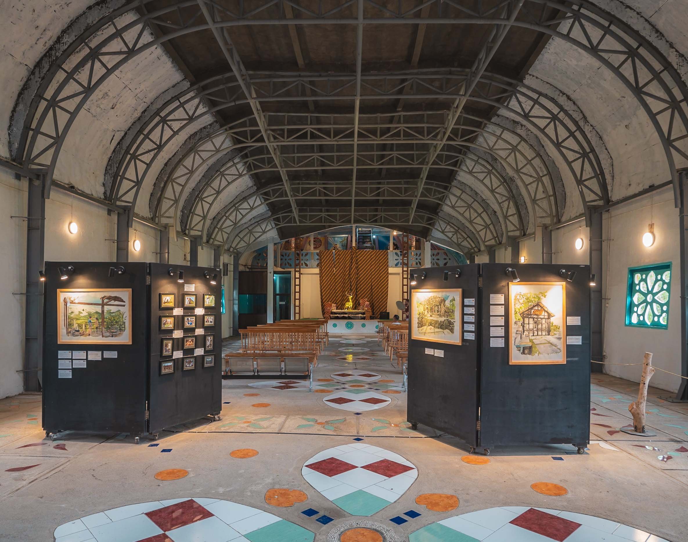
The interior is fully built up from basement to the top with various exhibits and prayer rooms, and you can climb inside the head for a view down the hill. If look really closely you can see a small hint of Borobudur on the middle right - this is where the above photo of the temple was taken from.
Once I had found my spiritual home here, I concluded my time in Java with a night in Semarang, where I got to just briefly glimpse at some of its remaining colonial Dutch architecture, before making my way to Borneo via a short flight over the Java Sea.
The Capital
While I didn’t end up in Jakarta on this part of the trip, I had a short layover a few weeks later. I didn’t find the time (and energy) to take a lot more photos of the city then, other than some snaps from the pool level of my hotel - including them for sake of completeness 😉
Indonesia is incredible, and the amount of natural and cultural variety is enormous - I spent more than 6 weeks here, literally on the road every day, and definitely want to come back.
