Bhutan - The Mysterious Mountain Kingdom
In early 2026, the Gulf War caused a little bit of a mess to my travel plans, but on the bright side, the situation led me to Bhutan, one of the more peaceful spots on the planet.
Bhutan is probably one of the most enigmatic places on earth, rarely heard of and removed from most (but not all) geopolitics. Maybe that’s what makes it so intriguing. I spent a little less than two weeks in the country - intense ones with a lot of moving around, hiking, sights, people, culture, festivals, architecture, and more, and yet I know there is still more to see here, especially towards the centre and east.
Nevertheless, this blog will probably end up having almost 200 images, such is the richness of angles to cover. Stay with me until the end, which features some of my favourite photos of the trip.
Getting There…
Bhutan is a relatively small landlocked country in the eastern Himalayas of South Asia. Although you can enter through a few land borders from India (but not from China in the north - the border is disputed) most tourists would arrive via its only international airport in Paro. That is easier said than done, for two reasons: first, Bhutan levies a USD 100 per day Sustainable Development Fee on tourists from almost every country, and an official guide is mandatory, there is no self-driving tourism here for example. My guide Chencho and driver Nima were both excellent, so no complaints here.
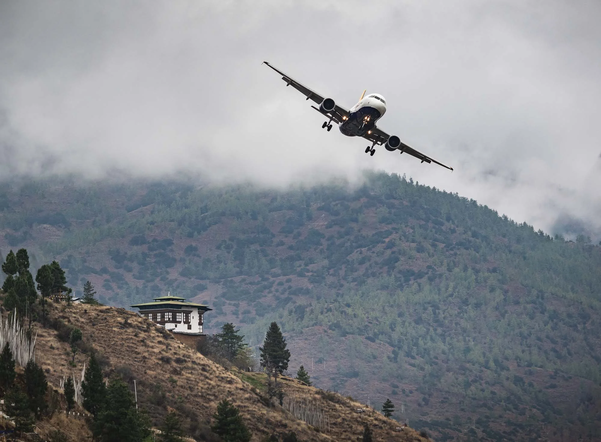
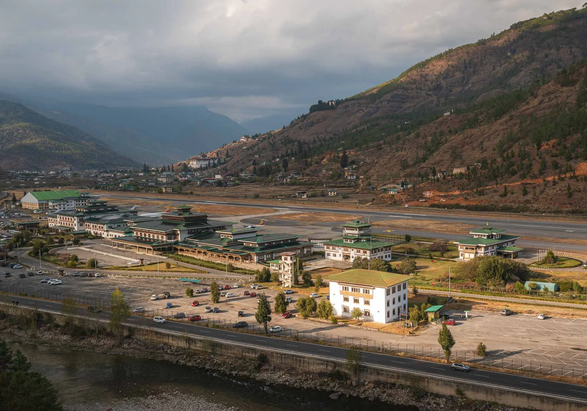
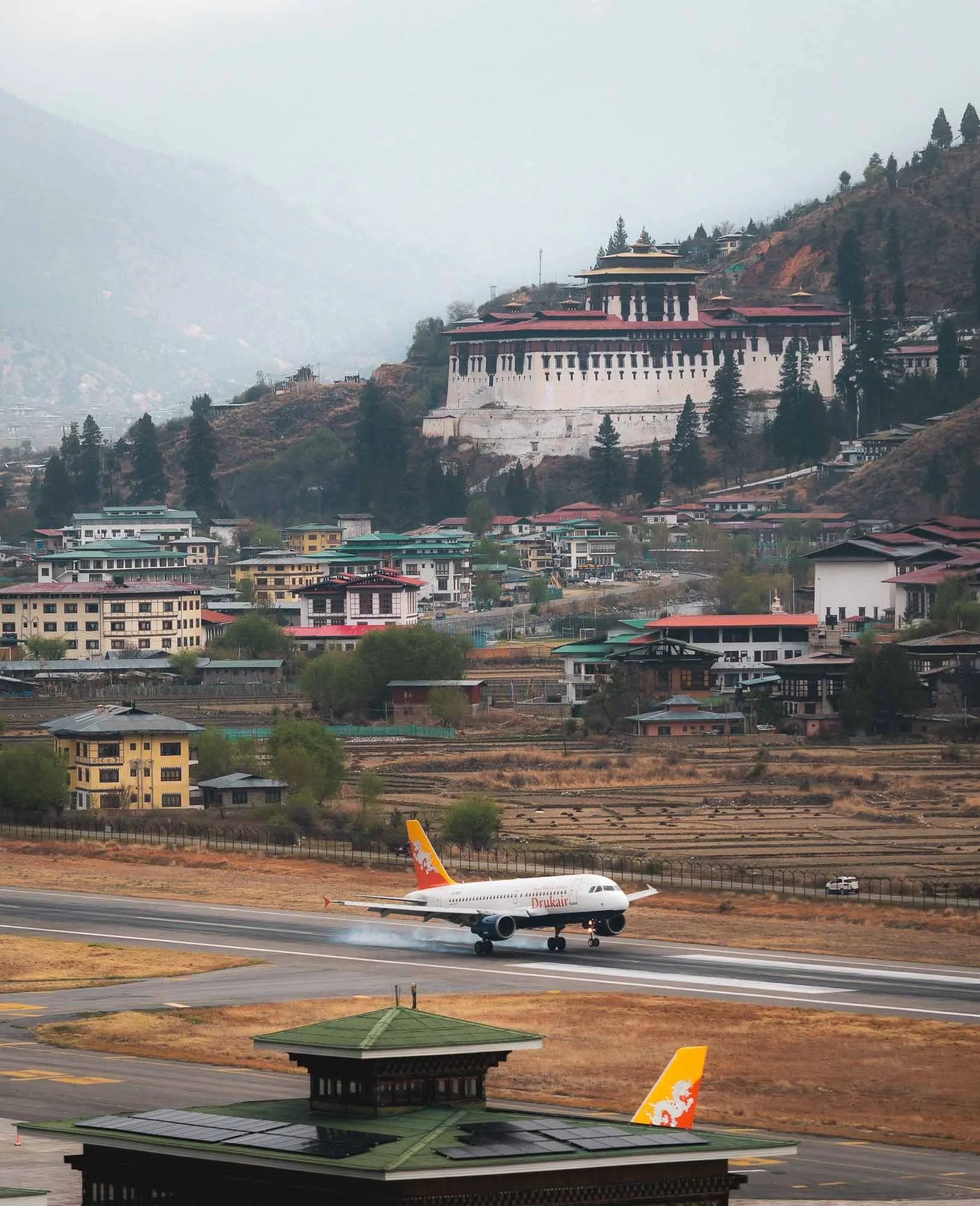
The second reason is its only international airport, generally considered one of the most difficult landings in the world due to its location in a narrow valley, with frequent poor visibility. Only a handful of airlines fly to and from a few countries, and only a few specially trained pilots are allowed to make the banked manual visual approach without the standard instrument-assisted landing systems.
My own arrival flight was delayed a few hours due to clouds (making such a visual approach impossible) - while I was in Paro I made sure to observe a few of the rather interesting landings with the backdrop of one of the many forts, more on that to come.
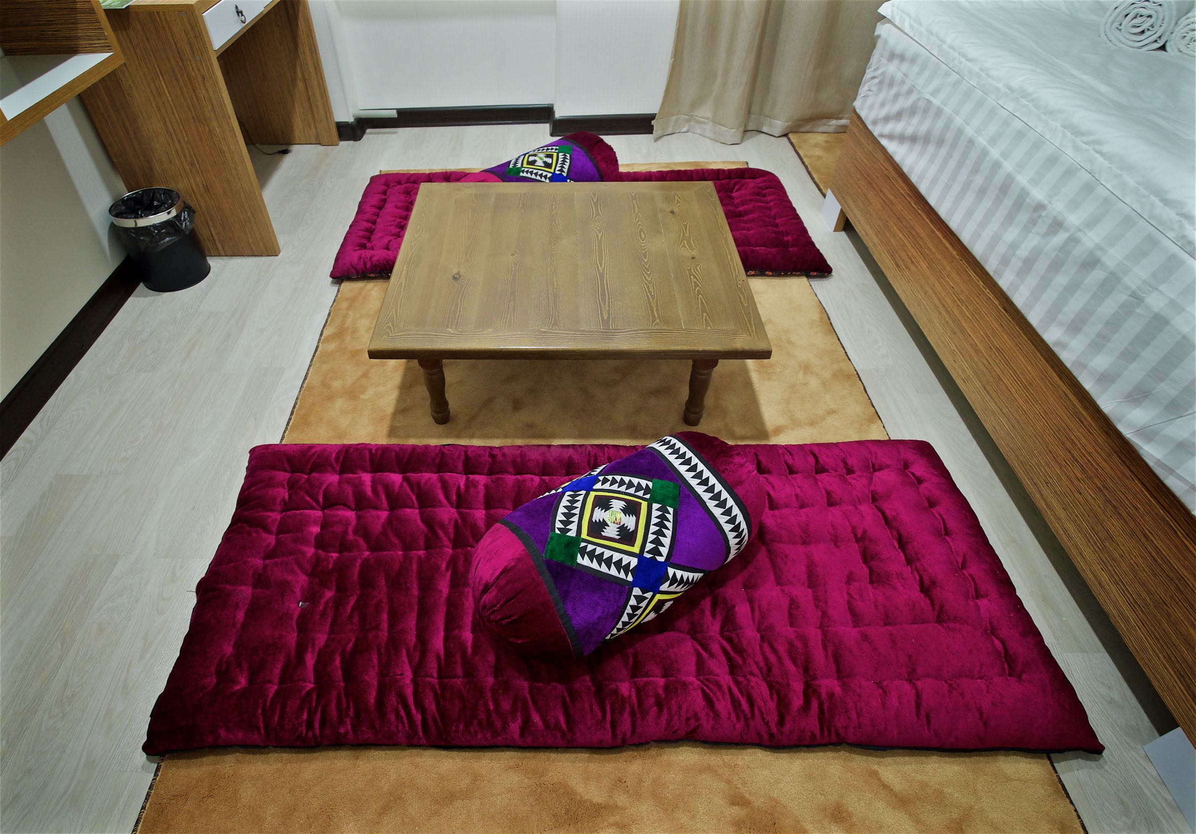
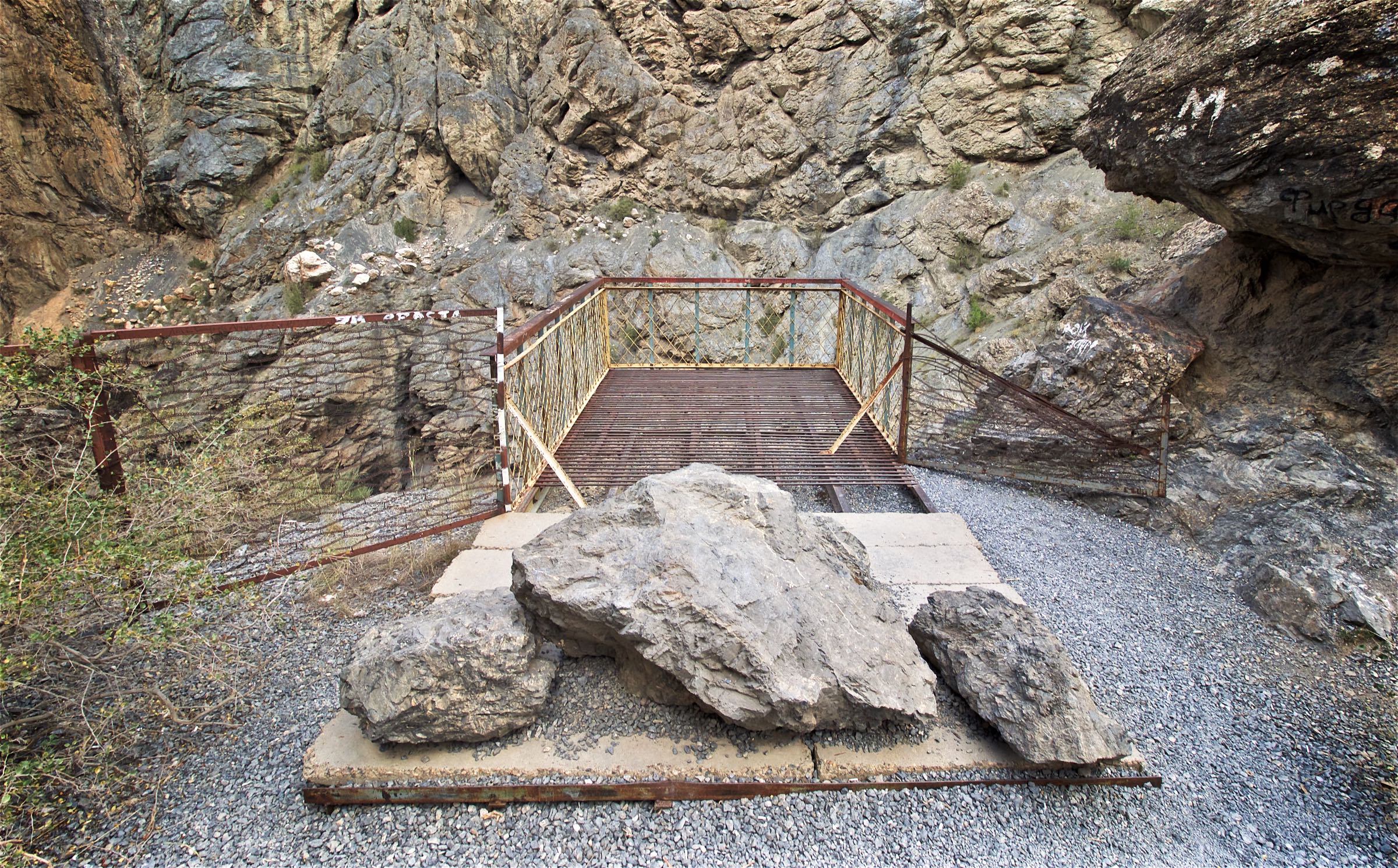
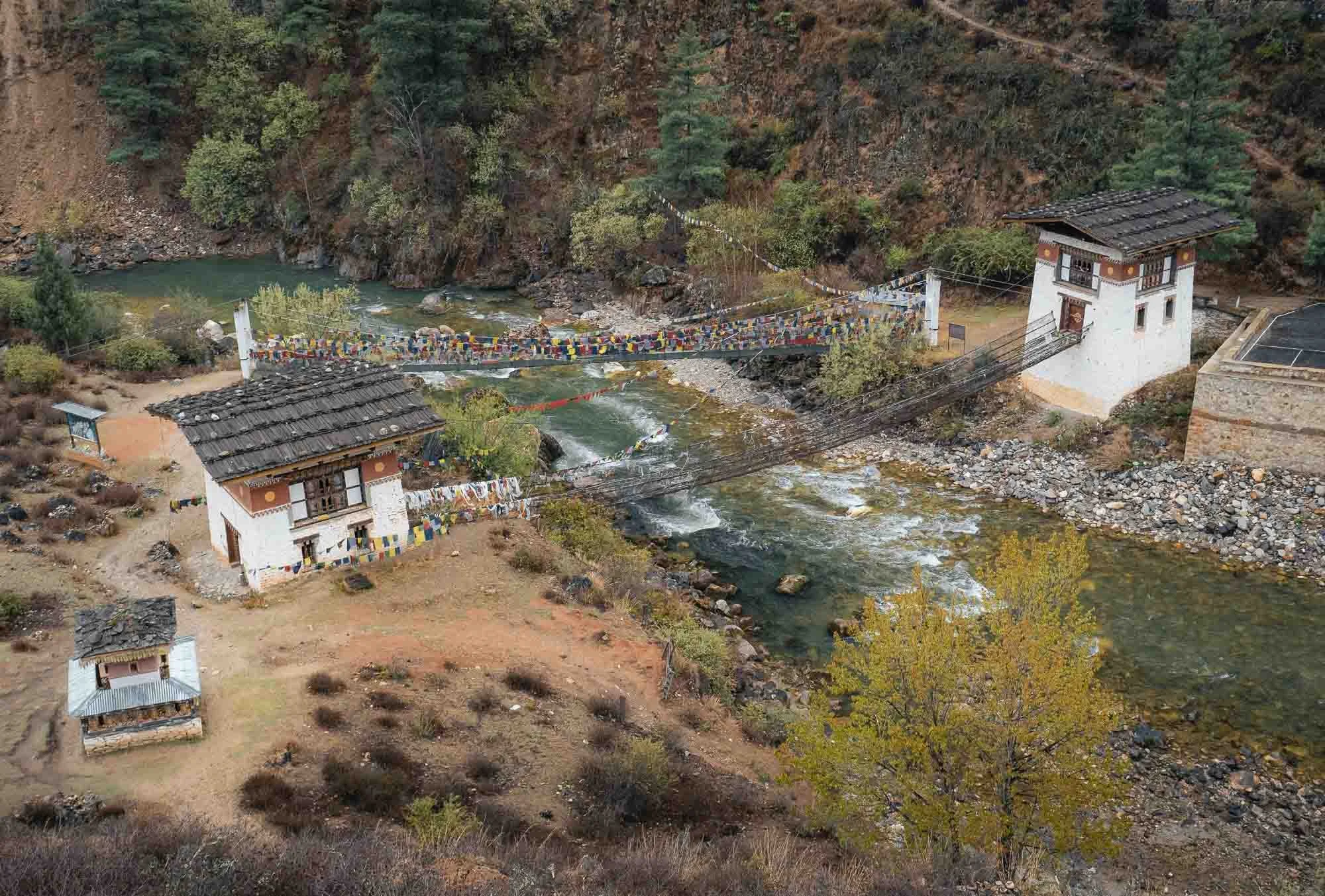
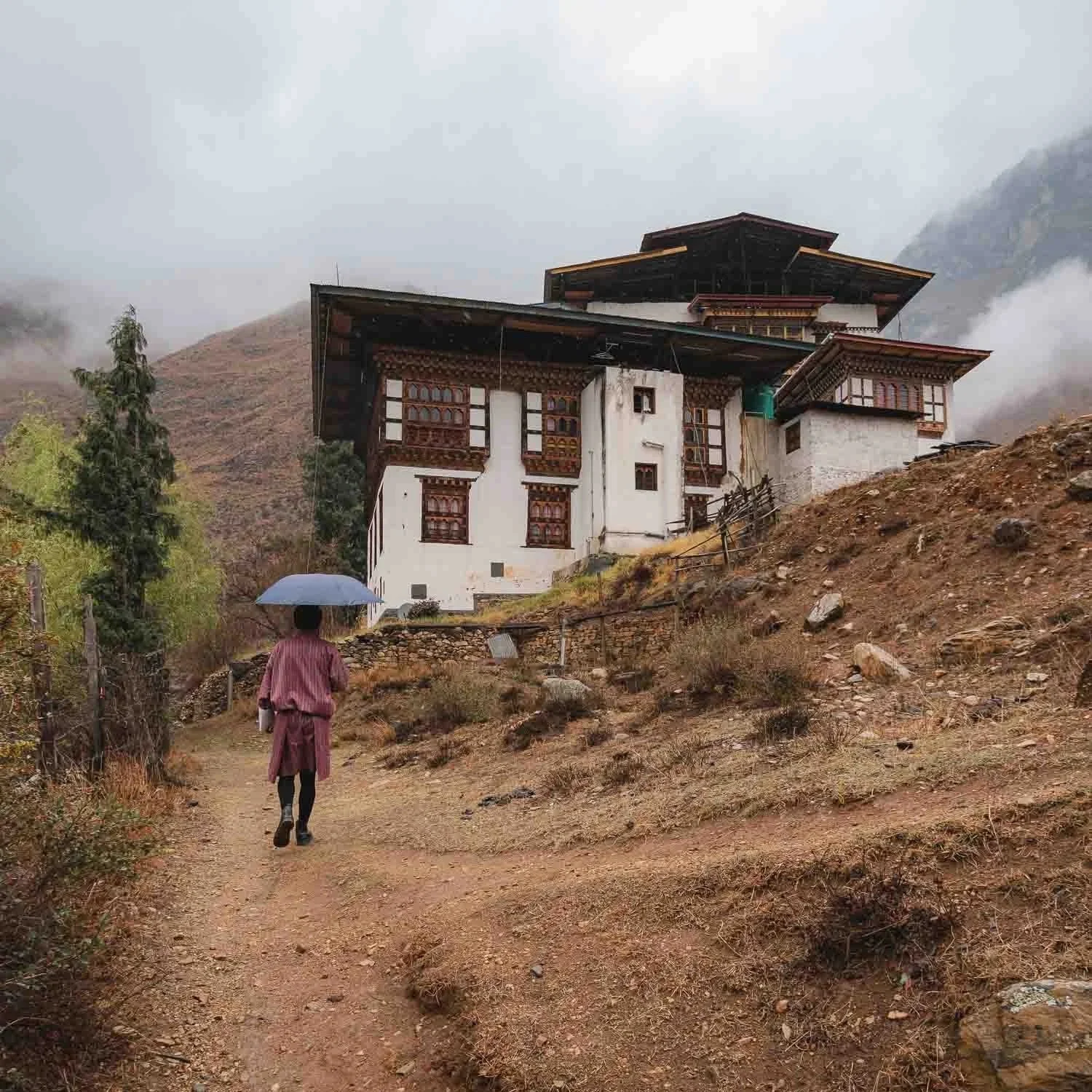
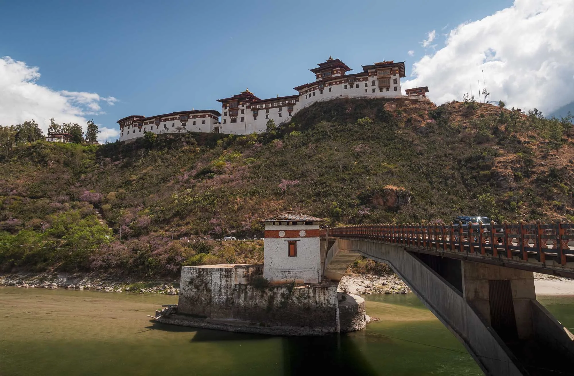
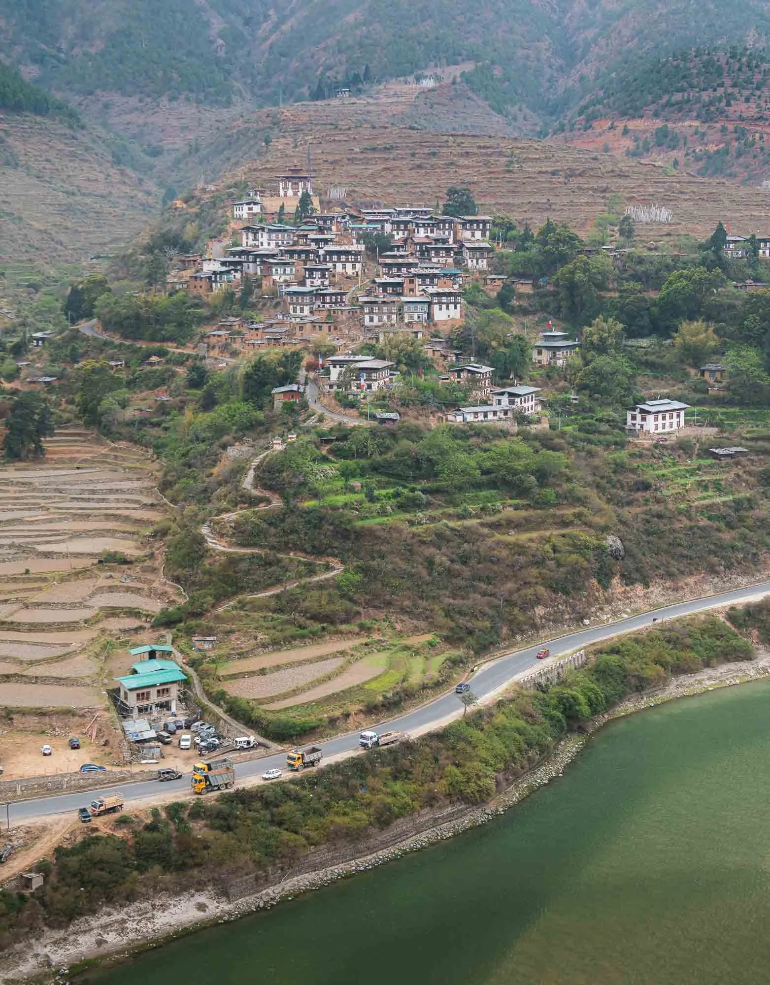
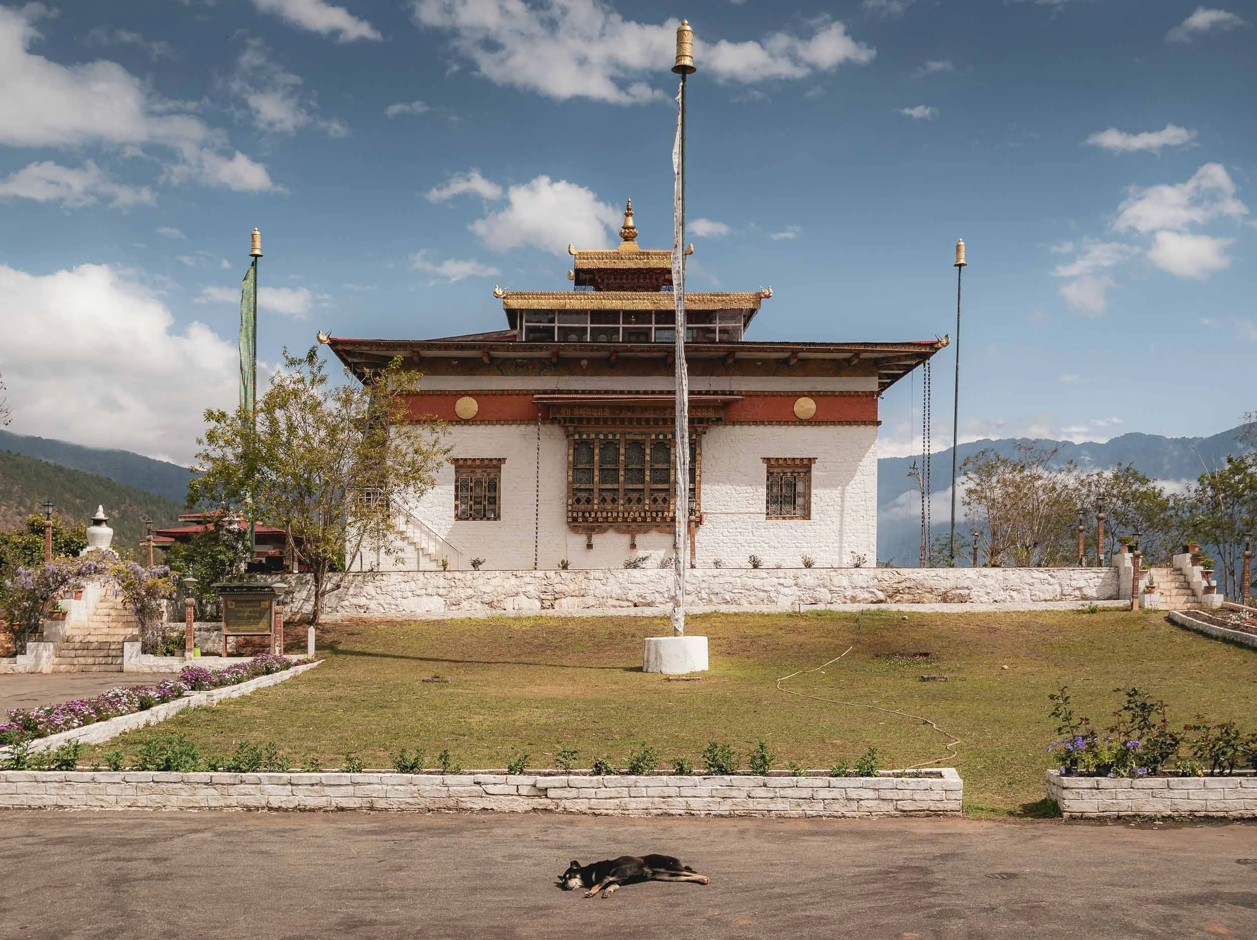
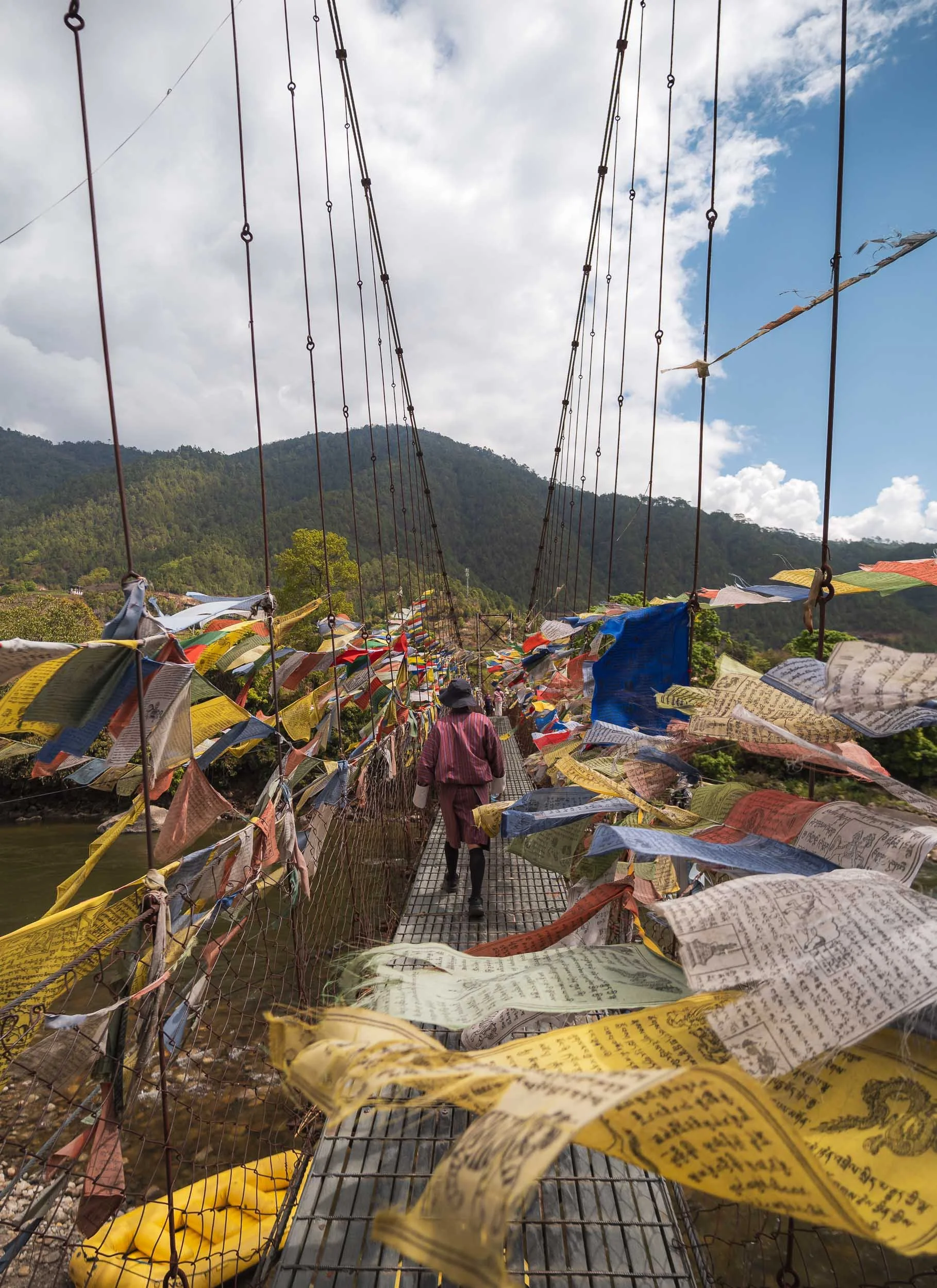
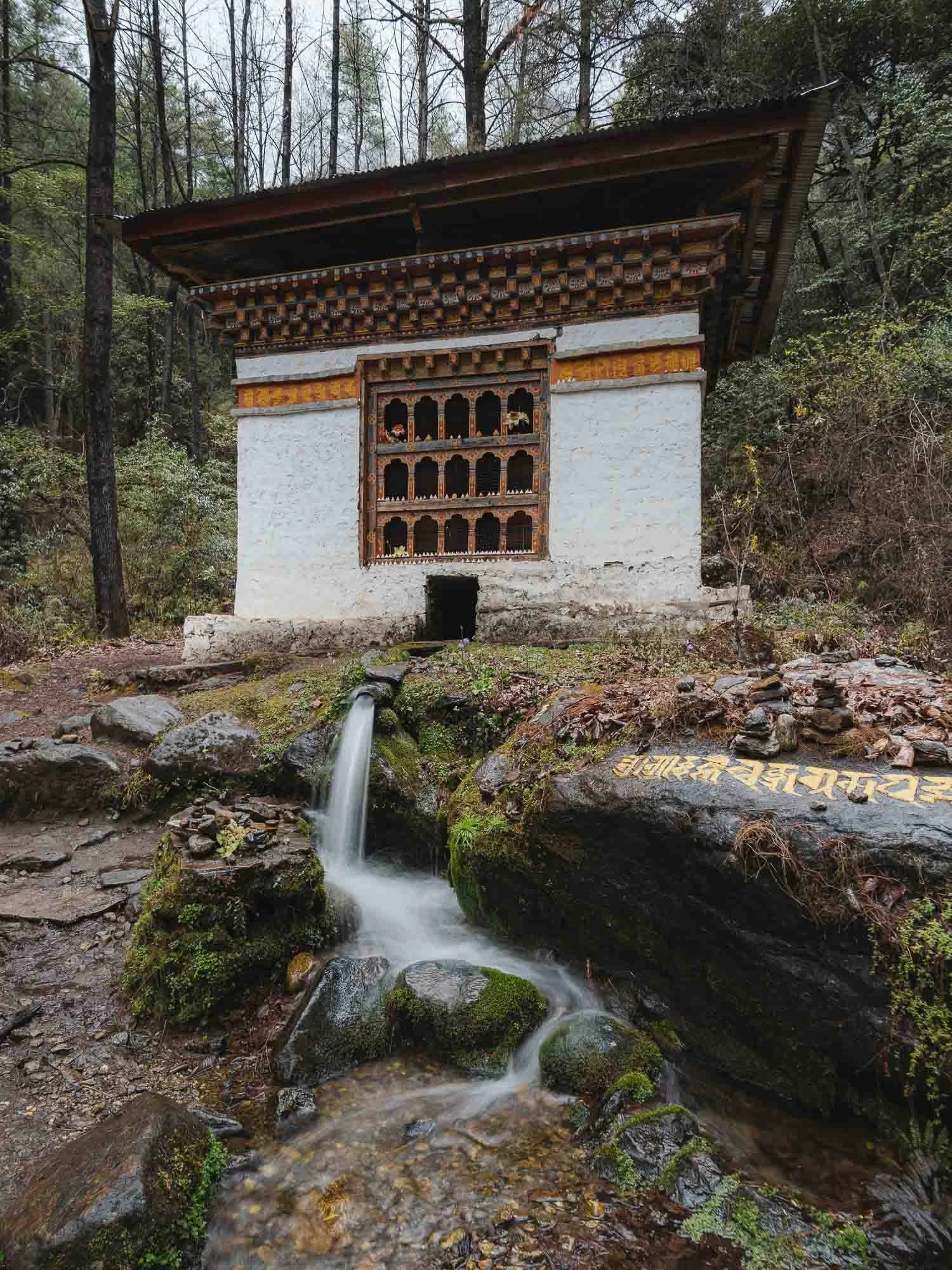
Once I made it a few hours later than planned, it was still rainy. A drive to Thimphu, the capital was on the agenda, with a short stop at a picturesque monastery of Tachog Lhakhang, accessible through one of the many rope bridges in the country. If you look closely, you’ll see there are actually two bridges here, the one without flags being the oldest in the country (from 1420) and - possibly for this reason - not in use anymore.
At this point I also had my first encounter with the political system of the country: Wikipedia says it’s a unitary parliamentary semi-constitutional monarchy - in effect a Kingdom, ruled by the so-called Dragon King (what a title). In practice, it holds general elections in a parliamentary form of government, but the royal family is present everywhere and from what I observed and been told, highly respected.
My guide Chencho and I walked up to the temple, where he showed me a statue of the so-called “Bearded Master”: Guru Rinpoche. He is omnipresent in the temples of the country, and considered the civilizational founder who established Buddhist Vajrayana practice across the region.
It also featured a rather curious artifact inside (no photos - none of the temples in Bhutan allow photography or videos inside and they’re quite strict about it): a spot where a woman had prayed so many times for so long that her footprints were eternalized in the stone floor.
Buddhism covers more than 75% of the around 800,000 people in the country, and its evidence is everywhere. The balance is mostly Hinduism, mostly from Indian influence in the south.
Thimphu
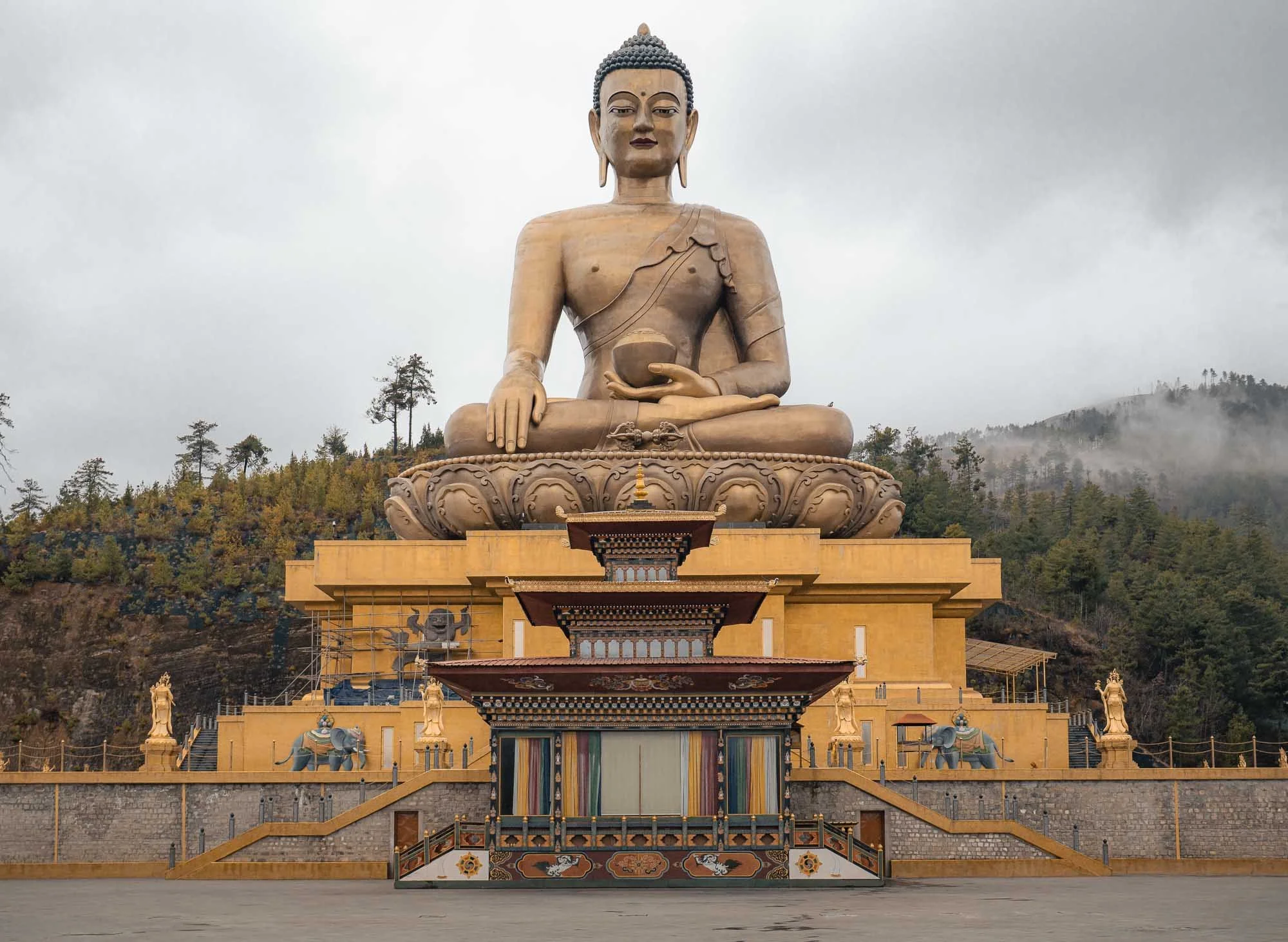
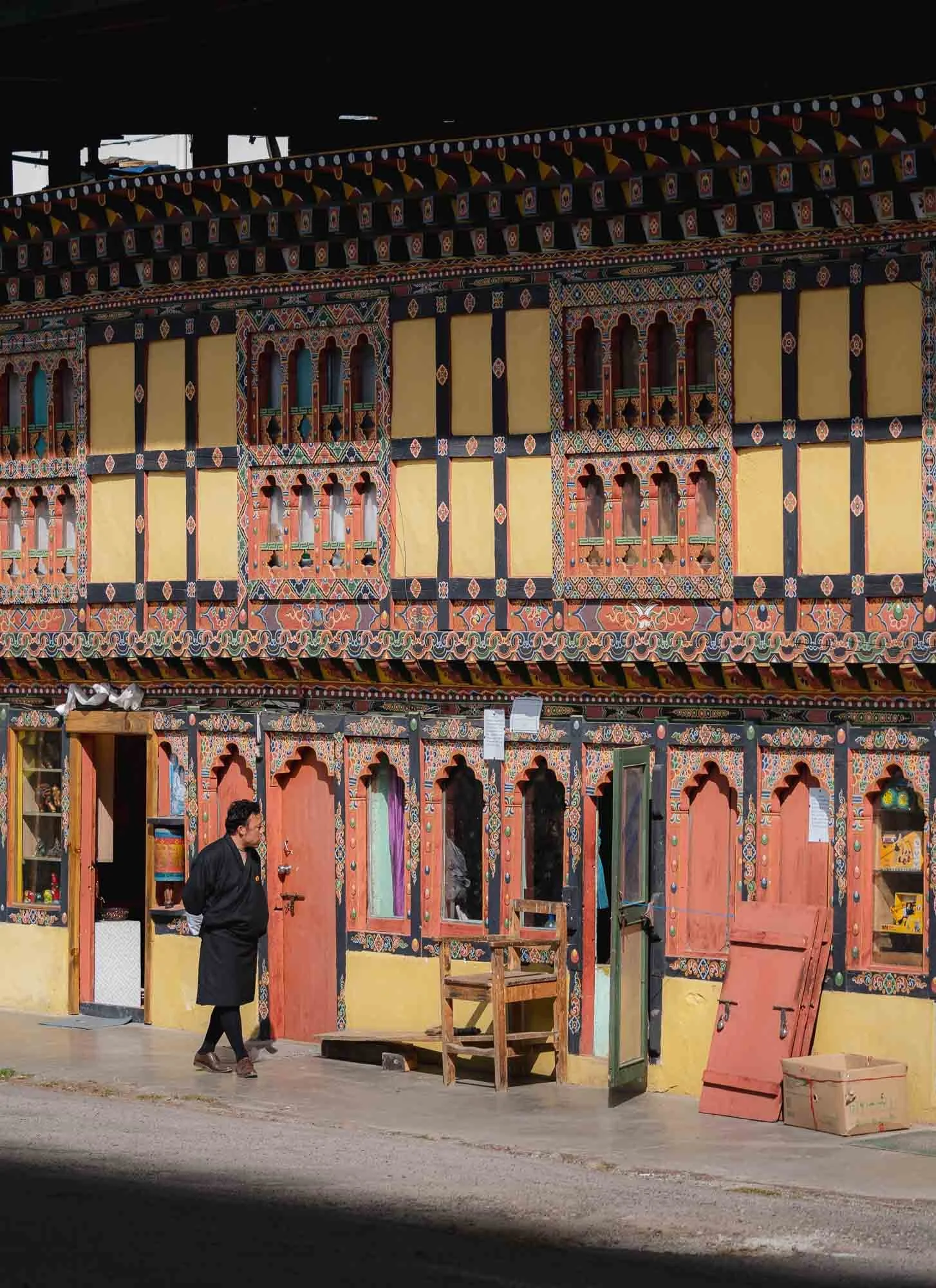
After about an hour drive we arrived at the capital, or more specifically, the Great Buddha Dordenma, a 50- metre-tall bronze statue overlooking the city. It was completed in 2015 and houses over 100,000 smaller Buddha statues inside and was built to emanate peace to the world, so they say. Indeed Bhutan has been ranked 21st on the Global Peace Index in 2025.
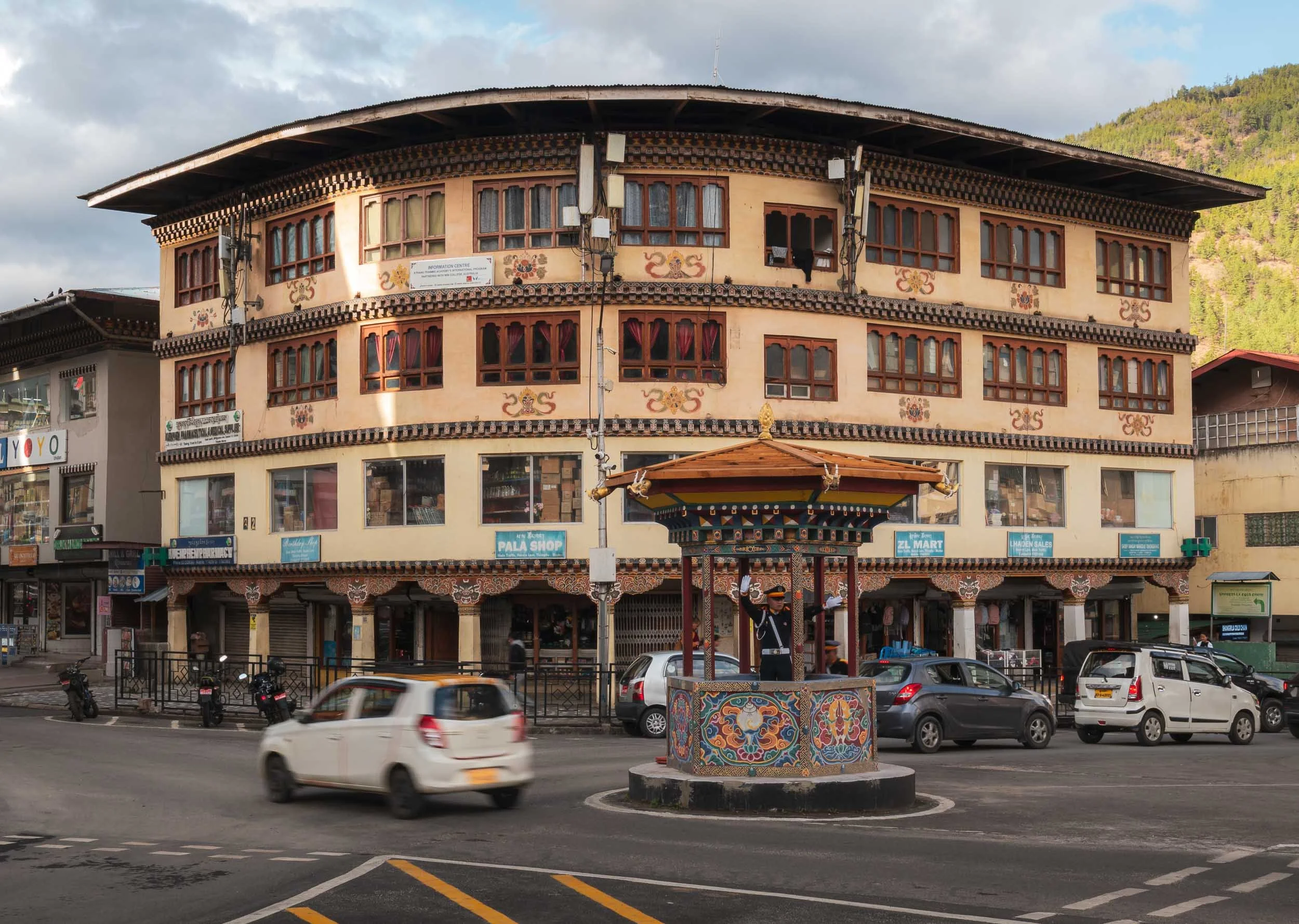
Thimphu is a relatively small capital, with a population of just over 100,000 people. In the Bhutanese spirit of calm, honking is not allowed on its road, and this is more or less adhered to from my observation - a stark contrast to neighboring India. The city also doesn’t have any traffic lights, the main intersection is managed by a white-gloved police offer housed in a little structure in a more human-centric approach.

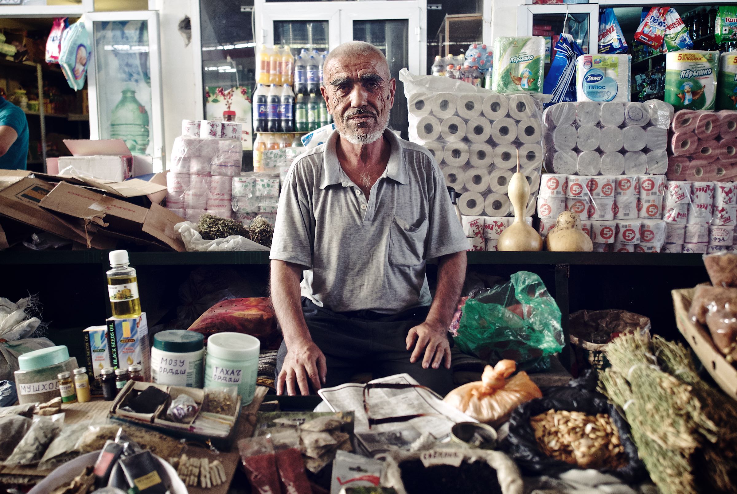
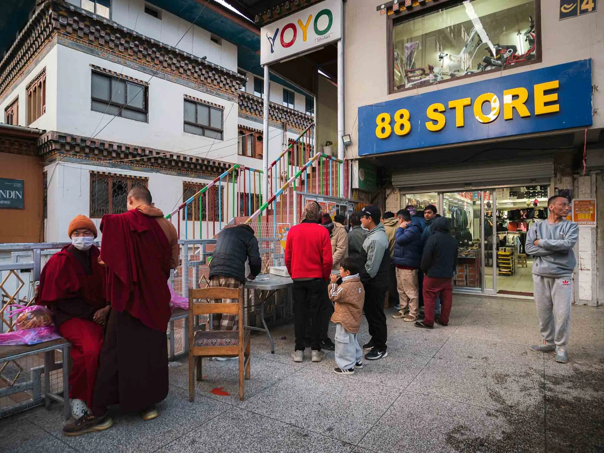
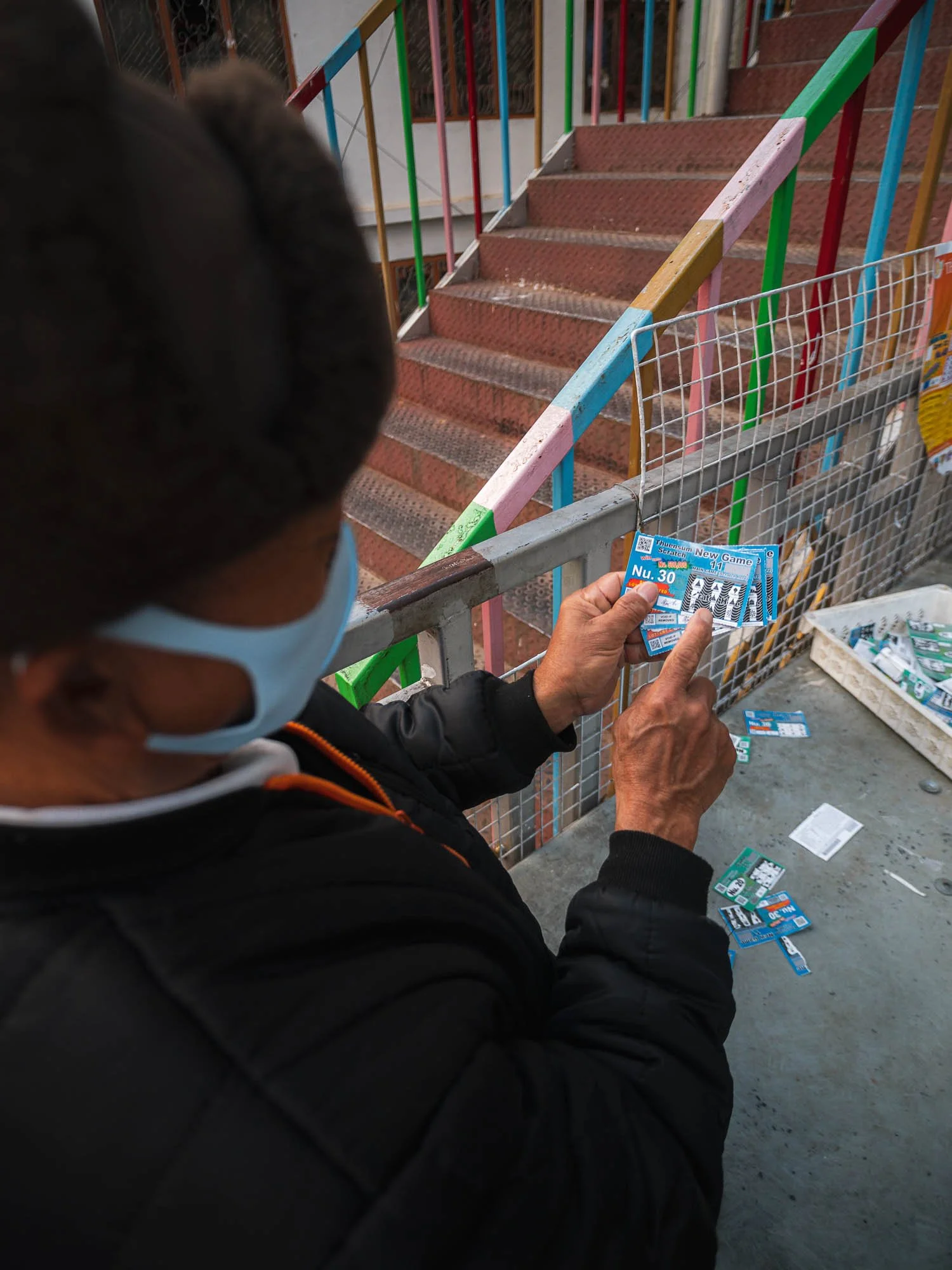
It otherwise has not that much to offer - the busiest spot I encountered was a local lottery stall. Gambling is frowned upon in Buddhism, but not forbidden. This man was not lucky according to his explanation of the various insignia on his ticket.
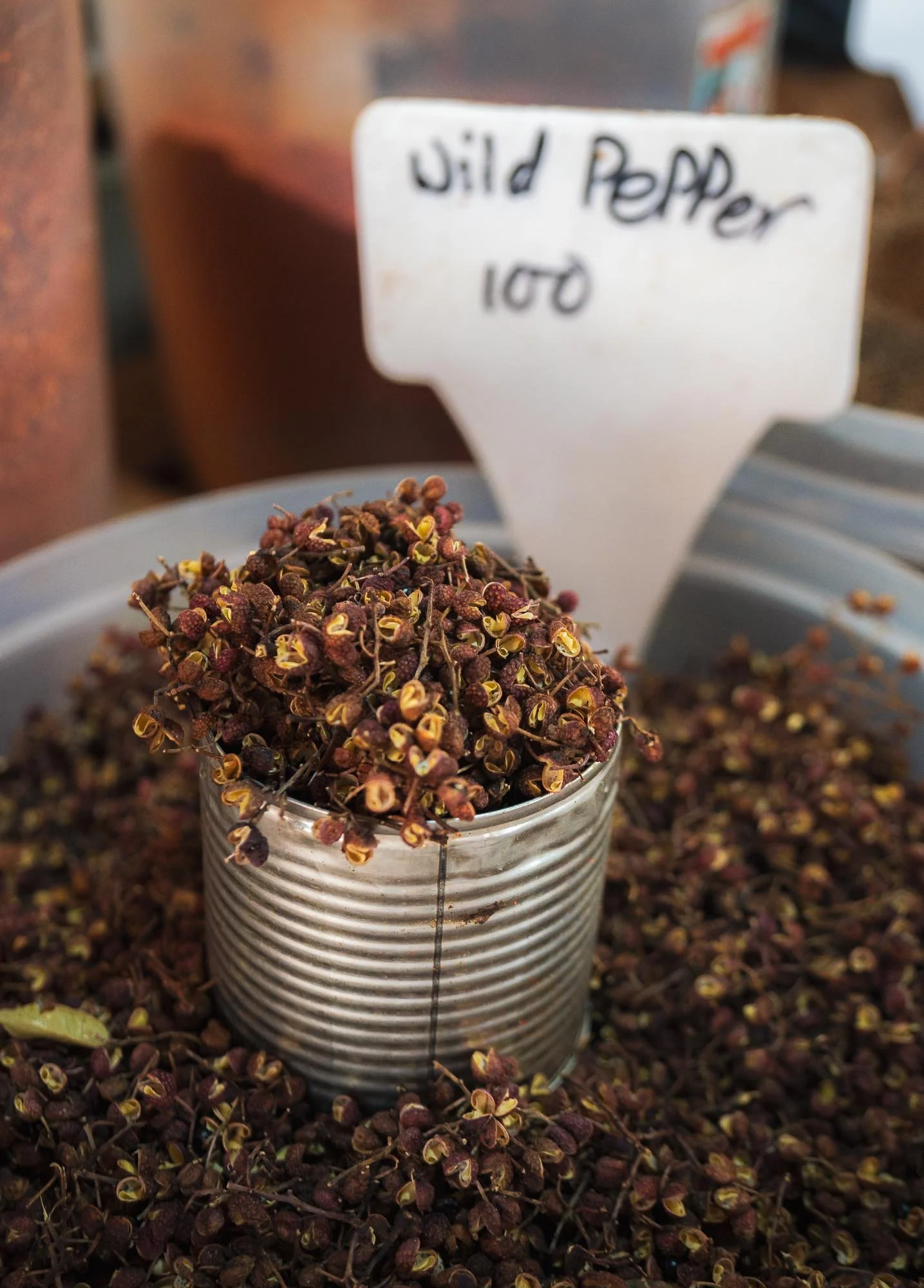
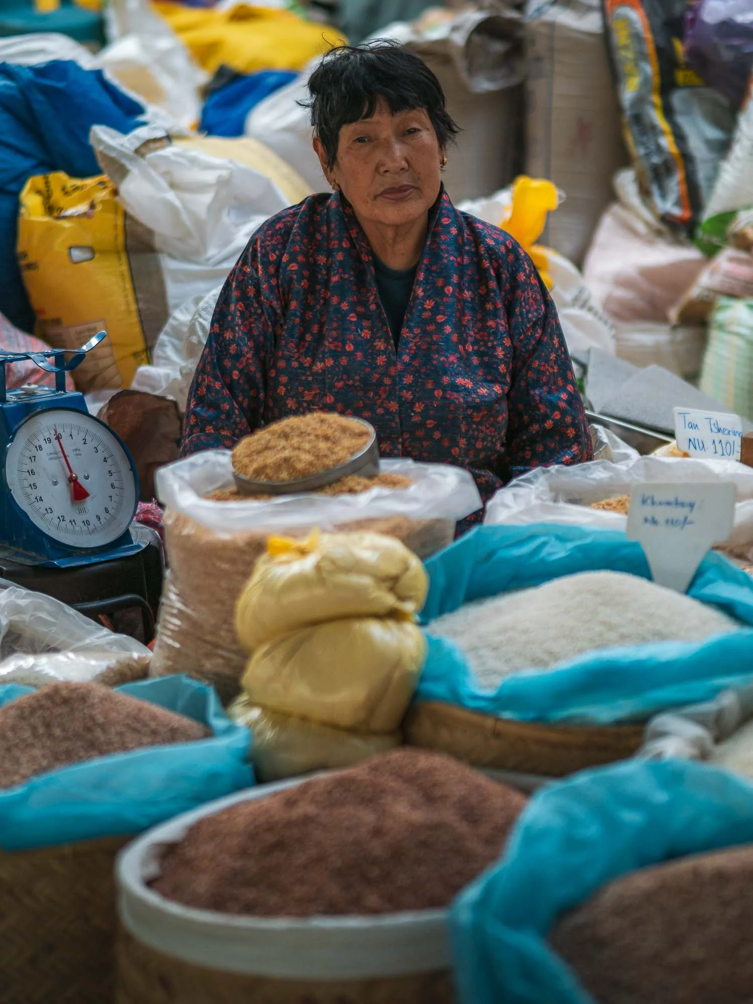
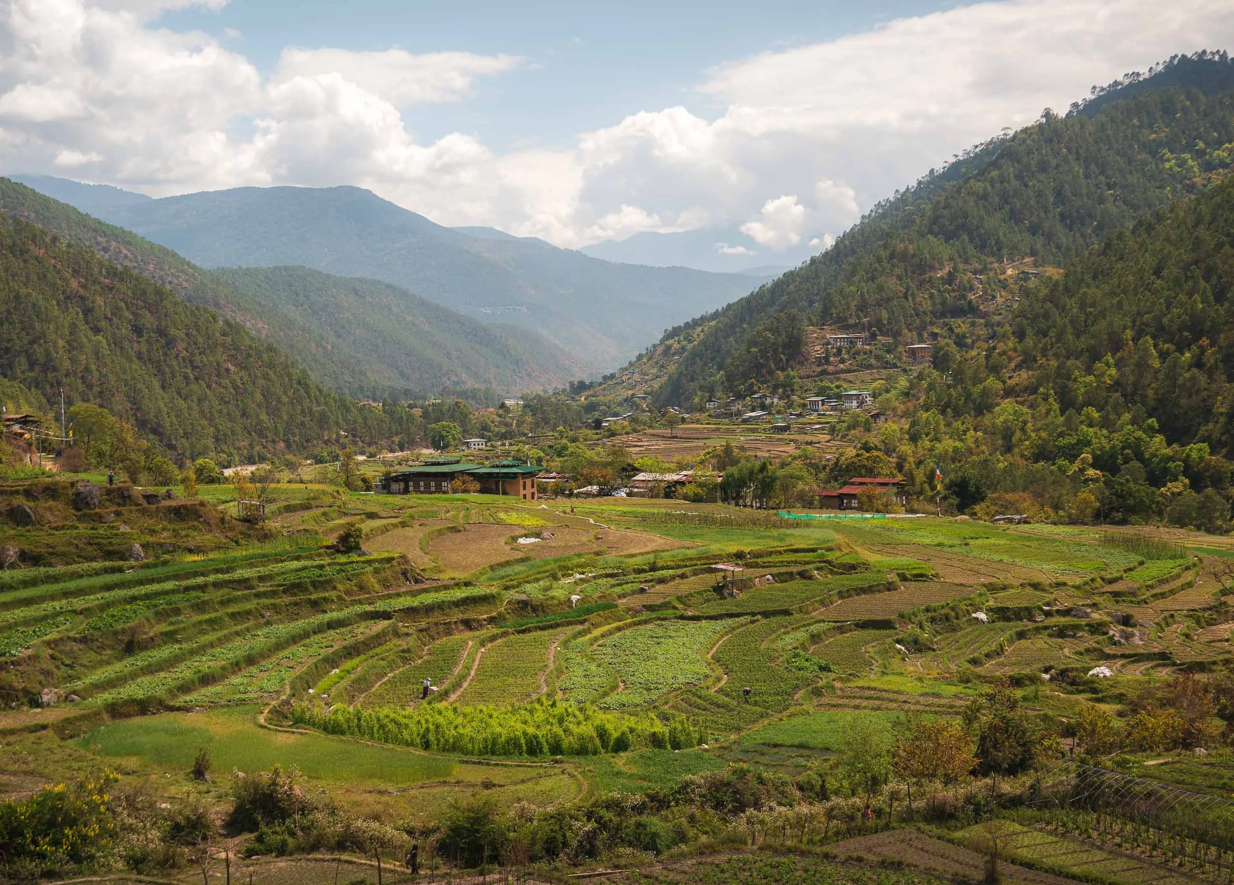
The market had a little more to offer than lottery tickets - mainly of agricultural nature, such as wild pepper. Agriculture makes up a large portion of the country’s economy despite the rugged terrain (almost 99% is considered mountainous), with significant subsistence farming.
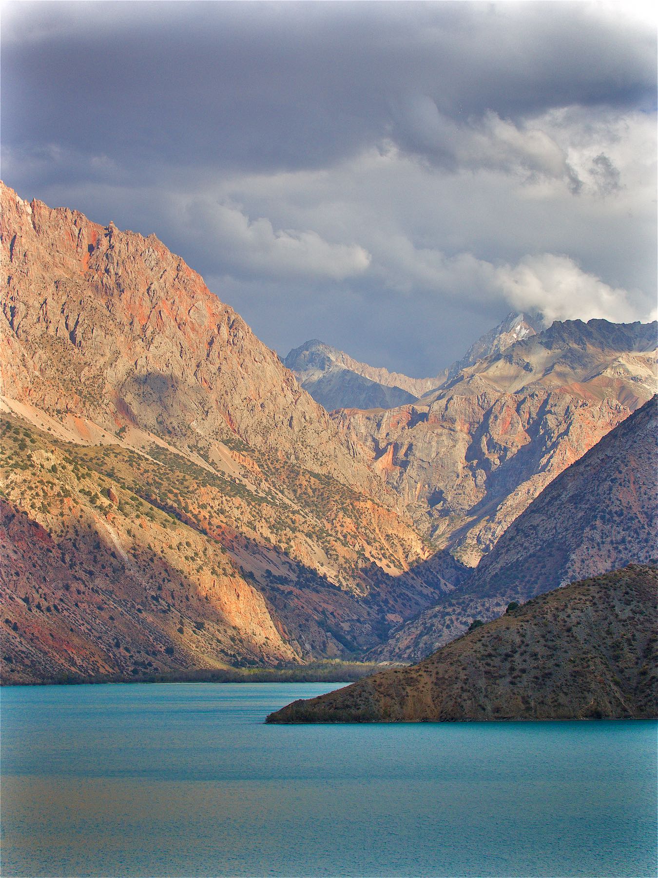
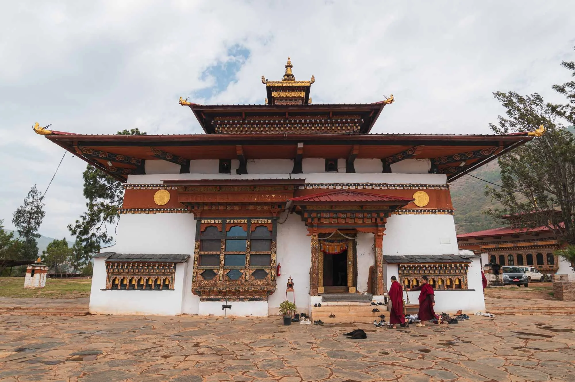
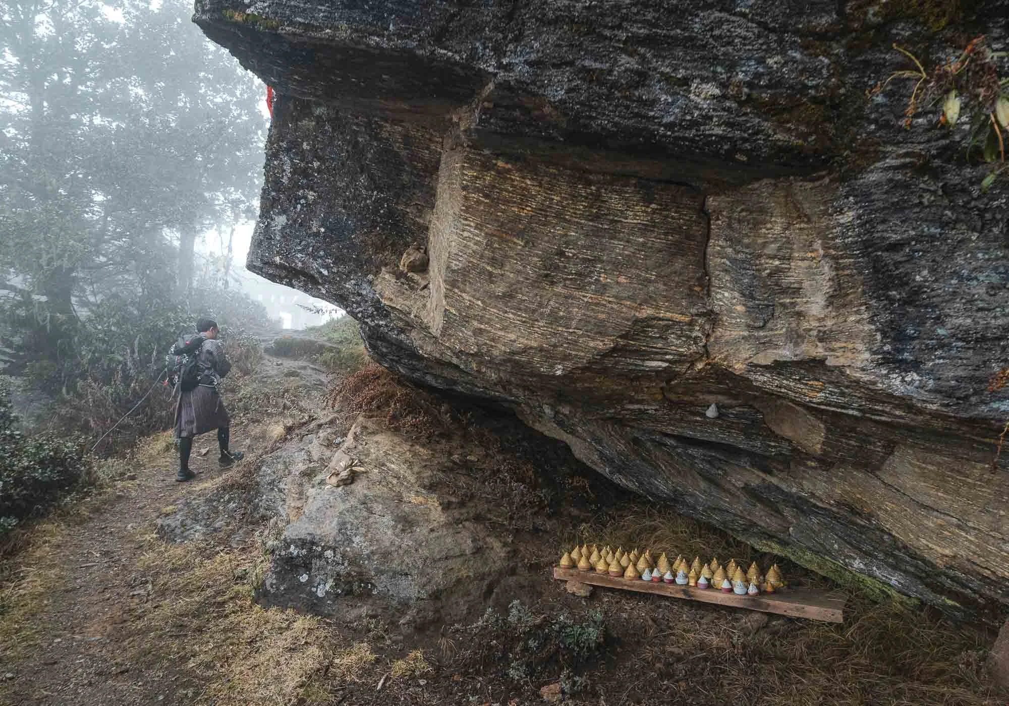
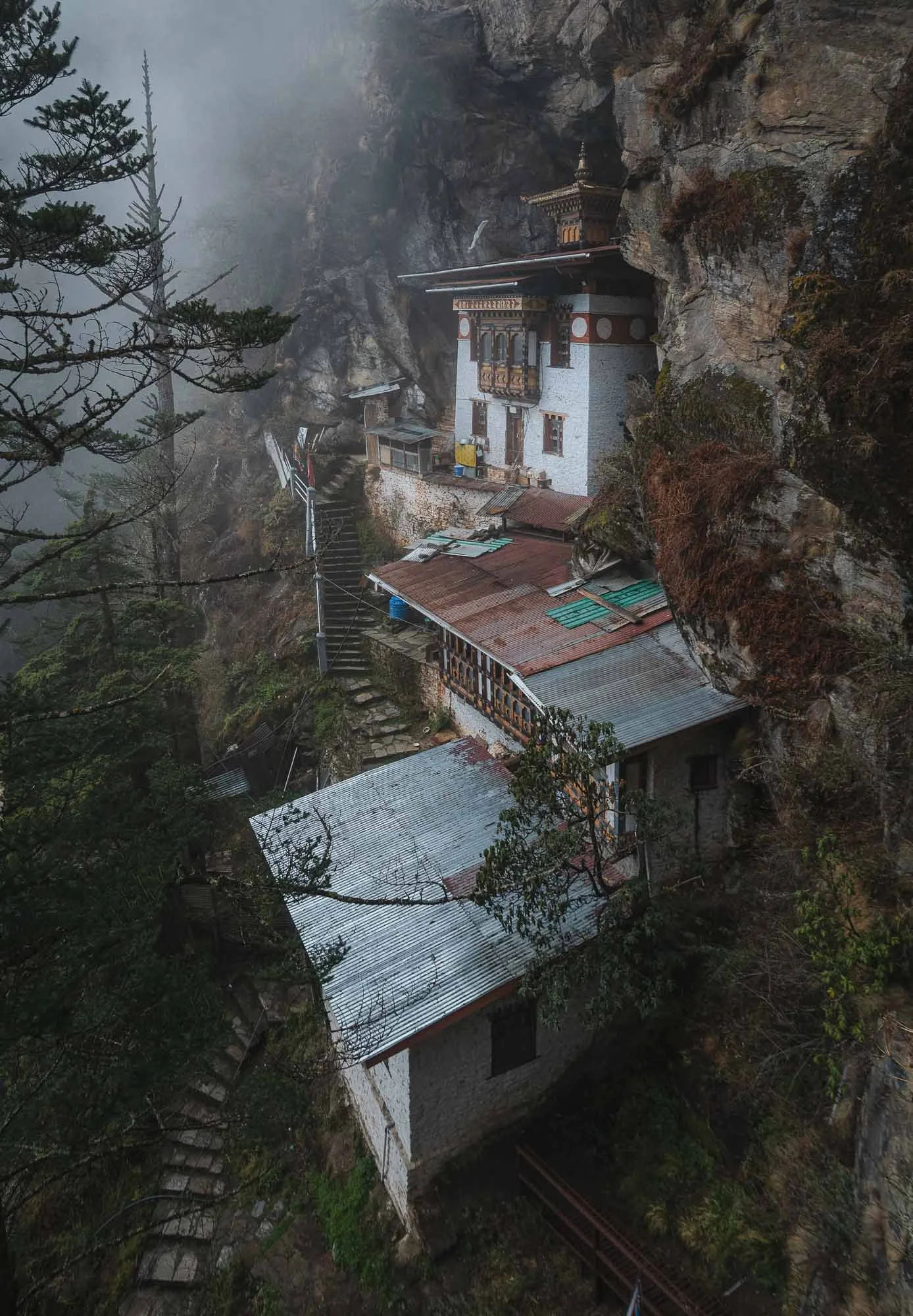
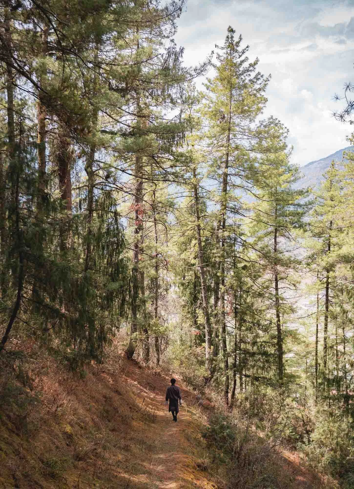
Cheri Monastery
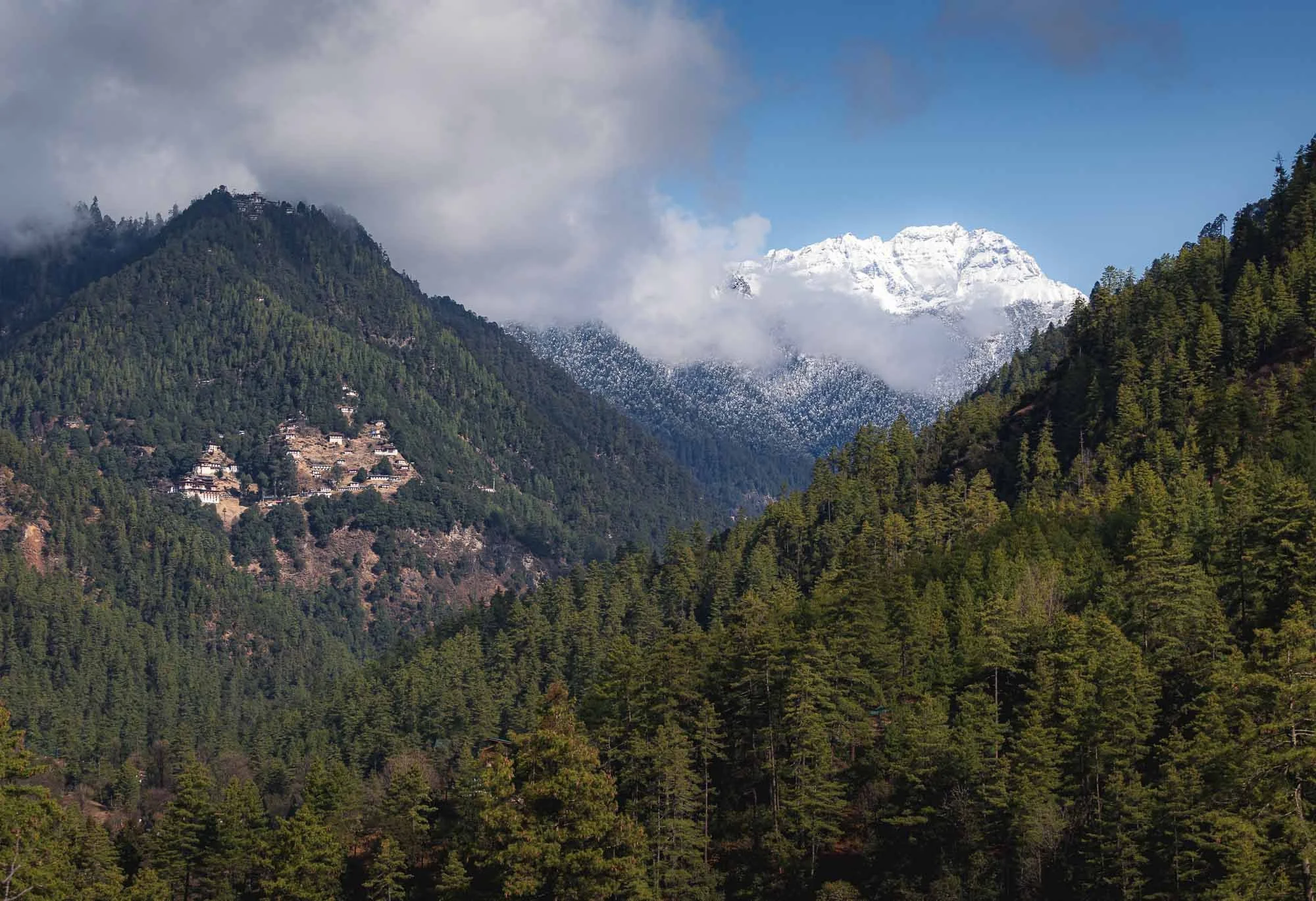
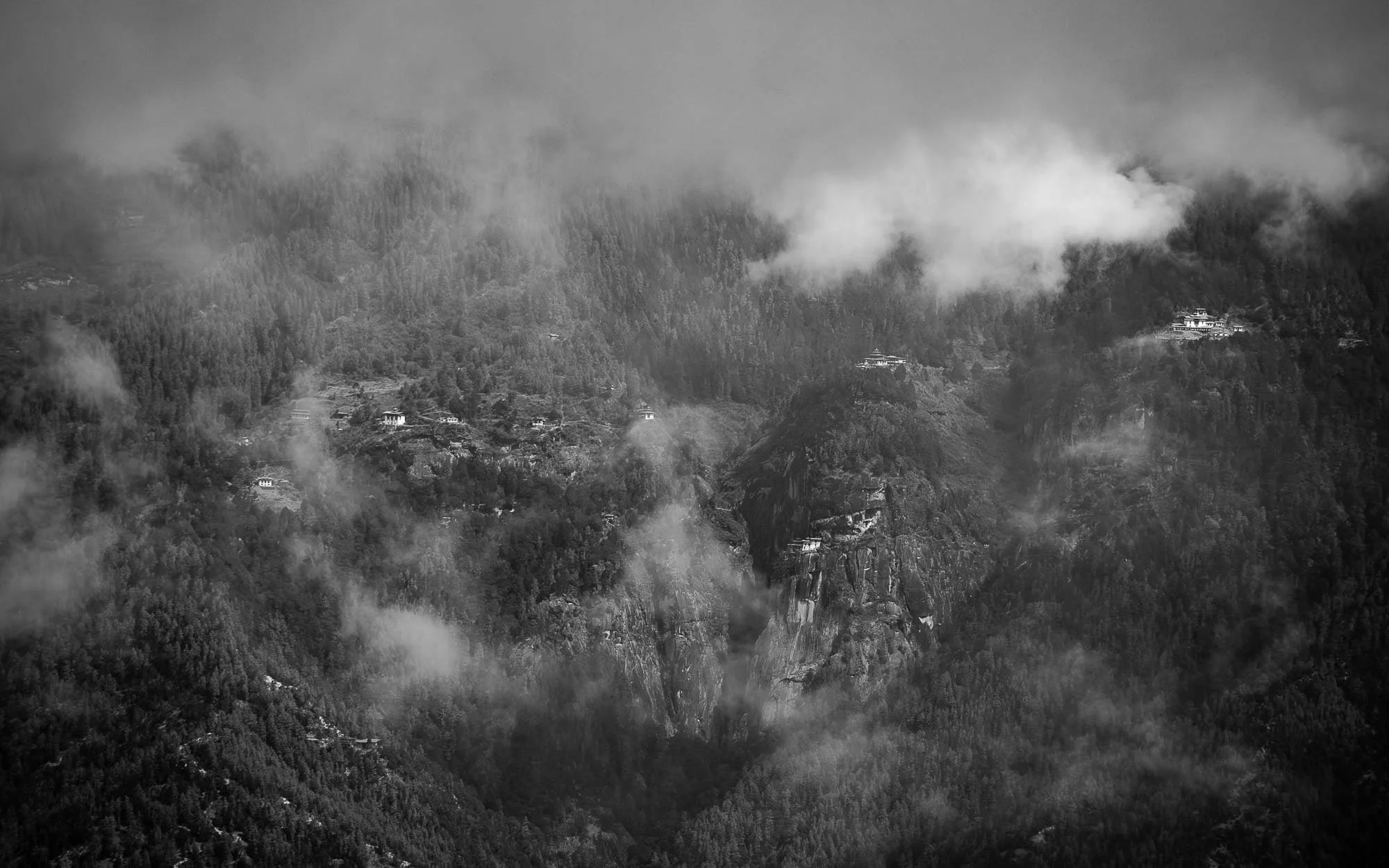
The next day brought brighter conditions and a chance for a first small hike to another monastery, visible on the left here, with a second outpost even higher up the mountain - visible just below the clouds on the left.
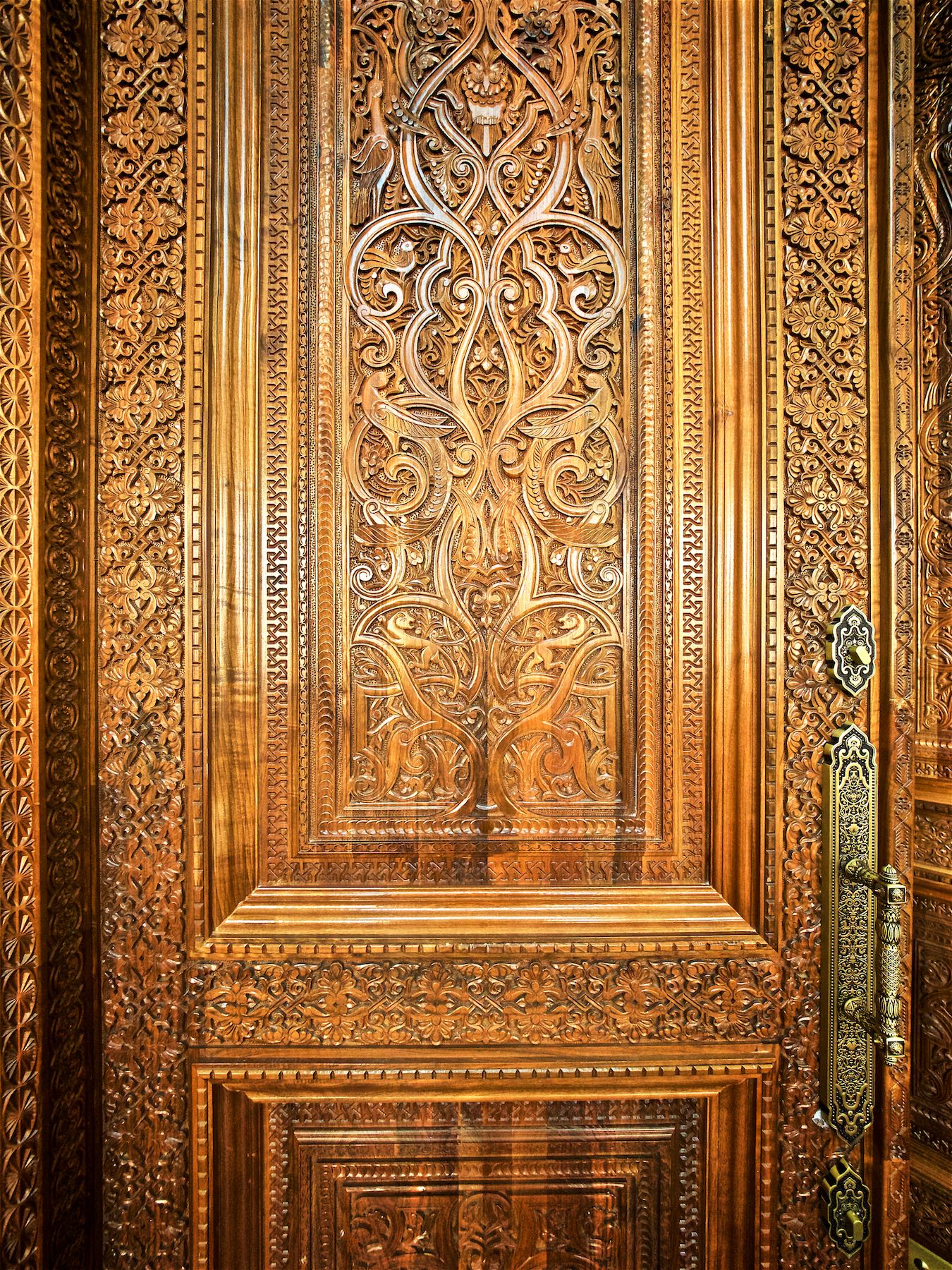
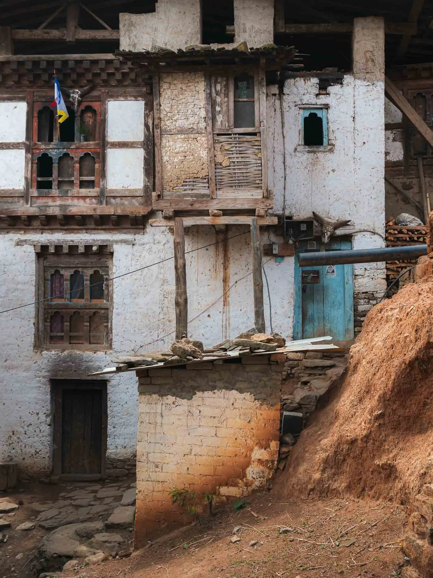
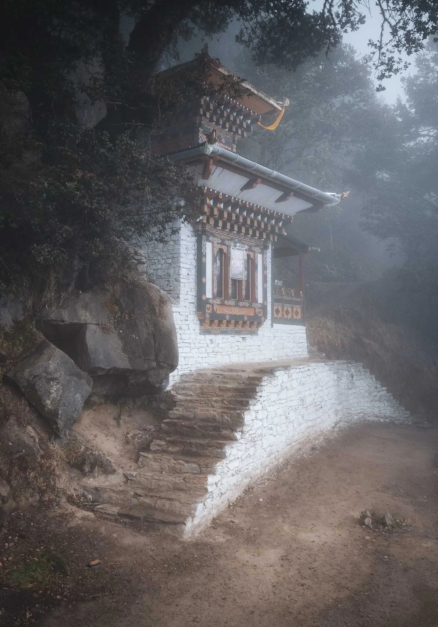
The monastery gave my first glimpse at the incredible architecture all around Bhutan, which is more or less unique to the country - only Tibet seems to feature a similar style. Mostly a mix of compacted earth, stone masonry and the amazingly detailed wooden elements, arranged in interlocking patterns without supporting nails or metal brackets.
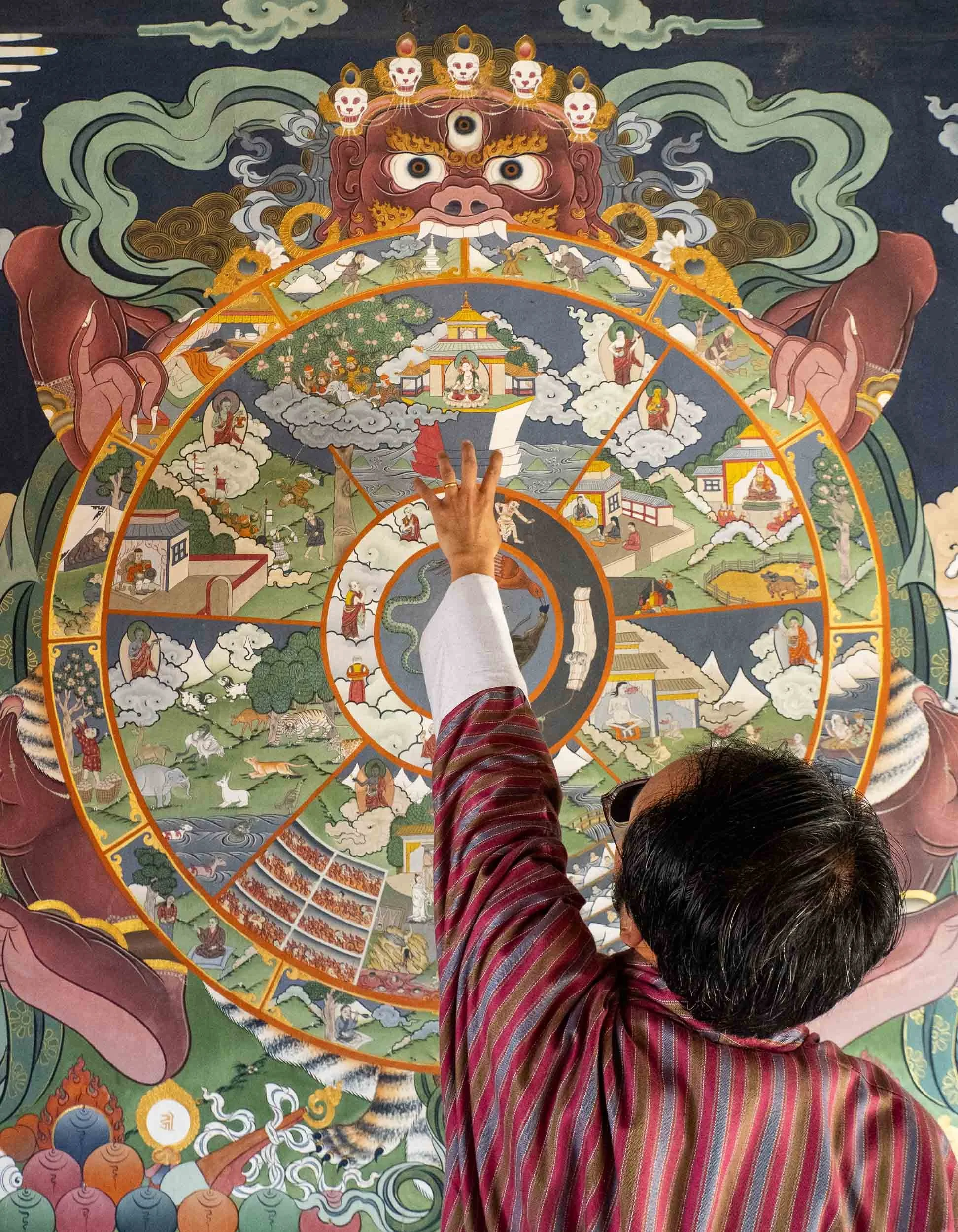
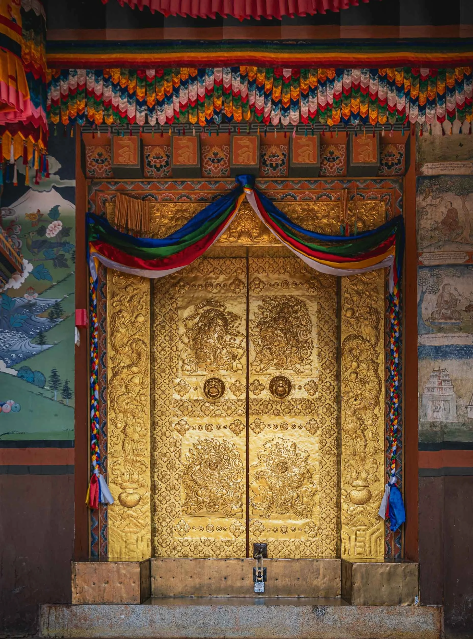
Thick, gold-slated doors protect the entrance, mostly wooden with carvings and gold leaf or powder mixed into paint. Chencho explained the Buddhist wheel of life that can be found painted at many of the temples, representing a kind of circle of existence in Buddhist cosmology.
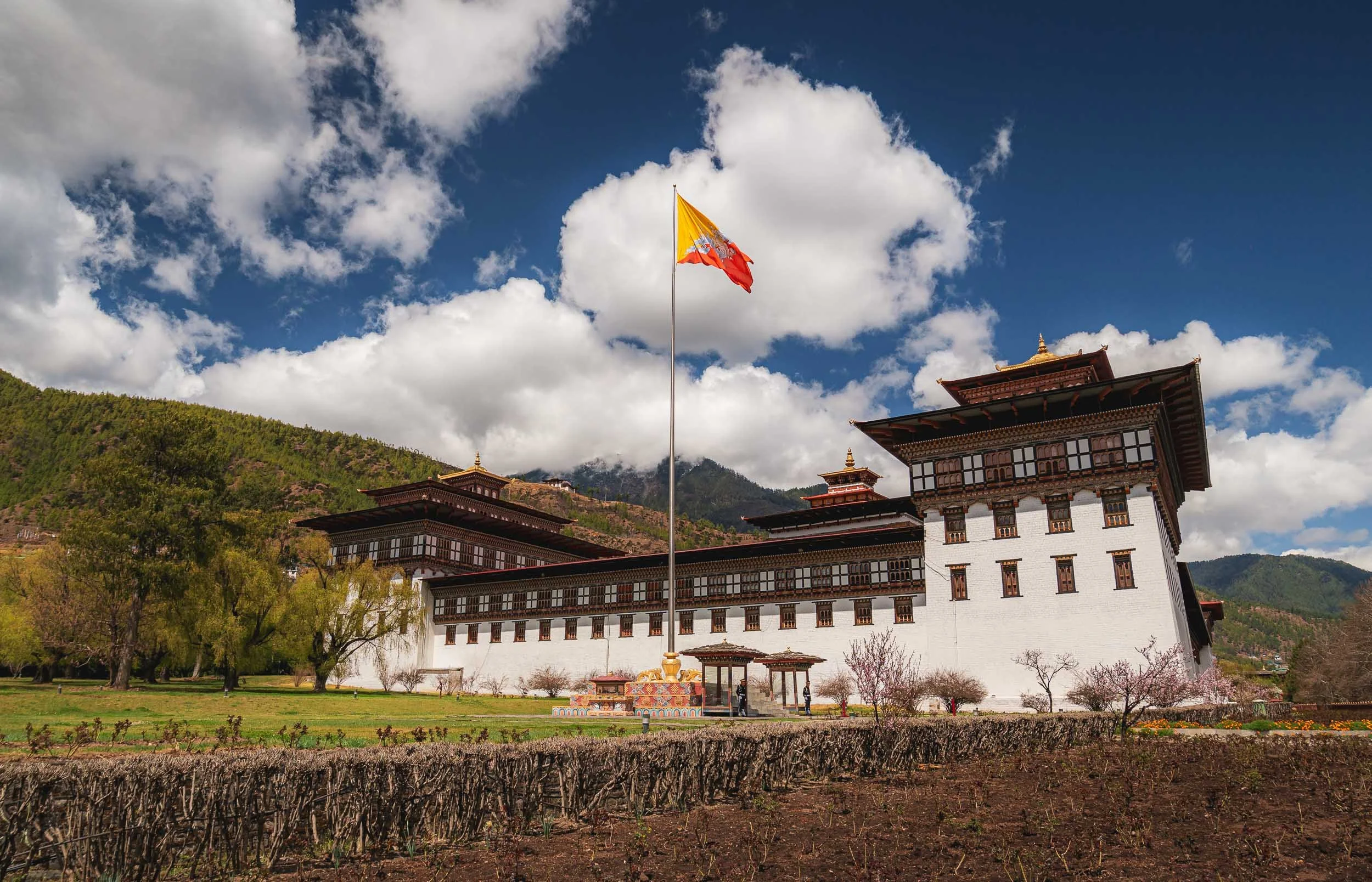
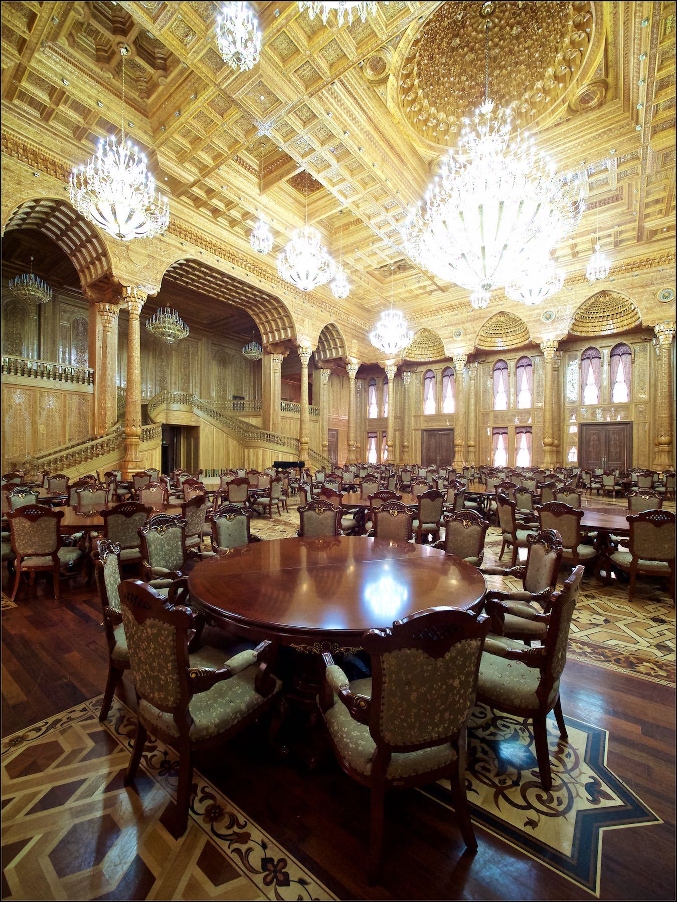
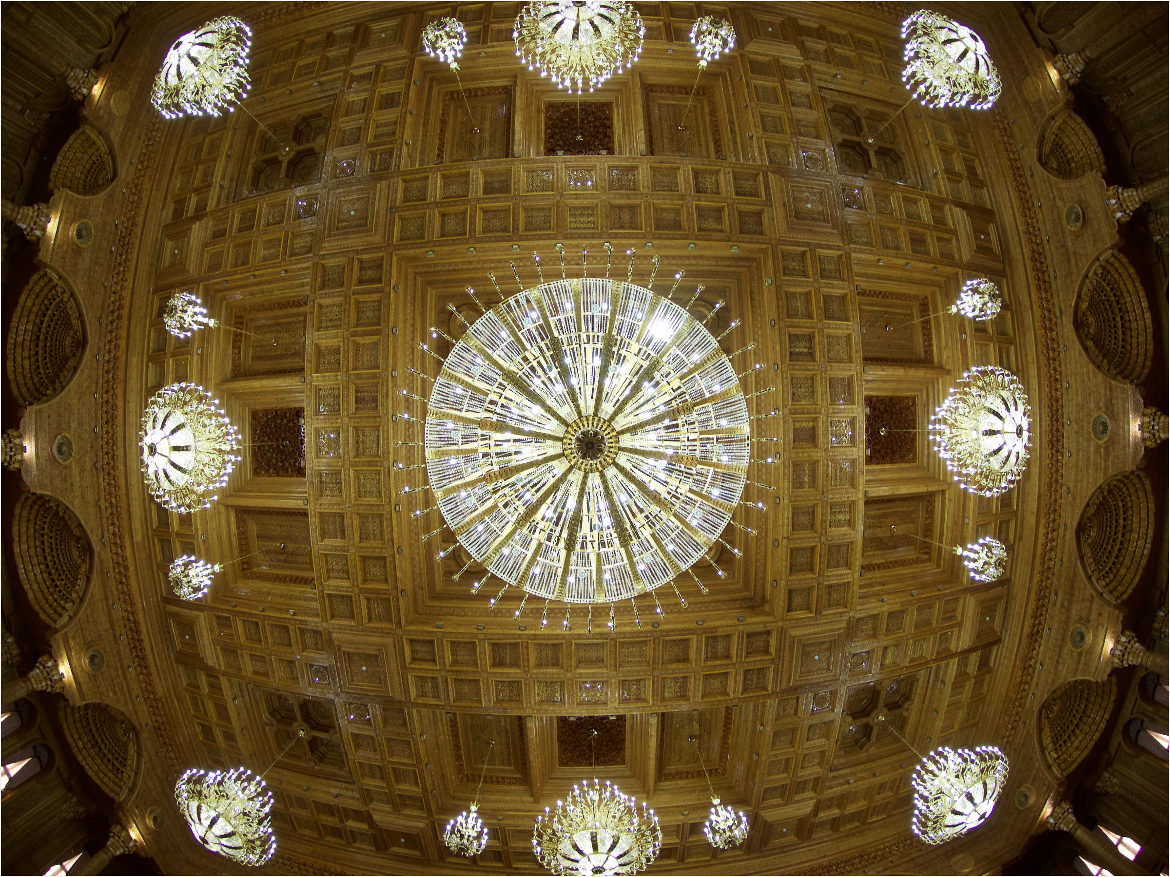
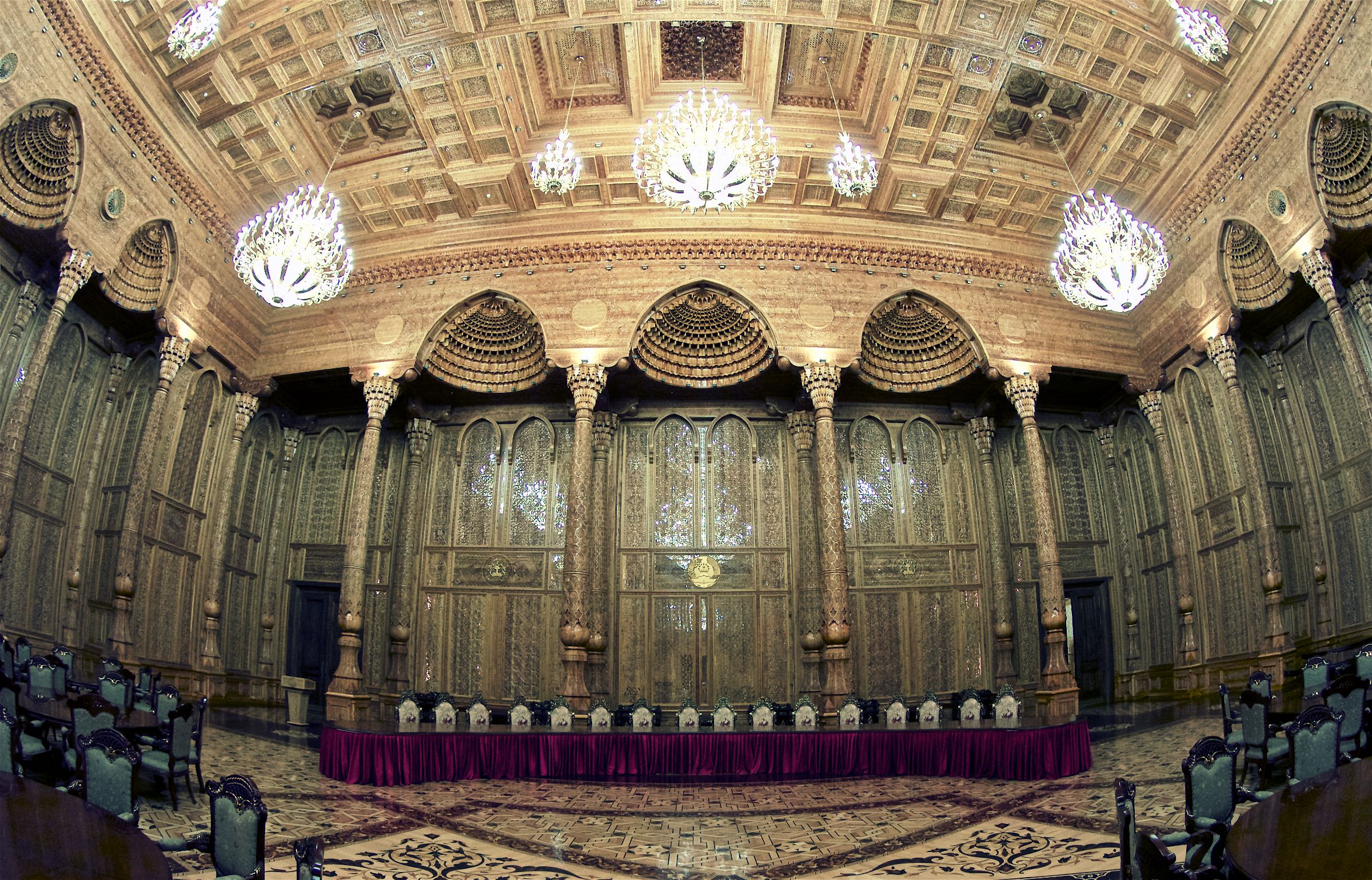
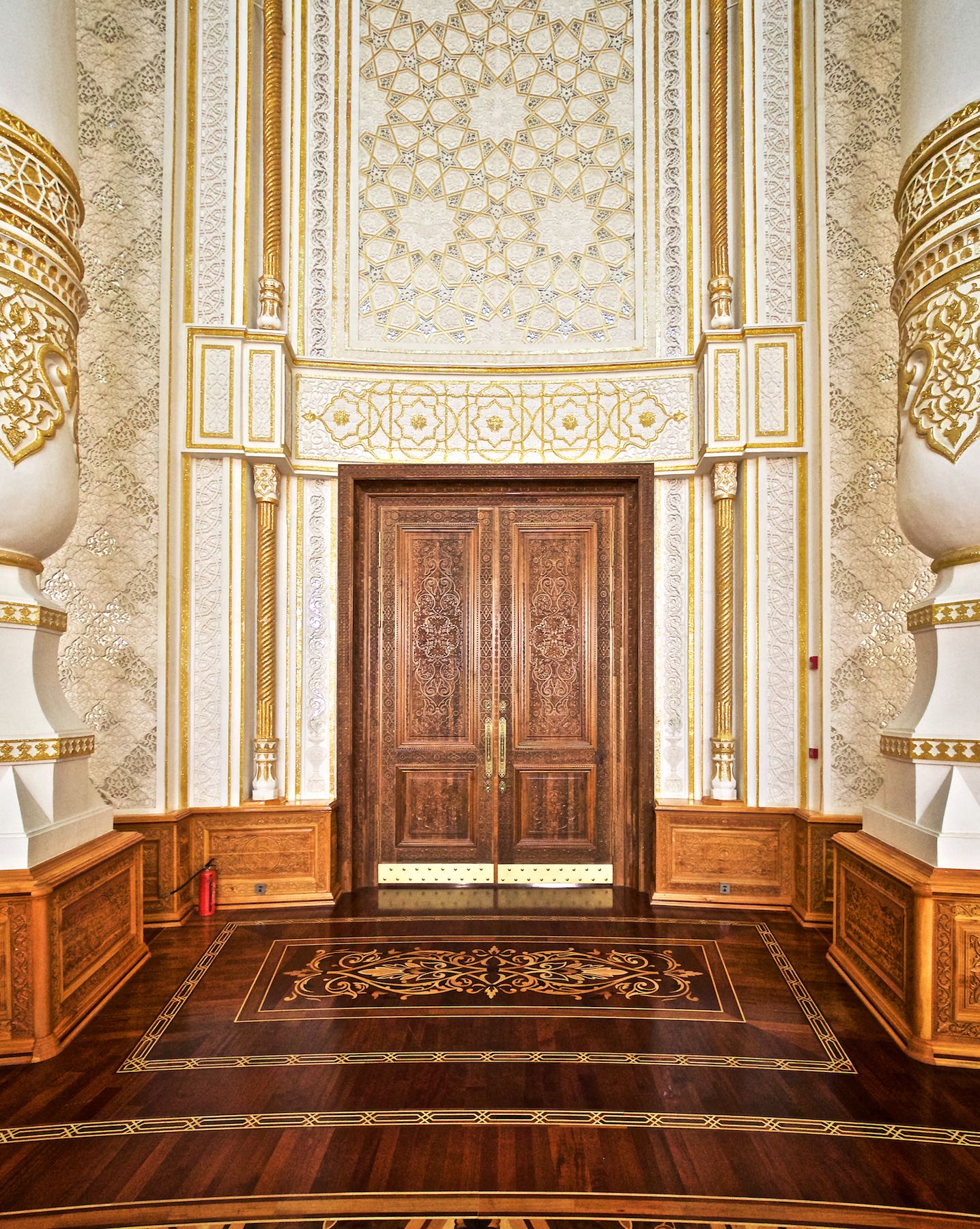
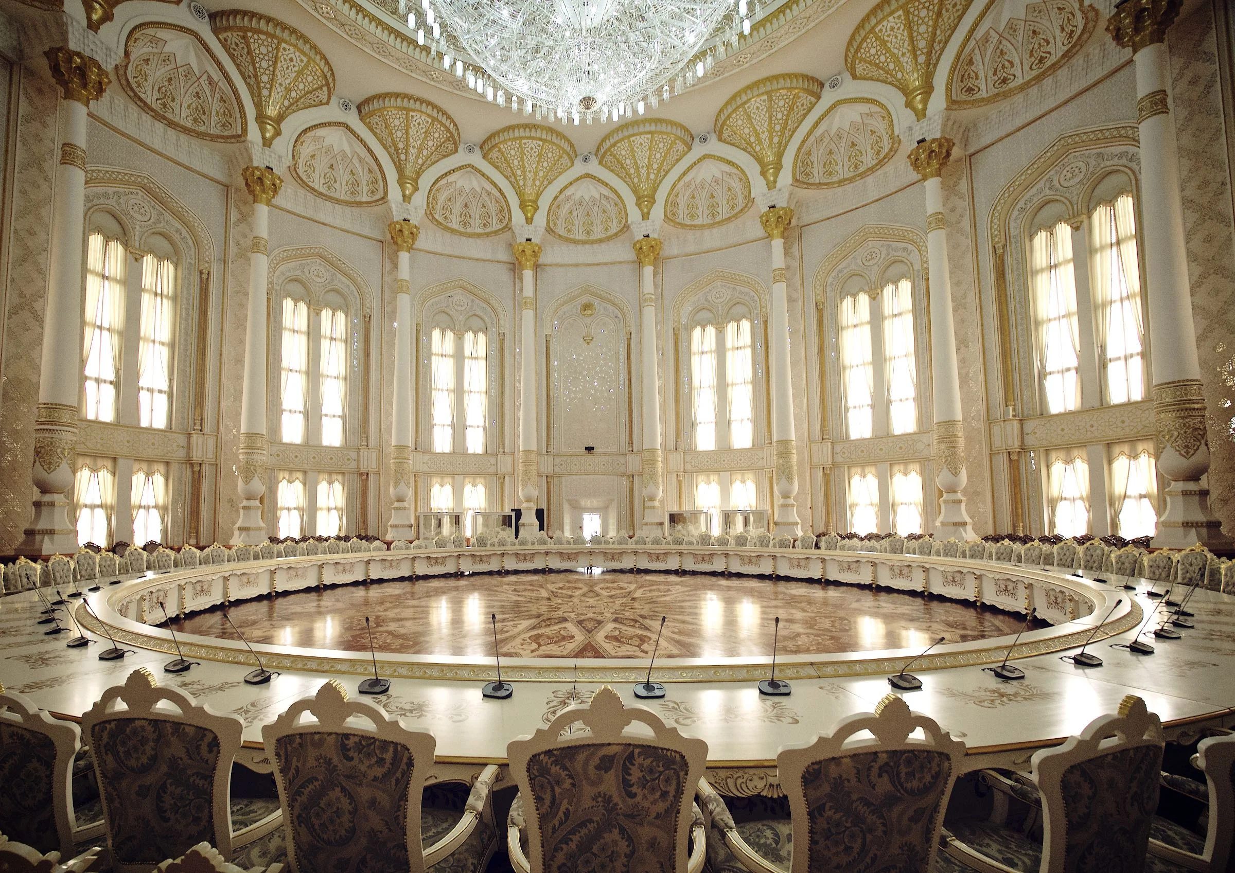
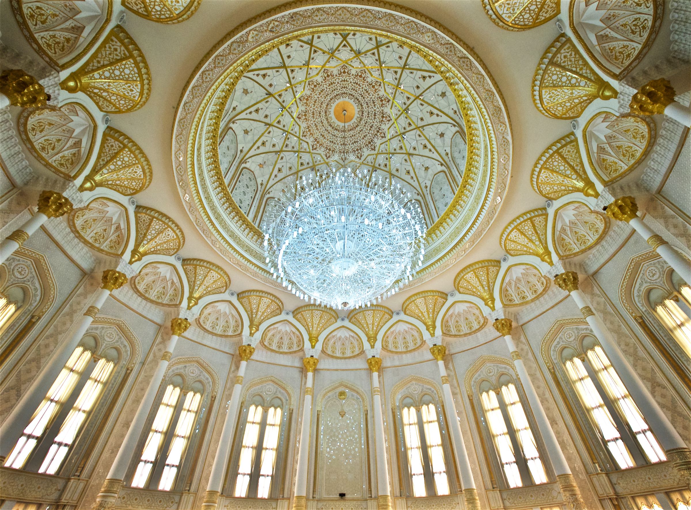
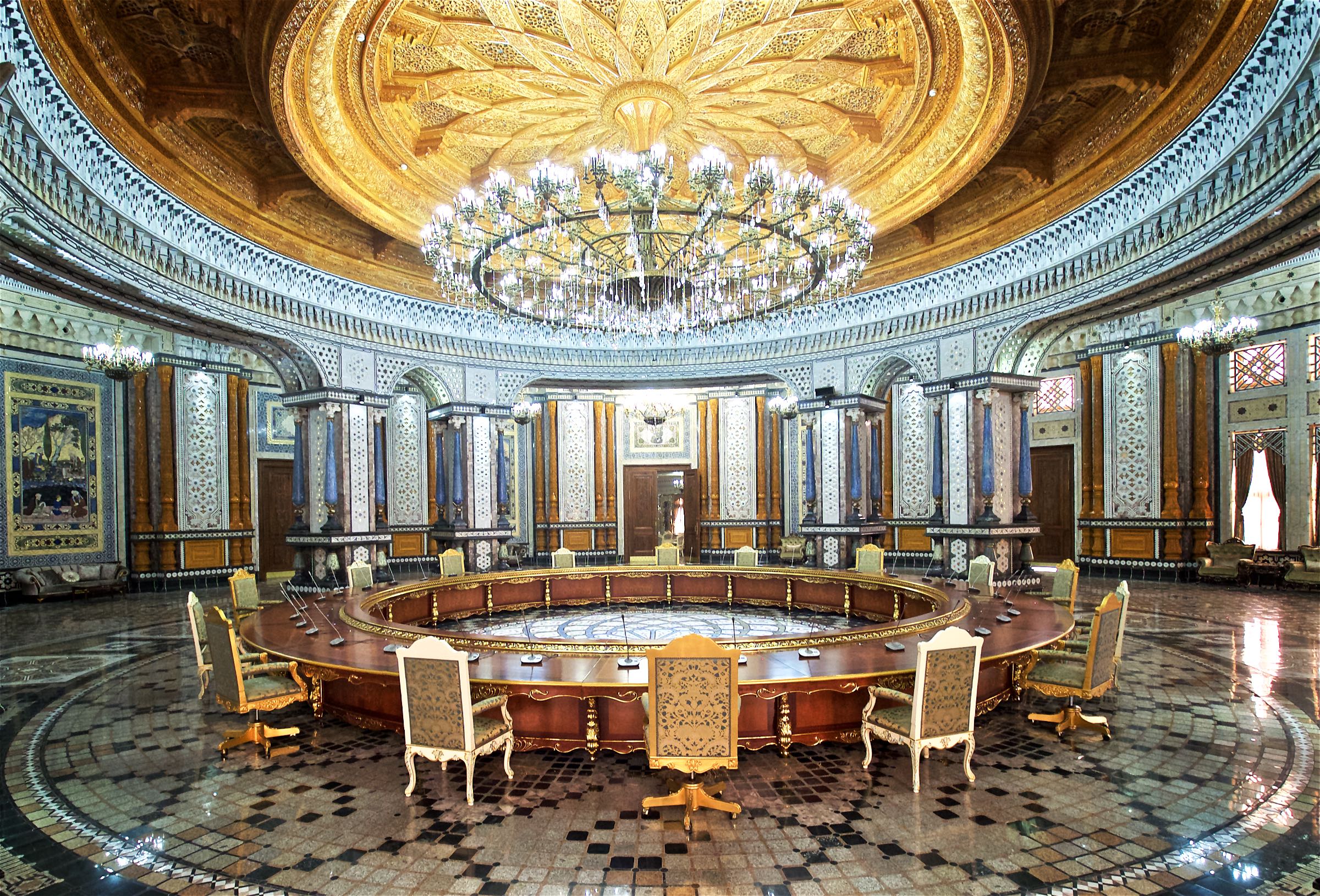
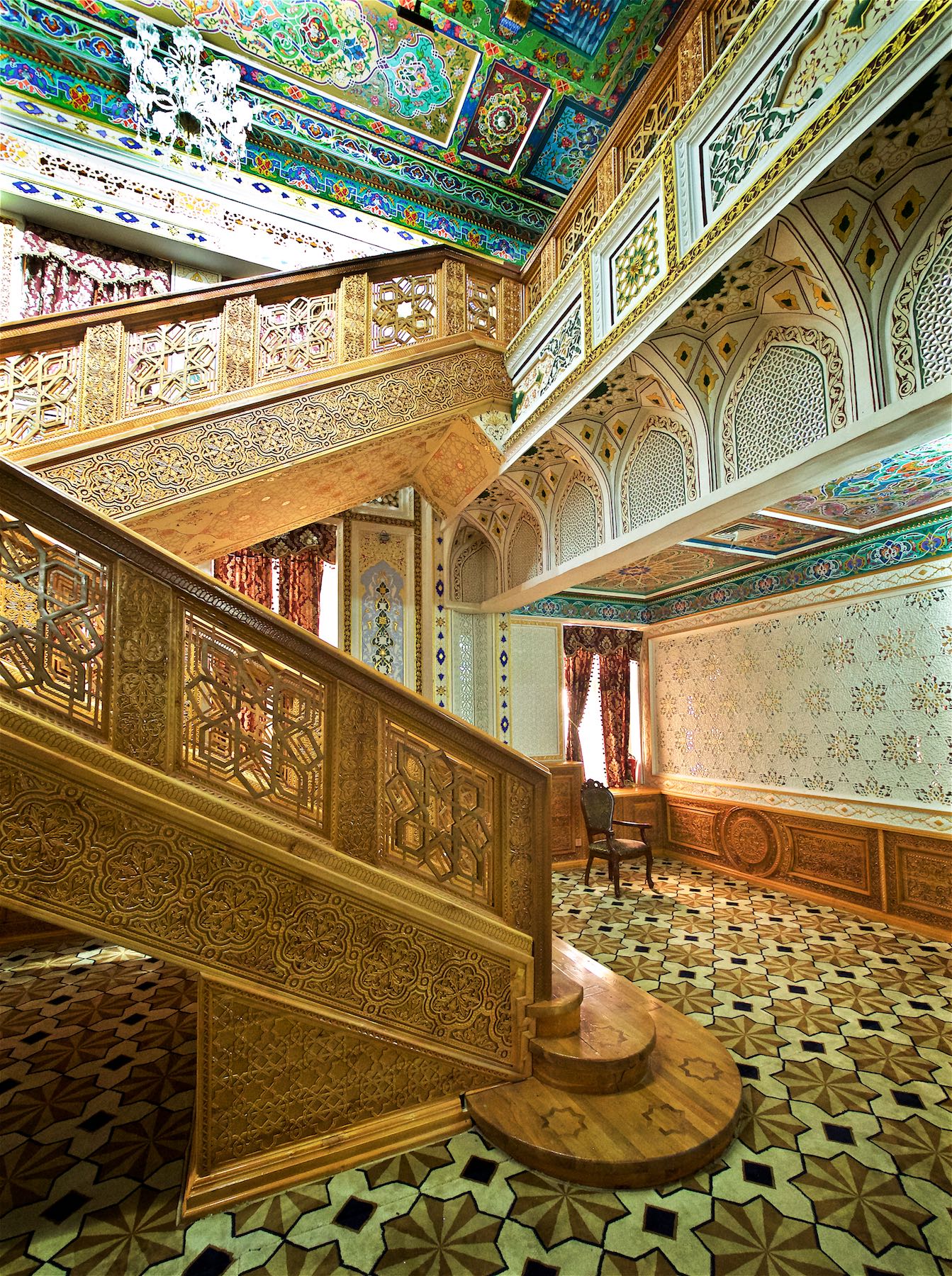
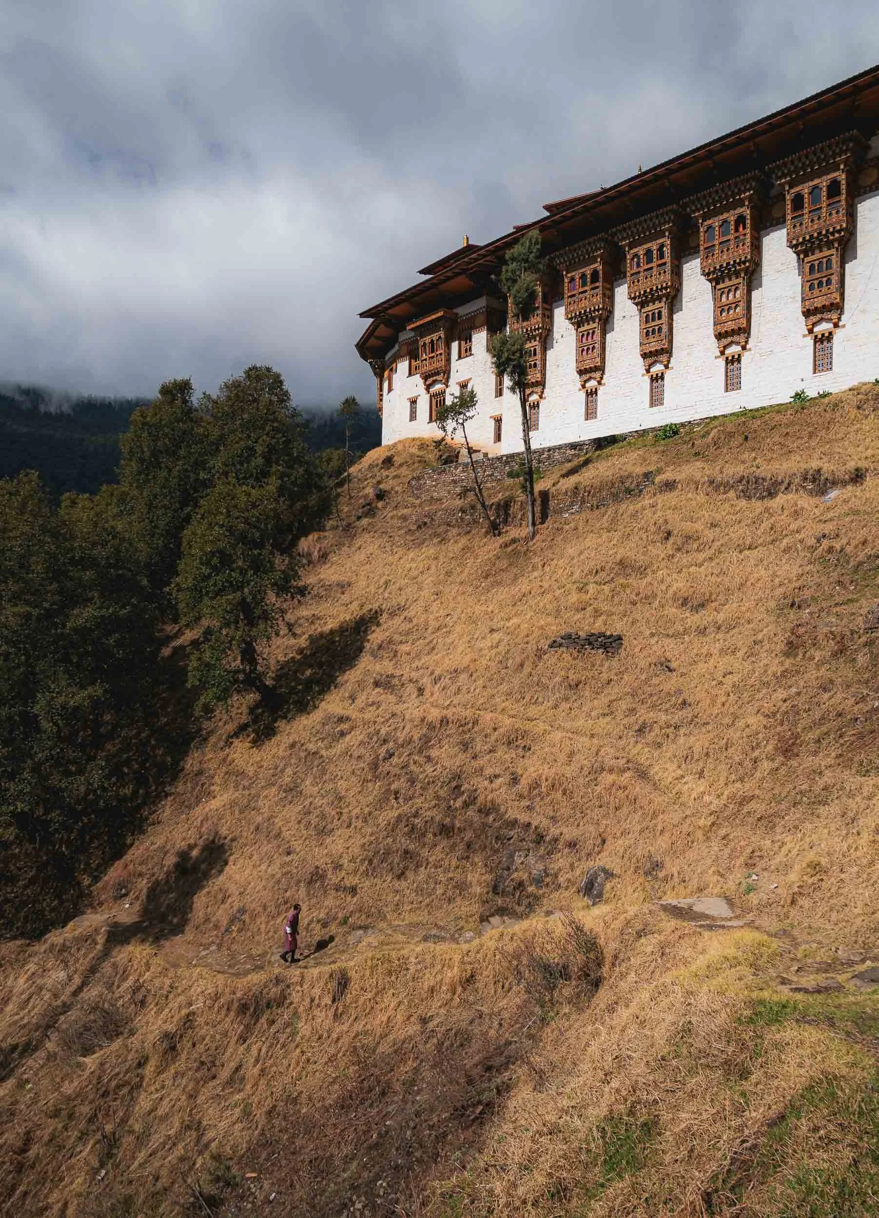
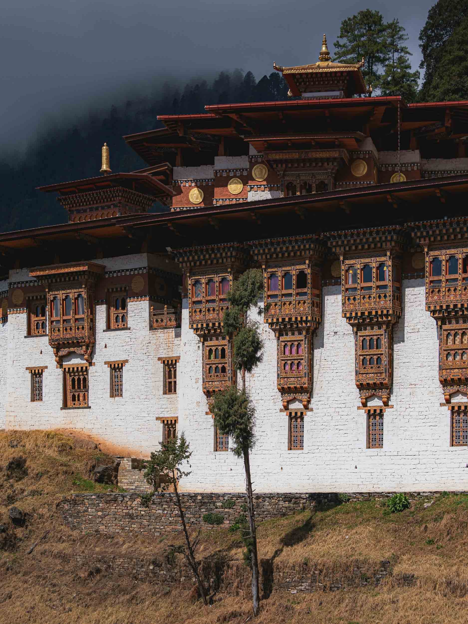
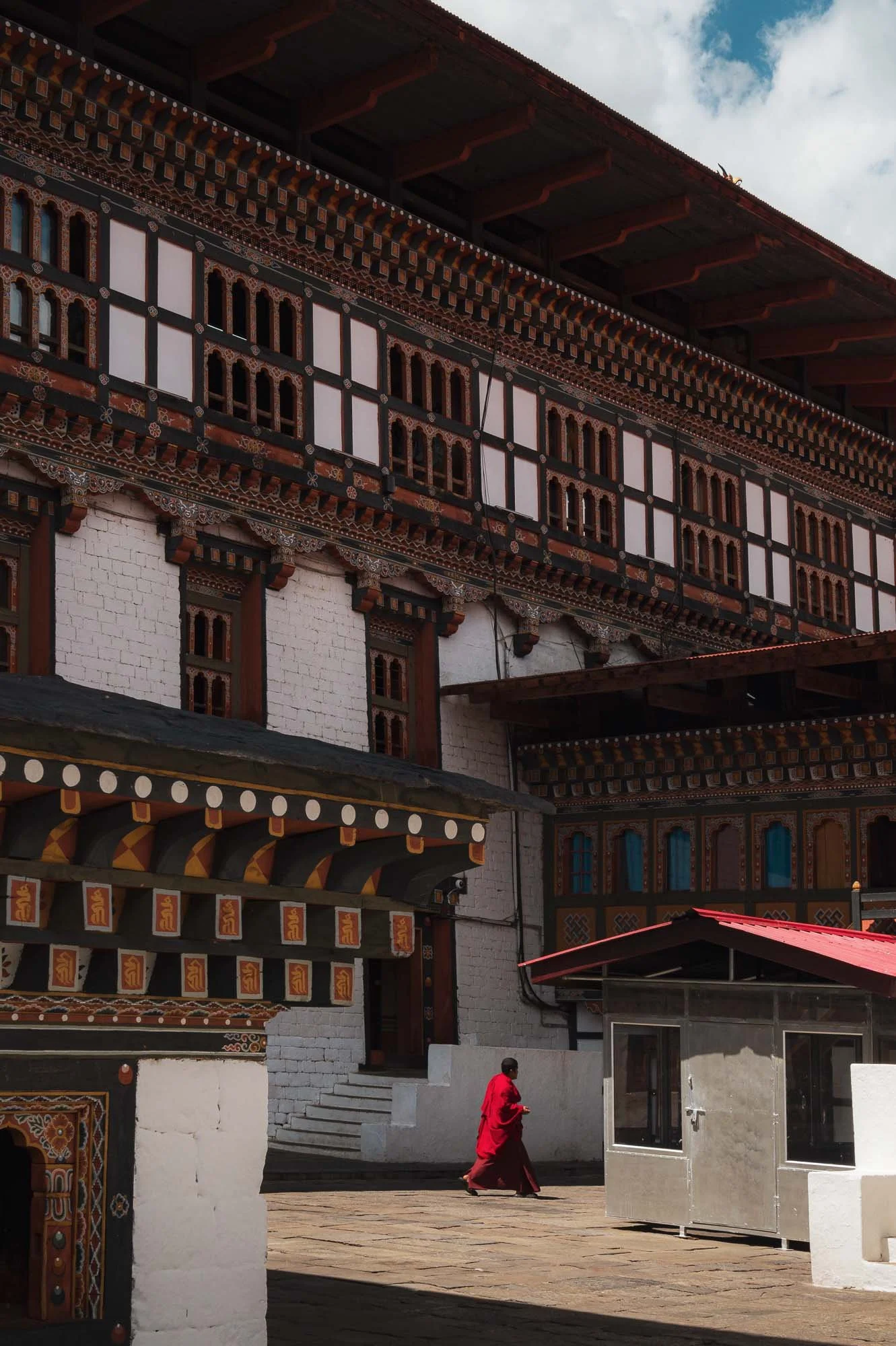
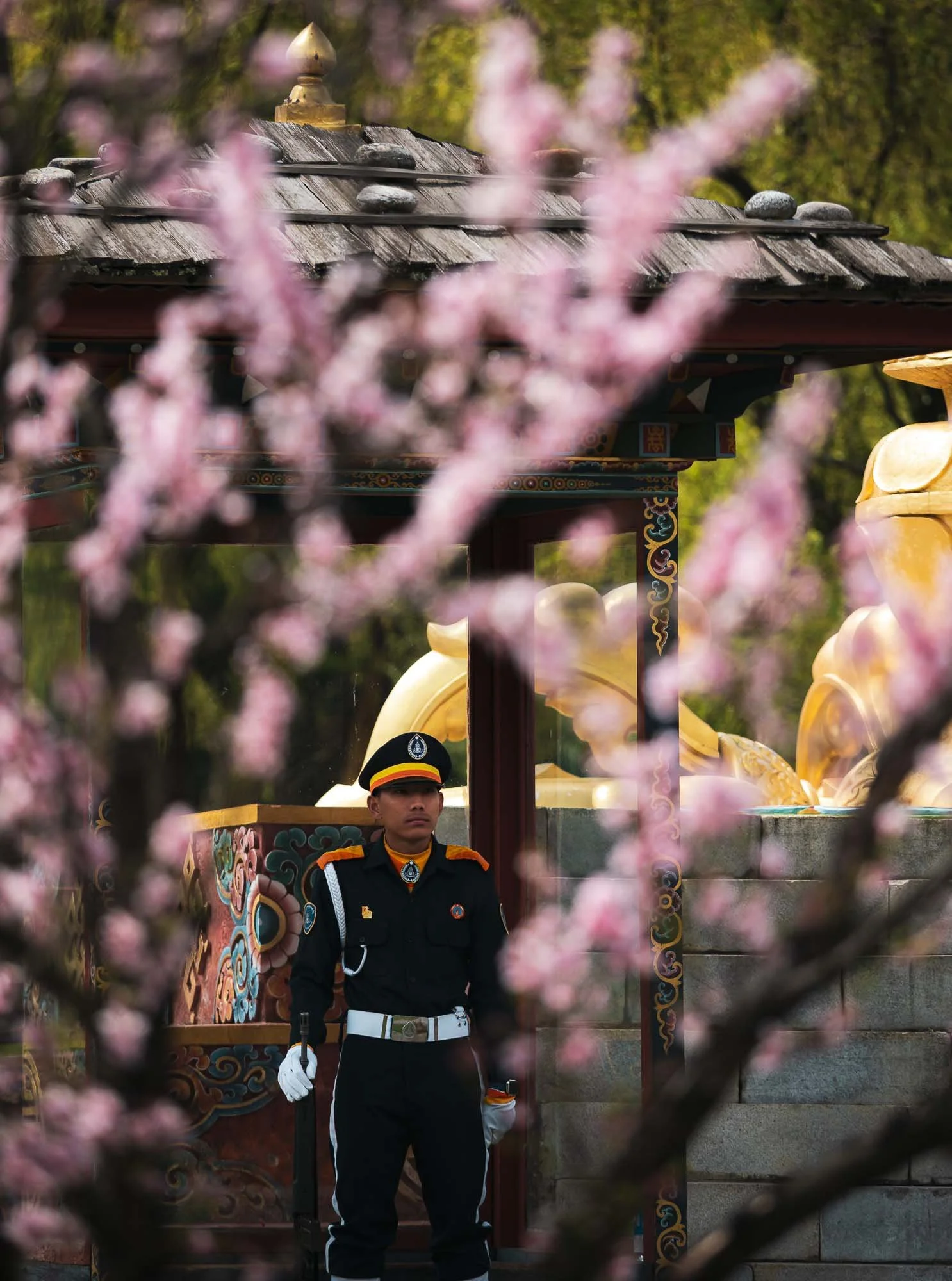
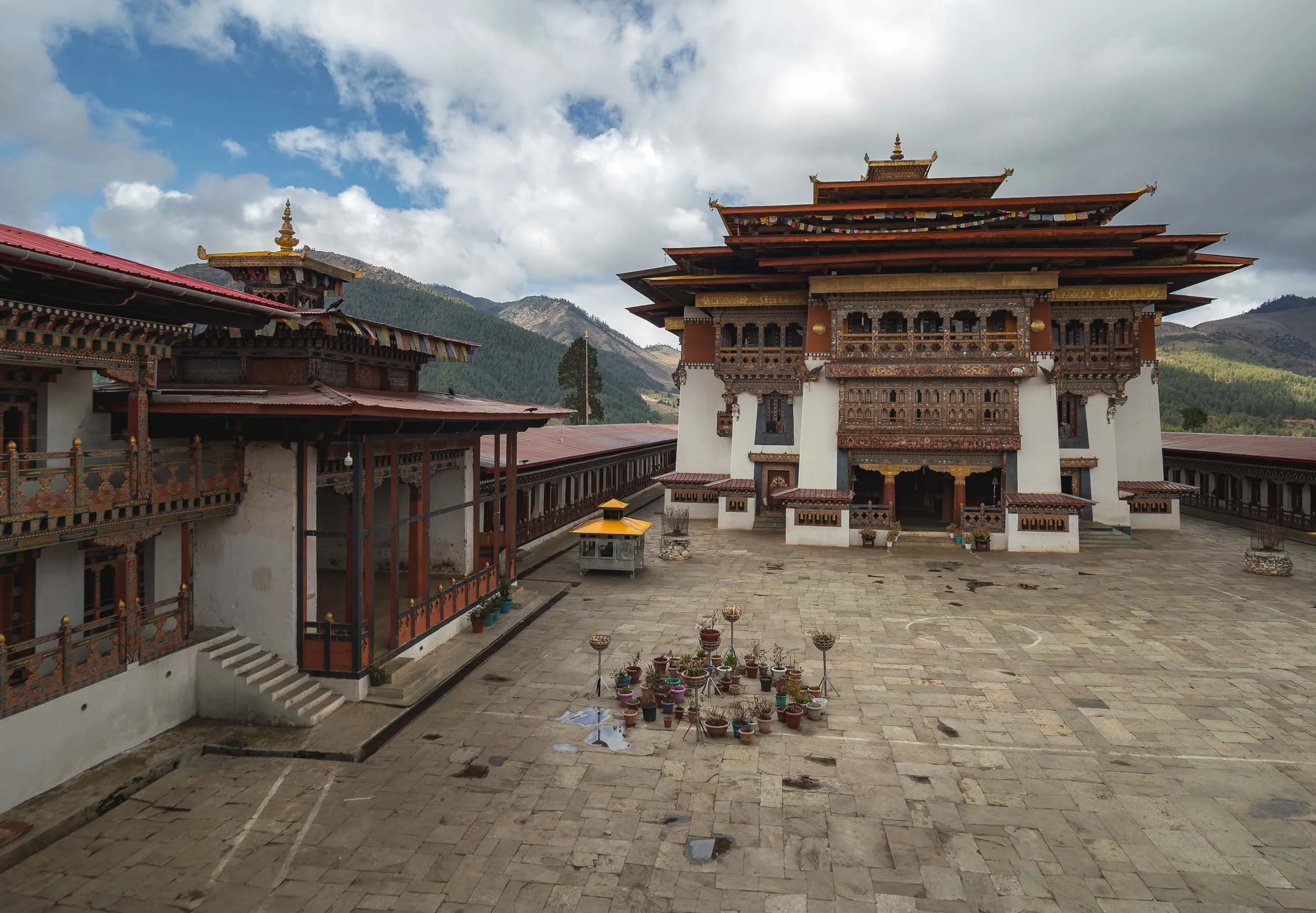
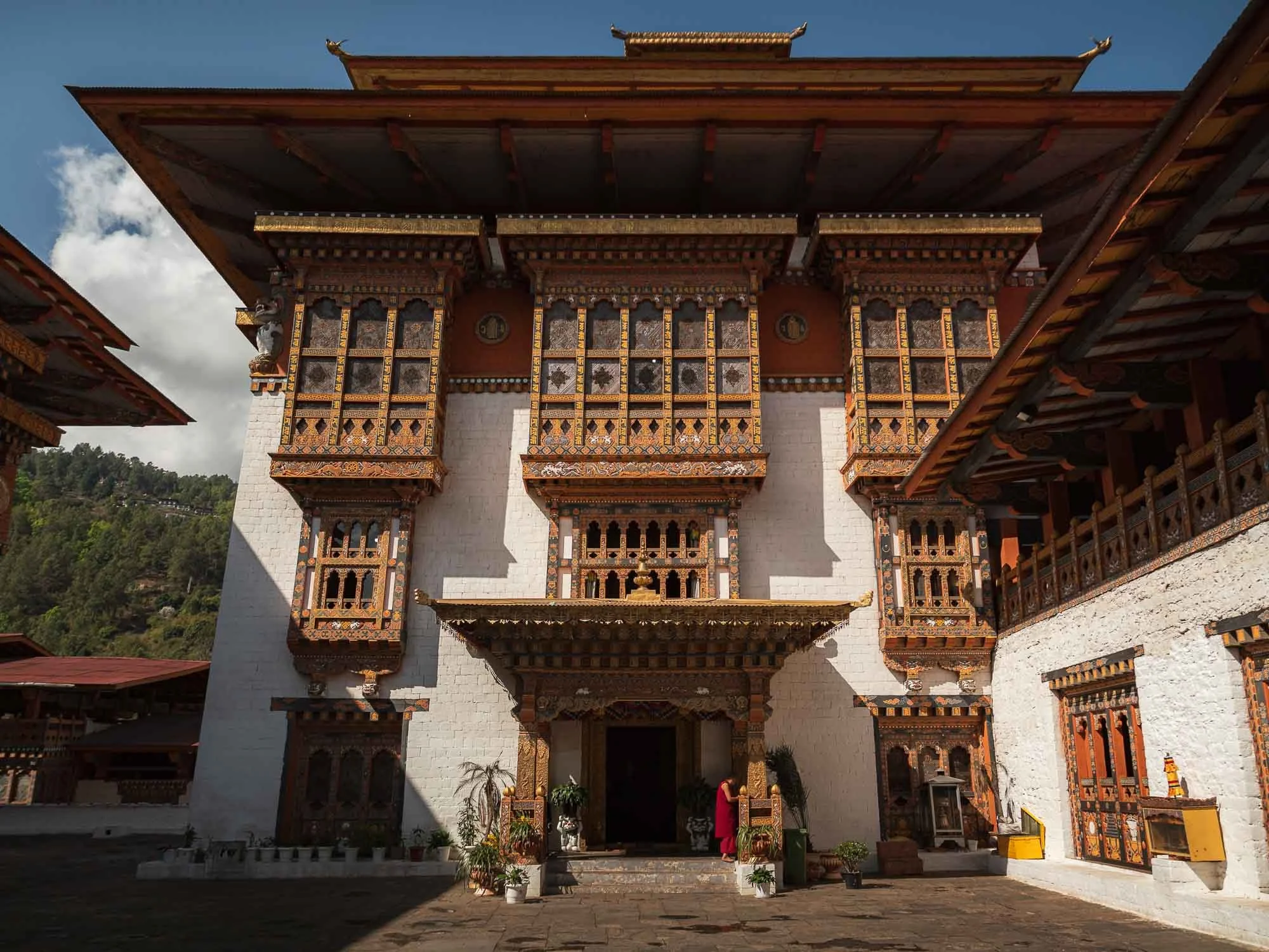
Tashichho Dzong
Back in the city, we visited its primary “Dzong” - meaning fort - an impressive structure serving a dual religious and secular function as the seat of the central monastic body and government offices of the King, including the throne room. Note Bhutan’s amazing flag - absolute winner!
The impressive structure originally dates back to the mid 17th century, but was damaged several times due to fire (a common story among the many heavily wooden structures in Bhutan) and earthquake. Its last restoration into the current form was largely finished in the 1960s.
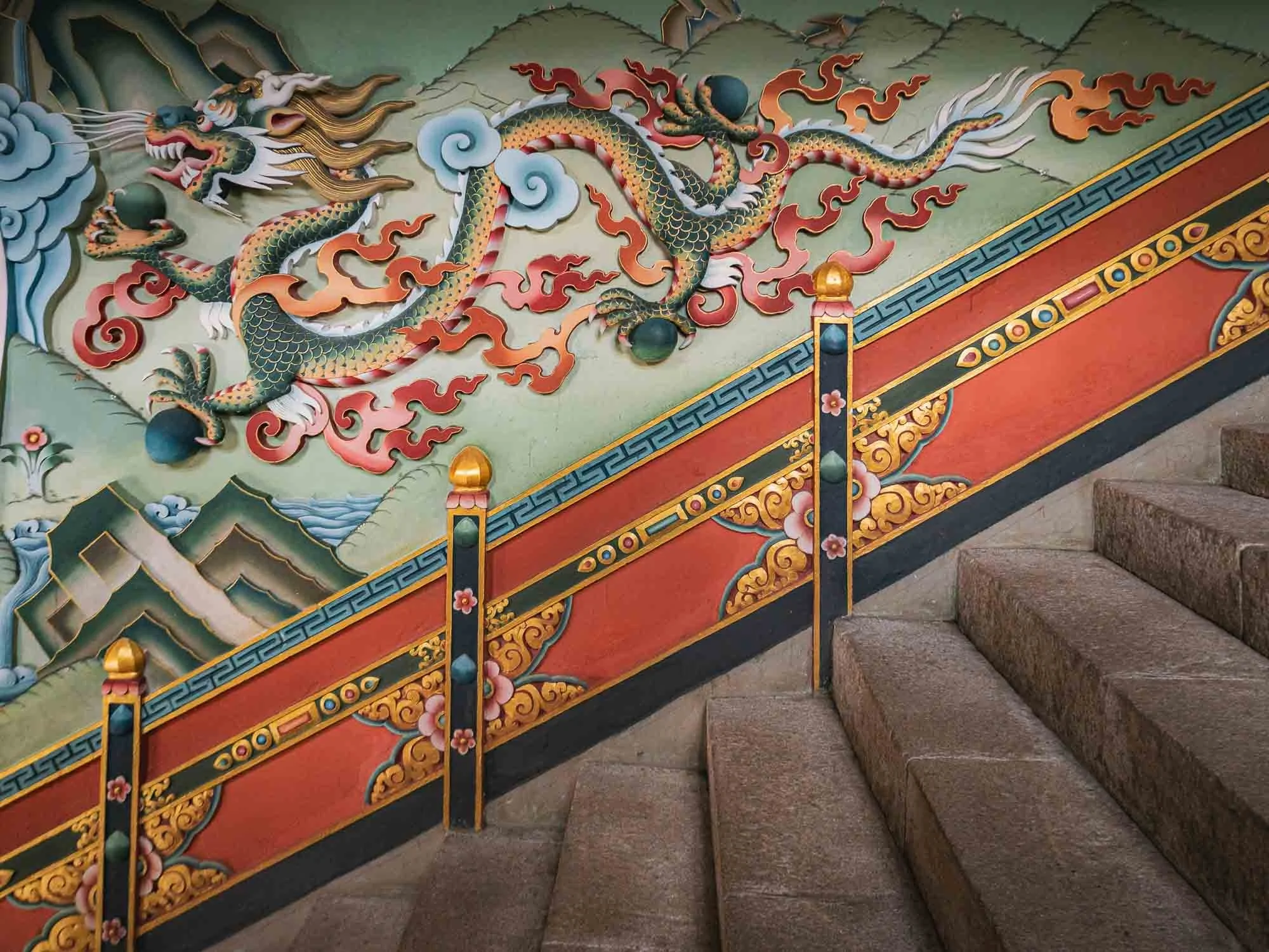
🐉
The dragon relief at the entrance staircase, Bhutan’s central national and religious symbol. The country is literally called Druk Yul - “Land of the Thunder Dragon”.
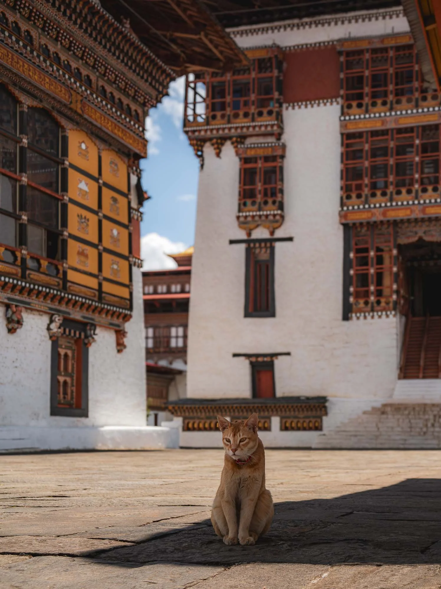
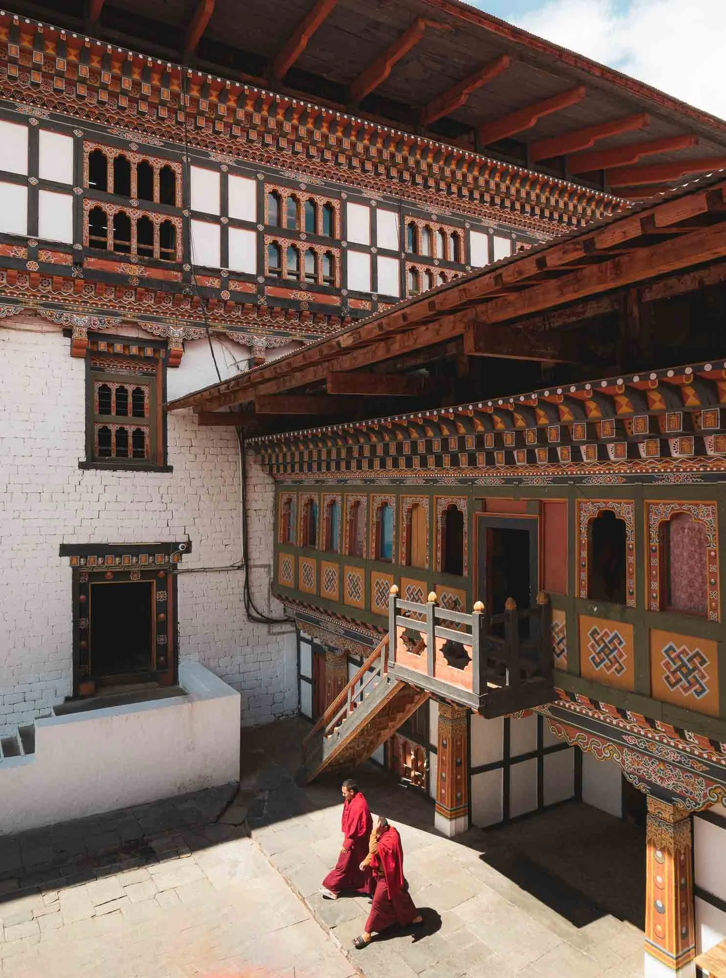
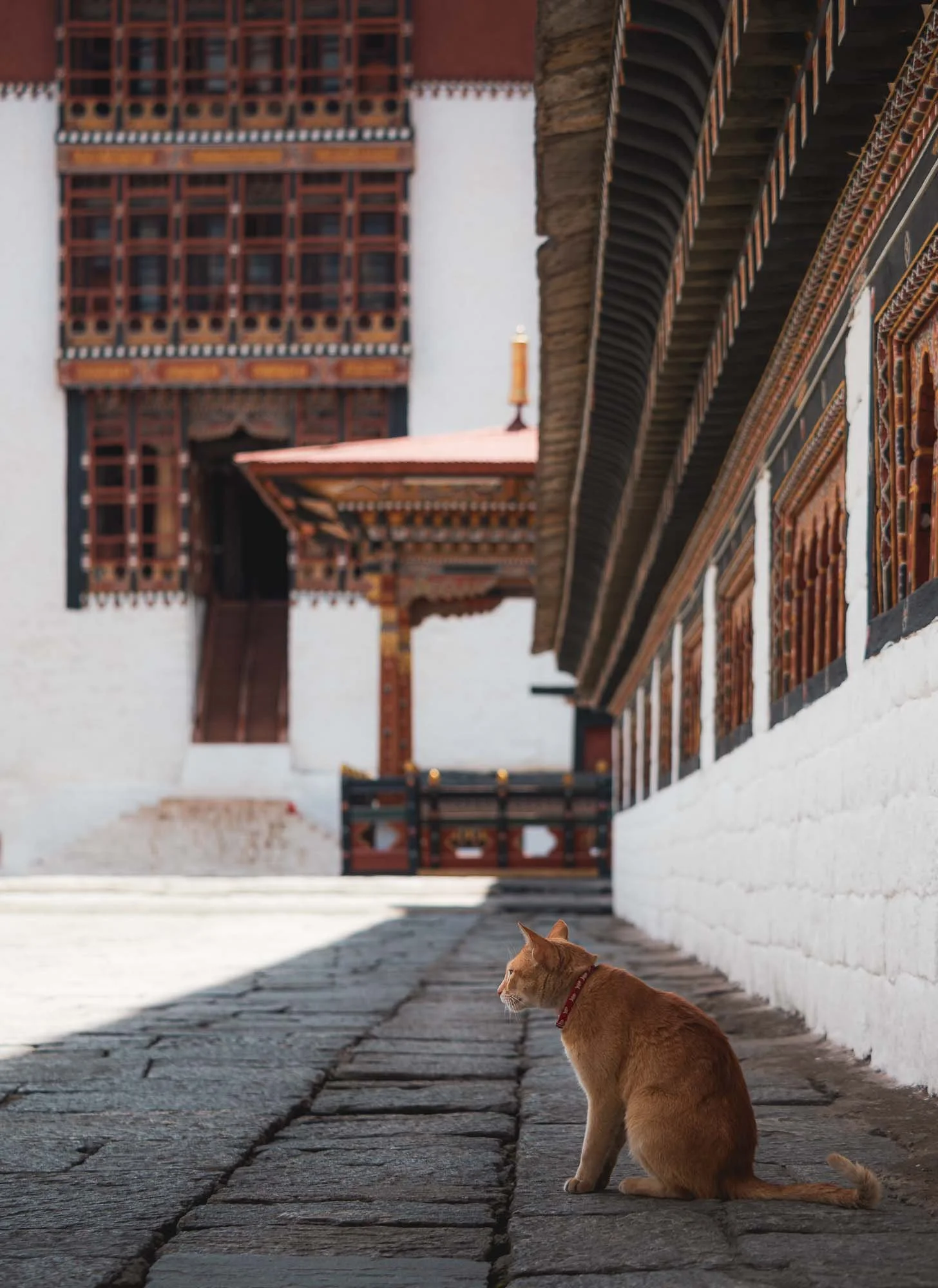
I spent a couple of hours here soaking up the calm atmosphere, virtually without any other tourists, waiting for monks or cats to move into position for a good photograph. They were obedient.
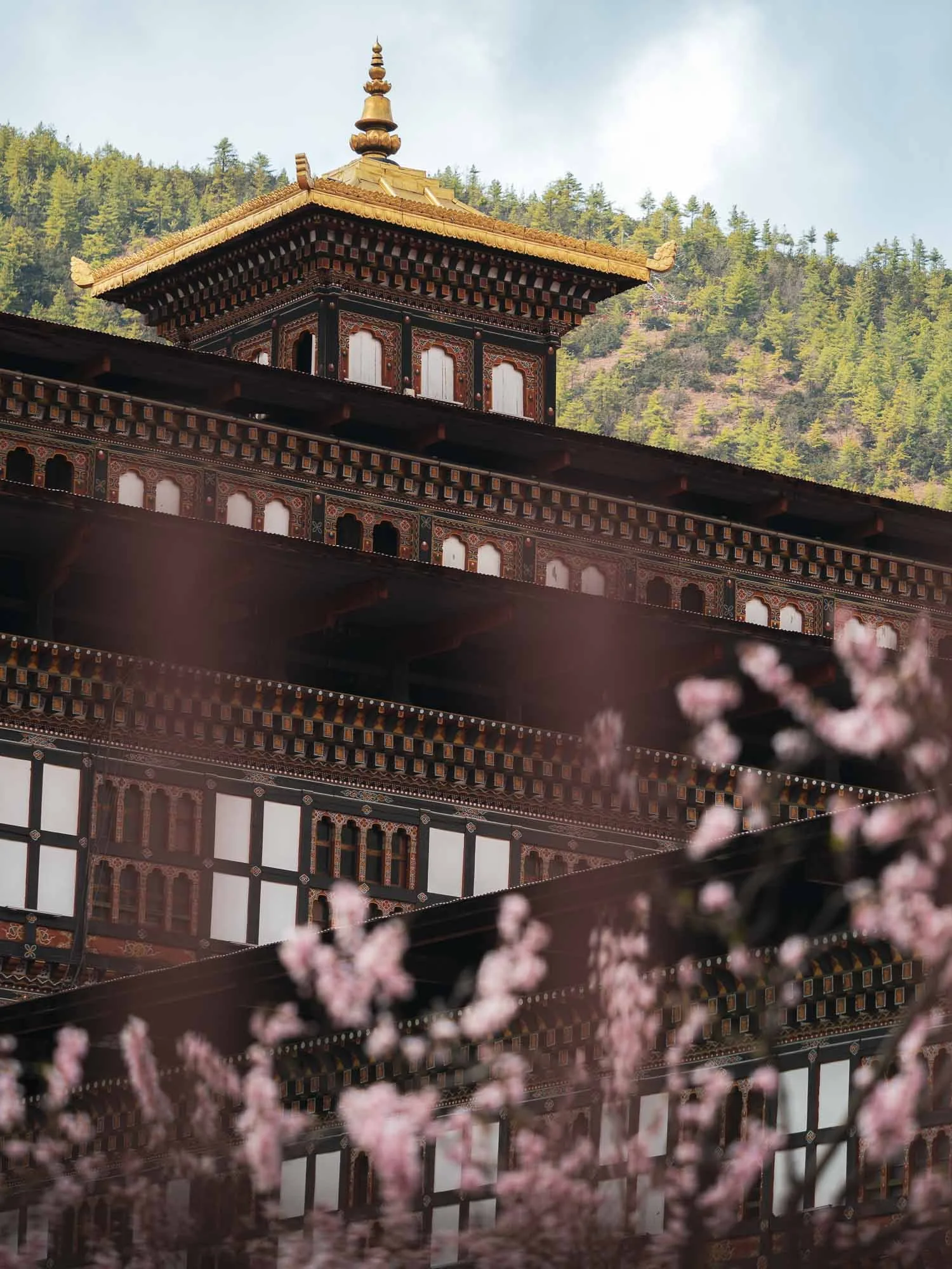
The spring cherry blossoms around the fort, which is formally guarded due to its administrative functions - not all areas are accessible to the public.
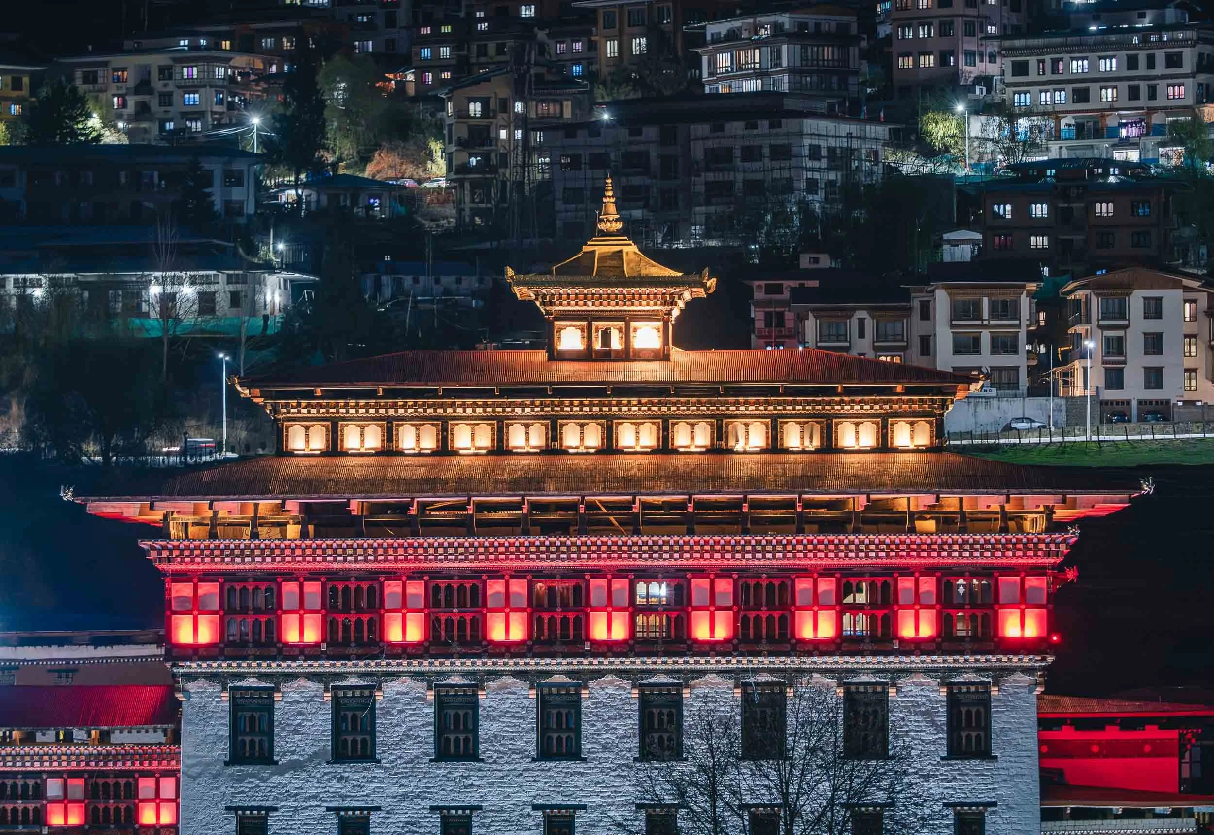
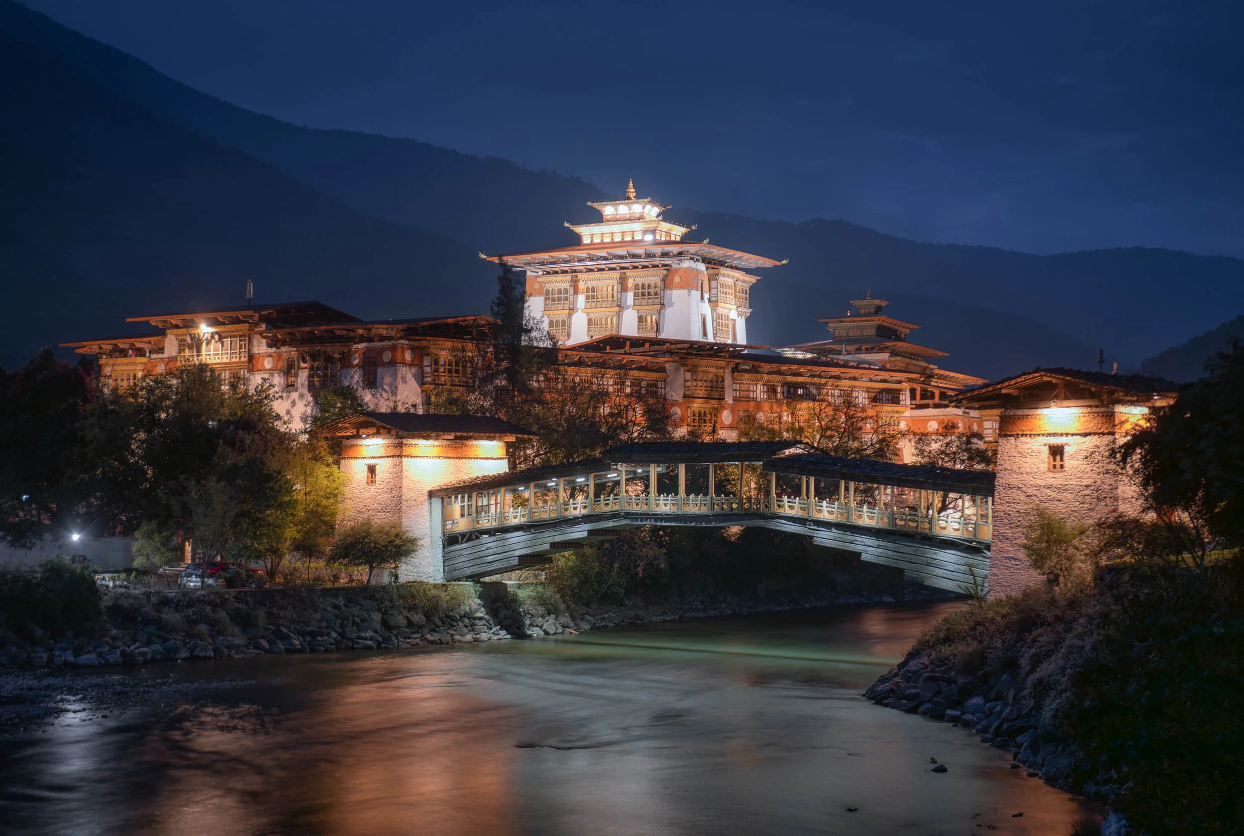
The Dzong is lit up beautifully at night, and I found two more viewpoints in the city to document it from.

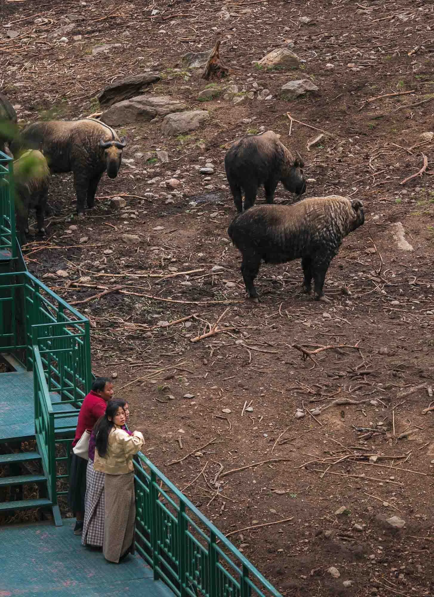
Bhutan Takin
Beyond the mythical dragon, Bhutan features significant biodiversity, likely owing to a combination of factors such as its focus on sustainable development, the extreme geographical spread (its lowest point is just 100m above sea level, whereas its tallest mountain reaches over 7000m), and forest cover of more than 70%. One of the lesser known and more peculiar mammals is its national animal: the Bhutan takin.
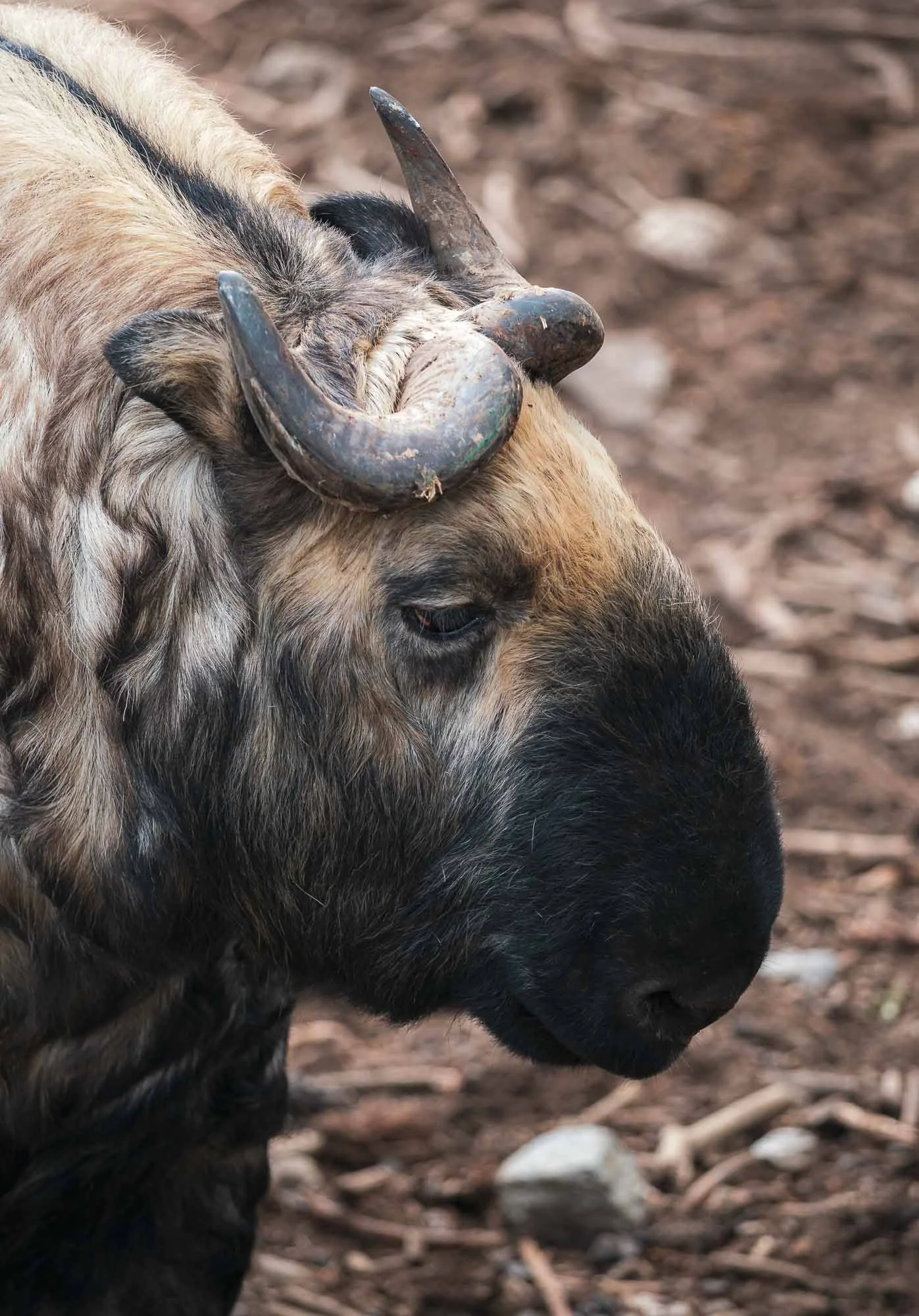
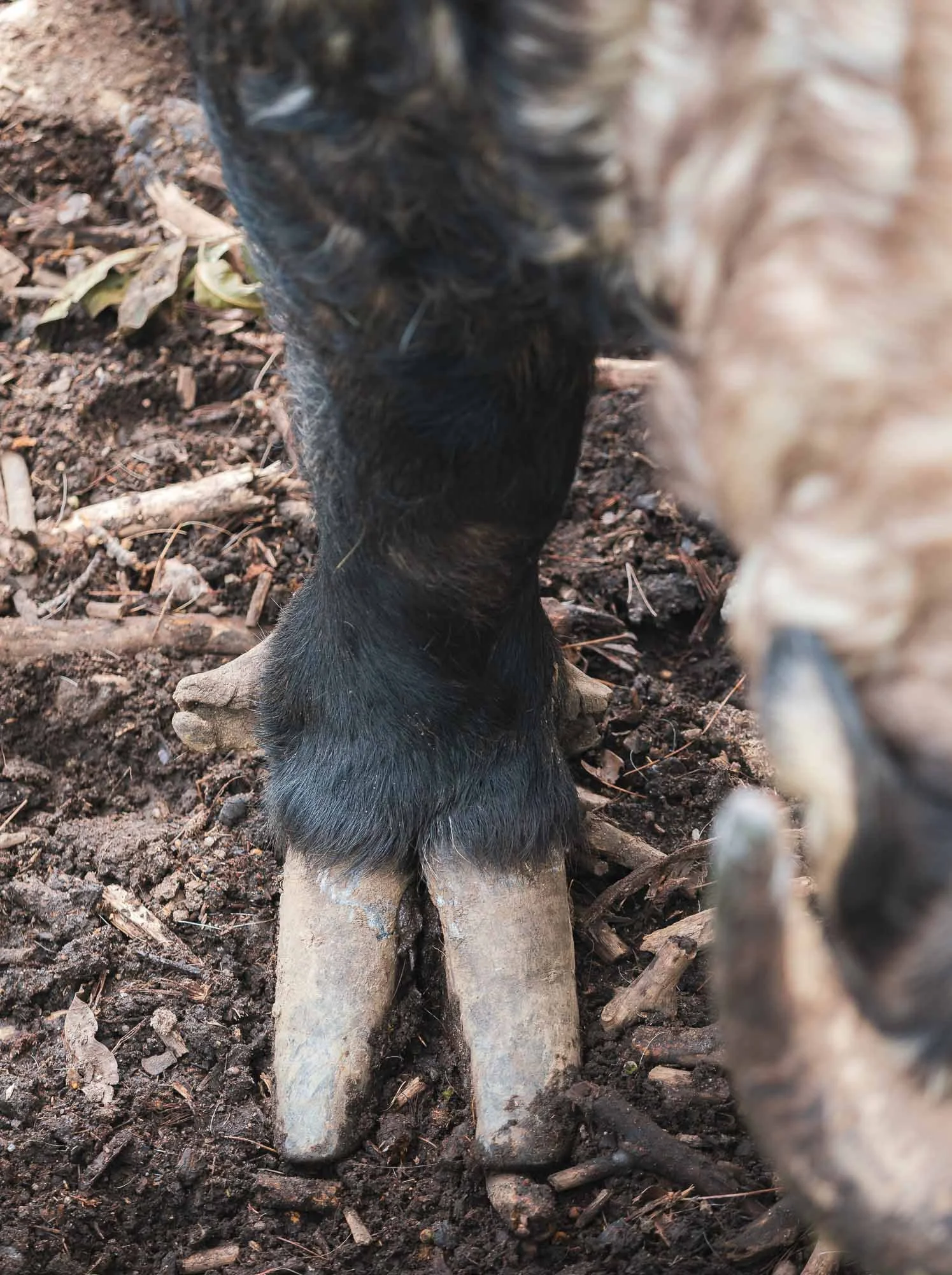
Spotting it in the wild is a rather difficult endeavor, but Thimphu is home to quite a decent and well-frequented mountain zoo, which houses a good number of them. While classified as vulnerable, the animal is protected in the country, probably for its cultural significance: as the legend of Drukpa Kunley (the Divine Madman, he would appear again later in the trip, read on…) goes, villagers asked him to perform a miracle. He told them to first bring a cow and a goat for dinner. After they served the animals, he ate them completely, leaving only bones. He then placed the goat’s head on the cow’s skeleton, clapped, and the animal combination came back to life and ran into the meadow. One can’t help but see the resemblance in the takin.
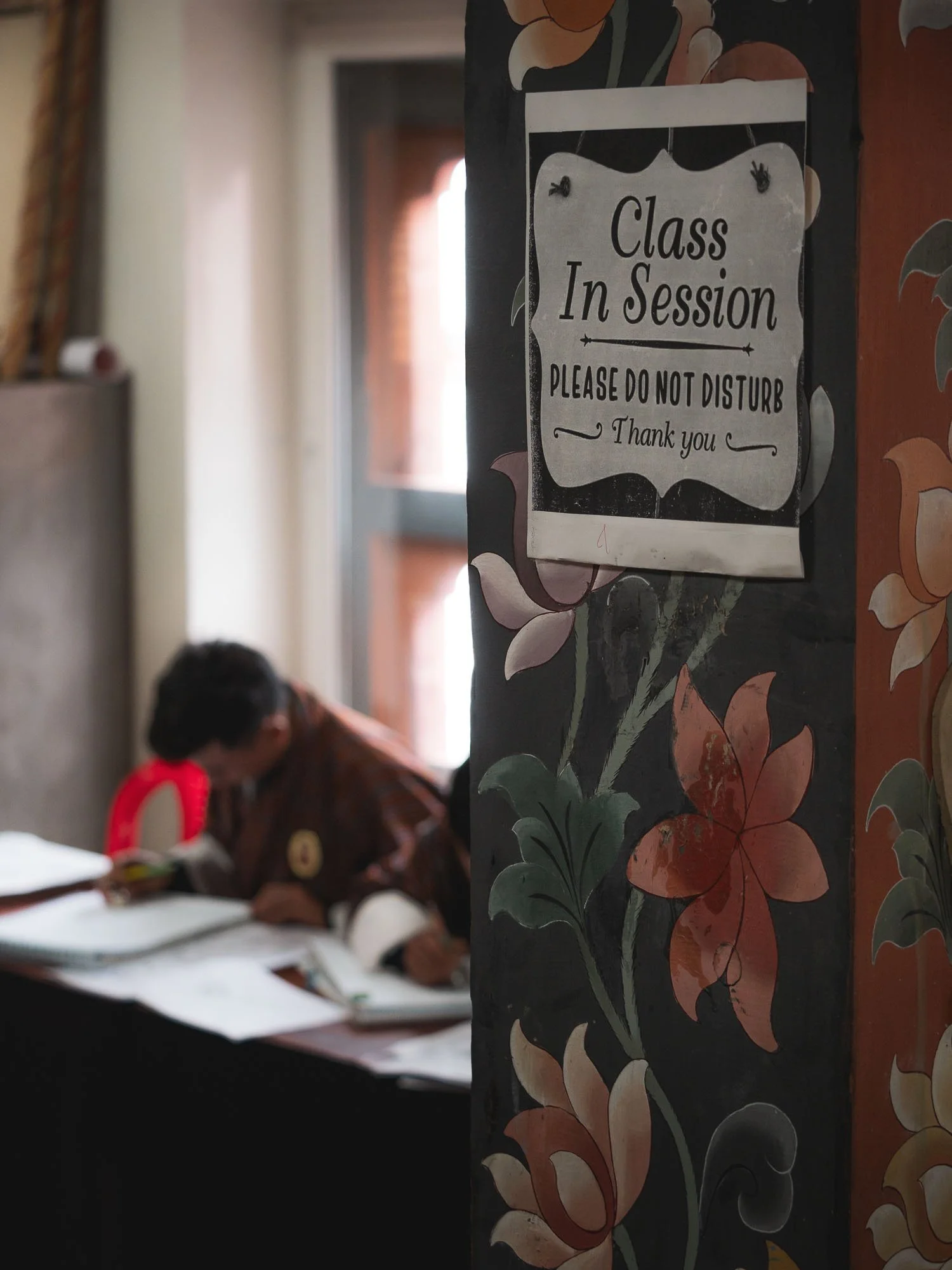
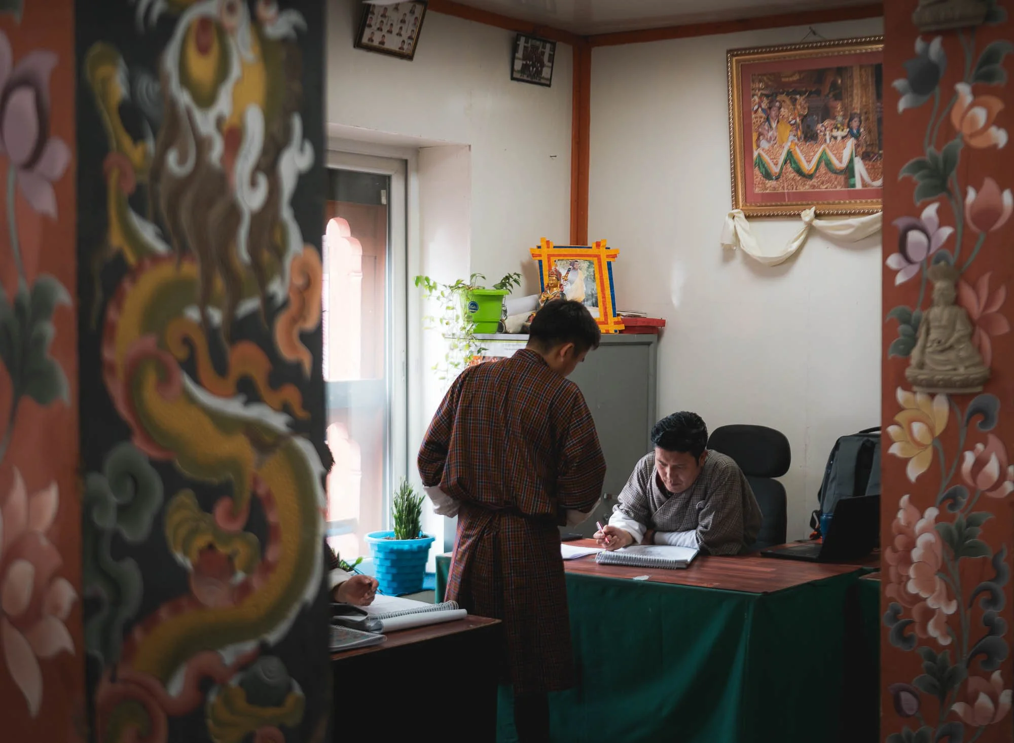
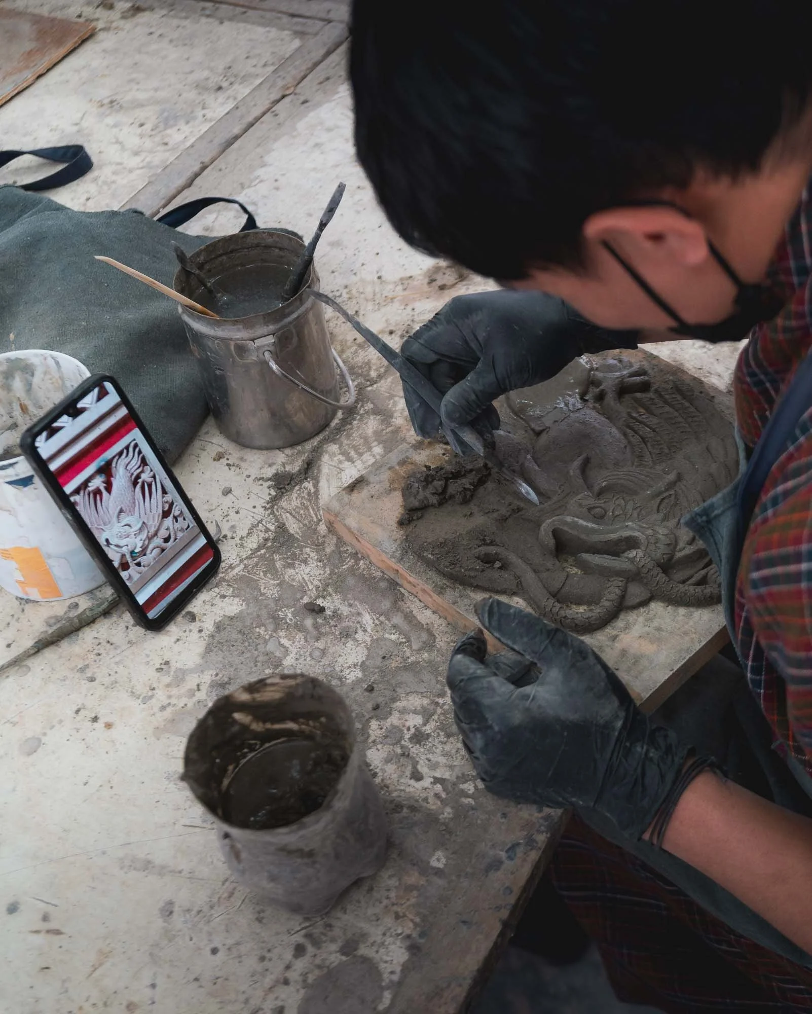
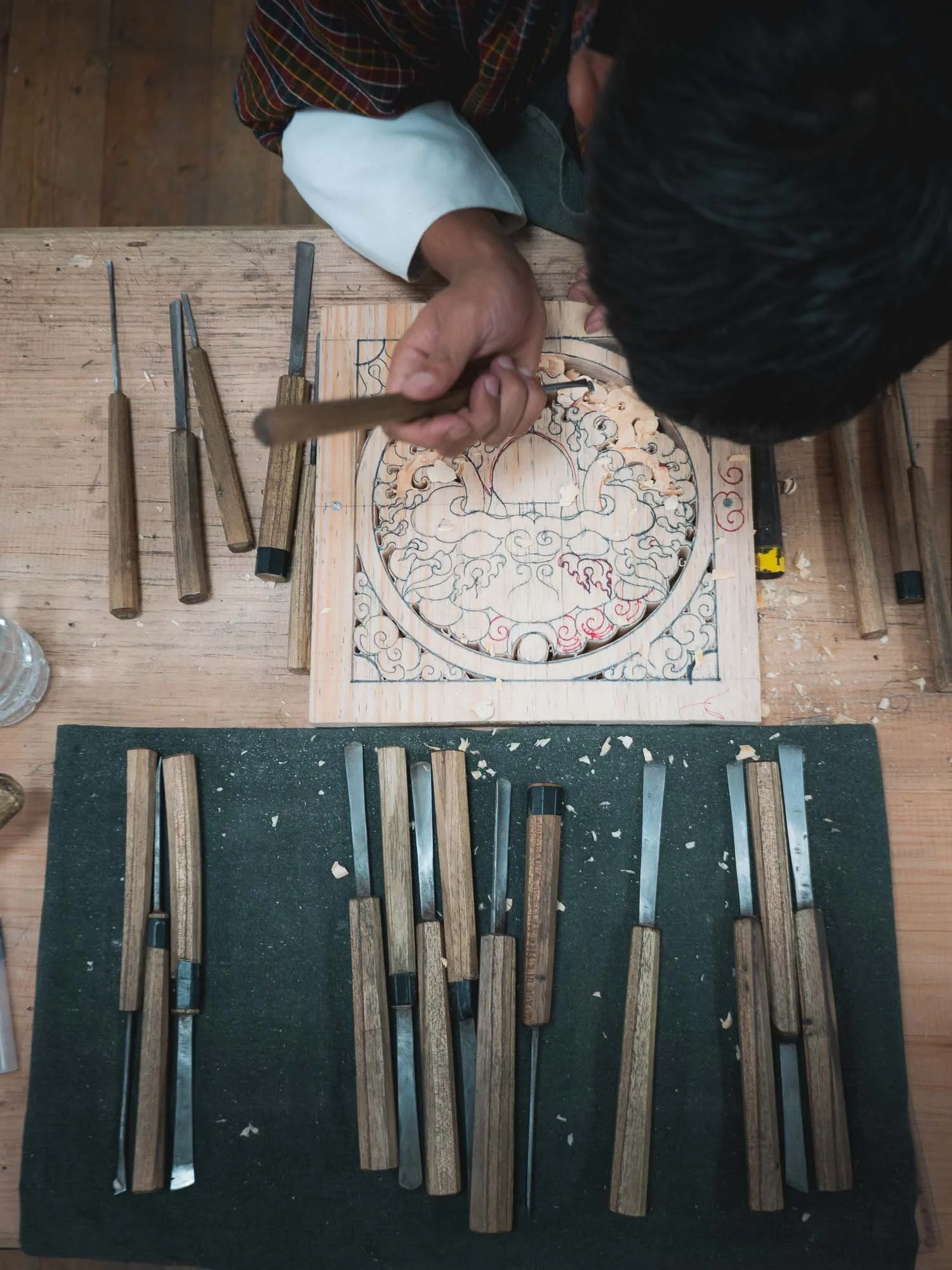
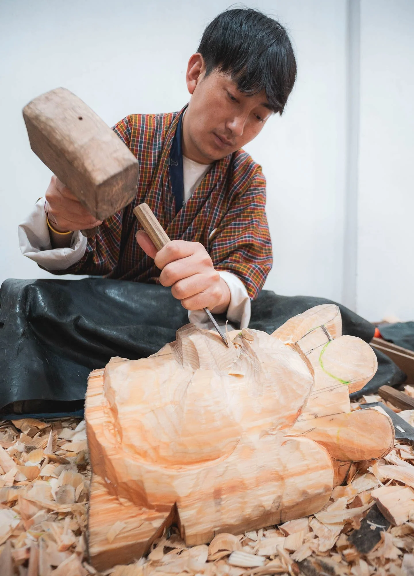
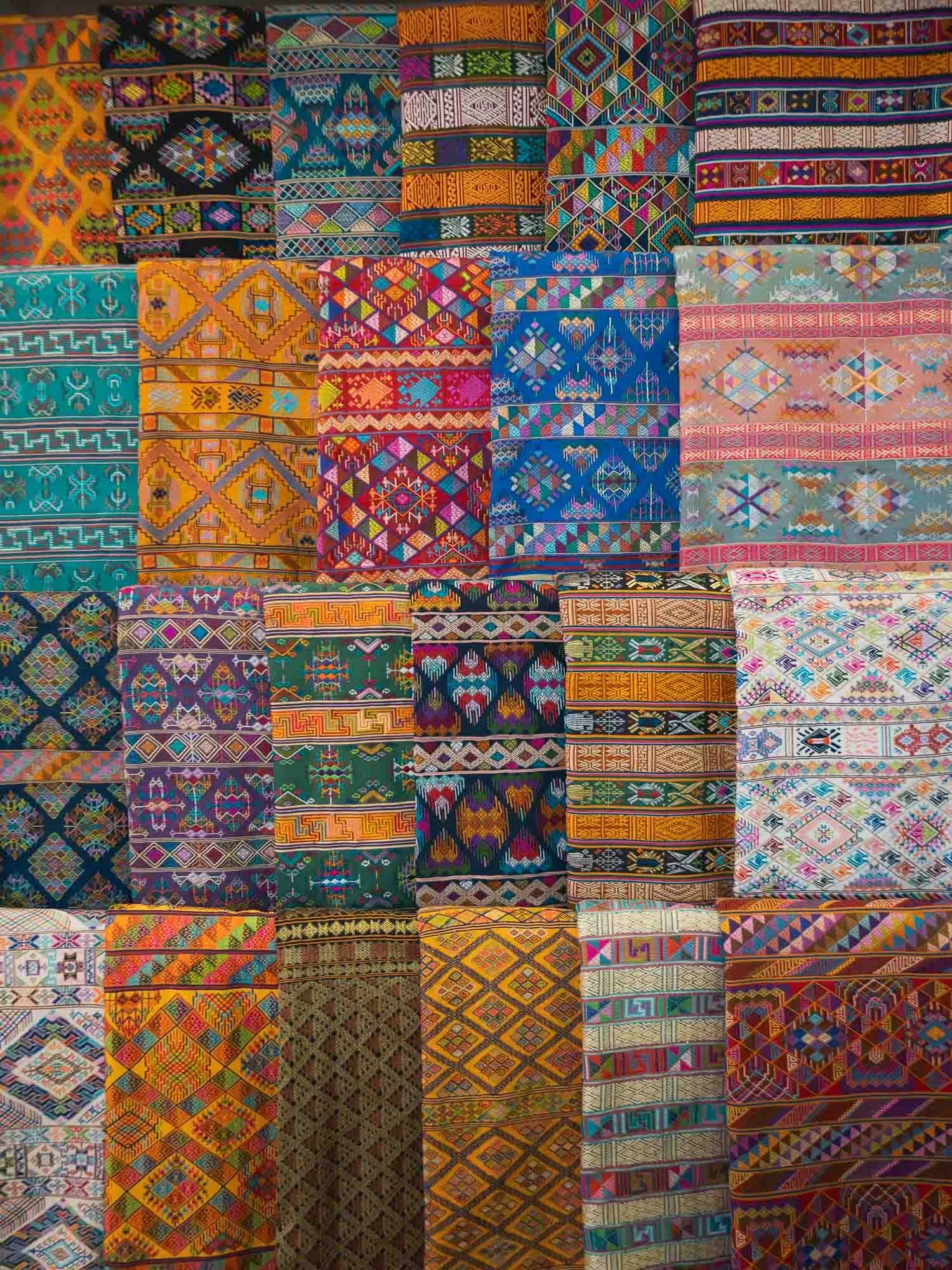
Moving on to a different kind of workmanship. For my time in Thimphu I had planned to visit a few places housing local artisans and craftsmen. No better spot to start this than the “Institute of thirteen Arts and Crafts” - collectively called Zorig Chusum and representing the formal classification of the country’s traditional disciplines.
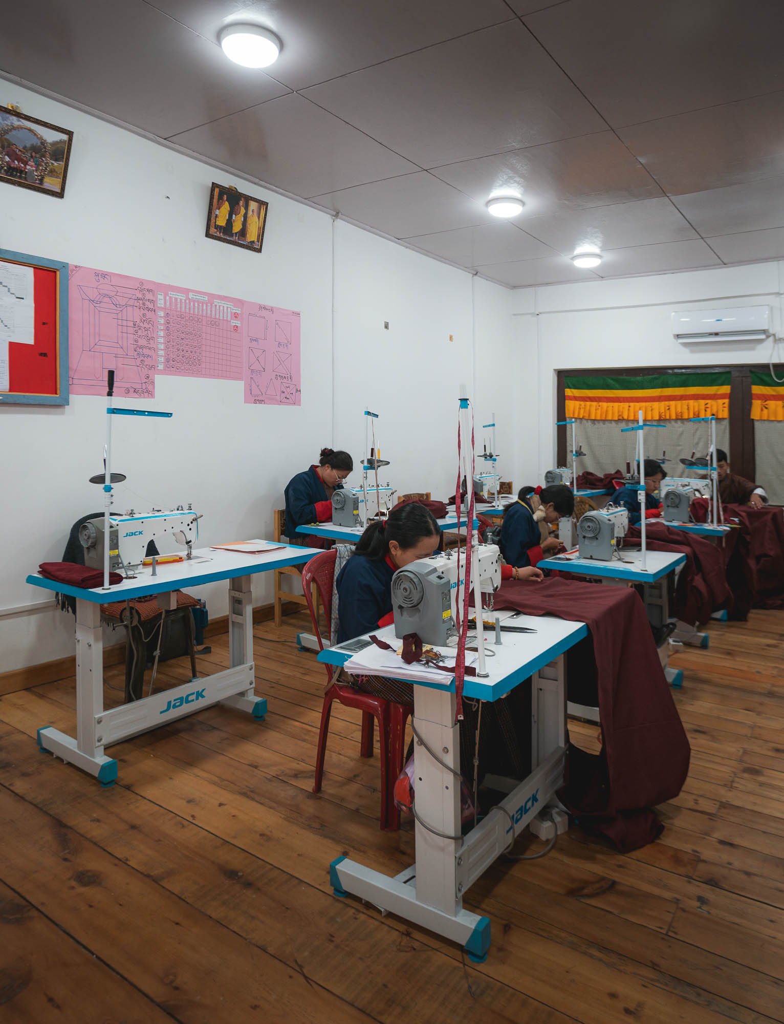
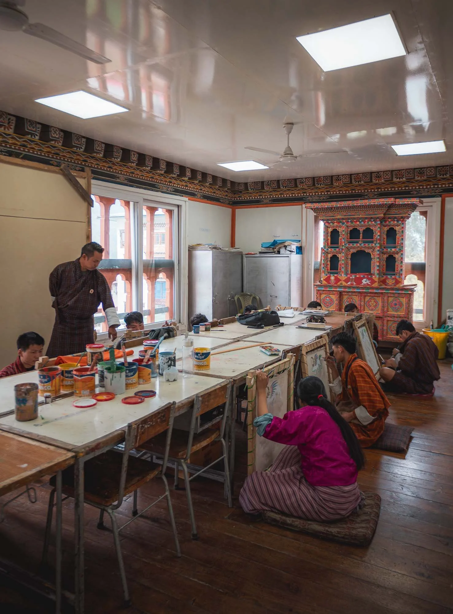
The school is not far from the city centre and dedicated to vocational training and encouraging entrepreneurial activities around tailoring, painting, sculpture, carving and more, many of them tied closely to the construction aspects of Dzongs and monasteries, or the various religious uses such as mask making and paintings for temples.
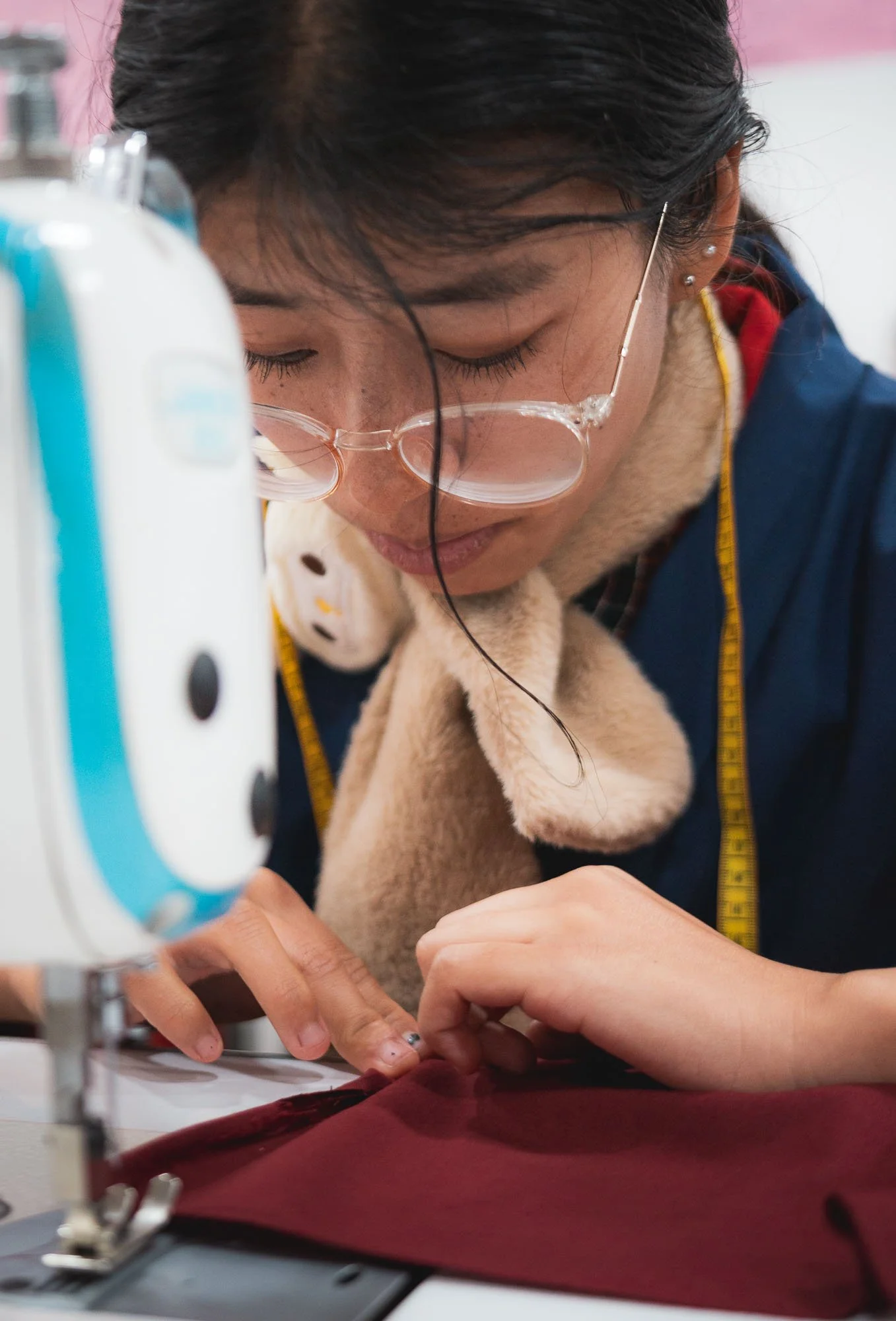
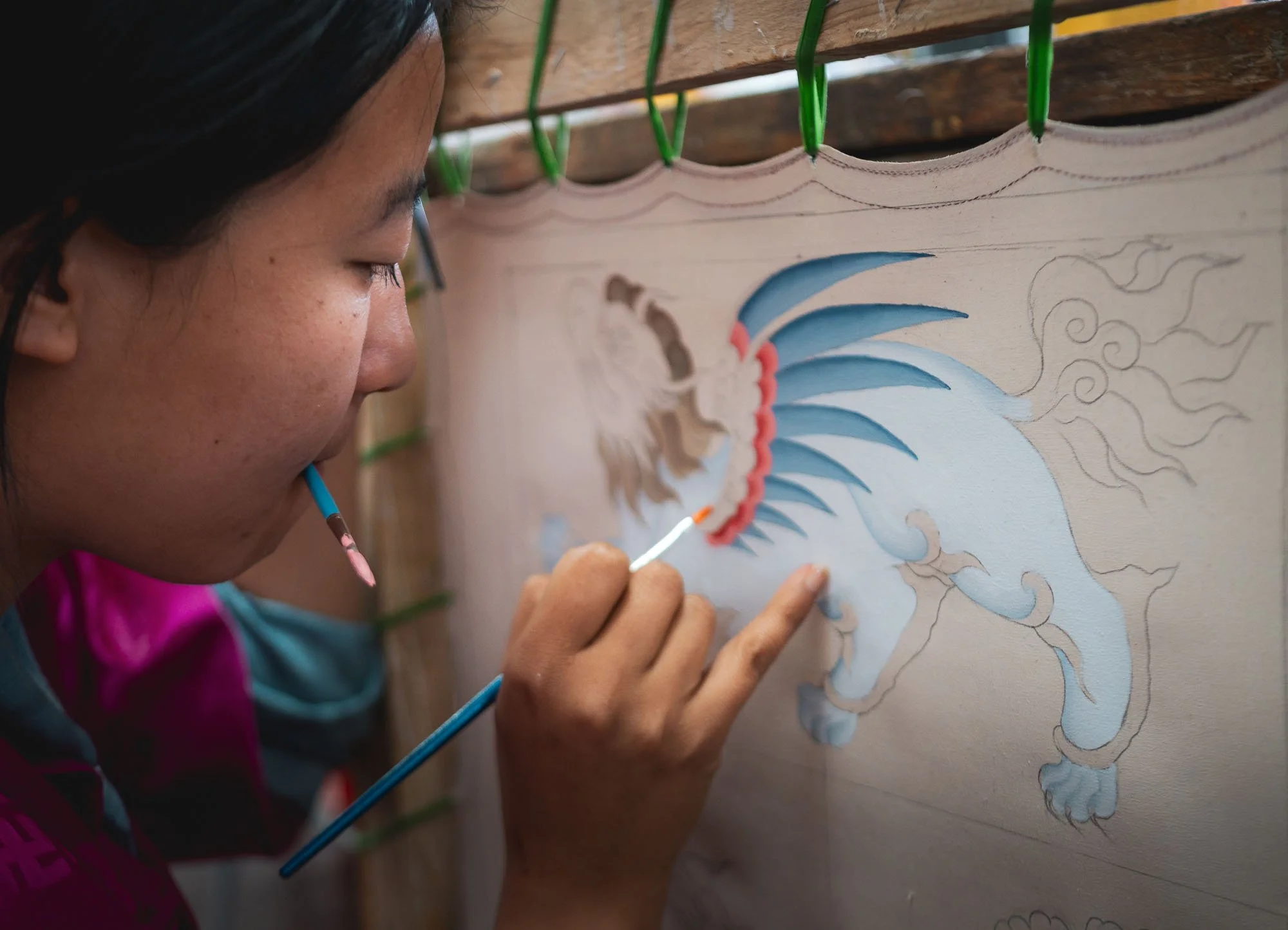
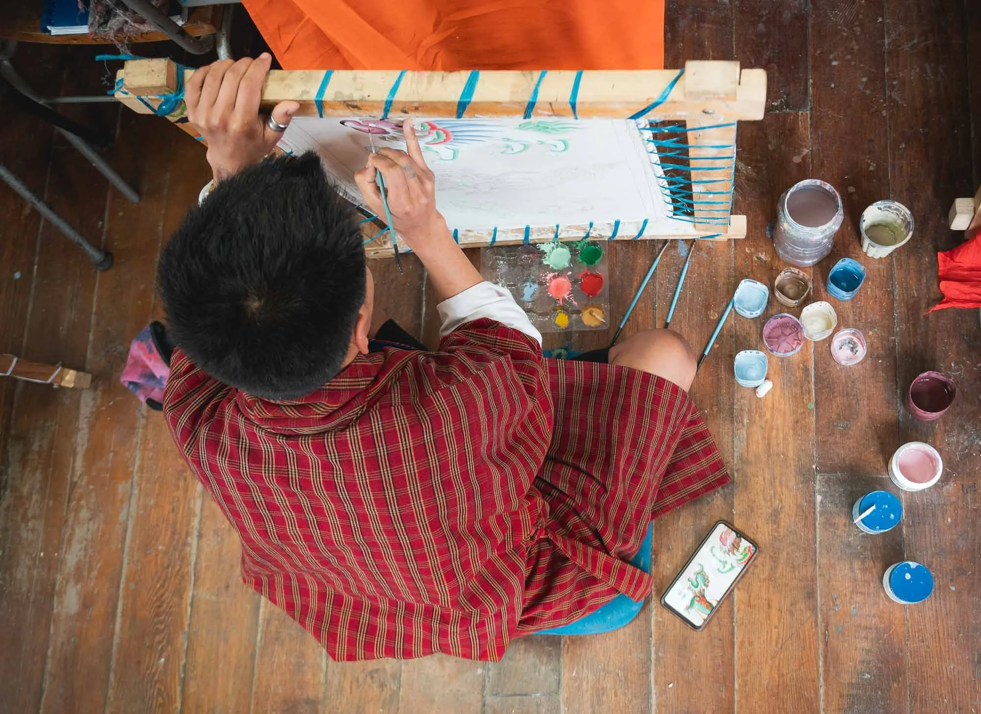
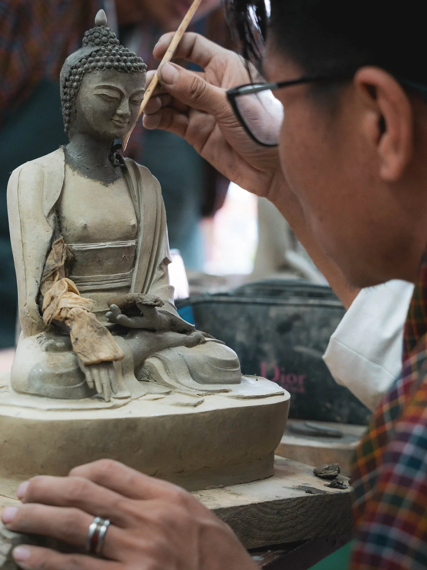
For a small fee, visitors are allowed to walk through the institute and check out the various classes in progress, such as the painting class here. Students attend courses anywhere from 3 months to 2 years depending on the level of skill and certification they want to attain.
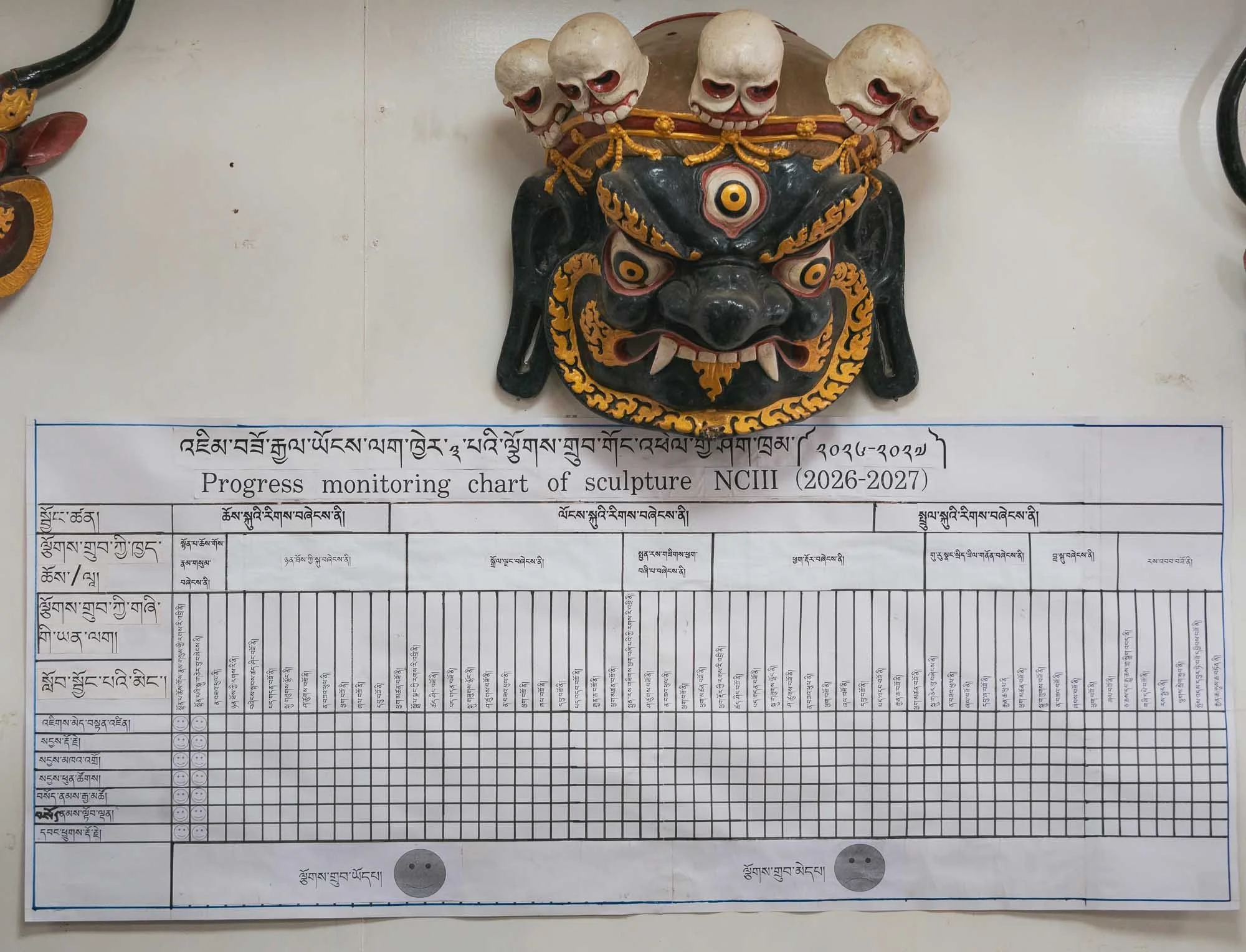
Schedules, performance, and quality monitoring don’t seem to be very relaxed! Indeed, a lot of the cultural aspects of Bhutan are not purely organic, but heavily institutionalized with skill development through formal training and government programs that preserve and regulate the national heritage.
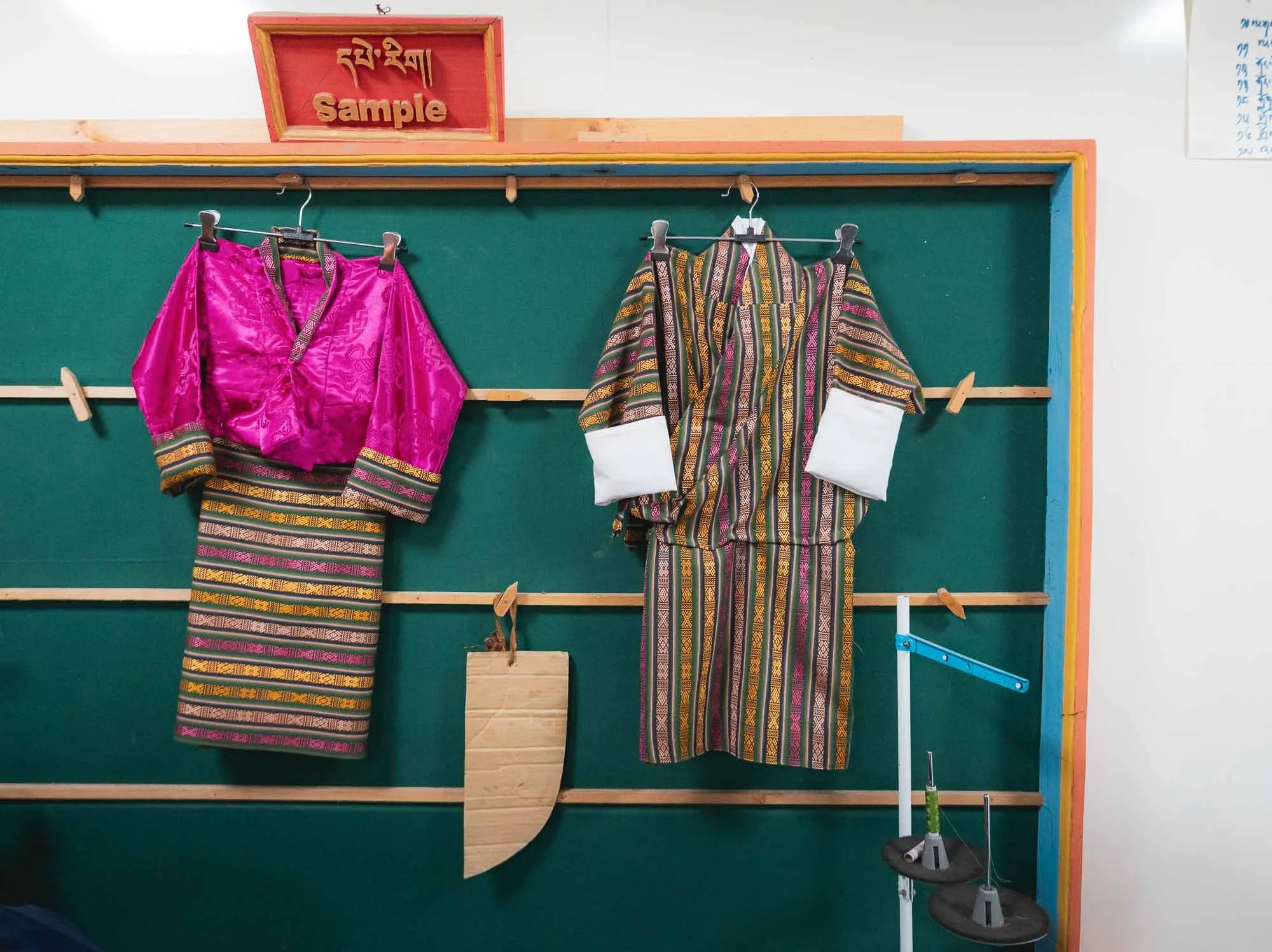
This is evident in the day to day architecture of local houses and dress style as well - it encourages a unified visual identity wherever you go, but for better or worse arguably may also be a little restrictive to evolution and individualism.
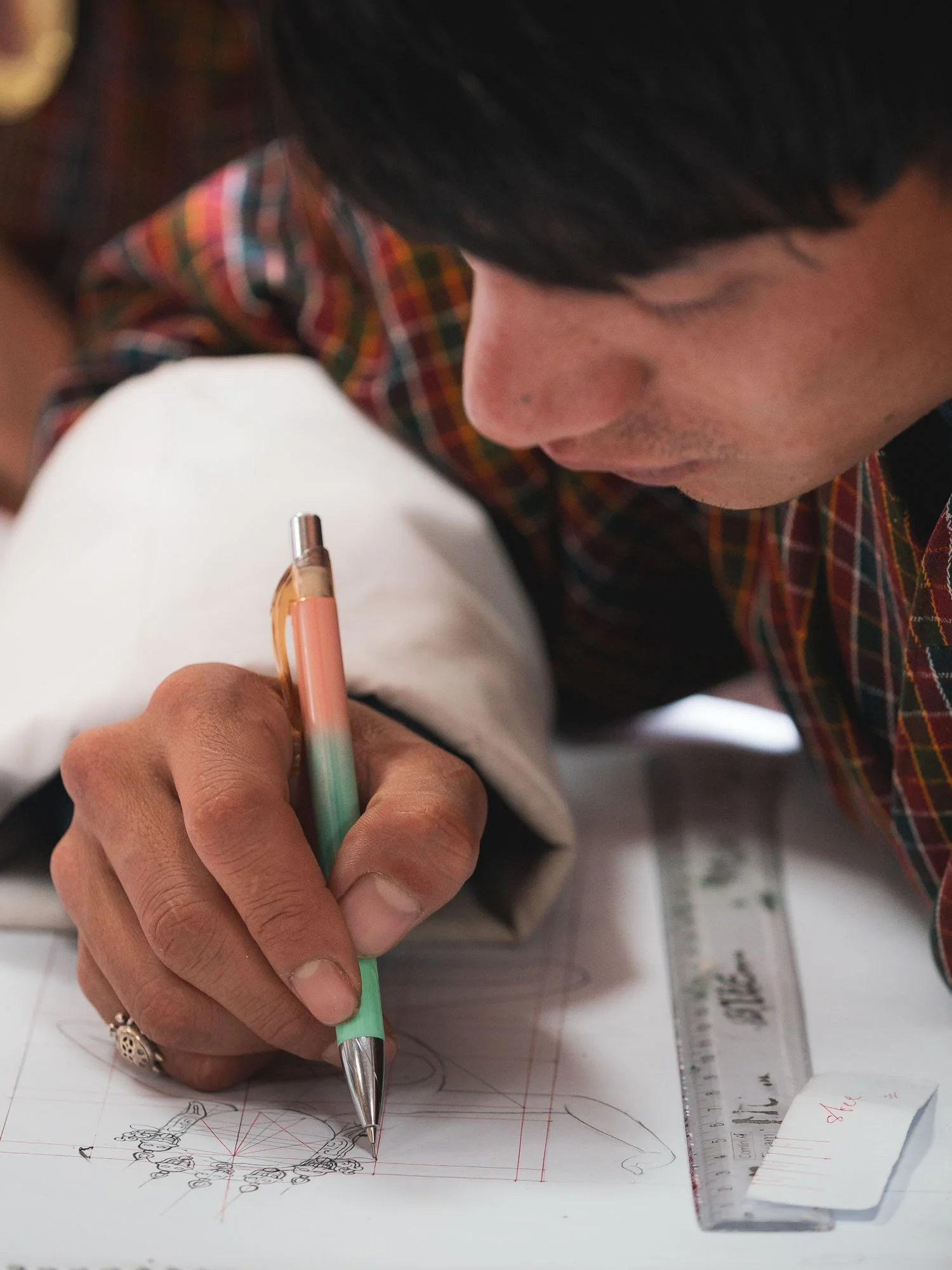
Experienced professors provide feedback and observe the student’s work, which seems largely focused on replication more so than creative expression.
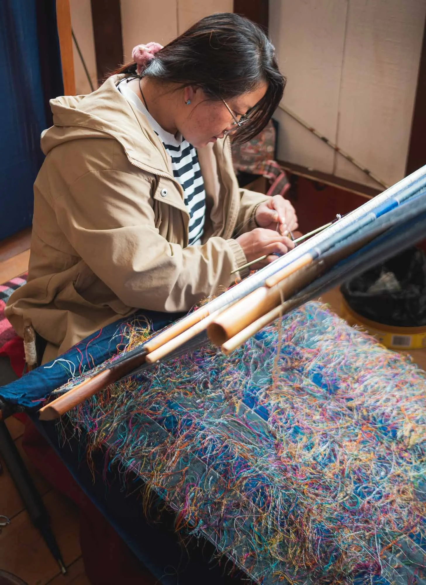
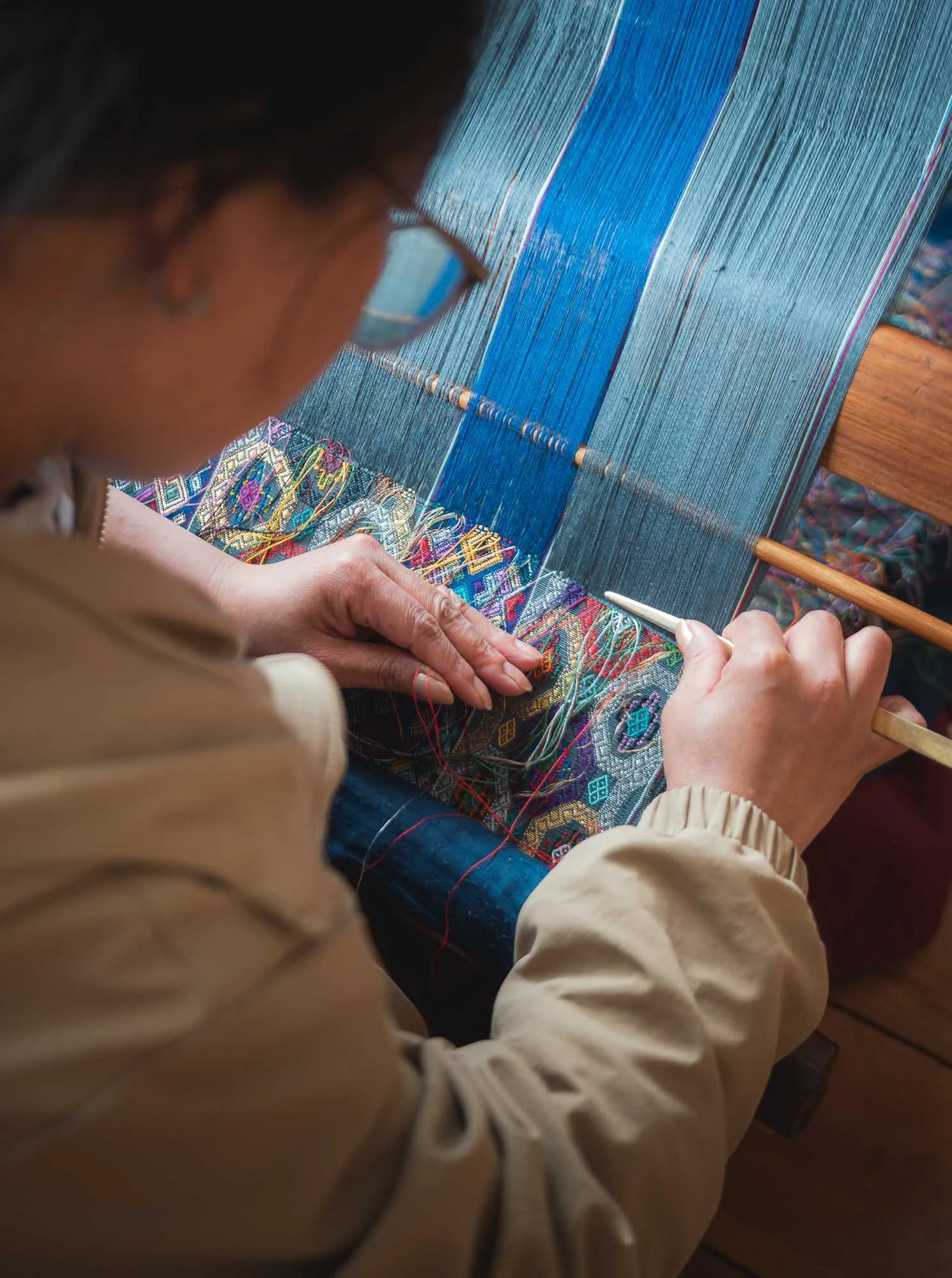
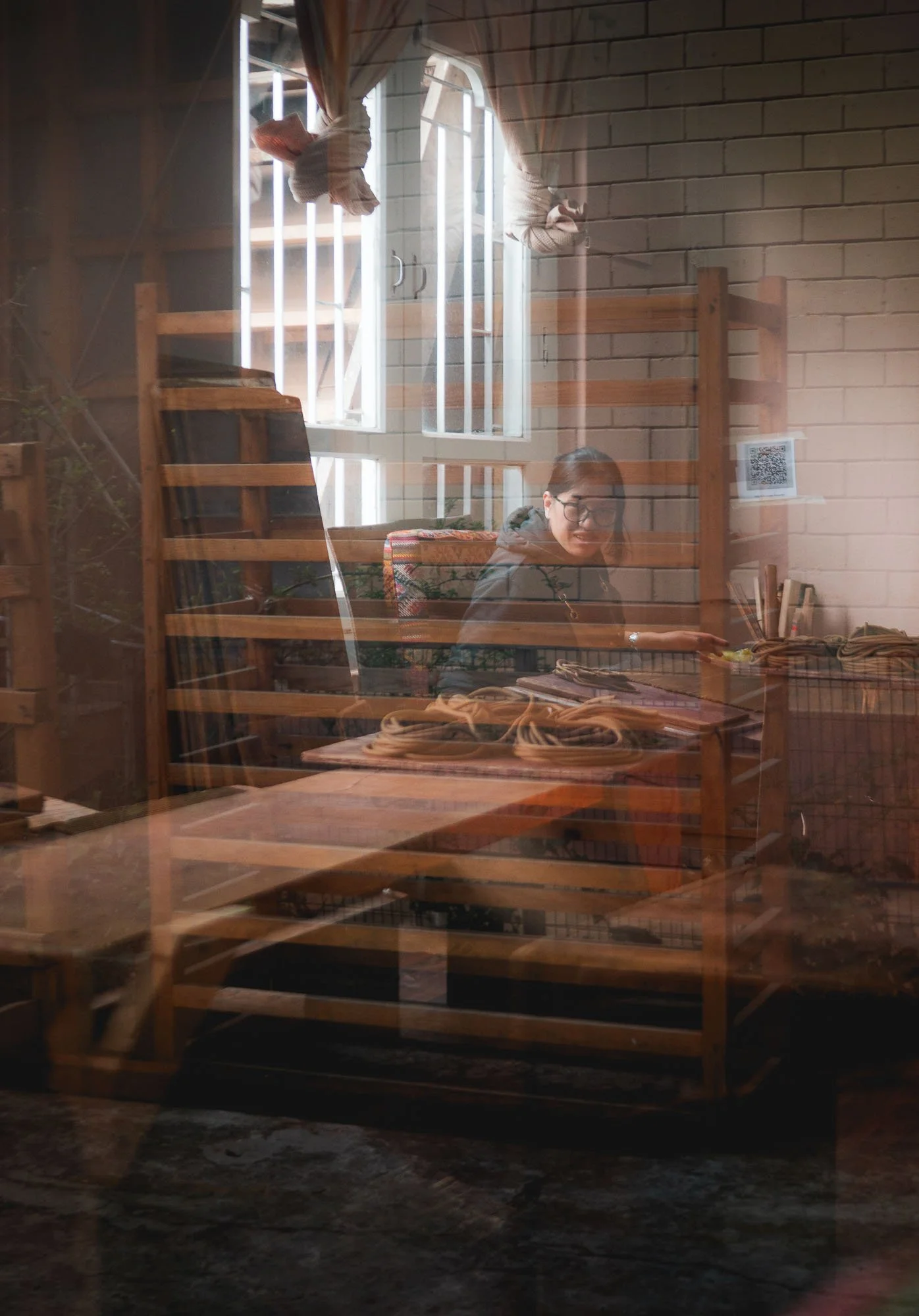
Weaving is one of the thirteen disciplines, and the dedicated Royal Textile Academy manages classes, market access opportunities, and a museum for this discipline, mainly practiced by women. It was closed for some renovations during my visit, but there are several other weaving centers dotted around the city.
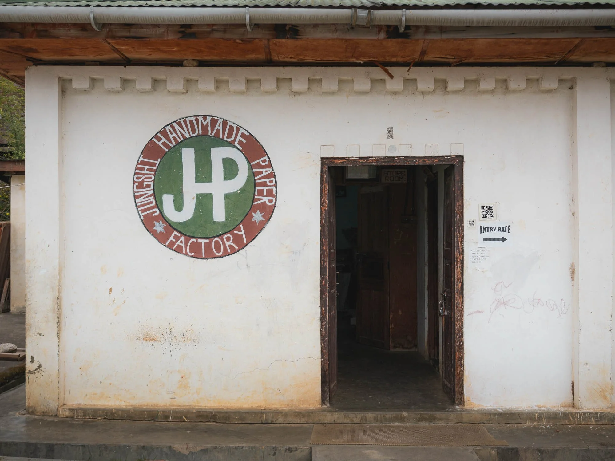
📜 Traditional Paper Making
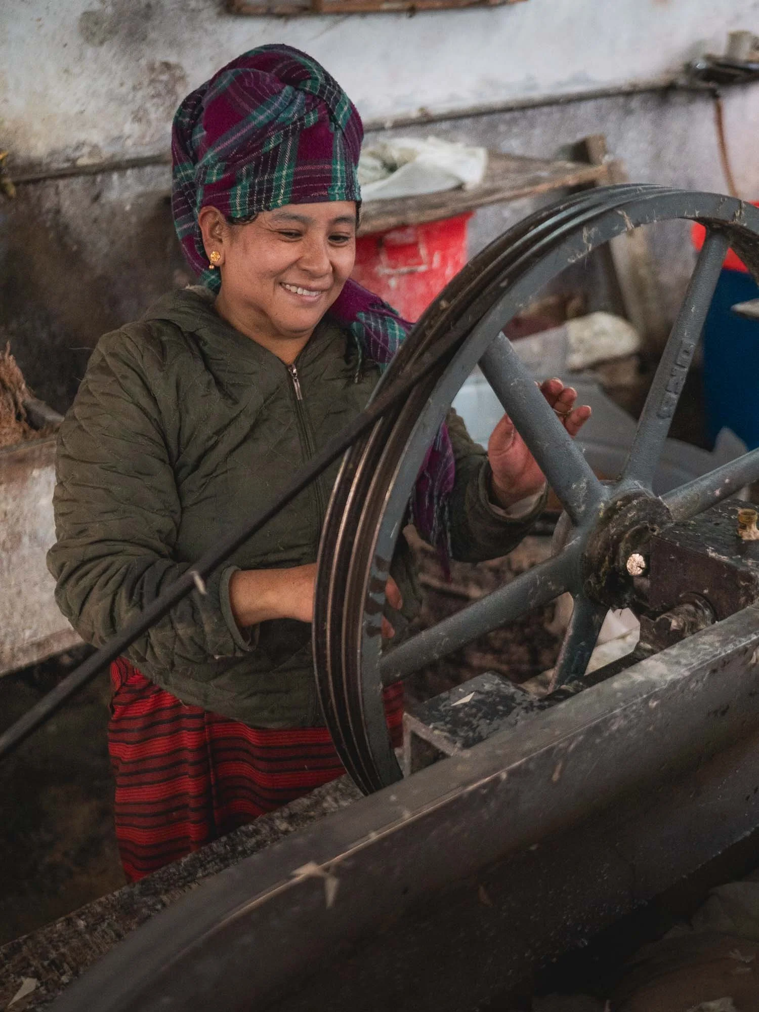
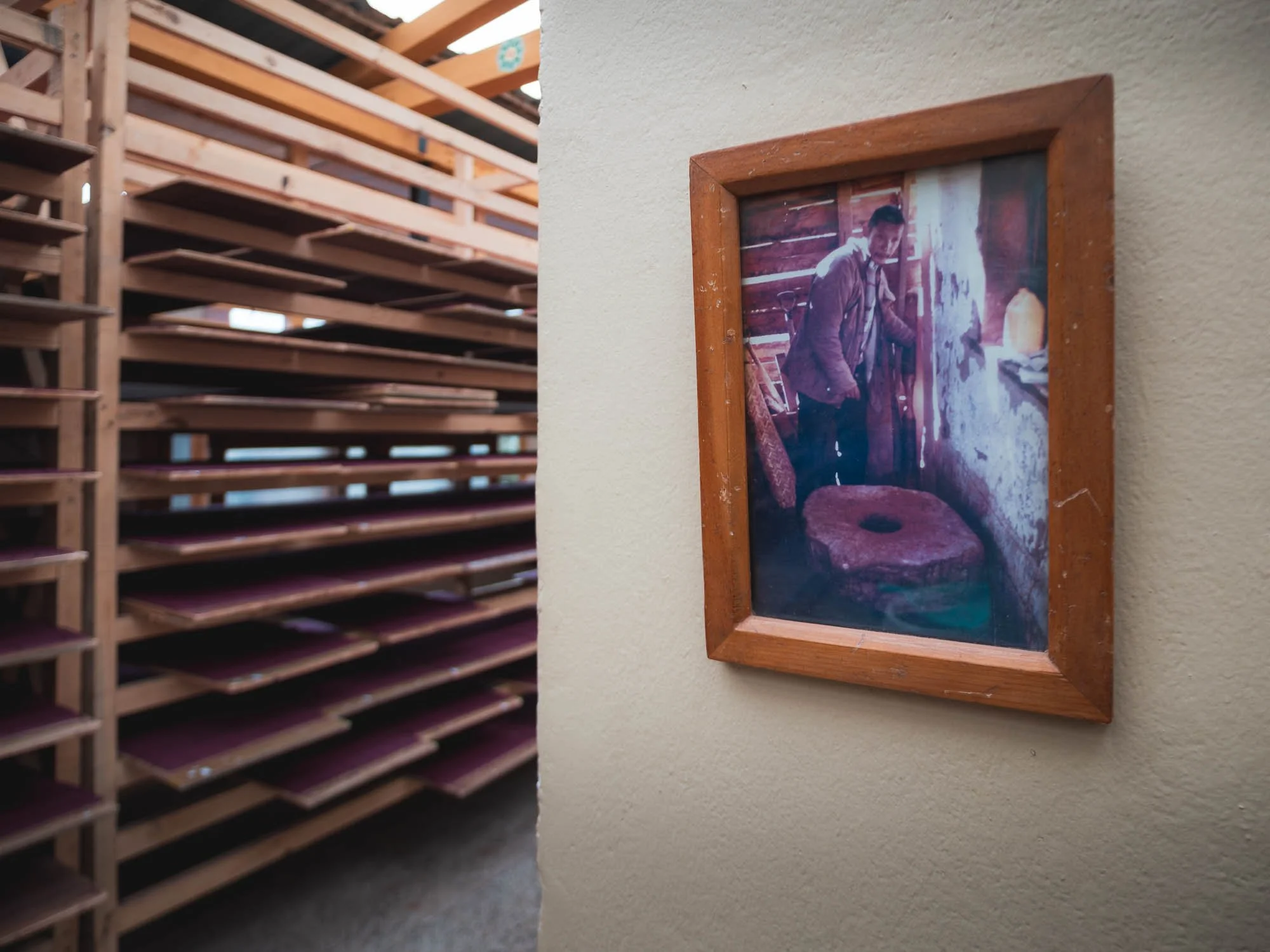
A little less formal and codified was the next place I visited, and it turned out to be one of my favorite spots.
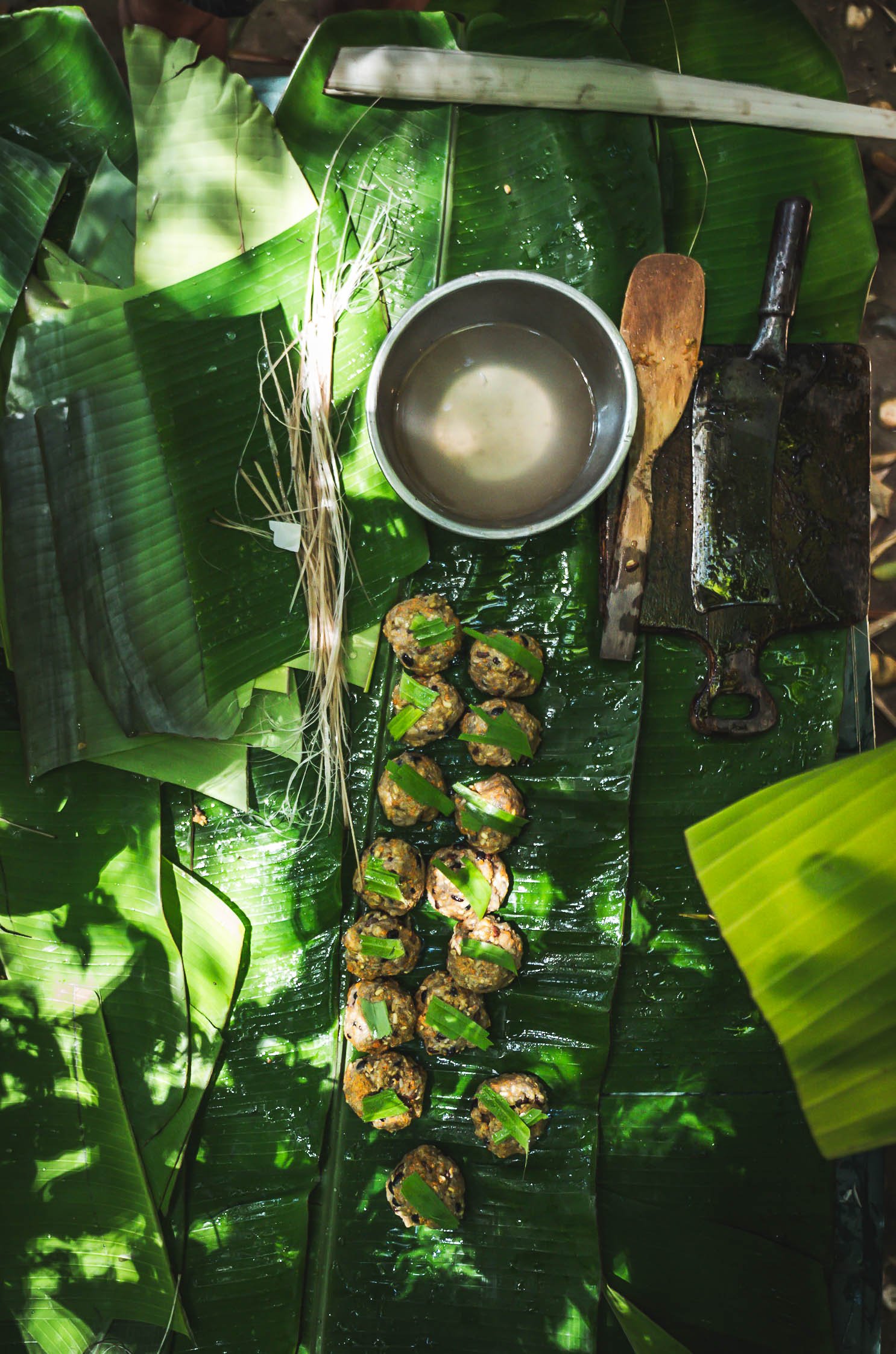
To make the paper here, Daphne plant fibers are first extracted by soaking and boiling the bark, then cleaned and broken down into pulp manually. This is mixed with water and a natural binder and spread in thin layers onto a screen to form sheets.
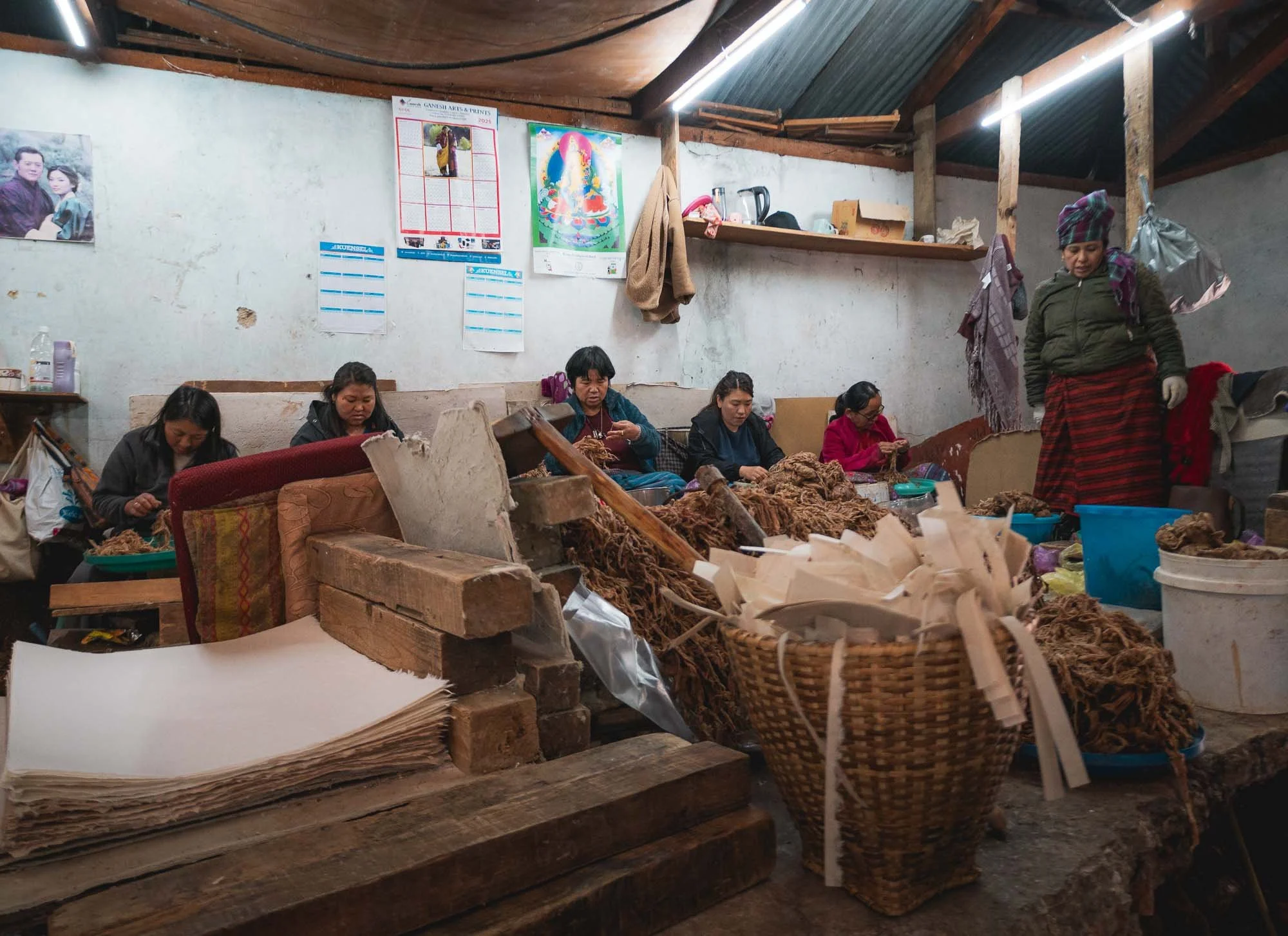
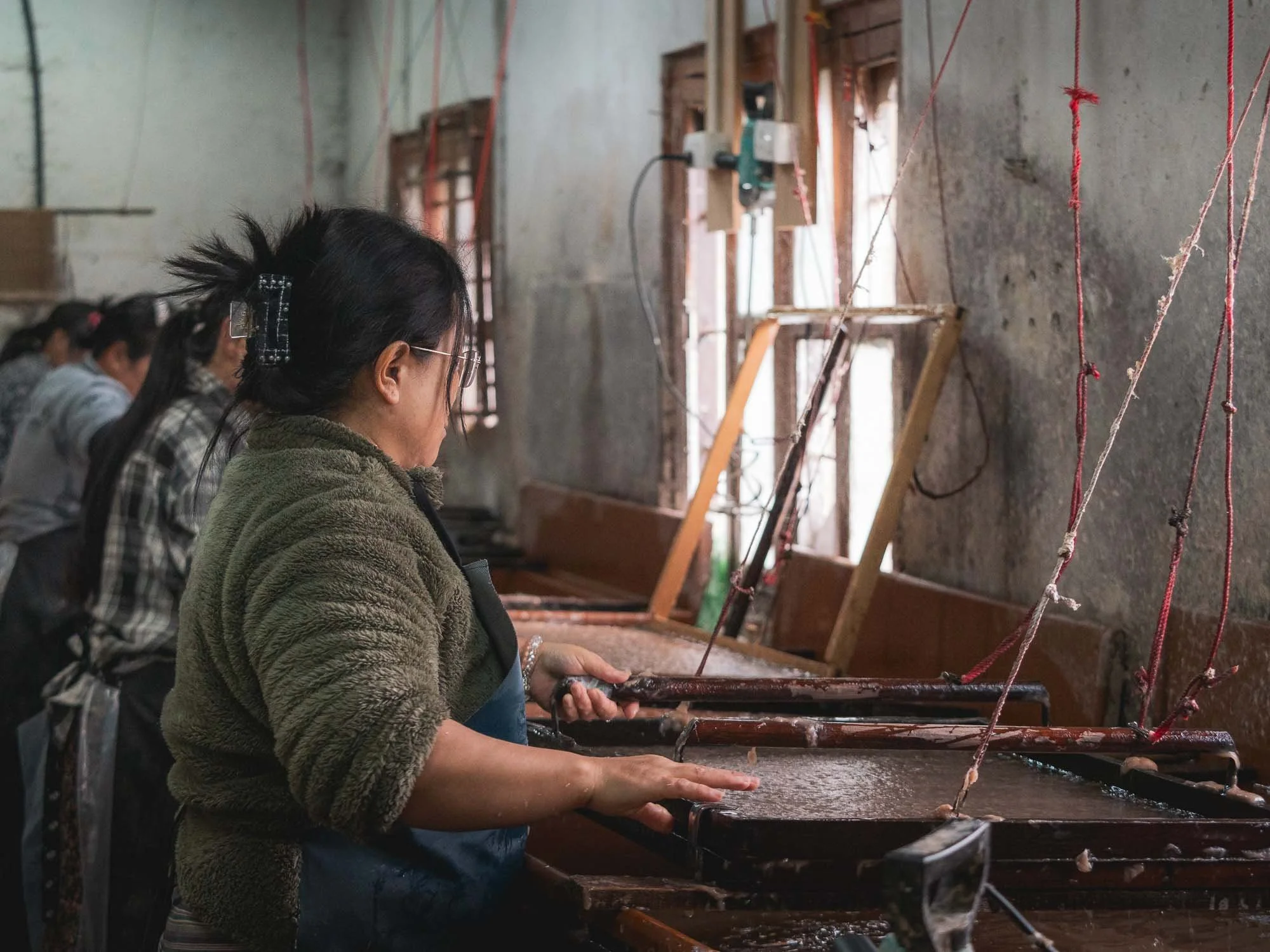
The sheets are then pressed to remove excess water, and dried individually on heated boards. They last for decades without chemical treatment.
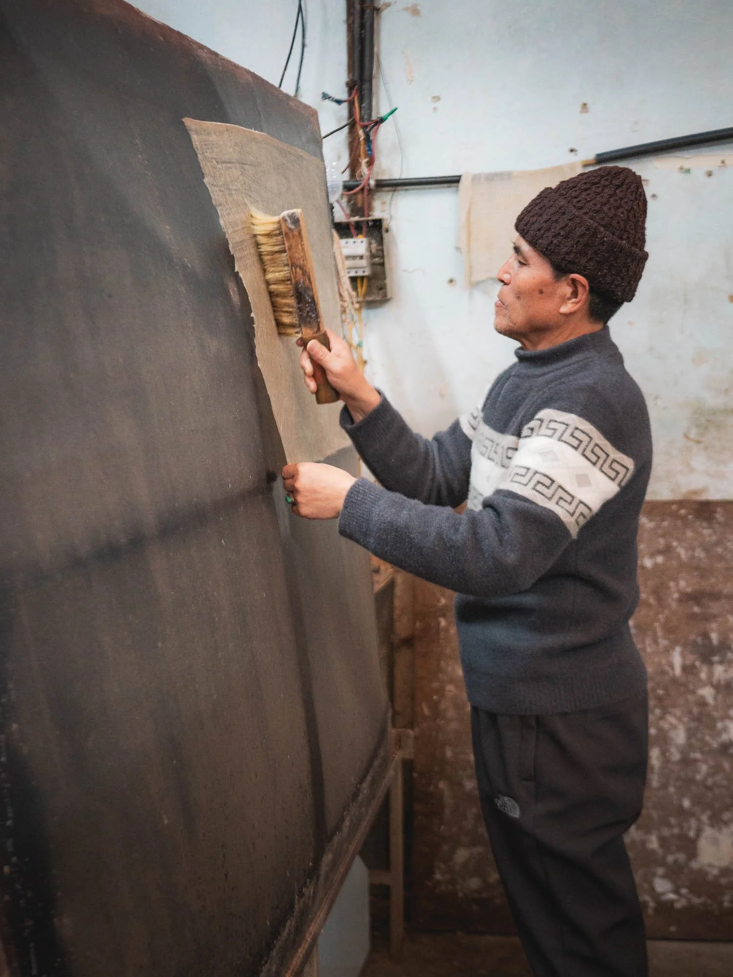
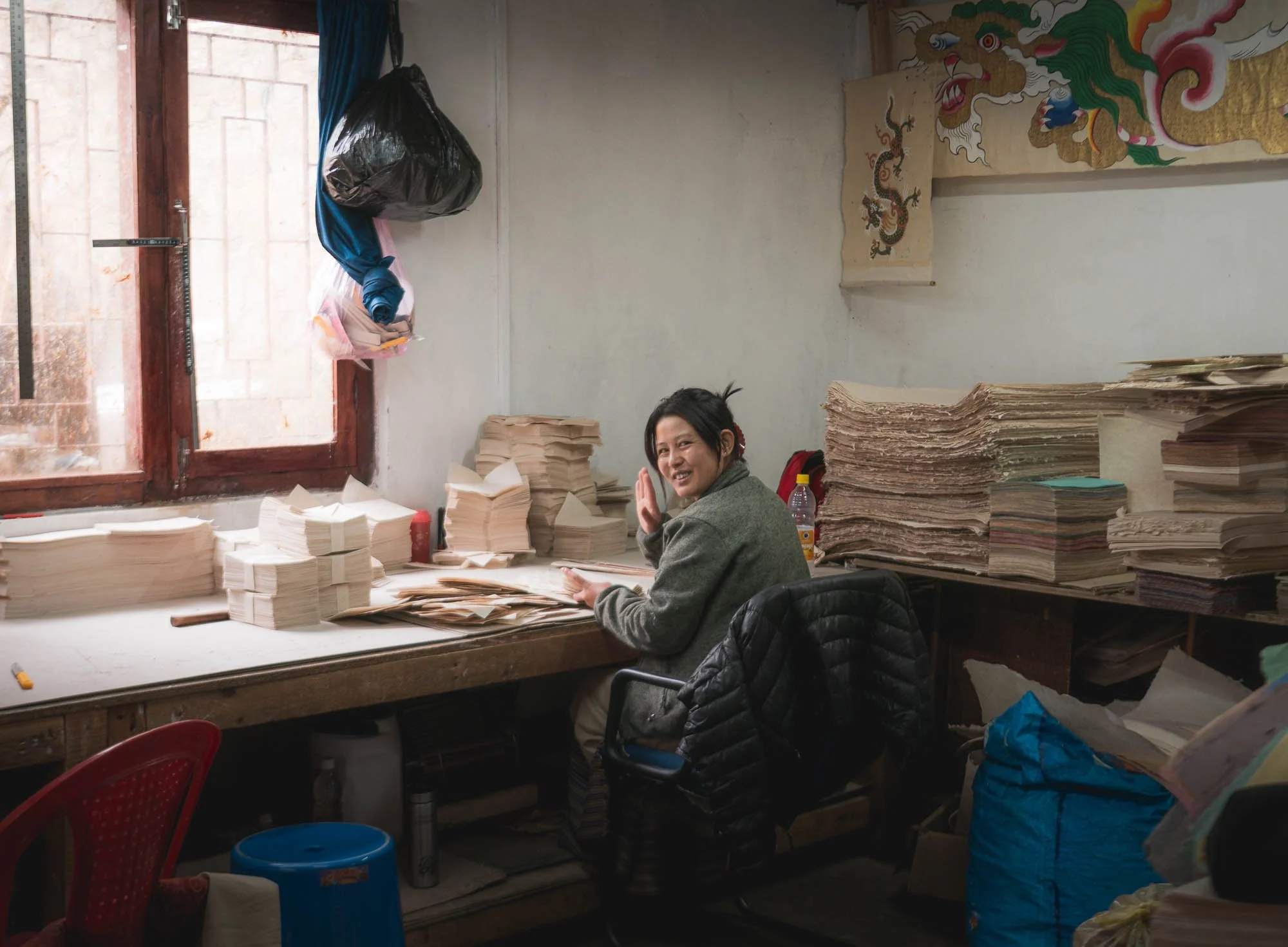
Historically, it was used for religious texts and official documents, nowadays it is commonly used for more industrial applications like packaging, and some of the paper is packaged and sold in their in-house shop as small postcards, note books, and similar items.
Although those are very expensive (overpriced, one could say), I couldn’t resist and bought plenty of sheets to try and print some photos on.
Incense Making
My last exploration into the world of Bhutanese crafts was at a local incense factory, which has been running for over 50 years, as the second generation owner told me.
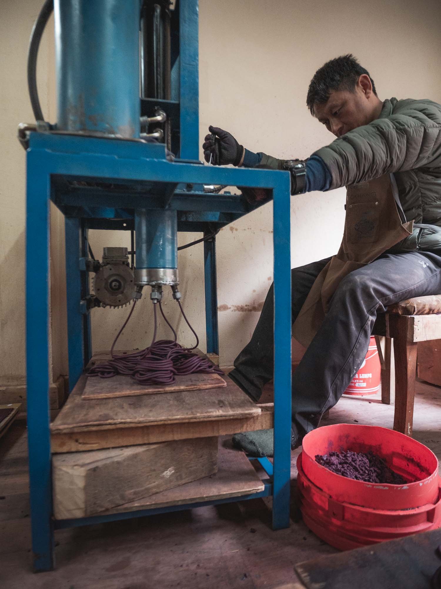
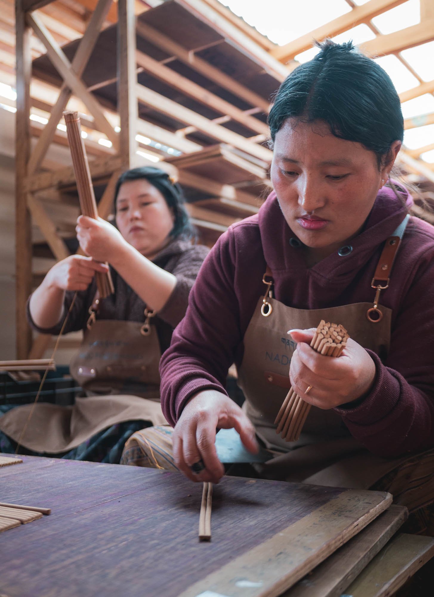
Incense here is mostly plant-based, from herbs, roots, and resins. They are first ground and dried (which produces a really strong stench and eye-watering sharp dust), then mixed with water into a paste, pressed into long tubes and then rolled and cut by hand, before being air-dried.
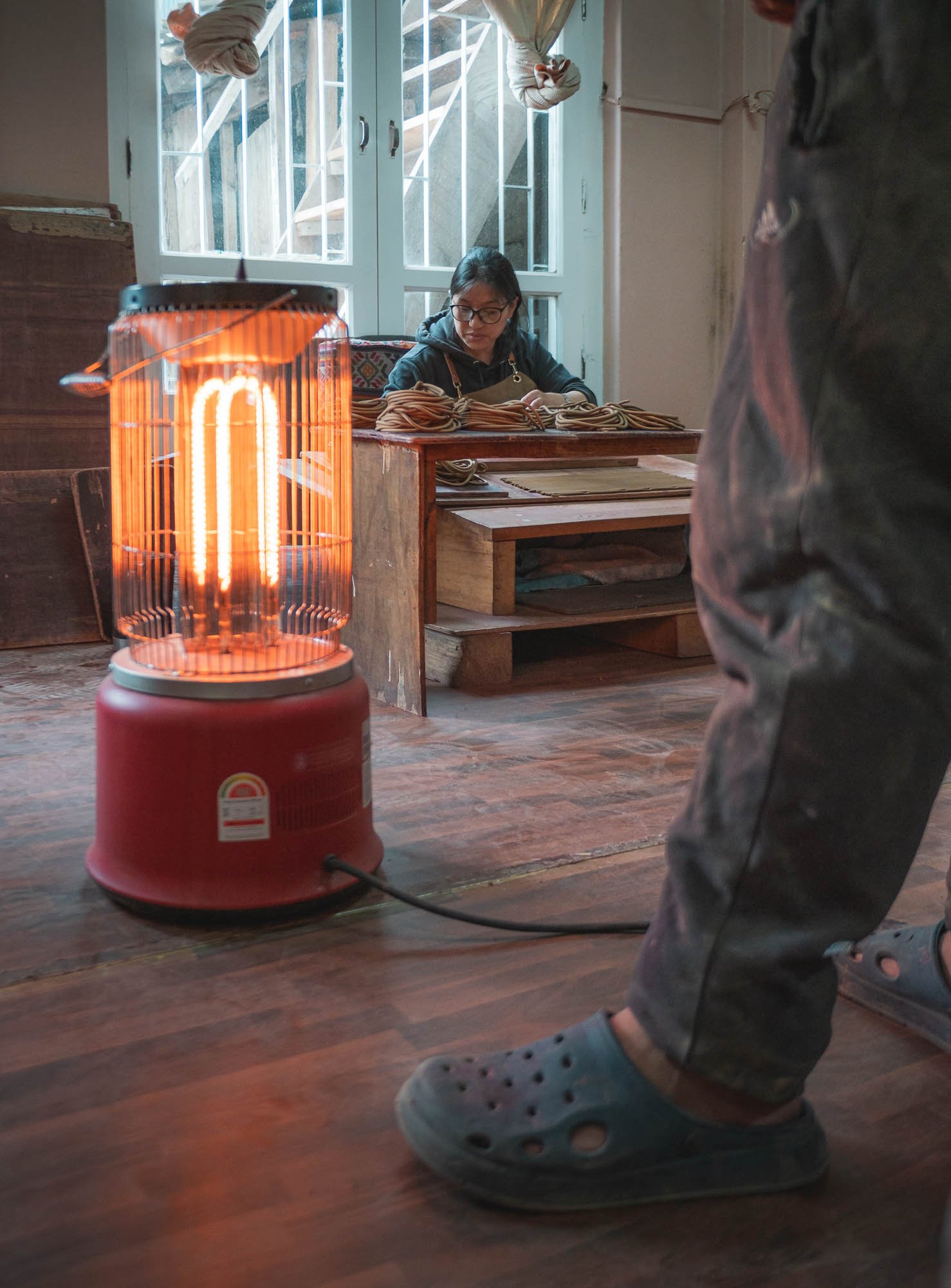
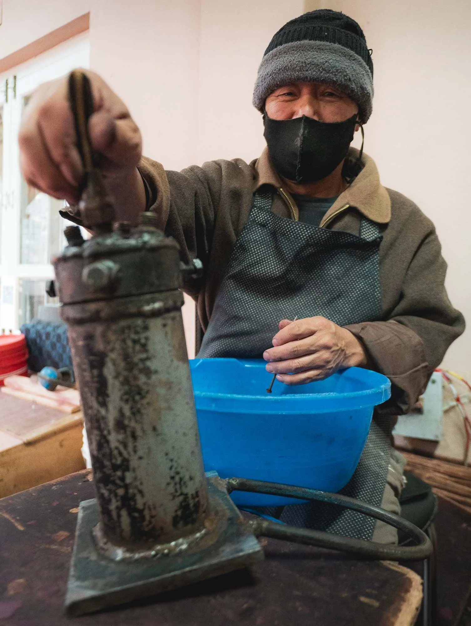
In house machine repairing… wearing a mask is a good idea in here, the dust filling the air from the finely ground base ingredients is definitely not healthy. With this, it was time to leave the capital and move a little further east.
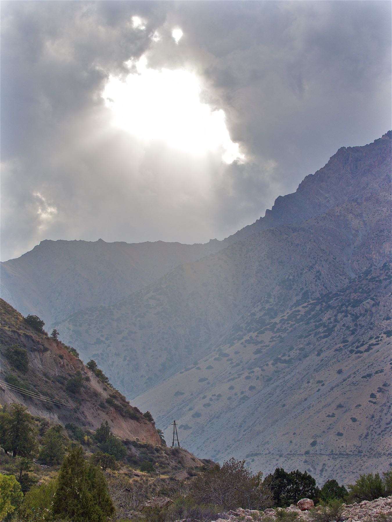
Dochula Pass & Beyond
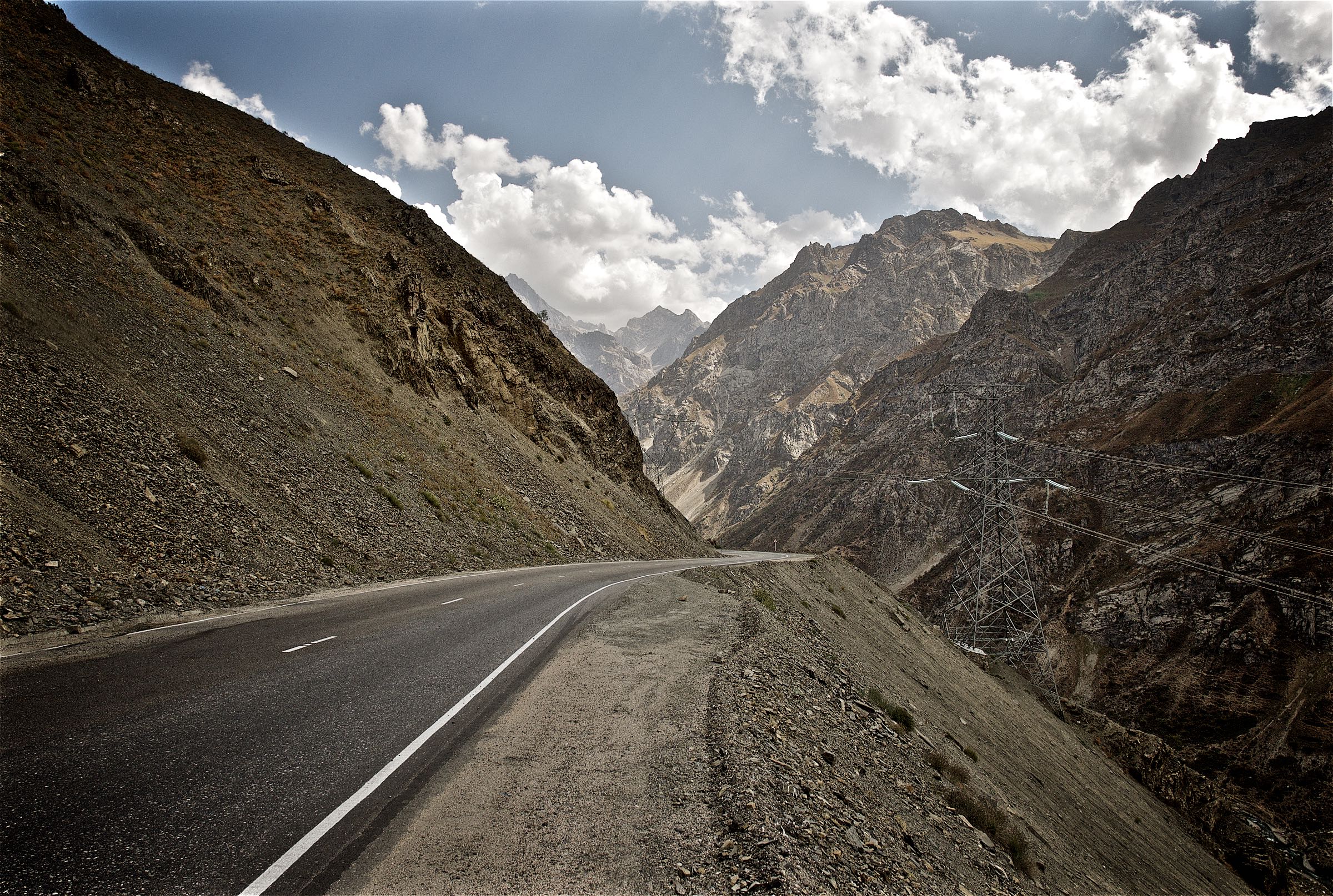
To do so, you cross the Dochula pass at around 3100m following a winding, but decent (not a guarantee everywhere as I’d later find out) road.
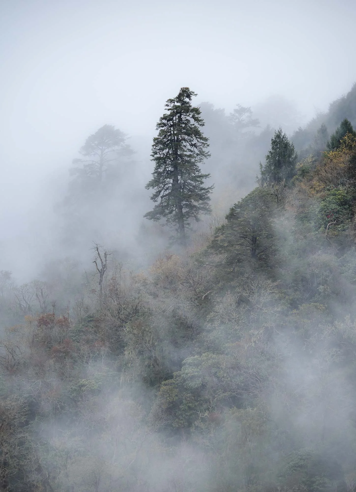
On a clear day it offers a view of the eastern Himalayas, alas that was neither the case on the way there or the return trip, which is quite common. Clear days in the mountains here can mostly be enjoyed in October or November, but the misty atmosphere also had its charm.
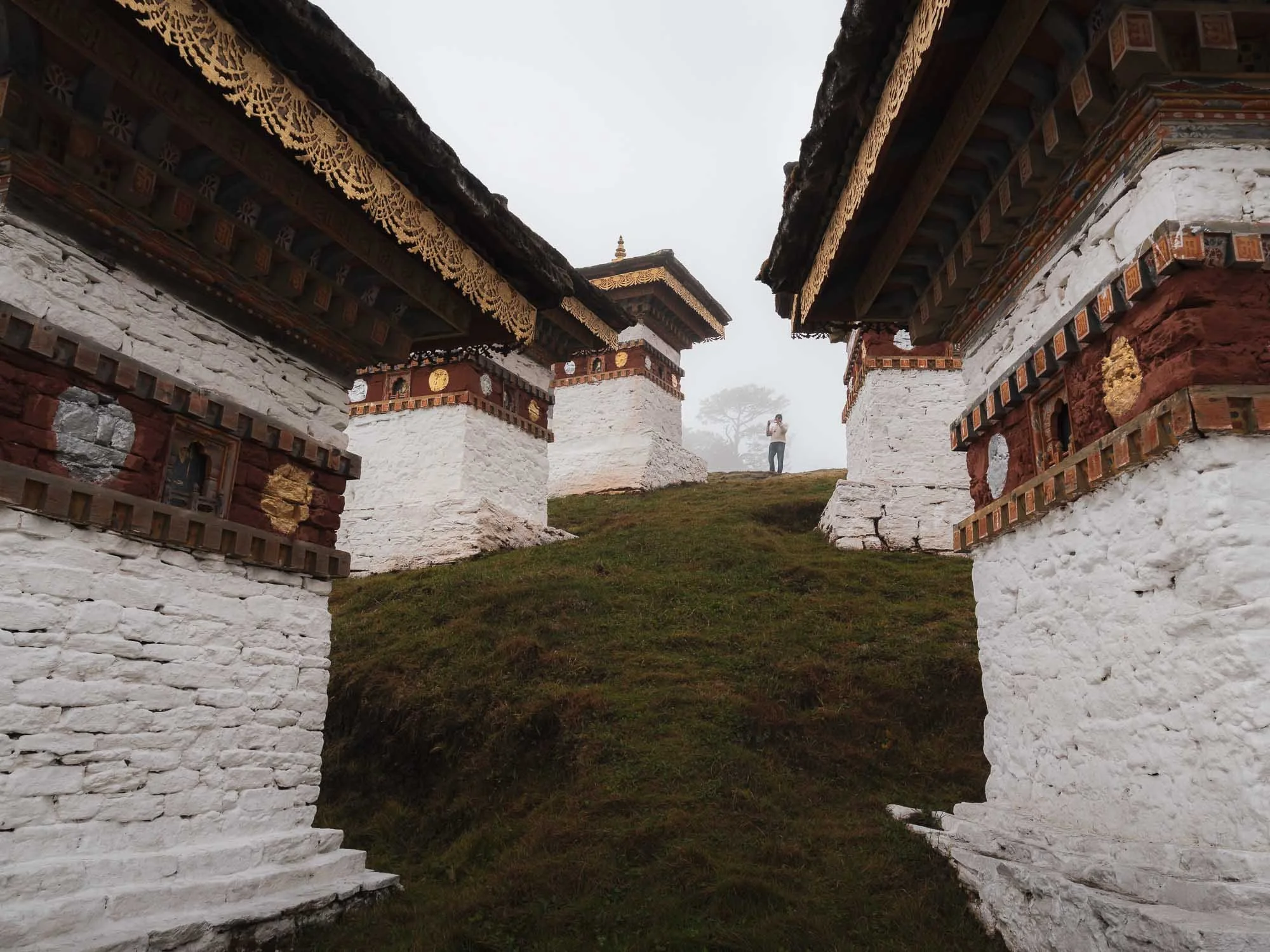
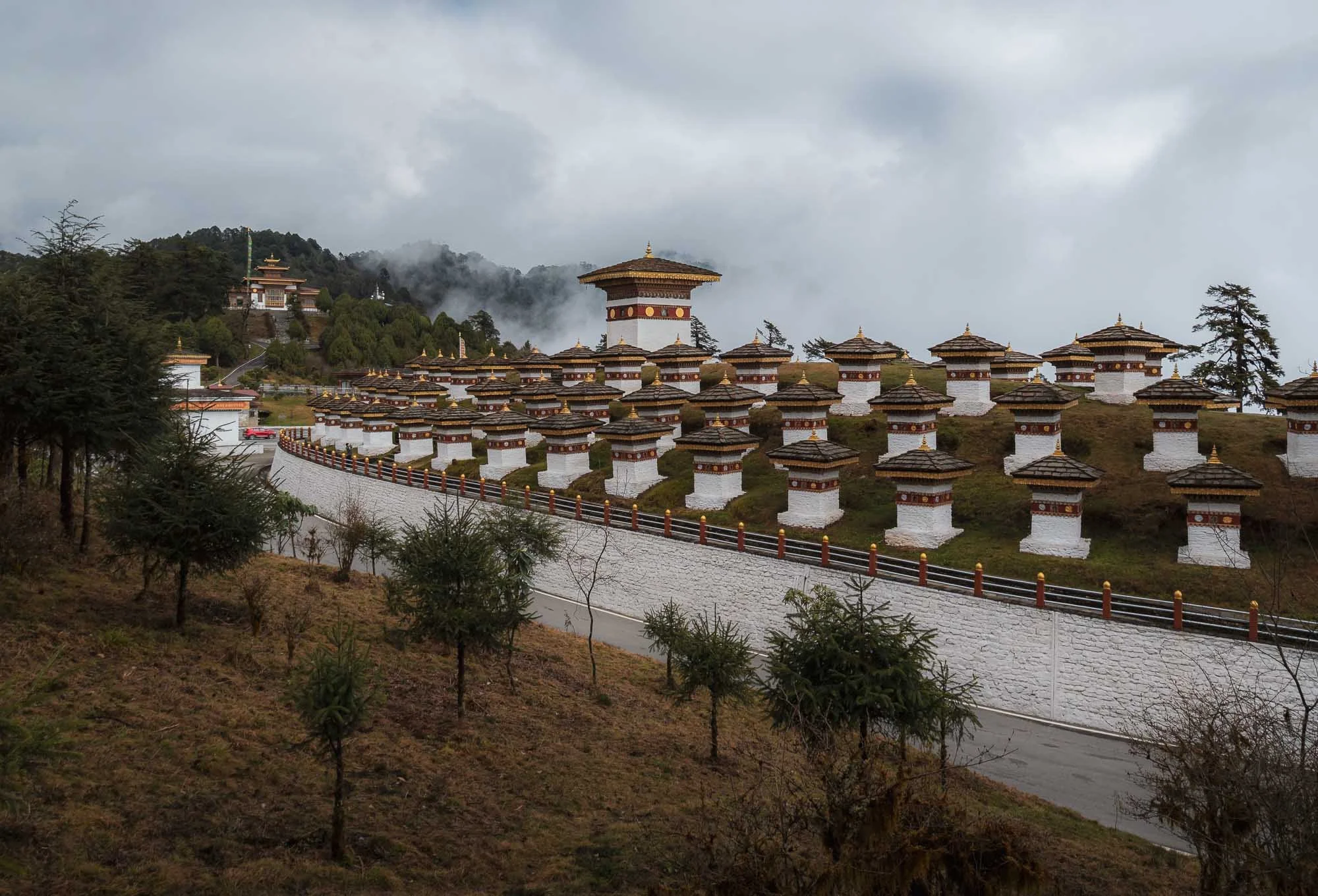
Many people visit the pass for the 108 chortens, a memorial constructed in 2004 at the very top in honor of the Bhutanese soldiers killed in military operations in the south against Indian insurgents the year before.
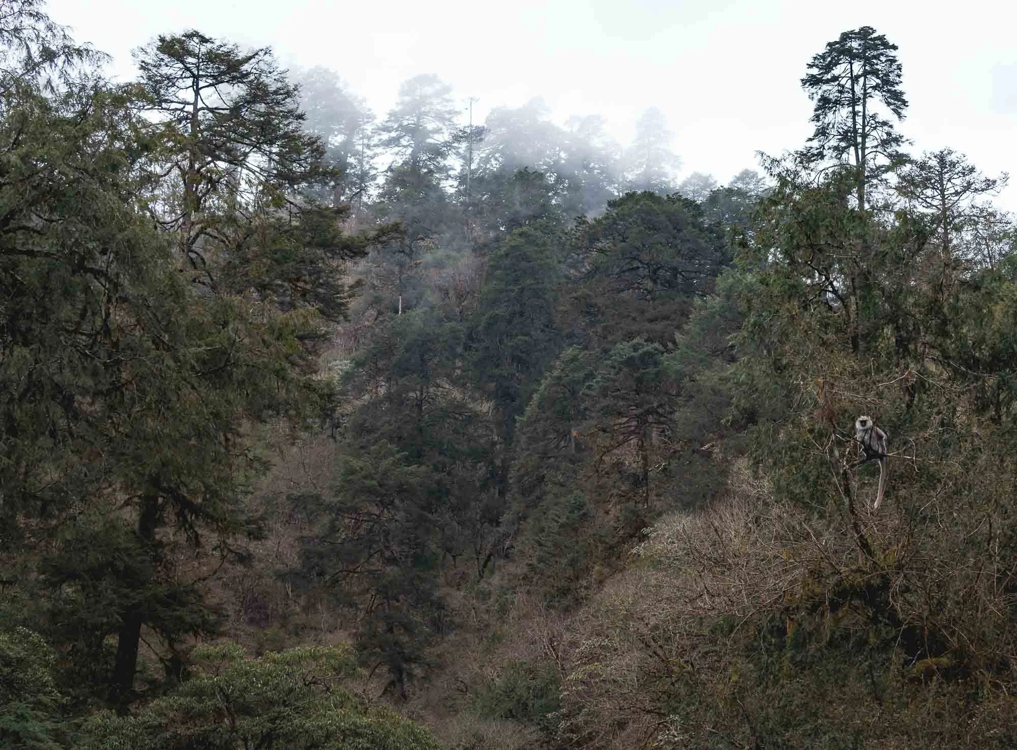
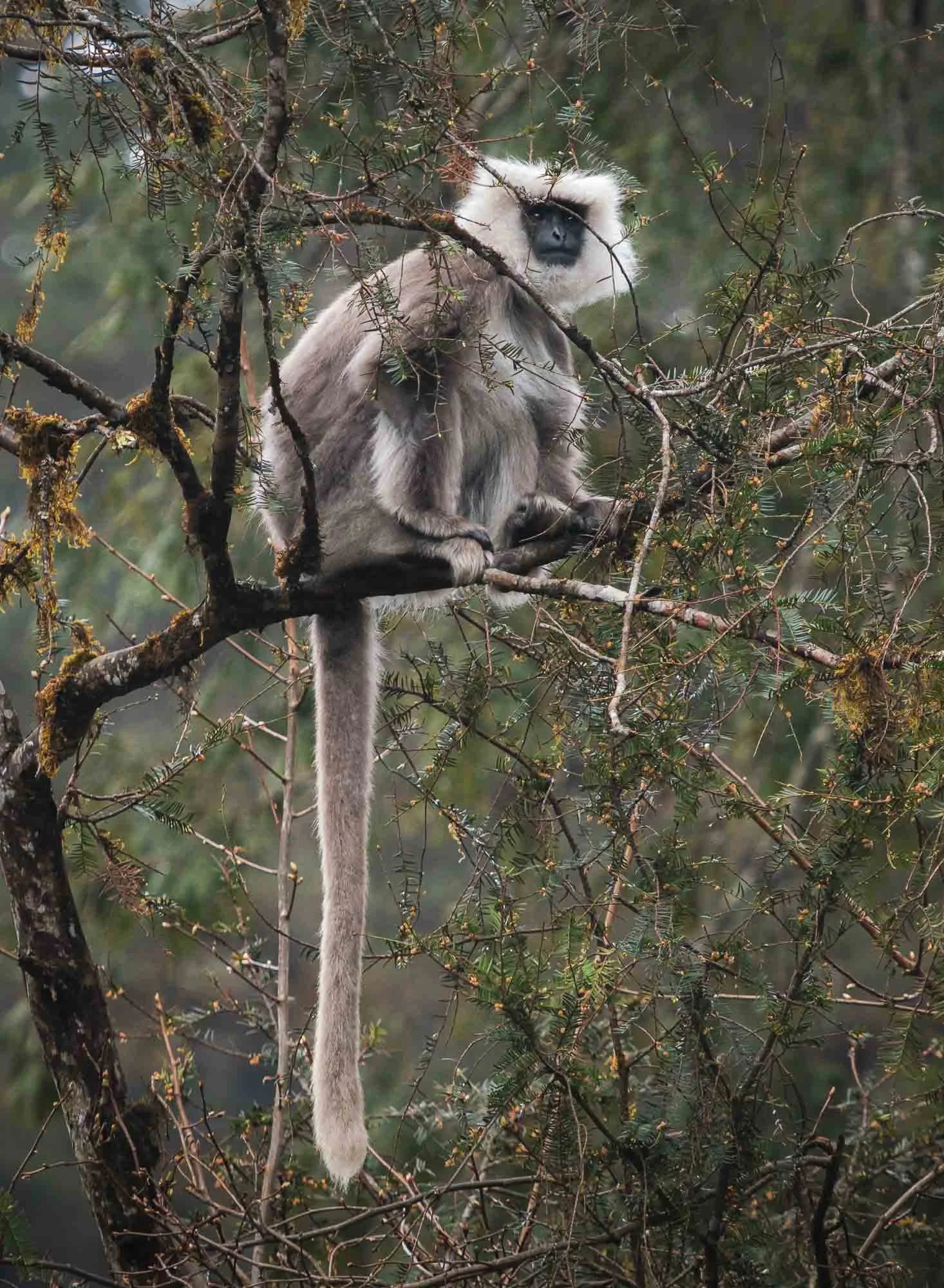
Instead of returning back, we made our way down the other side into the valleys, and had the chance to spot a grey langur with its characteristic black face on the roadside. It’s very rare golden cousin is endemic to Bhutan and small parts of India, and much harder to spot in the wild.
Once descended, we crossed the Puna Tsang Chu river and its valley and headed further east, but not without a short stop for a photo of the Wangdue Phodrang Dzong, at the ridge above the river confluences. It was almost fully destroyed by fire in 2012, and has been reconstructed over the last years.
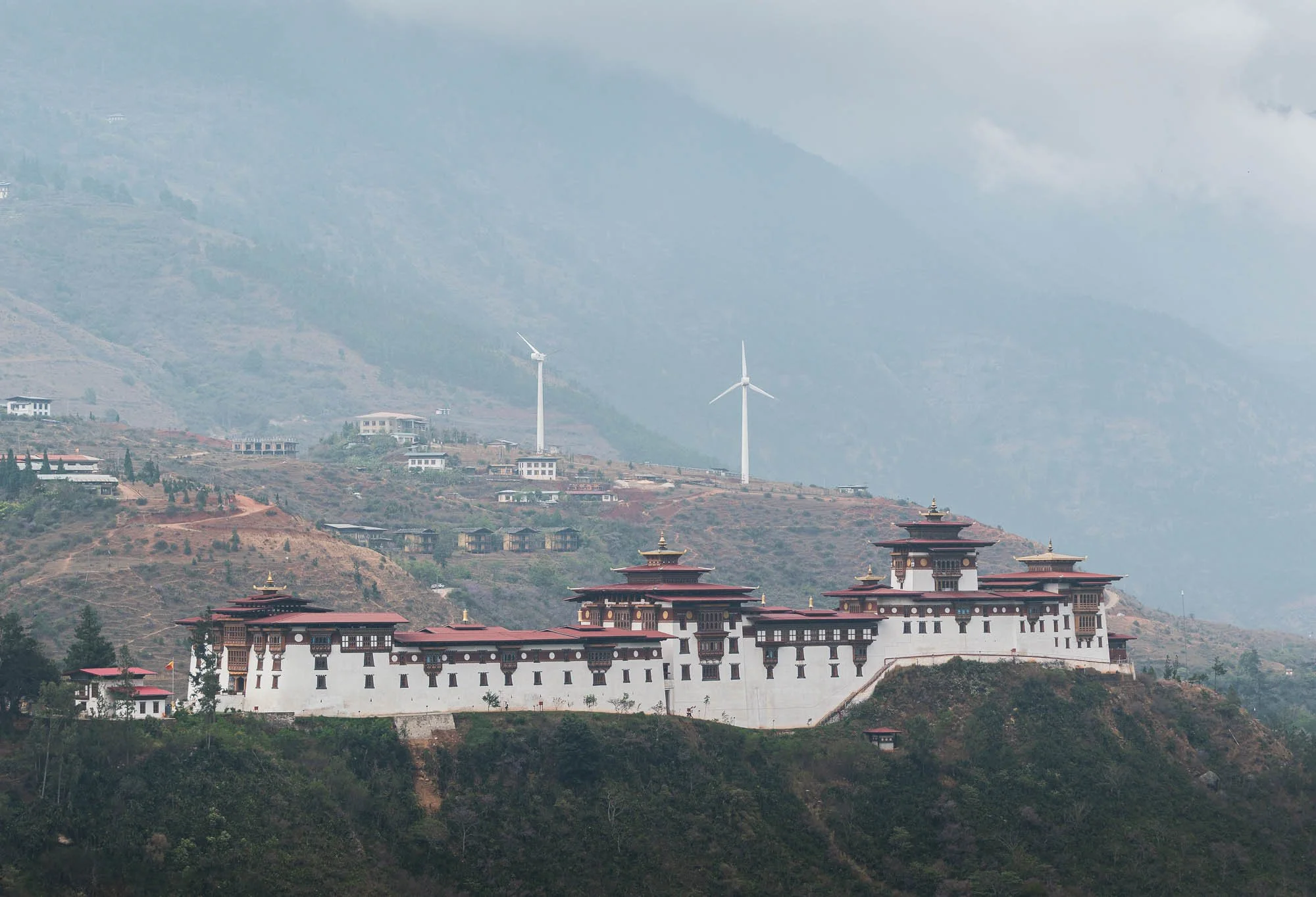
Despite the wind farm in the background, Bhutan’s electricity is almost entirely generated from hydropower owing to its many rivers. In fact, exports of energy to India are a major revenue source for the country, although it still imports fuel for local generators and uses biomass for heating, for instance.
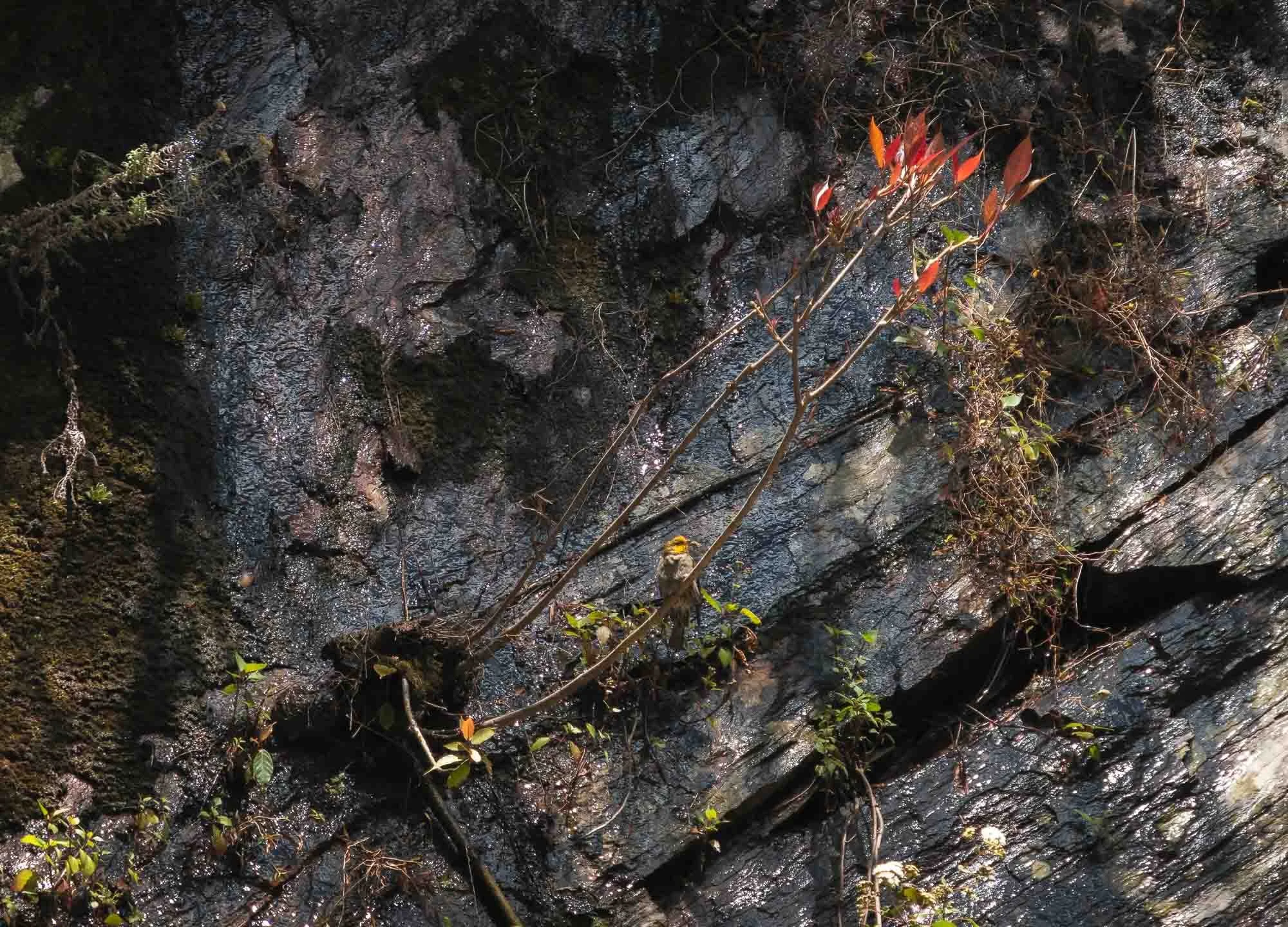
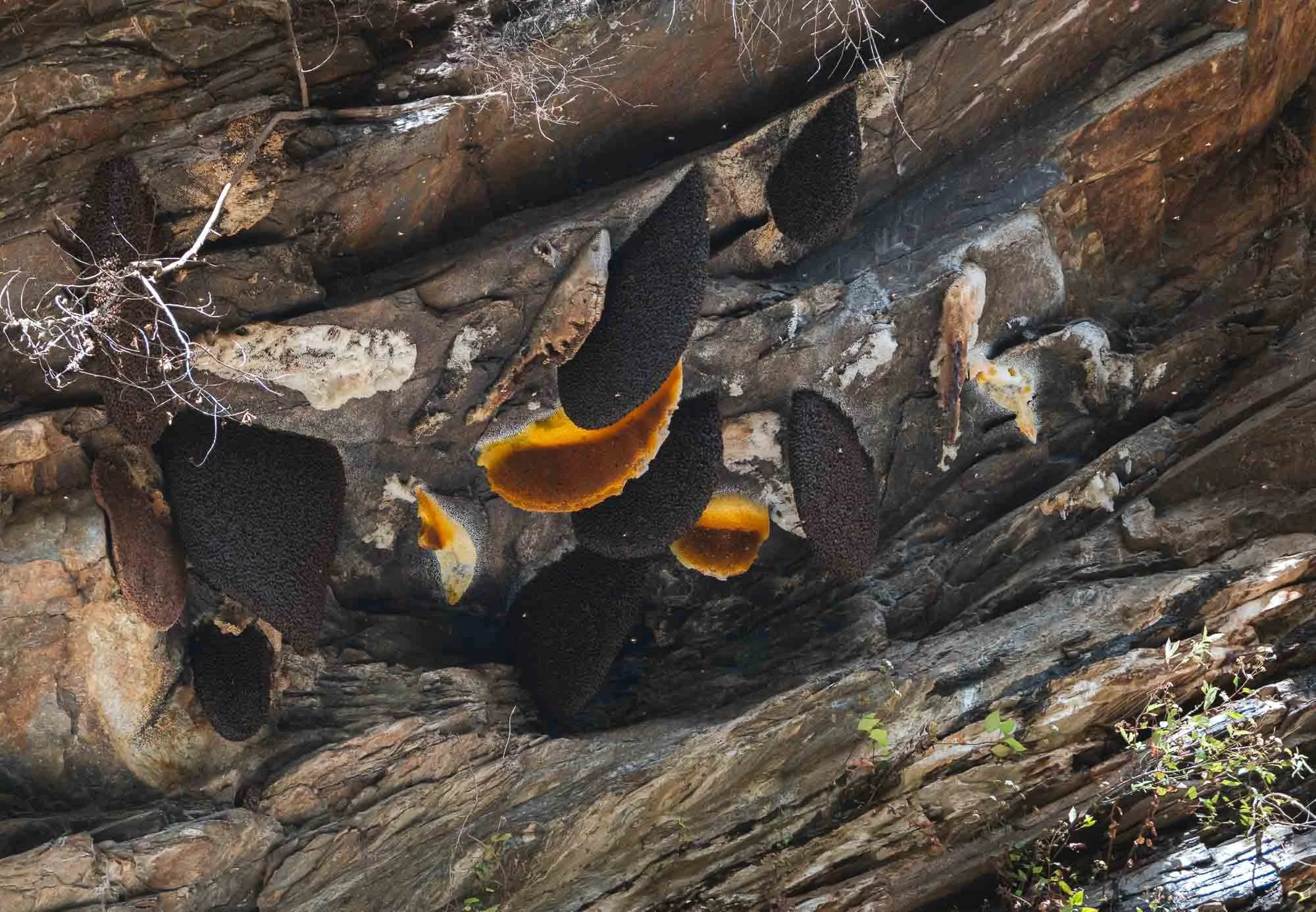
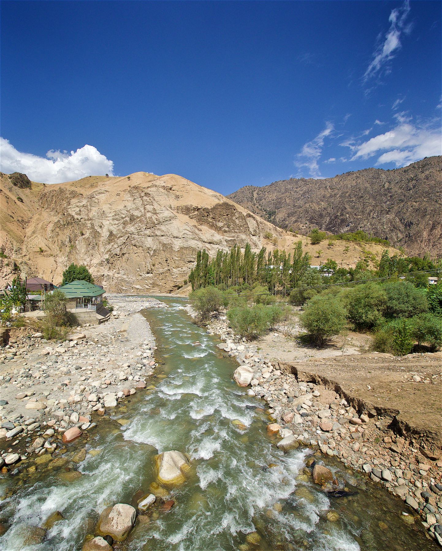
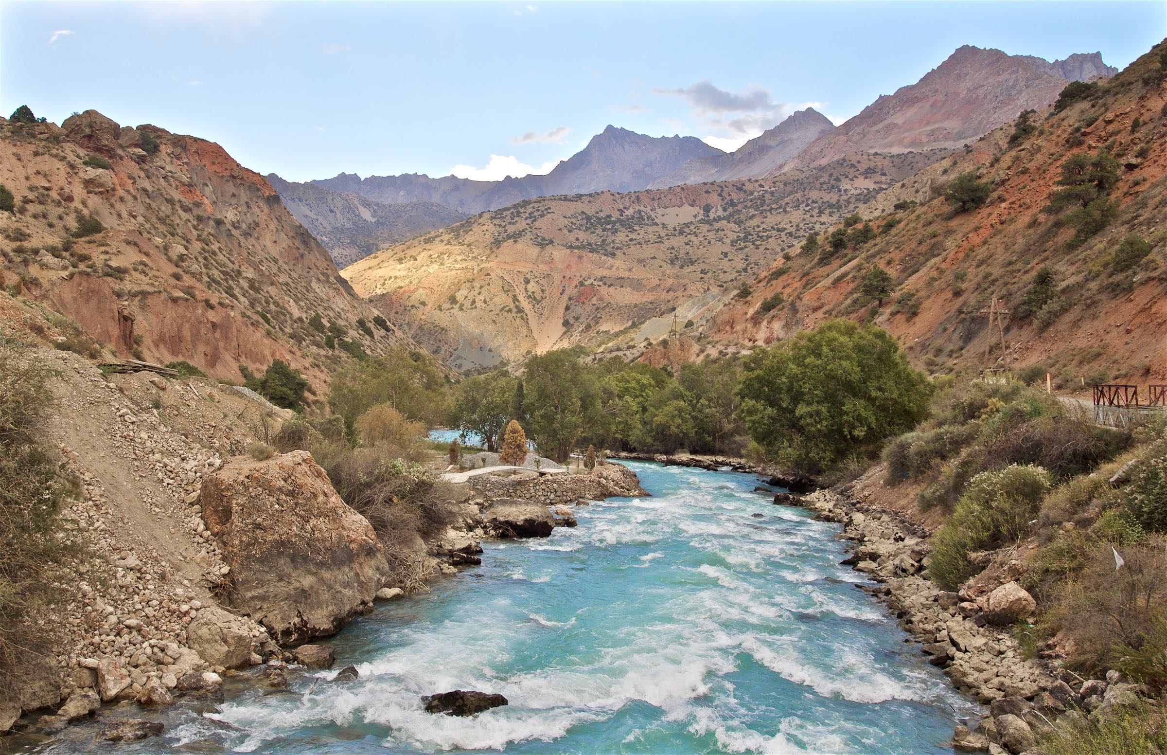
We continued our way to cross Lawala Pass at 3300m into the Phobjikha basin - the roads here were demonstrably worse, and recent rains didn’t help. An interesting sight a bit lower on the slopes were cliff-nesting giant honey bees and the accompanying yellow-rumped honeyguide, which I only spotted because a group of birders had stopped by the side of the road to photograph it - Birding tourism is quite common in Bhutan owing to its many rare and endemic avian species.
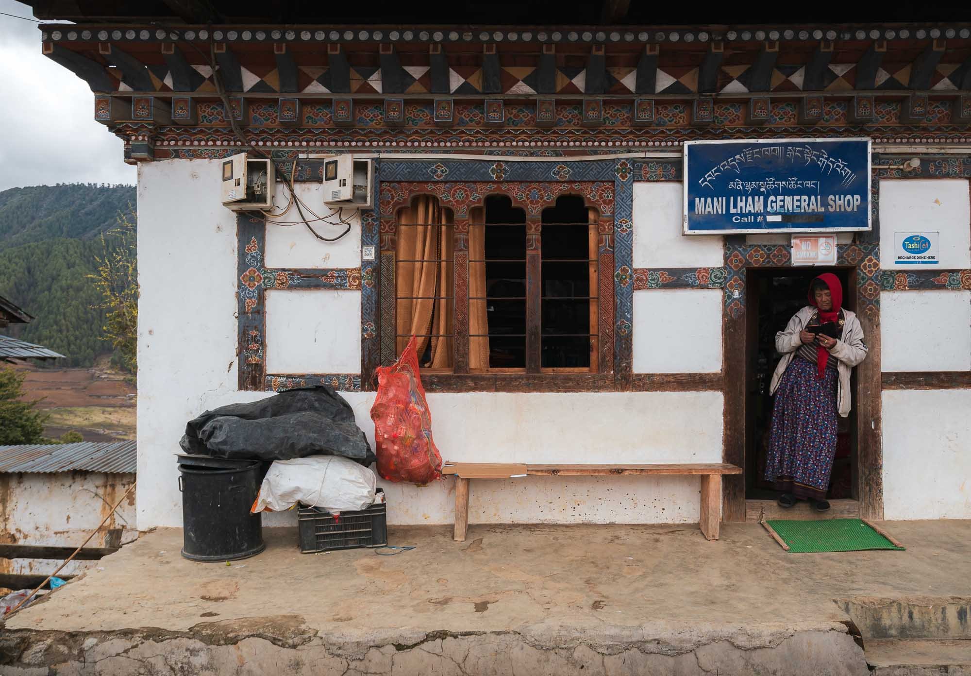
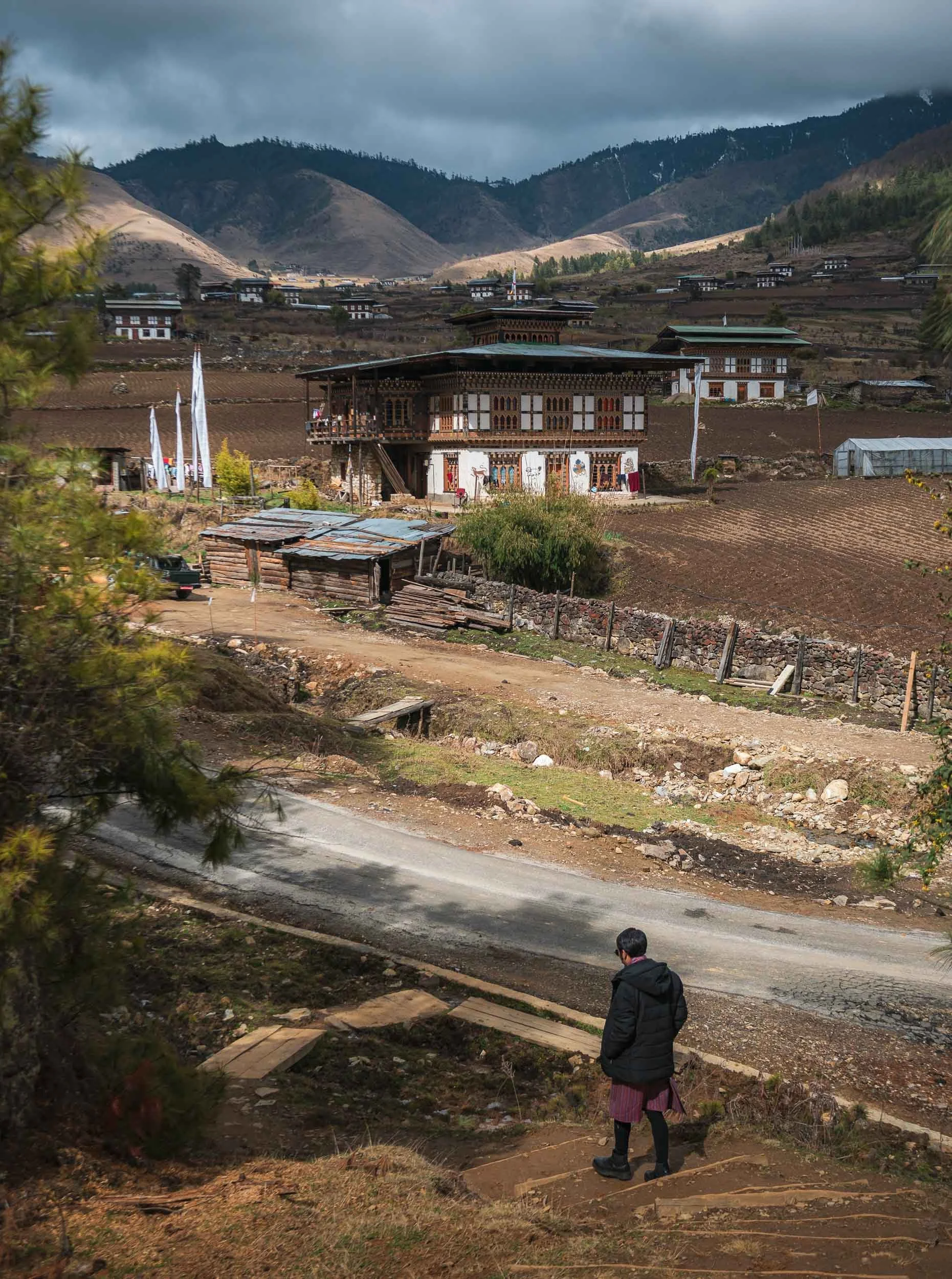
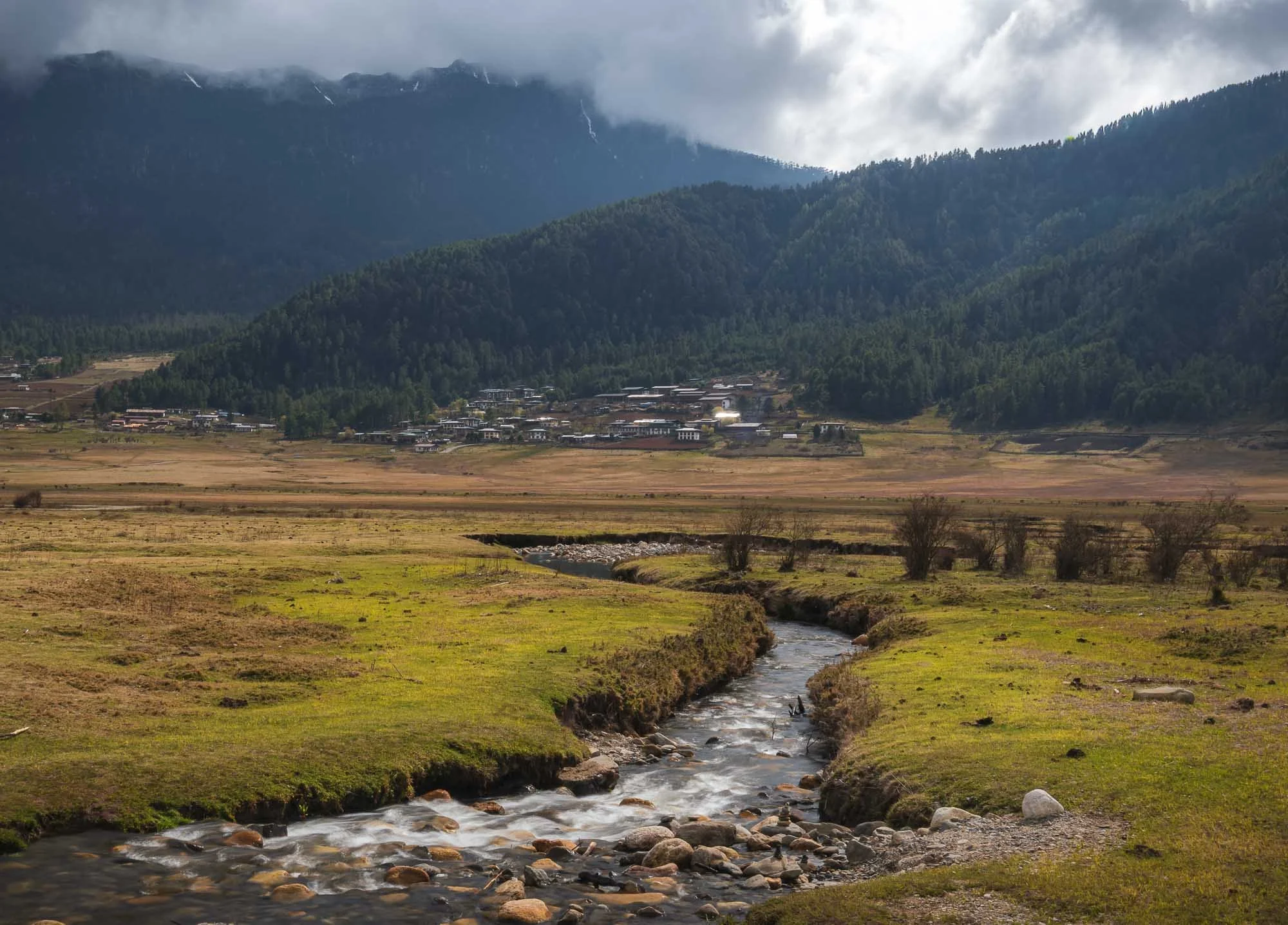
Gangtey
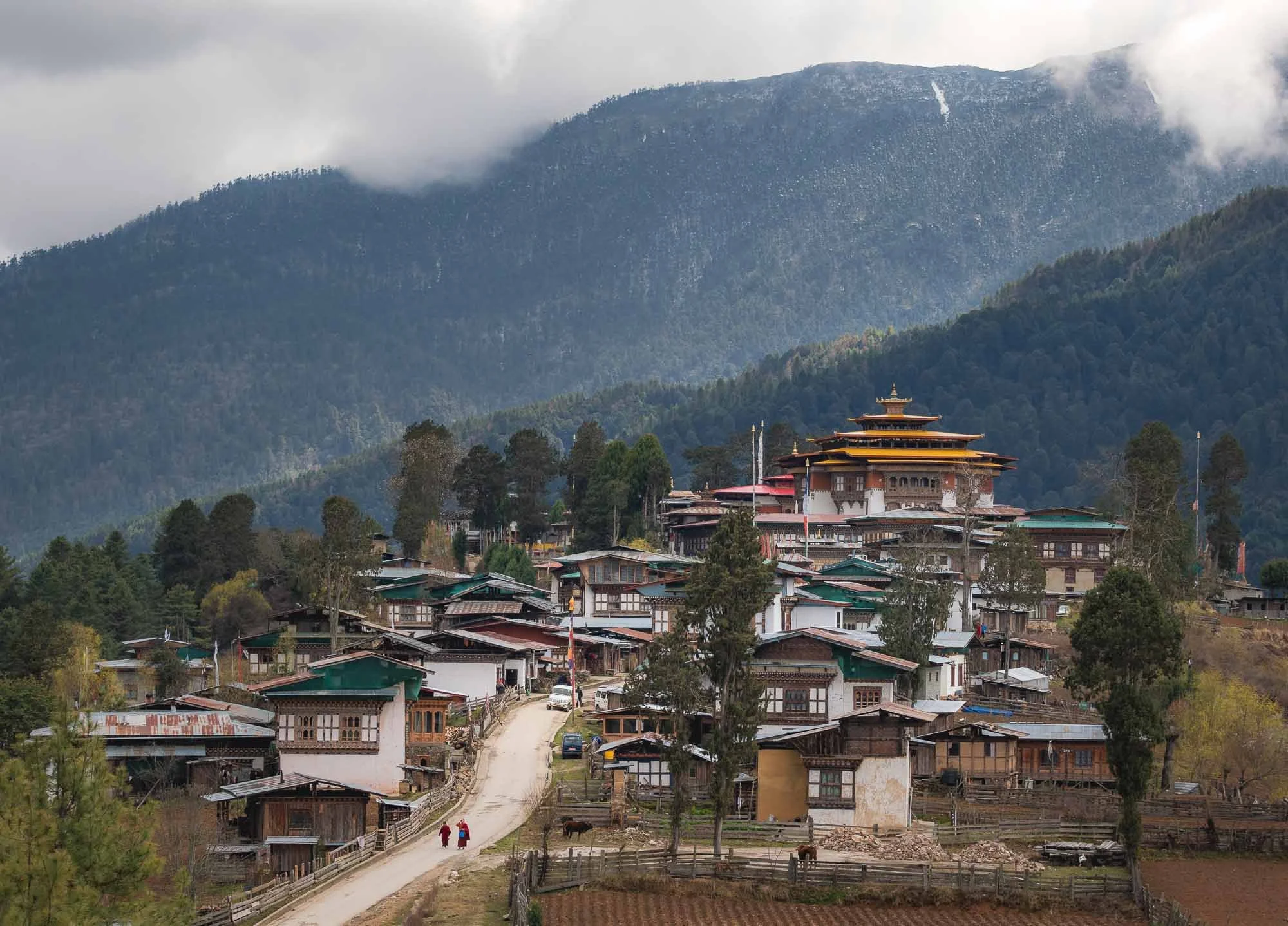
We finally arrived at one of my favorite spots in the country, this view of the small town of Gangtey and its monastery overshadowing the local houses.
The 17th century monastery was renovated in the early 2000s - while a bit smaller and less monumental than the more famous Dzongs it’s quite beautiful with a lot of intricate details.
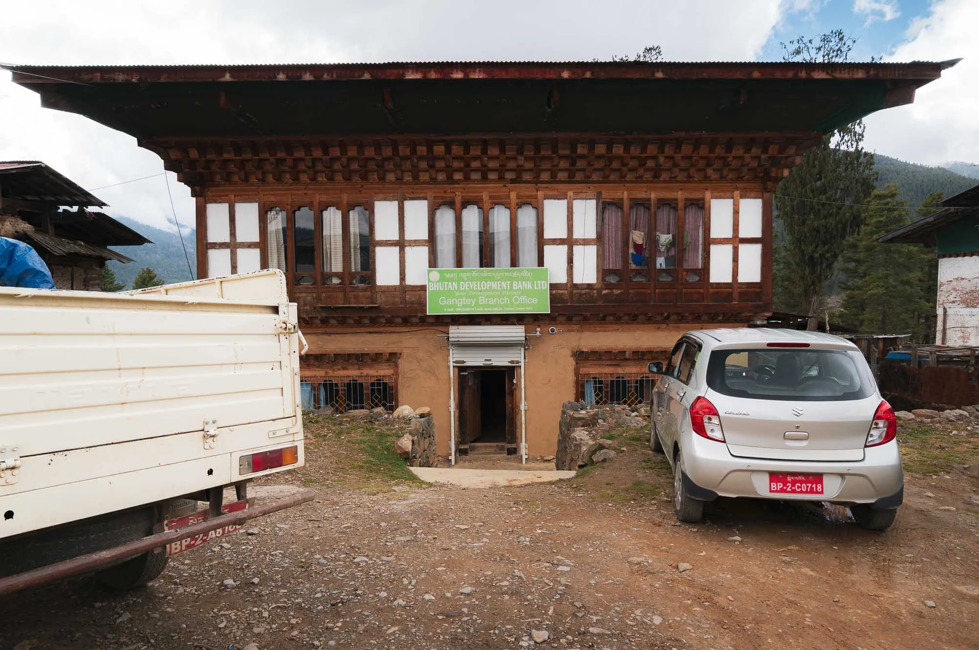
Things are quite rural here otherwise - the main shop on the left and the local branch of the Bhutan development branch on the right. I wonder what collateral they accept for a loan?
From here, we took a beautiful walk into the Phobjikha Valley along the Gangtey nature trail, crossing river trails and spotting a few of the tall white prayer flags, marking mourning rituals for the deceased.
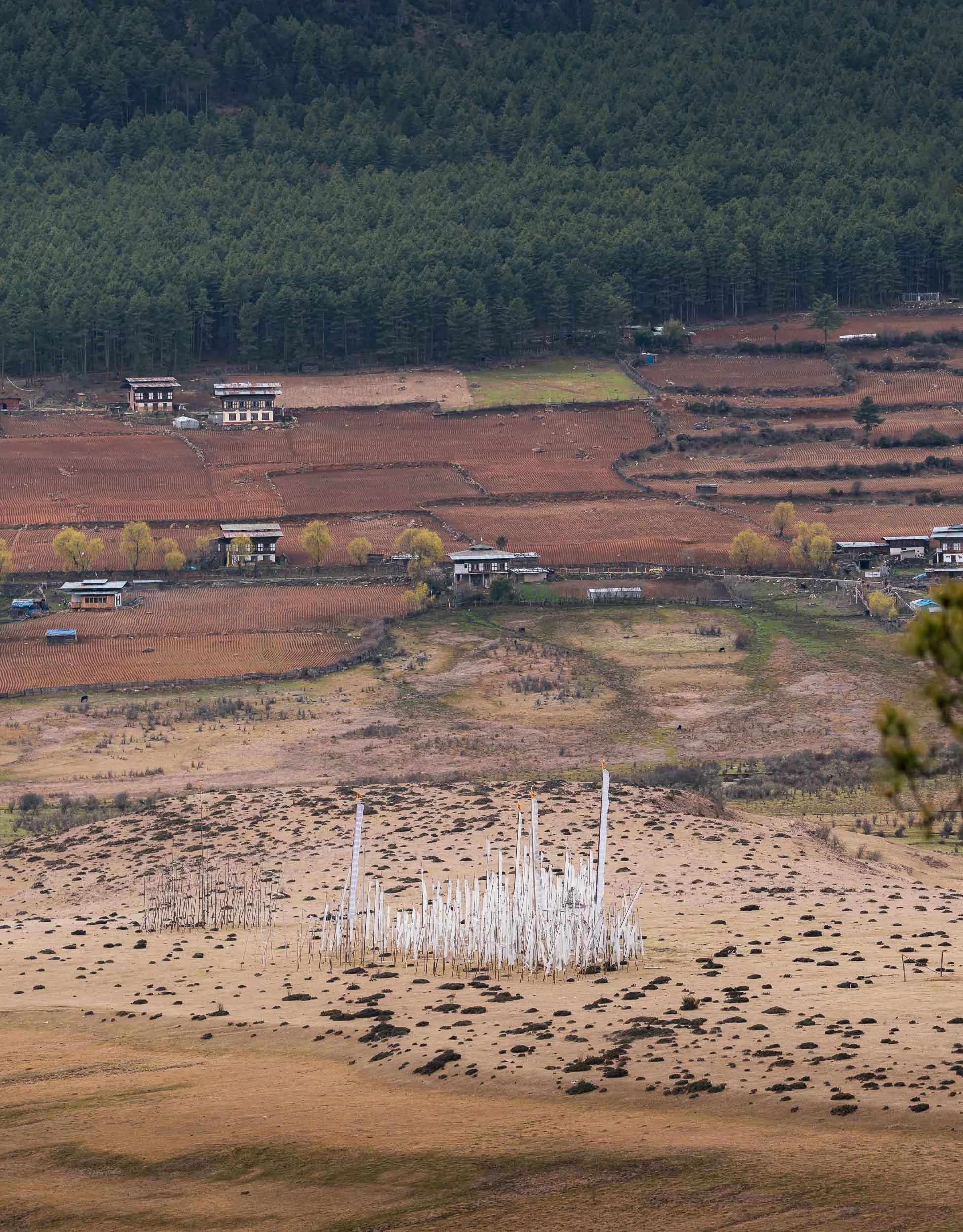
The valley itself is famous for its seasonal black-necked cranes, which arrive here in November and stay until March, using the wetlands around the central river as a wintering site. They are heavily protected - even power lines have been moved underground to reduce risk - and have a cultural relevance to the area.
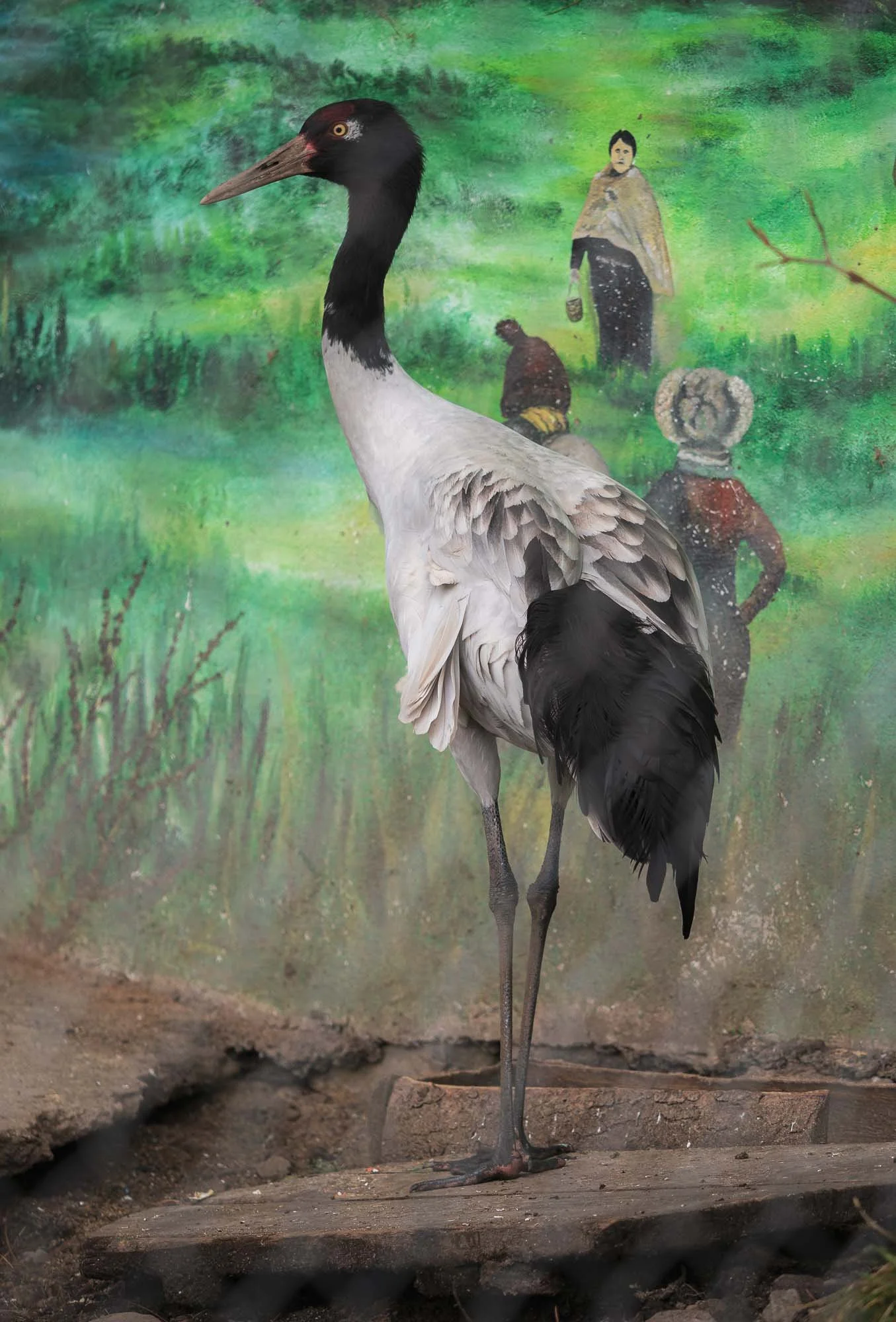
The cranes had already left by late March, so I didn’t get to see a wild one. The local visitor centre specifically built around these birds is home to two rescued individuals, which suffered injuries - they are prey for leopards in the area, for example.
Despite its remoteness, the area attracts quite a few of the aforementioned birding tourists, and the edge of the wetland is home to very small high-end results such as Six Senses (which has 5 resorts in the country), reflecting the upper scale tourism approach of the country.
Oddly, Bhutan’s national bird is the raven, rather less ecologically significant, but a representing a protective deity in Bhutanese Buddhism.
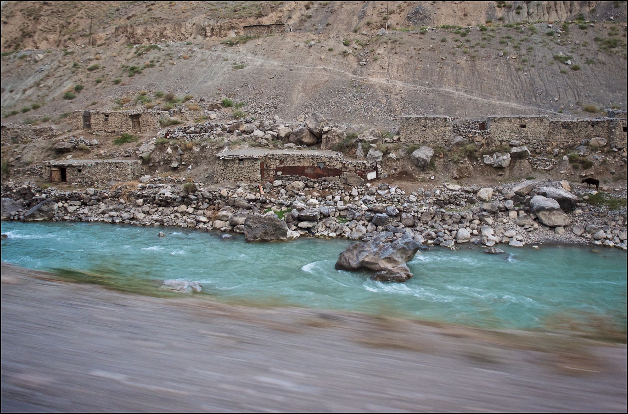
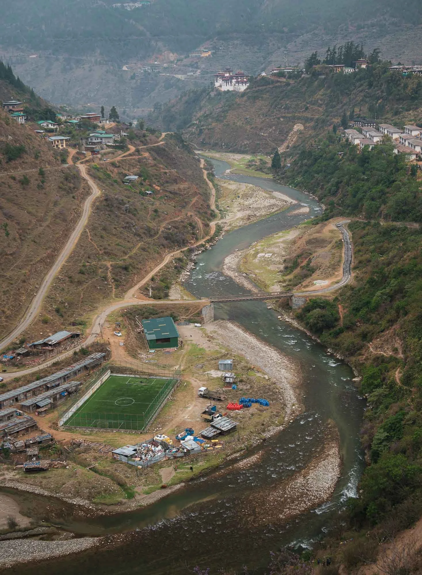
We headed back the next day, once again spotting the elevated Dzong of Wangdue, and a rather interesting football field, as well as the old village of Rinchengang across the river, which I explored a little.
The rather unusually compact traditional village is said to be one of the oldest in Bhutan, and characteristic by tightly packed houses with stone roads inaccessible for cars. It was renamed to Drinchengang and is slowly being revived as a cultural reference village - many of the houses now have QR codes to learn about their history and past inhabitants.
The Fertility Temple
Do you remember the Divine Madman from the story of the takin?
We visited the 1499 temple dedicated to this Buddhist master next - his story and what remains is probably the main attraction for tourists in this region. But not only - it’s also couples praying for children and women hoping to get pregnant that come here.
This is because the temple is known for its ability to bless people with babies, evident by a book full of pictures of parents from all around the world holding their rose-cheeked newborns - often unexpectedly so due to illness or other struggles to conceive - after having visited the temple and subduing themselves to one of the various rituals that supposedly address any obstacles to having a child.
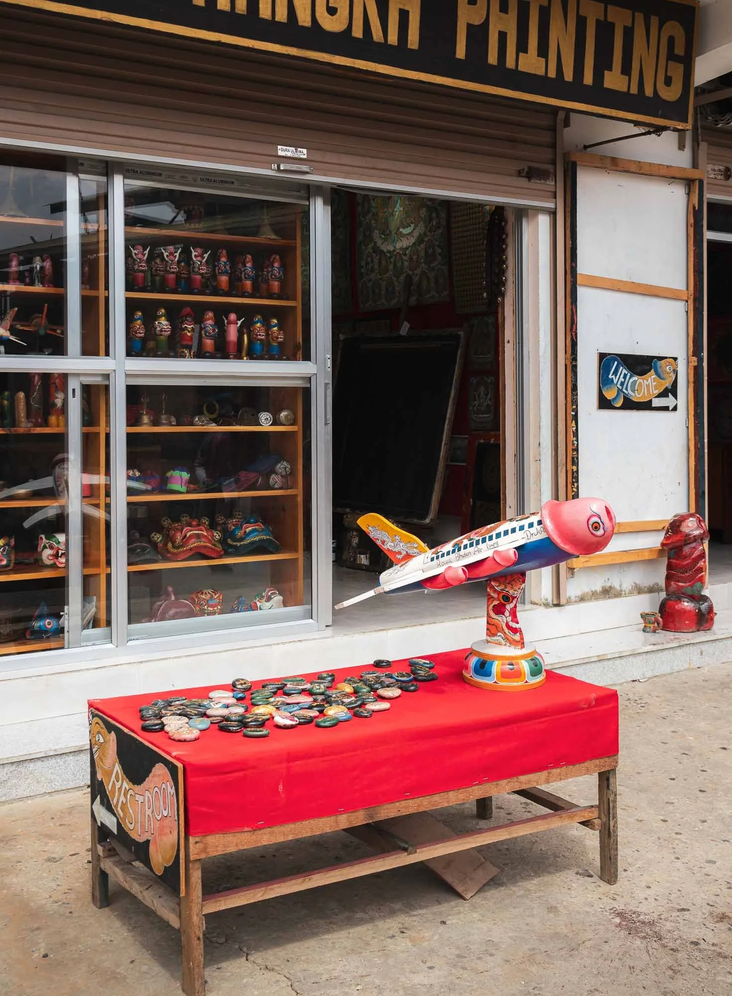
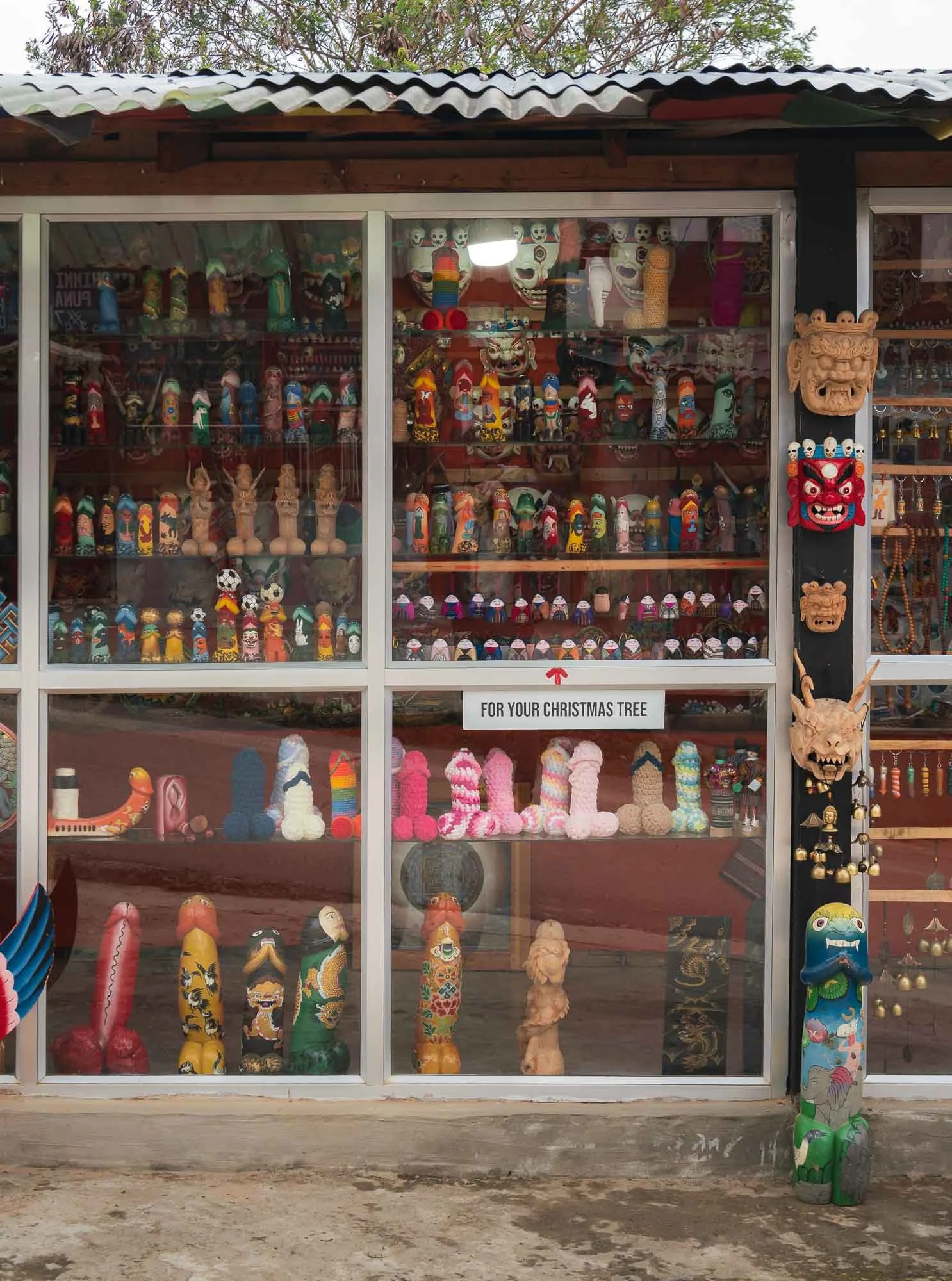
This belief is rooted in the stories of the Buddhist master known as the “Divine Madman,” who rejected traditional conventions and taught through more unconventional behavior, often using sexual themes and his (many) interactions with women as a way to make things memorable. The primary symbolism to reflect his powers follow a phallic theme, mirrored in the many small shops selling relevant artifacts accordingly. In general it’s hard not to notice the symbols around door frame carvings and paintings all around Bhutan.
Wolakha Nunnery
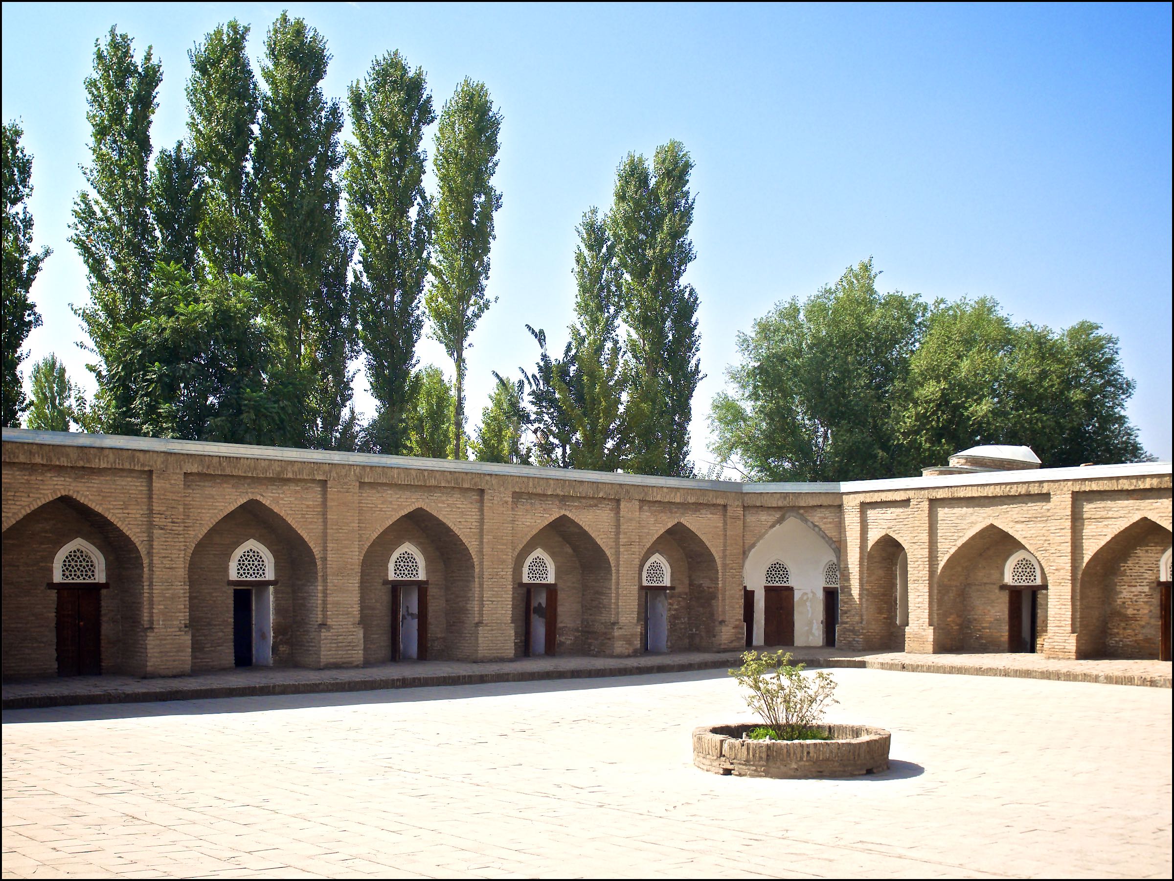
In what one might describe as an antithesis to the above, we next visited the nunnery of Wolakha.
Aside from the beautiful views over the valleys, it features interesting architectural aspects such as the primary stupa following the design more common in Nepal (with painted eyes) as opposed to the more abstract, less adorned Bhutanese chorten style of the Vajrayana tradition.
On the right, the temple for the thousand-armed Avalokiteśvara, a deity for compassion and support in suffering.
The nunnery features education and vocational activities and its pupils - mostly aged 6 to 18 or so - happily showed me their evolving skills and the readings and writings they practiced. While nuns historically had less institutional support than monks, there are now quite a few nunneries around the country.
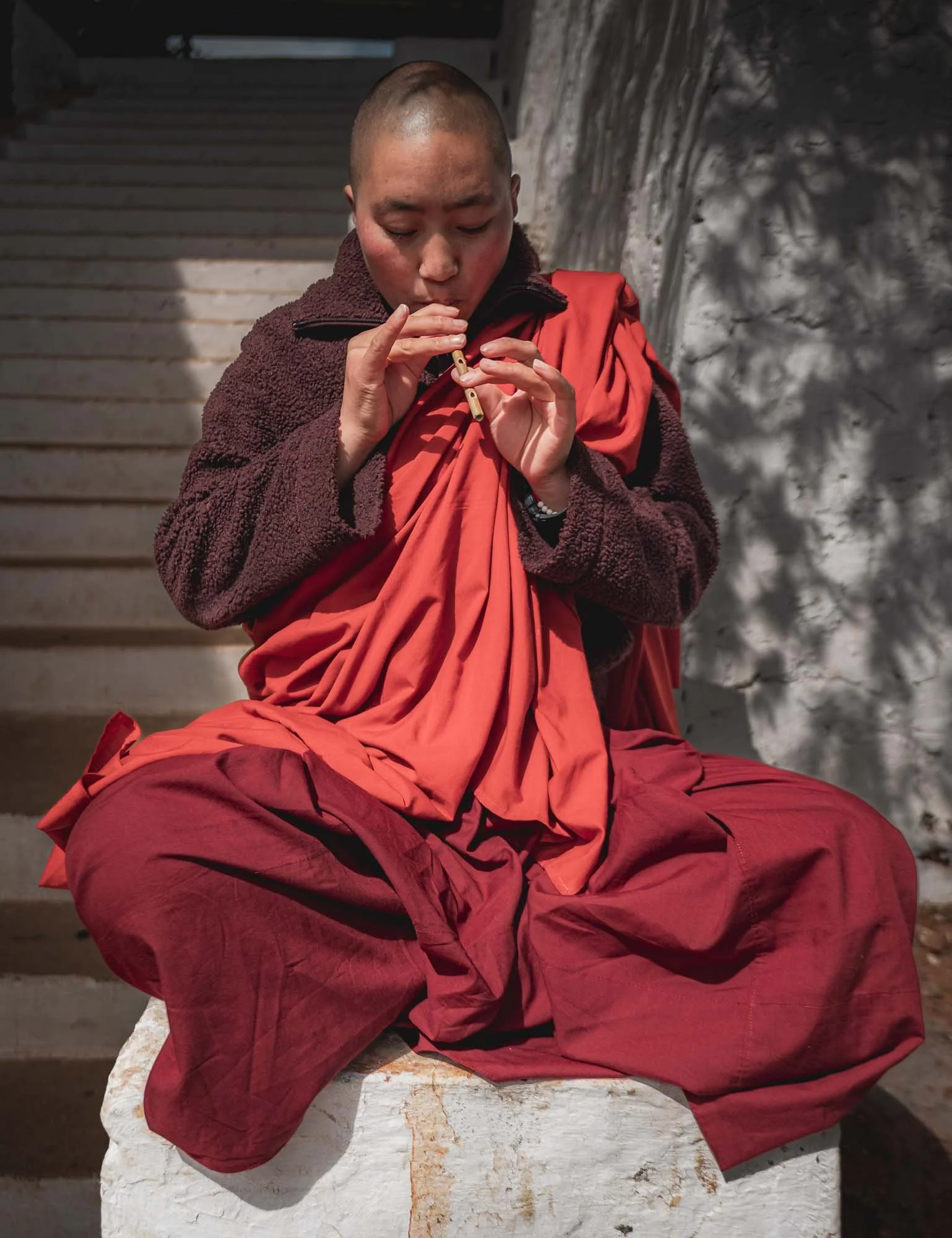
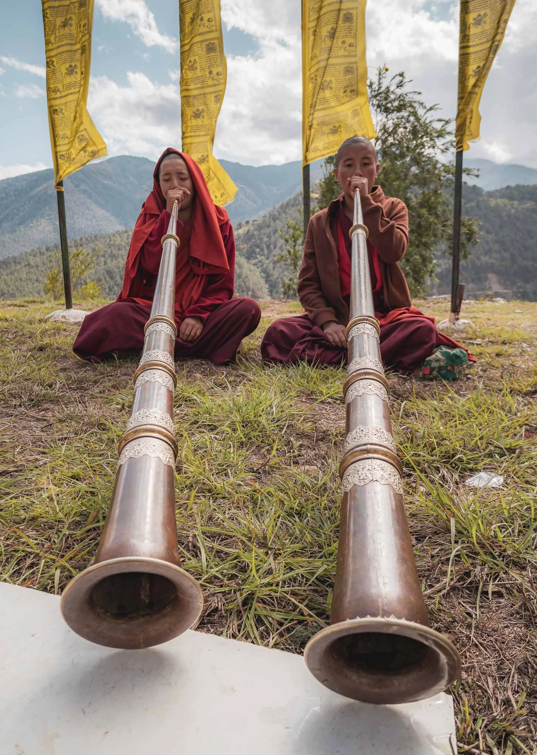
They were also practicing the Dungchen, a long kind of horn producing a deep drone sound used during monastic rituals and festivals. It takes them several years to master it.
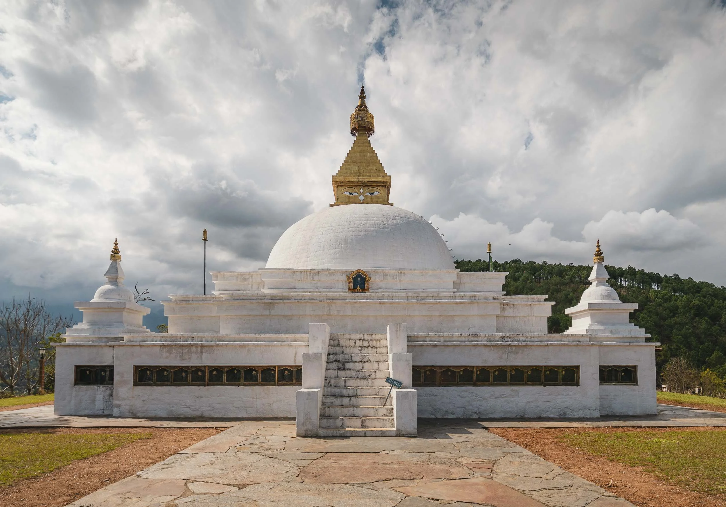
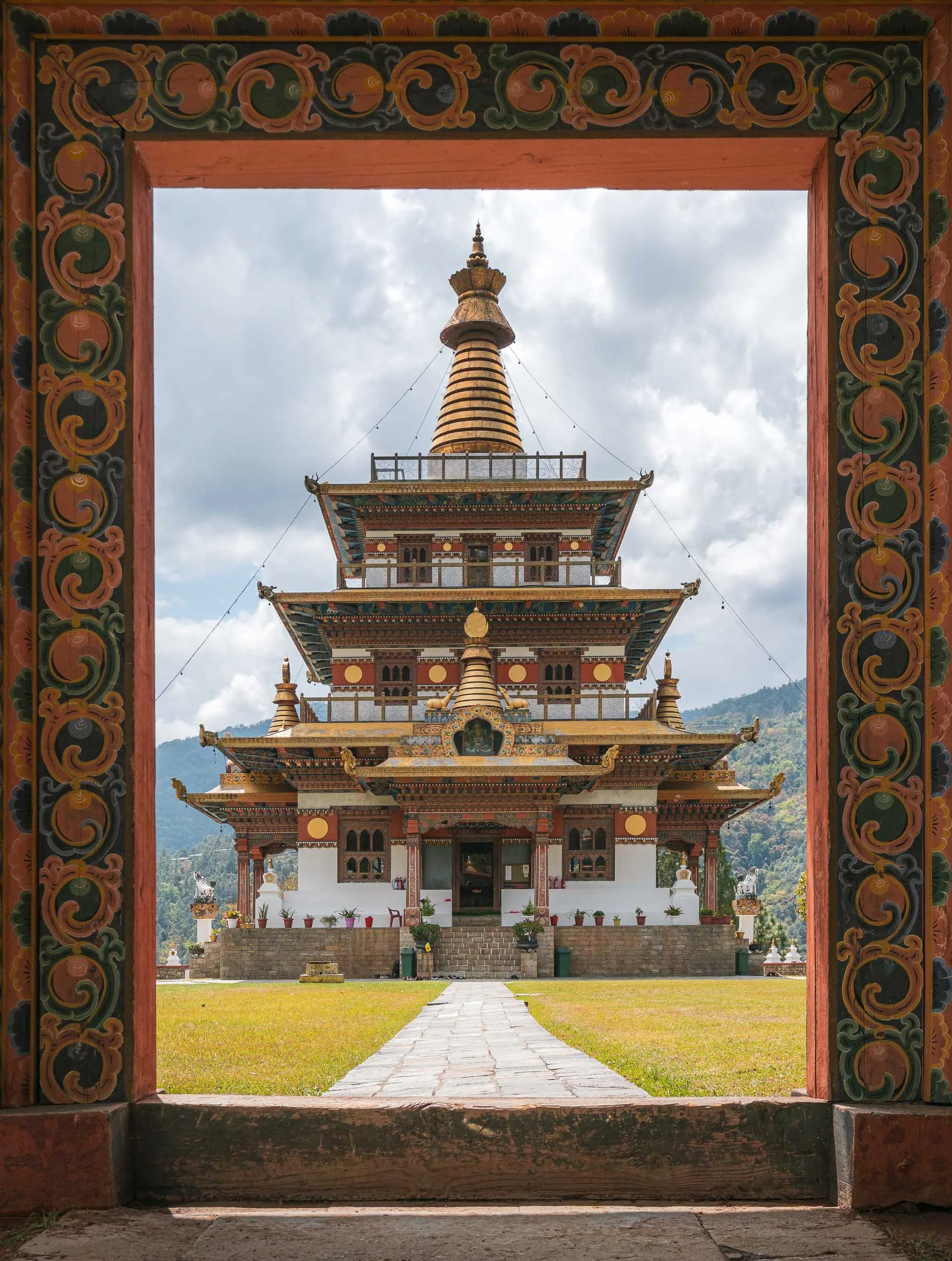
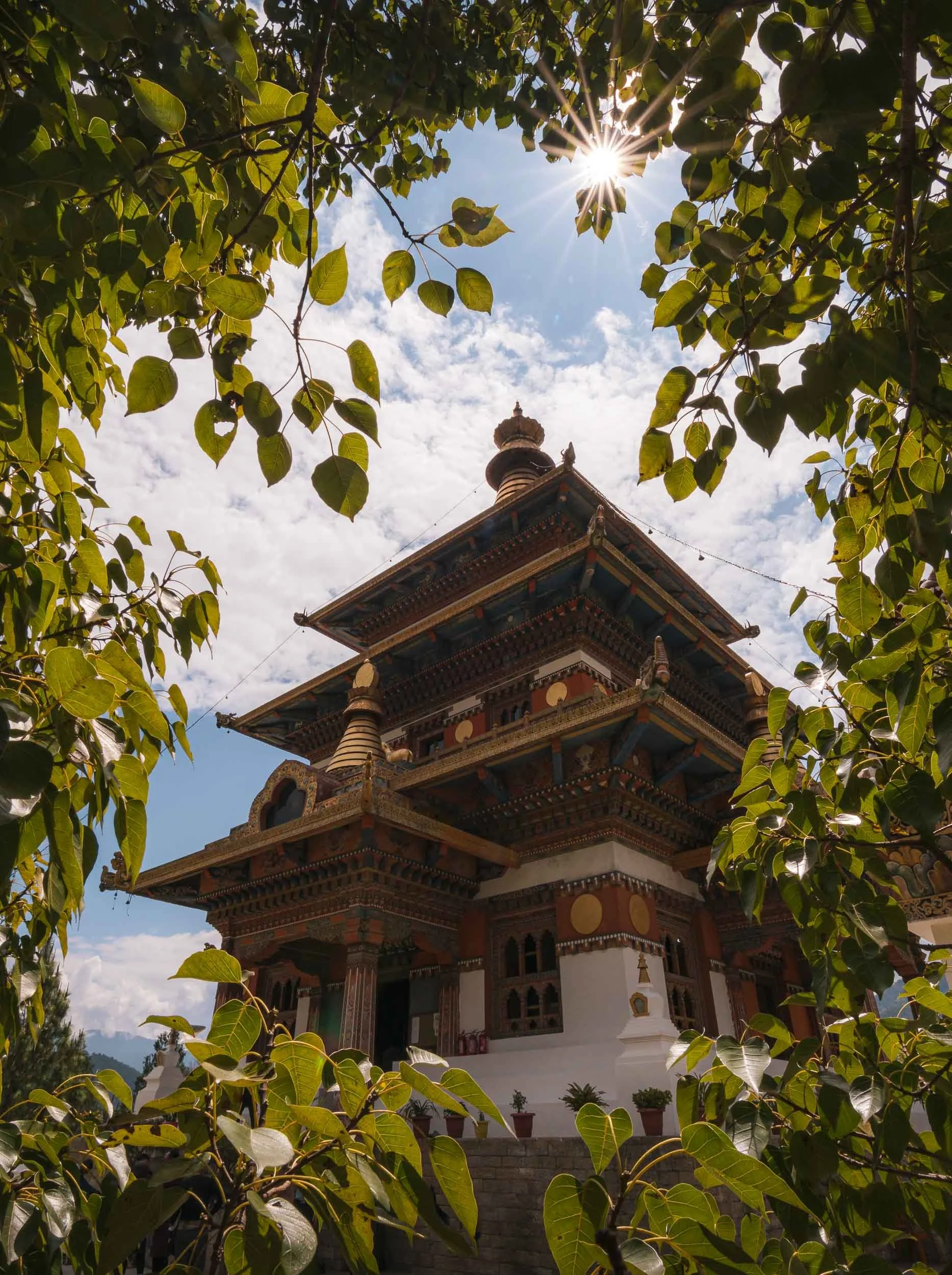
Khamsum Yulley Namgyal Chorten
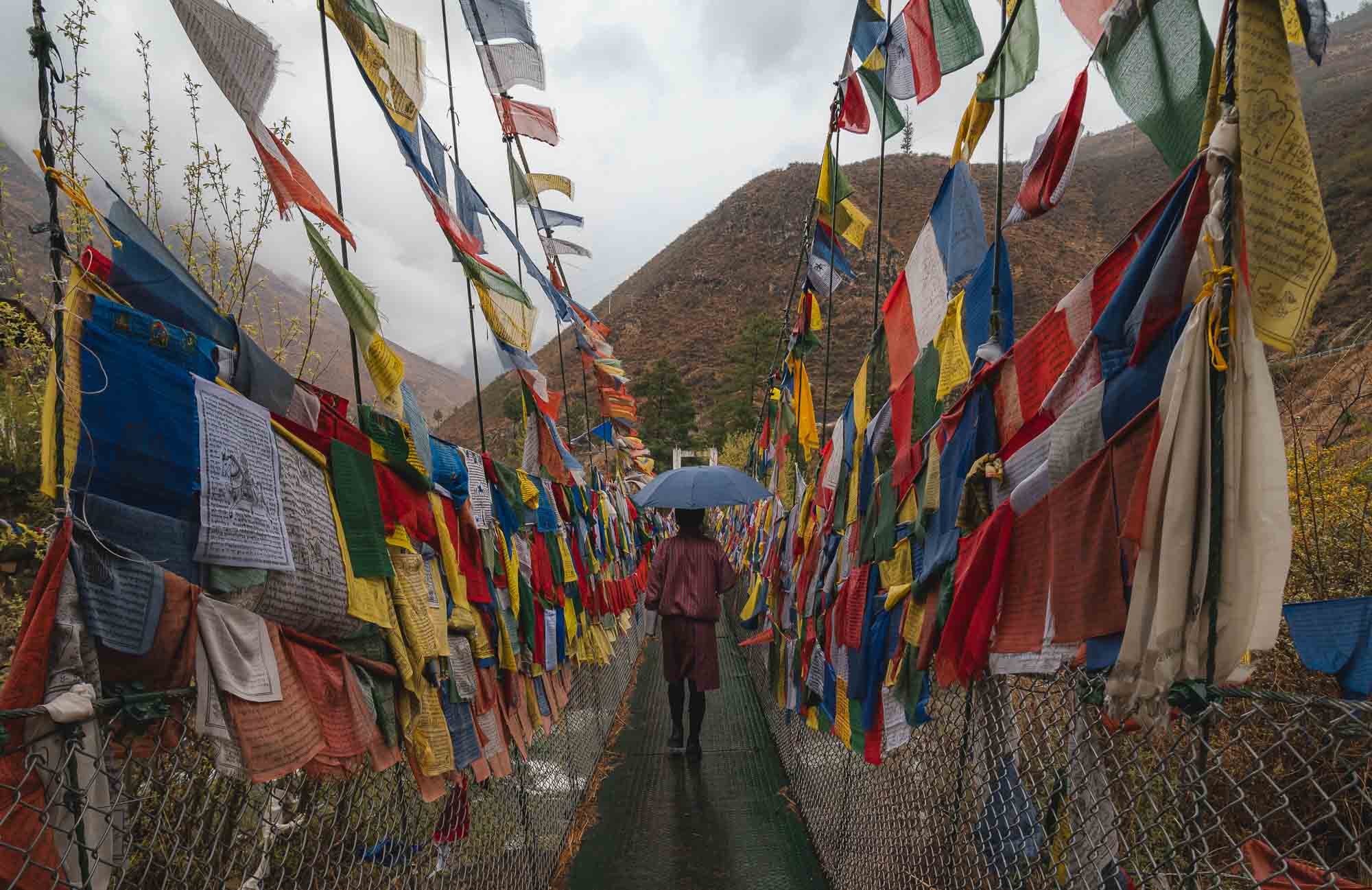
Not far from here lies another picturesque monastery, reachable after crossing another flagged suspension bridge, followed by a short walk through the rice paddies, and a brief hike up the hill.
This one was built fairly recently and opened in 2004 - unlike many of the other chortens it has an accessible, multi-level interior, centered around promoting stability and peace in the region.
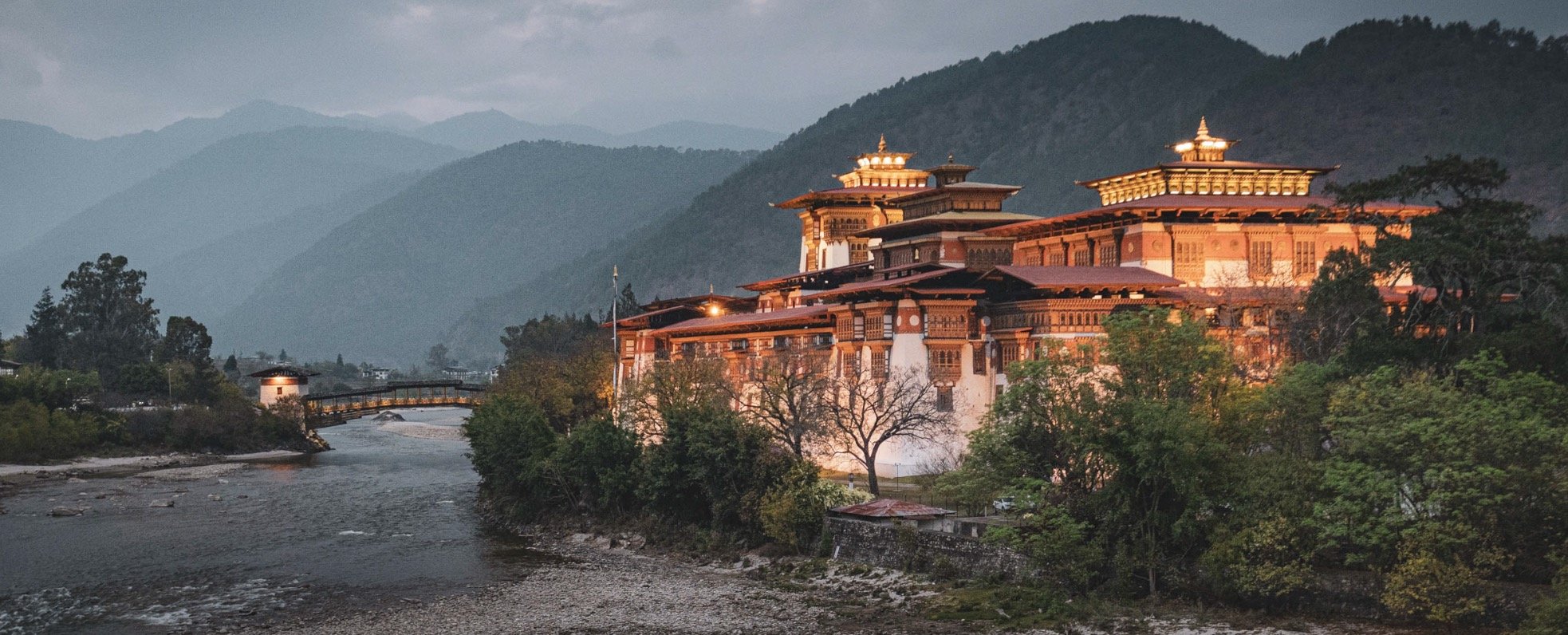
The Palace of Great Happiness
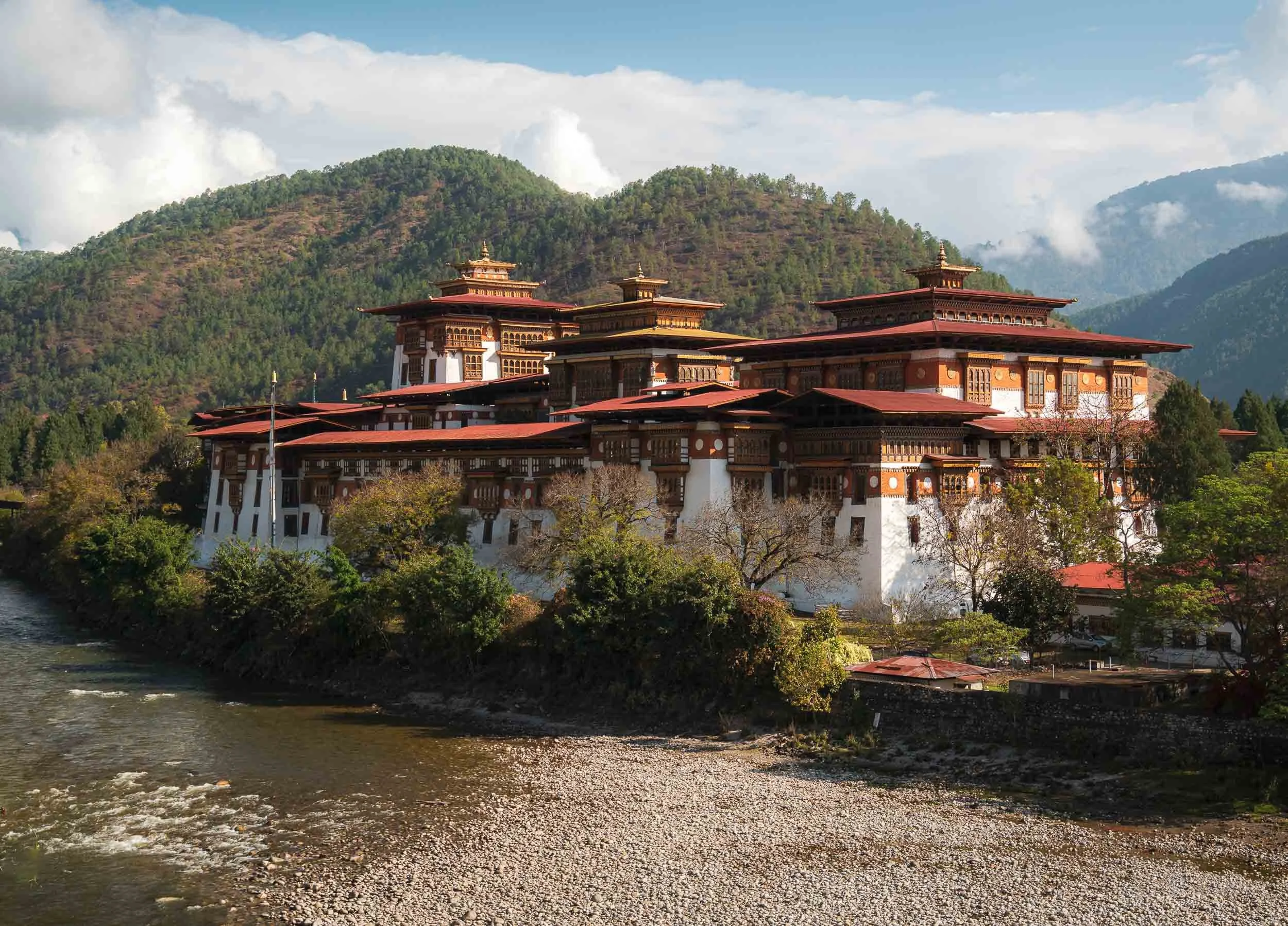
Despite the many interesting sights in the area, it’s undeniable that the Punakha Dzong steals the show, and also became one of my personal favourite places in the country. Its beautiful location at the confluence of the Pho Chhu and Mo Chhu rivers (representing male and female parts), the amazing architecture and its historic significance as the old capital of Bhutan until 1955 are some of the reasons for its appeal.
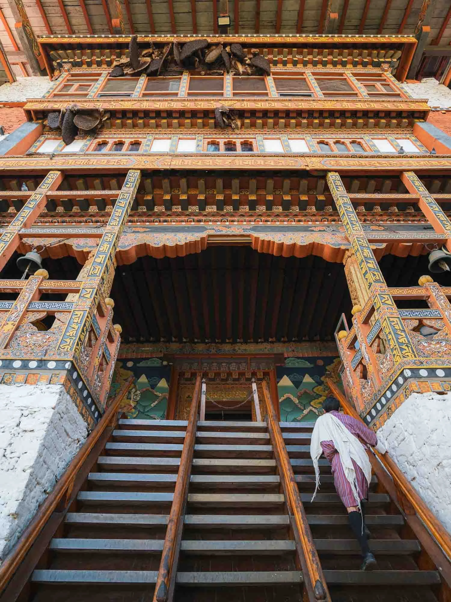
To enter, you cross the traditional timber cantilever bridge (re-built several times due to flood damages, last time in 2008) and then climb the steep stairs designed as a defensible entry point towards the courtyard. Always glad to have Chencho here as an involuntarily model - it is mandatory for guides to wear the local traditional outfit, and the more formal scarf is required for a Bhutanese to enter administrative buildings, which many Dzongs still serve as.
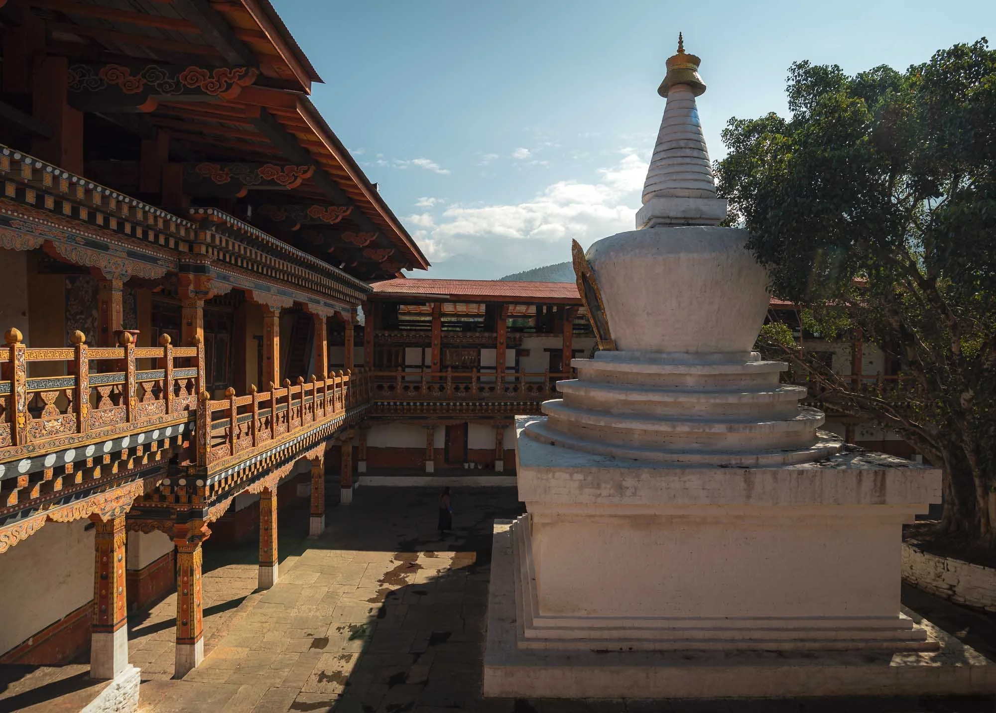
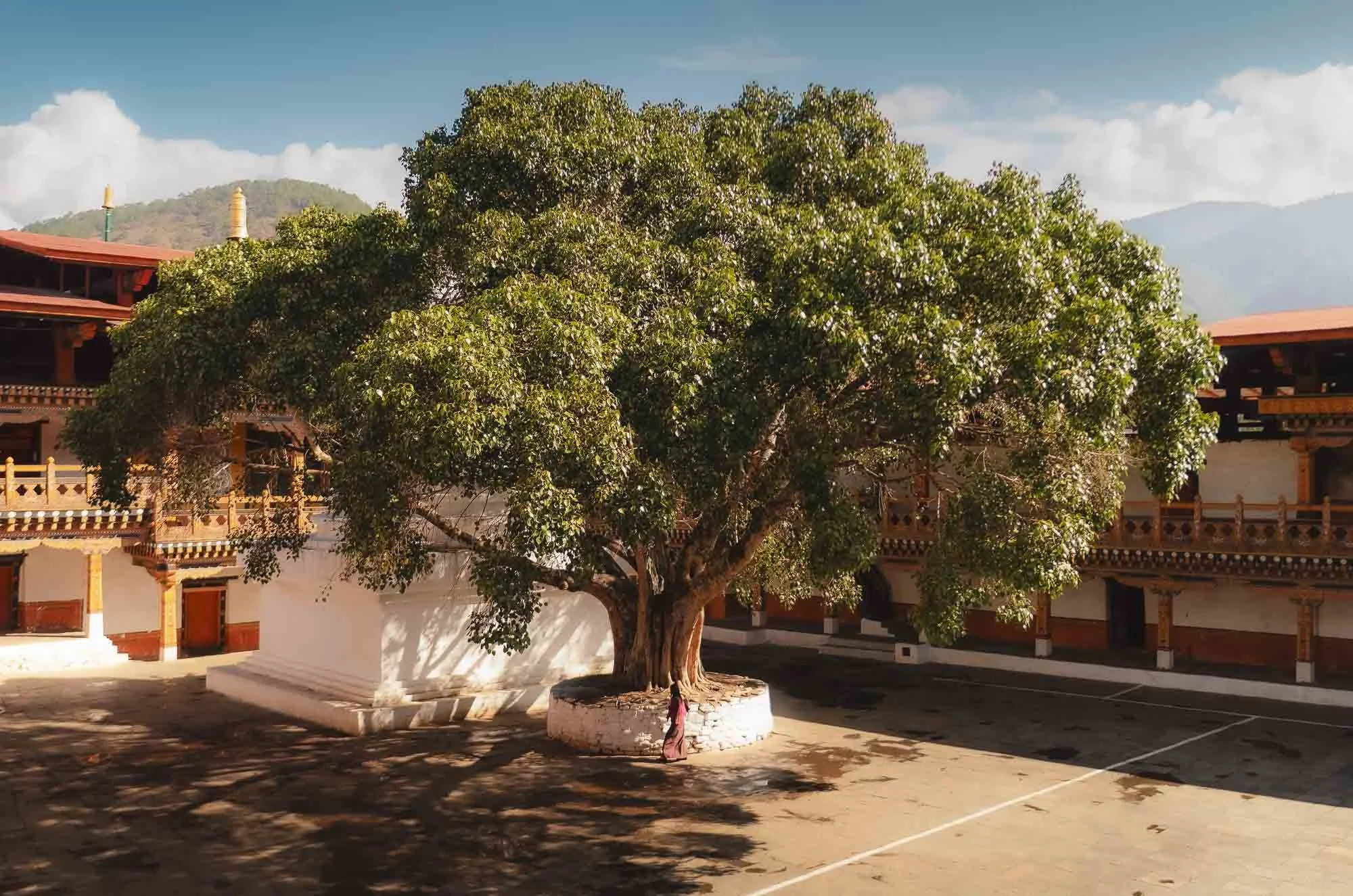
The courtyard is home to a large stupa and a jacaranda tree. The fort is surrounded by them which must be quite pretty during the few weeks when they show their purple bloom in the spring, but I wasn’t lucky enough to see that.
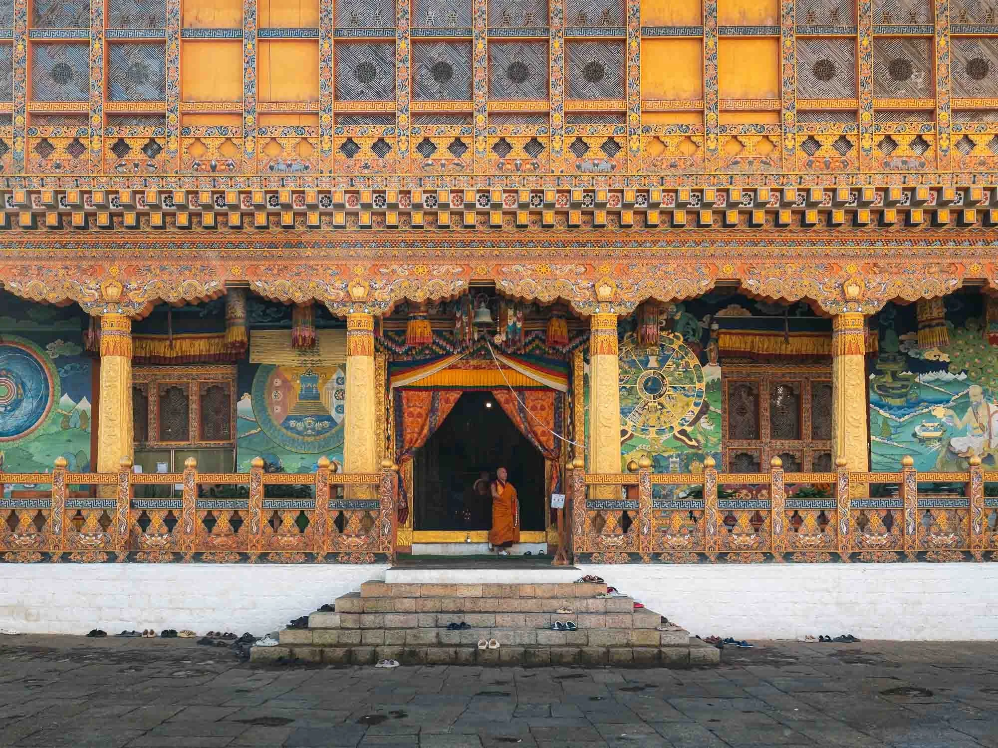
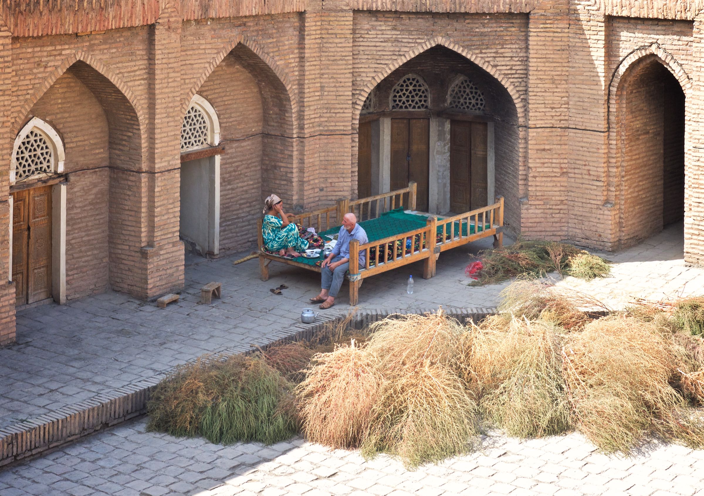
While some temples and courtyard spaces are public, several parts are off limits, such as the administrative areas and specific inner buildings housing some of the most important local religious relics.
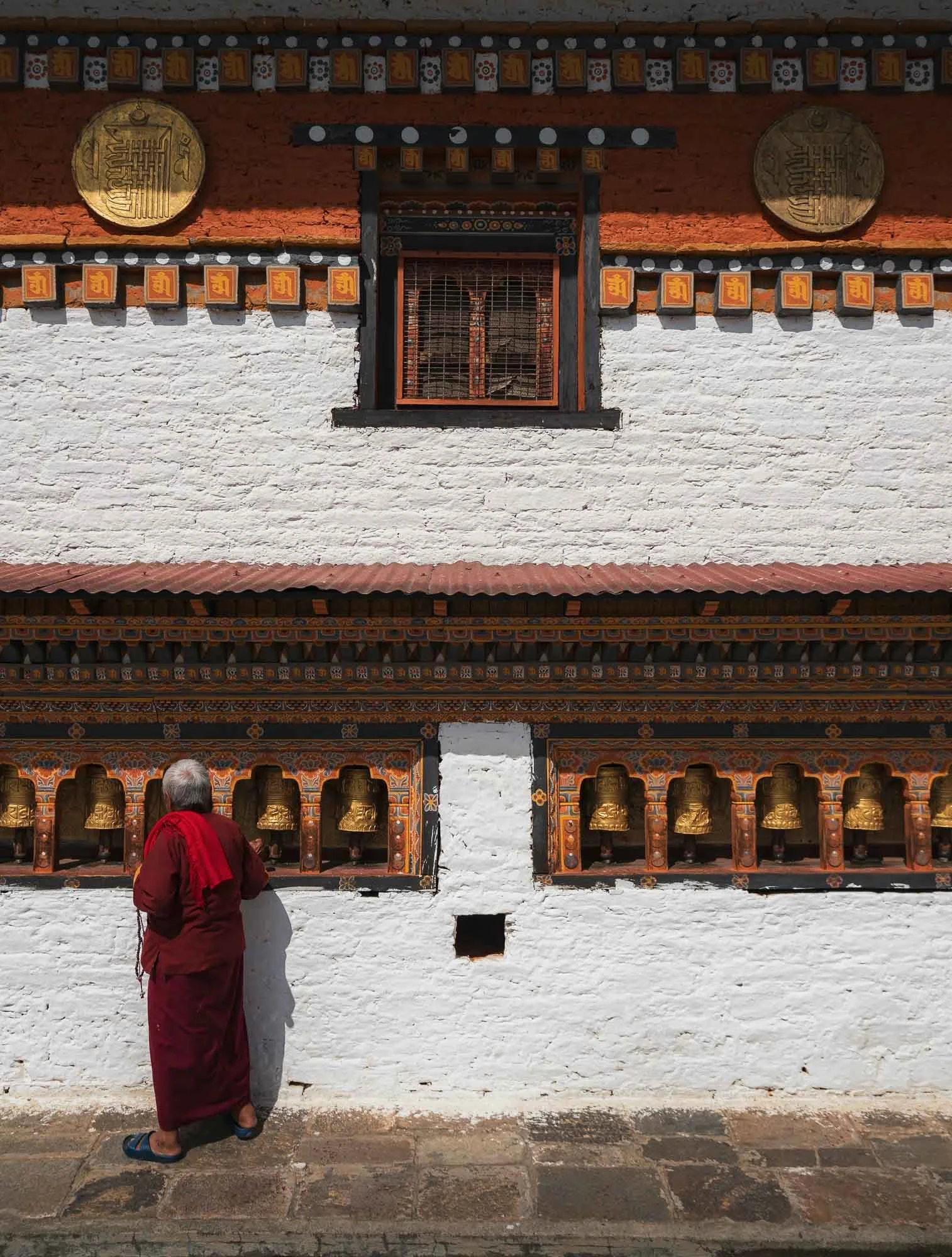
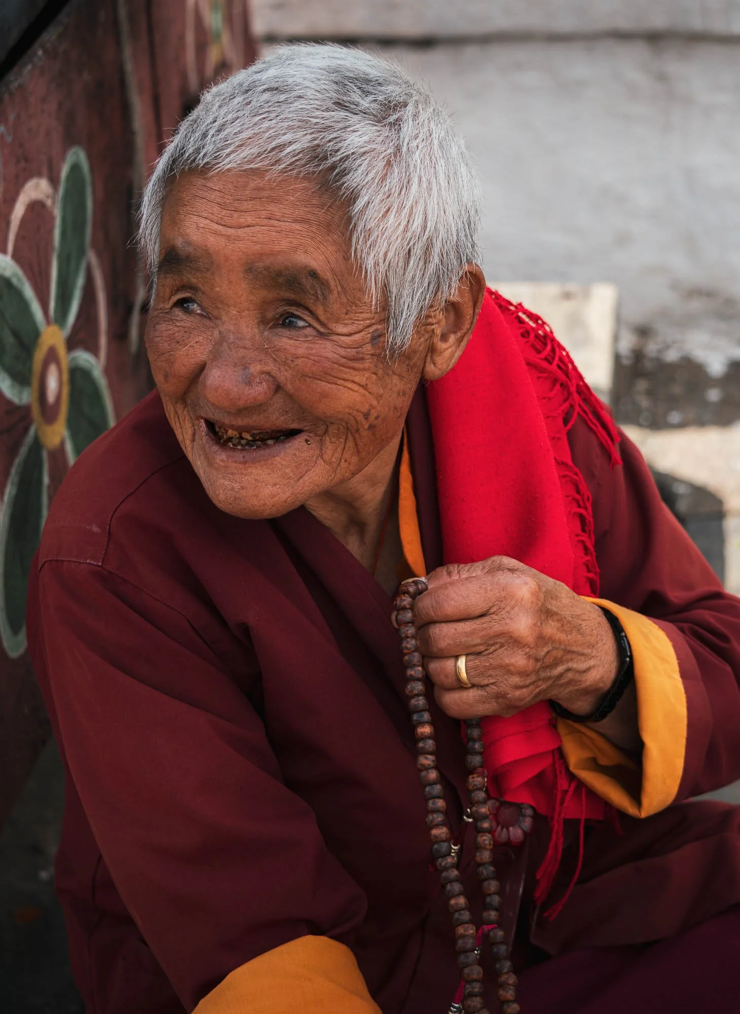
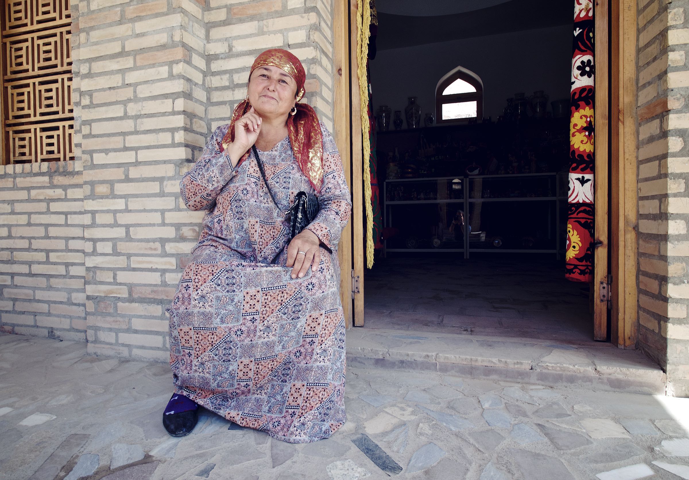
Just outside the main structure lies a smaller building where this elderly lady conducted her daily ritual of clockwise rotation around the temple, spinning the prayer wheels. She also showed me her string of the 108 prayer beads used to count mantra recitations and - I can’t validate this - told Chencho that she accumulates 30,000 counts every day.
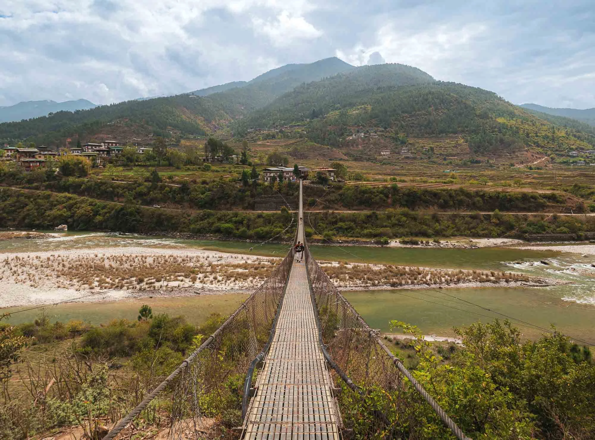
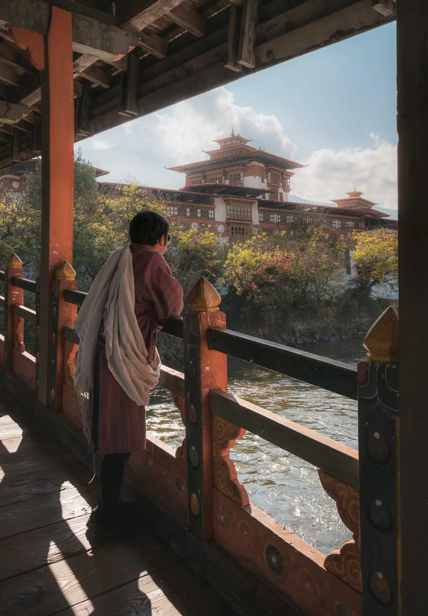
Just a few hundred metres from here you can cross the Pho Chhu river on Bhutan’s longest suspension bridge (around 180m) - it’s not so much a tourist attraction but provides actual connectivity between the Dzong and the nearby villages on the opposite side of the main entrance.
Night View
We came back in the evening for a night view - like many of the Dzongs, this one is beautifully illuminated as well.
Return to Paro
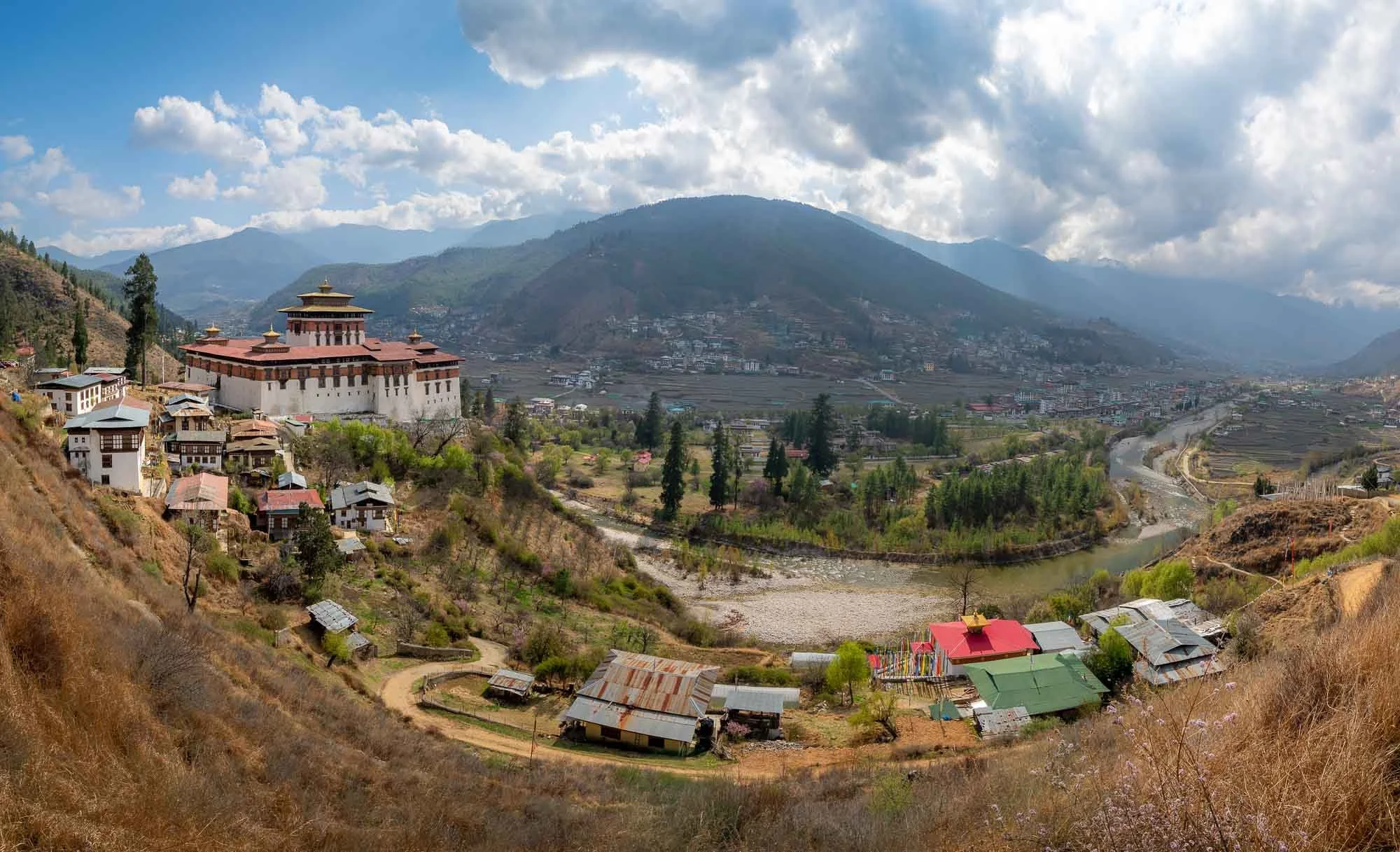
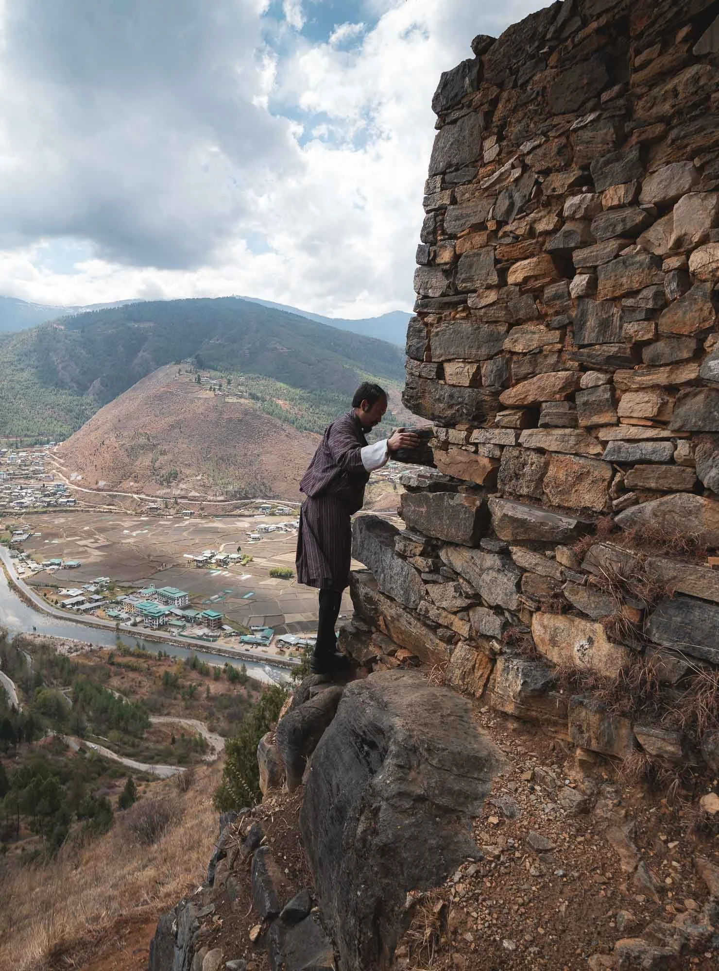
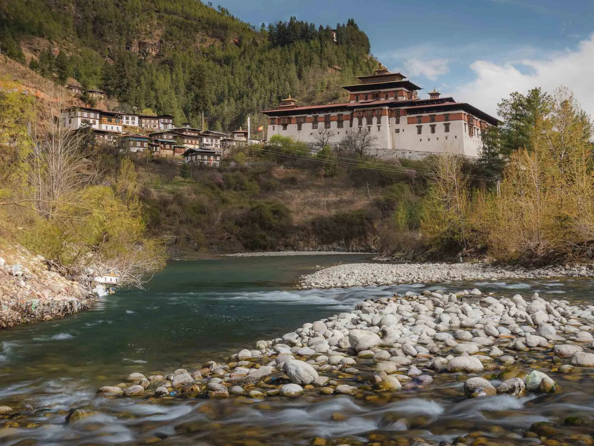
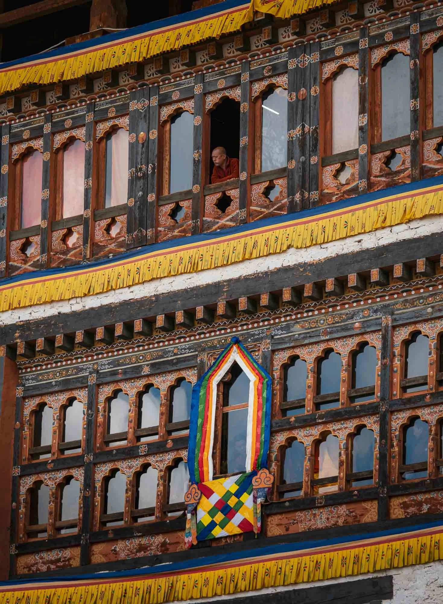
And with this, we headed back to where the trip started, but there were a few more things on the agenda. Paro‘s valleys are a little more open and wider than most of the rest of the country, resulting in a lot of agricultural space and it being home to the (still barely fitting) airport. Of course, the city features another Dzong as well, built in 1646 and seen here on the left - more on that later…
Chele la pass
Having said that, we left the valleys on the next morning for the highest motorable road in Bhutan, passing through a beautiful forest, and reaching the 3980m summit with a small temple at the top. That’s still far from the highest peak of Bhutan, Gangkar Puensum at 7570m, which is also the highest unclimbed mountain in the world. It has been designated as off-limits by the government to protect its sanctity.
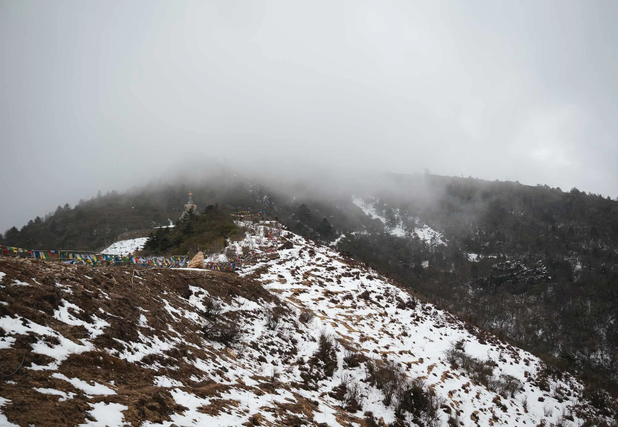
I’m not sure this drive was worth it given the cloudy conditions - nevertheless it gave me a little close up glimpse at the Himalayan snow. Born near the Alps, that was not quite as exciting to me as to the many Indian tourist families who arrived as we left and excitedly grabbed and lay down in whatever white patches were left next to the road. Surprisingly this is quite a rare occurrence: I was told snow has been quite spare in the valleys of Paro and Thimphu over the last years, something the locals attributed to global warming multiple times.
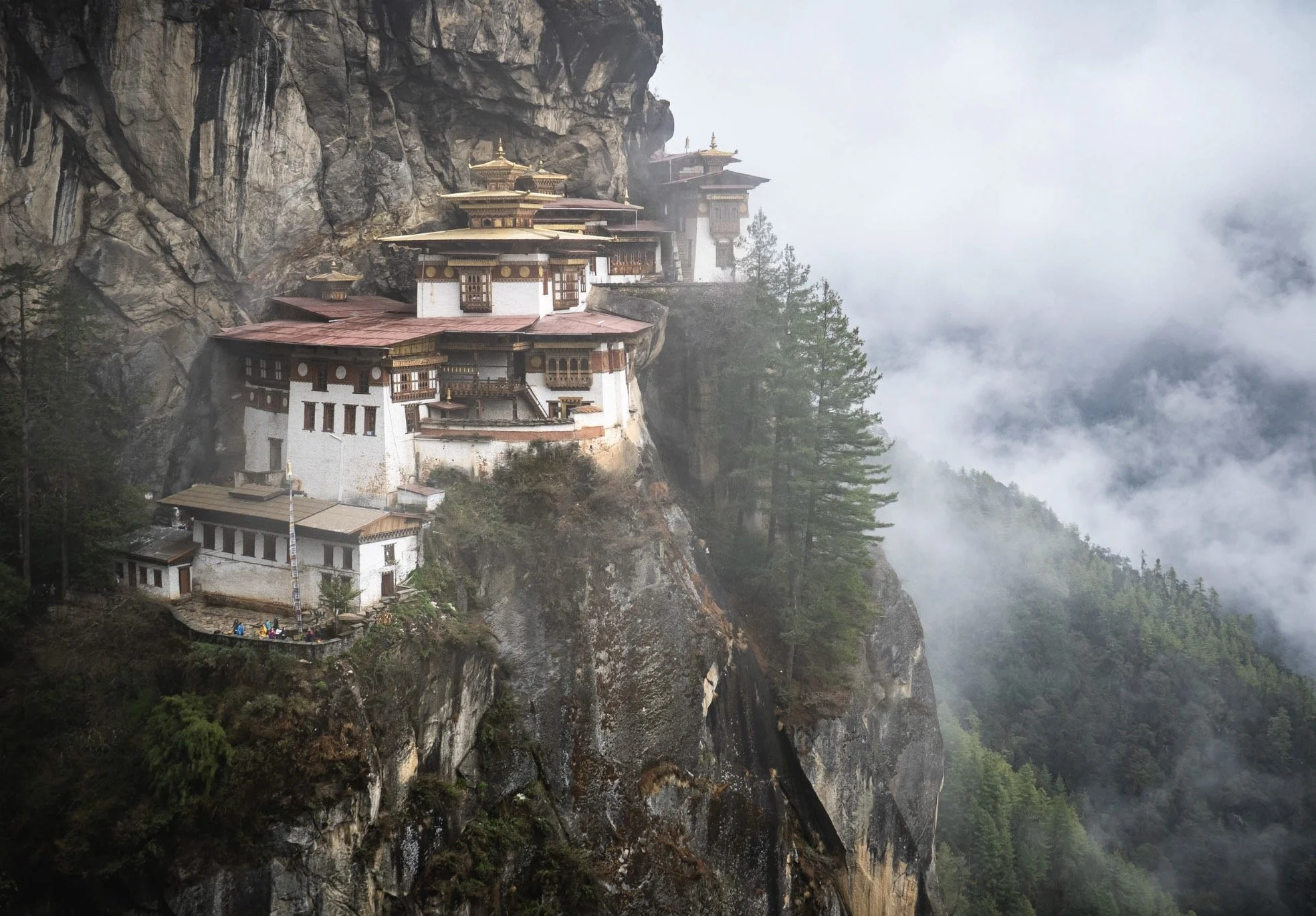
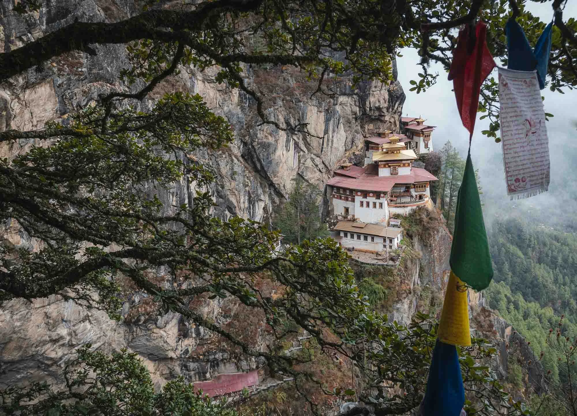
As the clouds opened up for a brief moment, my driver pointed at something in the opposite mountains I didn’t expect to see from here: Bhutan’s most famous sight, at a distance of what I suspect must be 20km or so made an appearance right in the centre of this image. It would be my destination for the next morning, read on…
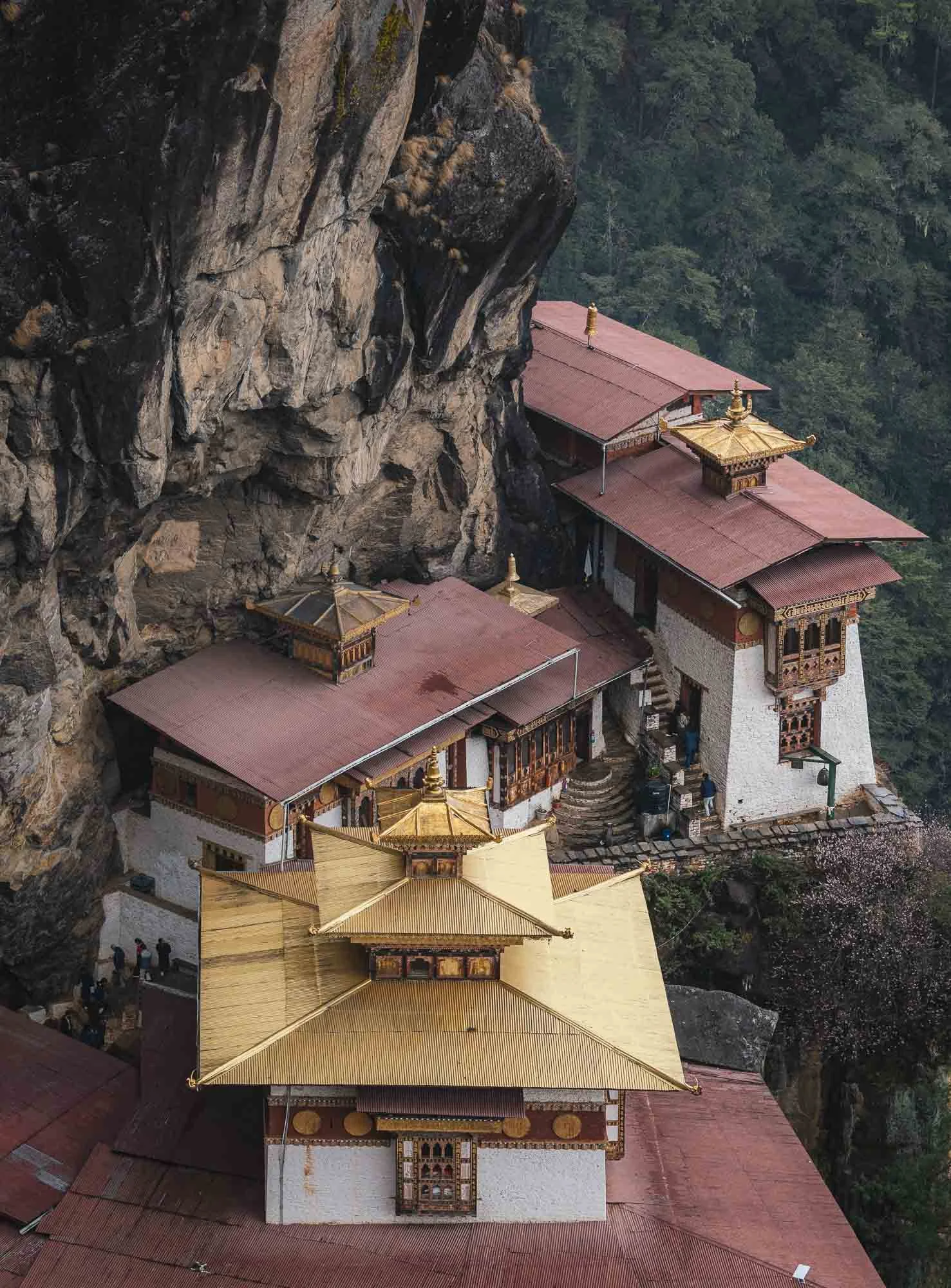
Bhutan’s Crown Jewel
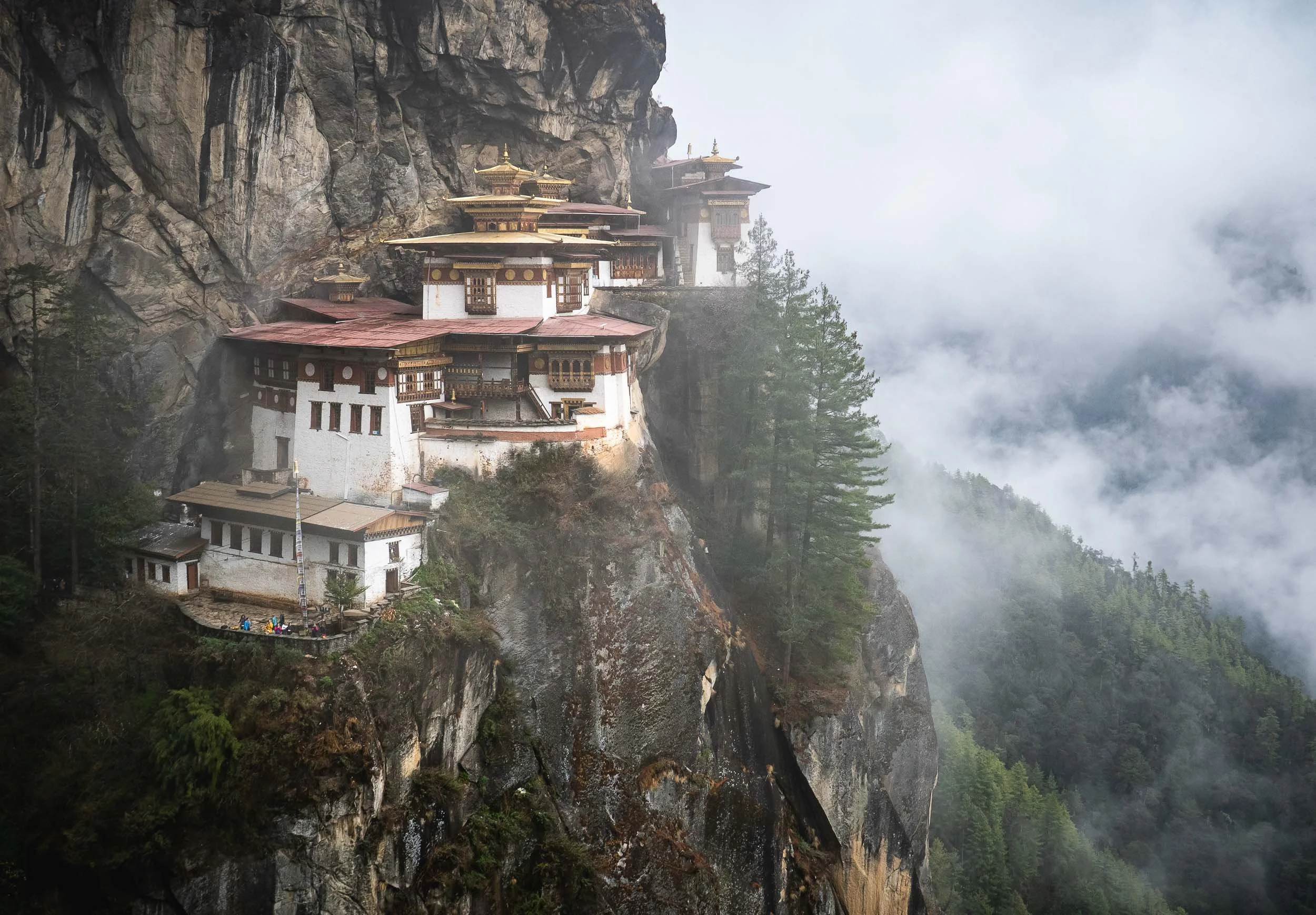
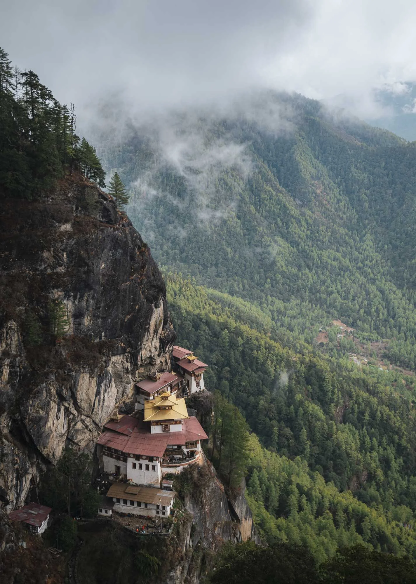
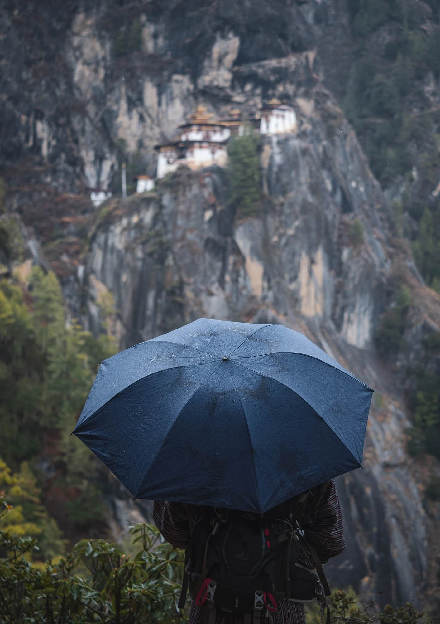
Opinions may vary on whether it’s justified (even my own mind isn’t quite so clearly settled, because I really enjoyed the Dzongs), but one thing is undoubtedly true: the so-called Tiger’s Nest monastery is Bhutan’s most iconic sight, and it doesn’t disappoint. We set off very early in the morning for the 30min drive to try and beat the crowds, but frankly speaking, no place I’ve visited in Bhutan felt particularly busy (sometimes it was the opposite). The same was true here as well, despite a few buses in the parking lot and some groups making their way up the trail.
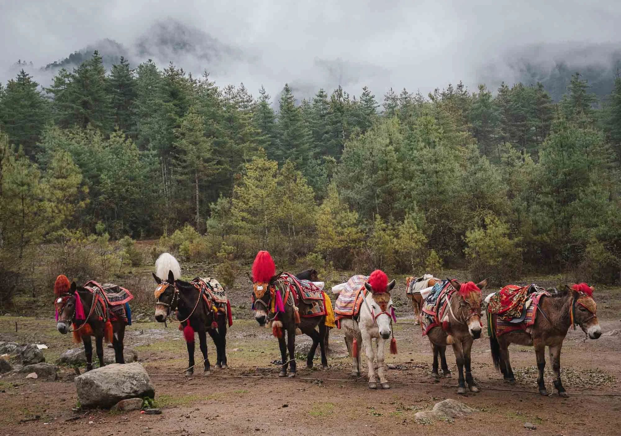
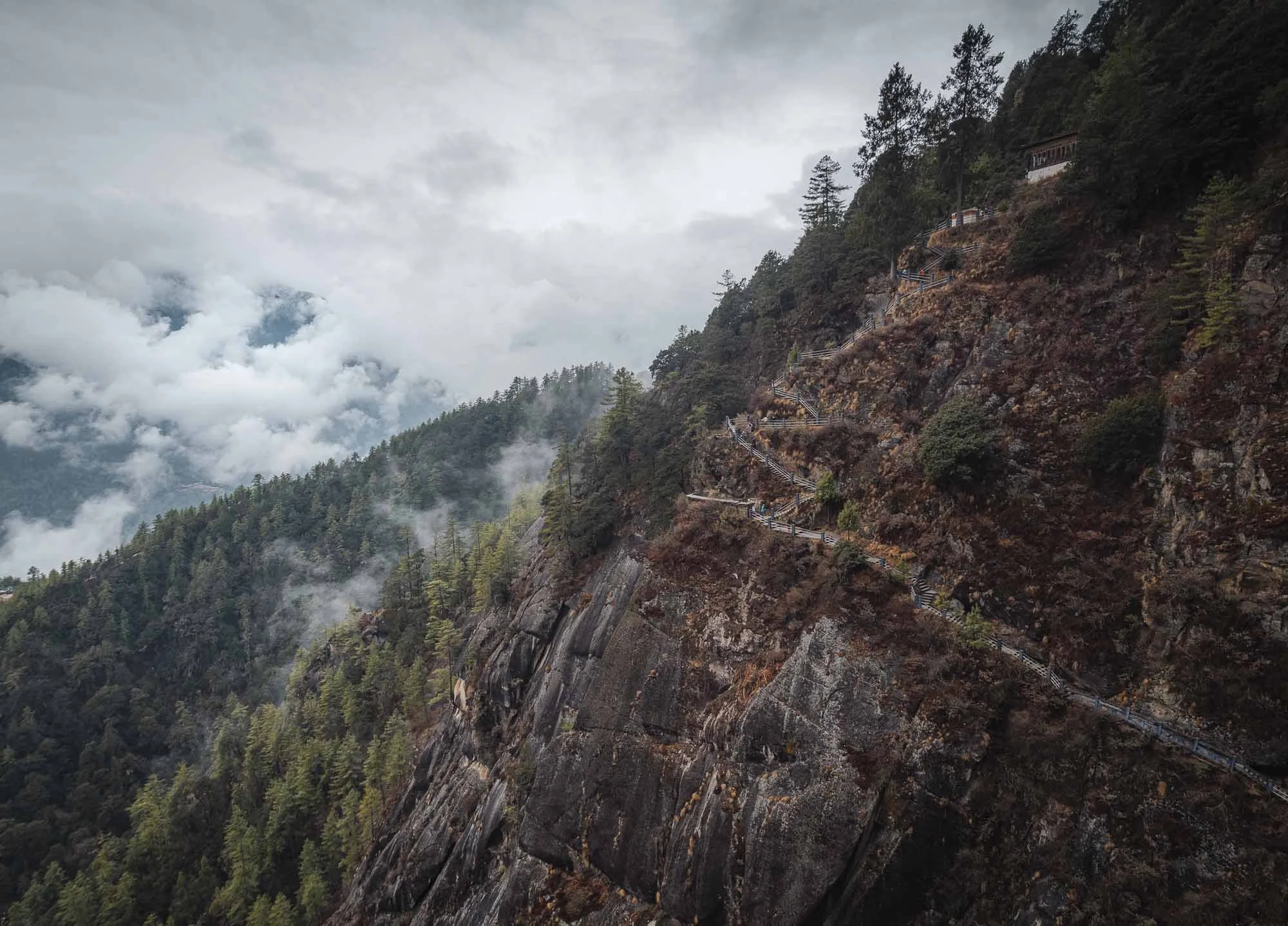
Speaking of the trail, to reach the cliffside monastery requires about 2-3h of hiking, depending on your speed and the amount of breaks you take. Part of it can be done by horses waiting at the bottom, but the second half has a few steeper elements, culminating in a lot of stairs at the end, so you won’t escape a little bit of physical exercise. Nothing extreme, but not a relaxed walk either, especially given the monastery’s altitude of 3,120 metres.
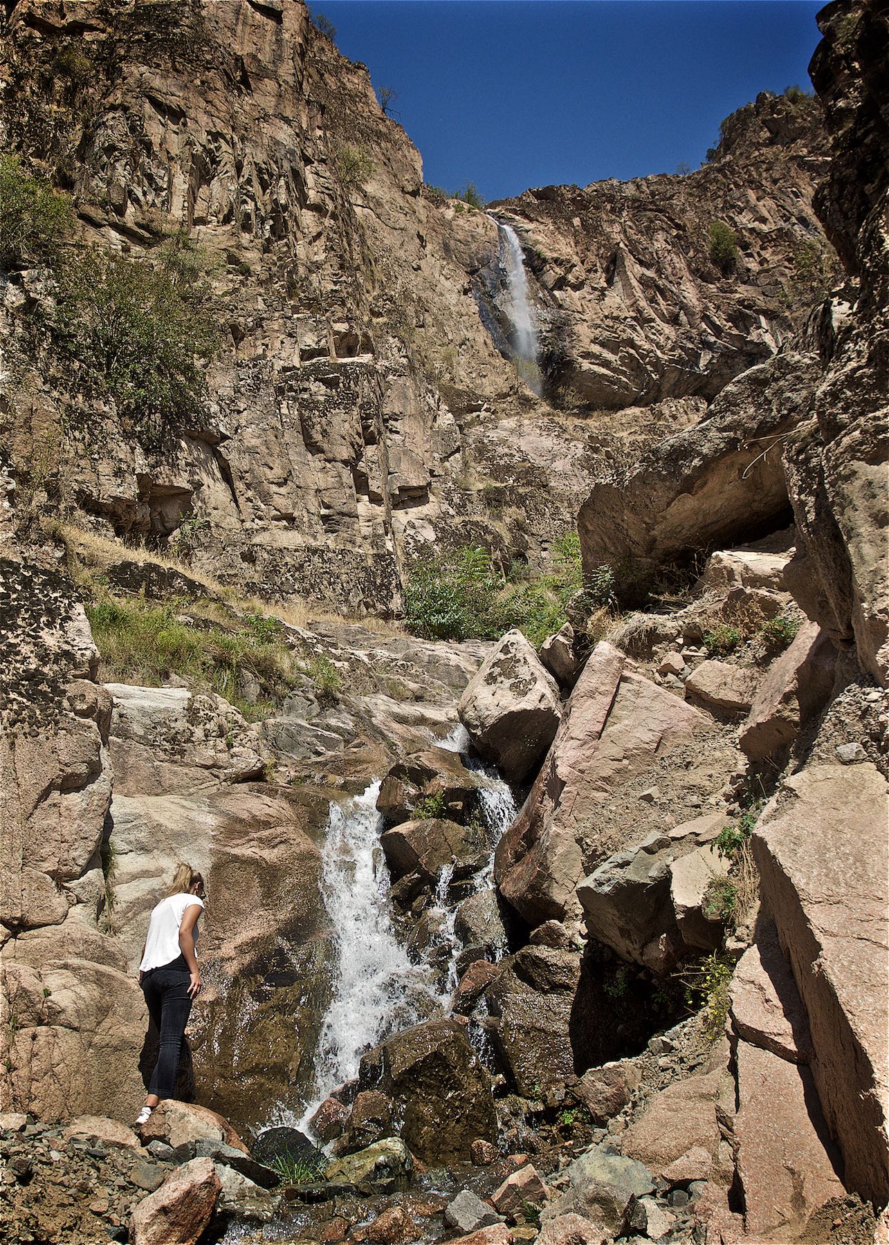
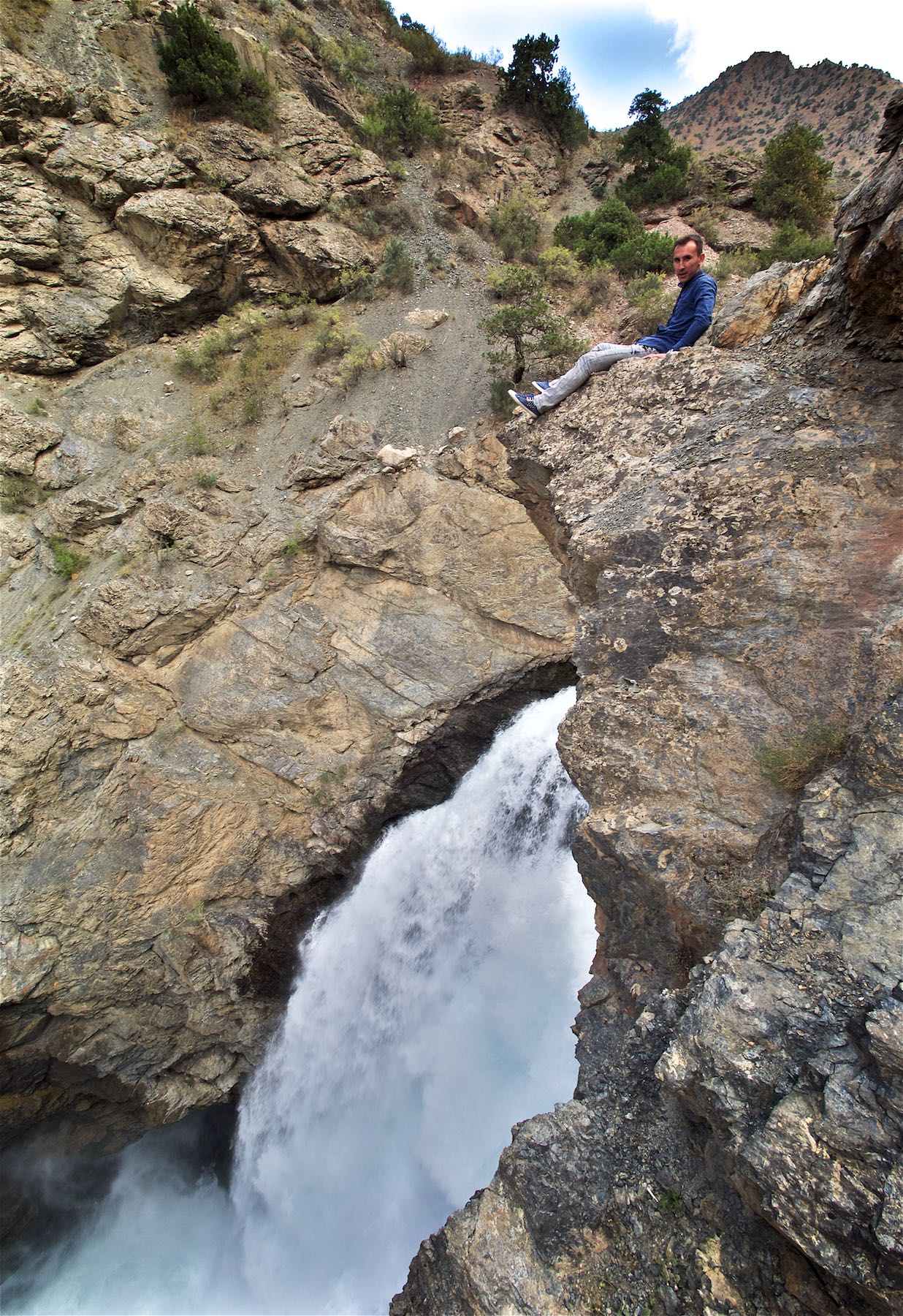
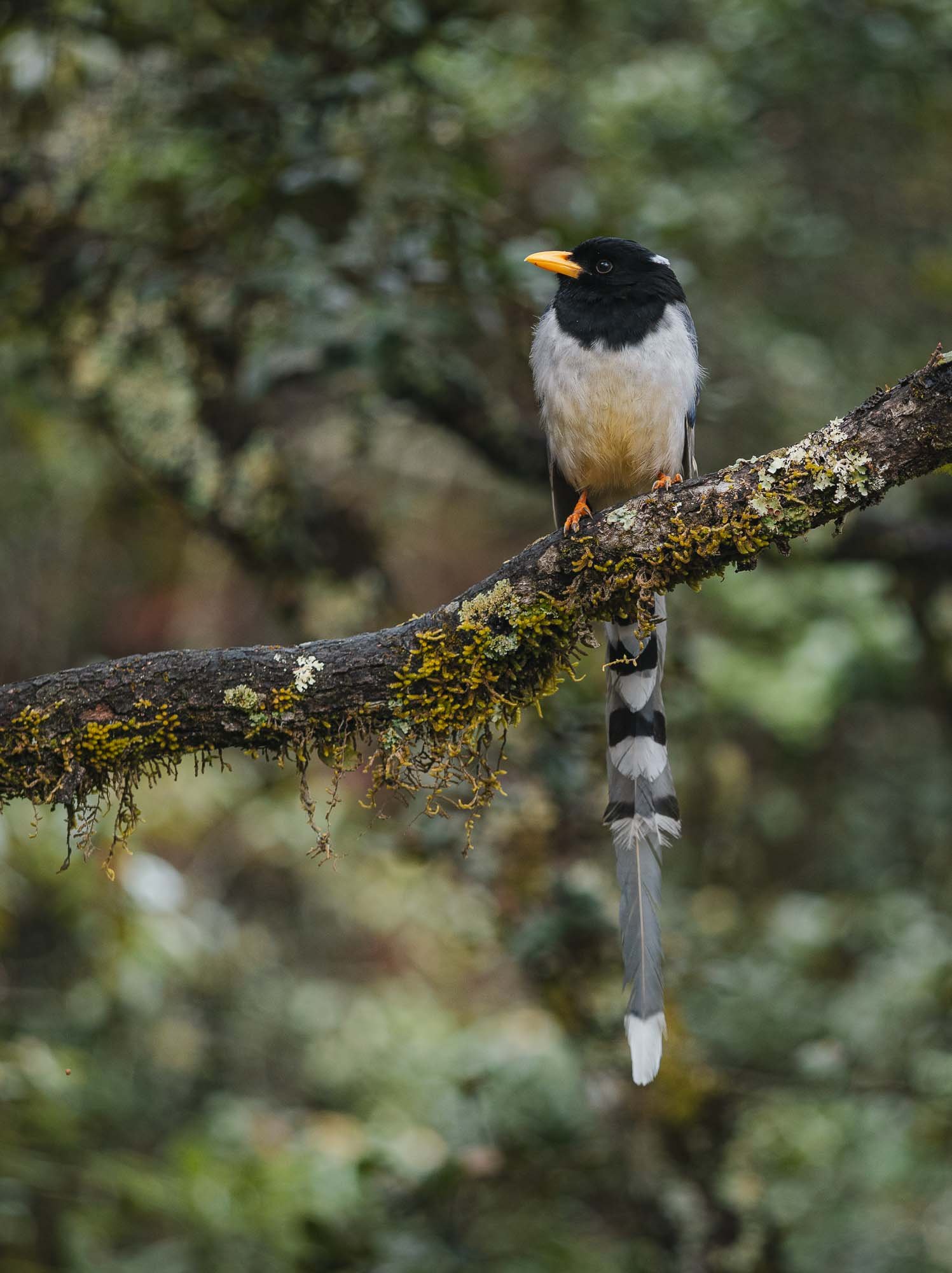
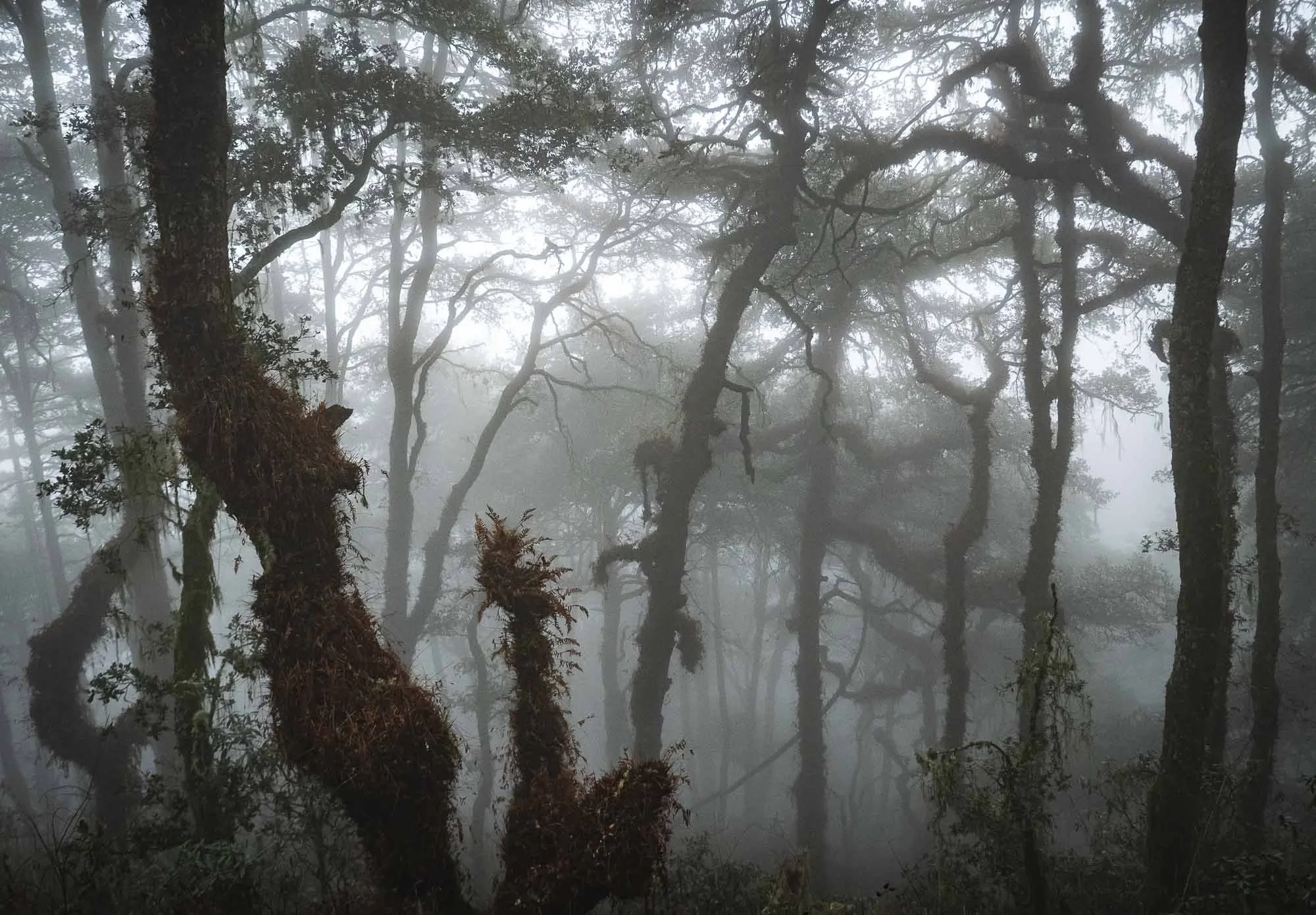
It’s worth it though, not only for the final destination, but also the forest, its inhabitants such as the beautiful magpies, and smaller temples and waterfalls on the way.
As we left in the morning I was a little afraid it would rain, but also had hope that the moody clouds would hang around and create a mysterious atmosphere in the scenery, and wasn’t disappointed…
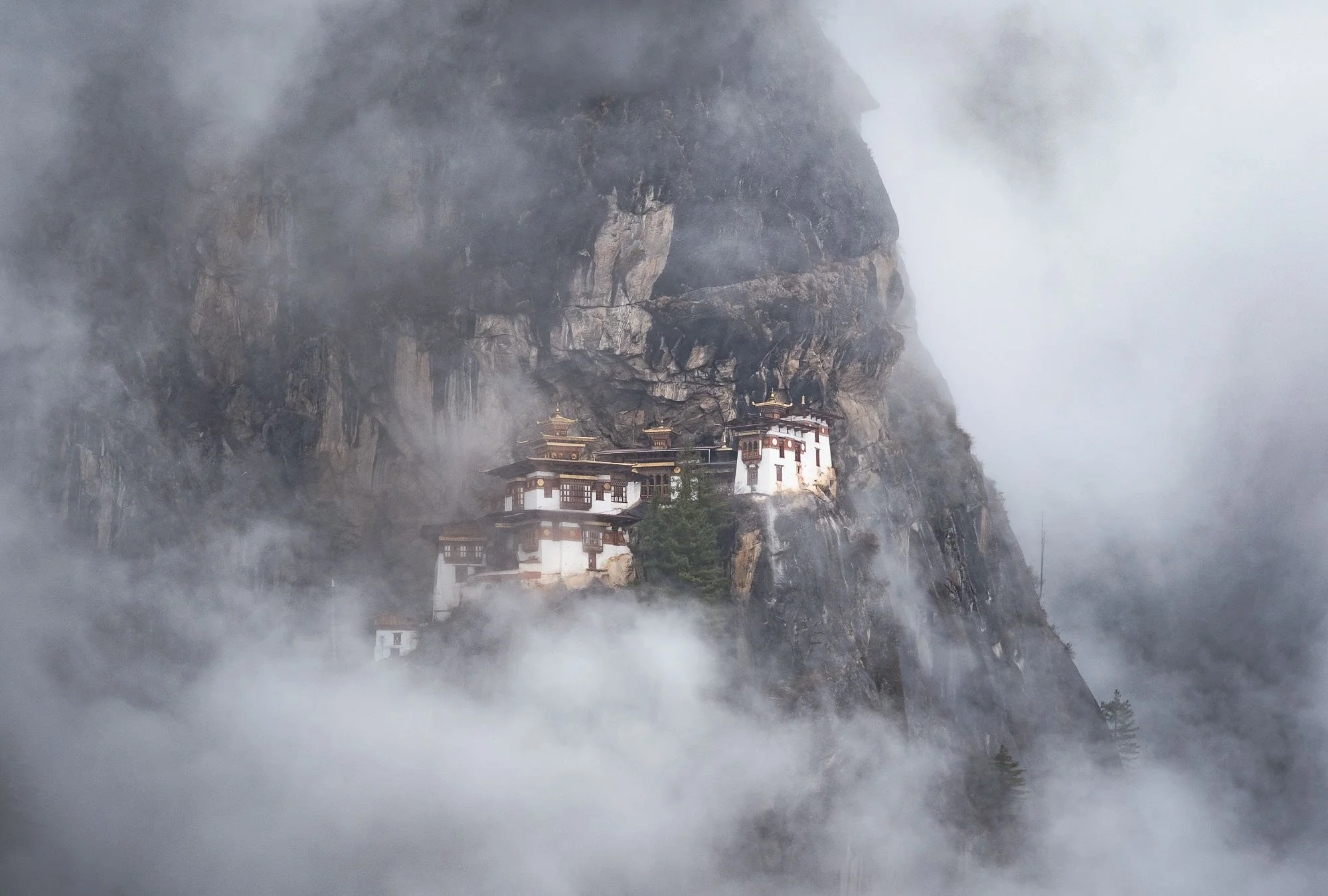
Even though the monastery was was occasionally completely covered in clouds, as is often the case, with a bit of patience conditions that wouldn’t generally be considered ideal produce some of the more intriguing and less common photos - I still want to see it in the snow one day as well though!
The complex actually consists of several main temples and residential shelters adapted into the rocky terrain. It was restored in 2005 after (you know the story by now) a fire broke out in 1998.
The monastery was originally started more than 300 years ago, and marks the site where Guru Rinpoche is said to have meditated in the 8th century after arriving on the back of a tigress (hence the colloquial term Tiger’s Nest - its actual name is Paro Taktsang), establishing Buddhism in the region. This makes it one of the most important religious sites in the country. Once you arrive, visitors need to lock away their cameras and phones and are searched before entering the interior courtyard and various temples holding some of Bhutan’s most sacred artifacts.
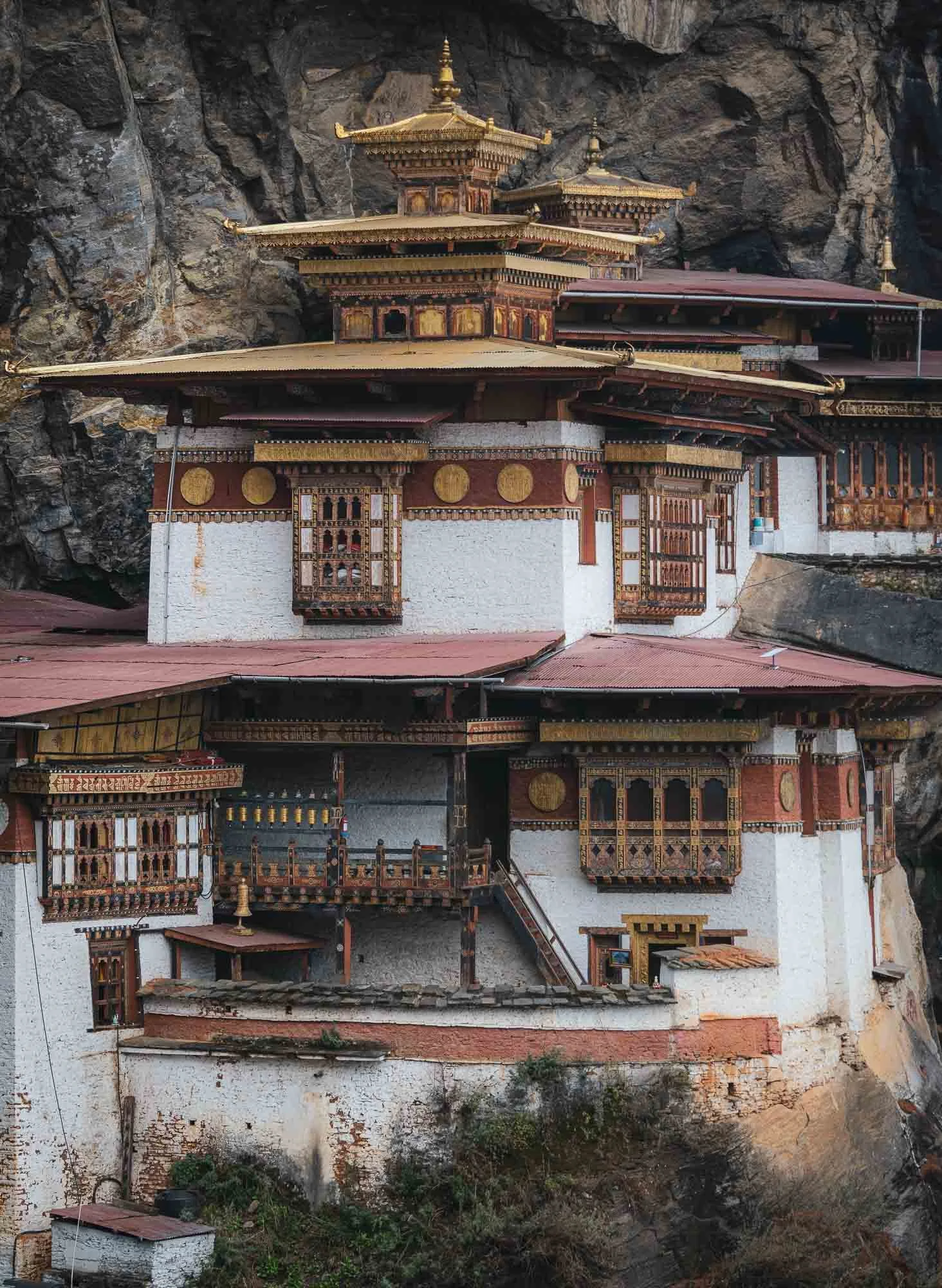
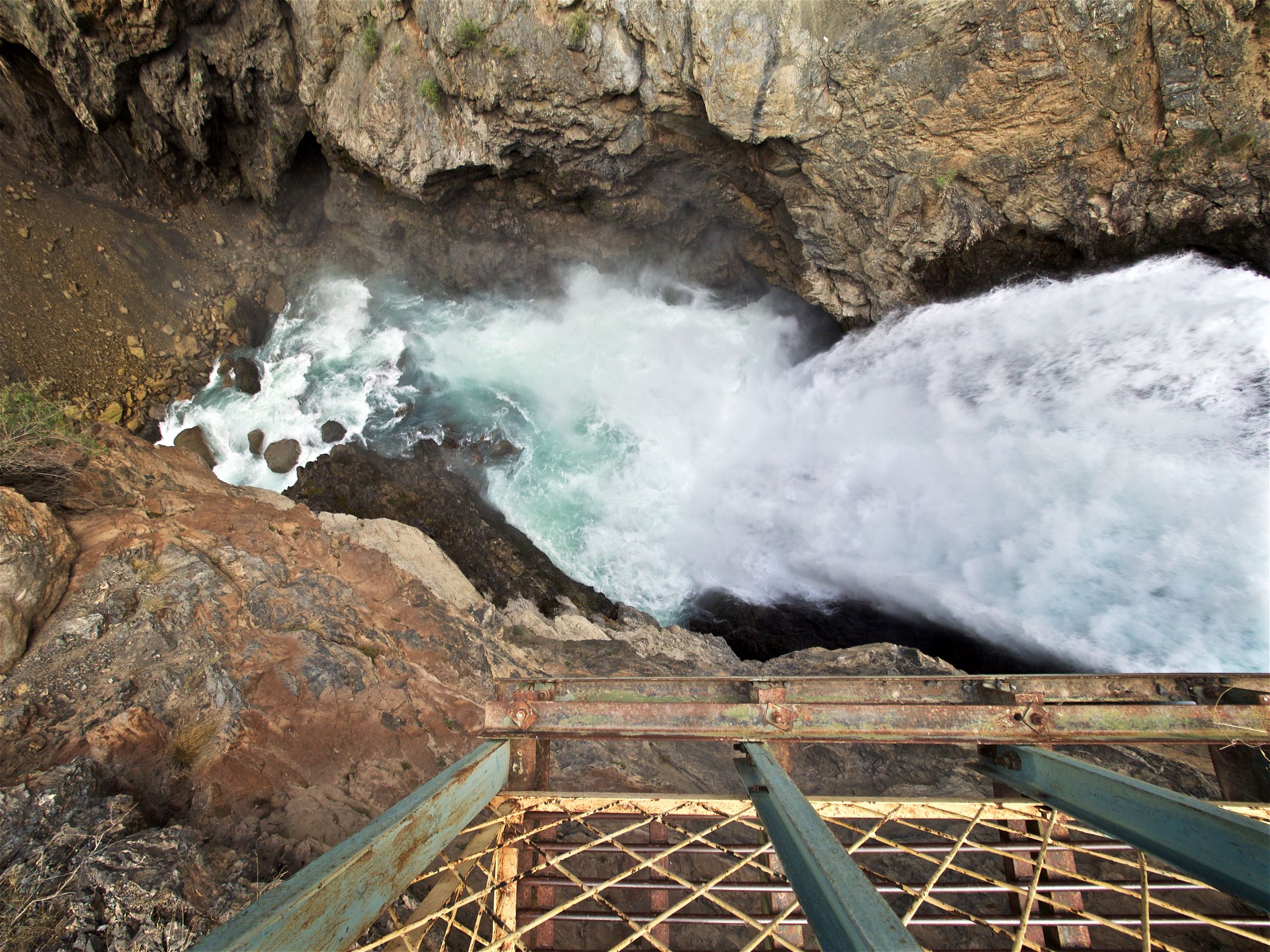
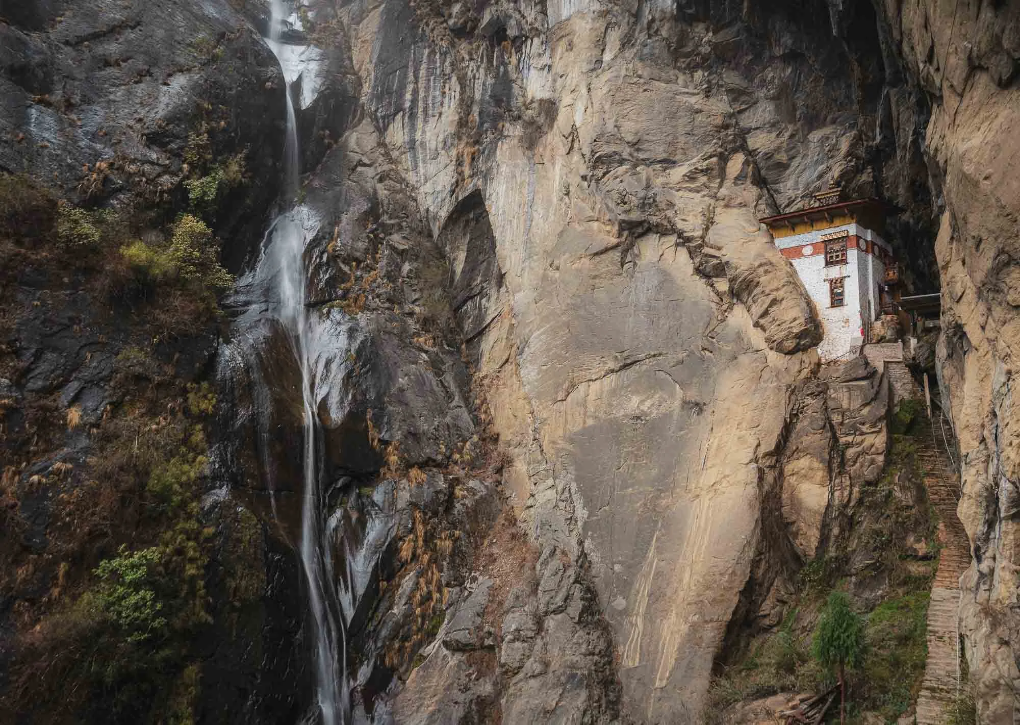
Looking backwards from the monastery you can see the tall waterfalls on the right with a small shrine embedded into the bedrock, and the stairs along the cliffs on the left. My guide told me that when he first came to Tiger’s Nest a few decades ago, accessing it required a bit more questionable climbing than nowadays.
After all those stairs you’d be forgiven for just wanting to head back down, but it’s worth to continue the climb a little higher, where several more important religious spots and temples await.
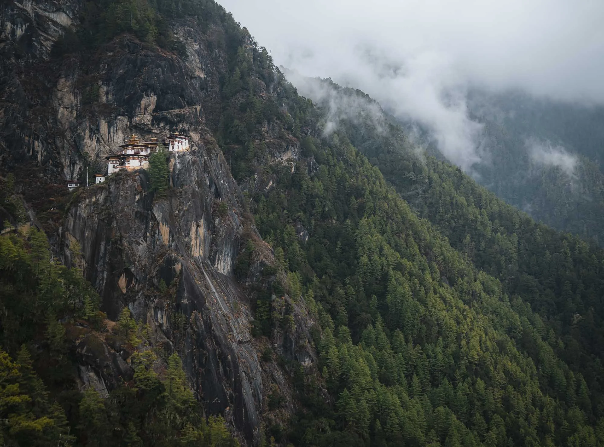
Throughout the entire hike there are several viewpoints along the way if you keep your eyes open - a few more angles below.
If you look back at the photo from Chele la pass, you’ll see that Tiger’s Nest is not as isolated as it may first seem, in fact it’s accessible from multiple places and surrounded by several more structures featuring the consistent local architectural style.
Despite this, not many people seem to make their way further up, possibly because the path is a lot rougher here and features a few questionable metal ladders. We were the only people as we arrived at the Zangdok Pelri temple.
Shortly after, the clouds and some rain caught up with us - luckily the resident lama (a respected monk teacher) who is staying here for several months to perform rituals, let us into his cabin, offering some heat and food that local ladies had brought for him the day before. No chance I could eat it and live to see the next day 🌶️🥵, but Chencho and Nima enjoyed themselves.
We left shortly after - with quite a few photography breaks and the extra temples beyond the monastery, and lunch at the little cafe on the way down, it took a total of a very worthwhile six hours from start to finish.
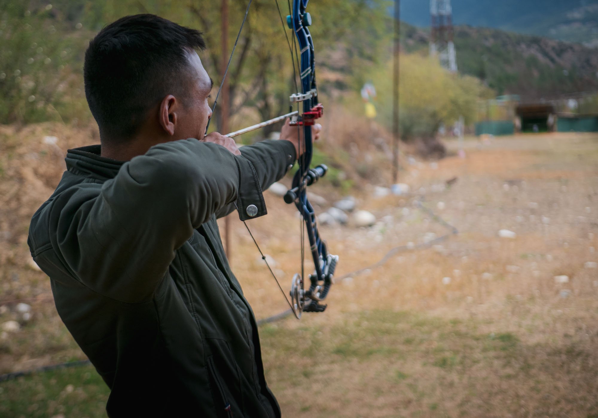
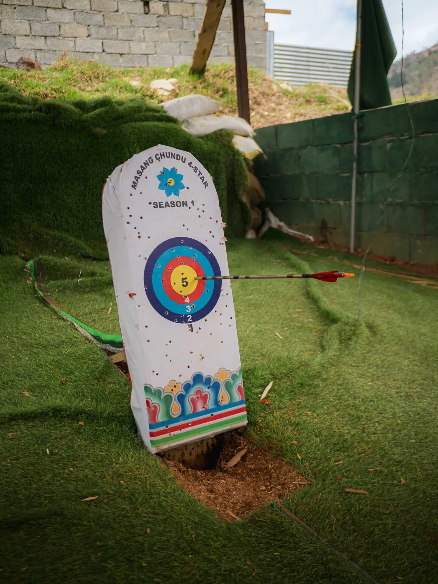
Driving back, we passed a group of people performing Bhutan’s national sport: archery. But here, it comes with a twist. Traditional matches are shot from a distance of about 140-145 meters (!), that’s roughly double the Olympic distance of 70 meters. Not difficult enough? The target is even smaller, with the bullseye being just 6cm in diameter, half of the Olympic version. It’s pretty ridiculous to see this first-hand: on the left picture you can just about make out the white dot in the centre of the little wooden structure in the distance - that’s what the rings are printed on.
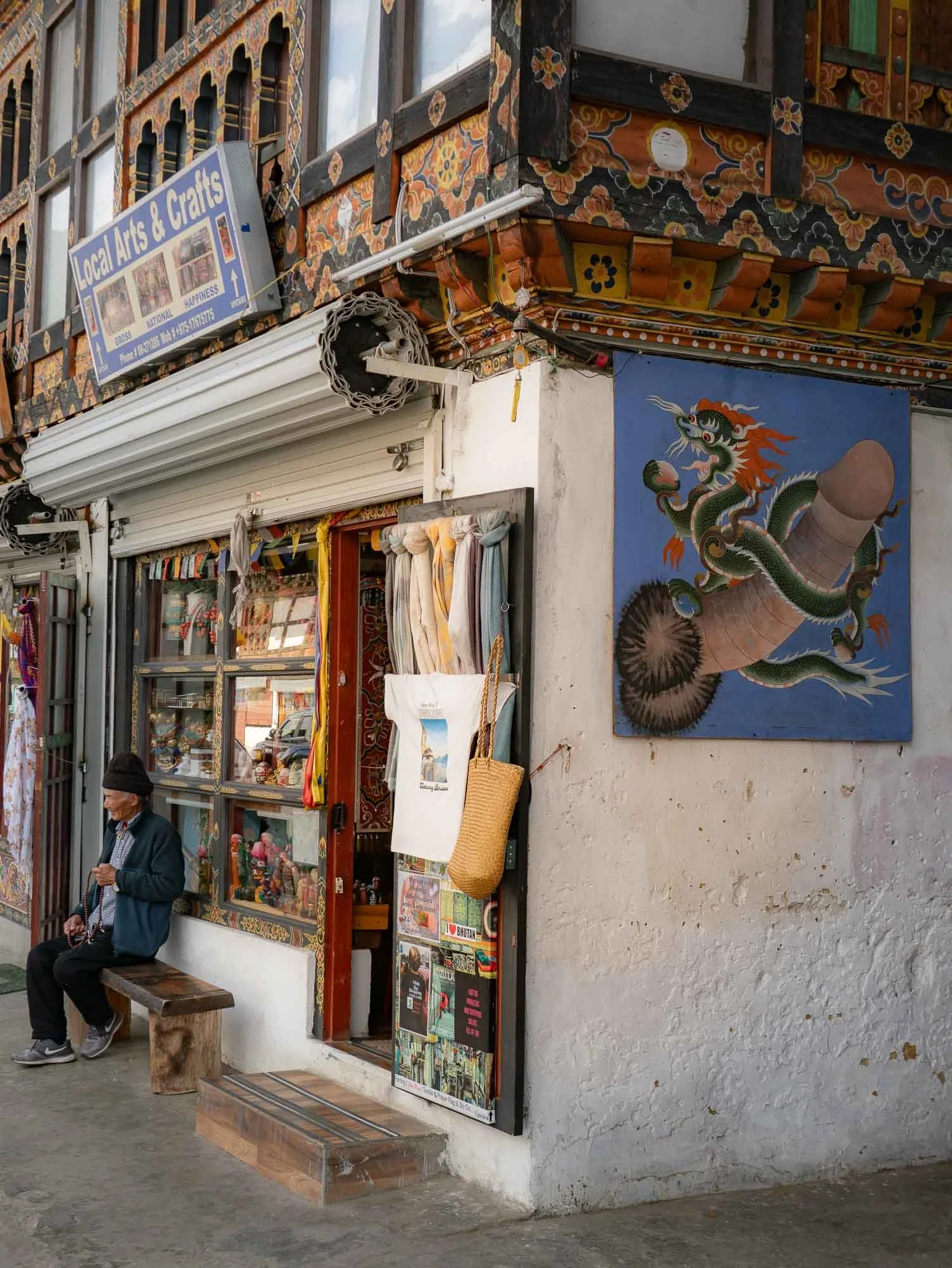
I also took a short walk through Paro - as the primary gateway into the country it’s relatively touristic, but the main street is still interesting and features the traditional architecture and symbolism, albeit mostly housing touristic shops and restaurants or cafes.
Another small hike followed through the woodlands around the city - Chencho grew up just around the corner of the Dzong, often roaming between the tall Himalayan Cypress - Bhutan’s national tree.
The leisurely path led to one of the oldest surviving forts in the country, said to date back to 1352, but now seemingly a mostly abandoned relic.
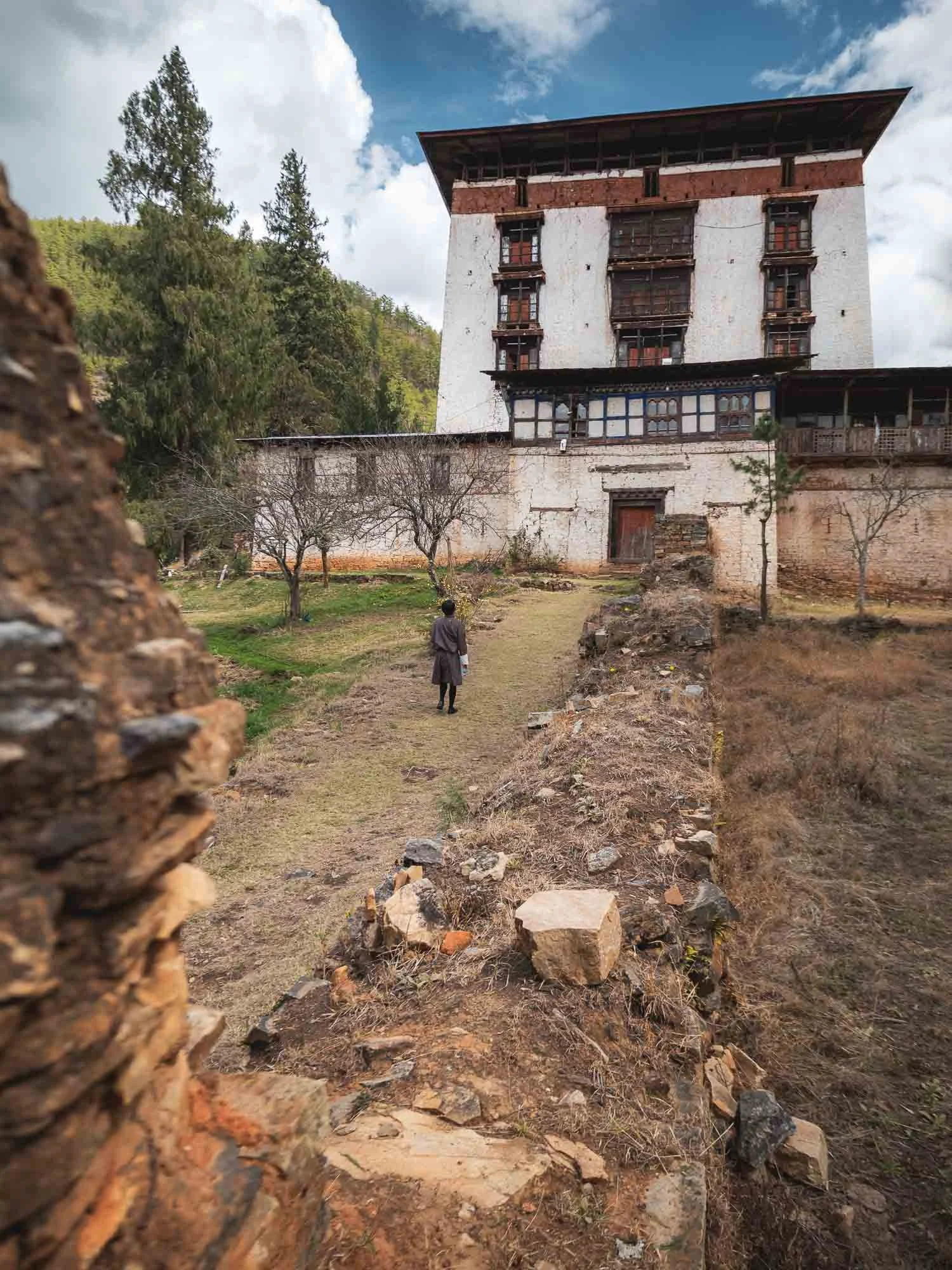
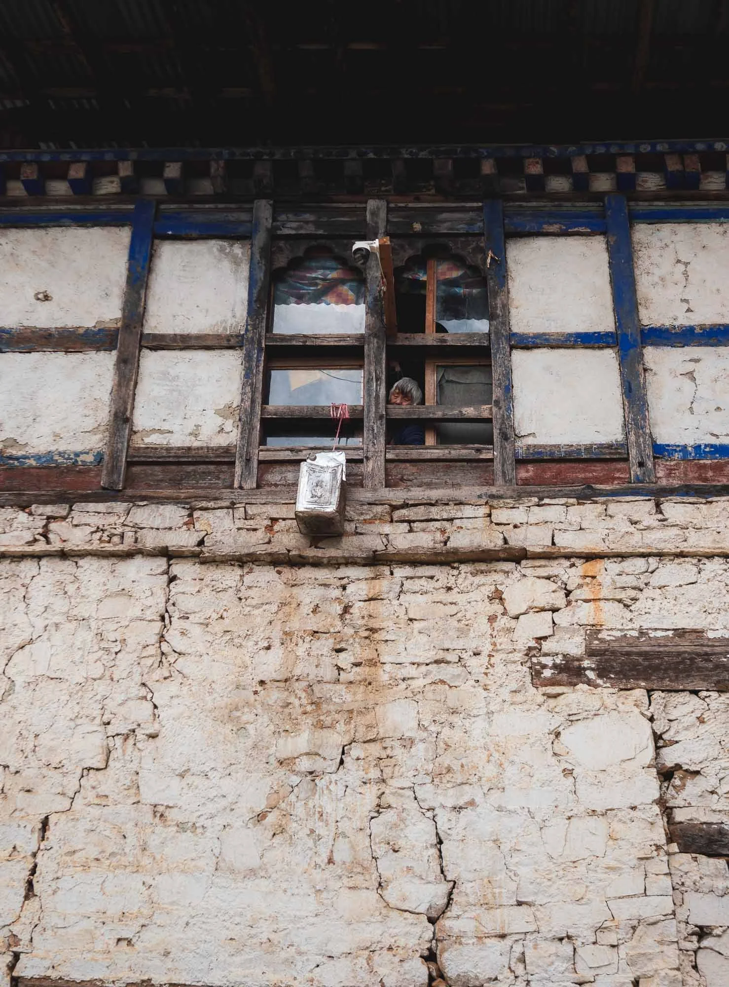
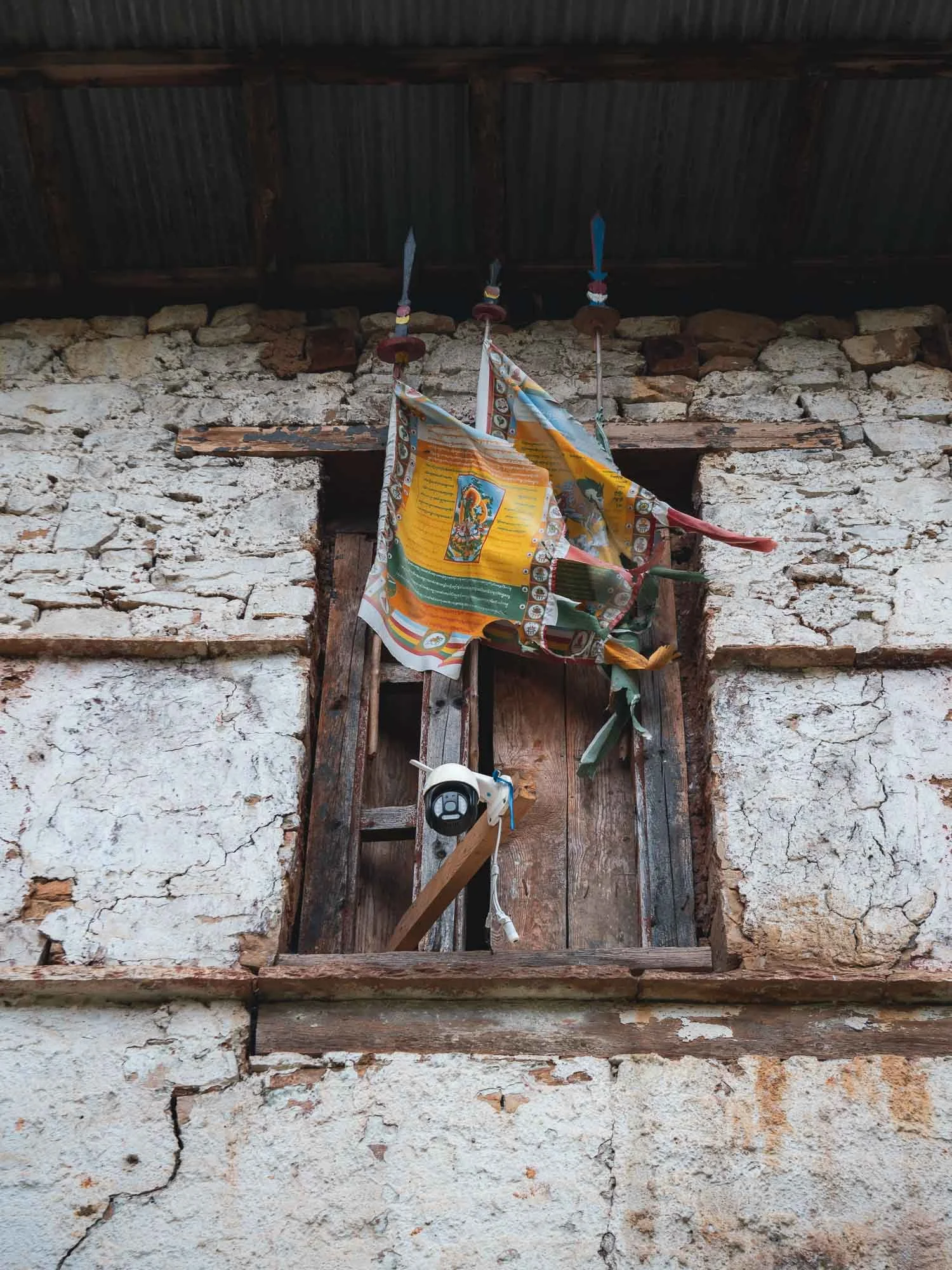
That’s not to say it is unoccupied. As we approached, I noticed a high pitched sound emanating from the building, and realised it was a motion activated camera that alerted an older lady of visitors. She promptly looked out the window to greet us but sadly the fort is not open to the public.
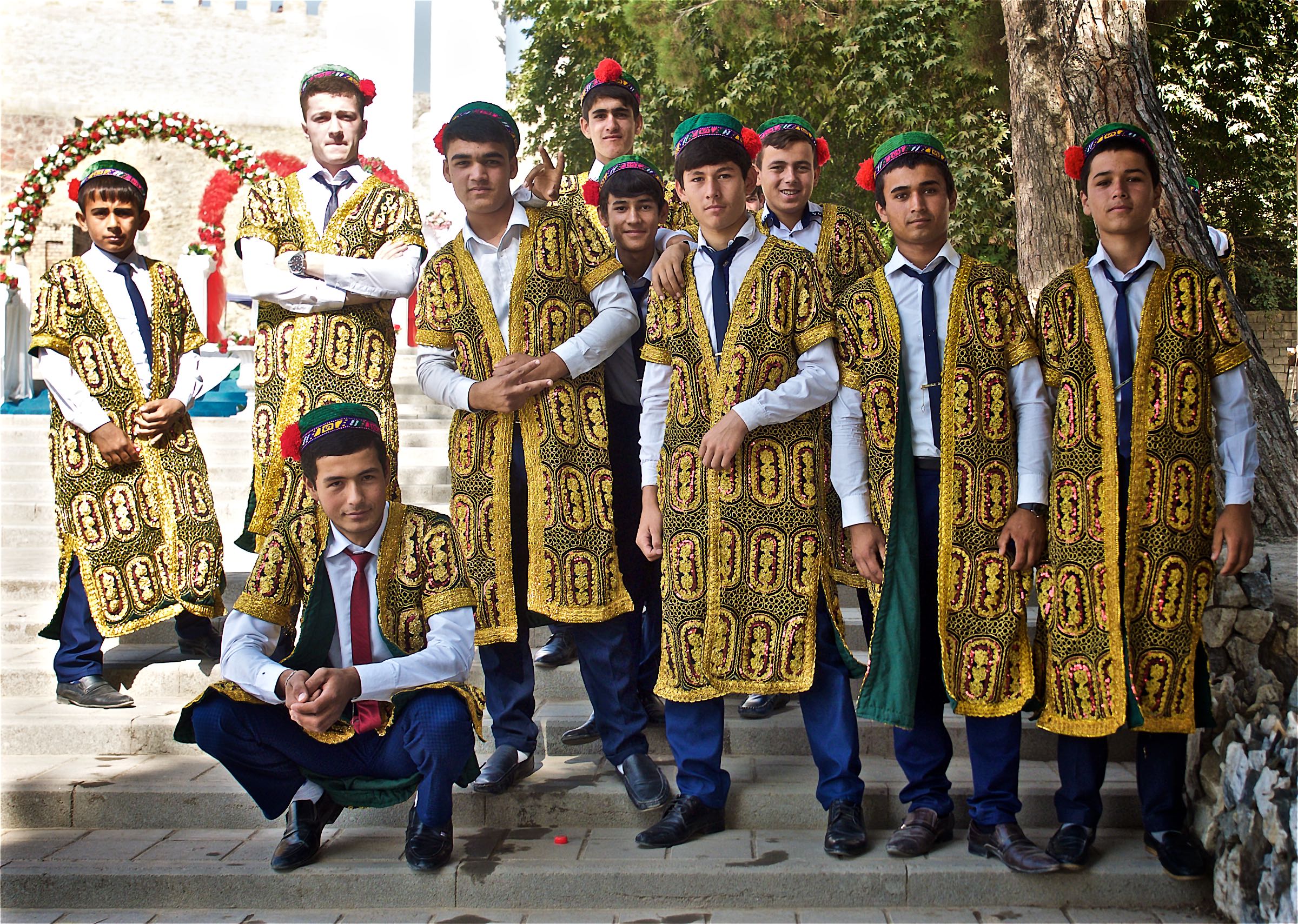
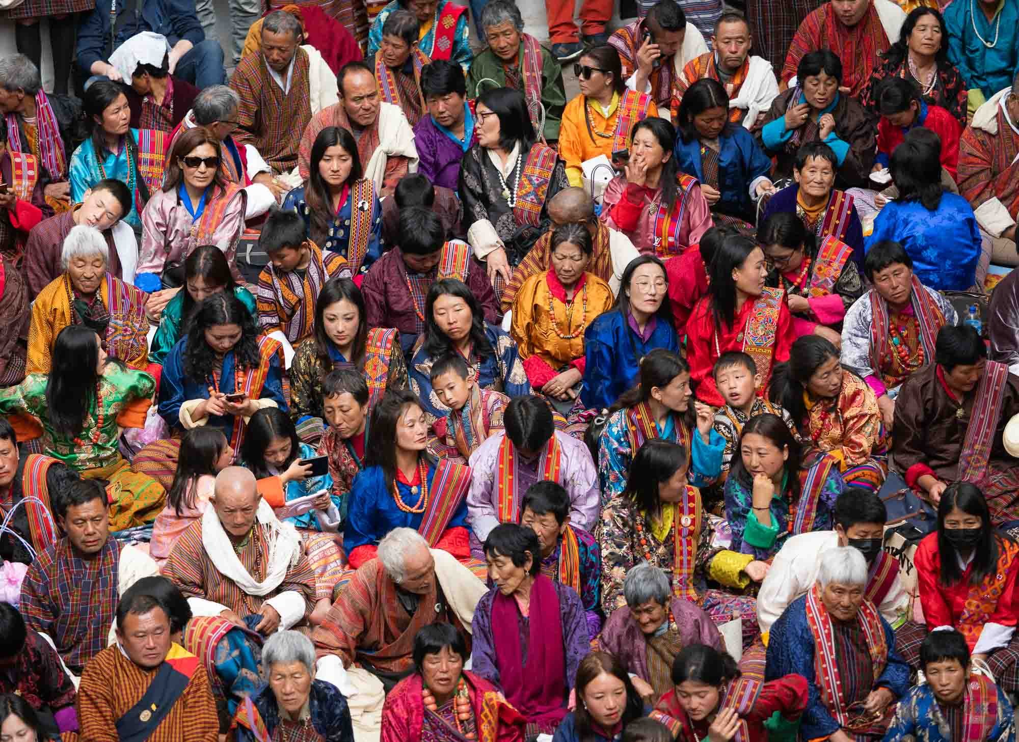
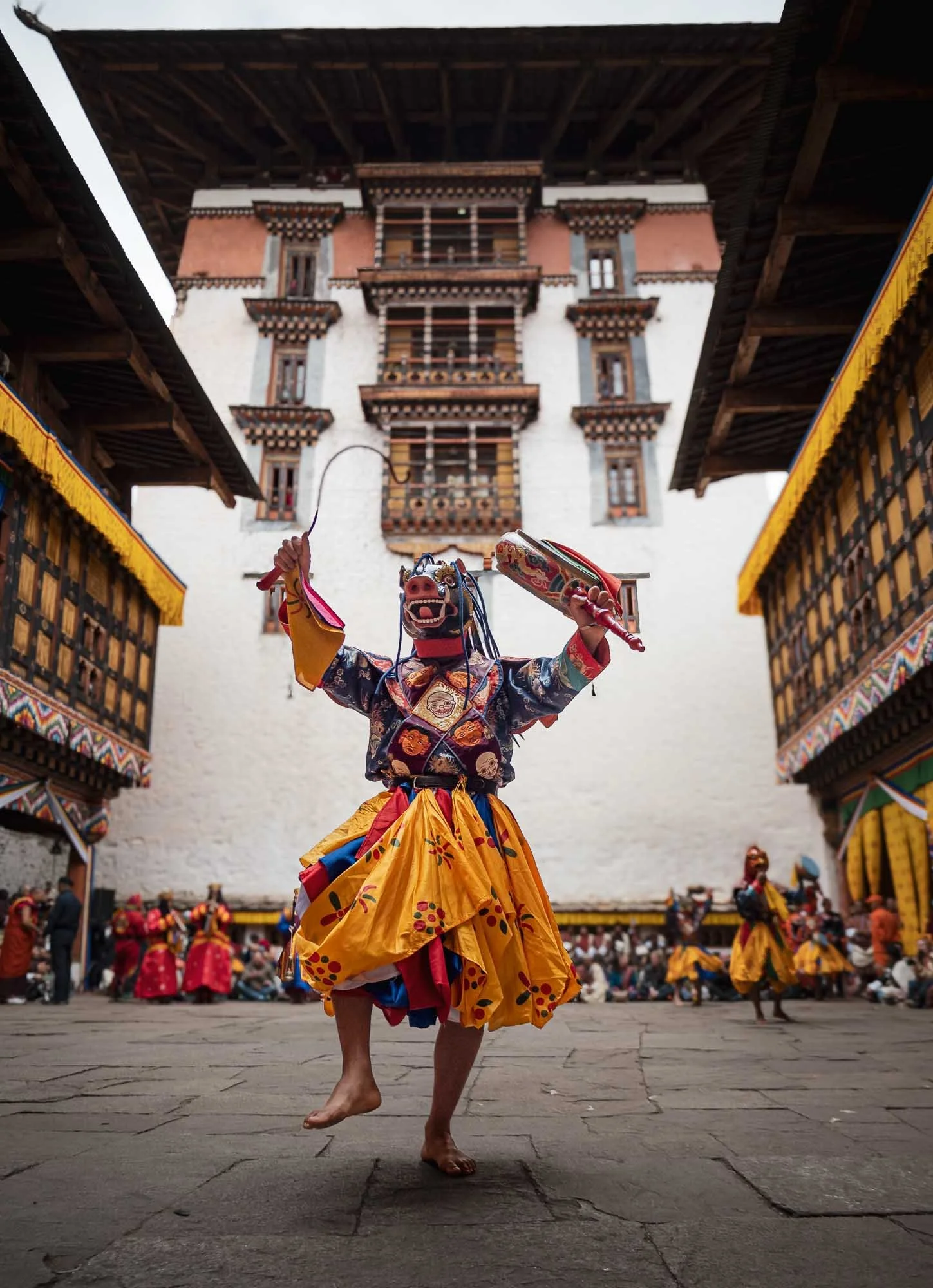
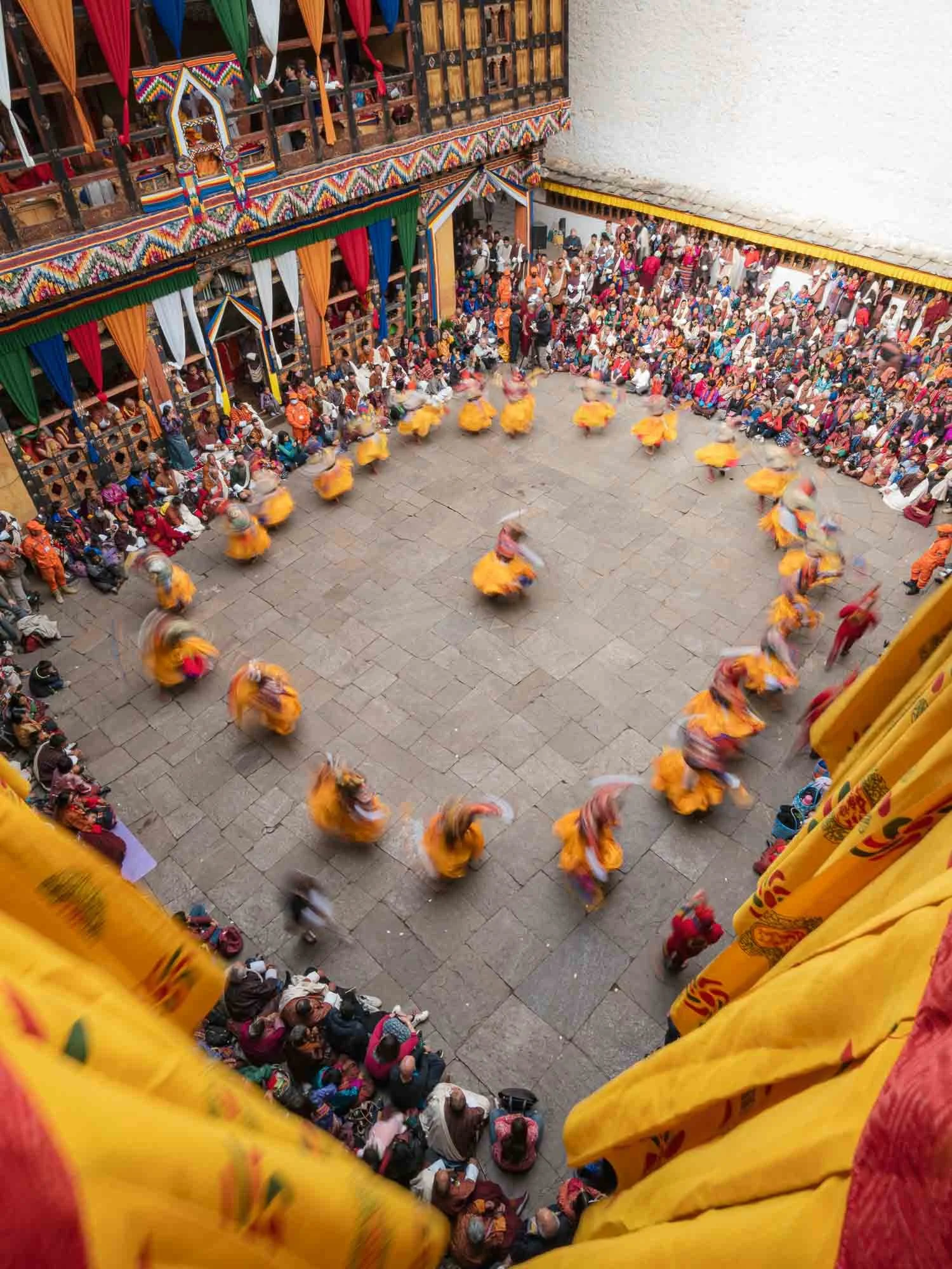
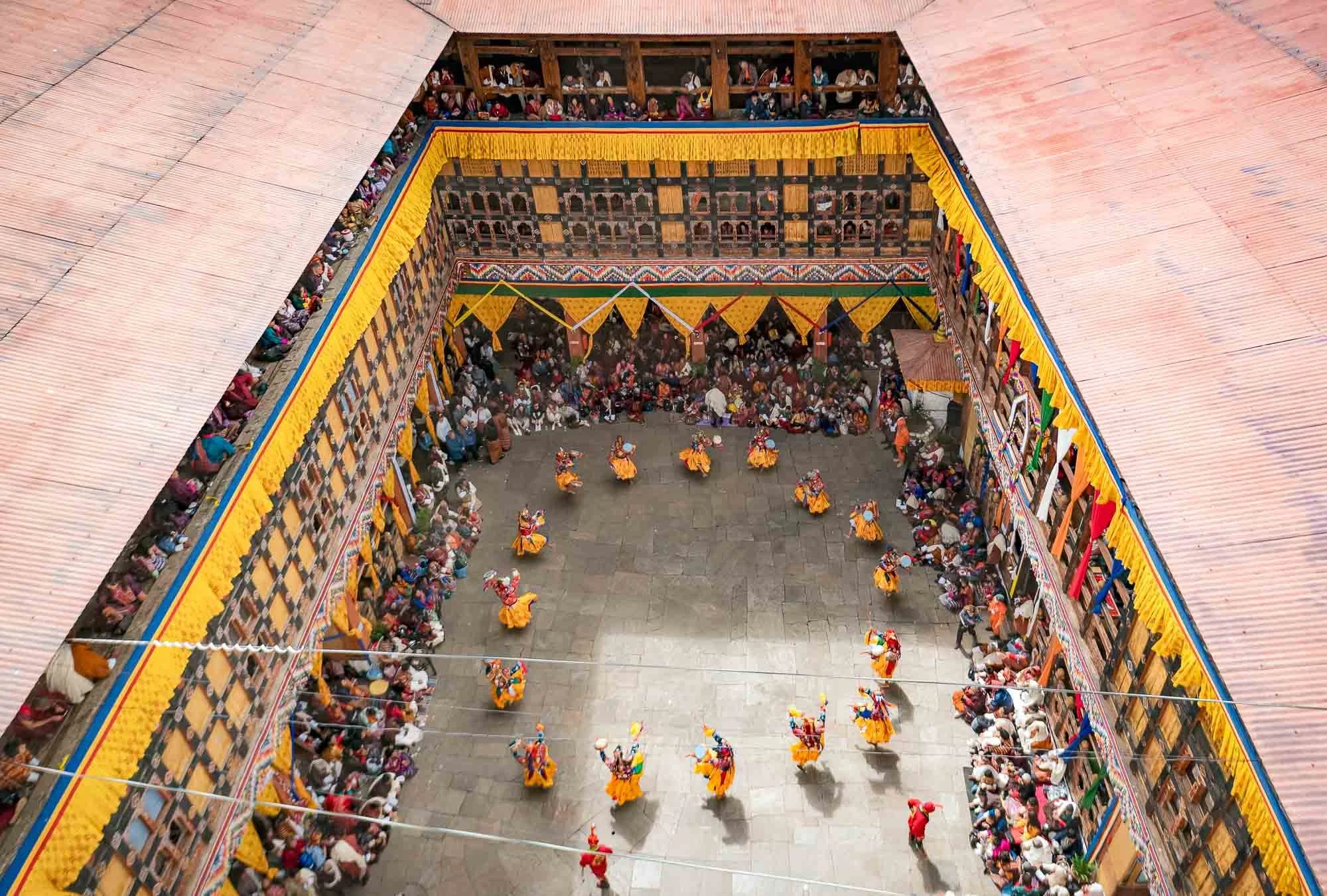
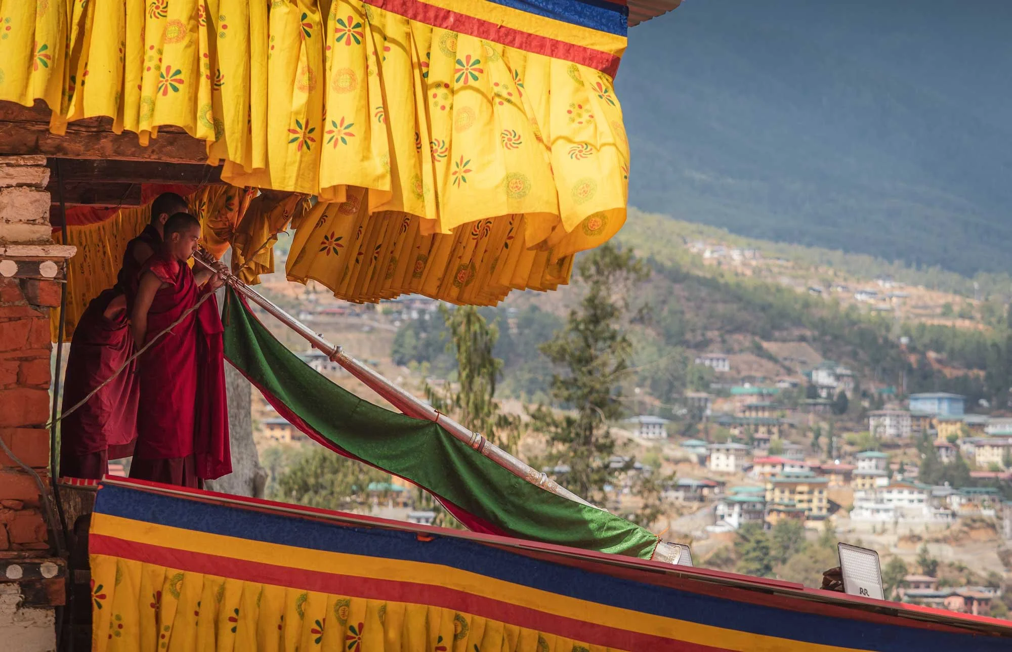
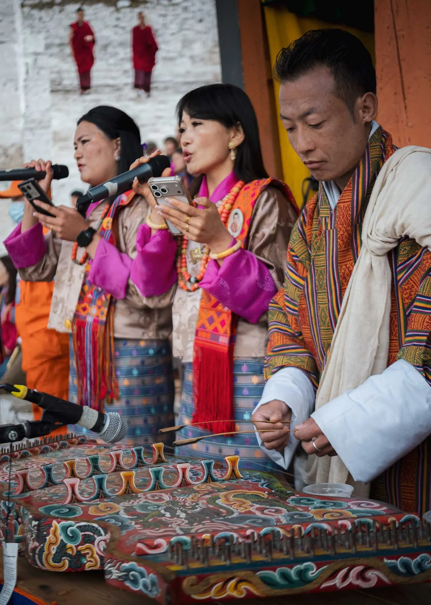
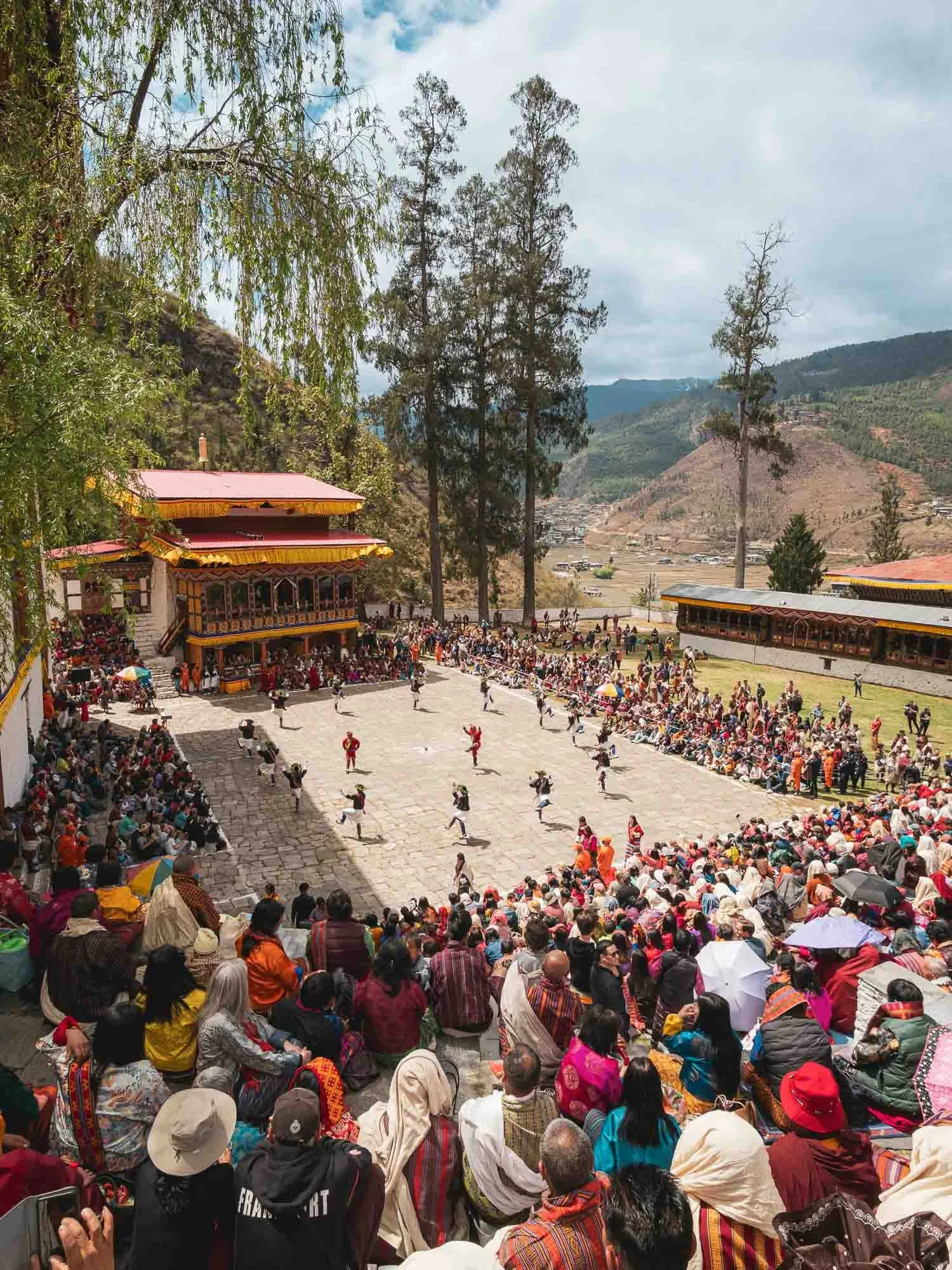
The Paro Tshechu
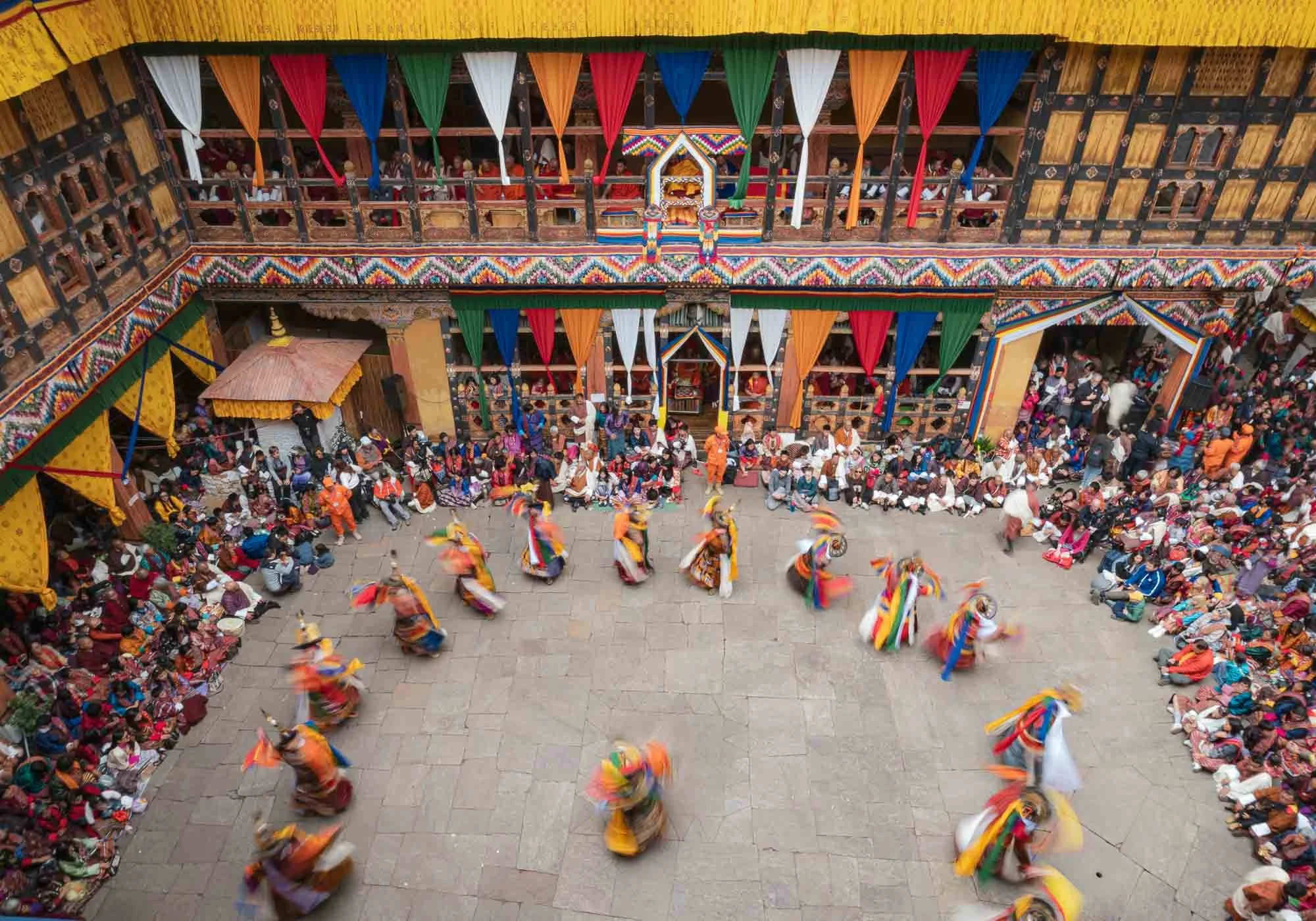
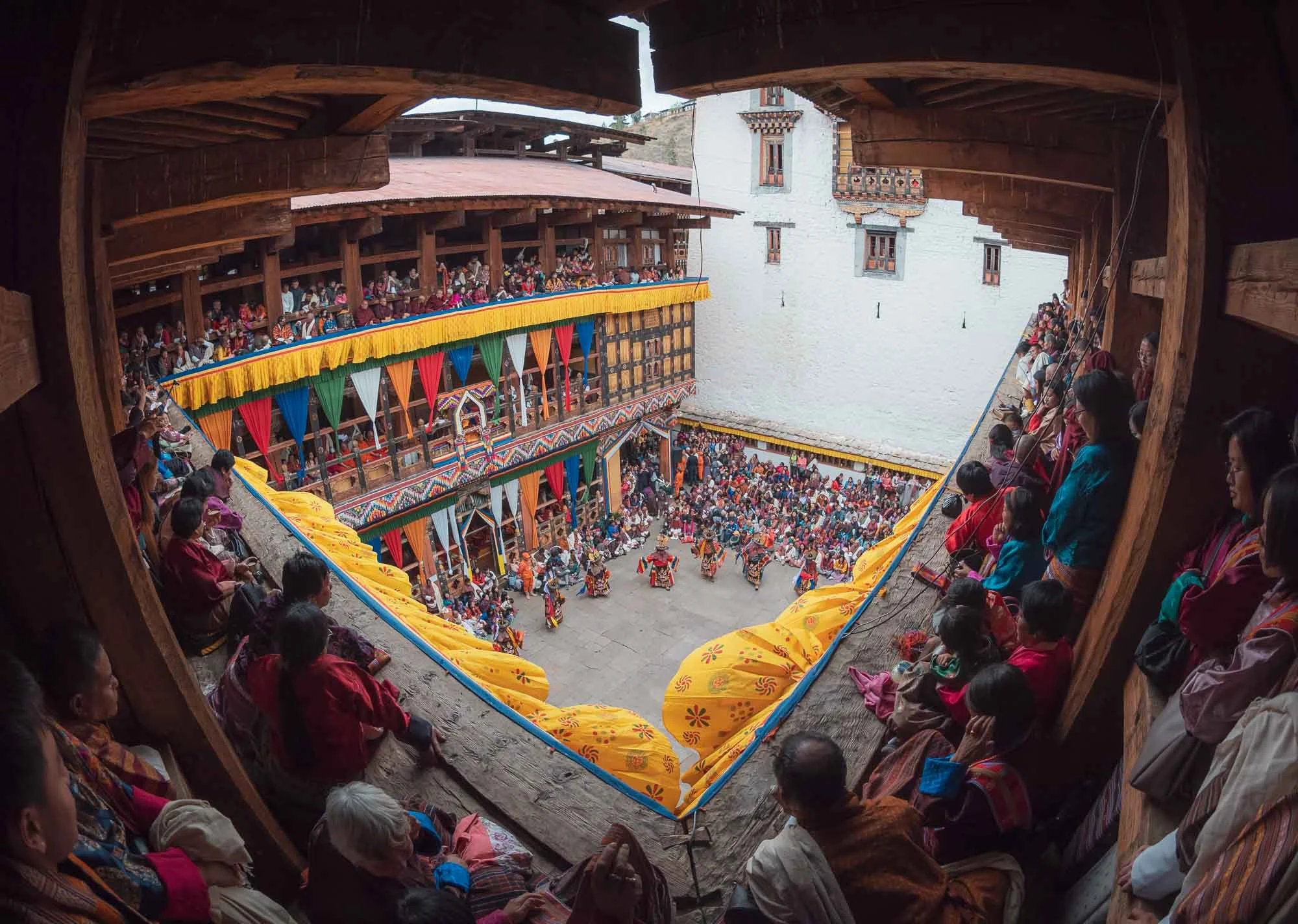
But aside from the Tiger’s Nest, there was a second main reason to spend a few days here, particularly in late March: over five days, the city is home to one of the most important and largest Tshechu (10th day in lunar calendar marker) festivals in Bhutan. It serves to generate merit and transmit the teachings of Guru Rinpoche through sacred dances, traditional music, and historic costumes. Its first day takes place inside Paro Dzong.
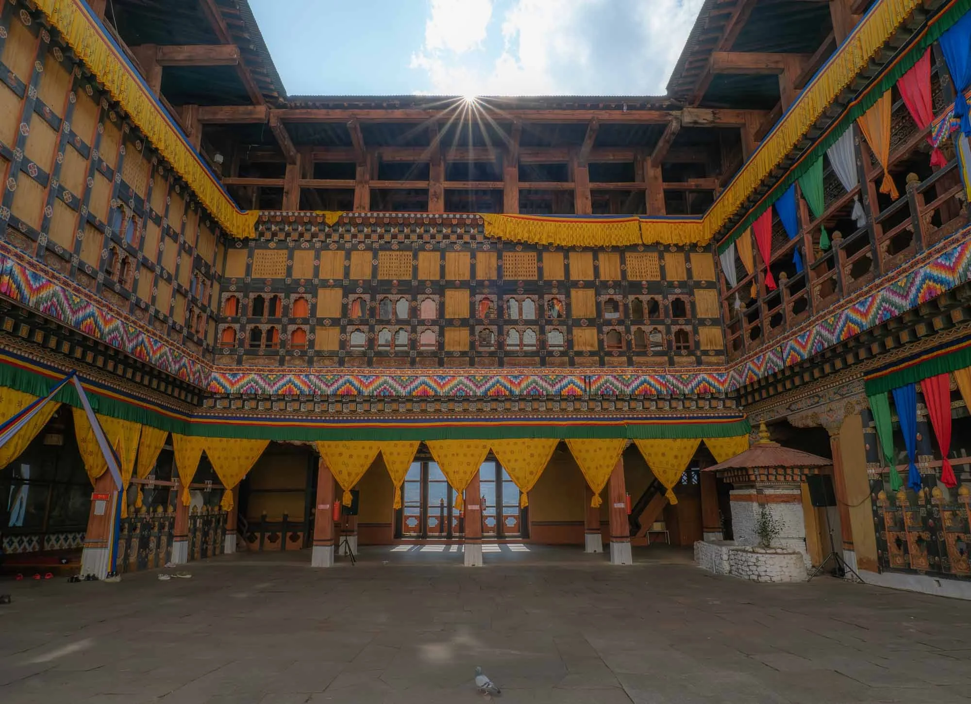
I visited the day before the festival for a quiet moment where the only other visitor was this pigeon, but the colorful decoration (and a few last minute dancing and singing practice) gave away that things were to become a lot more crowded soon.
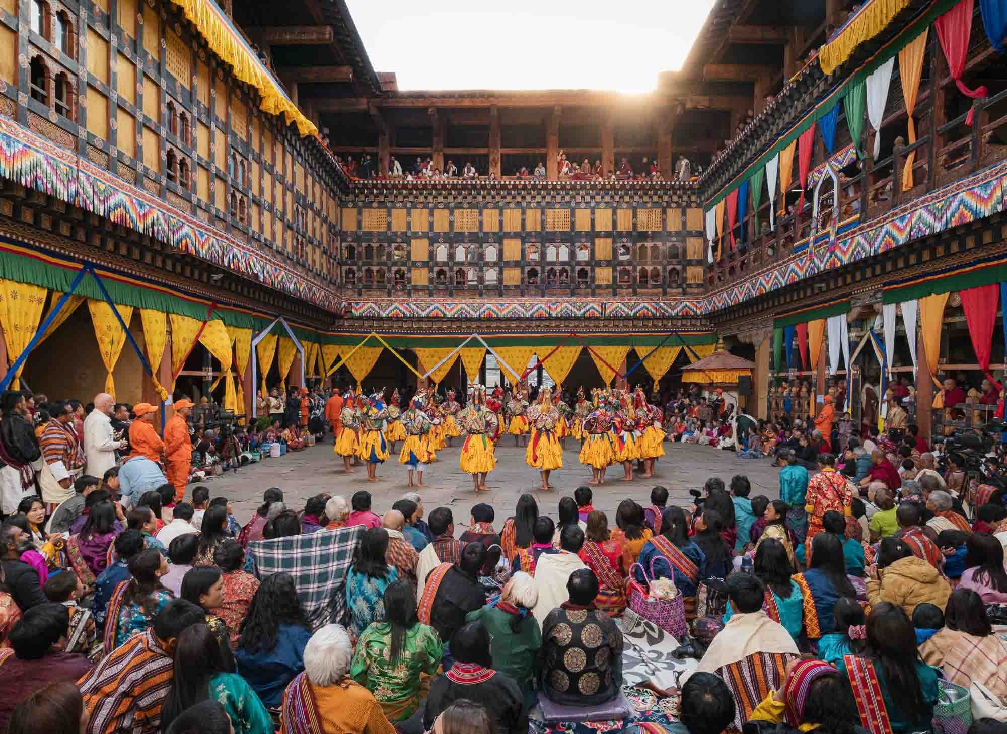
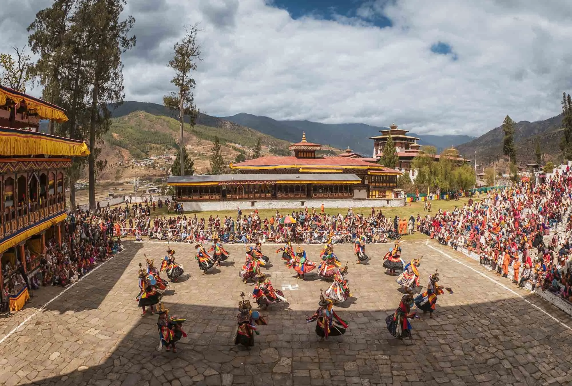
And indeed, this was the same spot the next day during the opening of the festival - crowds occupying every floor, nook, and cranny of the courtyard, with dancers performing in the centre. But one step at a time…
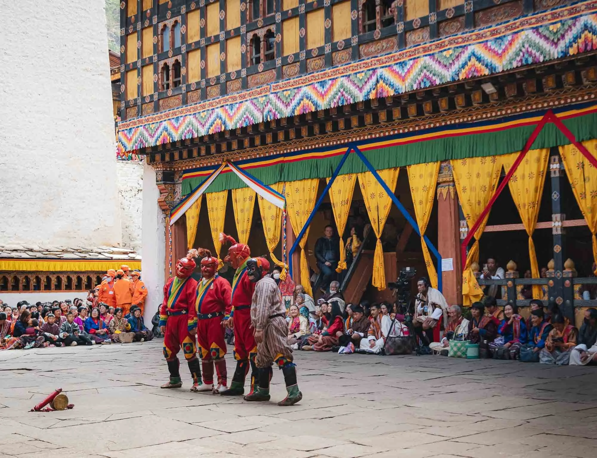
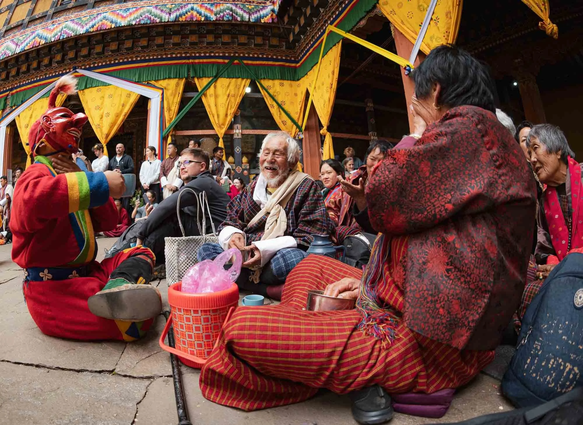
The proceedings are kicked off and hosted by the so-called Atsara (sacred clowns), who serve various roles, from teaching moral lessons and keeping the audience engaged, to managing the flow of performances all day, at times using their wooden phallic symbols seen in front of them here to do so...
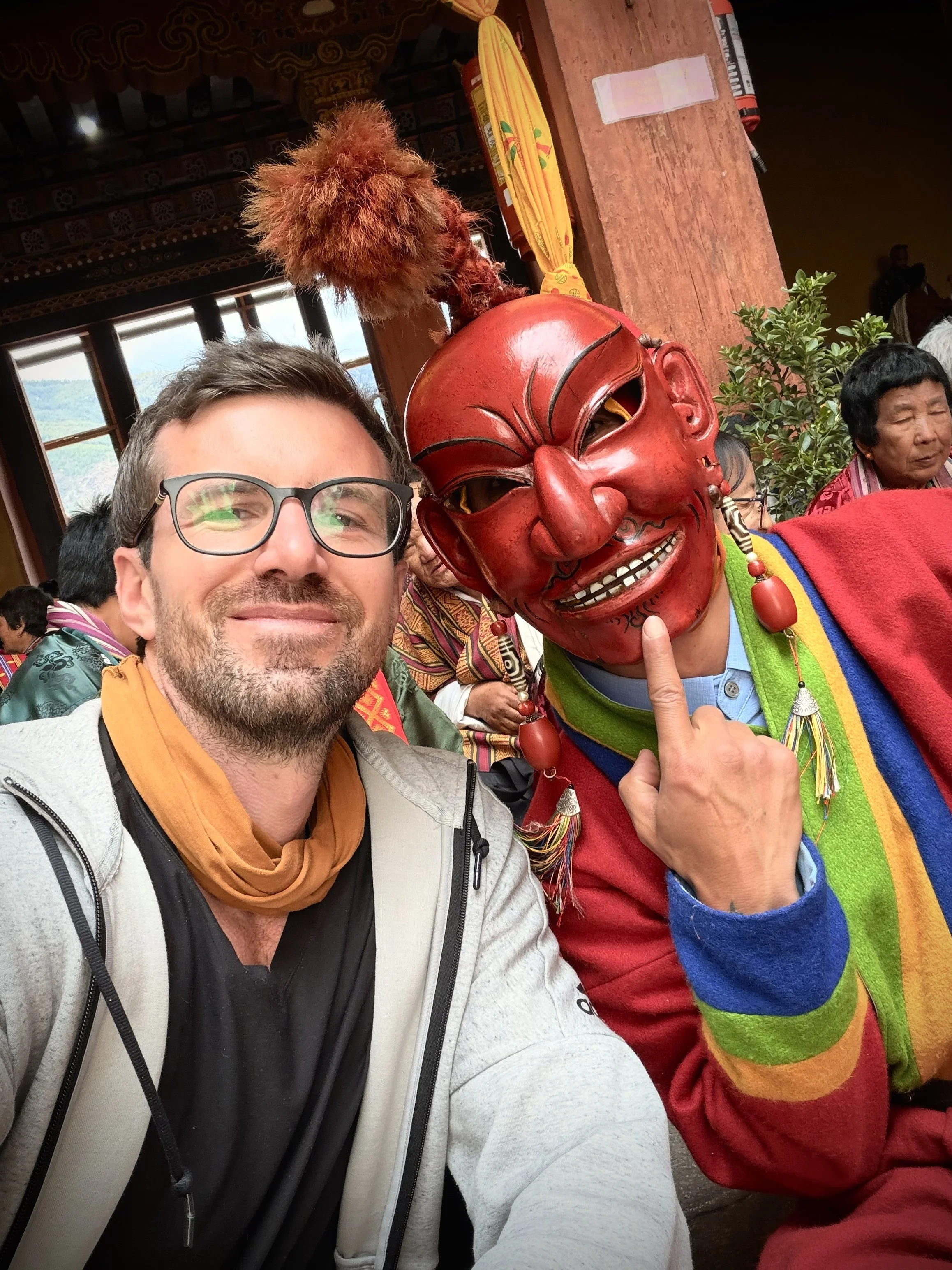
I had a chance to chat and take a selfie with one of them, and they seem to be born entertainers.
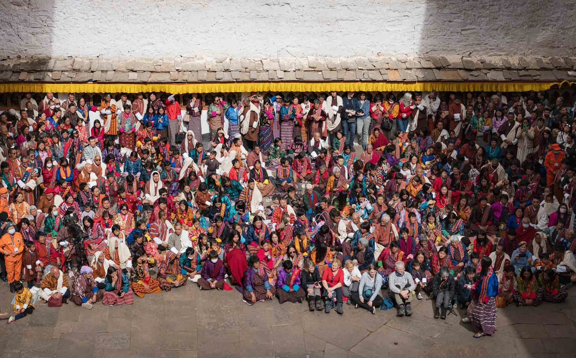
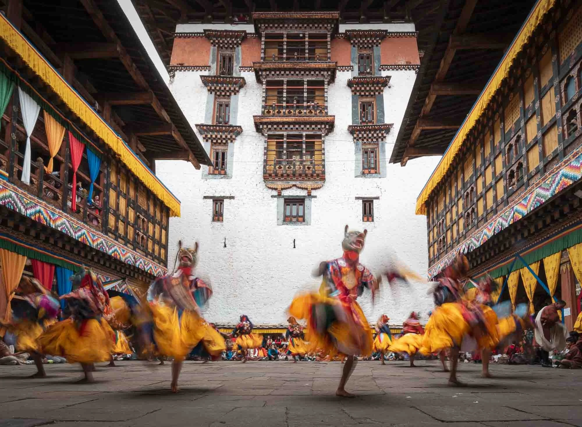
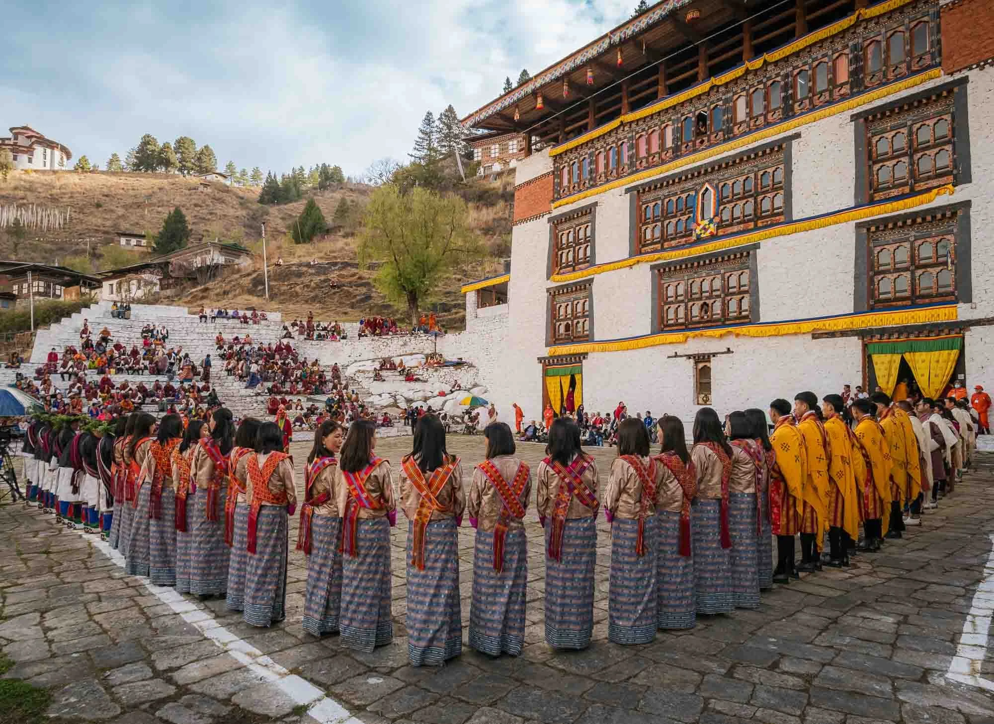
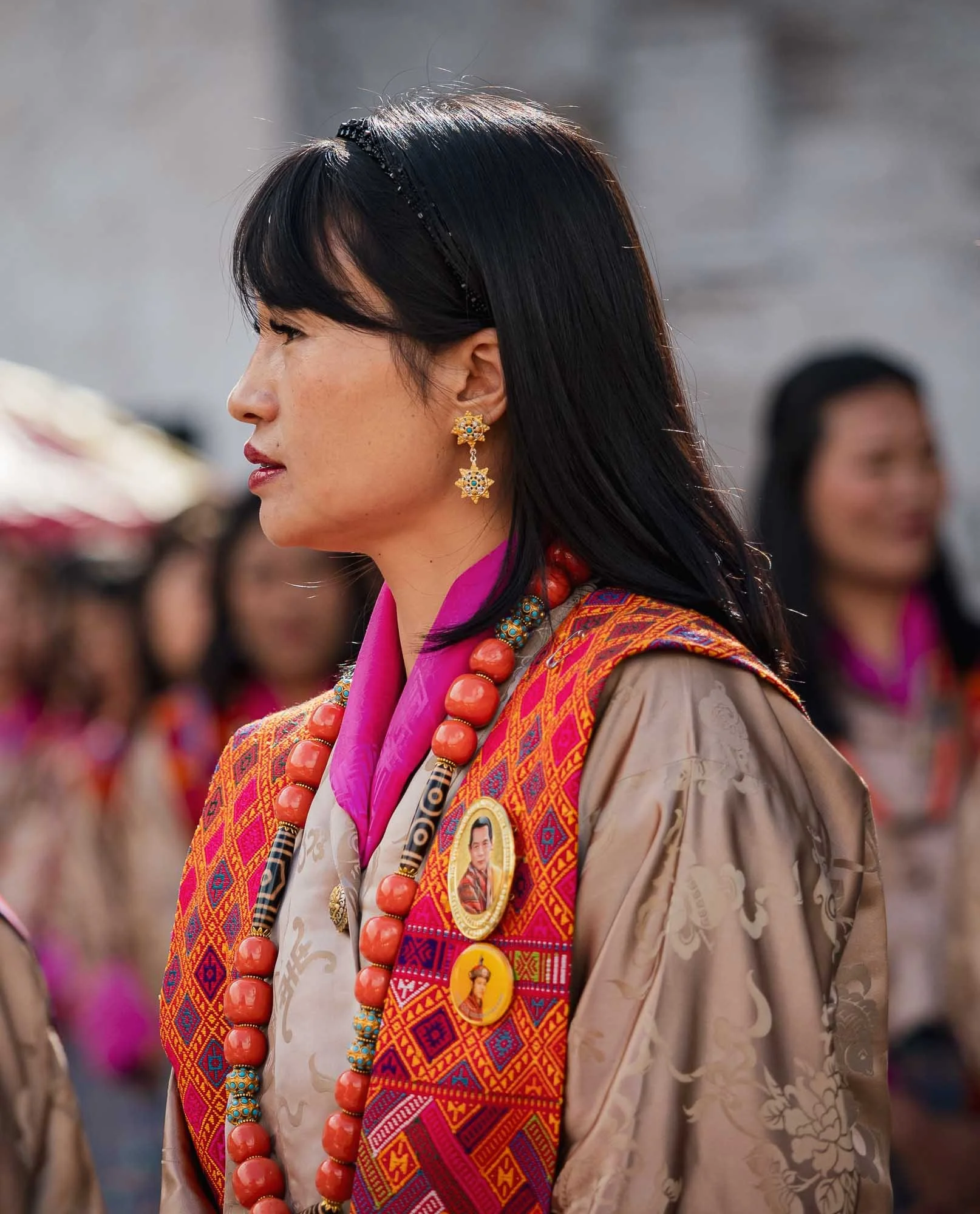
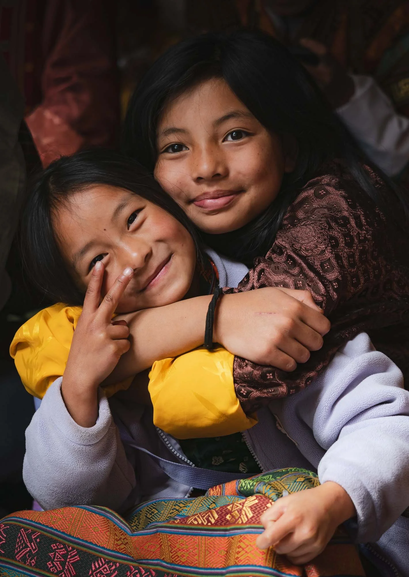
It’s a colorful affair of different dances and performances accompanied by varying music, with spectators in traditional local dresses all around. It’s often a family day out with three or more generations sitting together, bringing lunch and watching the activities.
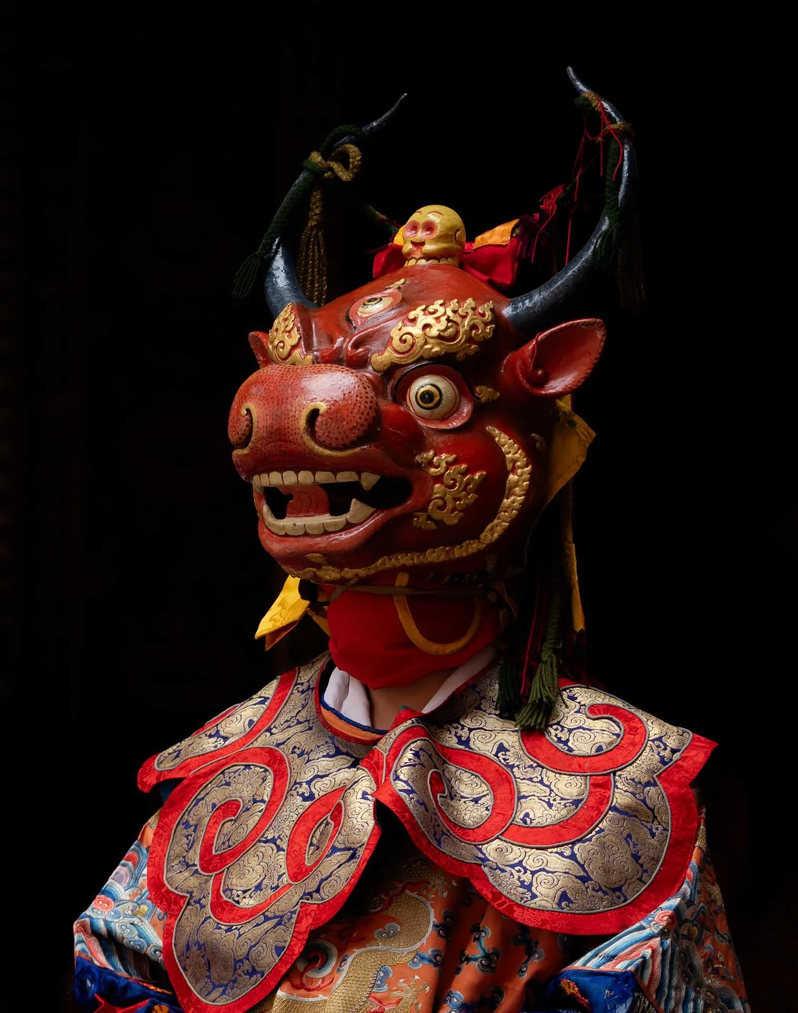
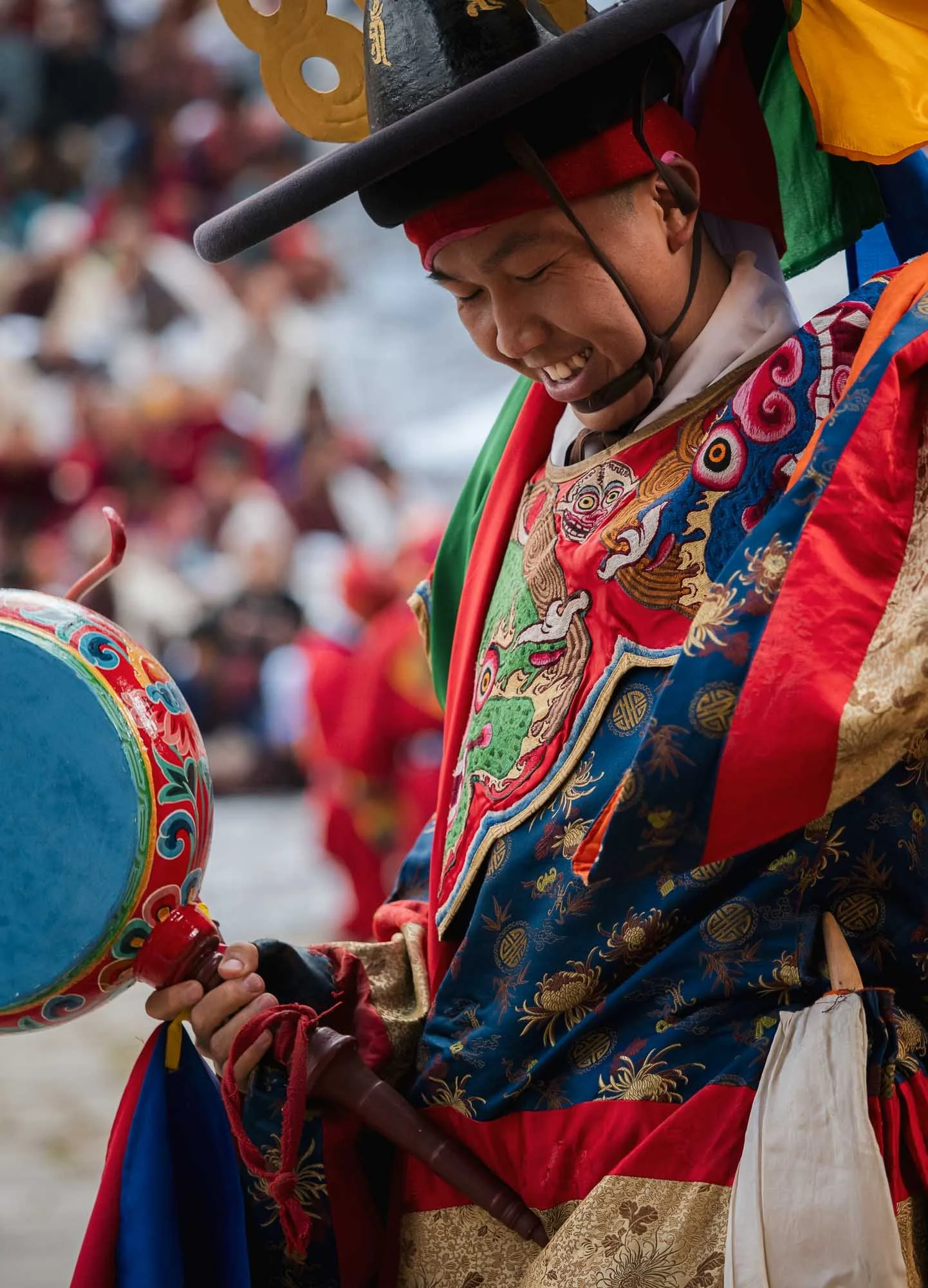
Equally colorful but sometimes a little more scary are the wooden masks of the performers, such as this one. If I recall it is part of the first dance related to overcoming the forces of death and blessing the ground for subsequent dancers.
The masks and dresses change as the day progresses, so does the music, rhythm, and choreography.
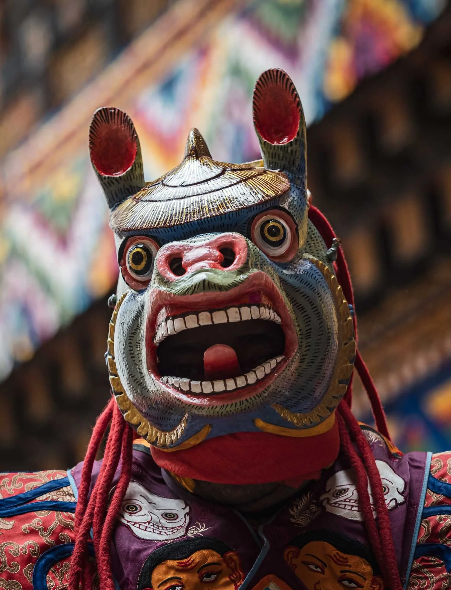
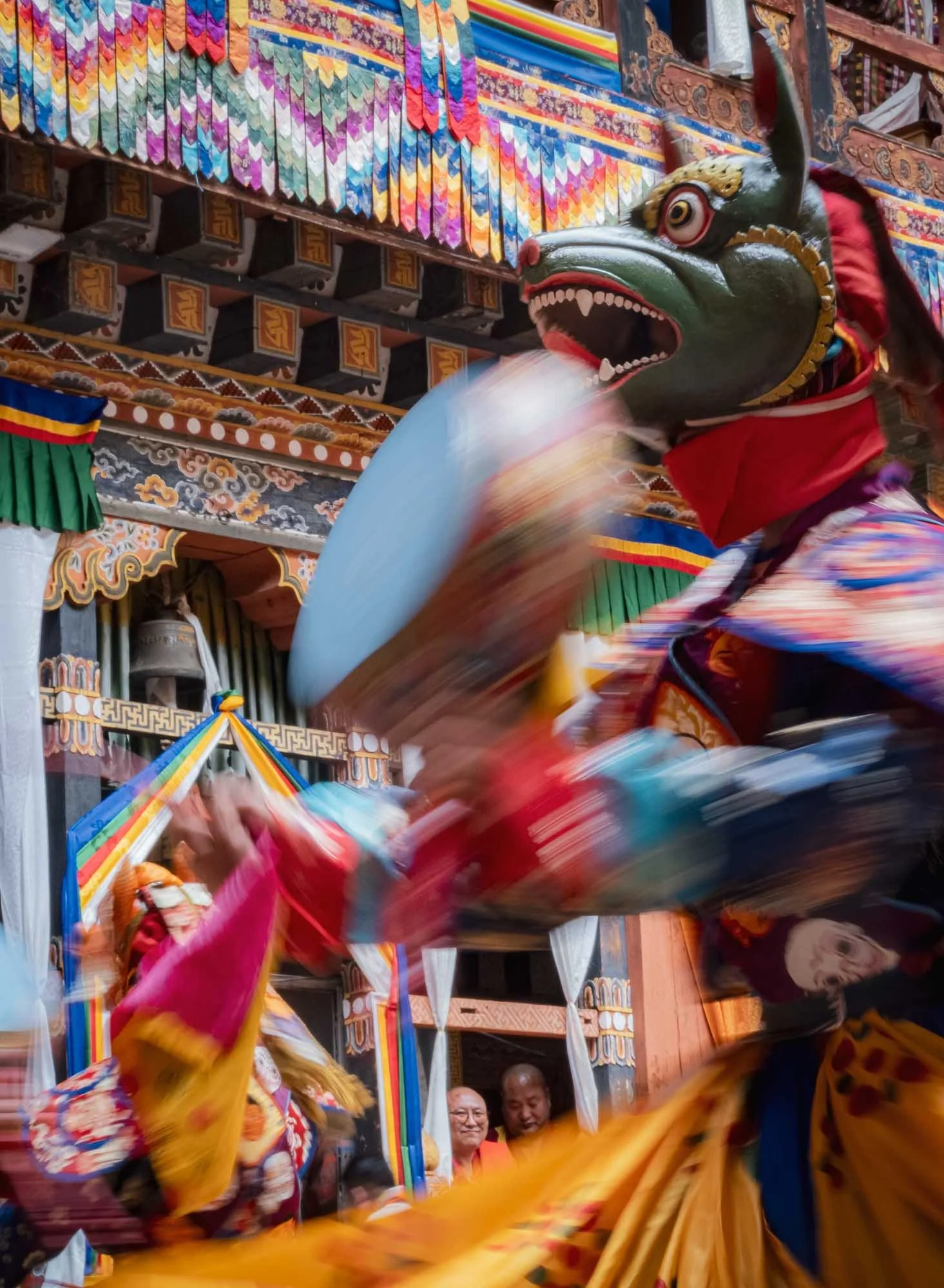
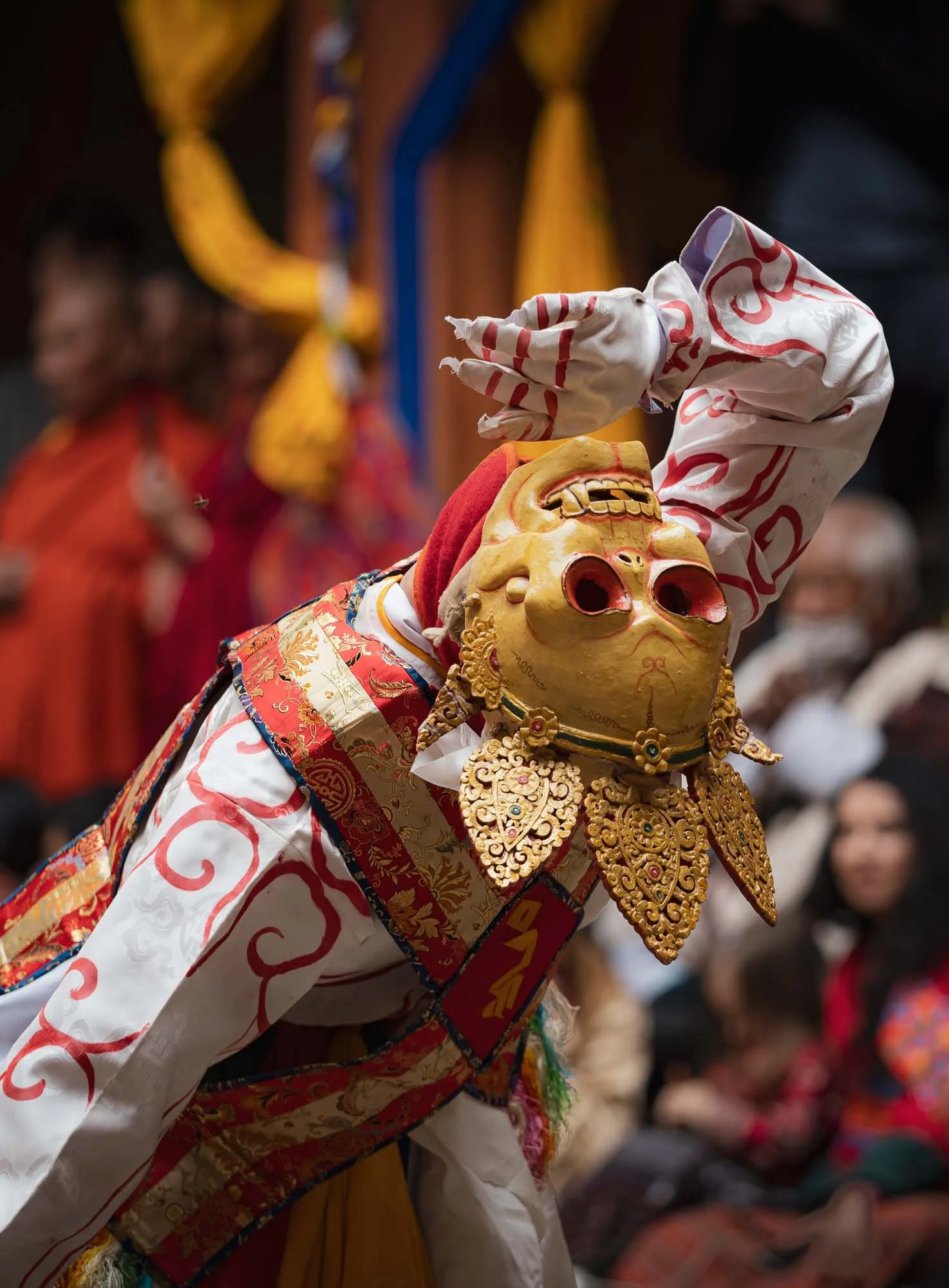
Every performance symbolizes a certain practice or teaching: the Black Hat Dance with its elaborate costume serves to celebrate the victory of good over evil and the purification of space, for example.
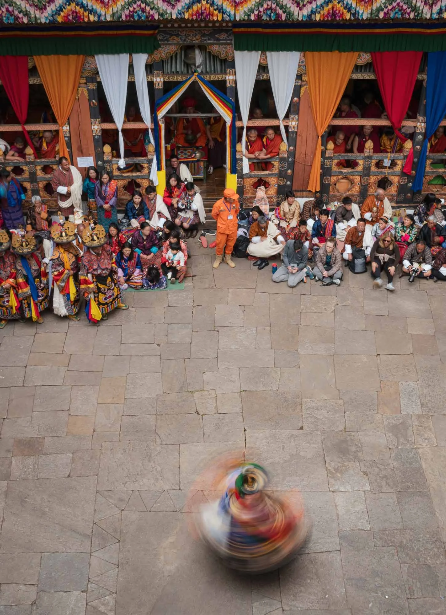
While quite a crowded affair at times, the very limited space makes the festival feel intimate and connects the spectators to the performers closely.
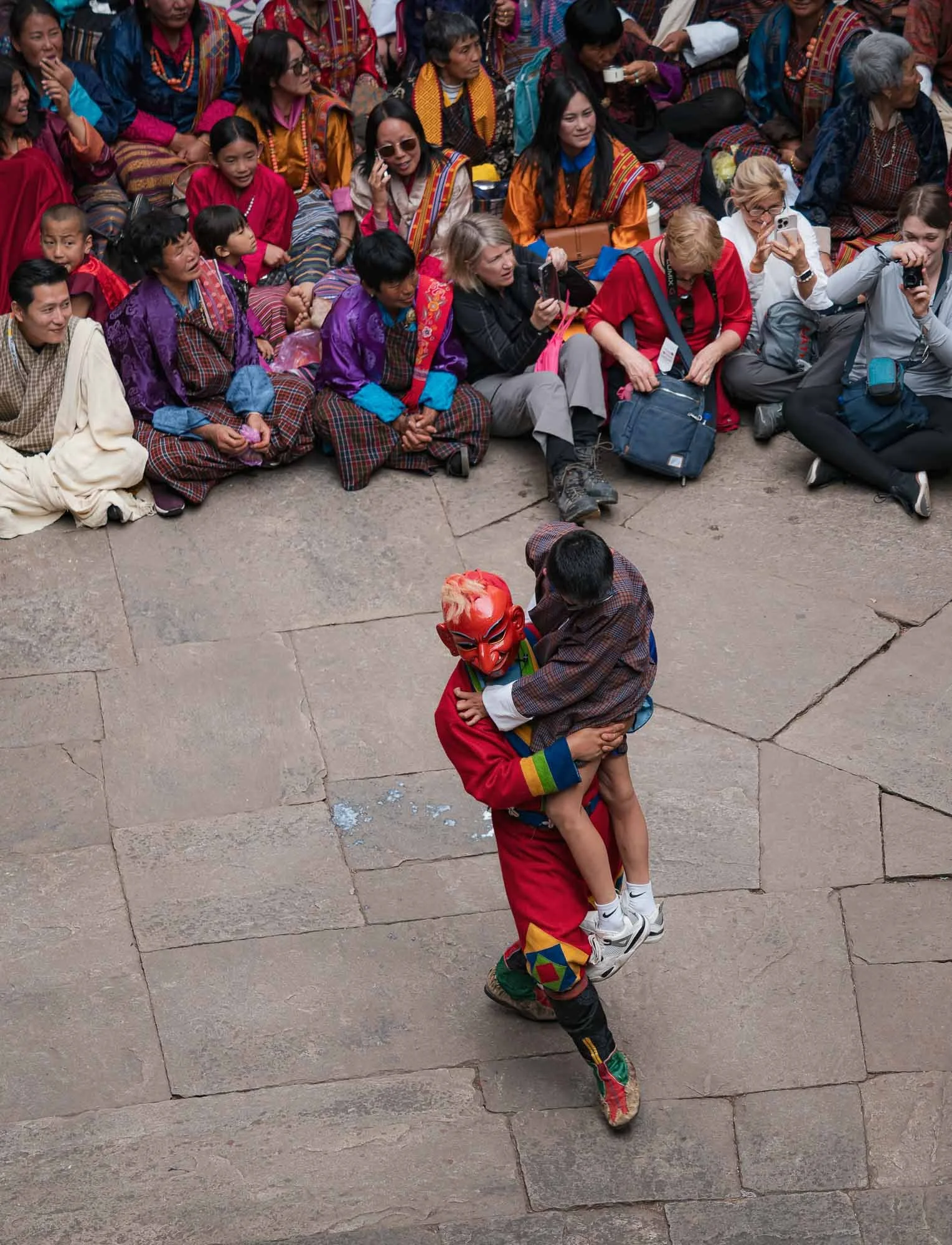
Sometimes a little too closely - audience participation is not always optional…
…but mostly a pleasant and humorous affair. I can’t be sure what this Atsara said though - given the expression of the women on the right, it may have been quite audacious. Not unlikely, from what I observed.
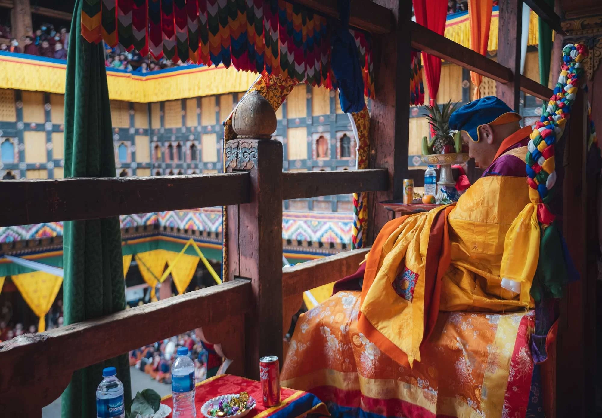
A dedicated section (into which I had the chance to sneak in for a bit) houses seats for the most important lamas and senior monks of highest monastic authority. If I recall, this one was the most respected person, immediately appealing to me for his choice of drink (and offering me some sweets).
I spent almost the full day here - the photographic opportunities are endless, and the cultural aspects quite interesting - part of the commentary is done in English and explains the purpose and background of the performances. Below are some clips of the day.
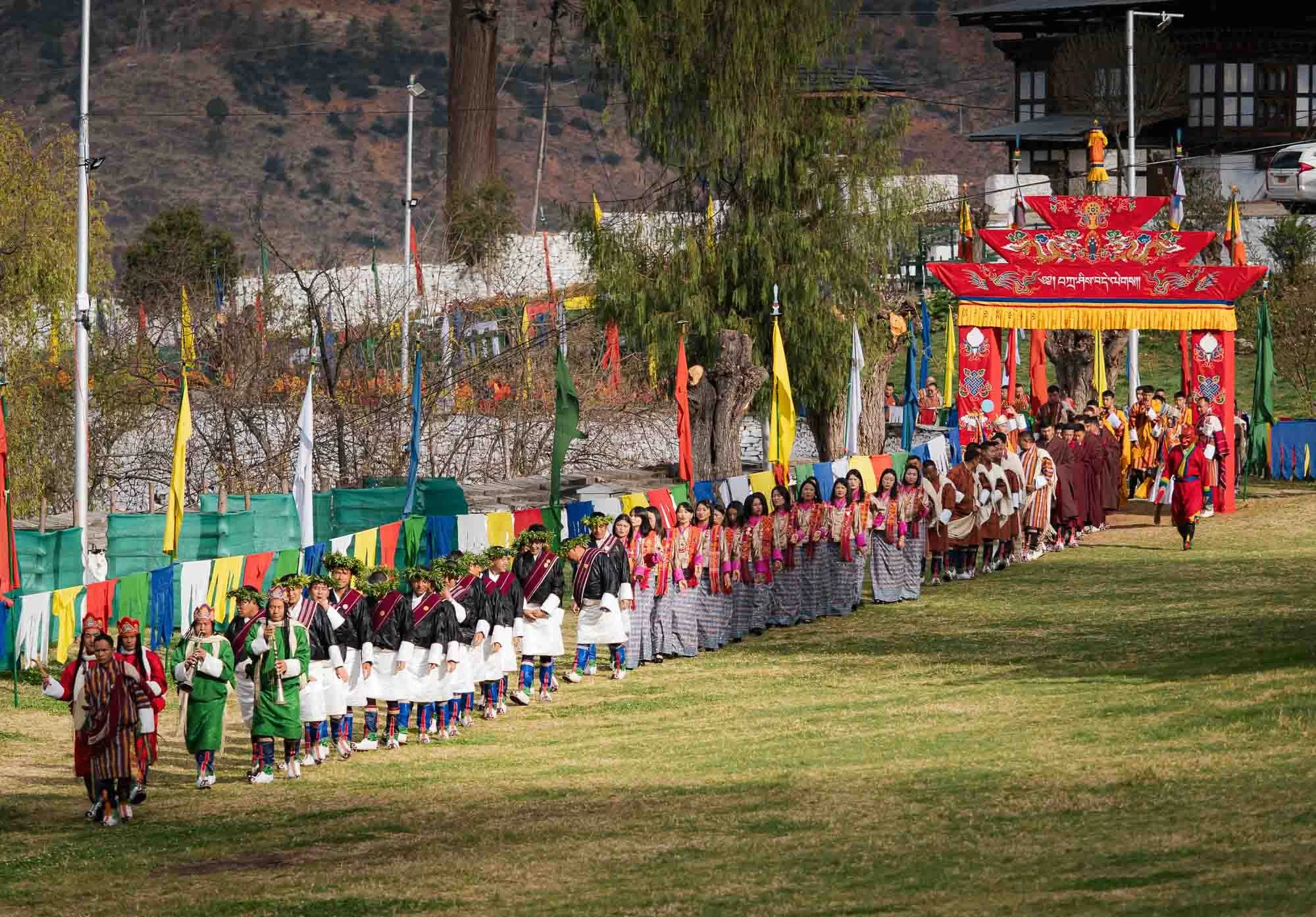
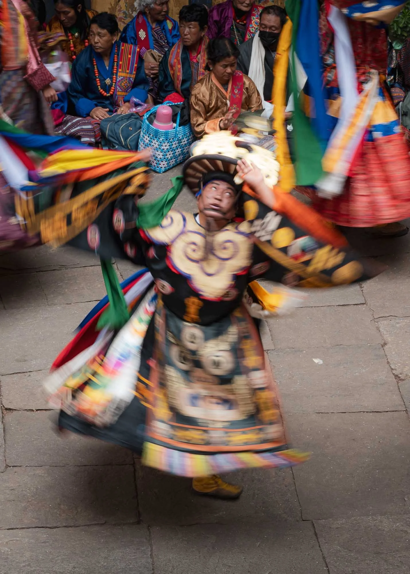
The second and subsequent days take place in the outer courtyard in front of the Dzong, with a procession of the participants arriving in the morning.
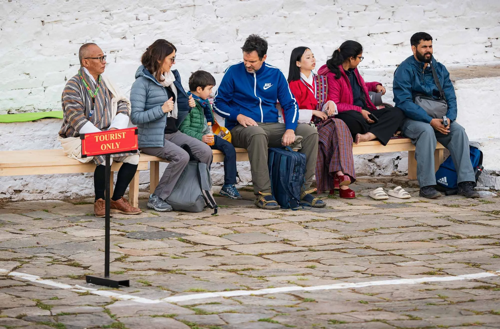
I couldn’t help but chuckle at this well-intended but somewhat awkward tourist section, which I of course didn’t let myself get confined to. While there were a few international tourists around, the vast majority of the attendees were locals.
The Dungchen being played during the entry of the performers - it was nice to hear them played skillfully after observing the practice at the nunnery.
The location out in the open gives the festival a much more casual atmosphere. I preferred the first day but this was the perfect slightly more relaxed follow up.
This is also where on the final day the festival culminates in the revealing of the thongdrel, a sacred tapestry of Guru Rinpoche - I didn’t get to see this part anymore though, as this was the end of my time in Bhutan. Nepal was next.
There is clearly a large amount of focus on preserving its roots and national unity, and Bhutan’s development model has long been famous for its idea of Gross National Happiness, prioritizing well-being, culture and environmental protection over pure economic output. Nevertheless, things may (have to?) undergo some change. While GNH remains an ideological basis, more conventional metrics have played an increasingly significant role in recent times.
For example, Gelephu Mindfulness City was announced in 2023 as a special economic zone three times the size of Singapore, designed to attract investment as a multi-sector economic hub, and also housing a new airport given its location in the lowlands near the Indian border.
Financing is meant to be driven by the country’s Bitcoin reserves. Bhutan held one of the largest national Bitcoin funds, at its peak estimated at $1.5Bn, mostly created through mining from its hydropower surplus (unlike US and Chinese holdings which were mostly seized). Its exposure has since been heavily reduced but remains significant.
We shall see if the country can maintain its sustainable happiness approach while at the same time creating attractive opportunities for its next generation - emigration, particularly to Australia, seems to be surging in recent years.
Subscribe to my newsletter to get notified and don’t miss out on more Wonders of the Globe.
Other Recent Posts:


Sights of Southern Vietnam
I managed to explore quite a bit of Vietnam over almost 4 weeks in mid 2024 - here is the first blog, starting with its economic centre Hi Chi Minh city and the beautiful Mekong delta.

In late spring of 2024 I explored another Asian country, spending four weeks in Vietnam. What was initially planned to be a bit more of a slow travel trip as I had plenty of work to do, turned out to be as intense as always, and I ended up exploring Ho Chi Minh City, the Meklong Delta, Hue and Hoi An, Hanoi and some of its surroundings, and the northern mountainous regions as well as Cat Ba bay. Although I didn’t spend a lot of time in each part, all of that definitely won’t fit into a single blog post, so this will be the first of three, starting with the south: Vietnam’s economic capital, and the Meklong river delta region.
“Saigon”
Ho Chi Minh’s colloquial and historic name is Vietnam’s largest city, with over 10 million inhabitants.


Panoramic photos of the Bến Thành Market in the city centre, with its iconic clock tower and a rather rare French Indochinese design. It is one of the oldest surviving buildings in the city, having operated for more than 100 years. Great views from the nearby Silverland Ben Thanh hotel with its amazing rooftop restaurant!


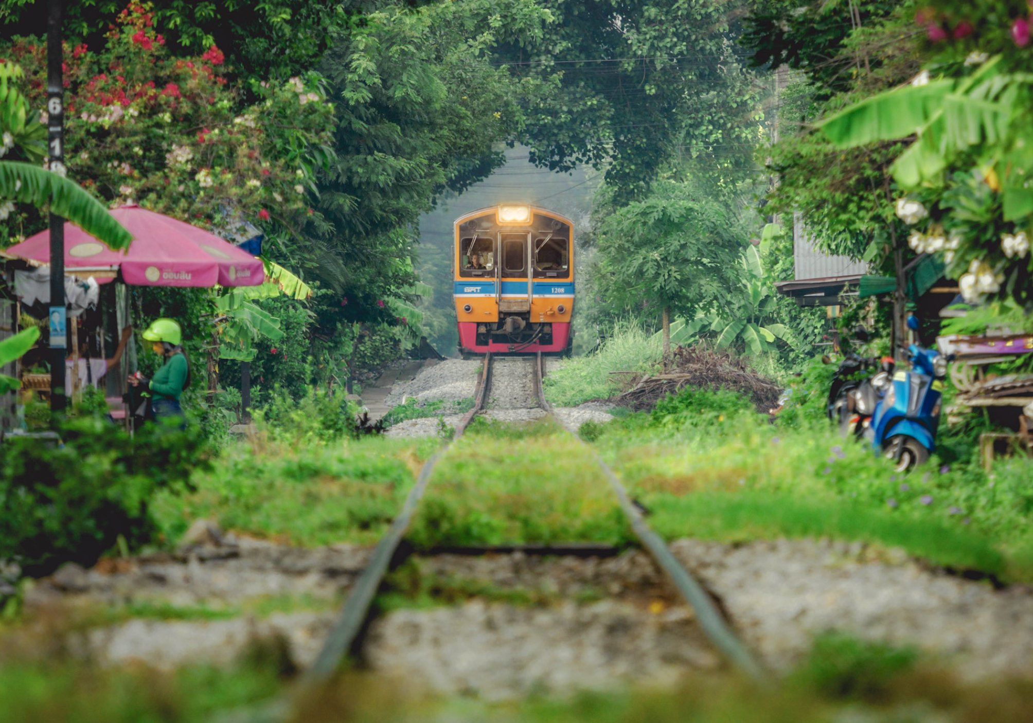
Train Vibes
Although it’s Hanoi that is famous for its train street - more on that in another blog - Ho Chi Minh has its own cute corners where the tracks runs through the city quarters. I’m a fan of trains, and can’t deny that the idea of the multi-day train journey from HCMC to Hanoi or back appeals to me…
Of course, the primary means of transport here are scooters though. There are very few place in the world with a higher scooter / person ratio than HCMC, and it shows in the organized chaos on the roads, and is also evident by the noise levels. Unfortunately, most south-east Asian cities have not undergone the transition of all two-wheeled transport to electric models, which brings incredible quality of life improvements - see my trip Beijing.


Walking through the city is enjoyable - people are friendly, and there are interesting compositions for street photography all around, for example in the famous Japan town - a quiet place during the day, but it comes to life at night, so I’ve been told…The group above was enjoying their weekend around the markets at An Quang Buddhist Temple and immediately invited me for a drink and some karaoke (both not my favorite pastimes, so I just said hi for a little).


The Church of Tan Dinh
Just over 10% of the population are Christian (almost half follow traditional folk religions or are not religious), but there a number of churches to be found in HCMC. Aside from this pink gothic marvel, the Notre Dame Cathedral is another, but was closed and covered for renovation during my visit. Strangely, this one is very strict about access: only catholics allowed inside - but even that did not help me as a tourist! Exterior photos only.
Phap Hoa Pagoda
Another beautiful religious building is this buddhist temple, uniquely combining Vietnamese and Chinese architectural styles, situated on the channel running through the area north of the city centre - quite a nice place to walk around and explore. Buddhism makes up the largest of the major religions in the country.


HCMC is a growing busy place, and the infrastructure is suffering accordingly - yet I found it quite pleasant to explore (aside from the usual humidity), with lot of large trees, many smaller streets, and less imposing highways than for example Jakarta and Bangkok. Much of the city centre follows an open square or radial-concentric grid system, while the surrounding areas are somewhat less strictly organized and consist mainly of denser low and mid-rise buildings. A defining feature are city’s famous roundabouts, where the rules are difficult to understand for any foreigner.


The city is dotted with greenery, and several of its roads are tree-lined, given them an avenue-like feeling, probably in part a heritage of the French colonial times. Nowadays, they act as source of shade (it makes a difference of several degrees C in urban centers), aside from their aesthetic appeal.


Landmark 81
To the east of the city by the Sai Gon river, a new modern district has developed over the last decade, including South East Asia’s second tallest building, only surpassed by KL’s newly completed Merdeka 118: Landmark 81. I can’t say I find it architecturally appealing - its Neo Futurism reminds me a of a boxy less elegant version of Burj Khalifa.


Architectural Oddities.
Not far across the river is this rather odd building and associated establishment - its claim to fame is derived by the borrowed name and logo only though.

Although I spent a few more days here, visiting more of the city’s landmarks such as the late 19th century Saigon Central Post Office seen here, the Opera House, the Skydeck at the (architecturally more pleasing than Landmark 81) Bitexco Financial Tower, and could probably fill a whole blog entry with the corresponding photos, southern Vietnam has more to offer than Ho Chi Minh City…
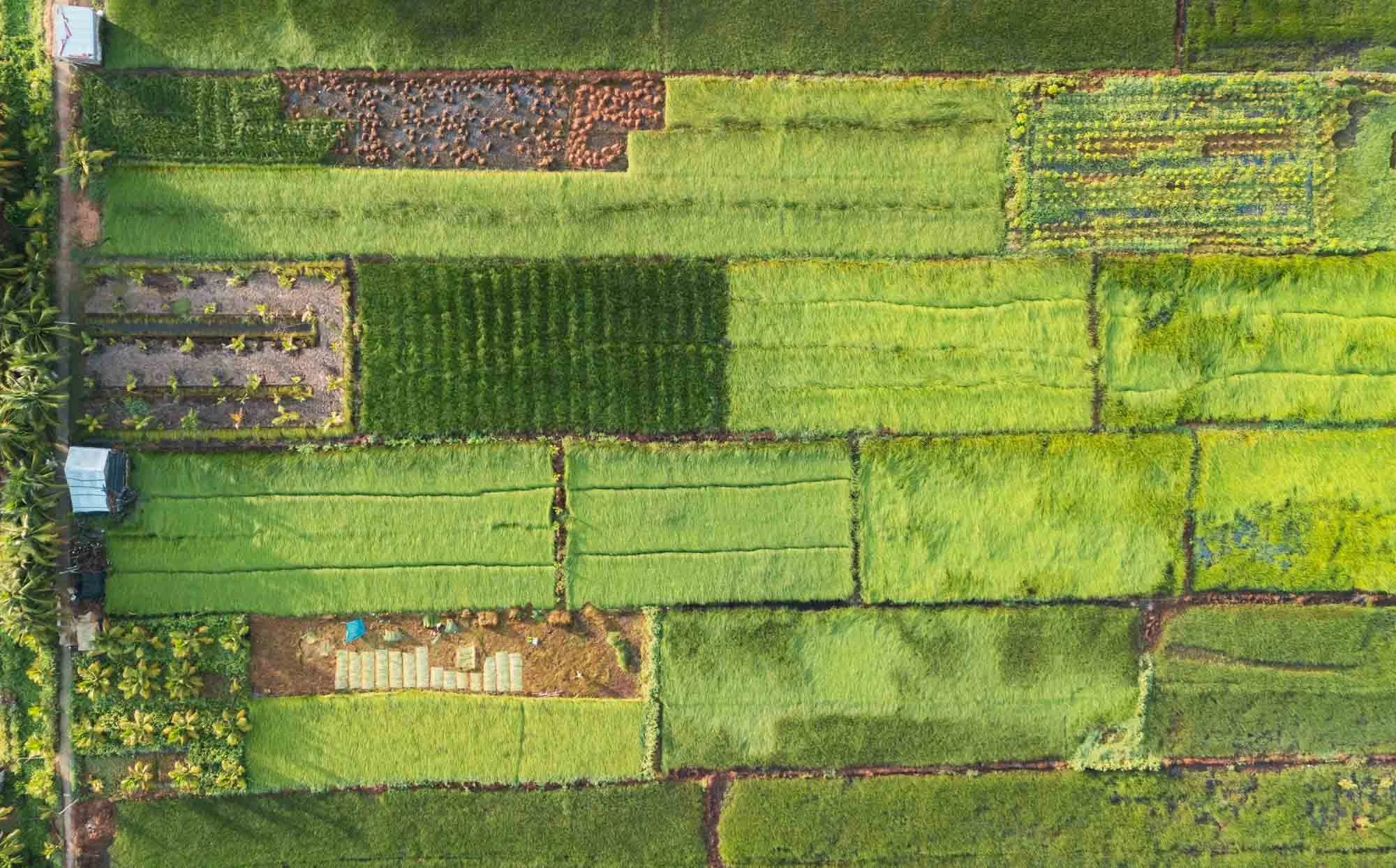
To the Mekong Delta
…and so I embarked on a three day roadtrip you’ll see documented below.

The Hang Pagoda of
the Khmer People
The Khmer ethnic group arrived to the area more than 4000 years ago, and is primarily present in what is today Cambodia, but over 1 million live in the Mekong delta area of Vietnam as well.
More than a 1000 years ago the Khmer empire dominated the area for over 500 years, and was responsible for many of the famous temples of Angkor. Today they follow a variant of Buddhism, and many of their temples can be found in the Tra Vinh area, this one being around 300 years old.


Aside from its beautiful golden ornamentation, the Hang temple is also famous for its wood sculpture and clay workshop, where skillful monks build out the intricate statues and decorations for the temple by hand.


Interior Vibes
The inside is normally not accessible, but we got lucky and a monk opened the doors for us - and even turned on the somewhat incongruous LED light around the central Buddha altar for added effect (complete with strobes and changing colours).
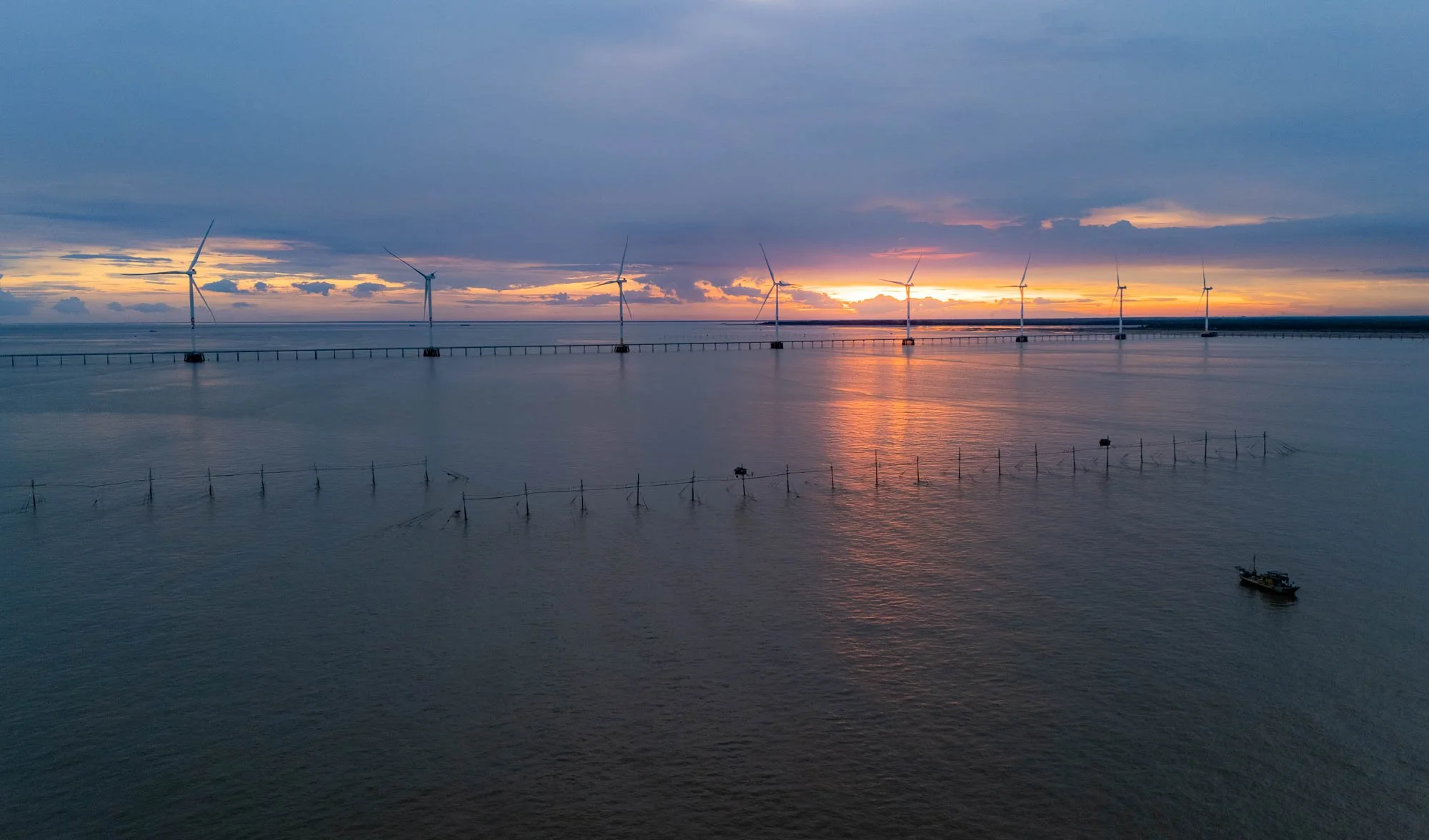
A Day At Sea
After a quick stop at the temple and another stop to get some of Vietnam’s famous coffee (which is essentially stretched with condensed milk, making it so sweet even I drink it), we arrived to our first primary destination, the shores of the Eastern Vietnamese Sea, where the Bassac (or Hau) river, a branch of the Mekong, meets the ocean. The goal? To spend a day at sea with a group of local fishermen, witnessing one of the primary ways of live shaping their culture, alongside the cultivation of rice.


Unlike many tours on the rivers here (and many other photography-specific arrangements, more on that below), this day was not set up to please tourists, but we were simply following their routine of going out to sea and collect the catch of the day, getting a real feel for what their job is like. The crew was really accommodating and gave us the chance to document their techniques, despite the hardship of the work.


After cruising for about an hour away from the shore on the boat, we reached their destination, a set of wooden pillars in the sea, connected by thin planks, with an occasional tiny hut in between. These are not traditional floating houses you might find on the river banks or near the shore: they are meant to be temporary accommodations, where the fishermen take turns to live for a few days or even weeks, tending to the nets that are attached to the poles with ropes in a kind of semi-permanent fish trap.

Waiting Game
We did arrive a little earlier than they normally do, giving us the chance to take some daylight and sunset photos while the fishermen rested. They typically haul in their catch a few hours after sunset, to take advantage of the natural behavior of fish and maximize the effectiveness of the nets - plus, it means the fish are as fresh as possible for the early morning market.
The Fishing Watchtowers
In this area, the traditional stilted huts stand in contrast to the huge concrete wind towers that part of the renewable energy farms built here over the last decades, taking advantage of the strong winds in this corner of the Vietnamese coastlines. As the sun set, the fisherman living in the hut came out, walking along the thin planks between the poles and preparing their nets to be lifted.


I sent my drone up during a few minutes of beautiful light - luckily the sea and winds were calm. Flying from a boat over the ocean is not always easy, read more about it on my recent drone photography book (German only, sorry!).
At this point, it was slowly time to let the crew focus on their job, and our ship moved closer, while the fishermen currently living in the little huts started to prepare the nets, dragging them out of the water.

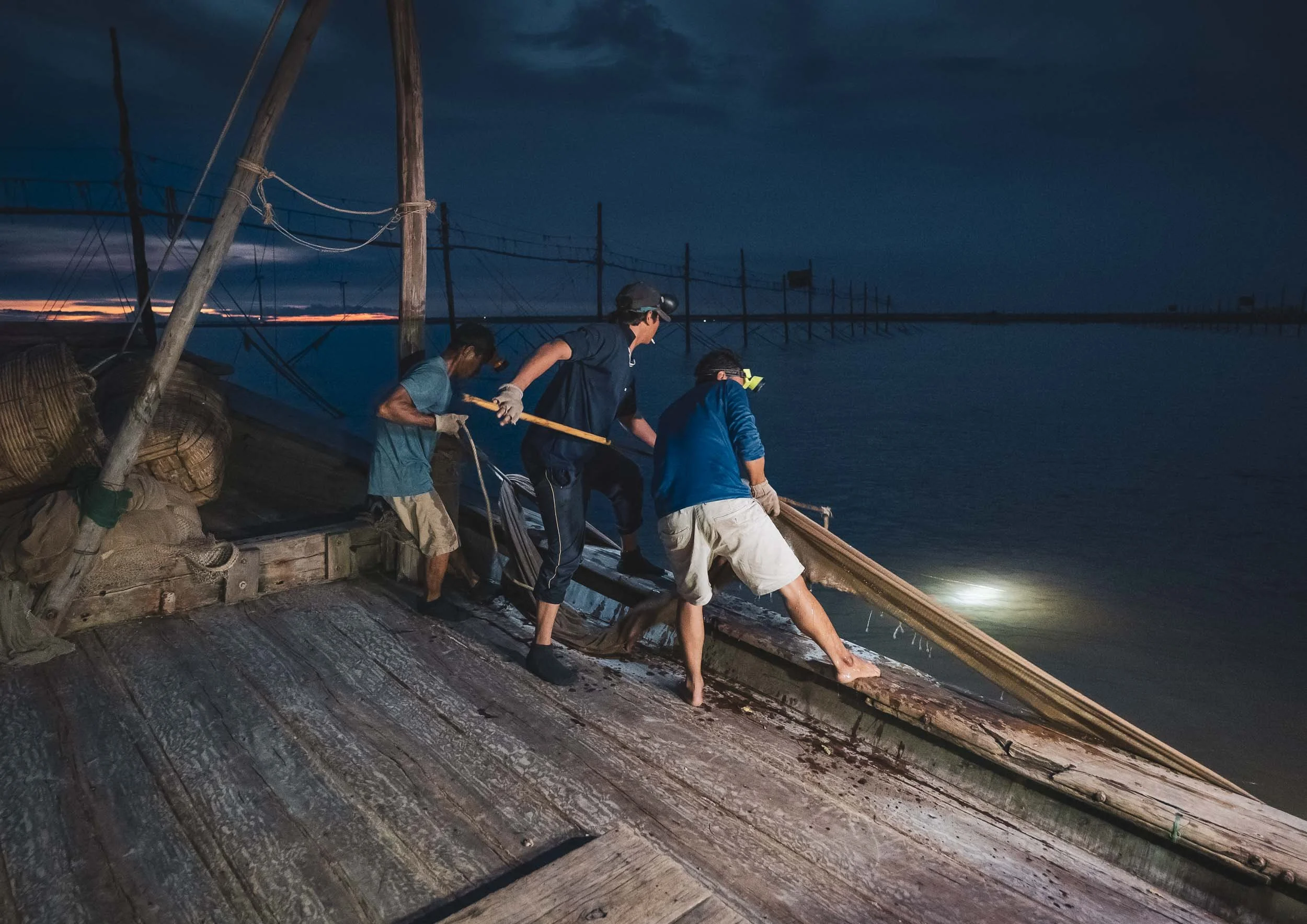
Pulling the Nets in
The crew then took the nets by the edges attached to the buoys and pulled them into the boat - the harder the task, the better, because that means they’re full of fish.

Nightly Work
For the fishermen on the stilts, conditions to stay out here are tough. No running water or permanent electricity, rough weather conditions, isolation, and of course the actual work, make this a difficult job.
Once the net was pulled into the boat, wooden baskets were prepared to empty the contents into - hopefully without letting too much of the catch escape, although one or the other creature managed to find a way.


Emptying the nets into the baskets required the full strength of three crew members - more than a dozen times they repeated this process.


Afterwards the nets are lifted back to the fisherman staying on the wooden stilts, spread out, and prepared for the next catch. A few more supplies were exchanged with the poor soul left behind to manage and monitor the nets, while the crew makes its way back to shore with their catch (reasonably successful, so I was told).


After almost 10h at sea we were back on land, headed to a small hotel for a few hours of sleep before sunrise, exploring more of the interesting ways of life in the Mekong Delta.
Sedge Grass Patterns
My next destination was on land tough. The Khmer people are also known for planting sedge grass in this area of the delta, which is used to make baskets or mattresses and similar handicraft items. The wetlands of the delta are a fertile ground for this plant to grow up to 2m in length. After a short exploration, we found a beautiful field with some local workers - as the grass is laid out to dry, the harvest season brings with it beautiful patterns when viewed from above.

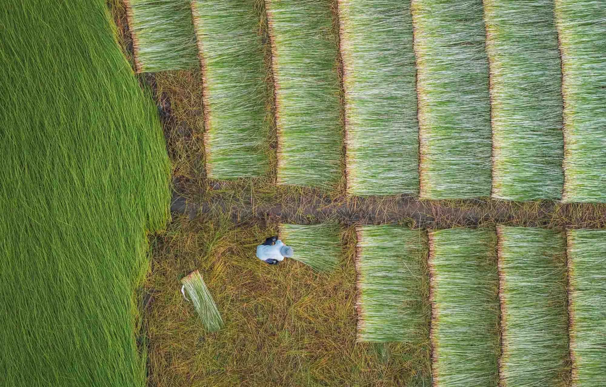

I had the chance to get a little closer as well and observe the locals in their work - they set up small sheet tents or use the traditional hat to protect themselves from the sun, and run the grass through a little roller machine as a first pass at removing the water, before spreading it on the ground to dry.


Staying Safe
Gloves are essential to avoid scratches as they grab the grass and pull it through the machine - I experienced that first hand when I tried the process.
Pottery Patterns
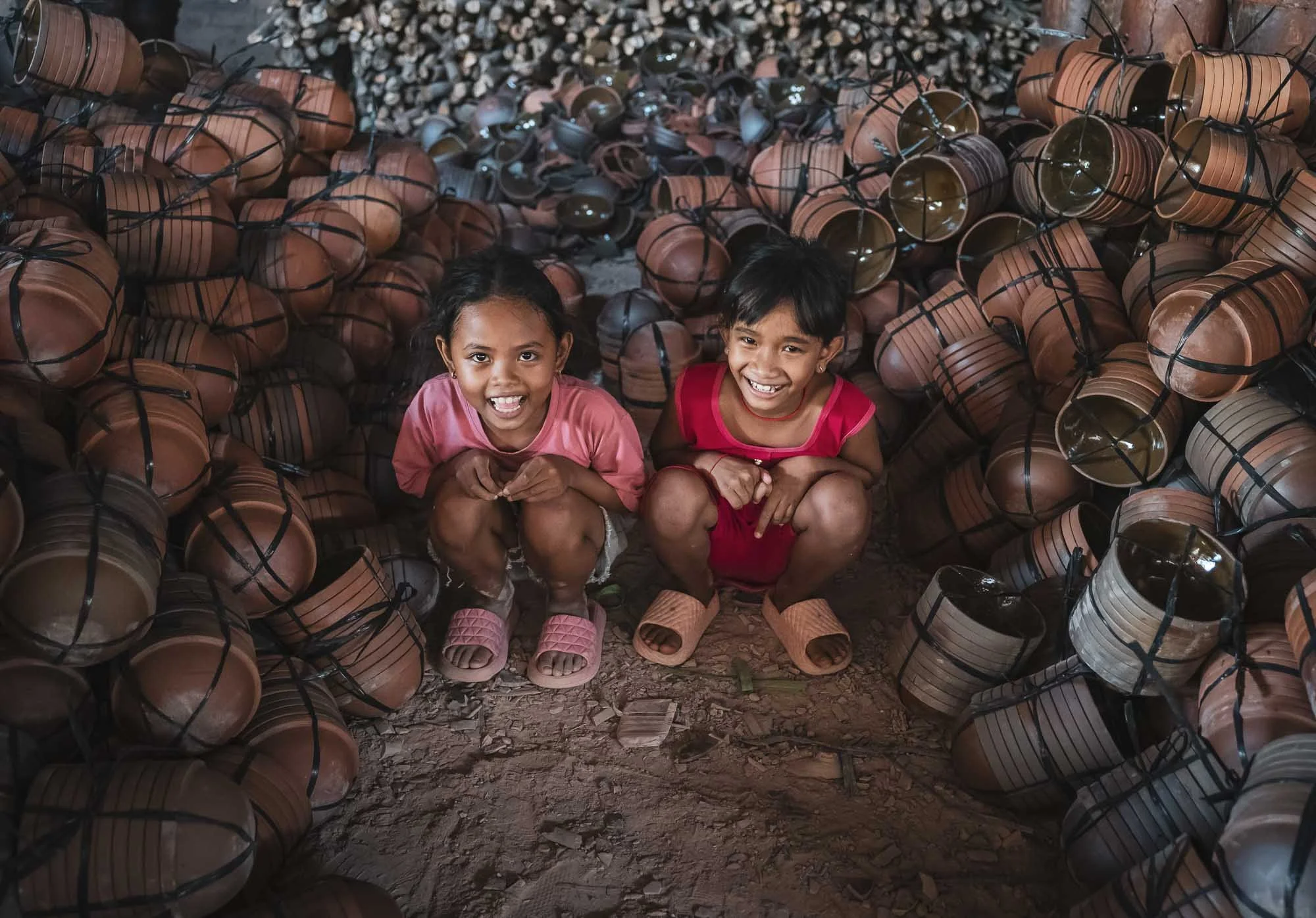
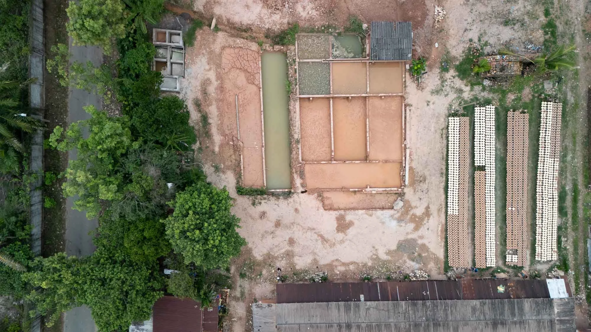
From here, I visited a local pottery factory - another place for interesting photographic opportunities. The process starts with the production of the clay from the Mekong river, filtered and kneaded to make it moldable.


The clay is then moulded by hand using a potter’s wheel, and turned into vases, pots, or decorative items by these skilled ladies getting paid per piece. Sometimes items for mass production are also shaped via mold casting, but in this factory it was all made by hand.


From Above
The resulting pieces are first air-dried on the large factory floor for several days, getting their final polish with sandpaper.
When I told the lady I’d like to fly a drone over her head for this photo, she was clearly very amused but happily obliged.


After that, the products are hardened in these massive brick kilns, often for several days, until they are fully dried out.


The factories utilize mounds of rice husks to fire the oven - a byproduct of the rice milling that happens in the region and perfect to provide slow, consistent heating, that is ideal for drying the clay. Huge amounts are stored here - my guide for scale.


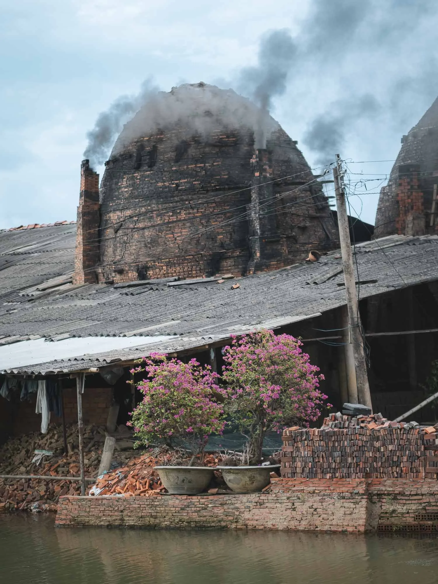
The Red Brick Kingdom
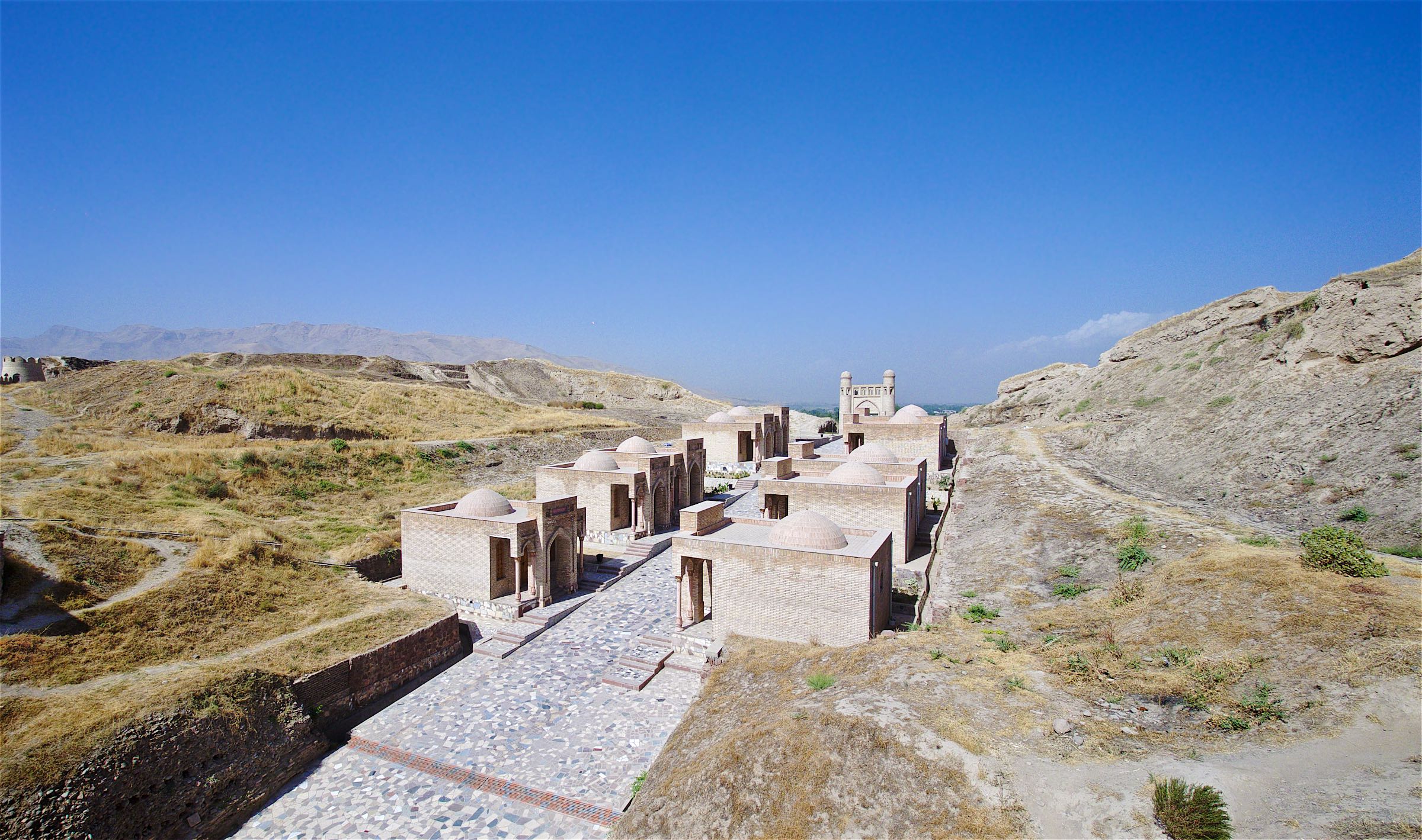
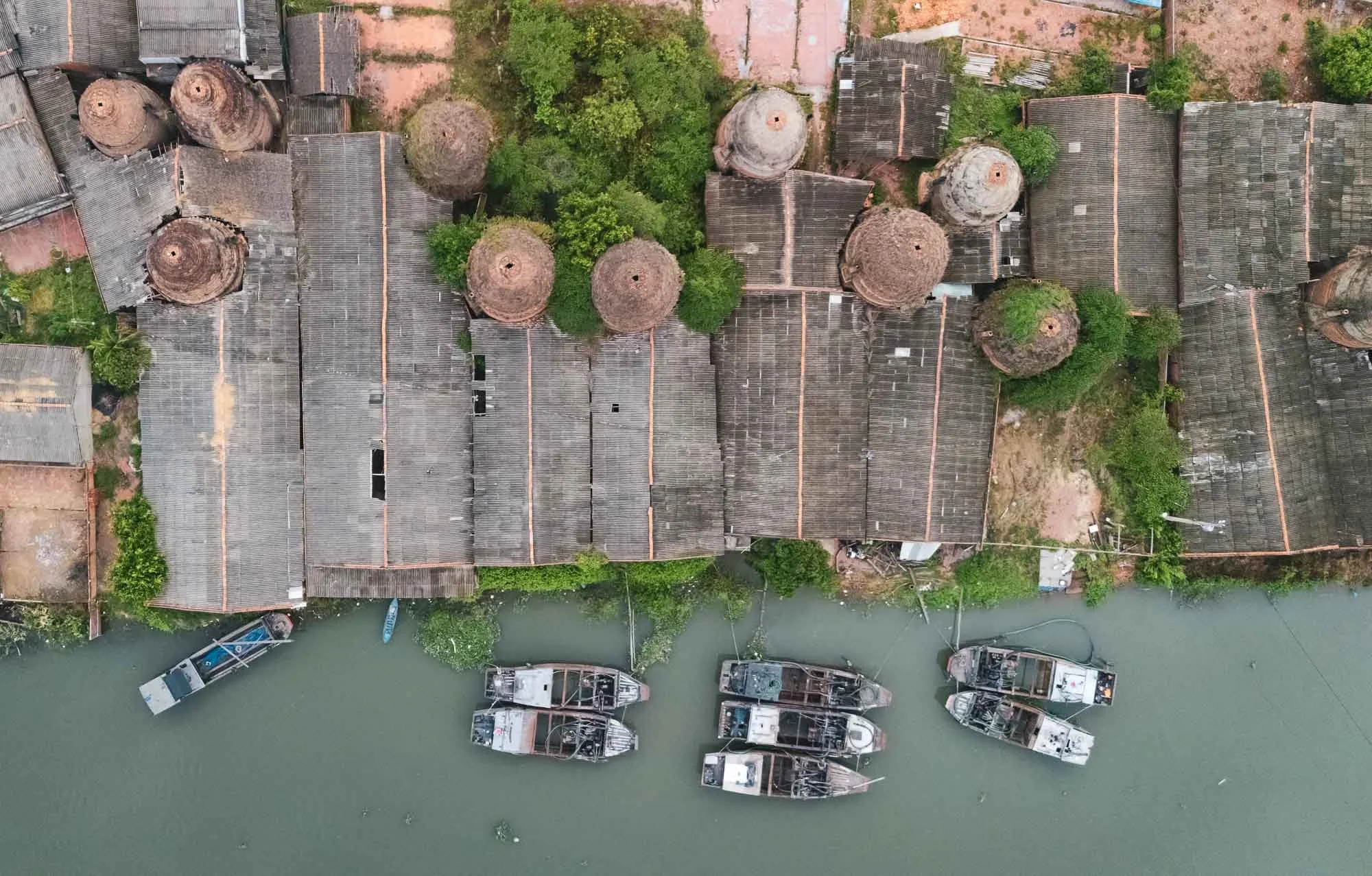
Following the path of the local clay industry, we made our way to Mang Thit village in Vinh Long, long known for its brick factories stretching along the channels for kilometers, seen here in this panoramic view as heavy clouds rolled in during the late afternoon.

Quiet Times
The area has been thriving for over a hundred years, supported by the availability of cheap fuel for the kilns, and plenty of clay in the nearby streams, which then also serve as transport route for the finished products - primarily bricks. Nowadays, only a few of the factories are still active, and many have been standing still for years, or just attract tourists.
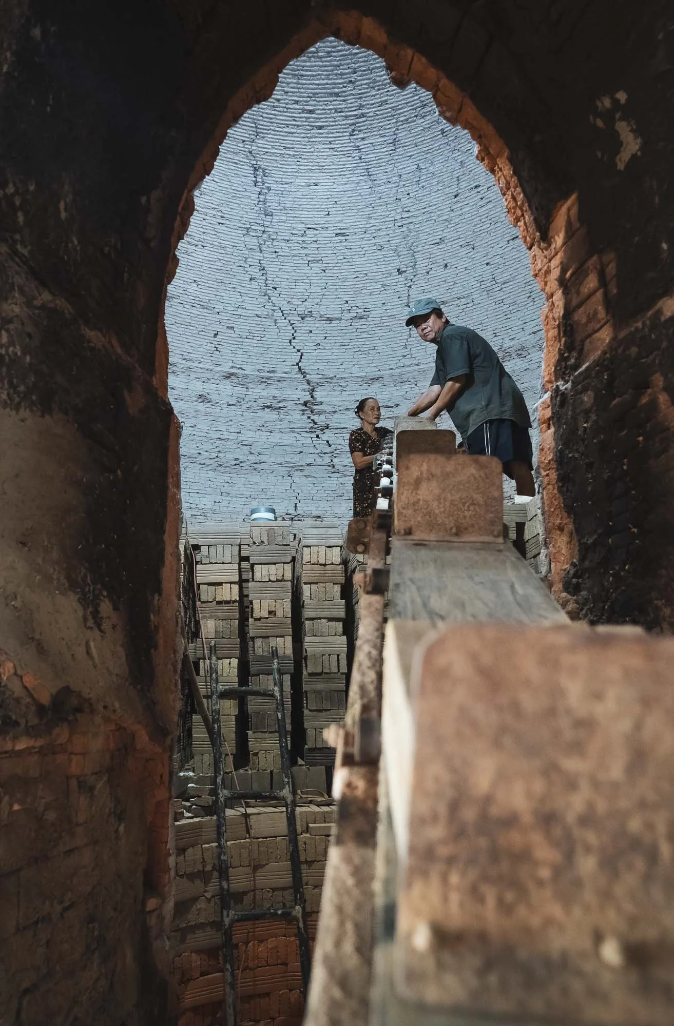
It’s not difficult to find the working factories though - dark smoke emitting from the small chimneys is the giveaway, and the workers are very welcoming and happy for you to come in for a chat and take photos - an opportunity I did not miss.

I got to observe their process, separating the clay, shaping the bricks using simple tools, and using conveyers, carts, or even small bikes to move them through the factory before they’re placed in the kilns for several weeks.


One of the active factories from above, and another one with some of the boats used to transport clay and bricks along the channel.


It’s of course sad to see that these traditional methods are slowly replaced by industrial production - the area is definitely a cultural landmark for the region with its unique architectural charm, not to forget the kittens I saw.

Nightly Storms
After we left, the stormy clouds decided to slowly empty their contents, but not before a few beautiful lighting strikes, captured here from the parking lot of our dinner spot.

Water Lilies
The rains didn’t last long and by the next morning the sunrise greeted us with beautiful light to photograph another local tradition: the collection of water lilies, typically happening during the floating season from September to November.
Disclaimer: I am normally not a fan of “arranged” photography, but as the time of my visit didn’t coincide with the right period to see this practice, and my guide happened to know the women who normally harvest the lilies, it was an easy decision to go for it anyway. As a result, these photos are the result of purposeful posing and arrangement of the flowers, rather than the natural harvesting practice.


The lilies are collected for their stems, which are used in various dishes, while the flowers are turned into Buddhist offerings. Aside from their use for humans, the lilies actually play an important role in the ecosystem, as they absorb excess nutrients and provide habitat for fish and insects.

Into the Water
While the drone views of these neat flower circles have been taken before, I tried to also get a few different perspectives and got into the water for some portraits - a welcome refresher as temperatures rose, but on the other hand my feet needed a real deep clean after wading through the muddy ground.
Although this scene has been excessively romanticized, mostly during organized photo tours and the resulting social media coverage, it does hold some understandable appeal: the flowers are beautiful and the ladies with their conical hats and small wooden boats make for nice subjects.


A Final Pottery Stop
We made our way back for the 6h drive to Ho Chi Minh City, with one last brief stop - another pottery factory, closer to the outskirts of the city.

This one has a rather interesting feature, which are dedicated shallow ponds to remove the clay from the soil in the ground and process it, seen here from above, with a long row of bowls laid out next to them to dry in the sun.

Breakage happens even to the best of them, as evident below, but that doesn’t take away the smile of the local workers here.


That’s it from the south of Vietnam - subscribe to get notified for the central and northern parts!
Subscribe to my newsletter to get notified and don’t miss out on more Wonders of the Globe.
Other Recent Posts:

Bohol - Happy Hills & Tiny Tarsiers
This less well known island of the Philippines is home to some of its more interesting unusual sights.

As part of my trip through the Philippines (see also my blog about Palawan), I didn’t really have Bohol and its surrounding areas on the list of regions to visit. It was only through a rather spontaneous decision to fly to Cebu and continue from there that this island appeared on my radar. And what a lucky decision it was, given that its landscapes turned out to be one of my favorite photographic sceneries. Although I stayed in Cebu city on the namesake island, I didn’t venture out beyond having some traditional Lechon - I was more interested in exploring the nearby fishing islands I had spotted during the descent from the plane, and visit its neighboring Bohol. Indeed, after an initial day trip, I returned to Bohol a second time for three days to explore more of what it has to offer.
The Chocolate Hills
The primary reason I did so were these hills - and their name only played a small part, I promise. This landscape is geological formation consisting of over 1200 hills spread over an area of more than 50 square kilometers made of limestone covered in grass, which turns brown in the dry season, giving them their cocoa-related appearance (and name).


Cloudy Days
My visit in January didn’t quite coincide with the height of the brown dry season, and the first day was a wet affair, as the rainless period was just about to start around this time of the year. As a result, low clouds hovered around the hills, which were characterized by a mixed brown and green tone.

The hills vary in height, with the tallest reaching about 120 meters - most of them are literally impossible to climb due to the very thick vegetation and wet steep surface (trust me, I tried), but a couple have been set up with stairs for visitors to enjoy the views.


The reason I came back for the second time was to explore more of the rather large island, and the huge area covered with the whimsical hills during better weather conditions. My drone had to fly overtime during these few days.

Aside from flying, walking through the area on foot was also very enjoyable, with local farms dotted in between the mounds.


The hills have been subject of a few local legends, with popular stories suggesting that the hills are the result of a battle between two giants who hurled boulders at each other over the flat landscape, or the solidified tears of a heartbroken giant who wept over the loss of his beloved.

Science tells the story a little differently. The hills were formed through the weathering of marine limestone, originated from coral reefs when the area was submerged under the sea over 2 million years ago.

Tales of the Tarsier
Bohol is also one of the few islands home to the Philippine Tarsier, endemic to the southeastern part of the archipelago. It is a threatened species, and several organizations operate sanctuaries on the island. I visited two of them - the Philippines Tarsier Sanctuary, and the Bohol Tarsier Conservation Area. In the end, they are both tourist destinations and it shows to some extent, but the former is run by the Philippine Tarsier Foundation and felt like a much more pleasant and natural experience, I’d recommend it.
Either is better than seeing and supporting places that cage them or make them cling on a stick in a market.
Tarsiers suffer from loss of habitat and pet trade, as they don’t do well in captivity - their lifespan shortens drastically.


Their eyes are disproportionately sized with the largest eye-to-body weight ratio of all mammals. They are fixed in its skull and cannot move in their sockets, instead the tarsier rotates its head up to 180° to look around.


Tarsiers are shy and nocturnal and spend their days hiding in darker areas under leaves or hollows of tree trunks. Indigenous tribes leave the Philippine tarsiers in the wild because they fear that these animals could bring bad luck - maybe humans should consider this as well and let them chill, like the one on the left here.


There are a few more interesting sights to be found around Bohol, such as its themed public transport buses, and the ship-shaped restaurant. It is also home to a number of beautiful caves - I visited the small Hinagdanan Cave on neighboring Panglao island, where you are even allowed to go for a swim. River cruises and the Bamboo forests are other popular sights.


The Cebu Strait
The Cebu Strait with its channels is home to a number of islands and their fishing villages, which I had initially discovered during the approach to Mactan-Cebu airport. Can’t resist a nice aerial photo of interesting human settlements, so I rented a small boat one early morning with an itinerary based on promising Apple Maps screenshots...

Cuaming Island
This interestingly shaped island includes a small cemetery on the very tip to the right of the image.

Pandanon Island

Pandaon island is home to a small sandbank used for drying the daily catch. Its market house on the small harbour was heavily damaged during Super Typhoon Odette in December 2021.


Nasingin Island
My favorite of the villages here was Nasingin island in the municipality of Getafe, owing to its unique shape and position south of a mangrove forest, planted as part of the National Greening Program since 2013.


Because it essentially doesn’t have any actual land as part of its boundaries - just 0.04 km2 - it is one of the most densely populated towns in the world, given that it is home to over 2000 people.
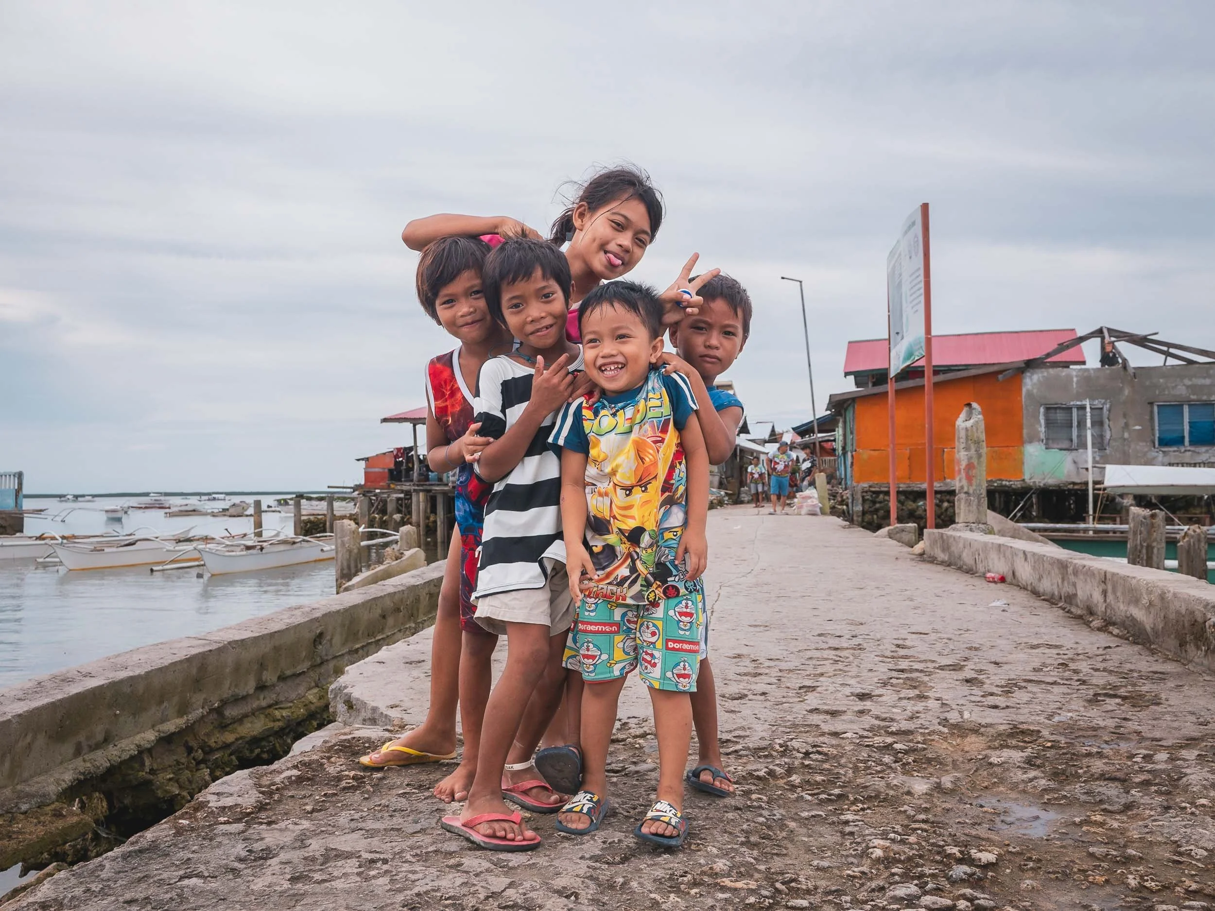

Need Wi-Fi? Buy a voucher at this vending machines - but the kids were happy nonetheless!

And that’s it for this blog, but more of the Philippines to come from Manila and Siargao…
Subscribe to my newsletter to get notified and don’t miss out on more Wonders of the Globe.
Other Recent Posts:

Borneo - A Quest for Indonesia’s Orangutan
Exploring the jungle of Borneo in search for orangutan and spending time with the Dayak tribe.

I’m slowly but surely completing my Indonesia blogs after Java’s Volcano Heaven and the Komodo and Flores island region, and the next entry is for the island of Borneo. In fact though, the world’s third largest island is shared between three countries: while Indonesia claims the biggest portion, Malaysia also has a presence here, and almost the entire nation of Brunei (see my blog here) is situated on Borneo as well, but makes up by far the smallest area.
I arrived in the Kalimantan region, as Borneo is known in the Indonesian language, after a short flight from Semarang across the Java sea, and straight away drove to a little harbour in the city of Pangkalan Bun on the central southern coast of the huge island.

Hoping that we wouldn't encounter the same faith as this ship, I boarded my home for the next 3 days: a small boat (Klotok) that would take us along the Sekonyer river into the Tanjung Puting National Park.
Welcome to Orangutan Land

Nowhere else on earth can you find as many orangutan as on Borneo, with around 100,000 individuals left. The smaller (in size and numbers) Sumatran orangutan and a very small population in Tapanuli make up the rest of this critically endangered great ape group.

A First Glimpse
As you make your way along the river, wildlife can appear on the banks either side regularly - this is how we spotted our first Orangutan.
Your best bet to get close to of one of the four great ape genera are the four research centres the park is home to. These were established by the Leakey foundation starting in 1971 - the eponymous couple was famous for their anthropological work in Africa (see my Tanzania blog).

It’s at the first station where we docked and encountered this friendly male fellow, who was keen to pose for the camera. The park is home to many re-wildered orangutans who were in the past kept in cages in personal homes or poorly equipped zoos. These individuals are much more used to humans, and often hang around the research stations.


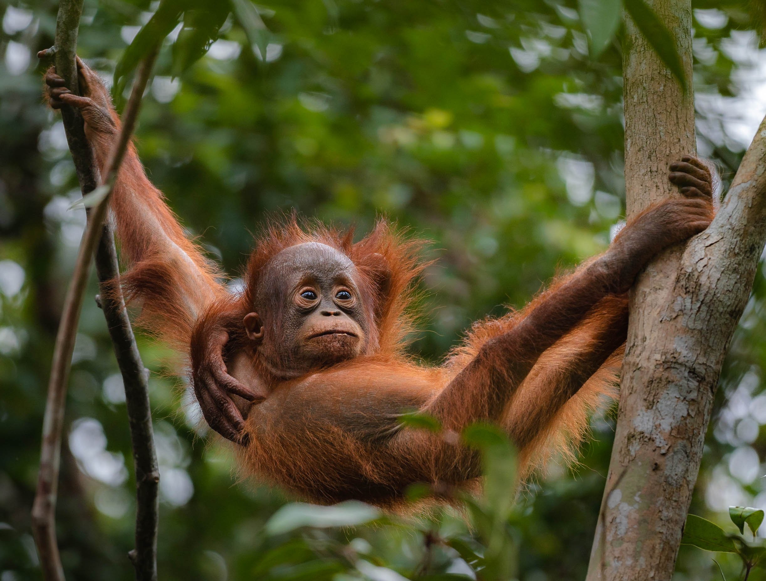
We spotted another in the trees eating a banana - not generally on their wild diet - that was provided to them at a feeding station near the research centre, primarily with the purpose to observe and provide for recently released individuals, such as this mother below.


Just Chillin
Generally speaking though orangutan spend most of their time in the trees - unlike Gorillas, they are arboreal.


Onwards
There aren’t really ways to get lost on the river, but in case you’re going a little fast, these signs warn you of the slow bends as the Klotok makes its way through the jungle. Luckily, my captain was in full control.

As we settled for the night tied to a tree on the shores of the river, it was time for dinner for the crew and myself.
The next morning we moved on to the second research station on the way, again encountering a number of orangutan, including some adventurous youngsters.


On the way we passed the outskirts of the few settlements in the park, with traditional housing and access by boat. The park is a UNESCO Biosphere Reserve, but still threatened by illegal poaching, logging and mining. It’s home to over 100,000 people in total.

We then arrived at the end of the publicly accessible river section, where the original Leakey center was established. This is where Birute Galdikas conducted most of her work, becoming the most well-known orangutan scientist in the world. Together with Jane Goodall (who studied Chimpanzees) and Dian Fossey (Gorillas were her focus) they became the three women educating the world about the great apes and fighting for their conservation. Take a look at my Uganda and Rwanda blogs for some more information.
The Long Noses
Orangutans aren’t the only wildlife you will find in the park though. Although much of the species here are rarely spotted by visitors (clouded leopard or sun bears for example - oh how I wish to see one of these!), one of its endemic inhabitants are more easily found: The Proboscis monkey.


Characterized by their long noses, particularly the leading male in the group, such as the one on the left, they are endangered and their population is threatened by habitat loss. I have been lucky to see them both in the Kalimantan and during my trip to be Brunei.
Although Proboscis monkeys are known to be excellent swimmers, they are generally arboreal and sometimes even jump from tree to tree or to the shoreline to cross rivers, and avoid predators such as crocodiles.


White-Bearded Gibbon (maybe)
Another primate species found in Tanjung Puting is the white-bearded gibbon, endemic to the area as well. There are multiple different Gibbon species present in Borneo, and admittedly I’m not 100% sure that I identified this one correctly - we only spotted it for a minute before it used its long arms to swing from tree to tree back into the thicket of the jungle.

The Big Boy
This guy was a little easier to identify. One of the largest males in the area around the Leakey research station, I got lucky to observe him showing up at the feeding station in the afternoon.
What a character. Some males grow much larger than others, developing huge cheek pads that give them the characteristic round head shape. Their arms can reach up to 1.5m in length and their body can weigh in excess of 100kg.


Although generally arboreal, Orangutans such as this elderly fellow sometimes spend time on the ground, possibly because there are no large terrestrial predators to threaten them in this region.


Sleeping Spot
After this it was time to head back to the mouth of the river - we spent our last night just outside the park boundaries, allowing me to capture this aerial view.

Glow Worms
As the night settled over the Sekonyer river, fireflies came to life in some of the trees.
Towards the West Kalimantan
I wanted to explore a little more of Borneo and its culture, other than just see Pangkalan Bun and the national park, so decided to make my way westwards on a 300km drive towards the boundary of the central and western Kalimantan districts. Given the size of the island (twice the area of Germany, and including mountains up to 4000m high), that was still only going to cover a very small part of it.

A large portion of this drive gives you an impression of what Borneo has sadly become famous for, and one of the primary reason its wildlife has been suffering over the last decades: Palm oil plantations. As far as your eyes can see, to the extent it has been described as “ecocide”. More than half of its rainforest has been lost in less than half a century. As the cheapest type of vegetable oil, demand has grown for decades and Indonesia and Malaysia together make up 90% of the supply. Its communities had little benefit - large companies based elsewhere own or lease and extract the value of the land with limited control, rampant corruption, and pressure on the local population - this was clearly evident in many of the conversations I had. That is, if people were willing to talk about it. Having said that, it’s easy to criticize the situation, but the vast majority of the production is exported to the rest of the world, where it is gladly consumed, and there are very few alternatives that deliver a similar yield, see here for an interesting article.
Time with the Dayak People
One of the indigenous ethnic groups on the island are the so-called Dayak tribes - in fact, they are a diverse group with multiple languages and religions, but the umbrella term was applied universally during the colonial past. They do share a number of common characteristics (one of them the feared practice of headhunting or Ngayau - now abandoned). I spent three days in a remote village of about 100 people in their company, being the first tourist they have had for almost 1 year.
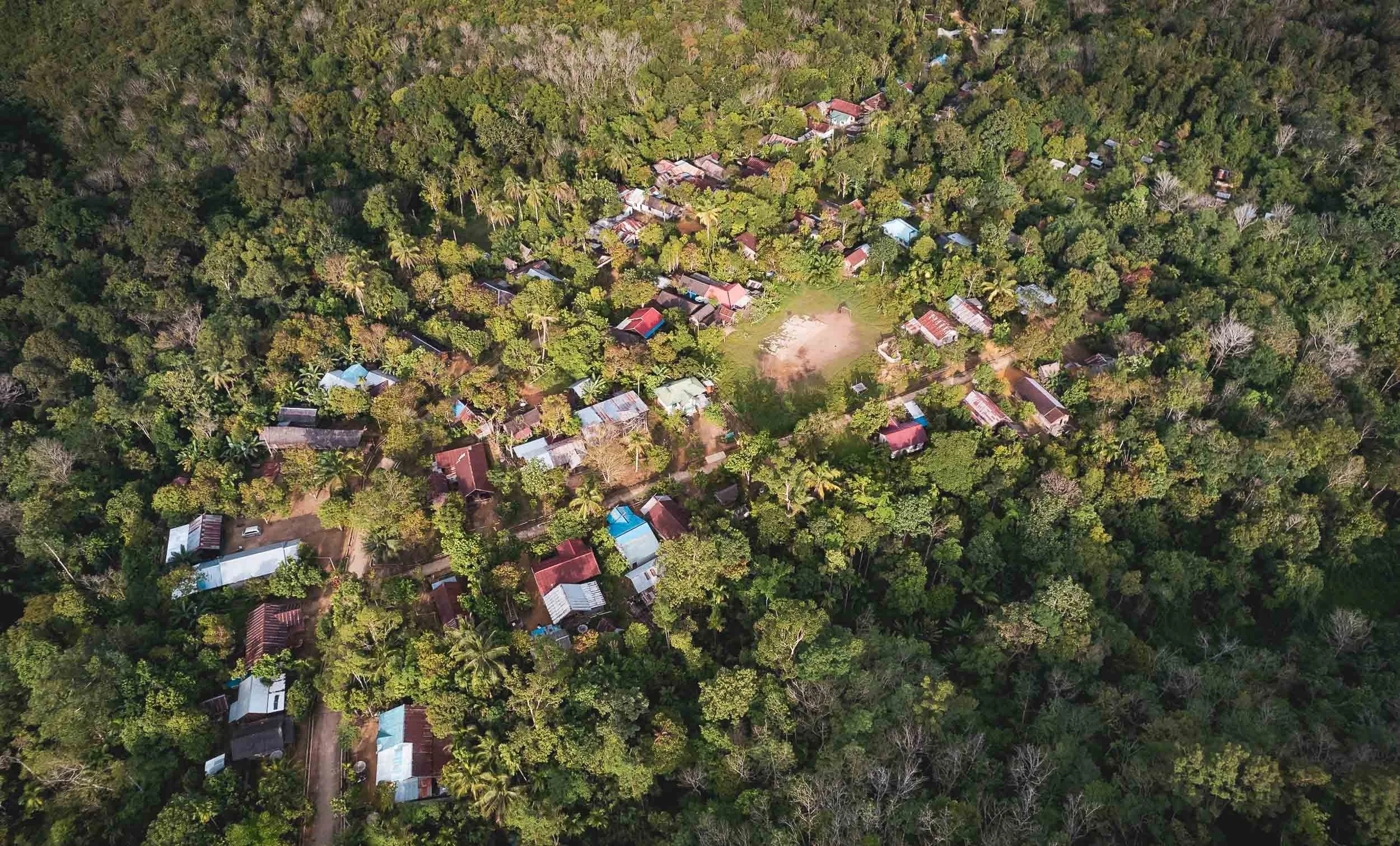
Long House
One of the common features of the Dayak villages is the stilted so-called long house (up to 200m!), sometimes still used as accommodation for multiple households, but today serving more of a traditional architectural and administrative function. It is visible on the centre left edge of the village in this aerial image.


Guarded
The long house is traditionally protected by a cat. Just kidding - this one just happened to chill on the porch.

Batu Batongkat (Stick Stone Monument)
Another of the interesting cultural aspects is this sight: although I could not fully discern its purpose, from what I understood it is a way to support nature.

Either way, the view from the top of the stone monument is beautiful, and the tribe owns much of the land, cultivating it in sustainable ways for generations - so far refraining from taking part in the palm oil industry and representing one of the strongholds against its complete takeover.

5 Star Bird Hotel
One rather unexpected commercial activity in this remote location is this concrete nesting structure meant to lure in swiftlets, whose saliva-built nests fetch high prices in China. They come with attached speakers imitating the bird’s call, and are often owned by people from the larger cities, paying locals to go around and maintain them (and protect their contents, as this is an industry where theft and sabotage seem not uncommon).

Universal Language
An observation I made during all my travels, even to the most remote places such as this one (there is no cell service here, power is by generator, water comes from the nearby river), is the power of football as a sport for the world. It’s always a way to get people interacting, and of course I couldn’t resist and joined in.

Theft concerns?
My hunch is that this is not really a problem here, given how this motorbike was secured to the house.
The People of Kubung Village
Over the three days I had the chance to get acquainted with a few of the people in the village (although none of them spoke any English), and was able to take some unscripted portraits.


The Last Dance
On my last evening I was asked to join the “Bagondang” or “Horn Bill Dance” ceremony, where the local dayak people blessed me and another father and his daughter visiting a nearby village with a welcome ritual ceremony called “ikat akar tongang”. They also provided me with a sacred Dayak bracelet for good blessing during the trip.


The ceremony involved the elder of the village attaching the bracelet, and the recipient drinking a rather large glass of home-made alcohol under the clapping and music of the villagers (who encourage you to finish it in one go), followed by dancing. There is footage of me undergoing these entire proceedings, which shall not be shared here.


Relics
While their day to day attire is fairly westernized, once a year the tribe brings out their traditional masks for dances and rituals.
It was a really enjoyable time here, and the local villager I stayed with still sends me photo updates on WhatsApp from time to time (although he doesn’t speak English, so I can’t always make out what he’s trying to convey with the pictures 😉).
I’m curious to see what happens to Borneo over the next decades, with Indonesia having recently announced to move its capital from Jakarta to the island. The new city called Nusantara is going to be located on the south-eastern coast, and construction began in 2022, with about 12,000 government officials expected to move in by the end of 2024.
I might be back to see it - Indonesia remains one of my favorite countries for its incredible sights and diversity.
Subscribe to my newsletter to get notified and don’t miss out on more Wonders of the Globe.
Other Recent Posts:
A First Glimpse of Thailand
Some impressions from Phuket and Bangkok - from rare apes, to temples, and trains through tree tunnels and markets.

Although I spent a few weeks in Thailand in July and August of 2023, they happened to be less focused on exploring and travel. Nevertheless, both Phuket (where I mainly worked on my doctorate application, about which I might write at some point here) and Bangkok (which was more of a transit stop to recover from two previous trips I have yet to write about) had a few sights to offer that I did want to make time for and document. Read on to find out what they are…
Phuket


While Phuket is famous for many things - some more questionable than others (I did visit Patong but couldn’t get myself to take photos there. It does have a nice German restaurant though…) - one of its main attractions are the nearby islands of Phi Phi. Didn’t visit those either, but whenever I’m in a destination during full moon I try to look for some possible compositions. In this case, the rise of our lunar companion happened to be aligned pretty well with the Phi Phi islands in the distance, which meant I was out in the humidity to capture it rising over the Andaman sea just after sunset.
Phuket is home to a few more famous islands, among them the so-called James Bond island, locally called Khao Phing Kan, a limestone formation featured in The Man with the Golden Gun.

The Gibbon Rehabilitation Project
Another famous sight of Phuket are its many animal attractions. Sadly, they originate from a sad past that is still not fully eradicated, namely monkeys, apes, snakes, elephants, and other animals serving as tourist entertainment with very little care for their welfare. The situation has improved drastically over the last decade, for instance its much criticized zoo hosting tigers and bears in small concrete cages and charging tourists (who were stupid enough to pay) to pose with them, was finally closed down in 2022. Elephant riding and half-drugged loris are still things that exist on the island though - on the other end of the spectrum, a place that is countering and trying to reverse some of the effects of this issue is the Gibbon Rehabilitation Project.
A visit to this place (a maximum of 10 people are allowed per day) is really interesting, with a personal small group tour that involves making food and actually delivering it to the apes, helped by our very knowledgeable guide called Thanaphat (who’s been amazing, and his story is worth listening to). Gibbons have been extinct in the wild on the island, and are now, through great and lengthy efforts, slowly being re-introduced into the last remaining rainforests that still exist here. In the past, they were home to tigers, leopards, and more species, whose habitat has made way for human development.
There’s no direct contact with the animals, and feeding is accomplished via a rope pulled up to the cage. At the same time, visitors are asked to fill out the daily observation sheets for “their” gibbon, which helps the local volunteers and members of the project to assess the ape’s development and readiness for release. Often, that readiness is never reached, the amount of time these gibbons spent in human captivity for the benefit of tourists makes them completely dependent and they come back from their release sites.

While gibbons are apes and thus part of the same family as humans, they are classified as “Lesser” apes, as opposed to the Great Apes like Gorillas. Nevertheless most of the species are now endangered, some of them critically so, making it worthwhile to support organizations like this one - adopt a gibbon!
A Sanctuary for Giants
Phuket is also home to countless elephant attractions - many of them designate themselves as “sanctuaries” for the many elephants that have spent their lives as tourist attractions or were chained and beaten to perform work in the forests and farms of the island. There are still black sheep, but it seems many of those establishments are now run in a reasonable way, do not allow elephant riding, don’t chain them, and provide food of sufficient quality and amount (an elephant eats up to 150kg a day), and space for their elephants. Given the rapid decline of elephants in Thailand (from 50,000 in the middle of last century to 3,500 nowadays, with less than 500 truly wild ones) they arguably do a necessary job.
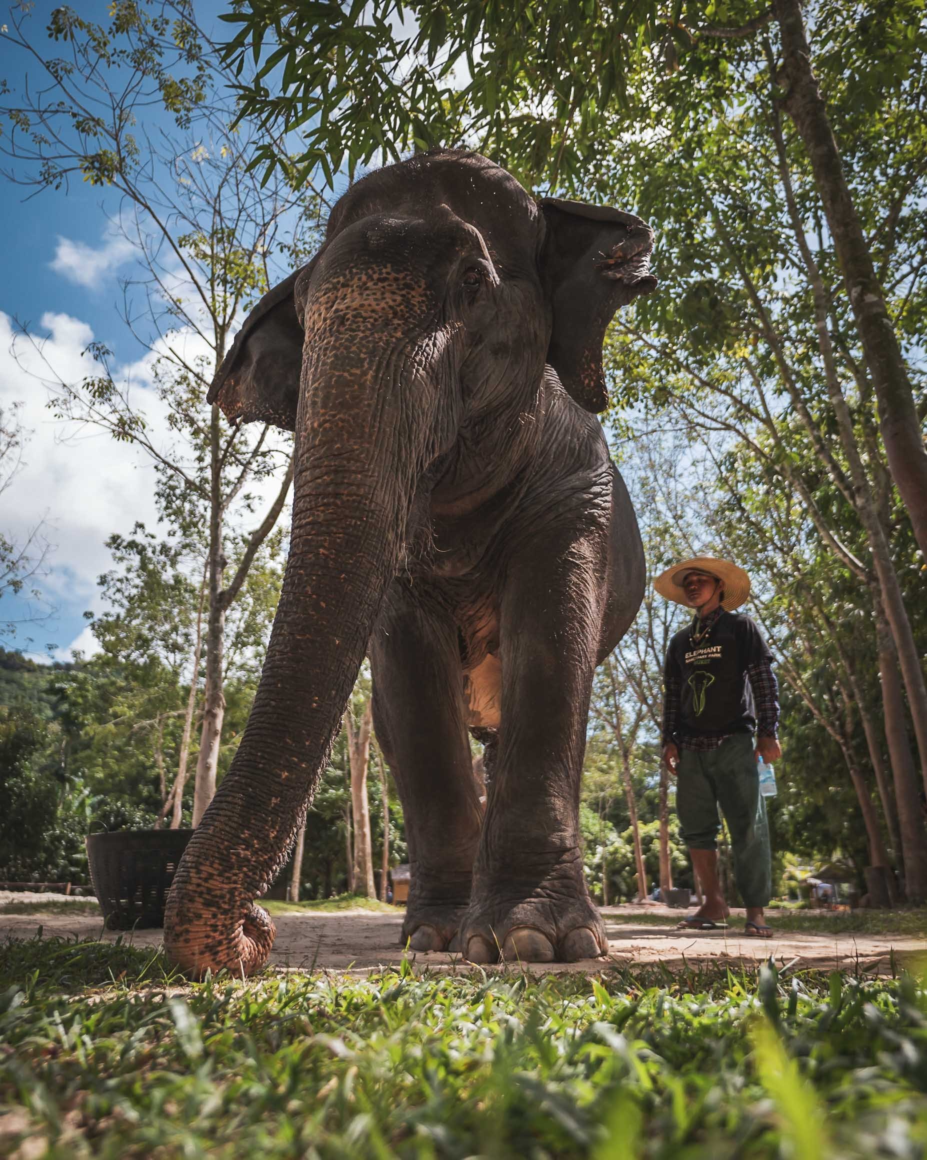

I went to visit the Green Elephant Sanctuary Park, established by a Swiss national, and while it’s a tourist destination with groups, it doesn’t feel crowded and there’s room for personal interaction and some education. The owners have also established a clinic for elephants, which they are trying to get more funding for.


Ever since my encounters in Kenya I’ve developed a much deeper appreciation for these animals, and while the Asian elephant is different from their African counterparts, their intelligence and social bonds shine the same way.

Care Quarters
The employees and mahouts (carers) live on site with the animals, spending the whole day with their elephants, allowing two tourist interactions daily.

Bath time
The visit ends in the big water pond of the site, where you can help the elephants cool down from the island’s hot and humid weather. Watch your camera…

Majestic
Not many animals make you feel the same way when you stand in front of them.
Elephants are the national animal of Thailand and prominently feature across many cultural aspects in the country - more on that later.
I might be back in Phuket one day to explore its islands and take more photos of the old town, which features a beautiful collection of sino-portuguese mansions and several buildings dating back to the time of European and Chinese influence. For now, let’s continue with the capital.
The (Temple) Capital
Home to over 10 million people (and much more in the metro region), Bangkok has endless sights: Its street life, museums, temples, and skyline definitely mean you can spend countless hours exploring and looking for photos. On the other hand, its insane traffic, disorganized urban planing (it lacked proper zoning until very recently), and hot humid weather (coupled with my exhaustion from a few previous trips) meant I didn’t quite have the urge to see or take photos of it all. Nevertheless, below are some of my favorites, with the best (for me anyway) saved for last.

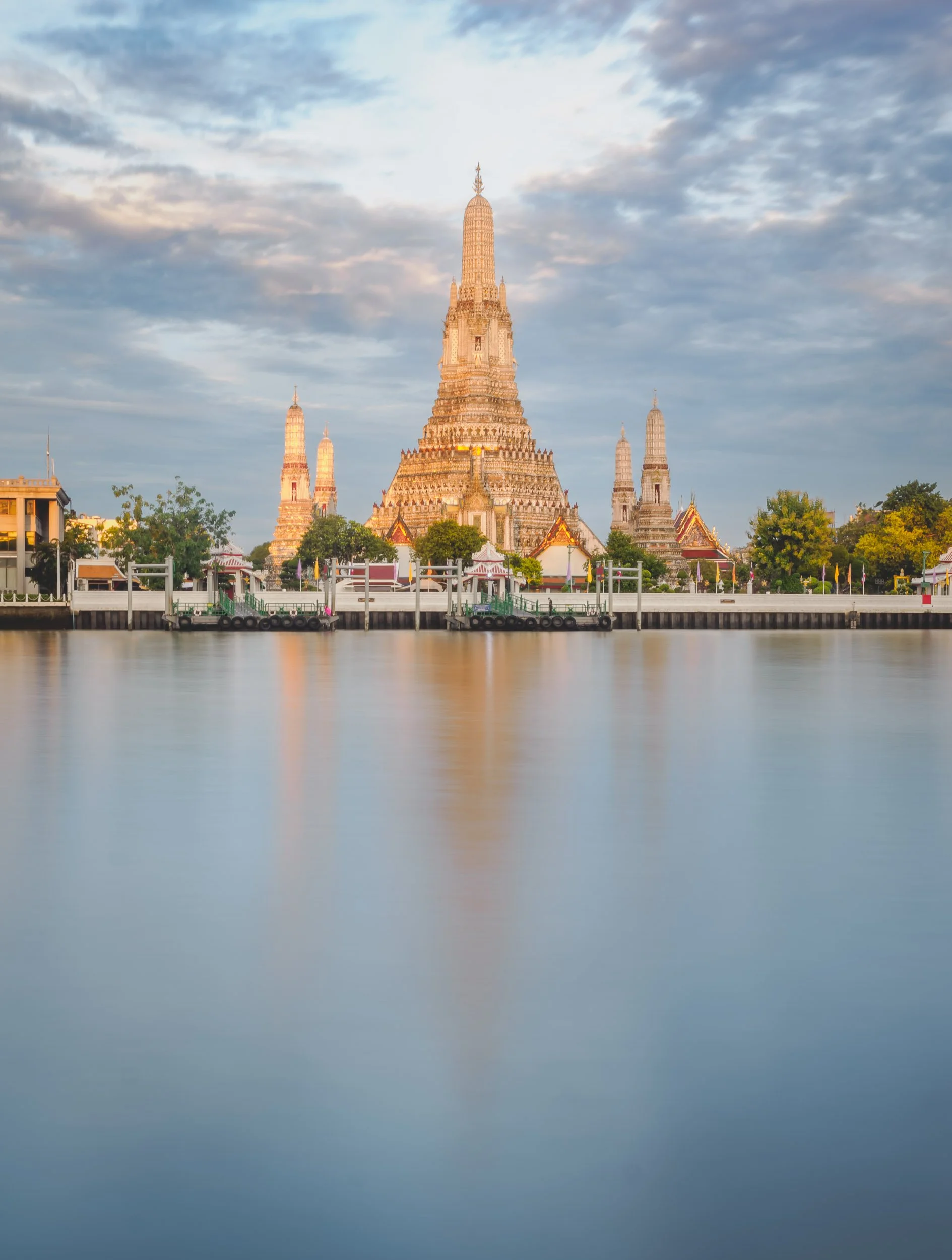
It’s impossible to miss the many amazing temples in the city, and some of the most beautiful ones were also on my list to visit. Wat Arun (above) was one of them, although I only photographed it from opposite the Chao Phraya river. This temple with its beautiful porcelain encrusted pagoda is almost 400 years old.

Wat Suthat Thepwararam Ratchaworamahawihan
Don’t ask me to pronounce it, but this was maybe my favorite temple in the Phra Nakhon area, where many of them can be found.


The temple is famous for its interior featuring beautiful murals and drawings depicting various scenes from Buddhist narratives and history. It is designated as a royal temple of the first grade, one of ten such temples in Bangkok.


Wat Ratchabophit
Another beautiful temple close by with its 43m tall golden chedi, and beautiful tiled exterior walls.


Wat Pho
A temple with an easier name and one of the oldest and largest complexes in Bangkok was the last I visited (although there are another half a dozen beautiful ones to be explored in the area).


The temple was originally completed in the 16th century, before the city was the capital.

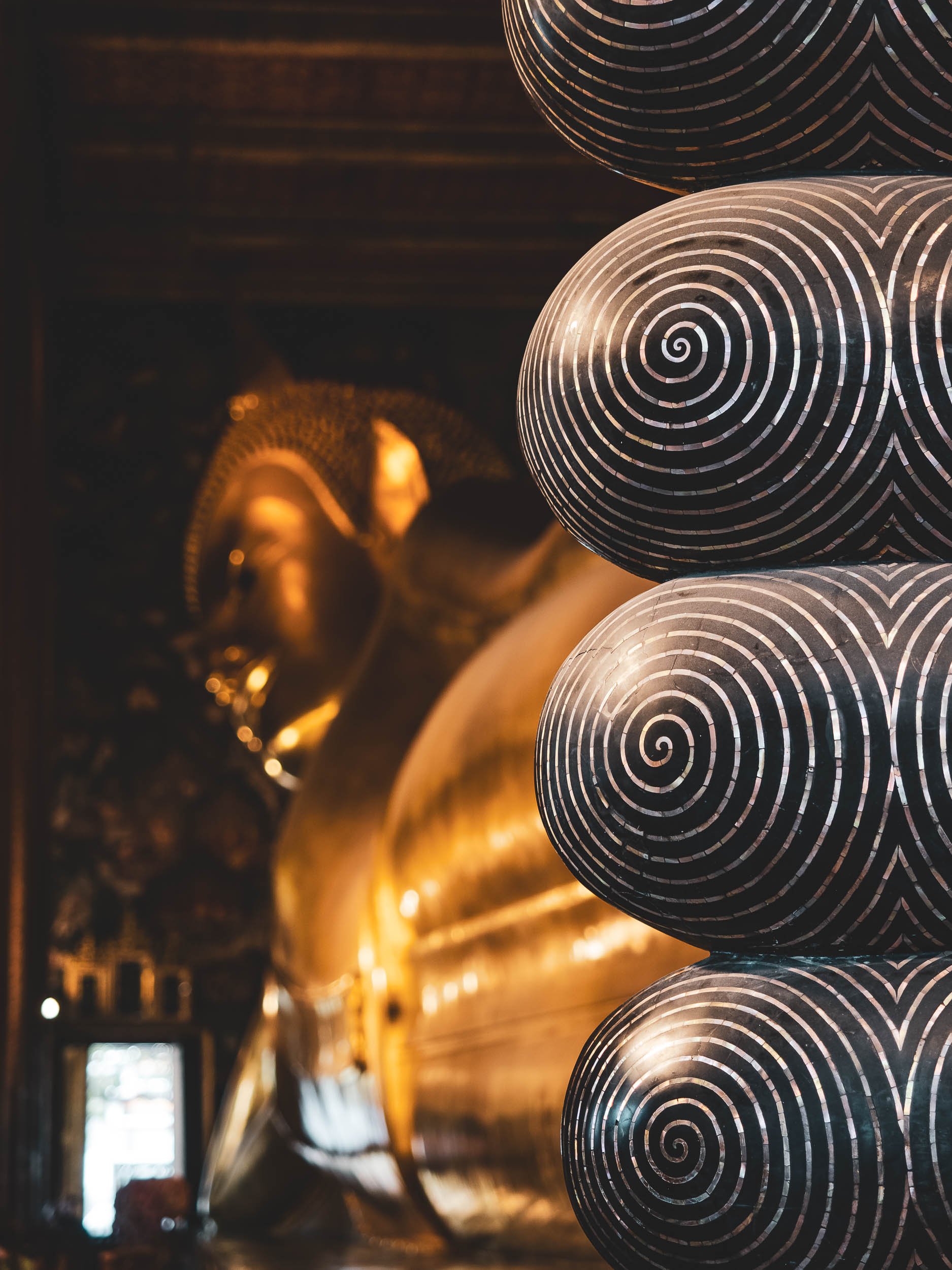
It’s home to over 1000 buddha images, but none are as well known as the huge reclining version, situated in its own chapel. Added in 1832, it’s 15m high and 46m long, and was made of brick, which was then plastered and covered in gold. The toes visible on the right are in-laid with mother of pearl.
It was time to leave the city for a day trip, trying to see two of its (potential) photographic points of interests to the west. Honestly speaking, neither of them quite fulfilled that promise, as both spots lost a lot of their natural charm and origins, having turned into a pure tourist destination.

Mae Klong Railway Market
The first destination was a village in the province of Samut Songkhram, about 1,5h drive. It's famous for its railway which literally runs through the local market for the last 500m before reaching the station and going back.


Arriving very early (before the first train) means you get to see the locals going about their business, buying and selling vegetables, meat, fish, and a few other random items. Many of the tables and goods are literally placed on top of the train track - as you’ll soon discover, in a manner that’s very flexible if required…


Coming Through
Shortly before the train arrives, the speakers announce it to the merchants (and the sightseers), who within a couple of minutes fold their sunroofs backwards, pull in the tables (which are mounted on wheels) and position their trays and plates in a way that the train will just have enough clearance to avoid dragging a few veggies along to the station.

Tight Spaces
The photos barely do justice to how tight the spots left and right of the track can become, as sun shades, tables, tourists, seller, buyers, and goods get squeezed into small stalls. While the train moves slowly, I did see one or the other anxious person and a few sellers shouting at people (they seemed to have an eye for which tourist was prone to get run over by a train).

The Aftermath
Once the train passed, you’ll see the hundreds of tourists that squeezed into the stalls either side coming out on the tracks, which just an hour earlier were home to a calm local market. I can’t blame them, it’s definitely an interesting spectacle to observe, and I was one of them, but I can’t say it was particularly enjoyable at this point.
Hence it was time to leave, and move on to another type of special market - a floating one. Called Damnoen Saduak, it’s probably the most famous of its type, and thus admittedly most likely to be touristy as well.

Damnoen Saduak Floating Market
Not far from the train spectacle lies another spot that was once only a way for locals to sell their goods. This time from a boat, moving along the channels and selling to people on other boats or on the shoreline. While the Mae Klong Railway market does preserve some of the original spirit (until the train arrives), this one has become nothing more than a tourist attraction by now.
This “market” is also still home to the aforementioned animal attractions that are still common in Thailand, with large snakes meant to attract tourists who are asked to pay to have them draped around their necks (and plenty did…), and I also spotted a loris being offered to visitors for posing. While for the snake and loris it’s definitely abuse, it didn’t seem to bother this cat luckily.


There is very little left of what I can imagine was once a very interesting genuine market experience, but by walking along the canals I did manage to capture a few impressions of vendors that probably offered their goods to people other than tourists many years ago, and still make and sell their local dishes.


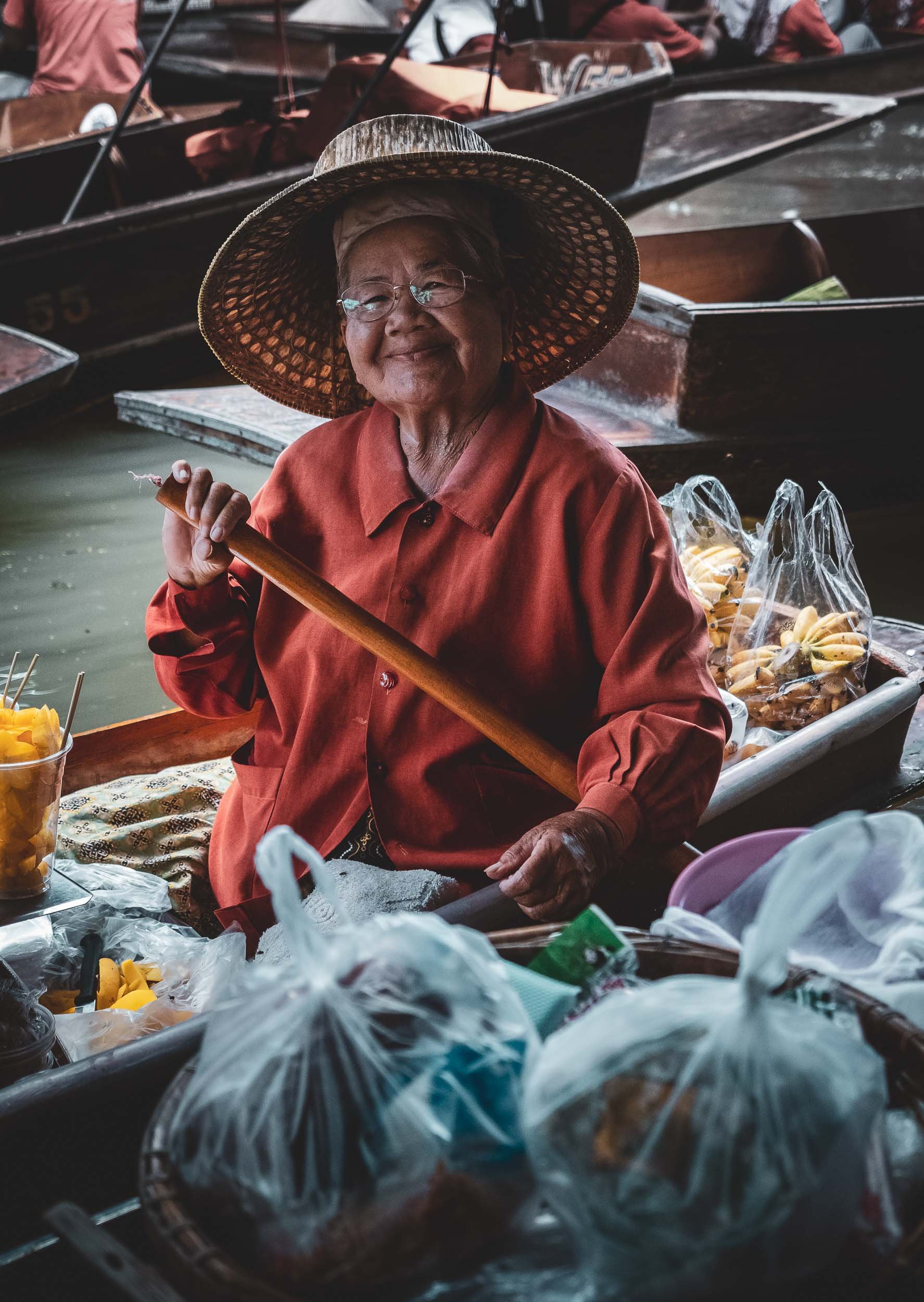
From what I gathered through my guide, the other markets of similar nature in Bangkok aren’t very different, but I did hear that some of them still have days where local trade takes precedence over tourism - need to find them on the next visit! I definitely didn’t spend too much time at Damnoen Saduak and would recommend a quick stop at best, if you happen to visit the train market (which somehow is still worth it).


Back in Bangkok, the usual rain clouds decided to unleash some torrential rains over part of the city, but stopped before sunset, giving me the opportunity to get some cityscape photos from the rooftop of the Banyan Tree hotel (including the endless traffic below)


Erewan Museum
A very different kind of temple awaits on the southern outskirts of the city. The 250 ton, 29m tall, three headed bronze elephant statue on its roof ensures you can’t miss it, but also holds a surprise inside…

… which is that you can take a small spiral staircase up one of the elephant legs, leading to the actual chapel in the belly, adorned with various art pieces, Buddha images, and representations of the solar system.
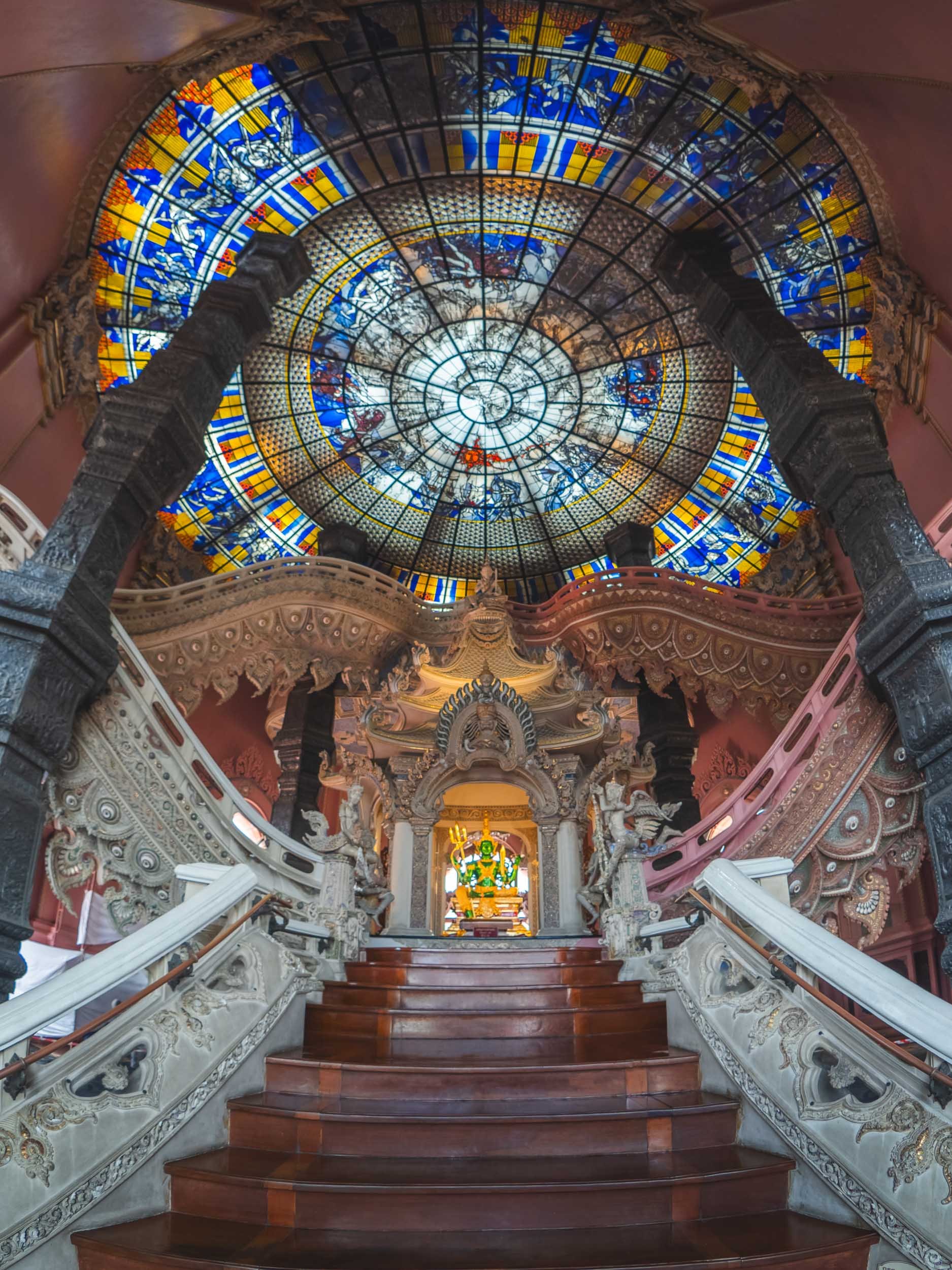
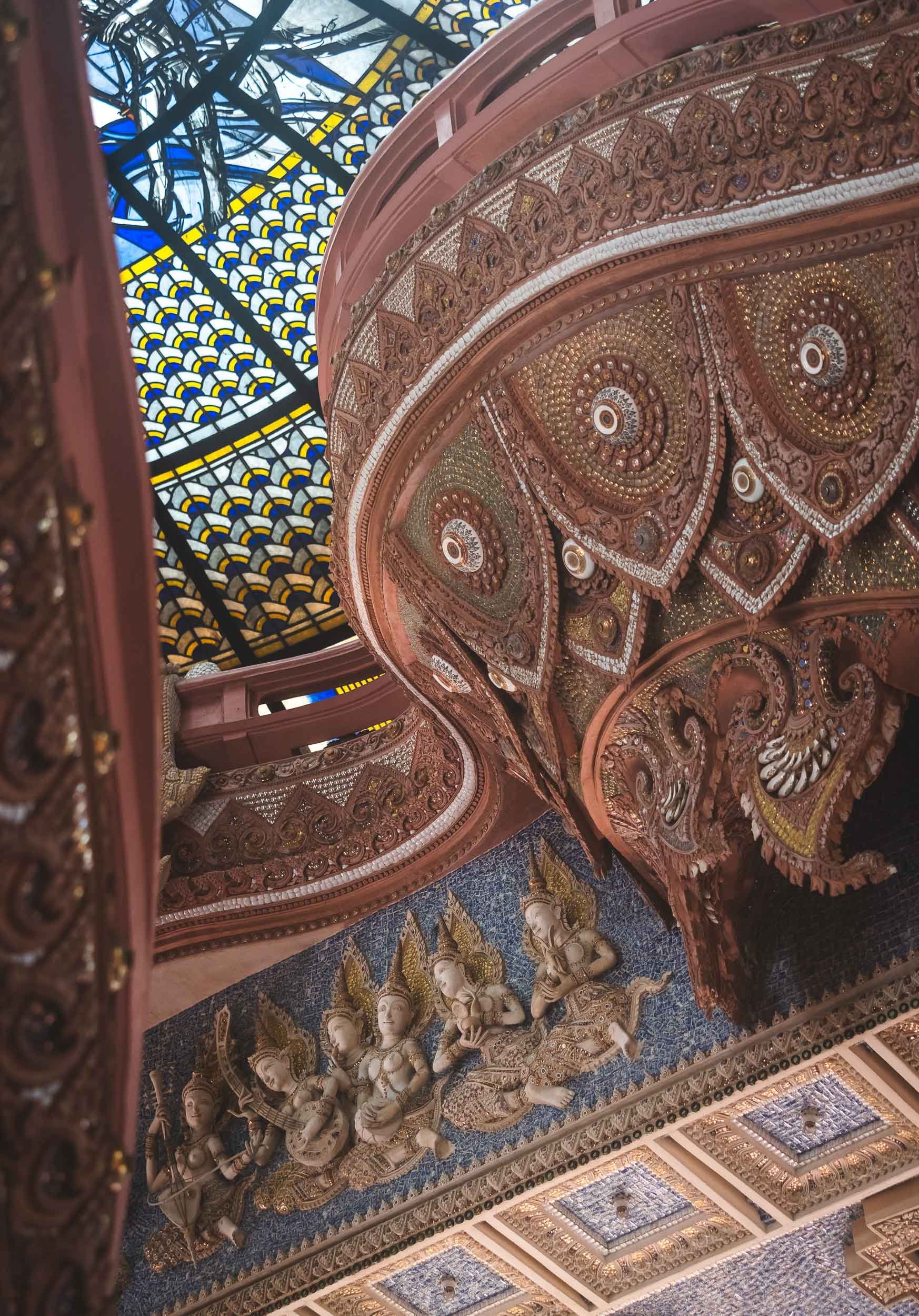
Below this world of the heavens lie the human and the underworld. While the Erewan museum was privately built to house an art and antique collection, the three-headed elephant also acts as a symbol of the cosmography in Hindu mythology. Its gardens are also worth a stroll, with plenty of small rivers, waterfalls, sculpted plants, and - you guessed it - a lot more elephant representations.

Chinatown
Yaowarat Road, the centre of Bangkok's Chinatown. Chinese immigrants historically formed the majority of the city's population.


The history of the city since it became Thailand’s capital in 1782 (then still the Siamese Kingdom) is filled with immigrant populations from different parts of Asia, including large Vietnamese and Malay communities, and it remains a cosmopolitan city today. Fun fact: The city changed its name several times throughout the course of history, and its full ceremonial Thai name features a mind-boggling 168 letters, earning it a place in the Guiness World Record as the longest place name.


Into the Night
Bangkok’s nightlife is meant to be legendary - for better or worse - and has earned it the nickname “Sin City of Asia”. I wouldn’t be able to judge that 😇 but I did enjoy a walk around after sunset to capture some of the neon lights and rain puddles.


The neon sign forest seen from one of the elevated train stations, which can provide interesting photo opportunities of the streets below, and is also a good option to make your way through the city and (partly) escape the traffic.

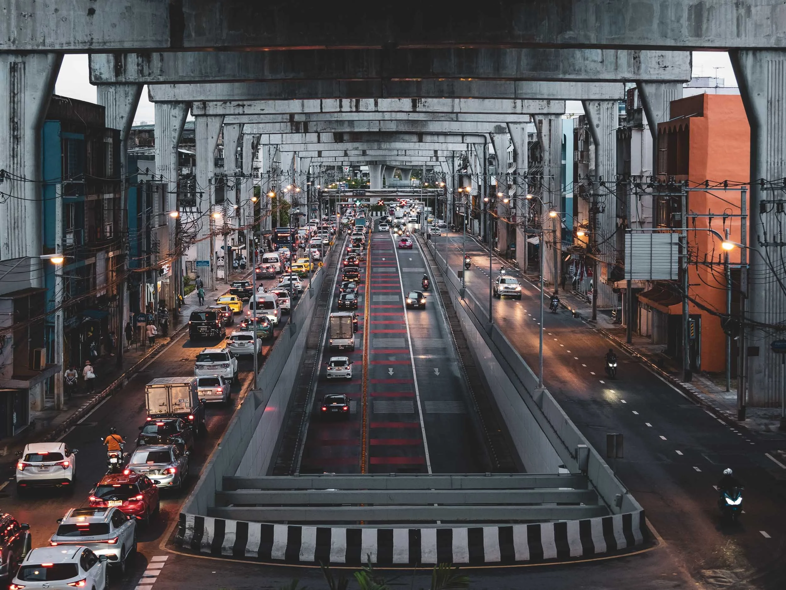
Infrastructure
Bangkok now has four different mass transit systems, the first of which started operating in 1999 - most of it runs above ground, often built on top of major roads like here, and some of the transfer station hubs are 4 or 5 floors tall.

Biggest Buddha
After 5 years of construction in between the network of canals in the oldest part the city, there now stands a giant Buddha in glowing gold. 69m tall and costing more than 3m USD, it was completed in 2021.
It’s part of the 400 year-old Wat Paknam Phasi Charoen temple. Large buddha images have remained a popular attraction in Thailand, and often bring significant income for a temple or even revive a whole district.
Please take a moment to spot the cat in the image on the left below ;)


Train Tree Tunnels
My favorite place in the city was a little away from its hustle and bustle, in the outskirts around the Chom Thong area. Here, the early morning hours see people get ready for work, kids preparing for school, merchants opening their shops, and monks heading to the temples, in a somewhat quieter and greener atmosphere than most of the rest of the city.
The main attraction for me though was the local train line running through the area and past the dispersed shops and little stations along its track. During the morning hours, a few commuter trains slowly make their way through, and you can catch some great compositions.

In several places along the few kilometers of tracks I followed, trees have formed their own little tunnels (probably with some human encouragement to make way for the train). Either way, this is maybe my favorite photo from Bangkok.


Out of the way!
People got used to life along the tracks, and so did the conductors and operators.
There’s definitely more to see in Thailand, but for now this is all I had to show you!
Subscribe to my newsletter to get notified and don’t miss out on more Wonders of the Globe.
Other Recent Posts:
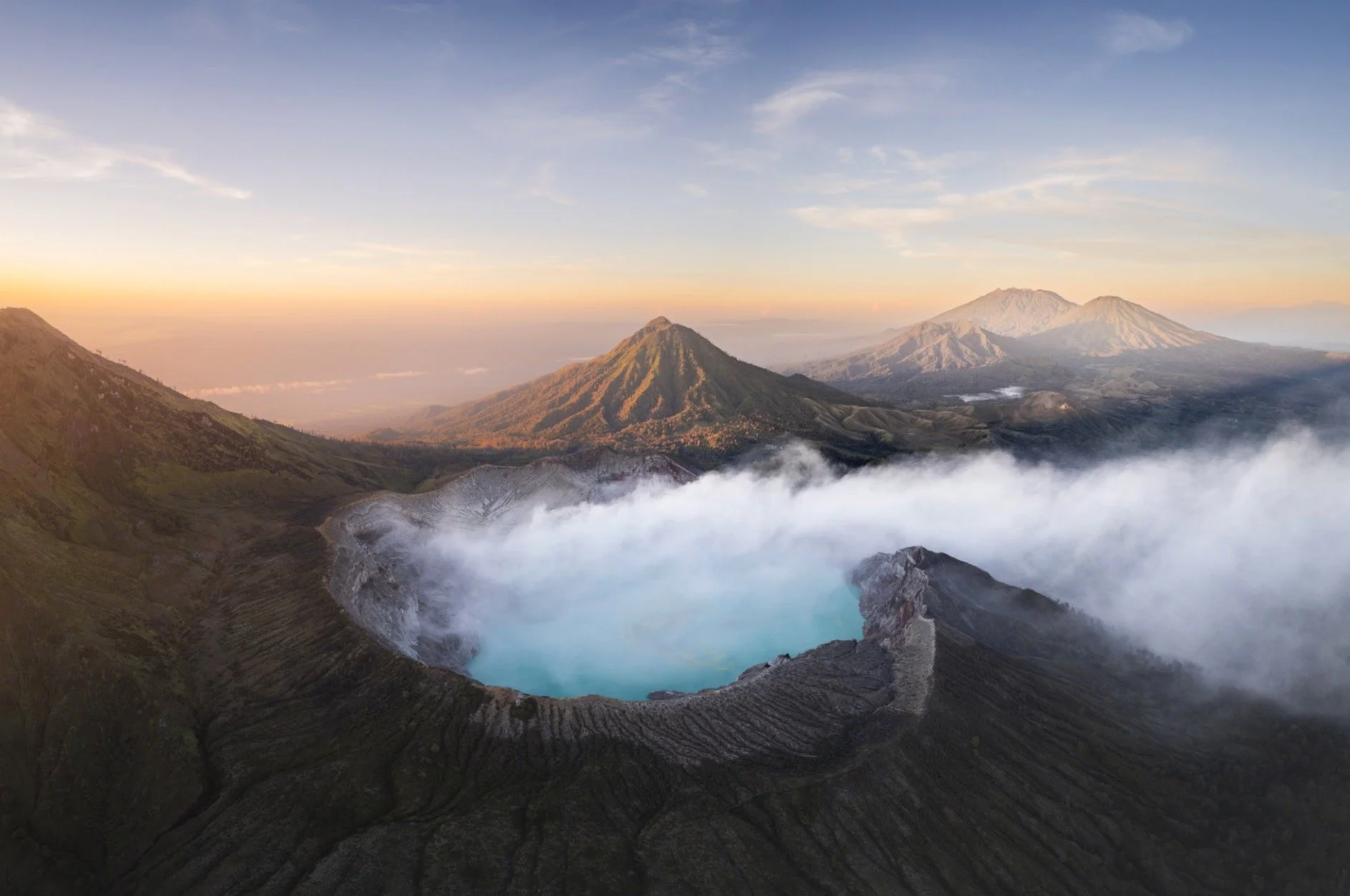
Java’s Volcano Heaven - Indonesia Part 2
The world's most populous island is full of amazing places - some of which I managed to visit.
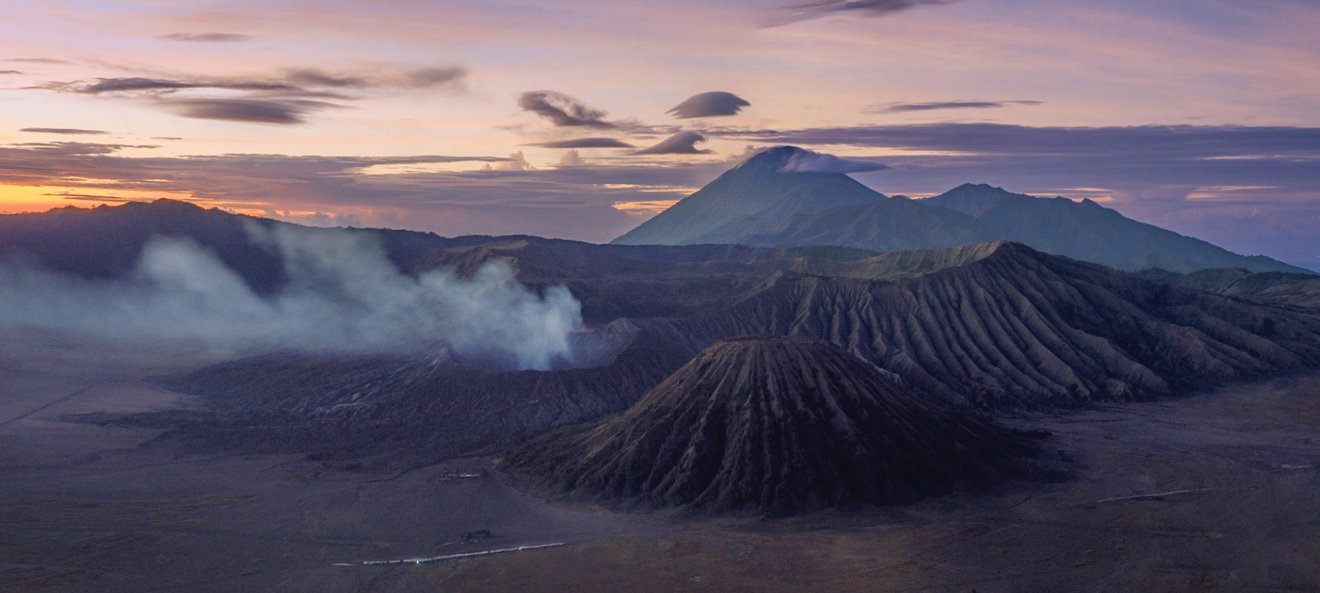
Java is - unbeknownst to many - the world's most populous island and - maybe more well known - full of amazing places. I spent around 10 days here during my time in Indonesia (see also my blogs on Flores Island & Komodo, and subscribe for more upcoming ones, including a trip to the Orangutan’s of Borneo) and was visited some of the sights this home to over 150 million people has to offer.
Start here for a few aerial impressions, and read on to learn (and see) more about each of those incredible spots, and a few more…
I came to Java by car ferry from Bali, and had a short night before a 3am alarm to make it to the starting point of the trail that takes you up an amazing volcano formation, on the very eastern edge of the looooong island.

The Ijen Volcano Complex
Blue fire and an acidic lake await

This may be unsurprising to some of you, but I was the first tourist that day to complete the 2h hike and still got to witness a bit of starry night above the smoke filled caldera. After a few minutes though I started the 45min hike down into the dark crater to find the infamous blue fire and see the acidic lake up close.
The way down is not that simple if you arrive before blue hour, because it’s completely dark in the crater, there is hardly a recognizable path, and you scramble over rocks and slippery steep sections. The photo below was taken after I had already arrived at the bottom and the sky slowly developed a purple hue. You’ll notice a few flash lights on the edge at the top just starting to make their way down - arriving early has the benefit of a few undisturbed moments to take in the bizarre scenery, before the very small space at the bottom of the lake gets a little crowded.


Equipped
This last part of the adventure also requires you to wear a proper gas mask, as the sulfuric gases make it almost impossible to breathe otherwise once you get close to the lake - trust me, I tried.

Blue Flames
Ijen volcano is famous for its blue fire - one of only two places in the world where such a phenomenon occurs permanently. The blue flames originate from sulfuric gas that escapes from the cracks at very high temperatures. A rumor told me that the blue fire isn’t very active these days, so better check before you go (and if it is, go soon to witness it in case it’s too late some day).


The same gas is actually channeled through pipes at this spot to support sulfur mining, which has happened here for many decades. The yellow bricks that develop after the molten sulfur hardens are then transported by workers up the crater and down the mountain. While - from what I heard - this work is paid comparatively well, it’s also dangerous and very strenuous. The laborers fill the baskets with 70kg or more of hardened sulfur, and then complete the entire journey to deliver it at the foot of the mountain to get paid. Most of them do it twice a day.


The workers and various researches sometimes cross the crater lake that developed here in these kind of self-made barrages - a dangerous affair, given that the lake is considered the largest highly acidic crater lake in the world, with a ph of <0.5.


When you arrive in the darkness it’s actually difficult to understand the scenery around you and how this otherworldly environment really looks - only as I walked back up was it bright enough to grasp the scale of the crater, the lake, and the amount of smoke escaping from the cracks and pipes where the sulfur is mined. Look closely and you see the small barrage from above at the shore of the lake.
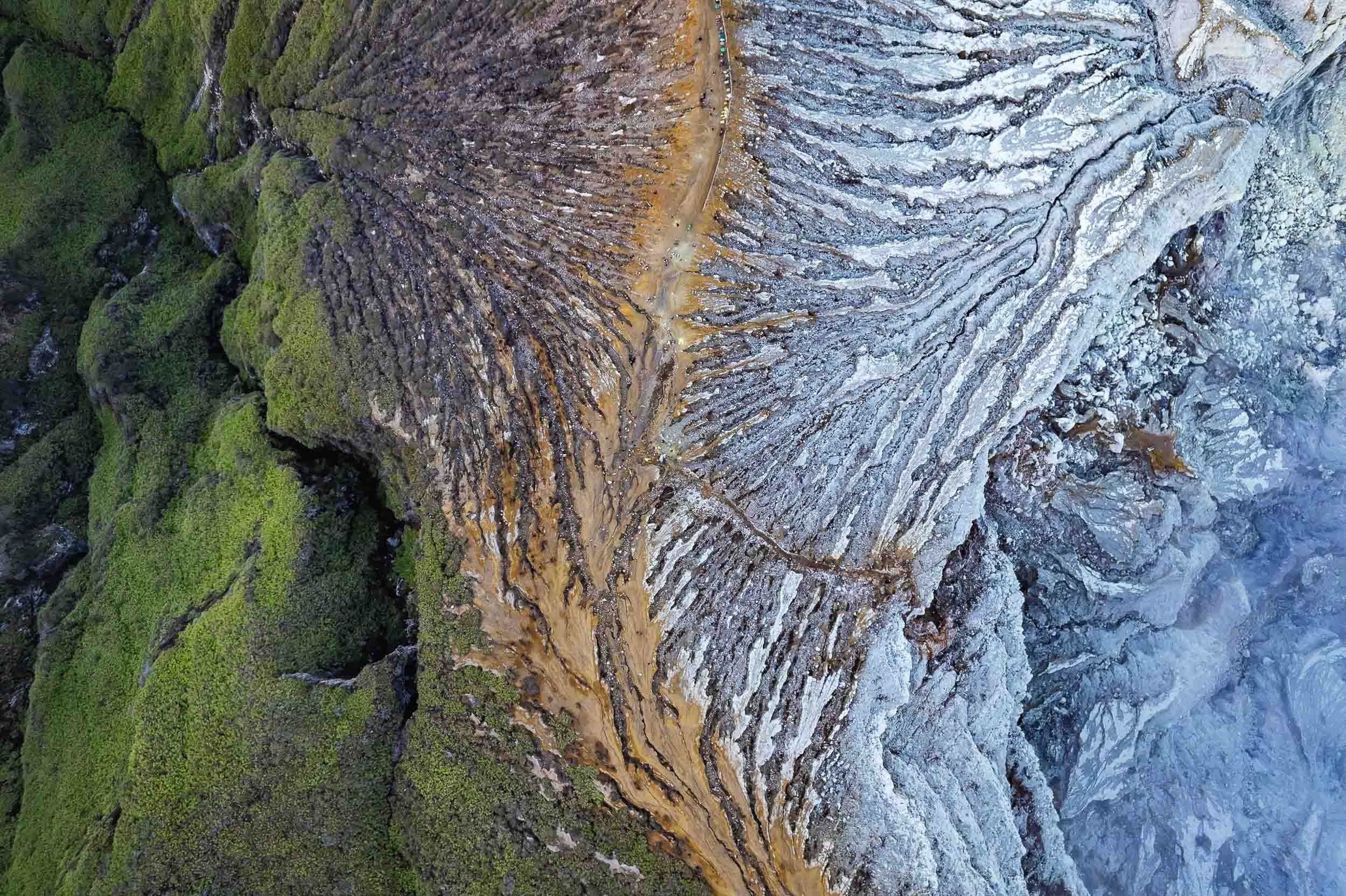
Abstract
Once I made it back up the sun had come out and I had a moment to fly the drone, capturing this abstract top down view of the crater’s edge, with the mountain on the left and the path towards the lake on the right. The small colorful dots at the top centre are the carts of the workers. Look closely and you’ll see some yellow spots, showing the sulfur rocks they had carried up already.

Shadow
Our home star was still low, so the nearby Merapi volcano, part of the Geopark Ijen is situated in, cast its huge shadow over us.

Bromo
Another volcanic wonder.
Straight after climbing down from Ijen a long drive westwards took me to Java’s most famous volcanic landscape: The National Park of Bromo Tengger Semeru. I arrived just after this beautiful sunset, and would go explore this area the next morning before sunrise.

Volcano-ception
This place is home to five volcanos (four of which are active) that have developed inside the caldera of another huge ancient volcano, with another volcano - Semeru - towering above them in the distance. Yup.
While I wasn’t lucky enough to experience the beautiful sight of the ancient caldera filled with a layer of fog (it wasn’t the right season), the conditions up there are always incredible, making for some very atmospheric photos around sunrise.


Semeru in Action
The tallest of the volcanoes in this area at over 3600m had just started to erupt in December 2022 a few days before I was there, and huge ash clouds developed from its crater in the distance that morning. If by now you are thinking “there are a lot of volcanoes here”, you are right - the entire island of Java is of volcanic origin, and there are no less than 45 active ones.

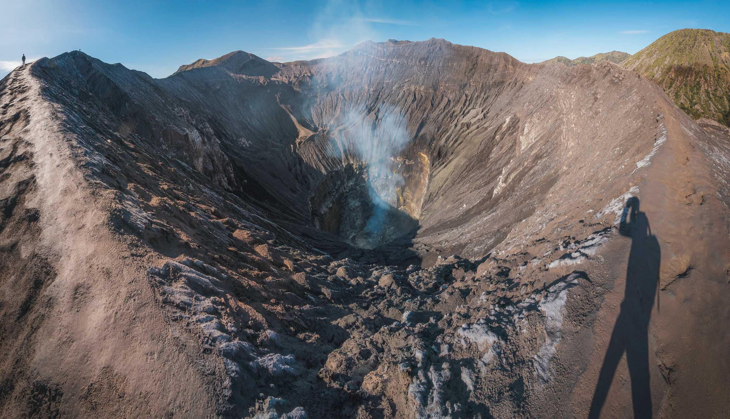
While Semeru is about 20km further south, Bromo is the most active of the volcanoes inside the actual caldera, and depending on the wind conditions you’ll need to watch out for the smoke and gases that emit from the crater - access to Bromo closes regularly due to safety concerns.


It is a relatively easy climb up a few hundred stairs (visible on the right photo in the corner on the bottom right) once you make it through the so-called “Sea of Sand” - the sand filled caldera - in one of the dozens of modified Jeeps the locals use to transport tourists. It can get busy here, but as always, arriving early and taking an extra little hike along the crater rim will bring you some peace and quiet - can you spot me (and my shadow) in the left photo?


The base of Bromo is also home to a rather interesting Hindu temple built in 2000, visible on the bottom in this photo - who thought it would be a good idea put a temple there I wonder? The Tengger people in this area are one of the last remaining Hindus in Java, which is overwhelmingly muslim. There is a small offering installed at the edge of the crater to please their sacred mountain.

Two of the aforementioned Jeeps making their way through the Sea of Sands in the distance, with the rugged slopes of Bromo in the foreground, seen from the crater’s edge.

For a touch of color after all that brown and grey around the volcano these four wonderful ladies posed happily in the sand canyon as I was leaving.

A Splash
Speaking of colours, I then made my way to the city of Malang, which is home to an interesting set of villages, namely Kampung Tridi (left), Warna Warni (top), and Biru Arema (bottom right), which have turned their districts into a little paradise of colours.

Pioneers
As the story goes, Kampung Warna Warni was the original of the colorful villages in Indonesia. While one might dismiss it as a tourism stunt, the idea actually came from a few students who wanted to revitalize this community, which had fallen into disarray, poverty, and pollution, alongside the nearby river. In 2015 they partnered with a local painting company and the resulting work didn’t just bring in tourists (who pay a small entrance fee) but also revitalized the surrounding community and created a social obligation to beautify and maintain the environment. It became a successful role model for the village across the river, and another one across the bridge, as well as a few others in the country.

Kampung Tridi is connected to Warna-Warni by a small footbridge. Both of the village are full of small whimsical details, murals, and friendly locals.


It’s an interesting thought to imagine how the world would look if all our cities were so colorful, considering the sea of brown and grey surrounding these villages. I happened to get another glimpse at the colorful roofs when I left Malang by train (excellent way to travel in Java!) on my way westwards towards the Special Administrative Region of Yogyakarta.


Tumpak Sewu
Before moving on though I got to experience what is probably the most incredible waterfall I’ve ever been to, about 3 hours south east of Malang. The active Semeru volcano mentioned earlier providing a beautiful backdrop.
The way down to the falls is a tough affair - it takes at least 30 minutes over muddy semi-paths, climbing long rope assisted vertical ladders, stepping on metal brackets fixed into the side of the canyon, crossing the river by jumping from stone to stone, and then being totally soaked by the waterfall’s wind induced layer of rains and fog at the bottom. But the views are worth it (I still thought so after the way up, but was less convinced then). Pro tip: It seems the descent on the eastern side is a little easier than the one I took, but who wants that?
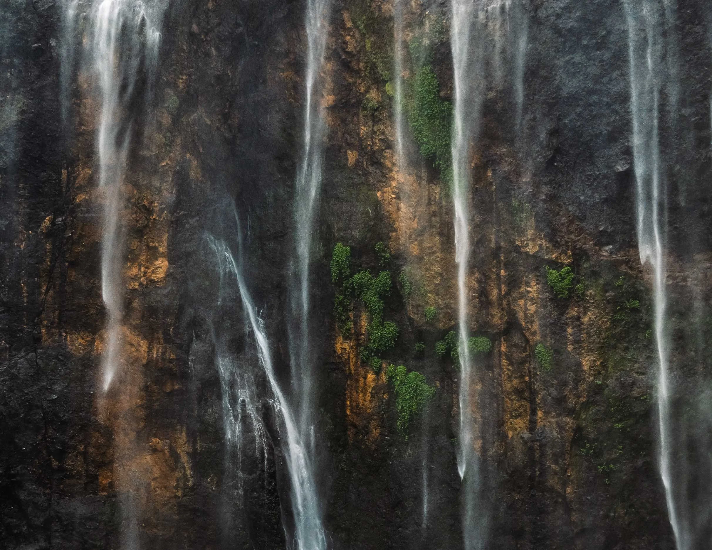

My guide posing in the rain for scale here.


The views from above are equally amazing though, even more so with a drone, but the viewing platform on the side of the canyon also provides some nice angles and opportunities to set up a tripod for long exposures.


The conditions changed quite a bit during the few hours I spent here, depending on the wind direction and the flow of the river. On top of that, as the sun moves across the horizon, the angle of the omnipresent rainbows shift as well, creating ever so slightly different compositions. A place you could come back to many times. An extra bonus - I was there on a regular weekday morning (not even that early) with almost no people - a very different picture compared to some of the (comparably boring) waterfalls in Bali.

What’s in a Name
Tumpak Sewu loosely translated means "a thousand waterfalls" in the Javanese language - an apt description.
What a place. Just missing some dinosaurs!


Back in Malang I took the aforementioned train onwards to the west into Central Java, more specifically the Special Region of Yogyakarta. A kind of unique autonomous province of Indonesia, the Sultanate has a few distinct administrative powers owing to its former status is an independent kingdom before it joined the Indonesian independence movement after the Second World War.

Prambanan
Three religious sights were on my mind for this part of the island, starting with the 9th century Prambanan temple, the largest Hindu temple in ancient Java and the second largest in the world. It’s dedicated to the Hindu trinity of God as the Creator (Brahma), the Preserver (Vishnu) and the Destroyer (Shiva). My hopes for some good photos were slightly destroyed by the weather, as I only had a few minutes before the pouring rain kicked in.


UNESCO World Heritage Site
The temple and its many beautiful reliefs have been inscribed since 1991. The pattern of lion in niche flanked by kalpataru trees is one of the most common panels in the temple.
The temple compound lay more or less abandoned for over 1000 years and lost a lot of its individual temples - there were 240 in total - as people used the stones for other construction or collected them. Only in the 1930s an effort to properly reconstruct it started, which is ongoing until today. An earthquake caused significant damage in 2006, and various volcano eruptions pose a constant danger to the site.


Standing Out
I once again had the chance to add a dash of color when I came across another group of four ladies that were happily swinging their umbrellas to pose for me.

Last Moments
The rain took over shortly after, and although I’m not one to shy away from some water, this storm was a bit too much for my camera to handle, and marked the end of my time here.

Borobudur
Next on my list was the world’s largest Buddhist temple, another UNESCO World Heritage Site and situated a bit further north near the city of Magelang.
Just like Prambanan, Borobudur was also lost to civilization and abandoned for hundreds of years in the jungle under volcanic ash. It was in fairly poor condition when re-discovered, to the extent that it was suggested to simply transfer the remains into a museum and rebuild them there. Followed by decades of looting the temple was finally restored in the early 20th century, but deteriorated quickly again, necessitating a more permanent in-depth restoration in the late 1970s.

It’s rather difficult to get nice photos of the temple from a distance, owing to the thick and high vegetation around it, and while beautiful drone shots exist, getting a permit proved difficult, and I tend to avoid breaking the local rules, especially around religious sites.
On top of that, climbing the temple was not allowed, owing to several restoration and cleaning projects. This used to be possible in the past, and from what I know, was allowed again shortly after my visit.

Procession
Despite those disappointments, I did get lucky with something else: Shortly after my arrival early morning, a procession of Buddhist monks made their way to the temple as part of their ordination ceremony. It made for a pretty extraordinary sight with the traditional buddhist dresses of 100s of pilgrims contrasting the temple.
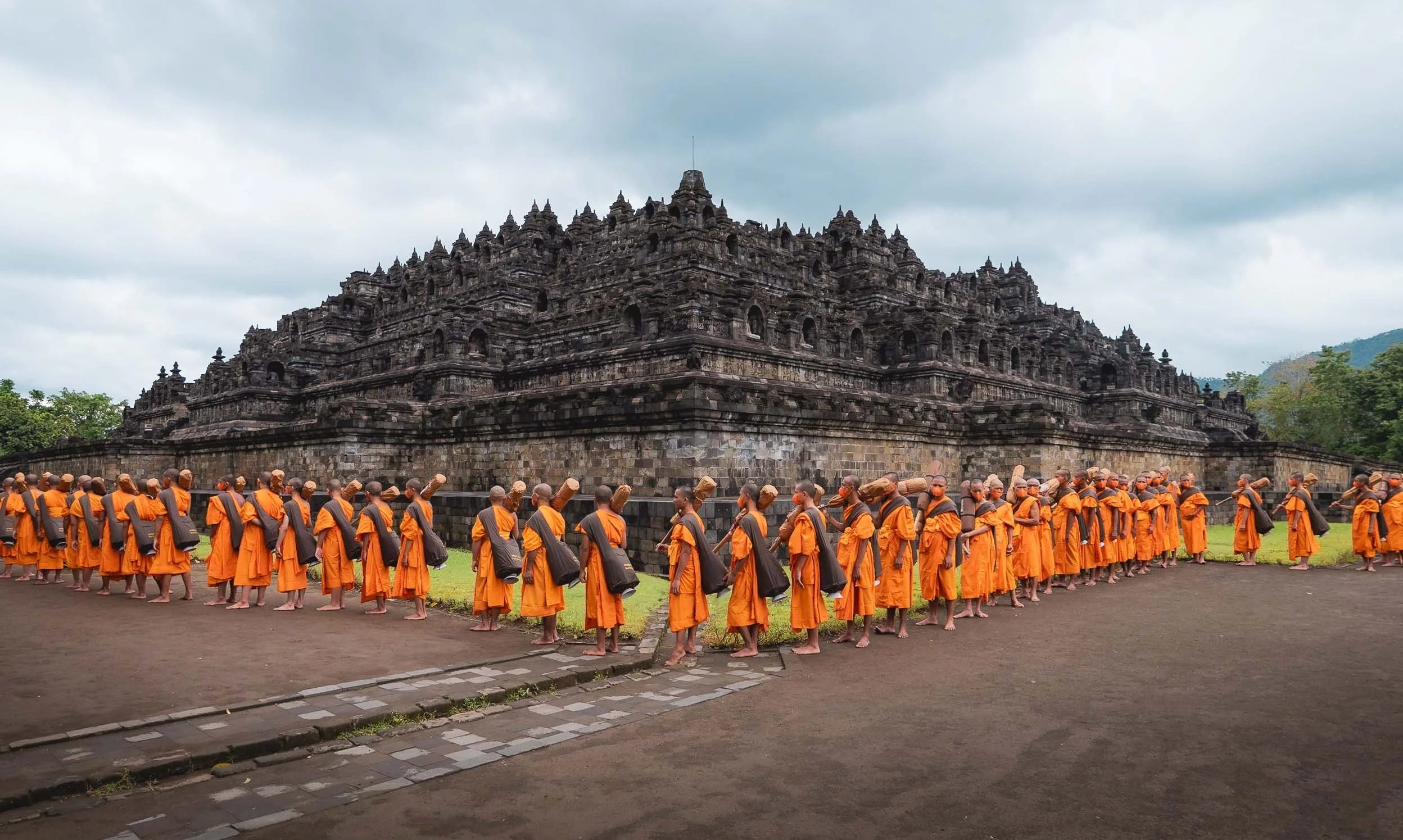
Borobudur’s architecture consists of six square and three circular pyramid layers with originally 504 buddha statues. Its design is closely aligned with Buddhist beliefs and cosmology.
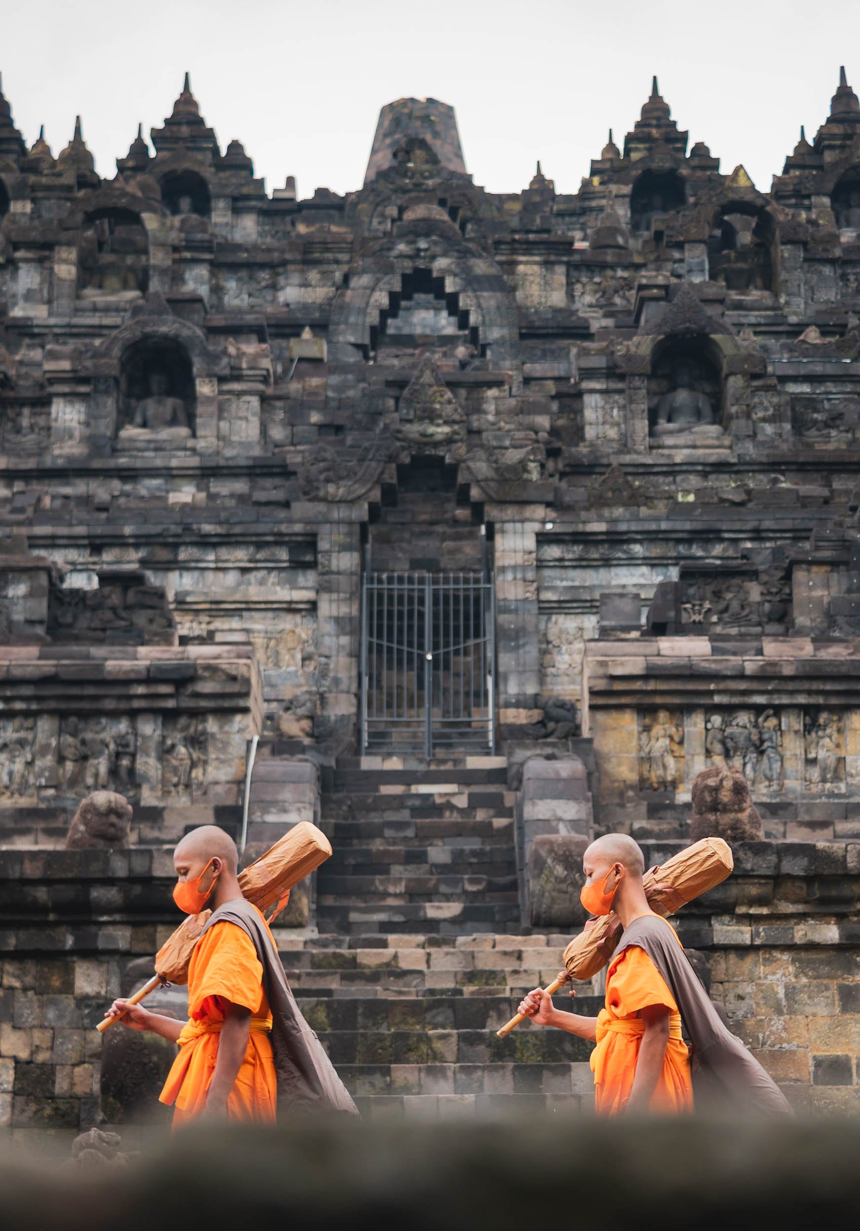
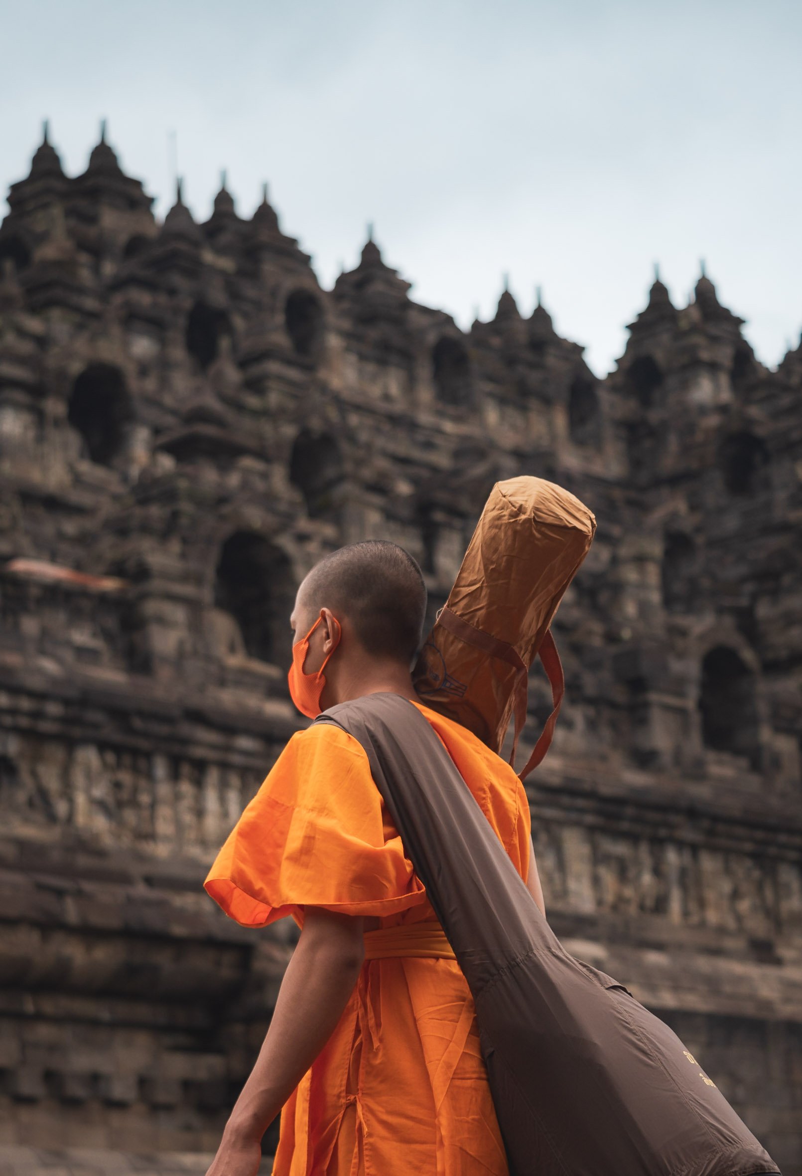
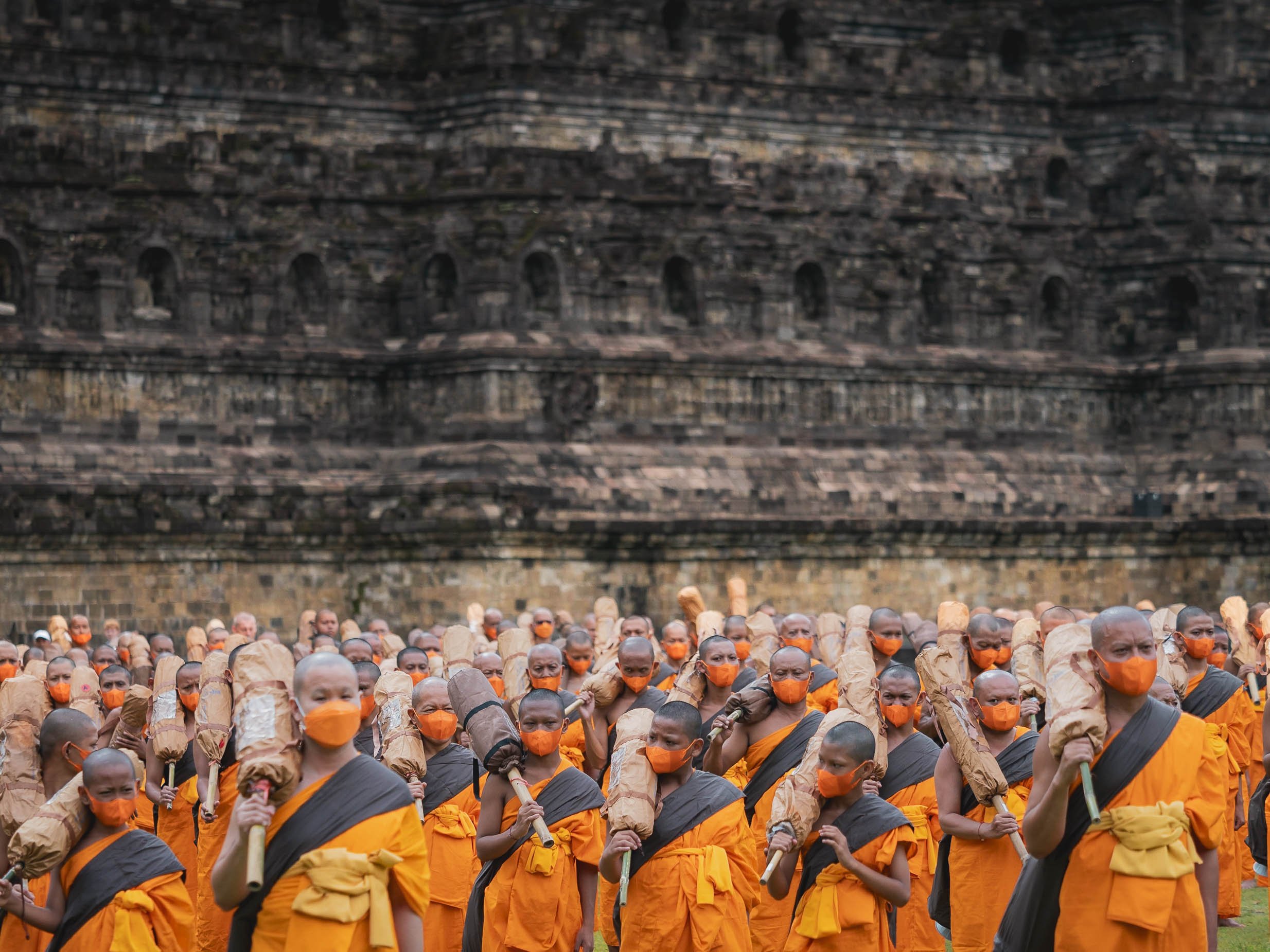
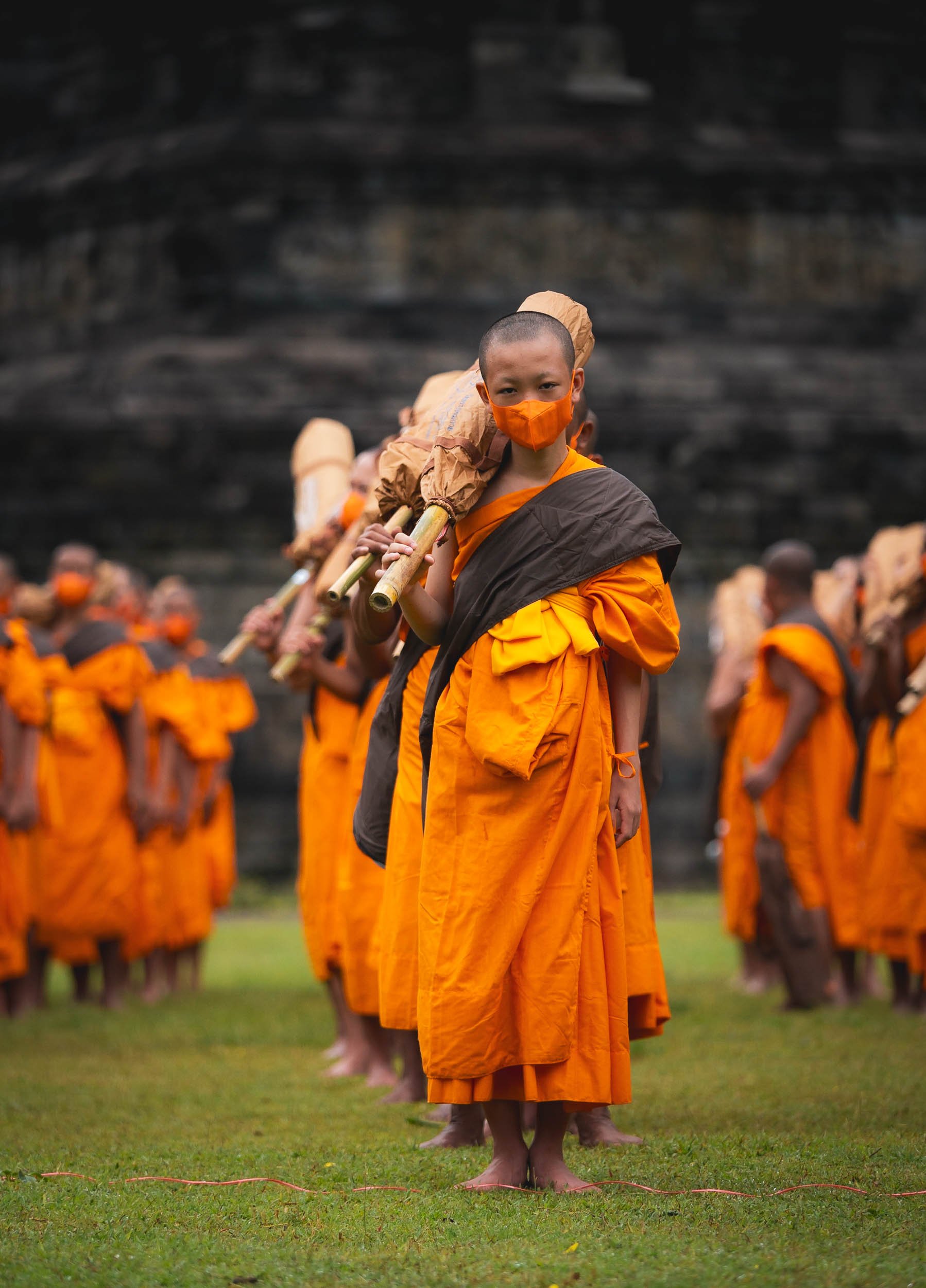

Climbing to the Top
The monks of course were allowed to take the steps up the temple, seen here from the mouth of the Chicken Church I visited later (yes, you read that right, just continue below…)

Gereja Ayam
That brings us to the last of the temple trio on my route - and while the above is its official name, calling it the Chicken Church is just inevitable, although the real design intent was to resemble a dove with a crown as a symbol of peace and coexistence.
The story of this poultry shaped religious institution goes back to a dream of a man called Daniel Alamsjah, whose divine visions made it his mission to establish a cross-cultural sanctuary for anybody seeking some spiritual guidance. The mission proved difficult, first due to protests by the locals who assumed he wanted to build a Christian church in a muslim neighborhood, then the complexity of permits, the need for money, and his general lack of experience with building projects.
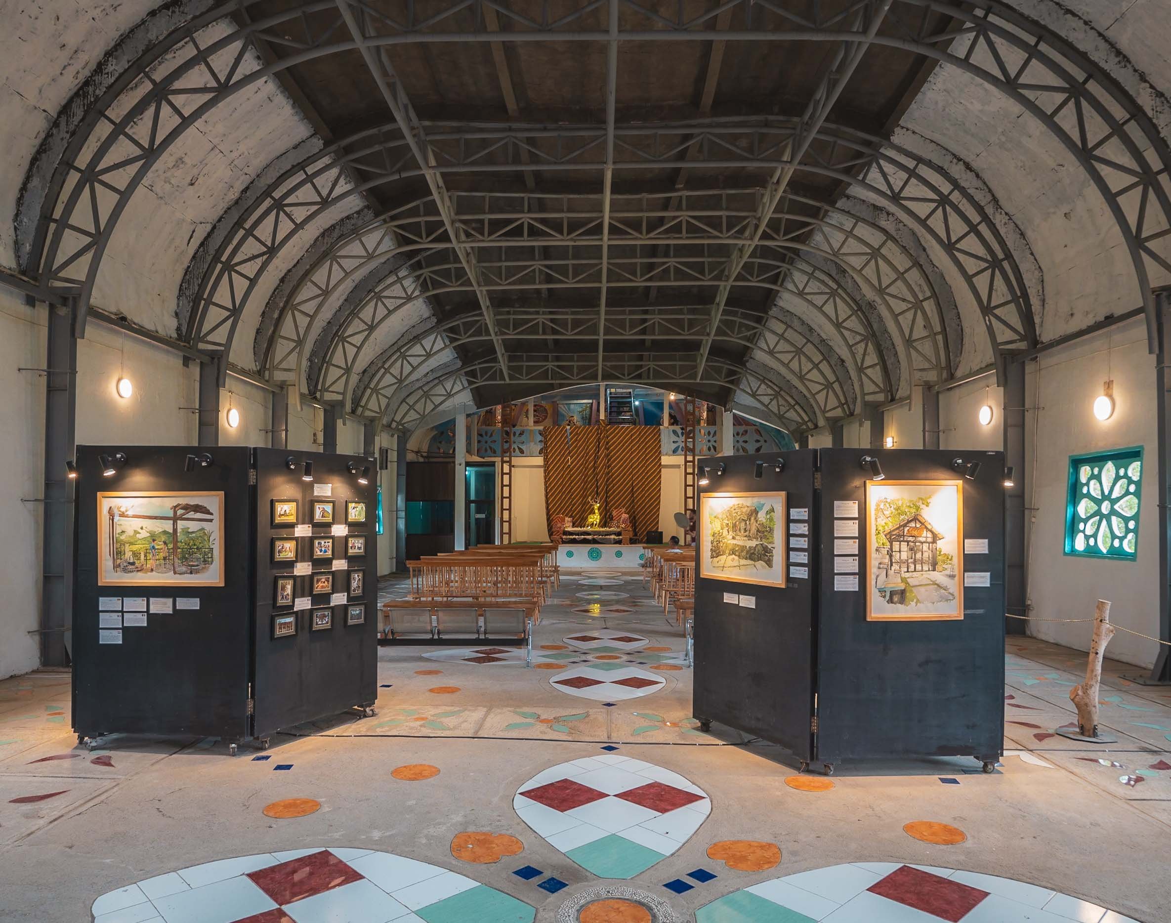
It took 20 years until his idea become an avian inspired reality. Then international media attention and the shooting of a famous Indonesian movie started to draw in more tourists and he could charge a small entrance fees and complete his dream, including a visitor cafe (the food quality of which is luckily in stark contrast to its location at the butt of the chicken rear of the building).

From the Chicken’s Mouth
The interior is fully built up from basement to the top with various exhibits and prayer rooms, and you can climb inside the head for a view down the hill. If look really closely you can see a small hint of Borobudur on the middle right - this is where the above photo of the temple was taken from.
Once I had found my spiritual home here, I concluded my time in Java with a night in Semarang, where I got to just briefly glimpse at some of its remaining colonial Dutch architecture, before making my way to Borneo via a short flight over the Java Sea.

The Capital
While I didn’t end up in Jakarta on this part of the trip, I had a short layover a few weeks later. I didn’t find the time (and energy) to take a lot more photos of the city then, other than some snaps from the pool level of my hotel - including them for sake of completeness 😉

Indonesia is incredible, and the amount of natural and cultural variety is enormous - I spent more than 6 weeks here, literally on the road every day, and definitely want to come back.
Subscribe to my newsletter to get notified and don’t miss out on more Wonders of the Globe.
Other Recent Posts:

Flores Island & Komodo - Indonesia Part 1
Exploring Flores island and the bordering Komodo National Park, part of the Lesser Sunda Islands in eastern Indonesia.
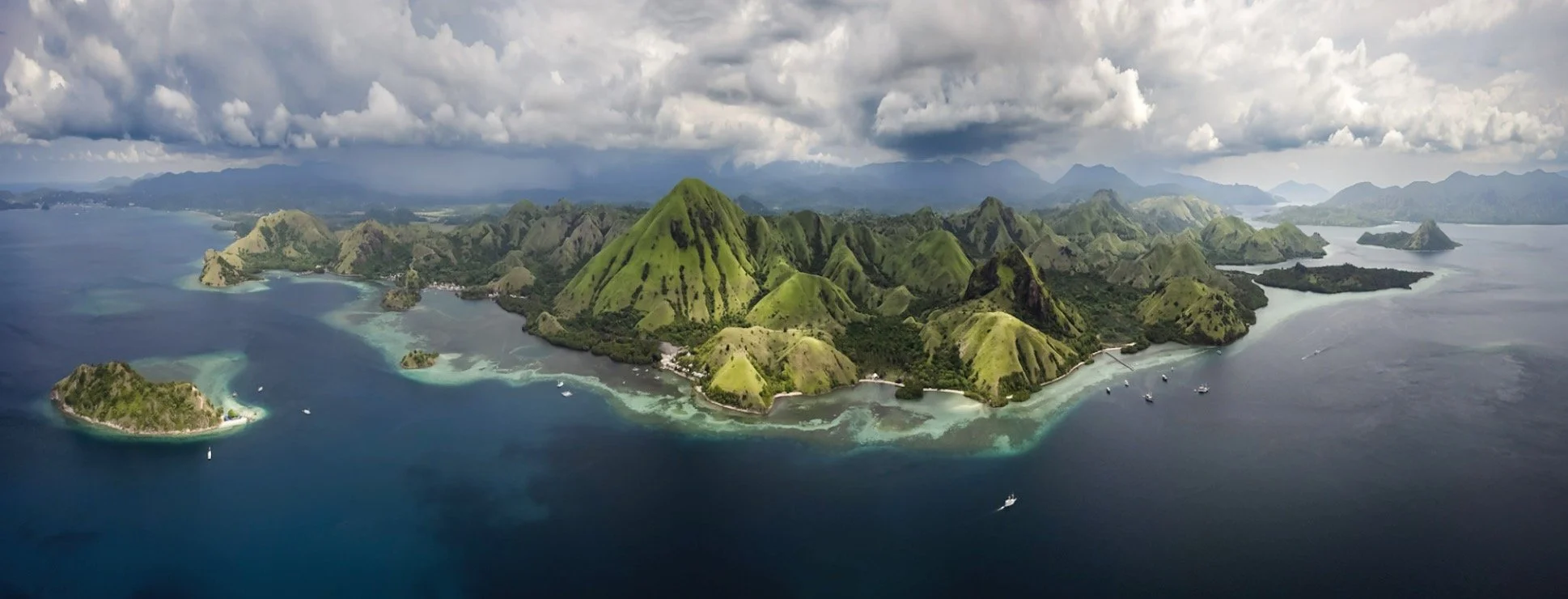
The amount of photos and videos I took over my 6 weeks in Indonesia has been slightly overwhelming, which is one of the reasons this blog didn’t see any of them yet. There are just too many incredible places to experience and document in this amazing country! We’ll start with the western part of Flores island (my kind of name) and the bordering Komodo National Park, part of the Lesser Sunda Islands in eastern Indonesia. I spent 6 pretty packed days here, 3 of them on a boat around the islands - take a look!
The video below will give you a pretty good overview of some of the most interesting places you get to explore in this part of Indonesia.

Ende & Kelimutu
My flight took me to the town of Ende, pretty much in the southern center of Flores (and I didn’t go much further east). The goal was to start with hiking up the Kelimutu Volcano in the first night. On the way, we stopped at some of the beautiful typical rice terraces, and the local Saga and Wologai villages to see some of the traditional houses common to the island.


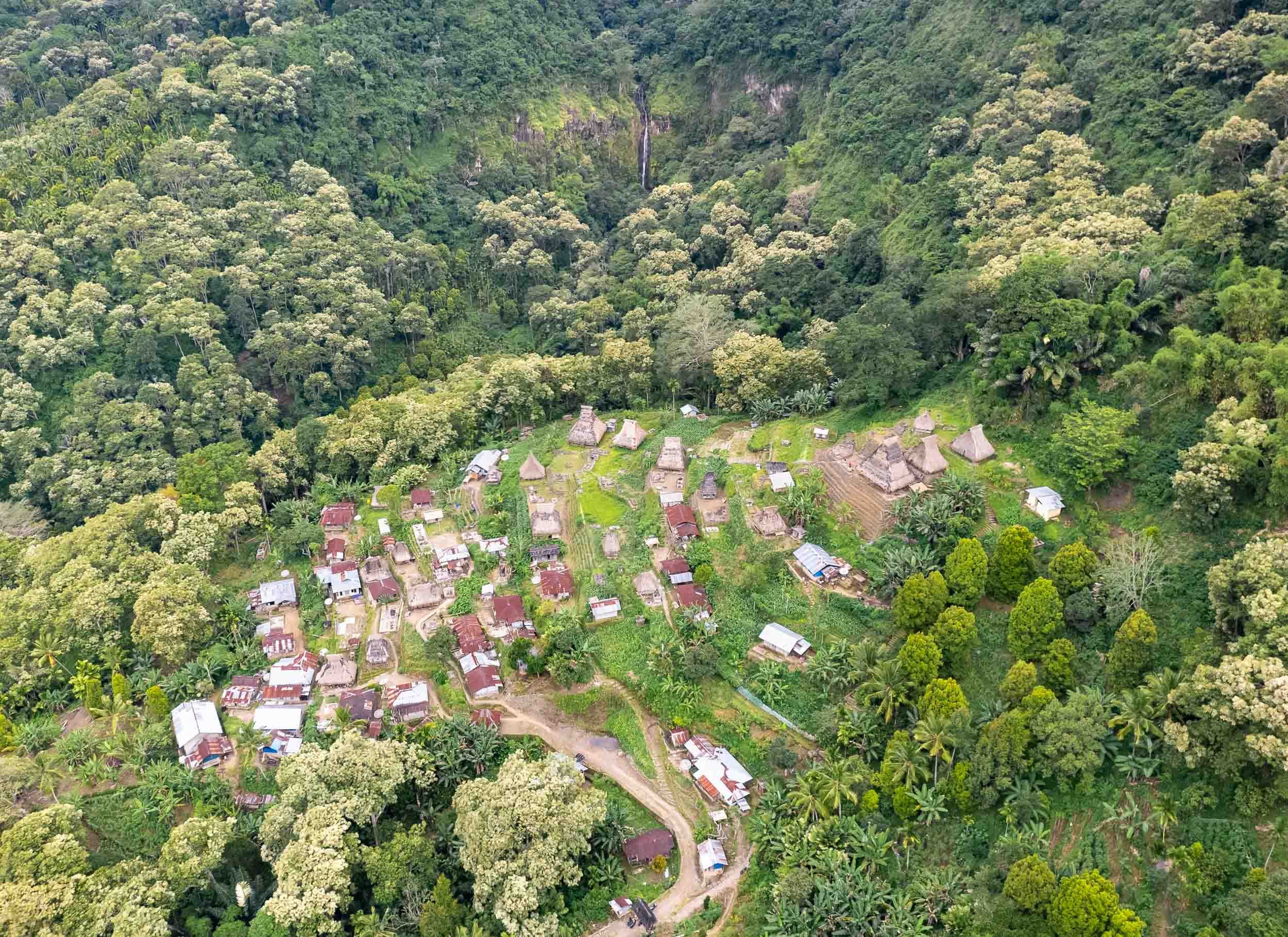


The thatched roofs of Wologai village, one of the many traditional places where you can still observe the daily life of the locals. The houses follow the Lionese architectural style and the village is said to be 800 years old.
Kelimutu - Volcano of the Dead
An early start around 3am ensured that we’d reach the Kelimutu Volcano with its three lakes for sunrise. After an hour hike, the stairs along the last few hundred meters to the crater’s edge lead us into colorful clouds, which slowly faded away as the sun rose.


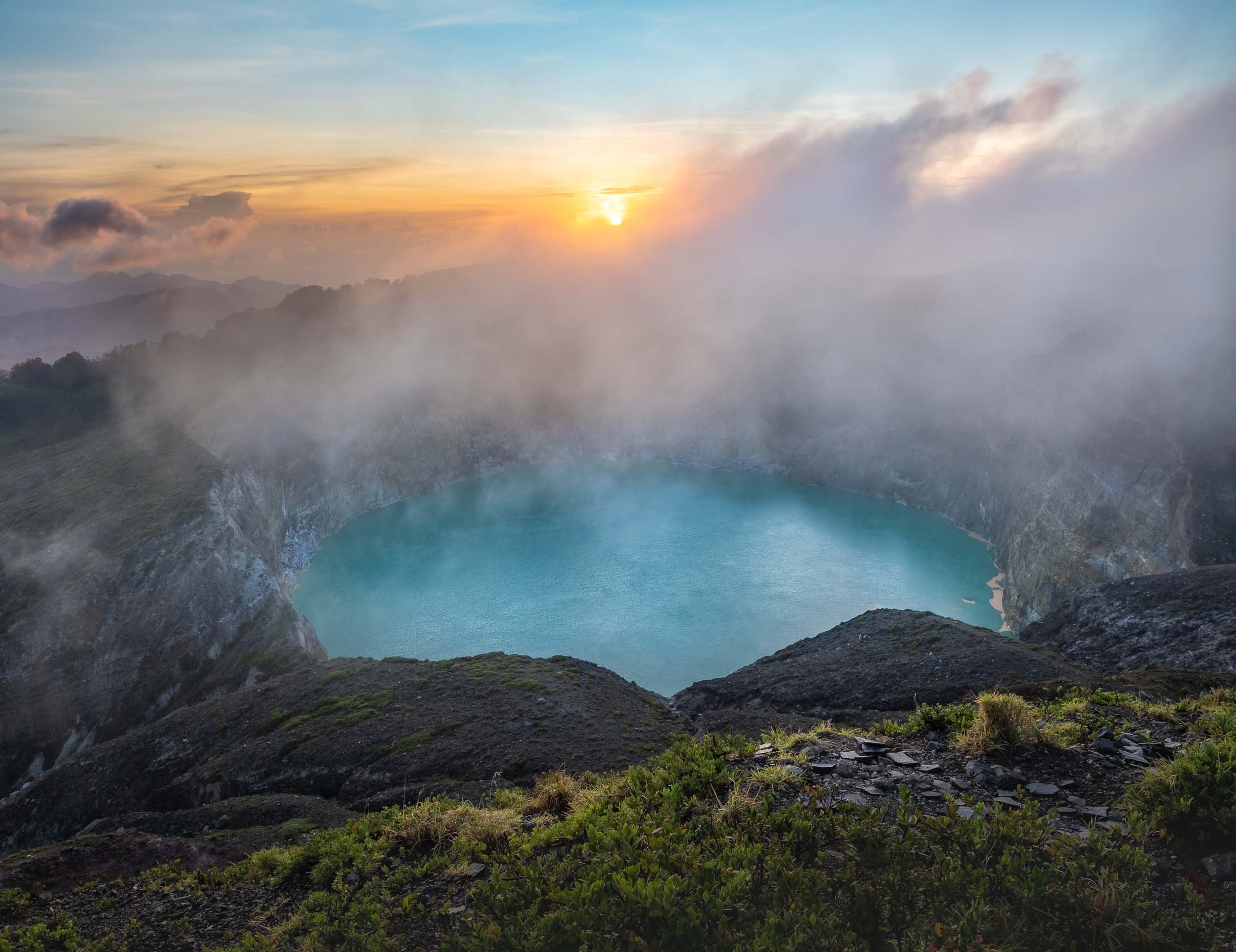
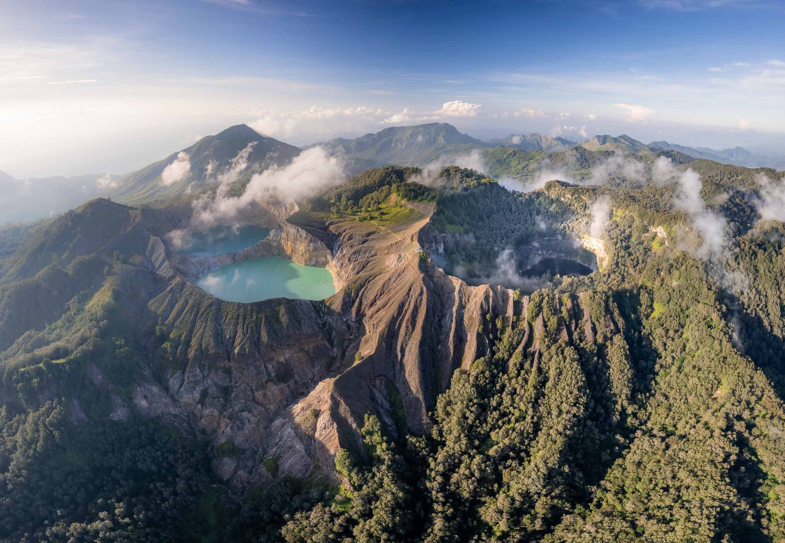
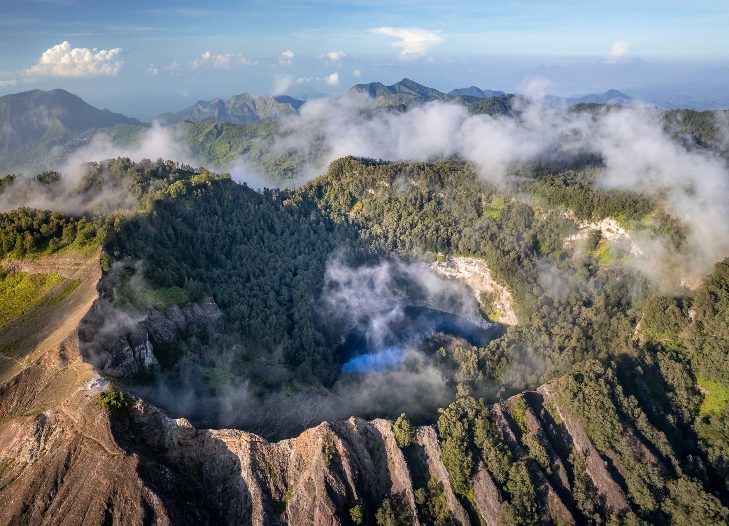
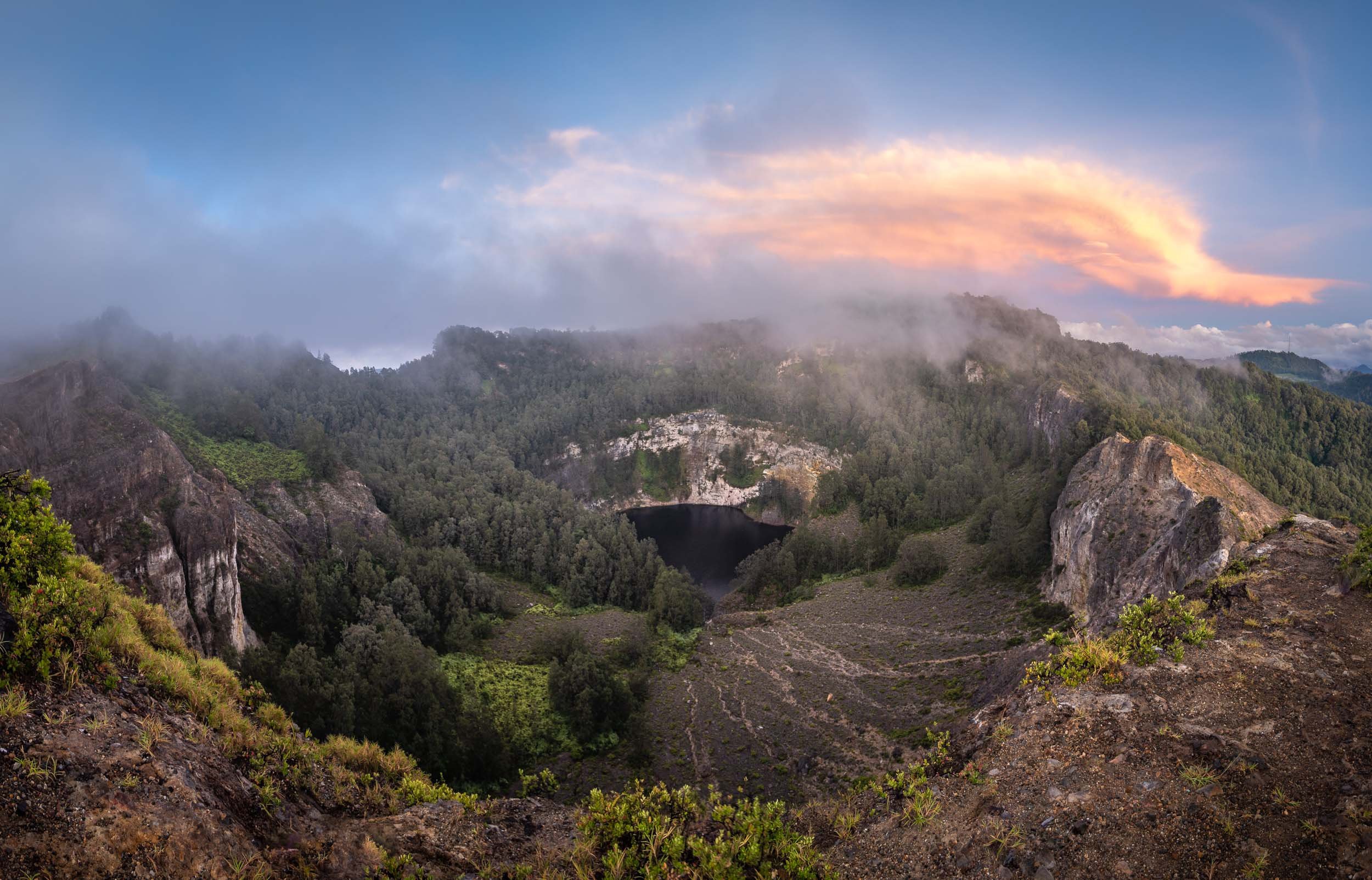
Close ups of the crater lakes, showing the smoke over the water and their different hues. Between January and November 2016, the colors of the crater lakes are said to have changed six times.

The way down leads through the Kelimutu National Park and its beautiful flora and fauna.


The Blue Stone Beach
We continued our journey in the morning after returning from the volcano. On the coastline in the south of the island lies another colorful phenomenon….
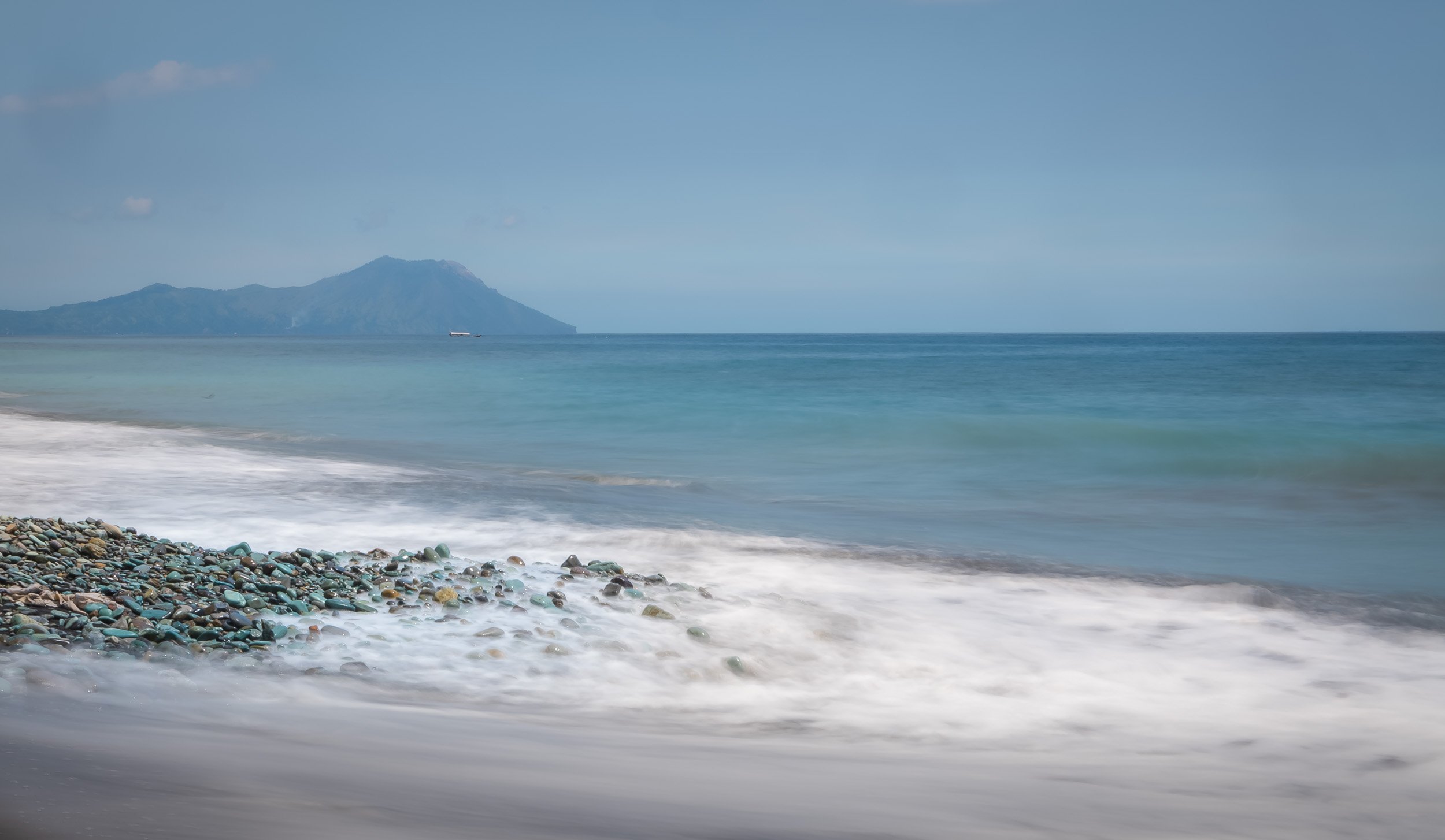
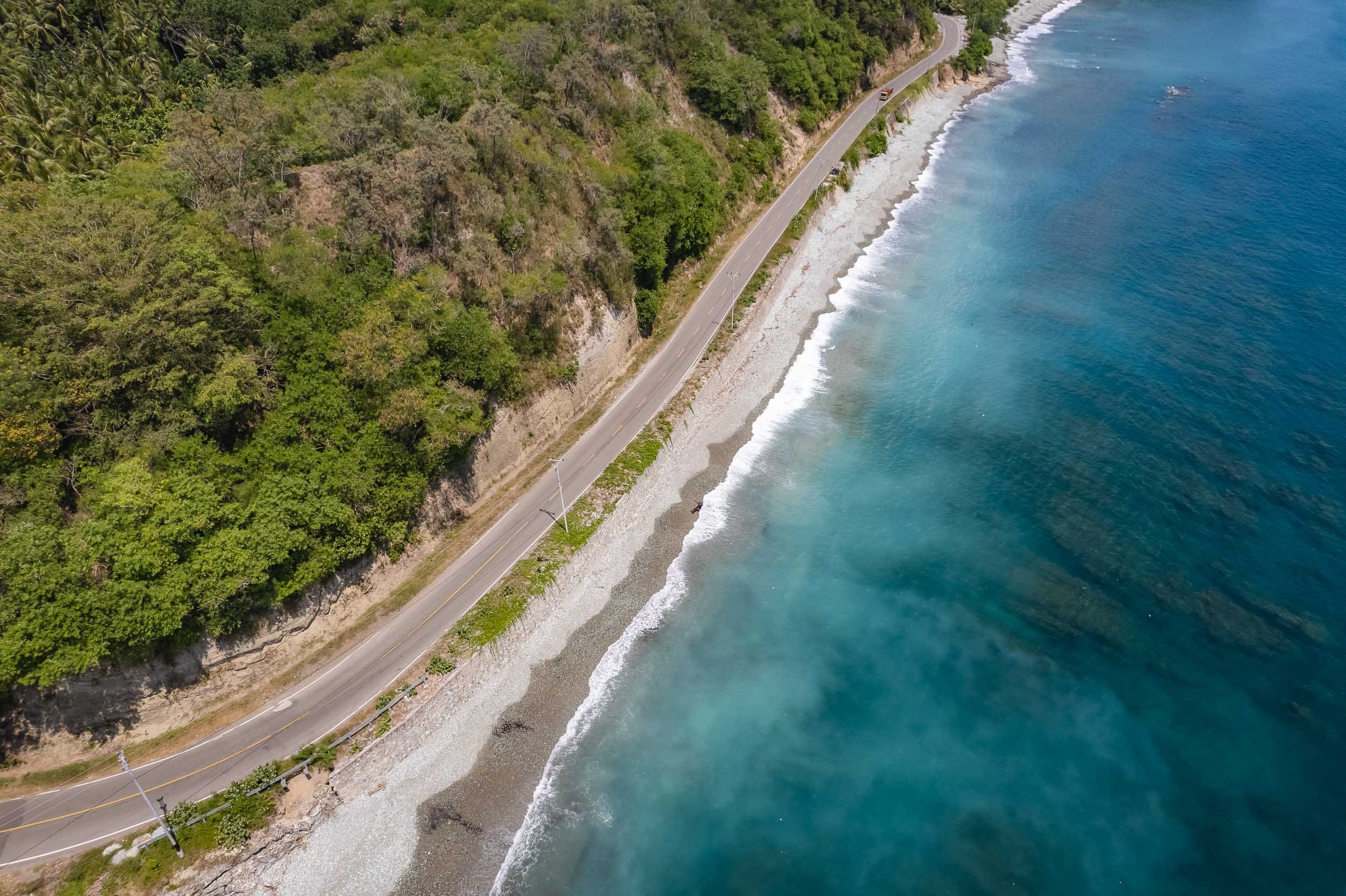
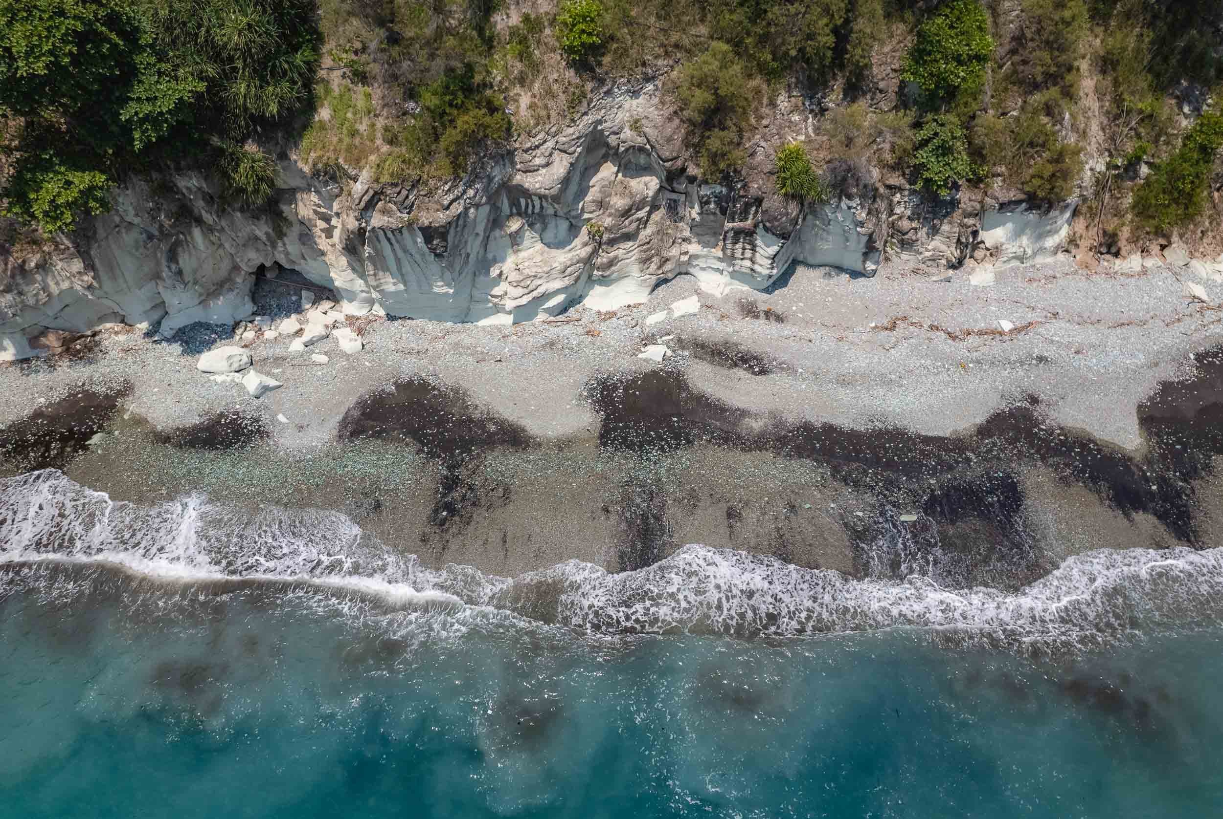


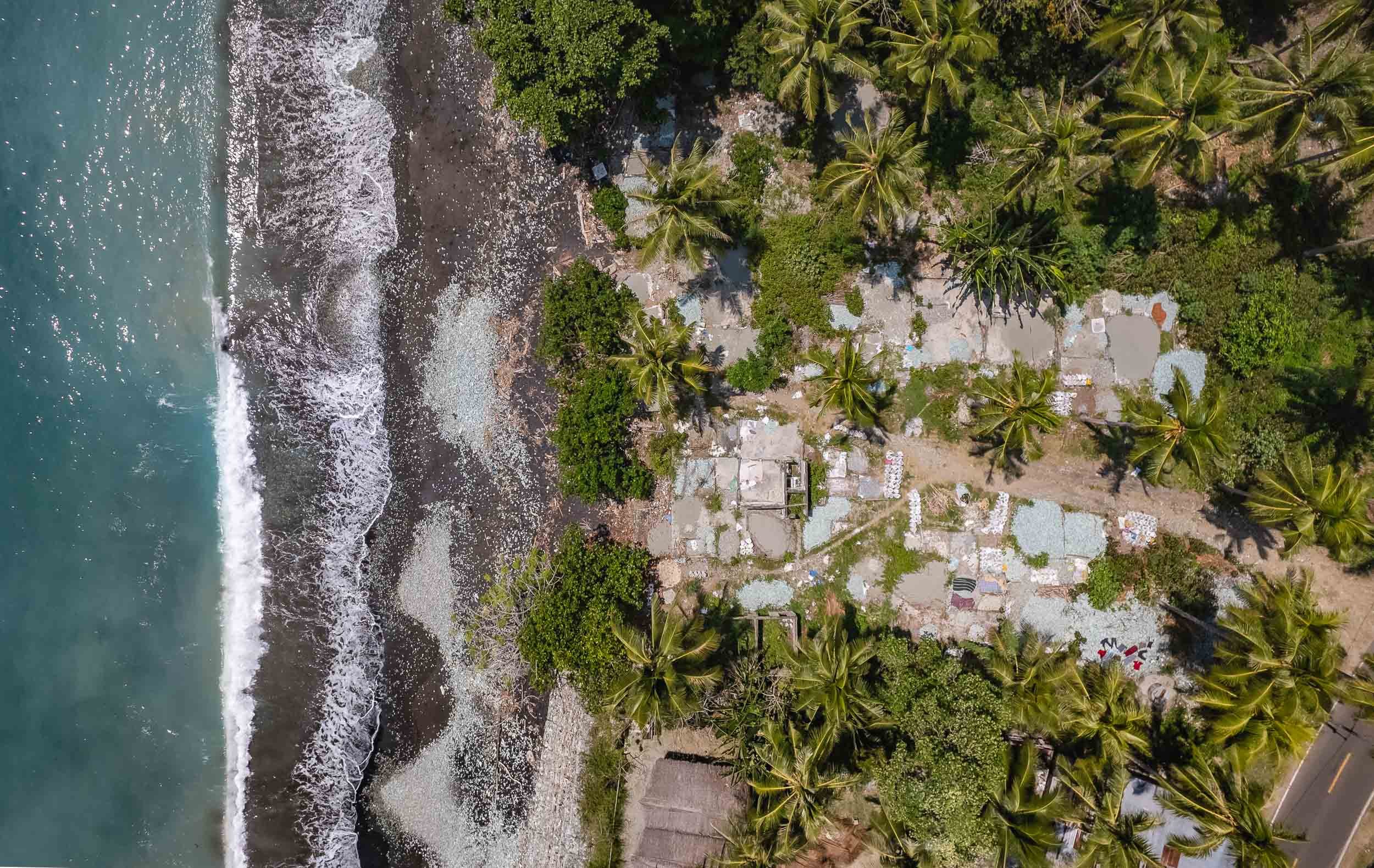
Volcano Village
Near the town of Bajawa lies the the small traditional village of Bena, one of the primary remnants of the preserved Ngada culture in the region.
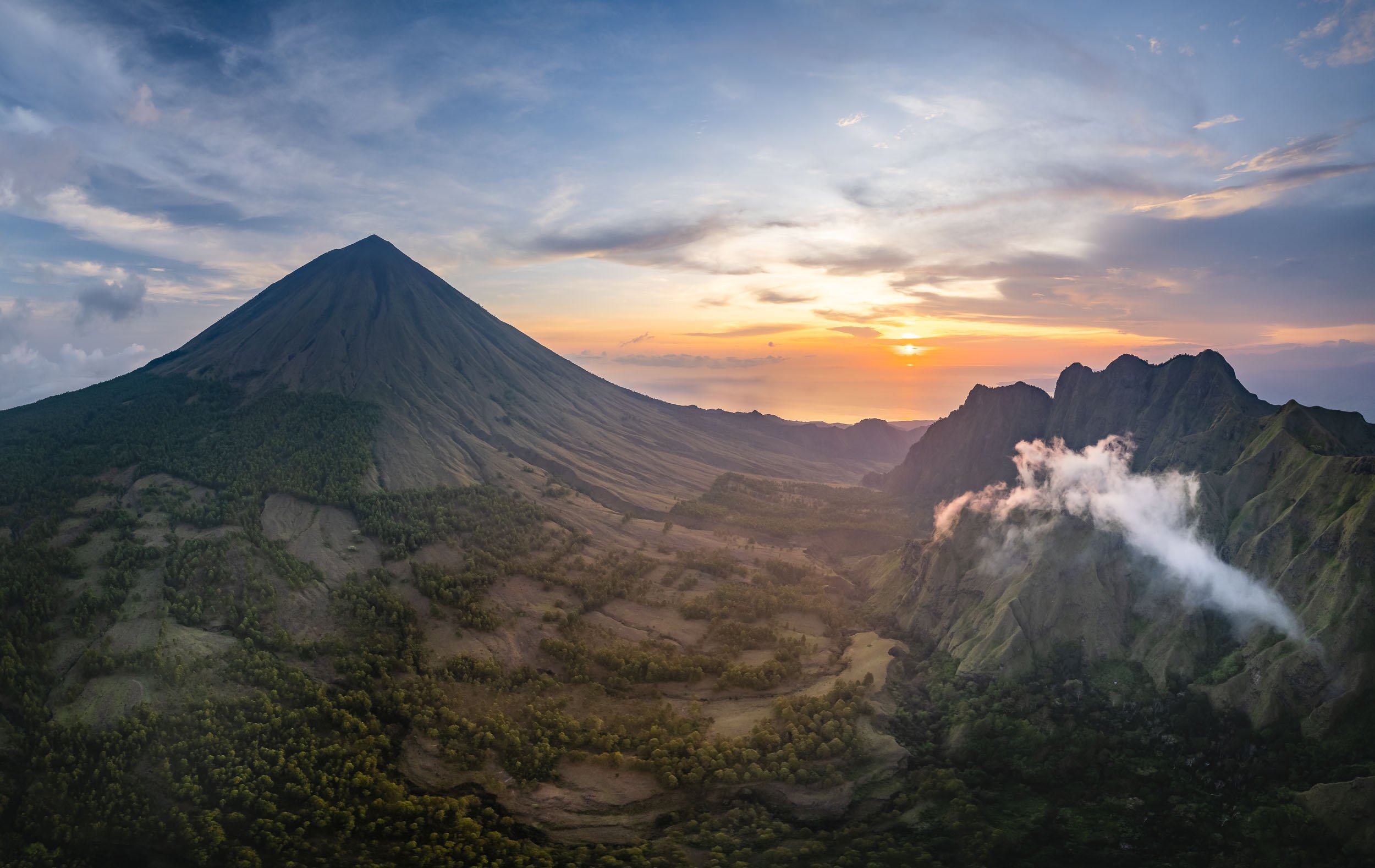
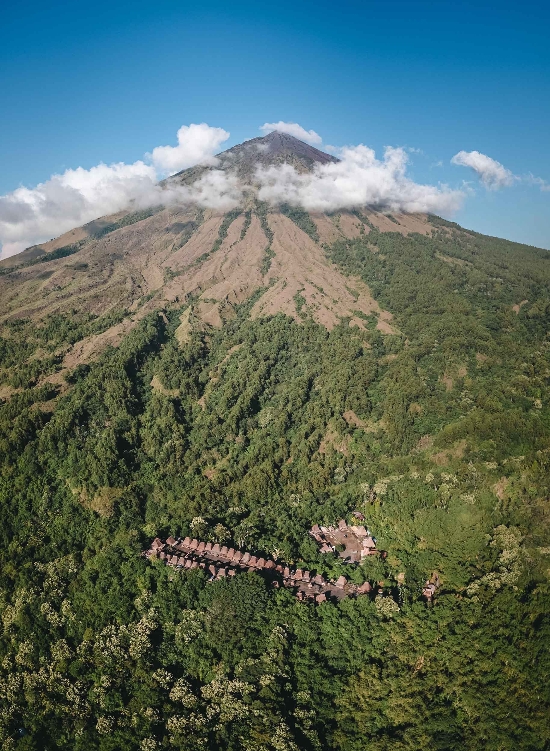
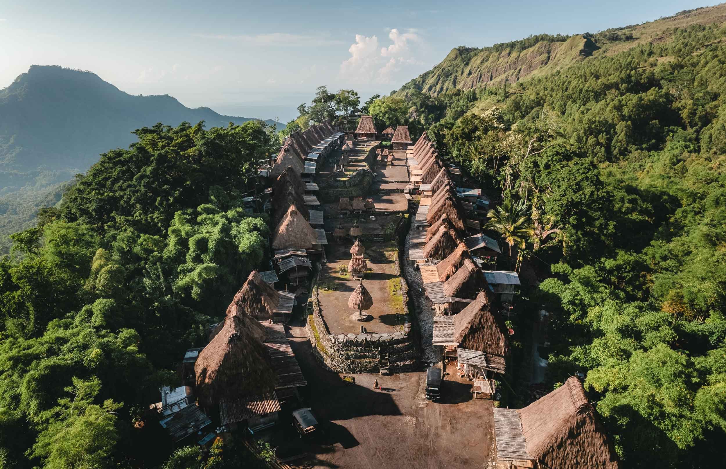


The Ngada traditions date back 1200 years and can still be observed in the village, even though some of the locals now focus on selling souvenirs to tourists.
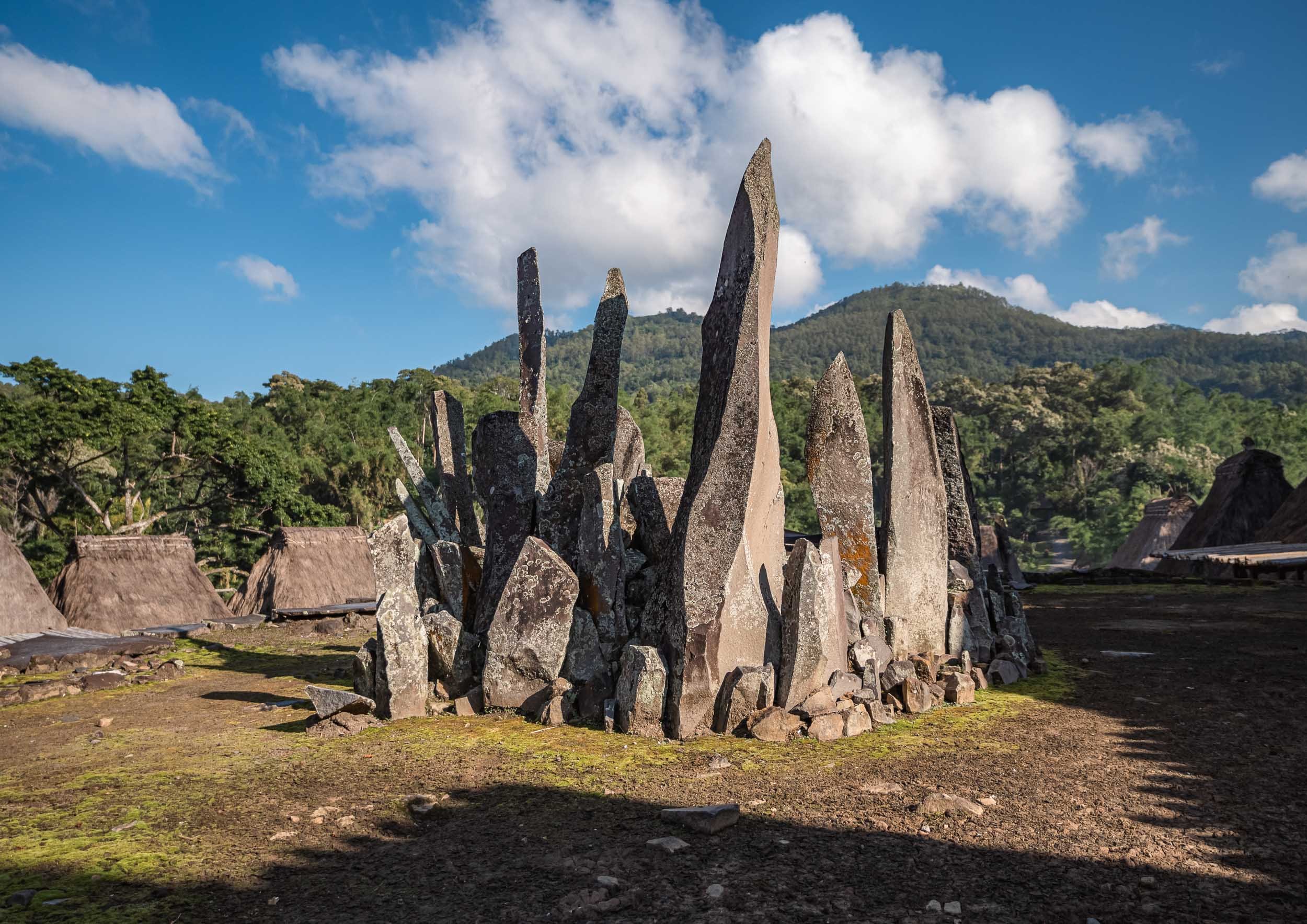
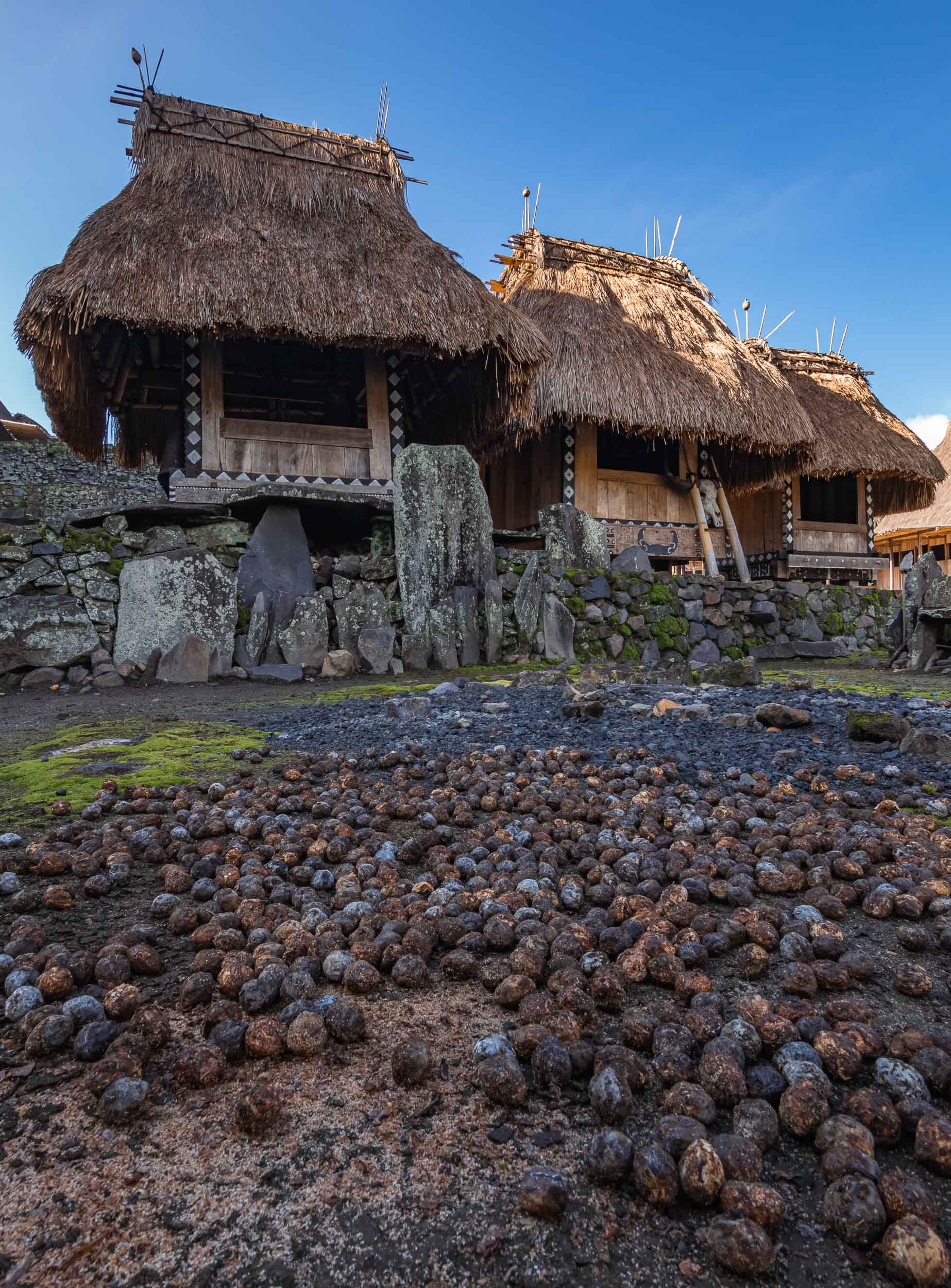


Some of the local villagers in the town - arrive early morning to observe some of the daily rituals.
From Bajawa to Ruteng
The road westwards led us past a small local distillery making Arag and fresh palm juice. The owner insisted on showing me how they are harvesting the fruit from the palm trees, climbing up to the top with a cigarette permanently attached to his lips. Understandable I suppose, he needed his hands free.


Some of you might know that I don’t drink (or like) alcohol, but of course I couldn’t refuse a sip after I saw the effort that went into making it. Let’s say it won’t change my stance, but on the other hand it wasn’t the worst alcohol I tried in Indonesia. More on that in another blog (watch out for my time in Borneo).
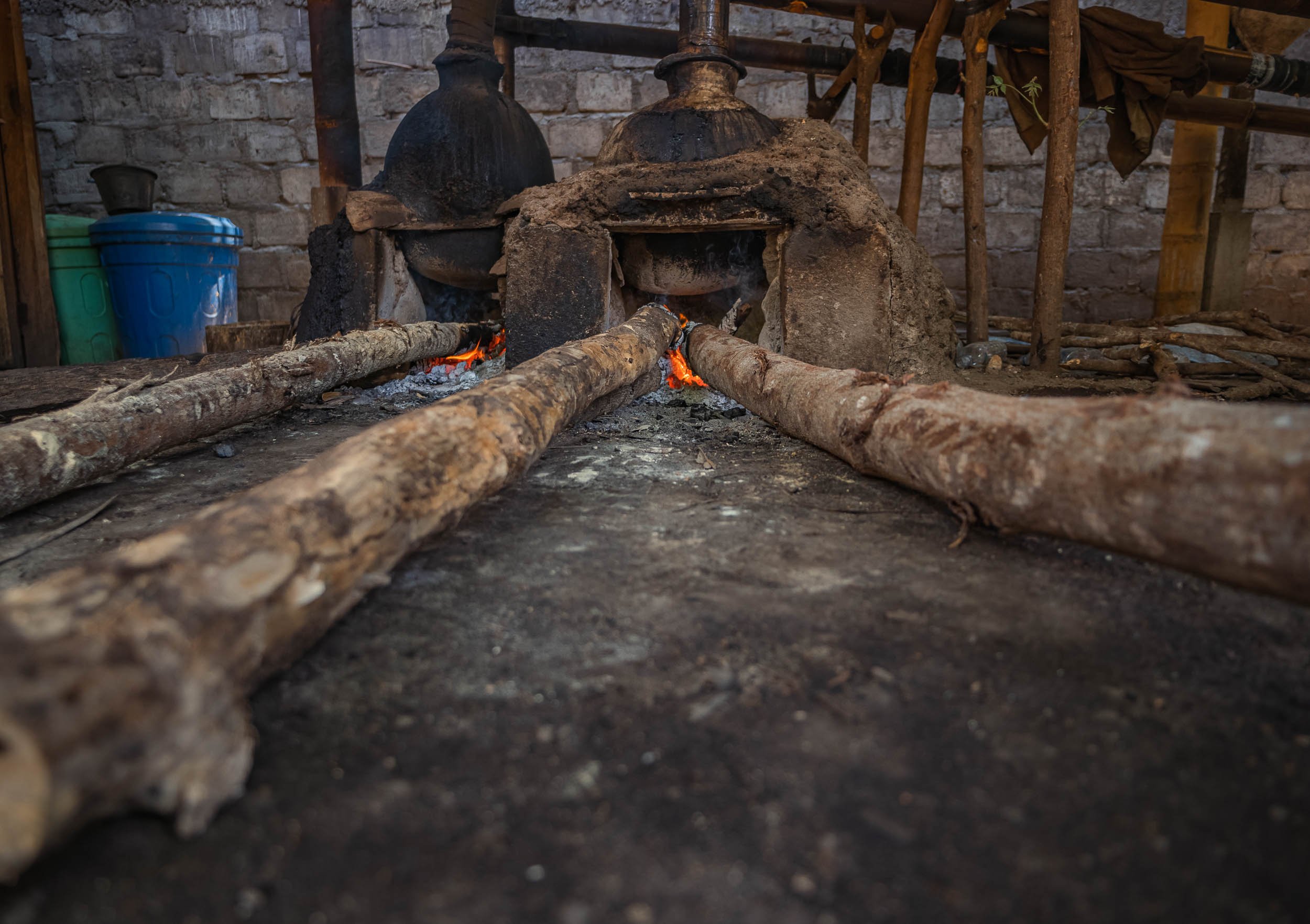
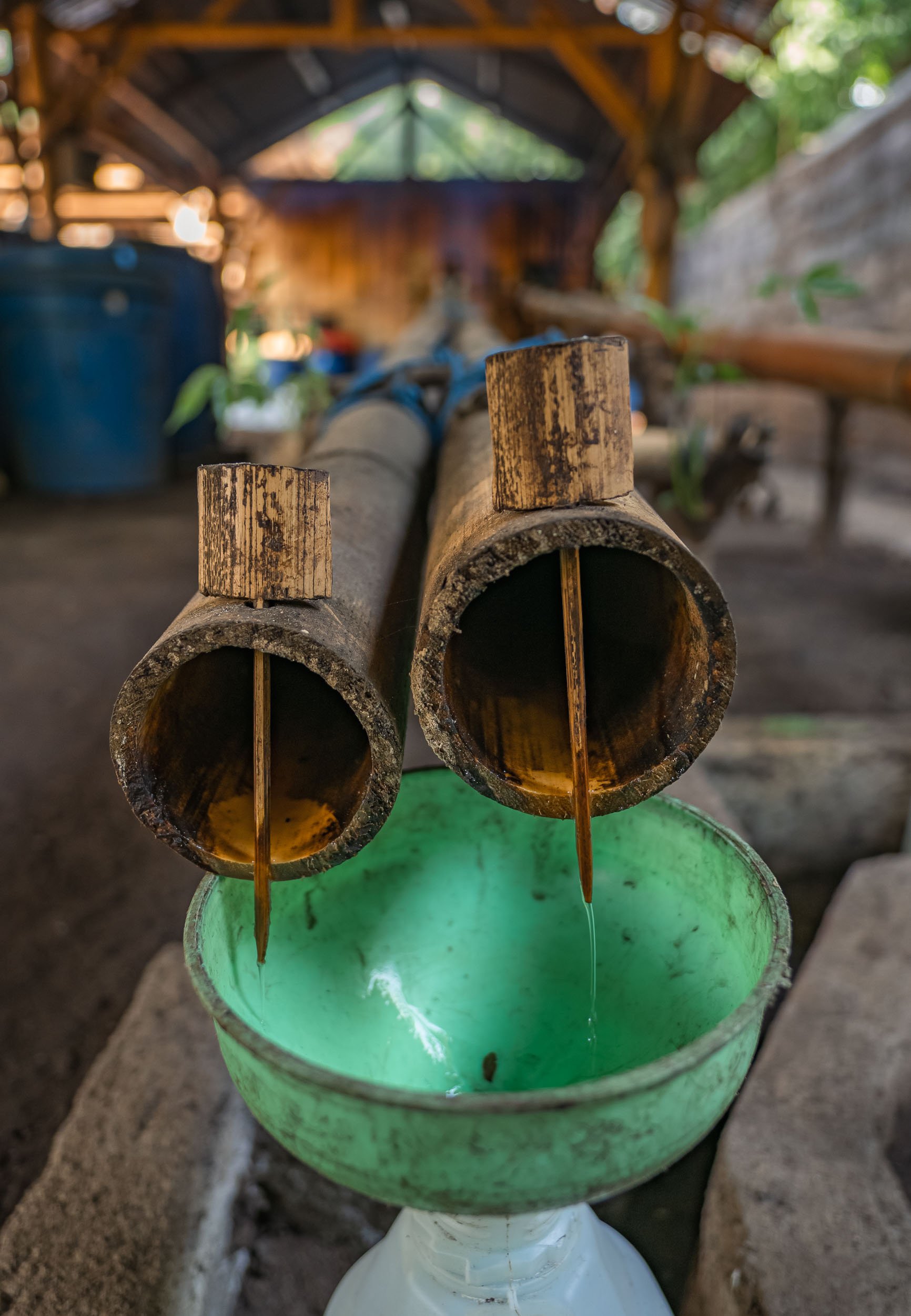
The clay oven powering the distillery. The entire process is based on locally made tools and tricks passed down through generations, such as these bamboo pipes.
The rain forest lake of Ranamese was our next stop, and rainy it was indeed. A small dry window in the clouds allowed me to get some aerial photos of this beautiful calm spot along the hilly road.
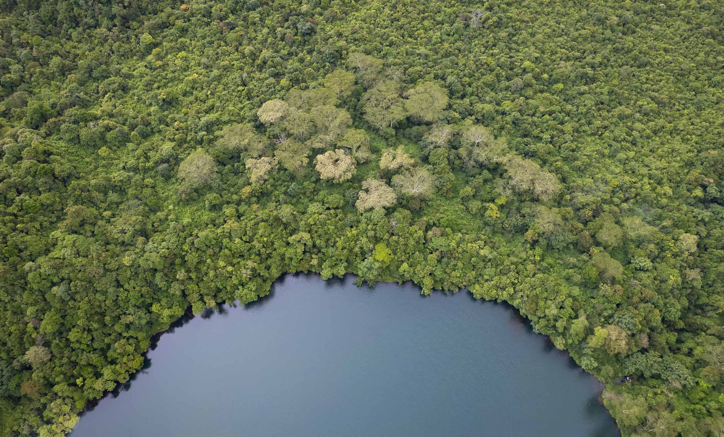
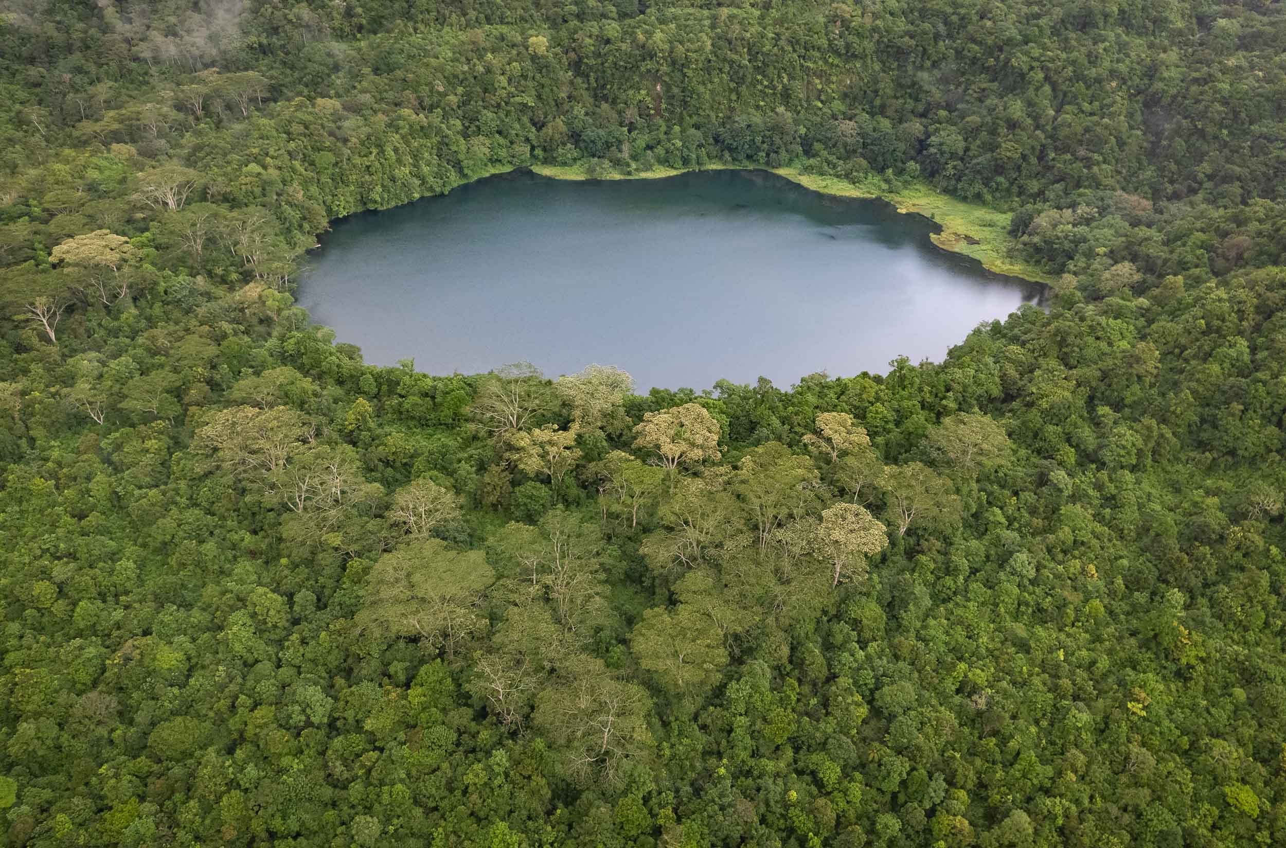
The Spider Web Rice Fields - Lingko
Heading west towards Labuan Bajo takes you past one of Flores’ most amazing attractions, the incredible rice fields shaped like spider webs. A visit during the right time of the year will allow you to see a green paradise full of rice plants, but the views during harvest as seen here are equally interesting.

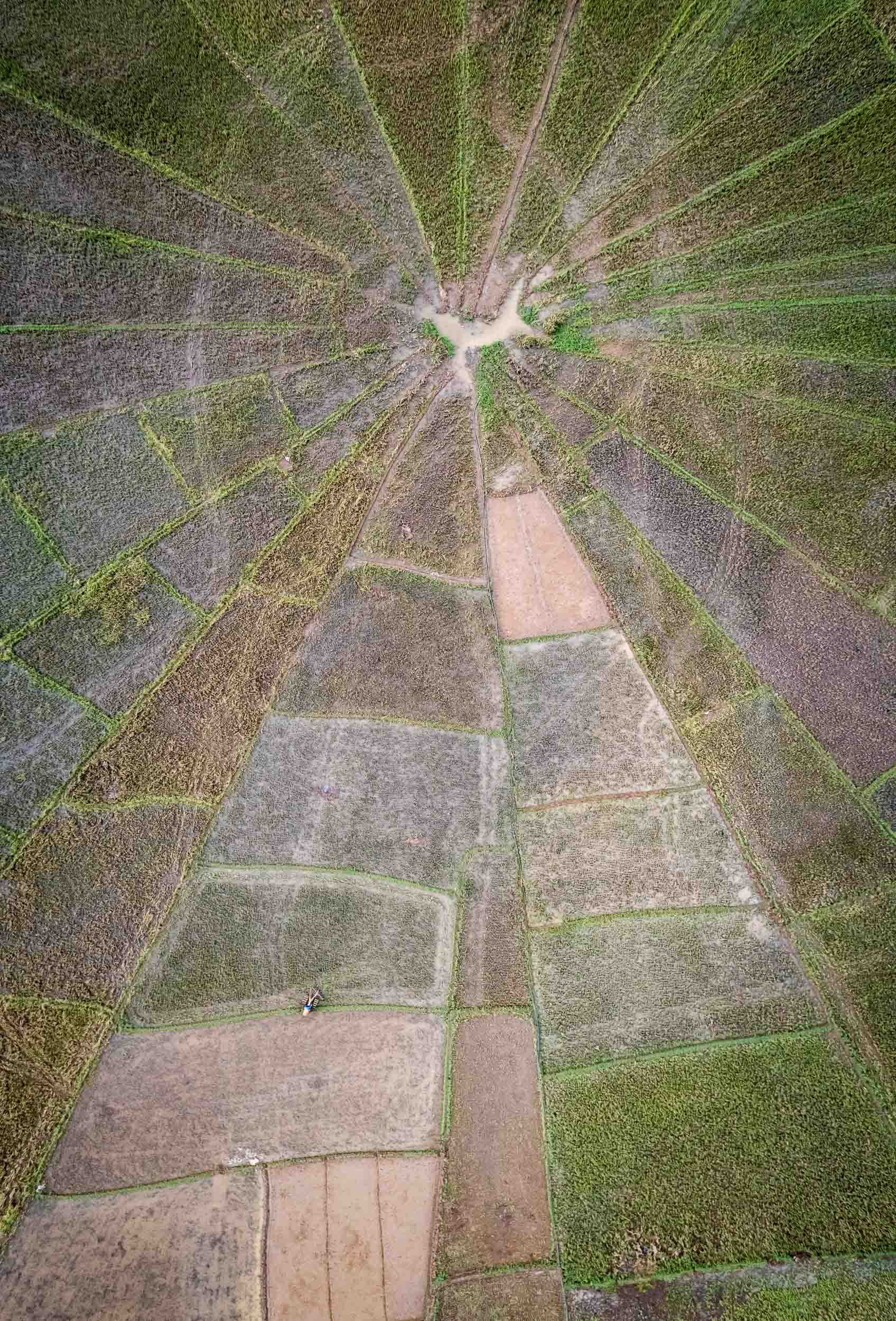
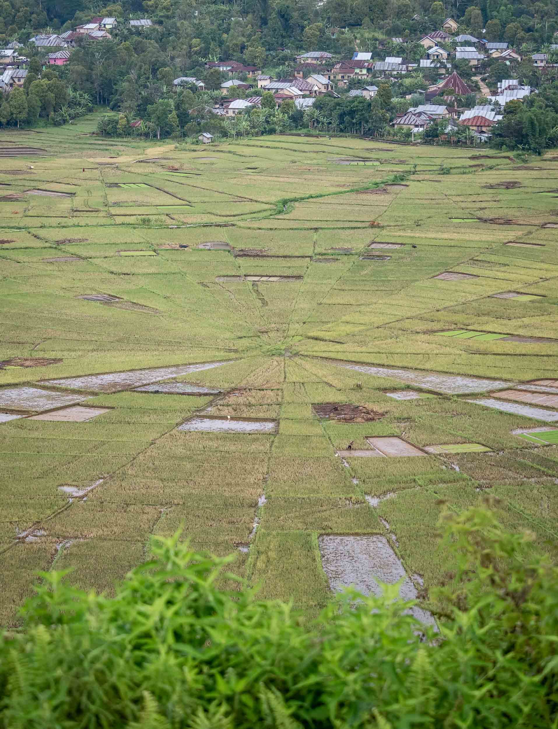
Island Life and Dragon Hunt
From Labuan Bajo the trip continued straight onwards, boarding the houseboat that would be my home for the next 3 days, sailing around the islands of the Komodo National Park.
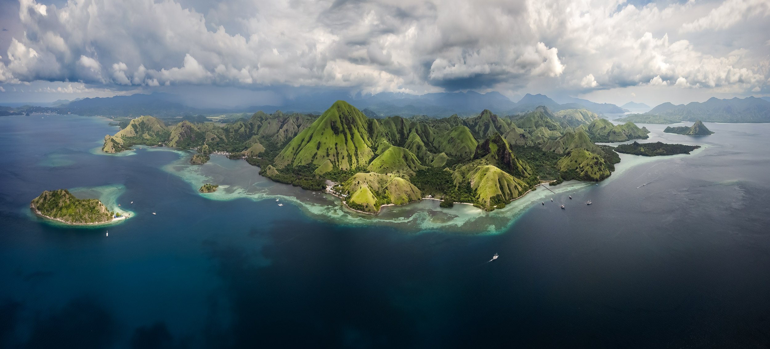

Padar Island
One of the larger islands in the archipelago is also one of the most beautiful. The views are worth the sunrise hike to the top - the earlier, the fewer people (as always).
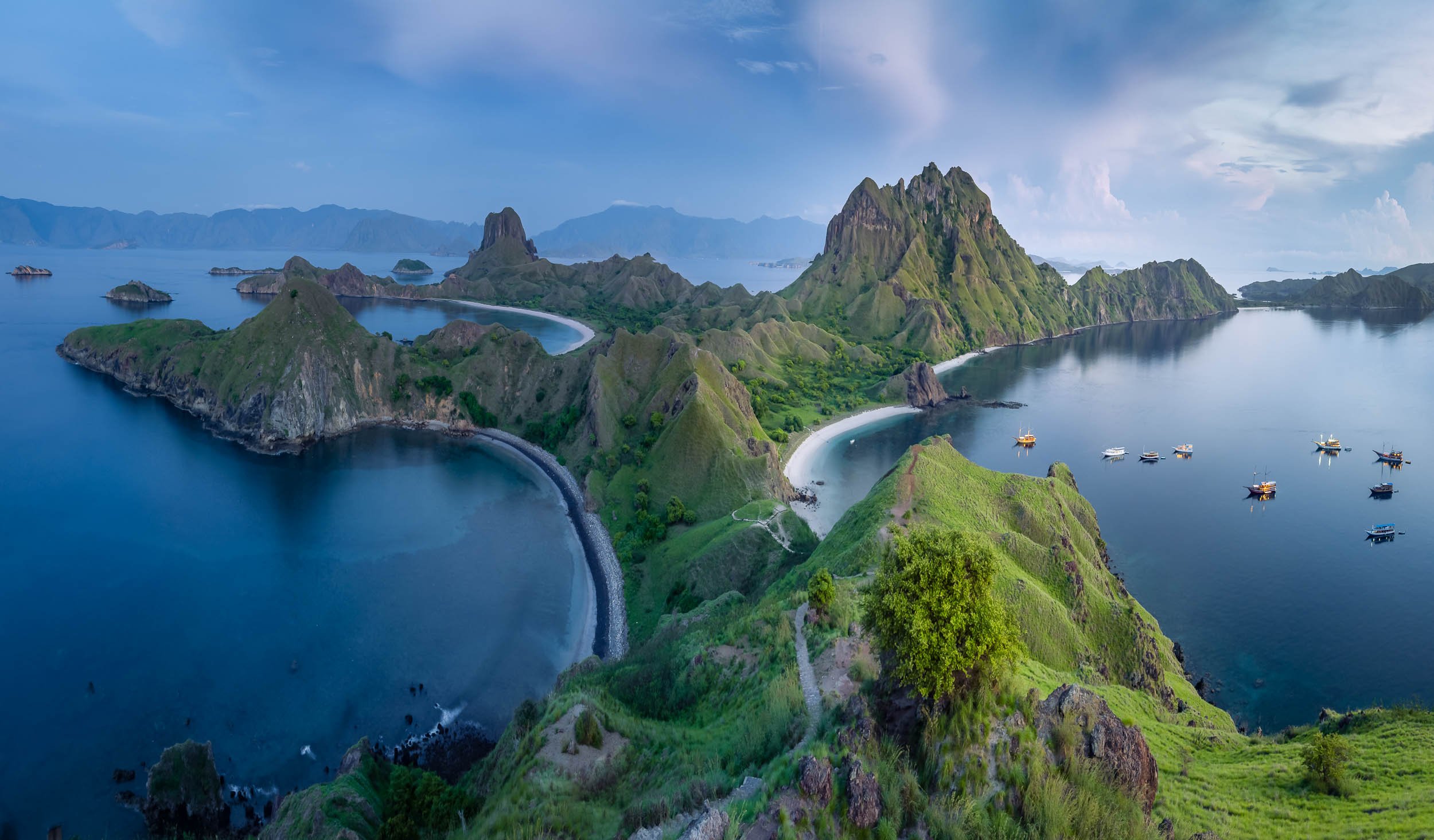
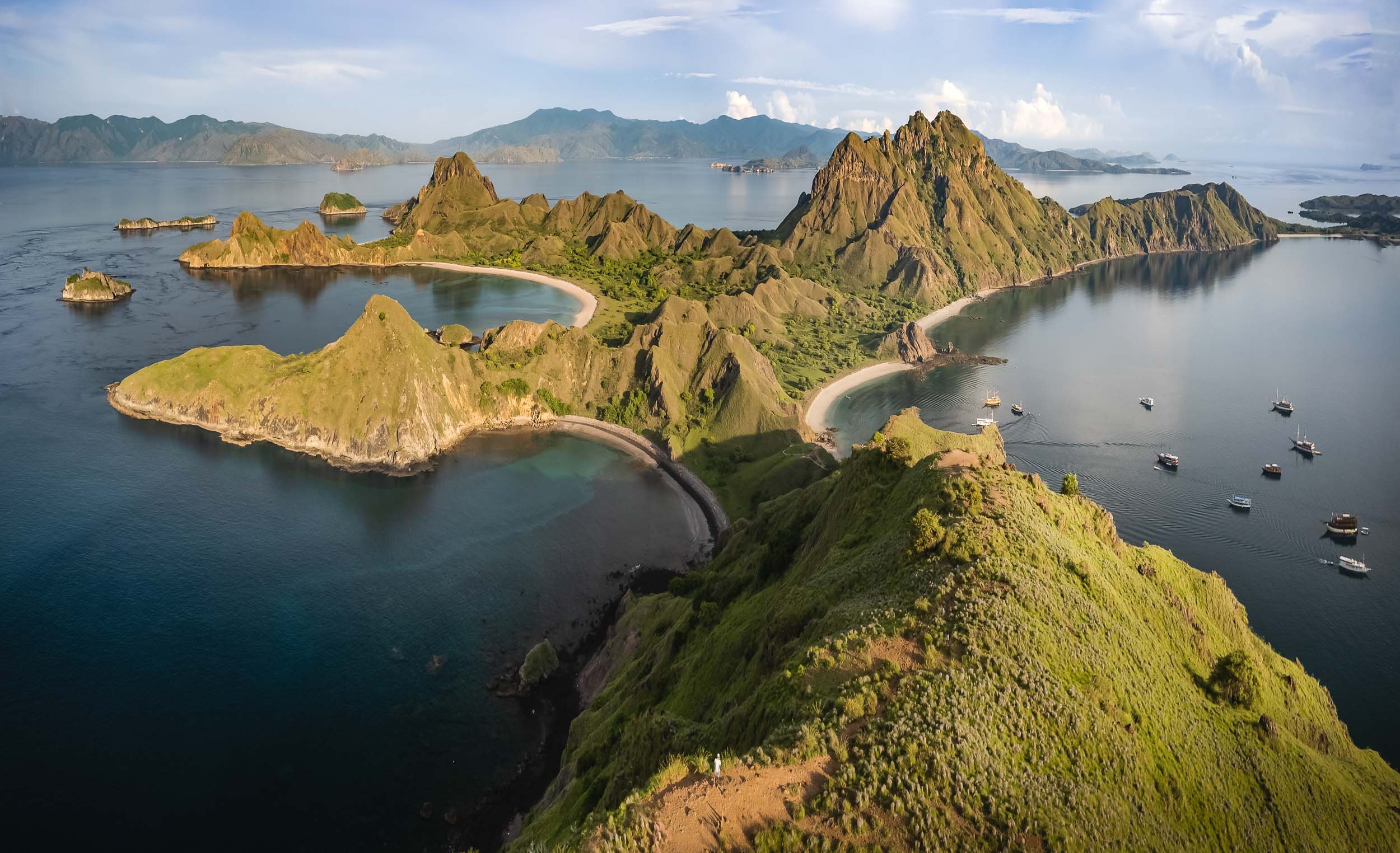
Flore and Fauna are abundant, from deer to wild boar, as well as dolphins, and a large coral variety. Seeing deer on the beach felt slightly odd to me at first, having always associated them with forests.


The Last Remaining Dinosaur
Of course, the primary wildlife people want to see in Komodo National Park are the namesake dragons. It’s an apt description for these animals. This is the only region where the largest lizard in the world can still be found on a handful of islands, with around 3000 endangered individuals still surviving in the wild, most of them on Komodo Island.
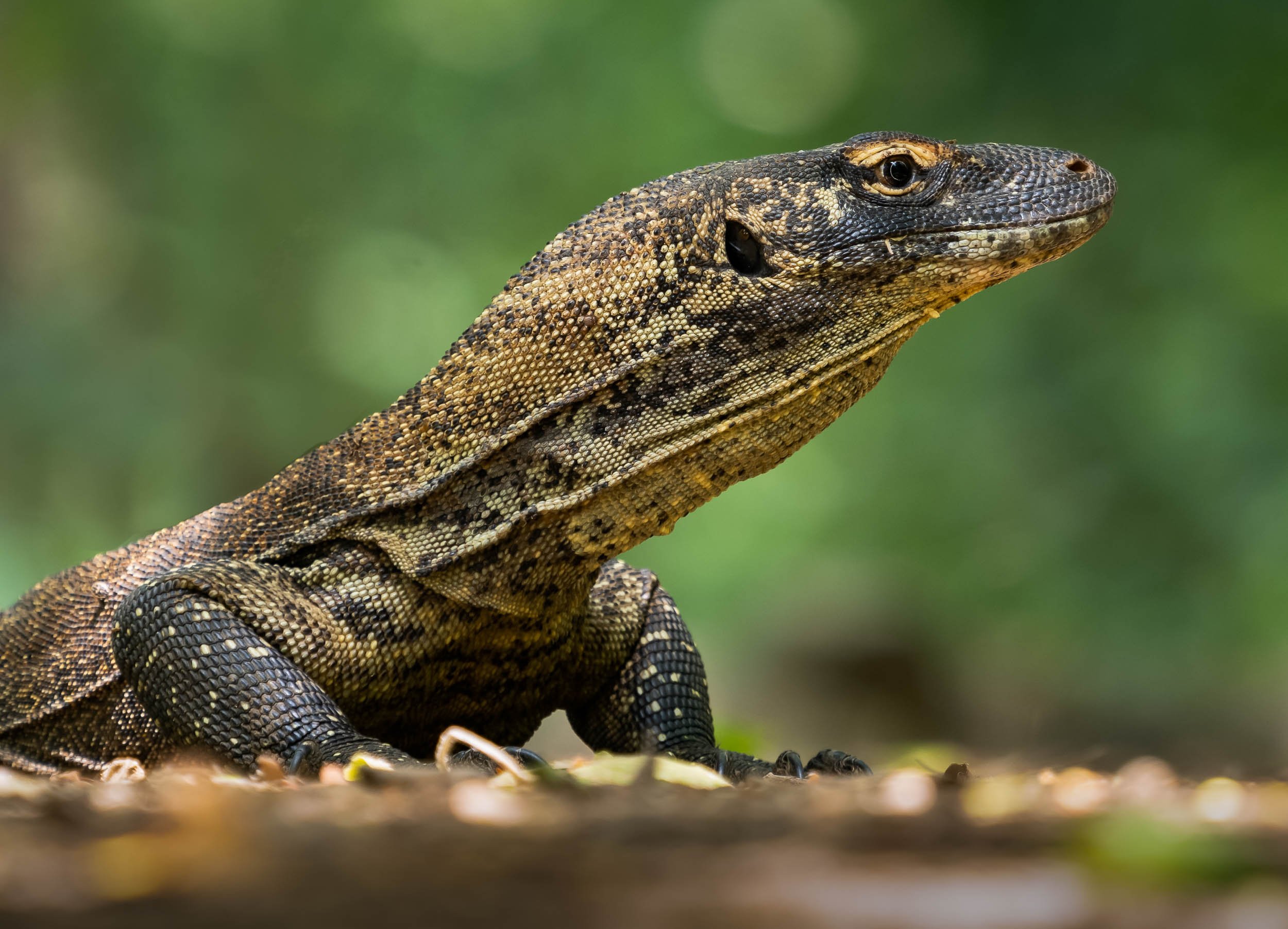
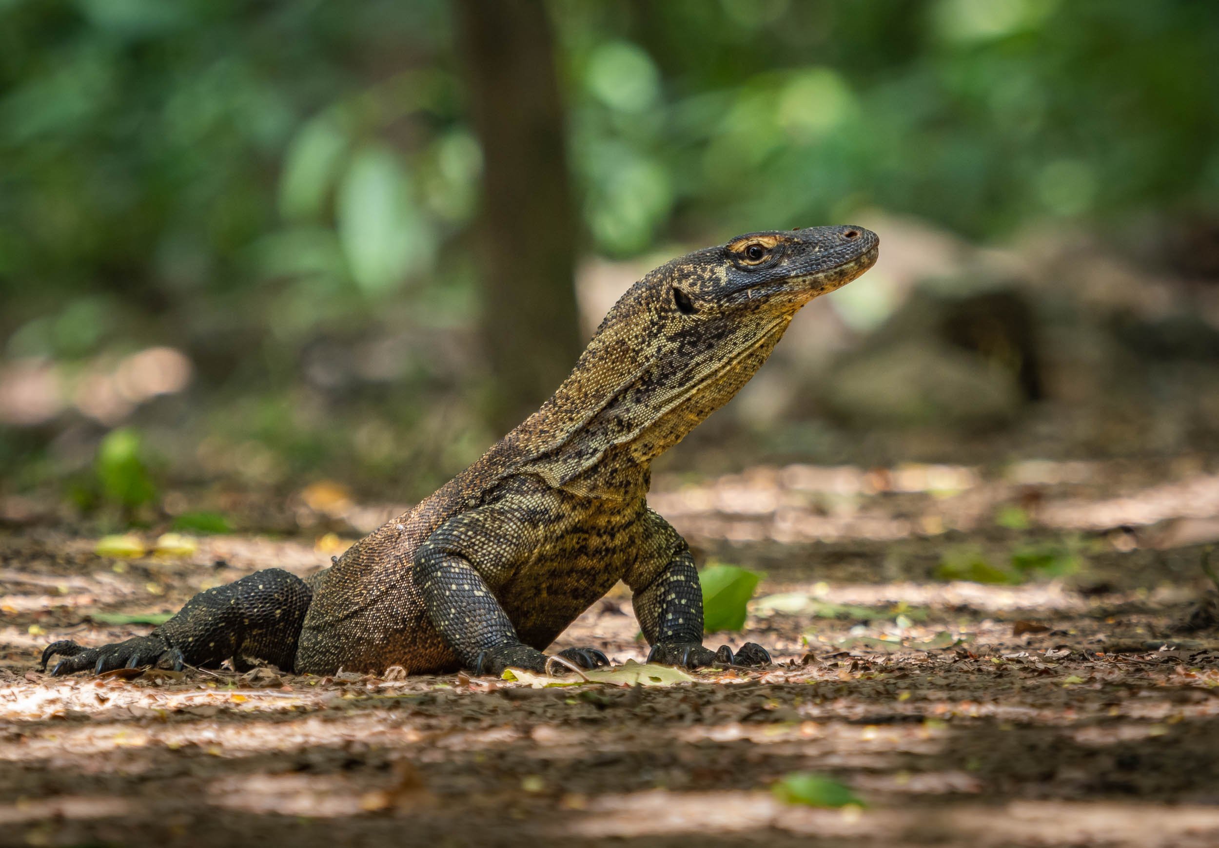
Once I made it to Komodo Island, your time is limited as you walk through the forest with a guide in search of some of these magnificent animals, but luckily I did get to spot a few…Nevertheless, I’d recommend two tours and possibly visiting another island such as Rinca to increase your chances for nice observations (and photos).
We found two very large individuals close to the beach, observing them at rest for a while, before one of them got up and moved into the forest. This was my chance to capture some photos of them in action, with their large tongue leading the way, and them to their prey - in fact, they can sense almost 10km away in good conditions.
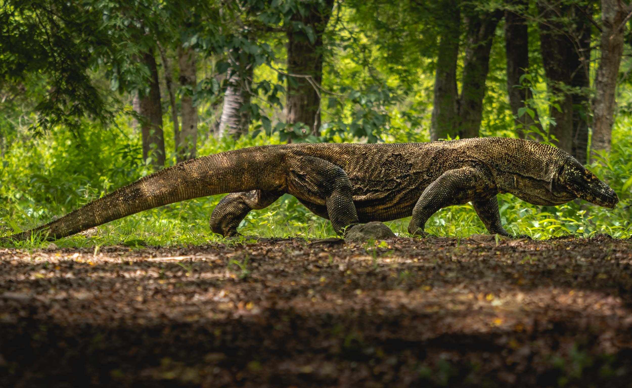
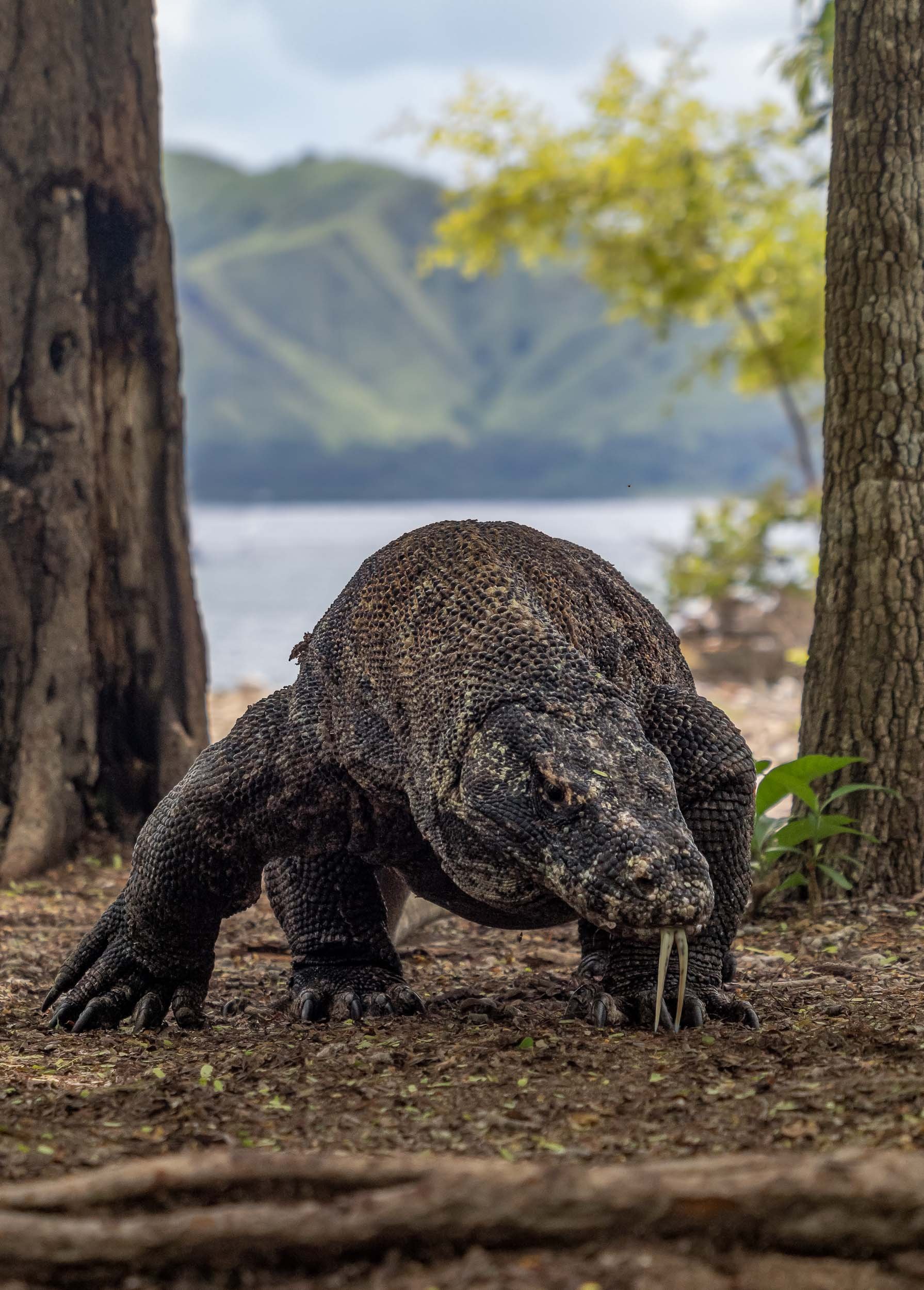


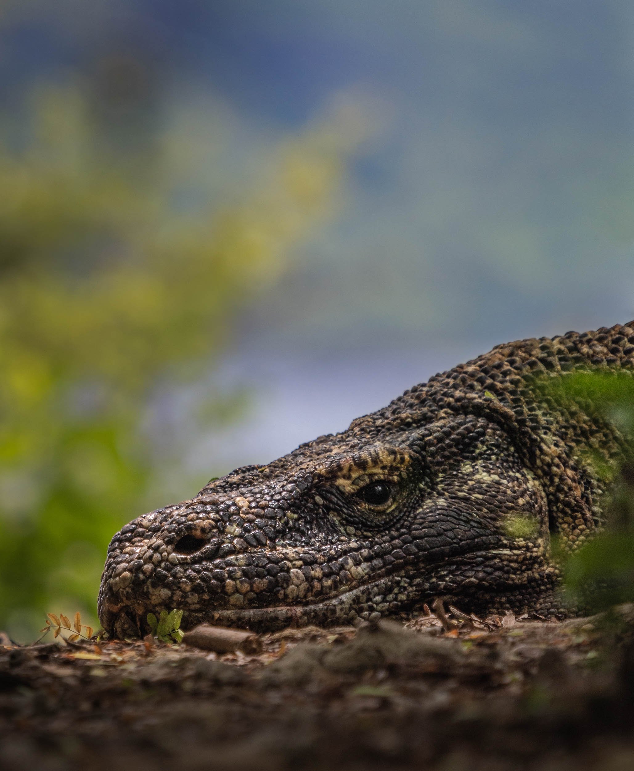
Through the Island Maze
Onwards through the island maze of Komodo, landing on Kanawa island, which was once home to a beautiful small resort.
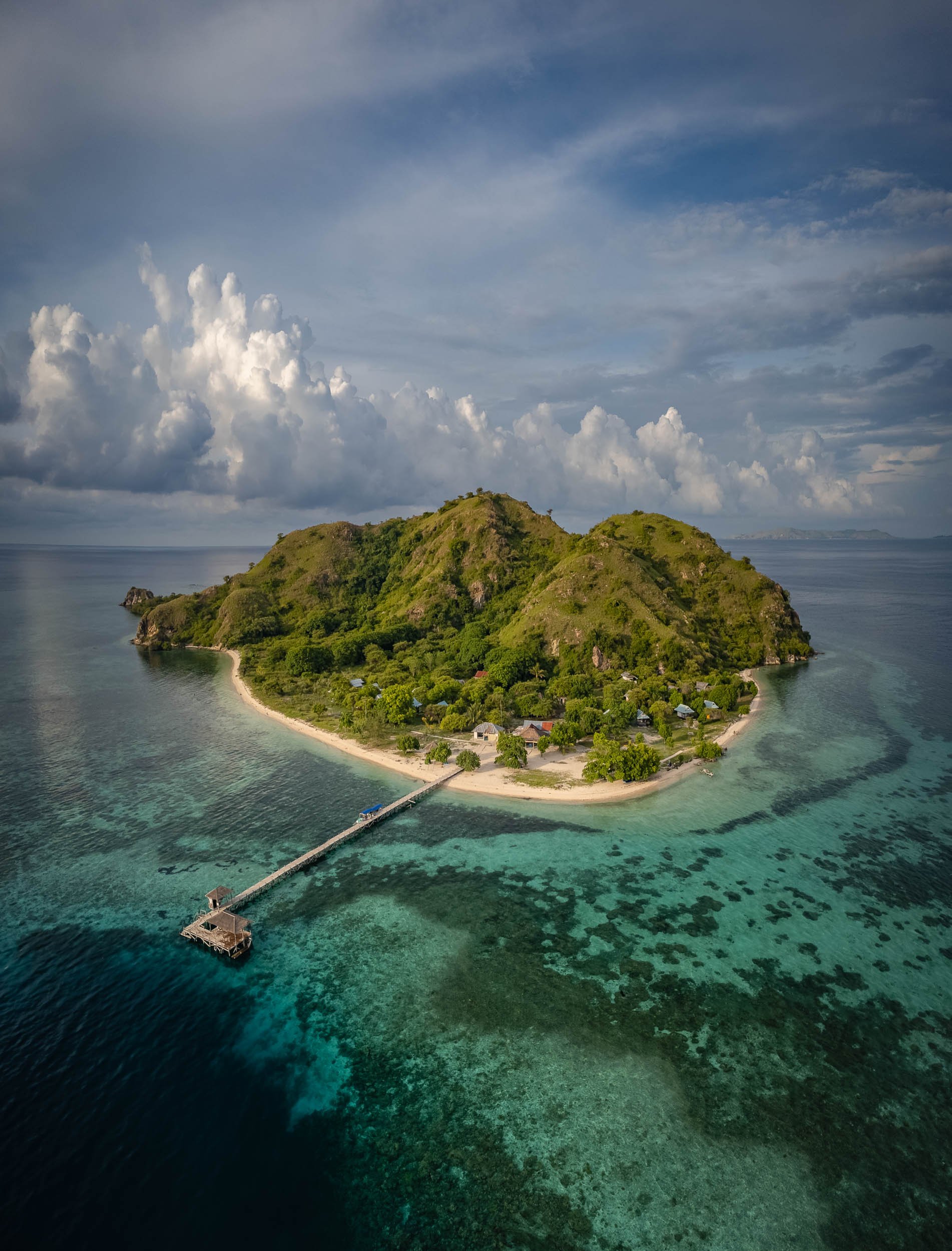


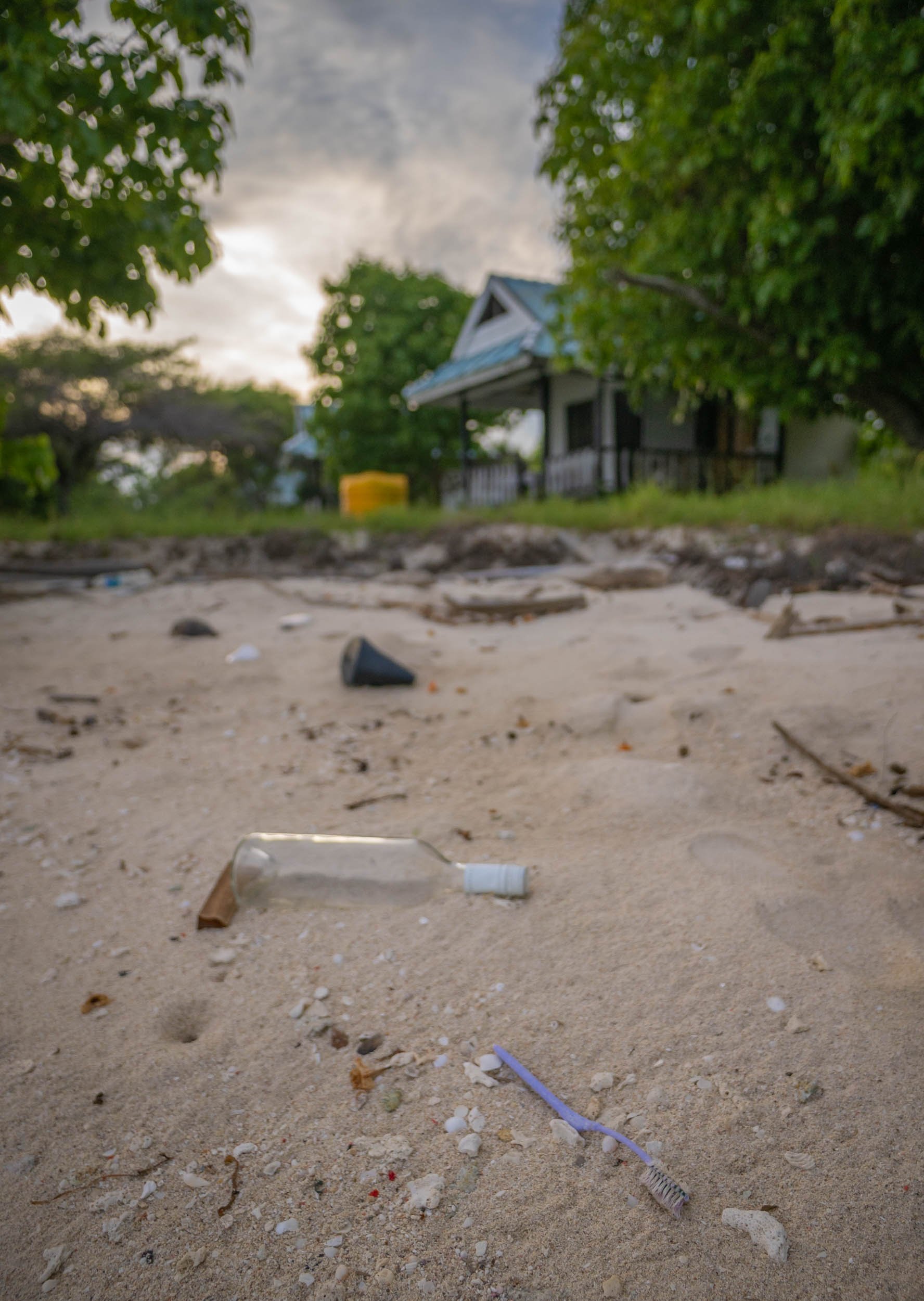
The resort is no longer operating and what must have been cute little villas are now decaying, but resourceful locals have turned the beach into a makeshift bar and lounge place.
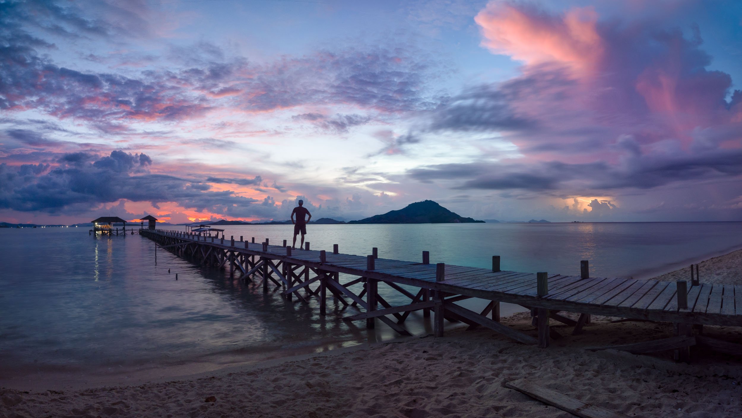
A Floating Fishing Village
Pulau Mesa is one of the few inhabited islands in the park. In fact, it is almost completely built up and home to a population of around 1500, the Bajau people - all of them extremely friendly and curious. I spent half a day exploring here and would definitely recommend visiting.
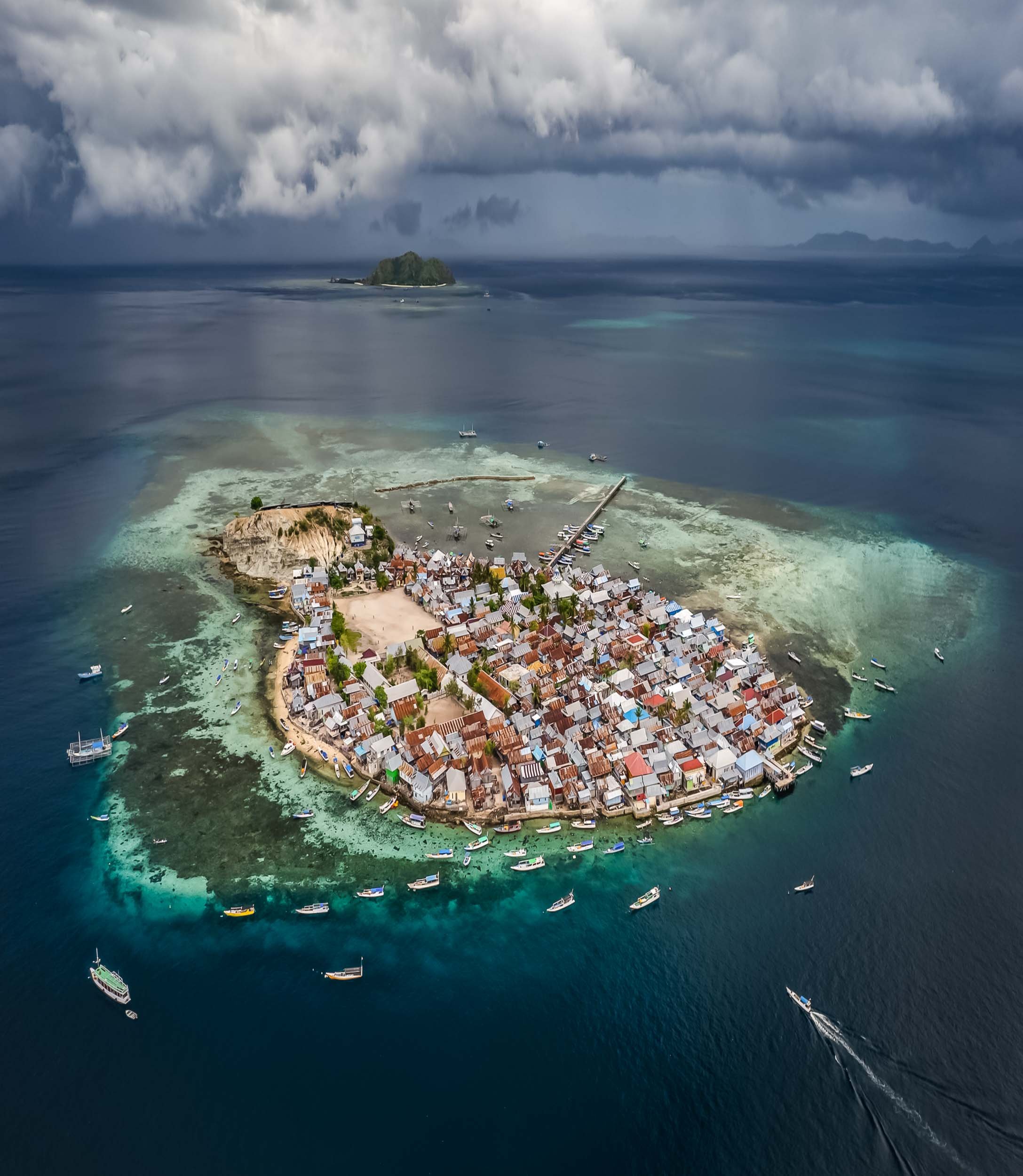
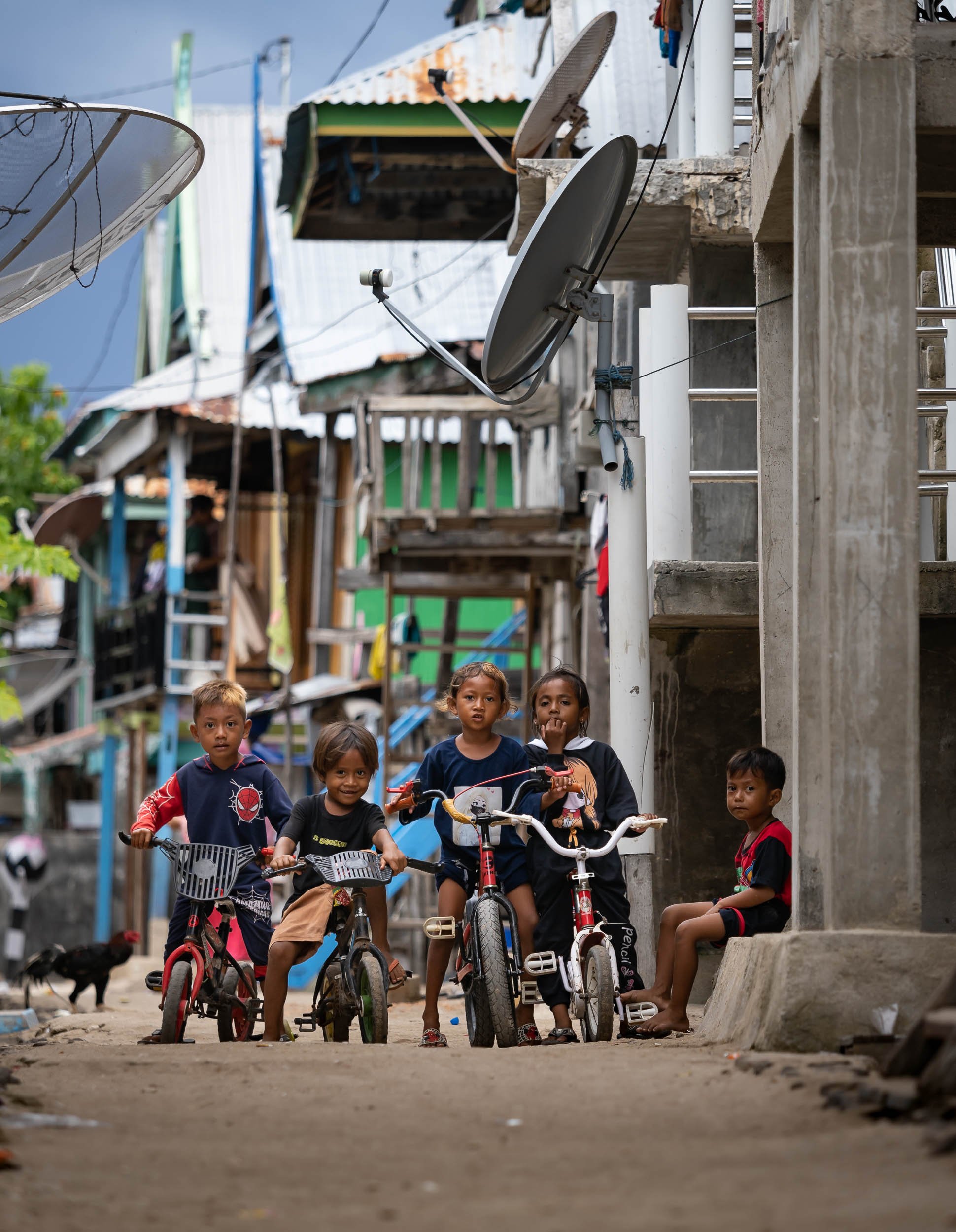


The island life is simple but happy, and people were always curious and friendly. It was one of my favorite towns in Indonesia.
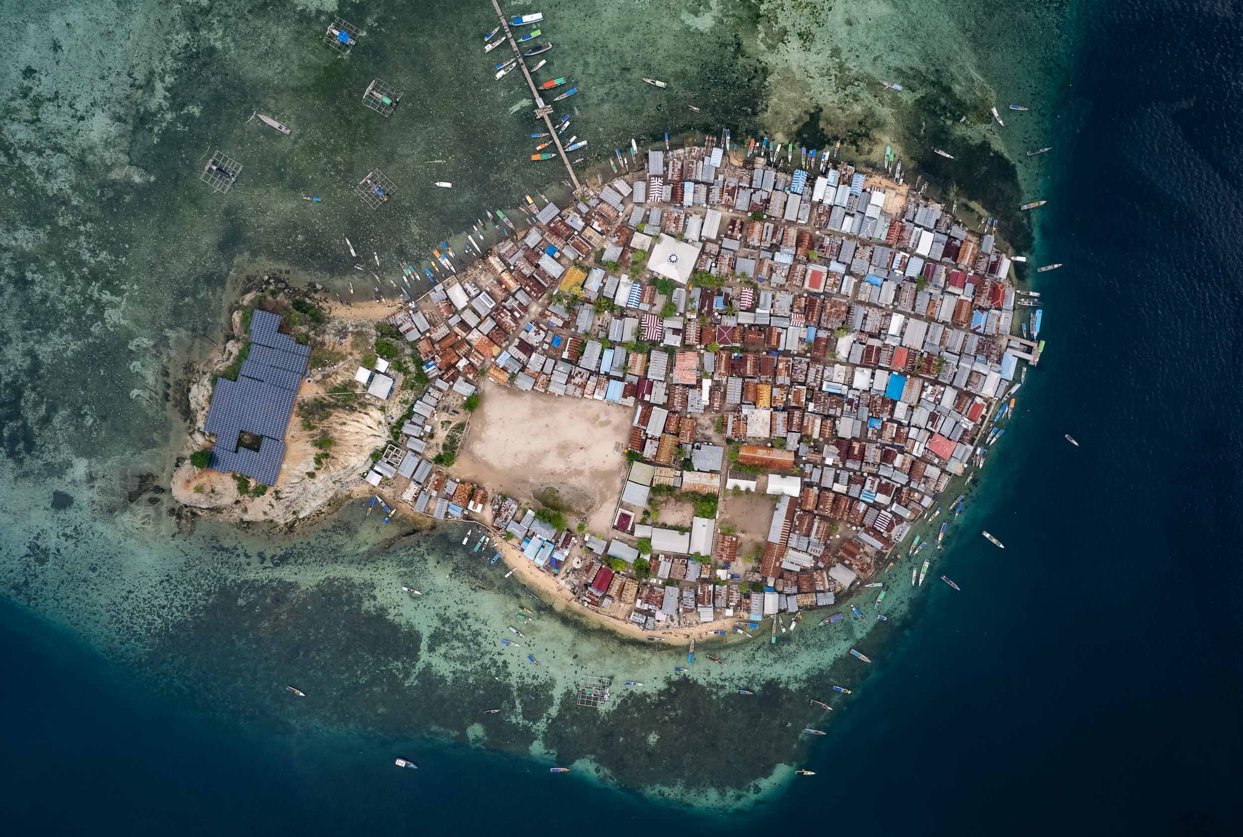


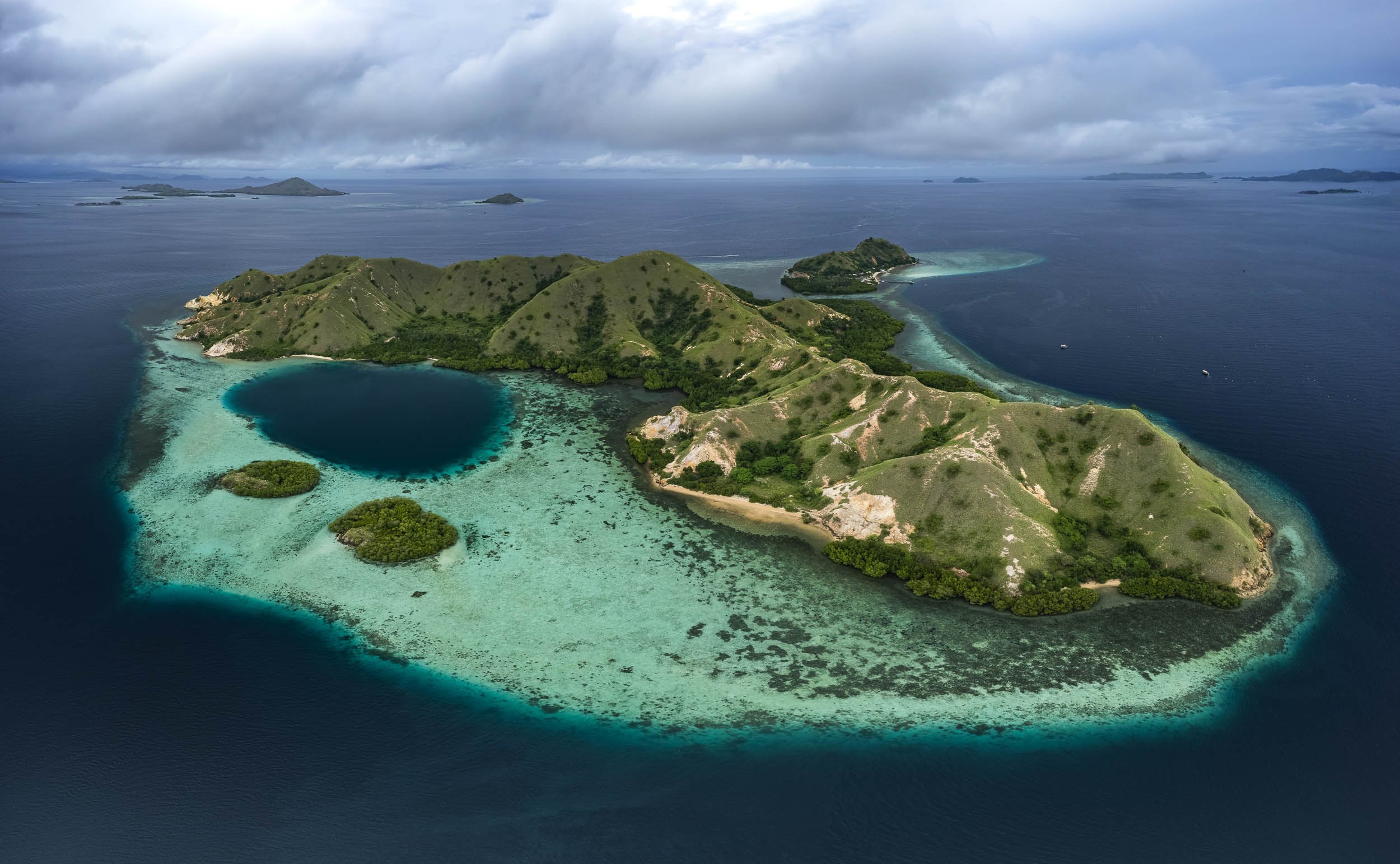
Subscribe to my newsletter to get notified and don’t miss out on more Wonders of the Globe.

The Abode of Peace - Brunei
Welcome to one of the more obscure countries on this planet, one of its last remaining absolute monarchies, and a nation forging its own path on the island of Borneo: Brunei Darussalam.

Welcome to one of the more obscure countries on this planet, one of its last remaining absolute monarchies, and a nation forging its own path on the island of Borneo: Brunei Darussalam. Once a thriving empire, its influence has declined over the centuries, but natural resources meant its population of less than half a million people now enjoys a very high living standard. I spent a few days here, including New Years Eve, which in Brunei is just like any other evening - that may be an odd choice for some, but I had a burger for dinner and was in bed by 11pm, perfect start into 2023.
The Capital
My starting point was the capital, Bandar Seri Begawan (ever heard of it?). A walk the centre around reveals… not too much, but there are some interesting places and local life to observe.
Royal Regalia
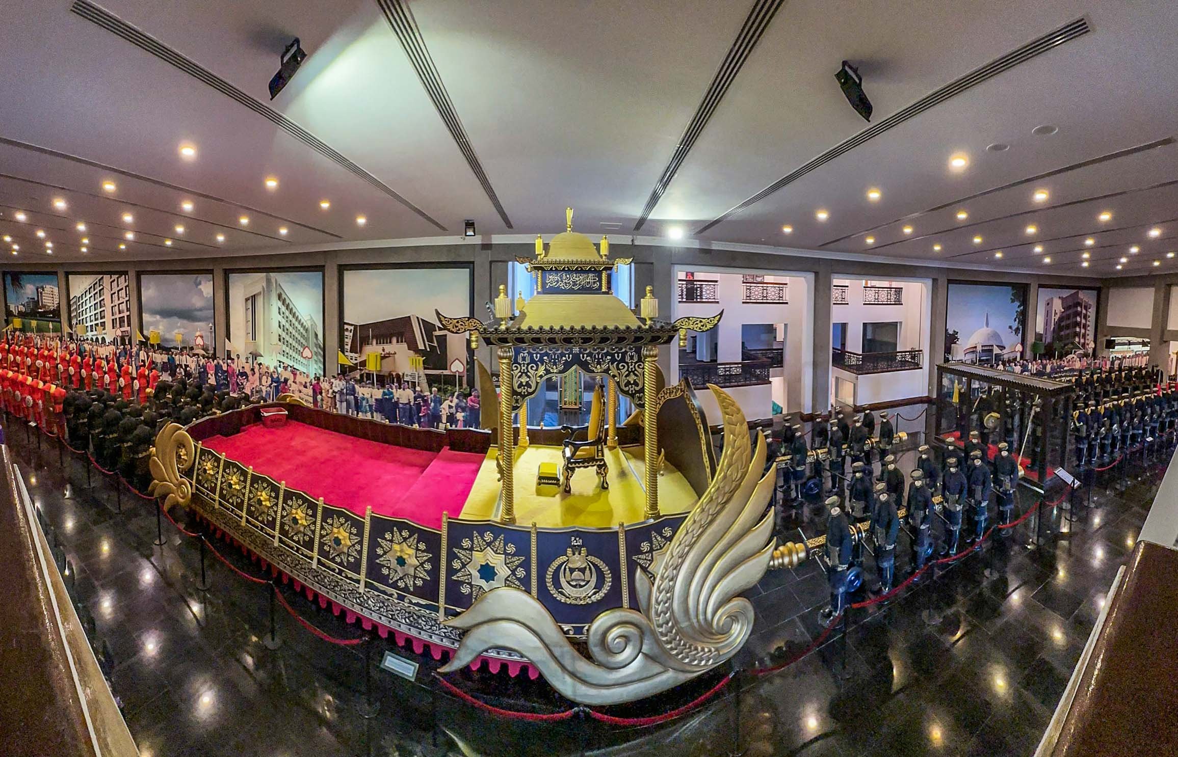
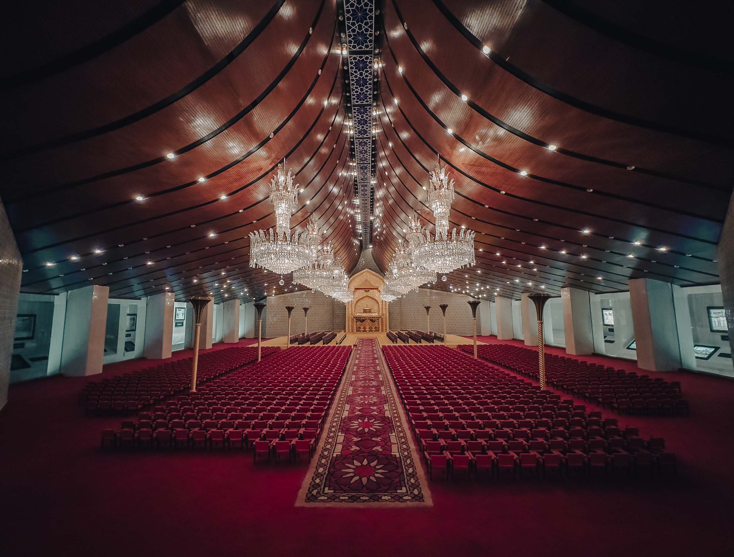
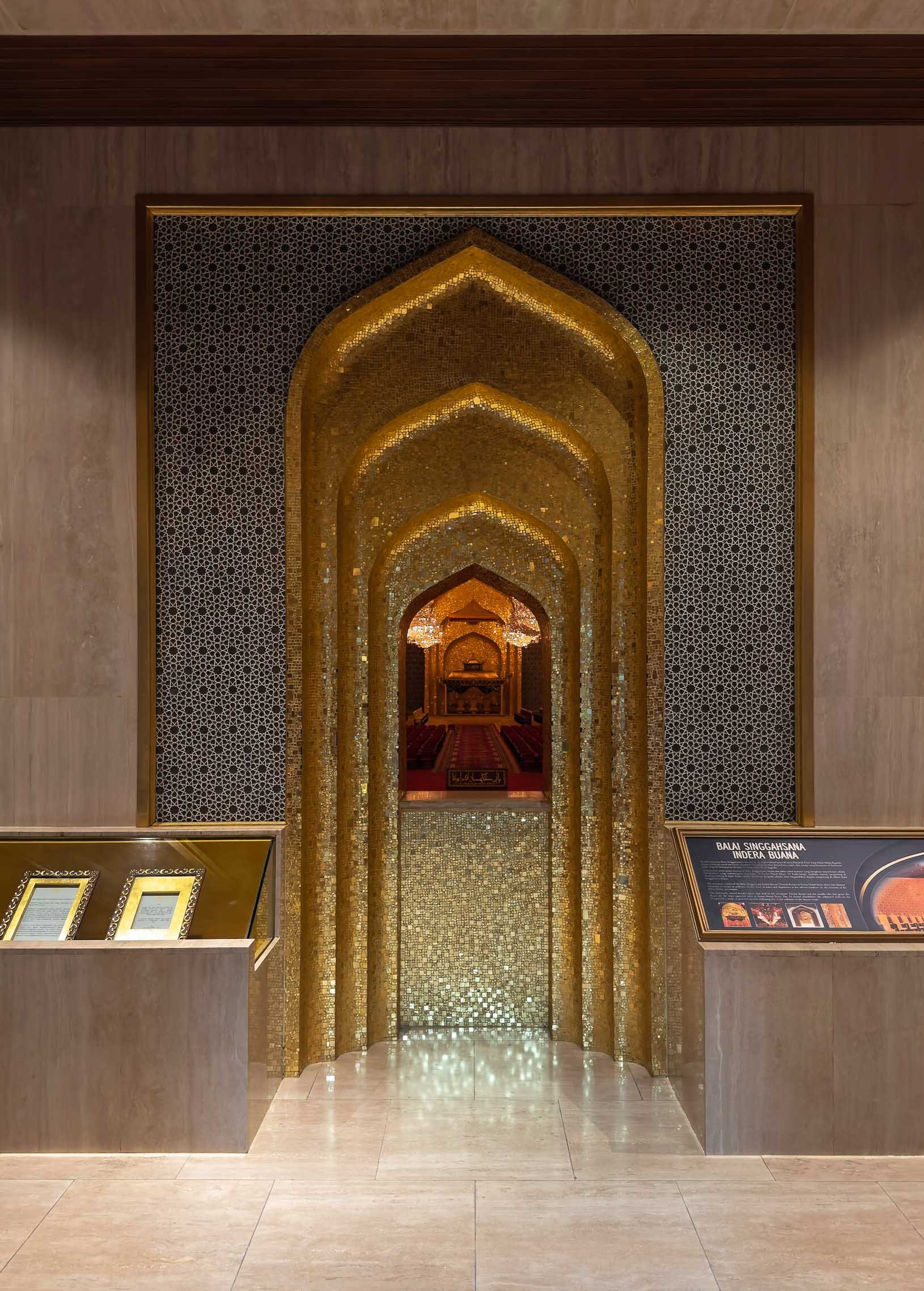
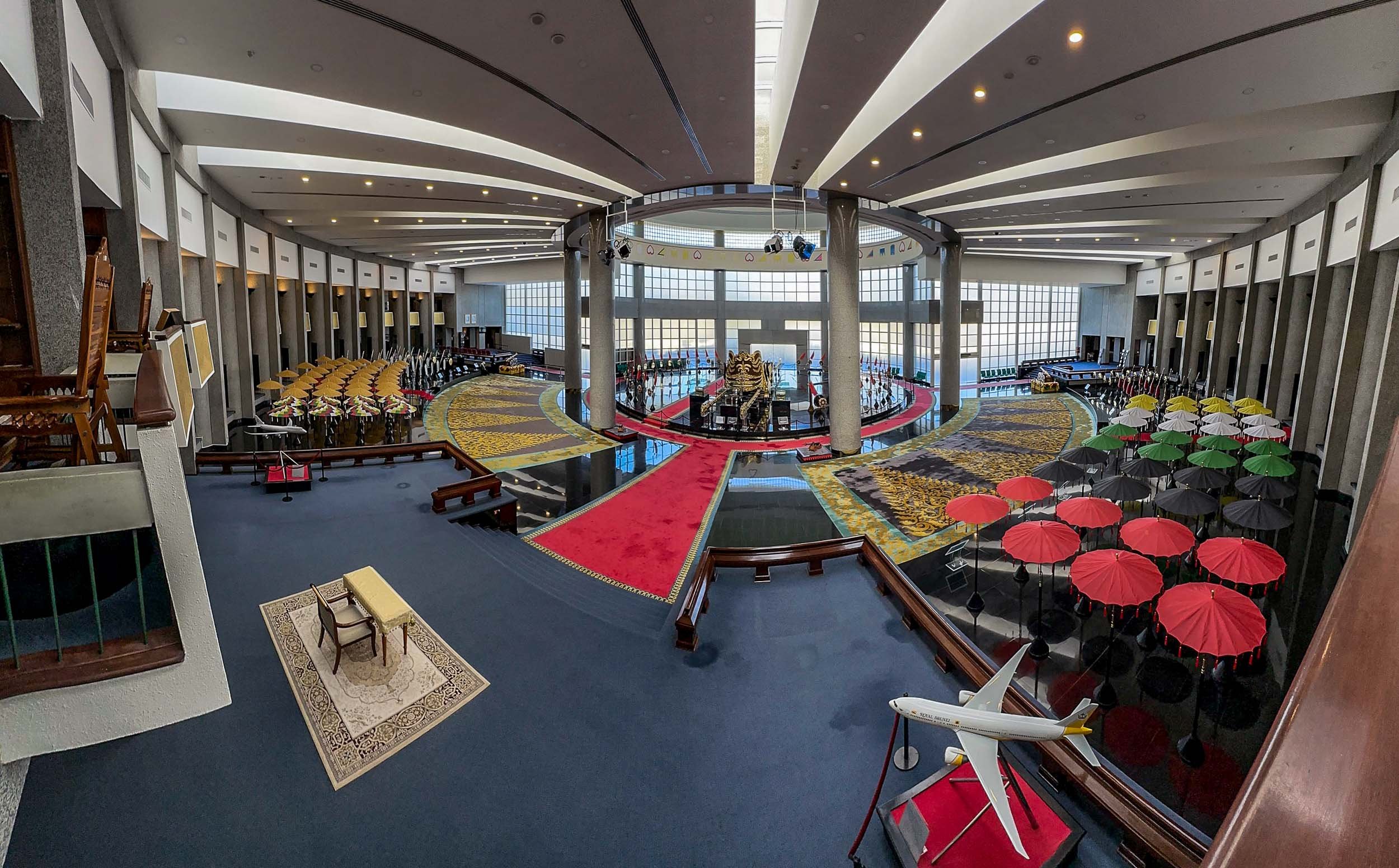
The Main Sight
The city’s most recognisable landmark, and arguably its most beautiful, is the Omar Ali Saifuddien Mosque, serving as the symbol of the Islamic faith in Brunei.
In fact, a dedicated frame was set up for people to take photos with it in the nearby park on the shores of the Sungai Kedayan river.

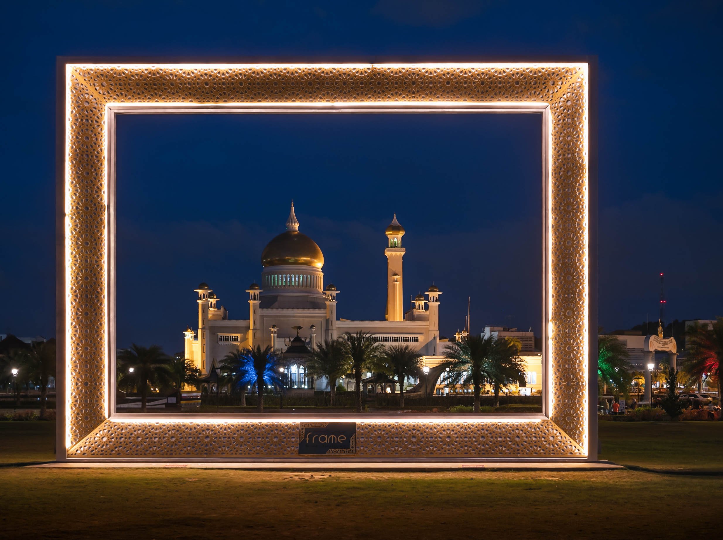
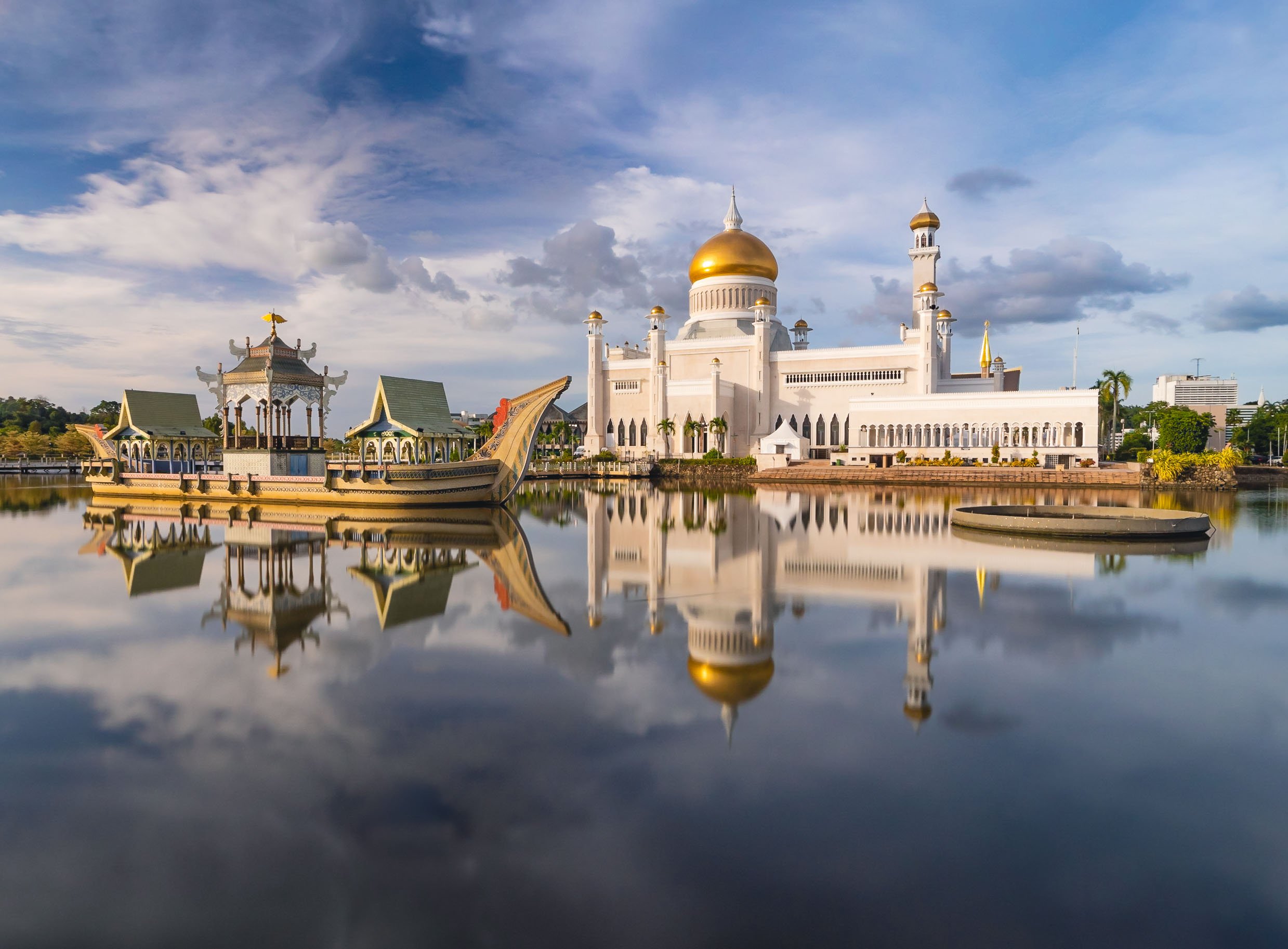
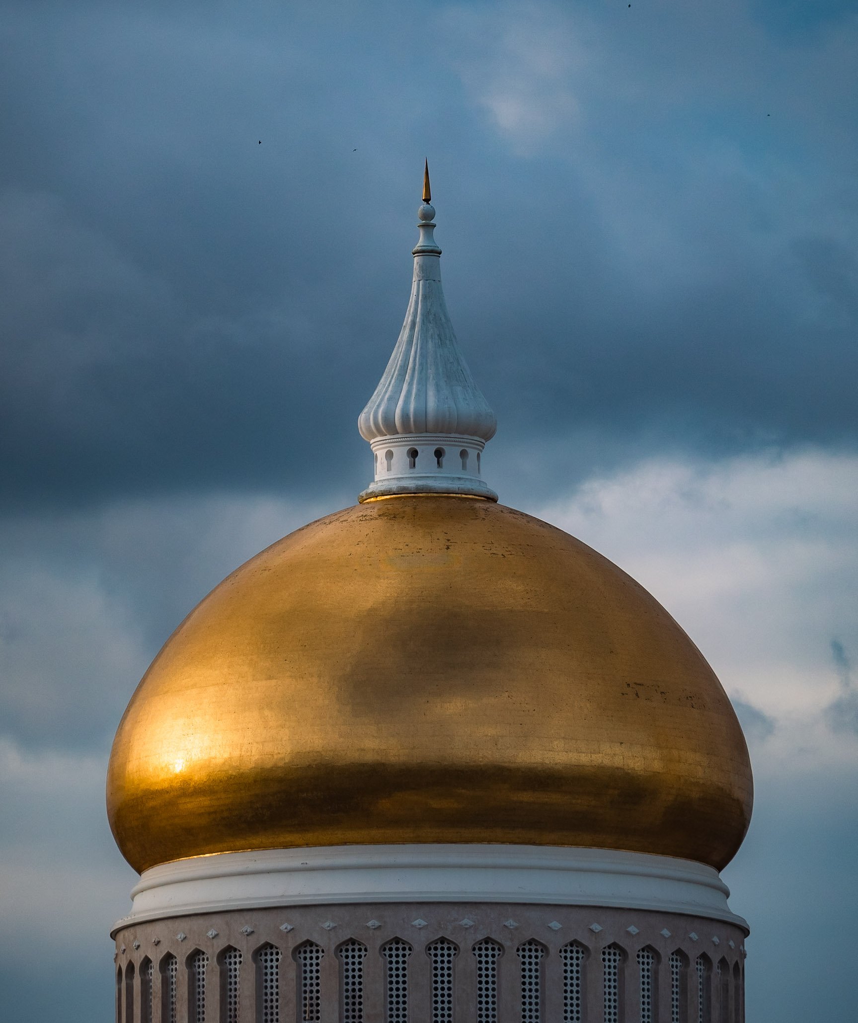
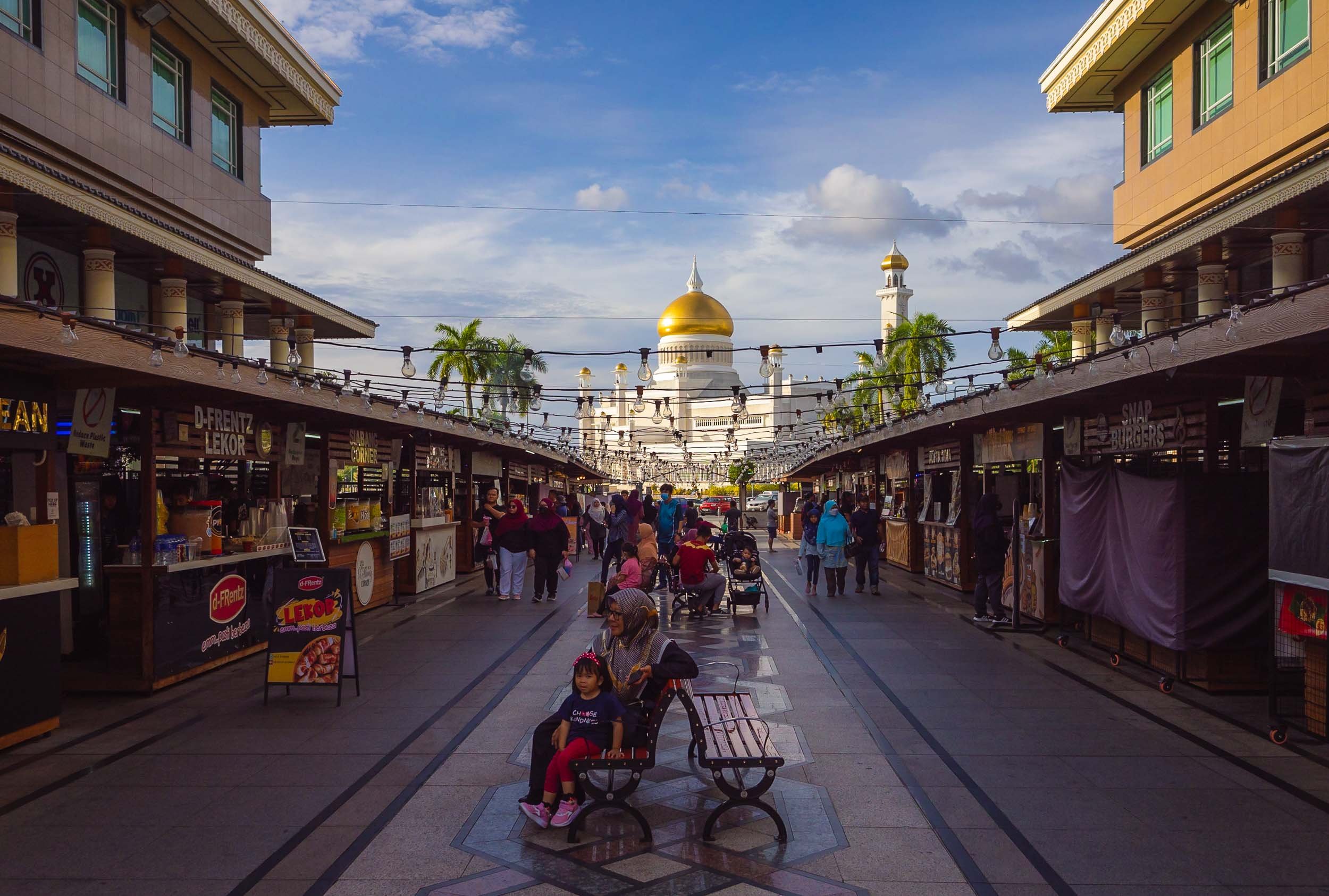
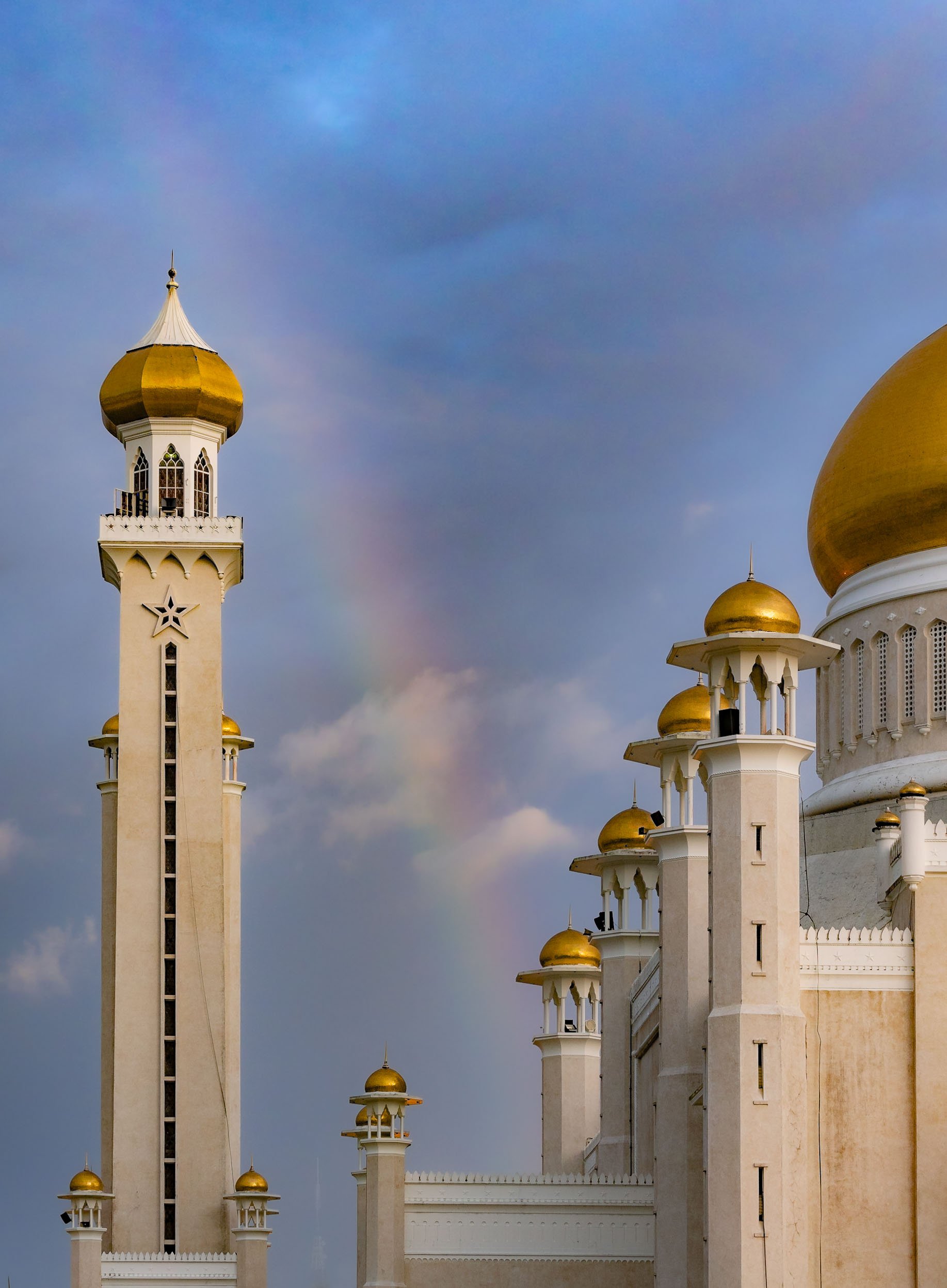

While Islam is the primary religion in the country, freedom of faith is permitted by the constitution, with some limitations. The buddhist temple of Teng Yun is one of the most prominent non-Muslim religious buildings.


Looking south over the Brunei river reveals a bridge called Raja Isteri Pengiran Anak Hajah Saleha Bridge - I’m glad they kept the name simple for every day directions. It is the second-longest single-pylon cable bridge in the world and 157m tall. I couldn’t help but notice that the golden dome closely resembled the one on Saifuddien Mosque.


The night market at Gadong with its variety of multicultural street food - Brunei has to import 60% of its needs. The biggest ethnic group is Malay, making up over 60% of the population, and only a very small portion of indigenous people. The balance is a mix of origins, including a large number of expats.


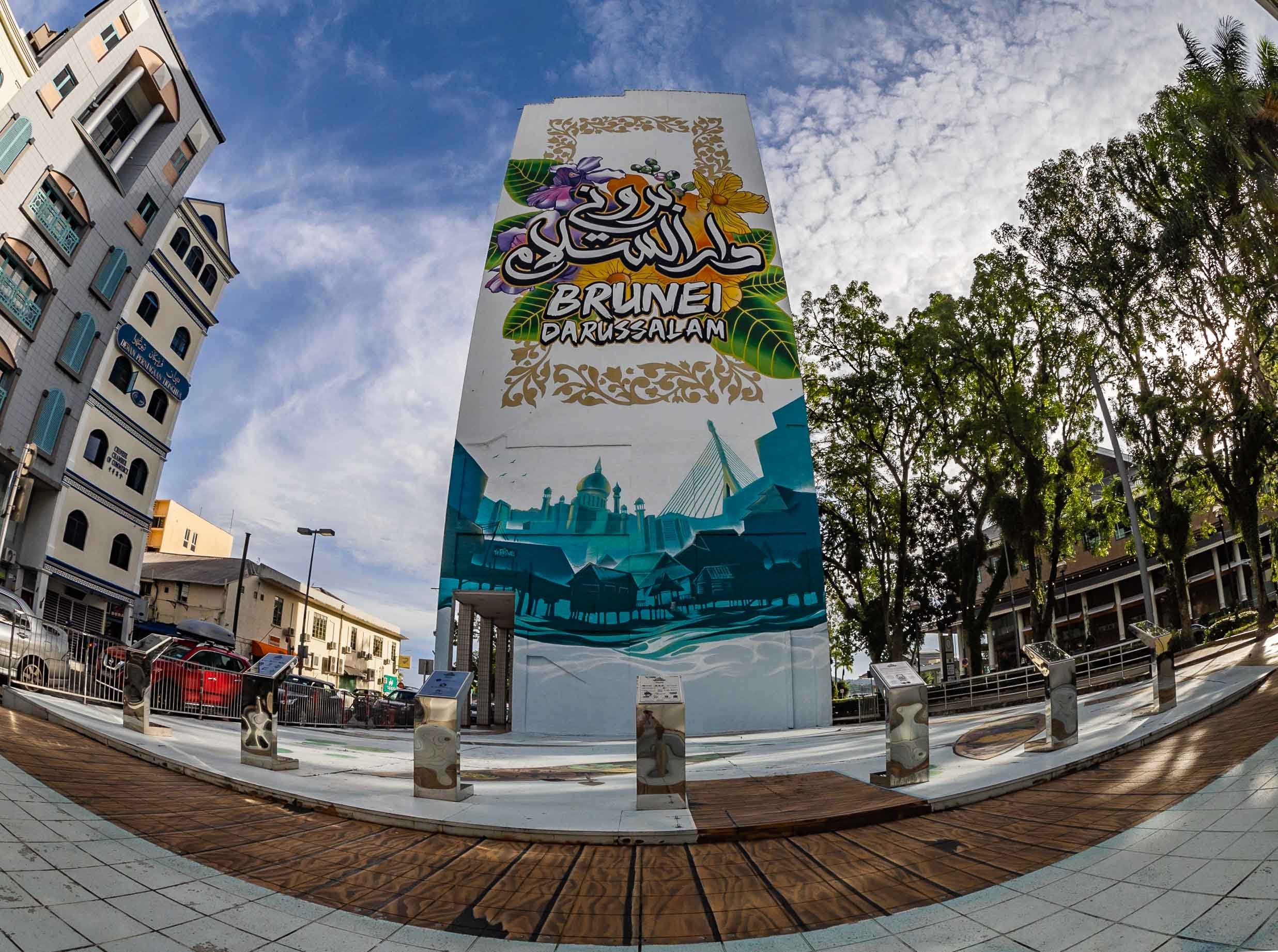
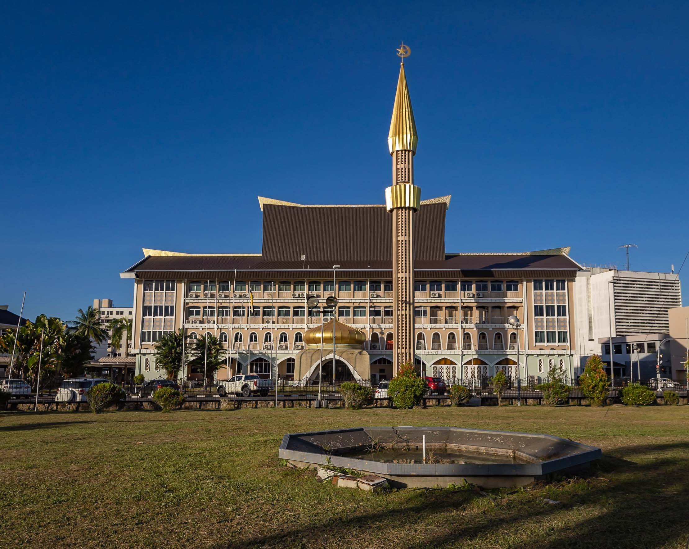
Kampong Ayer
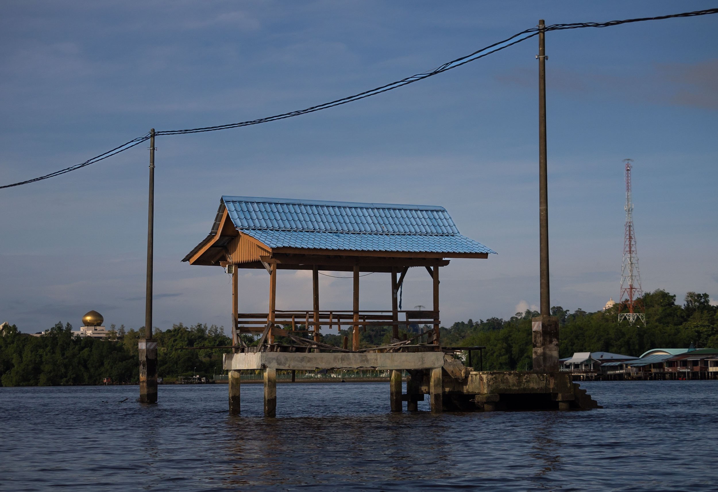


In fact though, a large portion of the village is as busy as ever, and includes floating mosques, schools, gyms and more.
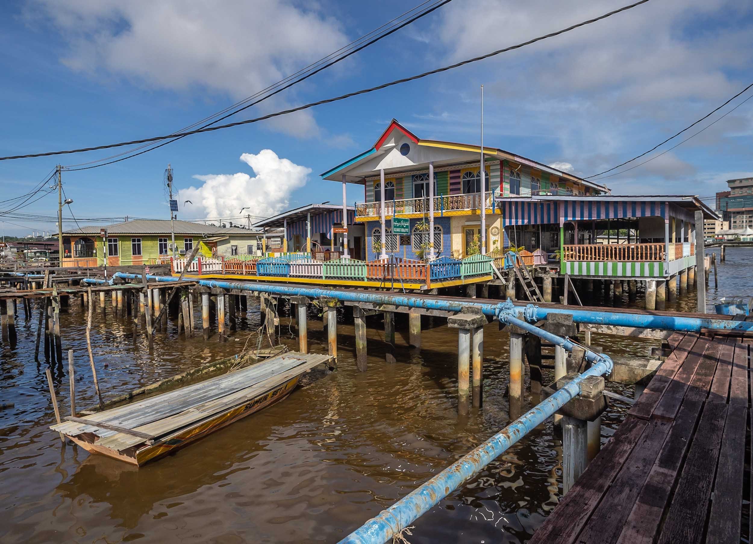
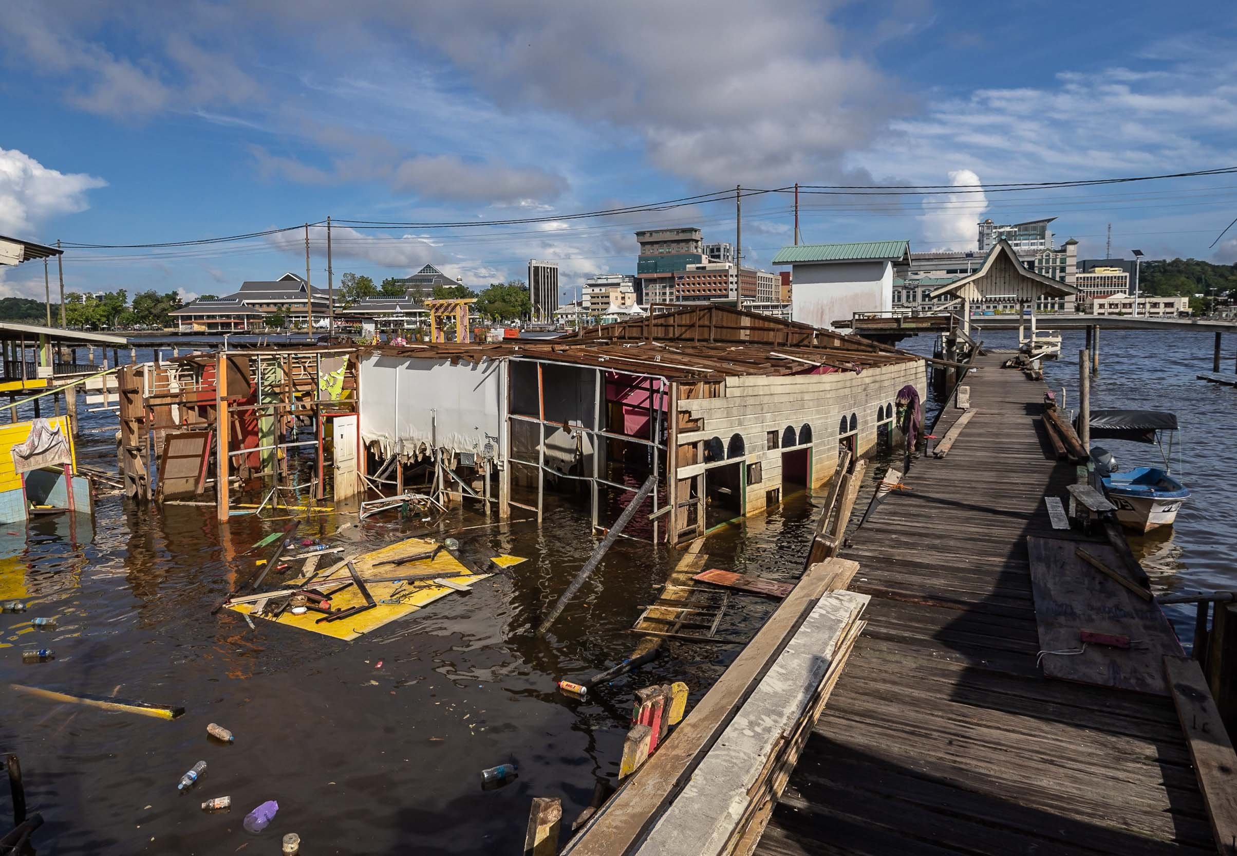
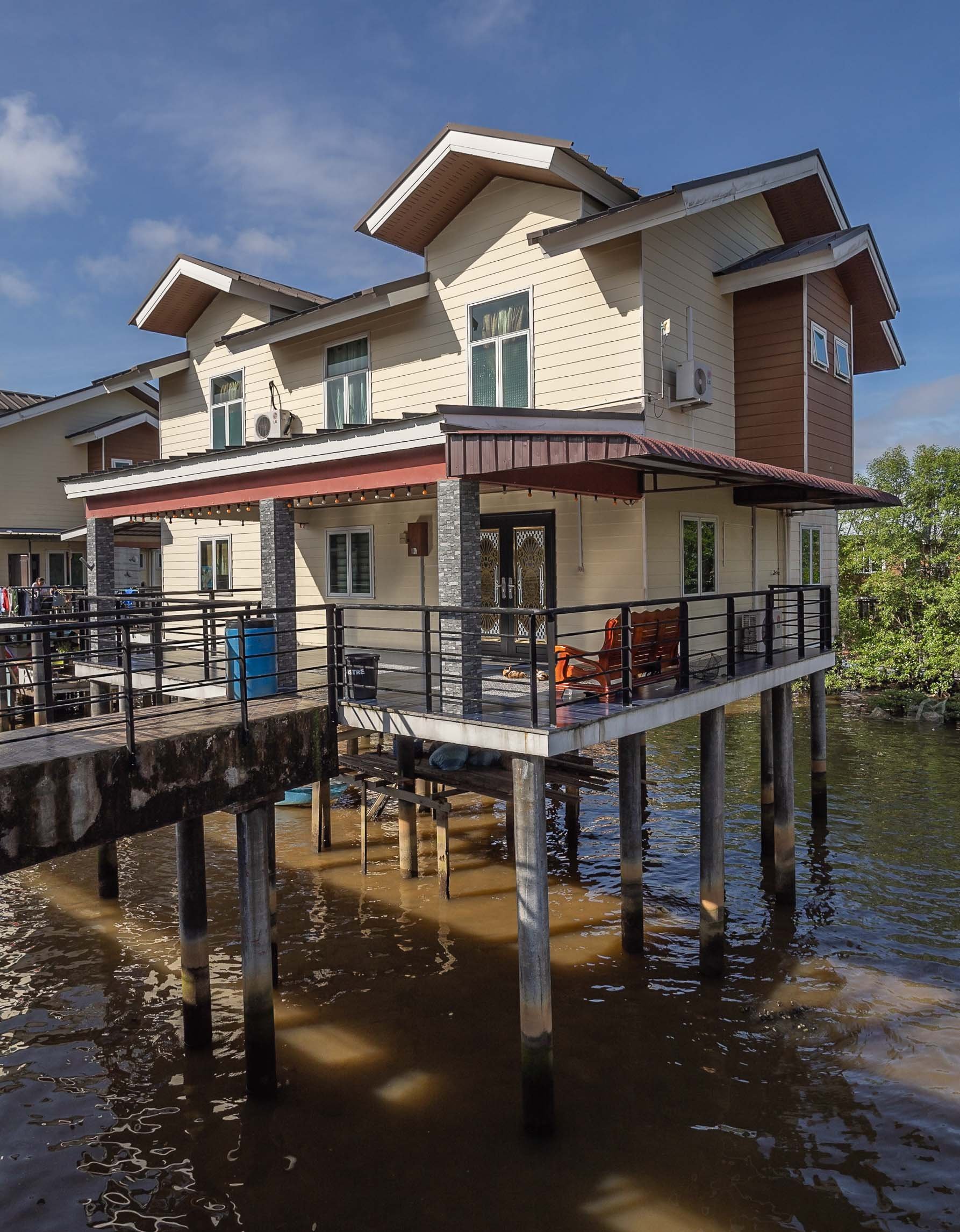

More City Sights
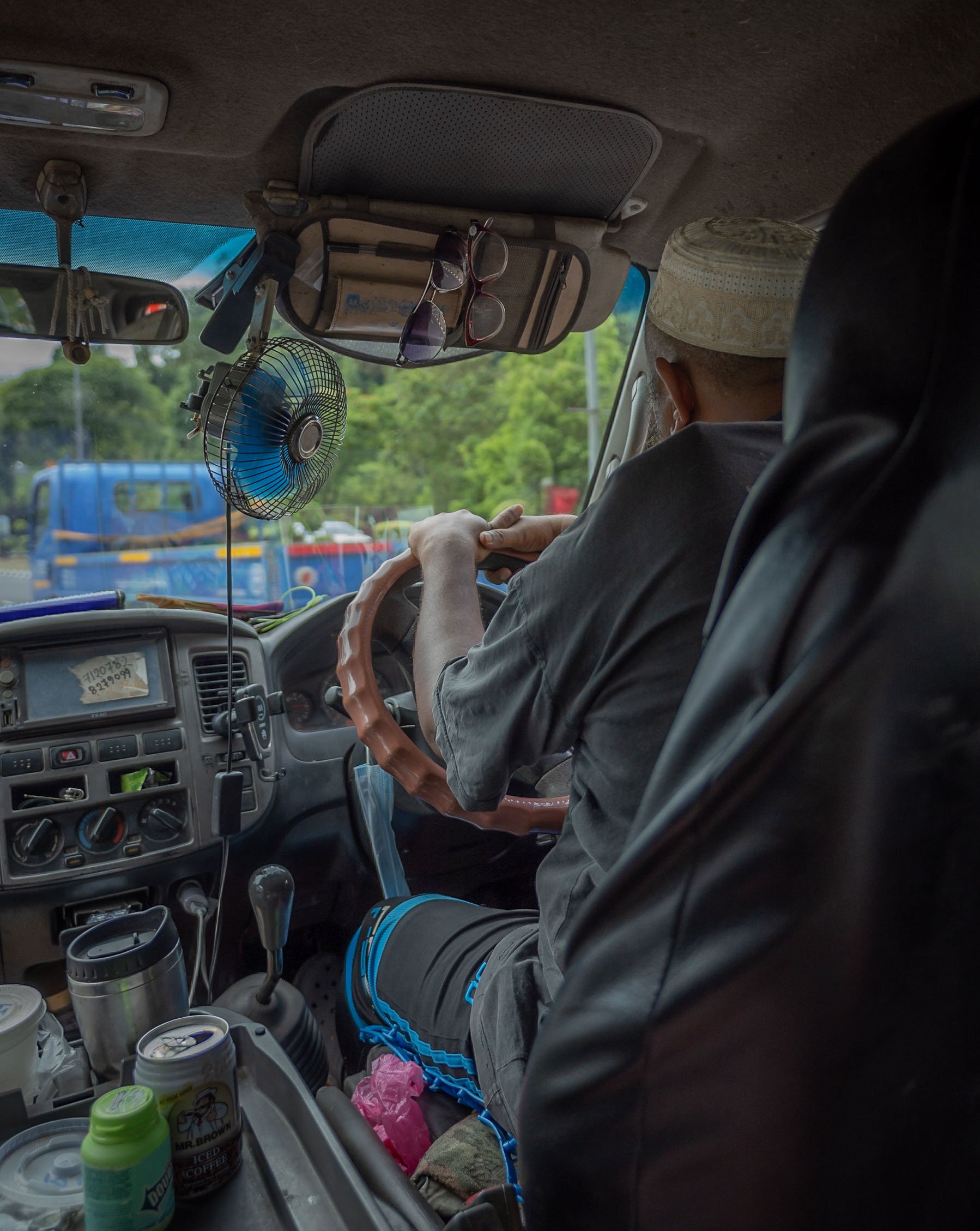
Jame 'Asr Hassanil Bolkiah Mosque
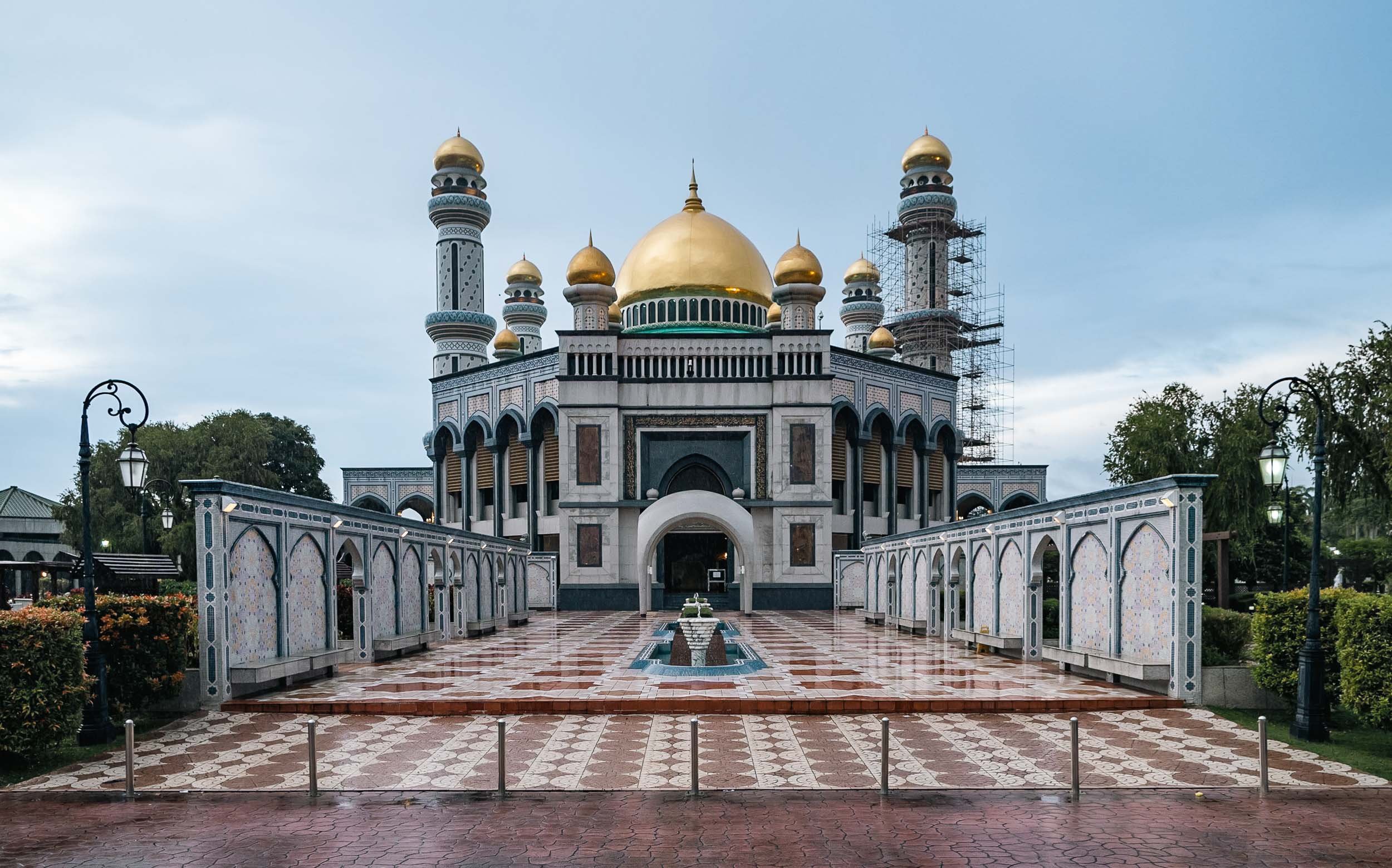
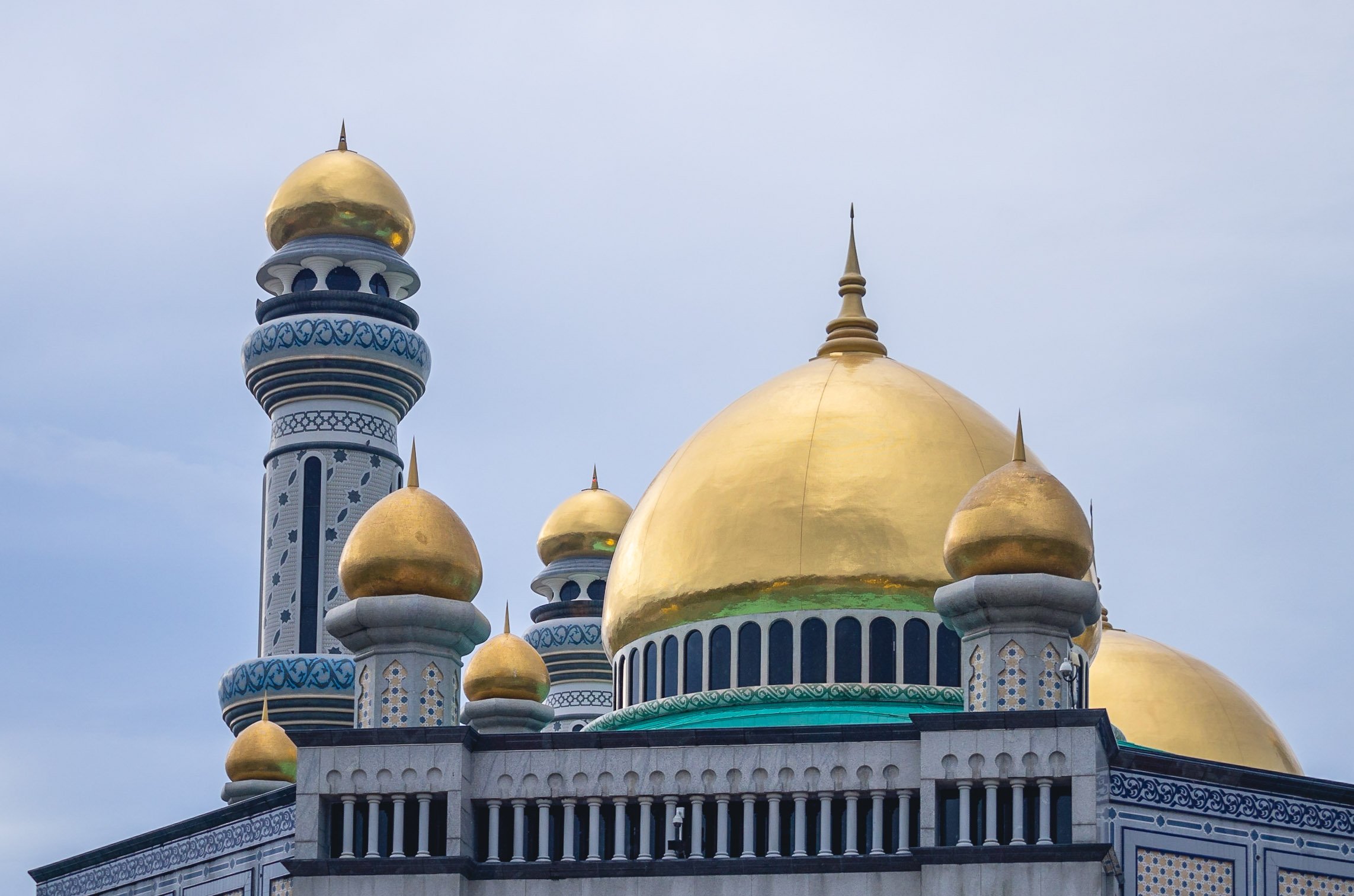
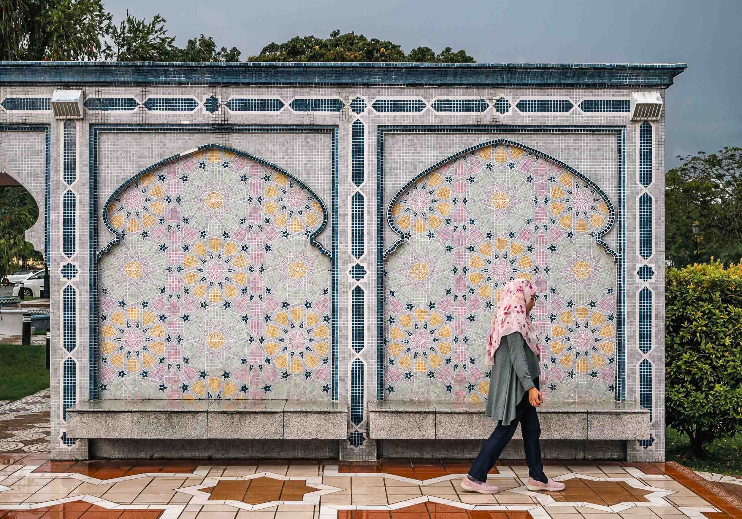
Ash Shaliheen Mosque
Yet another mosque - they are some of the most interesting attractions in Brunei. This one is said to follow Moroccan style, and was designed by an Egyptian architect. It’s possible to visit, and the interior courtyard with its retractable roof is worth seeing. It’s also located in the government district, which featuring a number of peculiar architectural styles for the various ministries and offices.


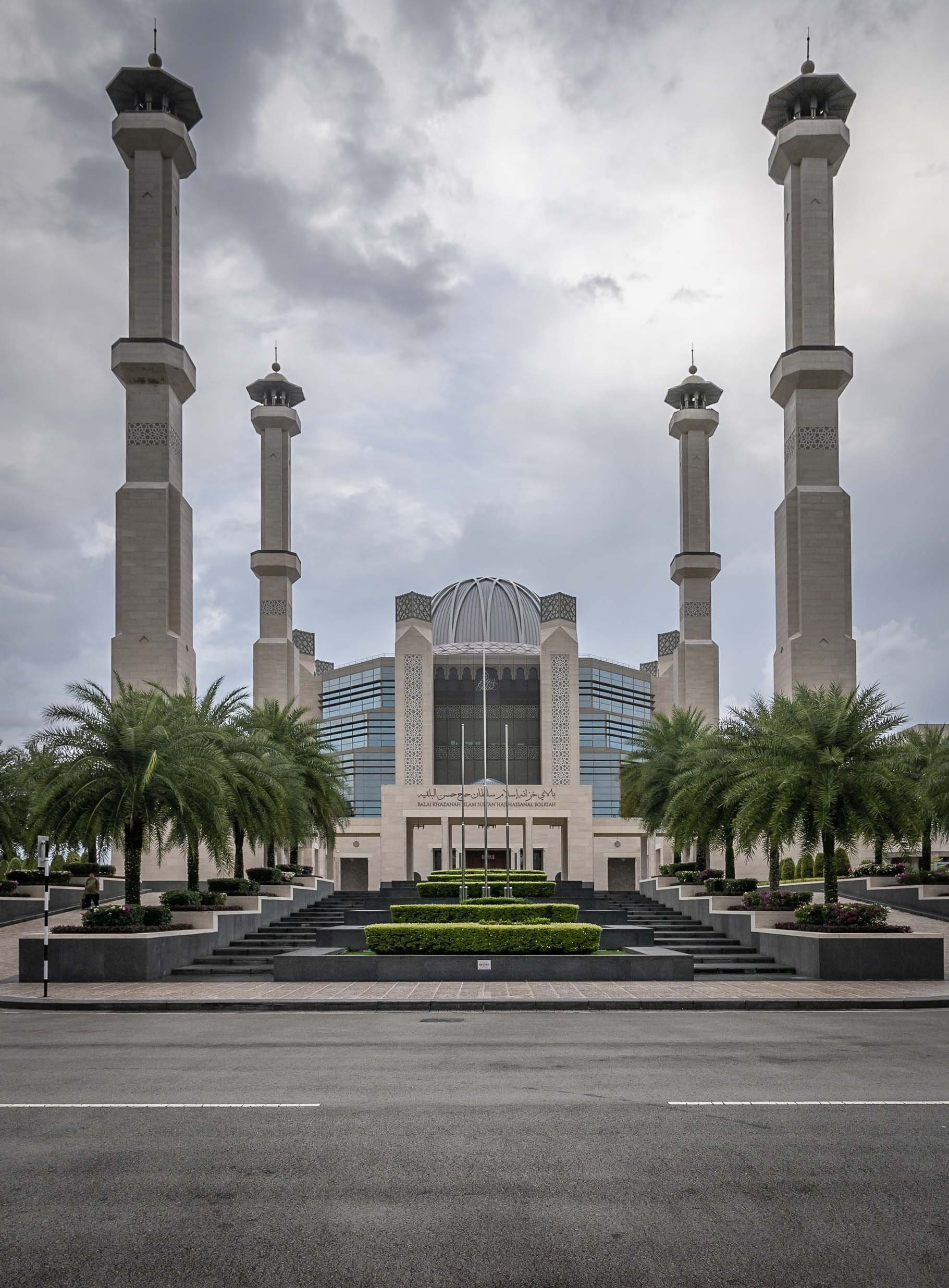


Unfortunately I couldn’t make it in time to go inside and visit, but it houses a large collection of manuscripts and artworks, for instance. The exterior was likely equally fascinating to me though.
Palaces
A strange and seemingly abandoned building can be seen from certain angles in Brunei - this place was allegedly built for the Sultan's ex-wife, but stopped after the divorce. Its status is unclear, but it is said the interior is almost complete and follows similar architectural approach as the outside - a mix of classic European and Russian styles.


Record Breaking
The actual palace of the Sultan of Brunei, called Istana Nurul Iman or the Light of Faith, is on yet another level - it is considered the largest residential palace and single family building in the world. The cost at its completion in 1984 was USD 1.5Bn, with a floor space area of over 200,000 sqm - it contains 1,788 rooms, of which 257 are bathrooms. It also houses the banquet room seen as a model in the Royal Regalia museum. The palace is also home to the infamous car collection of the Sultan and his brother (a whole different character, worth reading up on). Most of those cars are said to slowly fall into decay due to the lack of care these days, but no one knows for sure.
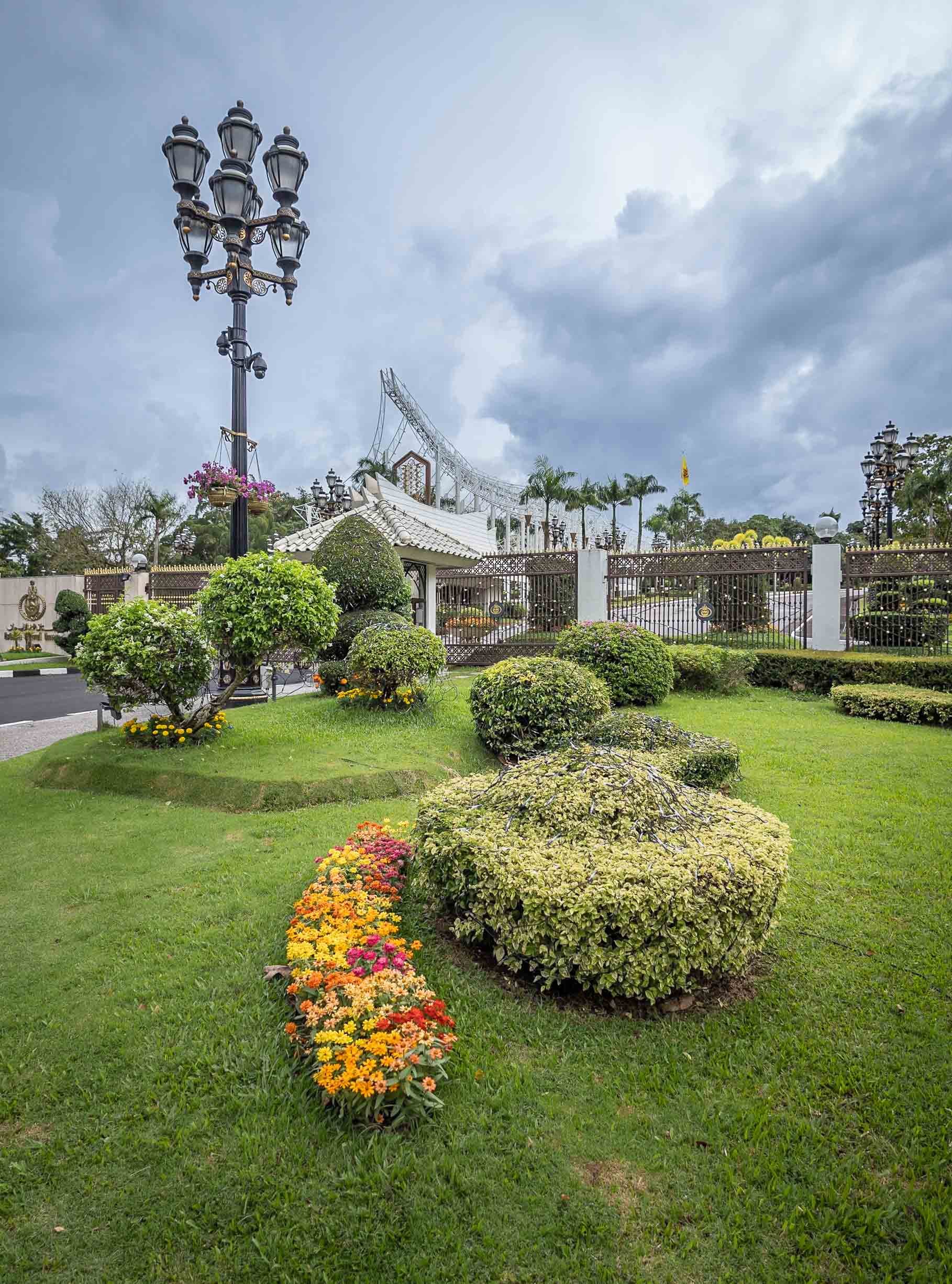
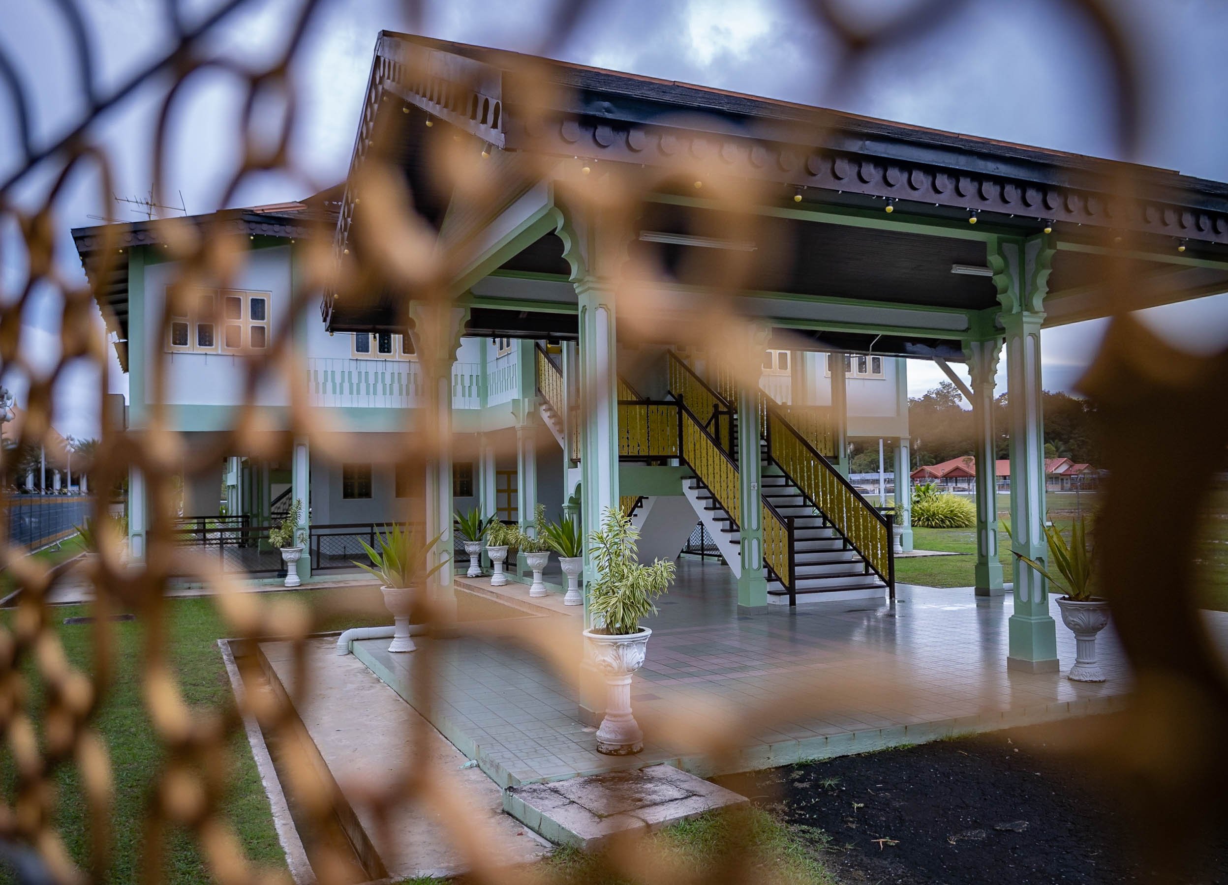
And Further Around
Frankly, there isn’t toooo much to see beyond the city boundaries, but there are a few nice beaches and several rivers in the largely untapped forest. Unlike much of the rest of Borneo, which is part of Malaysia and Indonesia, Brunei’s portion hasn’t been tapped for Palm Oil and other plantations. These photos were taken from the shores of the The Empire Brunei hotel, the country’s only real high end luxury property, 20min from the city.


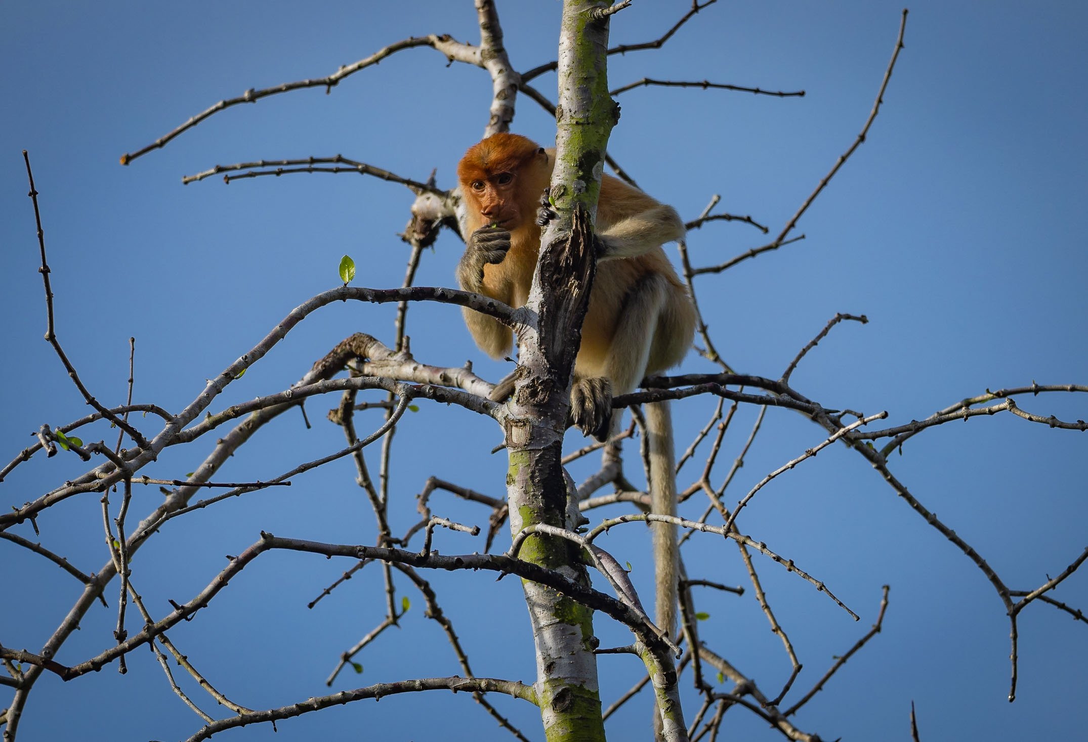
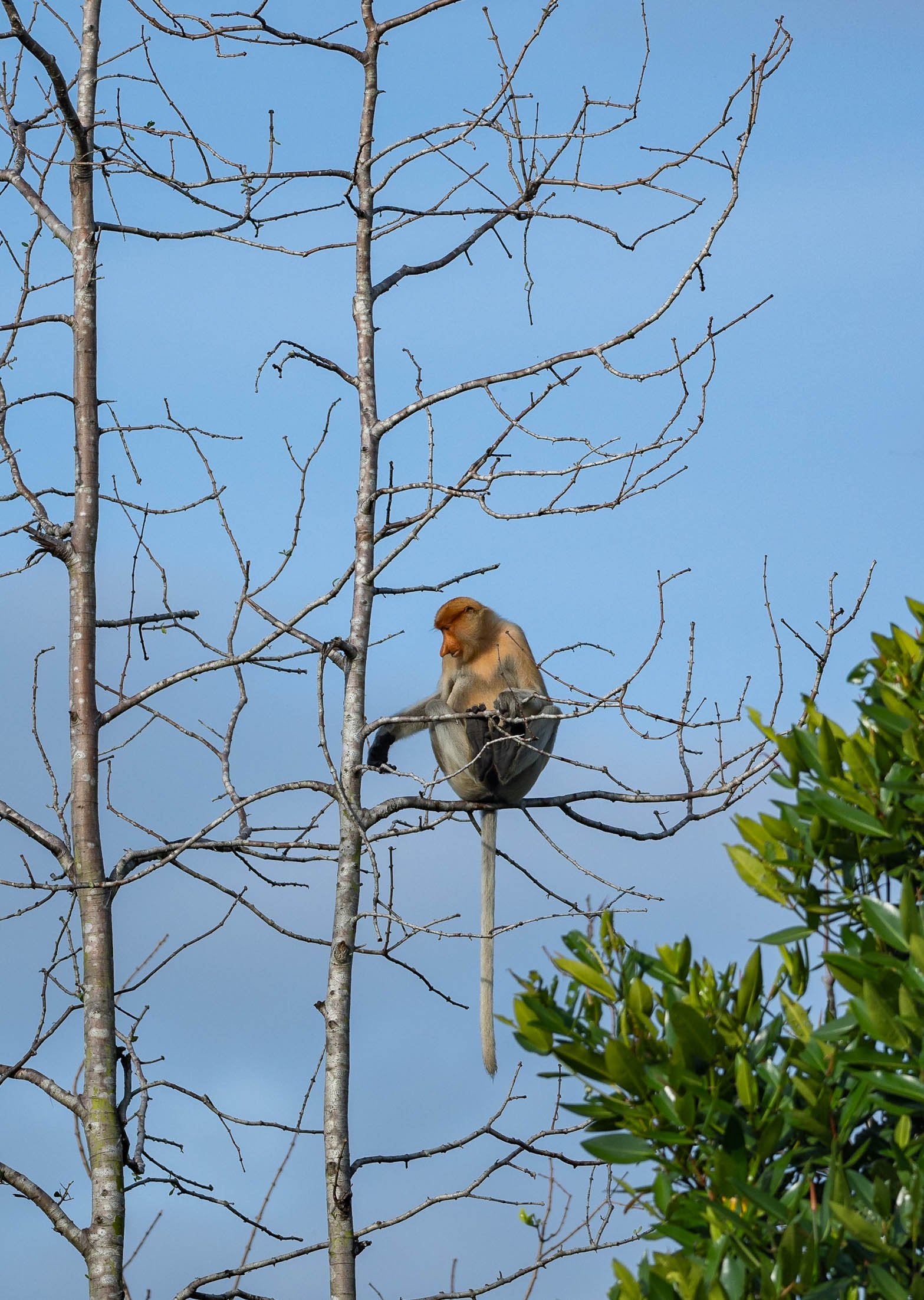
Macau - The Las Vegas of Asia, but not only
When you're in Hong Kong, it's hard not to consider a trip over to the Macau, the other "Special Administrative Region of the People's Republic of China" just across the South China sea, about 1h by ferry. While often seen as the new gambling capital of the world, the city actually has a little more to offer with its unique Portuguese influences that can at times make you feel like in Europe. Worth the trip and 2 days well spent (including winning at Roulette, as always).

When you're in Hong Kong, it's hard not to consider a trip over to the Macau, the other "Special Administrative Region of the People's Republic of China" just across the South China sea, about 1h by ferry. While often seen as the new gambling capital of the world, the city actually has a little more to offer with its unique Portuguese influences that can at times make you feel like in Europe. Worth the trip and 2 days well spent (including winning at Roulette, as always).


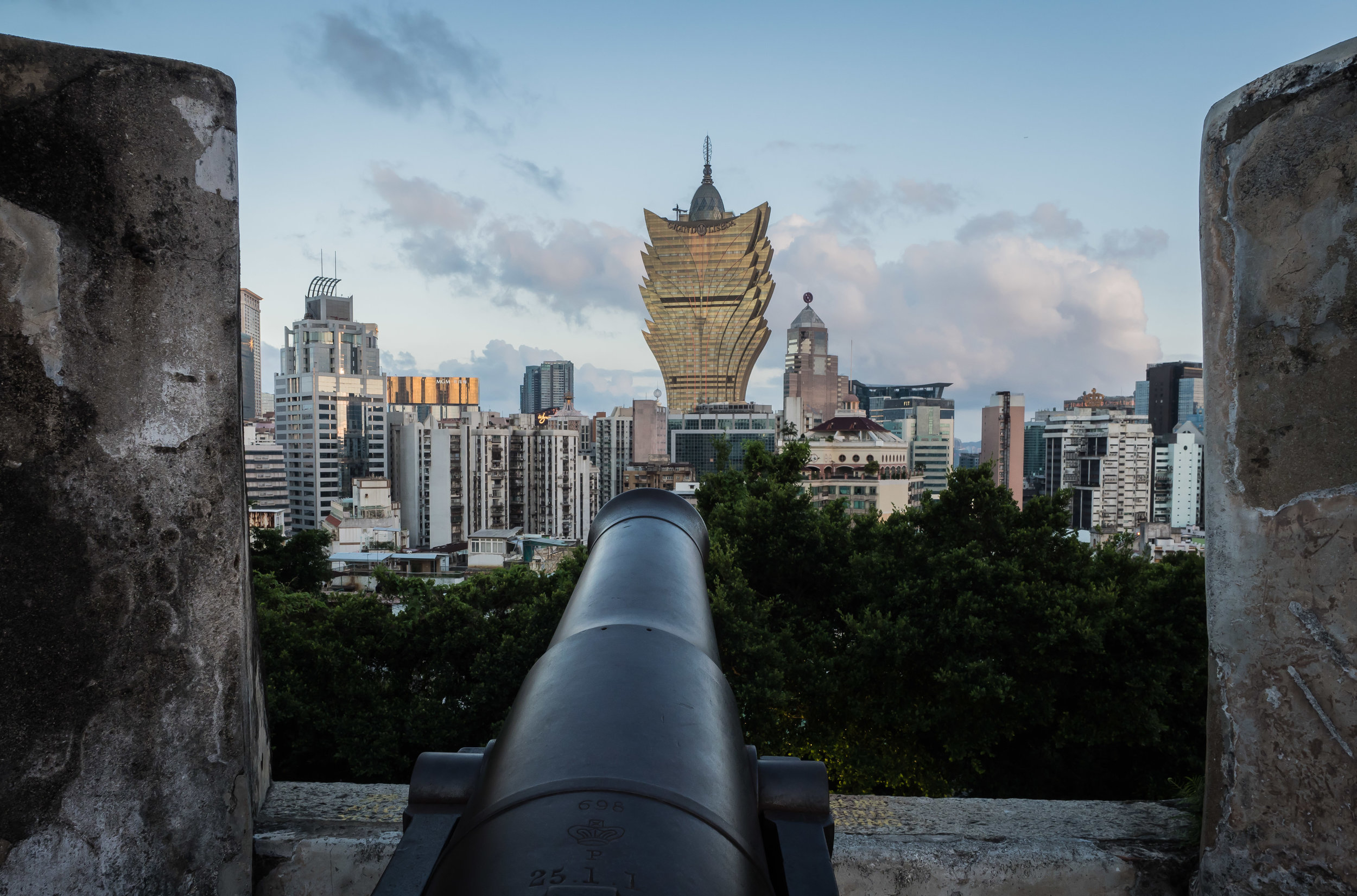
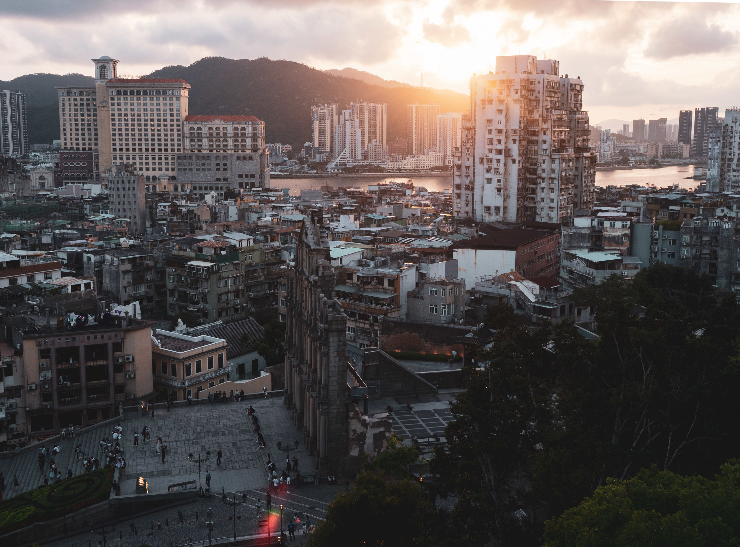
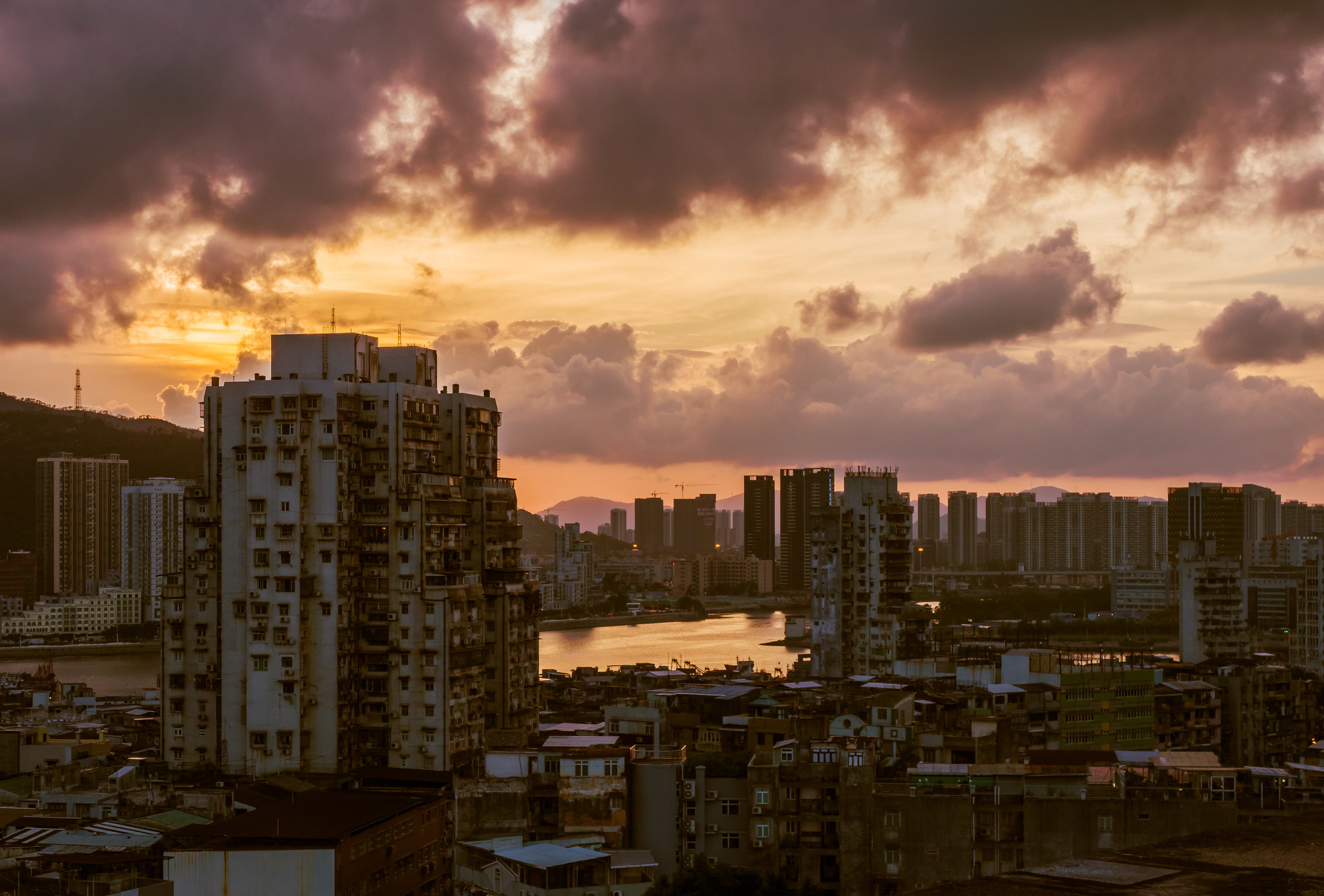

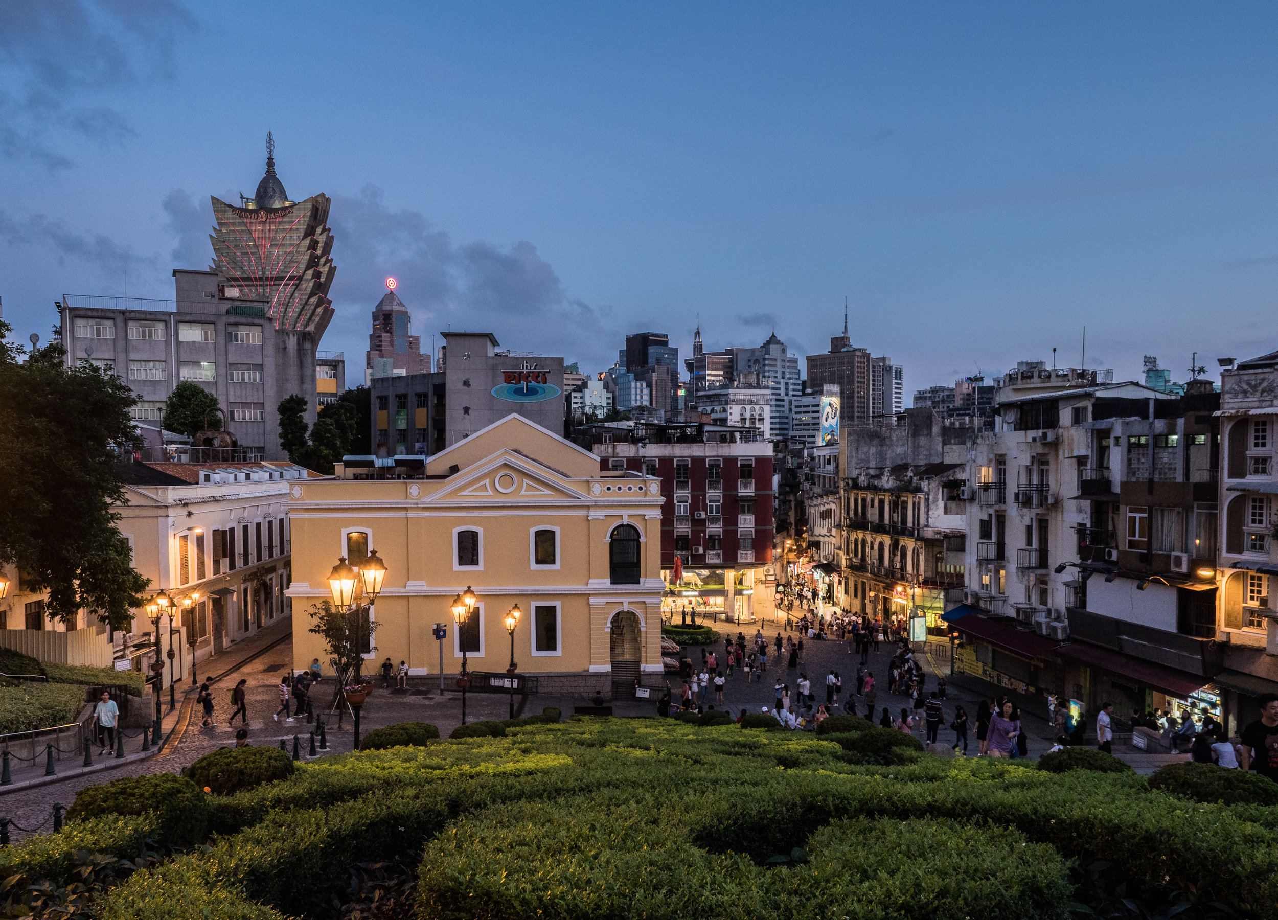
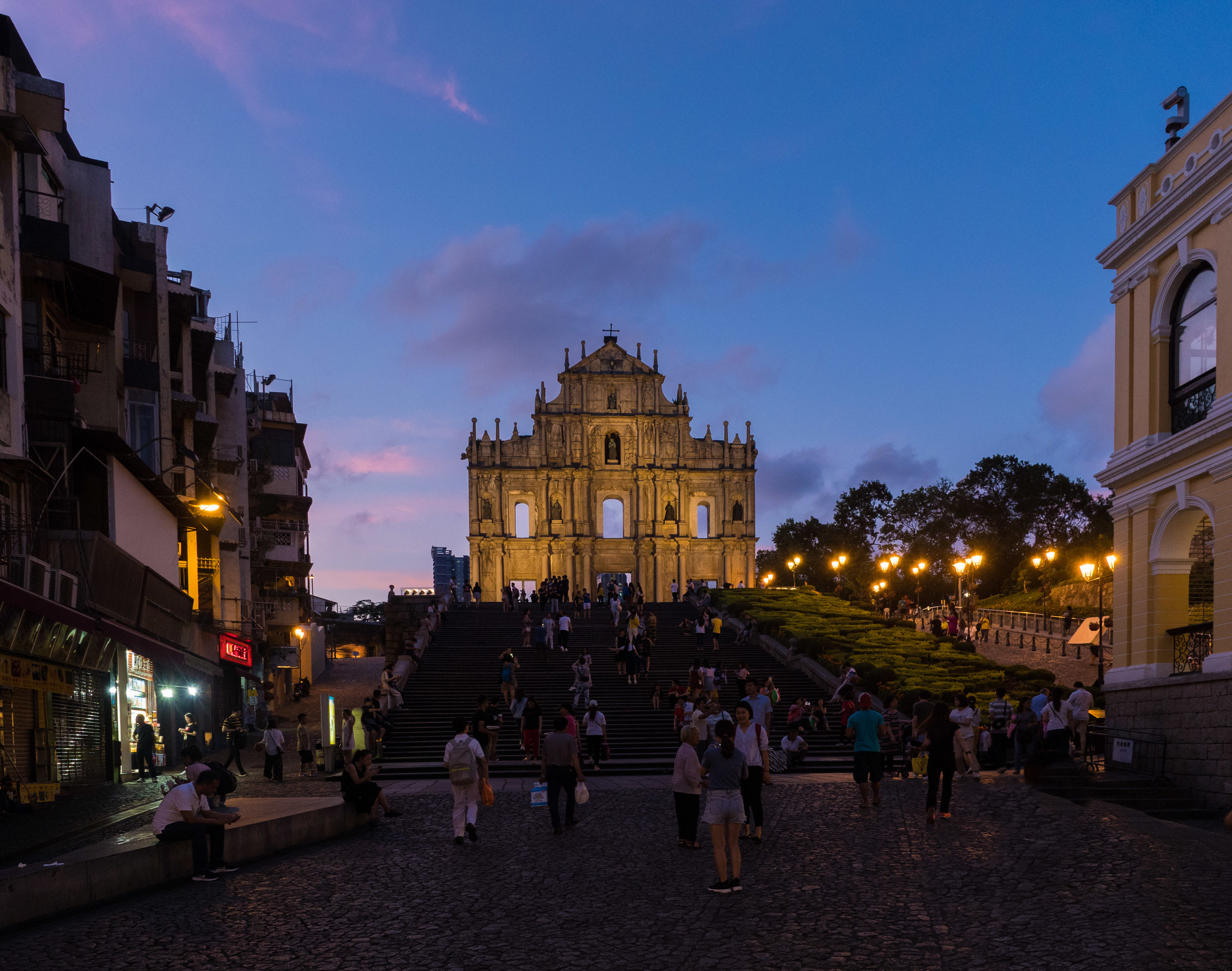
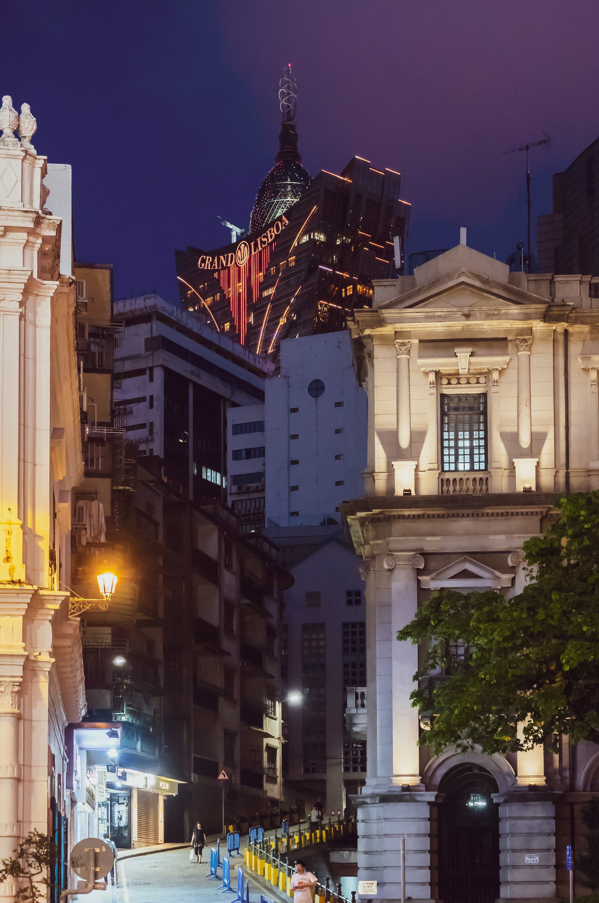
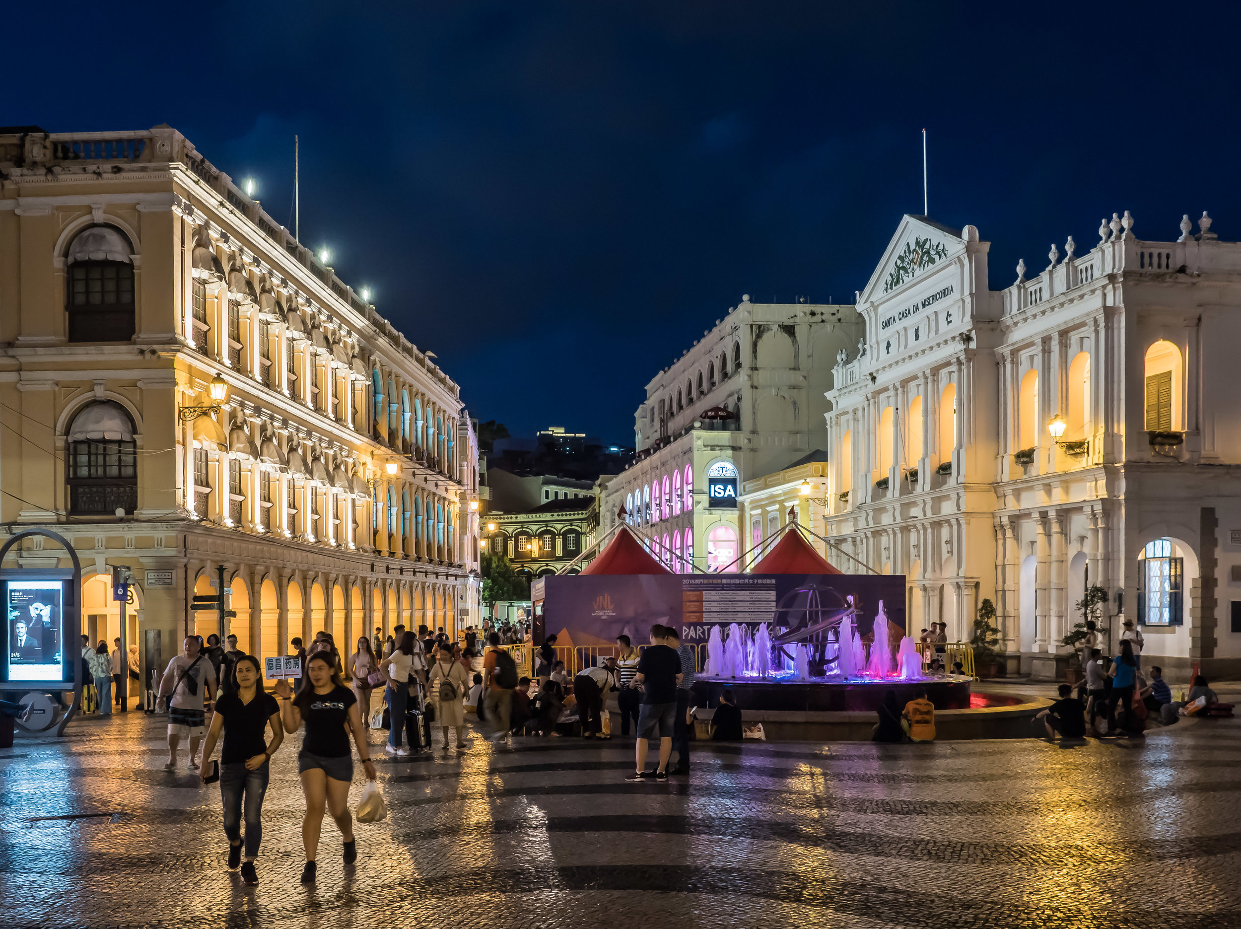
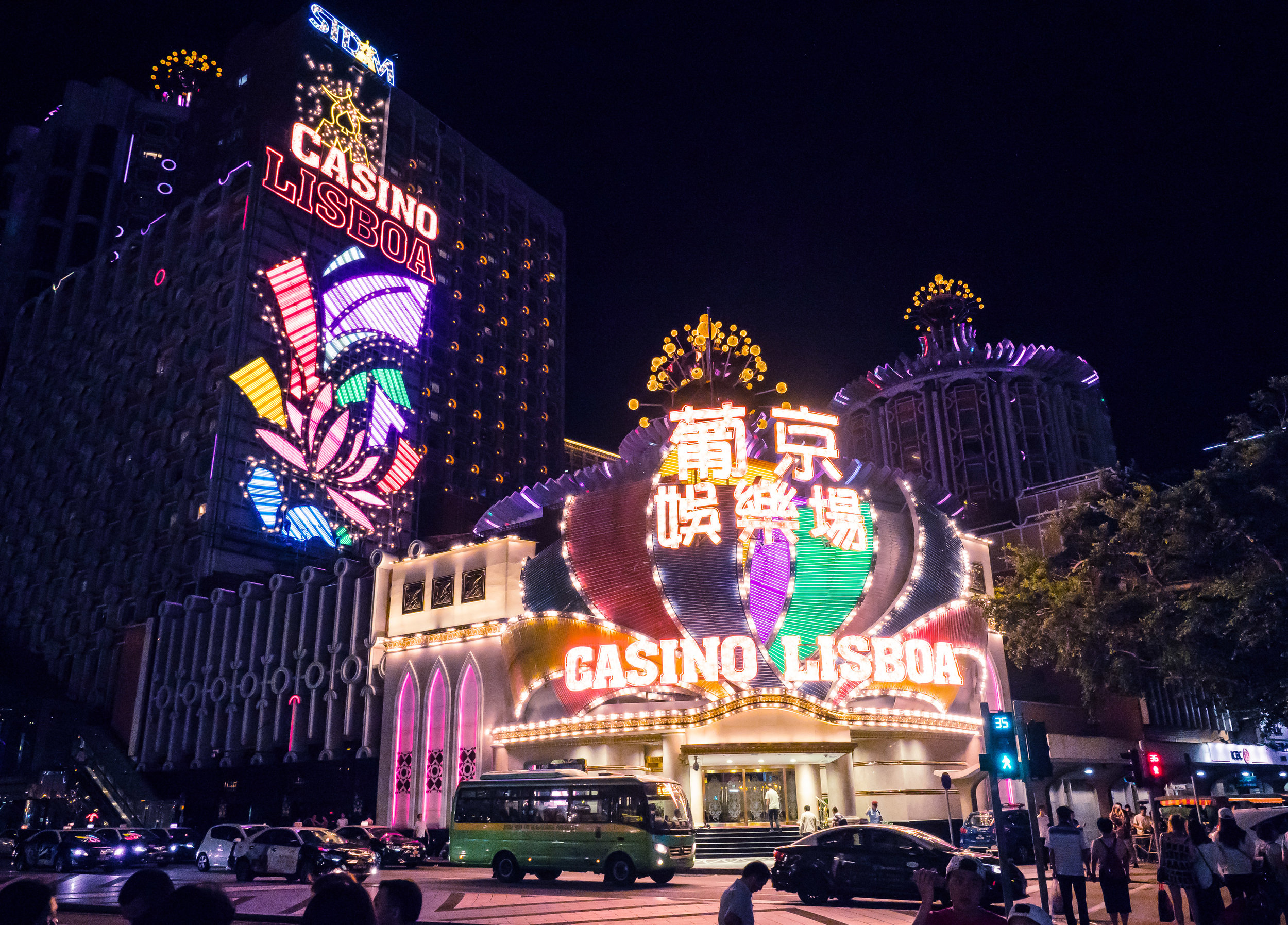
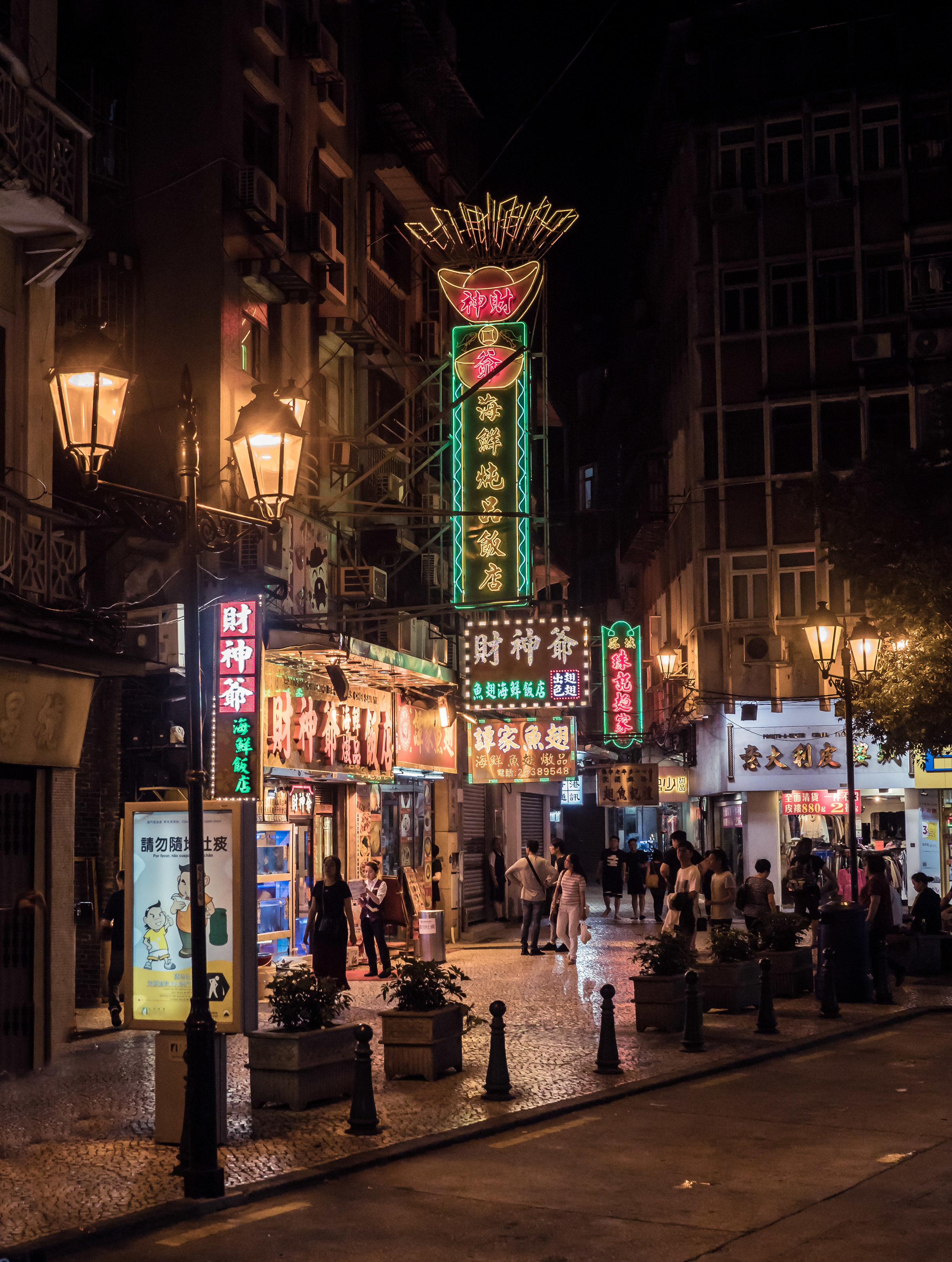


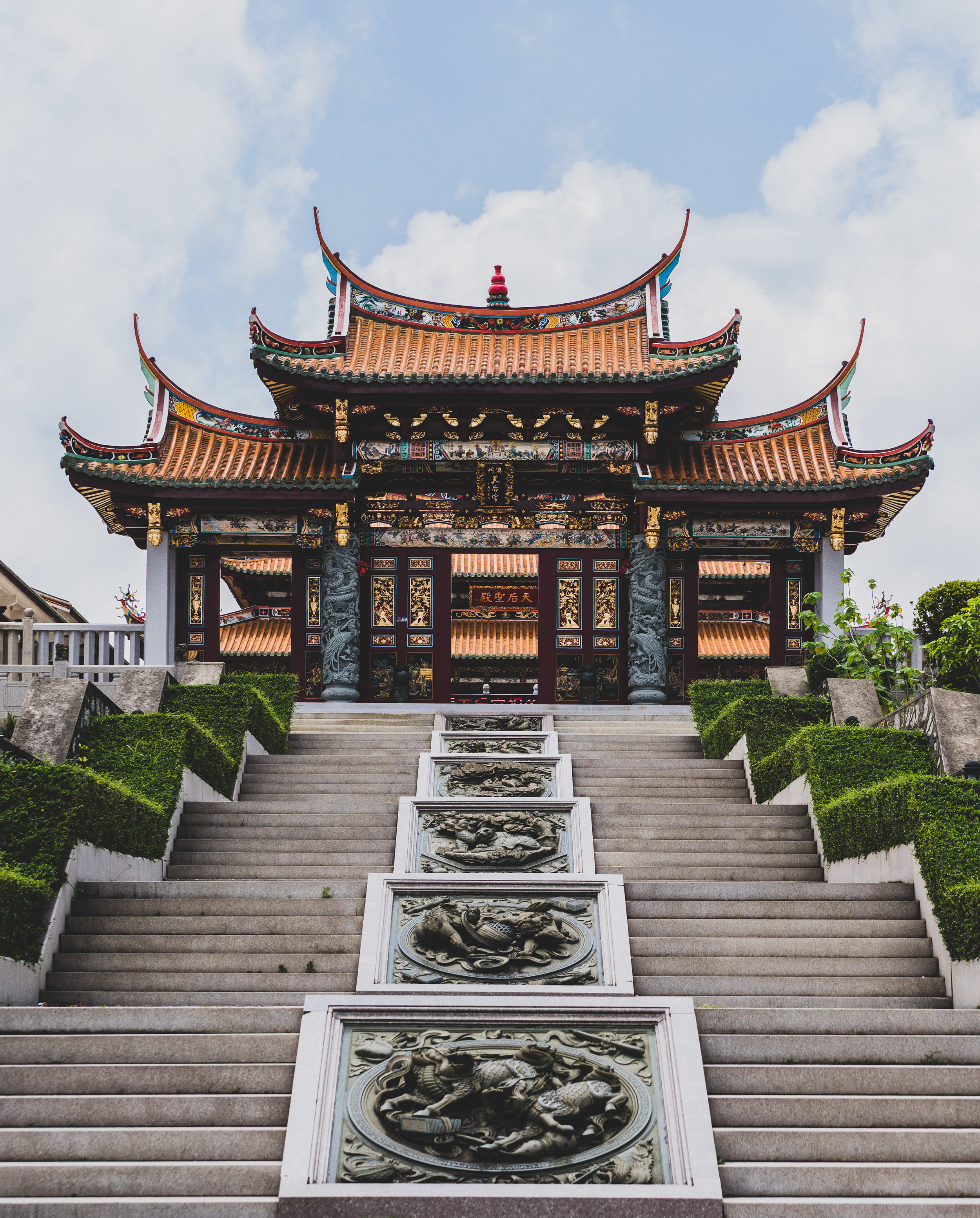
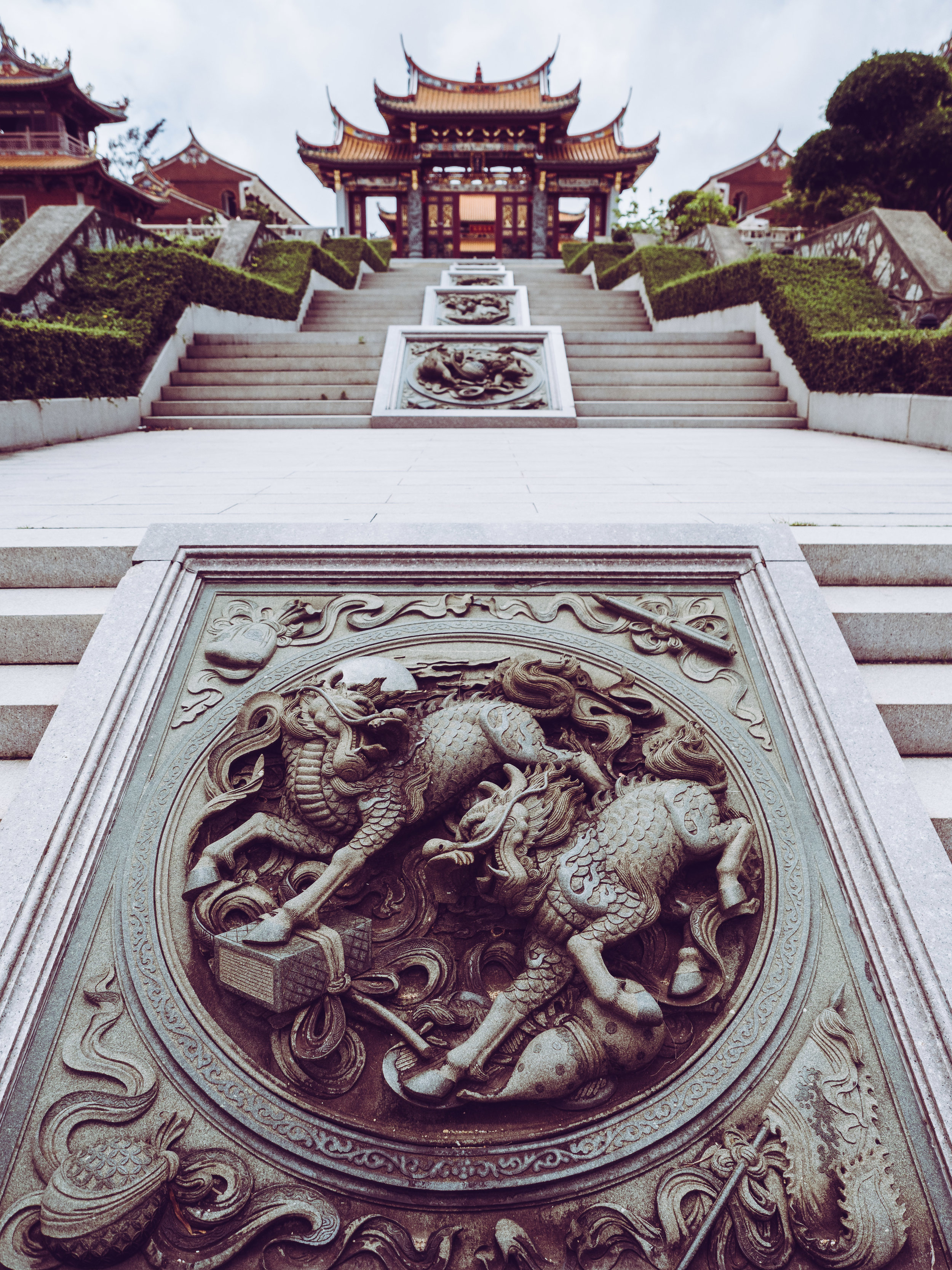
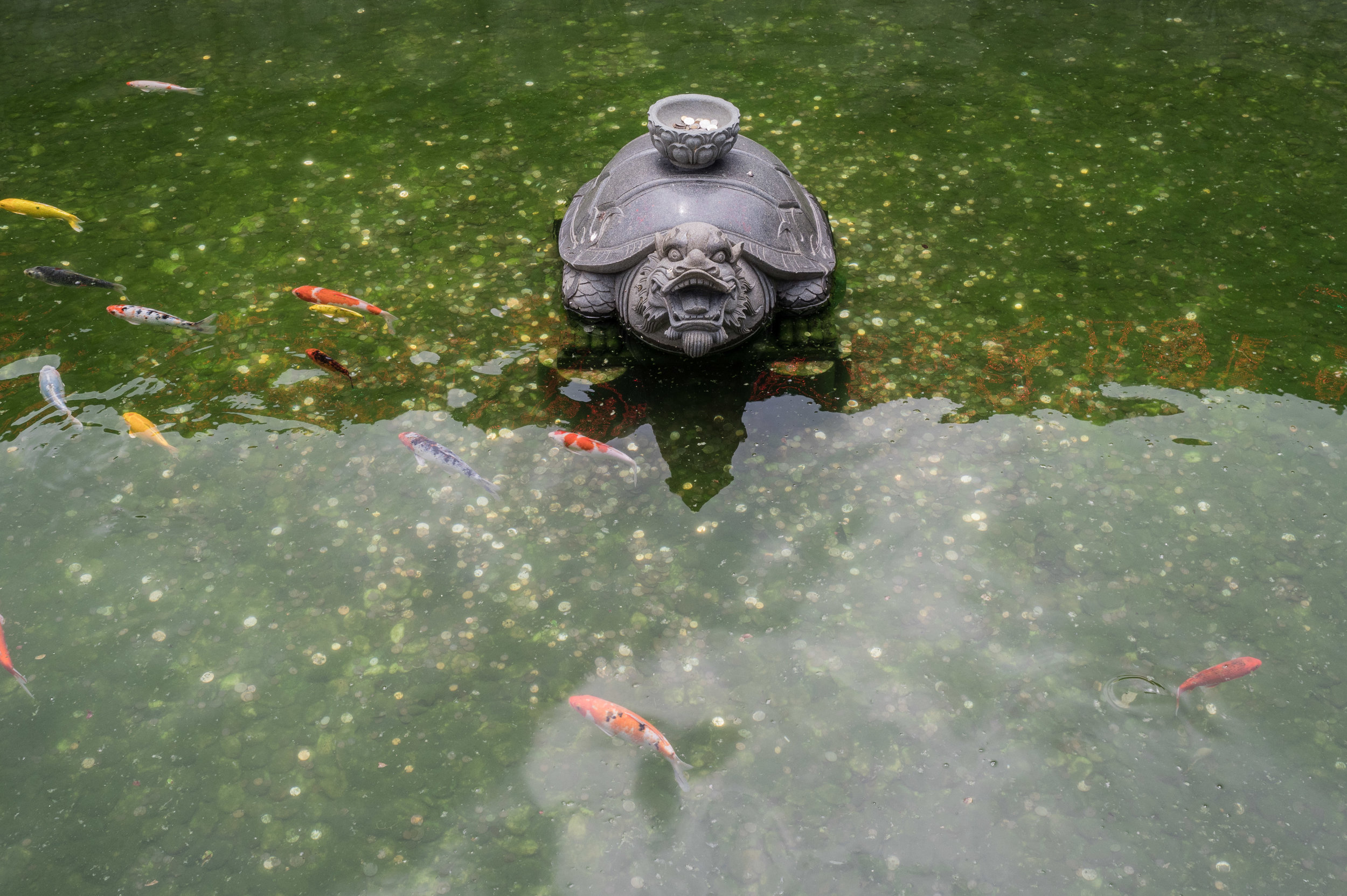
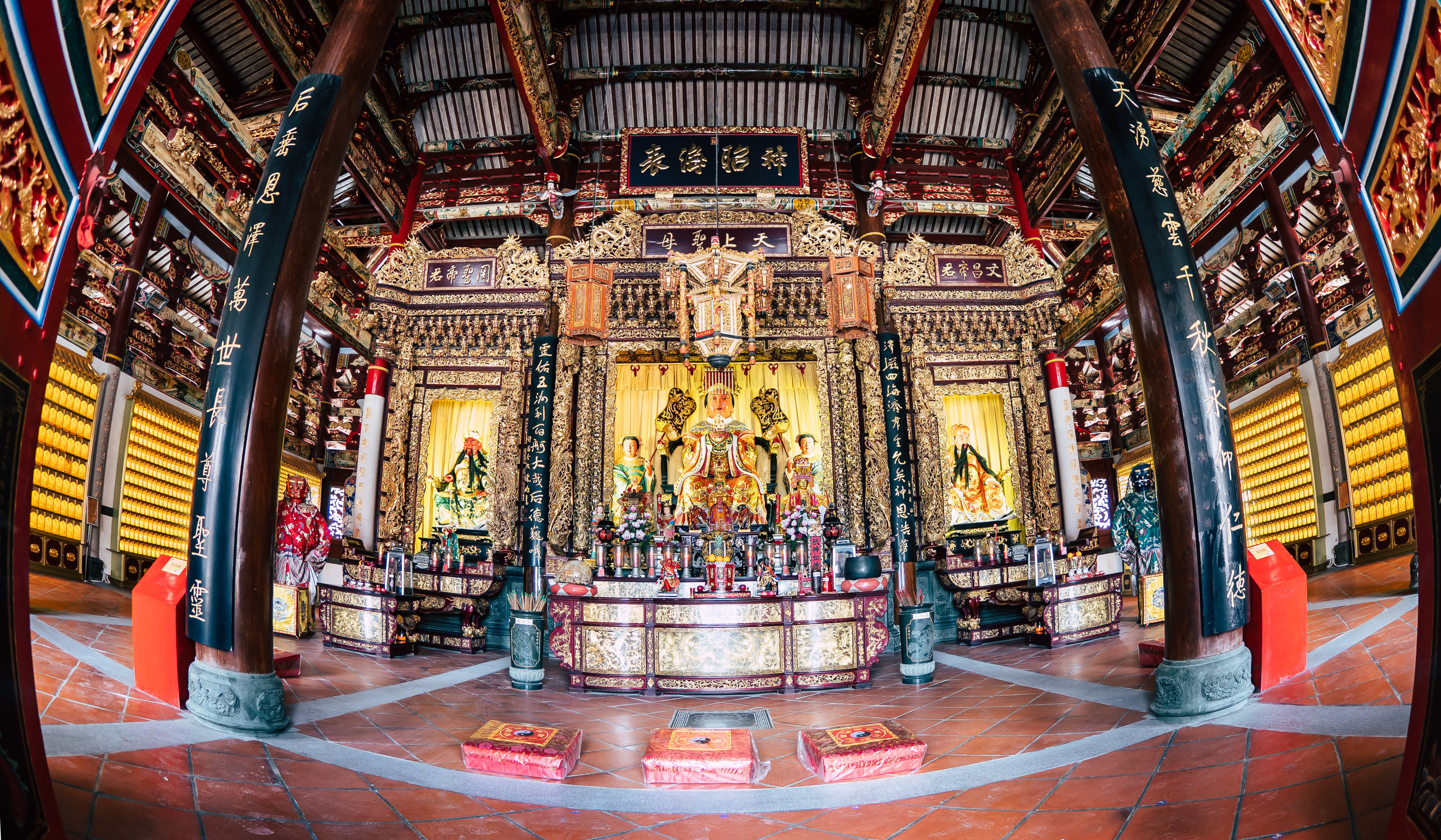
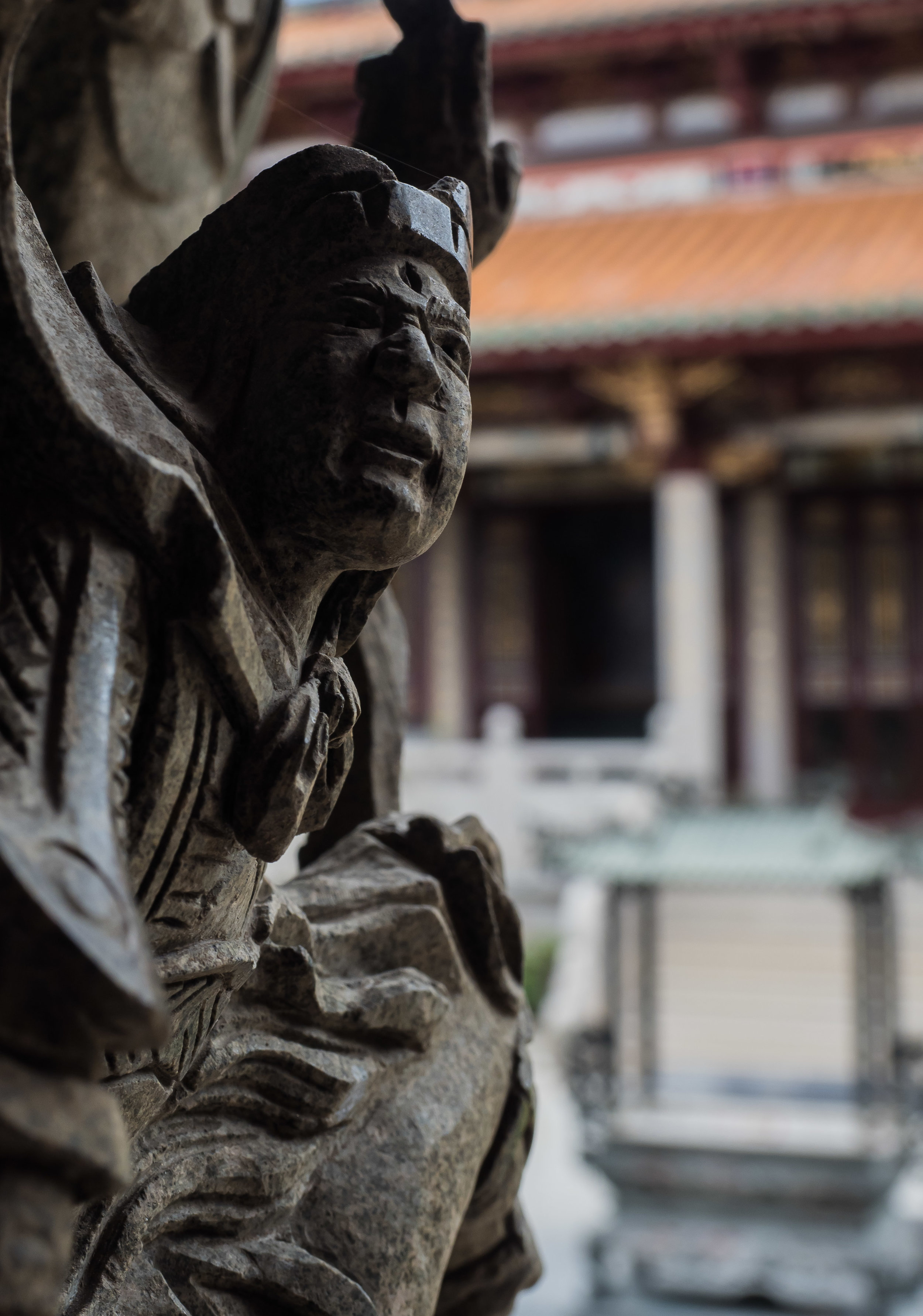

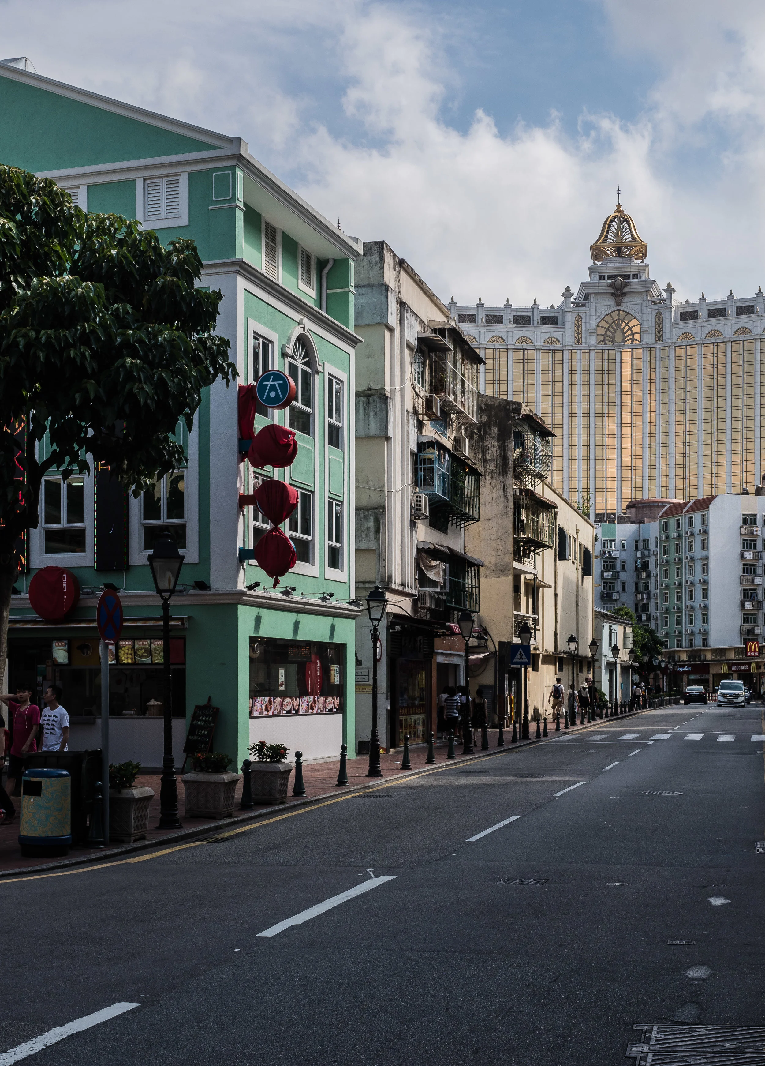

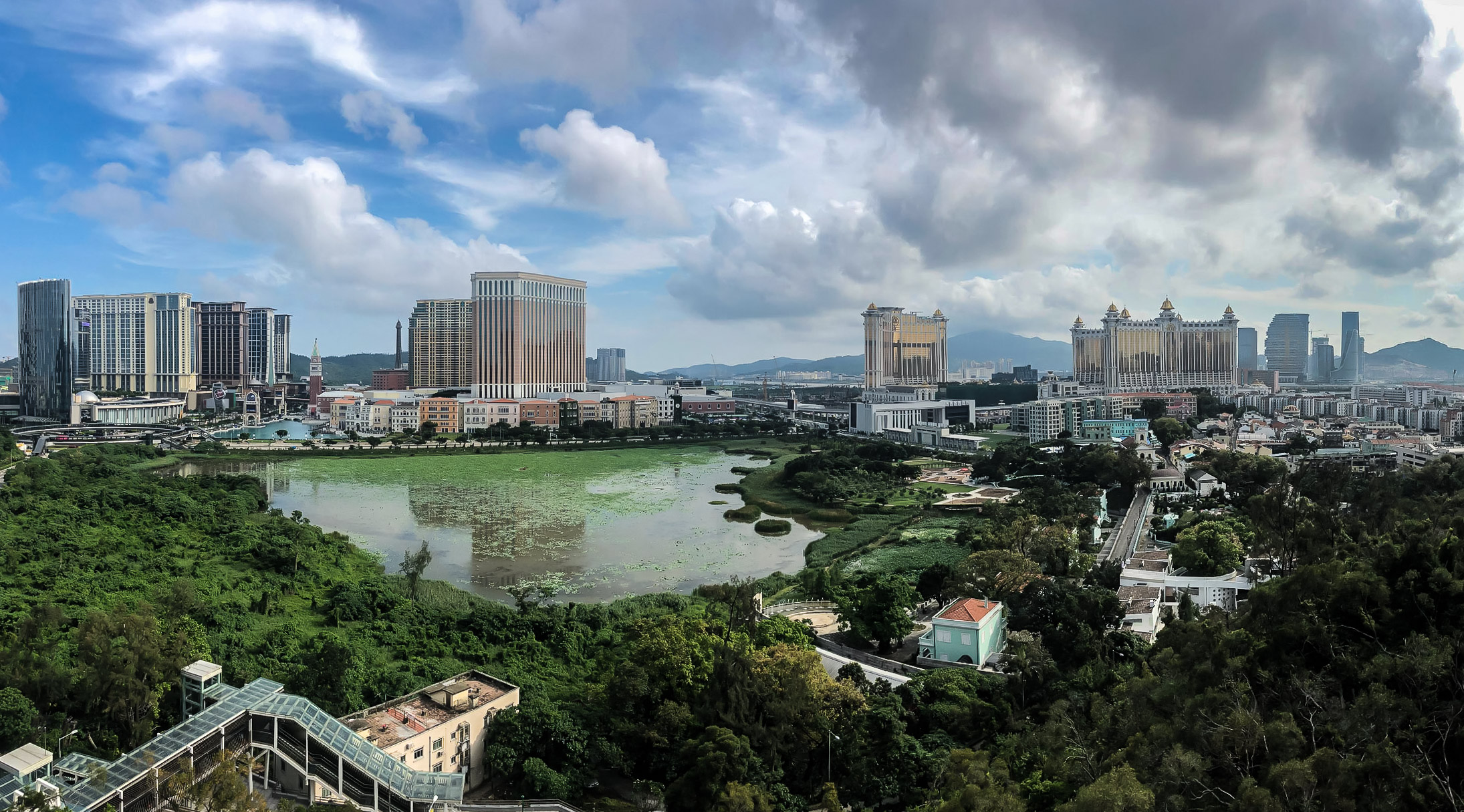
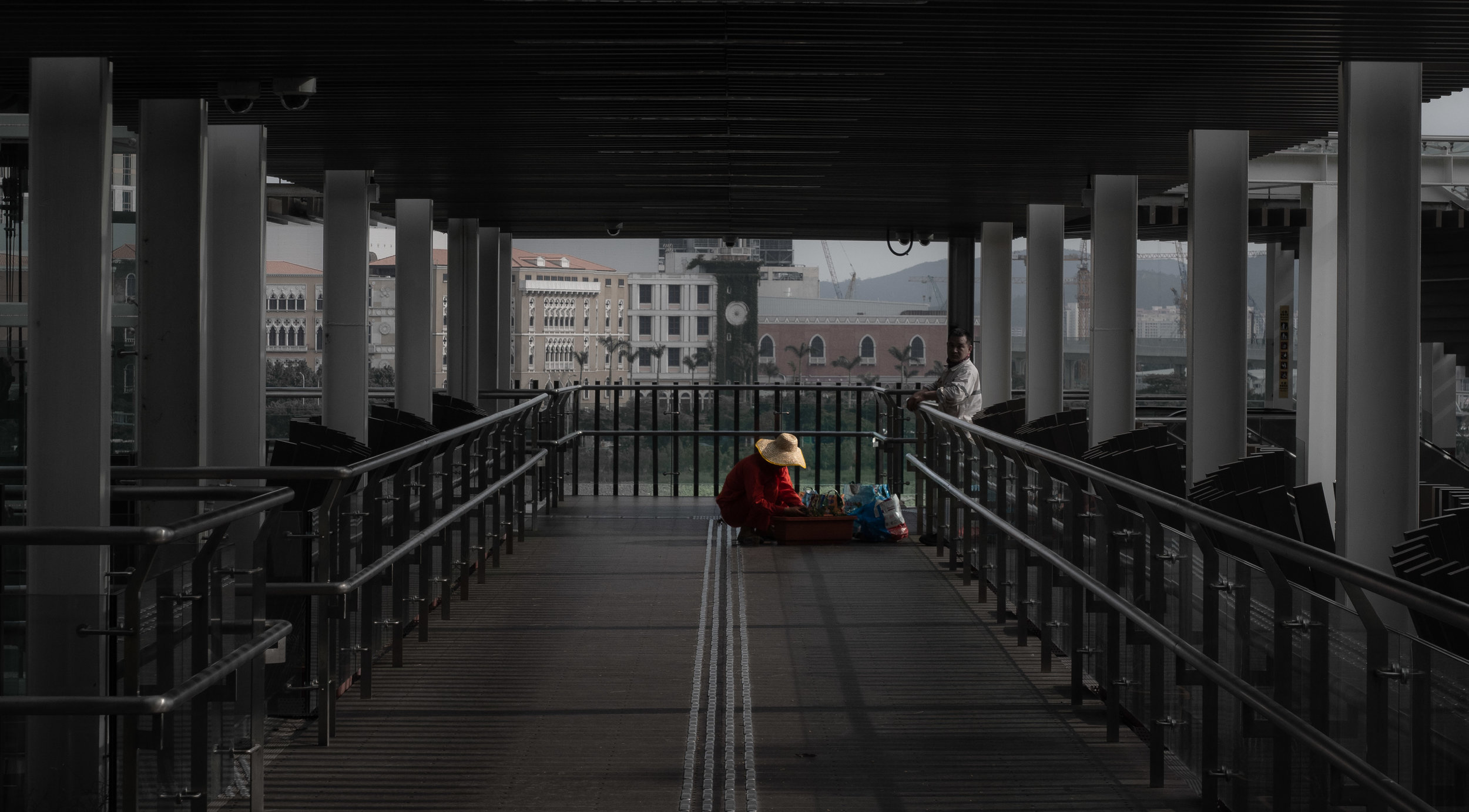
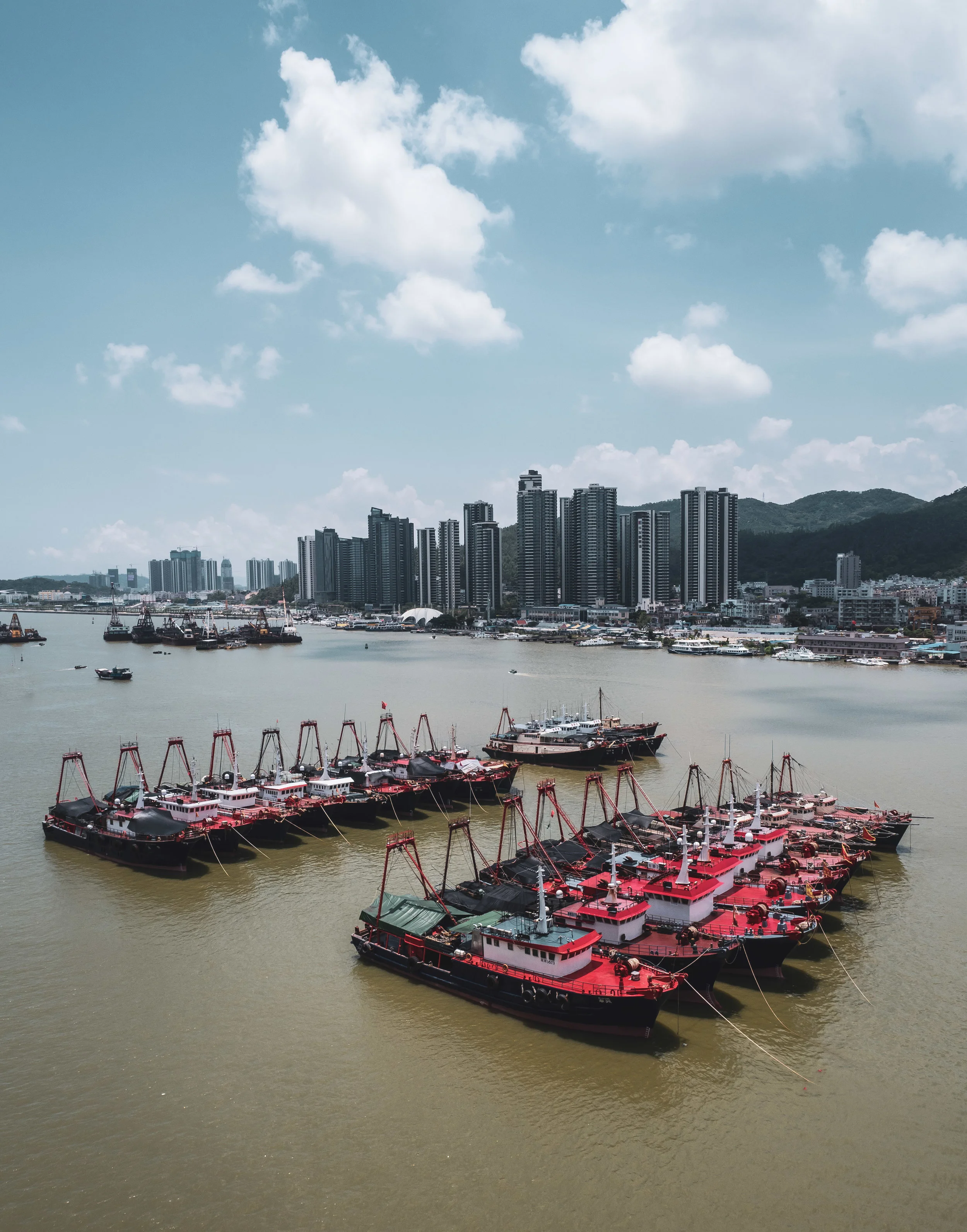
Tajikistan - Journey into the Unknown
For Eid Al Adha, we took a 2 day trip to Tajikistan, which is only a 3h flight from Dubai. Admittedly I knew next to nothing about the country, starting with the name of its capital - Dushanbe. We spent one day in said city, and a second day driving into the Fann Mountains to Iskanderkul, a beautiful lake. Definitely worth exploring, beautiful nature and a new culture.
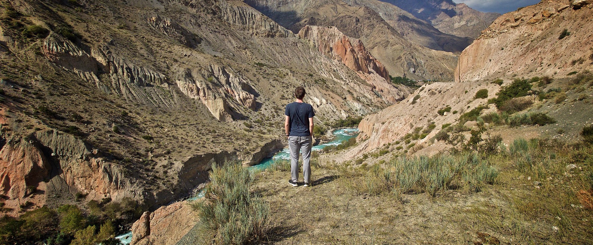
For Eid Al Adha, we took a 2 day trip to Tajikistan, which is only a 3h flight from Dubai. Admittedly I knew next to nothing about the country, starting with the name of its capital - Dushanbe. We spent one day in said city, and a second day driving into the Fann Mountains to Iskanderkul, a beautiful lake. Definitely worth exploring, beautiful nature and a new culture.