Hanoi & the Many Faces of Northern Vietnam
Vietnam’s beautiful capital and a glimpse at its mountainous and coastal landscapes.
This is the third installment of my Vietnam blog series, after the central parts with beautiful Hoi An & Hue, and the south, featuring Ho Chi Minh City and the Mekong delta. Vietnam remains one of my favourite destinations in Asia, and this entry covers just over a week spent in its capital and northern parts - there is a lot more to see and I hope I’ll find time to go back in the not too distant future. For now, here is a look at the capital, the islands around Cat Ba, the tea plantations in the mountainous areas, and more…
Hanoi - Capital in the Shadow
Despite its capital status dating back more than 1000 years - granted, under different governing entities - and its nearly 9 million inhabitants, Hanoi is probably not the first city that comes to people’s mind when they think of Vietnam. At least in western culture, it’s Saigon - or Ho Chi Minh City, its official name - that commands a little more mindshare. Granted, the centre of the south does play the most critical economic role, but I probably enjoyed Hanoi a little more, despite my short stay.
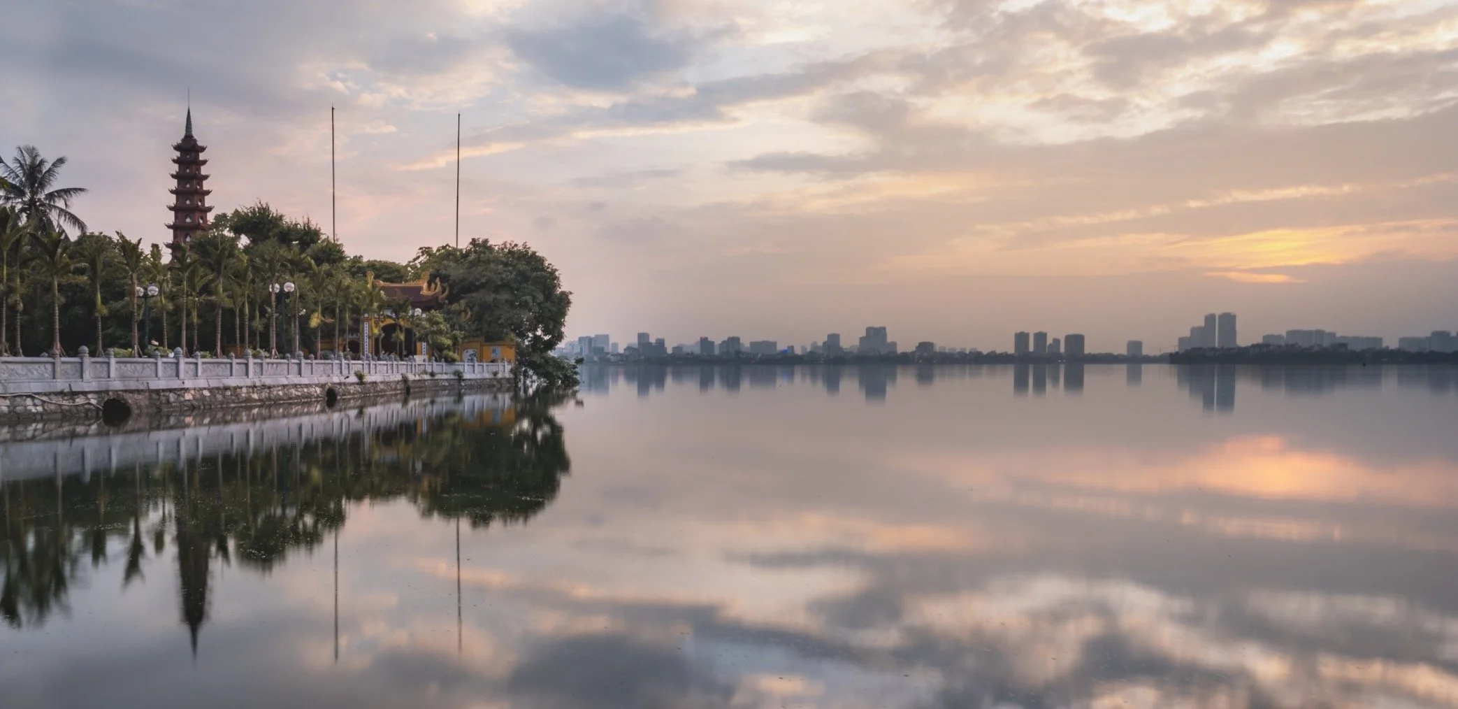
One of my favourite features is its many lakes dotted around different parts of the city, with plenty of walkways, restaurants, and street life. Many of them were left behind by the shifting patterns of the Red River, and later turned into natural features of the cityscape. While seemingly much improved over the last years, the lakes suffered from heavy wastewater pollution until recently - not a place to swim.
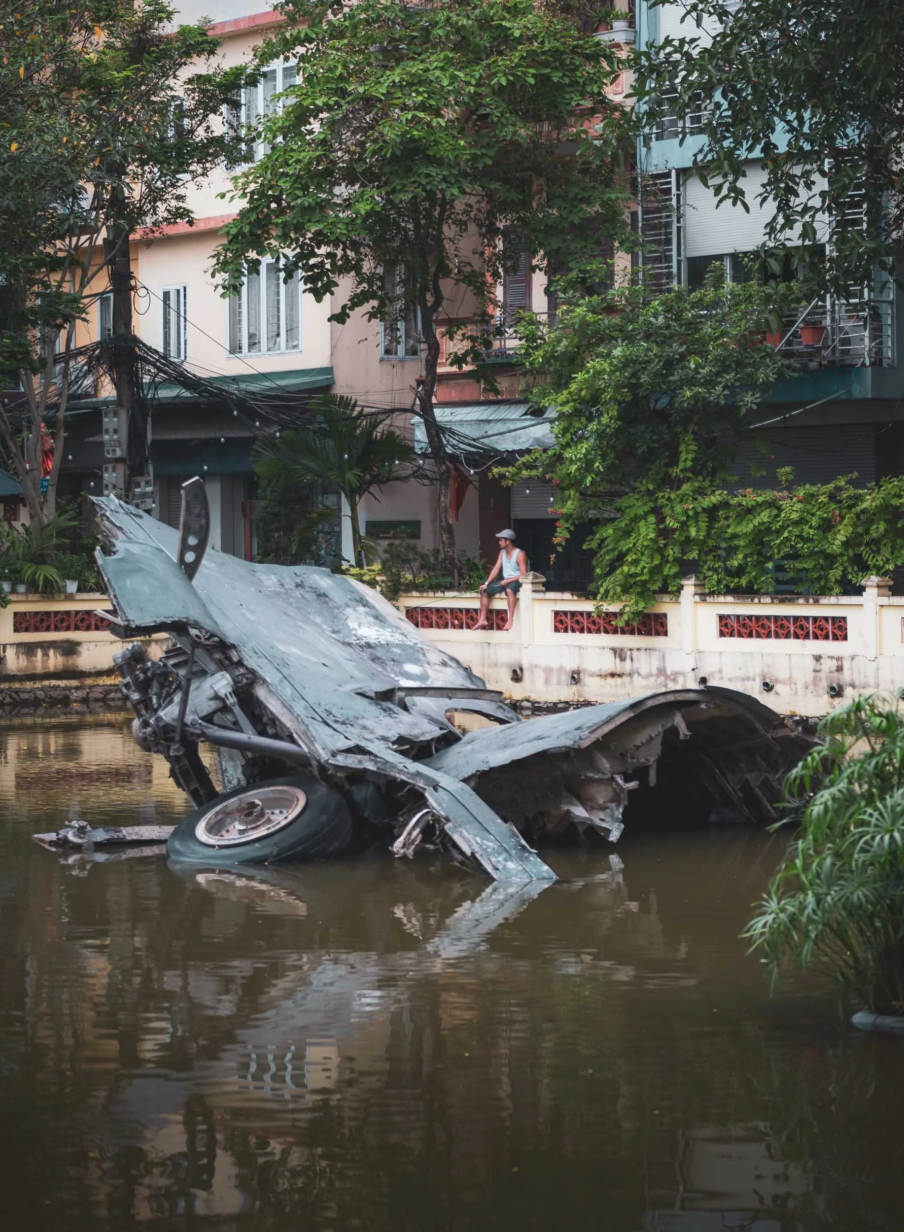
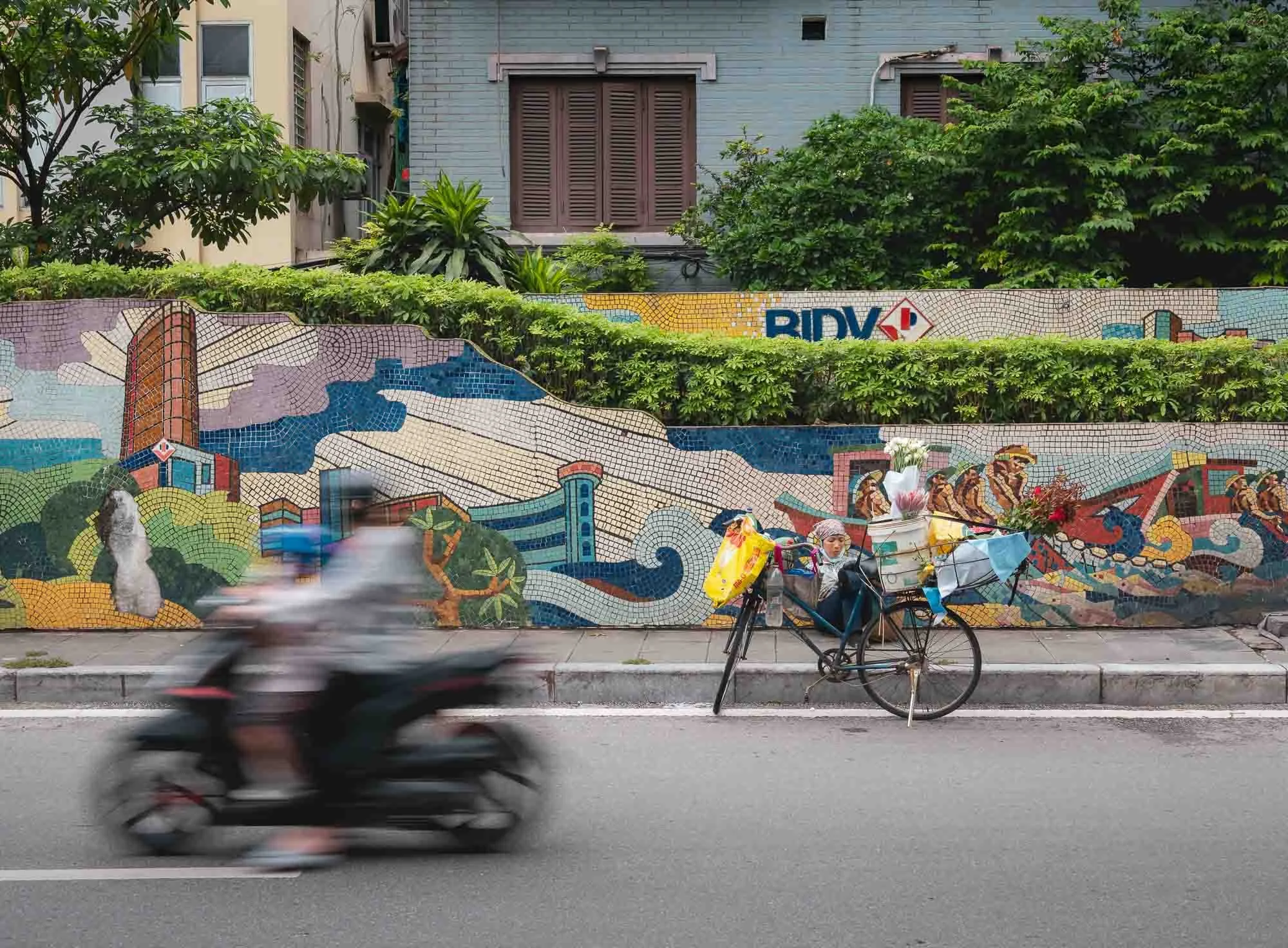
A very very small lake in a residential neighbourhood features remnants of a B-52 bomber, shot down on December 27, 1972 - the wreckage serves as a war memorial symbolising Vietnamese resilience during the war with the US (and the south).
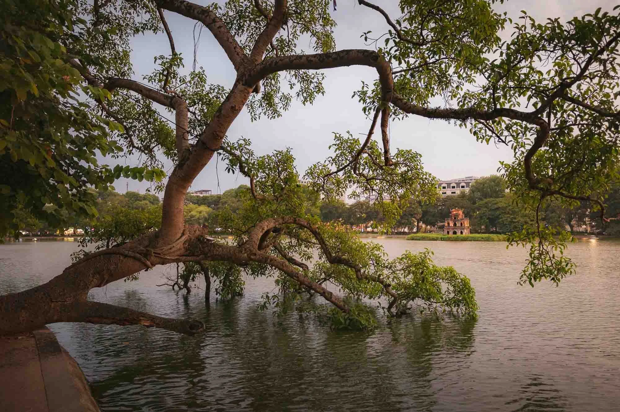
Luckily, some of the lakes feature slightly more peaceful relics, such as the so-called Turtle Tower on a small island in the centre of Hoan Kiem Lake near the old quarter, built around 1886 in honor of a local legend.
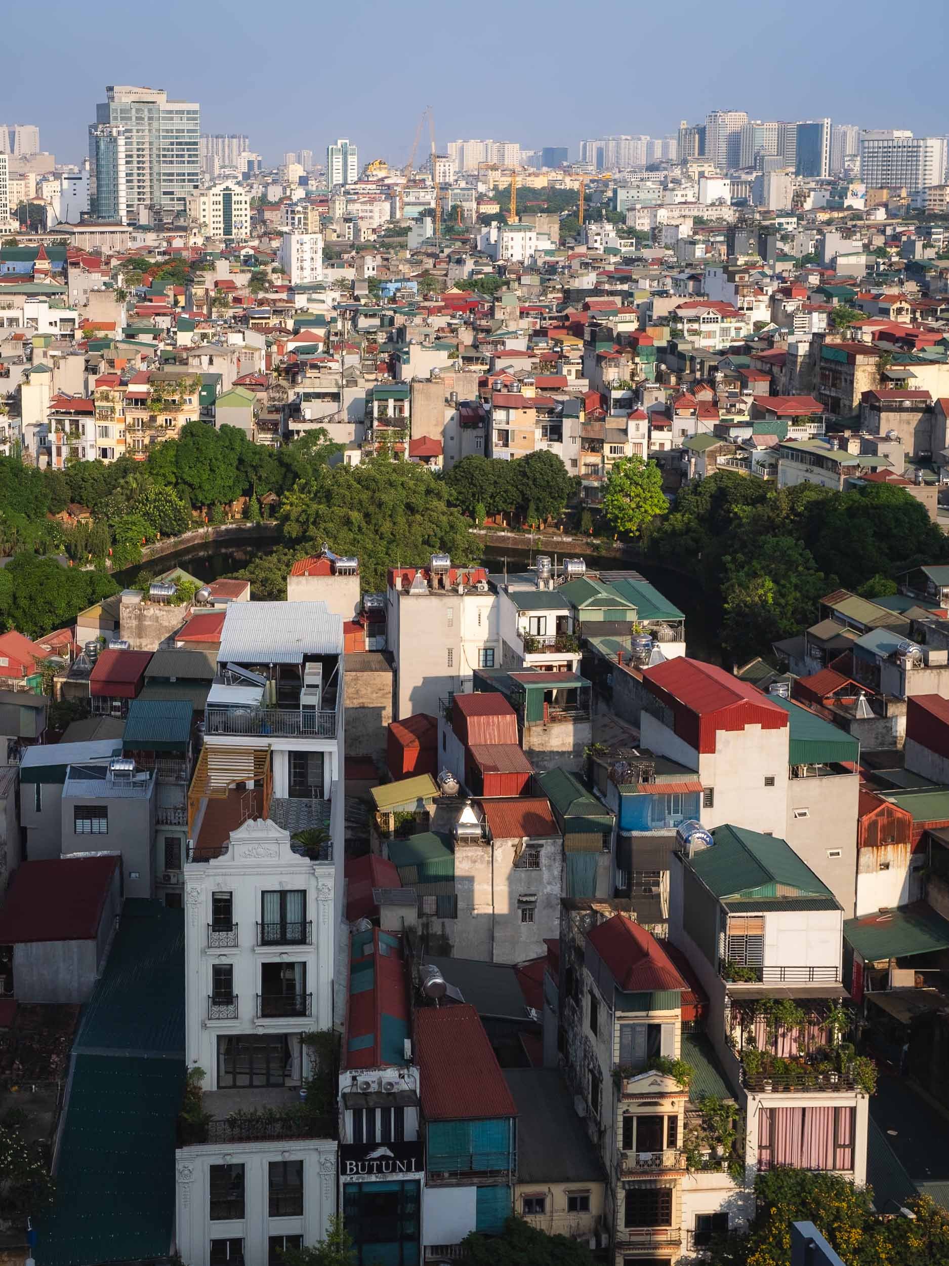
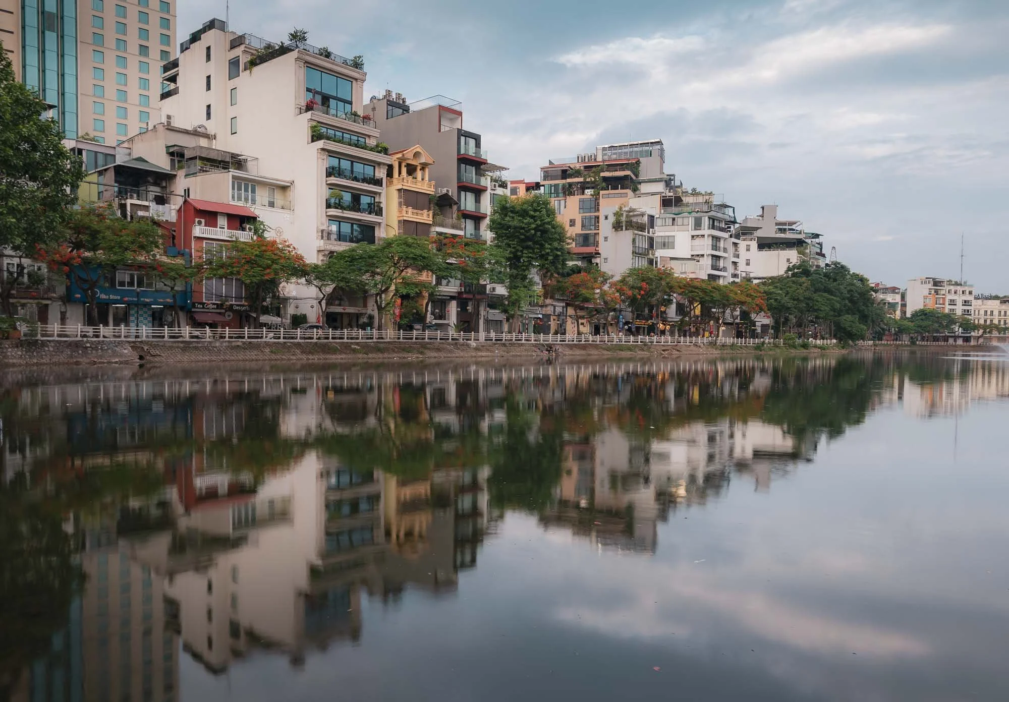
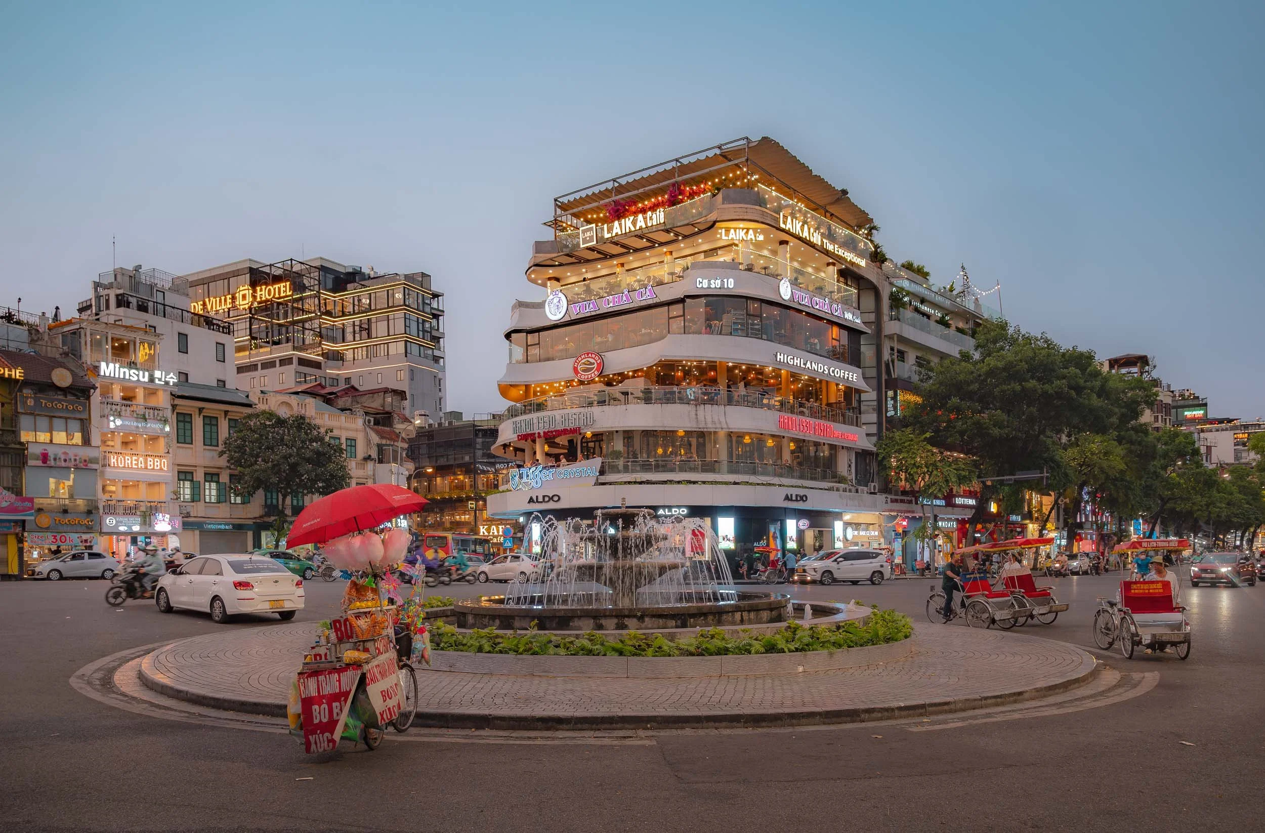
Hanoi is a colorful place - tree-lined avenues and lakes, stacked narrow houses with a mix of Vietnamese and colonial architecture, ancient temples, and modern high-rises.
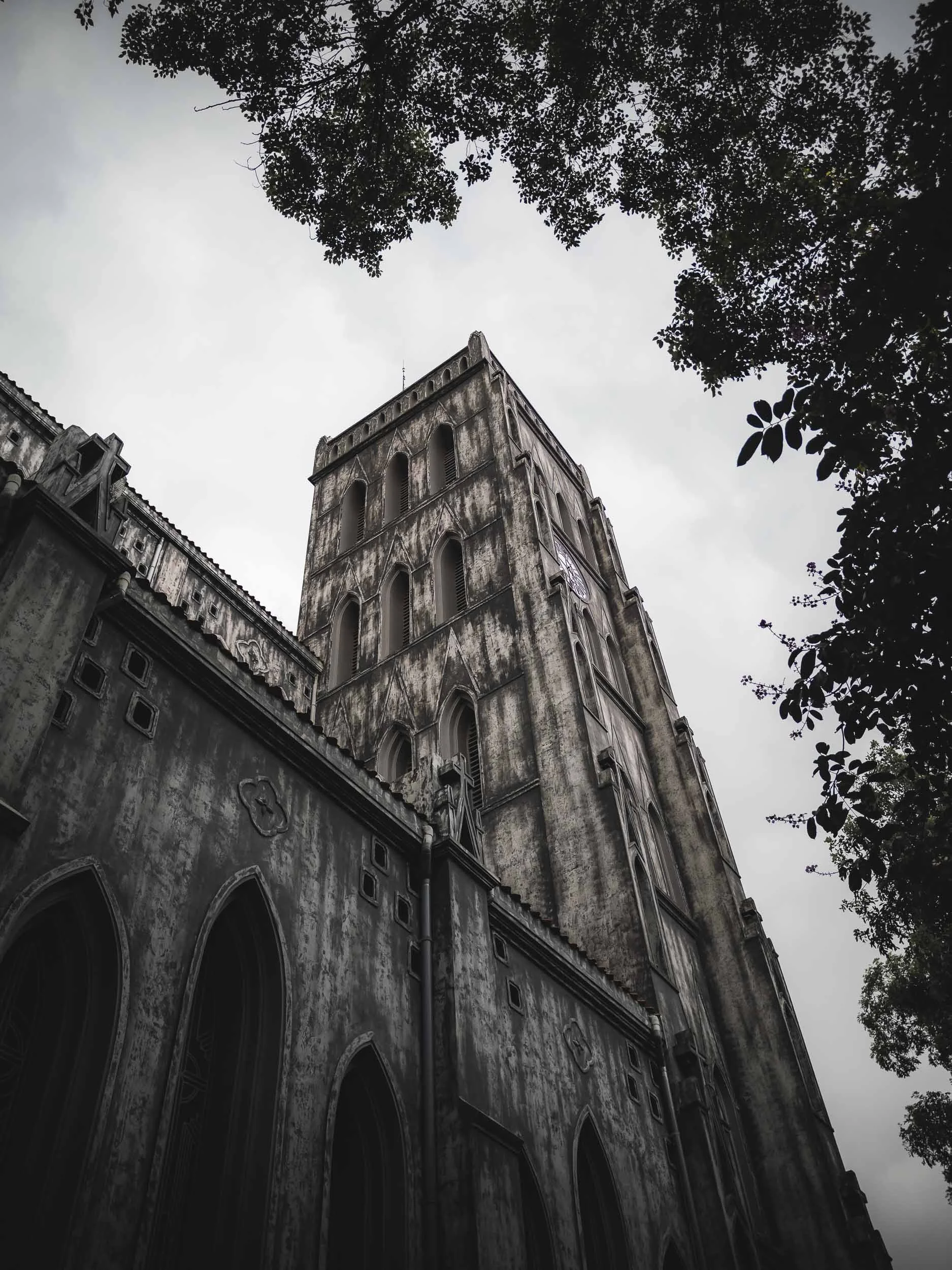
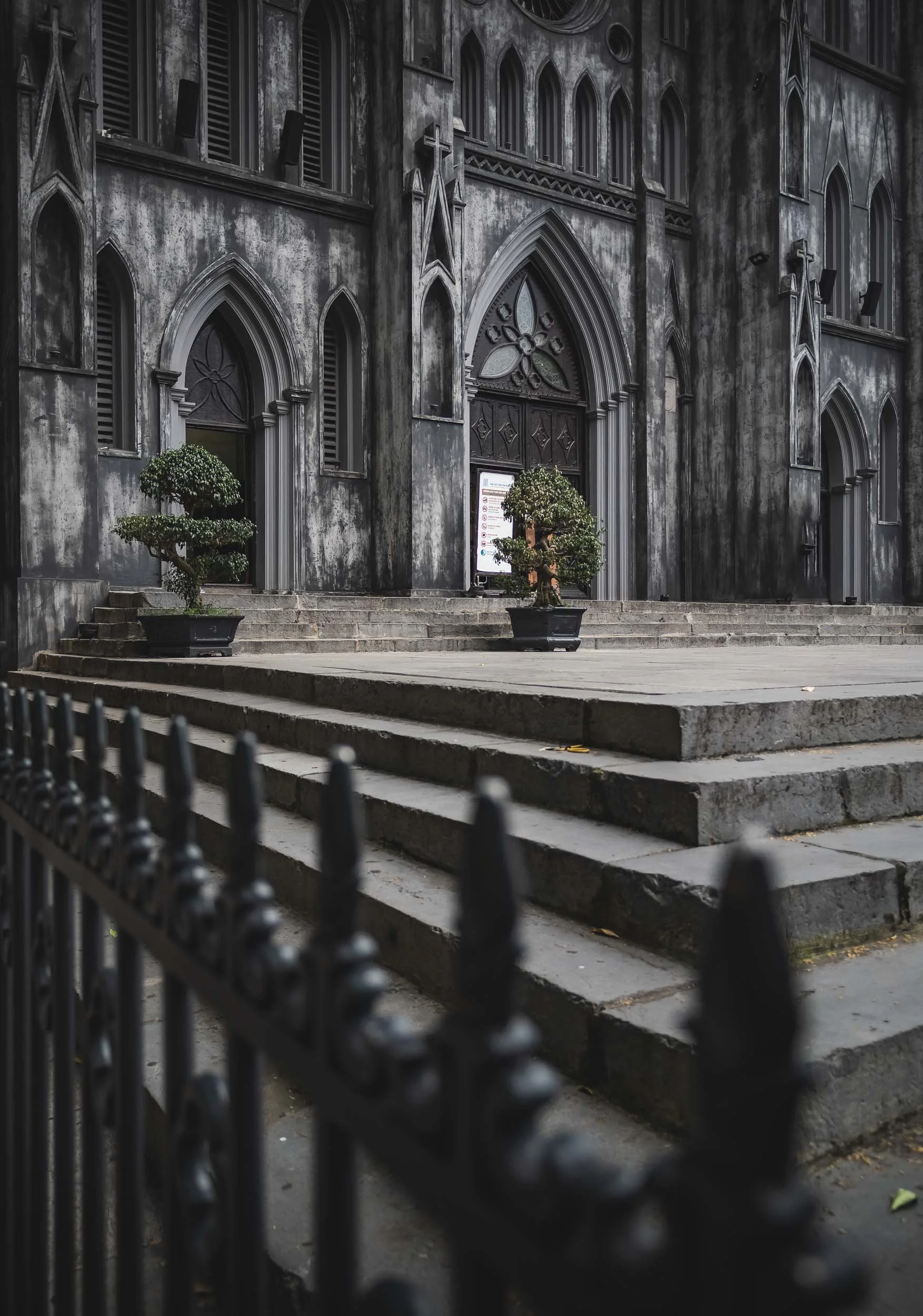
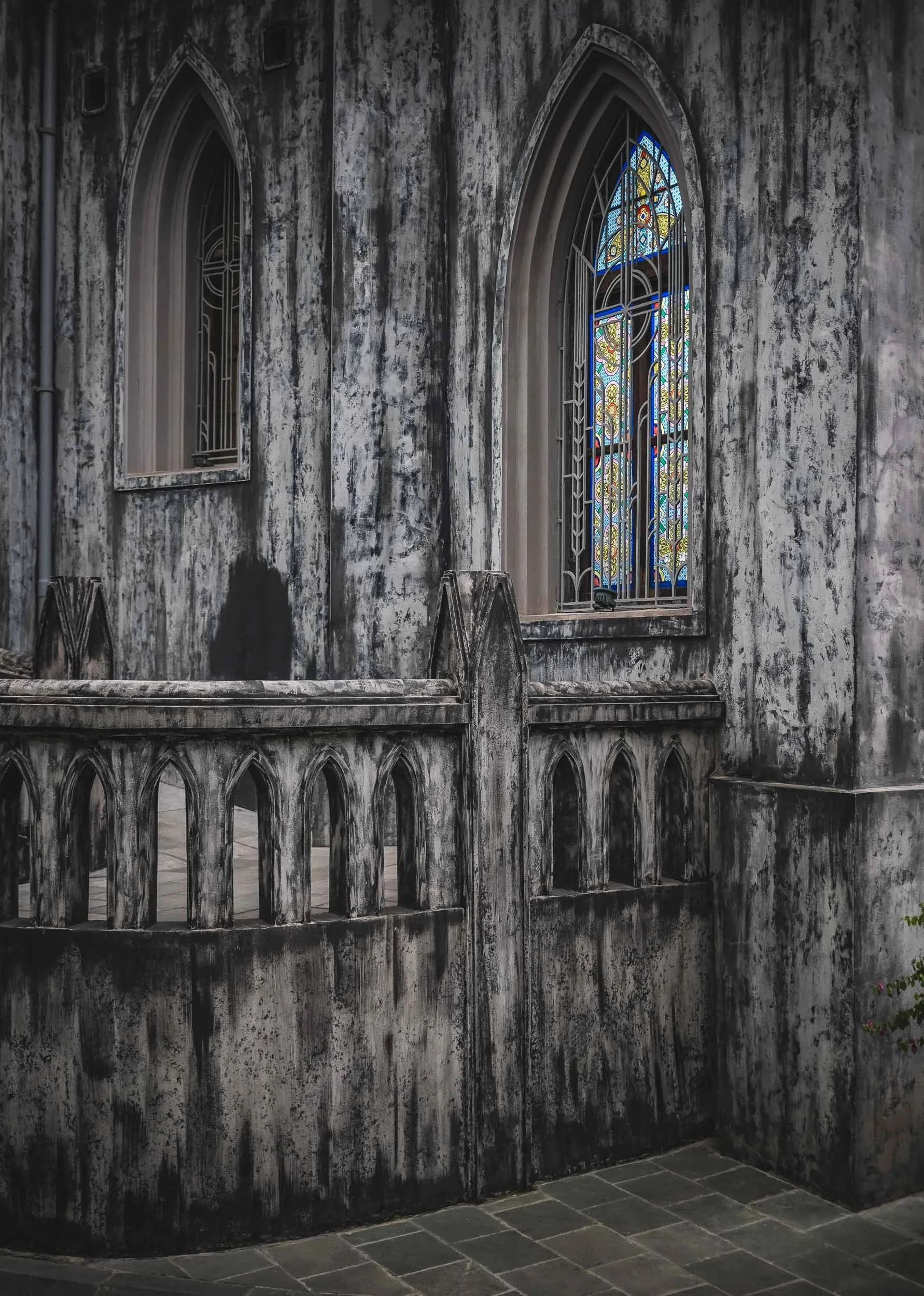
St. Joseph Cathedral
A less colorful affair is its 19th-century Neo-Gothic cathedral in the old quarter on a moody afternoon - a common occurrence given that I visited at the start of the rainy season in May. It was built during the very early French Indochina period and now houses the Archdiocese of Hanoi.
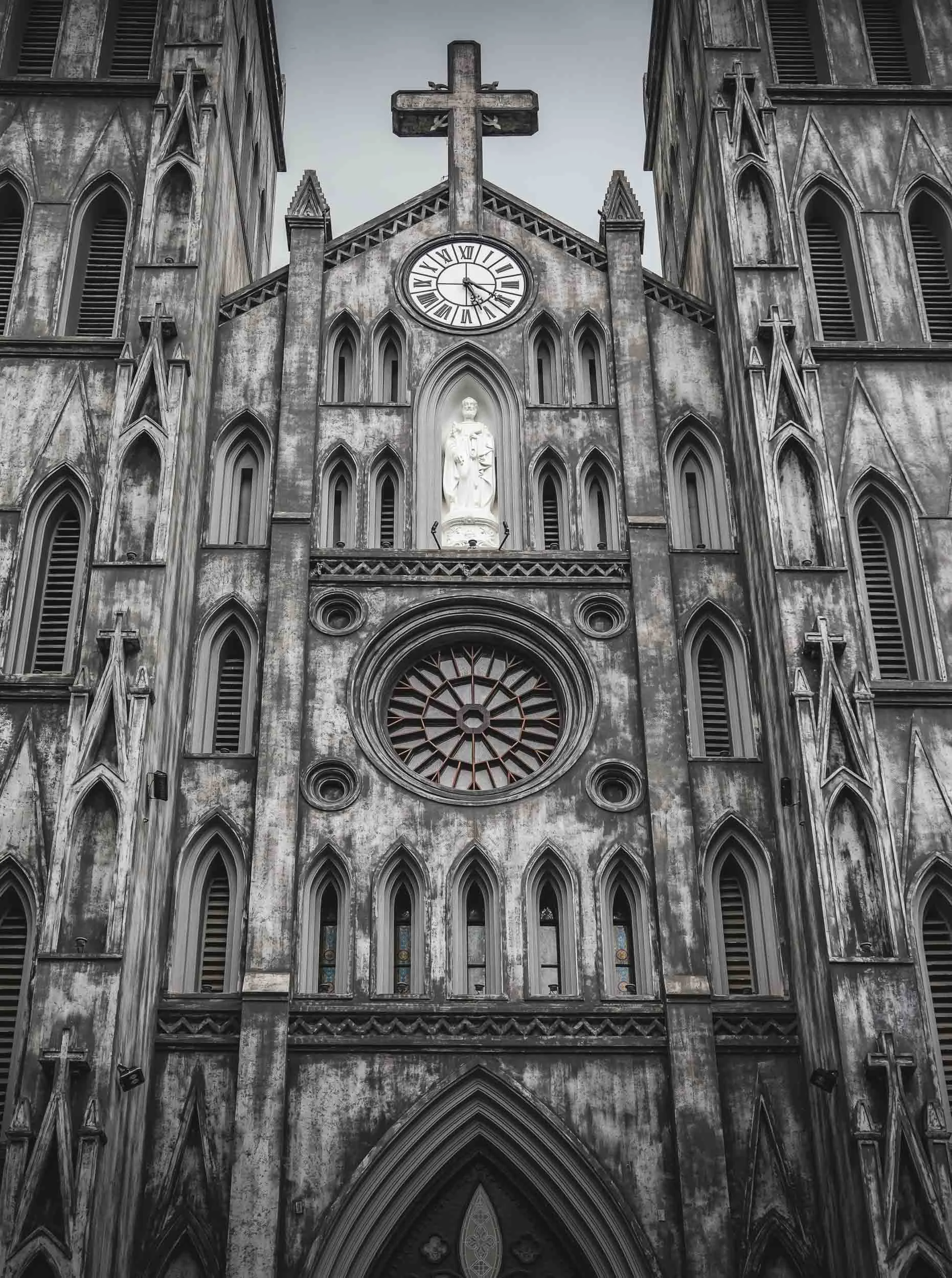
Only around 8% of the Vietnamese population is Catholic though. While the country is a secular state, in fact most people practice traditional folk customs rather than the more well-known global religions.
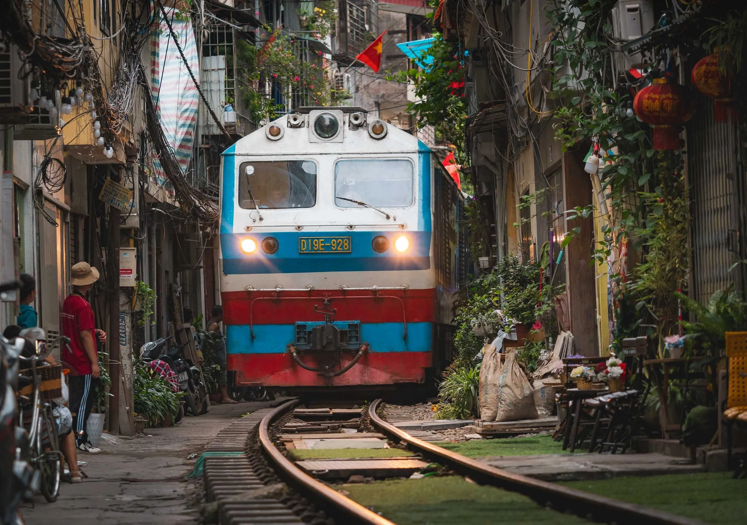
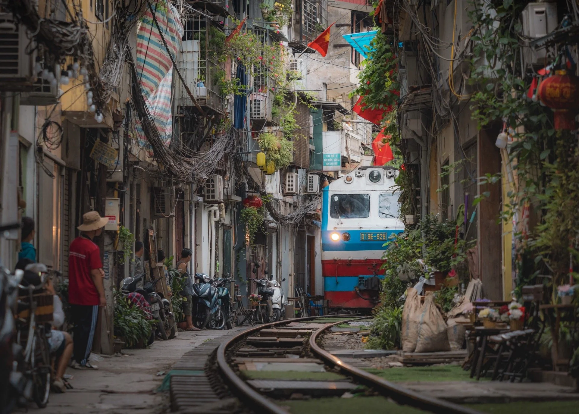
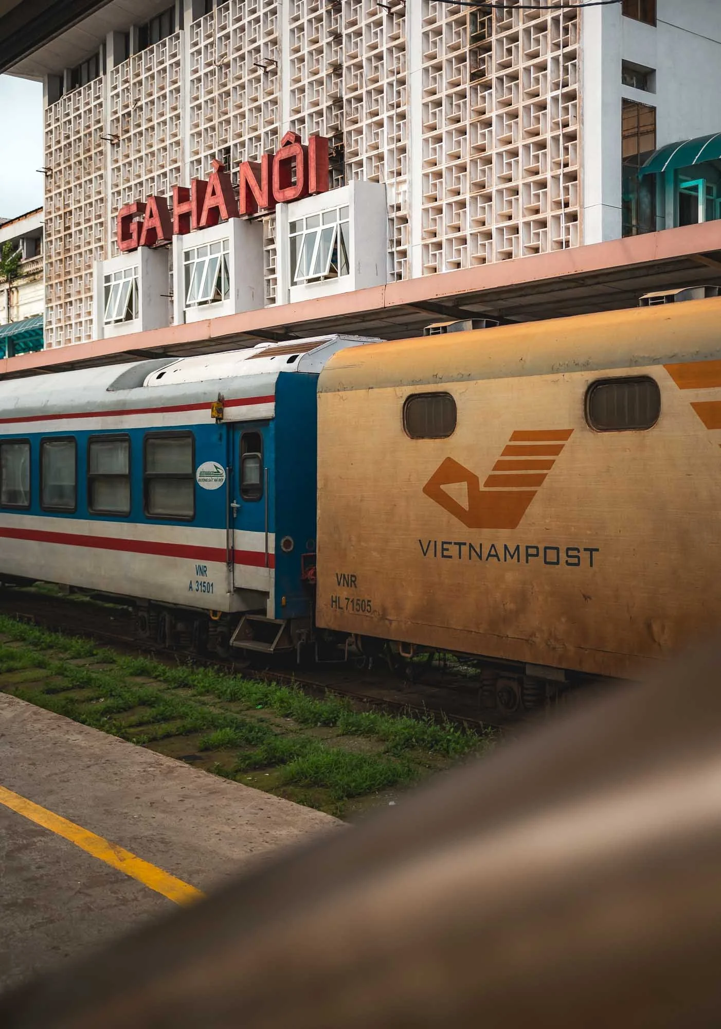
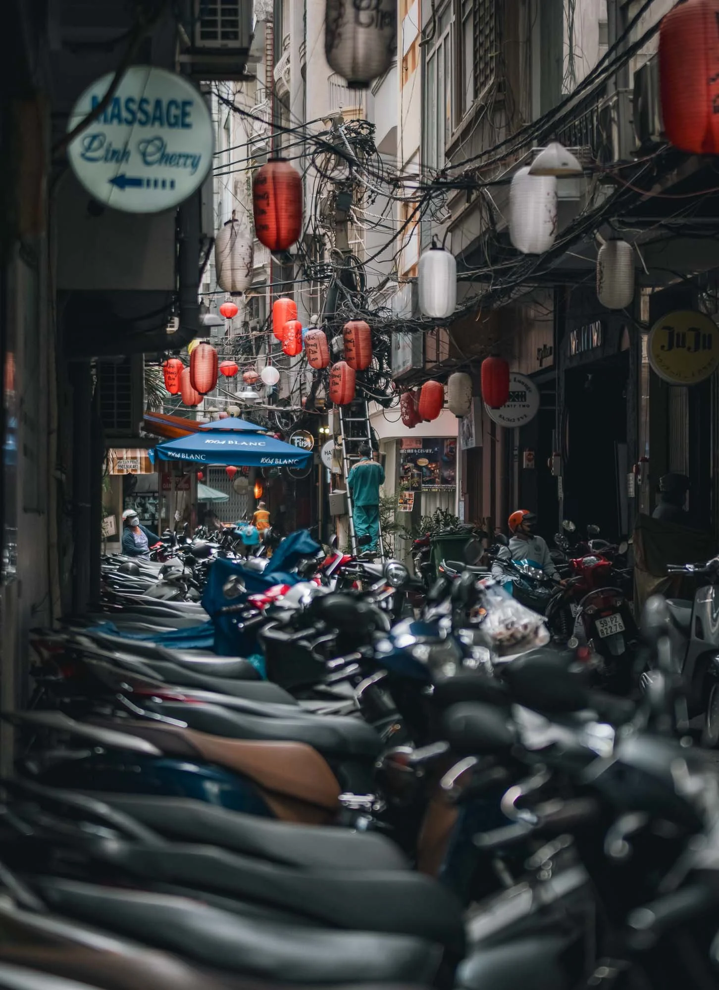
Train Street
Another of the city’s commonly visited attractions is the so-called train street.
The trains depart from or arrive at Hanoi’s central station and literally pass people’s living rooms on their way in and out of the city - a very peculiar sight. There is in fact one section of the railroad with an alley full of cafes for tourists - where incidents occur at not so irregular intervals and the section gets closed off quite regularly, with police around all the time.
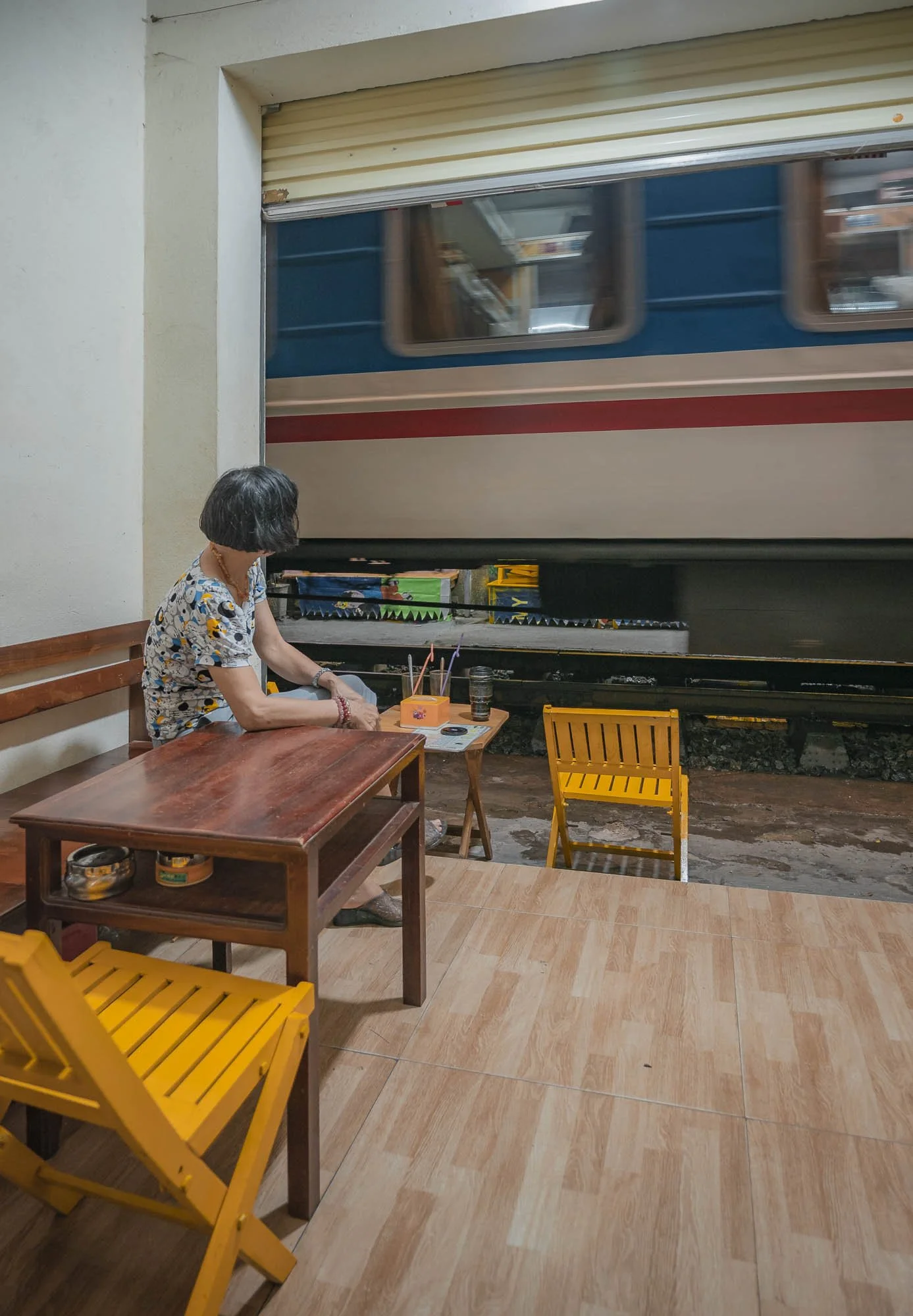
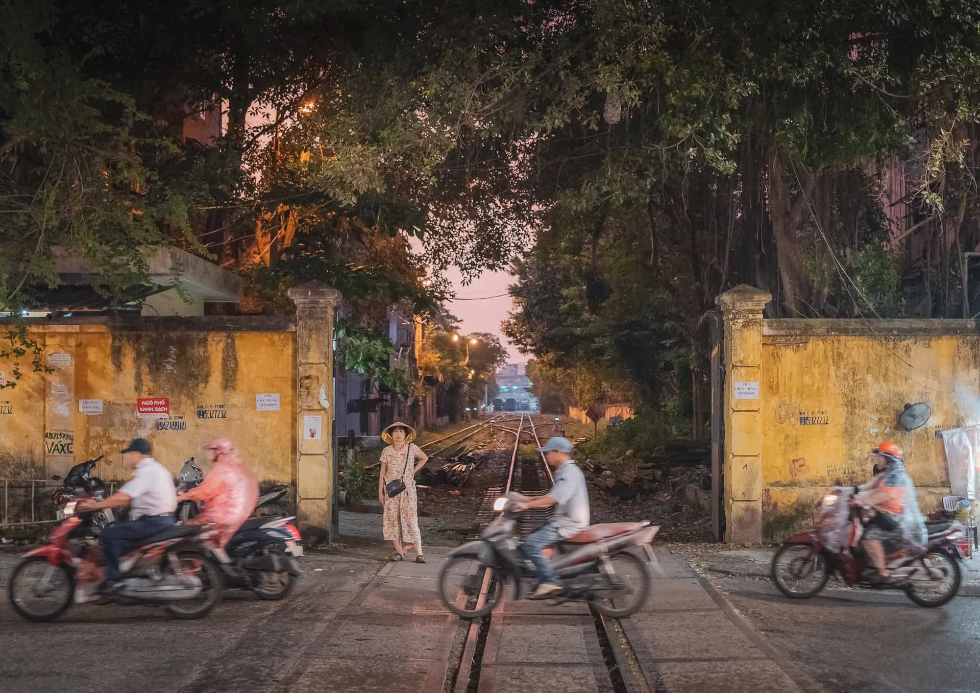
The main station lies behind these walls, where the trains cross the road and head into the alleys on their way in and out. A few of the quieter parts of the track further north and south are worth exploring as well. Whether you like trains or not, spending a couple of hours to watch the proceedings as they make their way through the tightest angles at considerable speed is intriguing.
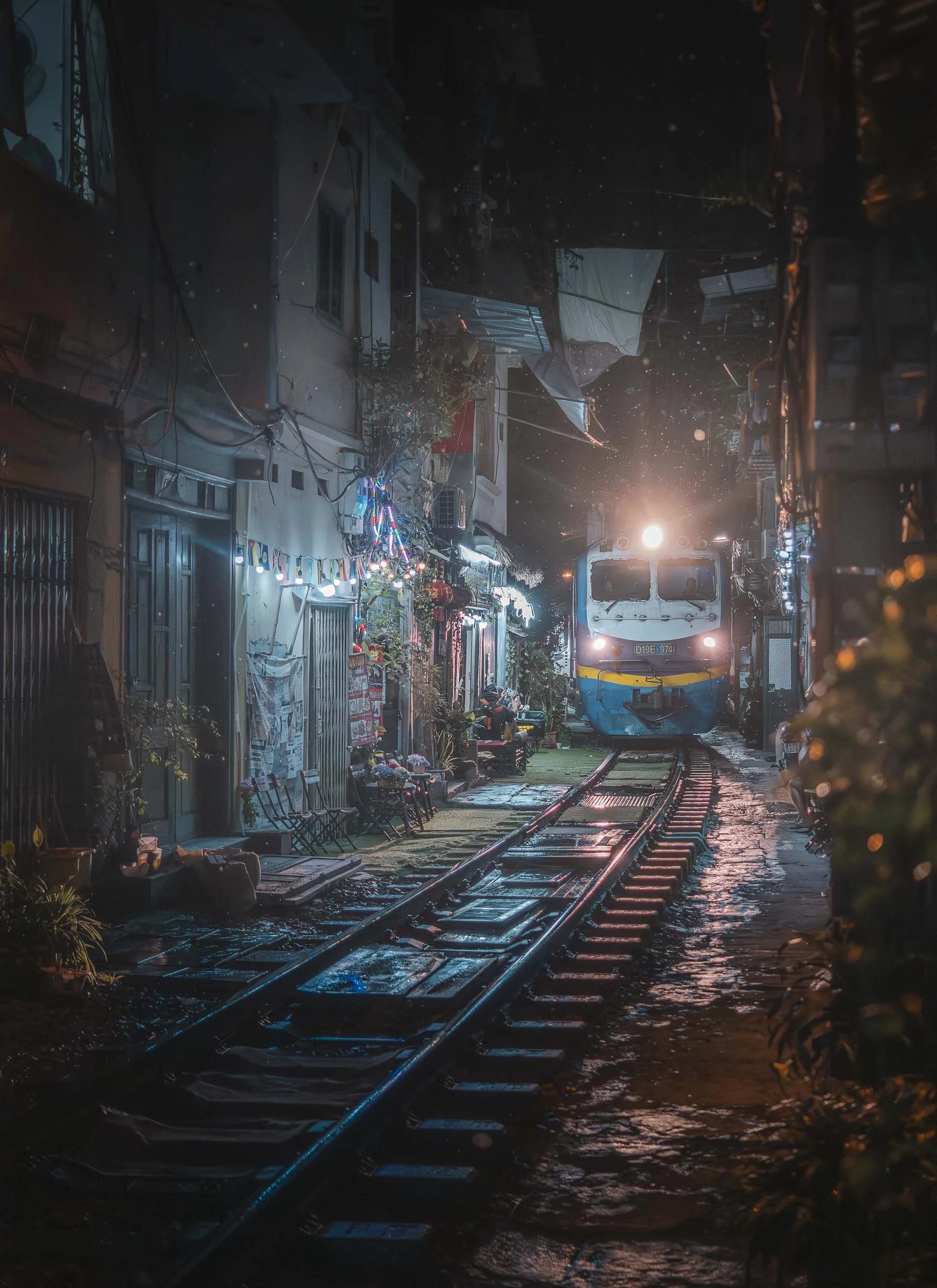
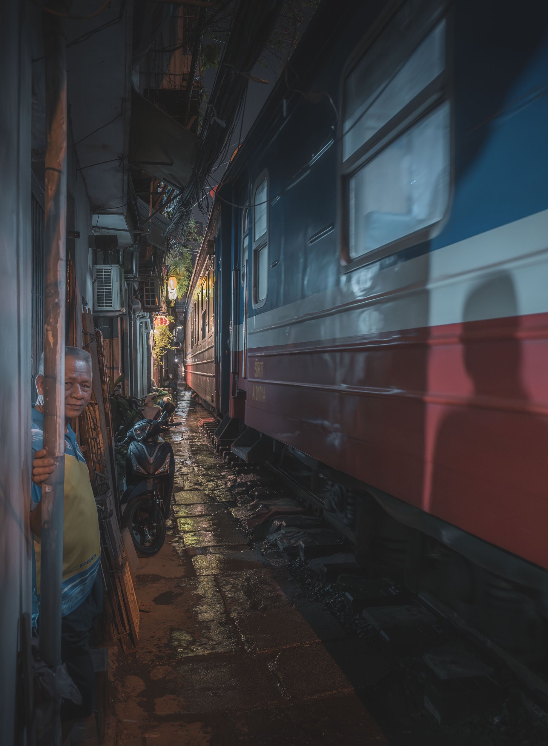
I came back to watch another part of the track for a second visit during a rainy evening. Make sure to check the schedule or ask the locals to catch a some of the trains, there are only a few each day.
One of the city’s more famous spots was the 1990s-era "Shark Jaw" building with its rooftop cafes - it was demolished shortly after my visit.
Street life is vibrant and I explored a loooot on foot, which is quite easy - although many tourists (Americans, presumably?) choose to be driven around in a 1960s era military jeeps…
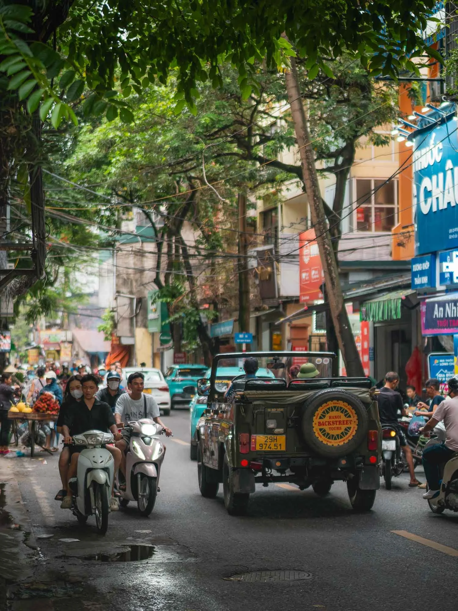
Of course the scooter noise is ever-present, although I felt Hanoi was a little more relaxed than many other large cities in the region - I can’t wait for all South-East Asian cities to move to the Beijing model with only electric two-wheelers. It’s an incredible quality of life improvement.
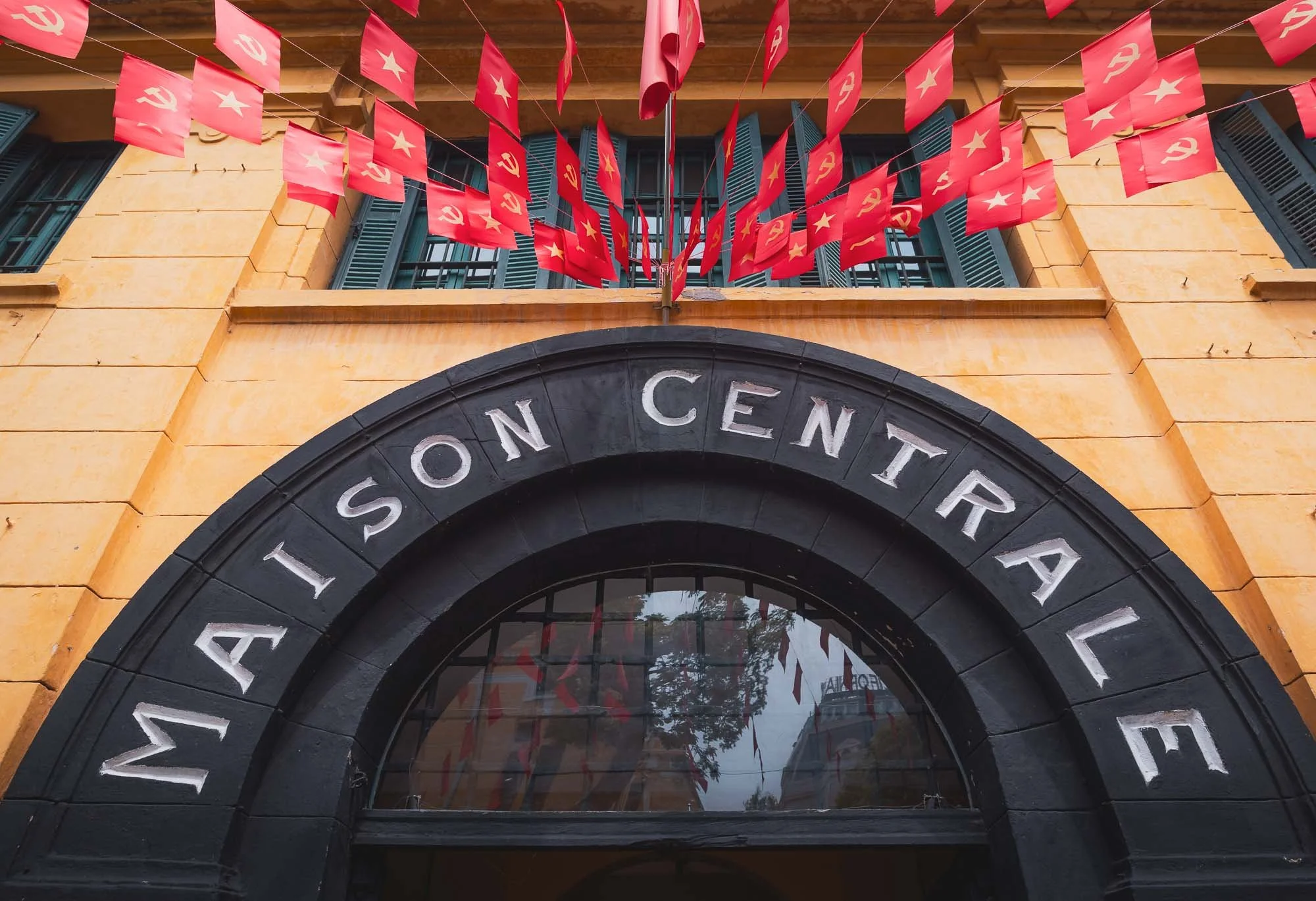
Maison Centrale
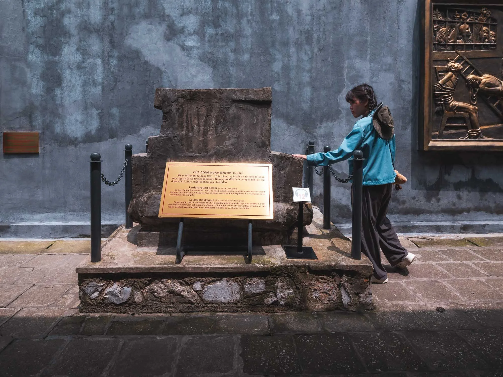
On my last morning in the city, I visited Hỏa Lò Prison, built during French Indochina more than 120 years ago. Its claim to fame probably came from its role during the Vietnam war, where it was dubbed the “Hanoi Hilton”, and home to American prisoners of war for almost 10 years.
The prison of course played a role before and after the Vietnam war as well, holding political dissidents and serving as an indoctrination centre, for instance, until it was demolished in 1994. Nowadays, only a small part still exists, converted into a museum telling many of the stories of its not so bright past.
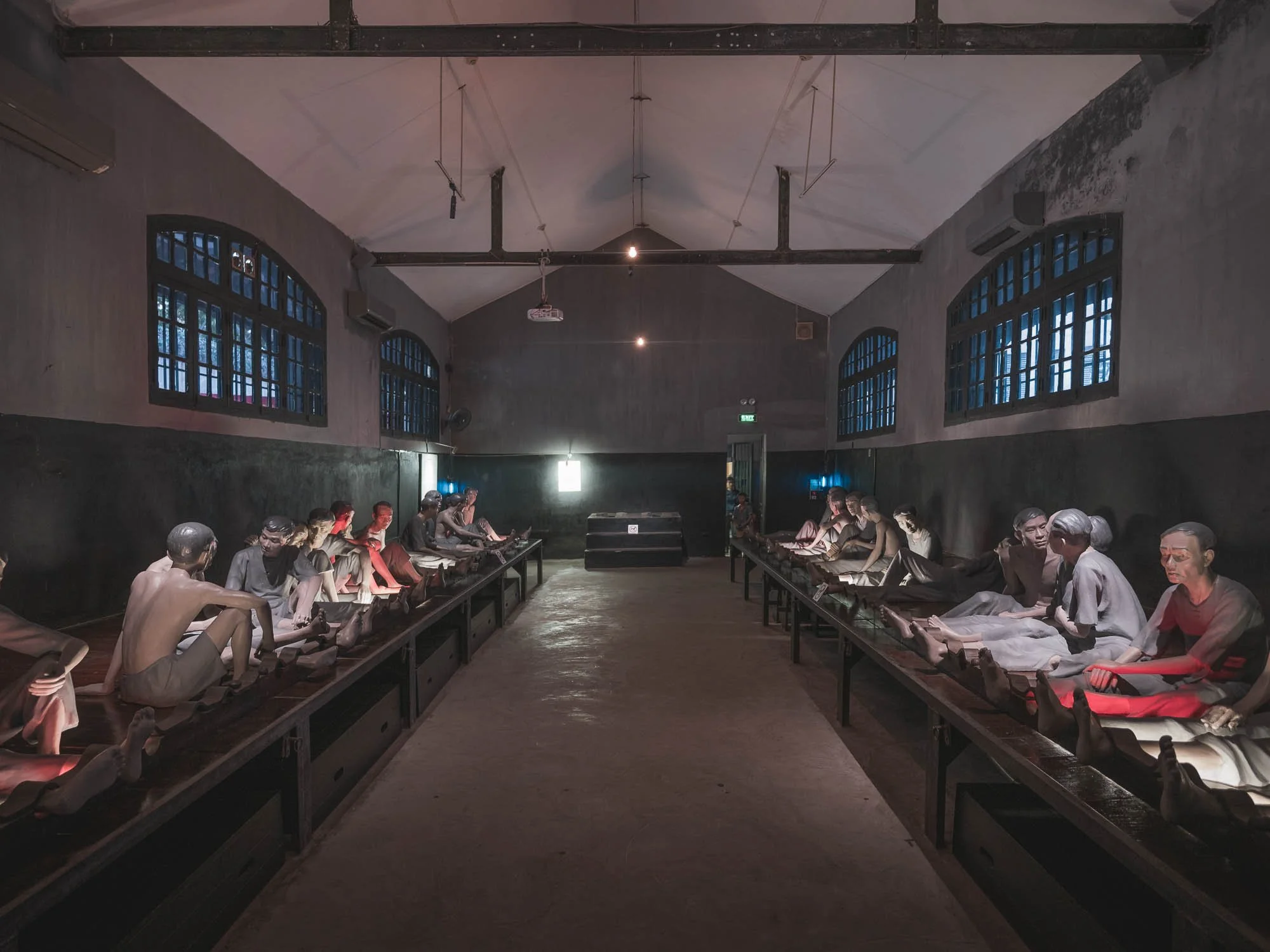
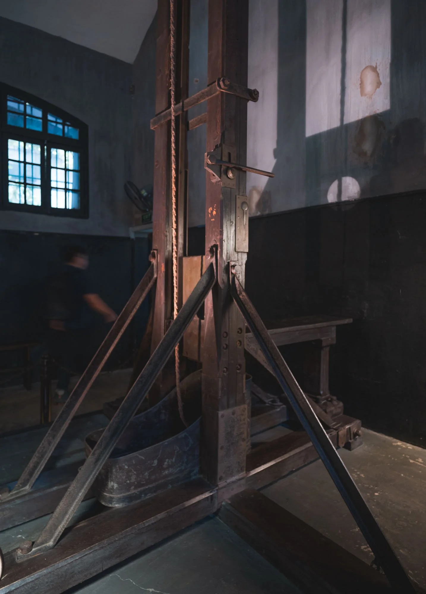
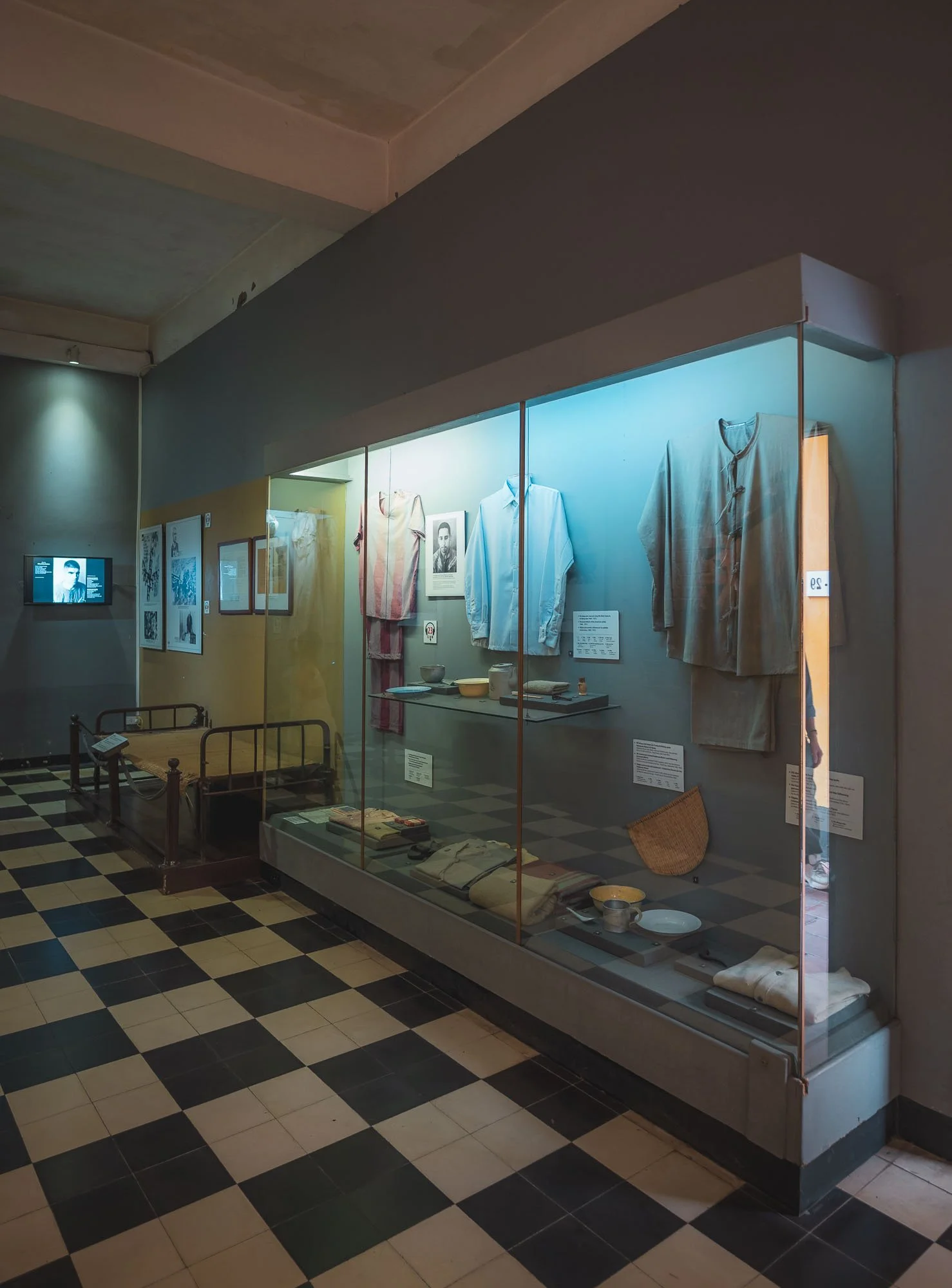
The exhibits include the guillotine room with its original equipment from the colonial period, as well as the flight suit of John McCain, who spent more than 5 years here after his plane was shot down, and later became a US senator and presidential candidate.
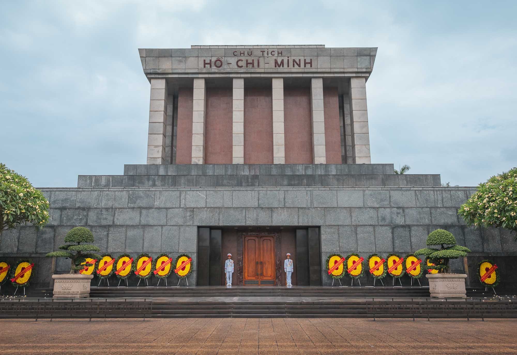
Ho Chi Minh Mausoleum
When it comes to historically important sights, the resting place of “Uncle Ho” shouldn’t be missed - his role in shaping Vietnam’s history can barely be overstated. No photos allowed inside.
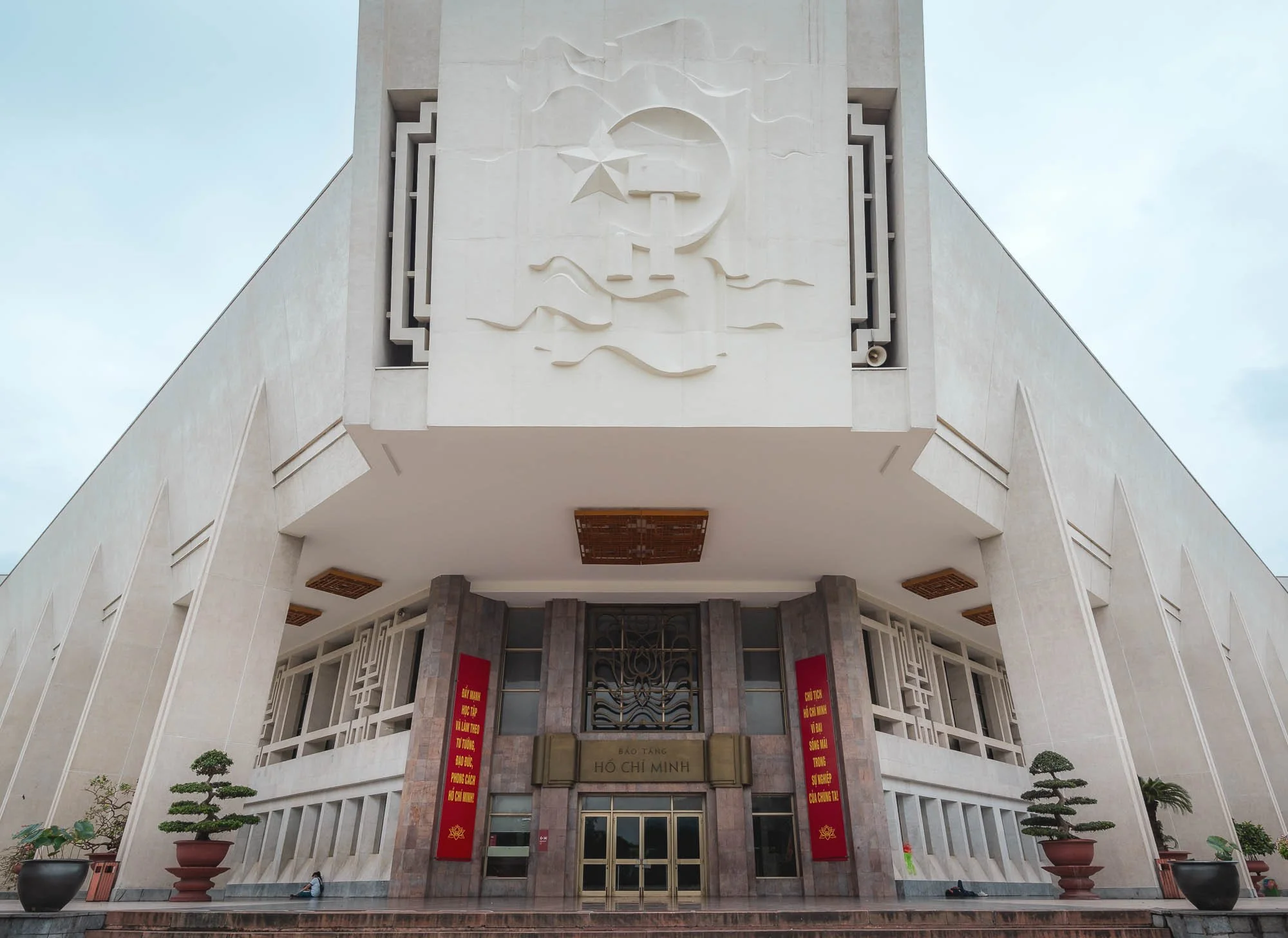
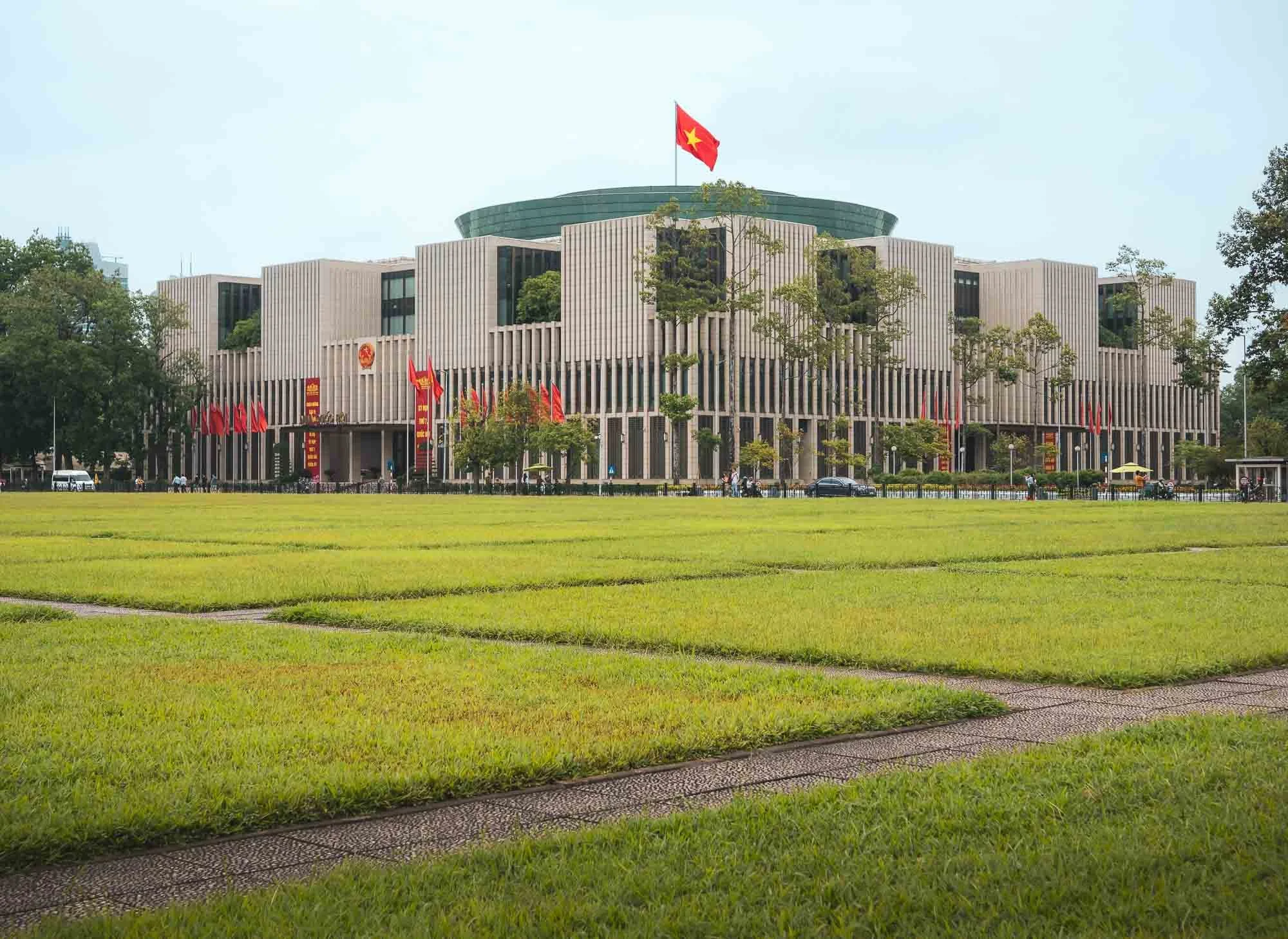
The 1975 mausoleum sits within a larger complex, including a museum named after him (closed when I visited unfortunately) and the National Assembly Building on the other side.
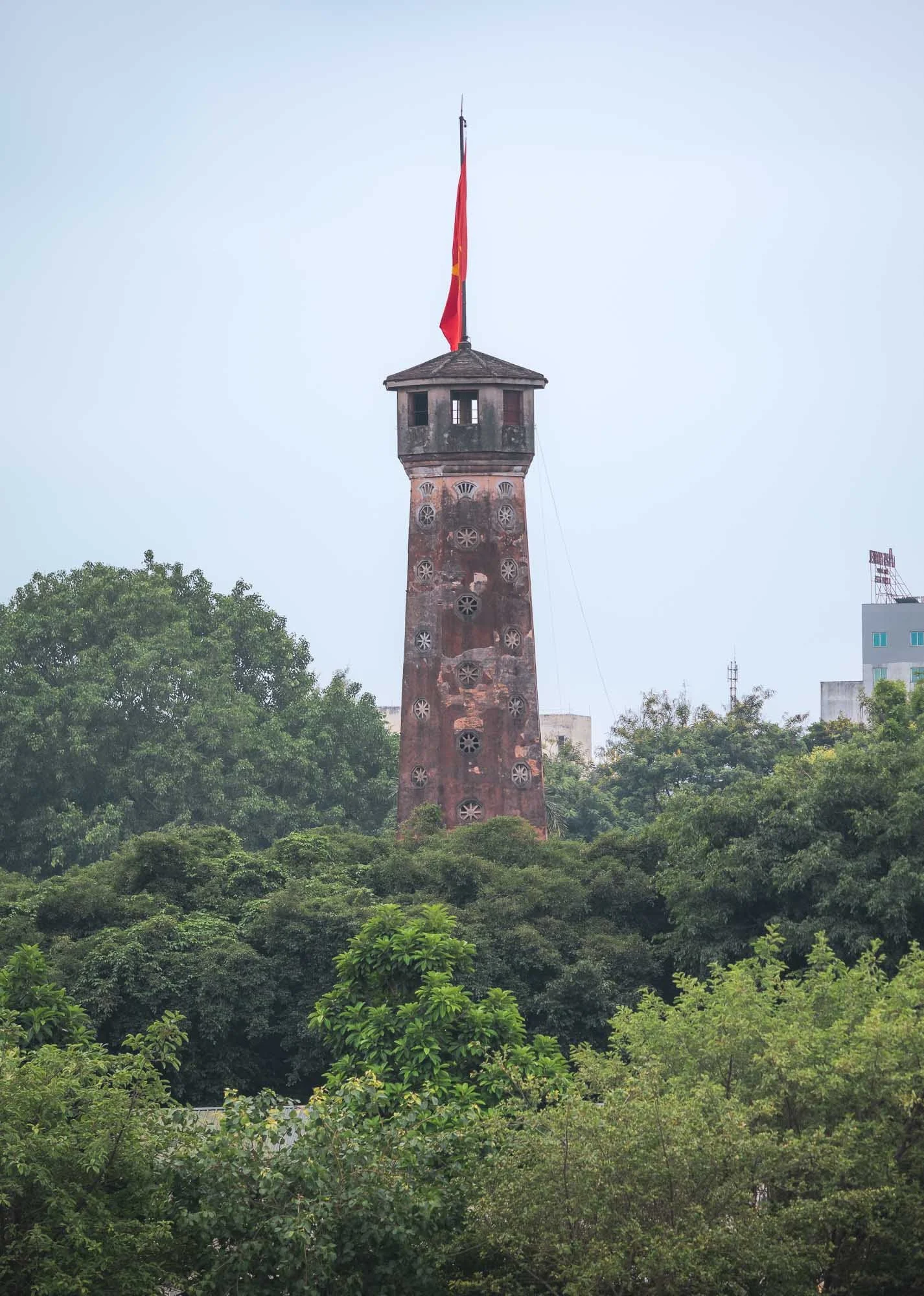
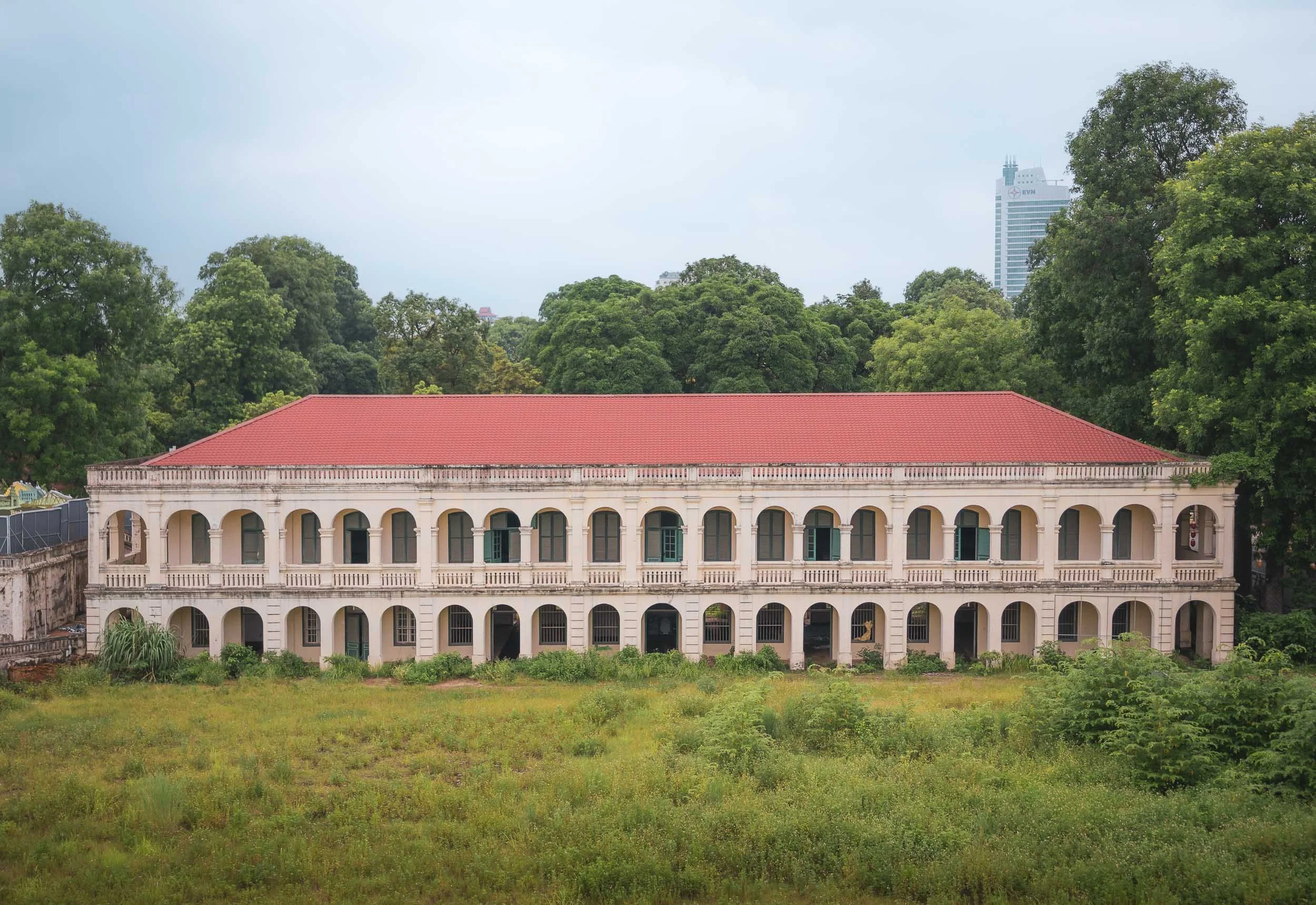
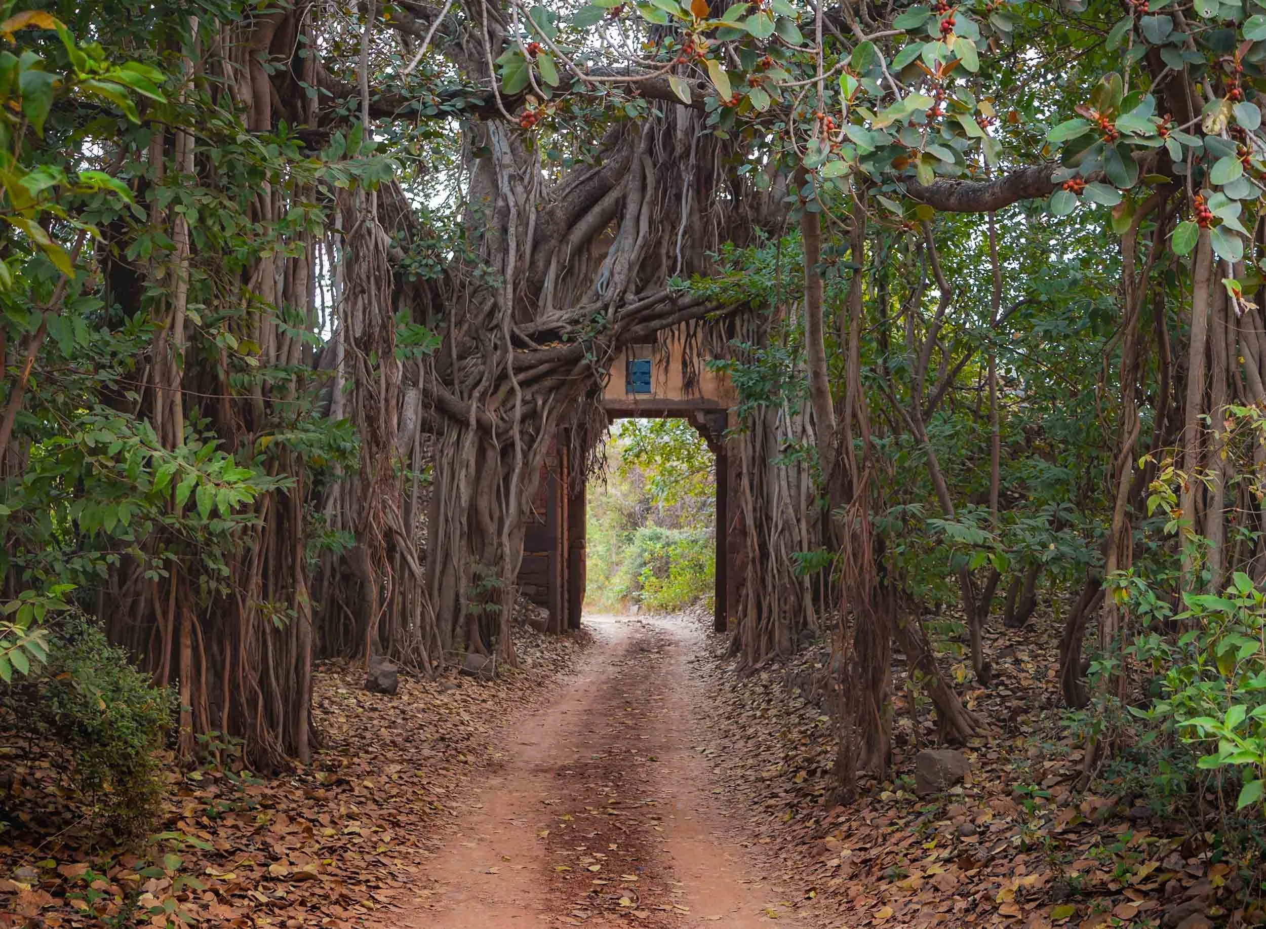
Just east of the complex you can spot the Hanoi Flag Tower, originally built in the early 19th century. It’s surrounded by the historic Imperial Citadel complex (a UNESCO World Heritage Site).
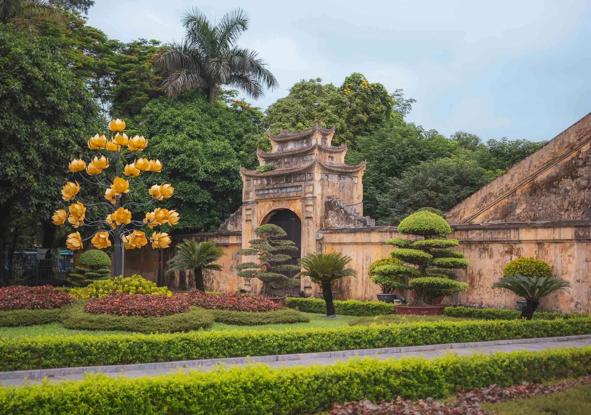
While it dates back 1000 years, much of what remains today is from a reconstruction in 1804. Part of the entrance gate to the forbidden city, the innermost part of the complex, is seen here.
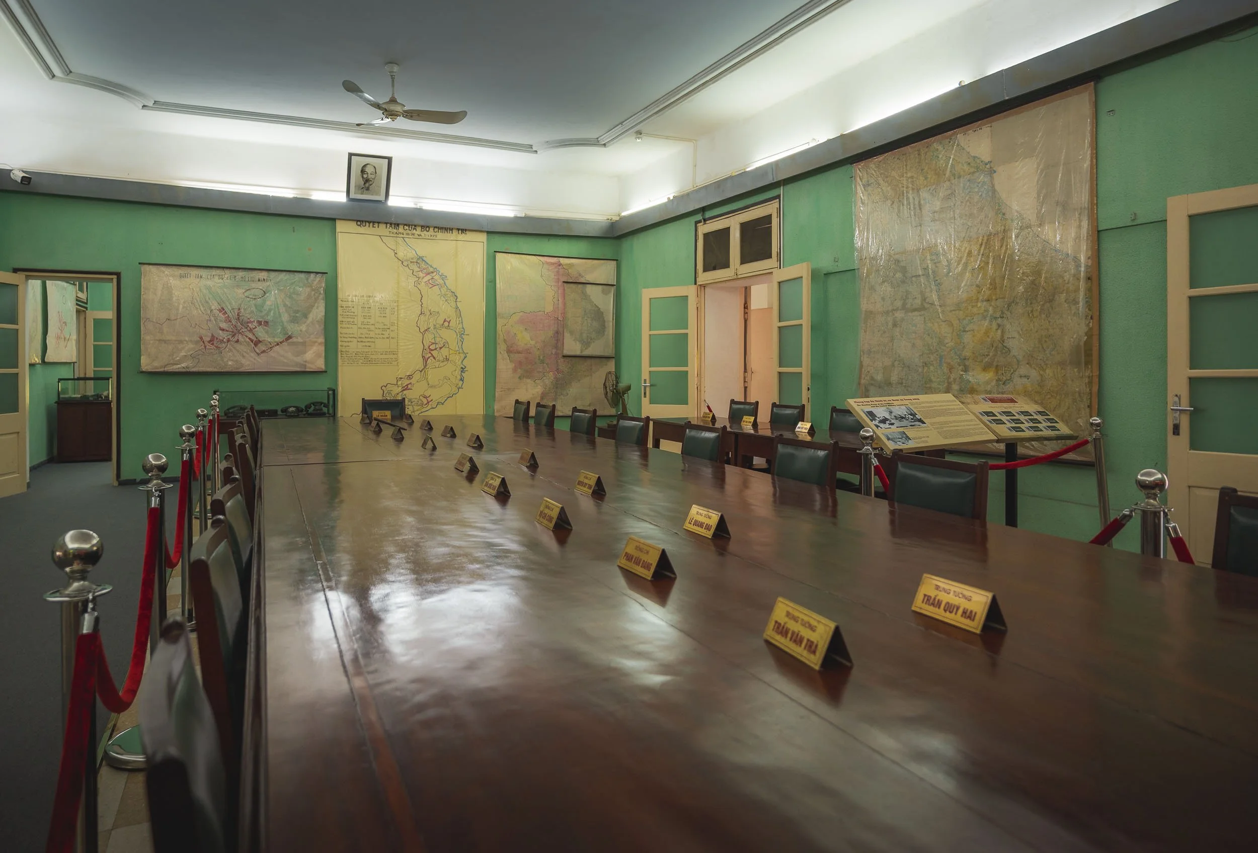
The site also features several preserved French colonial-era military buildings, often constructed by tearing down the original structures of the citadel. In addition you’ll find a number of Vietnam war era bunkers, as well as the restored meeting room of the Politburo and Central Military Commission used at the time of the war.
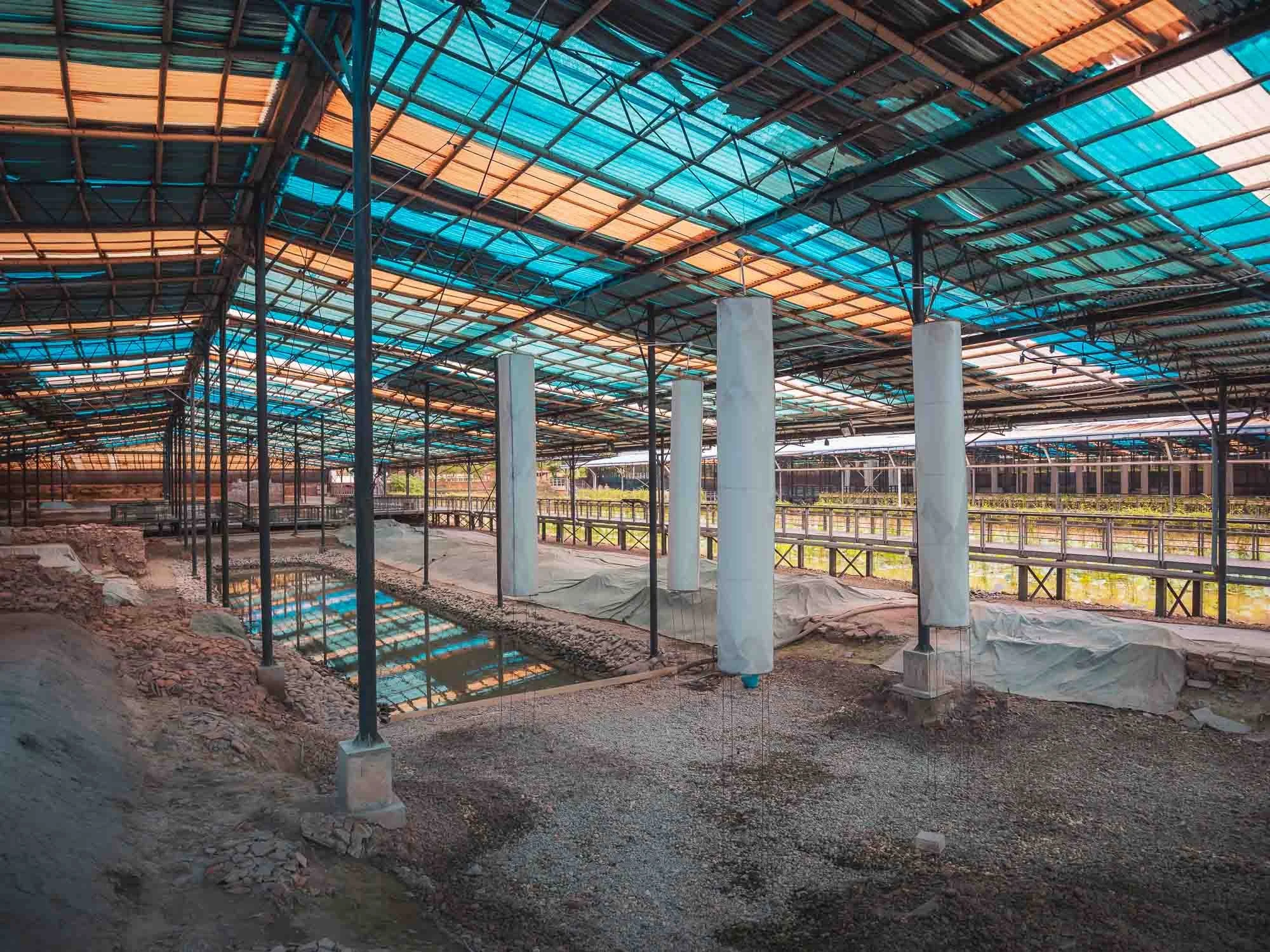
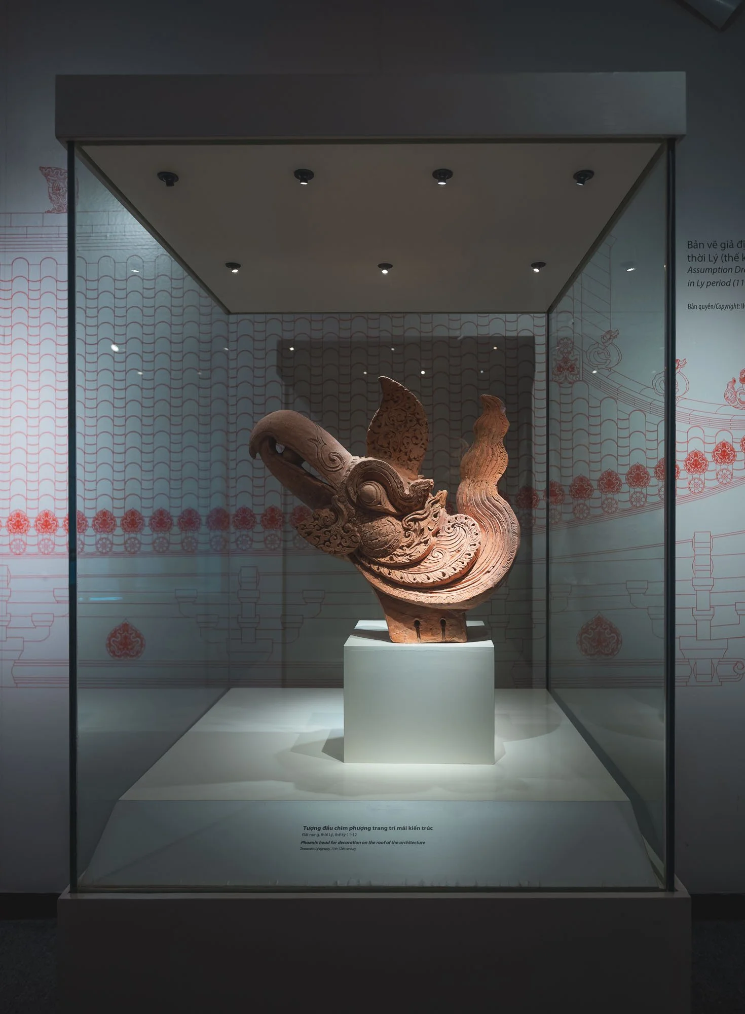
Just across the road you can go back even further into the city’s history, and explore the archeological site of the complex, with evidence going back to the Chinese dynasties all the way to the 7th century, and a small museum holding various artifacts found during the excavations.
Moving on from the capital…
Valleys of Tam Coc
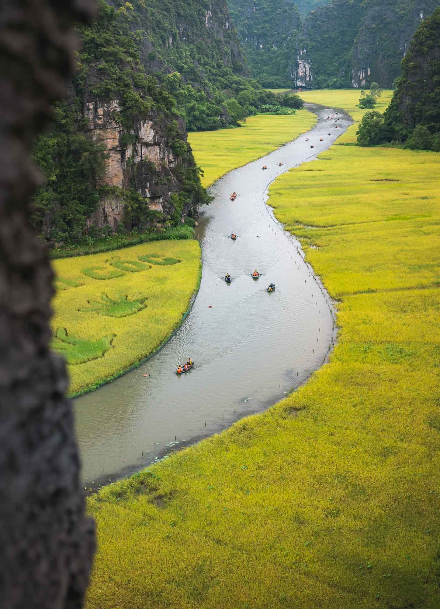
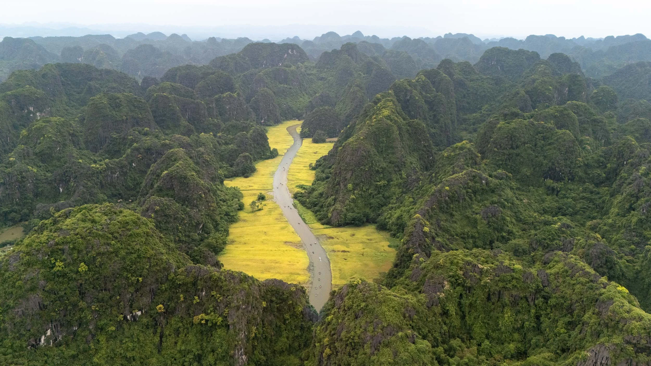
About 100km from Hanoi lies the Tràng An Scenic Complex, a UNESCO World Heritage site, featuring a number of temple complexes dating back more than 500 years, and the Tam Coc landscapes.
It’s a flooded karst scenery, with rice paddies covering the larger valleys dotted between the hill landscape, and the Ngo Dong River running straight through - truly beautiful, even on a cloudy day like during my visit.
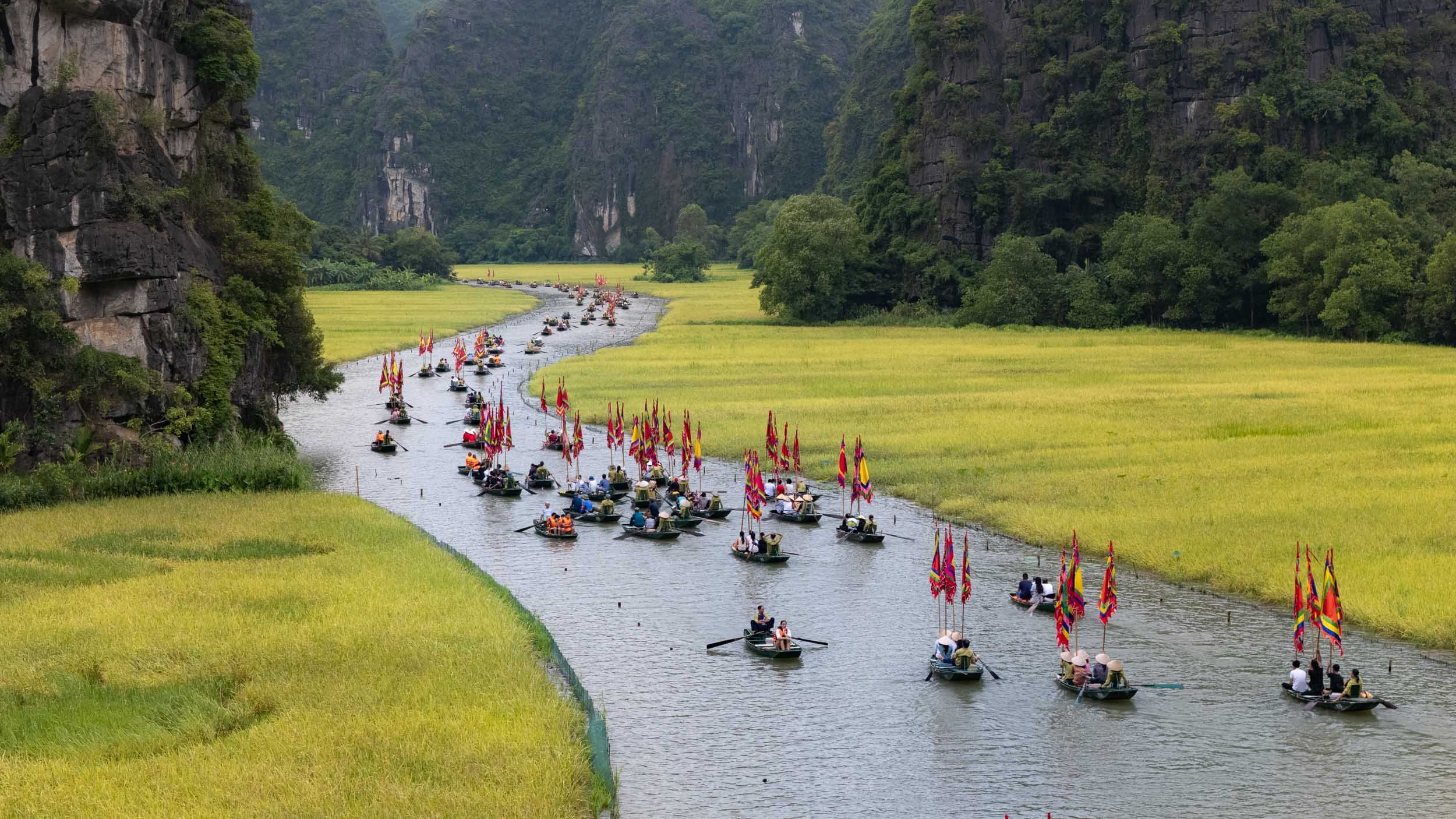
A small rehearsal of a boat parade for the annual rice harvesting festival took place when I was there, making the river a little busier than usual, but adding a few colorful flags to the scenery.
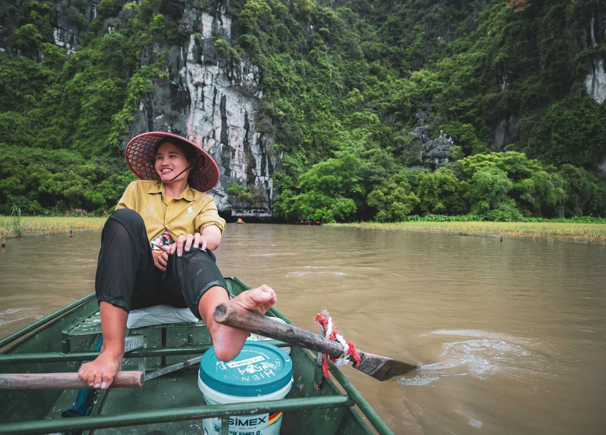
You gently make your way along the river in small boats that local ladies operate - mostly with their feet, including paddling both up and down stream. No need for leg day!
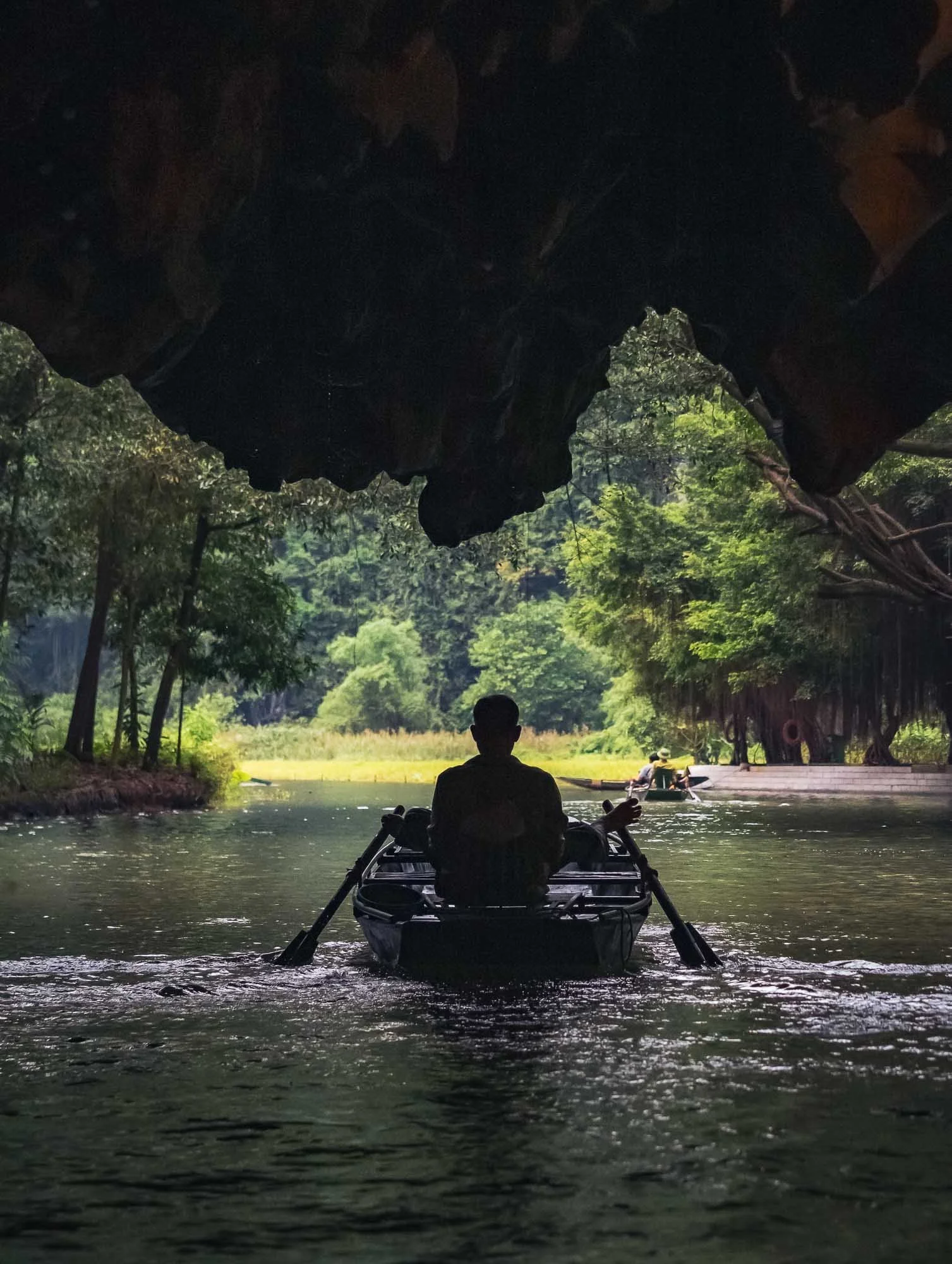
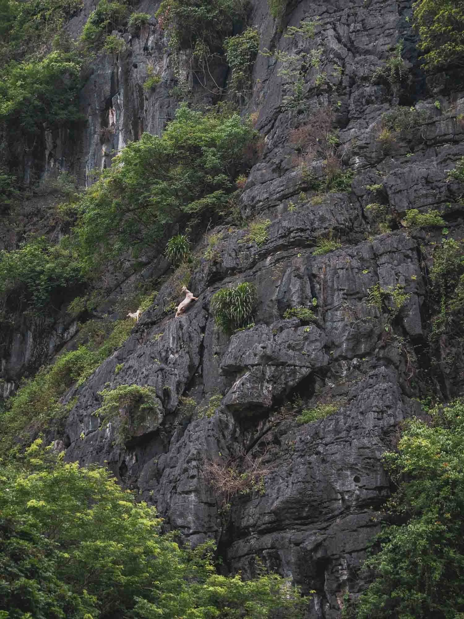
Aside from the rice paddies, you'll pass some beautiful karst stone formations with the occasional goats, and through three low caves, before turning around at a small temple complex.
Beyond the boat trip there are a few other viewpoints around the area which can be explored on foot as well - I made my way up the Dragon Hill, for instance, named after a stone statue at the top.
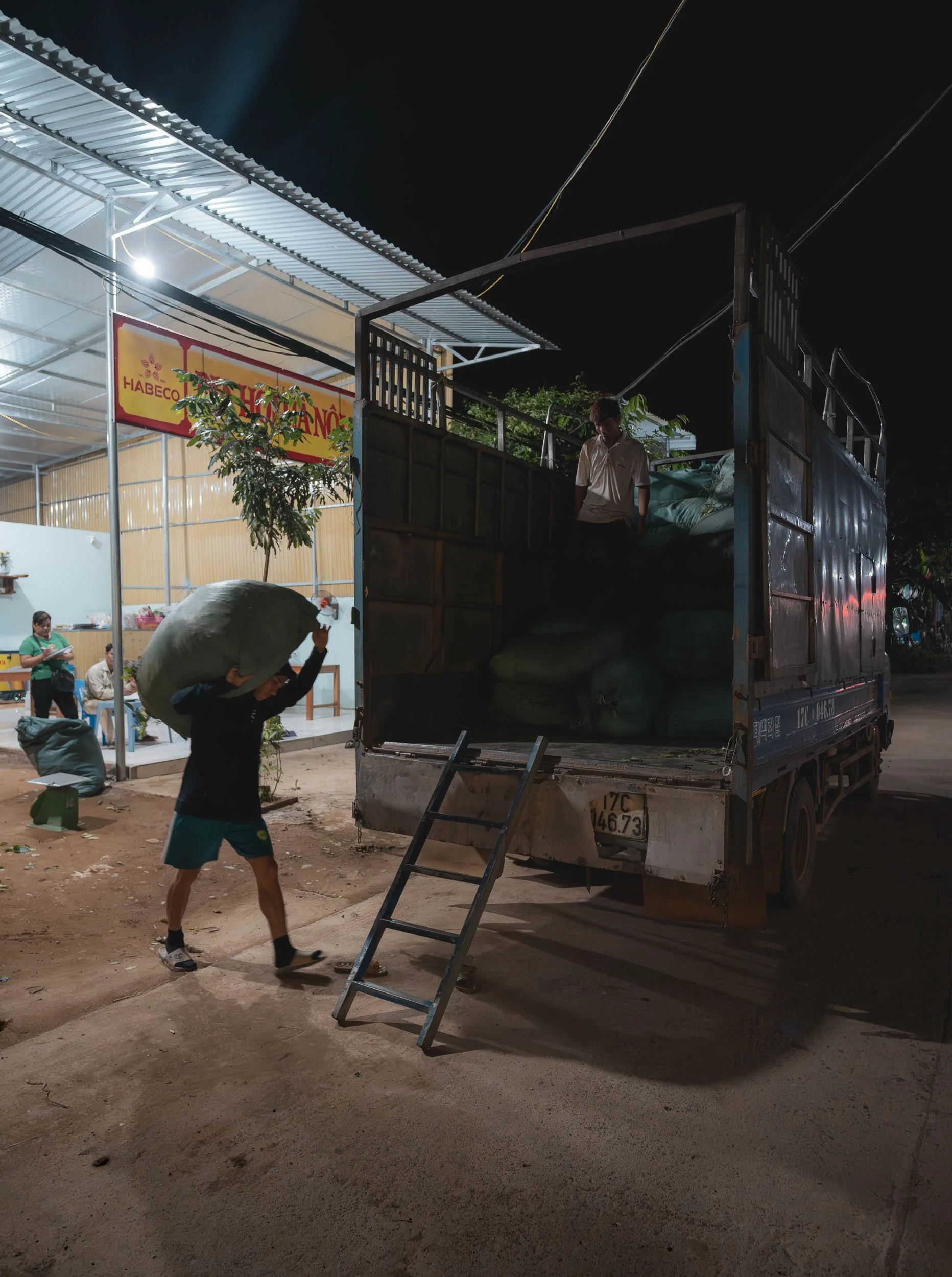
Of Incense Village, Bamboo Fishtraps, & the Soy Sauce makers
The proliferation of photo tours in Vietnam combined with social media content has created quite a few occasions of somewhat staged environments: rooted in traditional culture and activities but now optimized for visitors and photographic opportunities. While I don’t have strong feelings about the practice itself, I’m personally not a huge fan of taking photos under these conditions. Having said that, sometimes it’s possible to catch a glimpse of their origins and the people behind them that makes a visit worthwhile, and this was true for the following three spots I visited over the next couple of days…
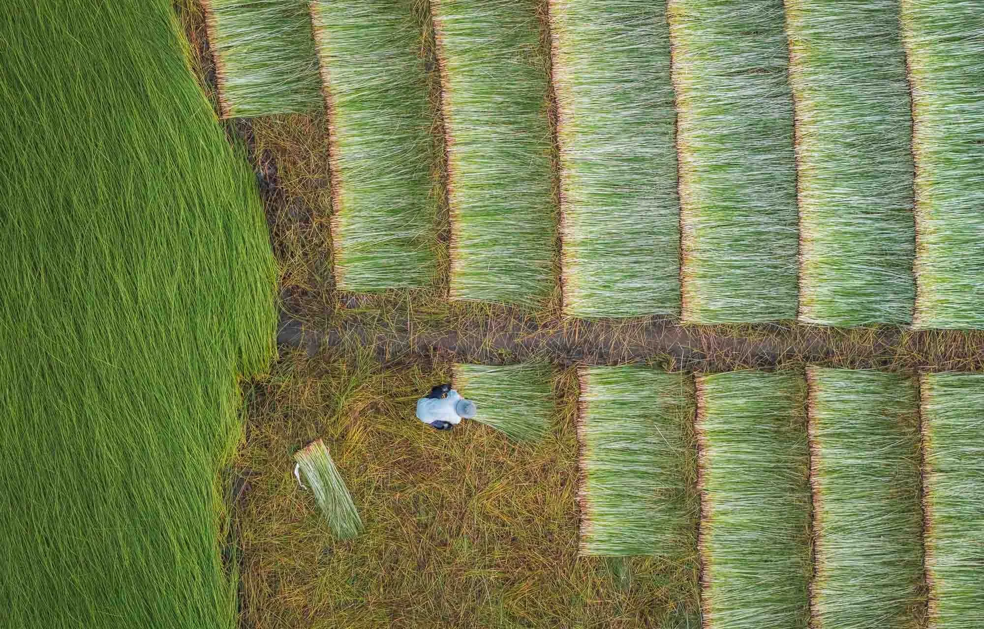
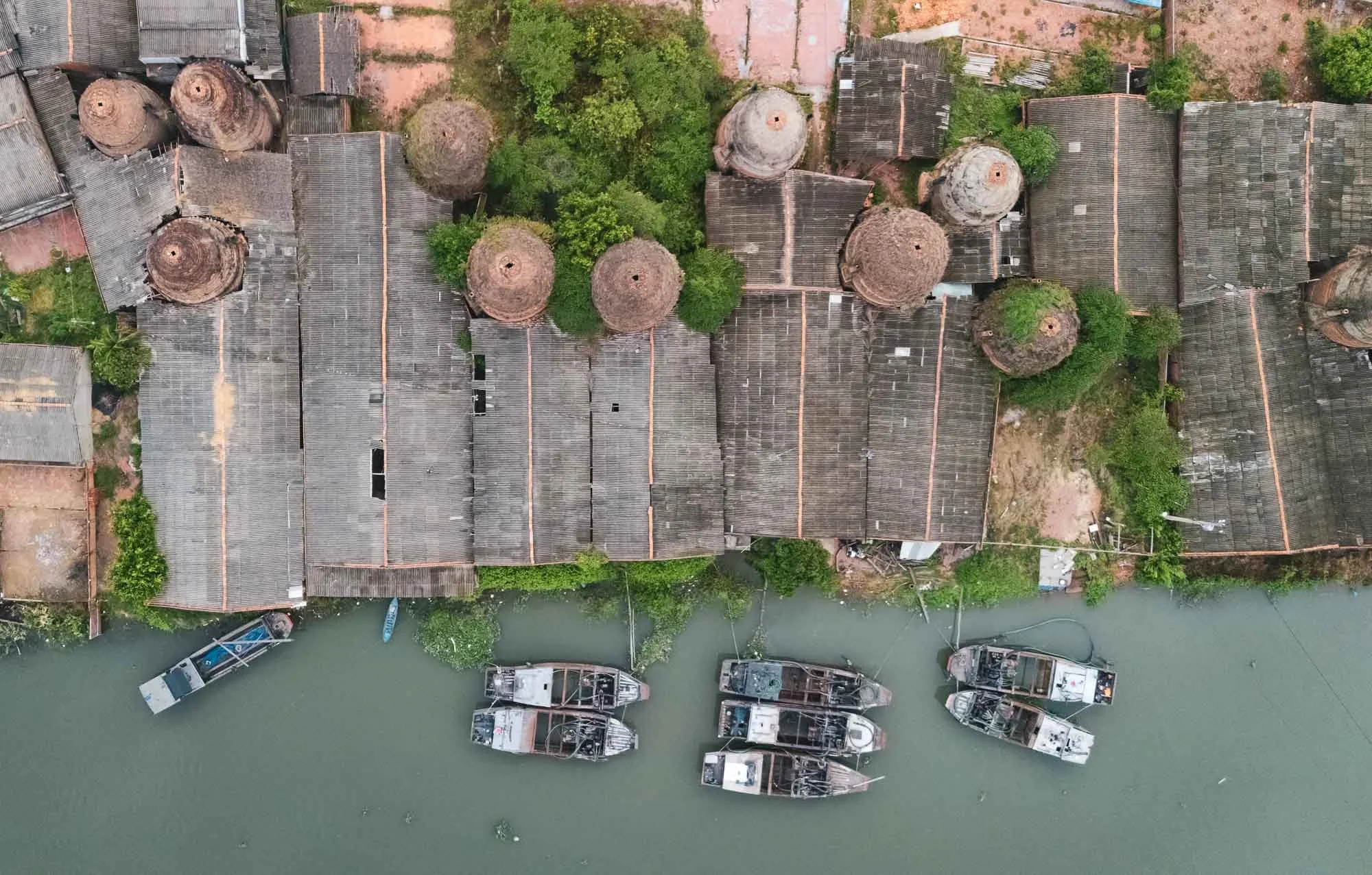
The Incense Village
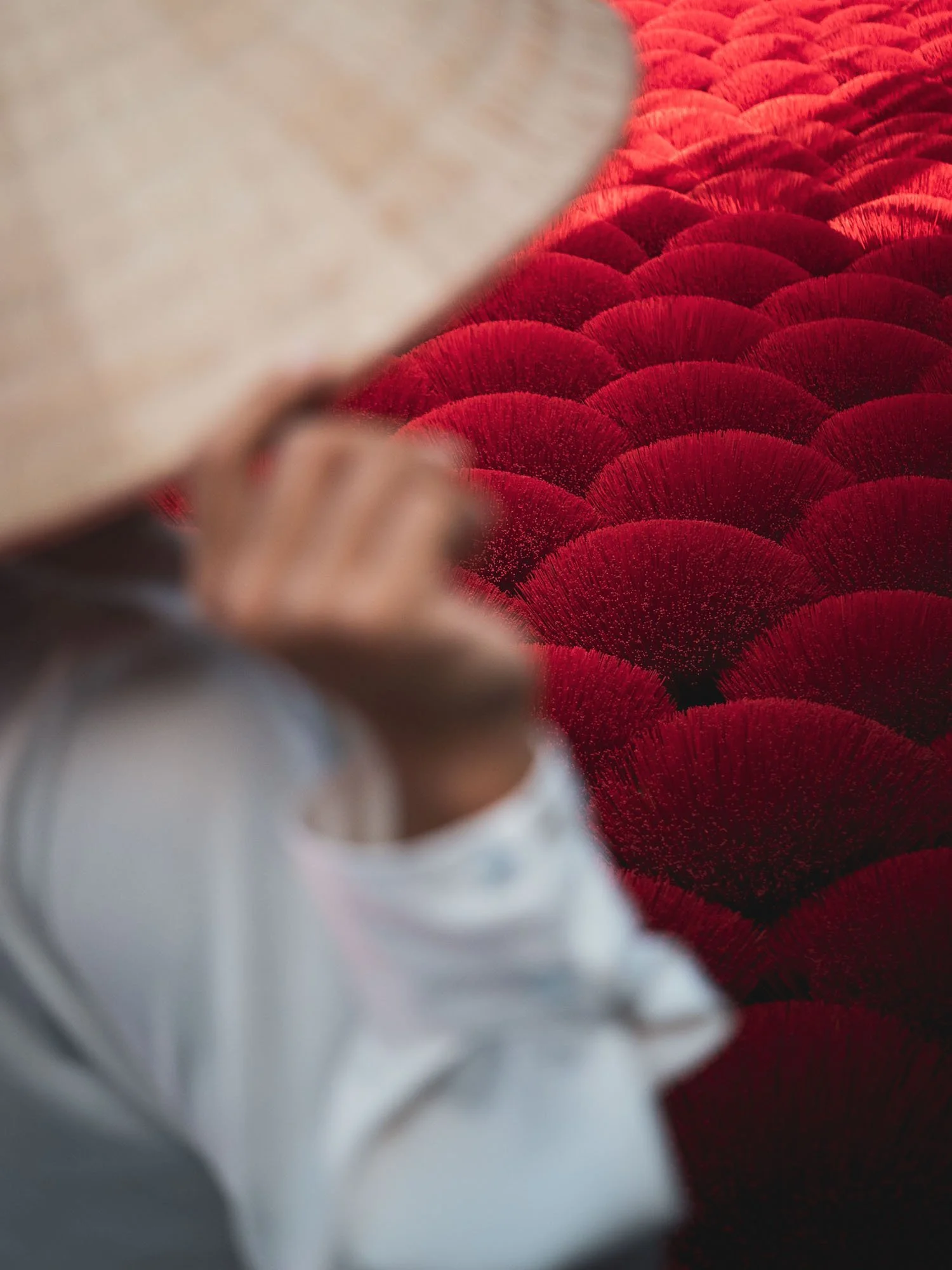
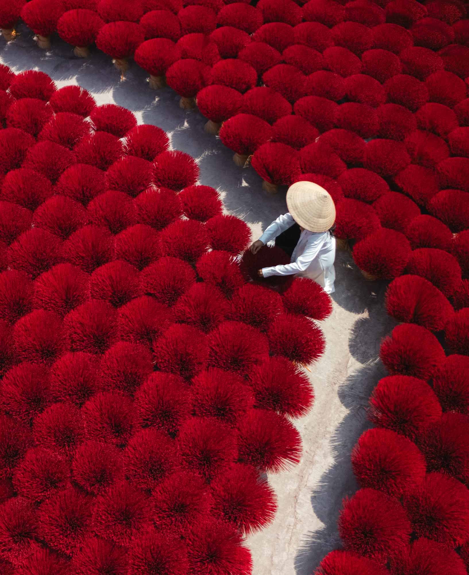
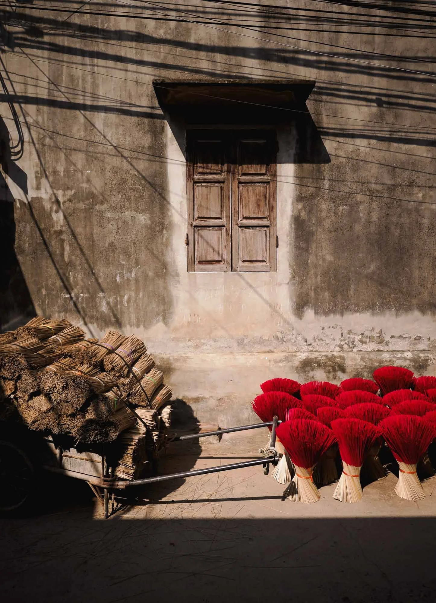
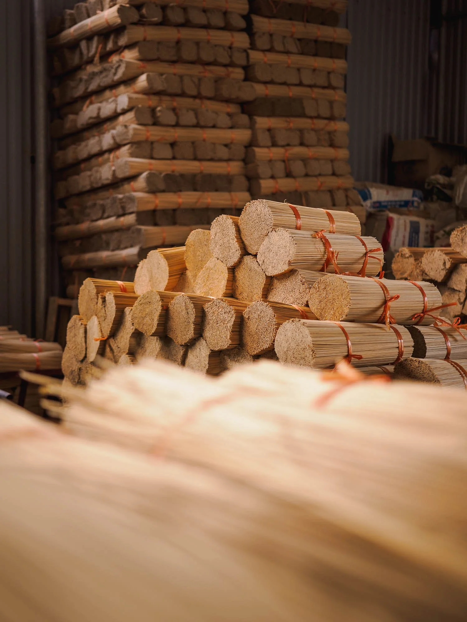
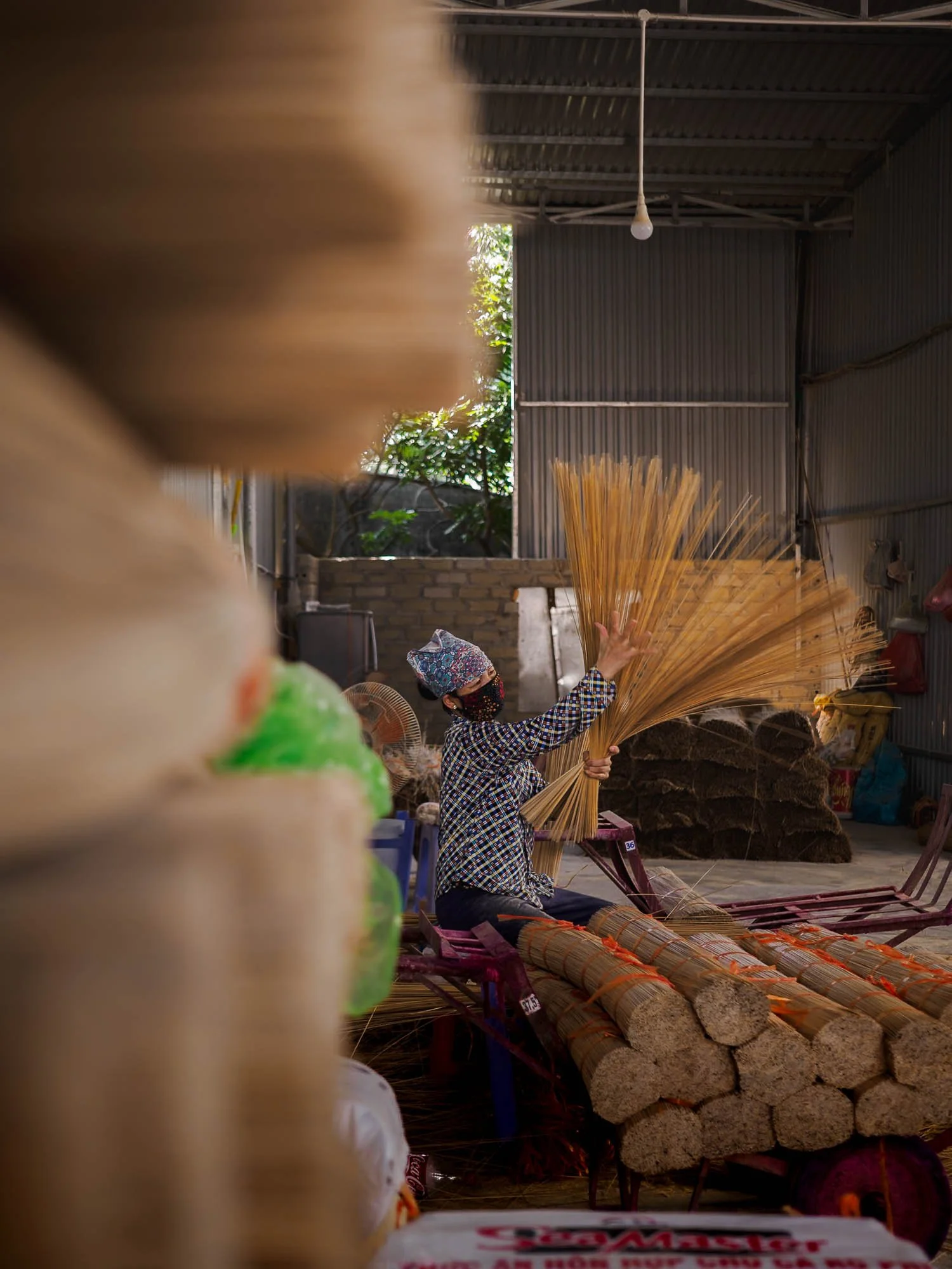
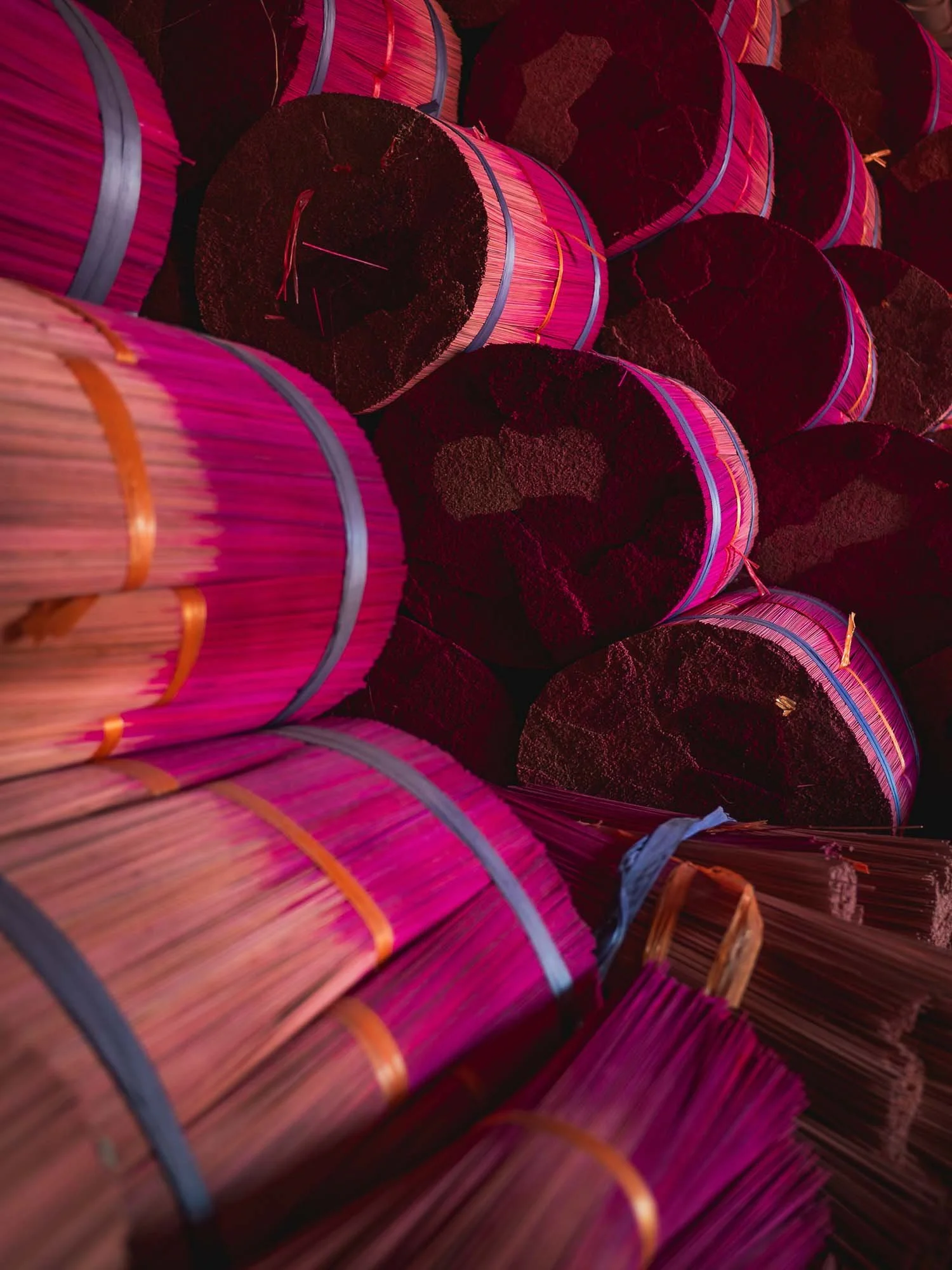
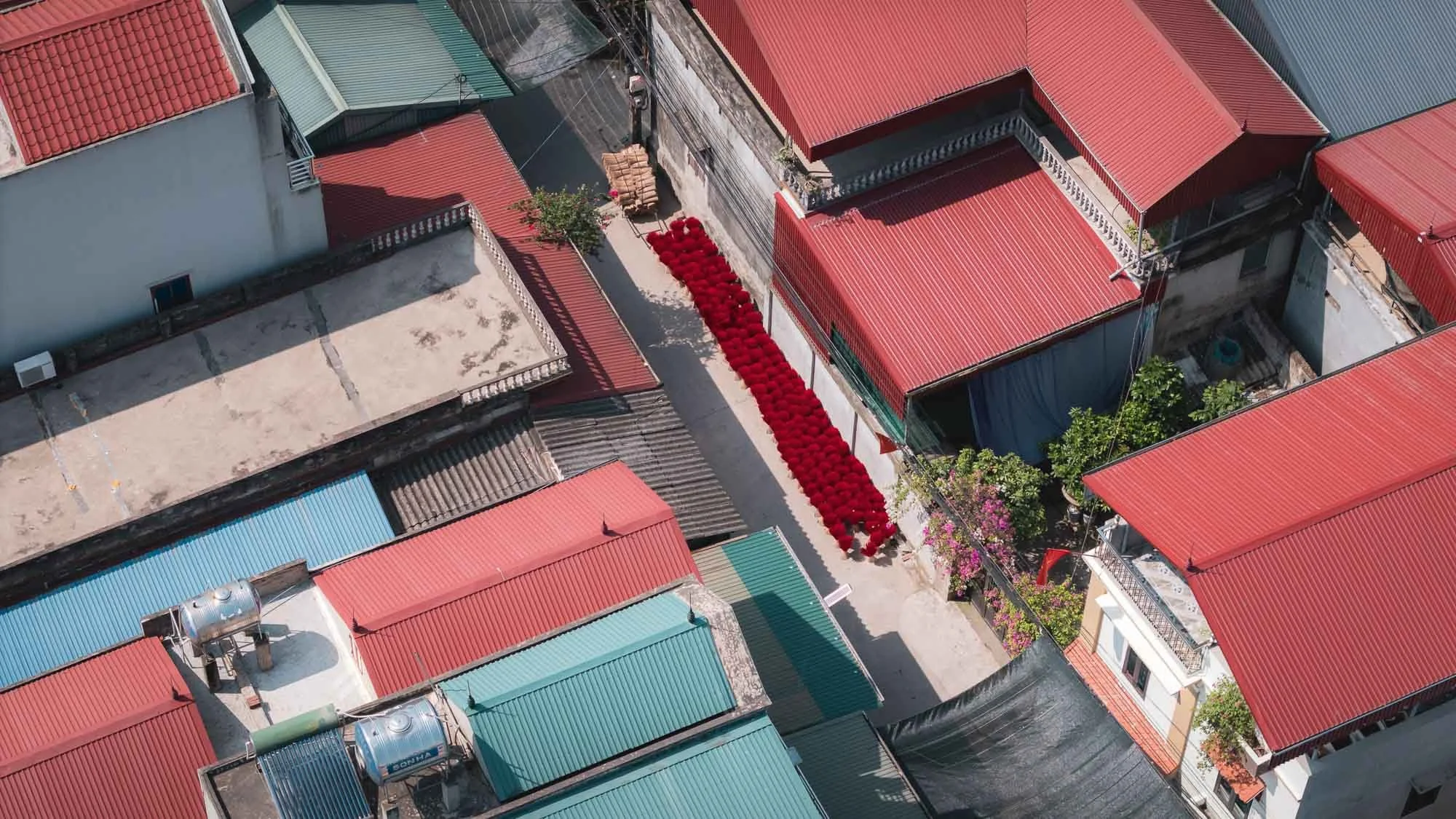
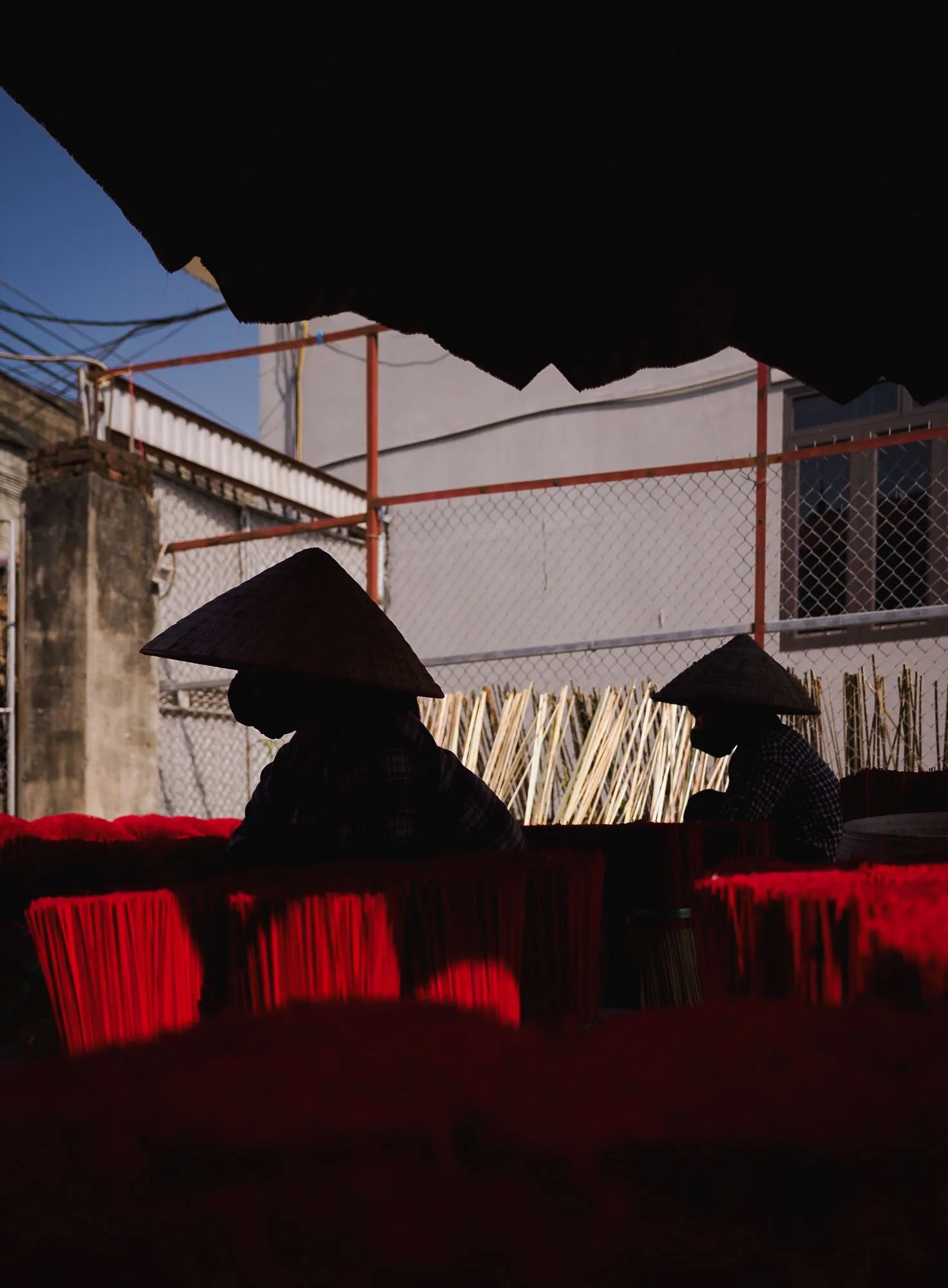
The village of Quang Phu Cau lies around an hour outside the city, and is famous for a practice established here more than a hundred years ago: producing bright red incense sticks. These have been neatly arranged in a few courtyards for tourists to take photos like the ones above, but if you walk down the street, you’ll find the actual factories and workers that cut, dye, and dry the sticks.
The core material is bamboo, as it burns slowly, coated in a binder and blended with fragrances such as sandalwood. From what I understood, the actual colour is merely decorative - red being a symbol of luck and prosperity, for instance.
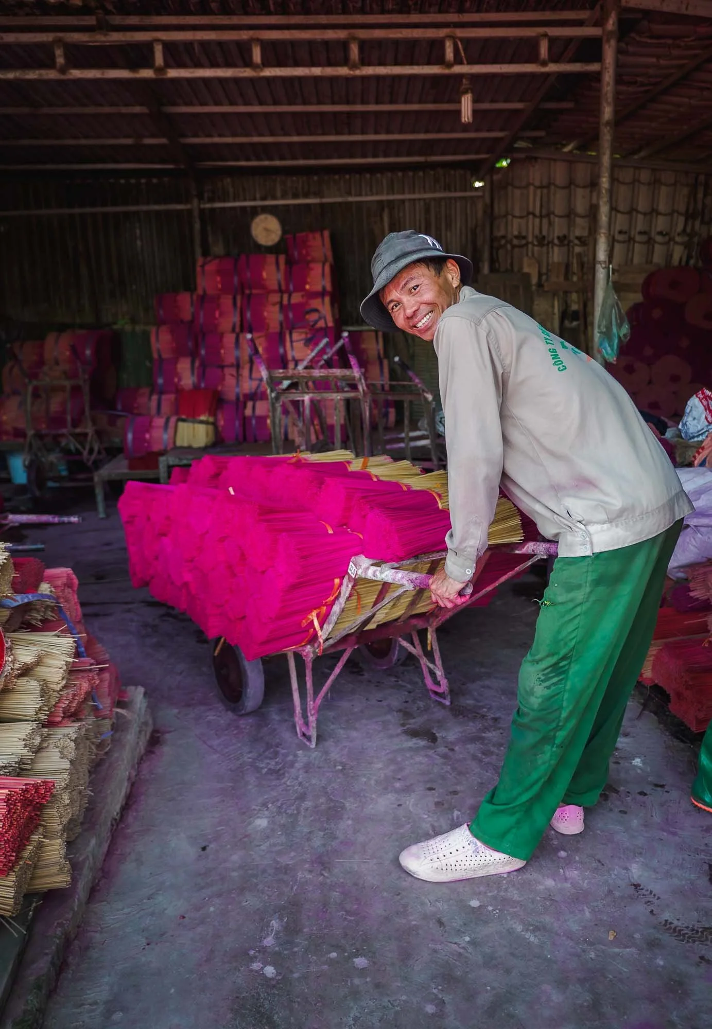
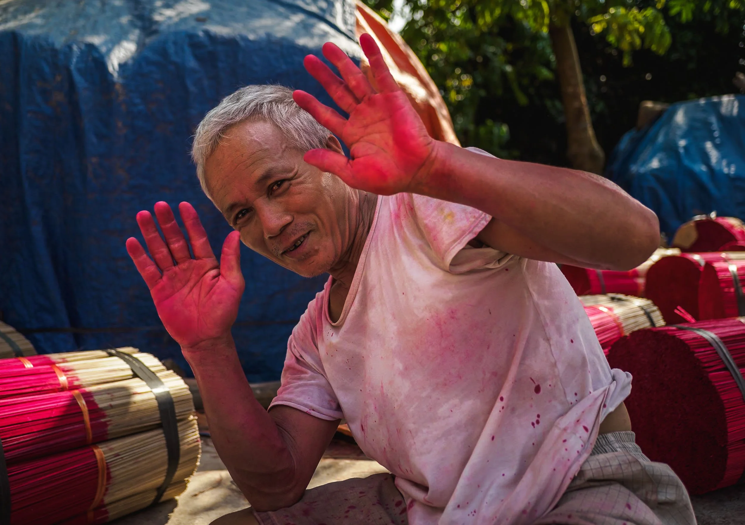
The dyeing process is unsurprisingly messy and I doubt this man has seen the natural colour of his hands (or feet) in the last years.

Once the work is done, the stick bundles are left outside to dry - not always arranged as neatly as in the staged tourist areas, but still an interesting aerial view.
Is it worth going? Not really for the now all too cliché social media photos, but if you venture a bit beyond those parts of the village you might get an actual glimpse at the people keeping a craft that emerged around the 15th century alive, and that makes it a little more interesting.
Makers of the Bamboo Fish Traps
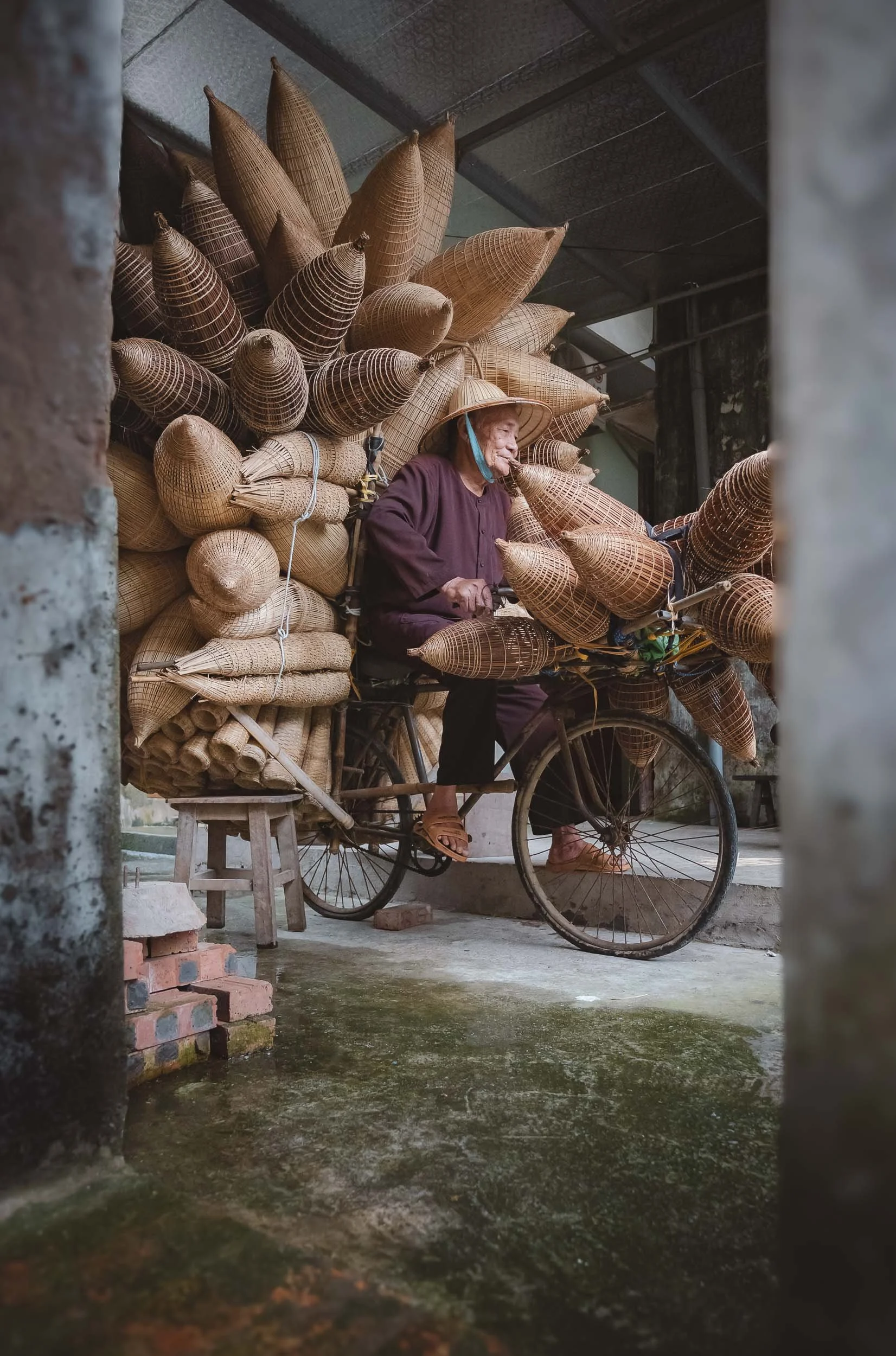
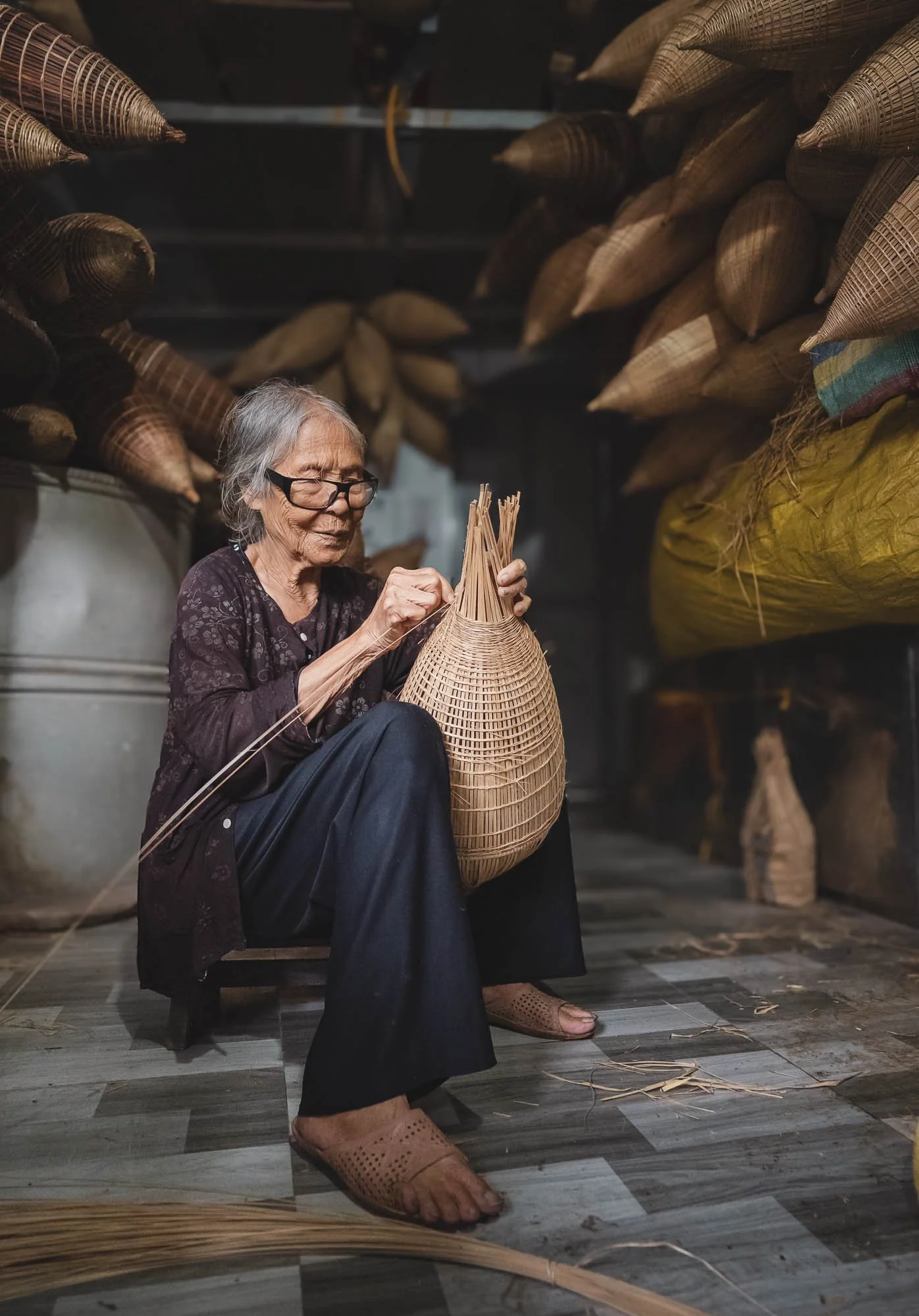
Another famous tradition can be found a bit further east of Hanoi - here, it’s both the practice and the people that have attracted countless photographers and tourists over the last years.
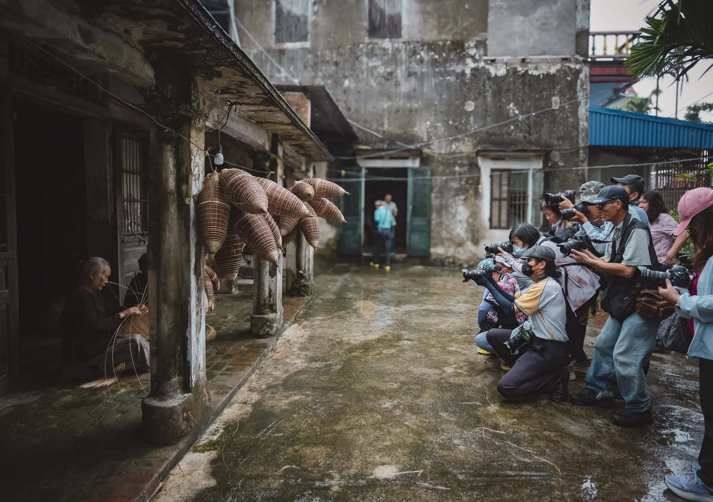
As we arrived, this group from China was clicking away, asking the elderly ladies to pose as they produce hand-woven fish traps from bamboo, called do or ro in Vietnamese - a technique used for hundreds of years in the lakes and streams of the country.
I got my own chance to take a few photos while watching them skillfully weave the baskets made of flexible bamboo sticks. Their shape is optimized for fish to enter the trap without being able to escape again - effective, but barely in use anymore today.
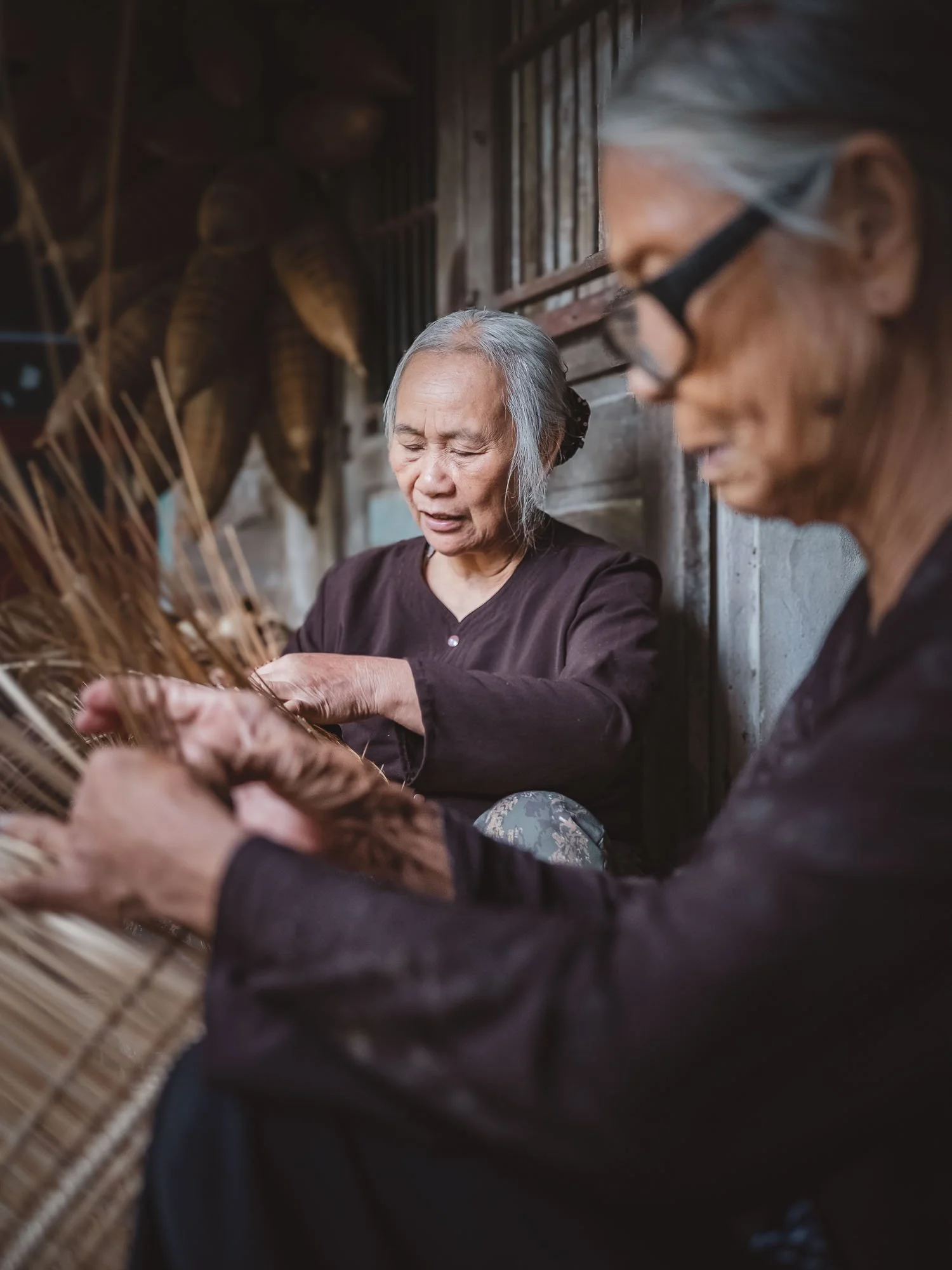
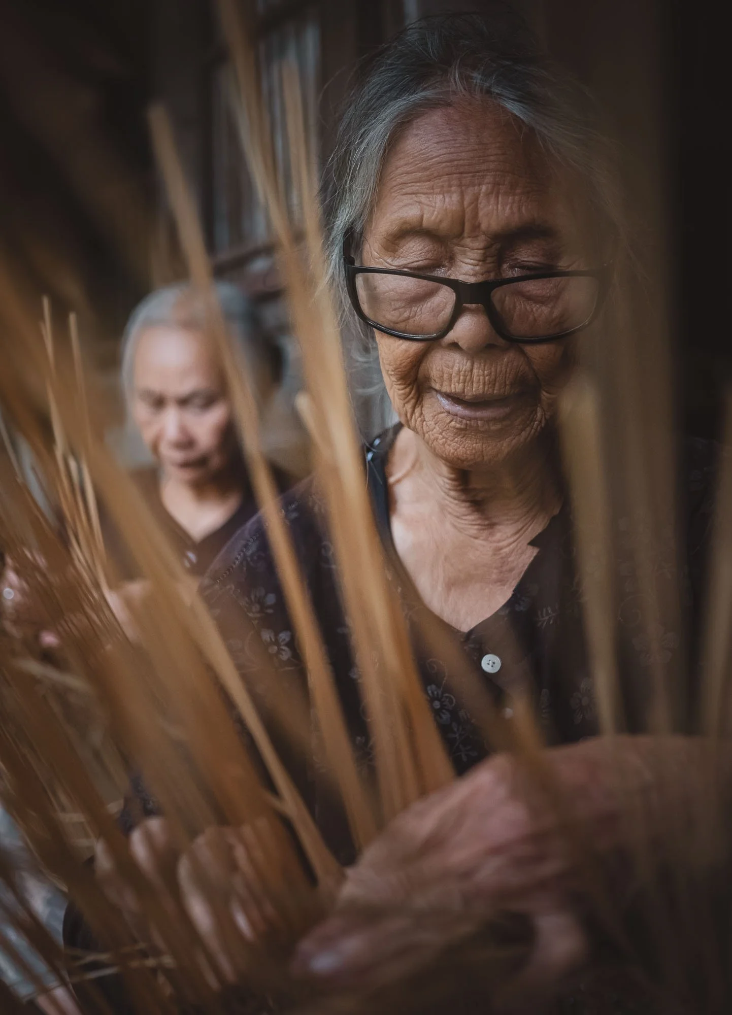
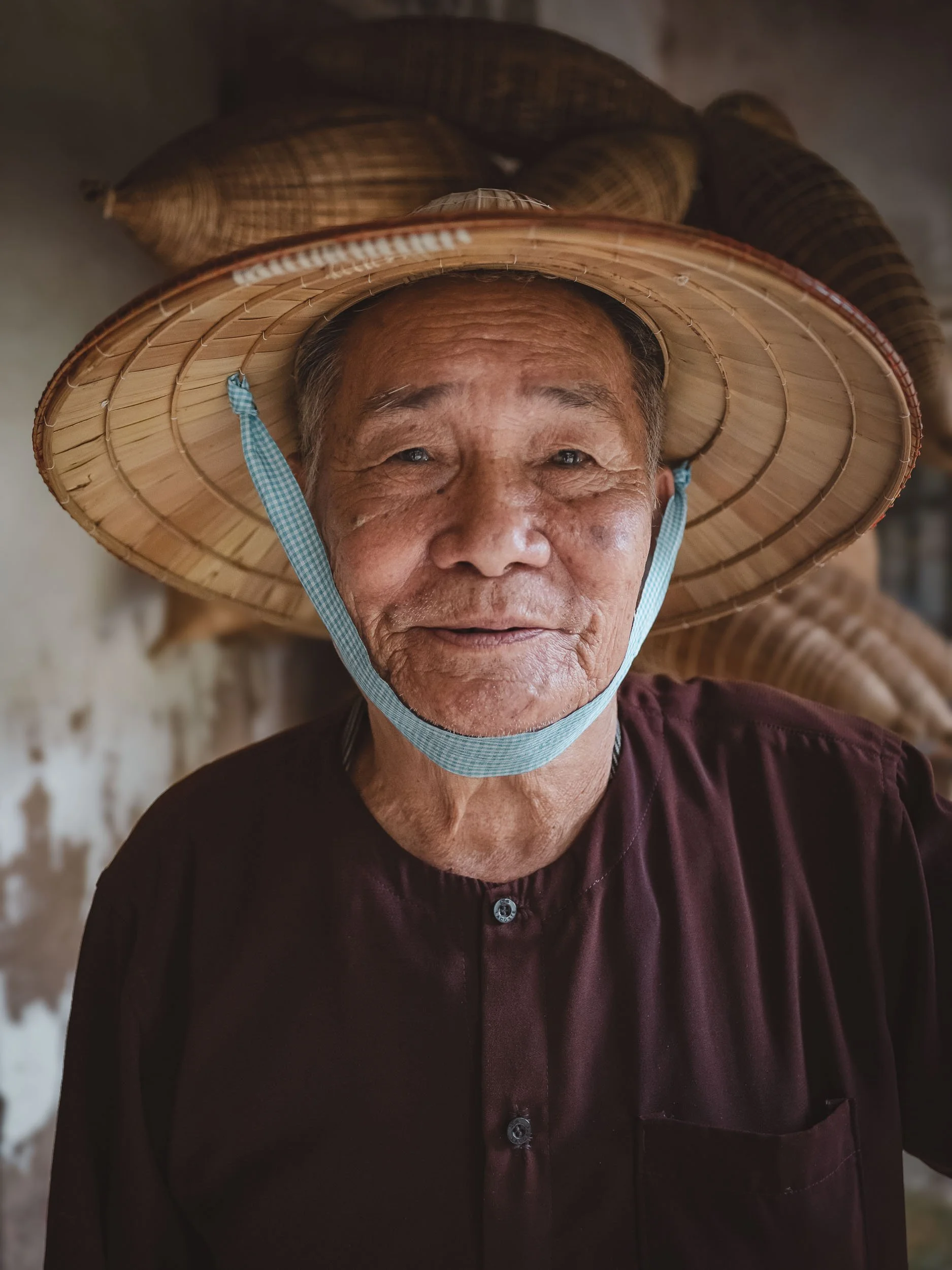
The Master Maker
The most famous protagonist here is Luong Son Bac, a very kind man in his late 80s (so he says), who took the time to tell us some stories from his past after the group left - one of those times where even a staged environment can bring some genuine moments - he’s the real deal.
He spent his youth in the military and then retired as farmer and fisherman, but unexpectedly became a celebrity featured in countless magazines and documentaries covering his fish trap making craft. He lives with his wife in their house next to their little fish trap storage and making facility, which he nowadays just opens for tourists.
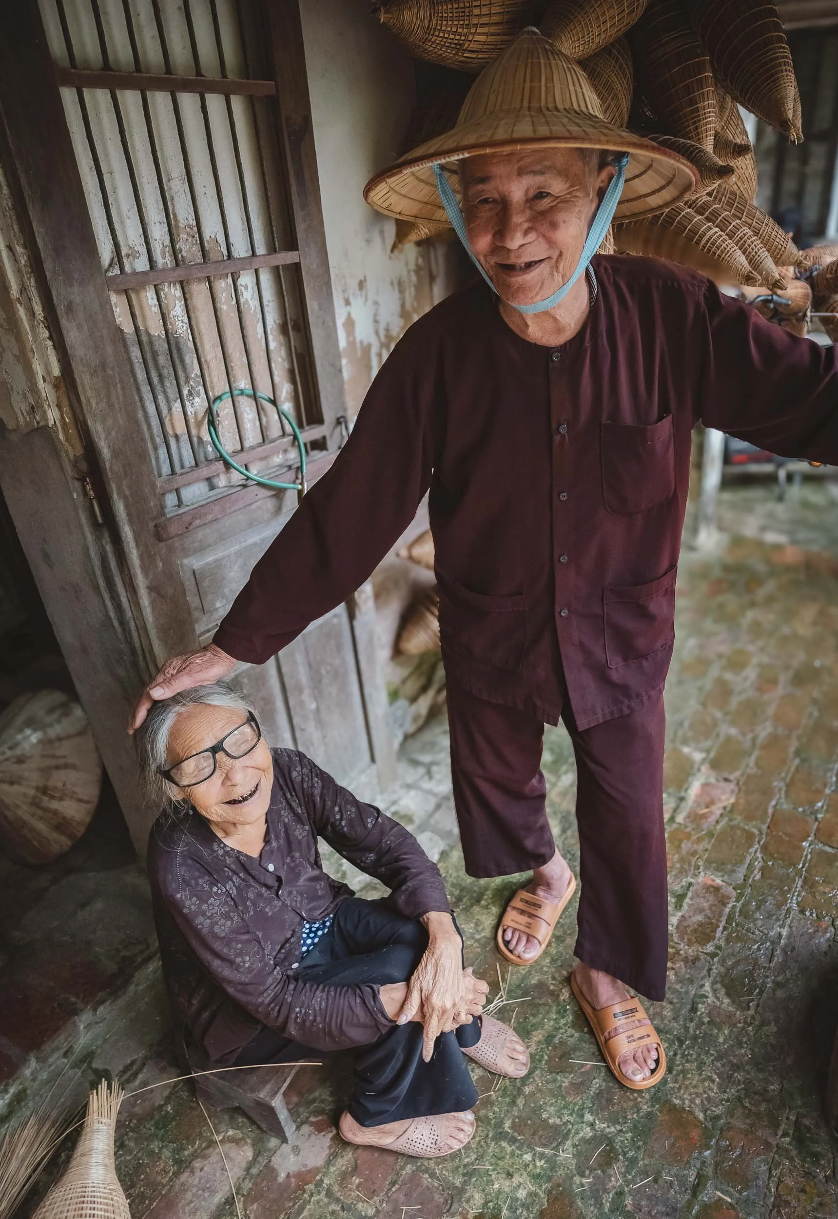
Neither of them have lost their skill though, and they both are always happy to showcase their craft.
The Soy Sauce Specialists
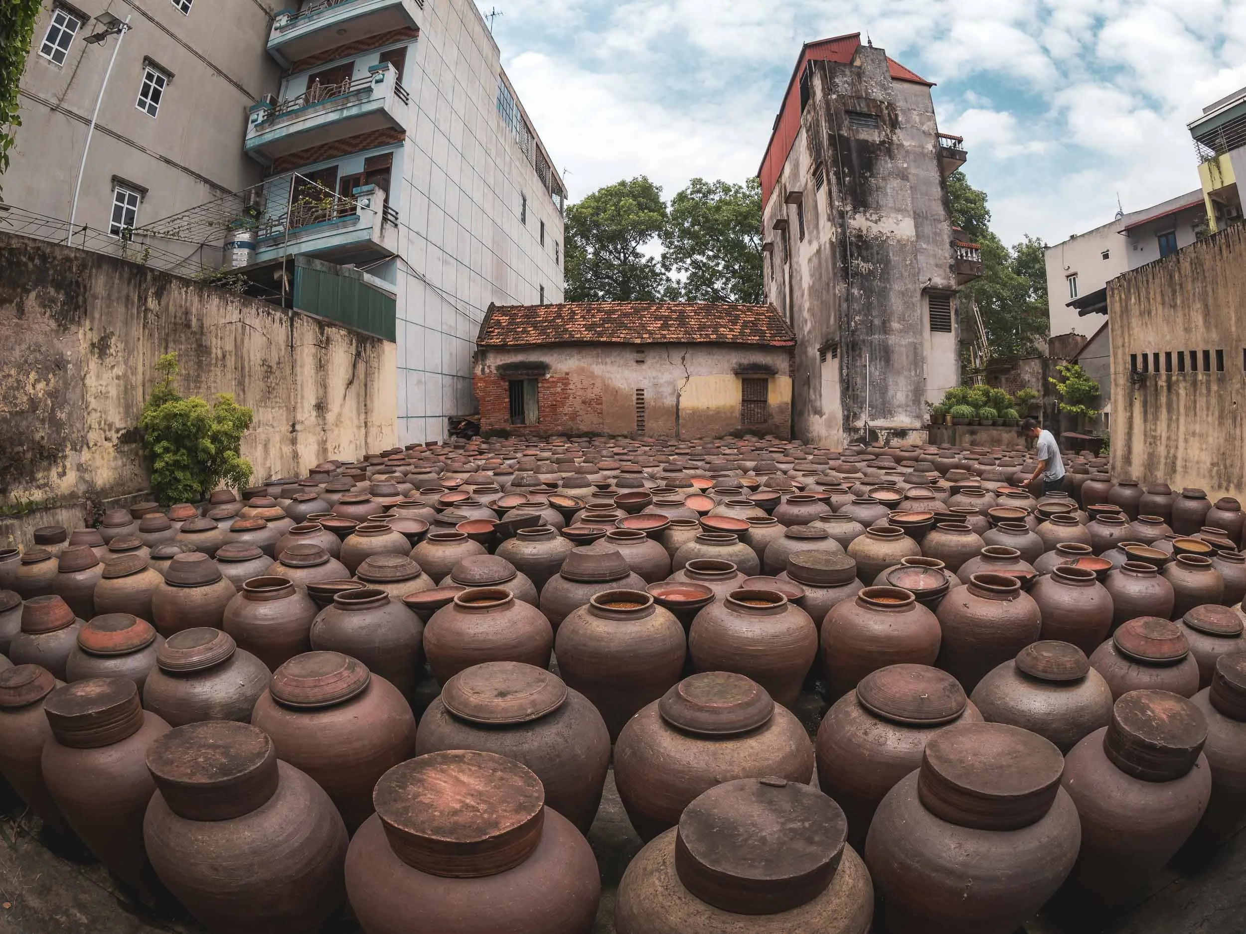
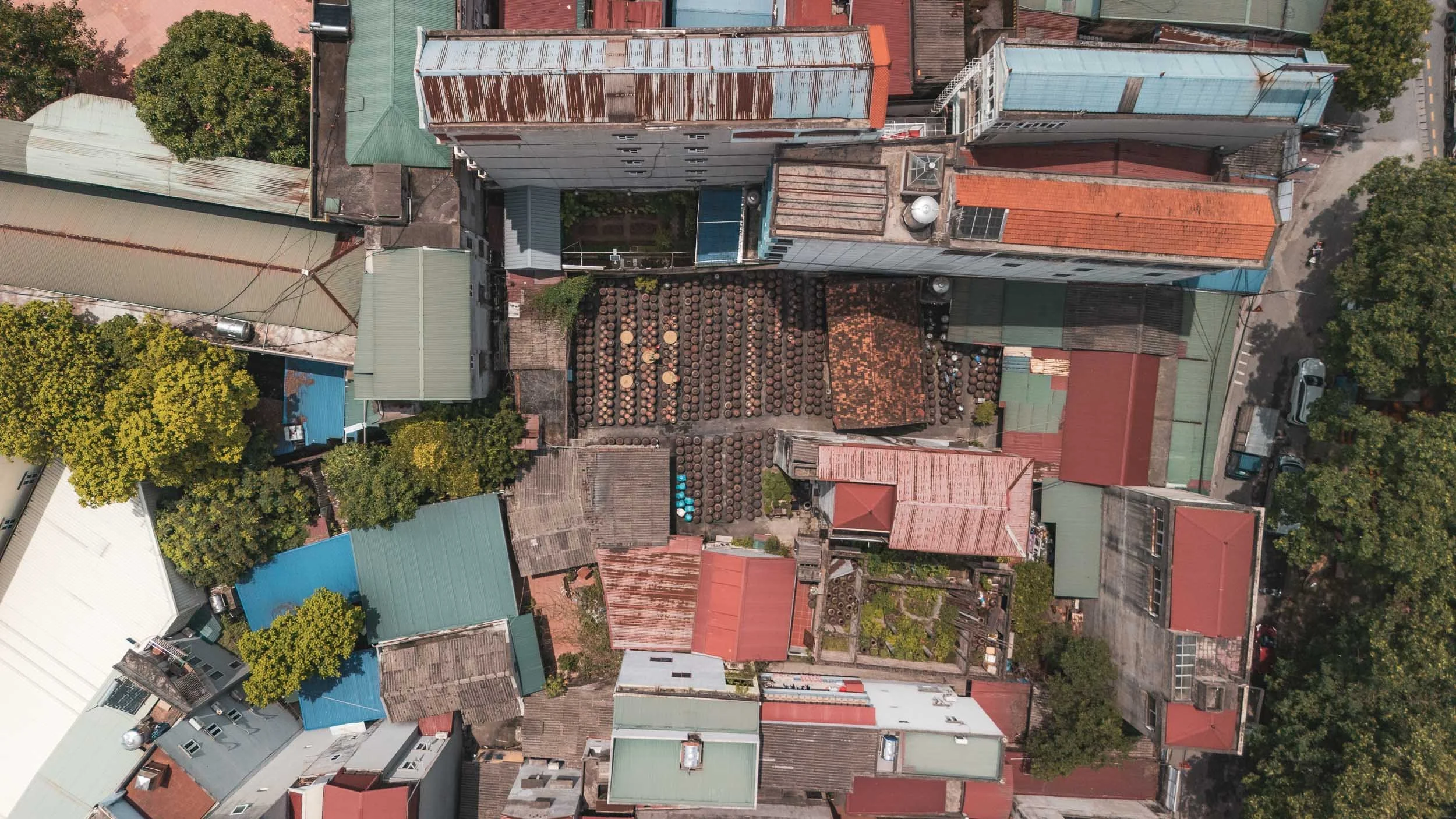
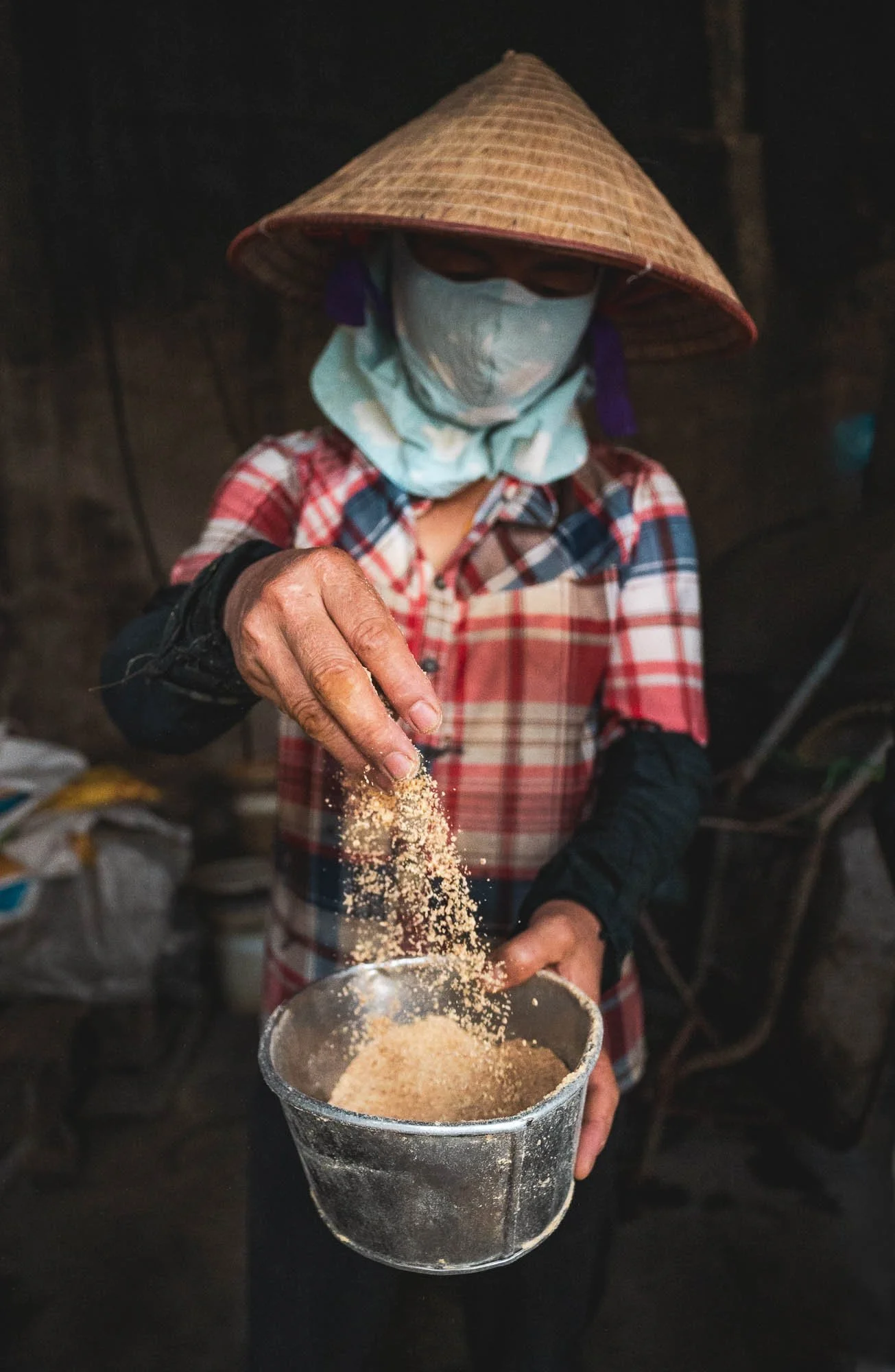
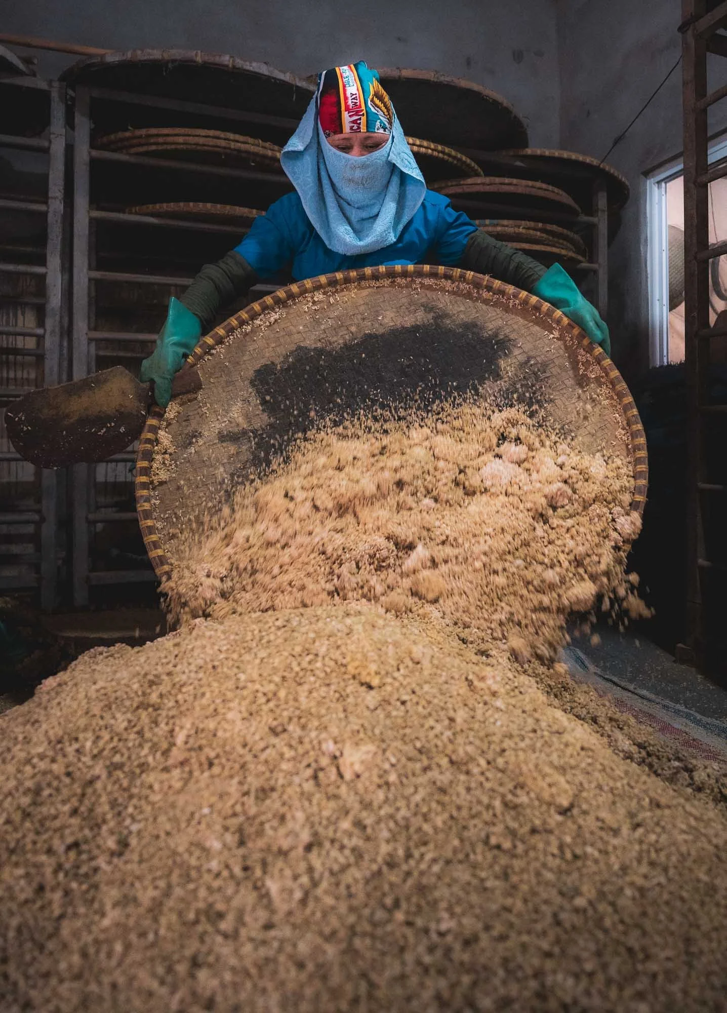
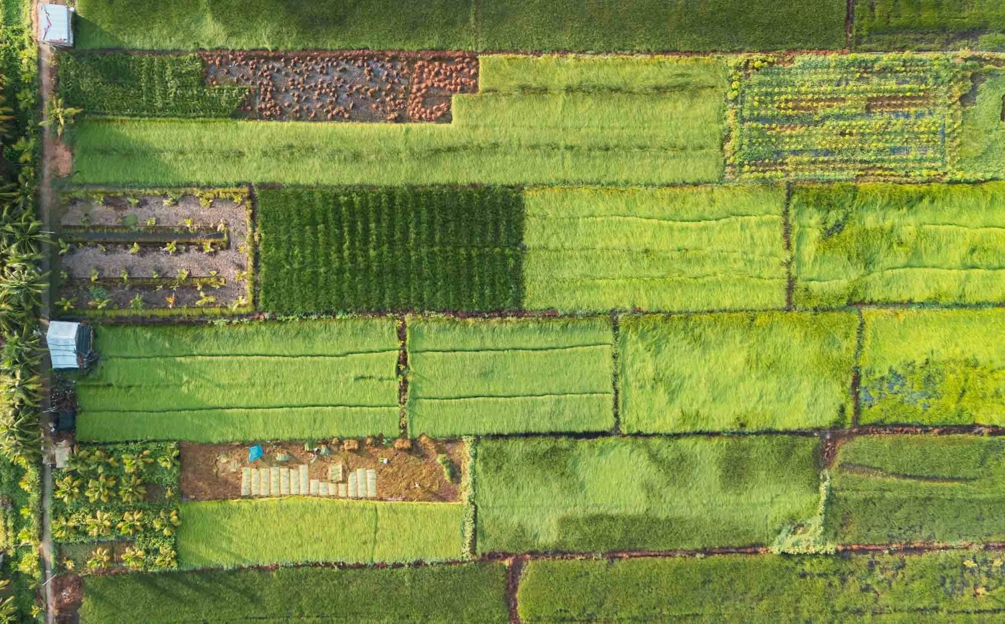
Another interesting traditional practice that can be found in Bần Yên Nhân just outside Hanoi. This little village is home to a few factories specializing in producing one of Asia’s most well known condiments: soy sauce.
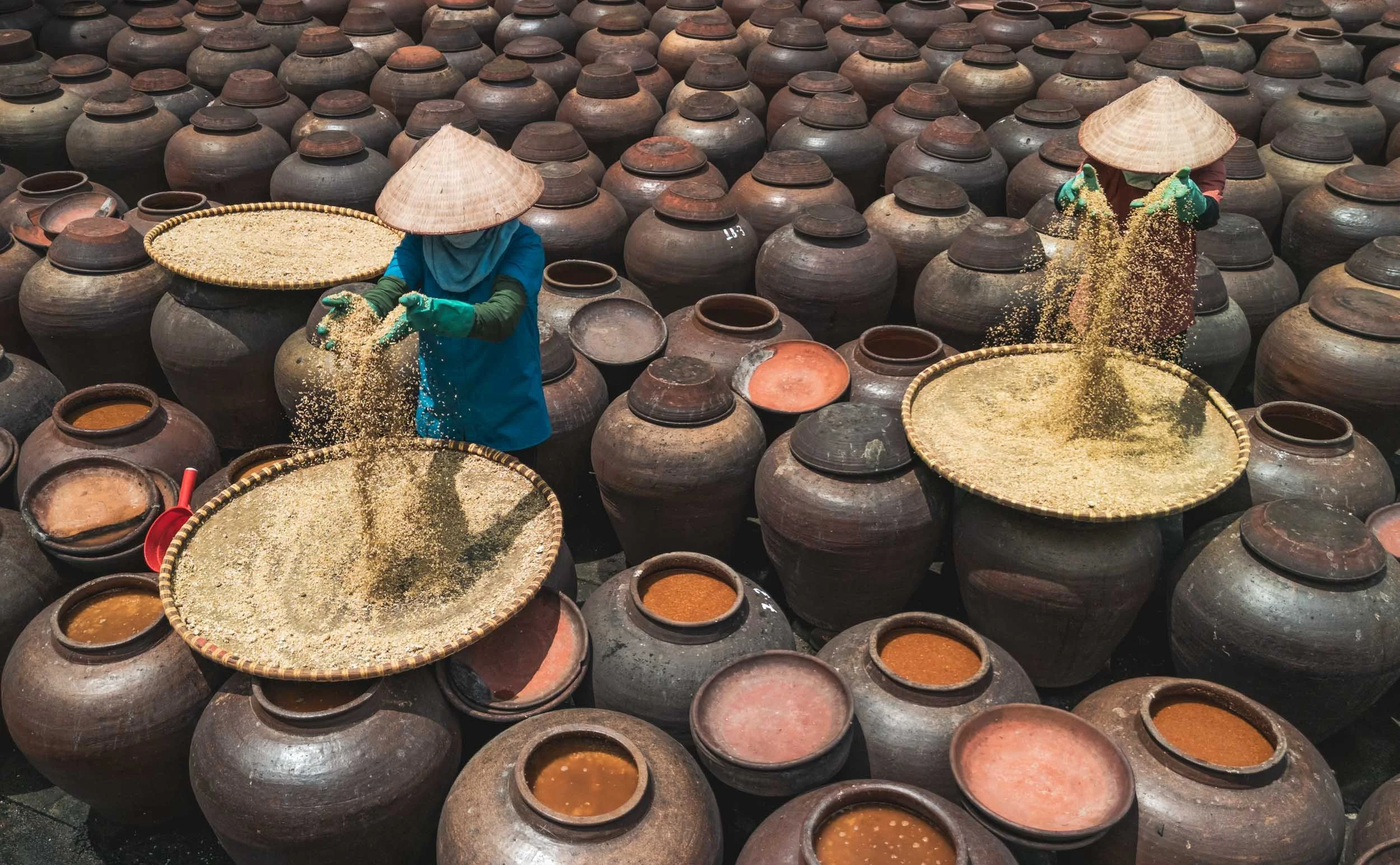
The ingredients are quite simple: rice, soybeans, salt, and water, but the process of combining them is a bit more elaborate. It starts from preparing a rice mold, cooking it into a sticky pace and letting it ferment for a while. The roasted soybeans are ground and also fermented for several days - the smell is quite intense at this stage.
The two mixtures are then combined in large clay jars with salt and left in the sunlight - temperature, timing, and regular stirring is what makes the magic happen, with each maker and region having its own secret process to get the best flavor out of the process.
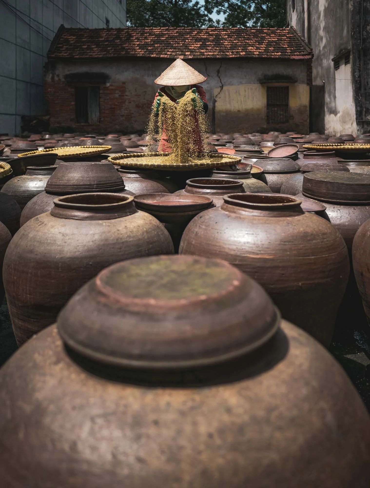
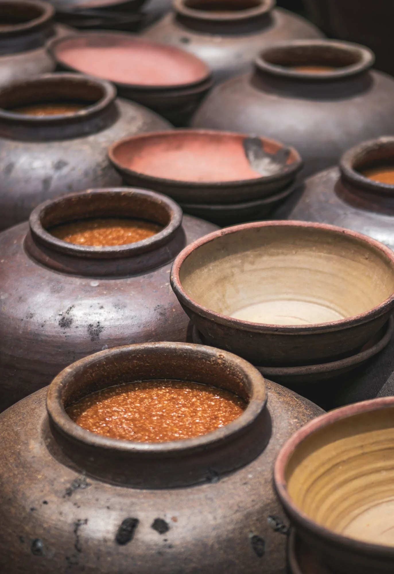
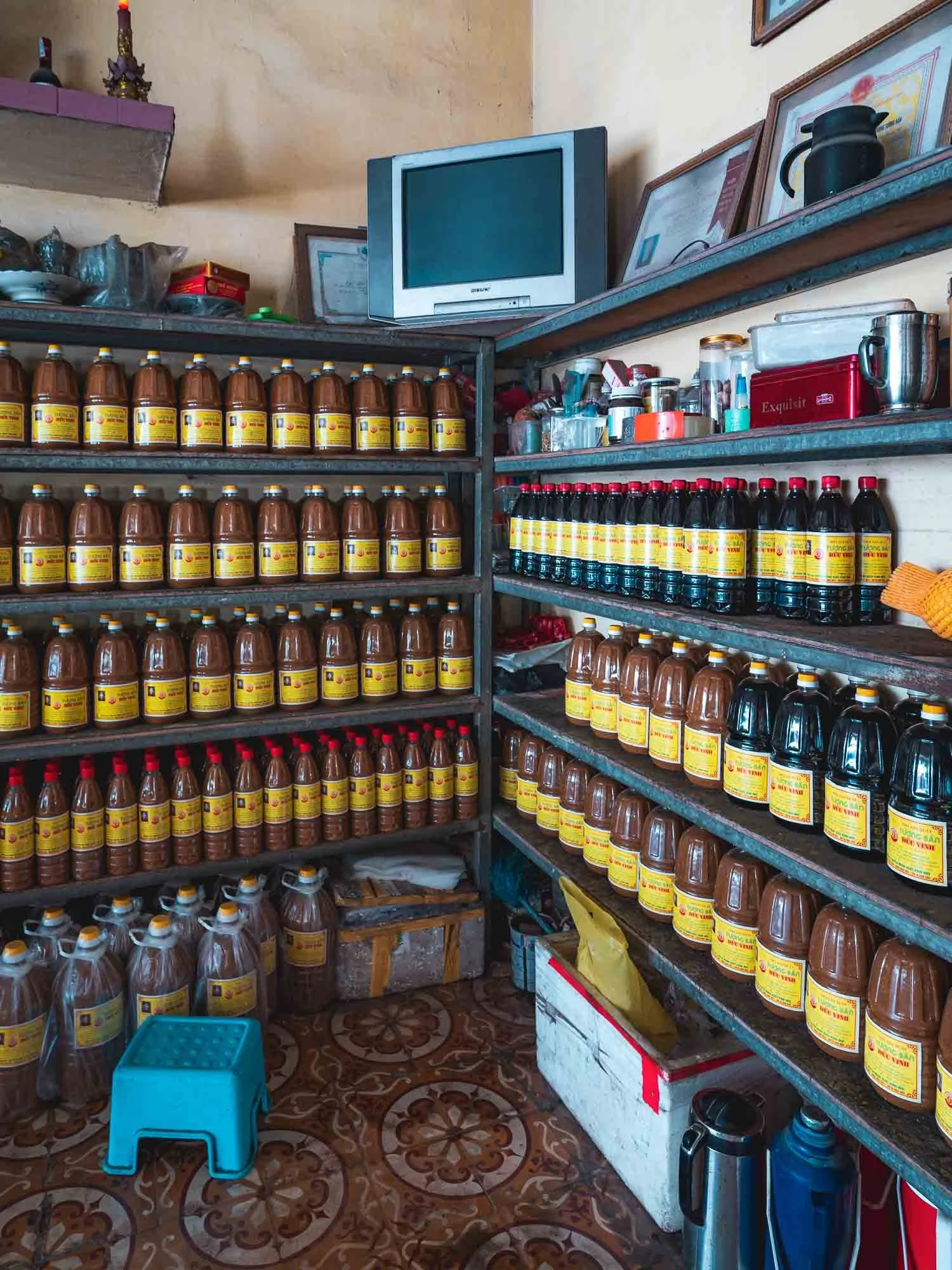
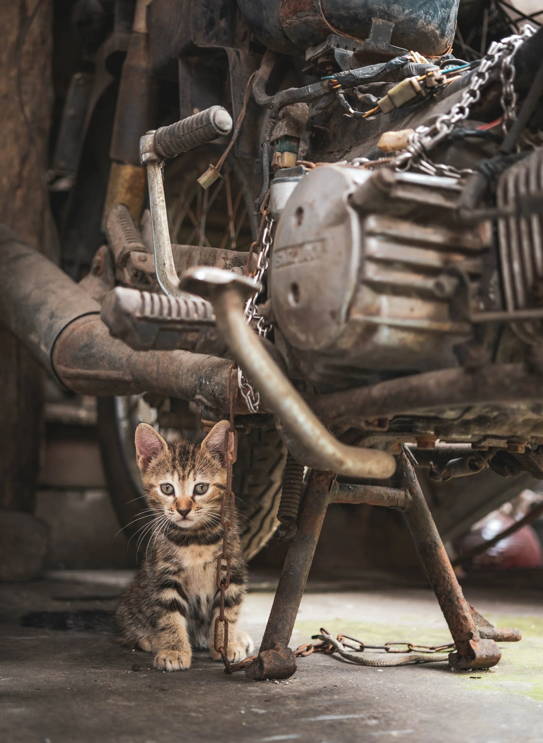
If all goes well, one can then purchase the final result in the shops after 6 weeks or so. There are quite a few factories dotted around the village - in total they are said to produce around 11 million liters a year. Cats play a more mentally supportive role in the process but probably keep the rodents out of the grain storage.
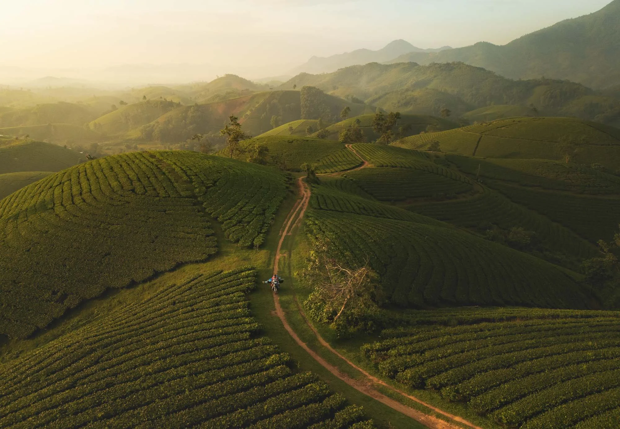
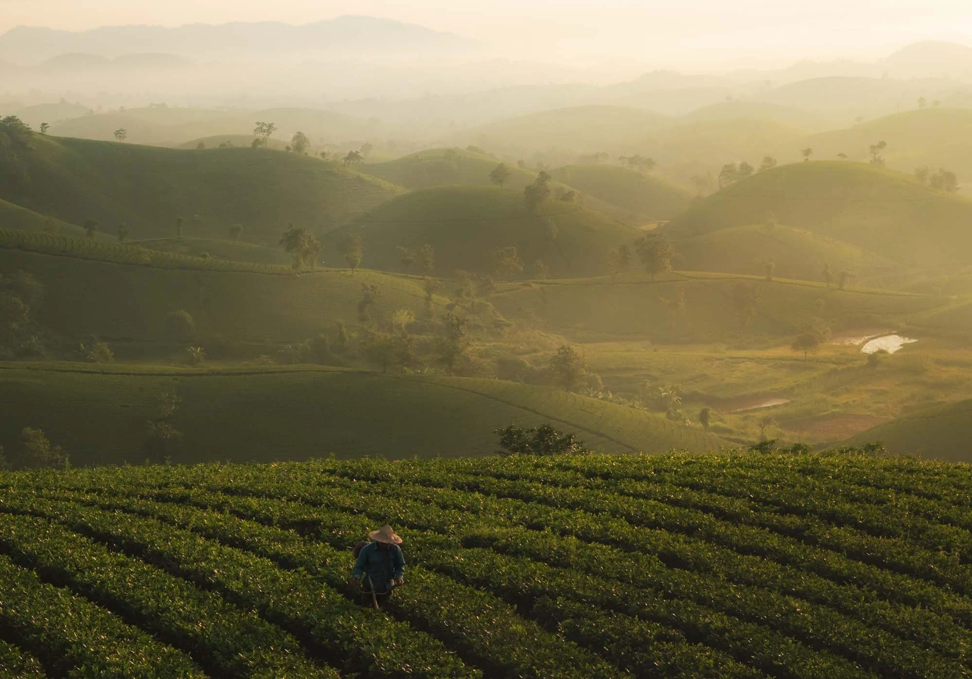
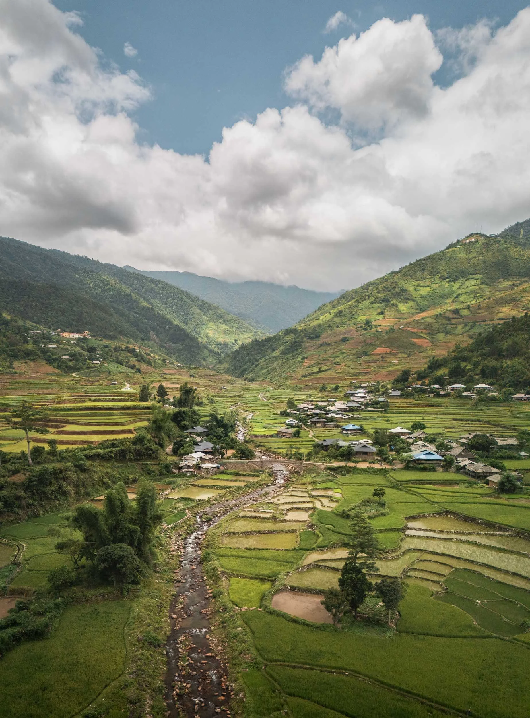
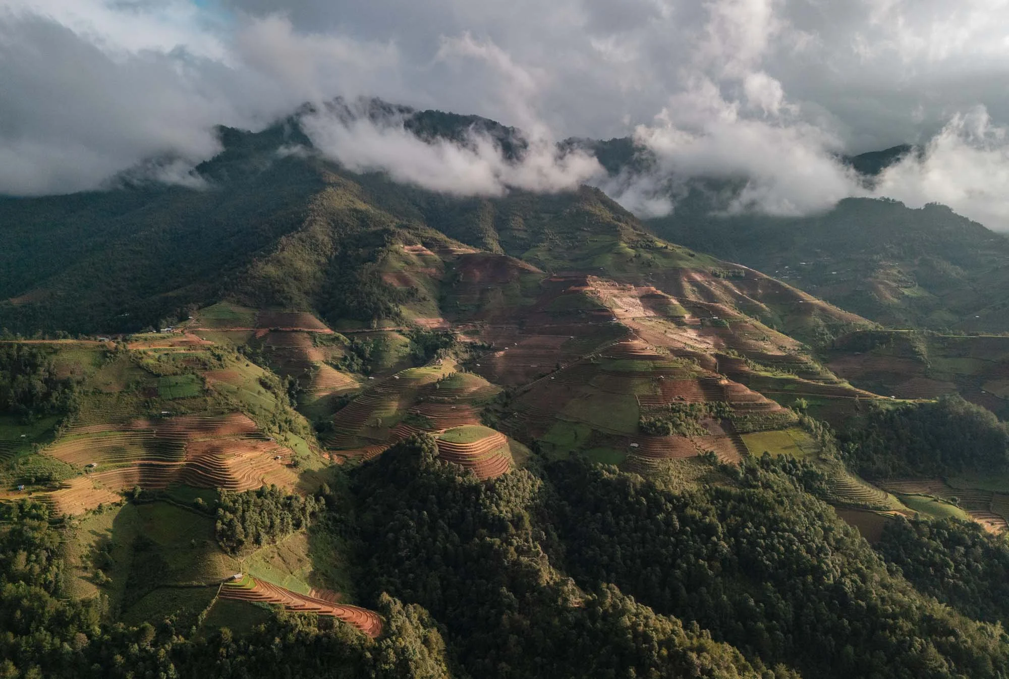
Rolling Tea Hills of Long Coc
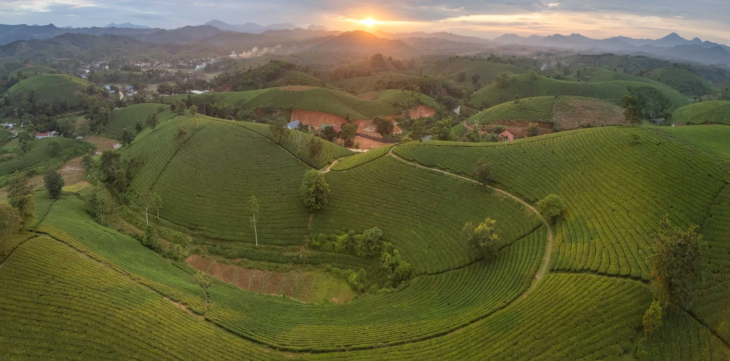
We left the eastern part of Hanoi behind us and moved into the north-western mountain regions, specifically the beautiful tea plantations of Long Coc.
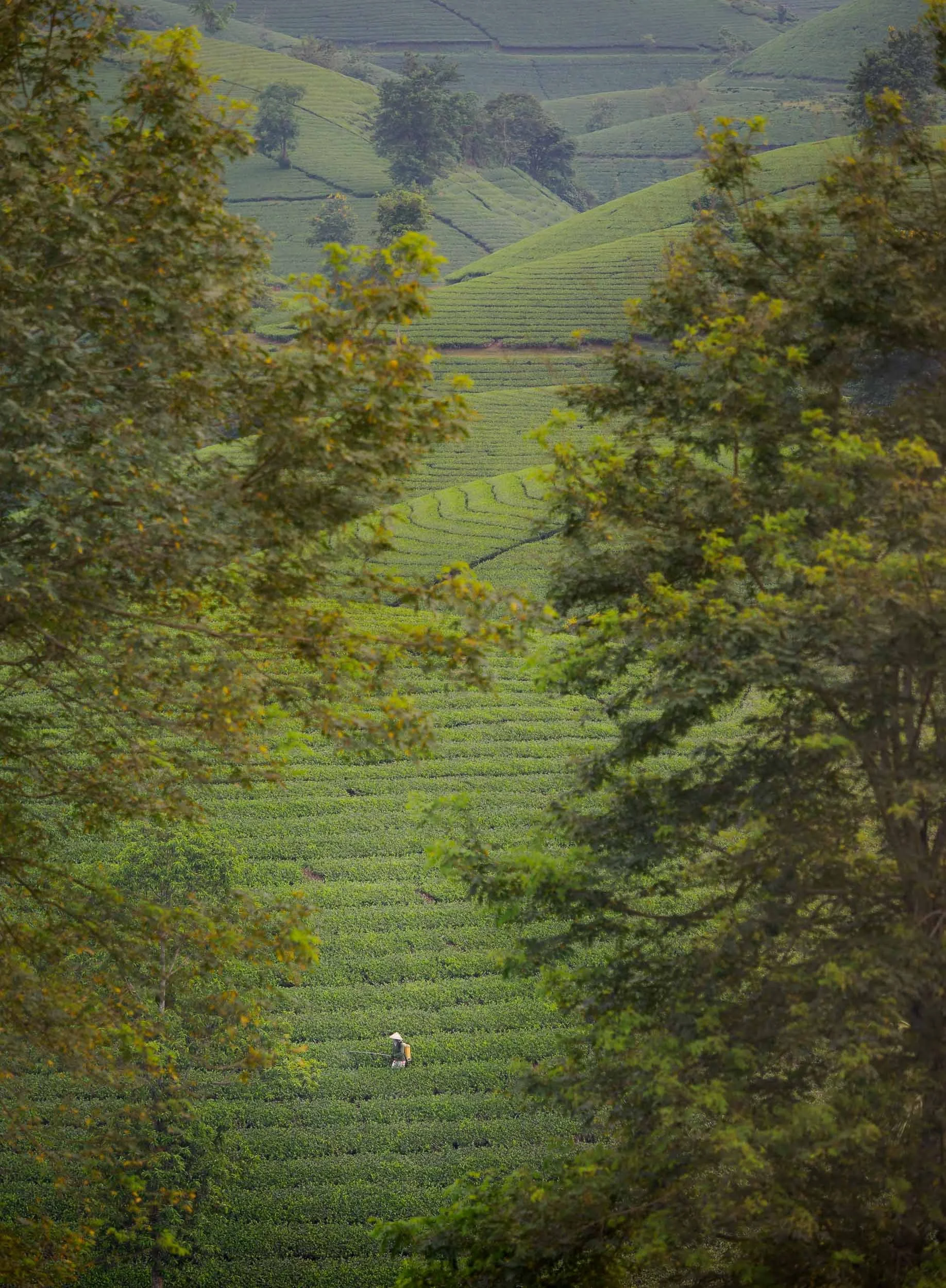
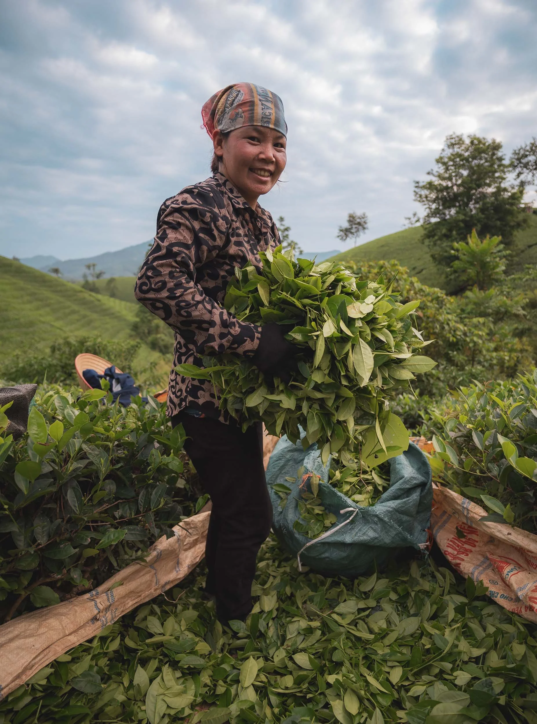
We happened to encounter a photography group here as well, who hired a few local ladies to pose with traditional tea harvesting outfits. If you just look around and ask the locals, you might get some more candid images of the actual workers in the fields though.
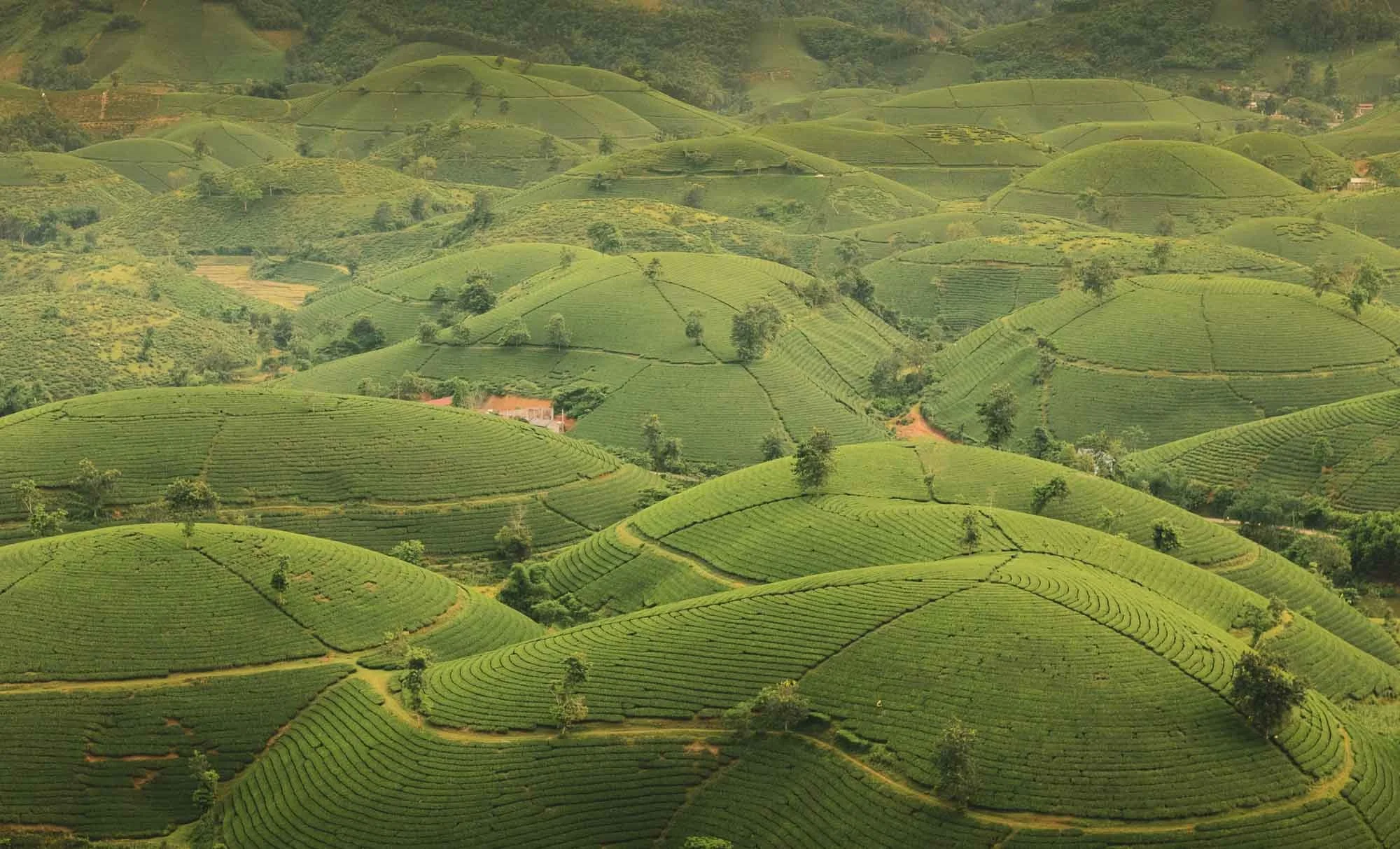
The tea hills are a beautiful sight, and I’d definitely come back to catch them in different conditions - adding a few dark nights for Milky Way photos would also make sense here!
Aside from the aesthetic value for tourists, tea has been grown here for more than 100 years, and is the staple agricultural livelihood for the local Muong ethnic group.
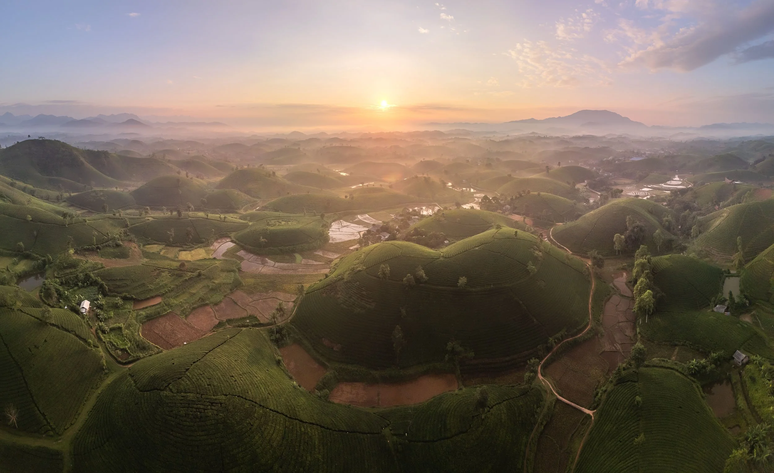
While undeniably picturesque, it’s also worth noting that with every new tea hill the landscape is shaped, and natural vegetation removed - of course that’s true for most agriculture.
We spent the night at a local guest house before making our way even further north-east after sunrise…
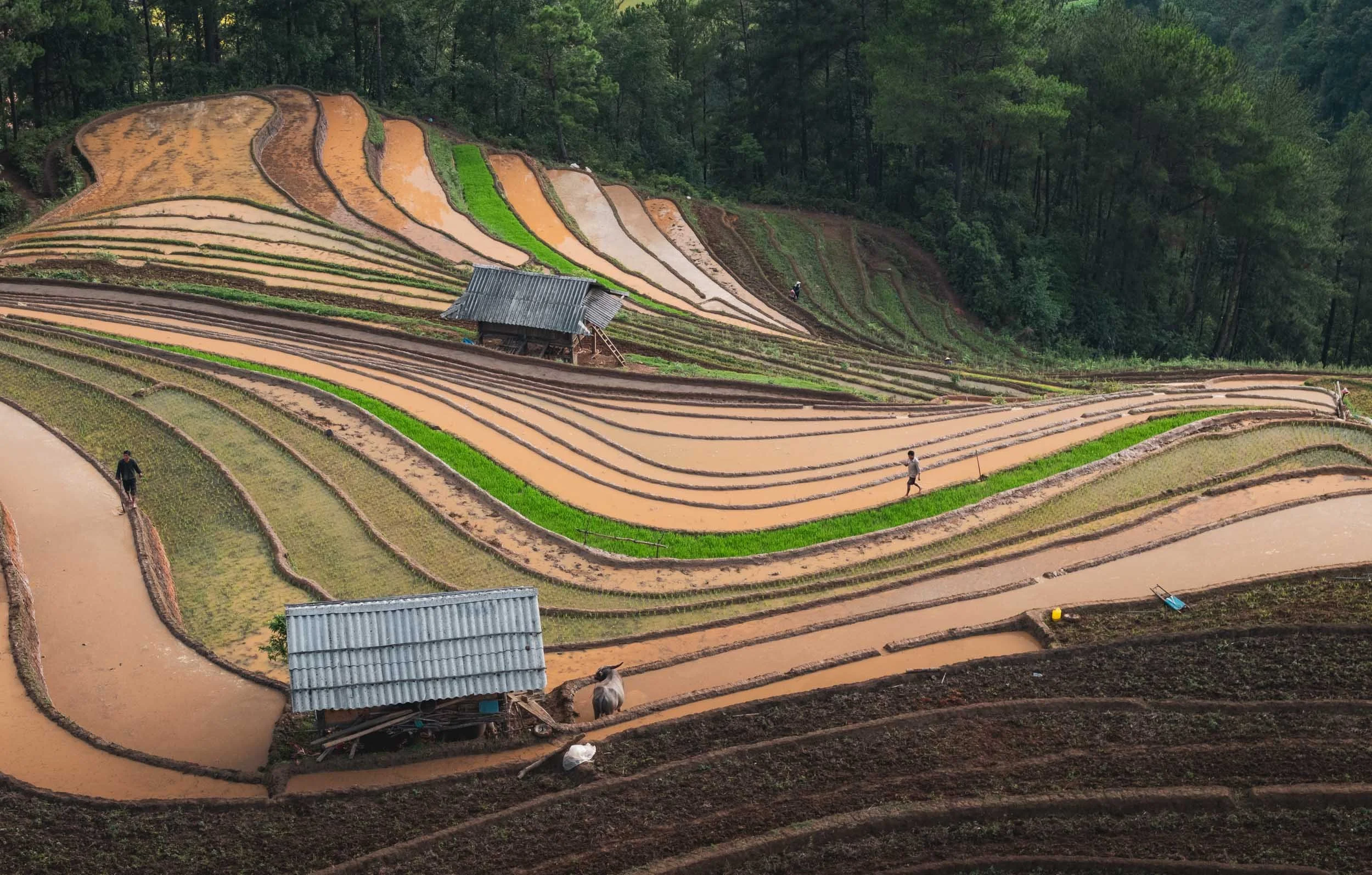
Khau Pha Pass & Tu Le Valley
…which brings you closer to the Chinese border, traversing various beautiful mountain passes in the process.
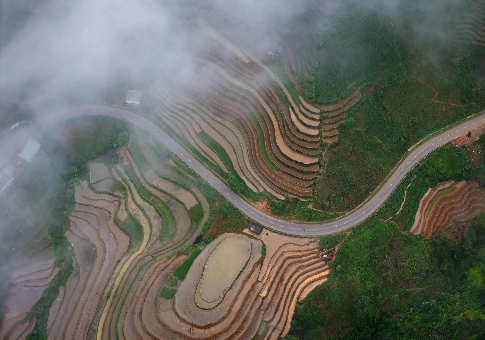
The peaks here are at about 1500m above sea level with great views into the valleys, many of which have been repurposed for rice fields as far as the eye can see.
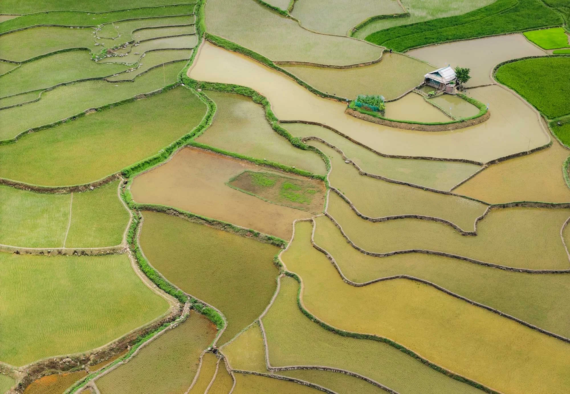
Mu Cang Chai
Our goal was Mu Cang Chai, where a specific U-shaped rice terrace is another photographer’s favorite - but usually during the harvest season when its rice plants shine golden and green for a dream-like feeling. This happens around September and October, which is also the peak tourist time.
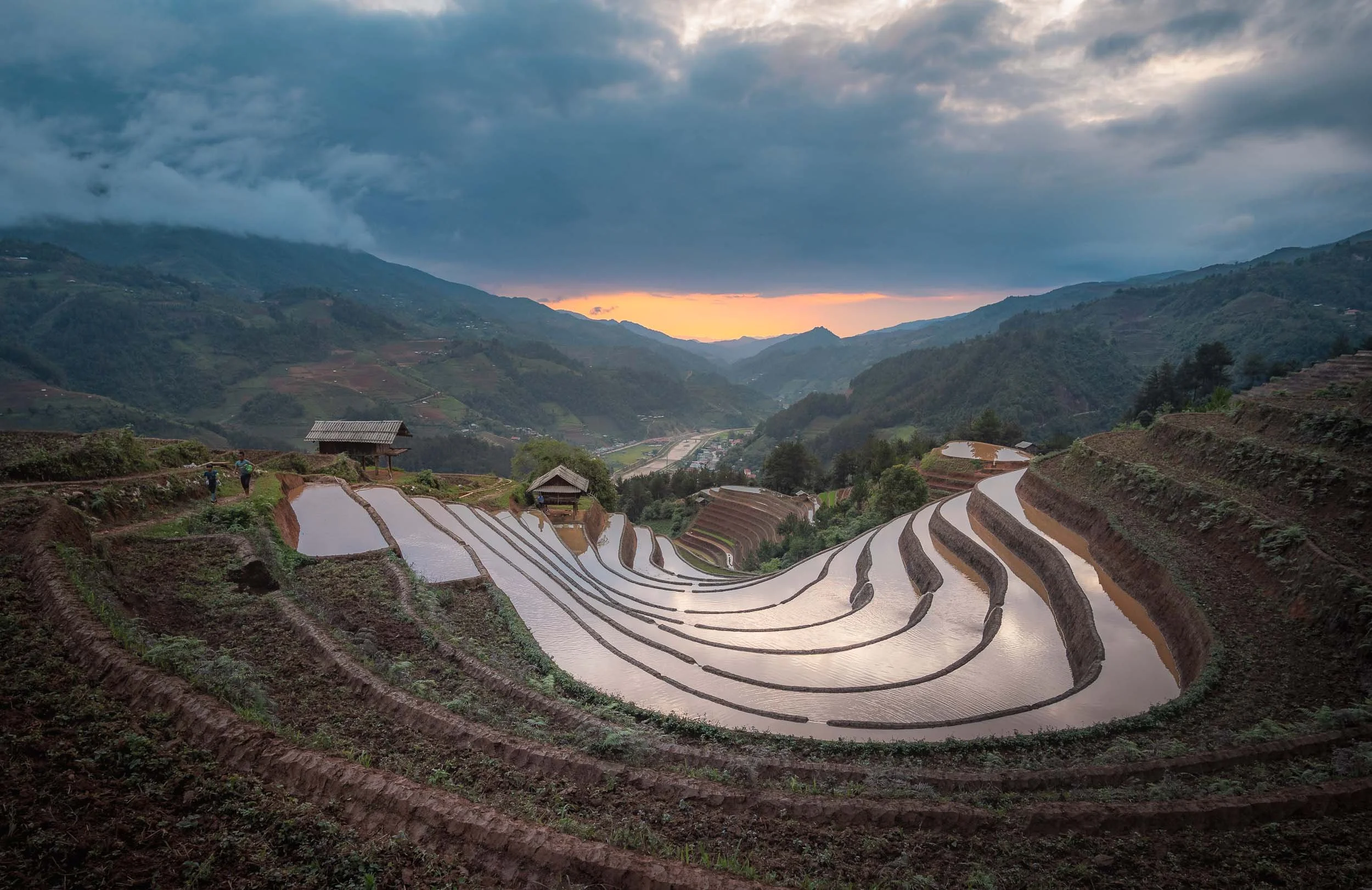
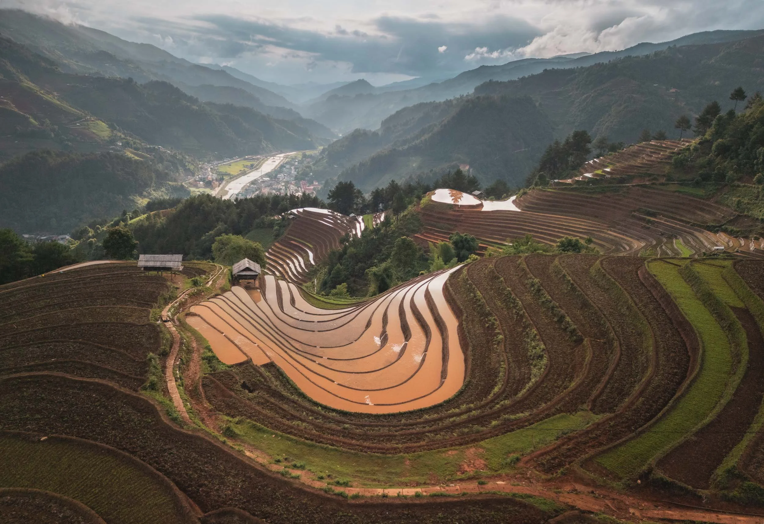
During the so-called water season, the paddies are flooded to keep them free of weeds and prepare for the next round, creating a very different scenery - still interesting (and a lot less busy).
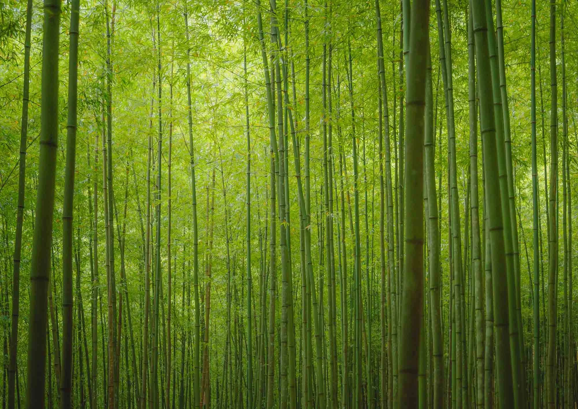
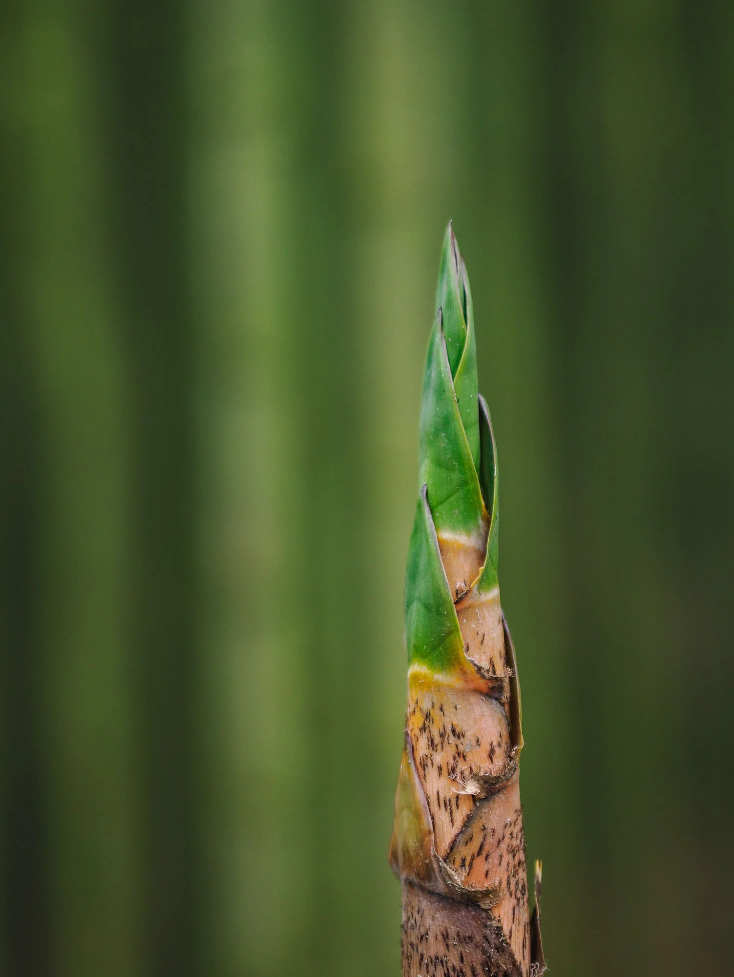
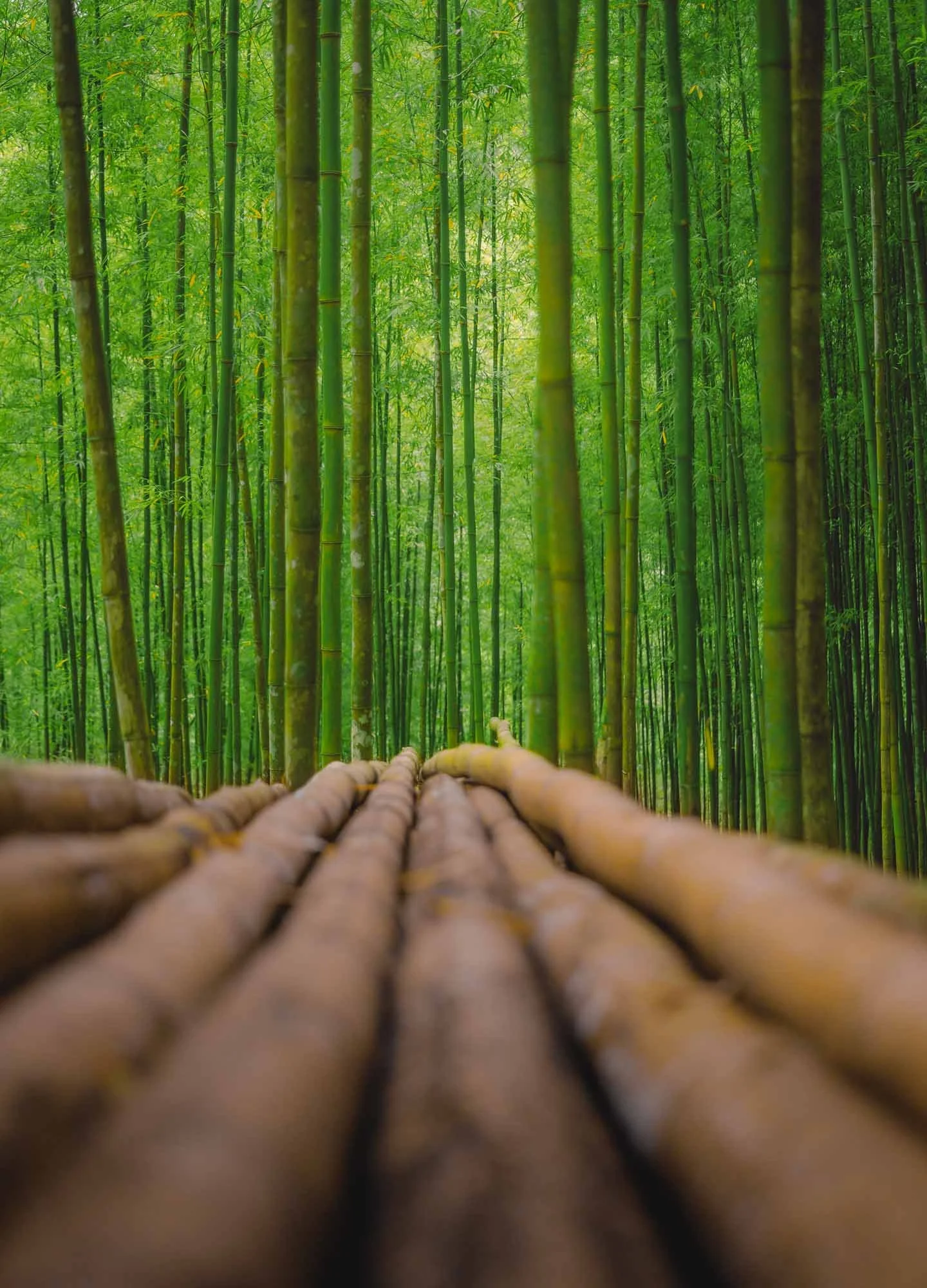
Bamboo Forest
Not all of the mountains are covered in rice fields though - another quite beautiful feature is its bamboo forest, requiring quite an arduous motorbike ride along narrow slippery paths to reach.
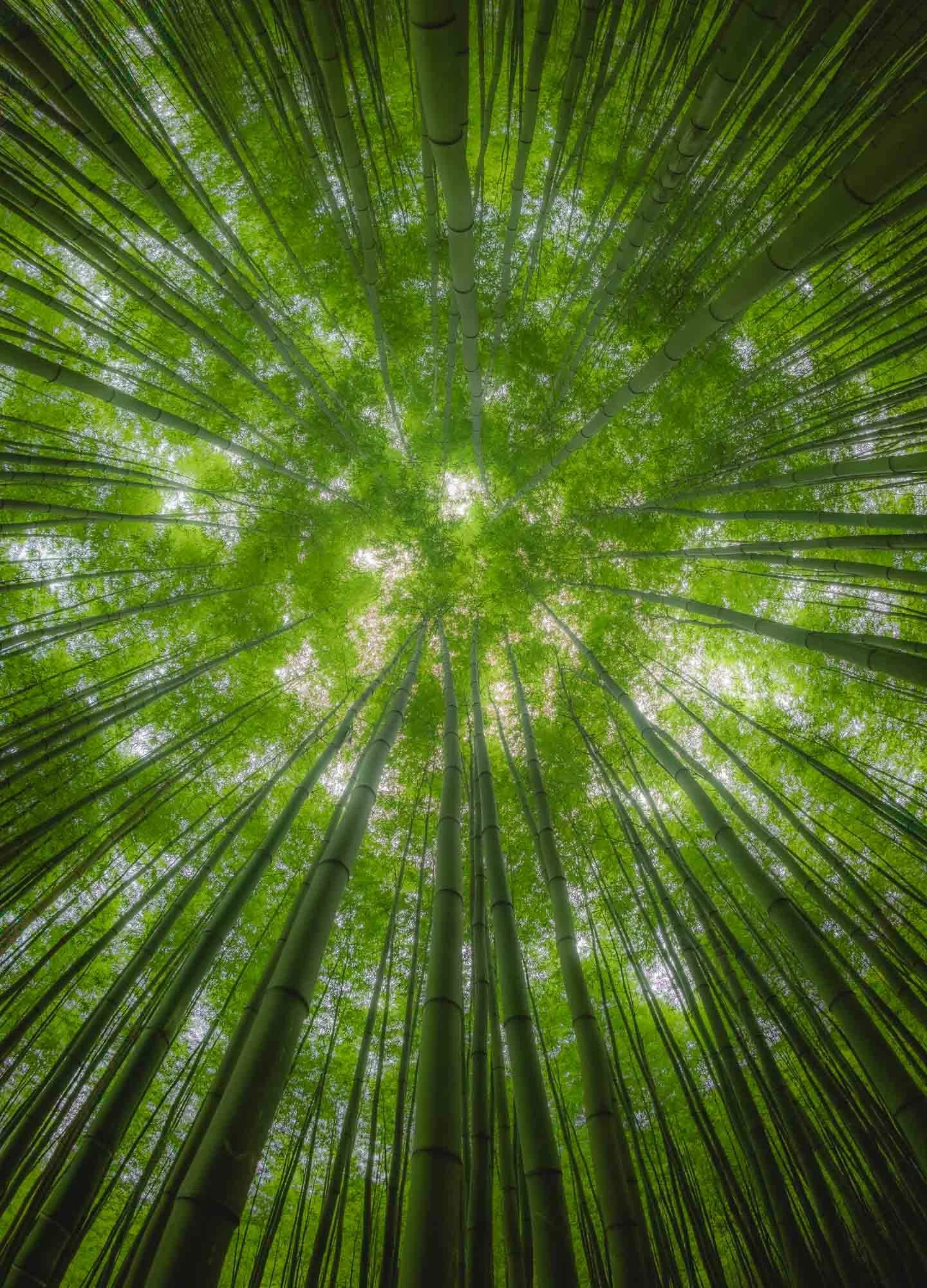
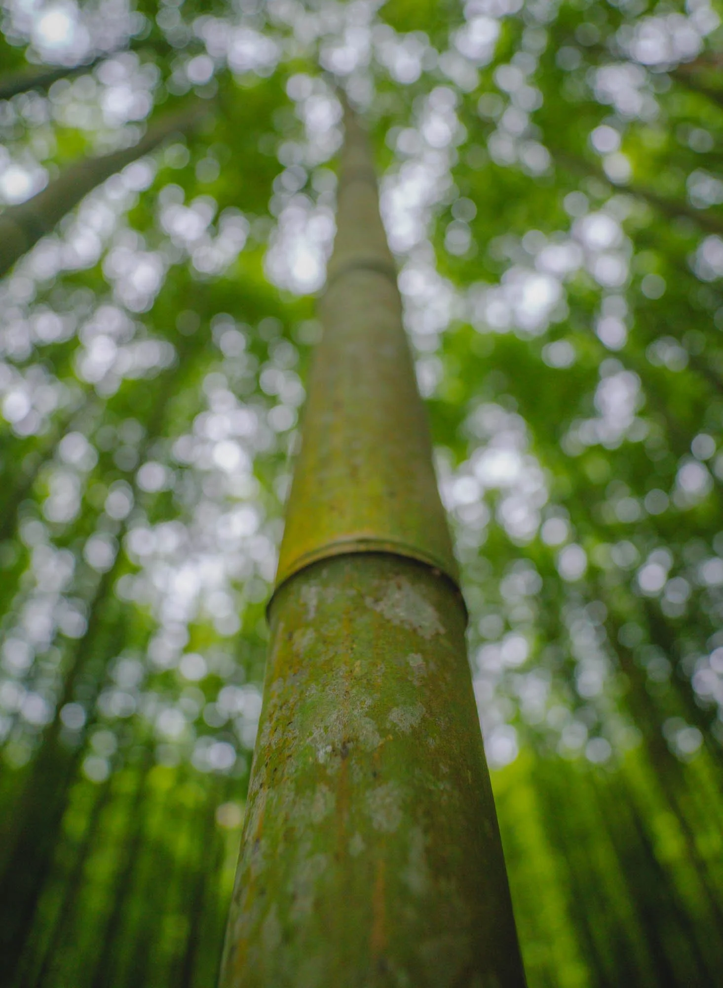
The forest is about 60 years old - its owners are native people of the Hmong ethnicity, and they take great care of its preservation. It was originally set up to harvest bamboo shoots and use the fast-growing trees as infrastructure materials, such as for fences.
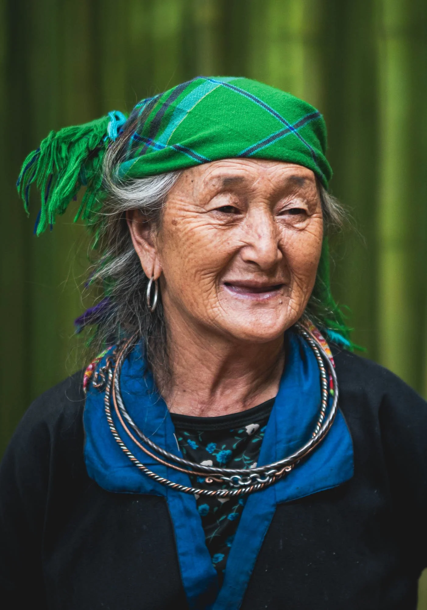
The Guardians
Its protectors during my visit were these two elderly ladies, asking for a small entrance fee and happily allowing me to take a few photographs of them. They have spent all their life here and have seen the forest grow from nothing during their lifetimes.
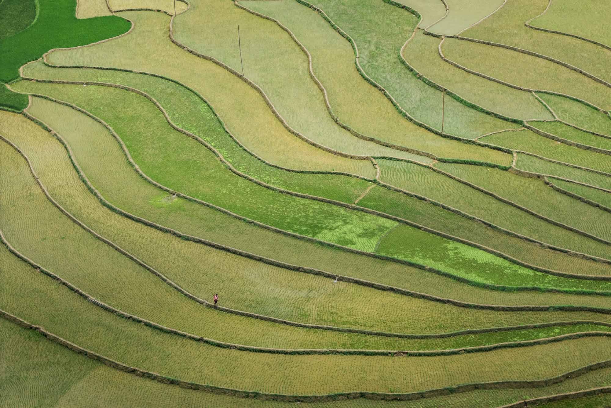
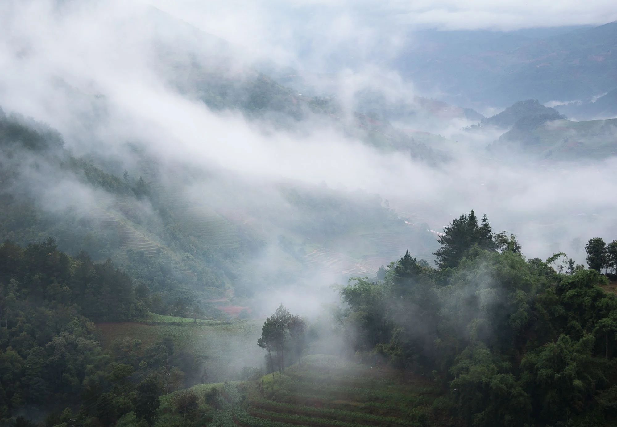
We explored a few more terraced rice fields the next morning, and were greeted with low clouds and fog over the hills, as well as a few rays of sunshine as we embarked on the drive back to Hanoi.
This was meant to be my last destination of the trip, but I had three extra days left, and decided to head back east of the capital…
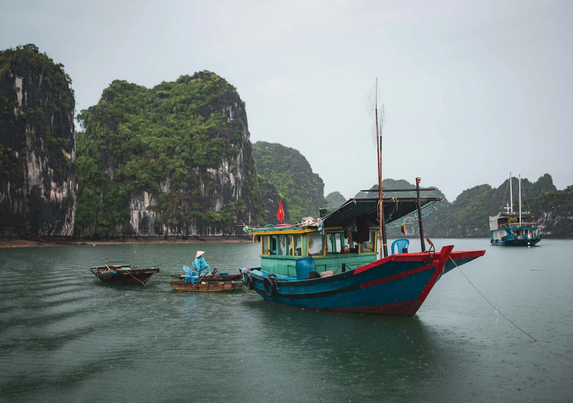
Cat Ba - Floating Villages
and a Rare Primate
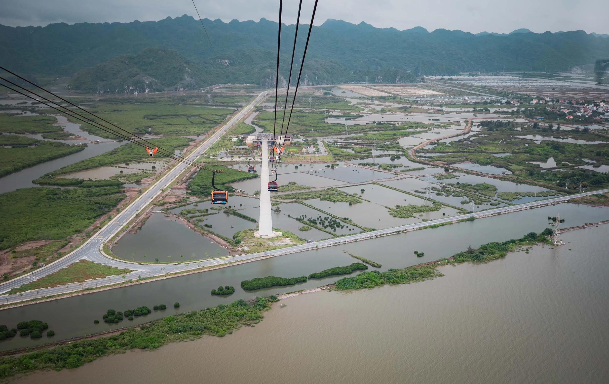
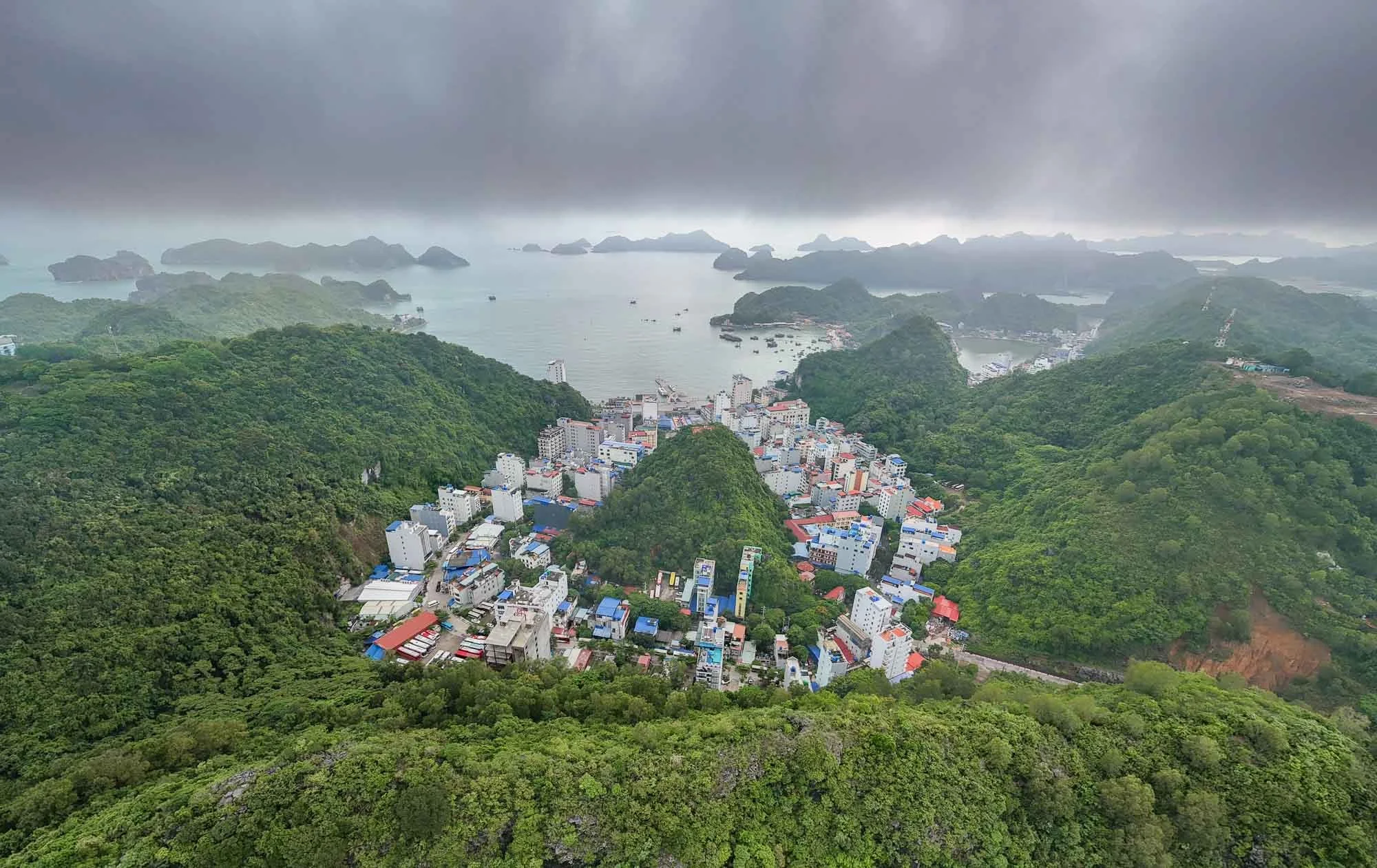
…where a few hours drive (and a cable car ride) from Hanoi lies Cat Ba Archipelago - a World Heritage Site, together with the more well-known Ha Long Bay.
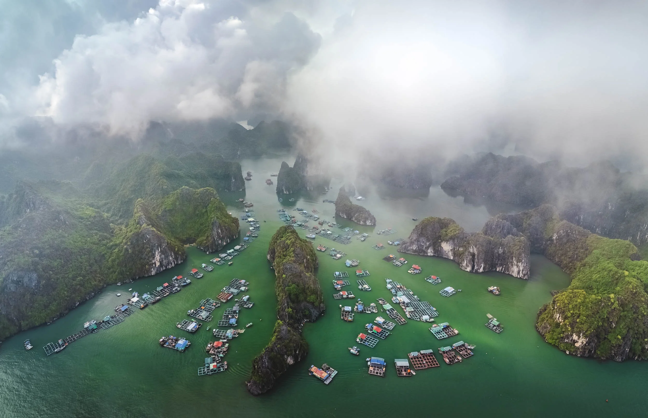
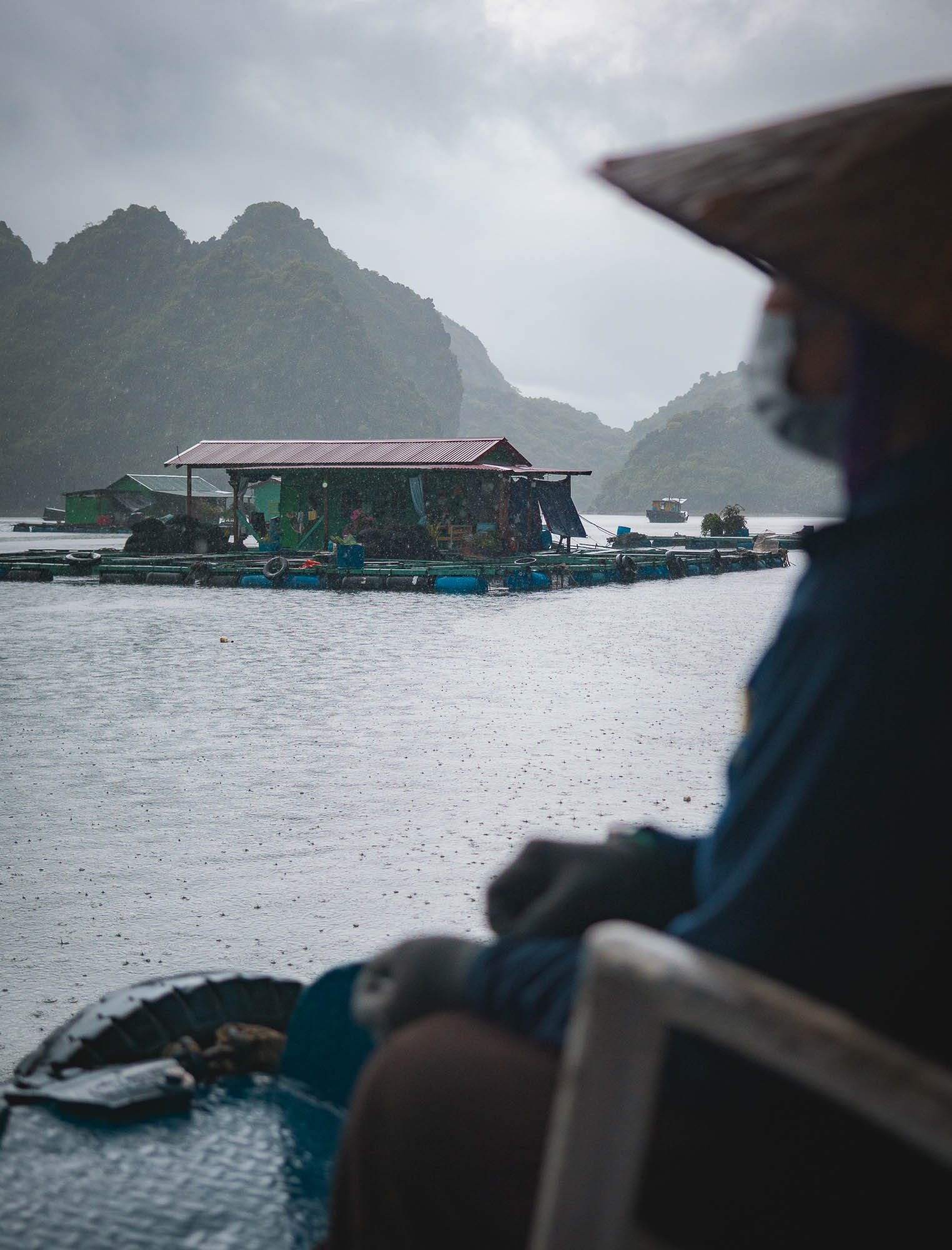
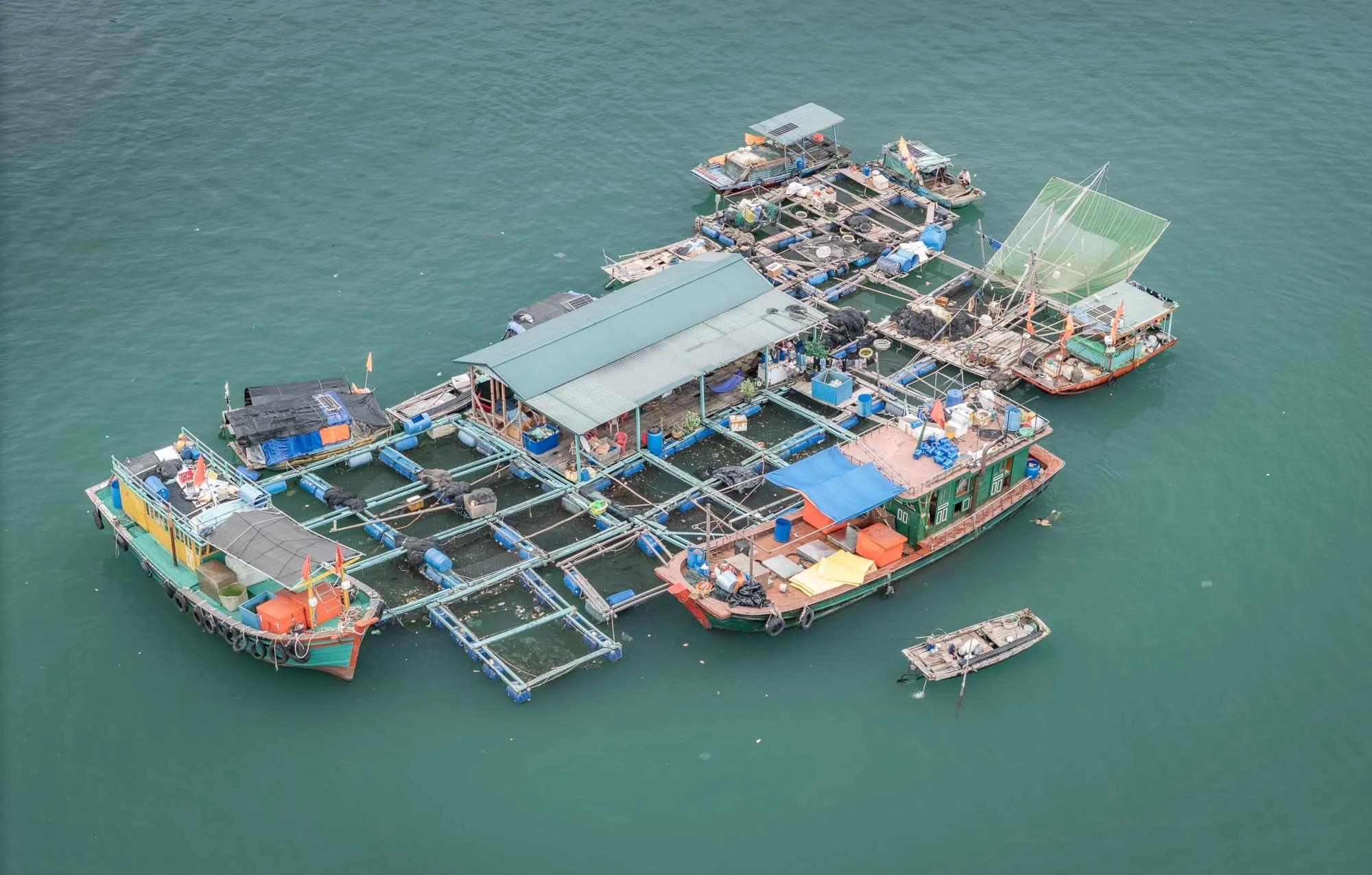
The area is home to Cai Beo, said to be Vietnam's oldest, largest, and one of its last remaining floating communities, featuring around 400 households built - literally - on water.
A short boat ride from the shoreline brings you closer to the floating houses, most of which are simple residential huts, while others act as schools, restaurants, or guest houses.
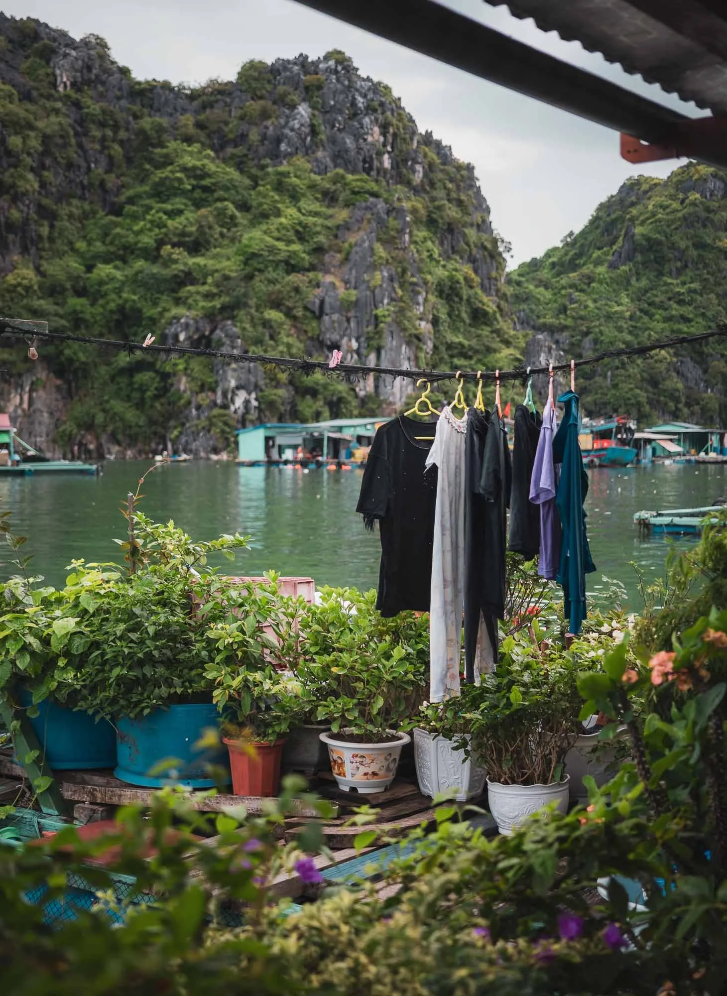
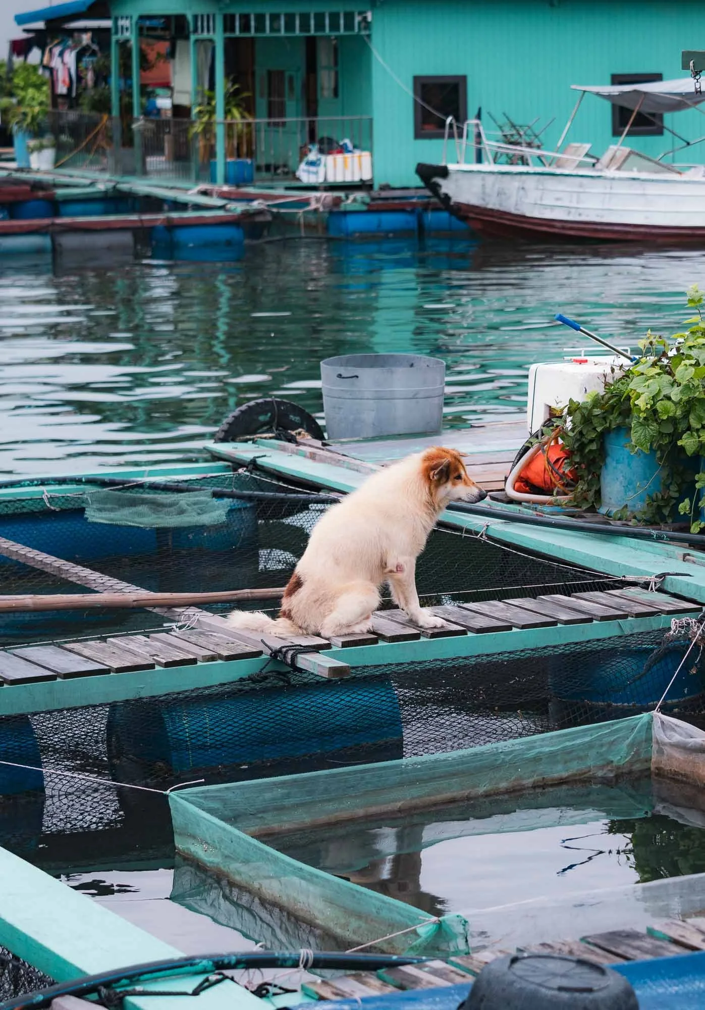
We got to visit one of them, observing a bit of their daily life here. Most of them have built-in fish farms, but some modernity has also taken hold: a few houses have at least temporary electricity from shared power lines and generators.
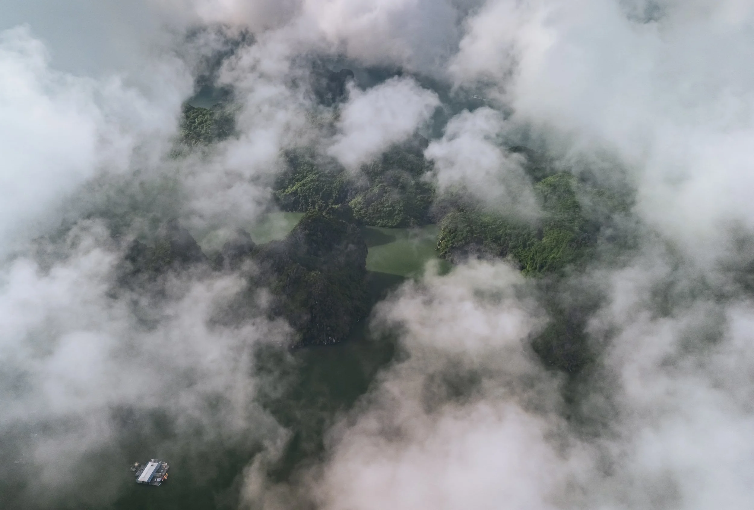
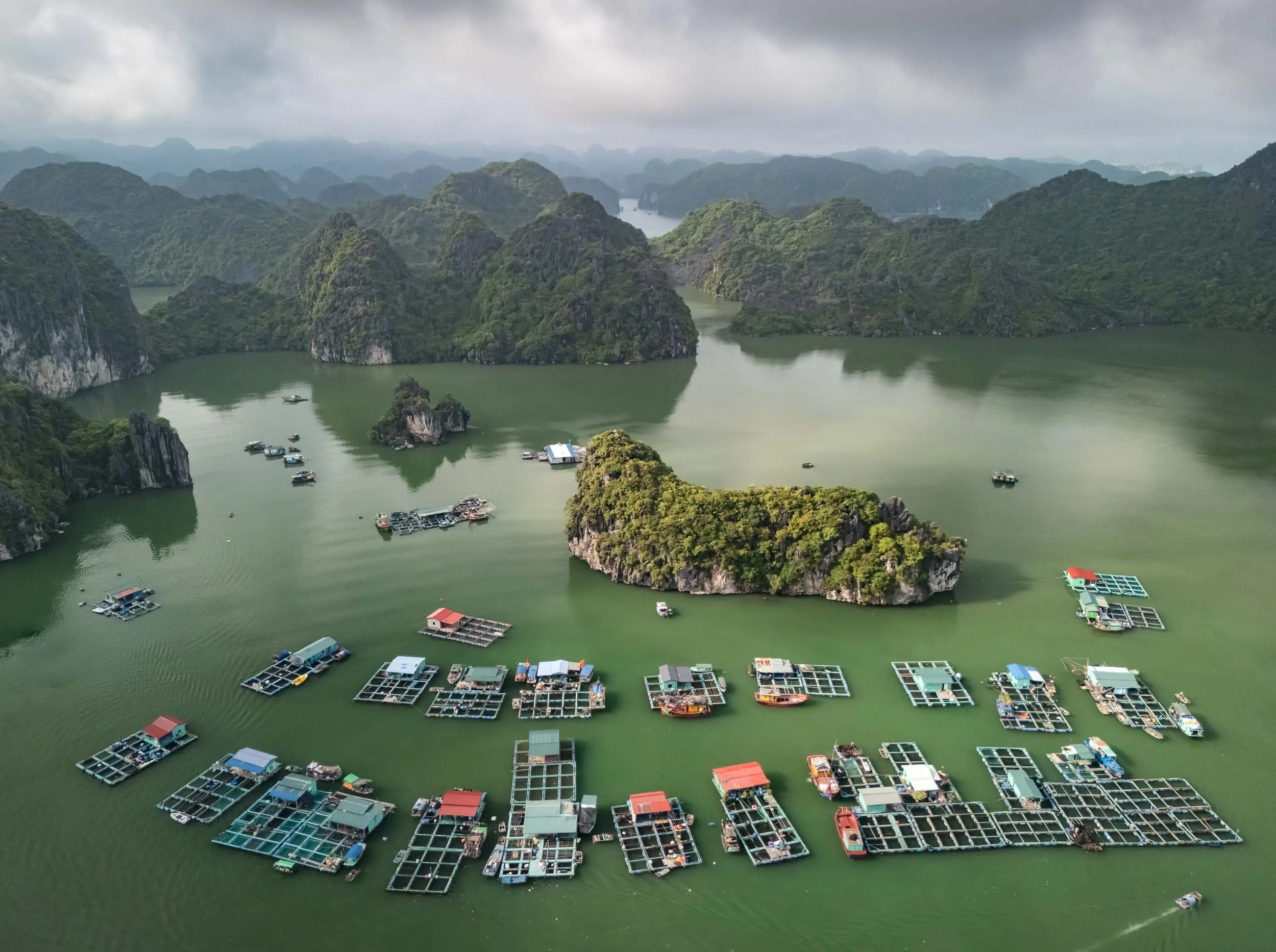
We headed out again the next morning into the very calm seas and moody clouds, creating a beautiful atmosphere among the many limestone islands dotted in the turquoise waters. The landscape is equally beautiful to Ha Long Bay, but a lot less busy - at least for now.
While most of the 300+ islands are uninhabited, you can spot the occasional lonely human soul around - they primarily work here to grow and harvest aqua-cultured oysters and other seafood.
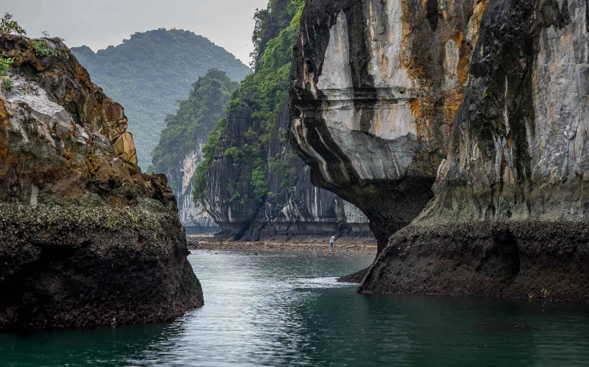
Rain had set in during the late morning hours, making their job a lot less comfortable. We picked up one of the local women - completely drenched - with our boat and dropped her at one of the floating houses.
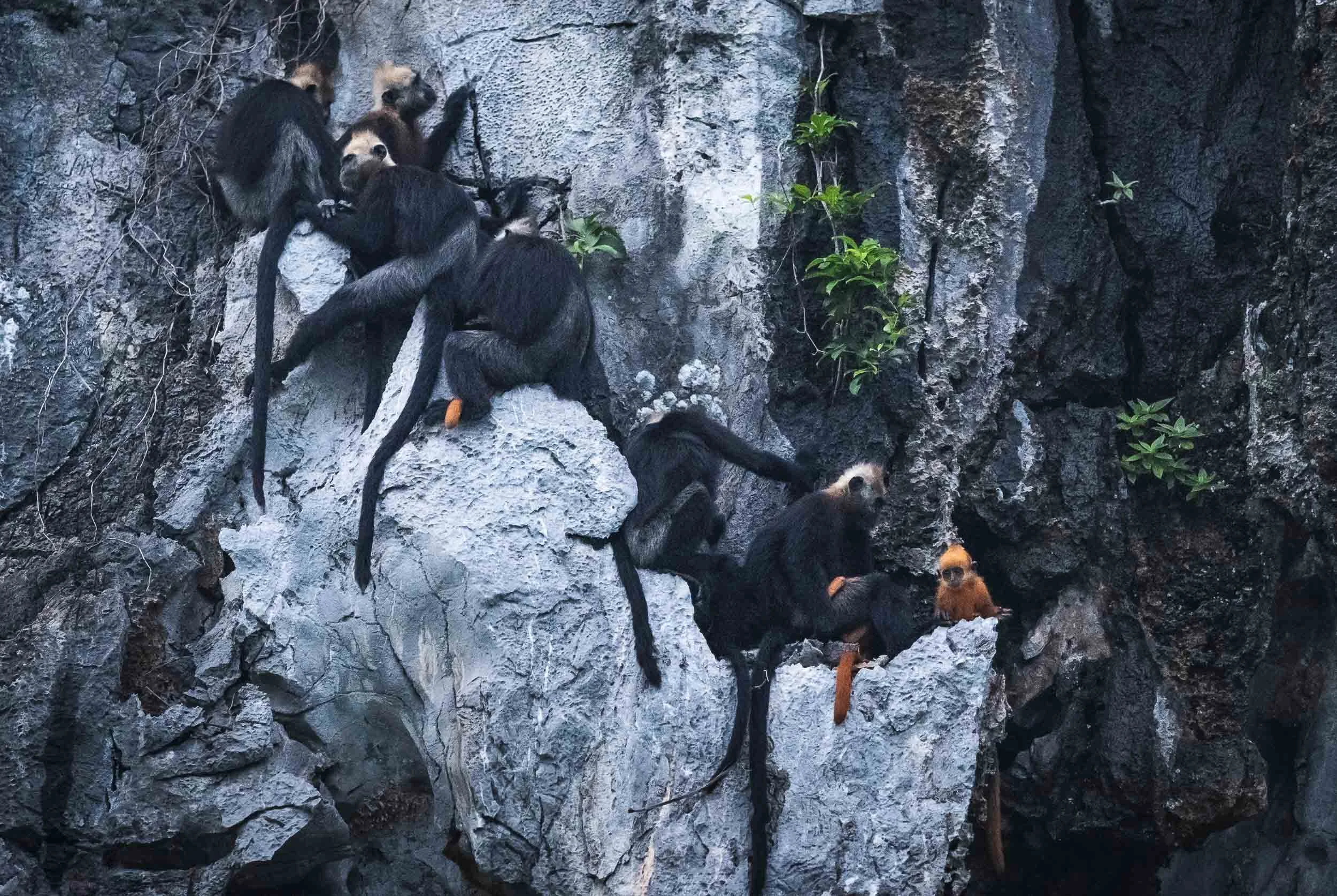
A Rarity
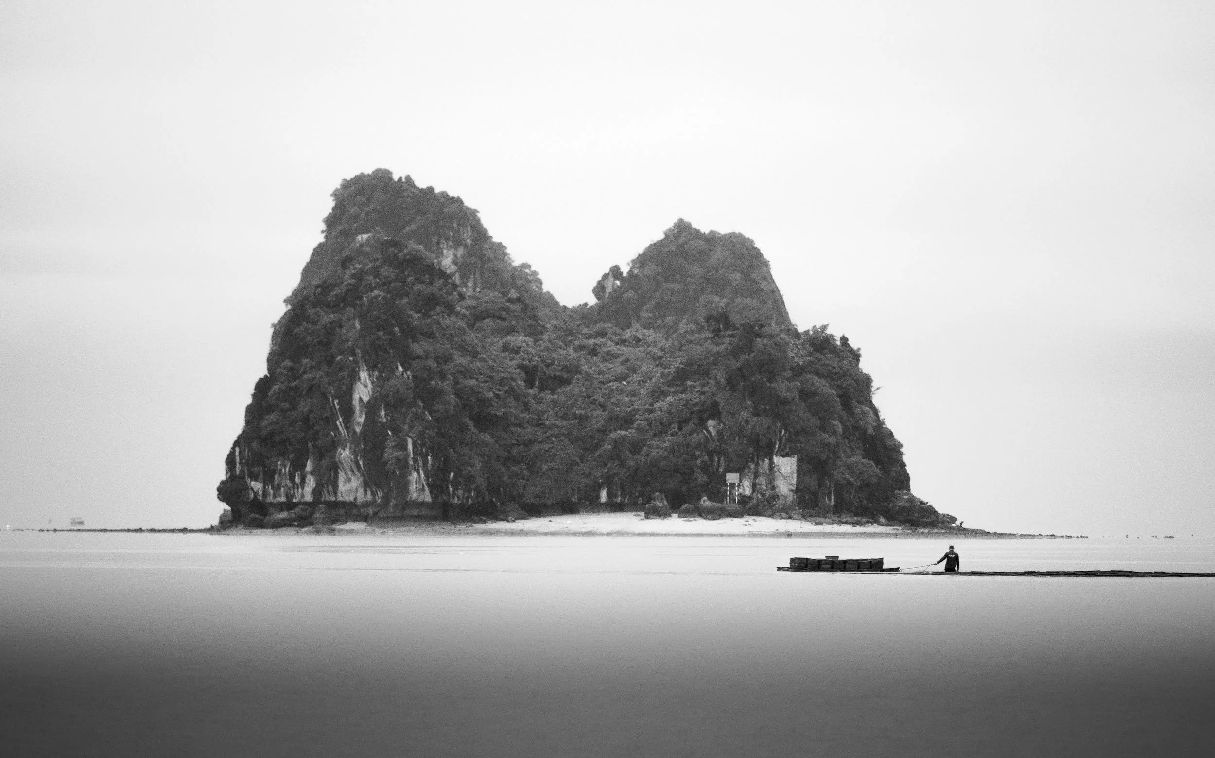
On our way back, we had a very very lucky encounter - something I had not even looked for: the Cat Ba langur, one of the most endangered primates in the world.
This is an extremely rare sight - there are less than 100 of them left, distributed over a few groups and occupying just a handful of islands. Our boat captain spotted one group high up in the limestone rocks, including a young individual with its distinctive orange colour, which probably gave them away.
These primates are critically endangered and have found ways to adapt to the unique environment here, for instance they can safely tolerate saltwater.
They are now heavily protected and part of the area is a strictly guarded national park to ensure their survival.
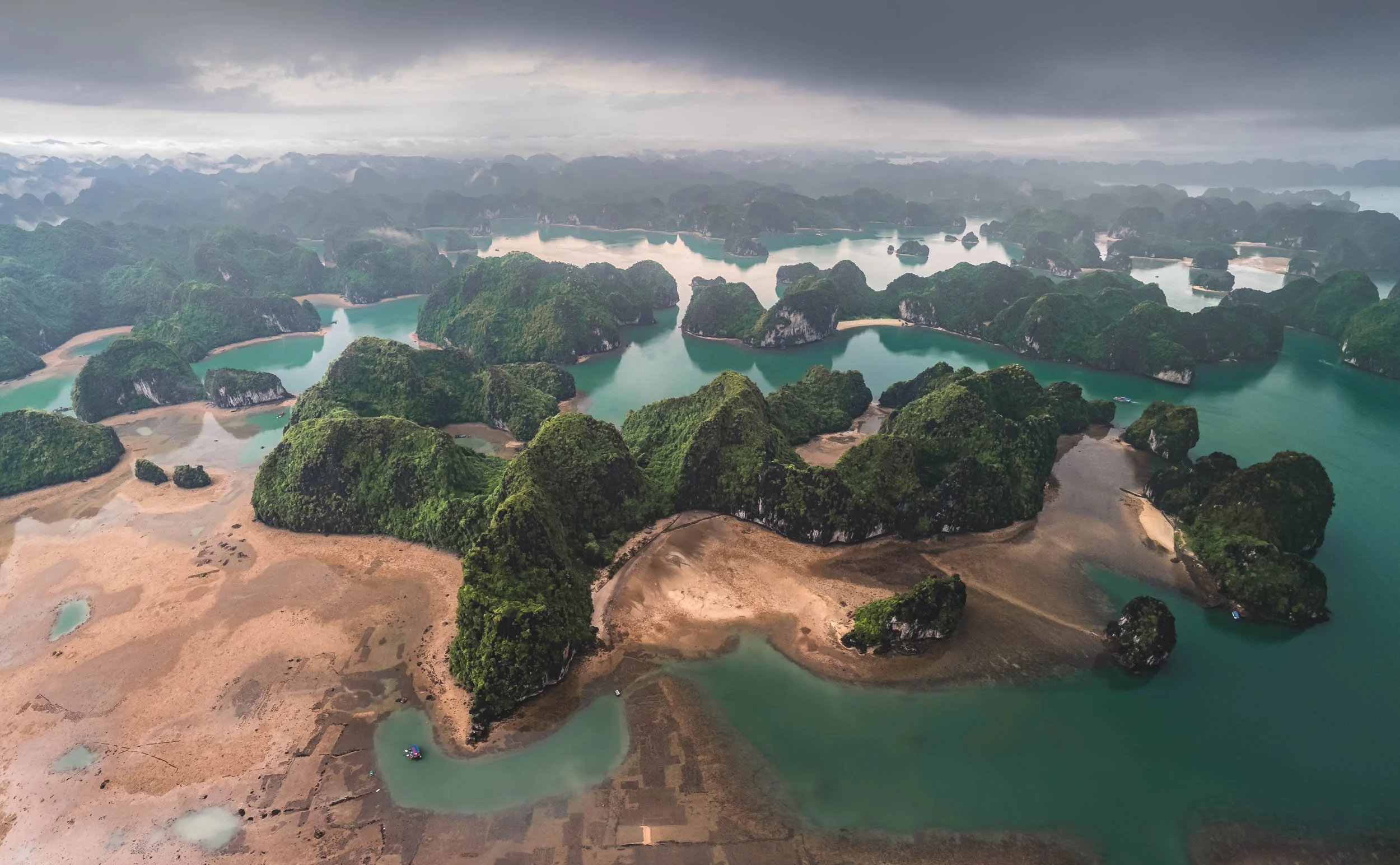
How long this will last is anyone’s guess - over the last years, more and more existing land was used to build human infrastructure, and in recent years huge reclamation projects into the sea added further pressure - just a year after I took this photo, this scene has changed completely, for example, as the bay is now filled with new land area.
And that’s it from my time in Vietnam - a country to add to your travel plan without a doubt!
Subscribe to my newsletter to get notified and don’t miss out on more Wonders of the Globe.
Other Recent Posts:


Sights of Southern Vietnam
I managed to explore quite a bit of Vietnam over almost 4 weeks in mid 2024 - here is the first blog, starting with its economic centre Hi Chi Minh city and the beautiful Mekong delta.

In late spring of 2024 I explored another Asian country, spending four weeks in Vietnam. What was initially planned to be a bit more of a slow travel trip as I had plenty of work to do, turned out to be as intense as always, and I ended up exploring Ho Chi Minh City, the Meklong Delta, Hue and Hoi An, Hanoi and some of its surroundings, and the northern mountainous regions as well as Cat Ba bay. Although I didn’t spend a lot of time in each part, all of that definitely won’t fit into a single blog post, so this will be the first of three, starting with the south: Vietnam’s economic capital, and the Meklong river delta region.
“Saigon”
Ho Chi Minh’s colloquial and historic name is Vietnam’s largest city, with over 10 million inhabitants.


Panoramic photos of the Bến Thành Market in the city centre, with its iconic clock tower and a rather rare French Indochinese design. It is one of the oldest surviving buildings in the city, having operated for more than 100 years. Great views from the nearby Silverland Ben Thanh hotel with its amazing rooftop restaurant!


Train Vibes
Although it’s Hanoi that is famous for its train street - more on that in another blog - Ho Chi Minh has its own cute corners where the tracks runs through the city quarters. I’m a fan of trains, and can’t deny that the idea of the multi-day train journey from HCMC to Hanoi or back appeals to me…
Of course, the primary means of transport here are scooters though. There are very few place in the world with a higher scooter / person ratio than HCMC, and it shows in the organized chaos on the roads, and is also evident by the noise levels. Unfortunately, most south-east Asian cities have not undergone the transition of all two-wheeled transport to electric models, which brings incredible quality of life improvements - see my trip Beijing.


Walking through the city is enjoyable - people are friendly, and there are interesting compositions for street photography all around, for example in the famous Japan town - a quiet place during the day, but it comes to life at night, so I’ve been told…The group above was enjoying their weekend around the markets at An Quang Buddhist Temple and immediately invited me for a drink and some karaoke (both not my favorite pastimes, so I just said hi for a little).


The Church of Tan Dinh
Just over 10% of the population are Christian (almost half follow traditional folk religions or are not religious), but there a number of churches to be found in HCMC. Aside from this pink gothic marvel, the Notre Dame Cathedral is another, but was closed and covered for renovation during my visit. Strangely, this one is very strict about access: only catholics allowed inside - but even that did not help me as a tourist! Exterior photos only.
Phap Hoa Pagoda
Another beautiful religious building is this buddhist temple, uniquely combining Vietnamese and Chinese architectural styles, situated on the channel running through the area north of the city centre - quite a nice place to walk around and explore. Buddhism makes up the largest of the major religions in the country.


HCMC is a growing busy place, and the infrastructure is suffering accordingly - yet I found it quite pleasant to explore (aside from the usual humidity), with lot of large trees, many smaller streets, and less imposing highways than for example Jakarta and Bangkok. Much of the city centre follows an open square or radial-concentric grid system, while the surrounding areas are somewhat less strictly organized and consist mainly of denser low and mid-rise buildings. A defining feature are city’s famous roundabouts, where the rules are difficult to understand for any foreigner.


The city is dotted with greenery, and several of its roads are tree-lined, given them an avenue-like feeling, probably in part a heritage of the French colonial times. Nowadays, they act as source of shade (it makes a difference of several degrees C in urban centers), aside from their aesthetic appeal.


Landmark 81
To the east of the city by the Sai Gon river, a new modern district has developed over the last decade, including South East Asia’s second tallest building, only surpassed by KL’s newly completed Merdeka 118: Landmark 81. I can’t say I find it architecturally appealing - its Neo Futurism reminds me a of a boxy less elegant version of Burj Khalifa.


Architectural Oddities.
Not far across the river is this rather odd building and associated establishment - its claim to fame is derived by the borrowed name and logo only though.

Although I spent a few more days here, visiting more of the city’s landmarks such as the late 19th century Saigon Central Post Office seen here, the Opera House, the Skydeck at the (architecturally more pleasing than Landmark 81) Bitexco Financial Tower, and could probably fill a whole blog entry with the corresponding photos, southern Vietnam has more to offer than Ho Chi Minh City…
To the Mekong Delta
…and so I embarked on a three day roadtrip you’ll see documented below.

The Hang Pagoda of
the Khmer People
The Khmer ethnic group arrived to the area more than 4000 years ago, and is primarily present in what is today Cambodia, but over 1 million live in the Mekong delta area of Vietnam as well.
More than a 1000 years ago the Khmer empire dominated the area for over 500 years, and was responsible for many of the famous temples of Angkor. Today they follow a variant of Buddhism, and many of their temples can be found in the Tra Vinh area, this one being around 300 years old.


Aside from its beautiful golden ornamentation, the Hang temple is also famous for its wood sculpture and clay workshop, where skillful monks build out the intricate statues and decorations for the temple by hand.


Interior Vibes
The inside is normally not accessible, but we got lucky and a monk opened the doors for us - and even turned on the somewhat incongruous LED light around the central Buddha altar for added effect (complete with strobes and changing colours).
A Day At Sea
After a quick stop at the temple and another stop to get some of Vietnam’s famous coffee (which is essentially stretched with condensed milk, making it so sweet even I drink it), we arrived to our first primary destination, the shores of the Eastern Vietnamese Sea, where the Bassac (or Hau) river, a branch of the Mekong, meets the ocean. The goal? To spend a day at sea with a group of local fishermen, witnessing one of the primary ways of live shaping their culture, alongside the cultivation of rice.


Unlike many tours on the rivers here (and many other photography-specific arrangements, more on that below), this day was not set up to please tourists, but we were simply following their routine of going out to sea and collect the catch of the day, getting a real feel for what their job is like. The crew was really accommodating and gave us the chance to document their techniques, despite the hardship of the work.


After cruising for about an hour away from the shore on the boat, we reached their destination, a set of wooden pillars in the sea, connected by thin planks, with an occasional tiny hut in between. These are not traditional floating houses you might find on the river banks or near the shore: they are meant to be temporary accommodations, where the fishermen take turns to live for a few days or even weeks, tending to the nets that are attached to the poles with ropes in a kind of semi-permanent fish trap.

Waiting Game
We did arrive a little earlier than they normally do, giving us the chance to take some daylight and sunset photos while the fishermen rested. They typically haul in their catch a few hours after sunset, to take advantage of the natural behavior of fish and maximize the effectiveness of the nets - plus, it means the fish are as fresh as possible for the early morning market.
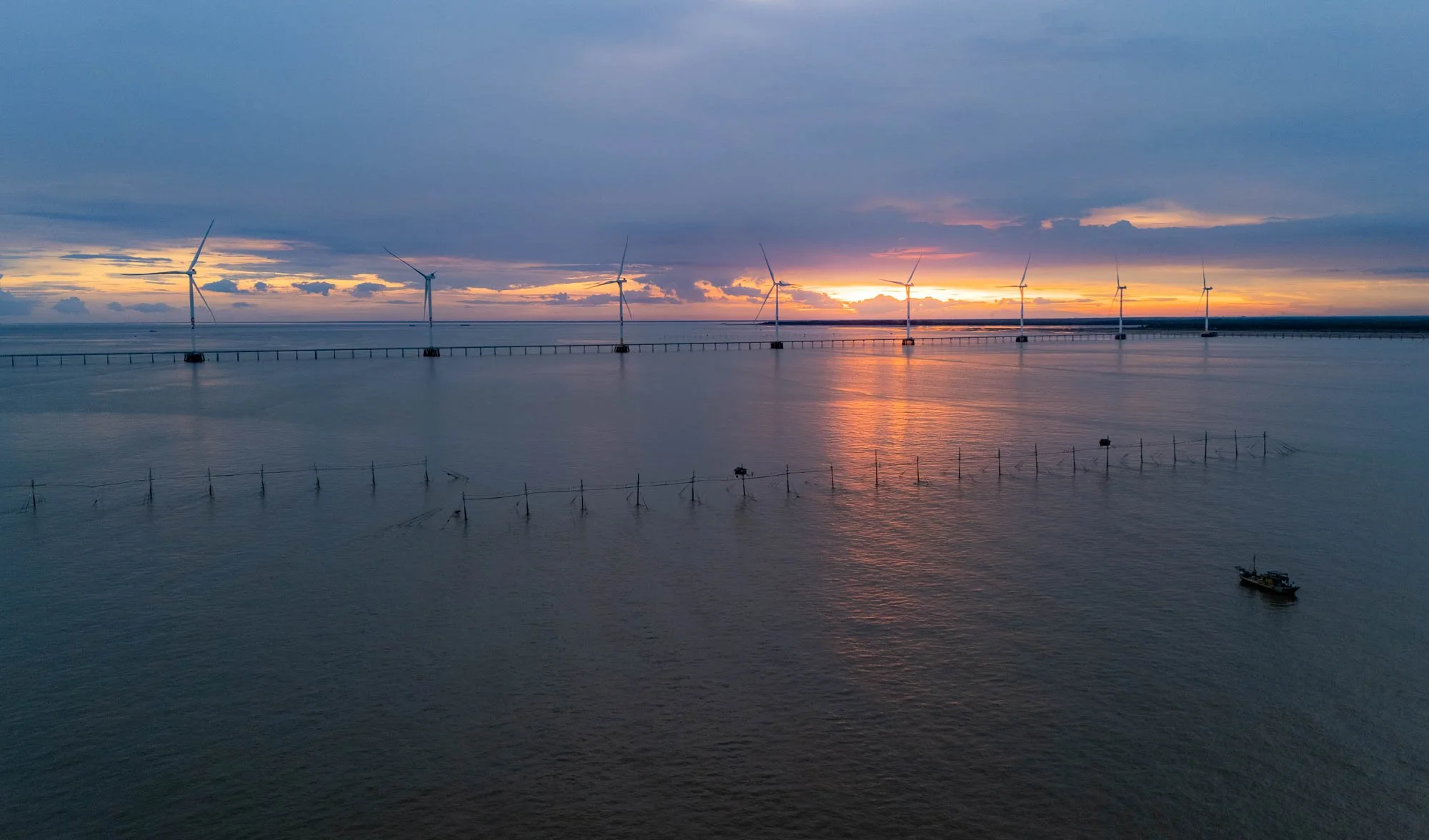
The Fishing Watchtowers
In this area, the traditional stilted huts stand in contrast to the huge concrete wind towers that part of the renewable energy farms built here over the last decades, taking advantage of the strong winds in this corner of the Vietnamese coastlines. As the sun set, the fisherman living in the hut came out, walking along the thin planks between the poles and preparing their nets to be lifted.


I sent my drone up during a few minutes of beautiful light - luckily the sea and winds were calm. Flying from a boat over the ocean is not always easy, read more about it on my recent drone photography book (German only, sorry!).
At this point, it was slowly time to let the crew focus on their job, and our ship moved closer, while the fishermen currently living in the little huts started to prepare the nets, dragging them out of the water.

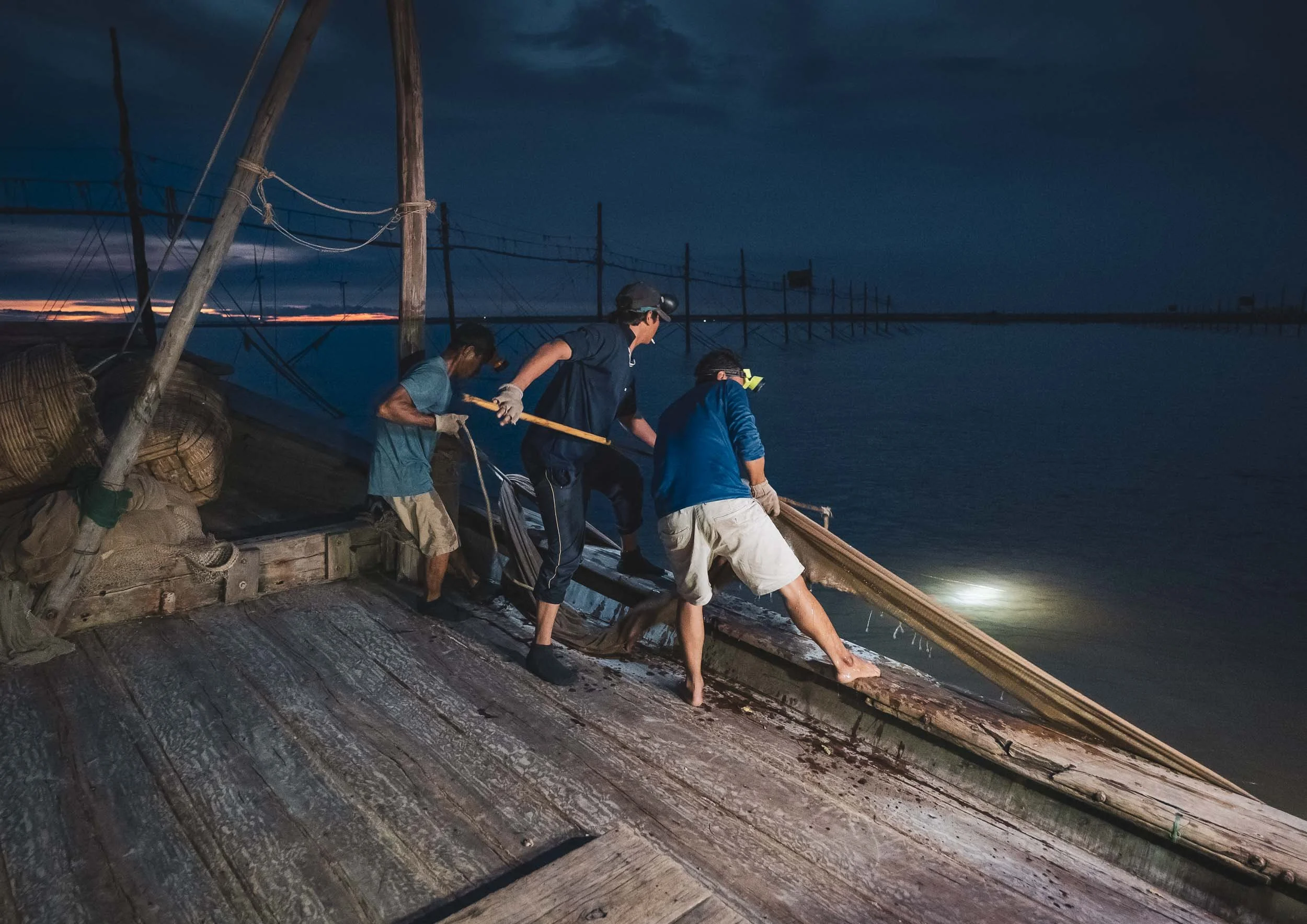
Pulling the Nets in
The crew then took the nets by the edges attached to the buoys and pulled them into the boat - the harder the task, the better, because that means they’re full of fish.

Nightly Work
For the fishermen on the stilts, conditions to stay out here are tough. No running water or permanent electricity, rough weather conditions, isolation, and of course the actual work, make this a difficult job.
Once the net was pulled into the boat, wooden baskets were prepared to empty the contents into - hopefully without letting too much of the catch escape, although one or the other creature managed to find a way.


Emptying the nets into the baskets required the full strength of three crew members - more than a dozen times they repeated this process.


Afterwards the nets are lifted back to the fisherman staying on the wooden stilts, spread out, and prepared for the next catch. A few more supplies were exchanged with the poor soul left behind to manage and monitor the nets, while the crew makes its way back to shore with their catch (reasonably successful, so I was told).


After almost 10h at sea we were back on land, headed to a small hotel for a few hours of sleep before sunrise, exploring more of the interesting ways of life in the Mekong Delta.
Sedge Grass Patterns
My next destination was on land tough. The Khmer people are also known for planting sedge grass in this area of the delta, which is used to make baskets or mattresses and similar handicraft items. The wetlands of the delta are a fertile ground for this plant to grow up to 2m in length. After a short exploration, we found a beautiful field with some local workers - as the grass is laid out to dry, the harvest season brings with it beautiful patterns when viewed from above.


I had the chance to get a little closer as well and observe the locals in their work - they set up small sheet tents or use the traditional hat to protect themselves from the sun, and run the grass through a little roller machine as a first pass at removing the water, before spreading it on the ground to dry.


Staying Safe
Gloves are essential to avoid scratches as they grab the grass and pull it through the machine - I experienced that first hand when I tried the process.
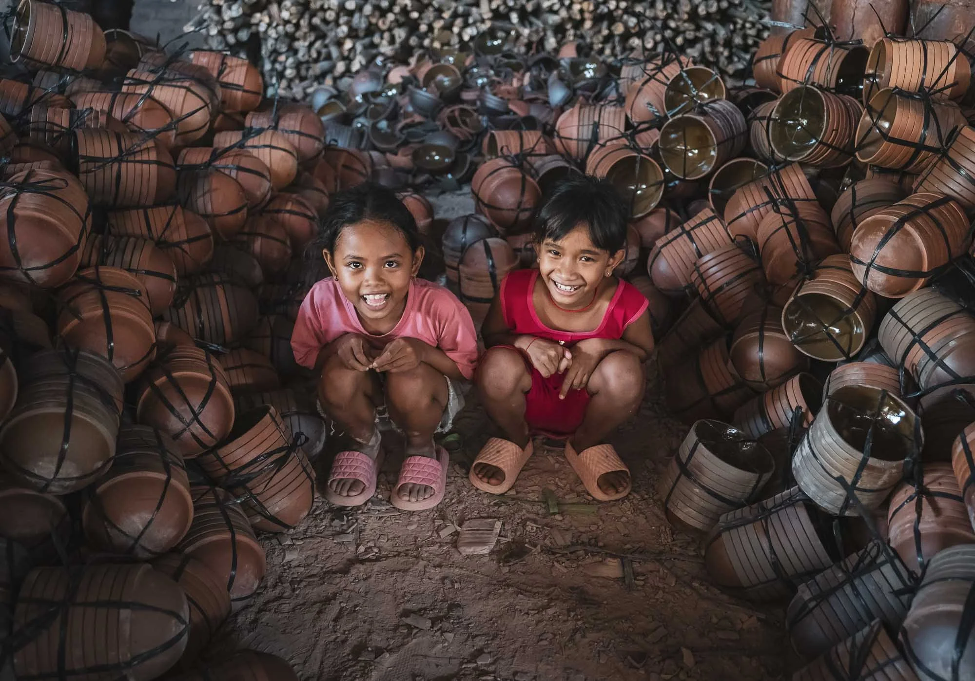
Pottery Patterns
From here, I visited a local pottery factory - another place for interesting photographic opportunities. The process starts with the production of the clay from the Mekong river, filtered and kneaded to make it moldable.


The clay is then moulded by hand using a potter’s wheel, and turned into vases, pots, or decorative items by these skilled ladies getting paid per piece. Sometimes items for mass production are also shaped via mold casting, but in this factory it was all made by hand.


From Above
The resulting pieces are first air-dried on the large factory floor for several days, getting their final polish with sandpaper.
When I told the lady I’d like to fly a drone over her head for this photo, she was clearly very amused but happily obliged.


After that, the products are hardened in these massive brick kilns, often for several days, until they are fully dried out.


The factories utilize mounds of rice husks to fire the oven - a byproduct of the rice milling that happens in the region and perfect to provide slow, consistent heating, that is ideal for drying the clay. Huge amounts are stored here - my guide for scale.


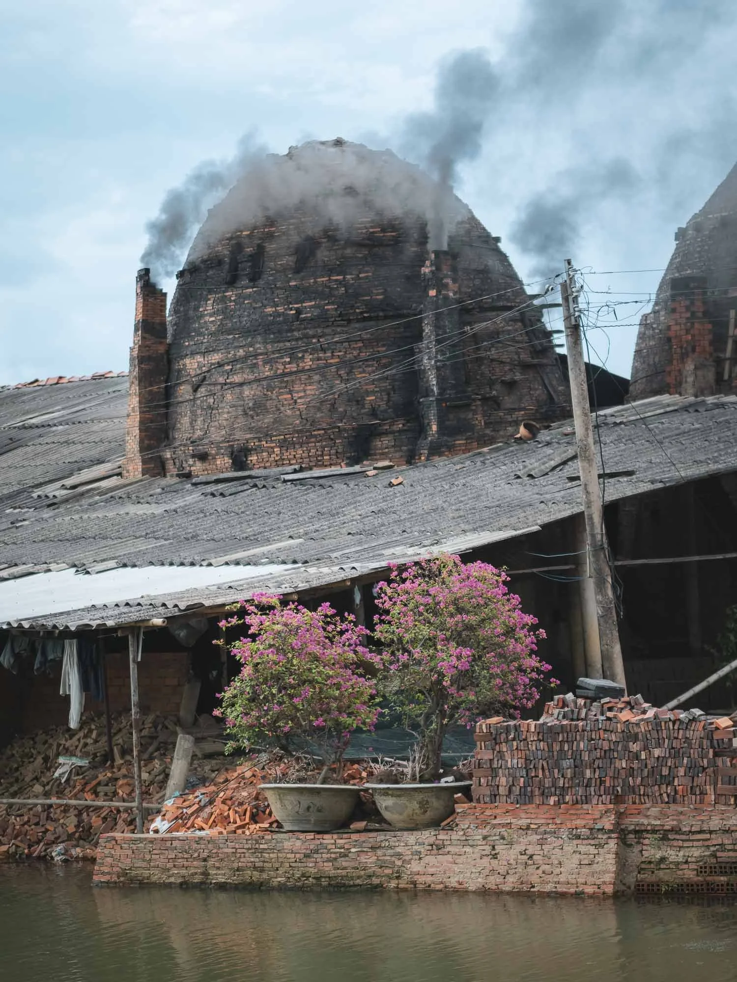
The Red Brick Kingdom
Following the path of the local clay industry, we made our way to Mang Thit village in Vinh Long, long known for its brick factories stretching along the channels for kilometers, seen here in this panoramic view as heavy clouds rolled in during the late afternoon.

Quiet Times
The area has been thriving for over a hundred years, supported by the availability of cheap fuel for the kilns, and plenty of clay in the nearby streams, which then also serve as transport route for the finished products - primarily bricks. Nowadays, only a few of the factories are still active, and many have been standing still for years, or just attract tourists.
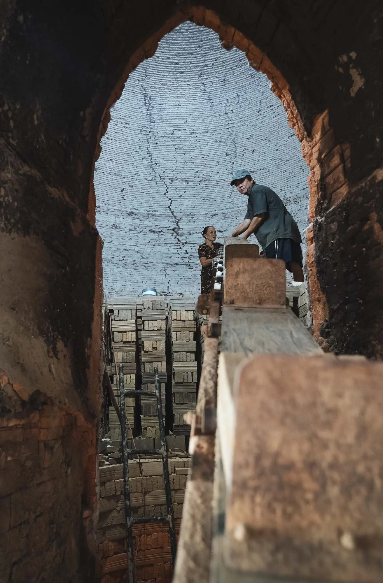
It’s not difficult to find the working factories though - dark smoke emitting from the small chimneys is the giveaway, and the workers are very welcoming and happy for you to come in for a chat and take photos - an opportunity I did not miss.

I got to observe their process, separating the clay, shaping the bricks using simple tools, and using conveyers, carts, or even small bikes to move them through the factory before they’re placed in the kilns for several weeks.


One of the active factories from above, and another one with some of the boats used to transport clay and bricks along the channel.


It’s of course sad to see that these traditional methods are slowly replaced by industrial production - the area is definitely a cultural landmark for the region with its unique architectural charm, not to forget the kittens I saw.

Nightly Storms
After we left, the stormy clouds decided to slowly empty their contents, but not before a few beautiful lighting strikes, captured here from the parking lot of our dinner spot.

Water Lilies
The rains didn’t last long and by the next morning the sunrise greeted us with beautiful light to photograph another local tradition: the collection of water lilies, typically happening during the floating season from September to November.
Disclaimer: I am normally not a fan of “arranged” photography, but as the time of my visit didn’t coincide with the right period to see this practice, and my guide happened to know the women who normally harvest the lilies, it was an easy decision to go for it anyway. As a result, these photos are the result of purposeful posing and arrangement of the flowers, rather than the natural harvesting practice.


The lilies are collected for their stems, which are used in various dishes, while the flowers are turned into Buddhist offerings. Aside from their use for humans, the lilies actually play an important role in the ecosystem, as they absorb excess nutrients and provide habitat for fish and insects.

Into the Water
While the drone views of these neat flower circles have been taken before, I tried to also get a few different perspectives and got into the water for some portraits - a welcome refresher as temperatures rose, but on the other hand my feet needed a real deep clean after wading through the muddy ground.
Although this scene has been excessively romanticized, mostly during organized photo tours and the resulting social media coverage, it does hold some understandable appeal: the flowers are beautiful and the ladies with their conical hats and small wooden boats make for nice subjects.


A Final Pottery Stop
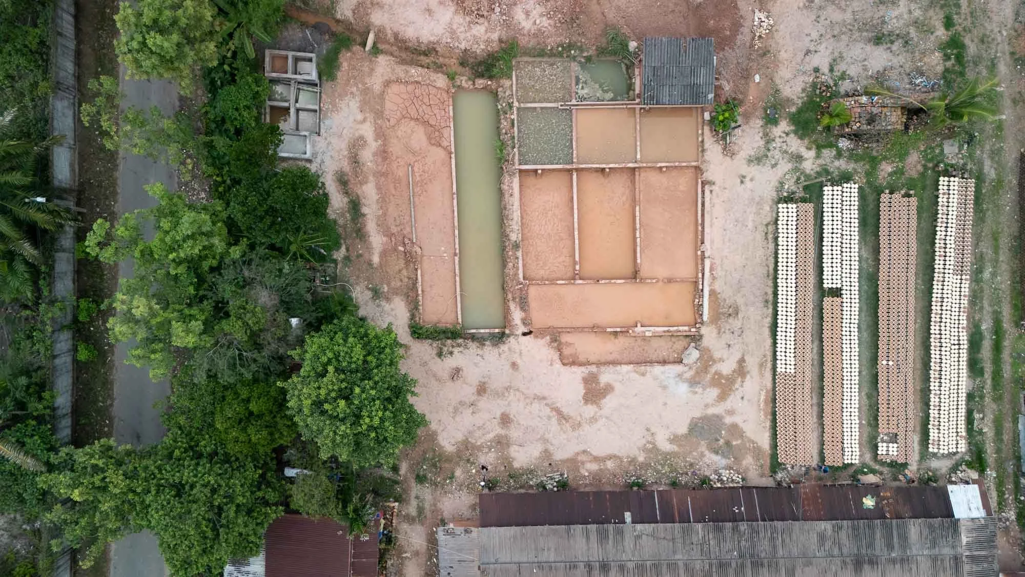
We made our way back for the 6h drive to Ho Chi Minh City, with one last brief stop - another pottery factory, closer to the outskirts of the city.

This one has a rather interesting feature, which are dedicated shallow ponds to remove the clay from the soil in the ground and process it, seen here from above, with a long row of bowls laid out next to them to dry in the sun.

Breakage happens even to the best of them, as evident below, but that doesn’t take away the smile of the local workers here.


That’s it from the south of Vietnam - subscribe to get notified for the central and northern parts!
Subscribe to my newsletter to get notified and don’t miss out on more Wonders of the Globe.
Other Recent Posts:

Tales of the Atacama Desert
Famous for its dry landscapes and amazing geological formation, this place is also a great spot to observe the night sky.

Chile was the first country I visited in South America, and I explored the capital Santiago, the remote Rapa Nui island, the landscapes of Patagonia (those blogs are saved for another day), and the stunning Atacama desert located in the northern part of the endless latitudinal expanse of the country. This blog covers the latter, so read on to see what the driest nonpolar desert in the world has in store.
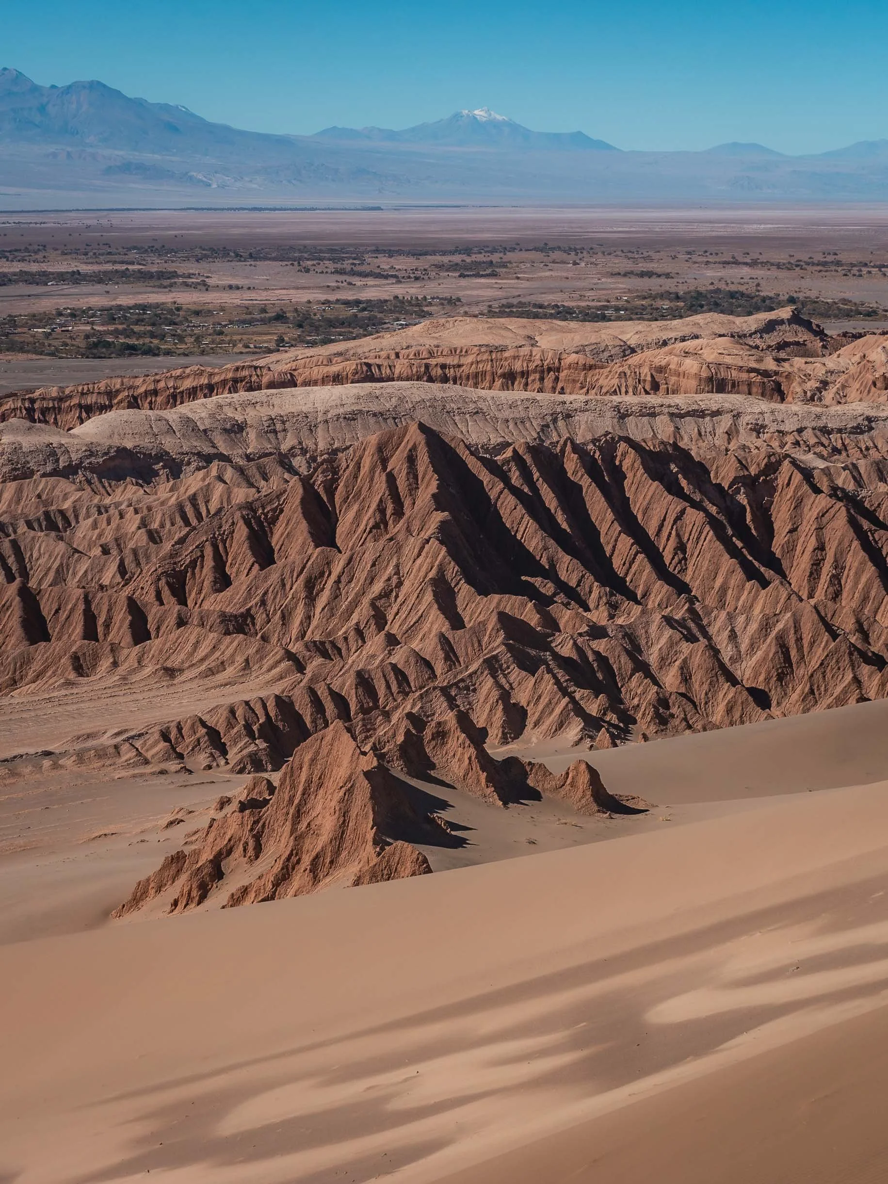
Although the borders of the Atacama Desert aren’t unambiguously defined, it's save to say that it stretches over at least 1600km along the western coastline of Chile. That makes visiting all of it essentially impossible in a single trip, so I started with the common destination of San Pedro de Atacama, somewhat in the centre of much of it.


It’s a small town that today is the base for many tourists, but has been occupied for over 500 years at an oasis in the Puna de Atacama plateau around 2500m above sea level. The first people occupied this area as early as 10,000 BC.


Many of the mud brick walls here are remnants of the past, built with the local adobe earthy construction material, and can still be found all around the city, separating the individual plots of land and roads. The walls of the church above for instance date back to 1744, from the Spanish colonial period.


Into the Moon Valley
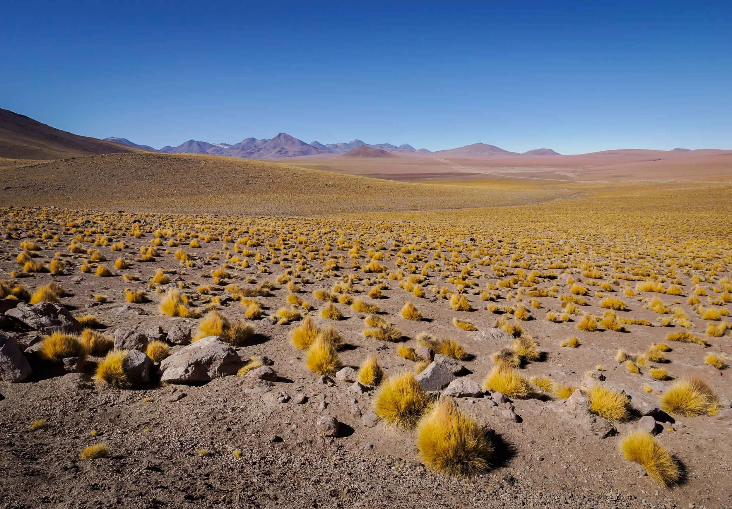
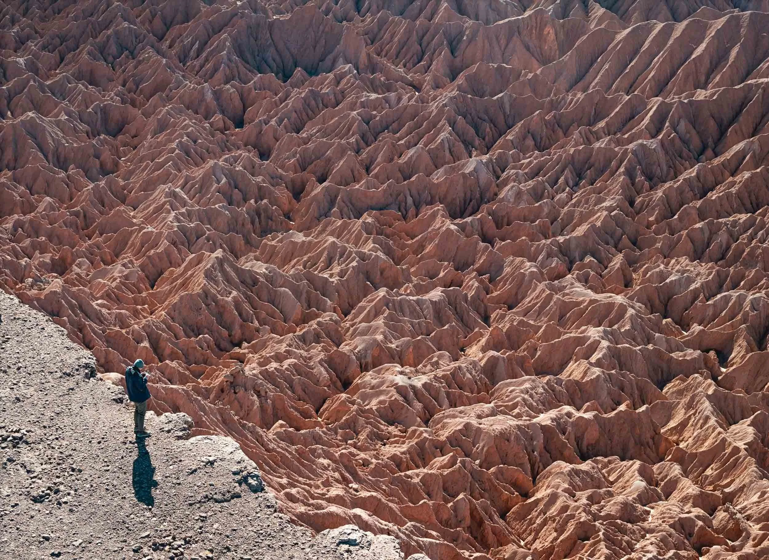
Despite the quaint beauty of the town, it’s the landscape that attracts most people to the Atacama region. One such landscape is the so-called Valle de la Luna, an area of interesting stone and sand structures with colorful patterns, and dry, salty, rock formations.


Fun fact: from what can be read online, a prototype for the ESA Mars rover was tested somewhere in this area. Easy to see why.

One of the many beautiful rock formations, but beware of the winds - we were close to being blown off this ledge a few times. Generally, it is said that summer (southern hemisphere) is the windier time, but we did get a couple of days of heavy gusts with some dust in the air. On the other hand, the temperature is more pleasant (albeit a little cold at night) and there are a lot less people around.

The Magic Bus 🚌 🪄
One of the man-made attractions in this area is this abandoned graffiti-decorated bus, that is said to have been left here when mining operations were abandoned decades ago.


We had it the entire evening to ourselves, as most of the excursions that make it to this area leave by late afternoon. The story goes the bus was a commuter vehicle for the workers, but I still can’t shake the feeling that it was left here for tourists 😄. I was assured by my awesome guide, friend, and fellow photographer Mauro (check him out if you want to visit Atacama!) it was not - which makes it all the more interesting.
Either way it makes for a very special kind of setting, and was going to be the spot to wait for darkness on the first day…


… so that we could get the Milky Way rising above it. The dark skies with no light pollution at a high elevation with almost no humidity make this part of the world one of the best stargazing regions on earth - it’s not a surprise some of the most important telescopes for scientific research, such as ALMA, have been set up here.


The area also has a few interesting eroded rock formations that provide more astrophotography opportunities.

We did not have a lot of time to enjoy the darkness though, as the moon rose shortly after. Unfortunately I could not time my trip differently, but moonlit landscapes have their own appeal. Can you spot my shadow?

Valle del Arcoiris 🌈
The other reason to not stay too long was that we had an early morning planned elsewhere - more specifically, the rainbow valley, where the moon was now setting…

This region is somewhat similar to the moon valley, but some parts of it feature different minerals causing incredibly colorful variations in the rock formations - see the layers below, with a close up on the right.


Living in the Shadows
People are often dismissive of barren landscapes and deserts, complaining about the lack of greenery - but this kind of scenery is equally beautiful to me.

Standing Out
It generally does not get very busy here, and our early morning arrival meant very few people around. Nevertheless, sometimes having one or the other person in the frame (not usually my speciality) can add a sense of scale to the landscapes: spot the couple in this photo!


The end of this small path leads to a canyon, with a few beautiful spots featuring deep red and purple rock colors.

Nature’s Shapes
The wind, sand, and occasional water (yes, even in the driest areas in the world flash floods happen) have done their job here and created beautiful rock formations all around.

Petroglyphs of Yerbas Buenas
Just outside the mars valley is this rather inconspicuous rock formation, which is filled with beautifully preserved Pre-Hispanic rock carvings.


The petroglyphs were created by the Atacameno people and are said to date back approximately 10,000 years. Many of them show llamas / alpacas (the domesticated versions of the vicuñas and guanacos you can find here - although the difference remains a little elusive to me), but of course I couldn’t help but focusing on the cat. An oddity is the presence of monkeys in some carvings, which never actually lived in this area.

As you make your way through the endless landscapes you can’t help notice the shrines to the side of the road, sometimes simple, sometimes quite elaborate. It’s easy to see that traffic deaths can be common here: large trucks, buses, vast distances, monotonous landscapes, straight two-lane roads with lots of overtaking are all part of the daily driving routine.

Cañon de Guatín
After a small rest break we were on our way to another different kind of landscape - the cactus canyon of Guatin.
Within a few hours drive around San Pedro de Atacama, the region offers very diverse types of geology and flora - the definition of “desert” is really much broader than what one’s imagination would prescribe.

The area stretches for a few kilometers on the slopes left and right of a small river, the Rio Puritama, which gradually cut its path into the rock for thousands of years.
As the sun sets, one side of the canyon remains illuminated and the light slowly fades away over the tall cacti, some of which are up to 100 years old and reach 7 meters in height.


Once again, we waited for the sun to set and the stars to shine to capture the different cactus species with the Milky Way rising.


Nightly Waterfall
A small waterfall in the canyon where nature strategically placed a cactus made for this nice composition.

Southern Trails
I had also set up another camera to capture some star trails with one of the cacti on the other side of the canyon, but we had another early start planned for the next morning, so 2 hours of trails is all I got for this image - the early start was worth it though…
Geysers Del Tatio
…because we went to the geysers of Tatio, around 2h drive to an elevation of almost 4500 metres, heading north and close to the Bolivian border. And of course wanted to be there for sunrise.

A short stop on the way at the Atacamenian village of Machuca, with less than 50 inhabitants and a small church that was established in the early 18th century overlooking the houses.

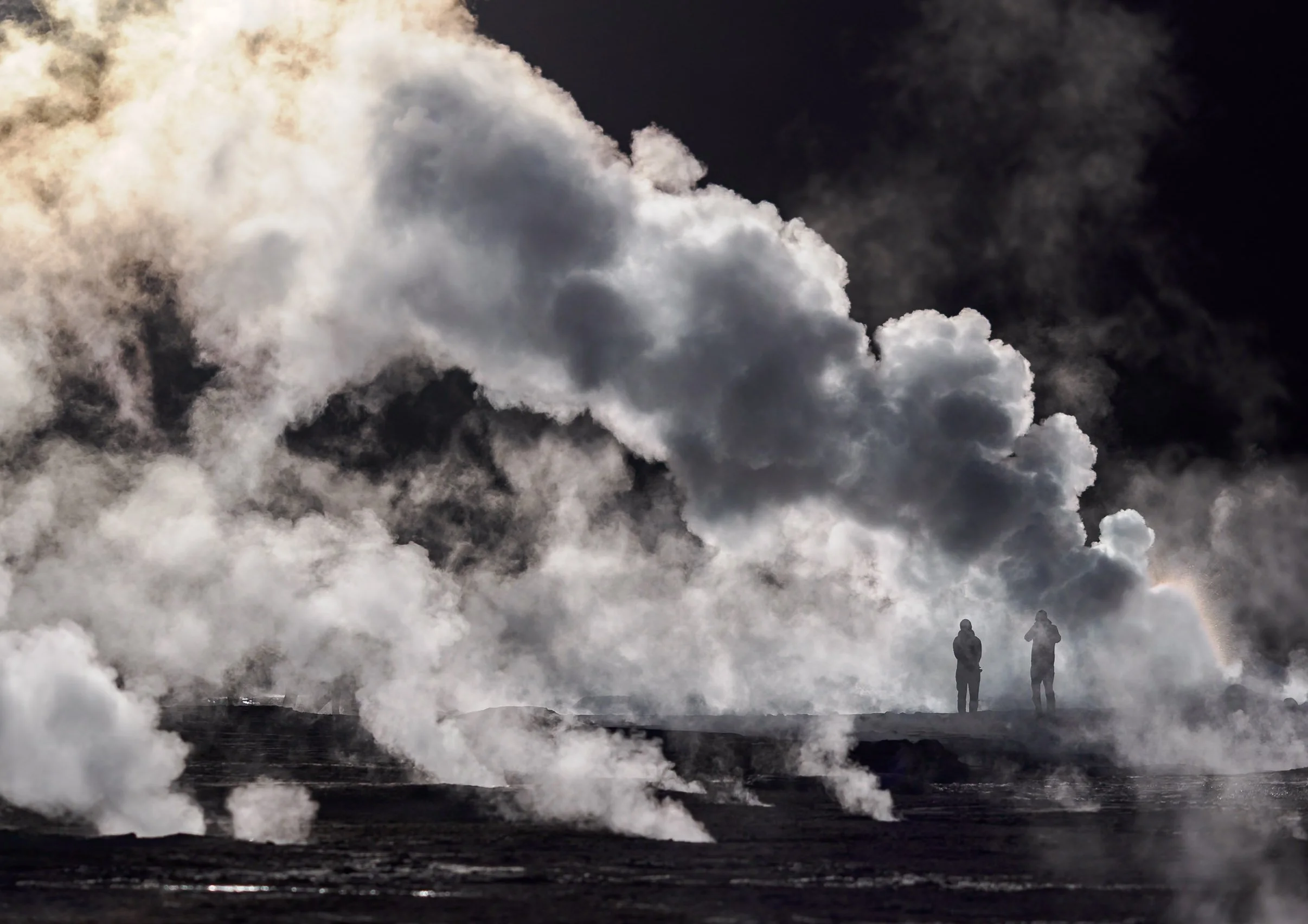
Smoky Fields
Shortly after, we started to see the rising puffs of smoke in the distance: The largest geyser field in the Southern Hemisphere, and the highest altitude field in the world. Spot the humans in the mist…


Extraterrestrial
El Tatio has been studied as an analogue for early Earth, and past life on Mars, owing to its extreme conditions where only the most robust of microorganisms could survive. Humans have been exploring the area for centuries - the old Inca trail from San Pedro de Atacama to Siloli crossed the geyser field.


The geothermal area covers around 30 square kilometres and is filled with hot springs and steaming vents - although only a smaller section is easily accessible by car or on foot.

Spectrum
Organic compounds and bacteria colour the sinter on the ground with orange-brown and greenish hues.


A vent and geyser cone - most of them only reach less than a meter in height, but occasionally fountains can grow to more than 10 meters.

Relics
Over most of the 1900s the site was considered for geothermal energy generation, but attempts were abandoned in the early 2000s over political and ecological controversy.
Landscapes
The region is part of a large volcanic complex with dozens of stratovolcanoes, many of which are still active, and some reach over 5000m in height.
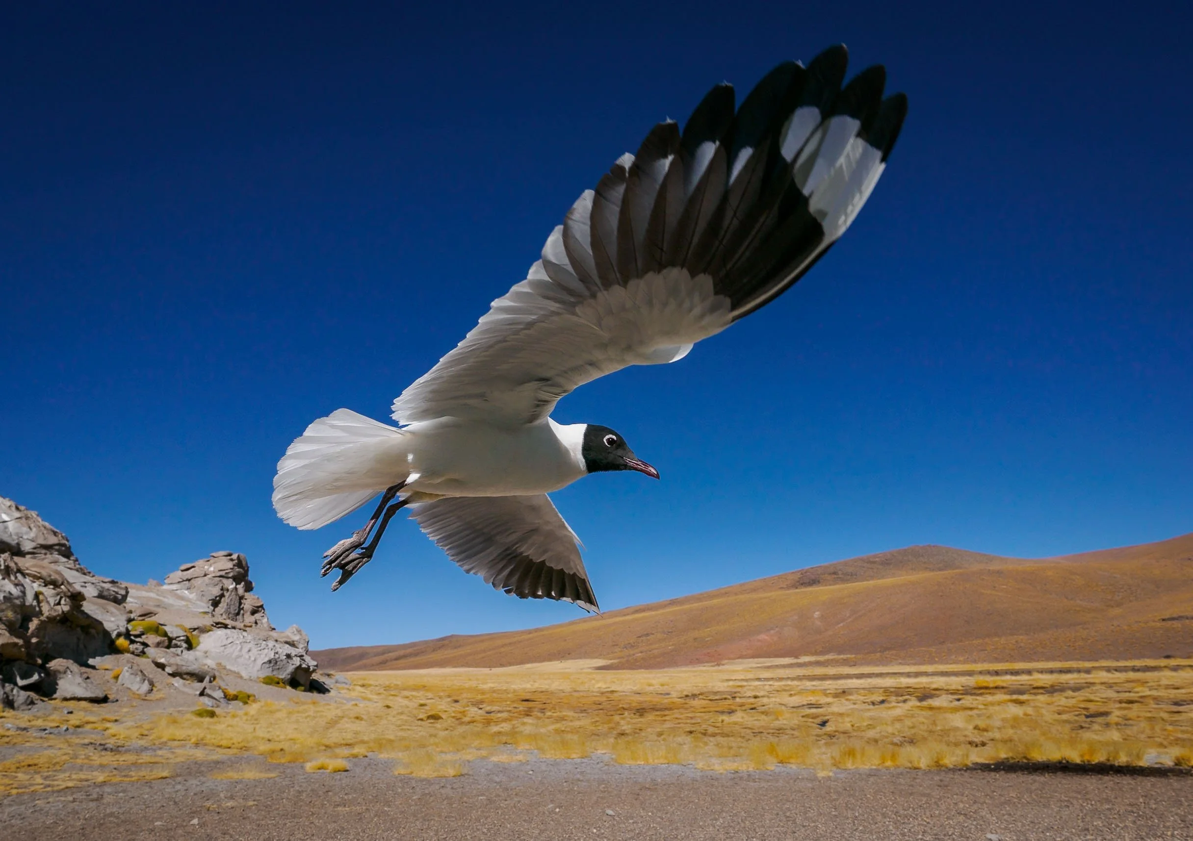
Despite the barren appearance and altitude, many vicuñas call this area home, and even puma can be spotted here occasionally. The Andean gull on the right has gotten used to tourists and came a little close during lunch break, making for a rather unique bird-in-flight photo.

The way back took us past the small lagoon of the Rio Putana, full of birdlife and with an abandoned mining operation just beside. Further down, a few spots offer beautiful views into the salt fields and the snowcapped Andean mountains.


Salar de Atacama 🦩
Our afternoon destination was one of several salt flats that are part of the Los Flamencos National Reserve.

The Chaxa lagoon is a beautiful landscape, with its main attraction being the large flocks of flamingos - depending on the season - enjoying the food in the shallow salty ponds, with the surrounding volcanoes casting their reflections in the water.


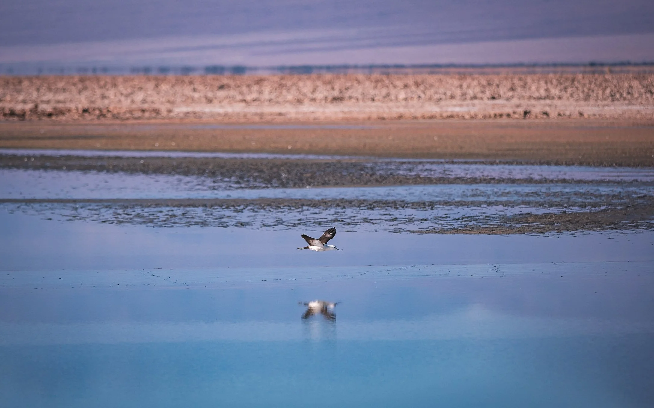
This ecosystem is home to rich birdlife, such as sandpipers or the Andean Avocet with its bent bill, but there are also mammals such as foxes and different types of rodents to be found here (not by me though…).


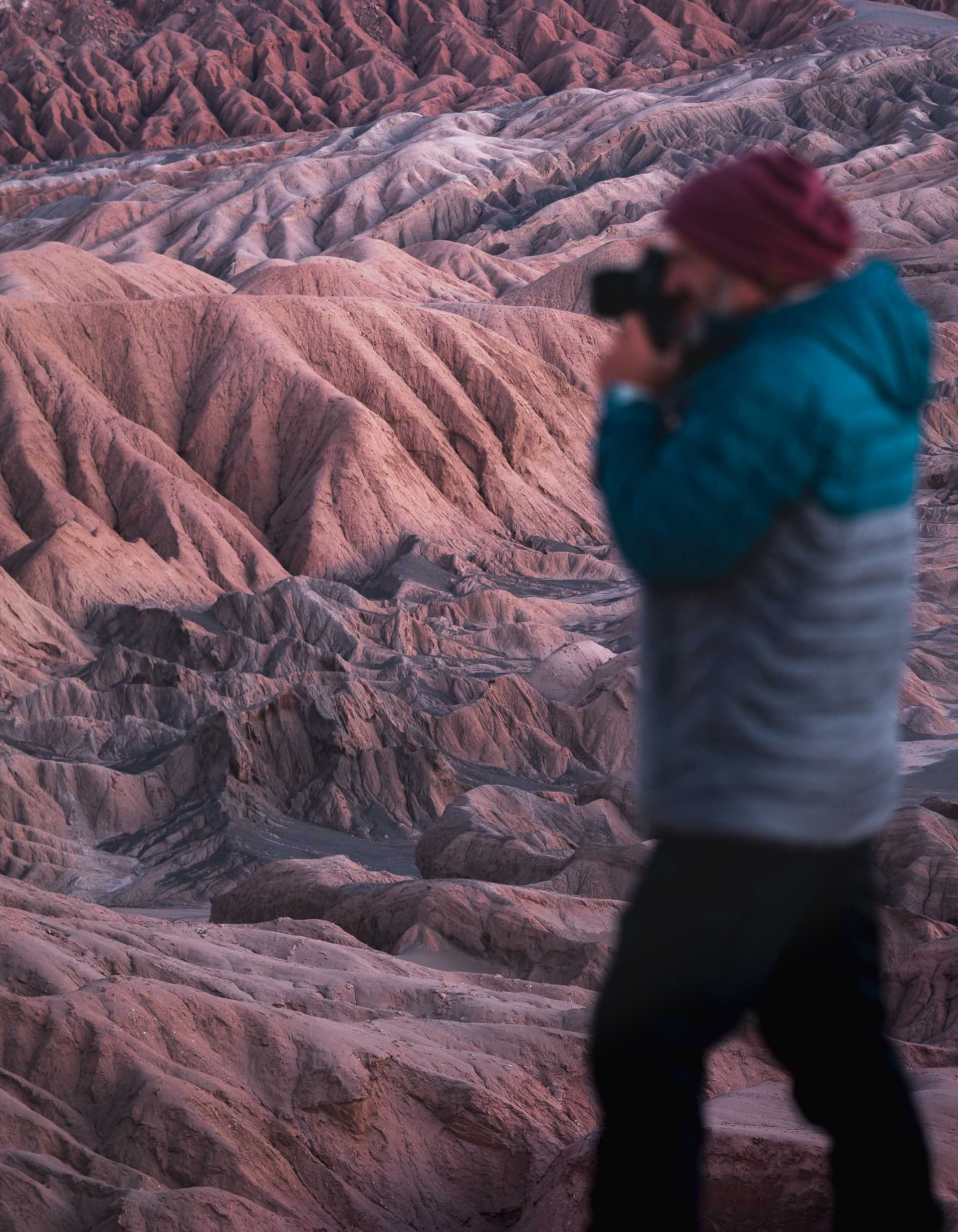
The Mars Valley
My last morning was spent at probably my favorite spot of the trip, the so-called Mars Valley, or Cornices. Some off-roading not too far from San Pedro leads to an elevated platform along the deep canyon ridges, with beautiful patterns and earthy tones. Take a look at the drone video below…
Orange and red hues start to glow over the landscape before sunrise.

First sun rays hitting the distant rock formations. The Atacama desert may be the oldest desert on earth, and has remained extremely arid for 150 million years.


Breakfast Spot
Not many better places for a nice start to the day.
The erosion has created some interesting patterns of jagged rocks in the valley along the steep canyon ridge - the upper left image below is a top down view.


Beautiful layers all around. This is one of the few places of this area of the Atacama desert with sand dunes.


Panoramic aerial view on our way back. We didn’t encounter a single soul the entire morning.

A final look at the large wind farms around Calama, the main city in the northern area and home to some of the largest mining operations here, before I left the Atacama desert.
It feels like I barely scratched the surface of what can be explored here - and that’s because it’s true, there is a lot more to see in the region. I might need to come back… but for now I first have two more blogs from Chile in the backlog.
Subscribe to my newsletter to get notified and don’t miss out on more Wonders of the Globe.
Other Recent Posts:

Tigers & The Pink City
Completing the golden triangle of northern India with this post covering Ranthambore National Park and Jaipur.

It’s my last (for now) blog post from India after my quest for snow leopards in Ladakh and now completing the infamous “Golden Triangle” journey in the north of the country: Delhi and its many architectural highlights, Agra with the incredible Taj Mahal, and finally Jaipur, the so-called Pink City, which I combined with a visit to Ranthambore National Park and the Chand Baori stepwell.
Ranthambore
Heading south-west from Agra, it’s just a few hours drive to one of India’s most famous national parks. Its claim to fame? The large population of Bengal Tigers, with around 80 of the vulnerable cats hidden somewhere behind one of the entrance gates into the various sections of the jungle landscape.
Having said that, the park is home to a lot more than tigers, its animal population also includes leopards, sloth bears, deer, hyena, and crocodiles for example, plus hundreds of bird species and of course a large variety of flora.


Getting a glimpse of most of the mammal species here is a difficult task, although I caught the back of a sloth bear for a few seconds, which was considered to be quite a rare occurrence. Having said that, my focus was on finding tigers, which also proved to be rather difficult (or maybe I was just unlucky).


Safari’s here are quite different than in most of Africa, and arguably worse in a few ways. The park is divided into zones with somewhat differing terrain and likelihood for sightings, and assignment is by lottery or “influence”. Timings for entering and exit are strict and you need to be back at the gate by sunset, meaning you rush back at least 30 minutes from deep inside the park. That’s obviously when the light starts to get good, and more crucially, when tigers wake up from their afternoon nap in the bushes… Capacity is limited - which is a good thing - but most of the tours are in a big bus with dozen of people, who are often not so acquainted with expected behavior in a natural environment in search for elusive animals. Luckily there is the possibility to book a private small jeep, which I’d 100% recommend.

Other than that, the park features beautiful landscapes, and quite interestingly, a fort with several of its associated remnants scattered throughout - and some alligator decoration.
Rantambhore Fort
The fort is undoubtedly worth a visit, ideally straight after your morning safari - it’s literally in the middle of the park. Together with the many hillside forts of Rajasthan, it’s a UNESCO World Heritage Site, and its origin goes back over 1000 years.


It is home to several temples of the era, and a long winding path brings you to the nearby market area of the village located at the edge of the park, where the monkeys wait to steal food.


Some of the people I met while exploring, which were happy to be photographed.

Padam Talao lake with the hunting palace used by the royal family of Jaipur in the past. It’s also home to the second largest Banyan Tree in India, just behind, with the fort on the hill in the distance.
Back to Tiger Search

It was my last game drive after 3 full days, and I still had not seen a Tiger - even my guide was getting nervous… so we didn’t spend much time at the fort or looking at or for other animals anymore.

Signs
We saw the evidence, such as the scratches on this tree, but had yet to find the culprits, despite the high tiger density in the park. I attributed this to the timings of the game drives when tigers sleep, and the fact the portion of the park allocated for each tour are sometimes quite small, with more or less random drives back and forth in the hope to find one.

The lucky moment happened at the very end when we spotted this Tiger sleeping in the very distance. This was shot at 600mm, and after he didn’t move for 20 minutes it was time to leave…
We got lucky a second time though, on the way to the park entrance we spotted two more Safari cars racing to a location by a small river, where a 6-year old Tigress called Shakir (T111) rested in a much better spot.


Bengal tigers are among the largest cats in the world, with males growing up to 3 meters in length with a 1 meter shoulder height, and a weight that can reach in excess of 250 kg. There are only around 4000 Bengal tigers left in the wild, and more than half live in India.

🐅
Even though I’d have wished for a little more interesting behaviors, she did raise her head once for this photo before we had to rush to the entrance to avoid missing closing time, which seemingly comes with a big fine. Maybe the fastest off-road drive I’ve been through, with a few moments of airtime.
I might come back to see more of this magnificent species, but would probably pick a different park this time. Although the rules are seemingly similar all around, I heard there are some options to improve the experience…
Chand Baori Stepwell
With a small detour to the north you can visit this incredible stepwell on the way from Ranthambore to Jaipur. It reaches almost 30 meters in the ground, making it one of the oldest surviving and deepest in the country. Its construction was finished more than 1100 years ago, albeit with several modifications and restoration projects since.

These types of wells played a major role on the Indian subcontinent from the 9th century onwards, but some are even older. They were often used to ensure access to water during draughts, but also served as resting place and sometimes had broader cultural and religious significance.


The well is famous for its cascading steps that reach down in a diamond-like pattern, and the beautiful arches around the perimeter. This arcade also houses many carved stones and other leftover sculptures from a nearby temple that was destroyed during the course of history in the area.


The Pink City
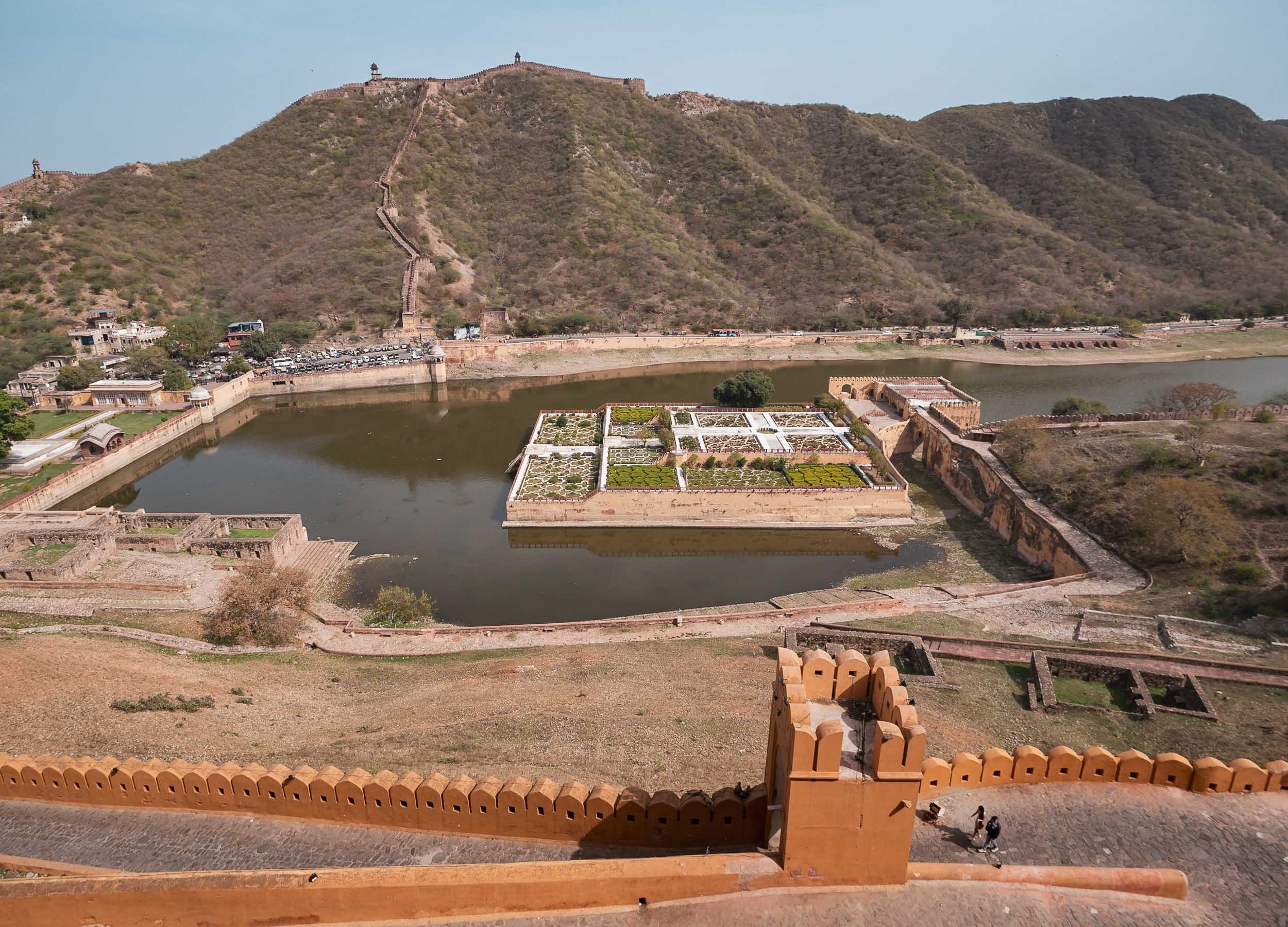
Jaipur, the capital of Rajasthan, was my final destination of this India trip, and I had two days to explore the city and its surroundings, starting with the Amber fort located in a town on the outskirts.
Amber Fort
The fort lies by Maota Lake, seen here with the historic Saffron Garden and the defense wall running along the mountain ridge in the background.


Although it is an example of Rajput architecture, it also features Mughal elements, particularly the Sheesh Mahal and its garden seen on the right. On the left is Ghanesh Gate with its latticed windows on the top, through which ladies could observe festivals or other activities on the courtyard below in a concealed fashion.

It was primarily constructed from red sandstone and marble and part of the same UNESCO entry as the Ranthambore fort, together with four more forts in the region.

Unmaintained
One of the decaying structures surrounding the accessible part of the fort.

I also spotted this man playing a beautiful local instrument here, the name of which I sadly forgot - if you know, leave a comment.


The other side of the fort overlooks the town of Amer with some of its beautiful Hindu temples and their ornate architectural elements.

Stairwell Symmetry
In this village to the foot of the fort lies another stepwell called Panna Meena ka Kund built in the 16th century, again featuring beautiful stairway patterns - unfortunately not allowed to be walked on nowadays.


Back towards the city lies the man-made Man Sagar lake, created as a reservoir in the late 16th century, featuring a rather interesting structure in the middle - the Jal Mahal.
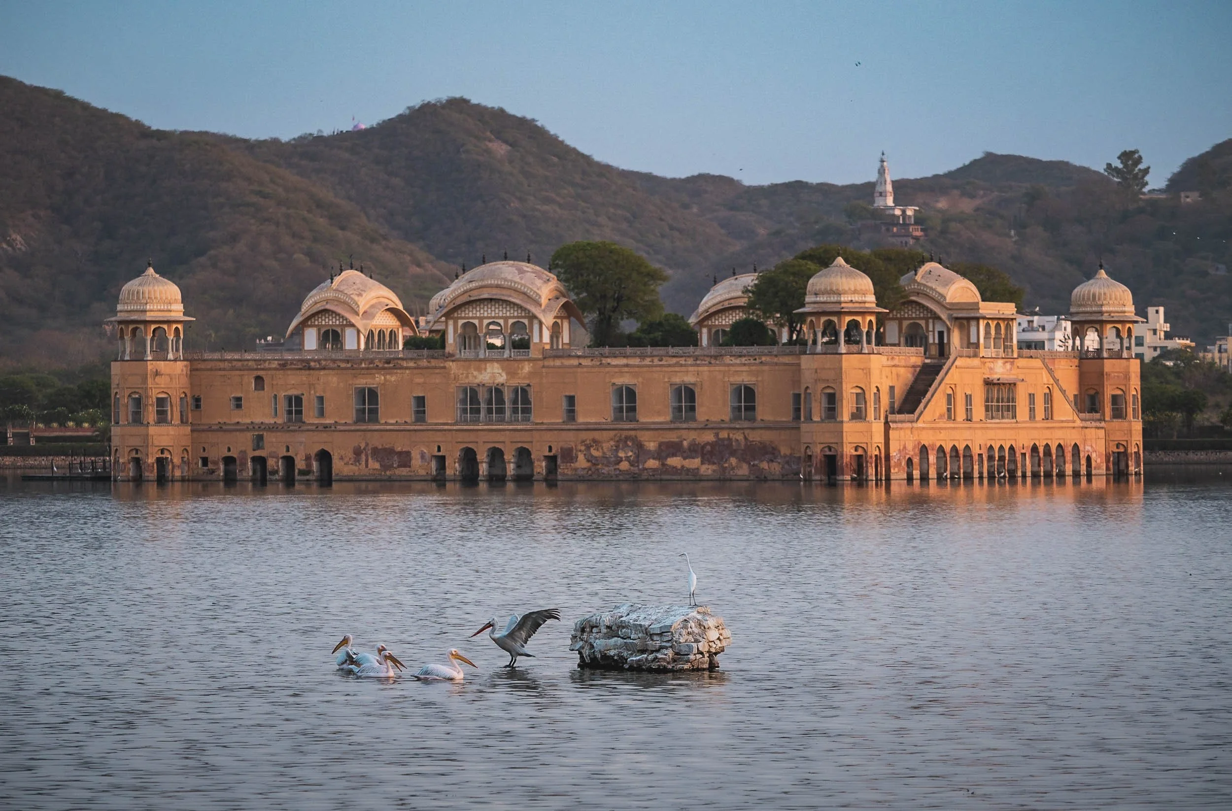

The so-called “Water Temple” was originally a Rajput style hunting lodge for the royal family, and actually houses up to four more stories underneath the water level. These were submerged over time as the water level rose. Today, it’s unfortunately inaccessible, but the lake is home to a variety of birdlife, and sadly, like many of India’s inshore waters, too much trash - having said that, a restoration project for the ecosystem and also the palace has been ongoing for several years.


At night the structure is beautifully lit up, almost creating the impression it is still in use today, particularly with the beautiful trees in the central courtyard.

Hawa Mahal
Despite the appeal of the Amber fort and the Jal Mahal, it’s probably this building that holds the “most well-known” title in Jaipur. This beautiful facade is part of the palace of the city, and was built in 1799.
The lattice facade once again served the purpose of allowing women to observe street life without being noticed themselves. In fact, the structure is the back (not the front!) of the women's chambers of the palace, and has a rather narrow side profile: some parts are just deep enough to allow a person to stand at the window.


Its nickname “Palace of the Wind” derives from the cooling Venturi effect created by its architectural features. Just like much of the other buildings in the city centre, it was built using the characteristic red and pink sandstone.


Speaking of which, here are a few more impressions from the same road running through the city all the way to the Sanganeri Gate in the south.

Local vendors preparing and selling traditional Chai or Kahwa tea, as well as the snake charmers can be found here. The latter is banned in India because of the associated animal abuse (the snake’s teeth are often removed).


If you keep driving down the same road, you will end up at Patrika Gate, but not before stopping at the Albert Hall museum, built and opened in the late 19th century and housing mainly artifacts from India’s past - I didn't visit the inside though.

Patrika Gate
This gate was built in 2016 by the eponymous newspaper group and serves as an entrance to Jawahar Circle Garden.
It’s the photogenic interior with painted walls and wooden doors that made it popular. Although some people say it’s not worth visiting - maybe because it’s seen as “commercial” rather than “historic” and because it’s located almost 30 minutes from the city centre - I thought it was quite beautiful. Especially so if you manage to visit at a quiet time with no people; I only encountered a couple taking pictures, which kindly gave me the opportunity to add a model to my own photo.


Back in the city, the last spot to visit was the 18th century city palace of Maharaja Sawai Jai Singh II. On the way there though we stopped at an interesting place just outside the palace - in fact, another UNESCO World Heritage Site - which I was not aware of: the Jaipur Jantar Mantar. A collection of huge stone-made astronomical instruments meant to be used with the naked eye, built along four other such locations around the region.

☀️
This is the world’s largest stone sun dial, and can be used with an accuracy of about 20 seconds by a skilled observer.
Most of the 19 instruments were designed to measure and predict movement of planets and calendar events.


City Palace
Having spent way more time than planned at the astronomical instruments (so cool!) the city palace visit was shortened a bit, but here is the Chandra Mahal, the royal residence until today. The family owns vast properties, runs a business empire and still has political influence.
Other than that it features interesting galleries of textiles, armors, and even a clock tower. One of the most distinct features are the beautiful gates at the inner courtyard seen below.


Works of Art
There is also an amazing painting and photography gallery, where I bought a few small pieces so delicate they are drawn by brushes of single hairs of squirrels, using natural colors. This artist has been working for the royal family for seven generations.

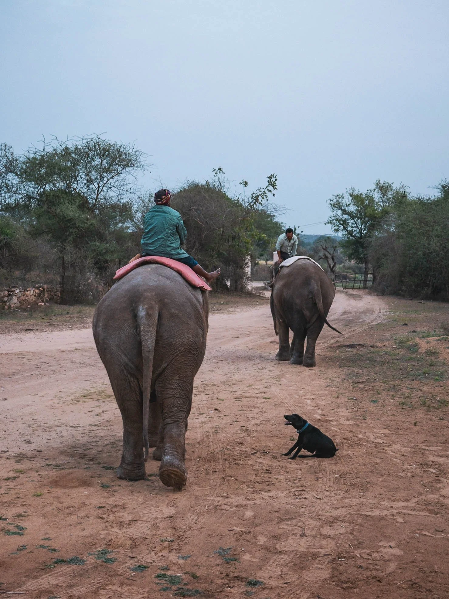
Dera Amer
My last stop in Jaipur was this refugee camp for elephants that in the past carried people up to the fort, damaging their feet on the hard stone, and their backs from the weight in the process. The heavy jewelry also cut into their ears and necks, leaving visible marks.


Today, two such elephants are housed here, living a quiet life with their mahout (caretaker) and a few other animals, getting fed by visitors to the camp set up by the Singh family, which partly finances the operation. Many other elephants still suffer from these practices, but it takes a lot of money to purchase them from their owners and then care for them during a long lifespan. It’s sad to see, as I’ve grown very fond of elephants, partly after my trip to Amboseli - they are incredibly gentle and intelligent animals.

And that was it from this trip to India - certainly not my last visit to this amazing diverse country. Lots more to explore.
Subscribe to my newsletter to get notified and don’t miss out on more Wonders of the Globe.
Other Recent Posts:

Delhi & Agra - Home to India’s capital, and its most visited sight
Exploring the north of India and its incredible Mughal architecture.

Following my amazing time looking for snow leopards in Ladakh I wanted to explore more of “typical” India - if there is such a thing - having only been to Kerala in the southwest previously. The capital was as good a place to start as any, before completing the northern trifecta with Agra and Jaipur, as well as Ranthambore national park. The latter two will be part of another blog in the future though.
India’s Capital Region
I barely had two days to spend here, and the first lesson to learn was that New Delhi - the capital city and home to all three of India’s branches of government - is distinct from the larger National Capital Territory of Delhi with its population of 35 million people, covering only a small portion in the centre. I started my first afternoon here, with a sight that is neither related to its political nor economic status: The Agrasen Ki Baoli.


Facing the skyscrapers around the Connaught place area - New Delhi’s CBD - this three level stepwell with 104 stairs is one of the last in the region, and was probably built during the 14th century, although its origins are not fully documented. It has been used by several Bollywood movies and TV series for filming, and as such has become a popular spot for visitors.

The Governmental District
Onwards to the Secretariat building, housing most of India’s important ministries and flanking the Rashtrapati Bhavan presidential palace. Like many of the structures in this area it follows a kind of Neo-Mughal architecture, commonly used by the British architects in the late 19th century.

India Gate
The memorial for India’s fallen soldiers from WW1 seen from Vijay Chowk Park. There are a few more interesting sights in New Delhi, such as Mahatma Gandhi’s resting place, but I didn’t stay longer as the area was heavily closed off and it was a smoggy day due to Delhi’s notorious air pollution.


I moved on to Lodi Gardens for a quiet sunset instead. With its mosques, tombs, and bridges, the park is full of architectural beauty from the 15th century and at the same time serves as a popular recreational spot.
Humayun’s Tomb
Speaking of beautiful architecture from this period, the morning spent at Humayun’s Tomb was probably a favorite moment during my time in India. A beautiful soft sunrise, very very few people, and one of the most beautiful buildings and gardens shaping future Mughal architecture - what more to ask for?


Diagonal View
The building was one of the first to use its unique combination of red sandstone and white marble.
Interior
The symmetrical ground plan of the interior chambers with an octagonal layout seems sparse today, but was richly decorated during the past. The intricate lattice screens still make for impressive morning light patterns on the marble floors. Over 100 hundred graves are spread over the many chambers in the complex, giving it the nickname “Dormitory of the Mughals”. They ruled most of the Indian subcontinent from the early 16th century until the middle 1800s.


Gardens
The beautiful grounds surrounding the tomb are one of its defining features, with the highly symmetrical layout interspersed with bisecting water channels separating the area into a total of 32 miniature gardens. They were recreated multiple times throughout history, having been used as vegetable gardens during the decline of the Mughals, and later re-done by the British in their own preferred formal style, before being restored closer to their original layout.

Barber's Tomb
The southeastern corner is home to the only other larger structure in the complex, the occupant of which is not known due to the lack of inscriptions. It dates from the late 16h century.
Isa Khan Tomb
This octagonal tomb is situated just next to Humayun’s grounds. Although much smaller, it features equally beautiful distinct ornamentation, and is situated in India’s oldest sunken garden surrounding a tomb, which was only discovered in 2011. The same concept was later used for the Taj Mahal.


The tomb’s beautiful tiled roof details.
Isa Khan was a member of the Pashtun nobles, who fought the Mughals during their early rise. He died at the age of 95.

Sabz Burj
A cyclist passing what is though to contain the earliest surviving painted ceiling for any monument in India, just outside the above sites. Although its original construction date remains unclear, it was probably built in the early 17th century.
From here it was time to head to Old Delhi - yes, that also exists, in addition to New Delhi, the Delhi territory and the Delhi district inside it, although Old Delhi is more of an informal area in the central part of the city. The most significant place I wanted to see here was Jama Masjid, built in the middle of the 17th century by one of the most famous Mughal emperors, Shah Jahan - you’ll read his name a few more times later.

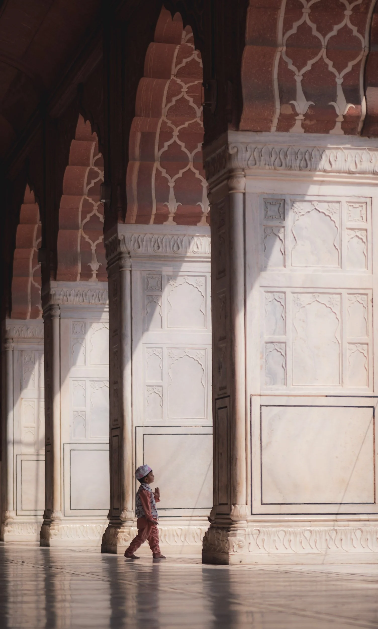
The main parts of the mosque were under renovation, but one of the minarets was open to climb on top, providing some interesting views of the Old Delhi cityscape. So densely built, flying your kite on the roof is the best option - look closely…


Meena Bazaar Street
The eastern side of the mosque with the walls of Delhi’s Red Fort in the background - also built by Shah Jahan, and a UNESCO site.

Preparations for - I think - Eid celebrations were ongoing during my visit, with this tailor preparing long white sheets which were to be used as shades across the mosque’s courtyard from what I understood.
The mosque is surrounded by the markets of Old Delhi - an attraction in and itself.


The Ringmaker
During my walk around the area I came across this vendor melting custom brass jewelry, and found the process quite intriguing. I asked him to make a ring for me and watched the elaborate steps it went through until it fit on my finger. While I insisted on paying him, he was proud of his work and would not take any money. I’m keeping it attached to a chain on my camera bag now.
A new Religion and the Lotus Temple
From Old Dehli’s mosque and markets it was time to head a bit further out towards a more modern spiritual piece, which primarily attracted me for its architecture, but also exposed me to an interesting relatively modern type of faith - the Baháʼí Houses of Worship.

The Baháʼí Faith is a relatively new spiritual movement from the 19th century, aimed at promoting unity and acceptance of all religions - any faith and belief is welcome to be practiced here. Although less than 10 million official followers adhere to its principles, its 14 temples attract visitor numbers far greater than that, primarily owing to their impressive architecture and prominent locations.


The Lotus Temple was financed by the members of the community, like all Baháʼí houses of worships. Its award winning design includes a large garden and is composed of free-standing marble-clad "petals", that surround the 9 entrances - this number is a common requirement across all Baháʼí temple designs.

Qutb Minar
My last destination in Delhi was Qutb Minar, part of the complex of the same name, built by the Ghurids who brought Islam to this region.
The minaret is more than 800 years old and another of India’s UNESCO World Heritage sites.
If you didn’t notice, it’s located on the approach path to Delhi’s international airport.
After several incidents in the last decades, the public is no longer allowed to climb up the 72.5 meters to the top, which make it the tallest minaret in the world built of bricks. The surrounding area is open for visitors though and features a number of tombs and monuments.


The crescent moon setting over Qutb Minar on my last evening in Delhi, before heading to India’s most famous sight.


Towards Agra
A mere three hour drive south-east from Delhi takes you to Agra. Once the capital of the Mughal empire for more than 100 years, it is now the fourth largest city in the state of Uttar Pradesh. Its priced historic buildings from the Mughal period are one of the city’s major attractions today, some of which you will see below.

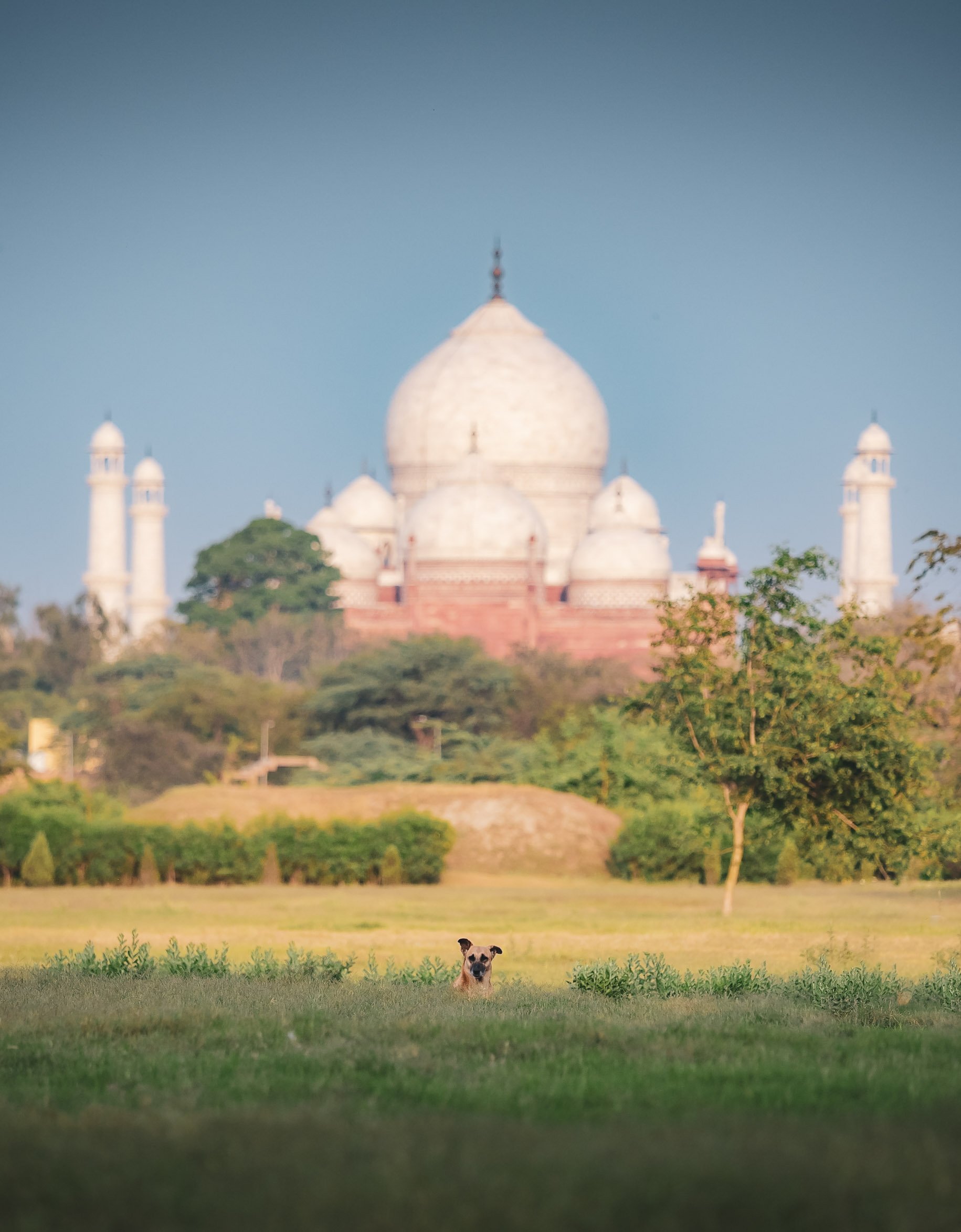
Taj Mahal
Taj Mahal remains its undisputed highlight for any visitor to India. Almost 8 million people admire its beautiful architecture each year, with 10% or so coming from abroad.

The mausoleum was built almost entirely out of white marble and commissioned by fifth Mughal emperor Shah Jahan as final resting place for his - allegedly favorite - wife, Mumtaz Mahal, who died while giving birth to their 14th child. Its symmetrical layout, use of white marble for the main structure and red sandstone for the surrounding buildings, and the many inlay and semi-precious stone features make it one of the best examples of Mughal Indo-Islamic architecture.

Quiet Moment
A very early morning arrival (at least 30min before opening, which itself is 1 hour before sunrise) with tickets in hand already will give you a few minutes inside before the crowds arrive - from my experience, heading north-west towards the Taj Mahal Mosque instead of spending too much time near the entrance is the best option. As the sun rises from behind, you will get to enjoy this view with no one around.

Sunrise
The sun emerging over one of the smaller domes of the red brick guest house in the distance, with two of the front facing minarets of the mausoleum in the foreground. The minarets are over 40 meters tall and were built slightly tilted, so that in the case of collapse they would not fall onto the central structure.


Construction of the complex included a gateway, guest house, mosque, and walls on three sides, and took over 20 years, using over 20,000 workers and artisans. An interesting tidbit I wasn’t aware of is the design of the garden: It originally was full of vegetation, including many fruit trees, roses and other plants, before the British adapted it towards the more formal (read: boring) lawn style in place today.


The only obvious non-symmetrical part of the entire site is a rather unplanned one. Under the middle dome where Mumtaz Mahal’s cenotaph lies in the centre (and no photos are allowed), her husband’s resting place was later added next to her, breaking the symmetry. Their real sarcophagi lie underneath in a non-accessible basement chamber in the same arrangement.

Decorations
An example of the stone inlay work (the pattern on the top is not painted!) and relief work that cover most of the mausoleum.
In line with Islamic traditions, the majority shows Arabic calligraphy or vegetation and other abstract shapes.
One challenging part of maintaining the structure is discoloration, particularly from air and rain pollution causing the marble to adopt a yellow hue over time. To prevent this, the Indian government set up a zone with stricter emission standards around the site back in 1997. Today, cars can only go up to a certain distance to the entrance before visitors need to walk or take an electric buggy.

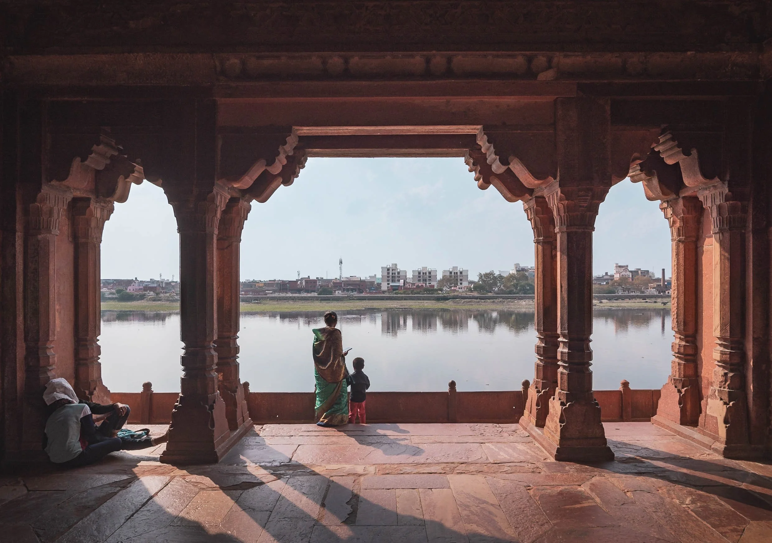
Aside from visiting the site itself, the garden on the opposite banks of the river Yamuna provide beautiful perspectives of the complex, often with very few tourists and a glimpse of local life happening on the shores. This photo also shows the huge sandstone platform on which the buildings were constructed.

I spent another sunrise exploring the shores of the river - this time on the western side - for more views of Taj Mahal, and was rewarded with this beautiful calm quiet atmosphere.

Sadly, just a few meters from here one of the small Yamuna tributaries flowing through Agra delivers an unbearable amount of garbage and sewage (and the stench that comes with it) to the shores, which literally stopped me from going any further, both out of disgust and concern for my health.

The Yamuna river itself suffers from heavy pollution due to sewage discharge primarily from Delhi. It is said that up to 800 million liters of largely untreated sewage enter the river each day in a very small stretch where it flows through the city. Cleanup efforts have been partly underway but not yet yielded any significant results - this is a sad sight in many places across the country unfortunately.

While the building is of course heavily visited with a hundreds of tourists arriving even before the site opens, there are quiet moments to be had if you arrive early enough, or spend time exploring the areas around the river for a different viewpoint. The beautiful architecture and incredible handiwork makes a visit (or even two) worthwhile, no doubt. But let’s take a look at what else Agra has to offer…
Agra Fort
The walled city of Agra Fort is also a UNESCO sites in the area, Taj Mahal being another, and the final one being Fatehpur Sikri, an incredible red sandstone town outside the city, which I did not visit (for now…)


Started by the Lodi Dynasty just before the arrival of the Mughal’s, the fort changed hands several times until the British arrived the early 19th century.

Prime Spot
The fort’s location on the river Yamuna gives it a prime view of Agra’s most priced sight, making it a popular photo spot.

The interior of the Musamman Burj palace inside the fort with its beautiful marble inlay and lattices. It was built by Shah Jahan for his beloved wife Mumtaz Mahal - ironically he also spent the last years of his life in captivity here, held by his own son who succeeded him as the emperor.

A view of the palace from the west. Shah Jahan is said to have died here while watching the the tomb he built for his wife.

Tomb of I'timād-ud-Daulah
One of my favorite places in Agra was this rather small but beautiful Mughal mausoleum, often regarded as the “Baby Taj”, built by Nur Jahan for her father Mirzā Ghiyās Beg. It was completed in 1628, just a few years before its bigger brother began construction - commissioned by her stepson!


Details
Delicate jali screens of carved white marble as well as typical inlay work combined with painted patterns all over the structure make it feel more delicate and intricate, but less simple, than the Taj Mahal.


The main chamber holding the tombs of Mirza Ghiyas Beg (who was Mumtaz Mahal’s grandfather) and his wife Asmat Beghum.

The Red Taj Mahal?
Another Taj-related building I wanted to see was this one: John Hessing's Tomb. The Dutch worked for the Marathas in Agra at the turn of the 19th-century and was killed in 1803, fighting the British to defend Agra Fort. His wife commissioned the tomb in similar spirit as Shah Jahan had done for his significant other.

The monument is housed in an ancient Catholic cemetery, somehow reflecting the complex multicultural facets of the local society even before the arrival of the British. While its design incorporates common elements of Islamic tomb architecture with some references to the Taj Mahal, it is made of red sand stone and lacks a lot of the decoration.


After a last walk through the markets around my hotel, it was time to head west. That’s for another blog post, but take a look at what is maybe my favorite image of Agra below first - a lucky moment.

Subscribe to my newsletter to get notified and don’t miss out on more Wonders of the Globe.
Other Recent Posts:

Jordan - From Salty Seas and Dramatic Deserts
A rich history, natural attractions, and dark night skies - what’s not to like?

I’ve wanted to visit Jordan for many years, and despite its proximity to Dubai it took until now - when I’m not actually living in Dubai - to make it happen. Its rich history and natural attractions didn’t disappoint, and on top of that, the dark skies of its deserts meant some Milky Way photography was on the cards. What’s not to like?
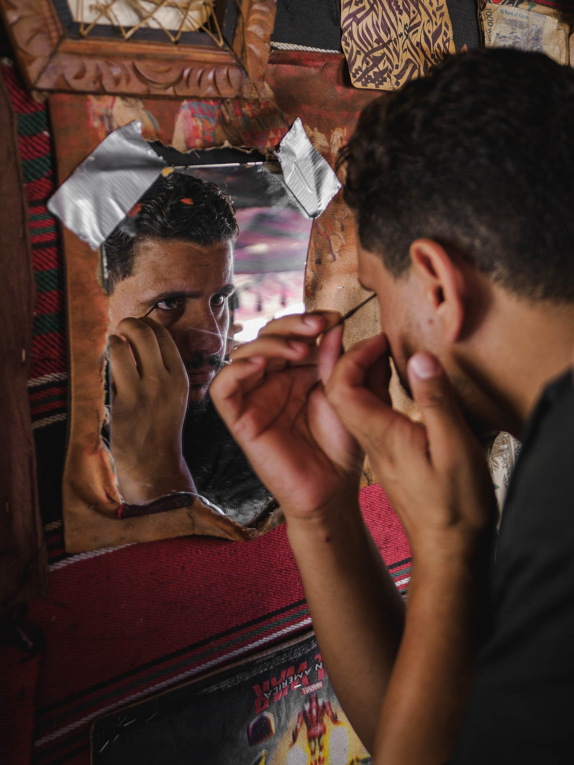
Petra - The Ancient Capital
The first part of my trip lead me to the capital of the Nabateans - the historic Kingdom that ruled this area more than 2000 years ago until the Romans took over. Their centre was the famous city of Petra. My time here (and in Wadi Rum) was spent in a small group as part of a trip organized by Benjamin Barakat, which really helped to get access to some of the best spots, with great local guides.
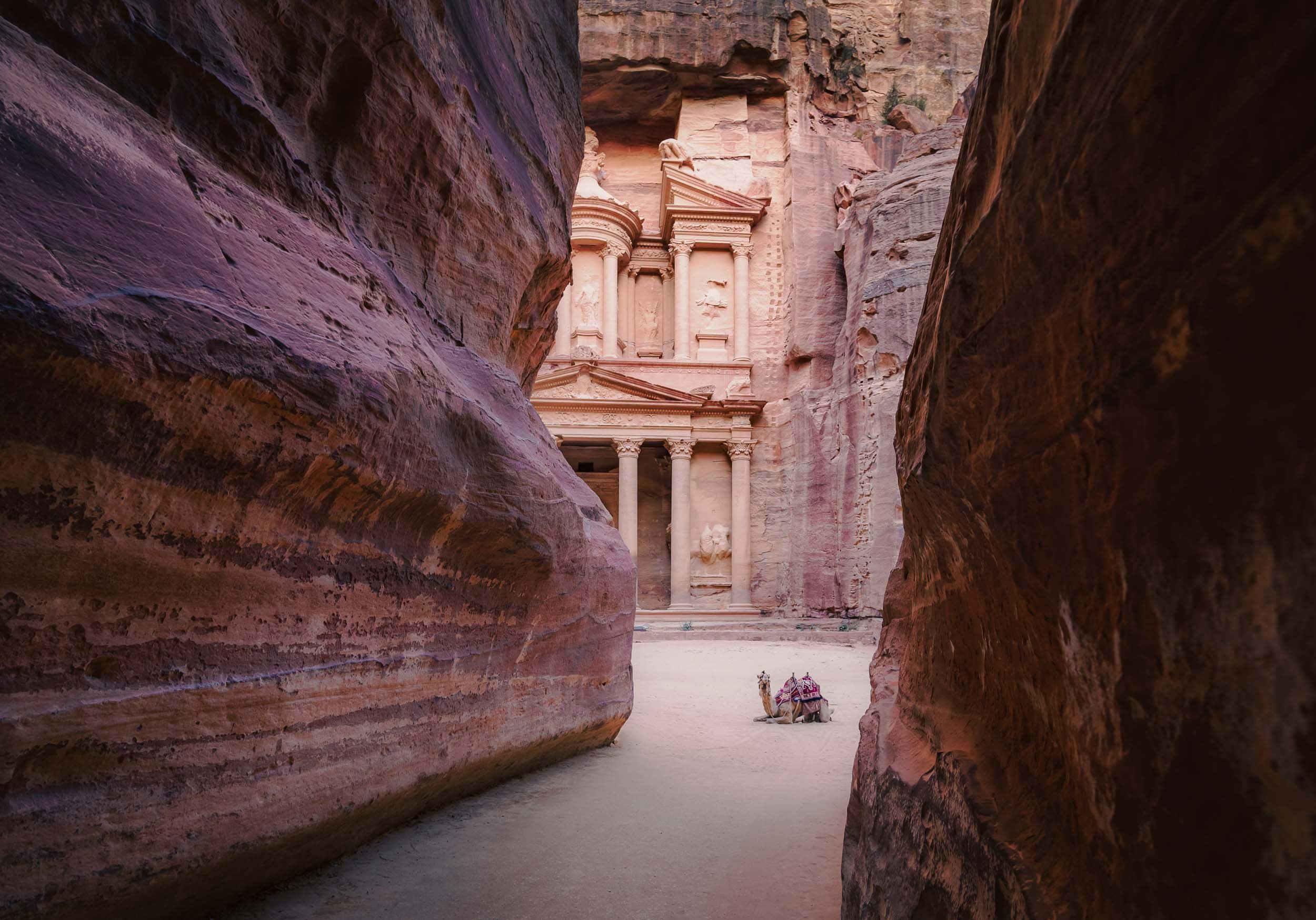
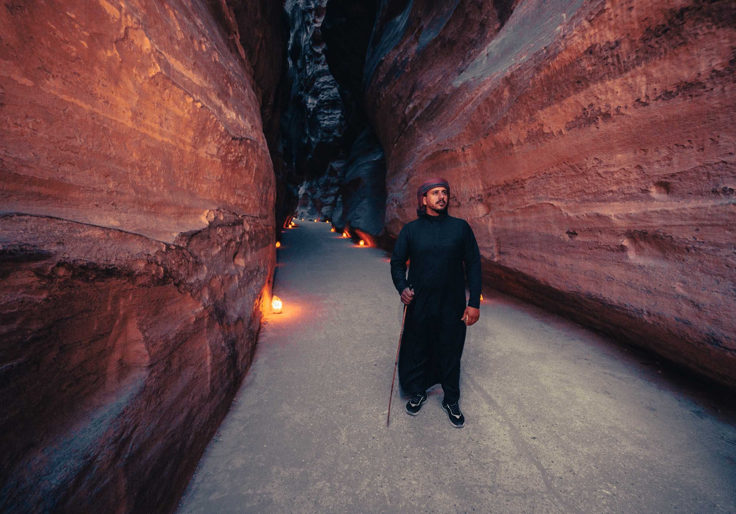

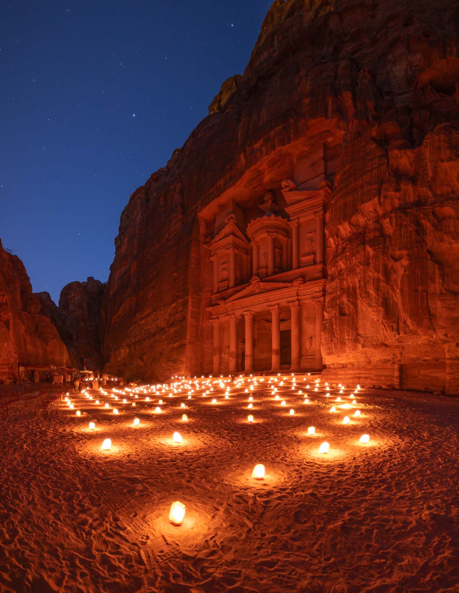
With the right timing - such as being the first one to arrive in the morning when the gates open at 6am (in the summer) - you can experience this place in peace and quiet, which adds to the awe-inspiring grandeur of the sandstone carved structure built 2000 years ago.


More than the Treasury
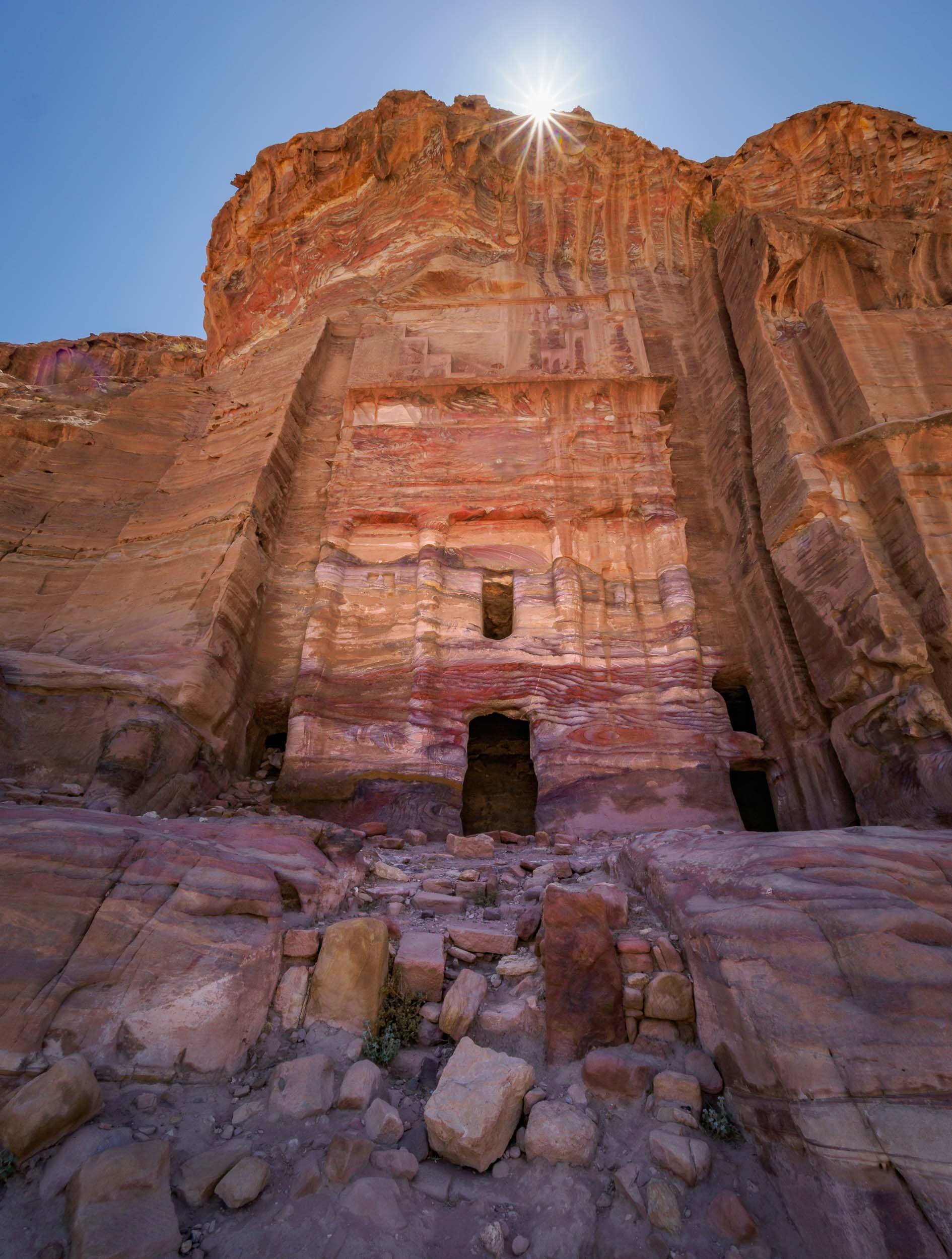
As I’ve alluded to, there’s more to experience in Petra than just the Treasury, which admittedly got a lot of the attention in popular culture, such as being featured in the original Indiana Jones movie. In fact, there’s a lot more to see, and if you want to soak it all in, you better be prepared to hike. I did 32km in one day, but it was worth it to explore the many Hellenistic facades, the tombs, and the amazing theatre, for instance.


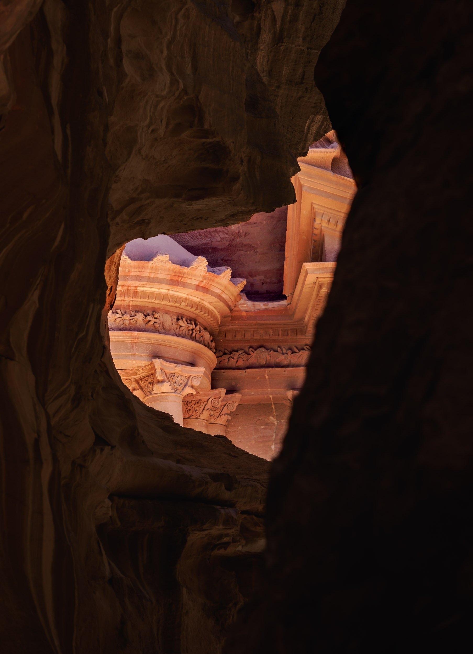
The Monastery
Maybe it’s simply the feeling of reward after the two hour journey to reach this place, but the Monastery might be my favorite structure in Petra. It was carved in the mid first century AD and follows the mixed architectural style that was characteristic for the Nabateans.


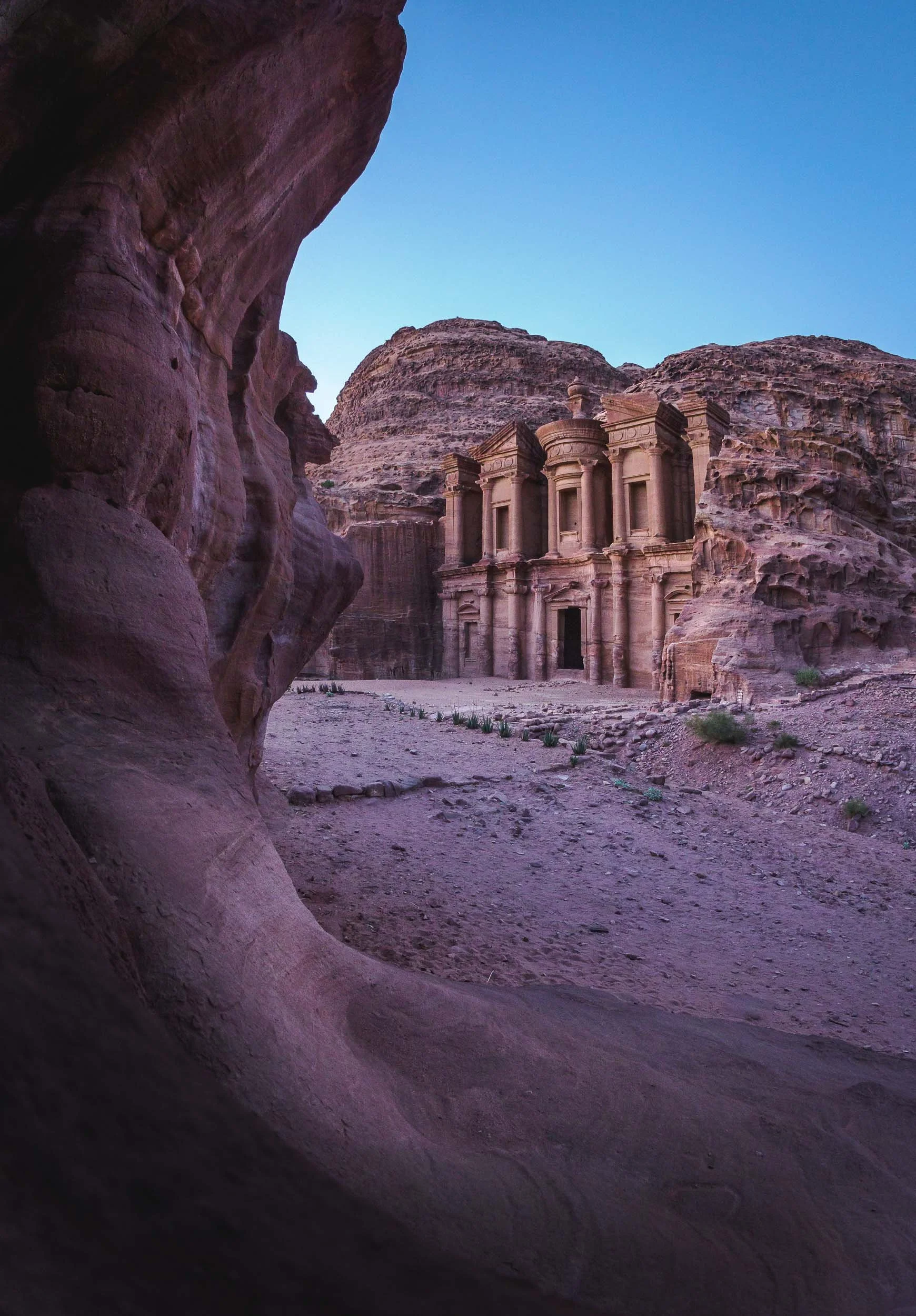
We were lucky to spend the sunset and early night here, allowing us to capture the structure in its best light and get a few star trails as well. It also meant that there were barely any other people left except us and the Bedouins… which couldn’t resist showing us their daring climbing skills.
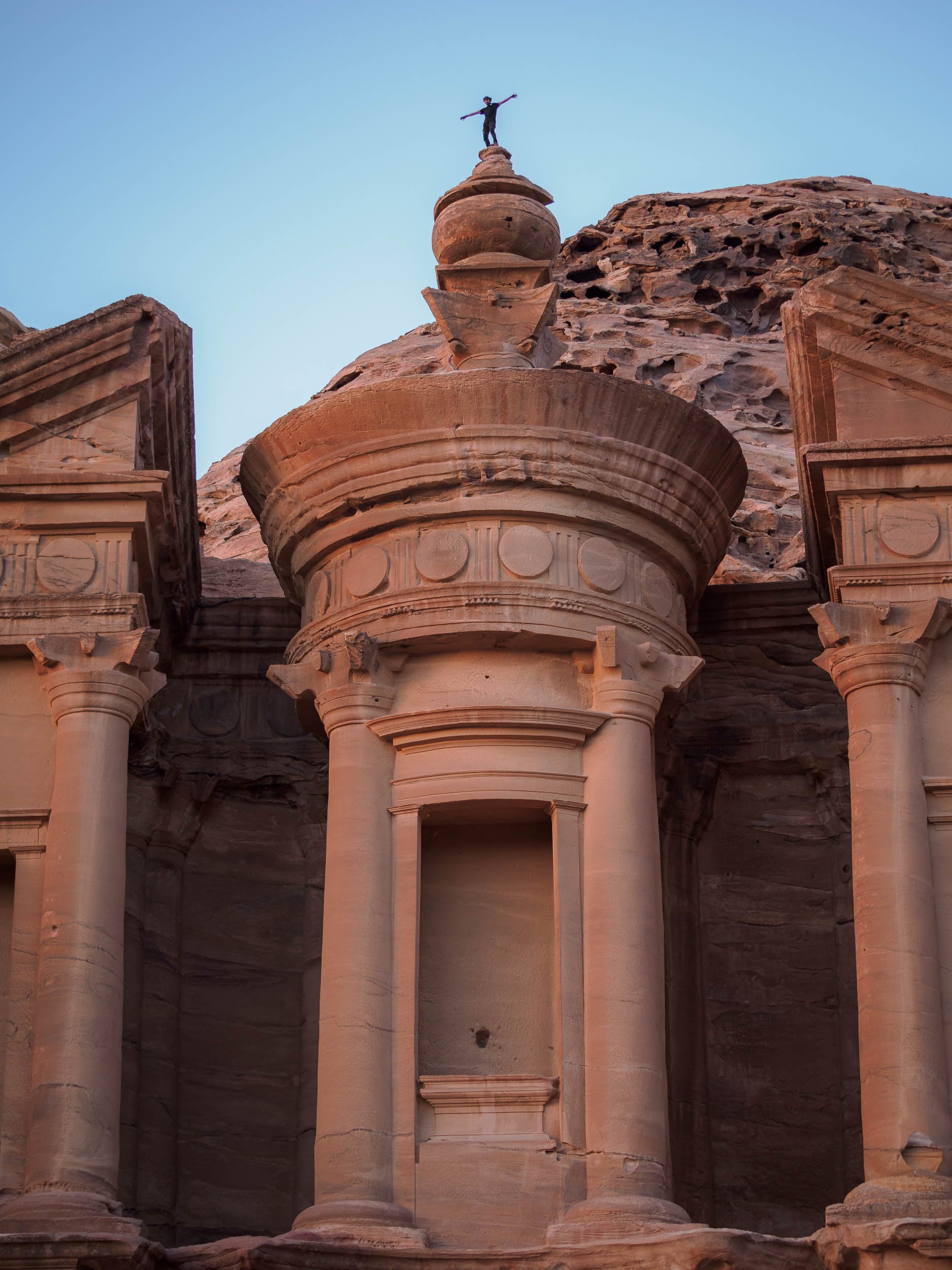

I couldn’t help but join them, and being up on the roof of the Monastery was an incredible feeling, but also one that reminded me that I have a healthy respect for heights - while I sat on the edge, you bet I didn’t follow that jump. Take a look at the video below and decide for yourself…
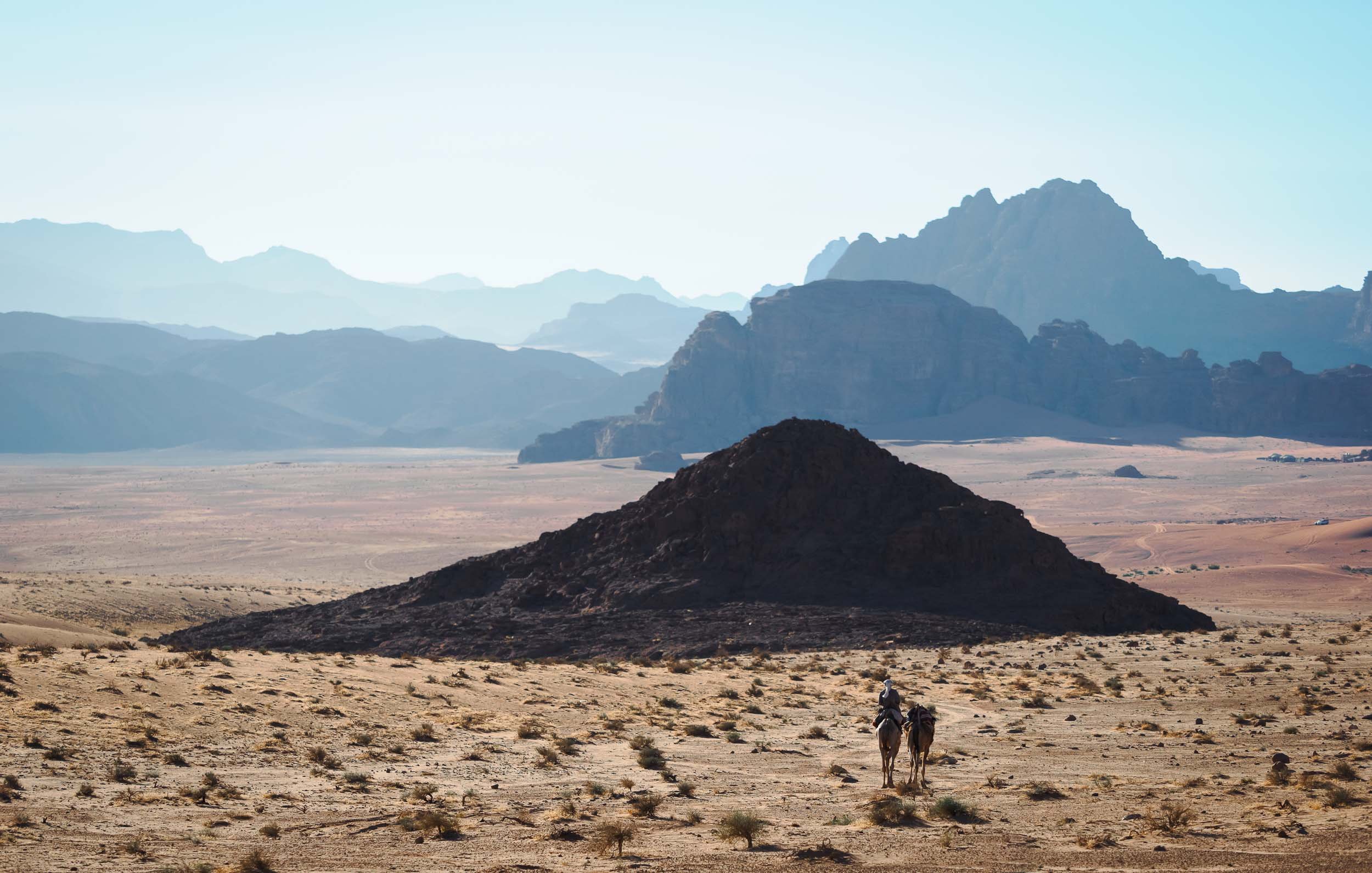
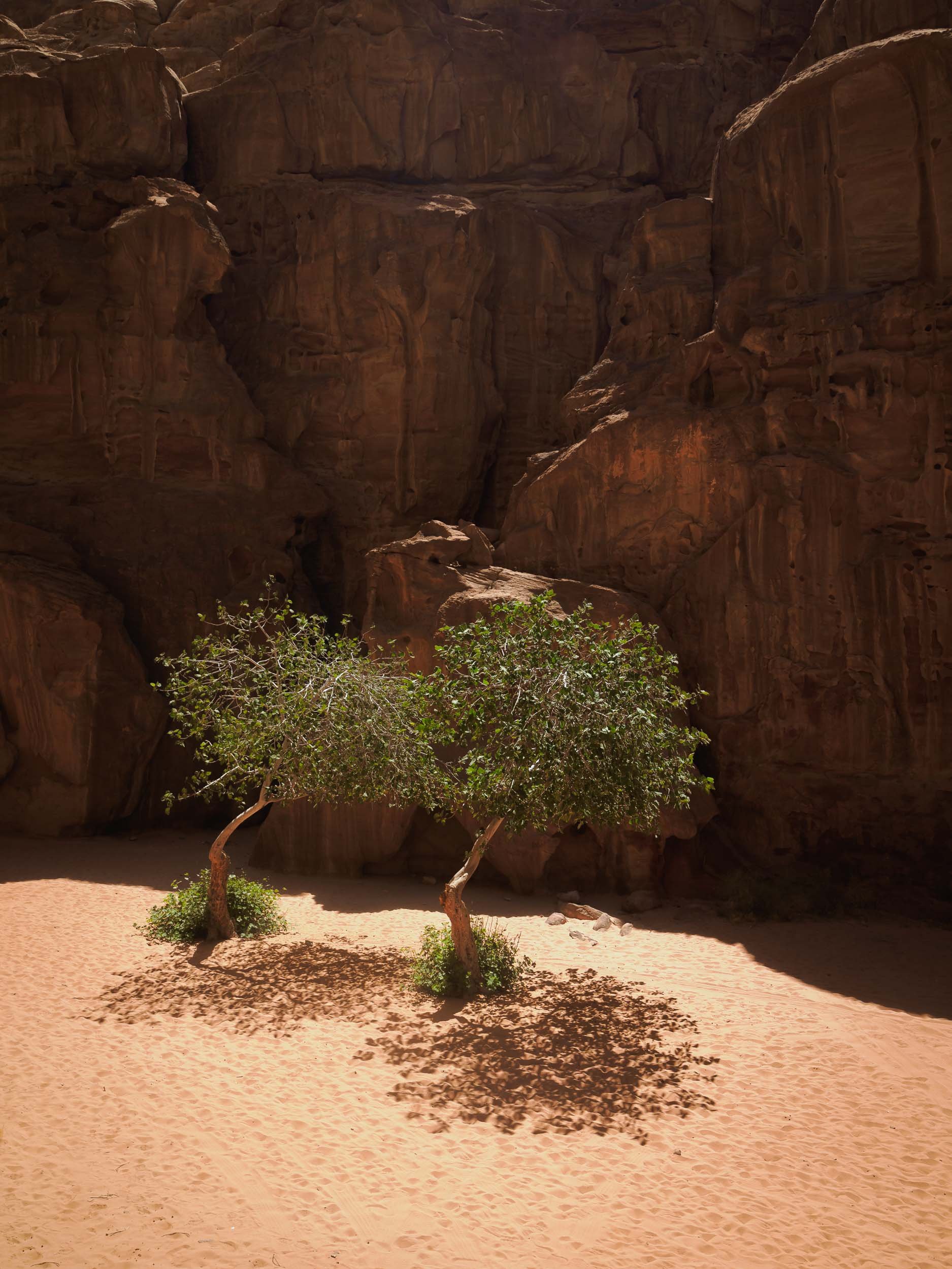
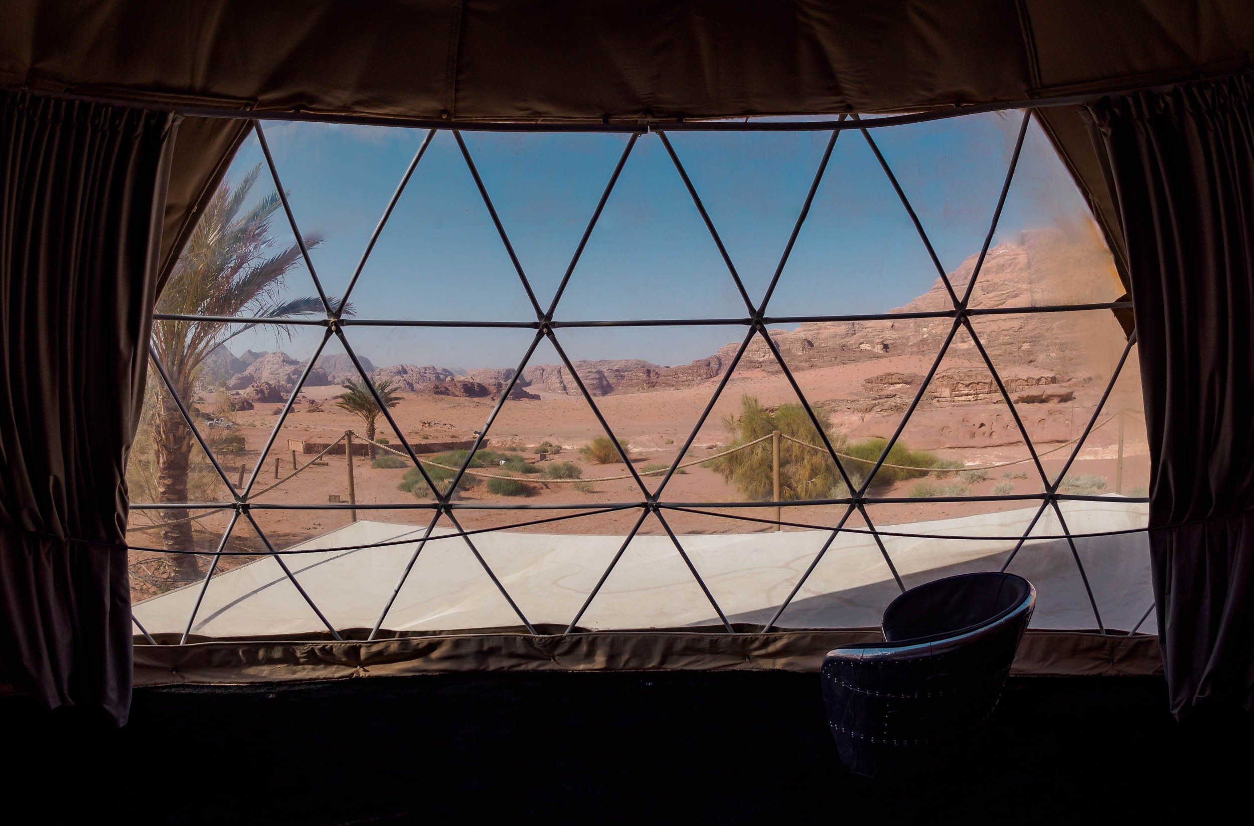
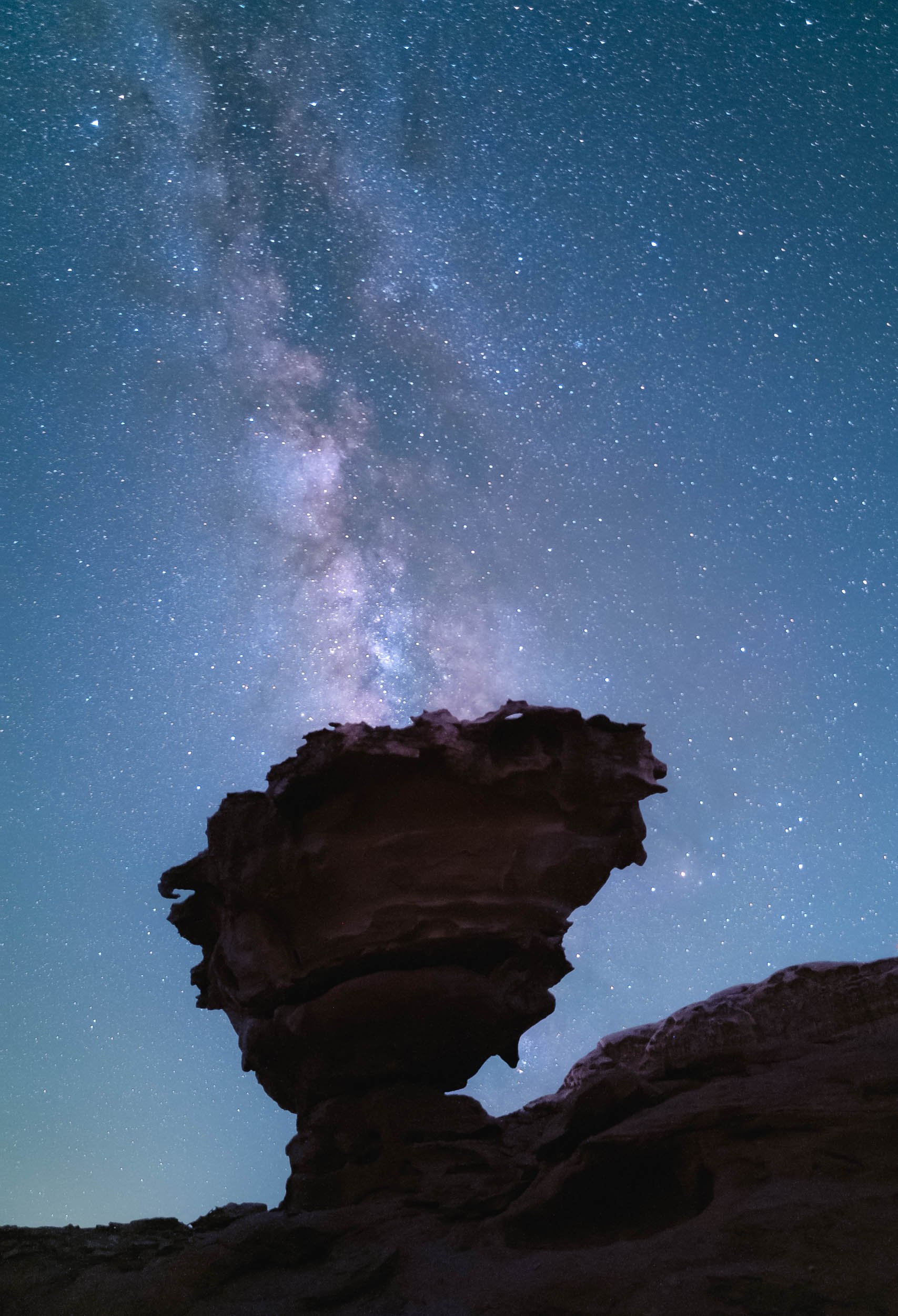
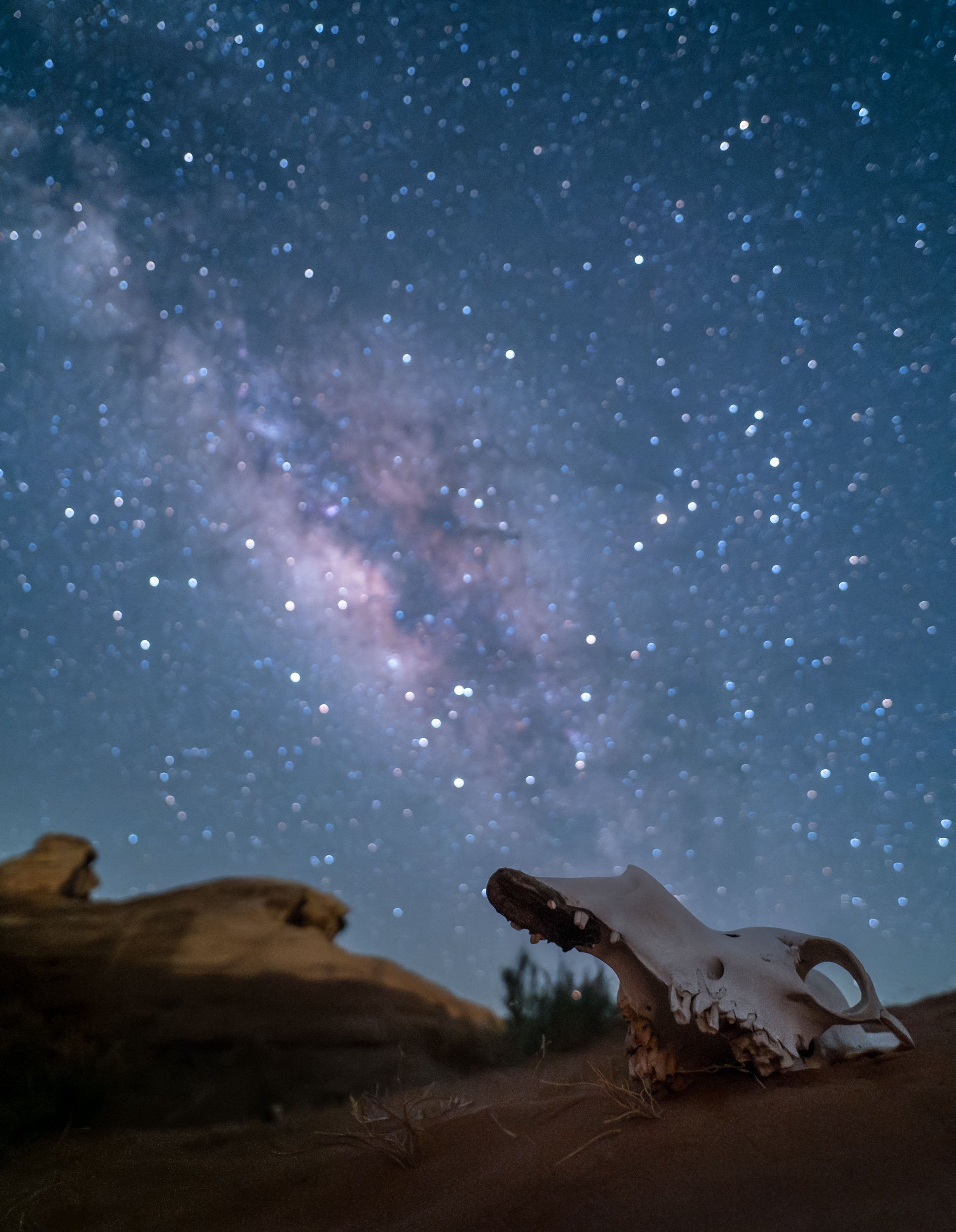
Wadi Rum - Mars on Earth
Another two hours further south of Petra lies one more of Jordan’s six UNESCO World Heritage Sites (Petra being one as well), and another one that has been featured in quite a few famous movies, such as Dune and The Martian. The original legendary appeal of Wadi Rum comes from the tales of Lawrence of Arabia though, which kick-started the tourism industry here.

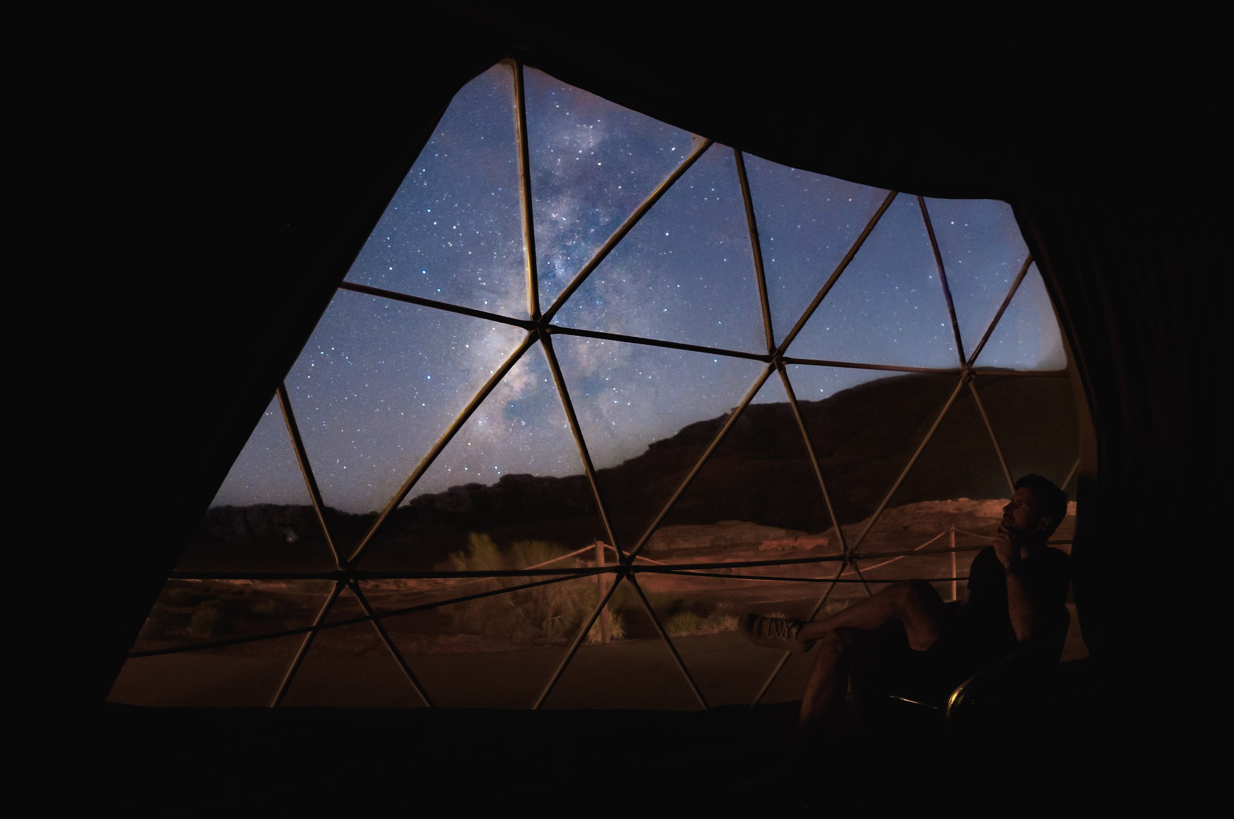
The first night took us out to a beautiful arch (one of many) not too far from the camp, and it was time for the first Milky Way session (also one of many)!
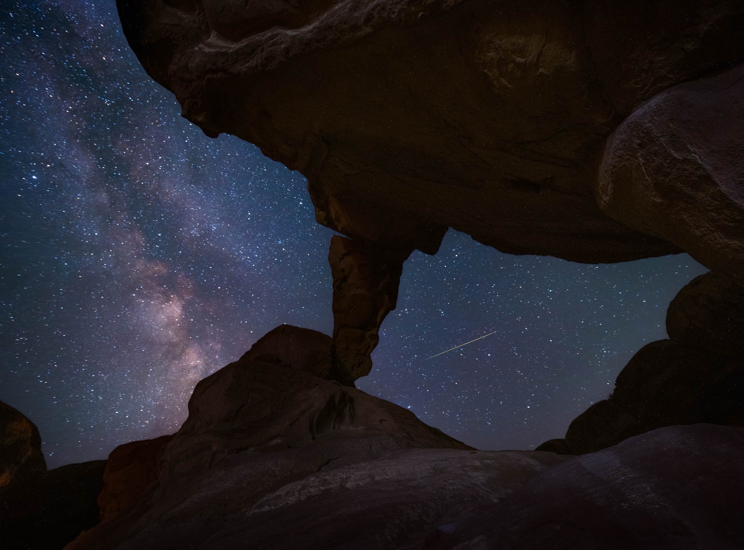

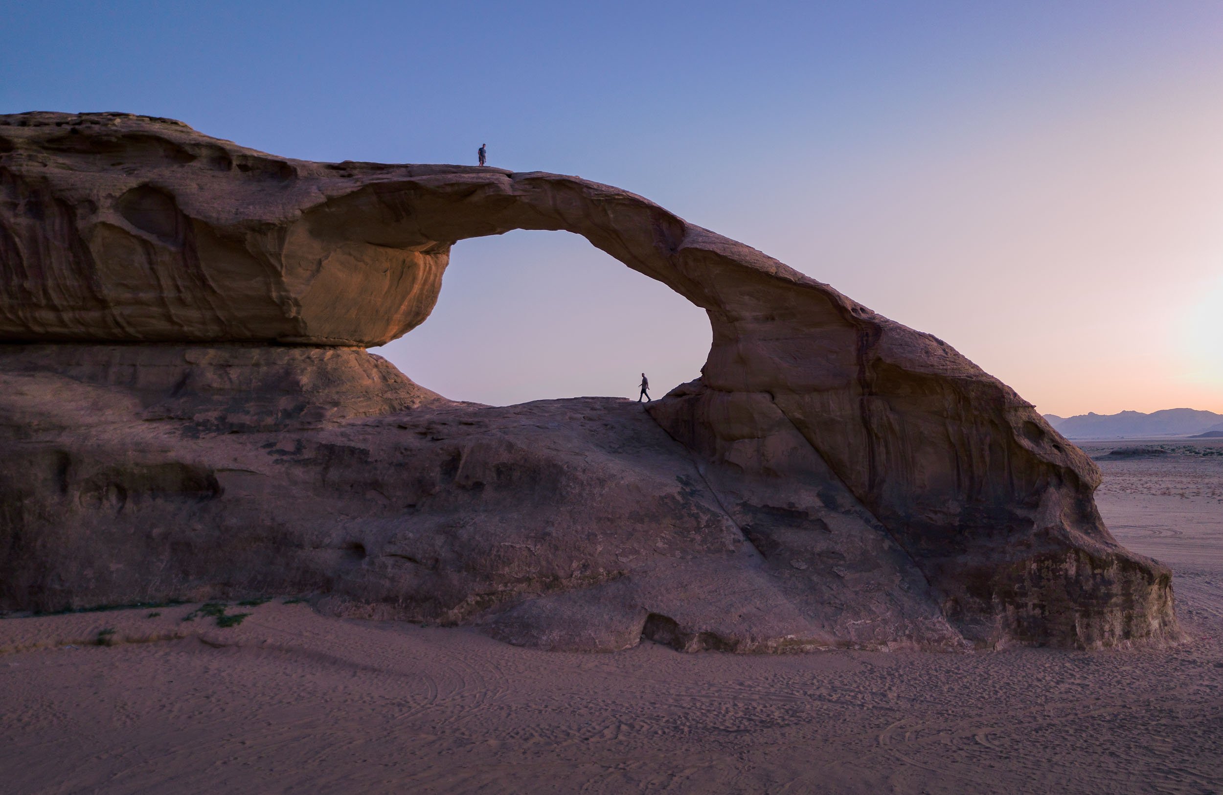
Another arch was on the cards for the following night, in fact, there are two different ones in this spot just a hundred meters apart. Paradise of rock formations!


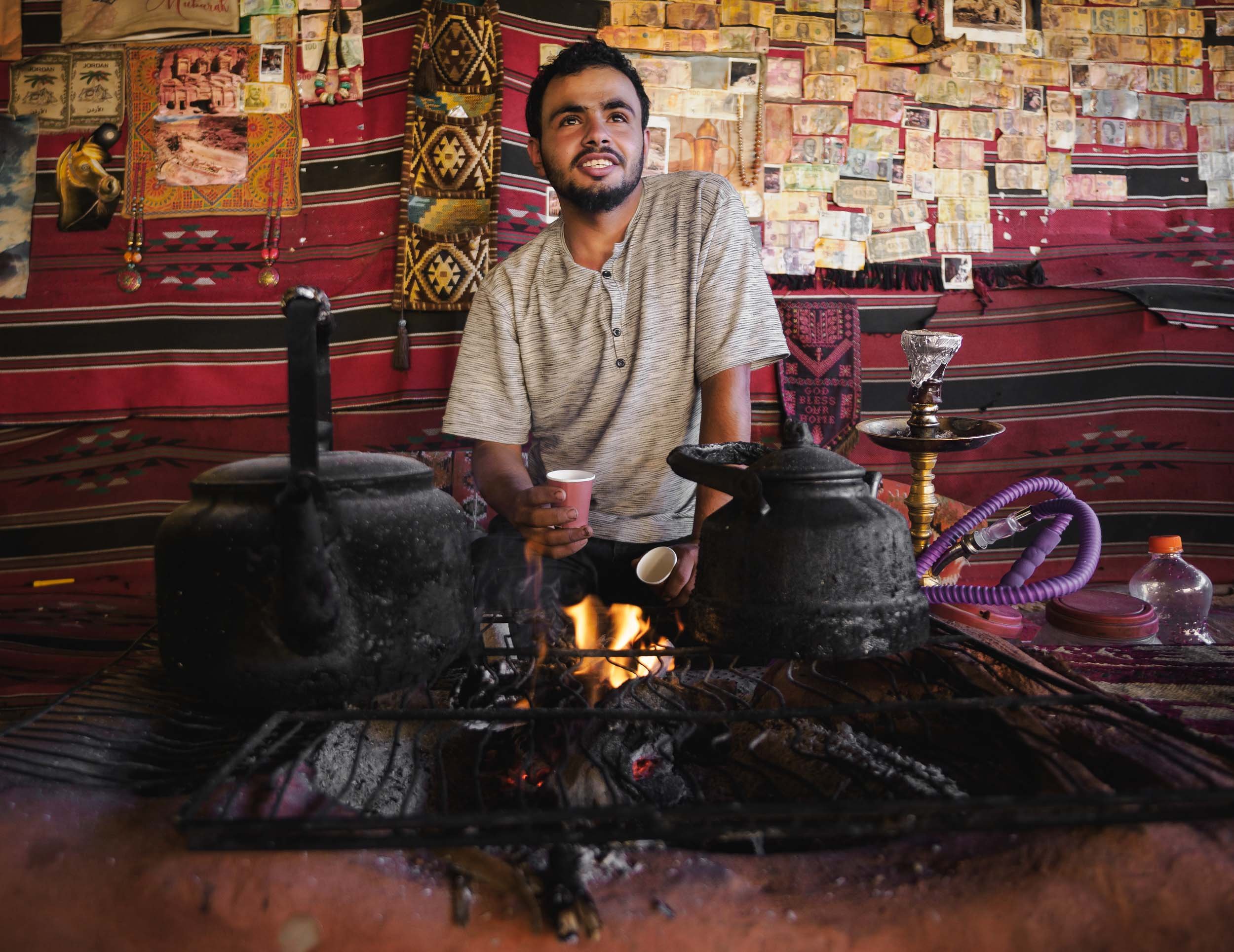
Luckily there were a few cats around for company while one waits for the camera to finish taking 3 hours of exposures…
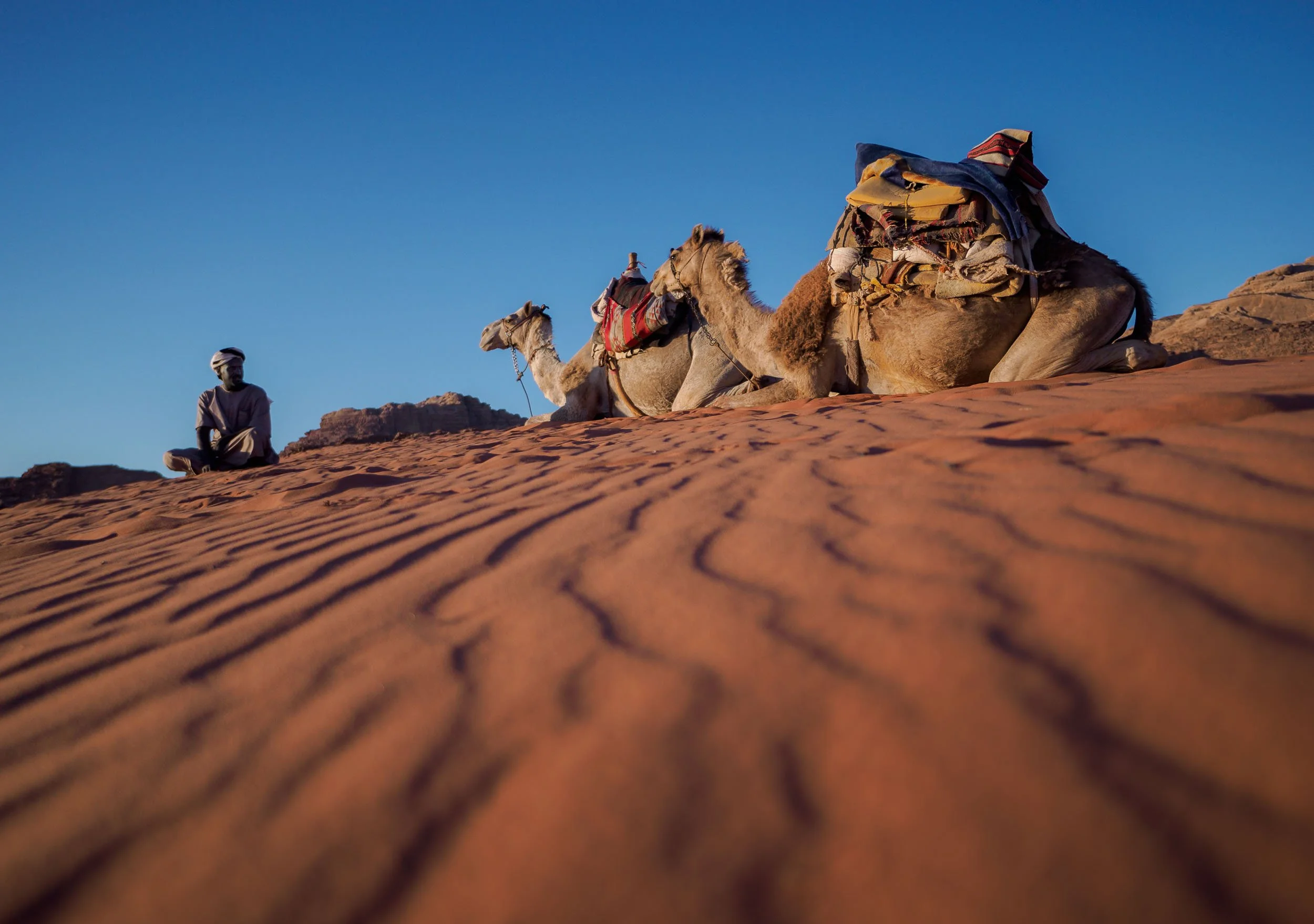
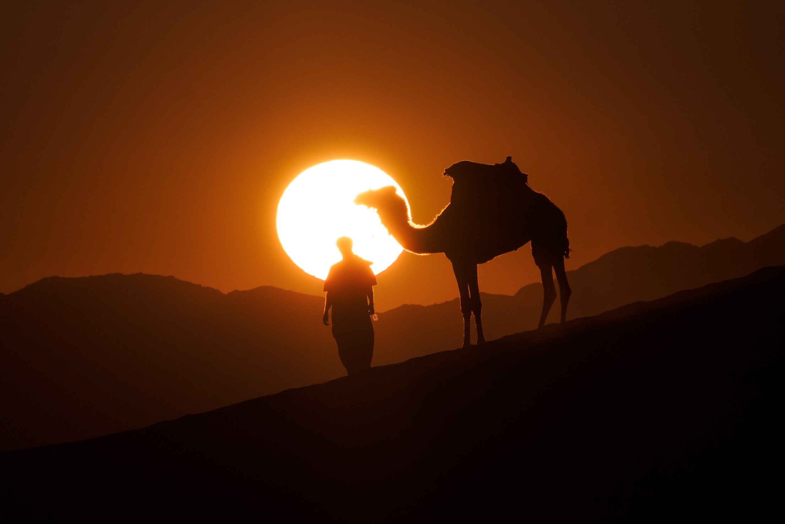
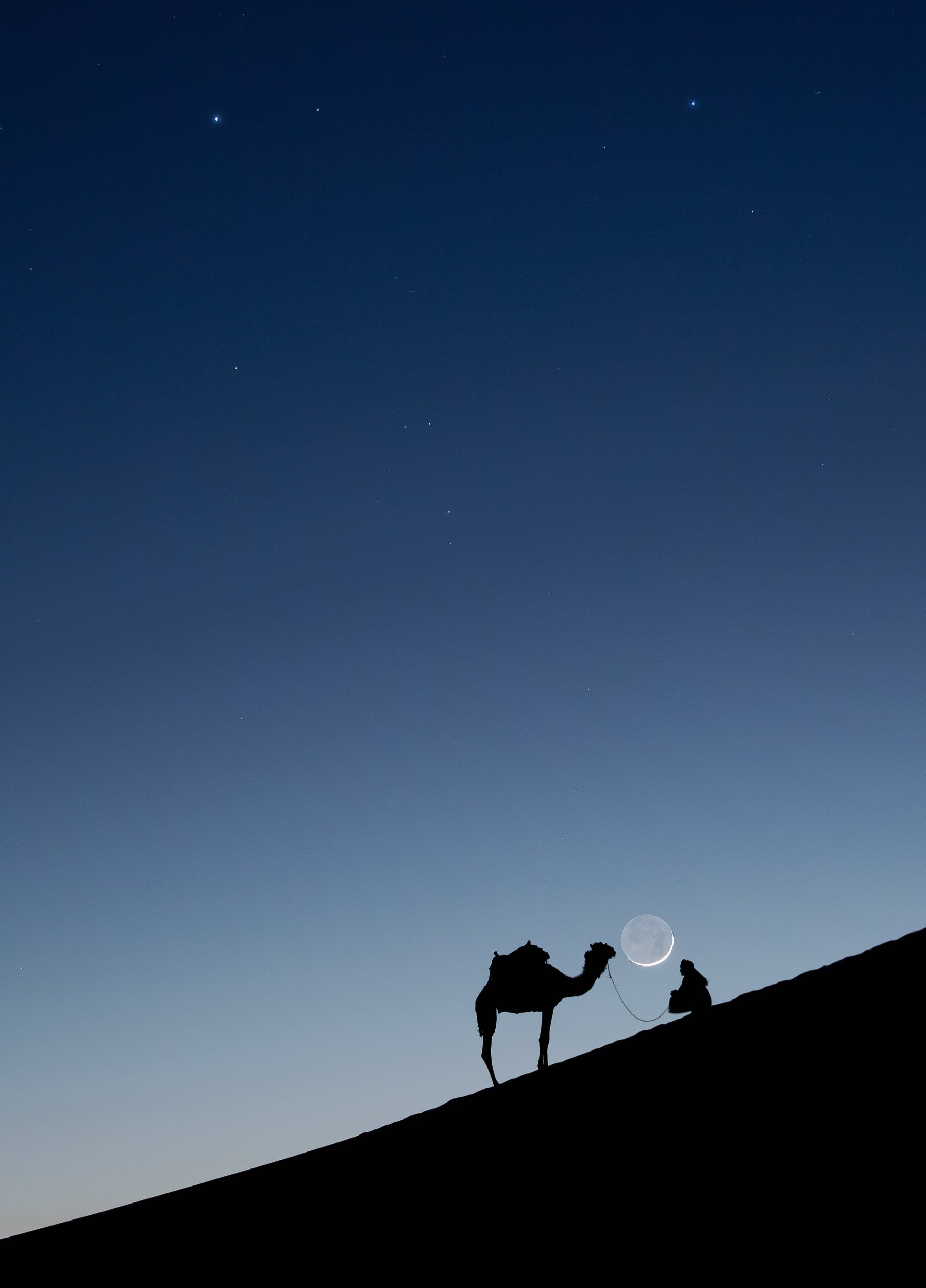
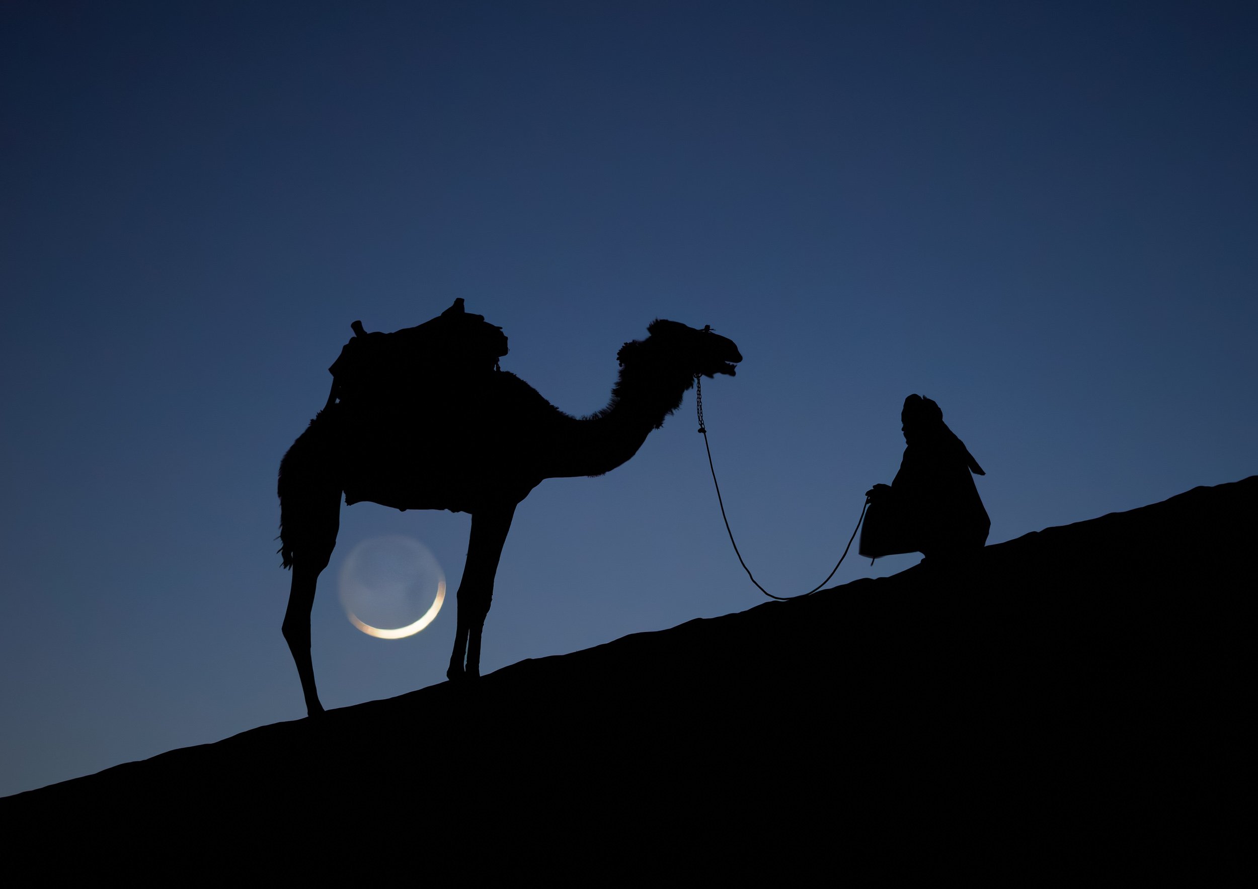
Our last night here was spent heading out to a few nearby dunes for sunset, joining our guides and their camels for dinner. The camel is a favorite animal of the Zalabieh bedouins that are resident here, and a symbol for male pride.


While I was off to take these photos, I set up another camera on my star tracker (the Benro Polaris) to take a timelapse sequence while the tracker was counteracting the rotation of the earth, effectively canceling it out and showing how our home planet makes its way through the galaxy.
The Final Morning in Wadi Rum
While drones are not allowed without a (very difficult to get) permit from the government, luckily there are other ways to see places from above, which I took advantage of before having to leave this incredible landscape.
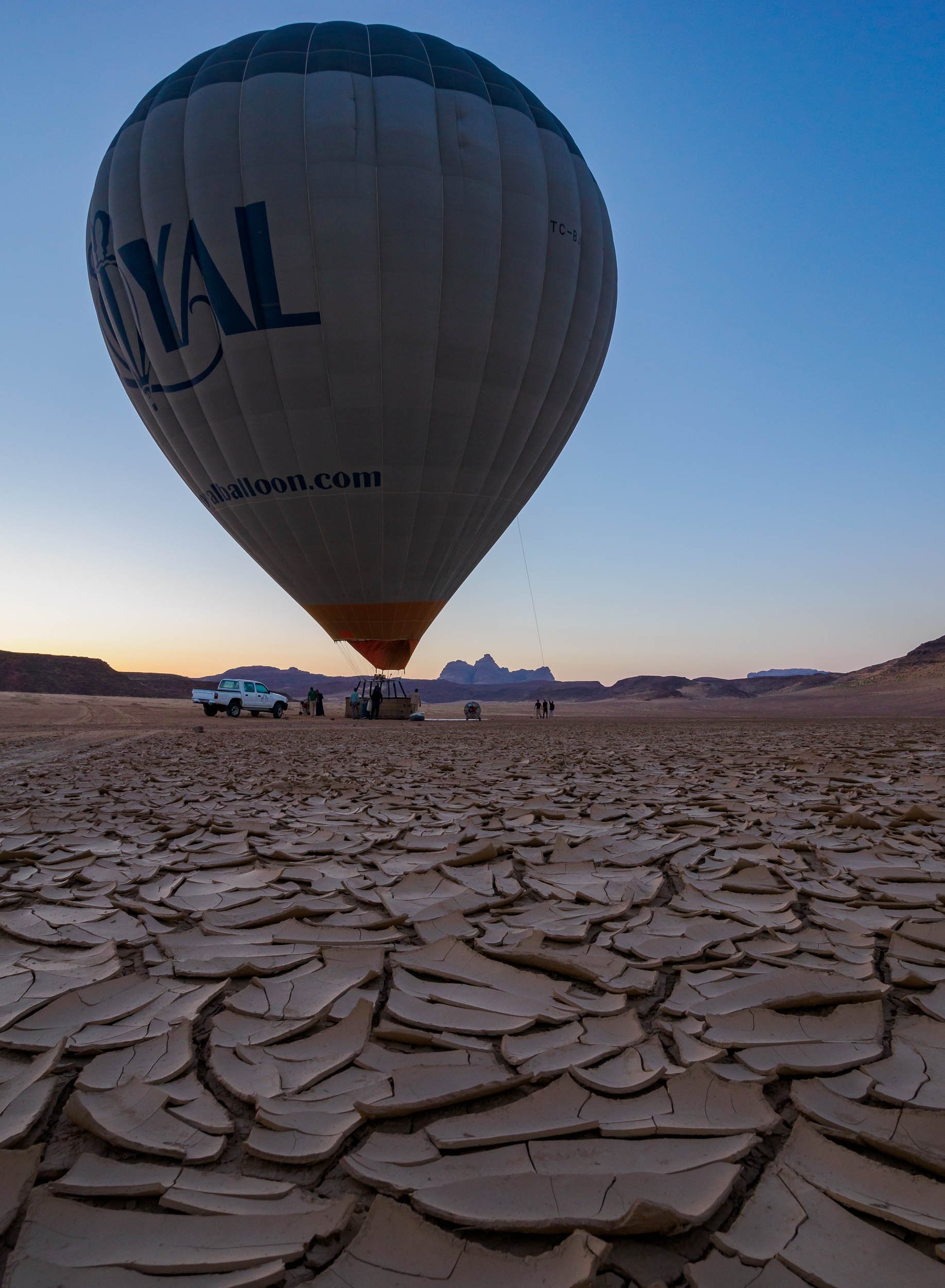
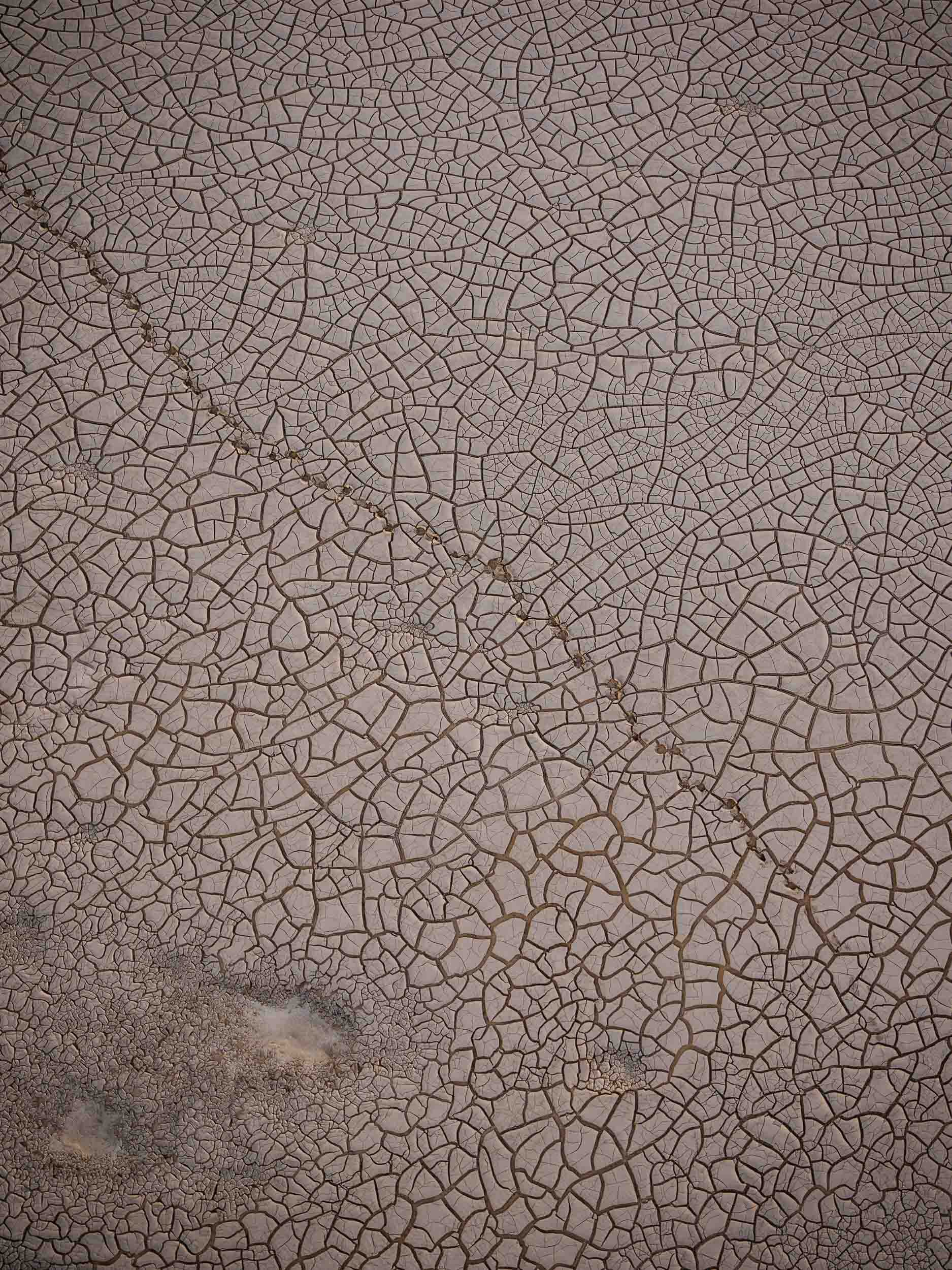

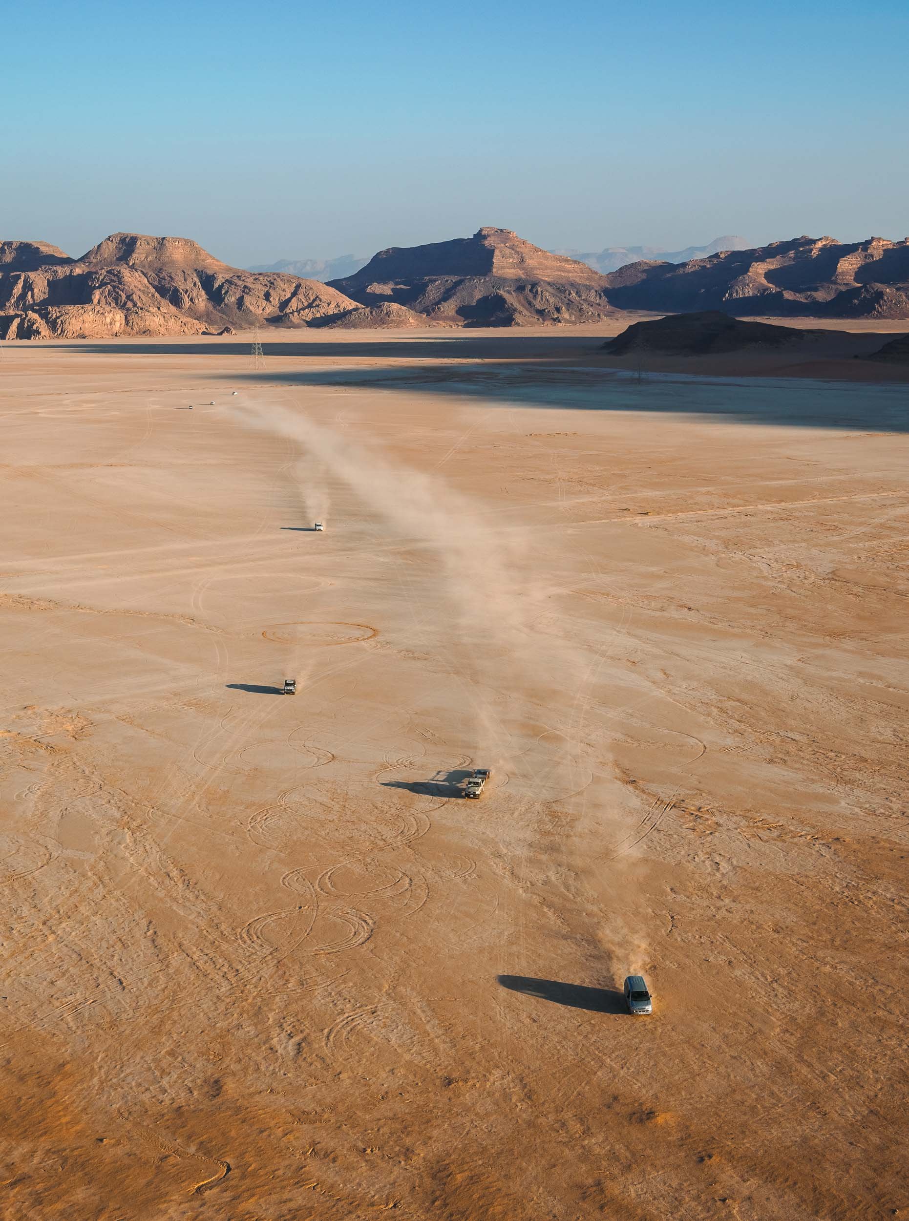
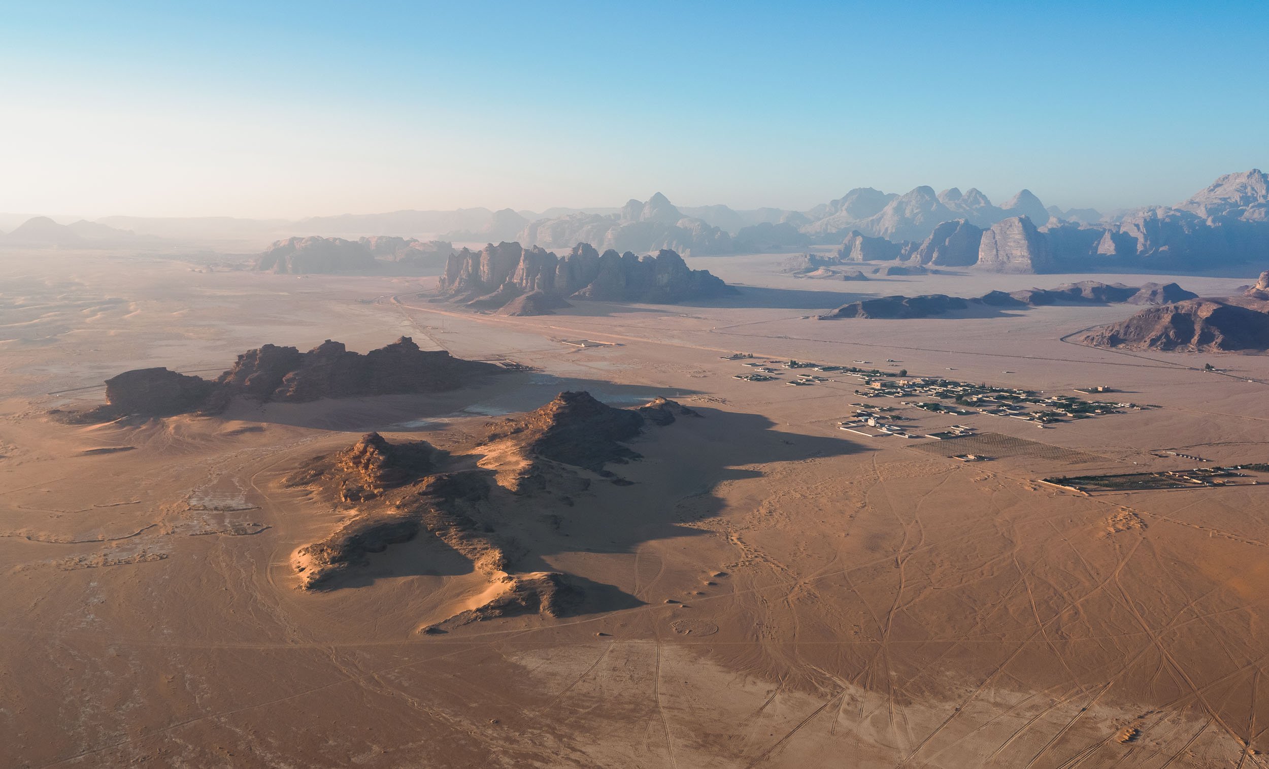
Back to the North
At this point I said goodbye to Benjamin and the group and continued the journey back into the northern parts of the country on my own, hoping to explore the ancient historic and a few more natural sites.
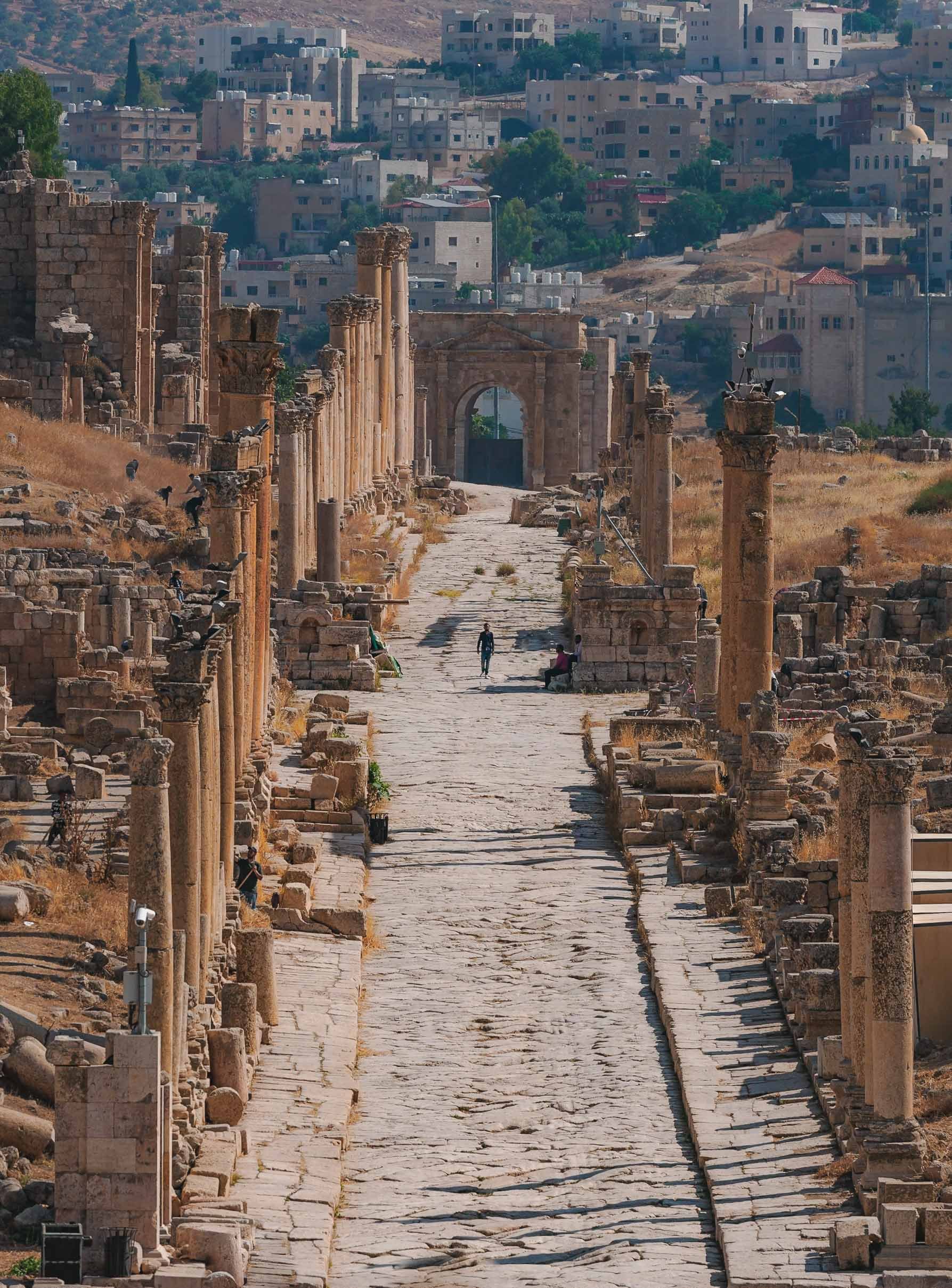
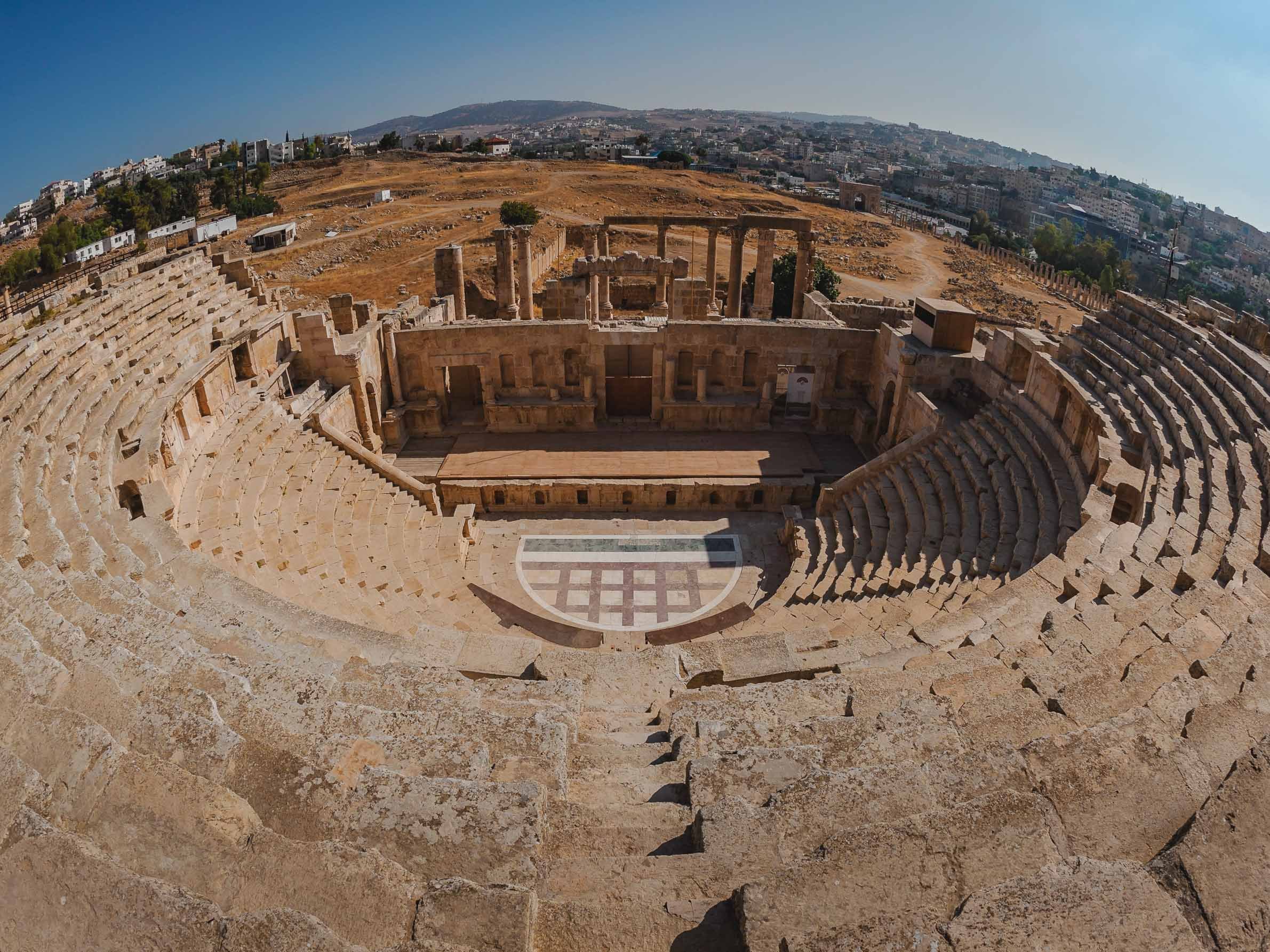


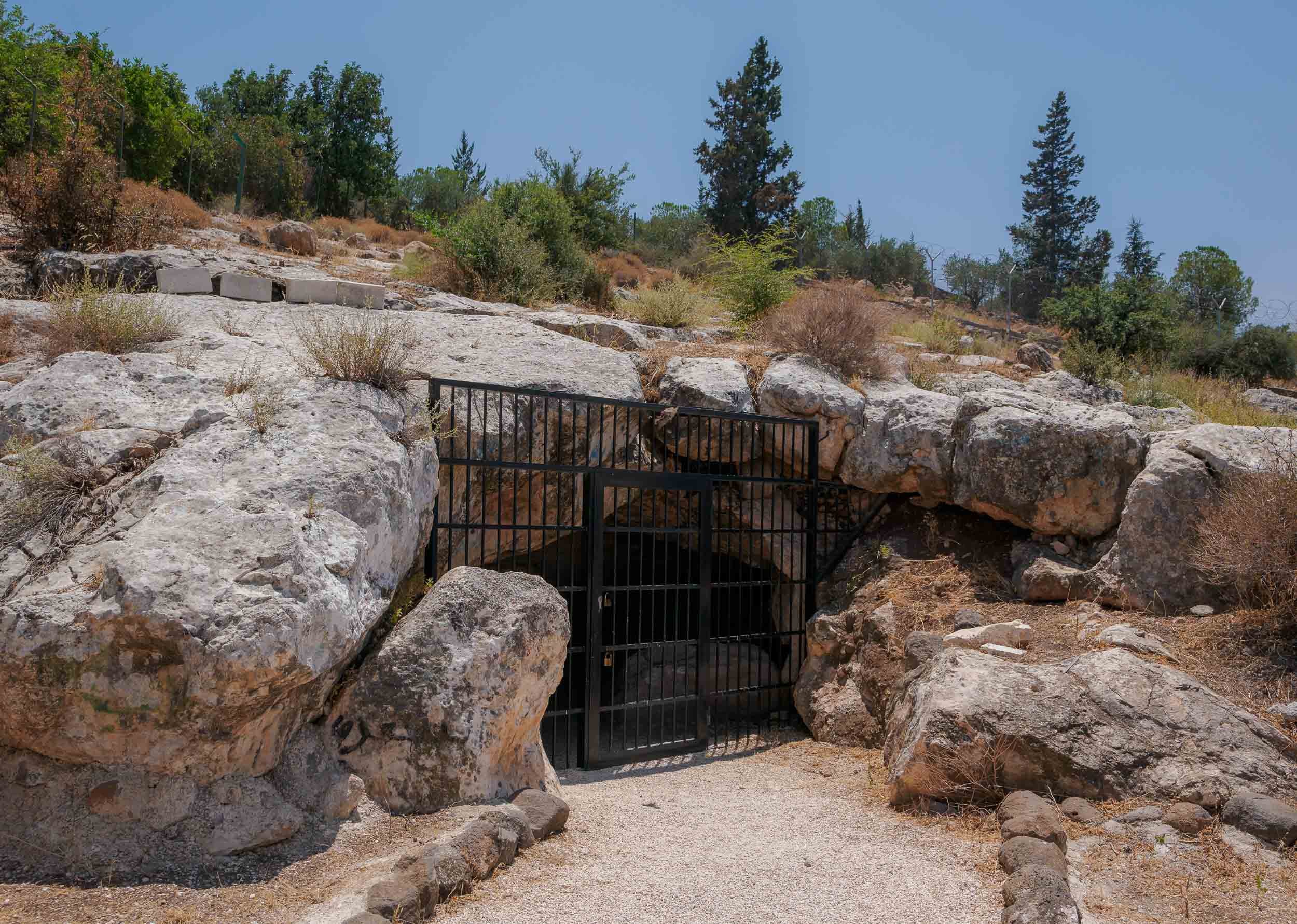

The Salty Sea
Heading back south, my next destination was the Dead Sea - one of the world’s saltiest water bodies and the lowest point on earth, at almost 450m below actual sea level. The water level falls at an alarming rate, dropping around 1 meter per year. Its high level of salinity (more than 10 times of a normal ocean) means there is no life to be found in and around it, and that swimming is more like floating - you can’t sink here.
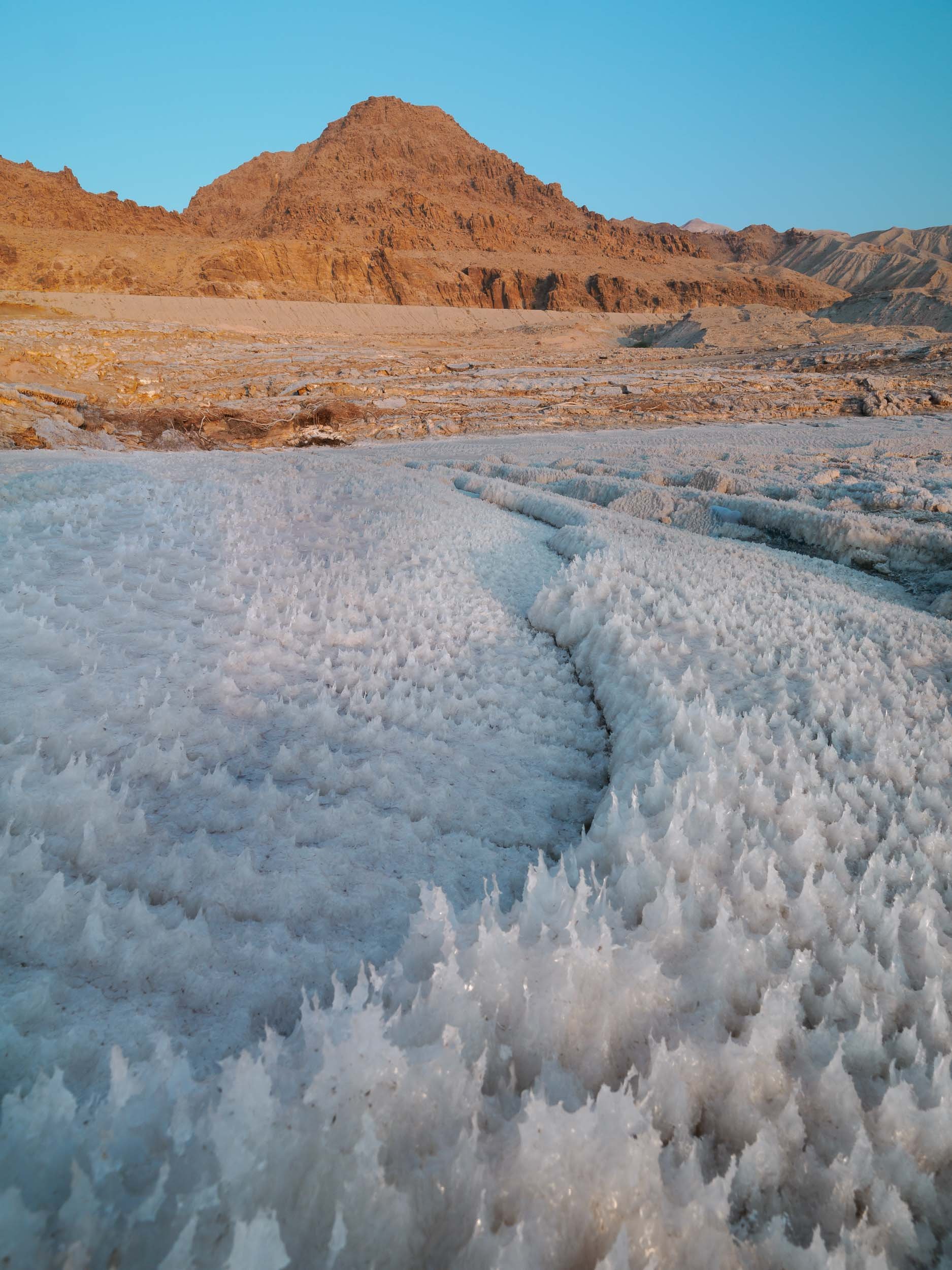
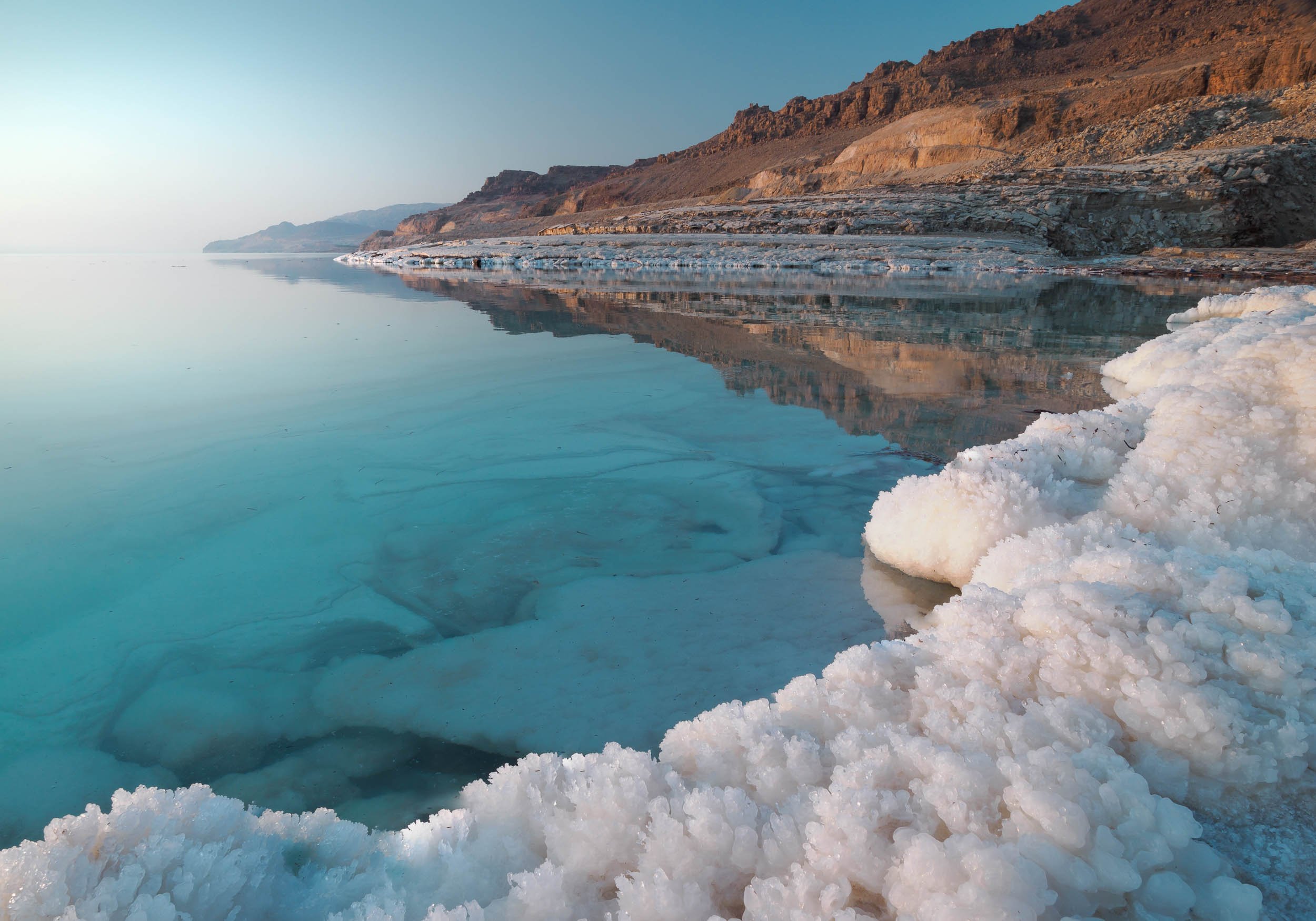
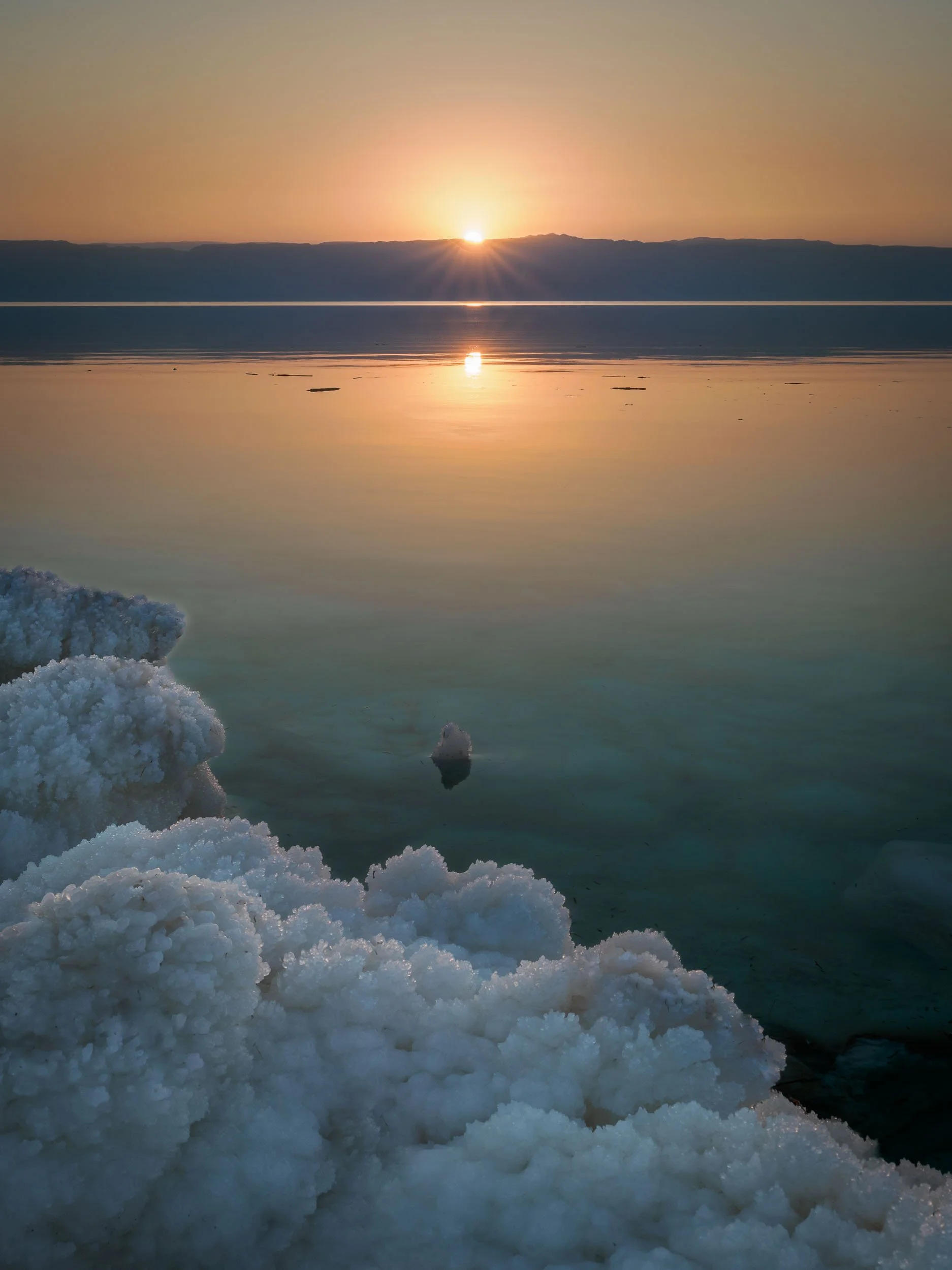

While originally a single body of water until the 1970s, the southern section of the Dead Sea (which is in fact a lake) is now completely separated from the northern part, and divided into commercially used evaporation pools to extract and produce chloride. The future of the northern part is not clear, some say it will eventually dry up completely, others believe this is unlikely due to the continued inflow of water, and the reducing evaporation rate that will eventually match the inflow. Commercial projects to save the lake at its current levels, such as a canal from the Red Sea, have been announced but never actually made significant progress.

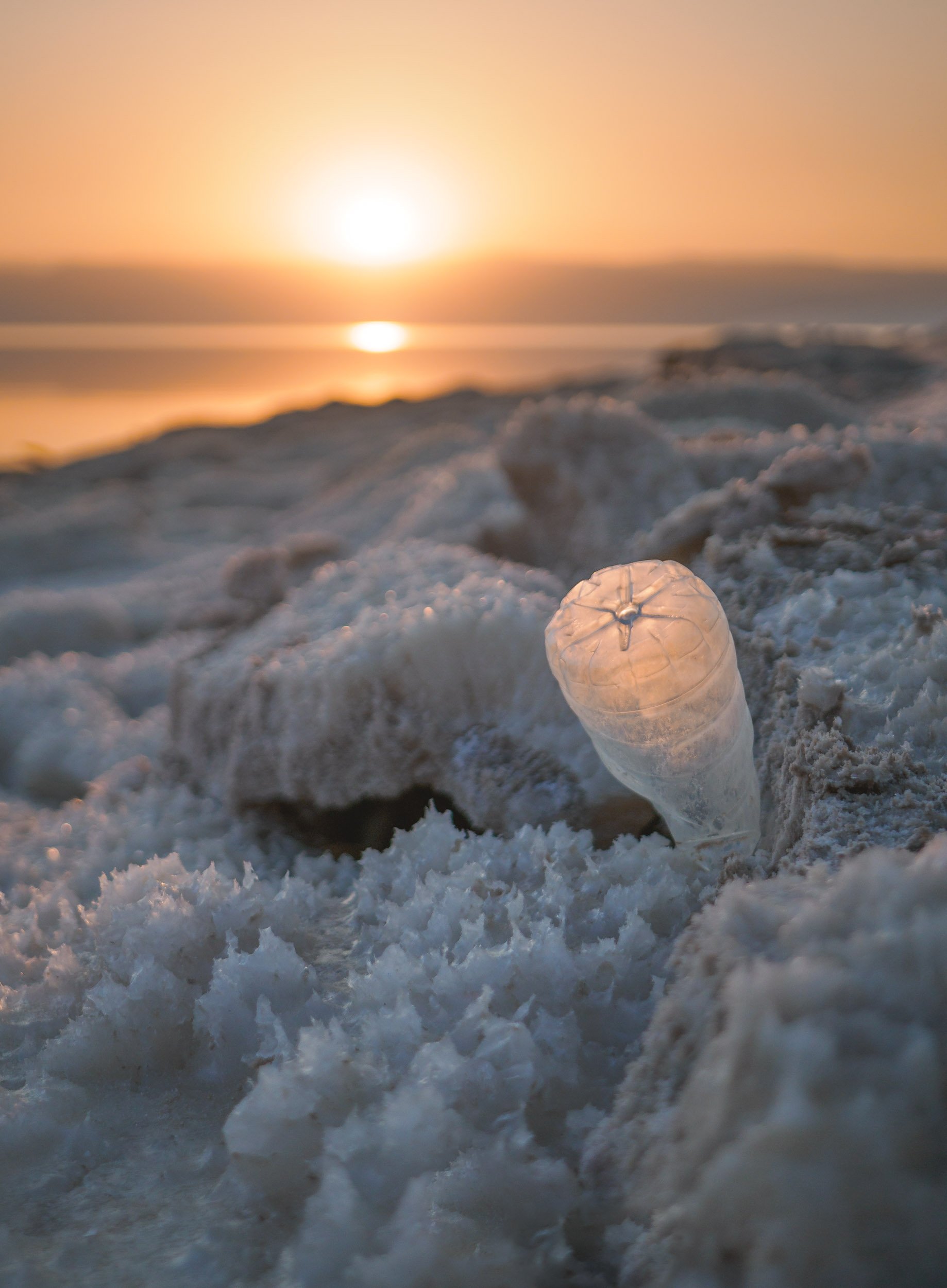
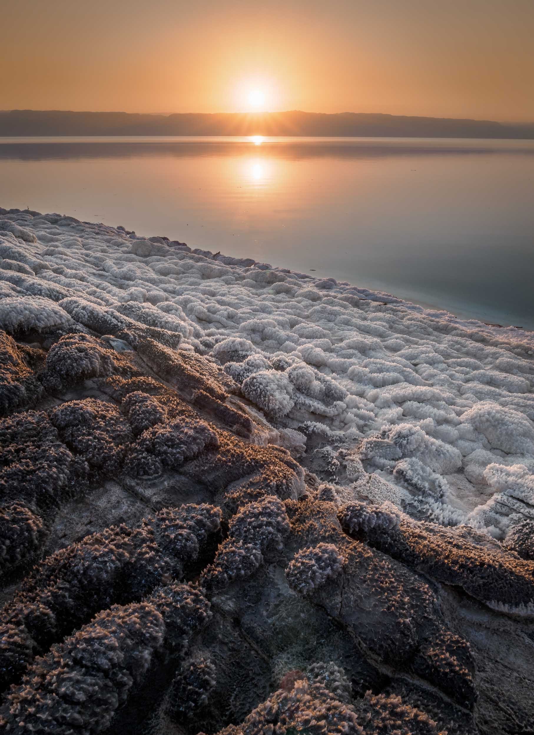
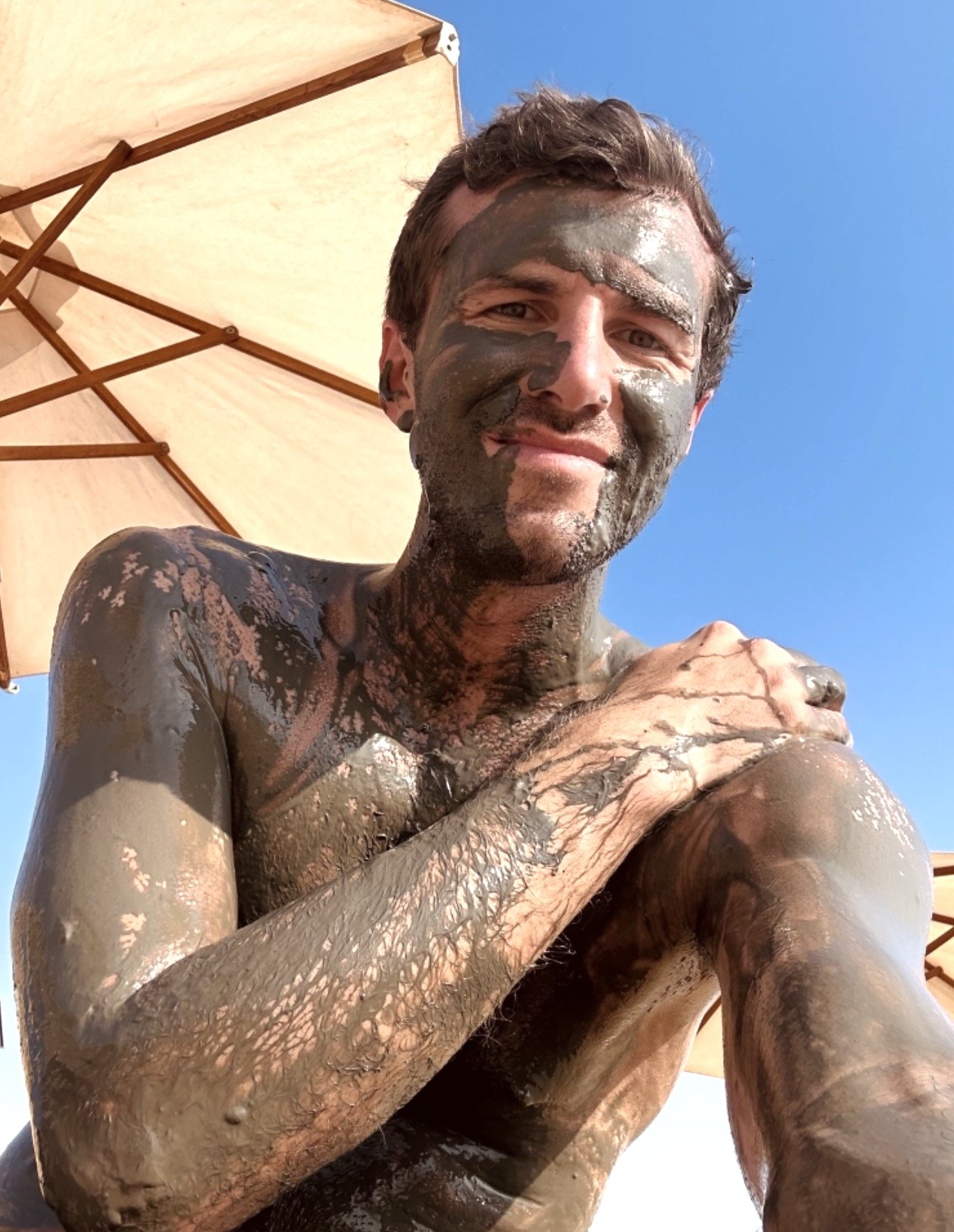
Wadi Mujib
On the shores of the Dead Sea lies a beautiful biosphere reserve around a river that empties into the lake, with options for hiking and canyoning.
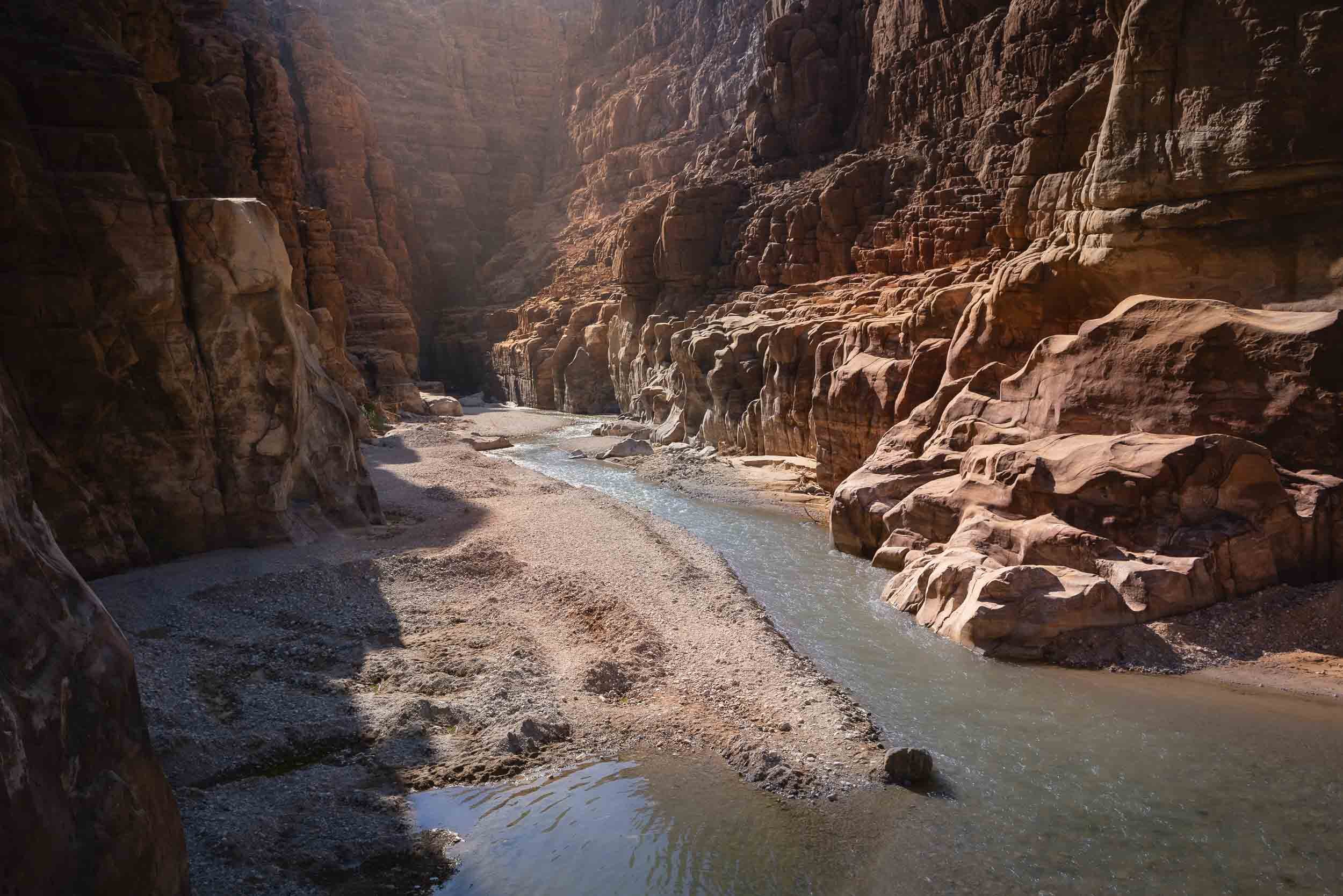

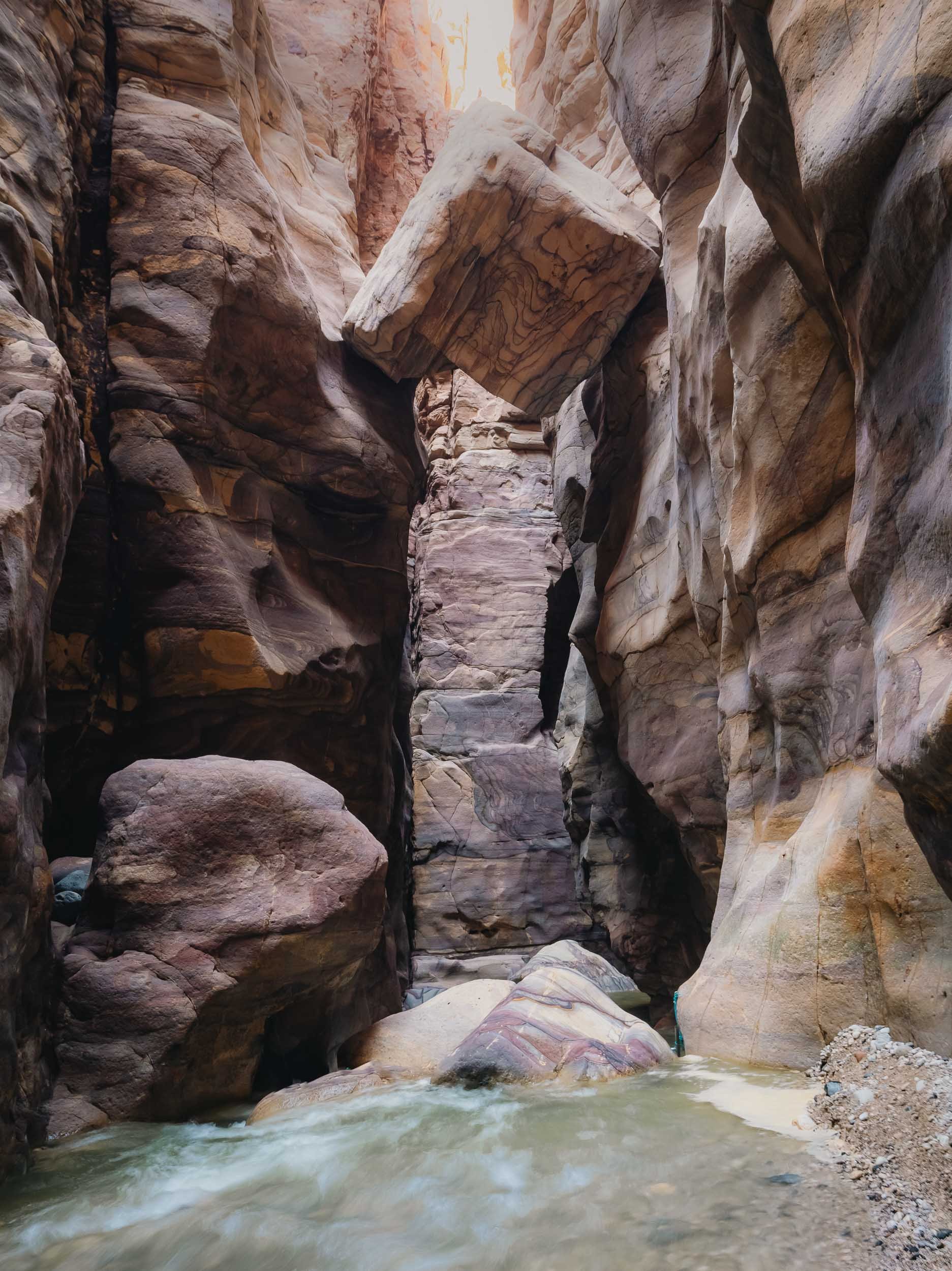
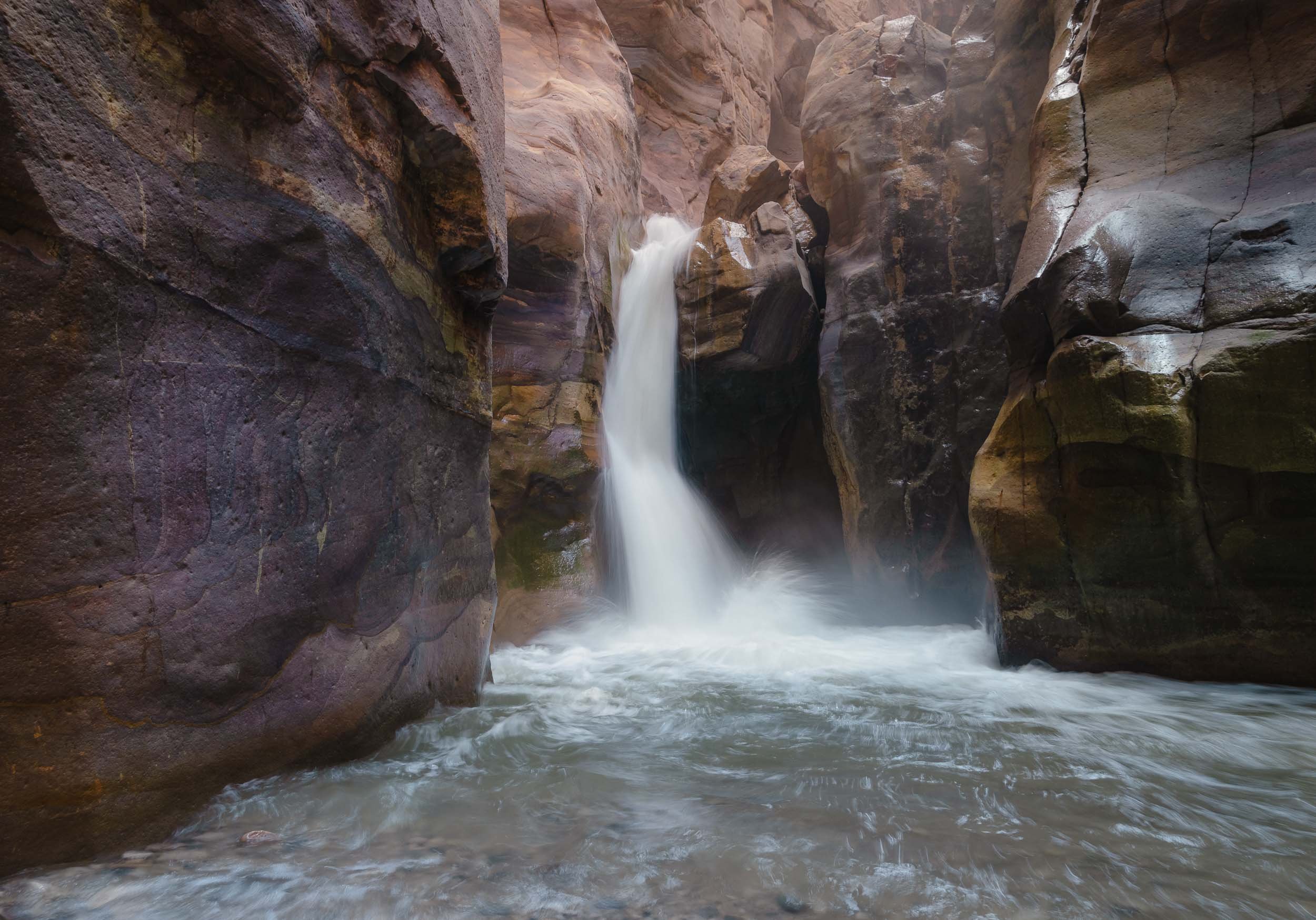
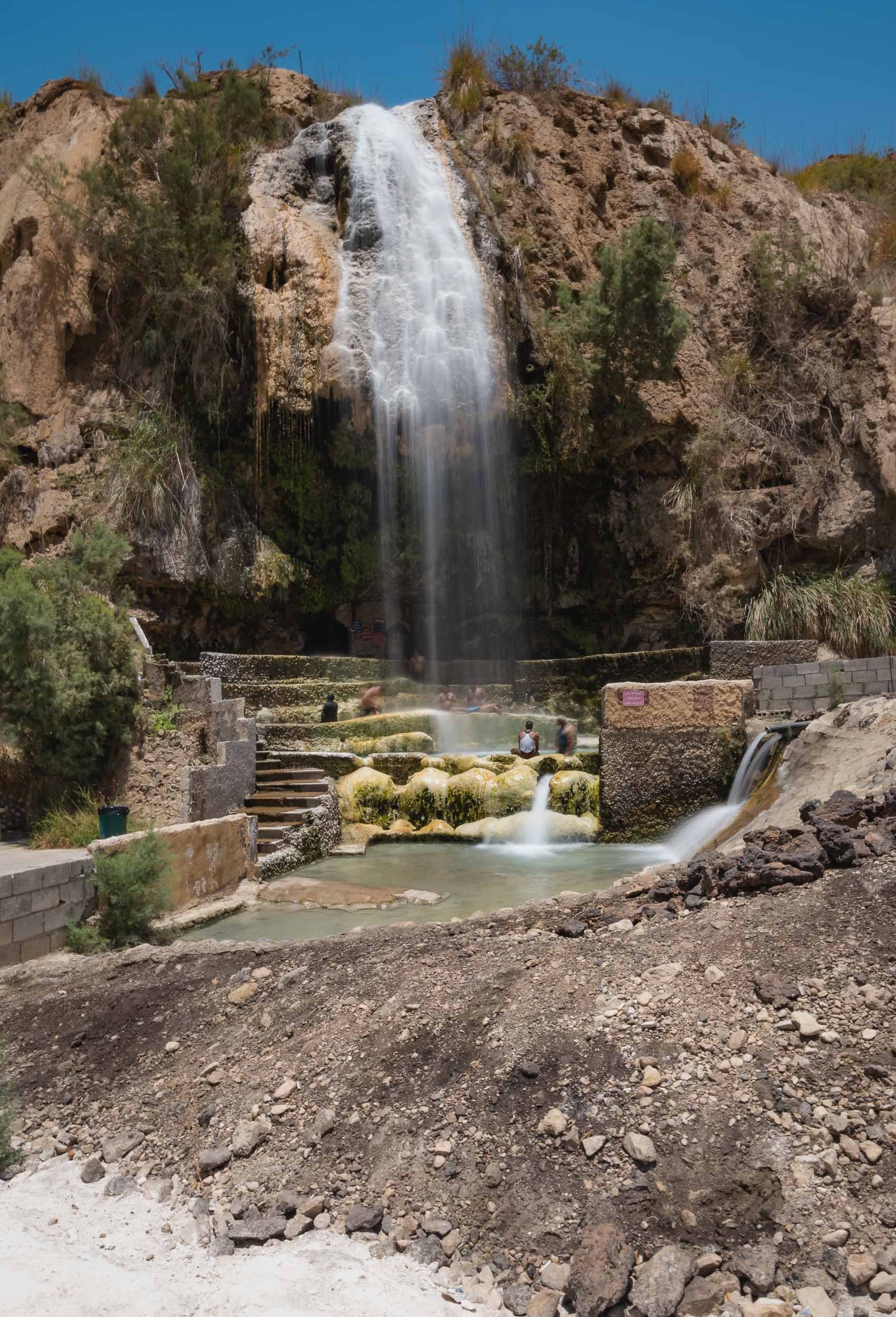


It's this 6th century map of the Holy Land, which represents the oldest surviving overview of the area, including old Jerusalem seen above. The representation was shown to be very accurate, occasionally even guiding excavations and research in certain areas.
Glimpses of Amman
I didn’t spend all that much time in Jordan’s capital, but of course had explore the citadel towering over the slopes that Amman has evolved on - originally, the city was built on seven hills. Excavations in the area found evidence of settlements dating back all the way to the Bronze Age, 4000 years ago.

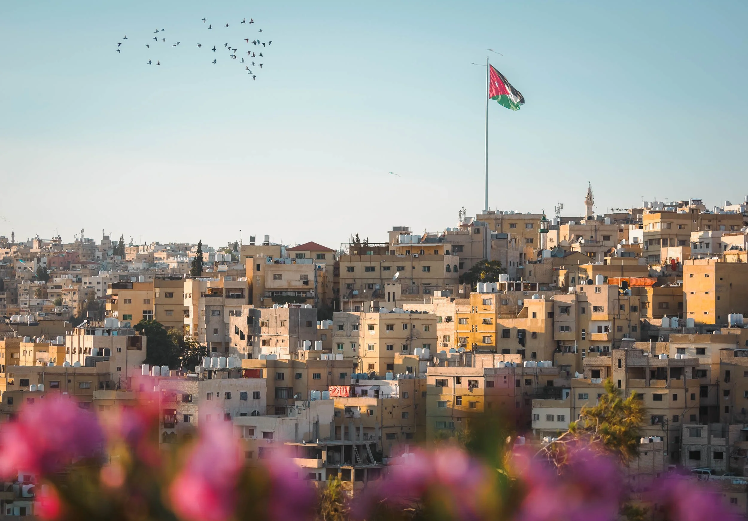

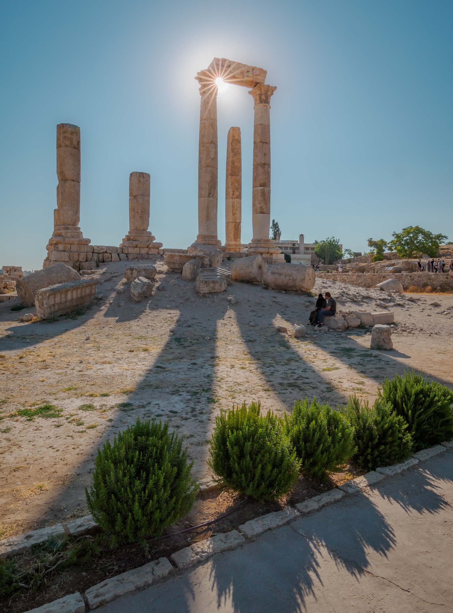


Final Stop
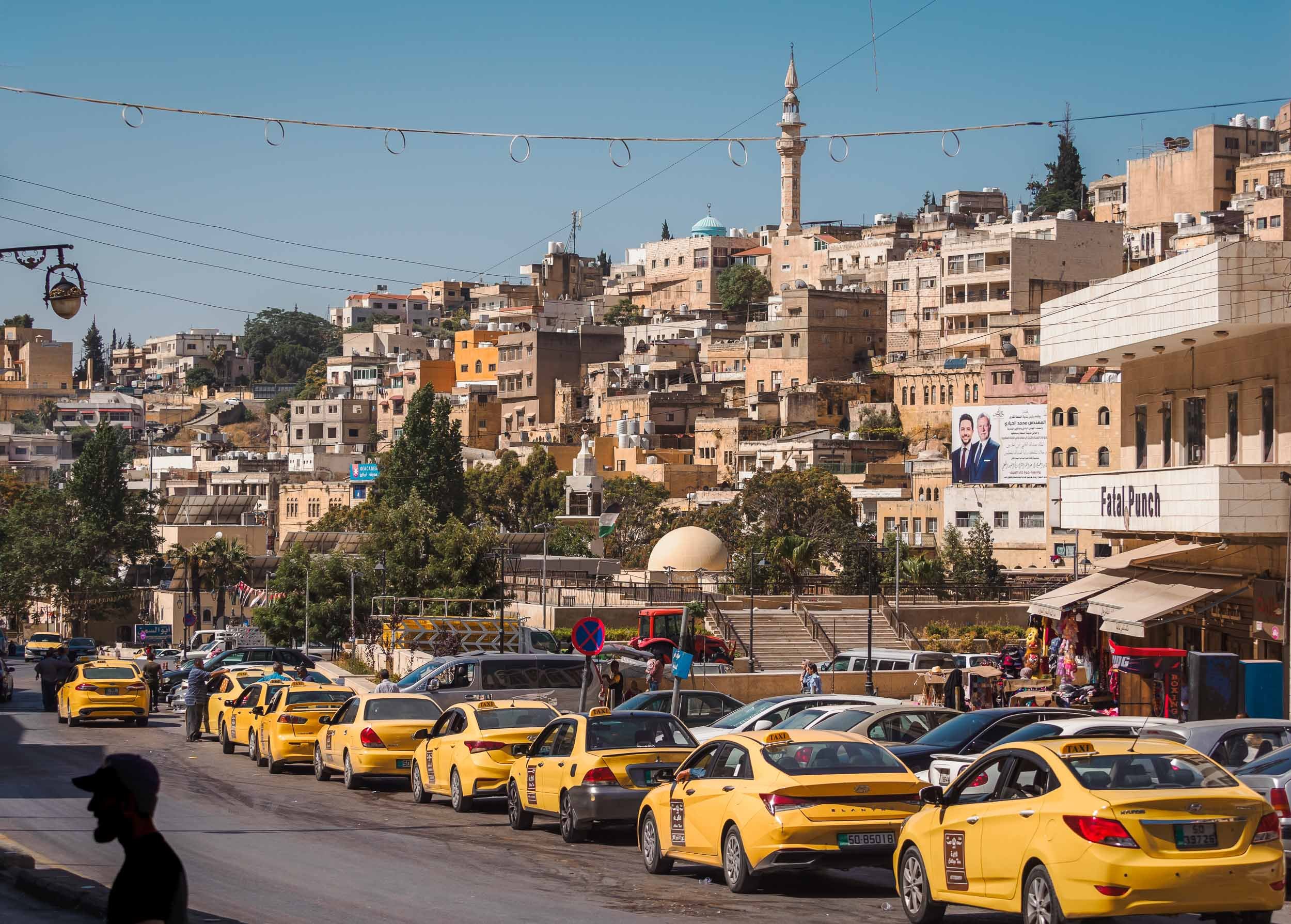


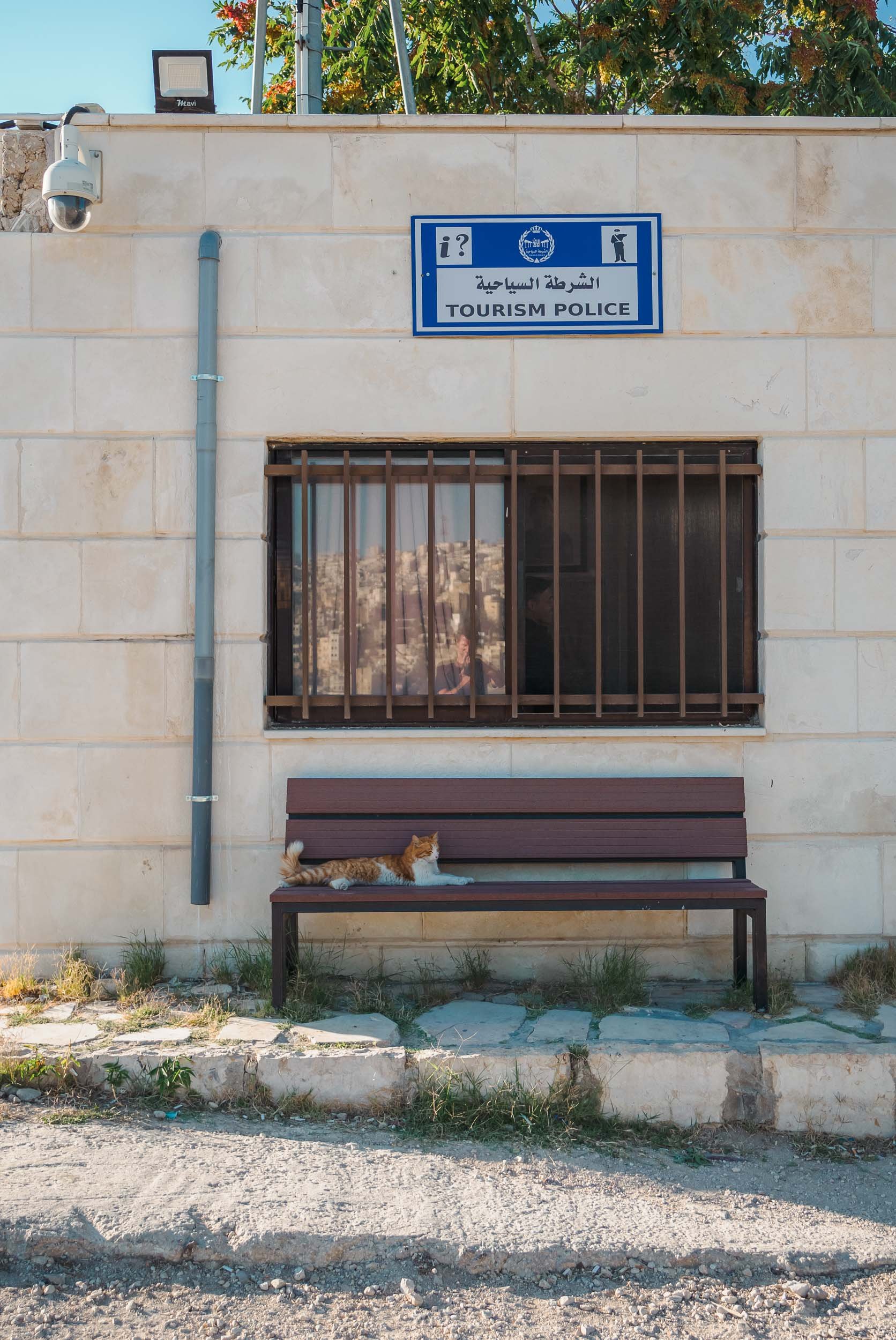
And that was my trip to Jordan - as always, you can subscribe for the next updates here or take a look at some of my favorite photos in my Portfolio. If any of the images here catch your eye and you think they’d make for a good piece of art on your wall, I make custom signed prints, just get in touch!


Palawan - Gem of the Philippines
Earlier this year I spent a few weeks in the Philippines, exploring Manila, Siargao, Cebu, Bohol, and what was once voted the most beautiful island in the world: Palawan.

Earlier this year I spent a few weeks in the Philippines, exploring Manila, Siargao, Cebu, Bohol, and what was once voted the most beautiful island in the world: Palawan. This large island is home to around 1m people and lies on the very western border of the country.
Start with this short clip for an overview of some of the amazing spots around Palawan!
On the way to El Nido
I arrived from Cebu, landing at the airport of Puerta Princesa, which is also the capital and largest city on the island. The plan was to go north towards El Nido, the most well-known area. On the way, a visit to the island’s famous underground river was on the cards - which was cancelled by the coast guard due to high waves. This is not uncommon, keep it in mind and allow enough time to try again - which I managed to do, more on that later. Instead, we stopped in Barton Bay, on the western coast, for a small boat excursion, and got to witness an interesting local event: Racing homemade speed boats.

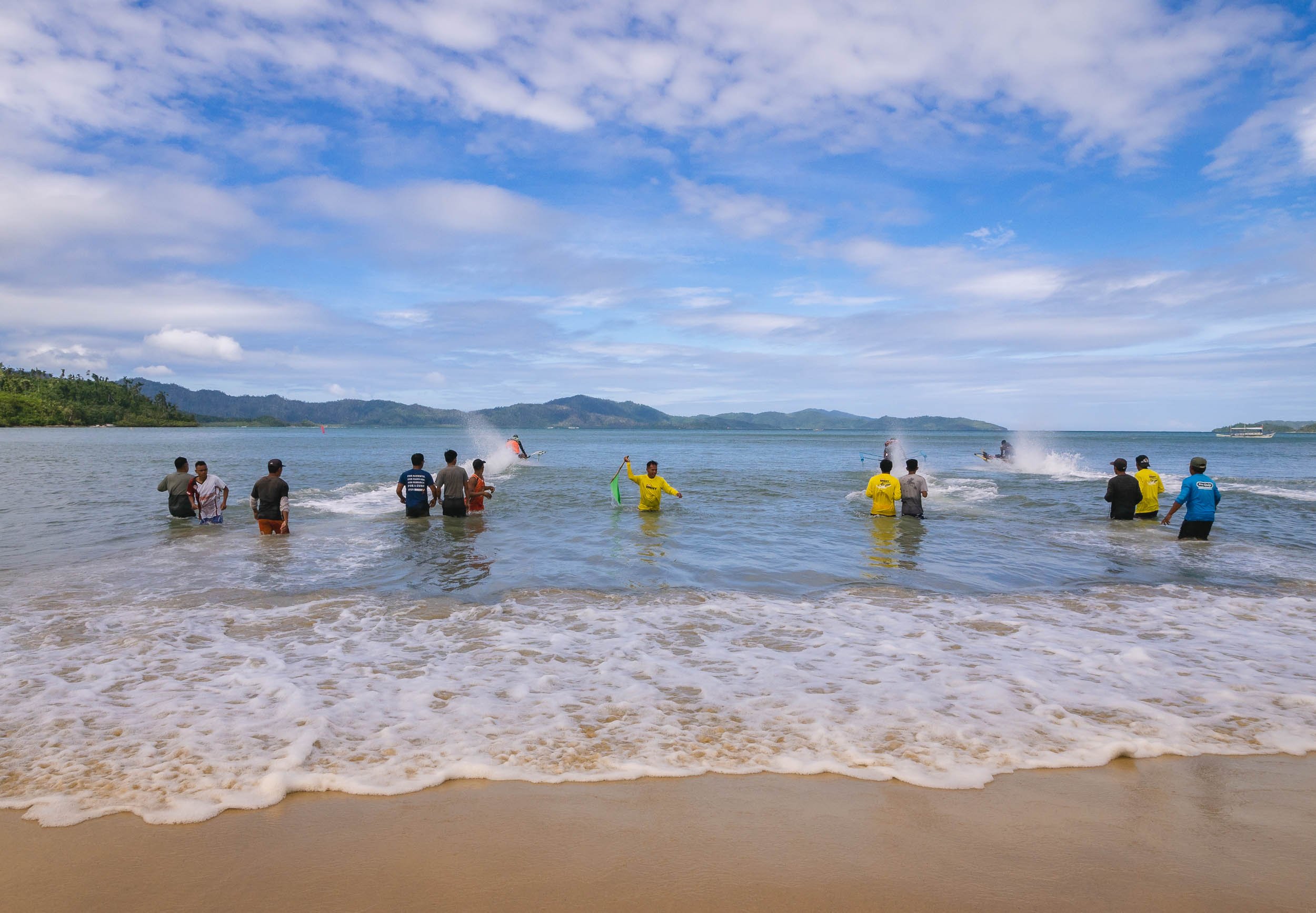
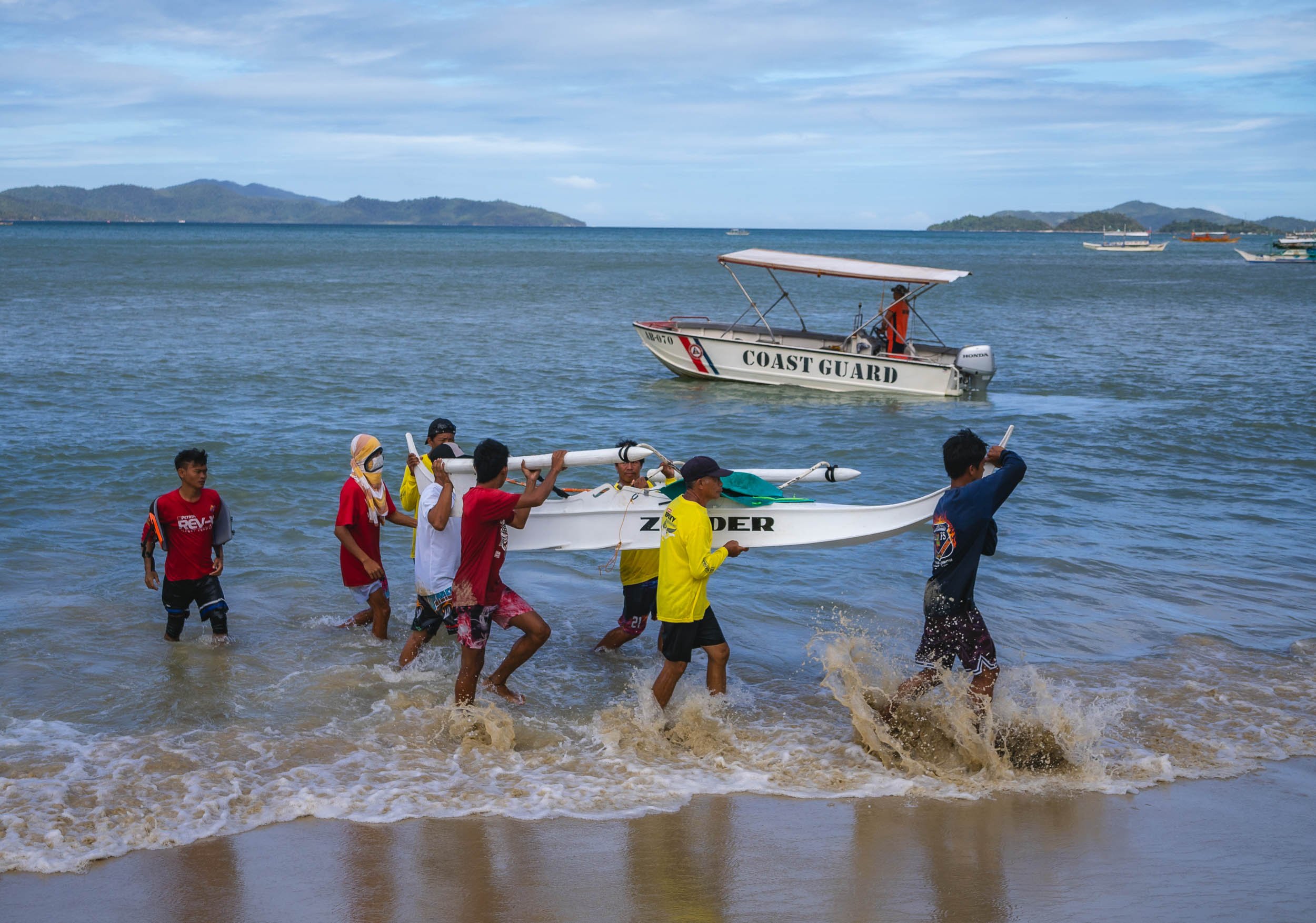

Port Barton is also home to a small sandbank that frequently sees starfish washed on shore, making for some picturesque scenes, especially if - like me - you’re patient enough to await the right moment with no boats and people around.


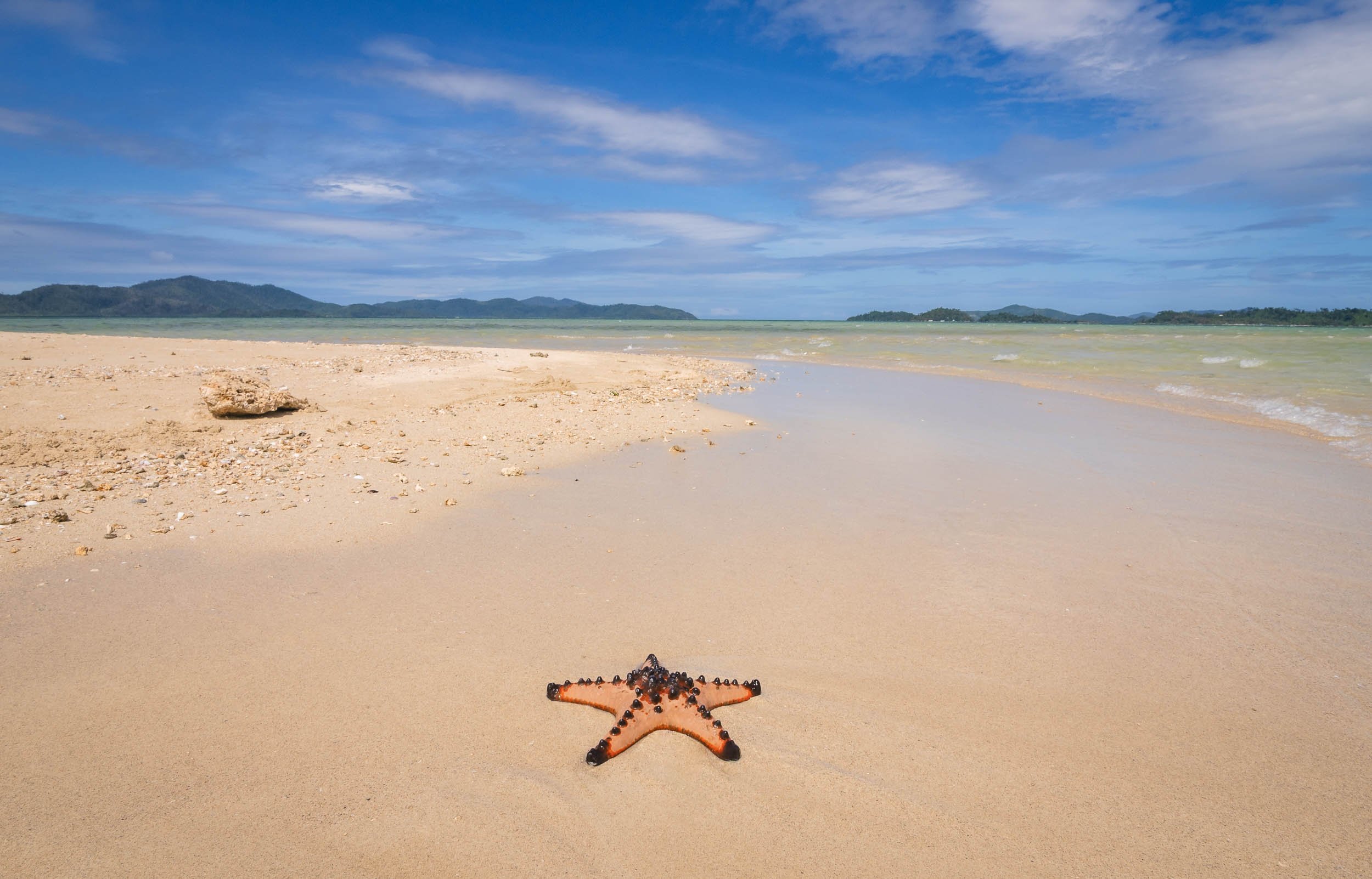


Island of Doom
The bay also has a few beautiful islands - one of which became the doom of my drone, which ended up with a low battery in the sea, as the heavy westerly winds didn't allow it to come back in time... Luckily my amazing tour company - more on that later - helped me get a rental for the rest of the trip. Palawan really needs to be seen from the air.


El Nido & The North
Some of the most beautiful land- and seascapes are in the northern parts of the main island, around El Nido. Having researched this area a bit, I knew that most of the very touristy trips follow standard routes, and you can pick A, B, C, or D. Obviously not what I wanted, because that means everyone going to the same places at roughly the same times, and those tours of course also start once people crawl out of their beds rather than at sunrise when the conditions are best and things quiet. So in my usual quest for something a bit more interesting I found a tour company priding themselves in organizing custom trips: Palaweña.
Palawan's landscape is famous for the almost 1800 islands scattered along the coast of the 450km long main island.

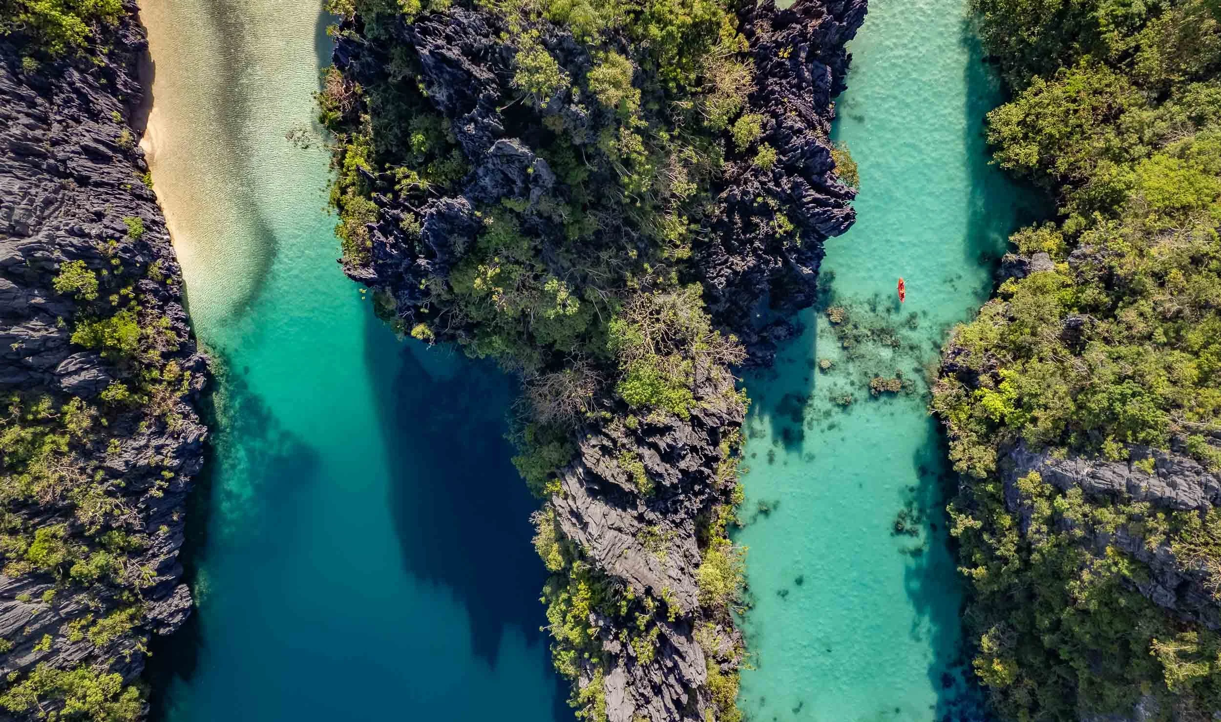
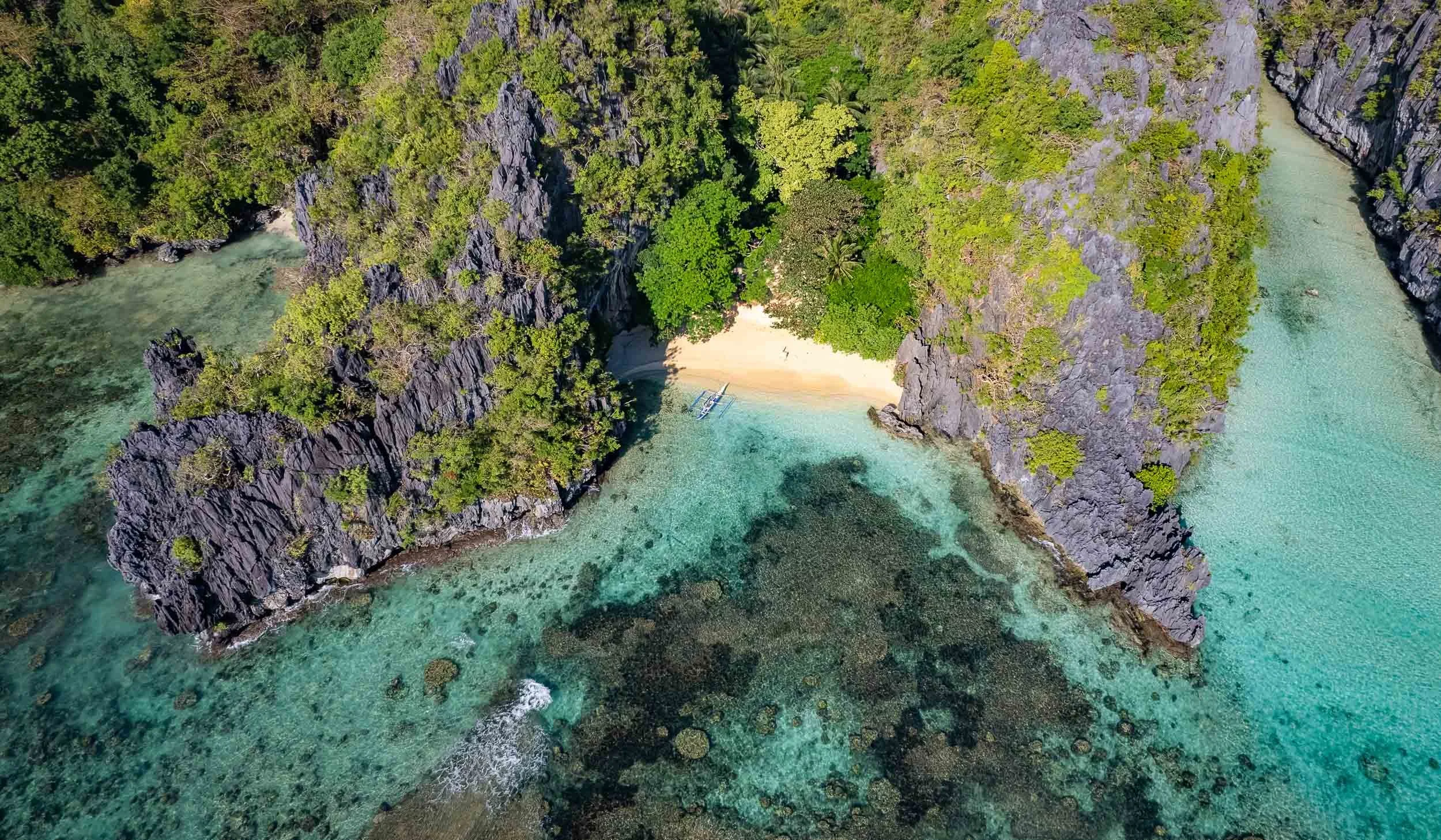
The private custom tours paid off (and were super well organized), because we reached many of the best spots around Bacuit Bay, such as the Big Lagoon and its beaches pictured above, before any other boats.


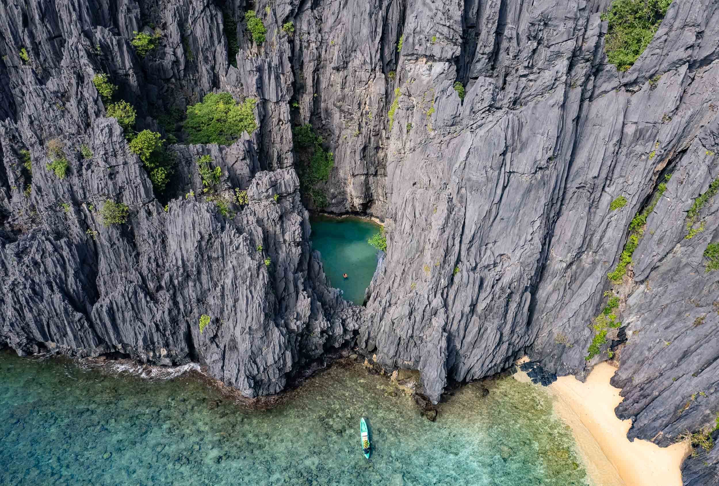

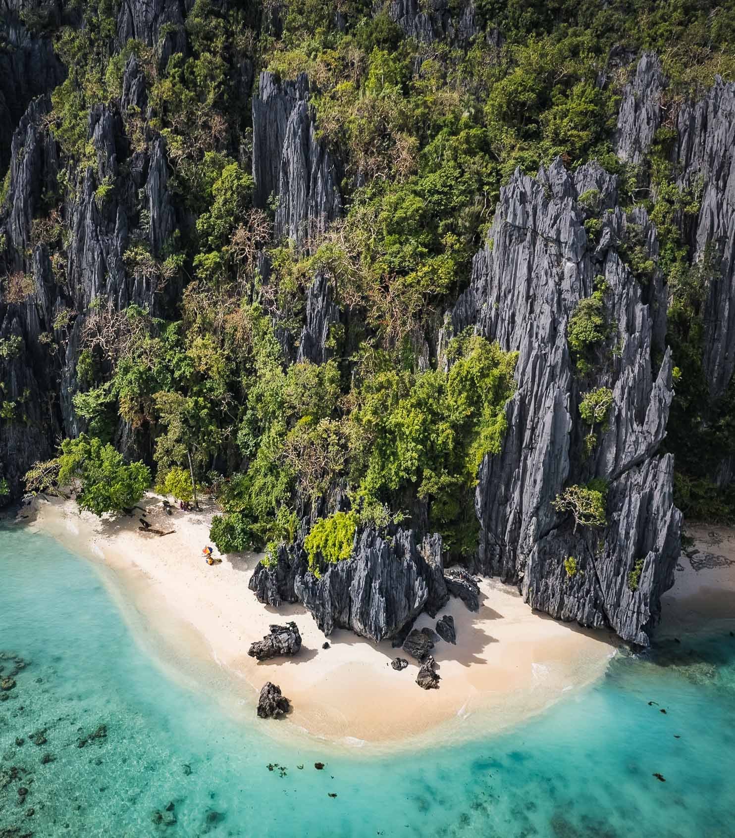
Shimizu Island
Another of the beautiful limestone cliff islands with their white sandy beaches. Who wouldn't want to set up their umbrella here?

Matinloc Island
A bit further north-west you’ll find a curious man-made spot: An abandoned shrine, built in 1982 between the cliffs and the beach alongside a small villa, and now mainly used for lunch stops and apparently a yearly pilgrimage by the locals.

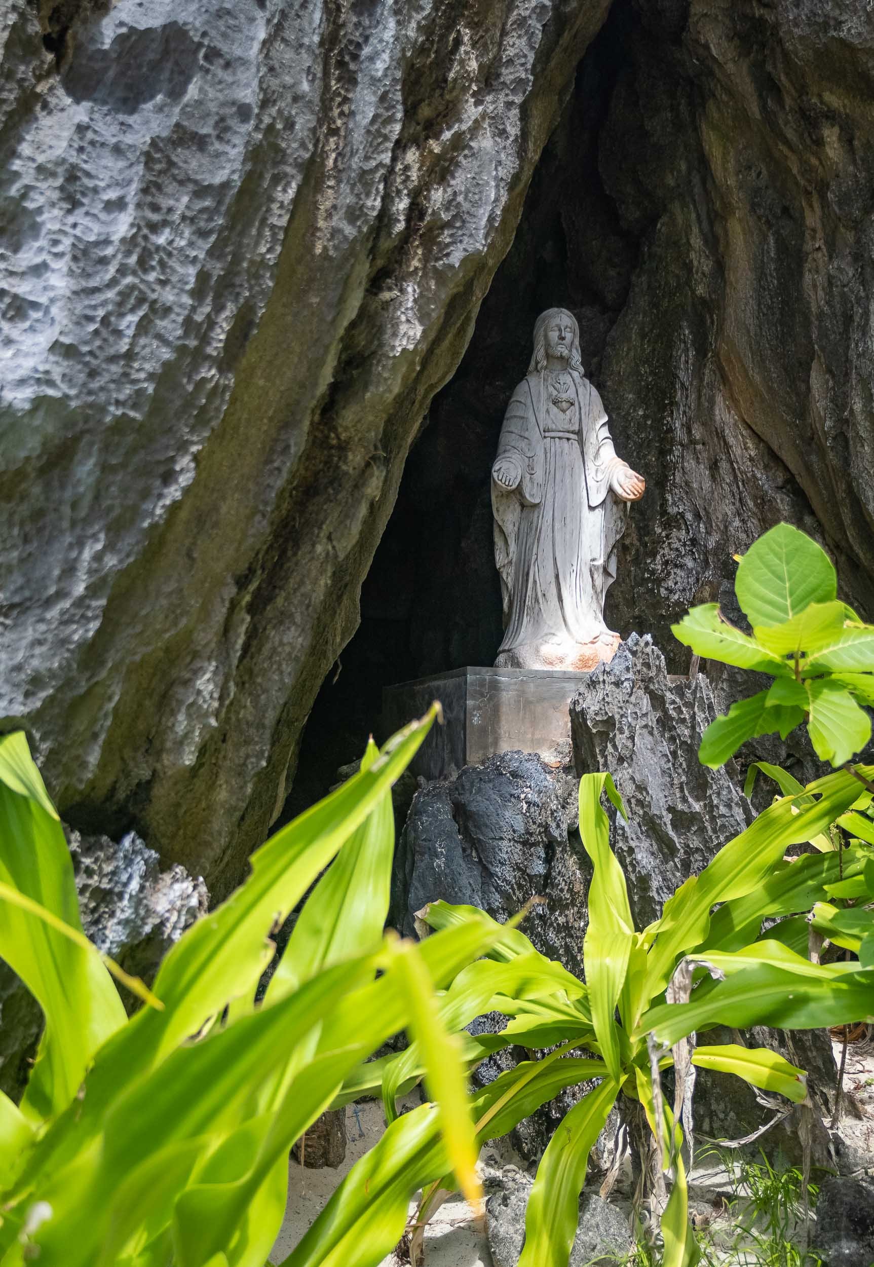


The scale of the limestone formations here is truly amazing, spot the kayak in the second shot!
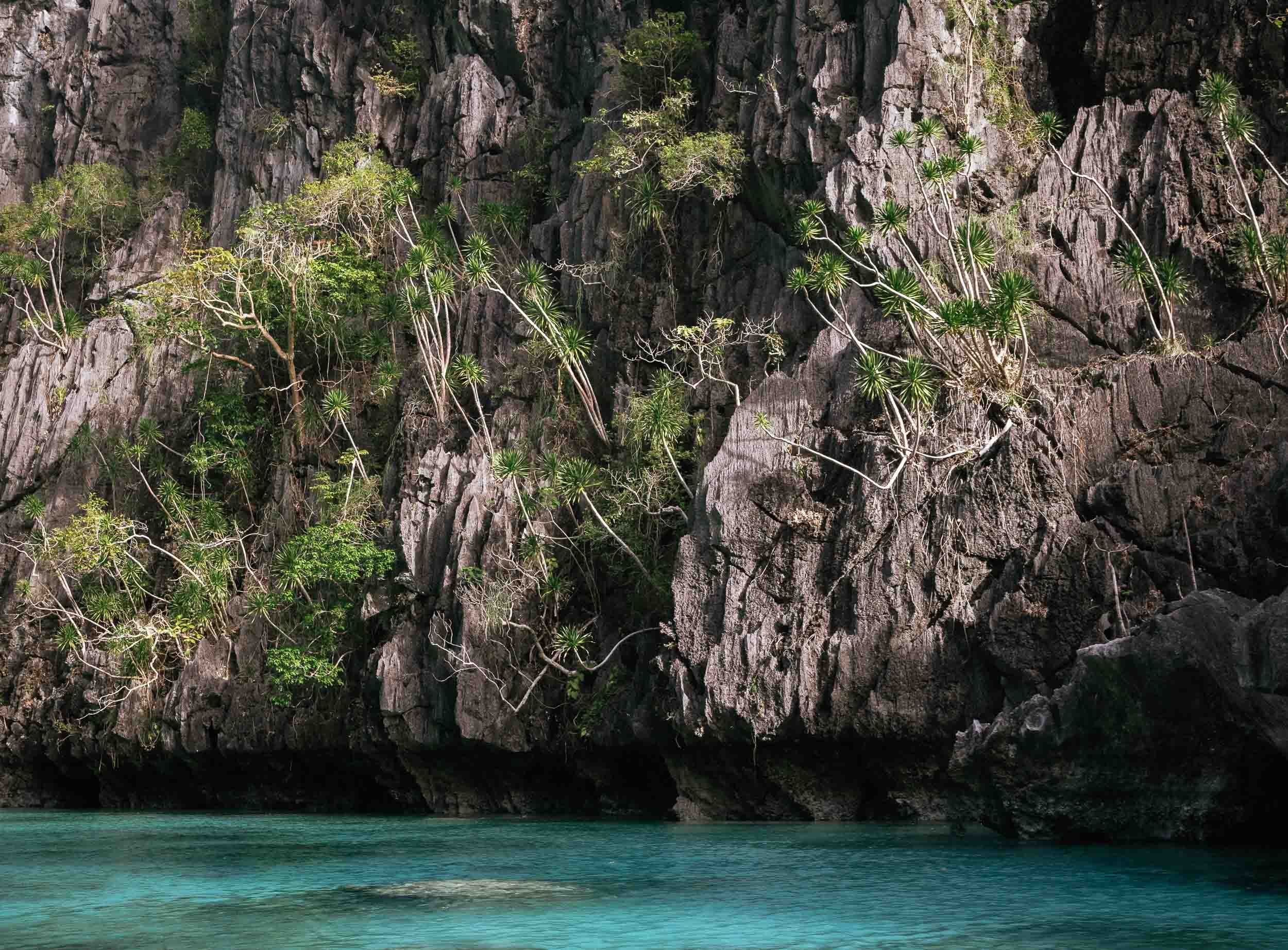
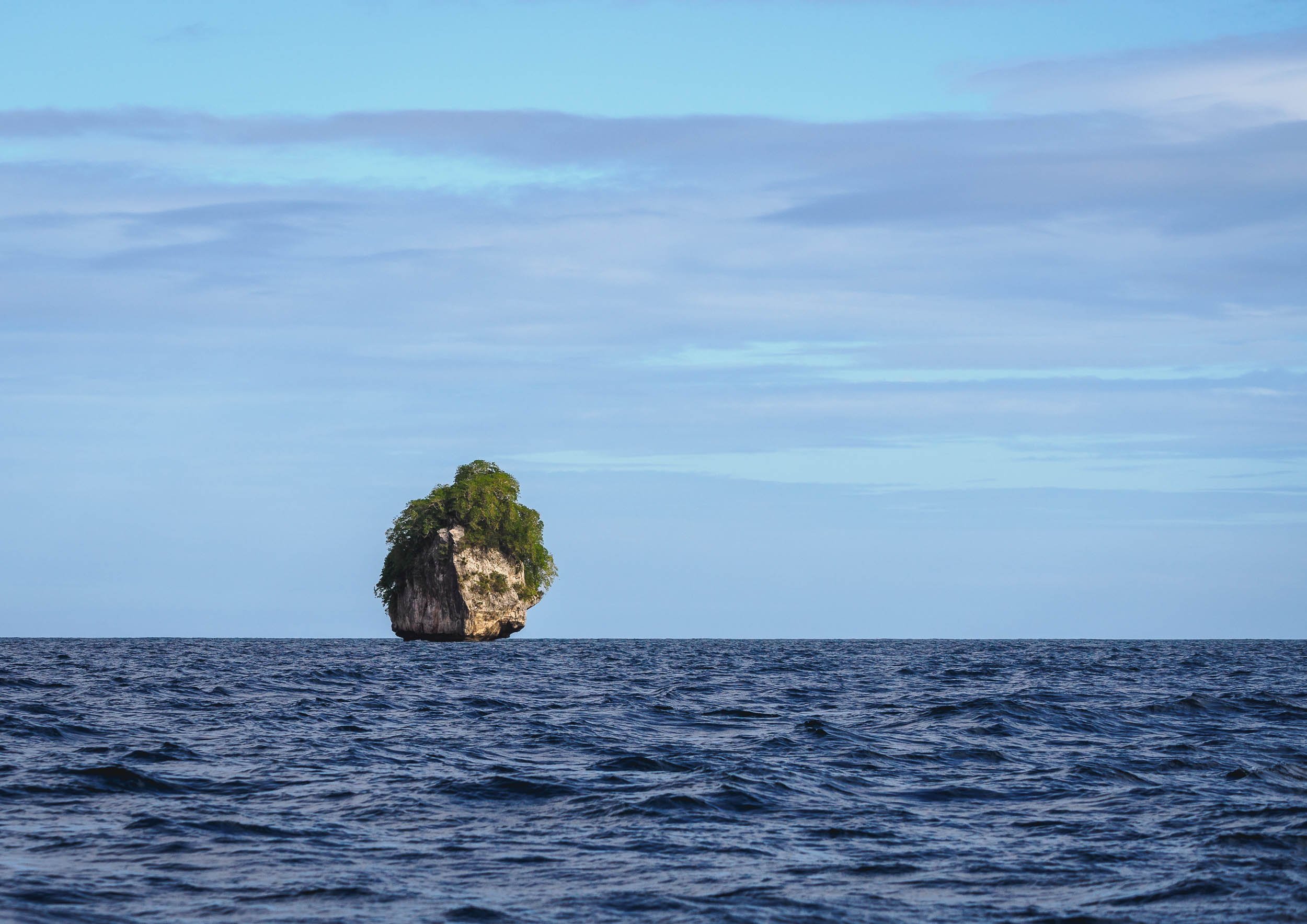
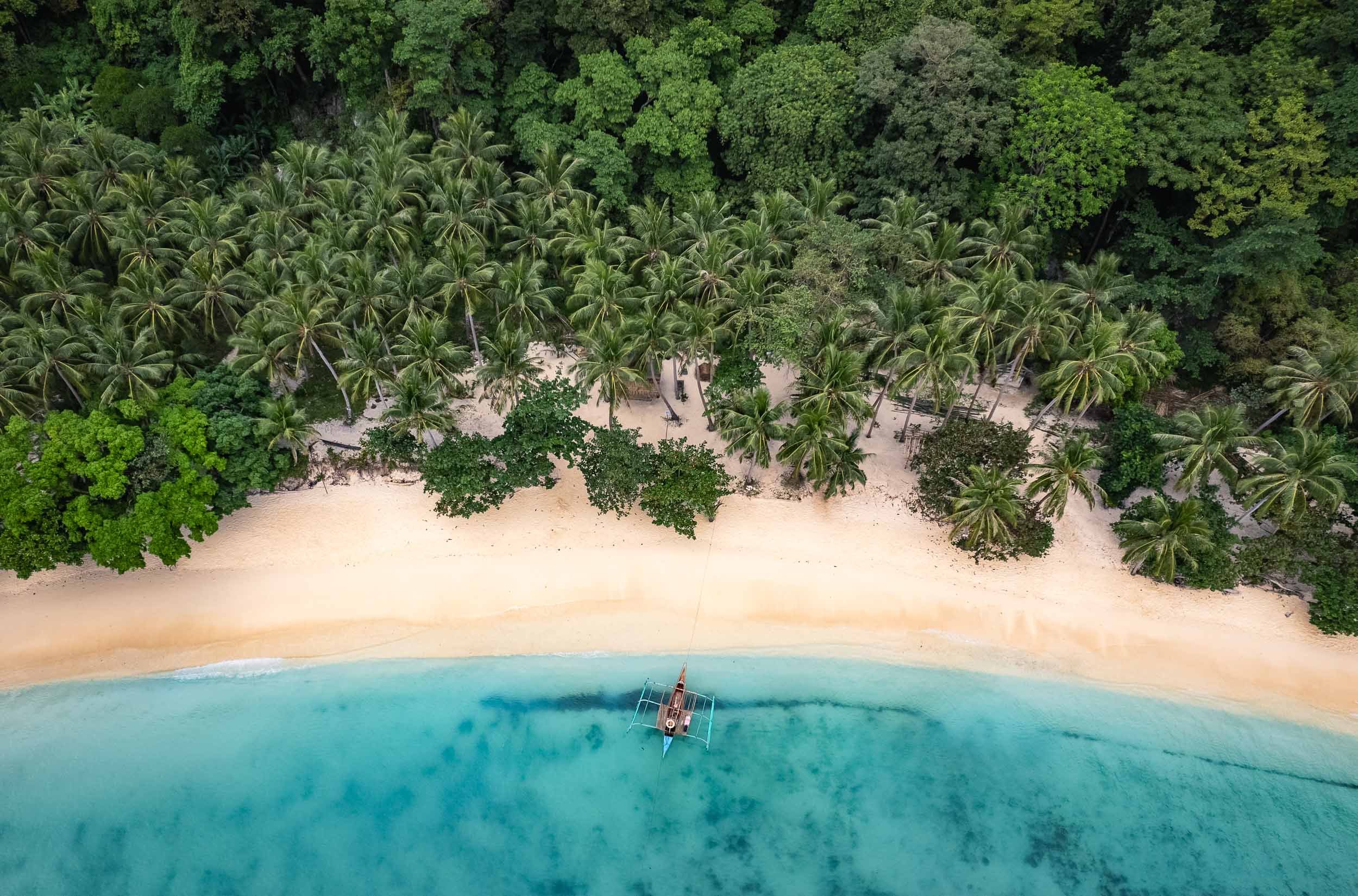
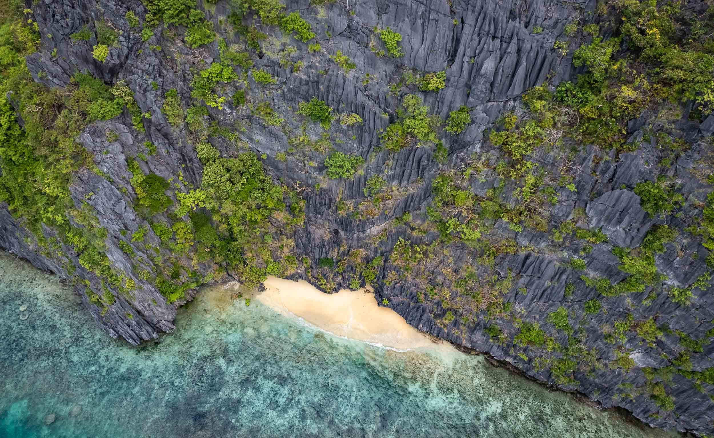

Different
Geologically speaking, Palawan is very different from the rest of the country, as its rocky island landscape originated from the Eurasian plate, forming this spectacular karst terrain that isn’t found elsewhere in the Philippines.
Another place I was able to enjoy by myself was the Hidden Beach (again part of the creative naming scheme...) on the east side of Matinloc island.


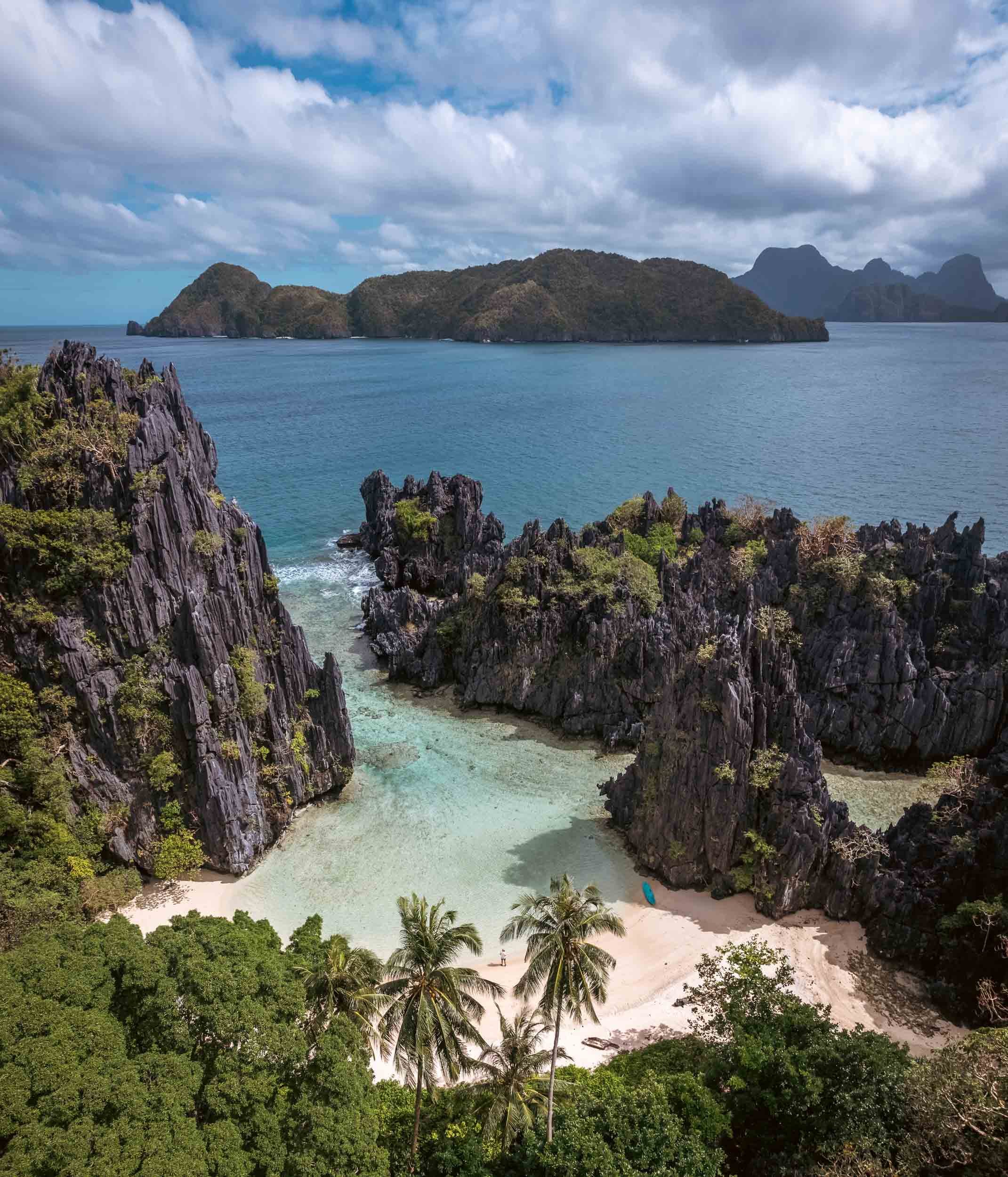
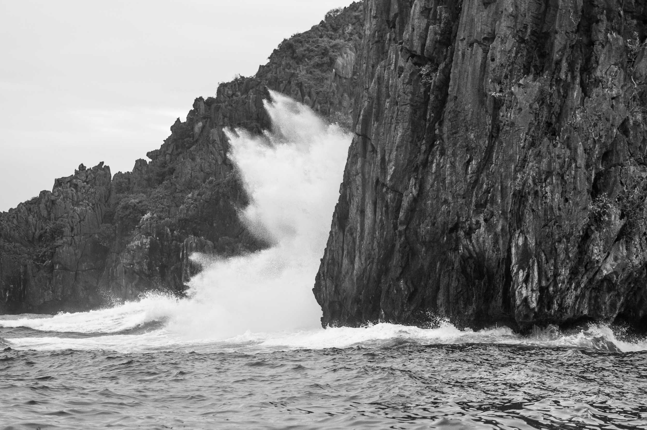

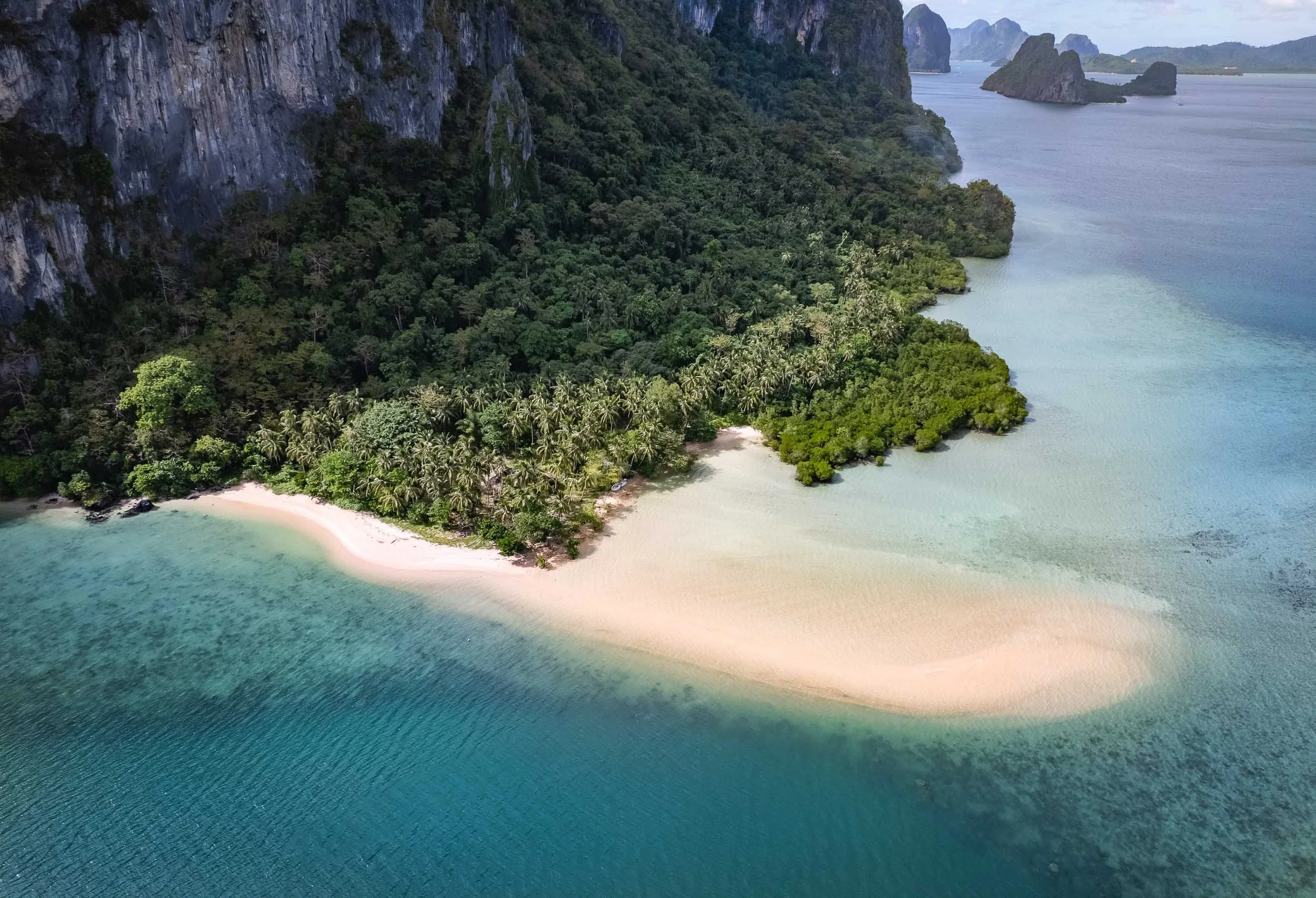


Sunset over Bacuit Bay
El Nido had one signature sunset in store, despite the largely cloudy conditions during my stay. I used it to capture this fisherman returning from the sea in his Bangka.


Waxing Moon
Our celestial companion rising on a clearer evening.

Going Underground
I spent the last day going back to Puerta Princesa for my onward flight, and started very early in El Nido for another attempt to reach and tour the subterranean river. This UNESCO World Heritage Site was once said to be the world’s longest underground river - there seem to be different definitions of this record though.
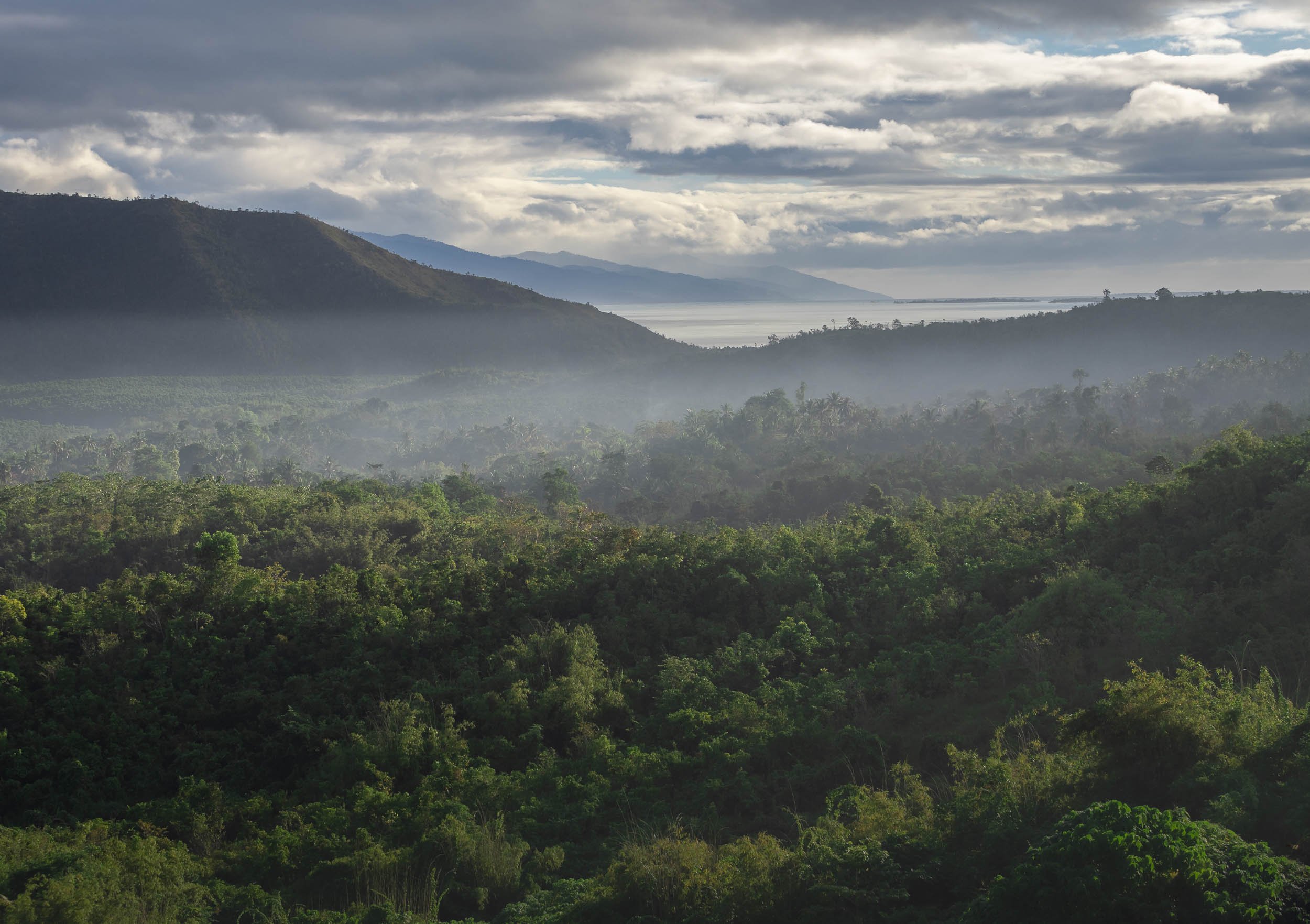
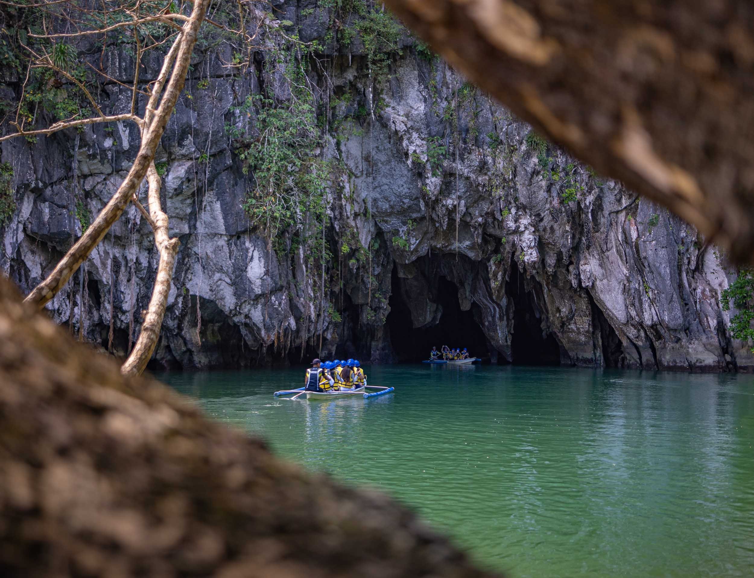


The inside of the cave river becomes completely dark once you go a few hundred meters beyond the entrance, with only the light of the boat captain shining onto the amazing limestone formations. It’s over 8km long, although only the first few kilometers are navigable by boat. The cave network itself reaches even further at 24km length.
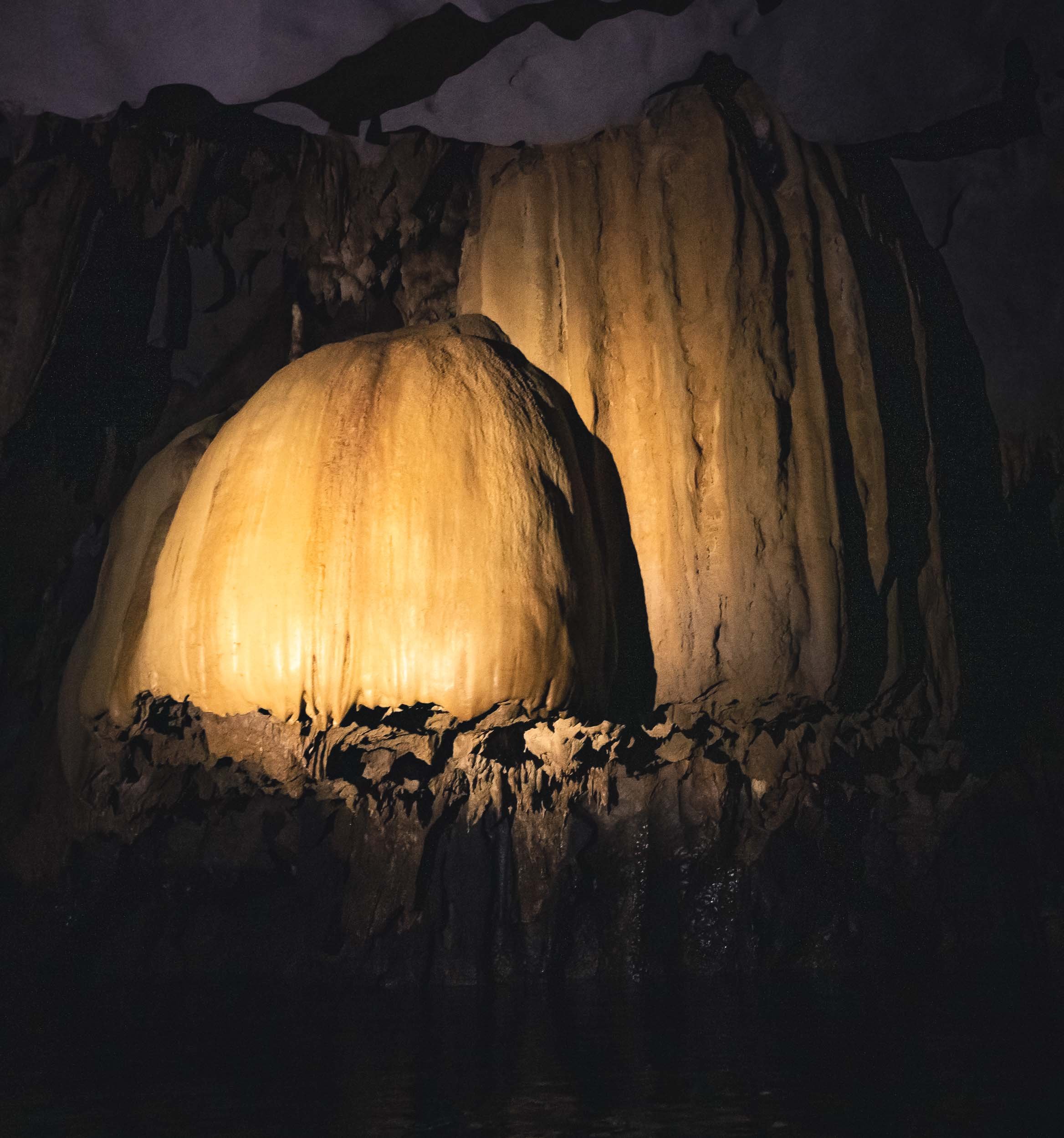
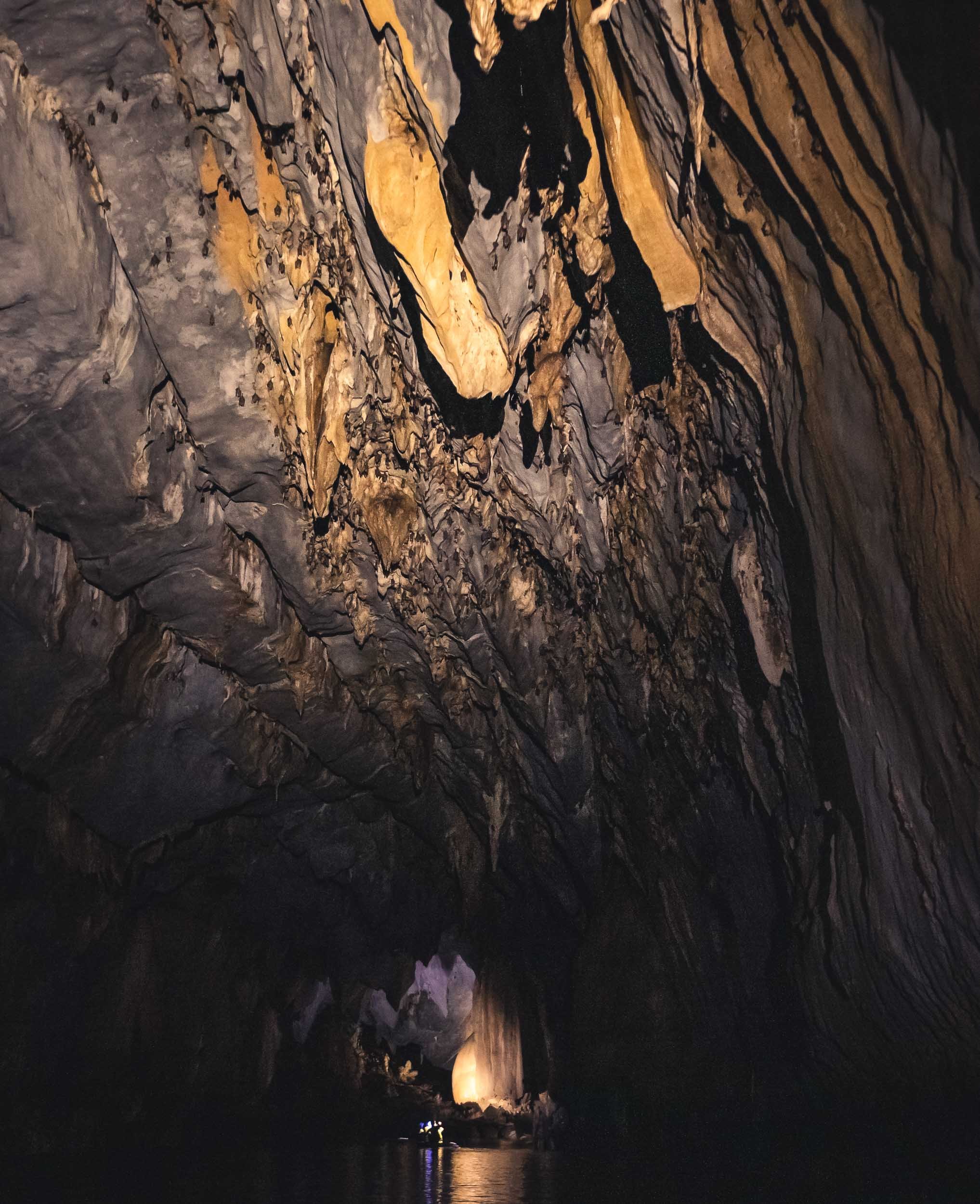
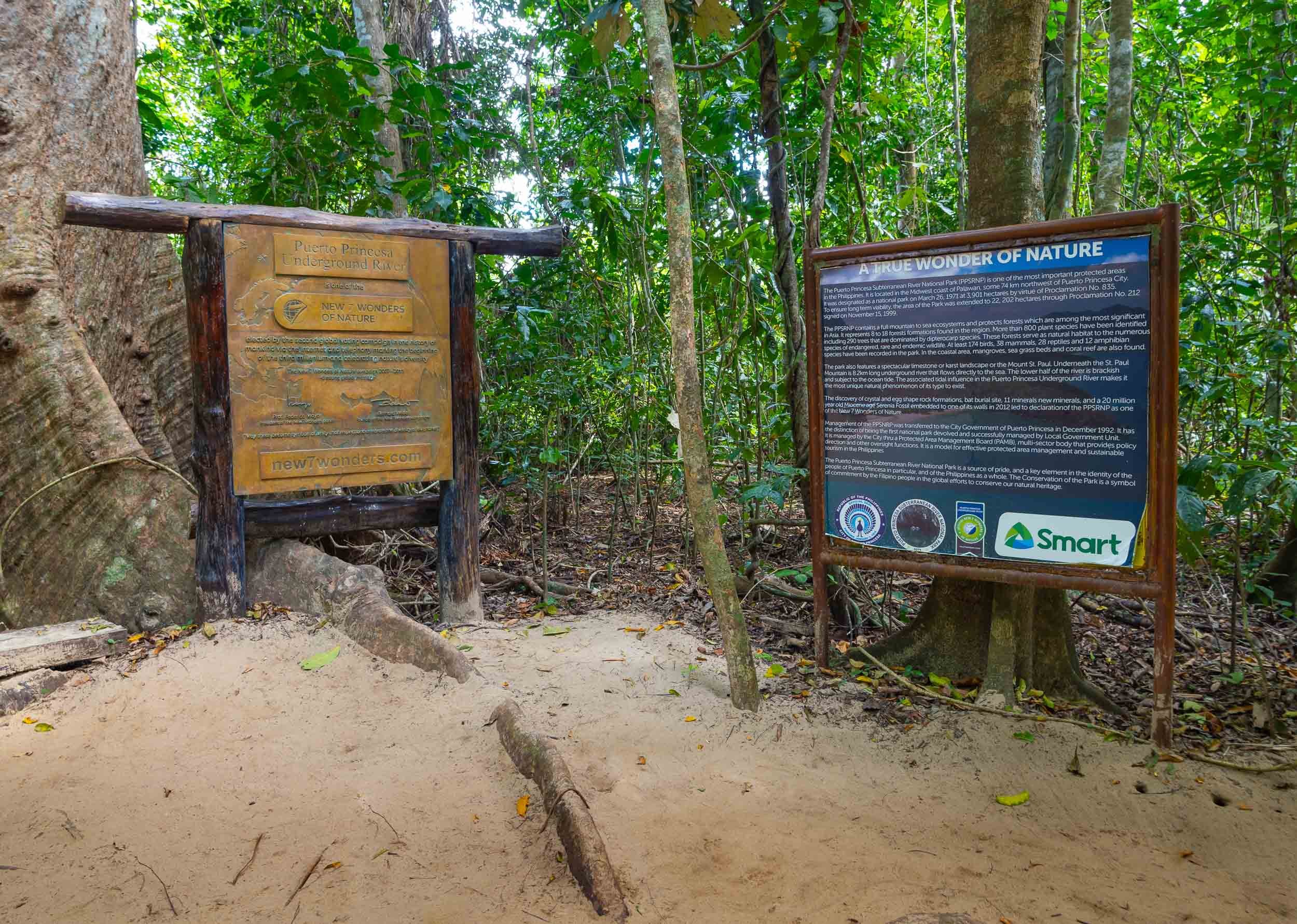

Palawan is home to a few special places, and the underground river as well as the limestone cliffs and their hidden beaches and lagoons are truly special. While it can be very touristy, and El Nido town definitely wasn’t my favorite, there are ways to make it a more enjoyable experience, and I can definitely recommend Palaweña to achieve that, one of the best operators I’ve worked with anywhere. Is it my favorite place in the Philippines? I think not, but more on that in another blog entry - subscribe here if you don’t want to miss it.

The Abode of Peace - Brunei
Welcome to one of the more obscure countries on this planet, one of its last remaining absolute monarchies, and a nation forging its own path on the island of Borneo: Brunei Darussalam.

Welcome to one of the more obscure countries on this planet, one of its last remaining absolute monarchies, and a nation forging its own path on the island of Borneo: Brunei Darussalam. Once a thriving empire, its influence has declined over the centuries, but natural resources meant its population of less than half a million people now enjoys a very high living standard. I spent a few days here, including New Years Eve, which in Brunei is just like any other evening - that may be an odd choice for some, but I had a burger for dinner and was in bed by 11pm, perfect start into 2023.
The Capital
My starting point was the capital, Bandar Seri Begawan (ever heard of it?). A walk the centre around reveals… not too much, but there are some interesting places and local life to observe.
Royal Regalia
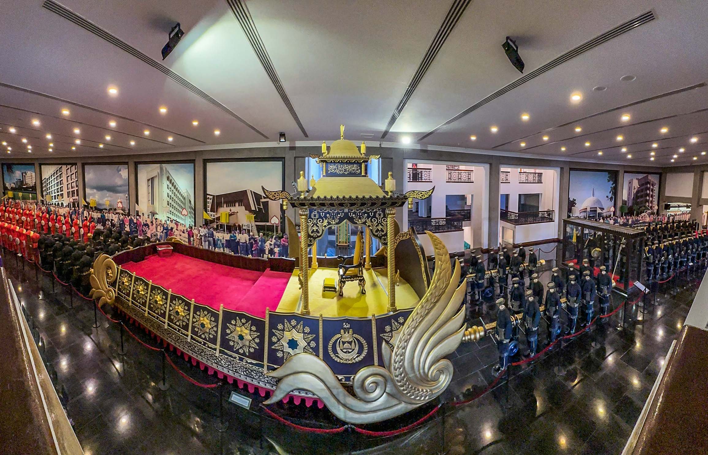
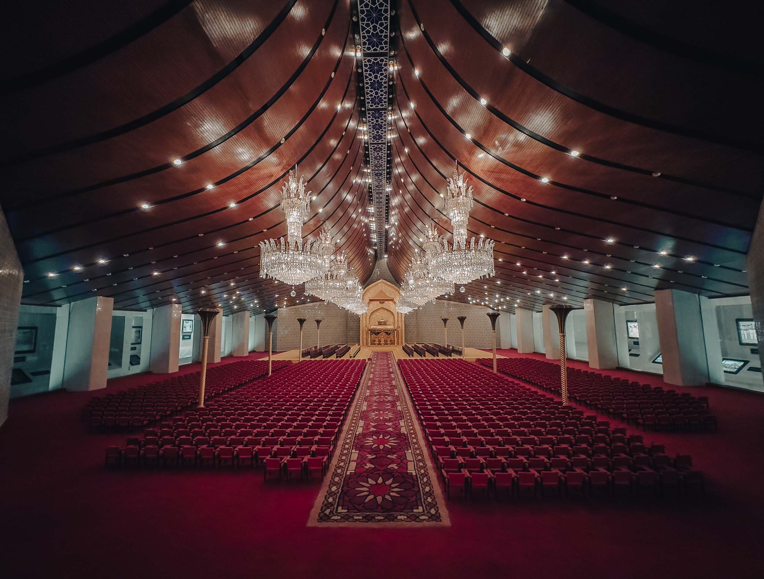
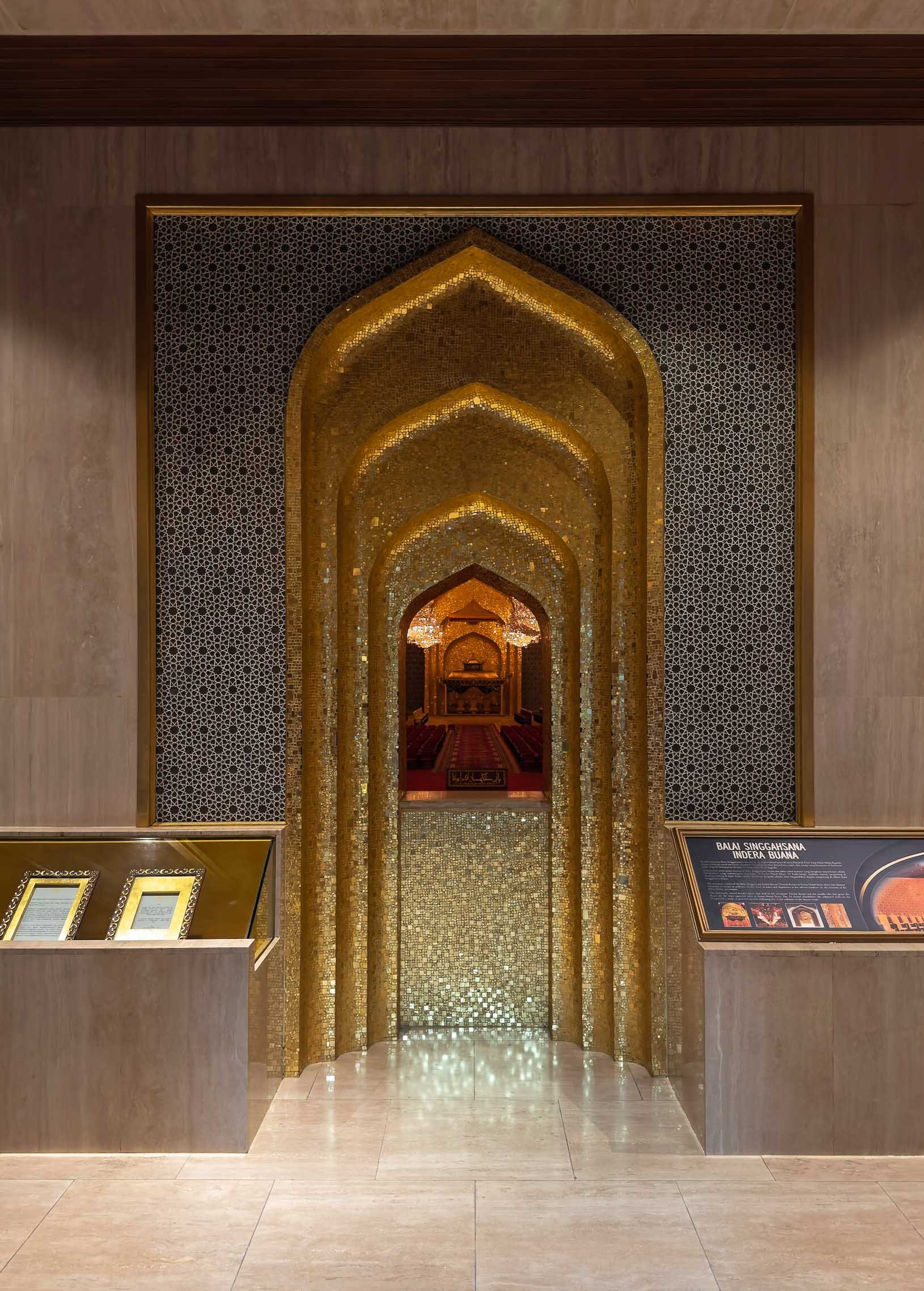
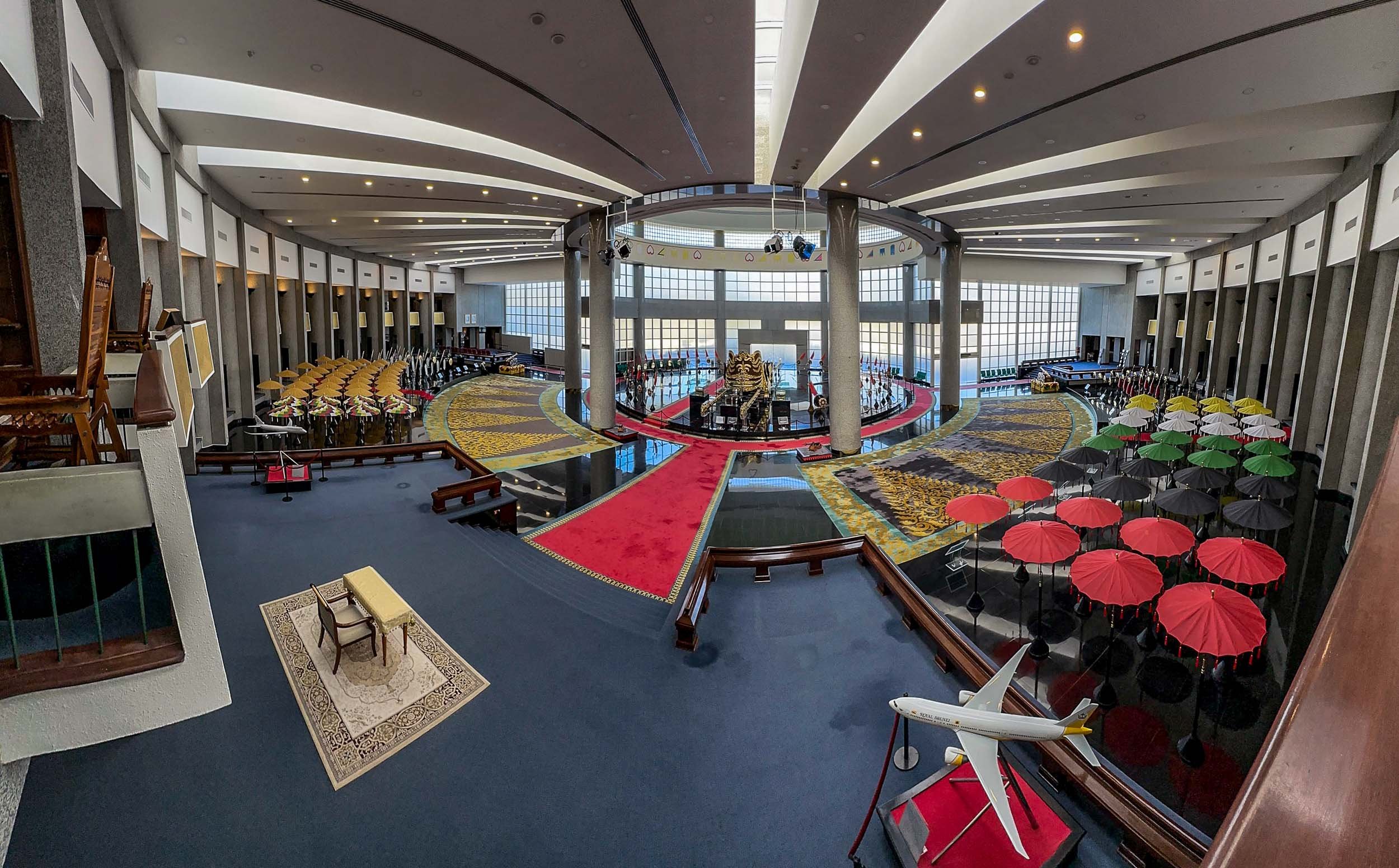
The Main Sight
The city’s most recognisable landmark, and arguably its most beautiful, is the Omar Ali Saifuddien Mosque, serving as the symbol of the Islamic faith in Brunei.
In fact, a dedicated frame was set up for people to take photos with it in the nearby park on the shores of the Sungai Kedayan river.

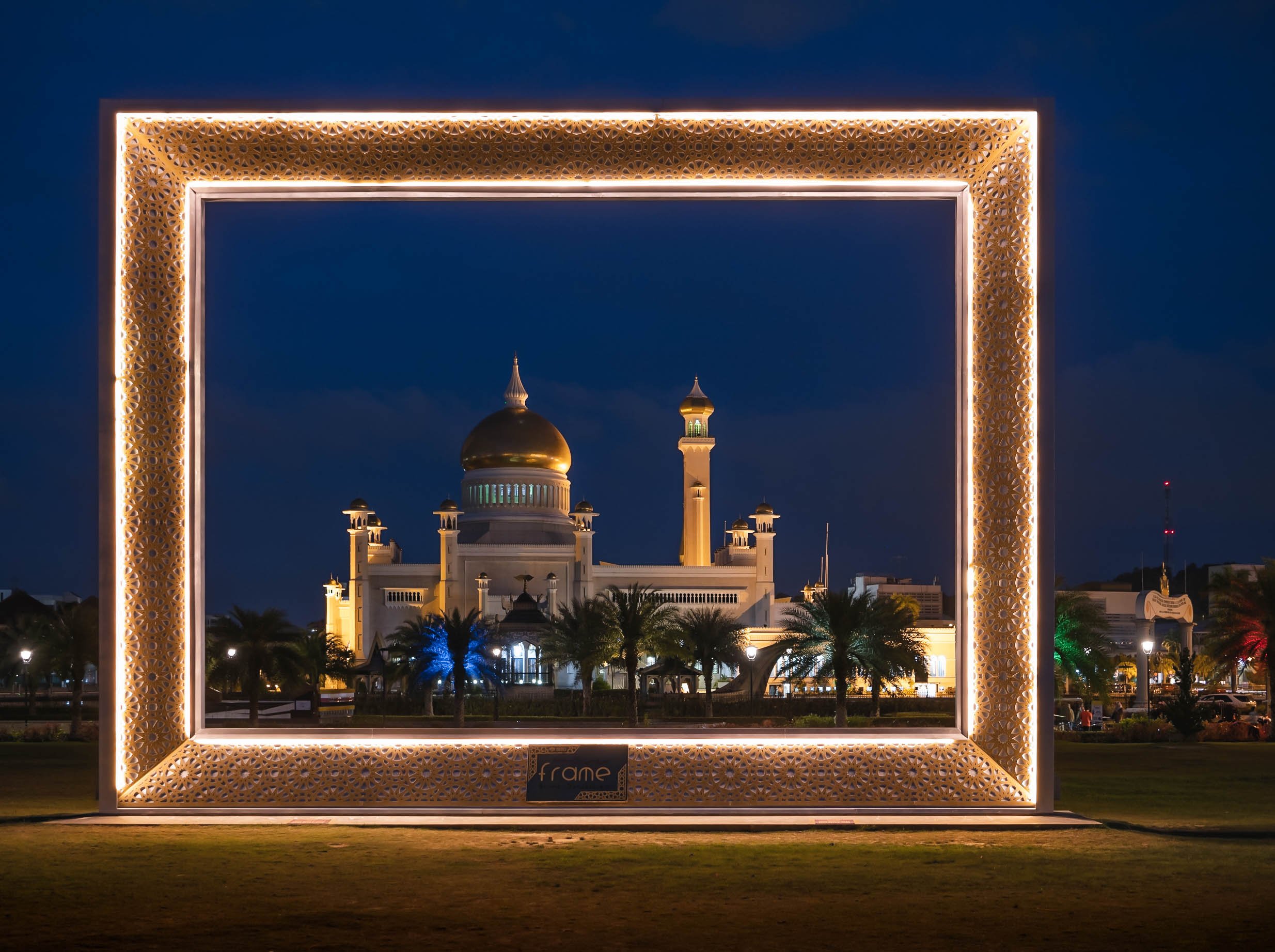
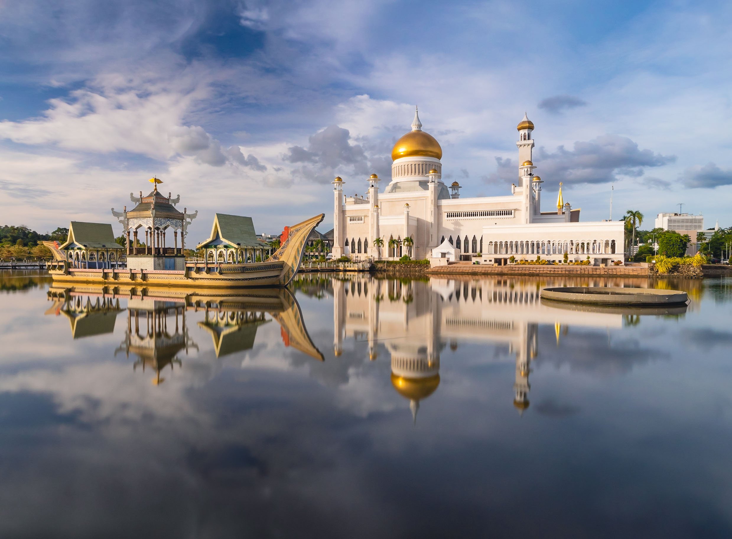
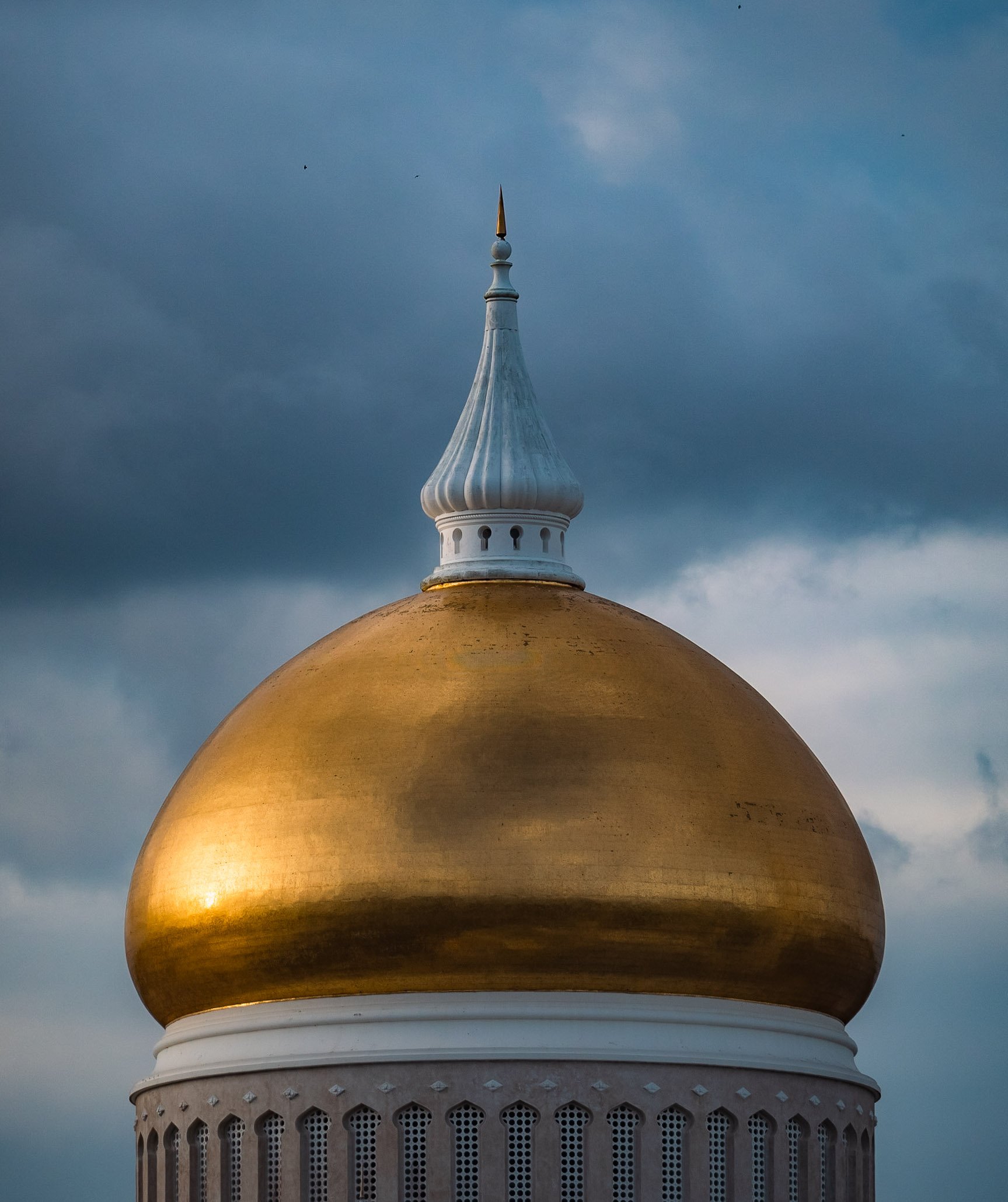
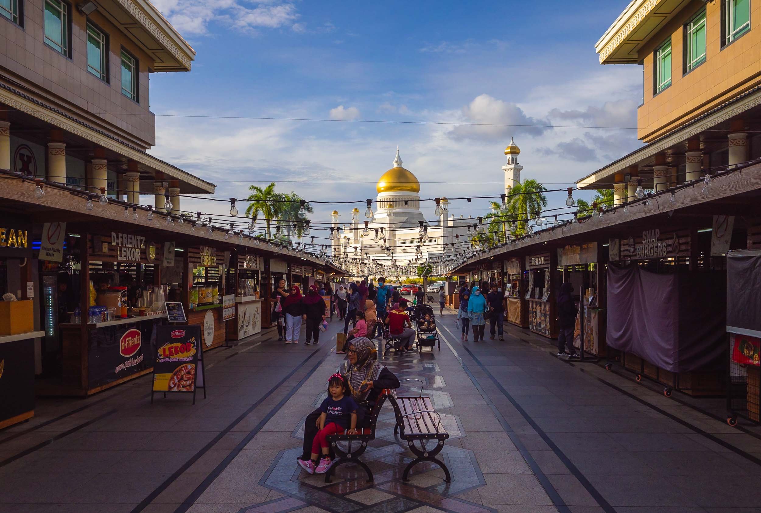
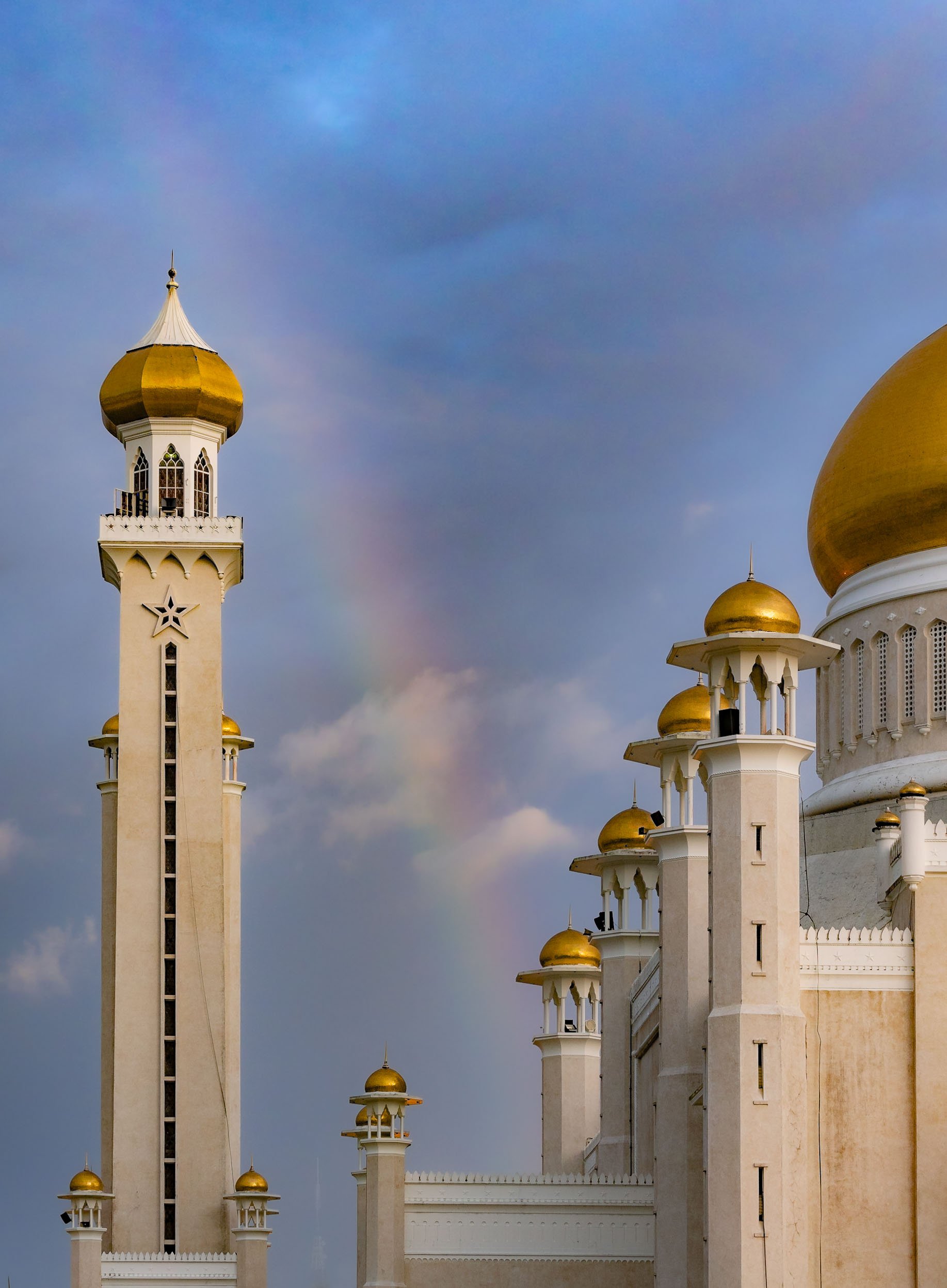
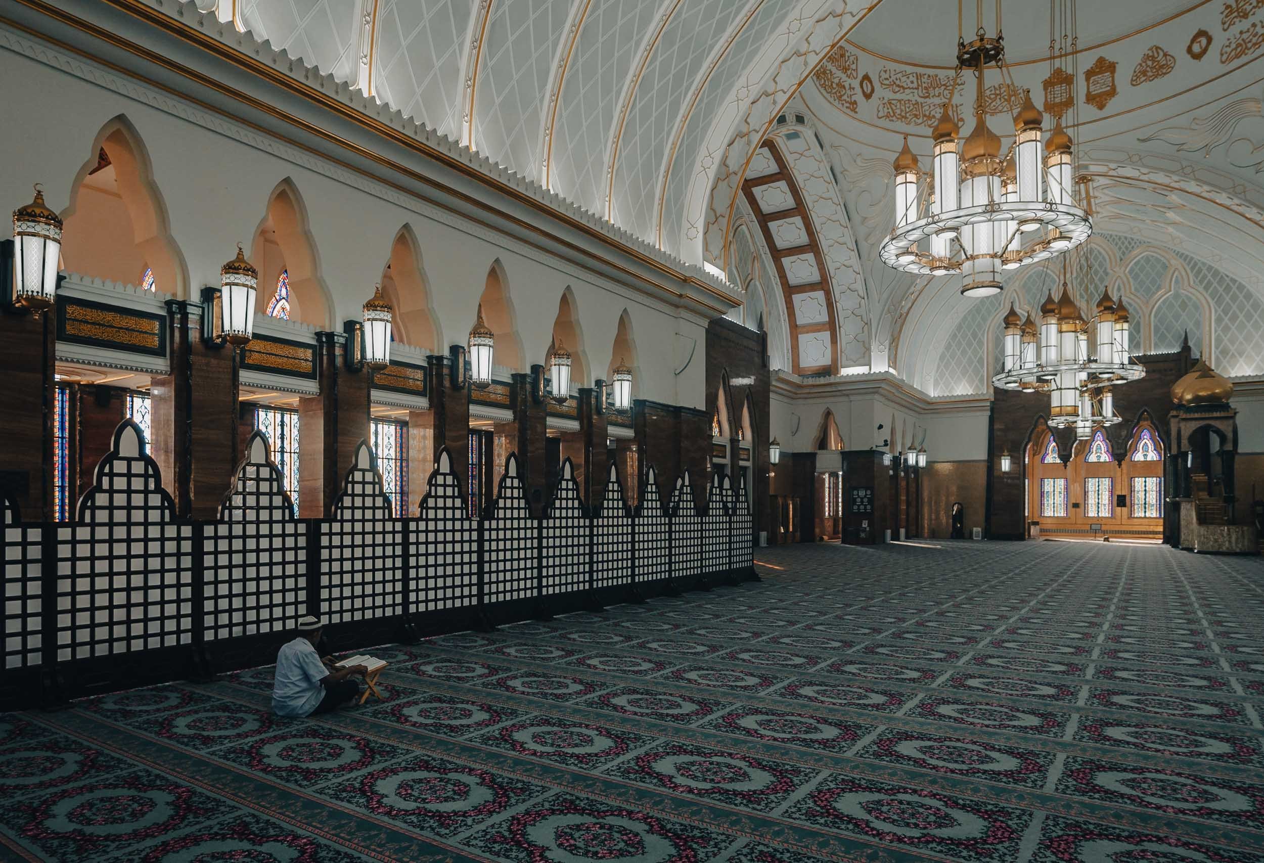
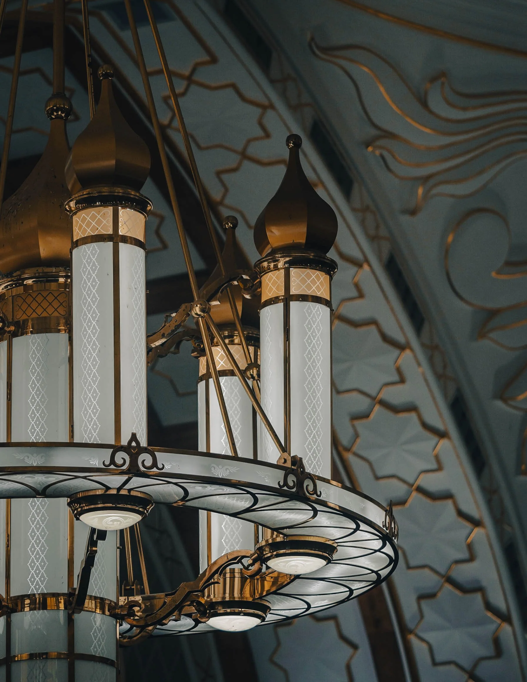

While Islam is the primary religion in the country, freedom of faith is permitted by the constitution, with some limitations. The buddhist temple of Teng Yun is one of the most prominent non-Muslim religious buildings.


Looking south over the Brunei river reveals a bridge called Raja Isteri Pengiran Anak Hajah Saleha Bridge - I’m glad they kept the name simple for every day directions. It is the second-longest single-pylon cable bridge in the world and 157m tall. I couldn’t help but notice that the golden dome closely resembled the one on Saifuddien Mosque.


The night market at Gadong with its variety of multicultural street food - Brunei has to import 60% of its needs. The biggest ethnic group is Malay, making up over 60% of the population, and only a very small portion of indigenous people. The balance is a mix of origins, including a large number of expats.


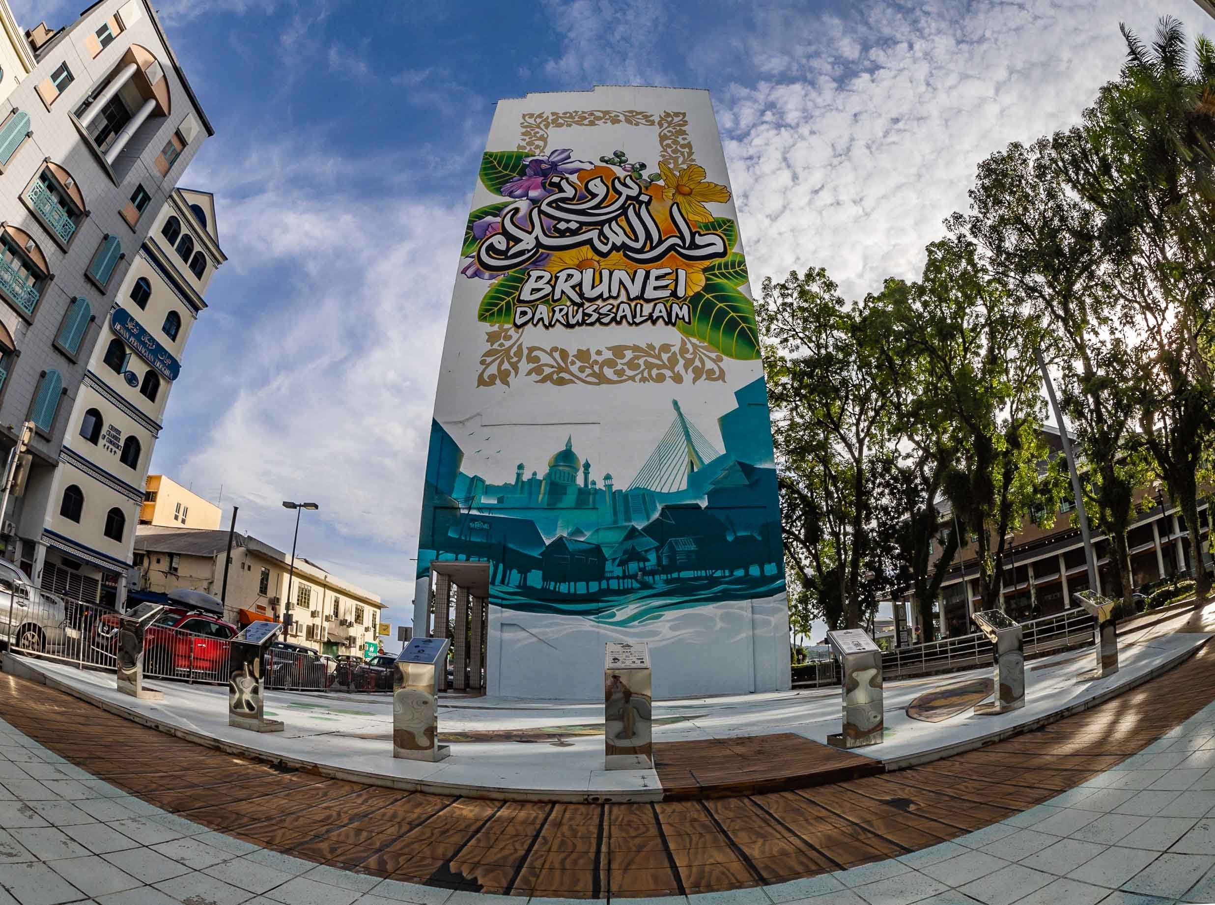
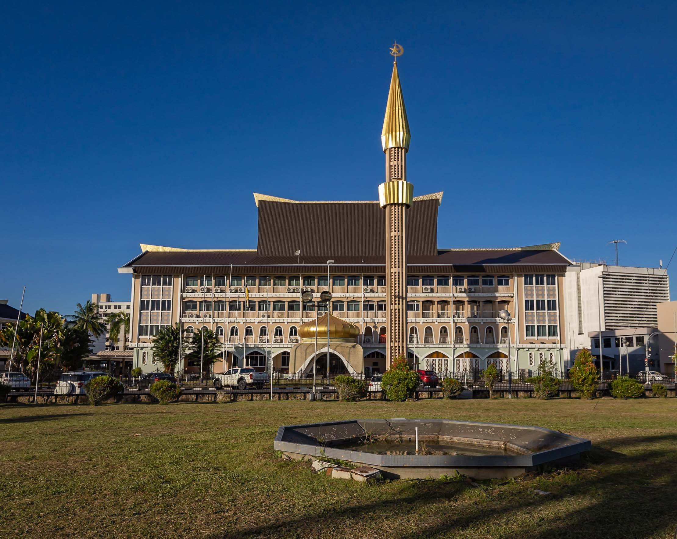
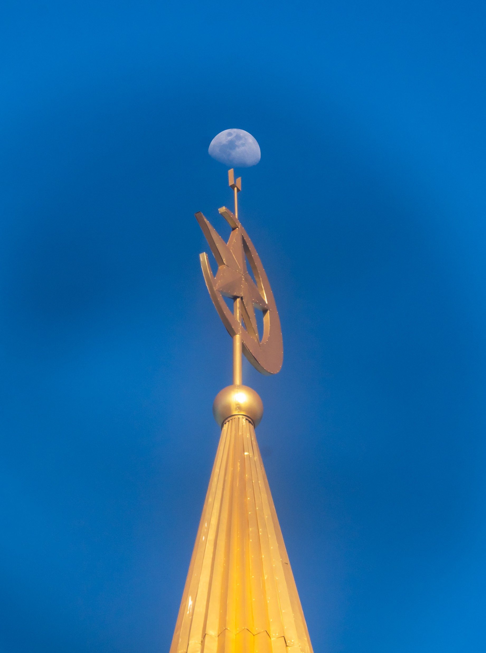
Kampong Ayer
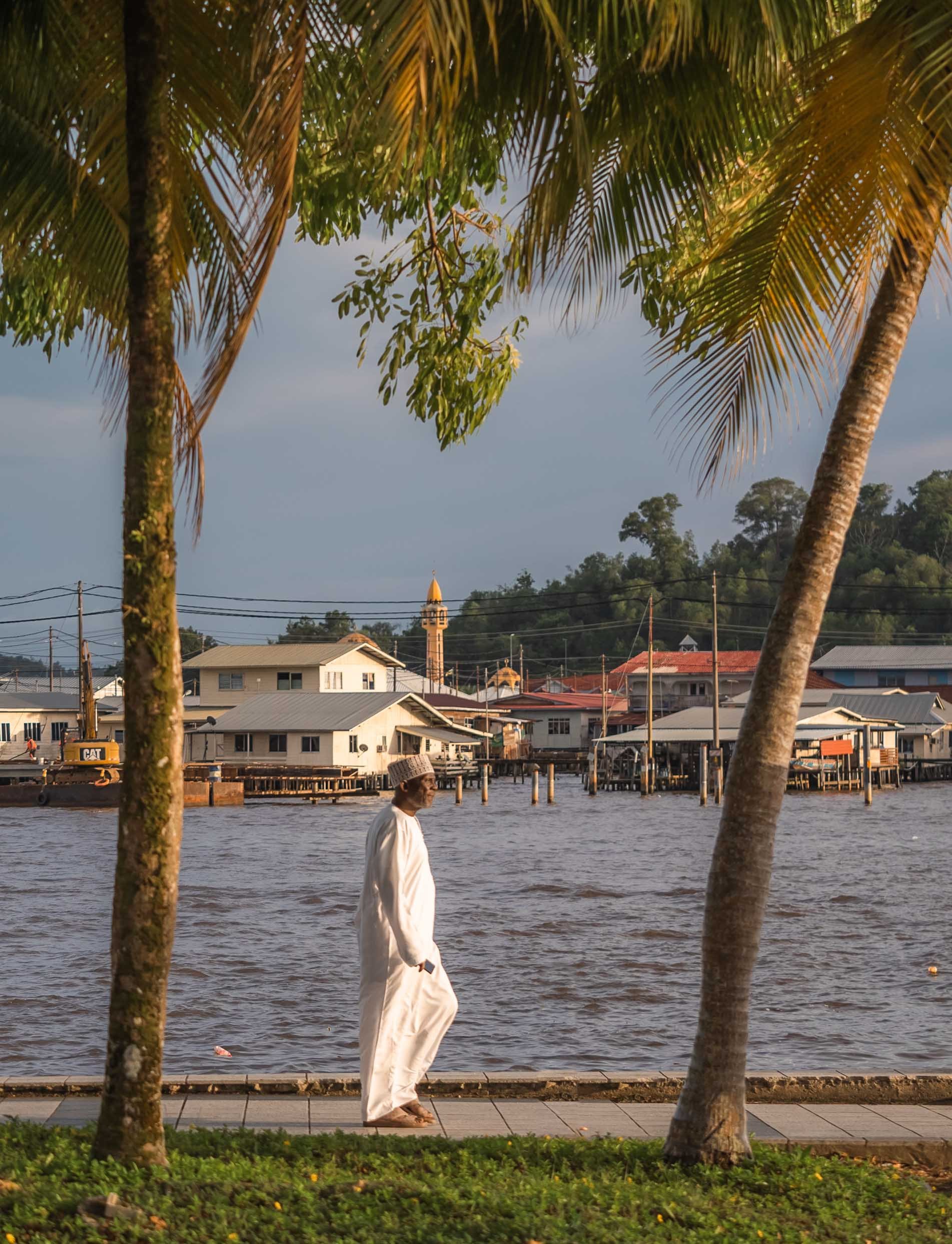
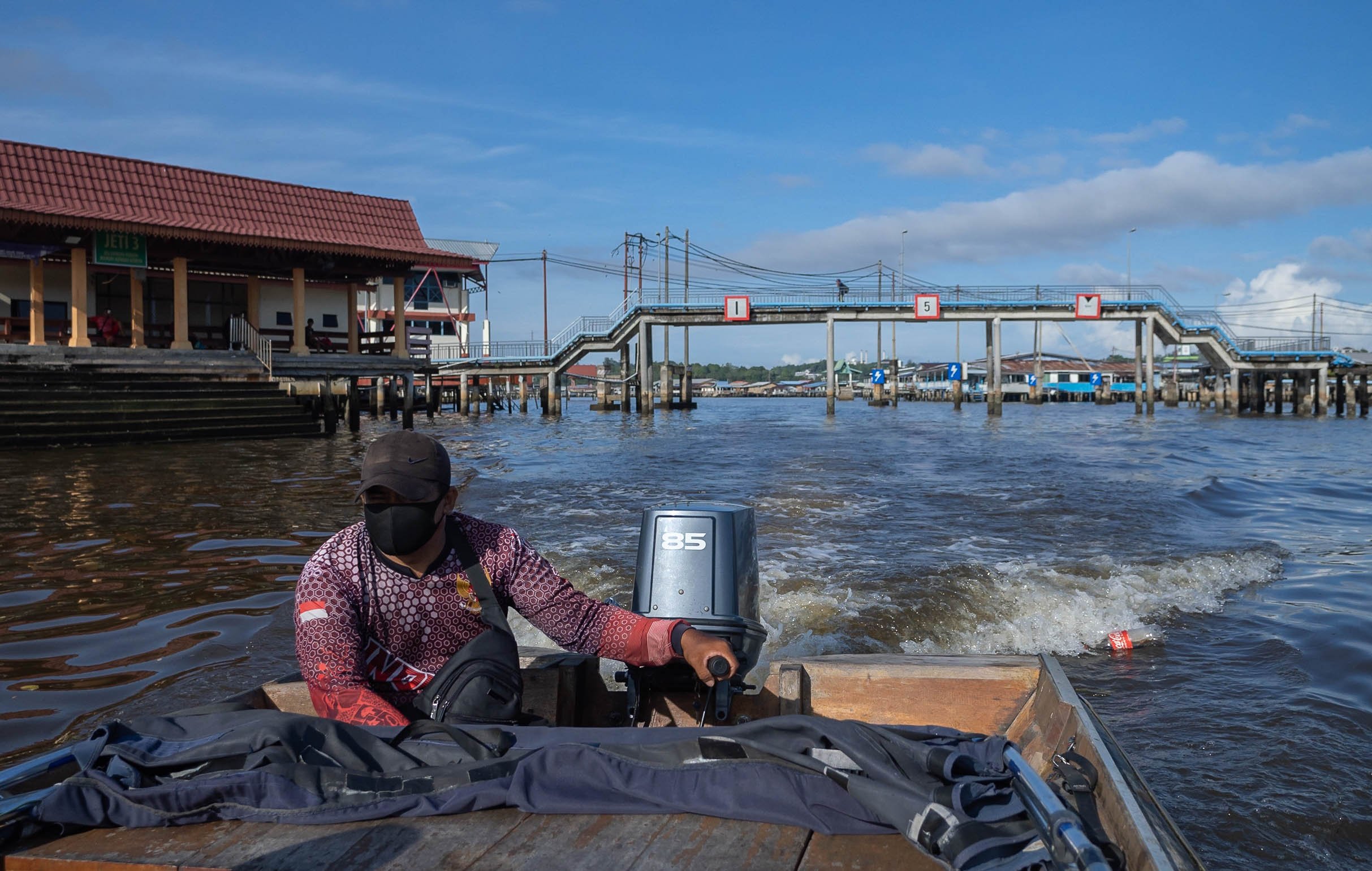
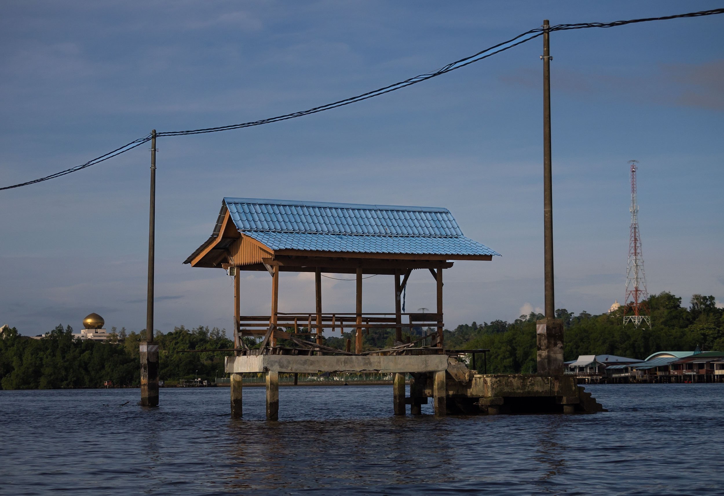


In fact though, a large portion of the village is as busy as ever, and includes floating mosques, schools, gyms and more.
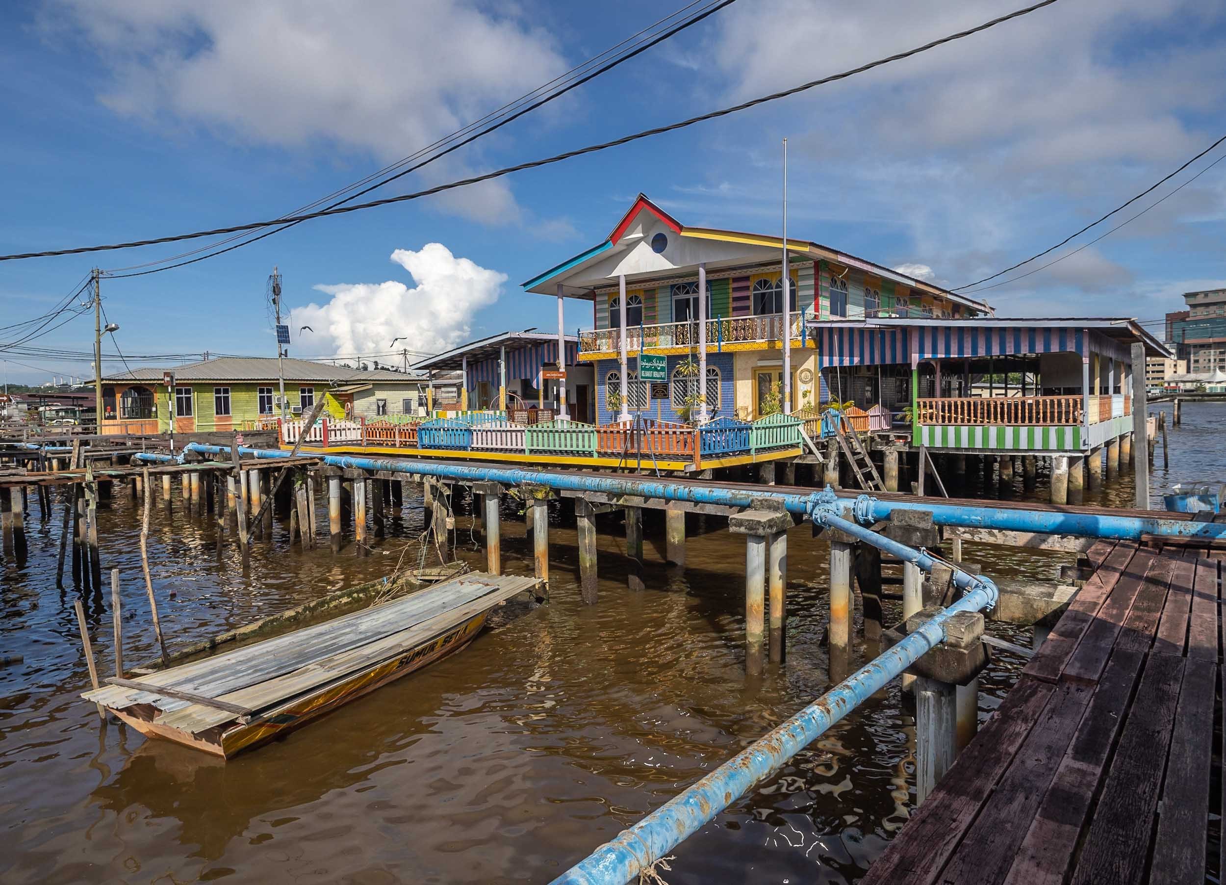
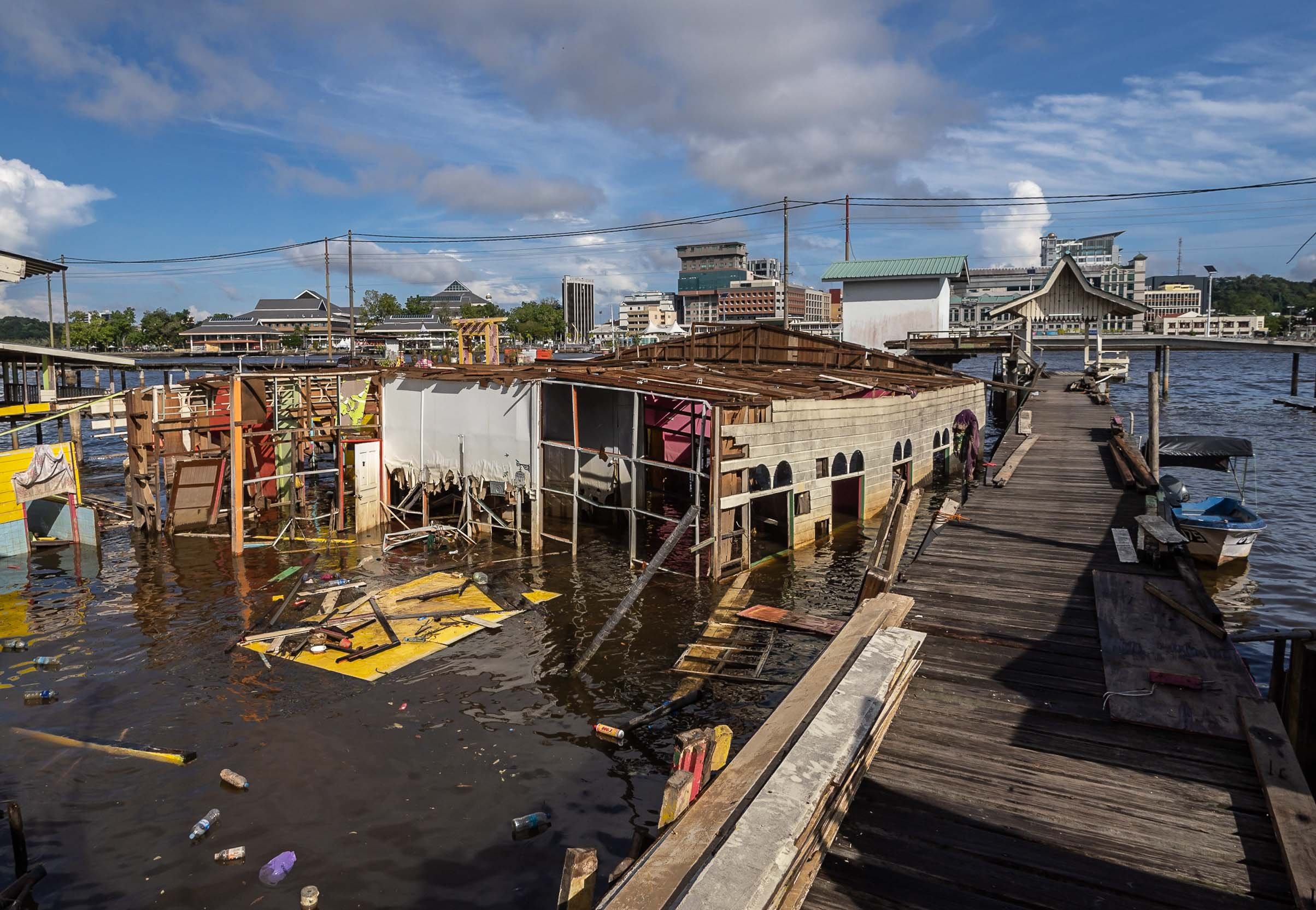
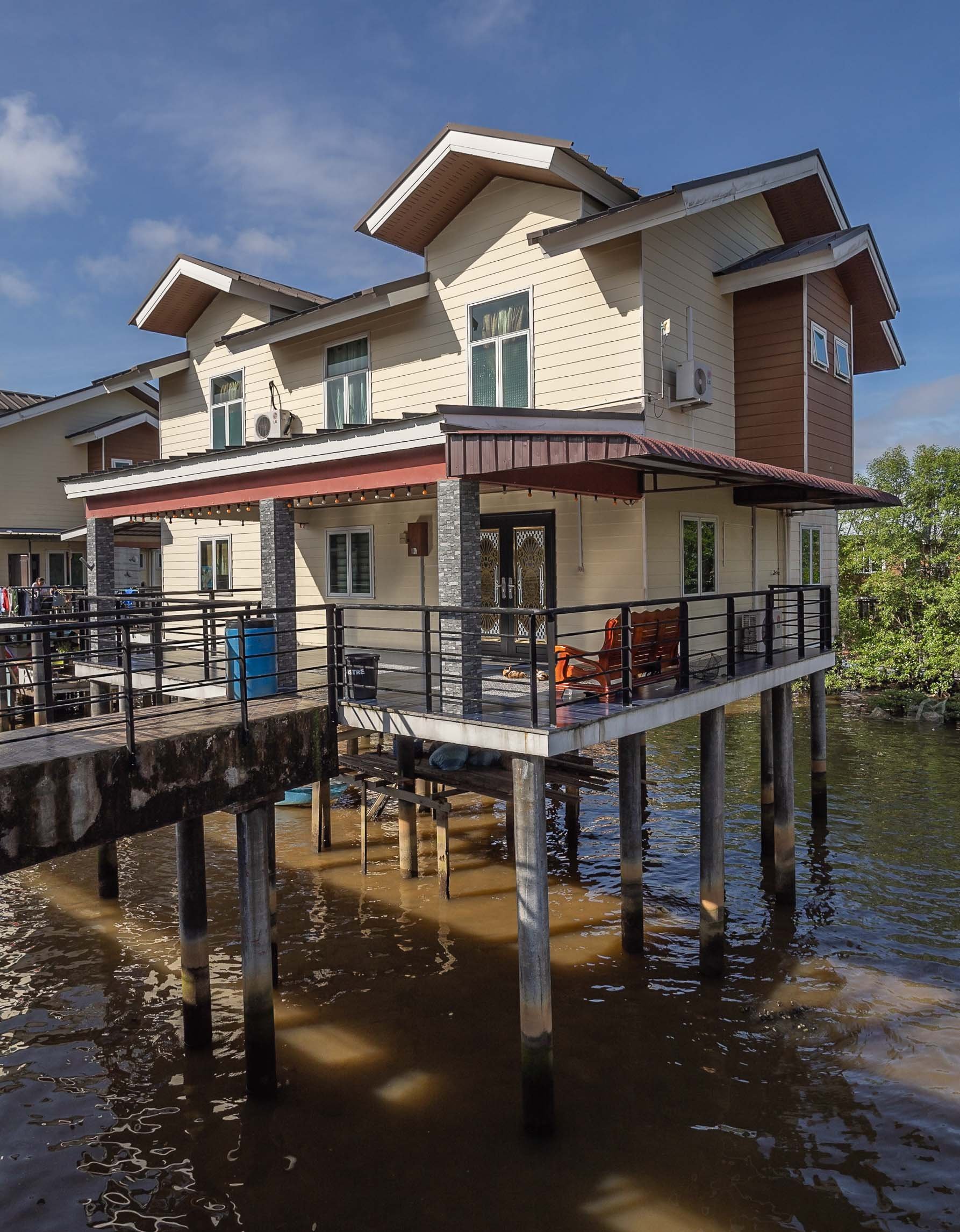

More City Sights
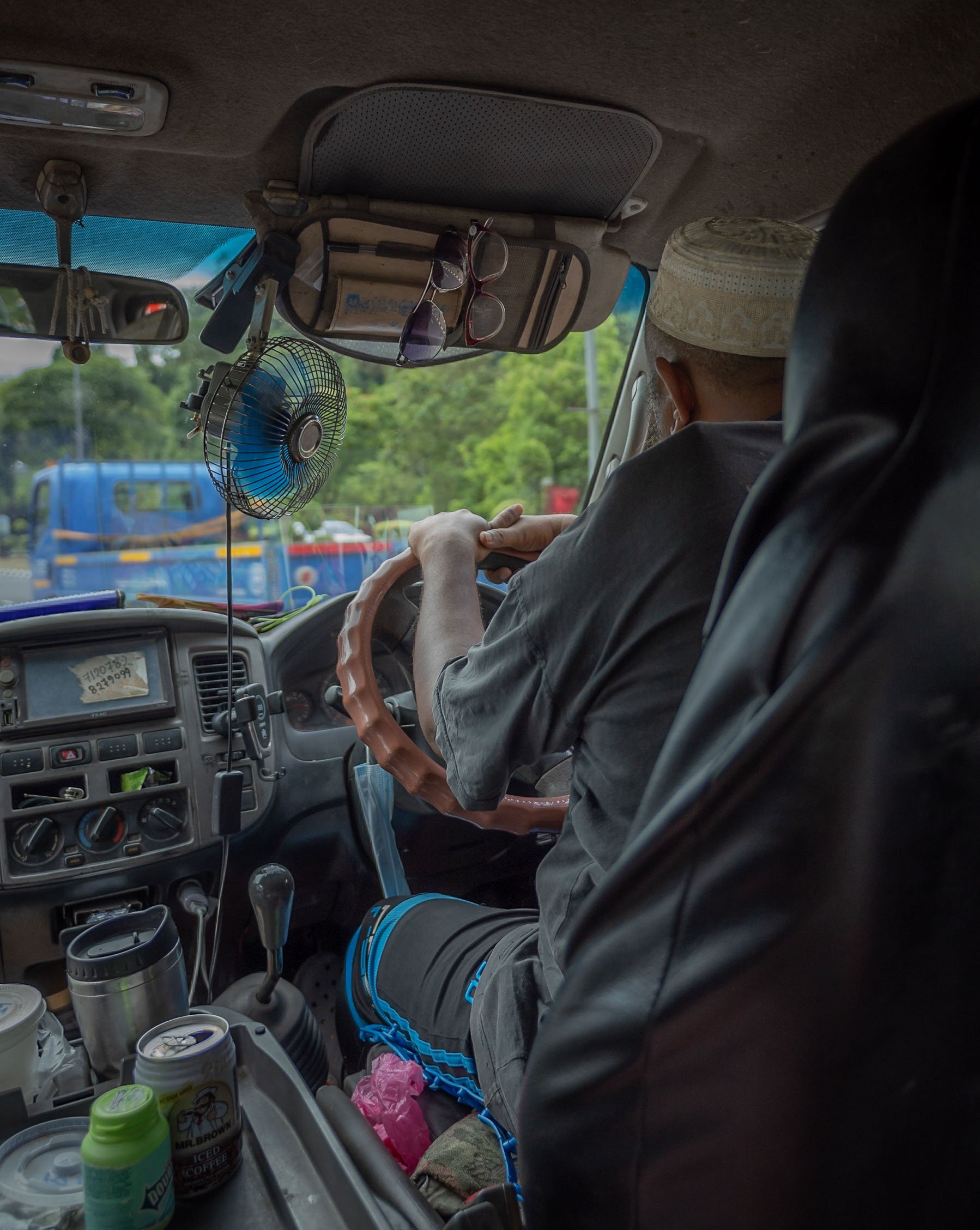
Jame 'Asr Hassanil Bolkiah Mosque
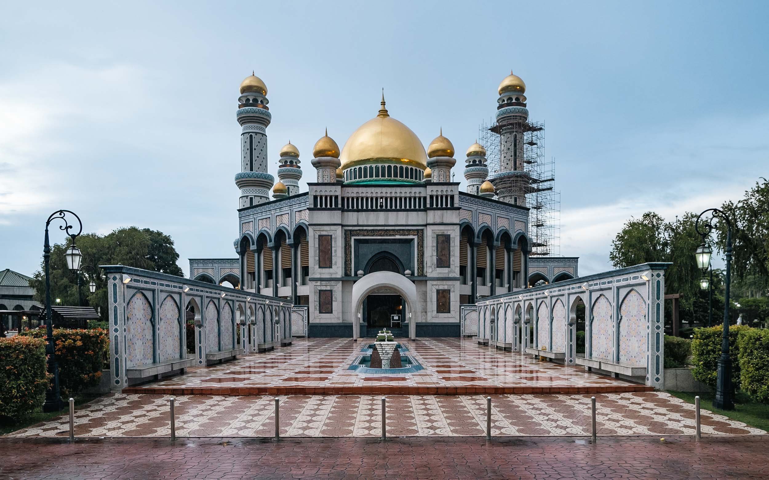
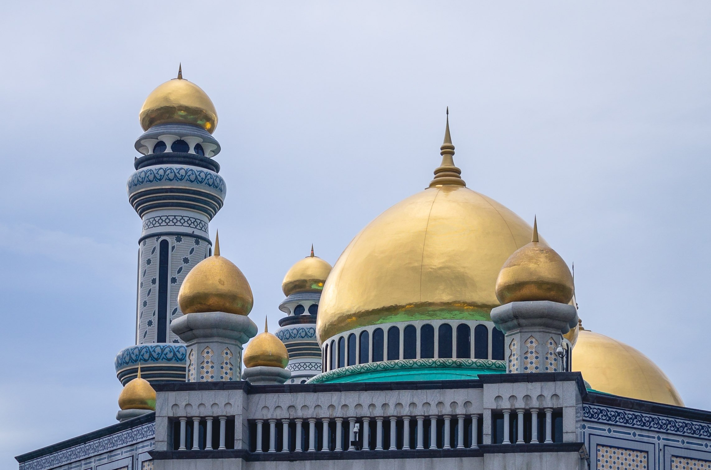
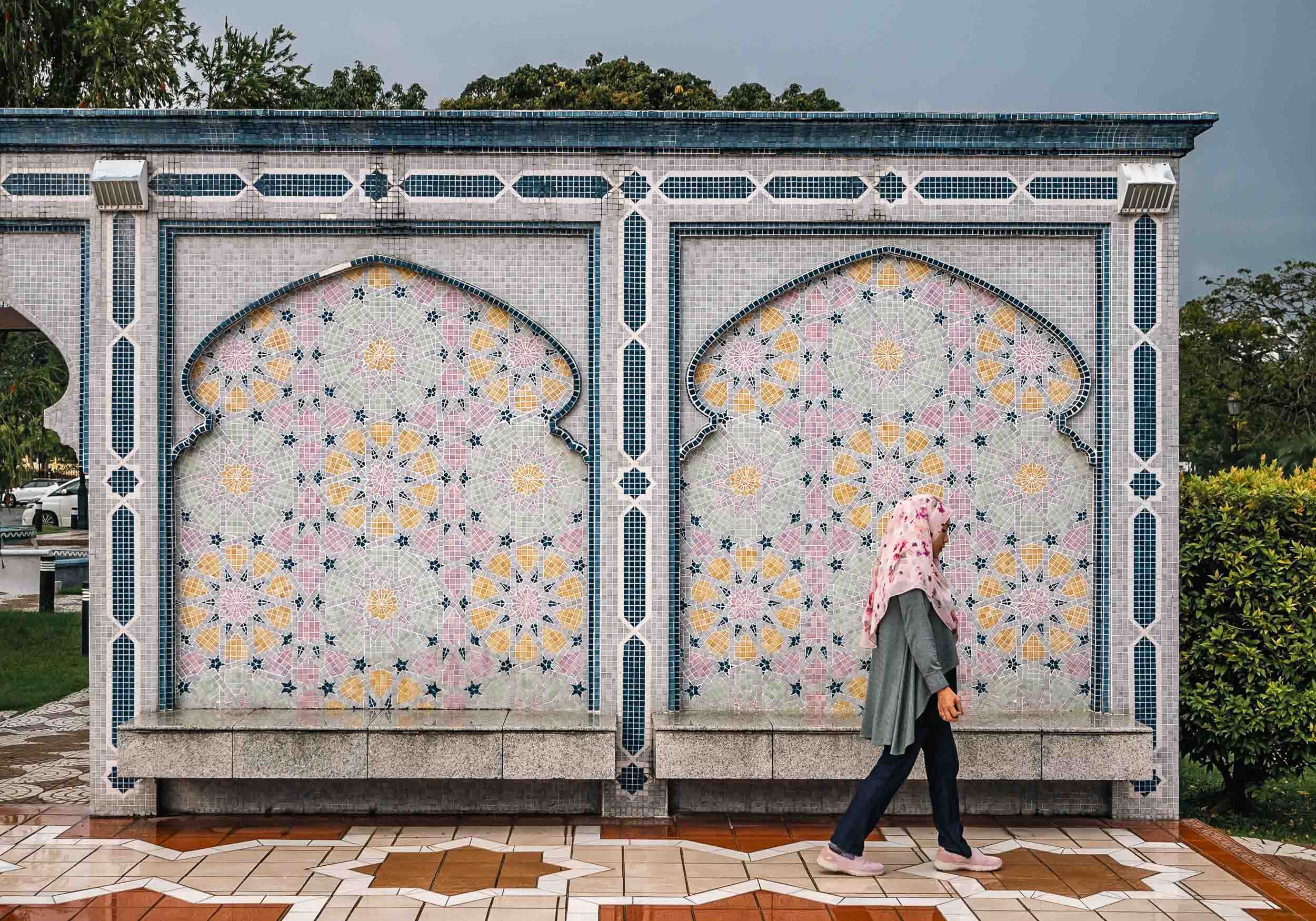
Ash Shaliheen Mosque
Yet another mosque - they are some of the most interesting attractions in Brunei. This one is said to follow Moroccan style, and was designed by an Egyptian architect. It’s possible to visit, and the interior courtyard with its retractable roof is worth seeing. It’s also located in the government district, which featuring a number of peculiar architectural styles for the various ministries and offices.


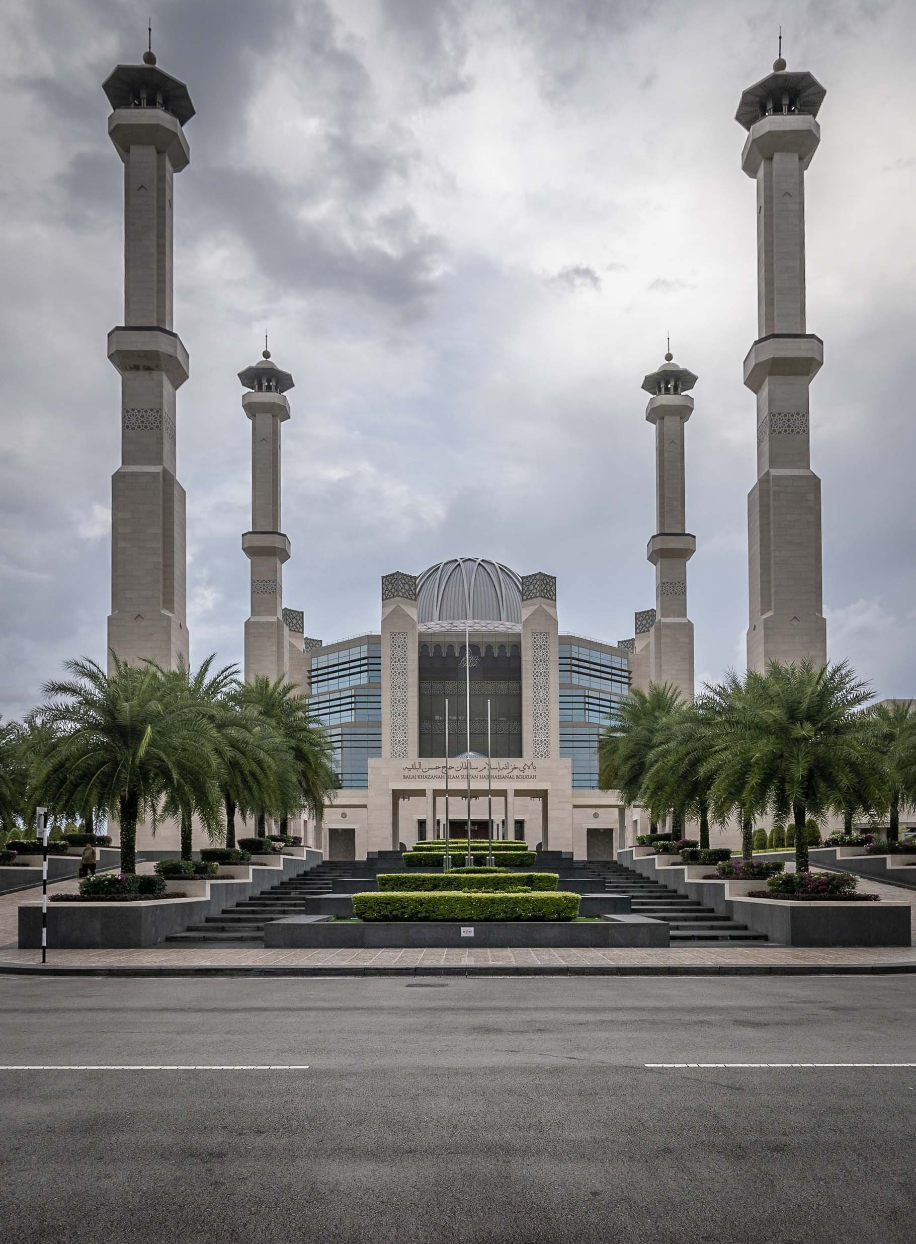


Unfortunately I couldn’t make it in time to go inside and visit, but it houses a large collection of manuscripts and artworks, for instance. The exterior was likely equally fascinating to me though.
Palaces
A strange and seemingly abandoned building can be seen from certain angles in Brunei - this place was allegedly built for the Sultan's ex-wife, but stopped after the divorce. Its status is unclear, but it is said the interior is almost complete and follows similar architectural approach as the outside - a mix of classic European and Russian styles.


Record Breaking
The actual palace of the Sultan of Brunei, called Istana Nurul Iman or the Light of Faith, is on yet another level - it is considered the largest residential palace and single family building in the world. The cost at its completion in 1984 was USD 1.5Bn, with a floor space area of over 200,000 sqm - it contains 1,788 rooms, of which 257 are bathrooms. It also houses the banquet room seen as a model in the Royal Regalia museum. The palace is also home to the infamous car collection of the Sultan and his brother (a whole different character, worth reading up on). Most of those cars are said to slowly fall into decay due to the lack of care these days, but no one knows for sure.
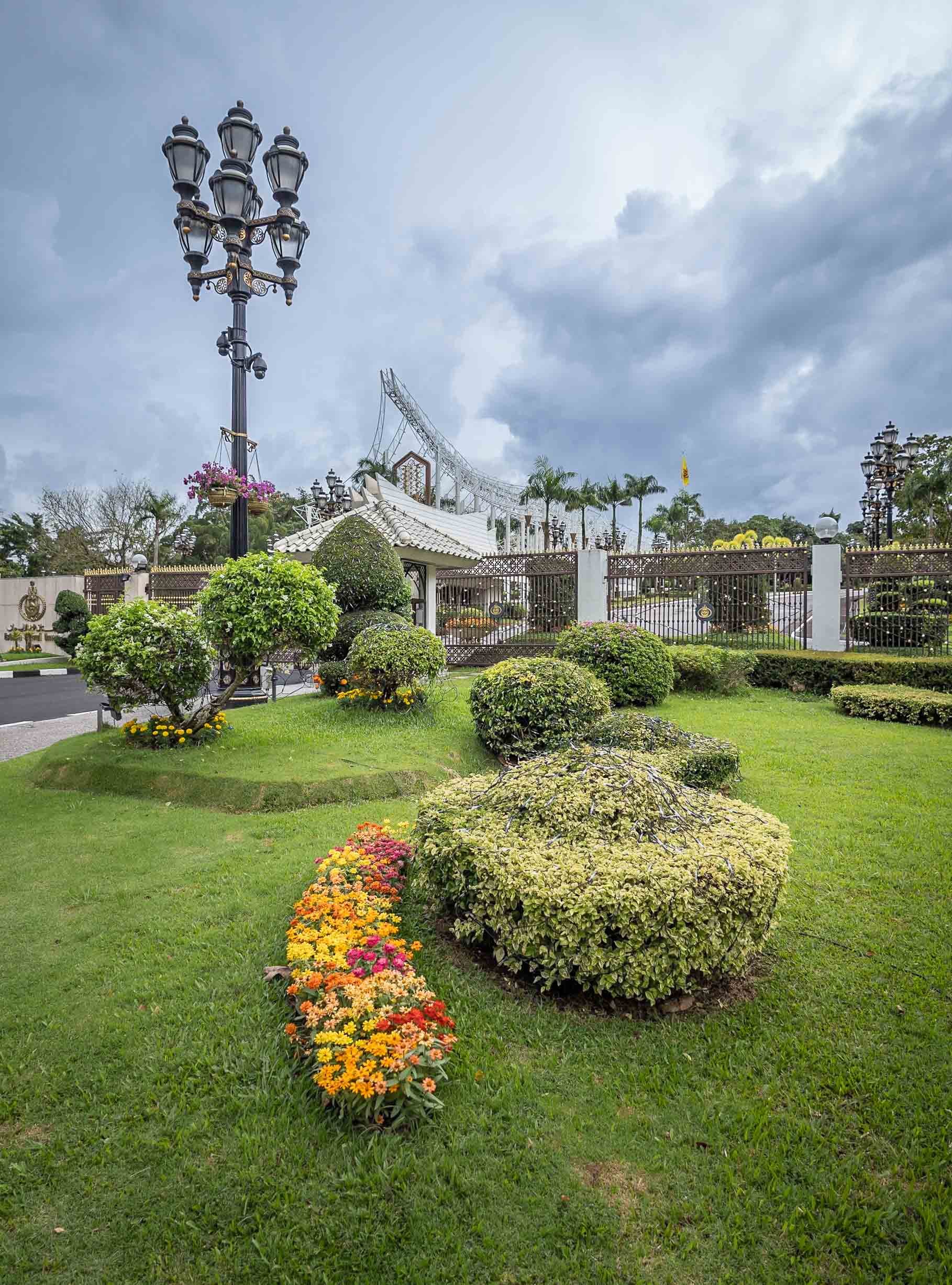
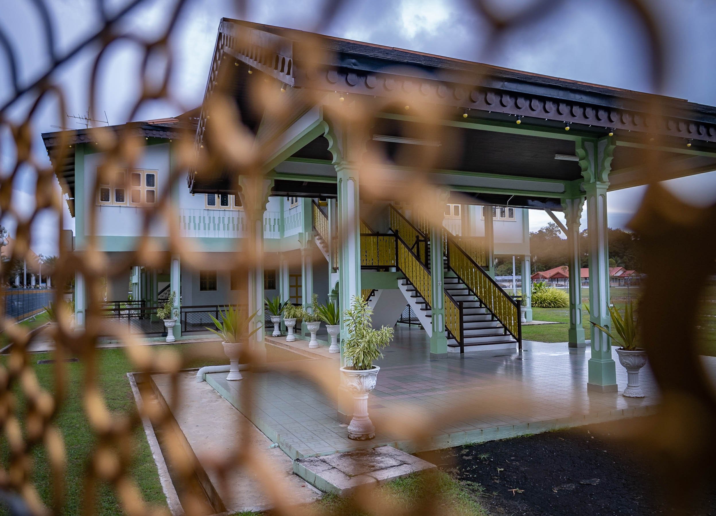
And Further Around
Frankly, there isn’t toooo much to see beyond the city boundaries, but there are a few nice beaches and several rivers in the largely untapped forest. Unlike much of the rest of Borneo, which is part of Malaysia and Indonesia, Brunei’s portion hasn’t been tapped for Palm Oil and other plantations. These photos were taken from the shores of the The Empire Brunei hotel, the country’s only real high end luxury property, 20min from the city.


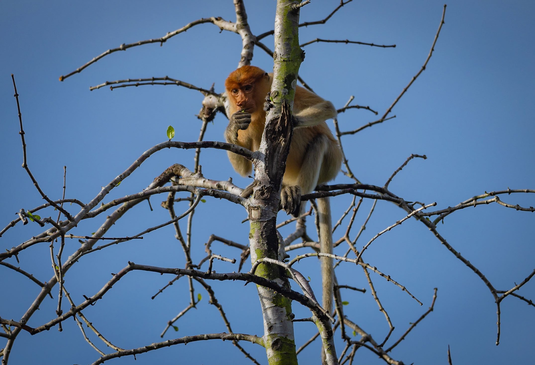
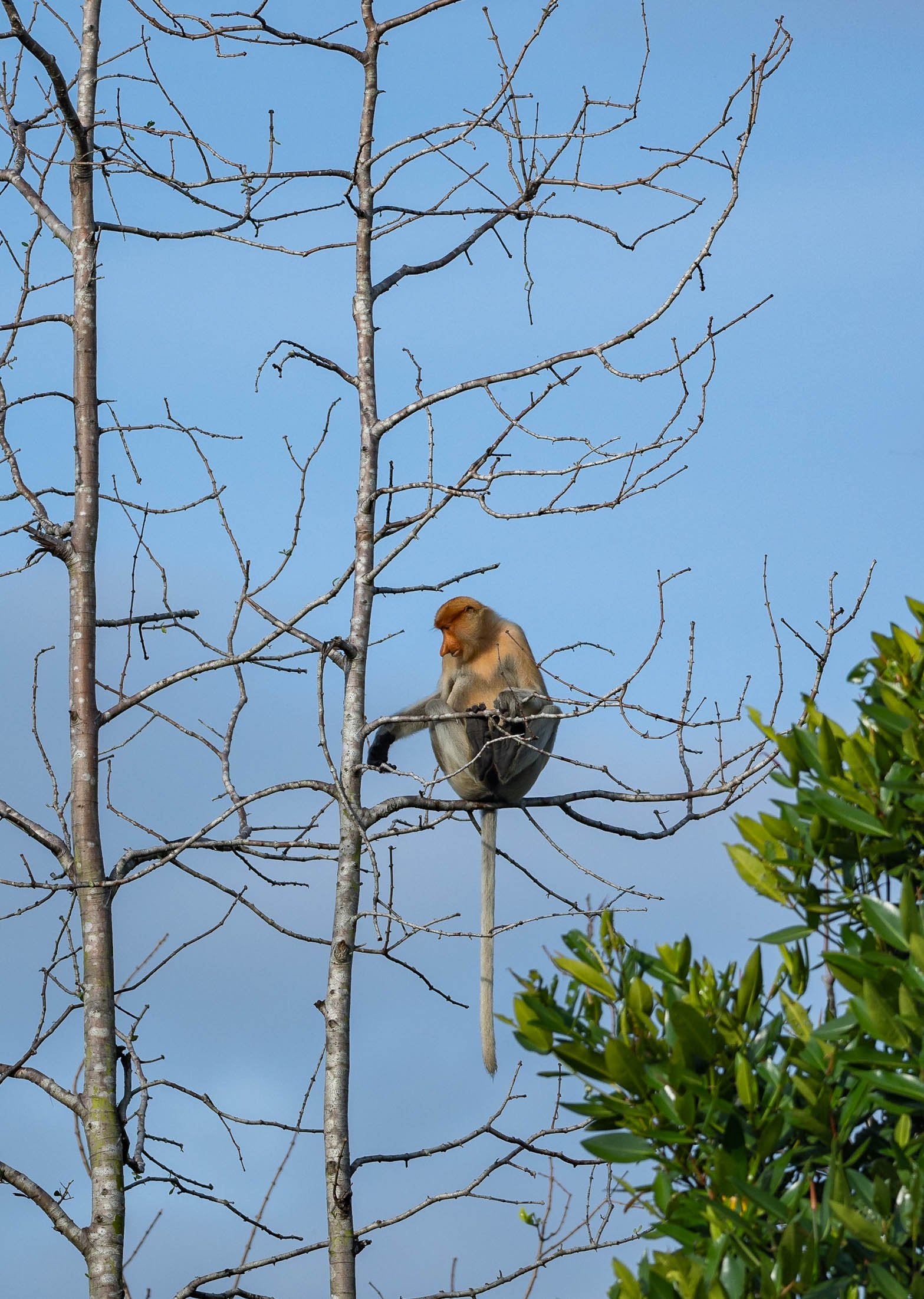

Copenhagen - The world's most livable city?
this was a title given to Denmark’s capital in 2013 by Monocle owing to its urban, cultural, and environmental planning

Well, this was a title given to Denmark’s capital in 2013 by Monocle owing to its urban, cultural, and environmental planning and is often echoed in many other city rankings. I visited in November 2022 to gain my own impressions, and finally got around to documenting some of them here.
The visit started with a big disappointment, being that Tivoli, one of the world’s oldest and most famous theme parks, was closed during my time here. This wasn’t really evident at all from the website, Google entry, or anywhere else, and so finding the doors closed wasn’t a happy start to the trip - even a visit to the nearby Lego store (Denmark is where Lego was invented) couldn’t quite help.
Instead onwards to the city’s aptly named “Round Tower”.


Some views from the top of the 1642 tower.
Church Galore

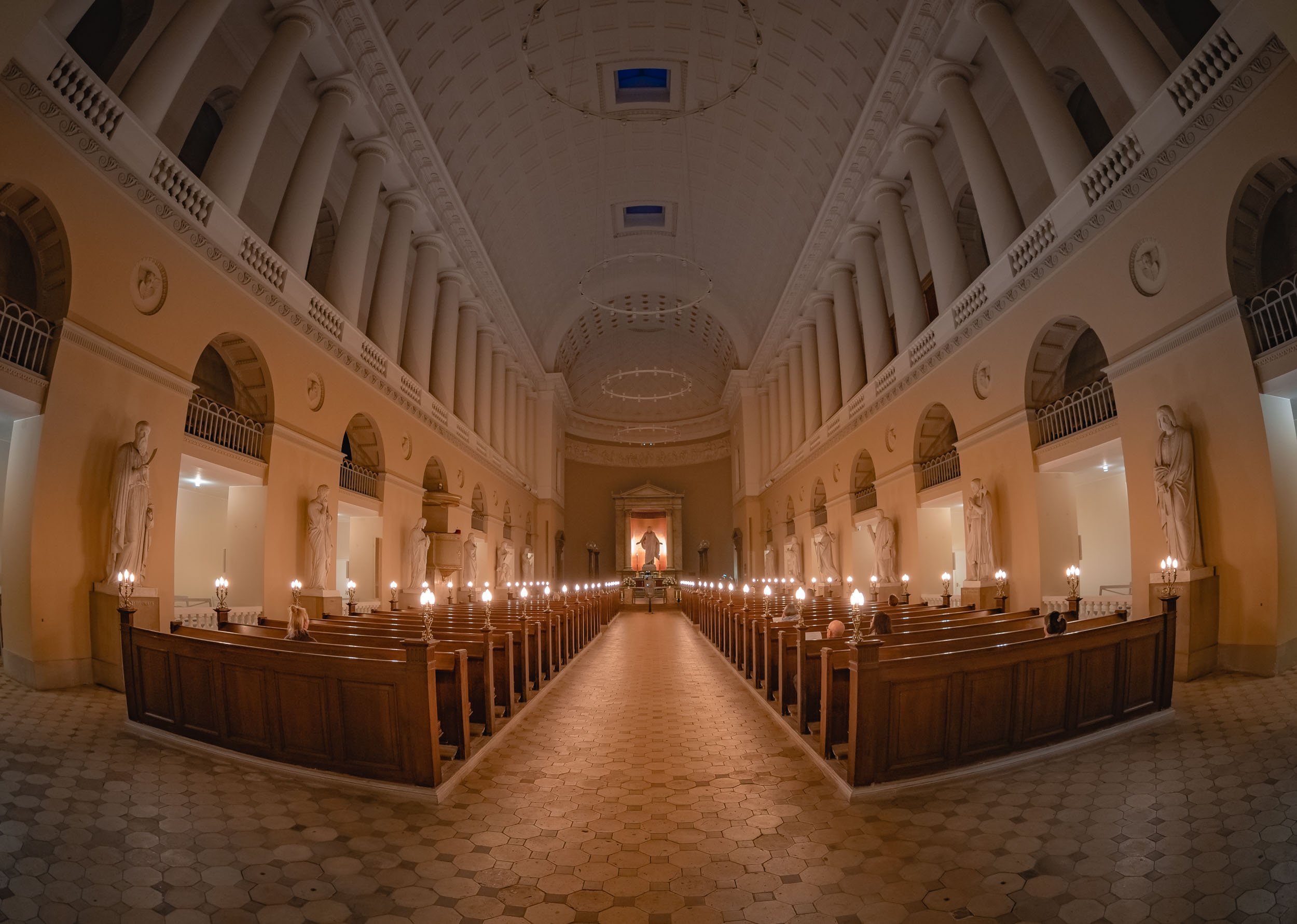
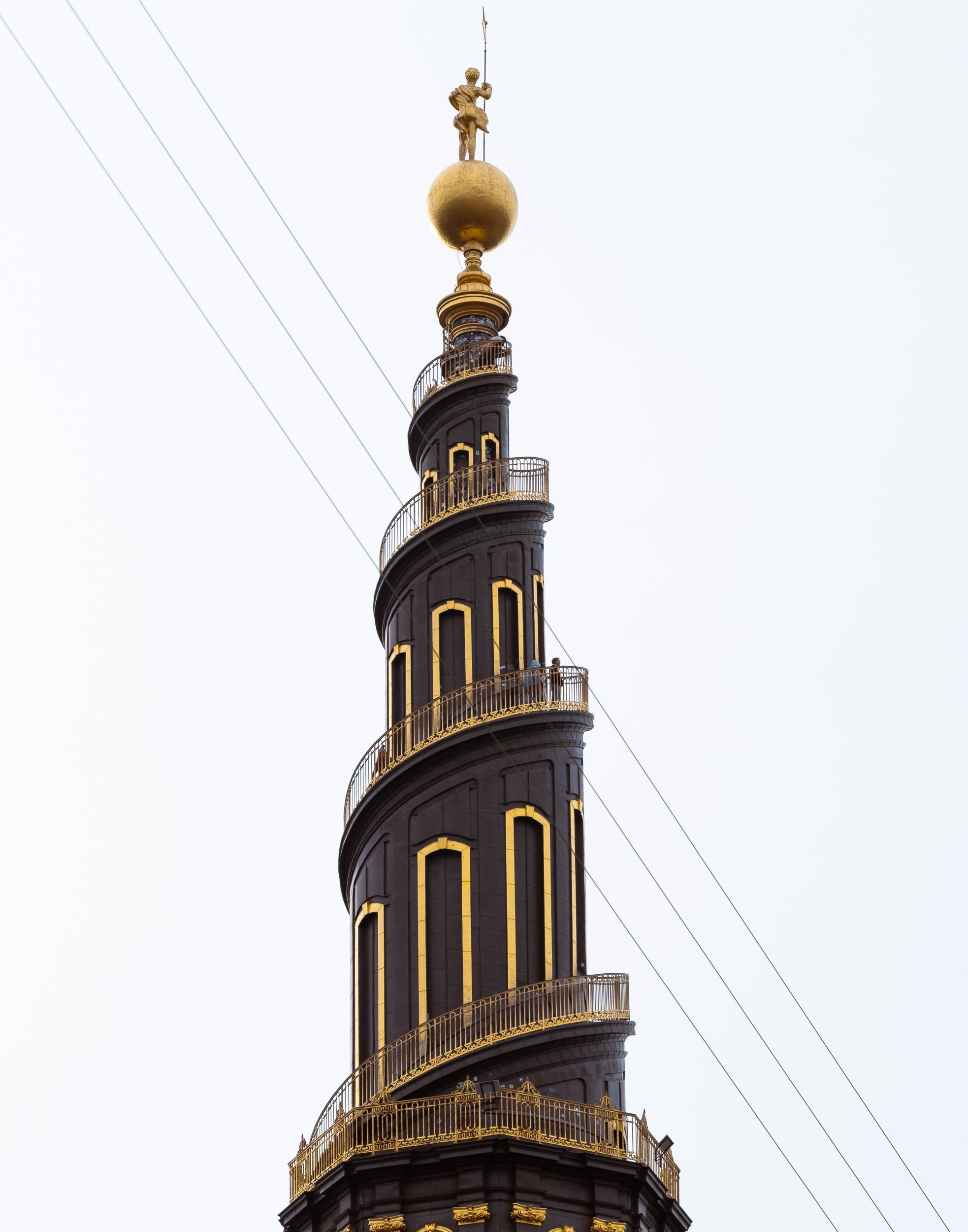
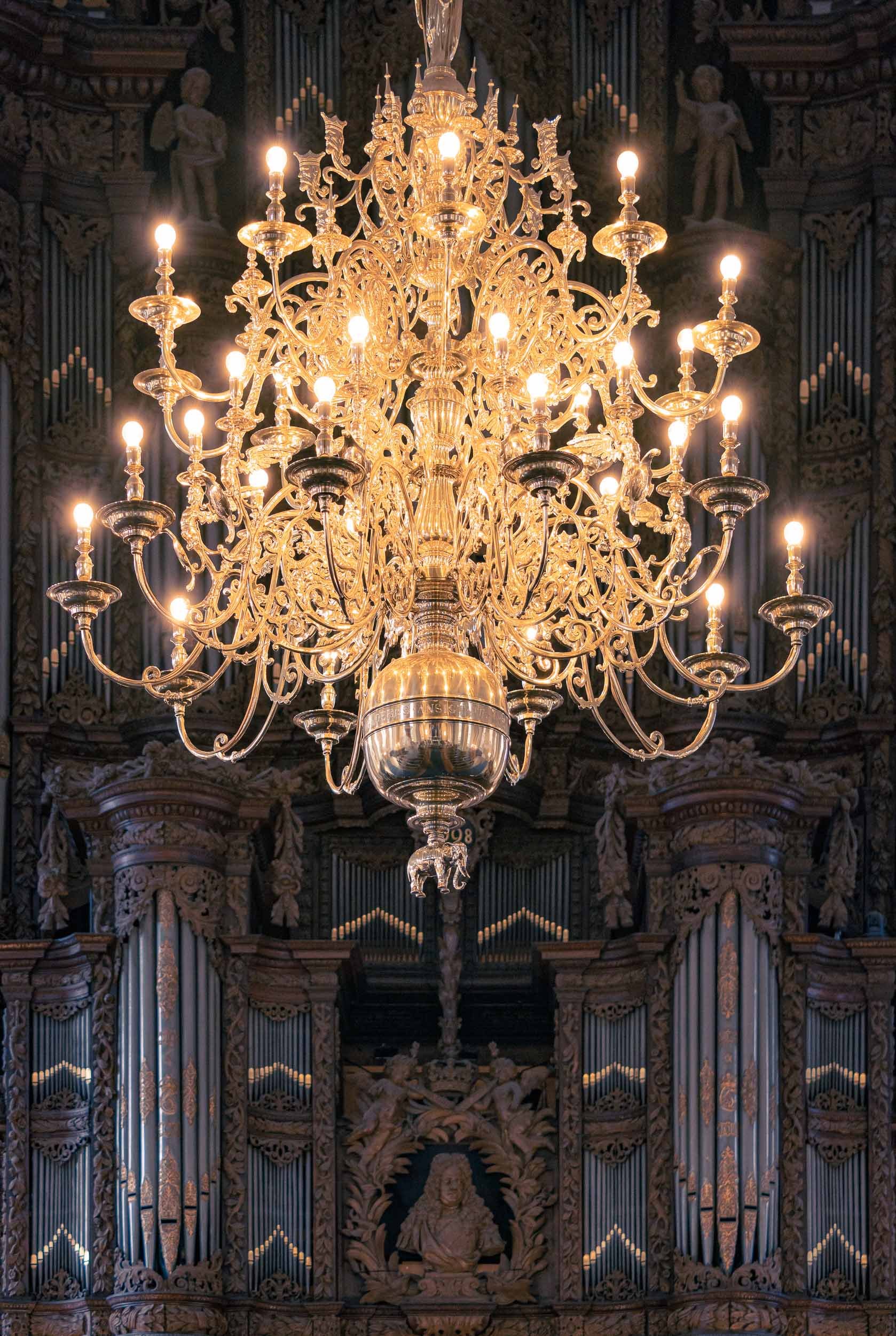
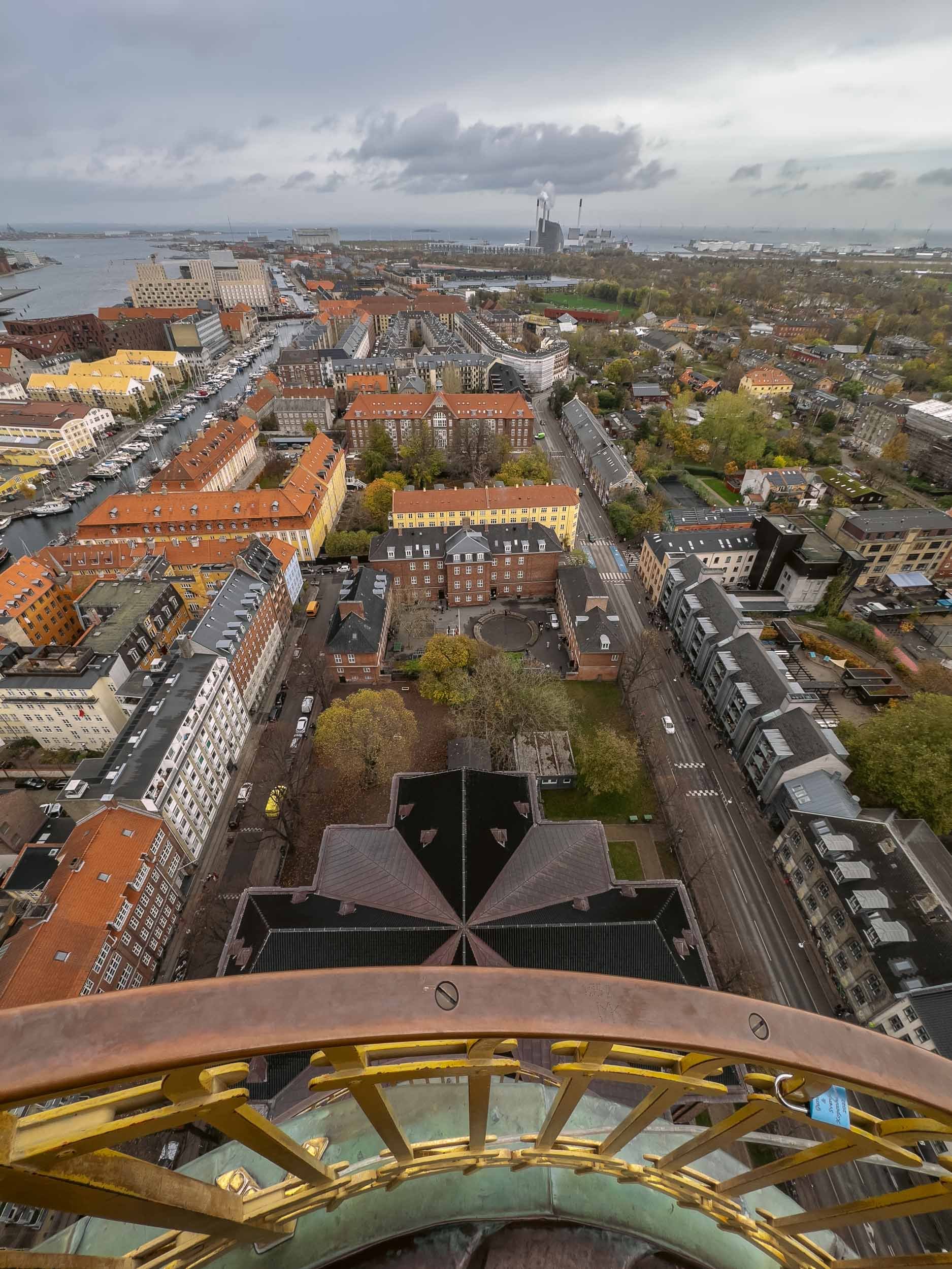
Evening Impressions & Nyhavn

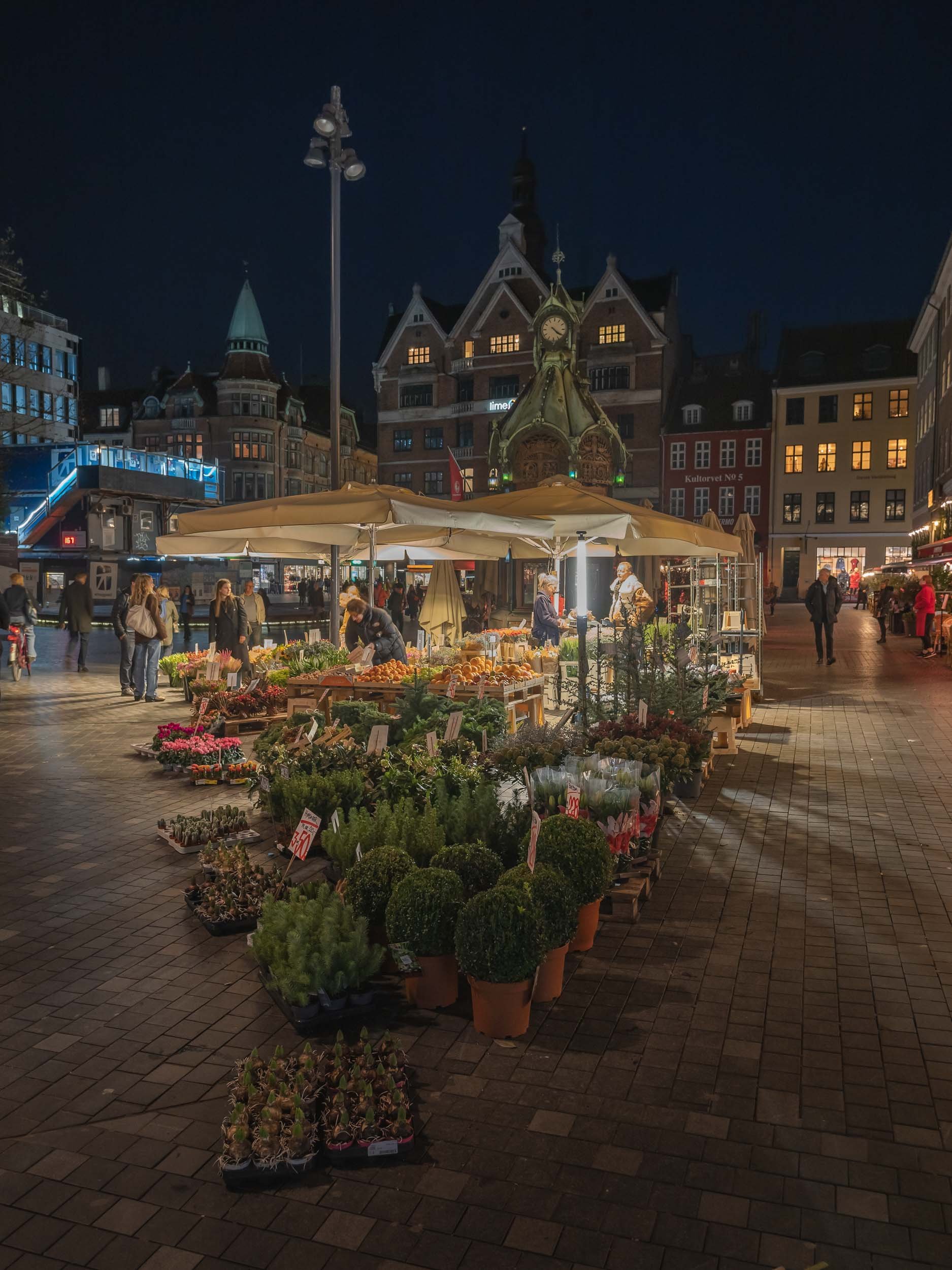
On the next morning, I had what is arguably the city’s most picturesque area on the agenda - as always, arriving before sunrise has its benefits, and I caught a quiet Nyhavn canal when it was still empty and with some nice reflections in the calm water.
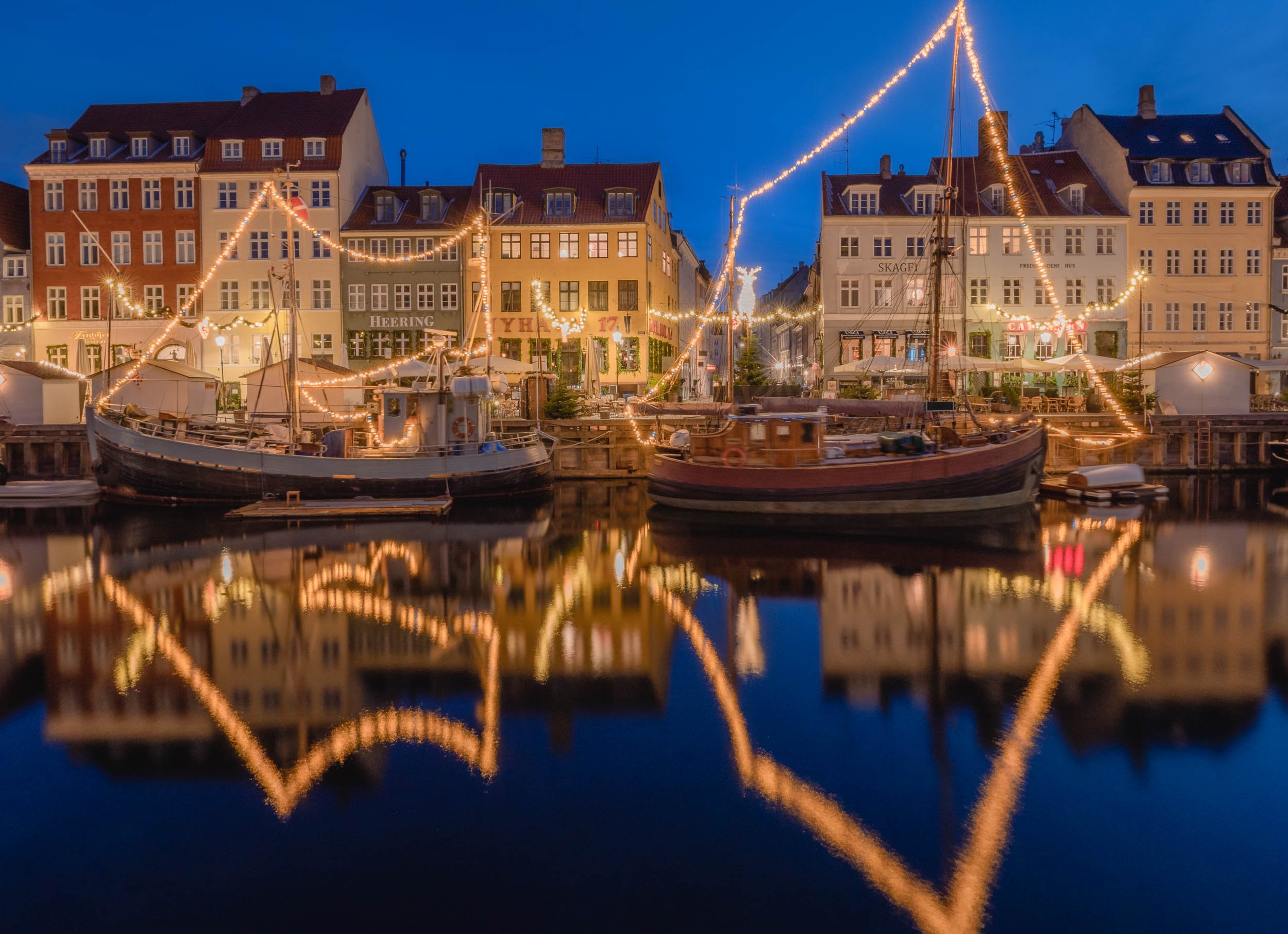

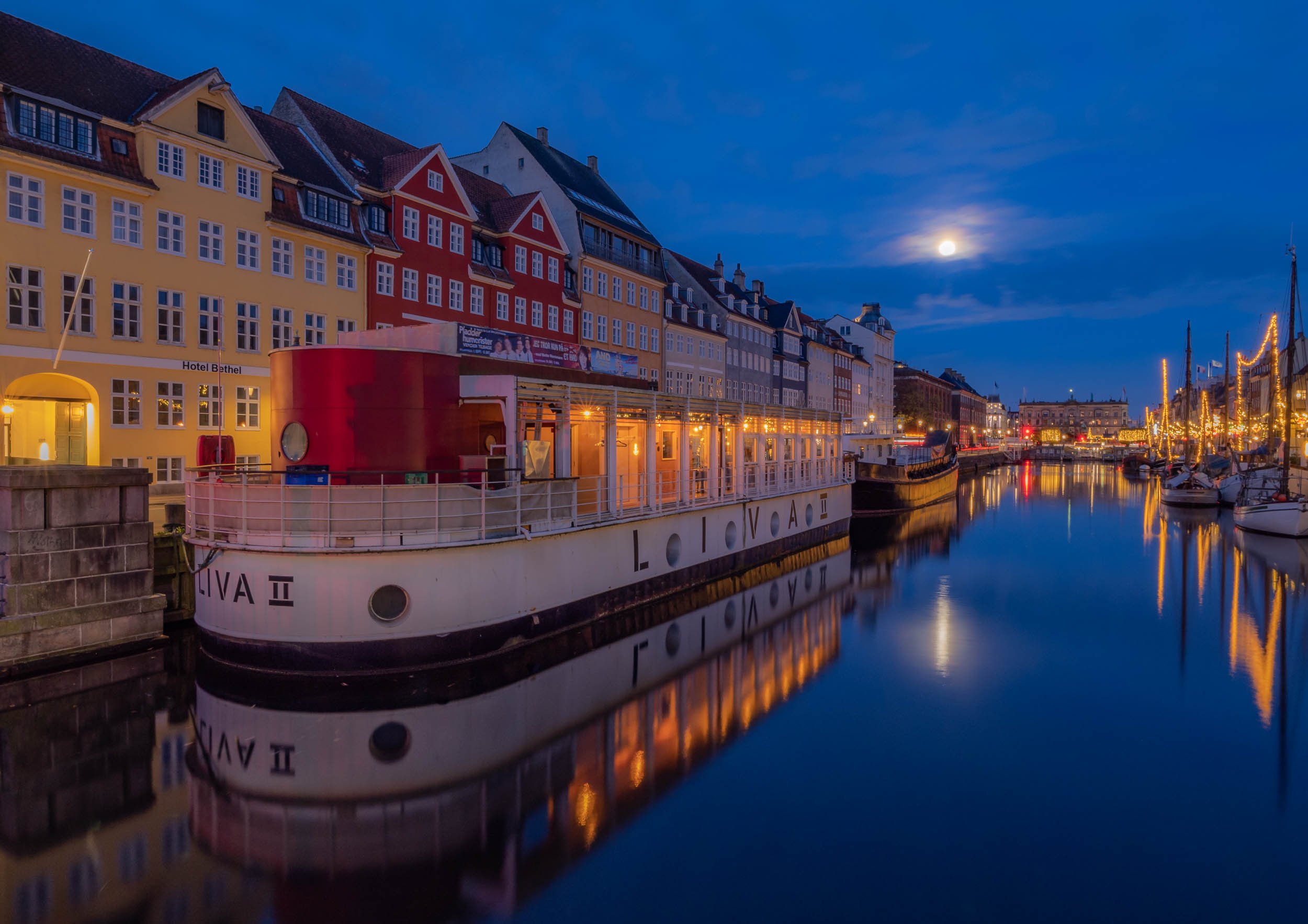


The Mermaids
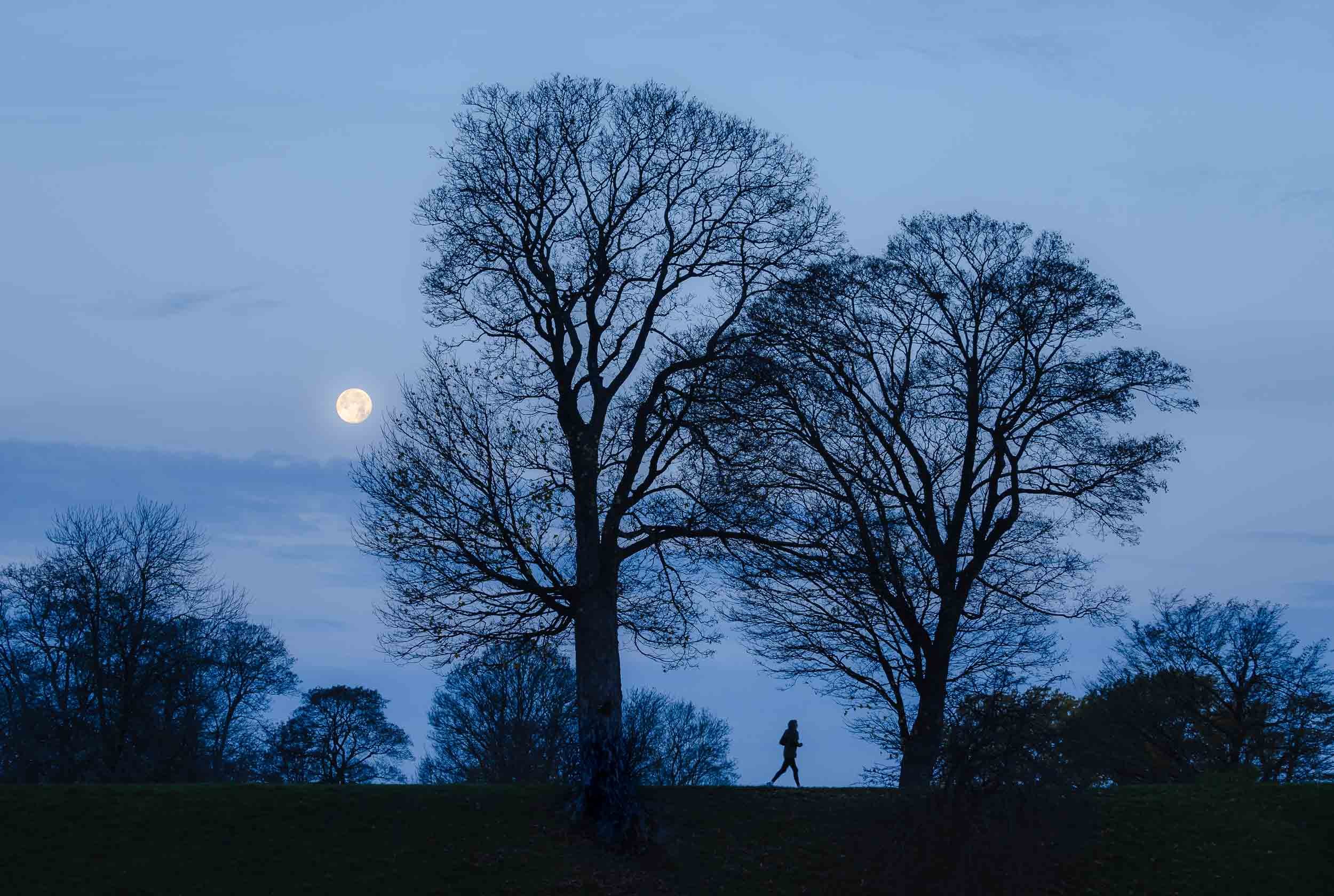
Wait a minute, mermaids plural? Yes, because aside from the very famous The Little Mermaid bronze statue by Edvard Eriksen, there is indeed a second less famous modern interpretation of it not too far along Copenhagen’s waterfront.
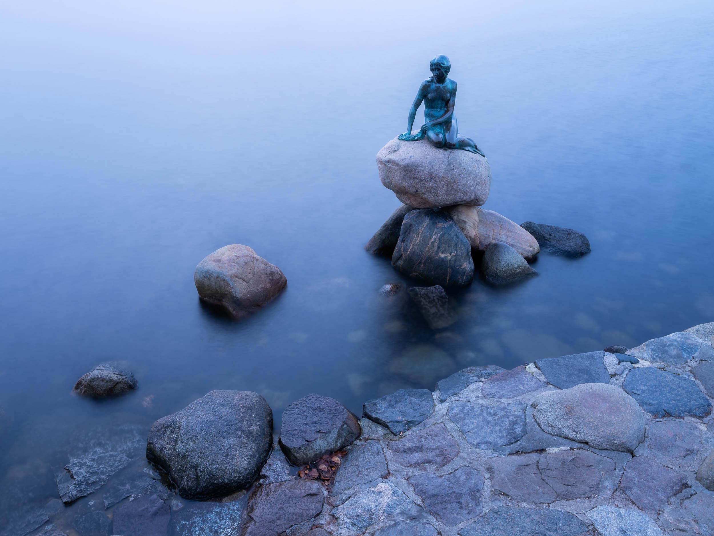


The second version is the Genetically Modified Little Mermaid, a sculpture that’s part of a 2006 series by Danish professor Bjørn Nørgaard, with the intention to create a kind of postmodern look at the changes in society.
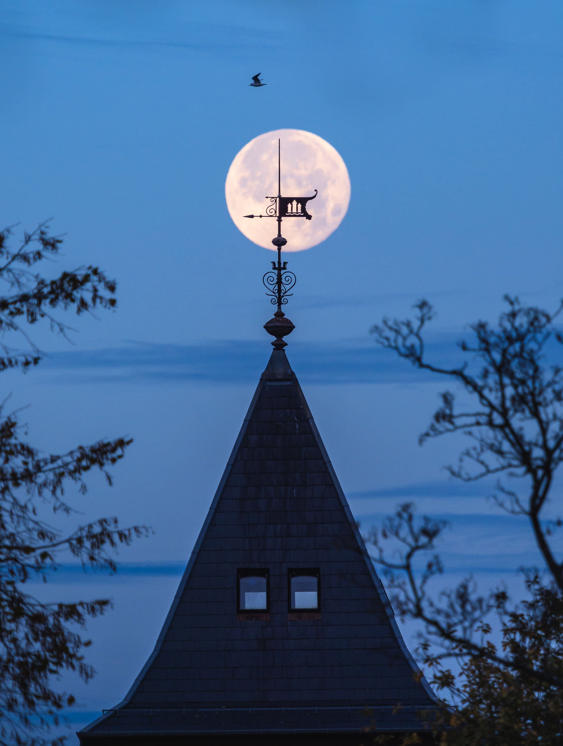
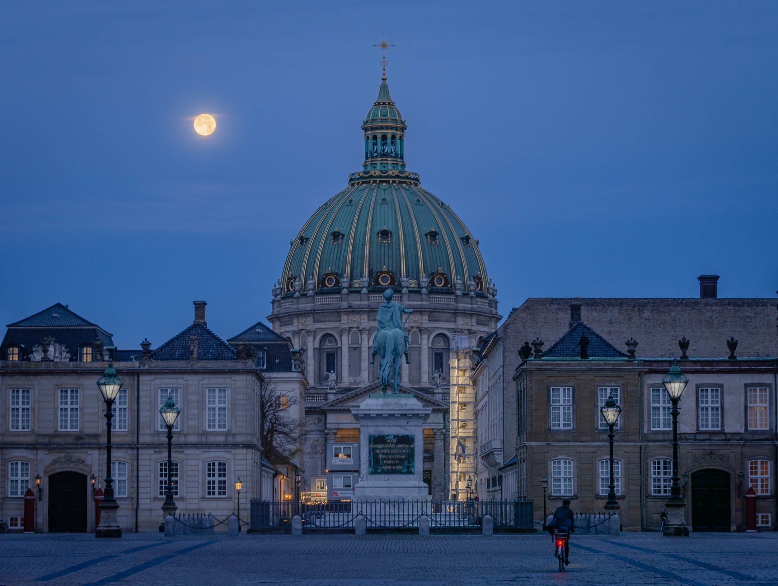
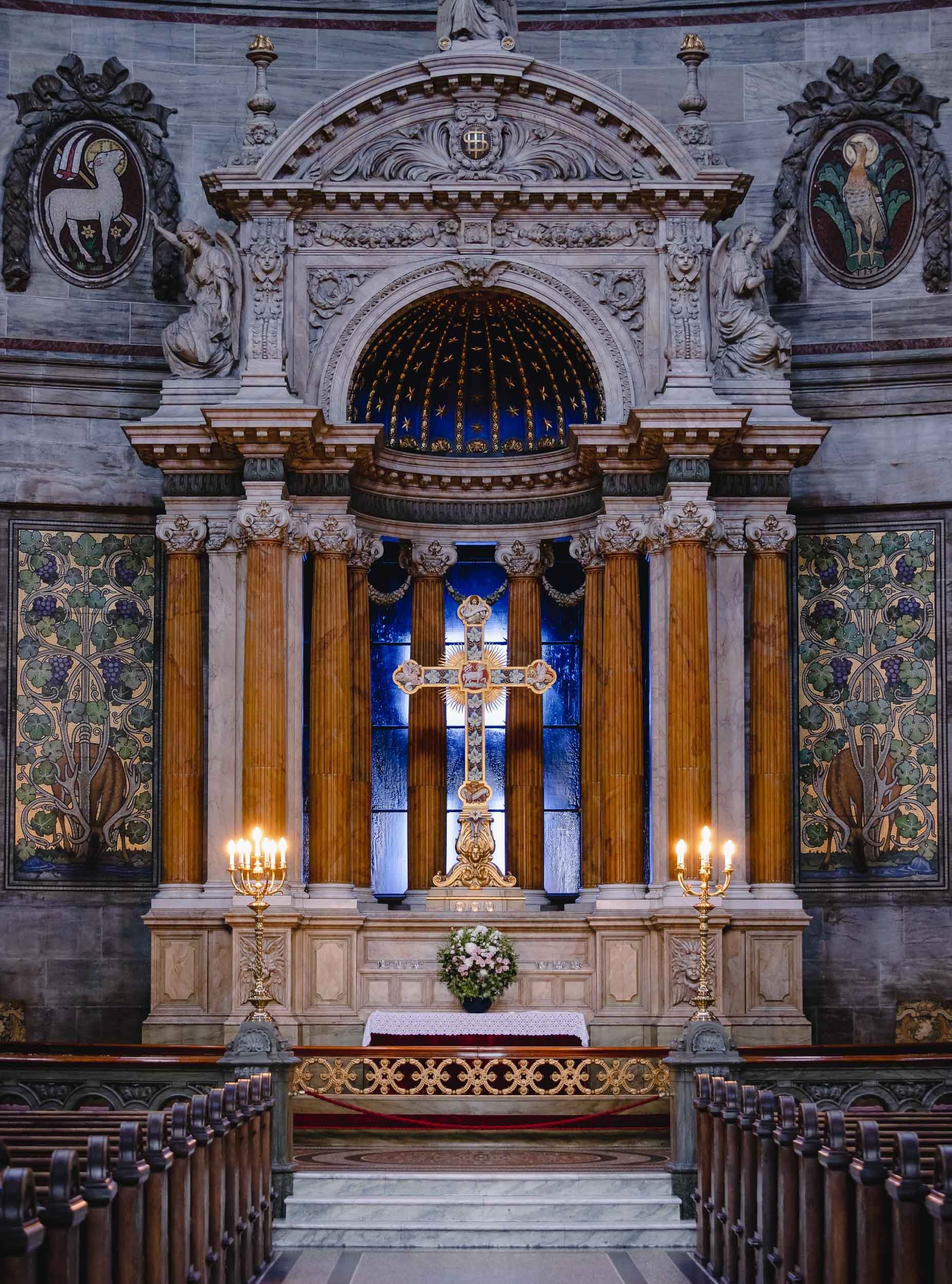
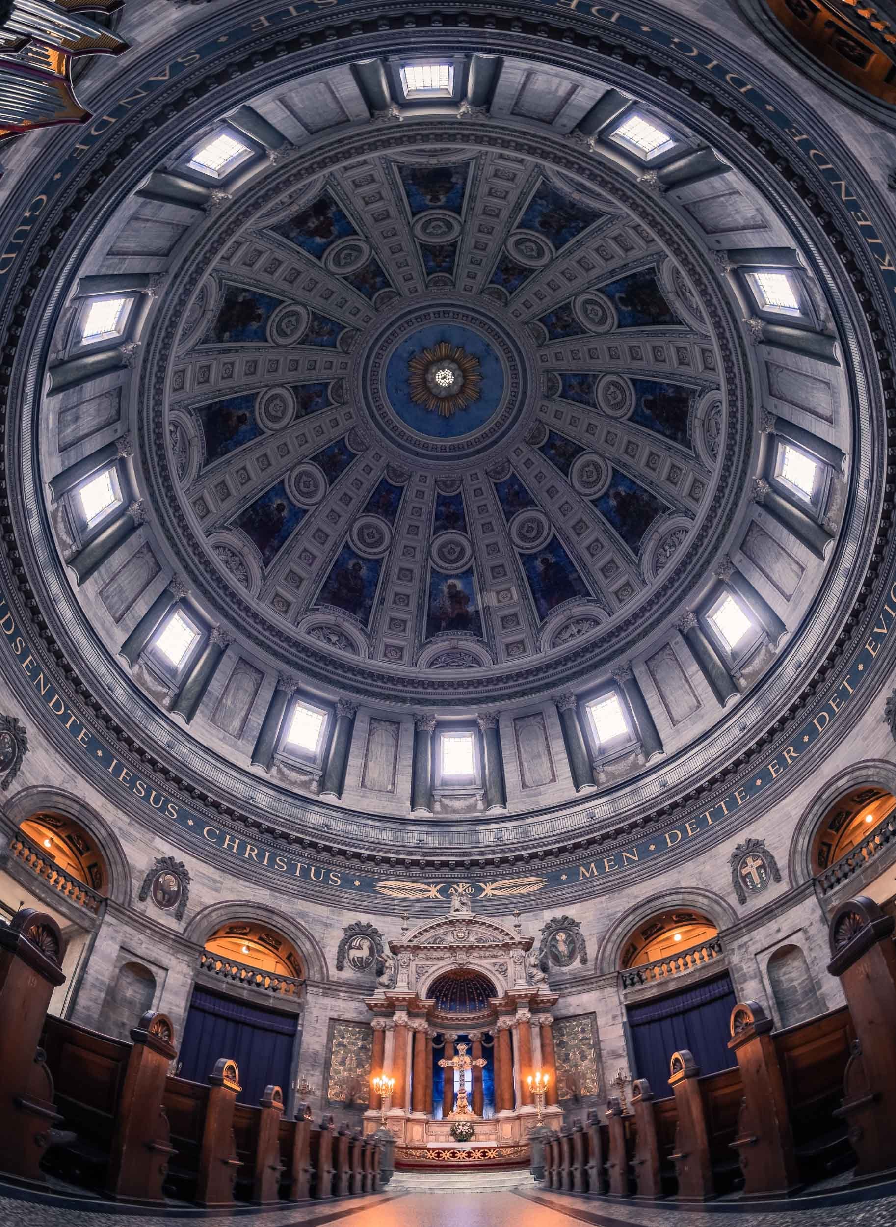
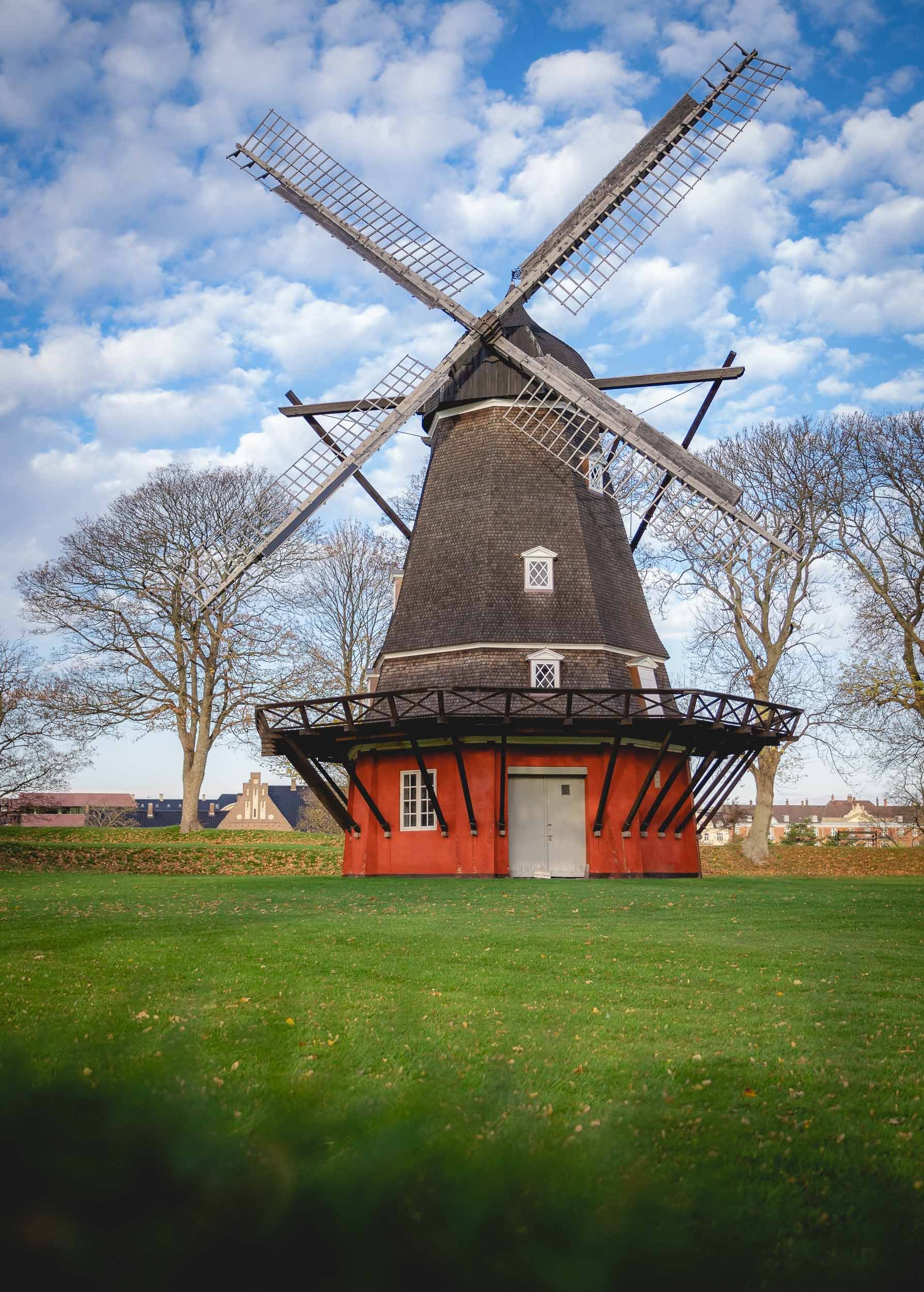


As well as the long yellow houses of Nyboder, once used as naval accomodation and today being restored as regular housing.
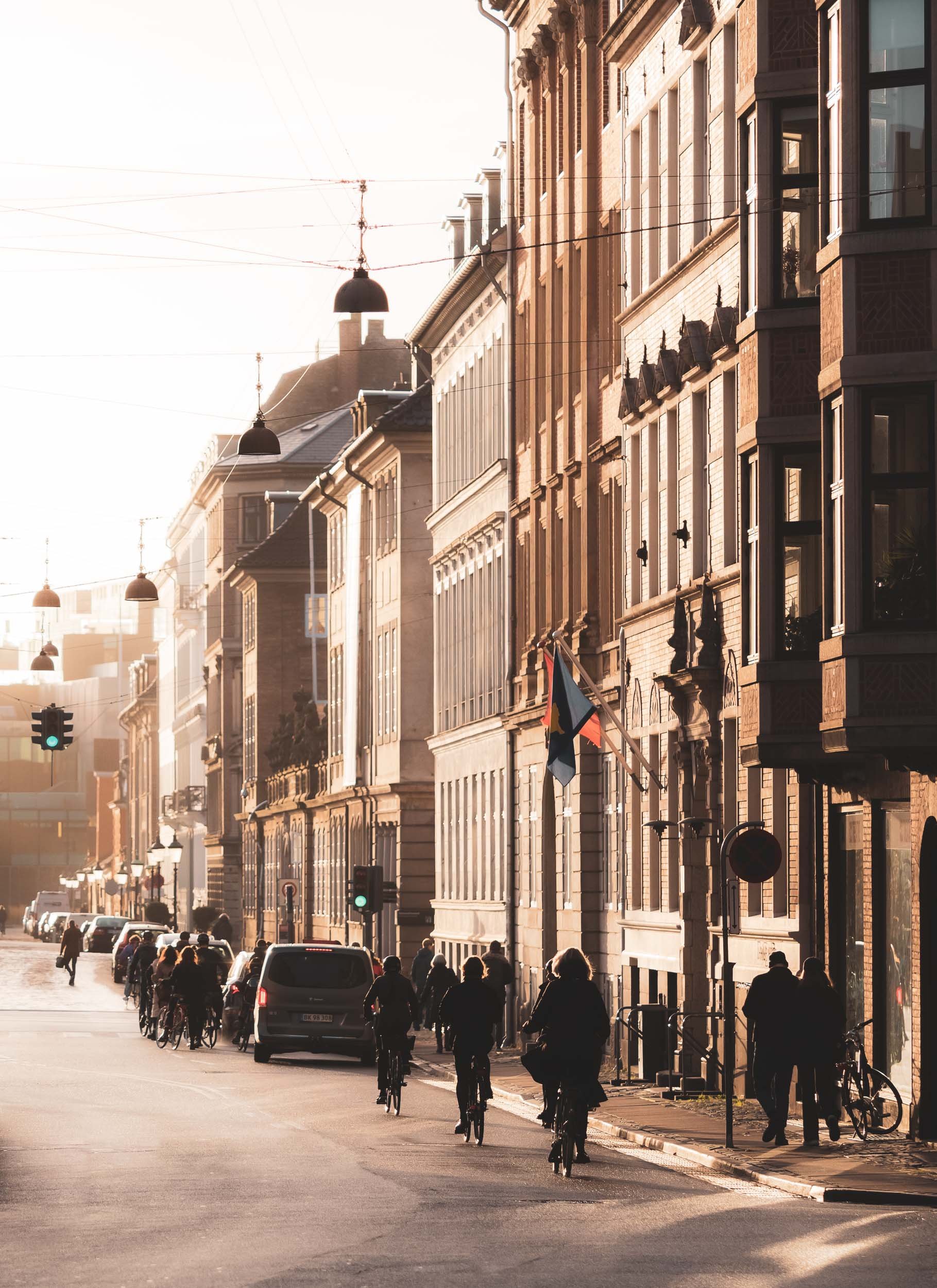
Not only Churches…


The mixed use towers opened in 2016 and were designed by Lene Tranberg.
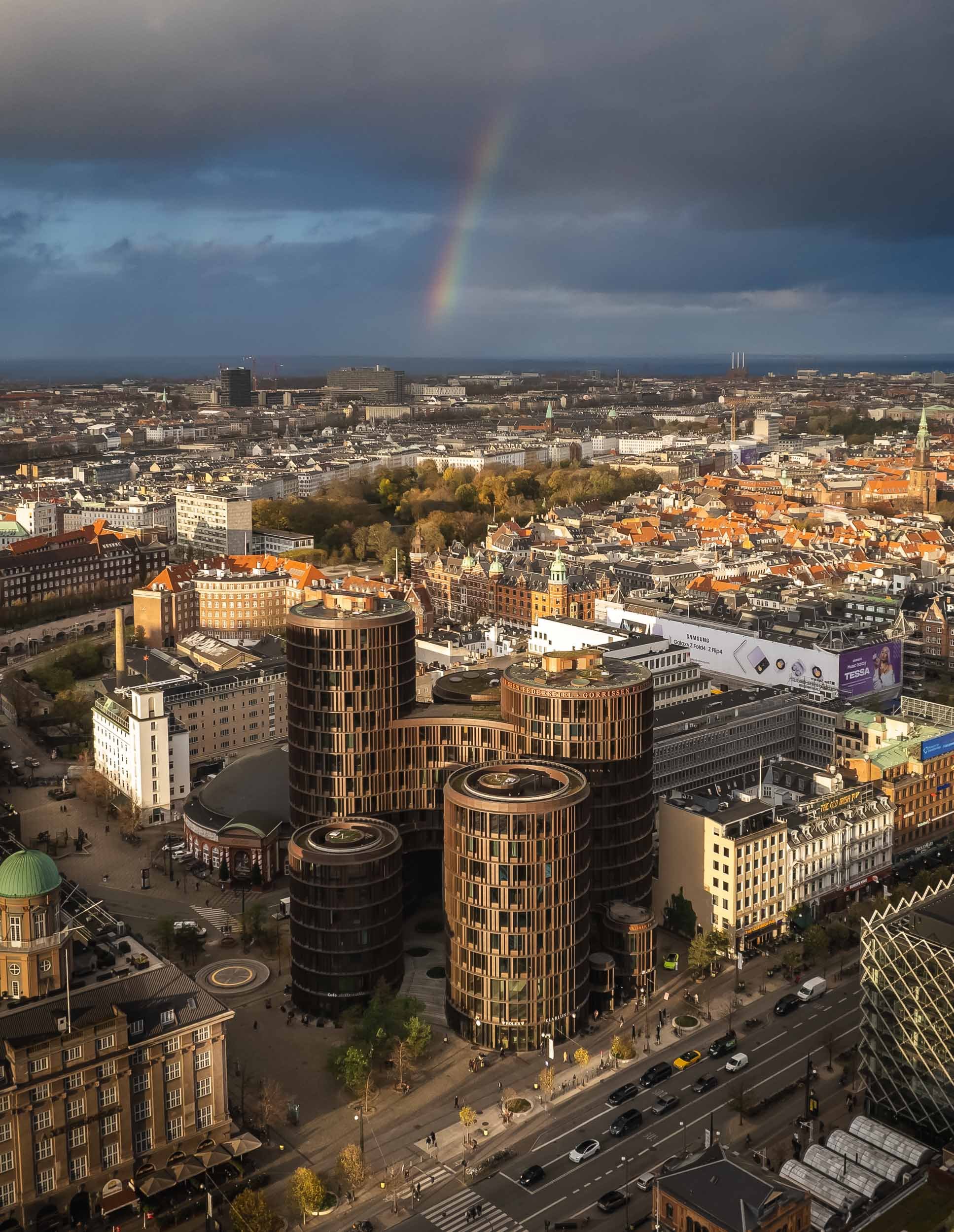
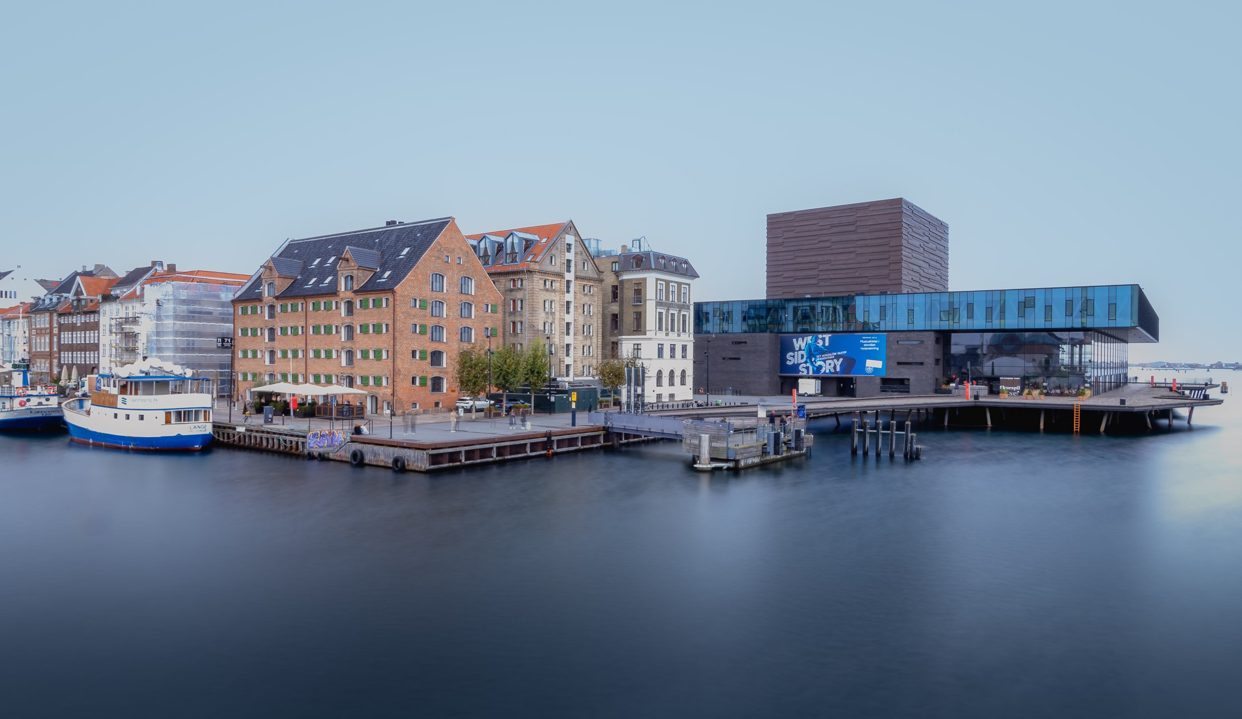
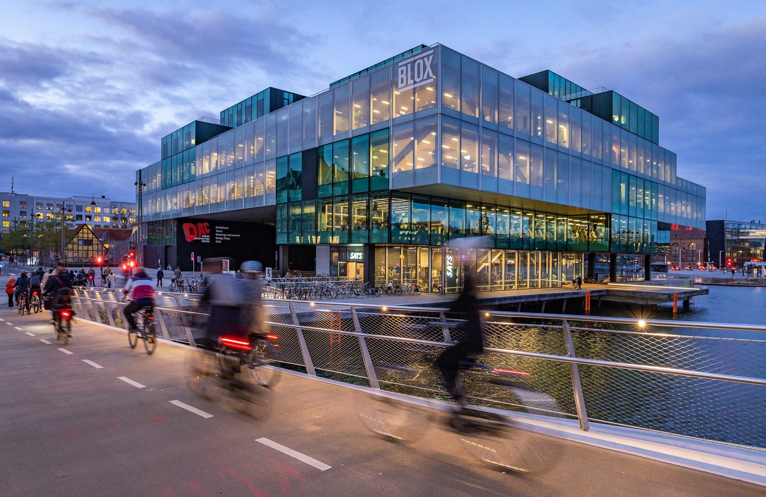
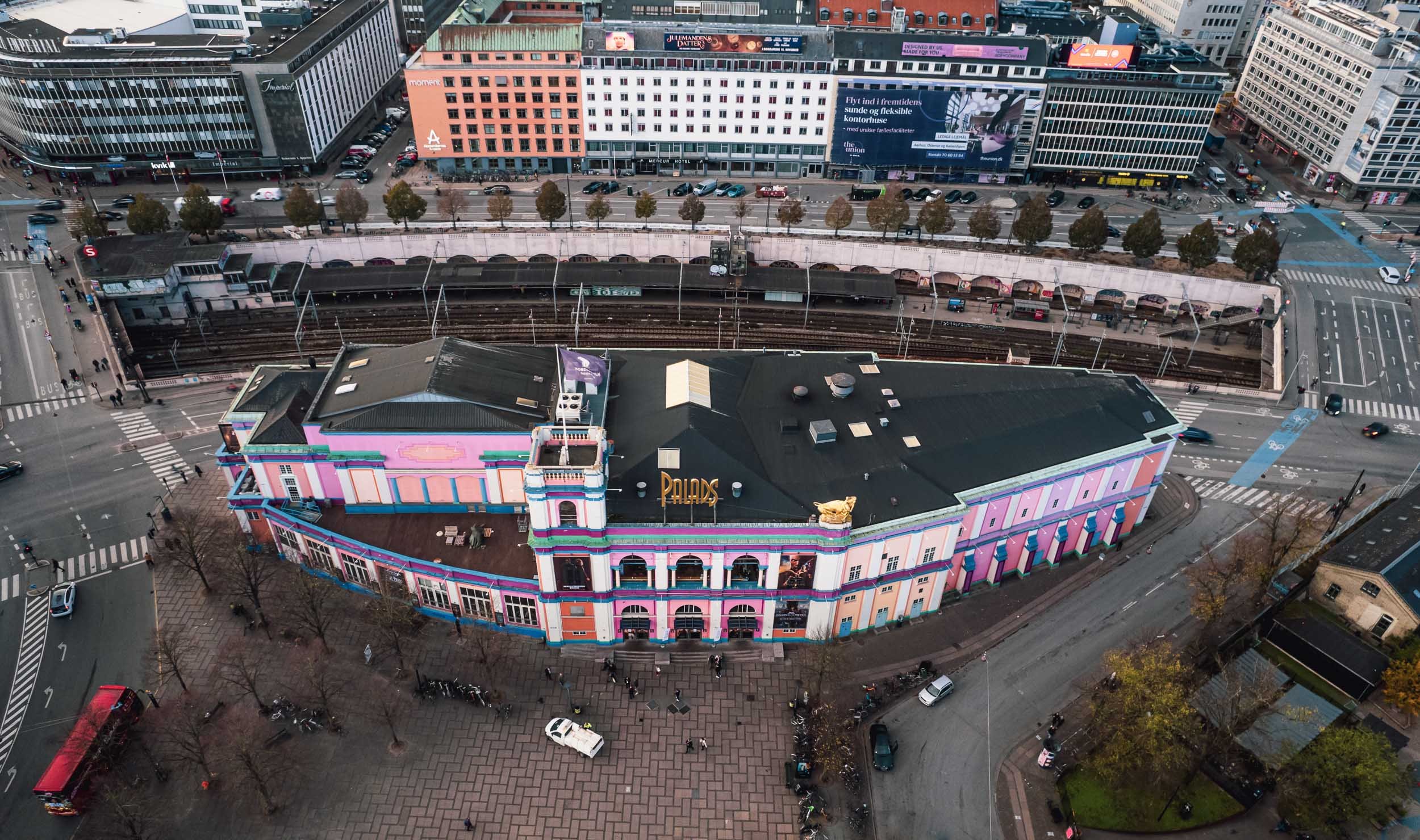
Copenhagen City Hall
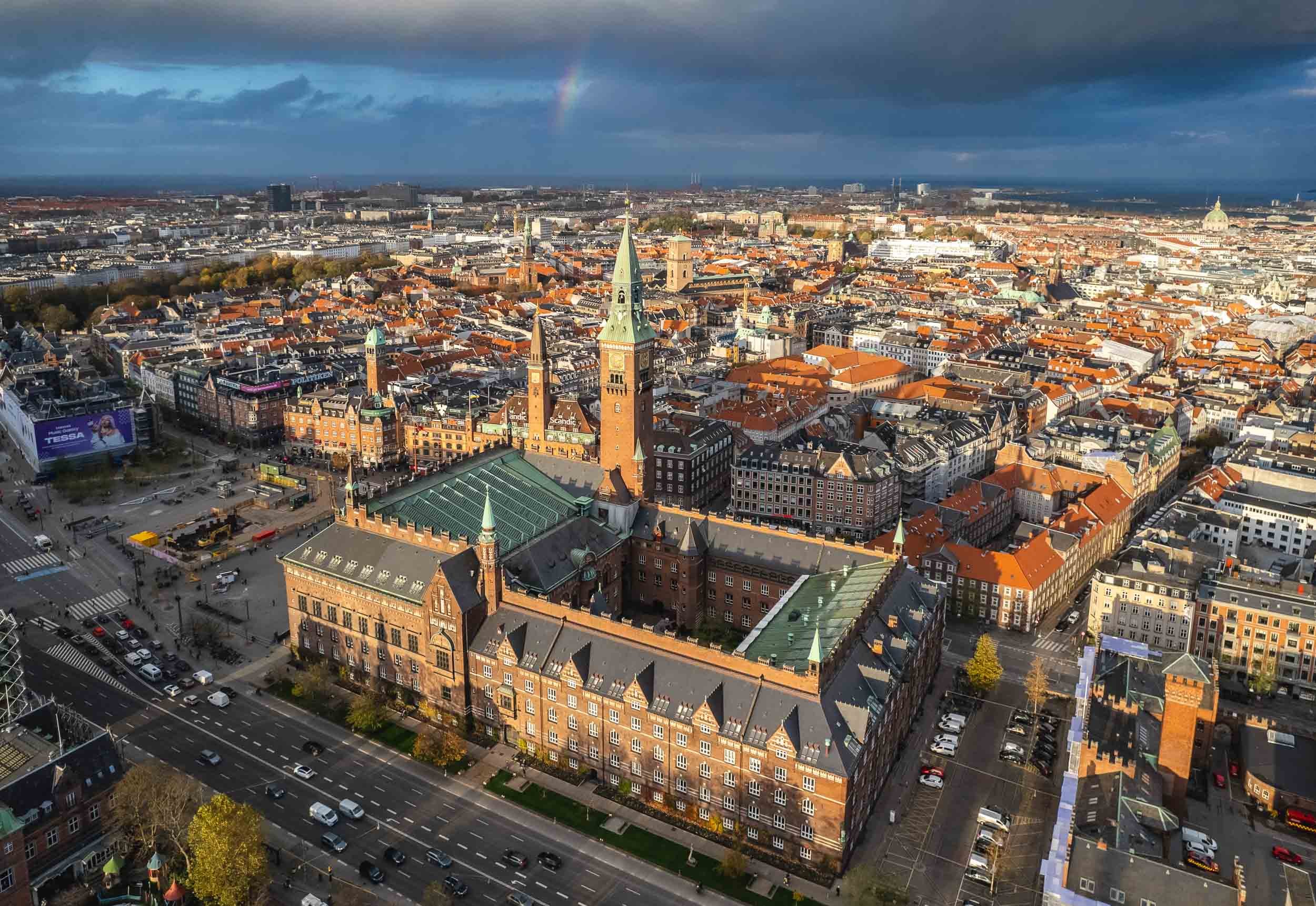
Aside from the views from above, another reason is the interesting interior…


… but primarily the amazing World Clock by Jens Olsen.

Rosenborg Castle and Christiansborg Palace
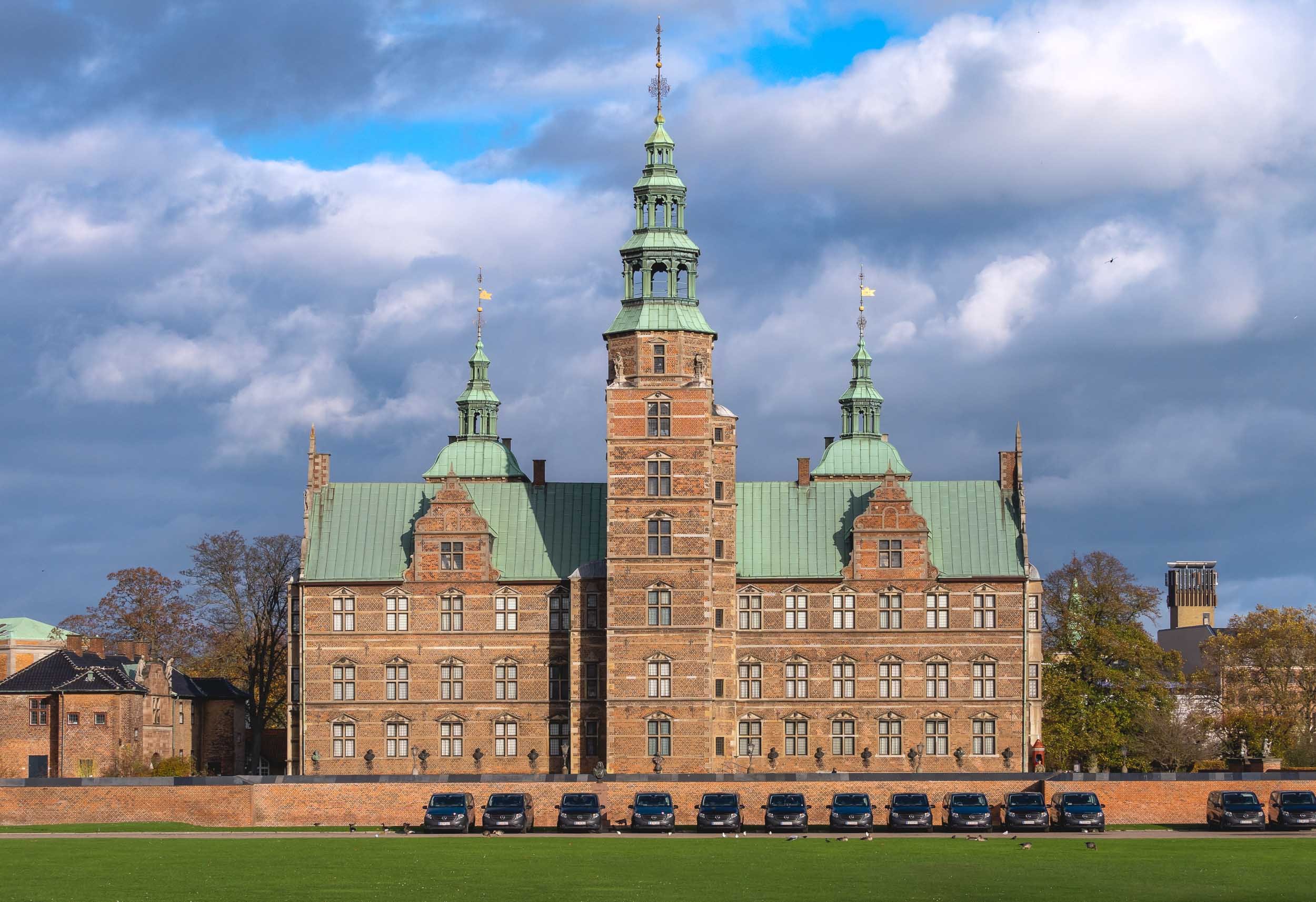

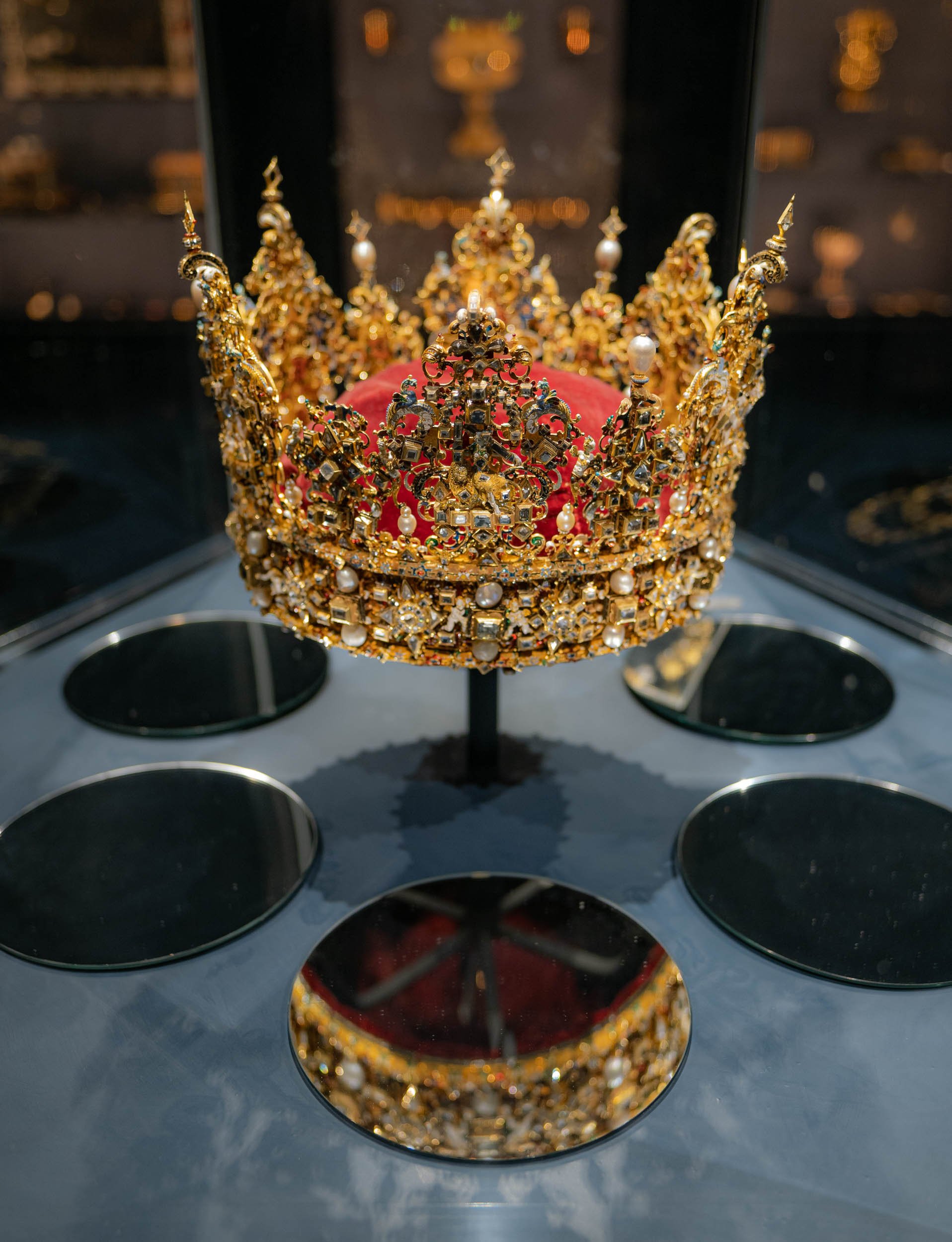

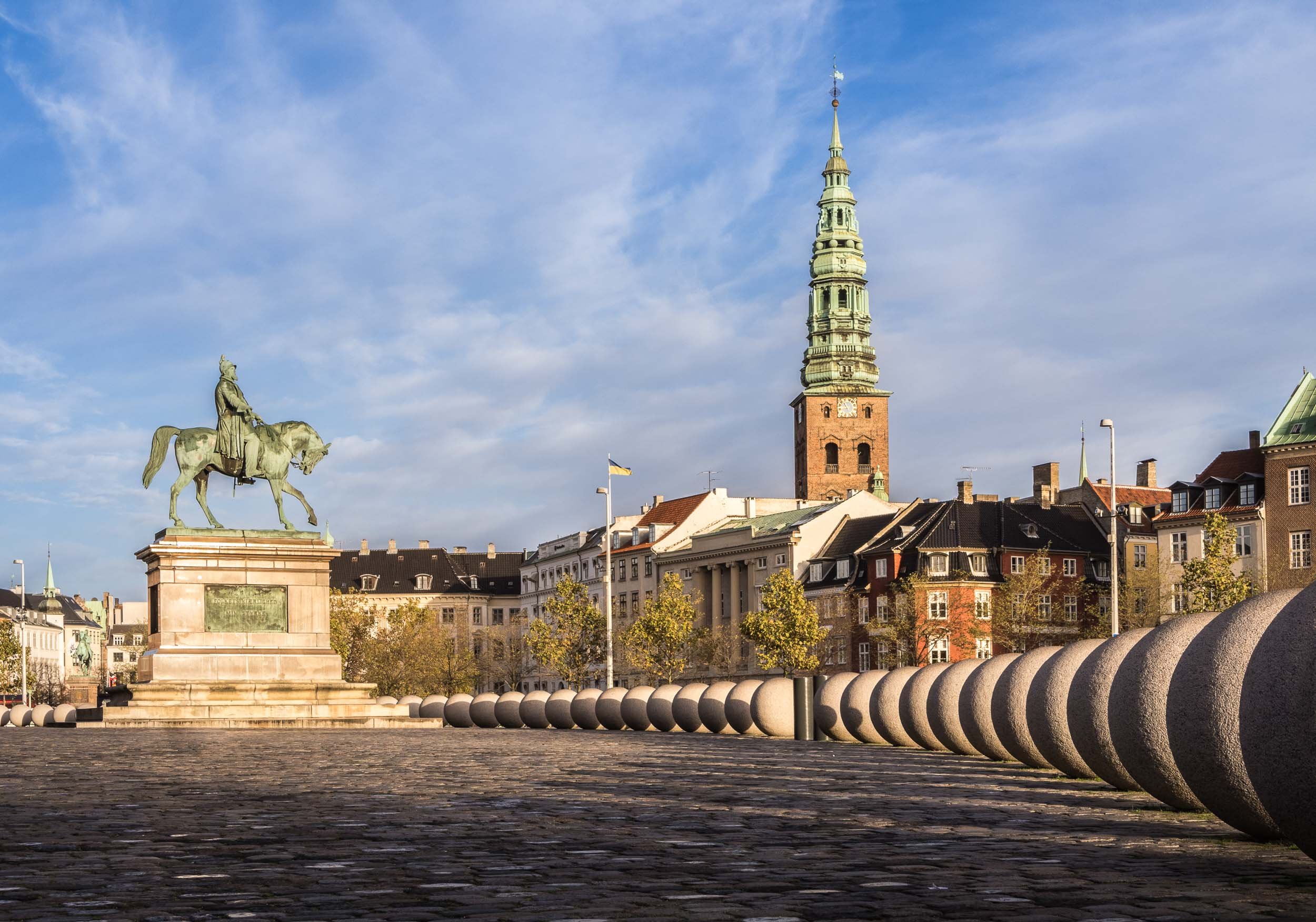
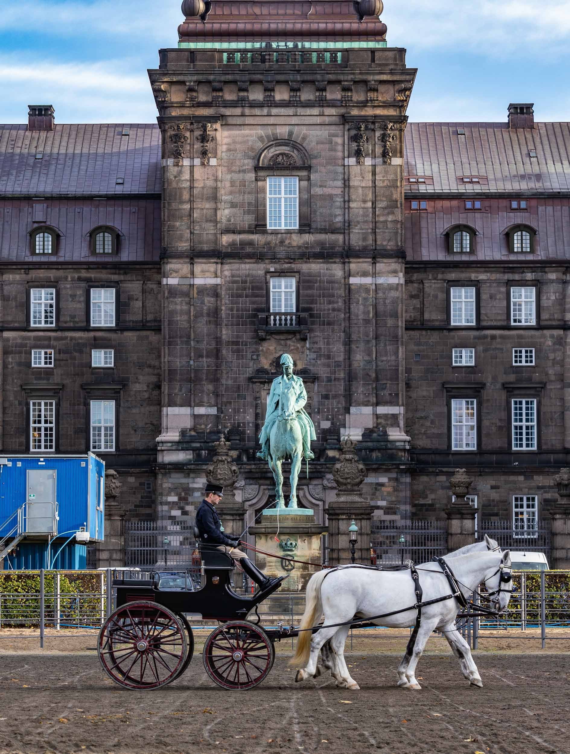
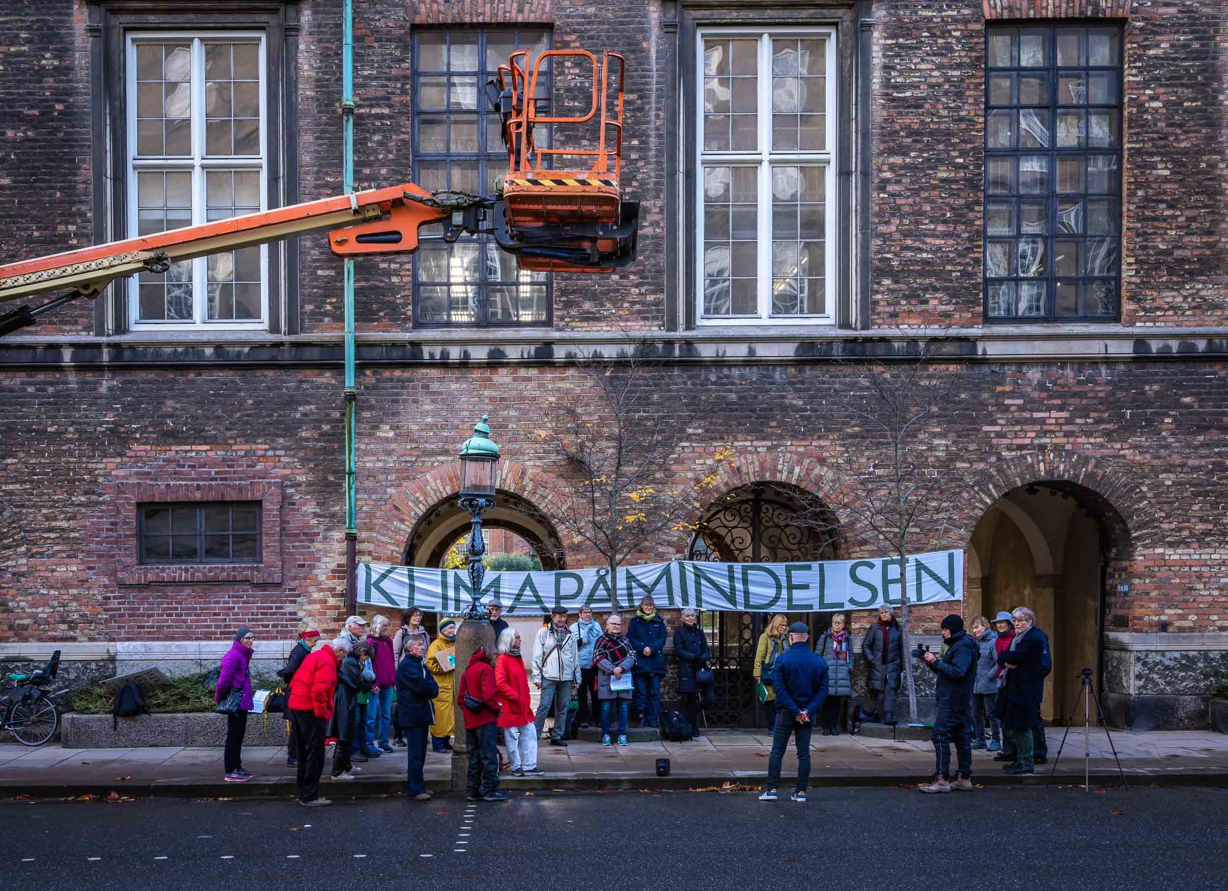

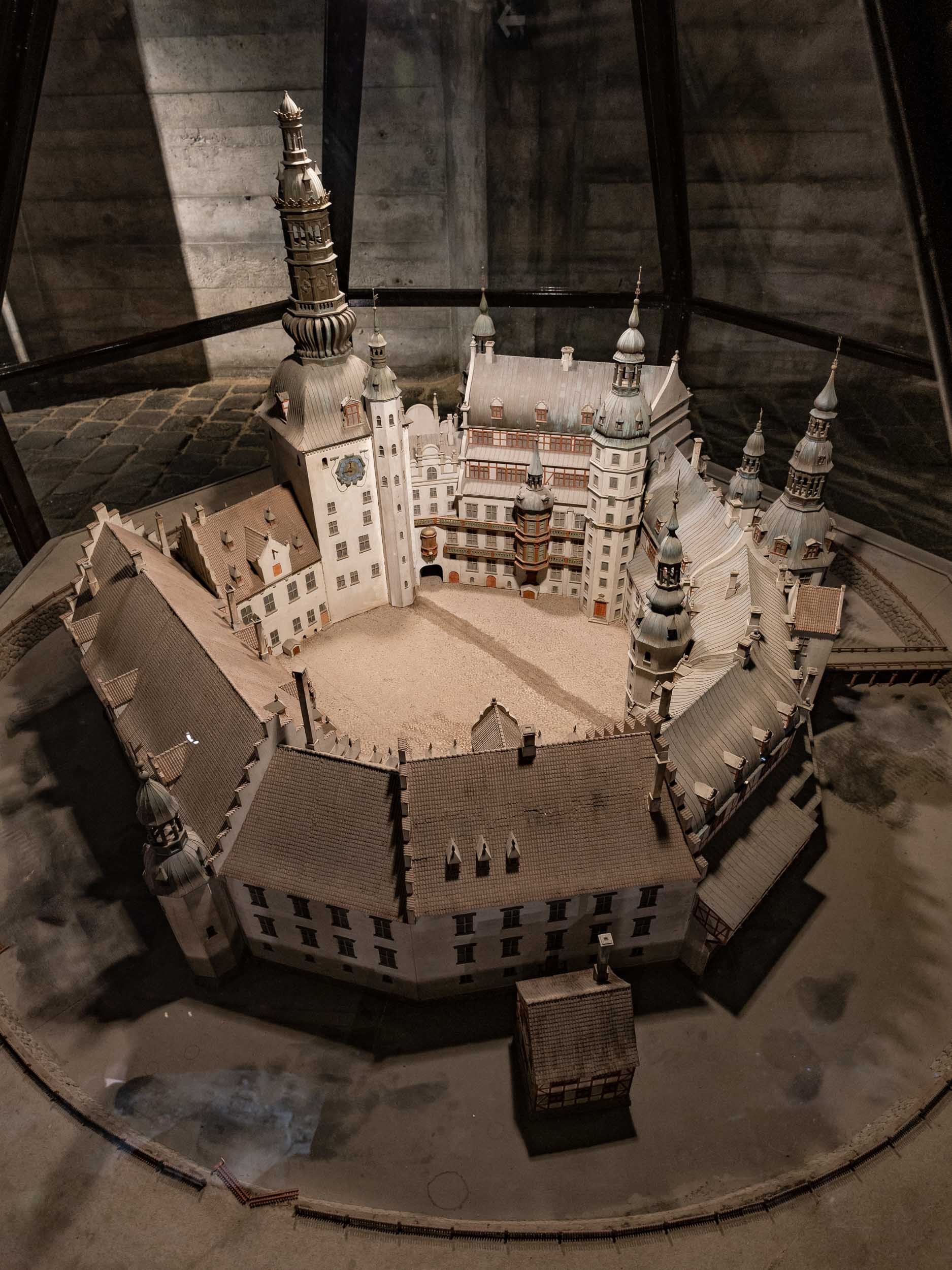
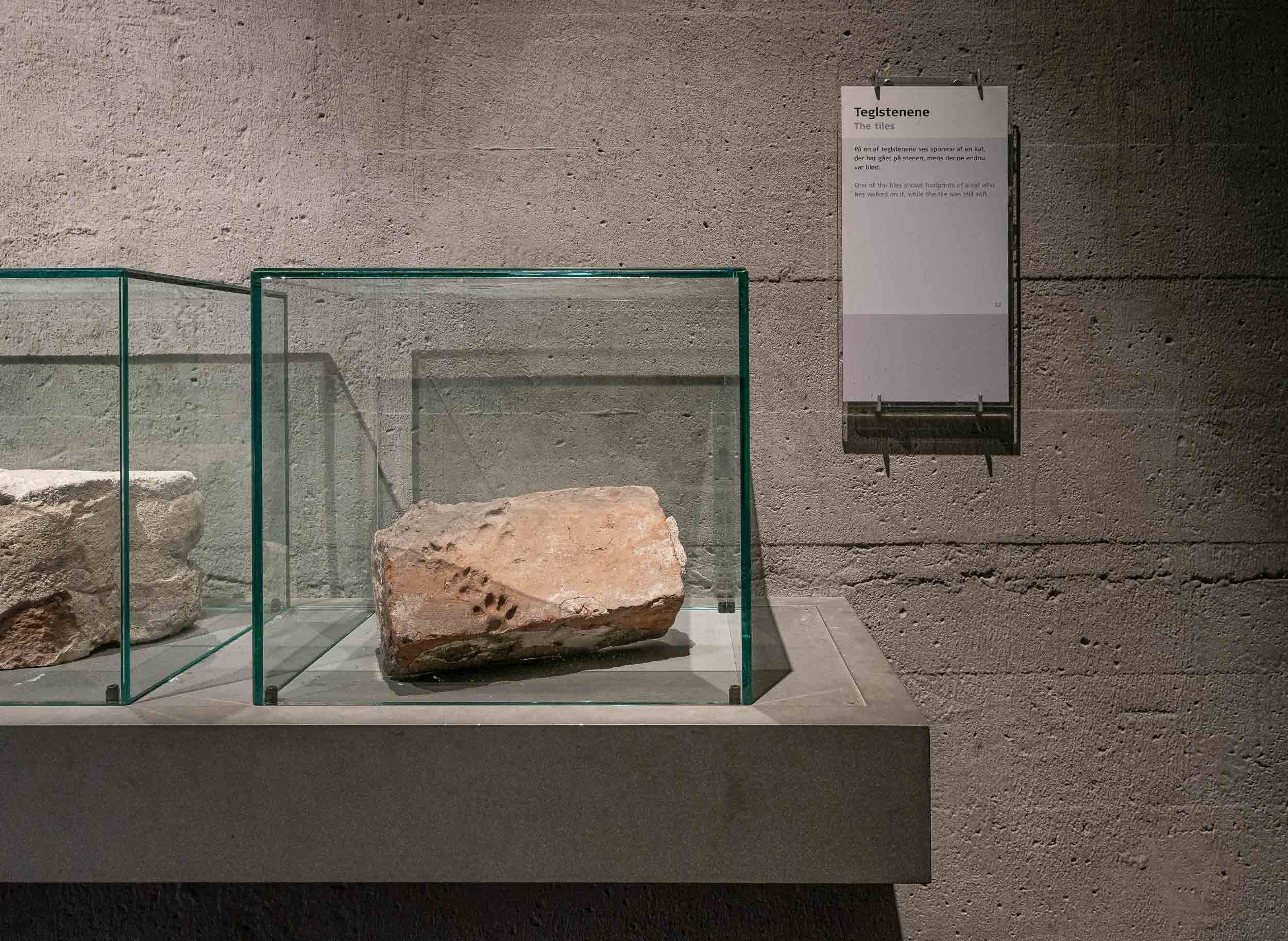
Grundtvigs Church
One of the most spectacular places in the city lies a little outside, but is worth the journey: A rare expressionist church completed in 1940, designed by Peder Vilhelm Jensen-Klint.
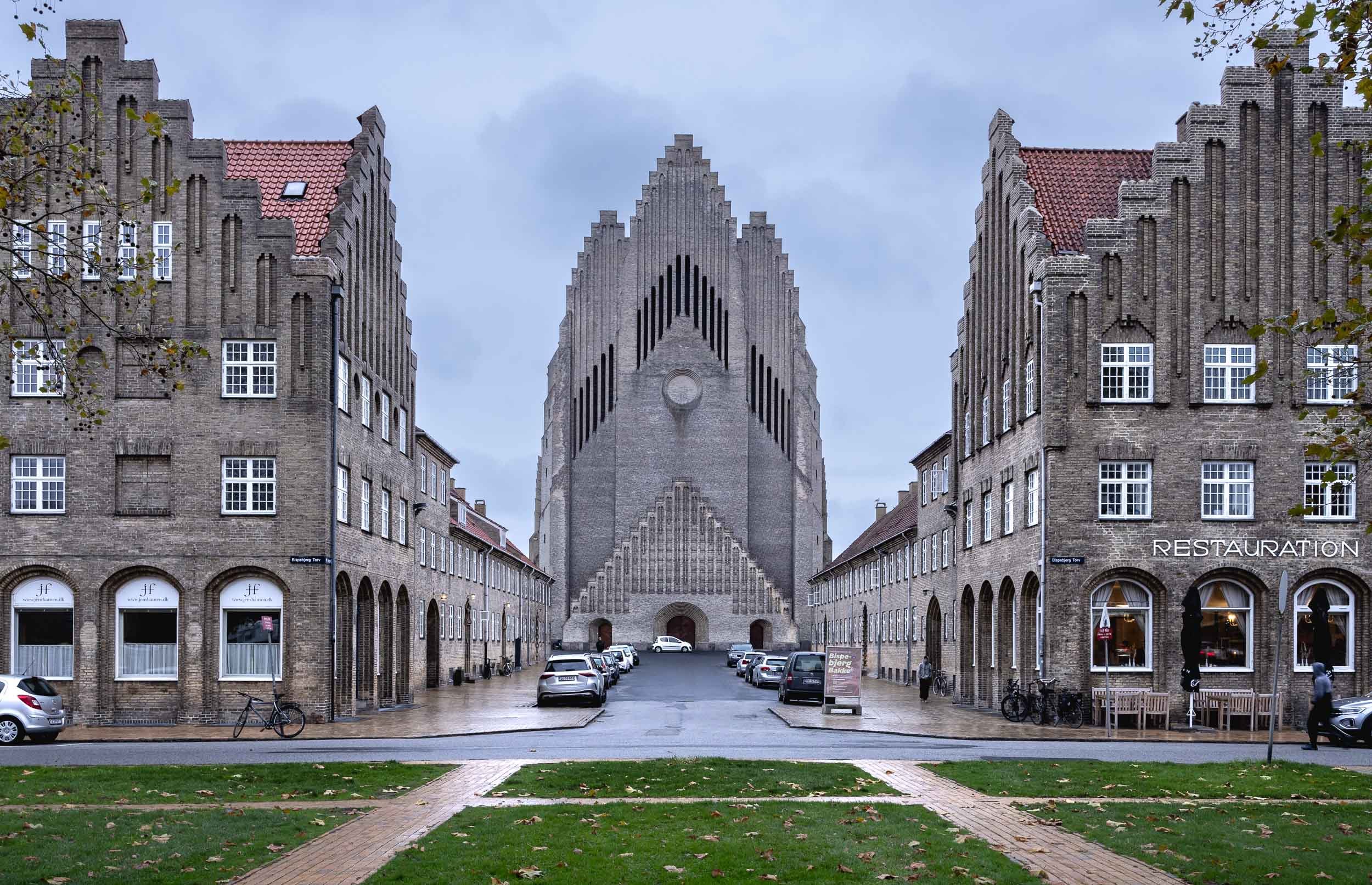
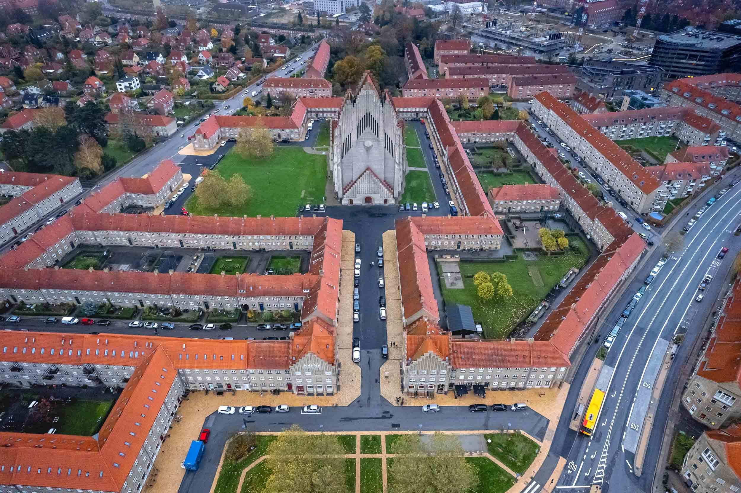


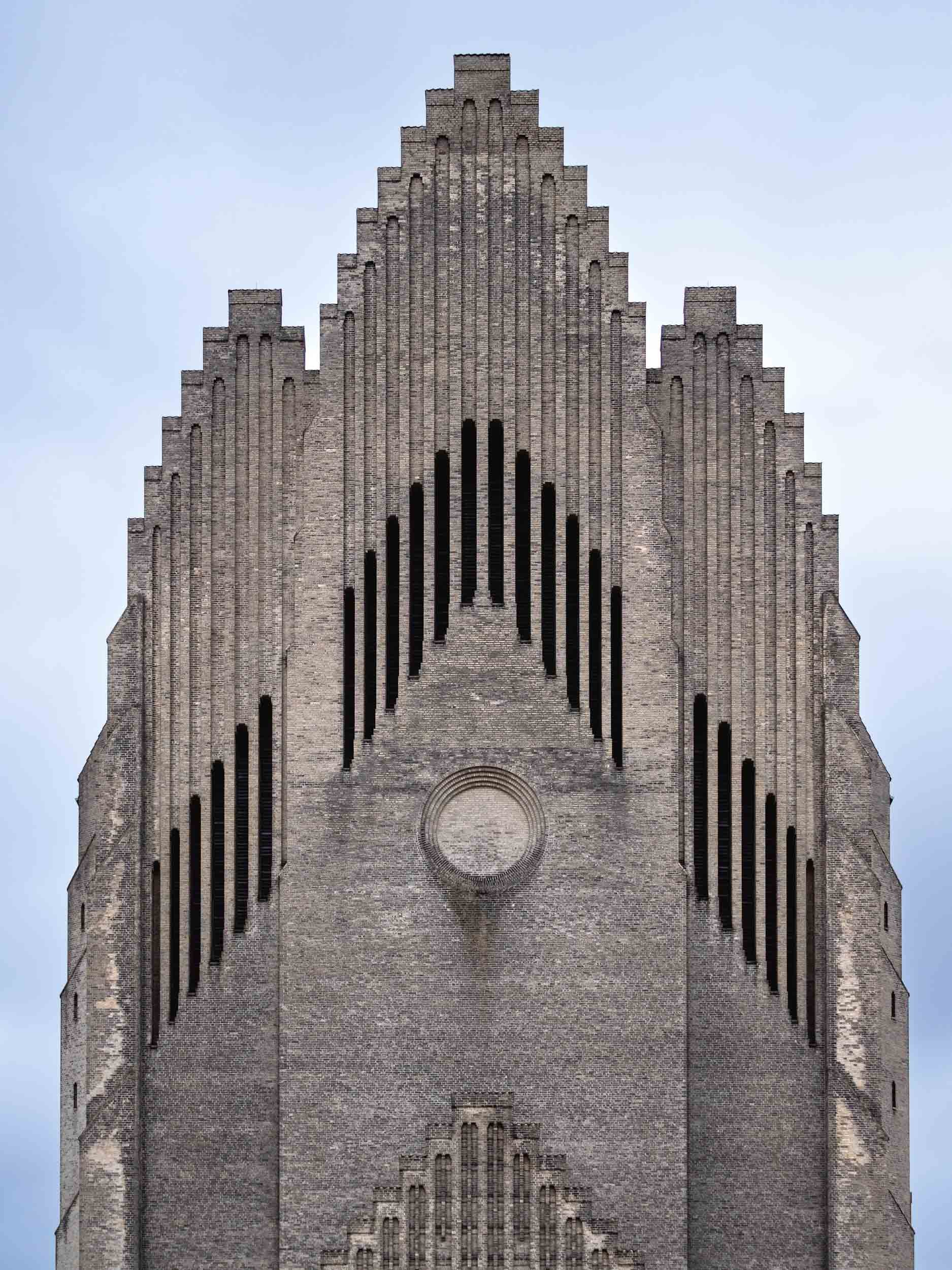
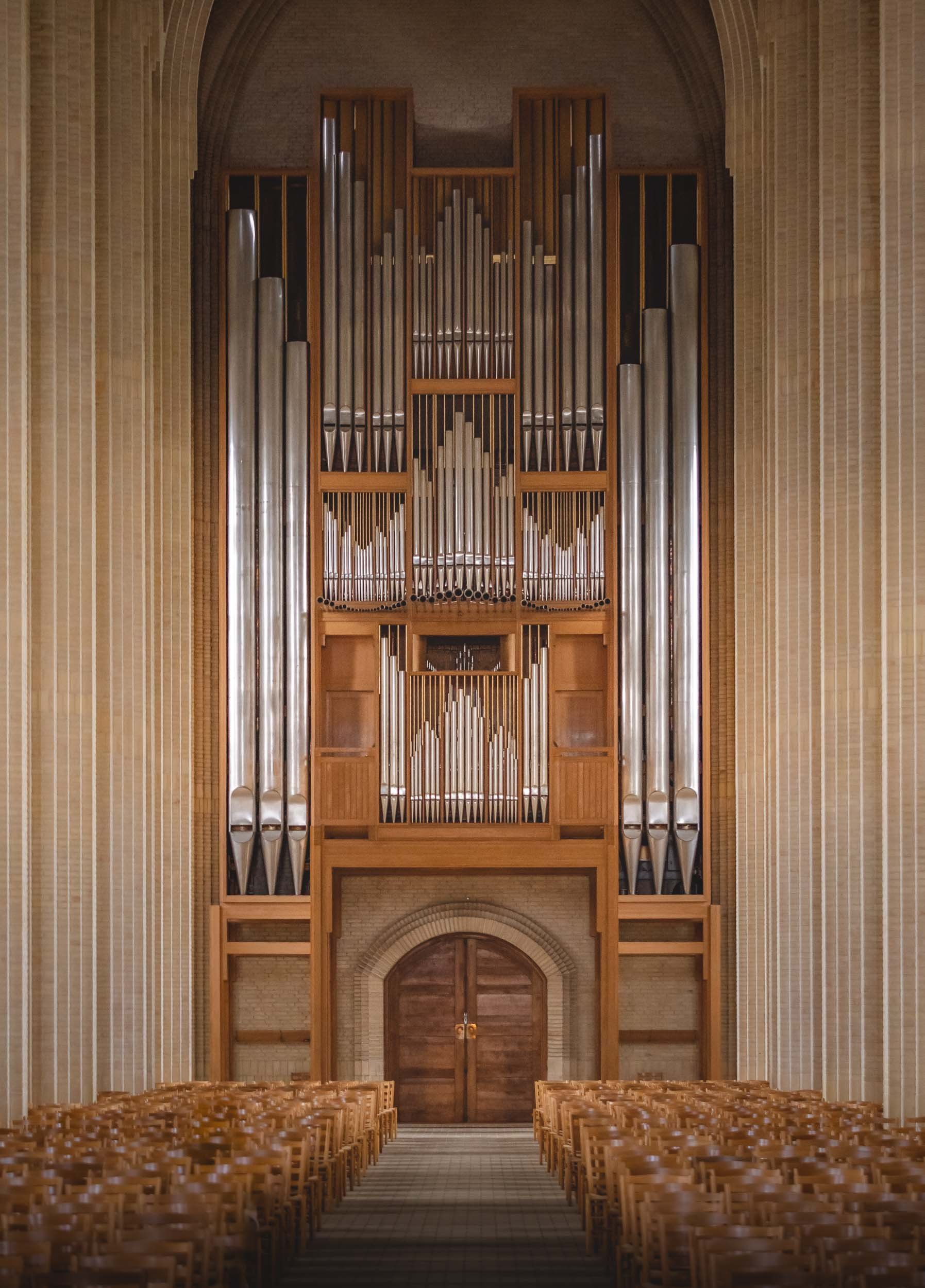


Here’s a little Hyperlapse clip of the central interior path to the altar.

Glimpses of Dubrovnik
After visiting another gem of the Adriatic, I took the chance to leave for the airport a little early to spend a few hours exploring Dubrovnik.

After visiting another gem of the Adriatic, I took the chance to leave for the airport a little early and spend a few hours exploring Dubrovnik, one of Croatia’s most famous coastal towns. It was just enough time to collect a few impressions - scroll down to see them!
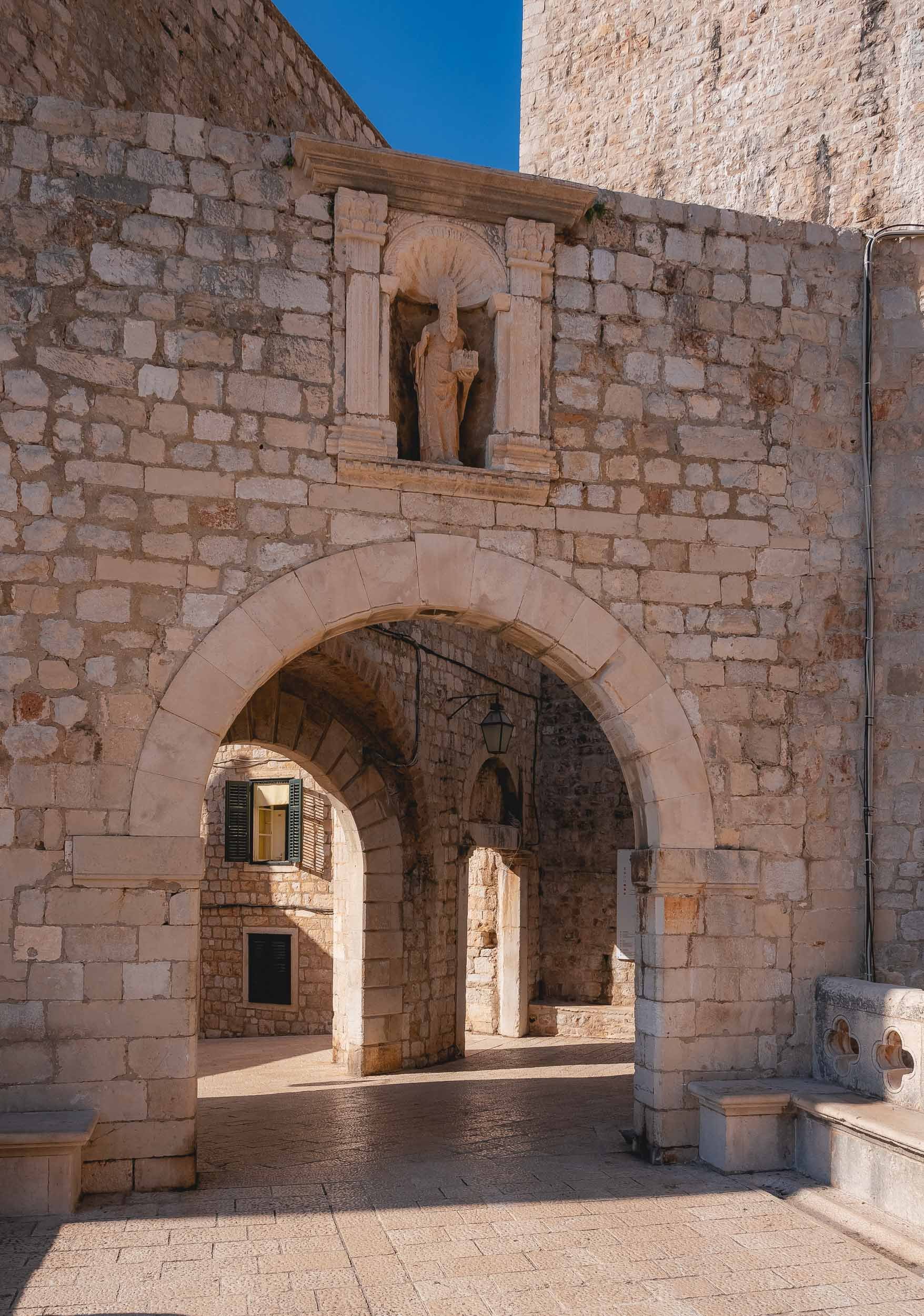


The view towards the small port from the bridge. Dubrovnik’s history dates back to the 7th century, and for over 500 years it ruled itself as a free state.
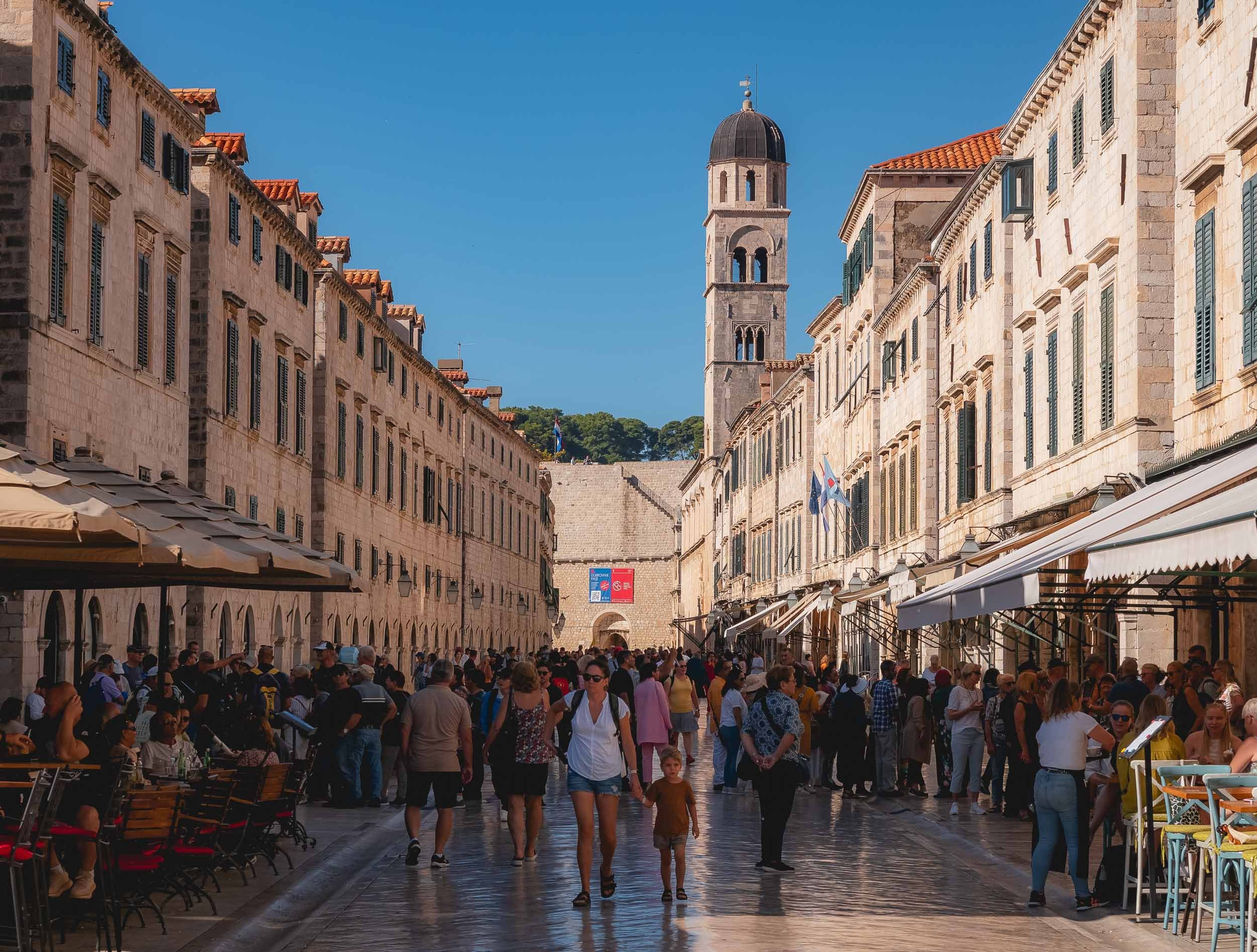
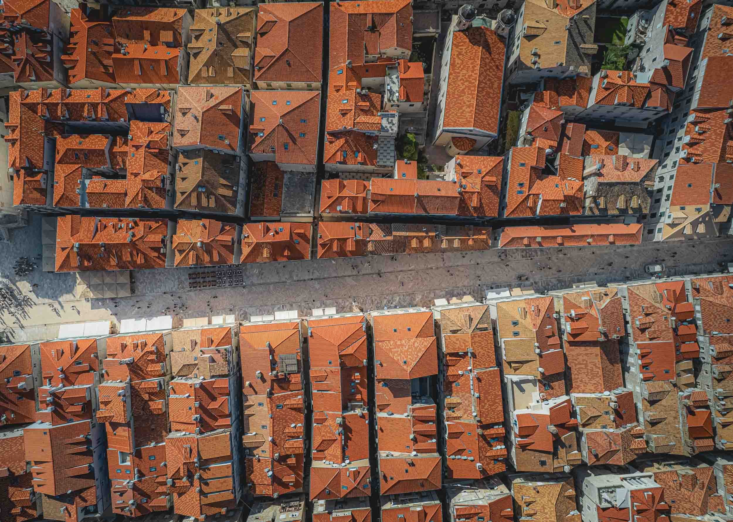
Narrow passages with a loooot of stairs wind their way up to the right and left. You’ll find Europe’s oldest operating pharmacy and many other historic places while wandering around.


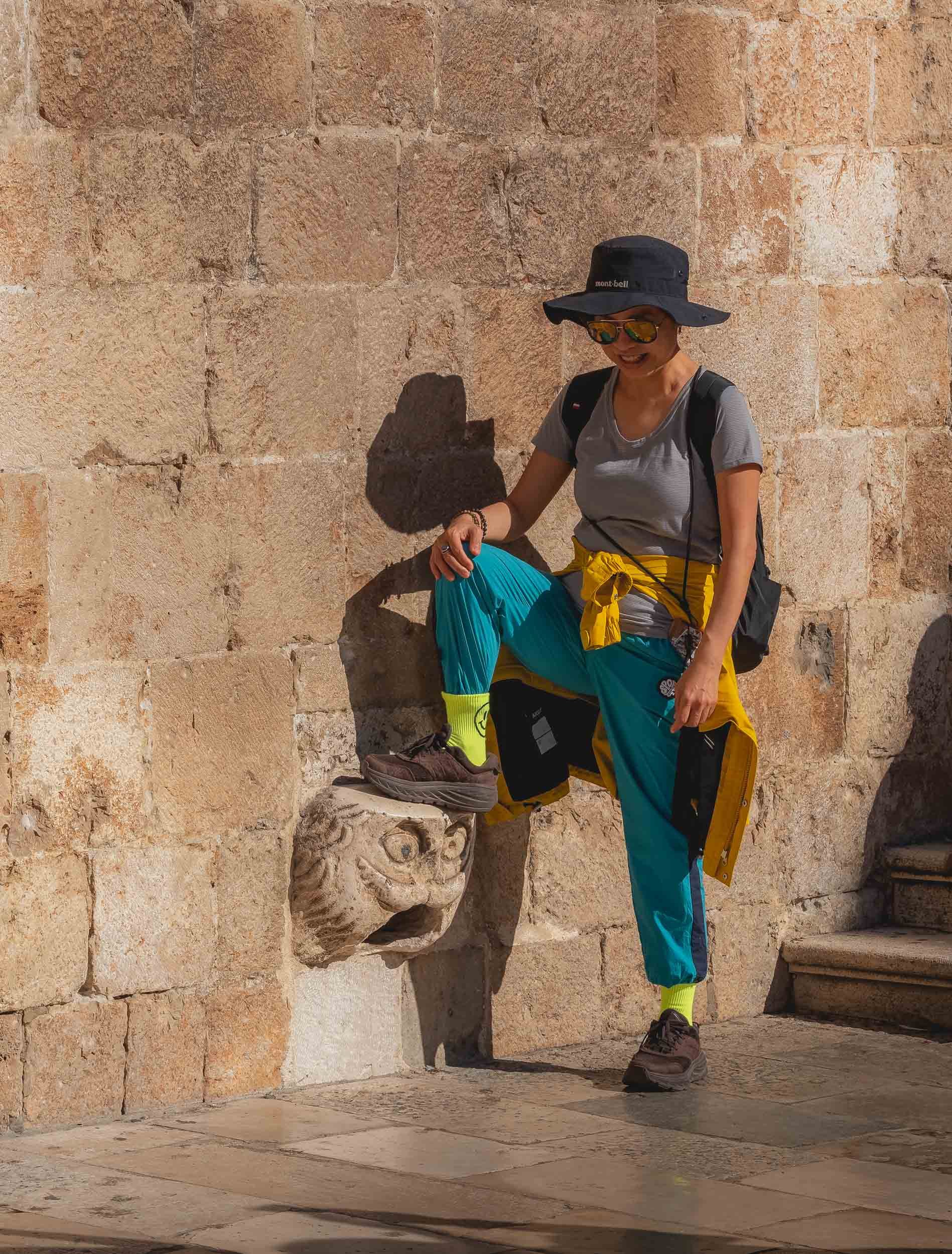


A majority of the city’s Renaissance buildings were destroyed during a large earthquake in 1667, and a lot of damage was done during the siege of 1991 - signs of repair are the brightly colored roof tiles on some of the buildings.
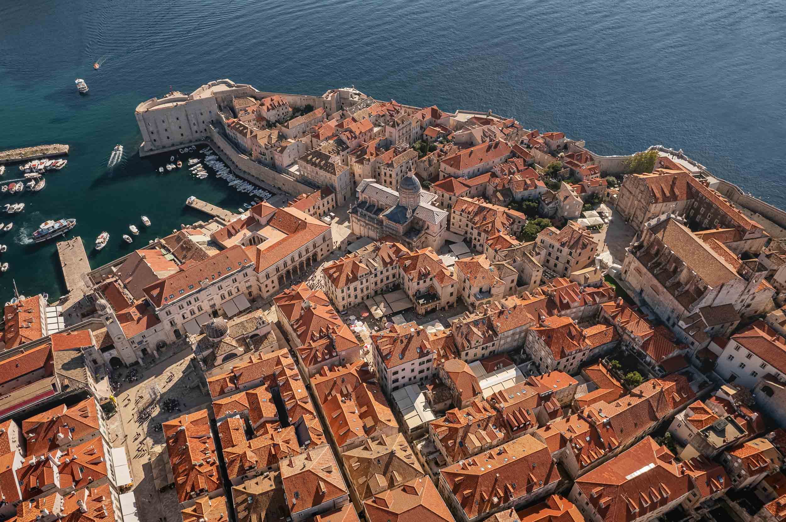
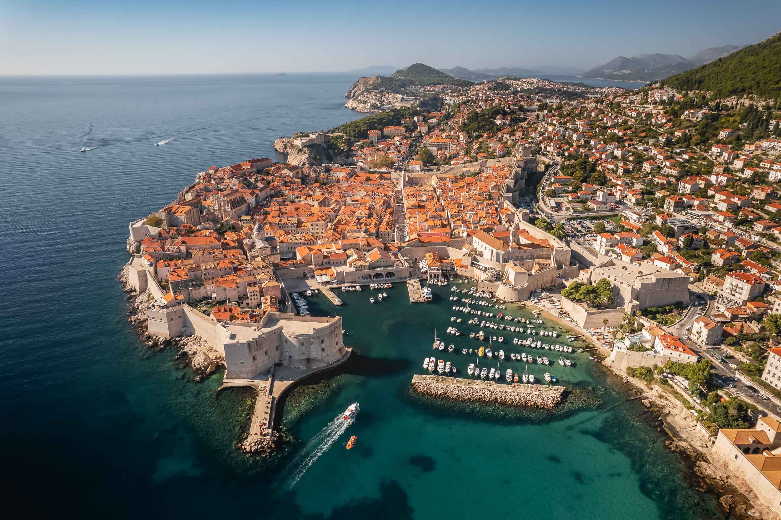

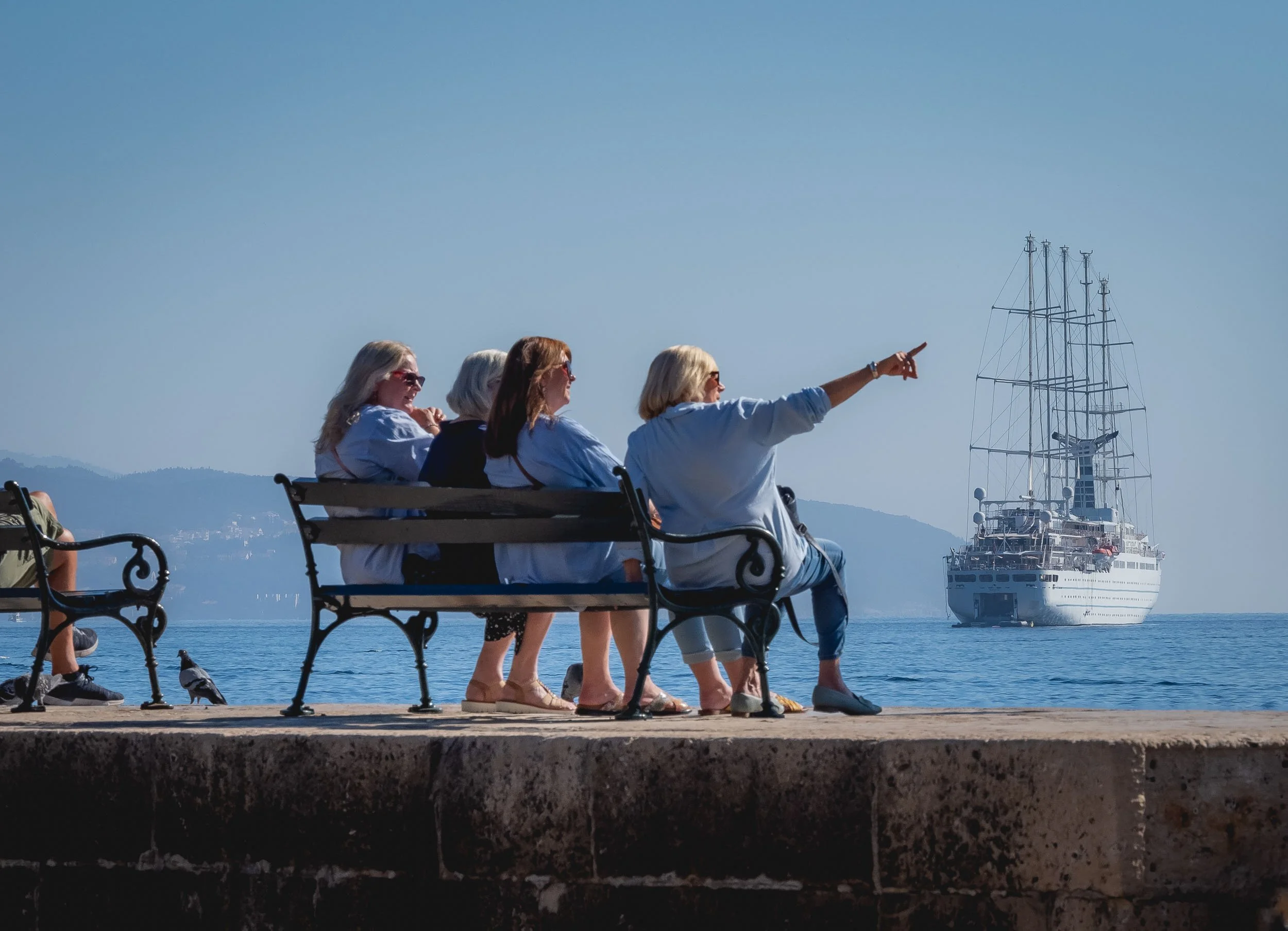
Today the city is very popular with tourists, helped by appearances in many movies and TV series - to the extent that the tourism board had to start staggering cruise ship arrivals in 2018.
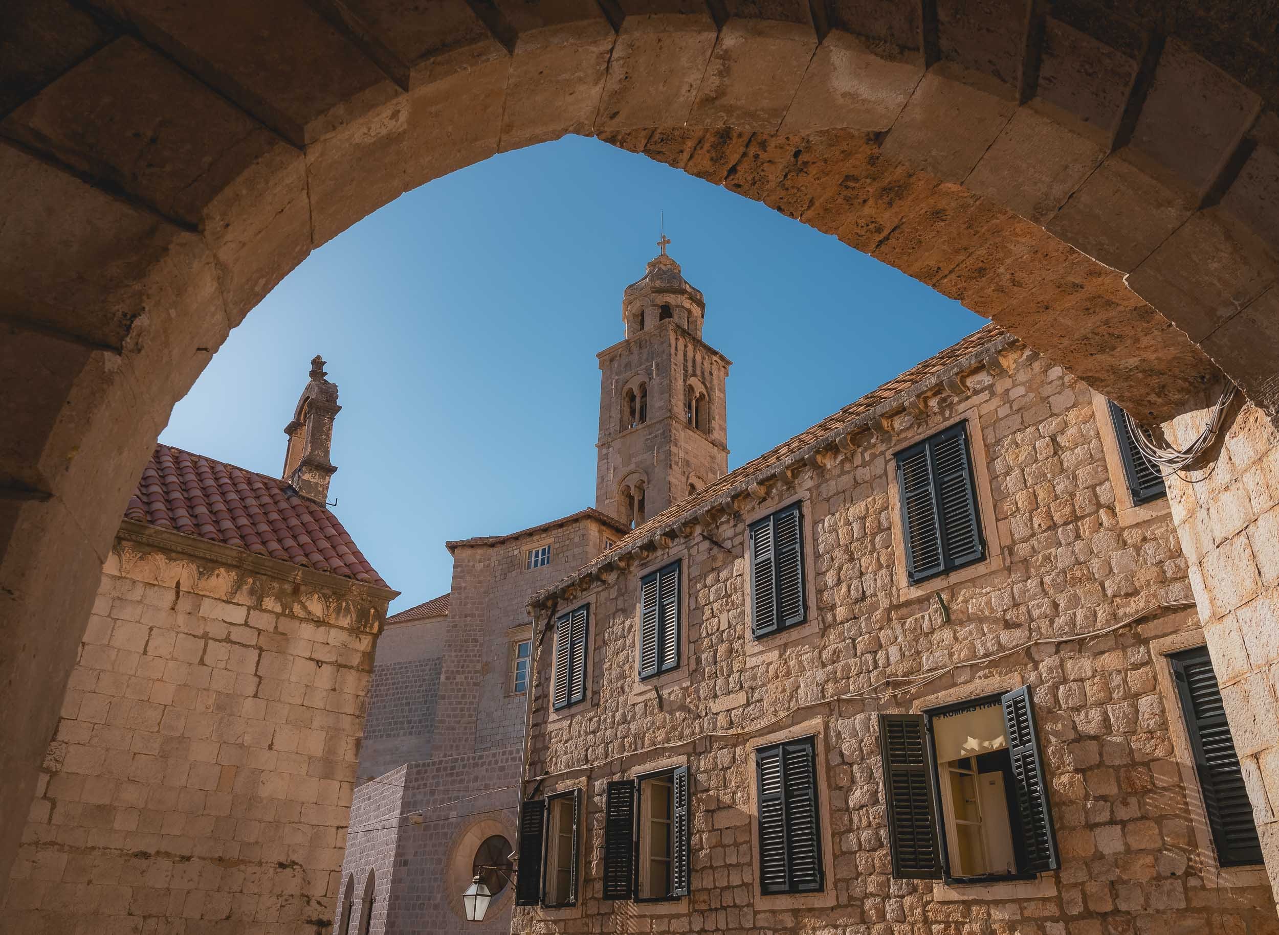
And that’s one last flight over Dubrovnik, and my impressions after spending a few hours here come to an end!.

Montenegro - Hidden Gem of the Adriatic Sea
In a quest to get a few glimpses of sunshine and explore a rather unknown place without too having to travel too far from Germany, Montenegro turned out to be an excellent choice

In a quest to get a few glimpses of sunshine (before going faaaar north shortly after) and explore a rather unknown place without too having to travel too far from Germany, Montenegro turned out to be an excellent choice for myself and my dear mother, who joined me on this trip. A young country with a rich and turbulent history, Montenegro only gained its current independence in 2006.
One & Only Portonovi
Since a few days of quiet time was on the agenda, this gem was our residence of choice - and wow, it did not disappoint. Definitely one of the most beautiful resorts I’ve ever stayed at, and surprisingly, somewhat, relatively (yes, need those qualifiers), affordable, given the fact we went during off season (summer will be a very different story).
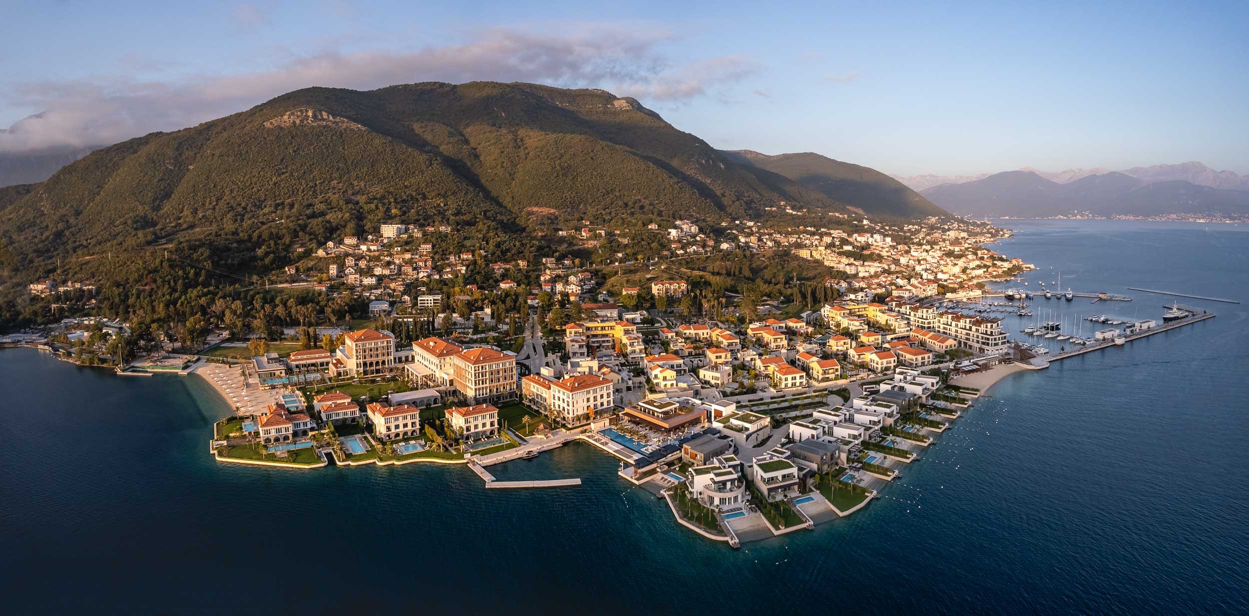
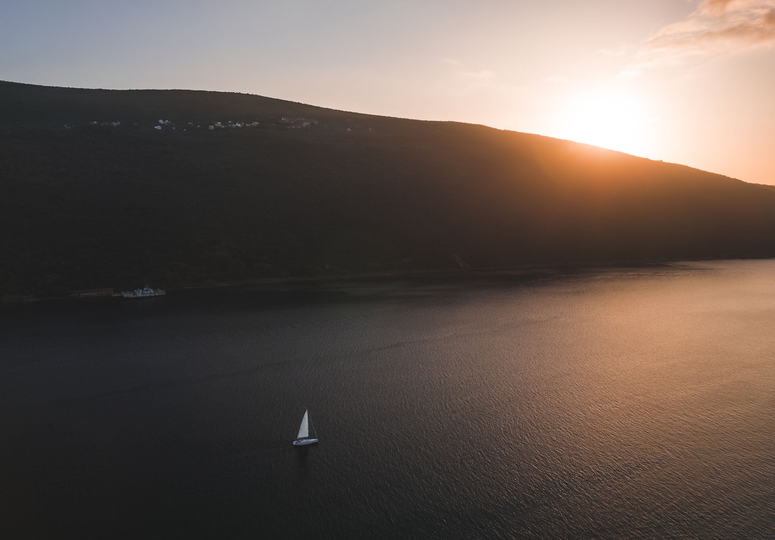
Secrets of the Bay
Just across the hotel lie a few interesting tidbits of history, barely noticeable unless you look a little closer. The first one is a series of tunnels dug into the mountain by the Yugoslavian army, with the intention to hide submarines in them during times of war.


The entrance to the tunnls was covered by metal structures and nets with rocks and plants to make them indiscernible from the surrounding landscape - nowadays, those are no longer serving their original purpose.


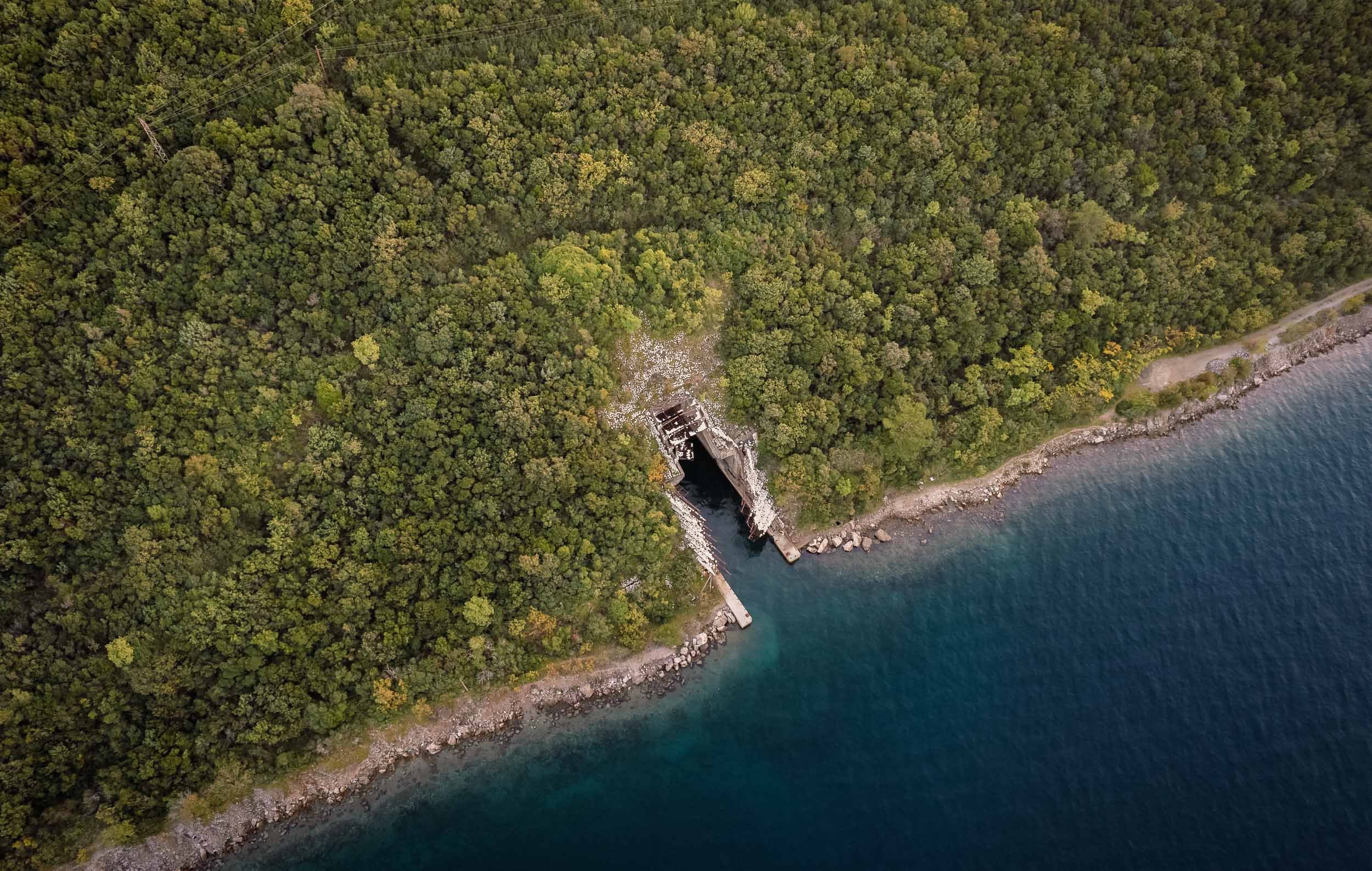
But the submarine tunnels were not the only surprises the bay had in store. Exploring a bit further into the Adriatic Sea, a colorful wonder awaits…
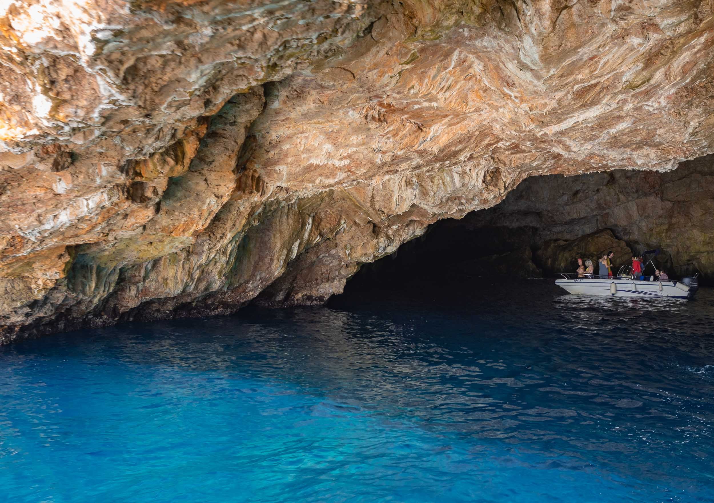
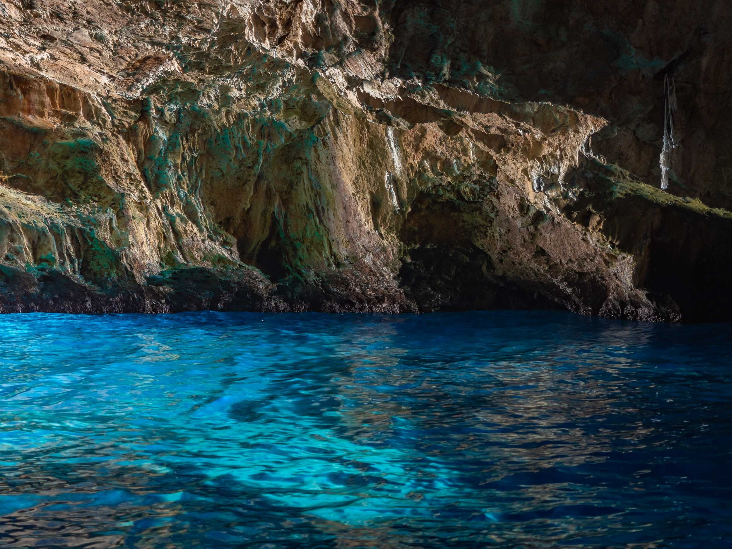
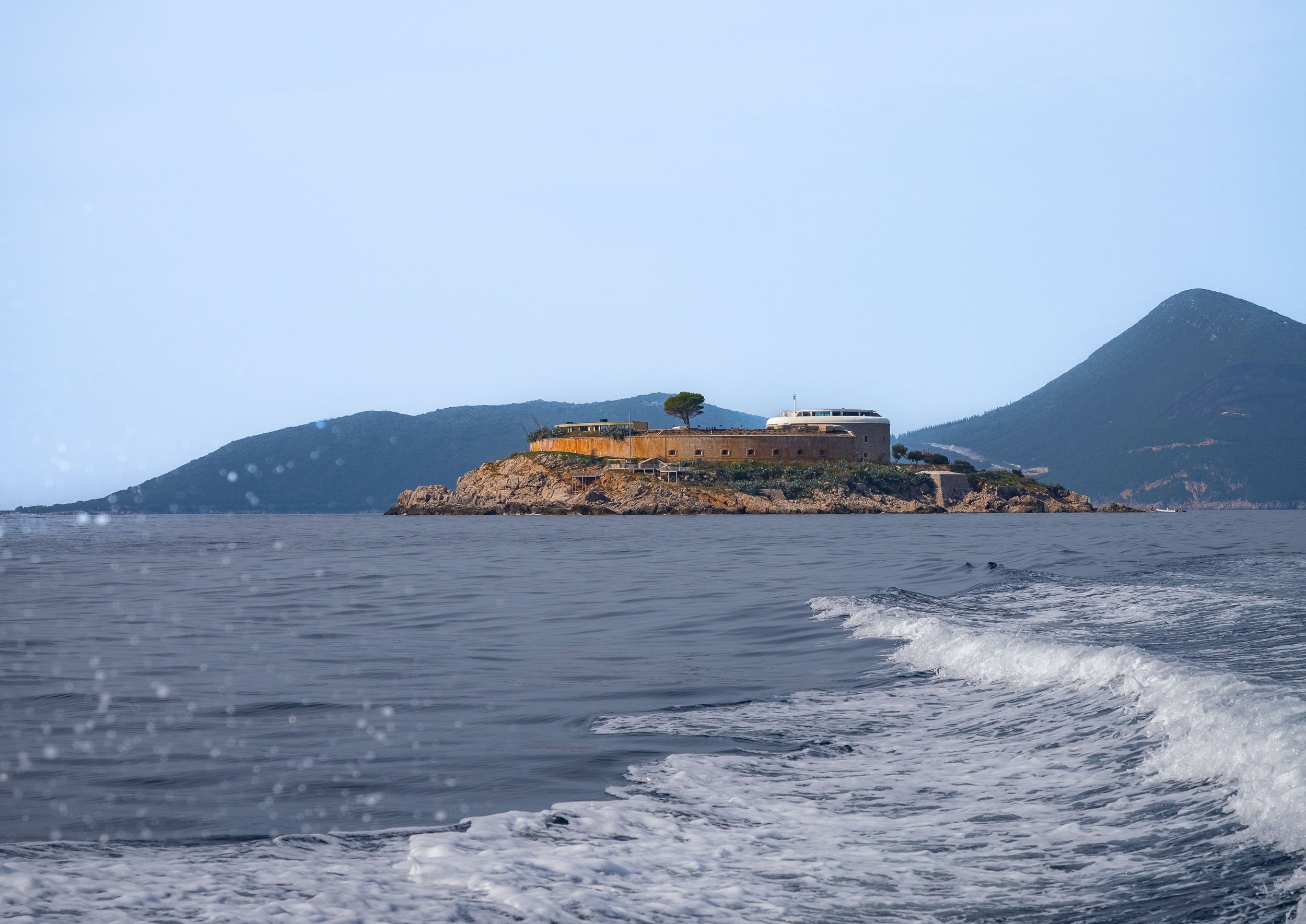
Islands in the Bay
Heading back into the bay towards the historical towns of Perast and Kotor, you pass two famous small islands, just off the coast, one of which is accessible.


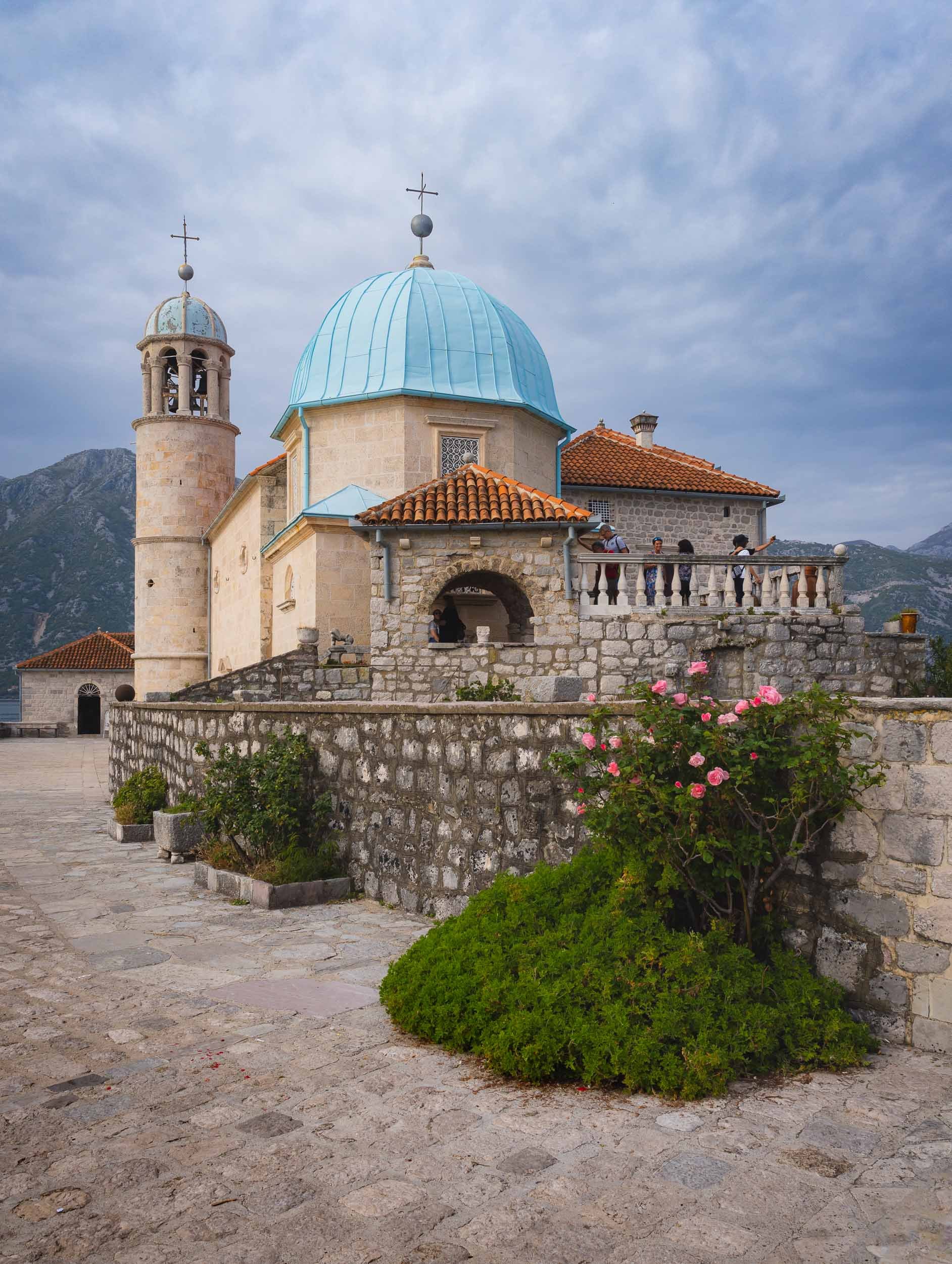
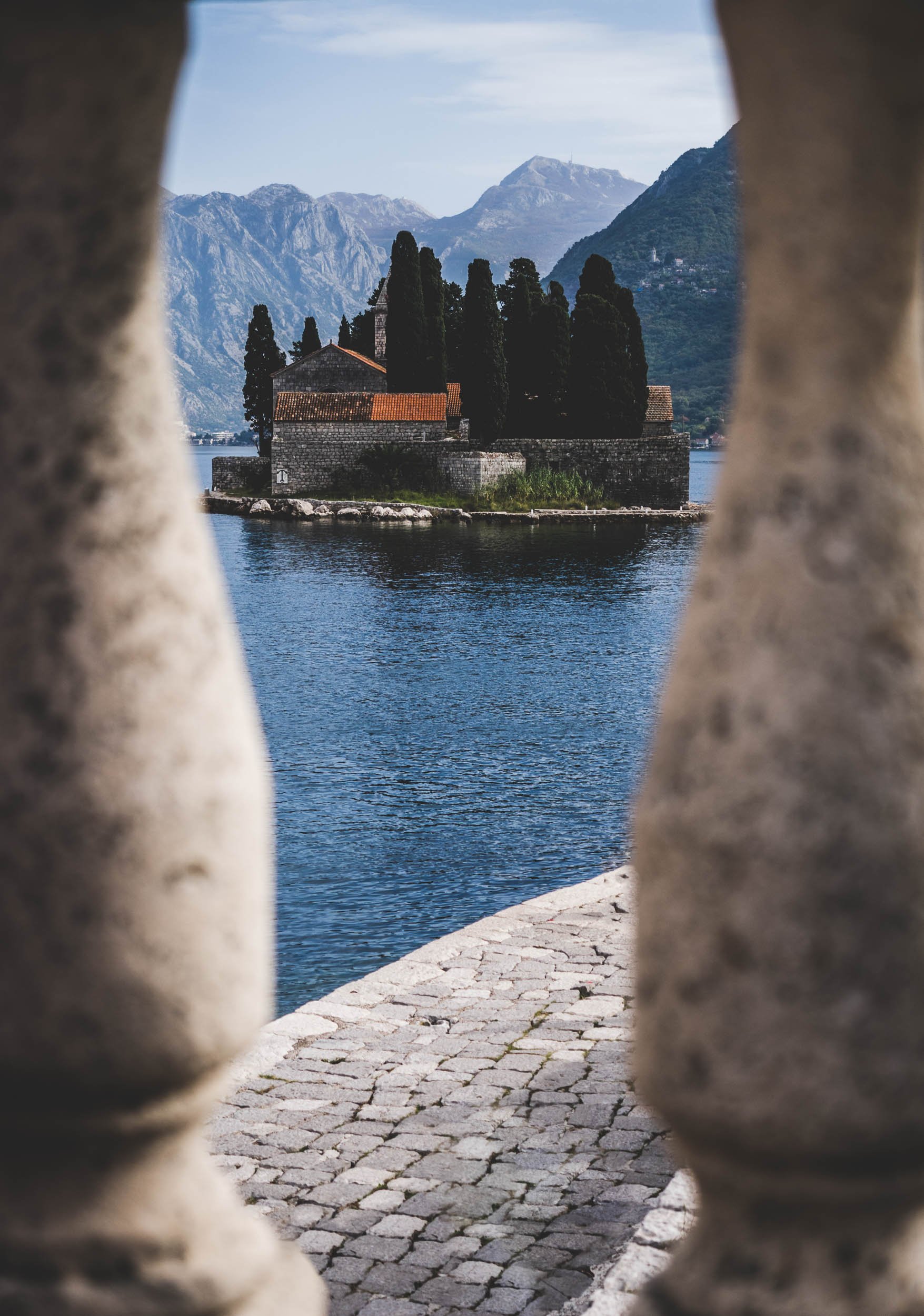


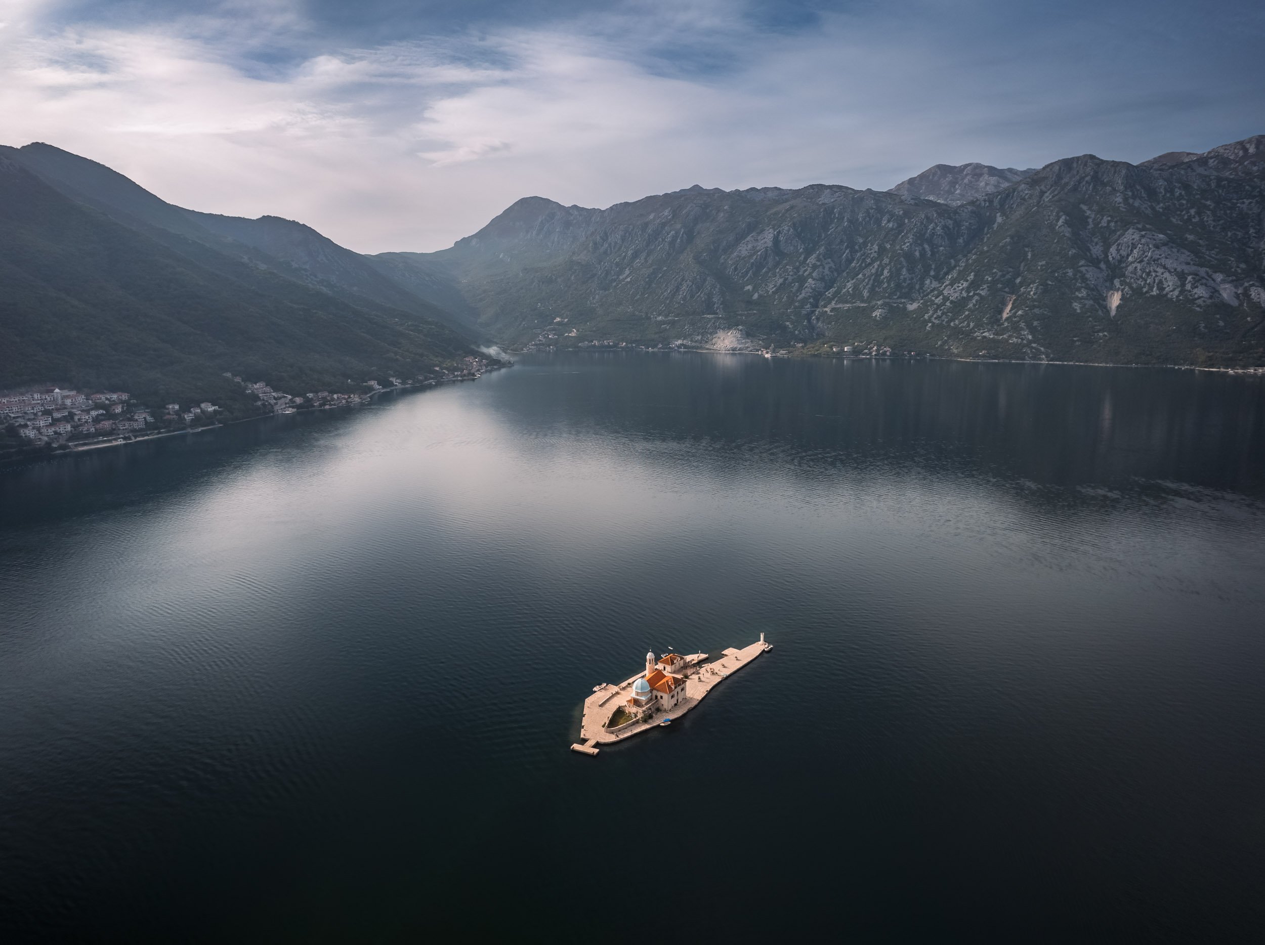
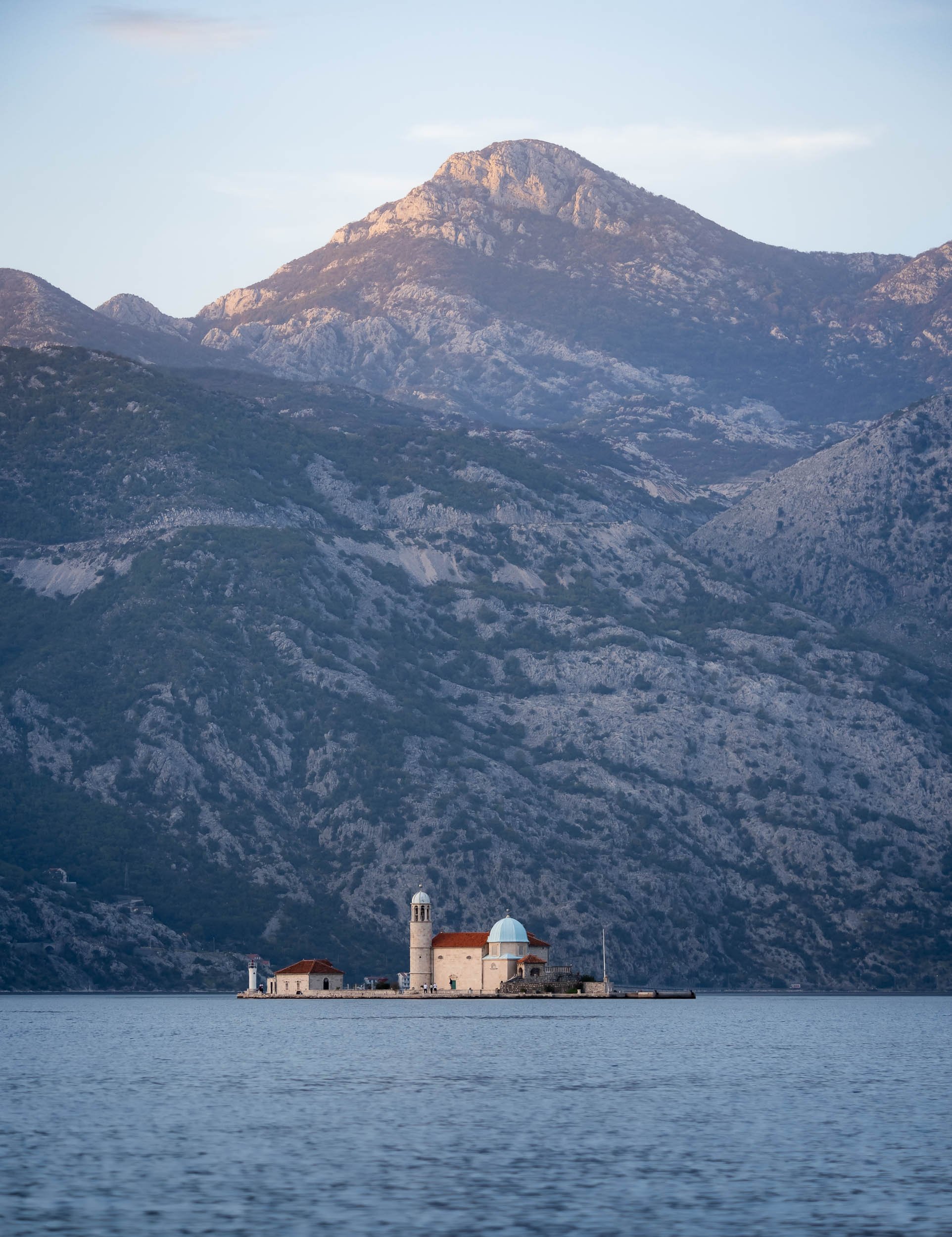
The Town of Perast
The first settlements in this area were found to be from the Neolithic era, but Prerast itself was referenced from 1336. Today, the city only has about 300 inhabitants, but its touristic appeal makes it feel much busier most of the year.
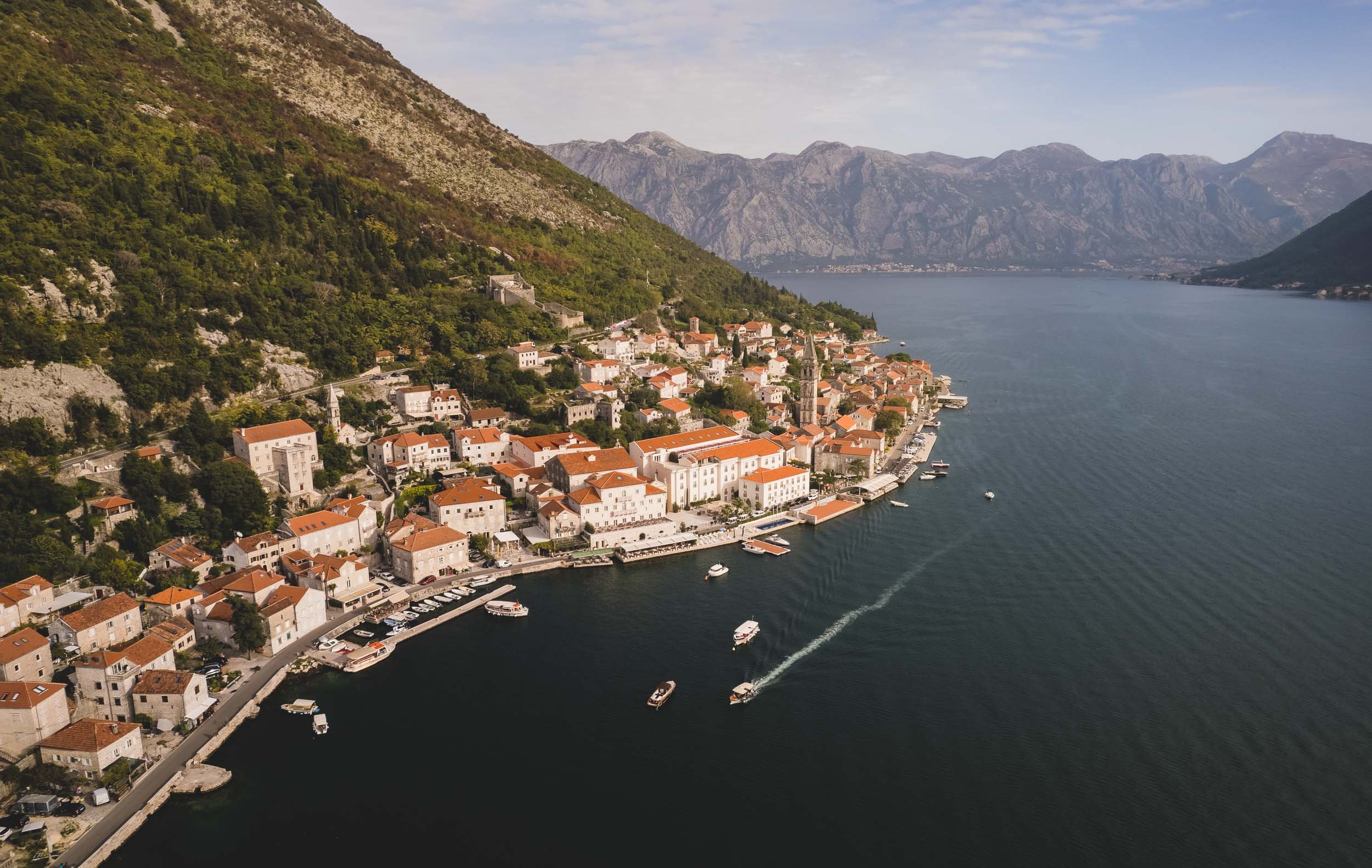
The city’s primary landmark is the Church of St Nicolas from 1616.


The entire area is part of the UNESCO World Heritage Site of the Kotor Region, due to its rich cultural past.


Kotor - Cat Kingdom
The namesake city at the end of the bay is also its most famous one. Its 2000 year history spans the Middle Ages, Venetian, Habsburg and Napoleonic rule. Today, its large population of cats has become a primary symbol for the town, and it indeed houses a cat museum (which unfortunately was closed) and a number of shops selling cat artefacts.
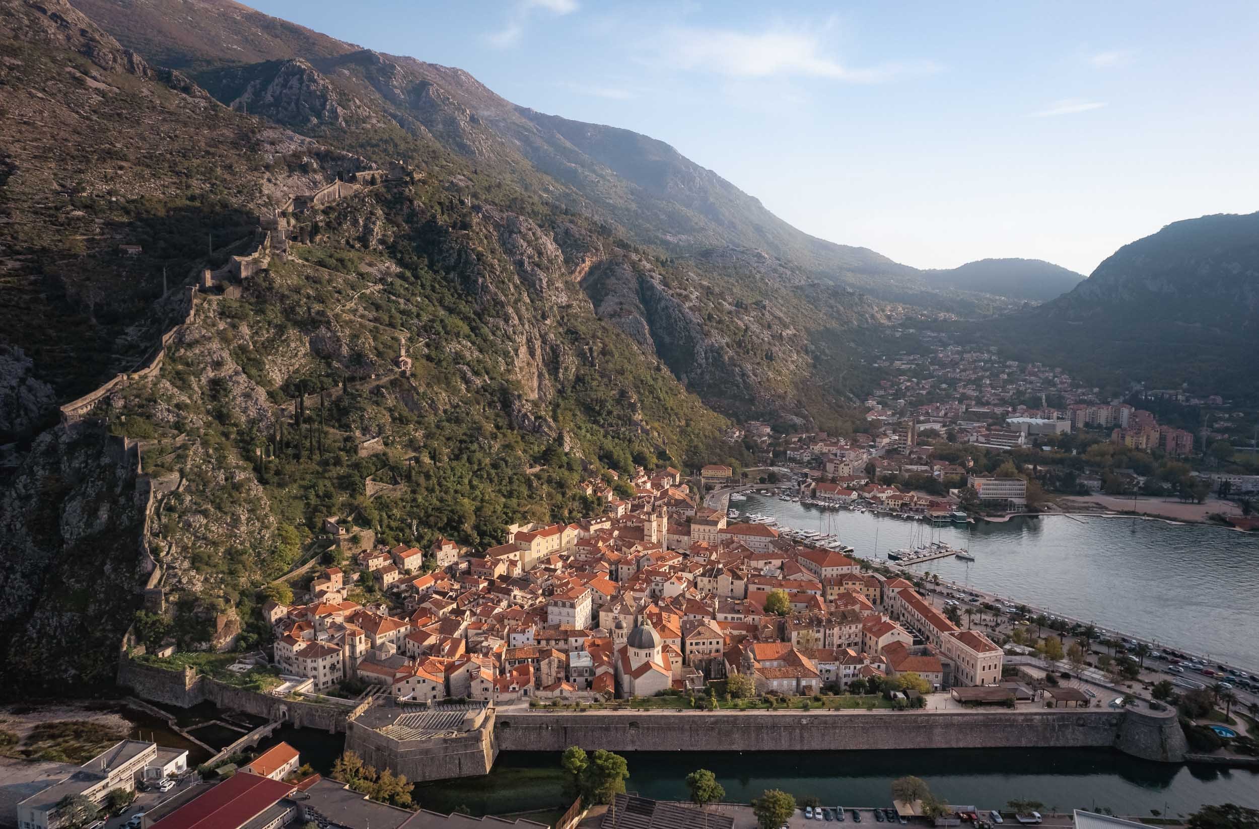
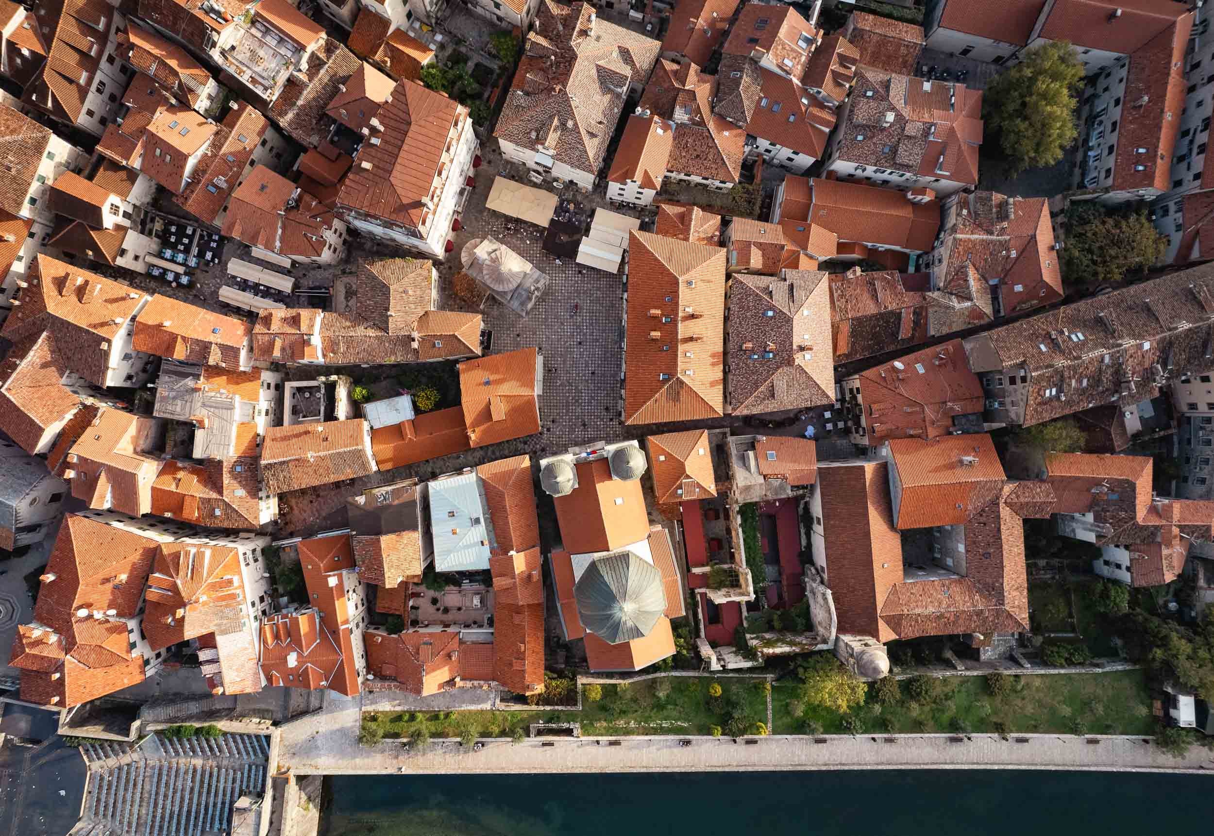
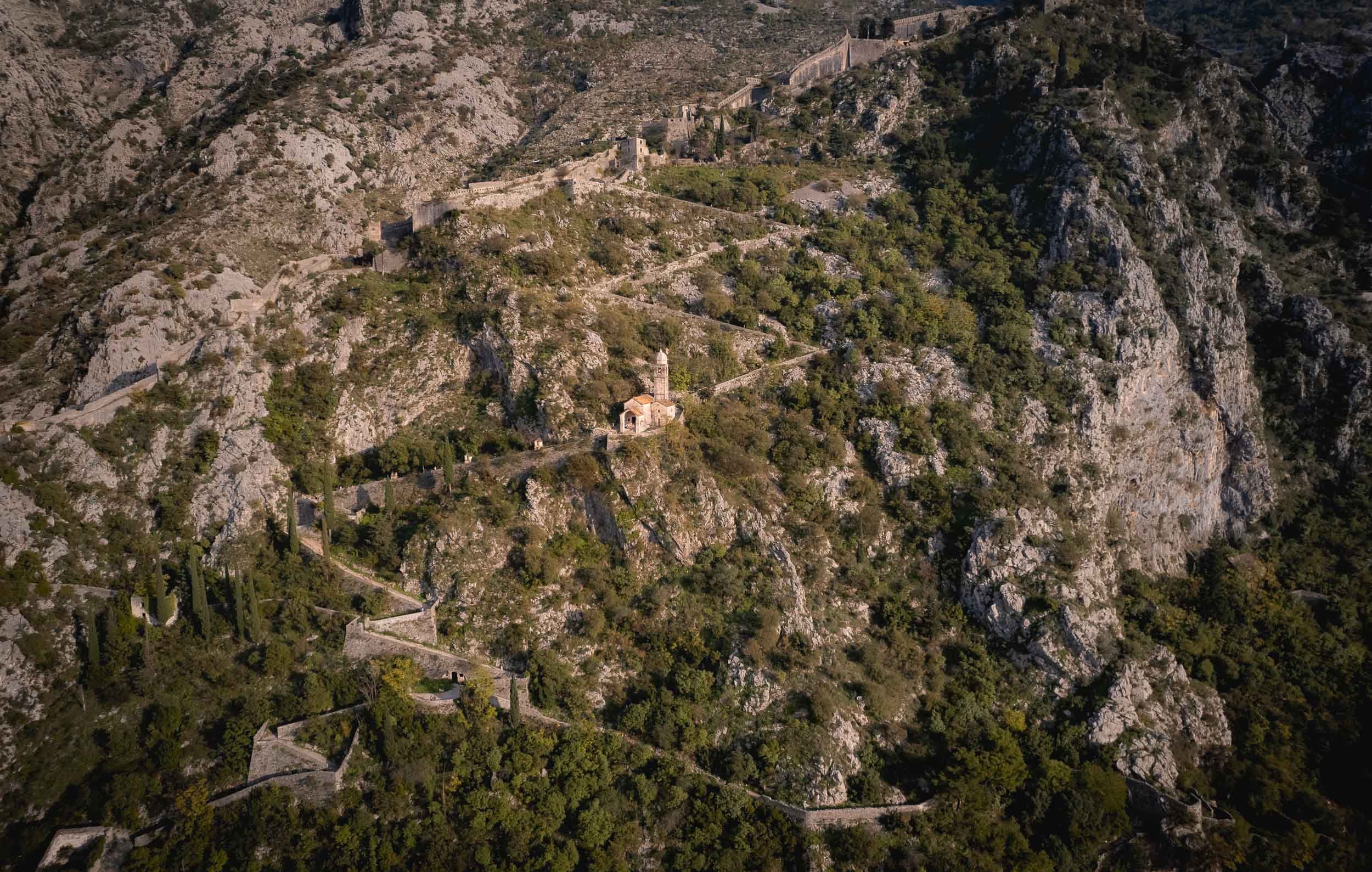


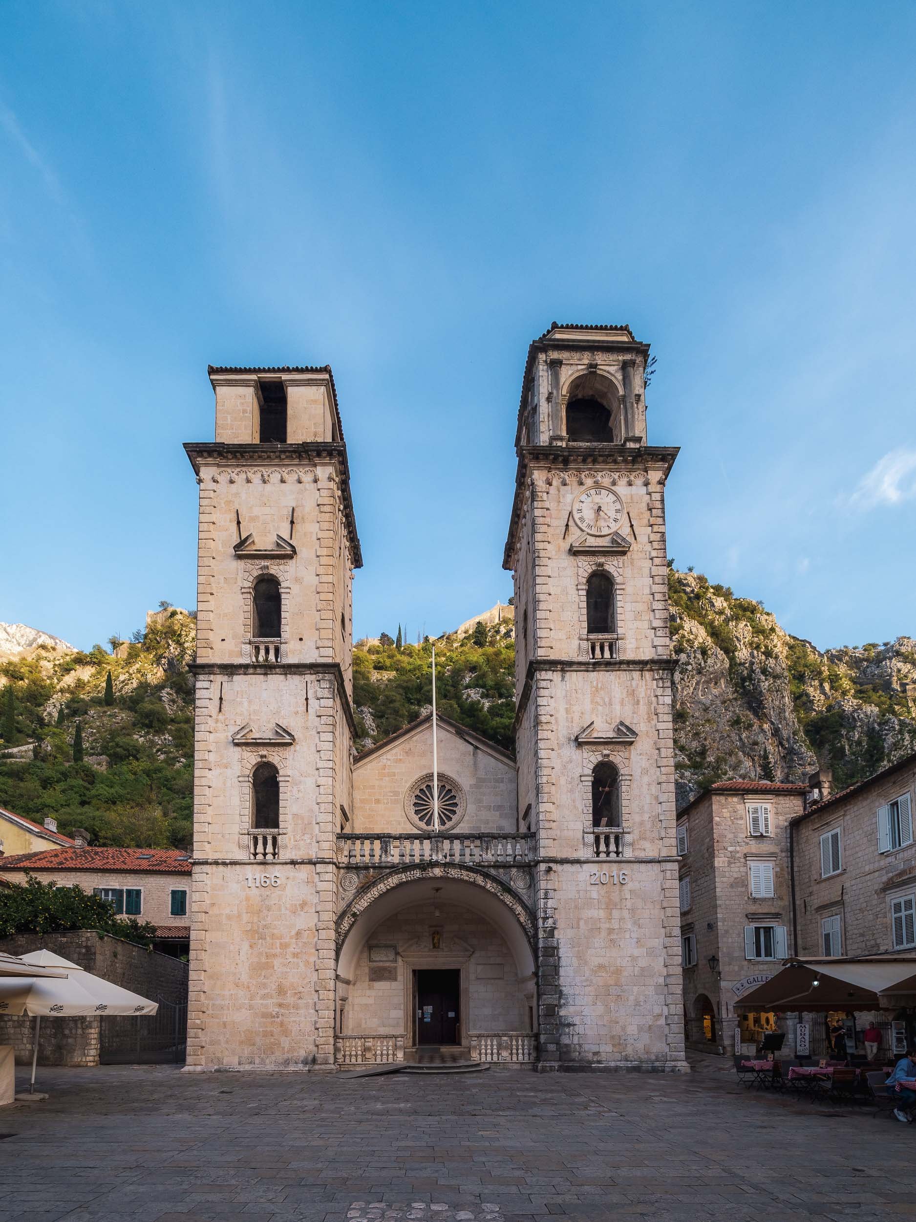
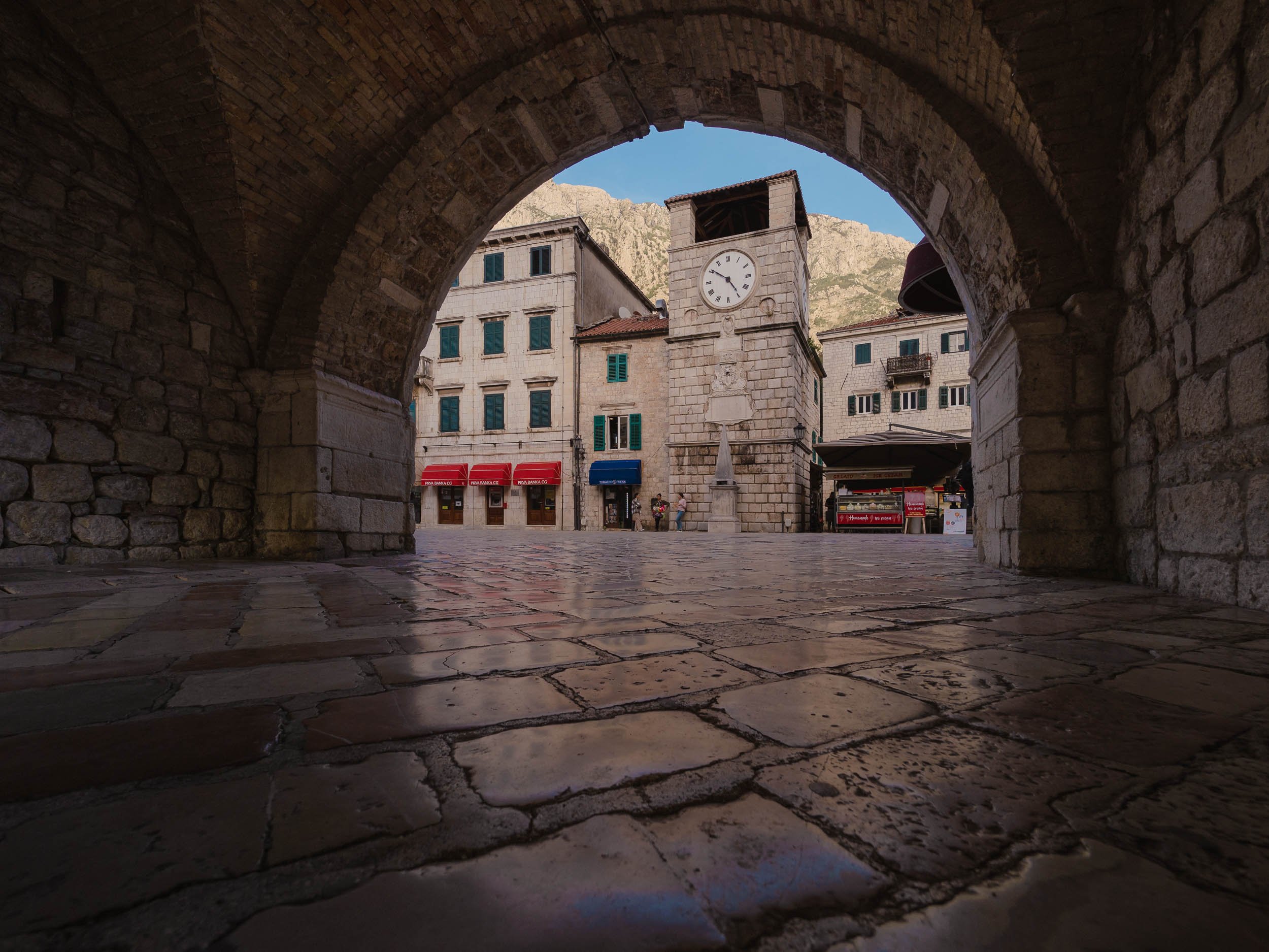
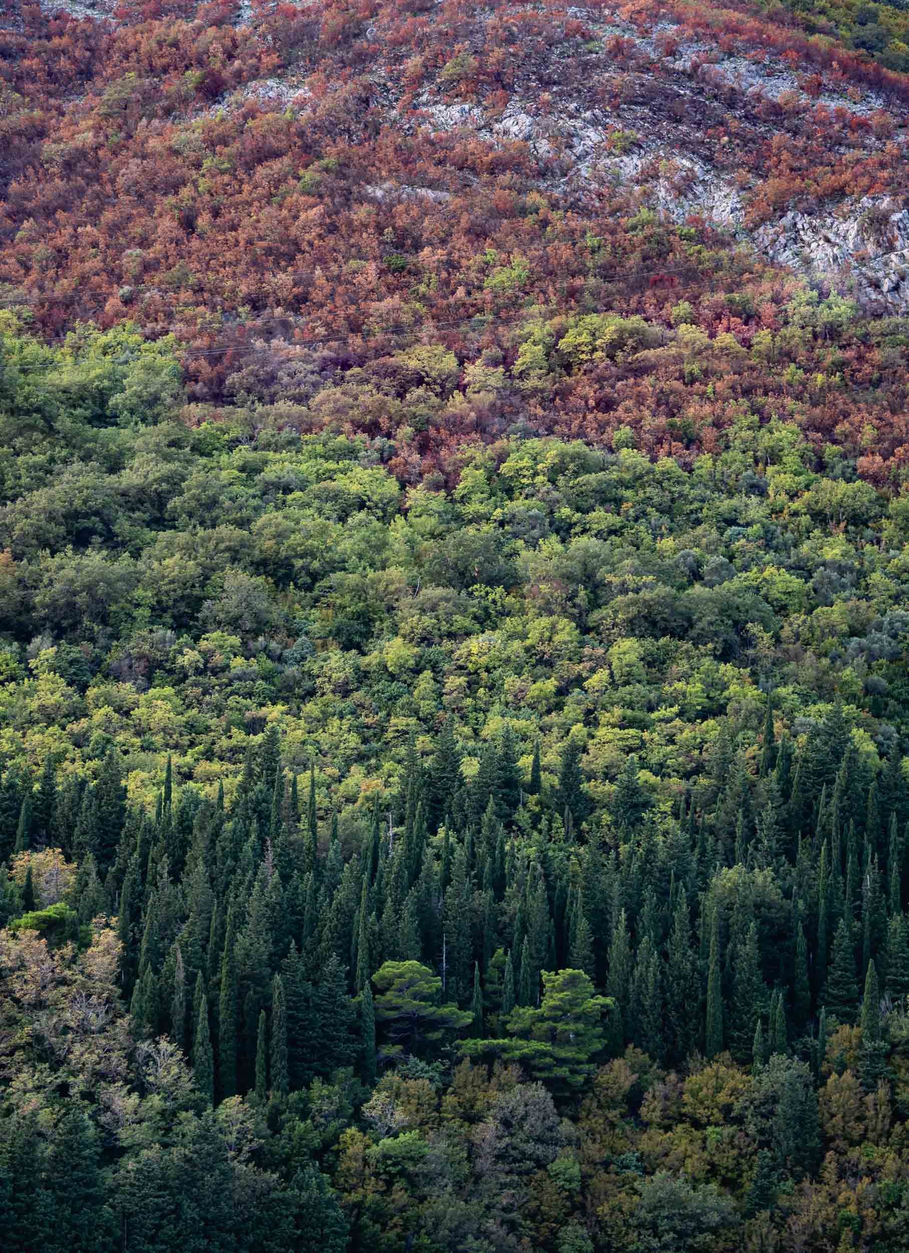
By the way, Croatia’s famous town of Dubrovnik is just an hour away and I had the chance to spend a few hours here - subscribe to be the first to hear more once I managed to go through the images.

San Marino - Small but Surprising
In the eternal quest to explore all corners of earth, you sometimes have to make your way into the smaller corners, or countries in this case.

In the eternal quest to explore all corners of earth, you sometimes have to make your way into the smaller corners, or countries in this case. San Marino is definitely one of the smallest, at just over 60 sqkm and 33,000 people. In fact, this makes it the oldest extant sovereign state, and also one the wealthiest in terms of per capita GDP.
It was a short road-trip and we had just 36h to explore - on the other hand, its size makes that enough time to explore most of the country’s sights, which are located in the namesake city on Monte Titano (there is a larger community at the foot of the mountain where most people live). On arrival we were greeted with a peculiar cloud rolling in, which was my clue to take a look from above.


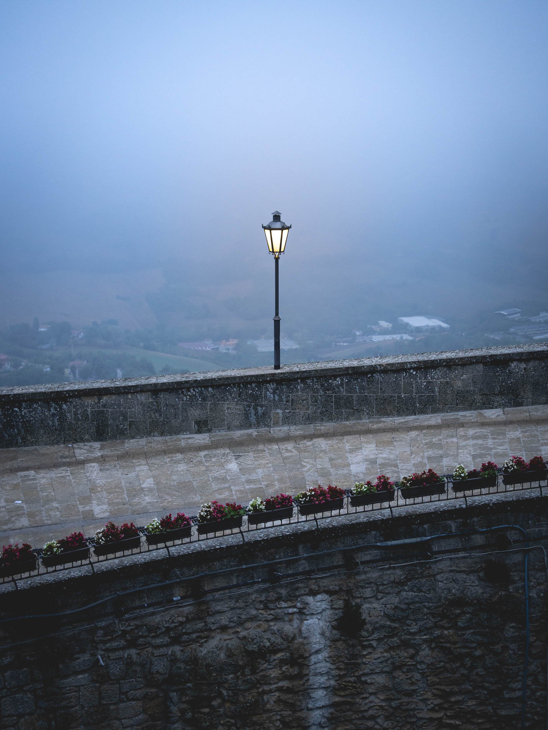
It wasn’t quite the weather you’d expect during August in Italy, just 10km from the Adriatic coast. A few minutes later, the city was covered in a layer of fog and clouds, and it became dark, turning the atmosphere into a mix of Christmas and Resident Evil.


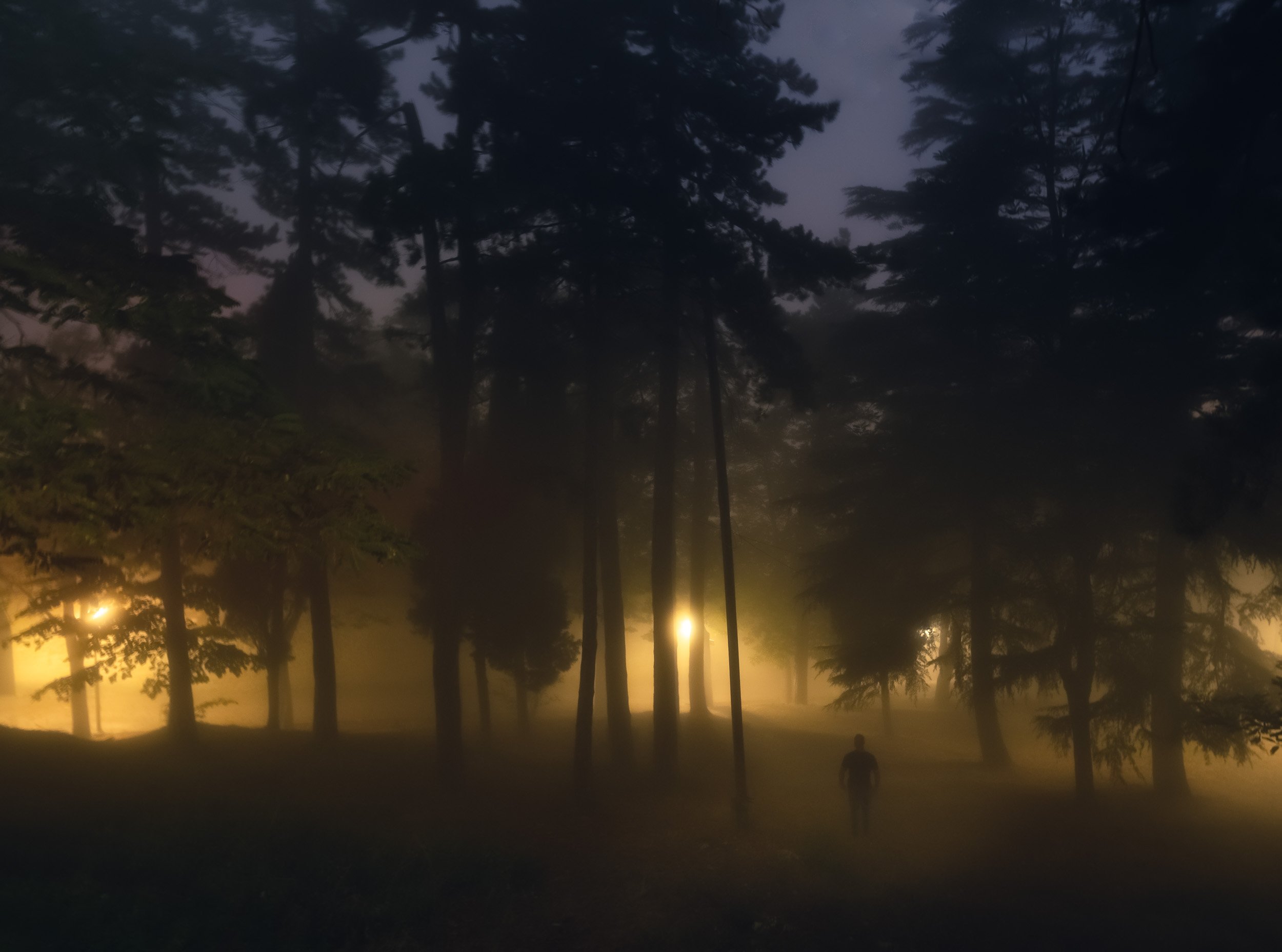
Exploring the fortress of Guiata and its two neighboring towers at the cliff of Monte Titano.


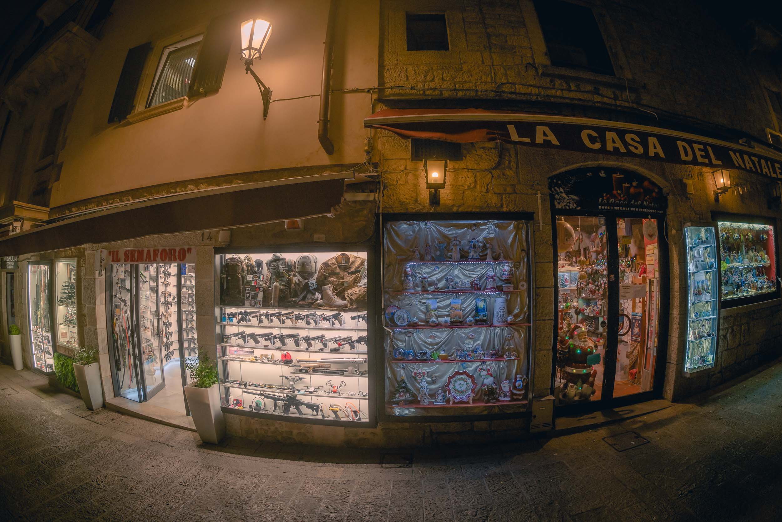


Nightly street vibes
Day 2
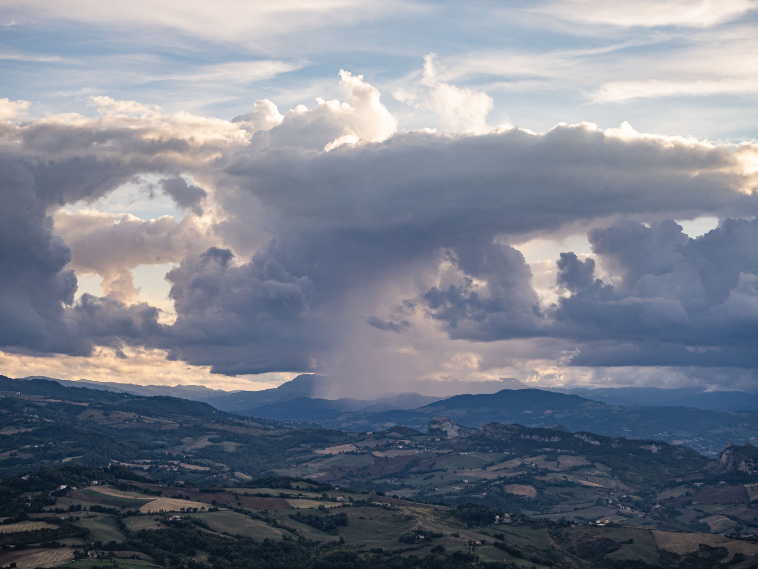

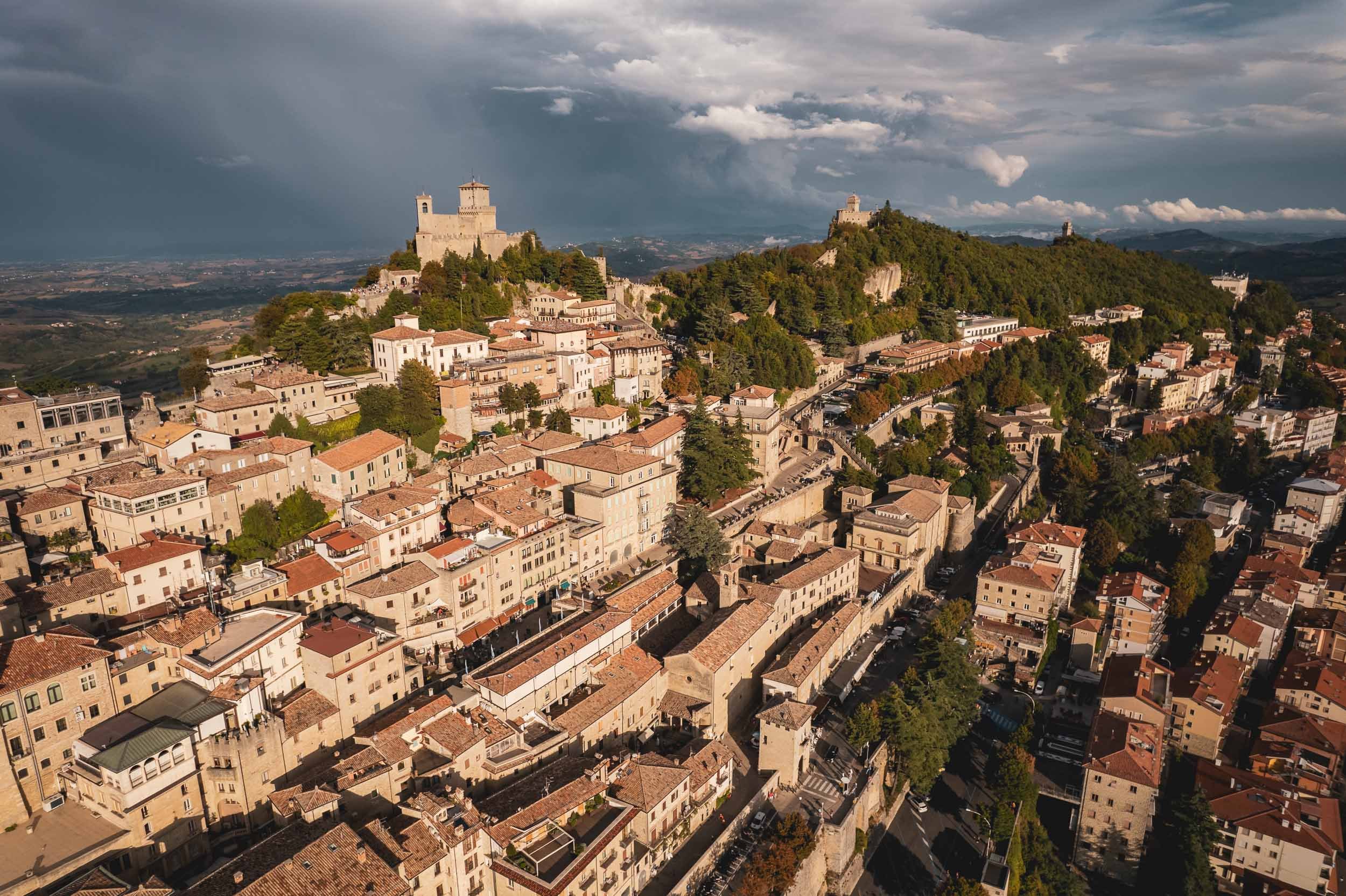
Politics
San Marino’s political system is a peculiar one. It is the world’s oldest constitutional republic with an elected assembly, which in turn elects not one, but two heads of state every six months from opposing parties, called the Captain’s Regents. This tradition is a nod back to the Roman consul times. At the end of their legislature, every Sammarinese (the Demonym for citizens of the country) has 15 days to submit any complaints about their actions - or lack thereof.
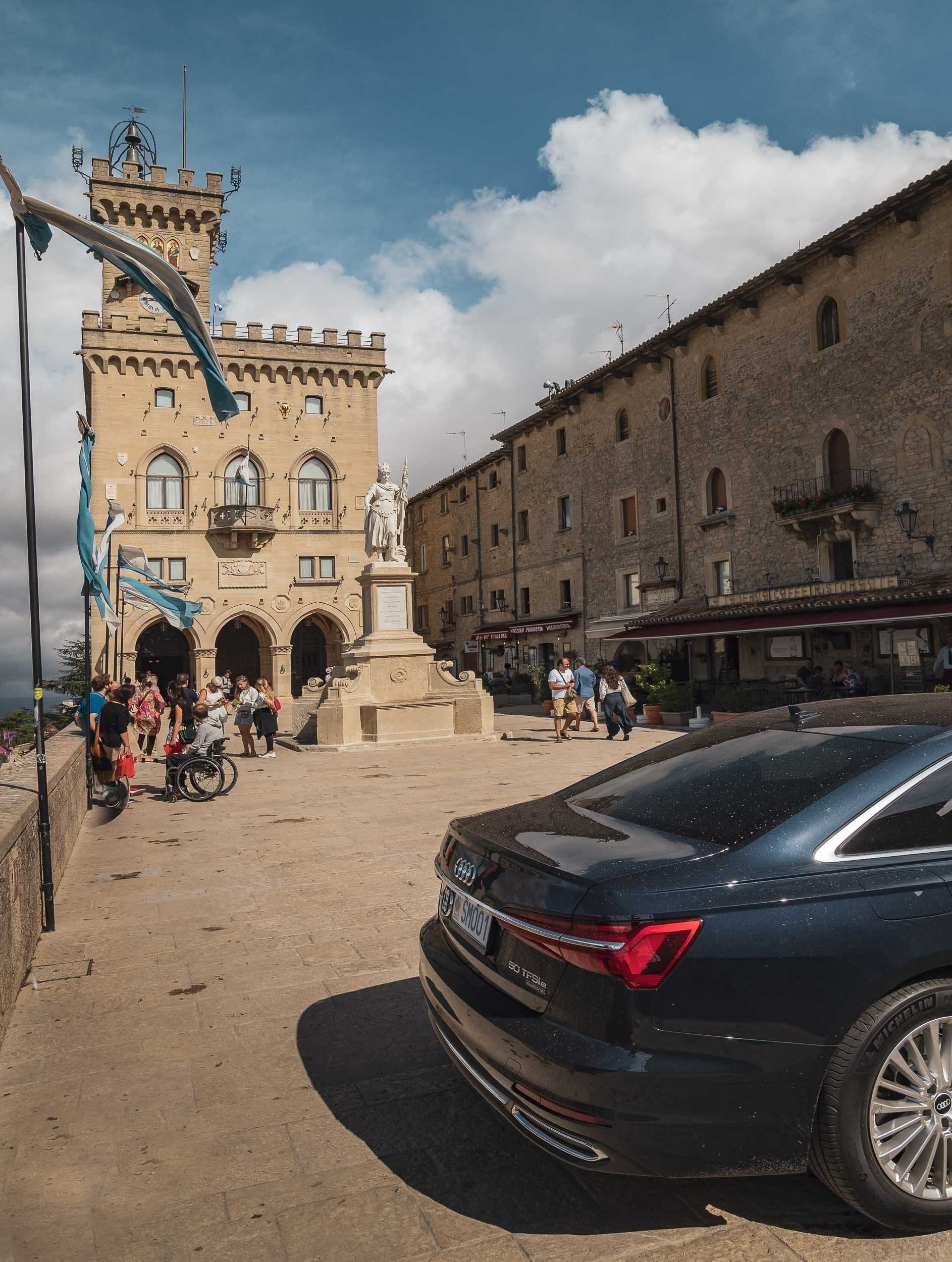
As the clouds opened up, I spent the last sunset photographing the country’s most iconic view, but rest assured there’s more to see in San Marino, such as its Museums of Torture, Dracula, and Curiosities (although I can’t say I’d highly recommend either of them). If you’re looking for the Formula 1 track where the race named after the country was held up until recently, you’ll have to go to Italy though. There is however an Ayrton Senna statue as a tribute one of the world’s best drivers, who tragically died at the 1994 Grand Prix.
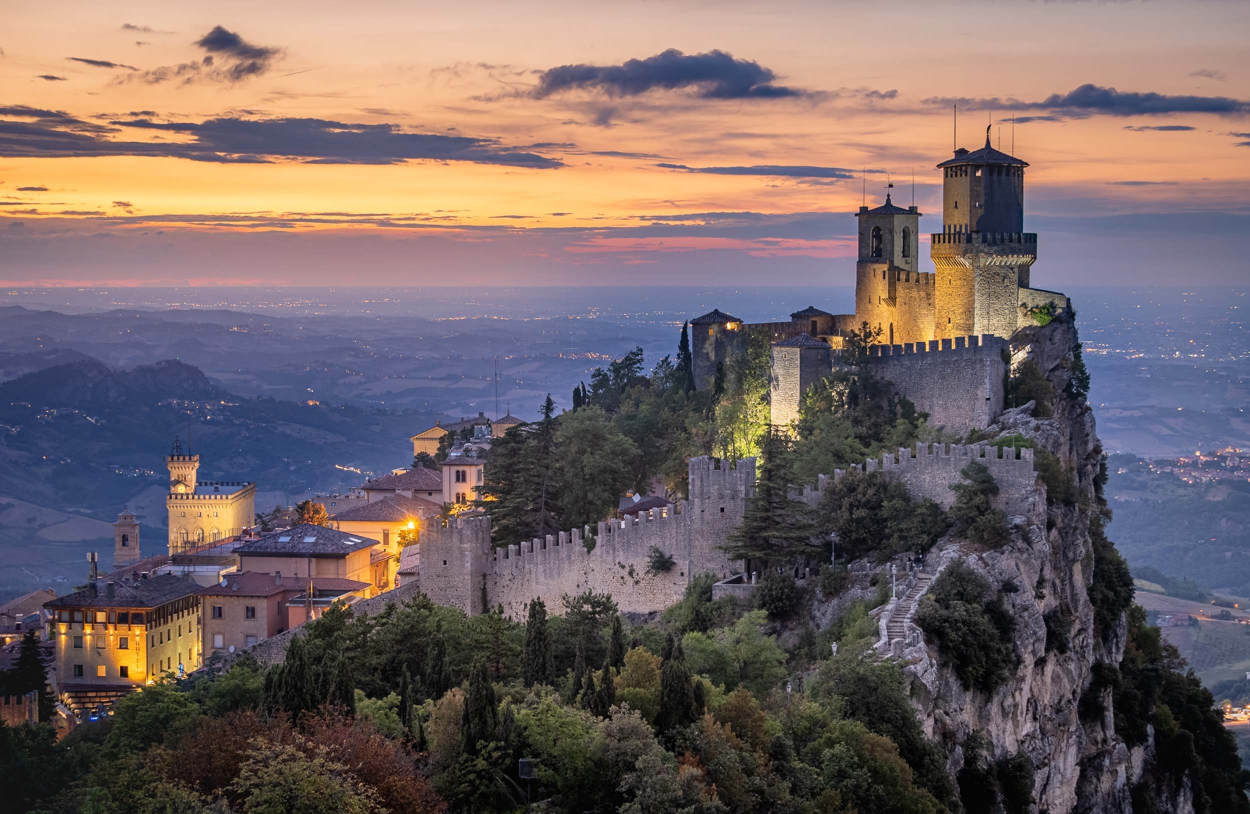
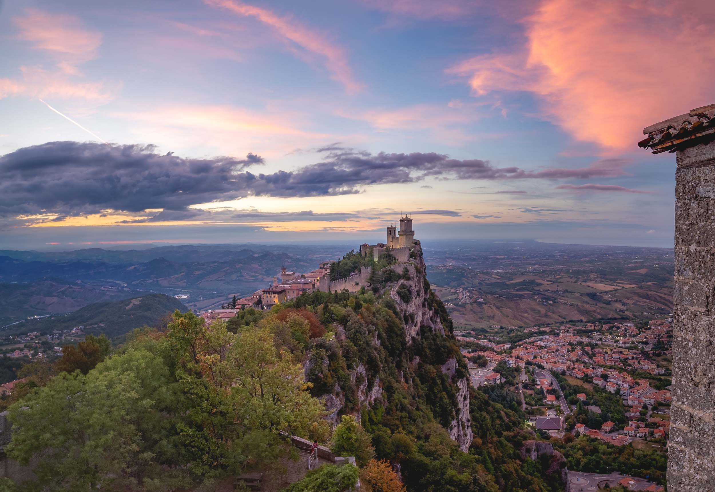
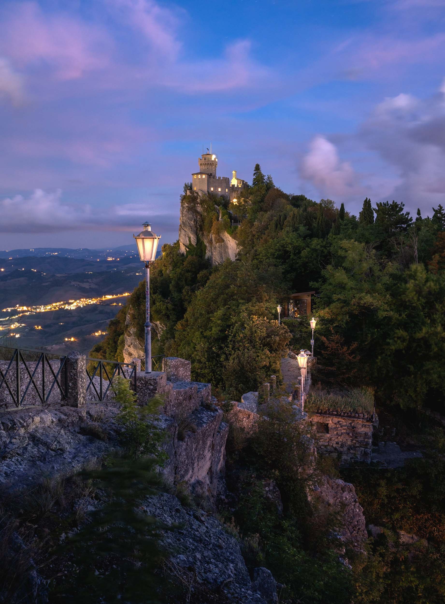
Thanks for tagging along - continue here with a nearby architectural curiosity, the medieval towers of Bologna (and a questionable statue).

Bologna - From Tall Towers and Statues with Secrets
On a recent roadtrip to San Marino we passed Bologna, one of Italy’s largest cities and home to one of its most peculiar architectural features.
On a recent roadtrip to San Marino we passed Bologna, one of Italy’s largest cities and home to one of its most peculiar architectural features. Of course that was reason enough to take a small detour and spend a few hours in the city to document this special sight - in the process, we found another rather questionable historic remnant, read on to find out…


The larger of the two towers, Asinelli, is visible from many of the city’s streets at a height of almost 100m.
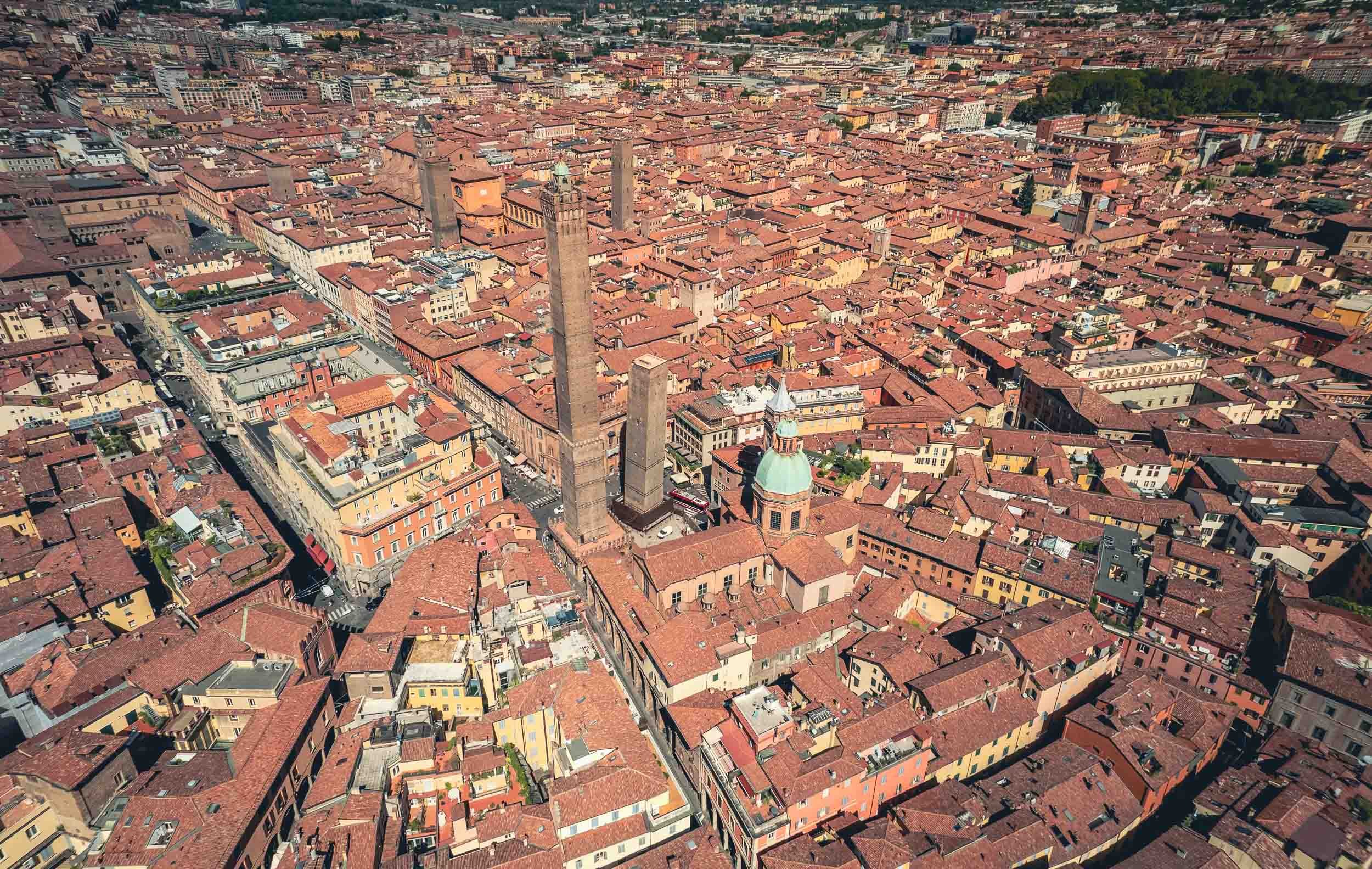
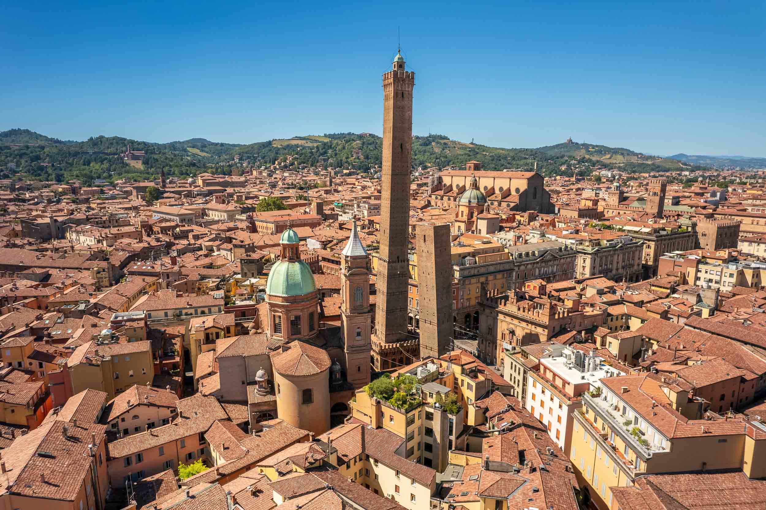
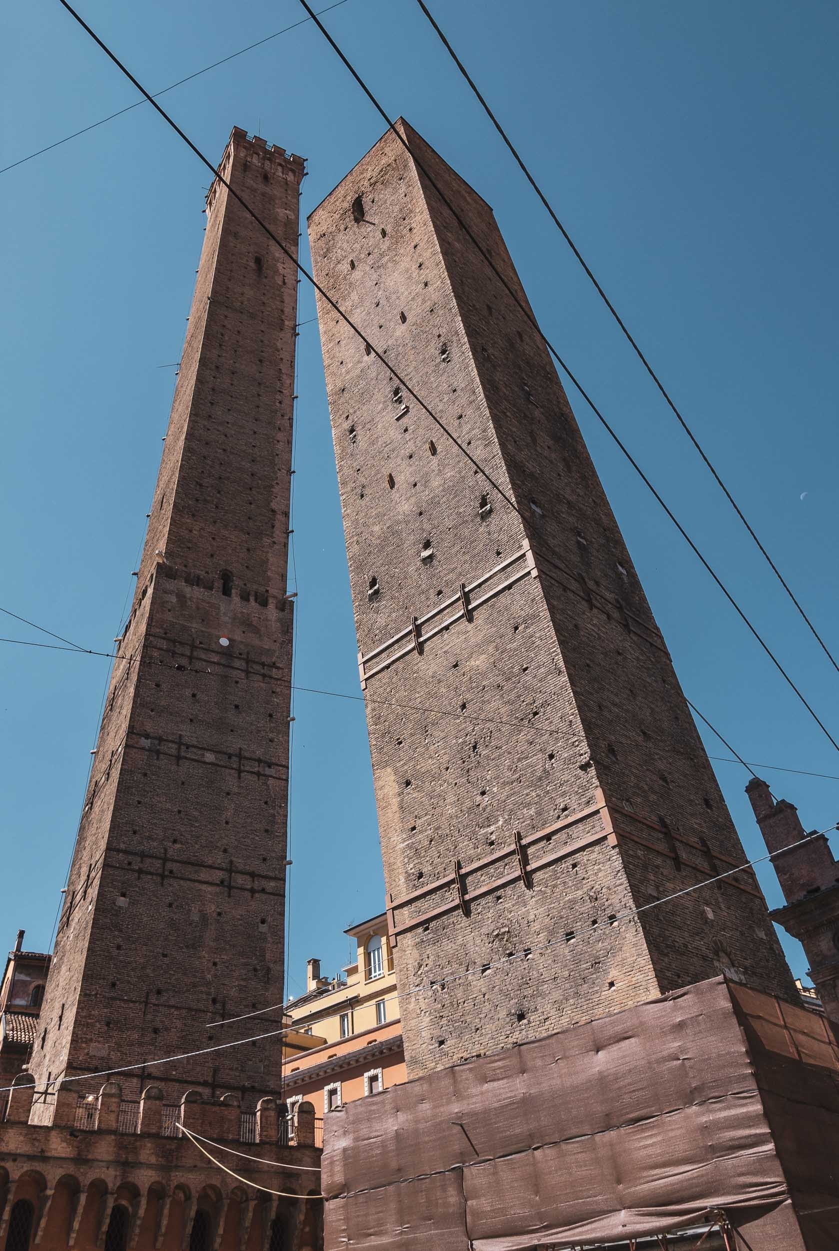
Take a flight around the towers.
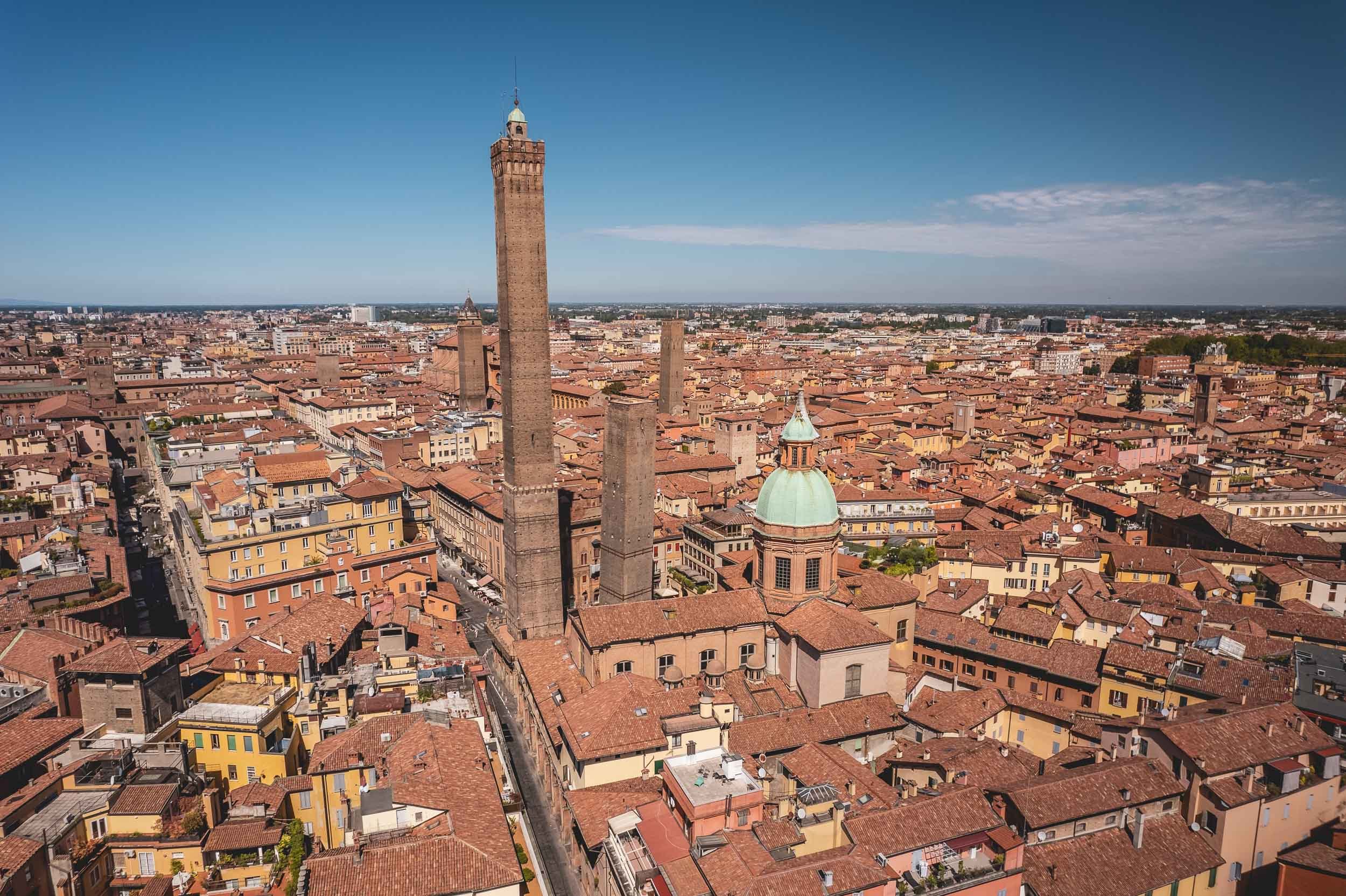
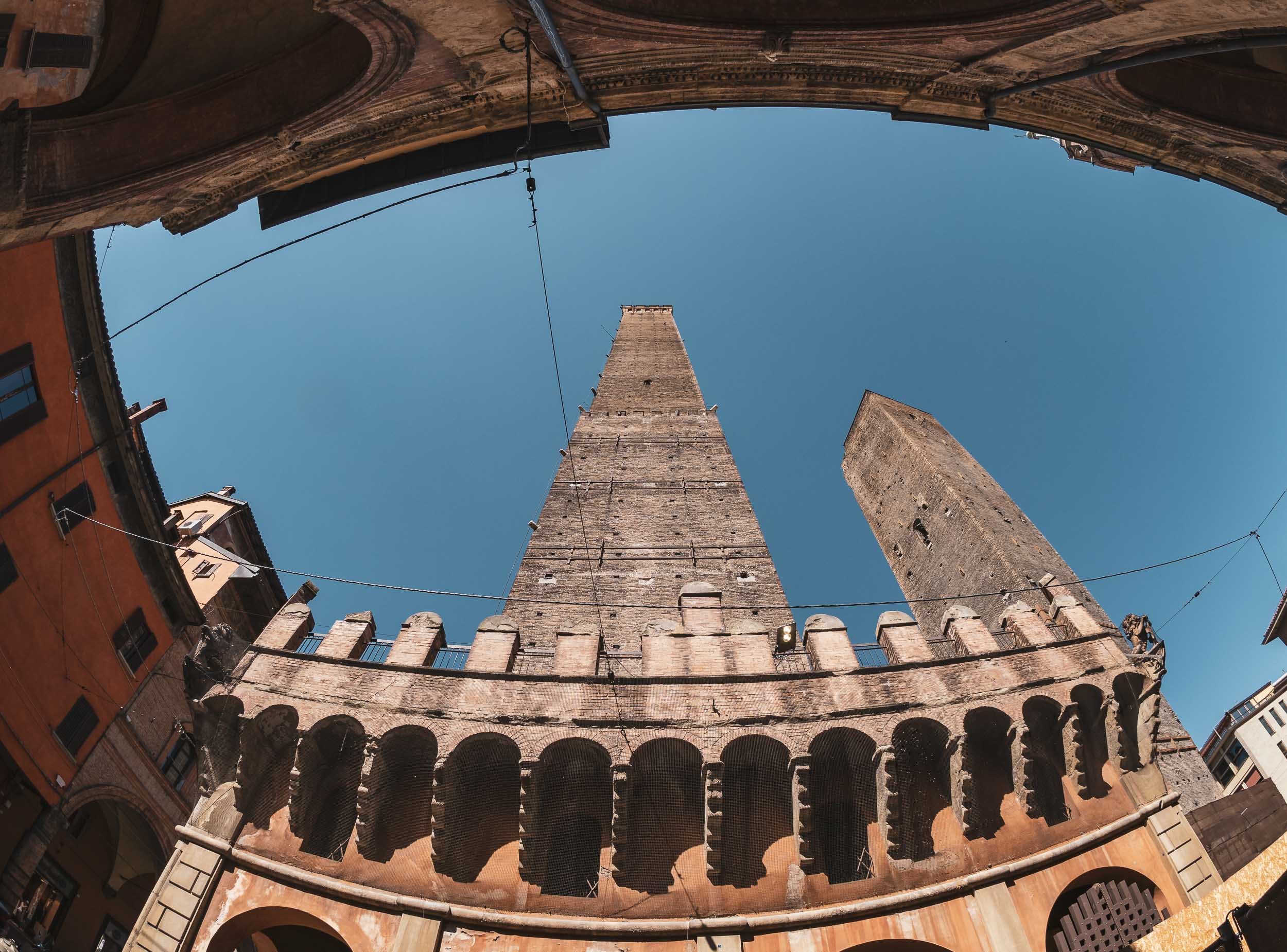
A Statue with a Secret
Not far from the towers and near the Basilica di San Petronio on the Piazza Maggiore you’ll find another oddity in the city - this time facing horizontal rather than vertical…
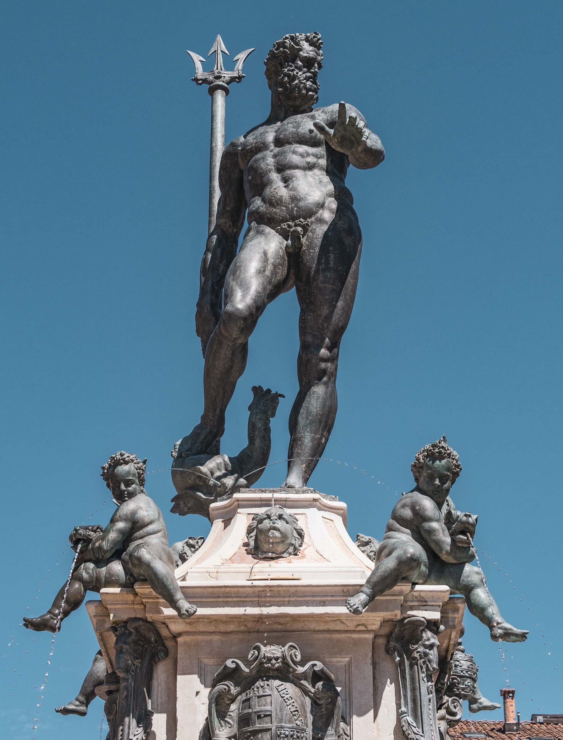

There’s a lot more to see in the city, and a return is definitely on the cards the next time I’m in the Emilia-Romagna region.

A Taste of Alsace - 36h in Strasbourg and Colmar
A brief visit to the two of the region’s most famous towns with their beautiful old woodwork.
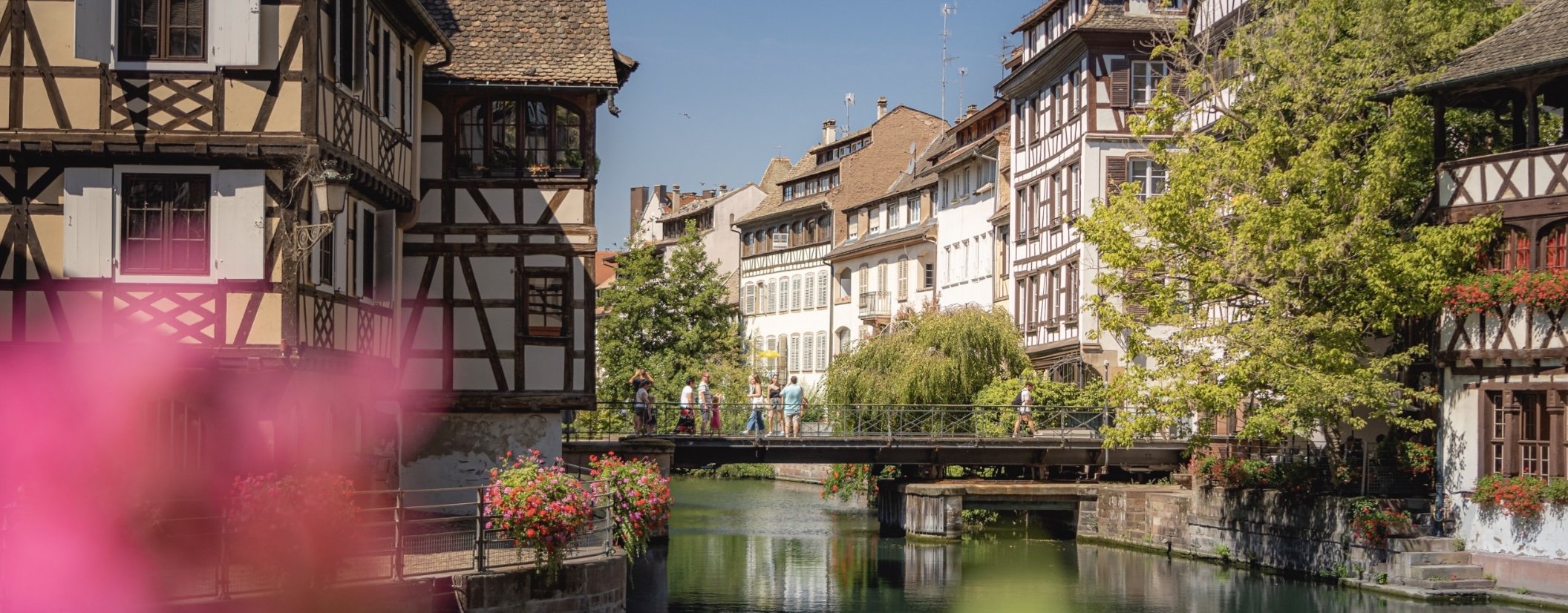
In August 2022 I attended a workshop for a startup founded by a couple that have become very good friends of mine (check it out, especially if you have young kids trying to learn reading: https://alphaben.app/de/) in the south western corner of Germany. Of course, I had to take the opportunity to jump over into the nearby Alsace region and visit Strasbourg and Colmar, two of the more famous cities in the area.
The Grande Île of Strasbourg
The most famous district is its Unesco World Heritage site area; in fact Strasbourg was the first city to have its entire city center be listed as a World Heritage Site. The city is over 2000 years old and was first mentioned in Roman times. Its position on the banks of the Rhine and on the borders of what is now France and Germany meant it was heavily disputed during its existence.
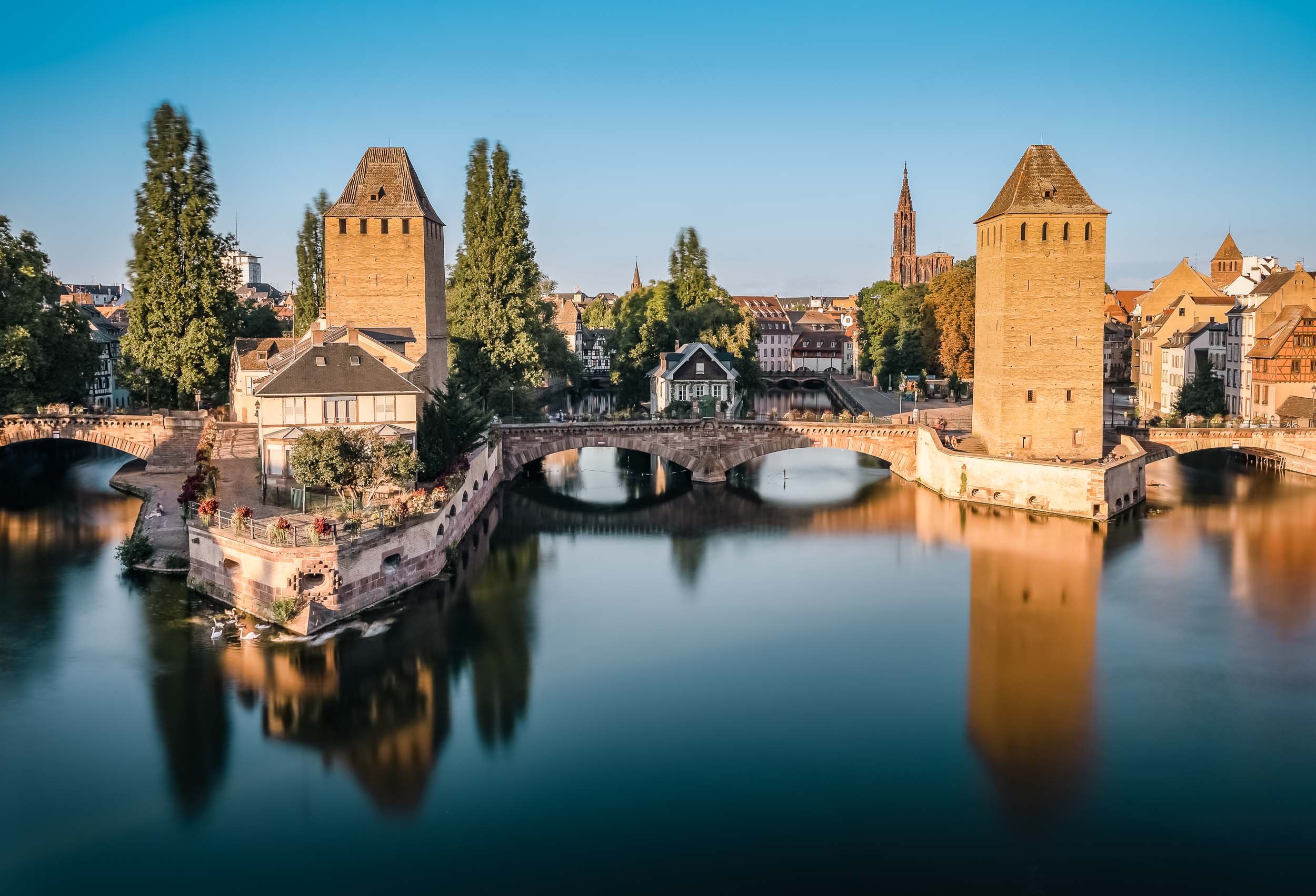


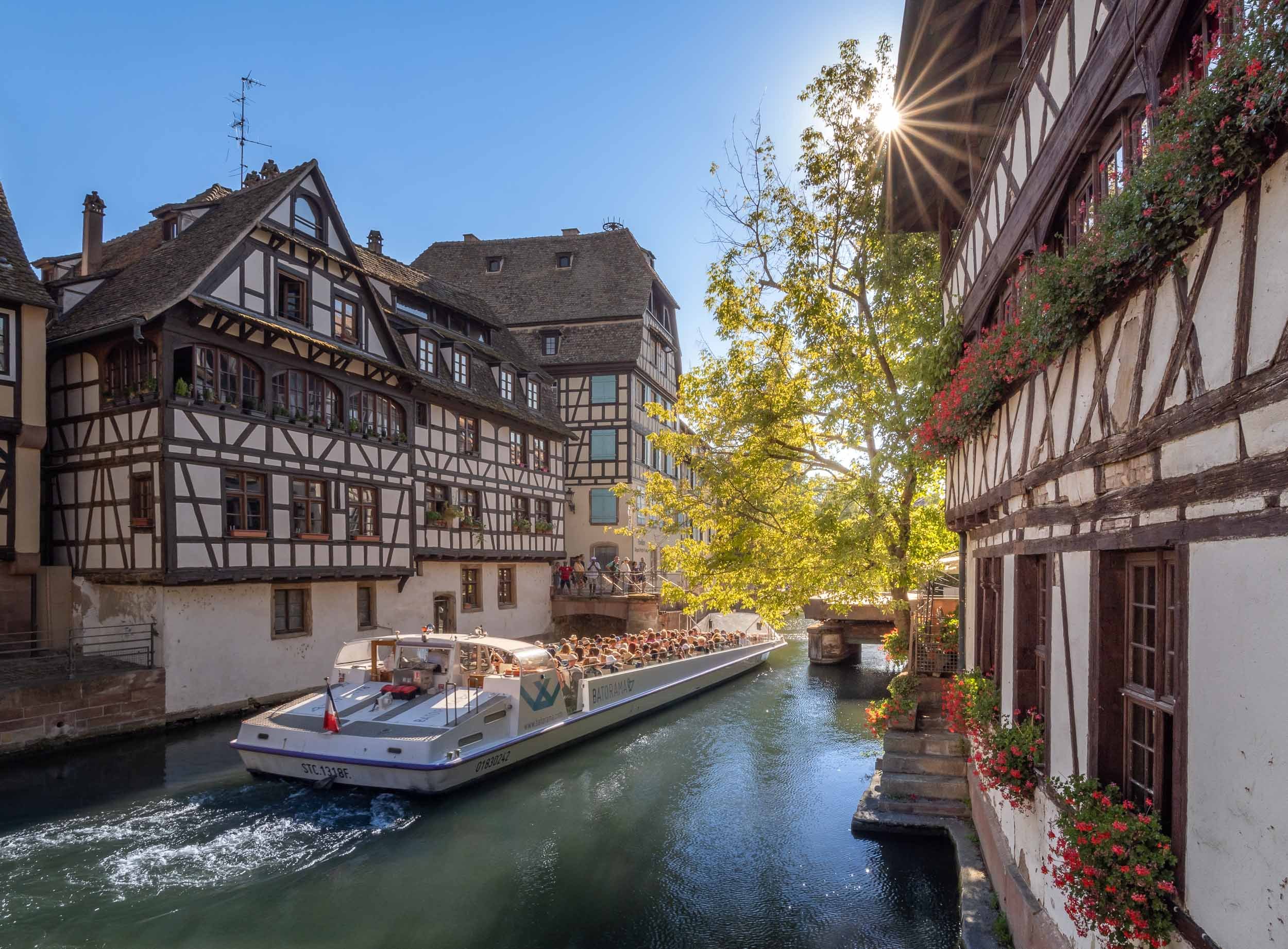
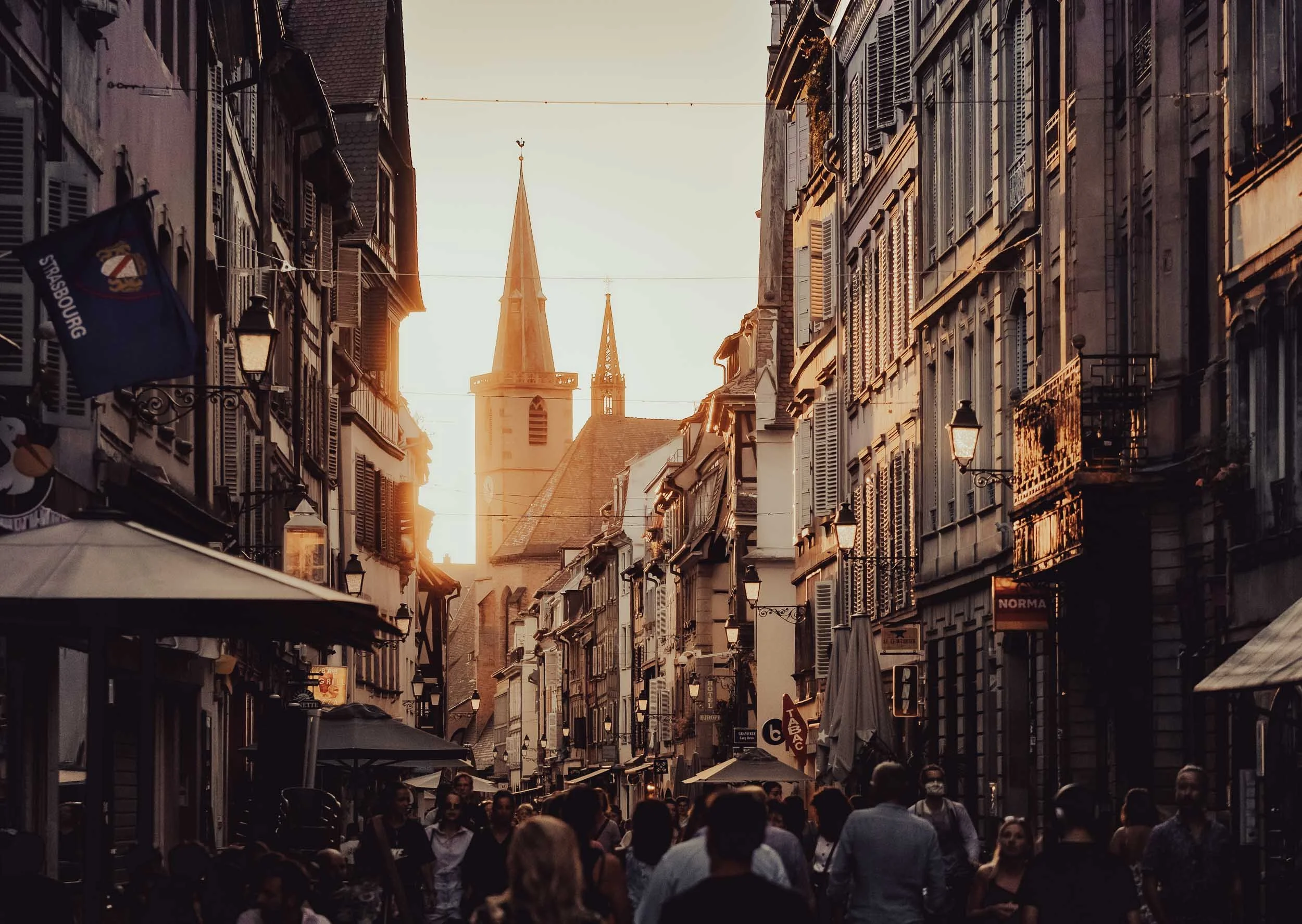
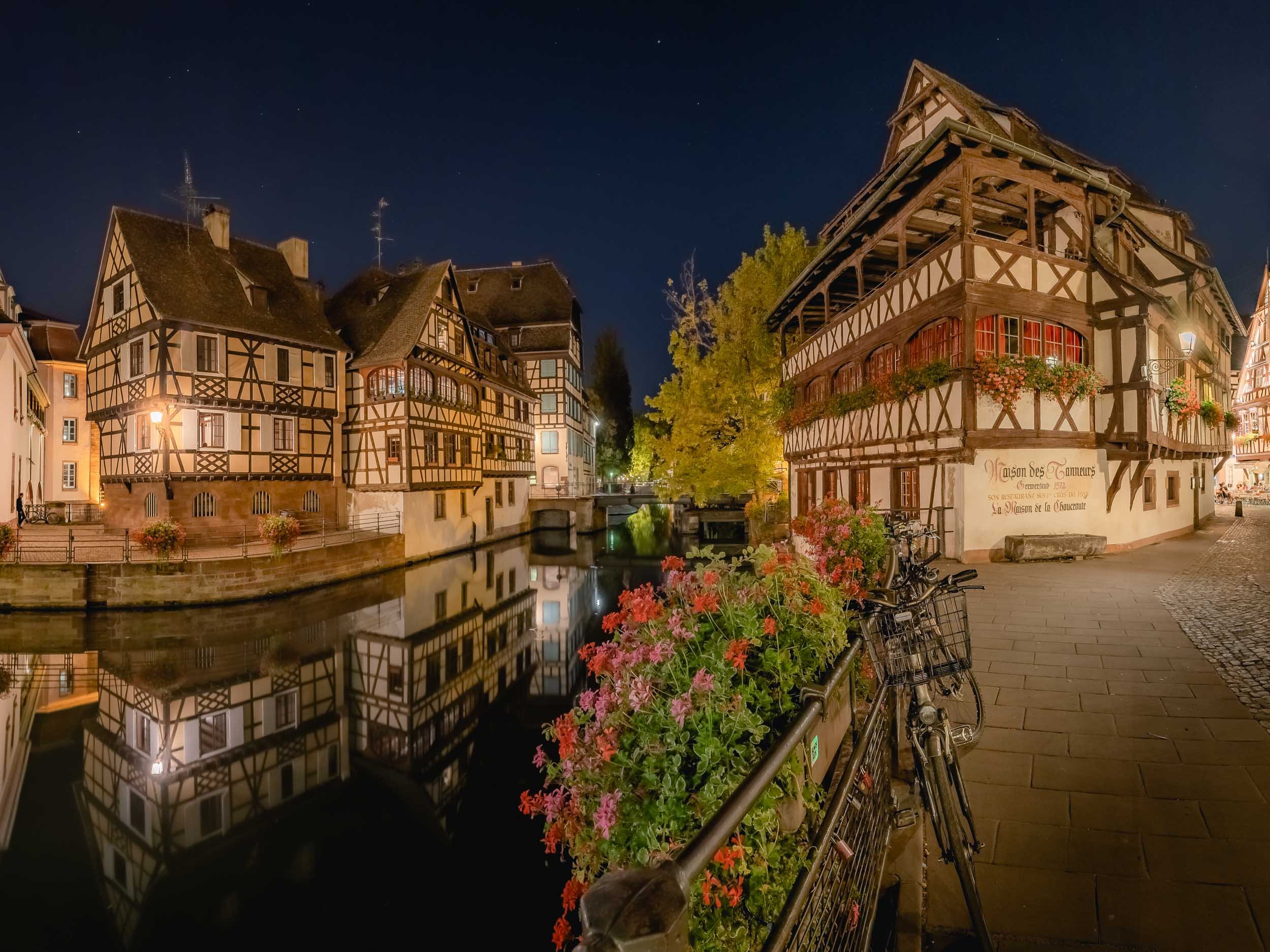

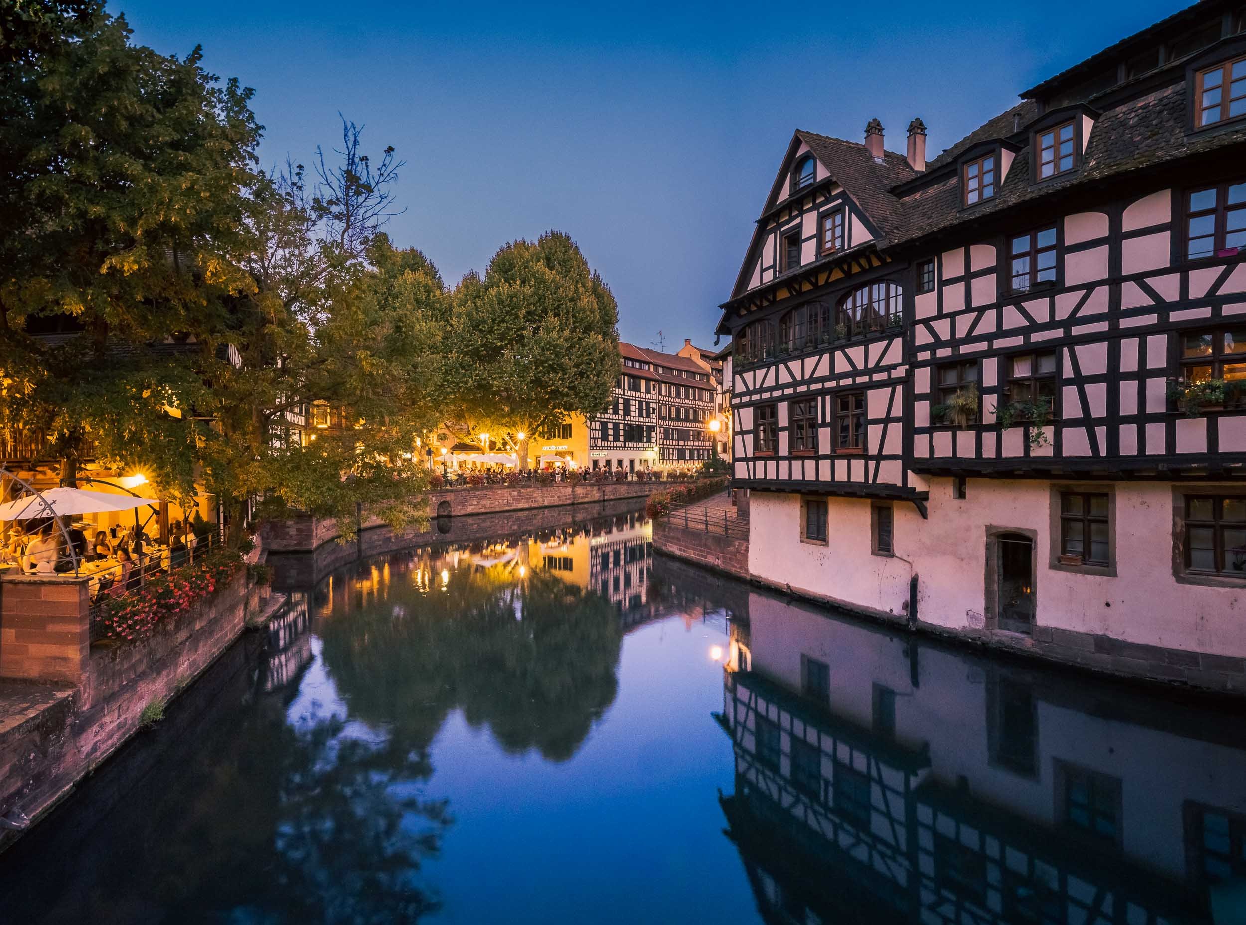

Street Scenes


The Strasbourg Cathedral
Unknowingly I happened to stay in one of the city’s most famous buildings - Maison Kammerzell - directly on the main square and one of the best preserved medieval gothic housings in existence. It also had the benefit of being able to visit the cathedral early morning before the crowds rolled in.
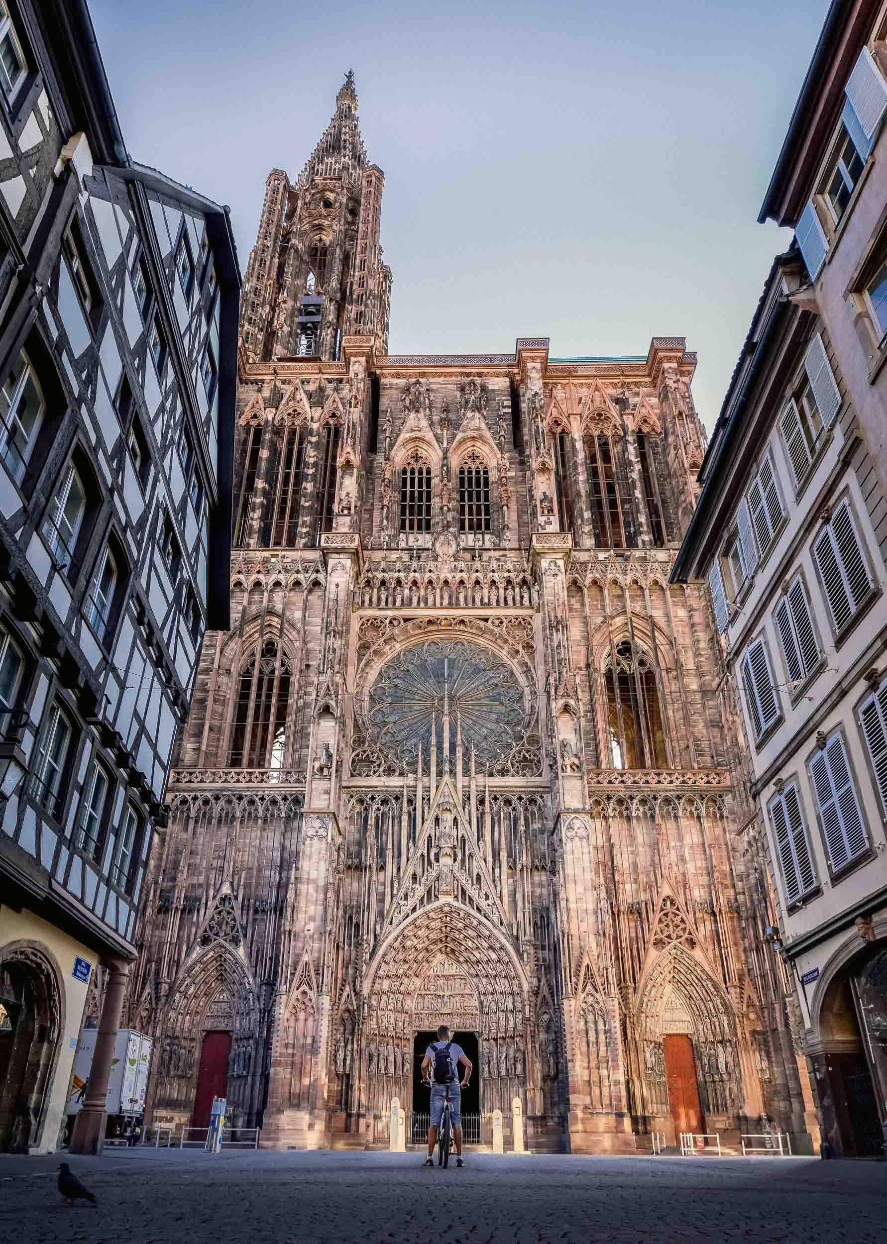
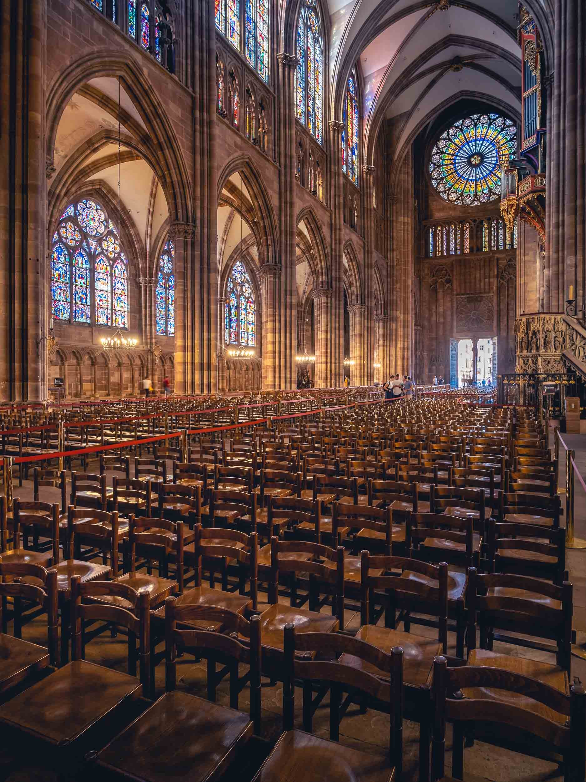
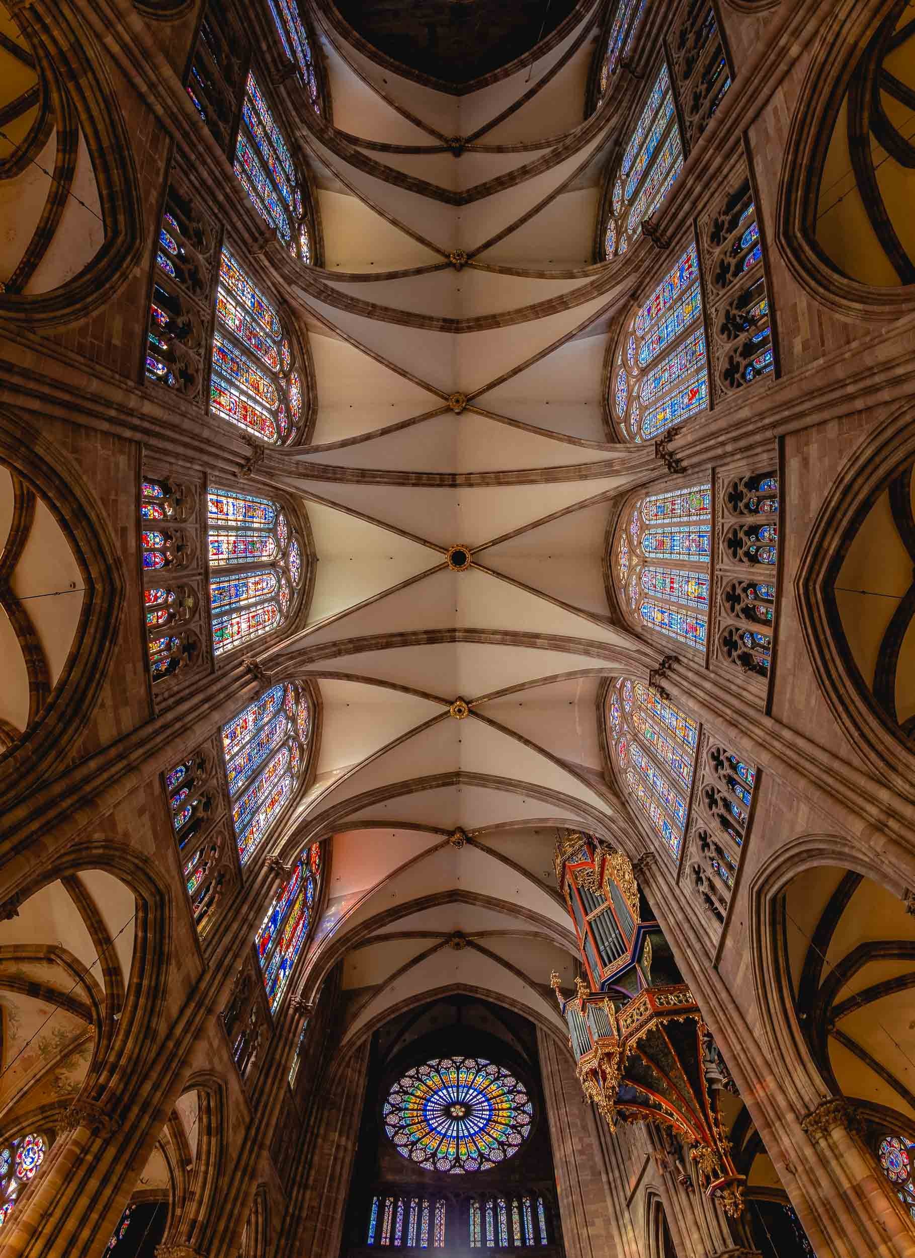
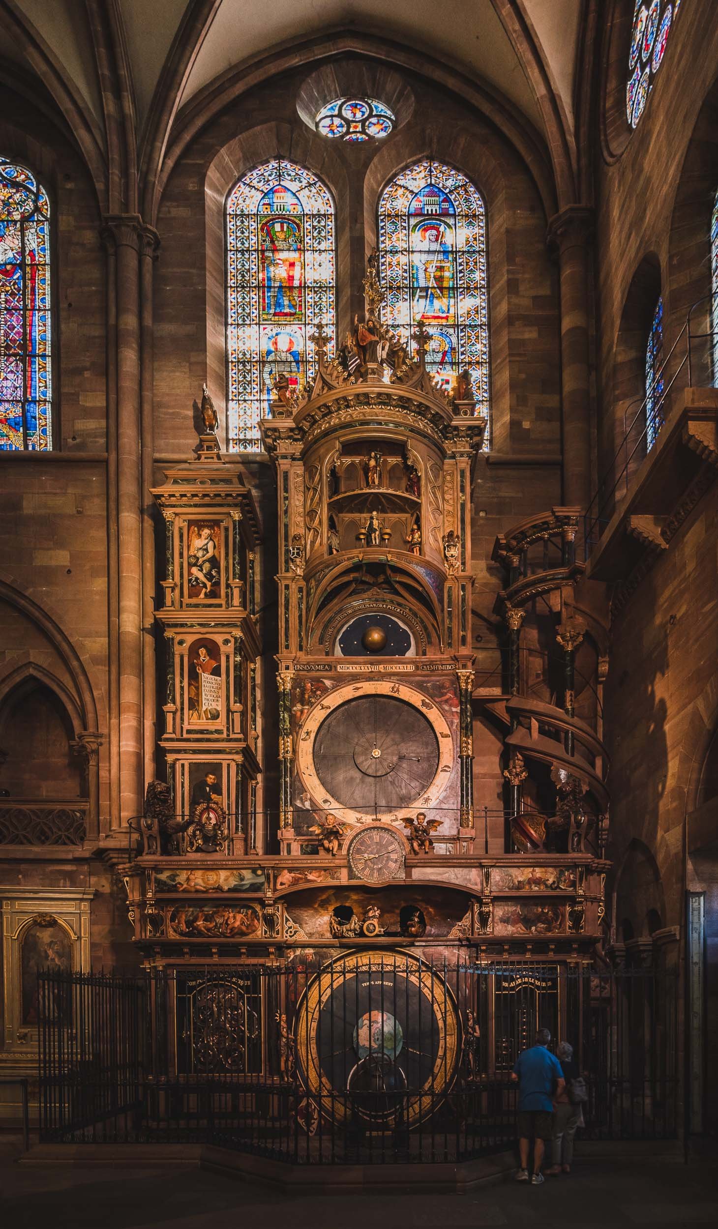
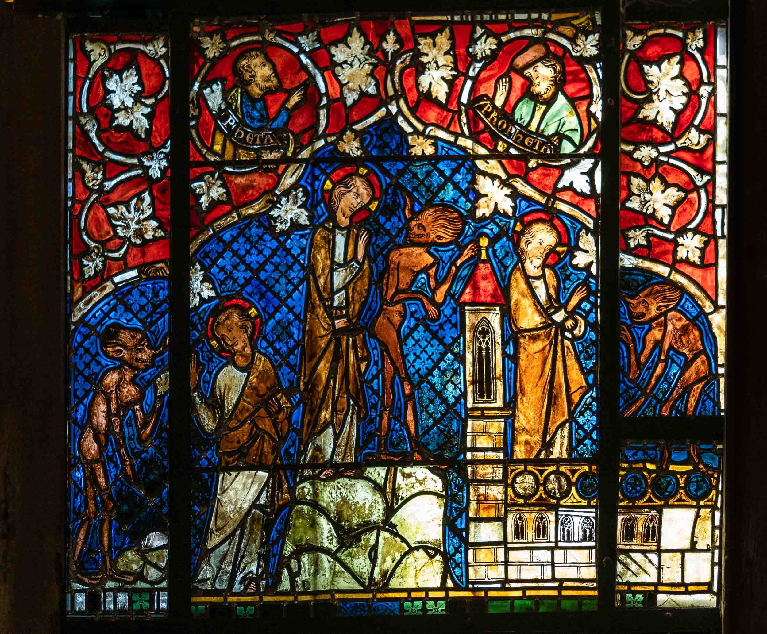
Views from Above
The views from the viewing platform of the cathedral provide a special look at the gothic architecture in the city, and its tilted roofs. On completion, the church was the tallest building in the world for a while, at 142m. In fact, it was meant to have a second identical tower, the preparations for which can be spotted on the empty roof foundation and by the fact the church has the same massive pillars inside to support it. Either way, it made the ascent quite a stair climbing marathon at 332 stairs.


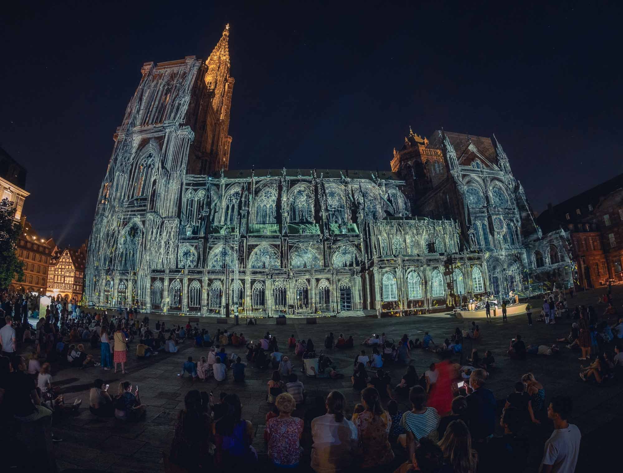
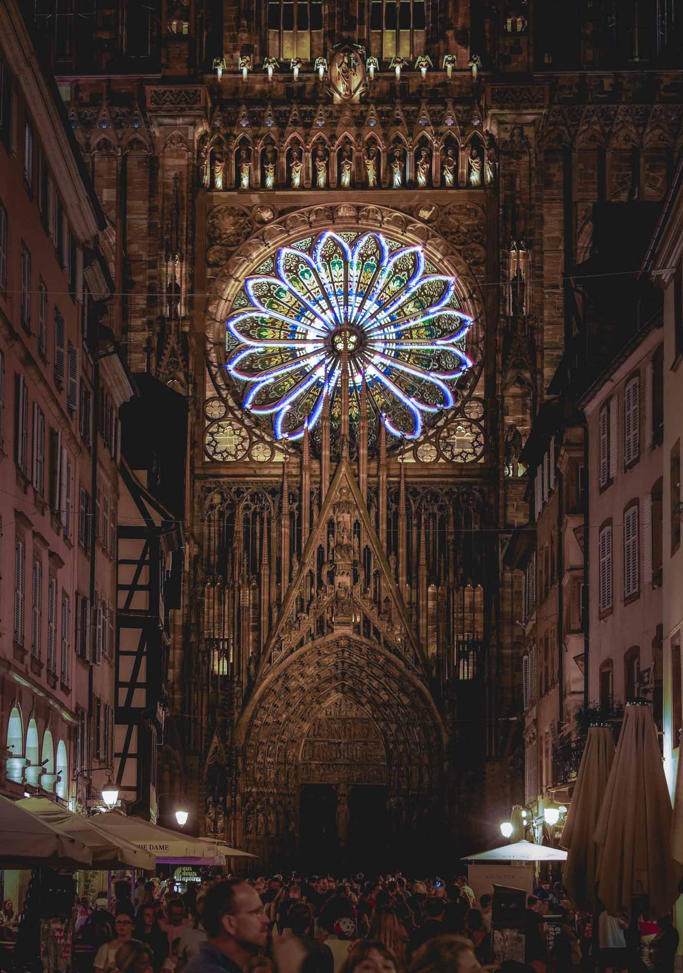
Colmar - The Little Venice
There was definitely a lot more to see in Strasbourg, for example the largest mosque in France, and the seat of the European Parliament, but I took a train to Colmar for a few hours instead, before having to leave the Alsace region for my trip to Iceland. It was worth it to catch a glimpse of one of the regions most picturesque villages with its well-preserved old town.

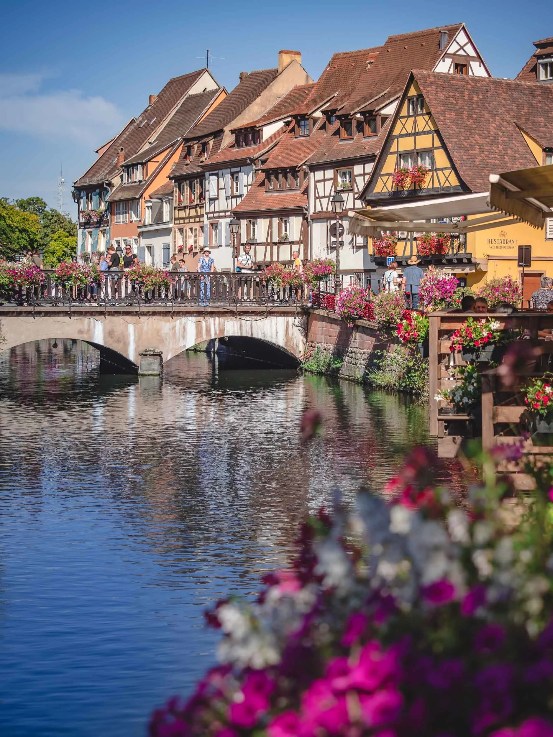
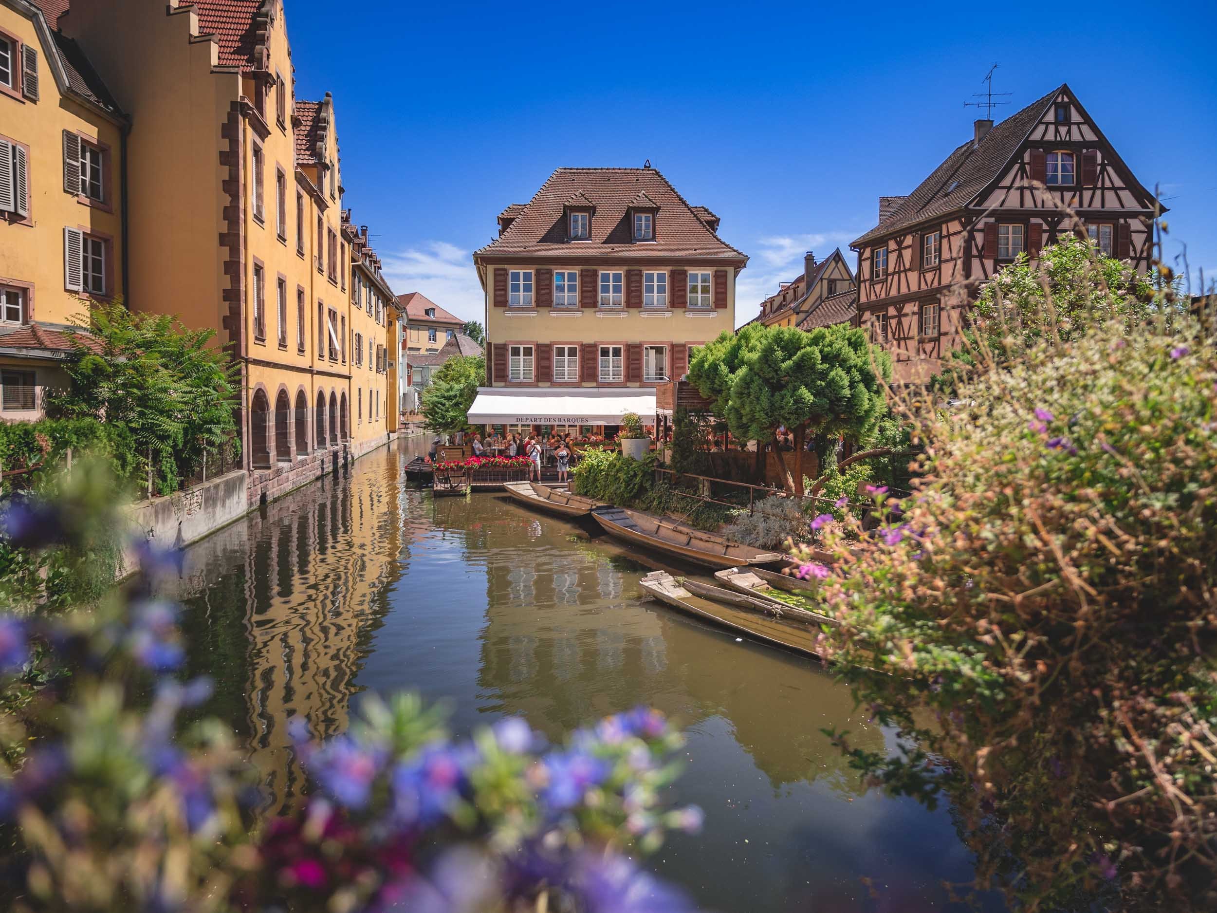
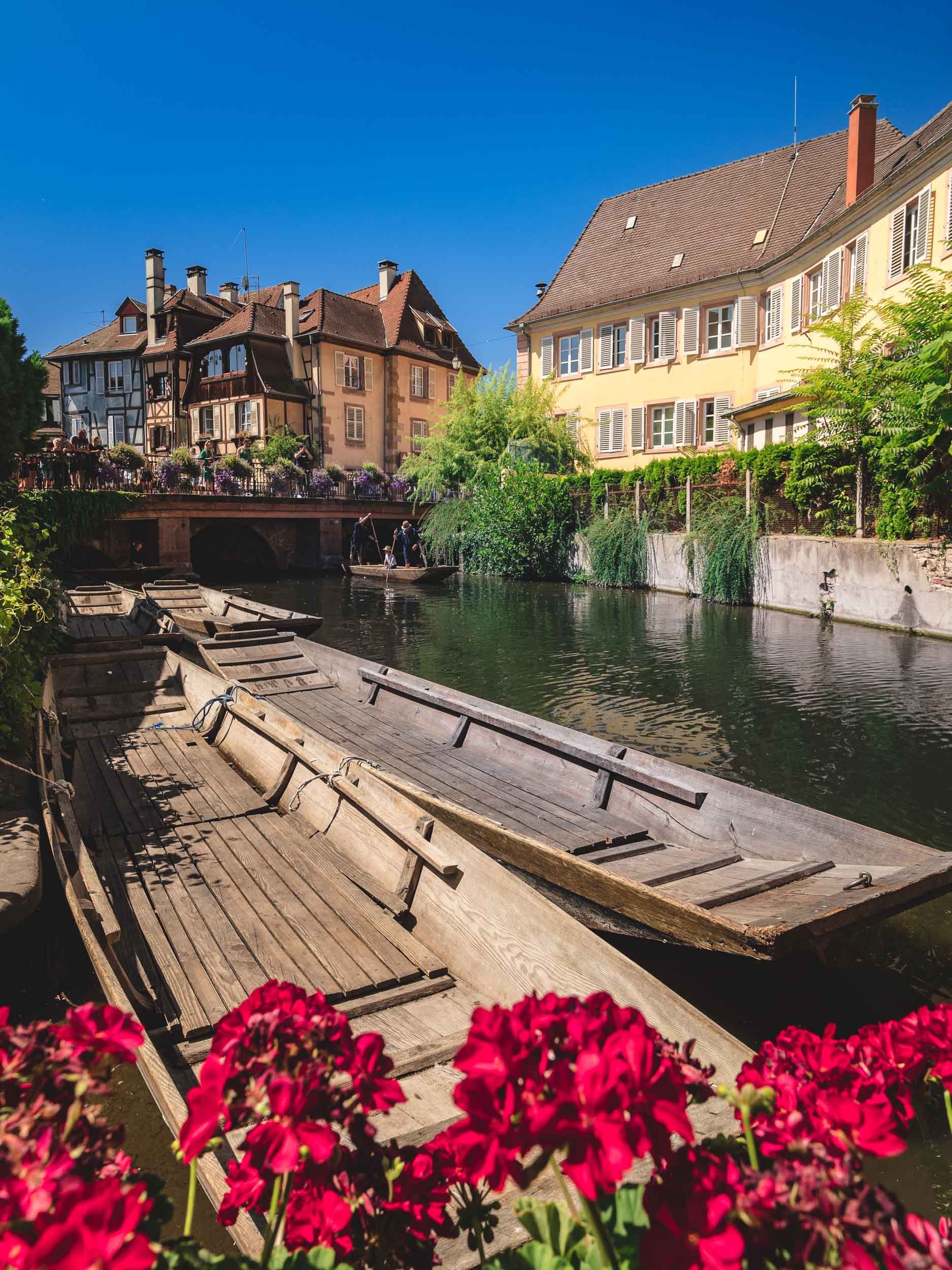
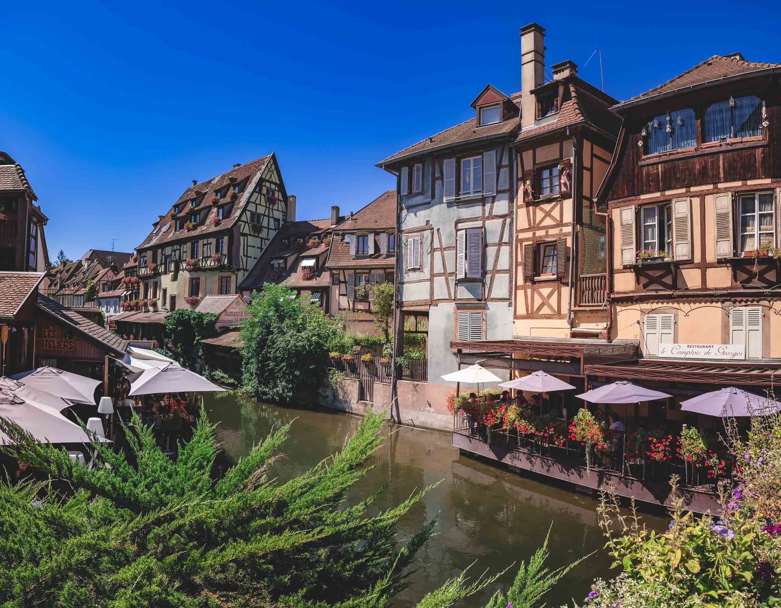


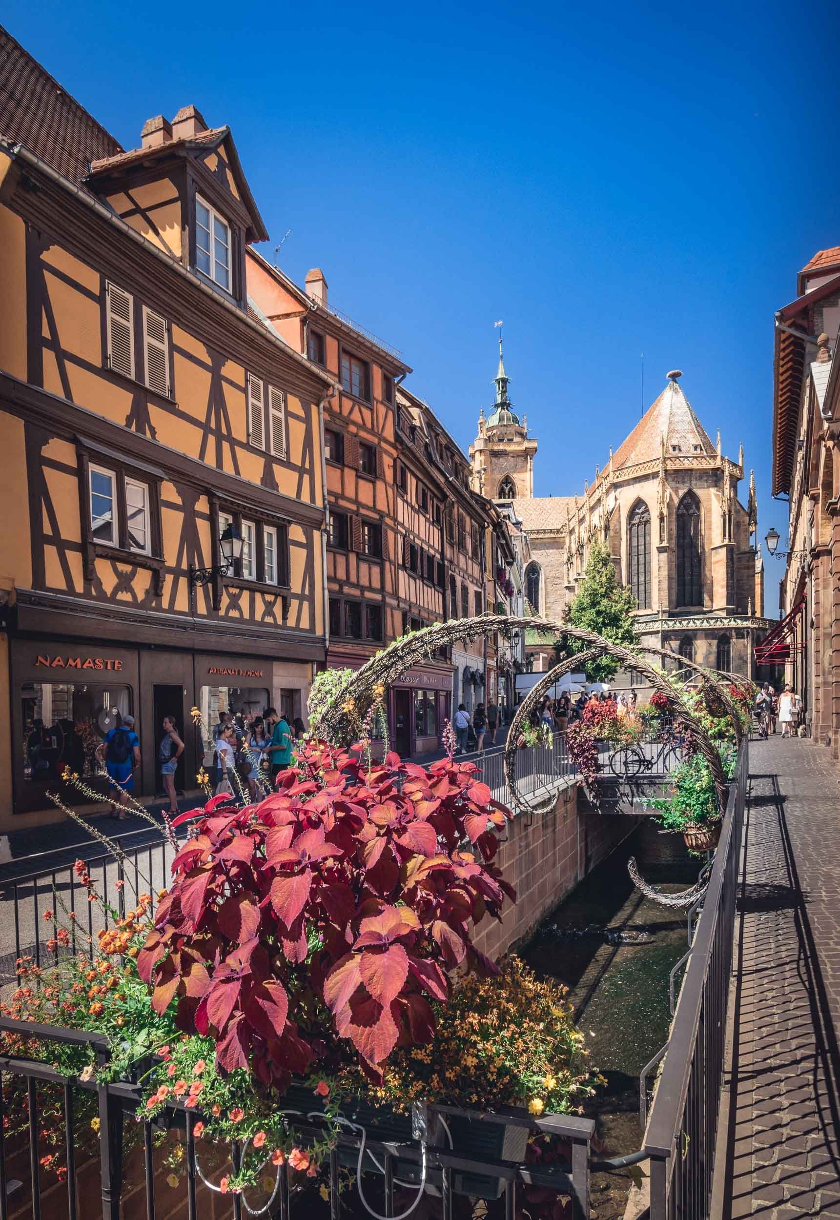
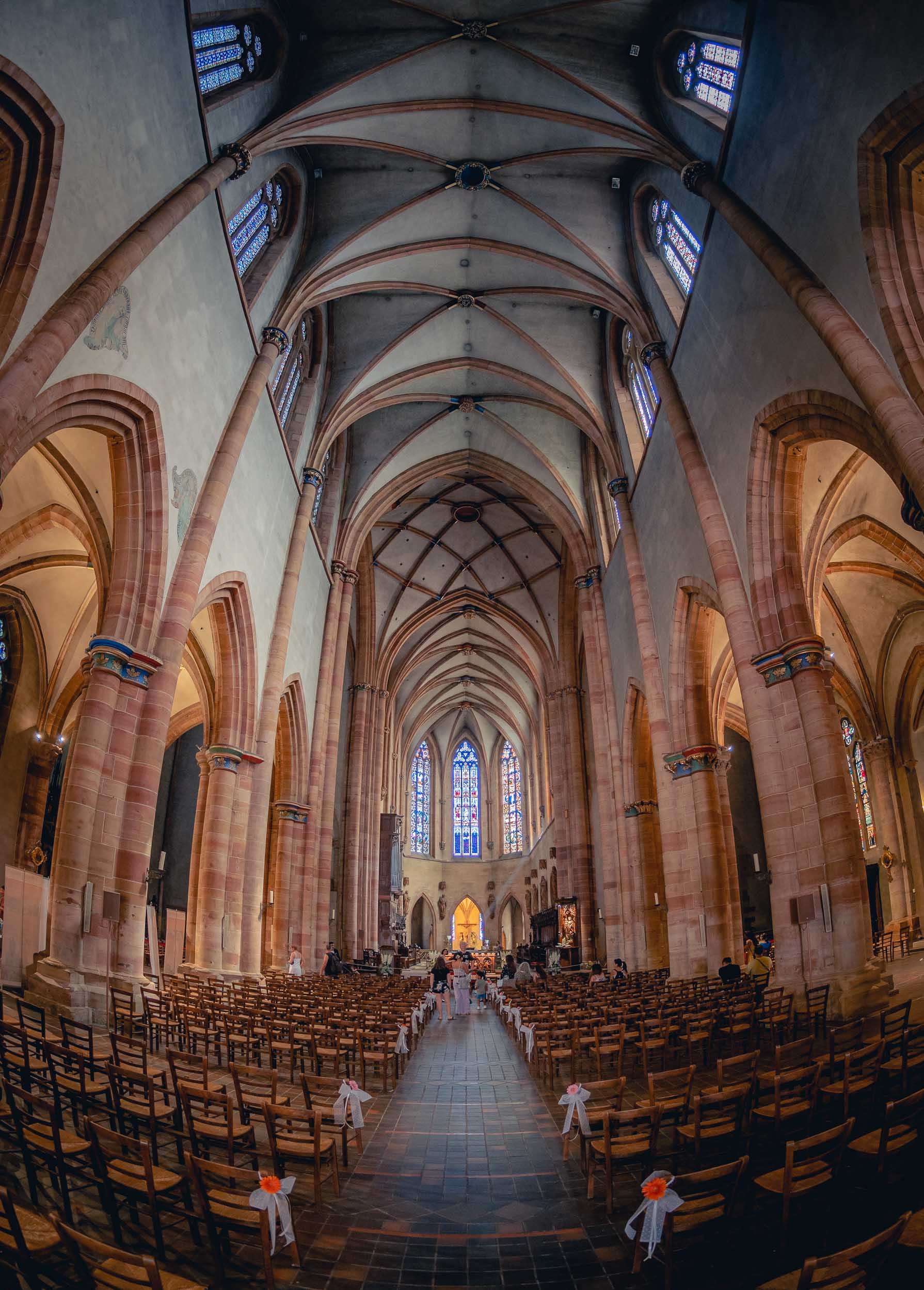
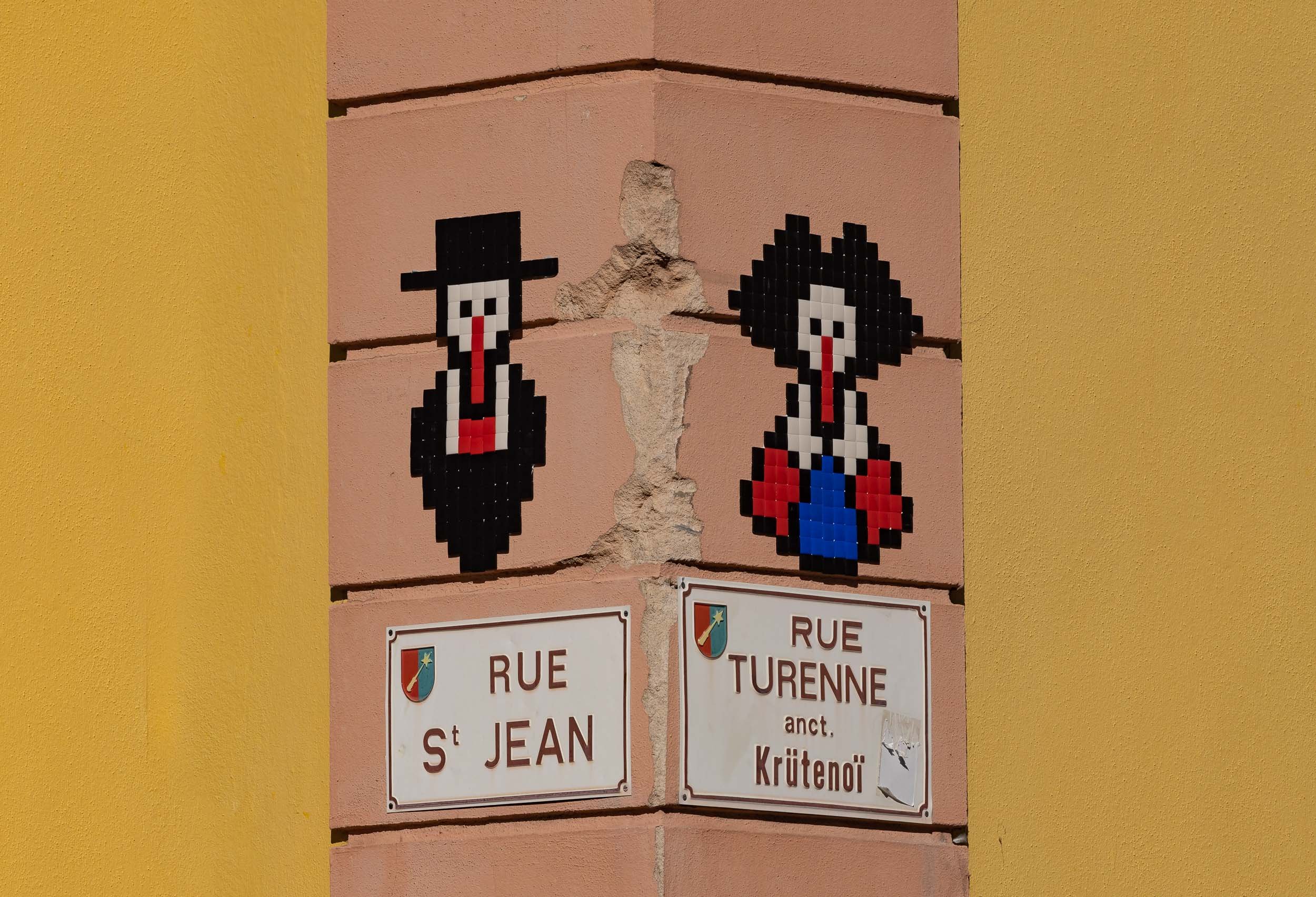
And that was a little excursion to a small corner of south eastern France! As usual, follow along on my Instagram, where I also have a story highlight with some clips from this trip.

Iceland - Documenting the Inferno
August 2022 saw a Volcano erupting on Iceland’s Reykjanes peninsula, and it was an event I could not miss.

While I was hiking glaciers in Alaska, something on the other end of the temperature spectrum happened a few thousand kilometers east: Iceland recorded another Volcano eruption, after last year’s 6 months period of volcano activity on the Reykjanes peninsula not far from Reykjavik. Having missed the previous occasion, I decided to book a flight and car in a 36h window on August 15th, between other trips I had already confirmed. It was a risky plan, given the fact that the activity could slow down or even stop at any moment, and knowing that Iceland’s weather is more than unpredictable. In the end, it was the right move, since I had great weather for most of the trip, and even more so because the eruption has effectively stopped as of August 22nd.
I arrived at the country’s international airport in late afternoon and took a rental car towards the Volcano location, which is just 45min from the airport, only stopping to get some groceries as I planned to stay at the site over night.
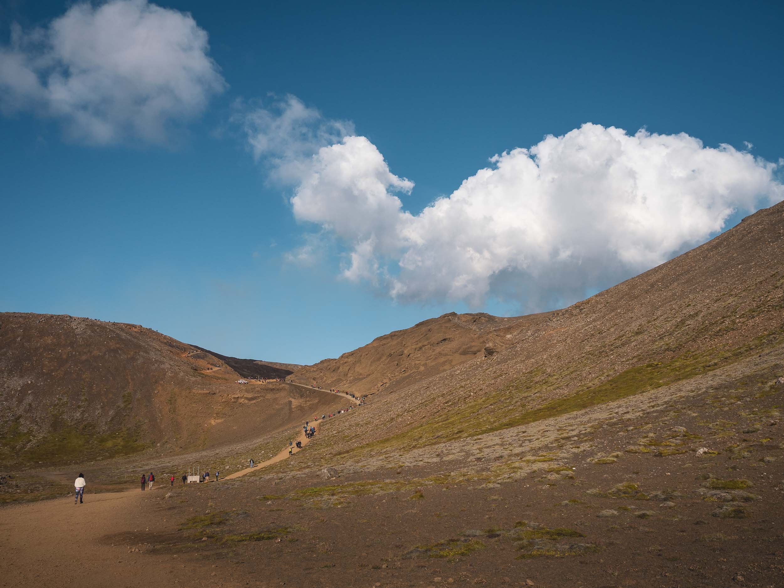

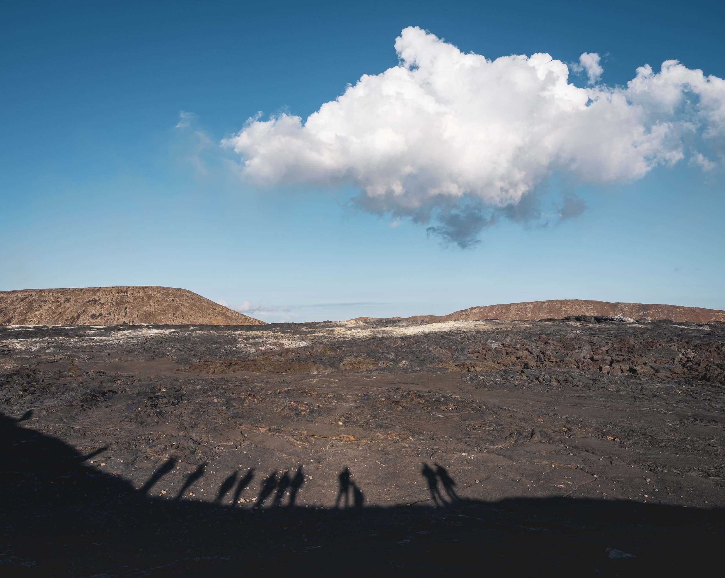
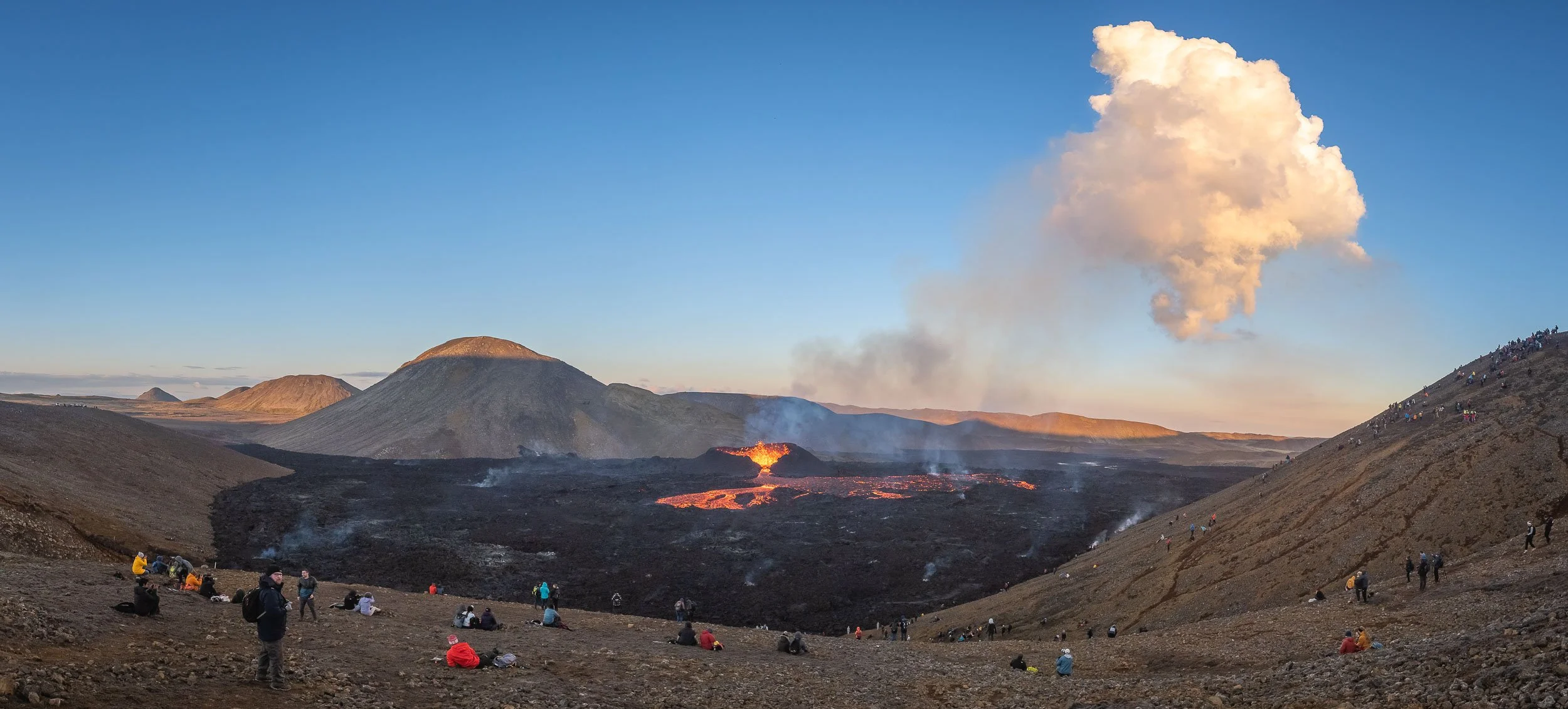
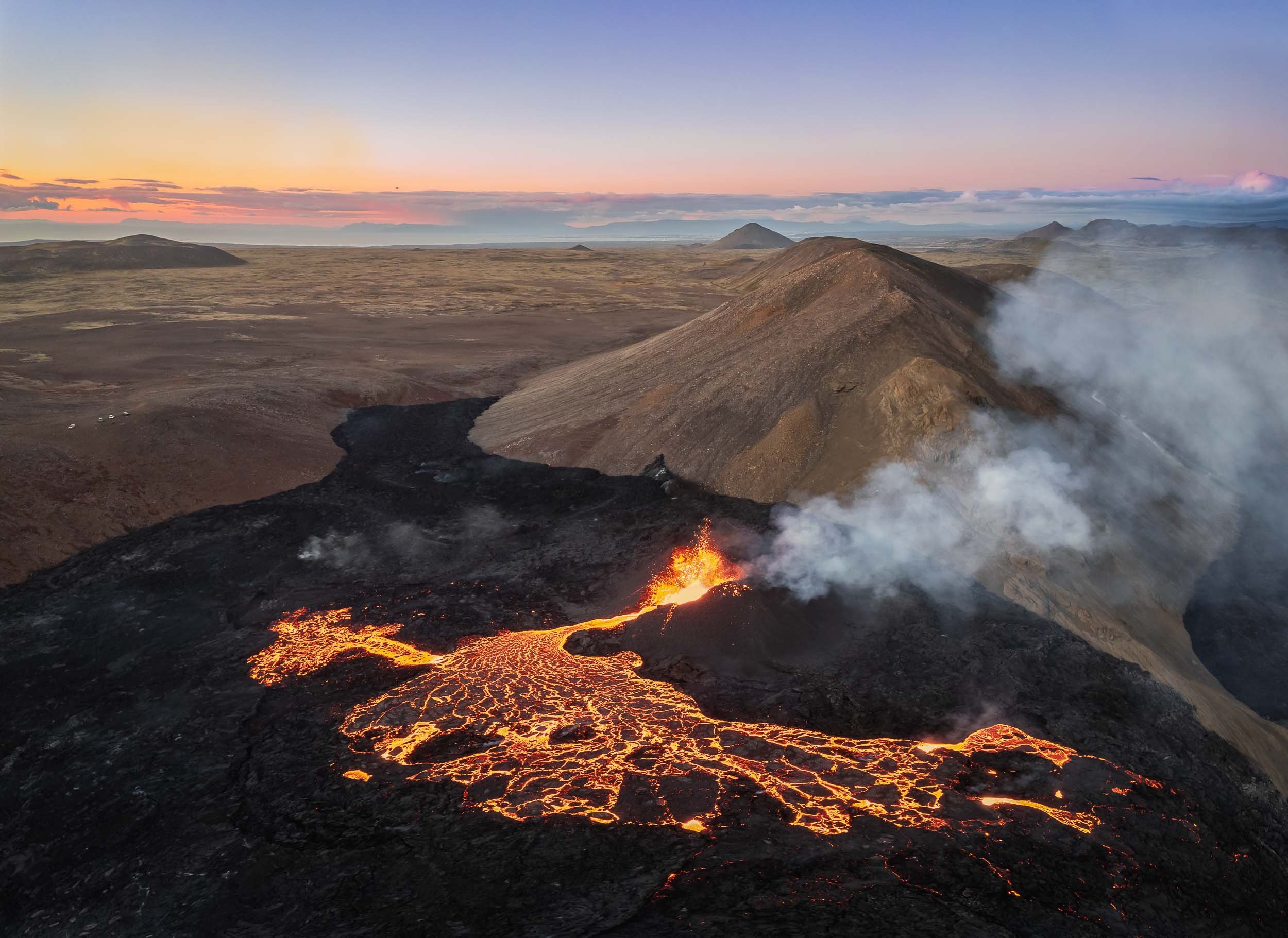
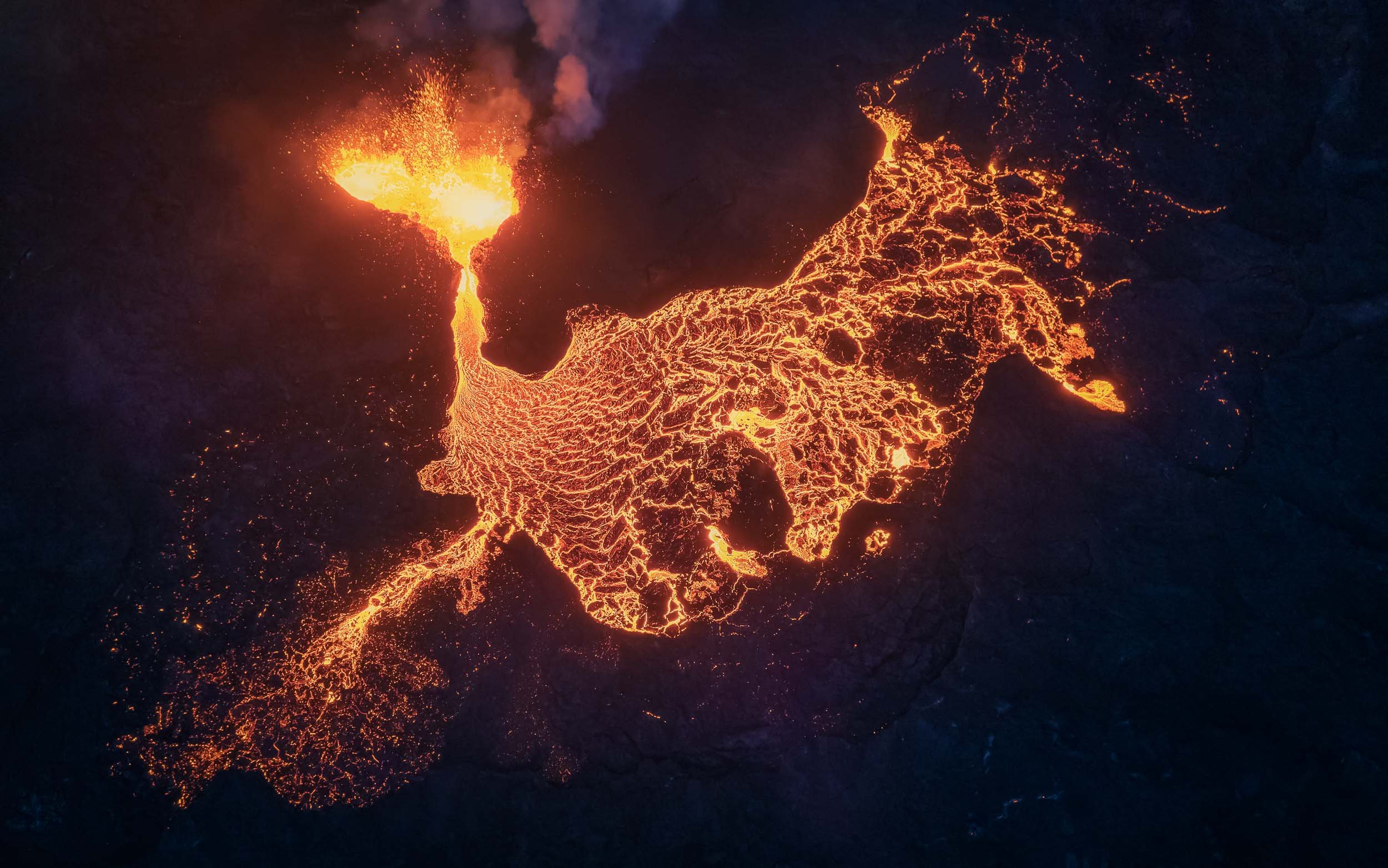
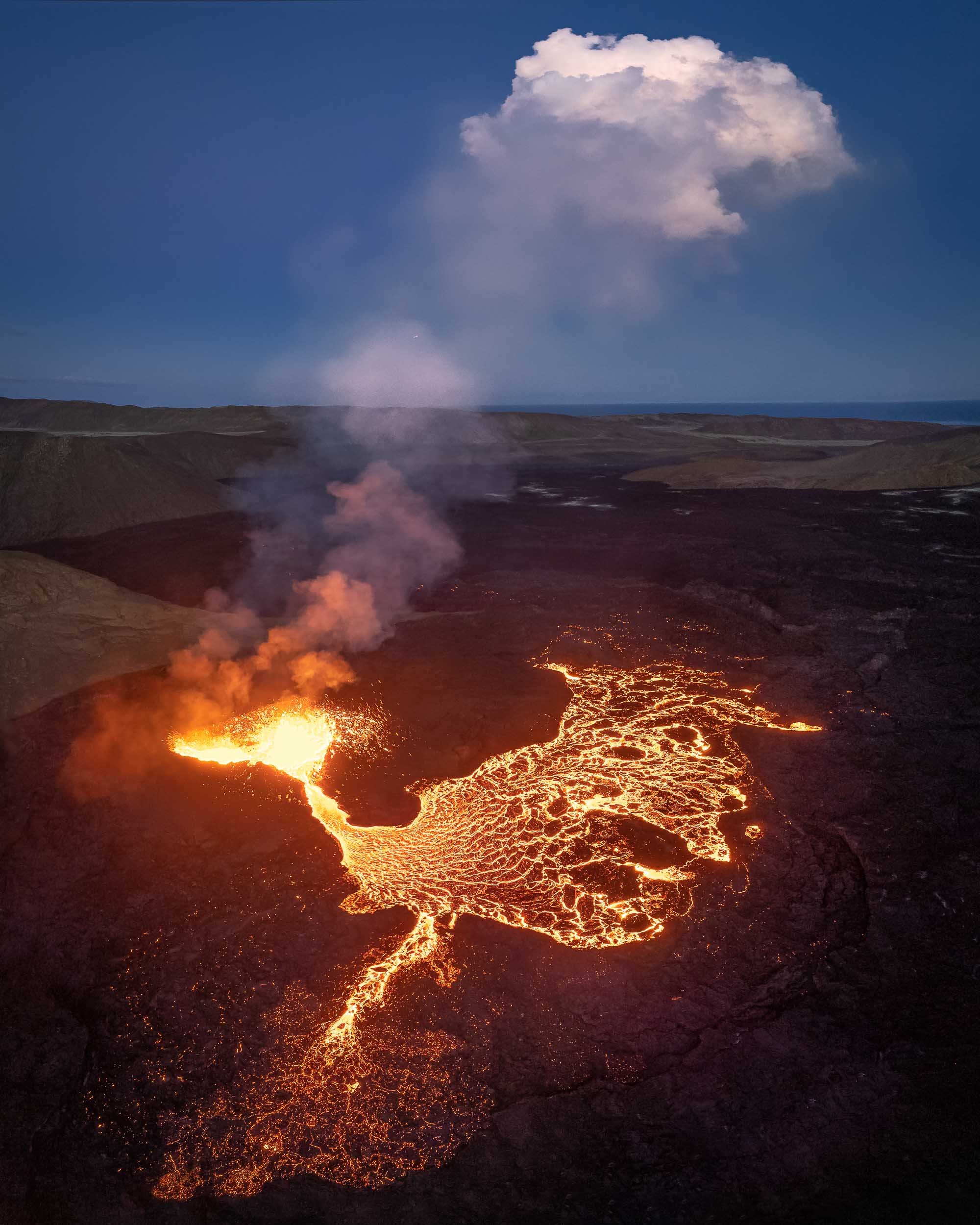


Watching the Inferno
A few images of people hiking along the hills surrounding the volcano at night.


Volcano In Motion - Highlights
If you enjoyed the photos, seeing the spewing lava in motion adds another dimension.
Morning Vibes
I spent over 14h at the site in total on the first day, to catch these views. What made it even more worth it is the fact that I was literally the only one here around 7am, surrounded by nothing but the noise of the volcano.
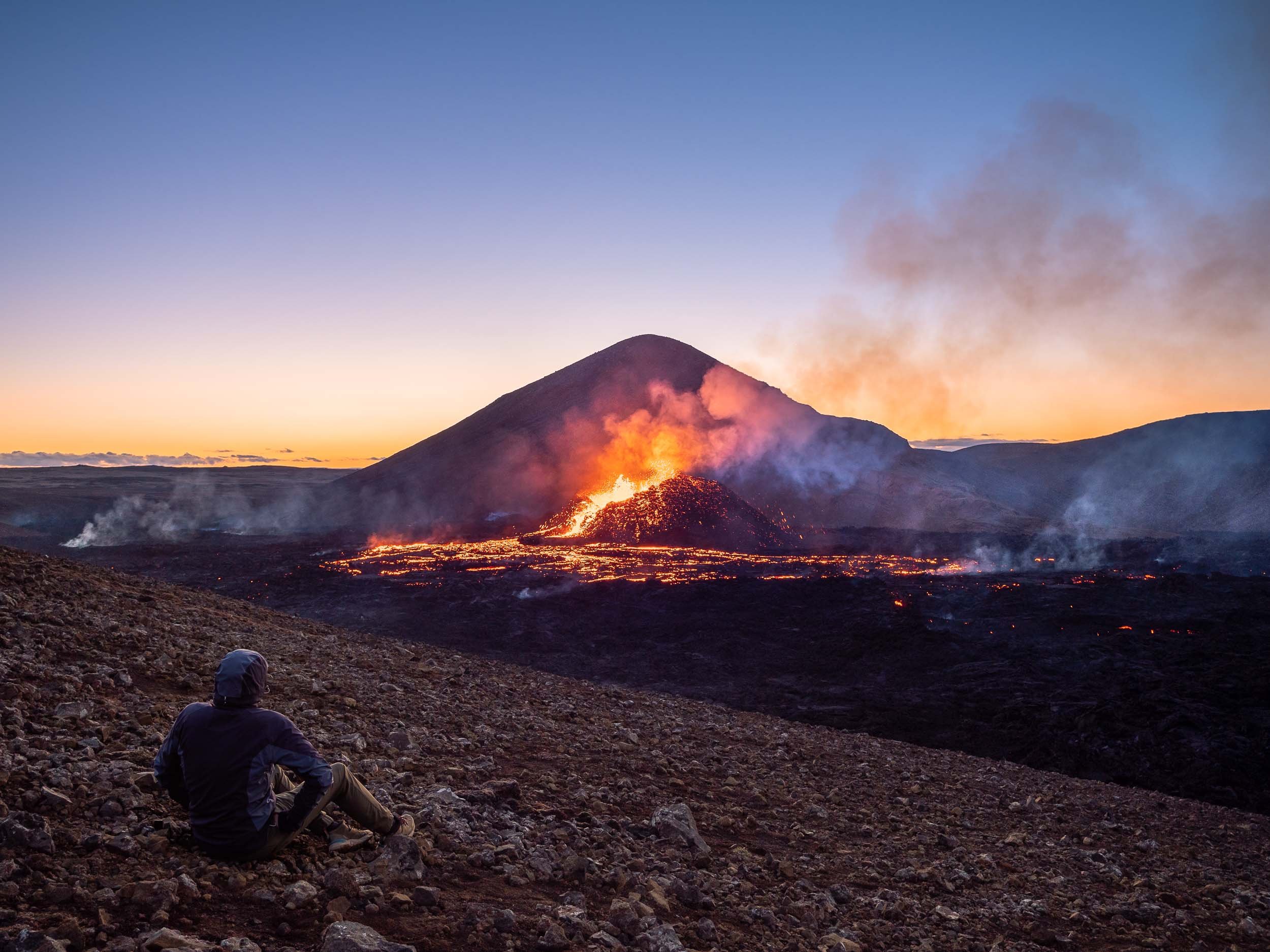
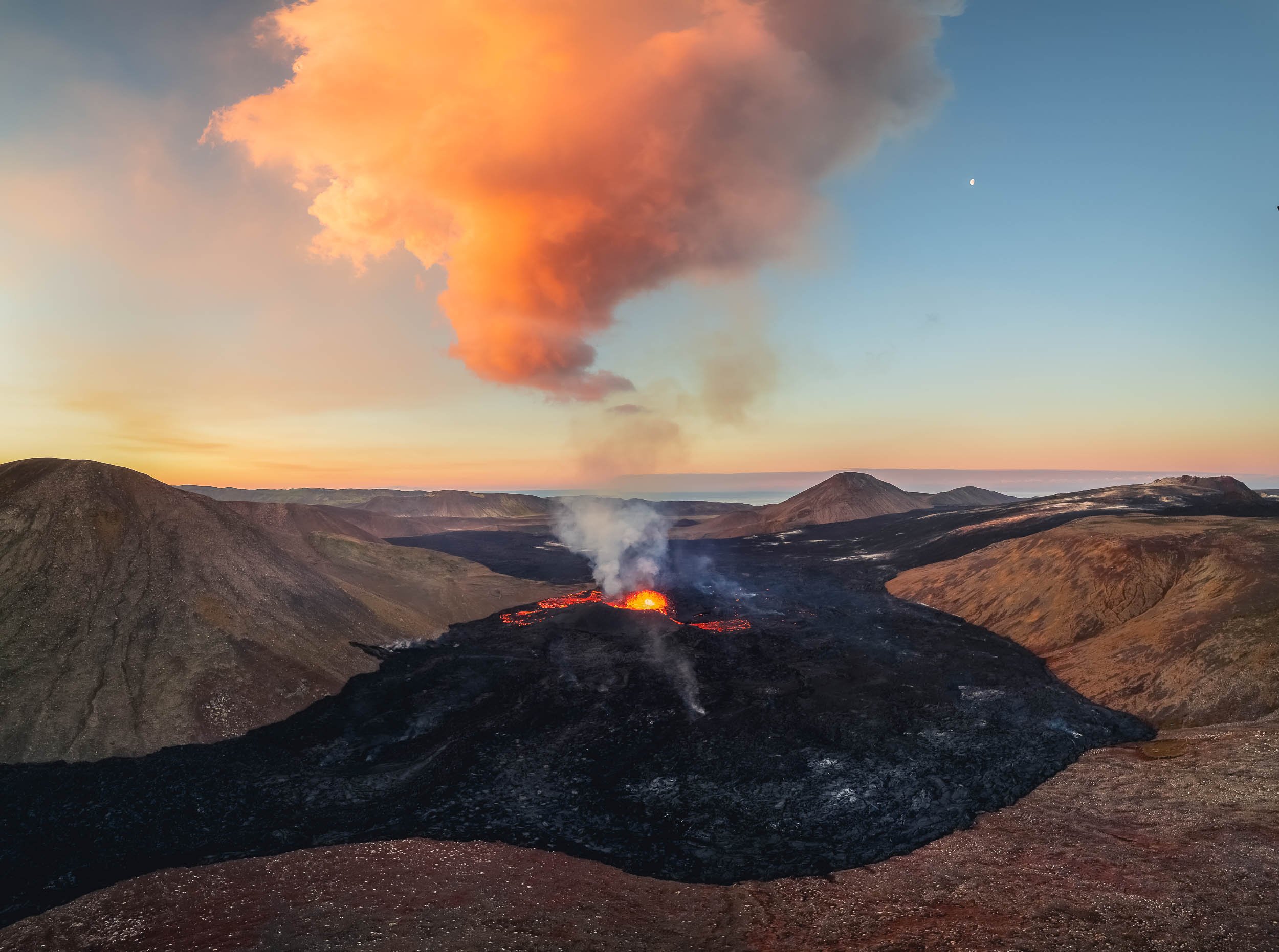
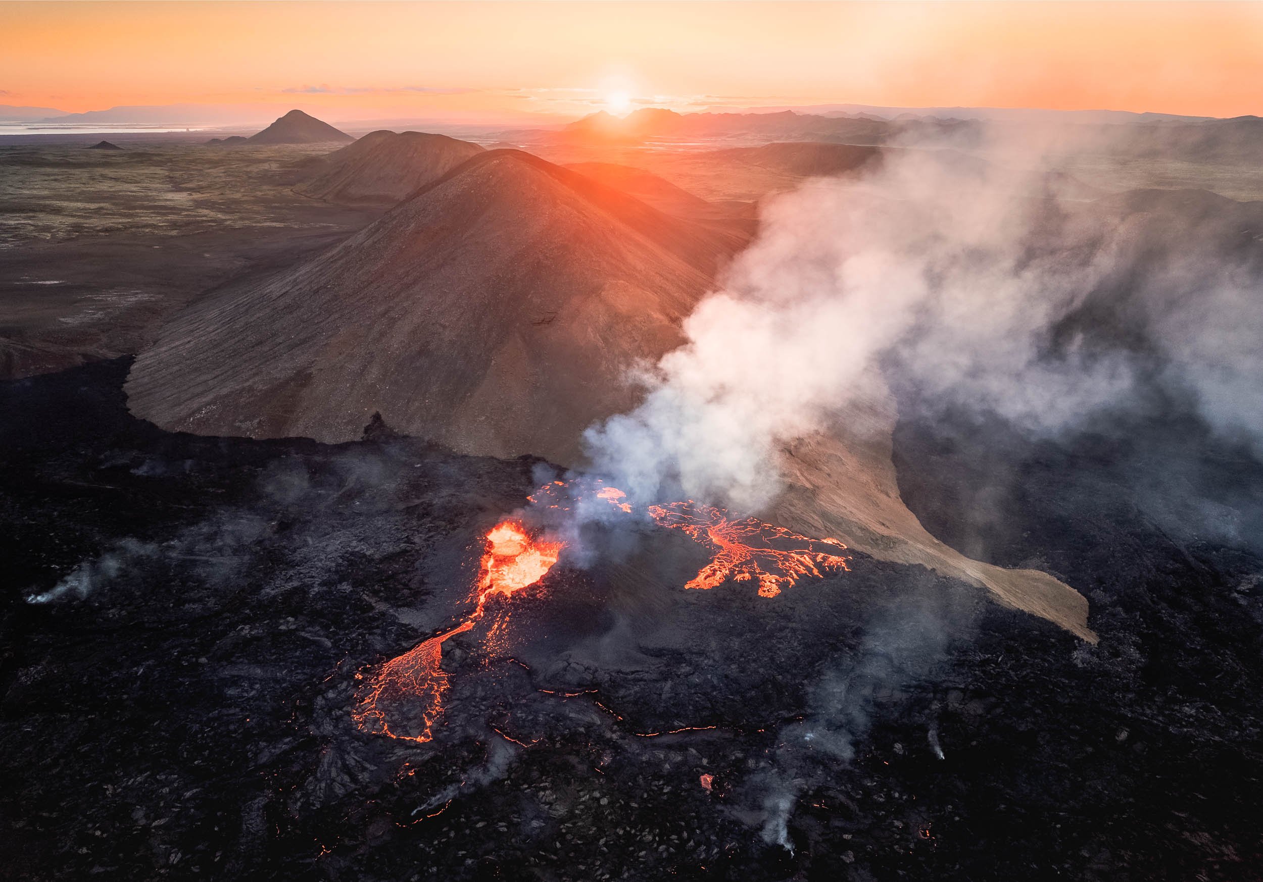


An Aerial View
While flying a drone makes for amazing imagery, your own perception still stays on the ground. Only a helicopter can change that, so after sunrise I went to Reykjavik to take a look from above with my own eyes.

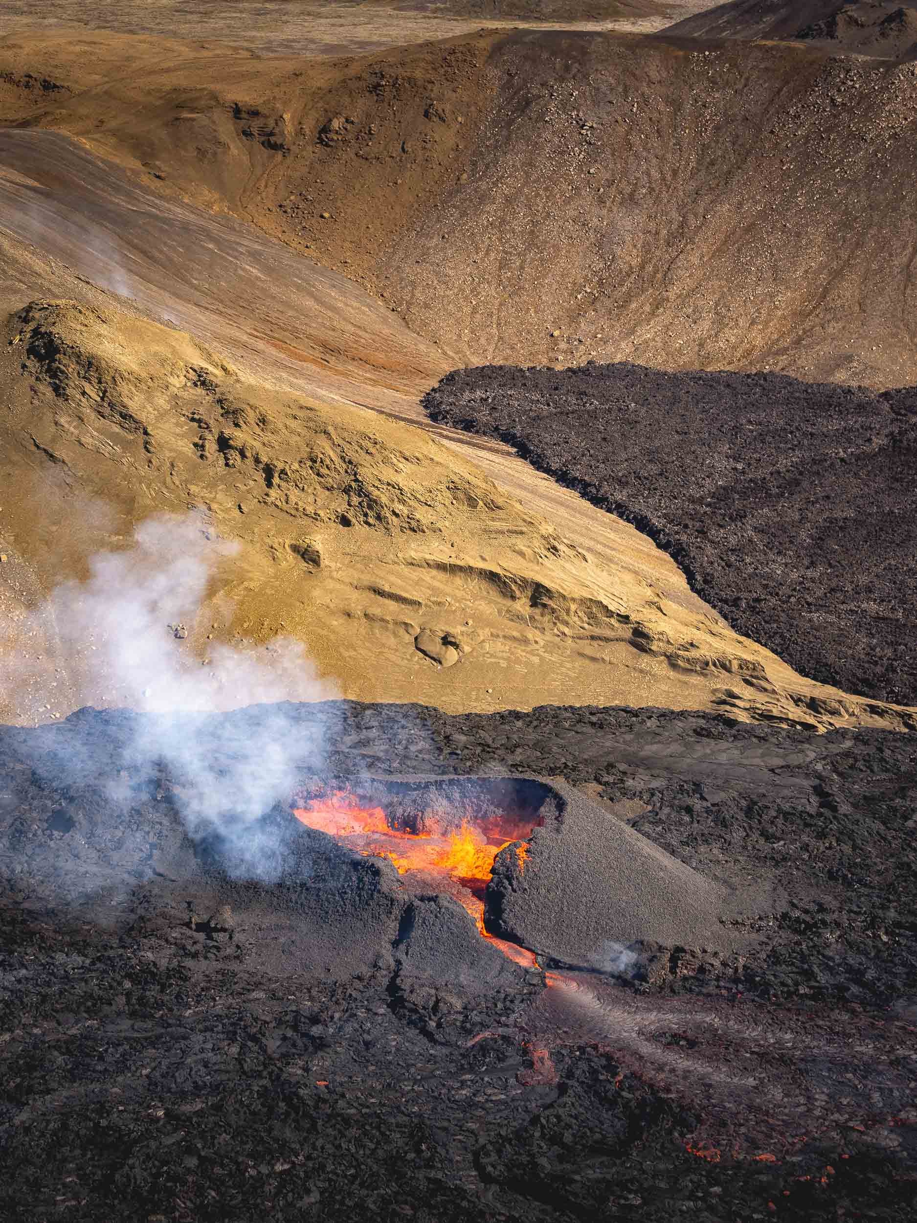
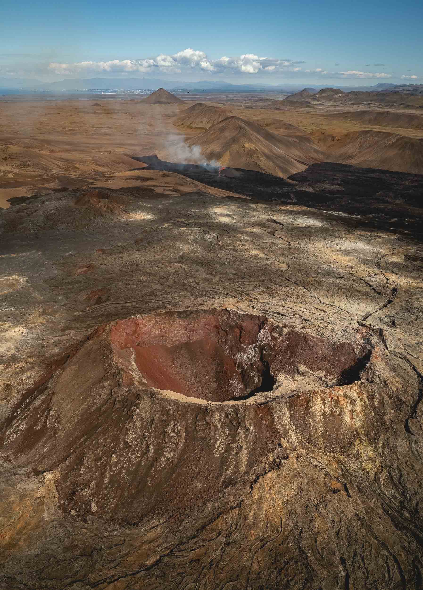
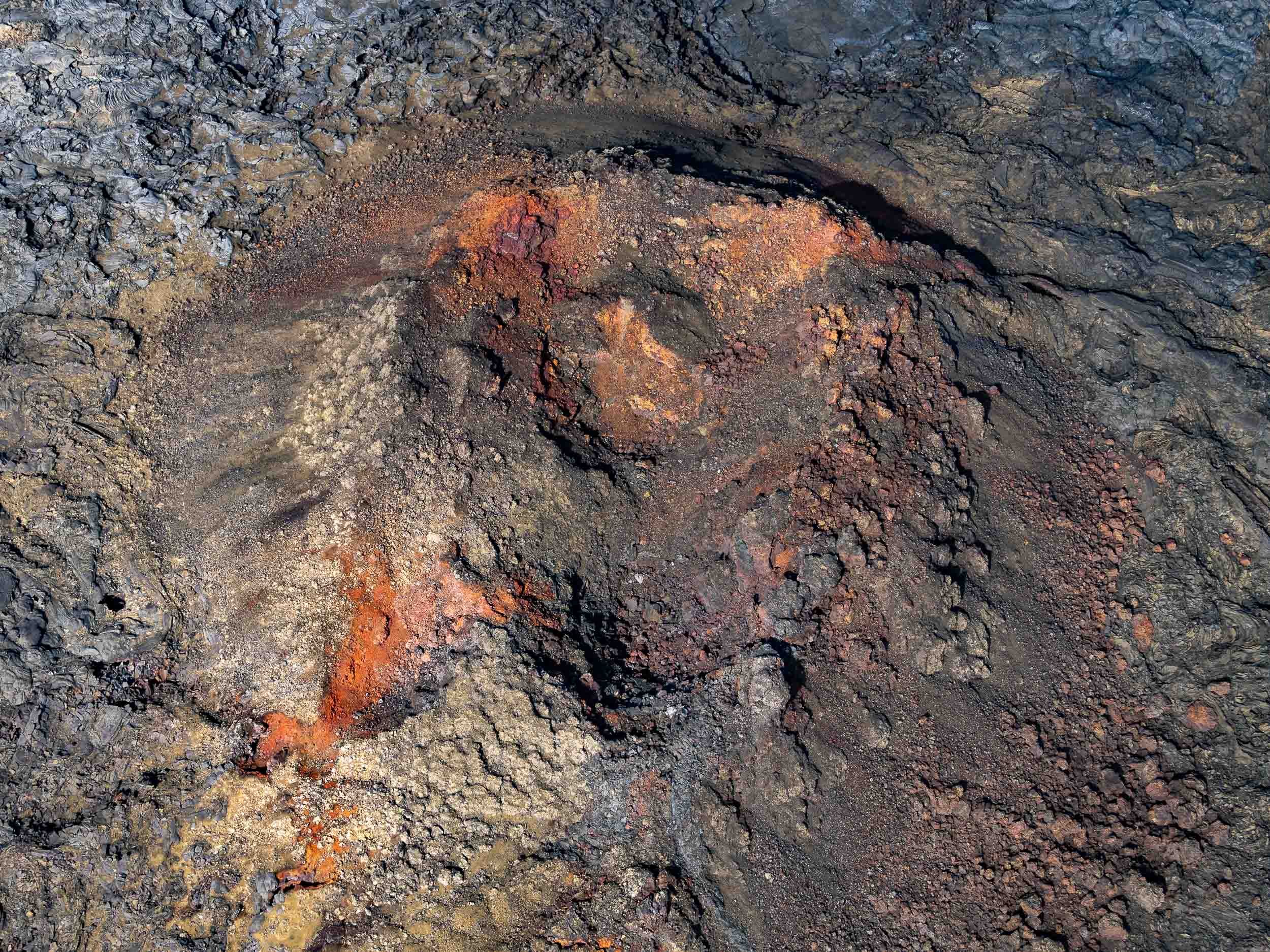
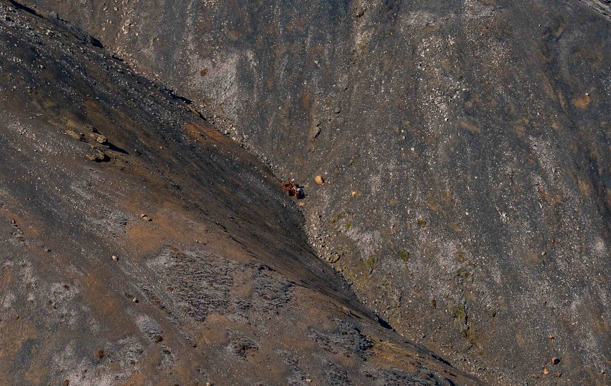
The flight also led us over a few more of Iceland’s beautiful landscapes.


The Last Attempt
After the helicopter flight I had planned to come back for another night before my 7am return flight, and started my trek before sunset in reasonably good weather. This was when I got to experience when they say that Icelandic weather conditions are unpredictable. 90min later, when I was just settling down at the volcano site, clouds, wind, and rain took over, making the experience of sitting on the hill completely unprotected a rather miserable one.
Since I really wanted to get a few more aerial shots, I held on for another 2h, catching a small break in the rain where I - despite heavy wind gusts - felt the drone would survive a short flight, before heading back to the car in the pouring rain for a few hours of sleep. I’d say it was worth it.
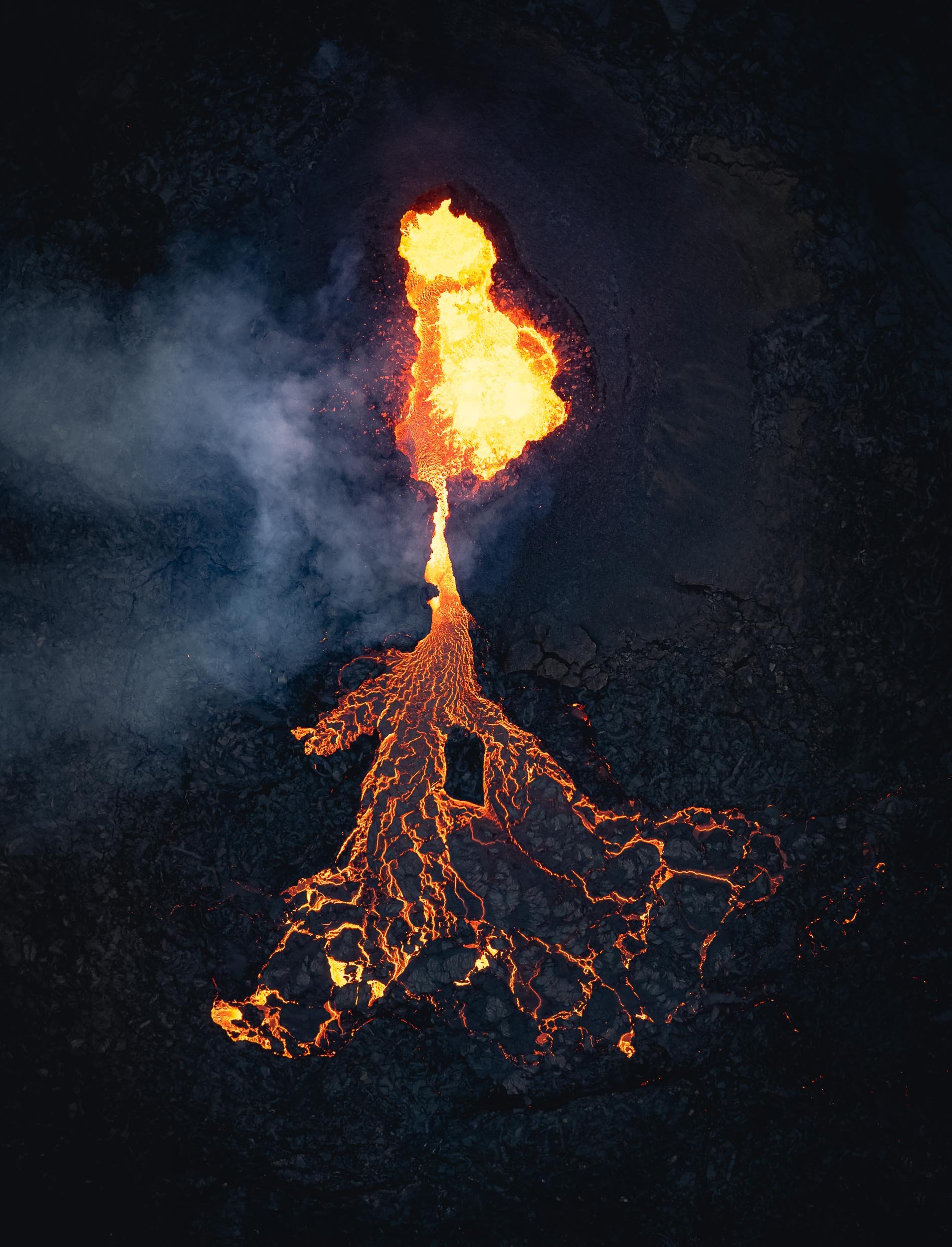
A Recap
Here is a timelapse sequence of the the evening , moonrise, and next day’s sunrise.
And that was 36h in Iceland - it was an expensive and tough journey, but I wouldn’t have had it any other way.

Alaska - The Last (and Vast) Frontier
Alaska - endless wilderness, bear country, the largest state, home to the tallest mountain in North America.

Alaska - endless wilderness, bear country, the largest state, home to the tallest mountain in North America, and a few random surprises. There’s a lot of beauty to be discovered here, as I learnt during my trip with Capture The Atlas.
From Anchorage to Kenai Fjords
Day 1 took us along a few interesting sights on the road from the state’s largest city (which is not its capital) to Seward, gateway to Kenai fjords, a National Park.
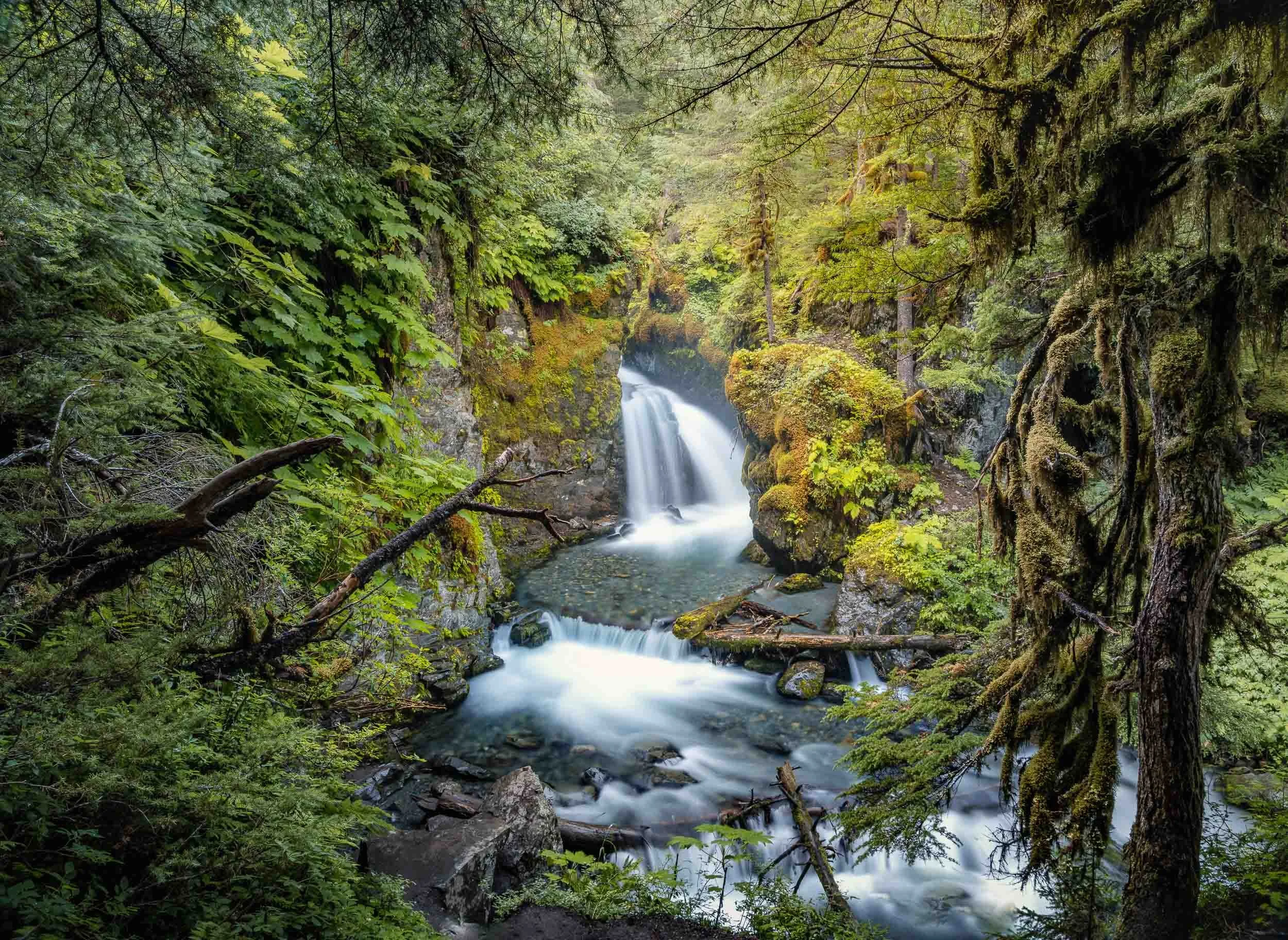

Byron Glacier
The second stop was Byron Glacier, an easily accessible glacier with a small ice cave, visible at the bottom of the aerial photo.


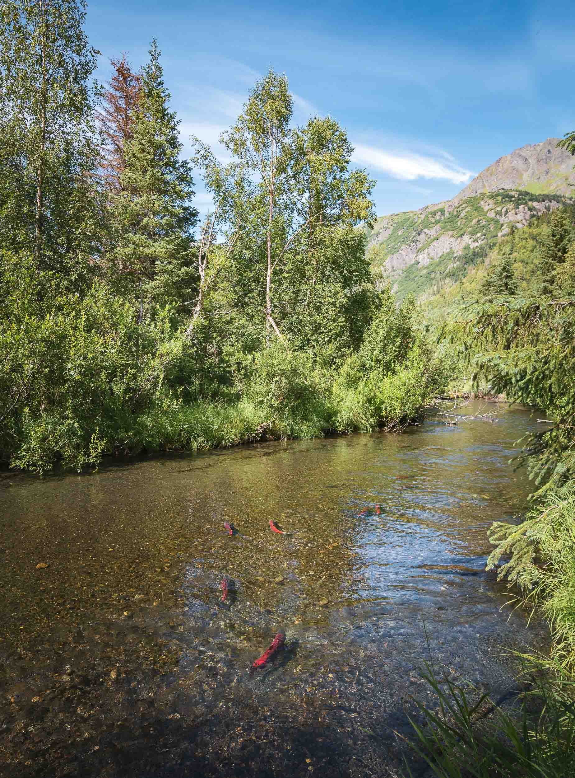
Exit Glacier
We had one more stop on the way to Seward, which was the aptly named “Exit Glacier” - it’s literally receding so quickly, it may be gone within our lifetime. Signs along the trail show how its terminus moved over the last 200 years, and the speed by which it does can hardly be described as glacial - up to 100m a year.


The Kenai Fjords
A boat cruise into the smallest national park of Alaska was next on the agenda. While the size of the park may not compare to others in the state, it does contain the largest ice field in the US at almost 2000 sqkm, with almost 40 glaciers feeding from it.
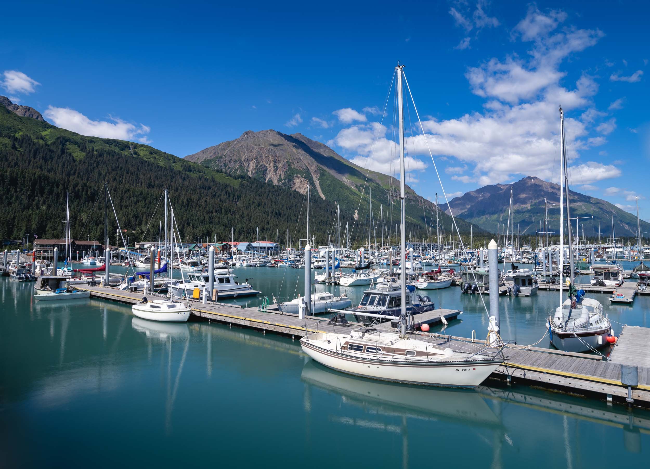
Wildlife Sightings
The area is home to varied wildlife, and we spotted puffins, sea otters, harbor seals, and a humpback whale.


Our destination was Aialik Glacier in the namesake bay.


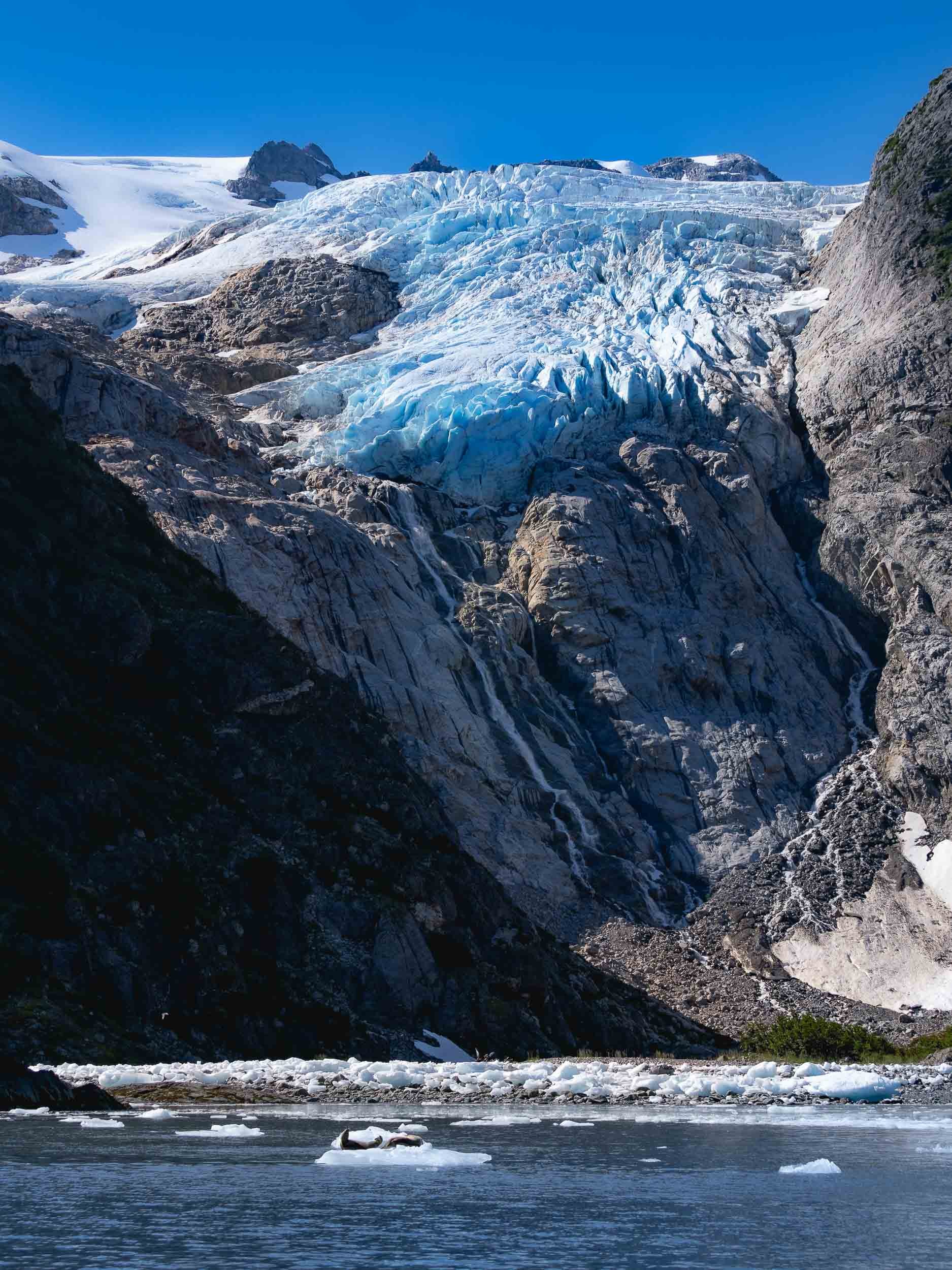
Bears of Crescent Lake
From Kenai we took a flight over the beautiful landscapes (more on that later) towards a turquoise lake across the Cook Inlet, with the goal to find and photograph brown bears. In fact, three of them acted as our greeting committee, sitting by the shorelines while the floatplane approached the lake, but quickly hiding in the bushes as we landed on the water.
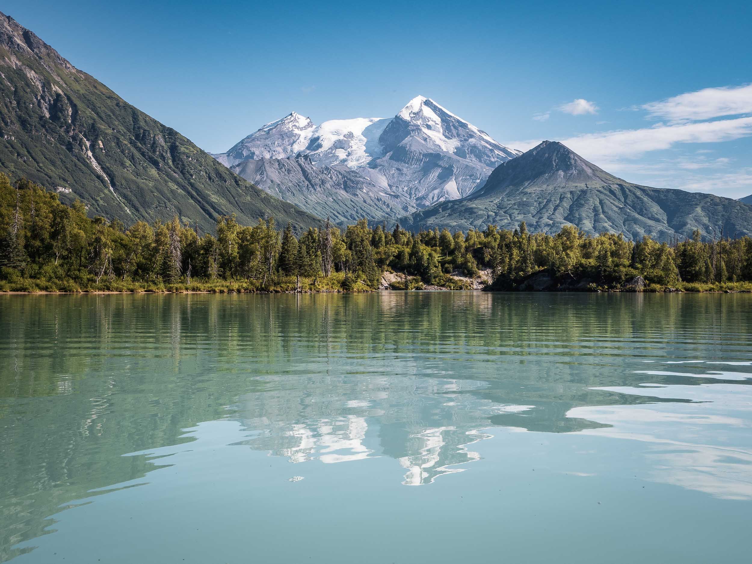
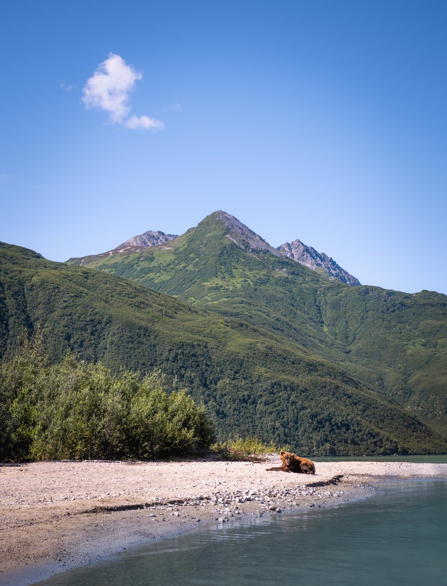


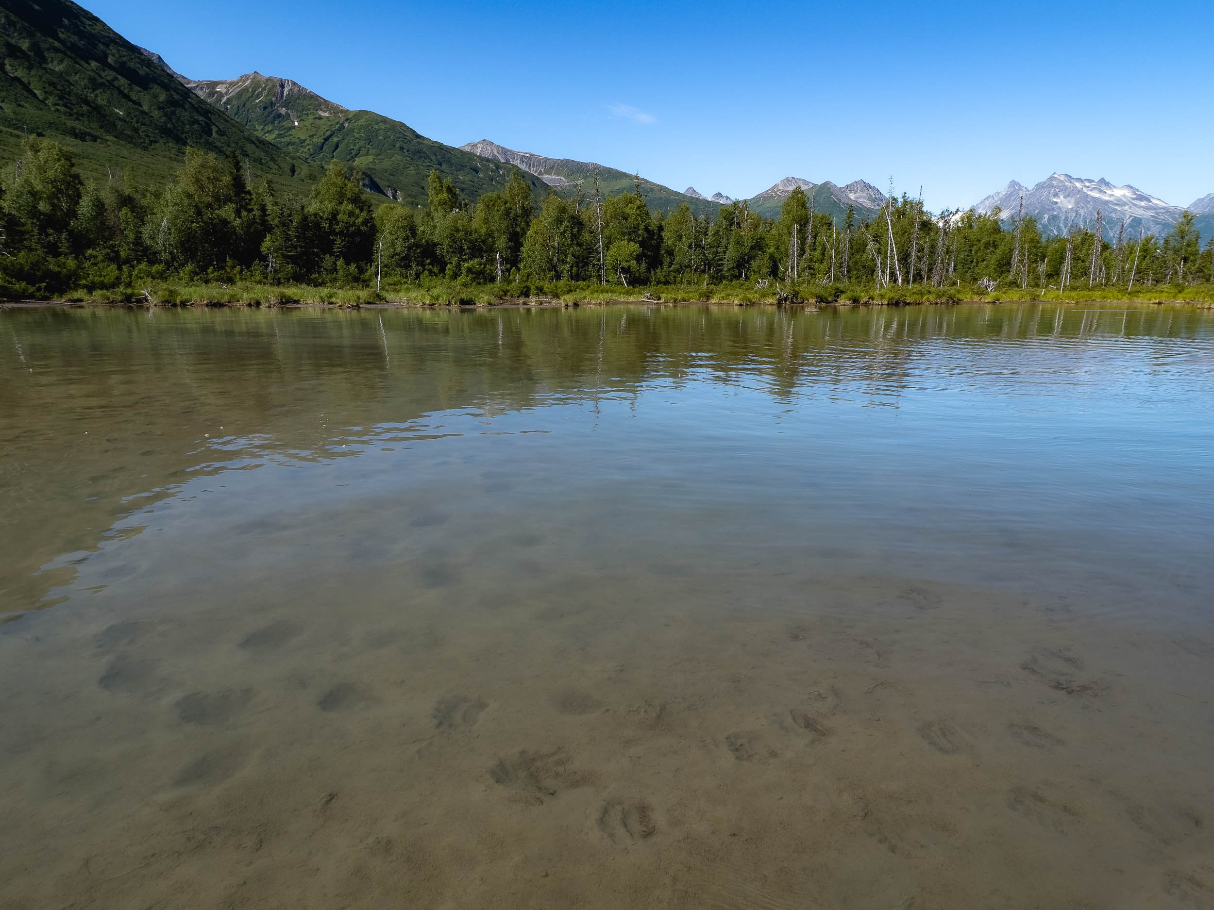
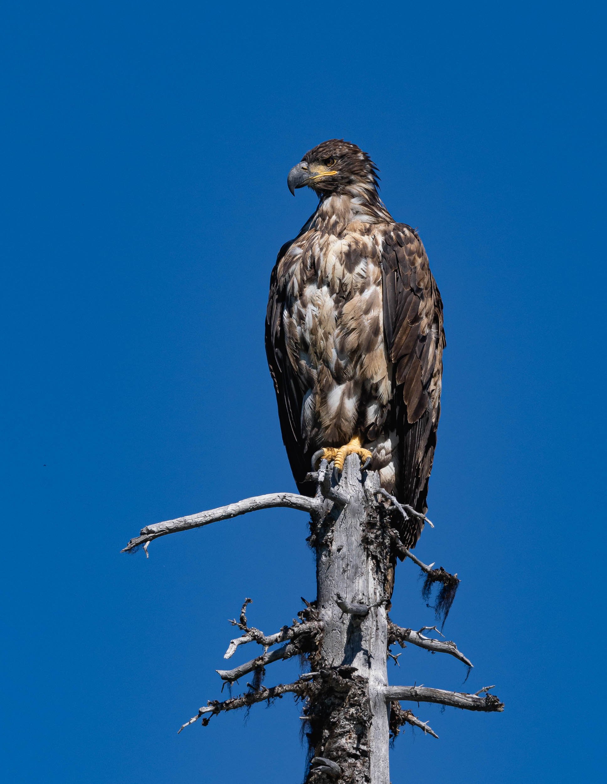
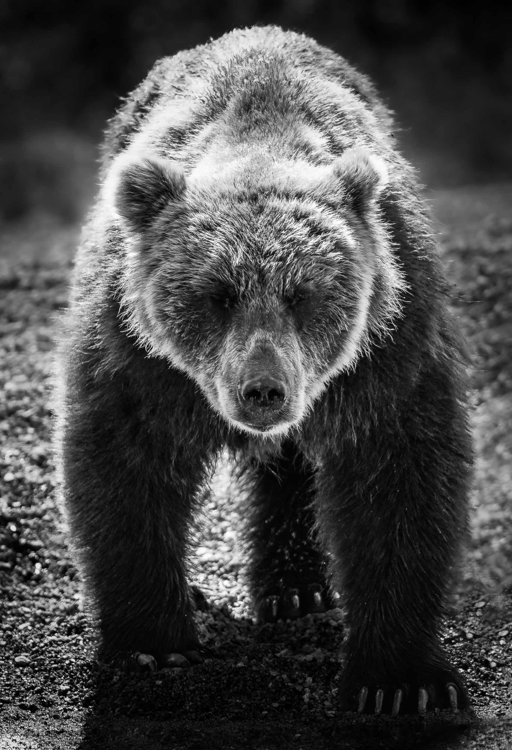
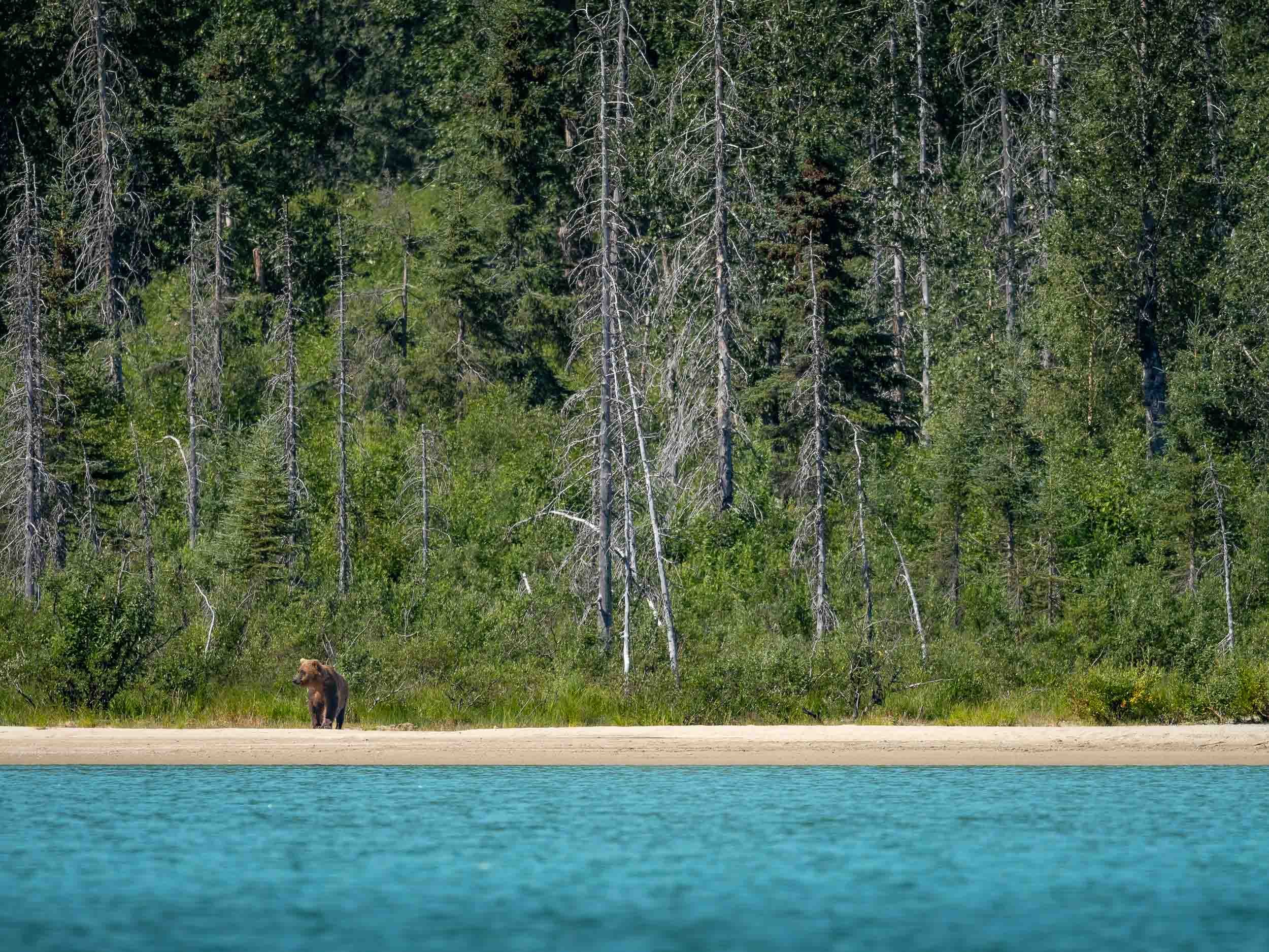
Back in Anchorage, a scenic Flight, and another (attempted) Bear Tour
From Anchorage we took a flight to Chinitna Bay for another bear tour in a different environment.
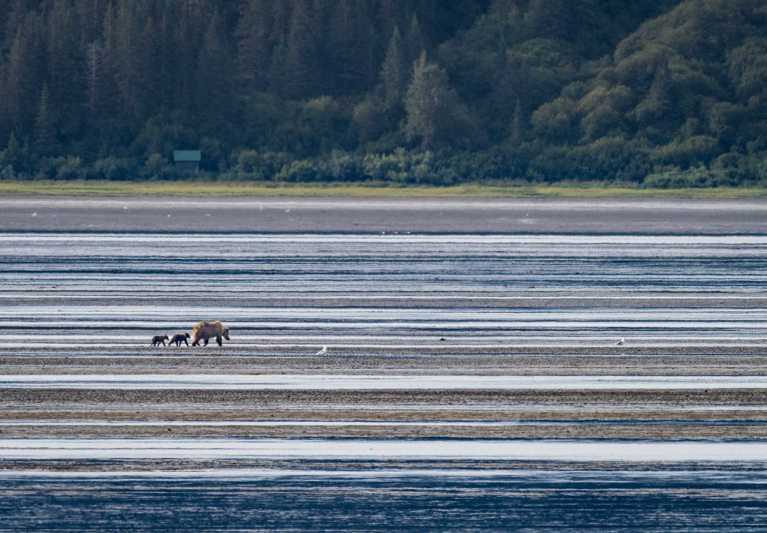
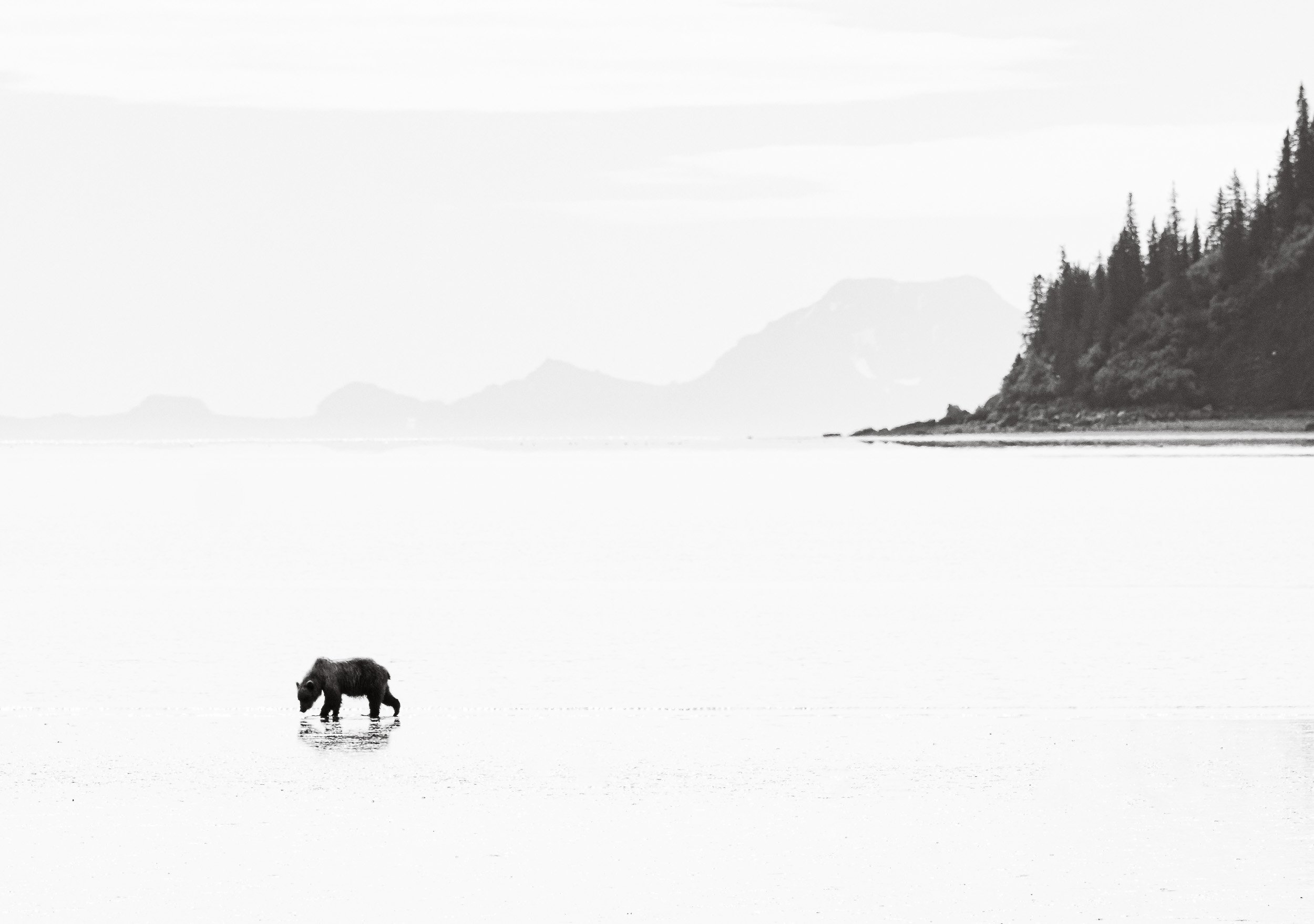
Shapes & Colours
The flight to and from the location partly made up for this disappointment though, as the views of the Alaskan landscapes, volcanoes, mountains, and ground patters were incredible.


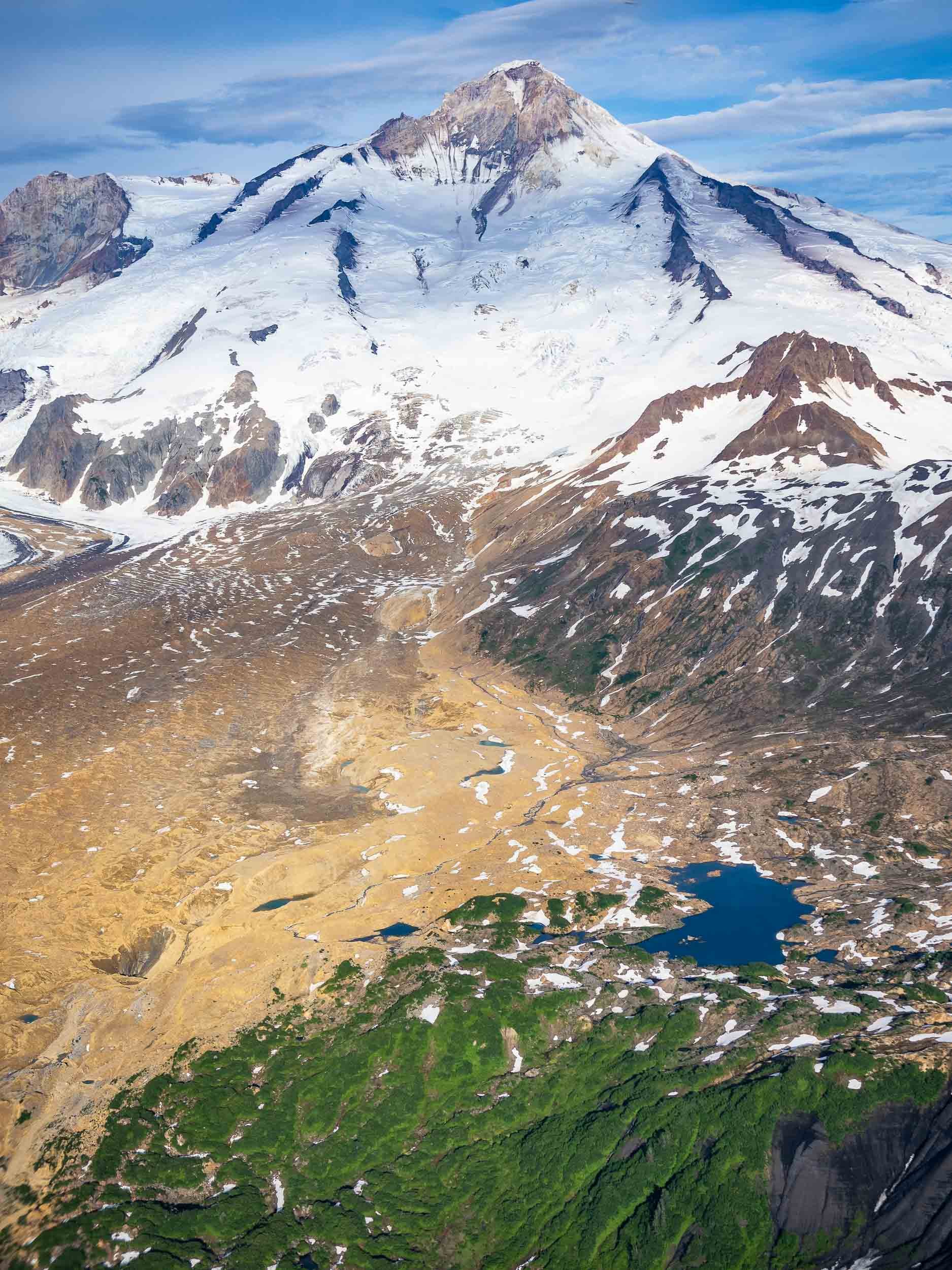
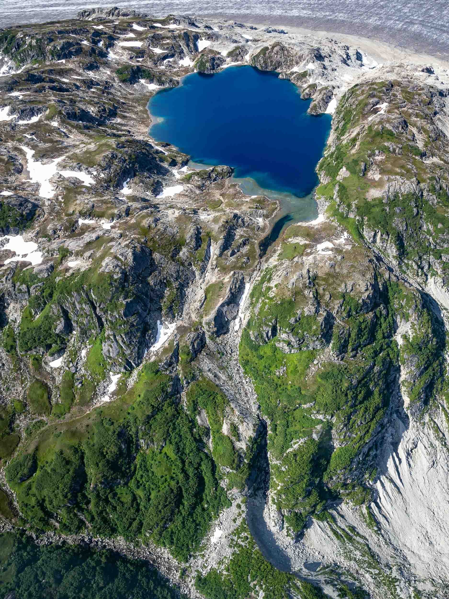
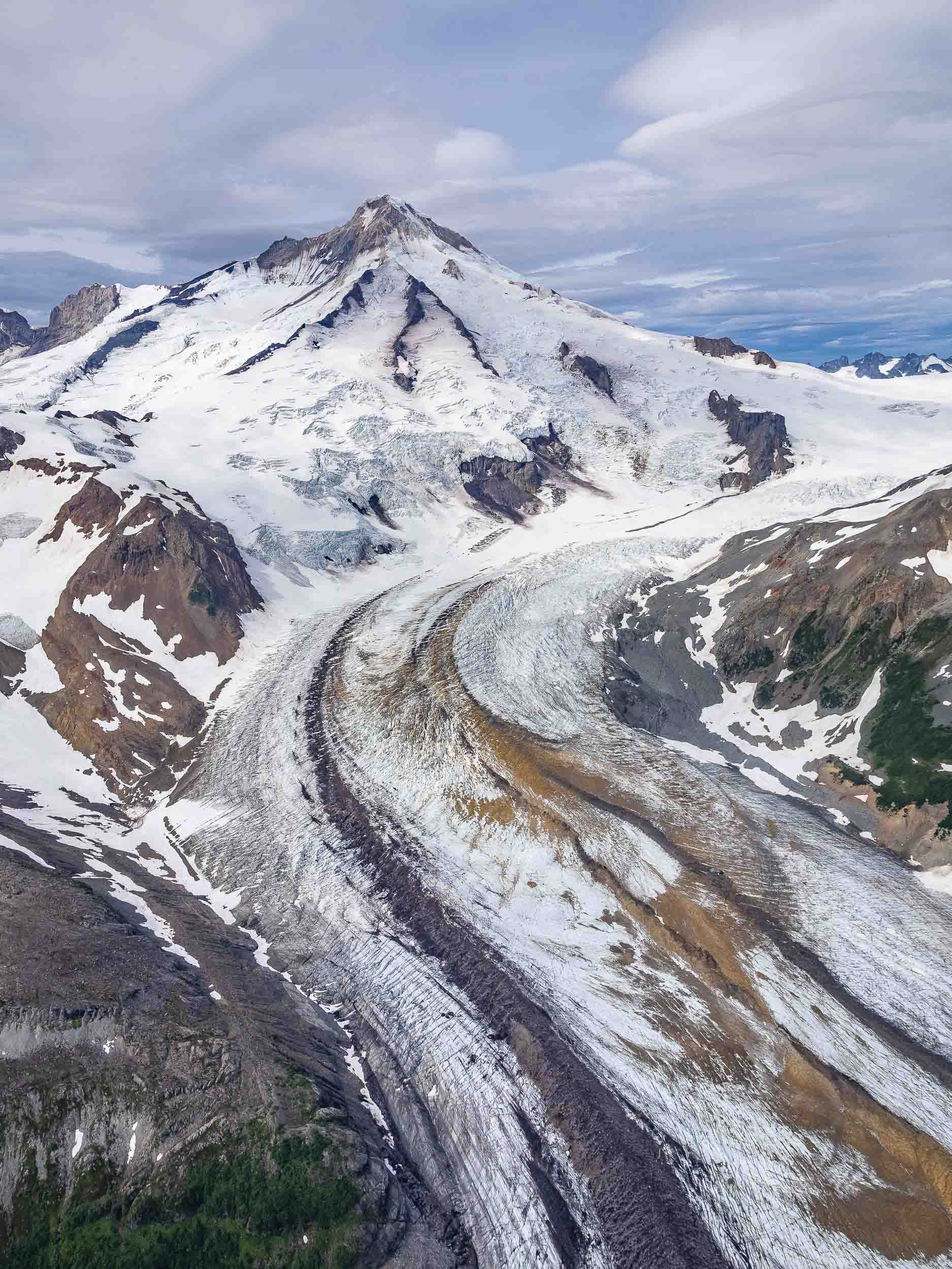
Valdez - Waterfalls and Kayaks
The next drive took us the small town of Valdez, at the head of a deep fjord in Prince William Sound. The journey is a beautiful one, past several glaciers and into canyons where one waterfalls follows the next.


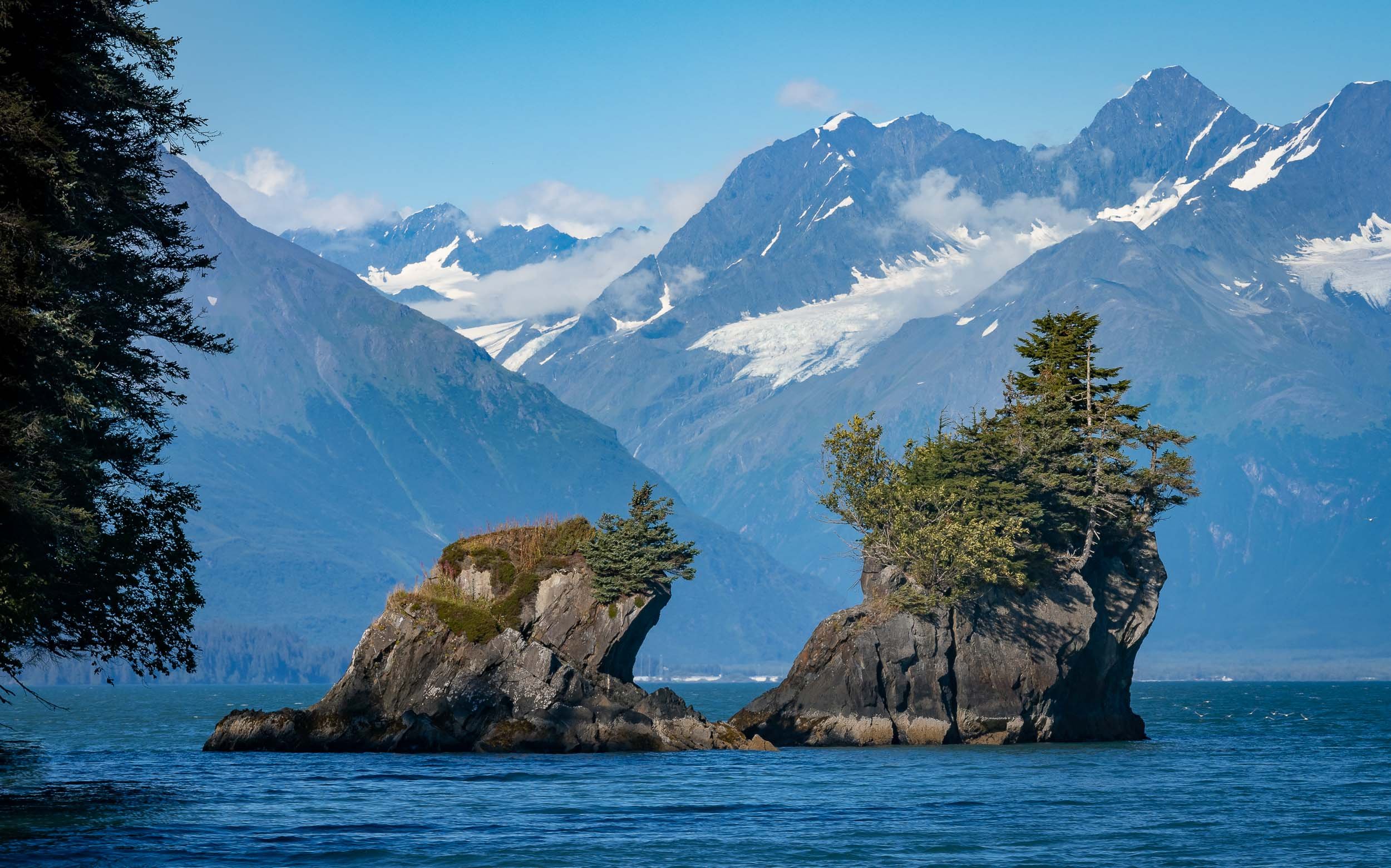
Next was a full day boat trip towards the end of the Valdez arm into the Columbia bay, home to one of the fastest moving glaciers in the world.

What was very special here is the fact we switched to a smaller and more manual method of transport once we reached the glacier - a Kayak. Moving through the ice like this was a very unique way to experience and explore the tidal glacier and the many icebergs originating from the calving of its terminus.
From Above
We had the chance to fly our drone from a small beach, providing some spectacular views of the landscape - and its inhabitants.


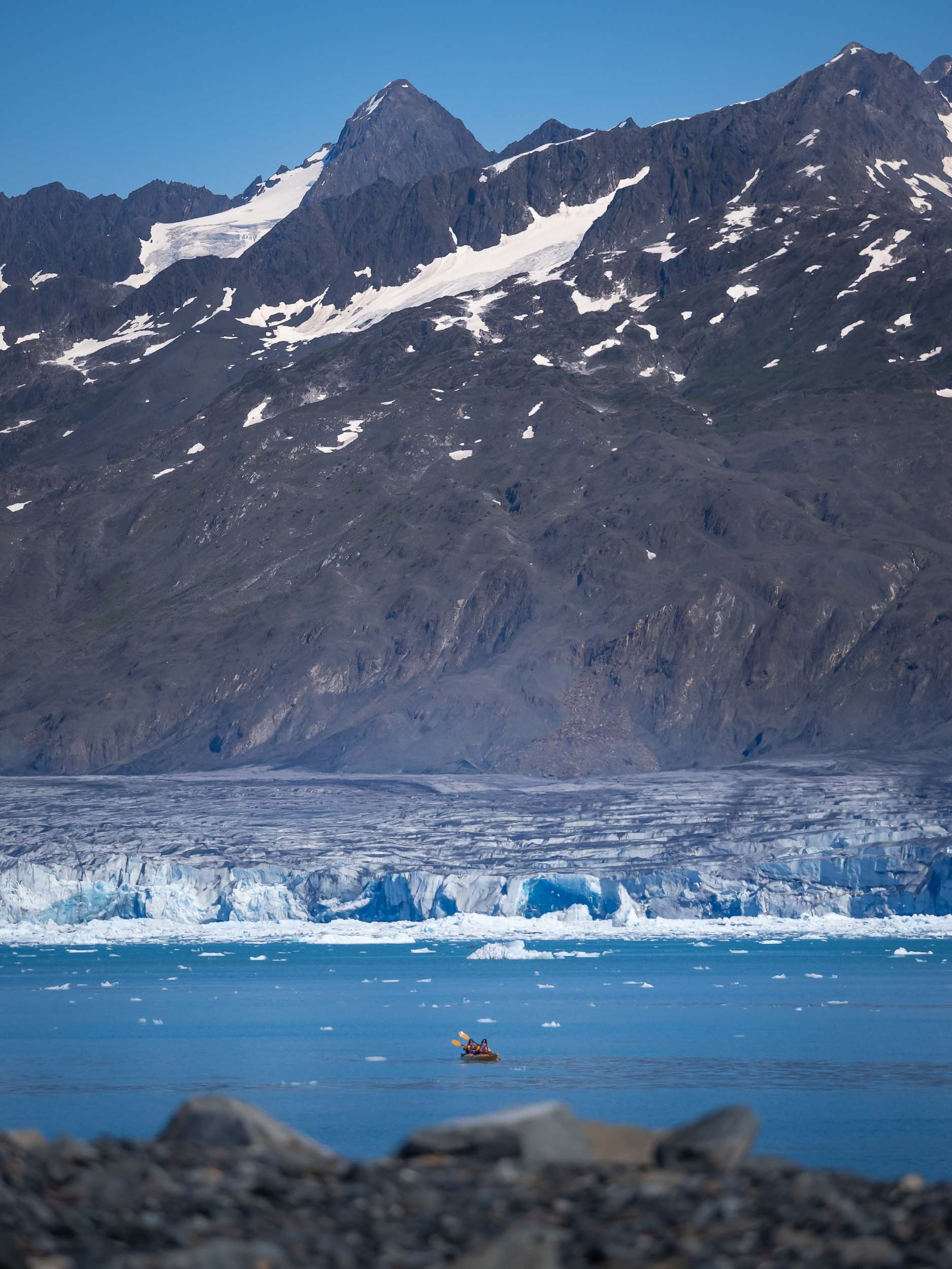


Sea Life
Aside from some chilled otters, we also spotted Steller sea lions, a near threatened species that had significantly declined since the 1970s but is slowly making a comeback, as well as porpoises, although getting a photo of them proved to be tricky.
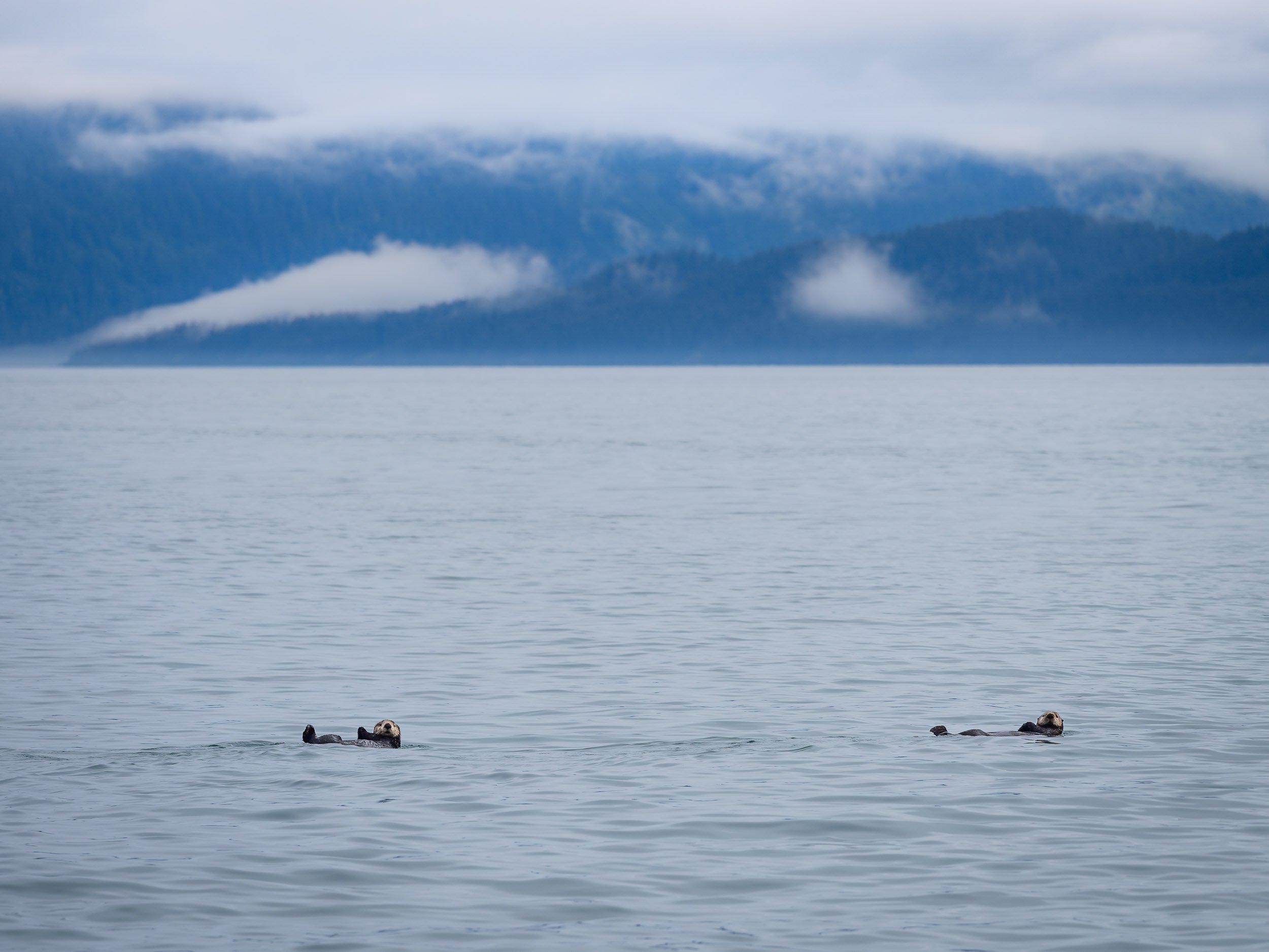


The Matanuska Glacier
On our way back from Valdez we crossed the Thompson pass, and on the next morning Alaska had one more glacier experience to offer: This time, we got even closer than in the kayak, since it is possible to hike on this icey giant.
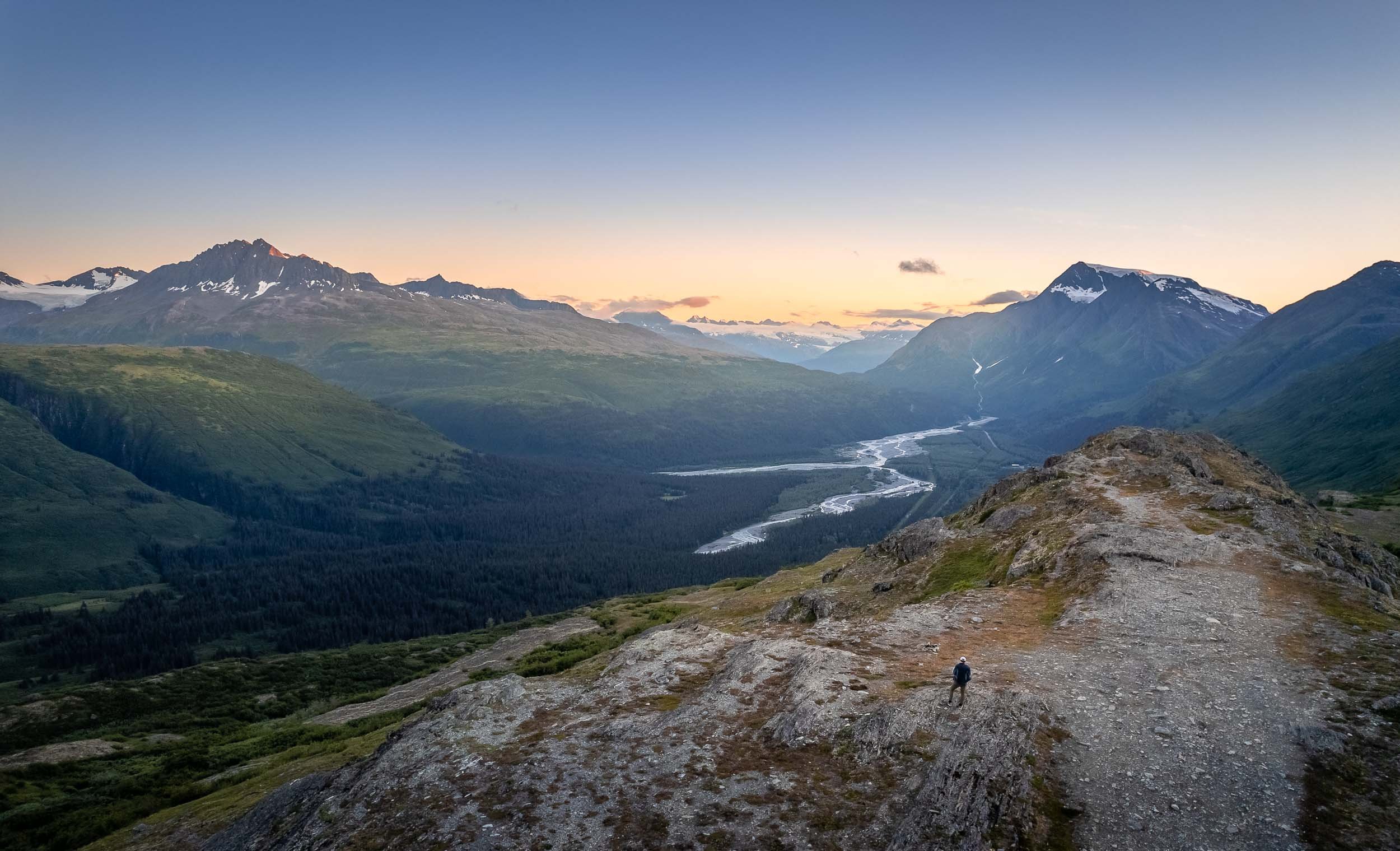
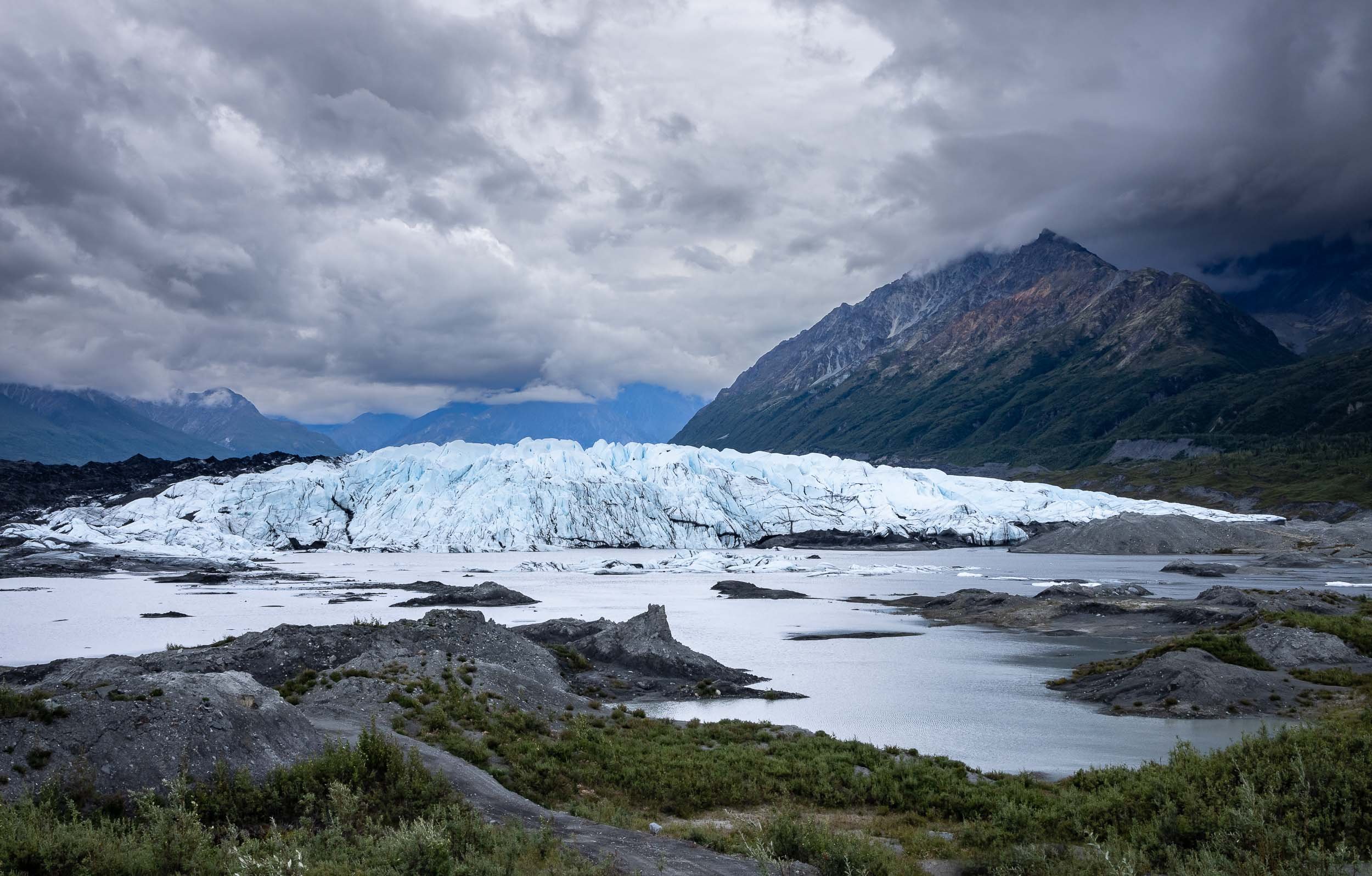
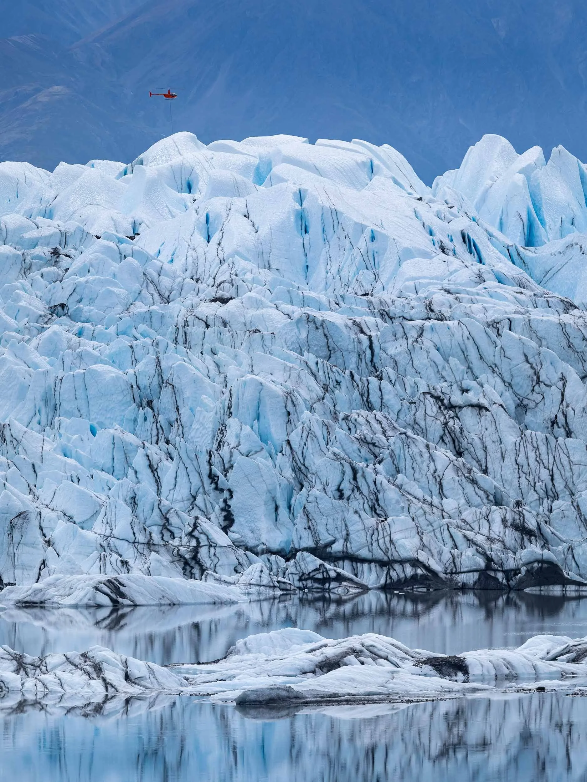
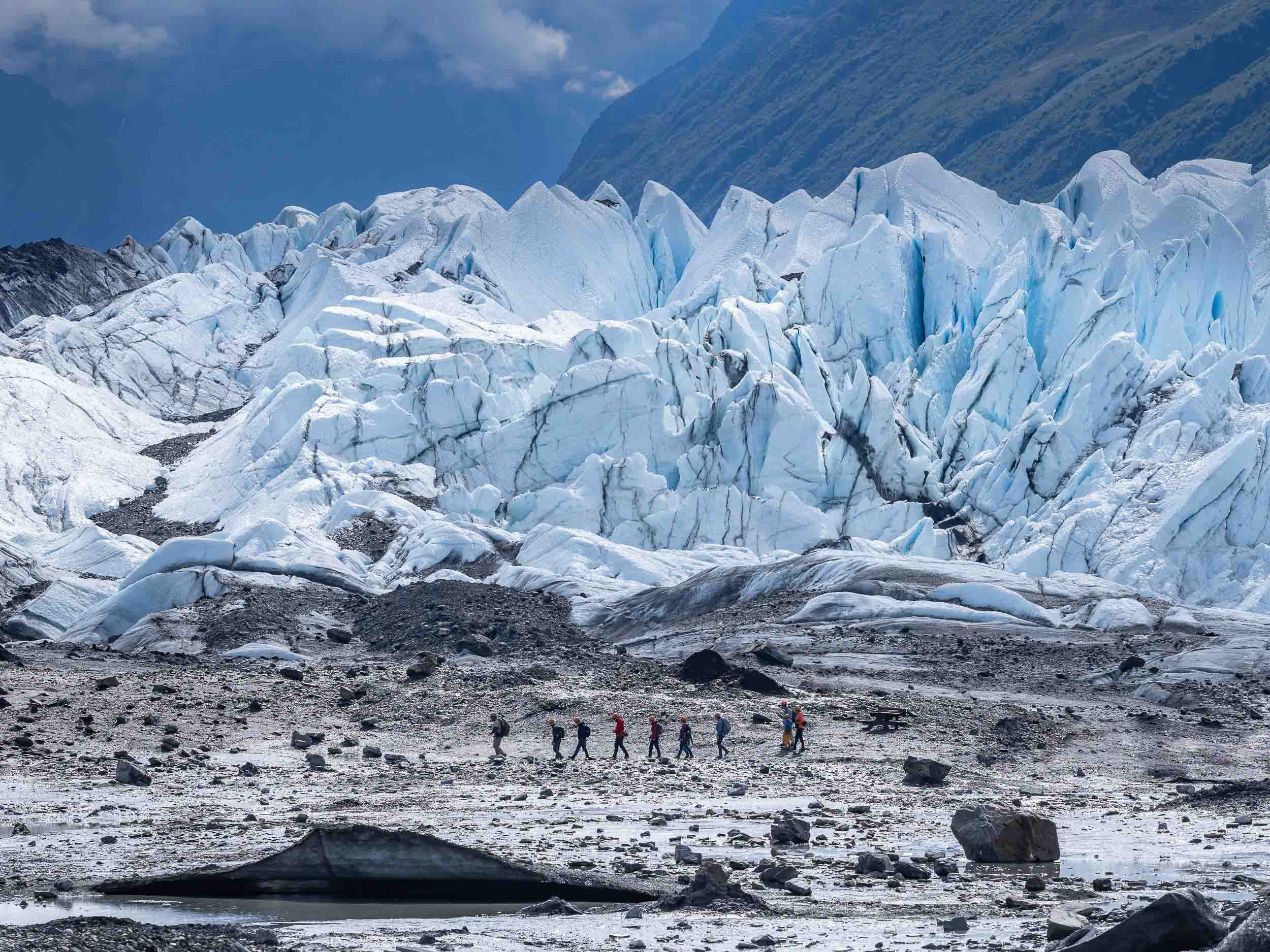


Alaska’s Most Unique House
The next destination was Denali National Park, and the road northwards also leads to a rather peculiar building better seen from the air: Goose Creek Tower, or colloquially “Dr Seuss House”.
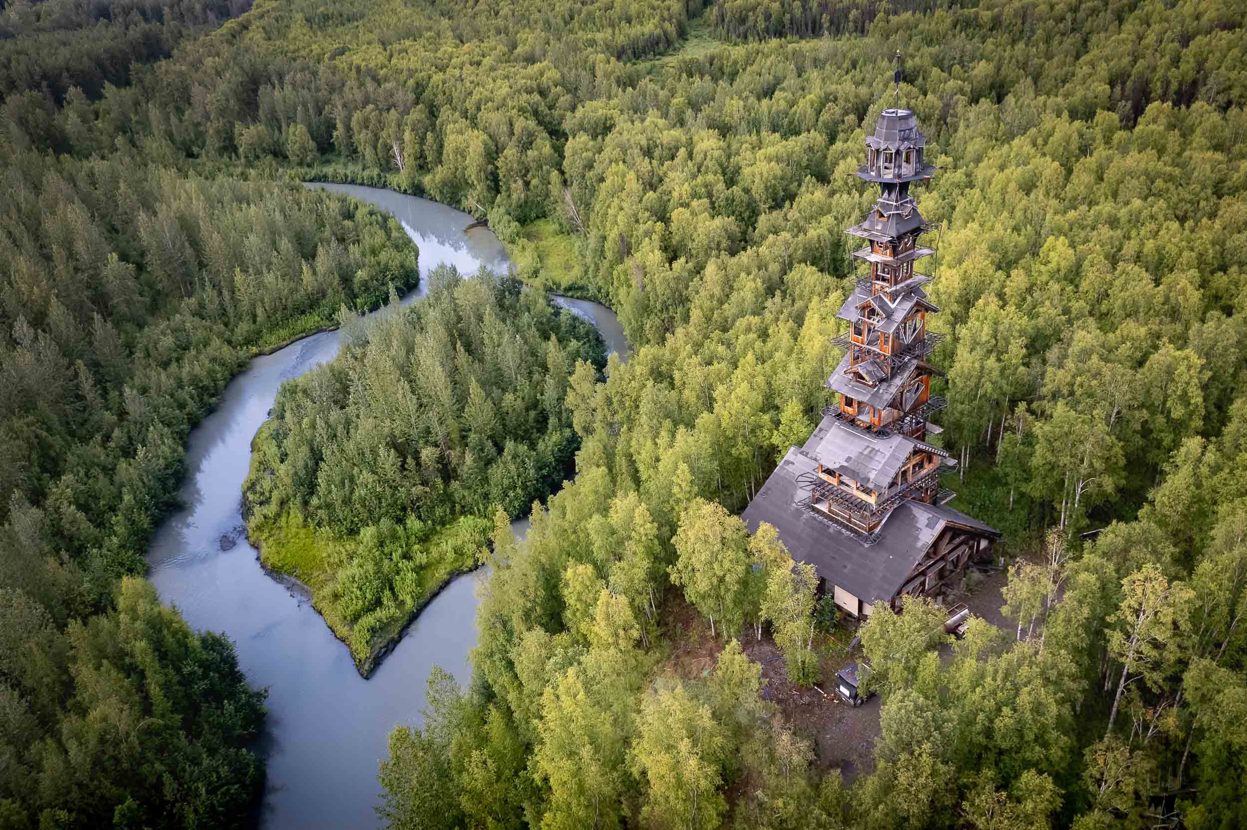
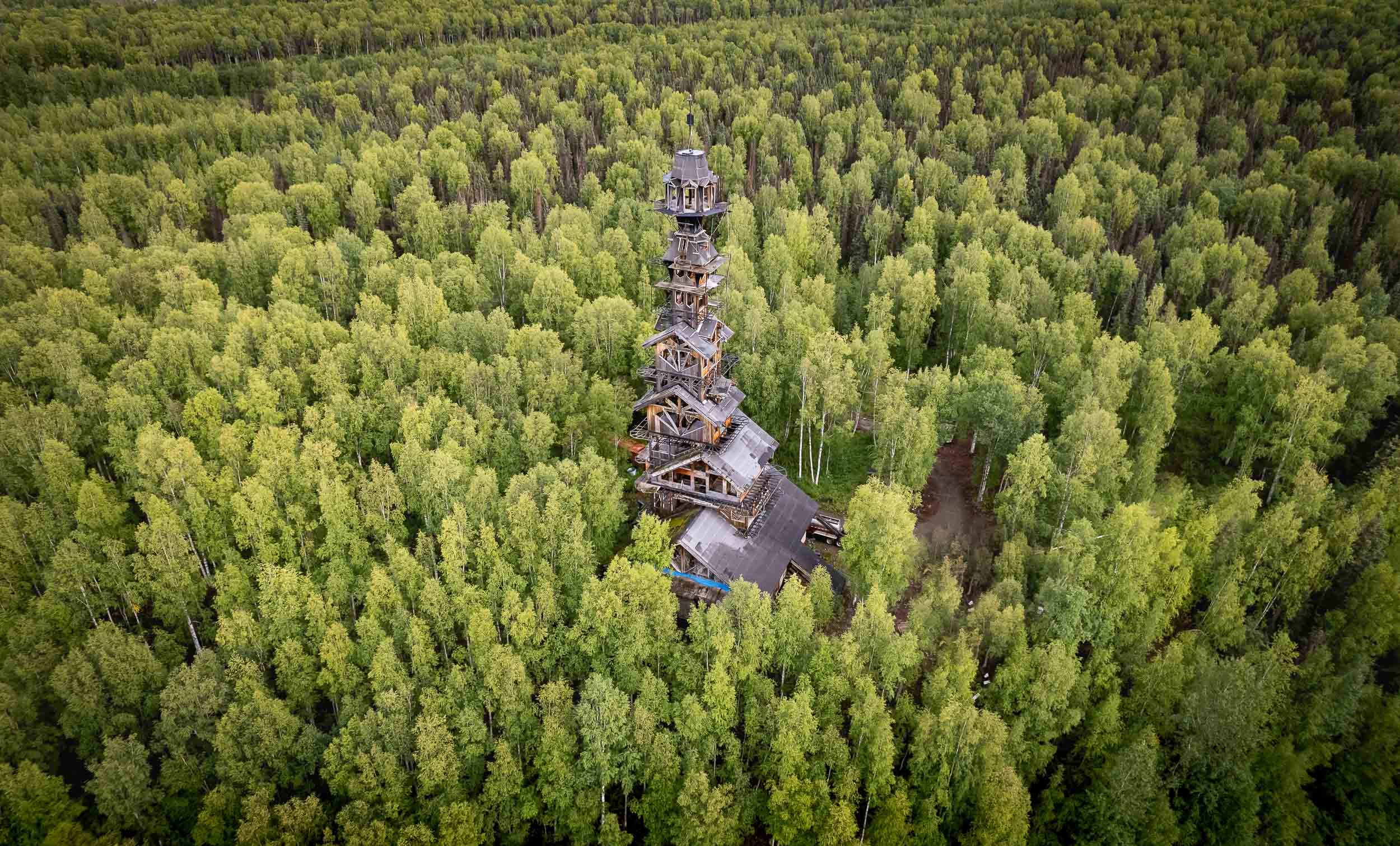
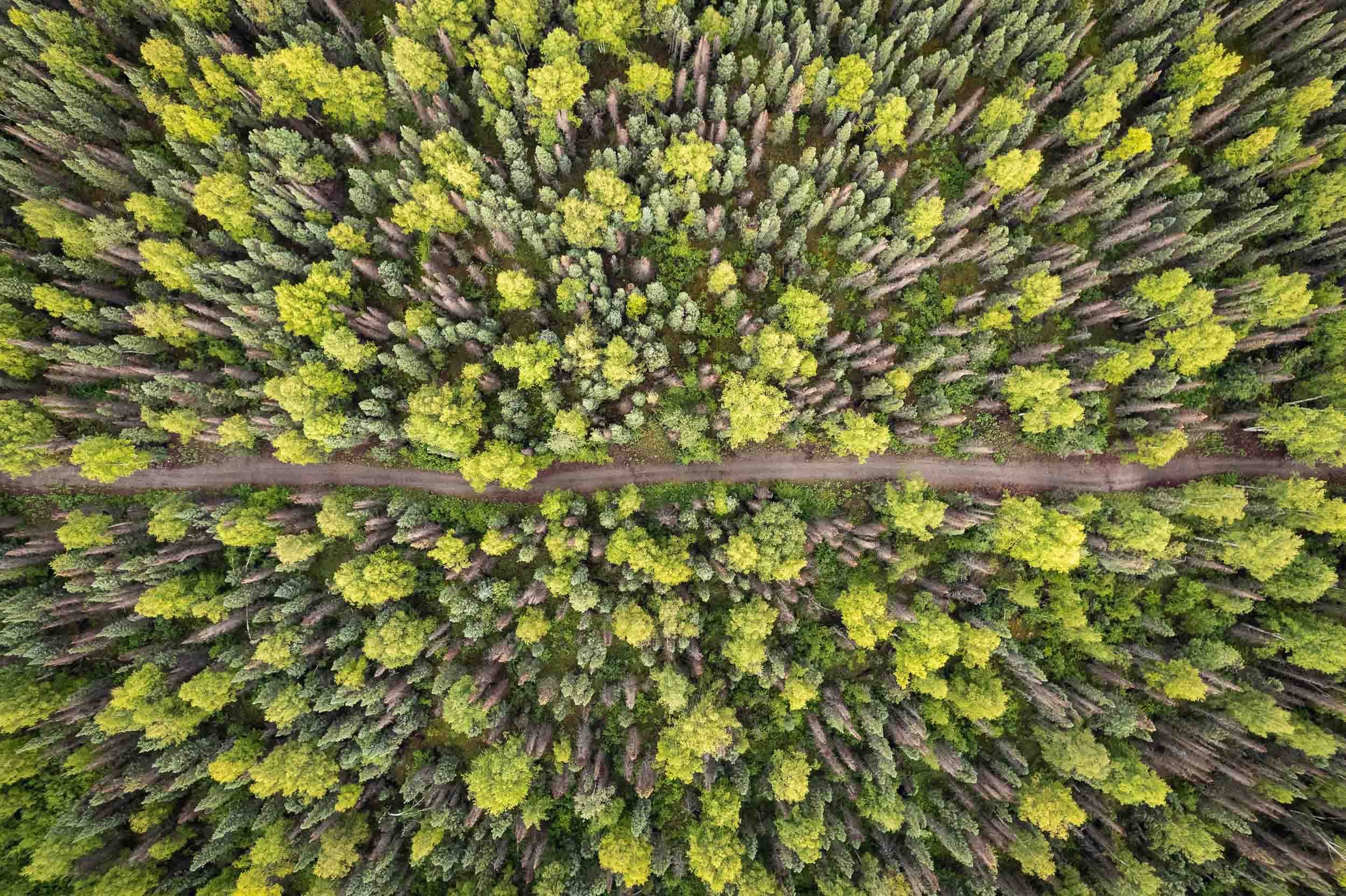
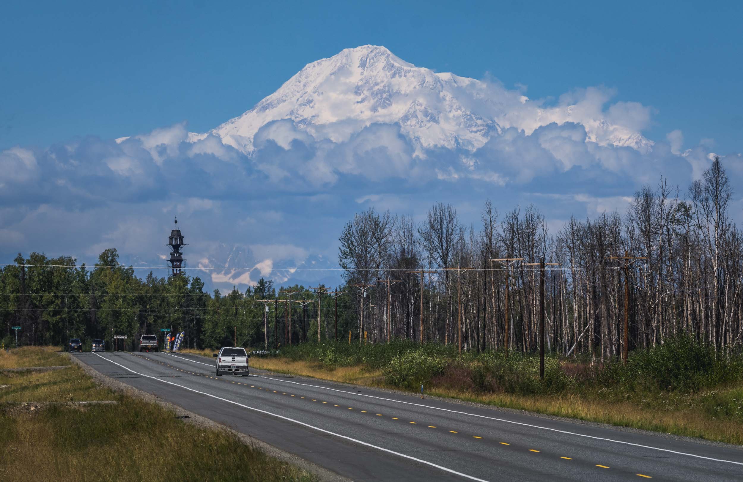
Denali - a National Park and North America’s tallest Mountain
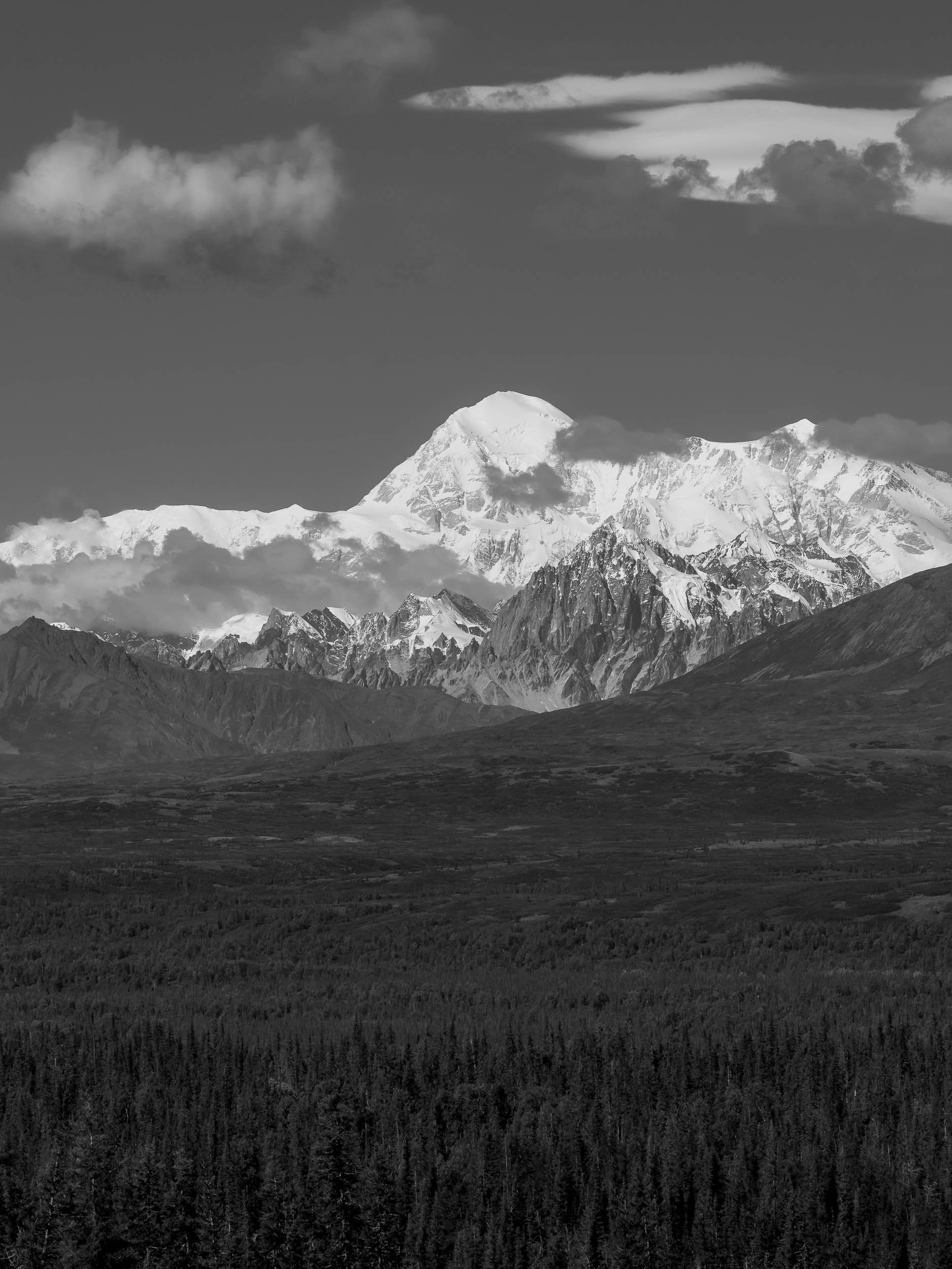
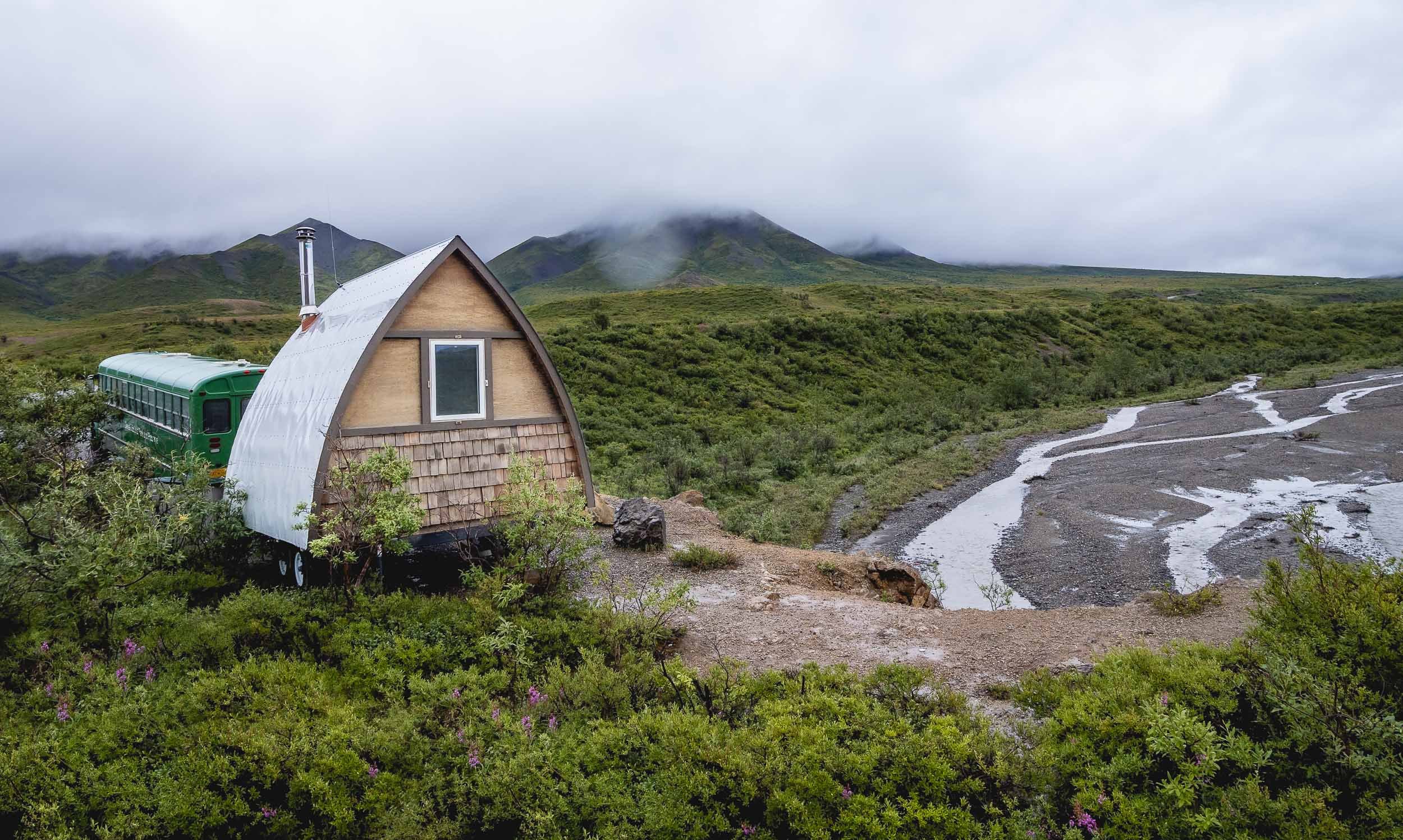
However, the next morning we had the chance to take a (dry) walk around Horseshoe lake, which features beautiful scenery reflected in the still lake waters, and a few beaver architectural masterpieces.
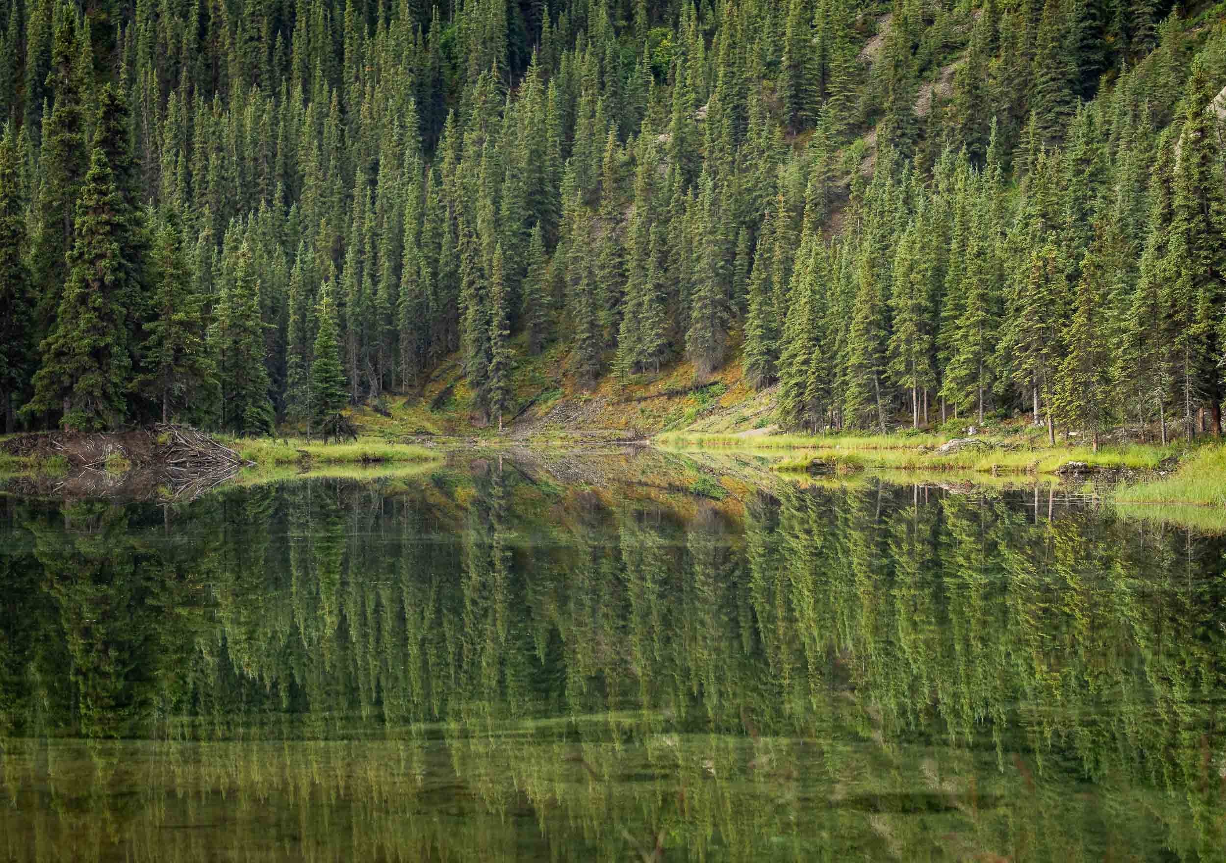


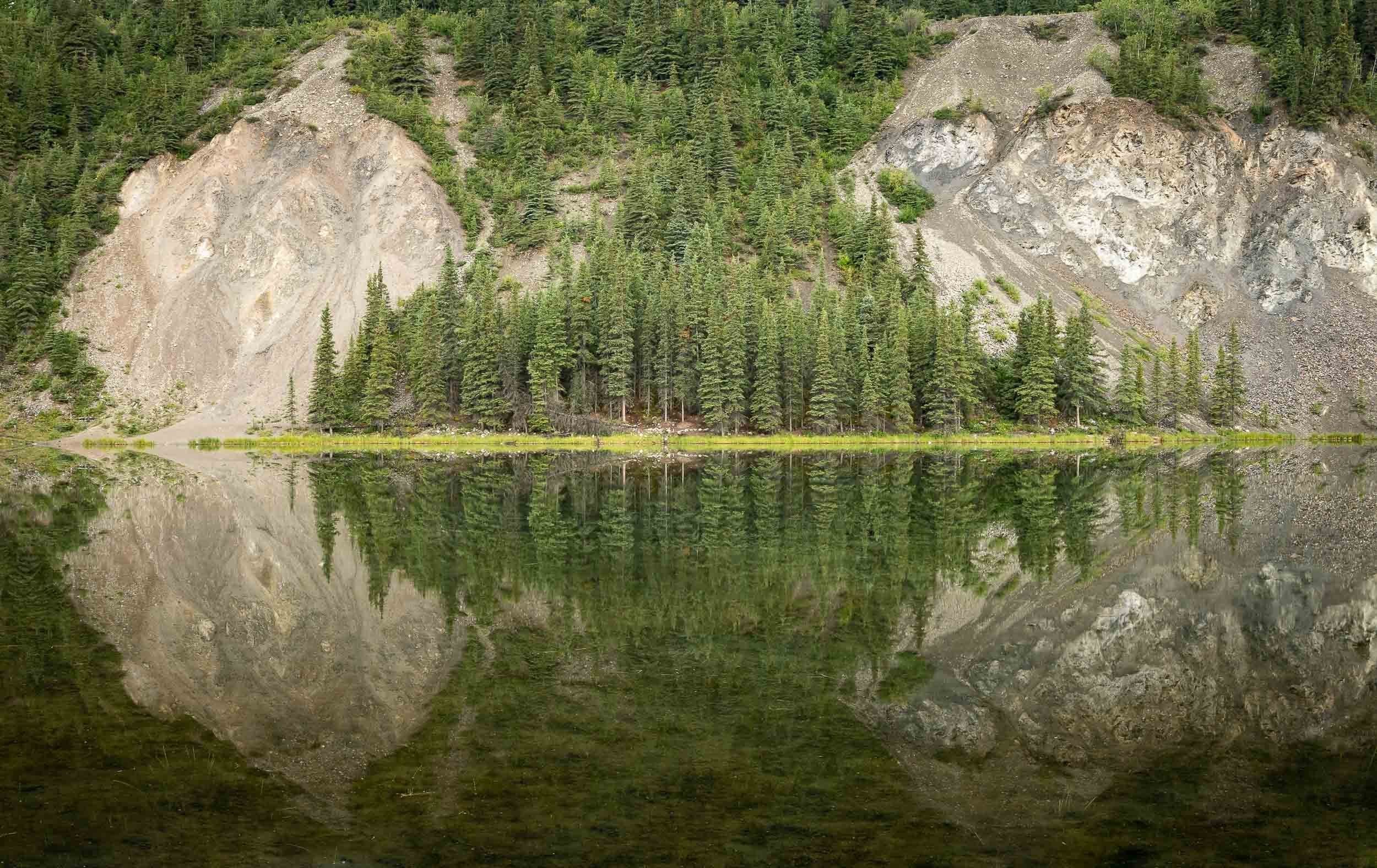
Denali also had a bit more wildlife in store for us, including Moose and Caribou, commonly known as their domesticated version - Reindeers.


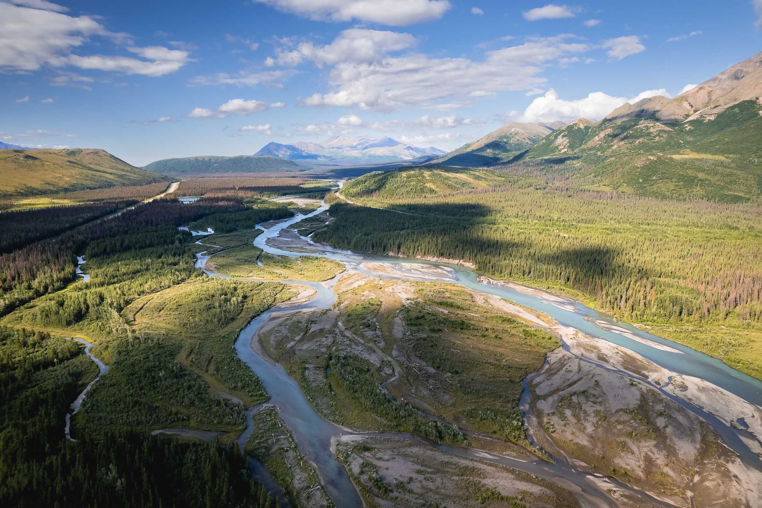
Watch more of Alaska’s landscapes from the air.
Thanks for making it until the end!
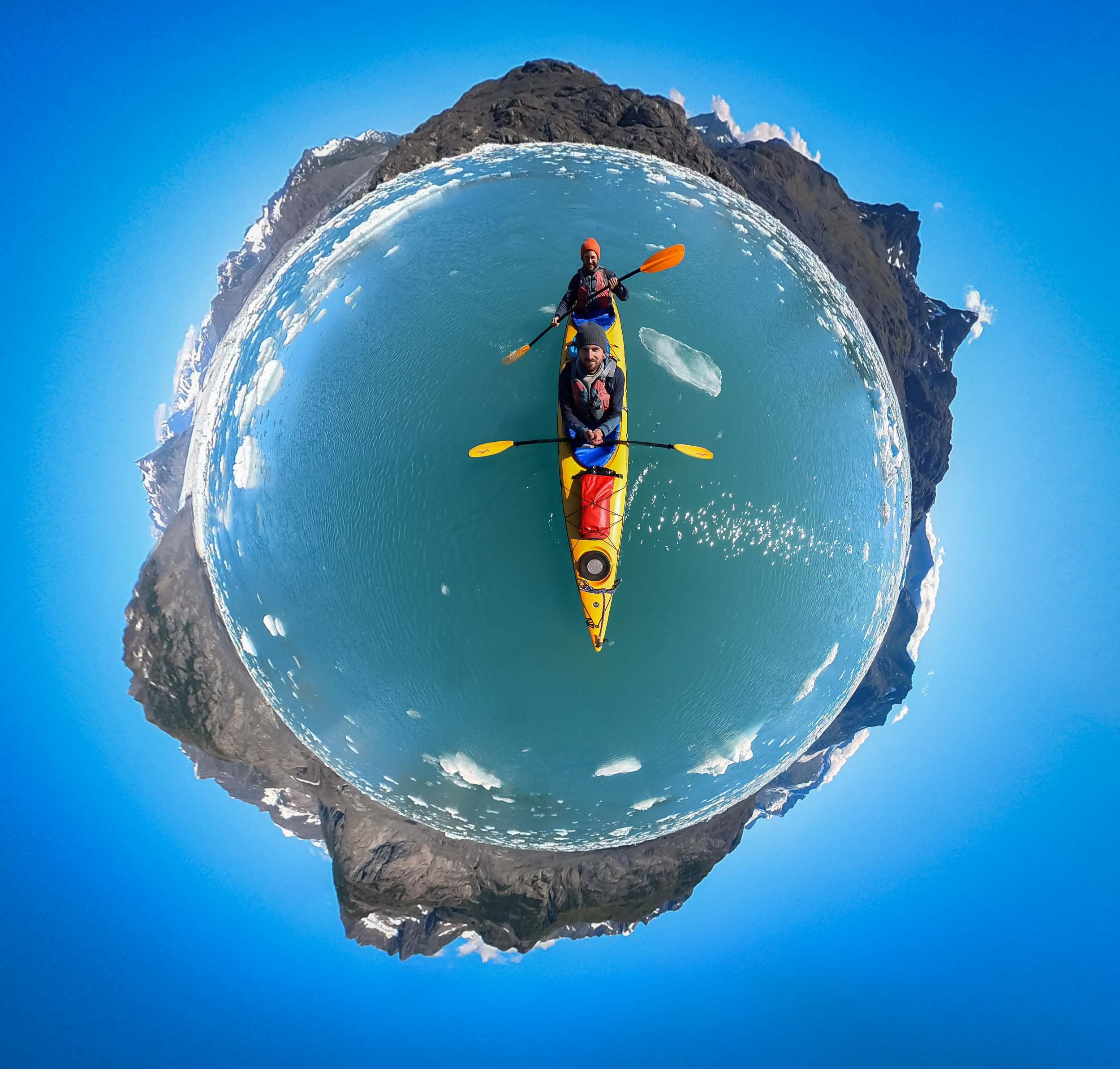

Rwanda - A Gem Of Africa
Rwanda - one of the smallest African countries, but for sure with a lot to offer.

Rwanda - one of the smallest African countries and one of the youngest populations in the world. The “land of a thousand hills” (its lowest elevation is just under 1000m) suffered from terrible tragedy less than 30 years ago, and since then has been on an incredible path of recovery - economically, socially and through its conservation efforts.
We only had 6 days in Rwanda, so the schedule was relatively packed as there is a lot to see - and as I learnt, more to explore than what I had time for. The first impression of Rwanda is Kigali, and it’s a positive one - the city is modern and clean, and well organized. Corruption is rare, and the country is united in building a better future for themselves - so far, relatively successfully.
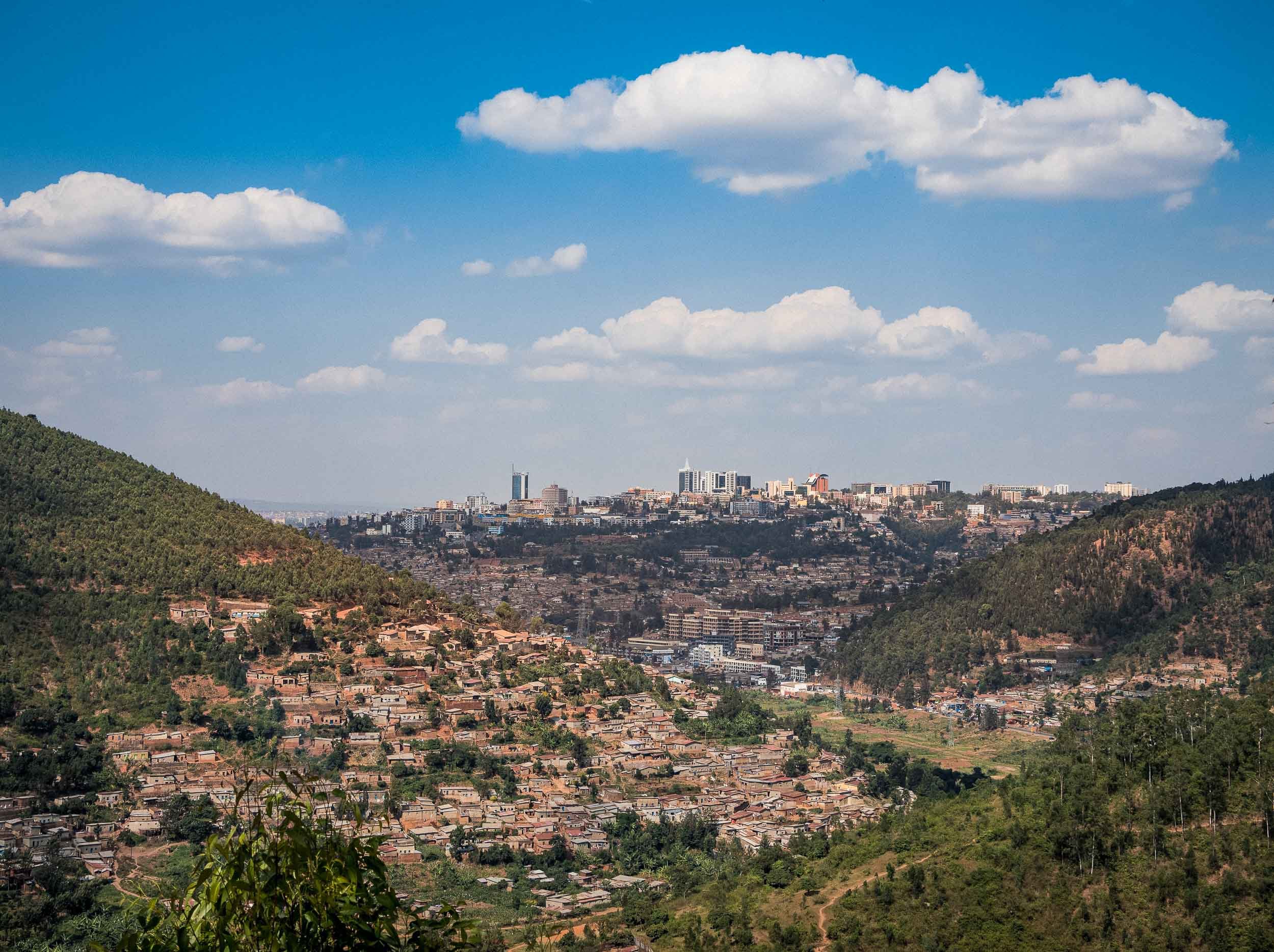
Great Apes and Golden Monkeys
More on Kigali and Rwanda’s history later, as we immediately left towards the country’s western parts: The Volcanoes National Park in the Virunga mountains, home to the world’s second remaining Mountain Gorilla population, aside from Bwindi Impenetrable Forest, about which you can read in my Uganda blog.
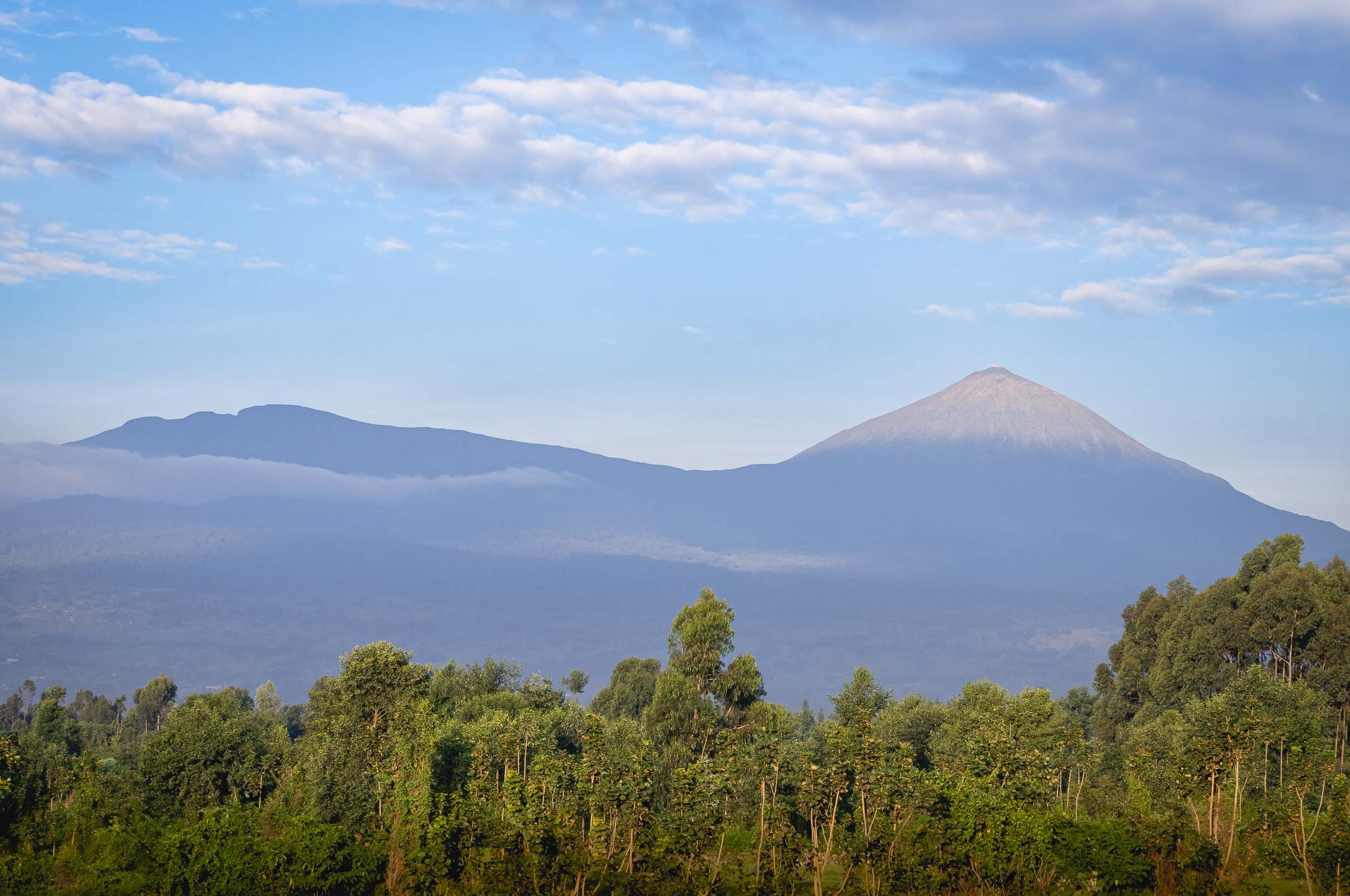
In Dian Fossey’s Footsteps
This was also the mountain we had to climb to see Rwanda’s most famous attraction - luckily not all the way to the top! With our guide, porters, and armed rangers, we started from the very western part, just a few kilometers from the border to the Democratic Republic of the Congo, where the national park area is currently closed due to the civil war. The trek was intense, although less so than in Uganda’s aptly named impenetrable forest.

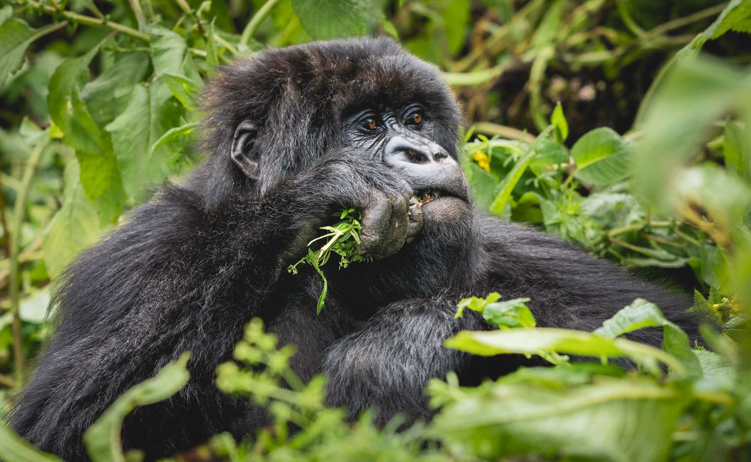
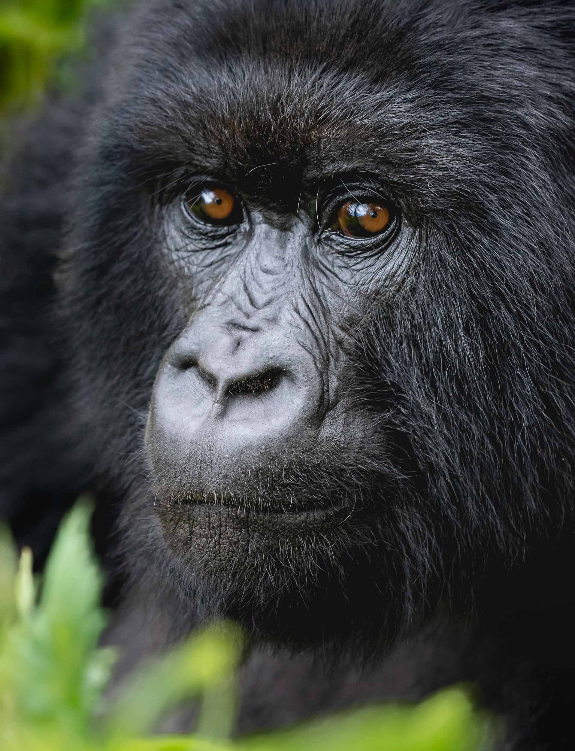
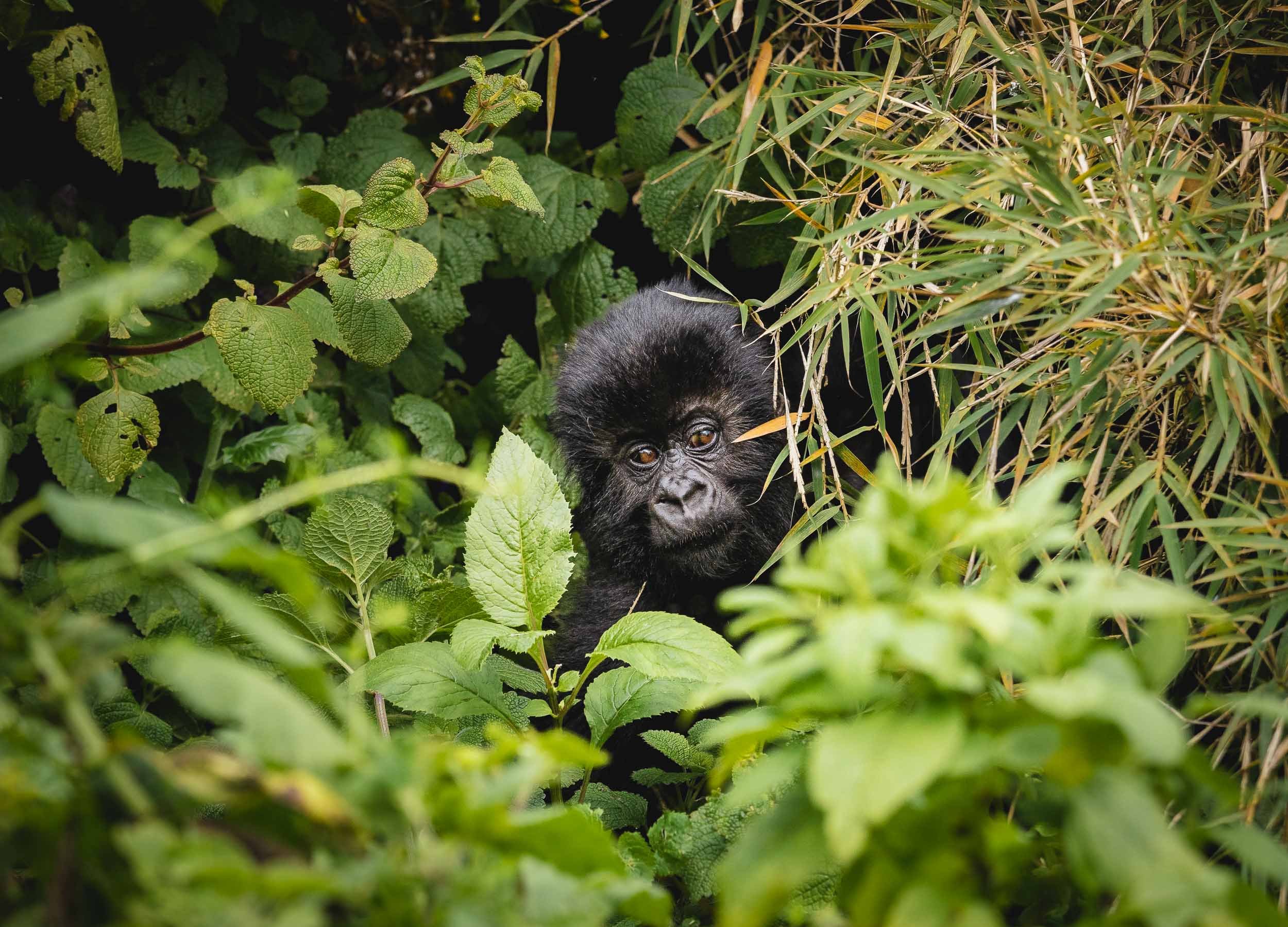
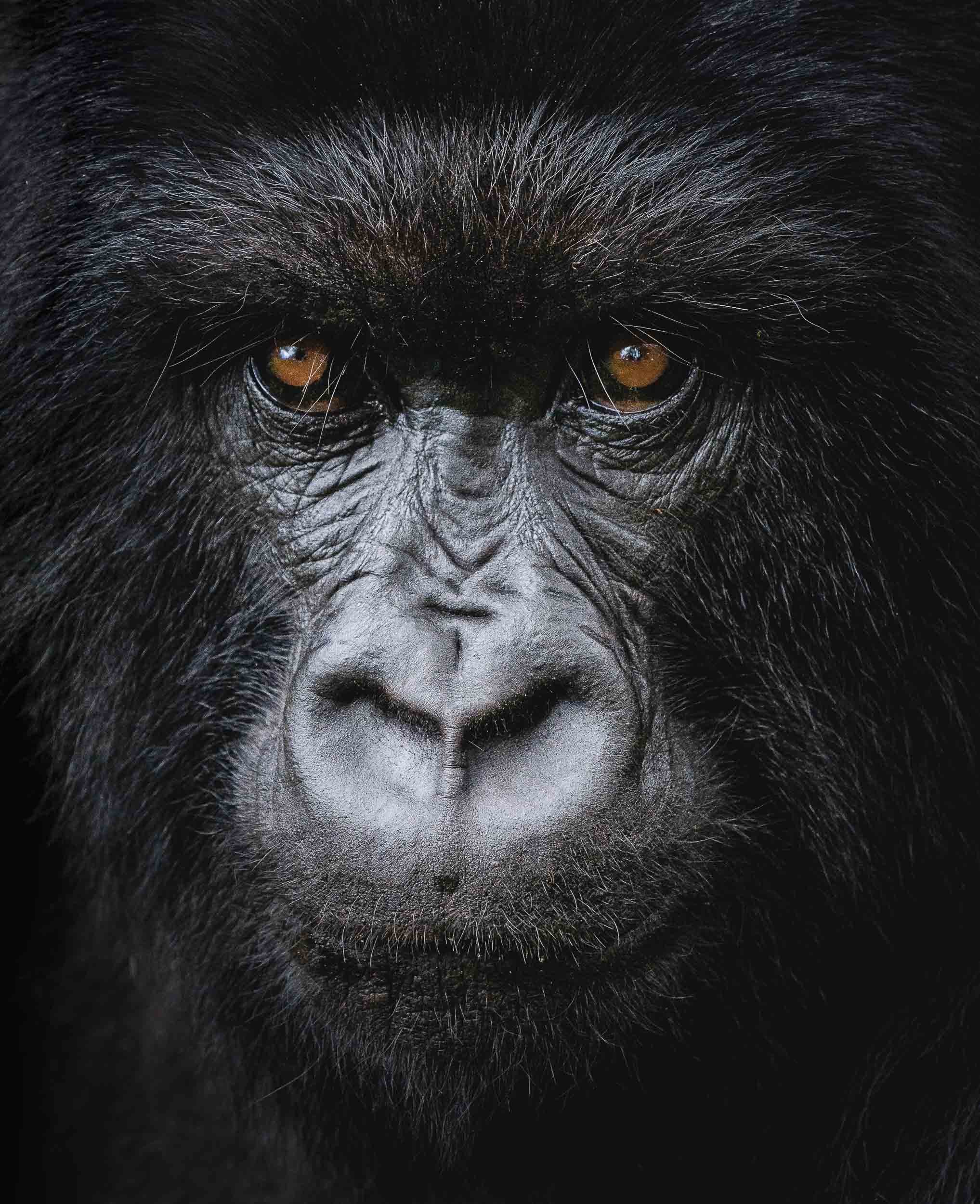


Even though it was my second Gorilla trek, it was not one bit less exciting than the first one. The varied behavior of the Gorillas, the different natural setting, and simply the fact you only have one hour with them definitely makes you want to experience more of it once you had a taste.
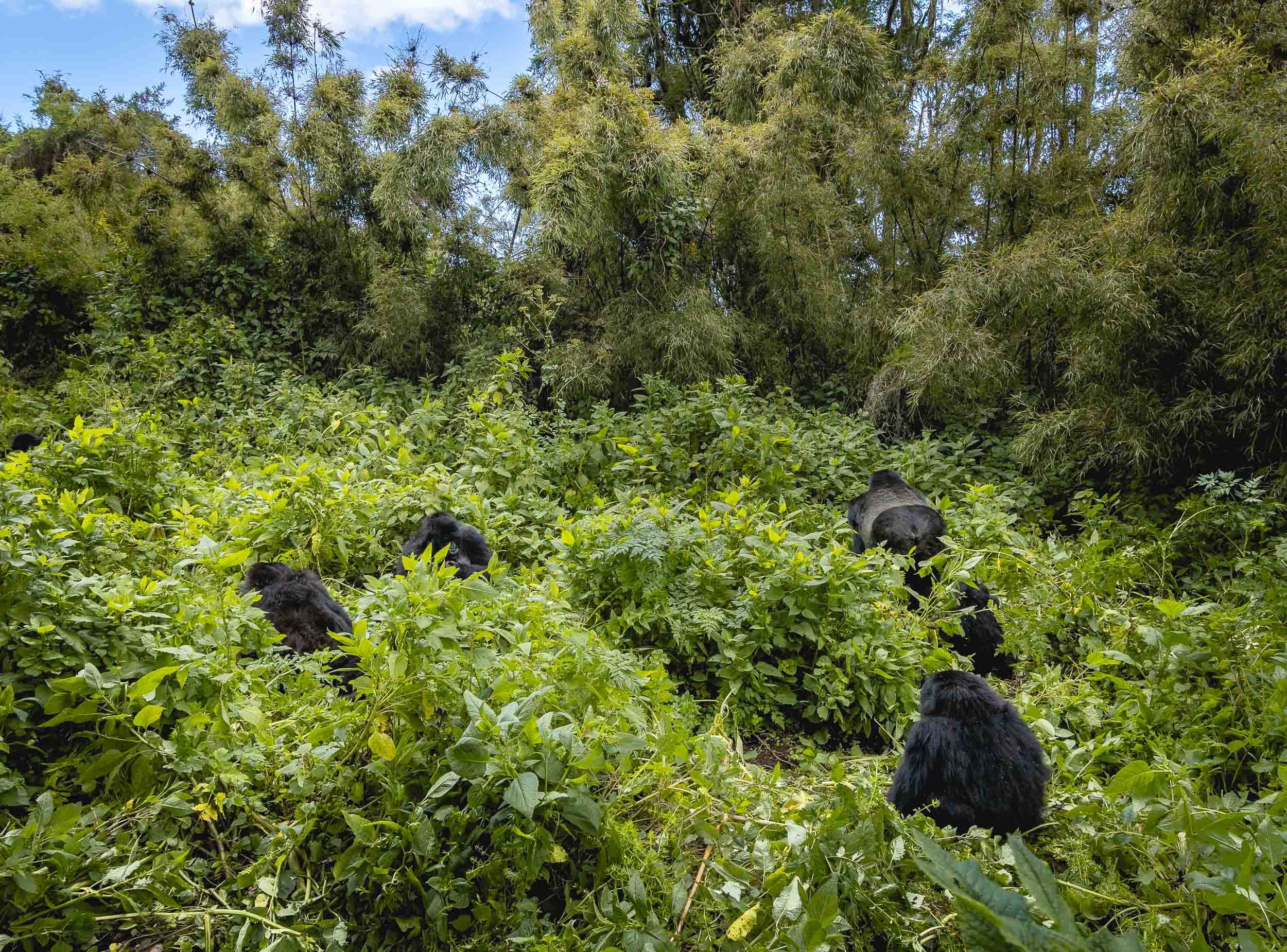
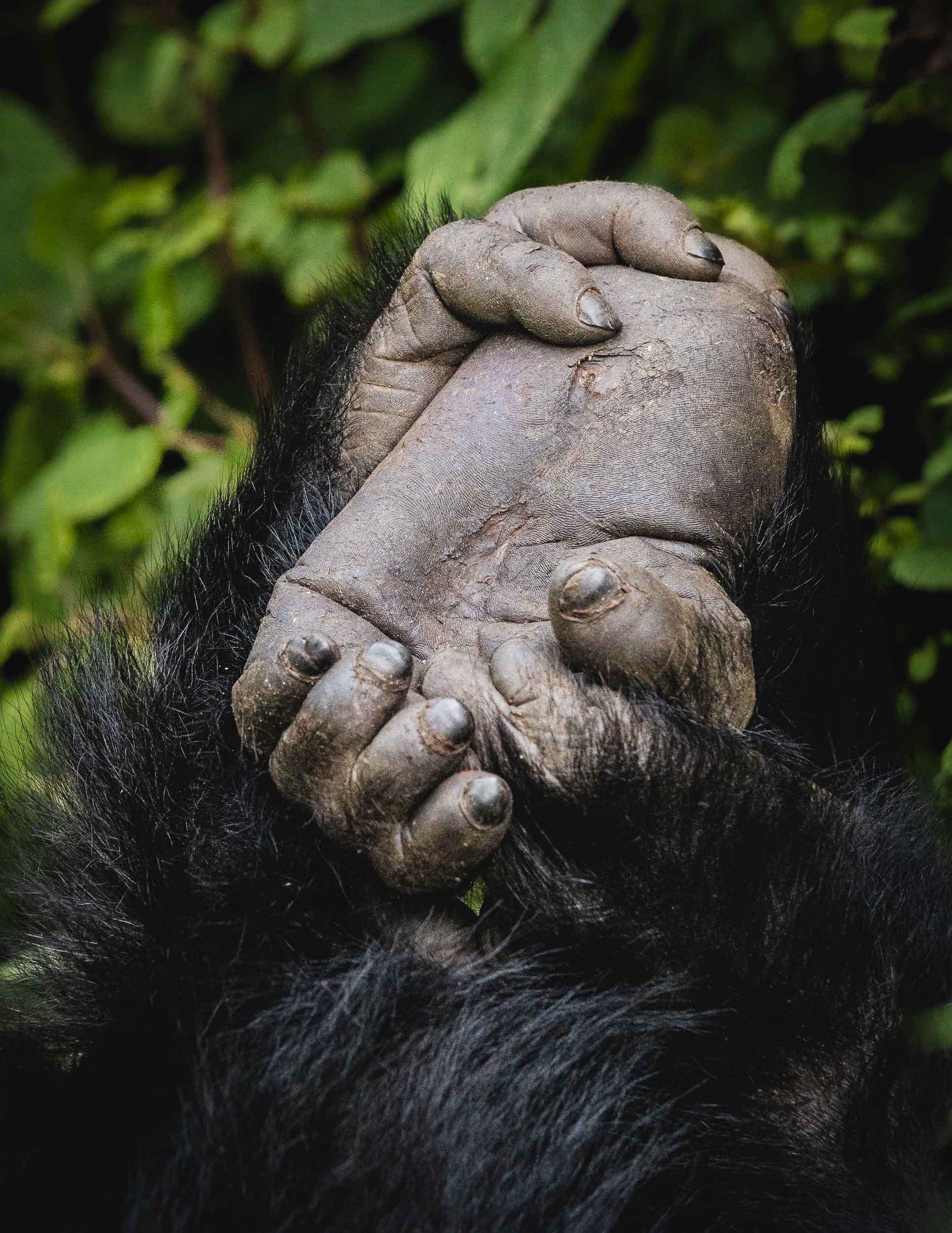
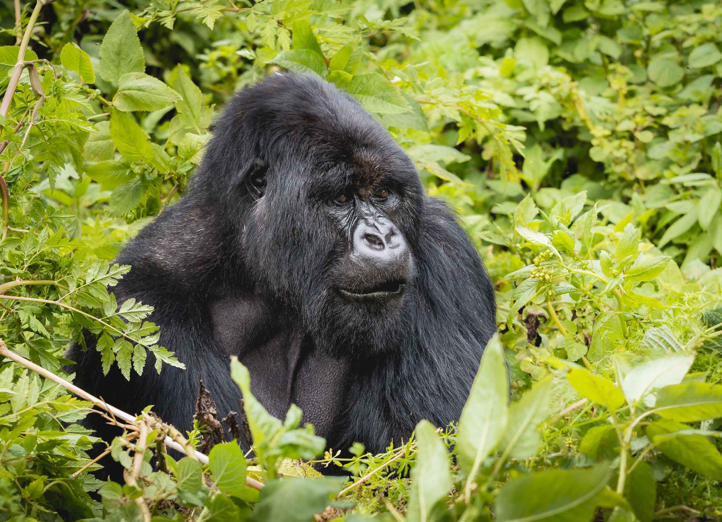
Rwanda’s Gorilla conservation effort and the conflict with poaching has been in the global spotlight for many years, starting with Dian Fossey’s work from the 1960s, culminating in her famous book “Gorillas in the Mist”, later adapted into a movie. She was instrumental in stopping the decline of the Mountain Gorilla population, and her work is now eternalized in the newly opened “Ellen DeGeneres Campus of the Dian Fossey Gorilla Fund”, a modern research centre and museum dedicated to the plight of these animals - definitely worth a visit when you’re in the area. Fossey’s life was not without controversy, and ended in her murder, which remains a mystery until today.
A Feast
The second species of primate that is special in this area are Golden Monkeys, an endangered animal that can only be found in the Virunga volcanic mountains, with an estimated population of 2000-4000.

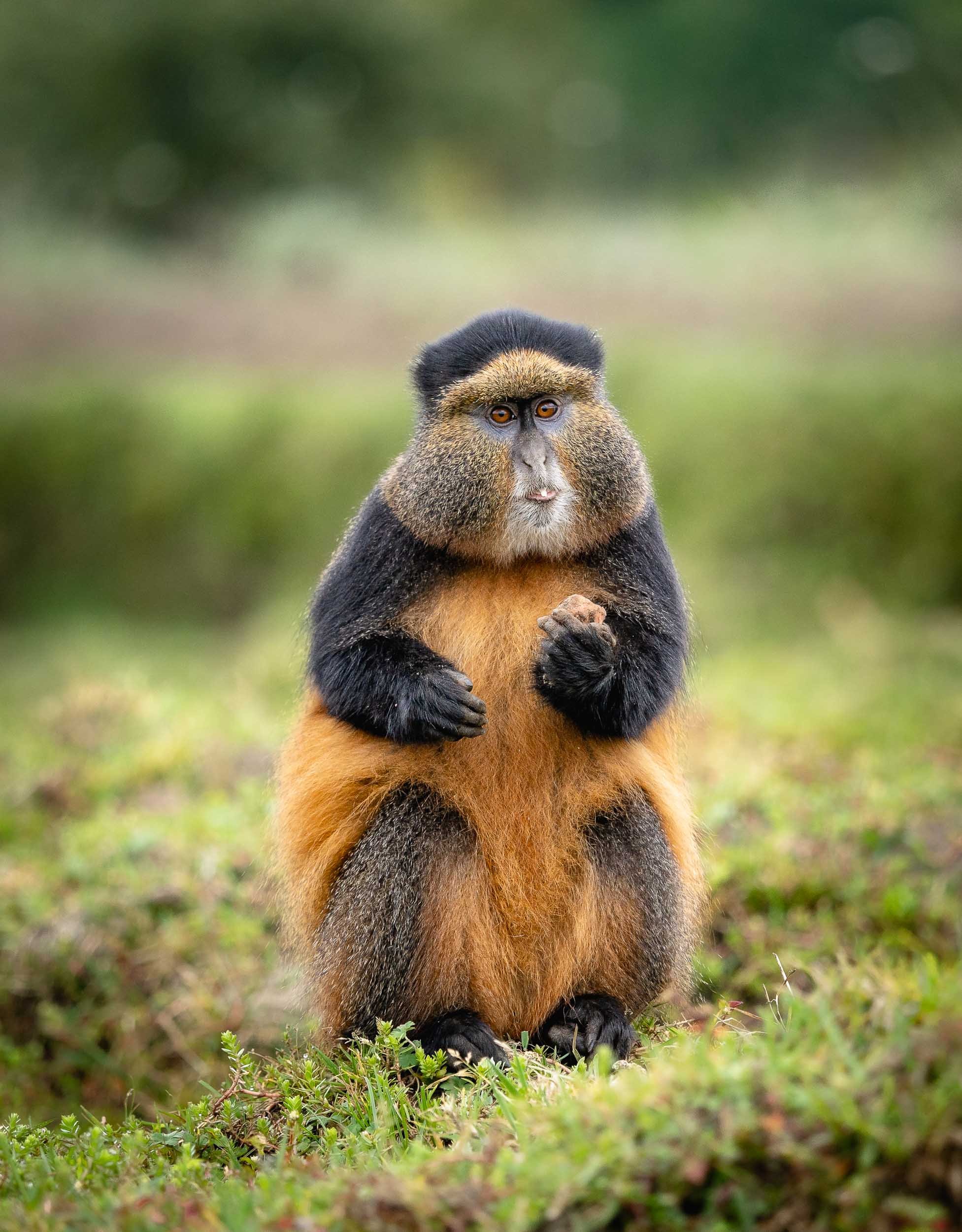


Watch one of them stuffing its face.
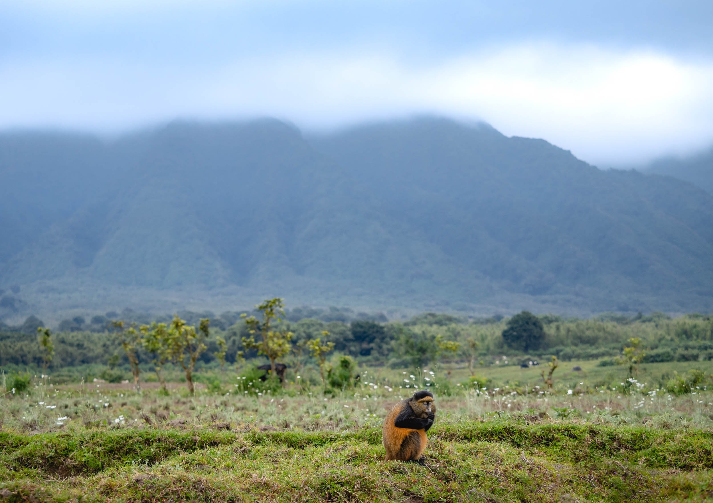
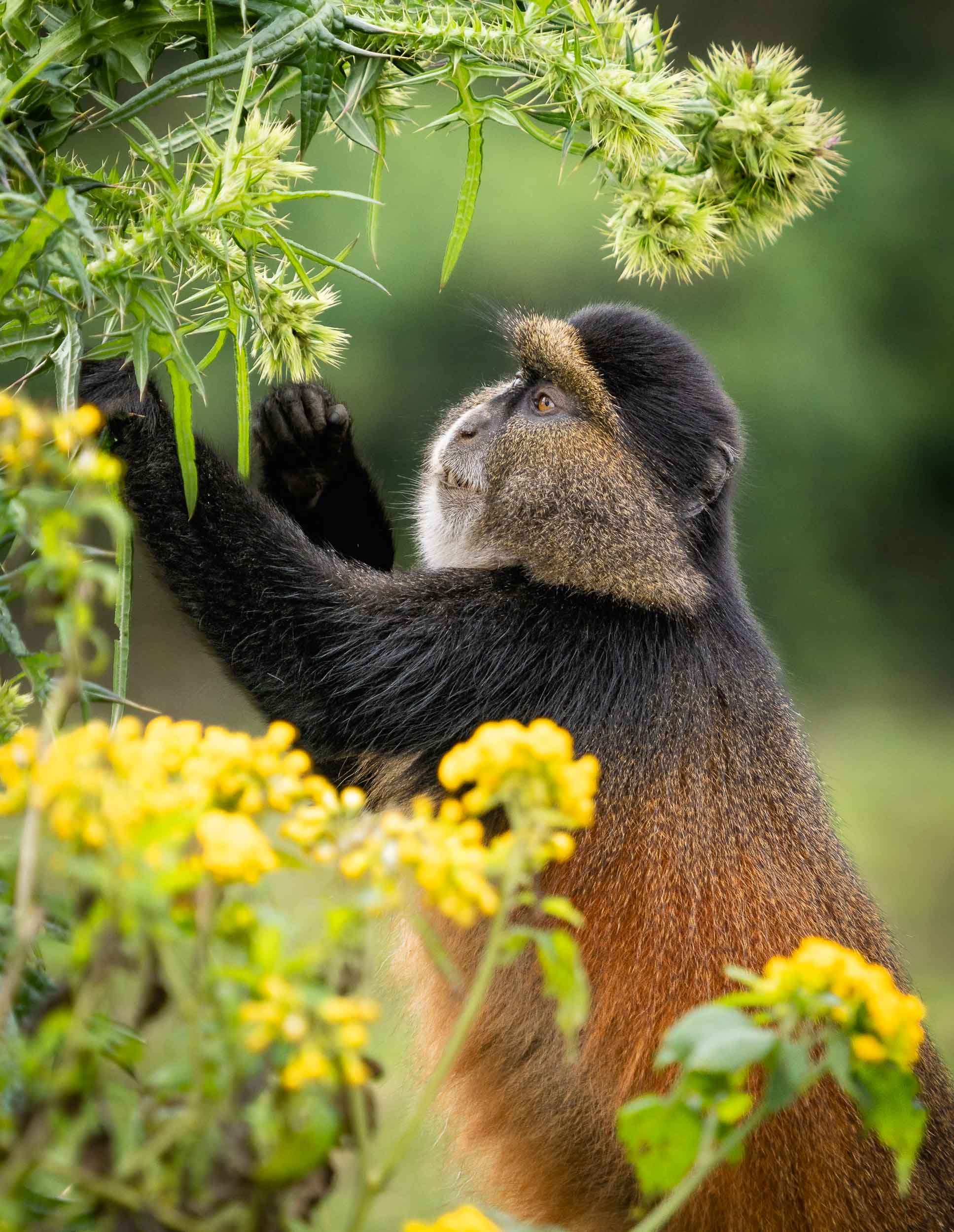
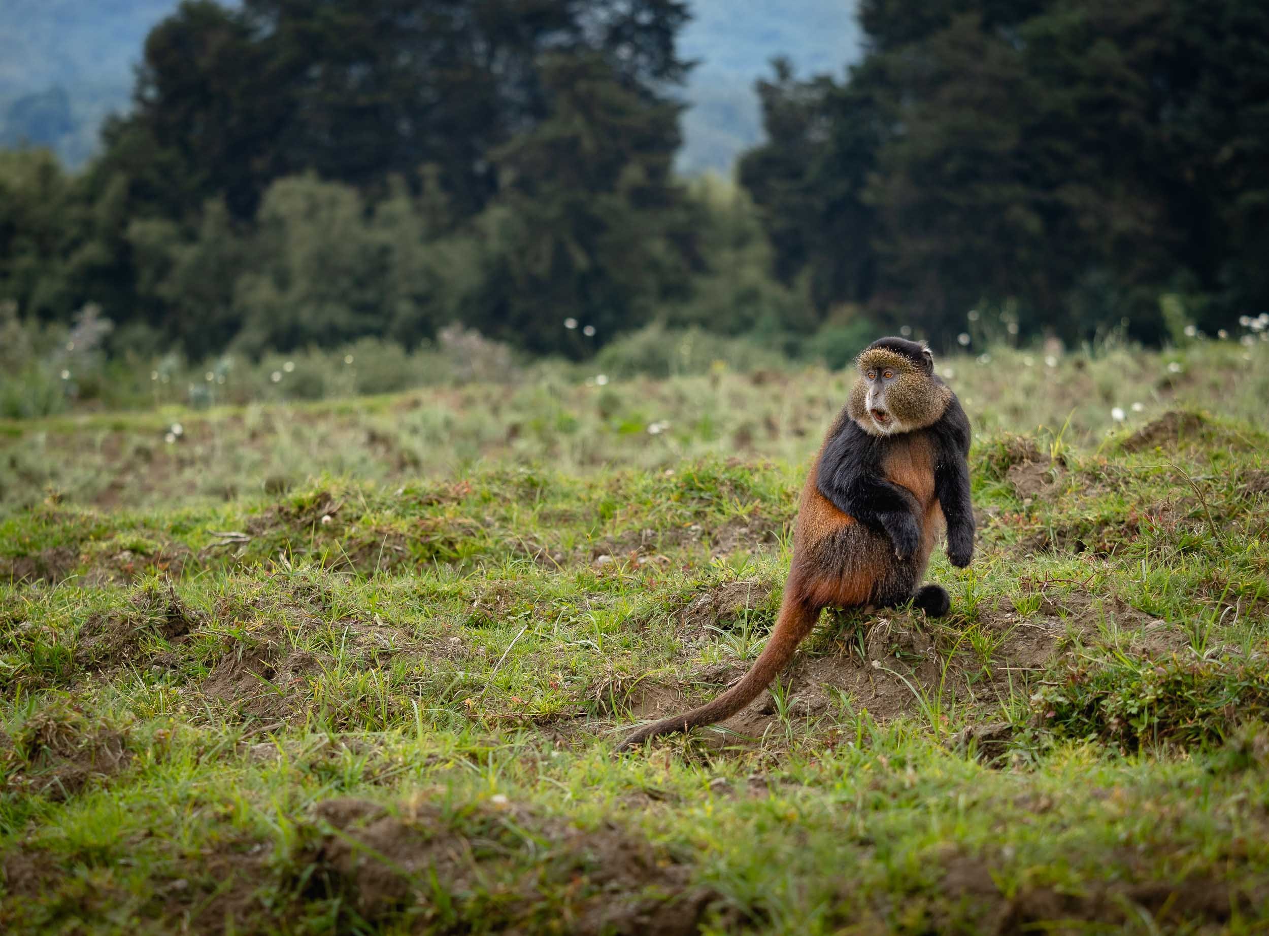
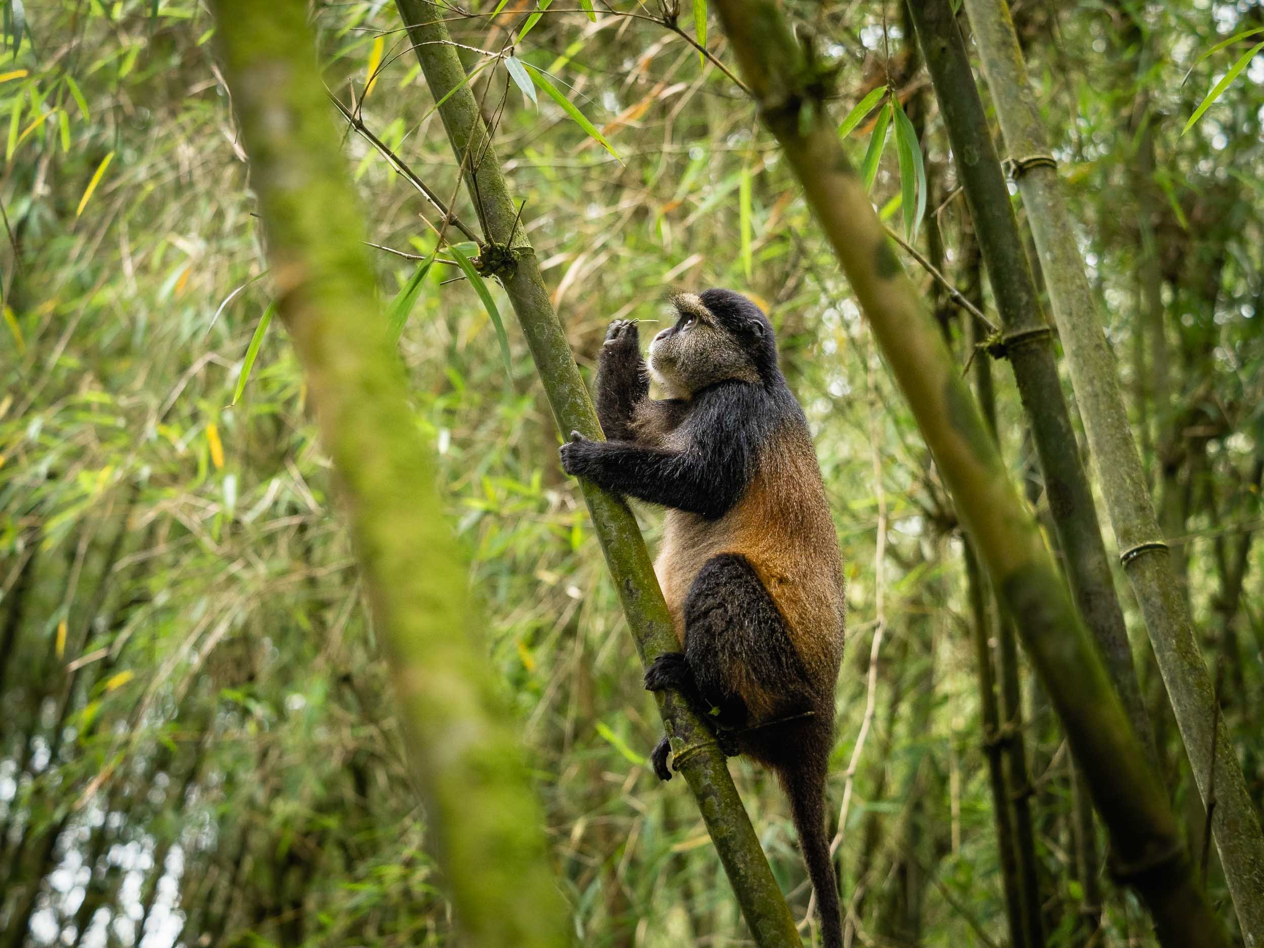
The Golden Monkey Trek is a lot less intense (and the permit much cheaper) than the Gorillas, and while not quite comparable they’re an interesting species, so it’s definitely worth combing the two if you visit Rwanda.
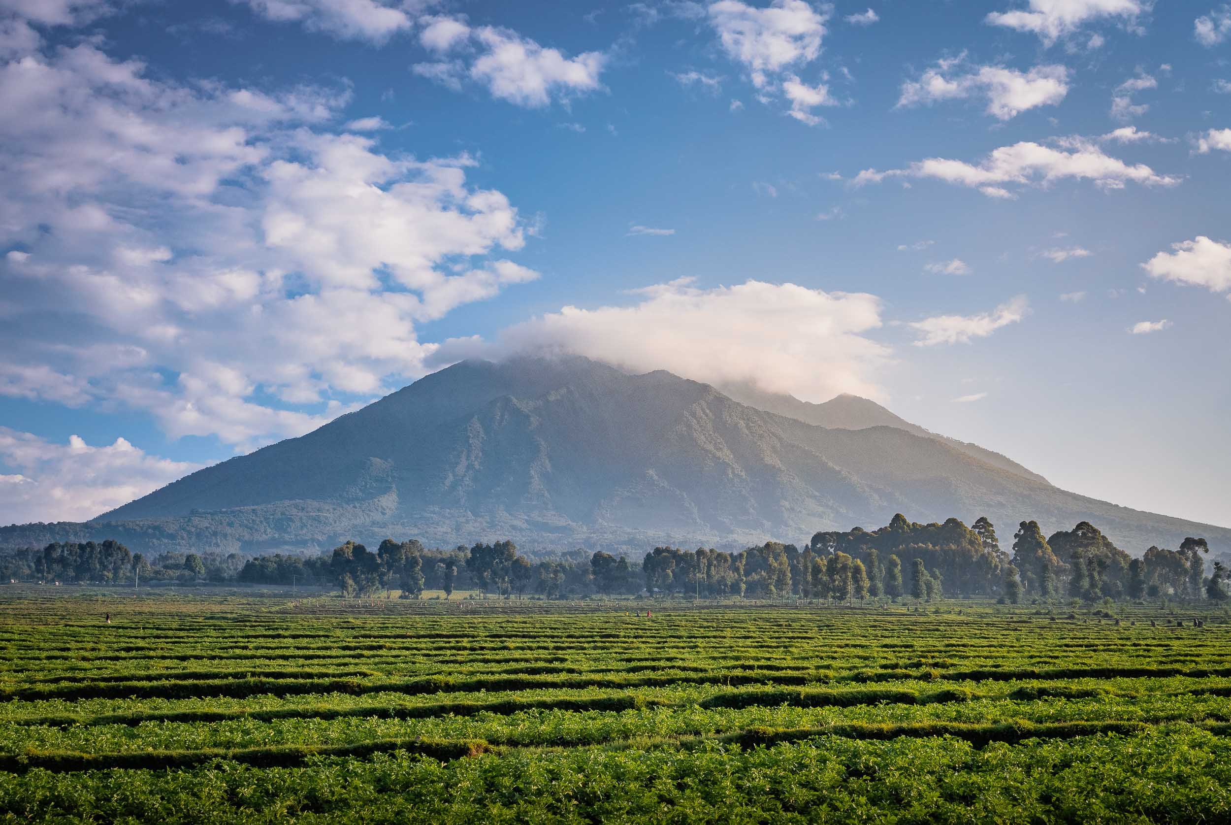
Into the Darkness and a Nice Place to Stay
A rather obscure attraction (my favorite ones) of the park are the Musanze caves. Their entrance lies literally under the main road through the area, and you’d never know what lies beyond unless you descend down for the guided tour.
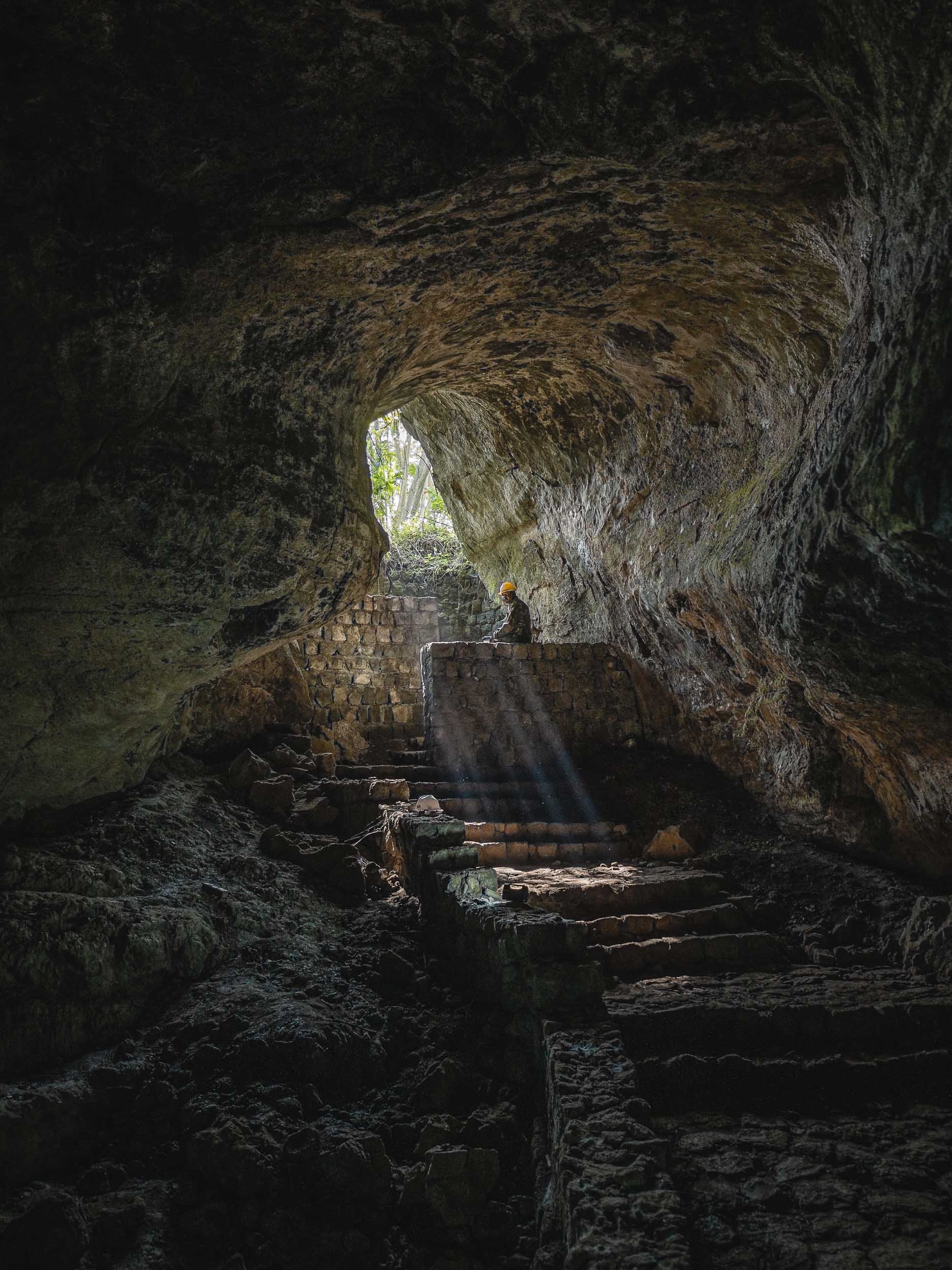
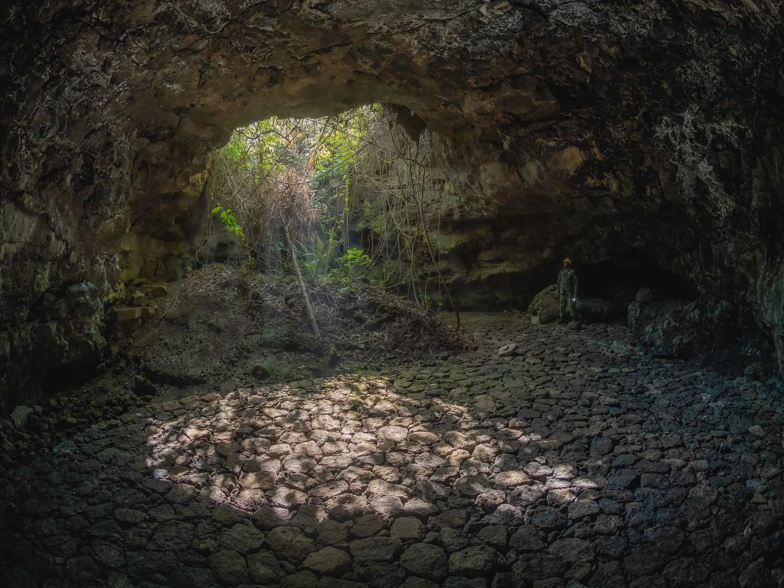
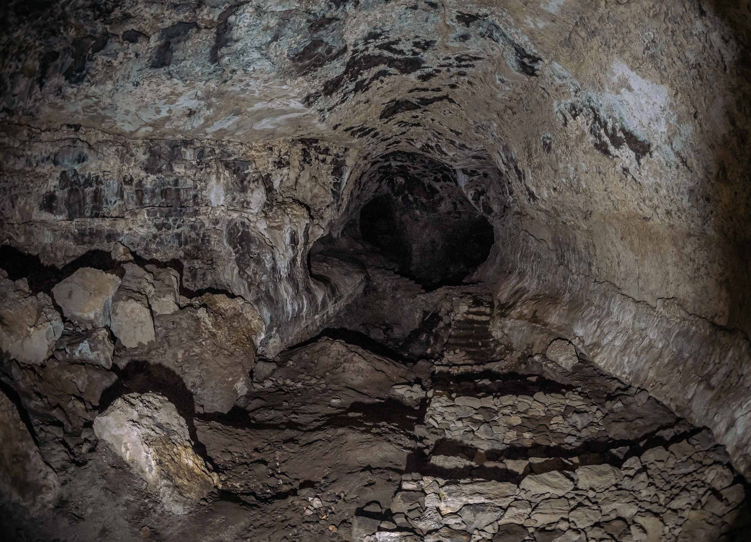
The last night at Volcanoes National Park was spent at One & Only Gorilla’s Nest. Definitely the most spectacular place to stay in the area, located in its own private Eucalyptus forest, featuring the restored cottage of wildlife expert Jack Hanna.
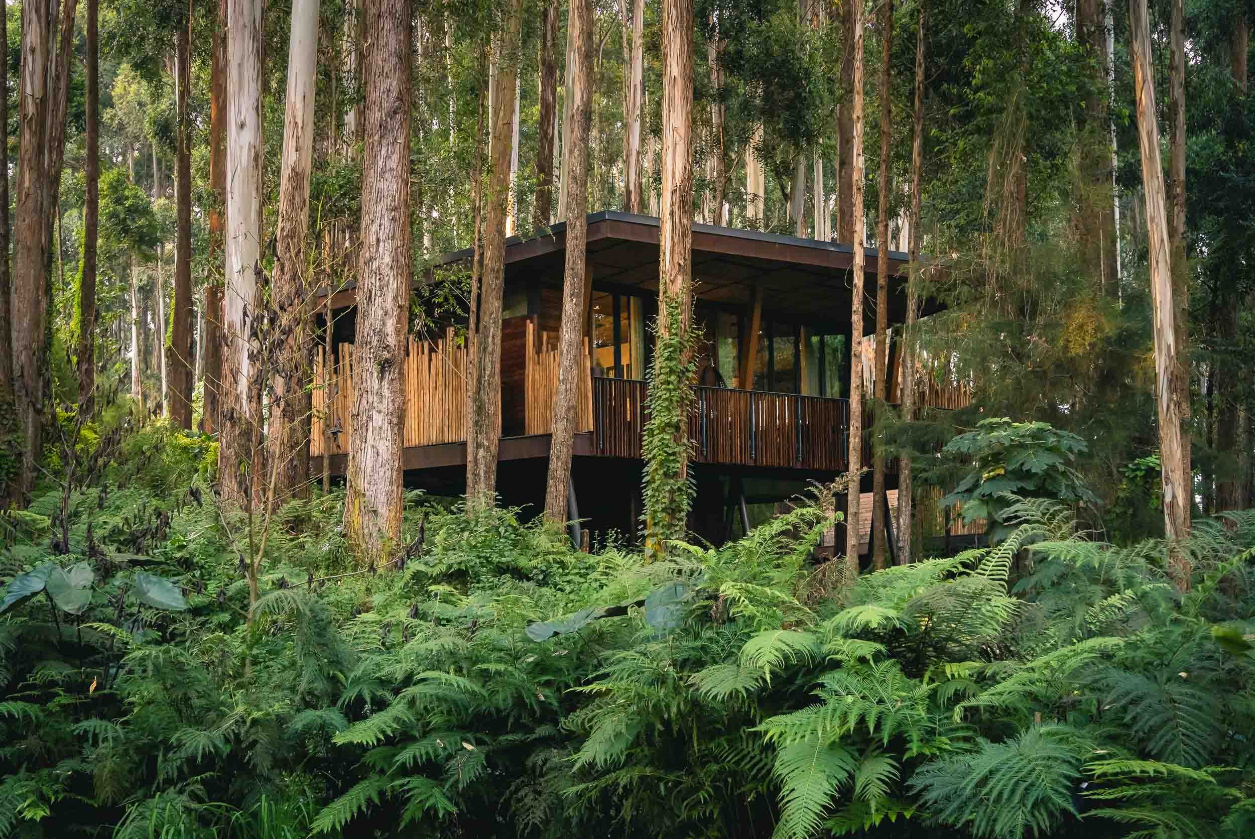
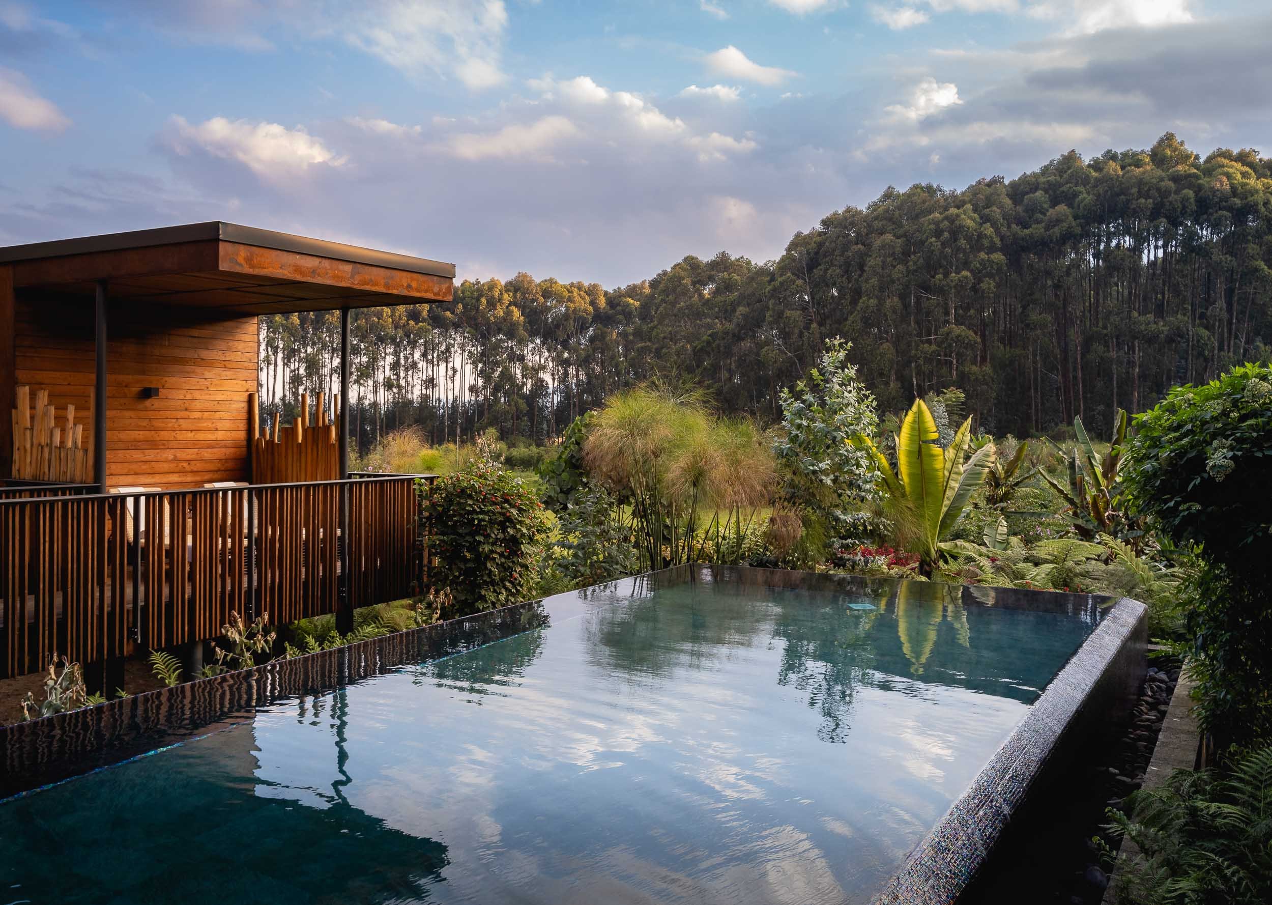
From Lakes and Volcanoes
I had one more place to see before heading back to Kigali - the Twin Lakes of Burera and Ruhondo, on the border to Uganda. These two lakes have an almost identical shape (hence the colloquial name), although they are at different elevations. The existence of a small channel (now a hydropower pipe) meant that water was flowing from one lake into the other in the past. They are separated by a small elevated hill, from which you get to experience beautiful views of the volcanoes and lakes - Byiza Lodge is probably the best spot.
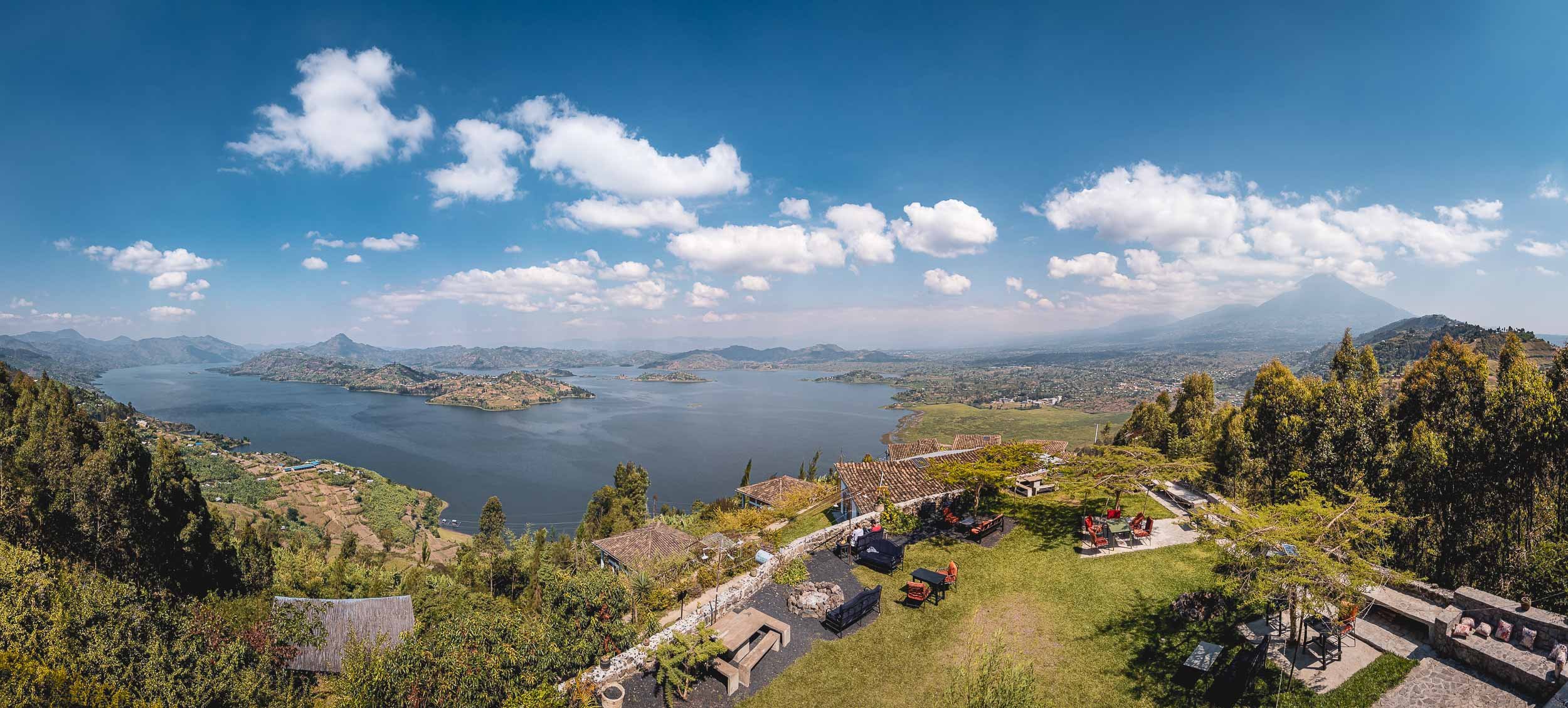
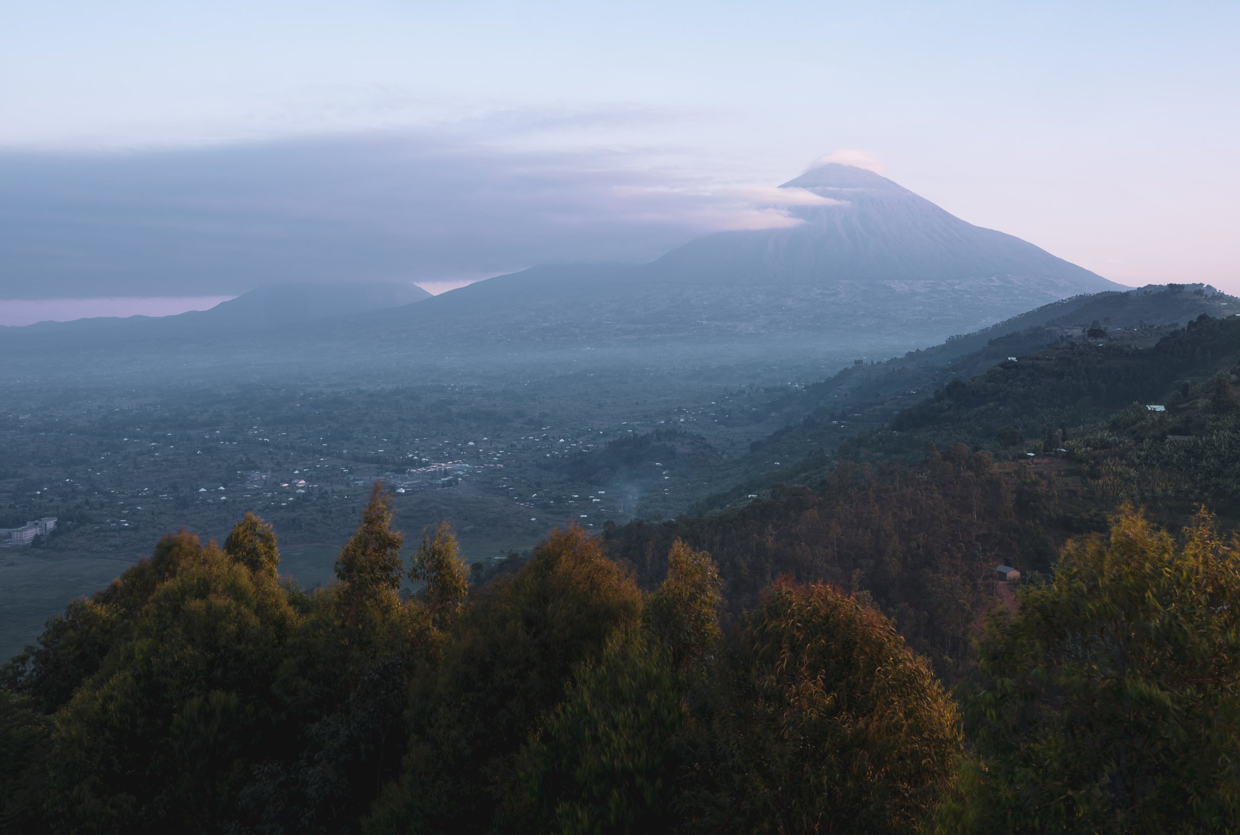
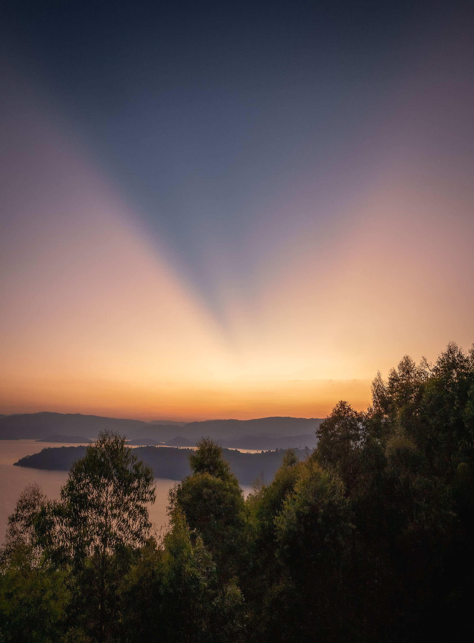
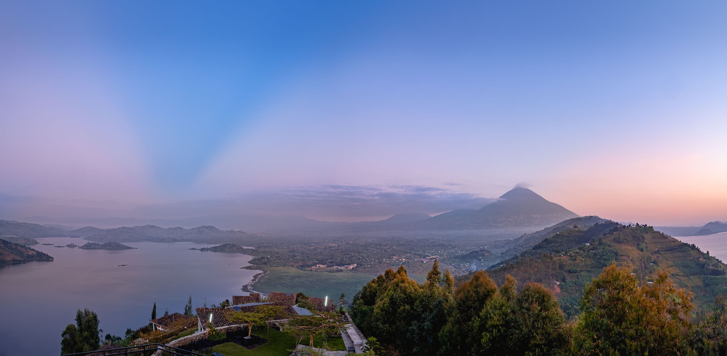
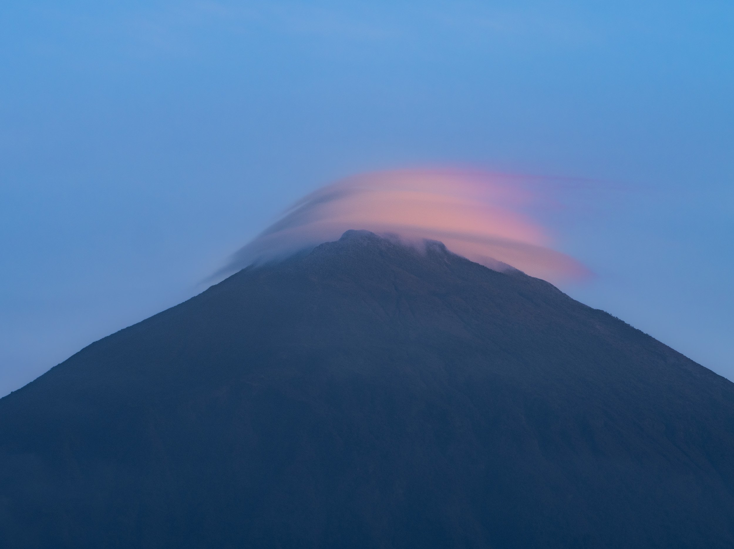
My last day in Rwanda was spent exploring Kigali and its surrounding areas. That includes one of its last independent milk bars (yes, that’s a thing) called Kuruhimbi, for the famous Ikivuguto drink. If you know me, you’ll know that’s my kind of bar, but the story behind the importance of cows and milk in Rwanda is an interesting one, worth a read in this article - there’s a reason why the phrase for “wishing someone well” here literally means “may you have a cow”.

Lessons Learnt from History, or not?
Beyond that, an agenda point no one should miss out when visiting Rwanda is to explore some of the country’s most significant monuments of the genocide in 1994. We visited three such places: Kigali Genocide Memorial, Nyamata Church, and Ntarama Church Memorial Centre, the latter two about an hour outside the city. They each provided a different insight and perspective on the genocide, but the theme of invoking incredible sadness about what occurred here is shared across all of them - it’s a rough emotional journey. For instance, Nyamata church still features holes in the wall that were used to throw grenades into the building when people looked for shelter, and blood stains on the altar cloth caused by machete massacres. Over 50,000 people are buried here, many of them displayed as rows of skulls and in coffins filled to the brim with bones, often unidentified. New victims are still found in mass graves of the area.
While I recommend reading the articles linked above, another way to start is the (albeit Hollywood-ized and not without its controversy) movie “Hotel Rwanda” which took place in the historic Hotel des Mille Collines, (where I stayed, as it happens).
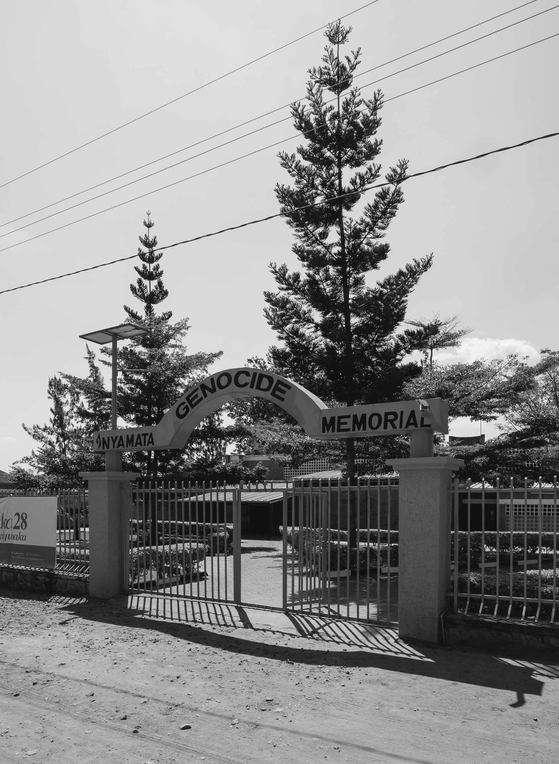
While estimated numbers vary, around 800,000 people were killed in the span of just over 3 months, the vast majority of Tutsi ethnicity, slaughtered by the Hutu perpetrators with the most brutal means. What makes learning about the events of this period particularly intense is their recency - as a consequence, literally everyone you meet in Rwanda is somehow directly or indirectly affected - and secondly, how the seeds for the genocide were planted long before, and, as so often, by Western occupants. At the same time, the country has taken a path of unification and forgiveness, and you don’t ever have the feeling of lingering tension or divide. While Rwanda is not without its political challenges, it makes the progress and development over the last 25 years all the more impressive.
When visiting memorials such as these, one often has the feeling that “this can never happen again” or “it wouldn’t happen today” - the problem is, that’s what everyone thought after genocides in Armenia over 100 years ago, or the Holocaust 80 years ago, and yet history keeps repeating itself. I found this banner particularly prescient and it makes you think about where the next risk lies and how to prevent it, given the complexity of the root causes.
A Sunset in Kigali
The last evening was spent on capturing the city from day to night. We found this elevated viewpoint which was perfect for capturing some cityscape scenes and this timeslice video.


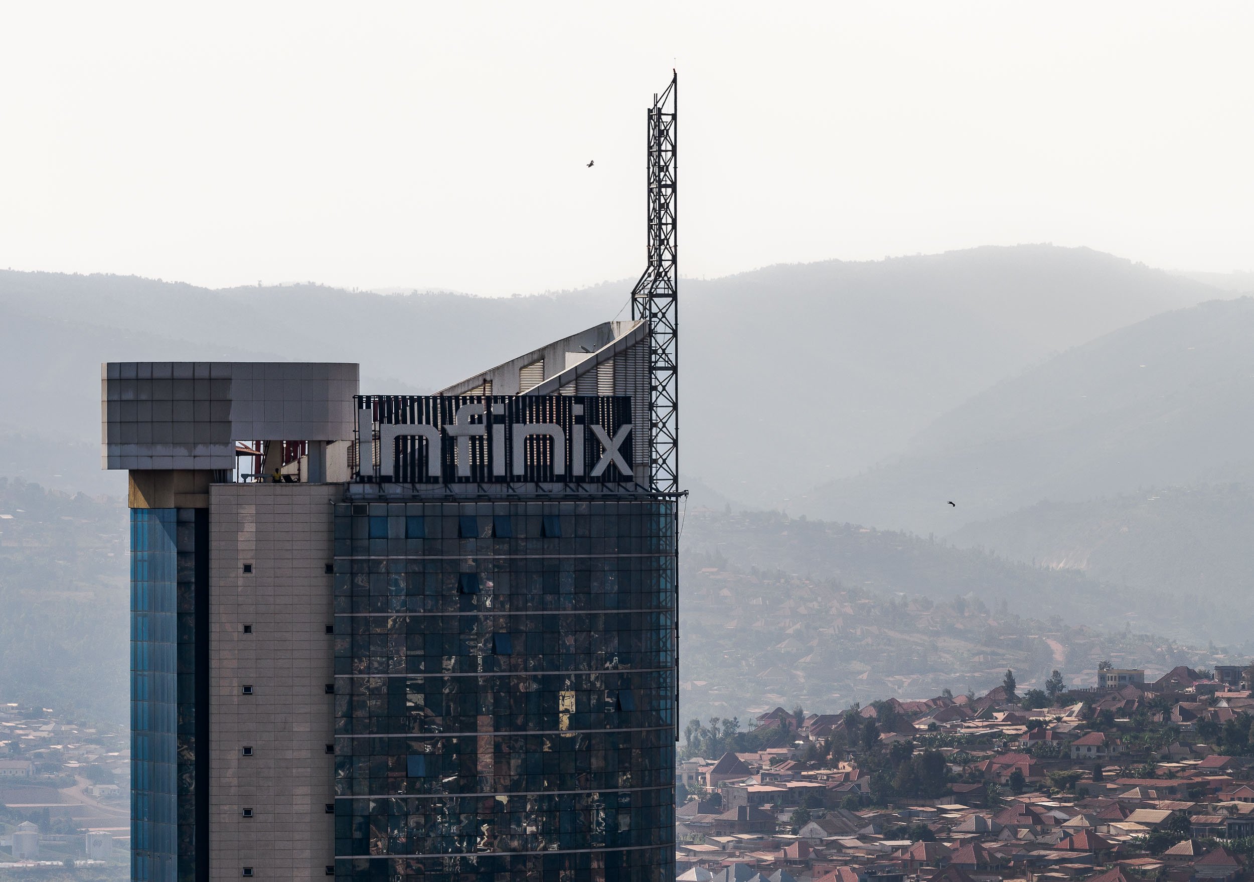

Botswana - On The River, Above the Ground, And Under The Stars
My time in this landlocked country on south-western Africa was mainly focused on animal photography.

The third destination I visited during my Africa trip, was Botswana. My time in this landlocked country on south-western Africa was mainly focused on animal photography. Having said that, I could not help sneaking in a few rather unexpected Milky Way photos, read on to find out why that was the case.
This trip was with Pangolin Photo Safaris, specifically their 10 day - 3 location trip, which was well organized and covered a variety of wildlife and landscapes.

The Chobe River
Over the first 3 days in the country, we spent time on a houseboat cruising and mooring along the Chobe river. In fact, we were anchored on the Namibian side, so one could argue that some of these photos show Namibia, and some show Botswana, depending on which side of the shore the animals stood ;).

Elephants in the Water
It was the first time I was able to observe elephants in the water, not just bathing and drinking, but properly swimming - in fact, literally under water. The park is widely known for its many elephants. Botswana has the largest elephant population in Africa estimated at over 200,000, to the extent that their presence causes pressure on the environment and other animals, as well as conflict with humans.
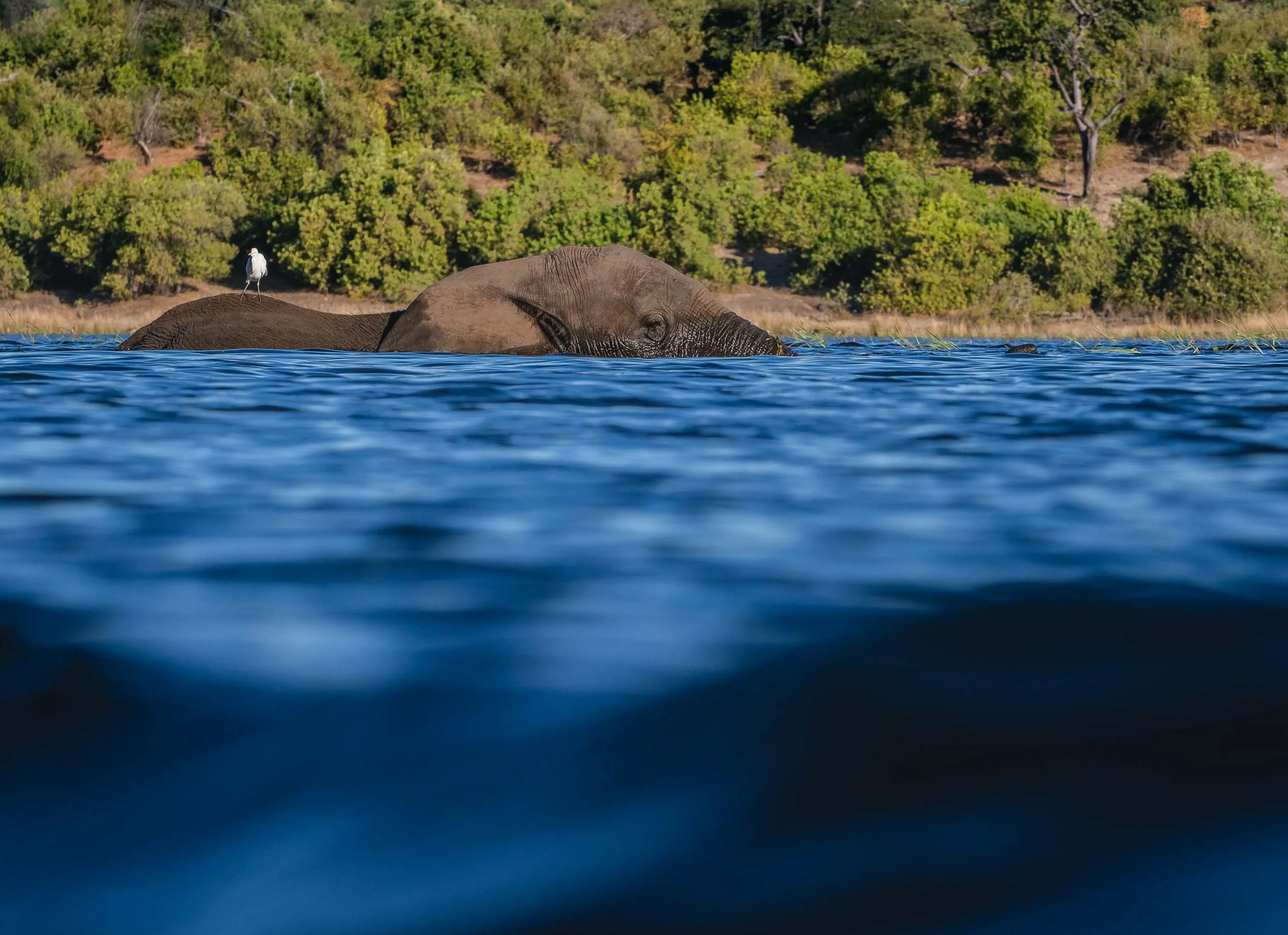
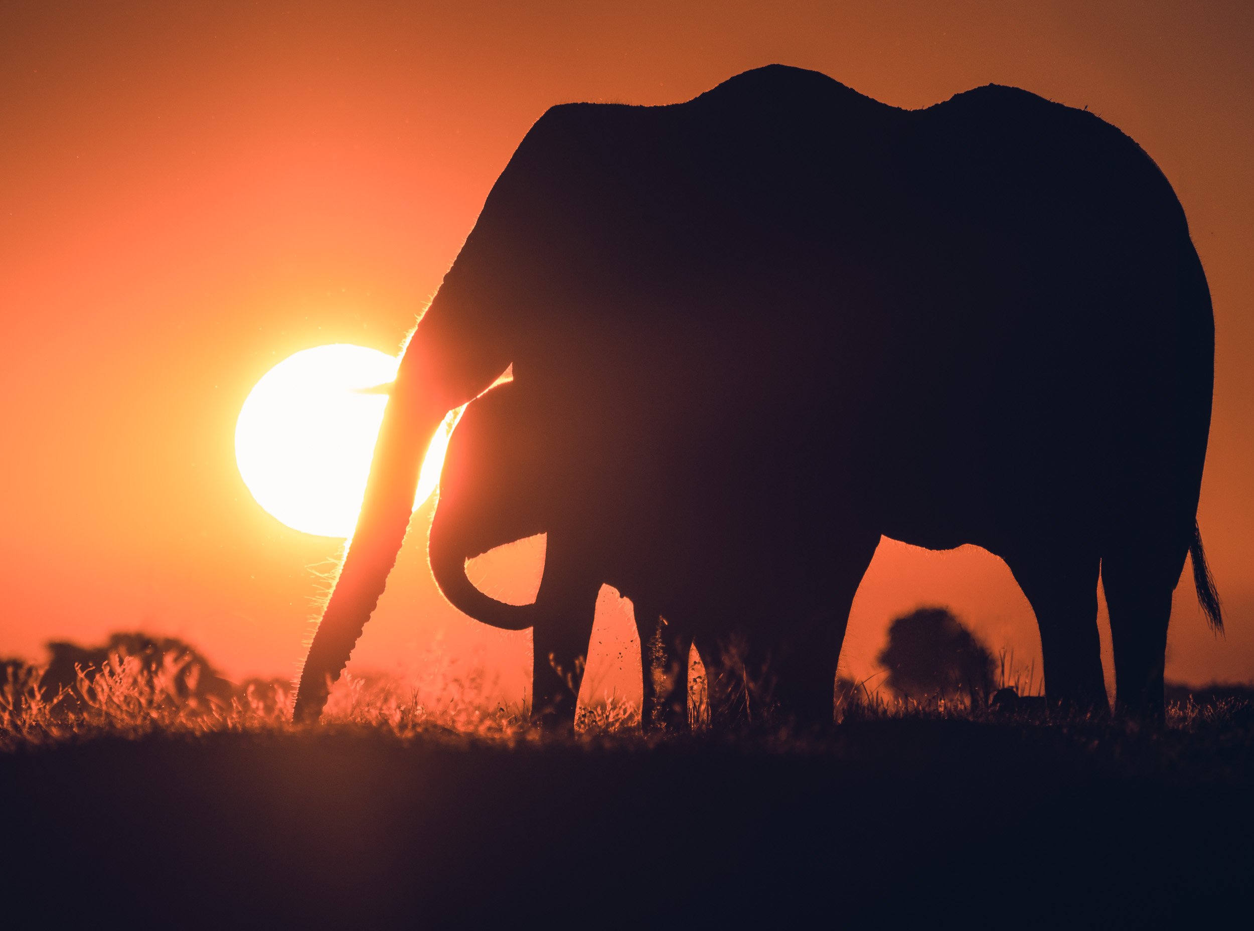
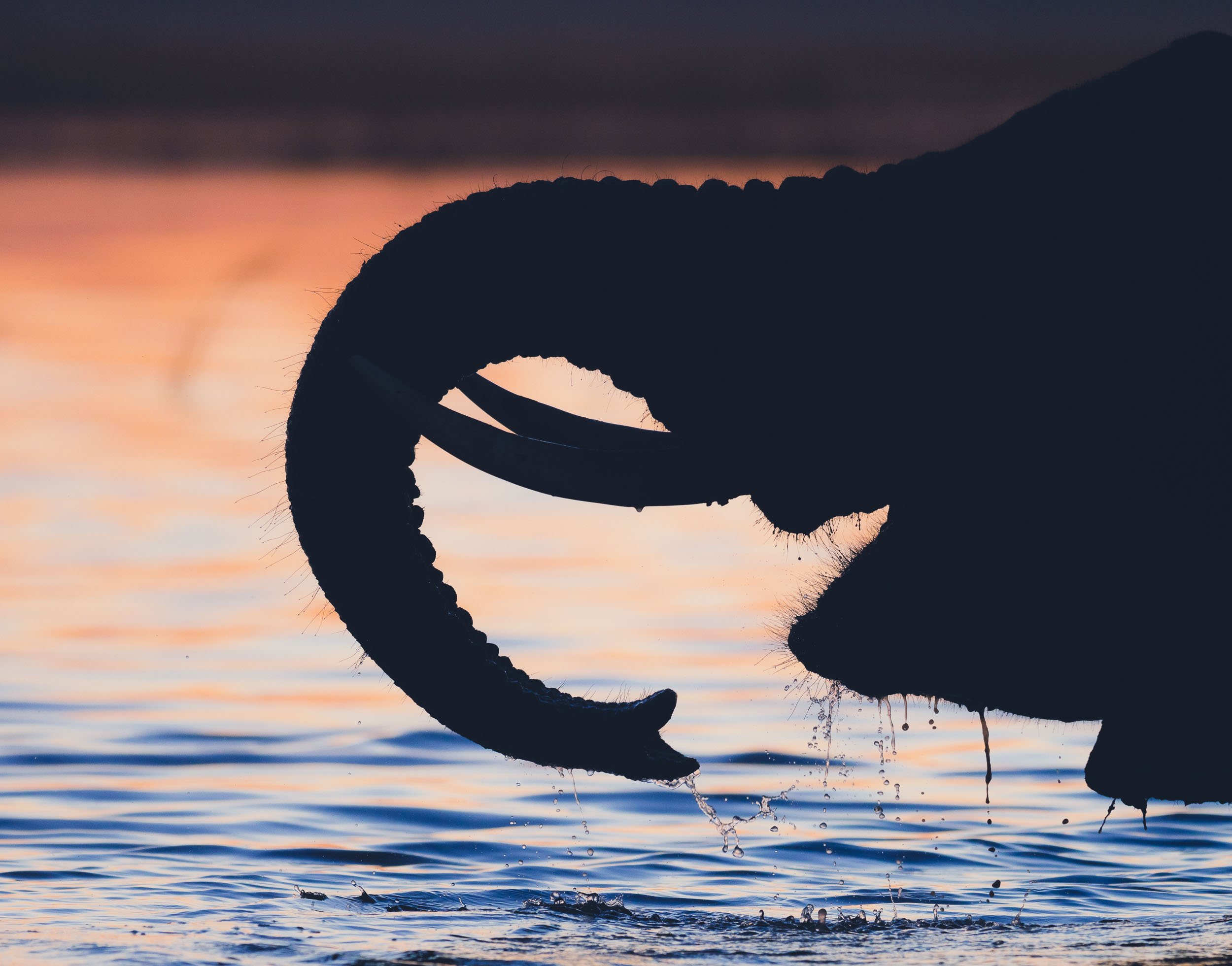
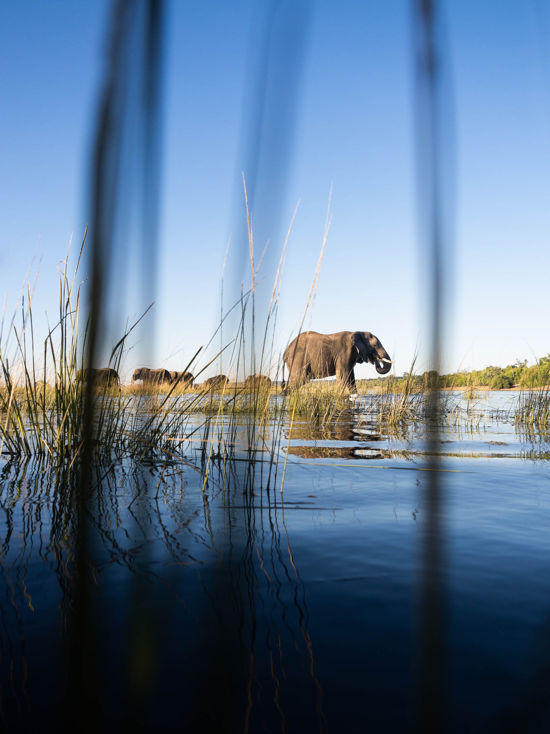
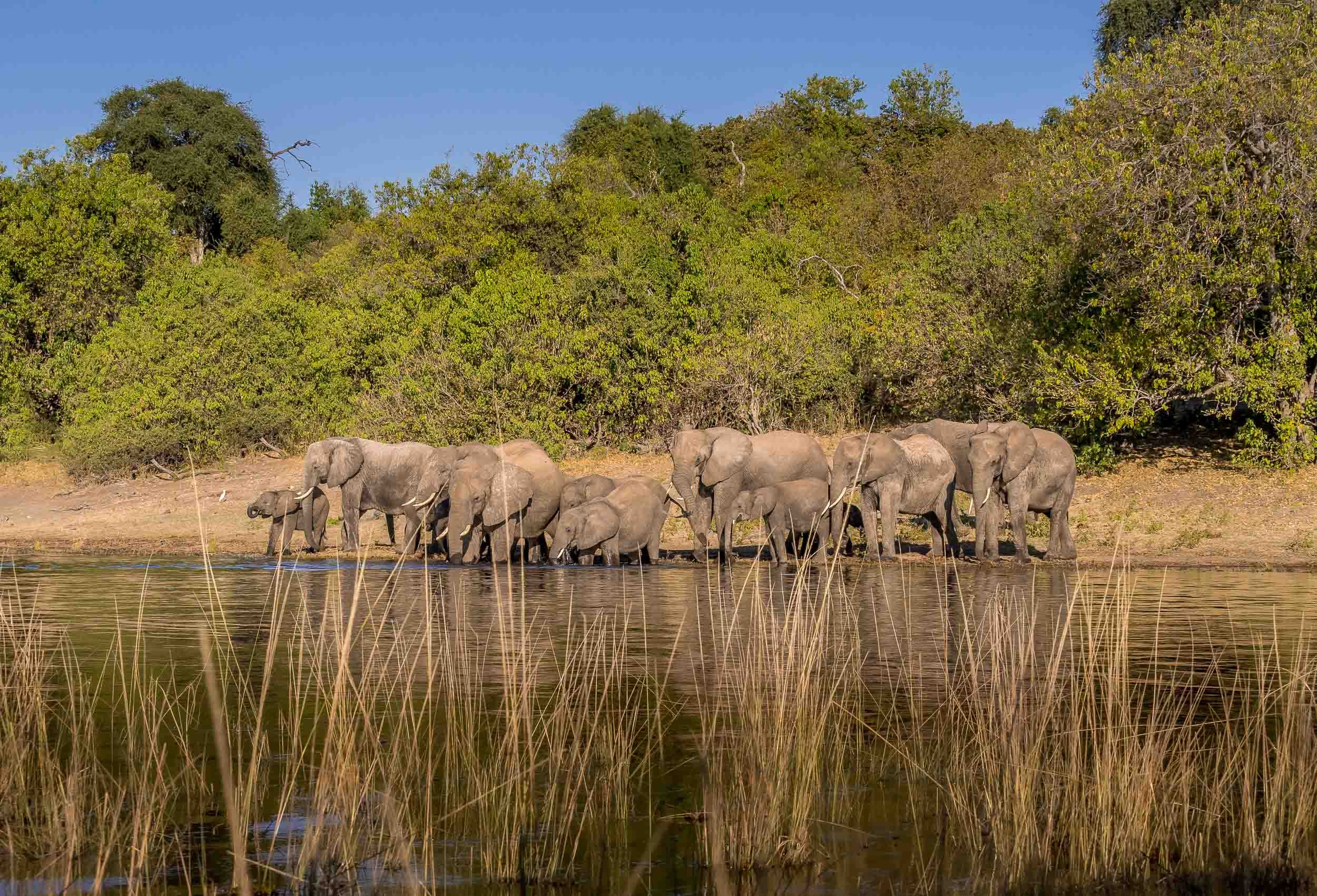
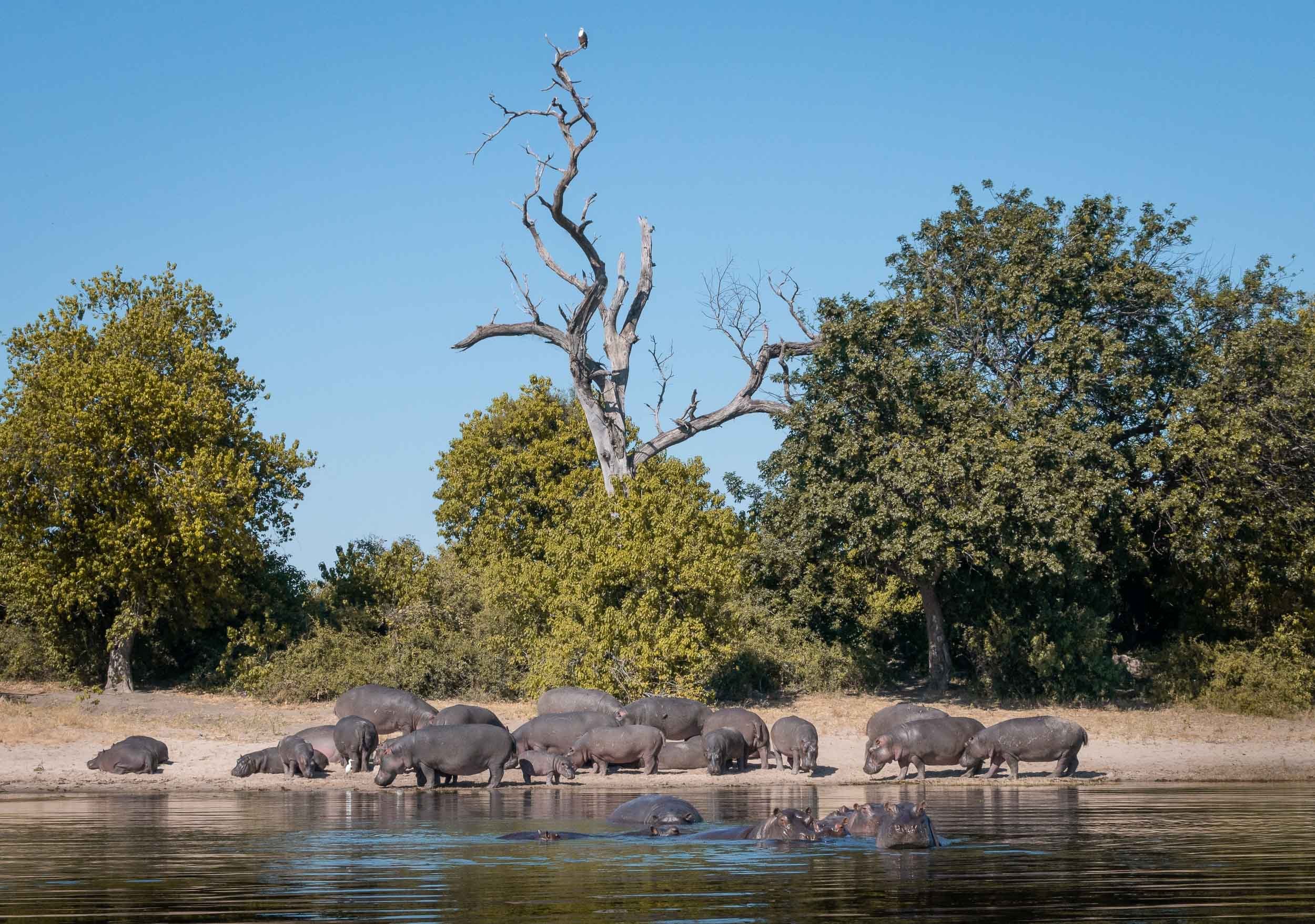
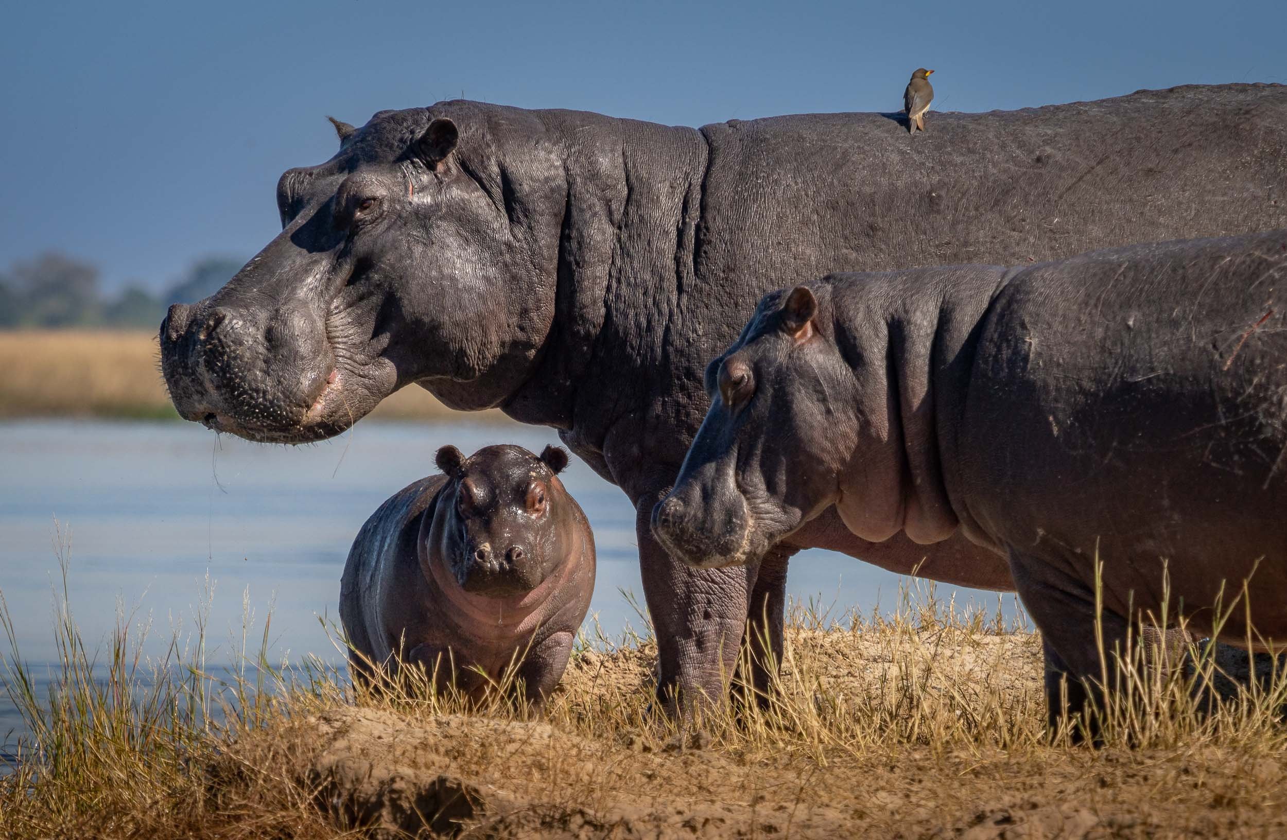
Bird Life
The river has amazing bird life, from Kingfishers, to Fish Eagles, Storks, and Jacanas. Not something I was previously too interested in, but observing their behaviors is intriguing, and trying to catch them in flight is a photographic challenge (which I never shy away from).
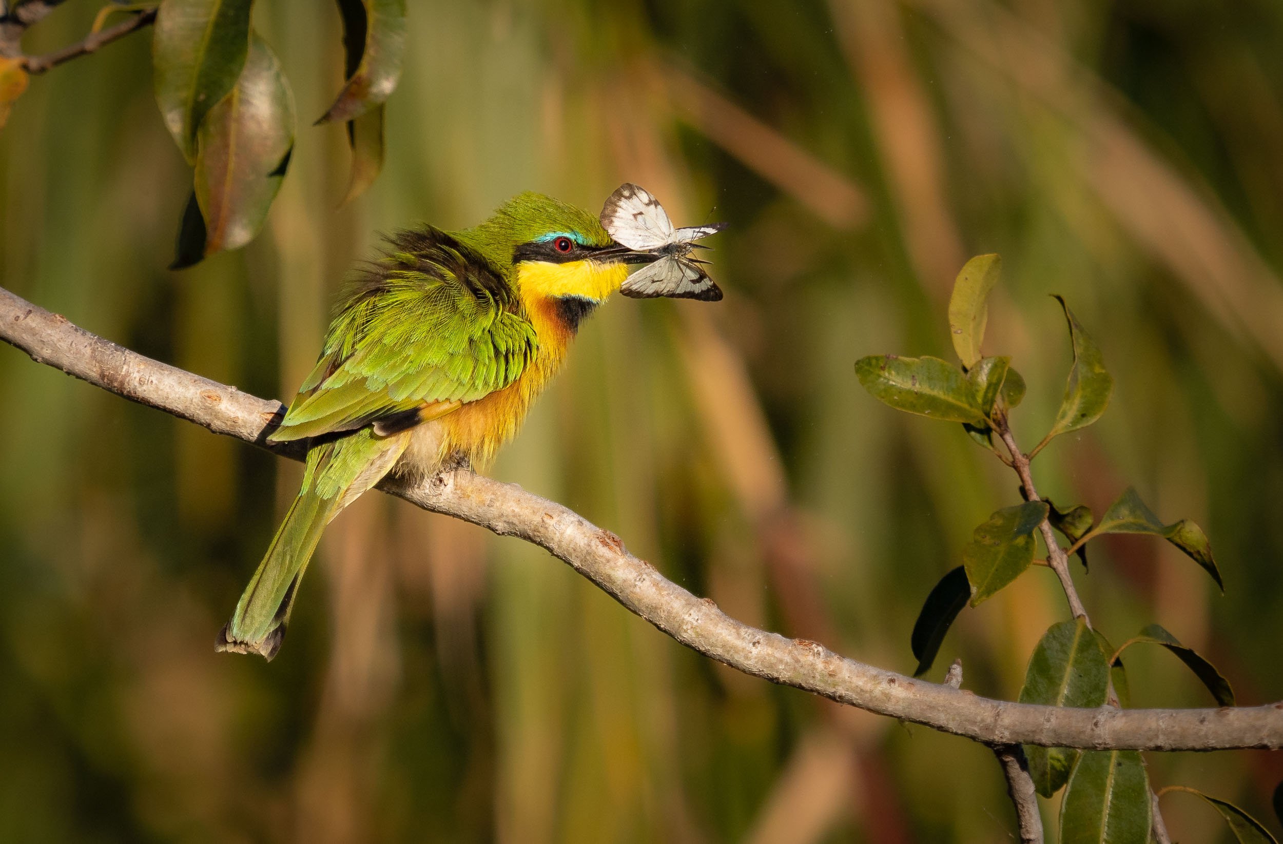
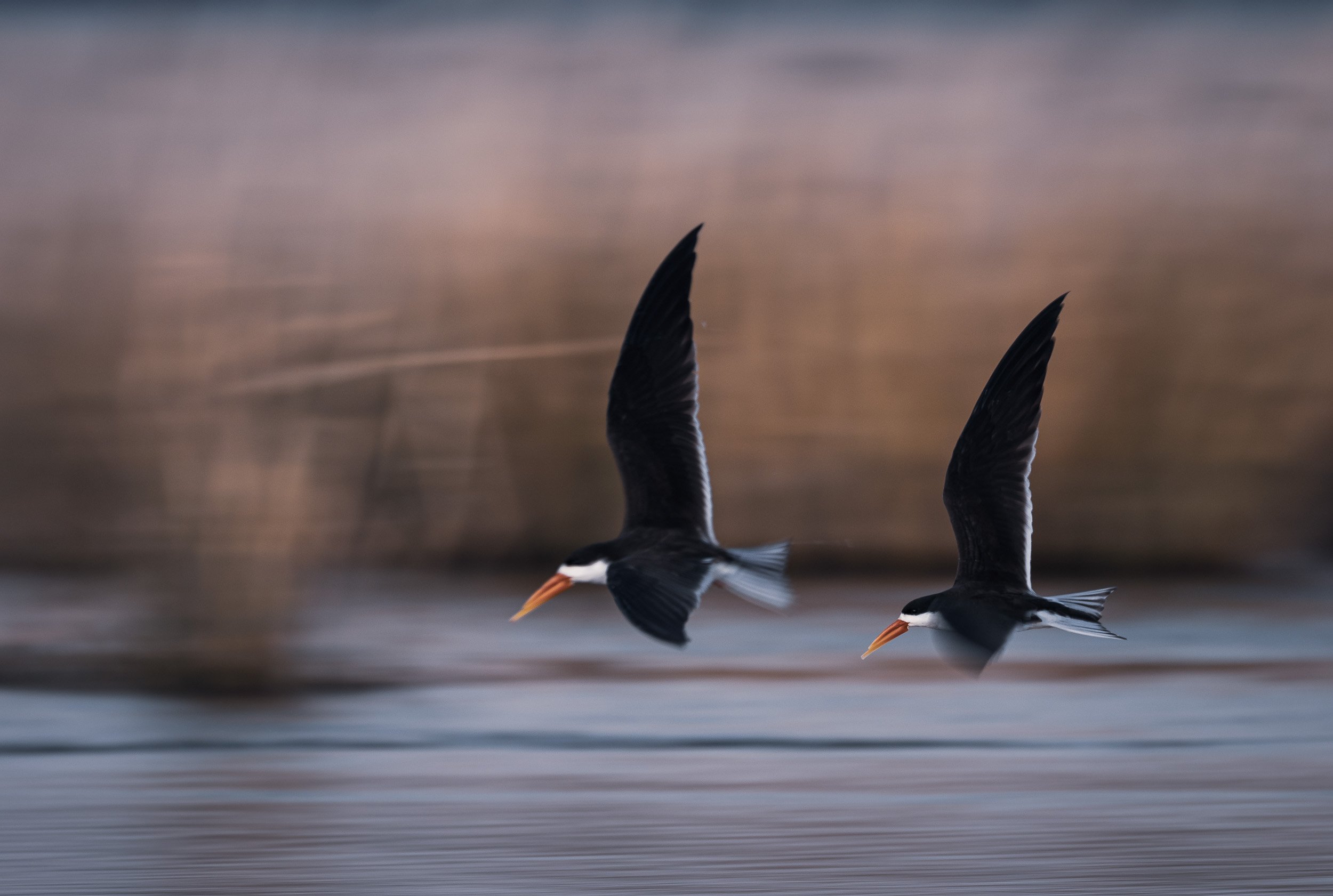
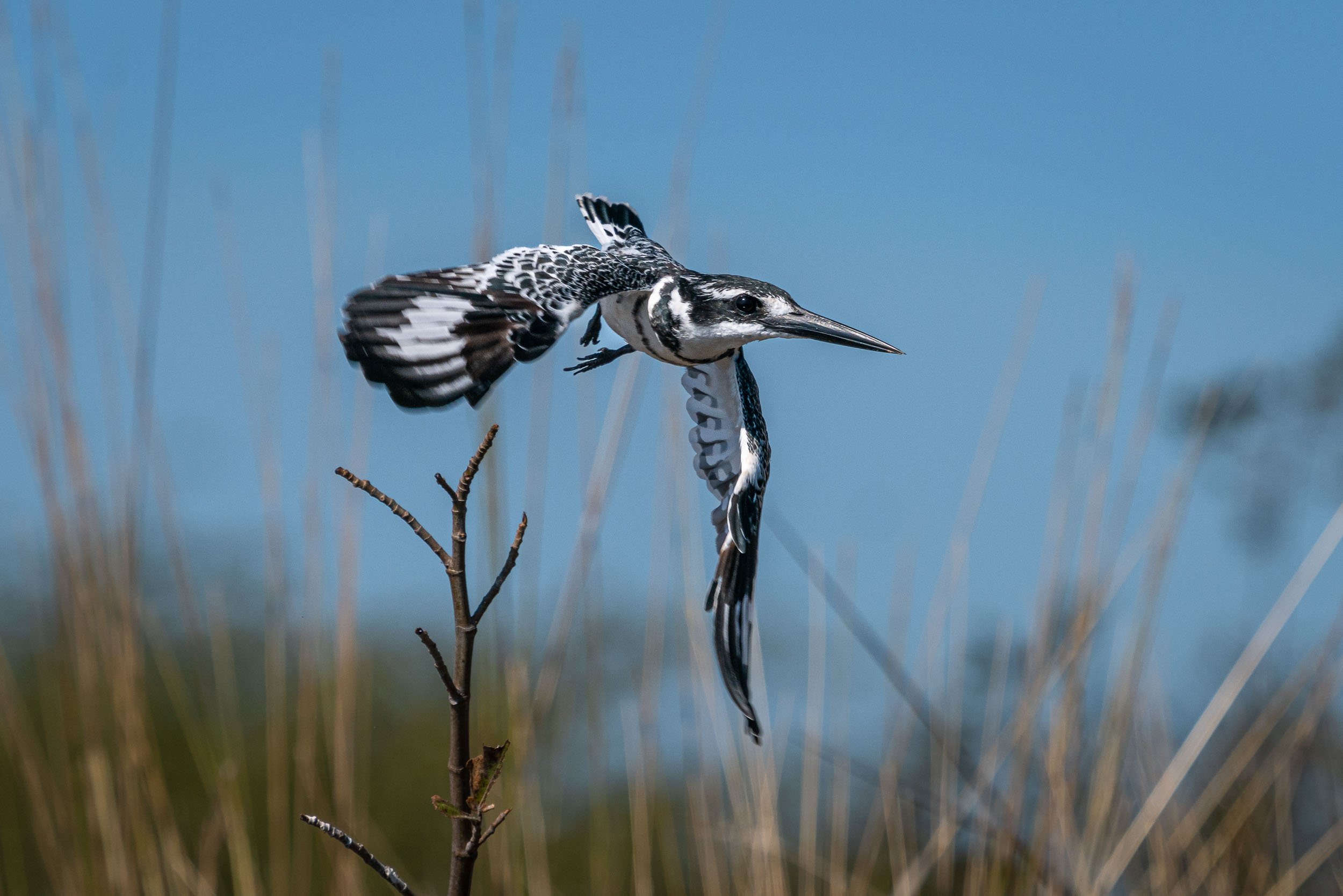
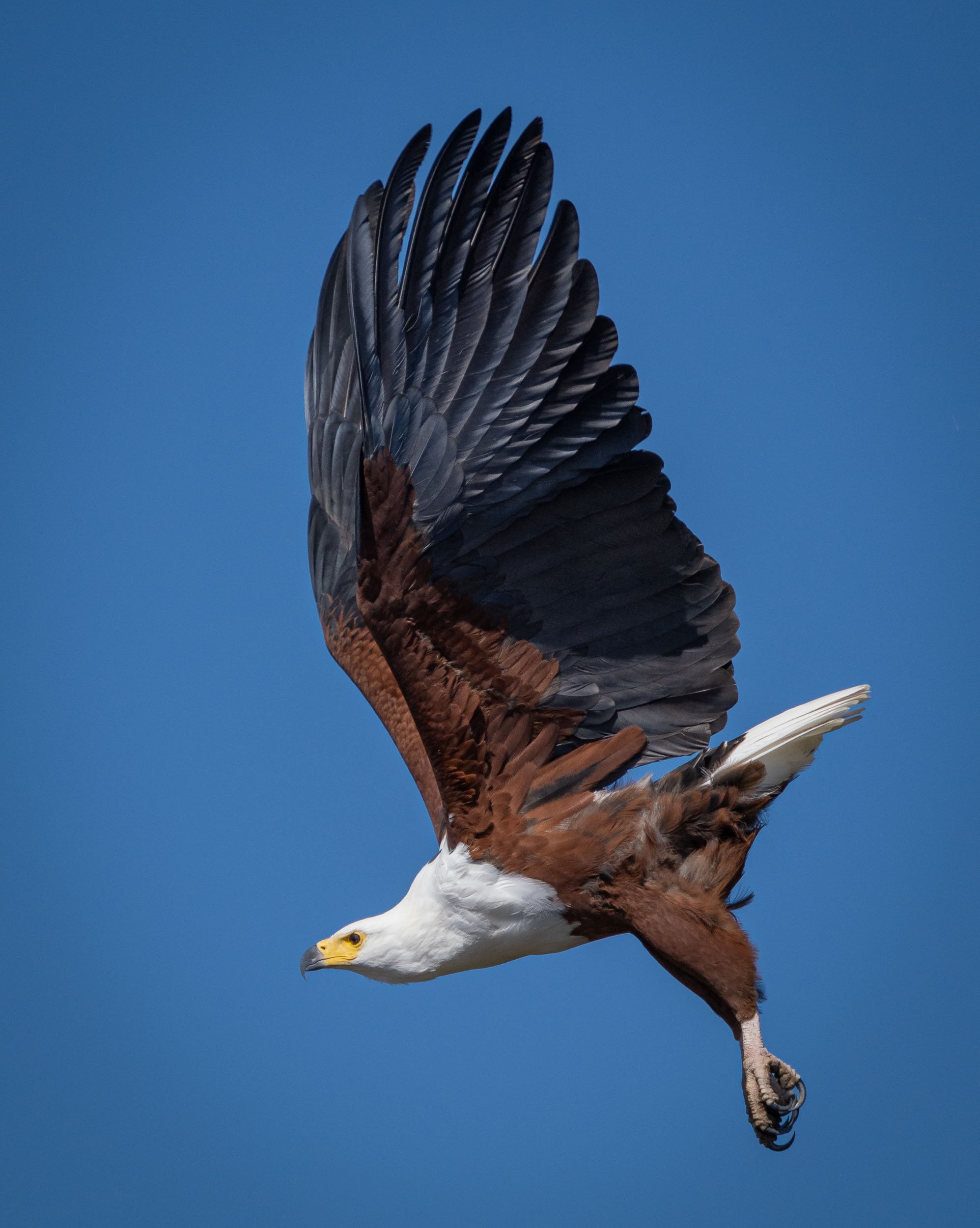
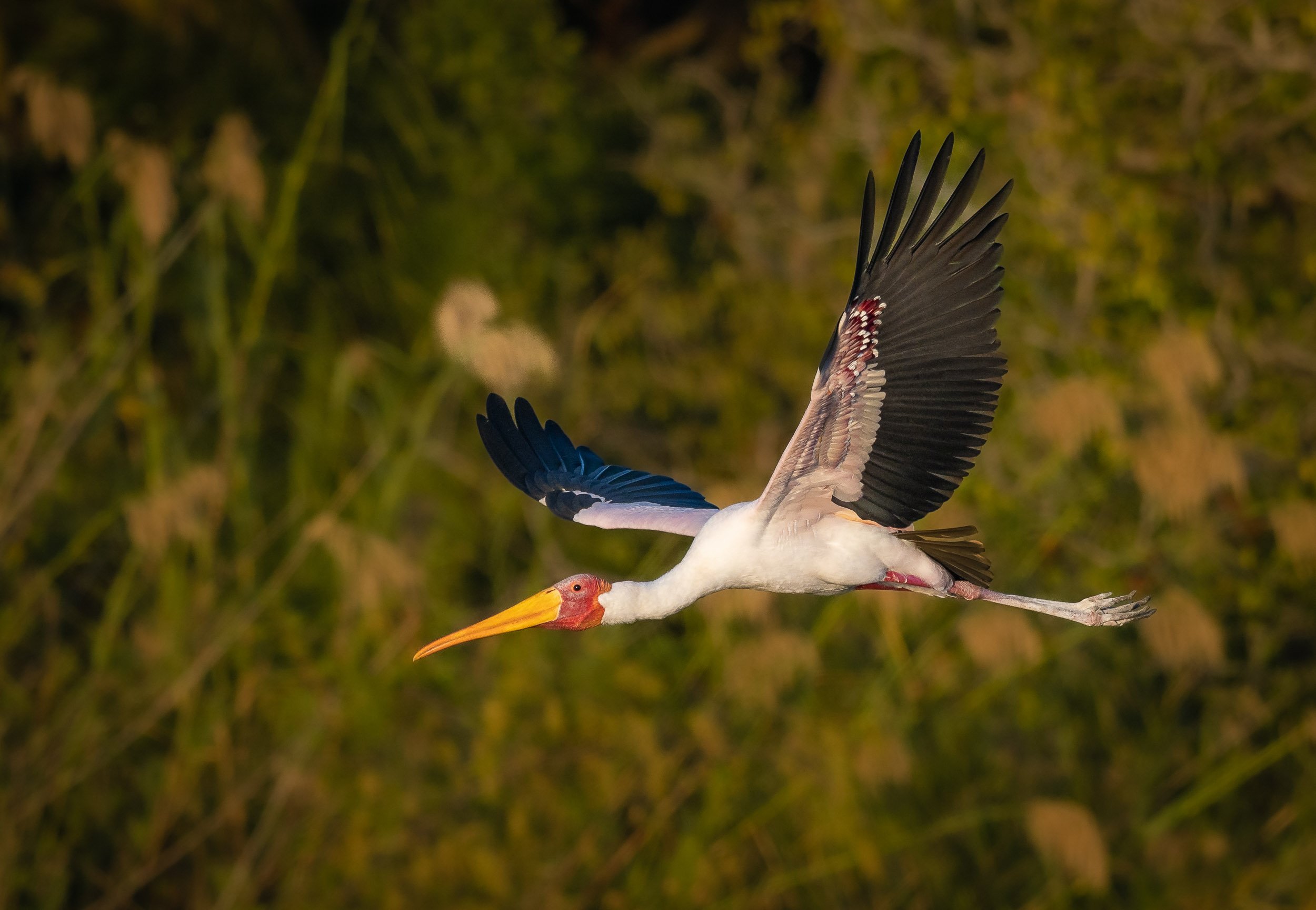
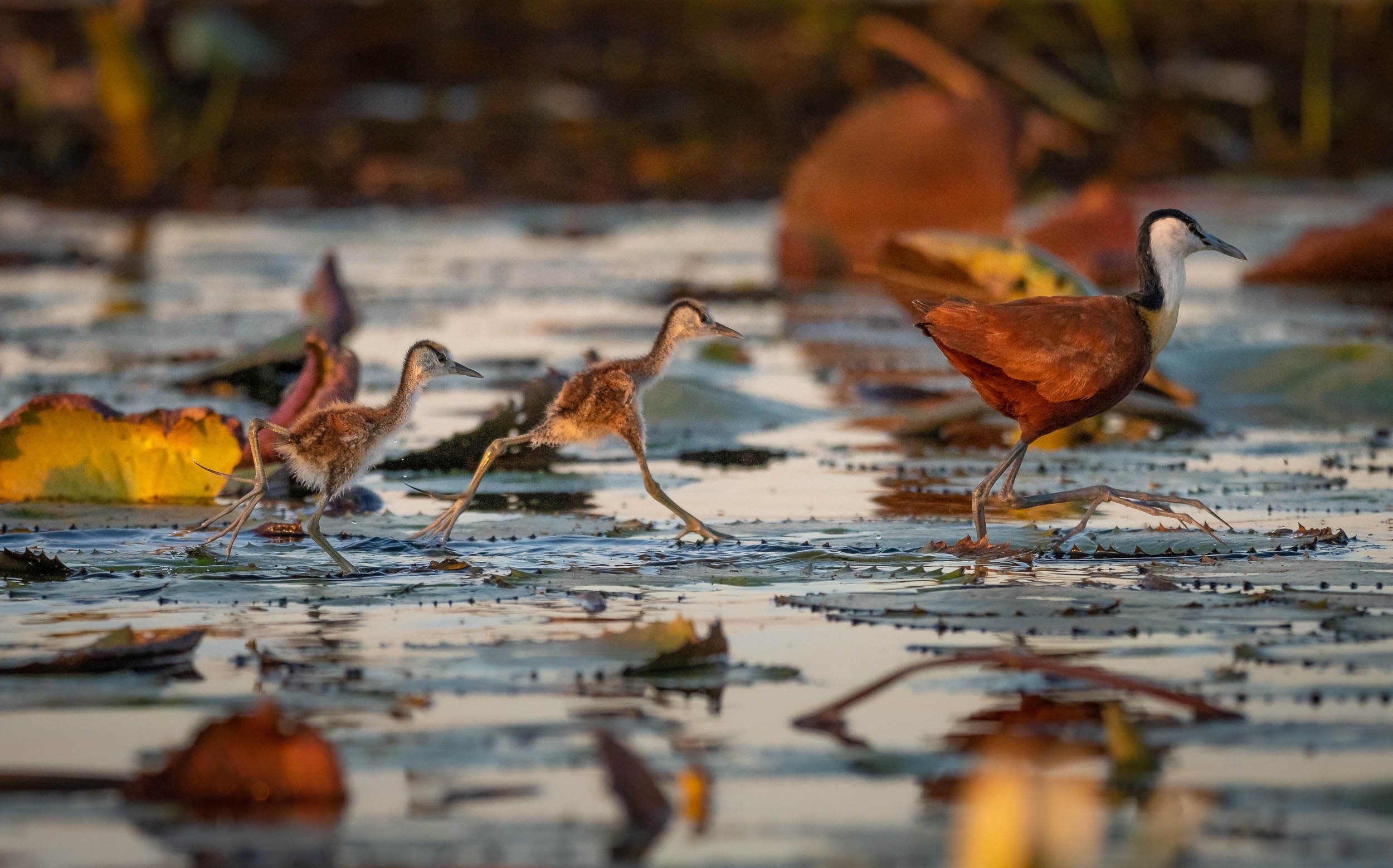
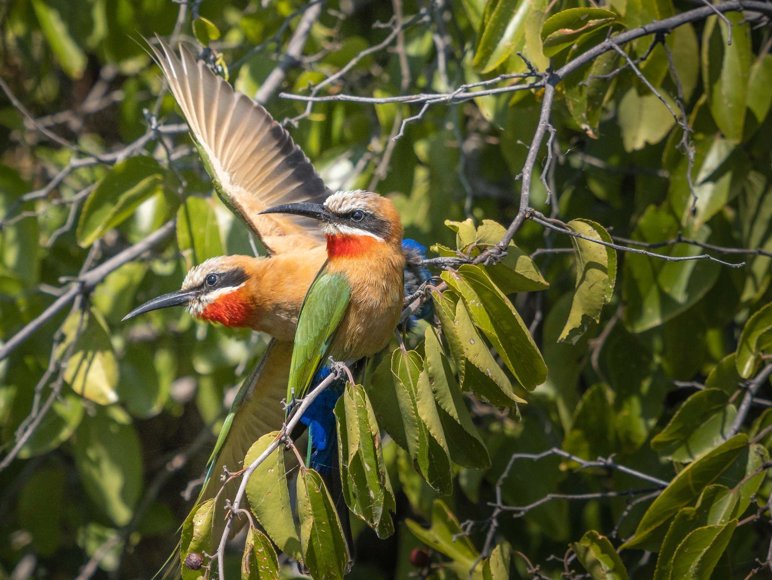
We were also lucky enough to observe some lions with a kill directly under the bushes on the shore.
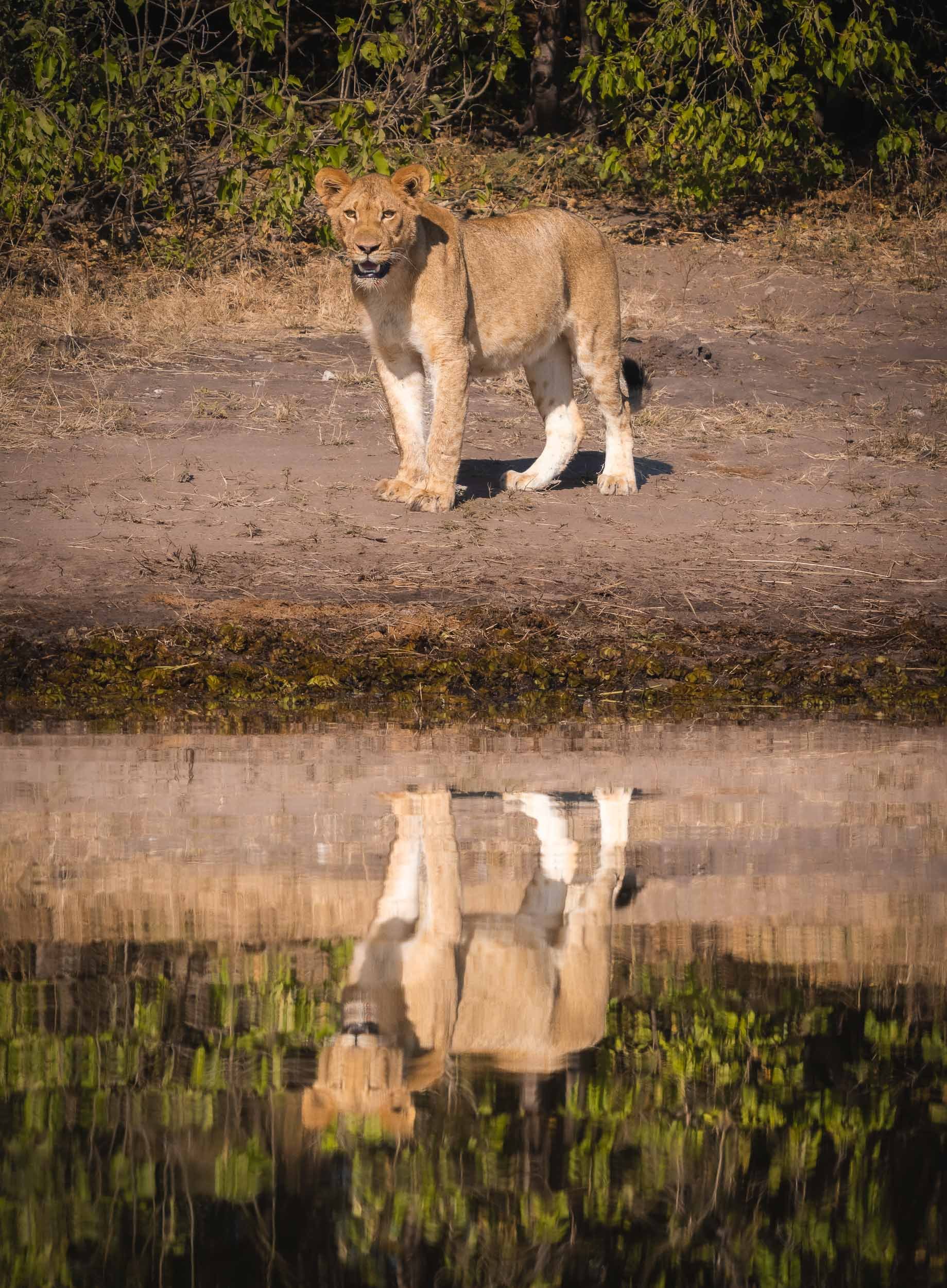

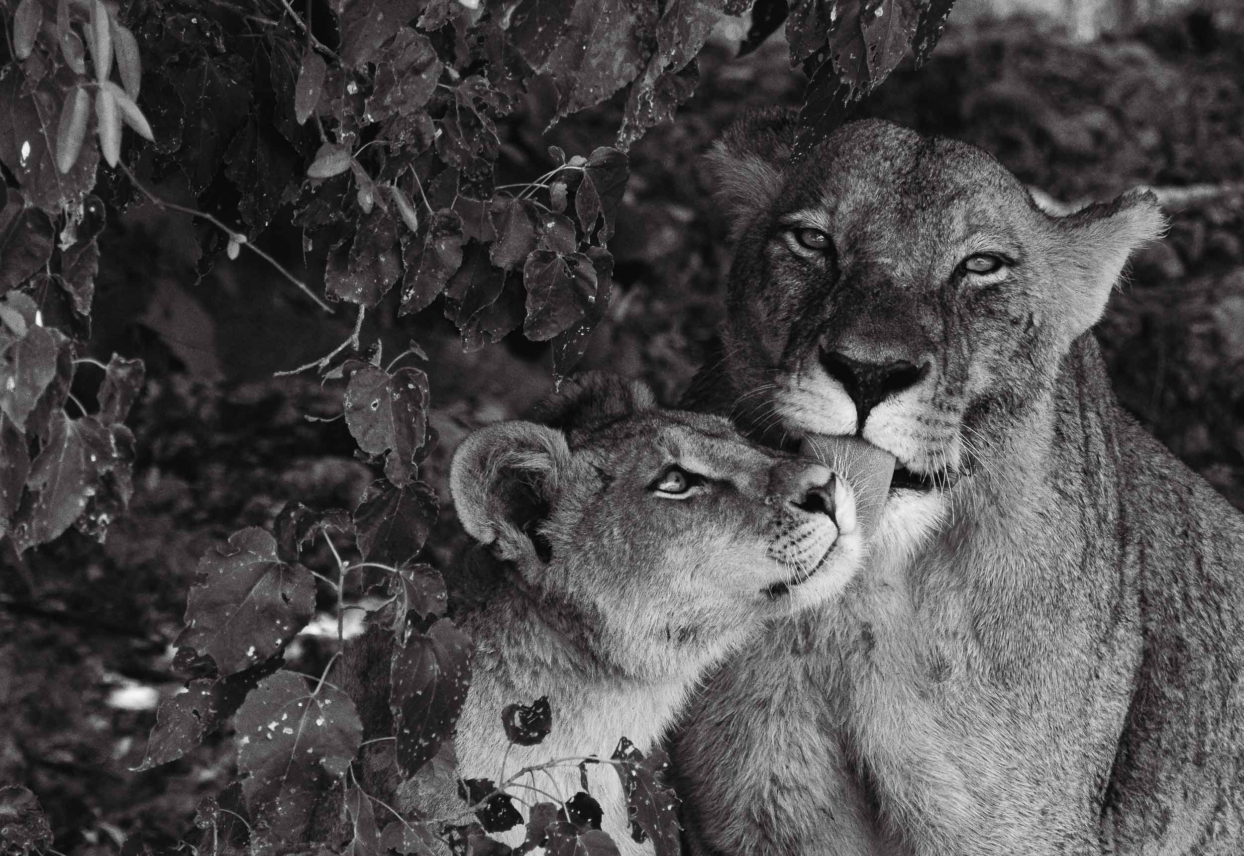
A few more animals by the water…
The Chobe river is actually the name of the eastern Cuando river, before it flows into the Zambezi. The National Park around it was Botswana’s first, and is its most biologically diverse.


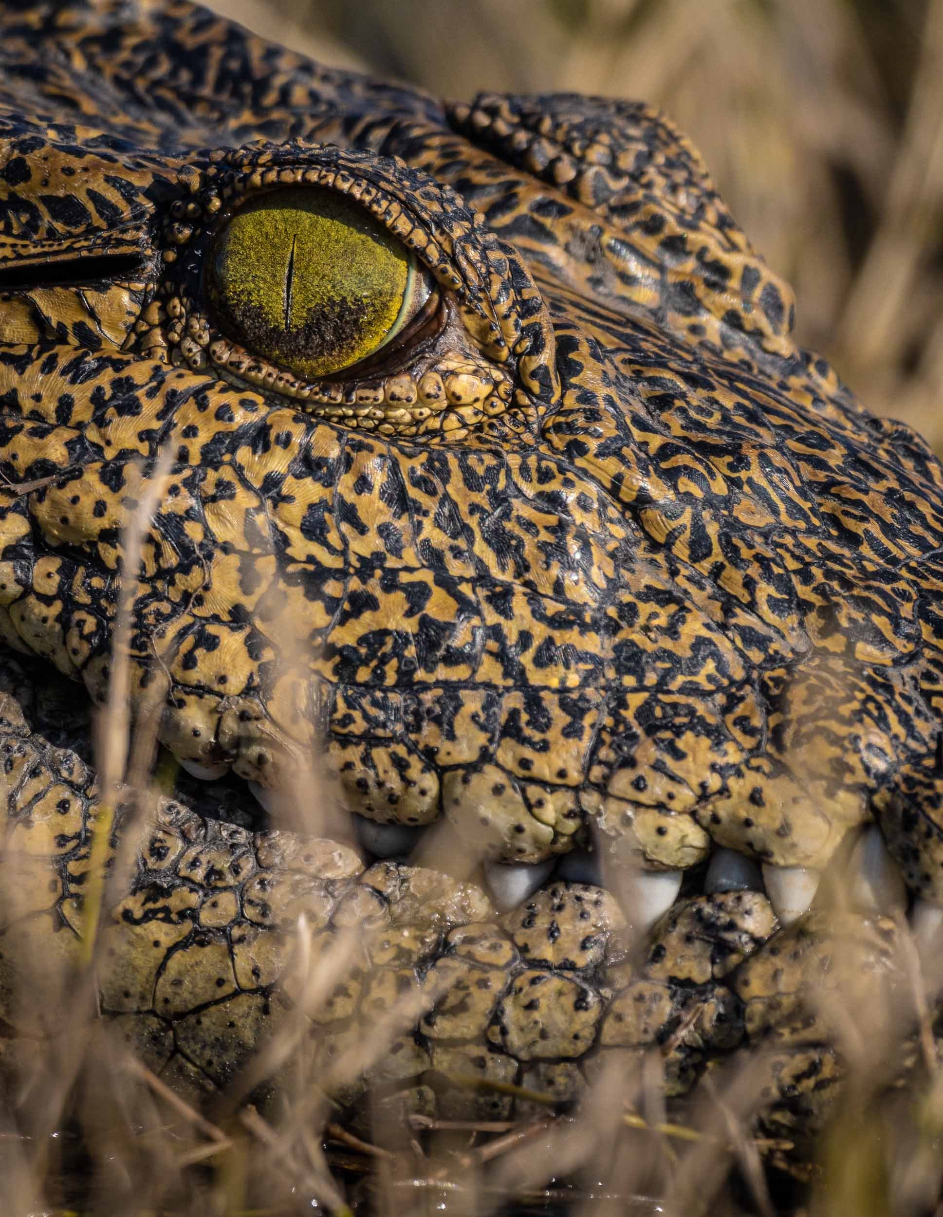

The Selinda Reserve
From Chobe we took a short flight to Selinda, a private concession in the greater Okavango Delta region. The Selinda spillway links the Delta with the Linyanti Swamps, and up until 2009 has been dry for decades. Now, its floodplains and channels have water flowing for many months of the year, becoming a home for wide variety of wildlife.
From Above
It was a good place for some aerial views, and what’s better for that than a helicopter? A 45min flight above this amazing landscape is the source of these bird’s eye views of elephants, crocodiles, heartbeests, and hippos in their environment.
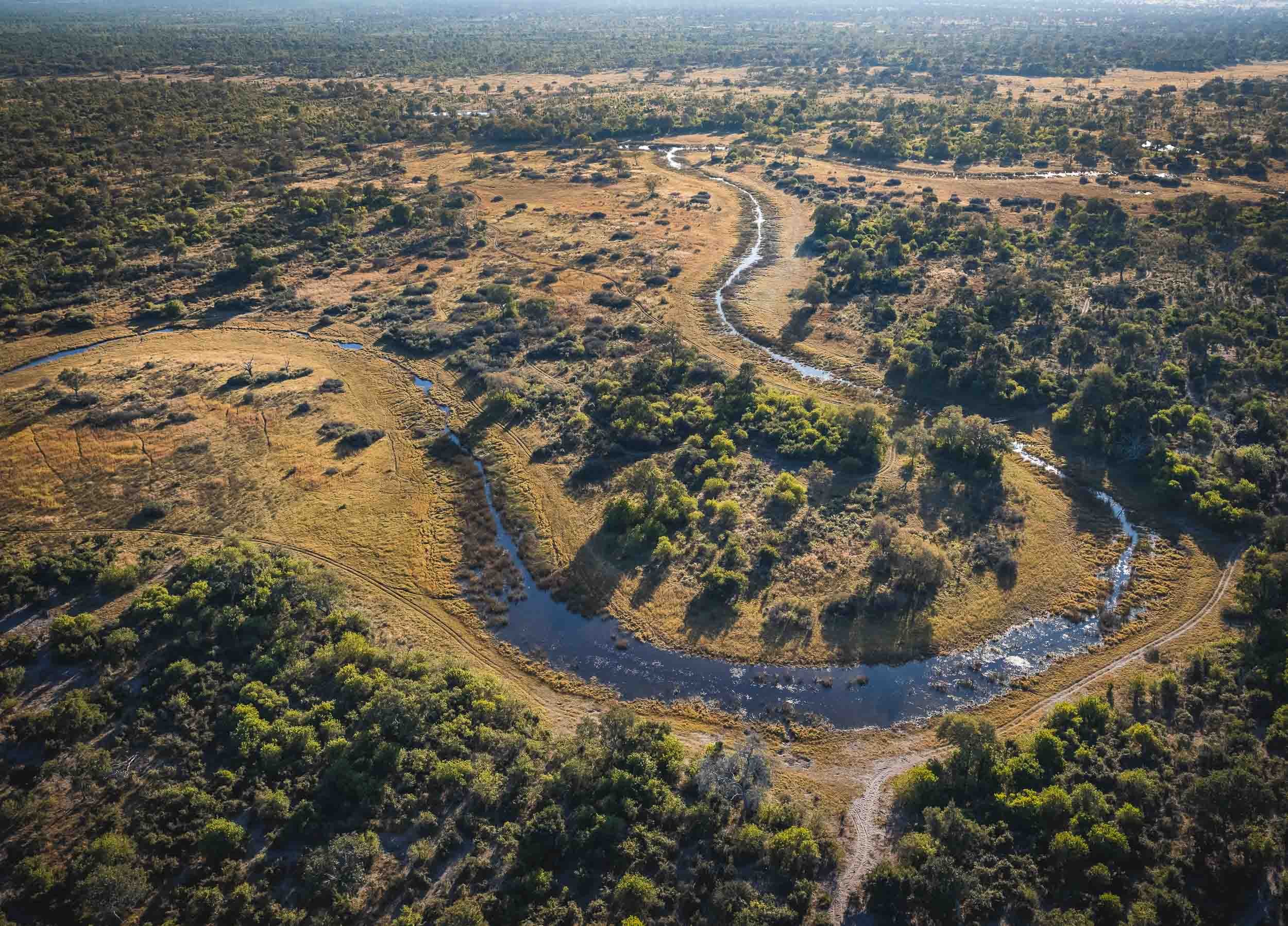
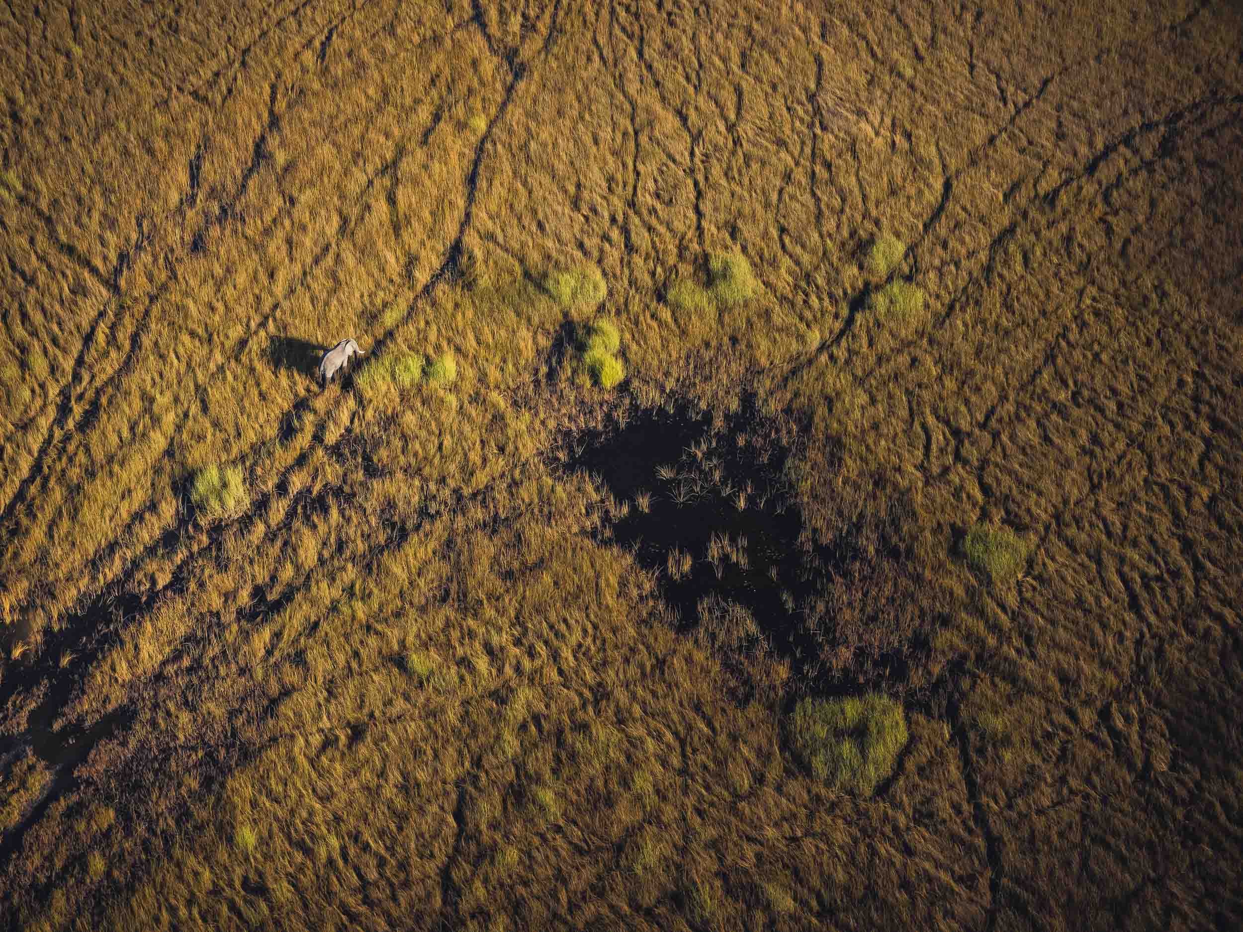
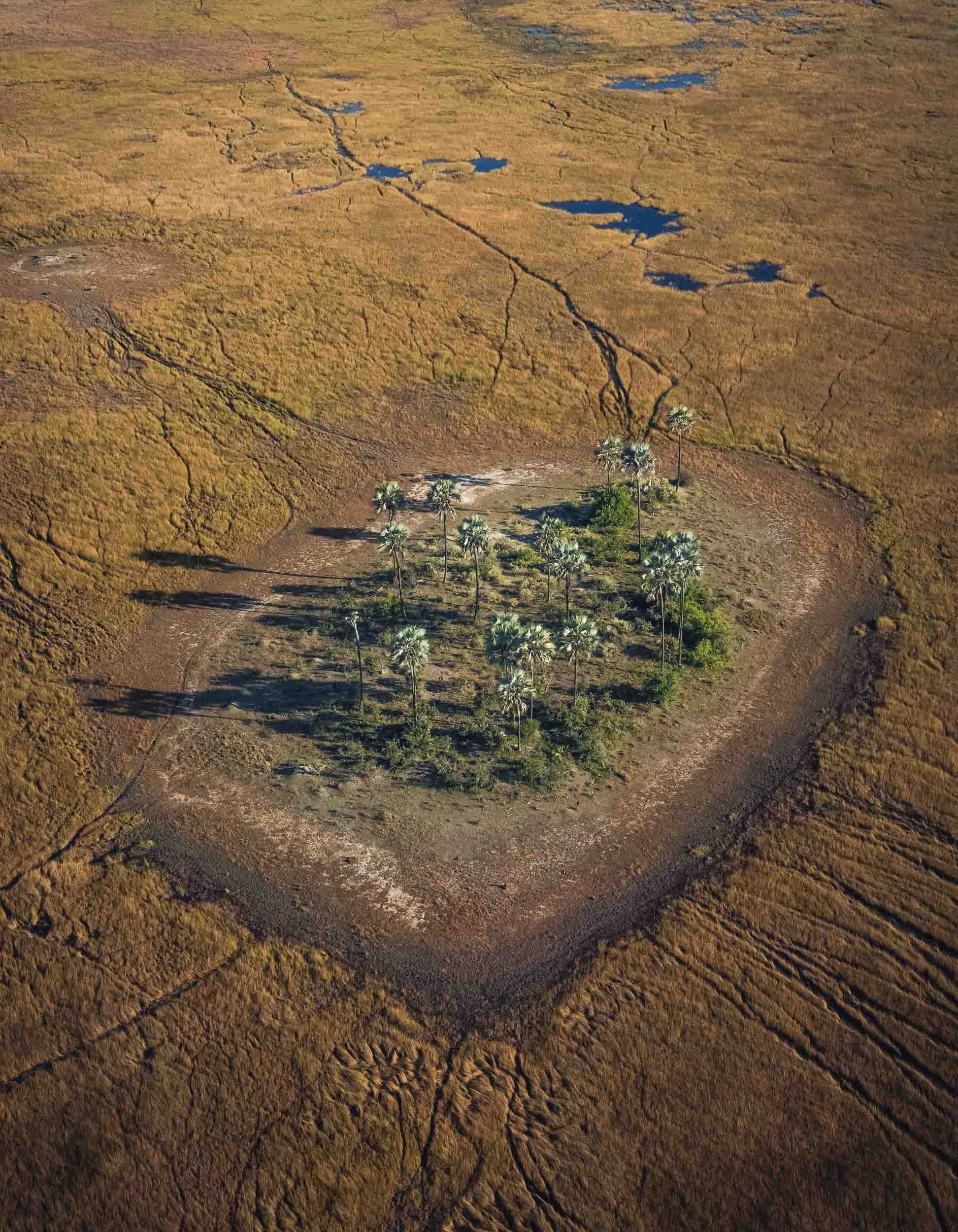
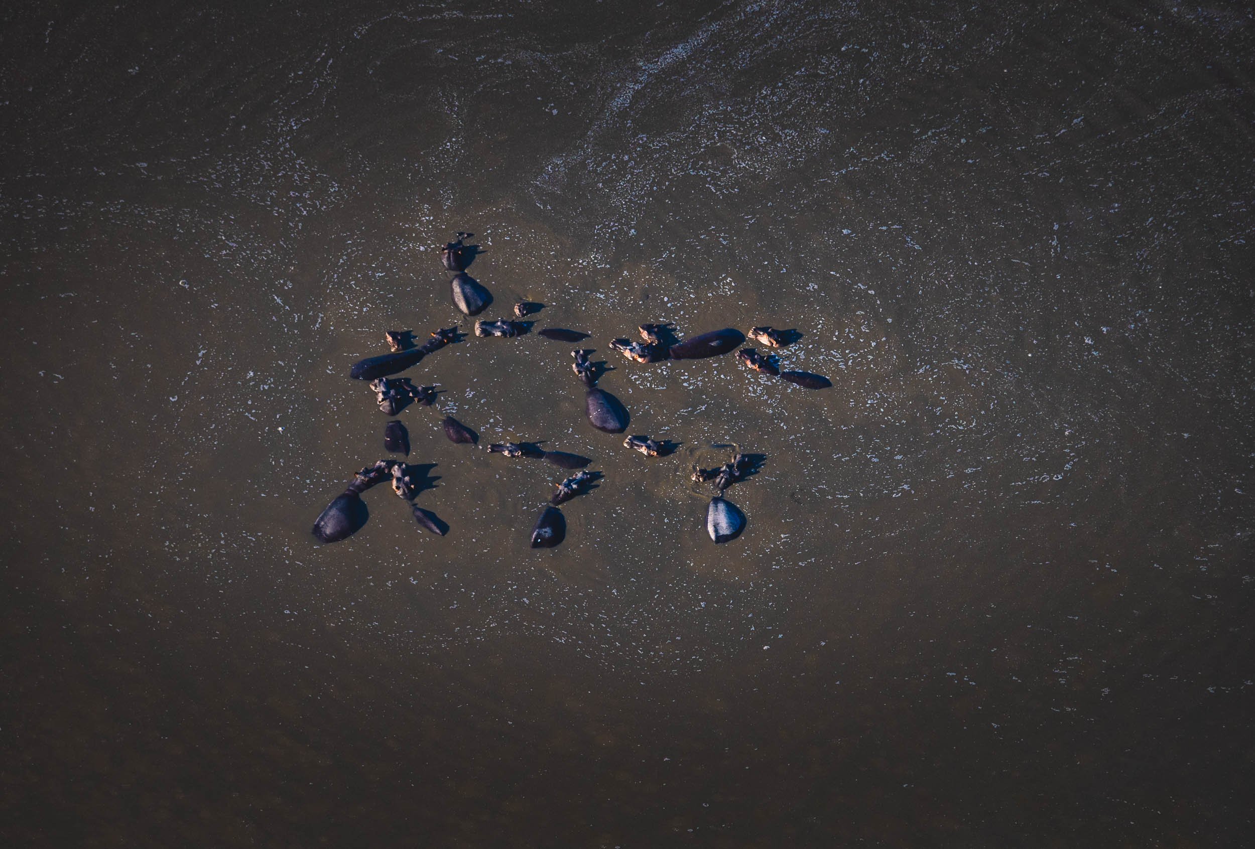
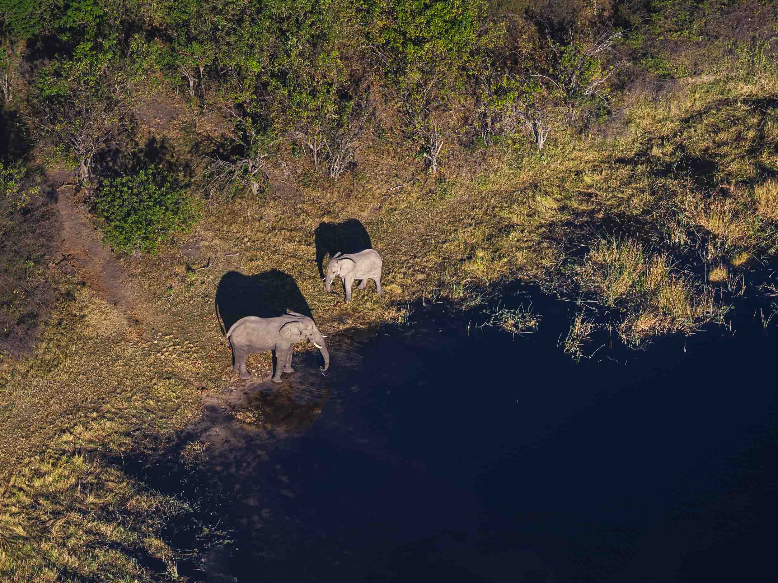
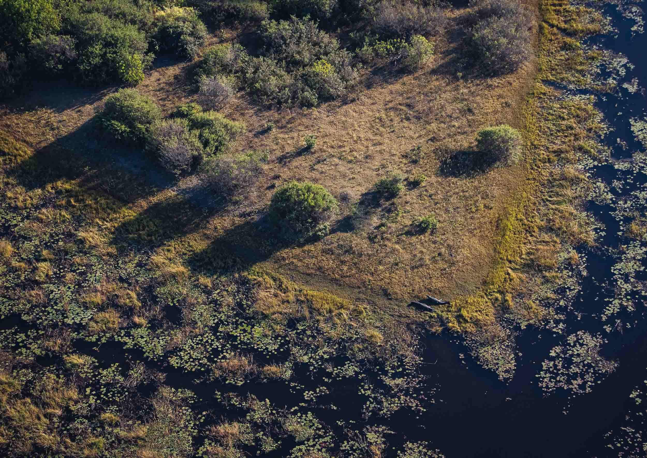
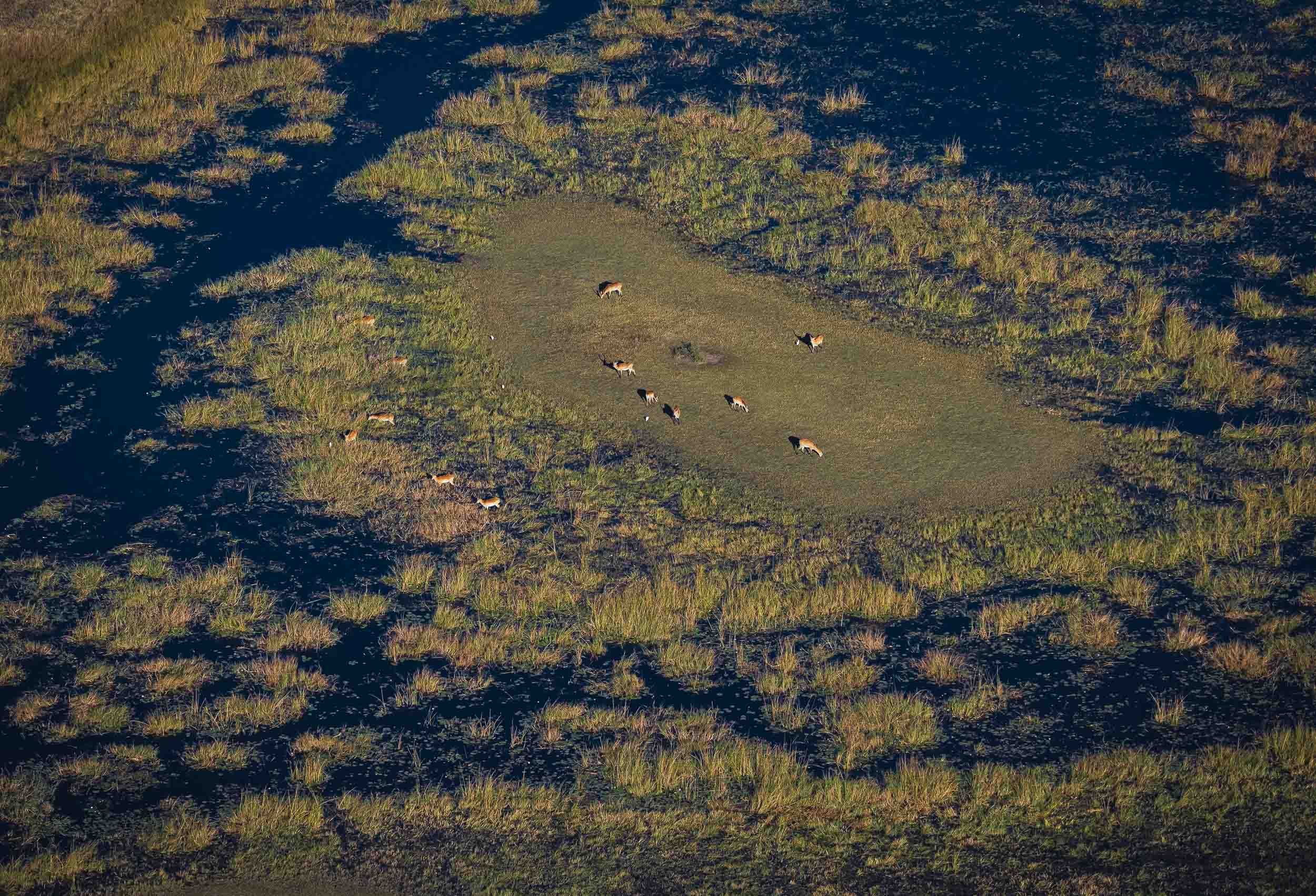
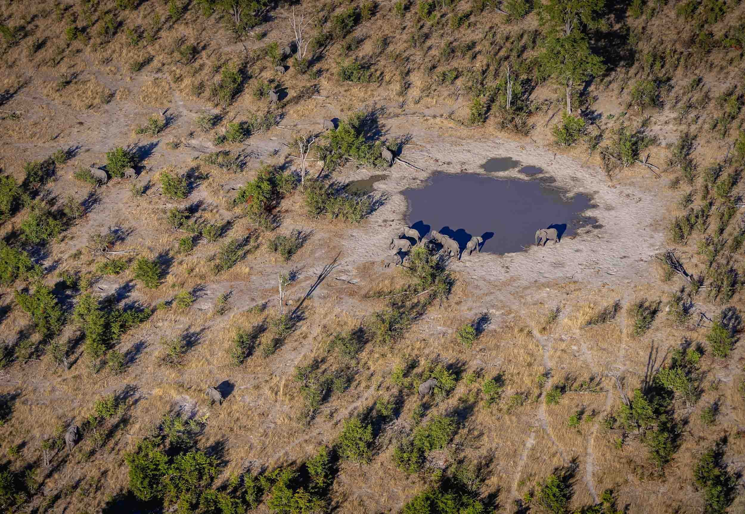
Lions
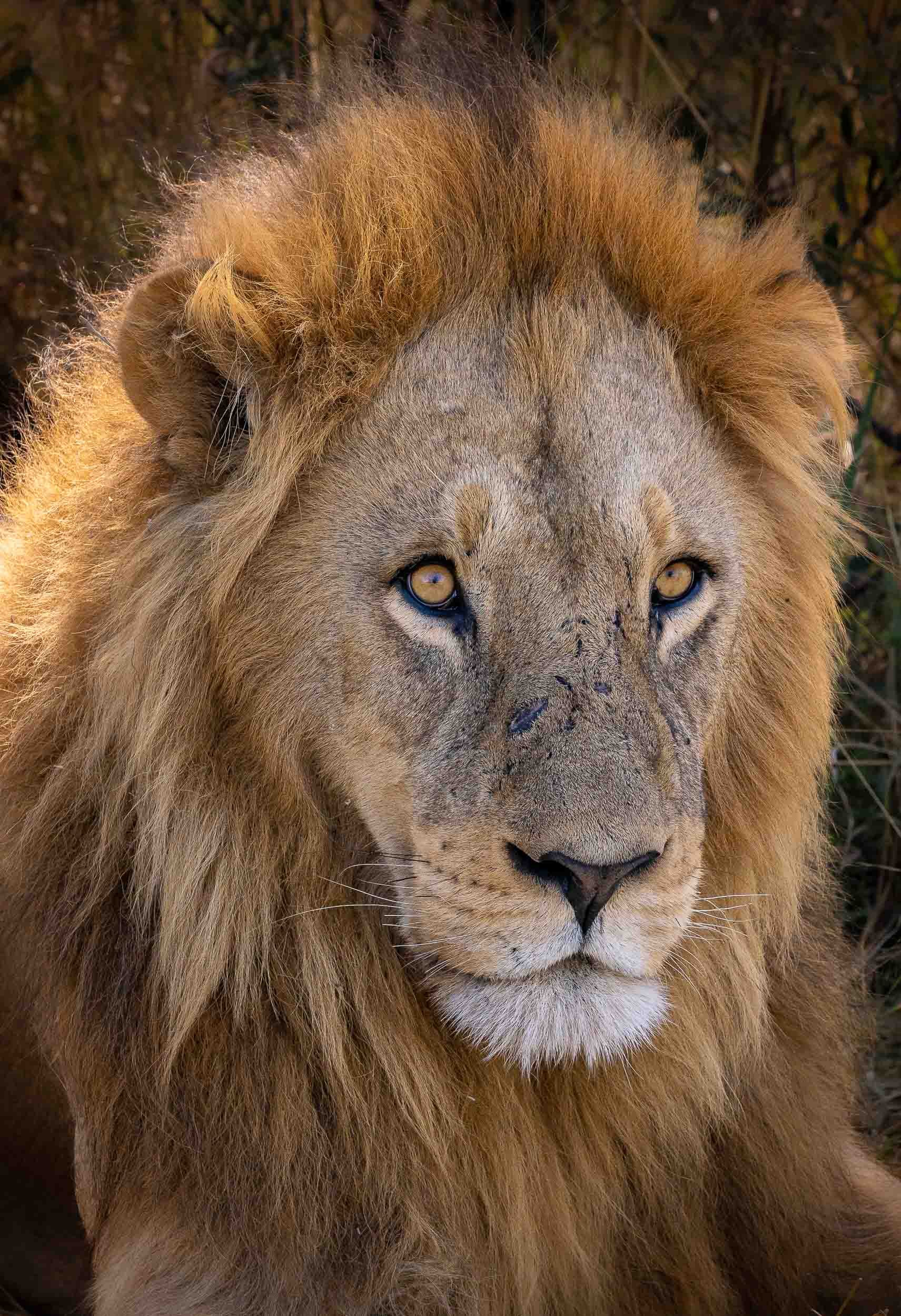
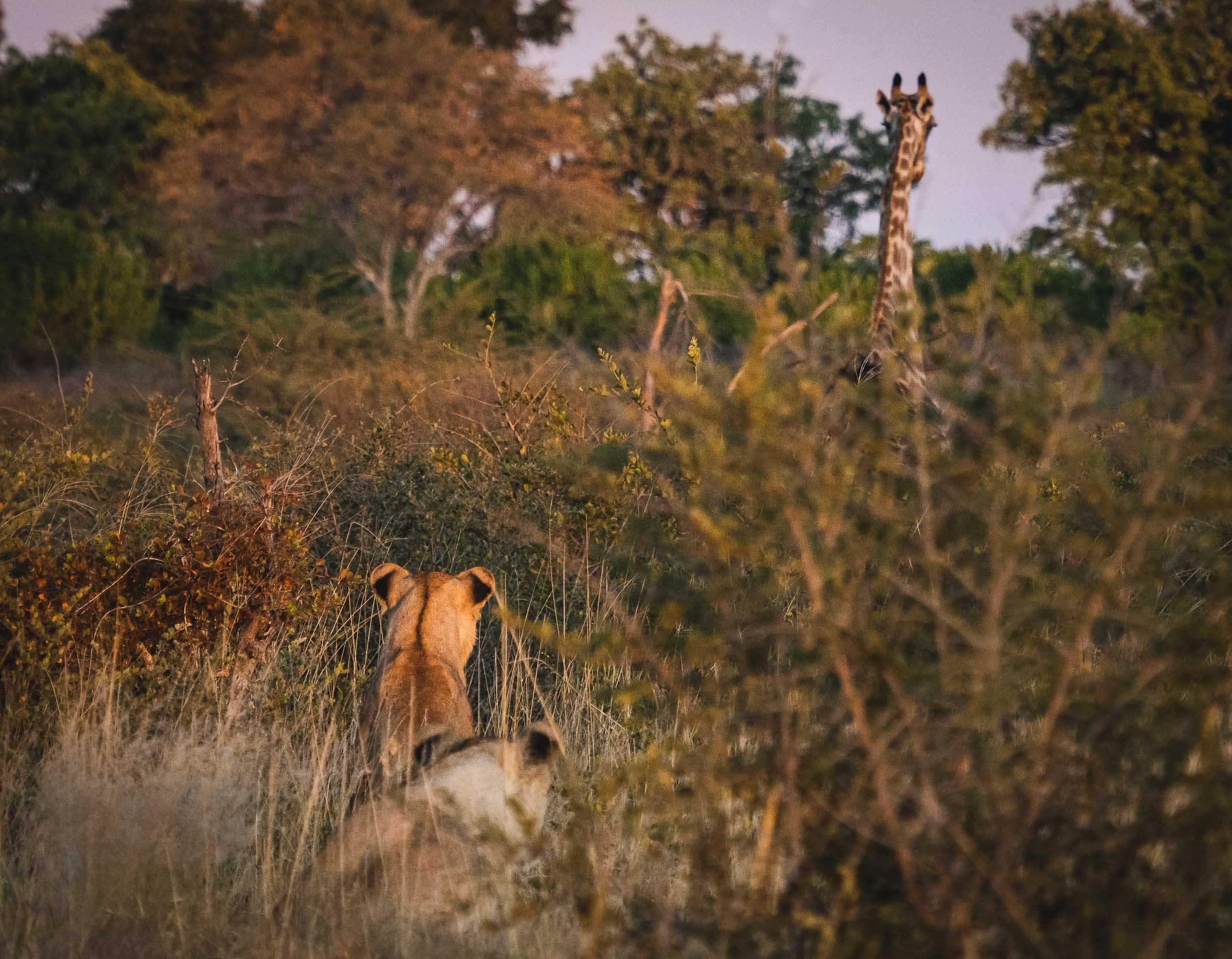
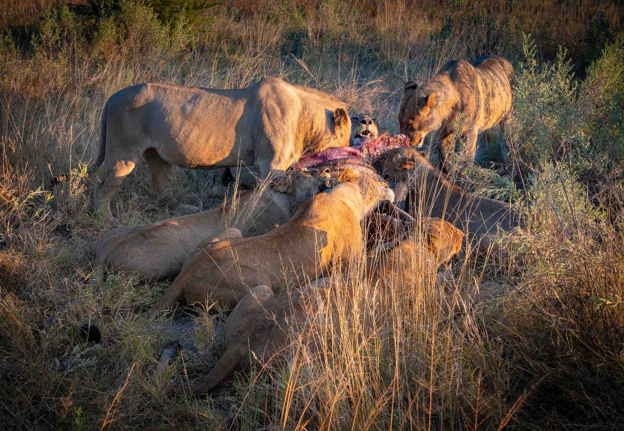

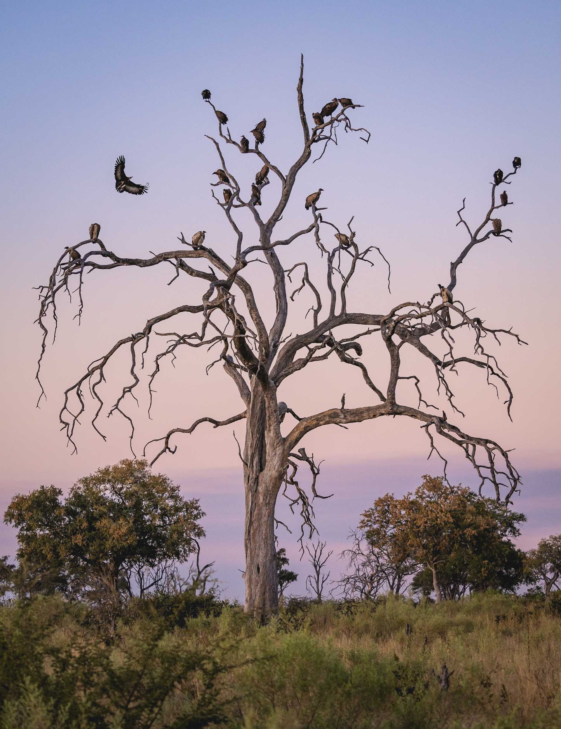
The Leopard
It’s always special to see your favourite animal in the wild, but a sighting like this makes it even more breathtaking. We spent four days, 8 hours a day, looking for this Leopard female and her 3 month old cub. On the very last morning, our guide - Stitcht, who called himself a legend and lived up to it - saw her sitting on a termite mount in the distance. We followed her when she called for her little one, and then climbed a nearby tree. They spent 15 min cuddling and cleaning before she rushed off to try and catch some breakfast, telling her cub to hide in the thick crown of the tree.


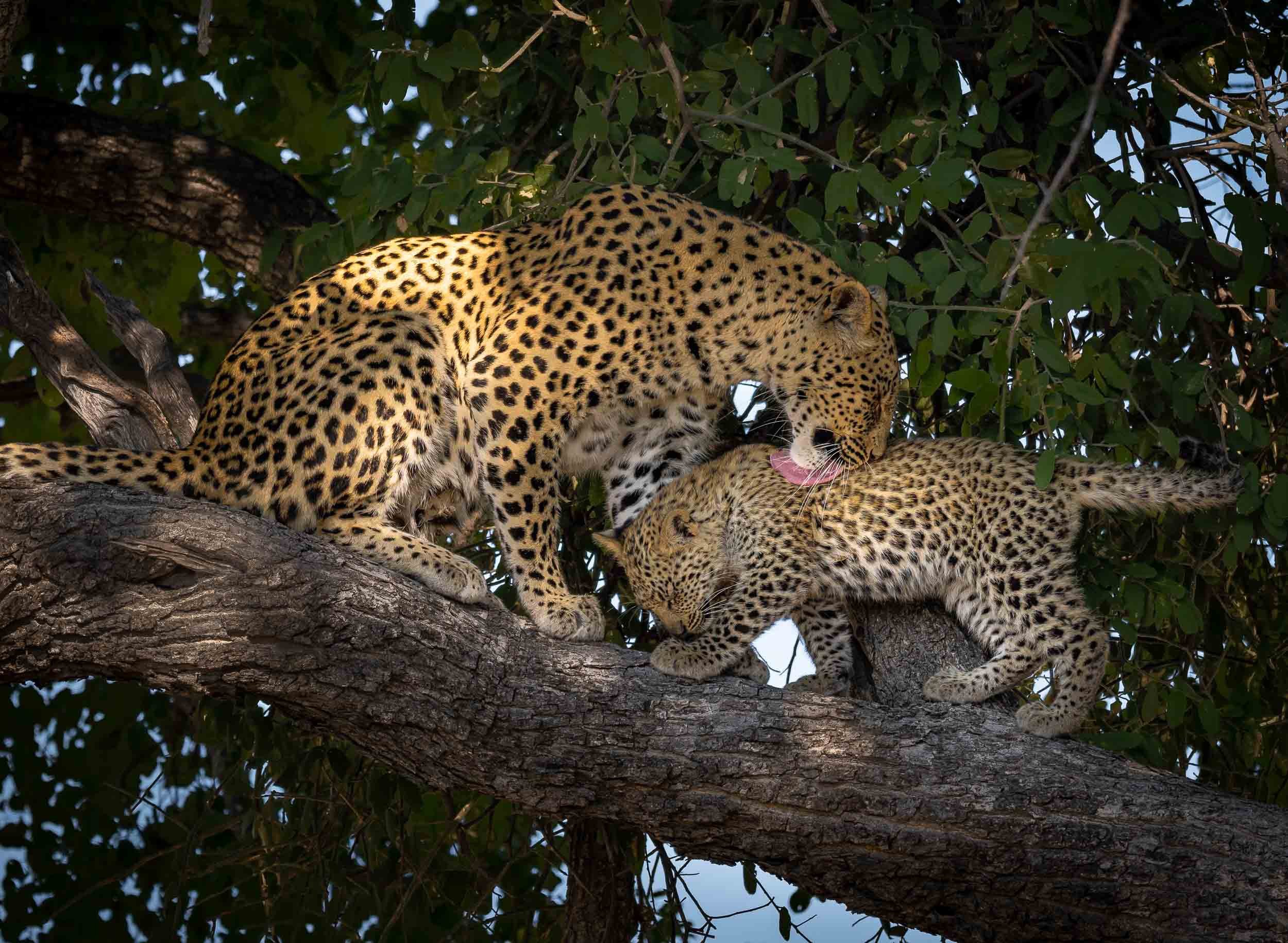


Watch them in motion
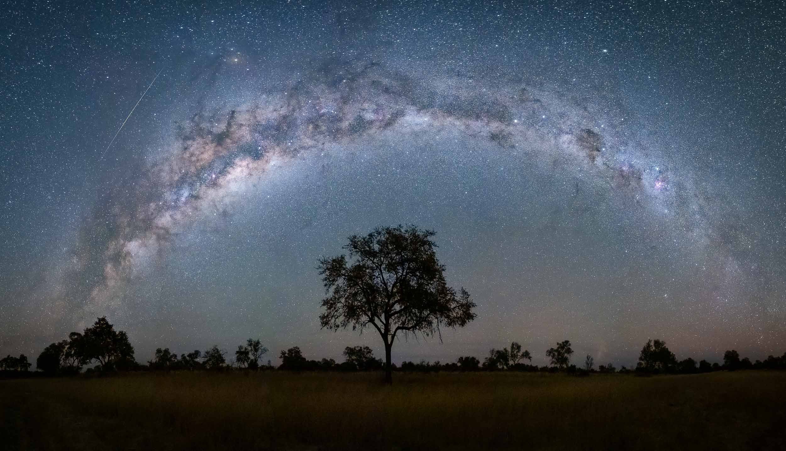
A few more…


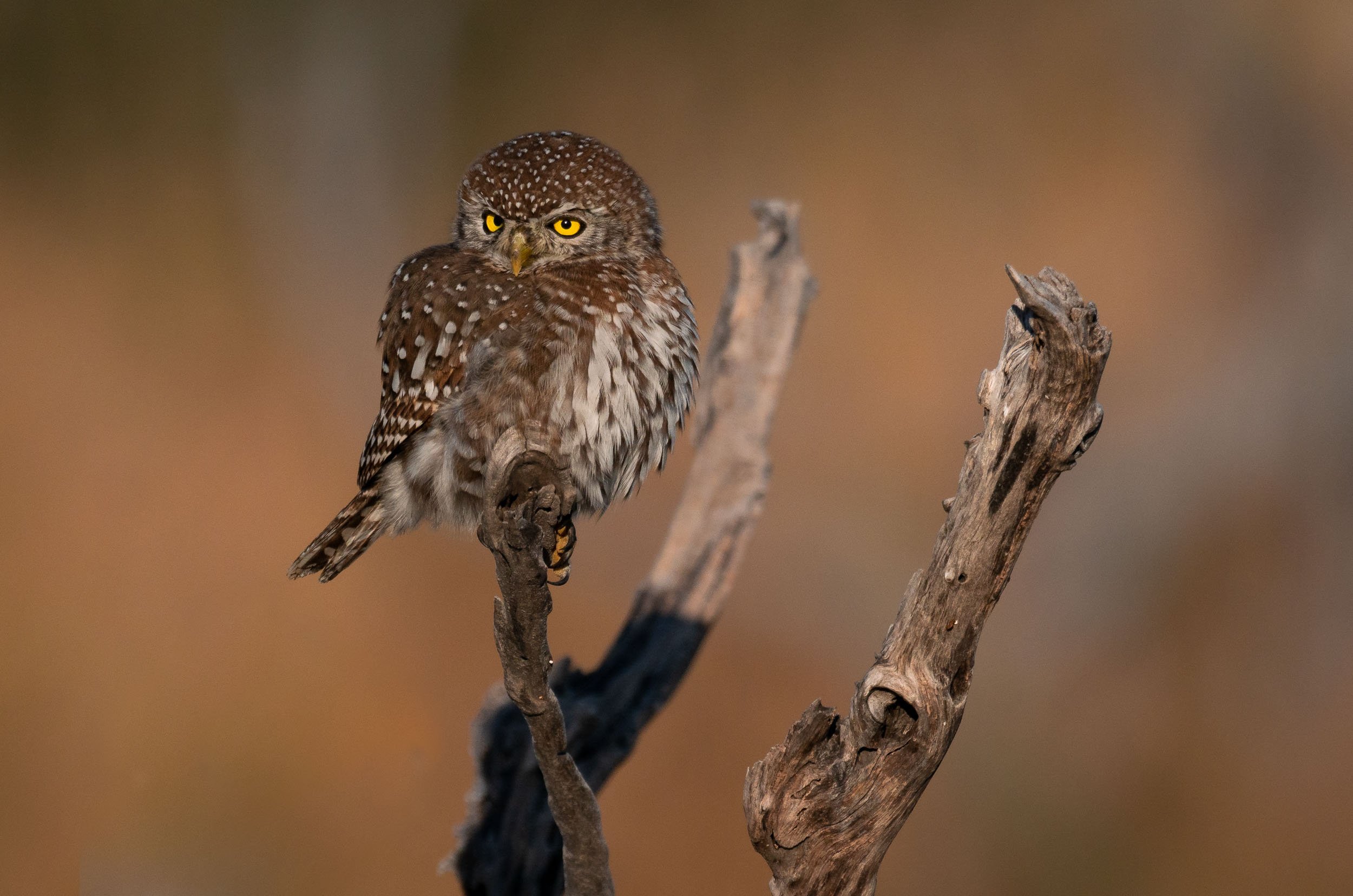

Dinaka
The last stop was in Dinaka, about 100km north of Maun, and bordering the central Kalahari. It’s a dry area this time of the year, but it did have a few special places to photograph from (and sleep in).
Jackals - Always Up To Something
After having observed them for a good amount of time, these mammals have climbed up in a my favorite animal rating list. A constant source of entertainment, and always giving an impression of being up to no good, I’ve seen these mischievous omnivores catch doves, chase away animals much larger than them, and strut around like they are the kings of Africa.
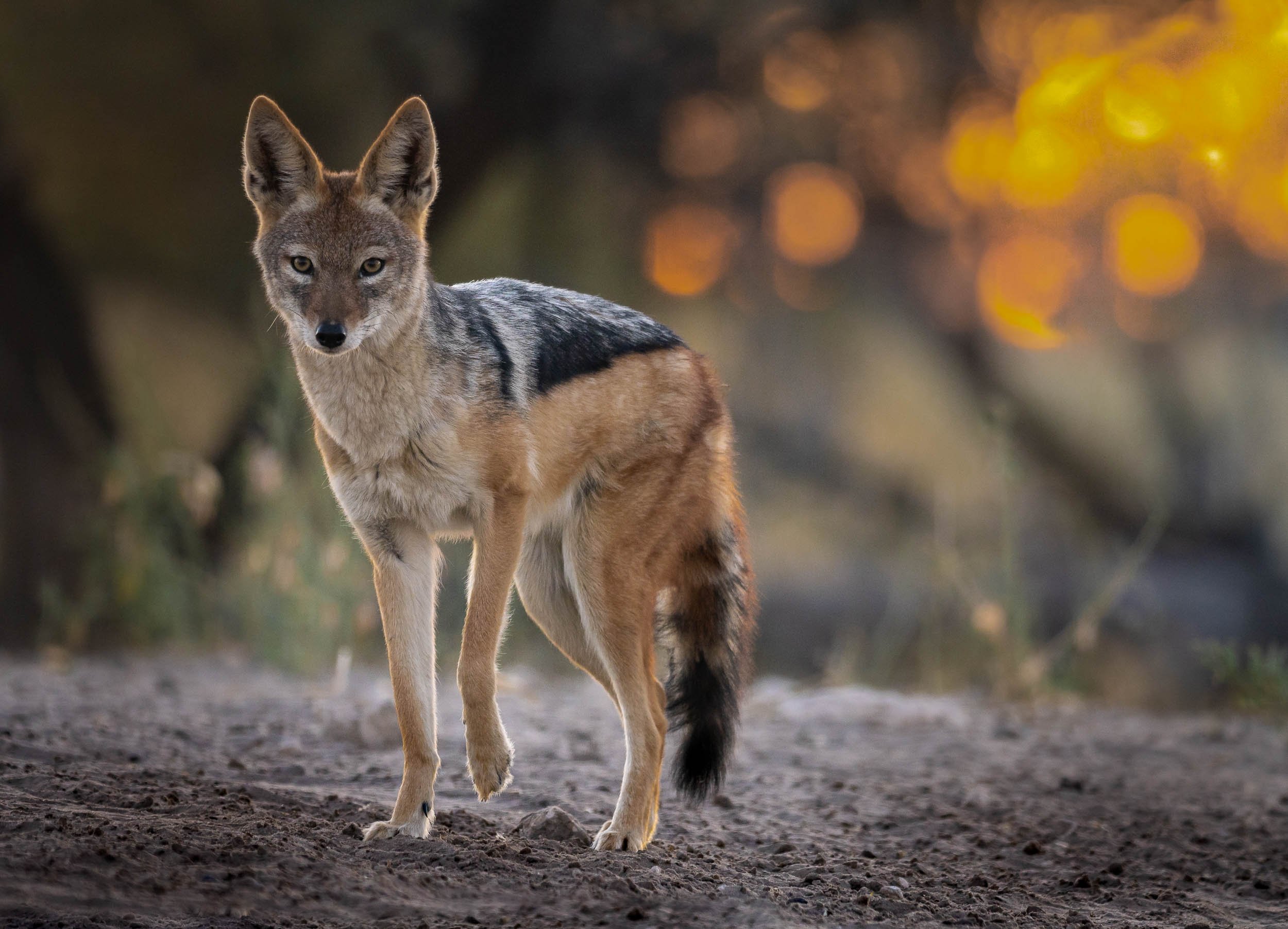
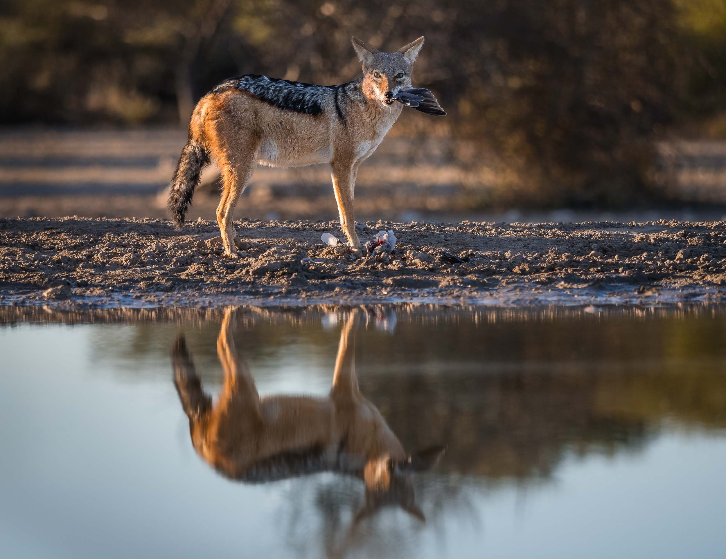
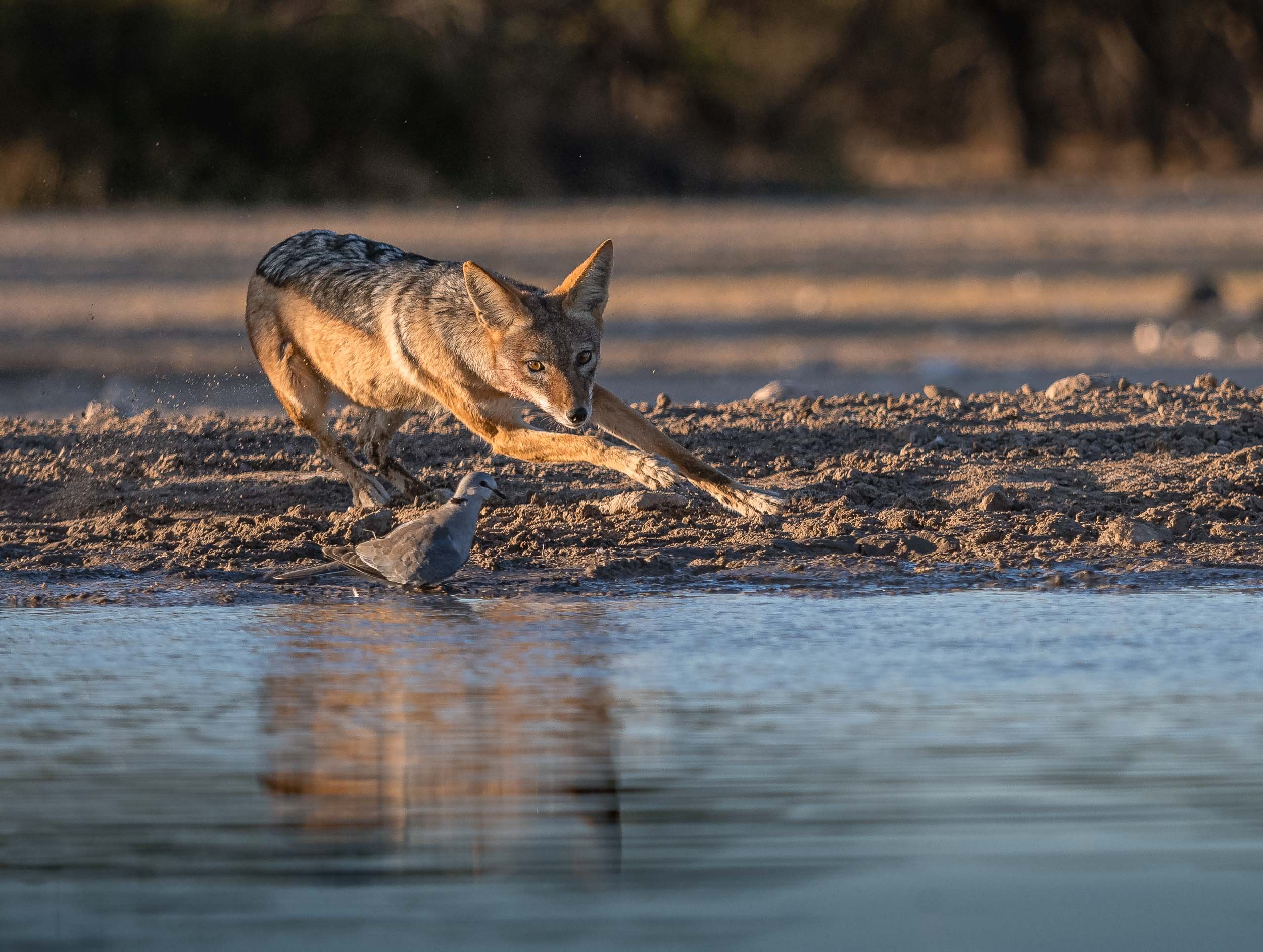
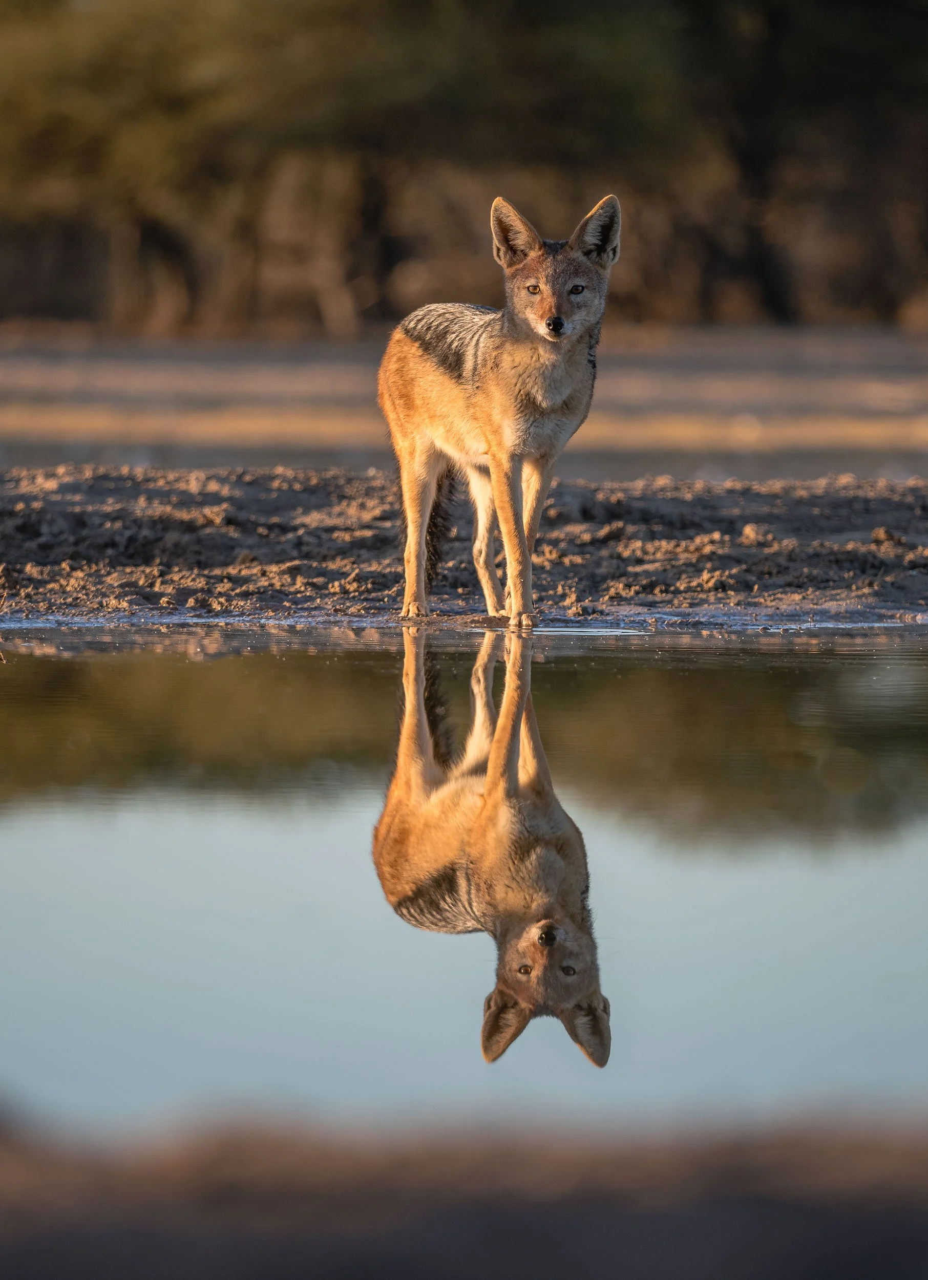
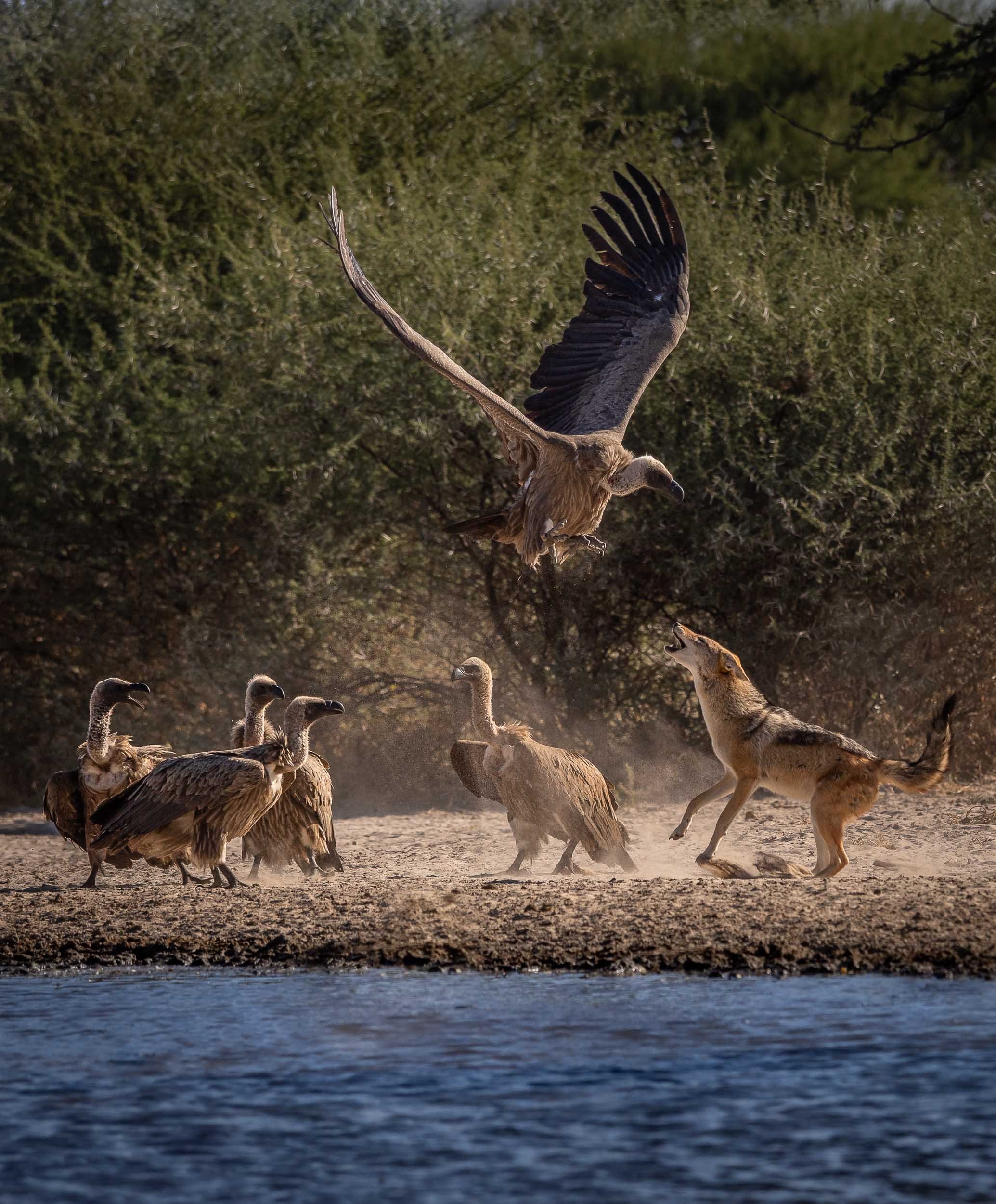
Starry Bedroom
Our lodge offered this special experience: A night under the stars, sleeping on an elevated platform in the bush - an opportunity I couldn’t miss out on, so one evening after dinner, I was dropped off 20min away from the camp to see what it feels like to sleep with a Milky Way view. See below for an impression!
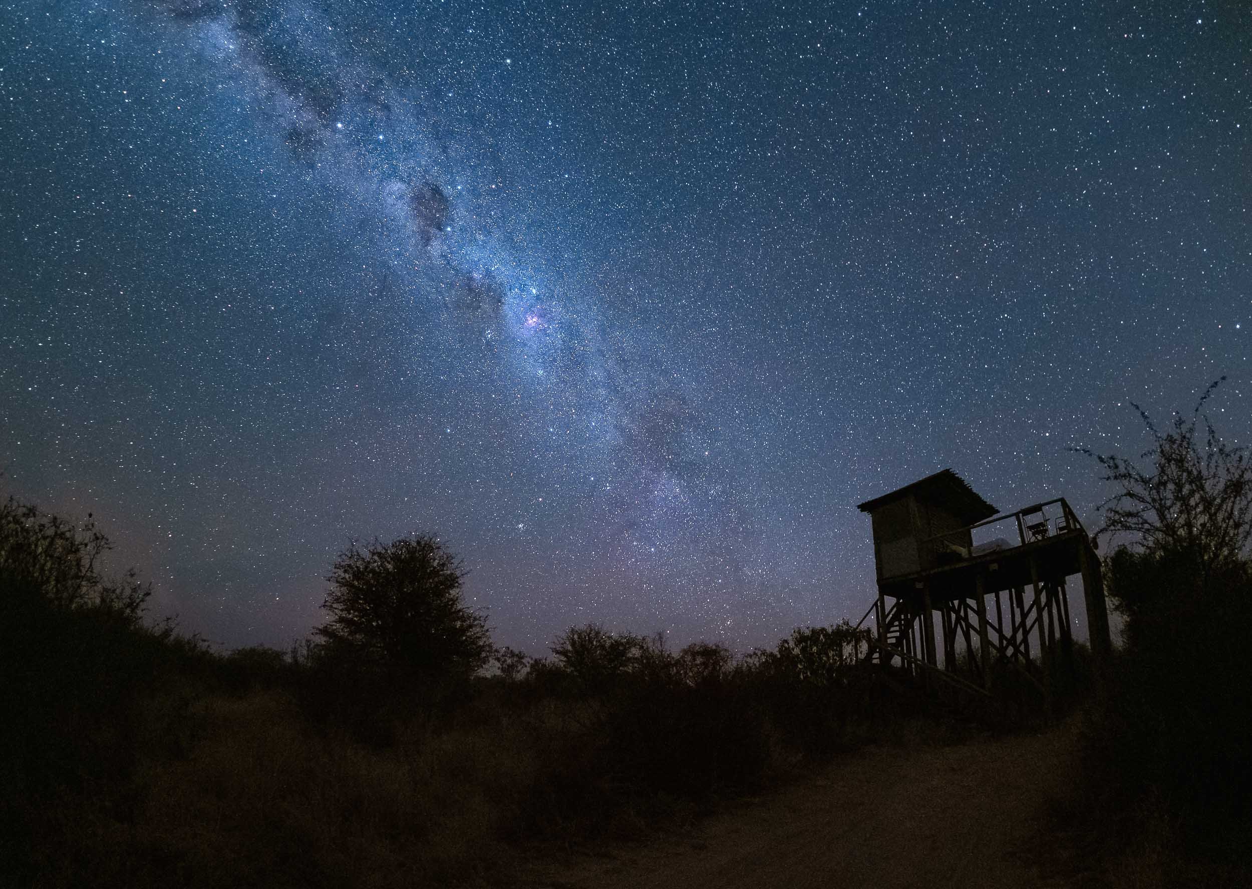

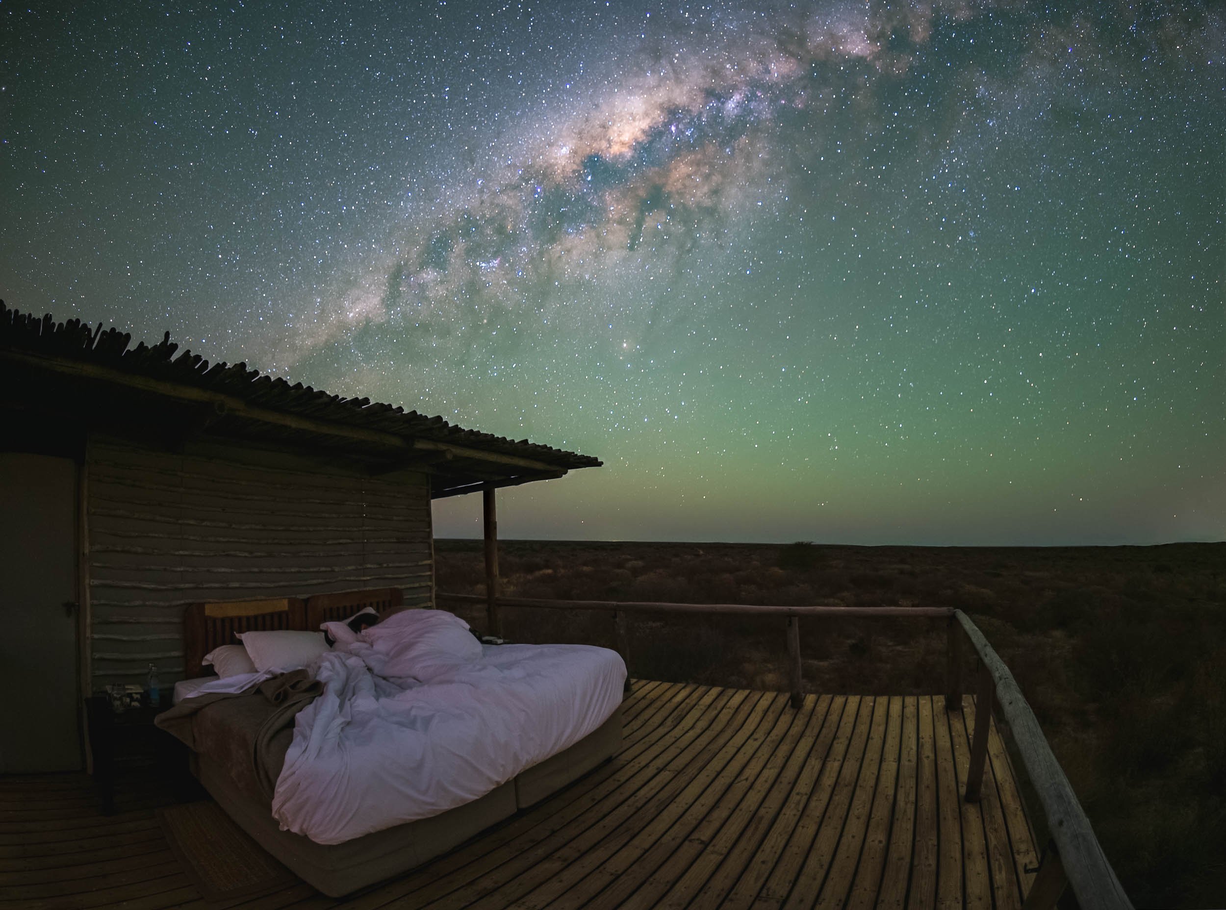
Watch Earth in Motion below…
The Waterhole
A second special spot is found a bit closer to the ground - in fact, it’s almost underground: A bunker-type hide to view animals up close at the waterhole, for some ground level perspectives. We spent a lot of time here, watching antelopes, giraffe, jackals and many other animals come to drink and interact without being bothered much by our presence.
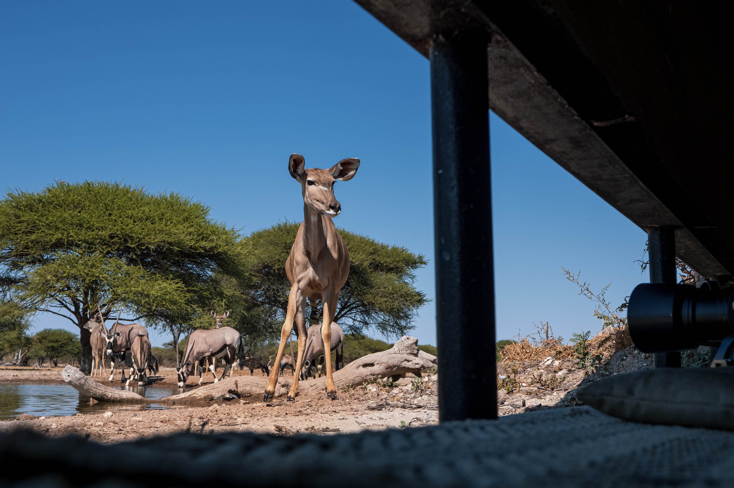
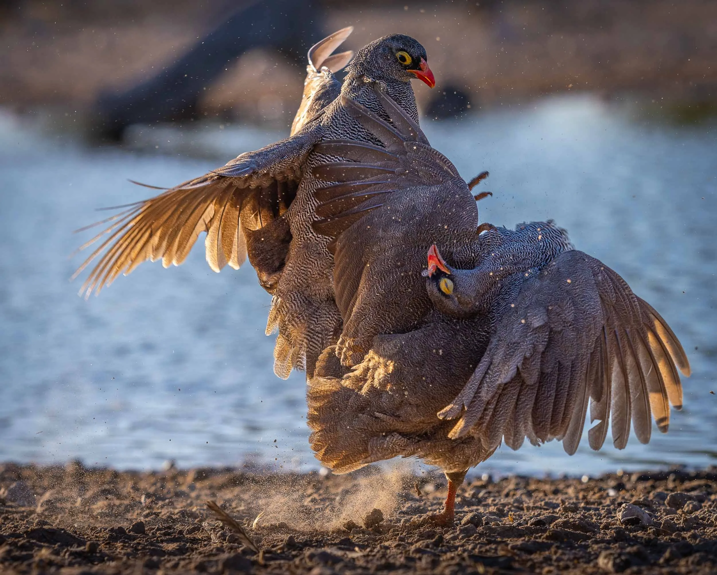


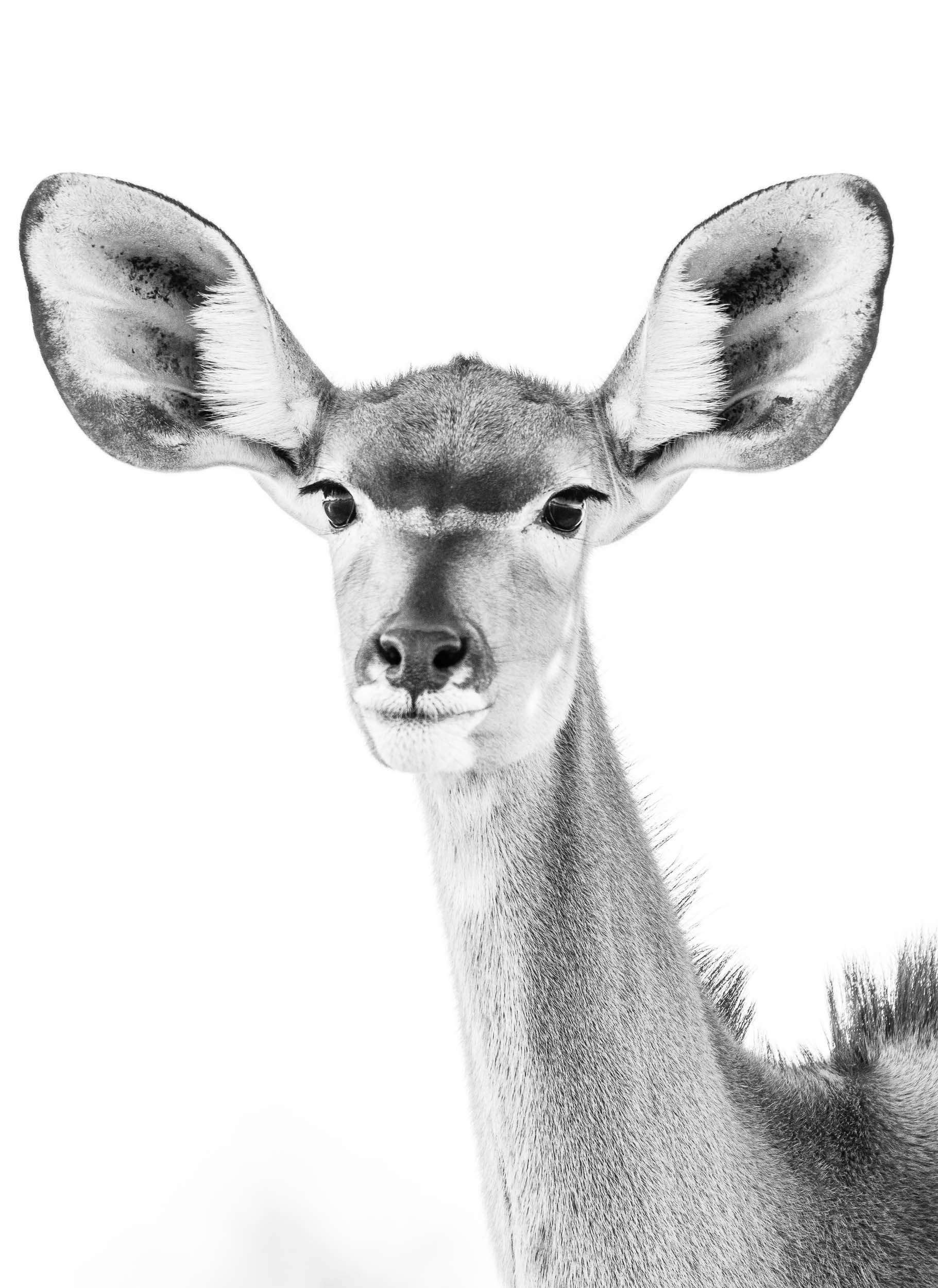
At Night
Private concessions (as opposed to National Parks) often come with the benefit of being allowed to stay out beyond sunset, opening the way for some nightly discoveries…


Lastly, the reserve is also home to a population of white rhino, which have been de-horned to deter poachers, a practice that some question in terms of its effectiveness in doing so, as the base is still attractive for the market.
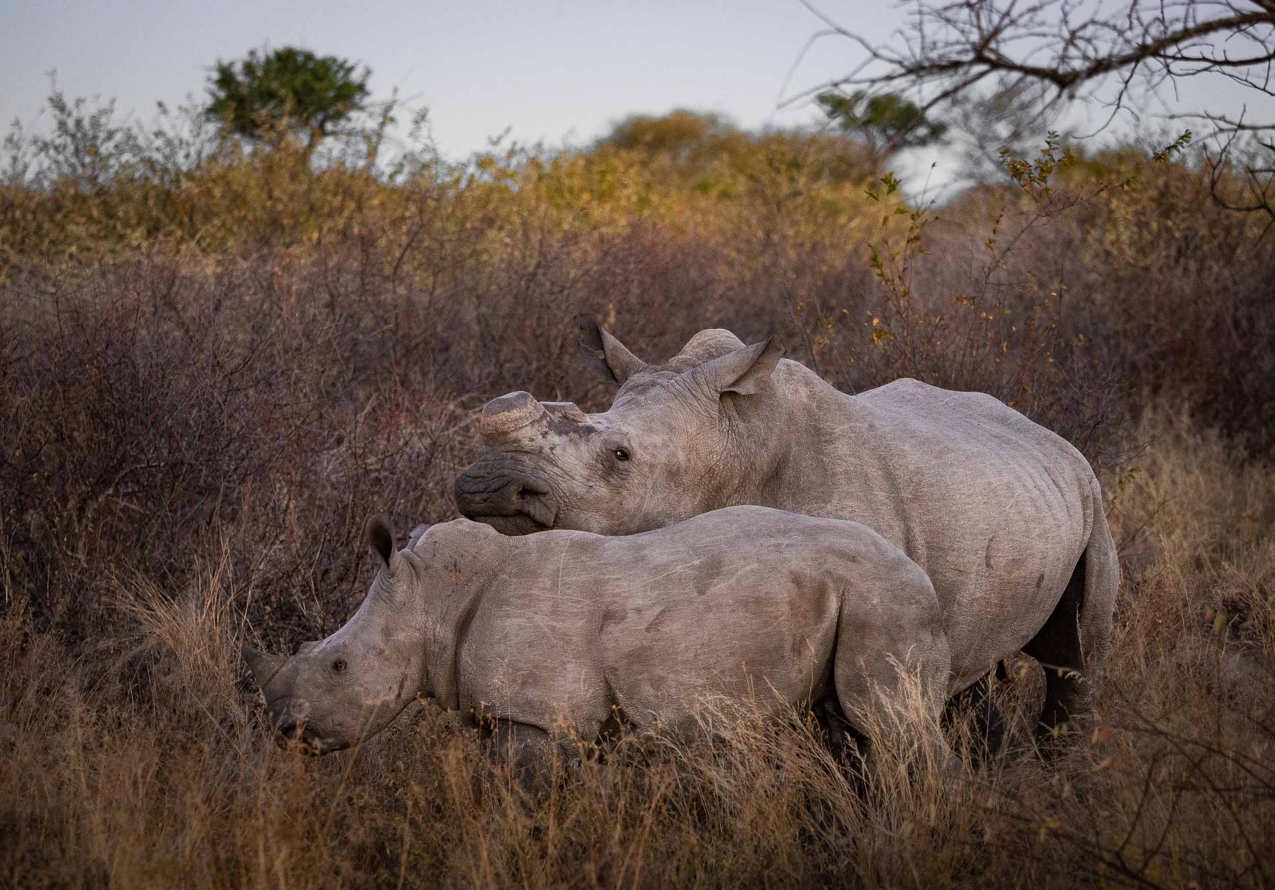
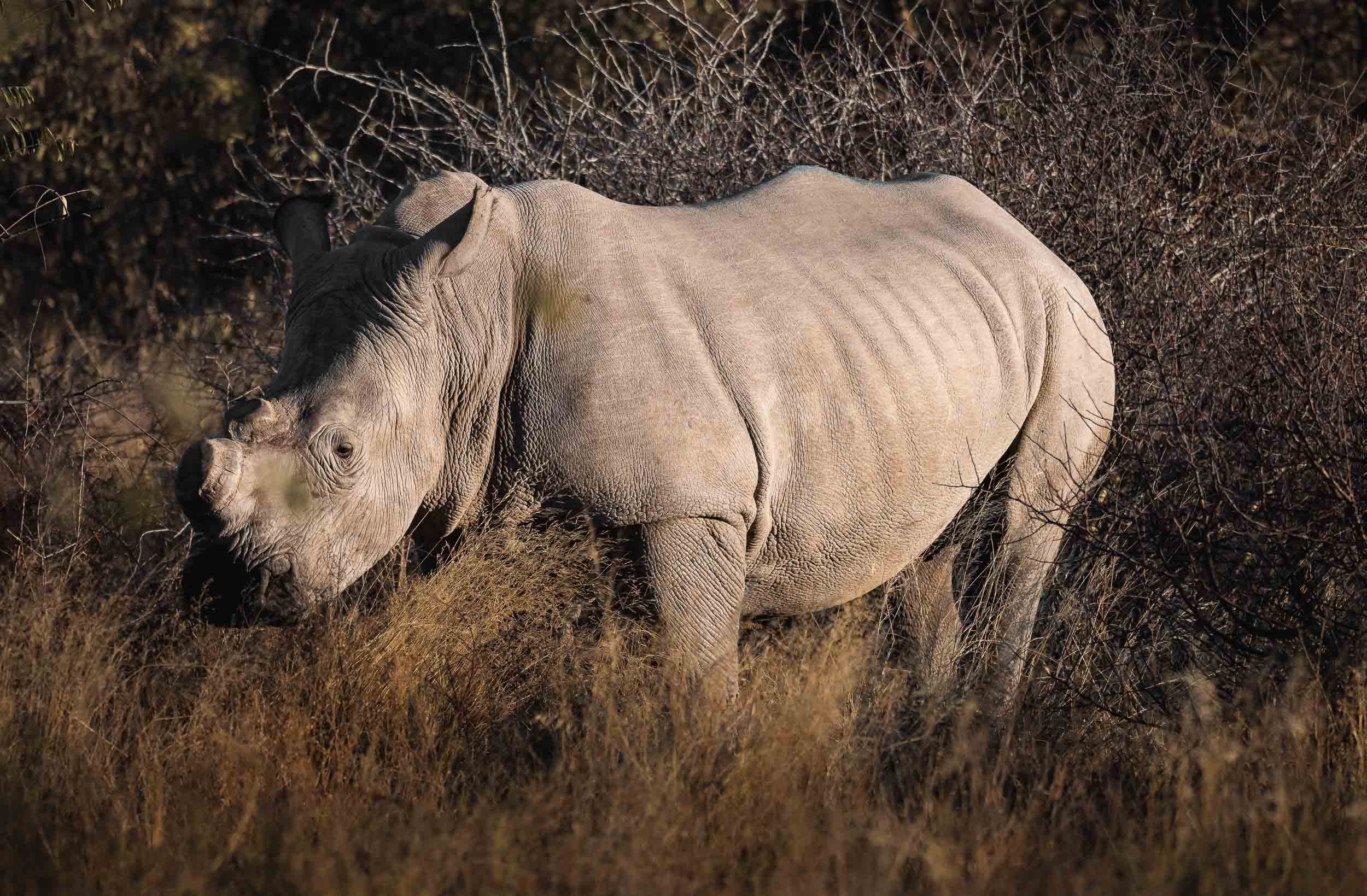
Zimbabwe - Tracking Dinosaurs & Lunar Wonders
The second country of my trip was Zimbabwe - a place which up until planning of this adventure hadn’t really grabbed my attention.

The second country of my trip was Zimbabwe - a place which up until planning of this adventure hadn’t really grabbed my attention. That has definitely changed after spending two weeks in Harare, Mana Pools, Chewore, Kariba, Matusadona and the Victoria Falls. This journey was full of incredible experiences, read on to find out what the country once known as the "Jewel of Africa" had in store.
Harare and some unique rocks
I had one day to spend in the capital city before making my way into the northern parts of the country. A brief tour and looking at one of its most unusual sights was all I could fit in.
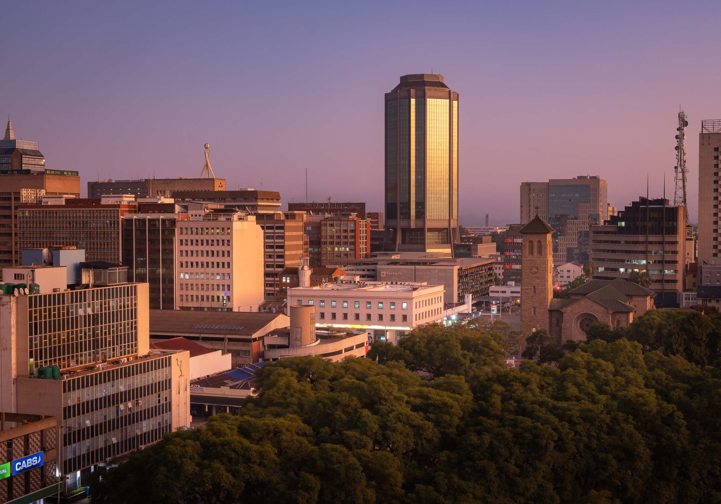
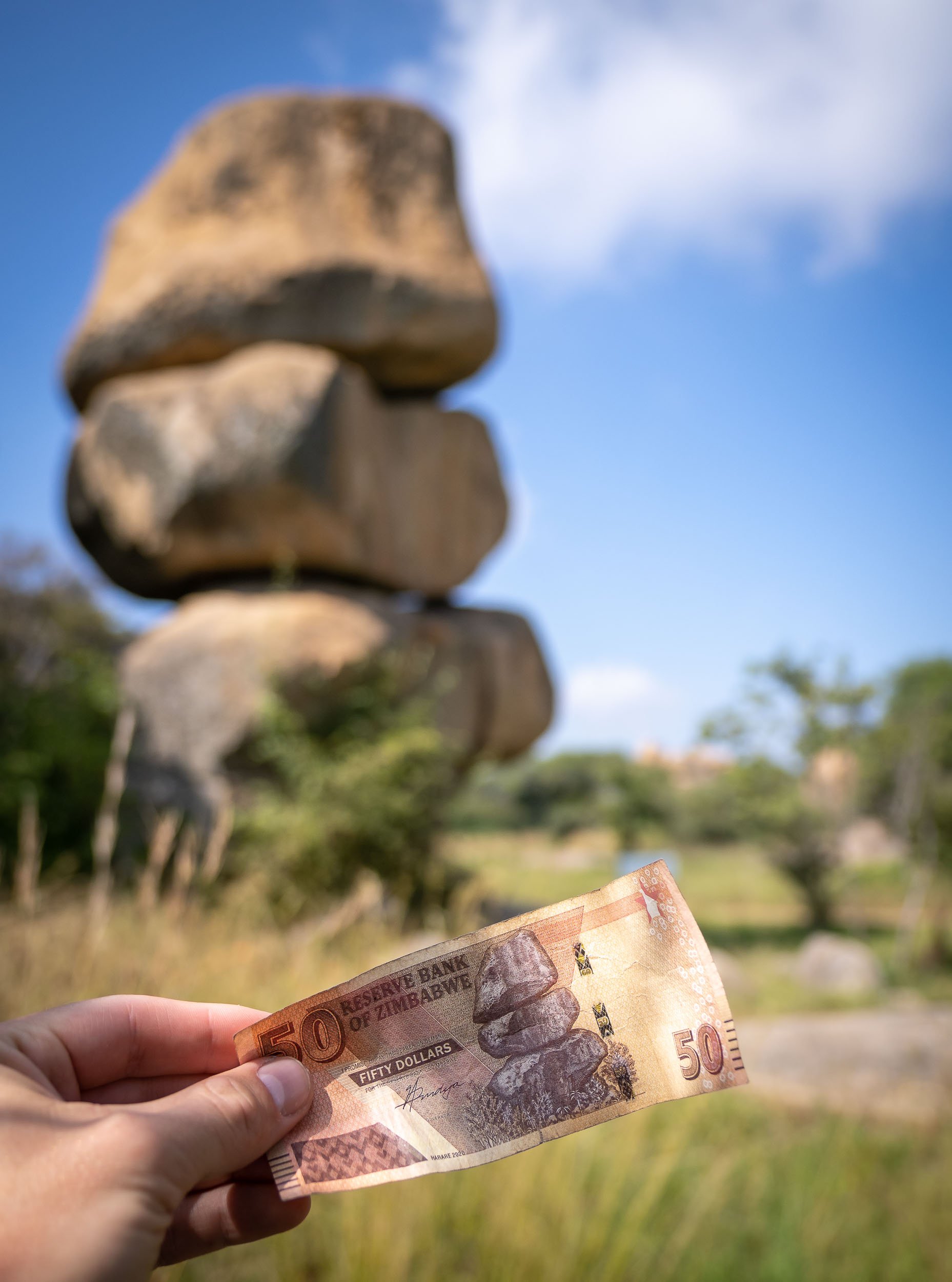
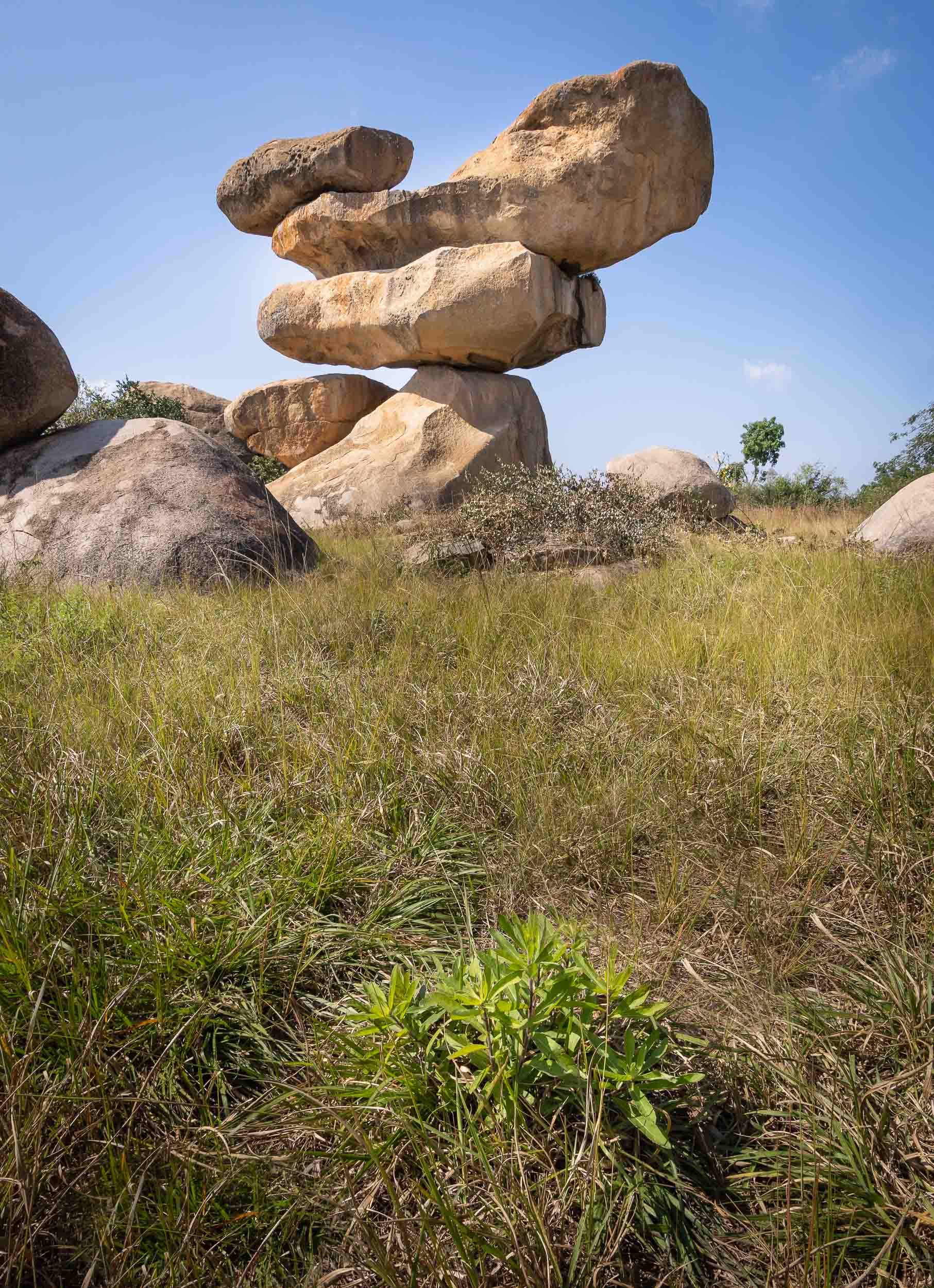
Mana Pools - Wildlife in a different way
I then spent 2 days at Mana Pools National Park in the northern part of the country, bordering the Zambezi river and the Zambian mountains on the other side of its shores. It’s this setting and the fact walking and canoeing are possible here, providing a much more intimate experience than the typical bush game drives, that made this a special place.

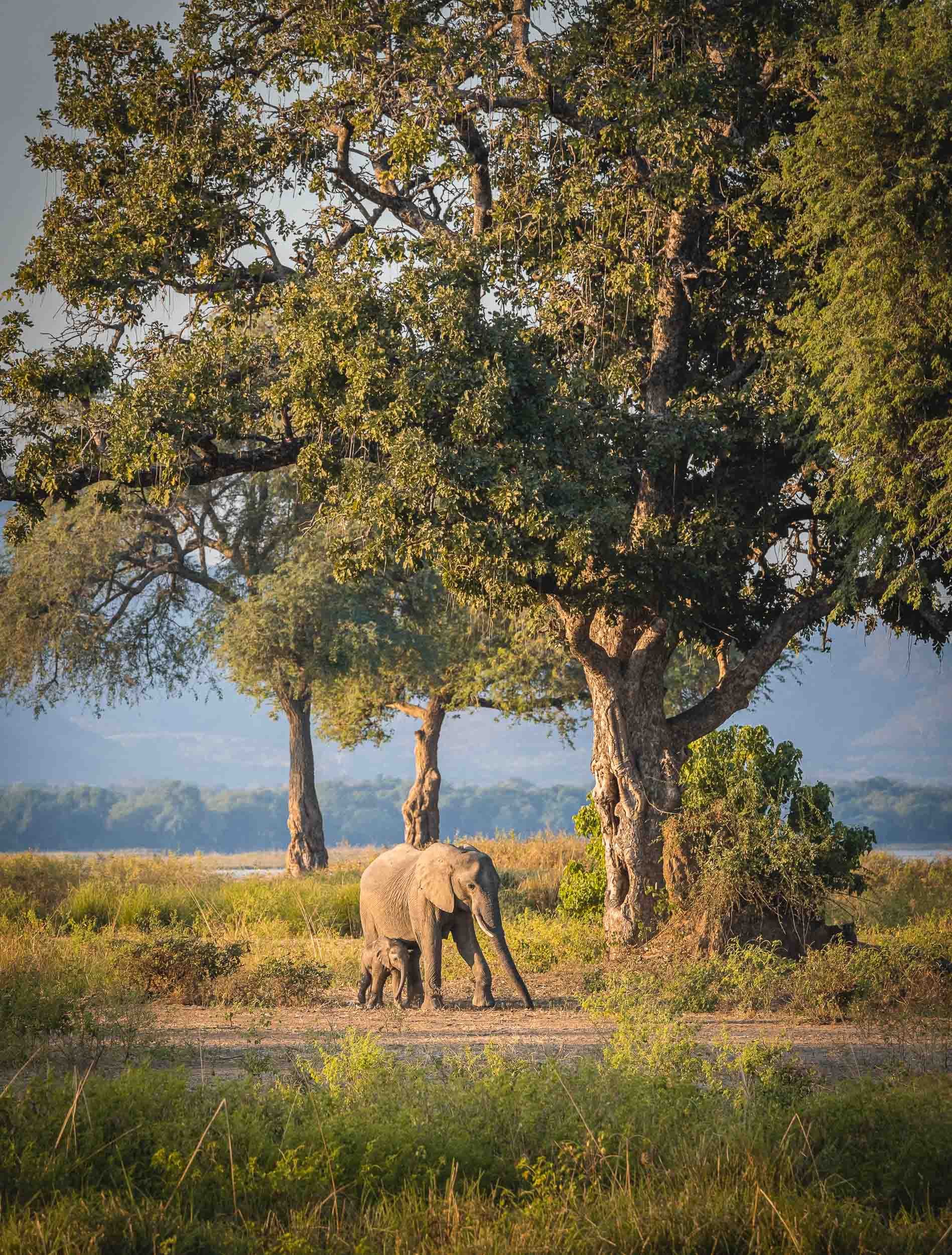
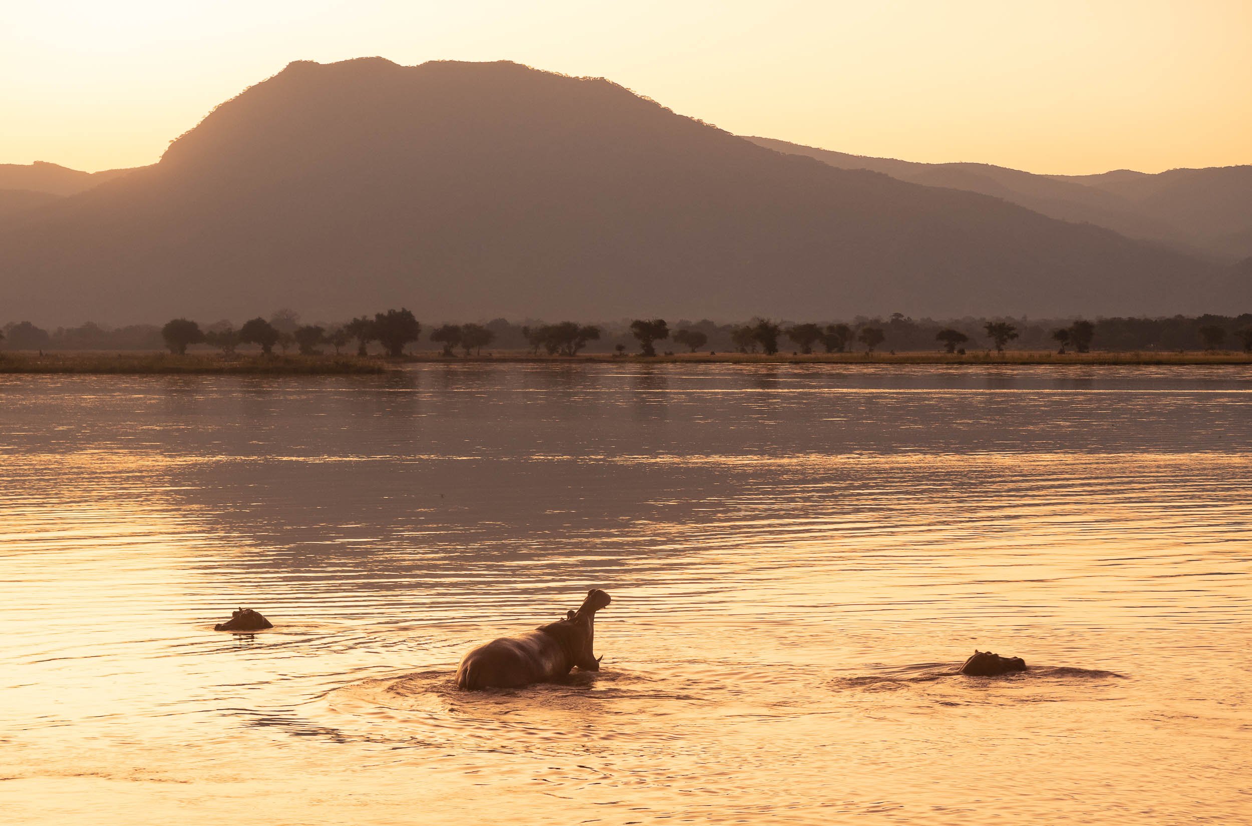
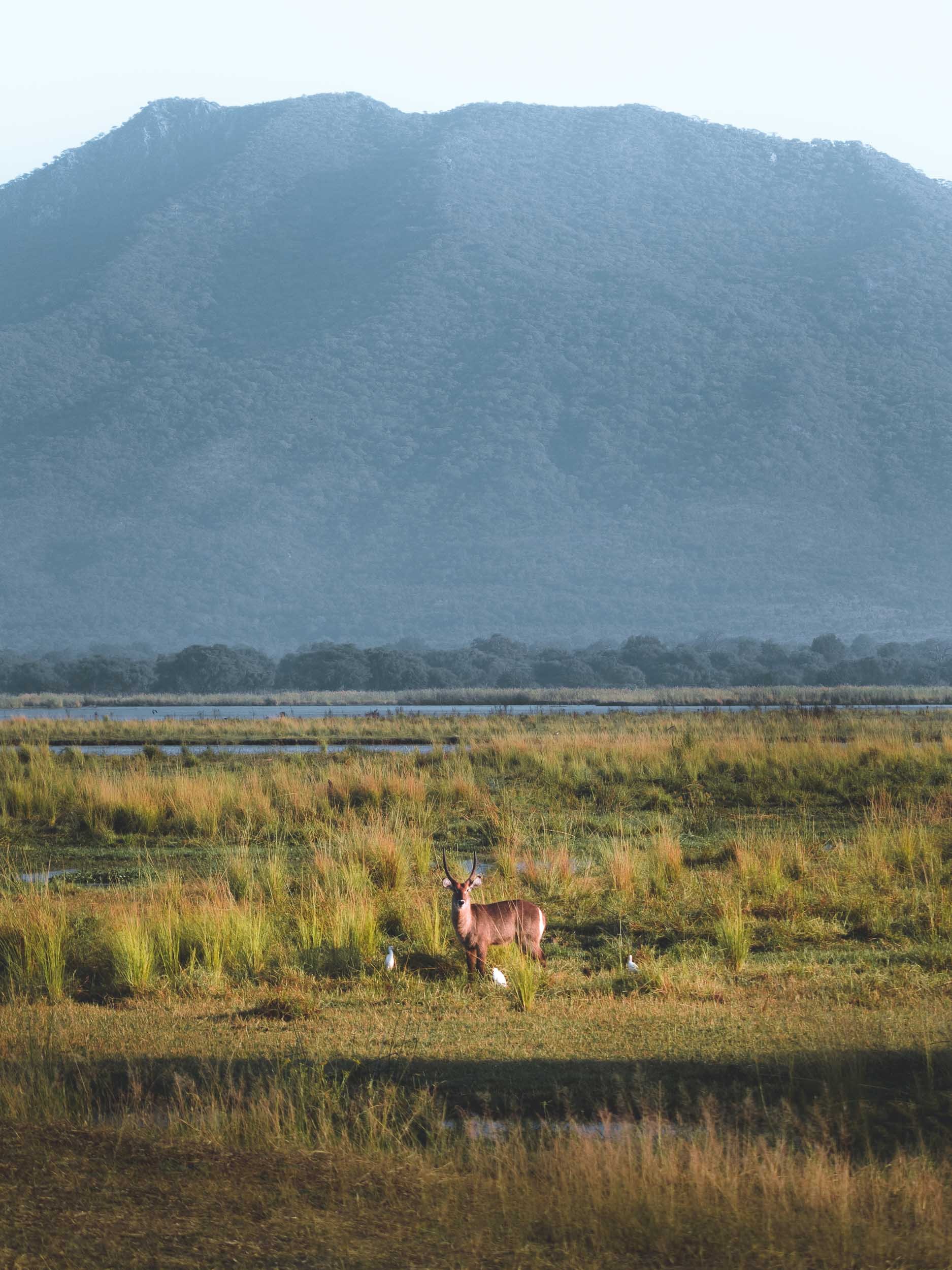
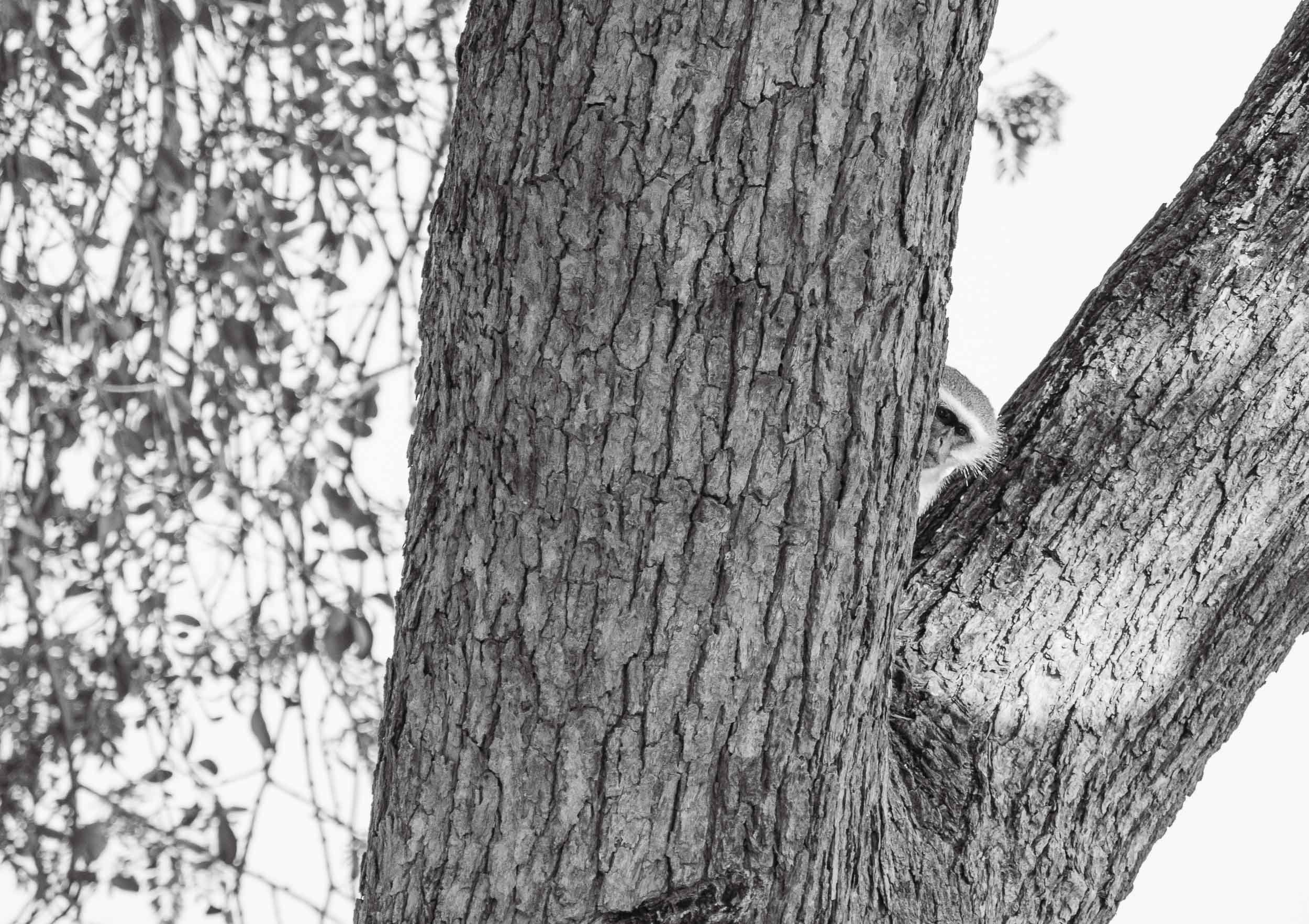
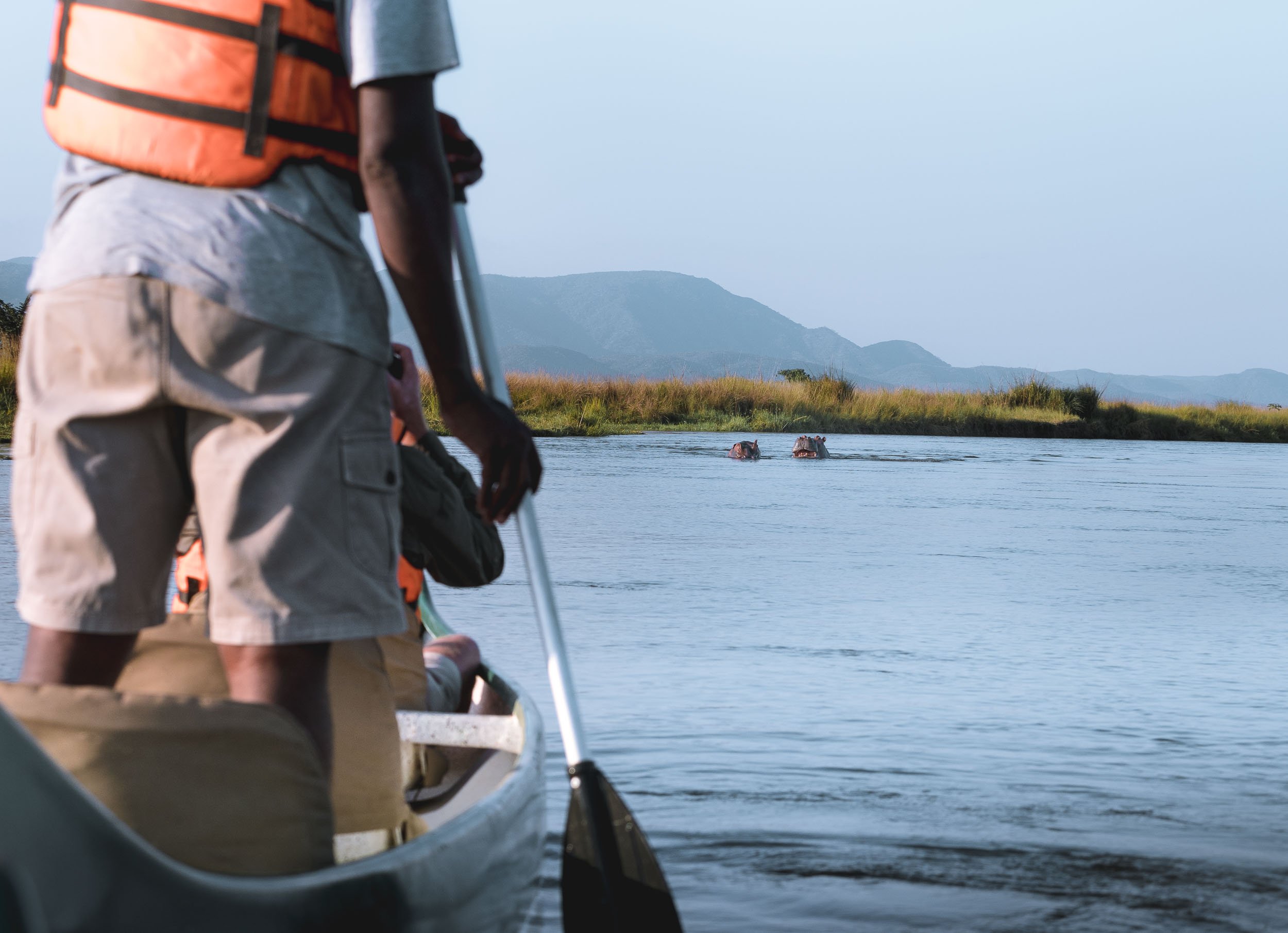

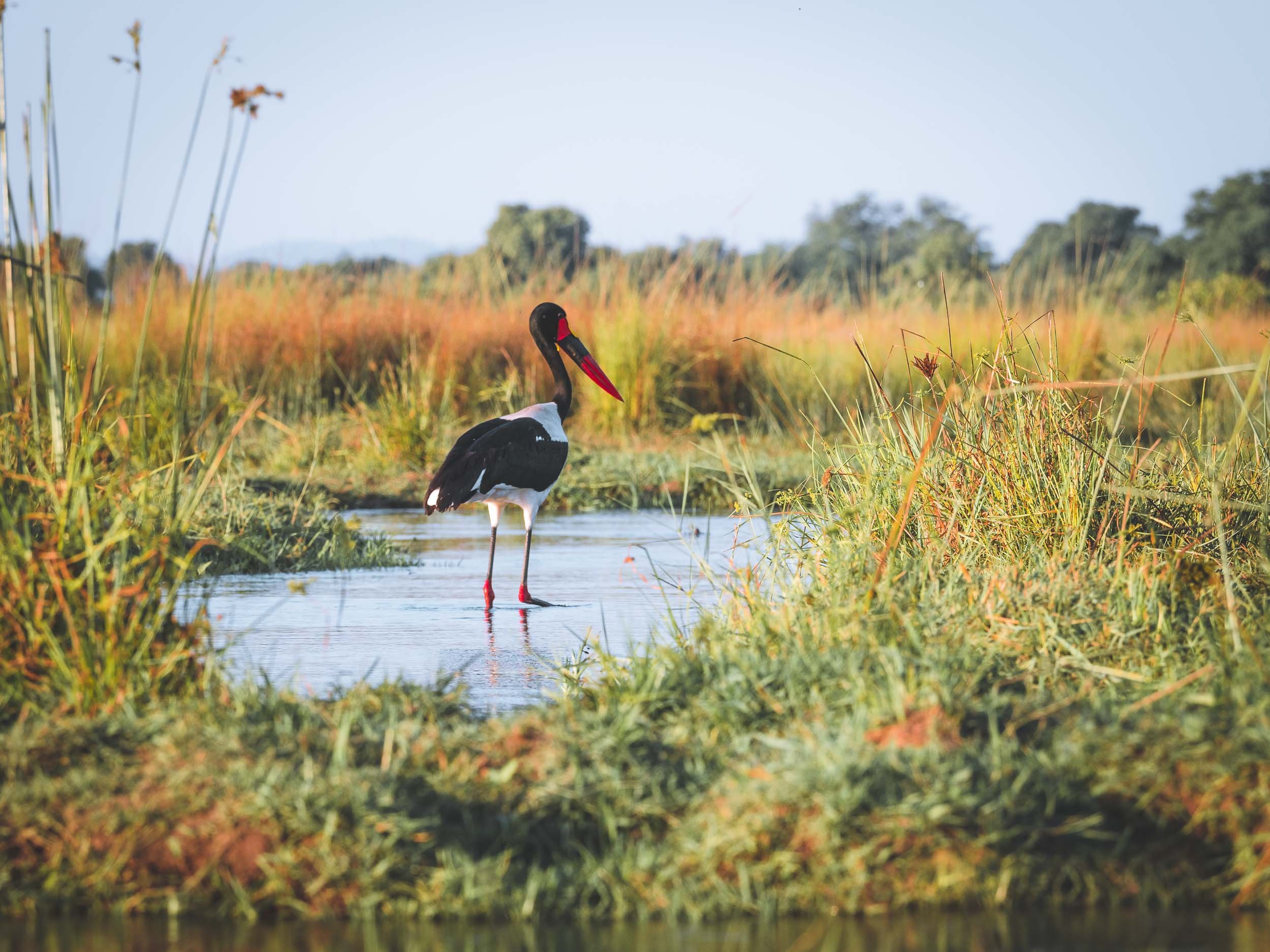


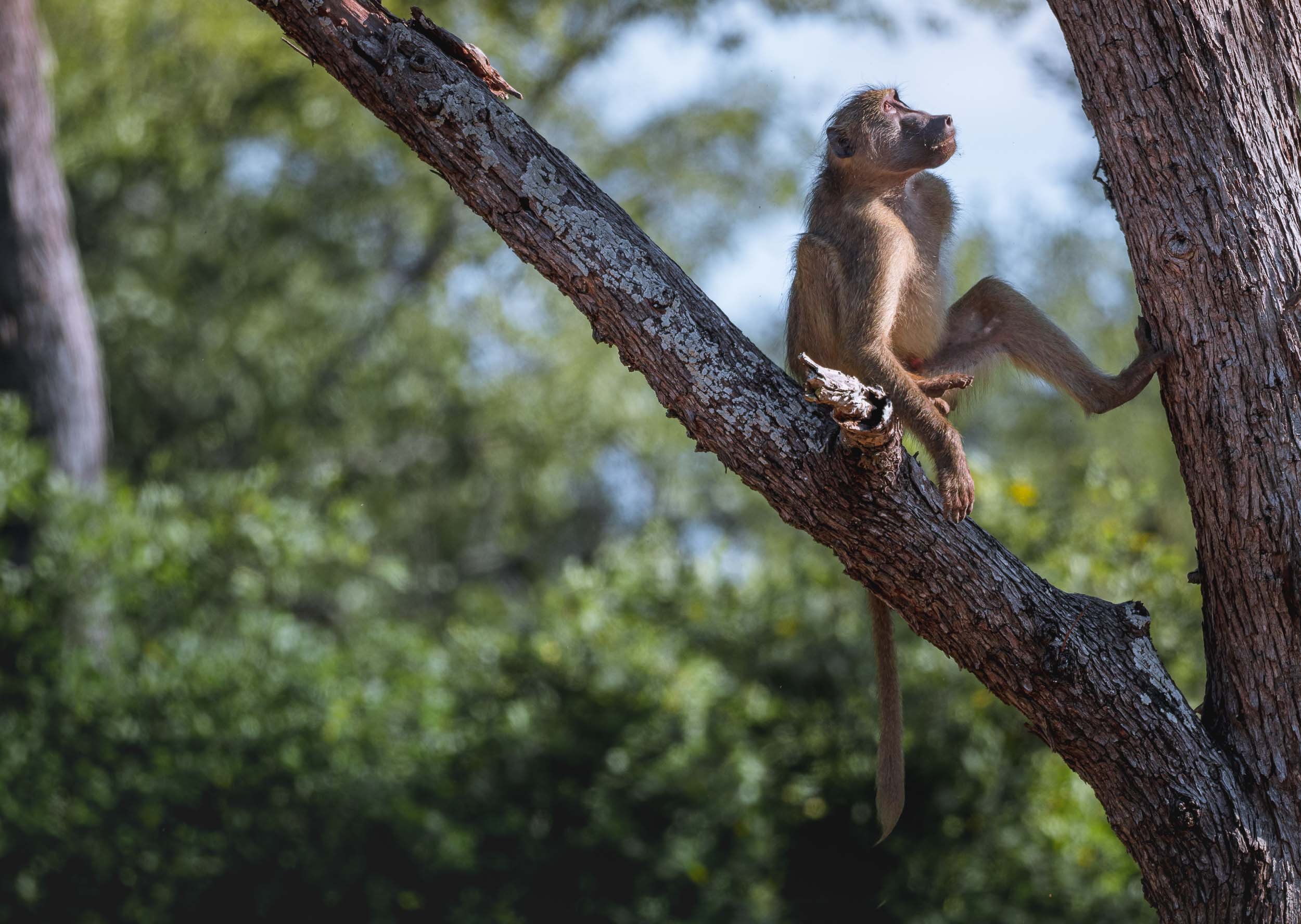
Chewore - Off the beaten, and onto the Dinosaur track
From Mana Pools, it was a good 4h drive on dusty and bumpy roads in a 1960s land cruiser owned by my wonderful host Louisa to a remote hunting concession - here. Hunting wasn’t the reason I kept annoying quite a few people before being able to come here: In fact, this place has some of the most remote and untouched dinosaur footprints in the world, which triggered my interest. Before that though, the universe had another special sight in store .
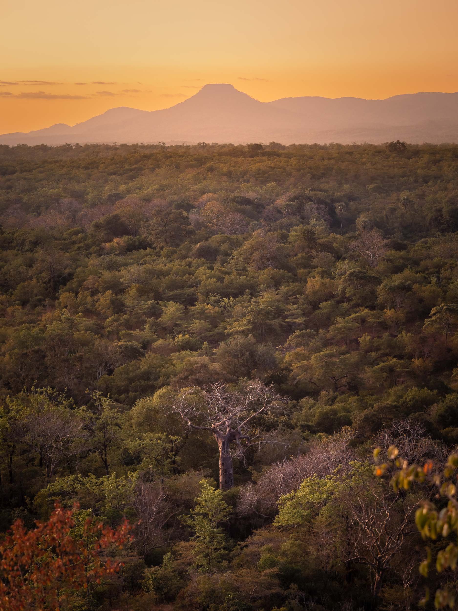
The Lunar Eclipse
My time in Zimbabwe coincided with the a full lunar eclipse on 16th of May, 2022, and luckily our location was just about within the areas of the globe that could experience this rare phenomenon, so I had to find a way to capture it. What a sight it was - and not only that, also an audible experience, as the lions and baboons roared in the background.

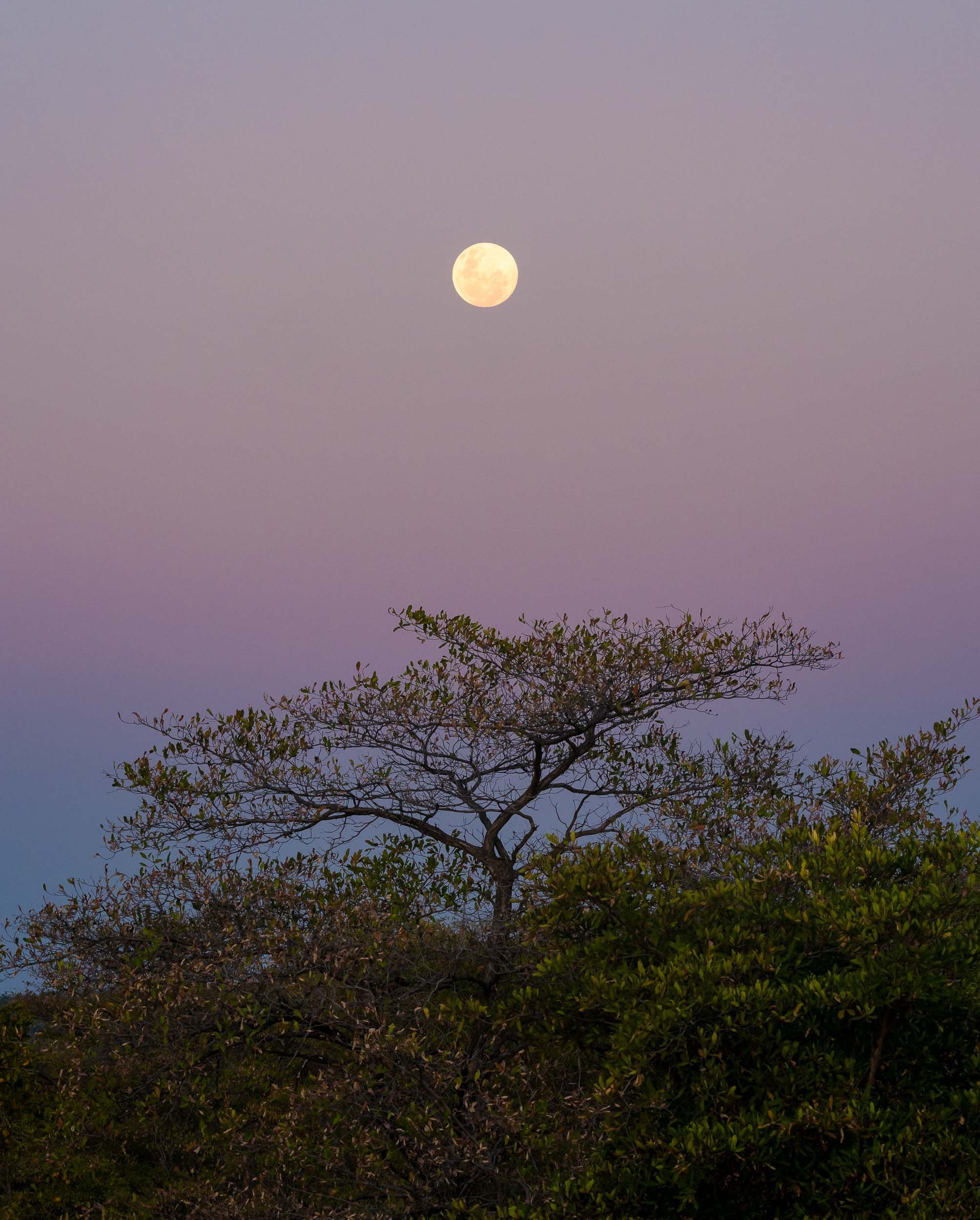
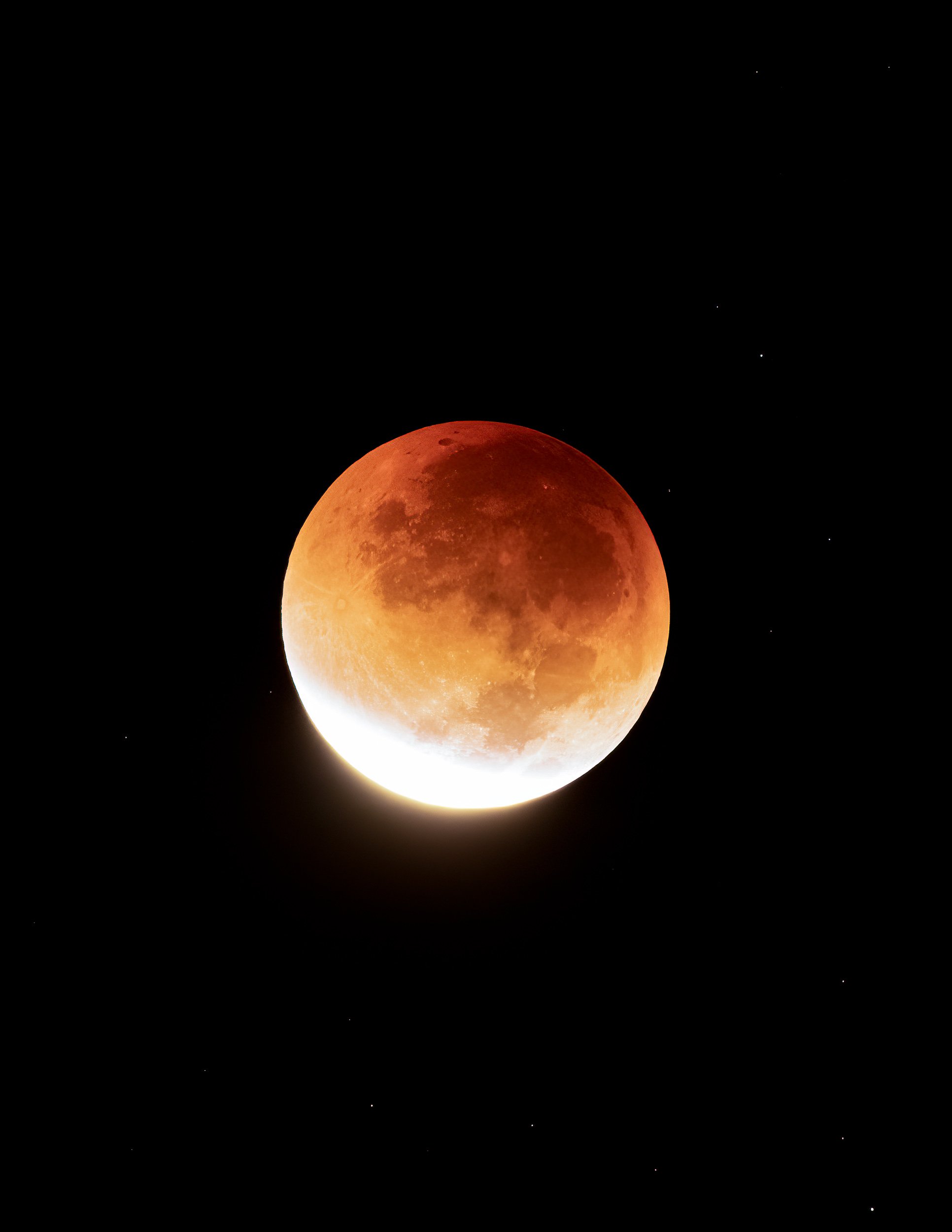
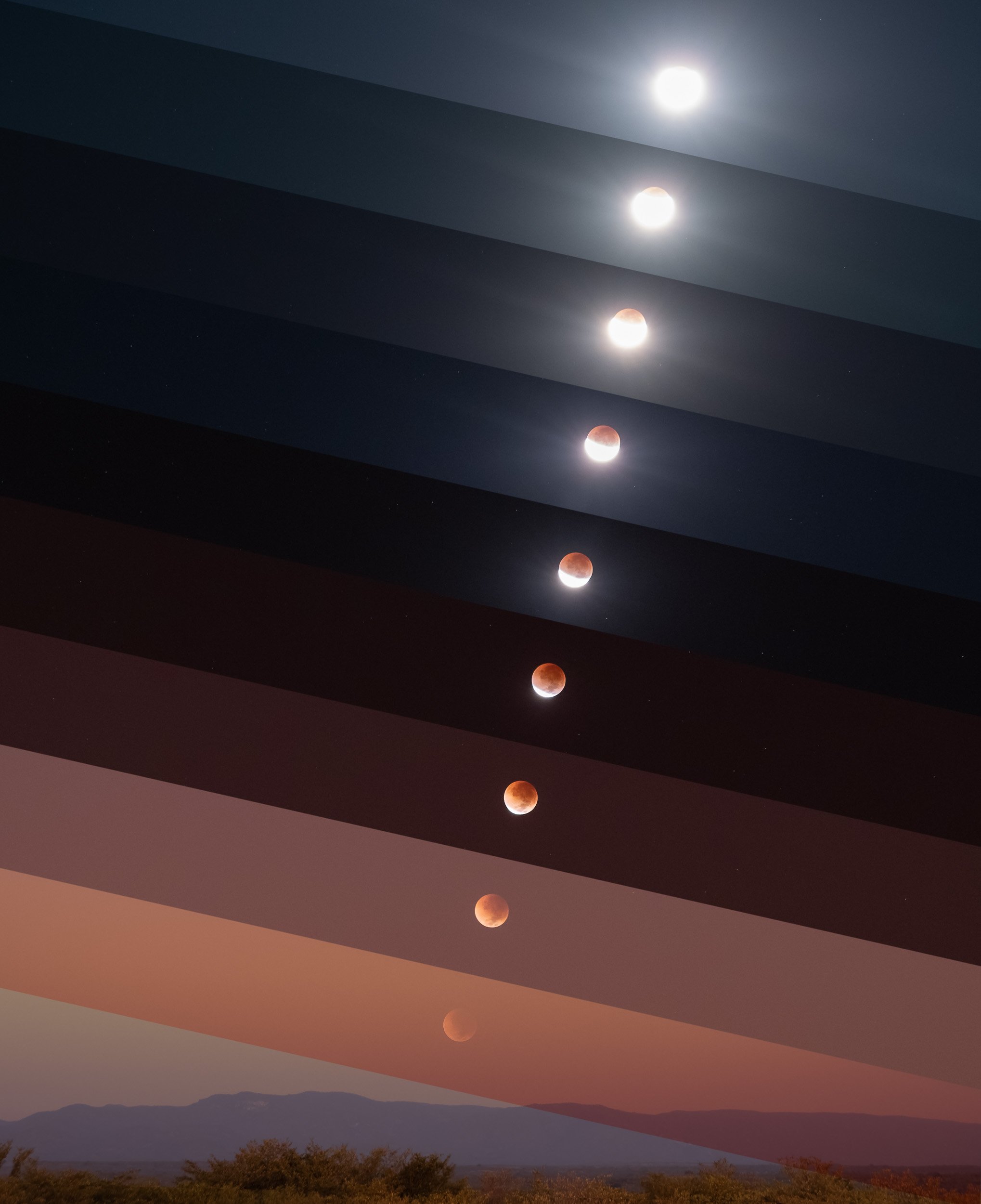
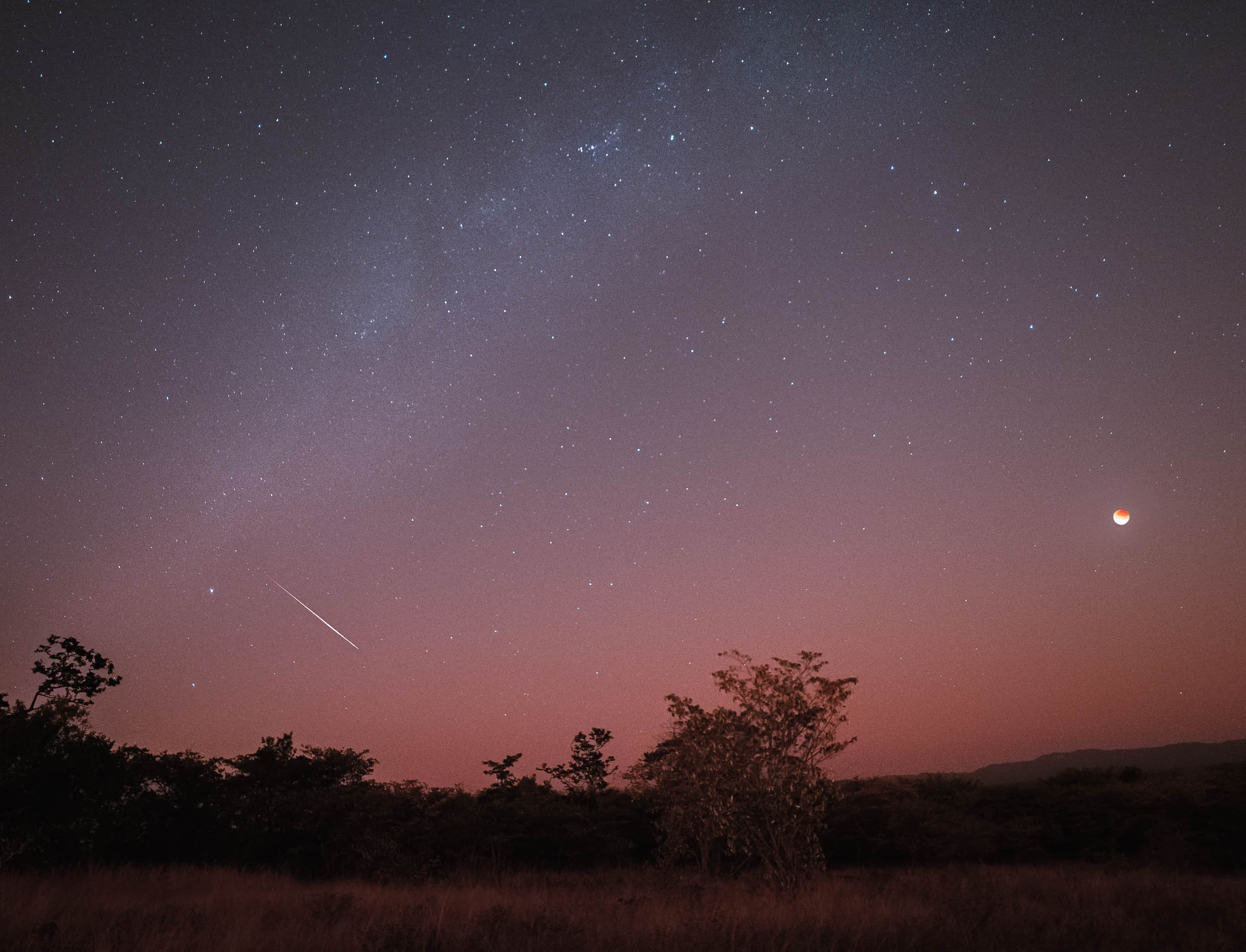
Here’s a timelapse video of the event, both a wider view from 3am to sunrise, and a close up of the eclipse progression.
The Dinosaur Footprints
The real reason for venturing this far and deep into the Zimbabwean bush can be found in the next photos. The country and specifically the Chewore area is home to a very special paleontological sight: Dinosaur Footprints from 150 million years ago. It took a large amount of research, planning and nagging to make this happen, but it was definitely worth it and I’m grateful to to everyone who made it possible and was a part of it with all their knowledge, Barry, Louisa and Neil. The owner of the concession estimates only 200 people have ever seen these - 201 now.
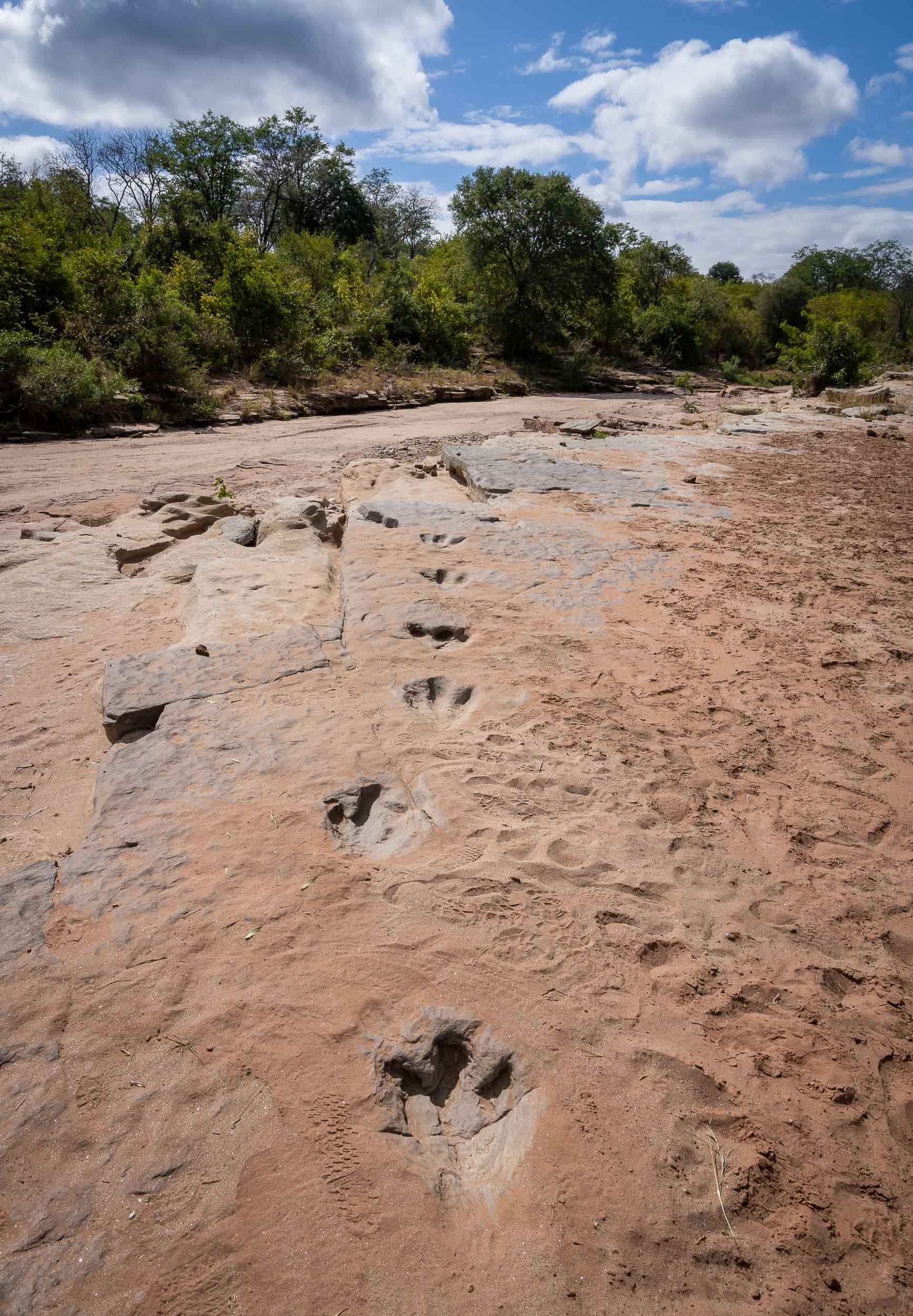
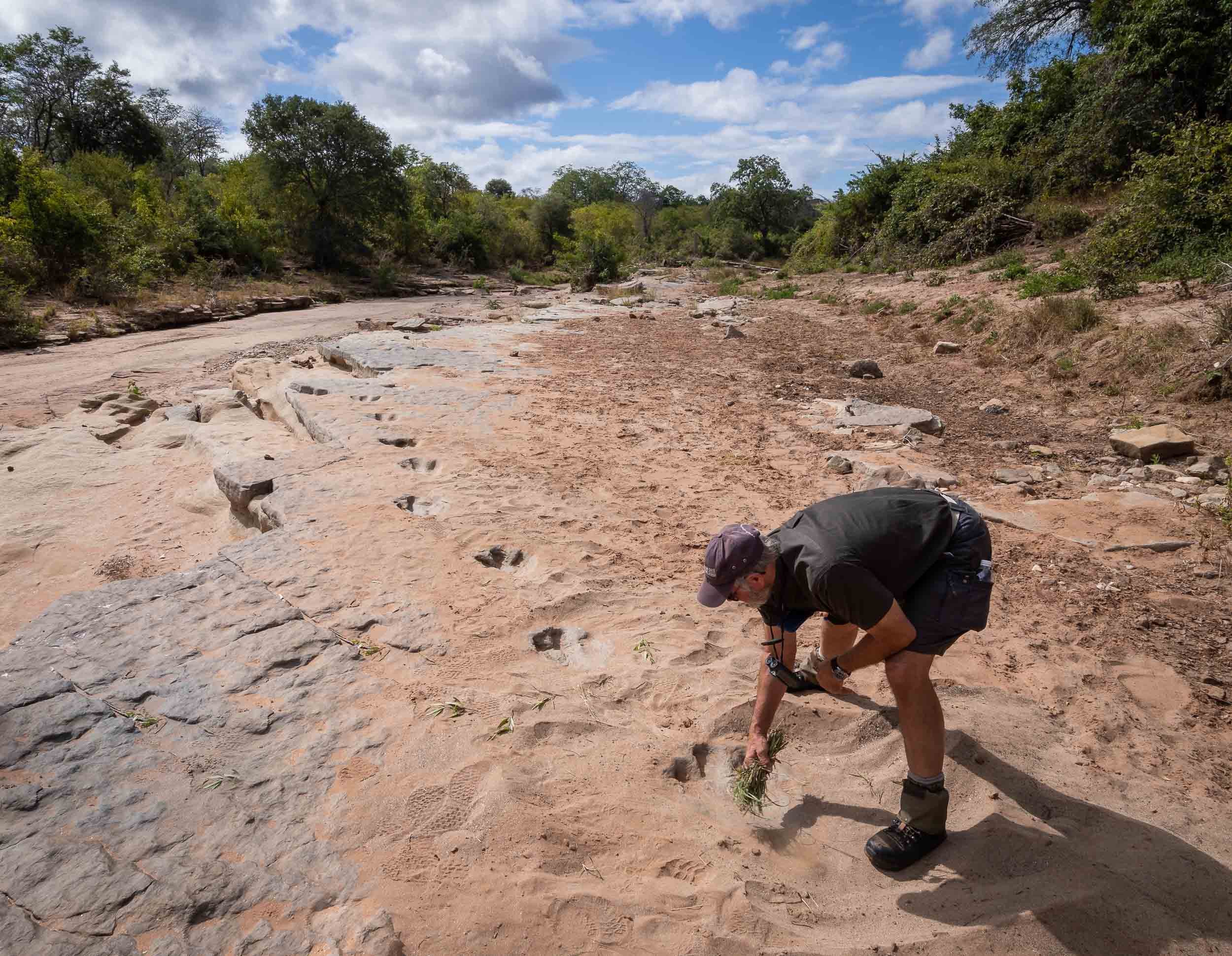
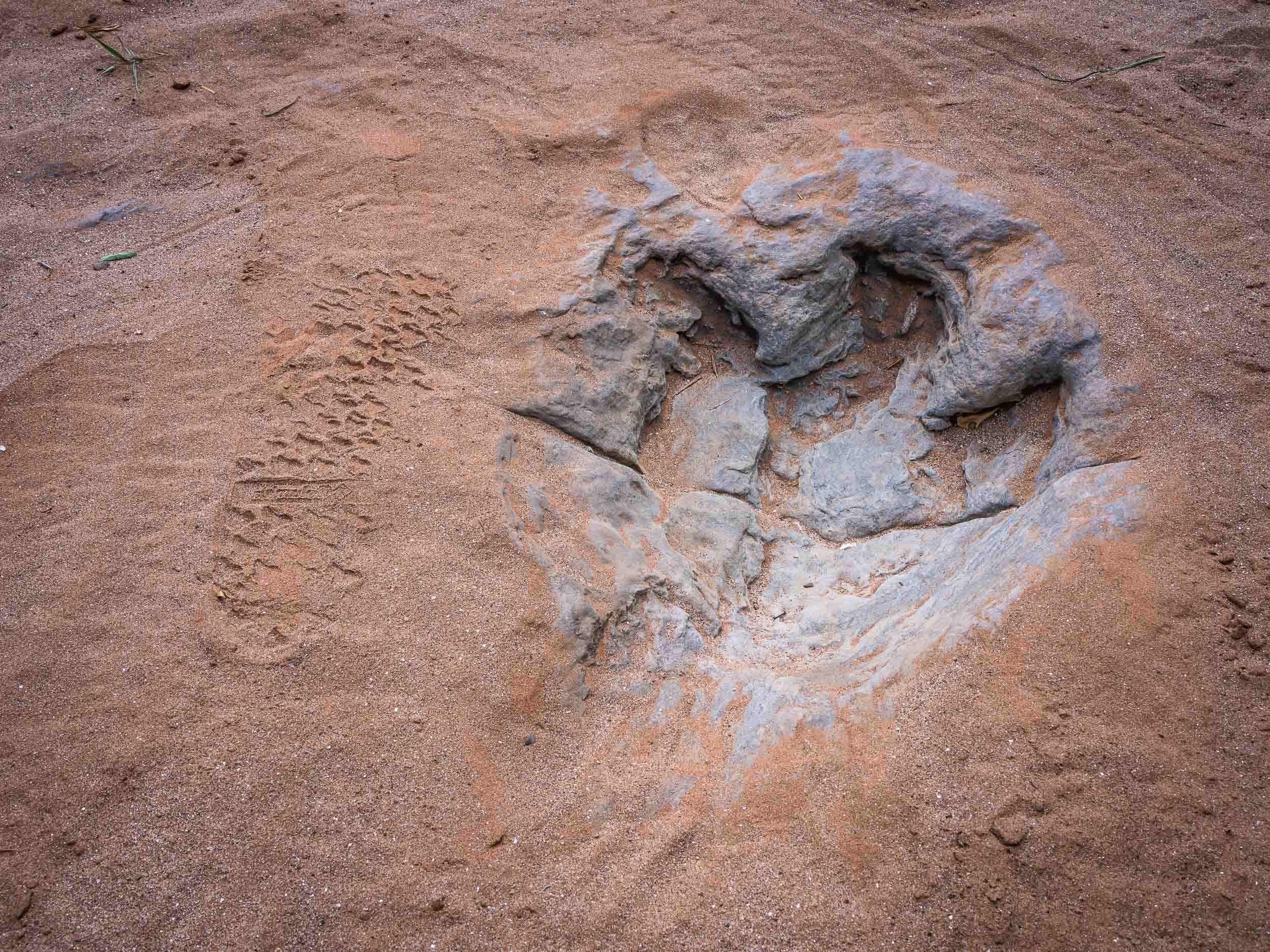
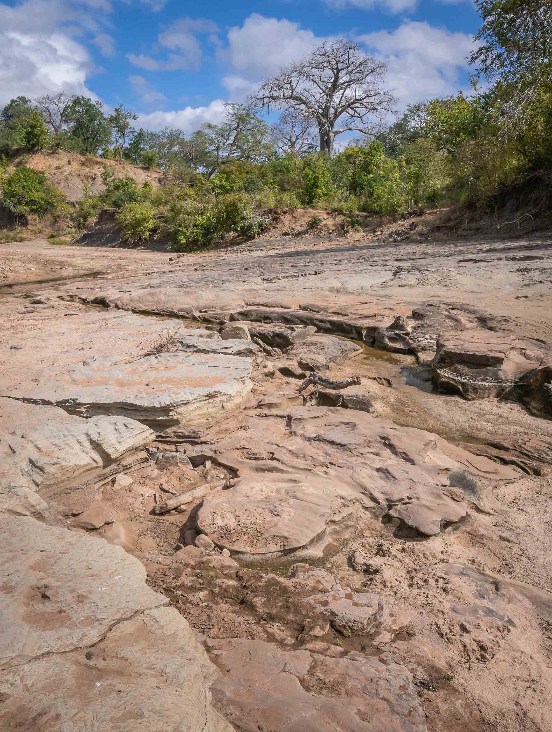
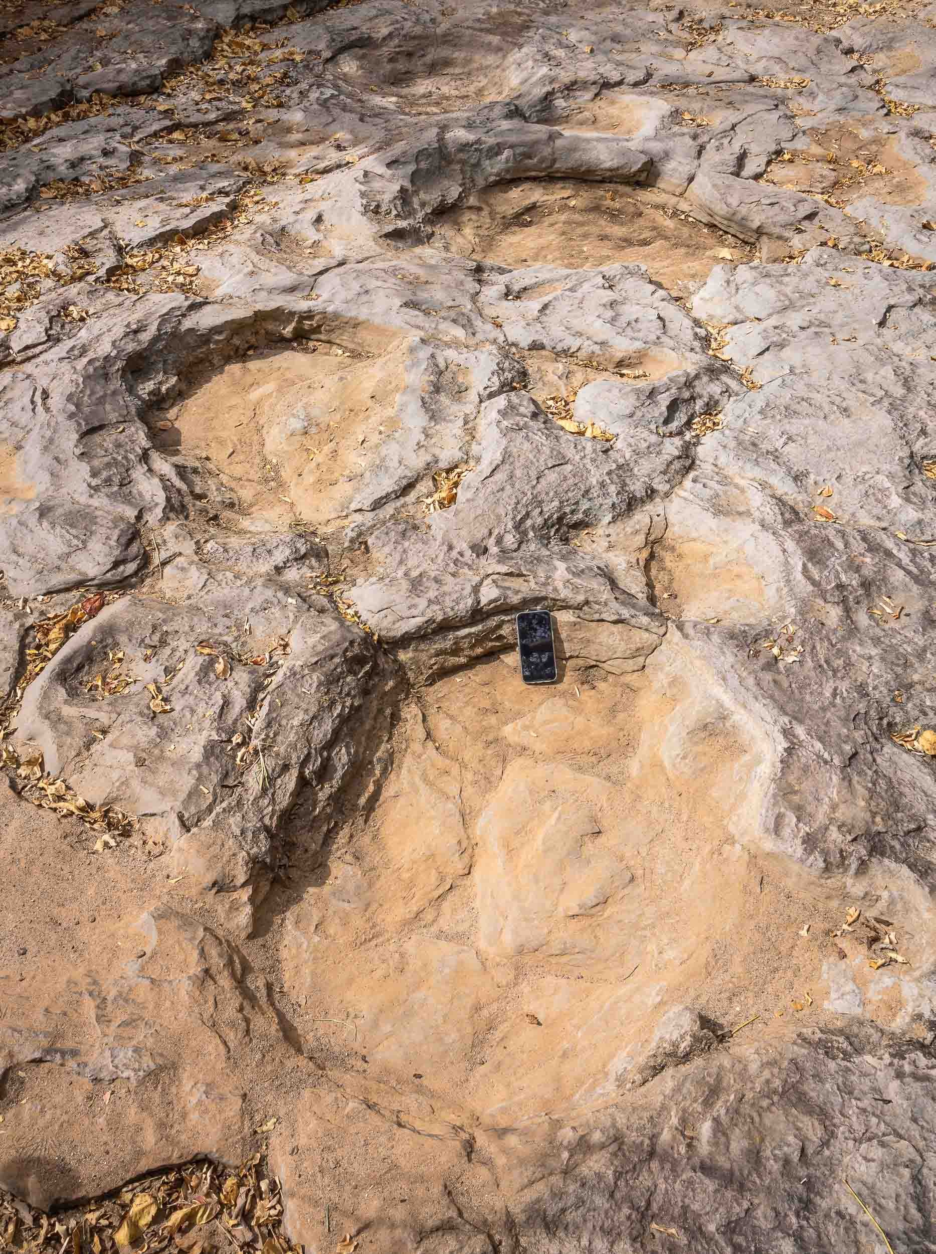
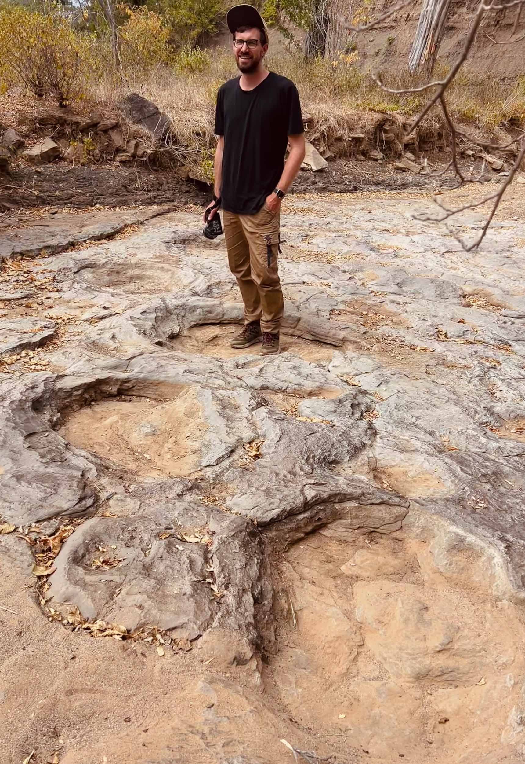
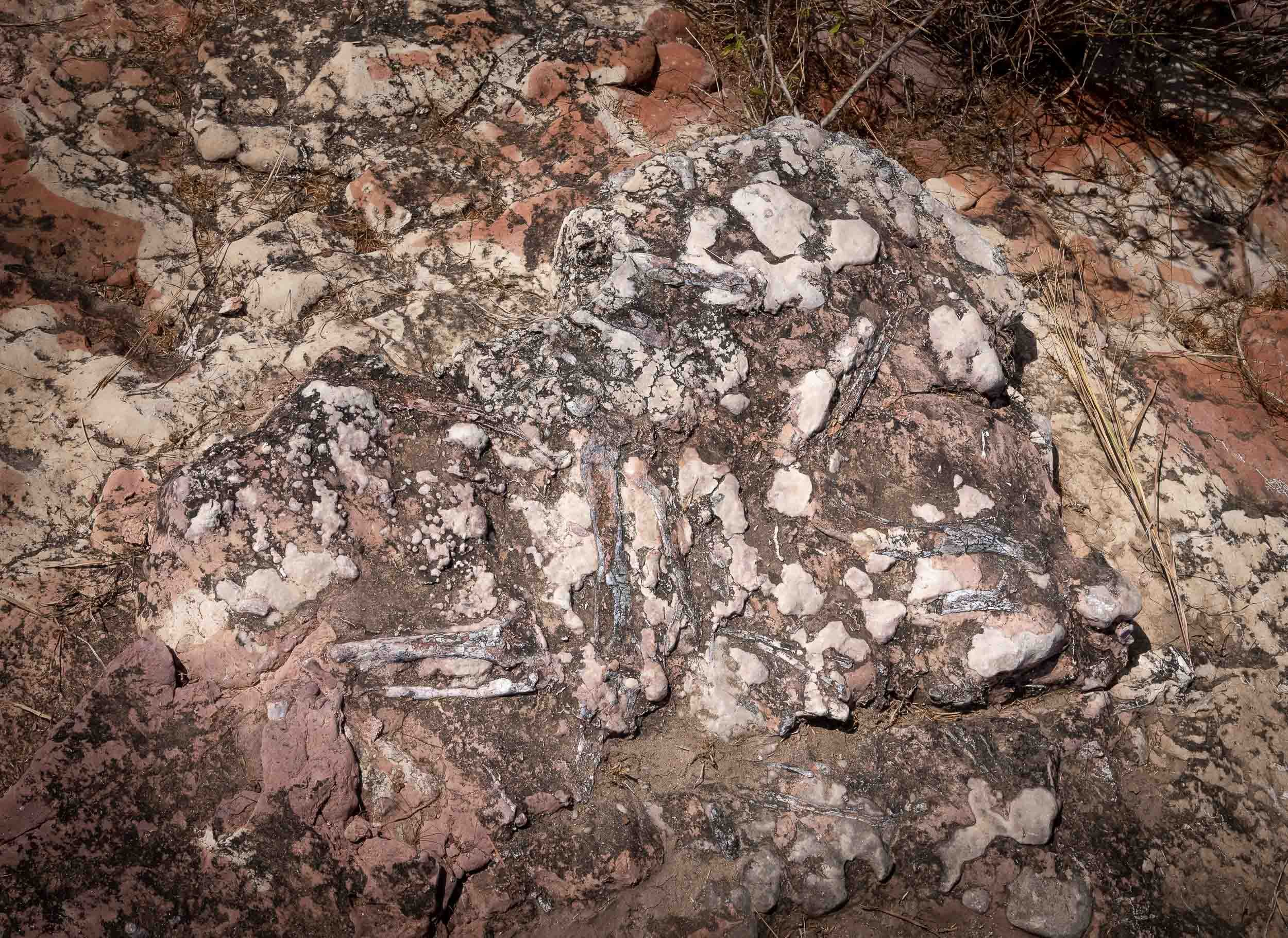

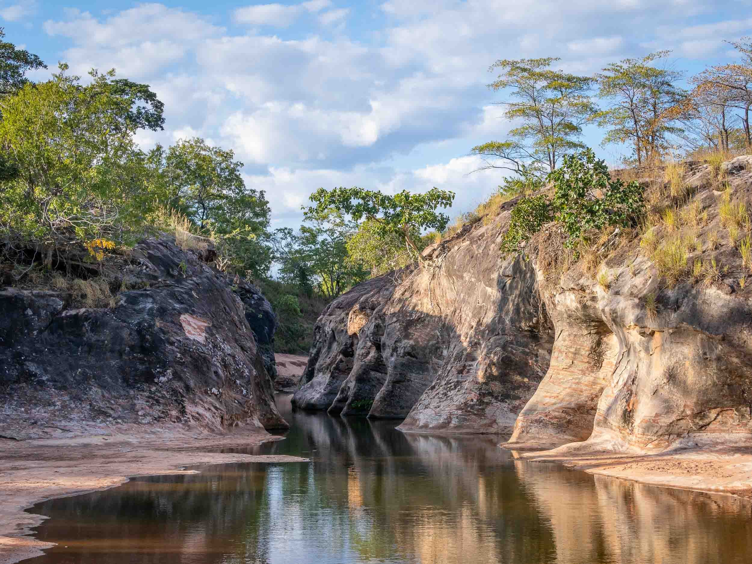
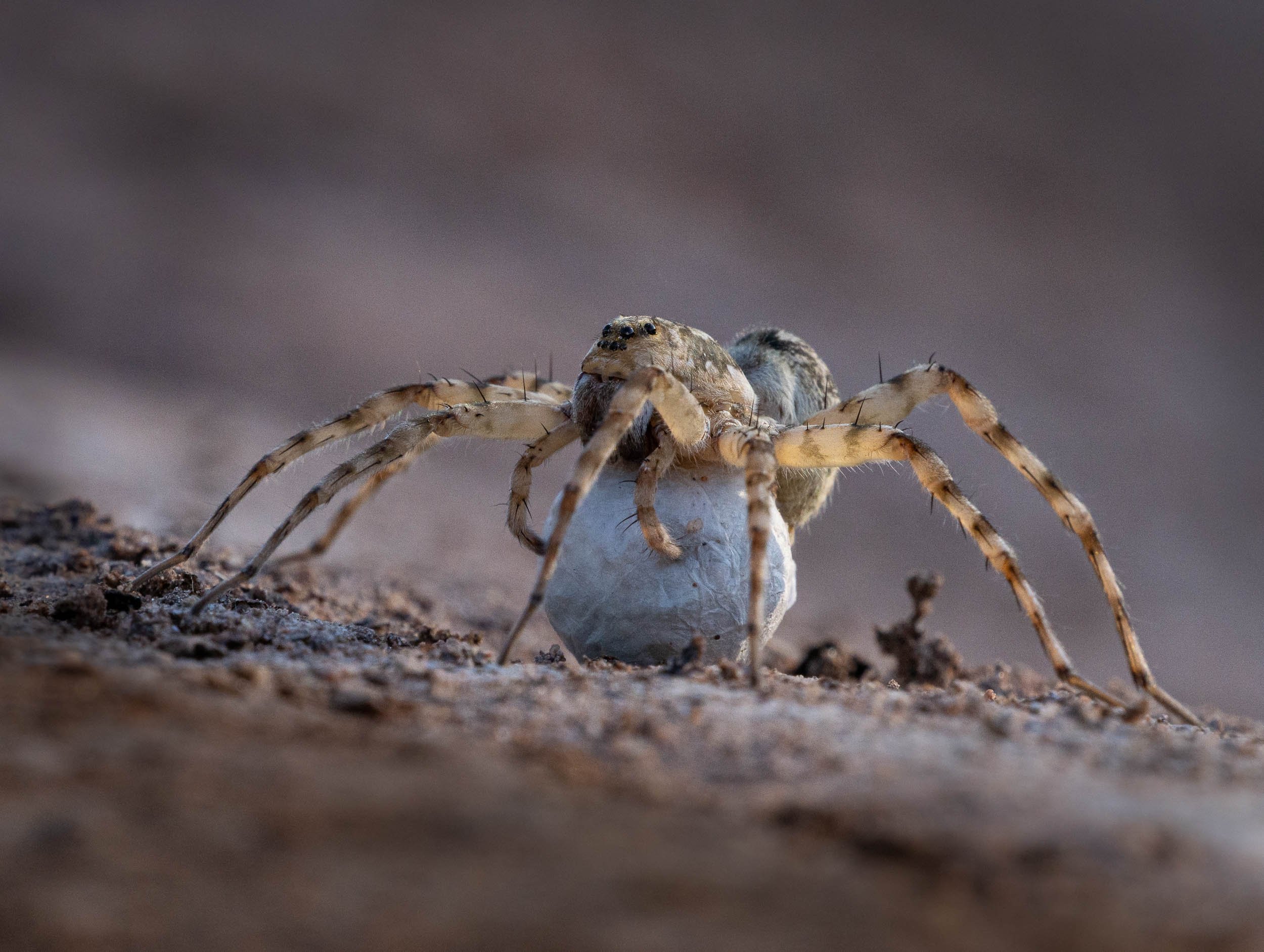
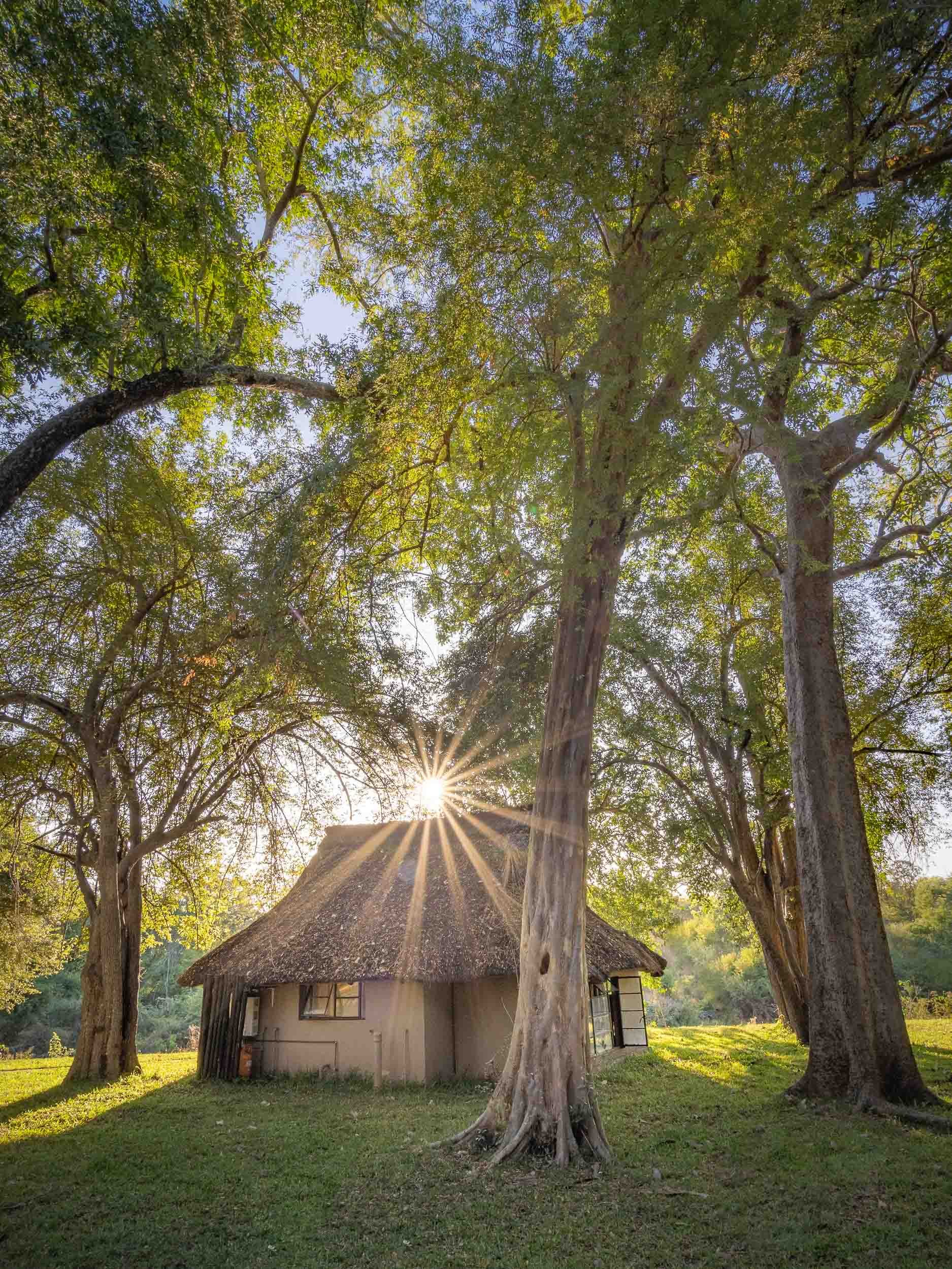
Lake Kariba and the Matusadona
After a long drive, I arrived at Lake Kariba and the Warthogs camp for a few nights on the shores of the world’s largest man-made lake in Musango Safari Camp, both operated independently by incredible people.
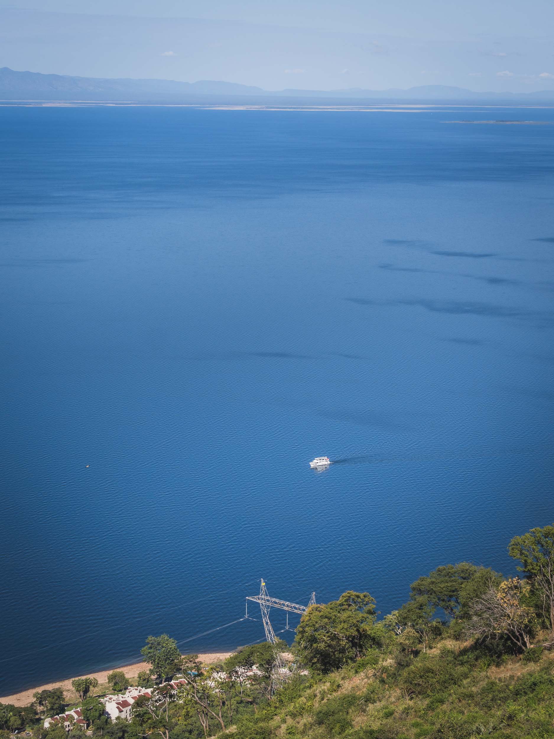
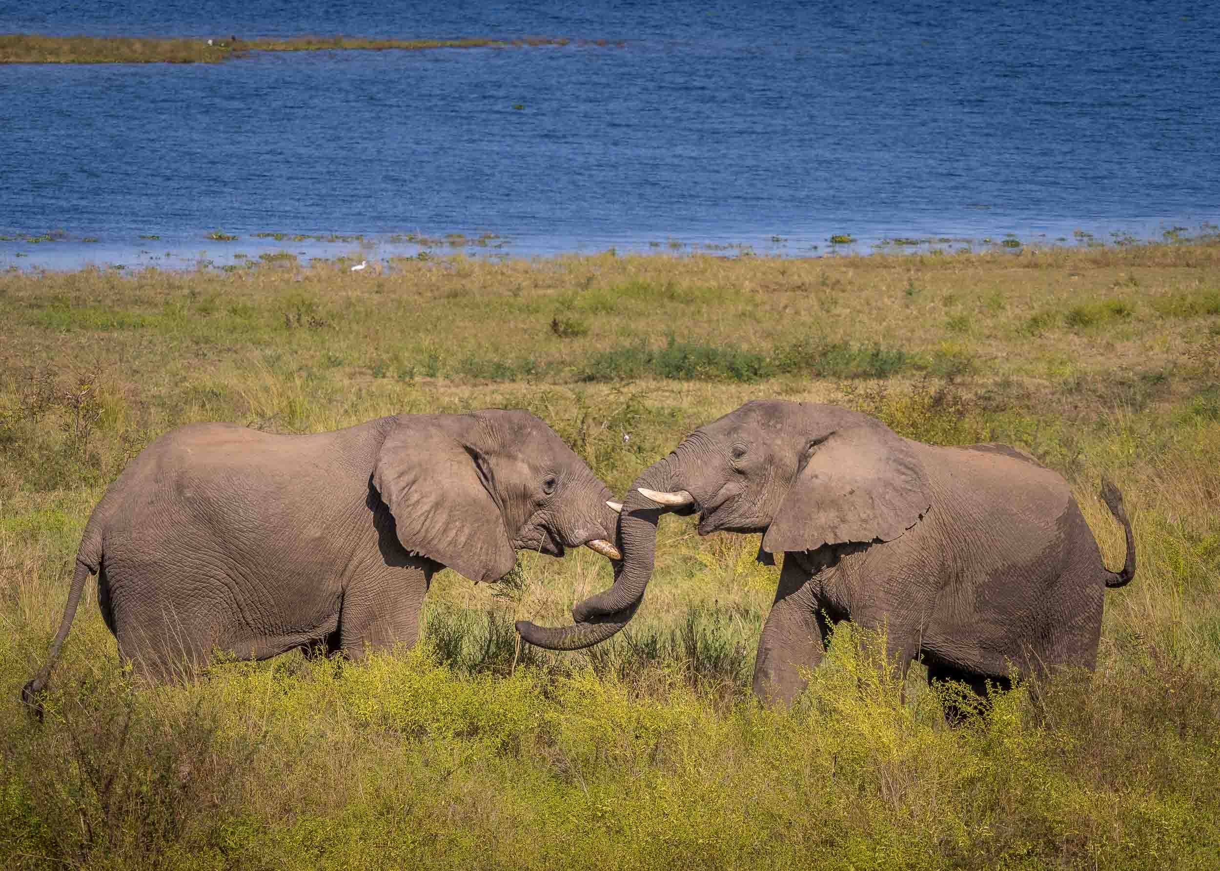

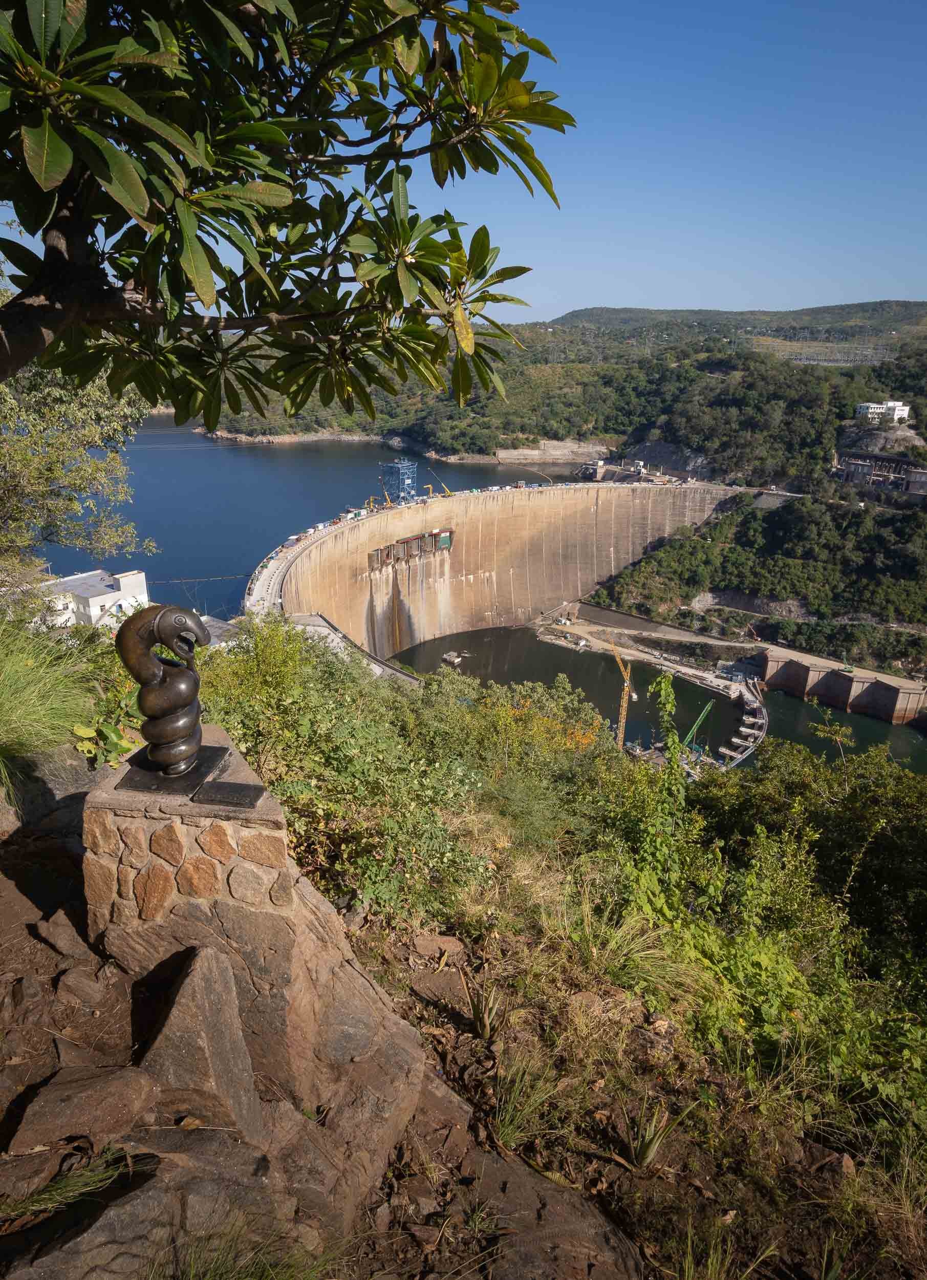
Following my time in Kariba at Warthogs Bush Camp (Elephants and Zebra visit the small pool there to drink!) I moved across the lake into the Matusadona National Park. An hour boat ride took me to a very unique lodge, called Musango, run by its owners Wendy & Steve.
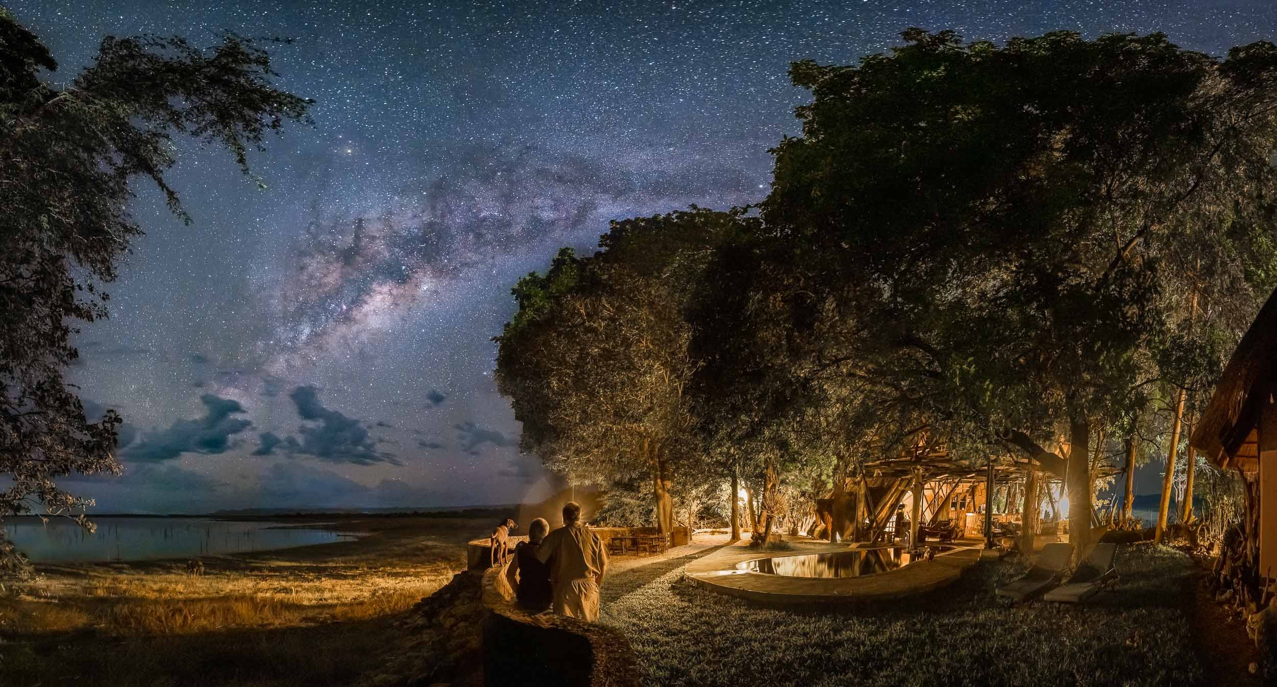
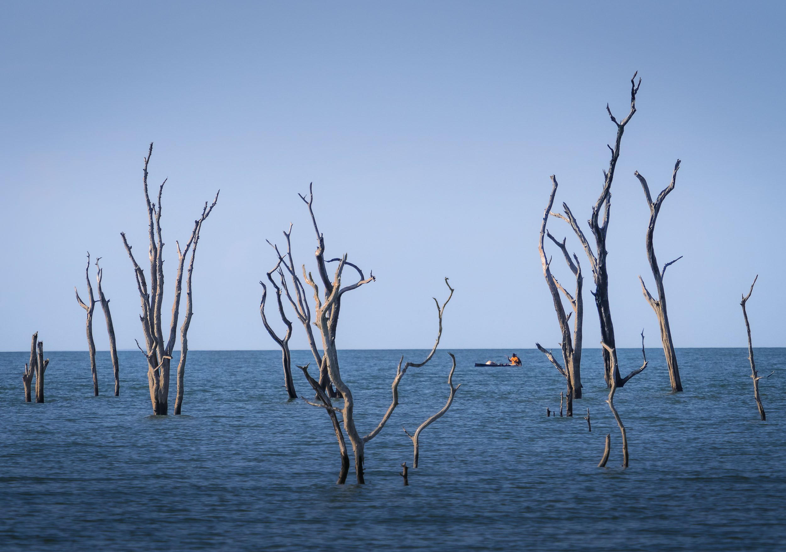
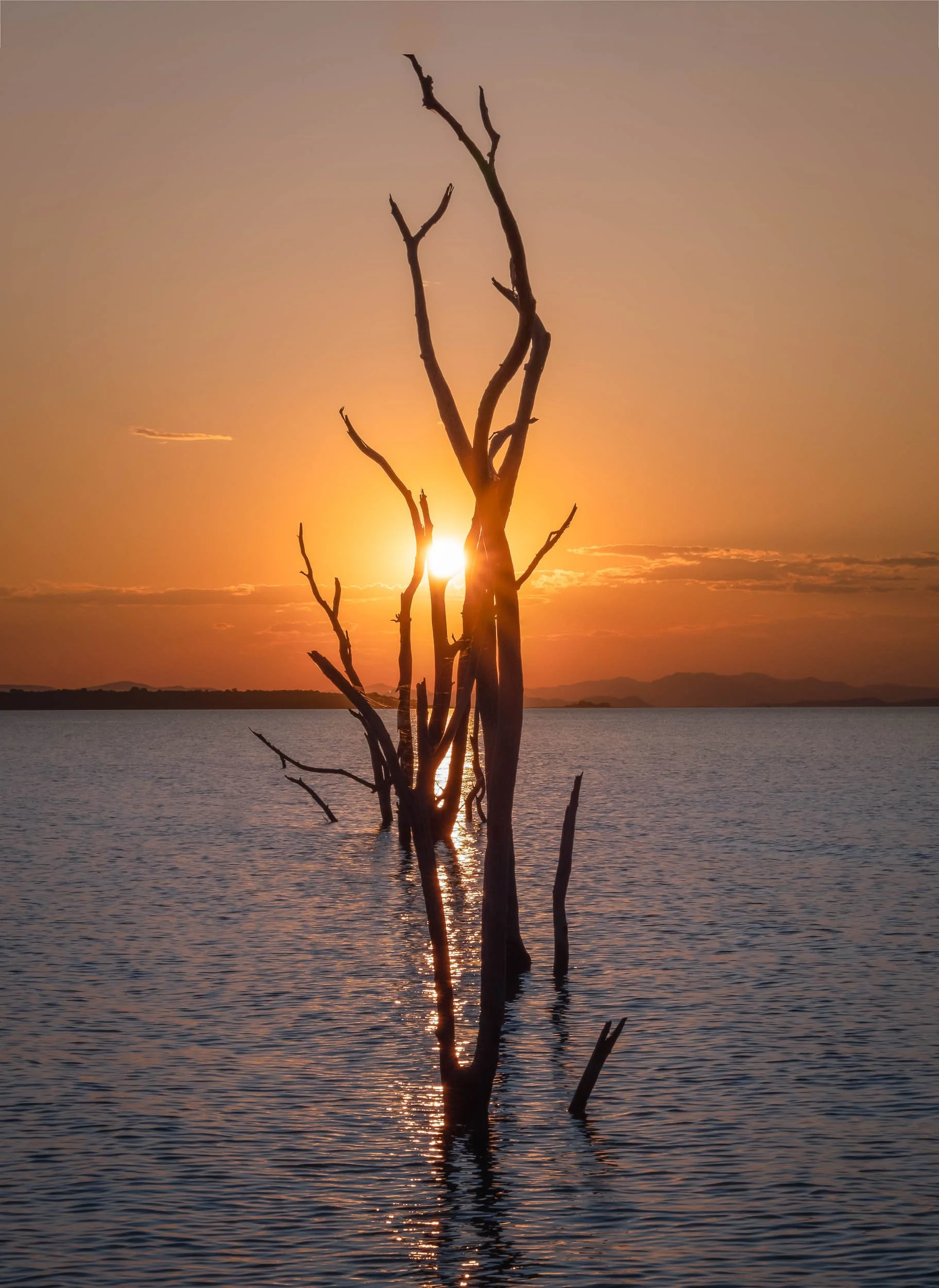
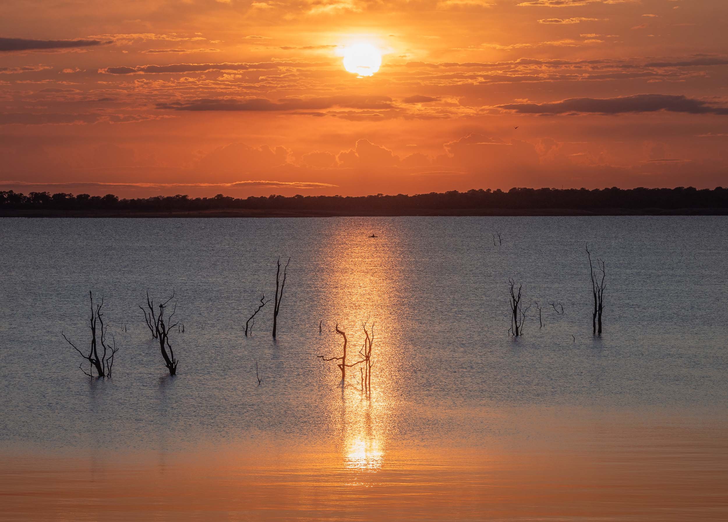
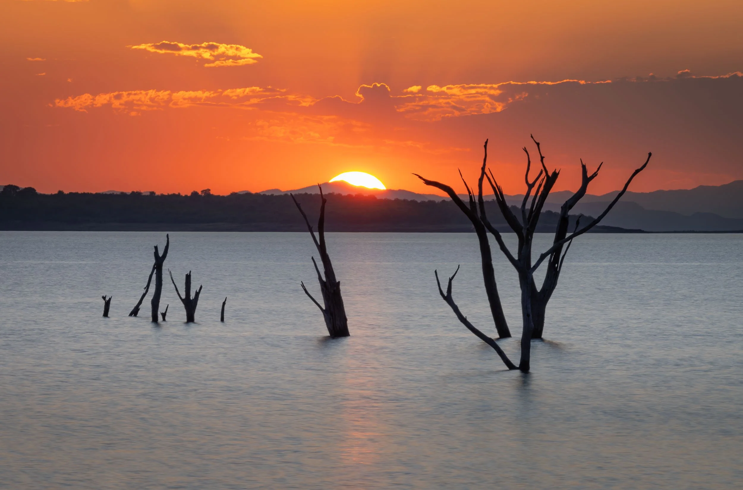
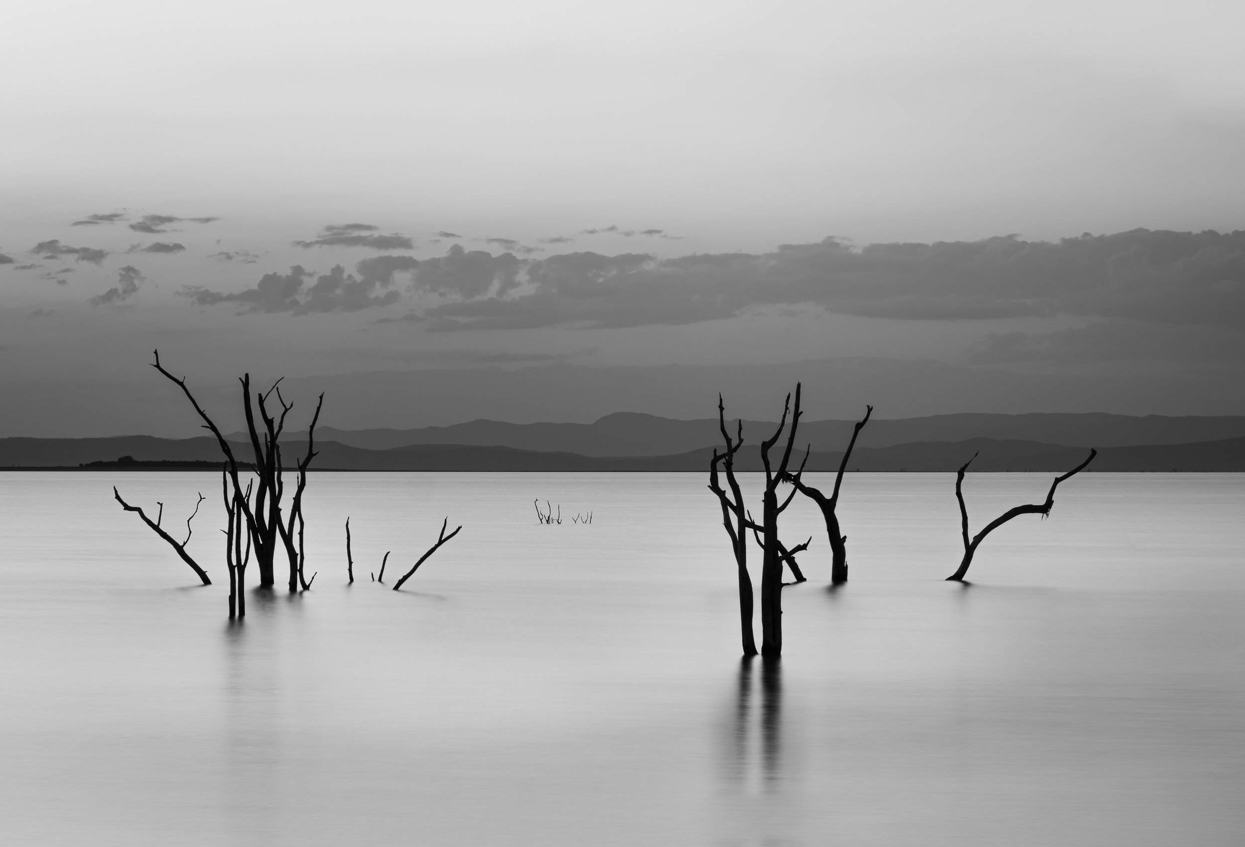
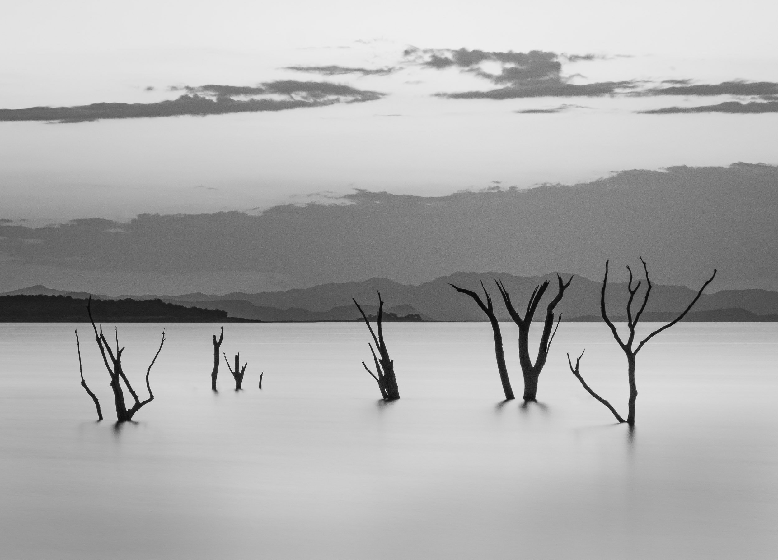

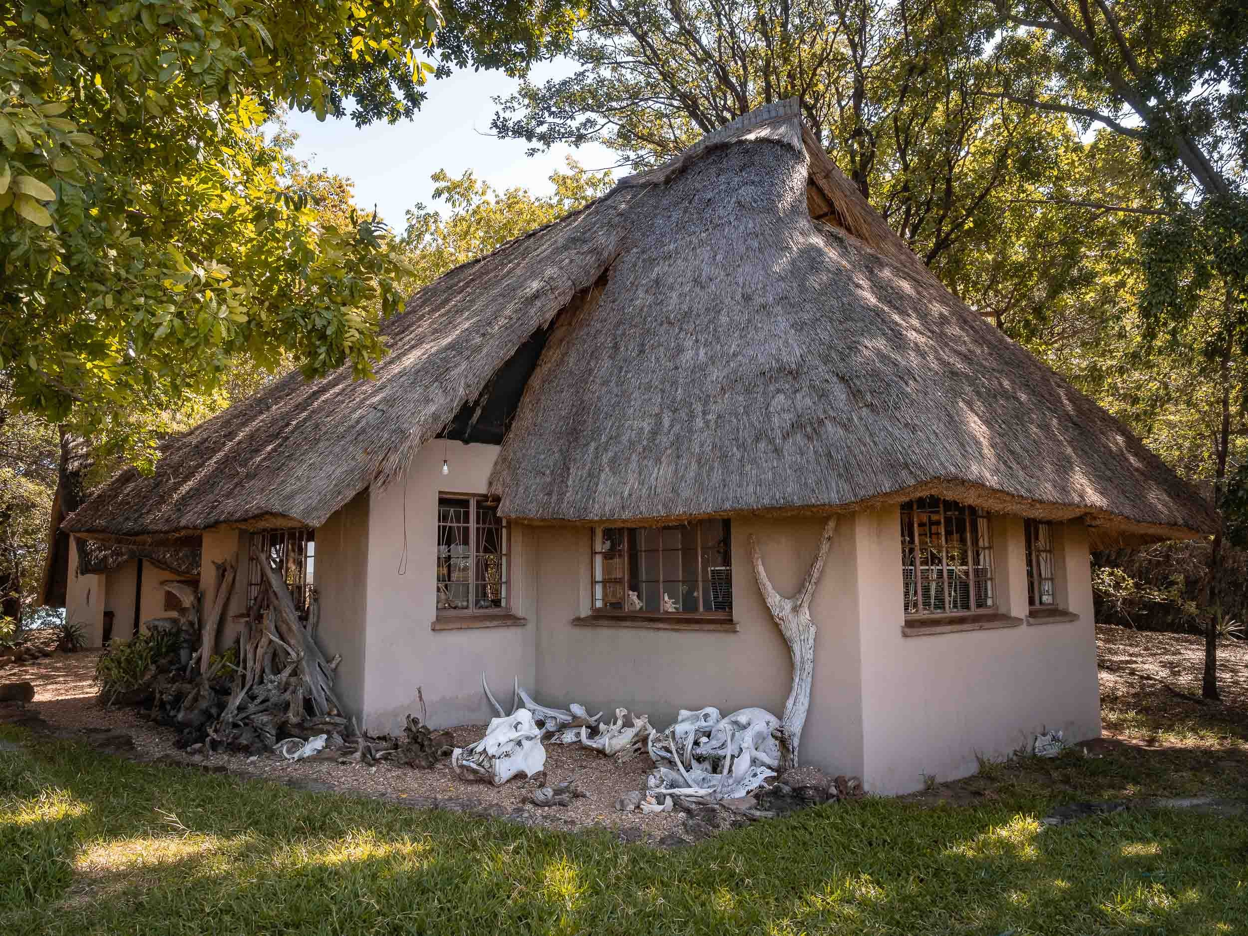
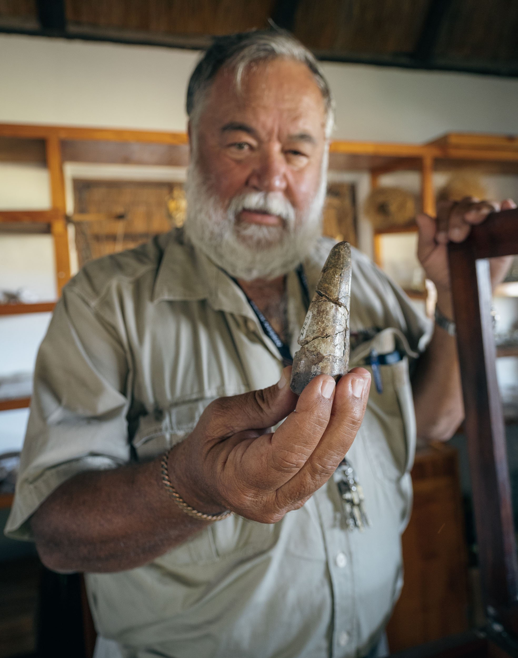
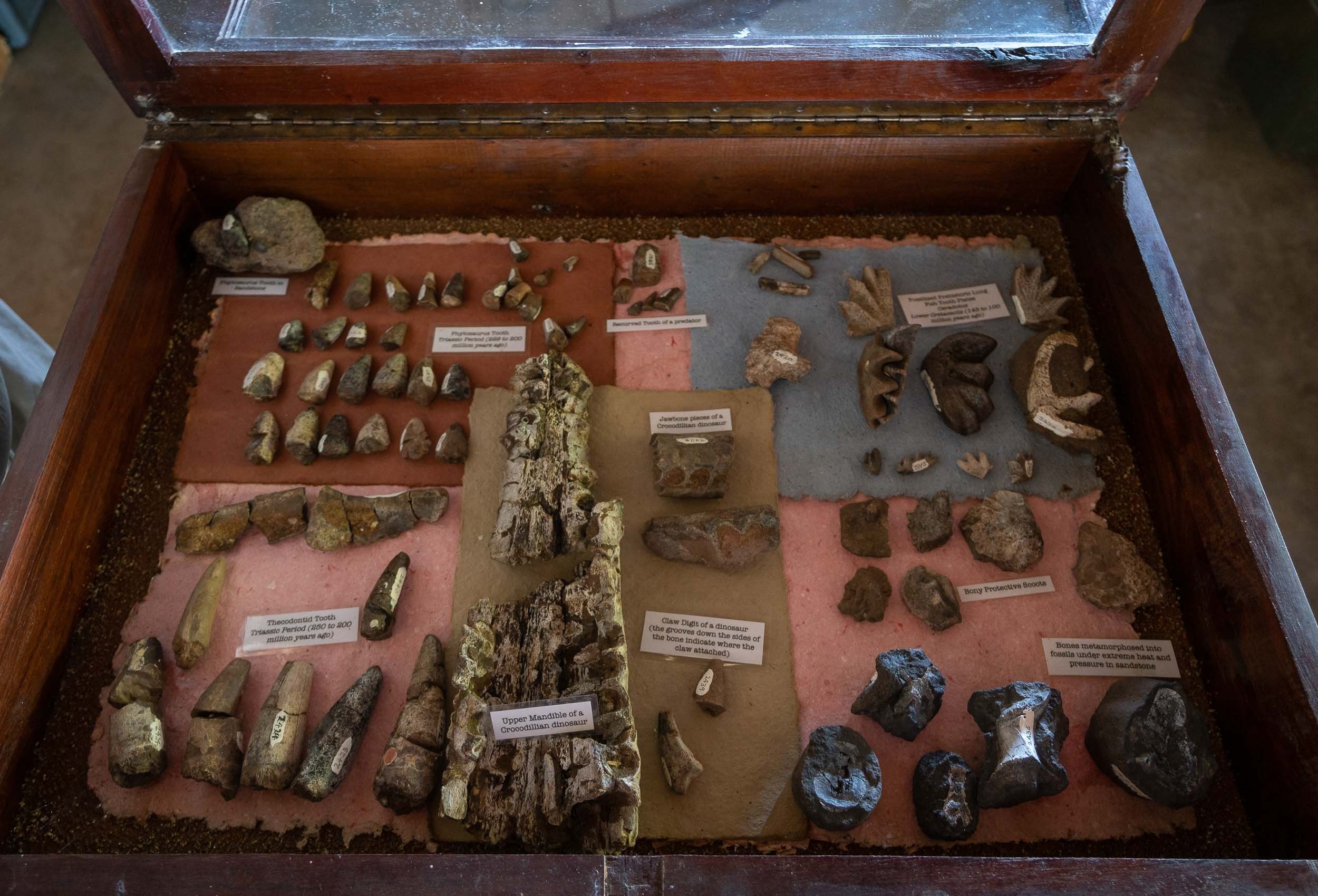
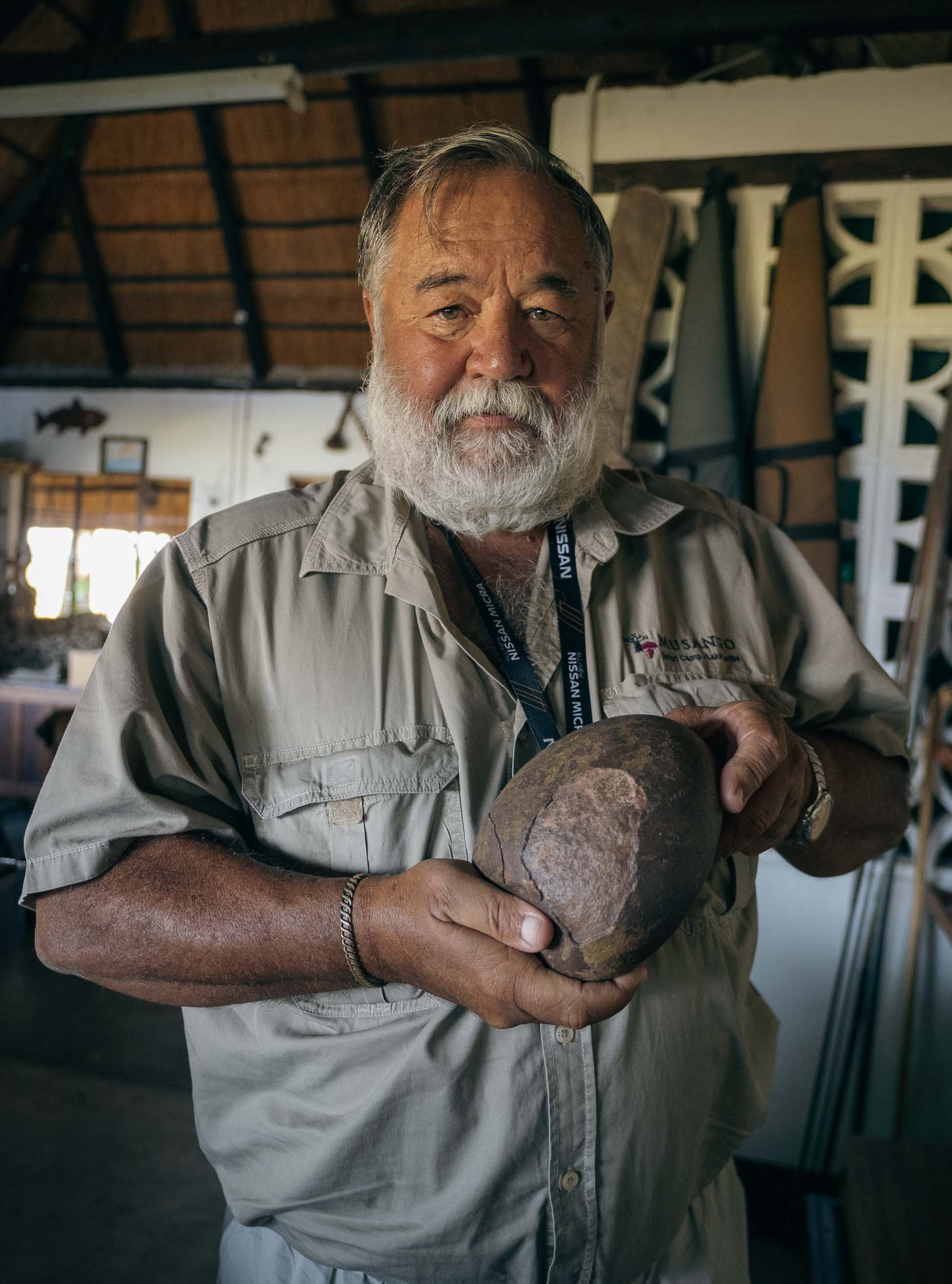
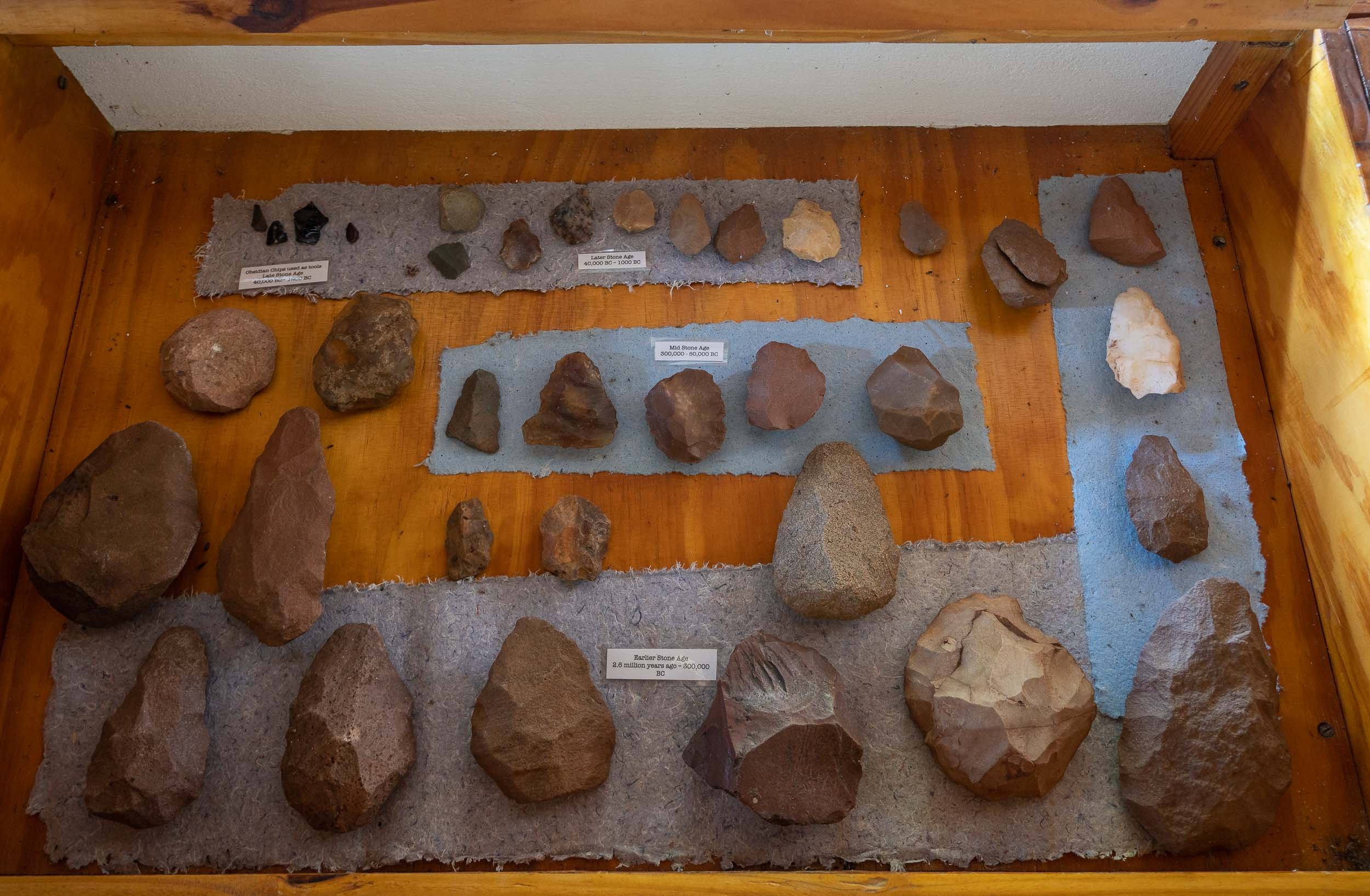
A night at the Falls
Before moving on to Botswana, I had a night at Victoria Falls, my second visit after having explored the Zambian side back in 2011. It is as fascinating now as it was then, and I’m glad to have seen both sides.
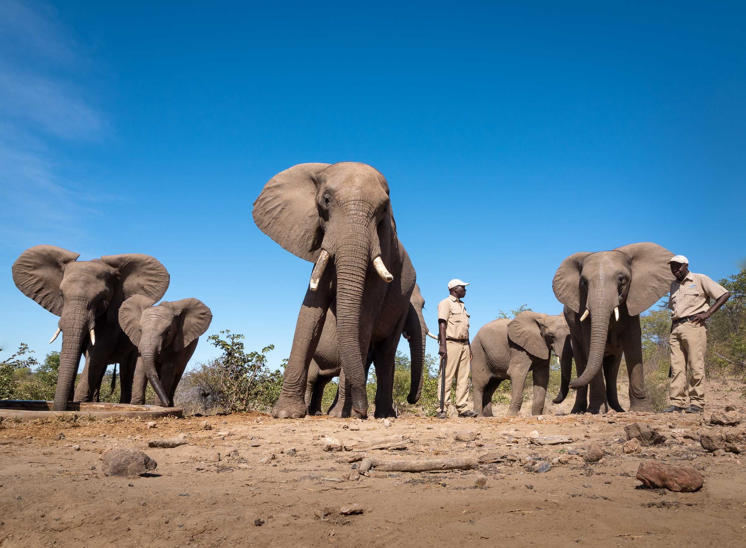
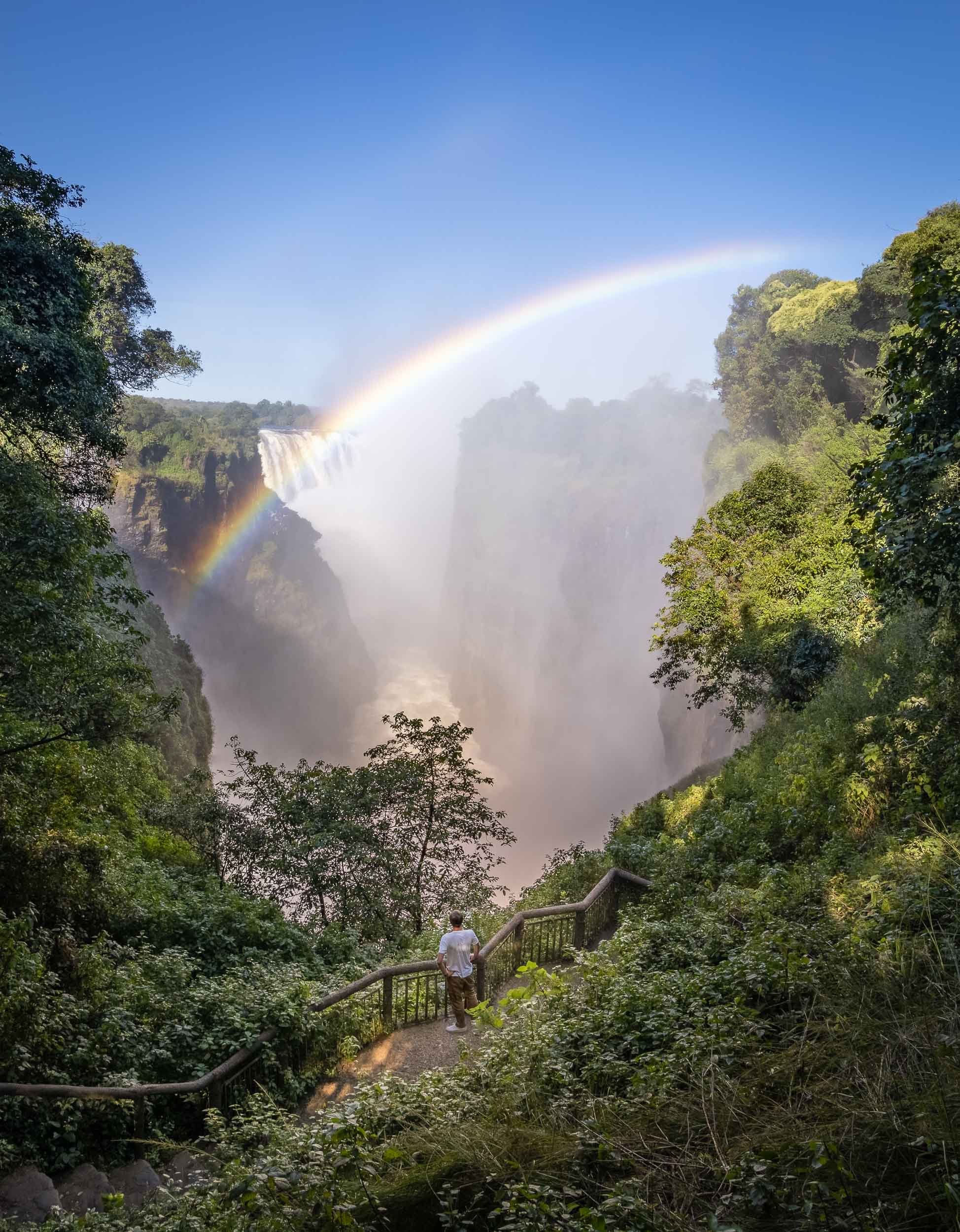
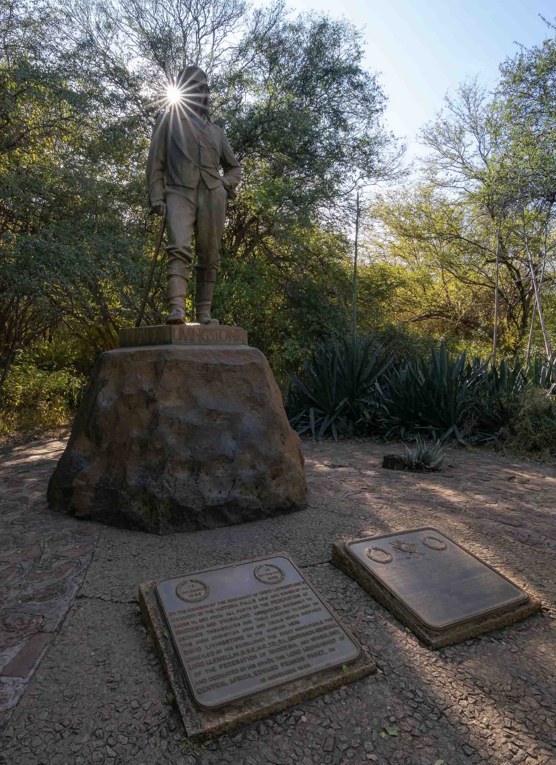

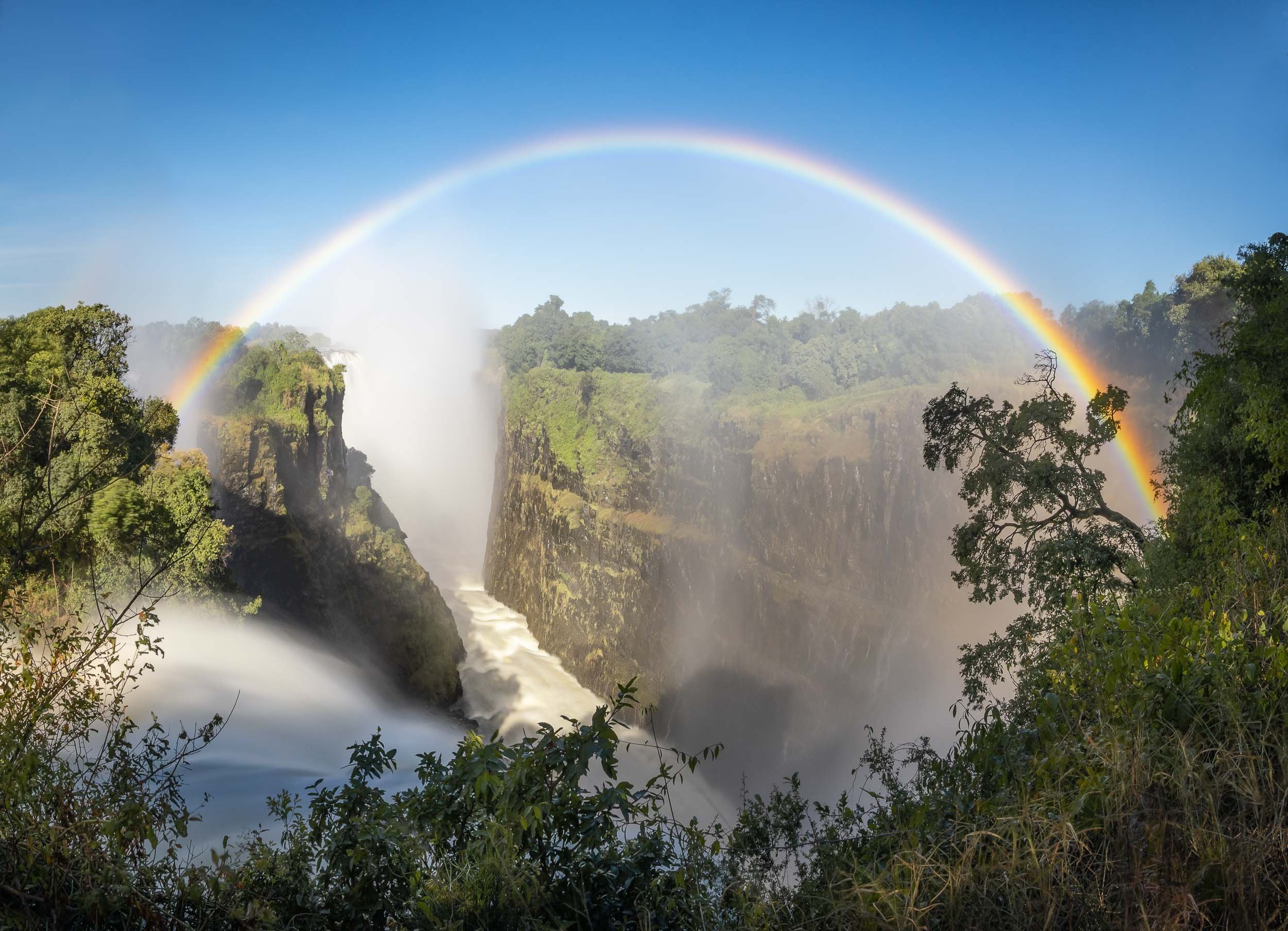
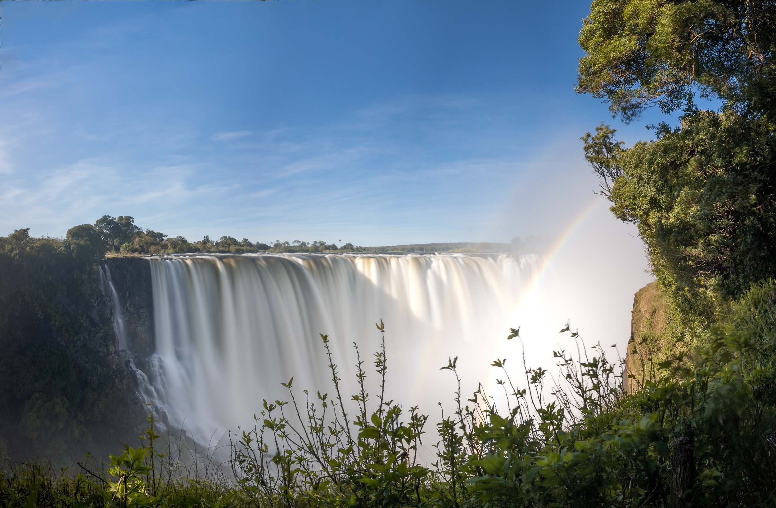
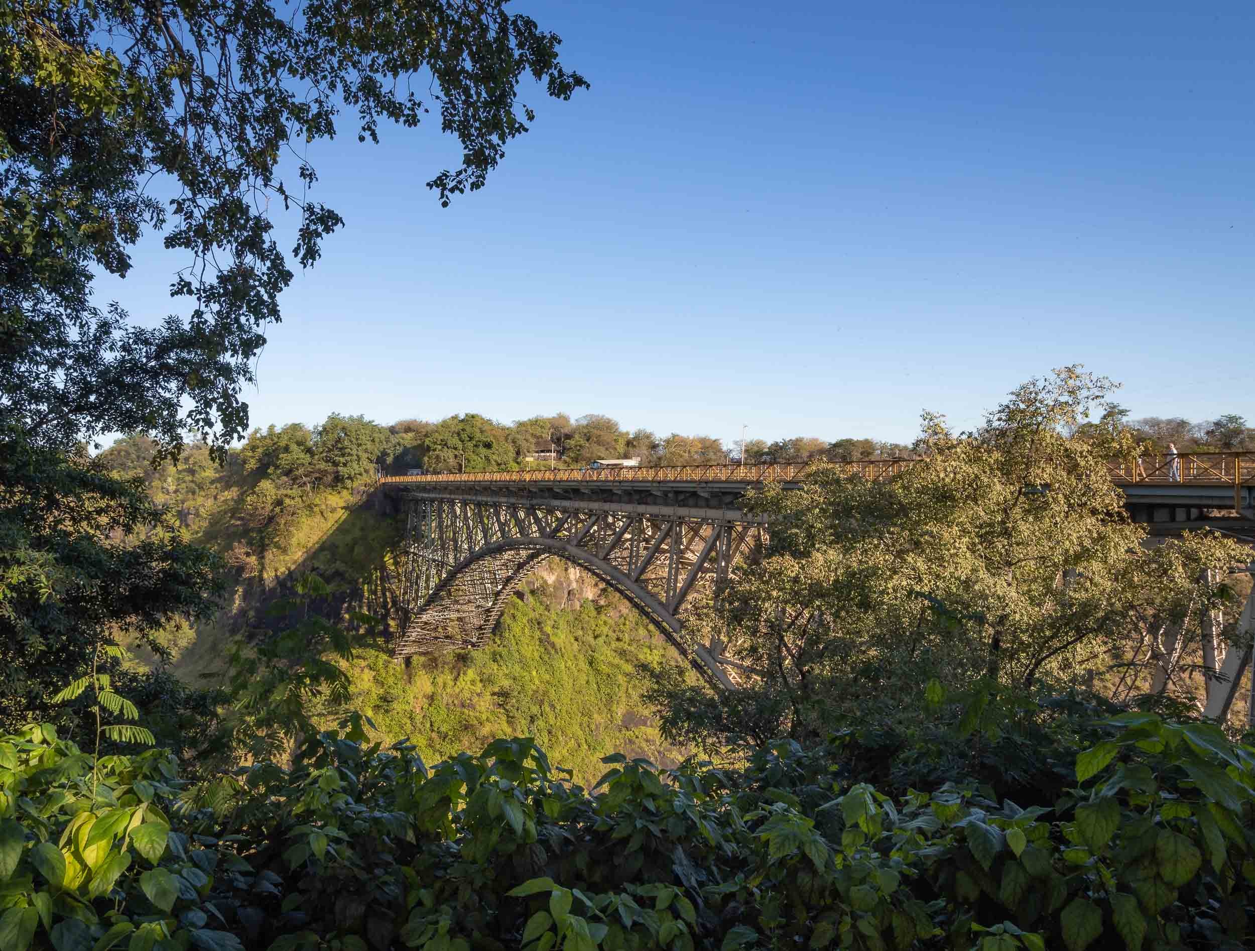
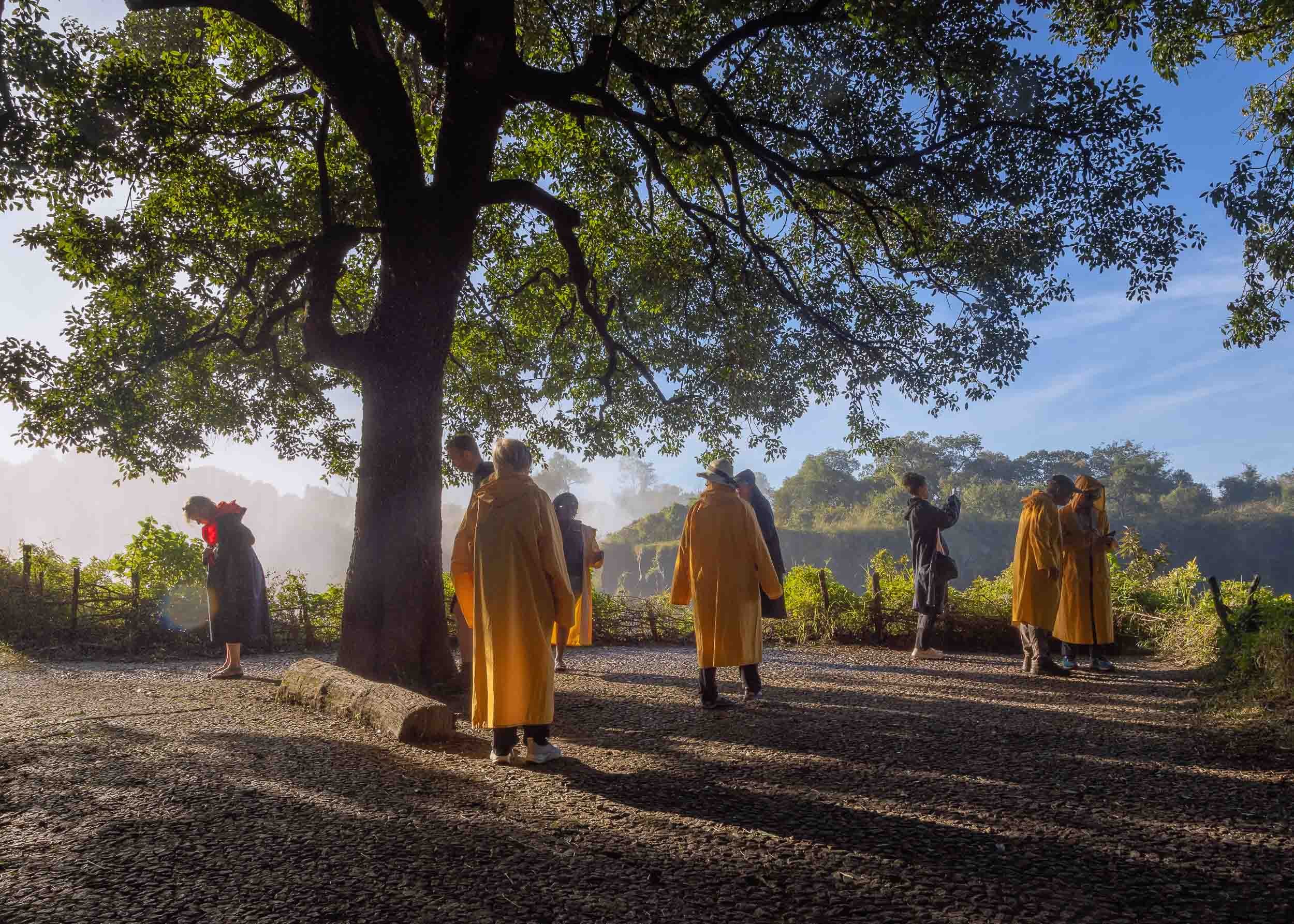
That brings us to the end of my trip through Zimbabwe!

Namibia - The Most Amazing Night Sky, But So Much More
Namibia was the first destination for my two-month-seven-country Africa trip, and maybe the one I was most excited about.
Namibia was the first destination for my two-month-seven-country Africa trip, and maybe the one I was most excited about.

This part of the journey was organised by https://www.stefanliebermann.de, Sony Ambassador for Germany as a 12 day workshop in collaboration with Richard Morsbach, a local tour guide.
The trip was focused on astrophotography, as Namibia has some of the best dark skies in the world and the Milky Way was visible all night during new moon. We did however also have the opportunity to take some daylight cityscape, sunrise and sunset, wildlife, and landscape images.
Namibia is incredible and definitely a destination I’d come back to. Read on to find out what you can see in this country, and the photos I captured to document it.
You can also head over to my Instagram (www.instagram.com/djflore) and check my Story Highlights for a bit of background info.
The Quiver Tree Forest
Our first destination after flying into Windhoek was the Quiver Tree Forest, north-east of Keetmanshop, where we arrived just in time for sunset after a 5h drive and lunch break.
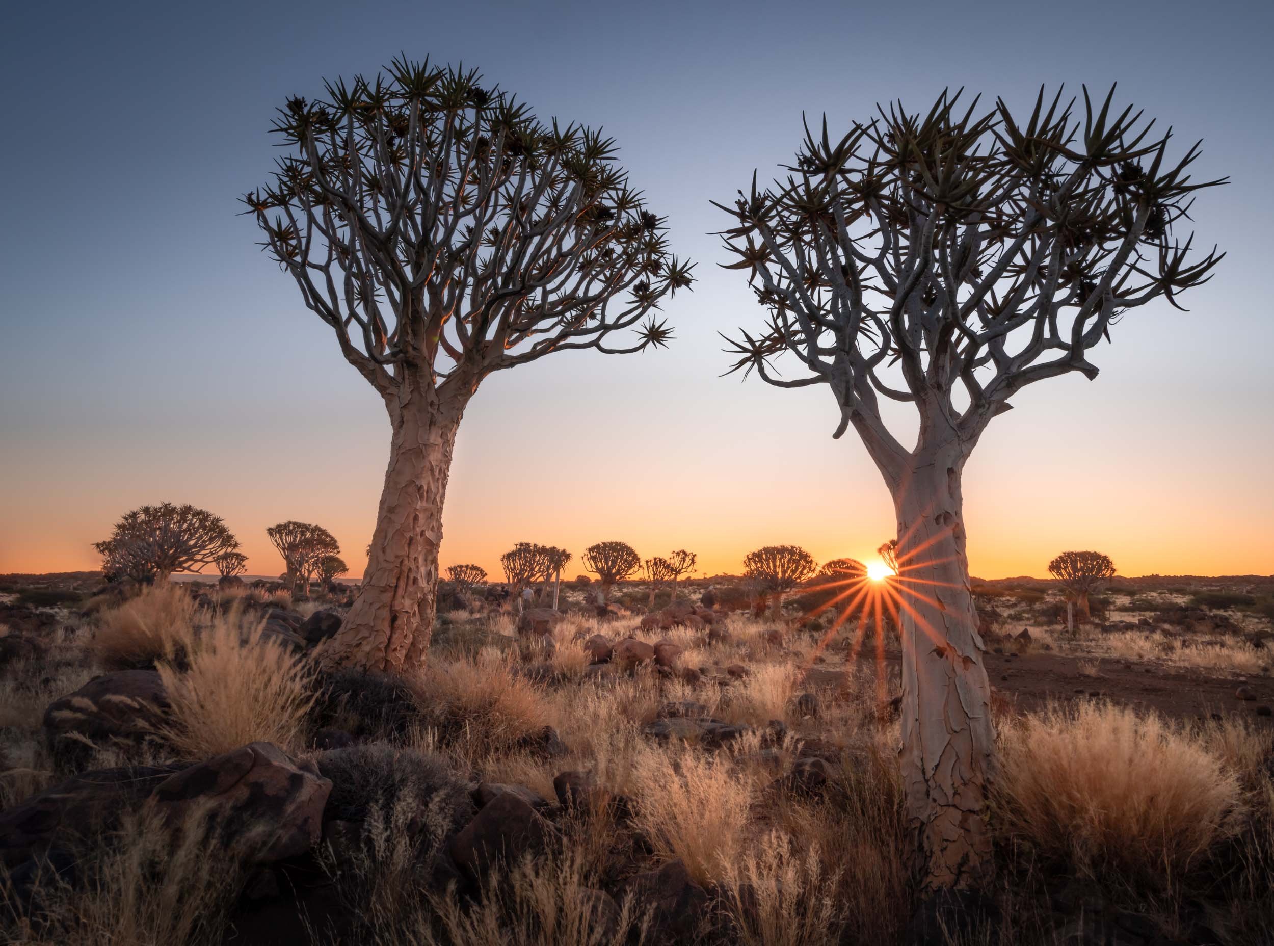
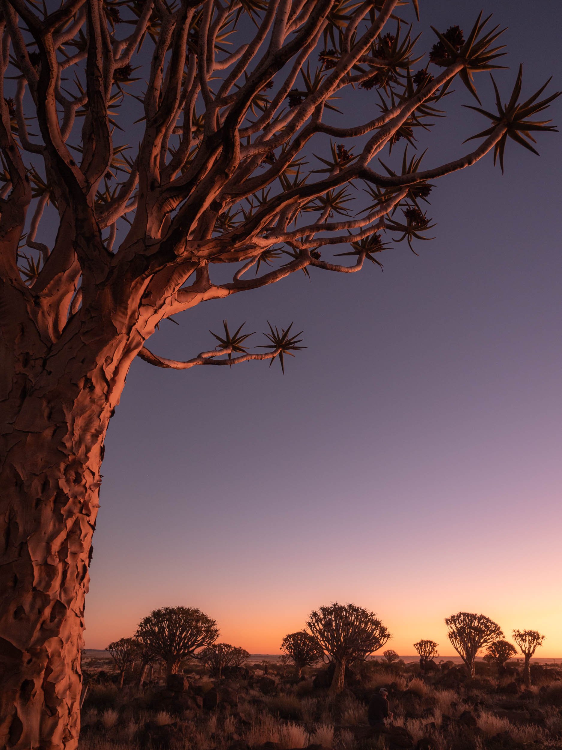
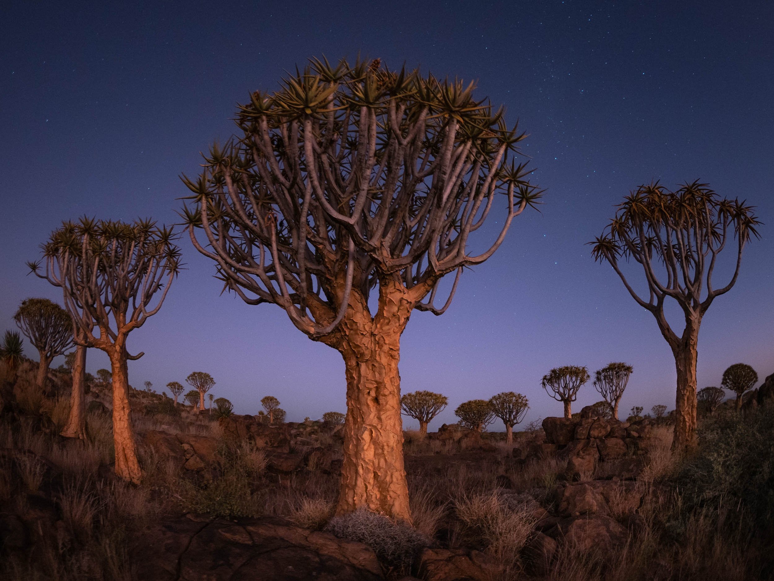

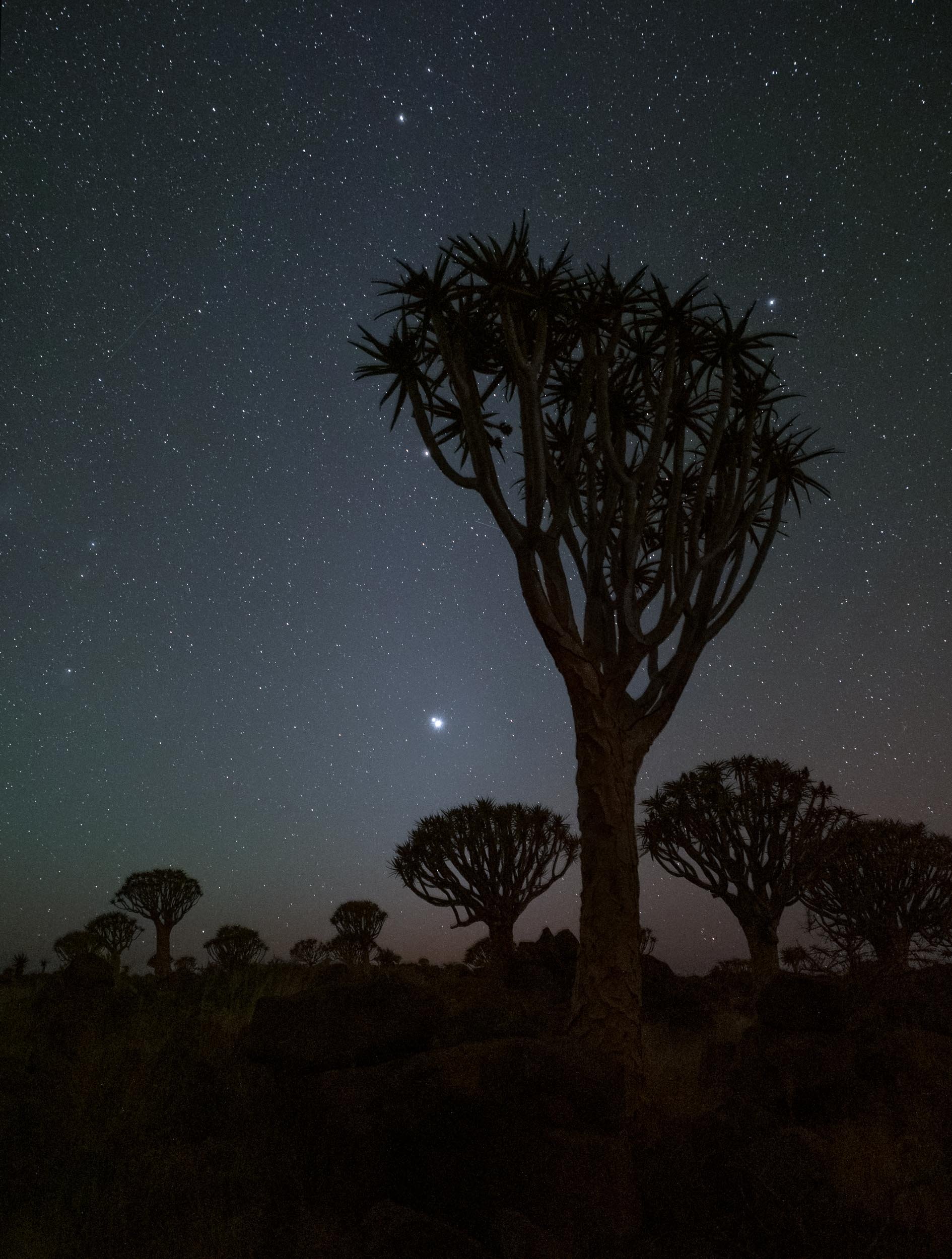
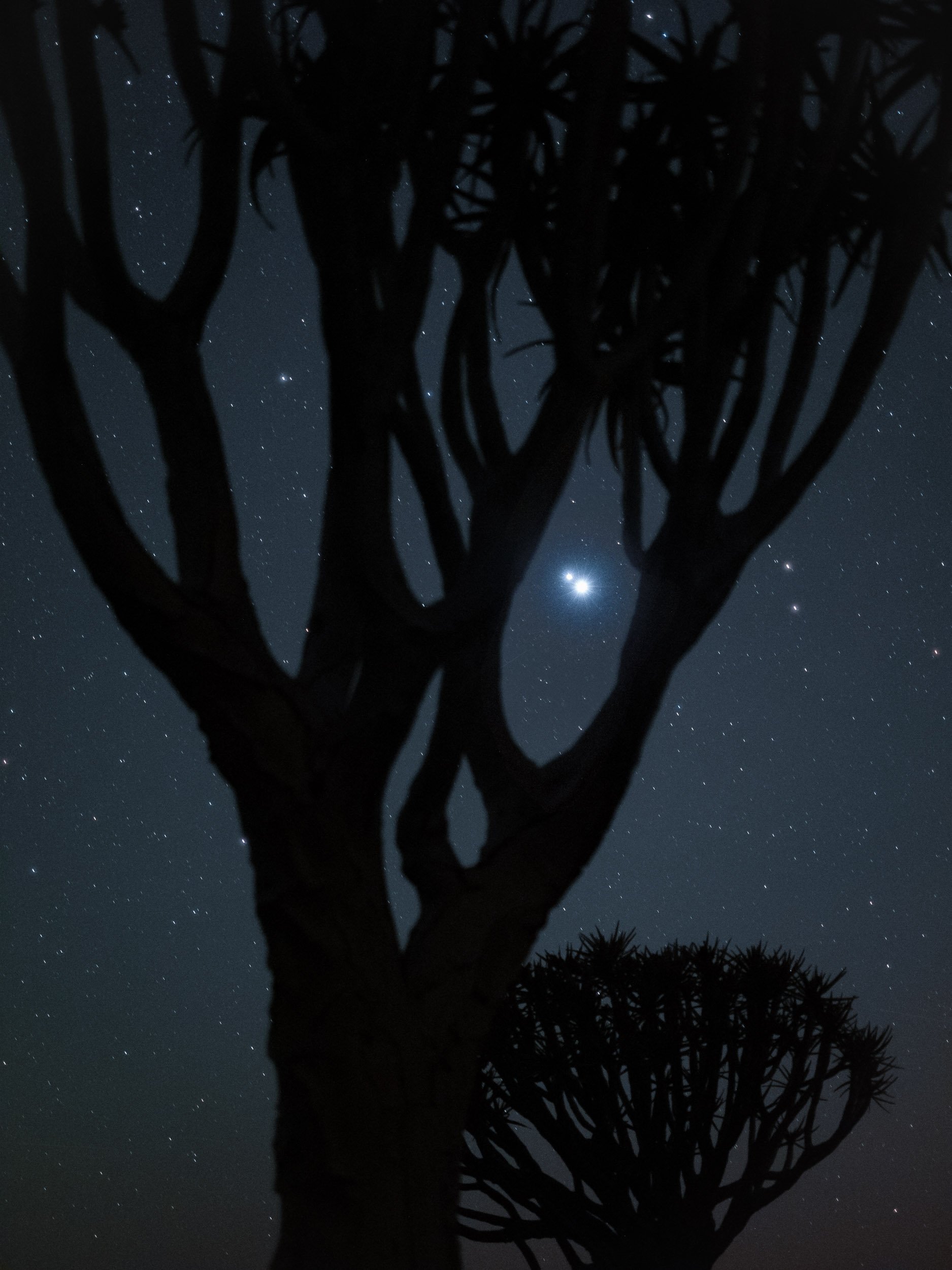

Onwards
After a sunset, night, and sunrise at the Quiver Trees, we moved straight on to the next spot., Fish River Canyon for a night, and then into Lüderitz, one of the country’s most famous towns.


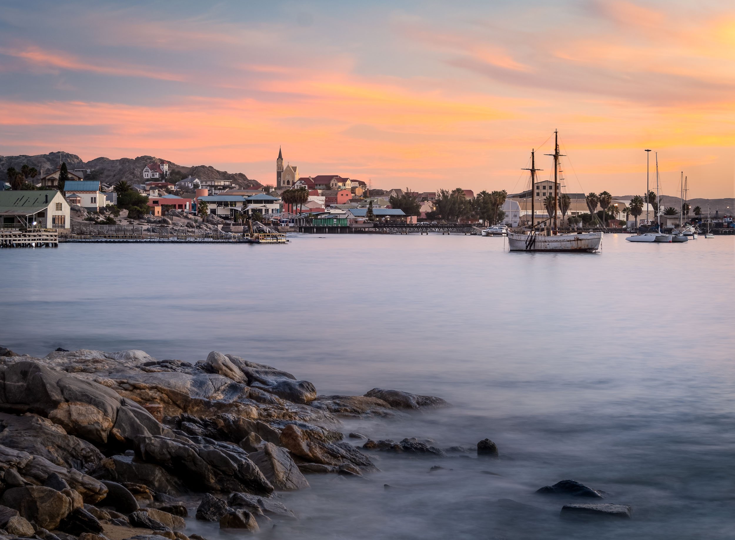
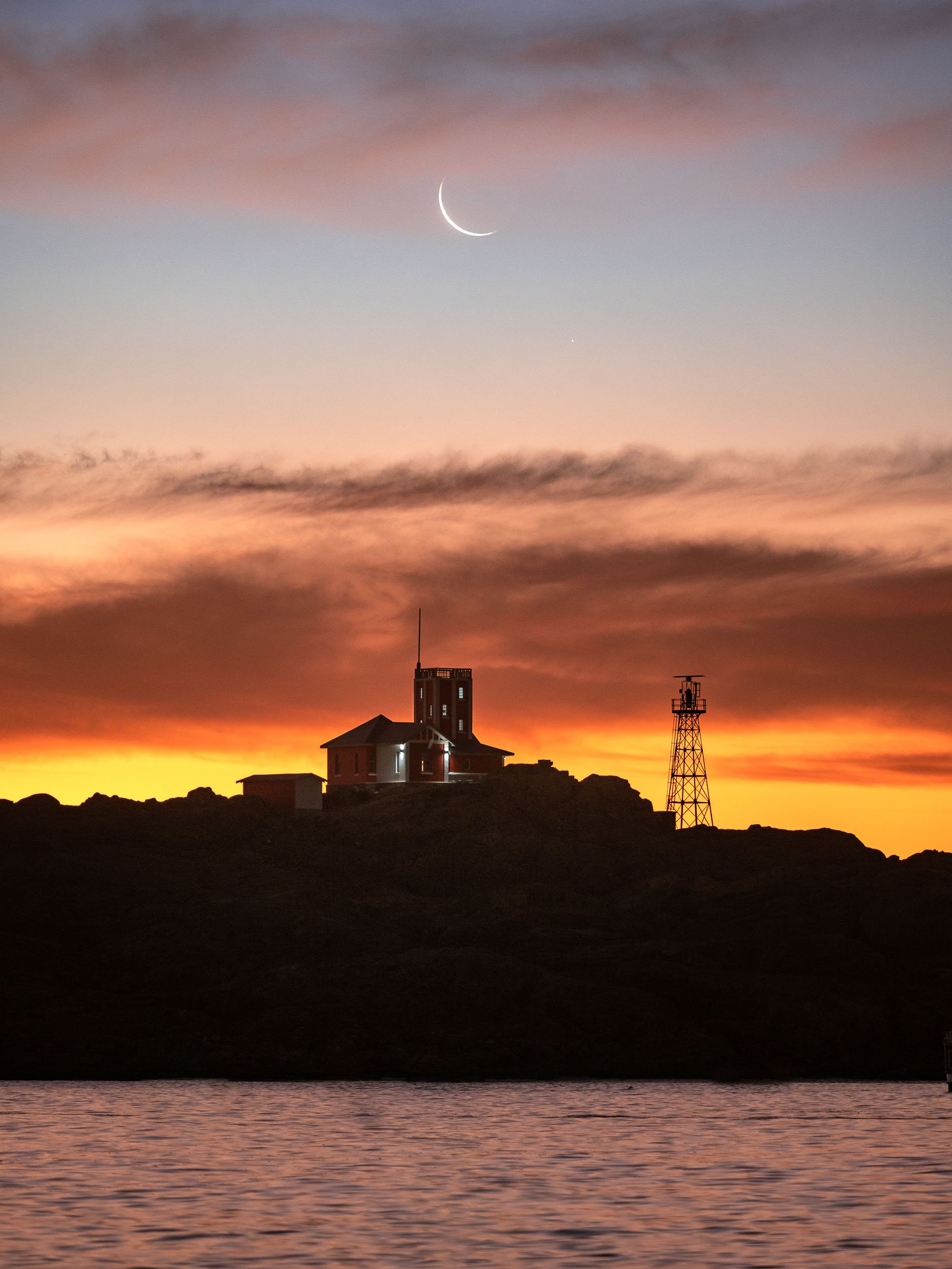
The Abandoned Town of Kolmanskoop
About 10km from Lüderitz you can find one of Namibia’s most popular destinations - a ghost village!
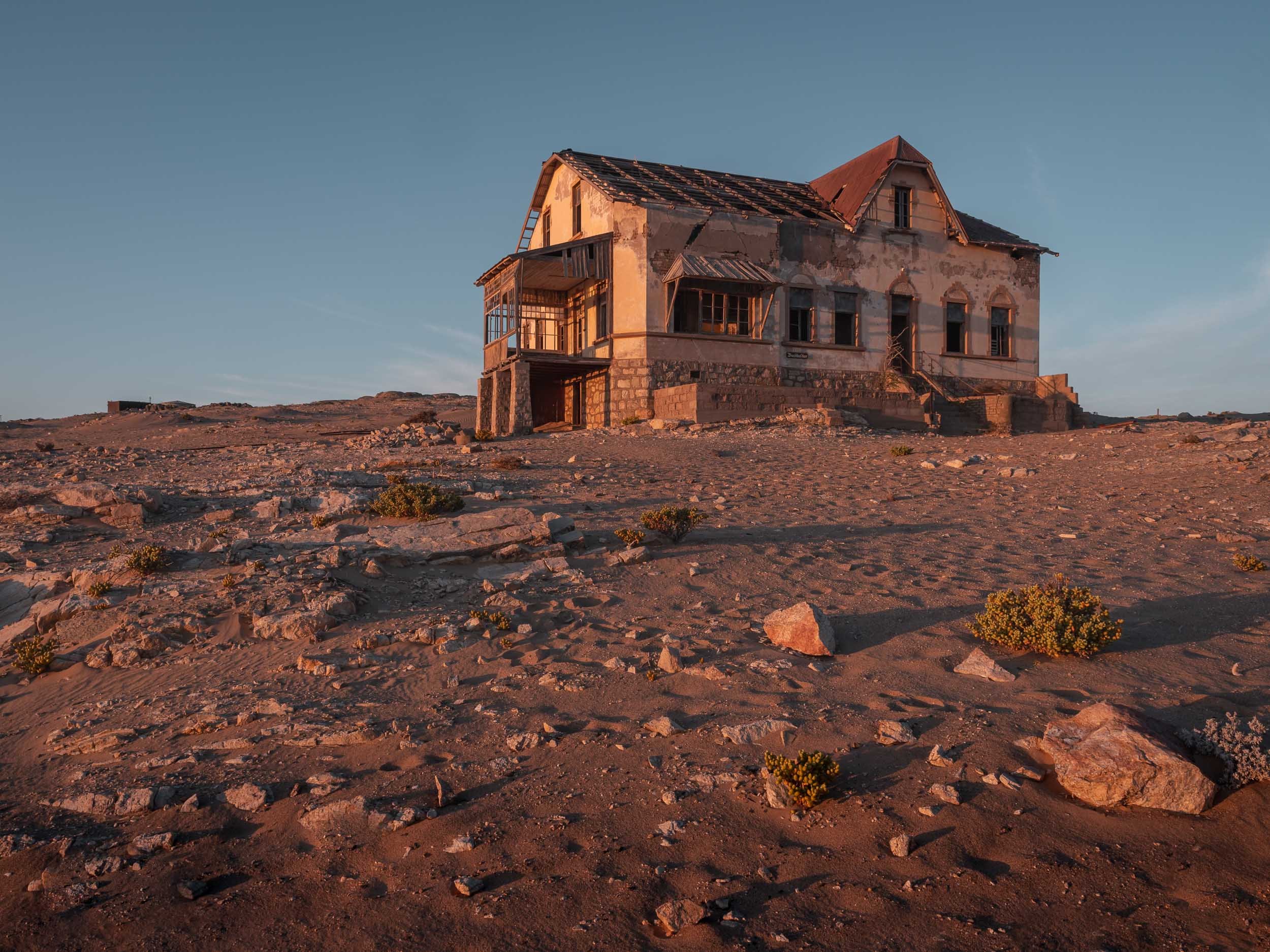
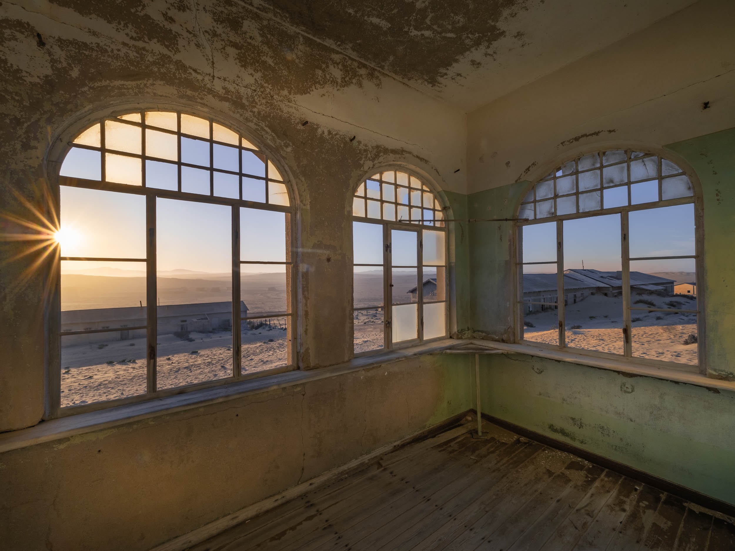
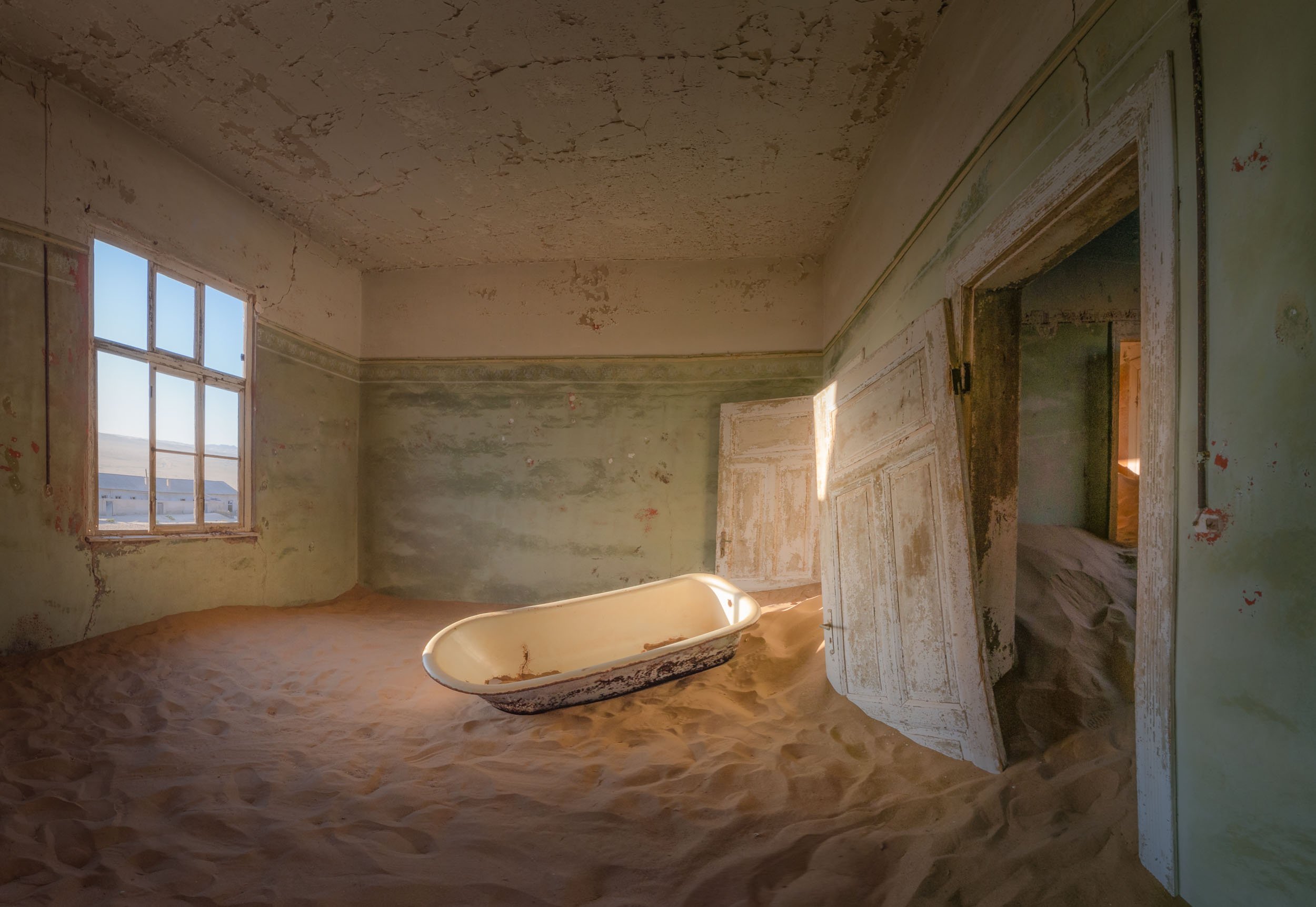

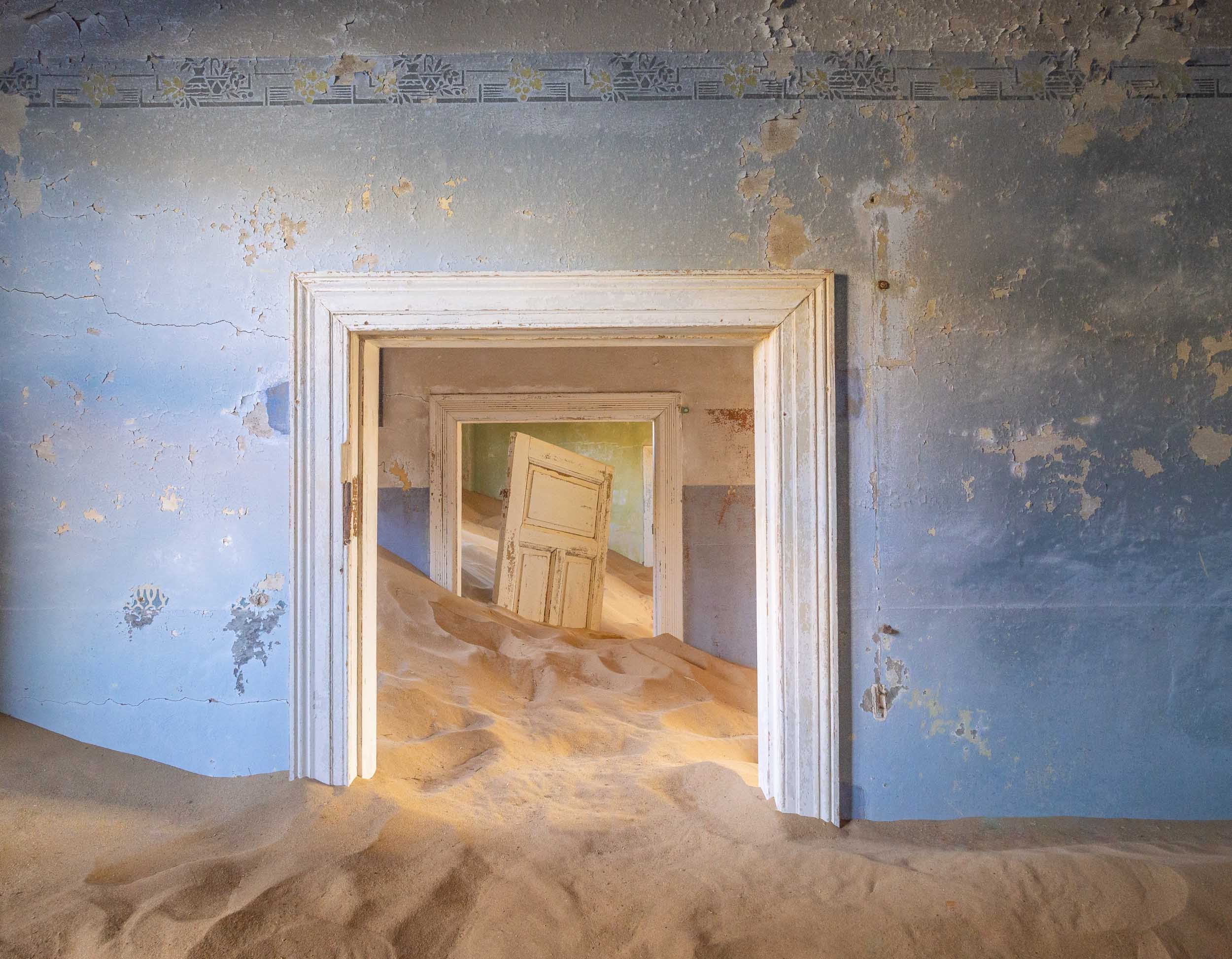
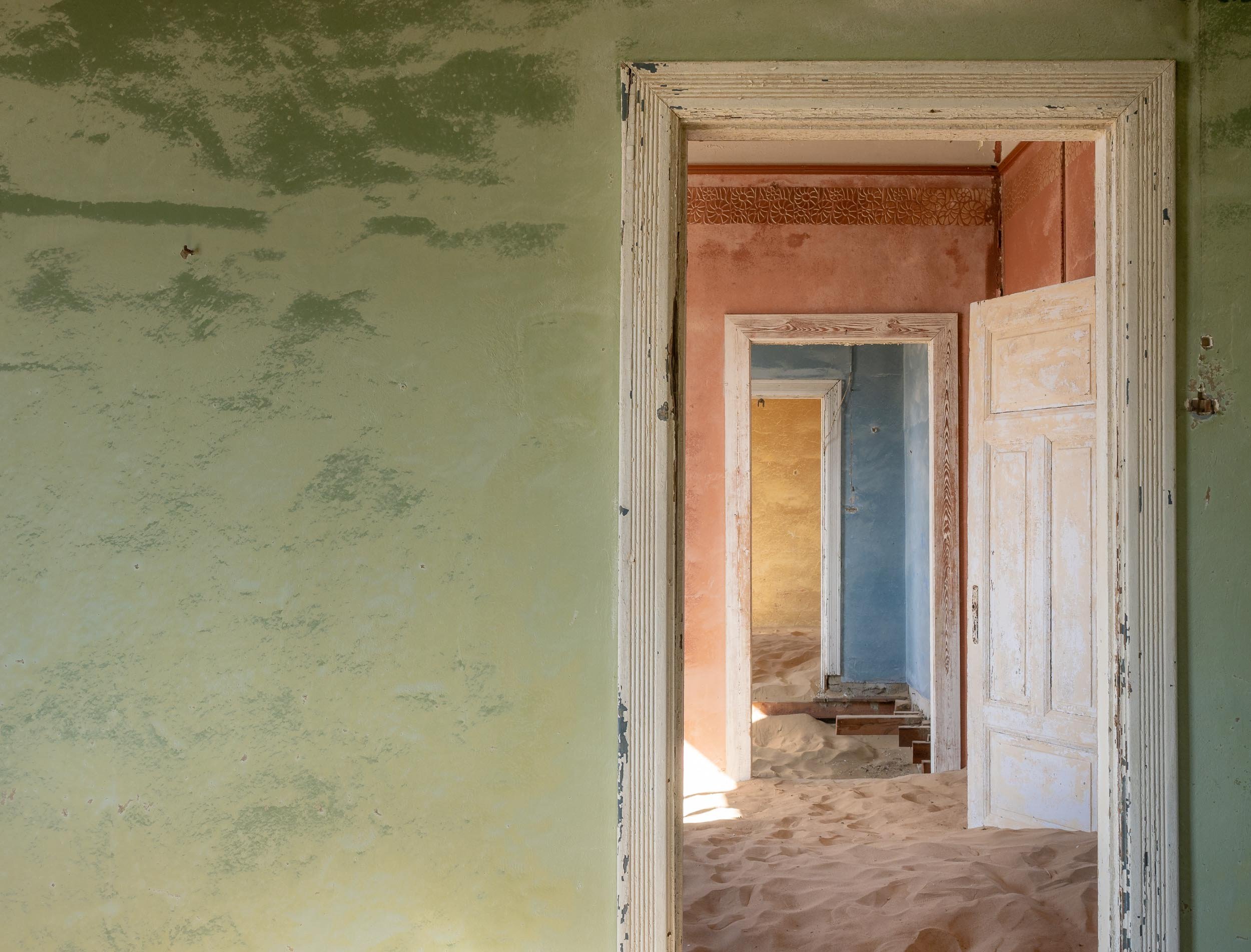
Onwards to Sossusvlei
After Lüderitz and the abandoned town, our next destination was the famous dunes of the Namib Naukluft National Park a bit further north of the country.
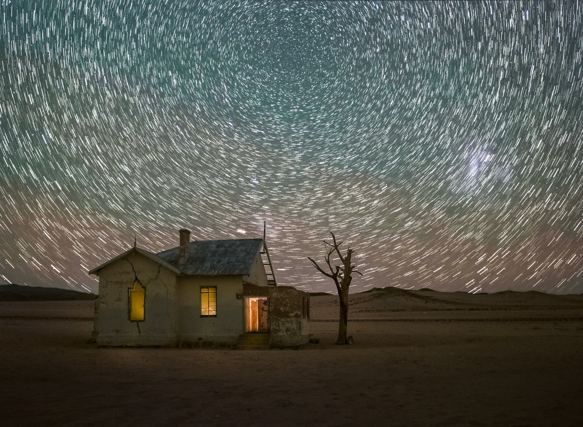
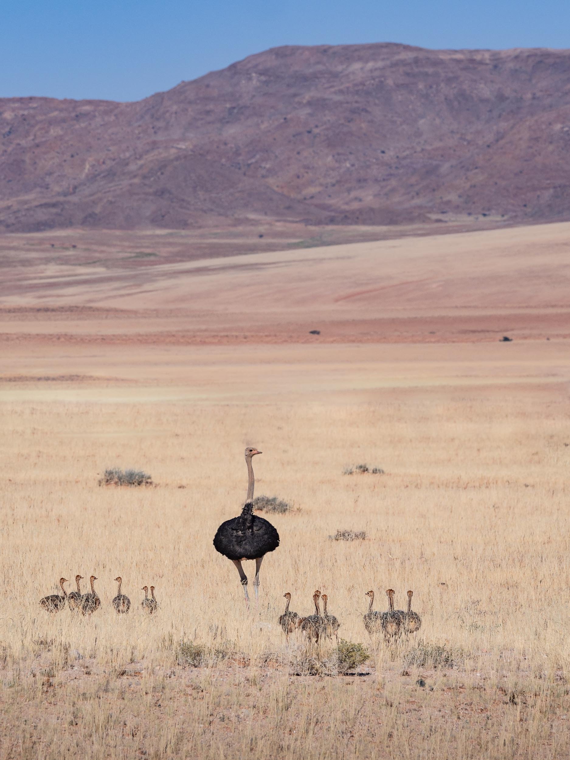
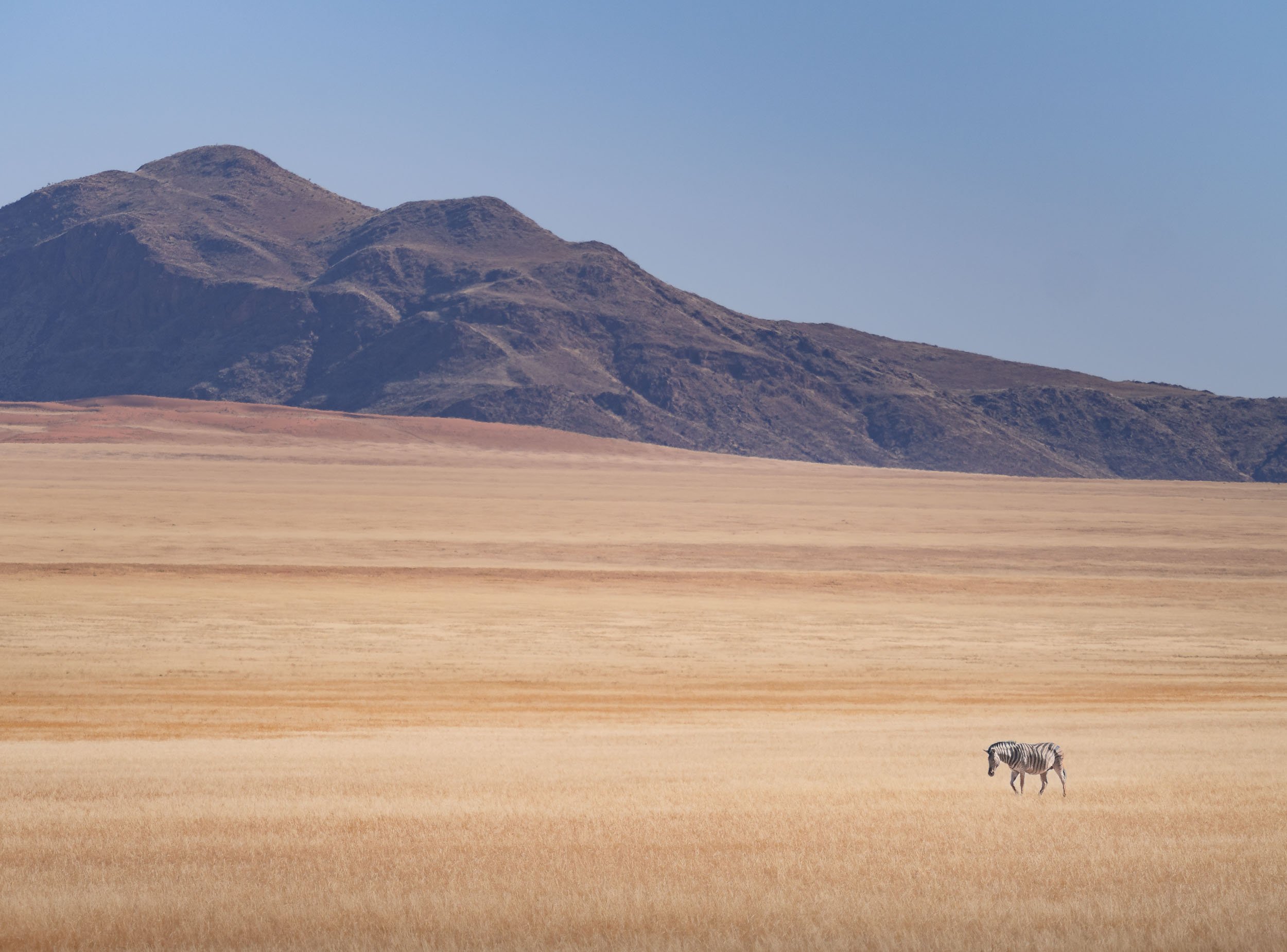
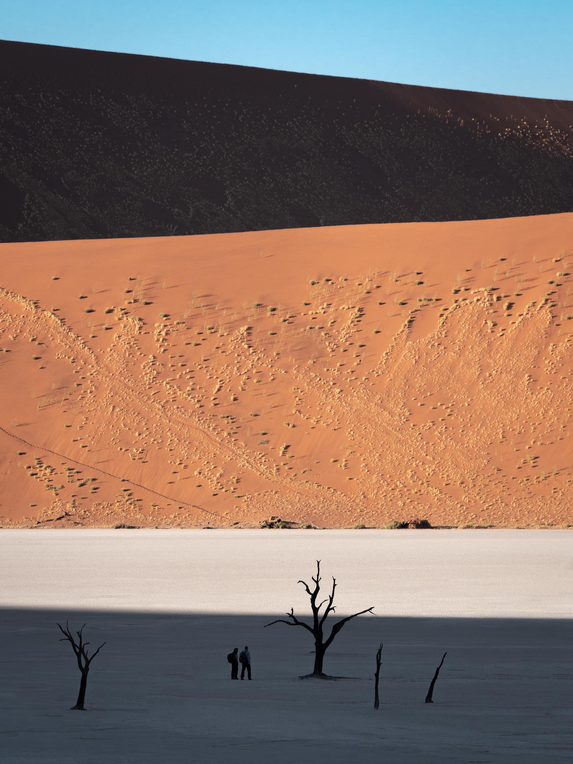


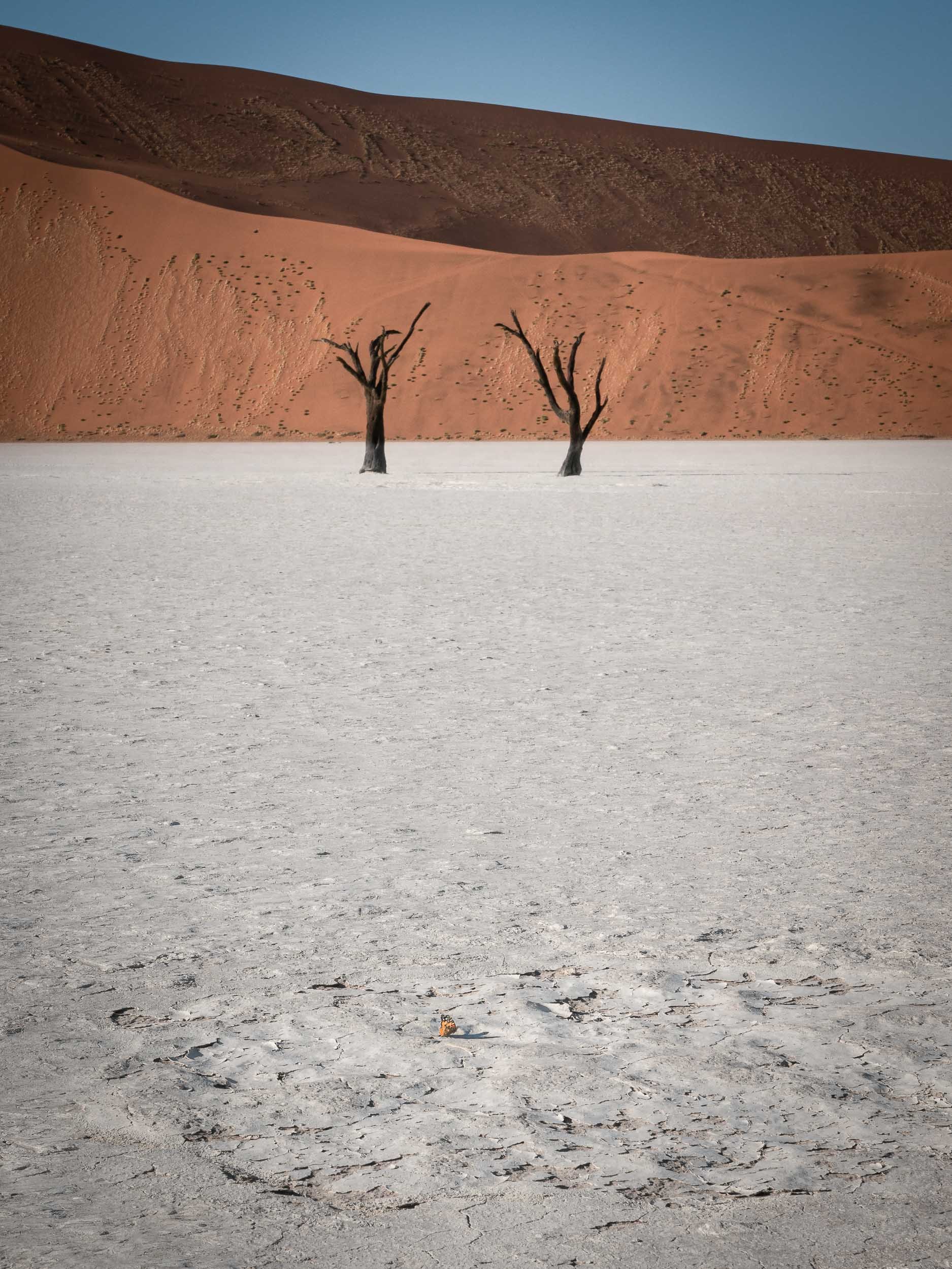
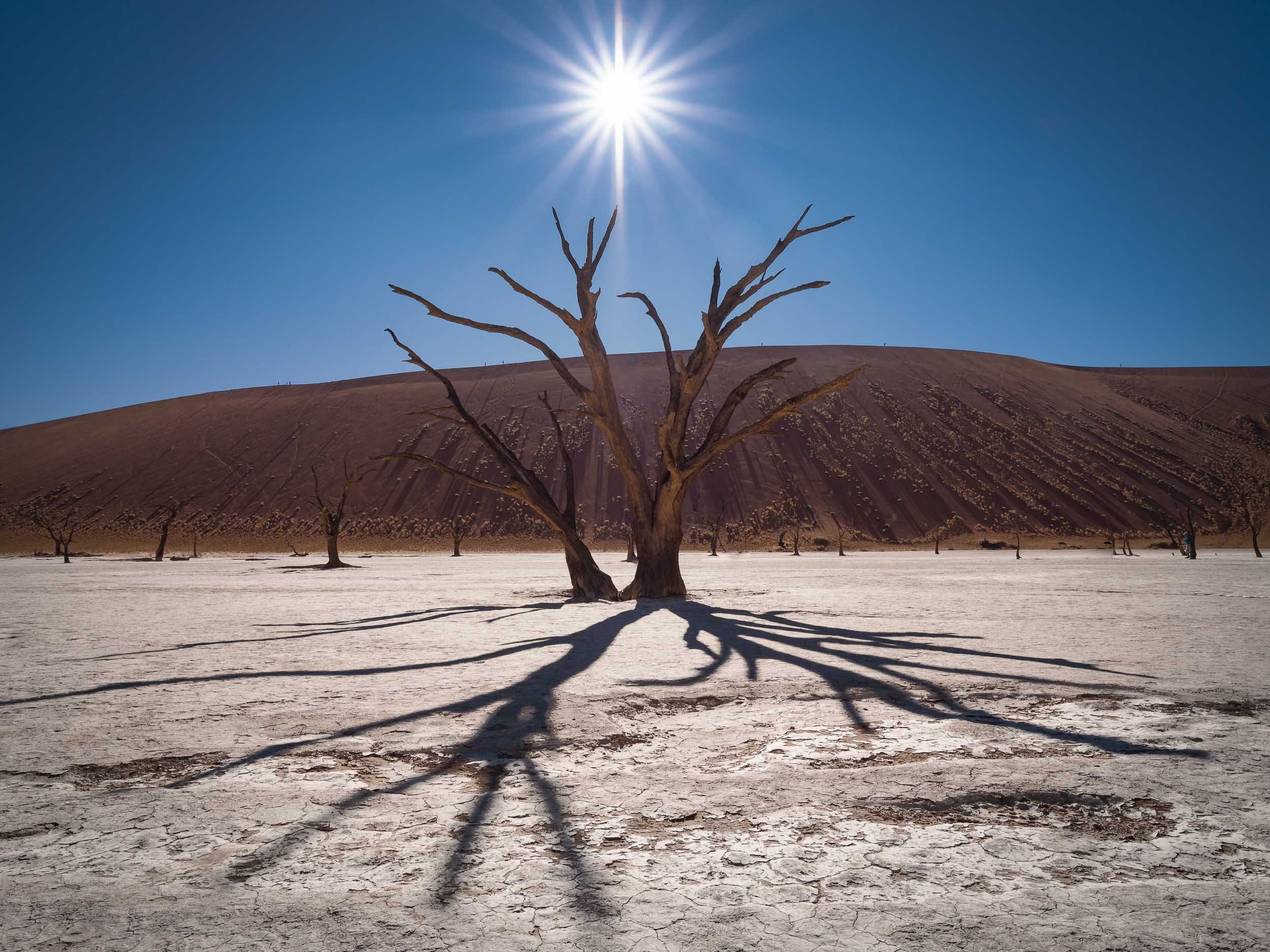
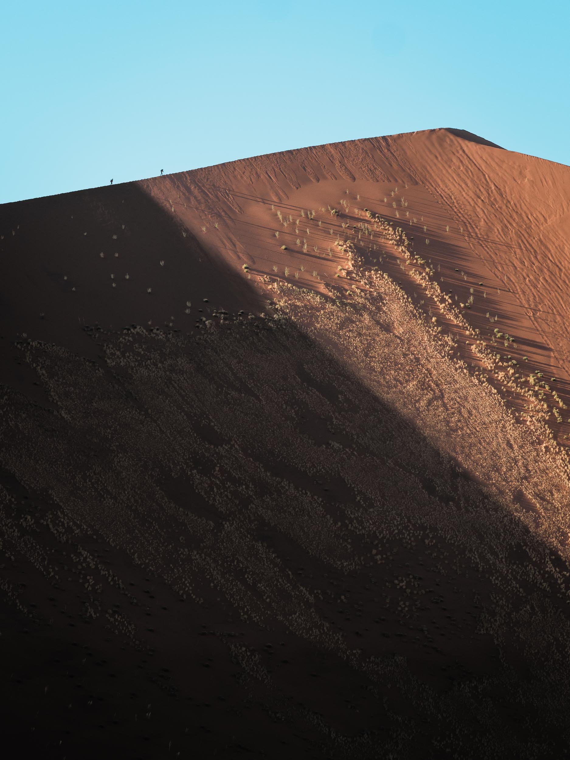
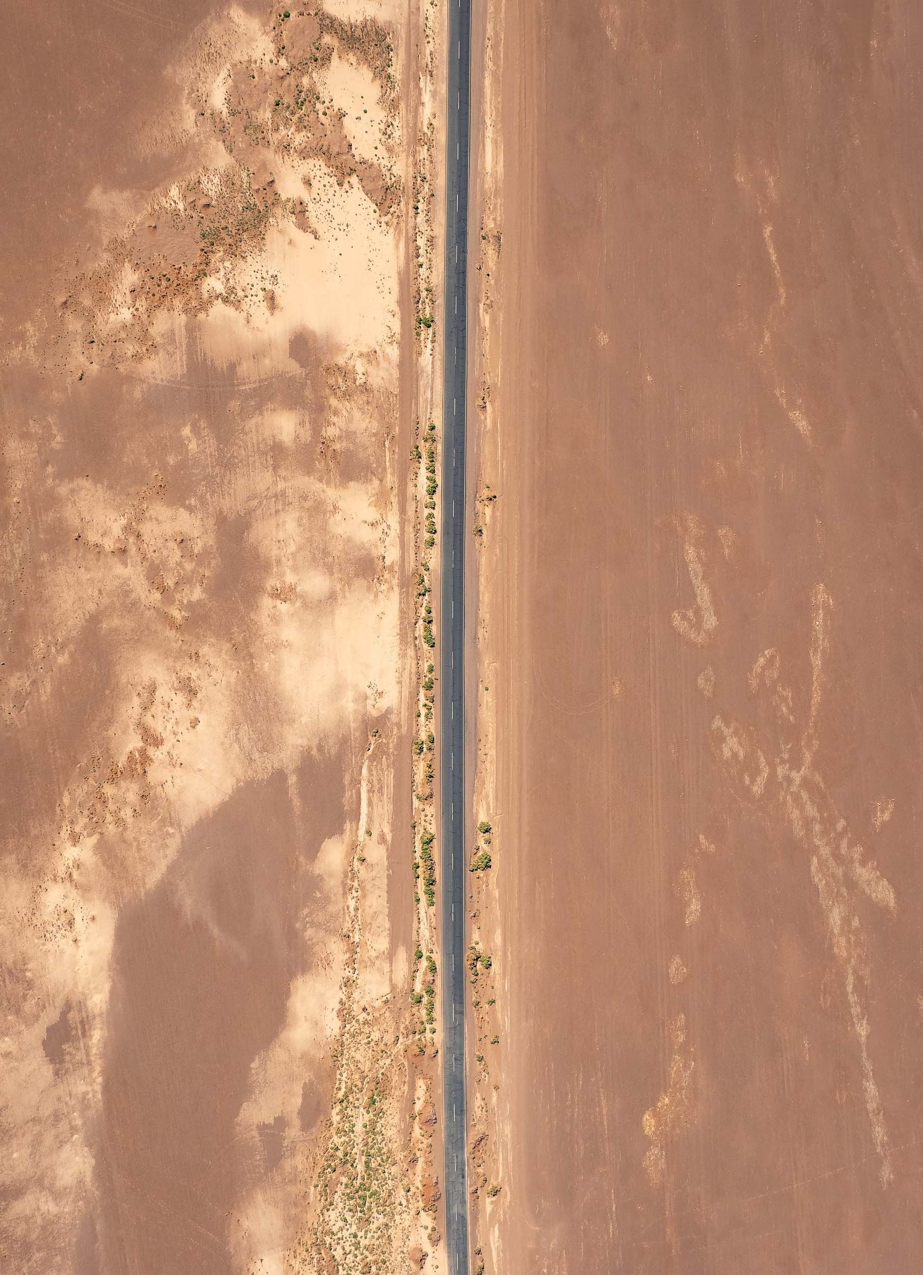
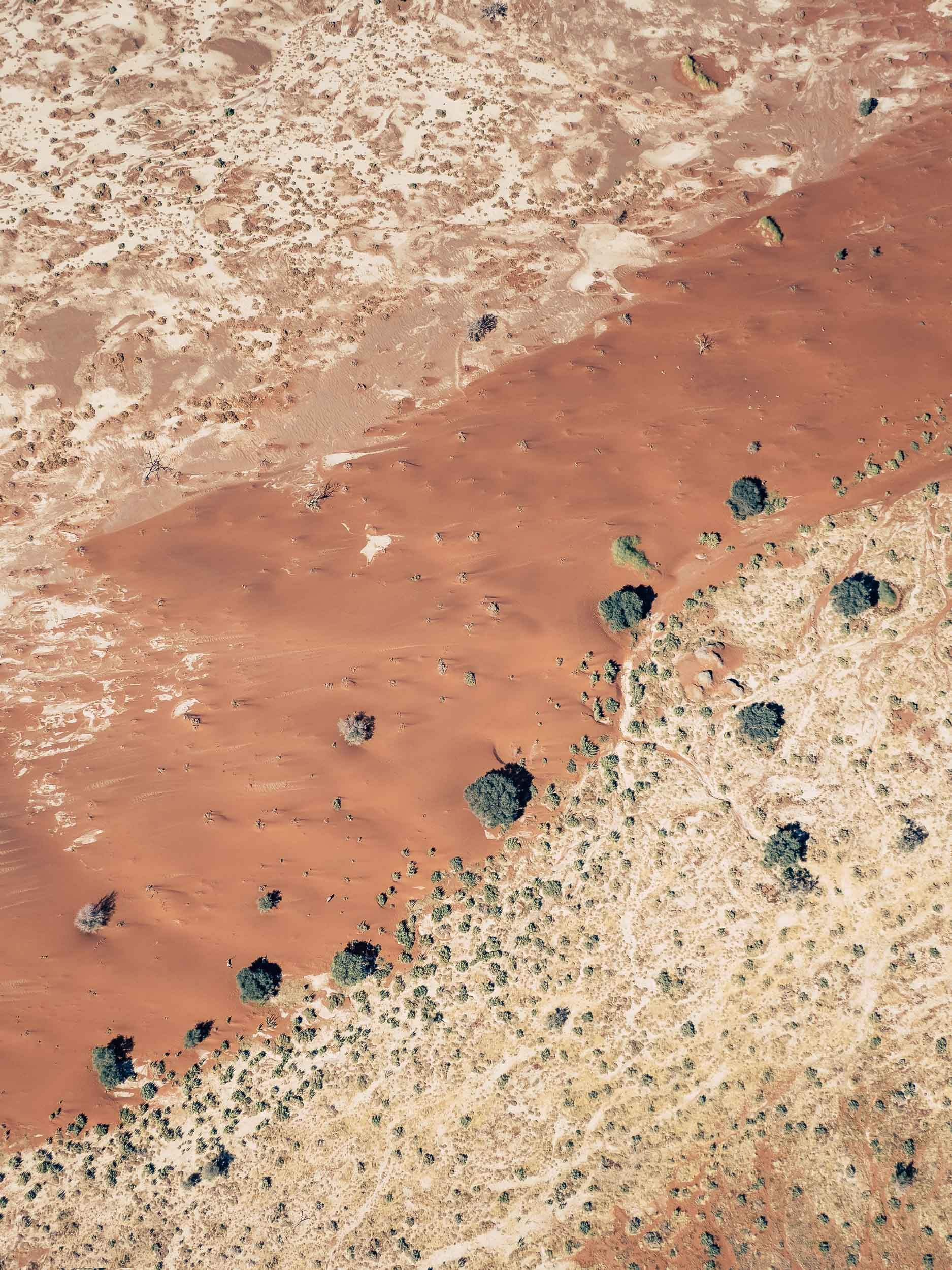

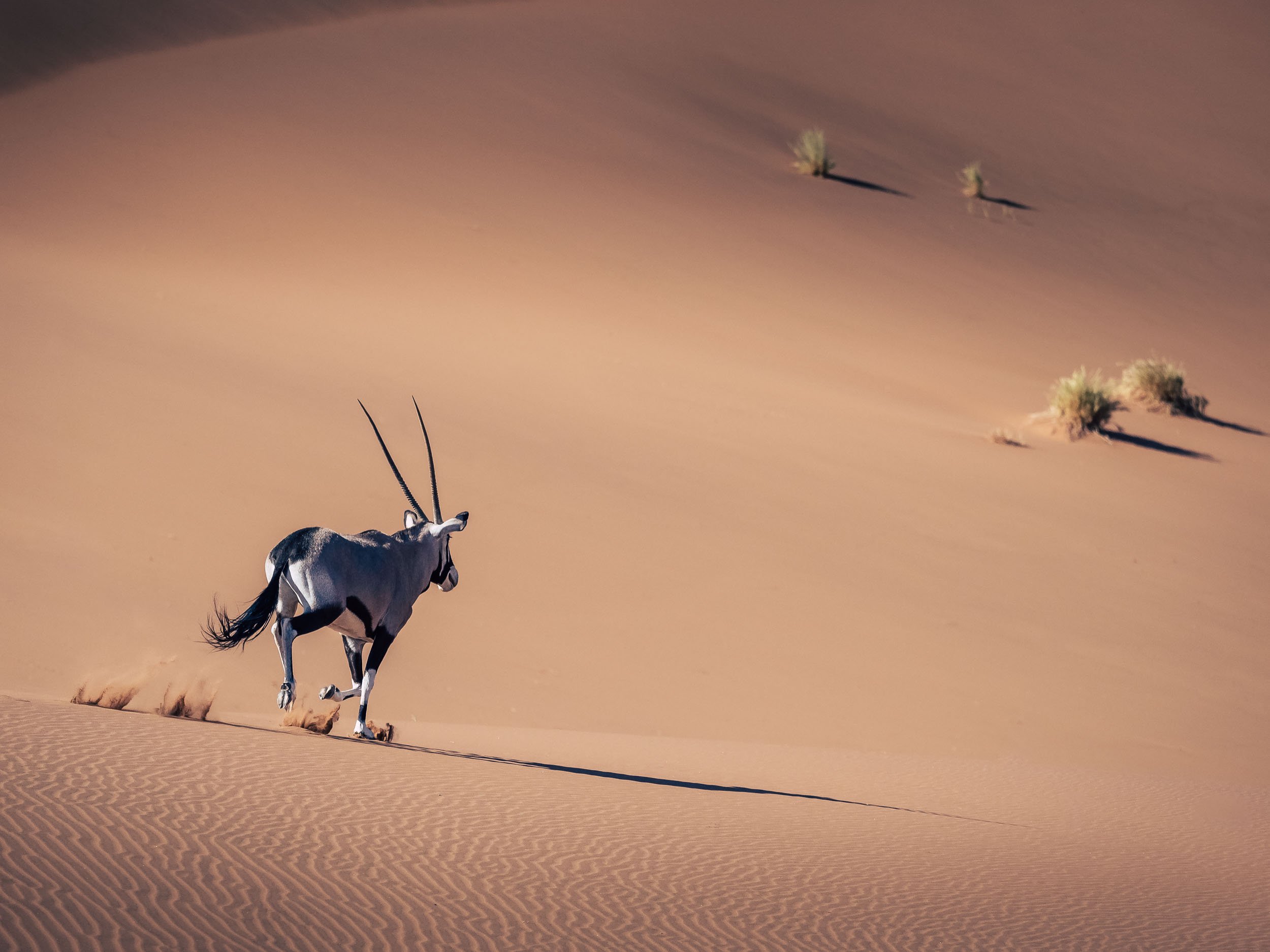
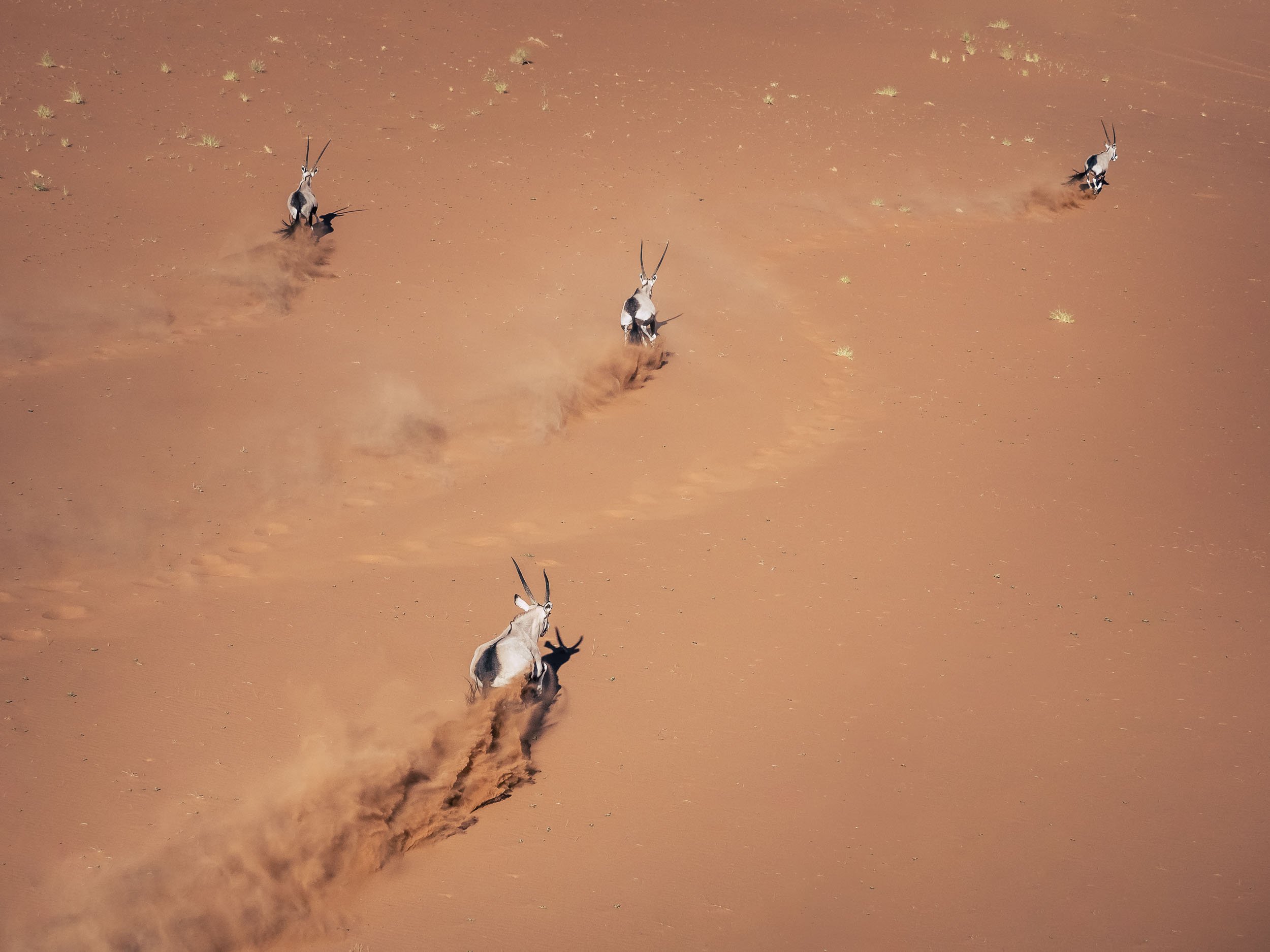
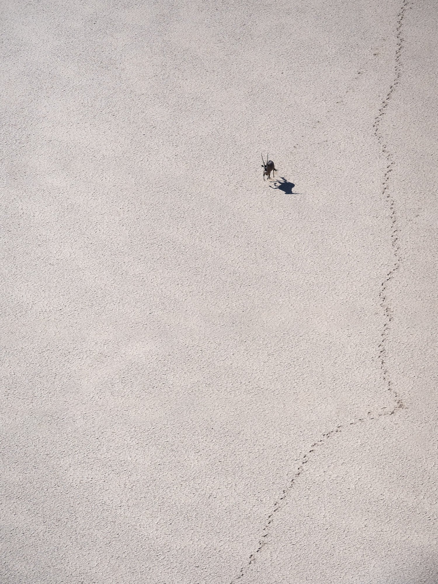

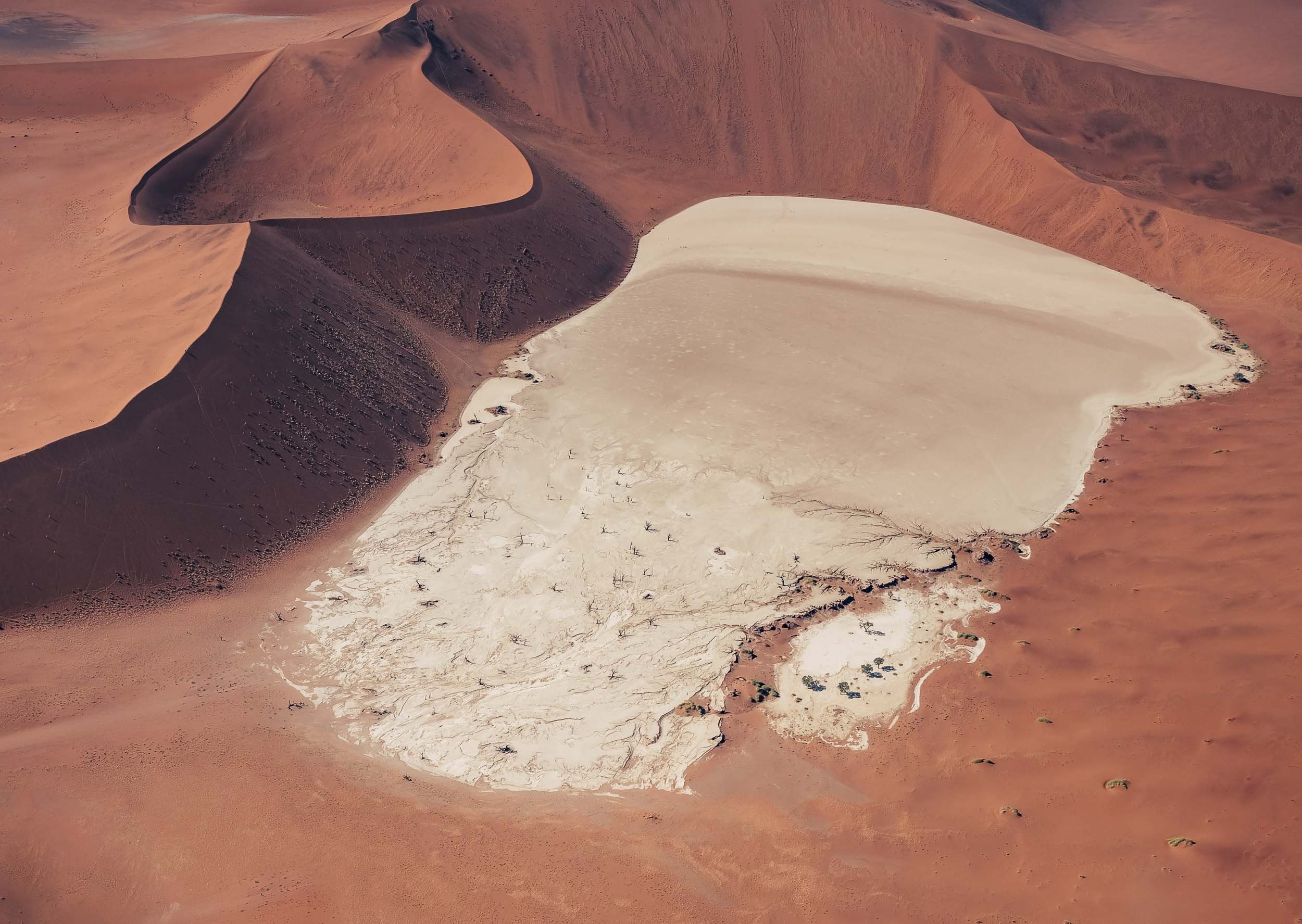
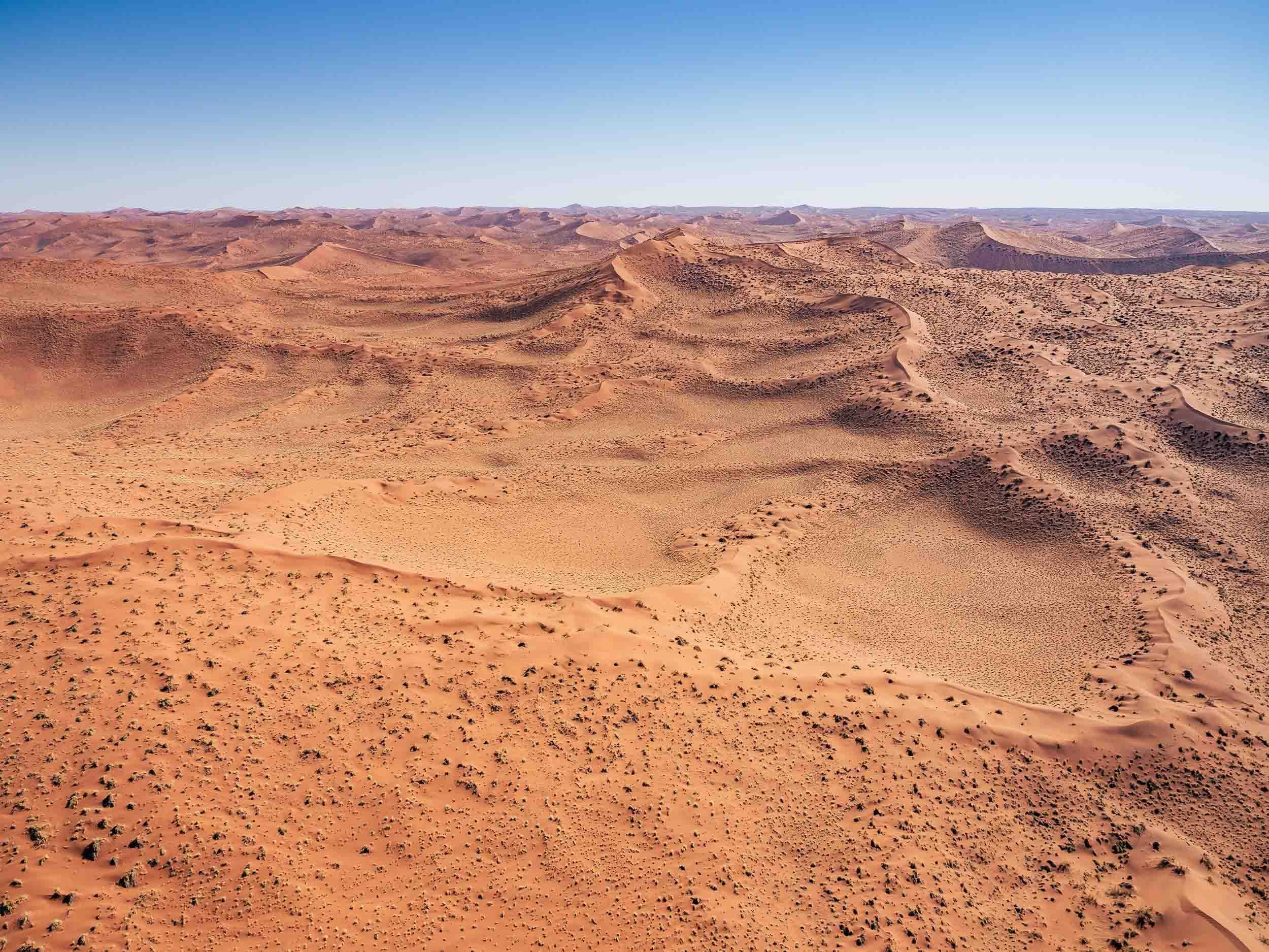
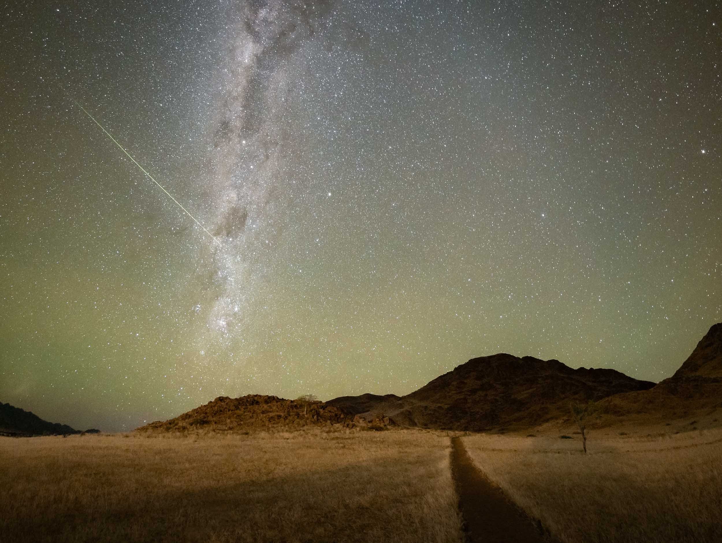
Swakopmund
To the northern end of the park lies this small city and its attractions.
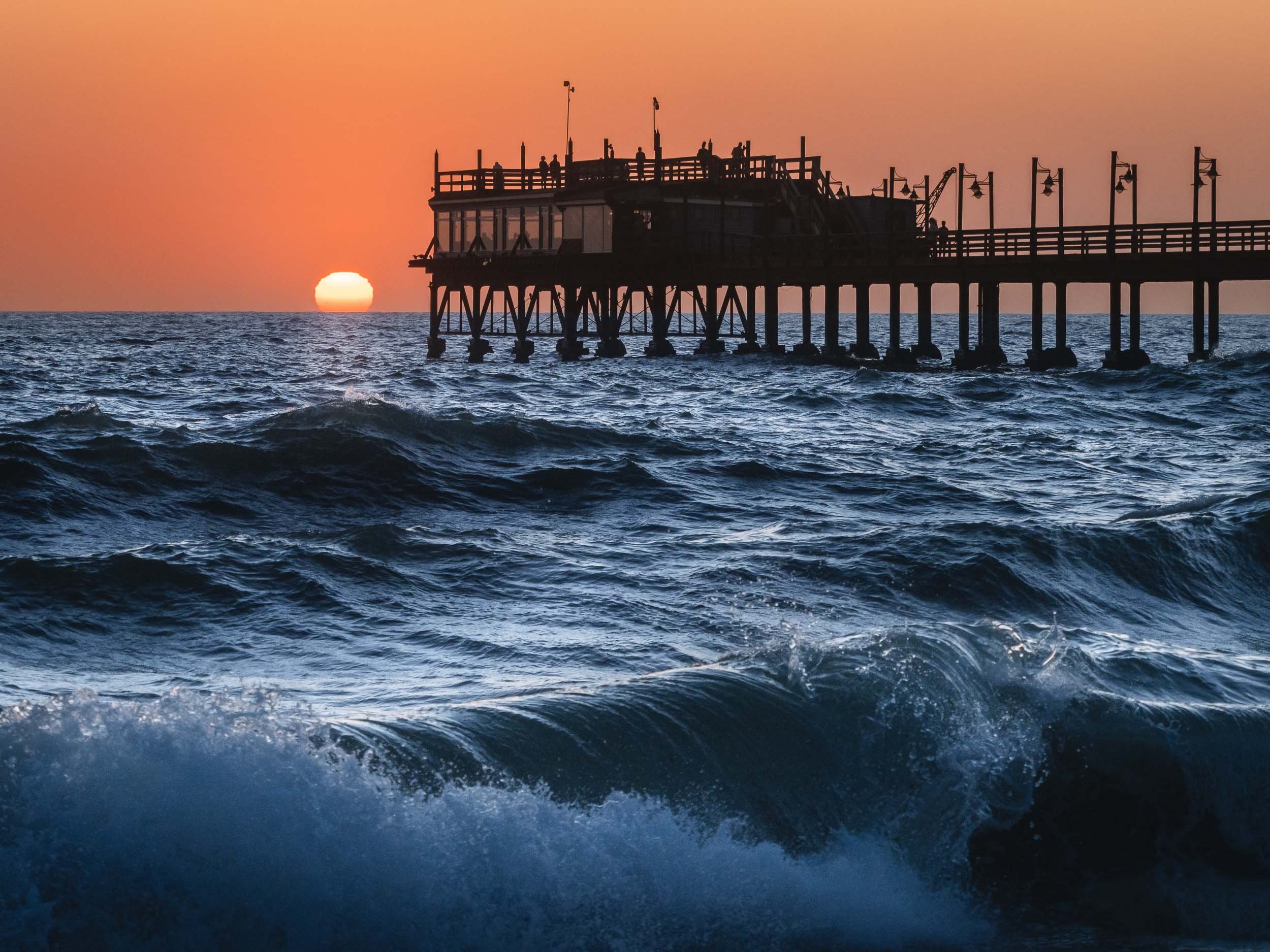

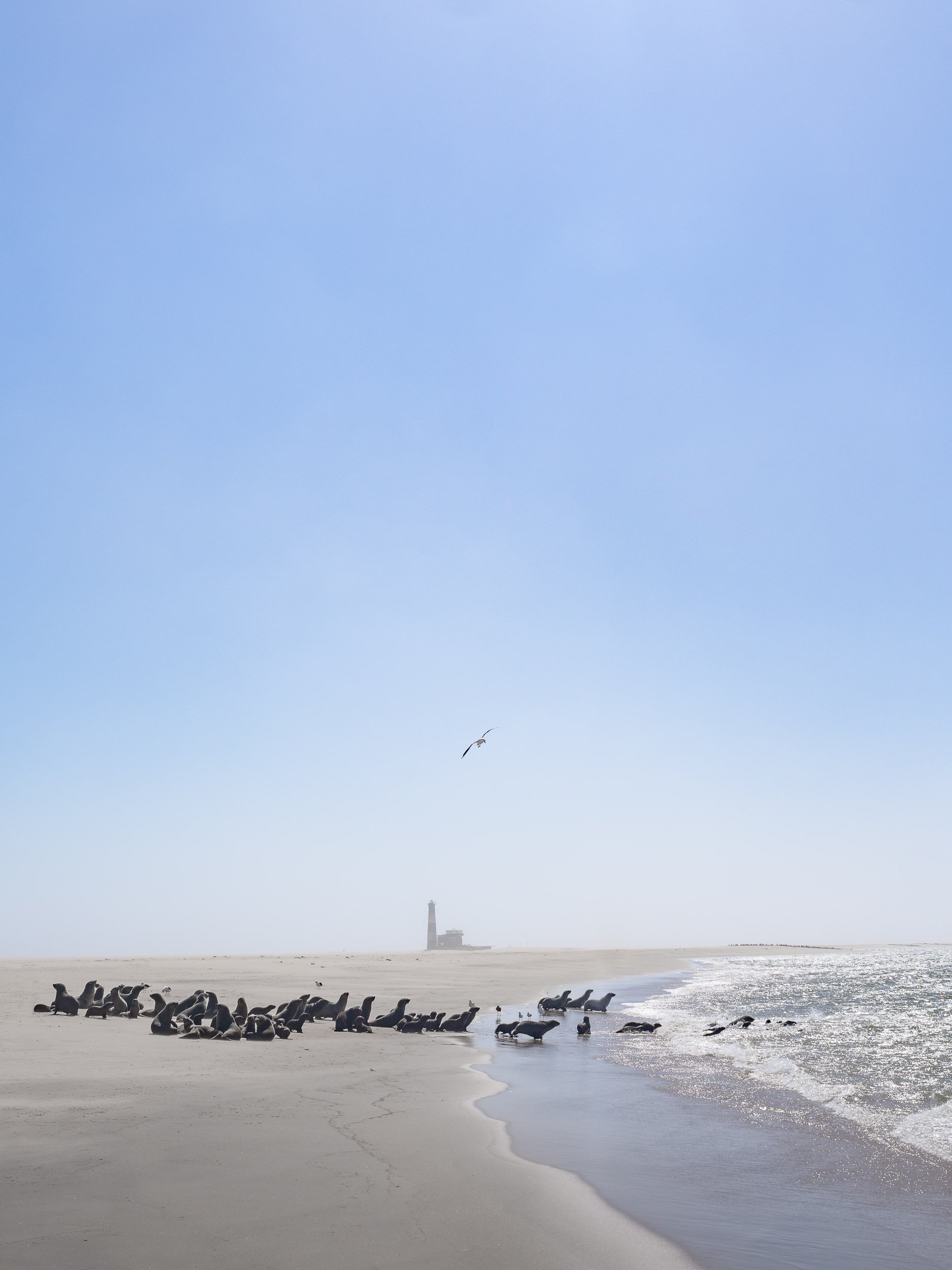
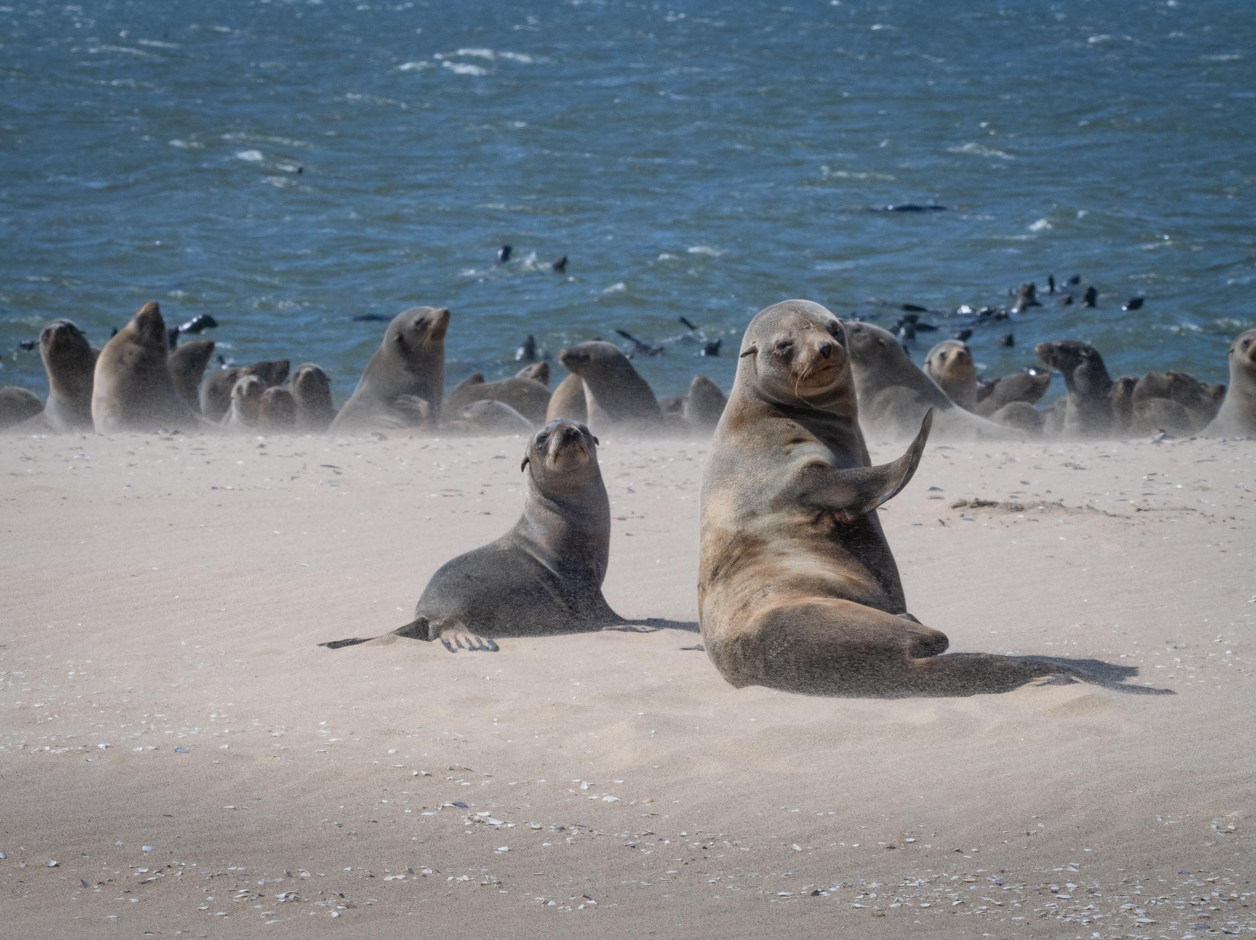
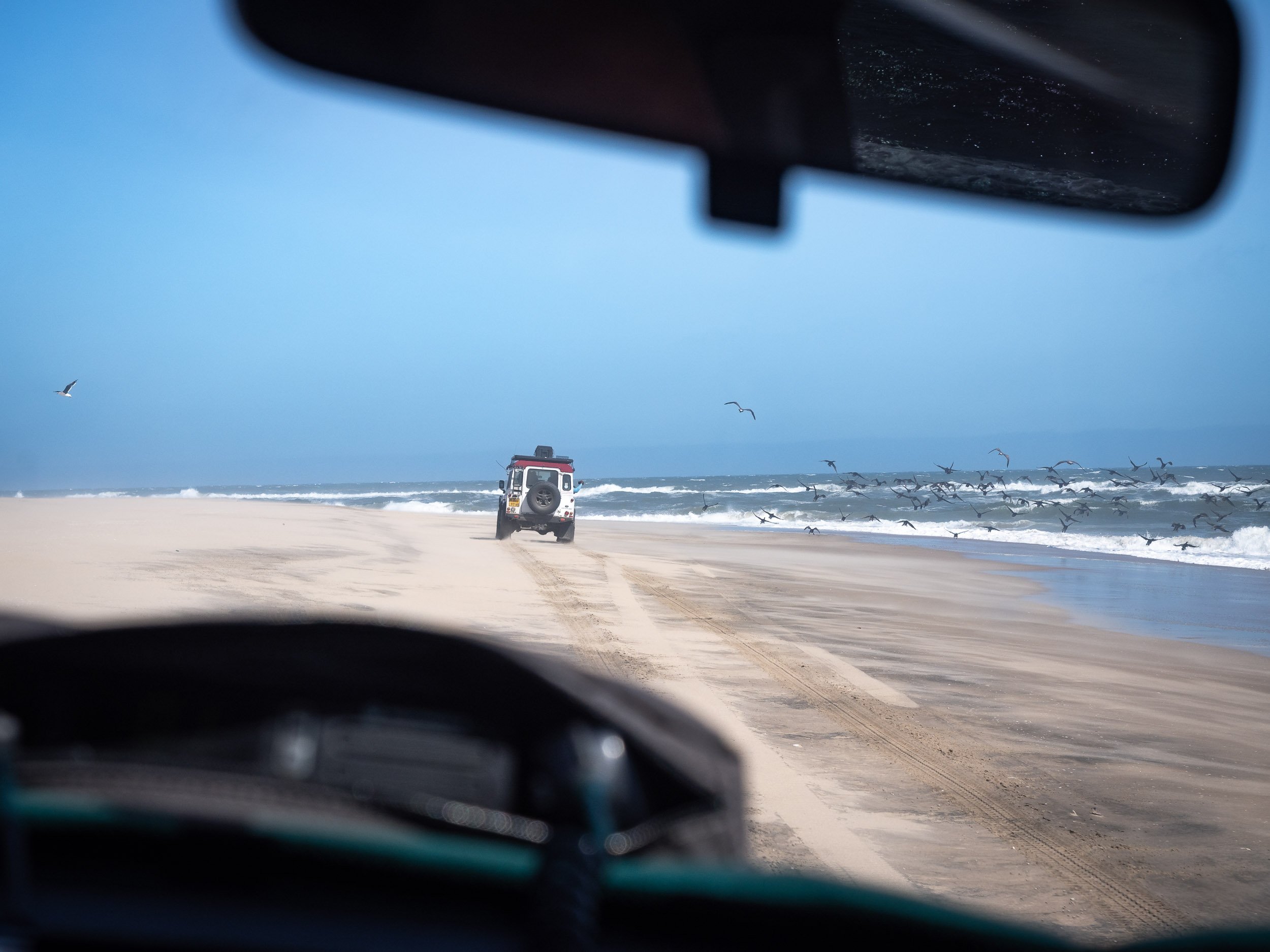
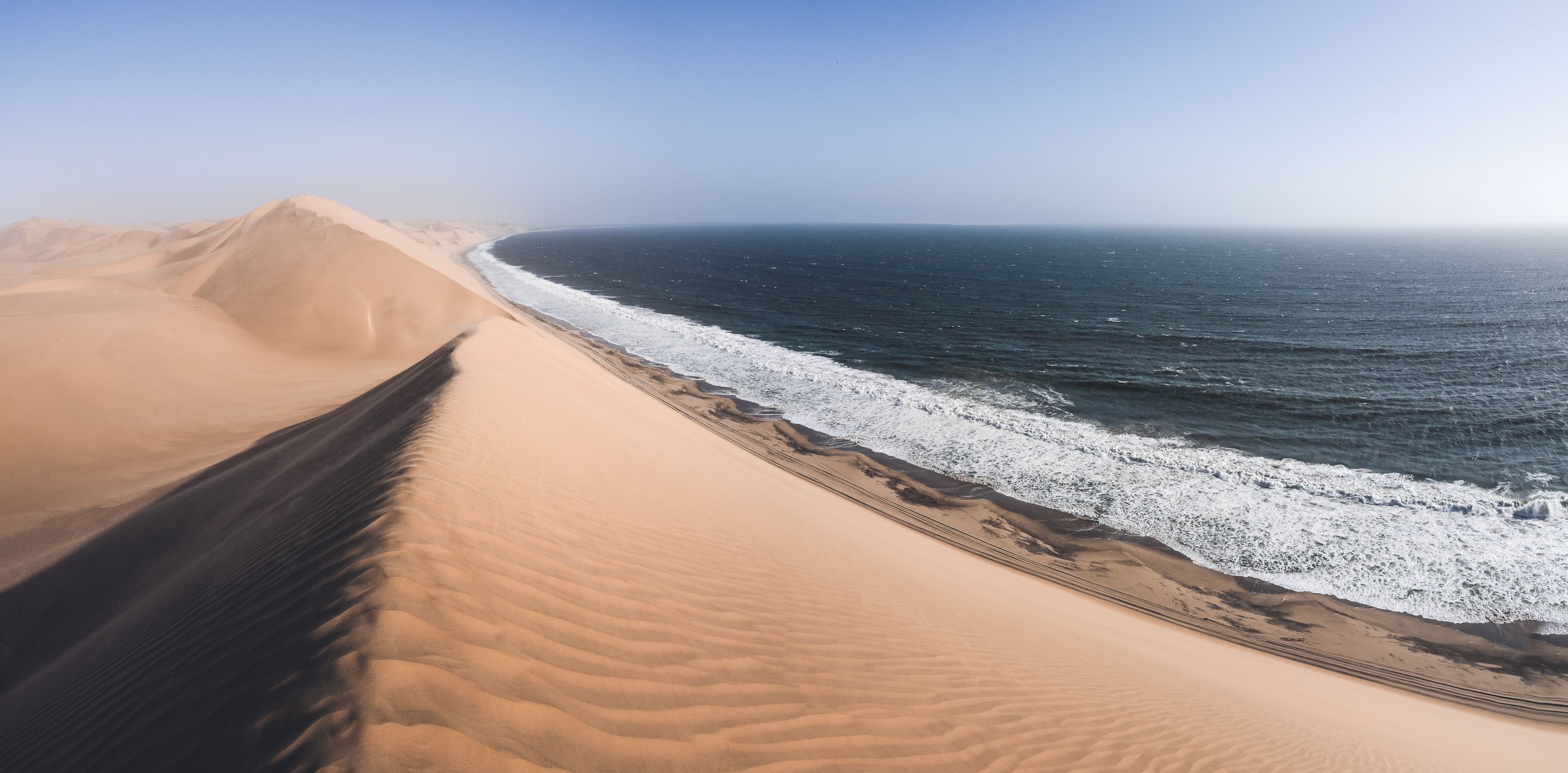
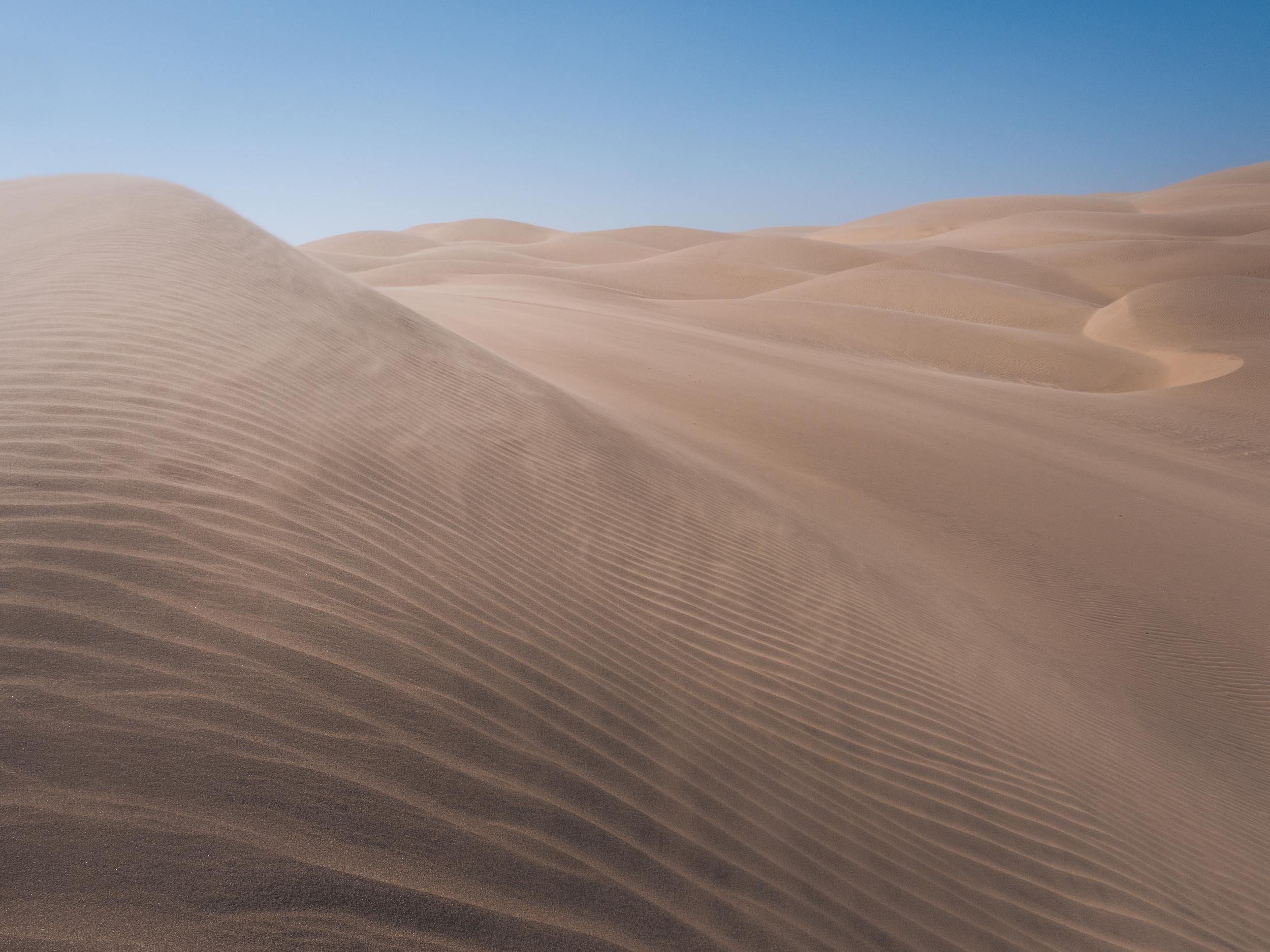
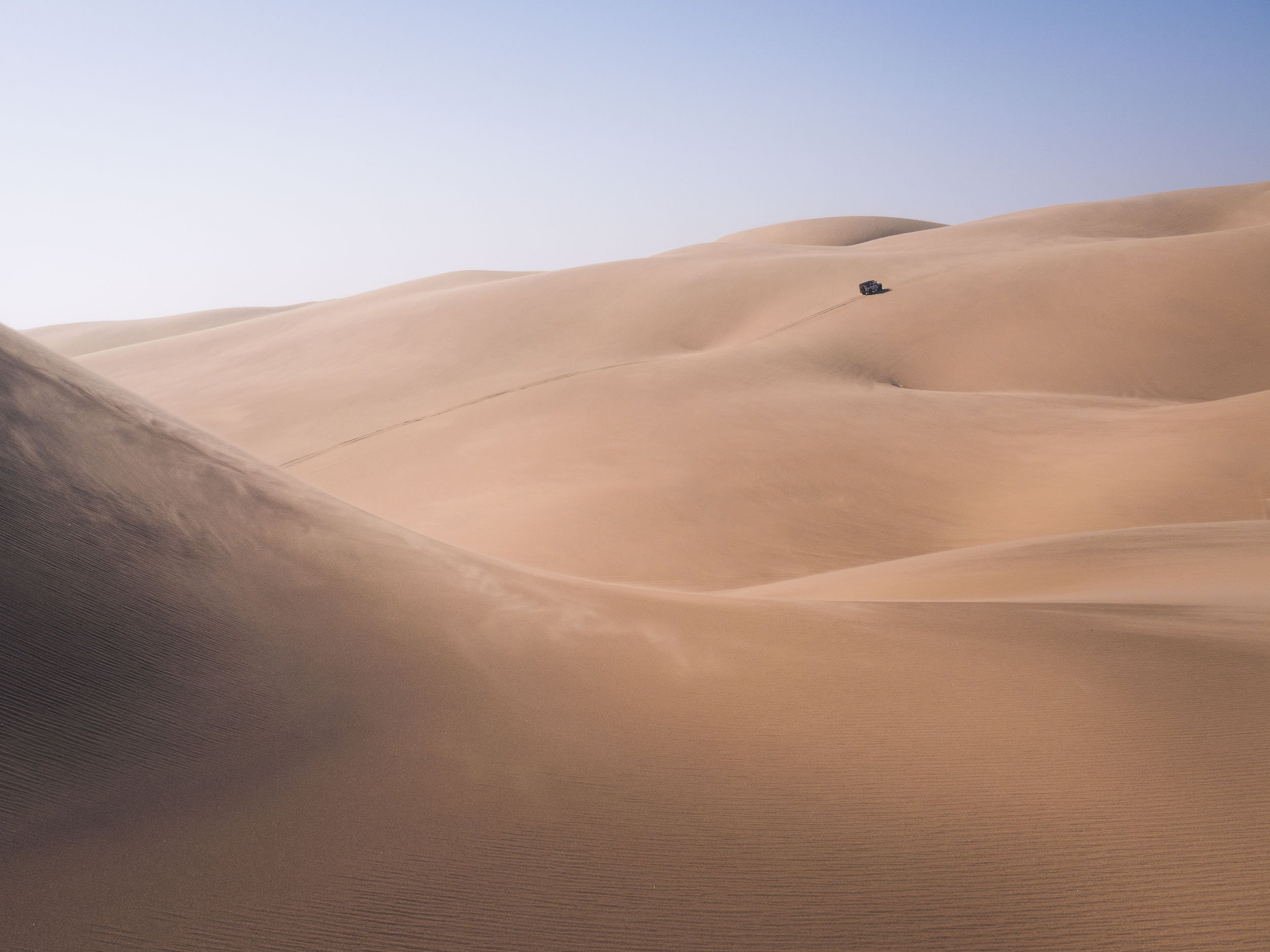
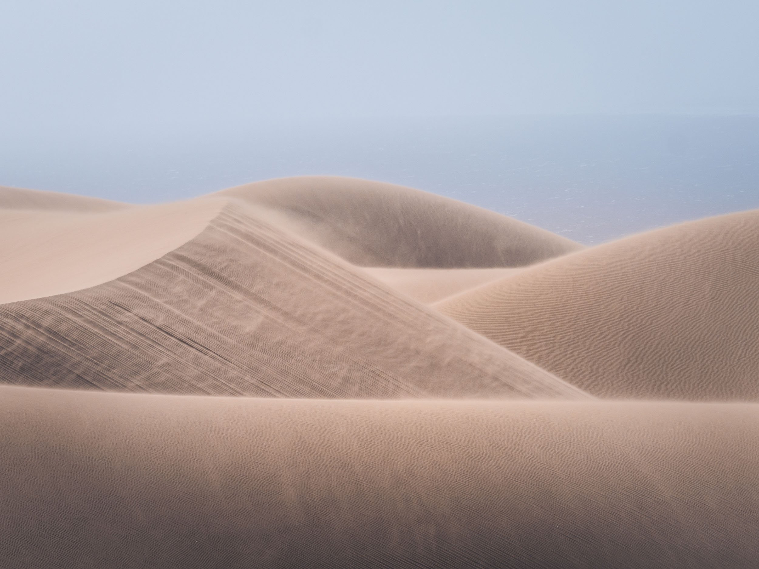
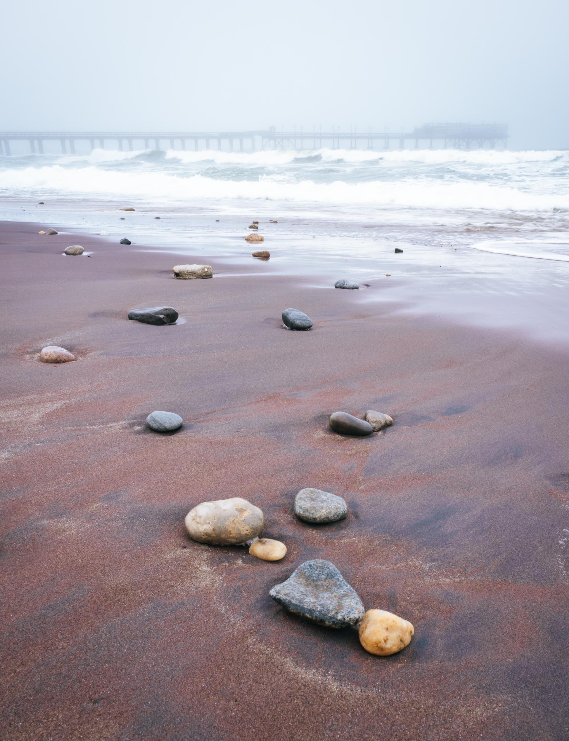
The Spitzkoppe
or Africa’s Matterhorn, as they call it.
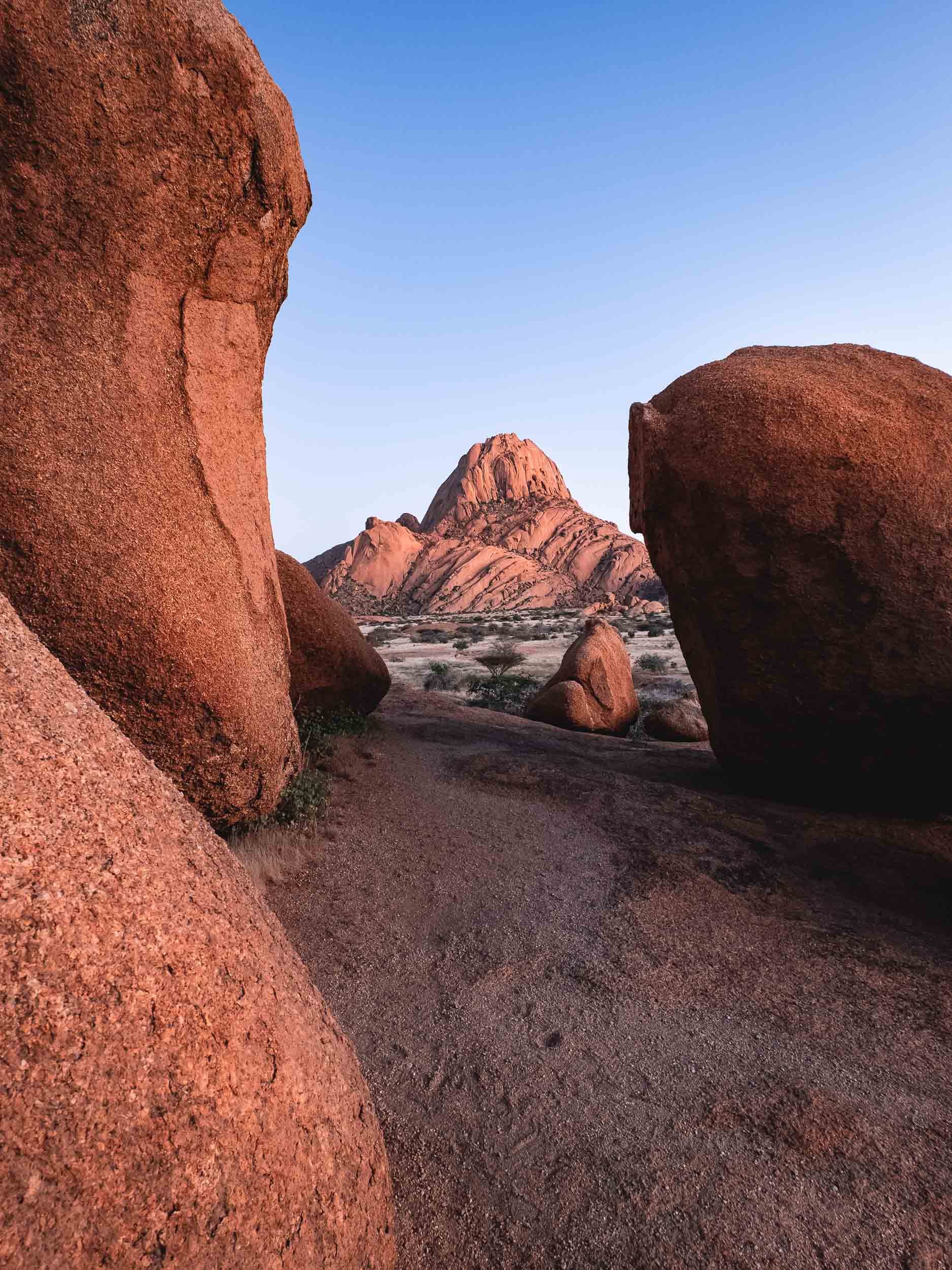
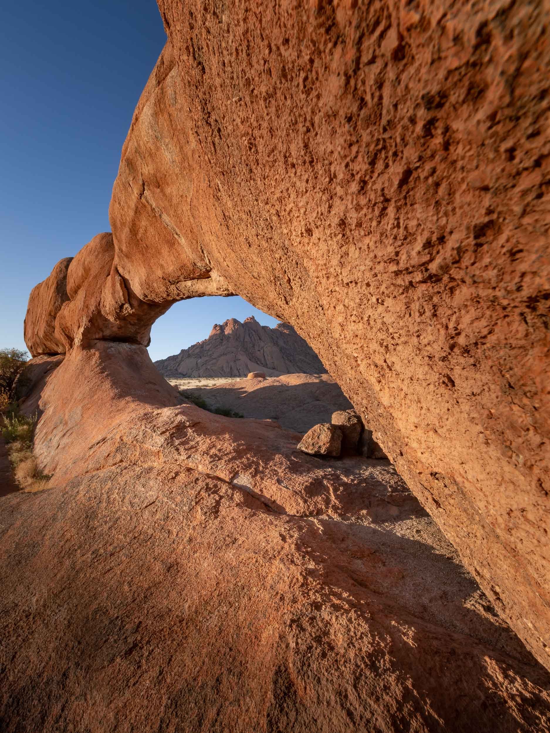
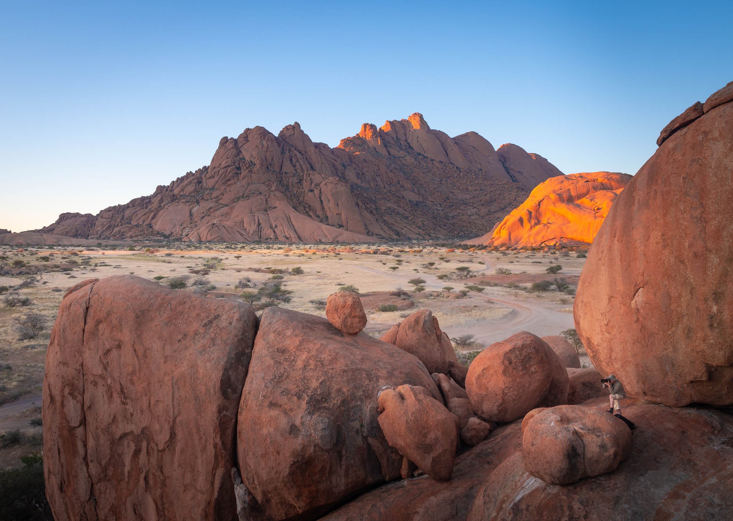


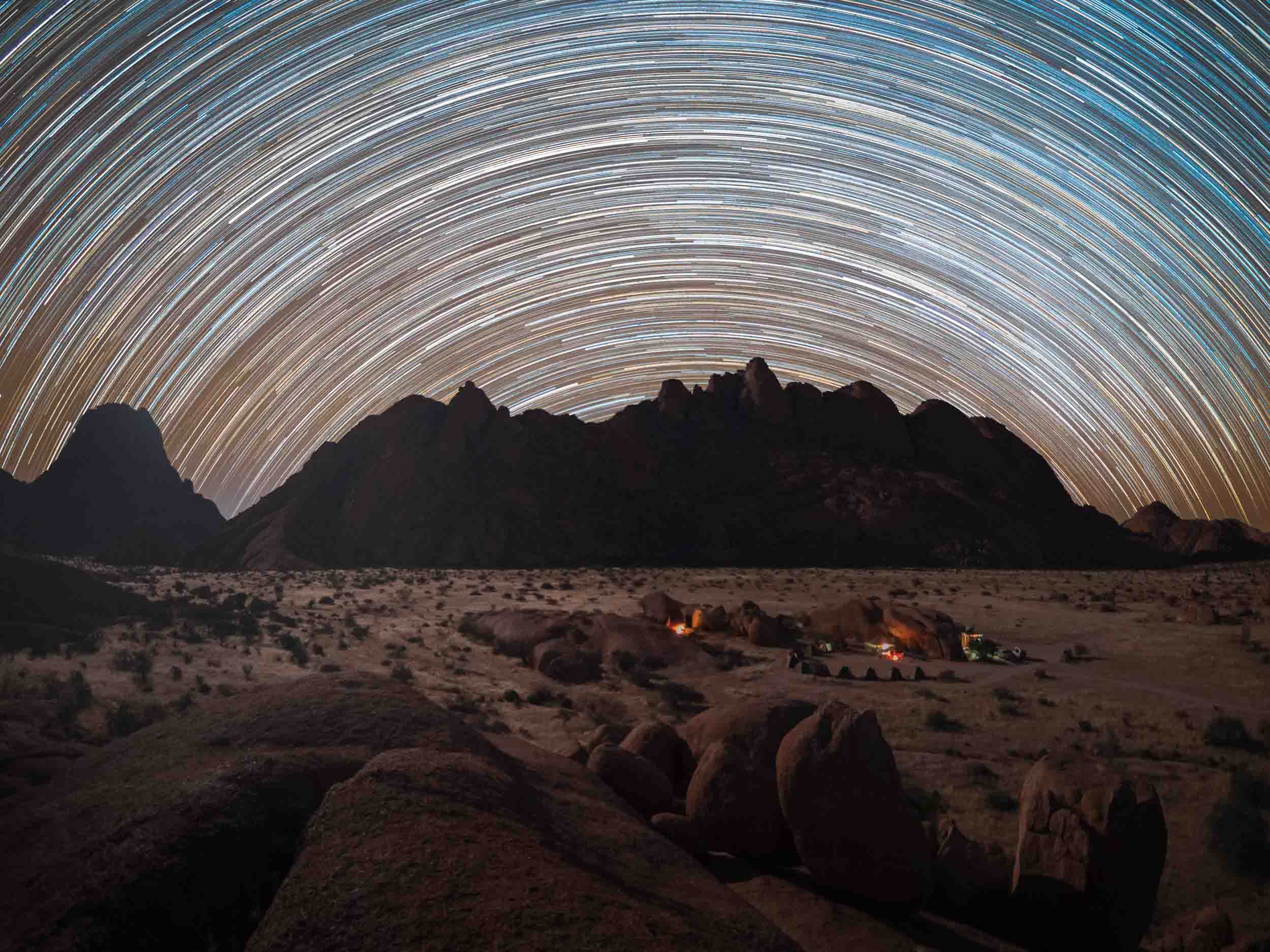
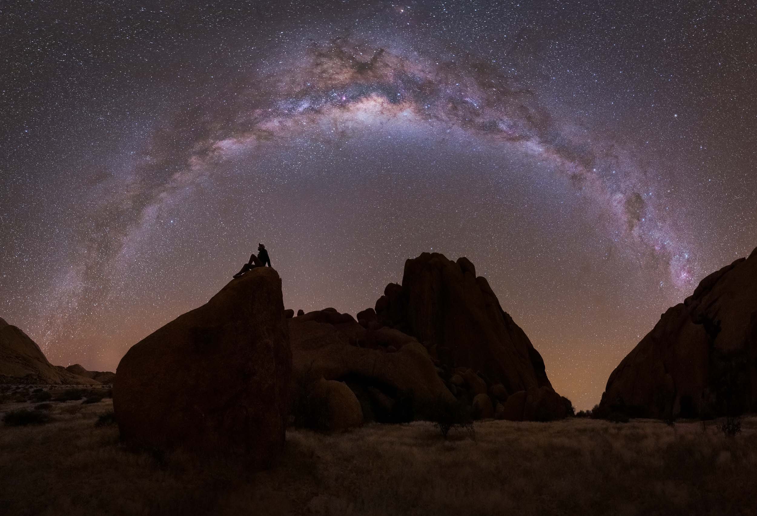
Etosha National Park
Our last destination was in the northern part of the country for some wildlife viewing.
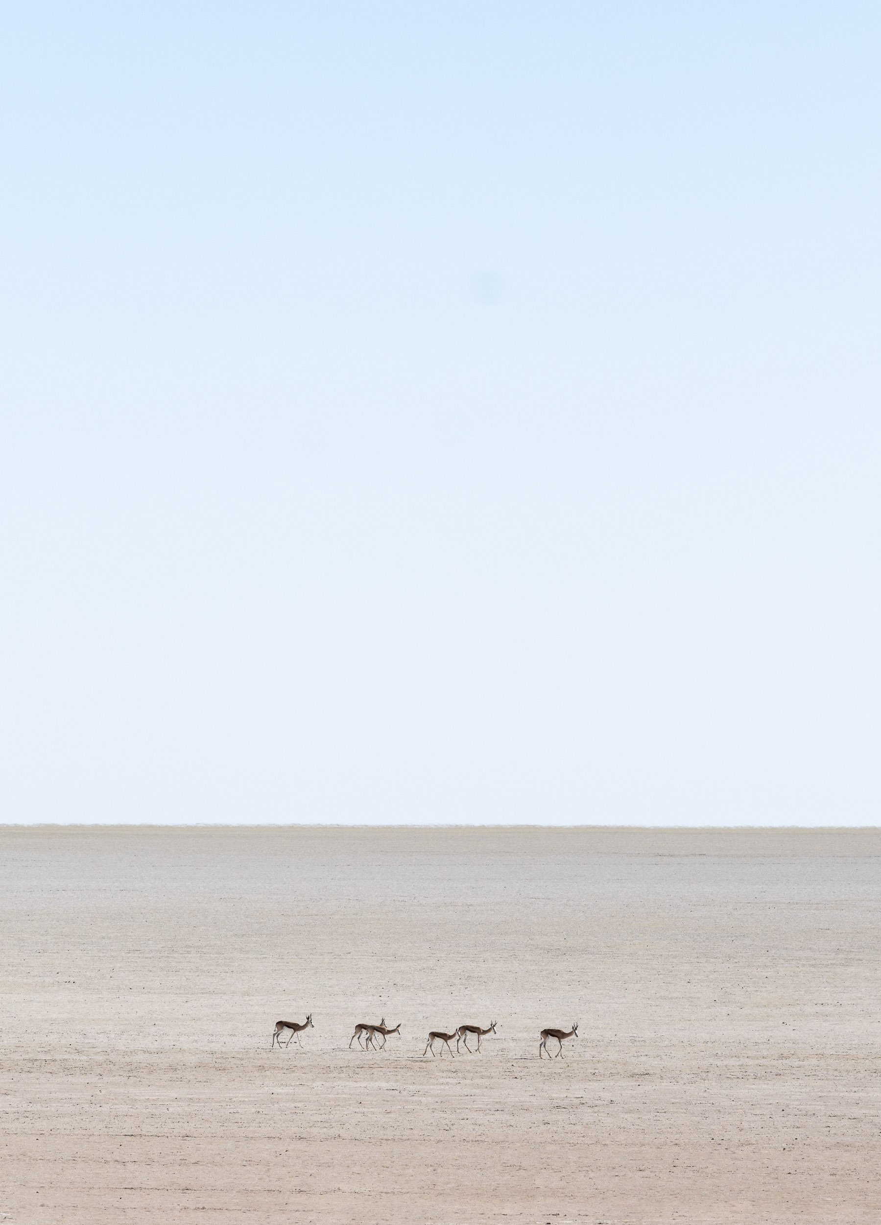
Scroll through the gallery for some of the animals we captured during the 2 days.