Enlaps Tikee 3 - Installation & Configuration (Part 2)

After my previous article giving an overview of the product, I have now created a second video on the Installation & Configuration of the solution, which you can watch below - however, it’s in German, so either use Youtube’s built in translate function for the subtitles, or you can continue reading to get an idea!
In its essence, the Tikee is a time-lapse camera, but it's really an ecosystem for all kinds of long-term projects, monitoring, and analytics. So if you want to document, for example, a construction site, or the set-up and dismantling of an event, or snow conditions in the mountains over longer periods, the Tikee is the right choice. It should be briefly mentioned that I use a Tikee 3 Pro Plus, there is also the normal Tikee, and I have a myTikee unlimited account. There are also the Storytelling or Reporting or a free account on mytikee.io. The differences are particularly evident in the configuration options for recording and editing; the commissioning remains basically the same. So let's take a closer look at it all.

Configuration
The configuration of the Tikee can basically be divided into three steps:
1) Preparing the Tikee:
First of all the Tikee itself, which you have to charge via Micro USB with a standard USB charger. Then you usually insert the micro SD card, which can be up to 512GB in the Tikee 3 Pro Plus. How much space you need obviously depends on the project you want to configure. There is a table from Enlaps to give a rough estimate. Even if you only send the images to the cloud, you still need a micro SD card, in this case of course with minimal space requirements.
The next step is to insert the Micro SIM. Of course, this doesn't apply if there is sufficient WiFi at the location that you can use, or if you only want to save the images locally. However, even if you only want to save the images locally, it can be a good idea to establish a data connection, for example to be able to call up the status of the Tikee on the cloud platform and to know whether the recording sequence is working ideally or there are problems. Two small points about the SIM: First of all, the data volume you need depends on how you configure the camera. Enlaps also has a calculator to estimate this, and it can really do anything from one gigabyte to 50 GB per month, depending on the configuration. The second point: It is advisable to insert a SIM card with your own telephone number; there are also micro SIM cards that only offer data volume, for example as an extension of your primary smartphone SIM card, but myTikee has a function that relies on the SIM card having its own phone number. The function is not necessarily critical but can be an advantage, more on that later, and that is why you should make sure that you have your own phone number when buying the micro SIM card.
2) myTikee Account and Connection
The second step in configuring the Tikee involves creating an account on myTikee. As already mentioned, there are different types of accounts with different costs and different functions, but you can of course also start with the free version. Then you need the myTikee Remote app for iOS or Android, where you can then log in with the same account.
Next, the Tikee has to be nearby and switched on and is then recognized via Bluetooth, and you can see various information about your Tikee in the menu and also format the SD card. You should then set the data connection, as already mentioned, this can be done via WLAN, but also via the SIM card. With the SIM card you usually only need the PIN number and the APN server. You can often find this online and it varies from provider to provider. I haven't had any problems here with T-Mobile. Next you should also test the data connection, you can do this directly in the app and it is of course possible to do the same on site - we know, especially in Germany, that the mobile data network is not always the best and of course it would be very annoying when the Tikee is installed and cannot always reliably send images to the cloud.
I would like to make a few points about connecting the Tikee with the myTikee Cloud platform that might be useful. Normally, the Tikee sends a current status (battery, connection quality, etc.) at least every 24 hours, and at the same time also gets the configuration from the cloud platform, for example if you have configured a new recording frequency for your timelapse. However, this 24h interval also depends on some other parameters. For example, you can configure how often the Tikee sends the images to the cloud, every single image that is taken, or only after (for instance) 25 images have accumulated - the latter is of course much more efficient for battery life. The Tikee has some intelligence built in here: You can then also set that below a certain battery percentage, this interval is automatically increased in order to preserve battery until the battery is sufficiently charged again by sunlight.

Another exciting feature is the ability to bypass this interval. If you want to immediately force a new configuration from the cloud platform without waiting, you can also do this, but you need a SIM card with a phone number as I mentioned before, since this phone number is used internally to wake up the Tikee and upload the configuration, query the status, get a picture, etc. without having to wait for the interval that has been configured to elapse. It is therefore a good idea to familiarize yourself with these small functions in order to find the best compromise for your setup.

3) Setting up an Image Sequence
So, now that we have the whole connection issue out of the way, let's move on to the third part of the configuration, which in my opinion is also the most exciting, namely entering a recording sequence. The Tikee offers 3 different options here:
a) First of all, there is a so-called burst mode; That's 200 images maximum, at short intervals, in JPEG format saved, either to the SD card or sent to the cloud.
b) The second option is event mode, which is a maximum of 24 hours with a flexible interval. The images are only saved on myTikee, and only in JPG format.
c) The third mode is the most exciting and probably the one you will use most often, namely the long-term mode. You have a lot of flexibility here, you can set intervals from 30 seconds to 24 hours, you can configure endless recording sequences and the images are saved either as JPG or as a raw file in DNG format or both, whereby you can send the JPG files to the cloud and the raw format files can be saved on the memory card.
You can also set that, for example, you only take pictures on certain days of the week, for example working days, and only between certain times, for example working hours on a construction site, or you don't need any pictures at night. So you have a lot of flexibility here, but I would still like there to be even more flexibility. For example, you can combine a long-term recording with a burst recording, for example for a day or a few hours where there is a lot going on at a construction site and you would like to have an extra short sequence in addition to the long-term recording. But, for example, you can't configure two long-term recordings at the same time and that can be exciting. For example, you want a long-term recording with quite short ones intervals but low image quality that is sent to the cloud, and also wants one image per day in high quality that is saved to the memory card as a DNG file. This is currently not possible, hopefully such functions will be available in the future.
Installation
With that we have actually completed the configuration part of the Tikee and we come to the installation. In my case, I installed the Tikee on a construction site for two single-family homes and I'll now briefly show you how I did it and what needs to be taken into account.

The Tikee is quite easy to install, it has a quarter inch screw thread at the bottom that can be combined with a ball head or other tripod products to install it. However, for a solid and long-lasting installation, I would recommend the stainless steel arm from Enlaps, which is very flexible and can be installed both horizontally and vertically, and also has a built-in ball head so that the camera position can be adjusted. My Tikee was attached to the wooden slats of the roof terrace of the adjacent house using the stainless steel arm, of course with permission. I simply used four stainless steel screws to fix it horizontally via the recesses on the stainless steel arm, and then adjust the ball head, so that you can place the Tikee on top and then rotate and tilt it so that it captures the construction site perfectly.
I noticed that the wide perspective of 220 degrees can really cover the entire property, even though the Tikee is positioned directly on the property boundary and not slightly set back. This is actually impossible with a normal wide-angle camera, but it would only be possible with a fisheye lens at best.
The next thing you should do is align the solar panel, of course towards the south. This can actually be determined quite easily using the compass app on your smartphone, but of course you don't know what the angle of inclination should be, as the compass app obviously doesn't show the position of the sun exactly, but only the azimuth. To get the altitude, as a photographer I am using an app like Photopills, which uses the augmented reality functions to see exactly how the sun moves across the sky and thus allows me to optimally adjust the angle of inclination. After you've done that, you can simply use the included Allen key to fix the solar panel and ensure that the battery is being charged efficiently.

When aligning the Tikee in a situation like this, it is advisable to mount the camera approximately halfway up the composition to be filmed, this avoids having to tilt the camera up or down. This can be done quite easily with the ball head on the stainless steel arm, but it has the disadvantage that buildings etc. with straight lines will then appear to be angled in the footage. This can be compensated for somewhat in post-processing, but it is time-consuming and should therefore be avoided. Of course, if you're filming landscapes or events from above, this whole aspect isn't really a problem.

For long-term outdoor use, I would also recommend installing an anti-theft device. The Tikee does have GPS, but I would still prefer to avoid running after the thieves - Enlaps has a solution for this, but you can also use any standard theft chain, such as for laptops etc use. One last note about the positioning of the camera - if it is possible, you should avoid important parts of the image section being more than five meters away in front of the tikee in the middle - why - because due to the parallax effect of the two lenses, this part of the image The most difficult part for the algorithm is when combining the final panoramic image. In my experience, the Tikee algorithm does this pretty well, but if you can avoid it, it can of course be an advantage.

A second point about the panoramic image algorithm: It uses the first 100 images that are taken to zero in on the composition and what is happening in this scenery - this means you should make sure that the sequence only begins when the camera is installed in the final position, and ideally start the sequence in good weather and not at night so that the algorithm can work best. After everything has been considered, you can take your first test image. You can do this directly using the preview function of the app, but you have to keep in mind that it can take a few minutes for the image to arrive on the app, so bring some patience. Personally, I would recommend that you try to have a laptop on site where you can check the whole thing on the myTikee platform as well. You can then not only view the test image on a larger screen, but also ensure that all other functions and communication of the Tikee are working before you leave the site.
Finally, make sure that you have entered a sequence or, if a sequence has already been entered, make sure that you press the start button. One more point about this: If you enter a sequence on the app, it may of course take a while, as already explained before, until the sequence is displayed on the cloud platform, so be patient and don't try to enter a sequence on the cloud platform right away, otherwise it can happen that conflicts may arise.

I already have several hundred photos of my construction site sequence on the myTikee platform and can create the first time lapses here. Next time we'll take a look at what functions there are and what you can do with your material. For this article, I can conclude that the installation and configuration are quite well thought out, the whole process is relatively simple. There are a few things to consider, such as the size of the SD card, depending on what you want to achieve with your sequence and what settings you use. It can also be an advantage to familiarize yourself with the instructions that are available online, for example to find the best compromise between battery life and the optimal result.
All in all, it worked well and if you have any questions, please leave them in the comments or contact me. If you plan to buy a Tikee, you can use FLOENLAPS50 on www.enlaps.com to save 50 EUR at checkout!

Beijing & The Great Wall
A look at Beijing’s architectural highlights, and China’s World Wonder.

During my last trip through Asia (lots of blogs to come), I didn’t really have Beijing (or China) on the cards yet, partly because you need a visa, and because there is just so much to see it needs a lot of planning and time. But sometimes opportunities present themselves, so when my return flight from Mongolia had to stop in Beijing, and I discovered there’s a 144h on arrival transit visa for EU passports, I had to take advantage. As a result, I can now show you this blog containing my impressions from a total of 5 days in Beijing and one of the most beautiful sections of the Great Wall.
My agenda was to spend a bit of time around the central parts and Forbidden City, as well as a few of the traditional Hutong areas, and explore a few of the architectural highlights the city has to offer, including some designed by the legendary late Zaha Hadid. Lastly, a sunset and sunrise at the Great Wall was also on the cards, and if time allowed, a visit to Beijing zoo - something I normally don’t really do, but this one is famous for its Panda bears.


I stayed in the CBD in the easter part of Beijing, just beyond the second ring road - it’s a nice modern area, very clean, organized, and - something I noticed throughout the city - it’s quiet, not by the number of people, but in terms of noise levels, especially compared to many south-east Asian cities. This is because there are no motorized bikes and scooters. They are all electric! Tons of electric bikes too, and of course many electric cars. This makes a huge difference, the environment becomes a lot more pleasant.

My first architectural target was the CCTV HQ building, an iconic skyscraper that in 2013 was awarded Best Tall Building Worldwide by the CTBUH - it’s easy to see why, given its unique loop style design.


Of course, you will also find traditional Chinese architecture, such as this pavilion in Lotus lake at Ritan park. But I was on the lookout for something else next…

Galaxy Soho
The building was completed in 2012 and is one of three "Soho" buildings by the Iraqi architect in Beijing.
As with almost all Zaha Hadid designs, the complex features primarily irregular soft shapes, more or less completely devoid of straight lines and corners. It consists of four individual but connected domed buildings - I was lucky enough to sneak into one of them to capture the cylindrical interior you see below, one of the few symmetrical aspects of the structure. Unfortunately it’s very difficult to get a full exterior view (let alone aerial perspective) of the complete complex, so you’ll have to trust me when I say - it’s cool and worth a quick look on Google!


Temple of Heaven
This 15th century temple is a UNESCO World Heritage site, representing the relationship between heaven and earth, which played a vital role for the emperors at the time.
The temple is surrounded by a beautiful large park, where the seniors from the surrounding neighborhoods come together every morning to stay active in fitness classes, sports, stretching, and running - it’s been remarkable how often one could observe elderly people taking care of their physical wellbeing all around the city.


The original structure was built at the same time as the Forbidden City, a bit south of Beijing’s centre. Nowadays the complex is home to over 90 buildings, with the Imperial Sacrificial Altar being the most distinct and largest.


The Forbidden City
Beijing’s most well known attraction! And boy, was it busy, August being the time of Chinese summer holiday. The booking process also proved interesting, as tickets are sold only at least a day in advance, and through channels that are basically impossible to use for foreigners. As it happens, the solution is to send an E-Mail with your passport details to their tourist office to be allowed to buy a ticket. Unlike with many other popular spots, the early morning is not the best time to visit, as that’s when school groups and everyone else lines up for when the gates open. I got my photos in the late afternoon, just as everyone left (or was being ushered out) shortly before closing, giving me 30 minutes of peace and relative quiet in this amazing complex - not nearly enough to see everything, but a nice window for some impressions away from crowds.

Panoramic View
The palace complex seen from nearby Jingshan hill in the early morning hours.
Even without entering the actual Palace Museum, the hill and the walkways around the northern perimeter provide some beautiful views of the corner towers and the northern main entrance, especially around sunrise.


Gate of Divine Prowess
One of the four main entrances, the primary one being the southern entrance from Tian’anmen Square.

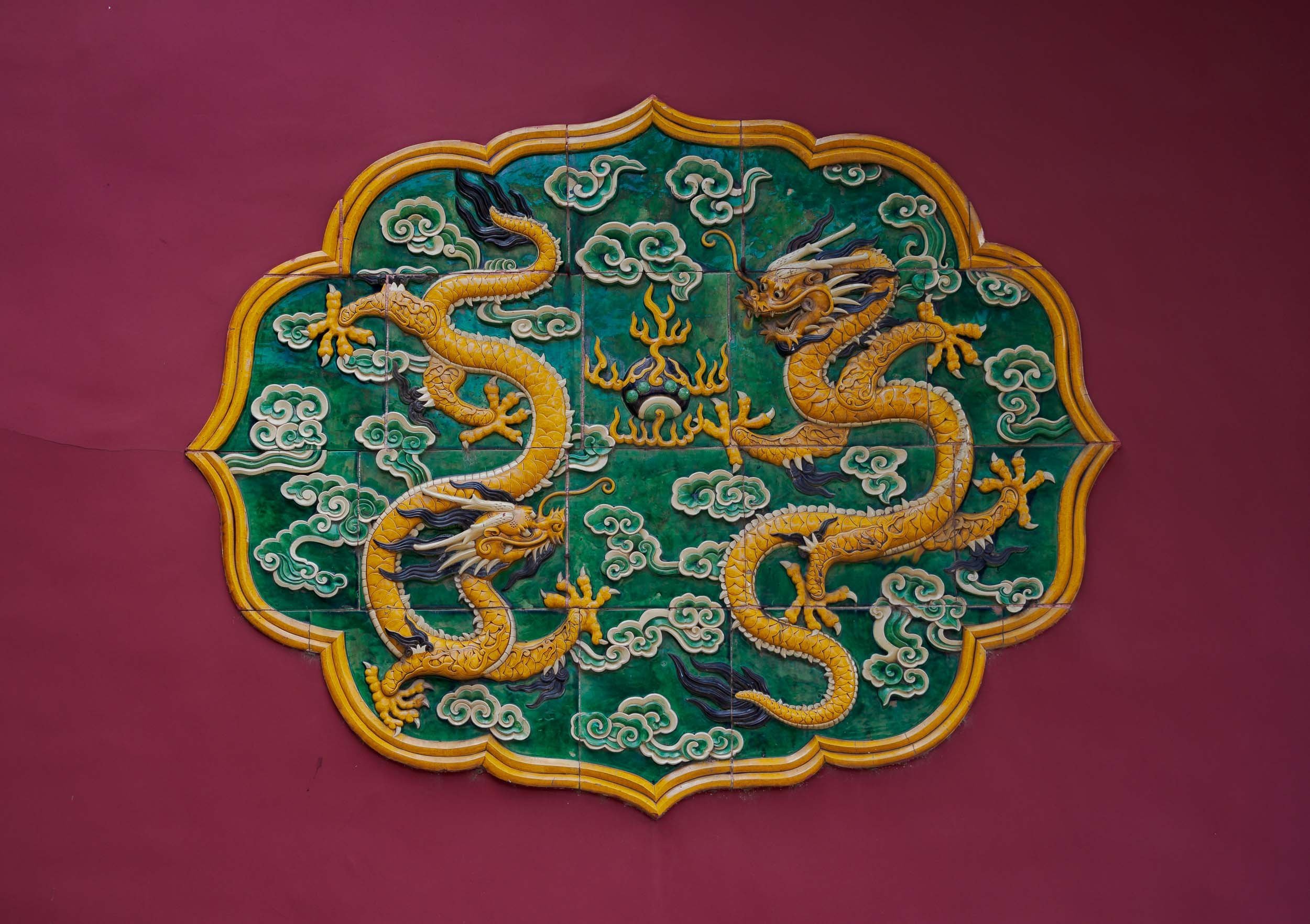
Colored Wood
One of the taller of the 980 buildings with a total of 9999 rooms. The wooden elements are clearly visible, and the complex is one of the best-preserved wooden structures in the world. The contrasting modern steel and glass architecture of the National Centre for Performing Arts in the background.
These kids were posing on the eastern moat bridges for some traditional photos with their families, who allowed me to get a few snaps.


The outer court with the Meridian Gate and the Inner Golden Water River, crossed by 5 beautiful stone bridges over the canal that has been protecting the complex from fire and flooding for almost 600 years.

The Hall of Supreme Harmony
It contains the throne of the emperor. This is the biggest building of the complex, and the largest surviving wooden structure in China.

The Tower of State Benevolence on Tianhedian Square
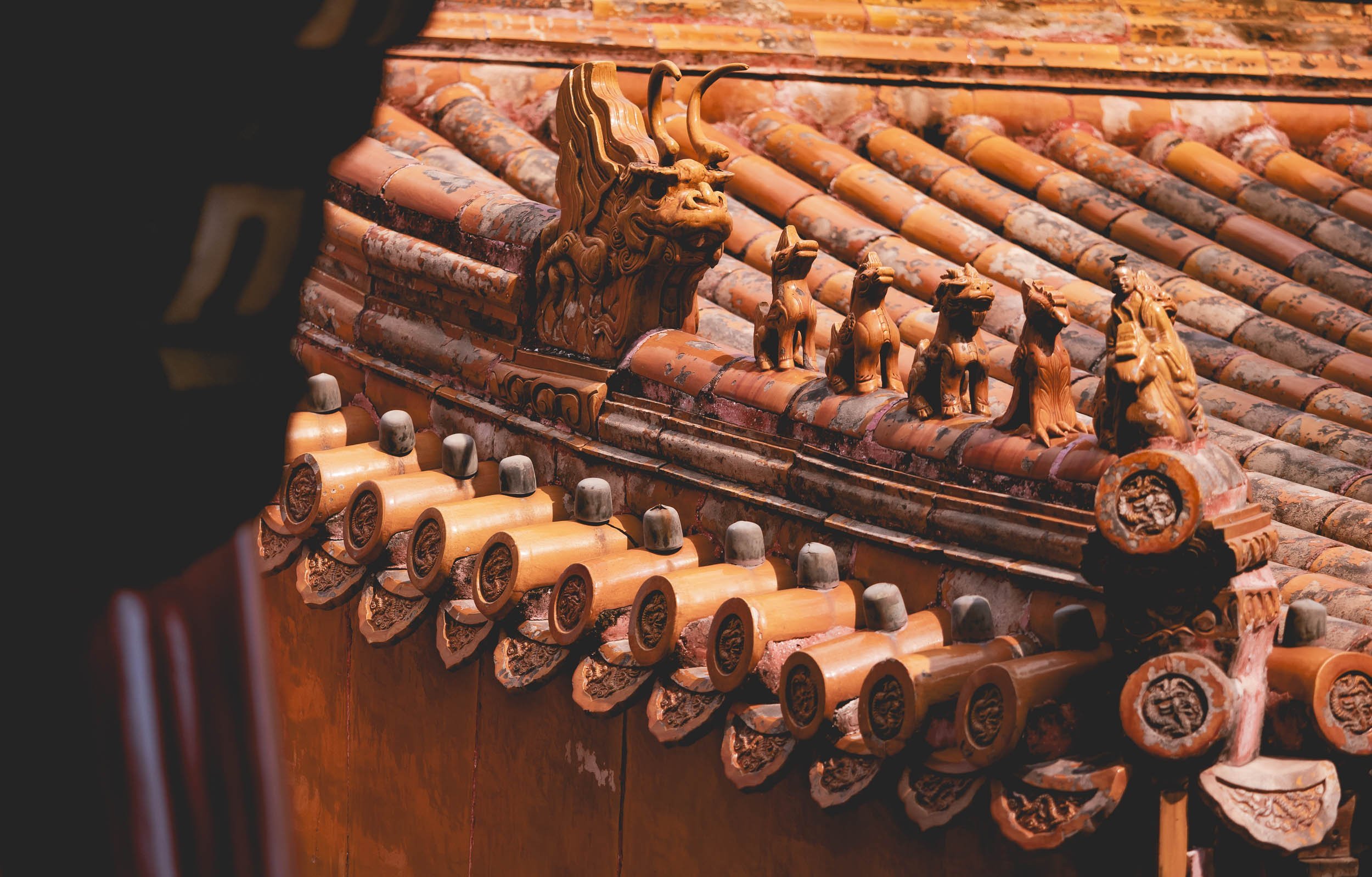
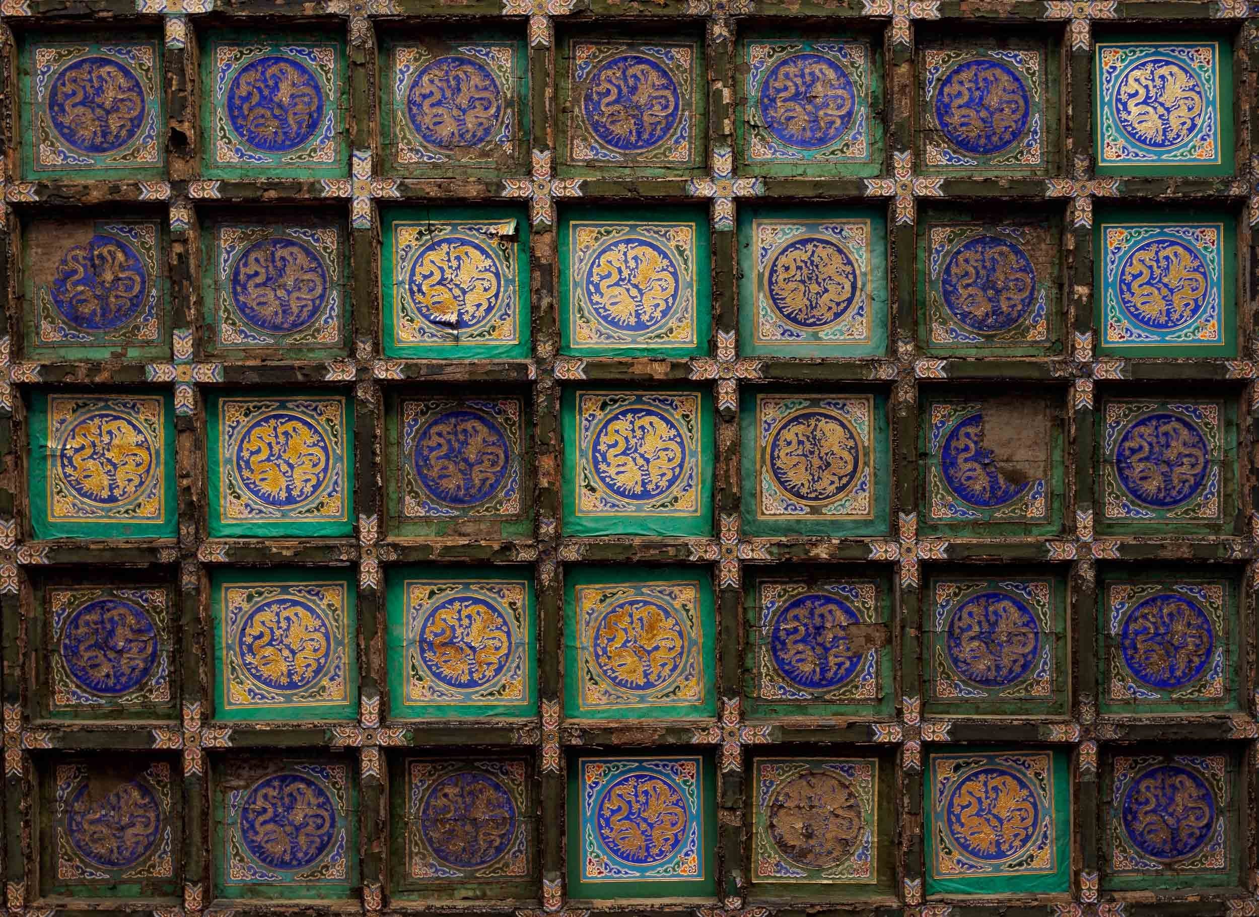
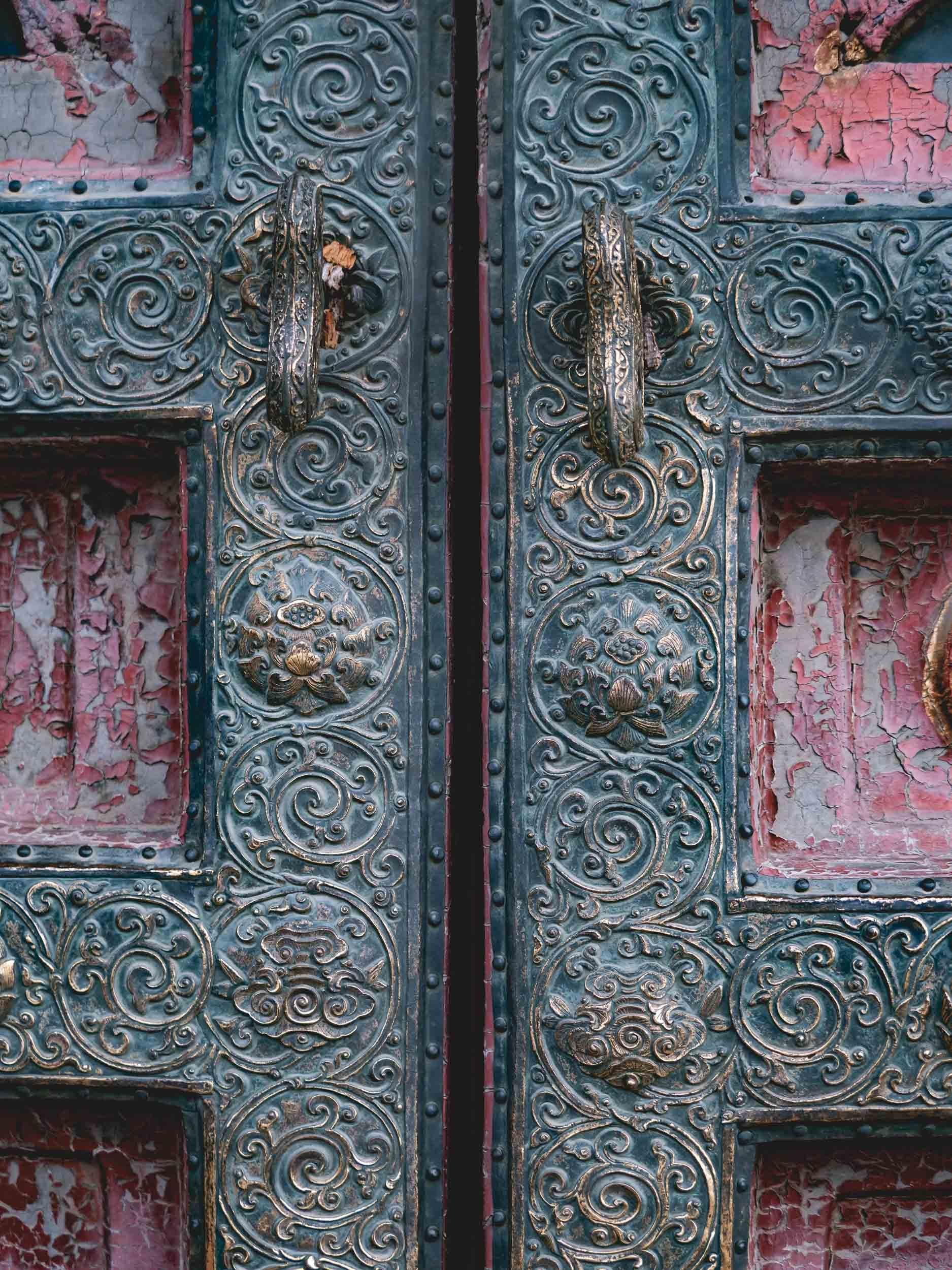
Details
I could have spent days in this place, just wandering around and capturing all the intricate architectural details.

South of the Forbidden City lies Qianmen Street, one of the city’s most famous pedestrian streets and one of the last remnants of the commercial centres of the old Beijing, dating back almost 700 years. Its gate frames the Zhengyangmen Tower just south of Tianmen square.

Of course, it’s now a modern shopping street and western influences can be found all around. Can’t deny that this is a pretty cool Starbucks though.
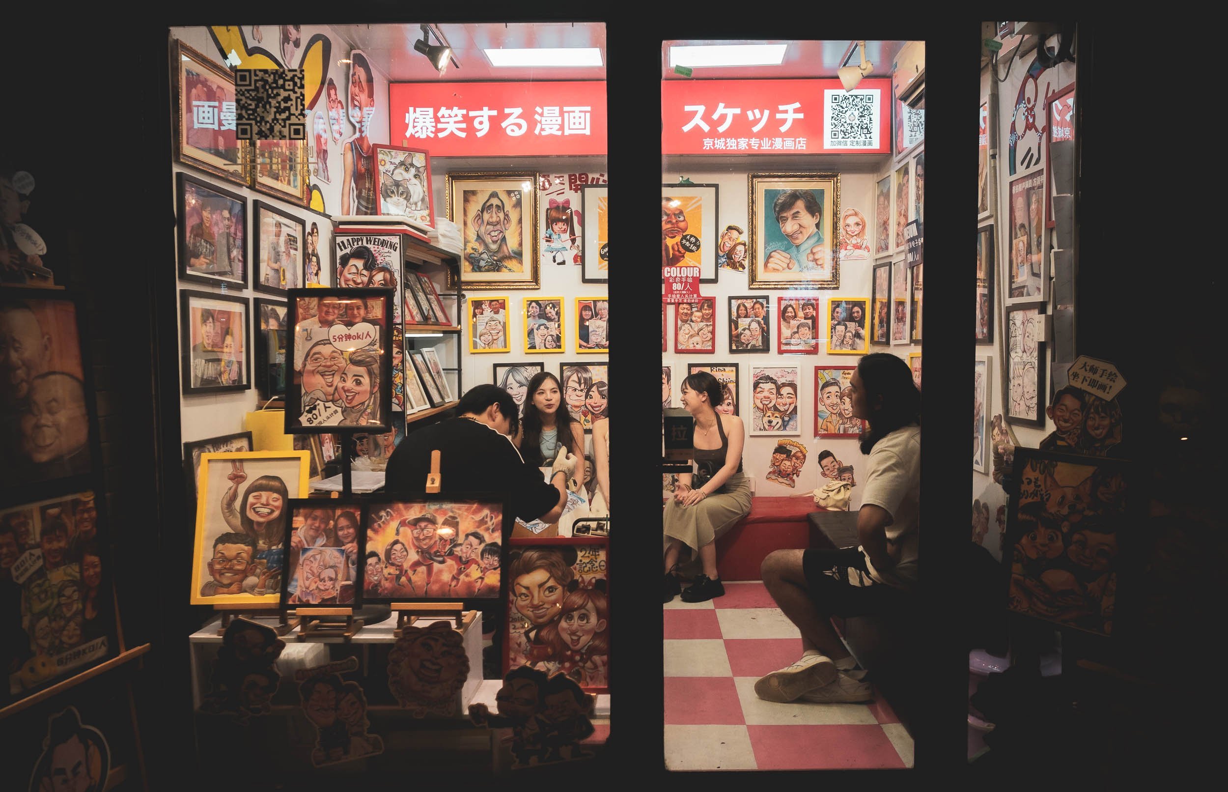
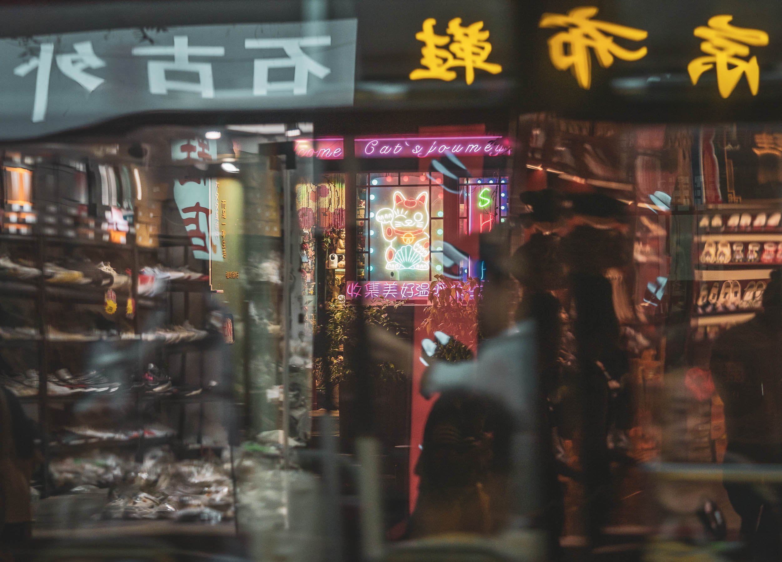
Hutong Scenes
One of my favorite parts of Beijing are its Hutongs, the low rise neighborhoods characterized by alleys formed between the siheyuan, traditional courtyard residences with their distinct roof structures. A walk here evokes a very local village feeling and masks some of the big city atmosphere. There are dozens of such quarters all around the centre, and while some are more famous than others, I just spent half a day in the area around Lama temple, wandering aimlessly.


Hutong Roofs - the traditional courtyard houses.

It may have been a seasonal factor, but I did not encounter many foreigners during my time in Beijing. That didn’t have any impact on my comfort level though, in fact, the organized and safe impression and generally polite demeanor of people make you feel quite welcome, despite language, technology and cultural barriers. This couple was very happy to pose for me once I smiled at them with a little “Nǐ hǎo” - the woman is 98 years old, as I found out during a conversation with the (excellent) Apple Translate app.

The Hutongs also frequently feature public toilets, partly a relict from the times where the community used shared bathrooms, but generally a common sight in Beijing. They are often shared, and occasionally (I only heard of this) without stalls, meaning you might have the chance for a nice chat while doing your business.

An evening view over one of the busier Hutong districts near Houhai lake, with the wooden Drum tower on the left. Together with its Bell tower sibling it was used for timekeeping via musical instruments since it was built almost 800 years ago (they've been converted to museums now).


Wangjing Soho
Moving back to modernity. The second Zaha Hadid building I had on my mind to see consists if three towers that interplay with each other in the architect's signature curvilinear style. This time, I managed to find a good viewpoint to capture the entire complex.
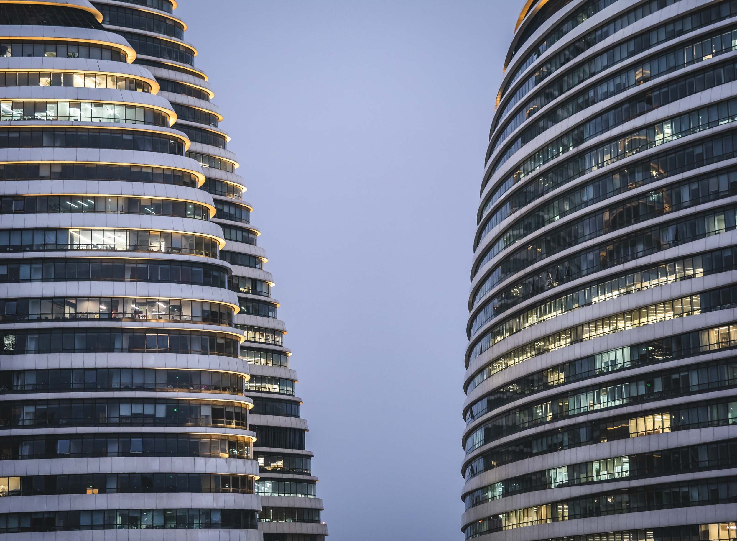
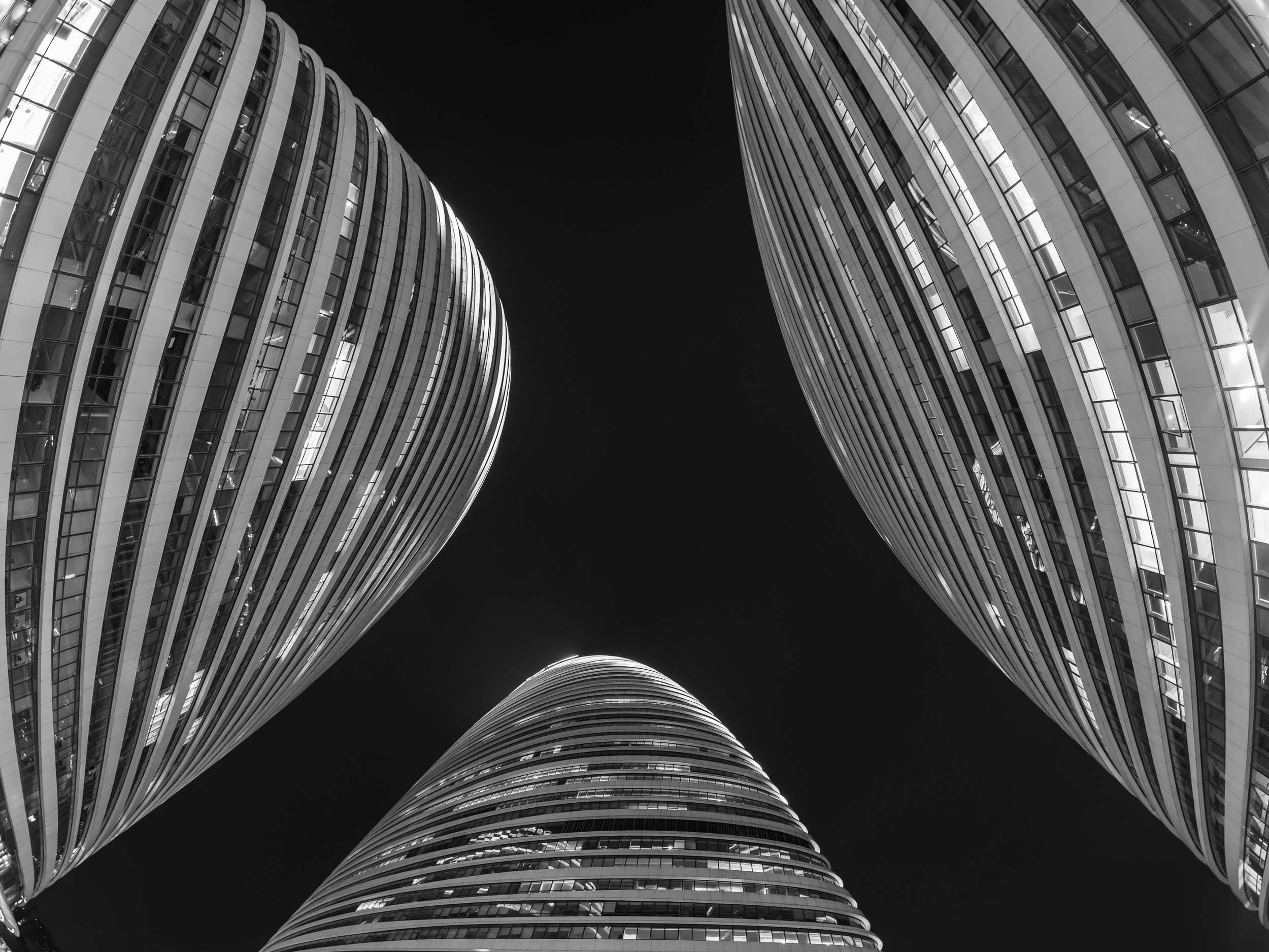
Soho is one of China's largest real estate developers, responsible for many of Shanghai's and Beijing's most well known buildings. Its CEO has been dubbed the "the woman who built Beijing". There's an interesting backstory to this design, which was allegedly copied by another architect for a building in Chongqing that looks strikingly similar, resulting in a lengthy legal battle, in which Zaha Hadid herself only took limited interest.
Panda Craze

I was torn whether to make my way to Beijing’s zoo in the eastern part of the city on my last morning: Firstly, I’m - broadly speaking - not a huge fan of zoos, and secondly, during the Chinese summer holidays, it was bound to be a crowded affair. And that turned out to be an understatement. Of course I arrived 30 min before the zoo opened and with tickets in hand already, but there was already a 200 people queue. And they all wanted to see one thing: 🐼. Which meant that as soon as the gates opened, this crowd, which had grown further, started sprinting (I don’t think “running” would sufficiently describe it) towards the Panda house, which was only going to open 30min later, for more queuing. Once you were past that, there was another short extra queue specifically for those who wanted to see China’s most famous Panda “Meng Lan”, a social media sensation due to some of his funny behaviors.


Breakfast
The queue during the day is said to shrink, but this is also because Pandas are no longer active after 10am, usually hiding and sleeping, whereas I did get to see some eating and playful behavior.
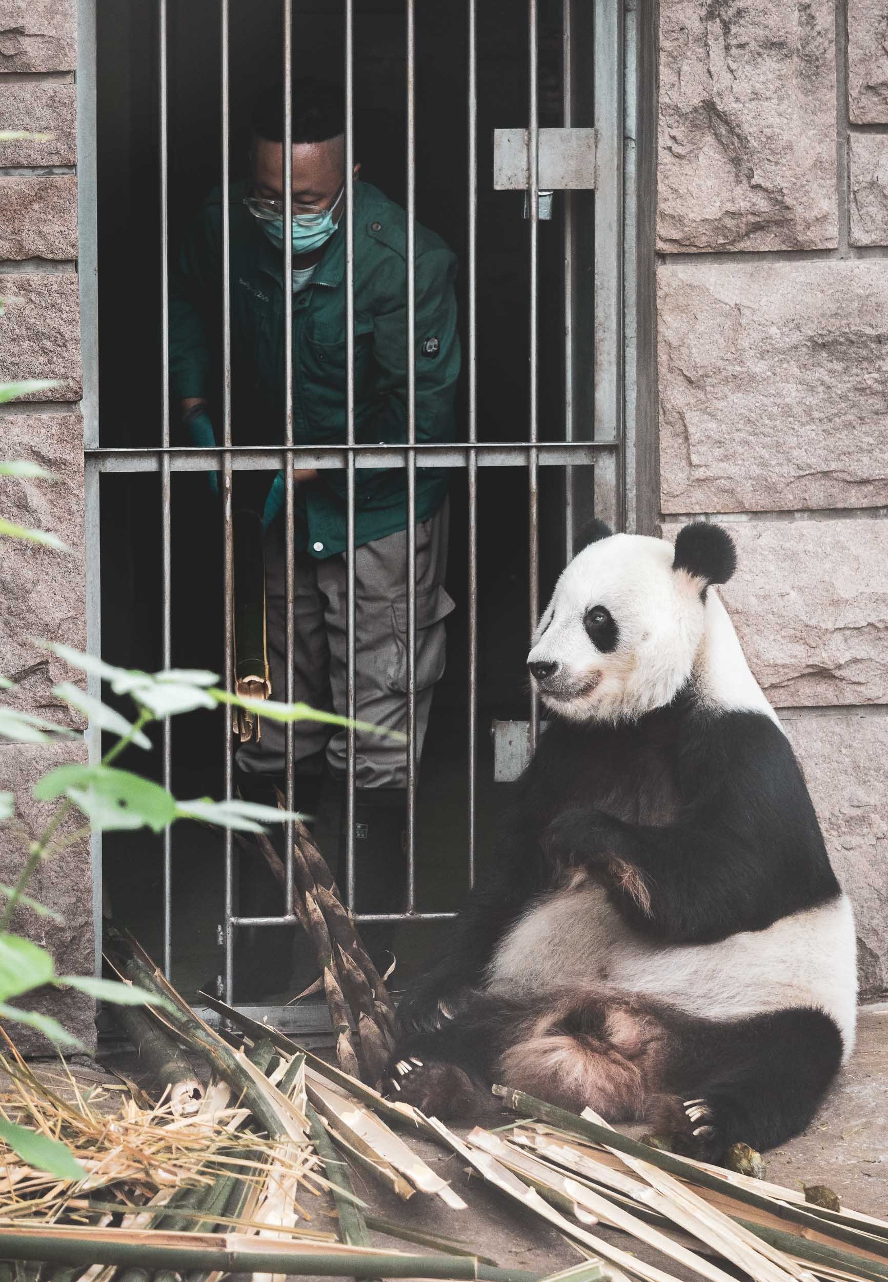
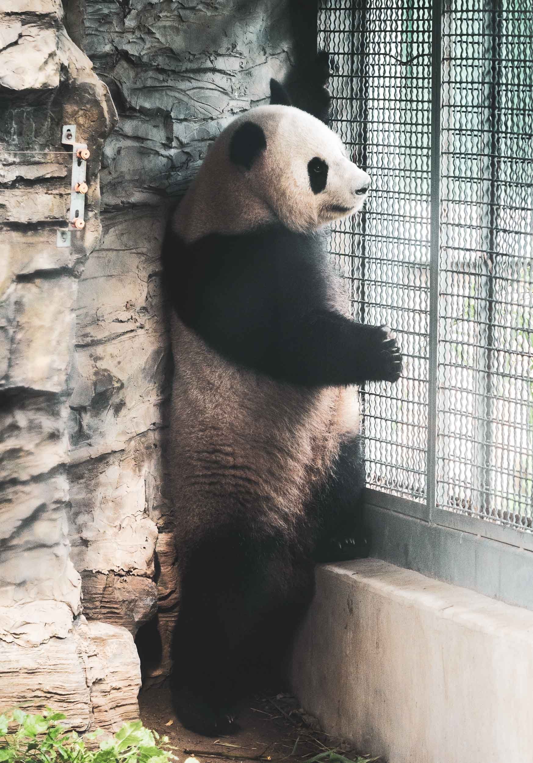

Life of a panda bear in Beijing’s zoo doesn’t have many private moments.
The Bird’s Nest

Beijing's National Stadium was built for the 2008 Olympics and was also used during the 2022 Winter Olympics.


While originally inspired by the patterns of Chinese ceramics, the steel frame later inspired the nickname “Birds’ Nest”. The exterior is not actually connected to the stadium, essentially just acting as a decorative shell for the inner bowl. During the initial design, the stadium had a retractable roof which was meant to be hidden within the steel frame, but the feature was then removed during the early construction phase.

Shapes
Speaking of bird related architecture, Beijing is also home to what’s colloquially described “The Giant Egg” - its National Centre for the Performing Arts.
Then building is the largest theatre complex in Asia and has an incredible construction story: The actual theatre hall sits up to 32m under the surface, meaning the groundwater would make the entire structure float. As a result a huge concrete tub was built around it. A few more interesting tidbits on Wikipedia.


The Great (& Endless) Wall
When going to Beijing, it is impossible to not consider visiting China’s World Wonder. Frankly, my imagination did the Great Wall a disservice (and some of the images I had seen didn’t help either) - I had a few bricks and towers in mind, with a lot of tourists, and not actually that much to see. How wrong I was, take a look at this video…
The first choice to make is where to go, as there are several options within reasonable distance from the city (the Beijing section alone stretches over 500km). The most well known is Badaling, and it is a real tourist destination which can be reached by a dedicated bus and offers all kinds of facilities, including a toboggan slide. It’s very crowded, especially during holidays. Needless to say, that’s not where I went. There are lesser-known but well developed and restored sections, and after looking at photos I opted for Jinshanling. Without having seen any other section, I’m confident to say this was a great choice. I had a sunset and a sunrise, stayed over night in a small tourist hotel close by, and encountered probably 20 people over a stretch of 3 kilometers, and was literally alone most of the time. Amazing feeling.

Jinshanling
This section features beautifully restored dense watch towers, but retains a lot of its wild surrounding landscape and original features with endless layers of mountains as the backdrop.


This part was constructed in 1368 has over 60 towers on its 10 km zig zag course through the mountains, with many beautiful architectural details and endless views over the sloping hills. It’s difficult to grasp that the entire wall network of China exceeds 21,000 km (!) in length over different dynasties, with the most visible Ming section alone reaching almost 9,000 km. There are several “wild” sections of the wall, which are technically off limits (as they’re often crumbling and run through dangerous landscapes) but popular with hikers and adventurers.


Although the views are beautiful from the ground, getting permission to fly a drone here gives you an even more impressive perspective.


Staying over night at the Wall is not allowed, so I left shortly before darkness. As blue hour fades some distant parts are illuminated, seen on the top right here.

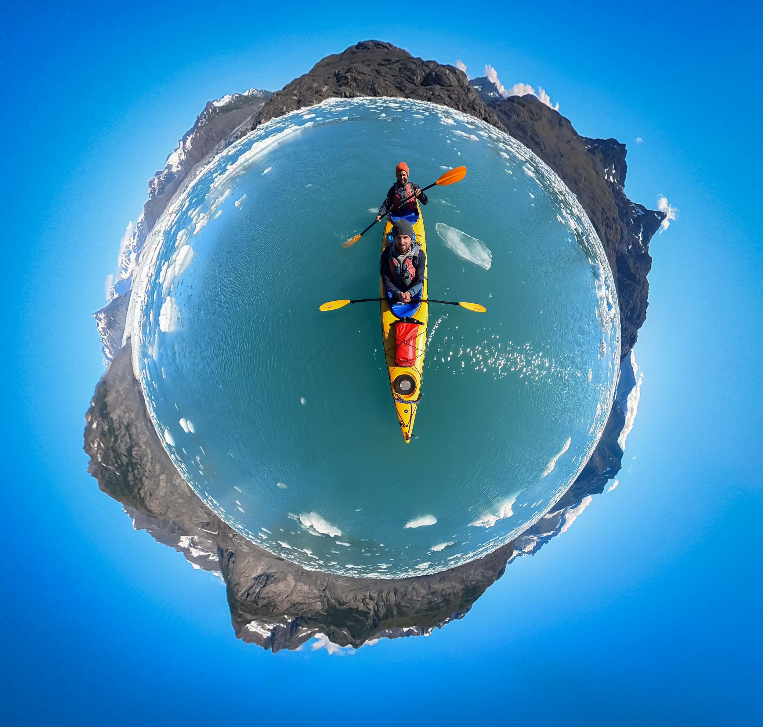
China, I’ll be back!
This was definitely not my last time here, there are too many amazing landscapes and cities still waiting to be explored. Also, this photo is a selfie, can you spot me?
Subscribe to my newsletter to get notified and don’t miss out on more Wonders of the Globe.
Other Recent Posts:


Jordan - From Salty Seas and Dramatic Deserts
A rich history, natural attractions, and dark night skies - what’s not to like?

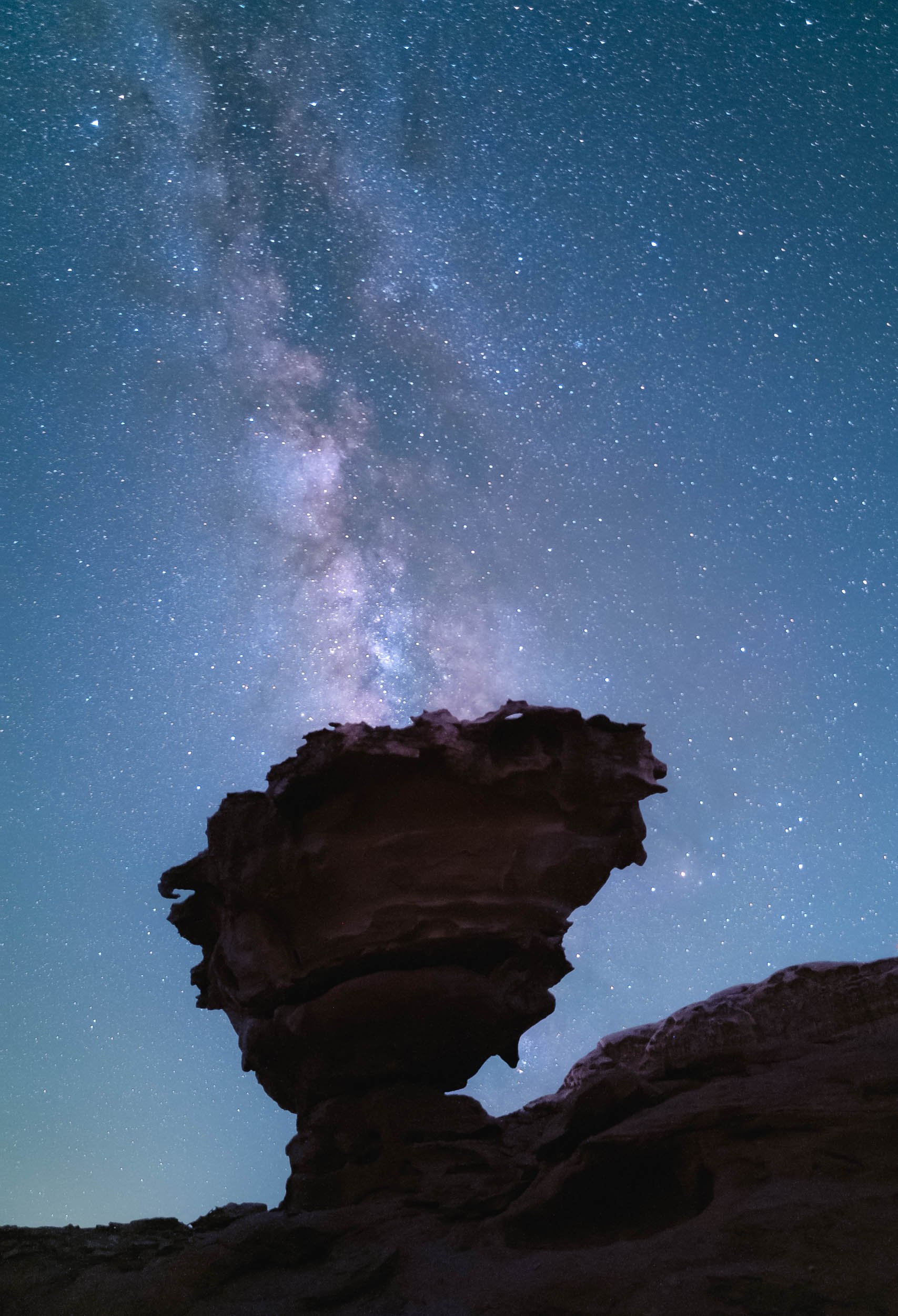
I’ve wanted to visit Jordan for many years, and despite its proximity to Dubai it took until now - when I’m not actually living in Dubai - to make it happen. Its rich history and natural attractions didn’t disappoint, and on top of that, the dark skies of its deserts meant some Milky Way photography was on the cards. What’s not to like?
Petra - The Ancient Capital
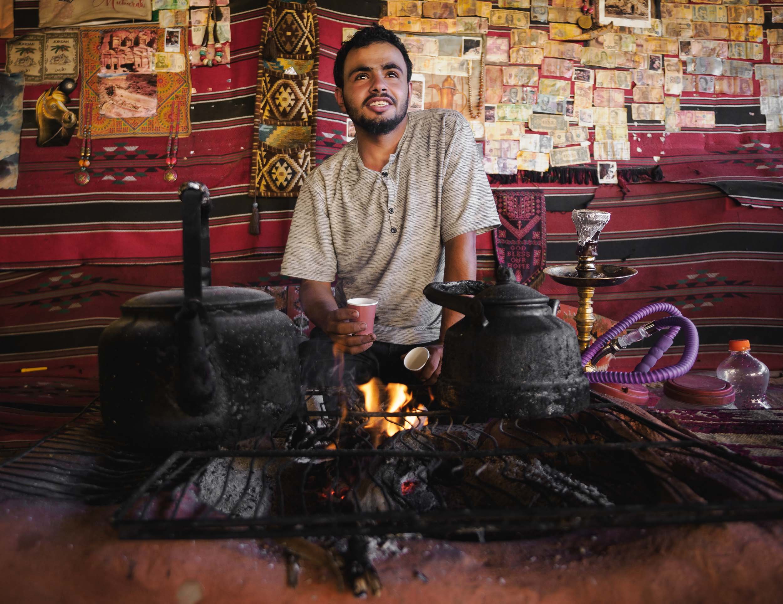
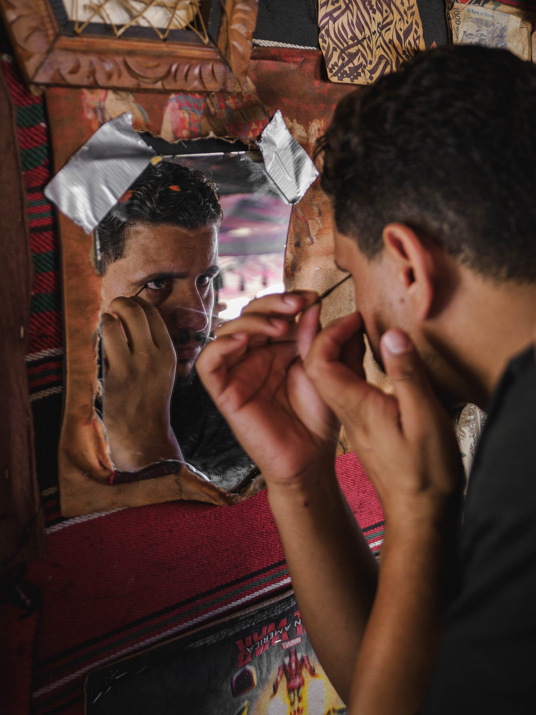
The first part of my trip lead me to the capital of the Nabateans - the historic Kingdom that ruled this area more than 2000 years ago until the Romans took over. Their centre was the famous city of Petra. My time here (and in Wadi Rum) was spent in a small group as part of a trip organized by Benjamin Barakat, which really helped to get access to some of the best spots, with great local guides.
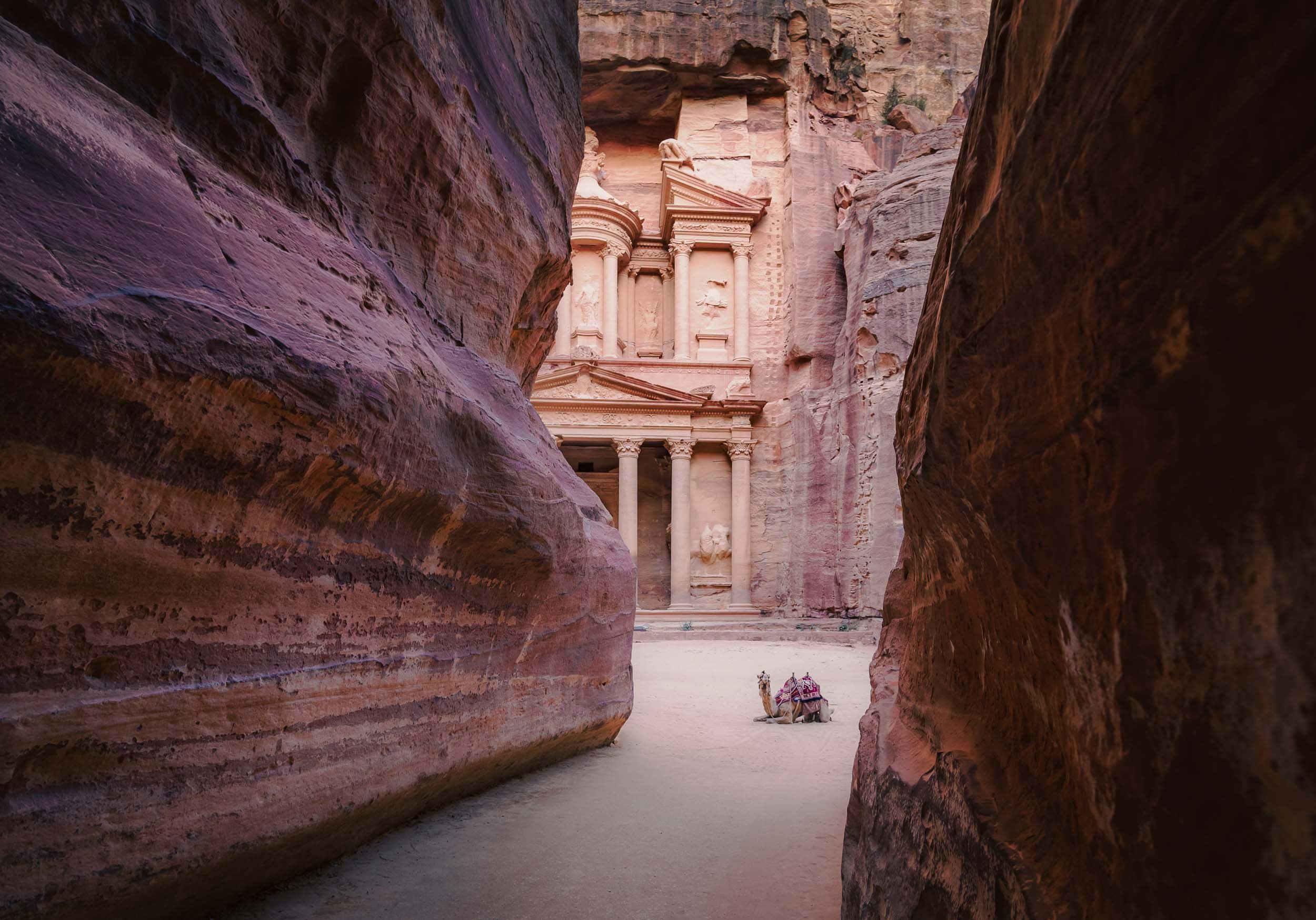
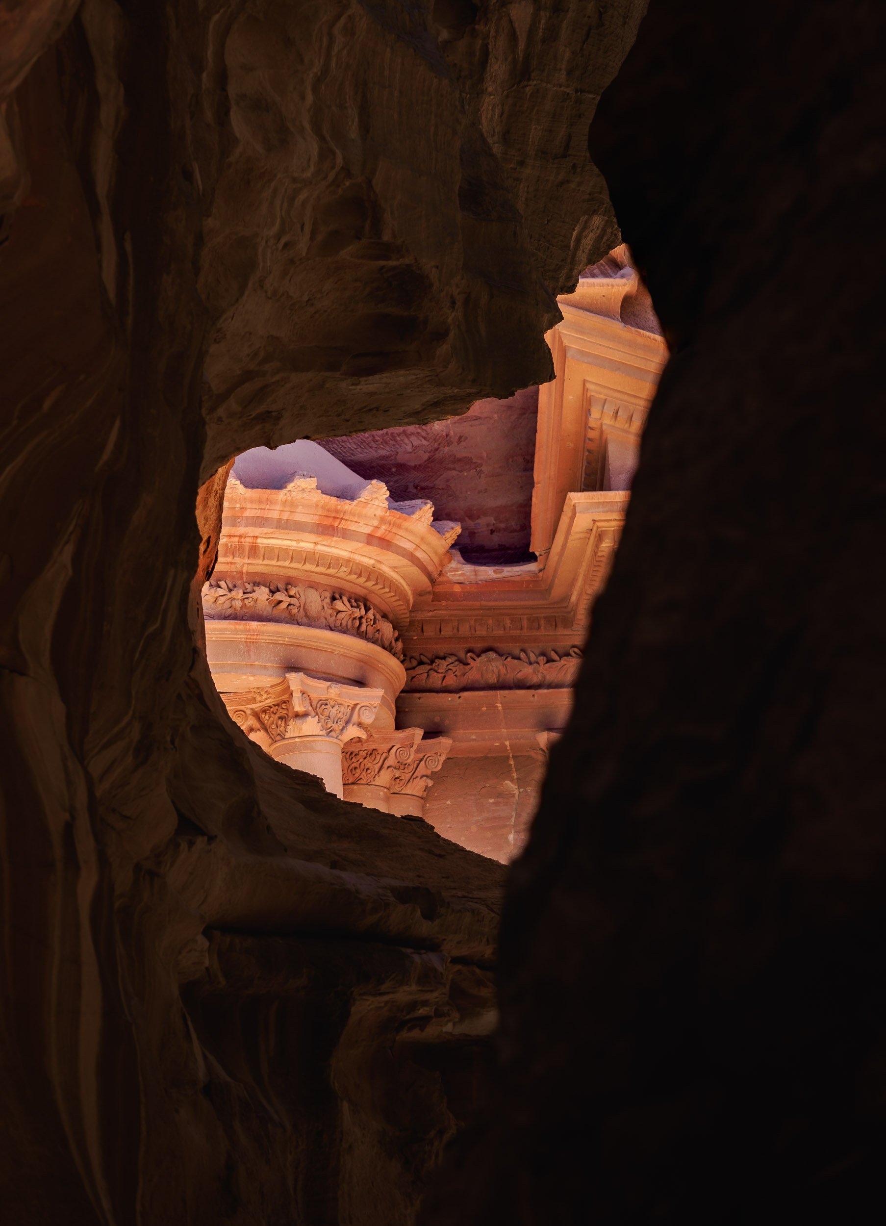
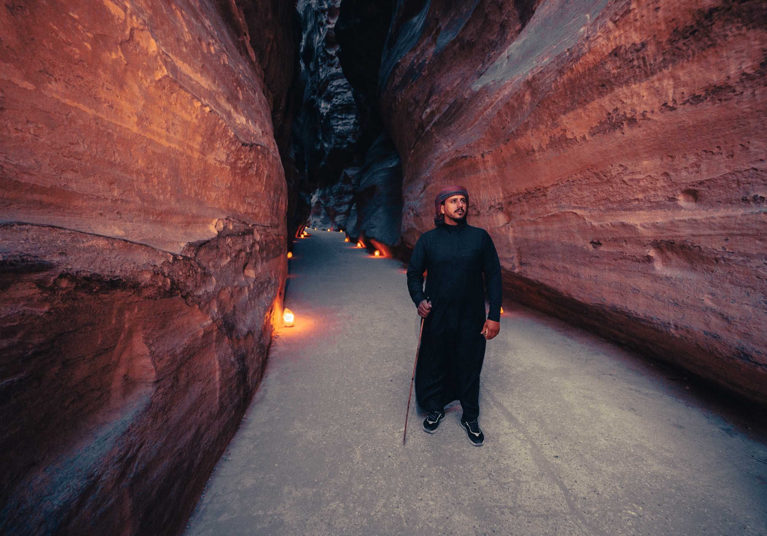

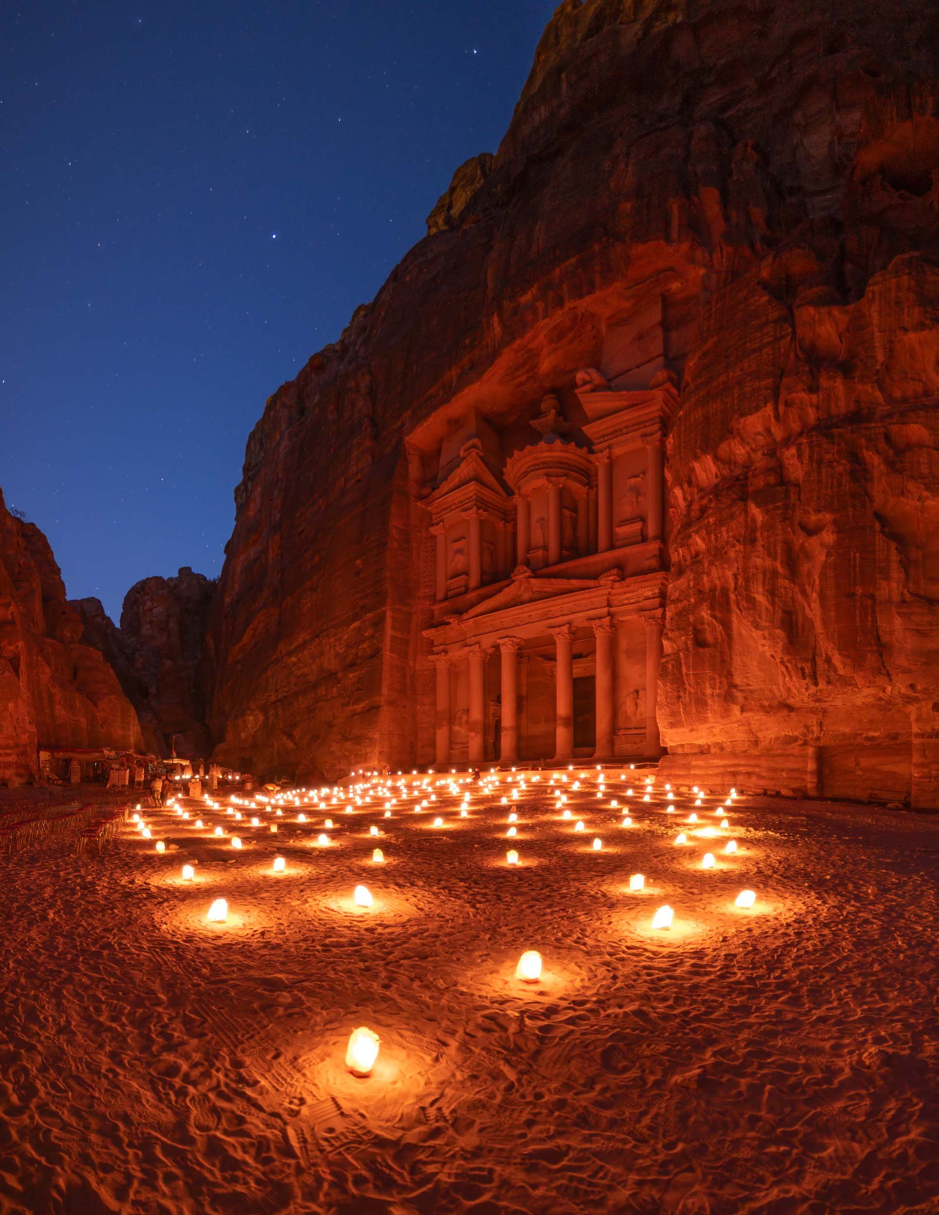
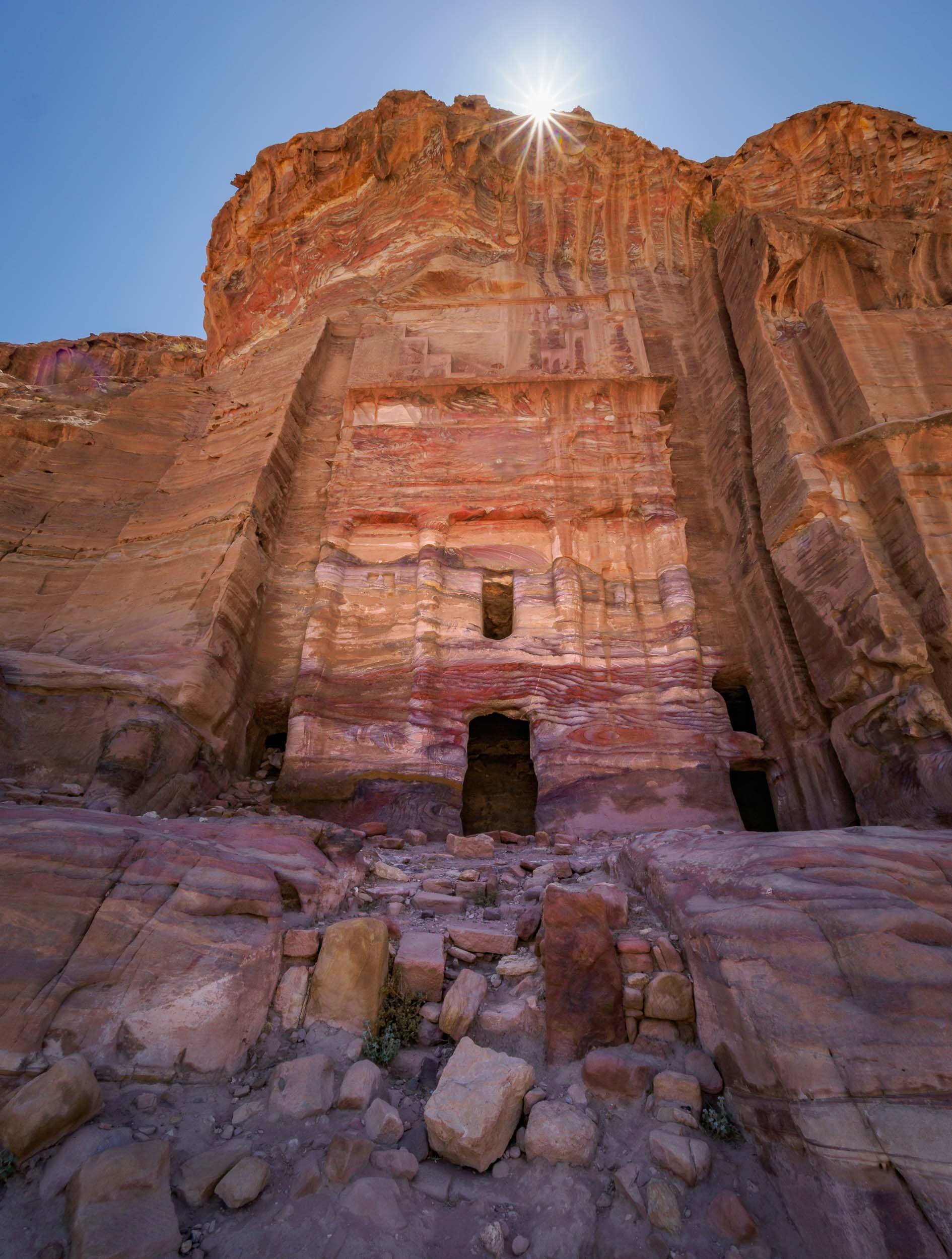
With the right timing - such as being the first one to arrive in the morning when the gates open at 6am (in the summer) - you can experience this place in peace and quiet, which adds to the awe-inspiring grandeur of the sandstone carved structure built 2000 years ago.


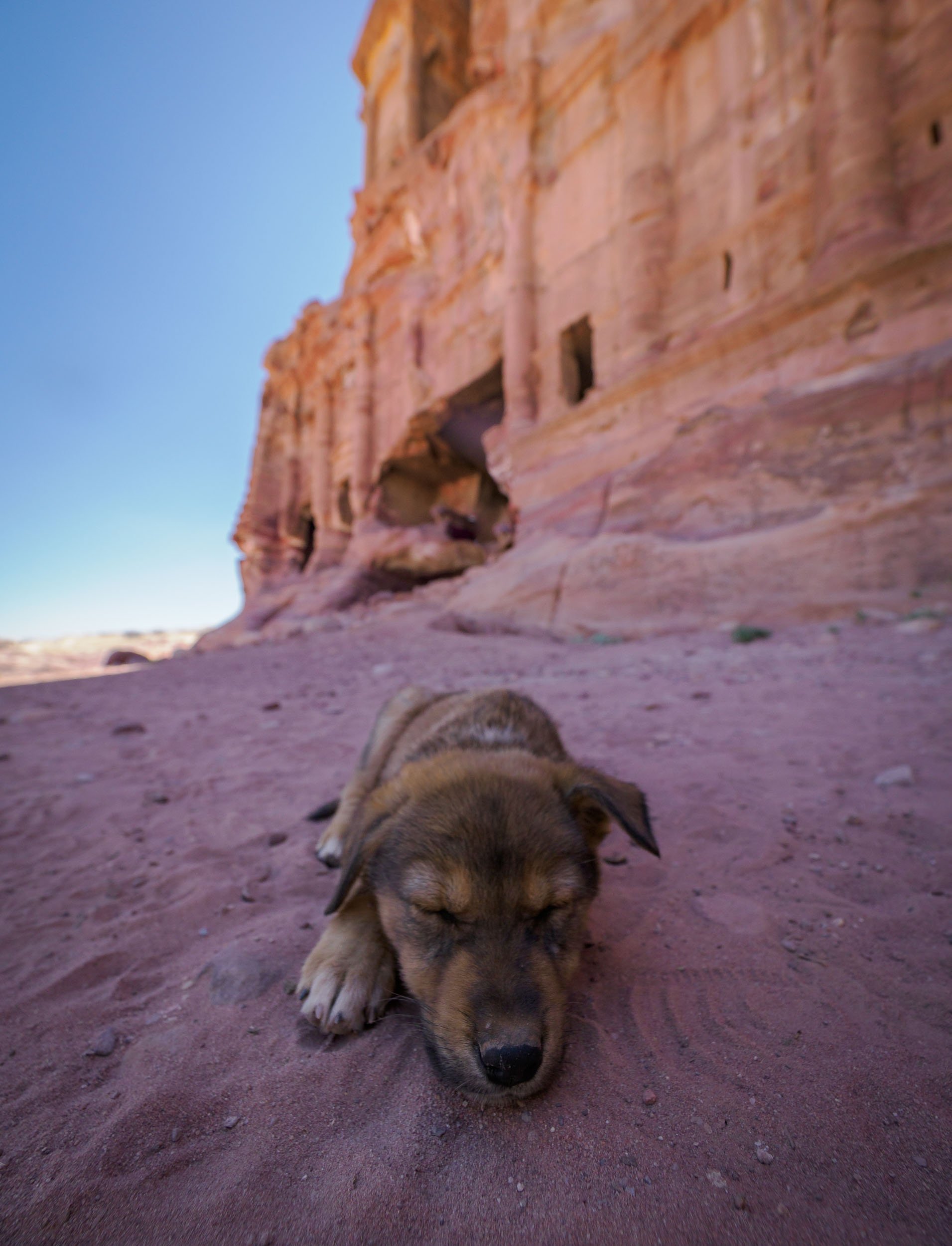
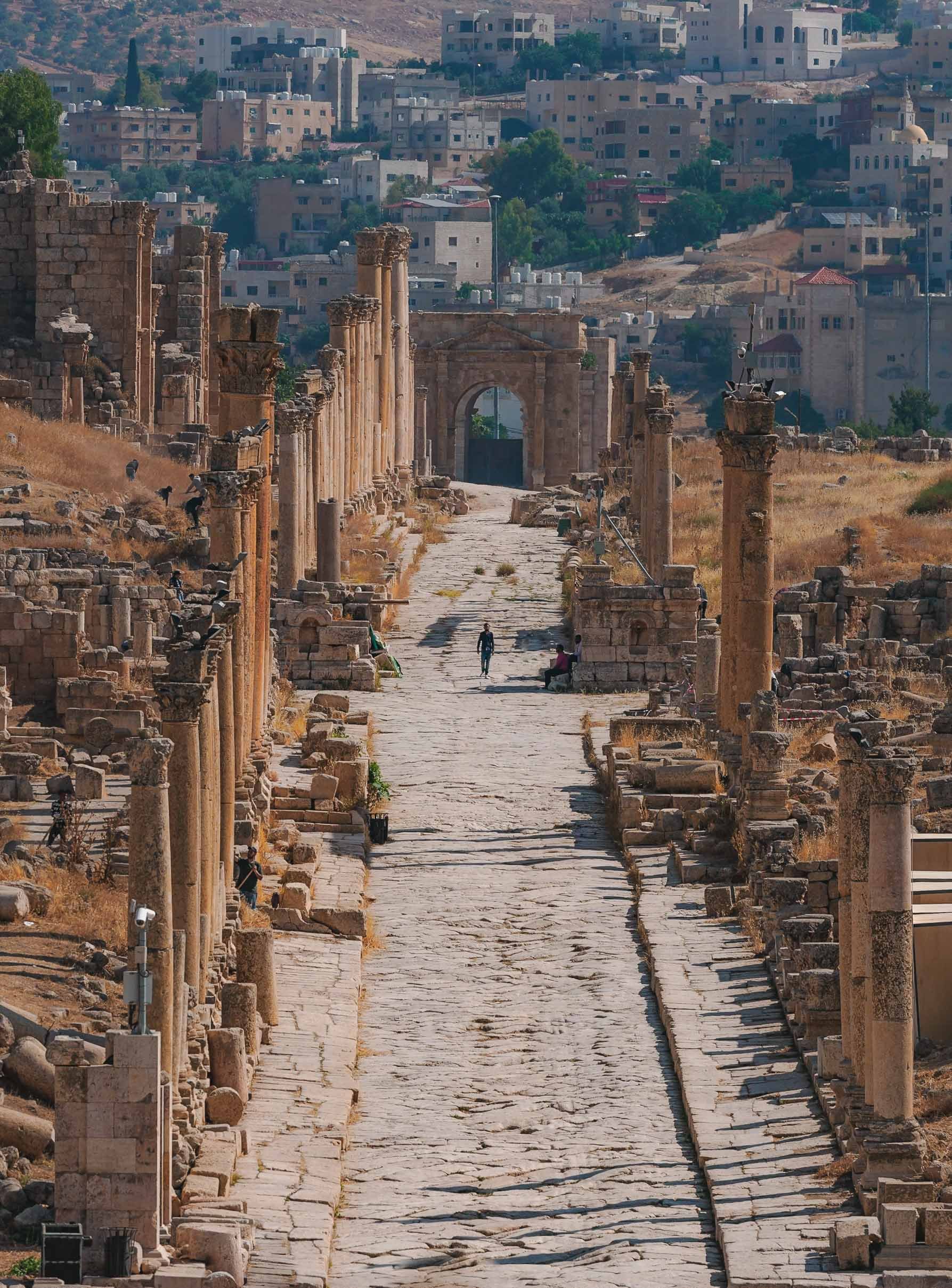
More than the Treasury
As I’ve alluded to, there’s more to experience in Petra than just the Treasury, which admittedly got a lot of the attention in popular culture, such as being featured in the original Indiana Jones movie. In fact, there’s a lot more to see, and if you want to soak it all in, you better be prepared to hike. I did 32km in one day, but it was worth it to explore the many Hellenistic facades, the tombs, and the amazing theatre, for instance.


The Monastery
Maybe it’s simply the feeling of reward after the two hour journey to reach this place, but the Monastery might be my favorite structure in Petra. It was carved in the mid first century AD and follows the mixed architectural style that was characteristic for the Nabateans.


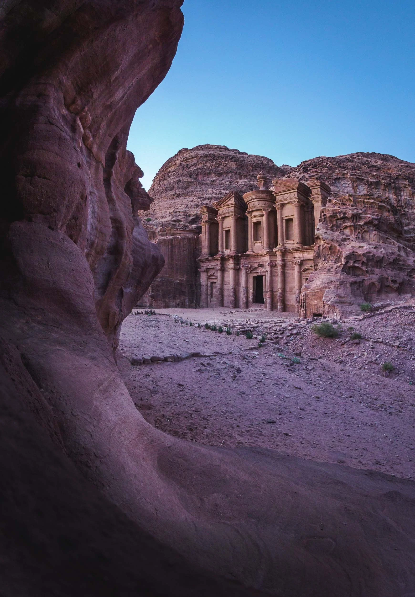
We were lucky to spend the sunset and early night here, allowing us to capture the structure in its best light and get a few star trails as well. It also meant that there were barely any other people left except us and the Bedouins… which couldn’t resist showing us their daring climbing skills.
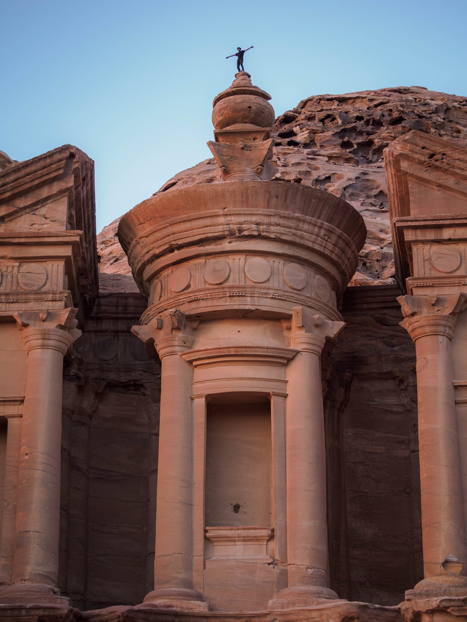

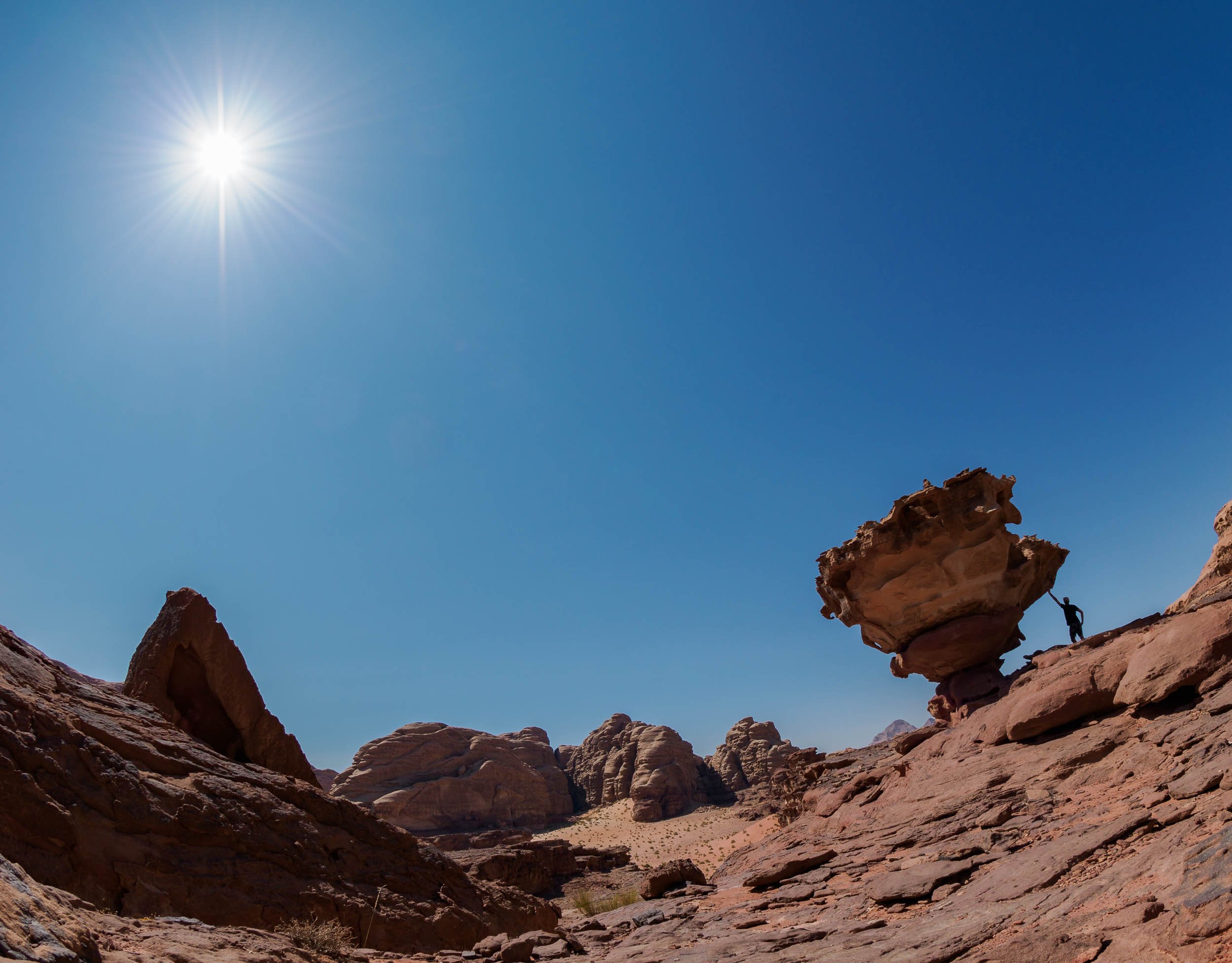
I couldn’t help but join them, and being up on the roof of the Monastery was an incredible feeling, but also one that reminded me that I have a healthy respect for heights - while I sat on the edge, you bet I didn’t follow that jump. Take a look at the video below and decide for yourself…
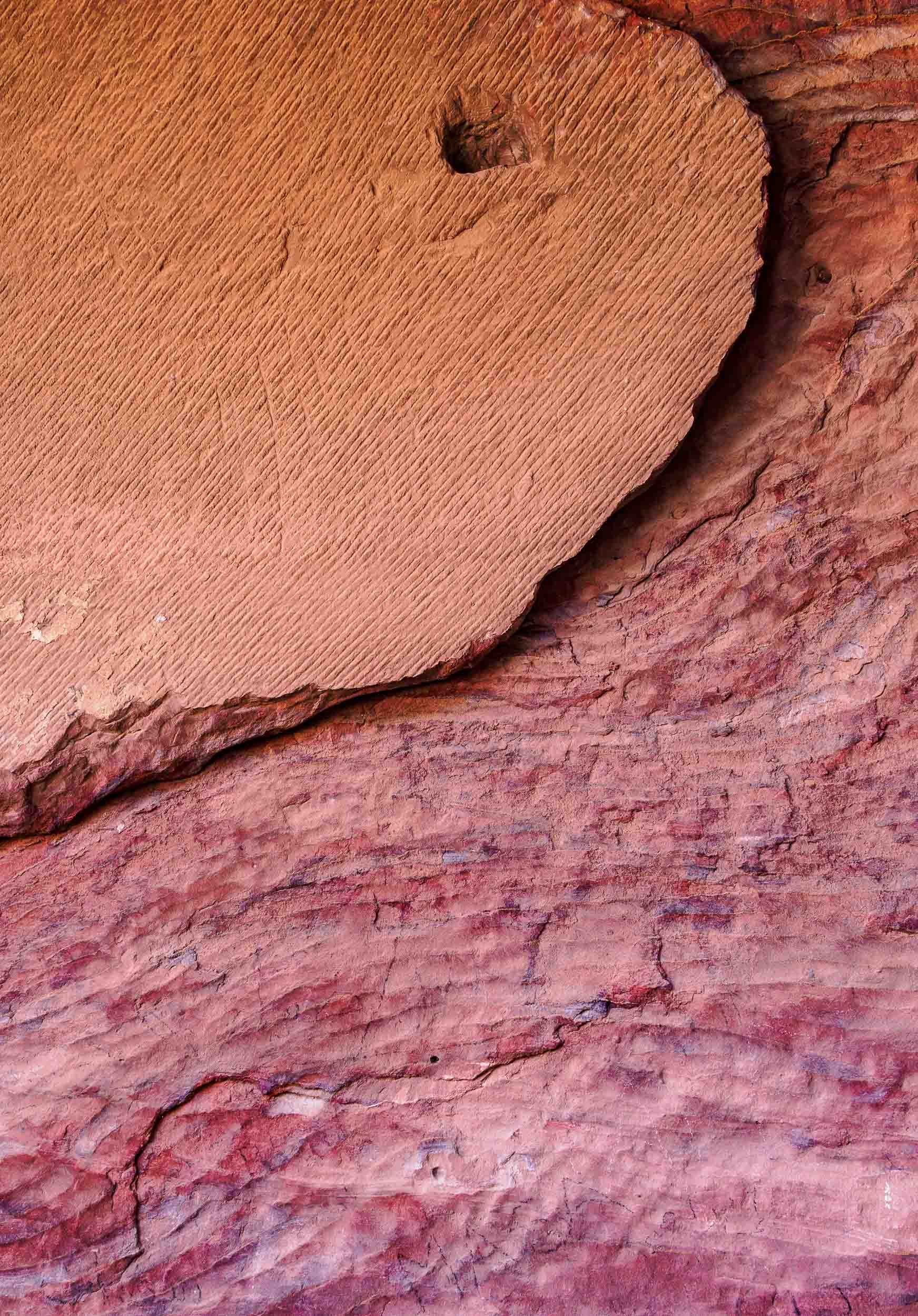
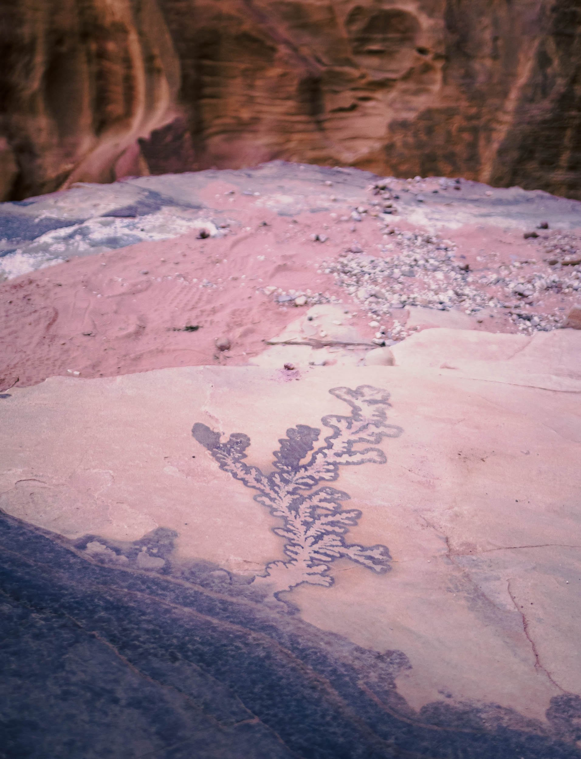
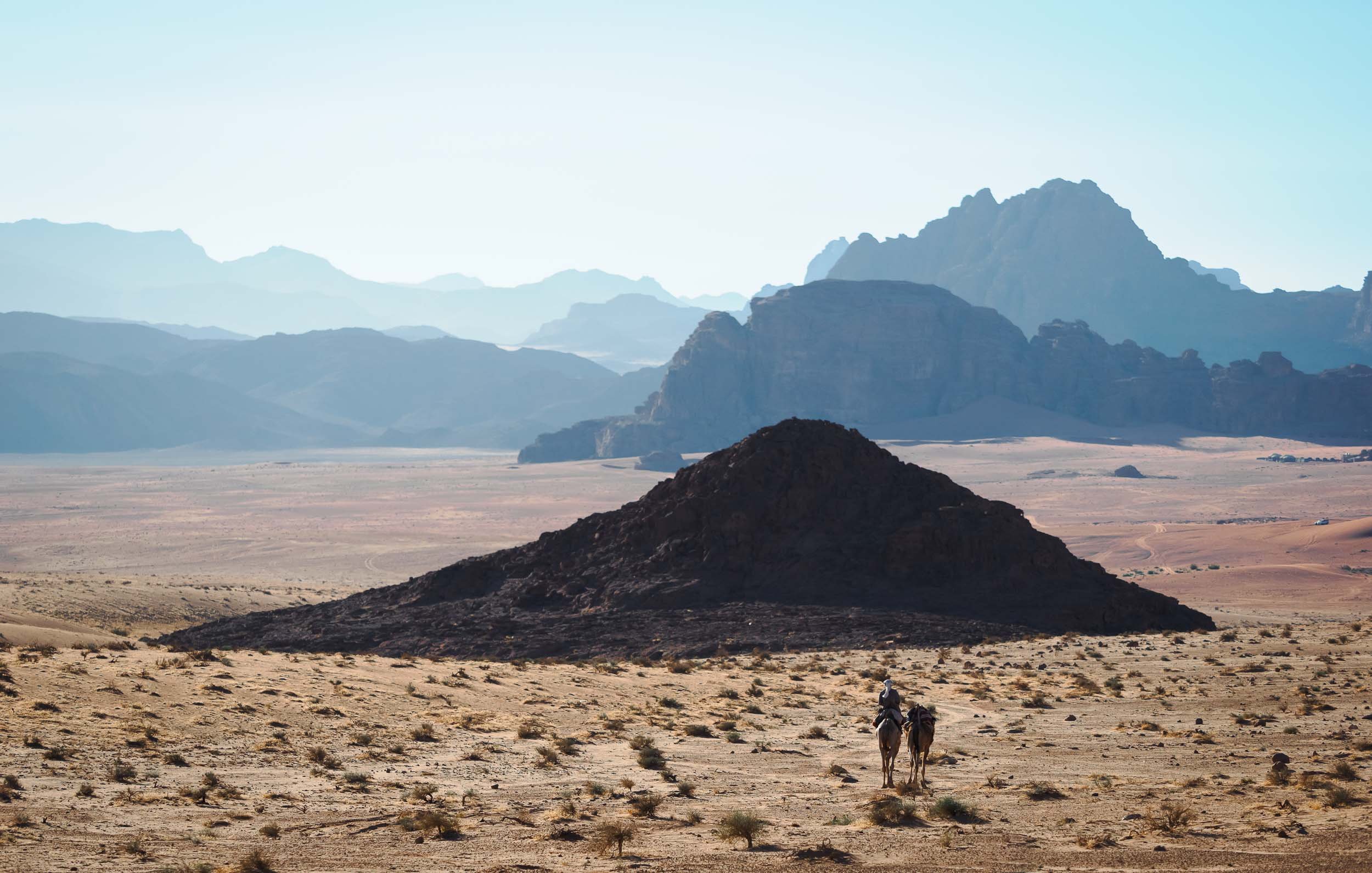
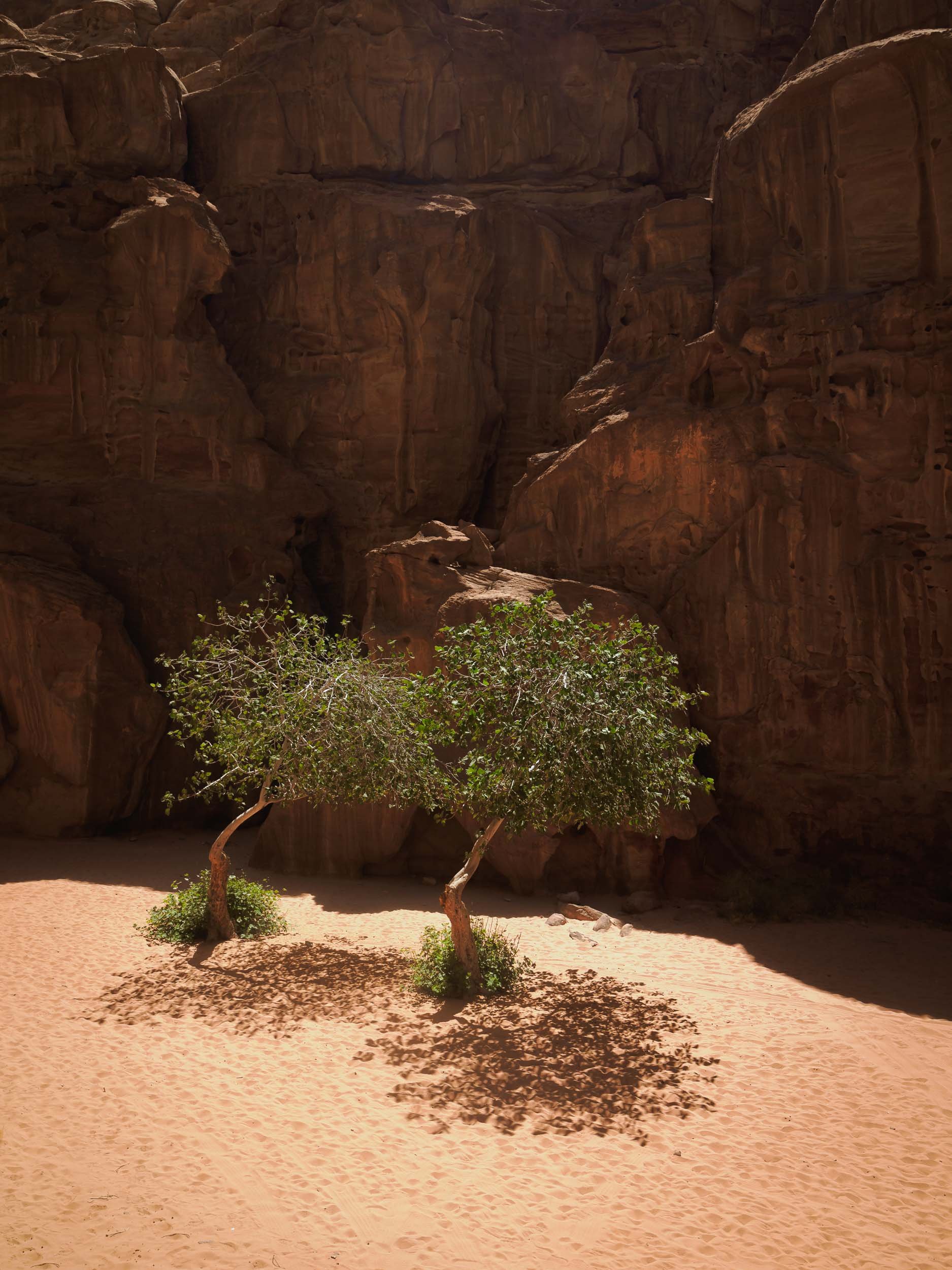
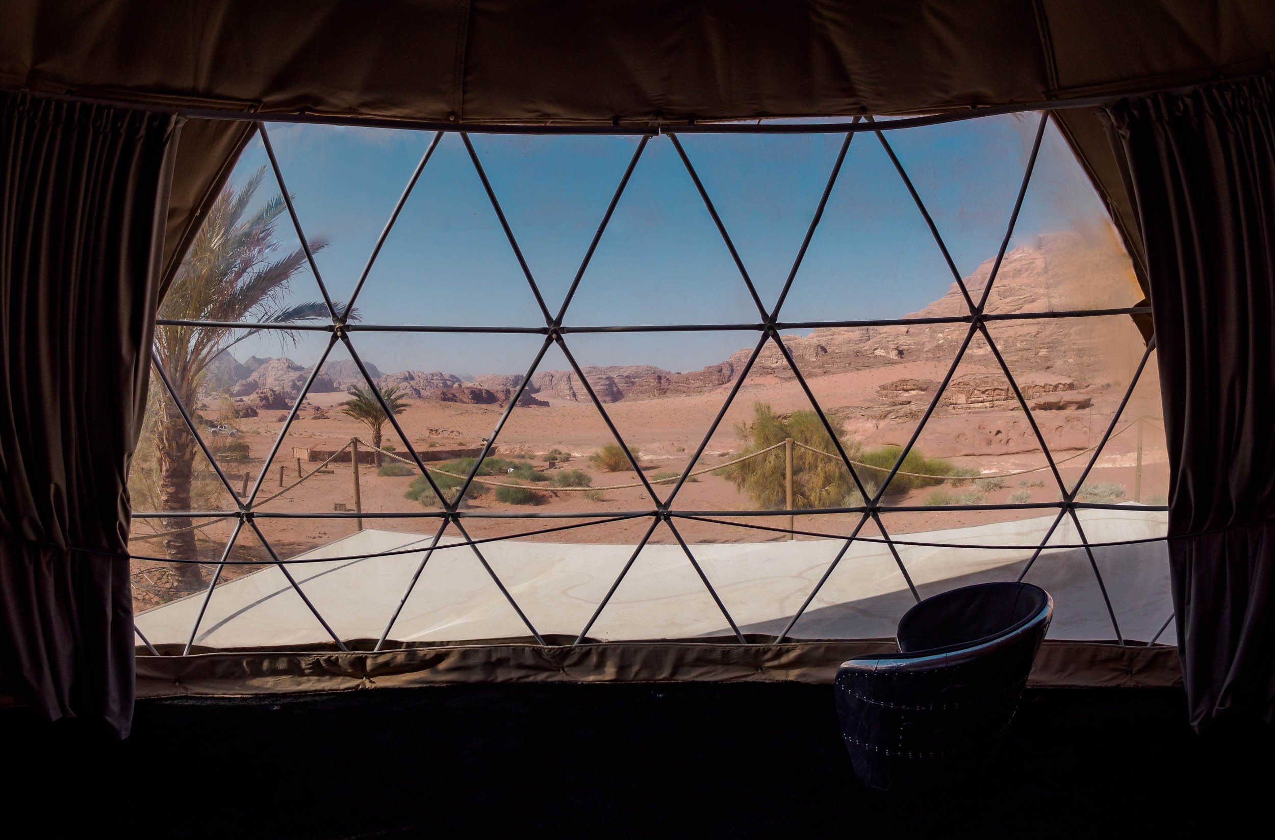
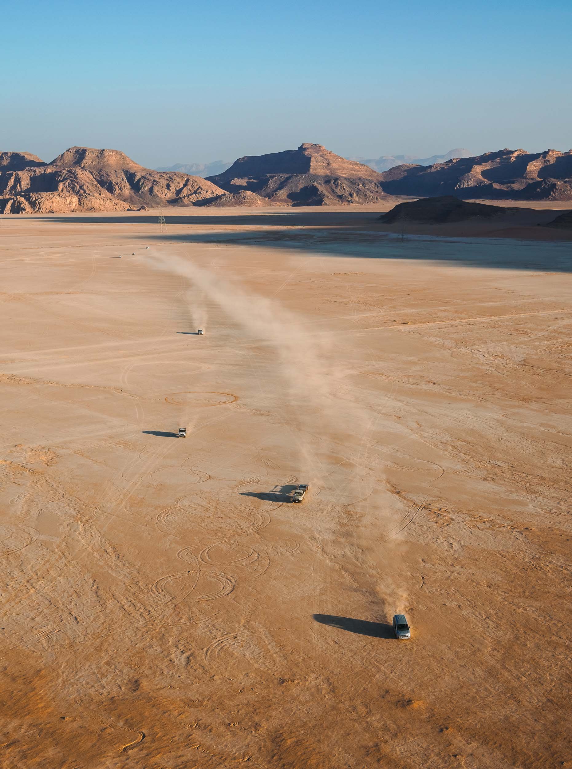
Wadi Rum - Mars on Earth
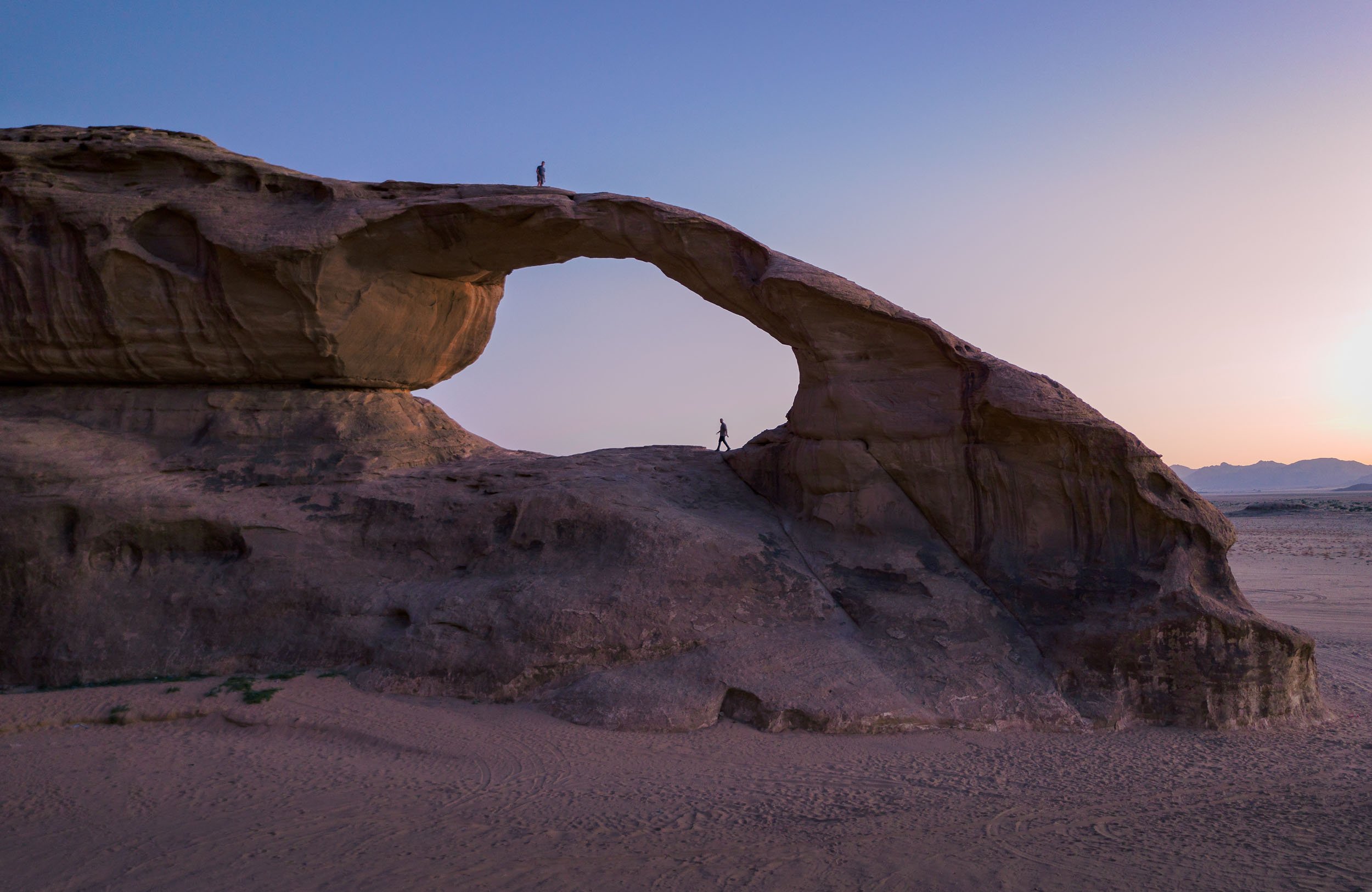
Another two hours further south of Petra lies one more of Jordan’s six UNESCO World Heritage Sites (Petra being one as well), and another one that has been featured in quite a few famous movies, such as Dune and The Martian. The original legendary appeal of Wadi Rum comes from the tales of Lawrence of Arabia though, which kick-started the tourism industry here.

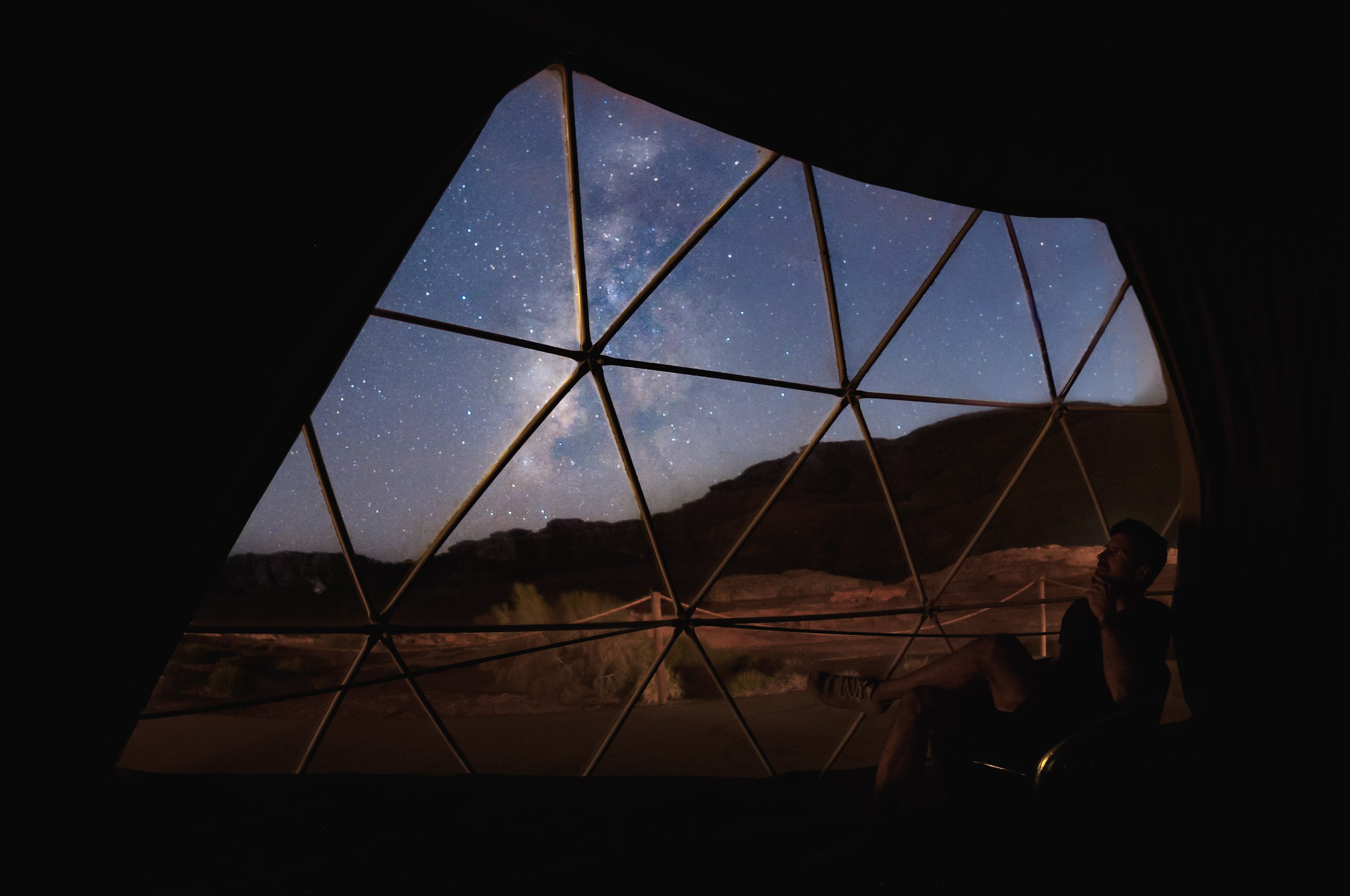
The first night took us out to a beautiful arch (one of many) not too far from the camp, and it was time for the first Milky Way session (also one of many)!
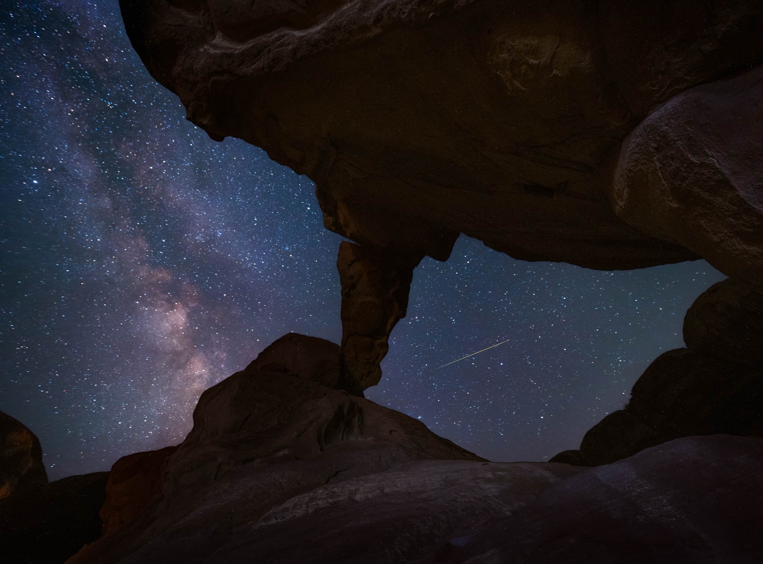

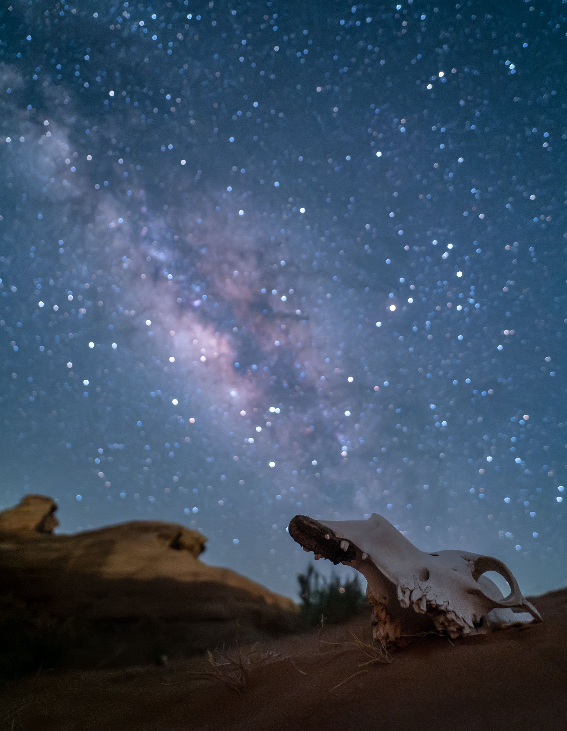
Another arch was on the cards for the following night, in fact, there are two different ones in this spot just a hundred meters apart. Paradise of rock formations!


Luckily there were a few cats around for company while one waits for the camera to finish taking 3 hours of exposures…
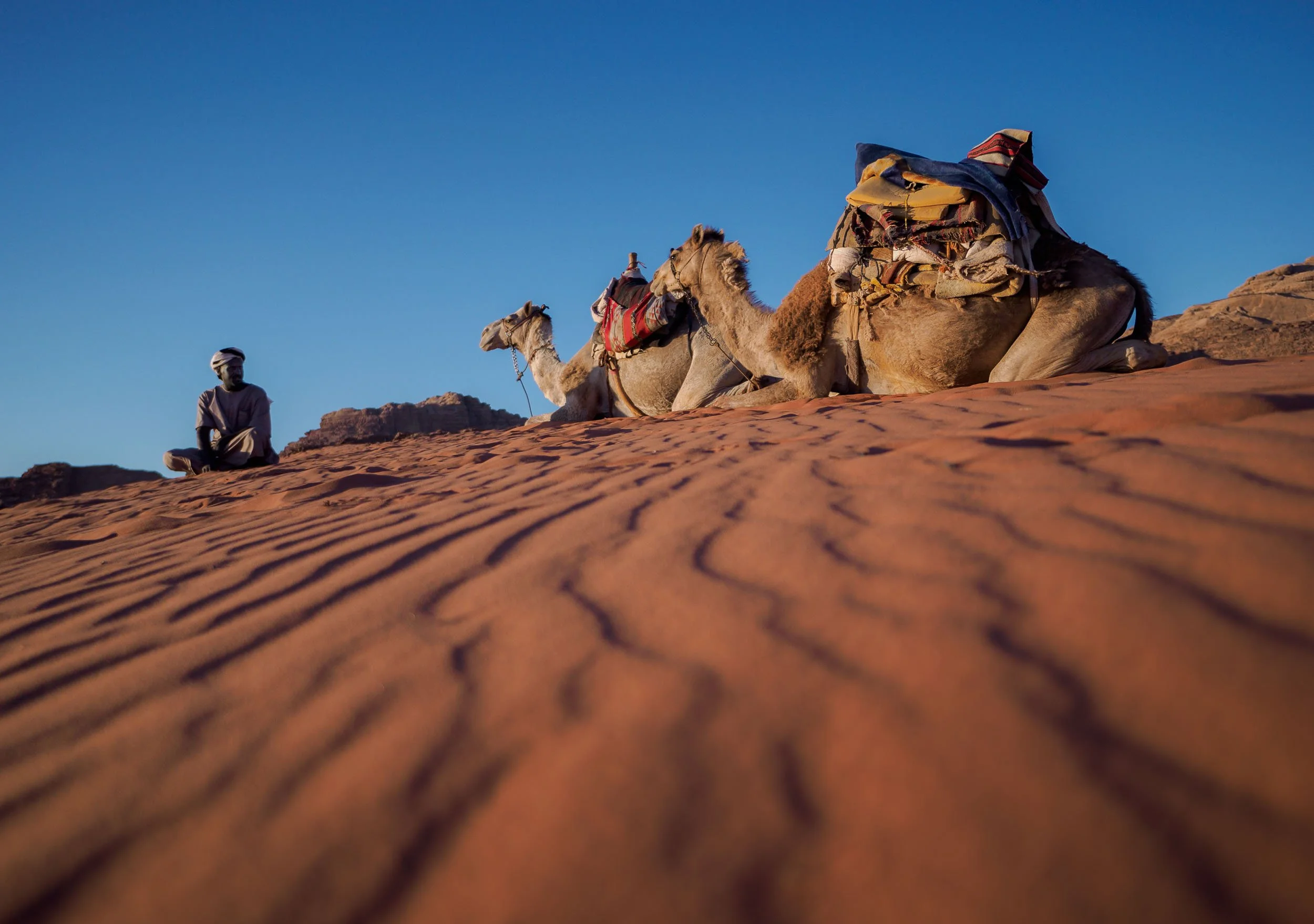
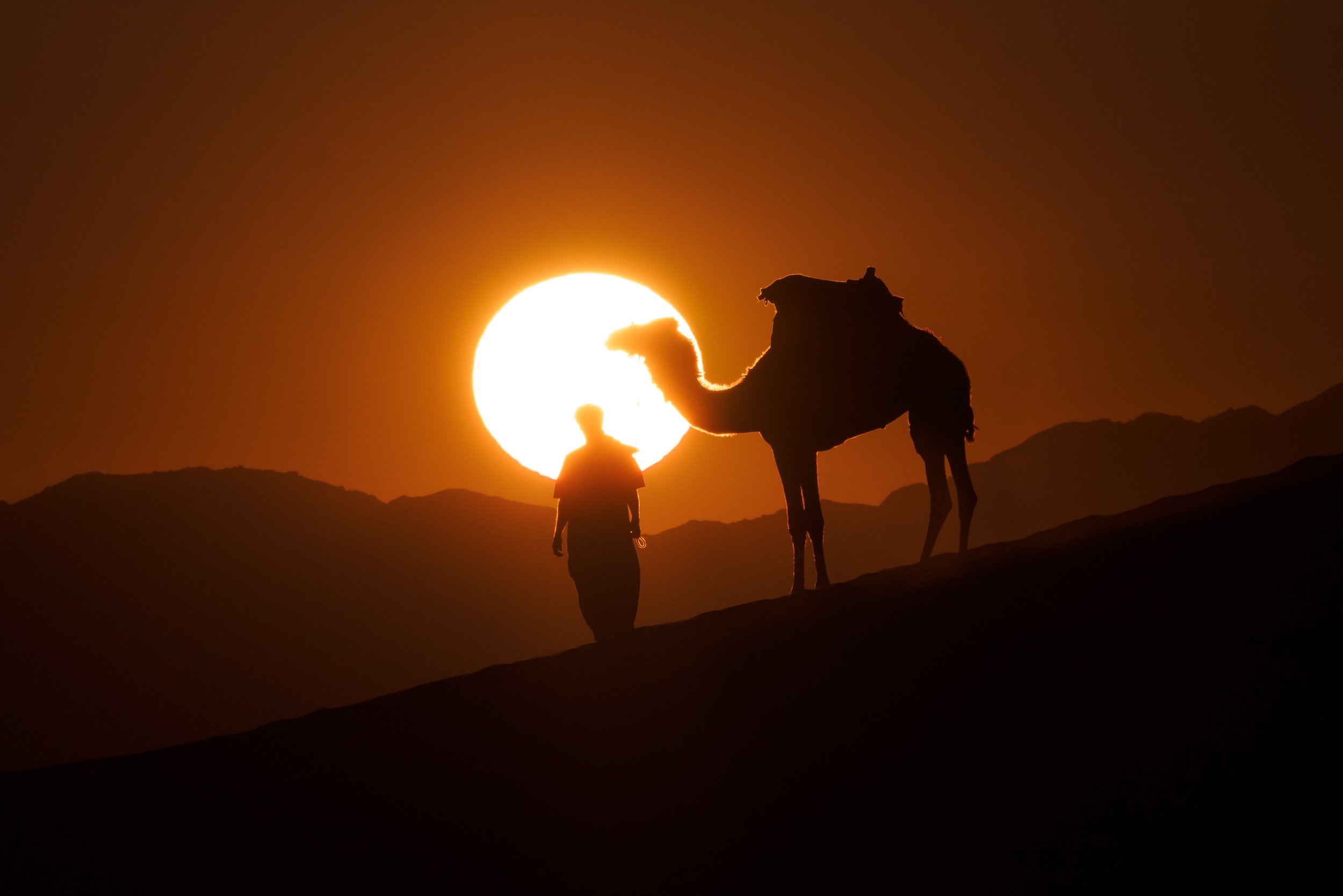
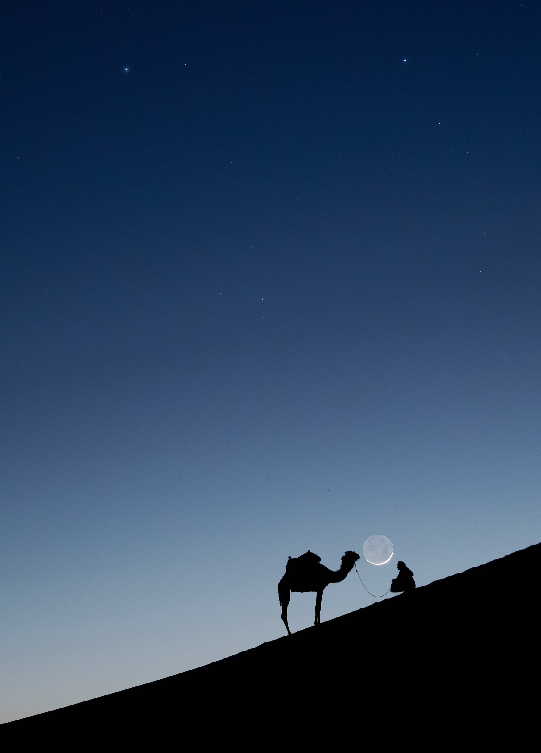
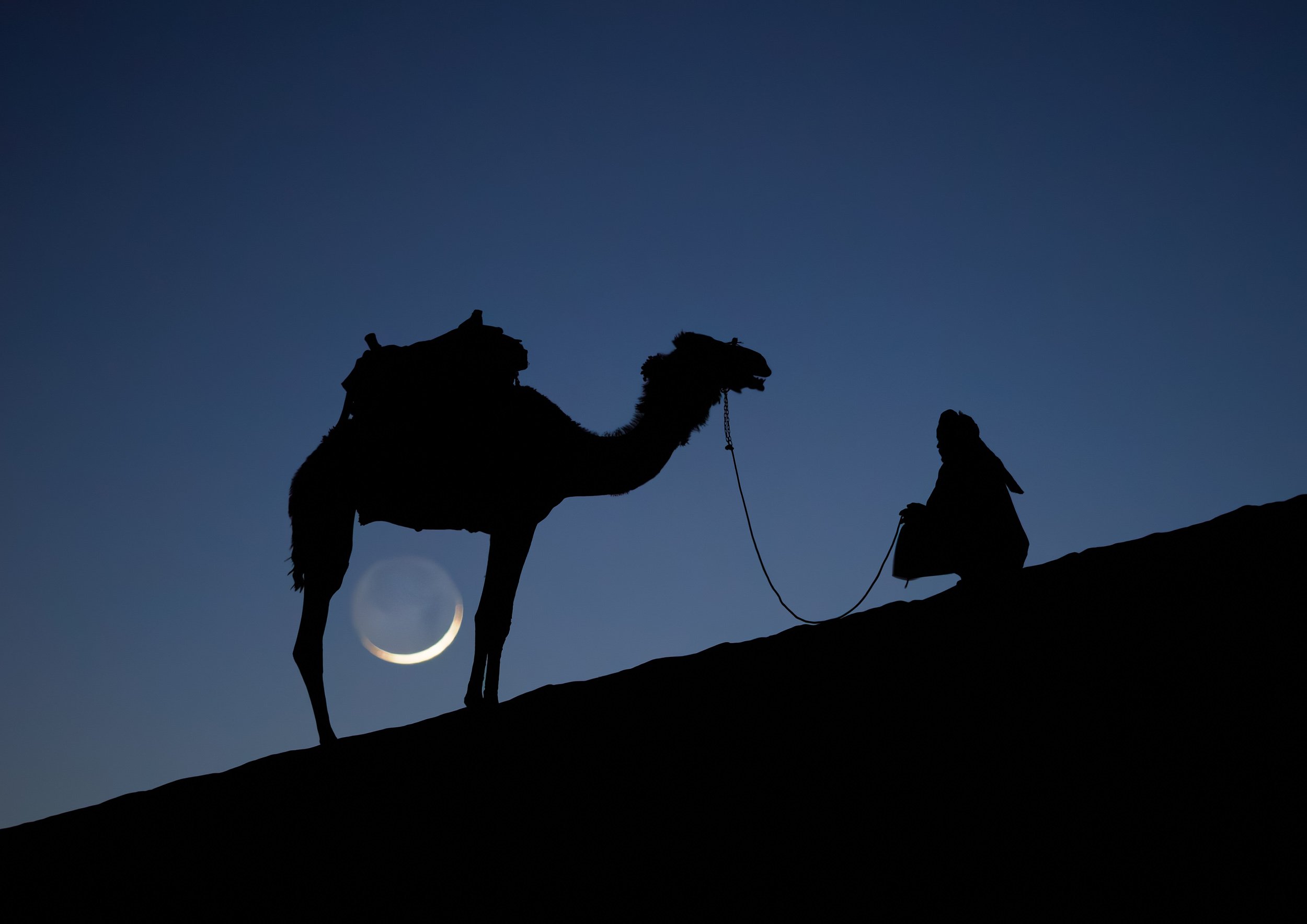
Our last night here was spent heading out to a few nearby dunes for sunset, joining our guides and their camels for dinner. The camel is a favorite animal of the Zalabieh bedouins that are resident here, and a symbol for male pride.


While I was off to take these photos, I set up another camera on my star tracker (the Benro Polaris) to take a timelapse sequence while the tracker was counteracting the rotation of the earth, effectively canceling it out and showing how our home planet makes its way through the galaxy.
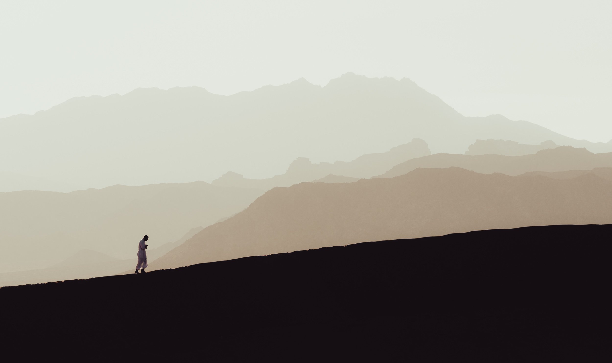
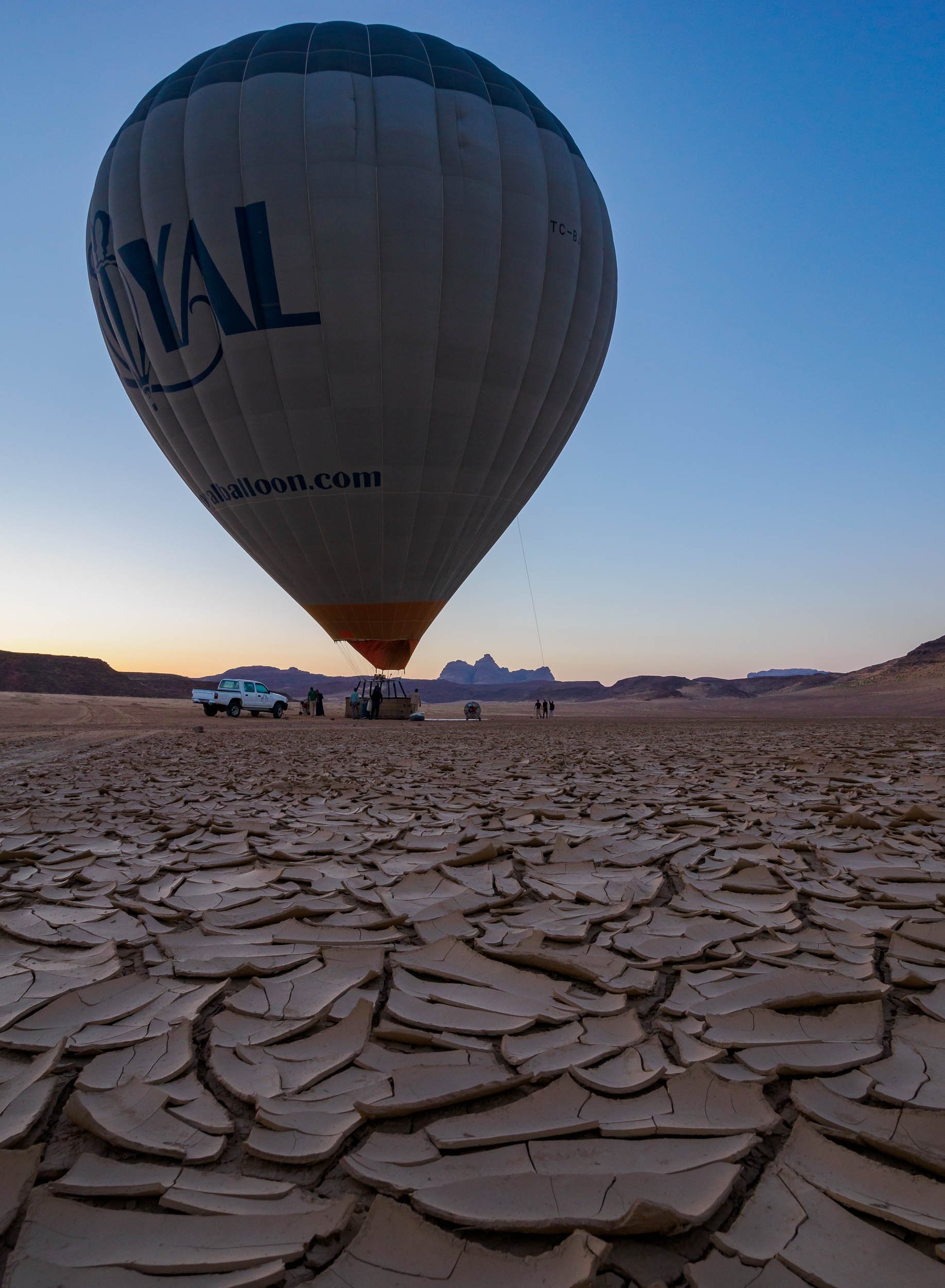
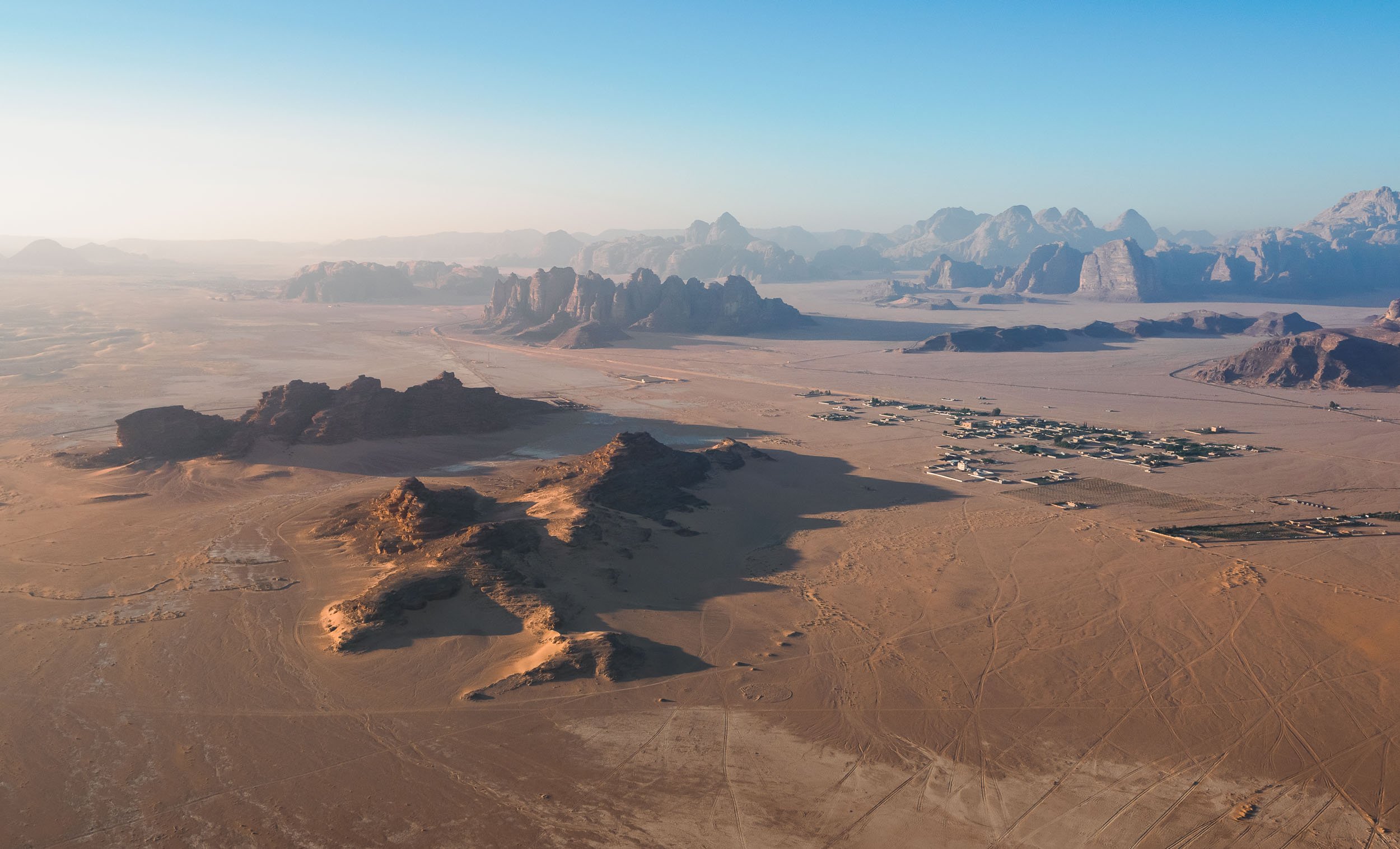
The Final Morning in Wadi Rum
While drones are not allowed without a (very difficult to get) permit from the government, luckily there are other ways to see places from above, which I took advantage of before having to leave this incredible landscape.

Back to the North
At this point I said goodbye to Benjamin and the group and continued the journey back into the northern parts of the country on my own, hoping to explore the ancient historic and a few more natural sites.


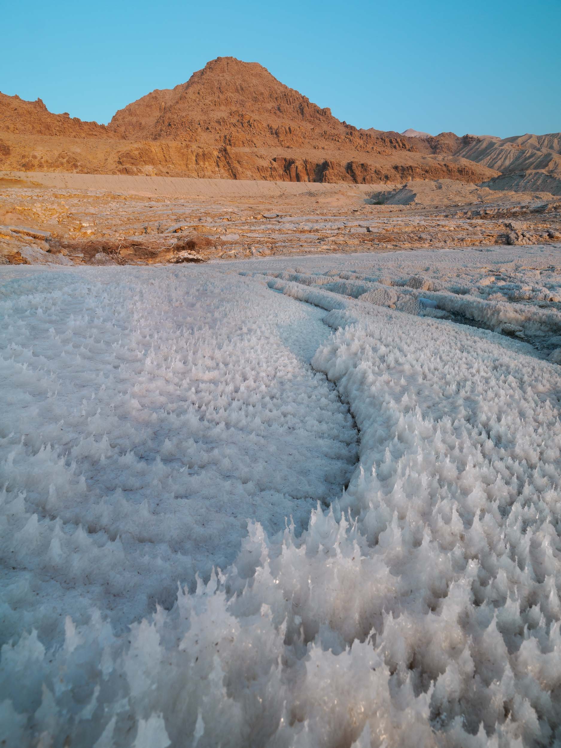
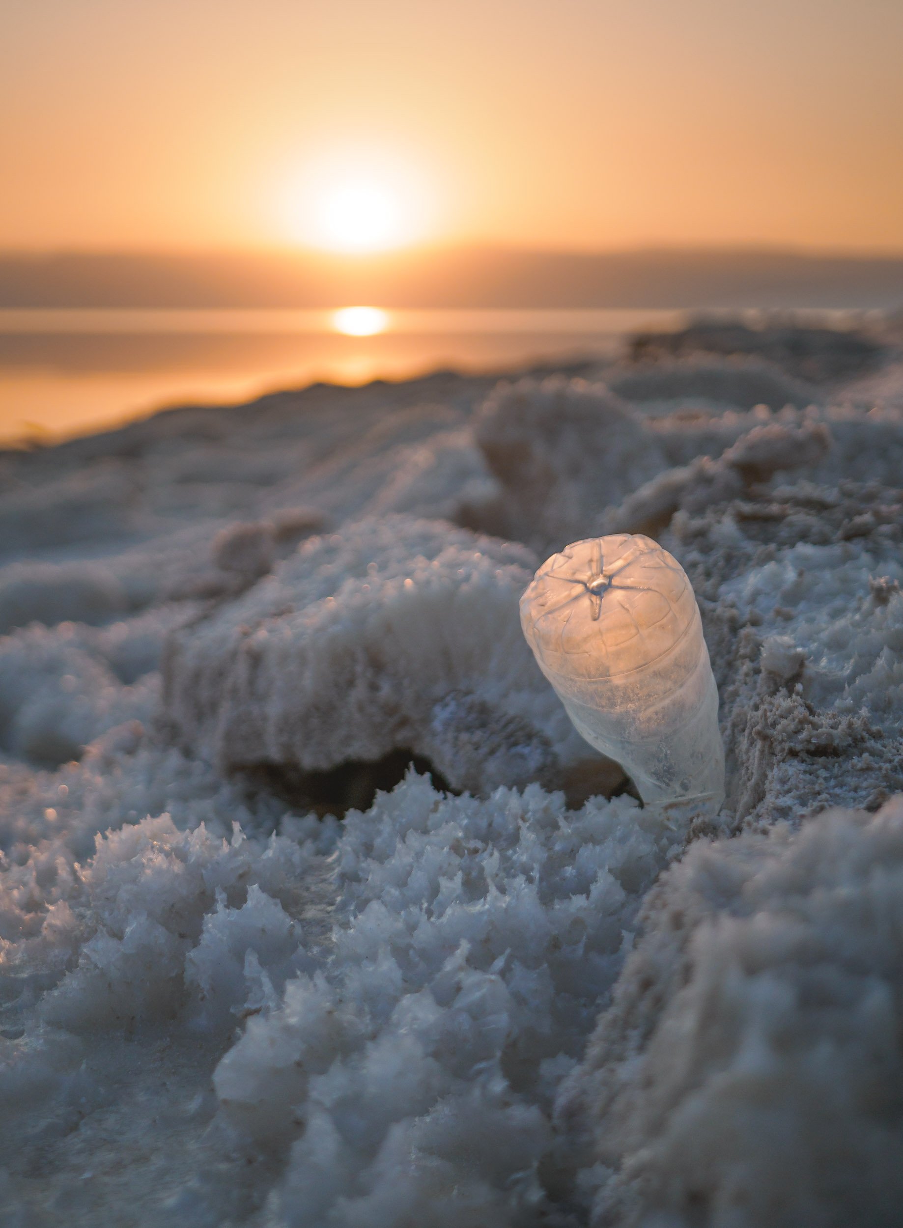
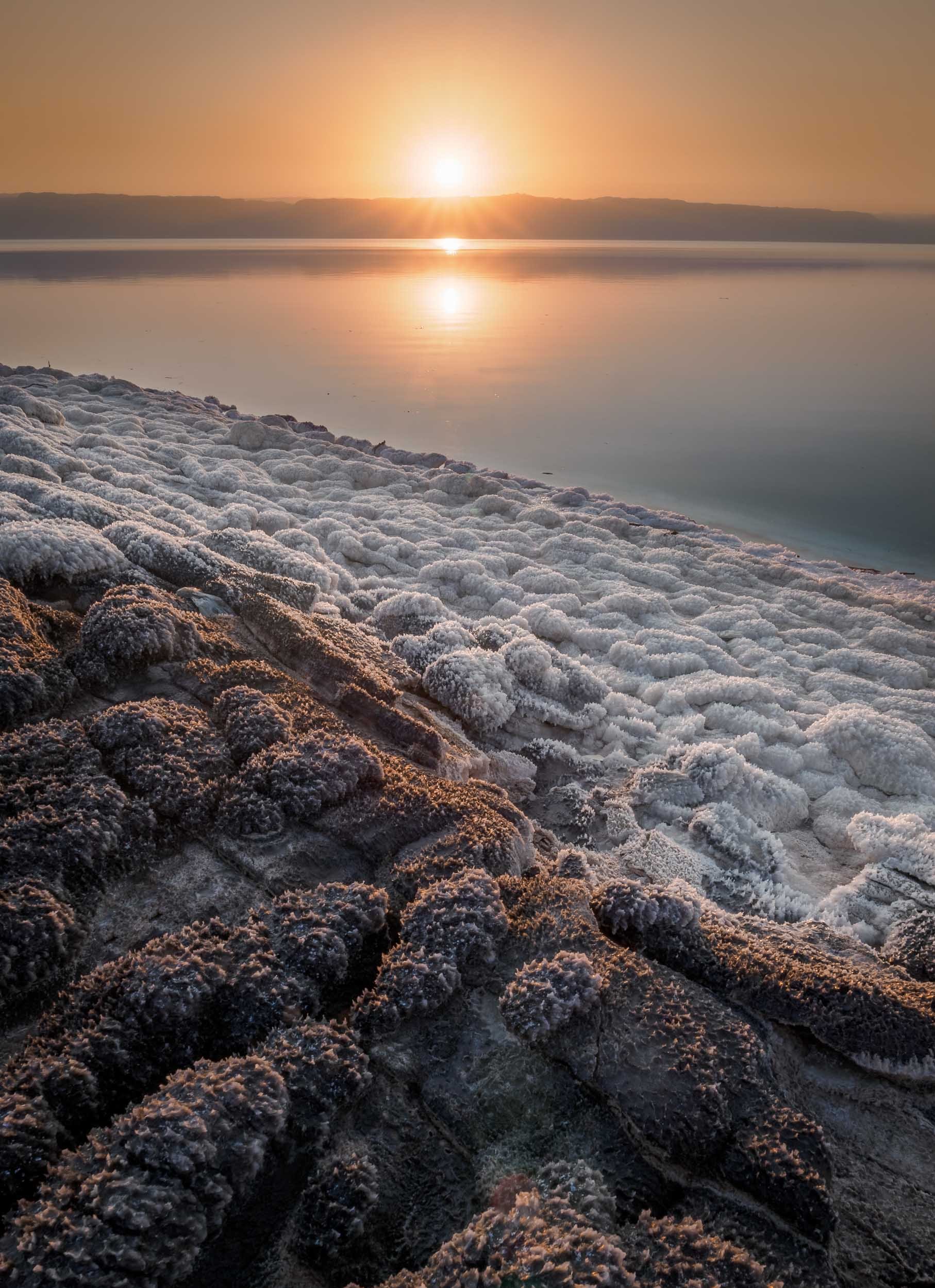
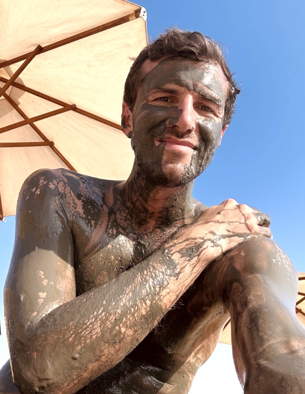
The Salty Sea
Heading back south, my next destination was the Dead Sea - one of the world’s saltiest water bodies and the lowest point on earth, at almost 450m below actual sea level. The water level falls at an alarming rate, dropping around 1 meter per year. Its high level of salinity (more than 10 times of a normal ocean) means there is no life to be found in and around it, and that swimming is more like floating - you can’t sink here.
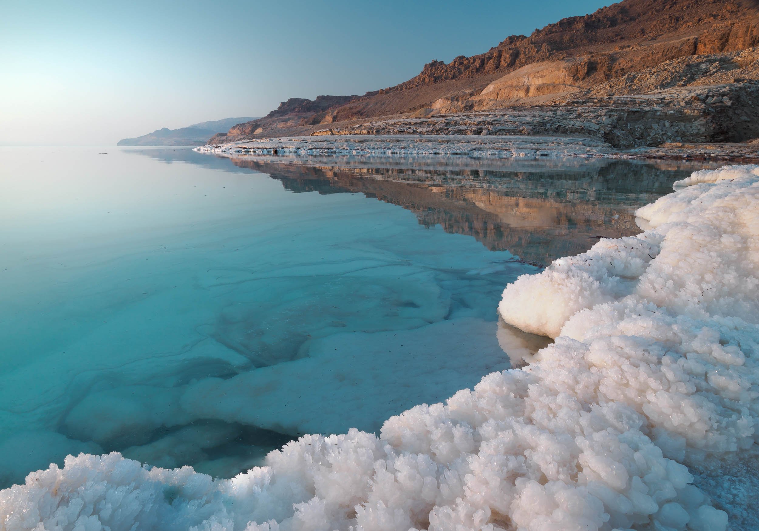
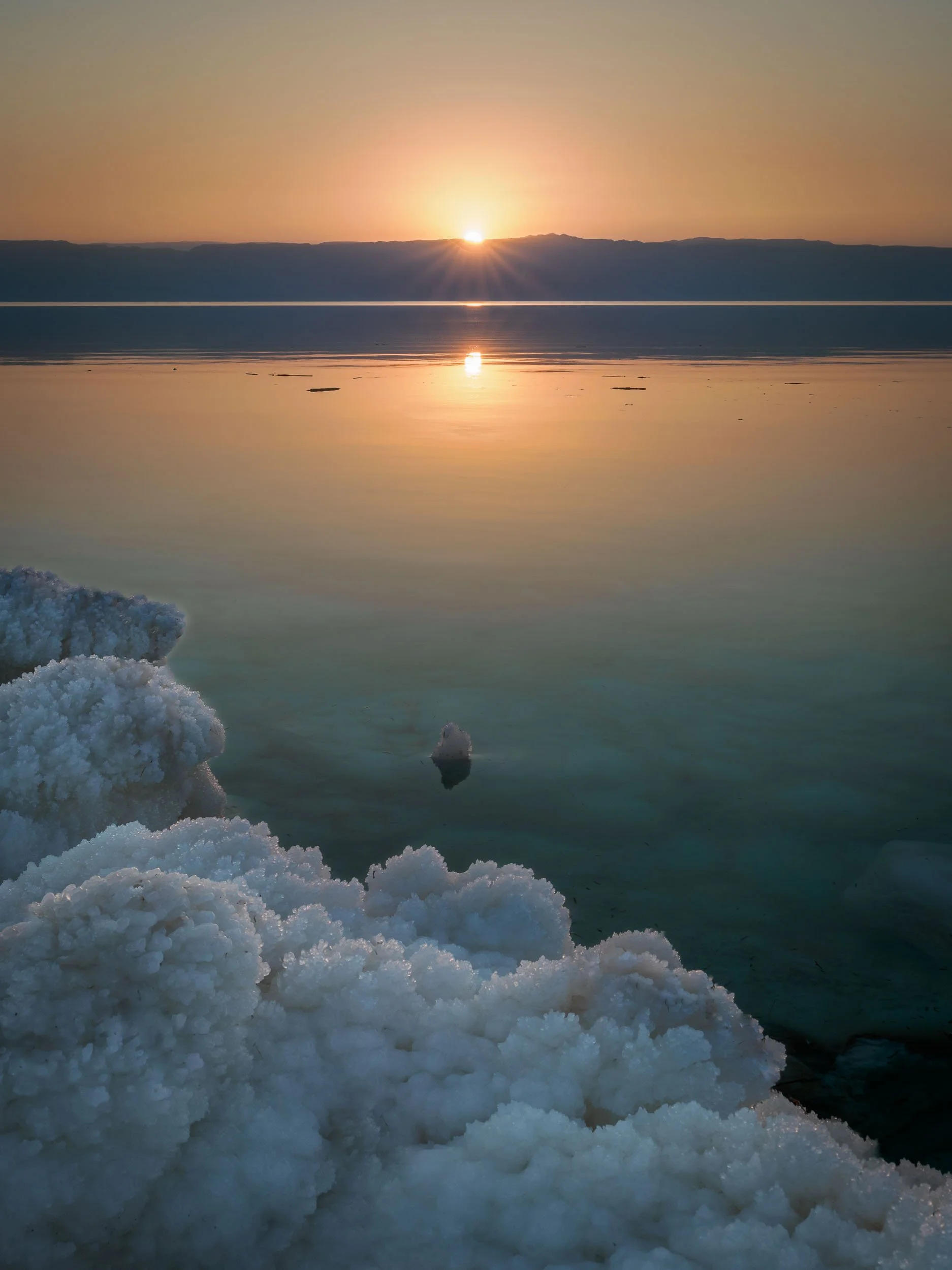

While originally a single body of water until the 1970s, the southern section of the Dead Sea (which is in fact a lake) is now completely separated from the northern part, and divided into commercially used evaporation pools to extract and produce chloride. The future of the northern part is not clear, some say it will eventually dry up completely, others believe this is unlikely due to the continued inflow of water, and the reducing evaporation rate that will eventually match the inflow. Commercial projects to save the lake at its current levels, such as a canal from the Red Sea, have been announced but never actually made significant progress.

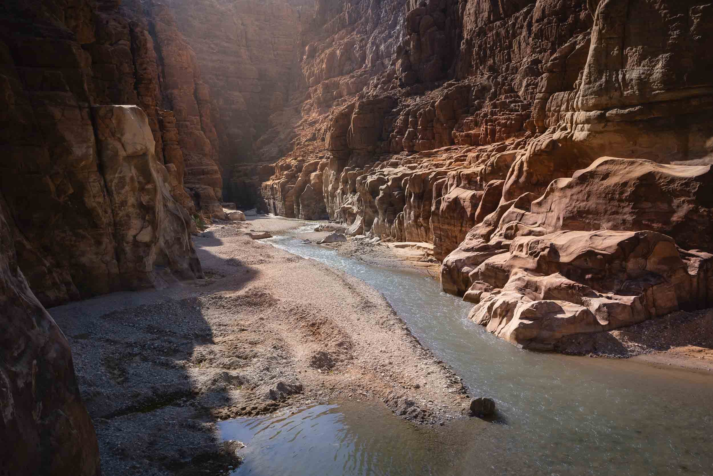
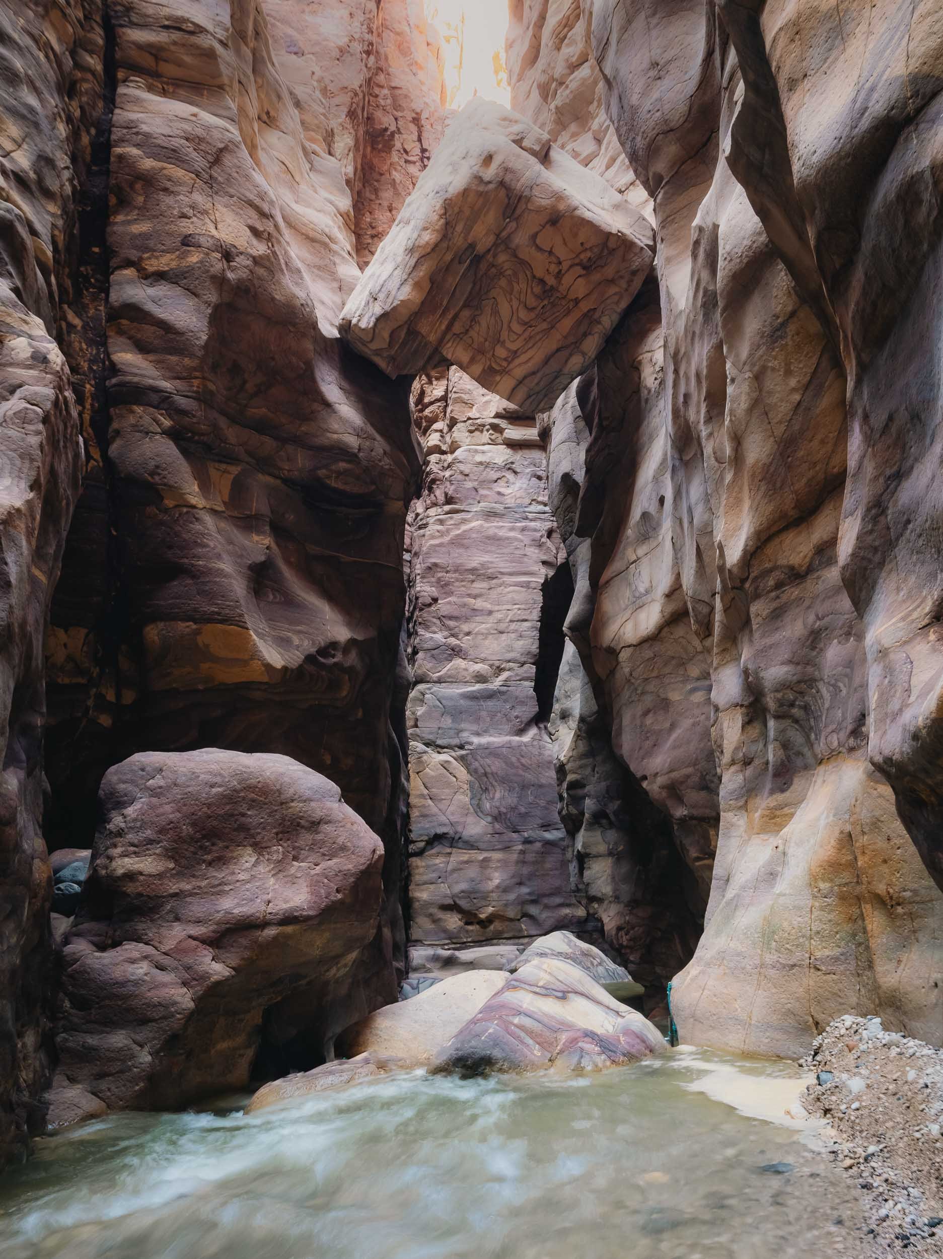
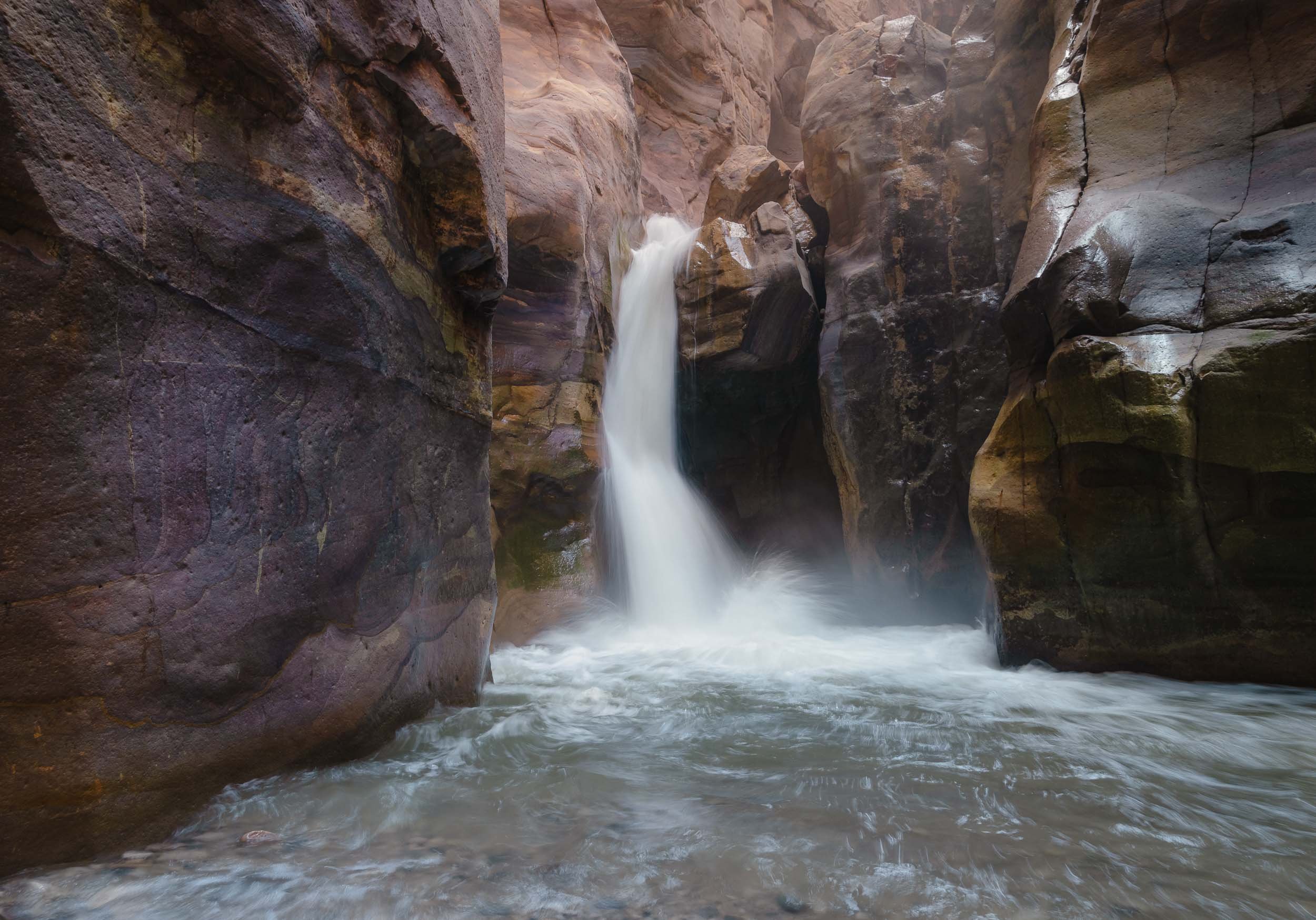
Wadi Mujib
On the shores of the Dead Sea lies a beautiful biosphere reserve around a river that empties into the lake, with options for hiking and canyoning.


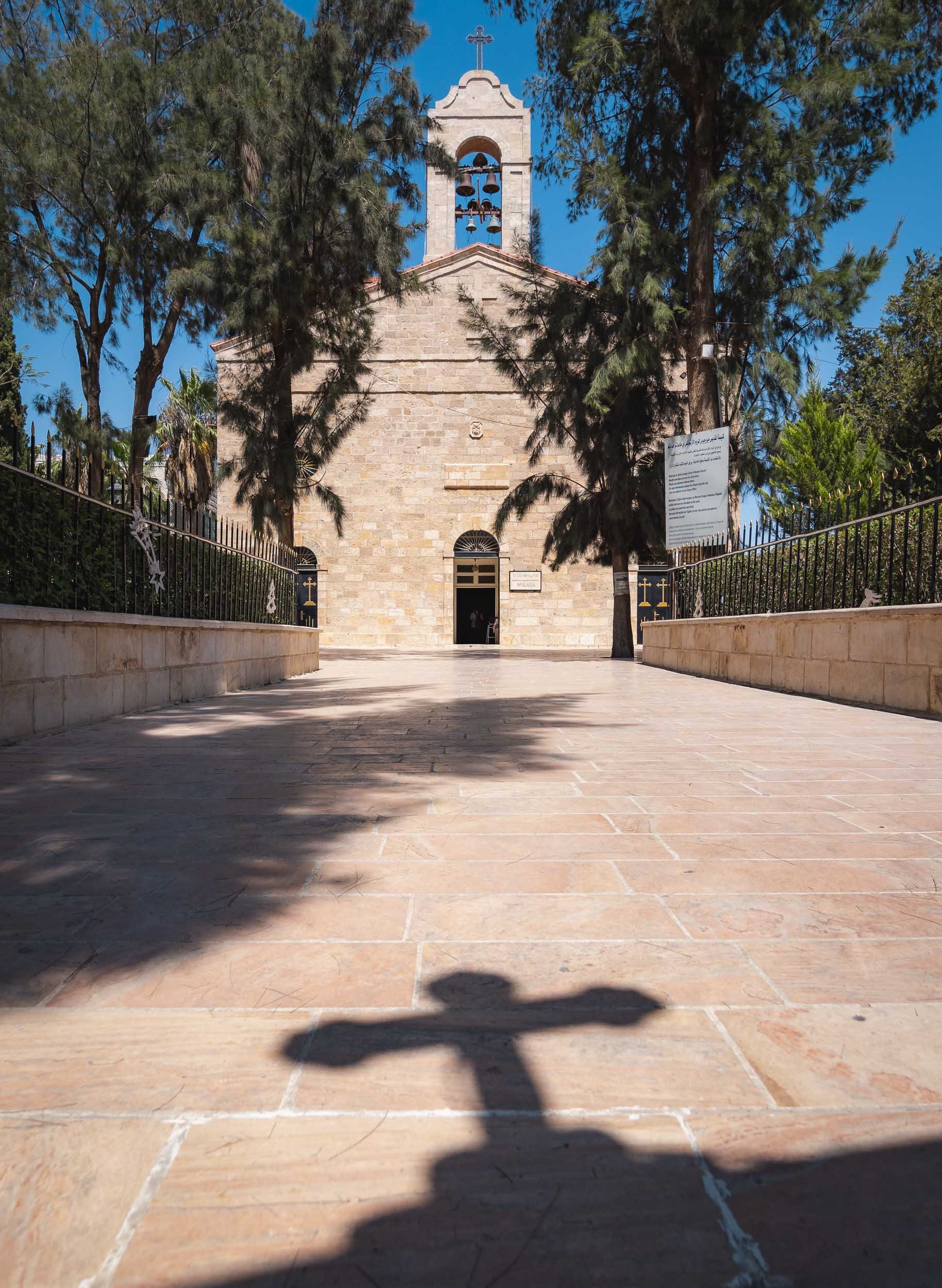


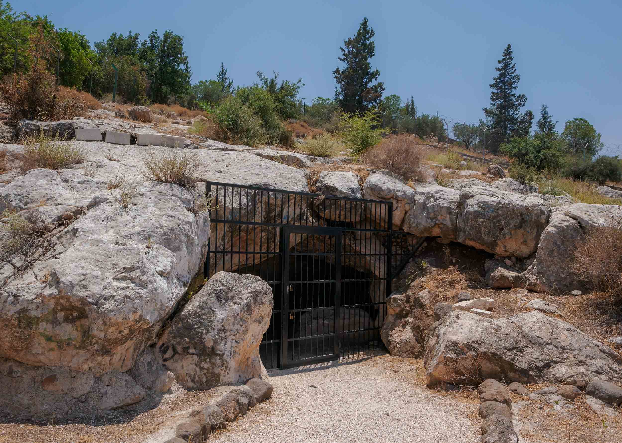
It's this 6th century map of the Holy Land, which represents the oldest surviving overview of the area, including old Jerusalem seen above. The representation was shown to be very accurate, occasionally even guiding excavations and research in certain areas.
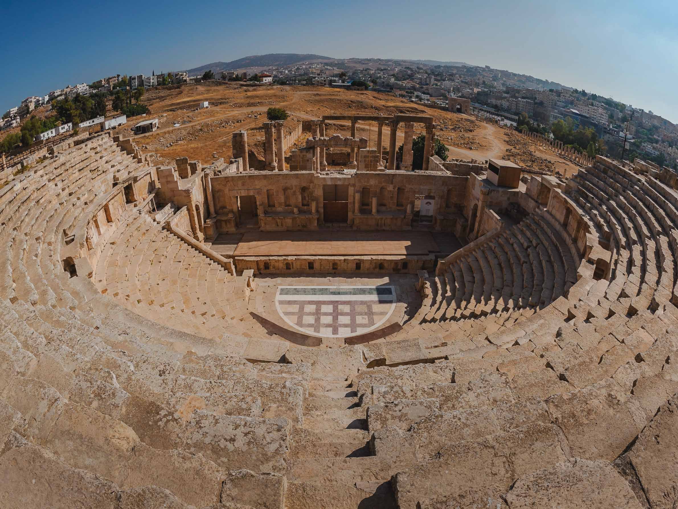
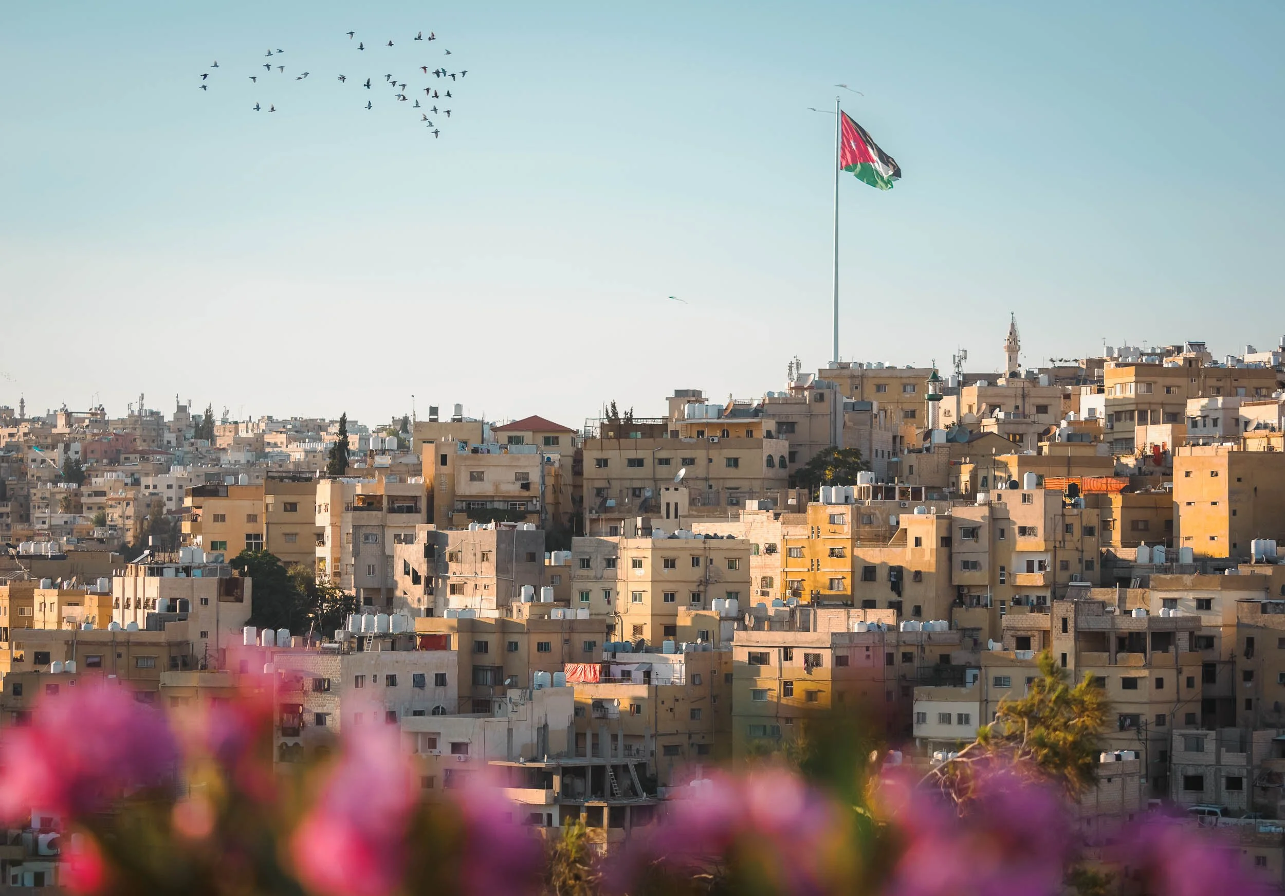
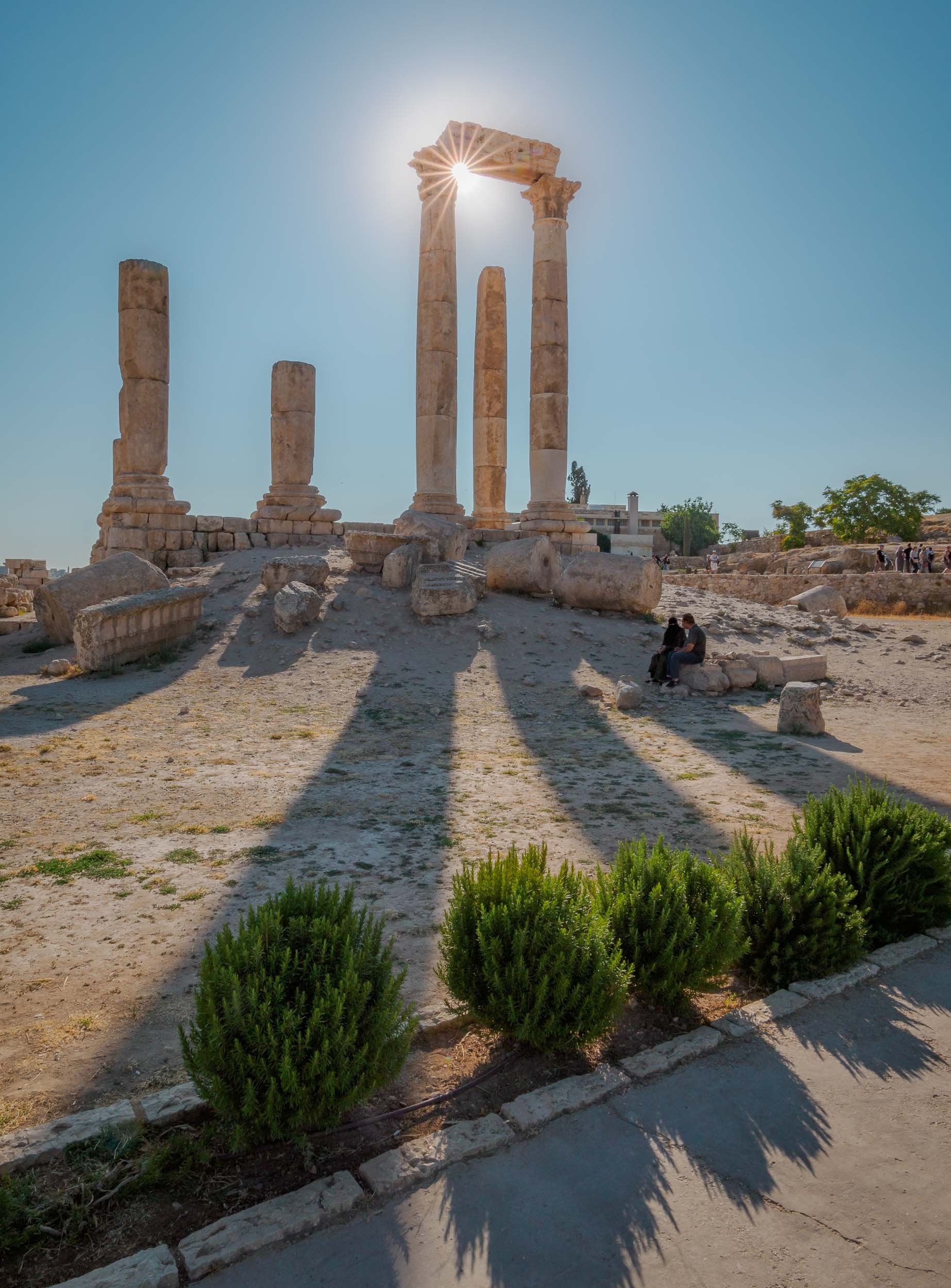
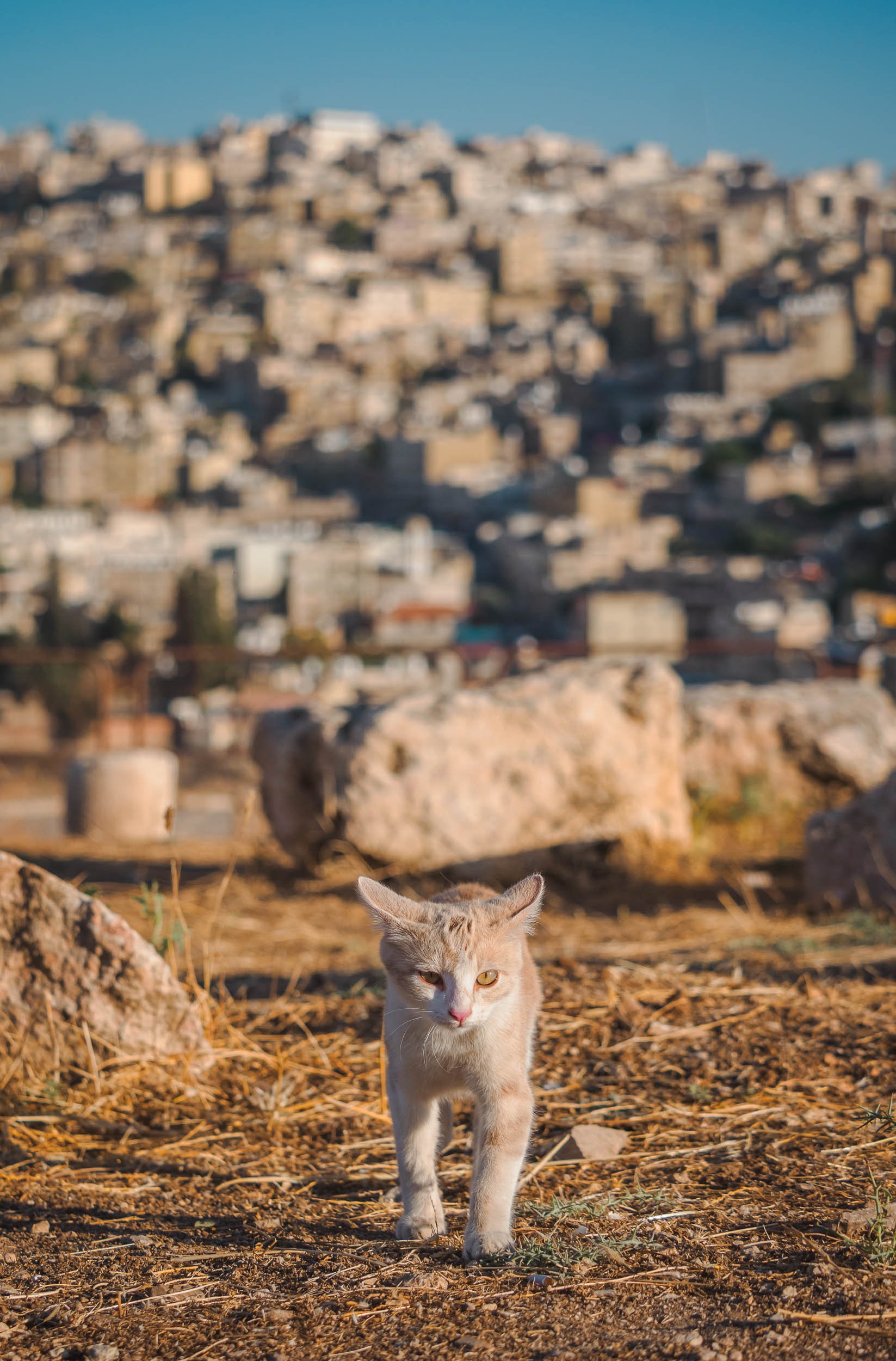
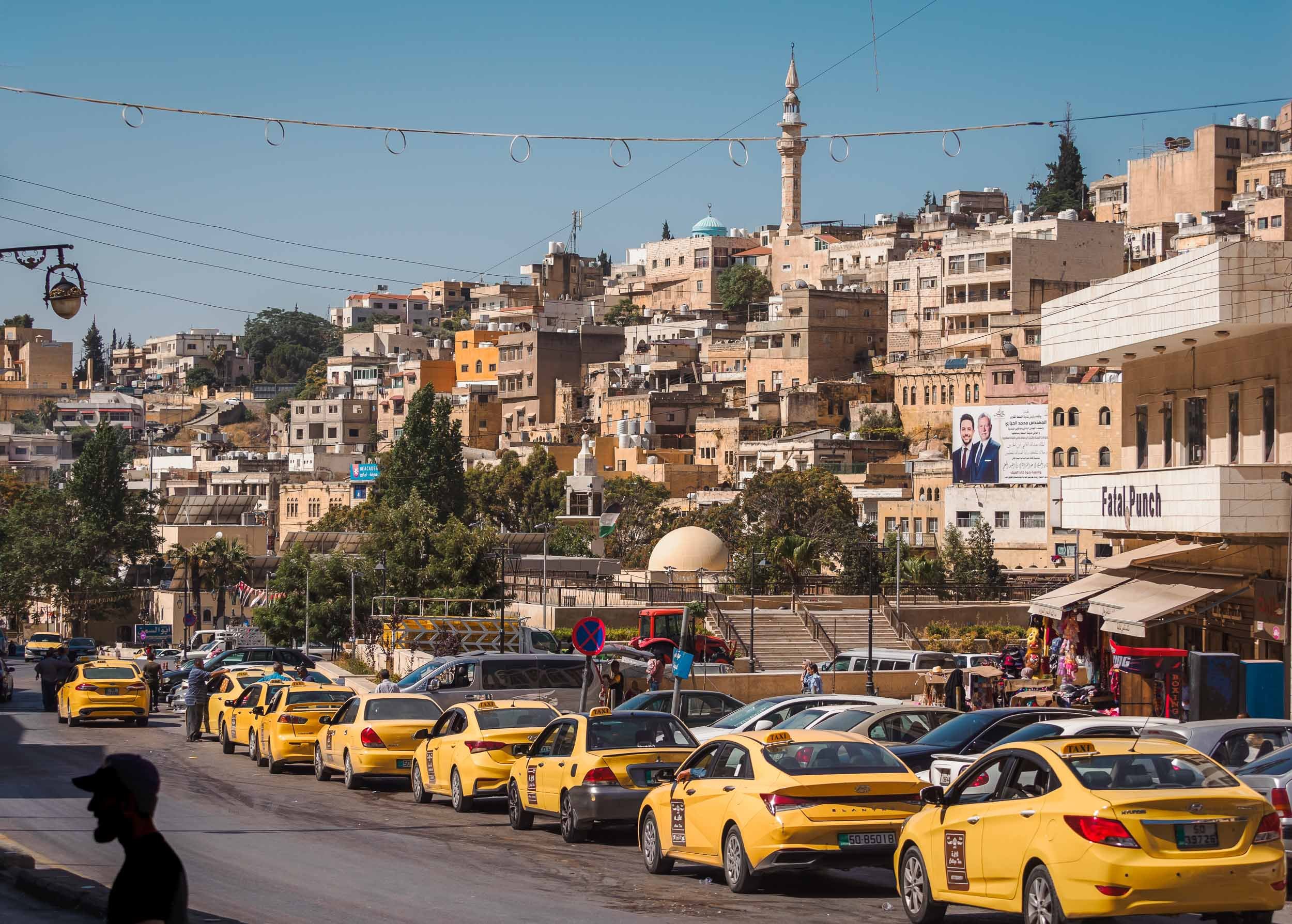
Glimpses of Amman
I didn’t spend all that much time in Jordan’s capital, but of course had explore the citadel towering over the slopes that Amman has evolved on - originally, the city was built on seven hills. Excavations in the area found evidence of settlements dating back all the way to the Bronze Age, 4000 years ago.


Final Stop


And that was my trip to Jordan - as always, you can subscribe for the next updates here or take a look at some of my favorite photos in my Portfolio. If any of the images here catch your eye and you think they’d make for a good piece of art on your wall, I make custom signed prints, just get in touch!


Palawan - Gem of the Philippines
Earlier this year I spent a few weeks in the Philippines, exploring Manila, Siargao, Cebu, Bohol, and what was once voted the most beautiful island in the world: Palawan.

Earlier this year I spent a few weeks in the Philippines, exploring Manila, Siargao, Cebu, Bohol, and what was once voted the most beautiful island in the world: Palawan. This large island is home to around 1m people and lies on the very western border of the country.
Start with this short clip for an overview of some of the amazing spots around Palawan!
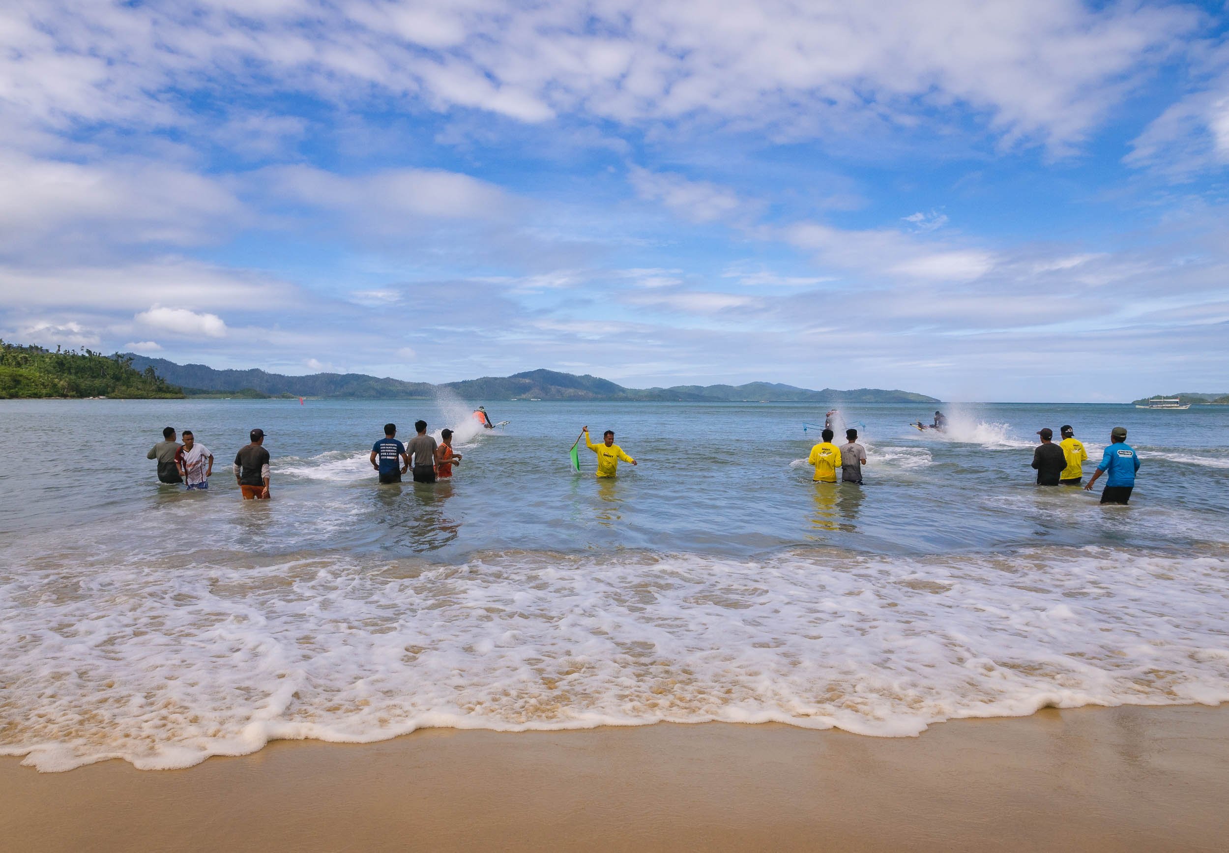
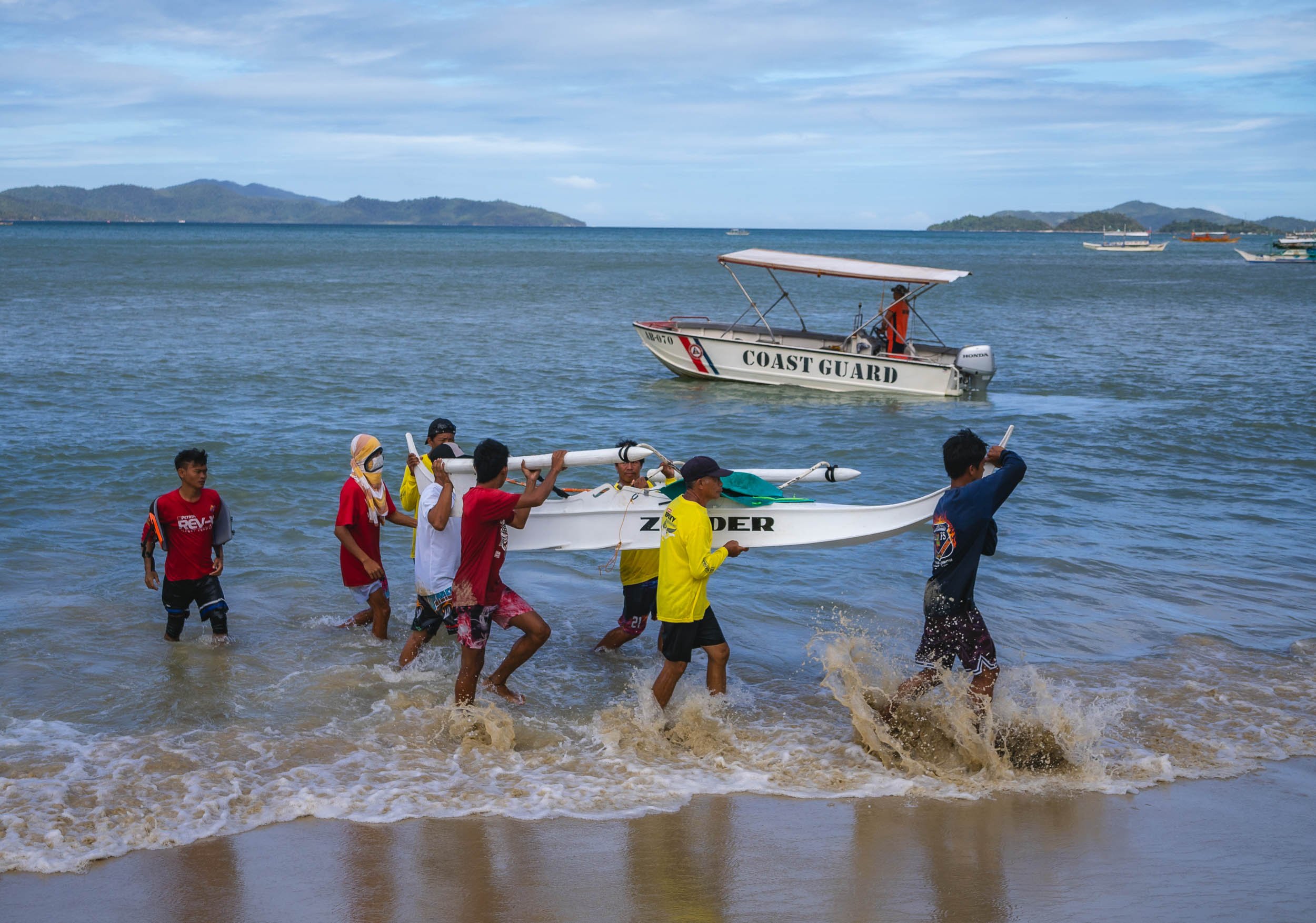
On the way to El Nido
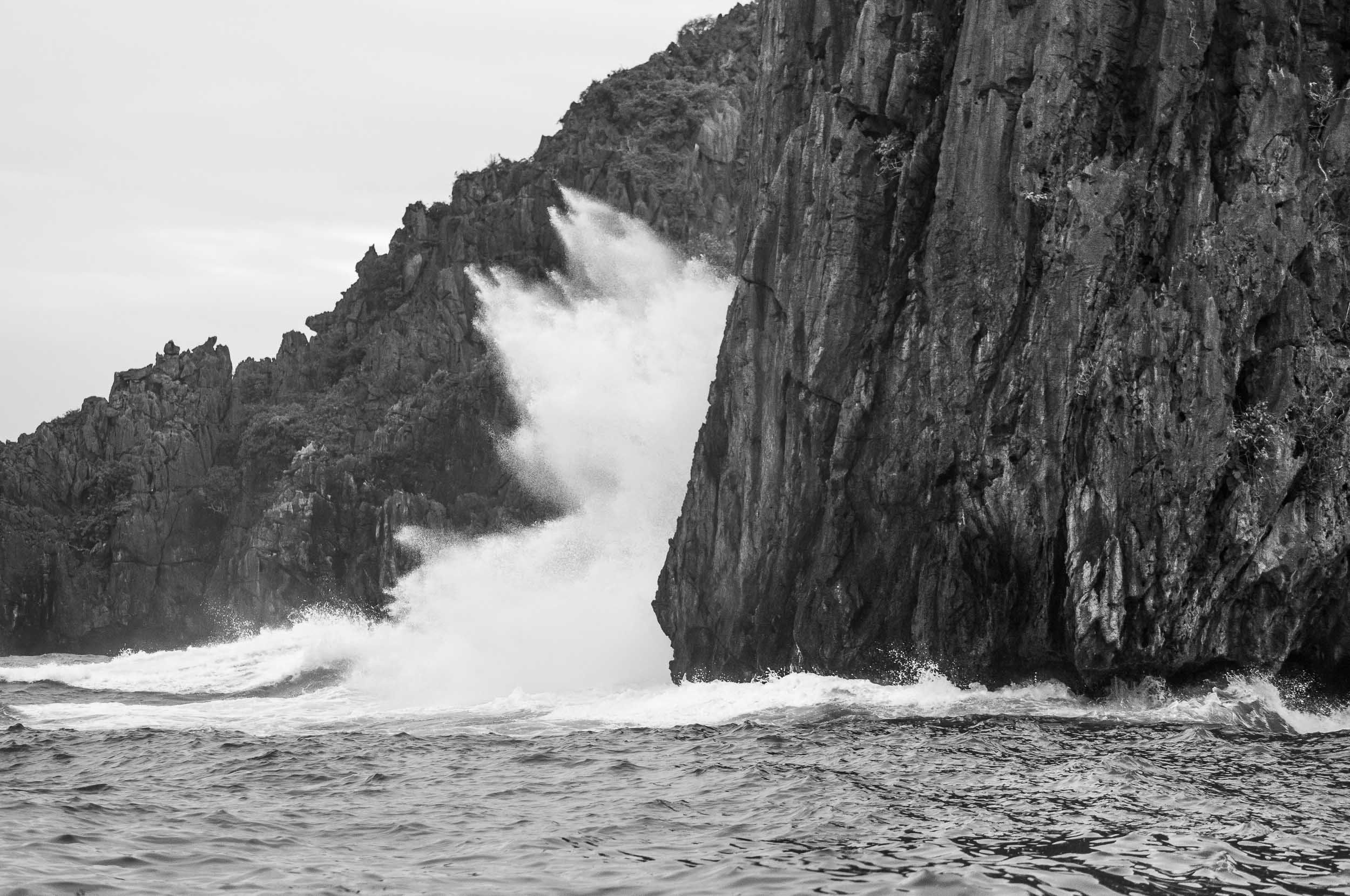
I arrived from Cebu, landing at the airport of Puerta Princesa, which is also the capital and largest city on the island. The plan was to go north towards El Nido, the most well-known area. On the way, a visit to the island’s famous underground river was on the cards - which was cancelled by the coast guard due to high waves. This is not uncommon, keep it in mind and allow enough time to try again - which I managed to do, more on that later. Instead, we stopped in Barton Bay, on the western coast, for a small boat excursion, and got to witness an interesting local event: Racing homemade speed boats.


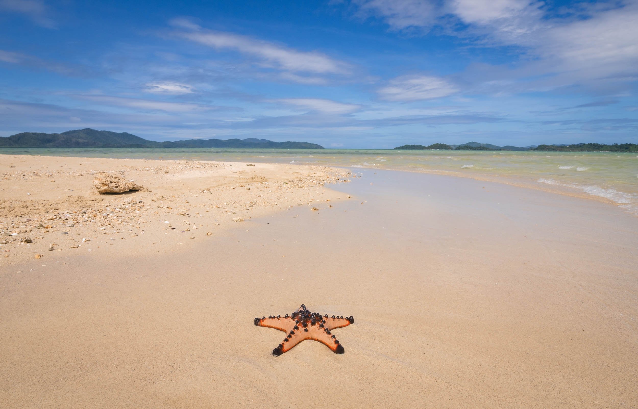
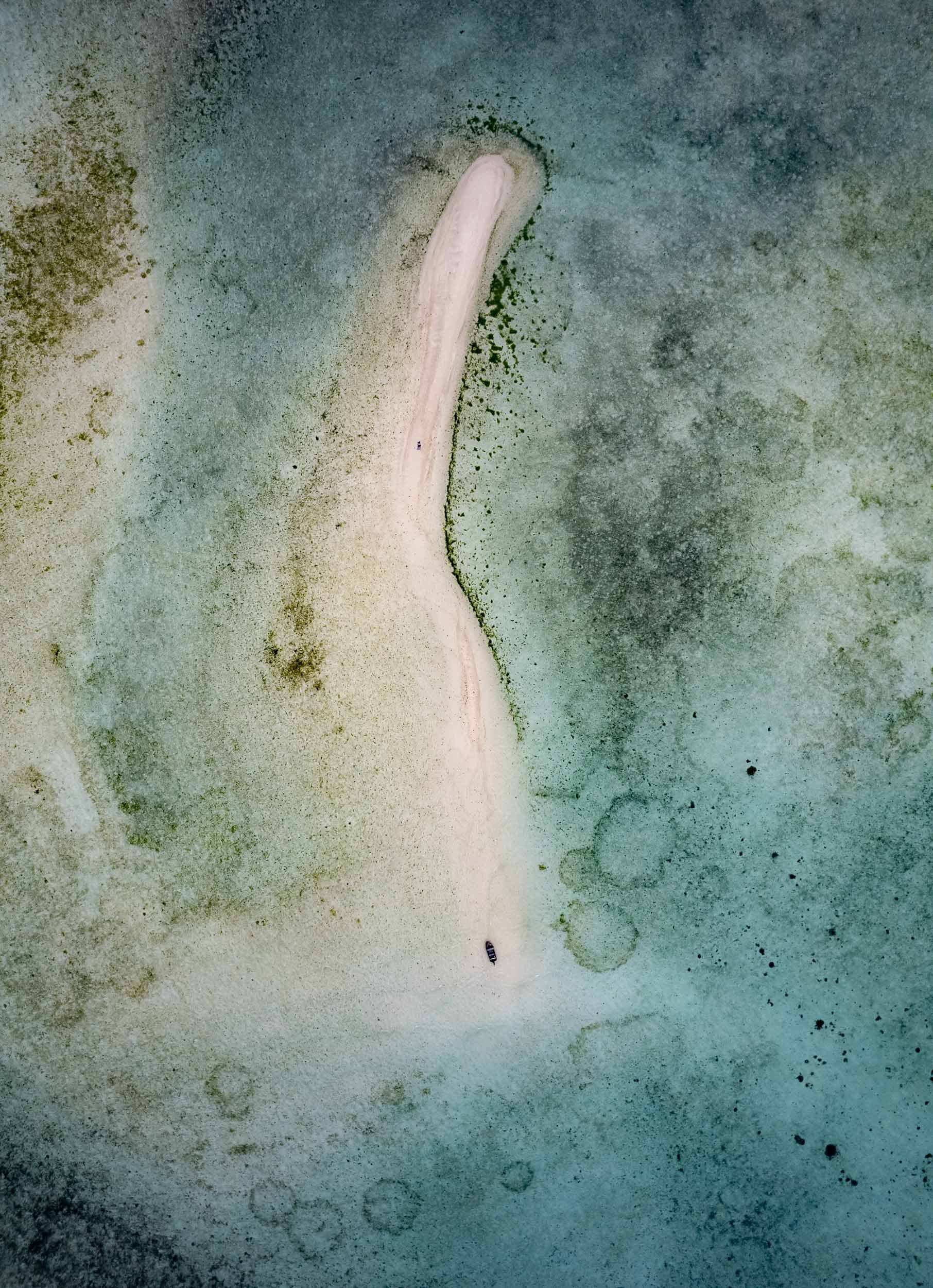
Port Barton is also home to a small sandbank that frequently sees starfish washed on shore, making for some picturesque scenes, especially if - like me - you’re patient enough to await the right moment with no boats and people around.


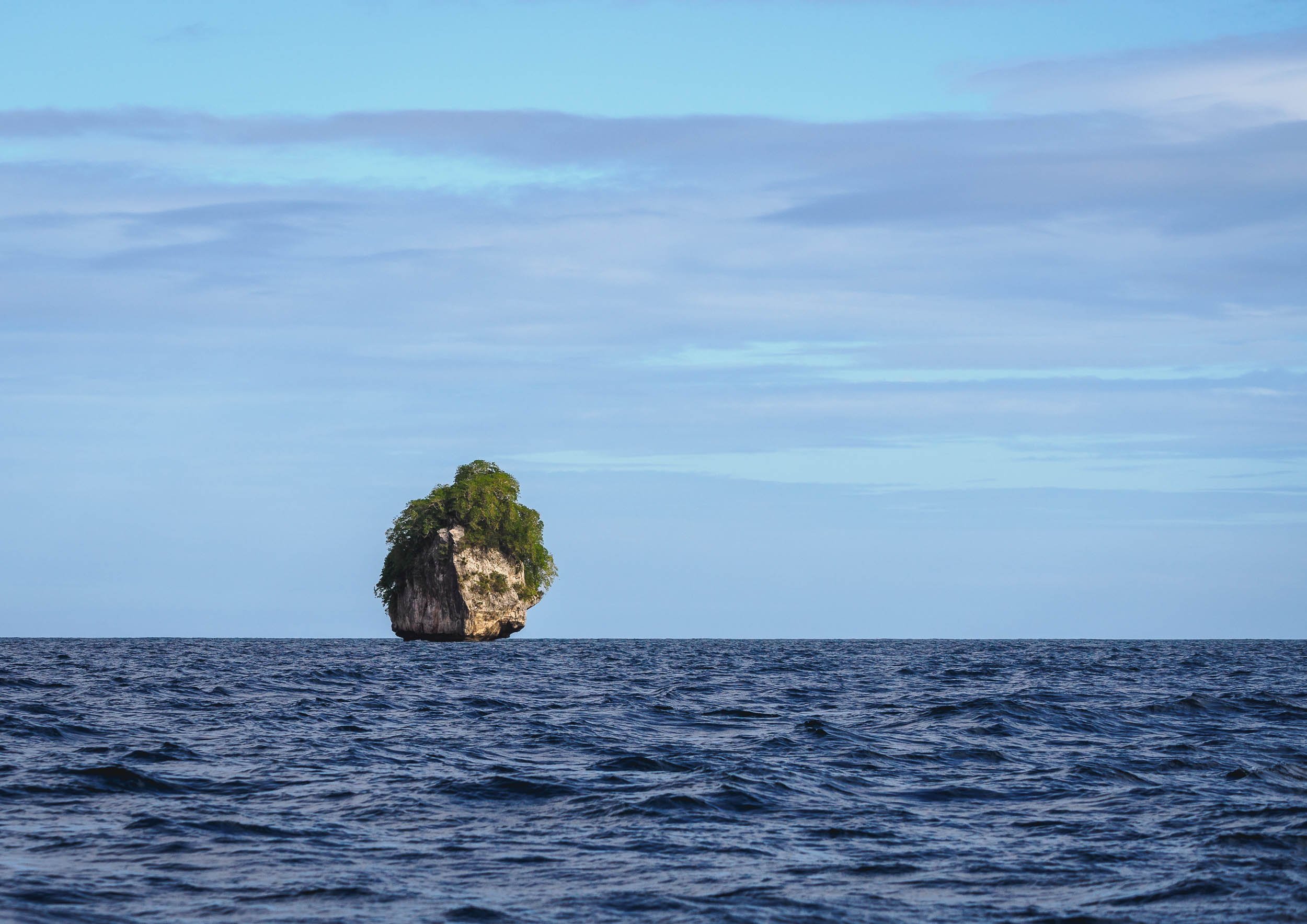
Island of Doom
The bay also has a few beautiful islands - one of which became the doom of my drone, which ended up with a low battery in the sea, as the heavy westerly winds didn't allow it to come back in time... Luckily my amazing tour company - more on that later - helped me get a rental for the rest of the trip. Palawan really needs to be seen from the air.


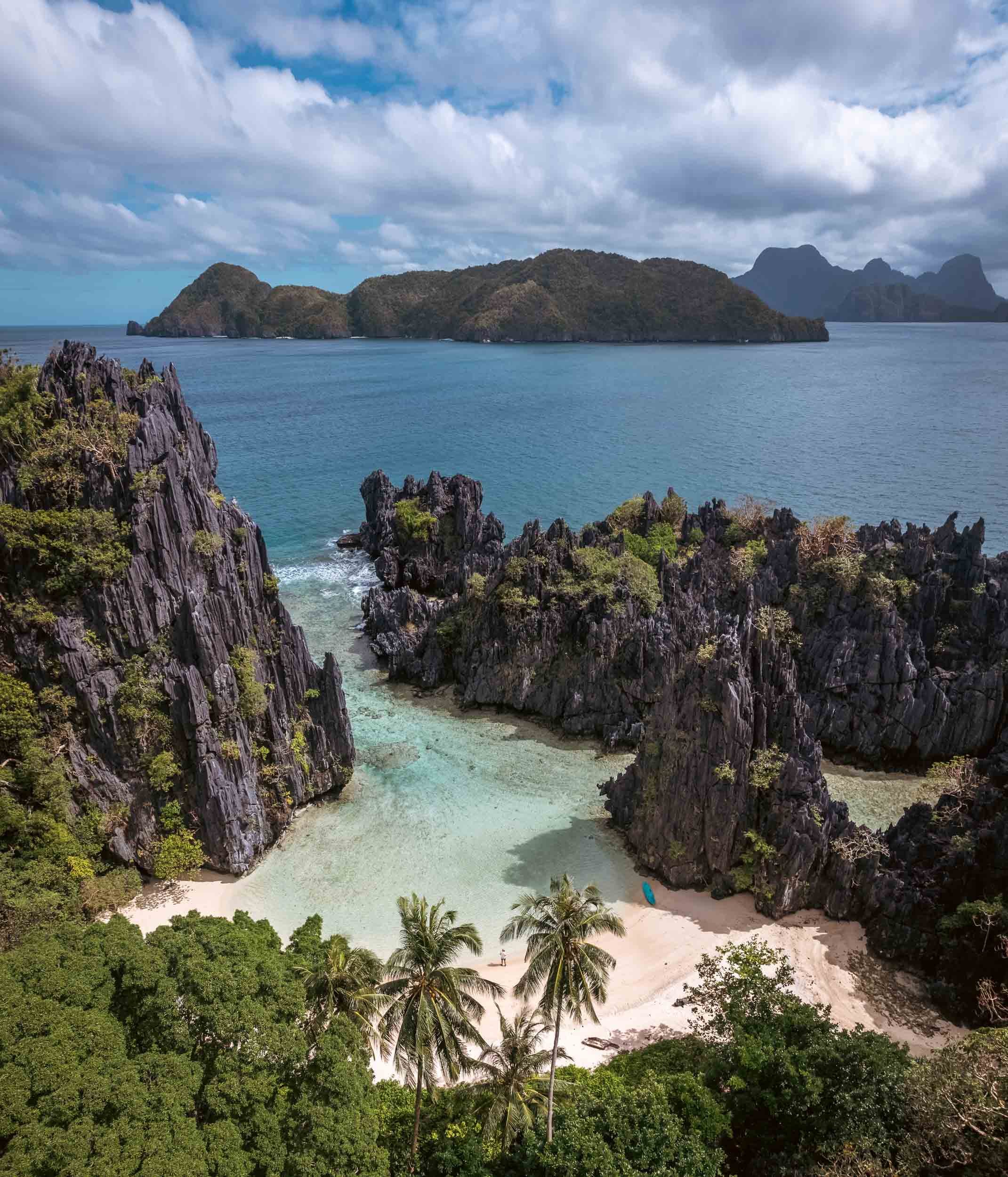
El Nido & The North
Some of the most beautiful land- and seascapes are in the northern parts of the main island, around El Nido. Having researched this area a bit, I knew that most of the very touristy trips follow standard routes, and you can pick A, B, C, or D. Obviously not what I wanted, because that means everyone going to the same places at roughly the same times, and those tours of course also start once people crawl out of their beds rather than at sunrise when the conditions are best and things quiet. So in my usual quest for something a bit more interesting I found a tour company priding themselves in organizing custom trips: Palaweña.
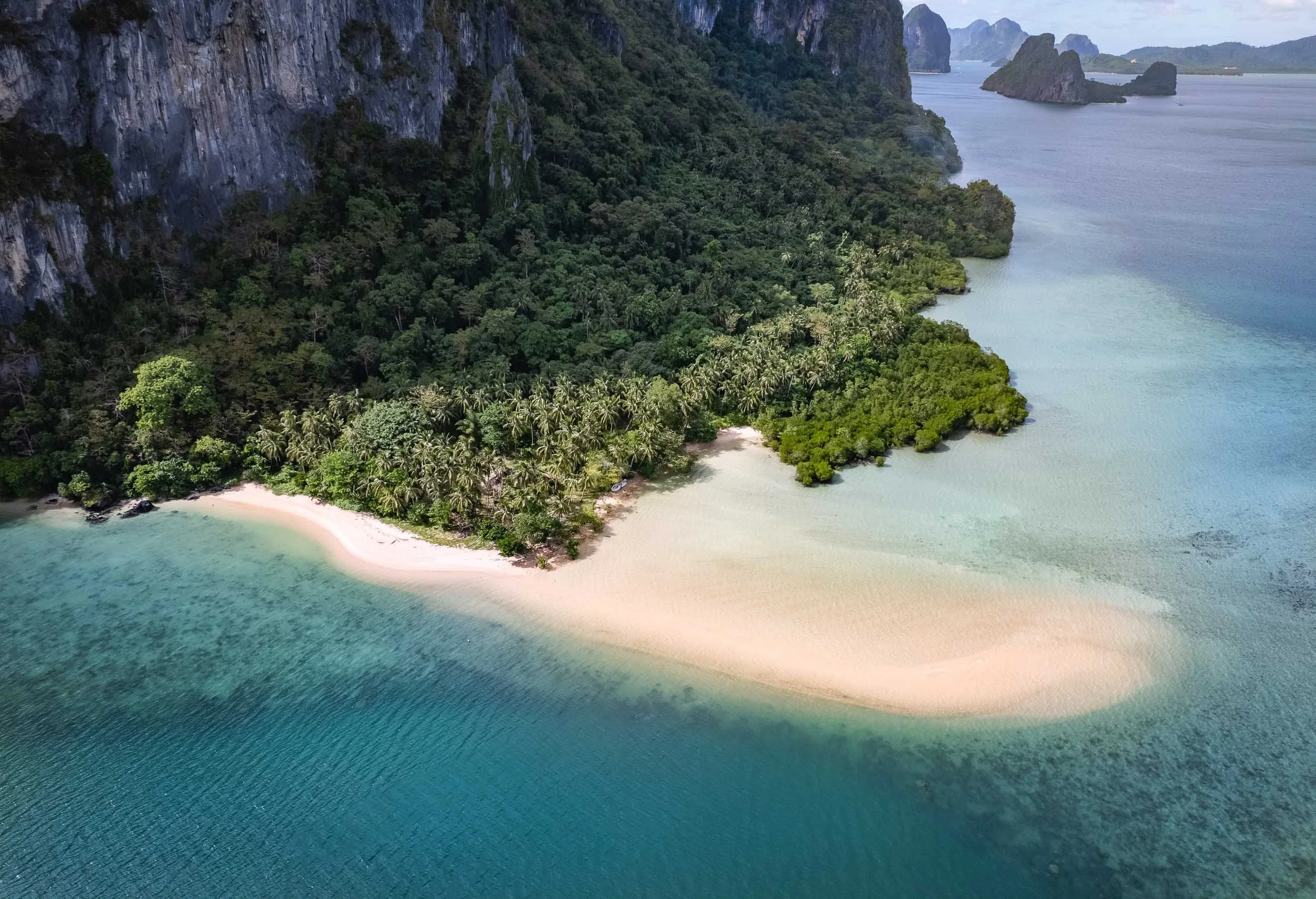
Palawan's landscape is famous for the almost 1800 islands scattered along the coast of the 450km long main island.

The private custom tours paid off (and were super well organized), because we reached many of the best spots around Bacuit Bay, such as the Big Lagoon and its beaches pictured above, before any other boats.


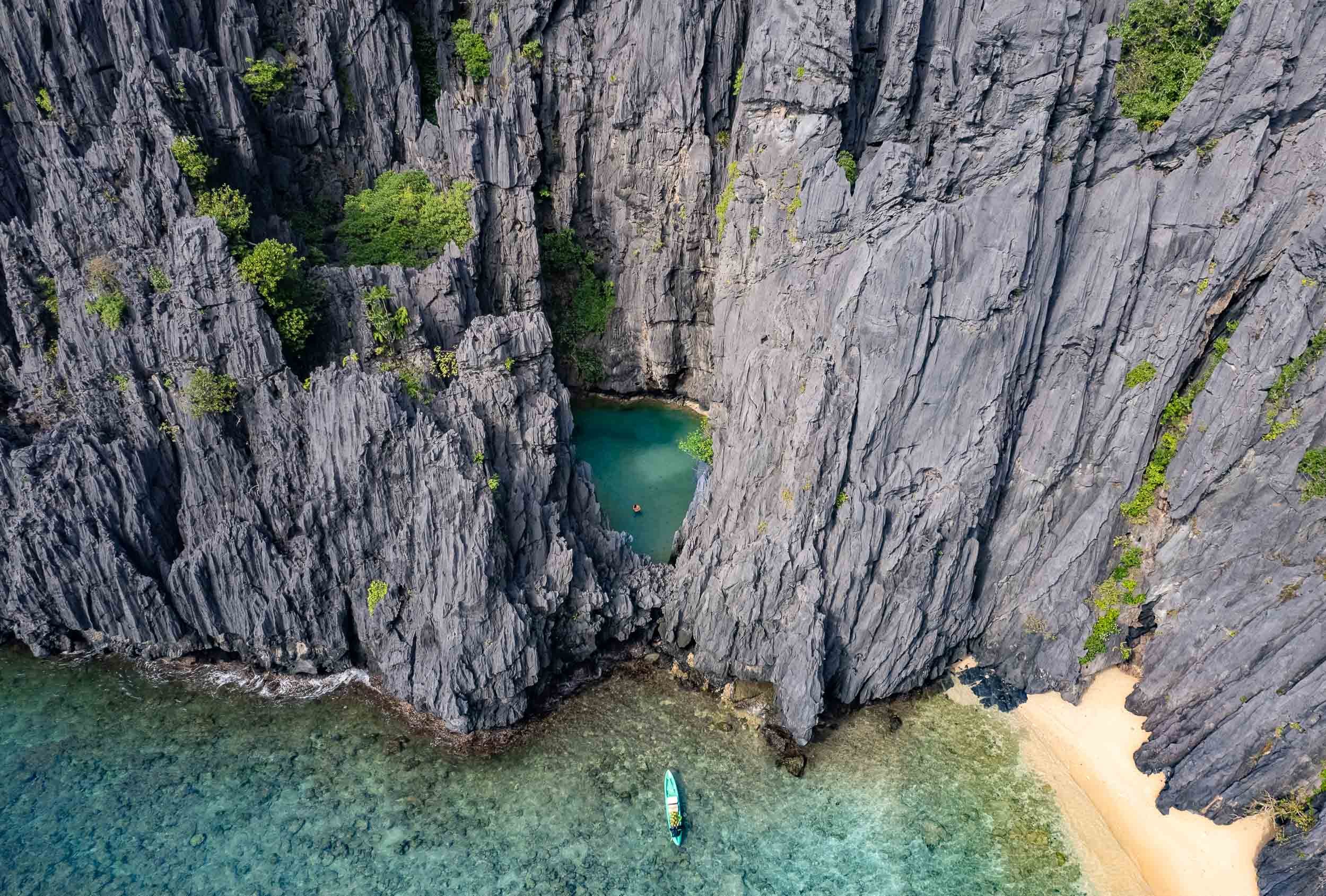

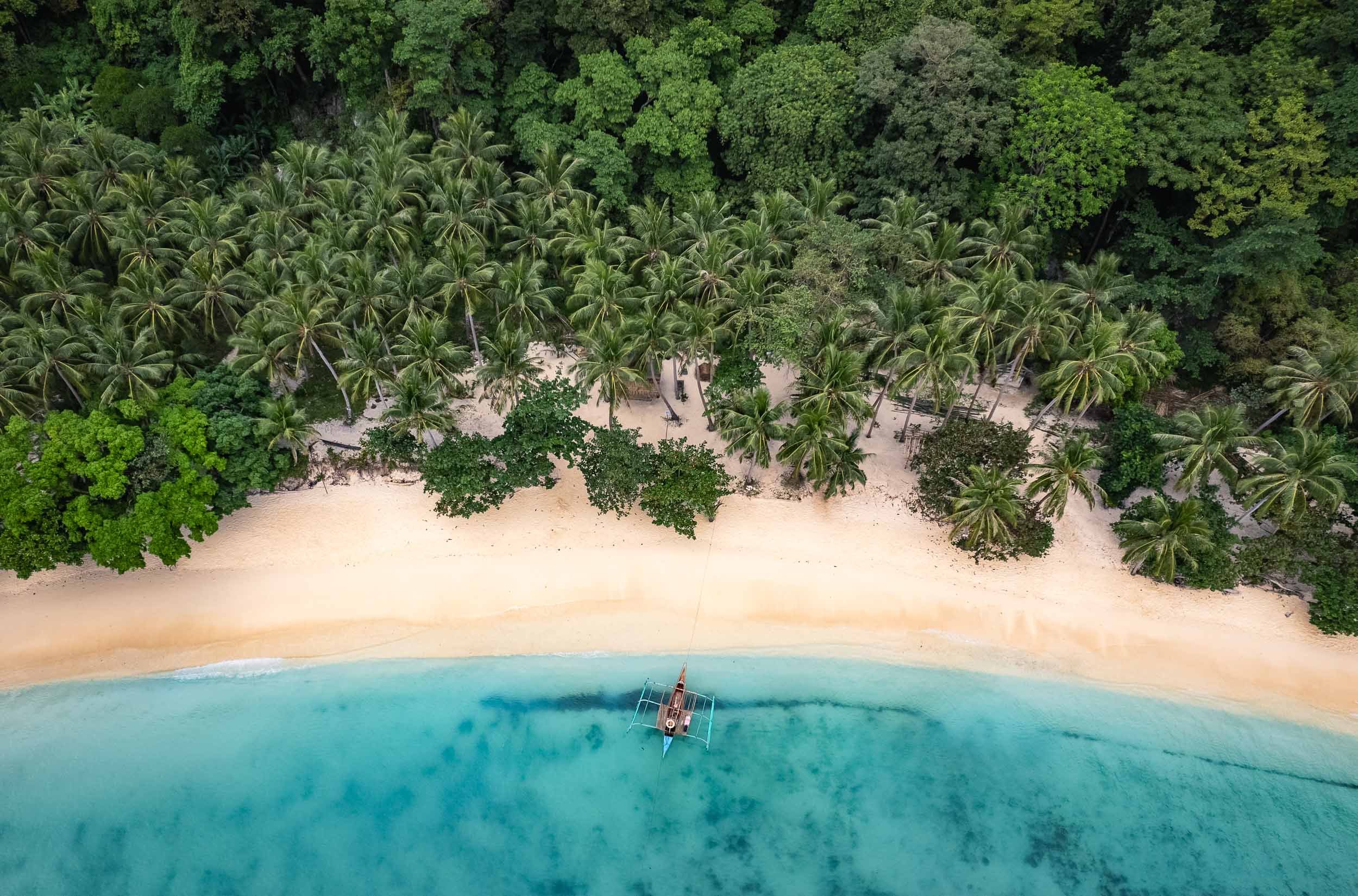
Shimizu Island
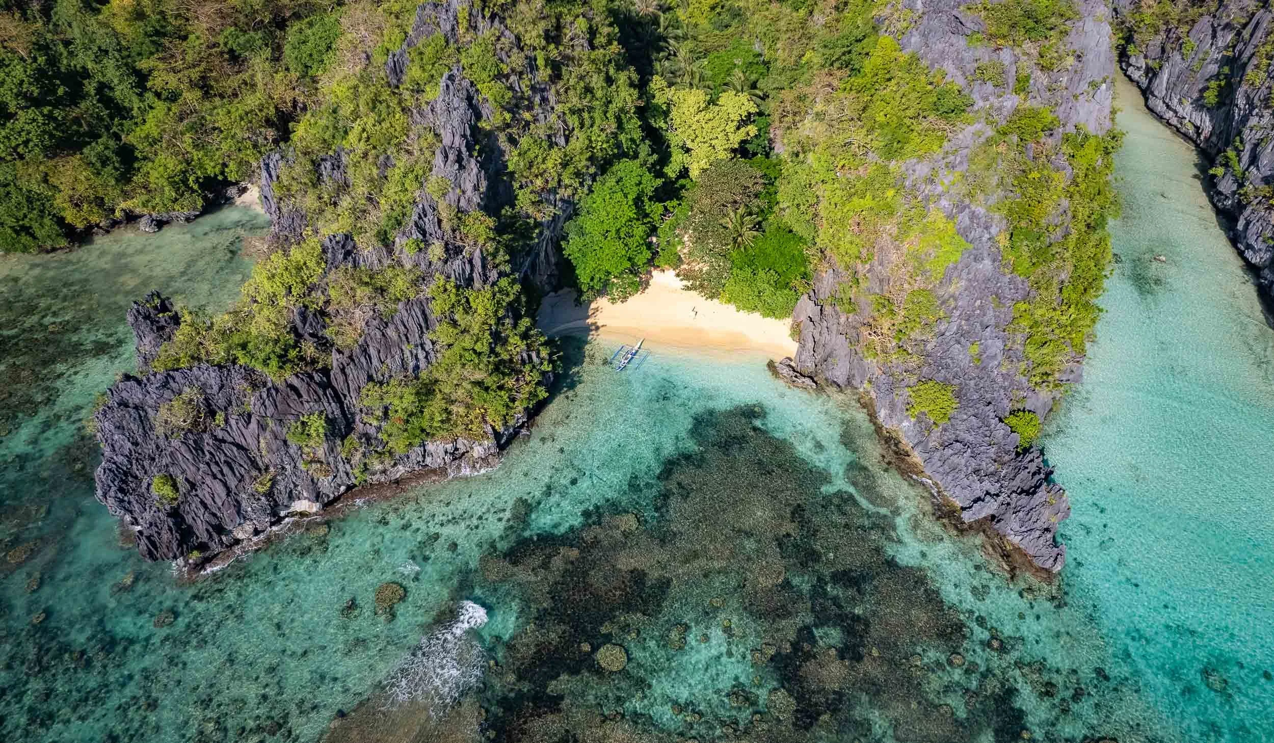
Another of the beautiful limestone cliff islands with their white sandy beaches. Who wouldn't want to set up their umbrella here?

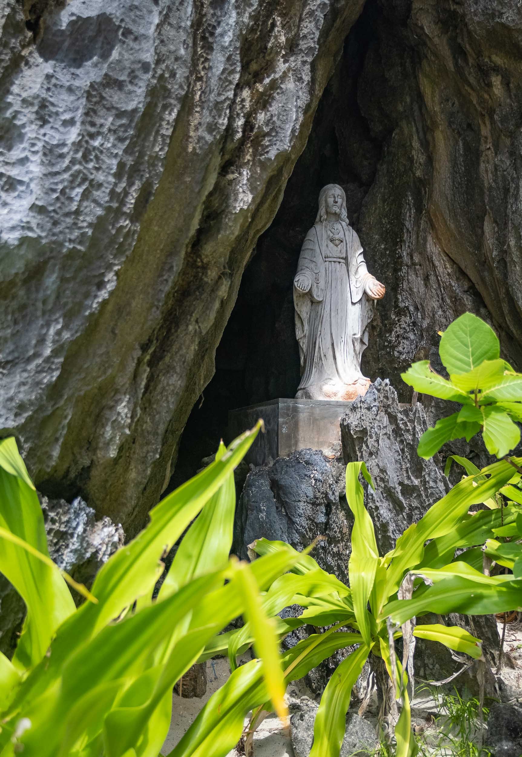
Matinloc Island
A bit further north-west you’ll find a curious man-made spot: An abandoned shrine, built in 1982 between the cliffs and the beach alongside a small villa, and now mainly used for lunch stops and apparently a yearly pilgrimage by the locals.


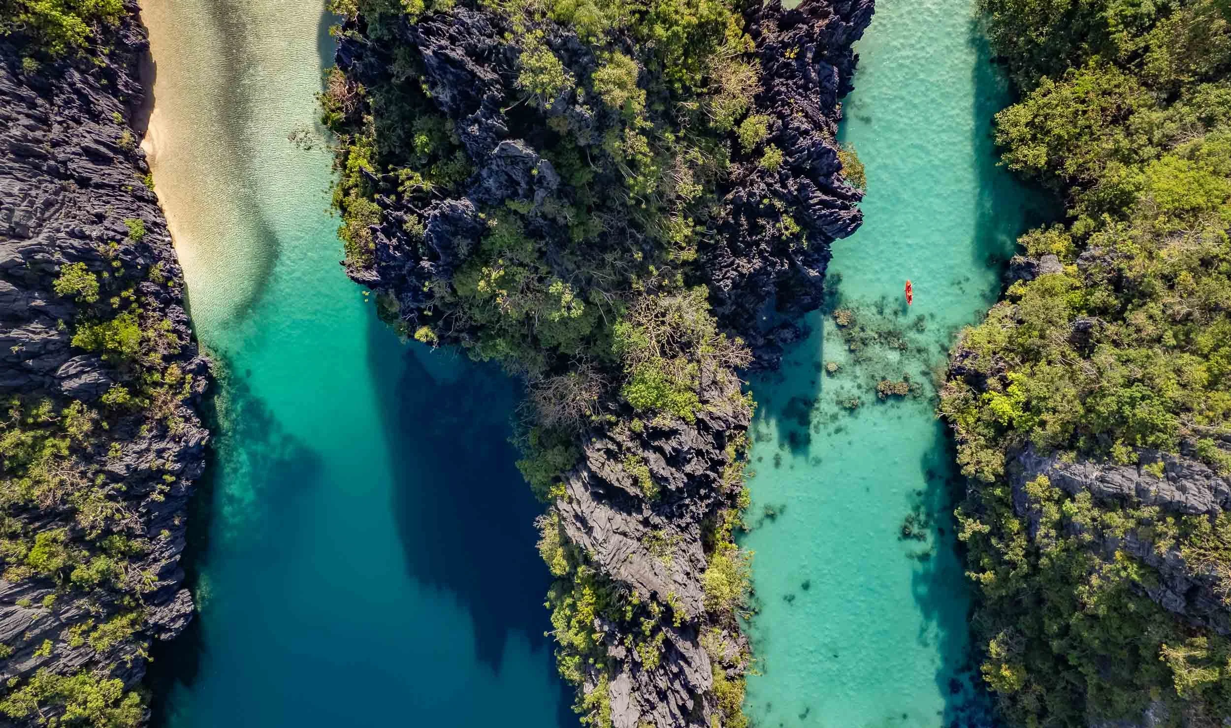
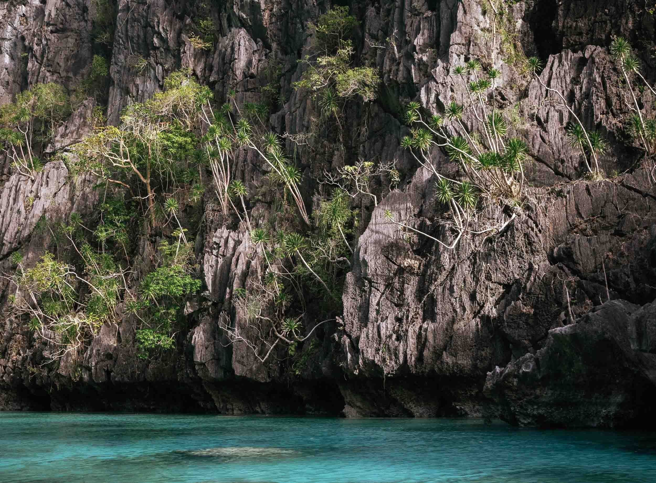
The scale of the limestone formations here is truly amazing, spot the kayak in the second shot!

Different
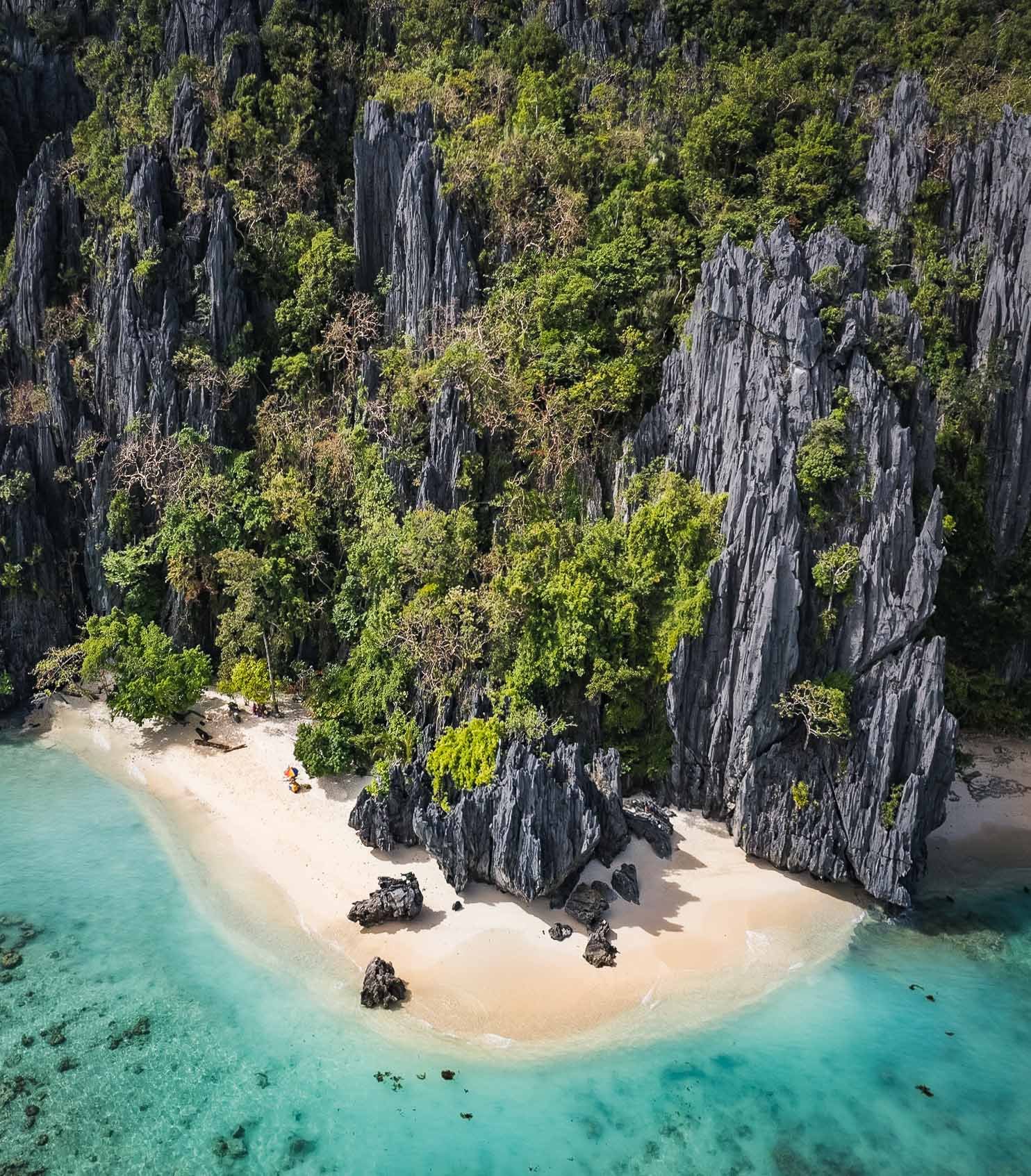
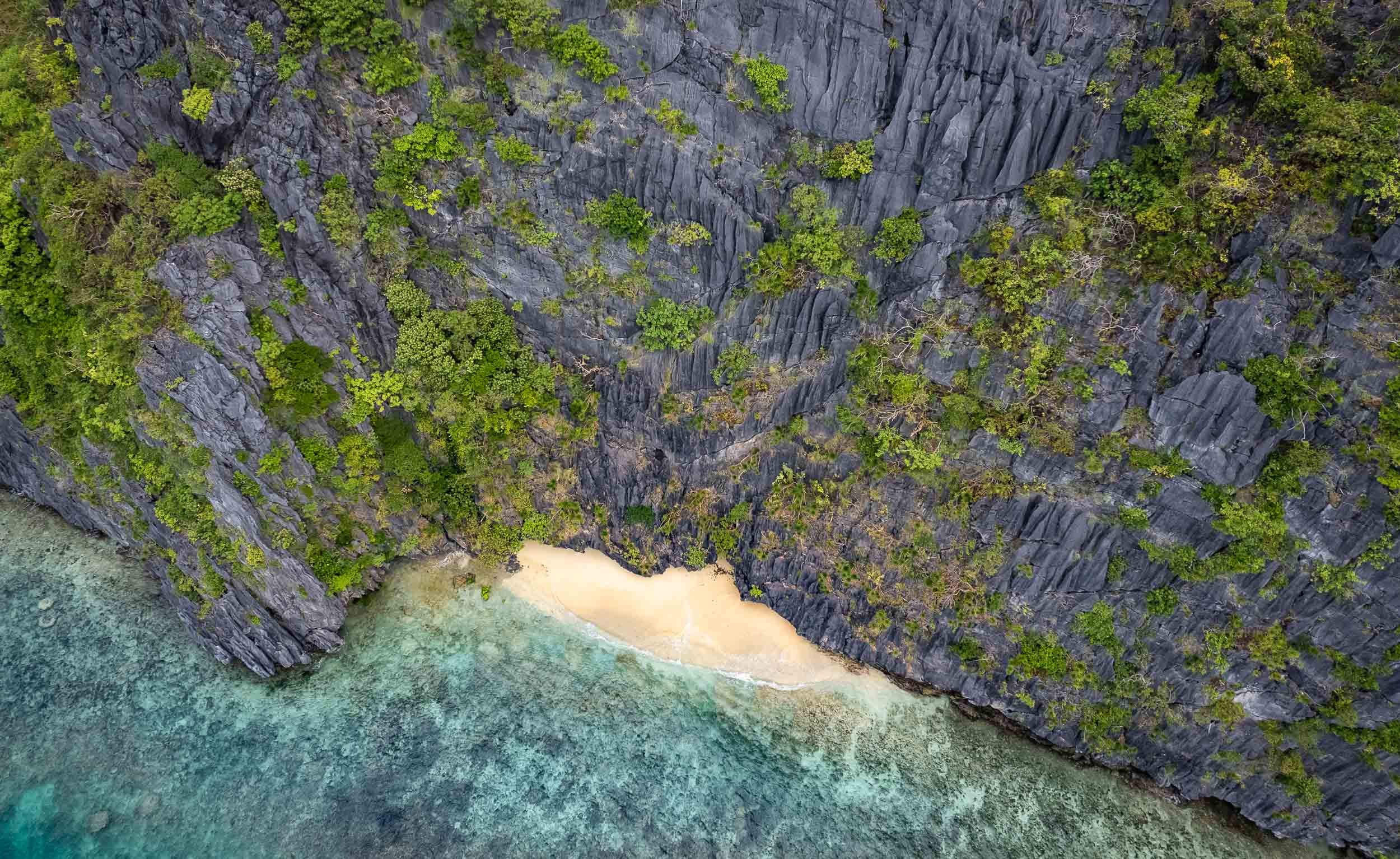
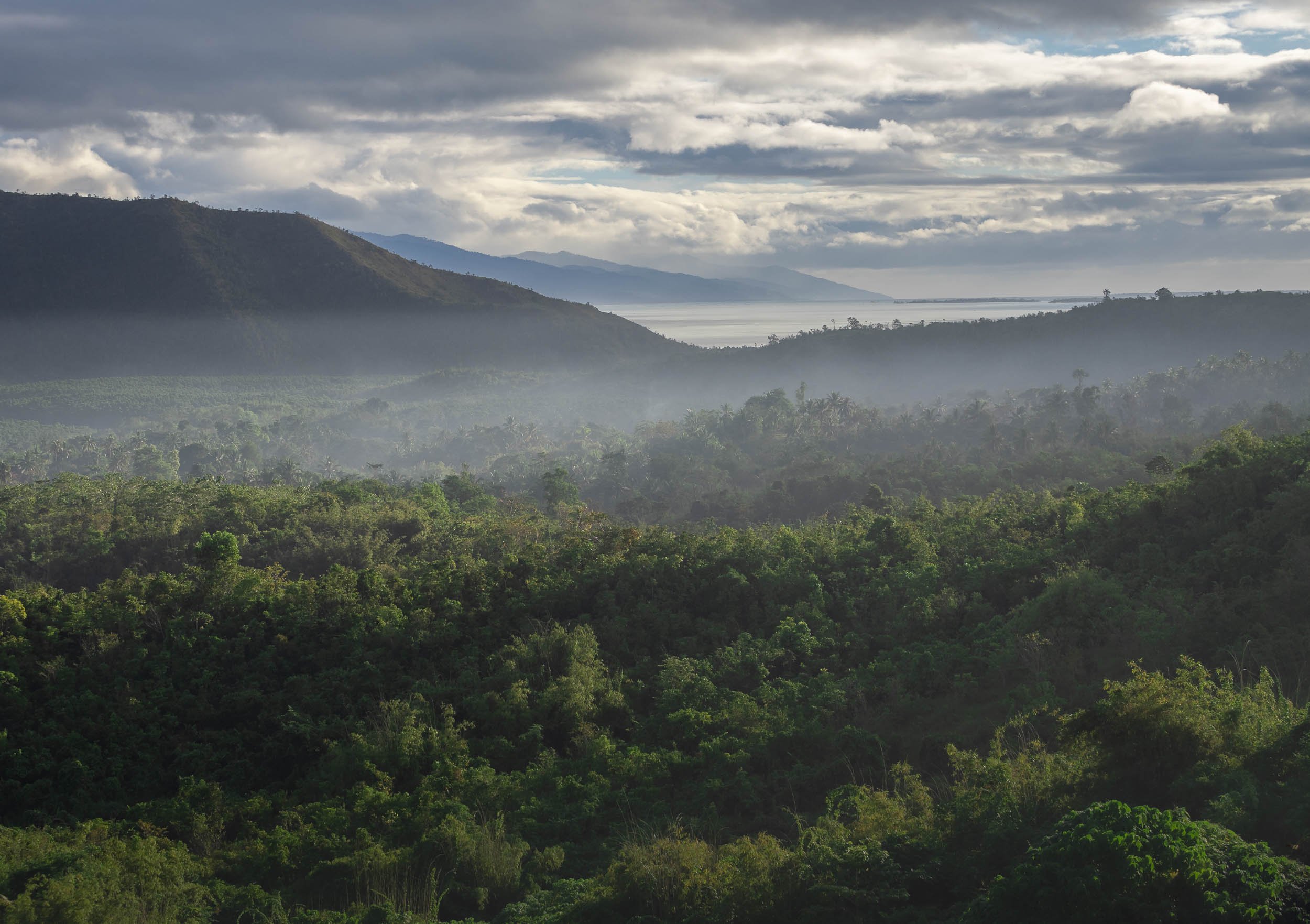
Geologically speaking, Palawan is very different from the rest of the country, as its rocky island landscape originated from the Eurasian plate, forming this spectacular karst terrain that isn’t found elsewhere in the Philippines.
Another place I was able to enjoy by myself was the Hidden Beach (again part of the creative naming scheme...) on the east side of Matinloc island.


Sunset over Bacuit Bay
El Nido had one signature sunset in store, despite the largely cloudy conditions during my stay. I used it to capture this fisherman returning from the sea in his Bangka.


Waxing Moon
Our celestial companion rising on a clearer evening.

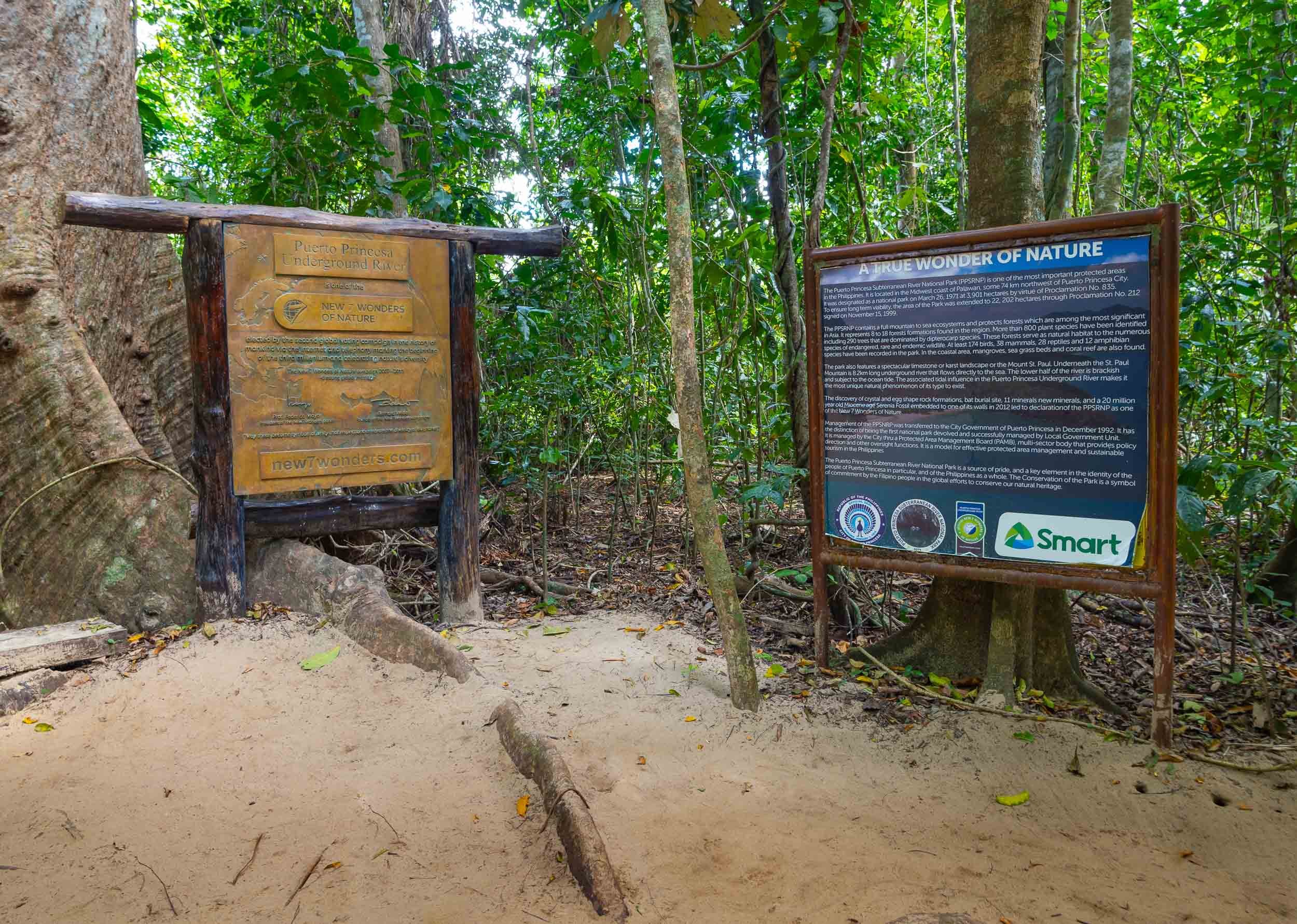
Going Underground
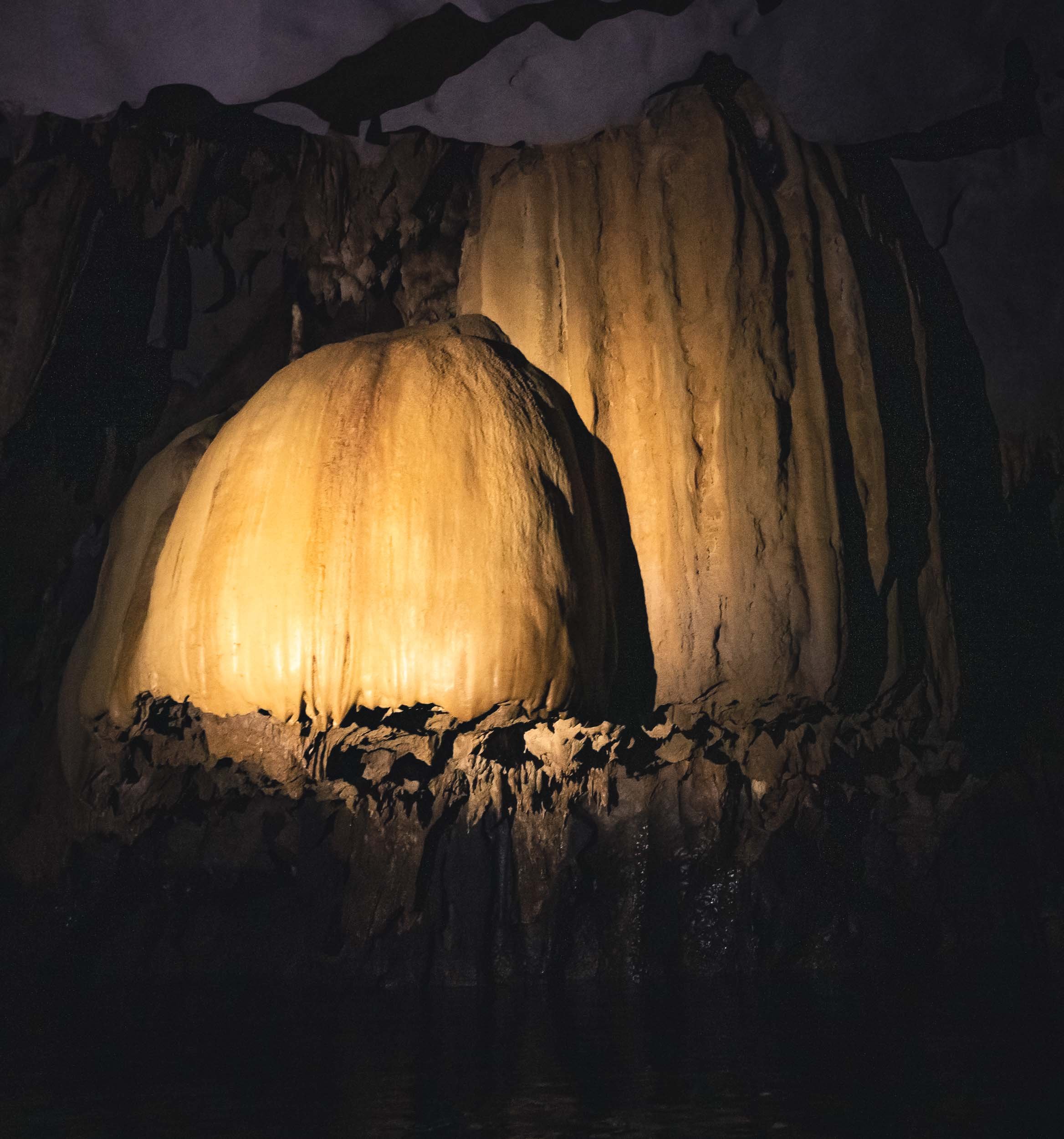
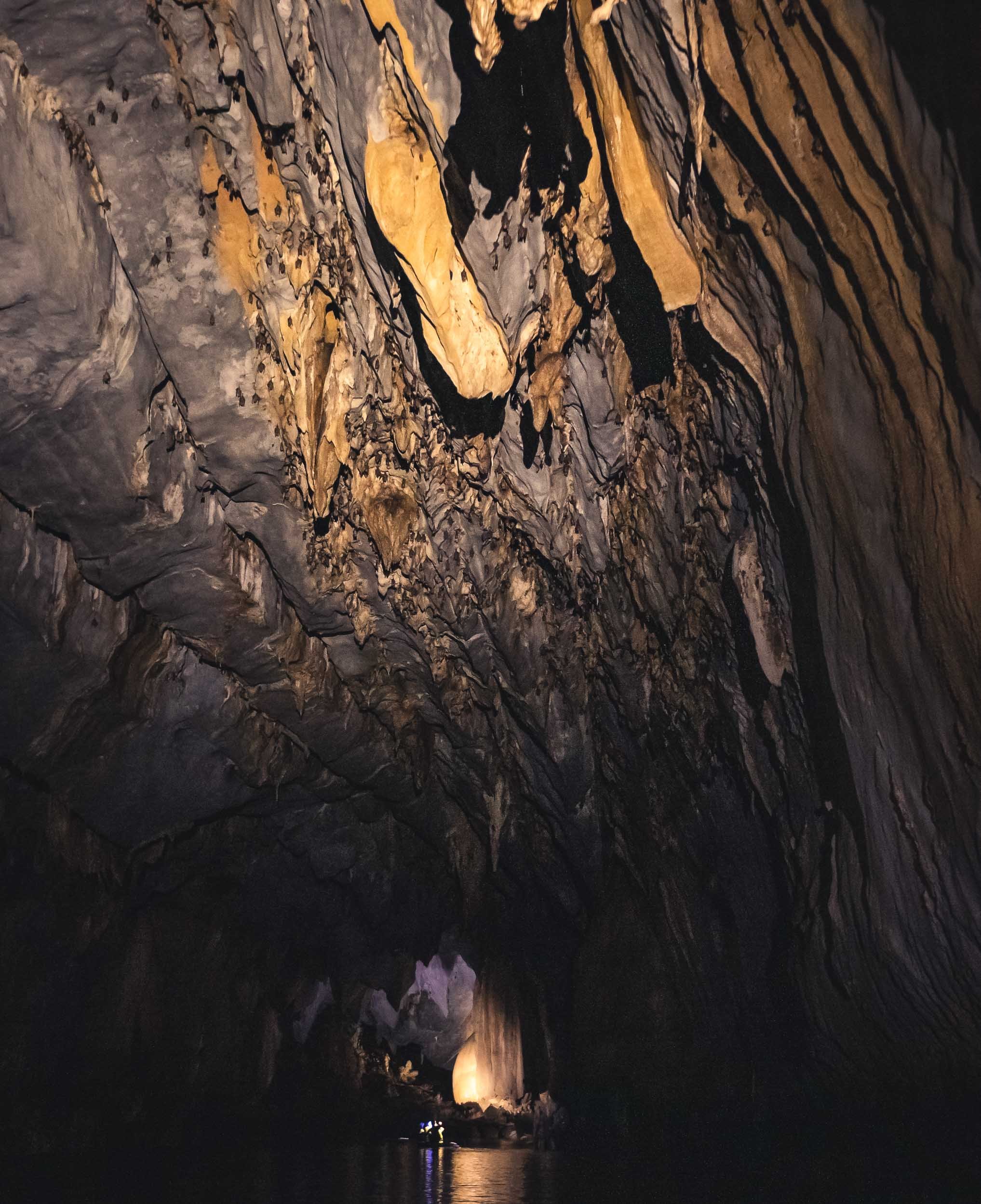
I spent the last day going back to Puerta Princesa for my onward flight, and started very early in El Nido for another attempt to reach and tour the subterranean river. This UNESCO World Heritage Site was once said to be the world’s longest underground river - there seem to be different definitions of this record though.
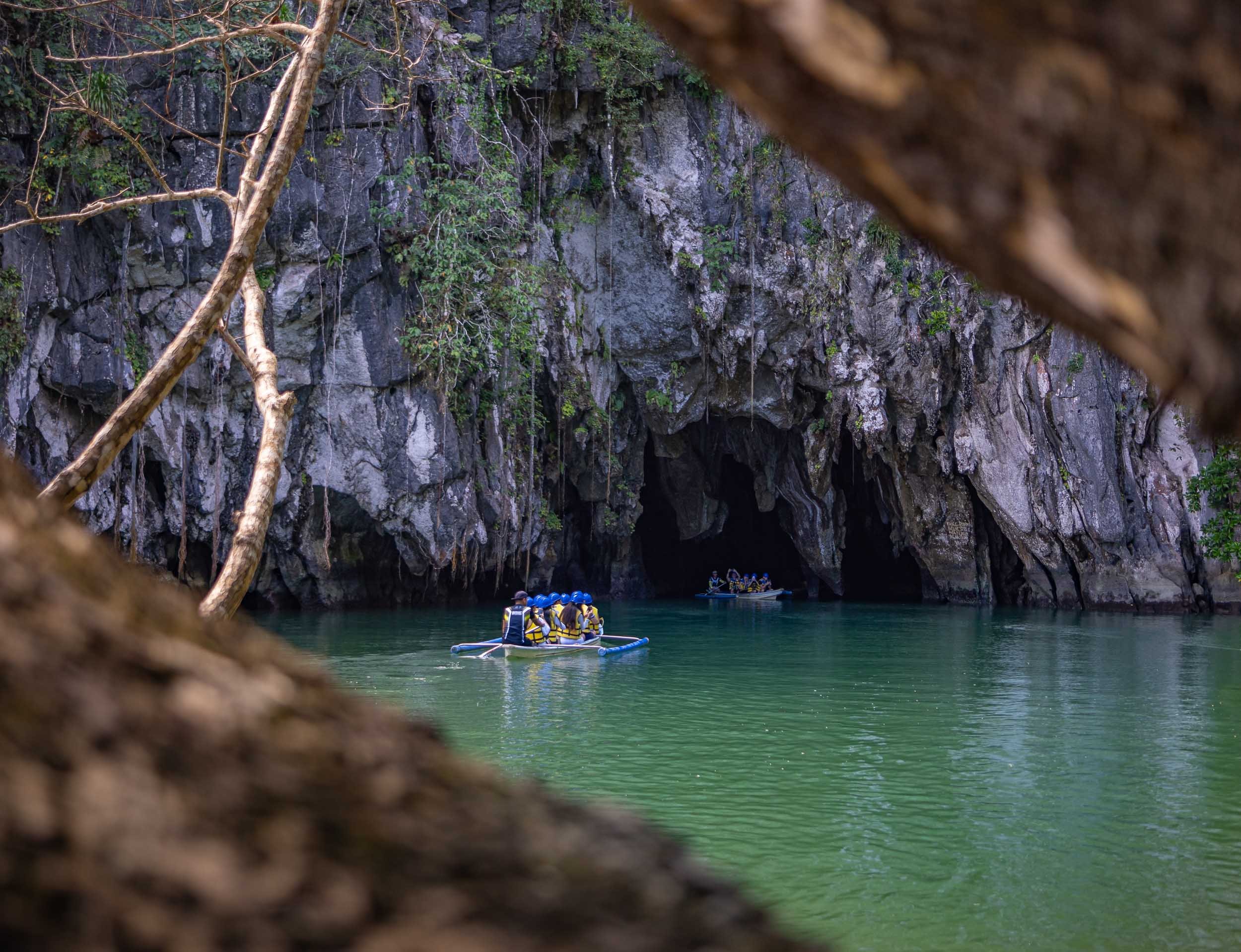


The inside of the cave river becomes completely dark once you go a few hundred meters beyond the entrance, with only the light of the boat captain shining onto the amazing limestone formations. It’s over 8km long, although only the first few kilometers are navigable by boat. The cave network itself reaches even further at 24km length.

Palawan is home to a few special places, and the underground river as well as the limestone cliffs and their hidden beaches and lagoons are truly special. While it can be very touristy, and El Nido town definitely wasn’t my favorite, there are ways to make it a more enjoyable experience, and I can definitely recommend Palaweña to achieve that, one of the best operators I’ve worked with anywhere. Is it my favorite place in the Philippines? I think not, but more on that in another blog entry - subscribe here if you don’t want to miss it.

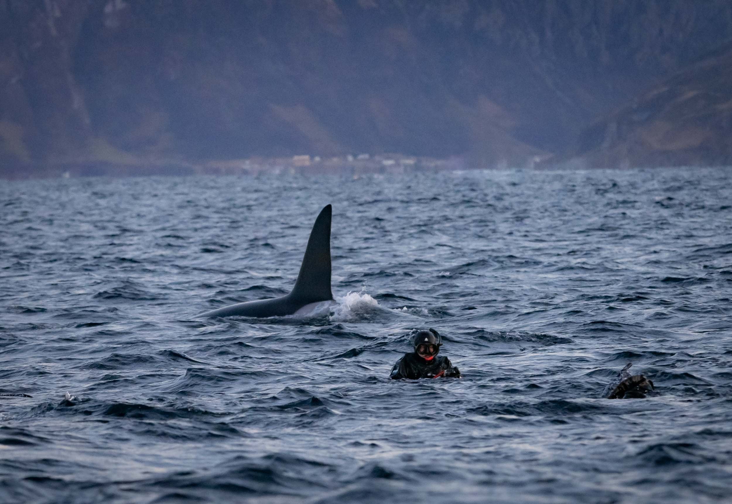
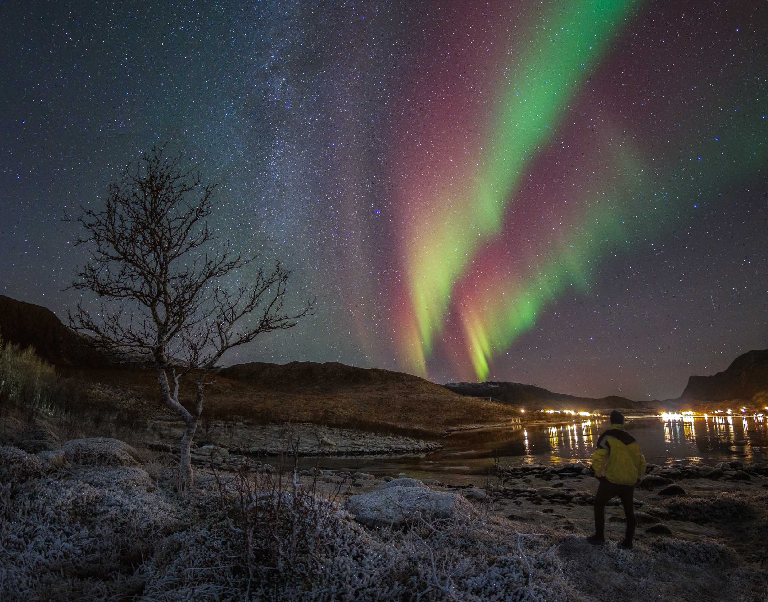
Chasing Orcas & Auroras - Northern Norway
A successful expedition to find and swim with Orca whales, and chase the Northern Lights.
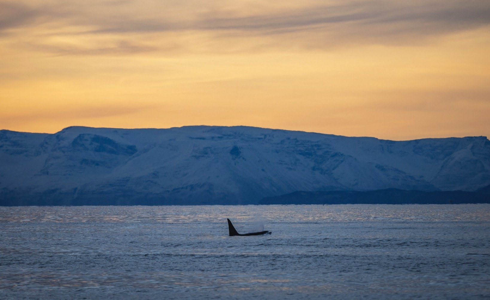
In the quest to go through my backlog of images and stories, here’s another adventure from late 2022 - exploring the north of Norway on the lookout for Orca whales, and hoping to see some Northern Lights on the way.
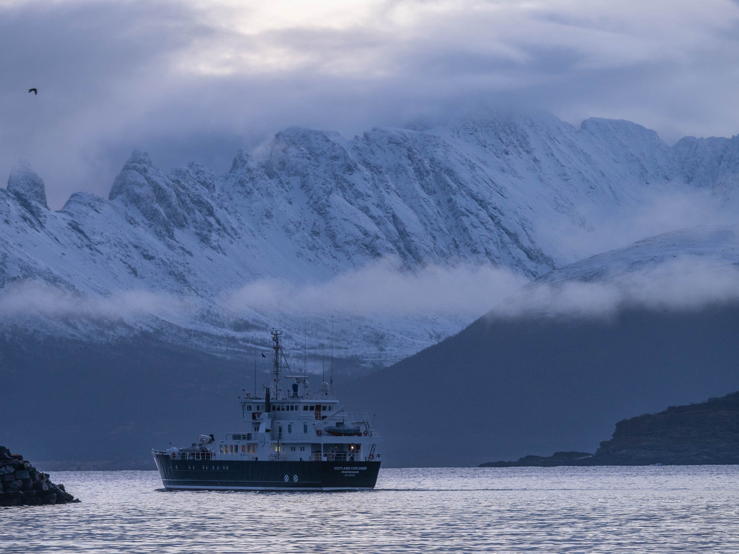
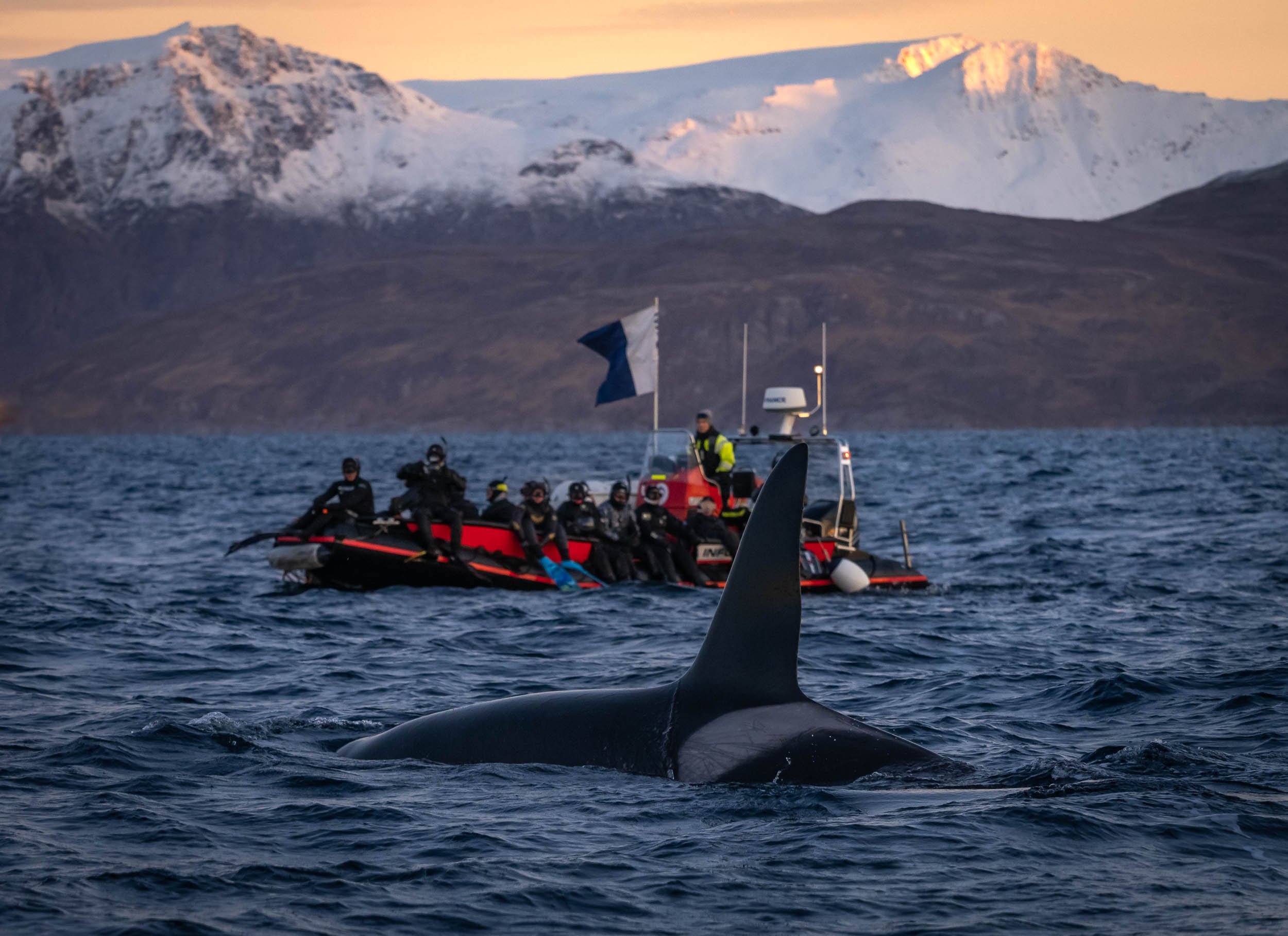
We started our trip from Tromso, taking a bus to Skjervoy, a small town in the northernmost part of Norway, far beyond the Arctic circle, where we boarded our boat, the Bergsund - home for the next week. Organized by https://www.orcanorway.info, this expedition is focused on finding orca around the fjords, and if the conditions are right, get into dry suits (or wet ones if you’re experienced), jump into a small dhingy boat, and with a bit of luck, snorkel and swim next to these amazing creatures. The time on the boat also includes several sessions by Pierre Robert de Latour, the “Orca Whisperer”, which culminate in the USEA certification for participants and really helps understand the behavior of orca in the wild.
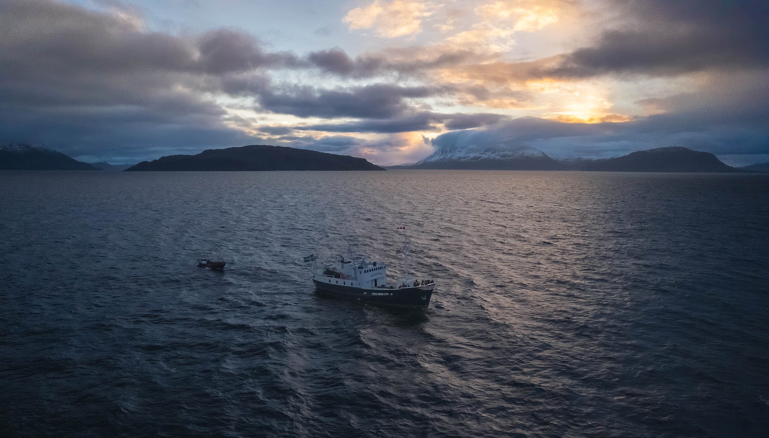
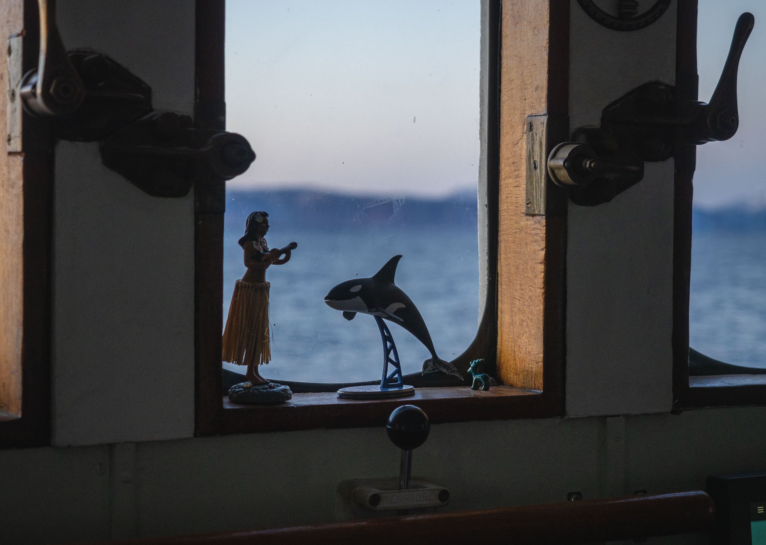
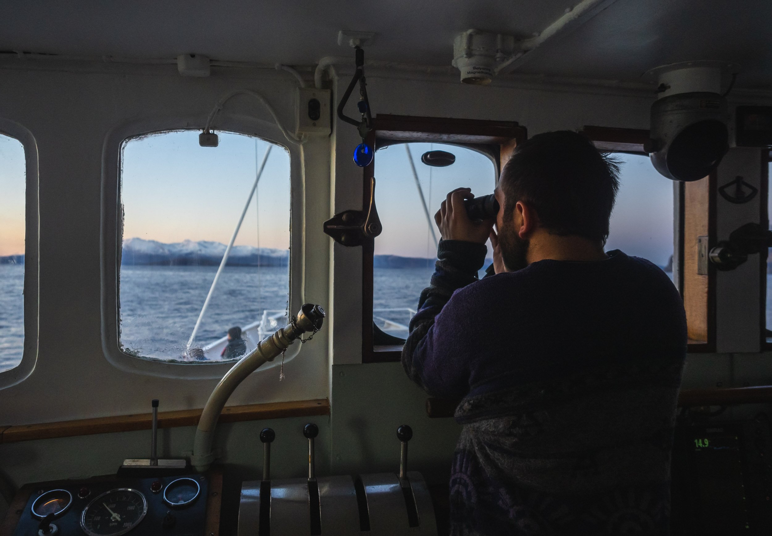
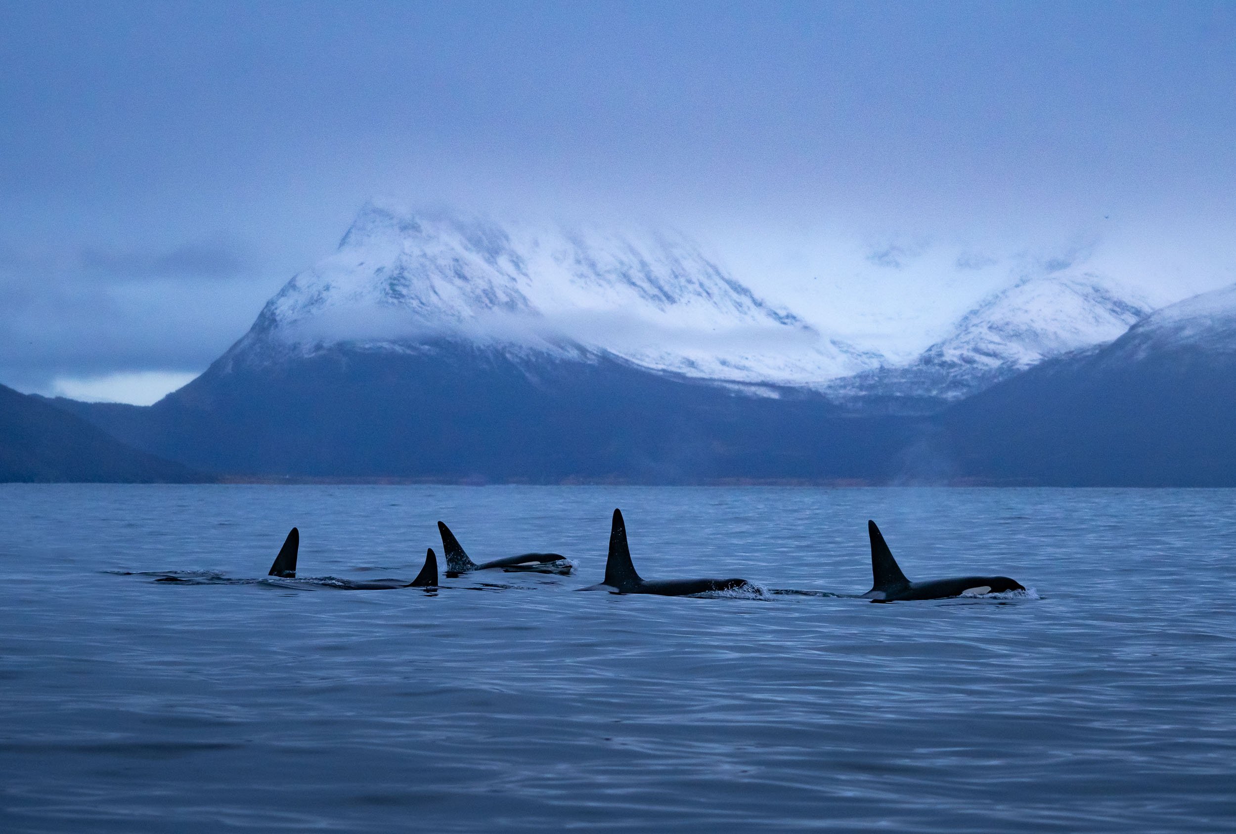
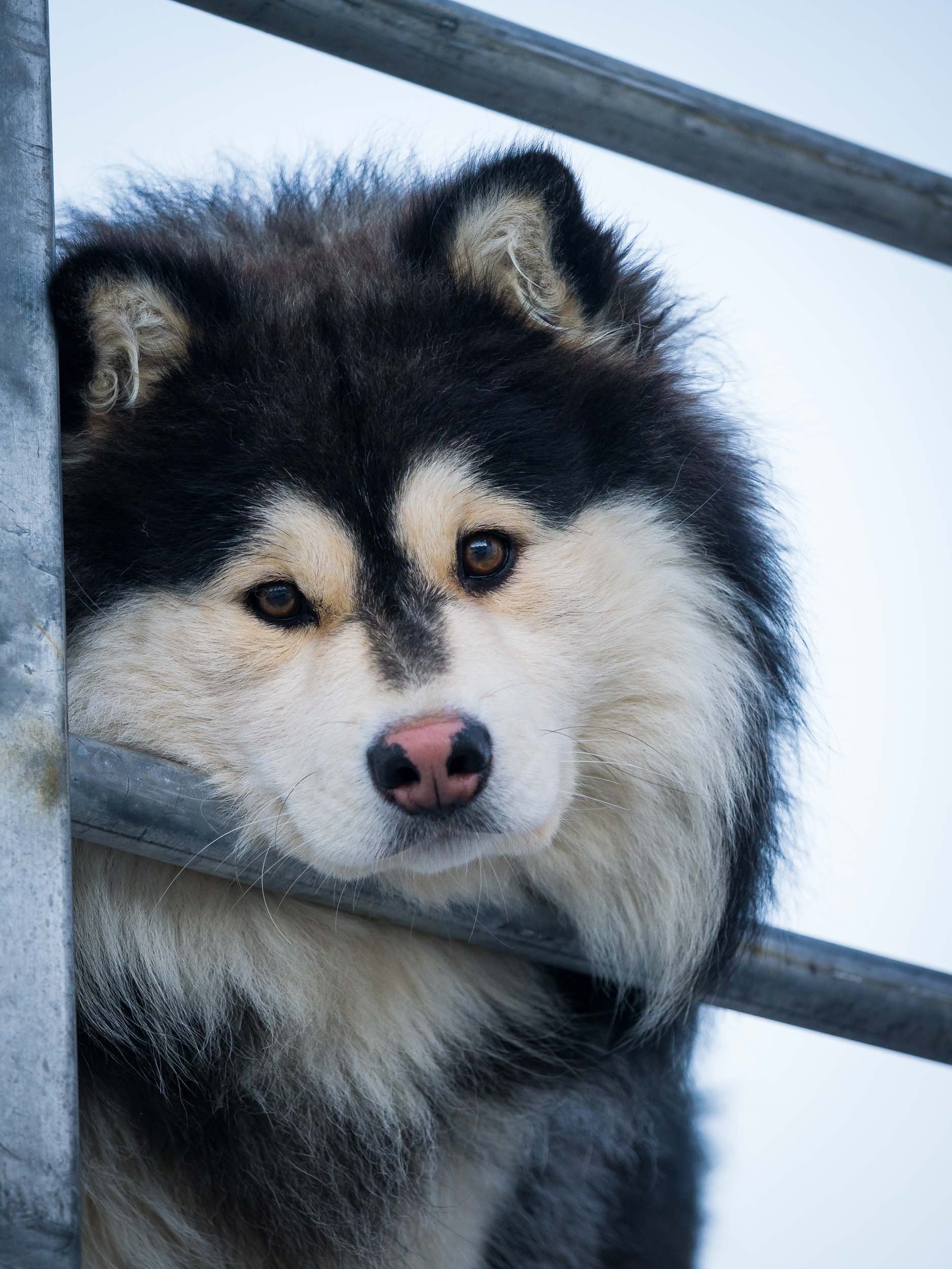
On the Lookout
The daily ritual is trying to spot pods of orca whales in the vast sea around the boat - not an easy task, as they can travel very quickly and spend long stretches under water. We had a lucky mascot though that seemed to have helped a bit.


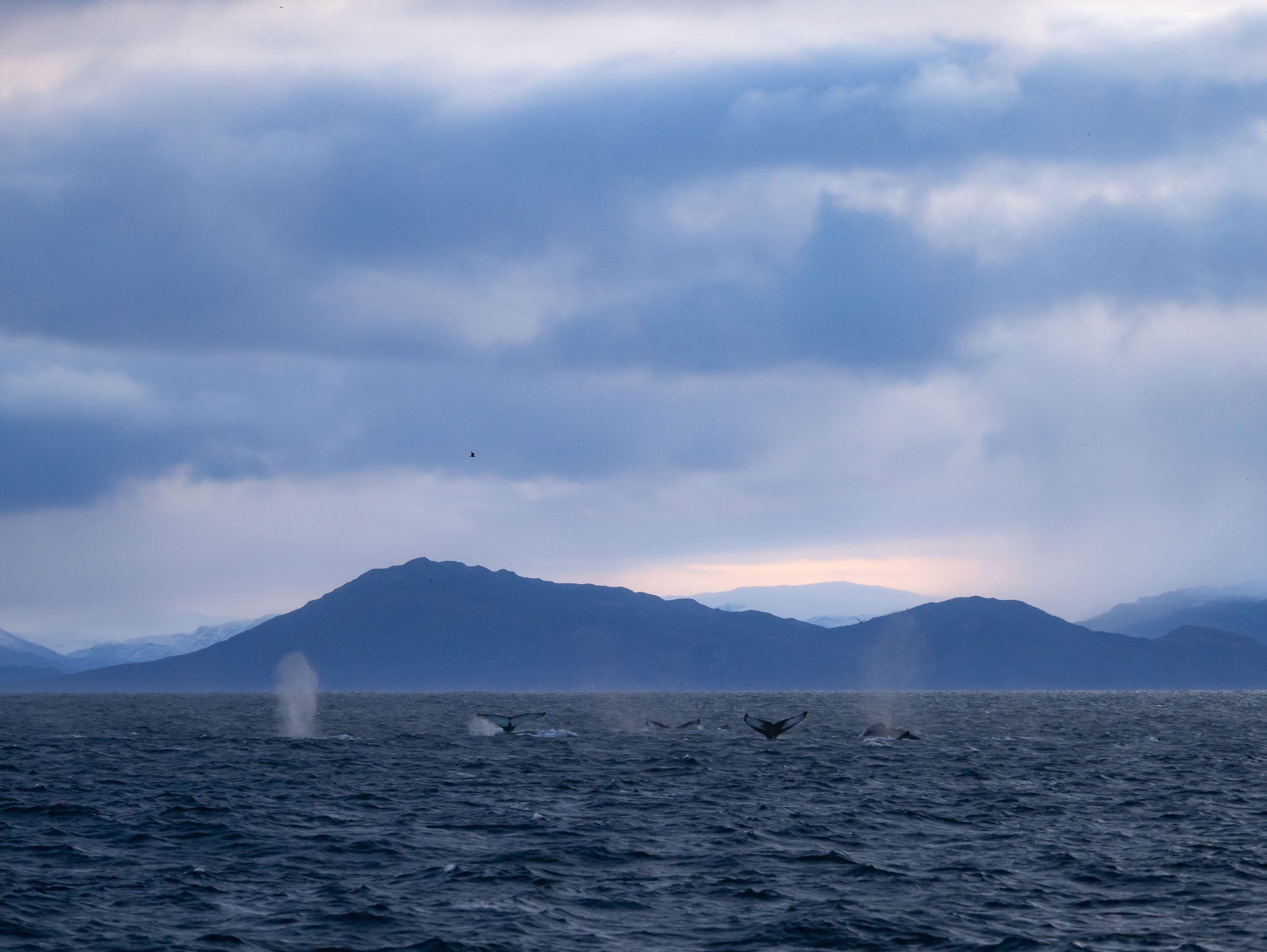
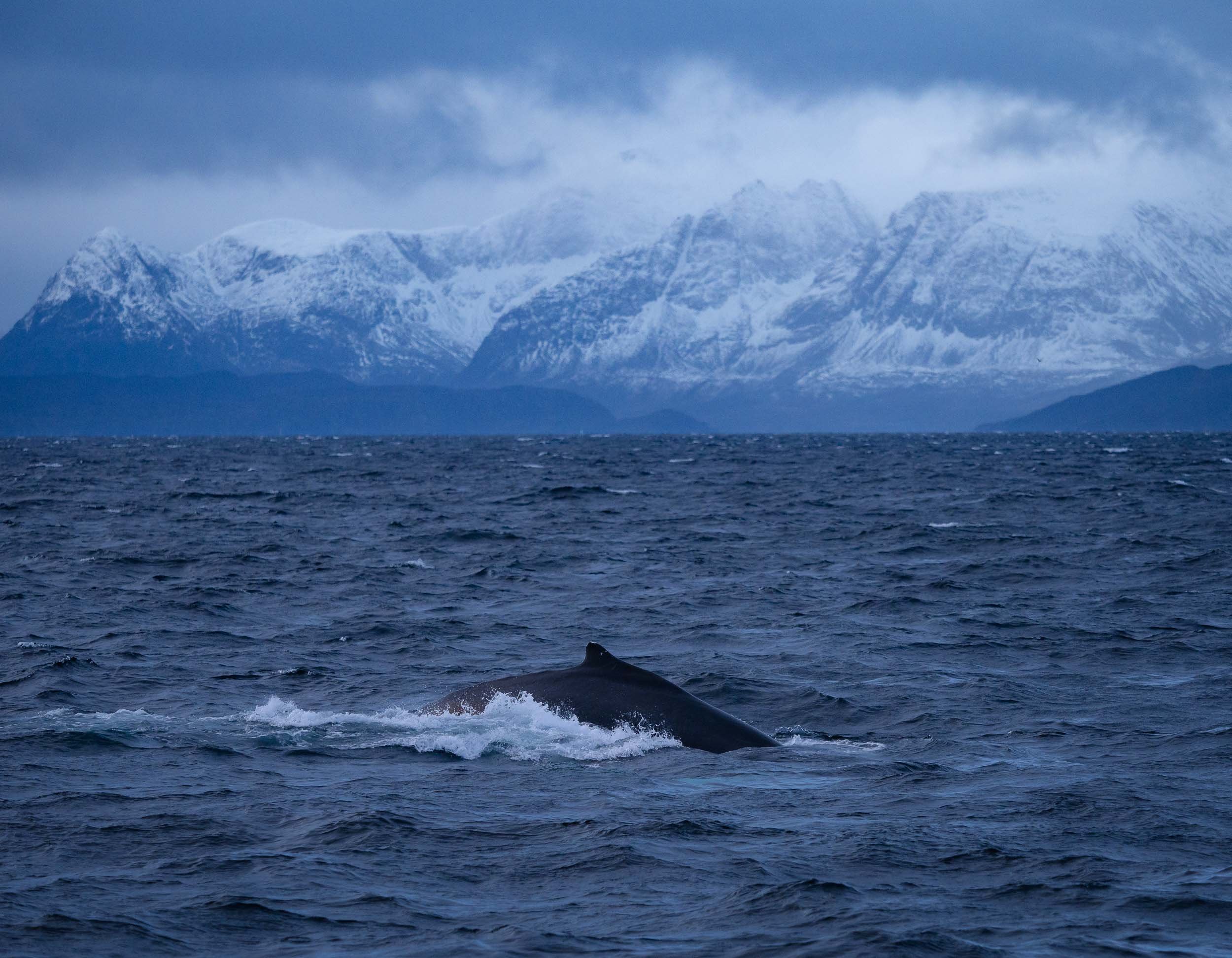
Humpbacks All Around
Aside from orcas, the area is home to a few groups of humpback whales during this time of the year. We had two great encounters, once from the boat and a bit of distance (the weather was not great) and once in the water, as they were feeding alongside the orca whales. The feeling of these creatures diving up a few meters away from you and whacking their flukes on the water is...intimidating to say the least.
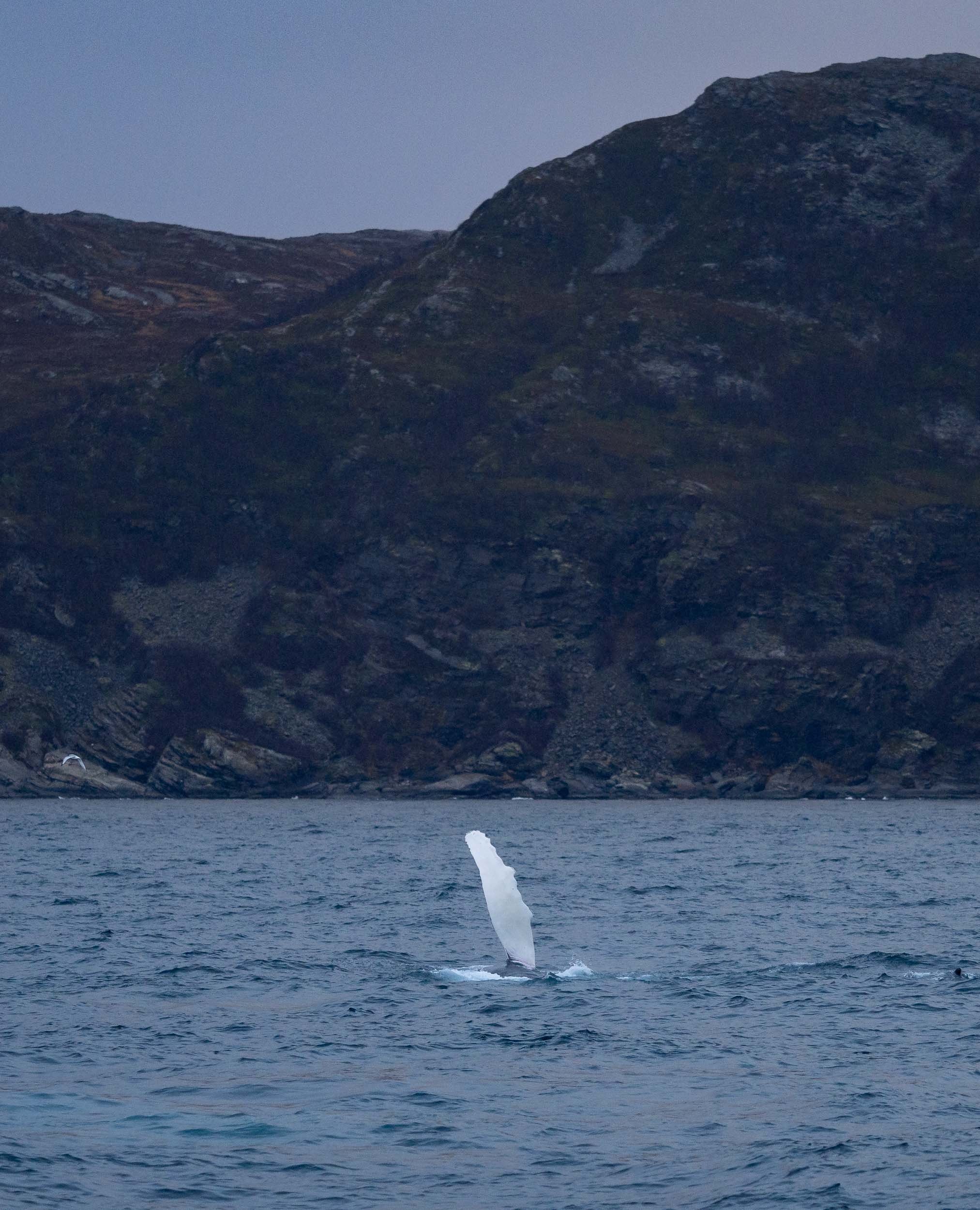
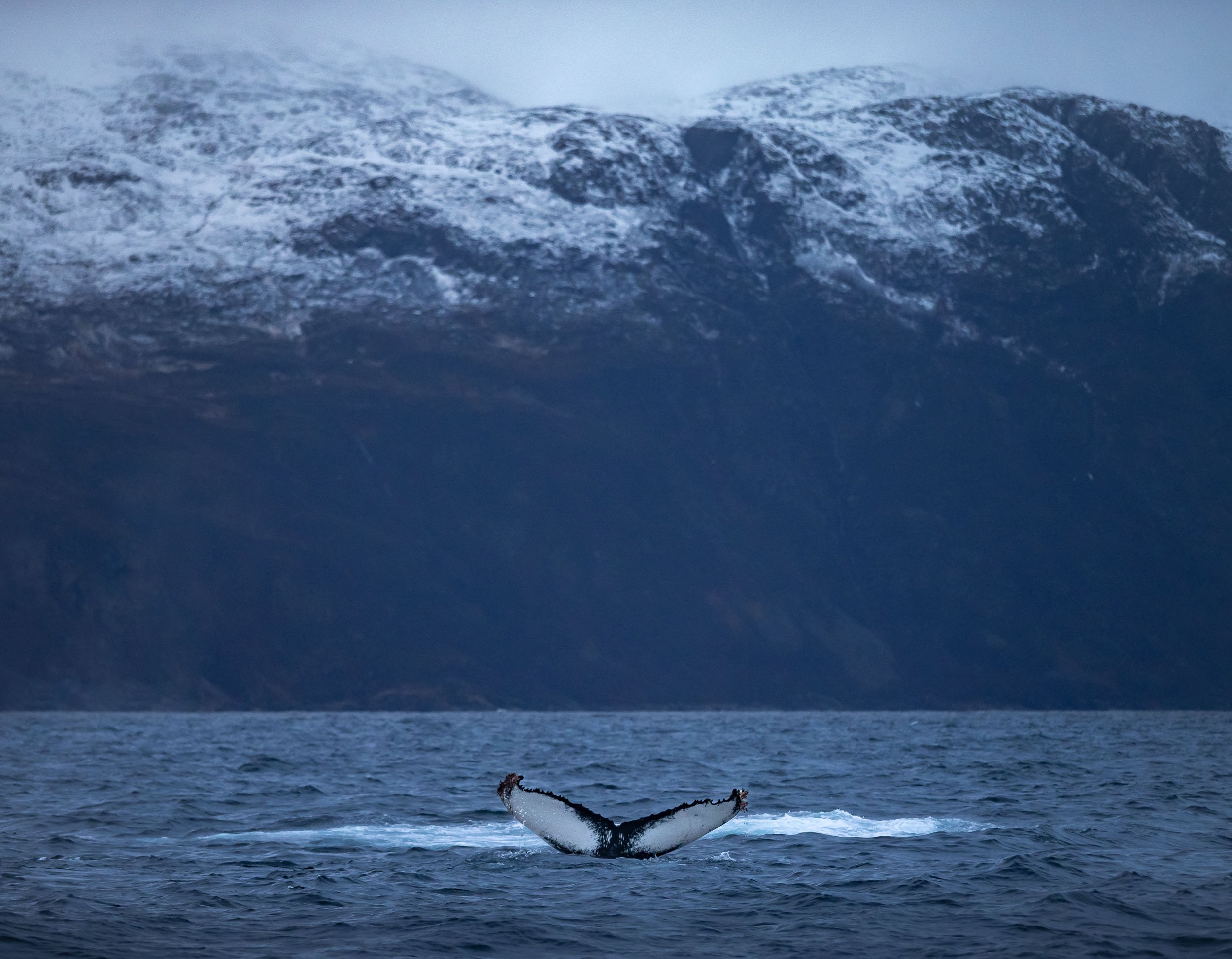
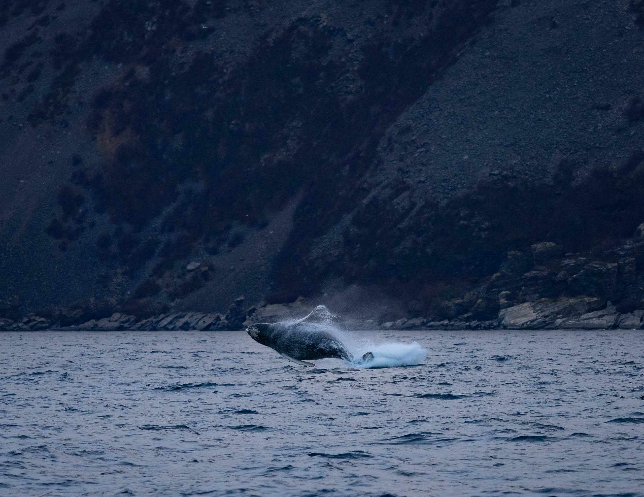
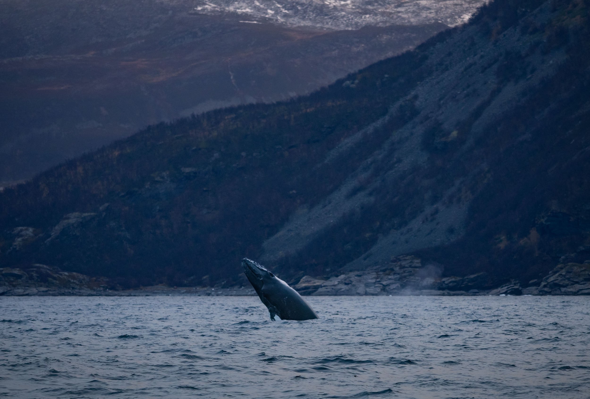
Humpbacks breach frequently, and throw their bodies out of the water. Impressive, considering they weigh 40 tons and grow around 15 meters in length. This juvenile had not quite reached those numbers yet though.
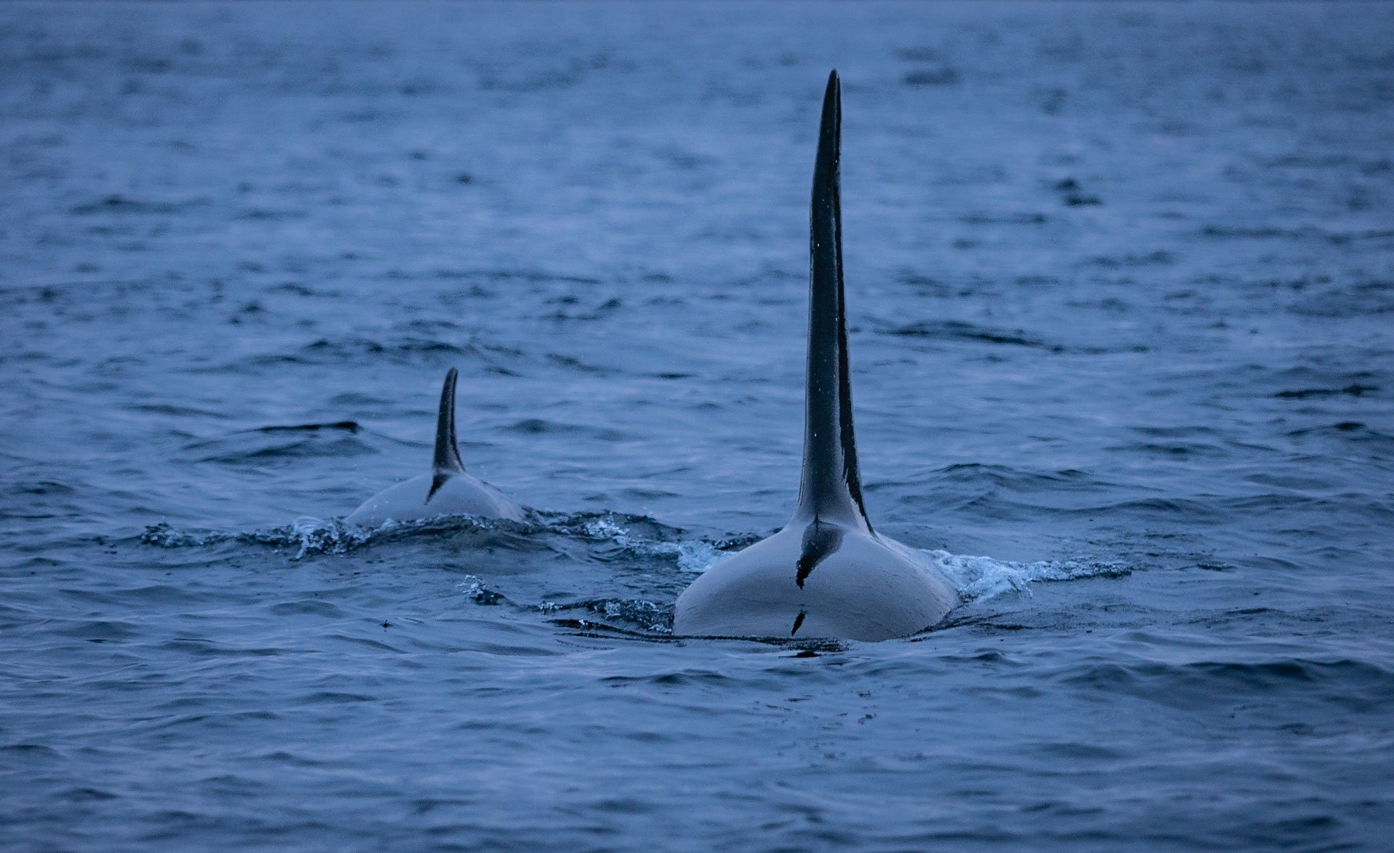
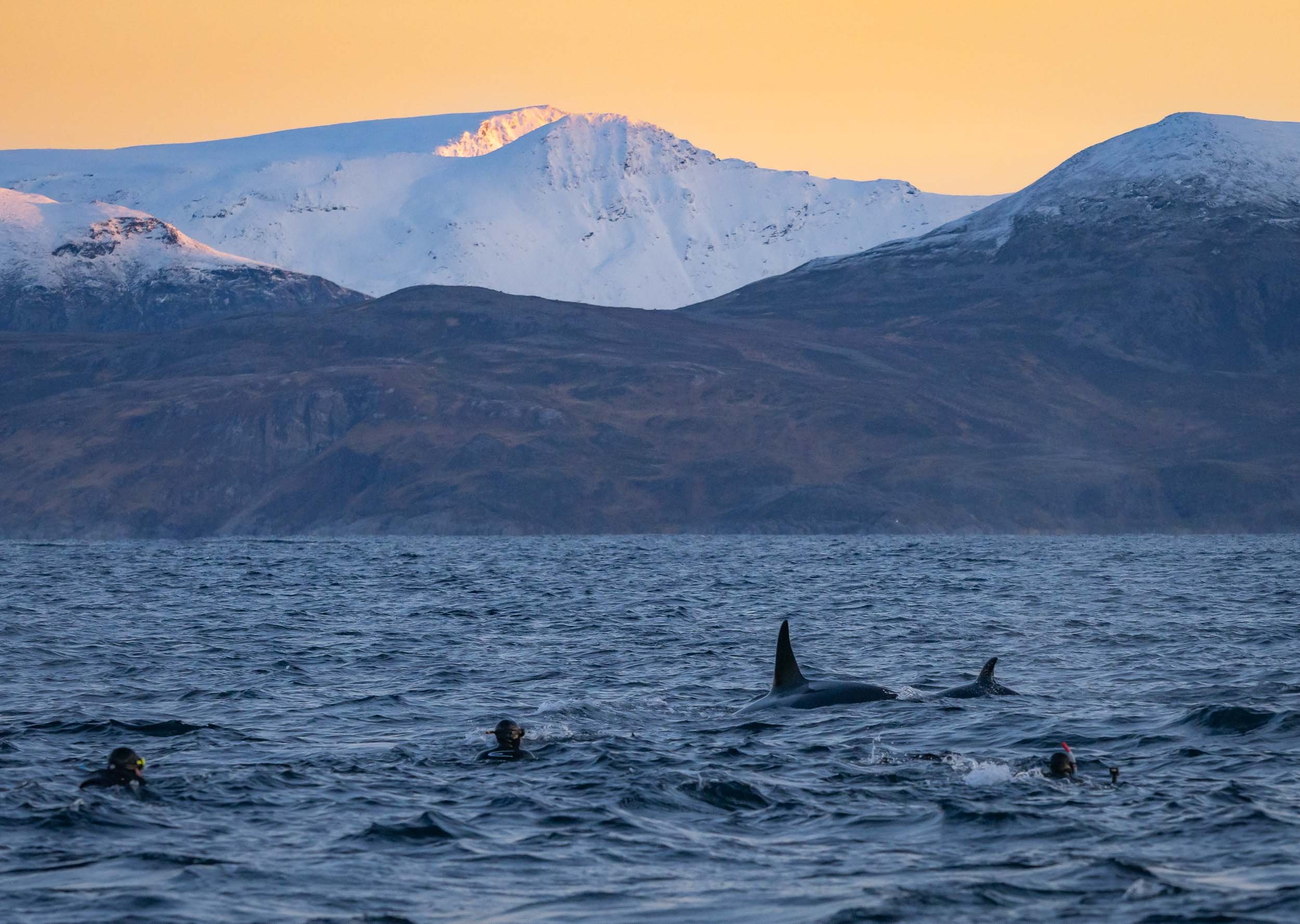
Orca Encounters
The excitement when seeing them from a distance and being lucky enough to get close is difficult to describe. Their elegance in the water, social interactions, curiosity, and just sheer size makes them one of my favorite animals - as is often the case with wildlife, experiencing it in its natural environment provides a very different perspective to documentaries or zoos and changes your relationship to these animals forever.
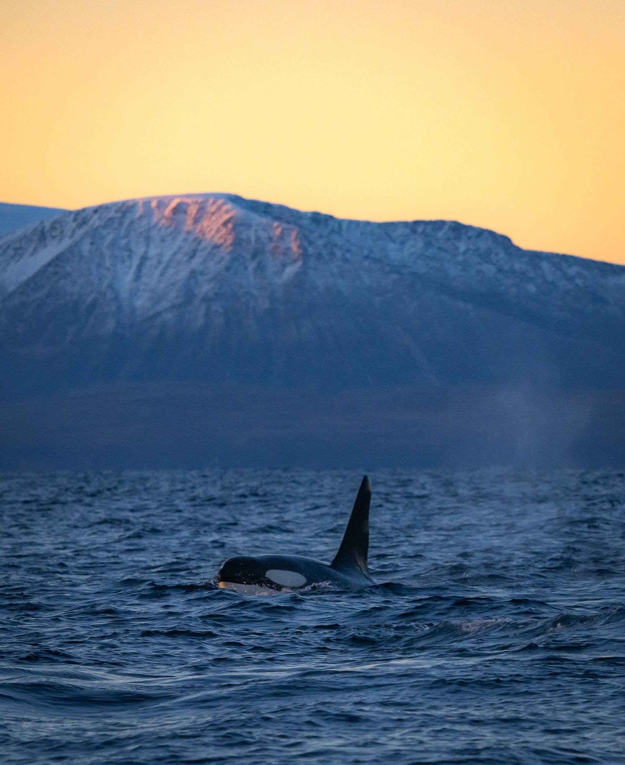


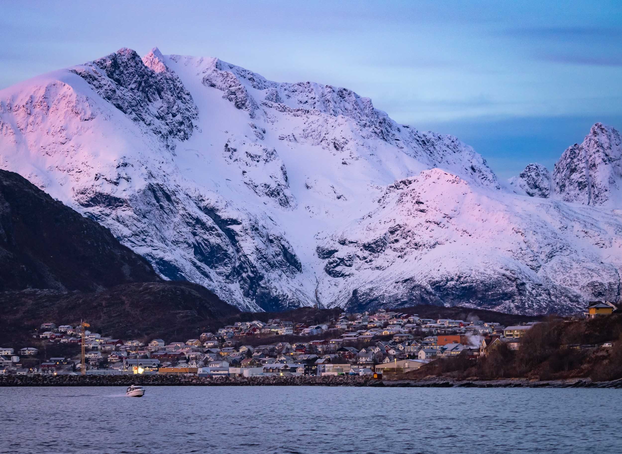
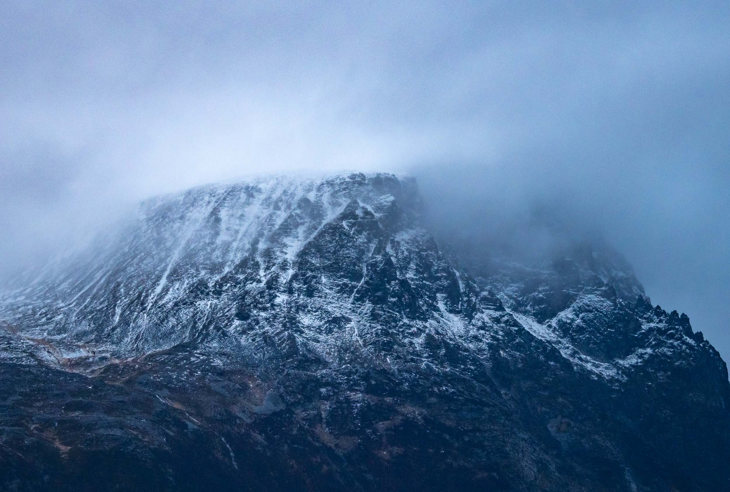
Landscapes of the North
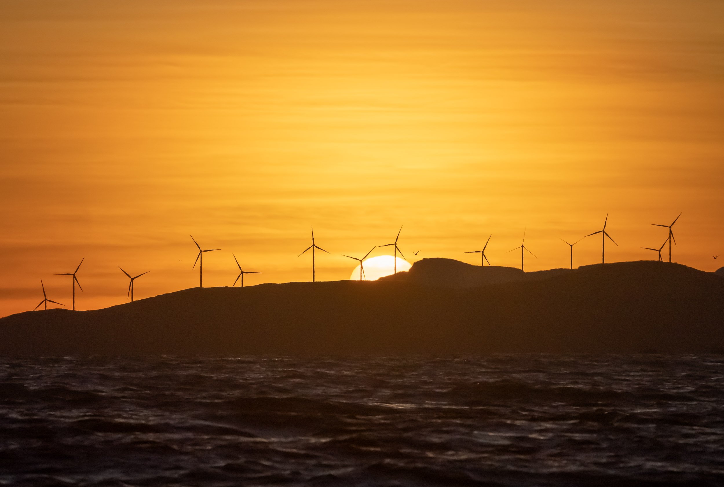
Even on days without wildlife encounters, the stunning fjords all around make for amazing scenery, either bathing in the low sun - there are only a few hours of sunshine each day this far north in the winter - or covered in clouds and adorned by dramatic overcast skies.


The light hits different up here…
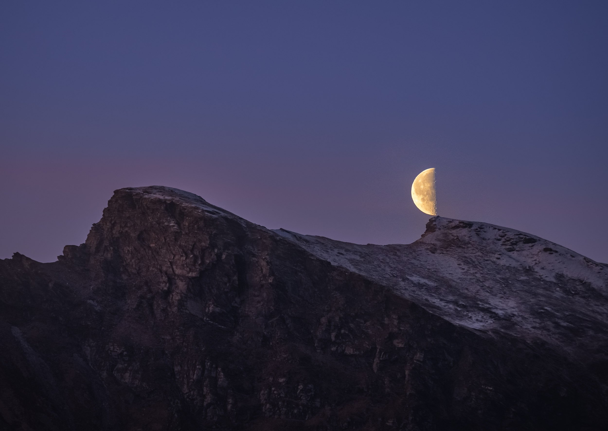
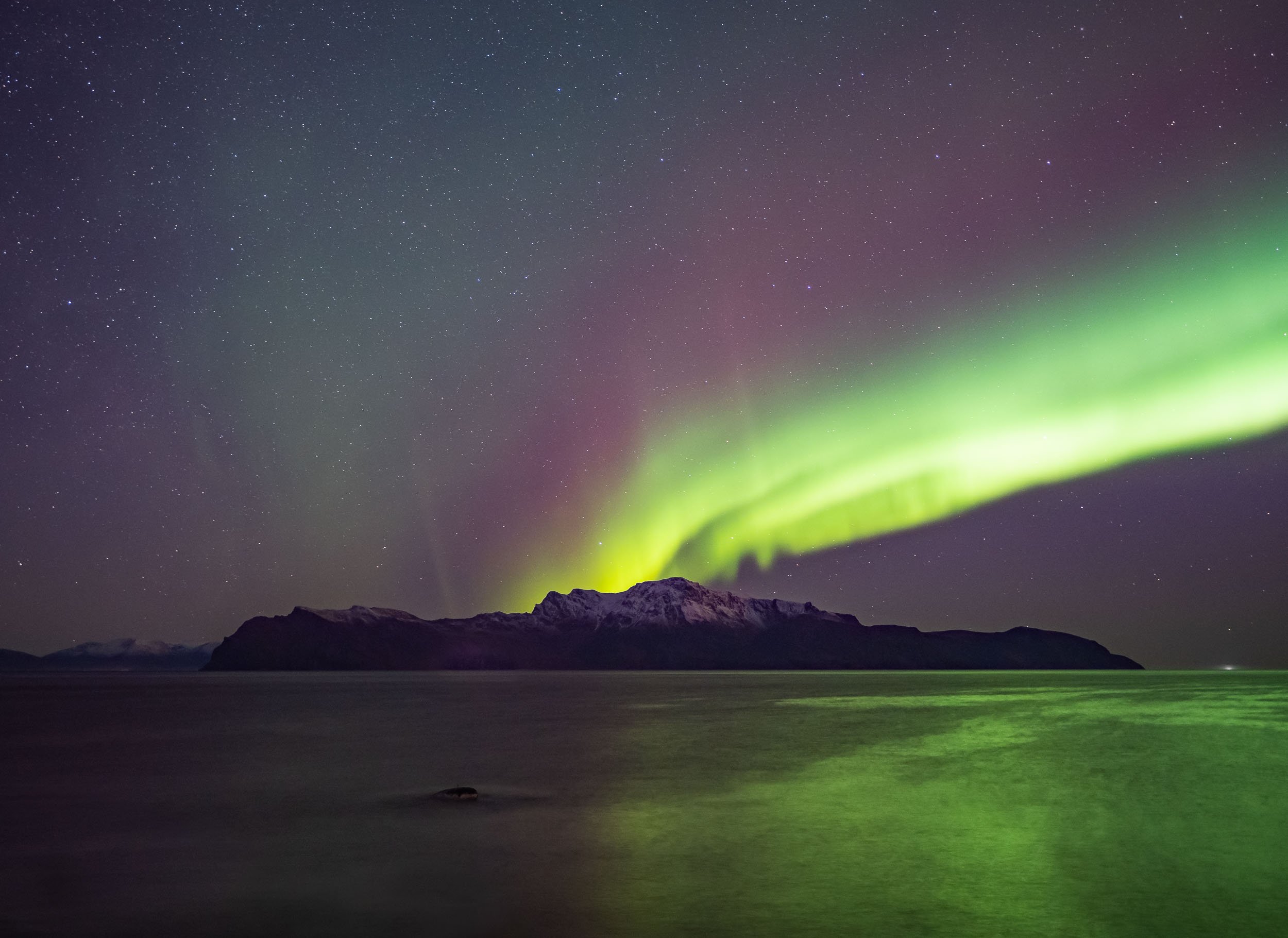
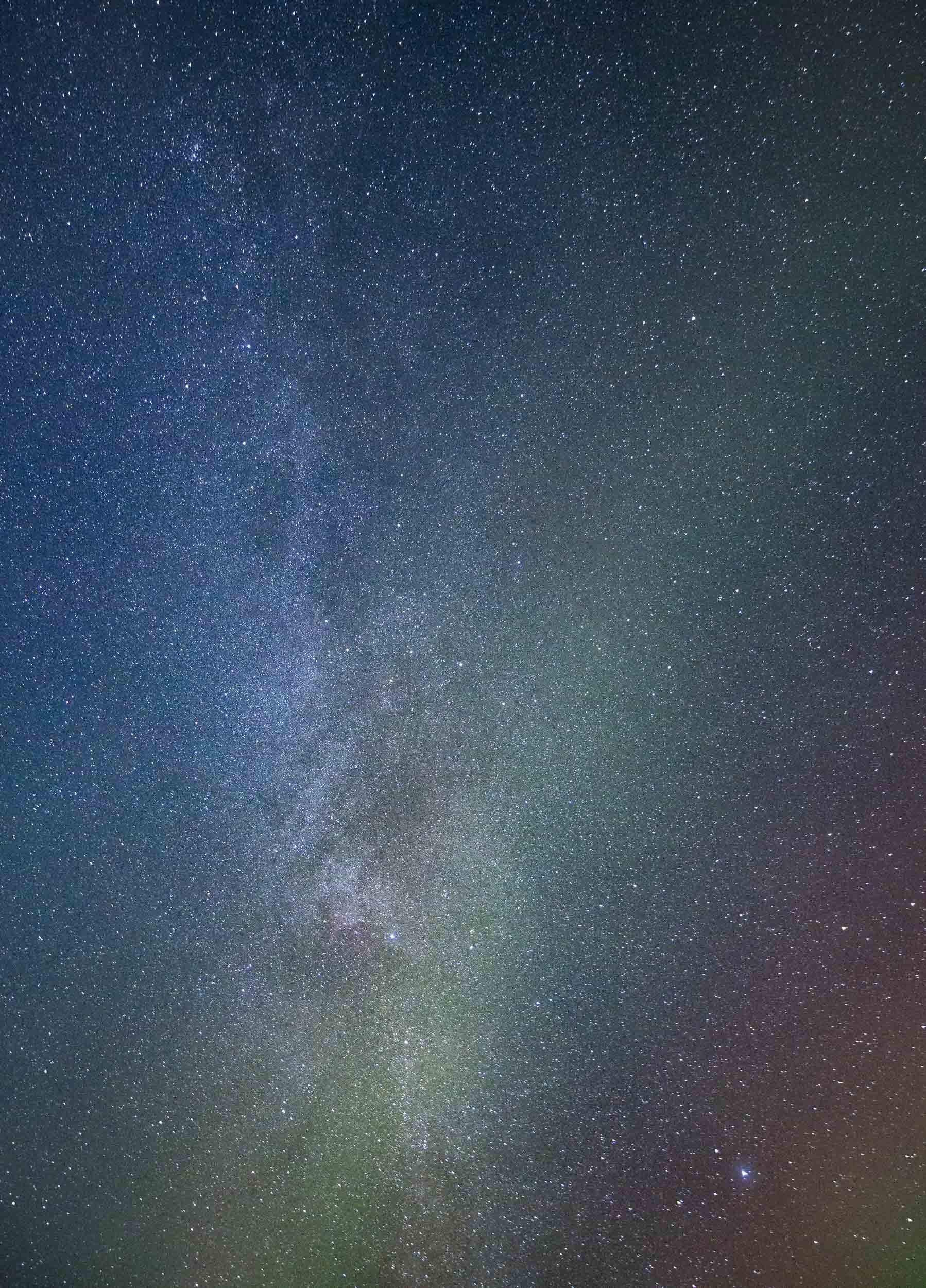
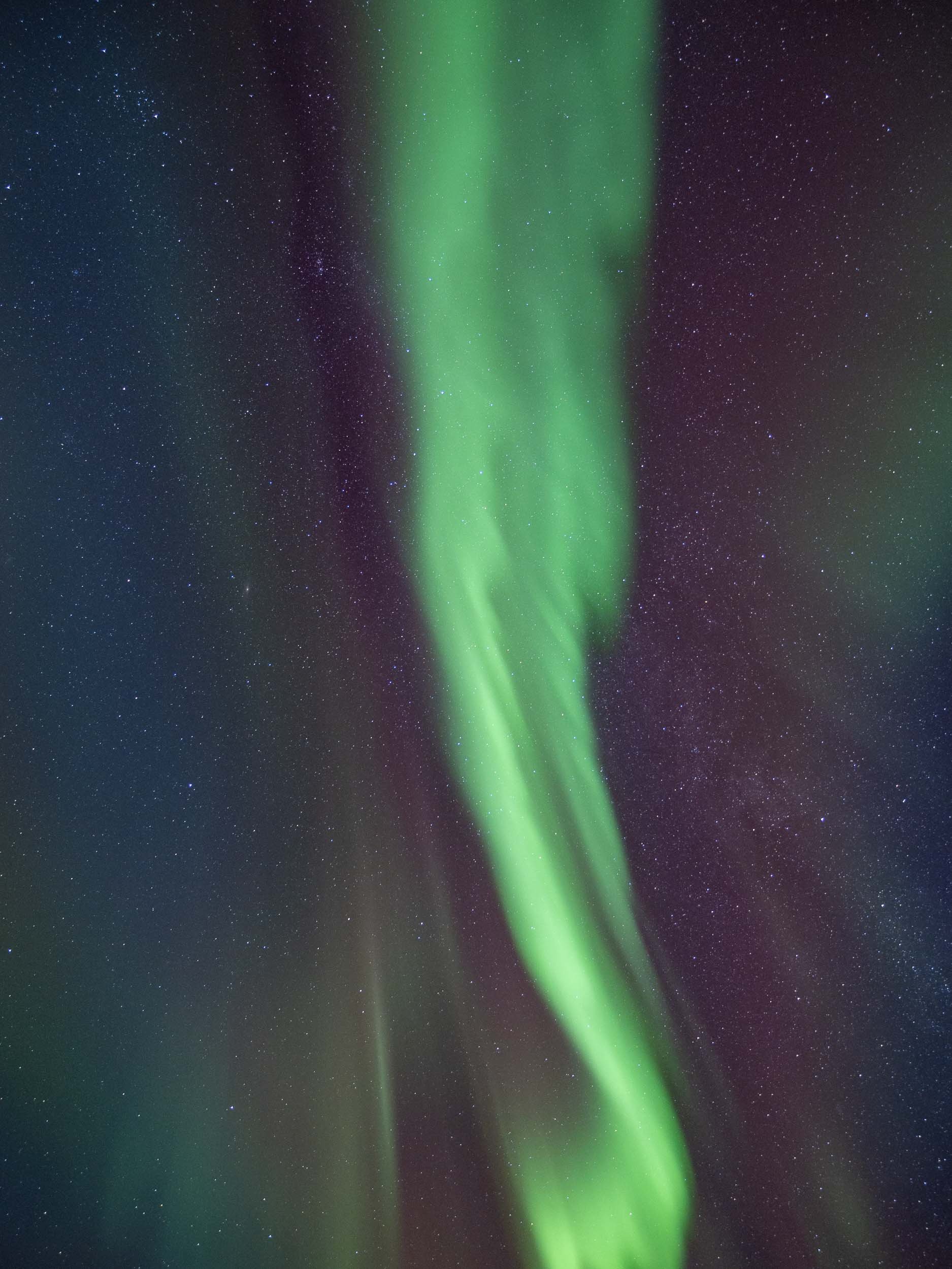
Green Nights
We docked in a few different harbors for the night during the expedition, and had a good chance to see some Northern Lights - of course I couldn’t resist and went out to capture some of the colorful magic in the sky when the conditions were right.

A short timelapse from the same spot. You’ll see my tiny self appear on the bottom right for a few frames at the end.
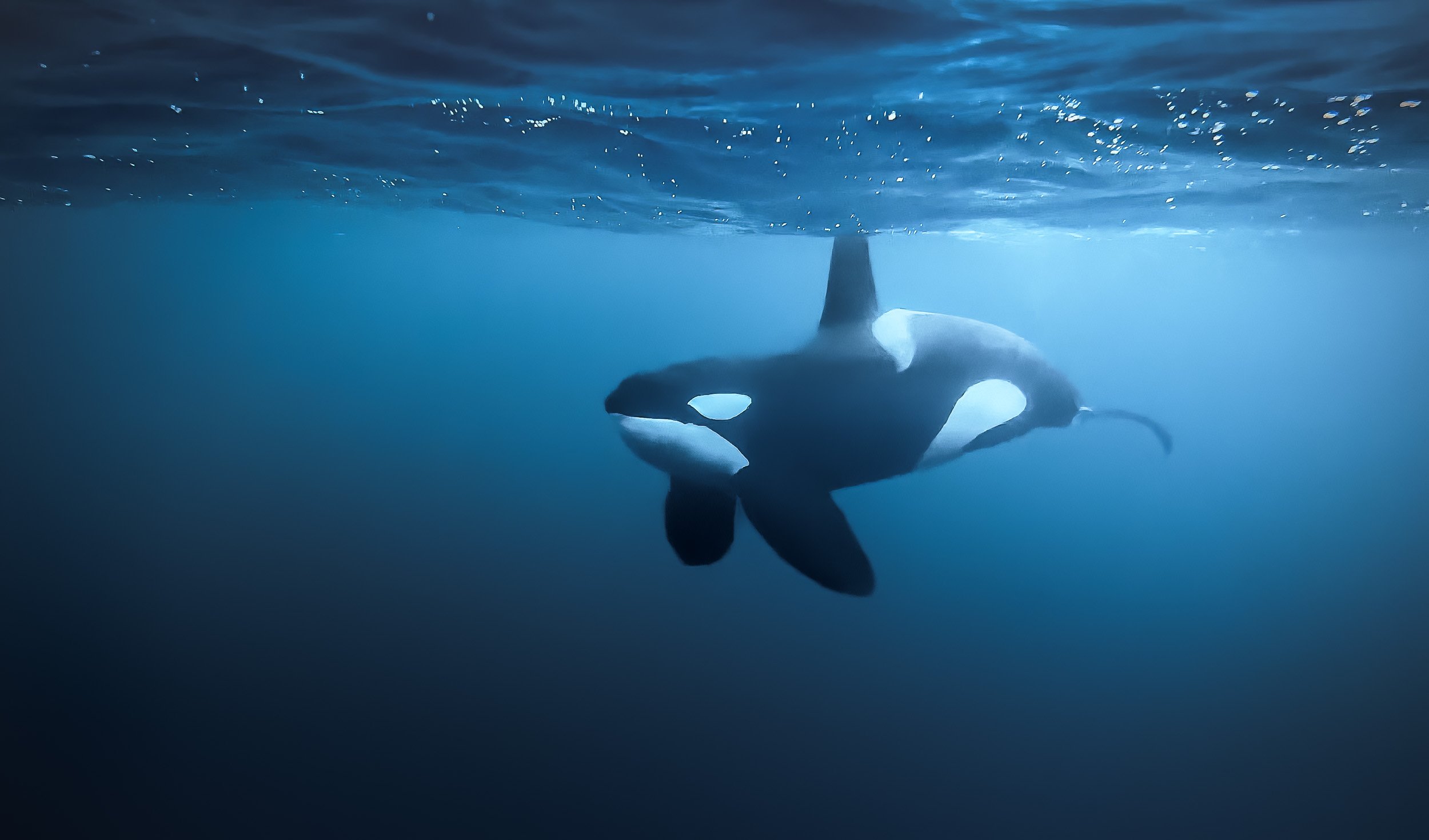
In the Water - The Main Event
Of course, the highlight of this trip was jumping into the water, knowing (or hoping) that there are orca whales that pass you close enough to see them, or even stick around while they are feeding. That sounds simple in principle, but it's often hard to anticipate their movement, approaching carefully and always ensuring to not interrupt their behavior with the dhingy.
The encounters are unpredictable and often very short - by the time you move around in your (huge, buoyant) dry suit, the animals might have reached the coast of Alaska 😉 and you’re only worried that none of that ice cold (5C) water enters the suit you have to wear for the next five hours.
I took all my under water footage with the iPhone in a case. This in principle delivers better results than a GoPro (and a more pleasant focal length) but it took me time to figure out how to avoid focus hunting and in general dealing with the new environment. Rest assured, next time I’ll know better and will have an underwater case for my trusty Olympus camera… Regardless of the photographic outcome, this was truly a privileged wildlife encounter, and ranks high up there for me, maybe only topped (if that) by my time with Craig, the elephant with the largest tusks in Africa.
We had a few amazing encounters, including a feeding where a pod of orca started to work the bait ball. They surround a school of herring and use tail slaps to stun them, then calmly feed. The orcas were joined by a number of humpbacks, and it became a frenzy that was difficult to grasp. This was also the only moment where our guides wisely decided we should leave the water, not due to any aggression, but because a humpback fluke isn’t something you want to be any closer to than necessary. Despite that, I never had the feeling of being in danger. The approach Orcanorway takes is full of respect and appreciation for these animals, and unlike many other such encounters around the world, sanctioned and licensed by the local government.
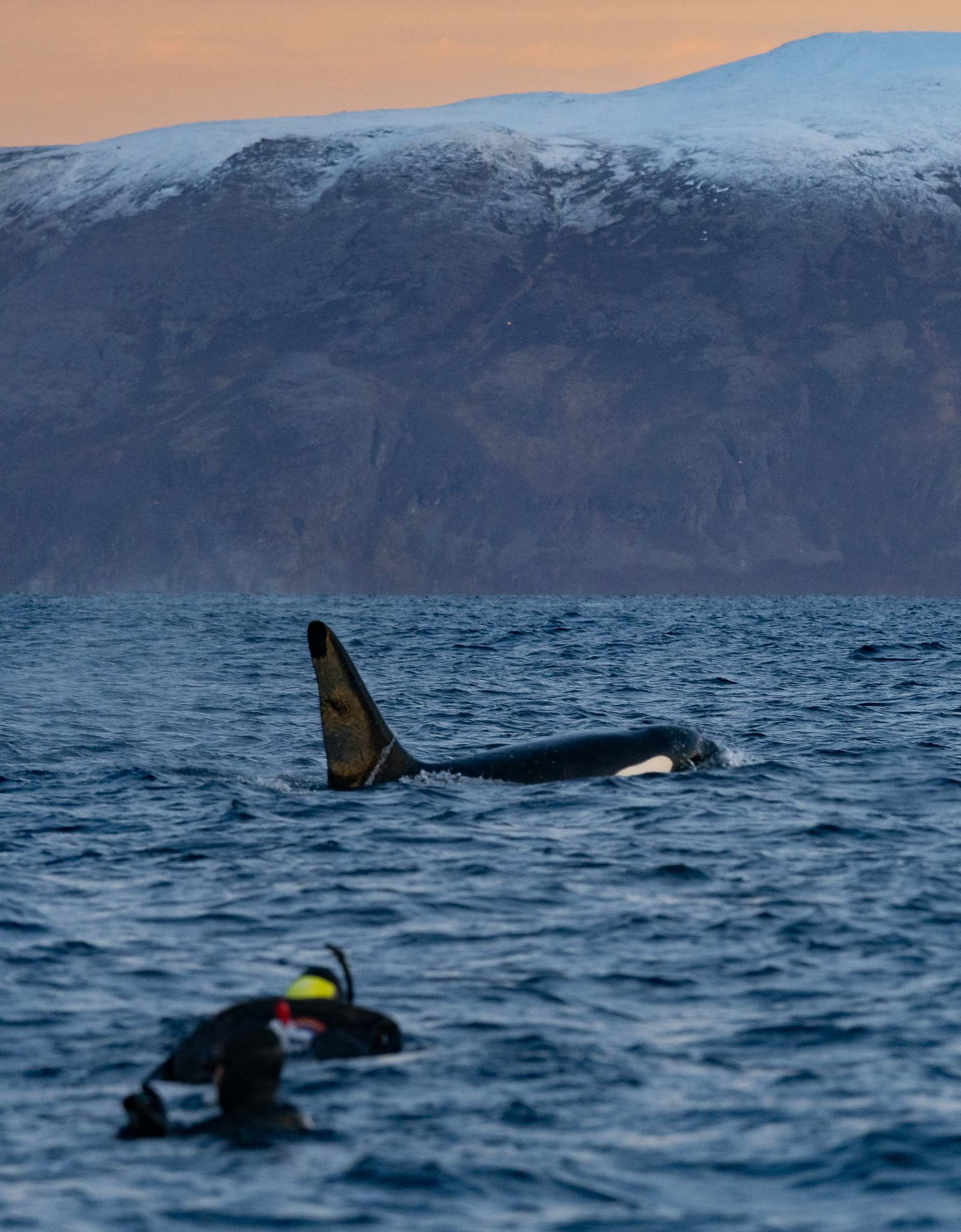
Contrary to the reputation that’s associated with killer whales (it’s in the name already…), there has not been a single documented intentional attack of an orca on a human in the wild. Every incident occurred in captivity, and it’s not surprising given the conditions these jailed individuals have to live in for large parts of their lives.
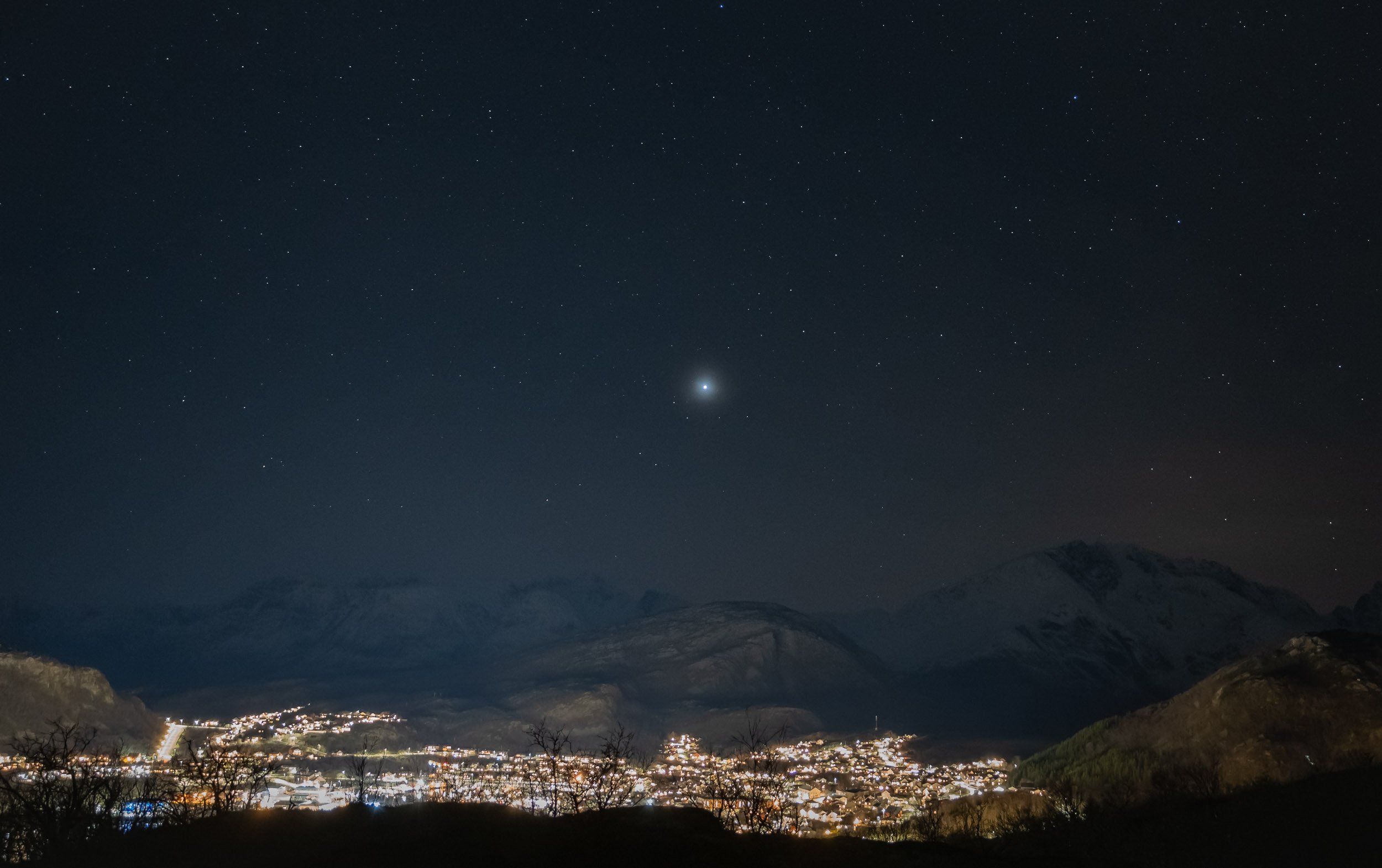
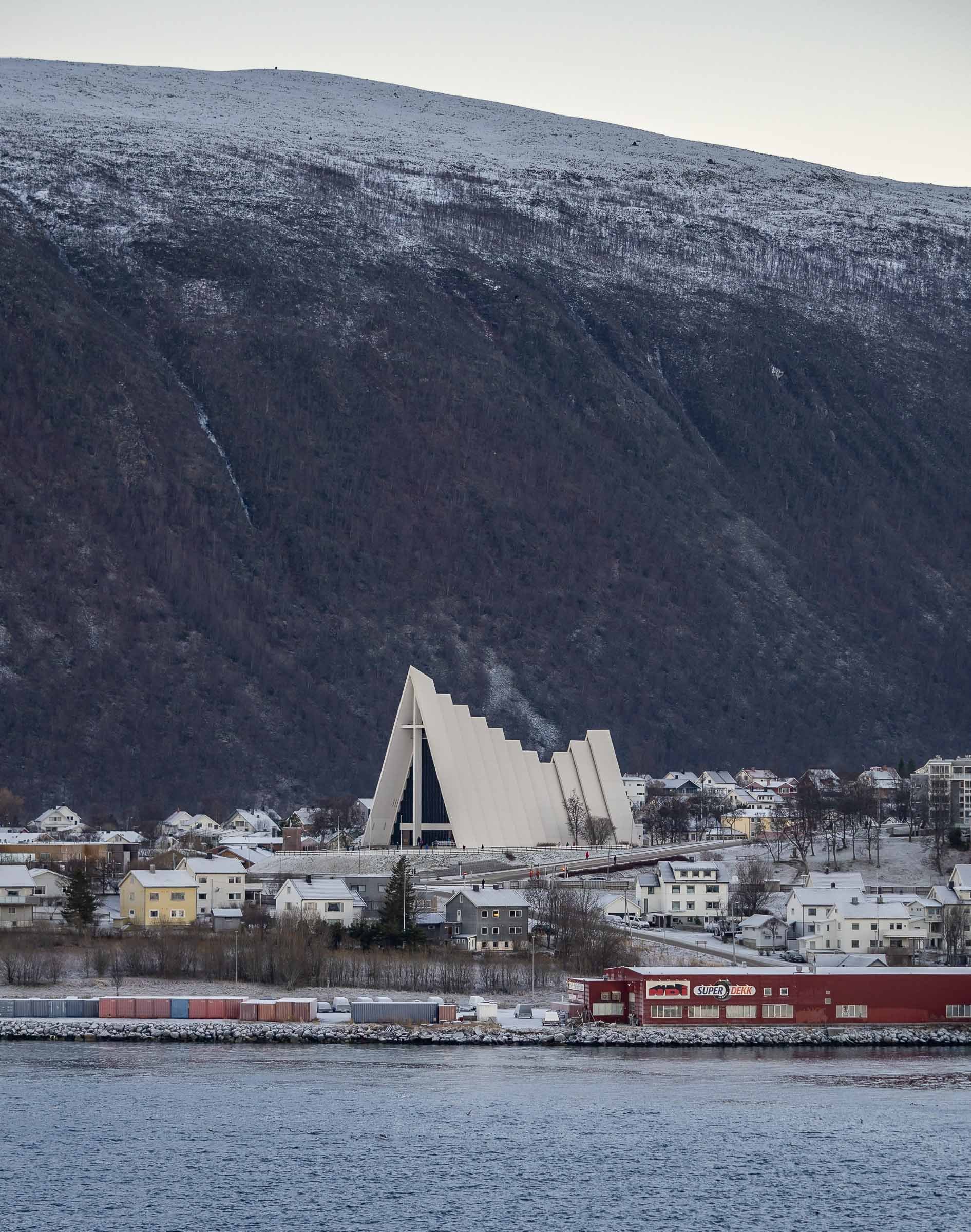
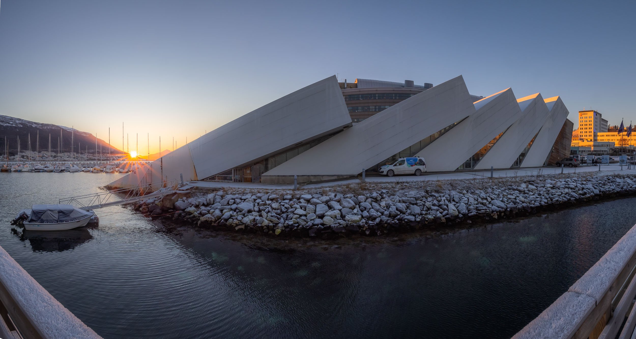
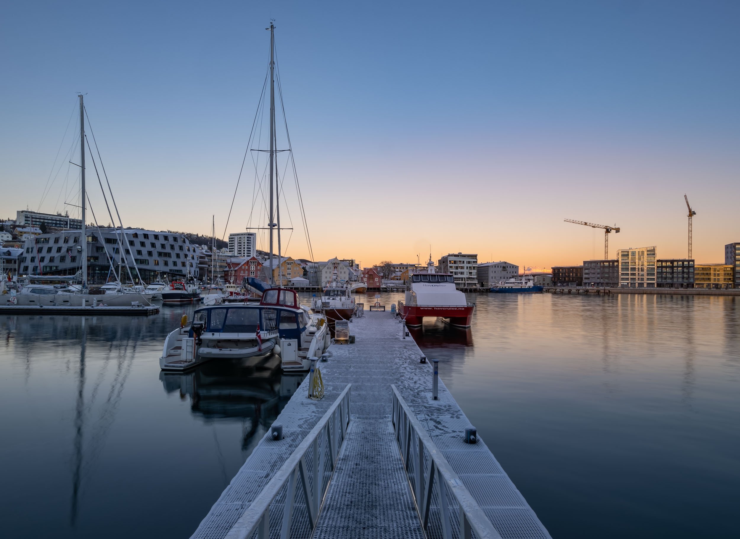
Last Light in Tromsø
After a week on the boat it was time to head back to Tromso - which greeted us with a display of strong Northern Lights, easily outperforming the city’s light pollution. I spent one more day in the city before moving on to Finland (another blog in the backlog).


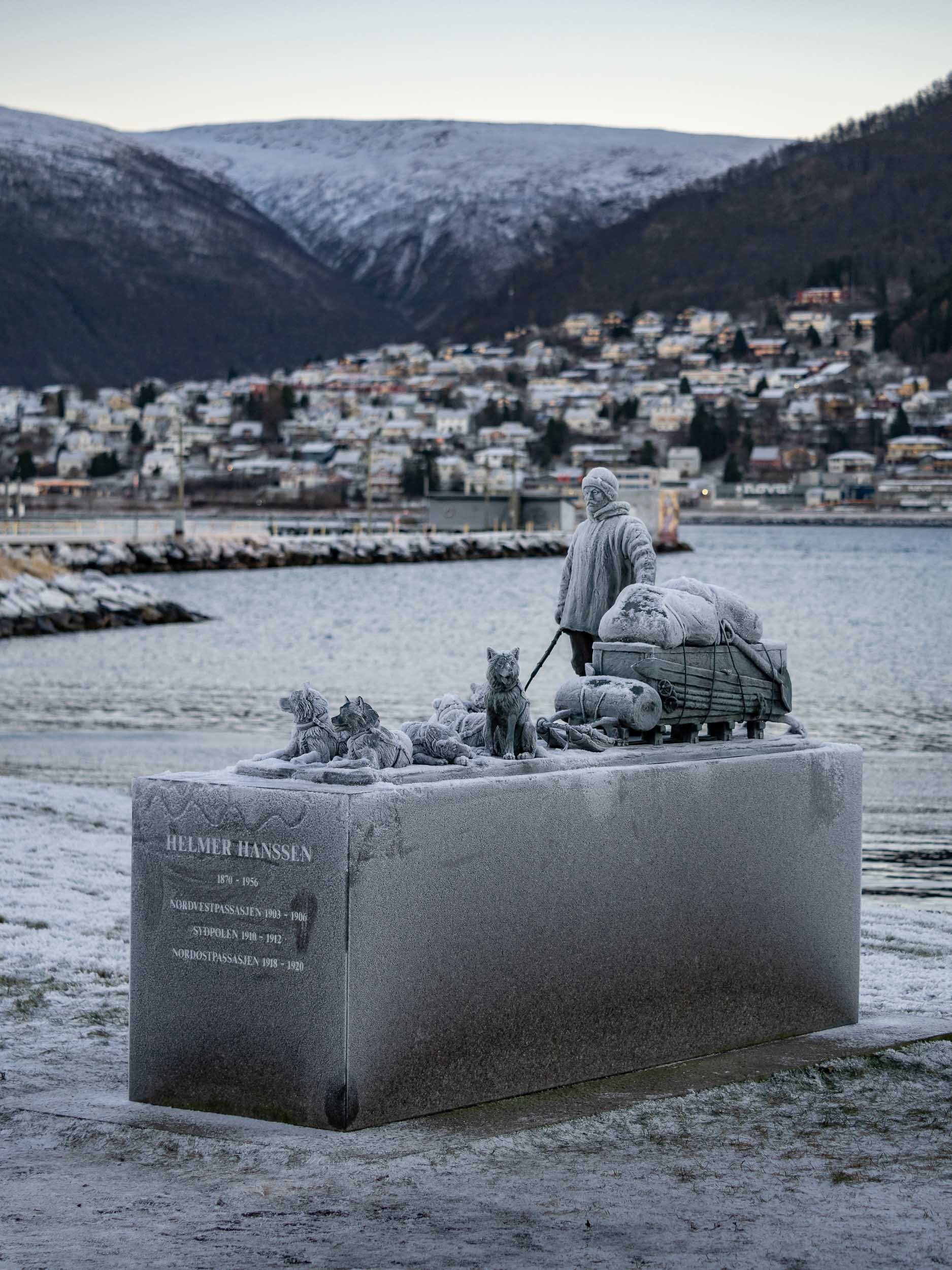
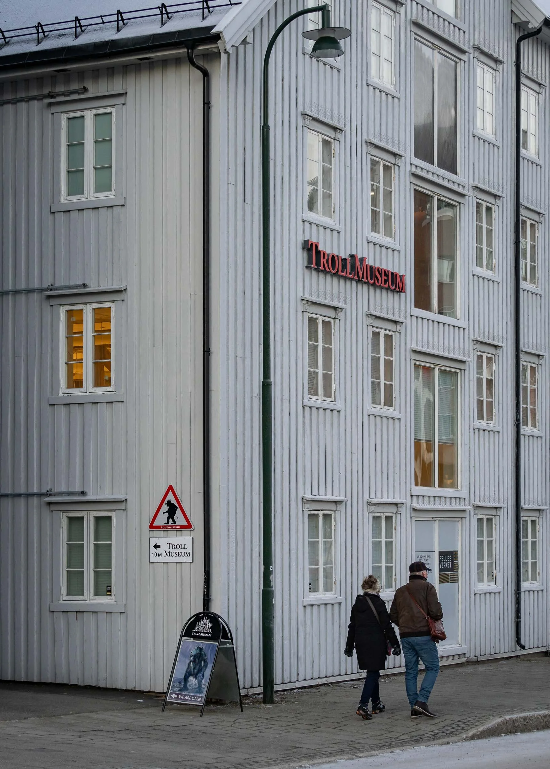

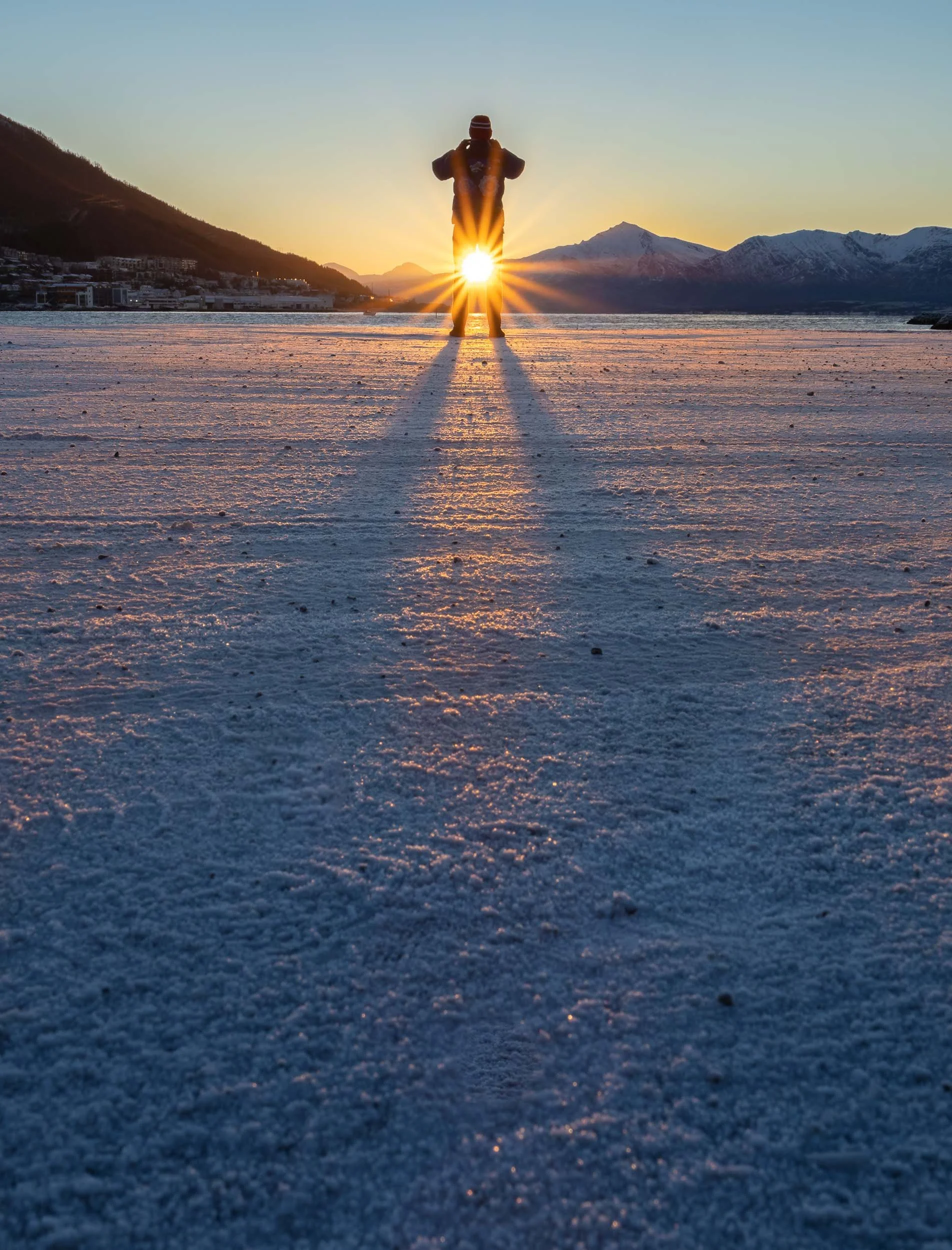

A Final Glimpse
This was taken at pretty much exactly at 12 noon on November 19th, 2022 - just 1 week later, the sun would no longer rise for another 6 weeks or so, only leaving a few hours of blue light during the day for Tromso’s population of 65,000.

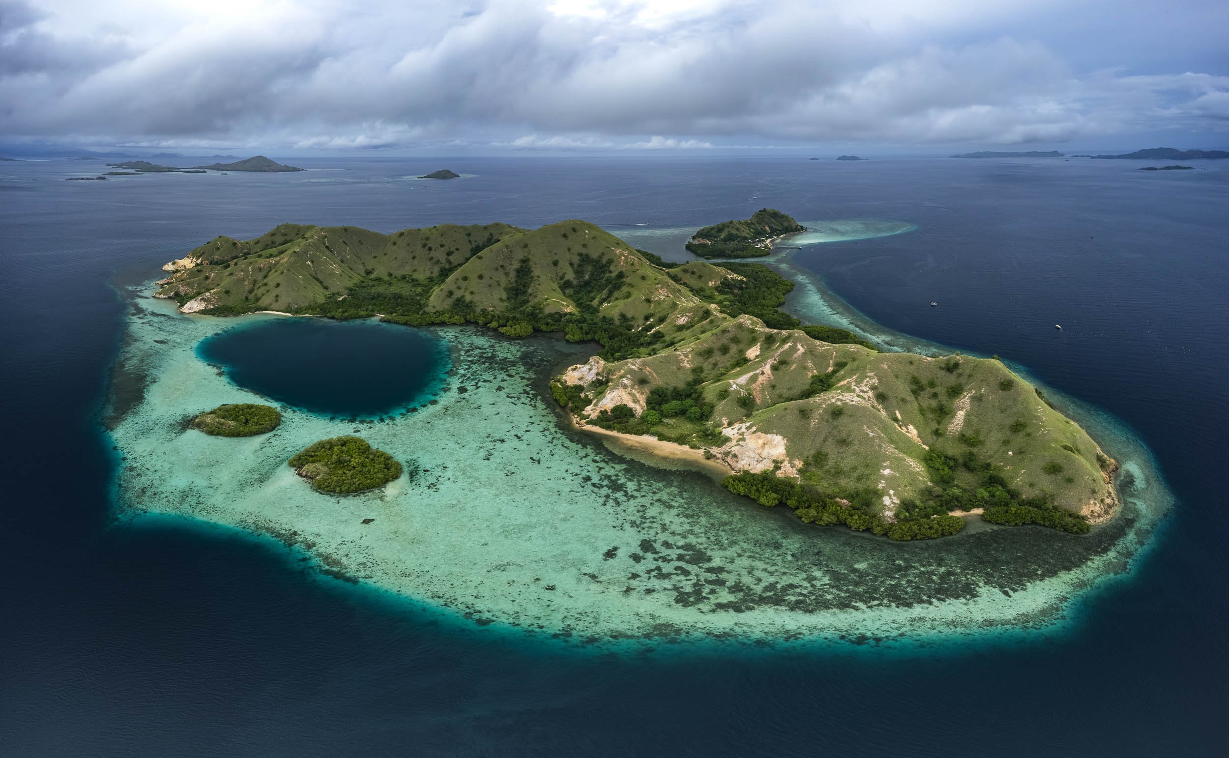
Flores Island & Komodo - Indonesia Part 1
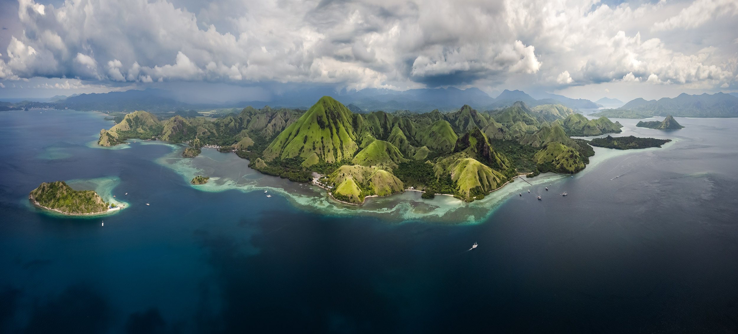
Exploring Flores island and the bordering Komodo National Park, part of the Lesser Sunda Islands in eastern Indonesia.
The amount of photos and videos I took over my 6 weeks in Indonesia has been slightly overwhelming, which is one of the reasons this blog didn’t see any of them yet. There are just too many incredible places to experience and document in this amazing country! We’ll start with the western part of Flores island (my kind of name) and the bordering Komodo National Park, part of the Lesser Sunda Islands in eastern Indonesia. I spent 6 pretty packed days here, 3 of them on a boat around the islands - take a look!
The video below will give you a pretty good overview of some of the most interesting places you get to explore in this part of Indonesia.

Ende & Kelimutu
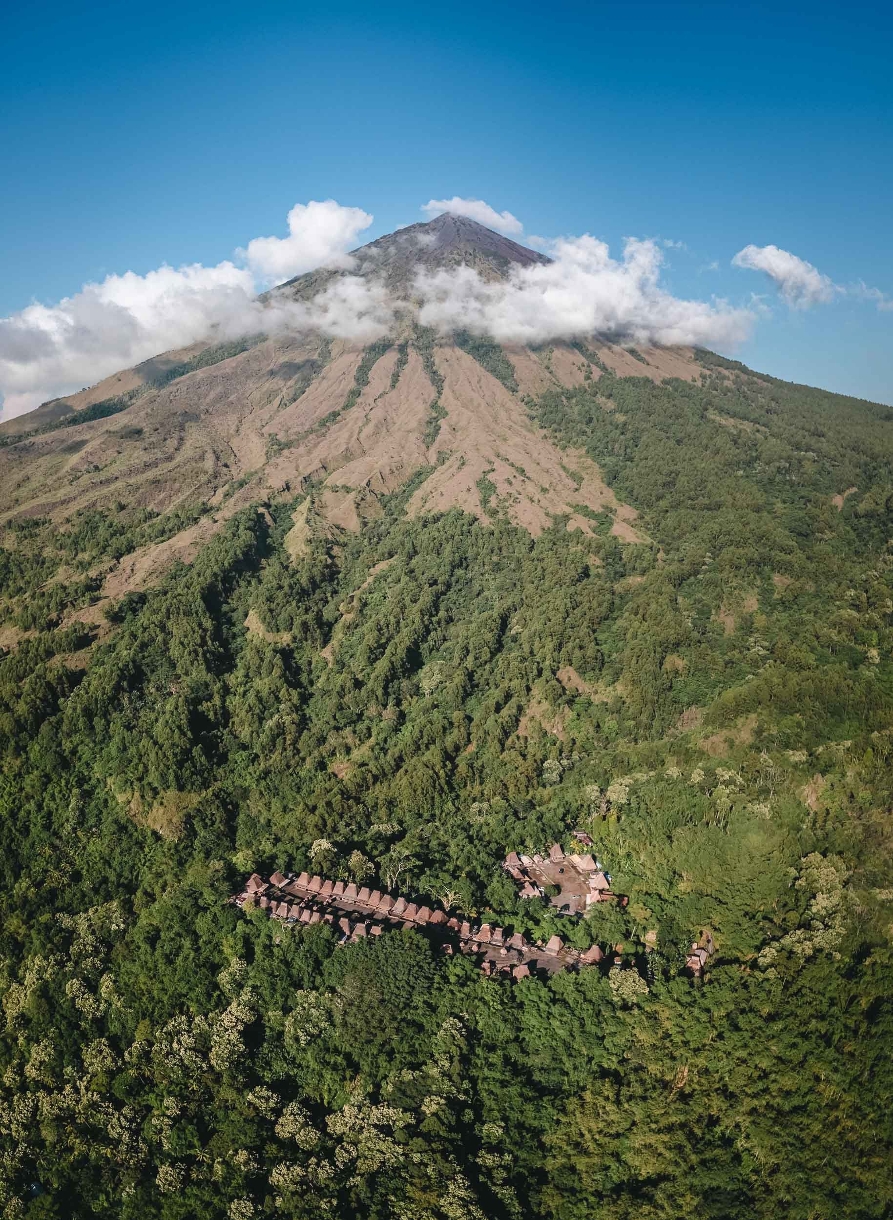
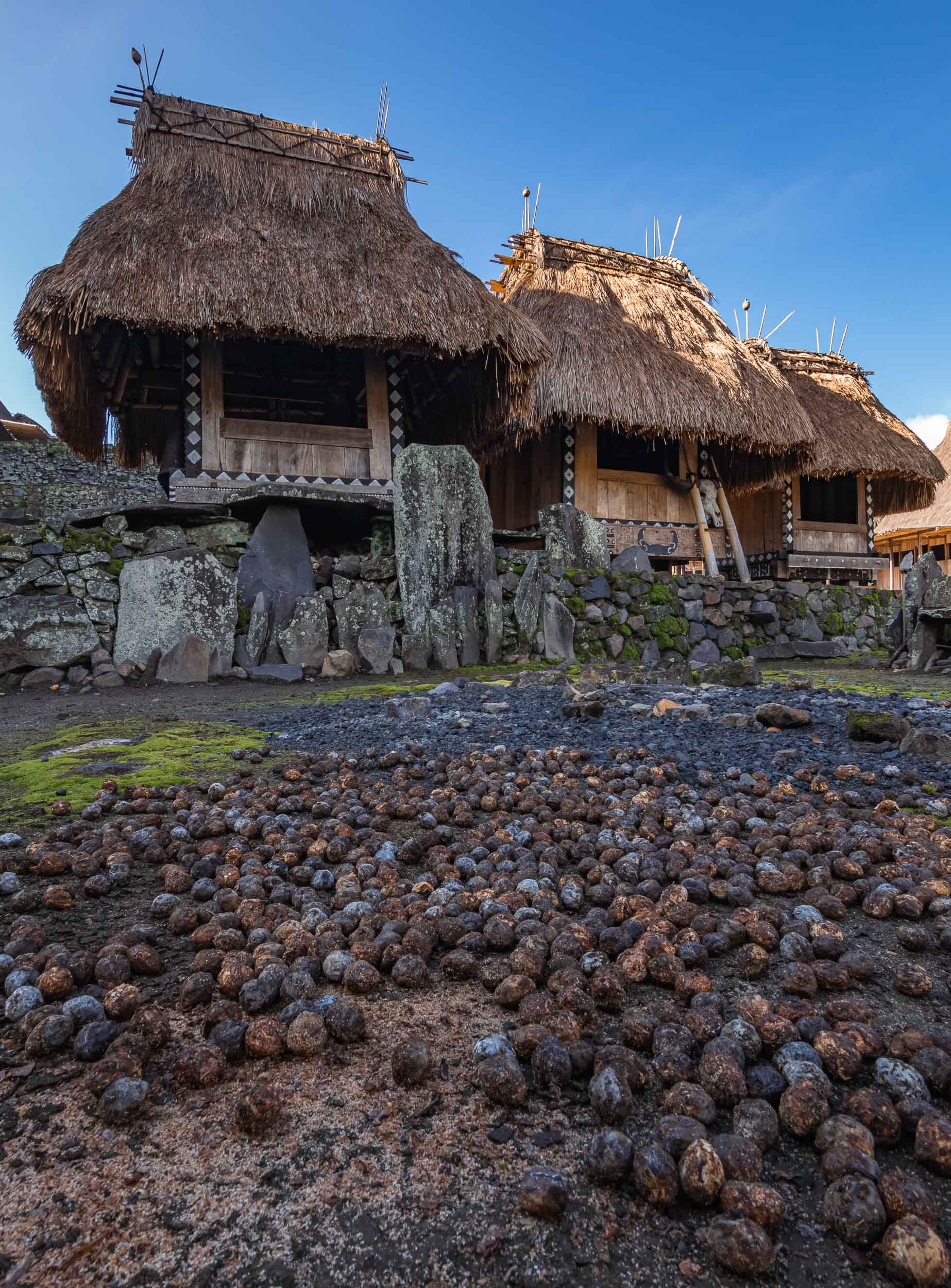
My flight took me to the town of Ende, pretty much in the southern center of Flores (and I didn’t go much further east). The goal was to start with hiking up the Kelimutu Volcano in the first night. On the way, we stopped at some of the beautiful typical rice terraces, and the local Saga and Wologai villages to see some of the traditional houses common to the island.


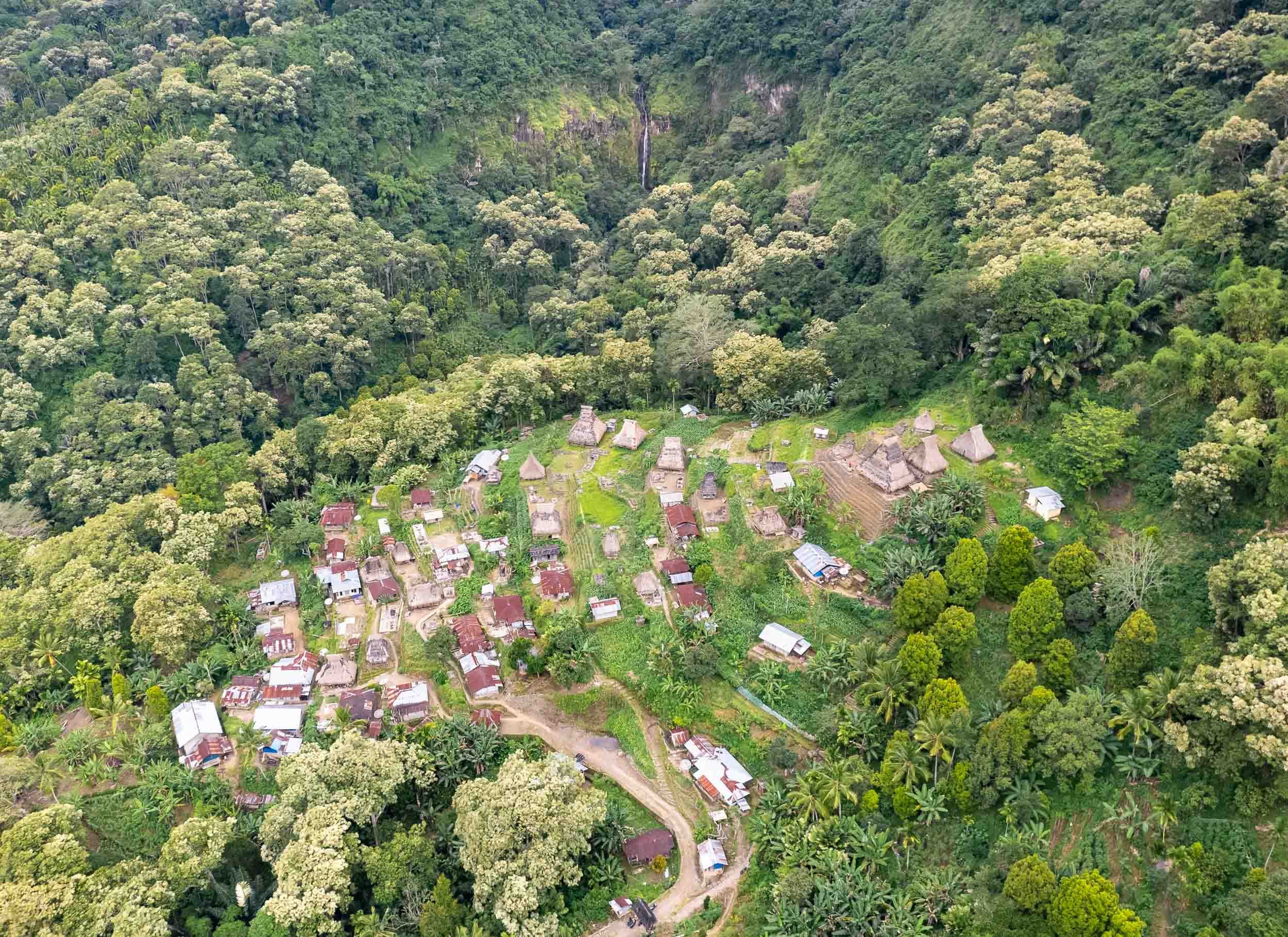


The thatched roofs of Wologai village, one of the many traditional places where you can still observe the daily life of the locals. The houses follow the Lionese architectural style and the village is said to be 800 years old.
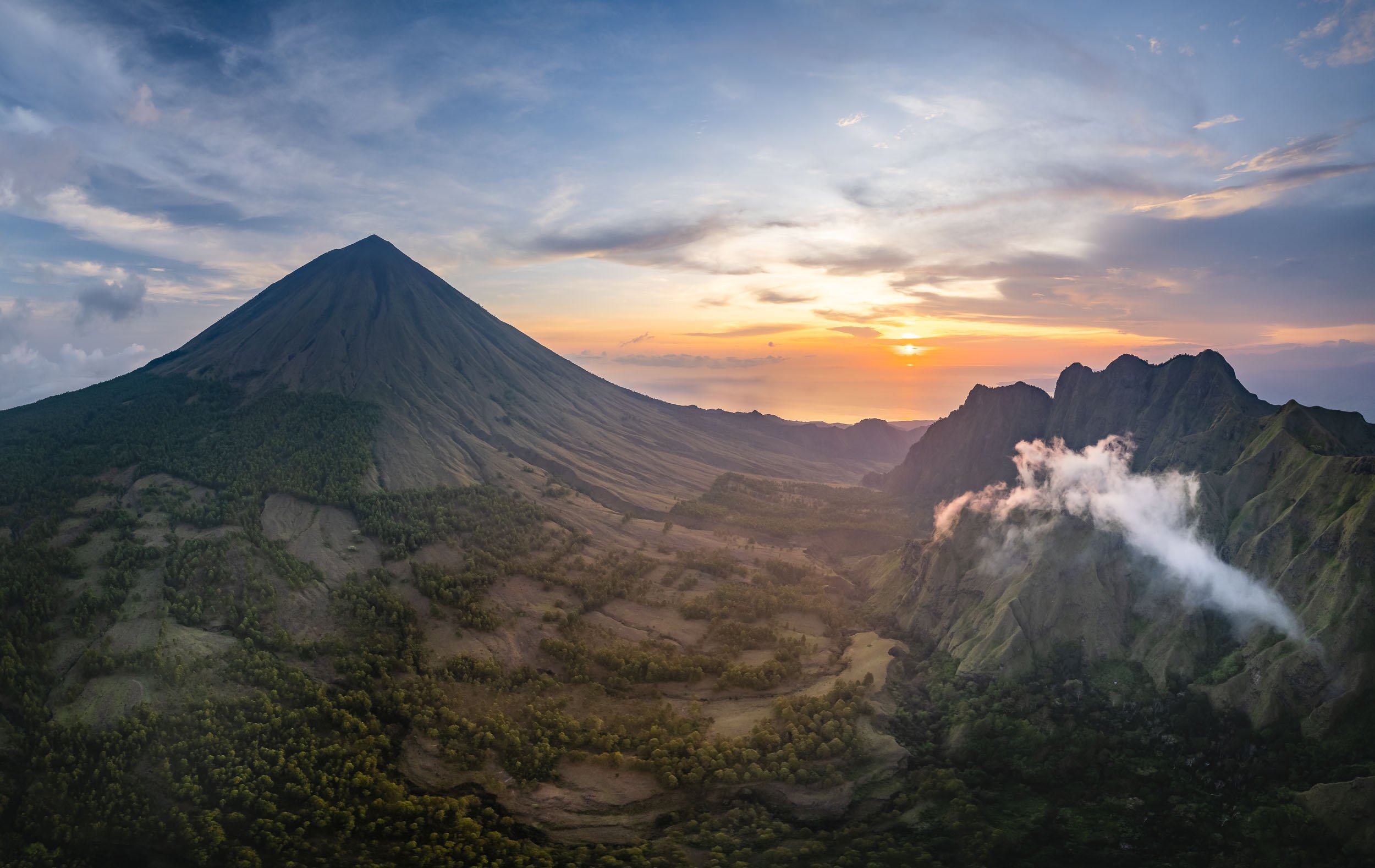
Kelimutu - Volcano of the Dead
An early start around 3am ensured that we’d reach the Kelimutu Volcano with its three lakes for sunrise. After an hour hike, the stairs along the last few hundred meters to the crater’s edge lead us into colorful clouds, which slowly faded away as the sun rose.


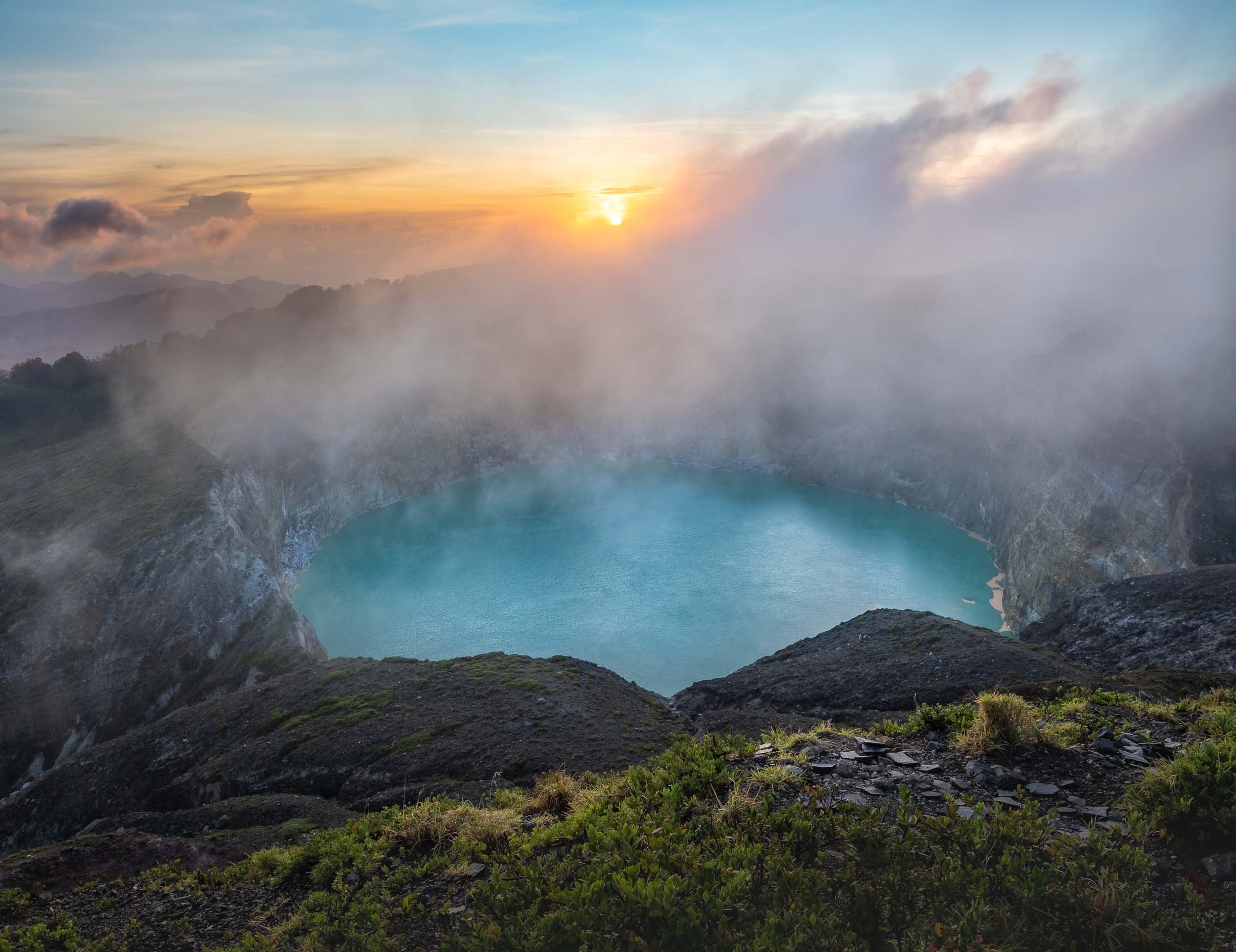
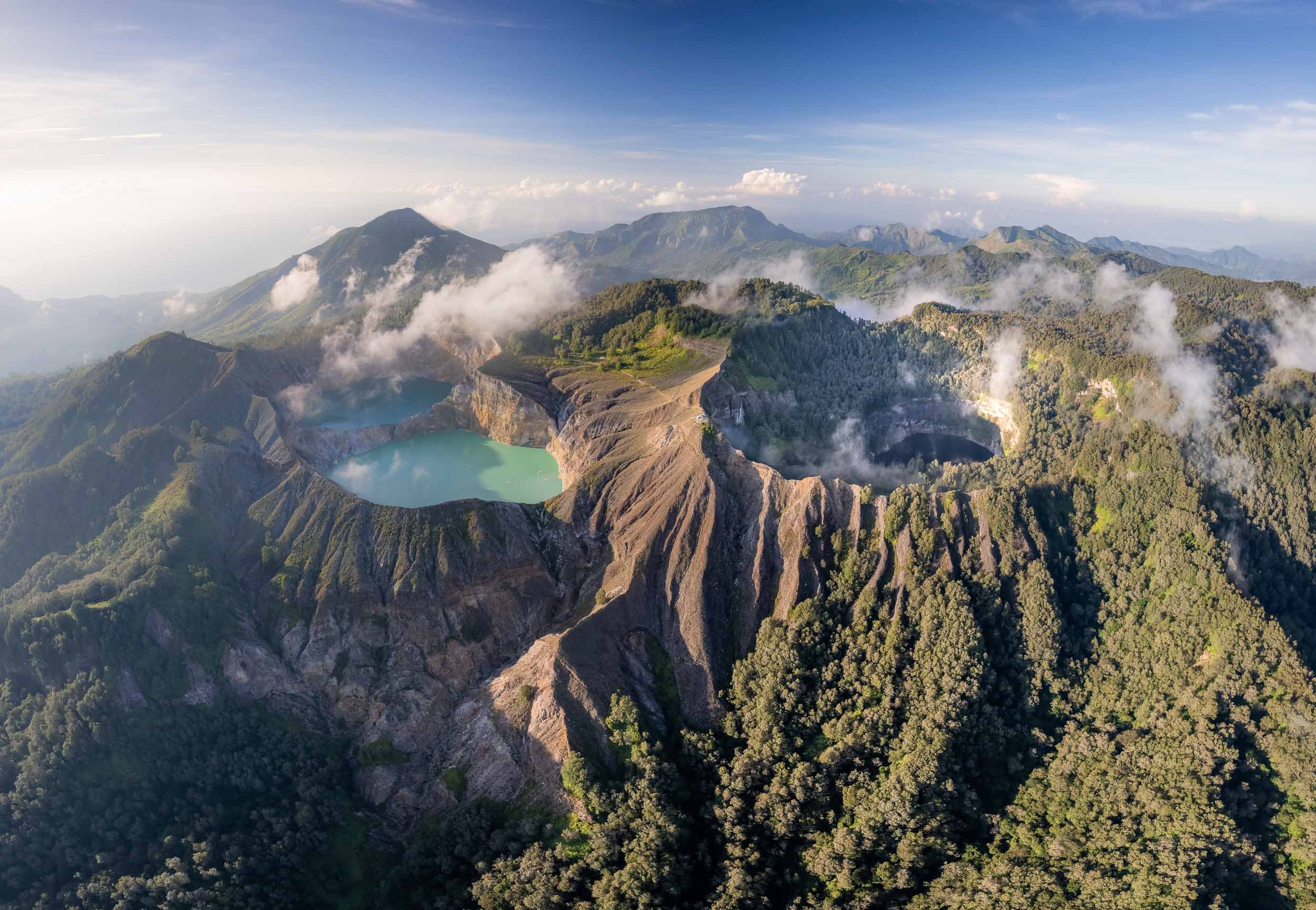
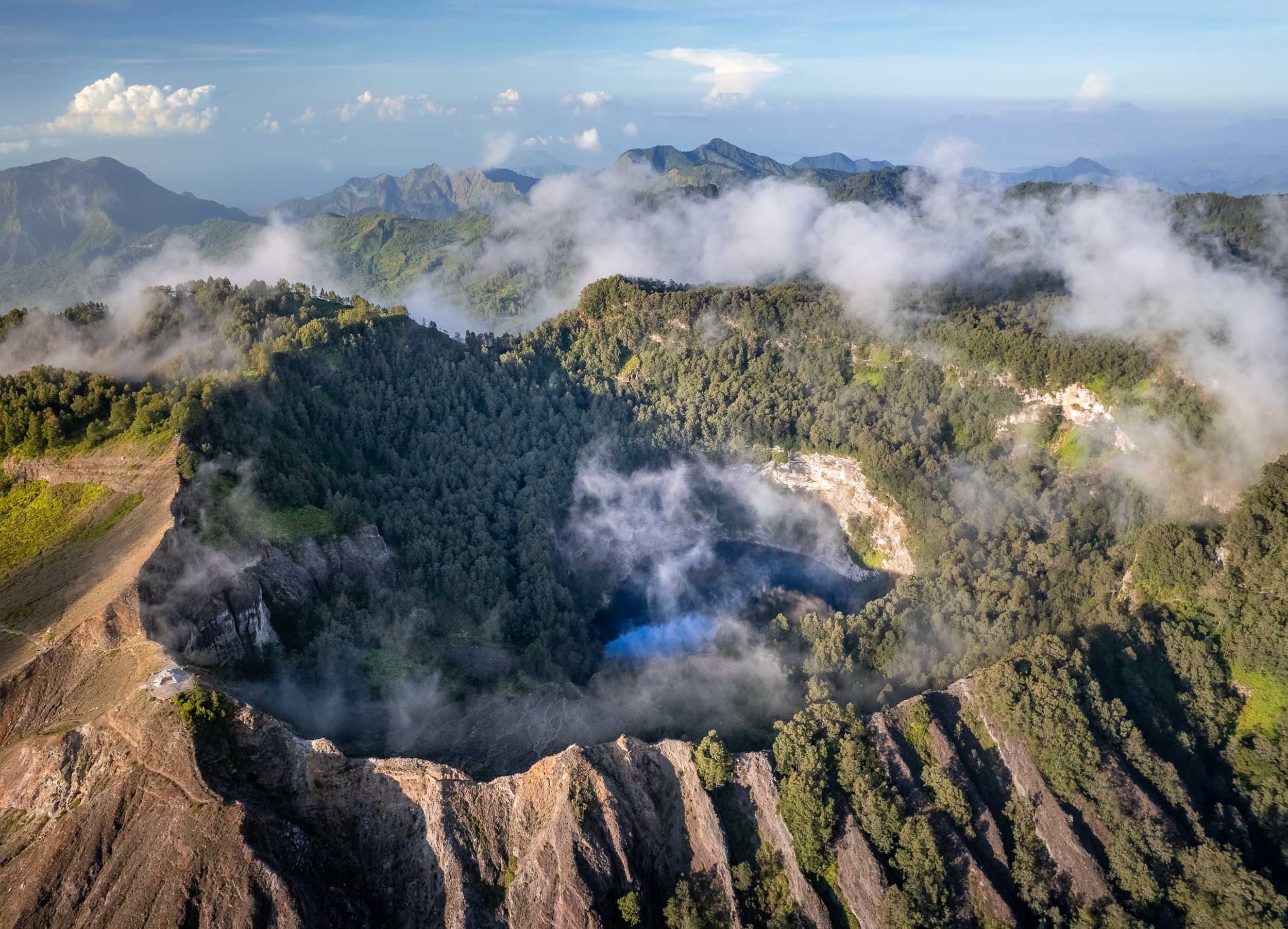
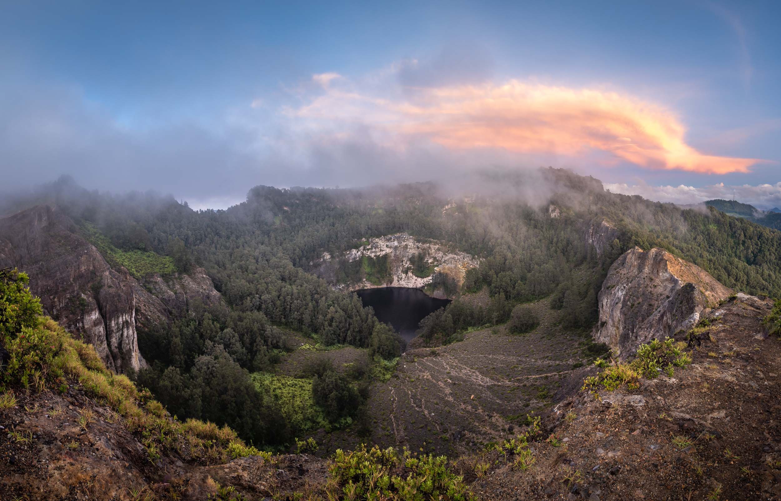
Close ups of the crater lakes, showing the smoke over the water and their different hues. Between January and November 2016, the colors of the crater lakes are said to have changed six times.

The way down leads through the Kelimutu National Park and its beautiful flora and fauna.


The Blue Stone Beach
We continued our journey in the morning after returning from the volcano. On the coastline in the south of the island lies another colorful phenomenon….
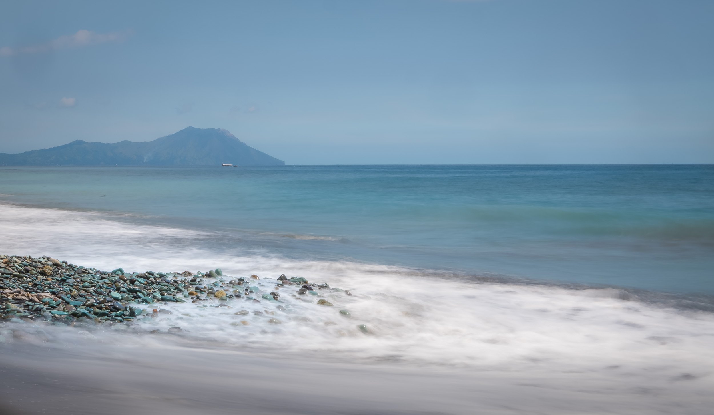


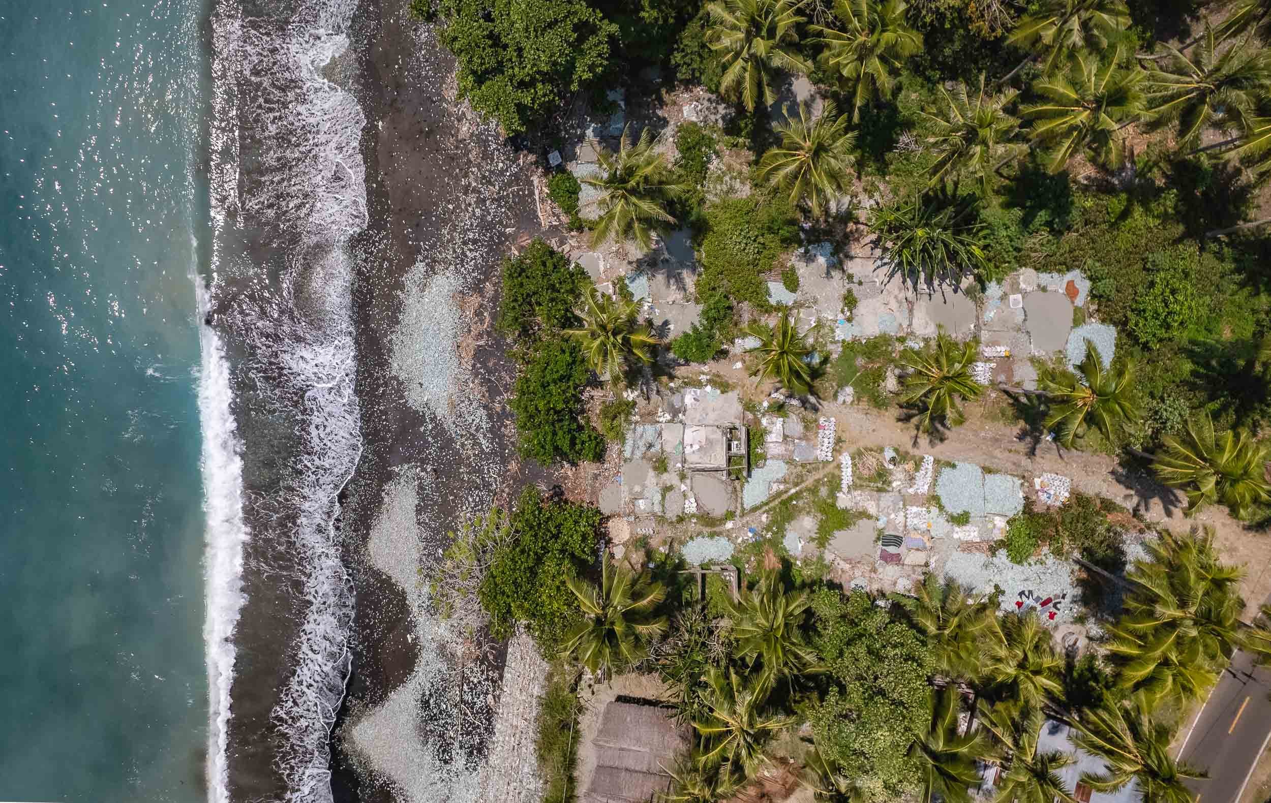
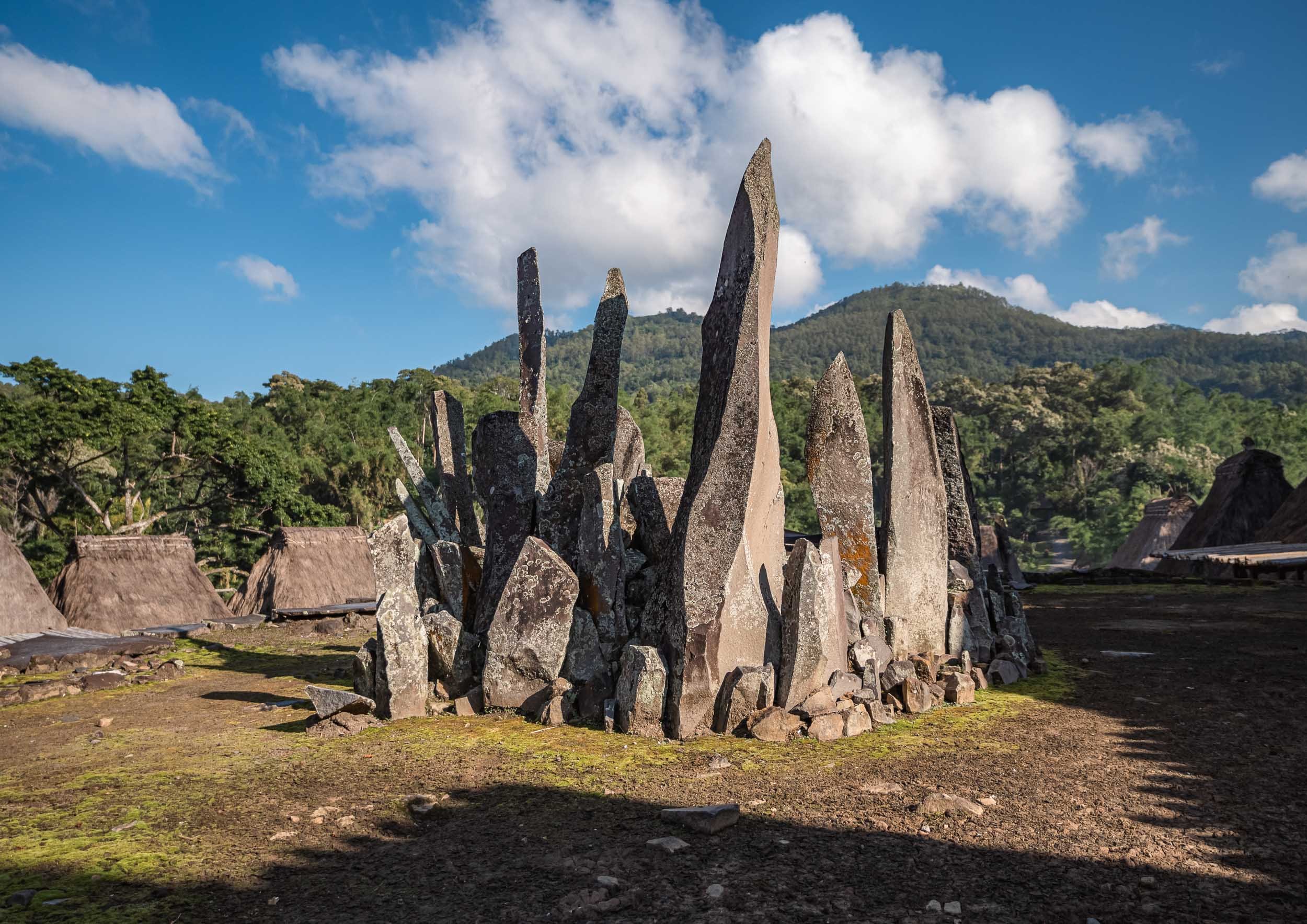
Volcano Village
Near the town of Bajawa lies the the small traditional village of Bena, one of the primary remnants of the preserved Ngada culture in the region.
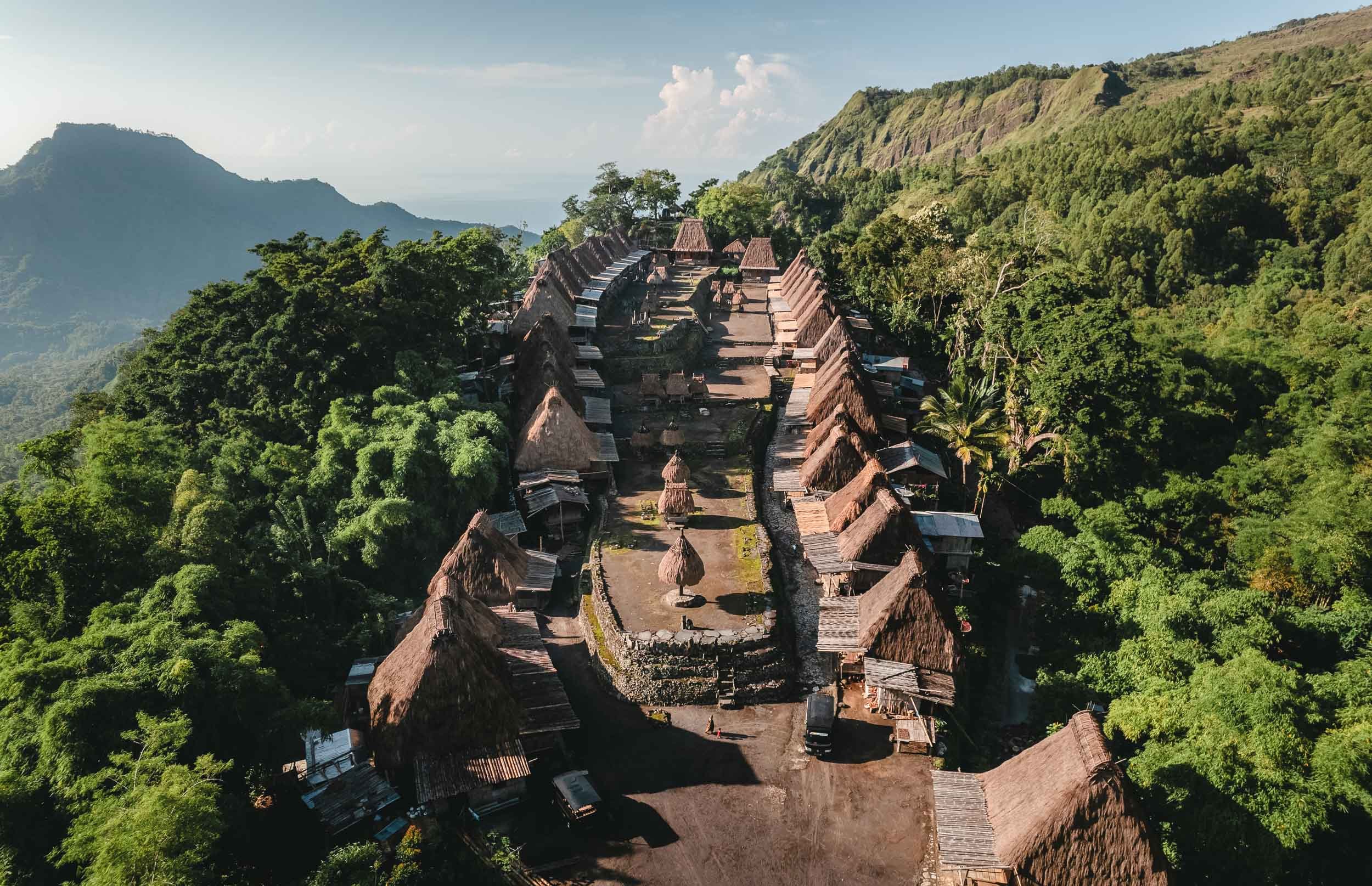


The Ngada traditions date back 1200 years and can still be observed in the village, even though some of the locals now focus on selling souvenirs to tourists.


Some of the local villagers in the town - arrive early morning to observe some of the daily rituals.
From Bajawa to Ruteng
The road westwards led us past a small local distillery making Arag and fresh palm juice. The owner insisted on showing me how they are harvesting the fruit from the palm trees, climbing up to the top with a cigarette permanently attached to his lips. Understandable I suppose, he needed his hands free.


Some of you might know that I don’t drink (or like) alcohol, but of course I couldn’t refuse a sip after I saw the effort that went into making it. Let’s say it won’t change my stance, but on the other hand it wasn’t the worst alcohol I tried in Indonesia. More on that in another blog (watch out for my time in Borneo).
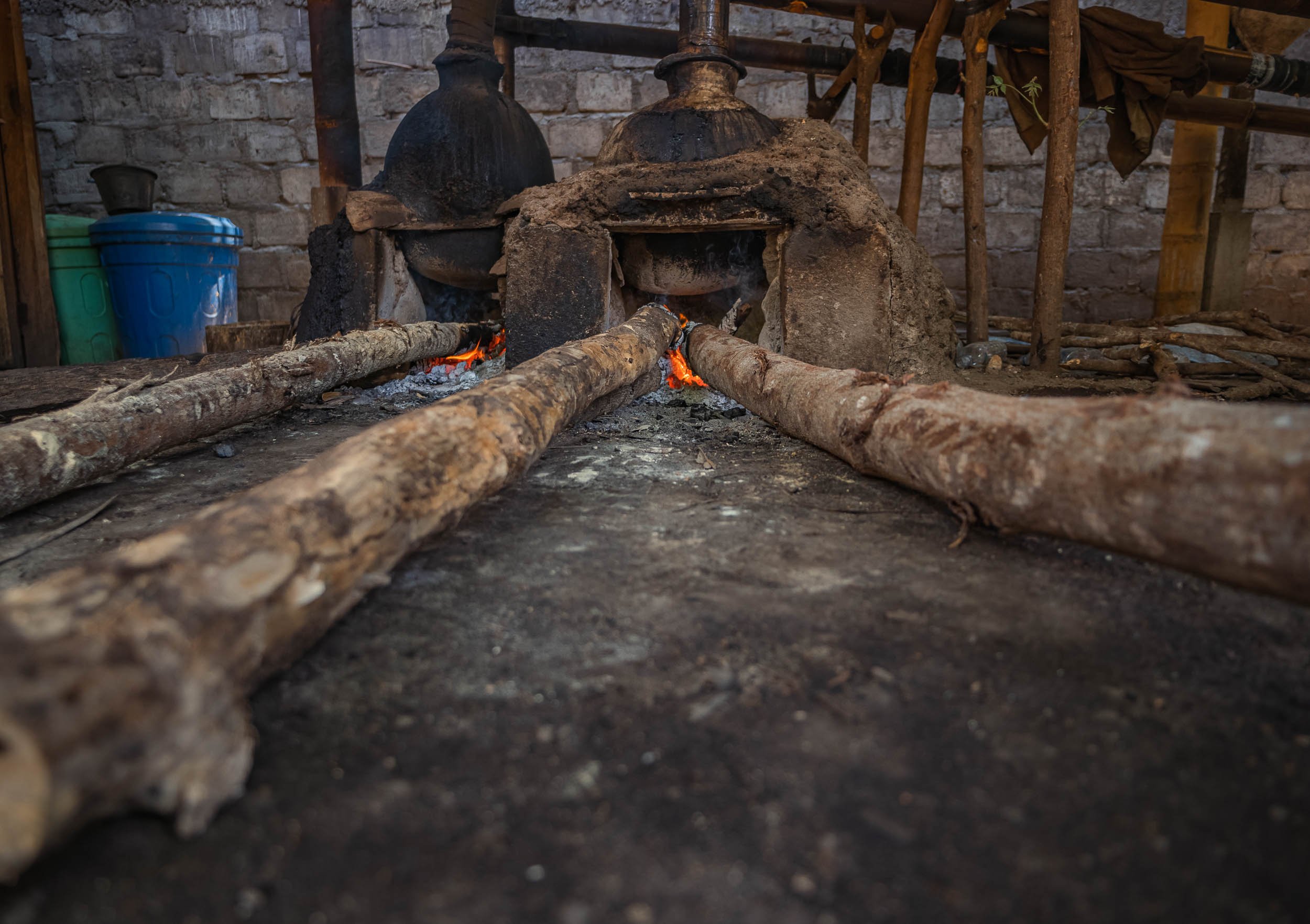
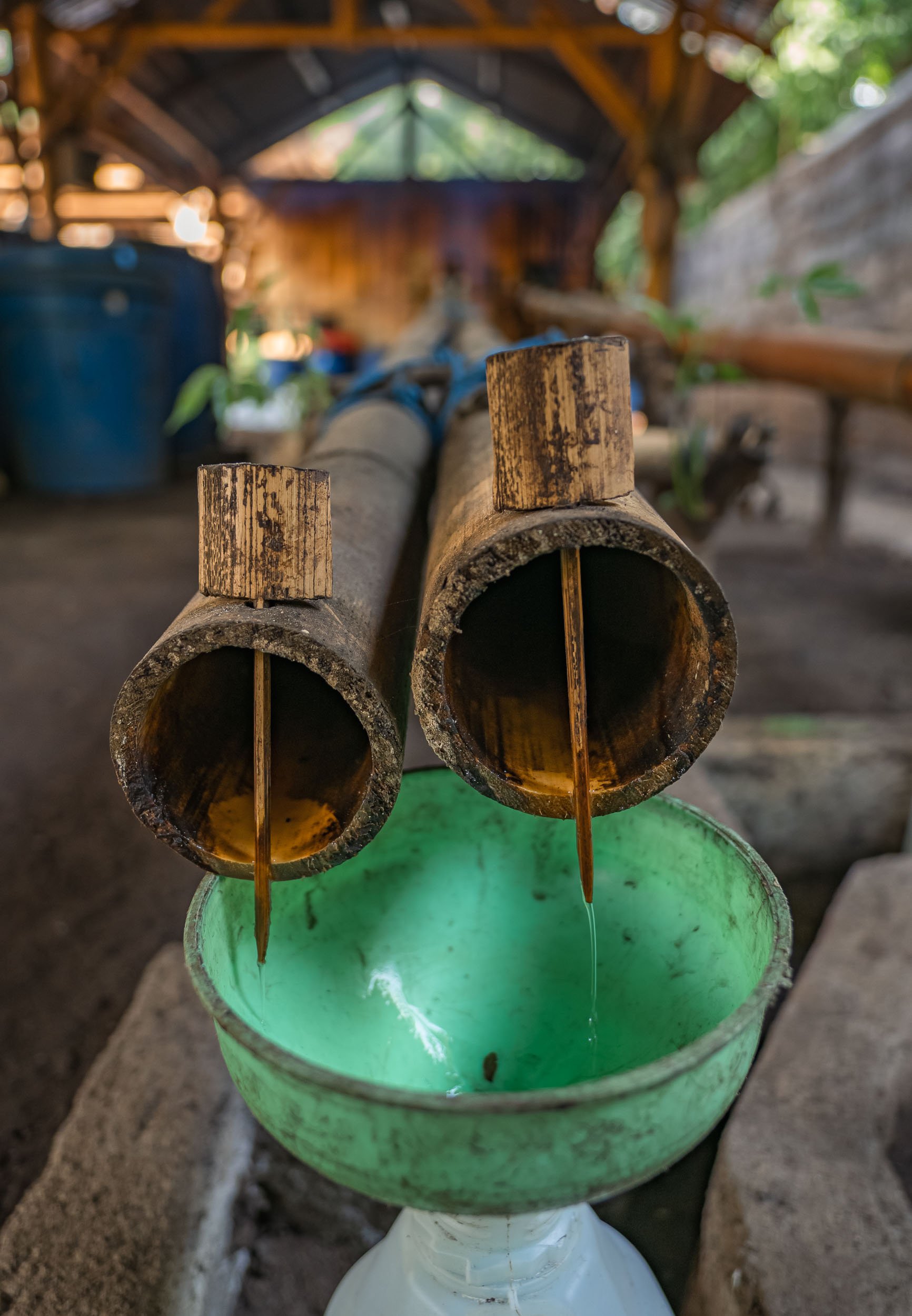
The clay oven powering the distillery. The entire process is based on locally made tools and tricks passed down through generations, such as these bamboo pipes.
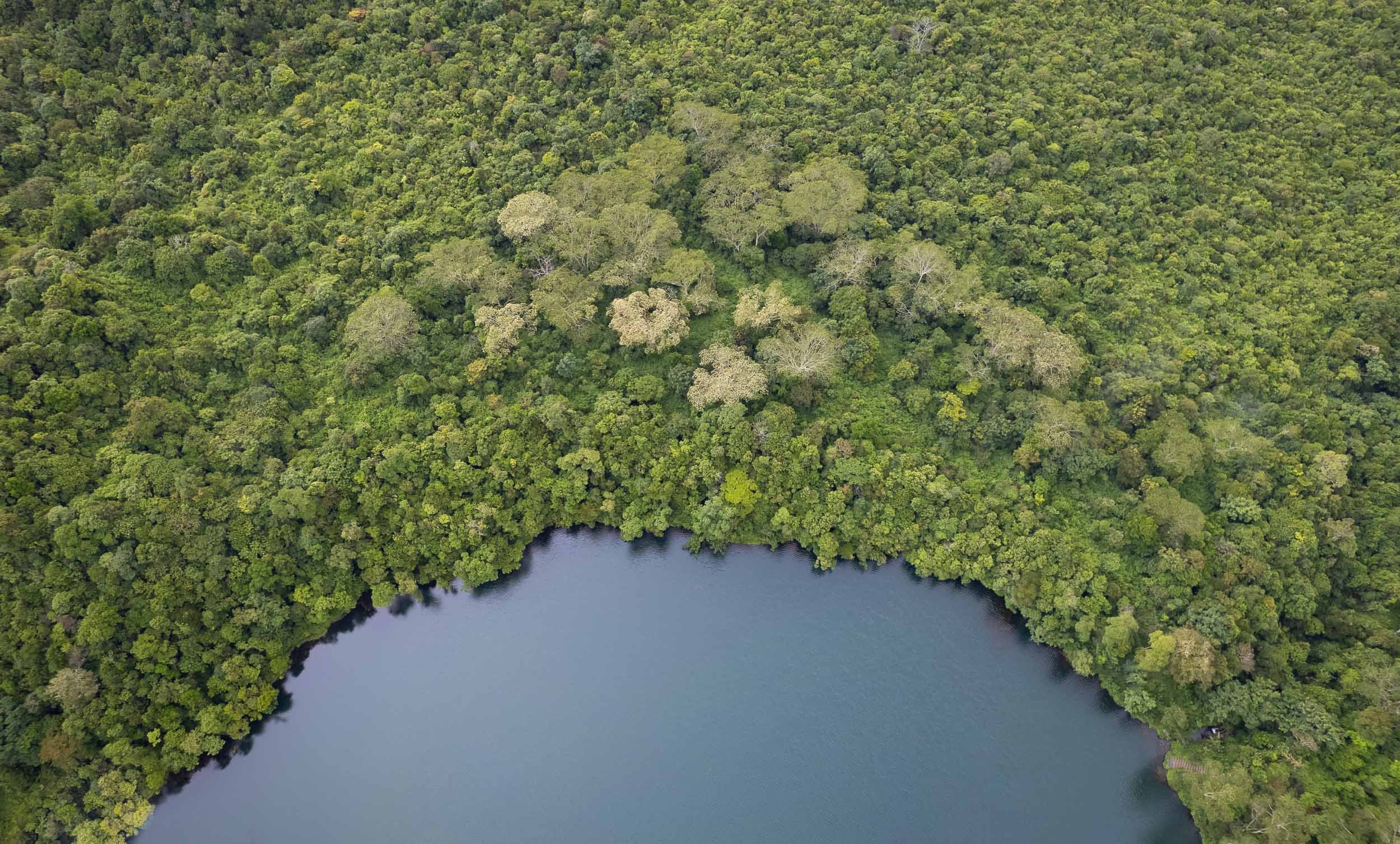
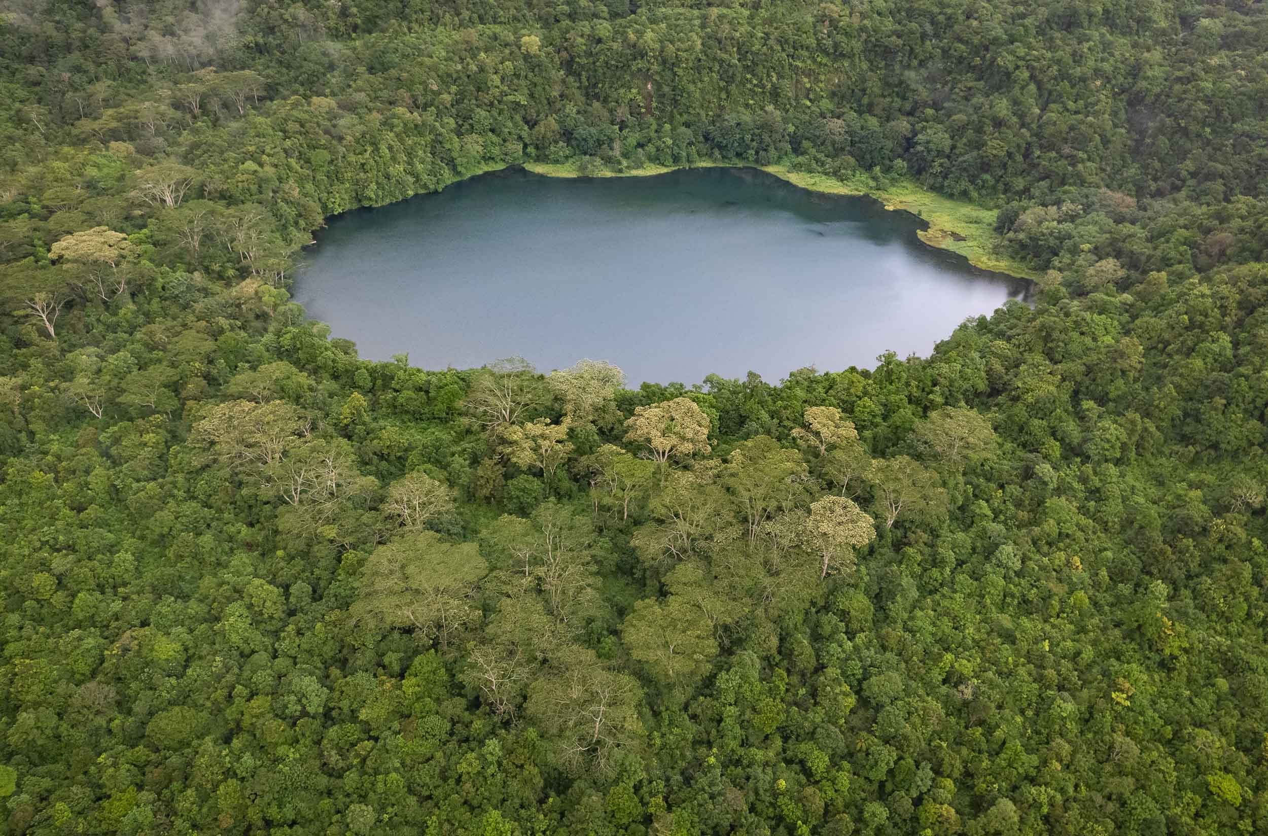
The rain forest lake of Ranamese was our next stop, and rainy it was indeed. A small dry window in the clouds allowed me to get some aerial photos of this beautiful calm spot along the hilly road.
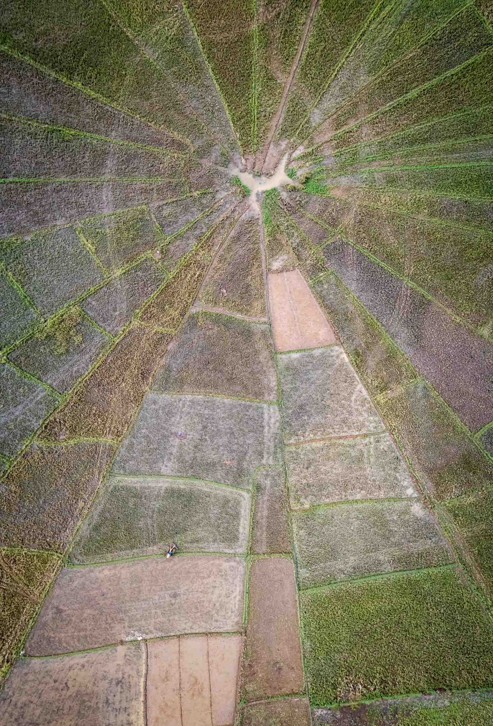
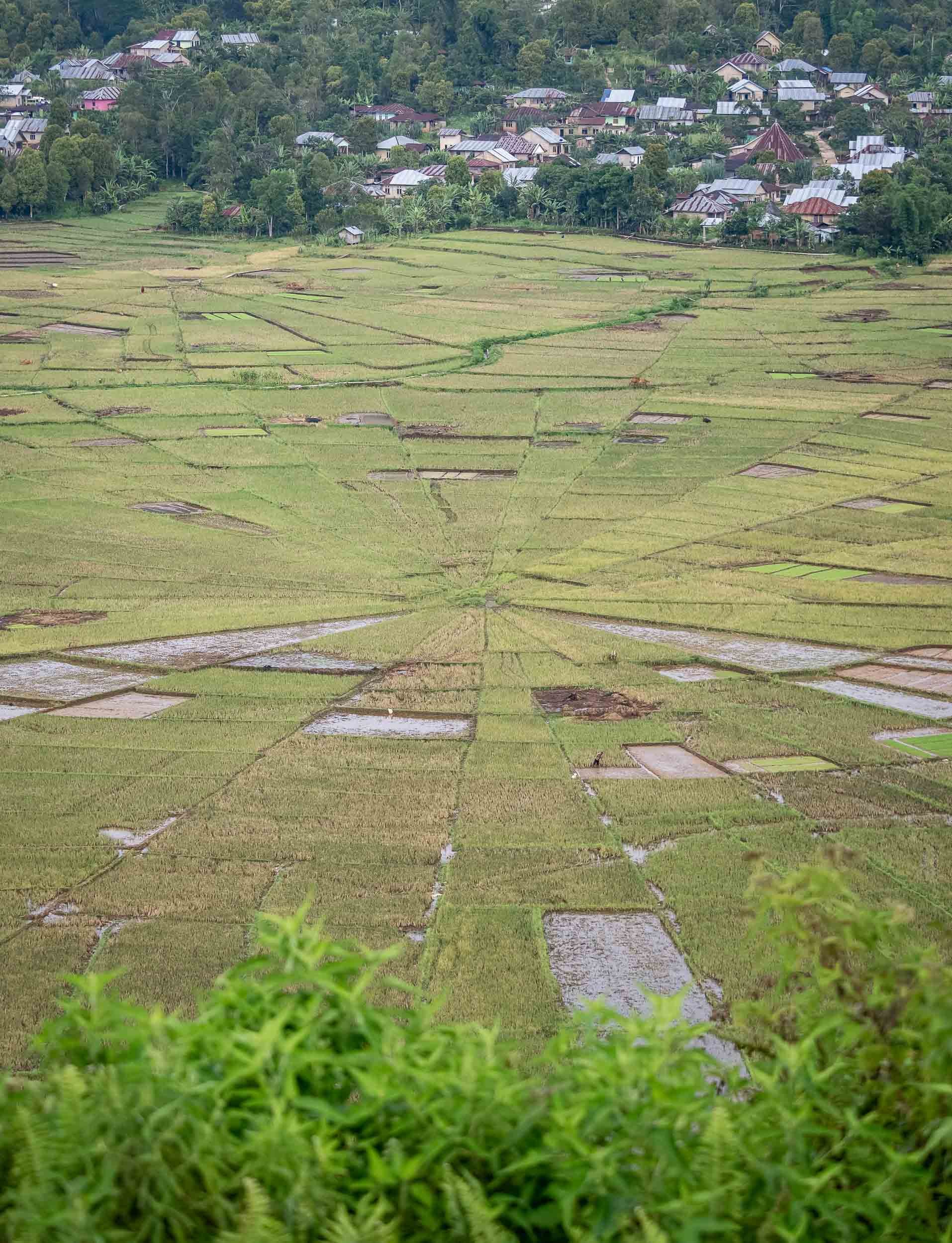
The Spider Web Rice Fields - Lingko
Heading west towards Labuan Bajo takes you past one of Flores’ most amazing attractions, the incredible rice fields shaped like spider webs. A visit during the right time of the year will allow you to see a green paradise full of rice plants, but the views during harvest as seen here are equally interesting.

Island Life and Dragon Hunt
From Labuan Bajo the trip continued straight onwards, boarding the houseboat that would be my home for the next 3 days, sailing around the islands of the Komodo National Park.

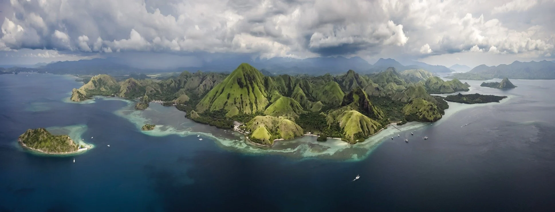
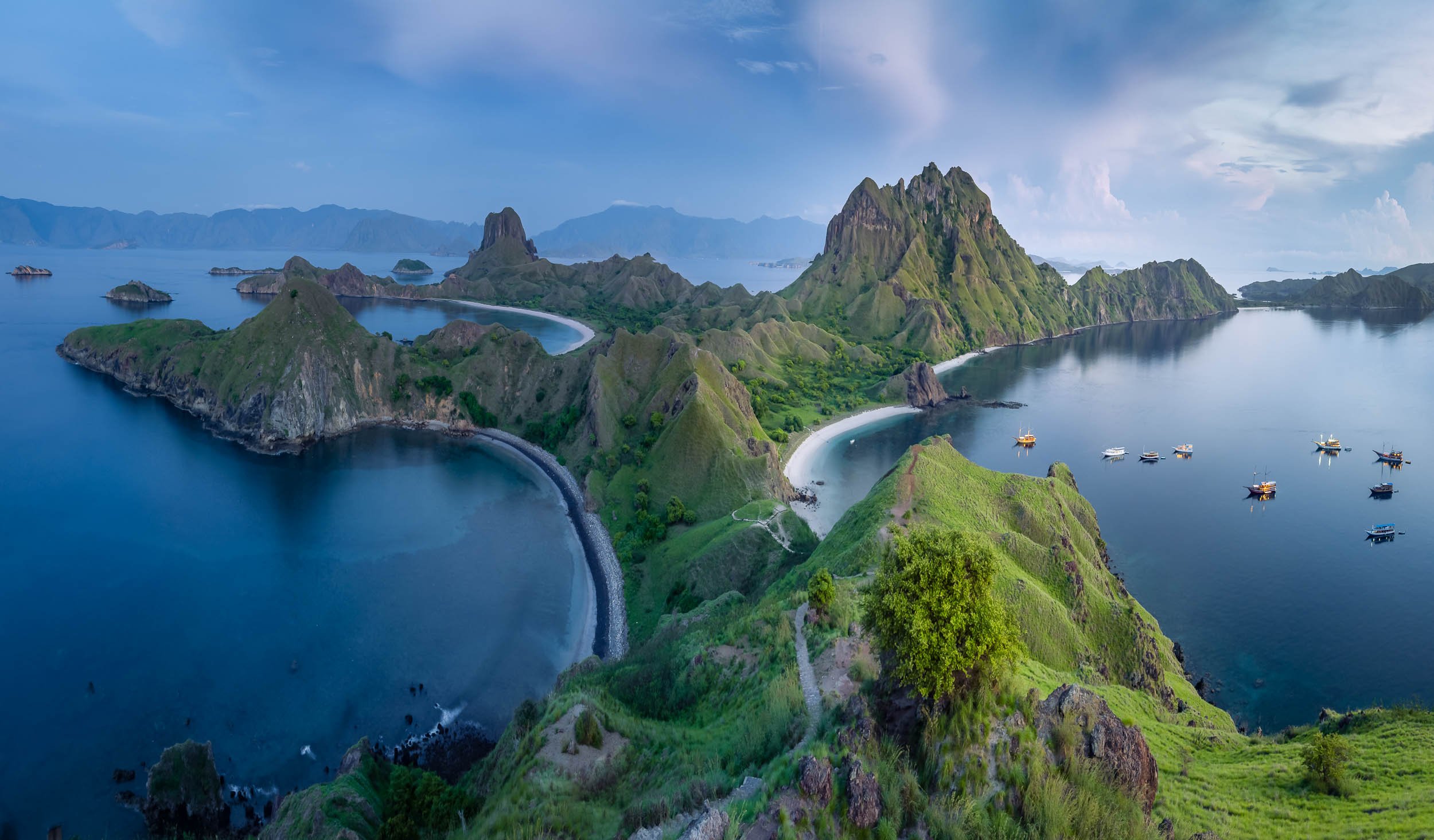
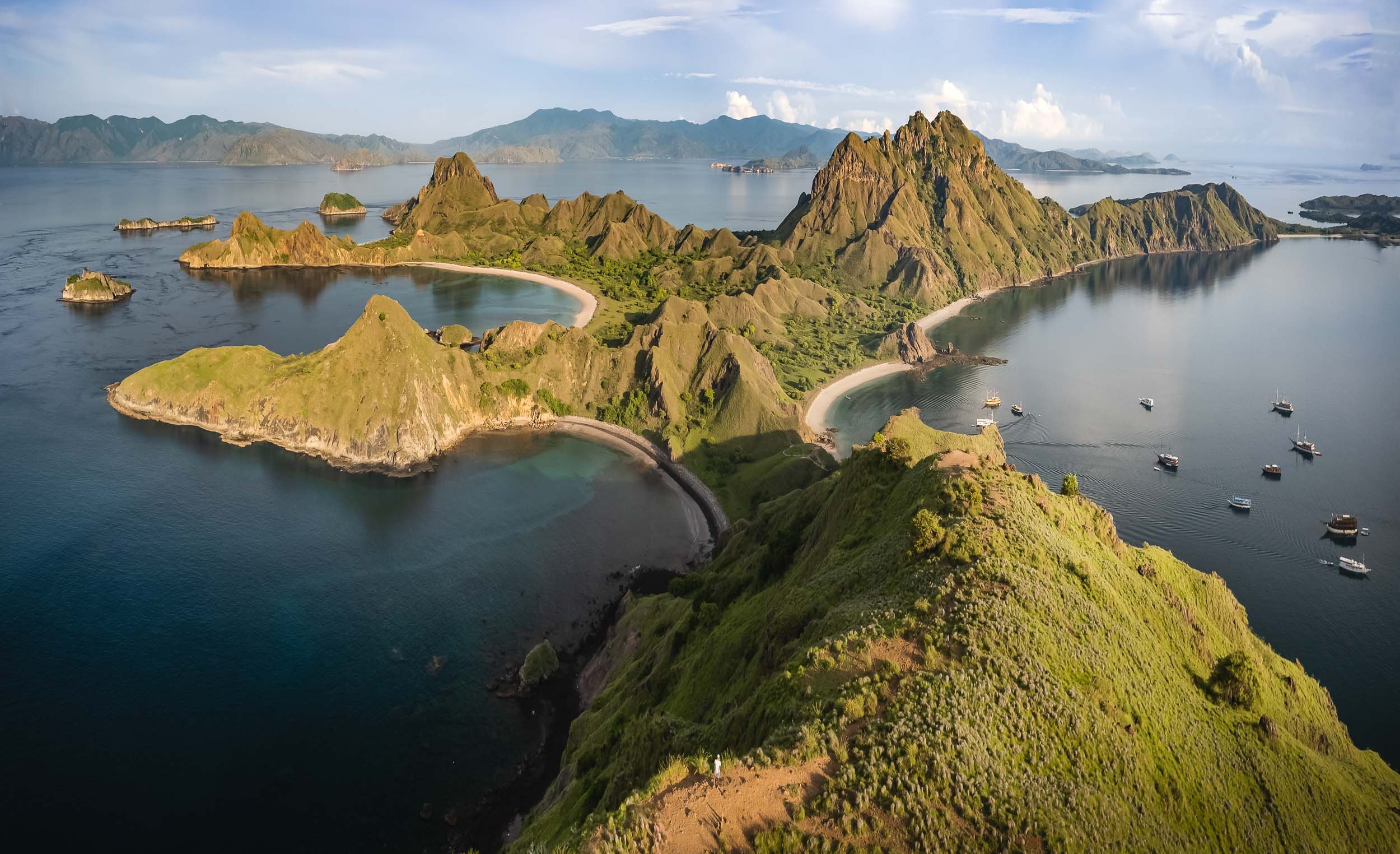
Padar Island
One of the larger islands in the archipelago is also one of the most beautiful. The views are worth the sunrise hike to the top - the earlier, the fewer people (as always).
Flore and Fauna are abundant, from deer to wild boar, as well as dolphins, and a large coral variety. Seeing deer on the beach felt slightly odd to me at first, having always associated them with forests.


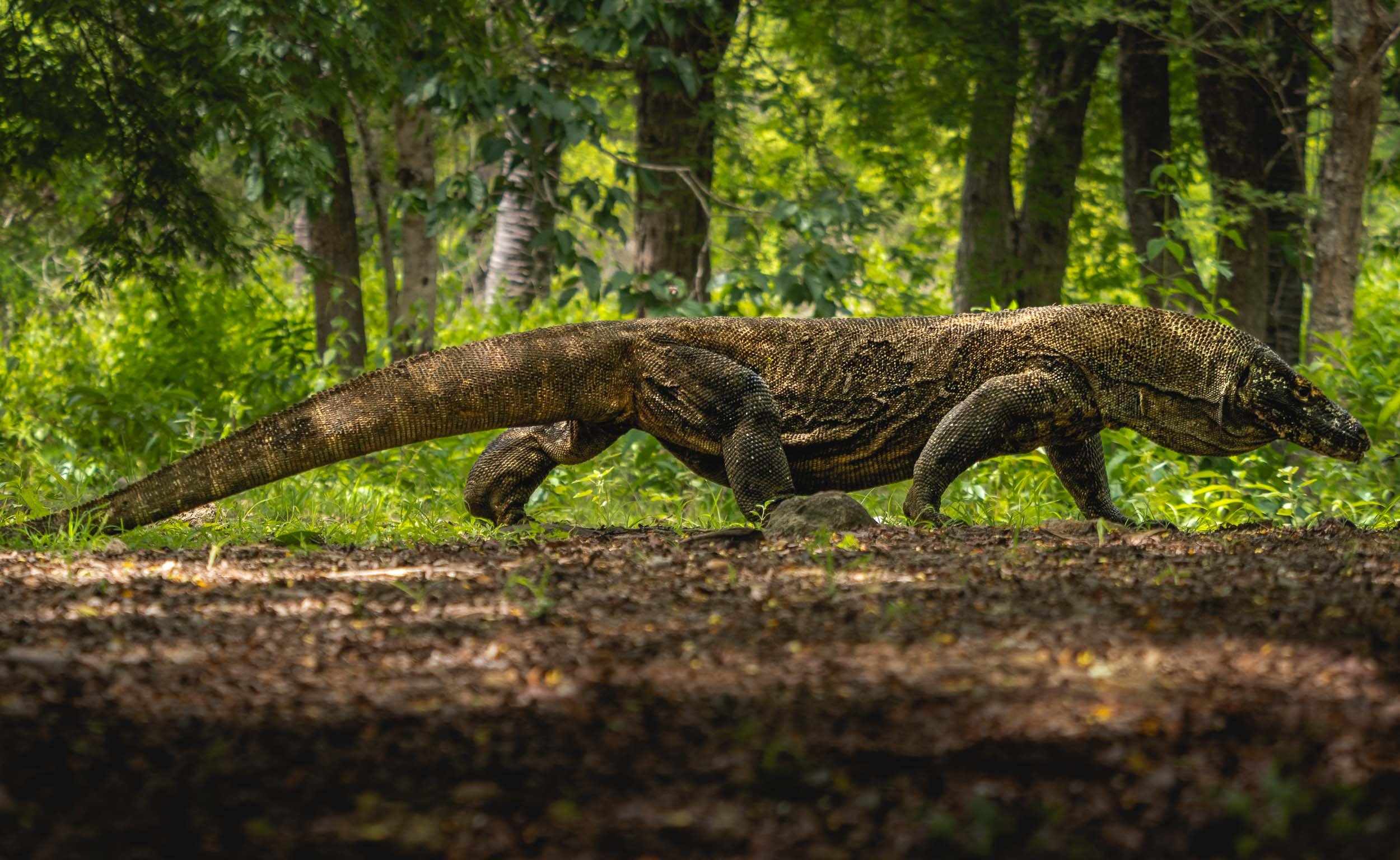
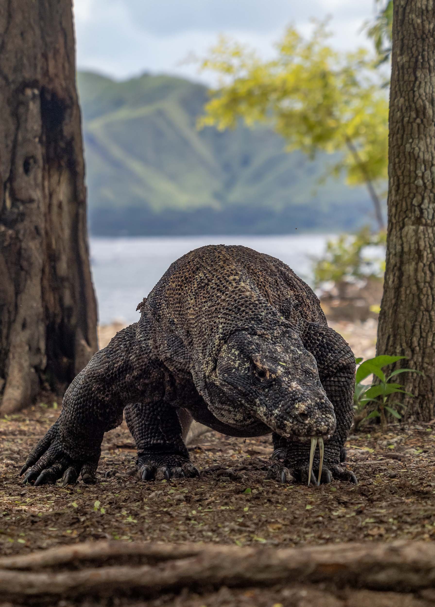
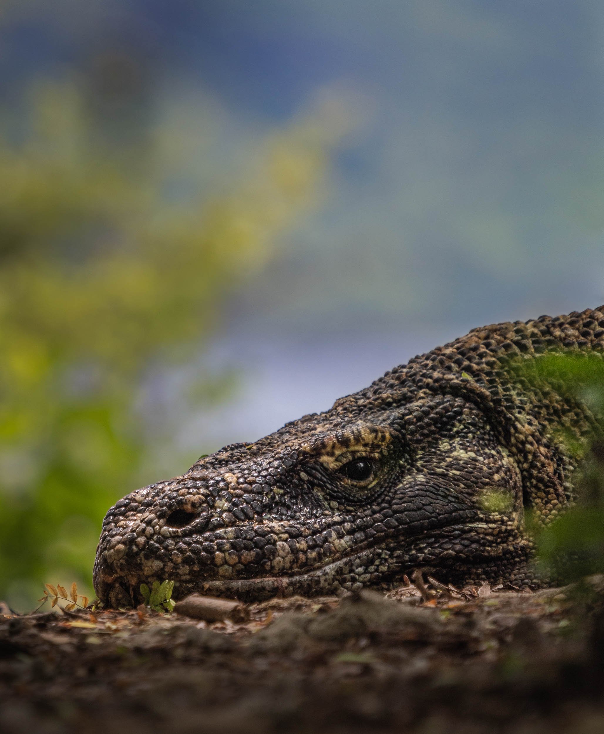
The Last Remaining Dinosaur
Of course, the primary wildlife people want to see in Komodo National Park are the namesake dragons. It’s an apt description for these animals. This is the only region where the largest lizard in the world can still be found on a handful of islands, with around 3000 endangered individuals still surviving in the wild, most of them on Komodo Island.


Once I made it to Komodo Island, your time is limited as you walk through the forest with a guide in search of some of these magnificent animals, but luckily I did get to spot a few…Nevertheless, I’d recommend two tours and possibly visiting another island such as Rinca to increase your chances for nice observations (and photos).
We found two very large individuals close to the beach, observing them at rest for a while, before one of them got up and moved into the forest. This was my chance to capture some photos of them in action, with their large tongue leading the way, and them to their prey - in fact, they can sense almost 10km away in good conditions.


Through the Island Maze
Onwards through the island maze of Komodo, landing on Kanawa island, which was once home to a beautiful small resort.
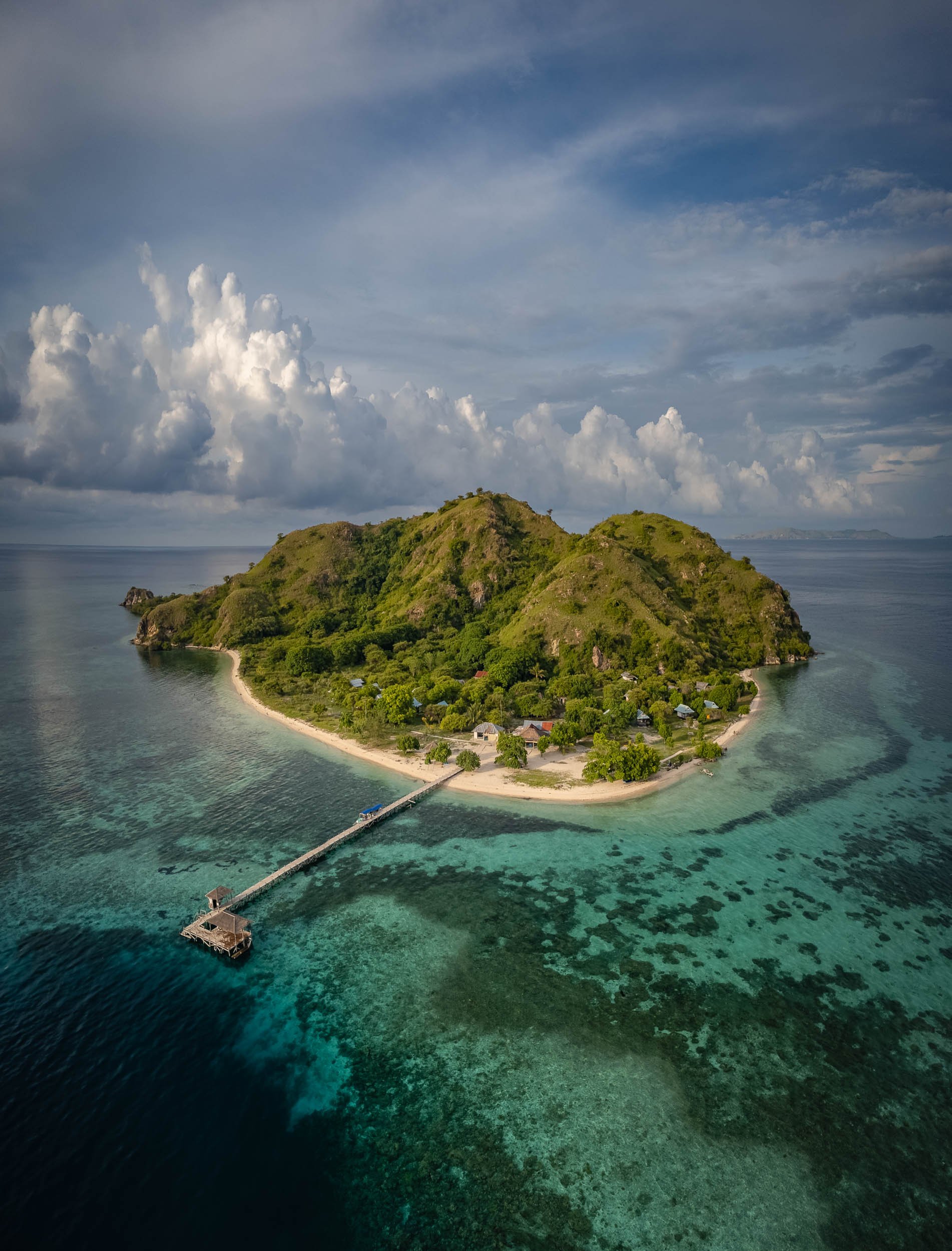


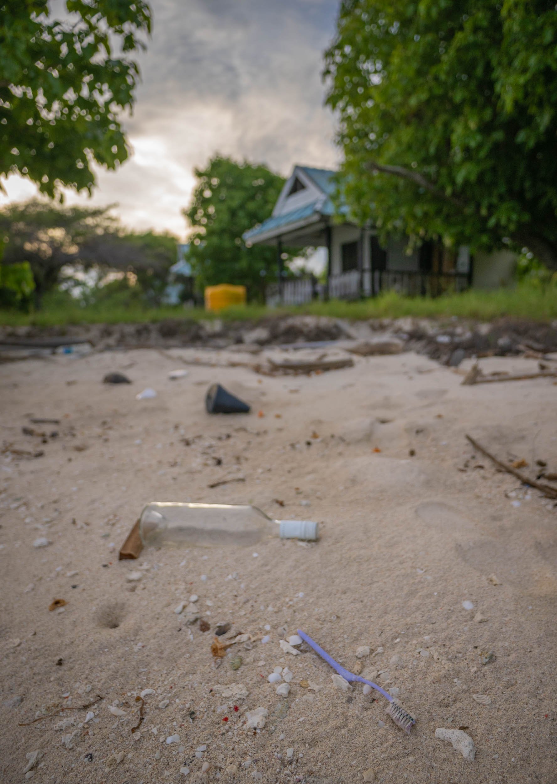
The resort is no longer operating and what must have been cute little villas are now decaying, but resourceful locals have turned the beach into a makeshift bar and lounge place.
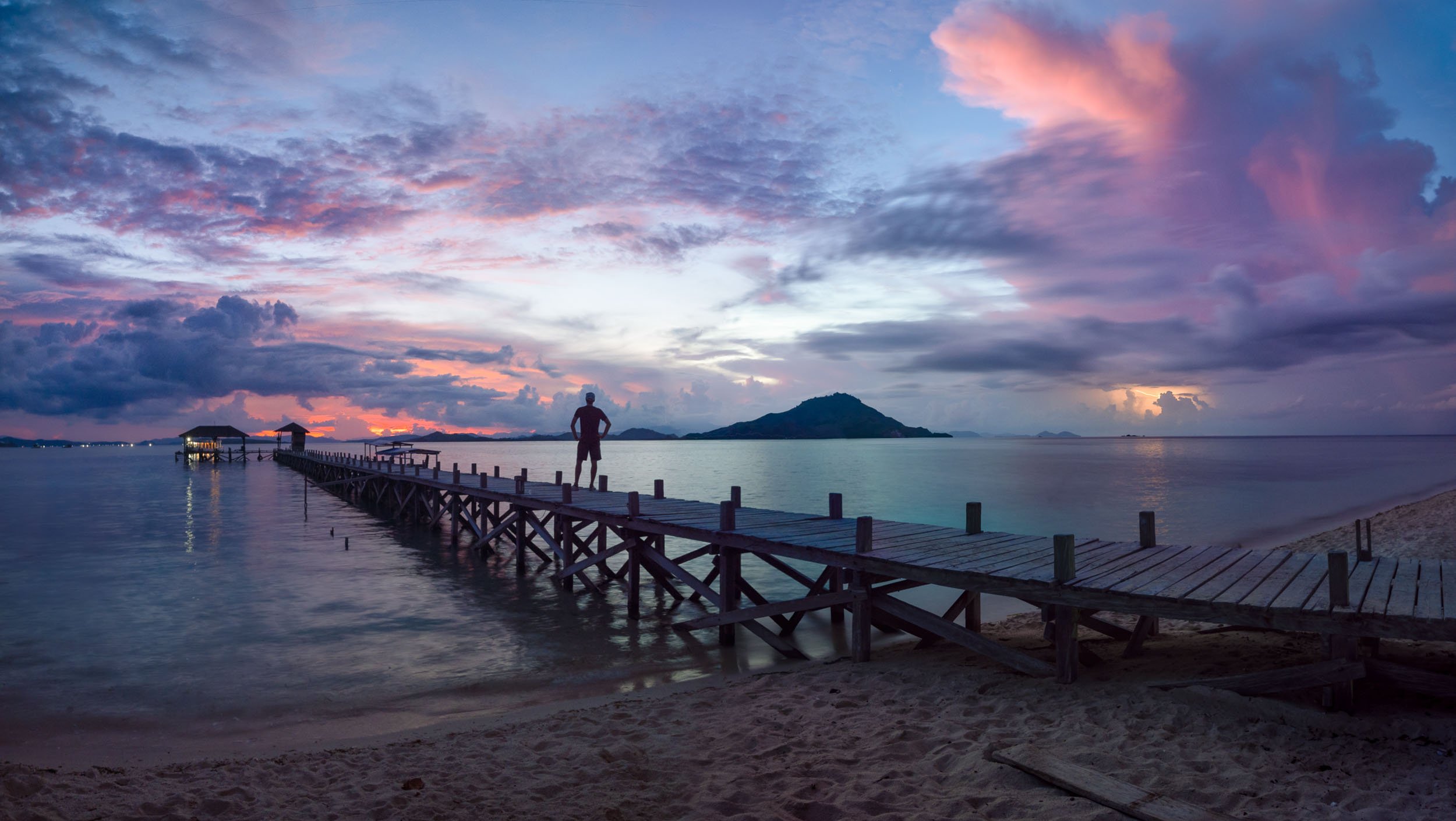
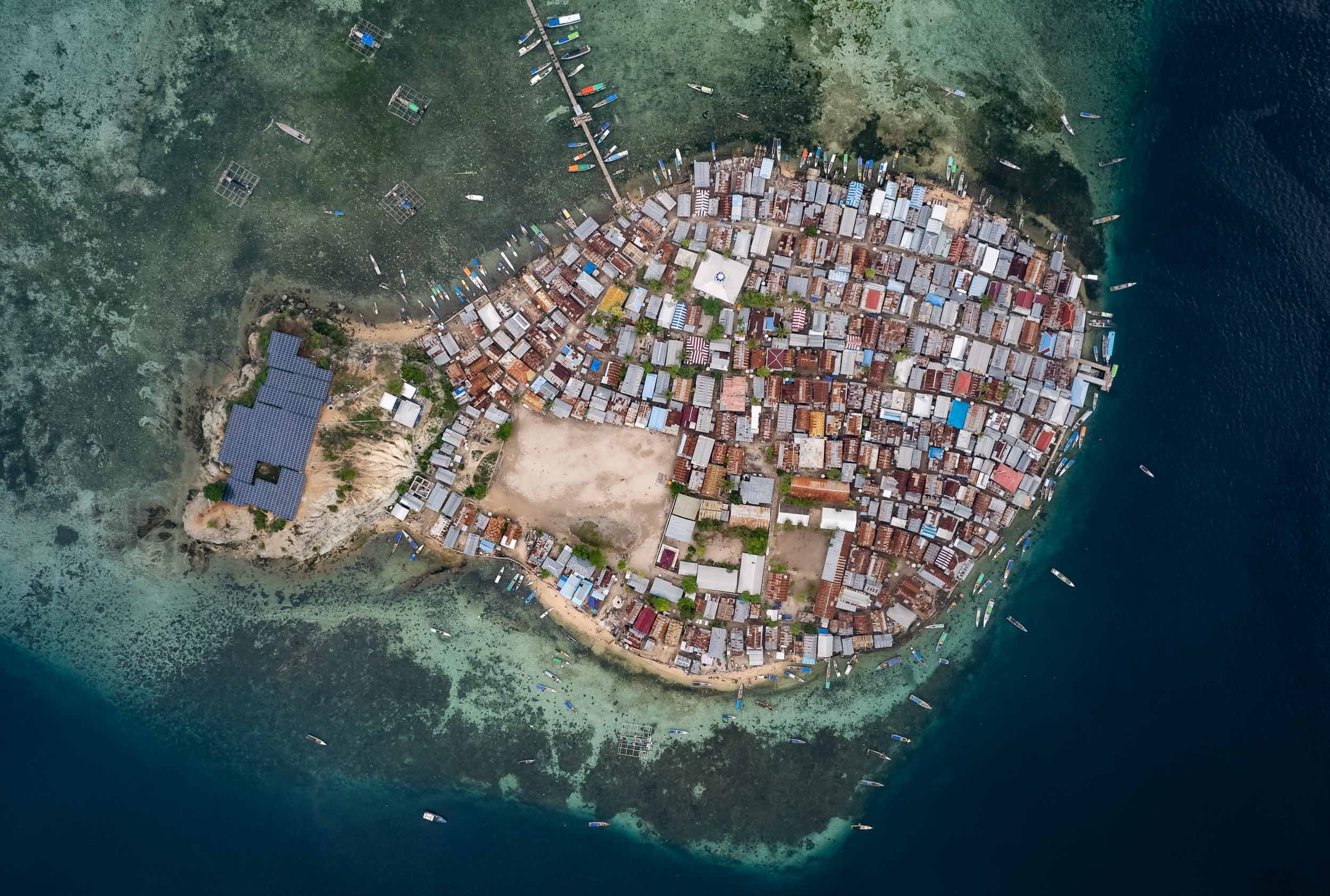
A Floating Fishing Village
Pulau Mesa is one of the few inhabited islands in the park. In fact, it is almost completely built up and home to a population of around 1500, the Bajau people - all of them extremely friendly and curious. I spent half a day exploring here and would definitely recommend visiting.
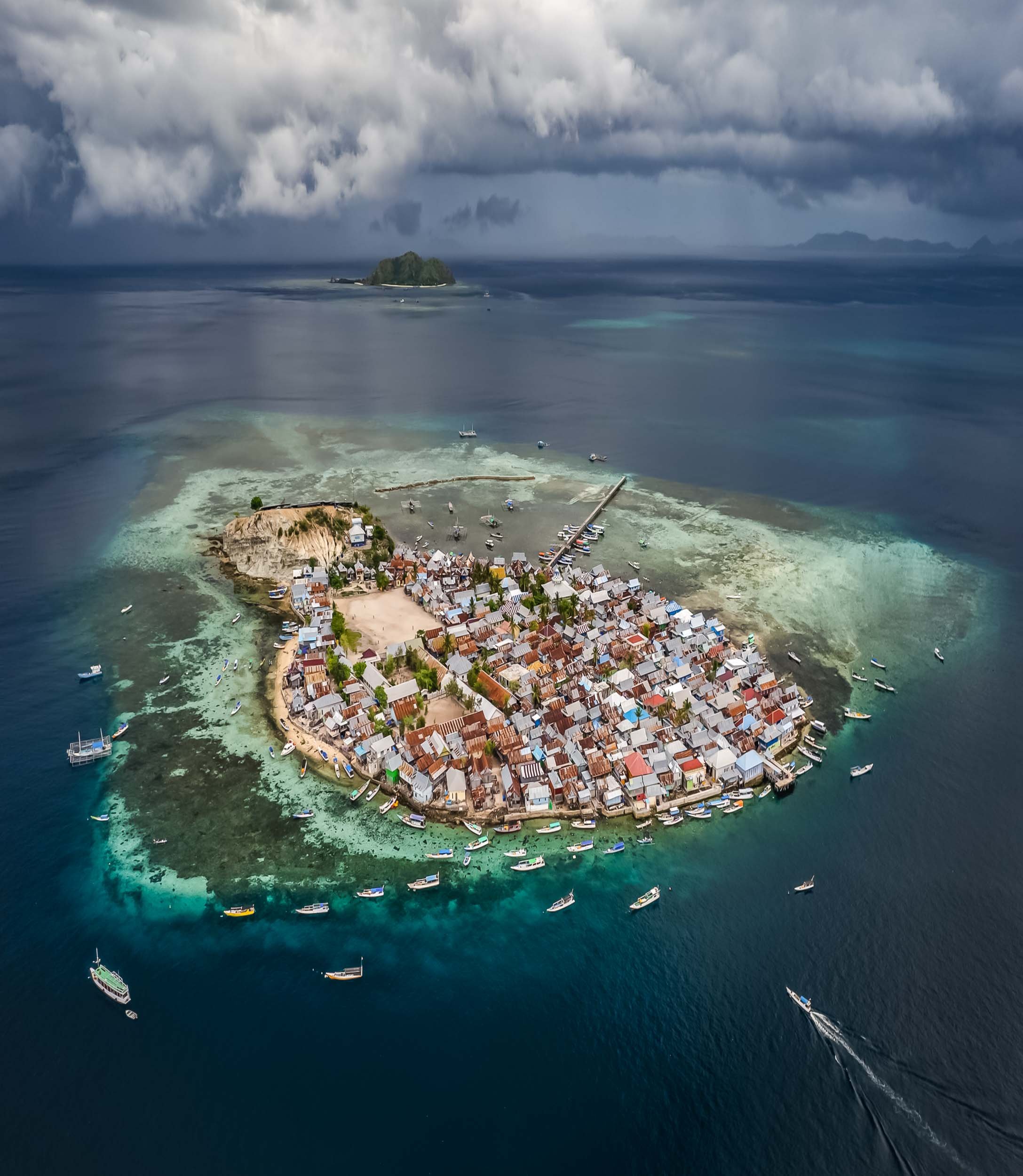
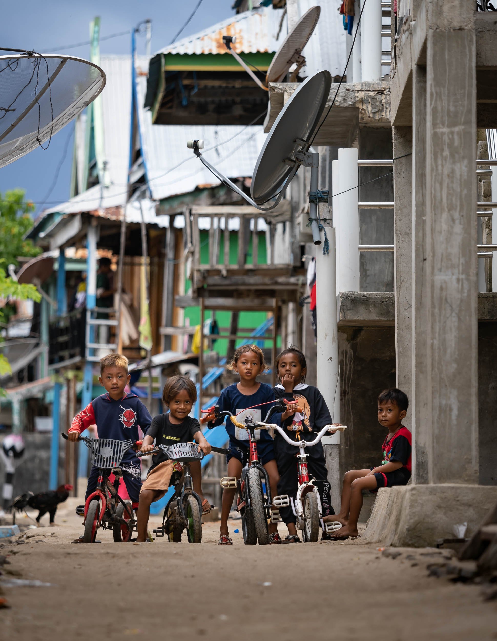


The island life is simple but happy, and people were always curious and friendly. It was one of my favorite towns in Indonesia.


Subscribe to my newsletter to get notified and don’t miss out on more Wonders of the Globe.

Enlaps Tikee 3 - Long Term Imaging Solution for Projects & Timelapse
My thoughts on the Tikee 3 Pro + long term imaging and Timelapse solution.

Over the years (many years in fact, my first ones were shot in 2011), I’ve enjoyed recording timelapse videos, compressing the progression of time and making resulting changes visible to the human observer.
One of my latest projects uses many different timelapse and recording techniques and combining them into a single video, documenting one of the many small Oktoberfest-like beer festivals in Germany, see below.
A few ago I was contacted by Enlaps, maker of a long term imaging solution ecosystem, including timelapse projects for construction, events, nature, weather, and similar scenes that can be interesting to observe, document, and analyze many hours, days, months, or even years.
They asked me if I’d be interested in having a go at using their camera and creating a small review. How could I say no to trying some new technology? See below the resulting (German with English subtitles) video, or read on for the English review.
Enlaps Tikee 3 Pro +
The product it's all about is a time-lapse camera called the Tikee 3 Pro +, which is the version I got from Enlaps. And this is a product that I find quite exciting, and would have liked to have had it myself a few years ago.

It didn't exist then, or rather I didn't know that the first versions already existed, so when Enlaps offered me this camera to test, I was immediately interested.
The Tikee is a time-lapse camera that can record all kinds of time-lapses, but is primarily designed for longer time-lapses, for example outdoors. That's a good thing, because my parents are currently building a new house here in Germany, and I intend to install the Tikee there on the construction site as well, to be able to test it in real life in a real operation.
Features & Cost
First, let's take a closer look at the camera - Enlaps provided me with a Tikee 3 Pro+, which is the more feature-rich and also slightly more expensive of the two available variations. The difference is particularly evident in the flexibility of the recording modes, more on that later, the exterior and the general principle of the two cameras as well as the quality is more or less identical.
The camera in this version costs 1800 euros. Also, Enlaps sent me a stainless steel mounting arm, which normally costs 180 EUR, and a mounting kit for 42 EUR. There are other useful accessories, such as an anti-theft chain and lens protectors, which I think would be particularly useful in the field.
Where we are on the subject of costs, the Tikee is available with a cloud platform. There's a free version, but the really interesting stuff starts at €59 per month per camera, or €35 per month if you buy a full year. More expensive variants for enterprise functions, such as access management and automatic person blurring can also be very useful, but are not absolutely necessary for everyone.
At first you might think that 1800 EUR plus accessories and monthly software costs is quite a handsome price, but that always depends on what you want to achieve and what you compare the whole thing to.
Personally, I don't know of any comparable product that seems so sophisticated in this simplicity, but let's take a closer look at why I think that: The Tikee itself is quite small and light, weighing less than 2kg, 20 square centimeters in size and 7cm high.
And it has some exciting built-in features: First of all, it has 2 built-in lenses with an aperture of 2.8 and a sensor of 16 MP each. This gives wide-angle panorama shots with a viewing angle of 220 degrees and a resolution of 6k.
The viewing angles of the two lenses will also be merged automatically, which means you don't have to do it manually, which can get really annoying. I've tried this before ;) With a resolution of 6k you can zoom and pan in the viewing angle and still have acceptable quality. In addition, the Tikee has a built-in directional solar panel that you can fold up and rotate and swivel here, and powers the built-in battery so that you can record your time-lapse in almost all configurations independent of a power source. Appropriately, it is also connected to the Internet either with WiFi or 4G LTE, which means you don’t necessarily need a wired Internet connection to load the pictures onto the cloud platform. The exception to this is DNG format images, if you want to use them to get more dynamic range and edit the images manually you have to save them internally and then download them from the camera, only JPGs are sent to the cloud.
On the back we find an SD card slot next to the SIM card, a power button and a manual trigger, as well as an input for an additional solar panel and a USB port that can also be used for charging. In addition, a fastening ring for the anti-theft device, as well as the possibility of screwing on the underside. The camera is IP66 ratedand also has built in GPS so you always know where it is even when you are out in the field.
MyTikee Cloud

On the myTikee Web Platform, you can view and configure the data from your Tikee camera, as well as create and group portfolios of multiple Tikees. By the way, there is also the possibility to add a normal IP camera, of course not with all the functions that the Tikee offers, but that can still be useful. If you want to generate timelapse videos, there is of course the option to only select certain days or times, such as only weekdays or working hours, but also functions with artificial intelligence, such as automatic selection of only sunny days.
Of course, this can be very exciting for long-term recordings, where you don't want to have the switch between sun and clouds all the time. The system also generates a kind of best of list of selected videos and photos of the best scenes or weather conditions, which lend themselves to further editing and direct sharing without much effort.
There are also somewhat more advanced functions such as a “before \ after” split image, i.e. different periods of time on the left and right of the image or automatic fade between different periods of time. usable eg for building site progress or winter/summer, good/bad weather, etc. For commercial purposes there is also the blur people or certain areas function to guarantee data protection. Since recently there are also AI-supported analysis functions such as recognizing people and counting them, and automatic recognition of construction equipment, vehicles, which can then be visualized etc.
The link to the feed can be shared privately and publicly and also in your own / others websites are integrated, as well as exported with up to 6k for further processing. Incidentally, the web app will soon also be available in German, says Enlaps, currently it is in English and French.
Summary
All in all, as far as I can tell, the Tikee is a very mature product, which is aimed at quite specific areas of application, but thanks to some flexibility it can be used very widely. Comparable results and functions for a similar price are difficult to find, or involve a lot of personal effort and handicraft work, even in post-processing. Of course, such options offer more flexibility, e.g. to choose a focal length, etc., but never the same simplicity and possibly more costs.

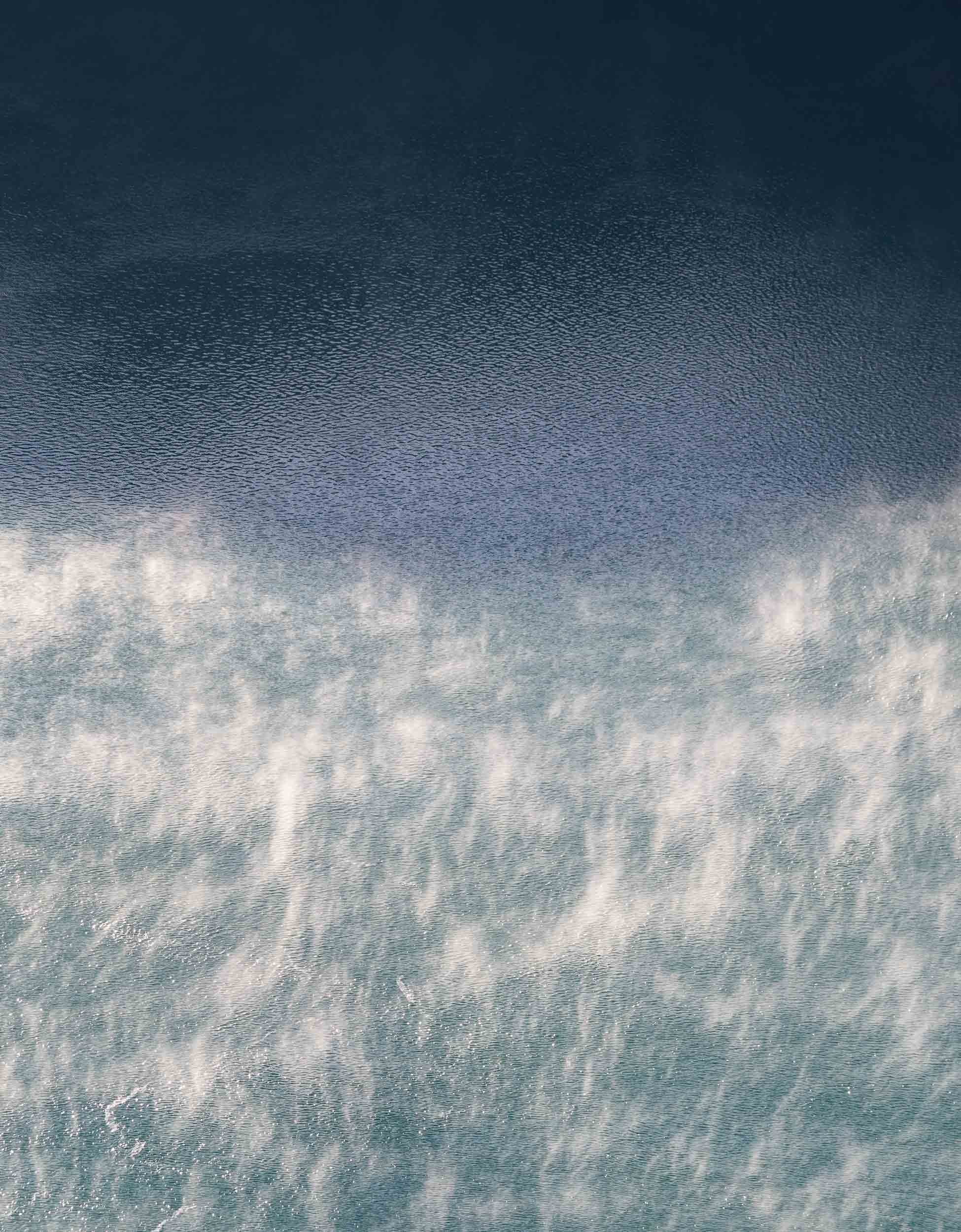
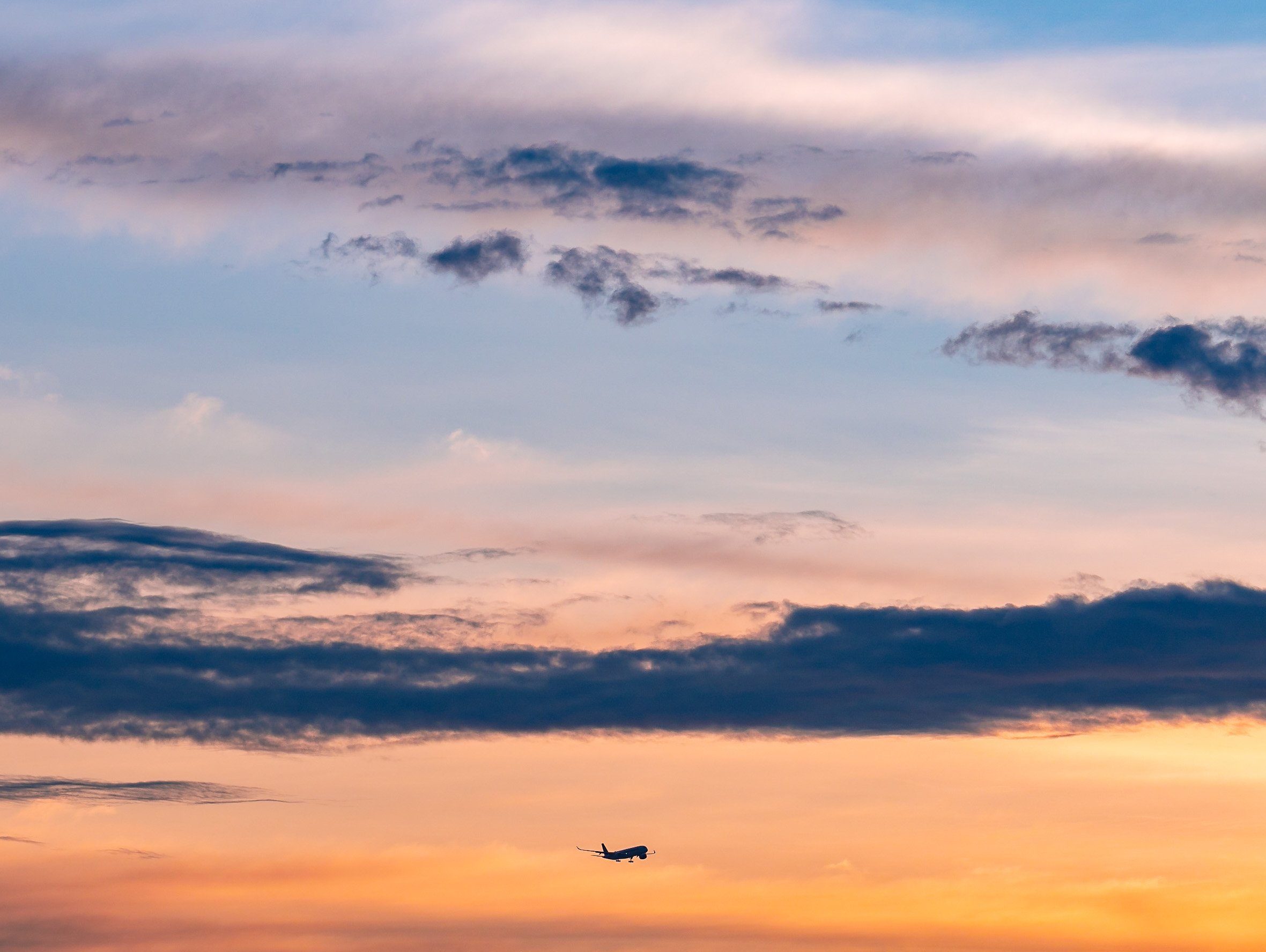
If you are looking for a camera that is easy to install and use to document projects such as construction site time-lapse, weather and wave conditions on the beach, snow in the mountains, setting up events, etc., I think you are in the right place. Little infrastructure requirements due to the built-in solar panel, battery and 4G LTE make it very easy.
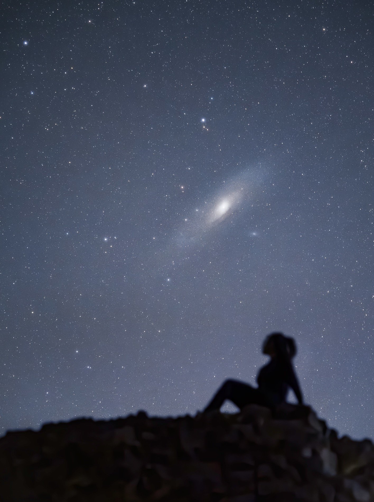
If I had to criticize a few points, I would probably say that the camera delivers night shots of acceptable quality, but of course it is not suitable for things like the Milky Way etc. A small personal annoyance for me is the USB connection, which is a micro USB - most of my products have already been converted to USB-C and the extra cable is sometimes annoying, but not so dramatic as you rarely have to connect to the Tikee.
A theoretical problem that I could still see is that the lenses fog up when shooting in high humidity or frost. Some external solution with a kind of heating sleeve controlled by the Tikee, for example 10 minutes before the start of the recording, could be desirable. Of course, this has consequences for battery life, one would have to consider that.
Nevertheless, in my opinion, Enlaps has built a very exciting product that enables new recording scenarios and, above all, makes long-term time-lapse easier and more accessible. The many interesting aspects of the mytikee platform also make me positive that a lot of functions are still being developed here, so the options for data analysis are of course endless.
In any case, I am very positively impressed. If you have any questions, please leave them in the comments, I will definitely create more videos in the next few weeks, particularly on setting up and configuring the Tikee.

The Abode of Peace - Brunei
Welcome to one of the more obscure countries on this planet, one of its last remaining absolute monarchies, and a nation forging its own path on the island of Borneo: Brunei Darussalam.

Welcome to one of the more obscure countries on this planet, one of its last remaining absolute monarchies, and a nation forging its own path on the island of Borneo: Brunei Darussalam. Once a thriving empire, its influence has declined over the centuries, but natural resources meant its population of less than half a million people now enjoys a very high living standard. I spent a few days here, including New Years Eve, which in Brunei is just like any other evening - that may be an odd choice for some, but I had a burger for dinner and was in bed by 11pm, perfect start into 2023.
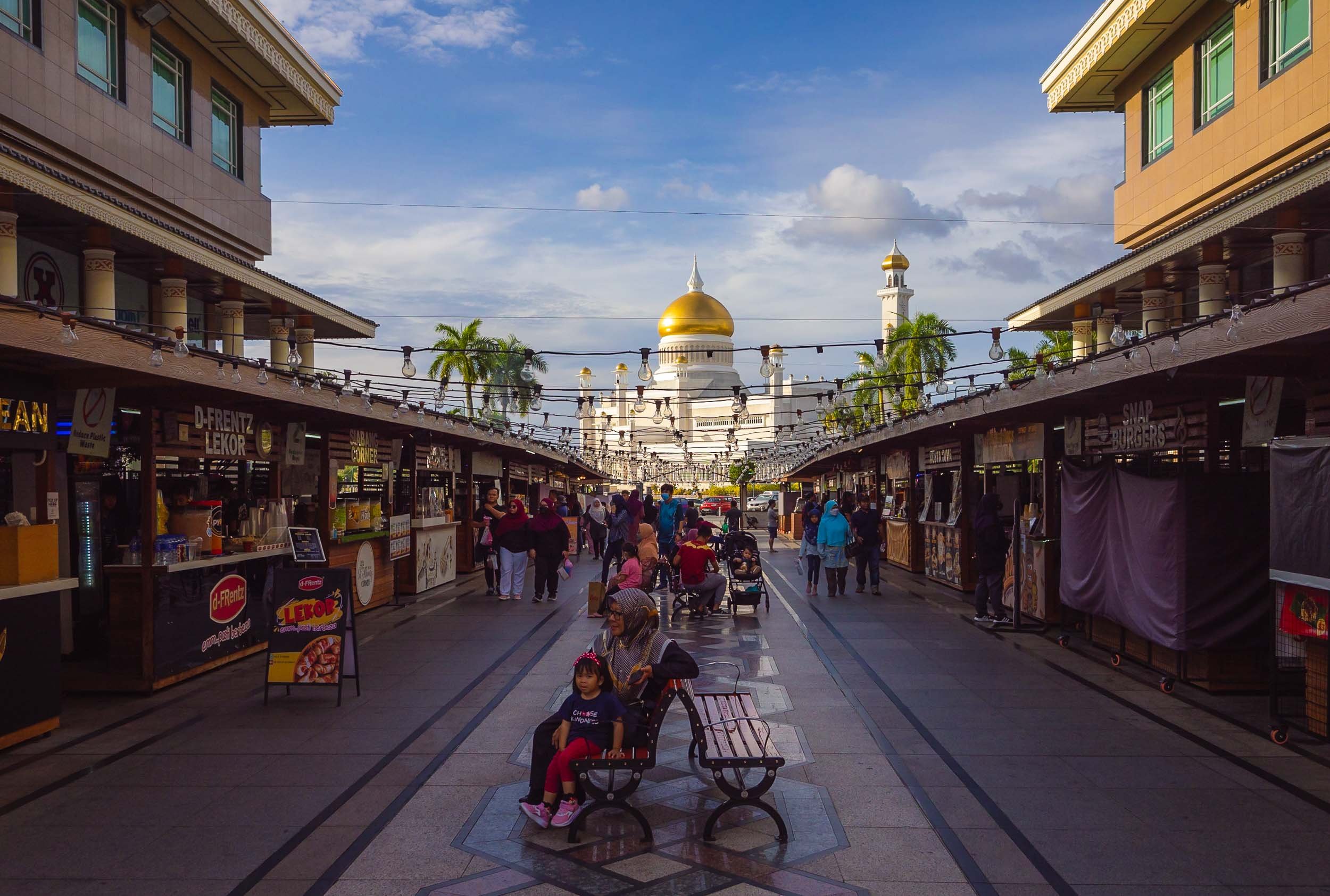
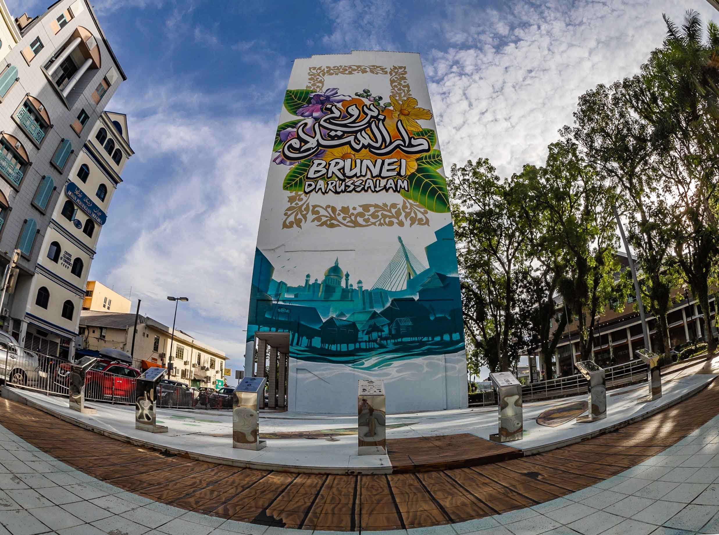
The Capital
My starting point was the capital, Bandar Seri Begawan (ever heard of it?). A walk the centre around reveals… not too much, but there are some interesting places and local life to observe.
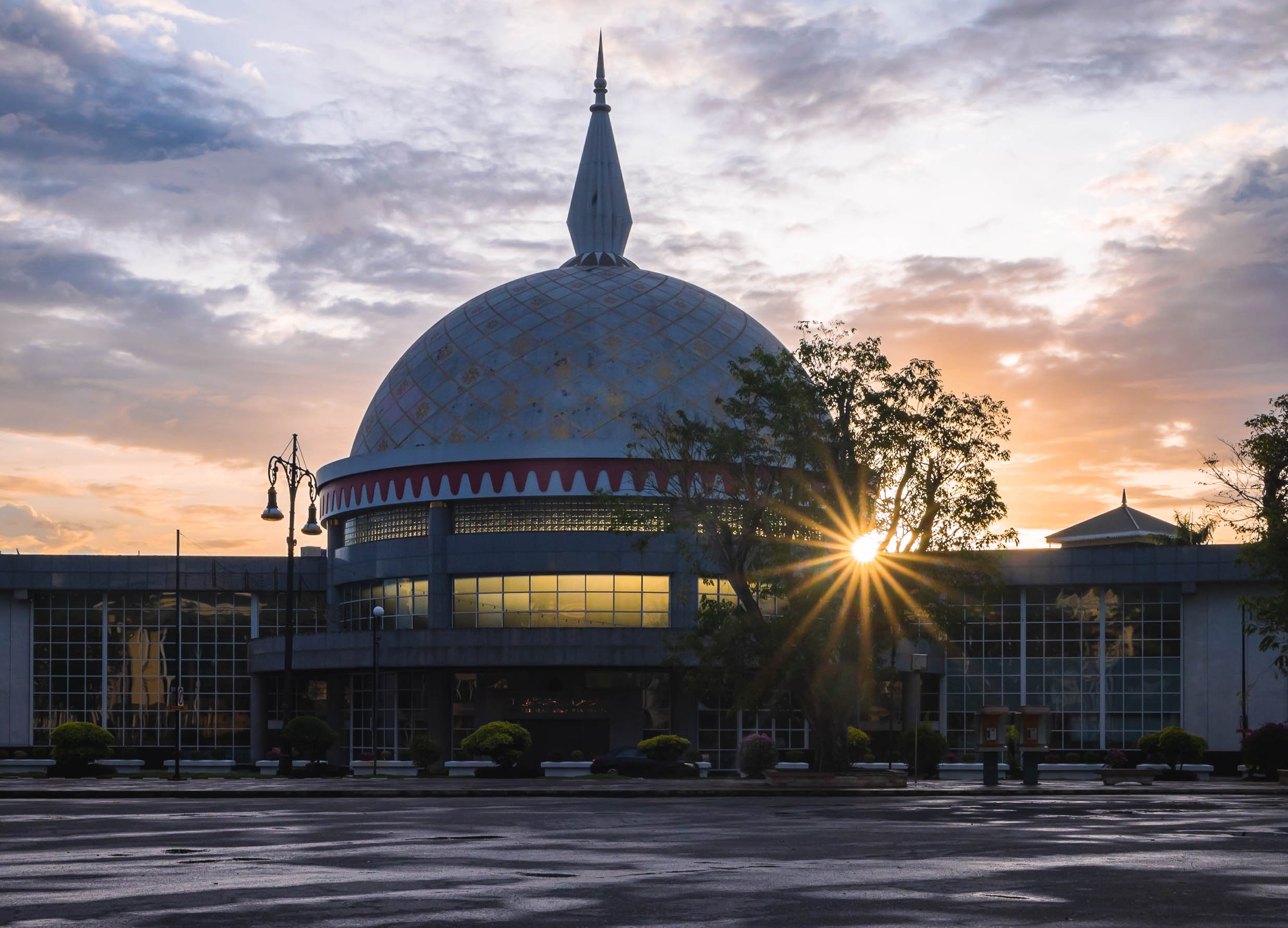
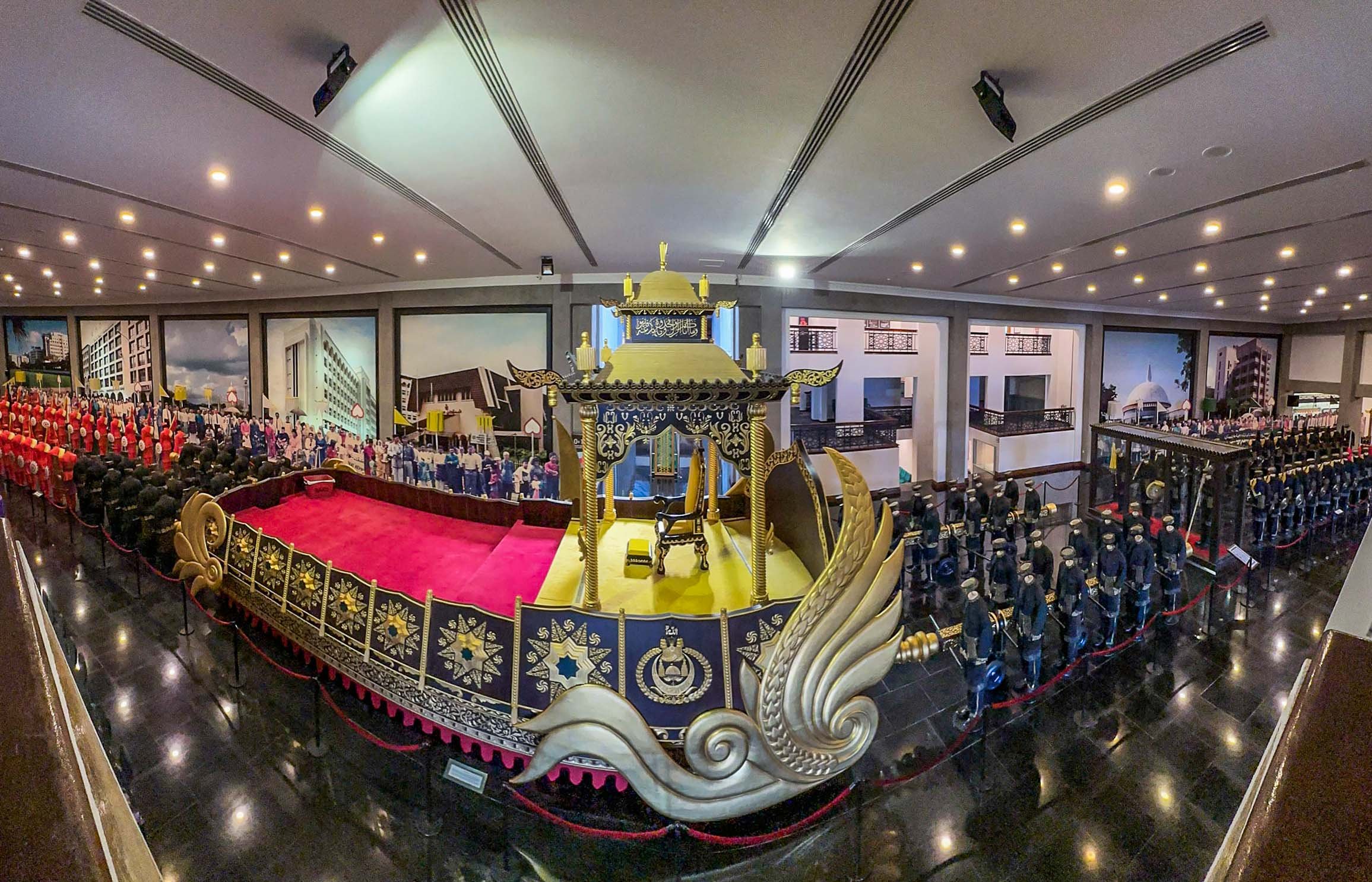
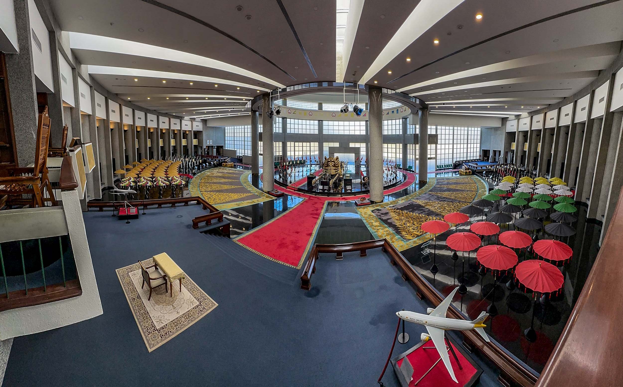
Royal Regalia
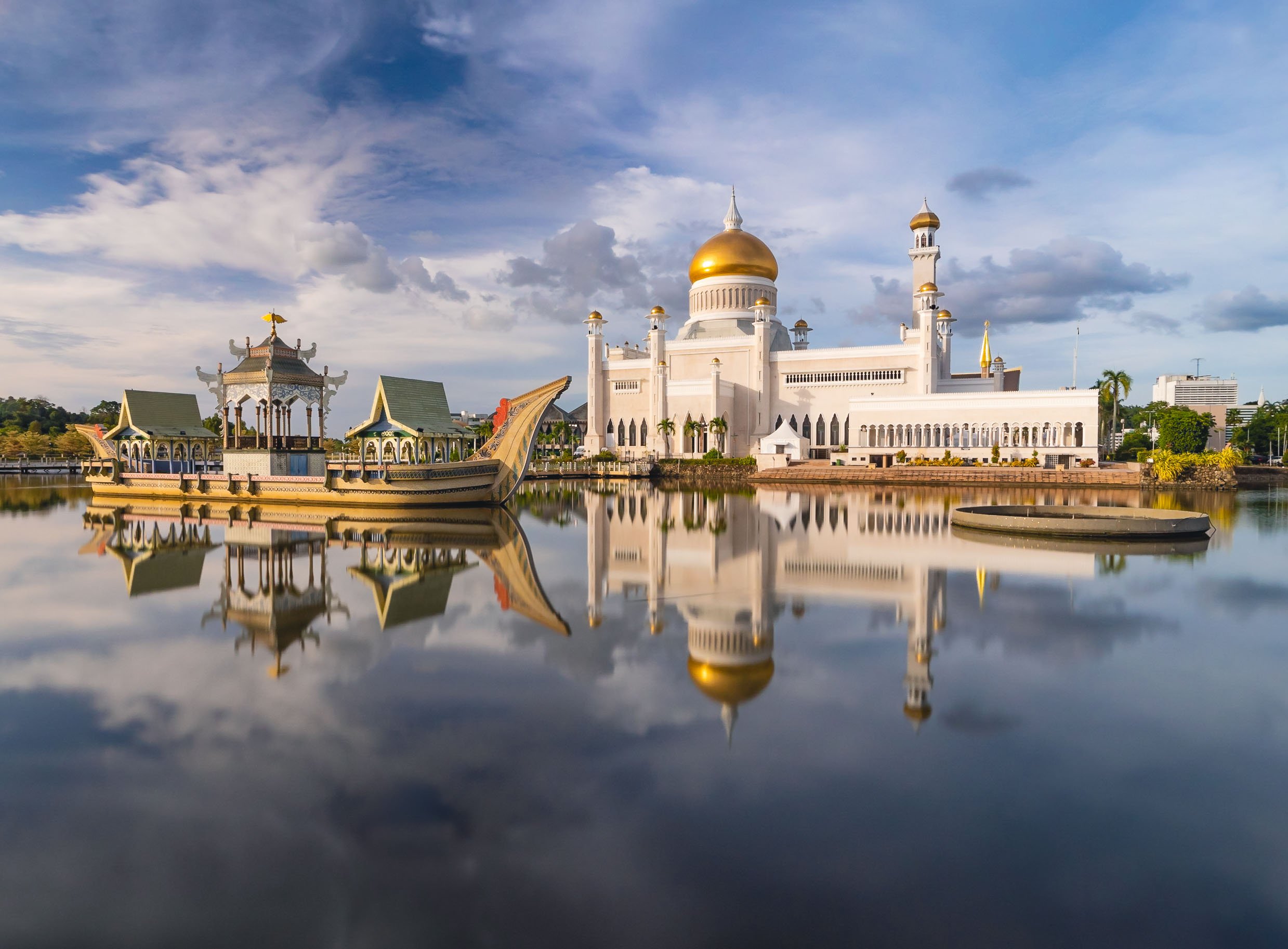
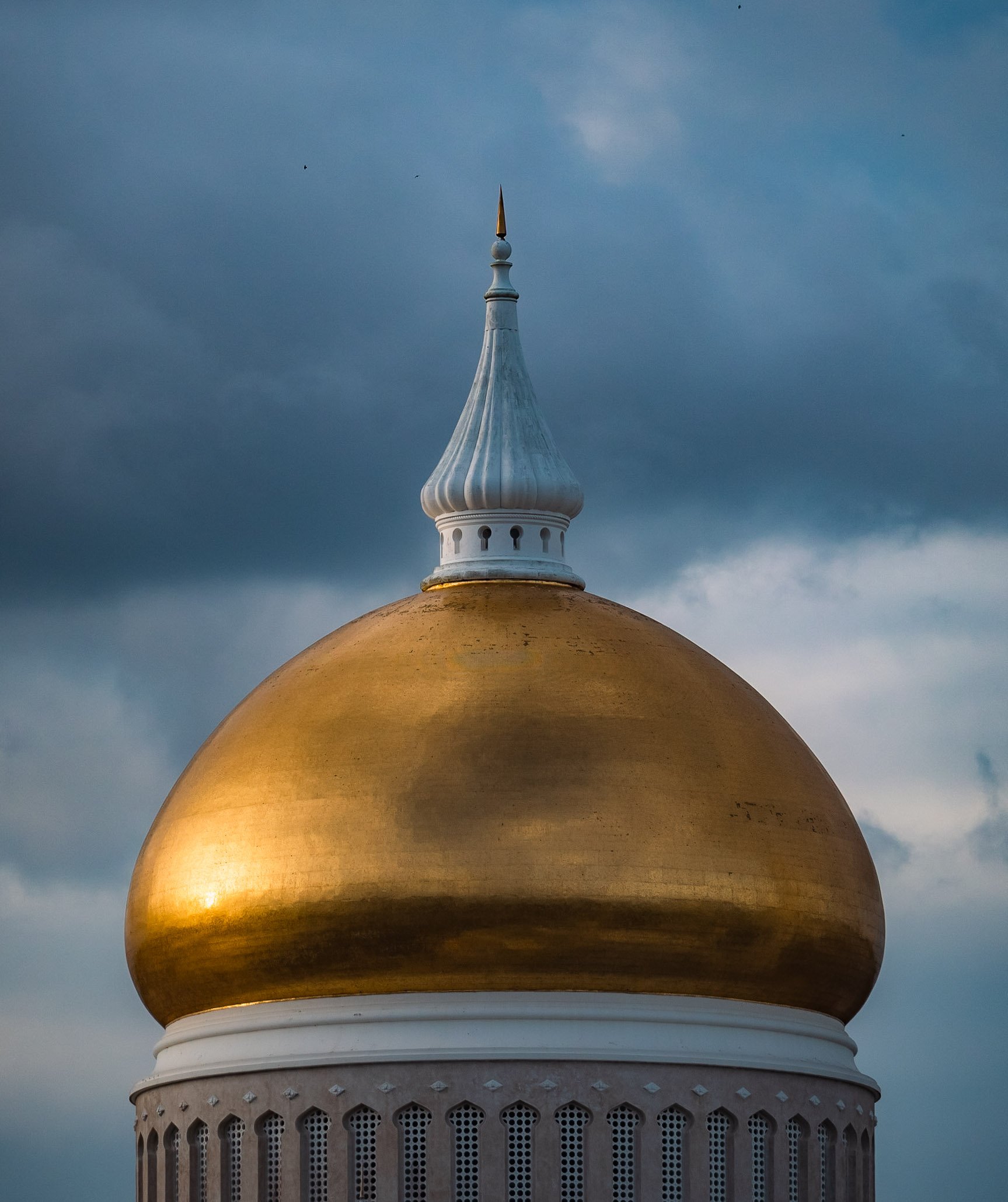
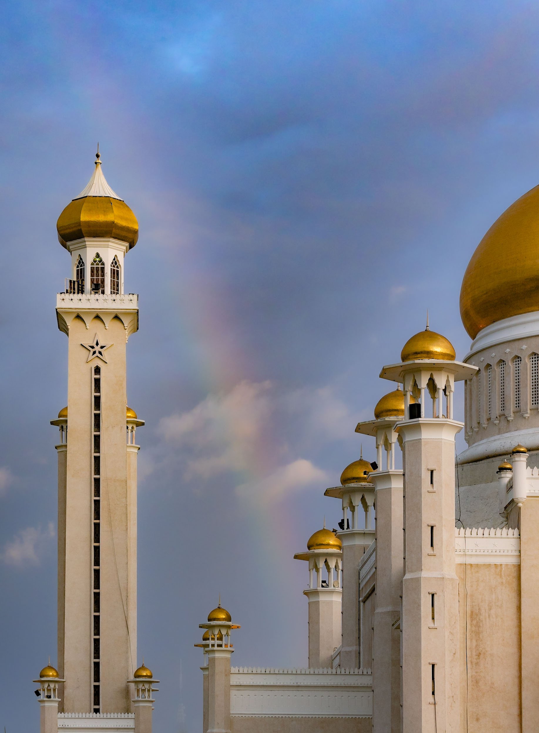
The Main Sight
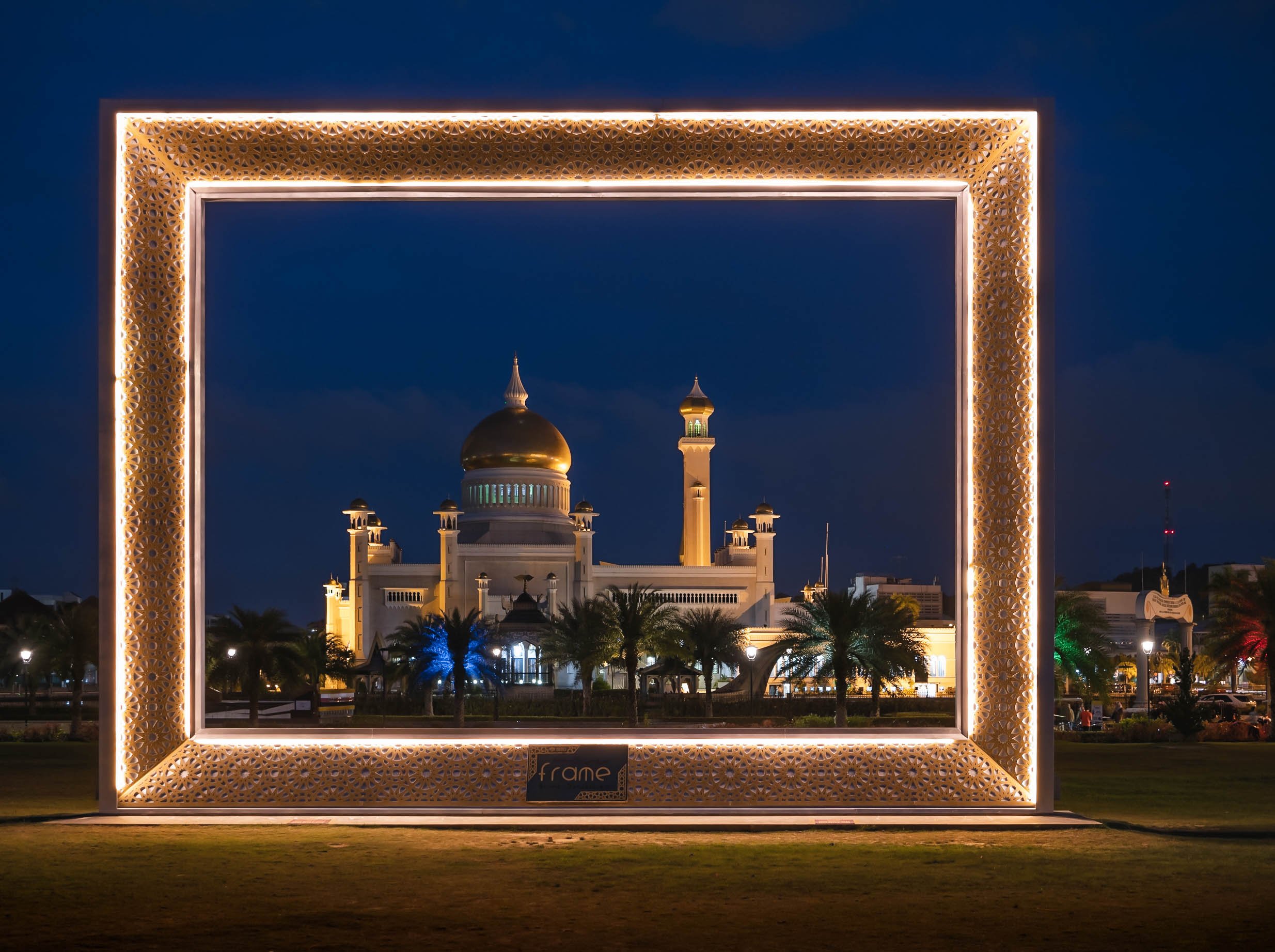
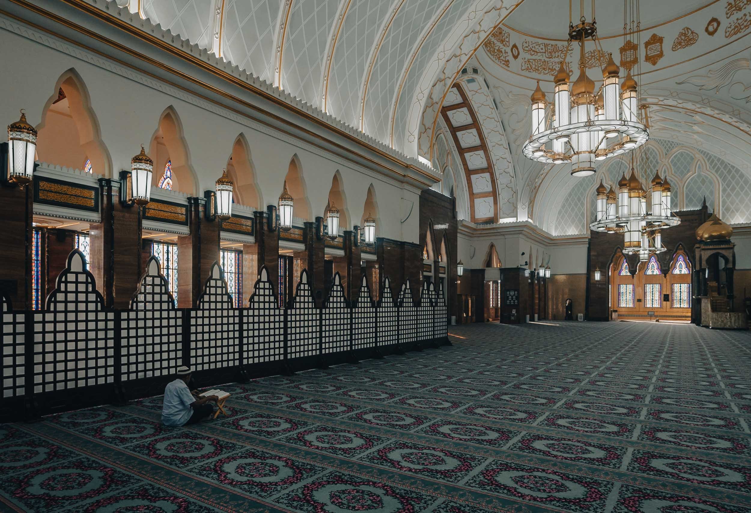
The city’s most recognisable landmark, and arguably its most beautiful, is the Omar Ali Saifuddien Mosque, serving as the symbol of the Islamic faith in Brunei.
In fact, a dedicated frame was set up for people to take photos with it in the nearby park on the shores of the Sungai Kedayan river.


While Islam is the primary religion in the country, freedom of faith is permitted by the constitution, with some limitations. The buddhist temple of Teng Yun is one of the most prominent non-Muslim religious buildings.


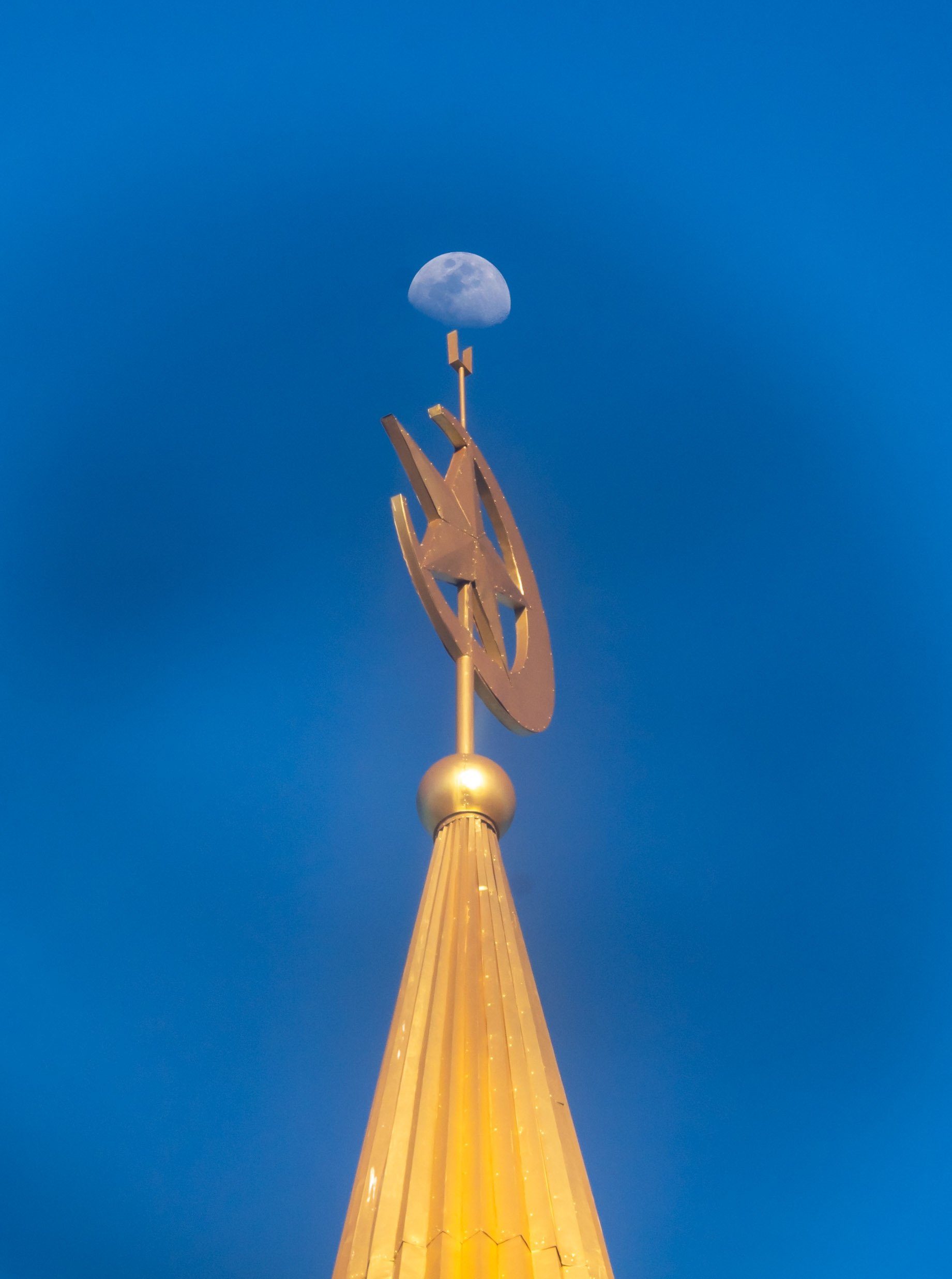
Looking south over the Brunei river reveals a bridge called Raja Isteri Pengiran Anak Hajah Saleha Bridge - I’m glad they kept the name simple for every day directions. It is the second-longest single-pylon cable bridge in the world and 157m tall. I couldn’t help but notice that the golden dome closely resembled the one on Saifuddien Mosque.


The night market at Gadong with its variety of multicultural street food - Brunei has to import 60% of its needs. The biggest ethnic group is Malay, making up over 60% of the population, and only a very small portion of indigenous people. The balance is a mix of origins, including a large number of expats.


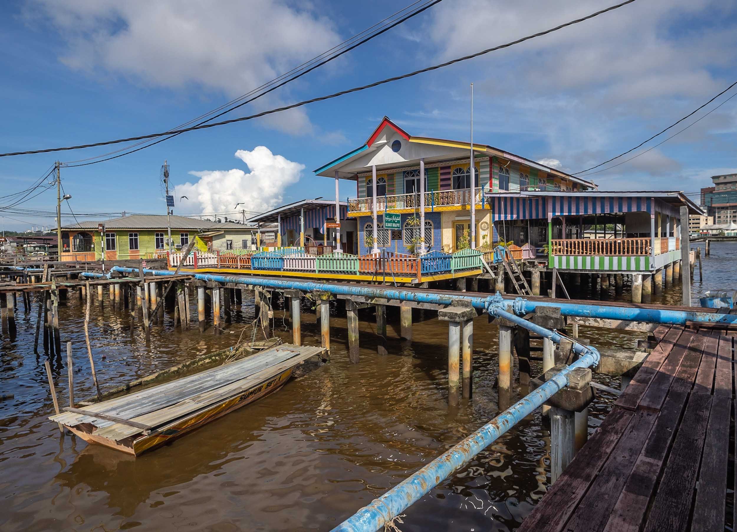
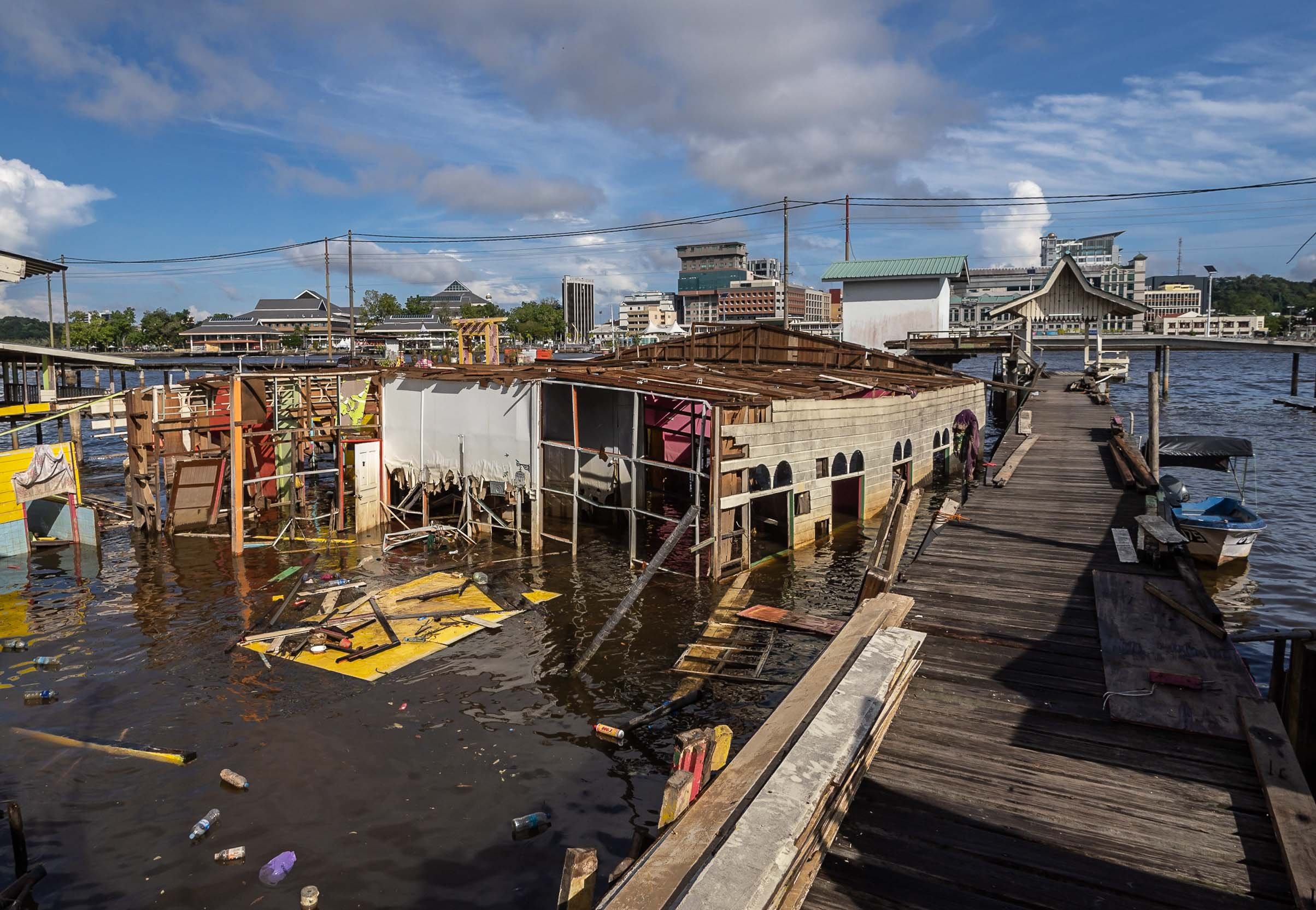
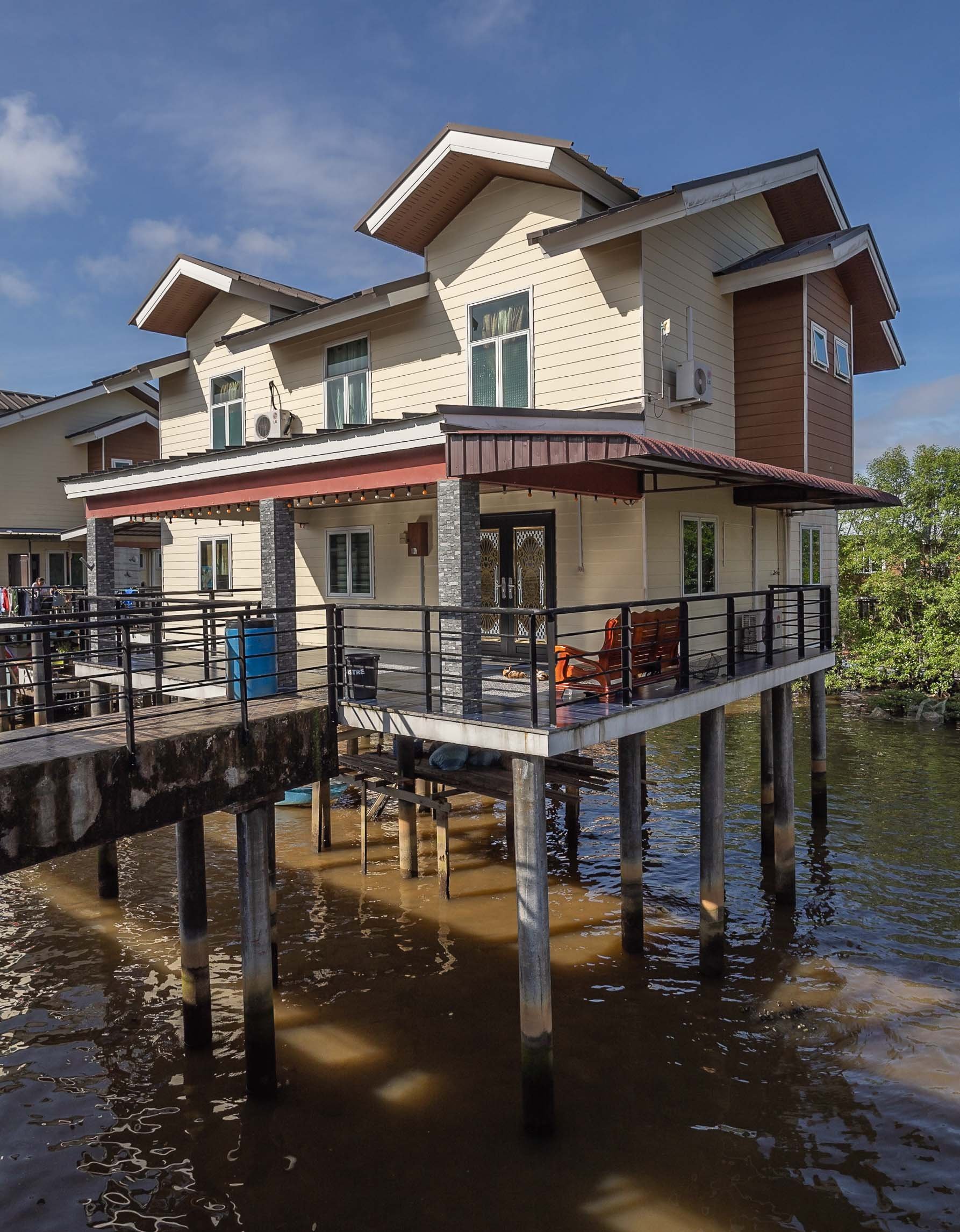
Kampong Ayer
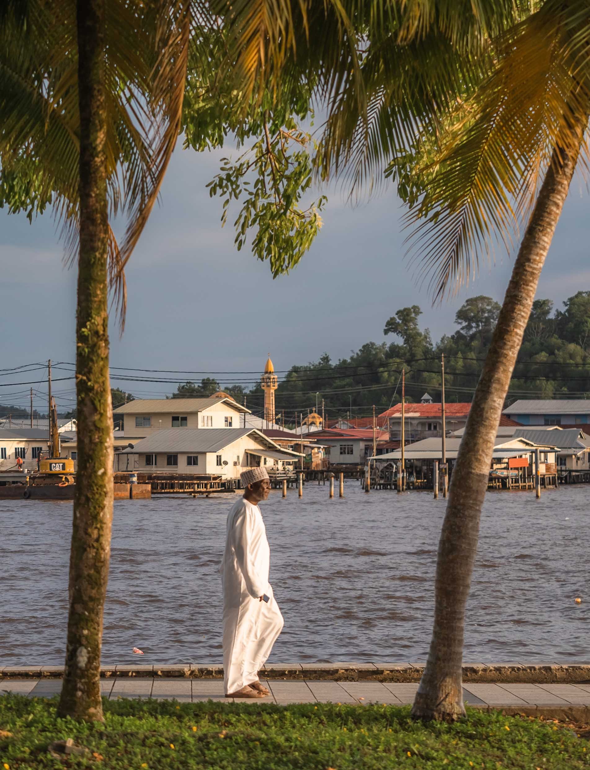
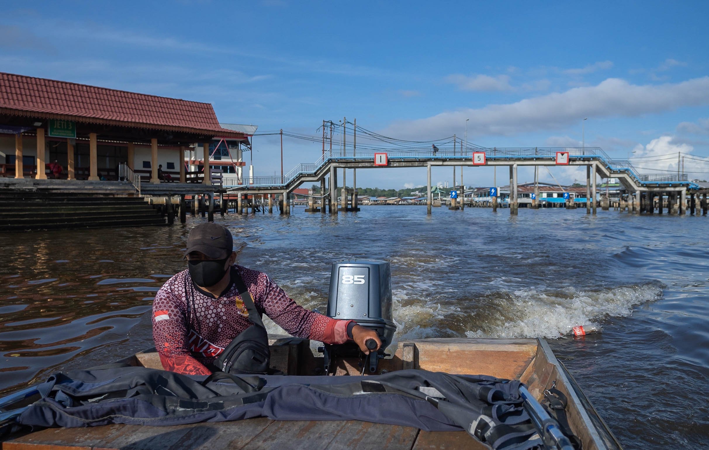
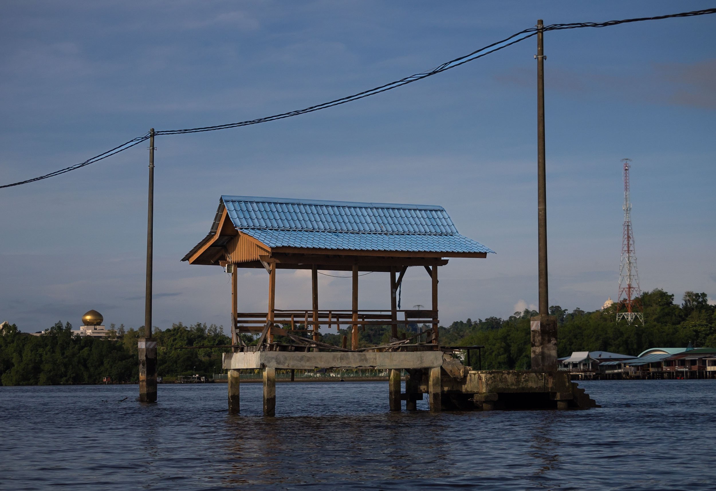


In fact though, a large portion of the village is as busy as ever, and includes floating mosques, schools, gyms and more.

More City Sights
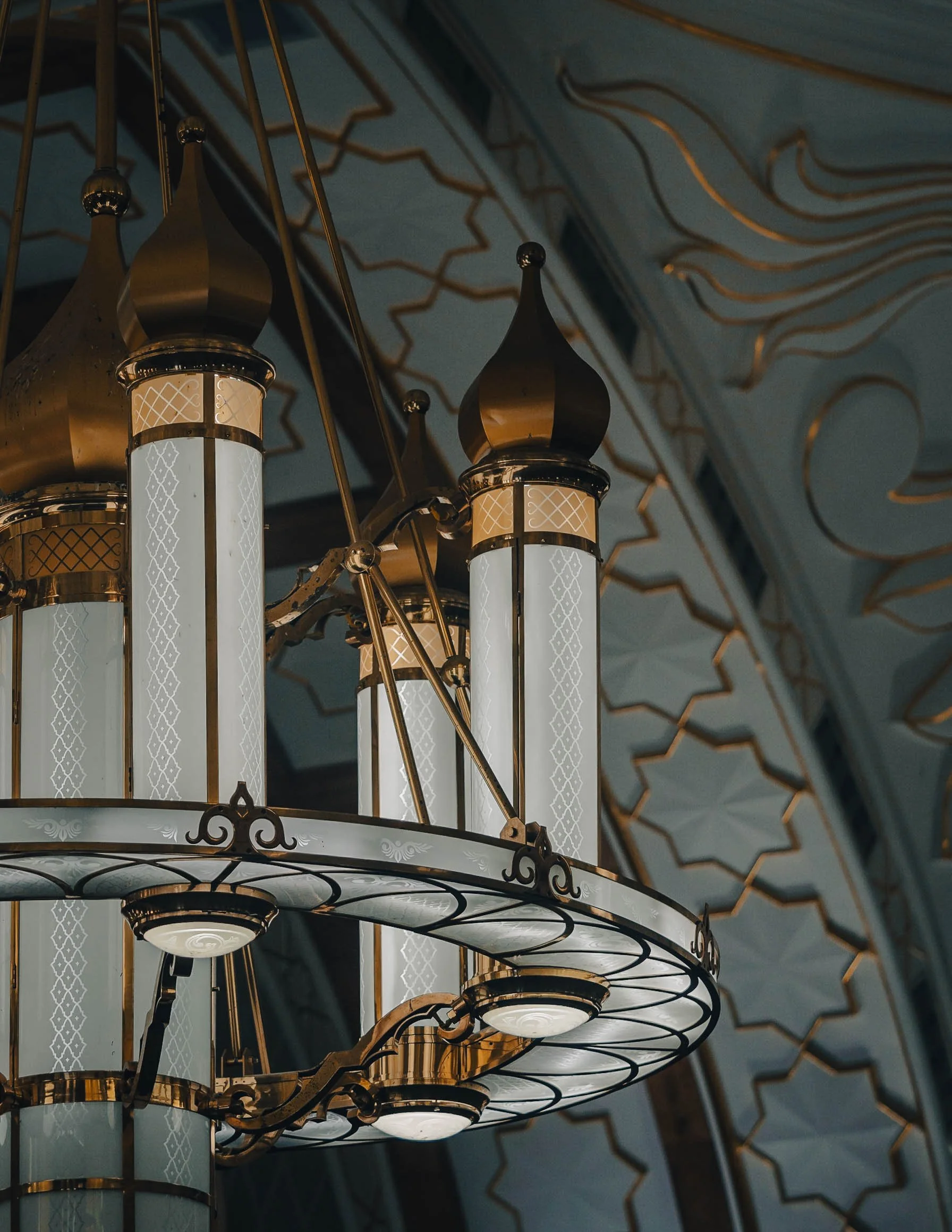
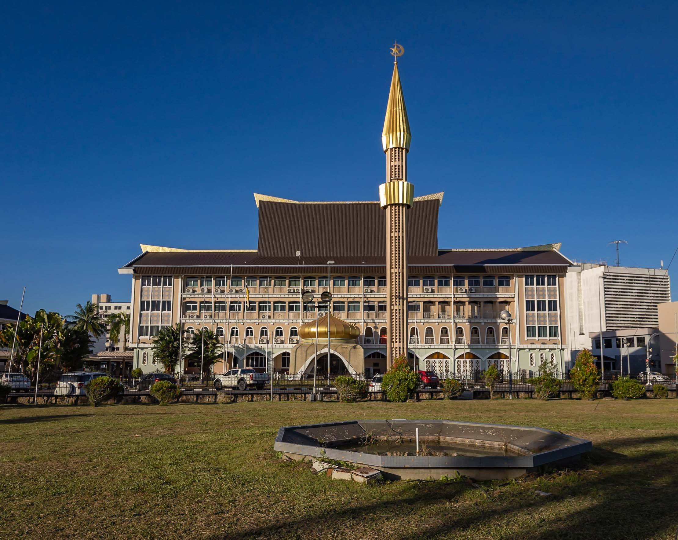
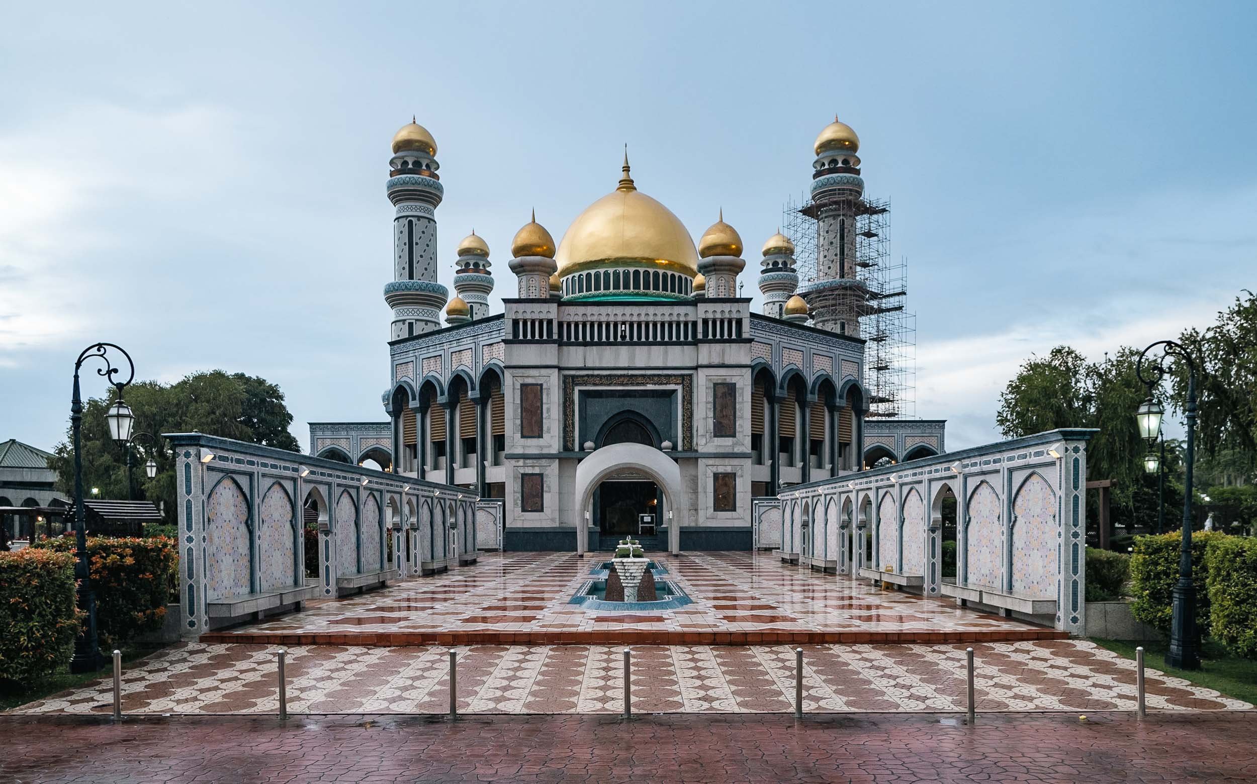
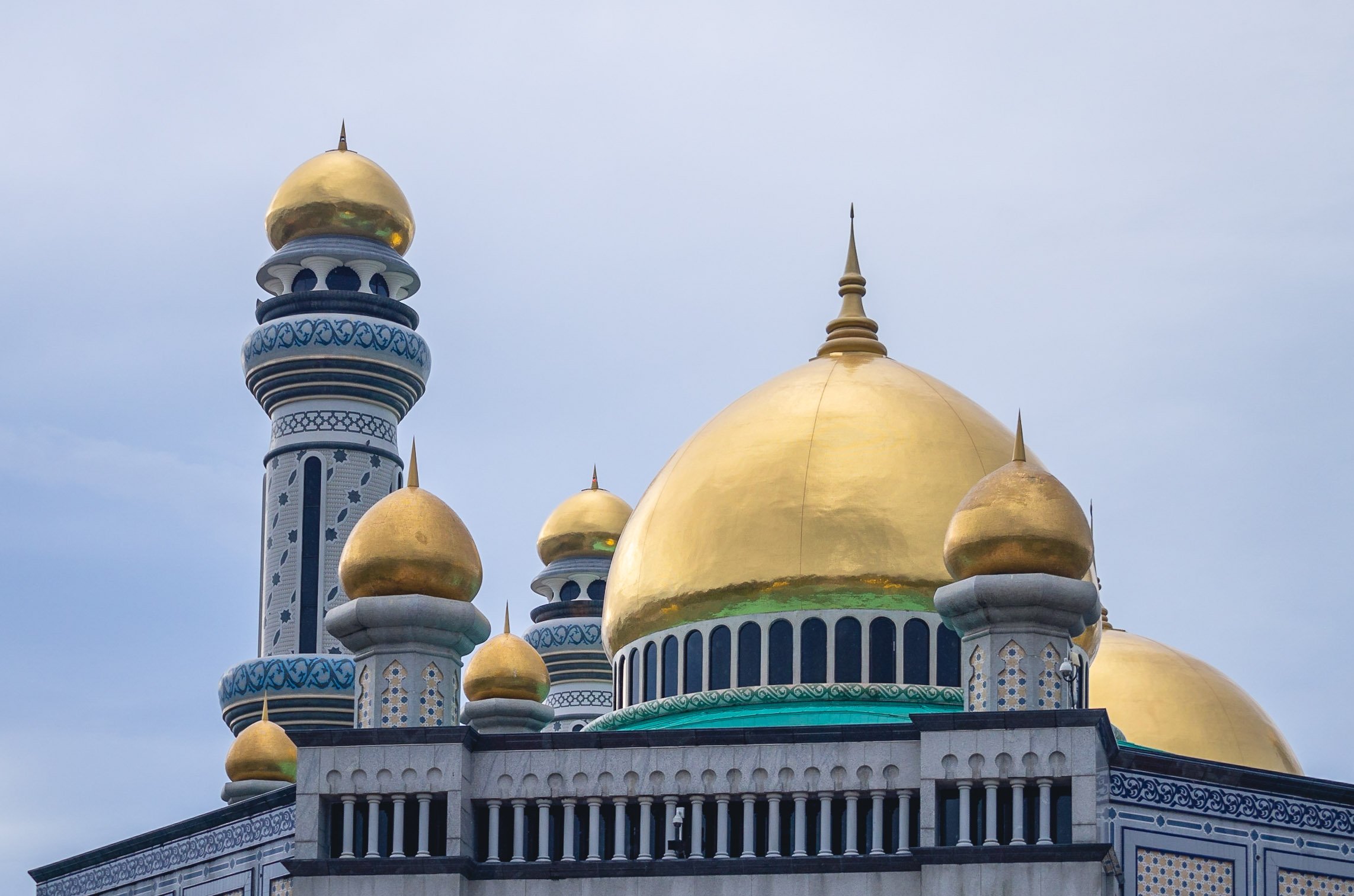
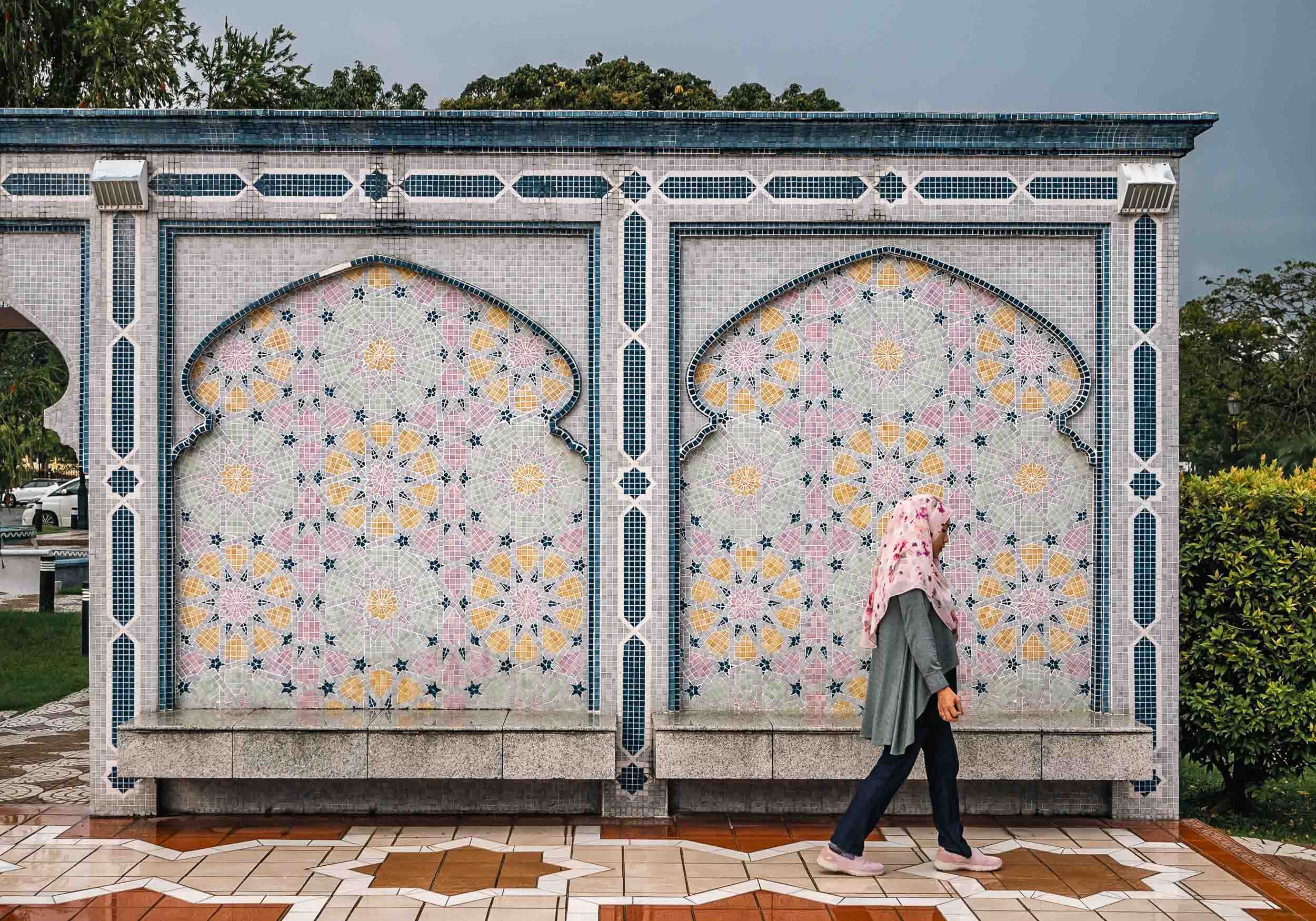
Jame 'Asr Hassanil Bolkiah Mosque
Ash Shaliheen Mosque
Yet another mosque - they are some of the most interesting attractions in Brunei. This one is said to follow Moroccan style, and was designed by an Egyptian architect. It’s possible to visit, and the interior courtyard with its retractable roof is worth seeing. It’s also located in the government district, which featuring a number of peculiar architectural styles for the various ministries and offices.


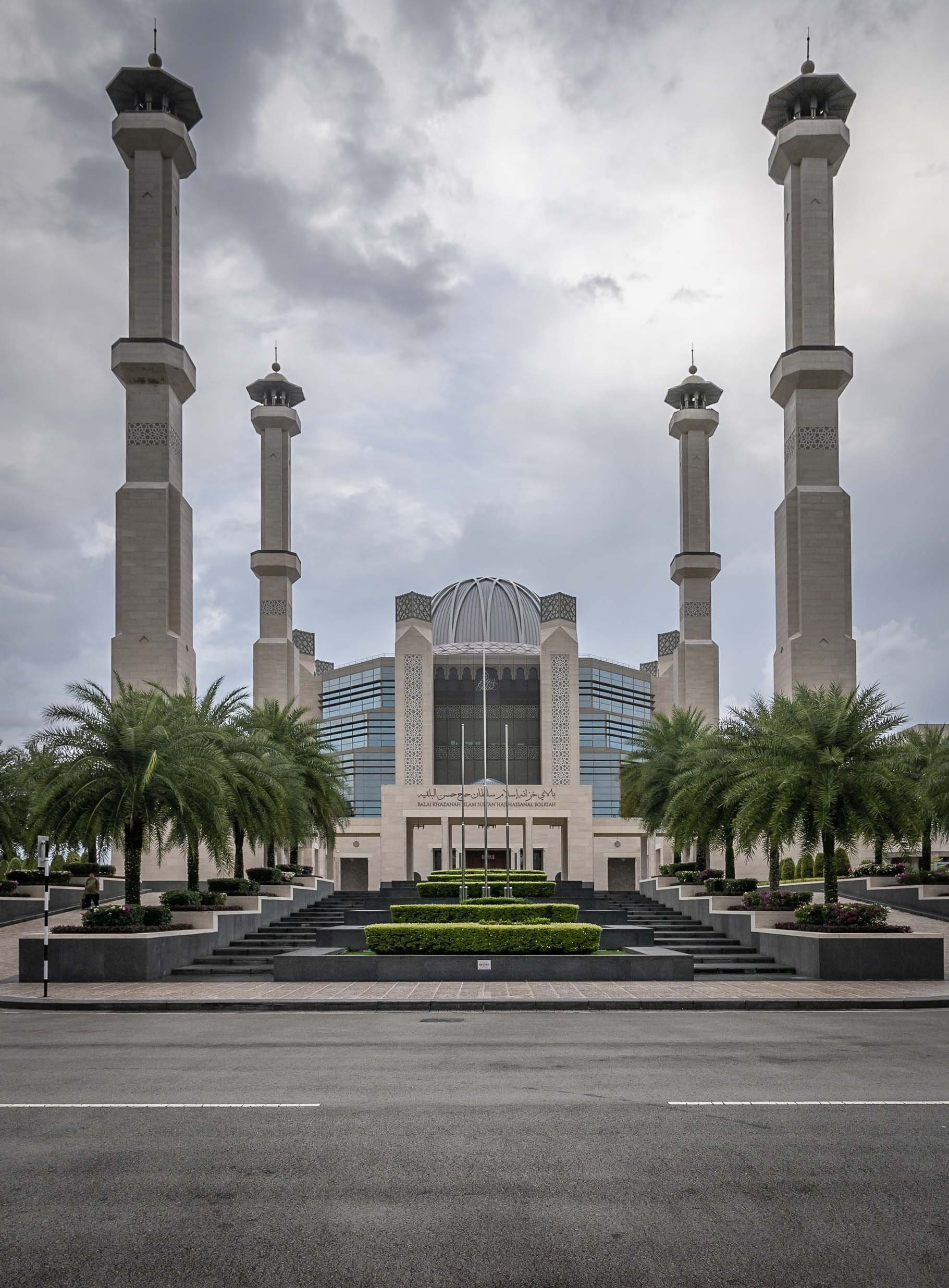


Unfortunately I couldn’t make it in time to go inside and visit, but it houses a large collection of manuscripts and artworks, for instance. The exterior was likely equally fascinating to me though.
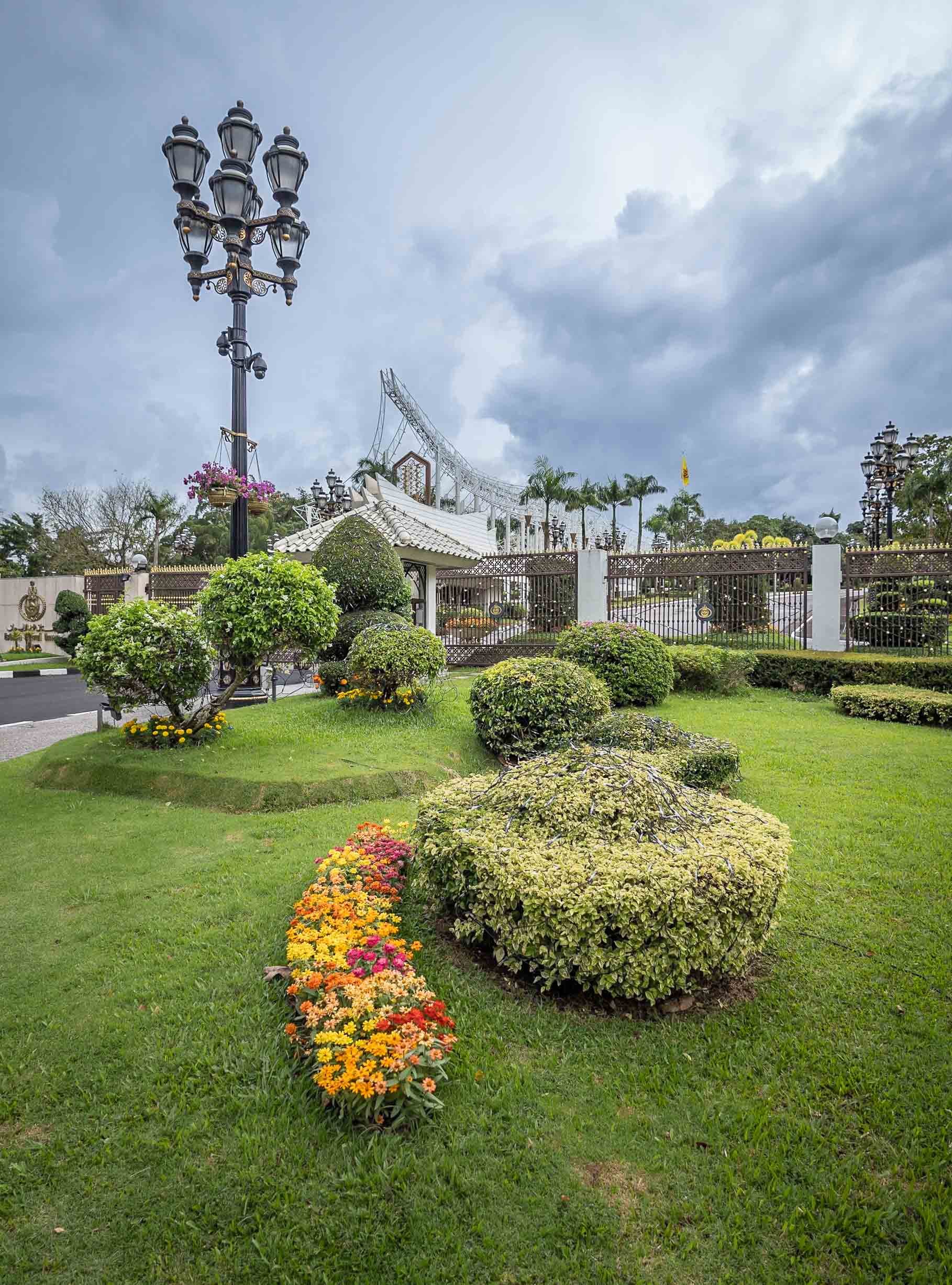
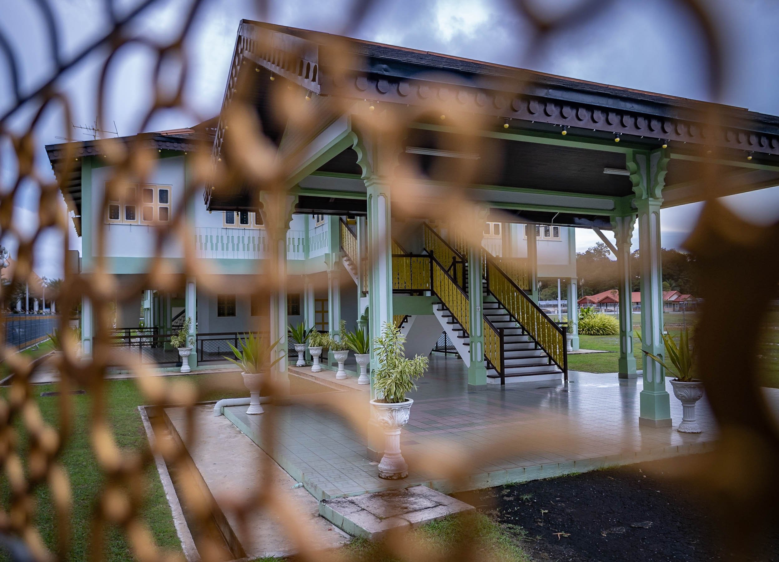
Palaces
A strange and seemingly abandoned building can be seen from certain angles in Brunei - this place was allegedly built for the Sultan's ex-wife, but stopped after the divorce. Its status is unclear, but it is said the interior is almost complete and follows similar architectural approach as the outside - a mix of classic European and Russian styles.


Record Breaking
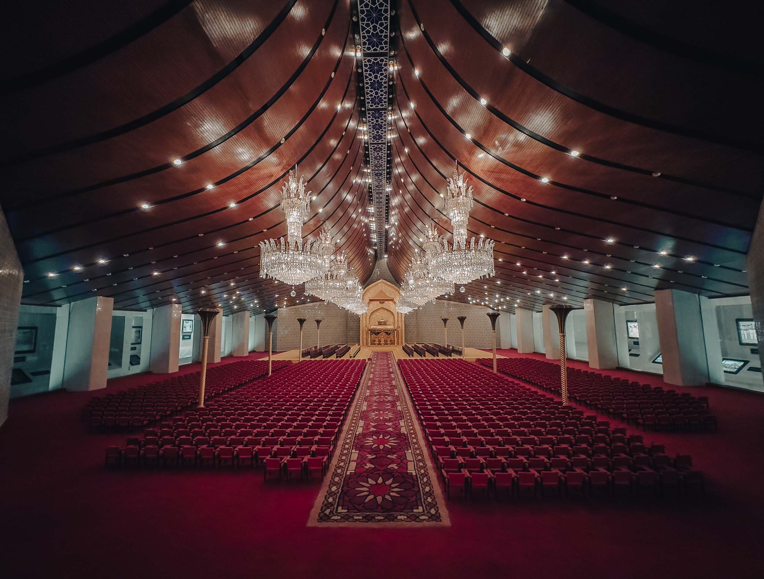
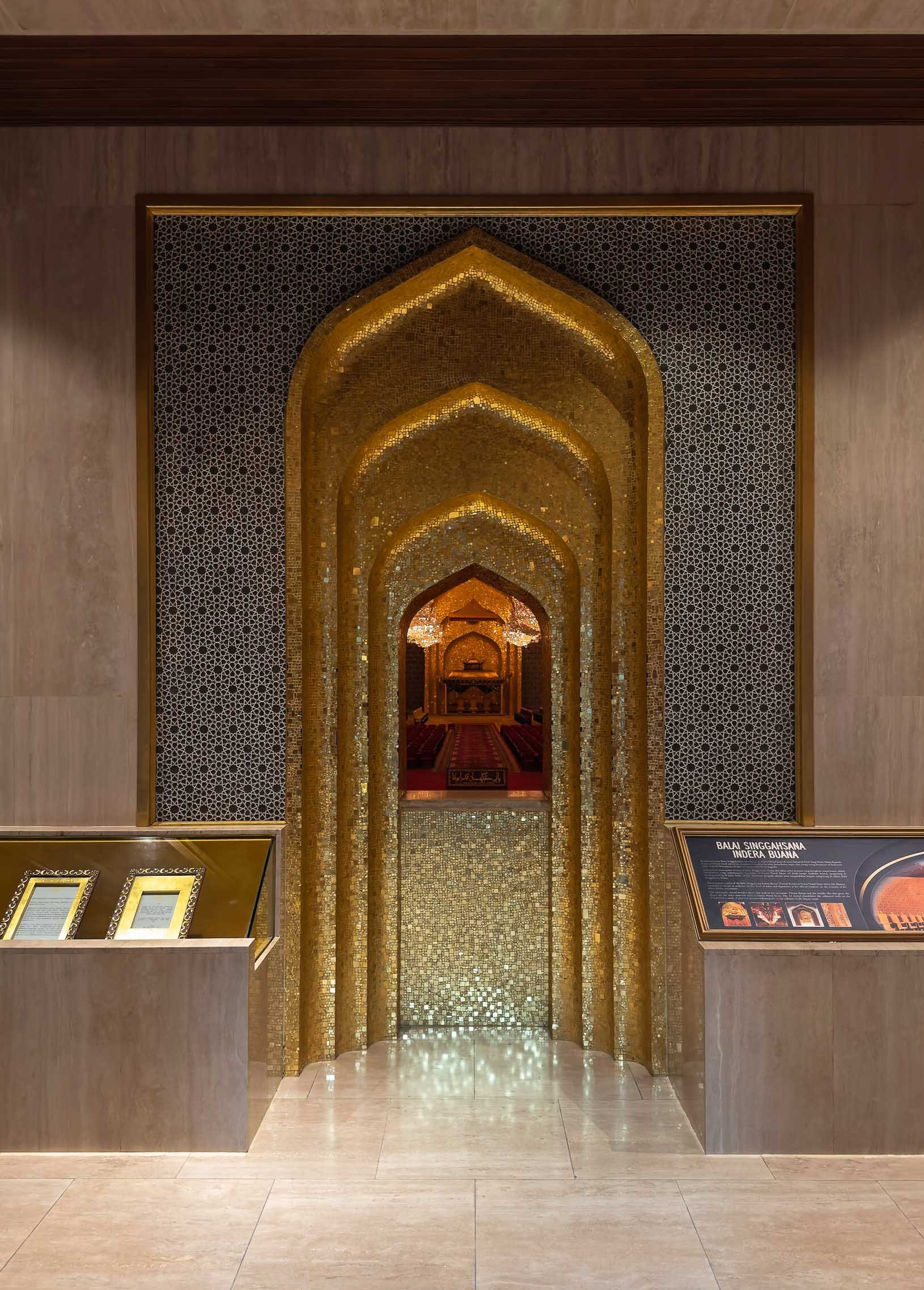
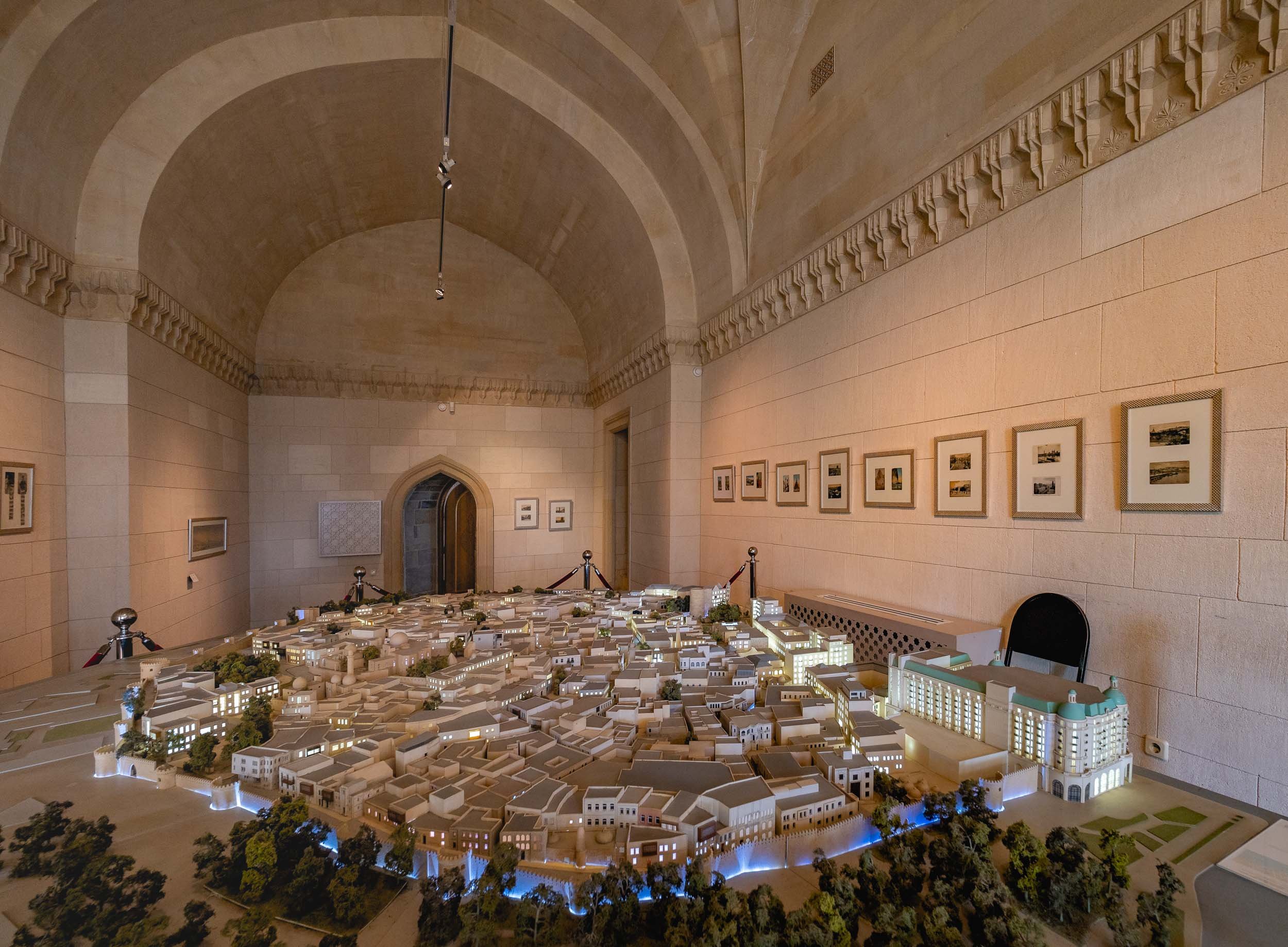
The actual palace of the Sultan of Brunei, called Istana Nurul Iman or the Light of Faith, is on yet another level - it is considered the largest residential palace and single family building in the world. The cost at its completion in 1984 was USD 1.5Bn, with a floor space area of over 200,000 sqm - it contains 1,788 rooms, of which 257 are bathrooms. It also houses the banquet room seen as a model in the Royal Regalia museum. The palace is also home to the infamous car collection of the Sultan and his brother (a whole different character, worth reading up on). Most of those cars are said to slowly fall into decay due to the lack of care these days, but no one knows for sure.
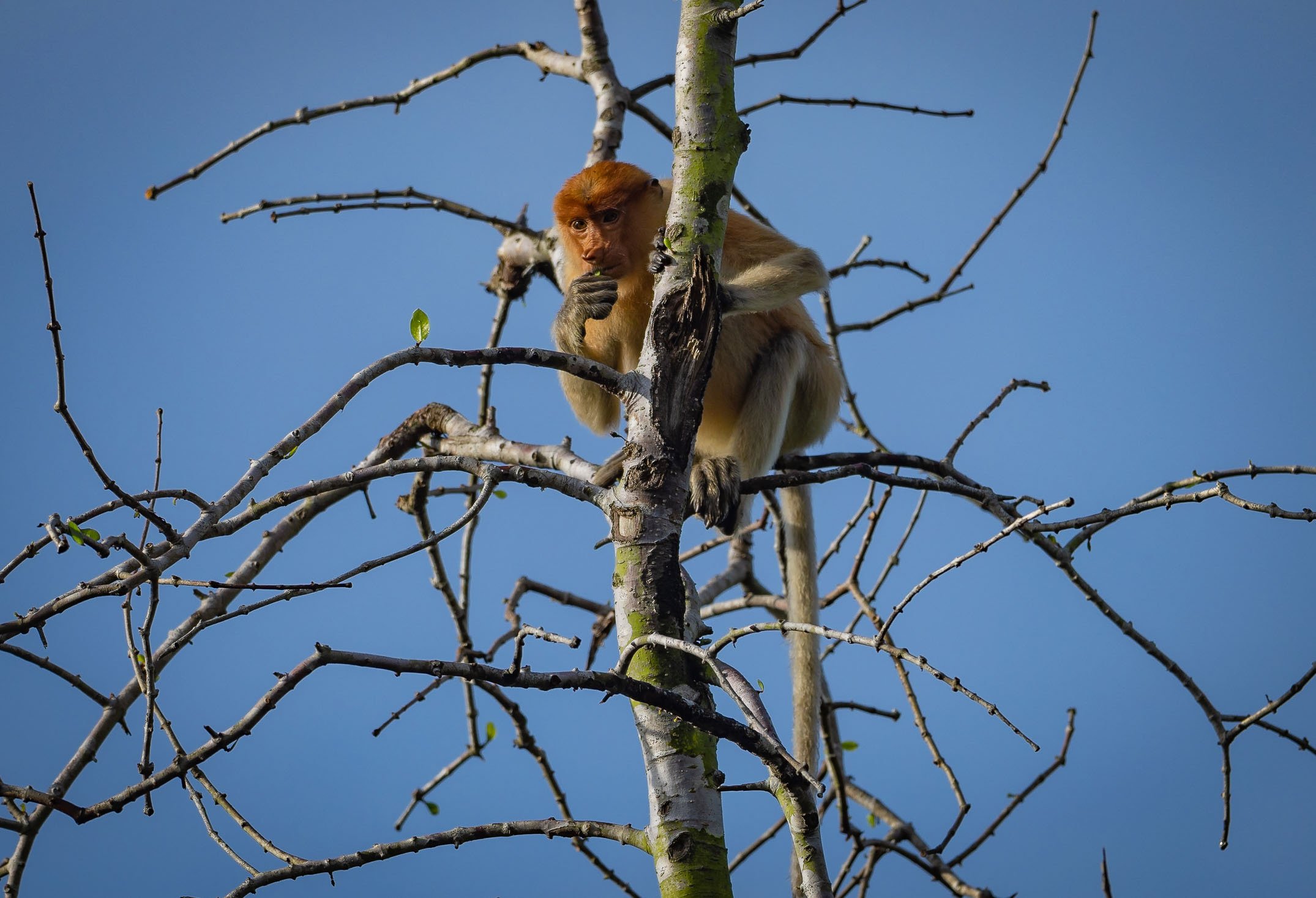
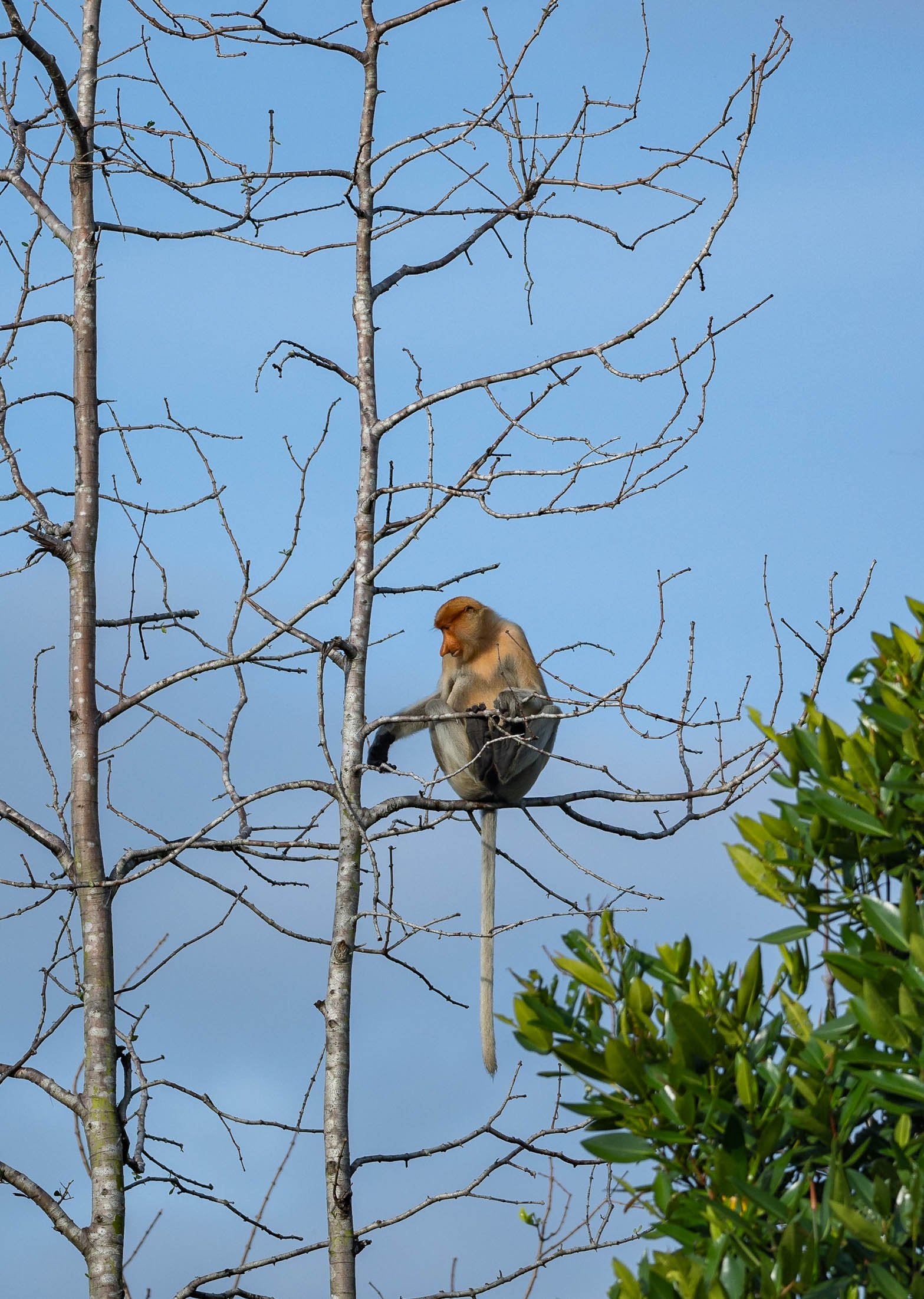
And Further Around
Frankly, there isn’t toooo much to see beyond the city boundaries, but there are a few nice beaches and several rivers in the largely untapped forest. Unlike much of the rest of Borneo, which is part of Malaysia and Indonesia, Brunei’s portion hasn’t been tapped for Palm Oil and other plantations. These photos were taken from the shores of the The Empire Brunei hotel, the country’s only real high end luxury property, 20min from the city.


Happy Days - HIPA Winner & Smithsonian Finalist 🥳
The award gods were kind to me this year, as my work has received a 1st place recognition at HIPA’s Worlds Coolest Winter Season 2 contest.
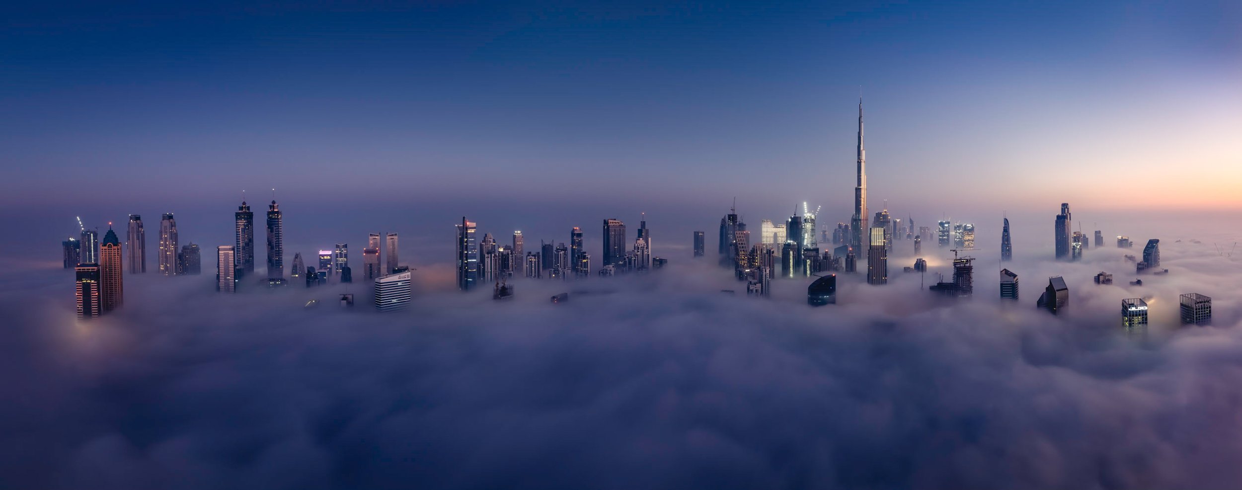
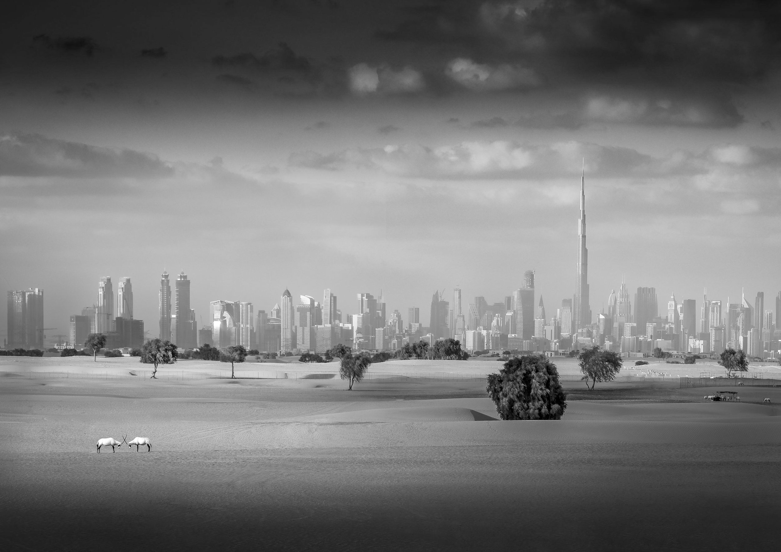
From time to time I submit my work to photography contests around the world. There are many sub-par money-grab competitions out there, so it’s important to be selective when choosing where to submit. HIPA of course is beyond such a doubt, running the world’s highest priced global photography competition, for instance. Their World’s Coolest Winter campaign doesn’t quite reach the same prestige (and price money) but it was still a competition of amazing images from all around the United Arab Emirates.
All the more exciting is it to be among the winners, and I managed to claim a 1st price this year with the five images below. Some of them happen to be among my favorite photographs ever, not only from the UAE, but in general, so I’m glad they’ve been recognized.

On this note, a shoutout to my friend Neelima Azad, who won the second price. She’s one of my favorite photographers in the UAE, so I’m very happy we’re sharing the stage on this one! Funnily enough it’s not the first time, as we also both had images featured at the RAK Fine Art Festival last year, and they happened to be exhibited next to each other.
If any of you feel like one of the photos would make your home a nicer place (or someone else’s - good gifts!), the works from this competition are available as signed prints with certificates. Just contact me and we will figure out which options work best. If prints on the wall are not your thing, some of these images are going to be part of my upcoming photo book “Wonders of the Globe” - more on that soon!

Here is each of the photos with its story for your viewing pleasure:
The Smithsonian & the Nature of Viral Posts
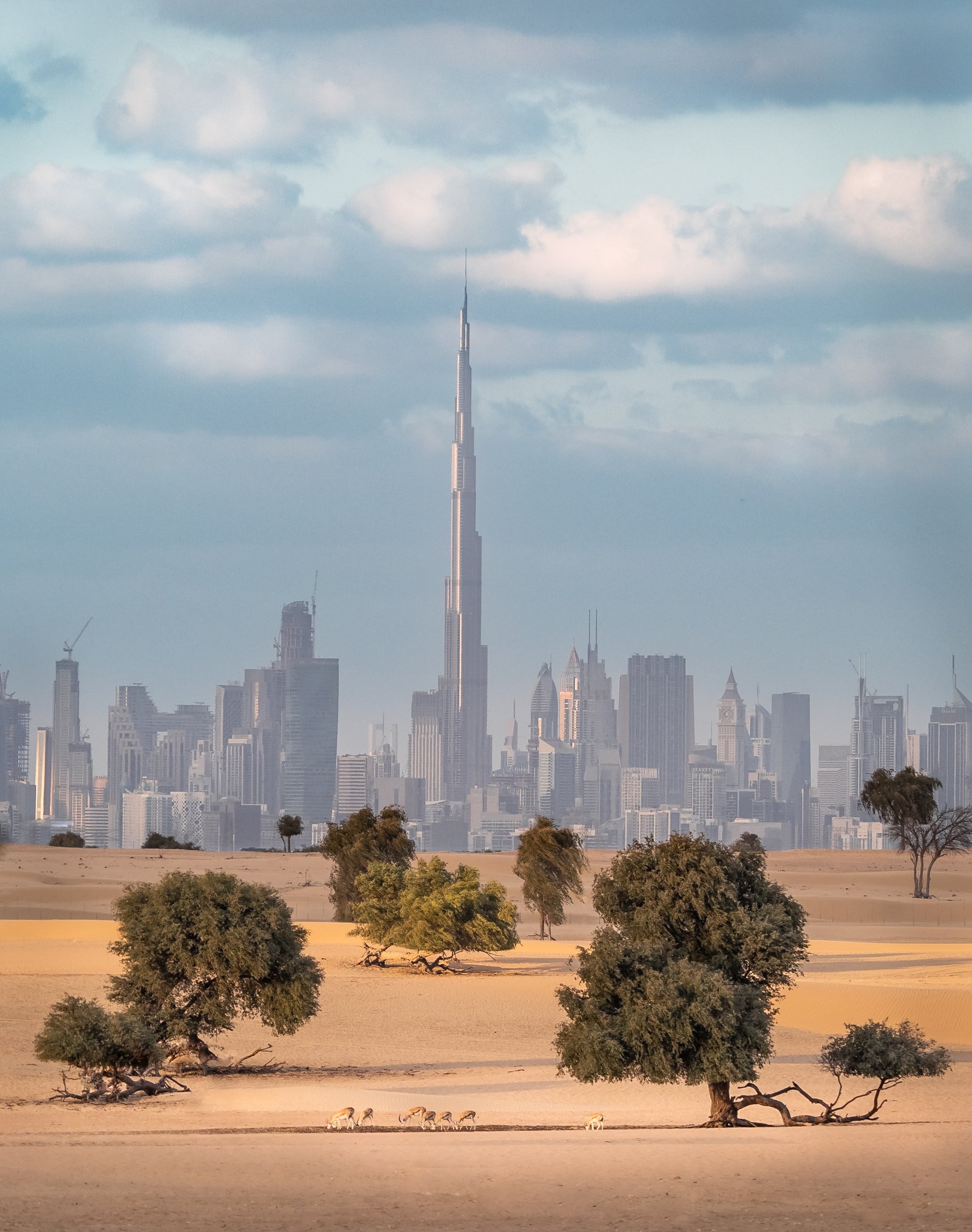
A few weeks earlier, I heard from the Smithsonian Magazine, which selected one of my submissions as a Finalist in the Drone category. “Suburban Dystopia” is a photograph I also took in the UAE, scouting the location on Google and Apple Maps, as I often do. Once it was published on the Smithsonian’s website, it quickly went viral on Facebook and Reddit with ten thousands of likes and comments. Sadly - as it often goes on social media and the wider internet - it’s mainly controversy that drives engagement. A bland suburban robotic copy-paste housing complex in a place like Dubai (which as a city itself is always a well-loved subject for online debate) seems to attract a lot of people feeling the need to voice their often less-than-qualified opinion, and this is seemingly what it takes for the algorithms to surface content high up in the feeds.
This villa complex is in Nad Al Sheba, Dubai, and one of the many master planned gated communities in the city, built to quickly and effectively counter the housing shortages resulting from the growing population.

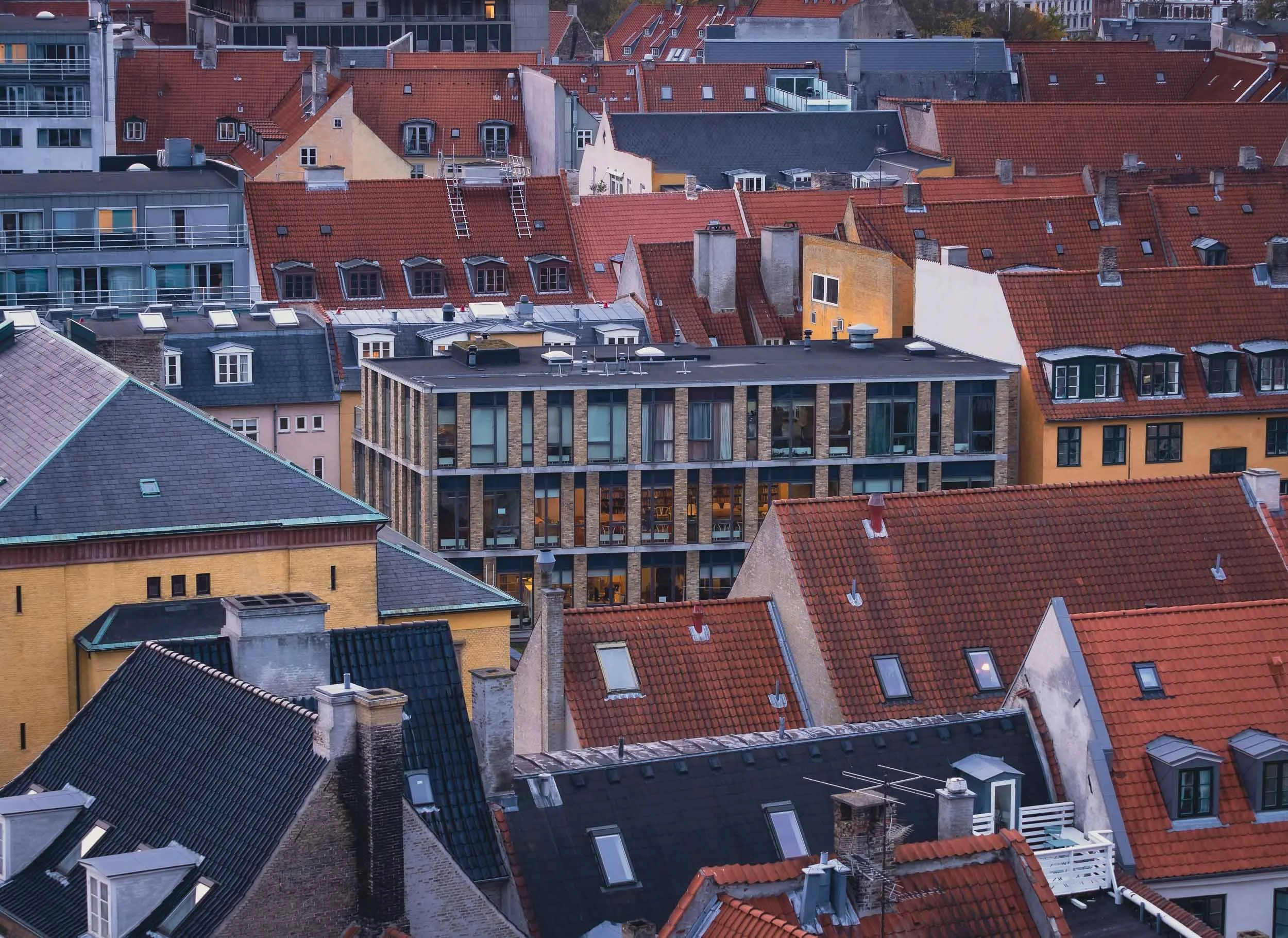
Copenhagen - The world's most livable city?
this was a title given to Denmark’s capital in 2013 by Monocle owing to its urban, cultural, and environmental planning

Well, this was a title given to Denmark’s capital in 2013 by Monocle owing to its urban, cultural, and environmental planning and is often echoed in many other city rankings. I visited in November 2022 to gain my own impressions, and finally got around to documenting some of them here.
The visit started with a big disappointment, being that Tivoli, one of the world’s oldest and most famous theme parks, was closed during my time here. This wasn’t really evident at all from the website, Google entry, or anywhere else, and so finding the doors closed wasn’t a happy start to the trip - even a visit to the nearby Lego store (Denmark is where Lego was invented) couldn’t quite help.
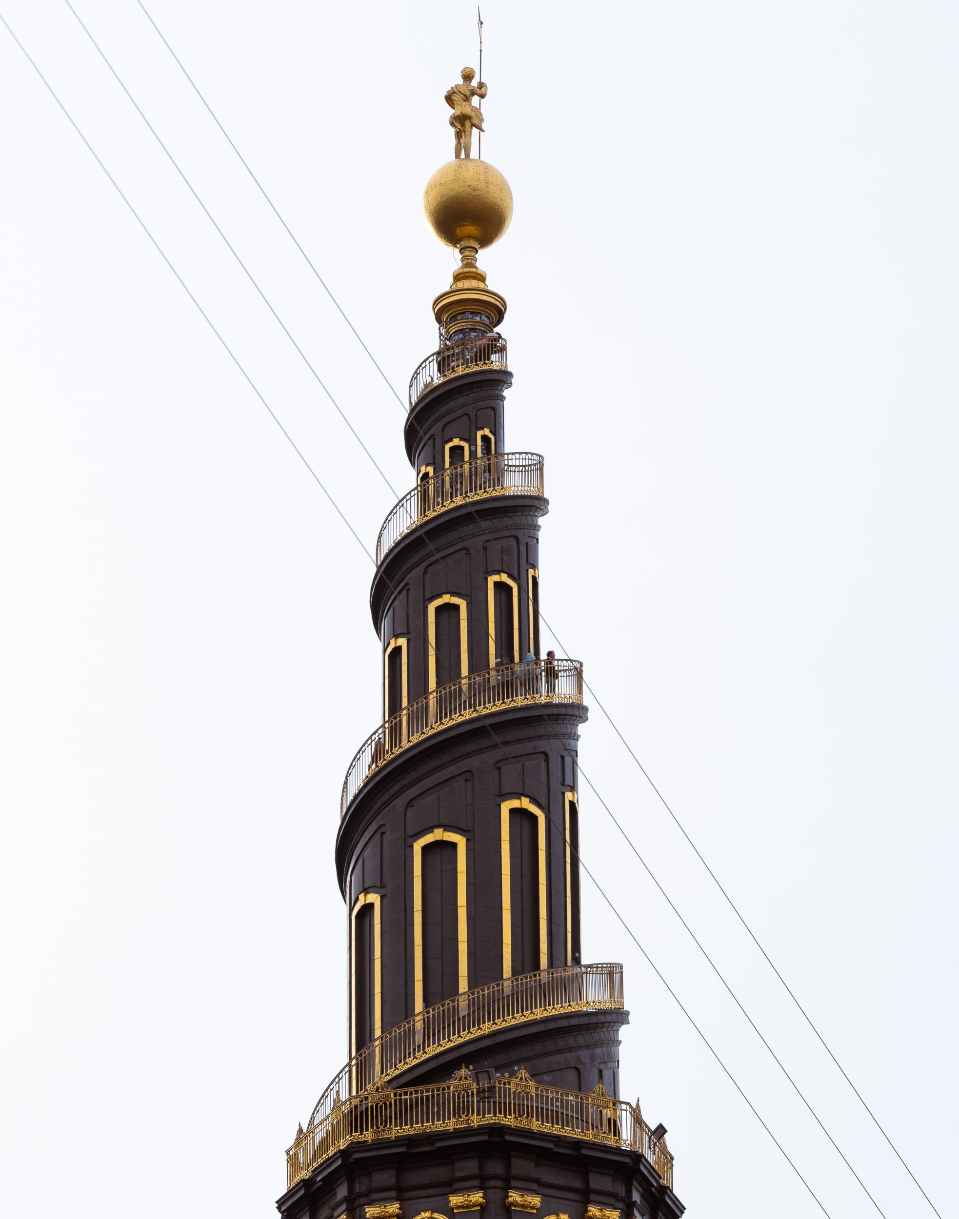
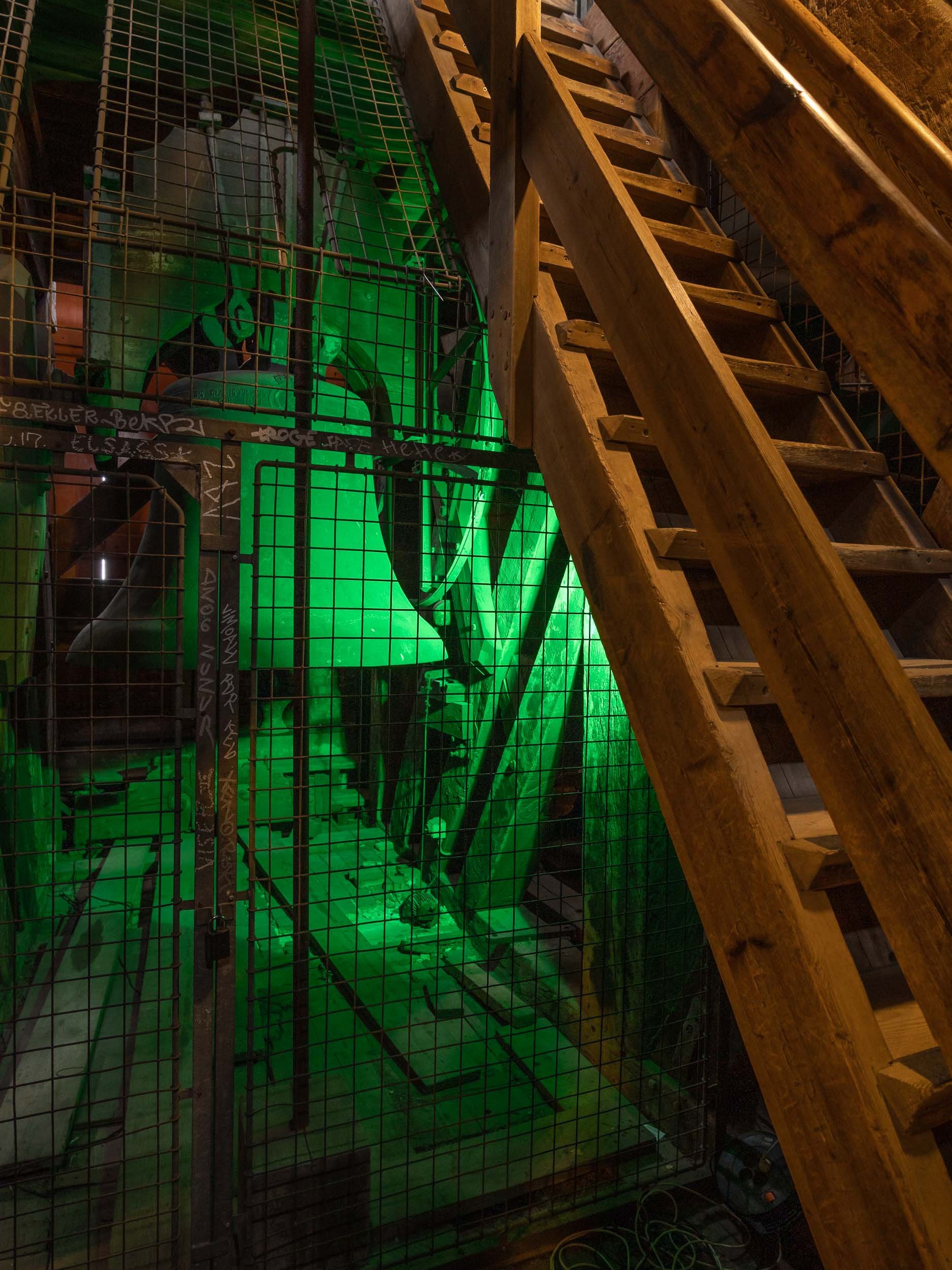
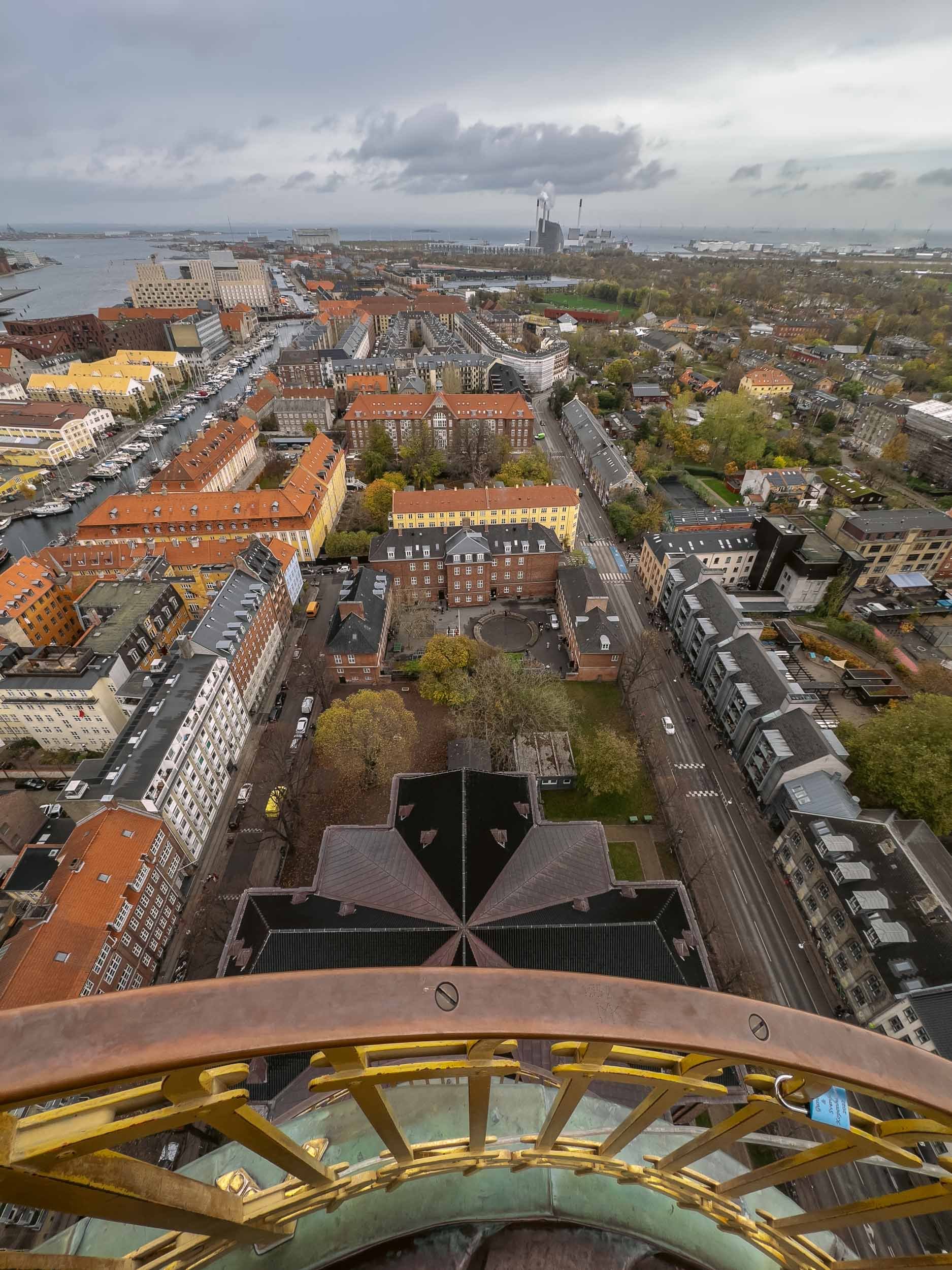
Instead onwards to the city’s aptly named “Round Tower”.


Some views from the top of the 1642 tower.
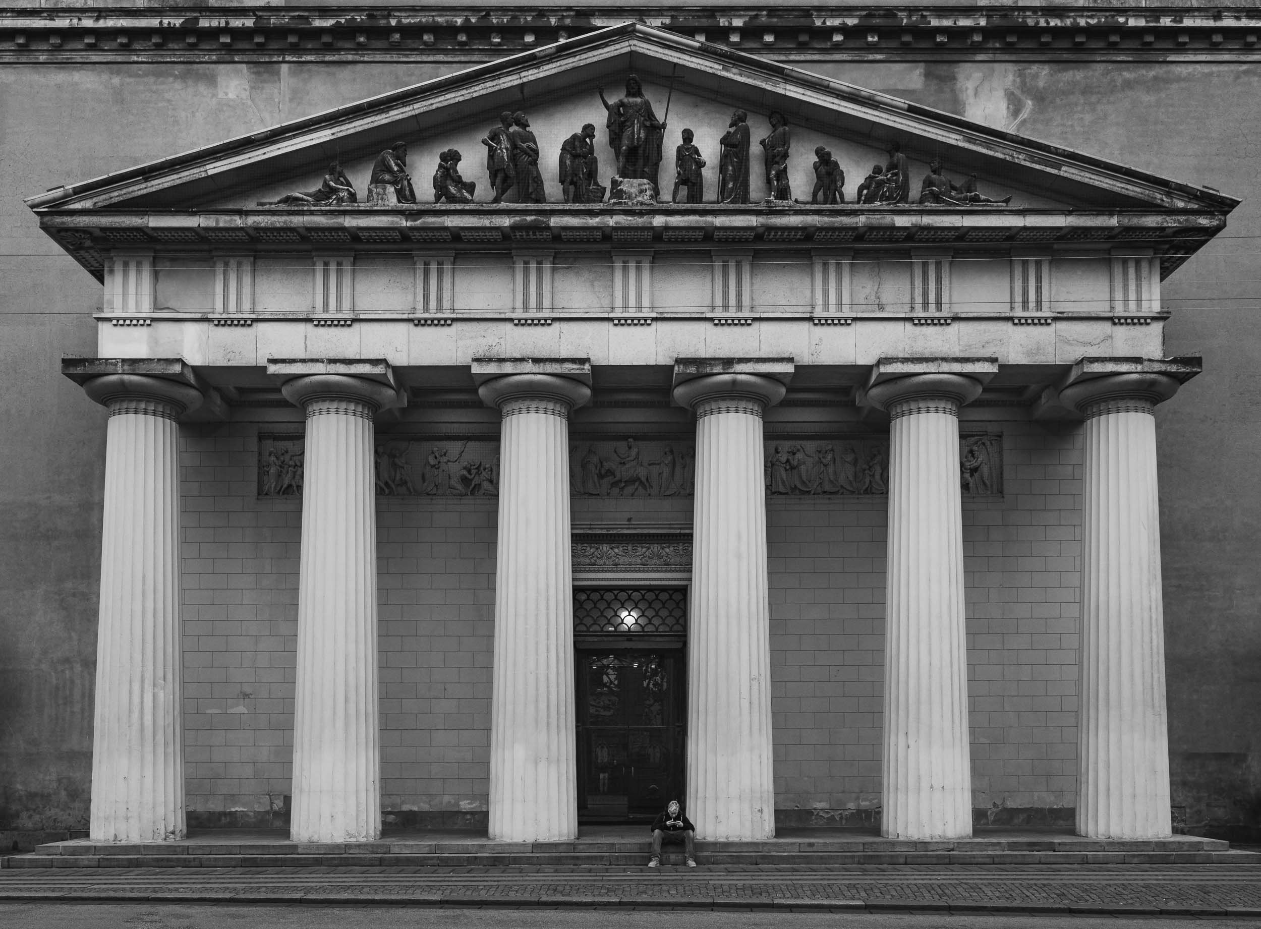
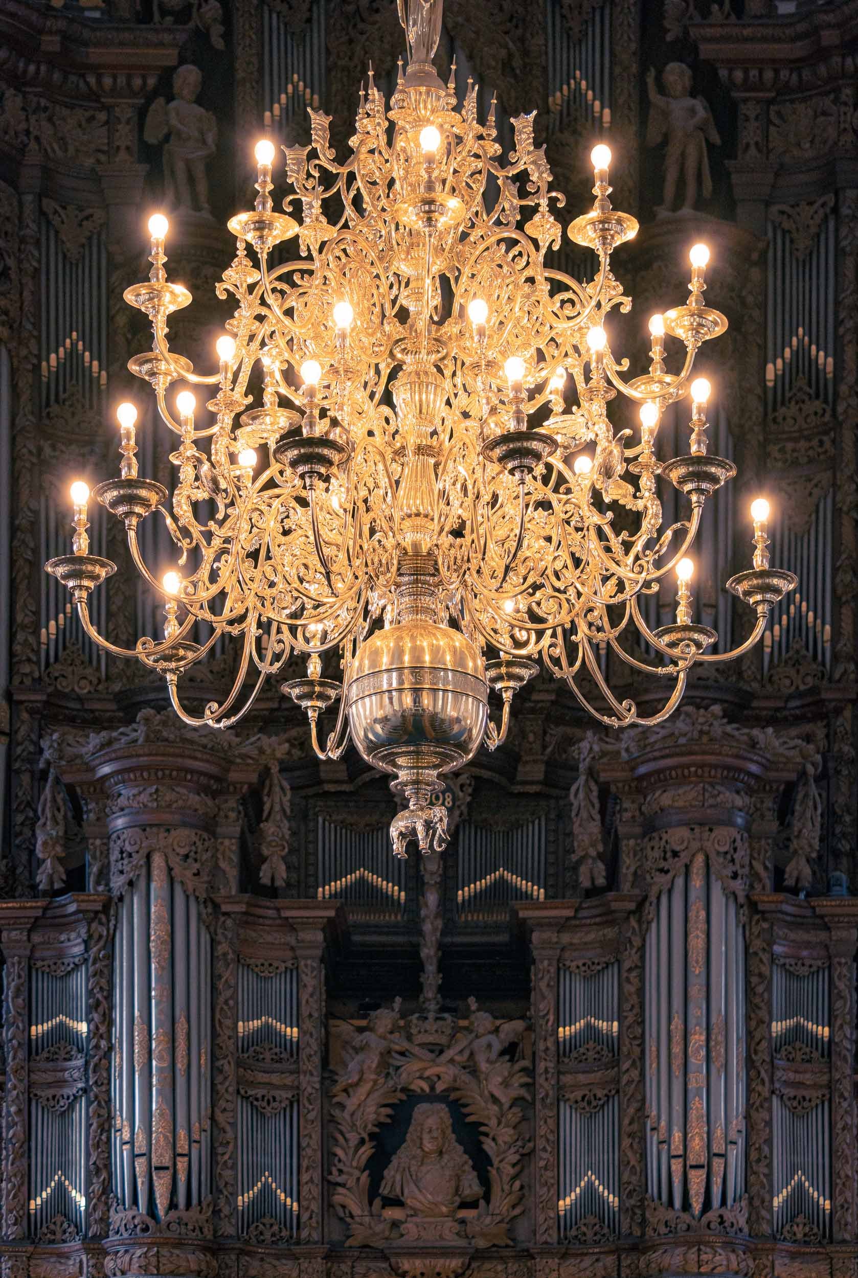
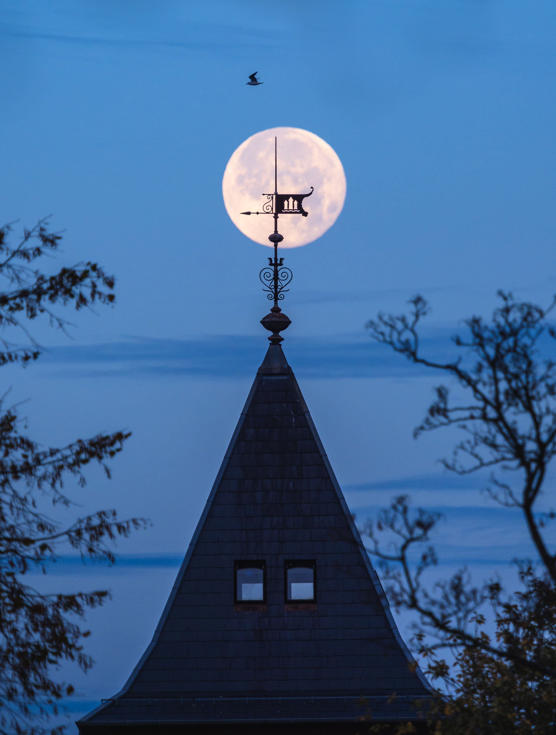
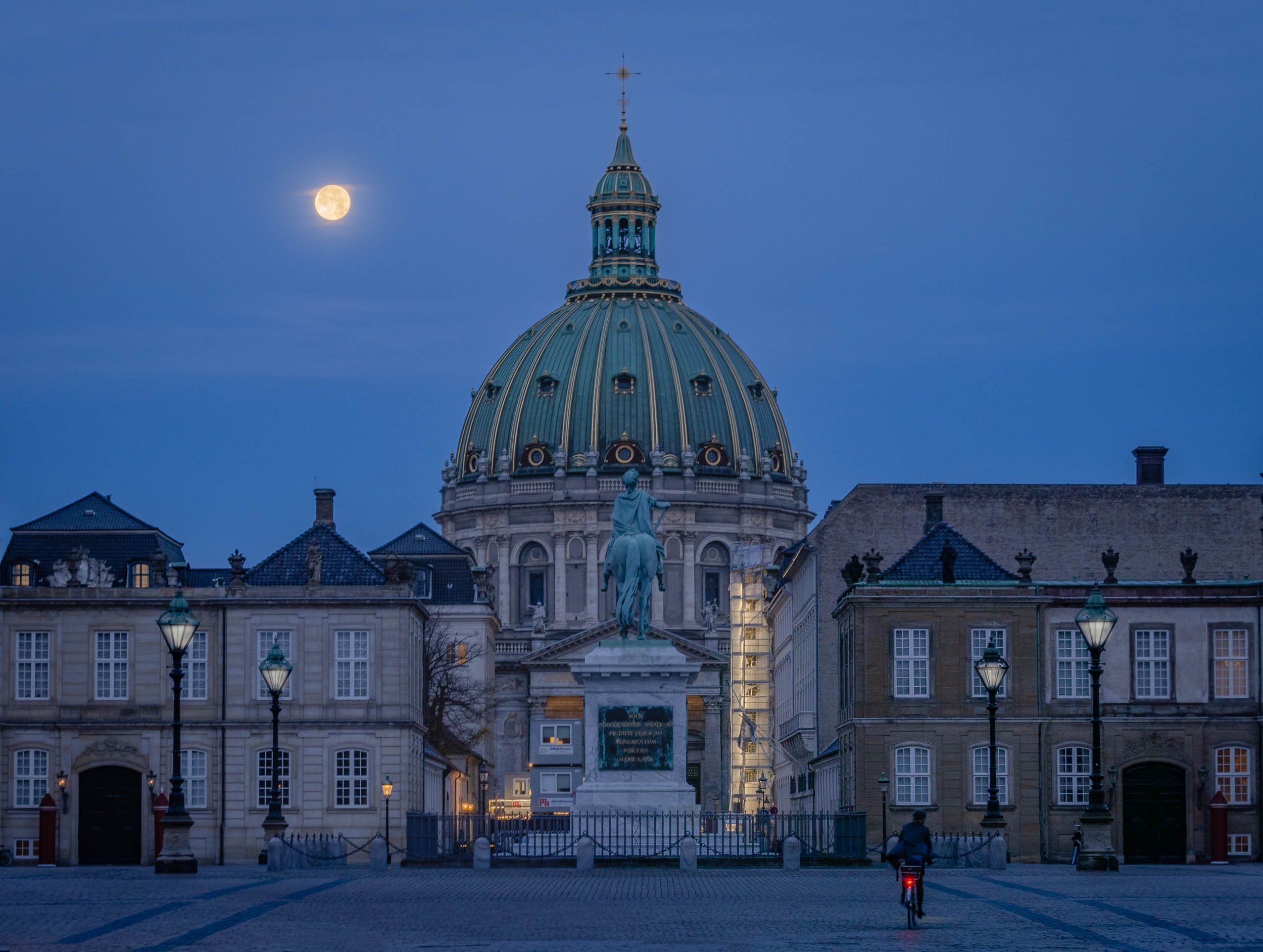
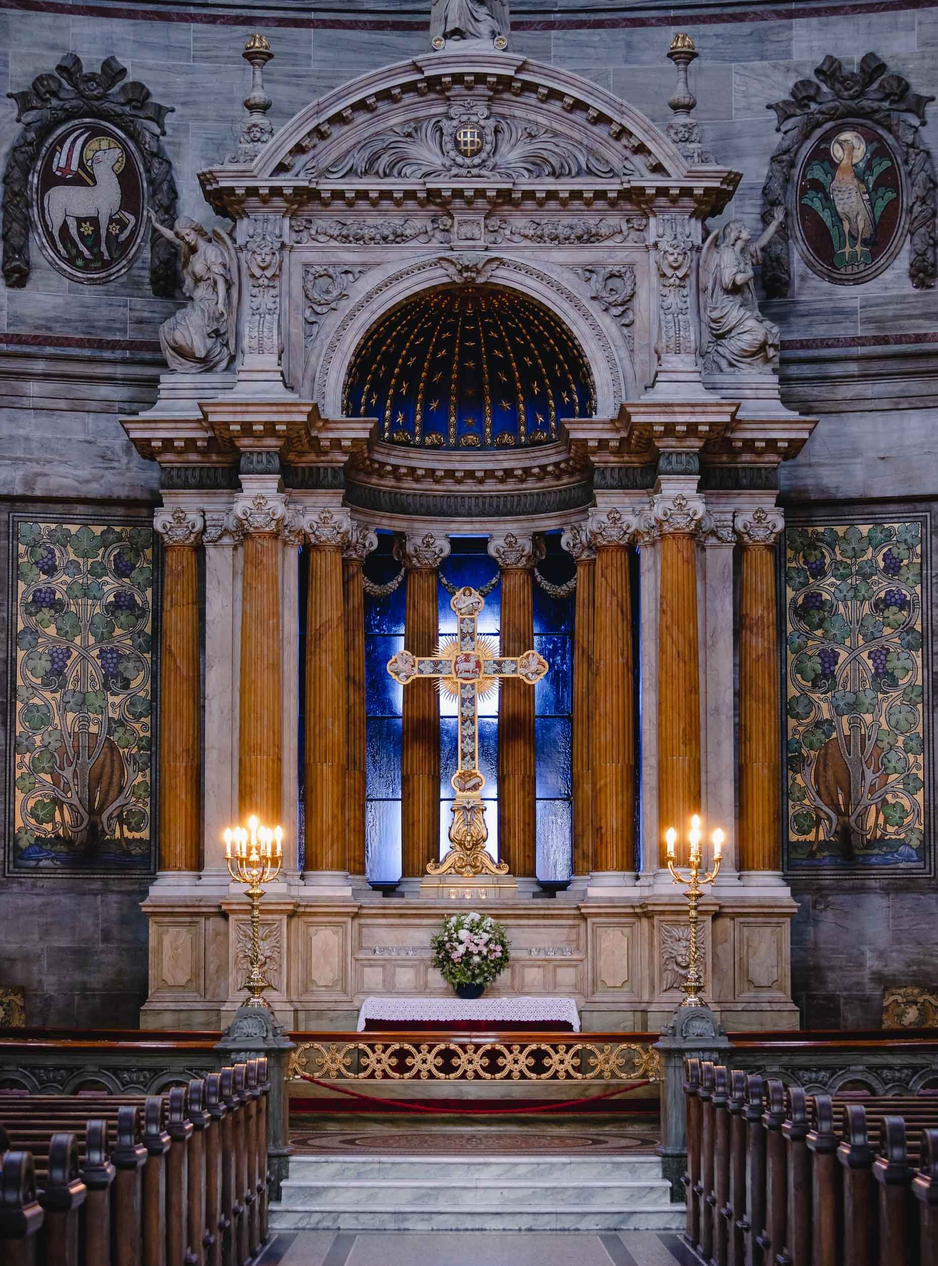
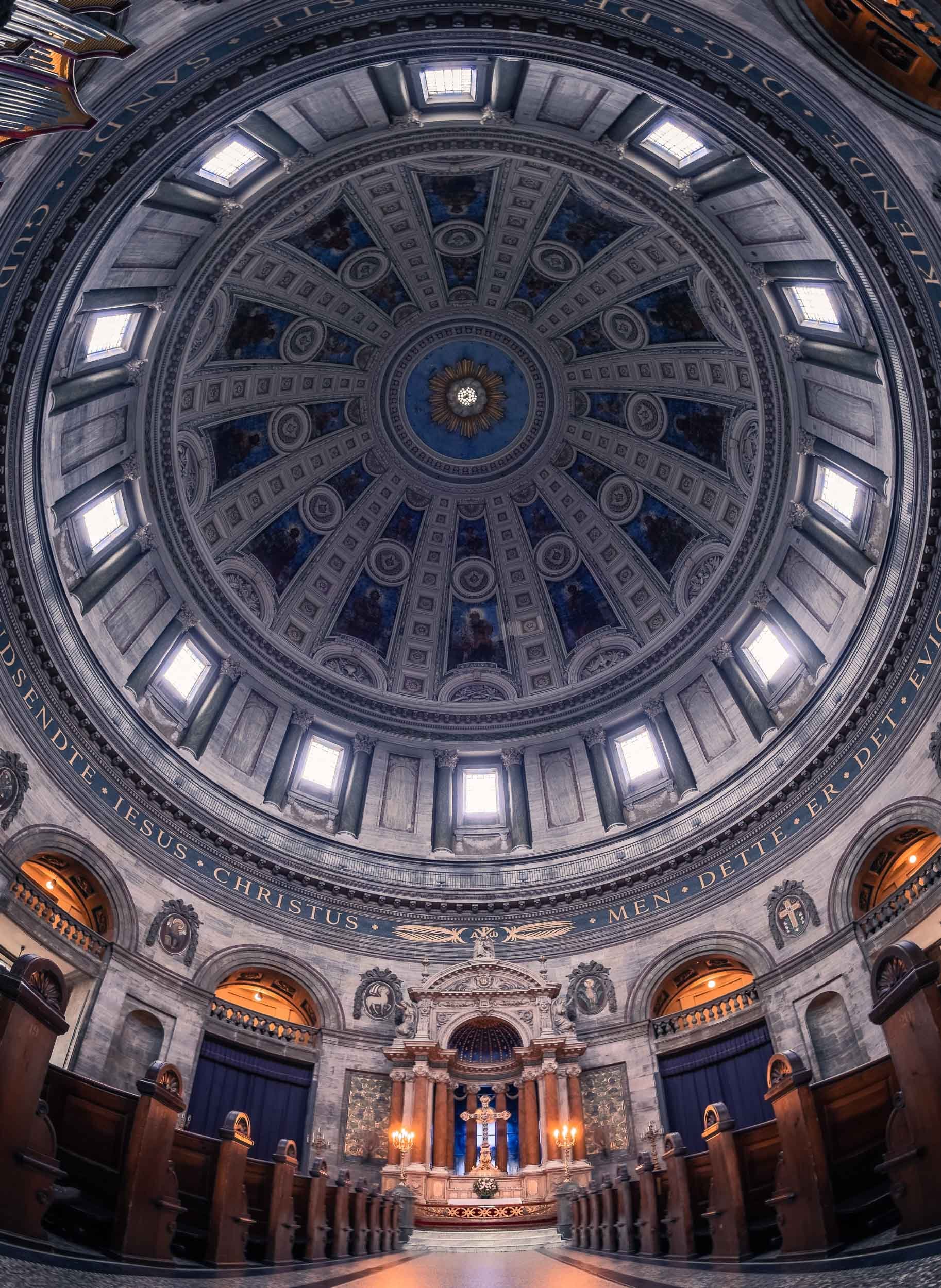
Church Galore

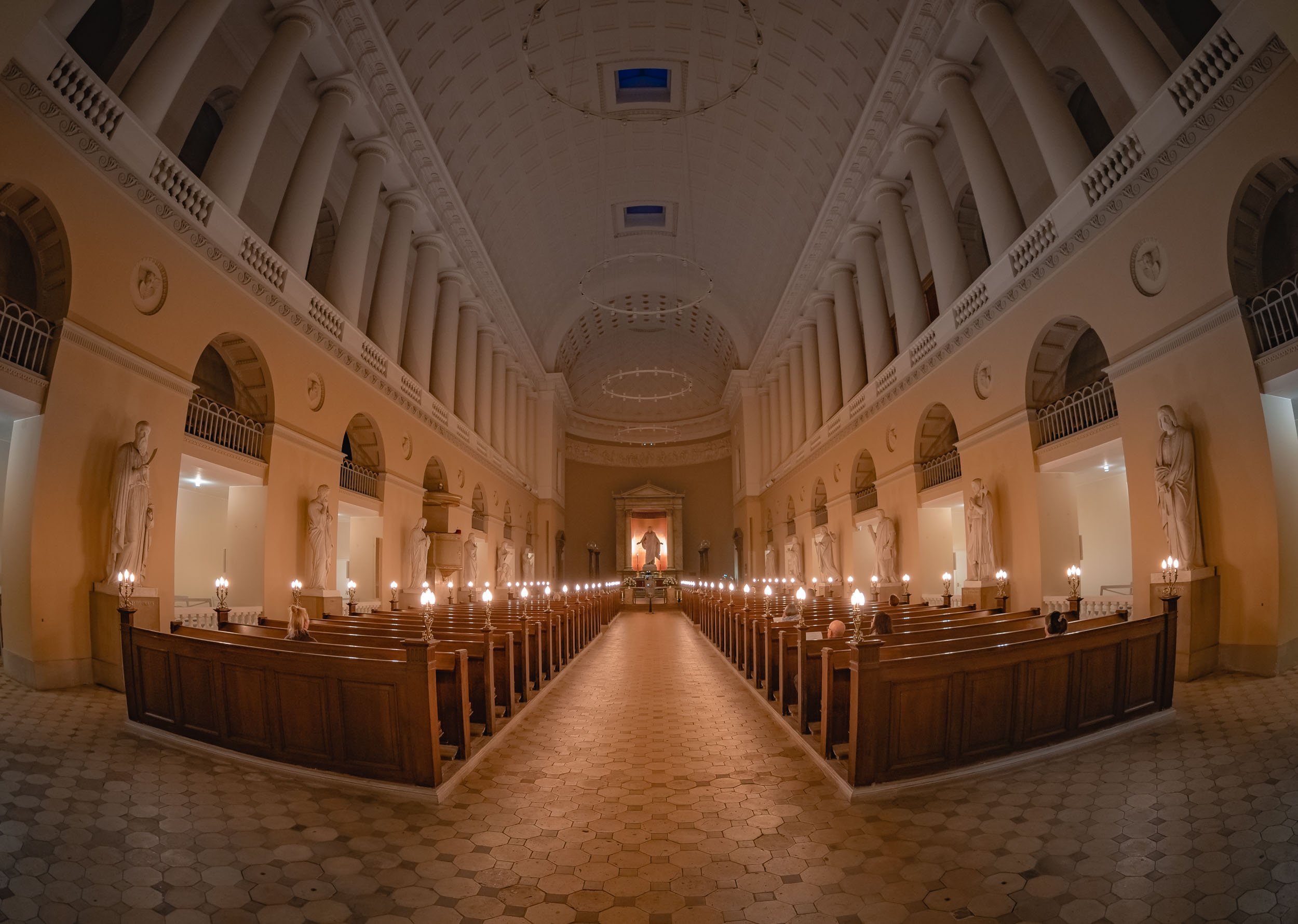
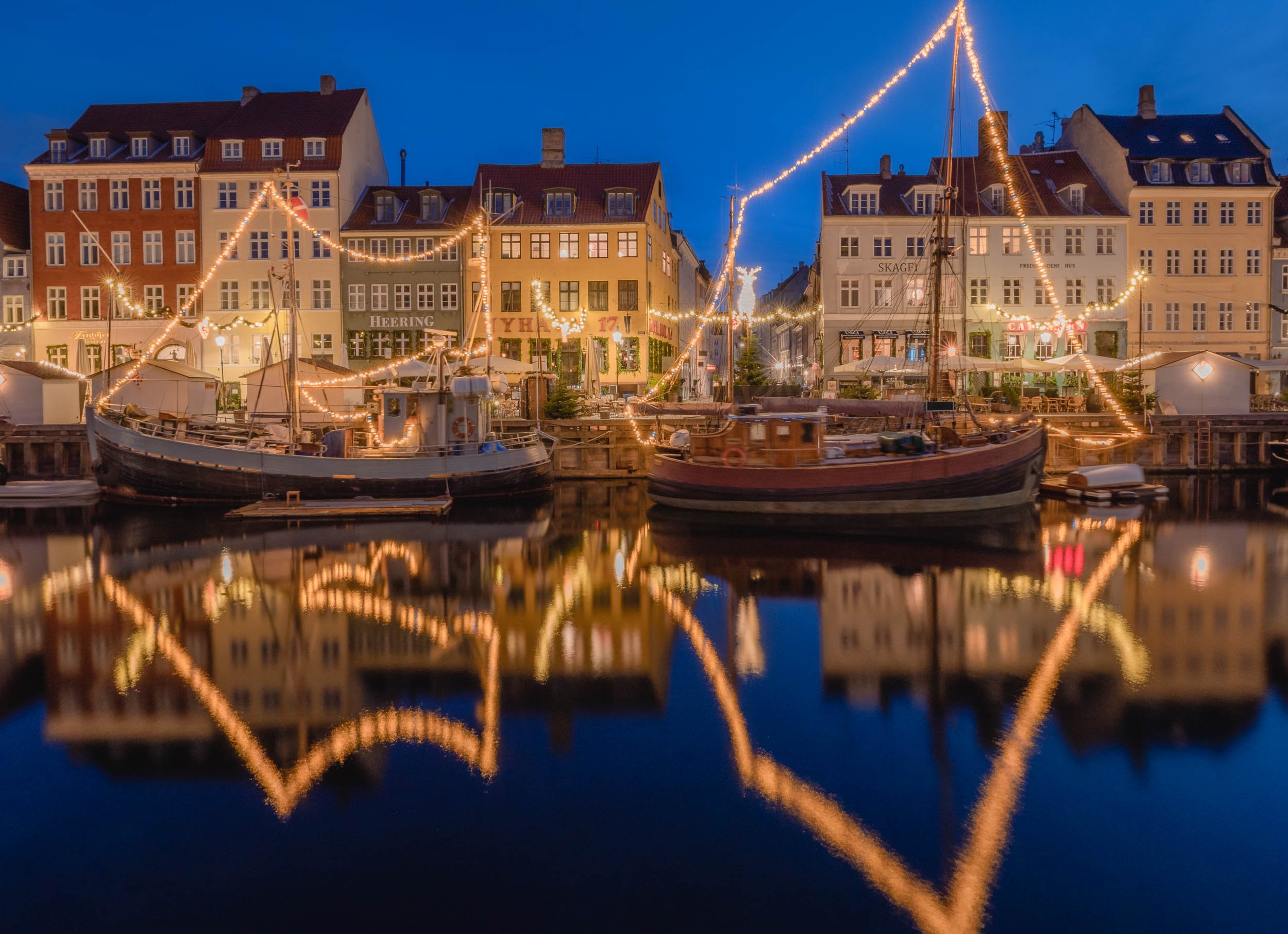
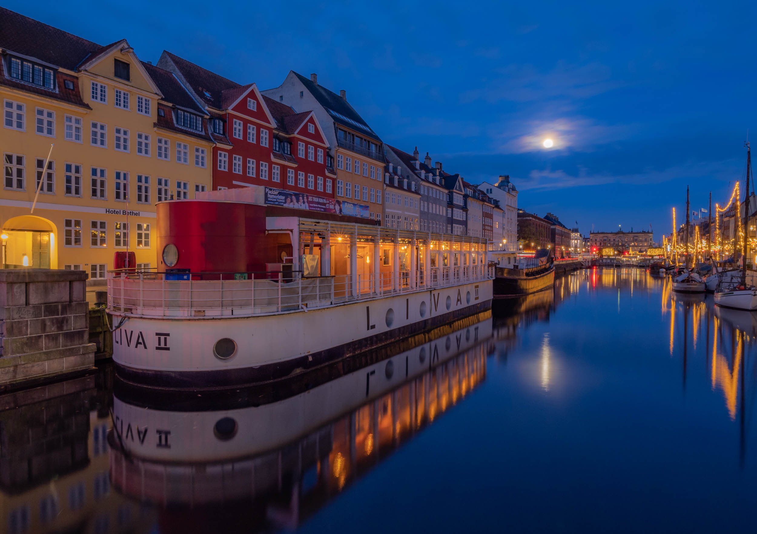
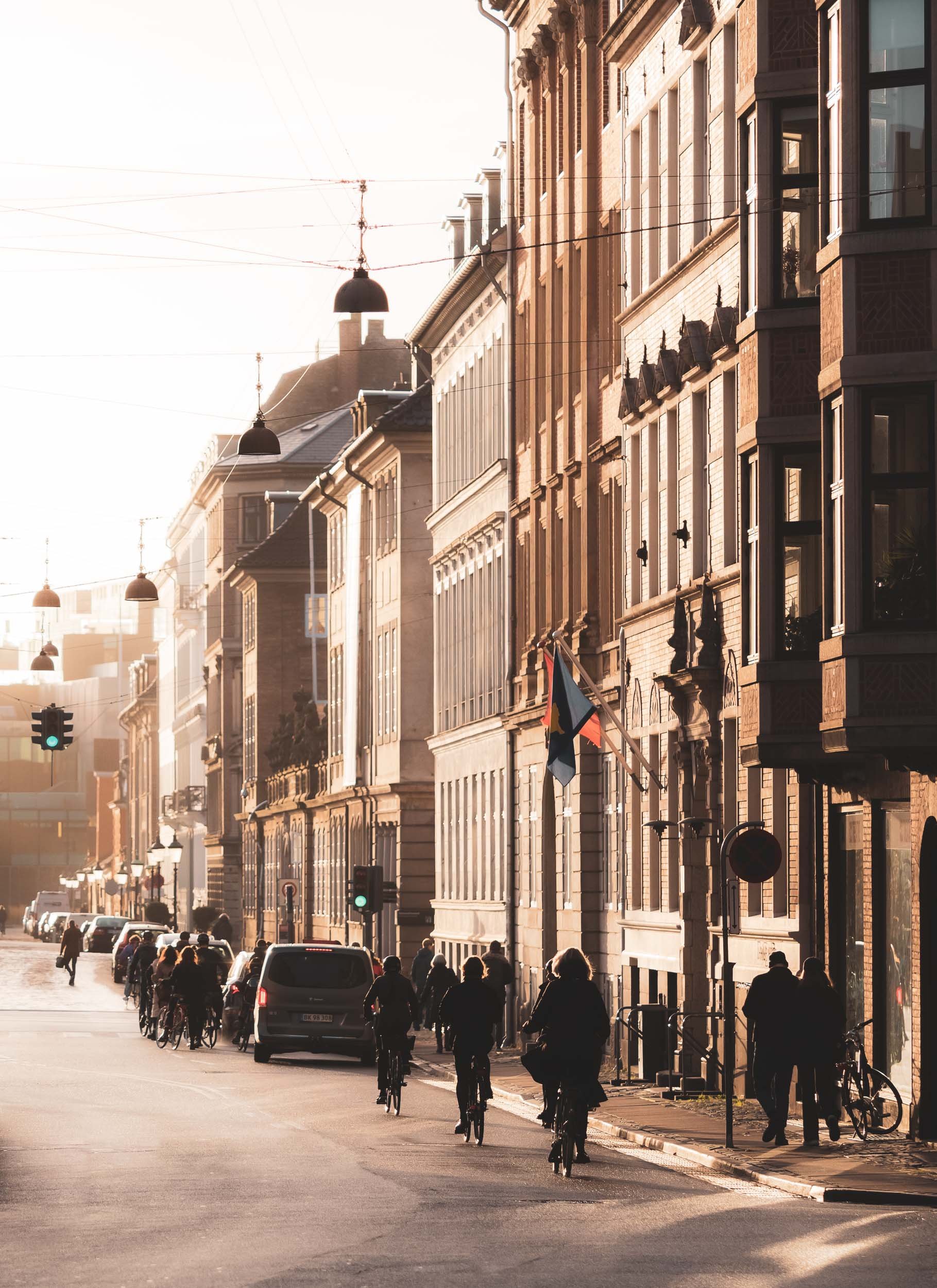
Evening Impressions & Nyhavn
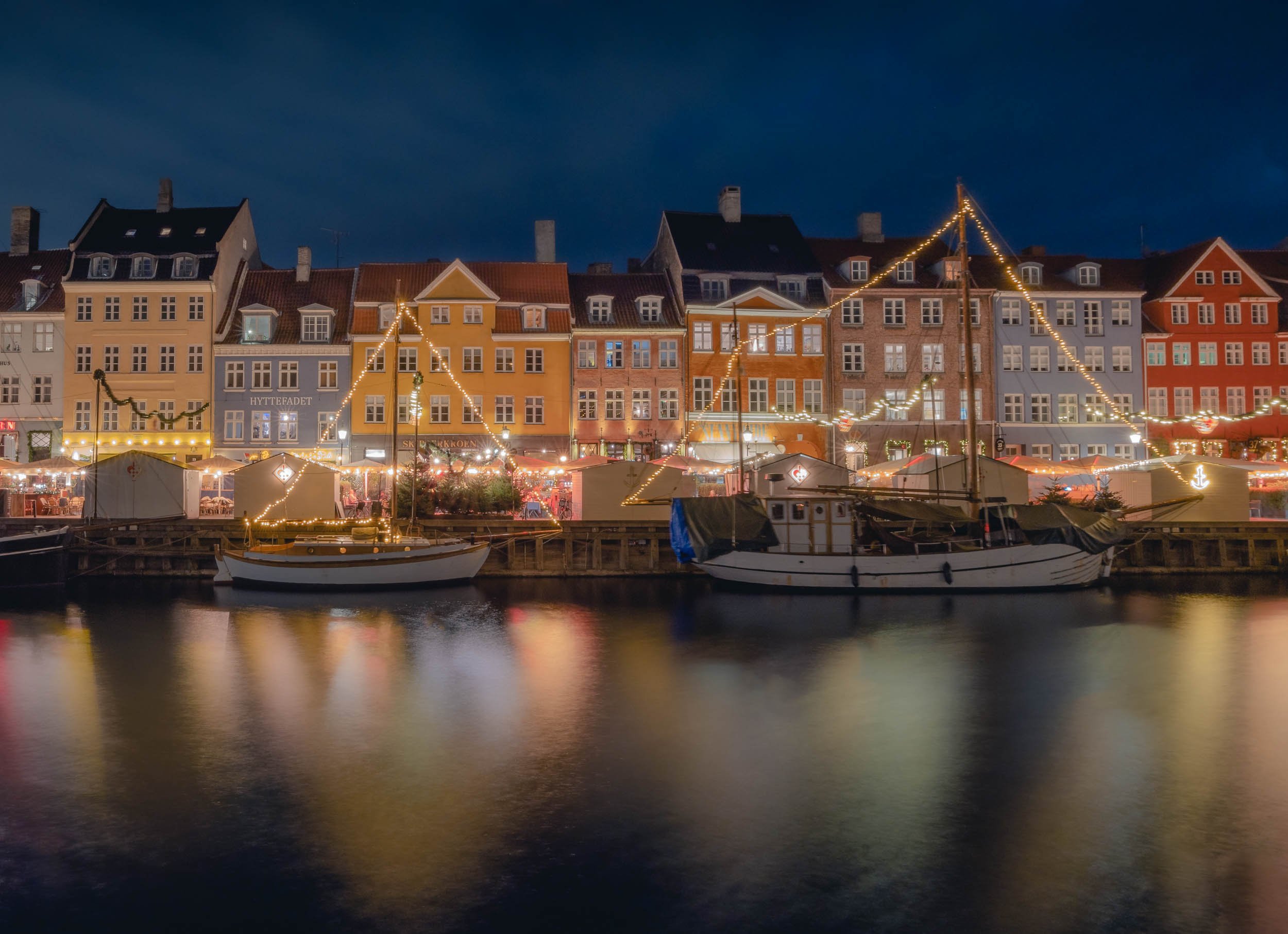

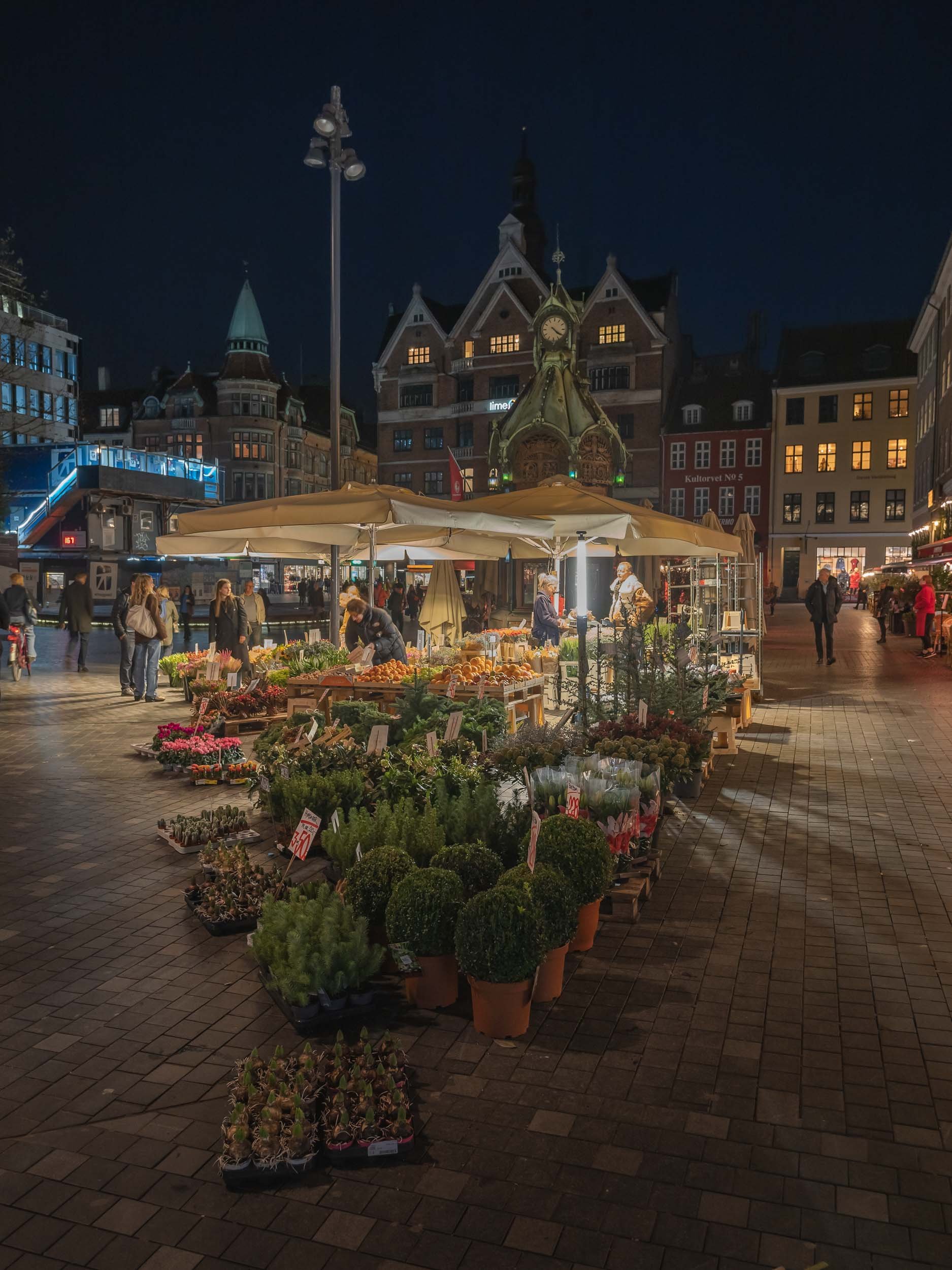
On the next morning, I had what is arguably the city’s most picturesque area on the agenda - as always, arriving before sunrise has its benefits, and I caught a quiet Nyhavn canal when it was still empty and with some nice reflections in the calm water.


The Mermaids
Wait a minute, mermaids plural? Yes, because aside from the very famous The Little Mermaid bronze statue by Edvard Eriksen, there is indeed a second less famous modern interpretation of it not too far along Copenhagen’s waterfront.
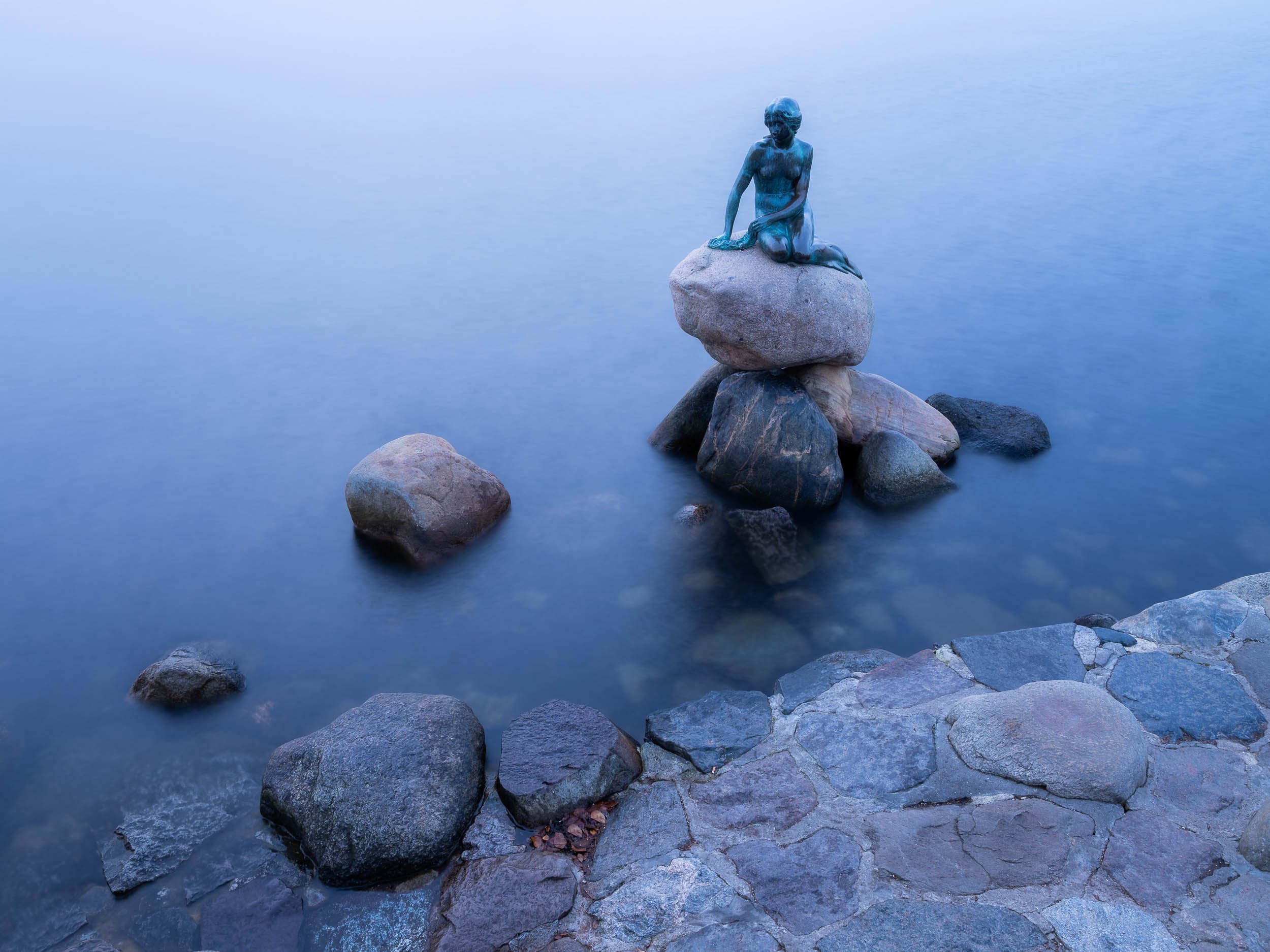


The second version is the Genetically Modified Little Mermaid, a sculpture that’s part of a 2006 series by Danish professor Bjørn Nørgaard, with the intention to create a kind of postmodern look at the changes in society.


As well as the long yellow houses of Nyboder, once used as naval accomodation and today being restored as regular housing.
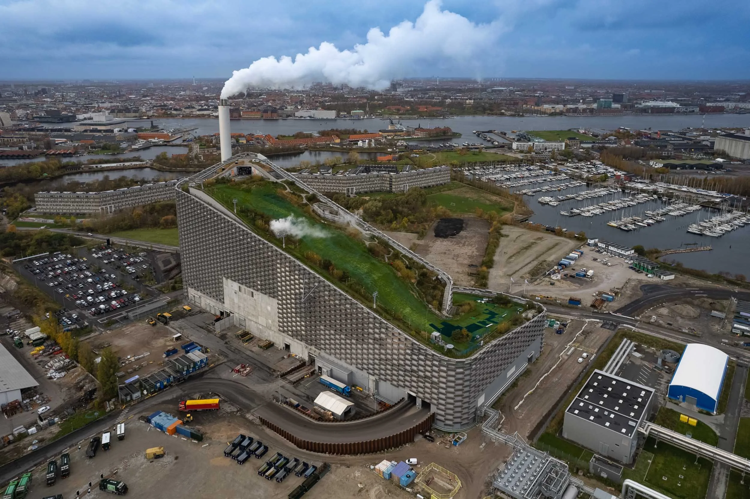
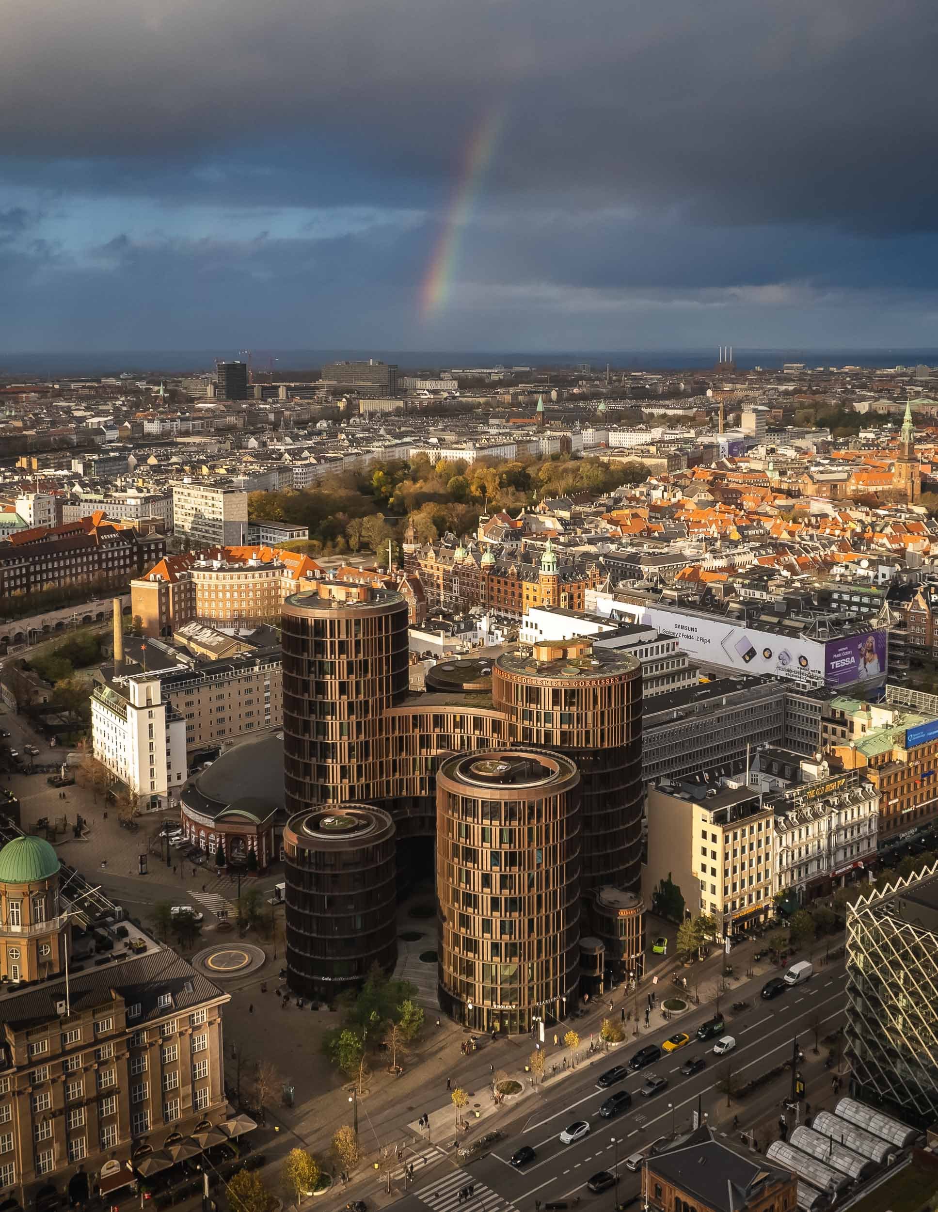
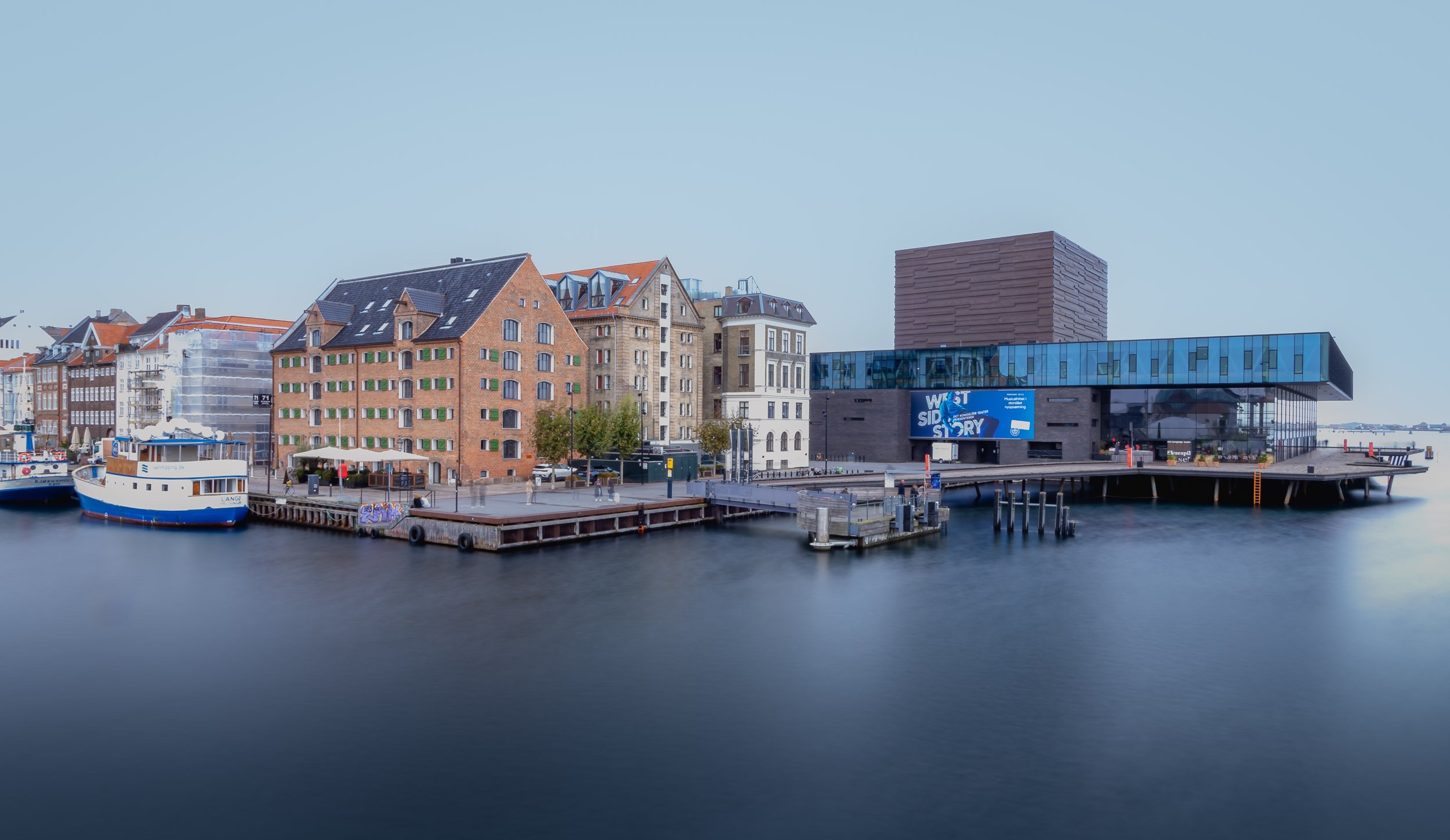
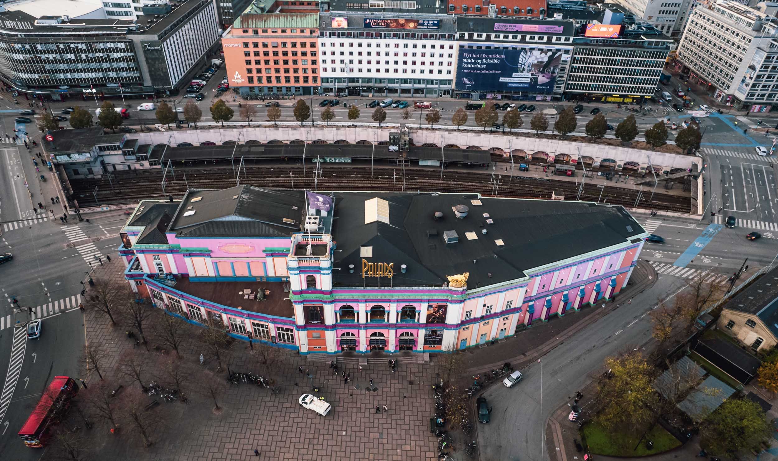
Not only Churches…


The mixed use towers opened in 2016 and were designed by Lene Tranberg.
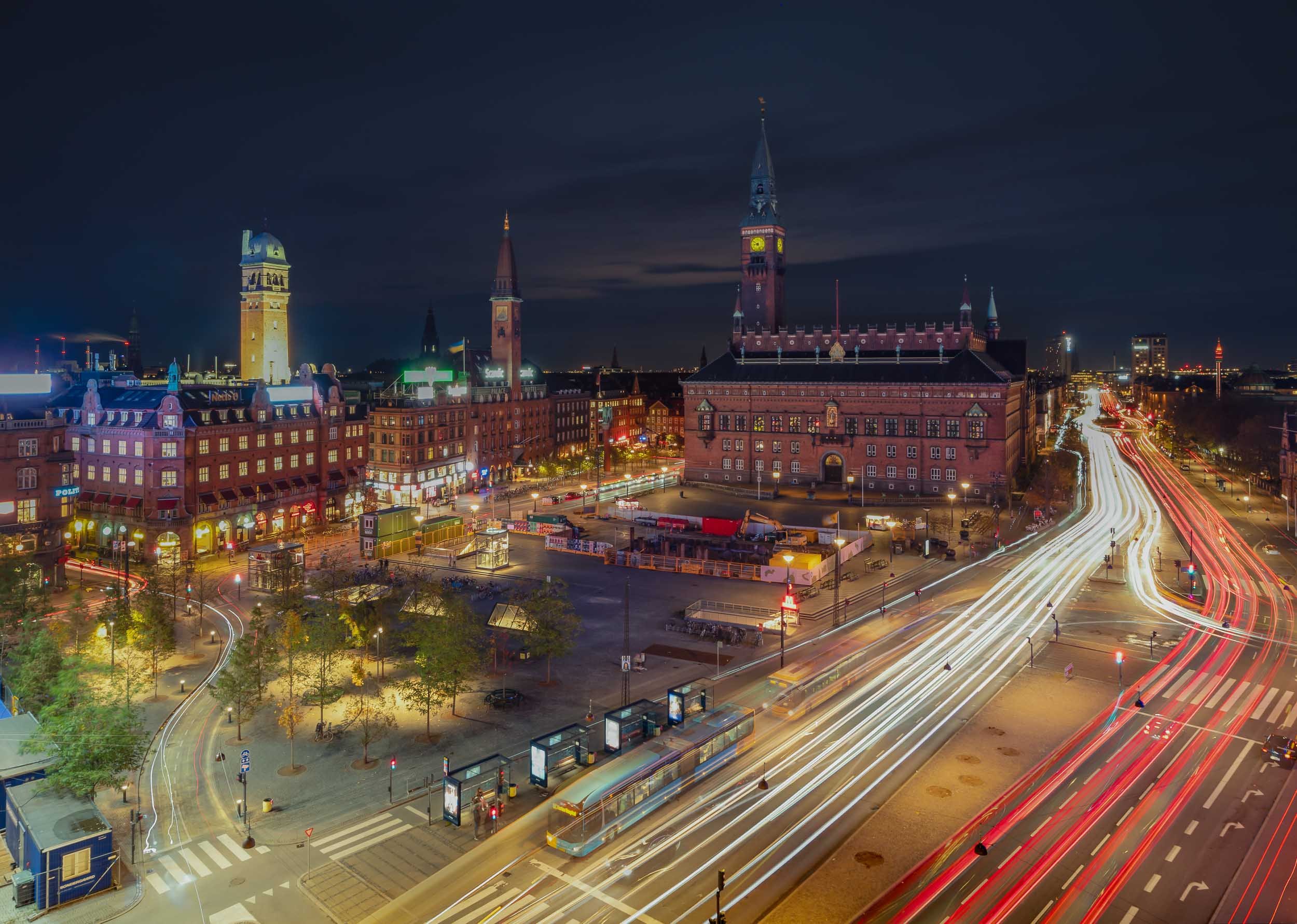
Copenhagen City Hall
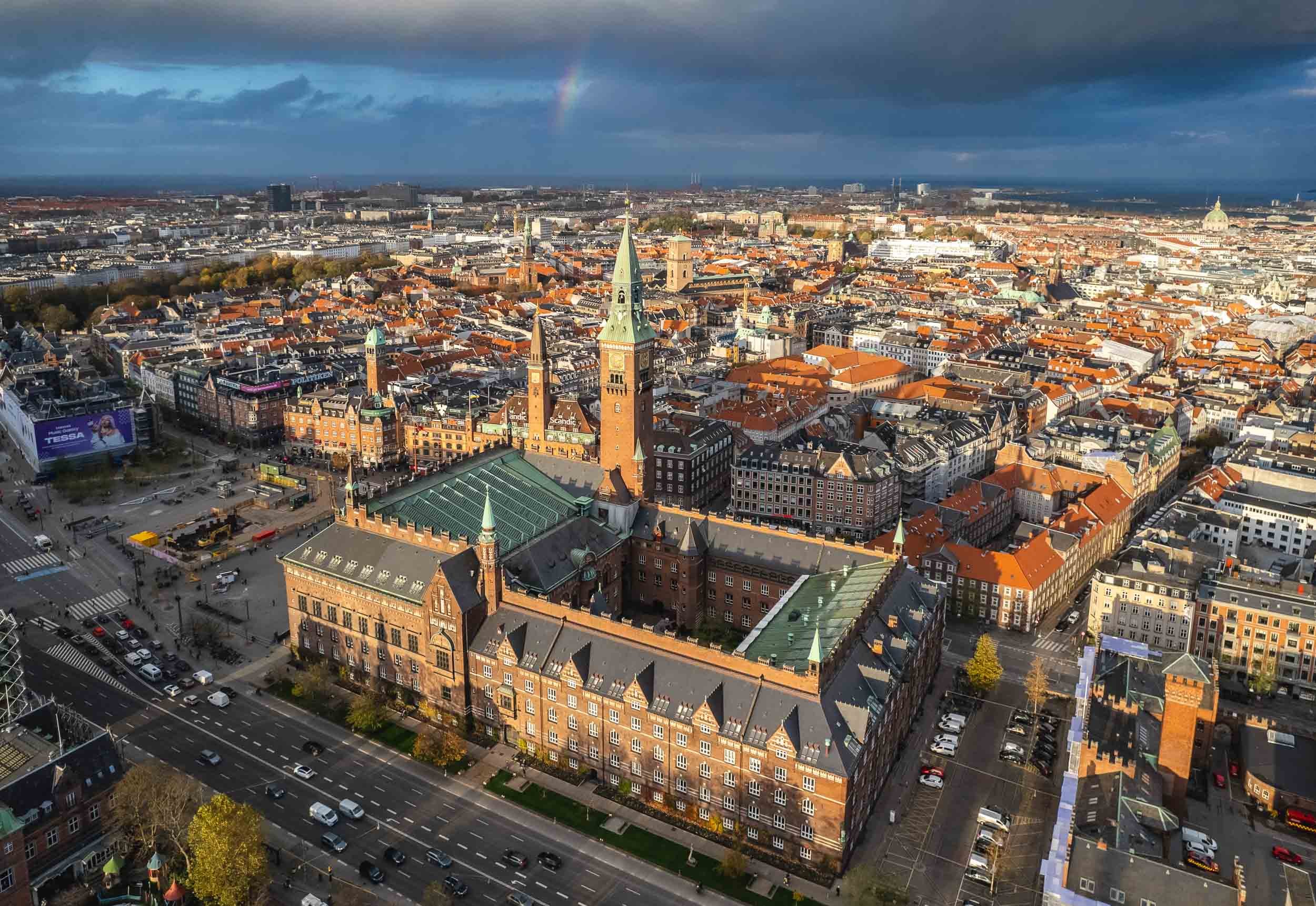
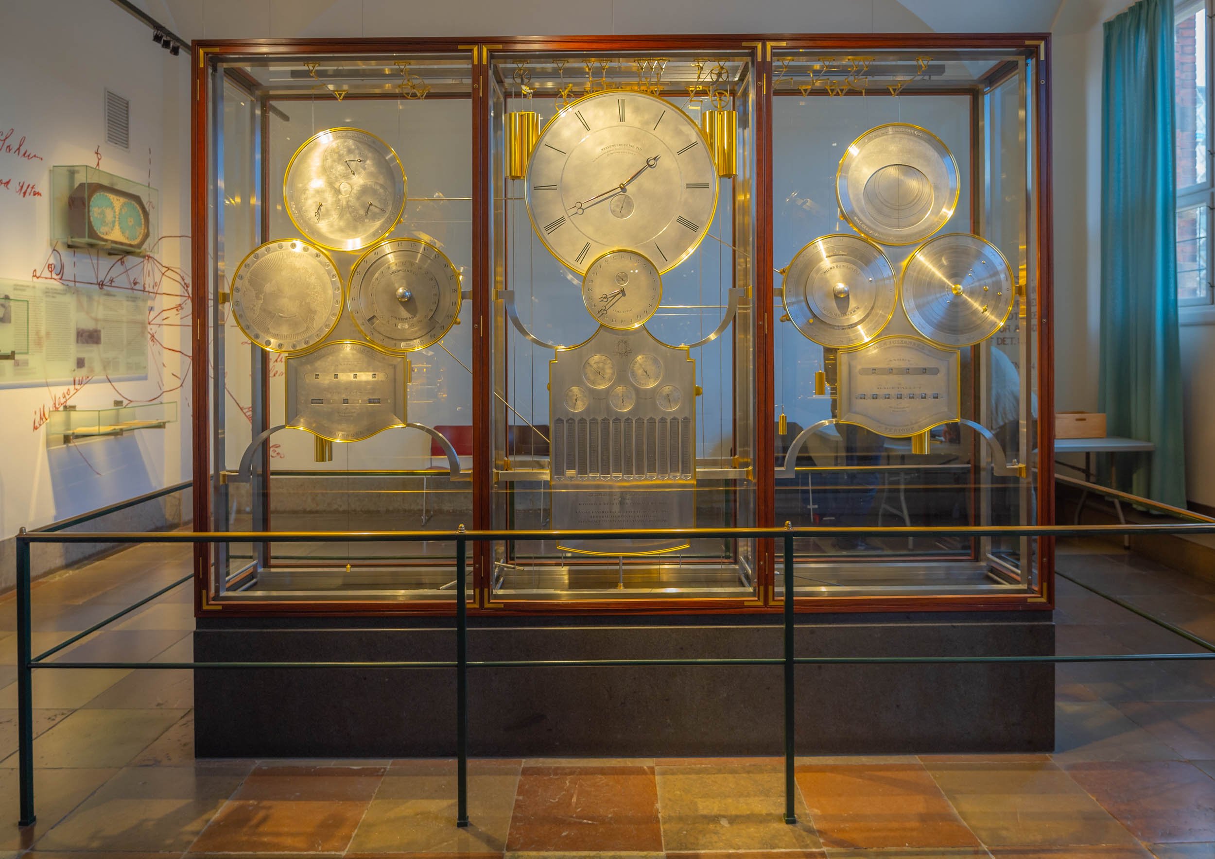
Aside from the views from above, another reason is the interesting interior…


… but primarily the amazing World Clock by Jens Olsen.

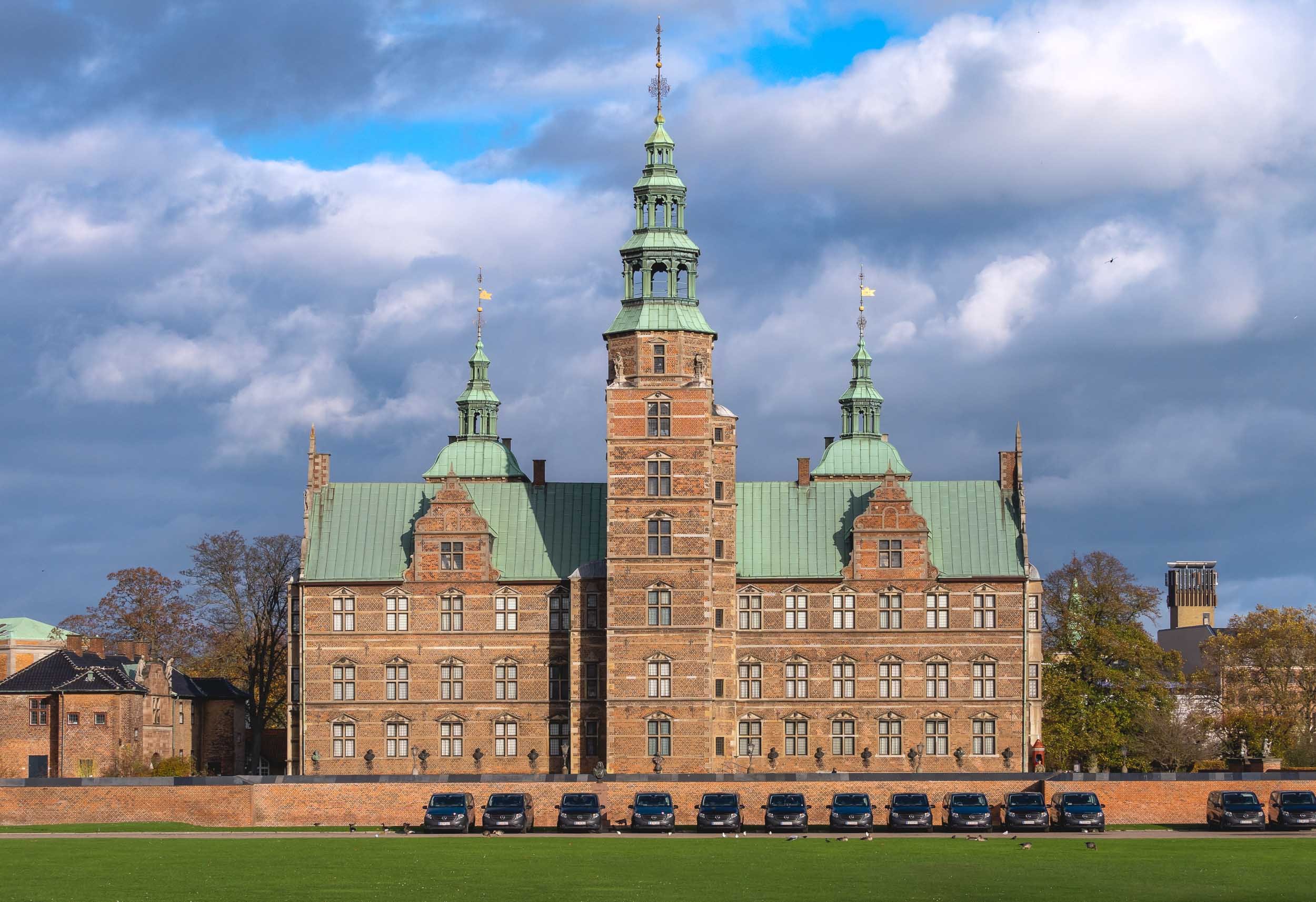
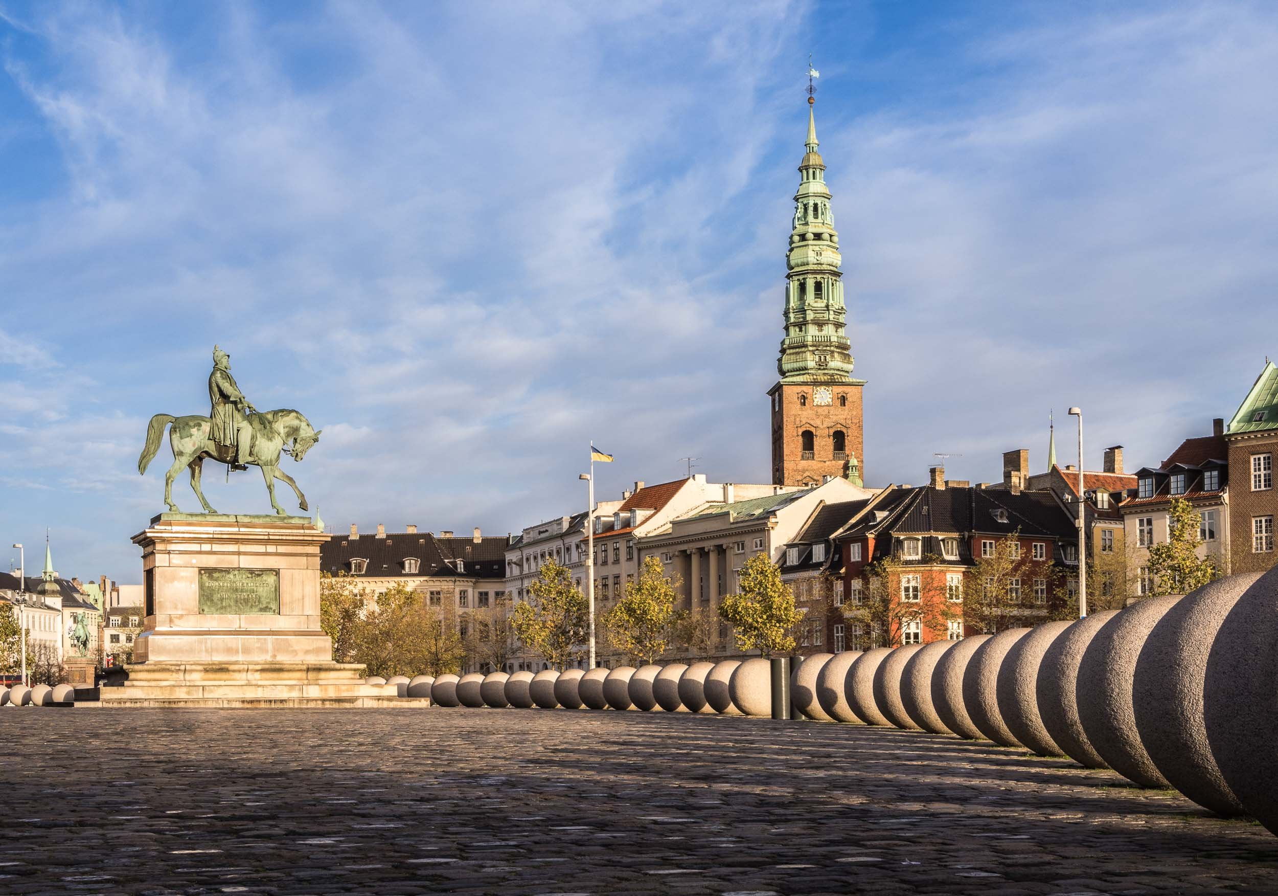
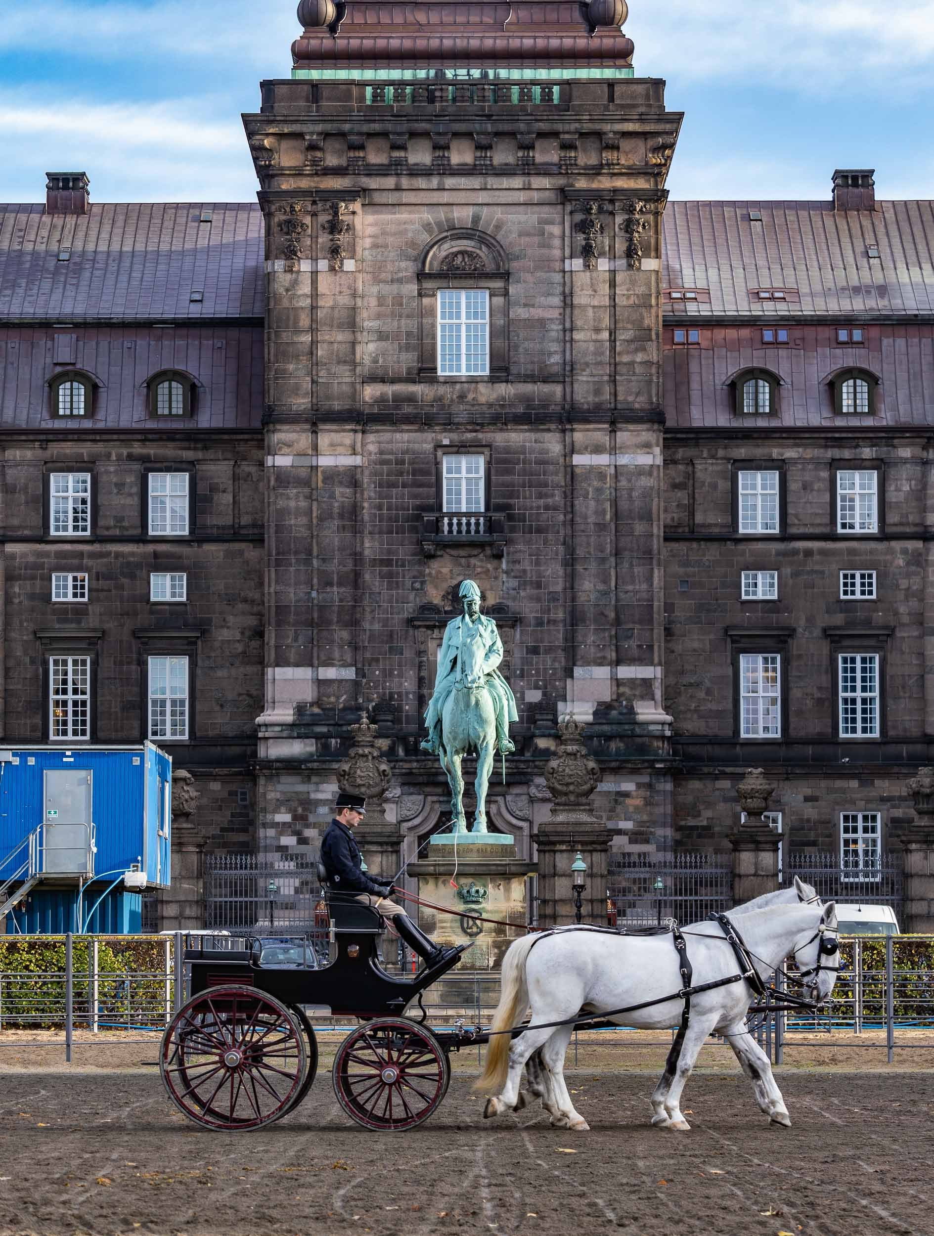
Rosenborg Castle and Christiansborg Palace


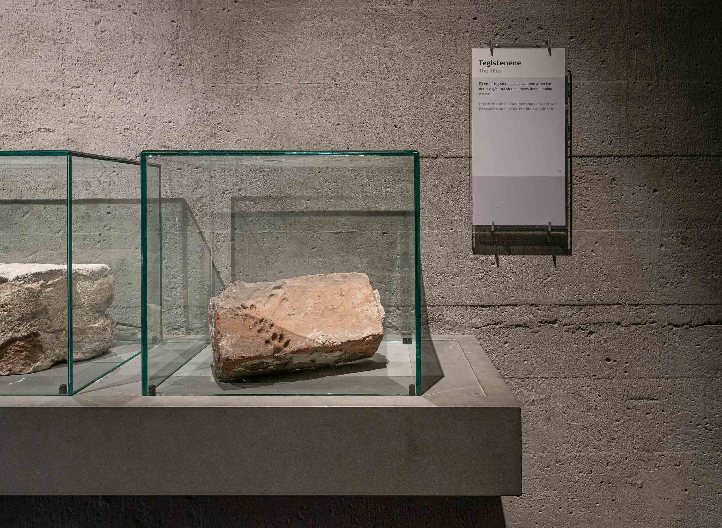
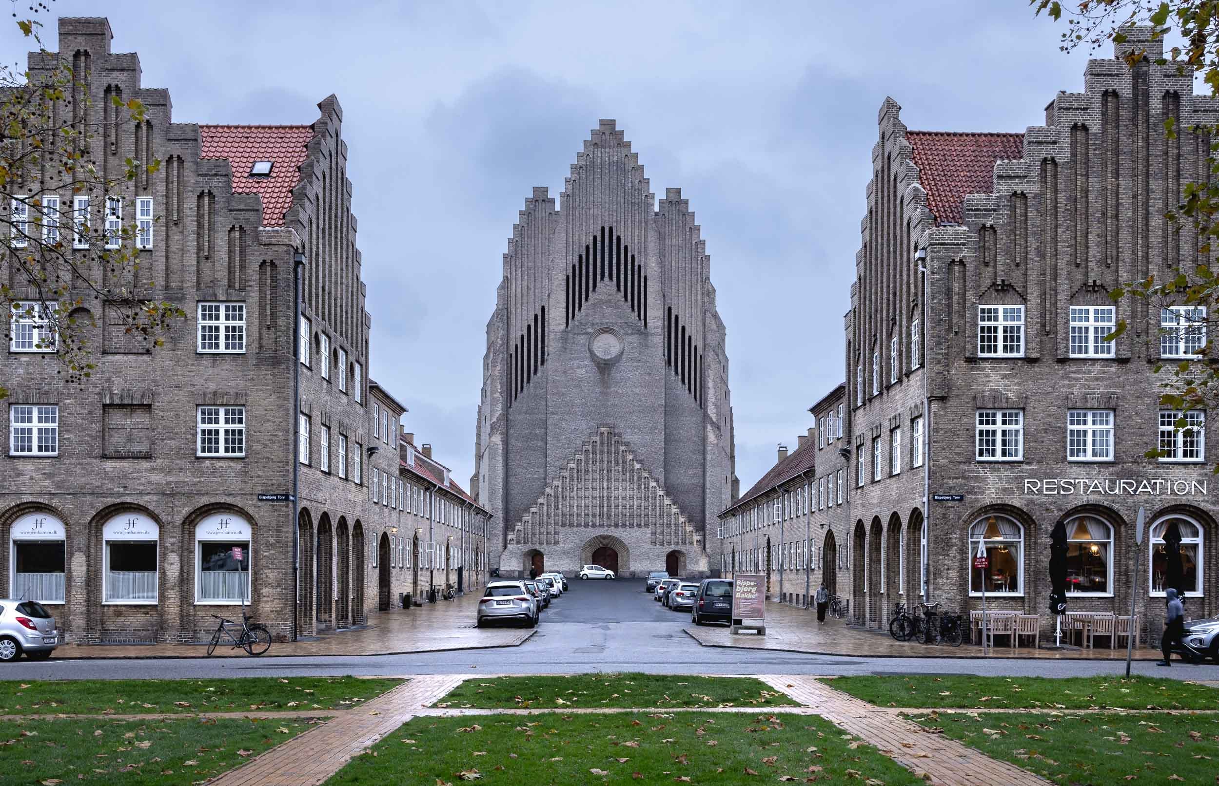
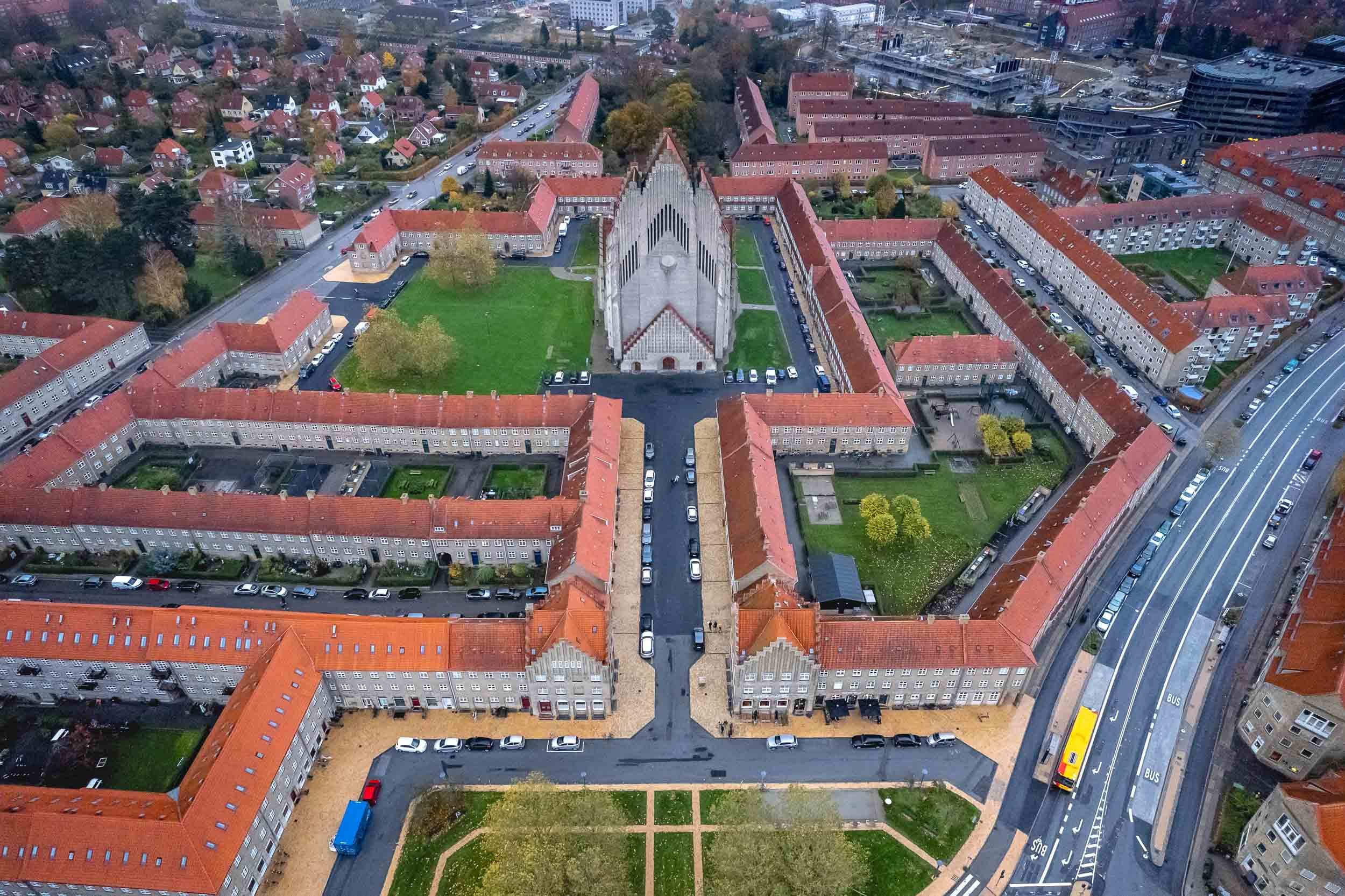
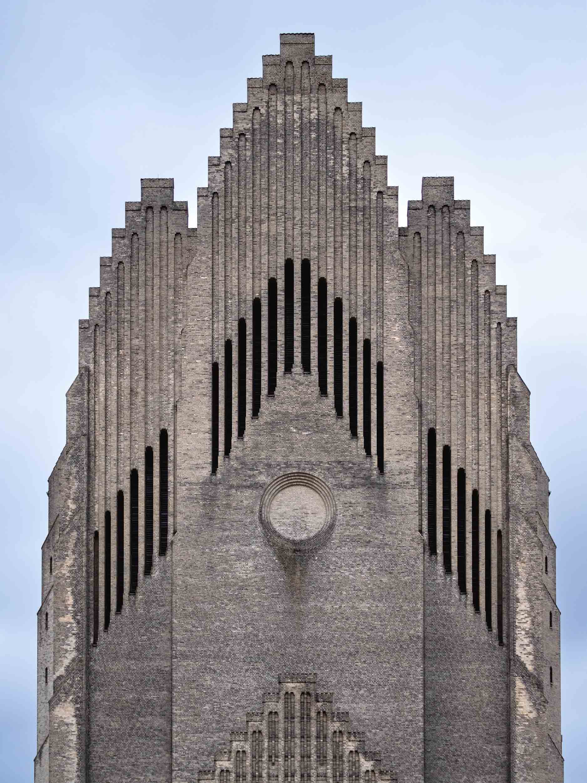
Grundtvigs Church
One of the most spectacular places in the city lies a little outside, but is worth the journey: A rare expressionist church completed in 1940, designed by Peder Vilhelm Jensen-Klint.


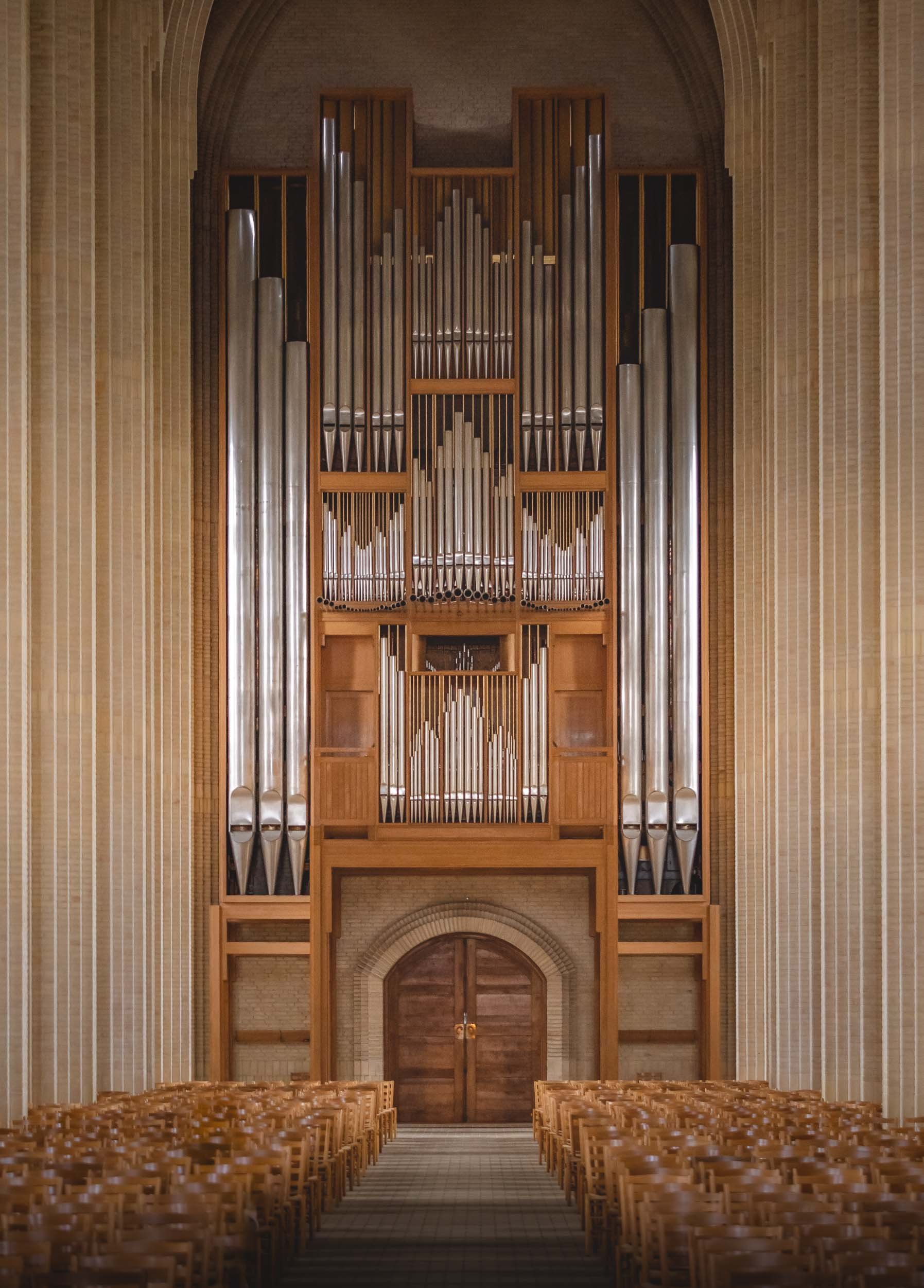


Here’s a little Hyperlapse clip of the central interior path to the altar.

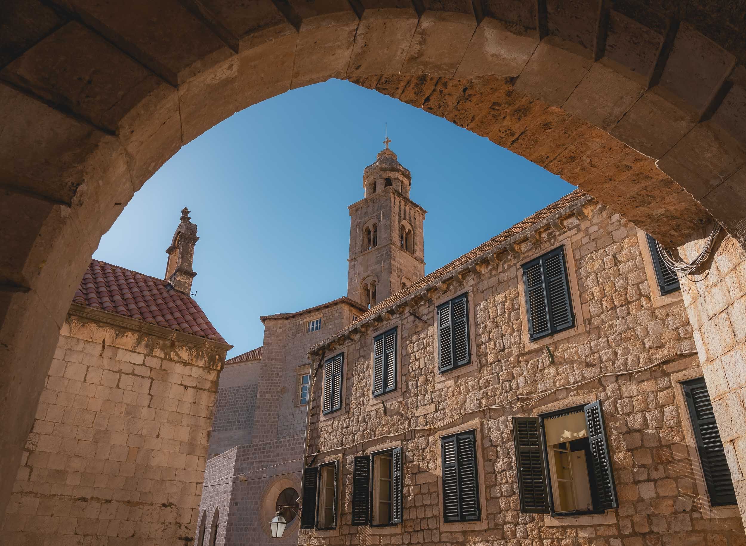
Glimpses of Dubrovnik
After visiting another gem of the Adriatic, I took the chance to leave for the airport a little early to spend a few hours exploring Dubrovnik.

After visiting another gem of the Adriatic, I took the chance to leave for the airport a little early and spend a few hours exploring Dubrovnik, one of Croatia’s most famous coastal towns. It was just enough time to collect a few impressions - scroll down to see them!
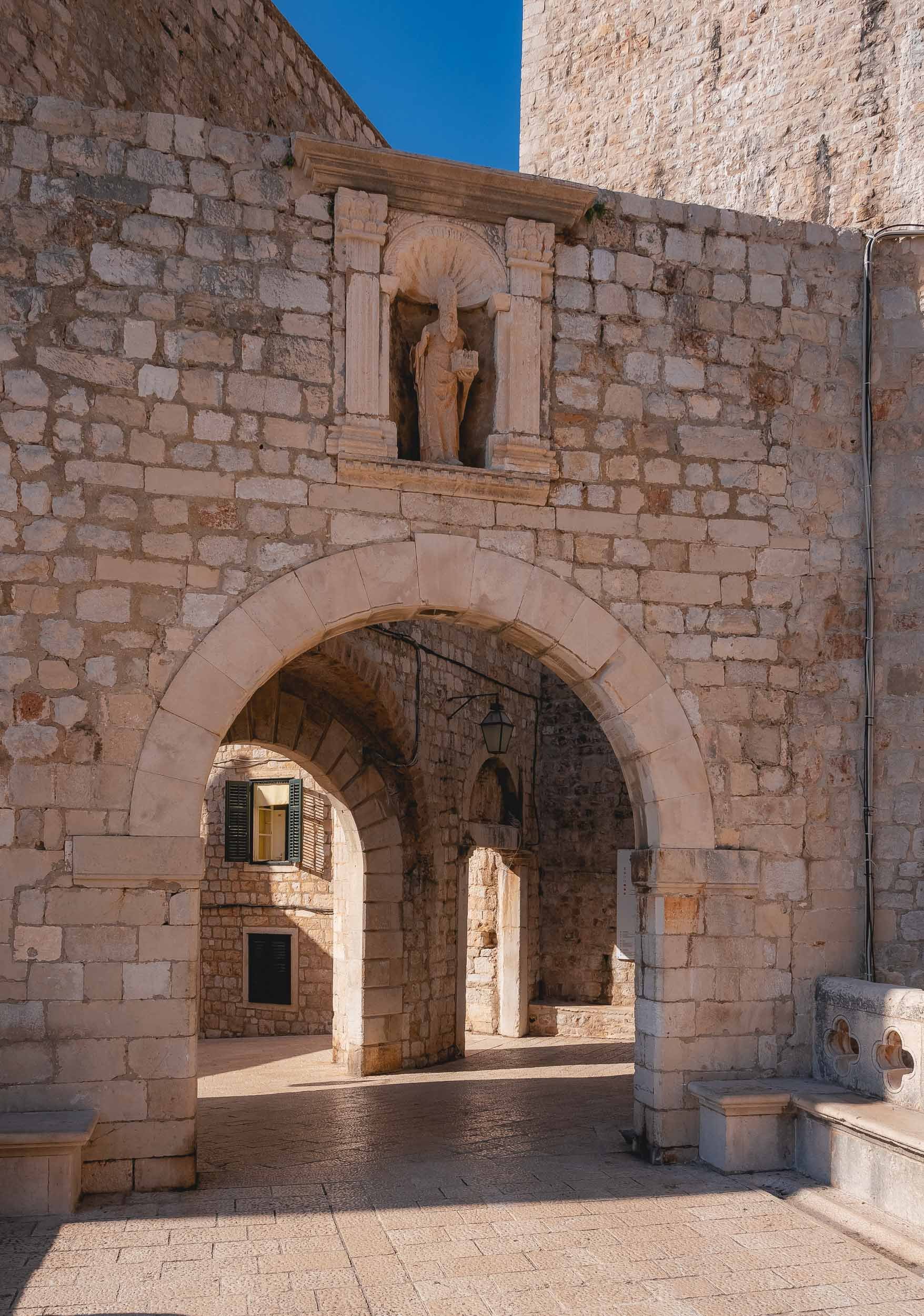


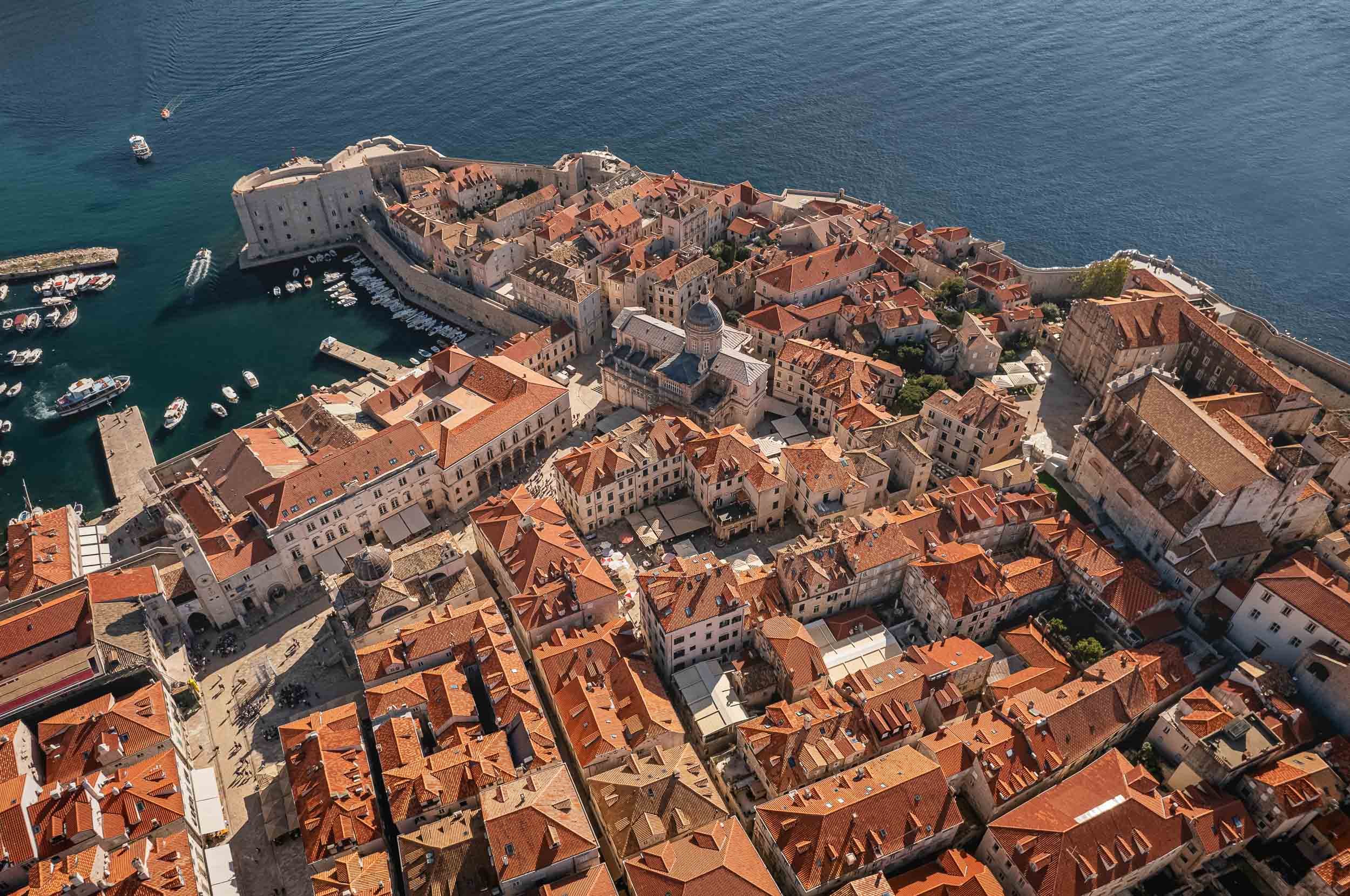
The view towards the small port from the bridge. Dubrovnik’s history dates back to the 7th century, and for over 500 years it ruled itself as a free state.
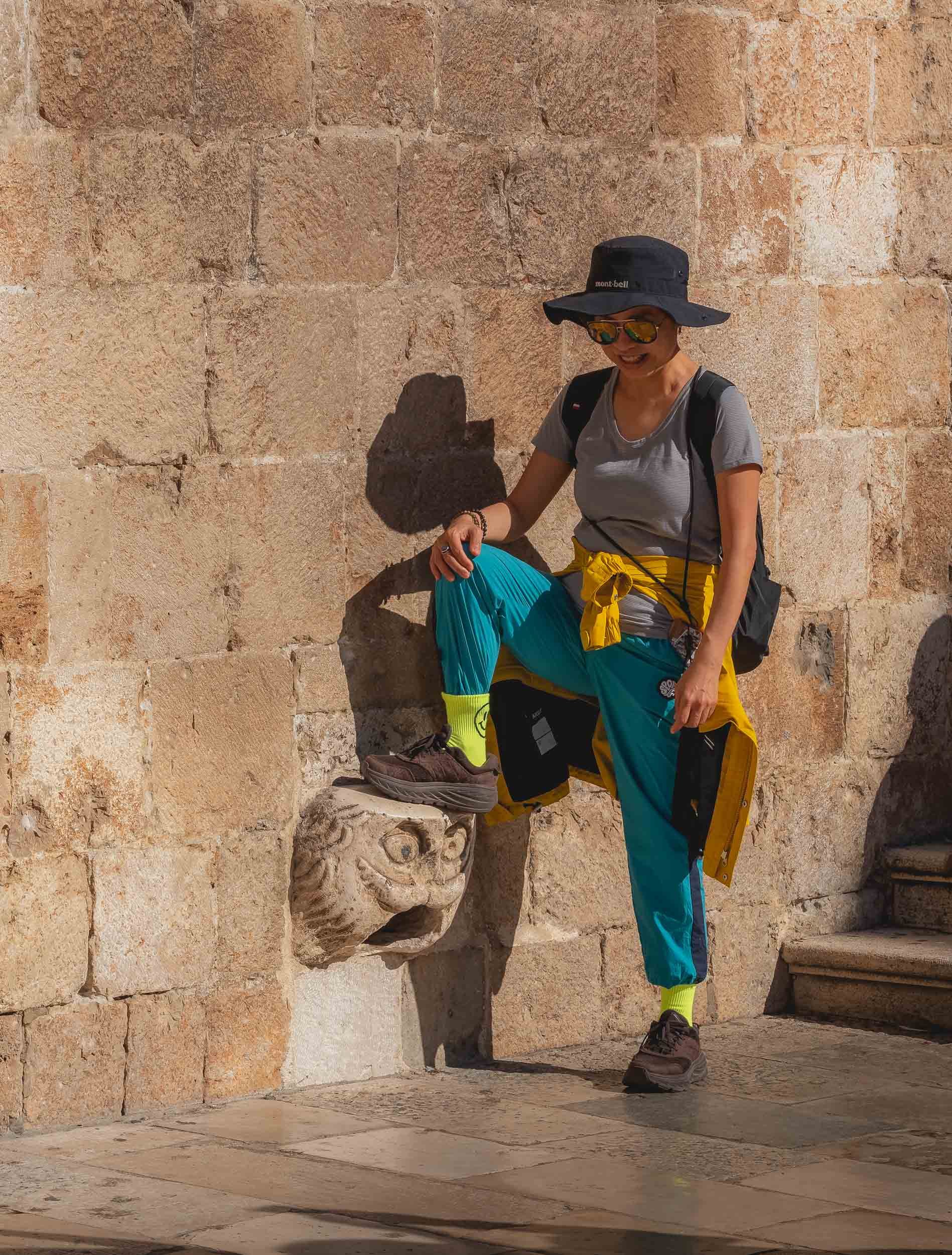
Narrow passages with a loooot of stairs wind their way up to the right and left. You’ll find Europe’s oldest operating pharmacy and many other historic places while wandering around.


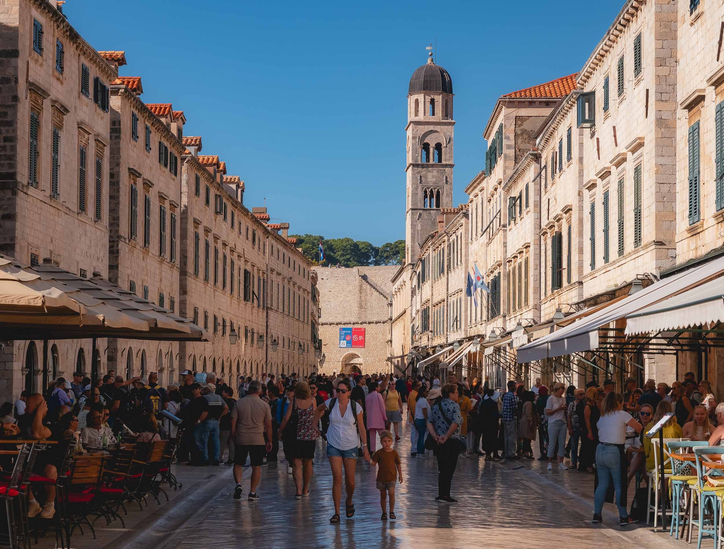
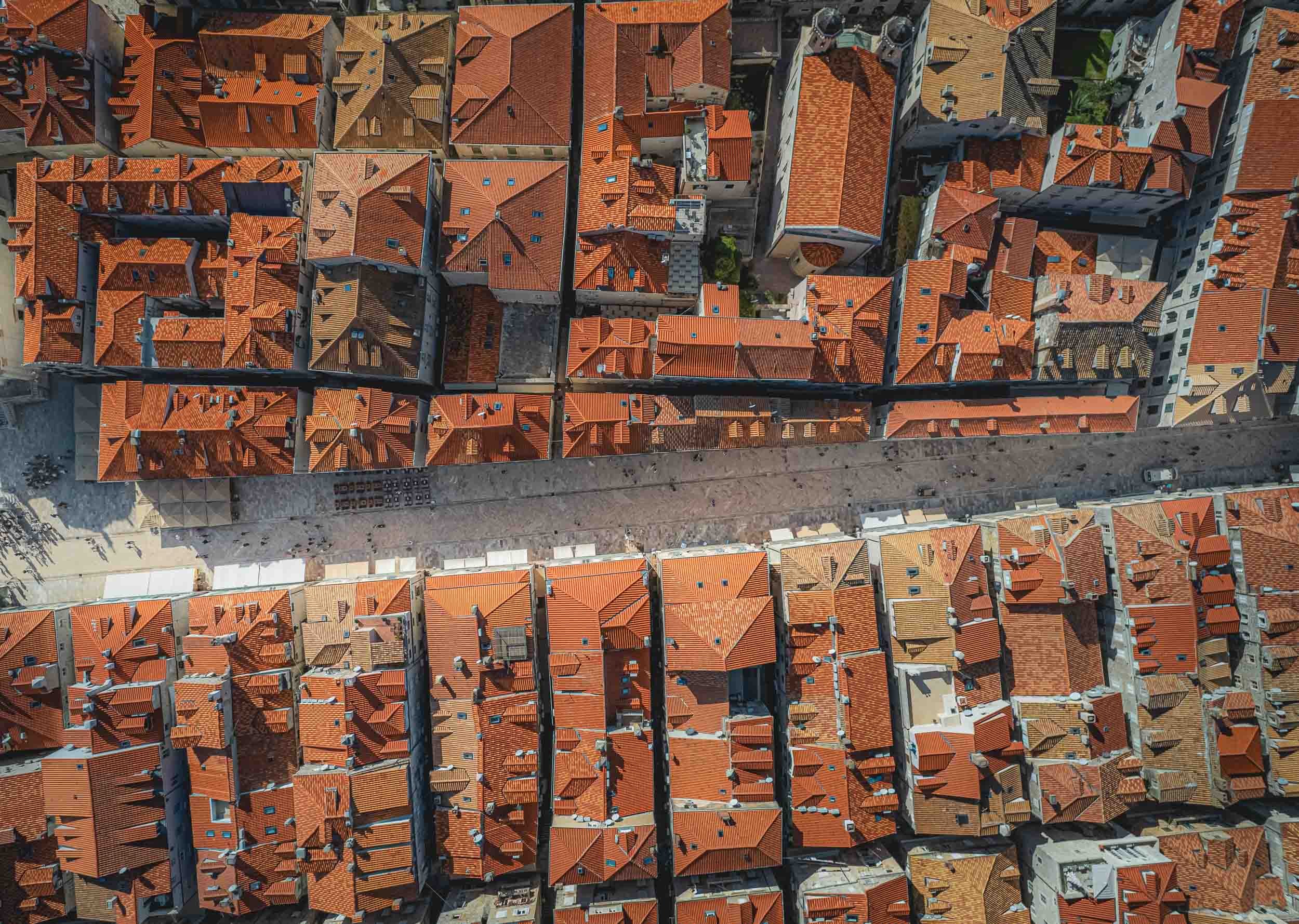
A majority of the city’s Renaissance buildings were destroyed during a large earthquake in 1667, and a lot of damage was done during the siege of 1991 - signs of repair are the brightly colored roof tiles on some of the buildings.
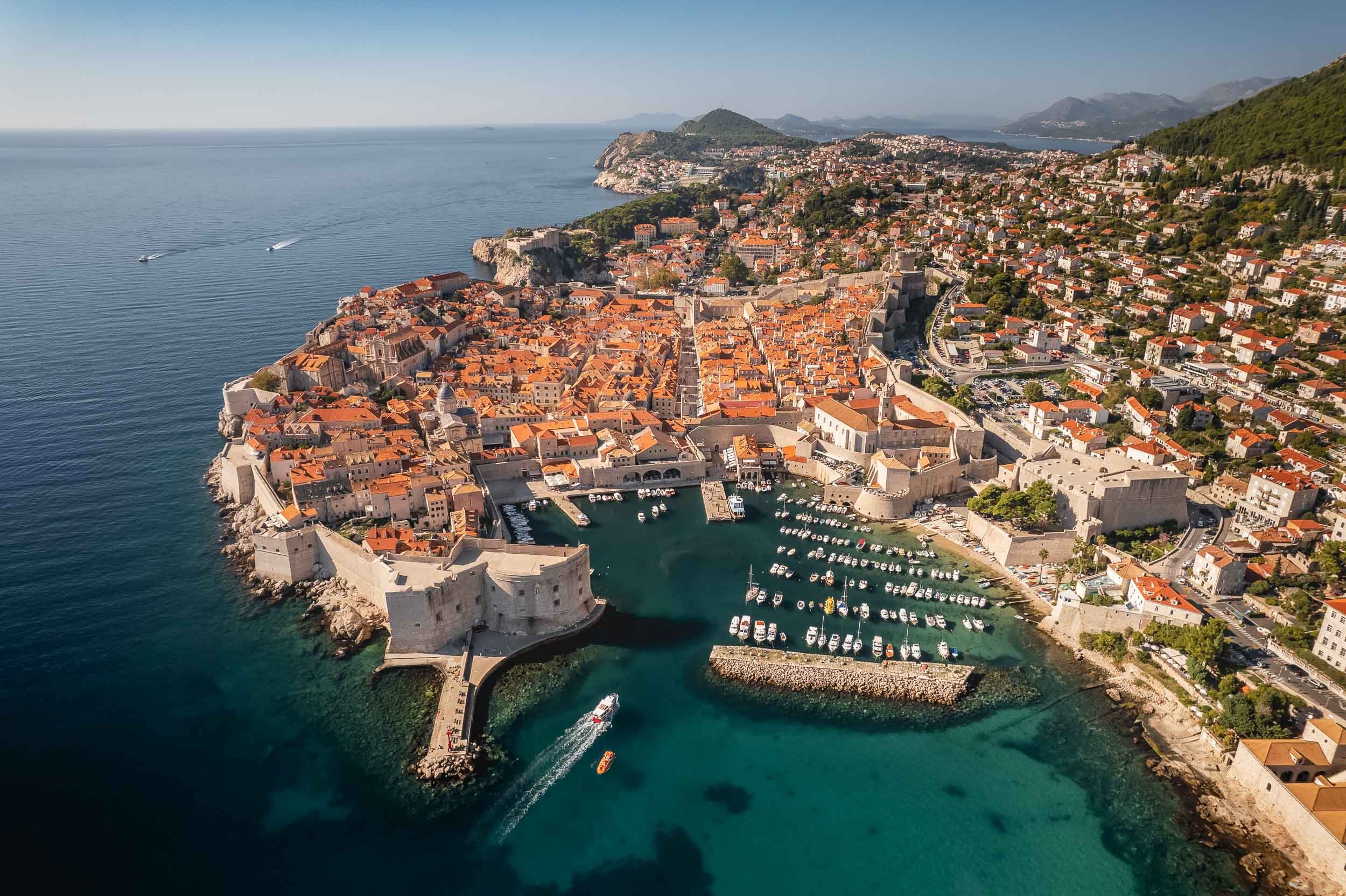

Today the city is very popular with tourists, helped by appearances in many movies and TV series - to the extent that the tourism board had to start staggering cruise ship arrivals in 2018.
And that’s one last flight over Dubrovnik, and my impressions after spending a few hours here come to an end!.

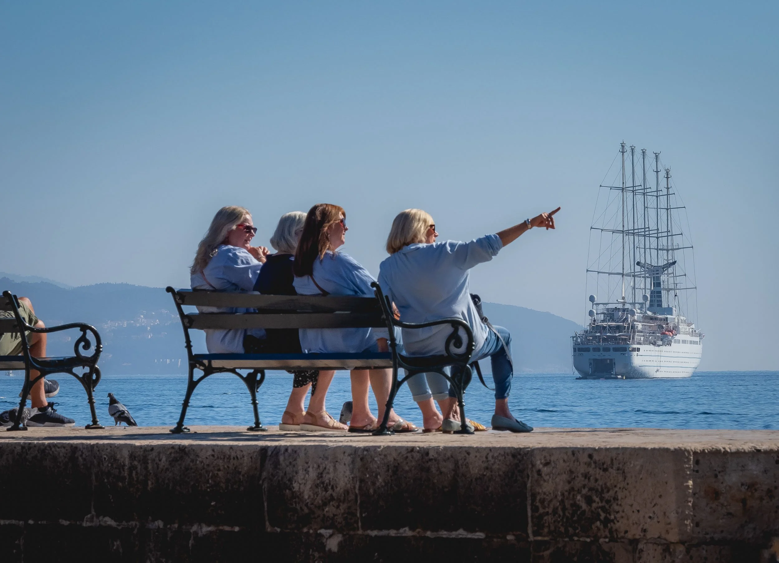
Montenegro - Hidden Gem of the Adriatic Sea
In a quest to get a few glimpses of sunshine and explore a rather unknown place without too having to travel too far from Germany, Montenegro turned out to be an excellent choice

In a quest to get a few glimpses of sunshine (before going faaaar north shortly after) and explore a rather unknown place without too having to travel too far from Germany, Montenegro turned out to be an excellent choice for myself and my dear mother, who joined me on this trip. A young country with a rich and turbulent history, Montenegro only gained its current independence in 2006.
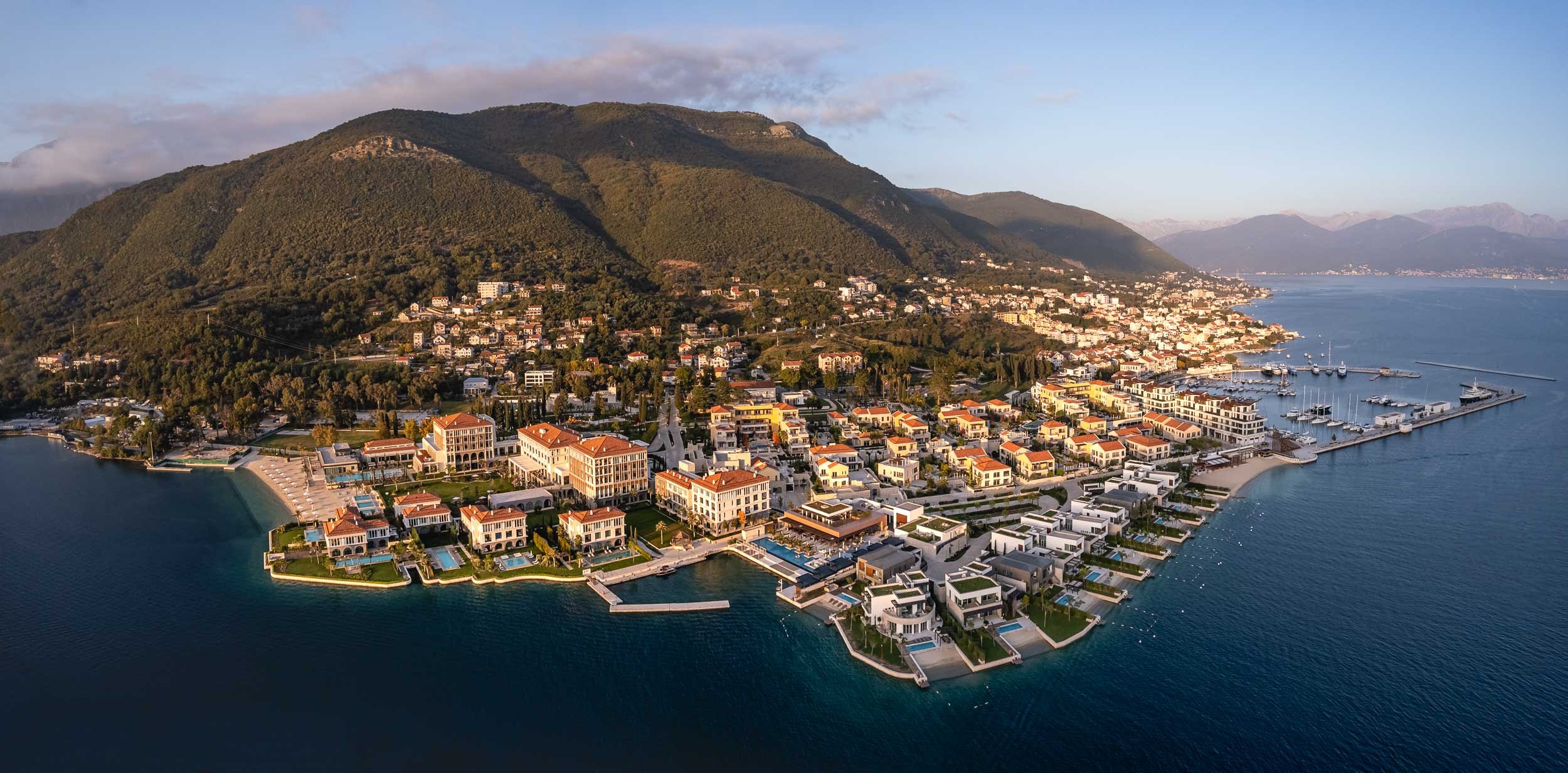
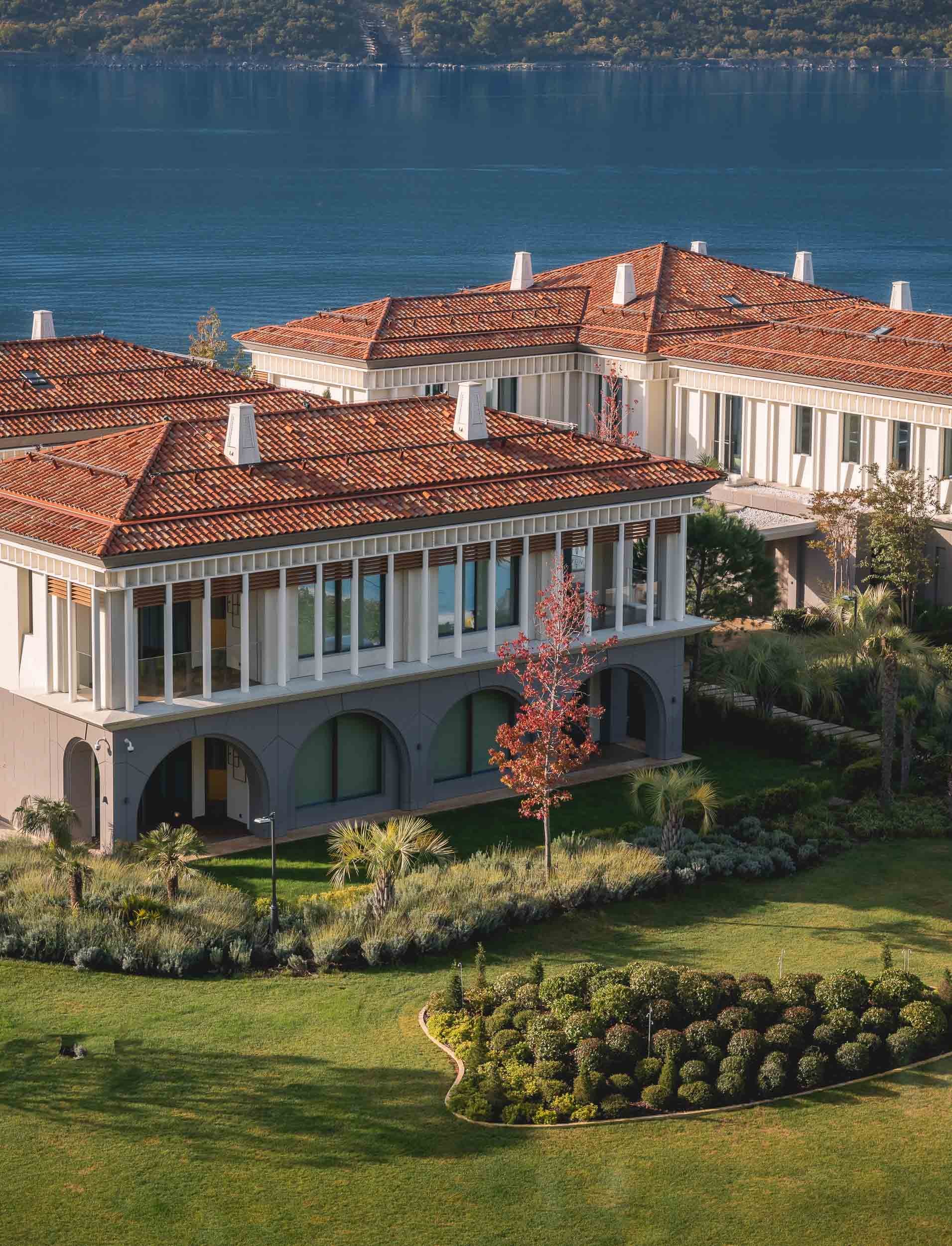
One & Only Portonovi
Since a few days of quiet time was on the agenda, this gem was our residence of choice - and wow, it did not disappoint. Definitely one of the most beautiful resorts I’ve ever stayed at, and surprisingly, somewhat, relatively (yes, need those qualifiers), affordable, given the fact we went during off season (summer will be a very different story).
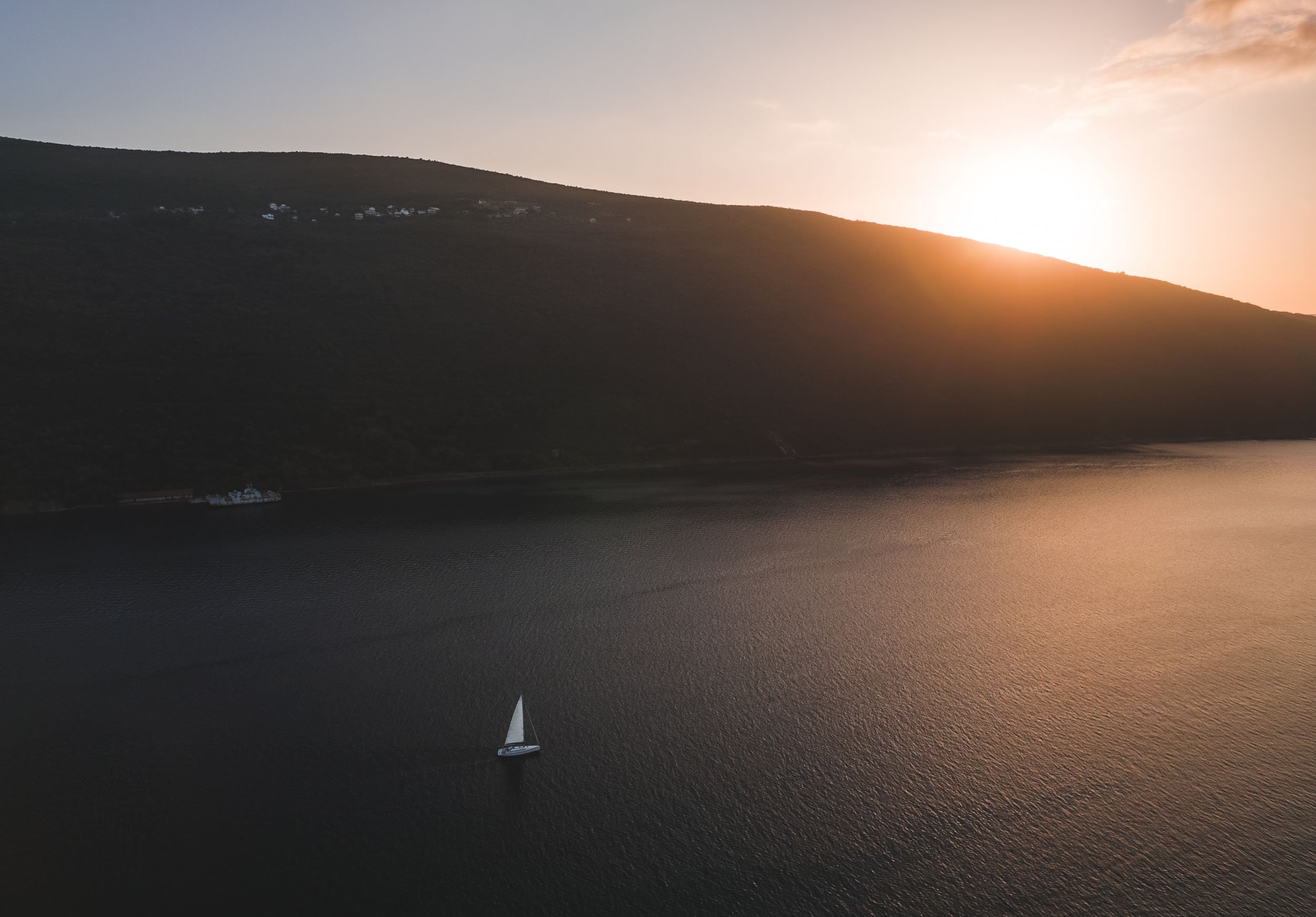
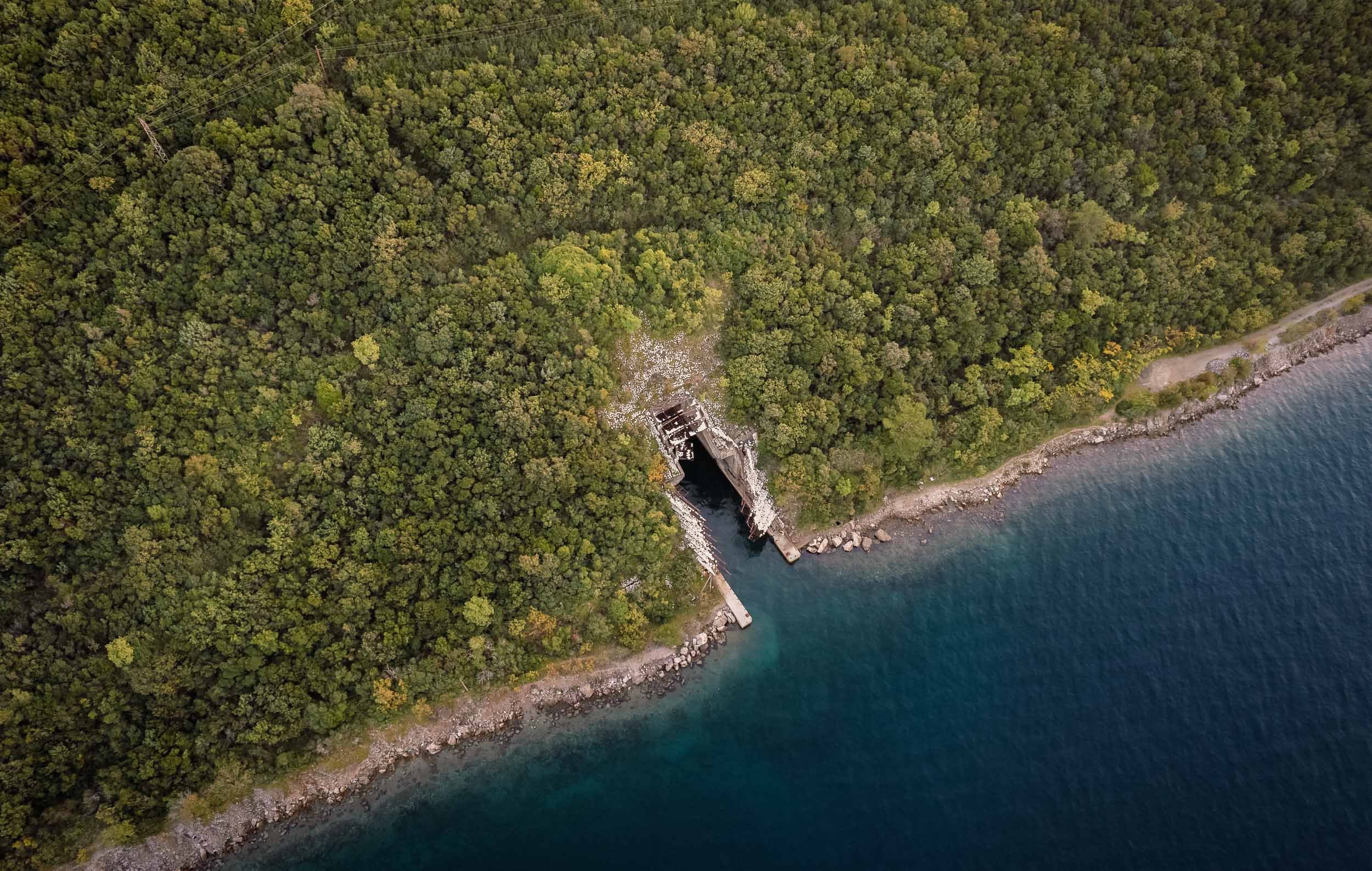
Secrets of the Bay
Just across the hotel lie a few interesting tidbits of history, barely noticeable unless you look a little closer. The first one is a series of tunnels dug into the mountain by the Yugoslavian army, with the intention to hide submarines in them during times of war.


The entrance to the tunnls was covered by metal structures and nets with rocks and plants to make them indiscernible from the surrounding landscape - nowadays, those are no longer serving their original purpose.


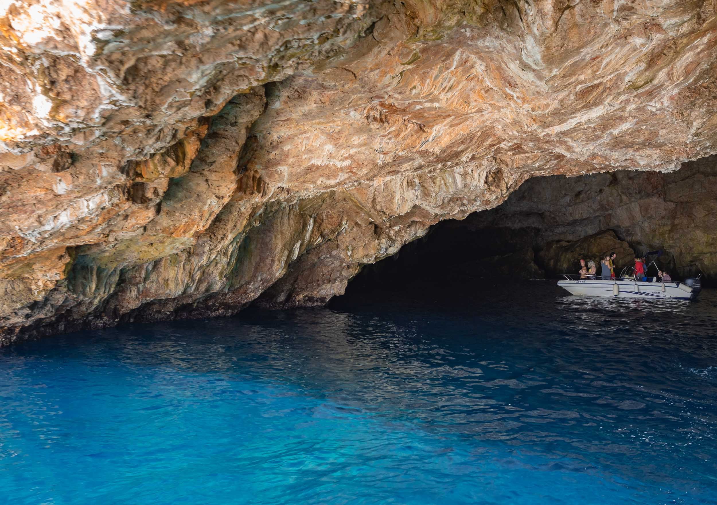
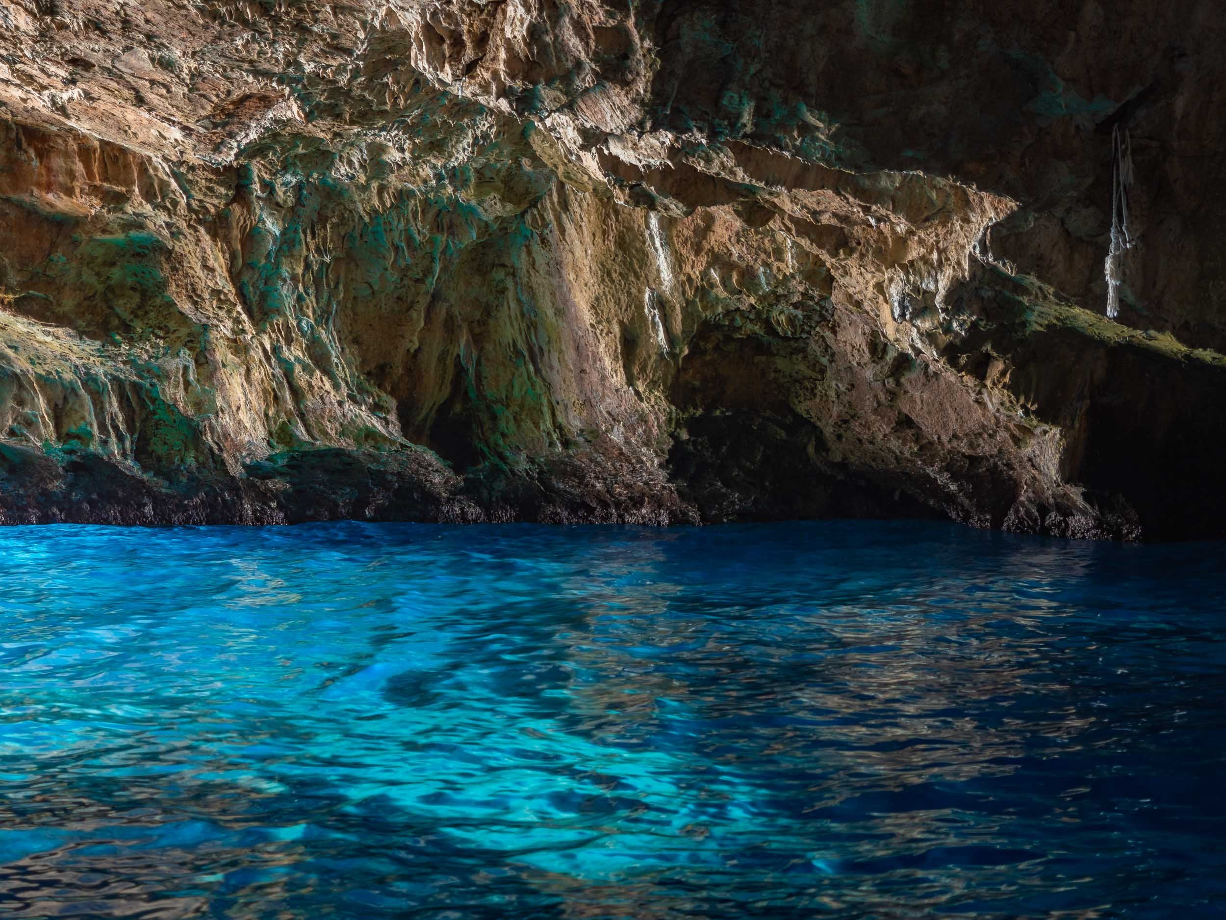
But the submarine tunnels were not the only surprises the bay had in store. Exploring a bit further into the Adriatic Sea, a colorful wonder awaits…
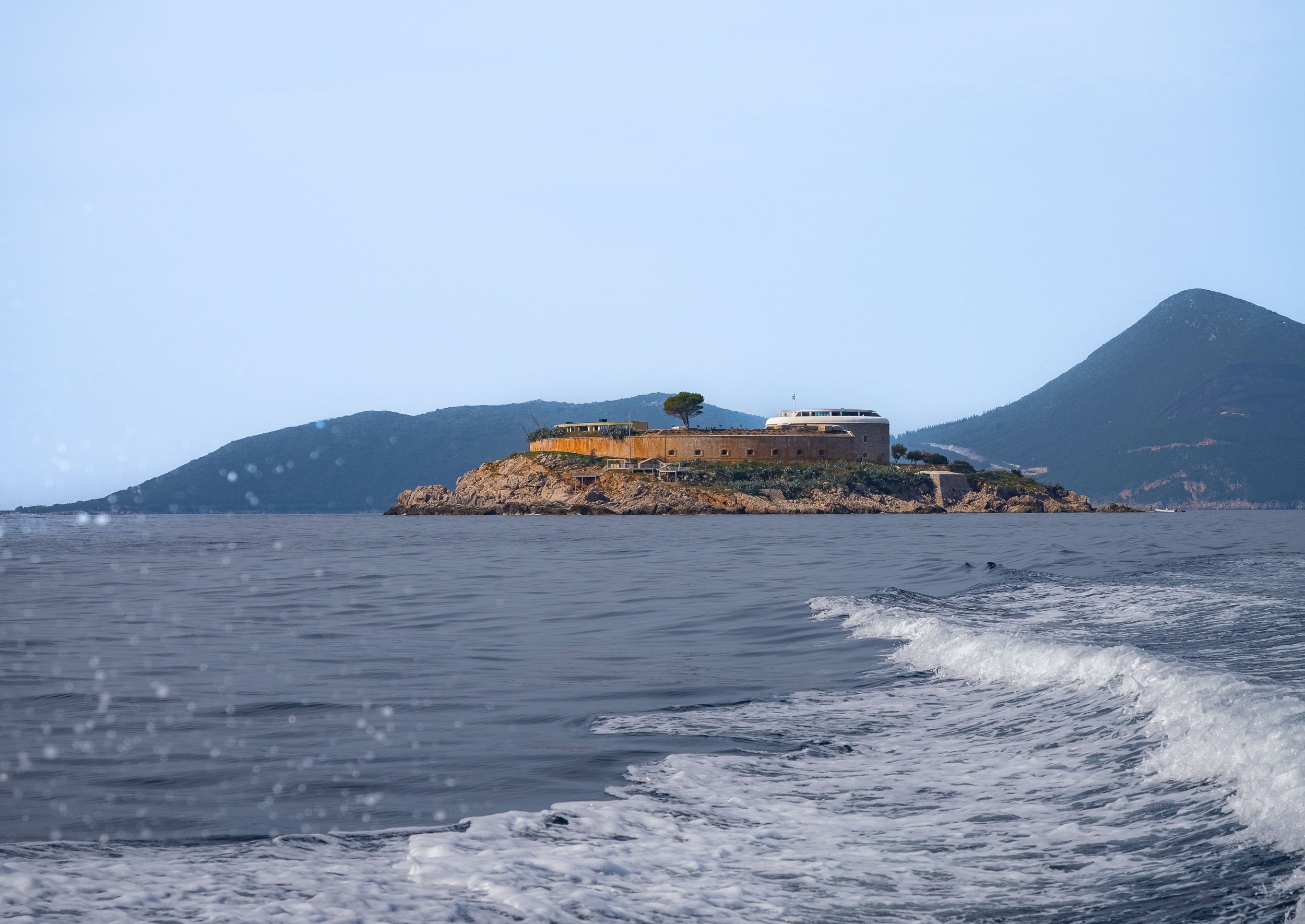
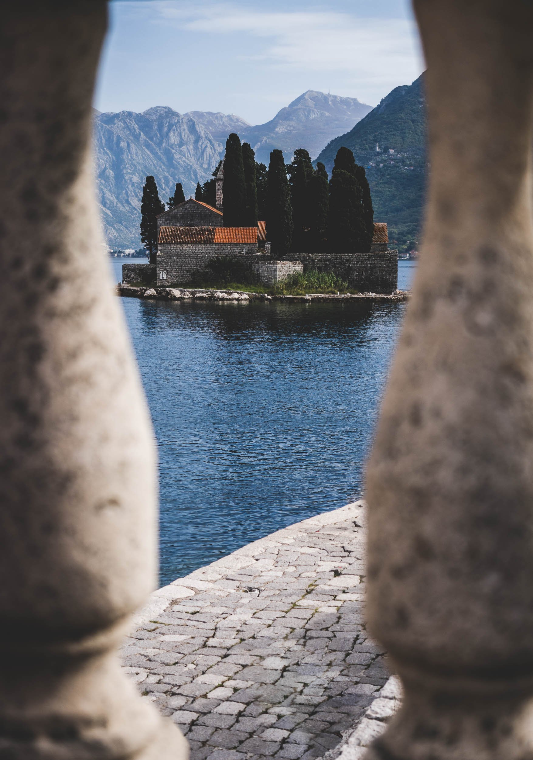
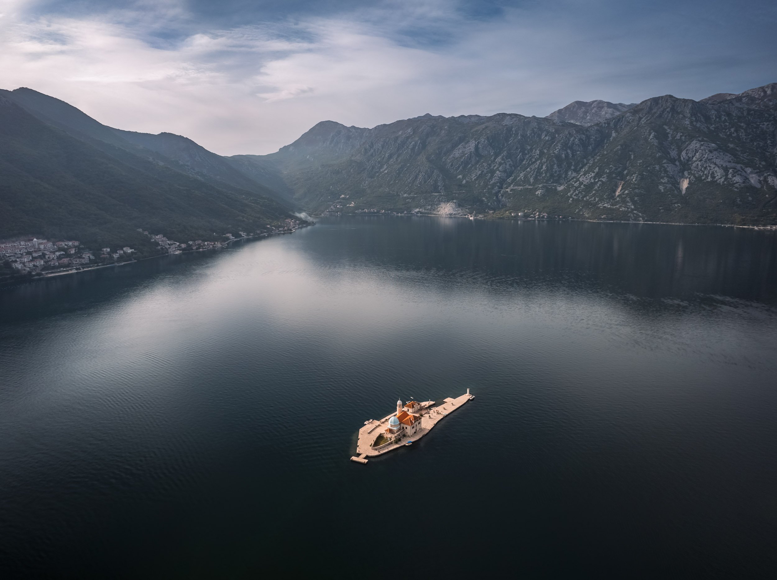
Islands in the Bay
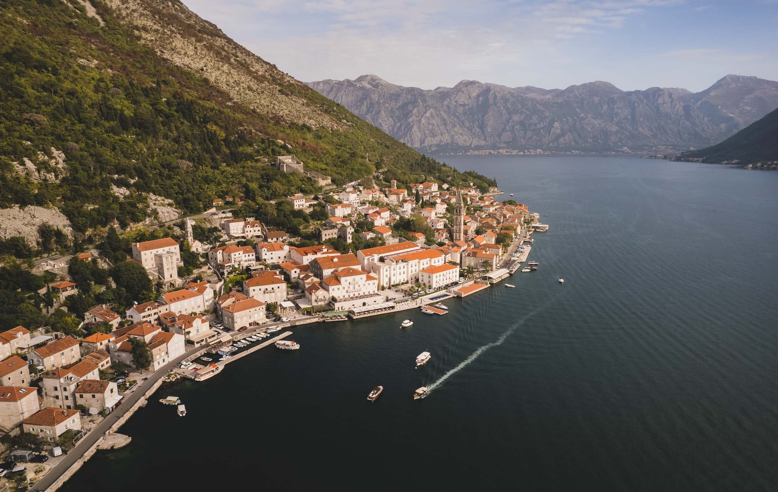
Heading back into the bay towards the historical towns of Perast and Kotor, you pass two famous small islands, just off the coast, one of which is accessible.


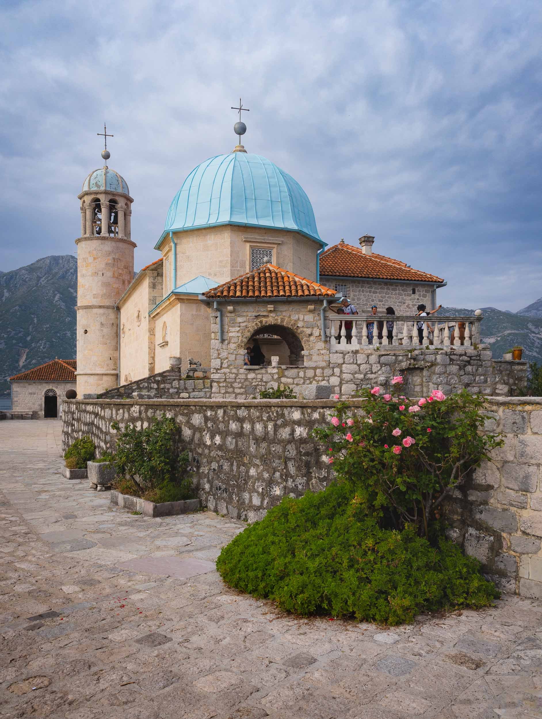


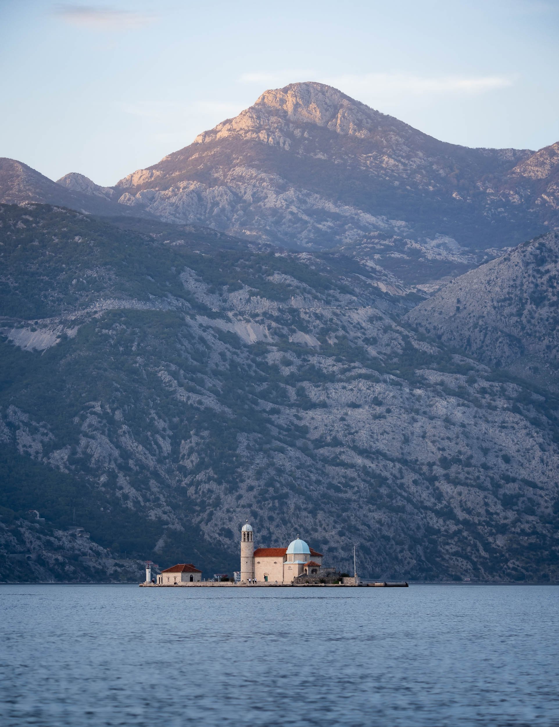
The Town of Perast
The first settlements in this area were found to be from the Neolithic era, but Prerast itself was referenced from 1336. Today, the city only has about 300 inhabitants, but its touristic appeal makes it feel much busier most of the year.
The city’s primary landmark is the Church of St Nicolas from 1616.


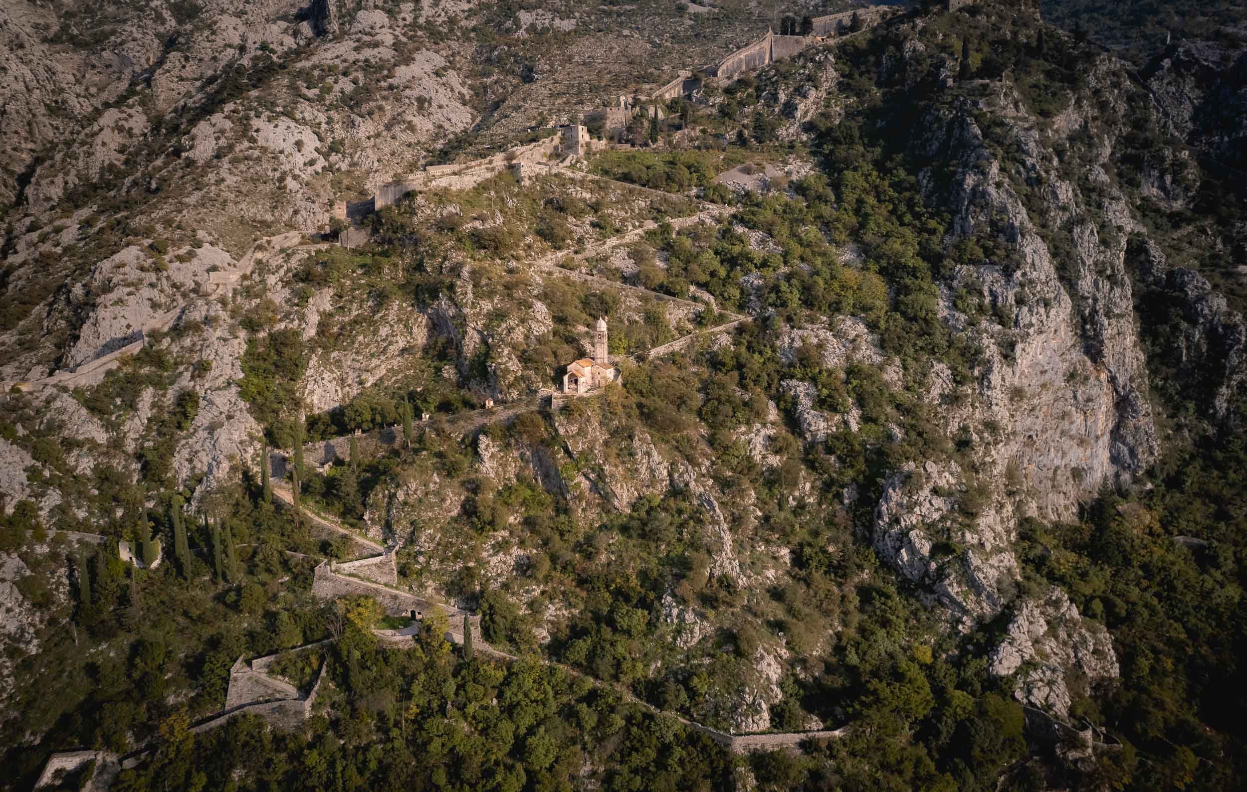
The entire area is part of the UNESCO World Heritage Site of the Kotor Region, due to its rich cultural past.


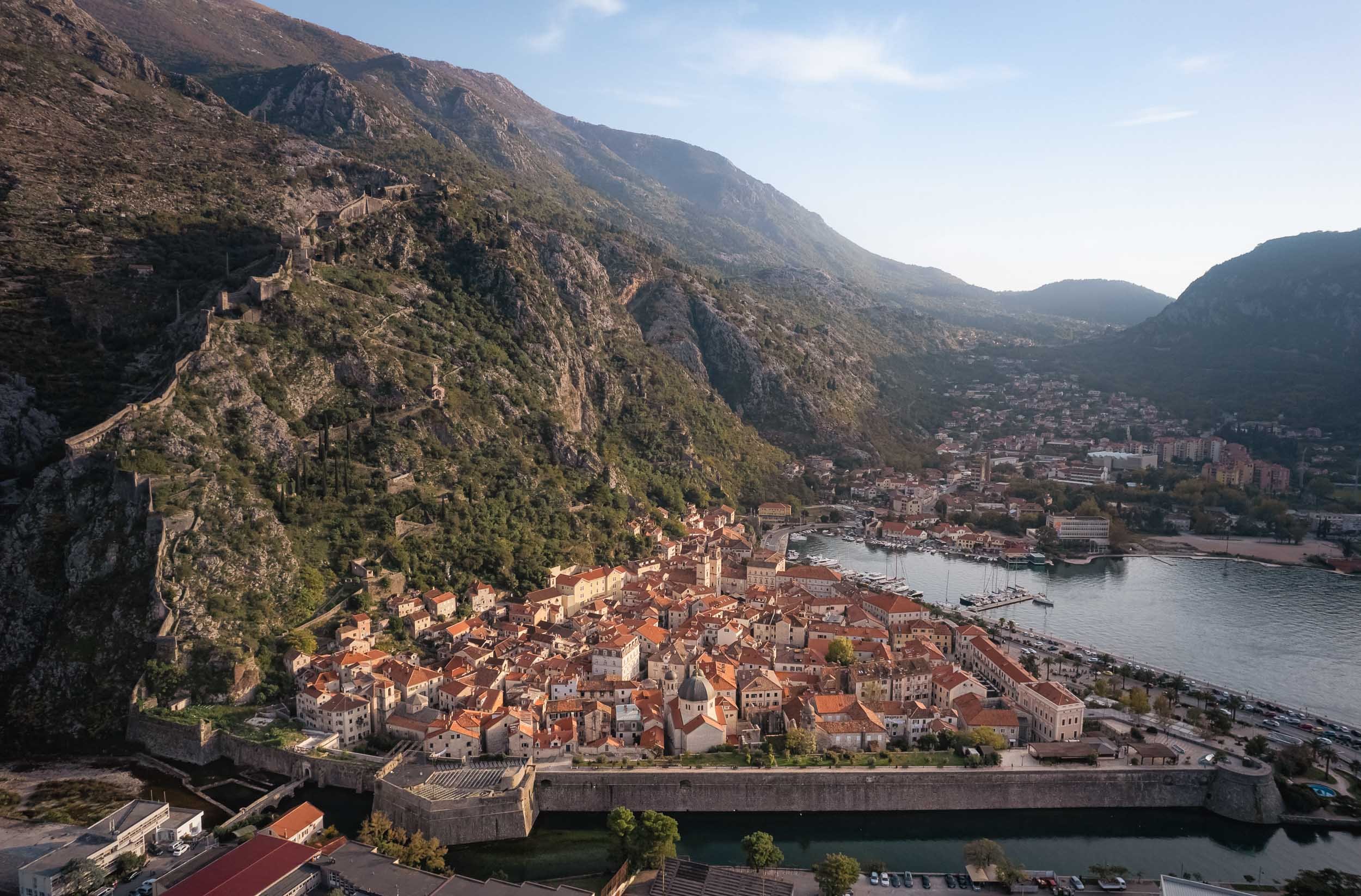
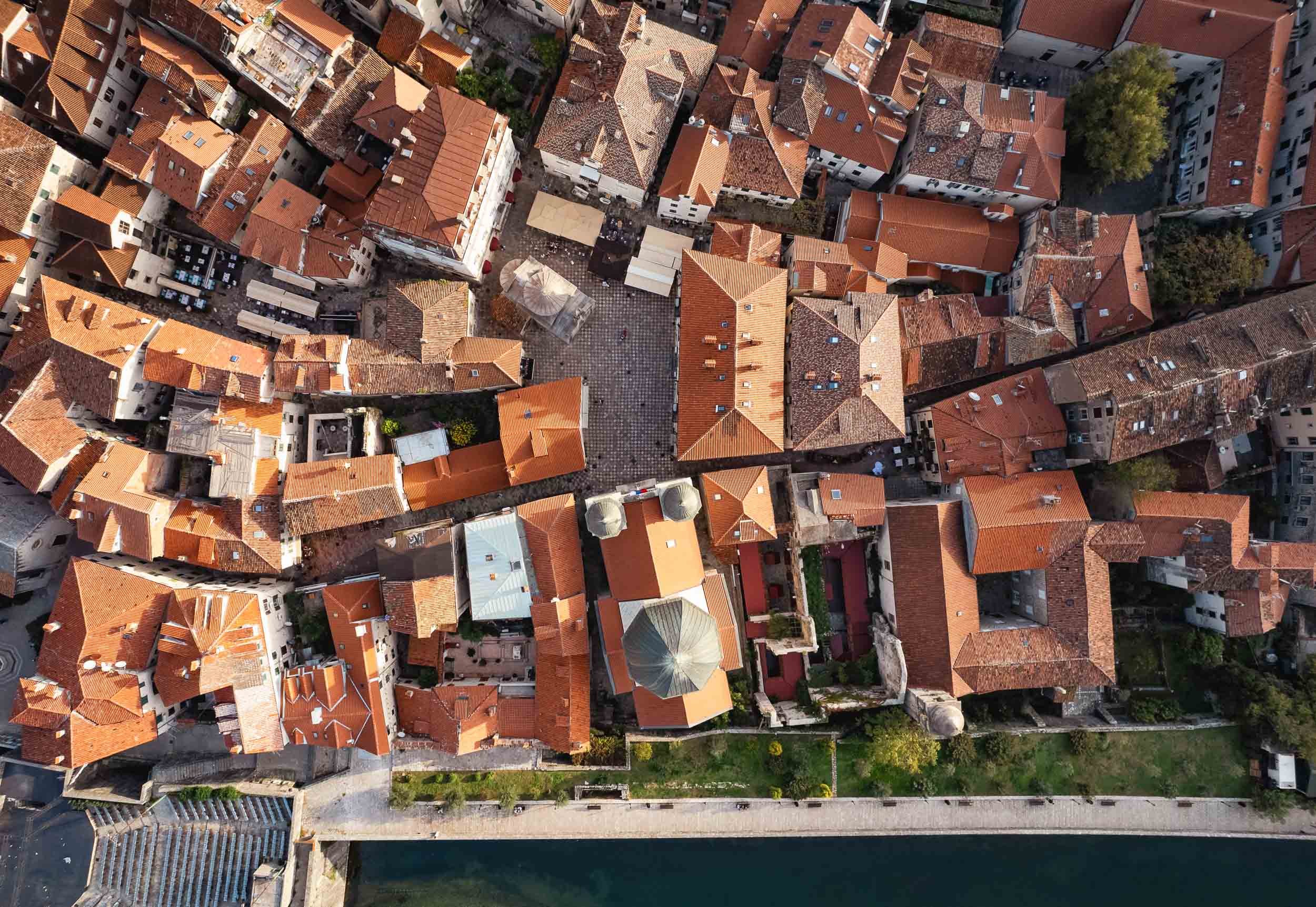
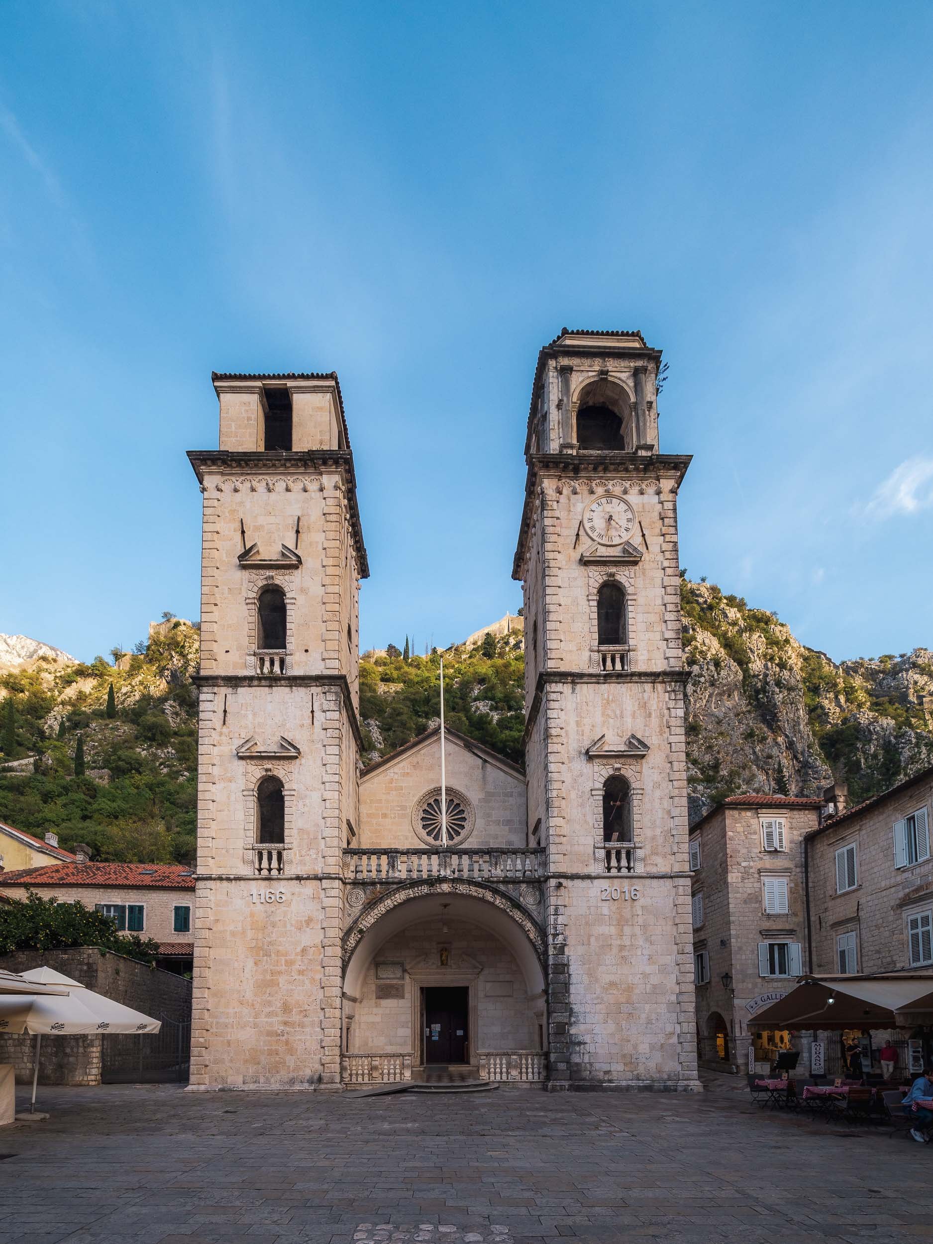
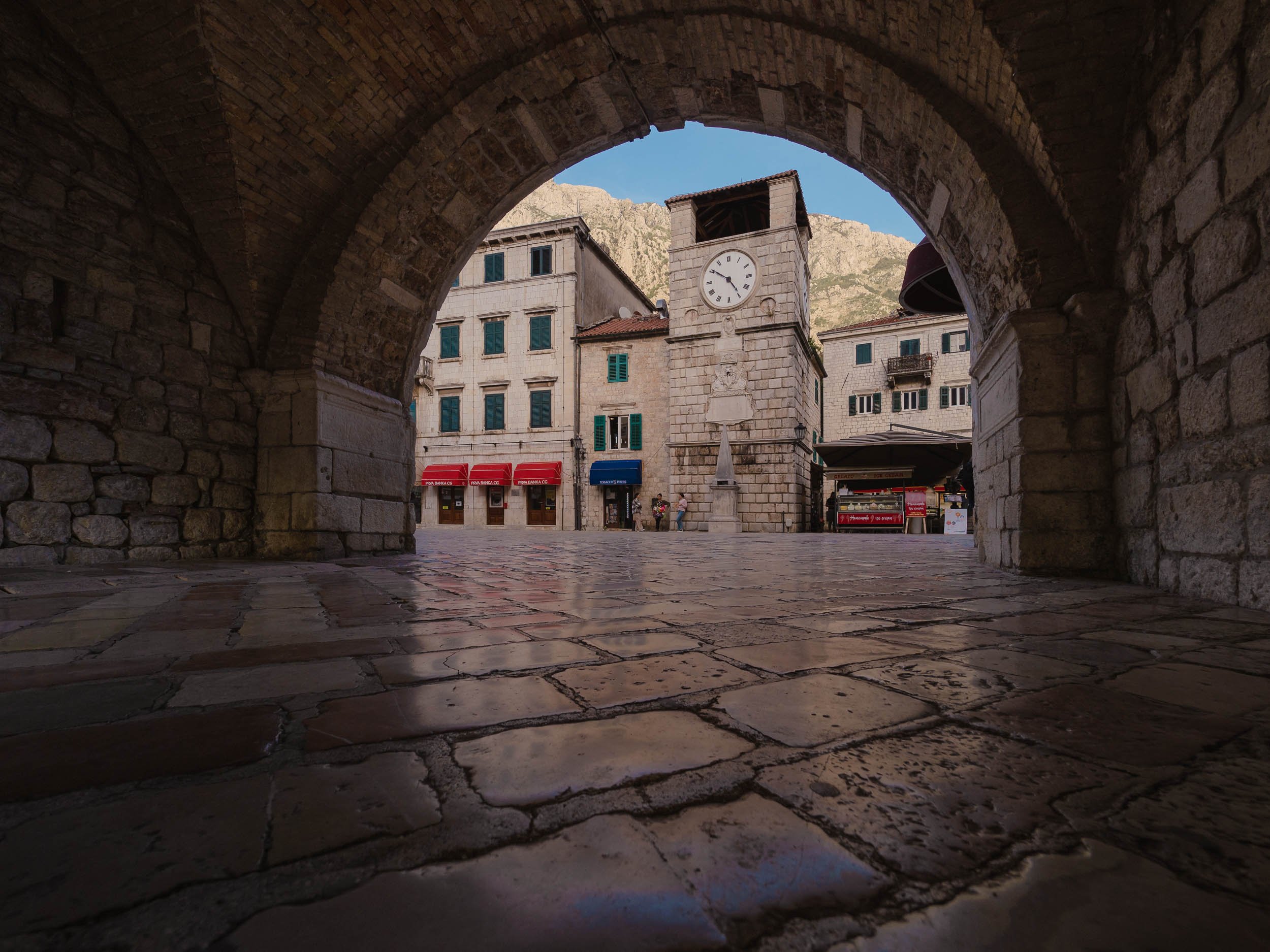
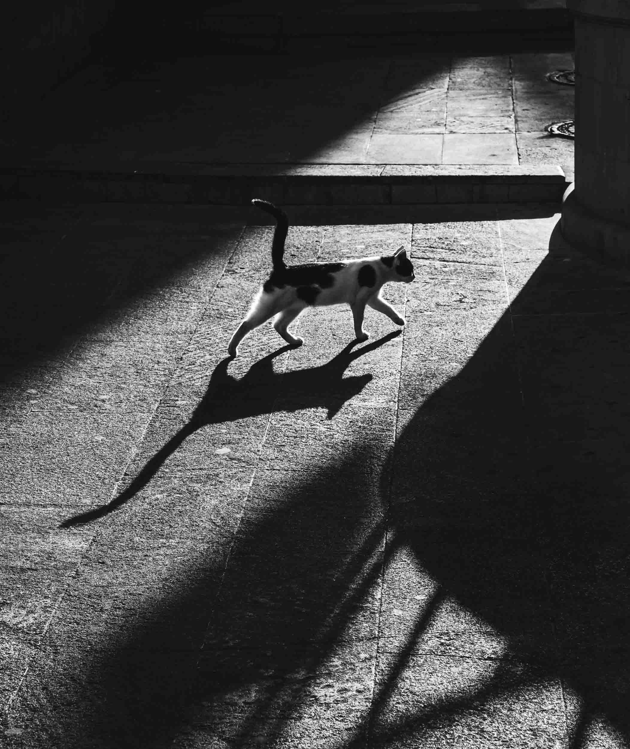
Kotor - Cat Kingdom
The namesake city at the end of the bay is also its most famous one. Its 2000 year history spans the Middle Ages, Venetian, Habsburg and Napoleonic rule. Today, its large population of cats has become a primary symbol for the town, and it indeed houses a cat museum (which unfortunately was closed) and a number of shops selling cat artefacts.


By the way, Croatia’s famous town of Dubrovnik is just an hour away and I had the chance to spend a few hours here - subscribe to be the first to hear more once I managed to go through the images.

Azerbaijan - Central Asia with a Few Surprises
Take a journey through incredible architecture, pink lakes, and rocks on fire with me in this central Asian country.

After visiting Tajikistan several years ago, exploring more of Central Asia was high on my list. When I started researching Azerbaijan’s sights, a few rather interesting spots came up - read on to find out what I mean and take a journey through incredible architecture, pink lakes, and rocks on fire with me.
The first stop on the way from Baku’s International Airport to the city was at the Atashgah Zoroastrianism Fire Temple. Azerbaijan is often referred to as the “Land of Fire’, and this site plays a small role, among others (read on..). It was built in the 17th century as a place of worship for Zoroastrians, whose belief includes fire as one of the tentpole elements. The natural flame on the site stopped burning in 1969 however.


Baku’s Old City
From here, we explored Baku’s Old Town, the country’s first UNESCO World Heritage Site.
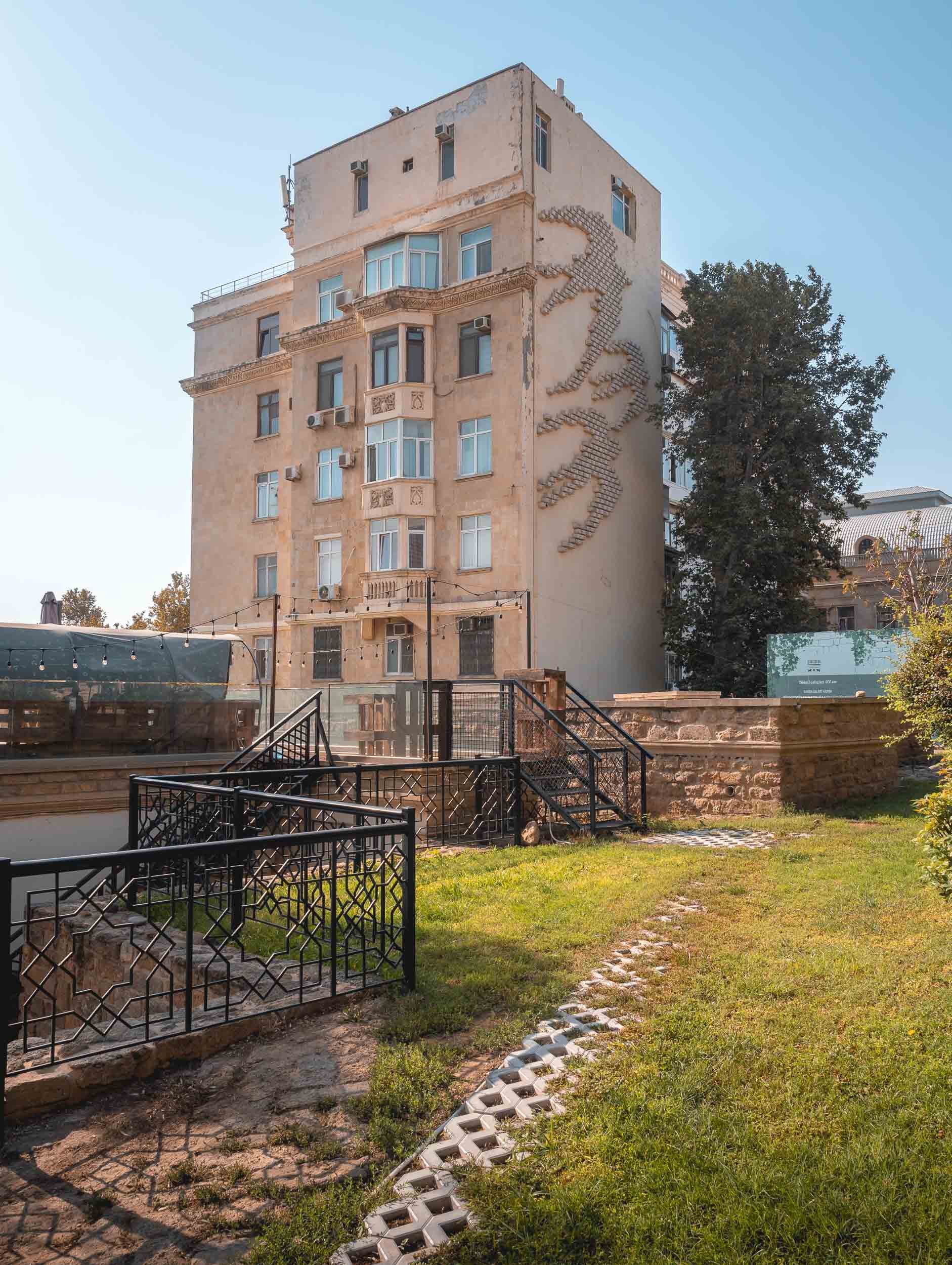
One of its primary attractions is the Maiden tower, dating back at least to the 12th century and featured on Azerbaijani bank notes. Its back story is an interesting one, and so are the views from the top, with the glass architecture of the Flame Towers in the background in stark contrast to the beige old city buildings..


Another important building in the old city is the 15th century complex of the Shirvanshahs dynasty, with its palace, baths, mosque, and mausoleum. The palace contains a nicely curated museum.


The Old Town is full of pretty restaurants, historical sites, and interesting shops.


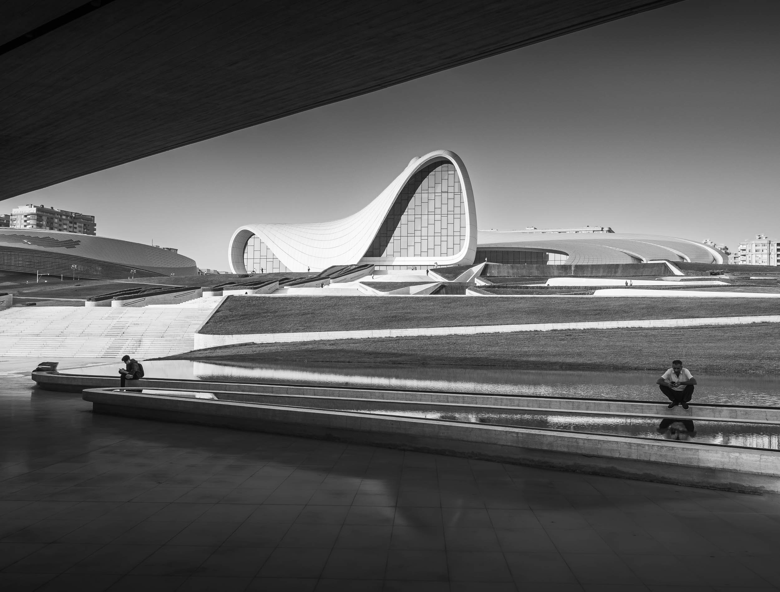
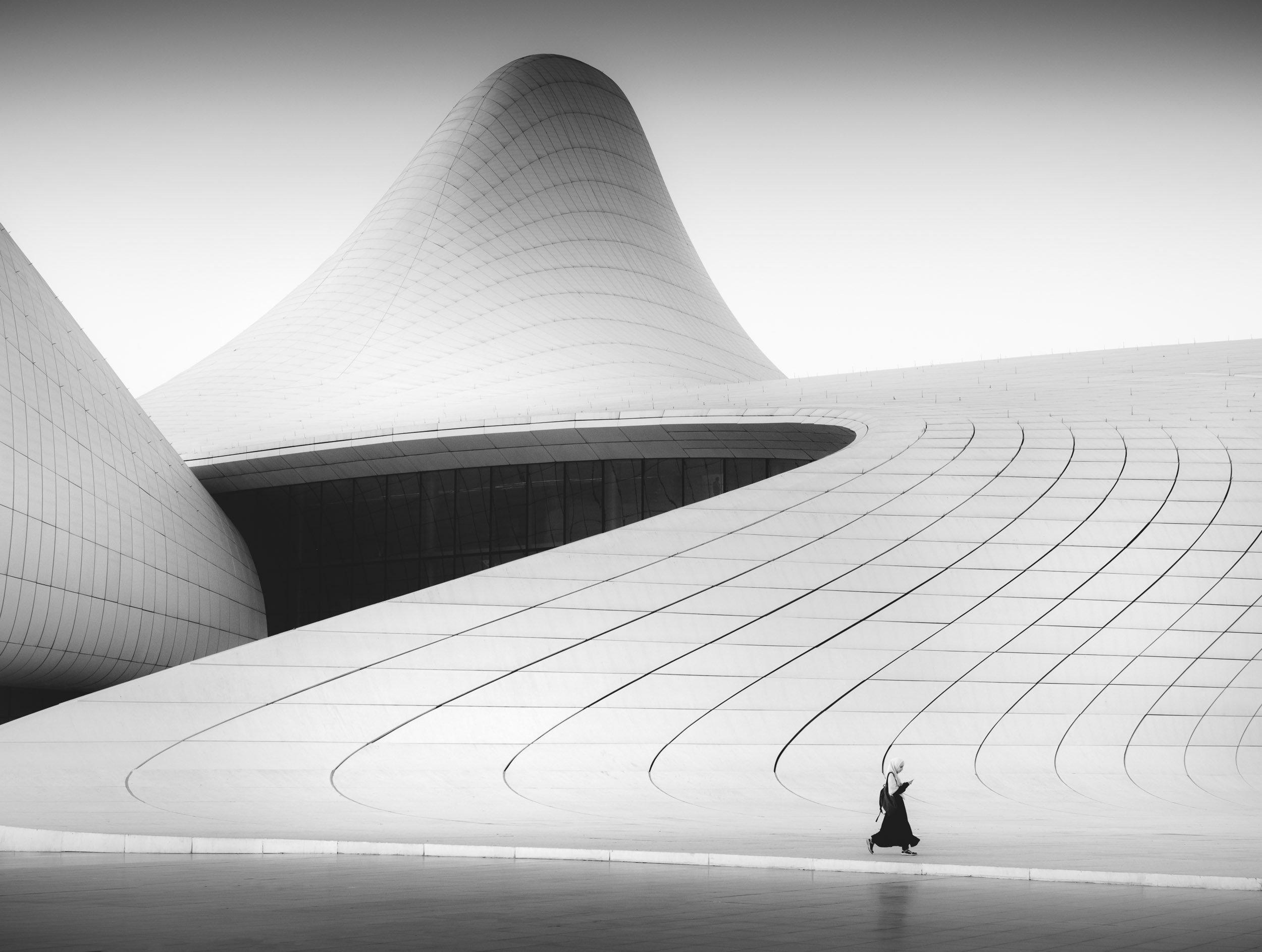
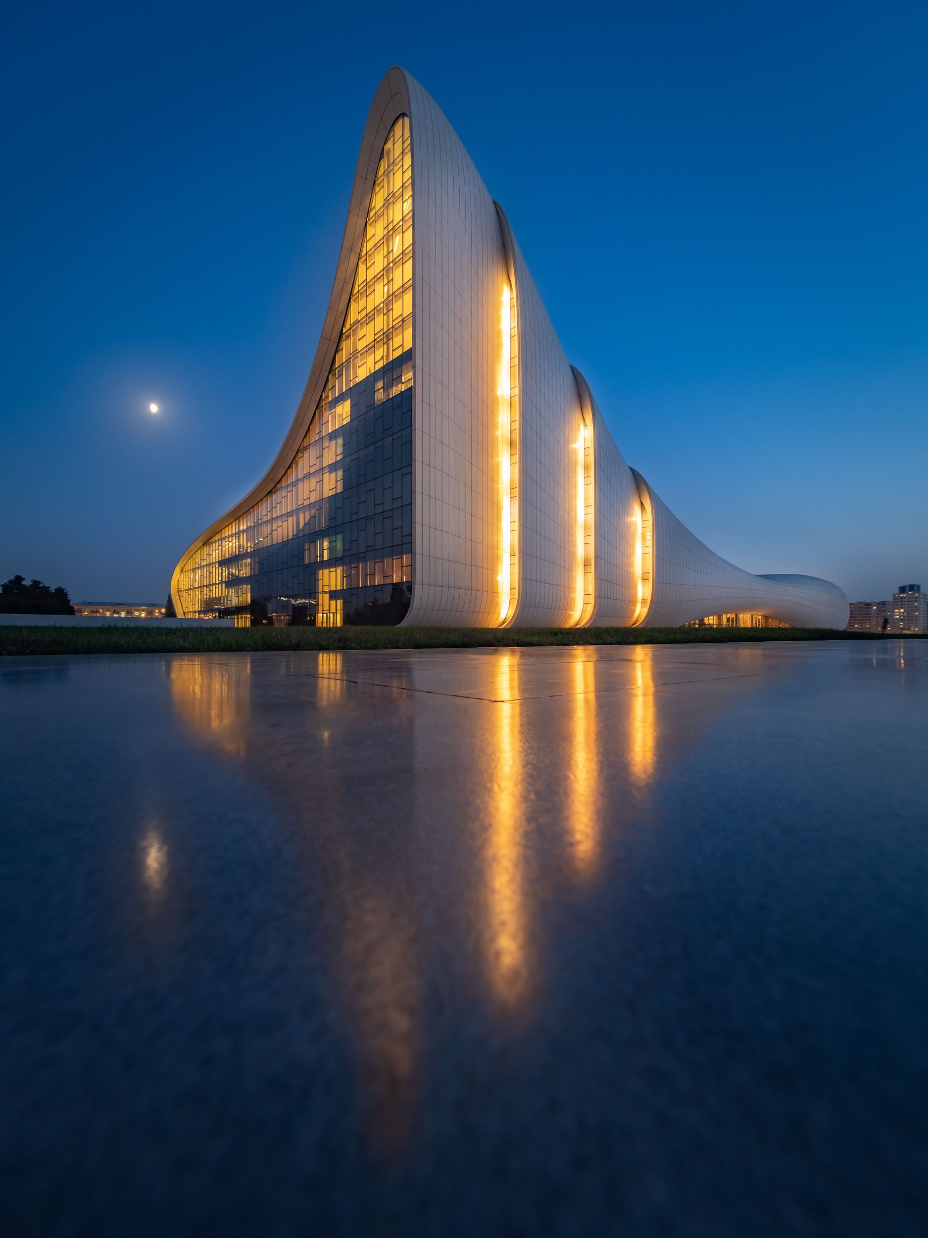
Baku’s Architectural Highlight
Despite its beautiful old city, one of the most intriguing buildings I was looking forward to photograph in Baku is much younger - it opened in 2012. The Heydar Aliyev Center was designed by Zaha Hadid and named after the country’s former president (as many things are in Azerbaijan).


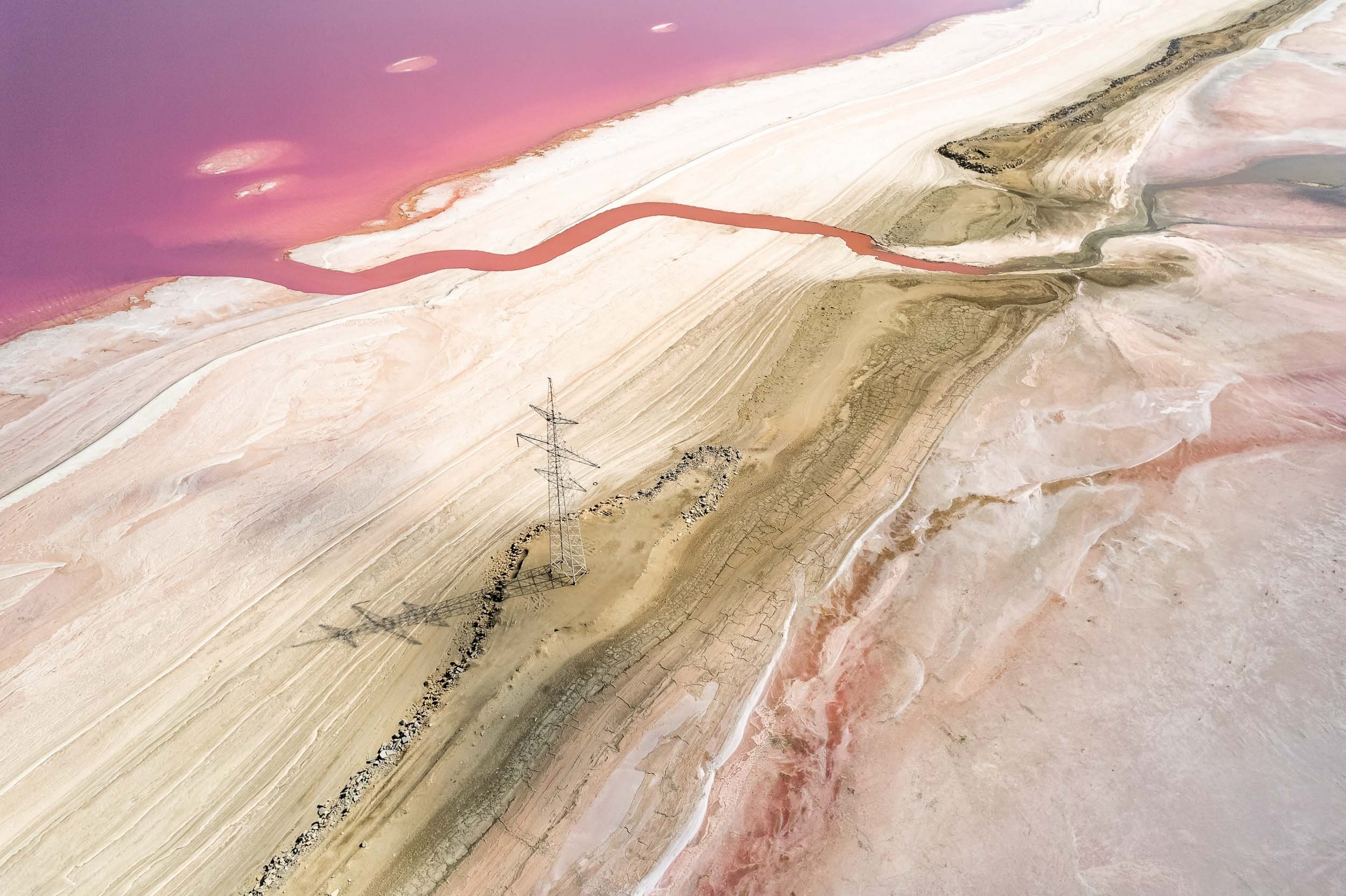
Pink Wonder
30km outside the city centre lies an attraction that only shows its true colours a few months of the year.
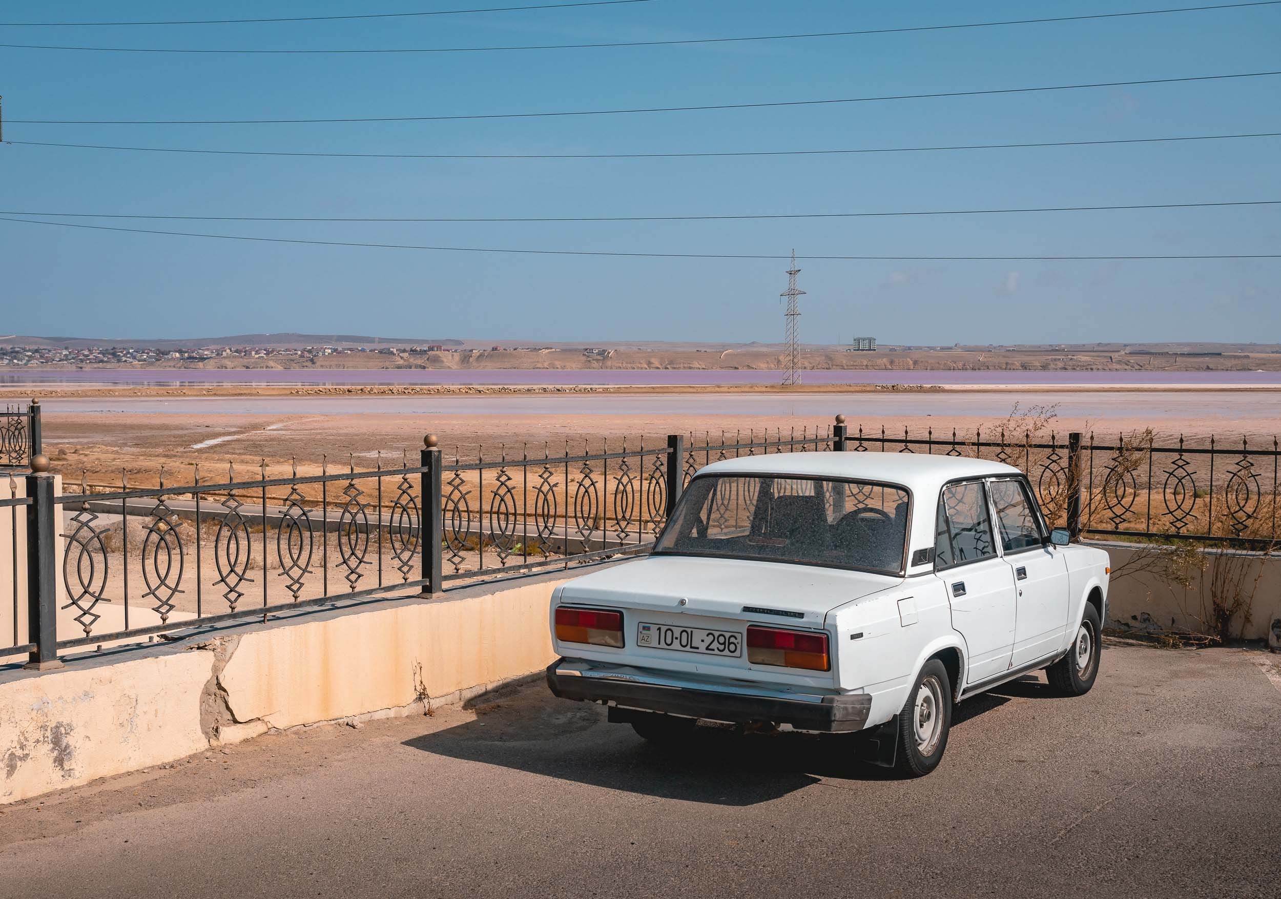


It's only when you get close that you start to suddenly realise the unique conditions present here, and the visual glory that comes with them. Having said that, nothing can beat the view from the top… ⬇️
This amazing sight is the pink lake of Masazir, north of Baku. Its color derives from the combination of algae and bacterial bloom in the highly salty water at the right temperatures. It's one of a few such lakes around the world, and the people living on its shorelines definitely get to witness an interesting spectacle.


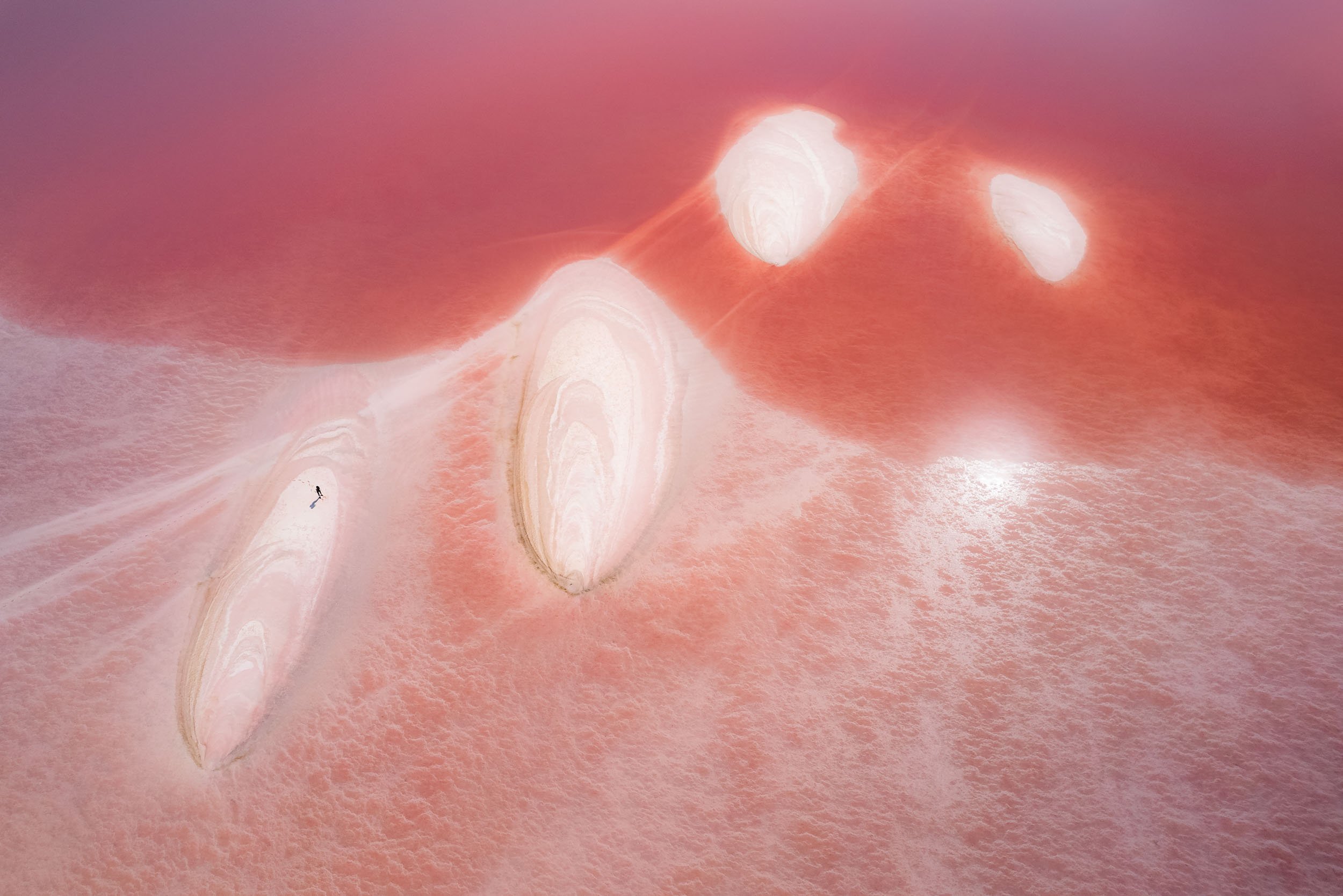
Got very lucky to explore and see this phenomenon, and many thanks to Andre Jabali for the tips in making it happen!
The Mud Volcanoes - Otherworldly Landscapes
Next up in the list of unusual places in Azerbaijan is an area called Gobustan, home to many of the world’s 800 mud volcanoes, half of which are located in the country.
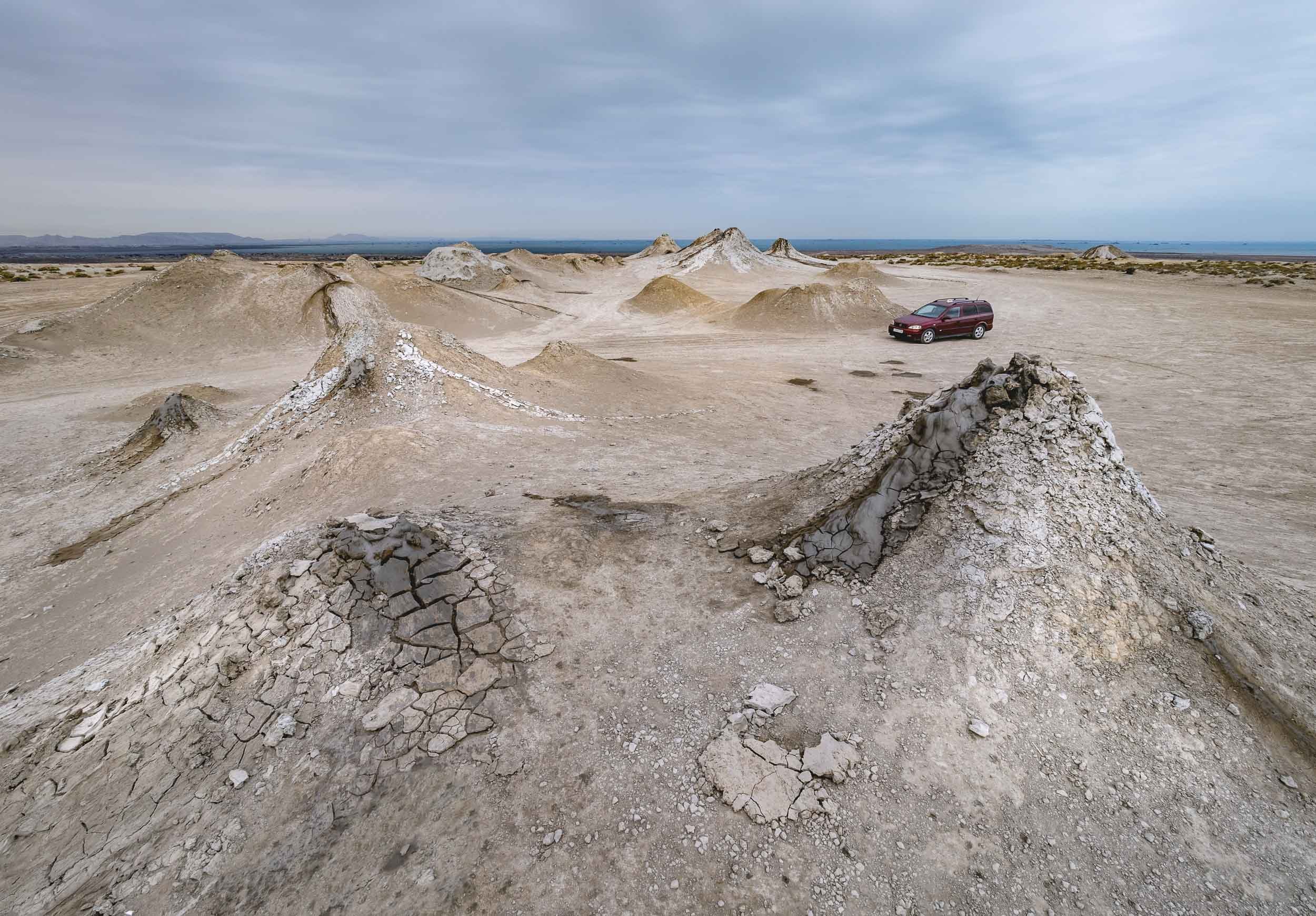

The look from above provides a perspective of several volcanoes in the area - notice the darker shades of fresh mud slowly making its way down the slope. NASA geologists studying Mars concluded that Azerbaijan's mud volcanoes have a similar structure to the uplands of the planet.


While the bubbly craters might appear cute, particularly given the sounds that come out of the bubbles as they pop, the larger volcanoes can erupt fiercely with flames shooting into the sky if water, gas, and mud mix under the right circumstances. In fact, the gas emissions are mostly methane, and can be ignited with a lighter (as our trusty guide proudly showed us while we scattered in fear of a mud explosion).


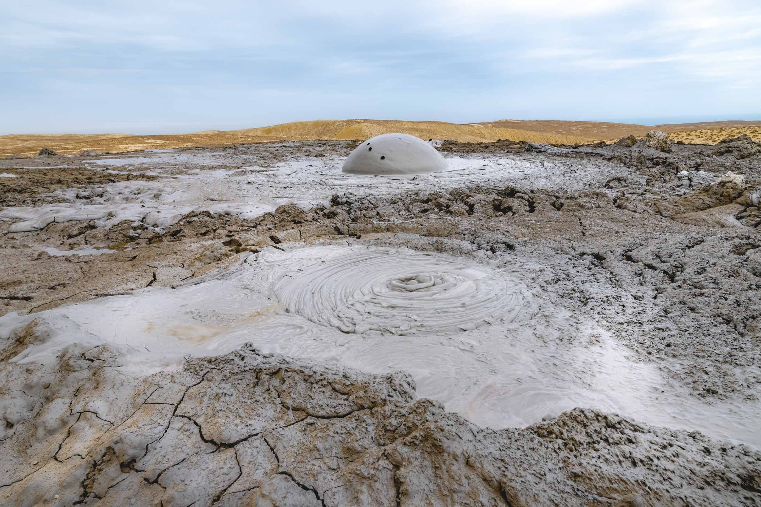
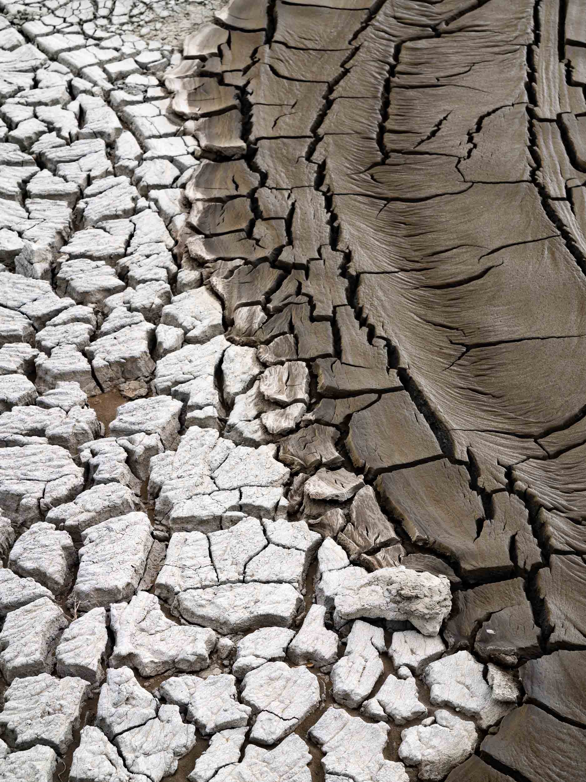
The mud is roughly the same temperature as the surrounding air, and dries up quickly once it spills over the crater edge. Volcano clay and mud are sometimes used in the treatment of diseases.


Gobustan National Park
The area around the volcanoes is a national park, home to a - surprisingly impressive - museum owing to the many prehistoric rock carvings dating back up to 15,000 years. The park is walkable and also includes natural “musical stones” called Gaval Dash, and a Roman inscription from the 1st century.

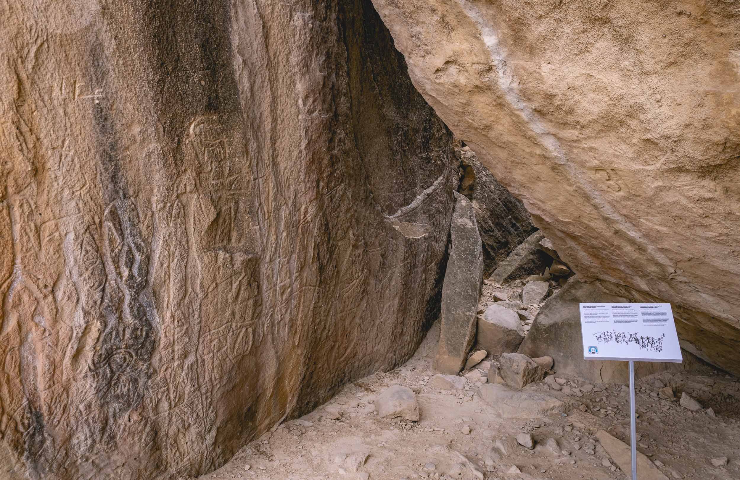
Heydar Mosque
Opened in 2014, it’s the largest in the South Caucasus region and located slightly outside the city centre. It’s almost disproportionately tall compared to its footprint - the minarets reach 95m.


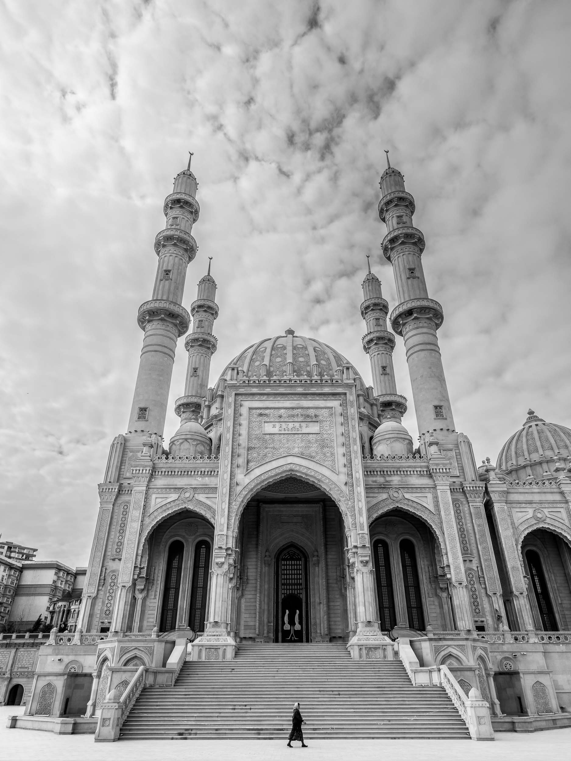
The Carpet Museum
Fitting into the city’s architectural gem collection is the carpet museum, which unsurprisingly looks like a carpet, and houses many of them in a nod to the regions carpet manufacturing heritage.


The Candy Cane Mountains
Azerbaijan is home to another colorful natural attraction: A small shale mountain range north-east of Baku full of pink, purple, orange, and brown shades.


Take a look from above!
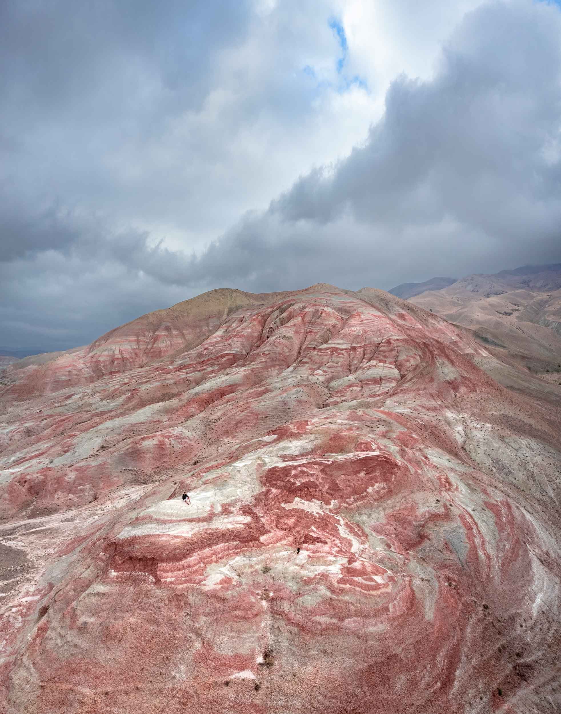

Yanar Dag - “Burning Mountain”
On our way back we stopped at another peculiar place. Remember Azerbaijan’s nickname? The “Land of Fire” has another appropriate sight: Yanar Dag is a natural gas fire said to have been continuously burning for more than 700 years, snow, wind and earthquakes notwithstanding.

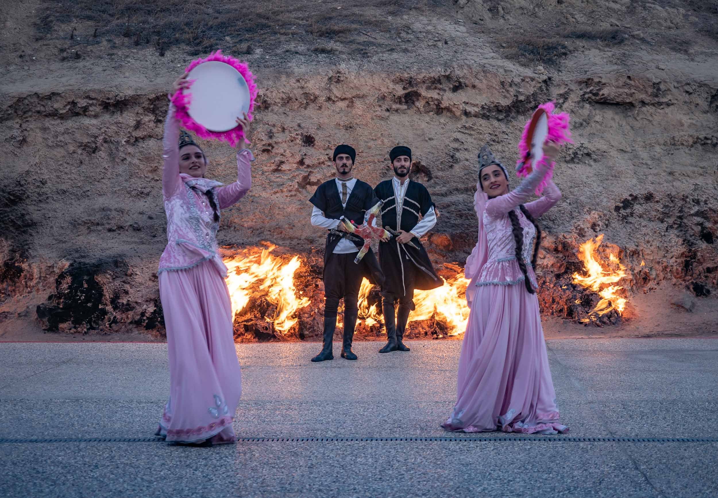
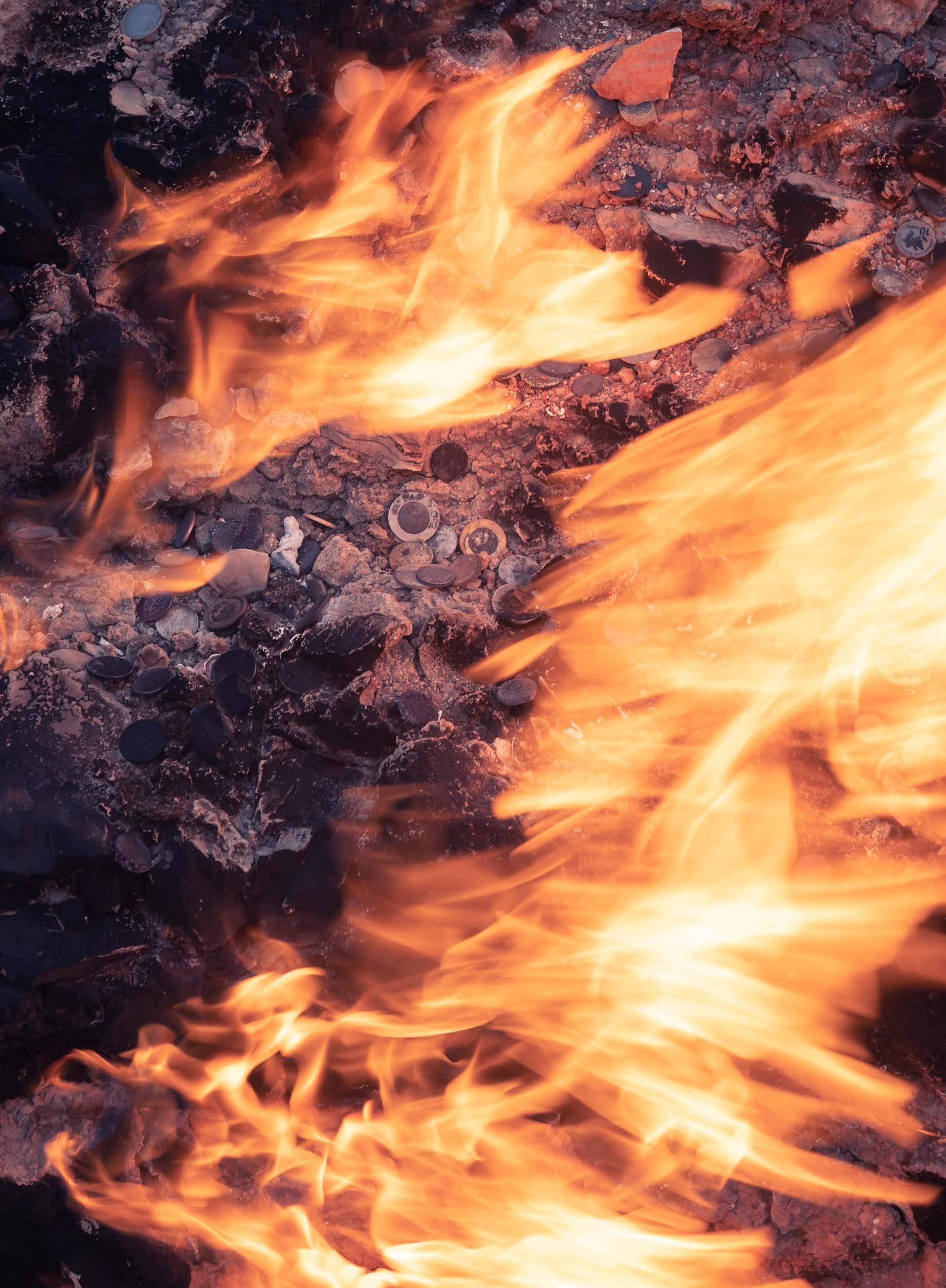
Baku Impressions
Baku’s Museum of Modern Art has an interesting collection, including private pieces of Picasso and Dali. Its curious cafe was unfortunately closed during the time of my visit.


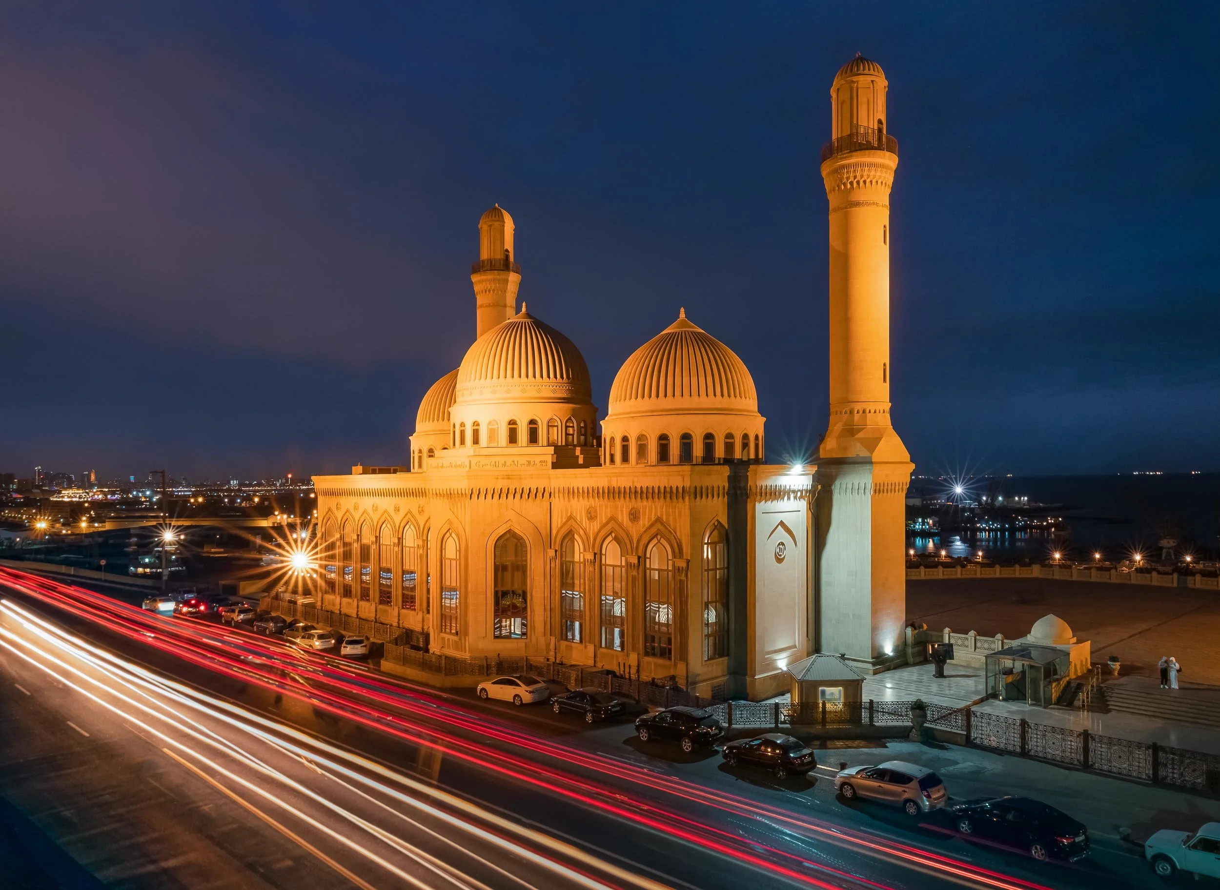

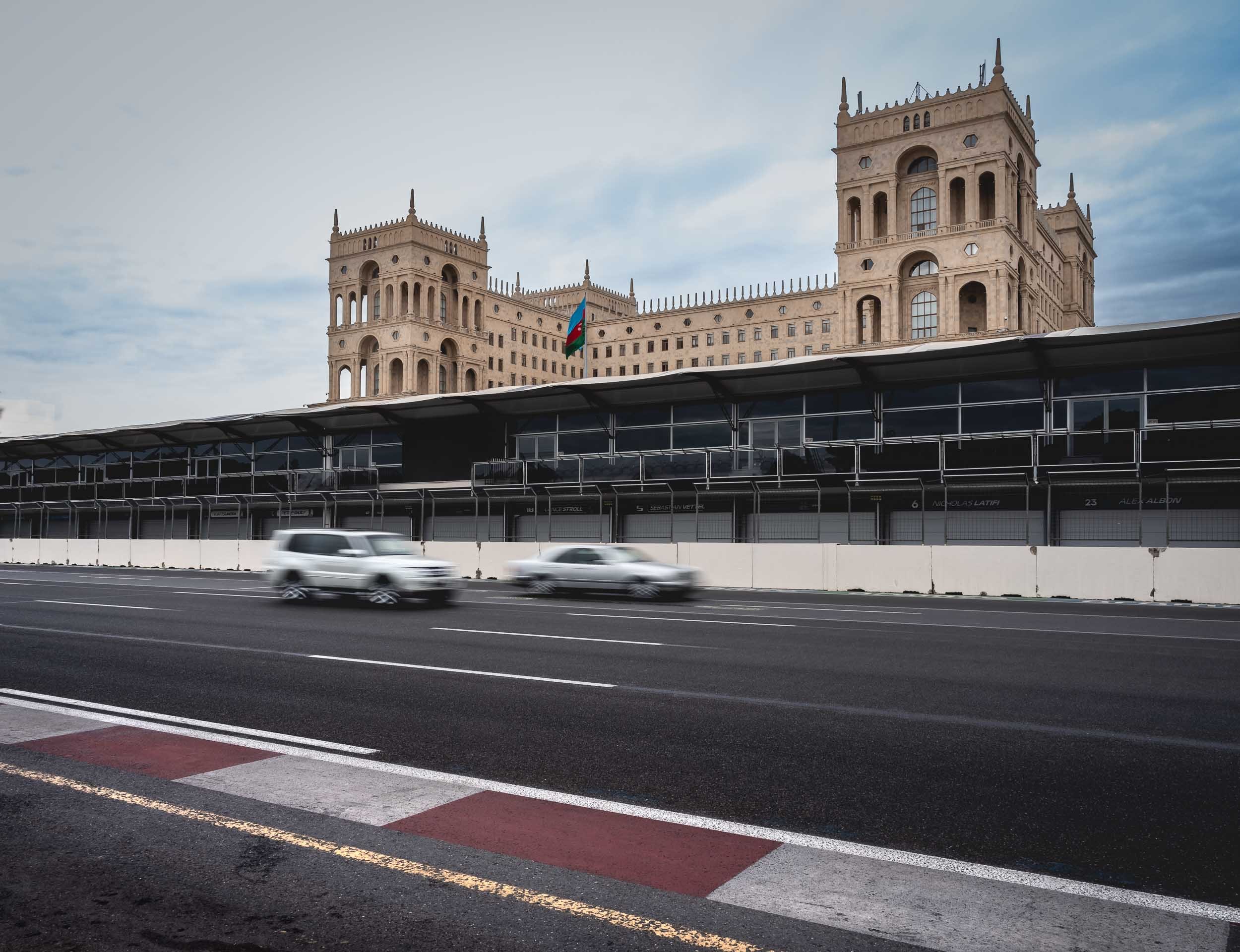
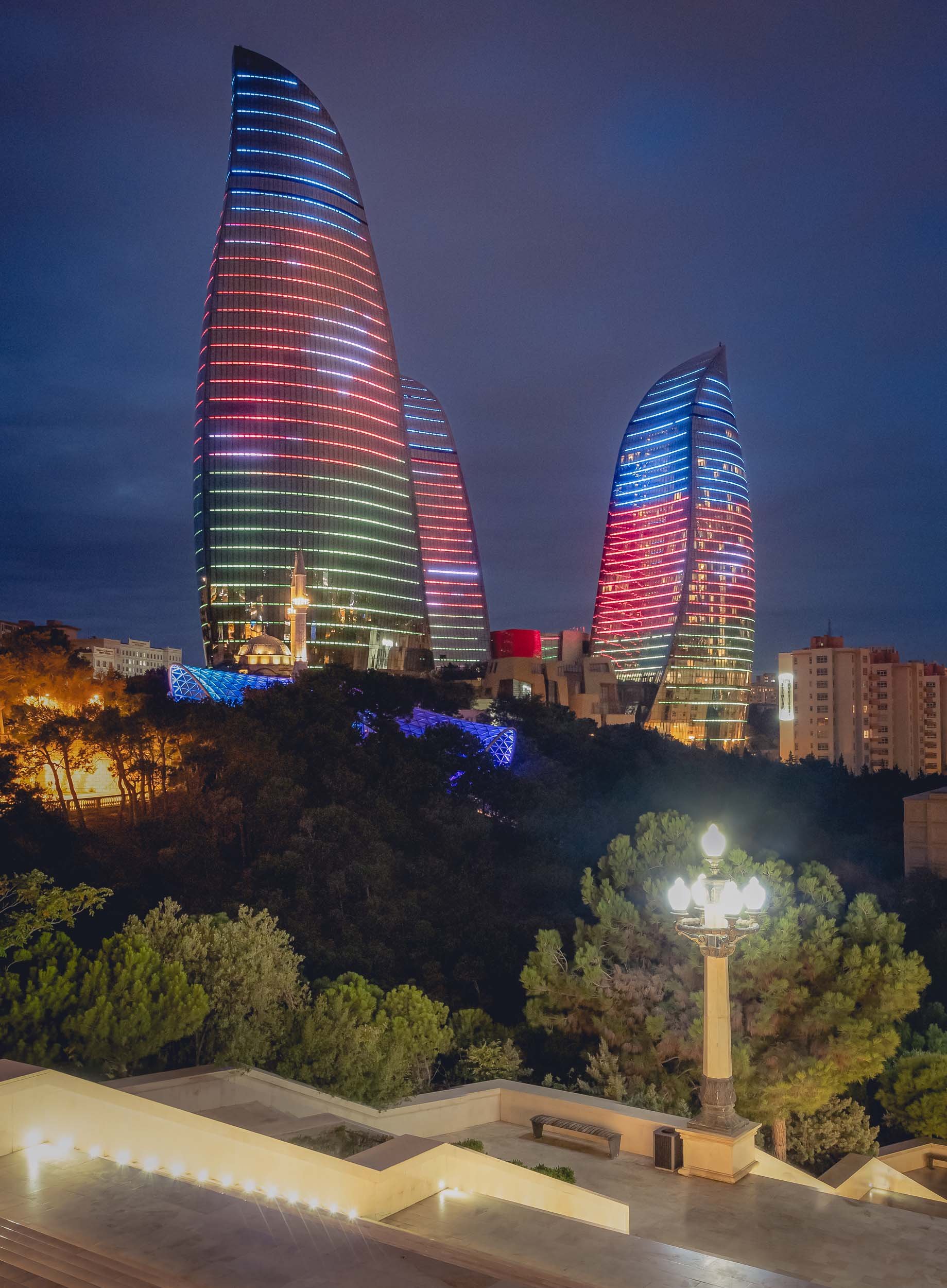
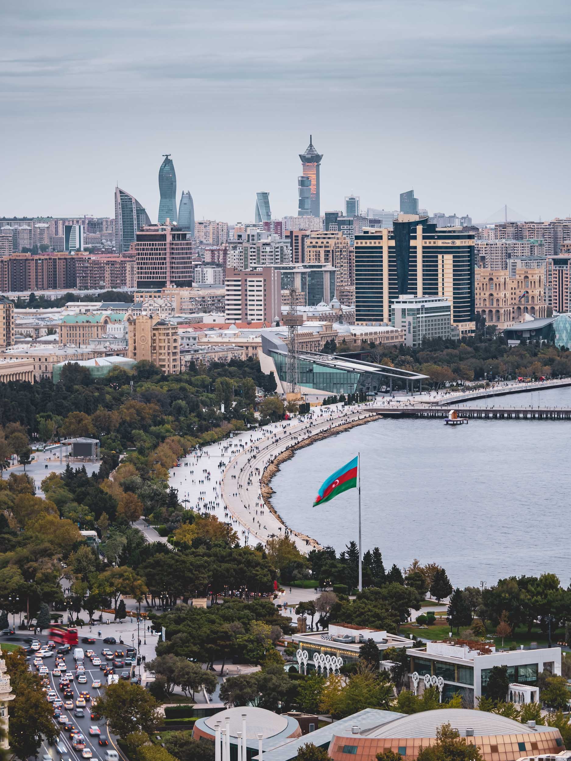
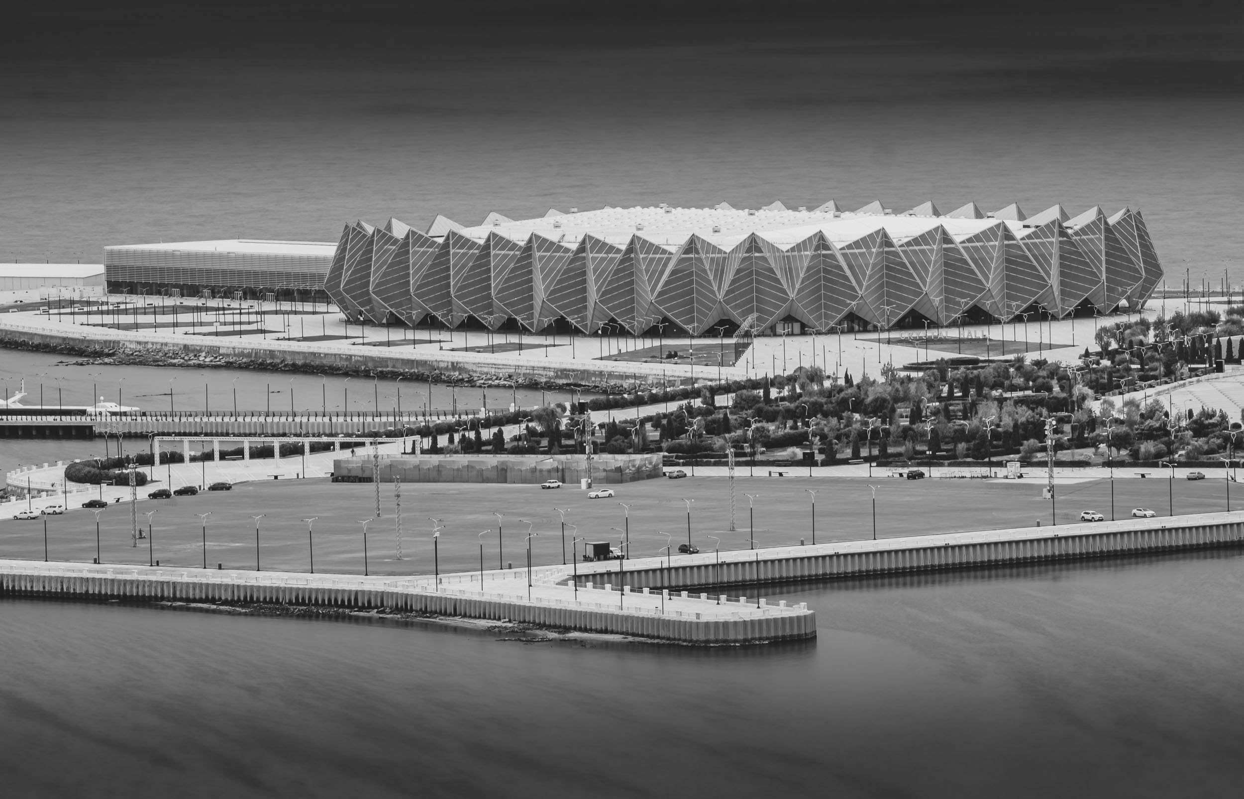
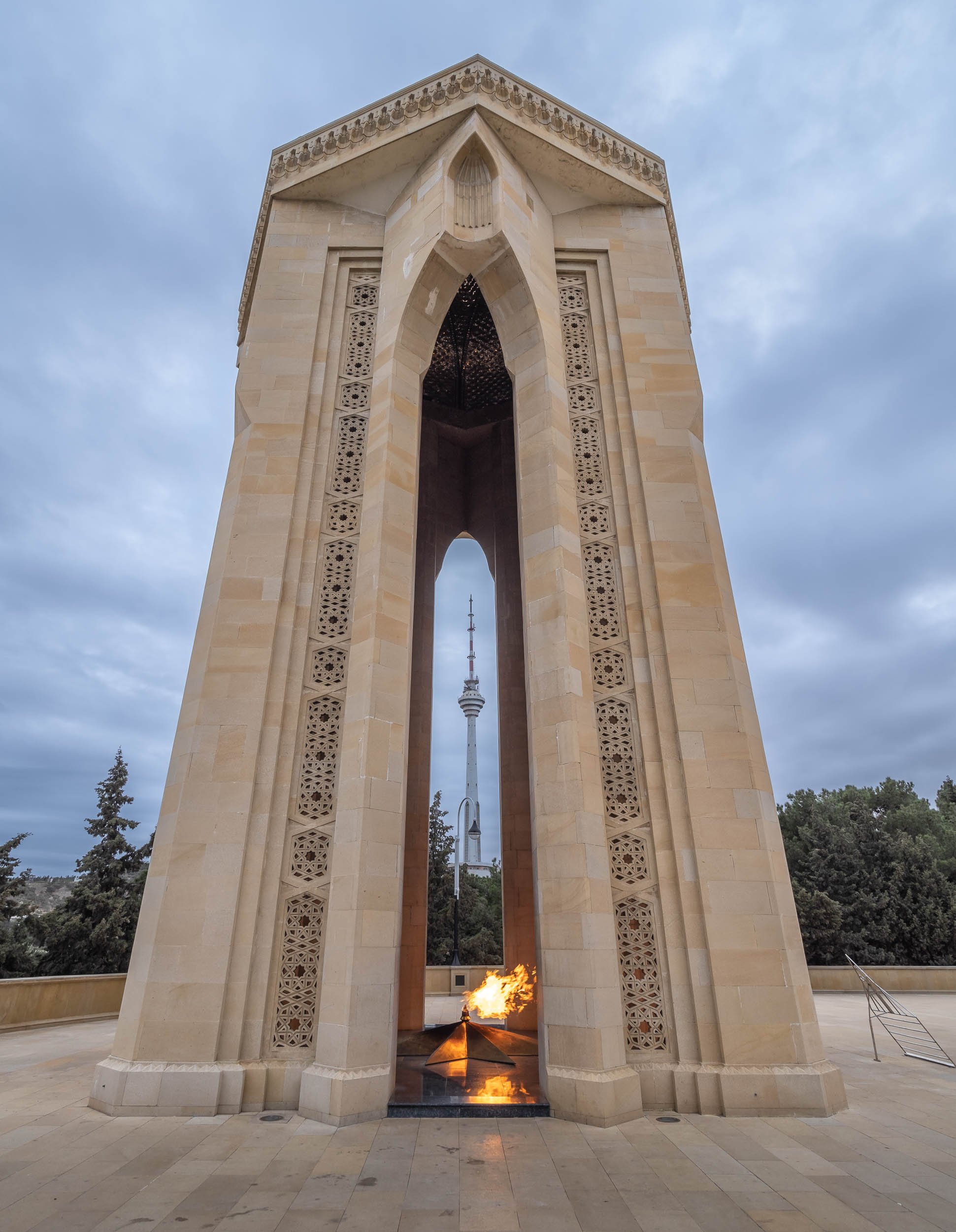
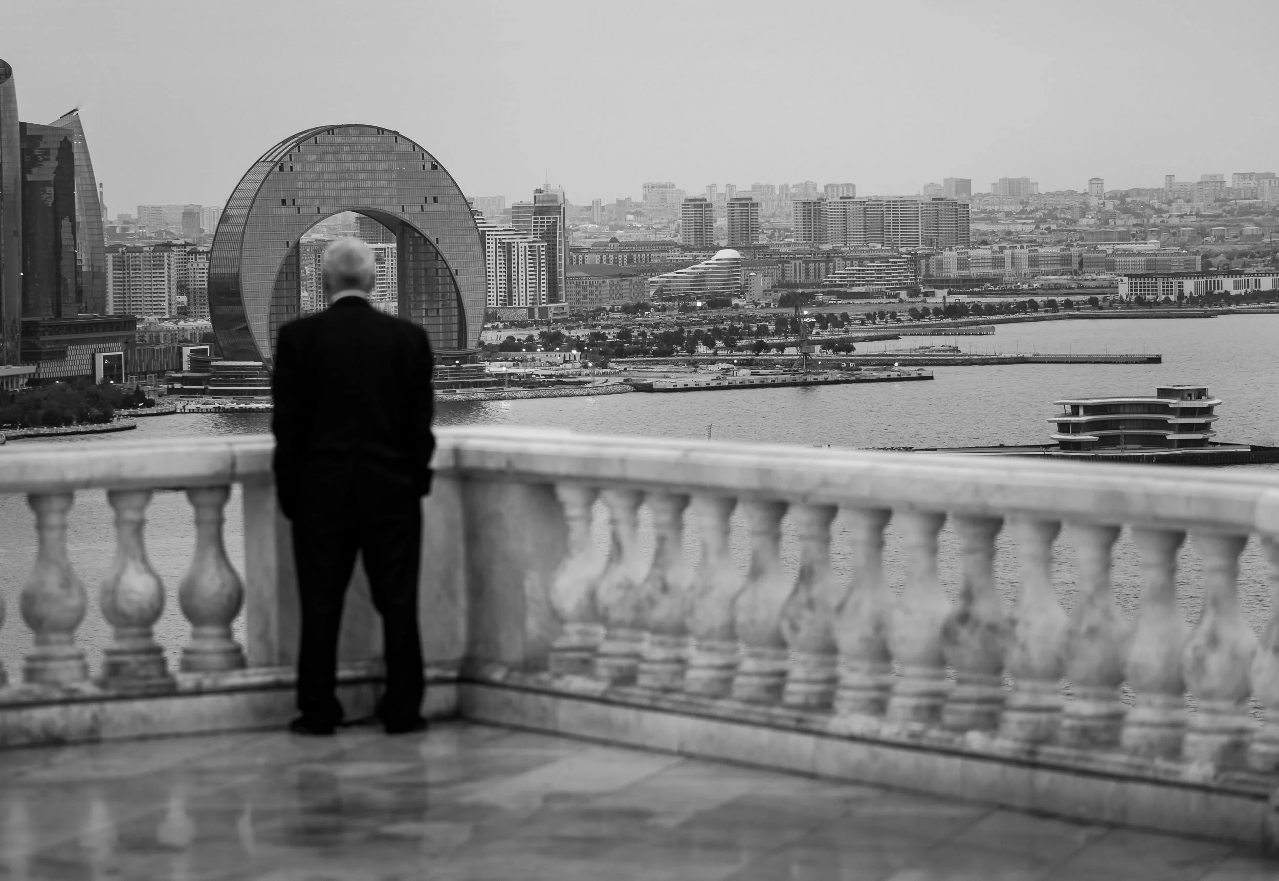

Palestine & Israel - Complex History, Present, and Future
Politically tense. Historically significant. Shaped by religion. Naturally beautiful. Developed in contrast.

Politically tense. Historically significant. Shaped by religion. Naturally beautiful. Developed in contrast. The region that is today shared one way or the other - depending on who you ask - between Israel and Palestine is all of those things and many more. Having spent close to a week between Tel Aviv, Jerusalem, and the surrounding areas, I feel like I barely scratched the surface.
Tel Aviv
The economic centre of the region with the largest per capita economy in the Middle East, and also the highest cost of living in the world as of 2021.
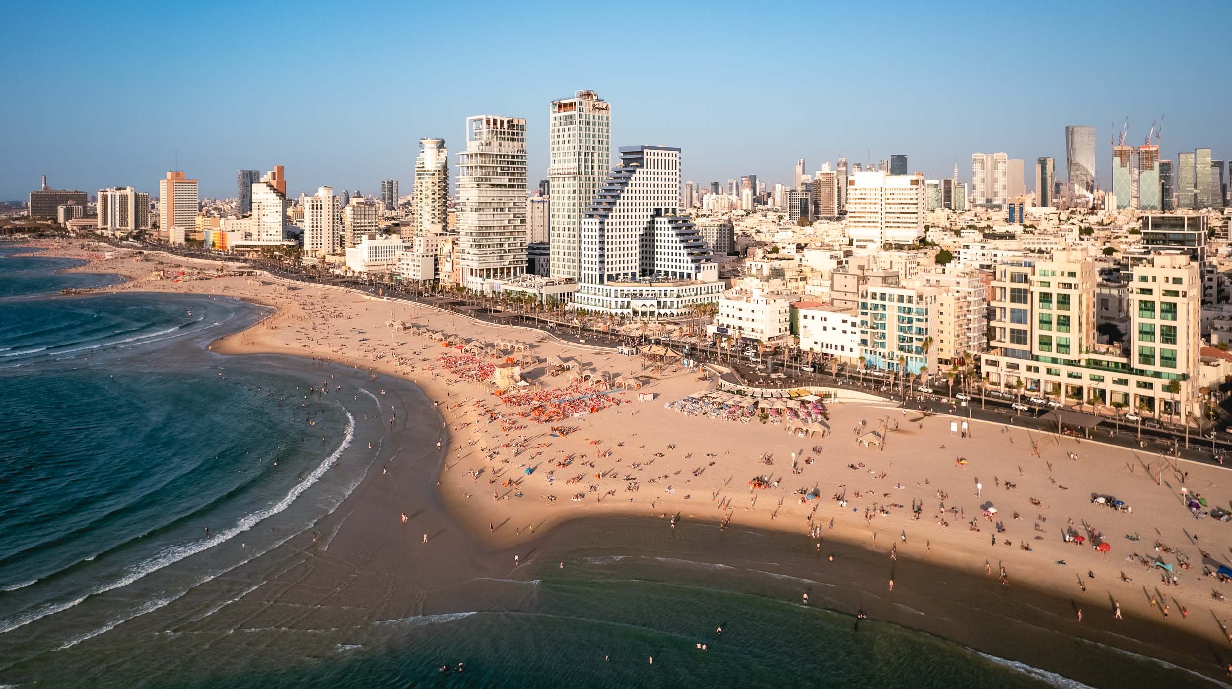
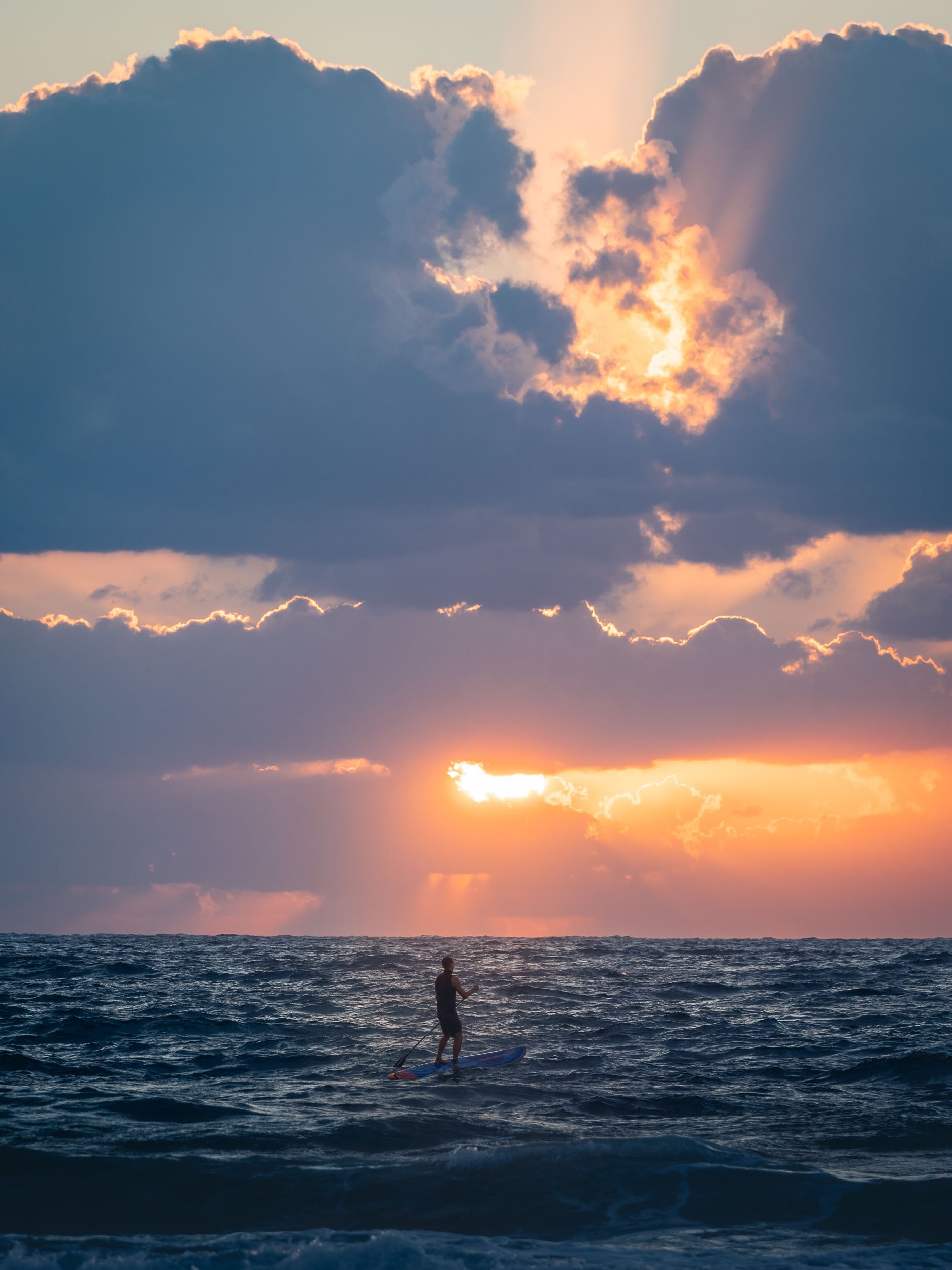
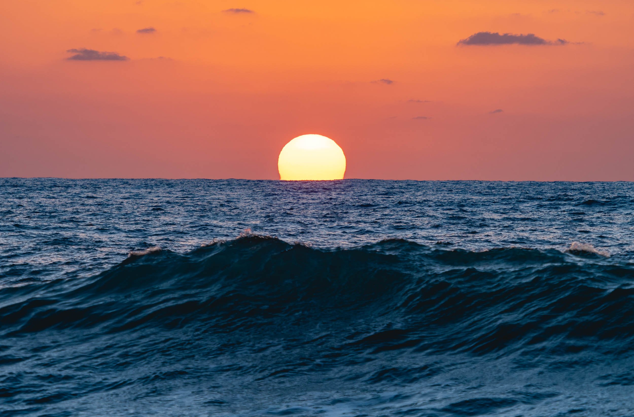
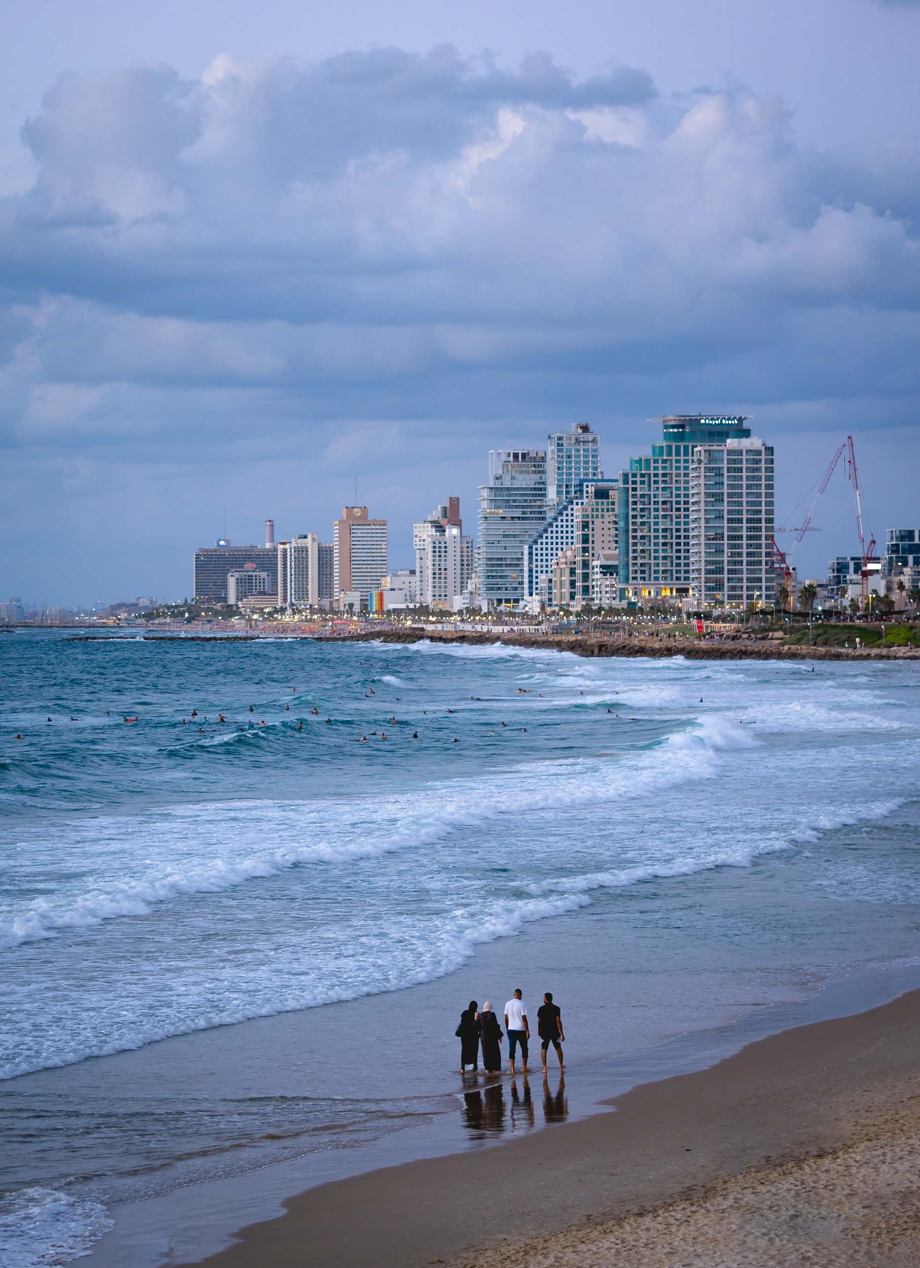


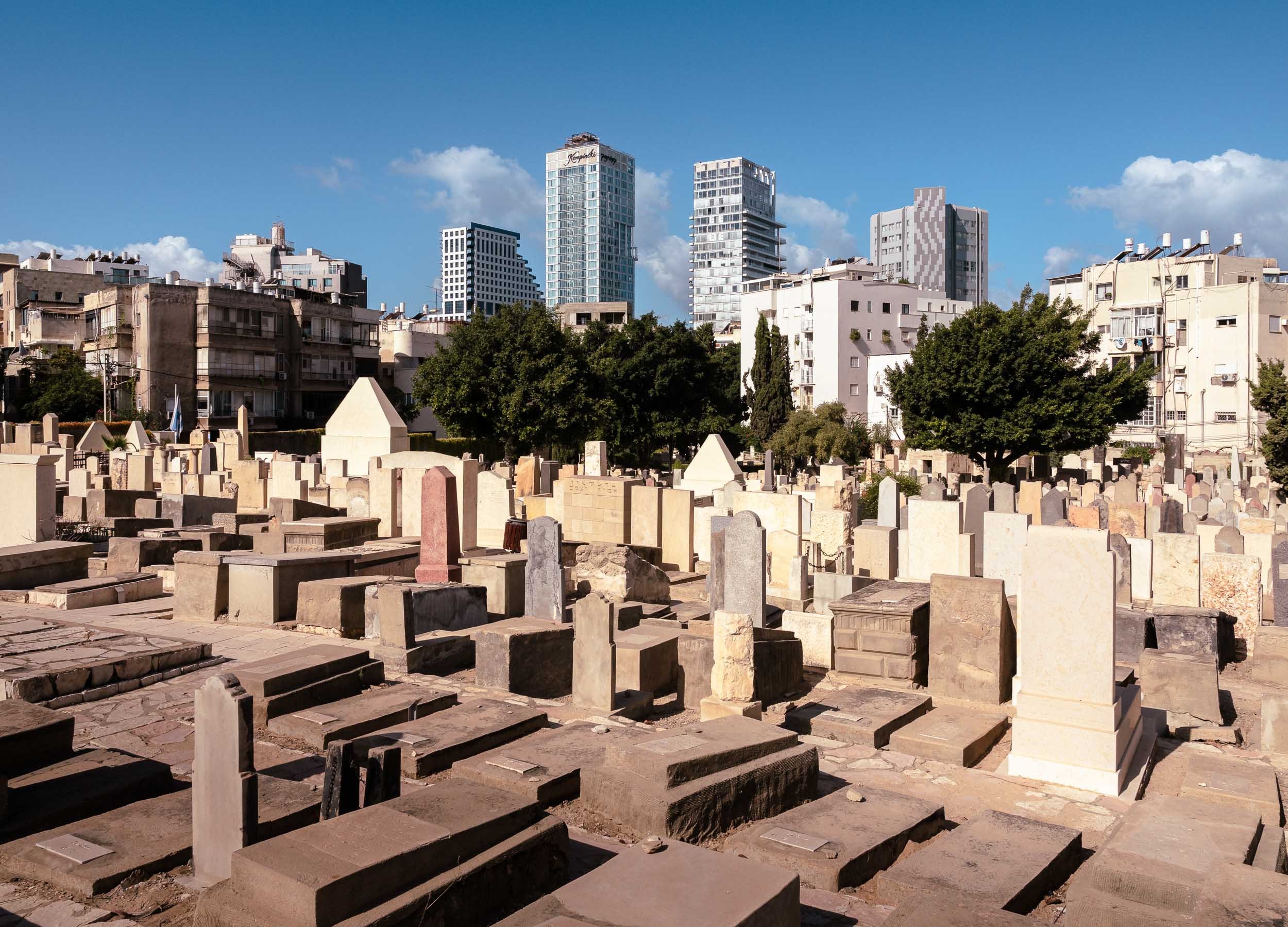
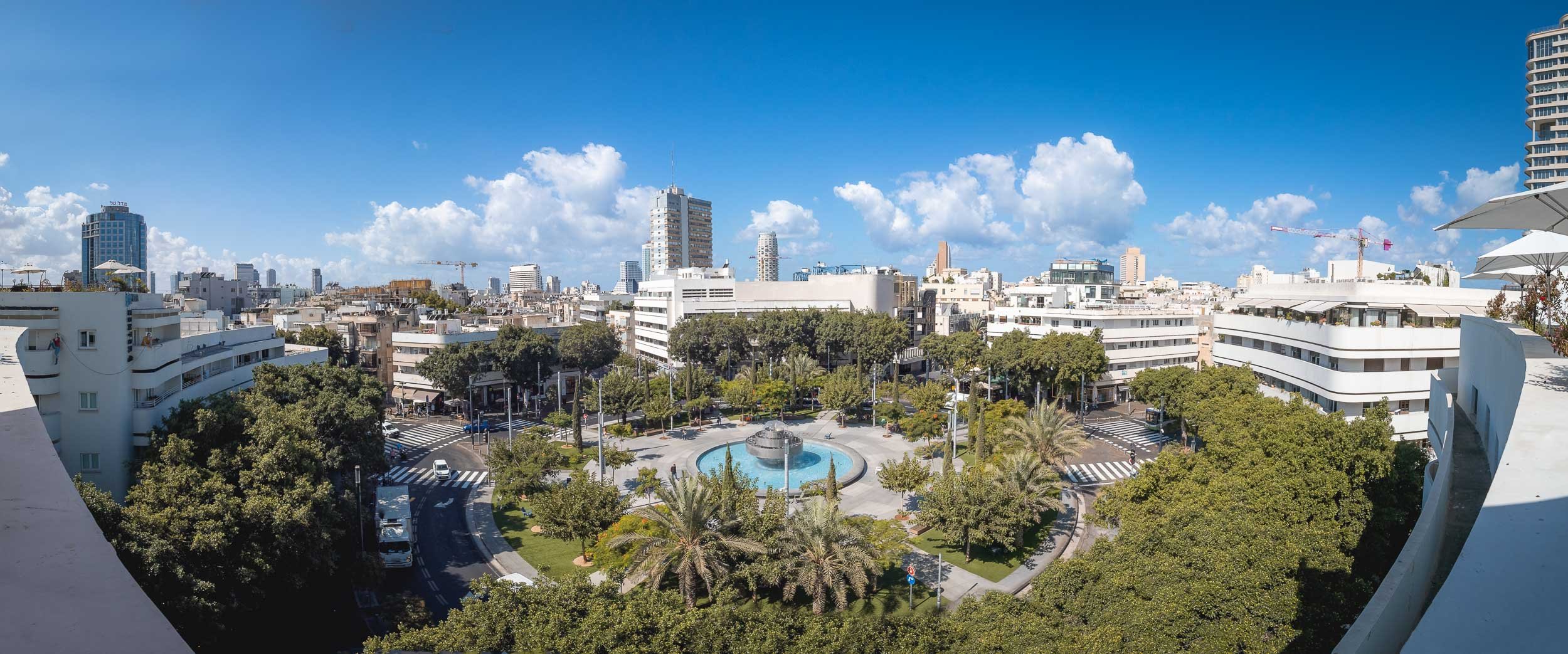
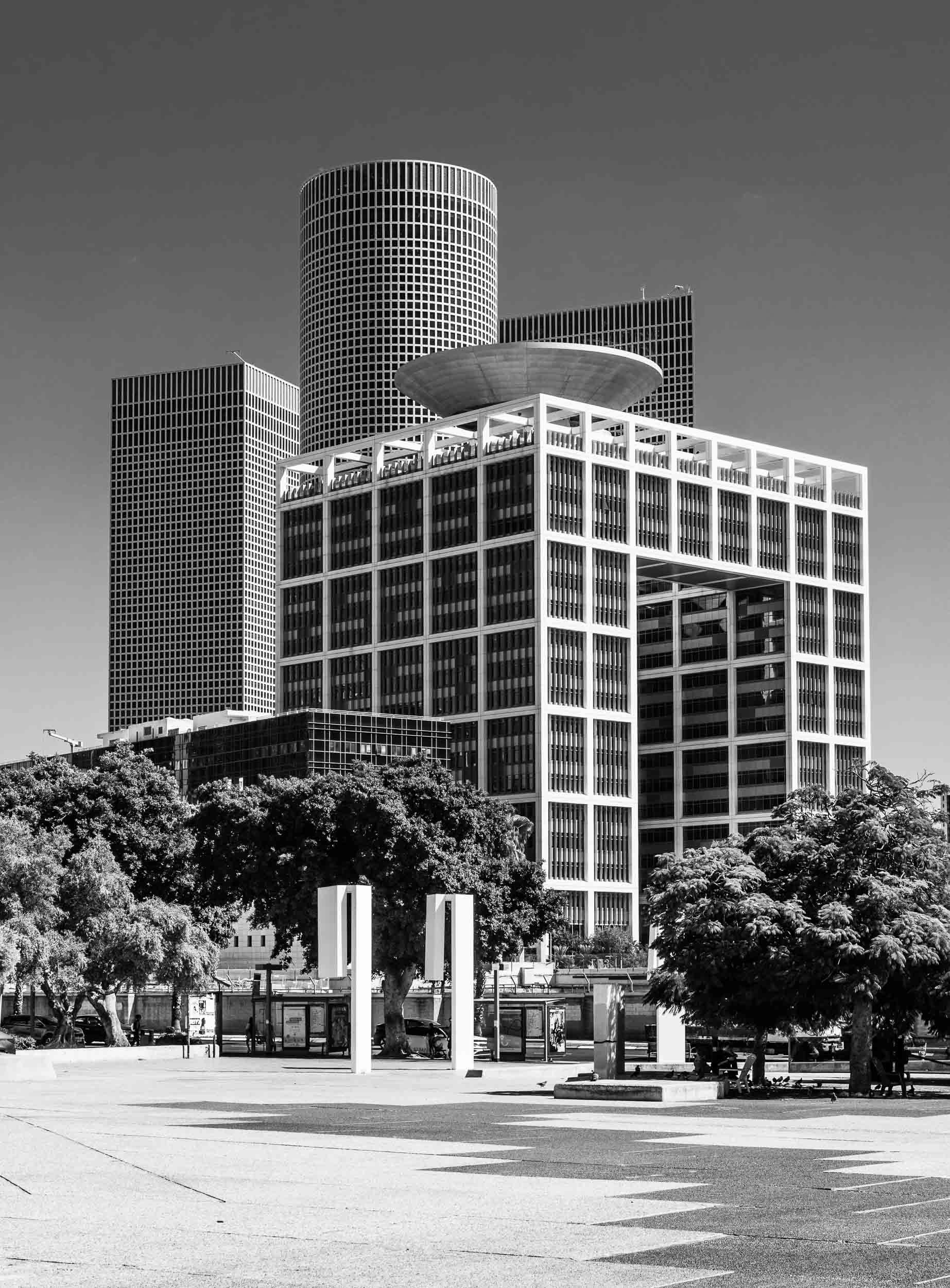
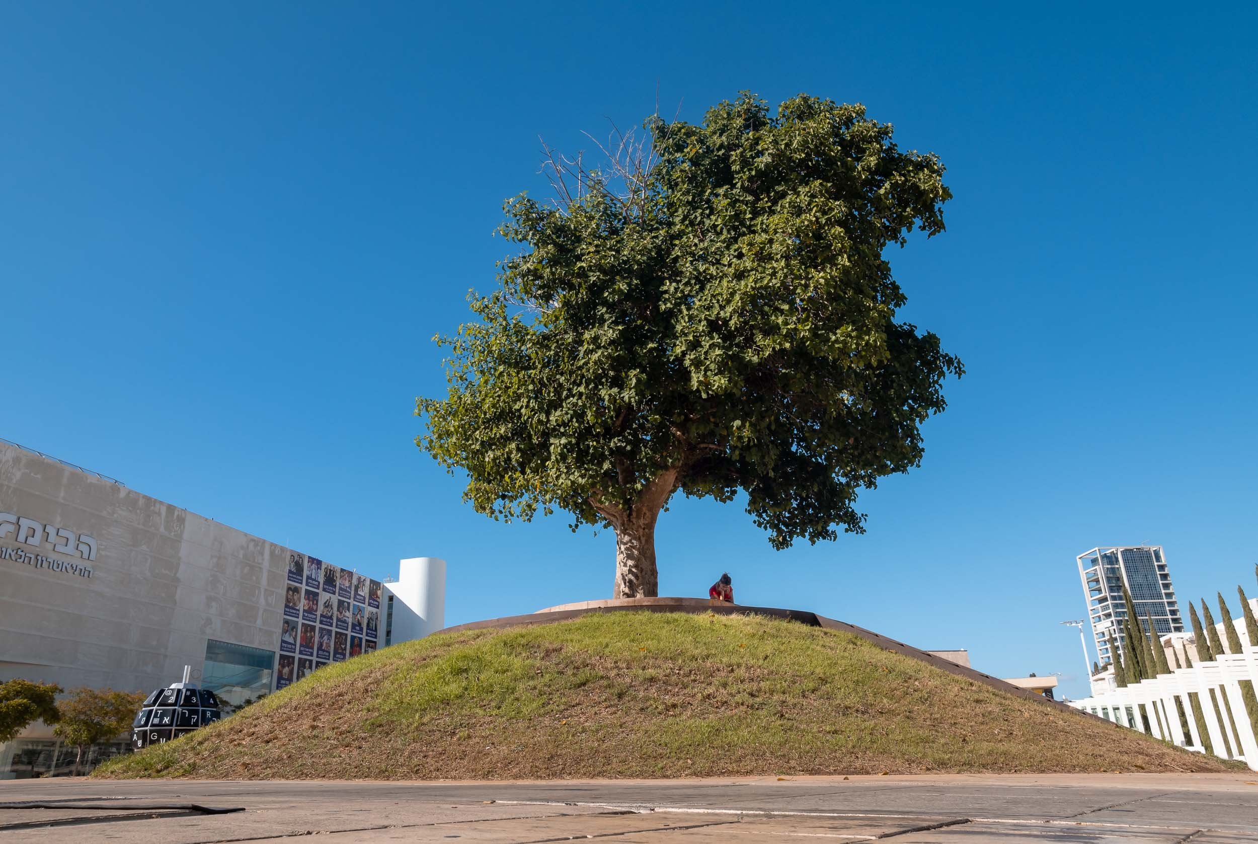
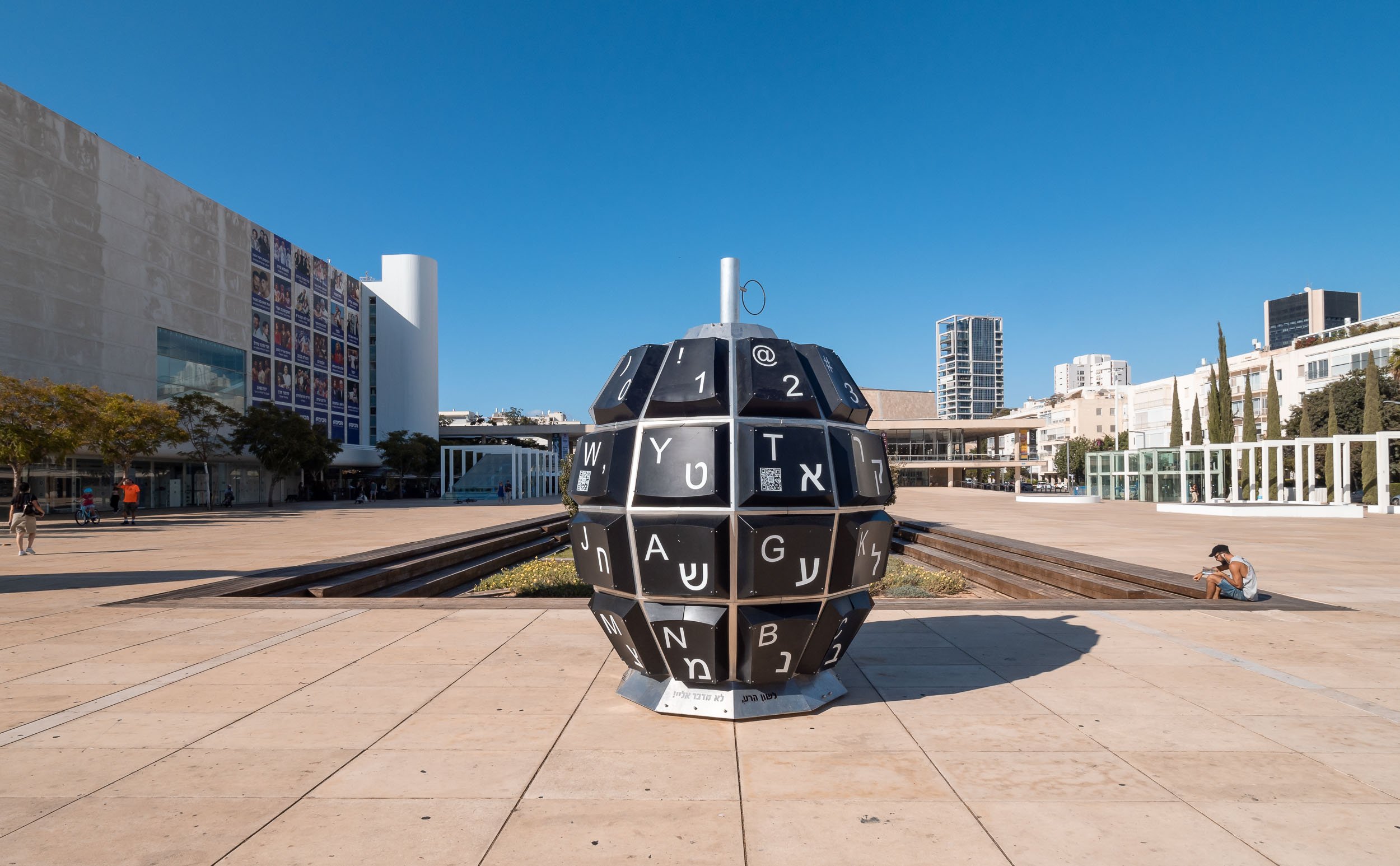
The Museum of Modern Art
While the city’s diverse architecture features many interesting corners, this building was definitely among my favorites.
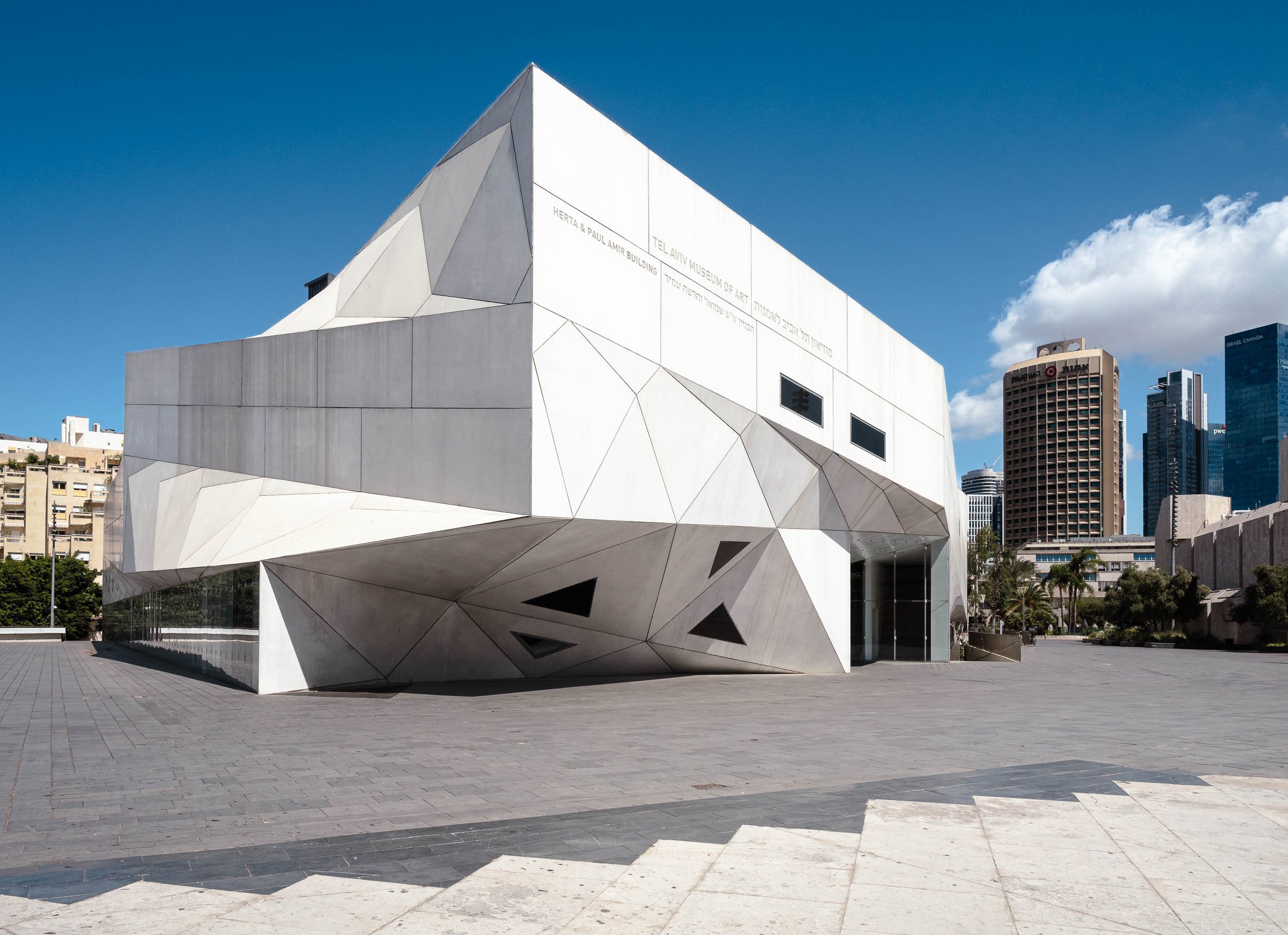


The inside is no less intriguing.


The Museum features works by Klimt, Van Gogh, Monet, and also the intriguing Miniature Rooms by Helena Rubinstein.


Jaffa - The Real Roots
Tel Aviv in its current form is just over 100 years old, but the real roots of the city lie in Jaffa to the south.
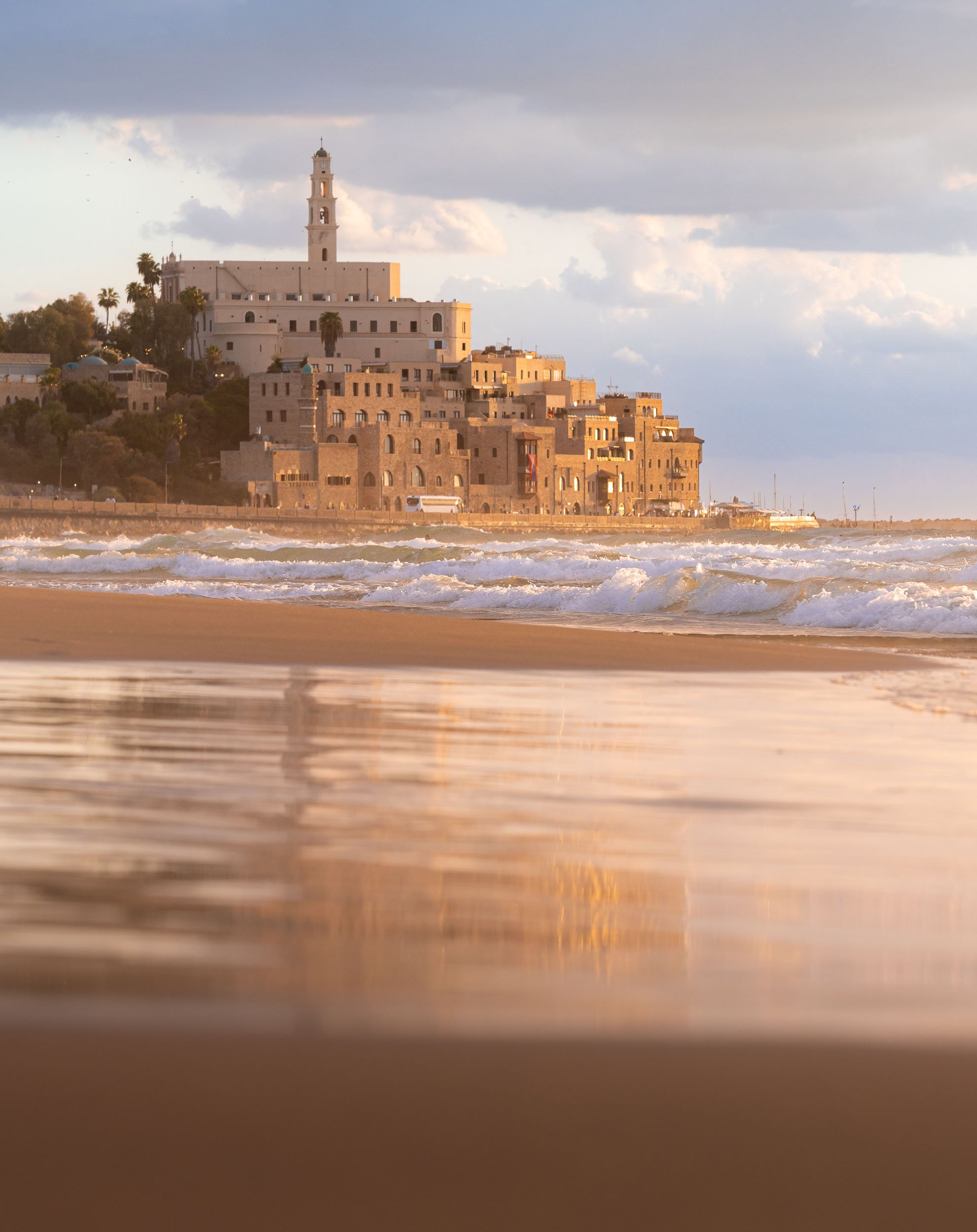
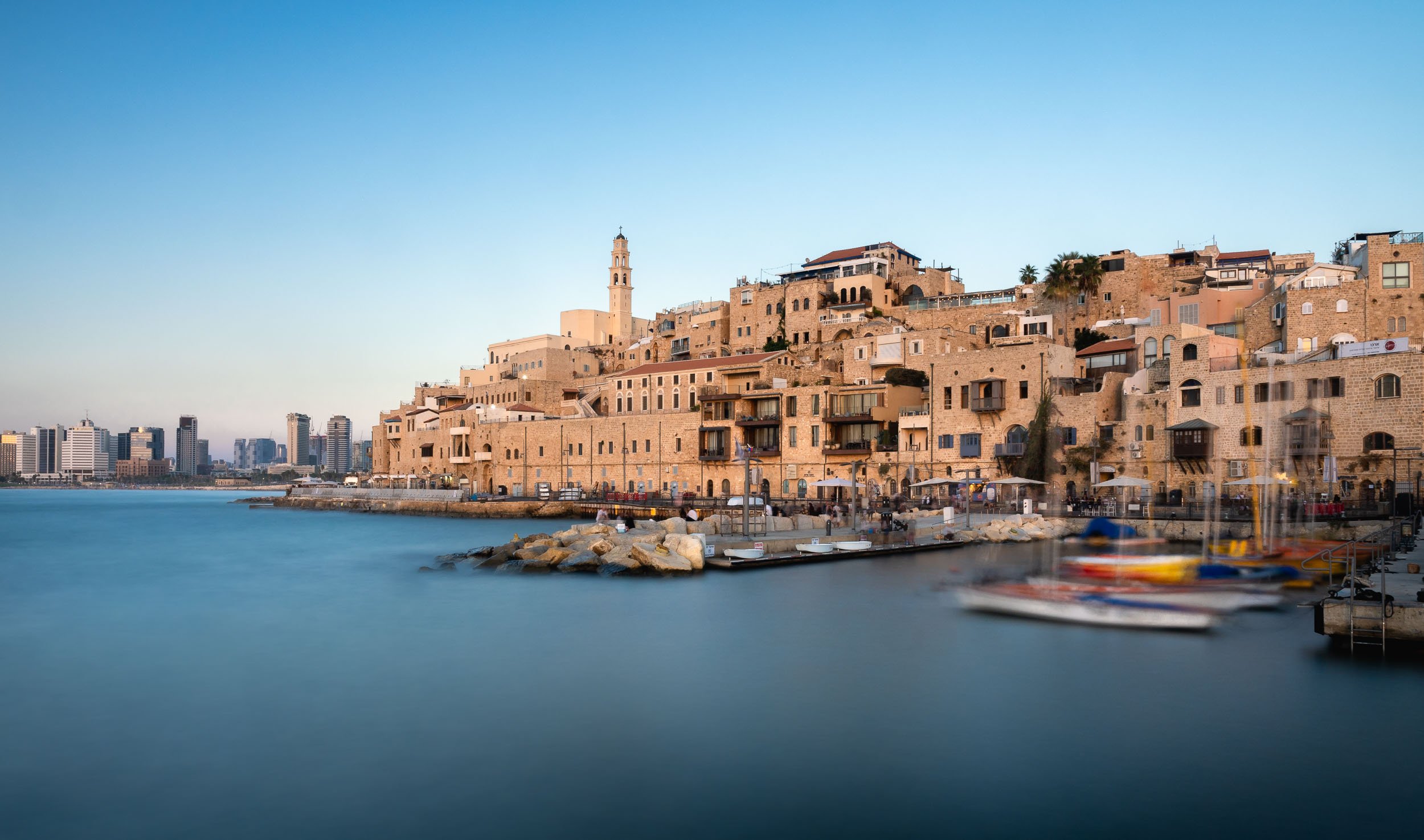
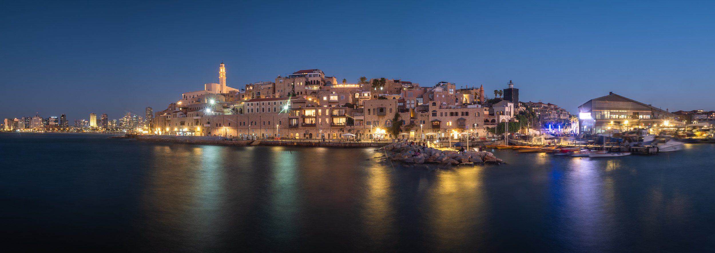
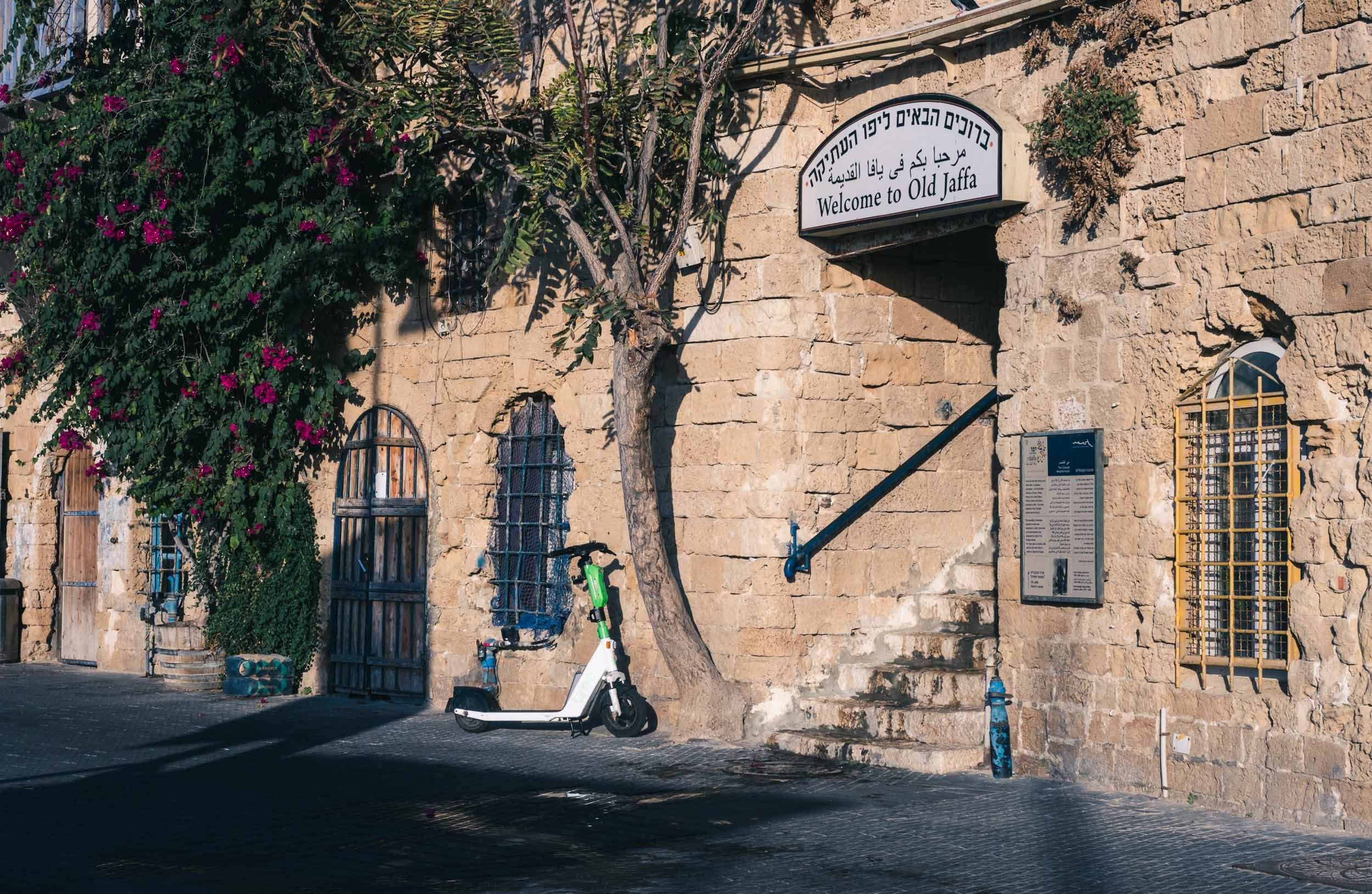
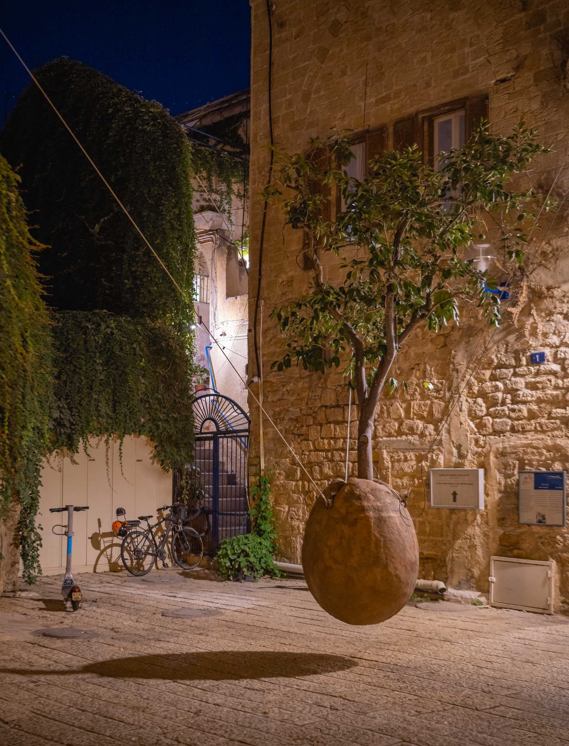
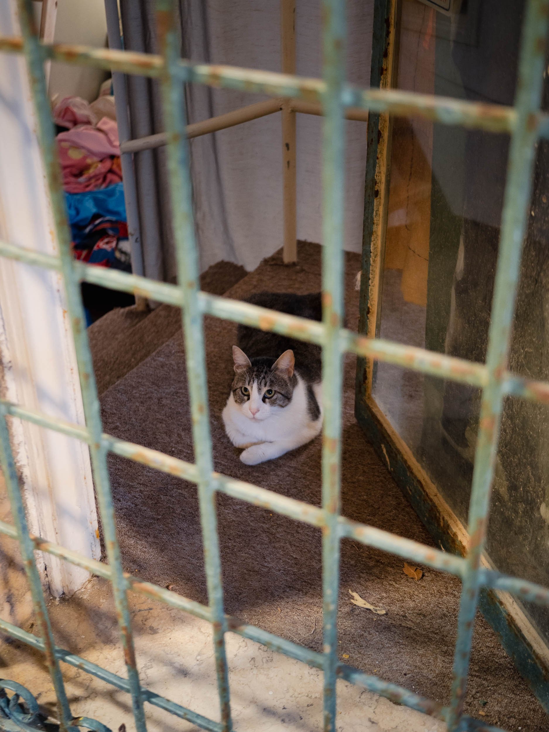
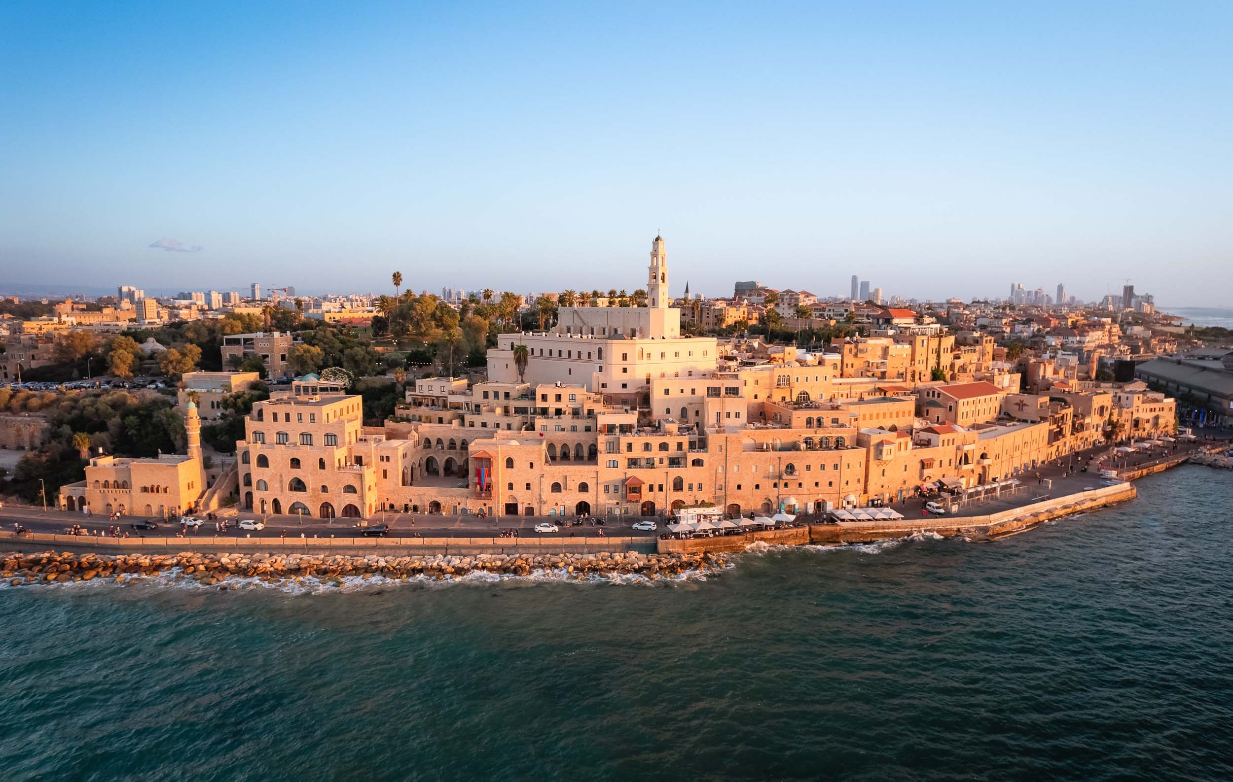
Beit Guvrin-Maresha National Park - Jewish, Roman, Byzantin, and in Between.
About an hour south-east of Tel Aviv lies the next stop on our route. This UNESCO World Heritage Site was full of surprising archaeological excavations, starting with a group of huge bell caves, some of them over 18m tall, airy, and used over 1000 years ago to extract chalkstone from the ground for construction.

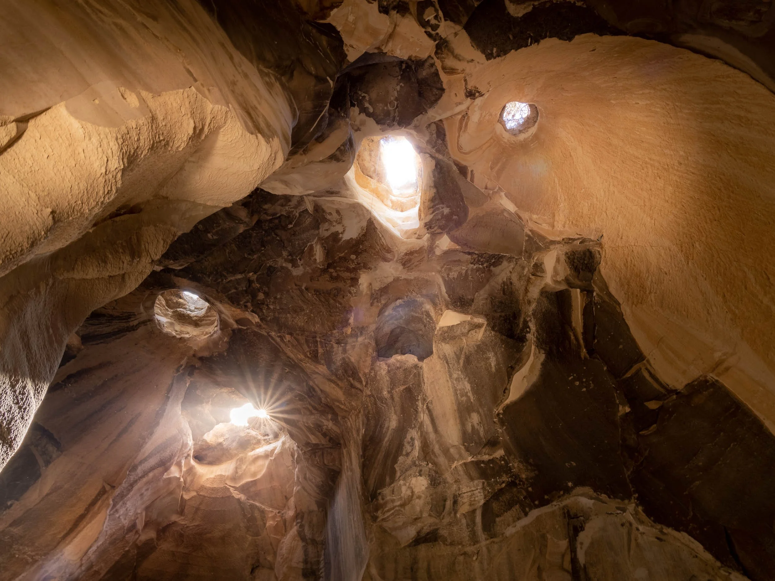
Additional caves acted as living quarters and baths, many of them interconnected via stairs and tunnels.


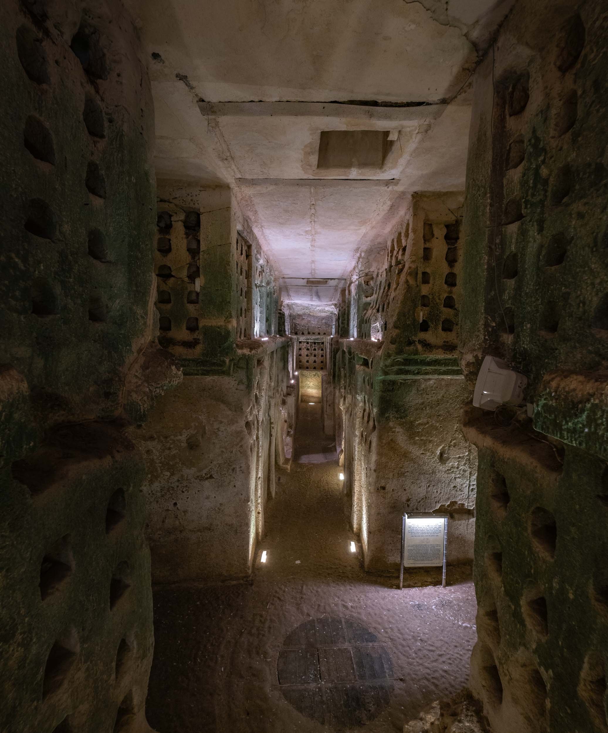
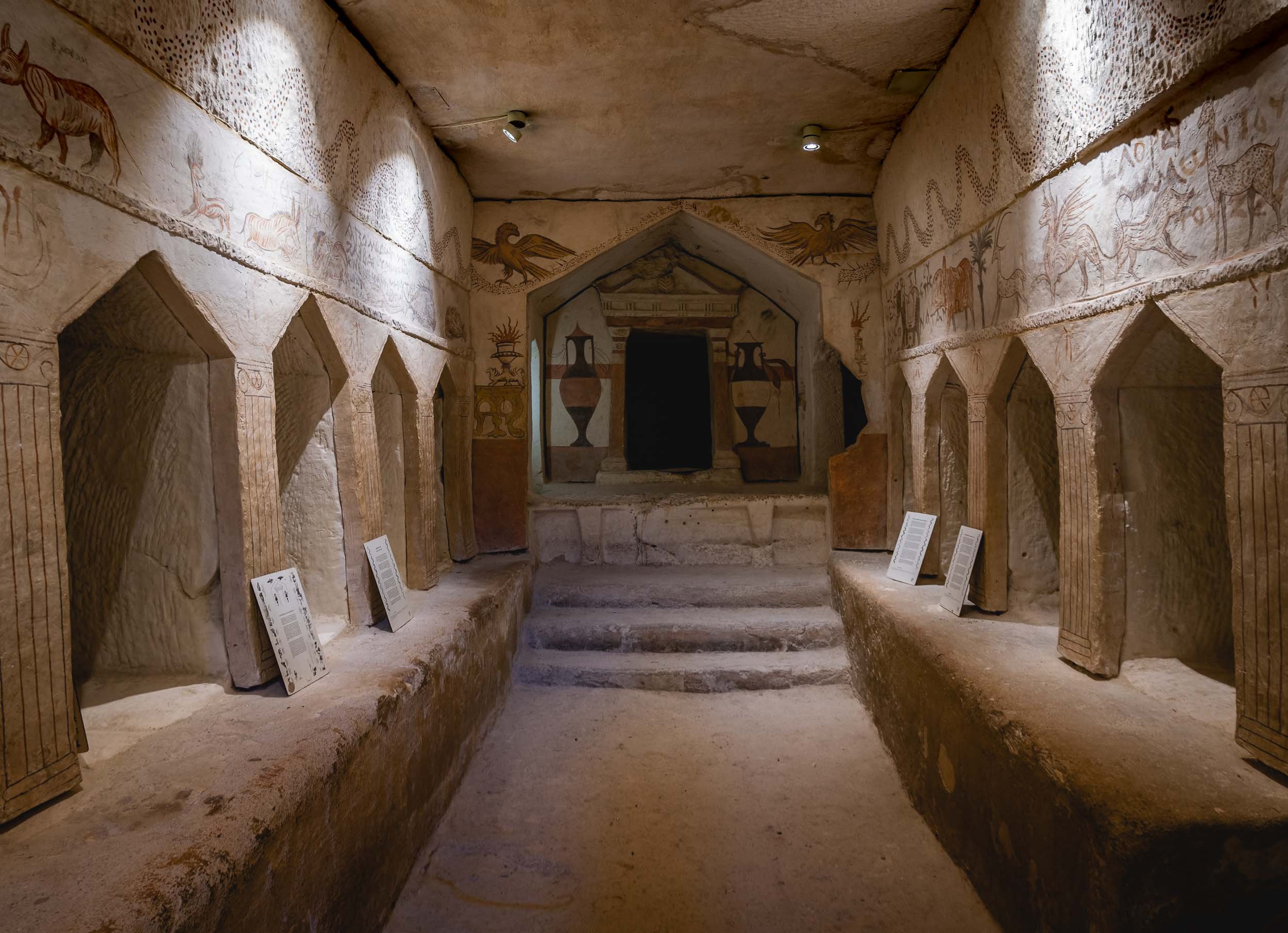


The site is also home to a Roman amphitheater built in the second century and uncovered in the 1990s.
The Stalactite Cave
A few kilometres north of the park is the Stalactite Nature Reserved, situated around several quarries which were the reason for the discovery of this cave.
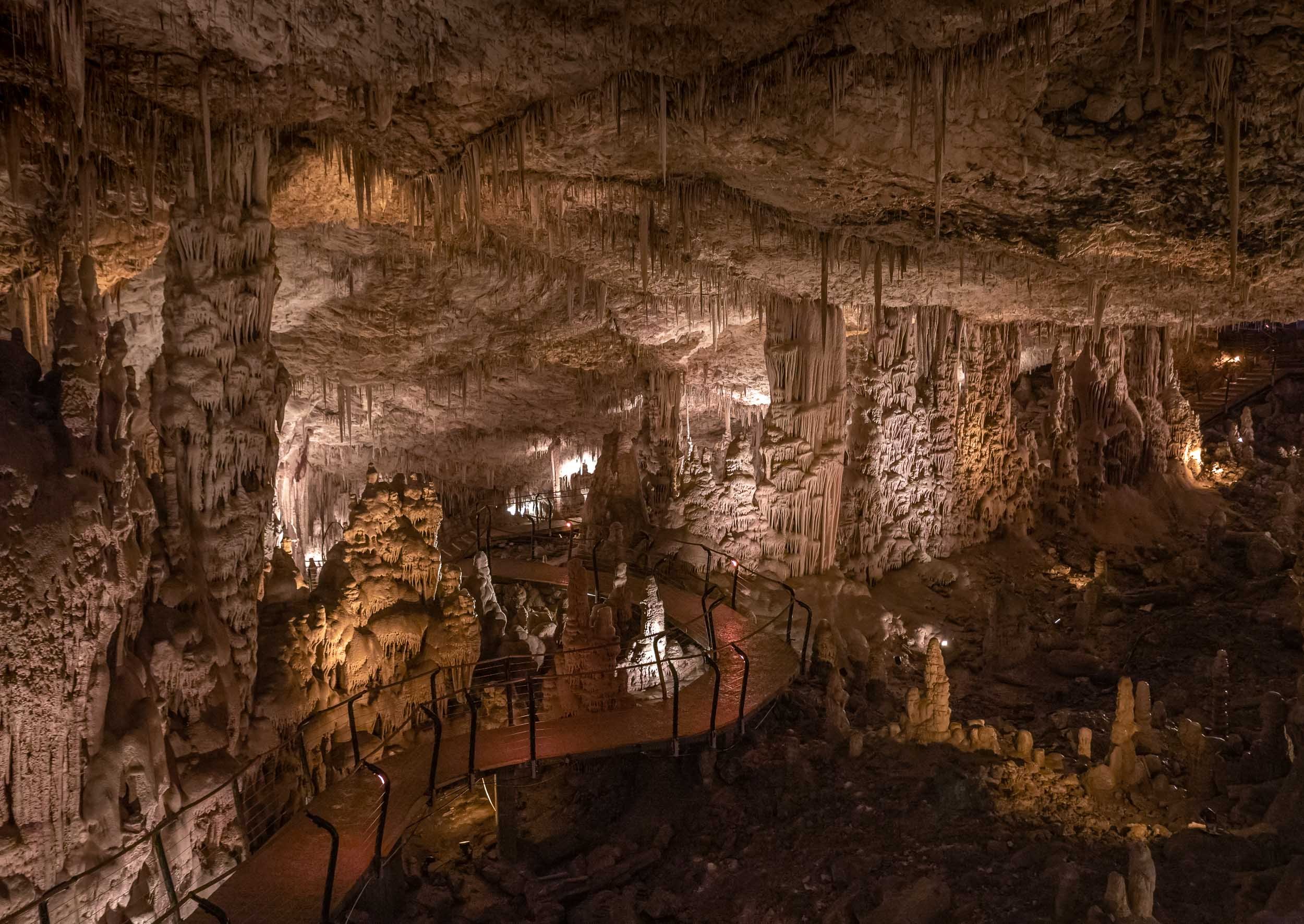
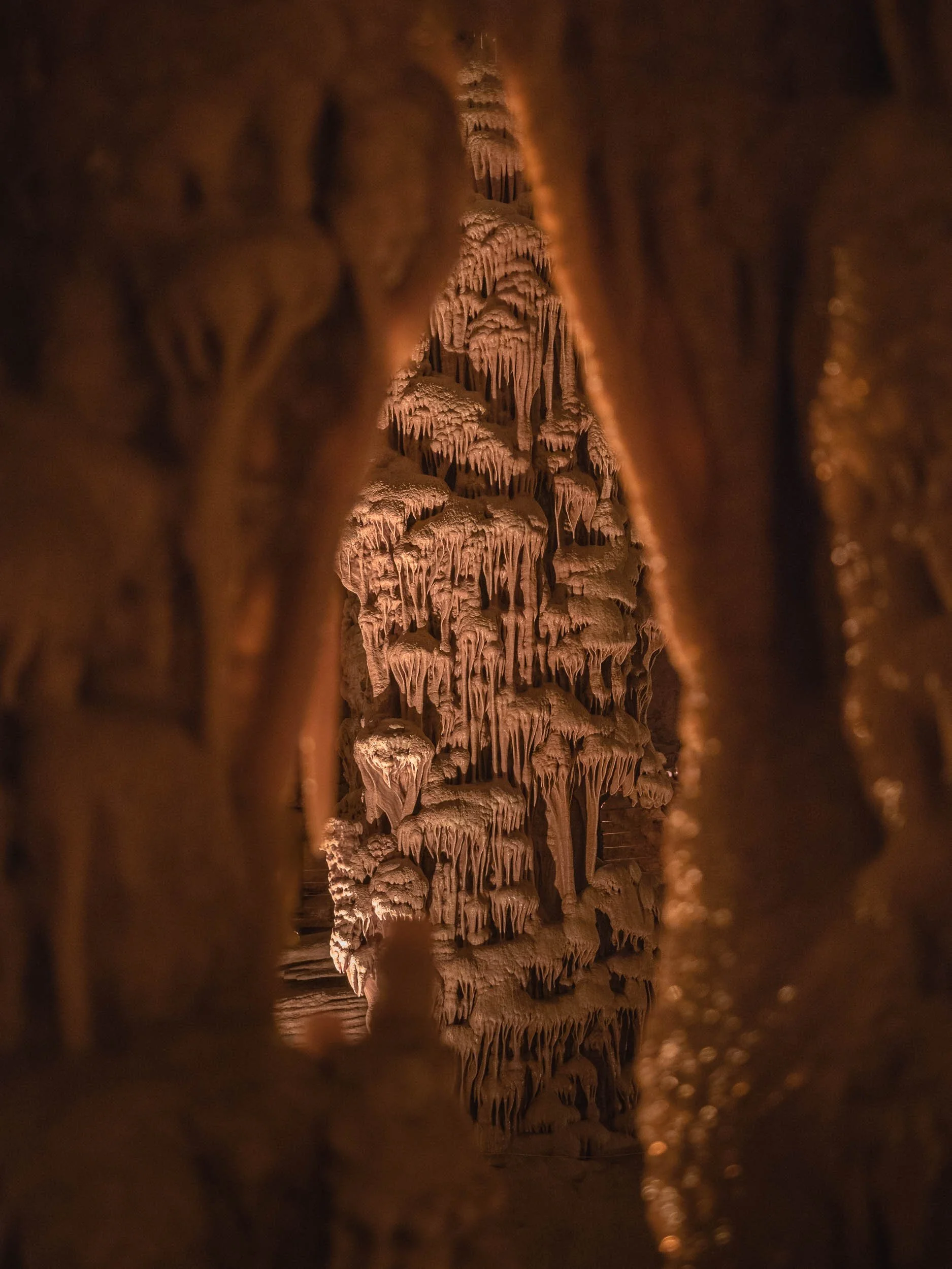

Betlehem - Into the West Bank
Before heading to Jerusalem, the trip took a small detour into the only area we visited that is not controlled by Israel as of today - the city of Betlehem. The experience of crossing the border (with no formal passport control) into a Palestinian territory encompasses a walk through a prison-like corridor and passing several one-way metal barriers, before exiting into a completely different environment, with a huge concrete wall to your left and right.
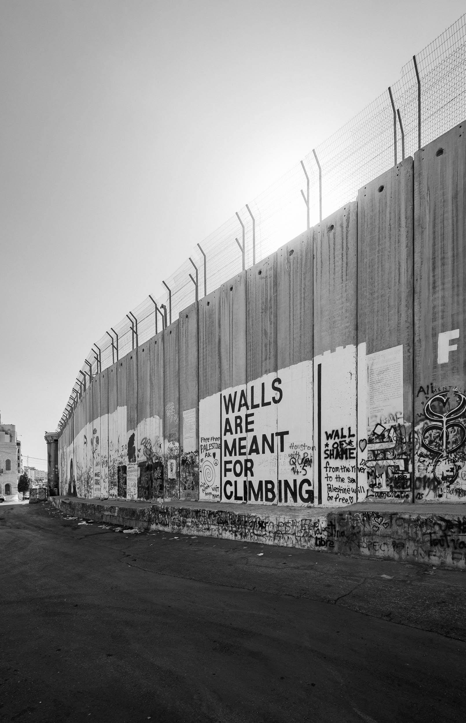
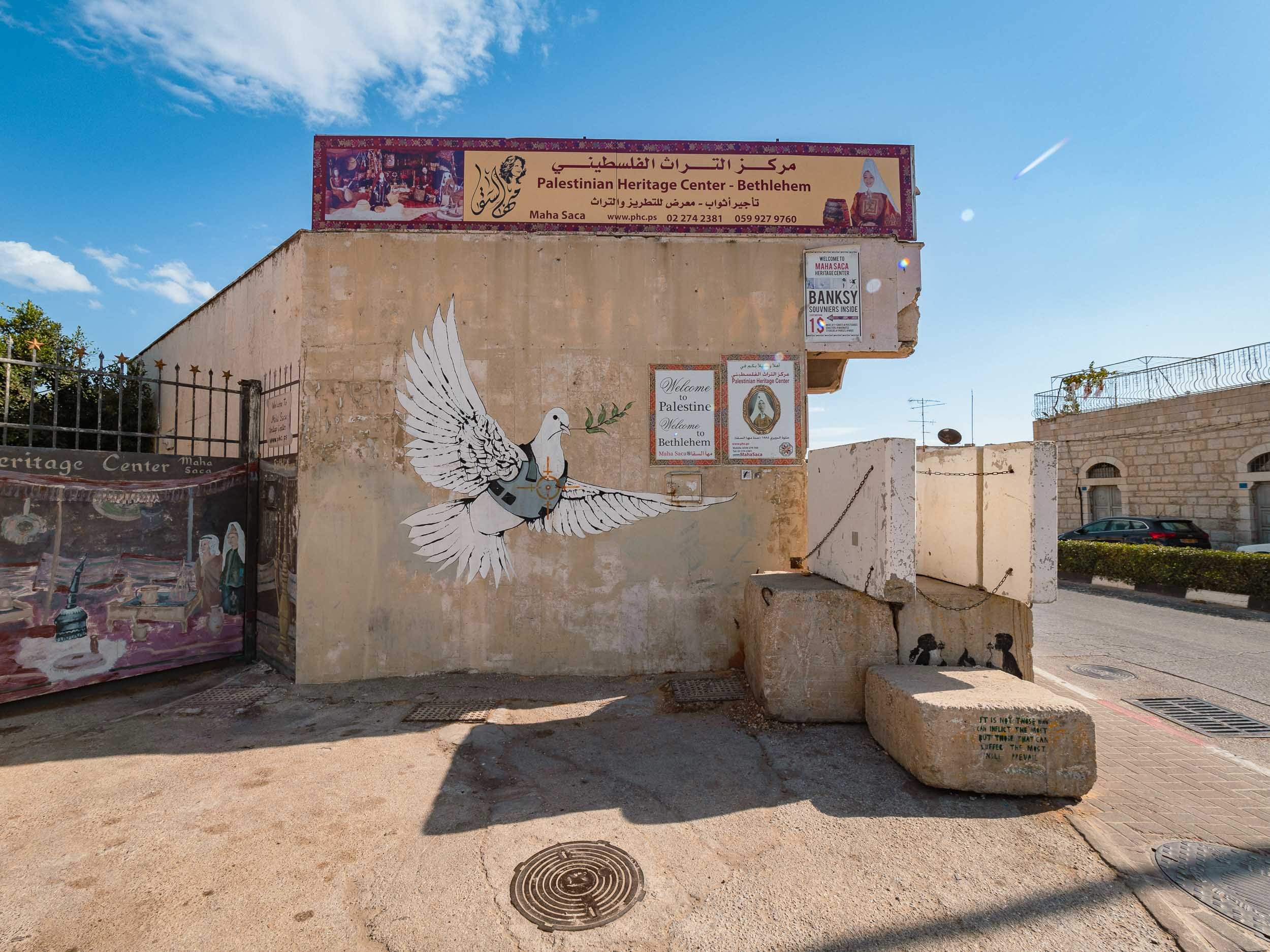
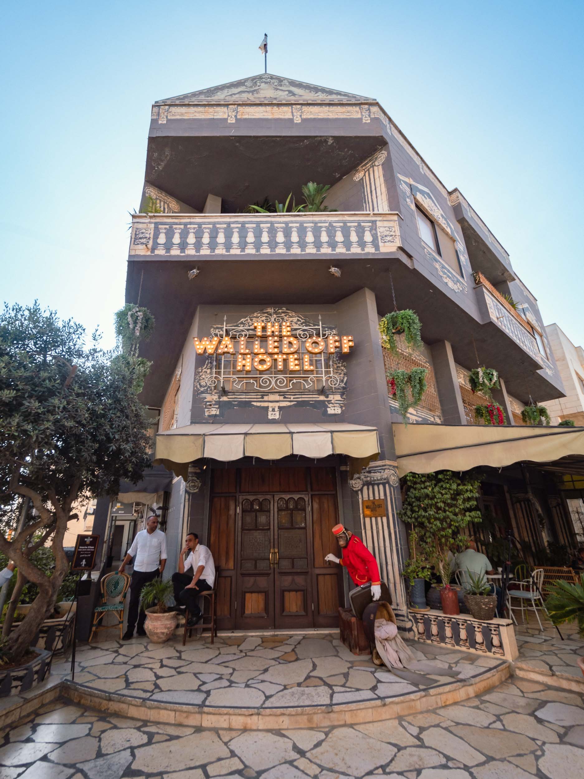
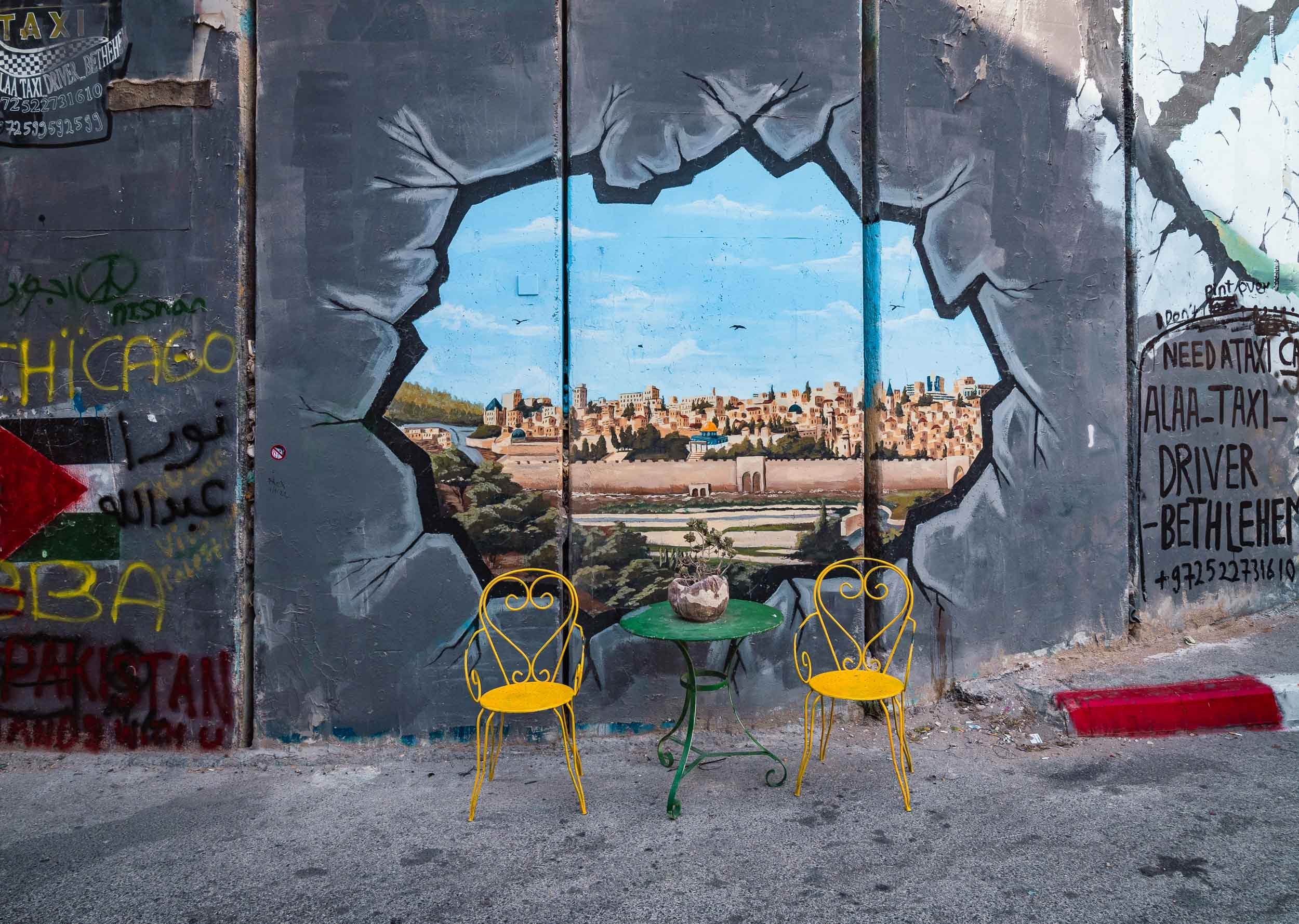
The Church of the Nativity
Of course, for most people the primary reason to visit Betlehem isn’t the wall or Banky’s art, but the church built at the spot where Jesus is said to have been born, albeit over 300 years earlier than the church’s construction. The nativity cave itself is the oldest site continuously used as a place of worship in Christianity and was declared a UNESCO World Heritage Site in 2012, the first listed under the State of Palestine.
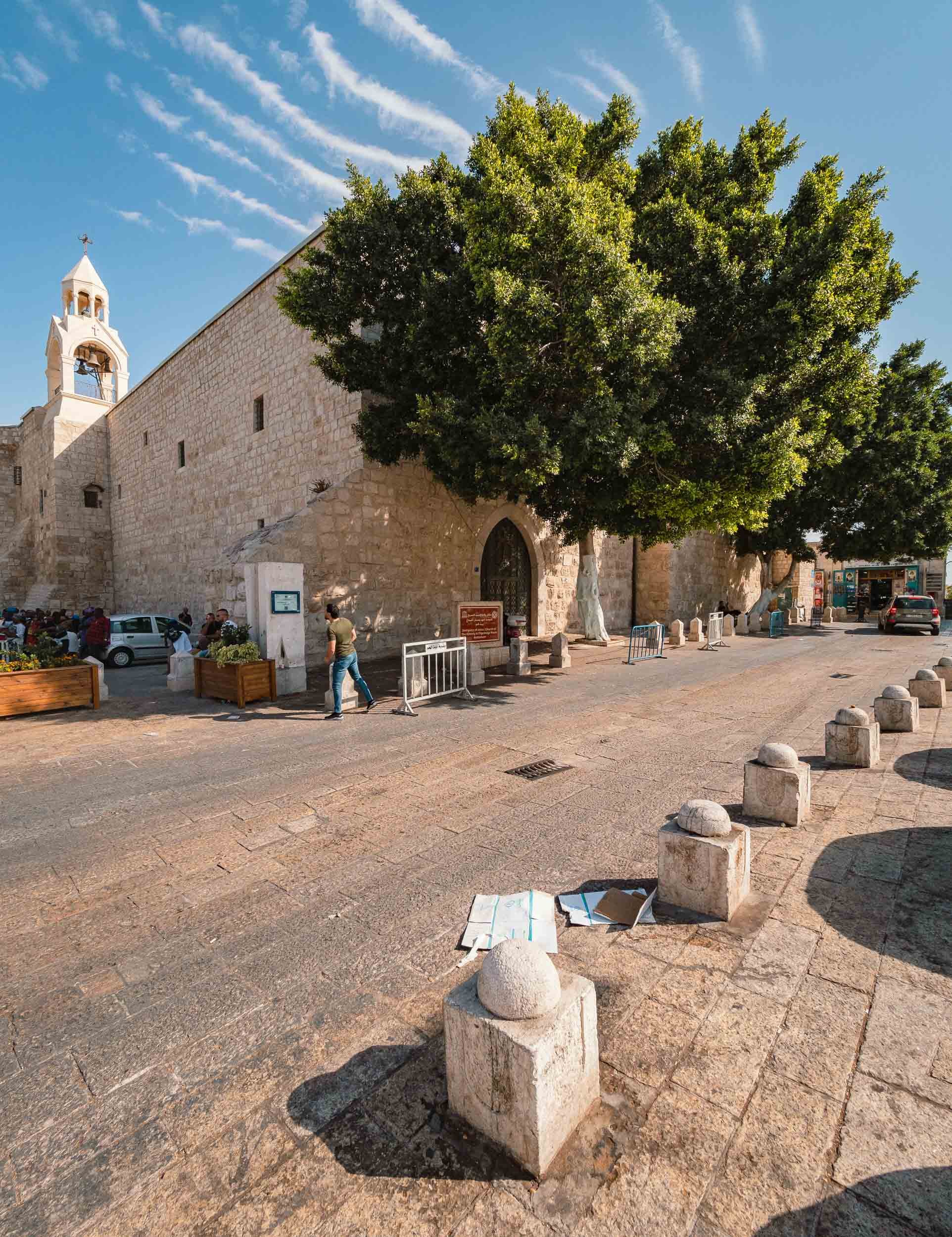
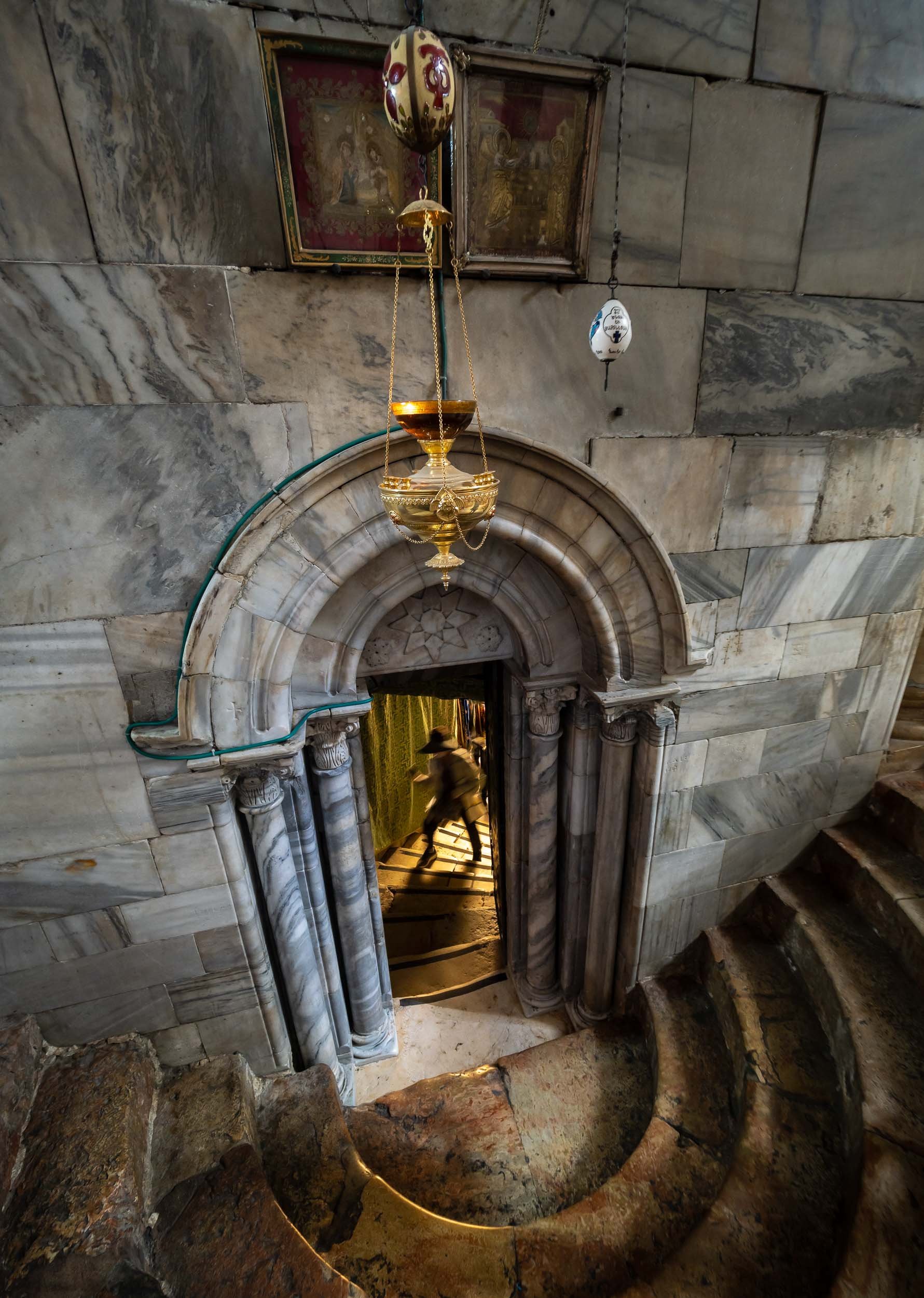
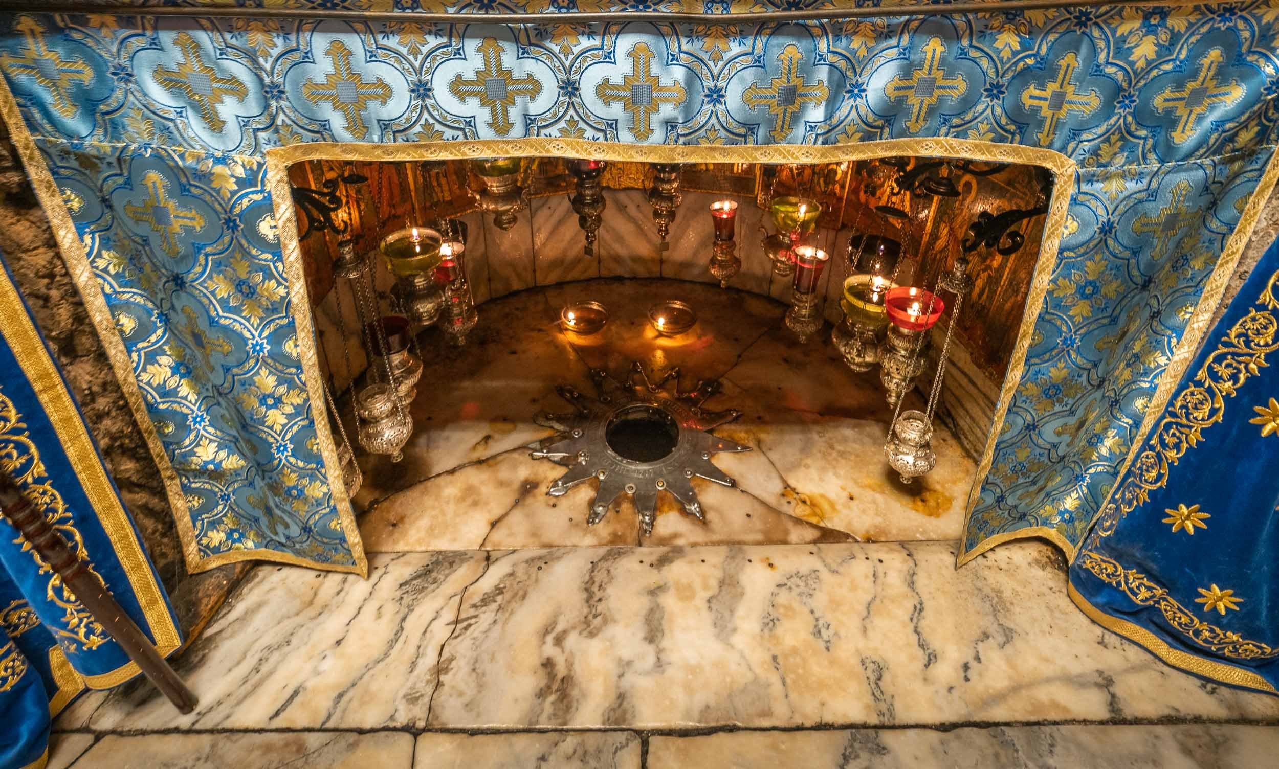
The Old City of Jerusalem - Holy Overload
Jerusalem’s Old City is without a doubt the most interesting part of the region - its historic significance is unparalleled and the number of sites with a complex past (and present) is difficult to grasp. The city is split into Muslim, Jewish, Christian and Armenian quarters (and a Moroccan one in front of the Western Wall, which was destroyed by Israel after the Six Day war in 1967), and each has its own flair, in a complex social, cultural, and political web.
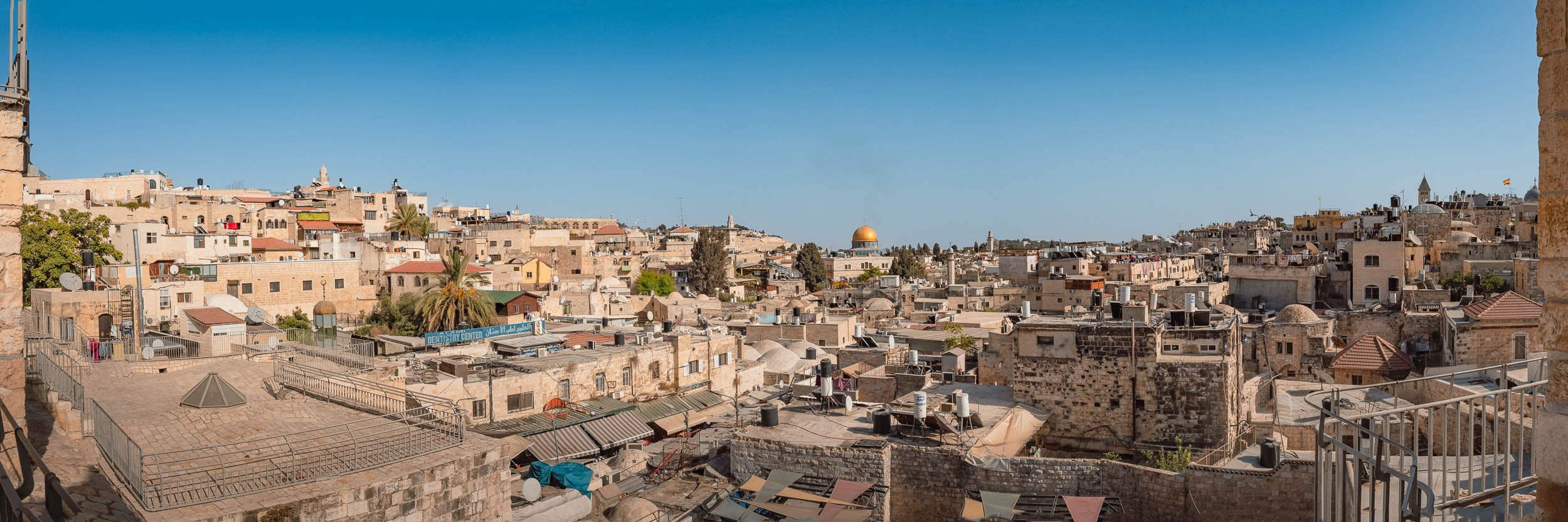


Walking through the allyes makes you feel like you are underground, and there is another layer above you - this is partially true, the roofs of many of the houses are accessible and walkable.
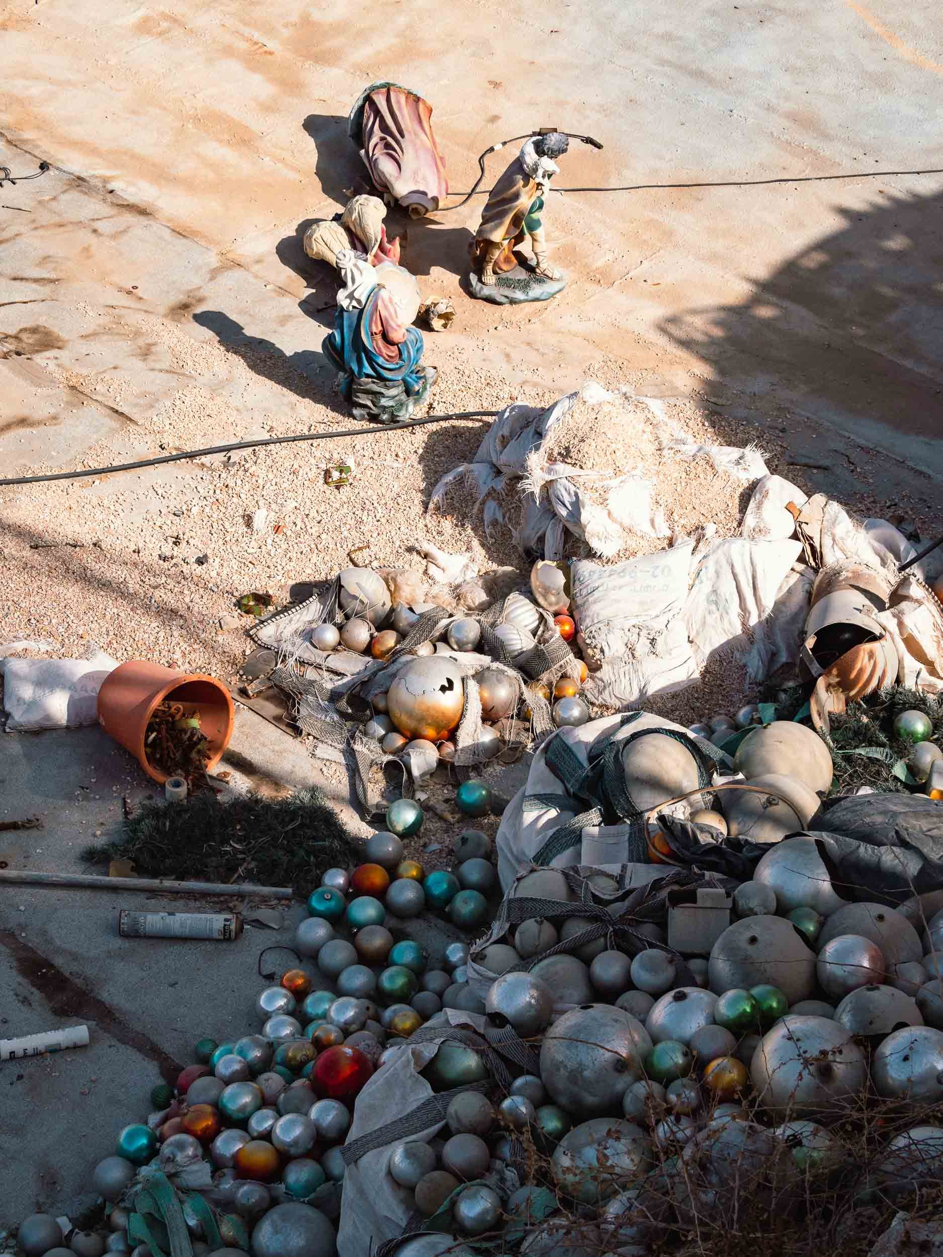
Church of the Holy Sepulchre
The current responsibilities for the religious sights in Jerusalem and Betlehem are managed through the so-called Status Quo from 1878, governing the roles of the various religions in managing the significant historic sites in the area. It’s an incredible read, and the complexity of interactions between the political parties and religions (even within their branches) is difficult to grasp. Find out more here.
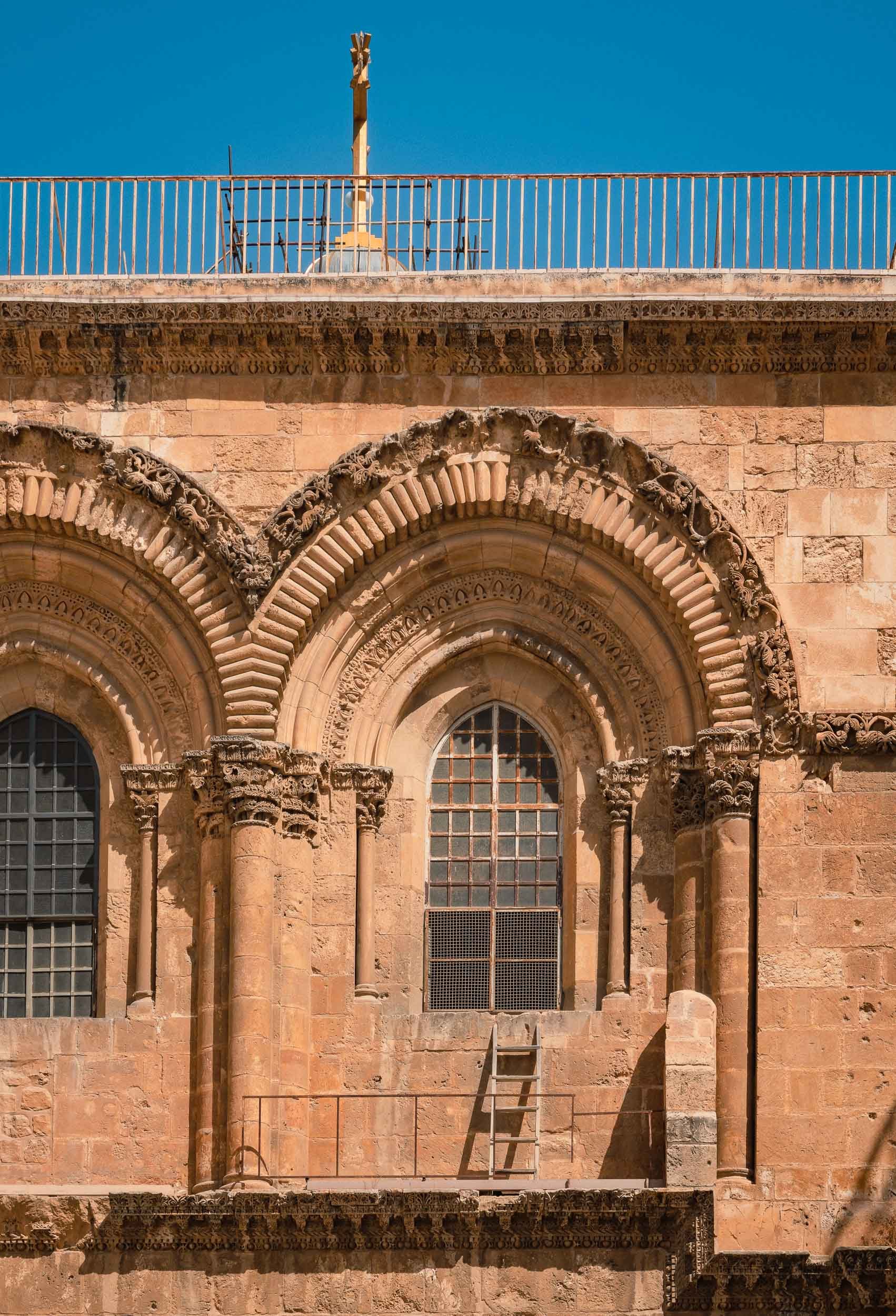
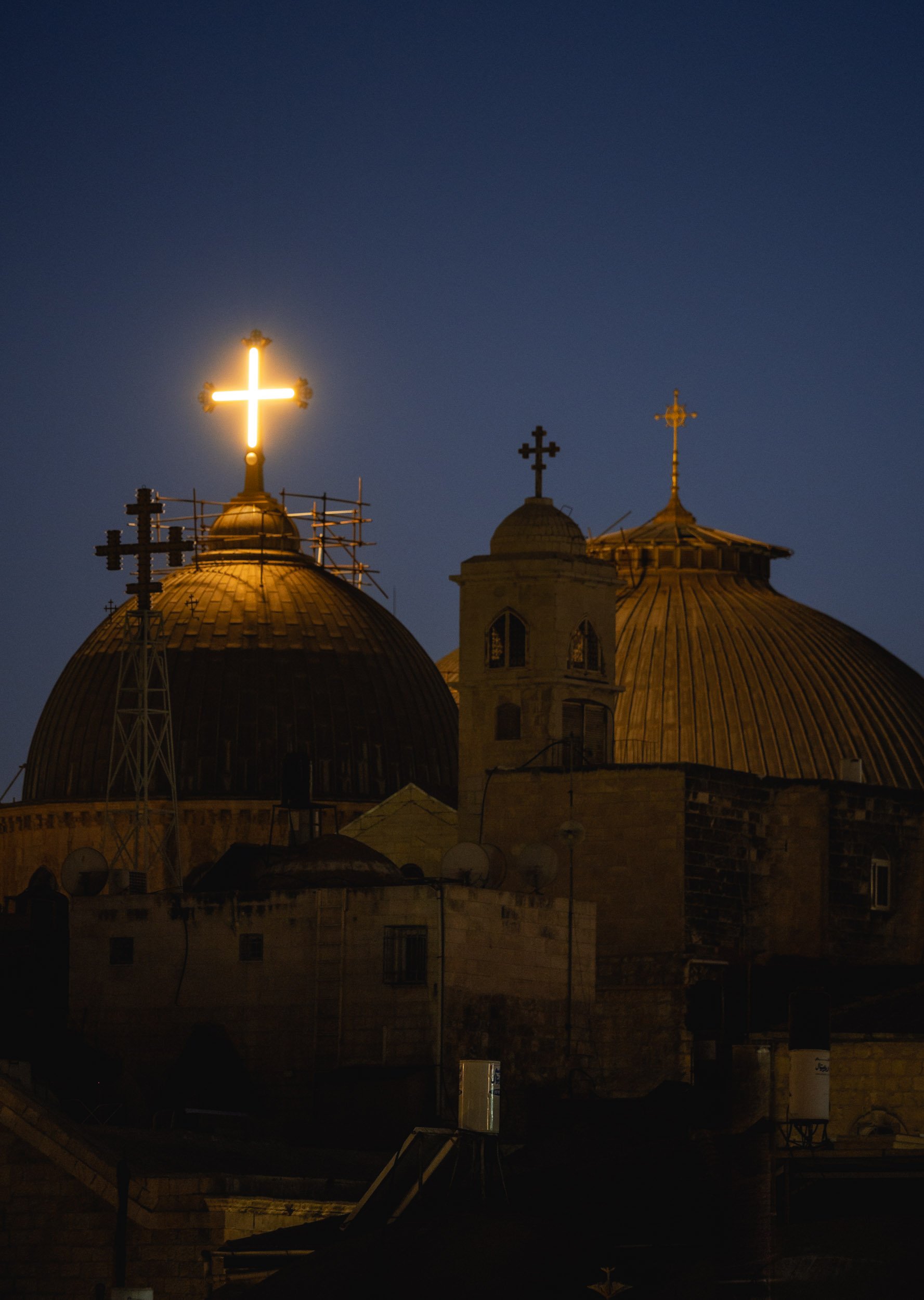

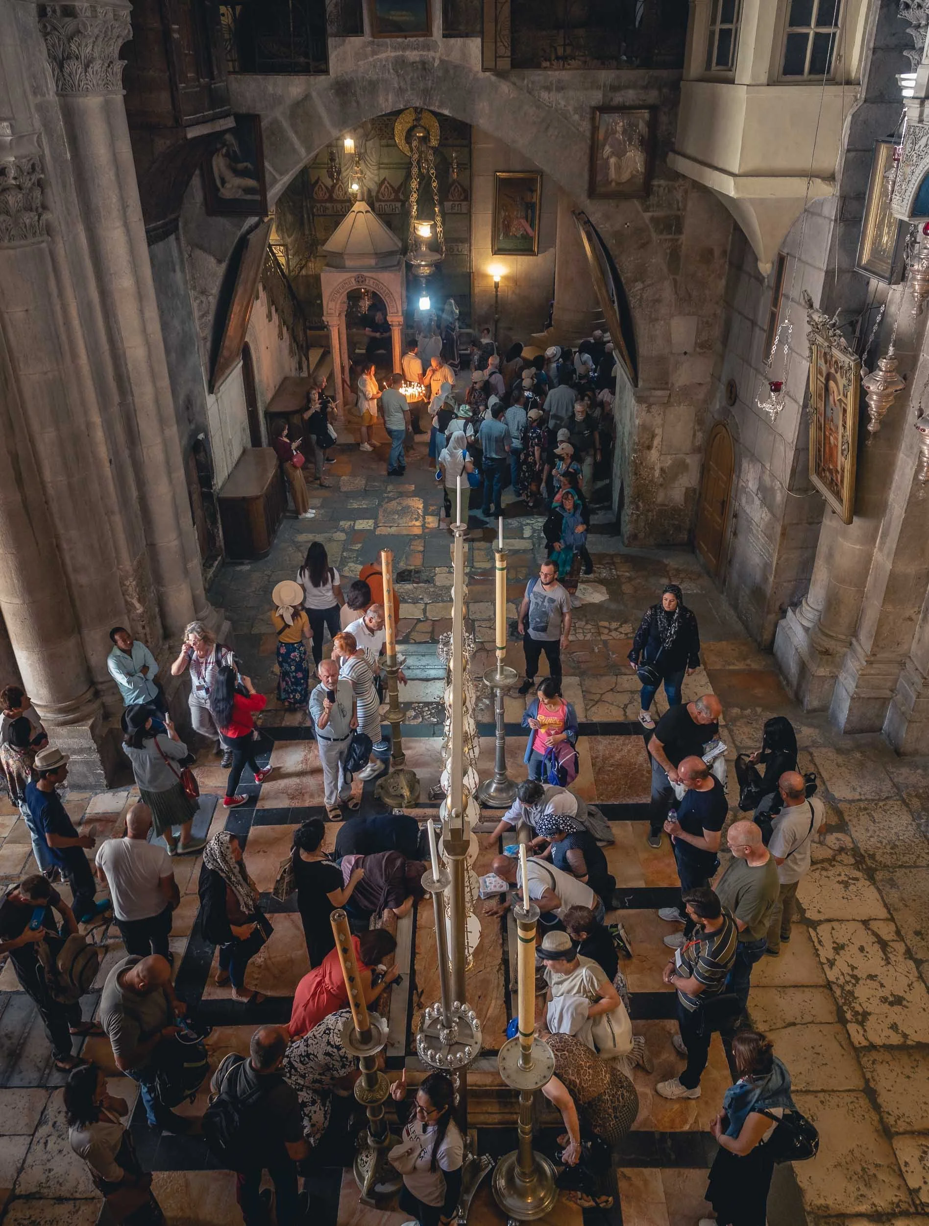
Two of the most important pilgrimage sites in the church are the Calvary, said to have been the spot of Jesus’ crucifixion (to the left above), and the Stone of Anointing, where Jesus’ body was prepared for burial (although the current stone was only placed here in 1810).
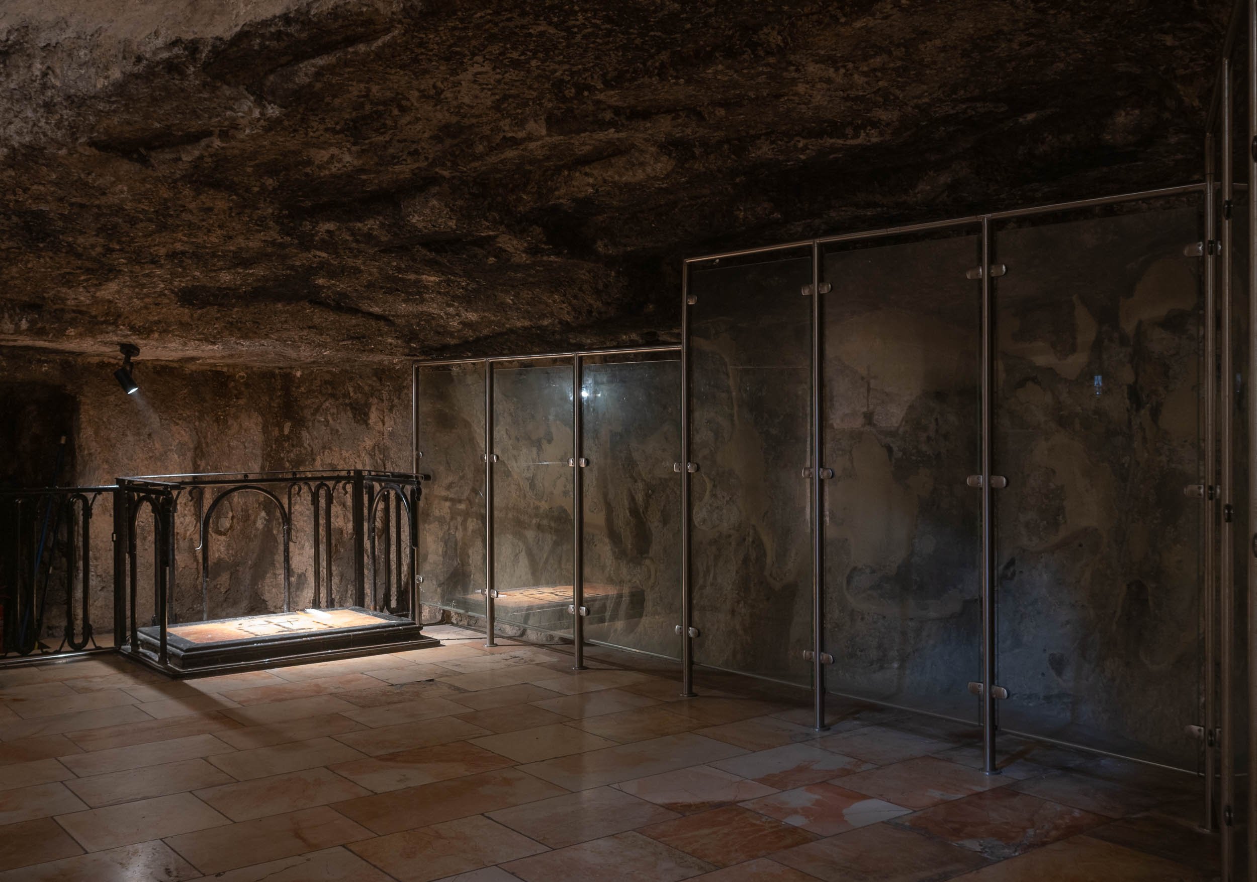
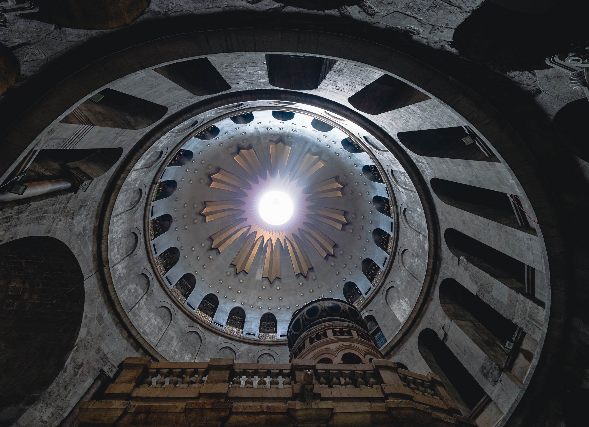
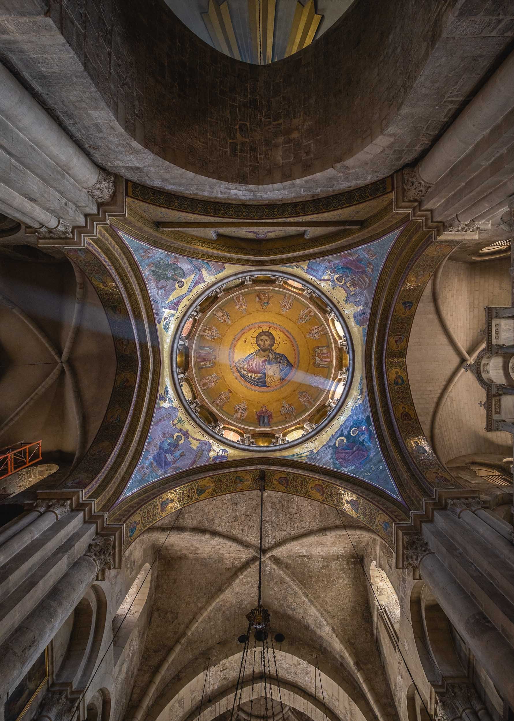
Dominus Flevit & Its View
This church on the western slopes of Mount of Olives offers a beautiful view of the Old City, and a particularly special one from the interior of the church.


Its unique aspect is the western facing altar, which is unusual for Christian churches. It was built this way to offer the view Jesus was said to have had when he wept while predicting the impending destruction of Jerusalem.
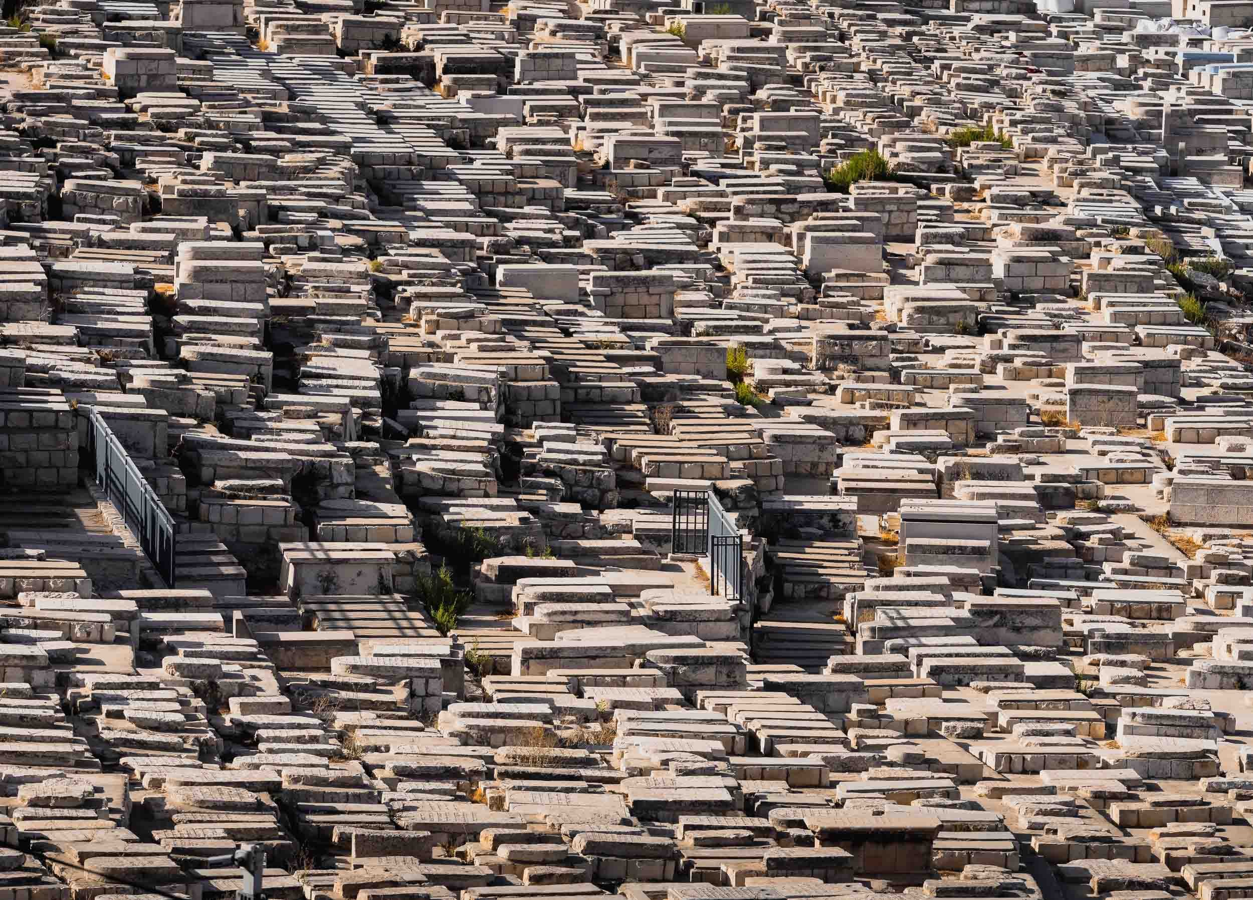
The Western Wall - A Small Piece of the Puzzle
The holiest Jewish site in the Old City is the Western Wall, often known as the Wailing wall. It sits on the west of the Temple Mount compound, and contains the exposed parts of the leftovers of the Second Jewish Temple.
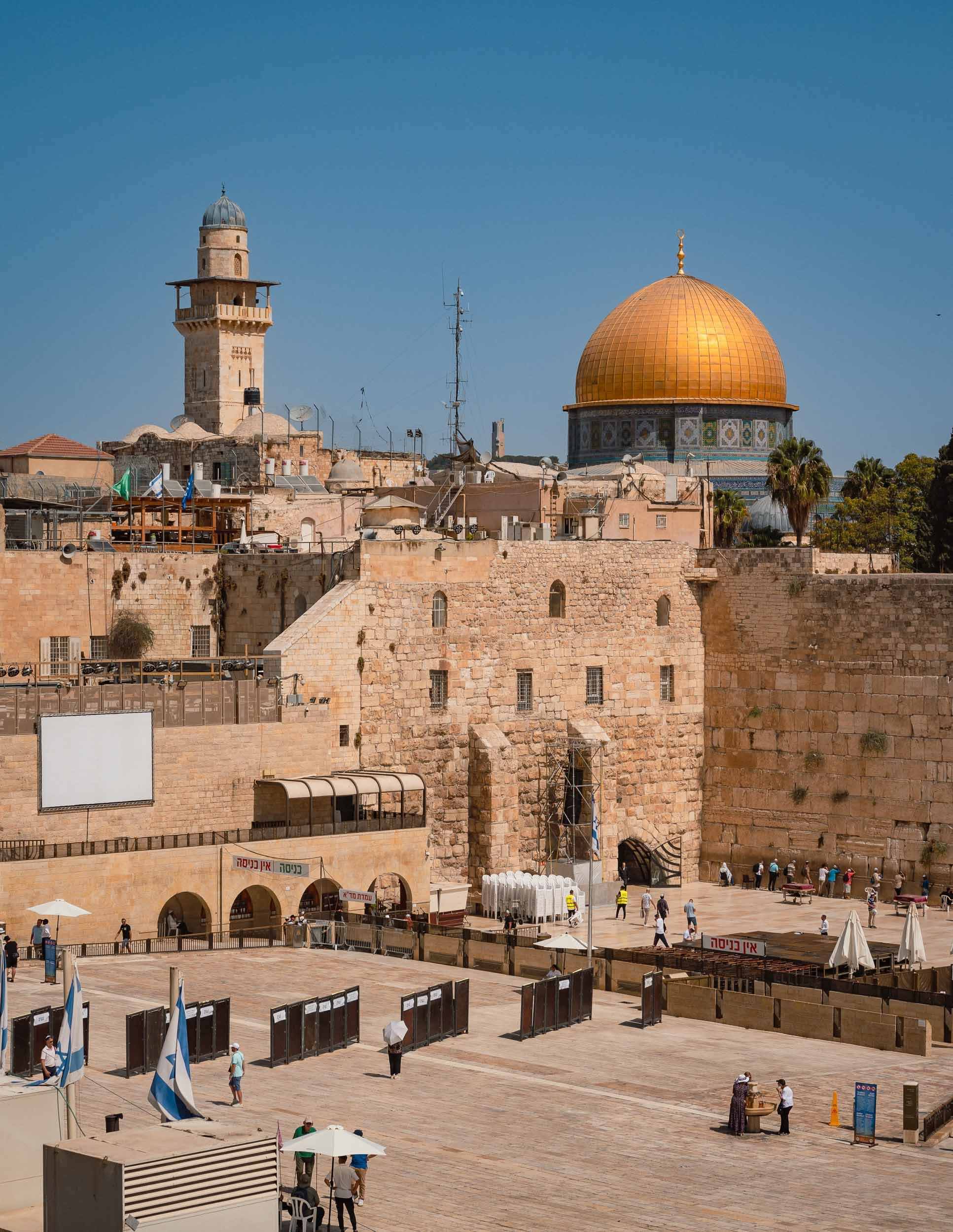
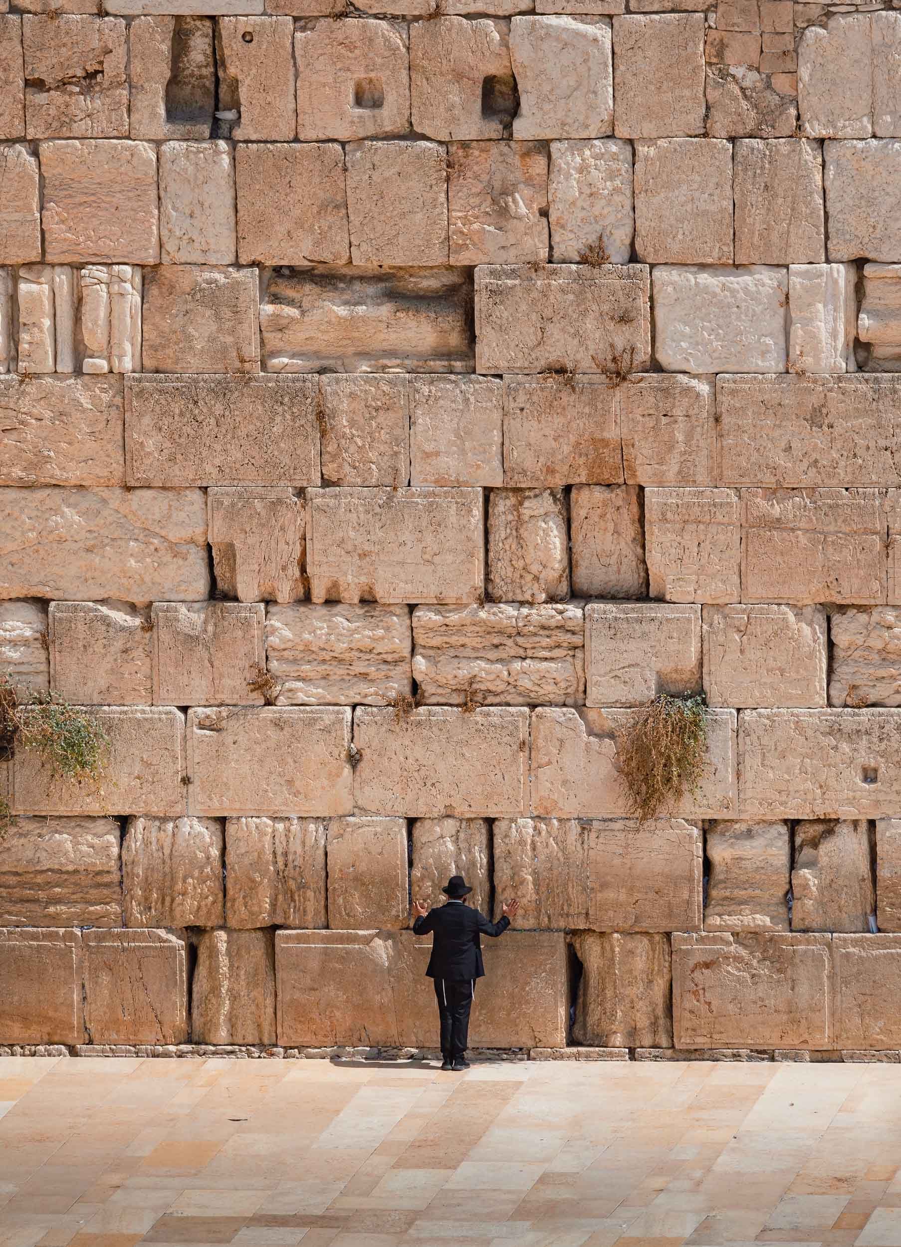
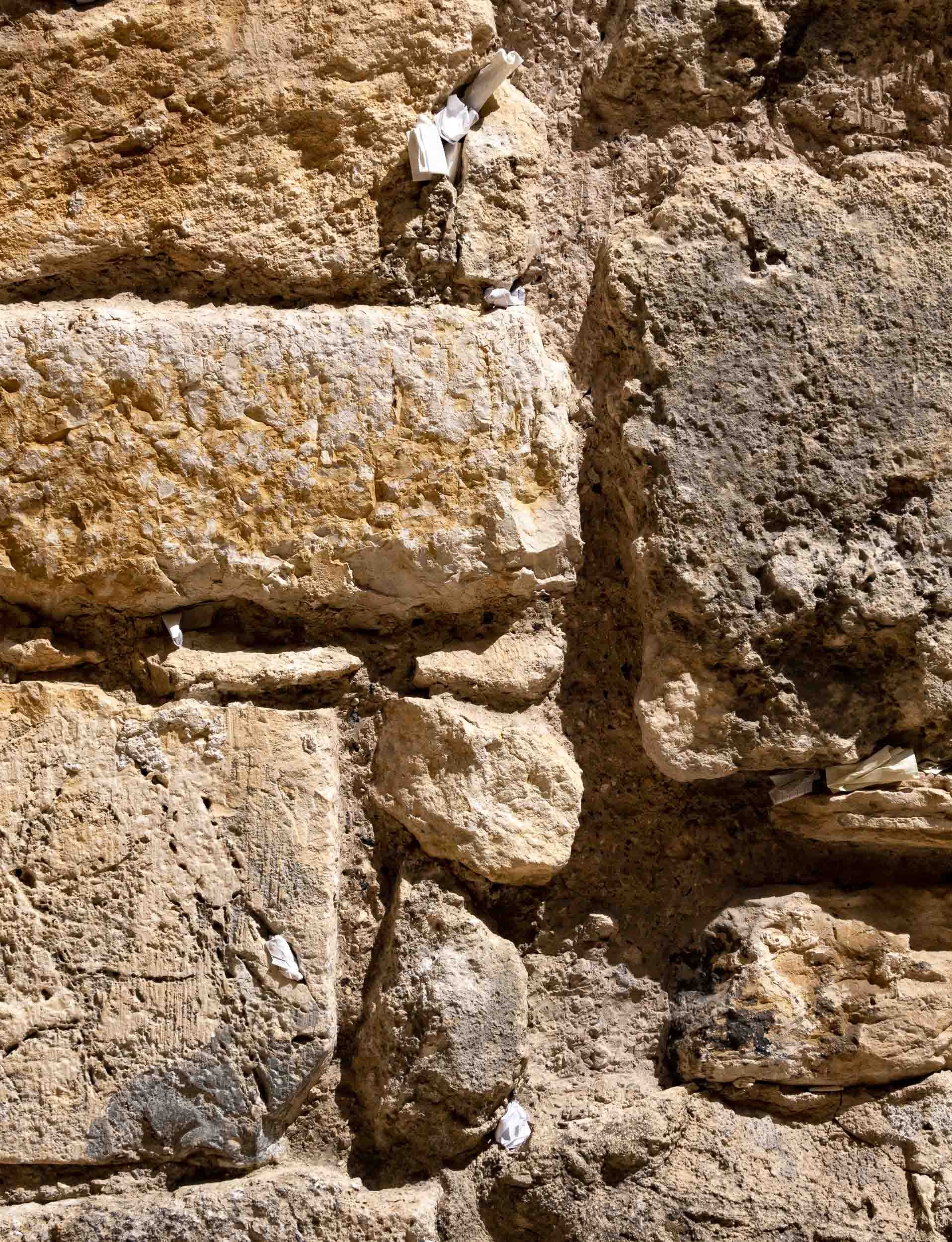
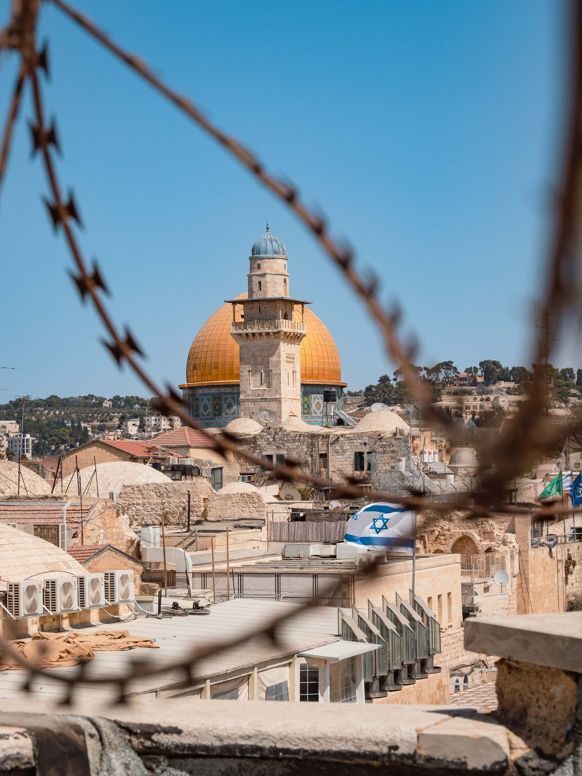
Dome of the Rock - The World's Oldest Surviving Work of Islamic Architecture
In the east of the Old City, on the Temple Mount, lies this another World Heritage Site, built in 688. While primarily an Islamic shrine today, it holds significance for all Abrahamic religions as the location of the Foundation Stone, the place where God created the earth and the first human.


In 1993, the golden dome covering was refurbished with funds provided by the King of Jordan - the country appointed the Waqf (trust) that is in charge of managing the site.
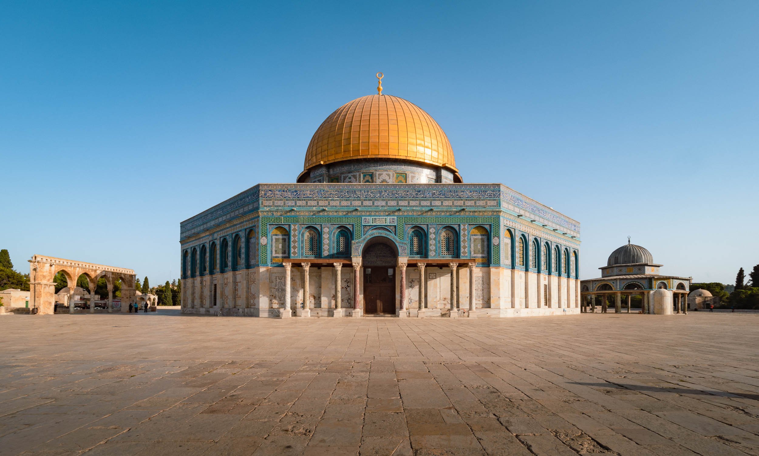


Take a Walk Around
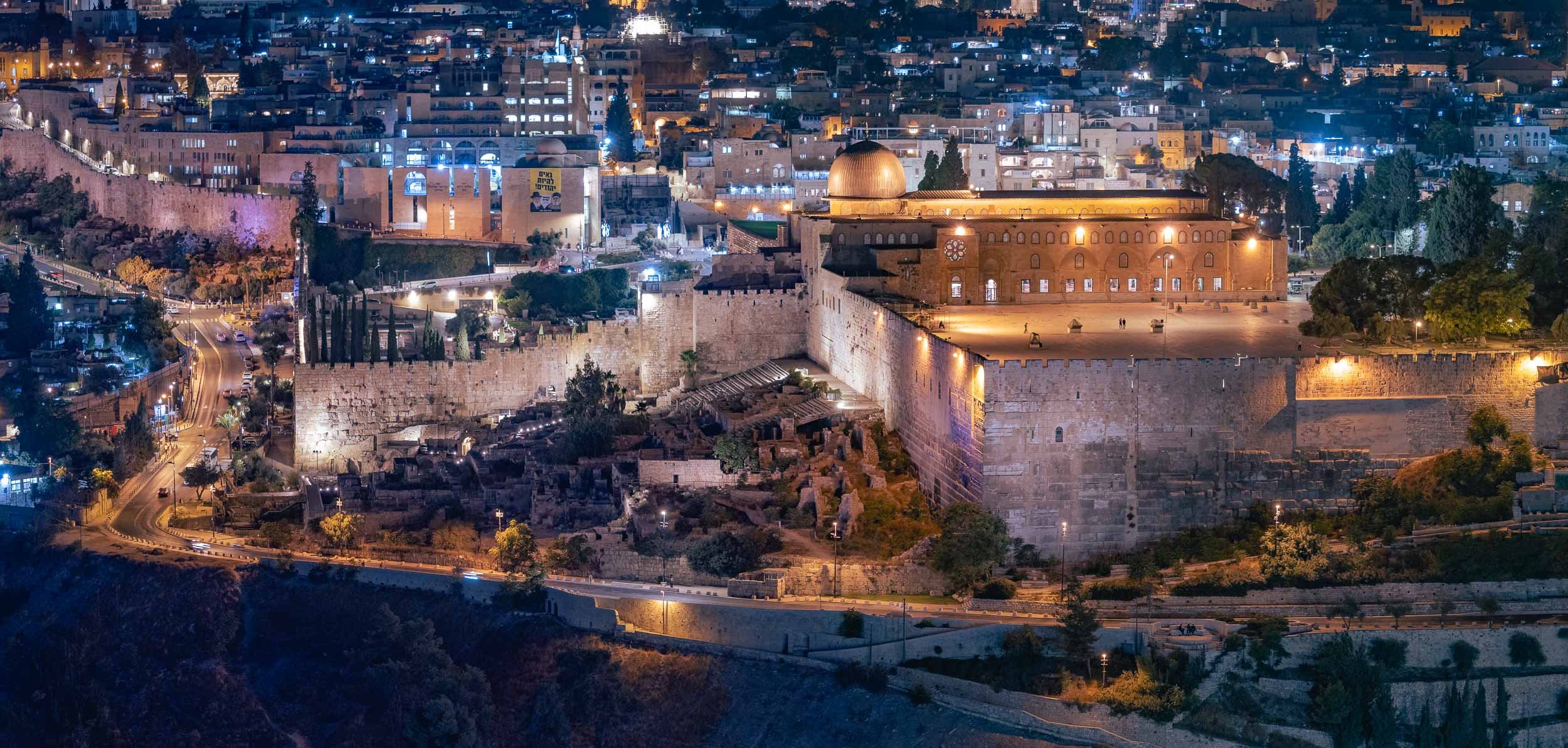
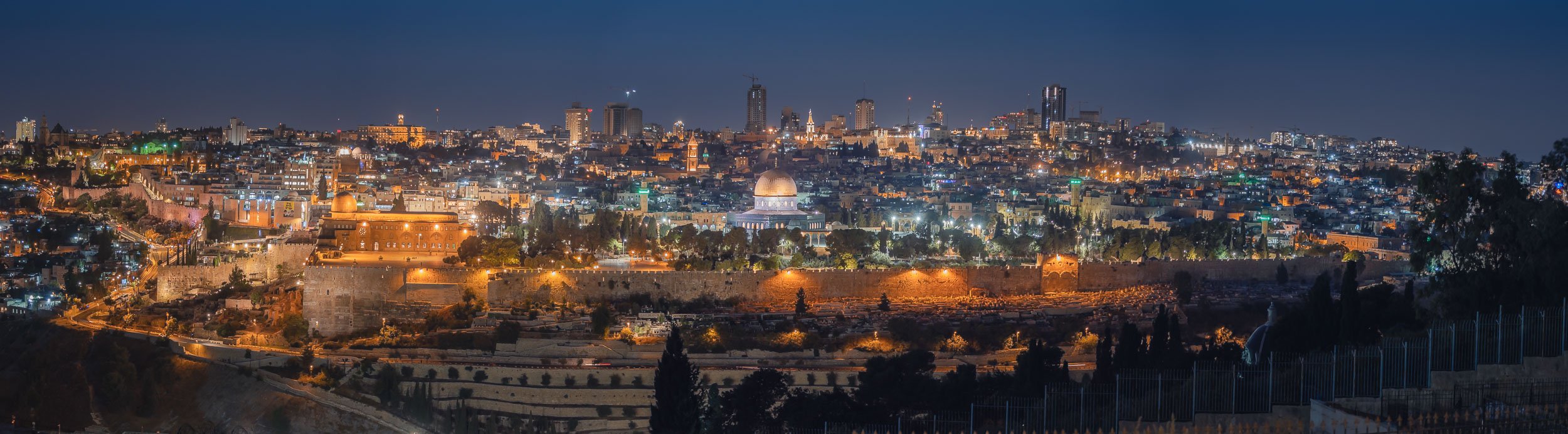
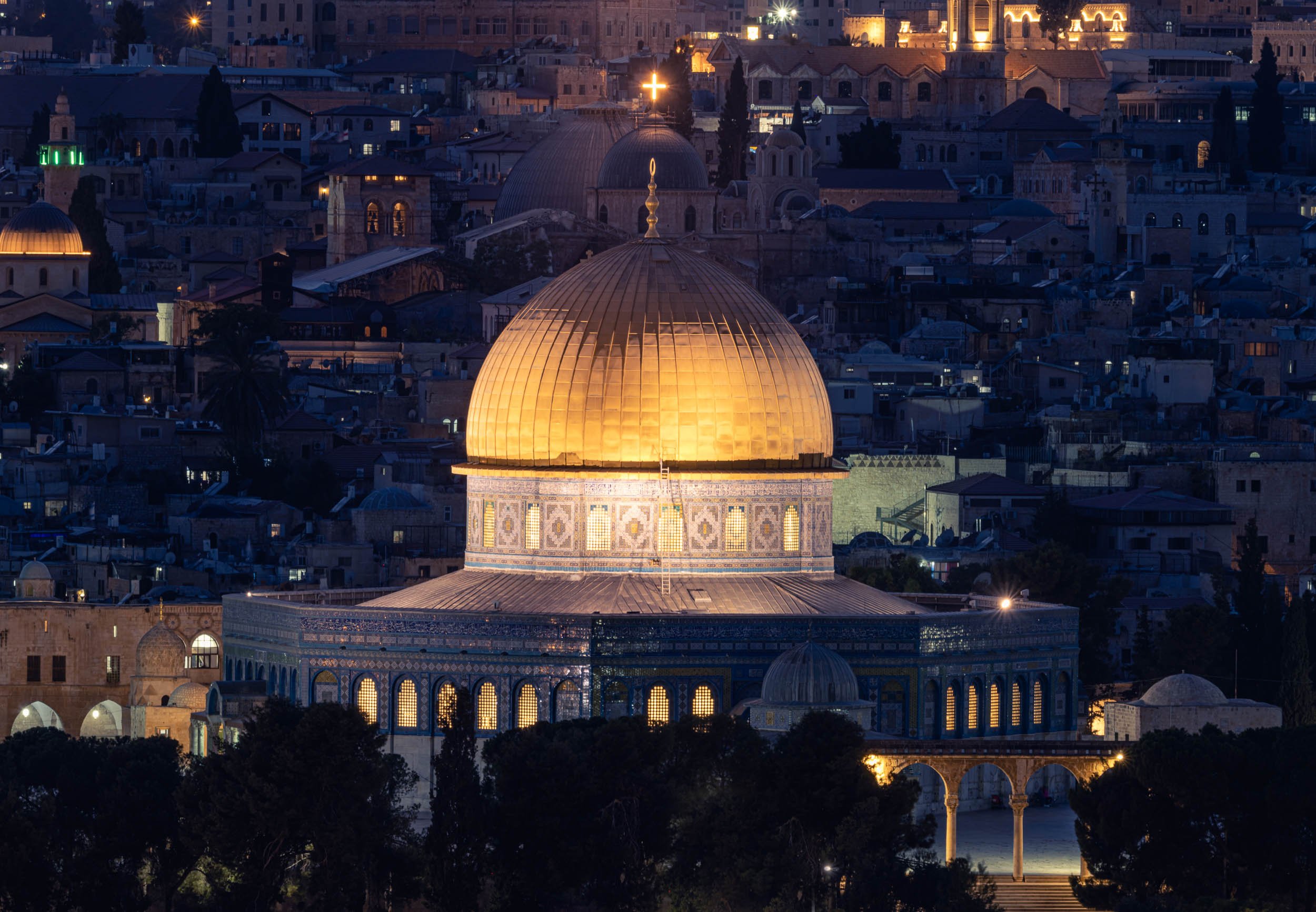
Street Scenes of the Old City
It’s an endless endeavor to cover all the alleys, corners, roofs and small shops in the quarters.


If you’re in need for some souvenirs, there are plenty of questionable options.


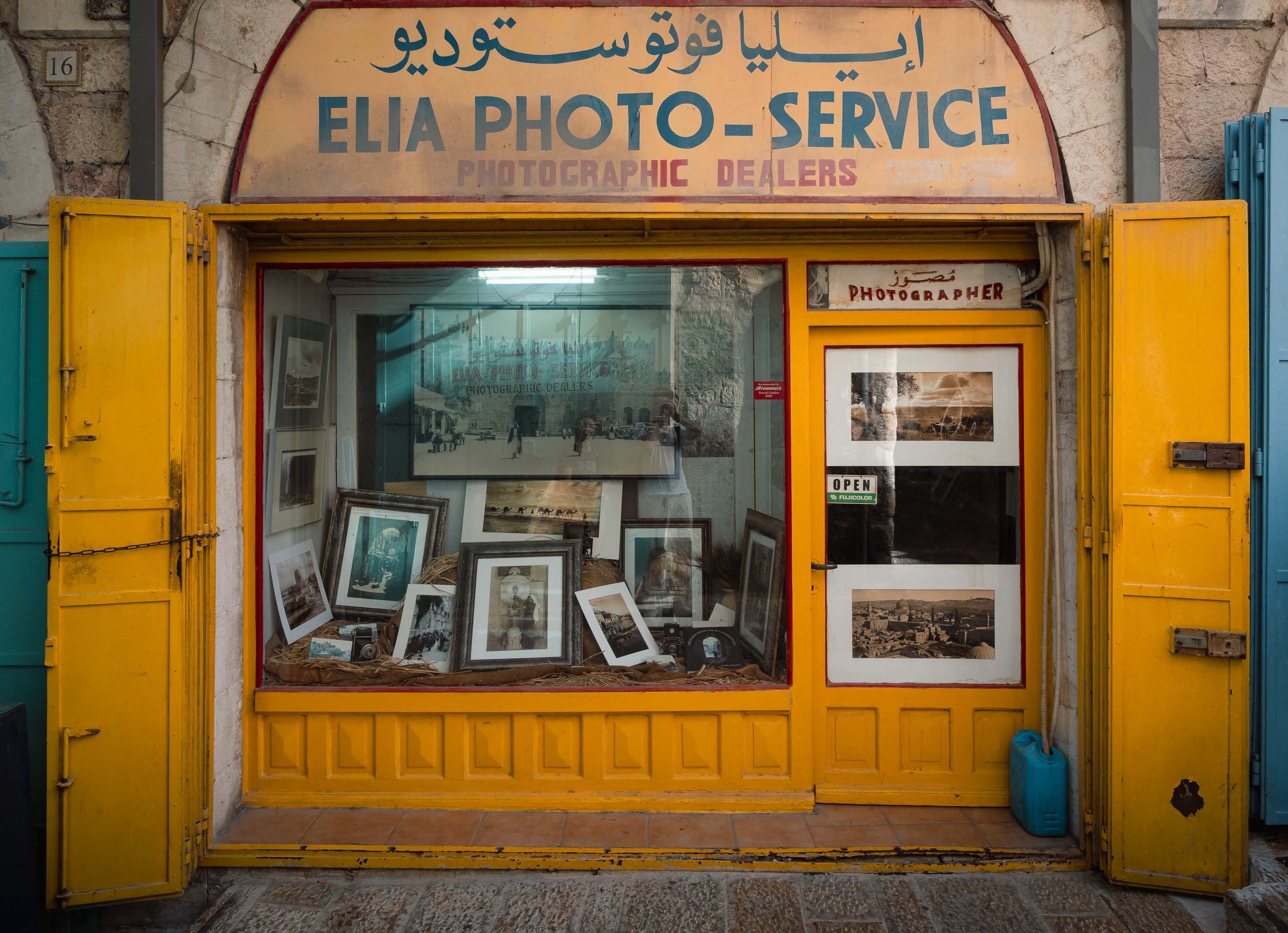
The Pool of Arches in Ramla
The last stop on the way back to Tel Aviv was this rather curious place, a 1200 year old underground reservoir.
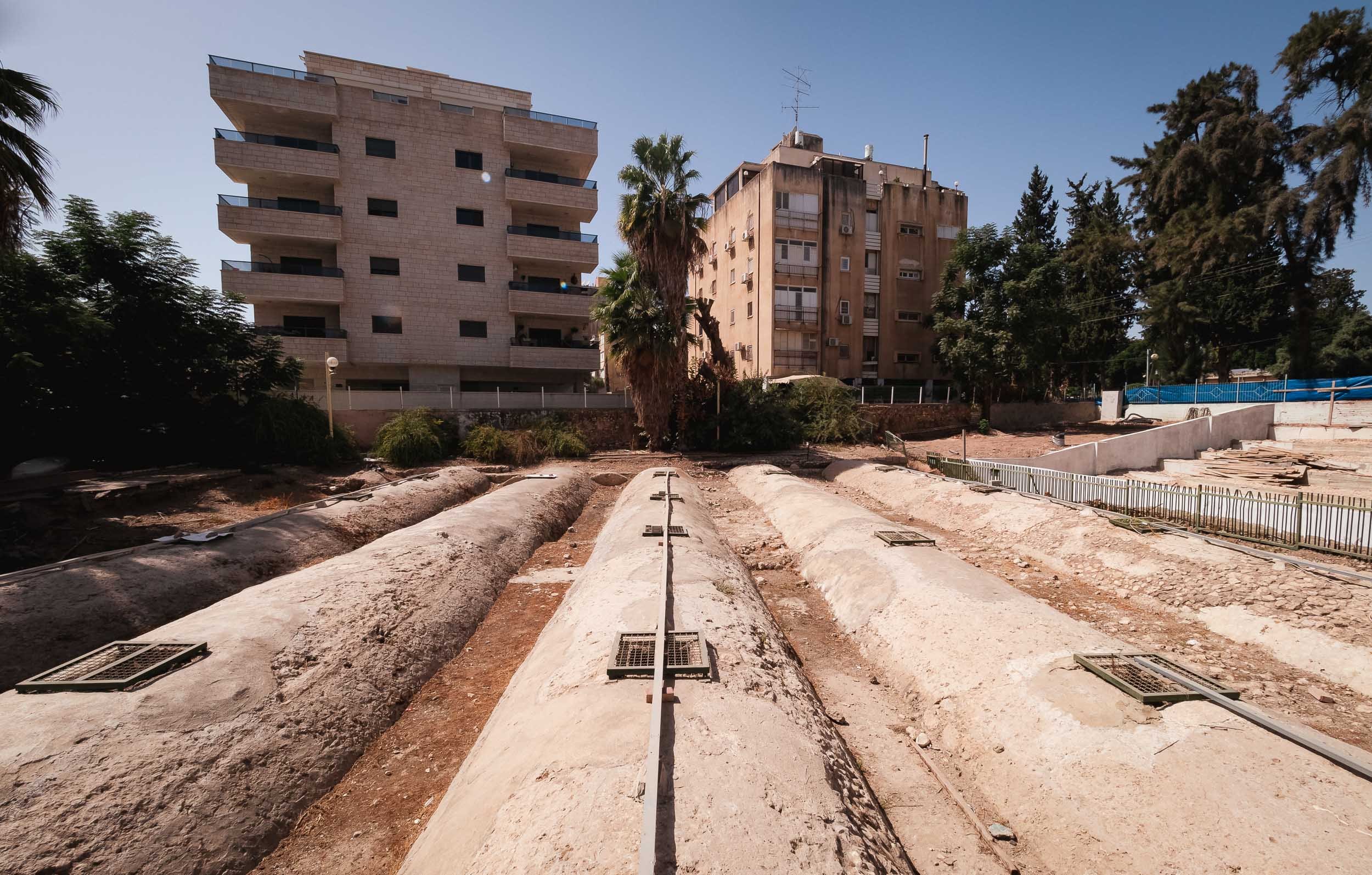


Once you descend down the stairs, you get to see the 20m x 20m basin, which is said to overflow in winter times, and rent a small boat to row around the stone columns carrying the roof.

This region still has a lot more to offer, and is another part of the world that I want to go back to, but for now those were my first glimpses into one of the most historically significant parts of the world.

San Marino - Small but Surprising
In the eternal quest to explore all corners of earth, you sometimes have to make your way into the smaller corners, or countries in this case.

In the eternal quest to explore all corners of earth, you sometimes have to make your way into the smaller corners, or countries in this case. San Marino is definitely one of the smallest, at just over 60 sqkm and 33,000 people. In fact, this makes it the oldest extant sovereign state, and also one the wealthiest in terms of per capita GDP.
It was a short road-trip and we had just 36h to explore - on the other hand, its size makes that enough time to explore most of the country’s sights, which are located in the namesake city on Monte Titano (there is a larger community at the foot of the mountain where most people live). On arrival we were greeted with a peculiar cloud rolling in, which was my clue to take a look from above.


It wasn’t quite the weather you’d expect during August in Italy, just 10km from the Adriatic coast. A few minutes later, the city was covered in a layer of fog and clouds, and it became dark, turning the atmosphere into a mix of Christmas and Resident Evil.


Exploring the fortress of Guiata and its two neighboring towers at the cliff of Monte Titano.


Nightly street vibes
Day 2
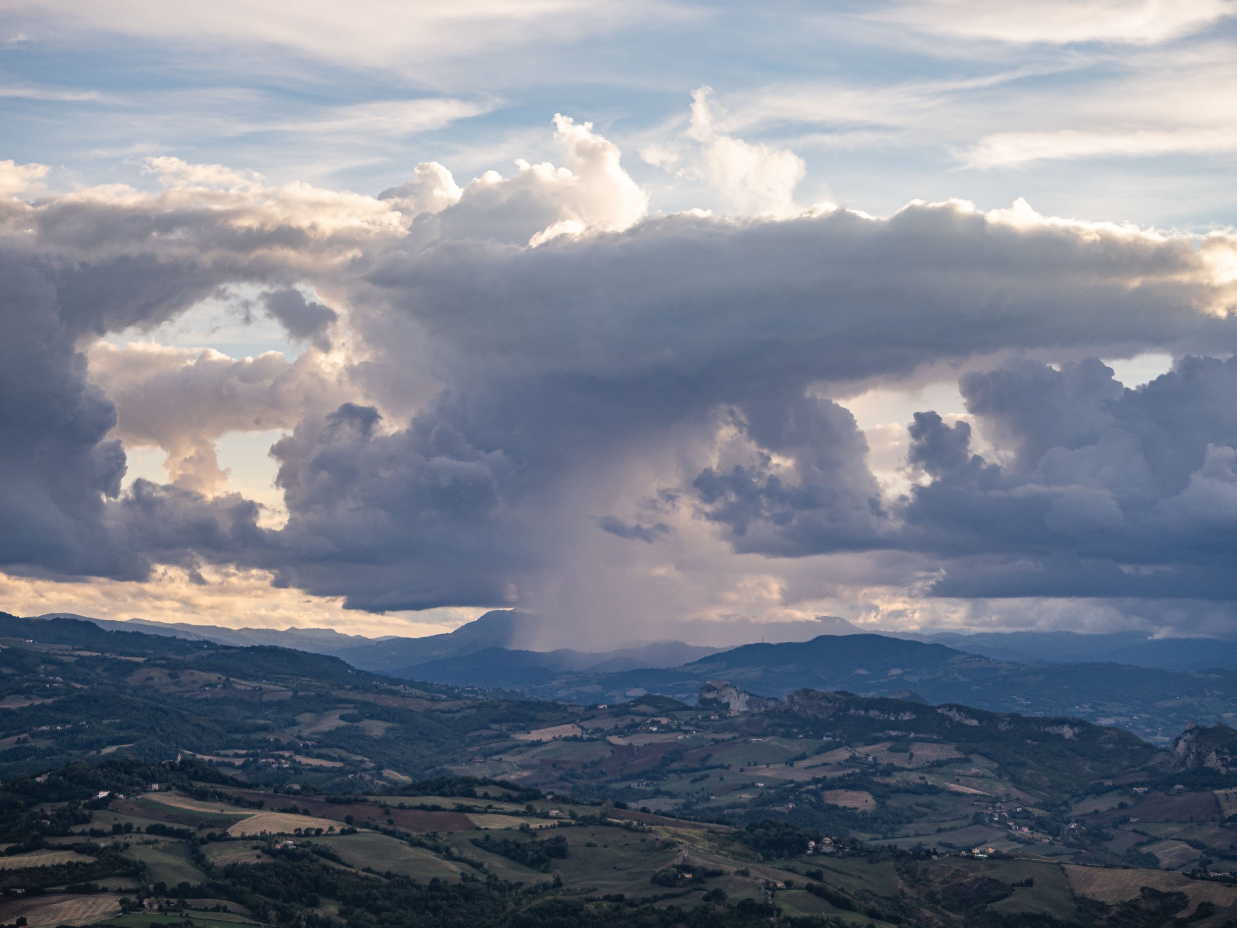

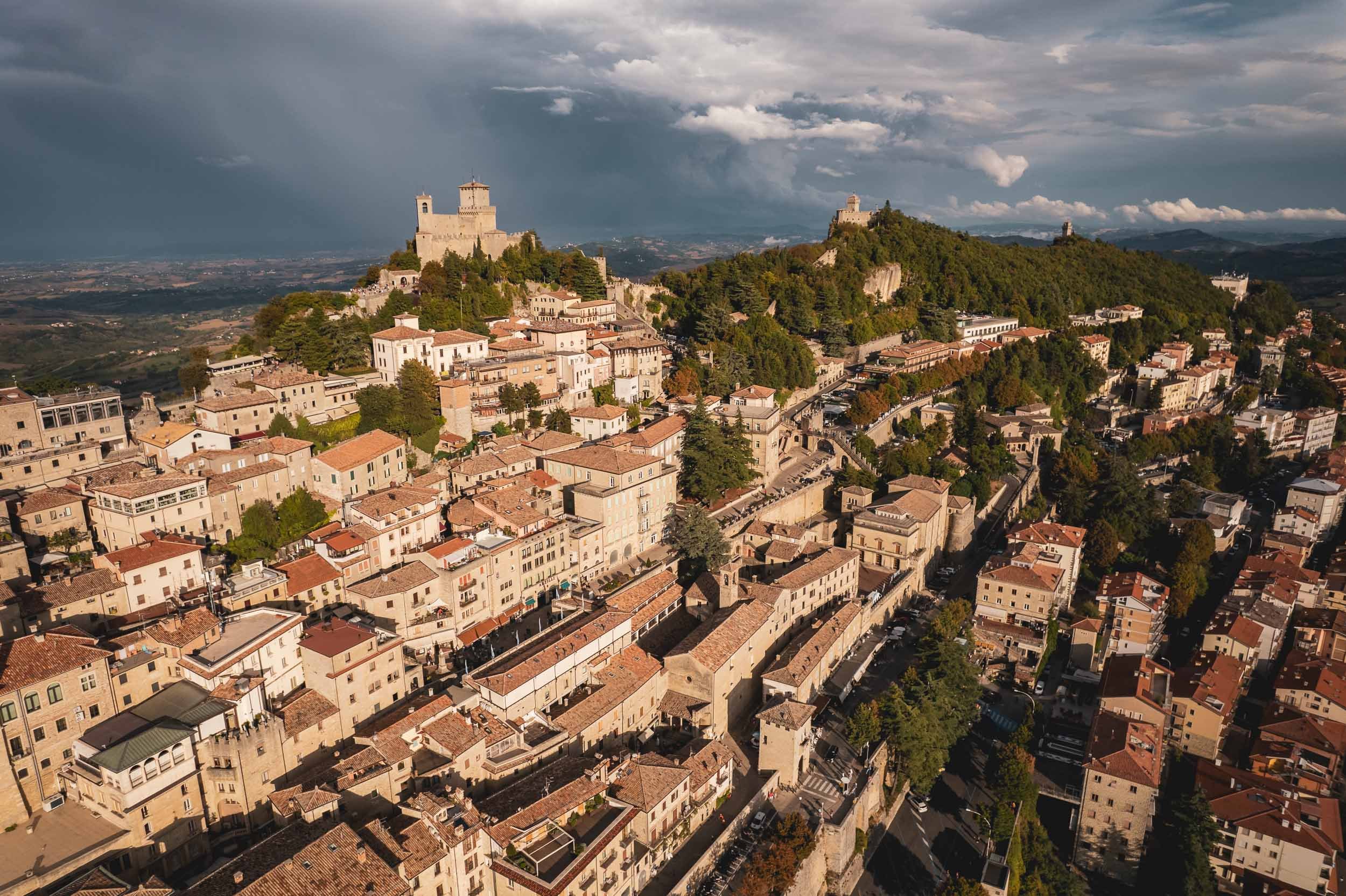
Politics
San Marino’s political system is a peculiar one. It is the world’s oldest constitutional republic with an elected assembly, which in turn elects not one, but two heads of state every six months from opposing parties, called the Captain’s Regents. This tradition is a nod back to the Roman consul times. At the end of their legislature, every Sammarinese (the Demonym for citizens of the country) has 15 days to submit any complaints about their actions - or lack thereof.
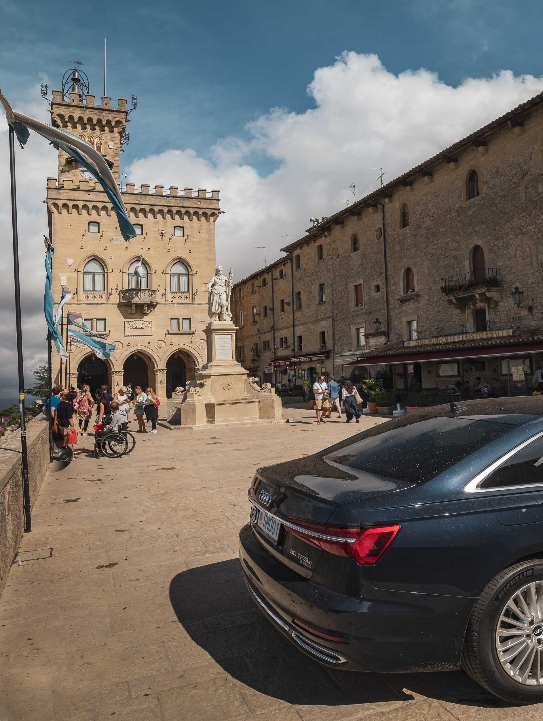
As the clouds opened up, I spent the last sunset photographing the country’s most iconic view, but rest assured there’s more to see in San Marino, such as its Museums of Torture, Dracula, and Curiosities (although I can’t say I’d highly recommend either of them). If you’re looking for the Formula 1 track where the race named after the country was held up until recently, you’ll have to go to Italy though. There is however an Ayrton Senna statue as a tribute one of the world’s best drivers, who tragically died at the 1994 Grand Prix.
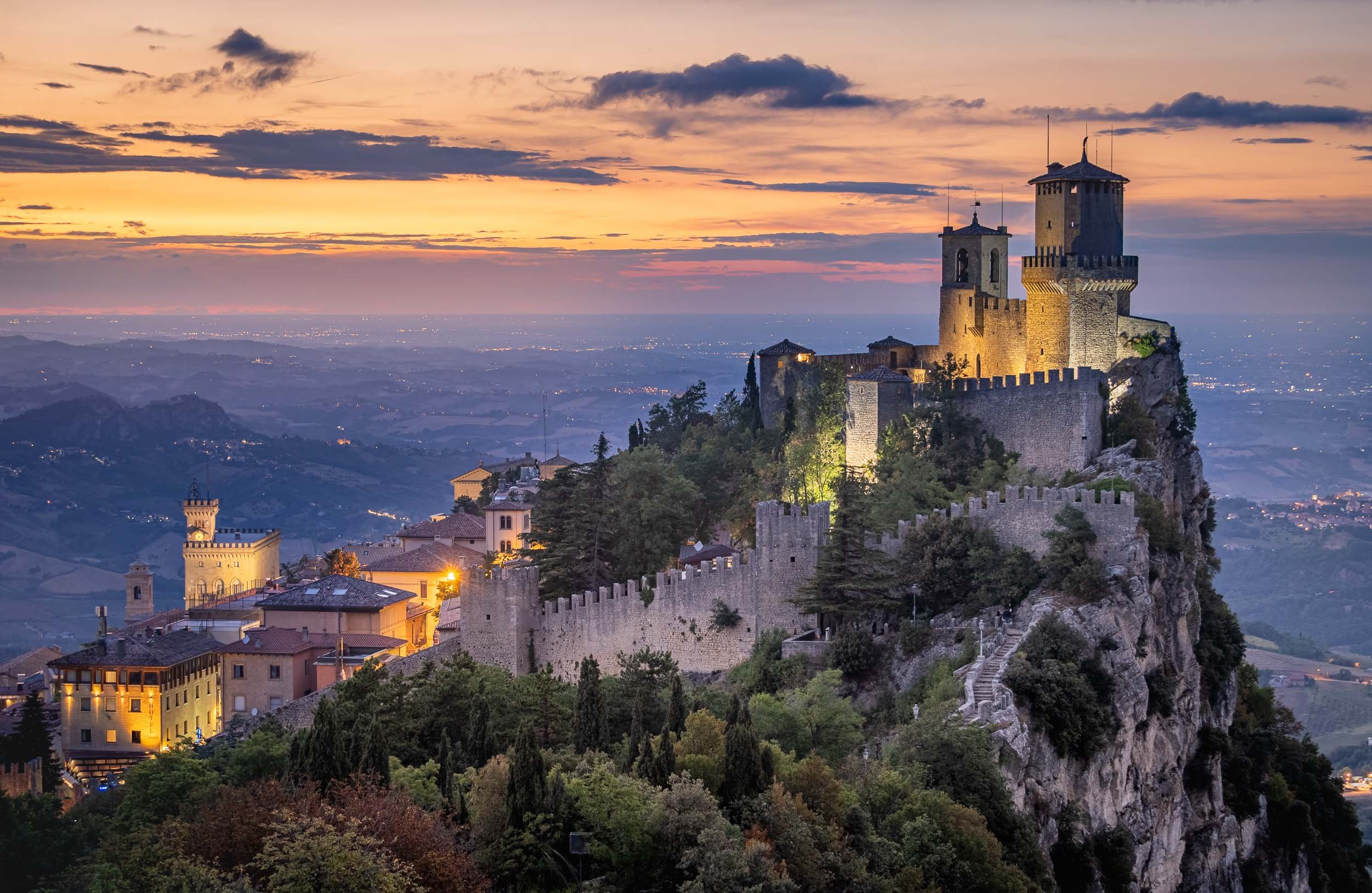
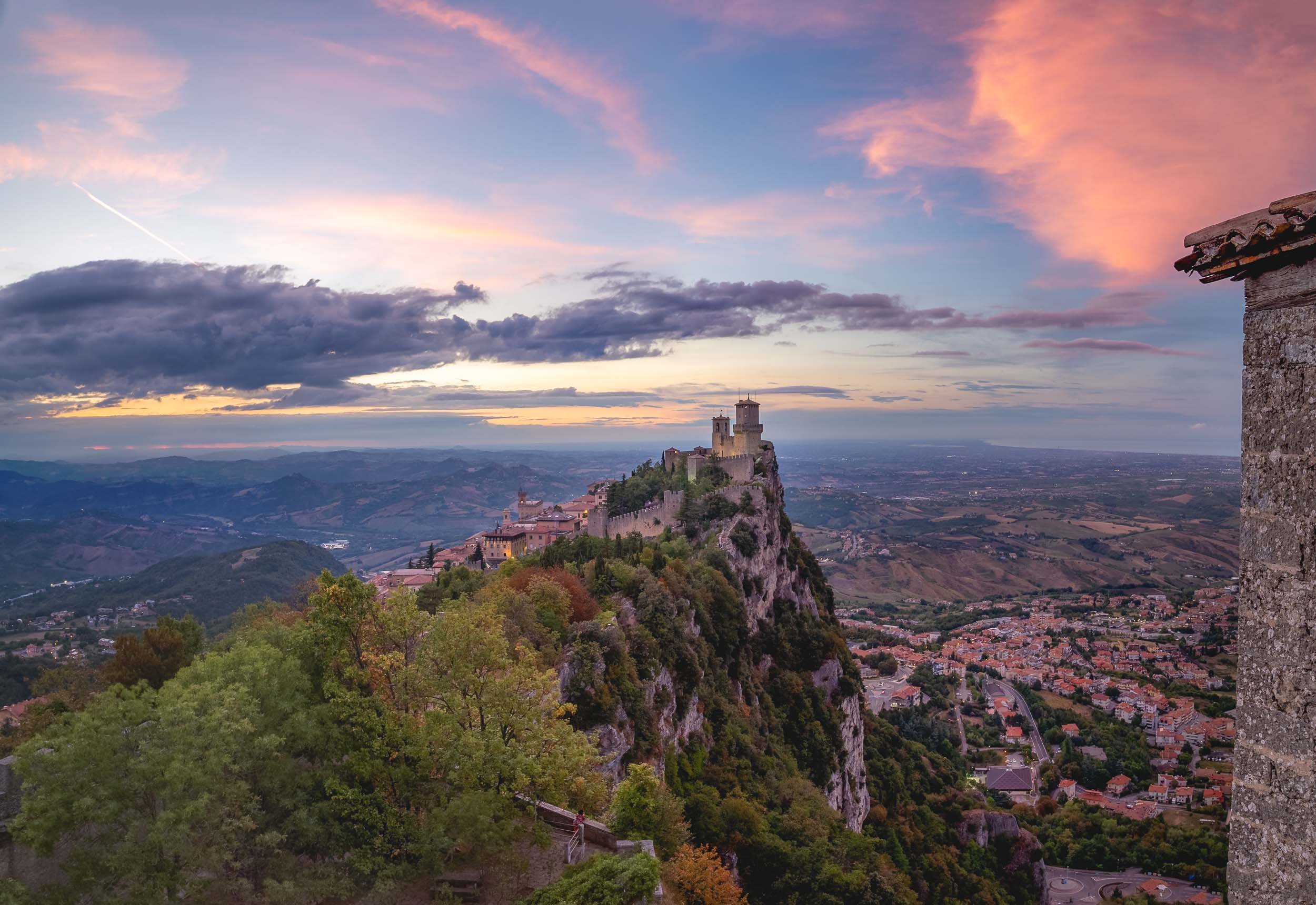
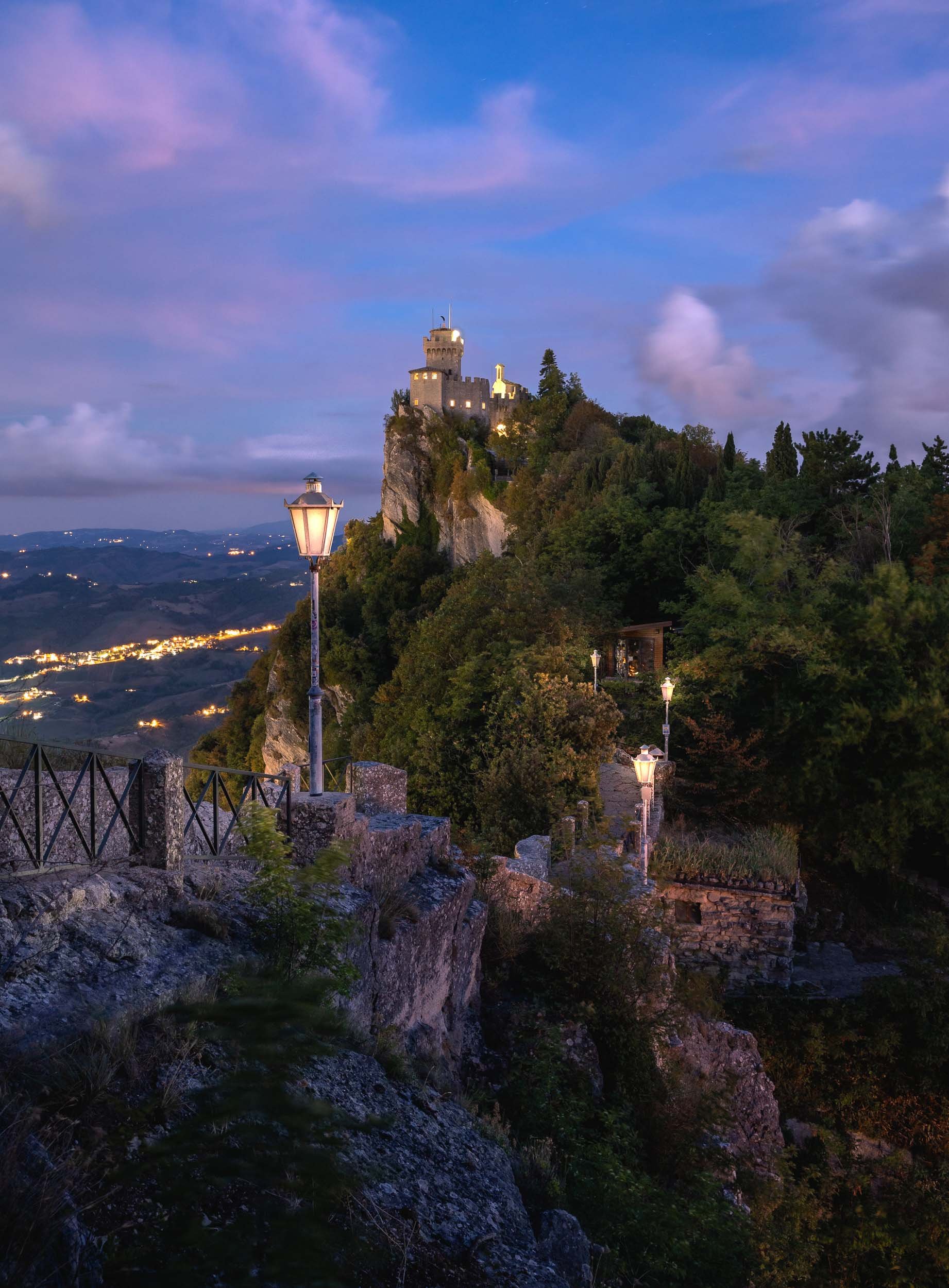
Thanks for tagging along - continue here with a nearby architectural curiosity, the medieval towers of Bologna (and a questionable statue).

Bologna - From Tall Towers and Statues with Secrets
On a recent roadtrip to San Marino we passed Bologna, one of Italy’s largest cities and home to one of its most peculiar architectural features.
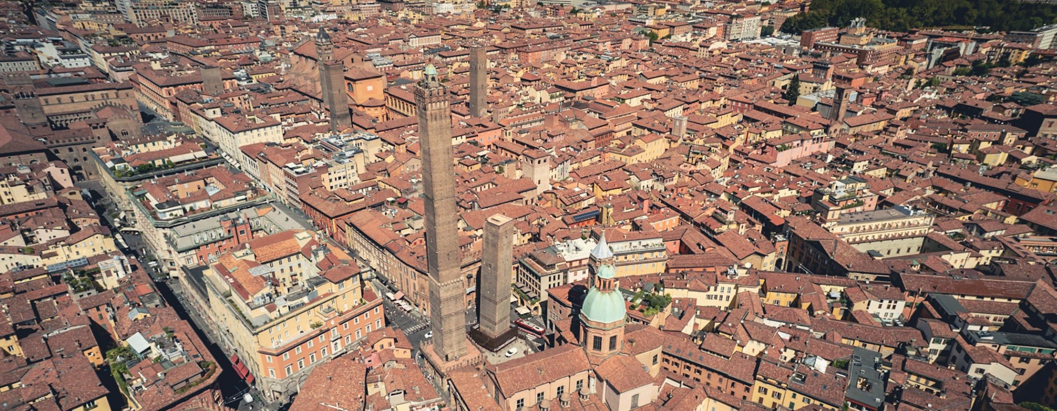
On a recent roadtrip to San Marino we passed Bologna, one of Italy’s largest cities and home to one of its most peculiar architectural features. Of course that was reason enough to take a small detour and spend a few hours in the city to document this special sight - in the process, we found another rather questionable historic remnant, read on to find out…
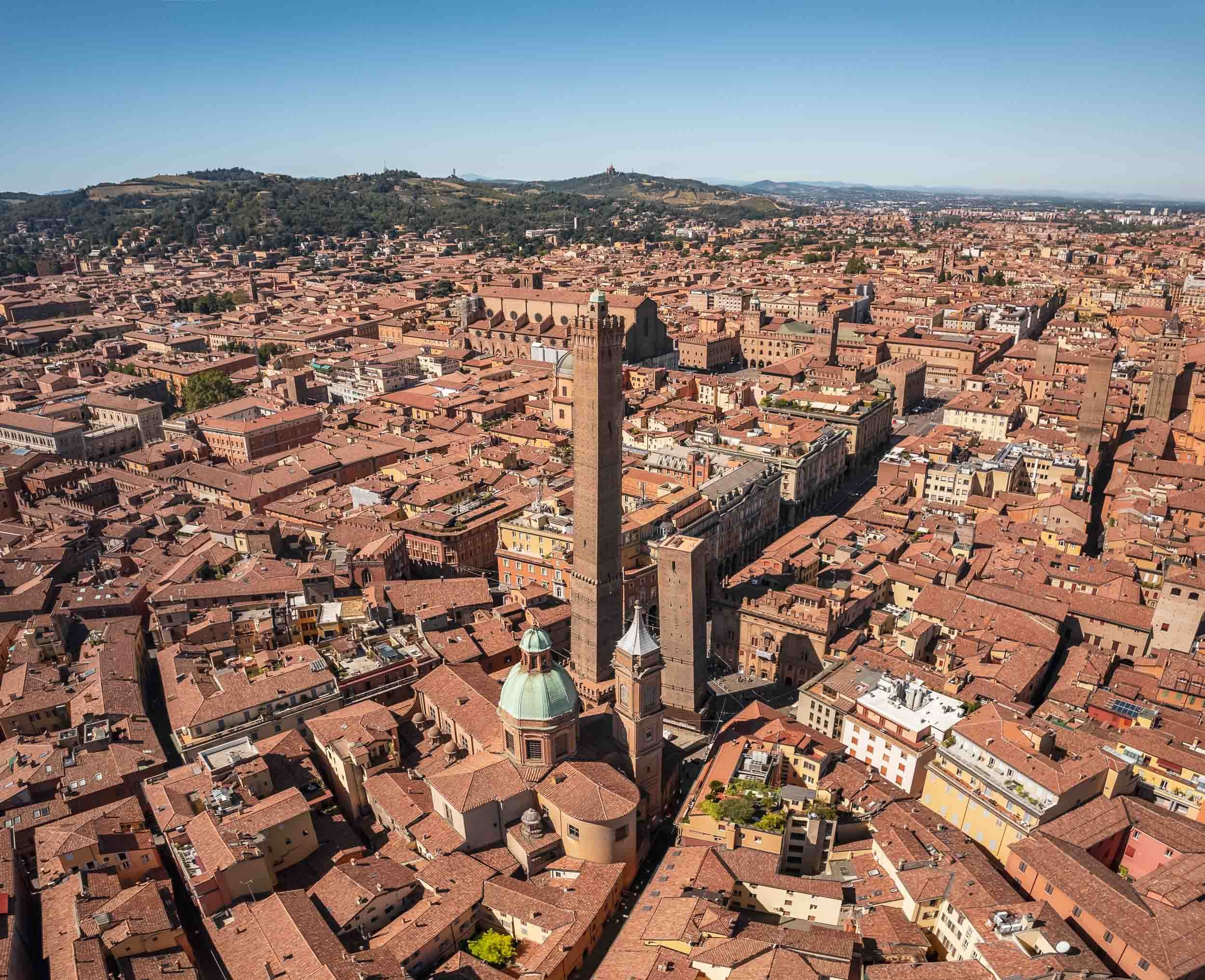


The larger of the two towers, Asinelli, is visible from many of the city’s streets at a height of almost 100m.
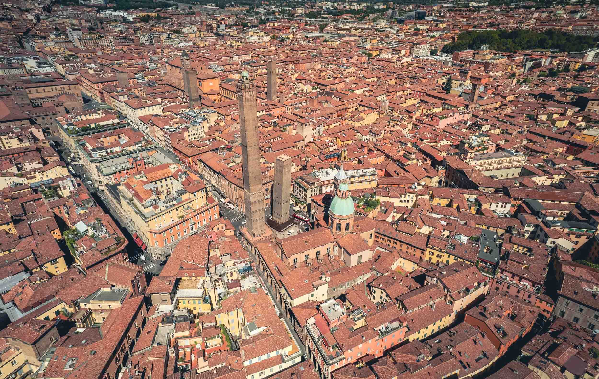
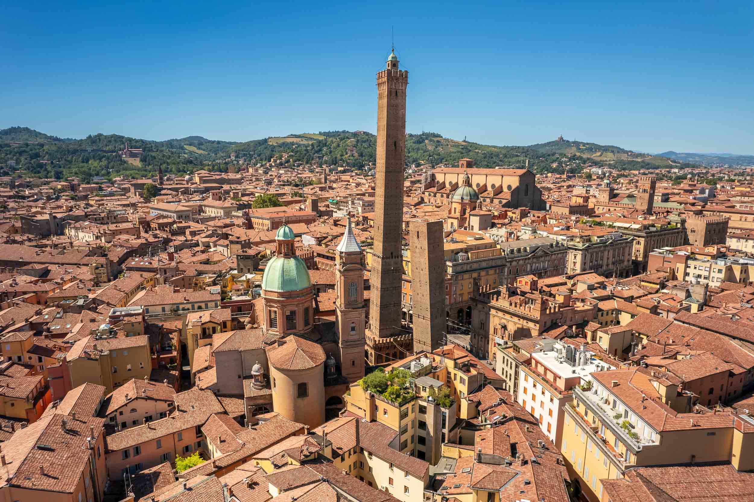
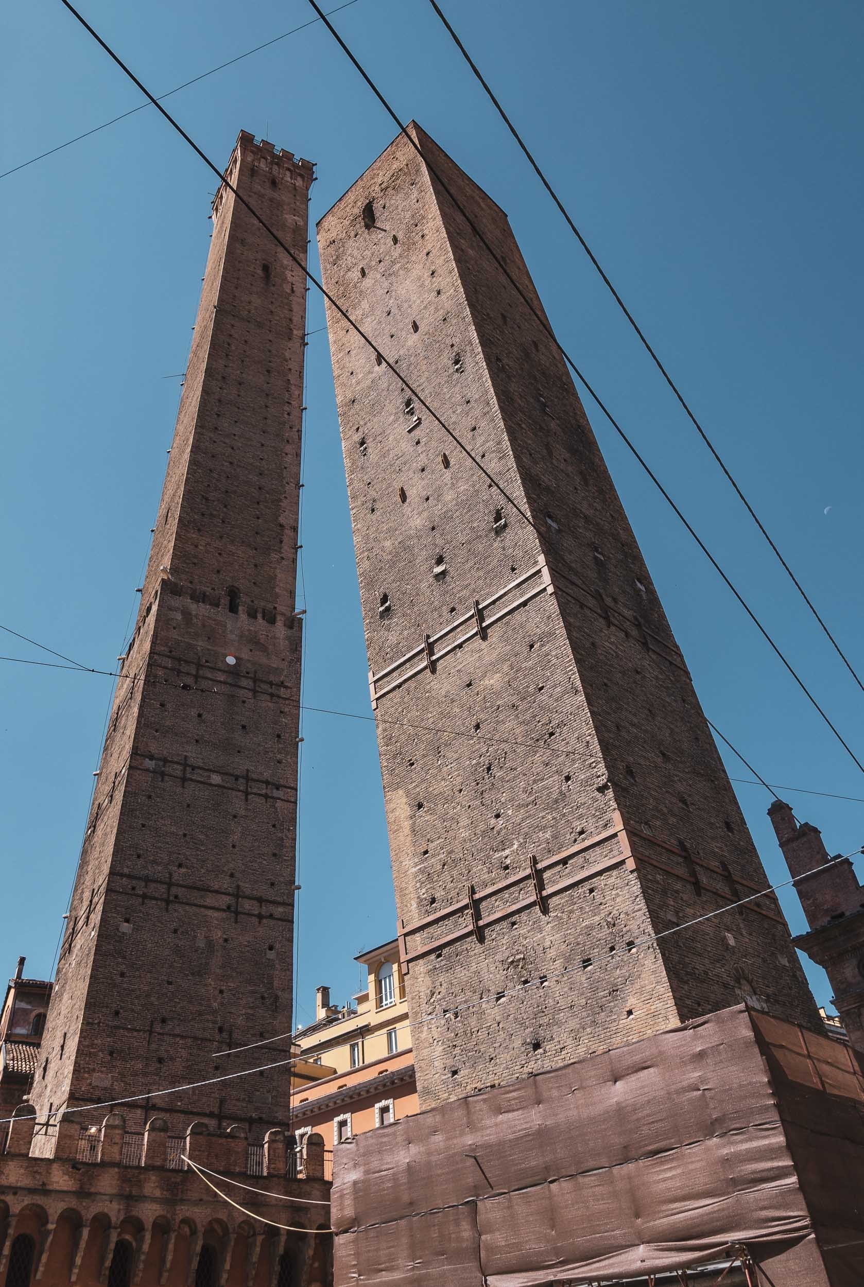
Take a flight around the towers.
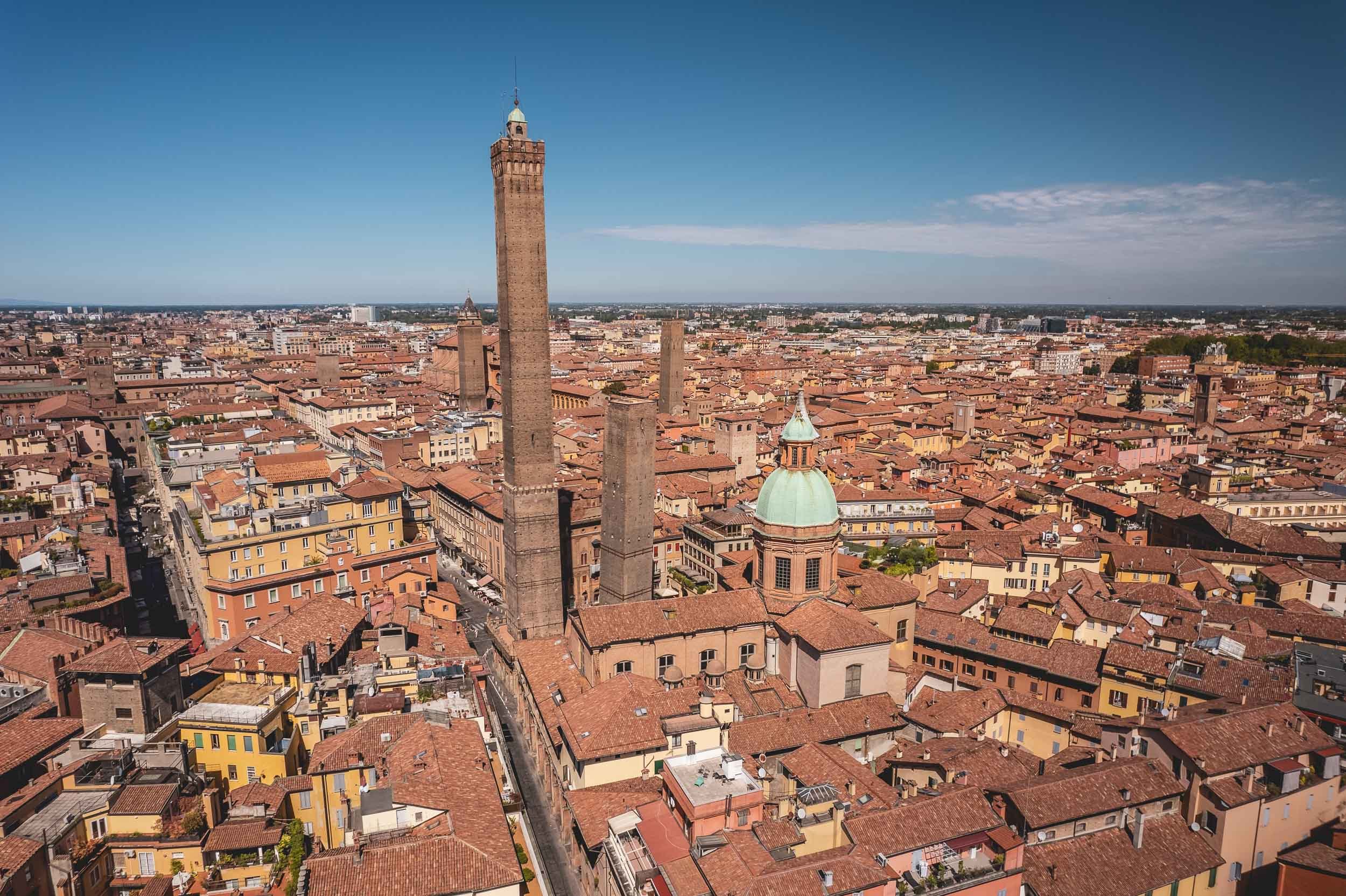
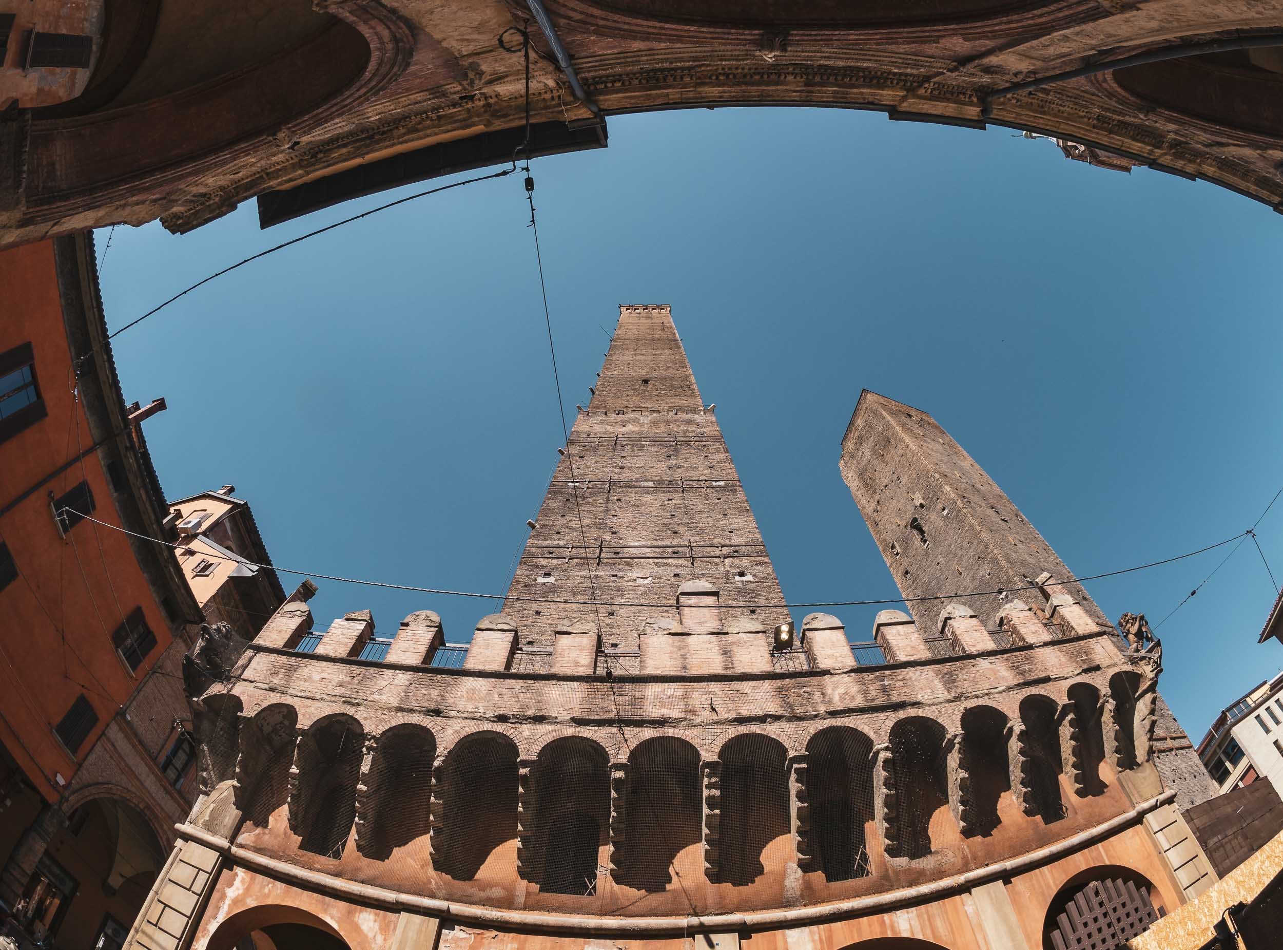
A Statue with a Secret
Not far from the towers and near the Basilica di San Petronio on the Piazza Maggiore you’ll find another oddity in the city - this time facing horizontal rather than vertical…
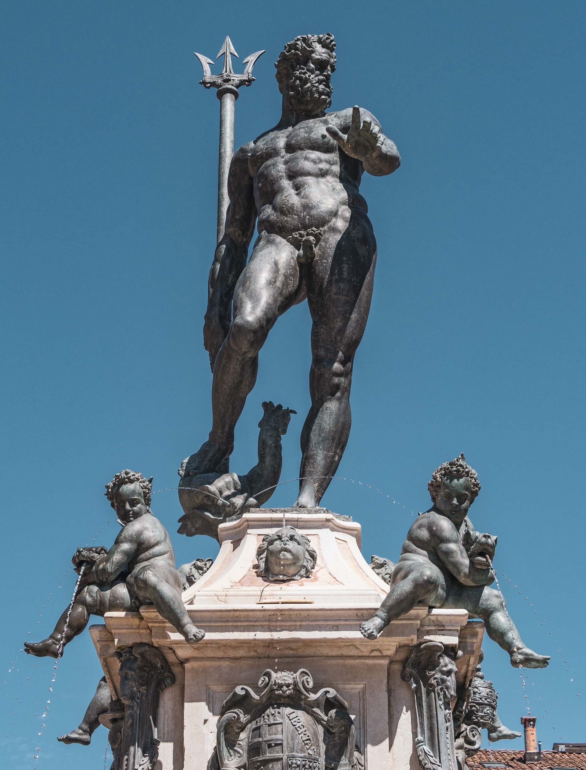

There’s a lot more to see in the city, and a return is definitely on the cards the next time I’m in the Emilia-Romagna region.

A Taste of Alsace - 36h in Strasbourg and Colmar
A brief visit to the two of the region’s most famous towns with their beautiful old woodwork.
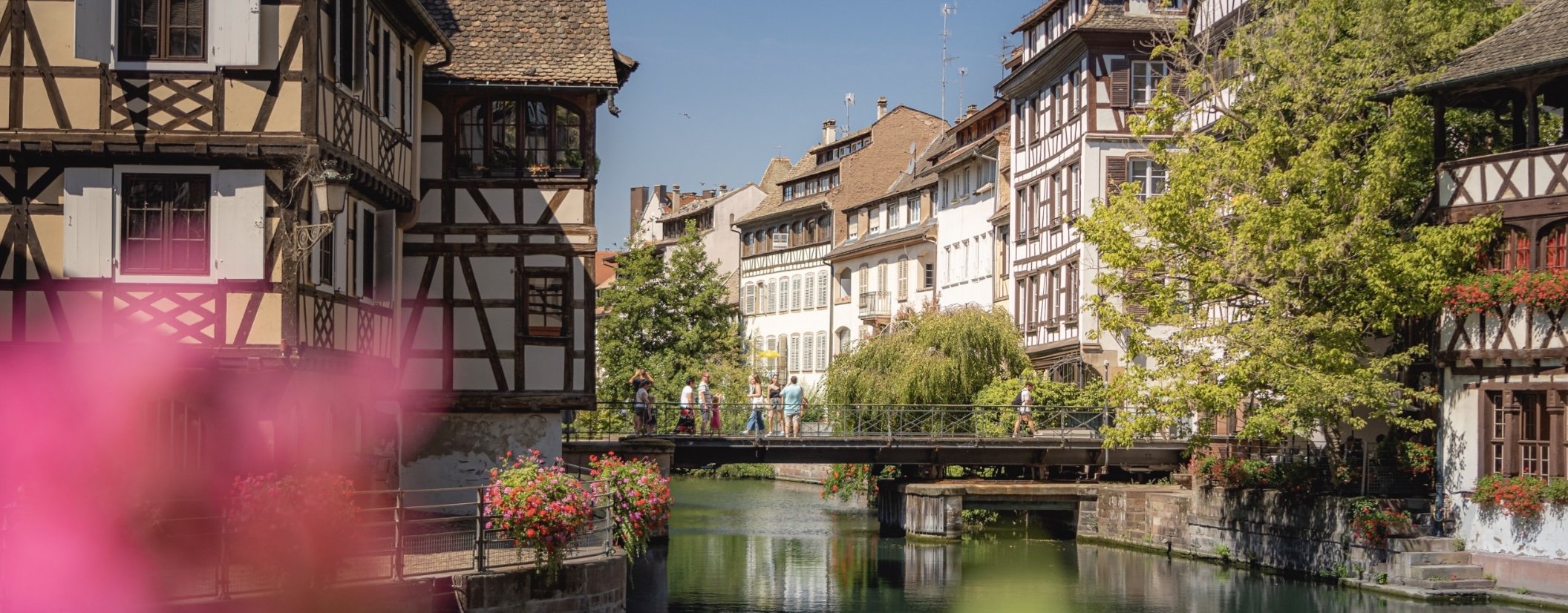
In August 2022 I attended a workshop for a startup founded by a couple that have become very good friends of mine (check it out, especially if you have young kids trying to learn reading: https://alphaben.app/de/) in the south western corner of Germany. Of course, I had to take the opportunity to jump over into the nearby Alsace region and visit Strasbourg and Colmar, two of the more famous cities in the area.
The Grande Île of Strasbourg
The most famous district is its Unesco World Heritage site area; in fact Strasbourg was the first city to have its entire city center be listed as a World Heritage Site. The city is over 2000 years old and was first mentioned in Roman times. Its position on the banks of the Rhine and on the borders of what is now France and Germany meant it was heavily disputed during its existence.
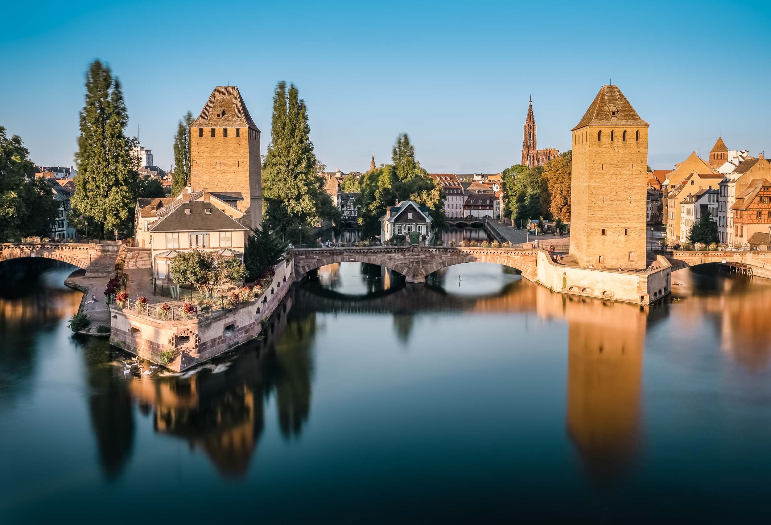


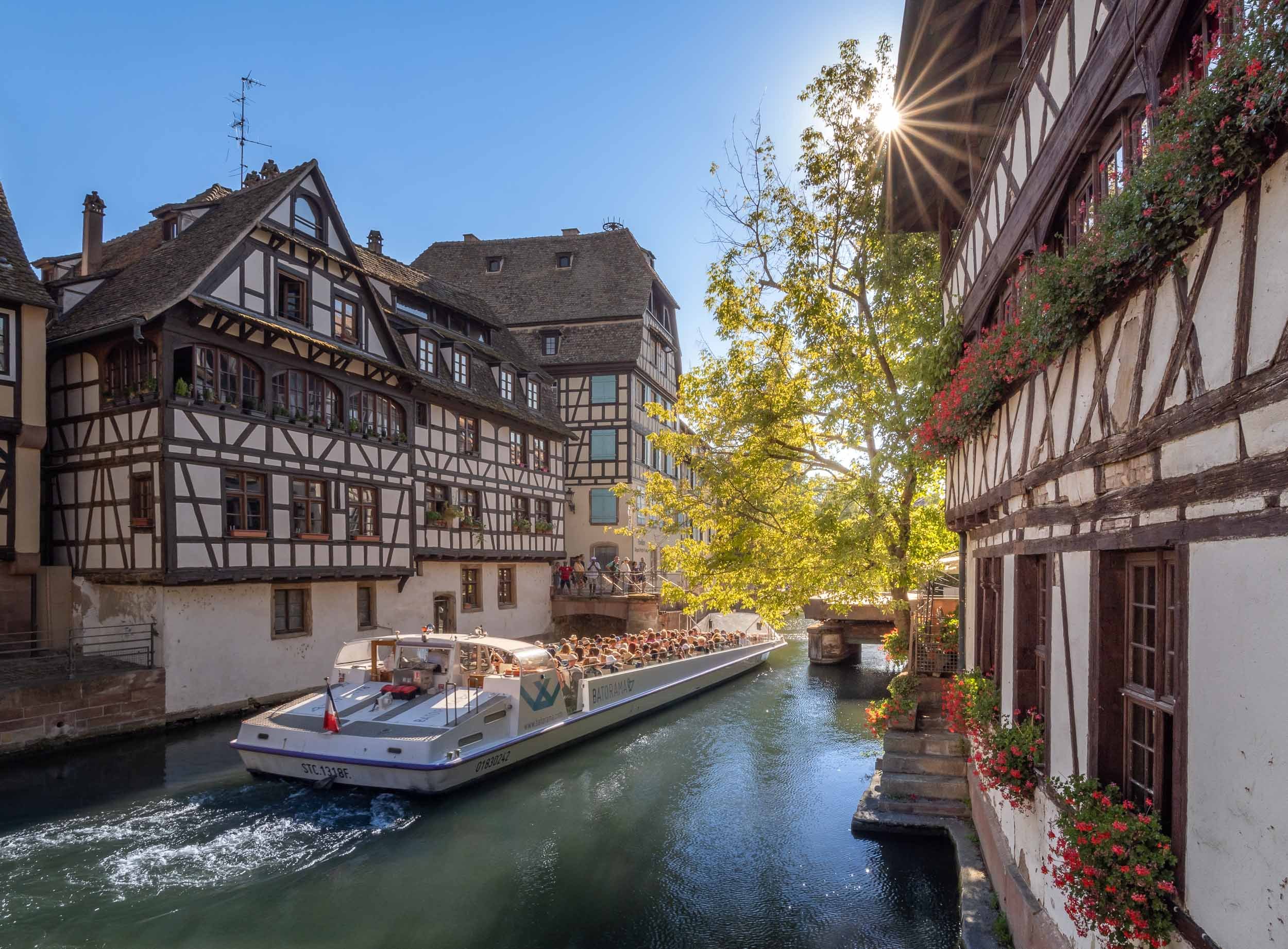
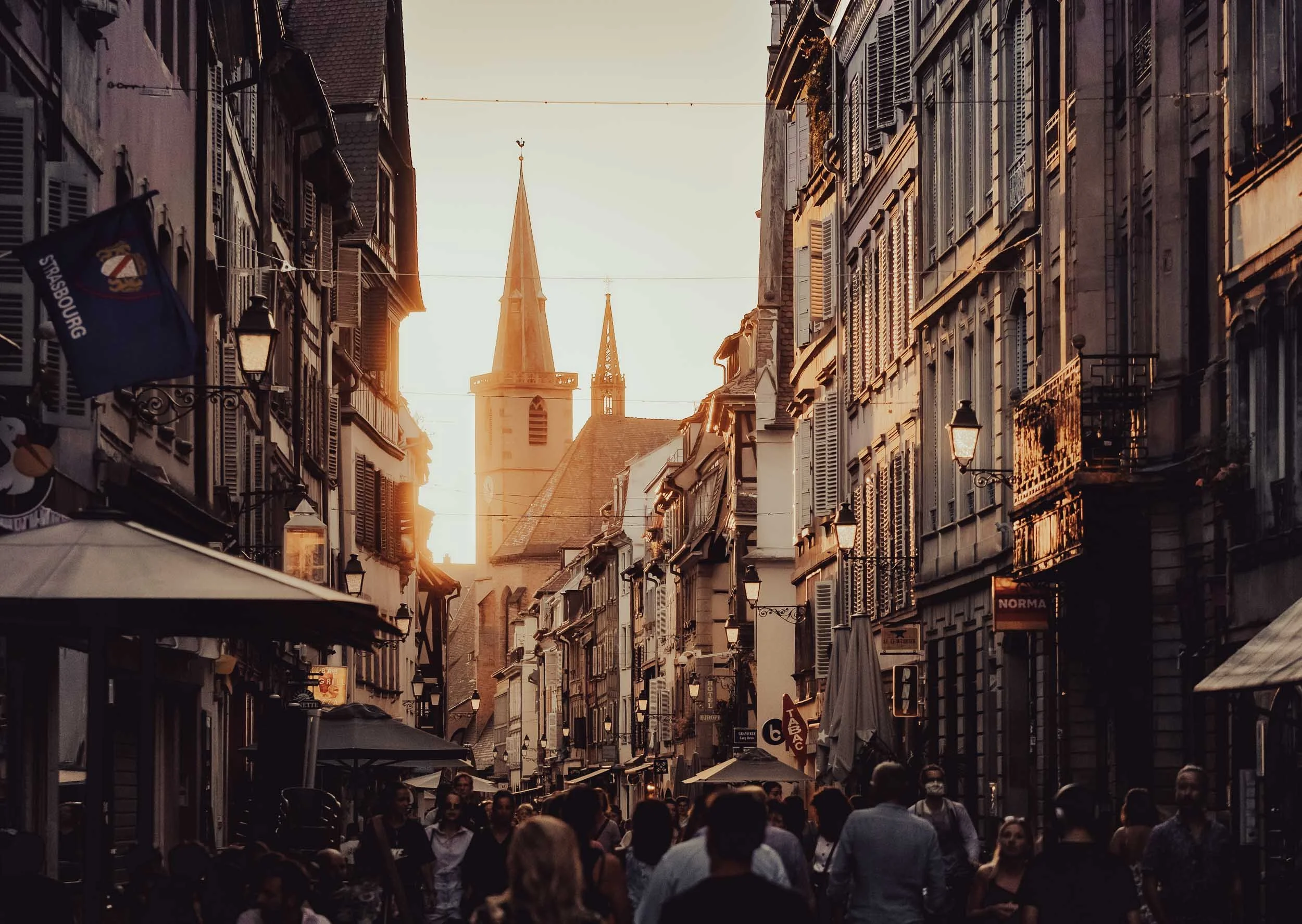
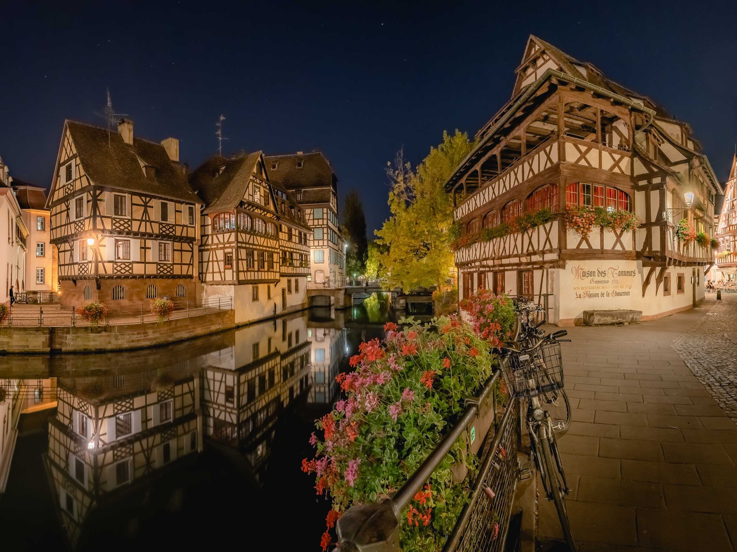

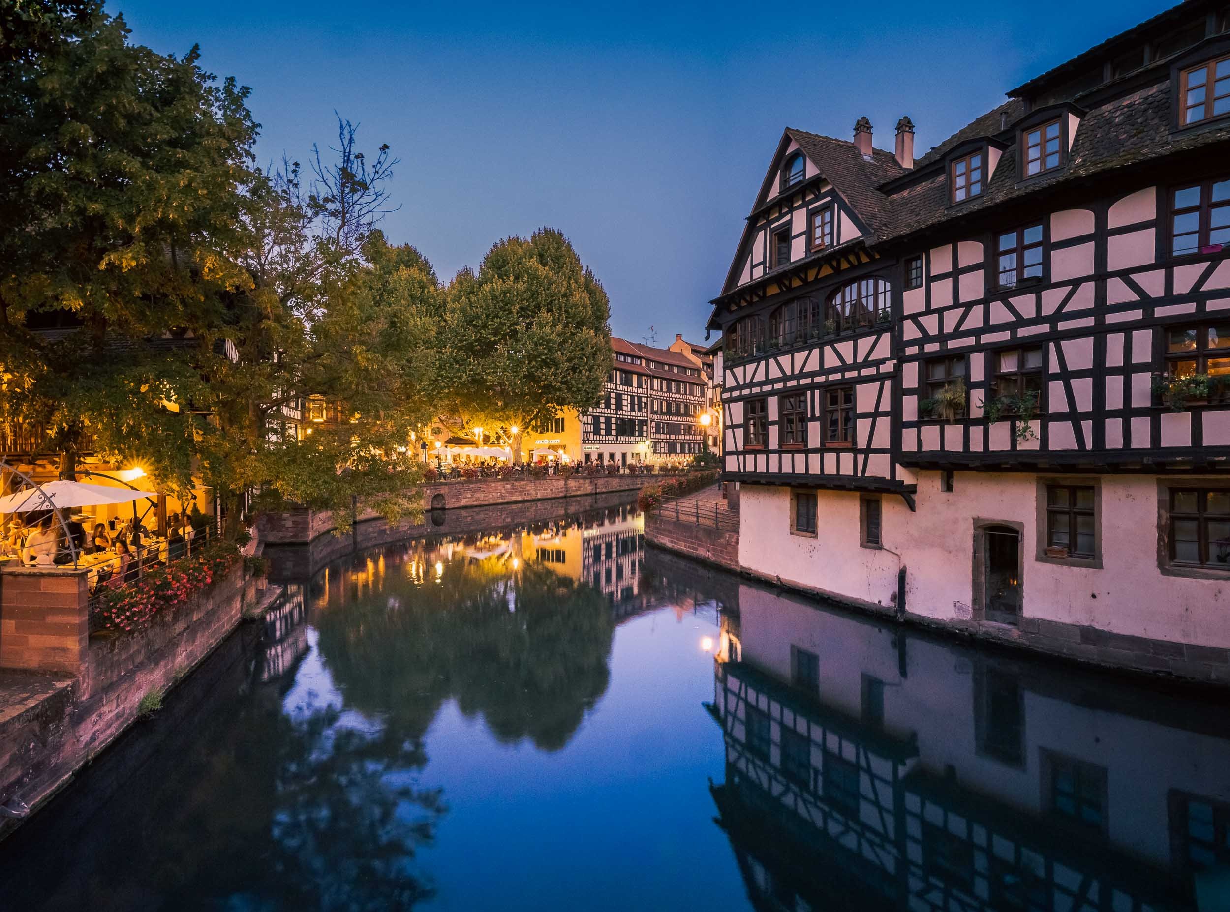

Street Scenes


The Strasbourg Cathedral
Unknowingly I happened to stay in one of the city’s most famous buildings - Maison Kammerzell - directly on the main square and one of the best preserved medieval gothic housings in existence. It also had the benefit of being able to visit the cathedral early morning before the crowds rolled in.
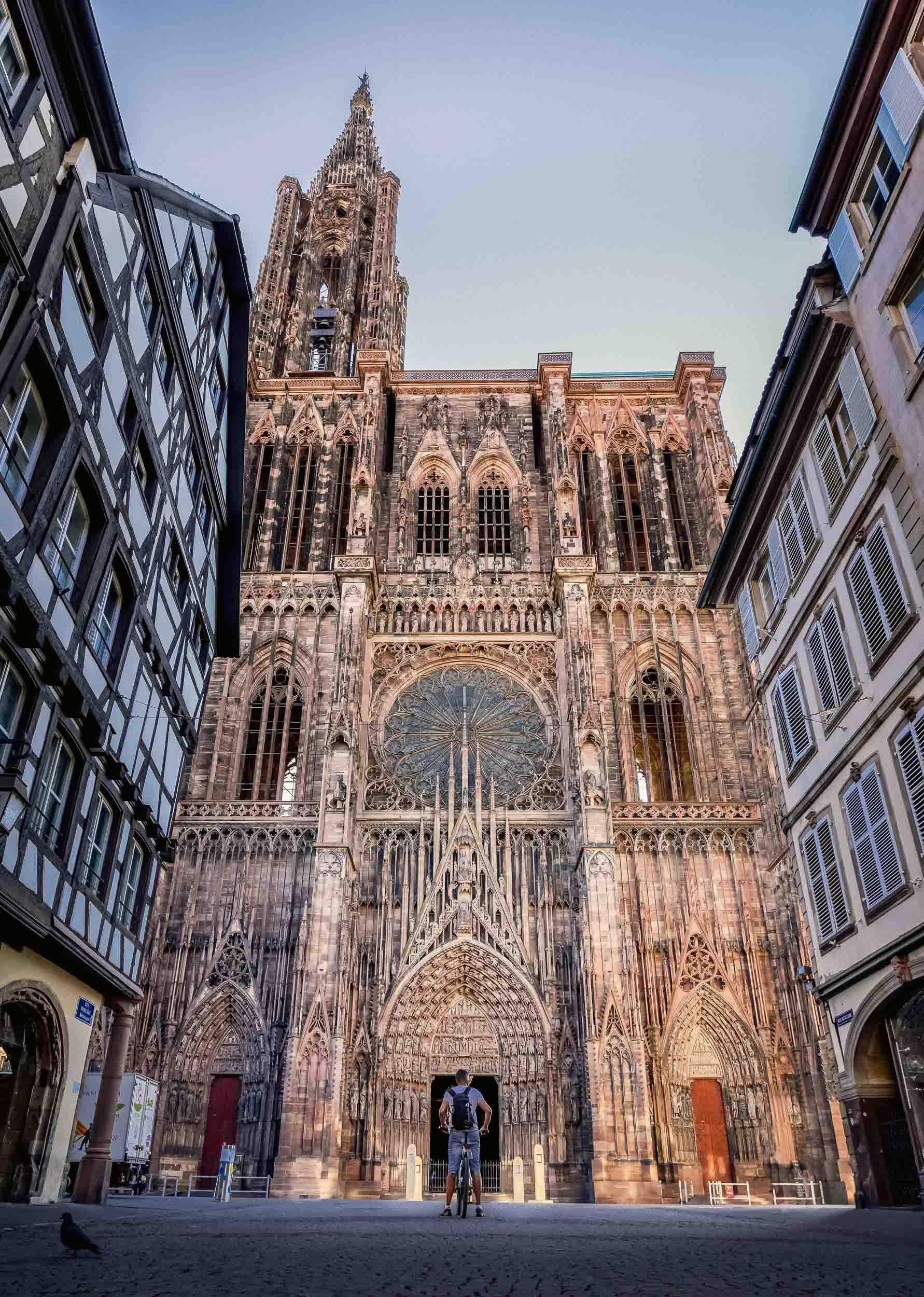
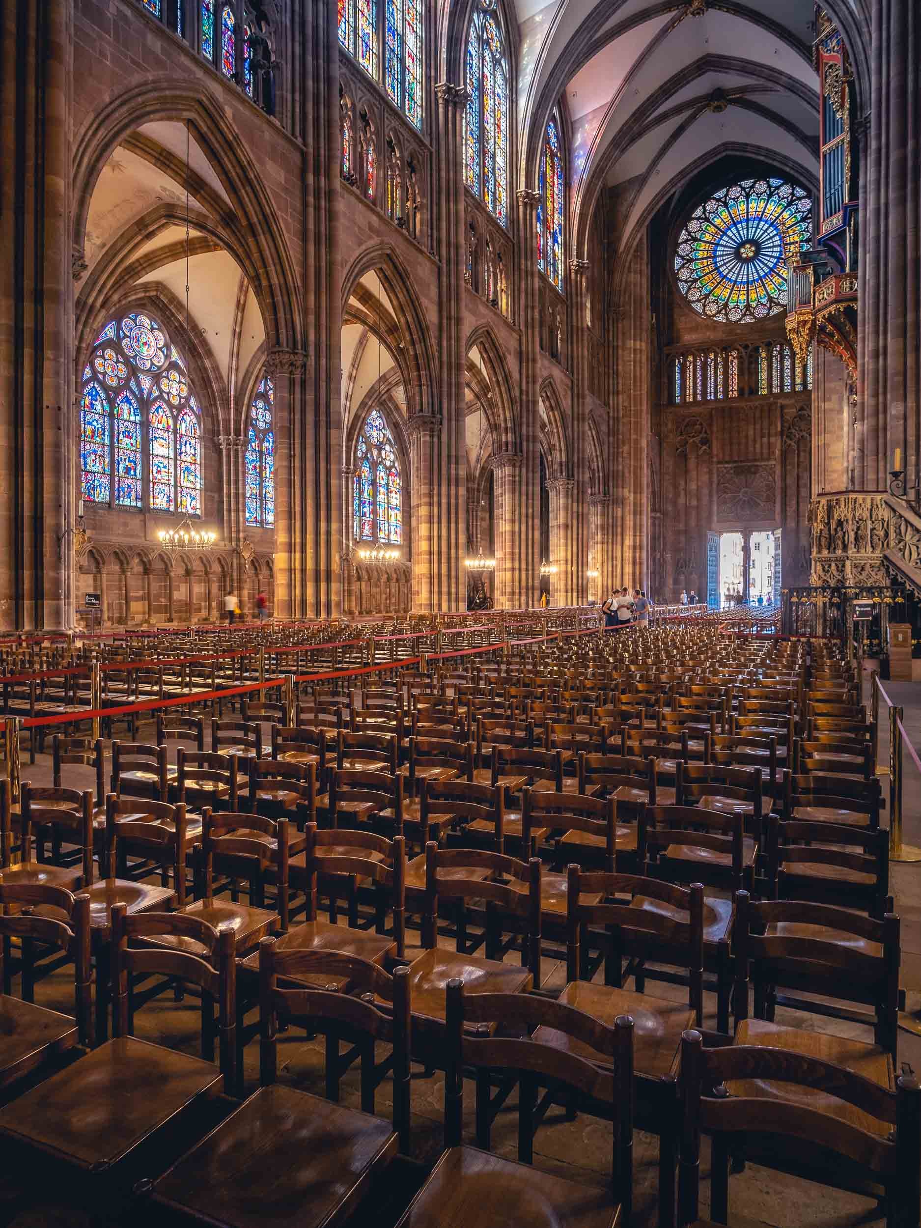
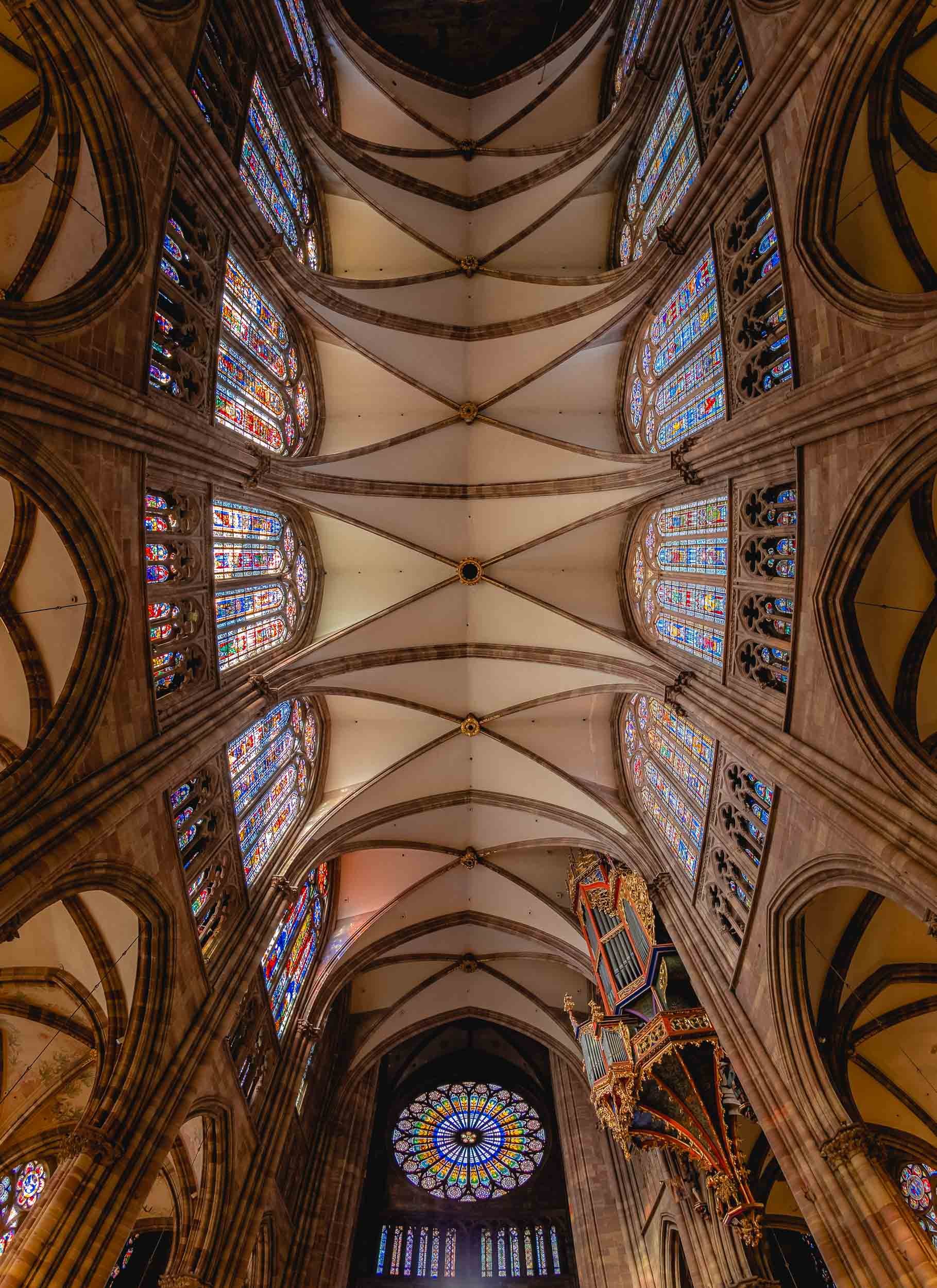
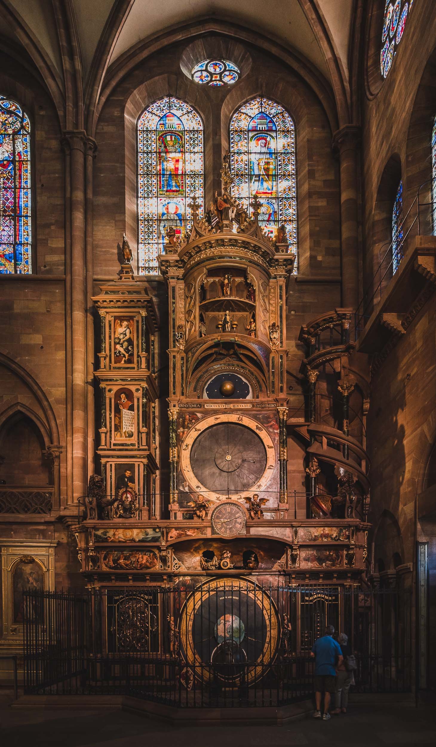
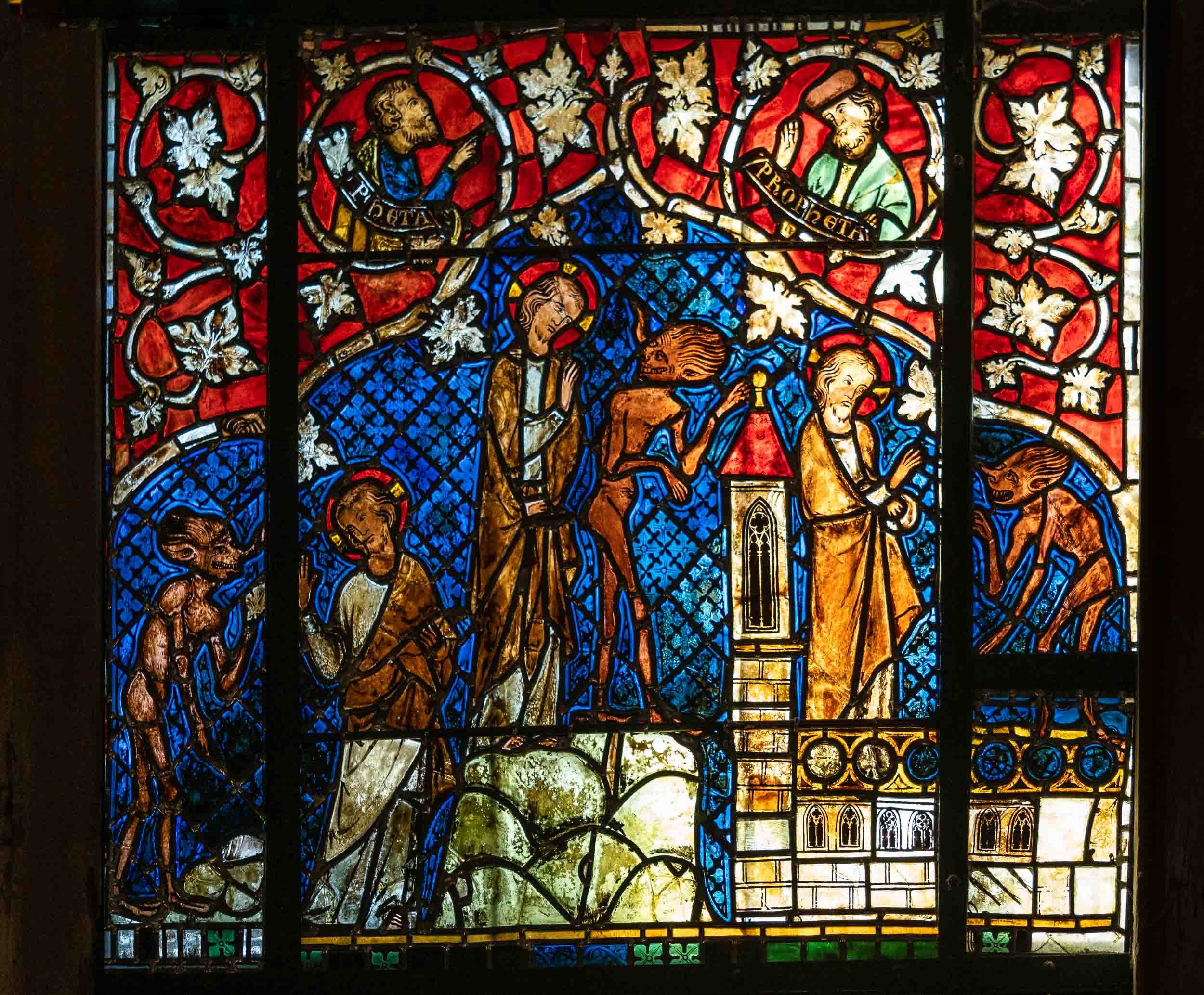
Views from Above
The views from the viewing platform of the cathedral provide a special look at the gothic architecture in the city, and its tilted roofs. On completion, the church was the tallest building in the world for a while, at 142m. In fact, it was meant to have a second identical tower, the preparations for which can be spotted on the empty roof foundation and by the fact the church has the same massive pillars inside to support it. Either way, it made the ascent quite a stair climbing marathon at 332 stairs.


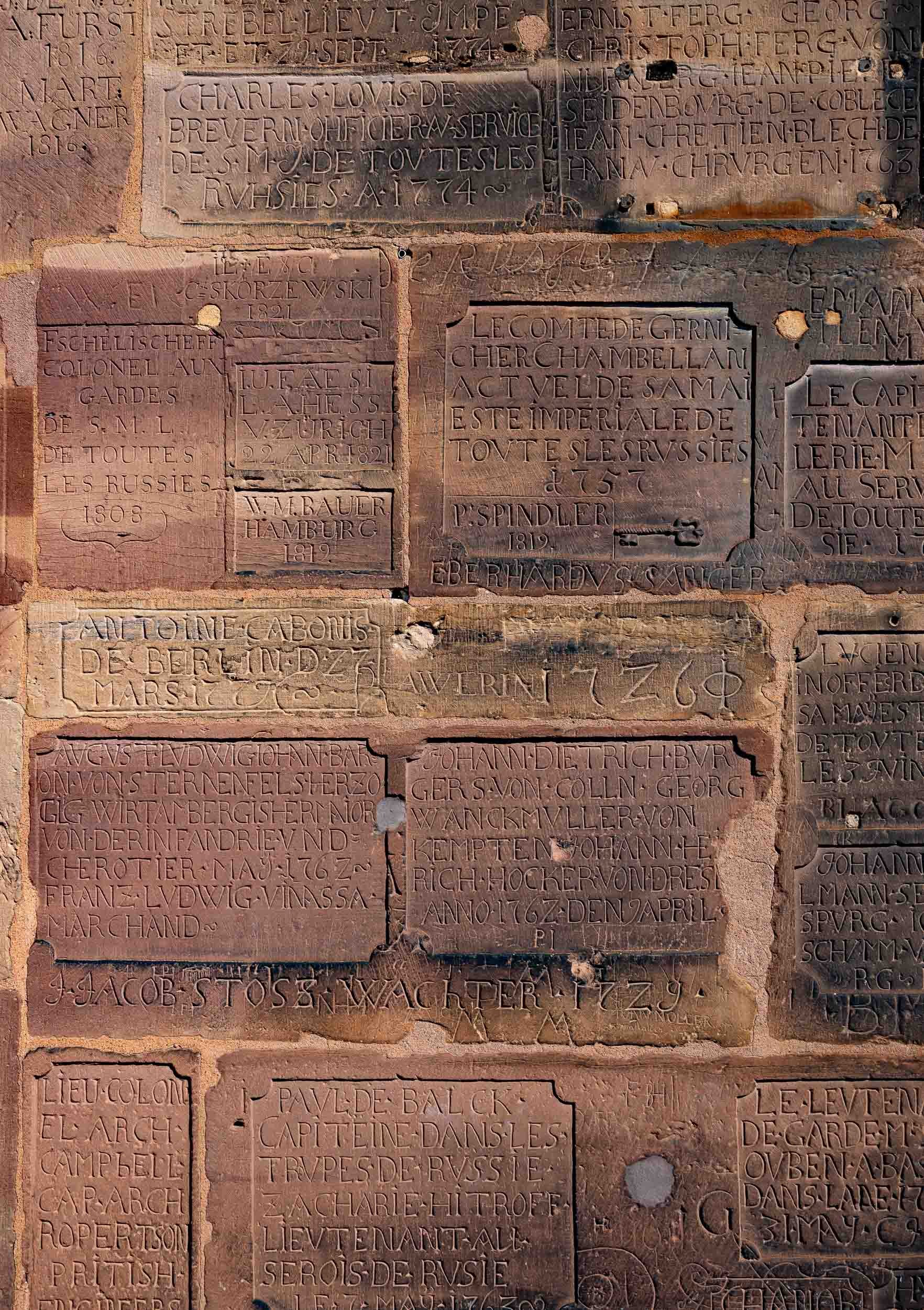
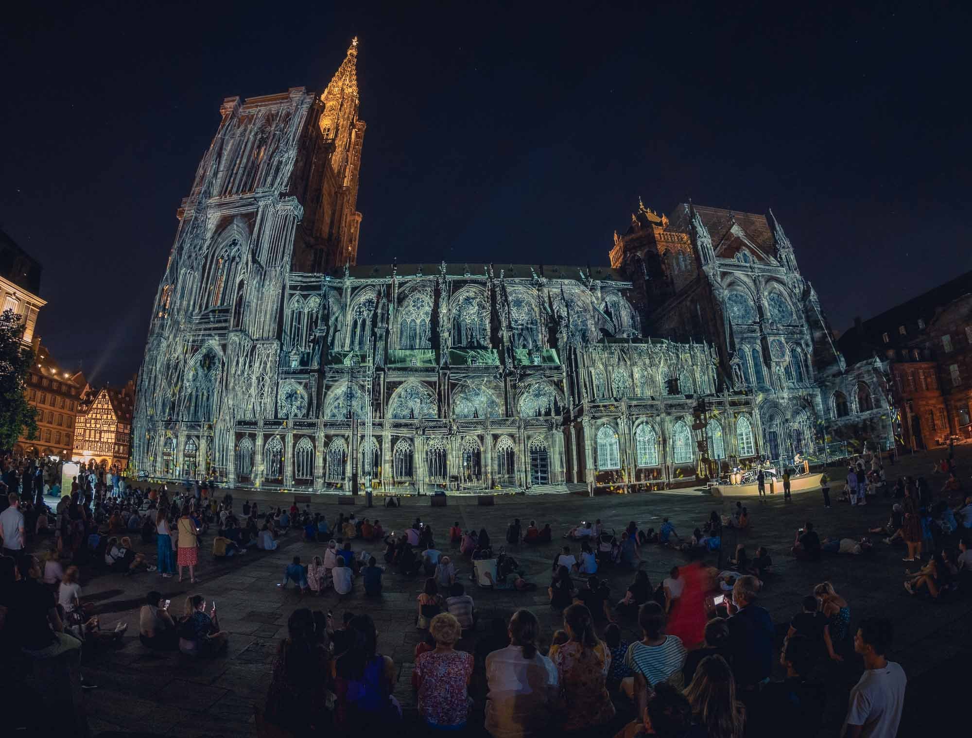
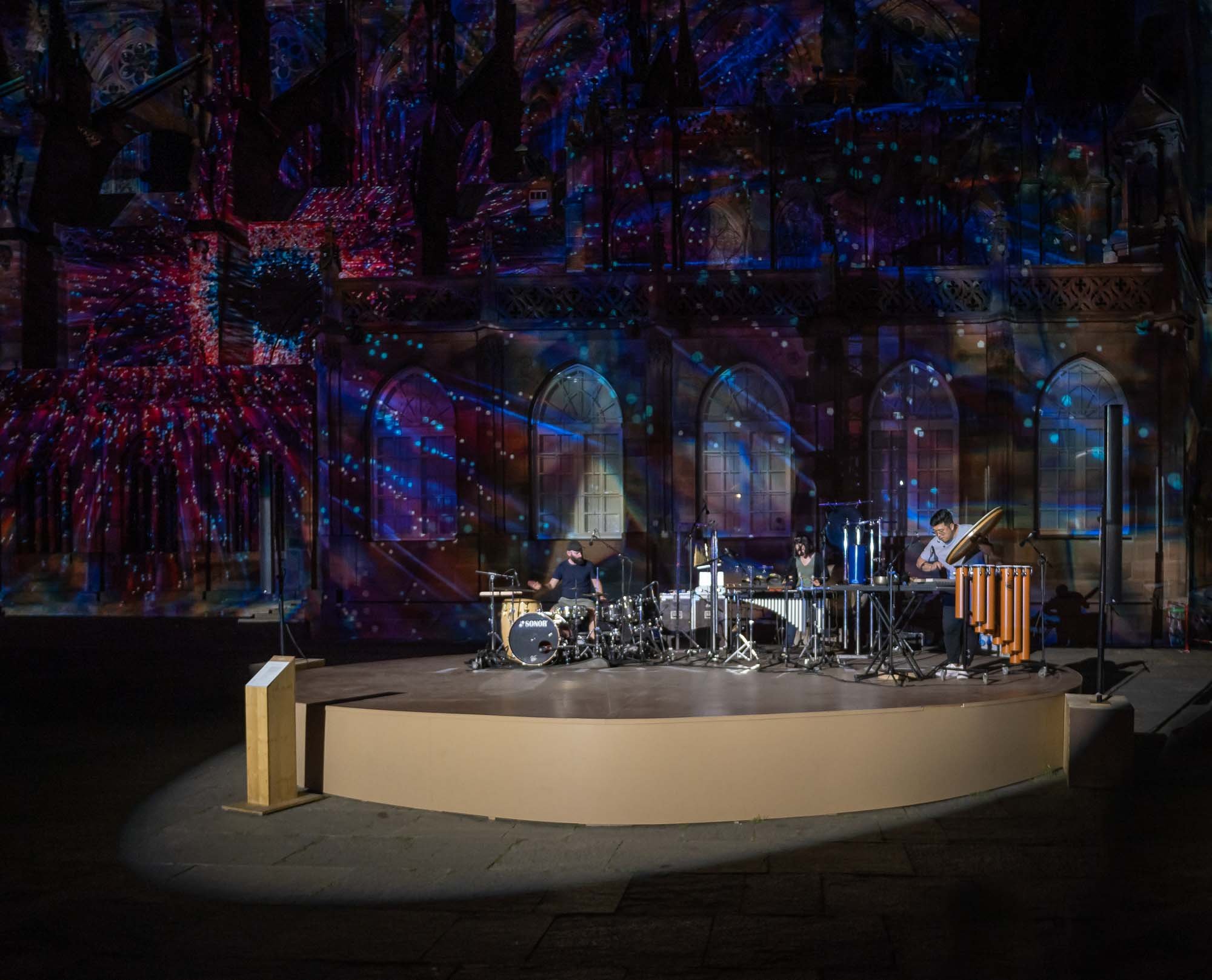
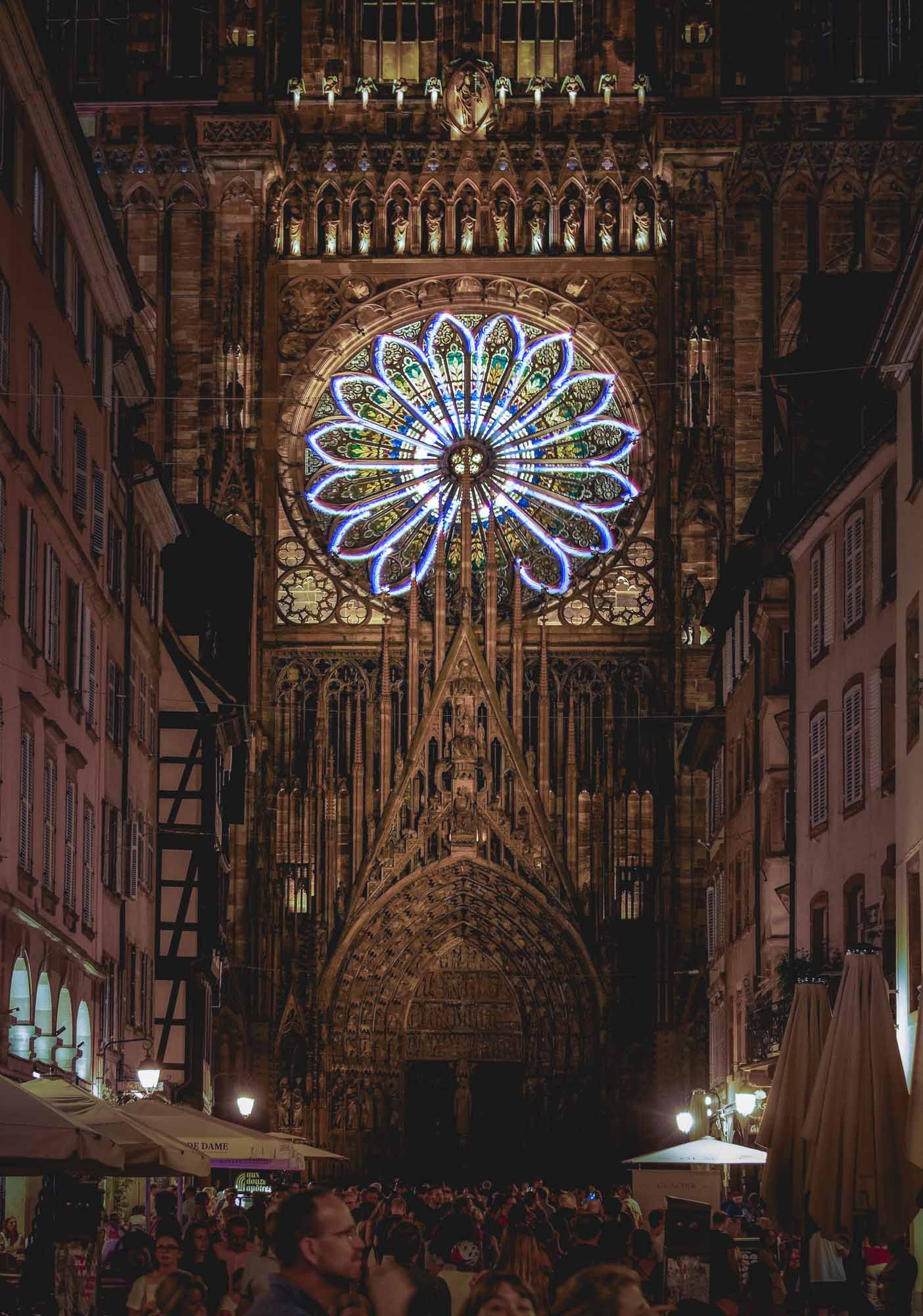
Colmar - The Little Venice
There was definitely a lot more to see in Strasbourg, for example the largest mosque in France, and the seat of the European Parliament, but I took a train to Colmar for a few hours instead, before having to leave the Alsace region for my trip to Iceland. It was worth it to catch a glimpse of one of the regions most picturesque villages with its well-preserved old town.

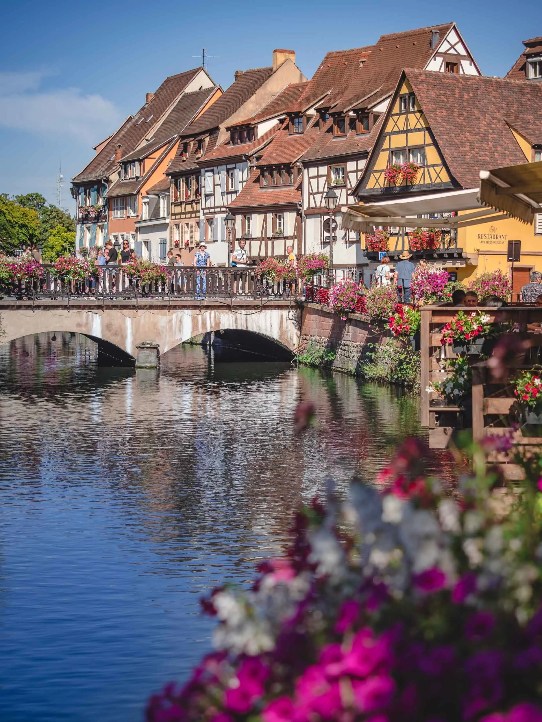
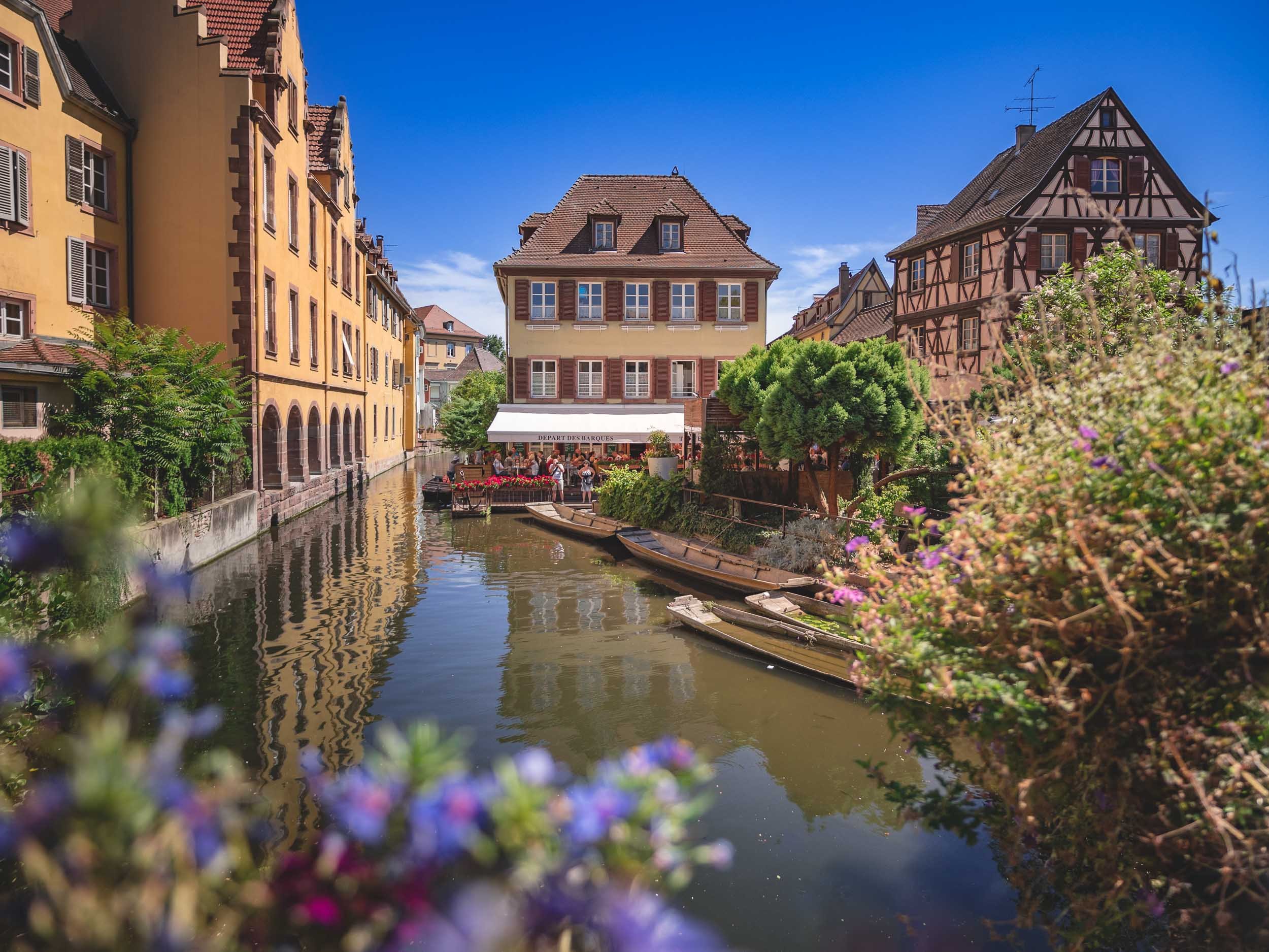
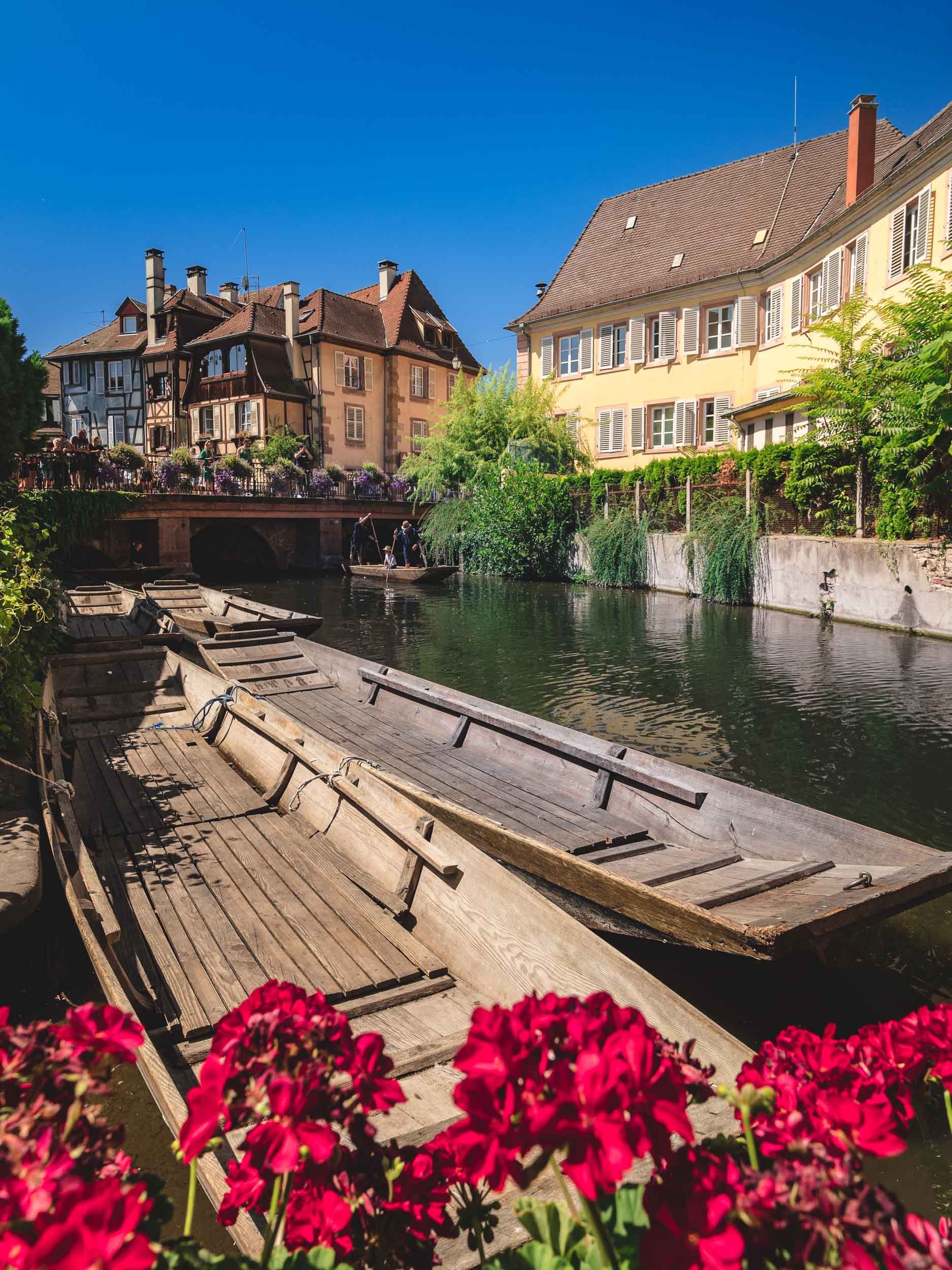
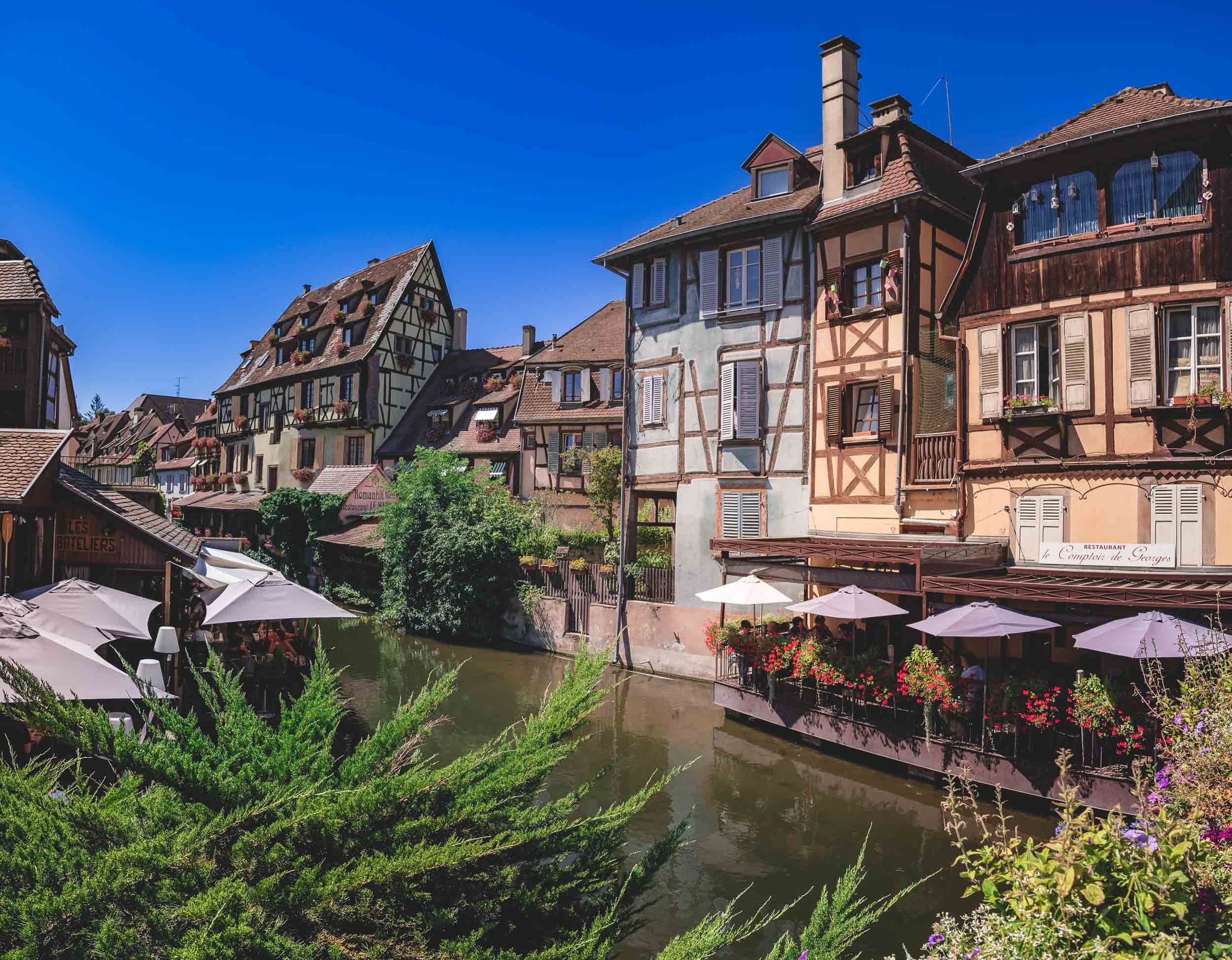


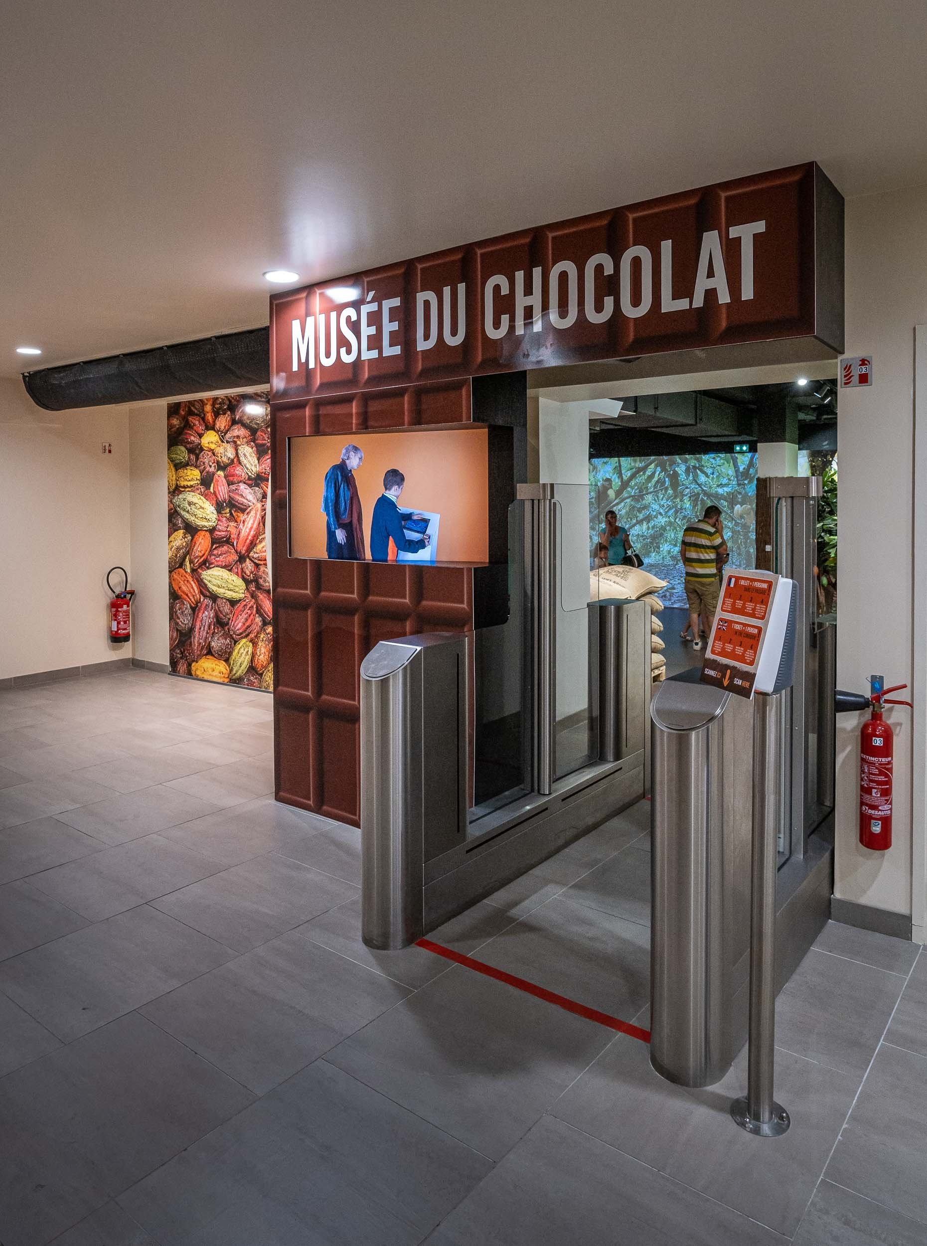
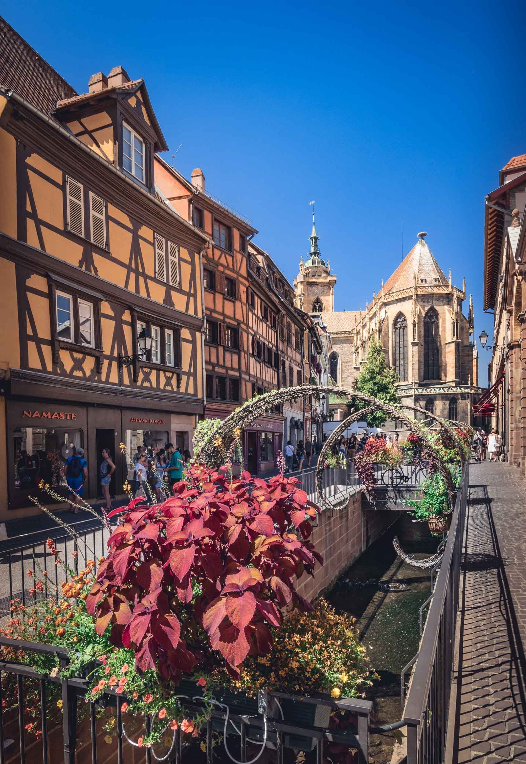
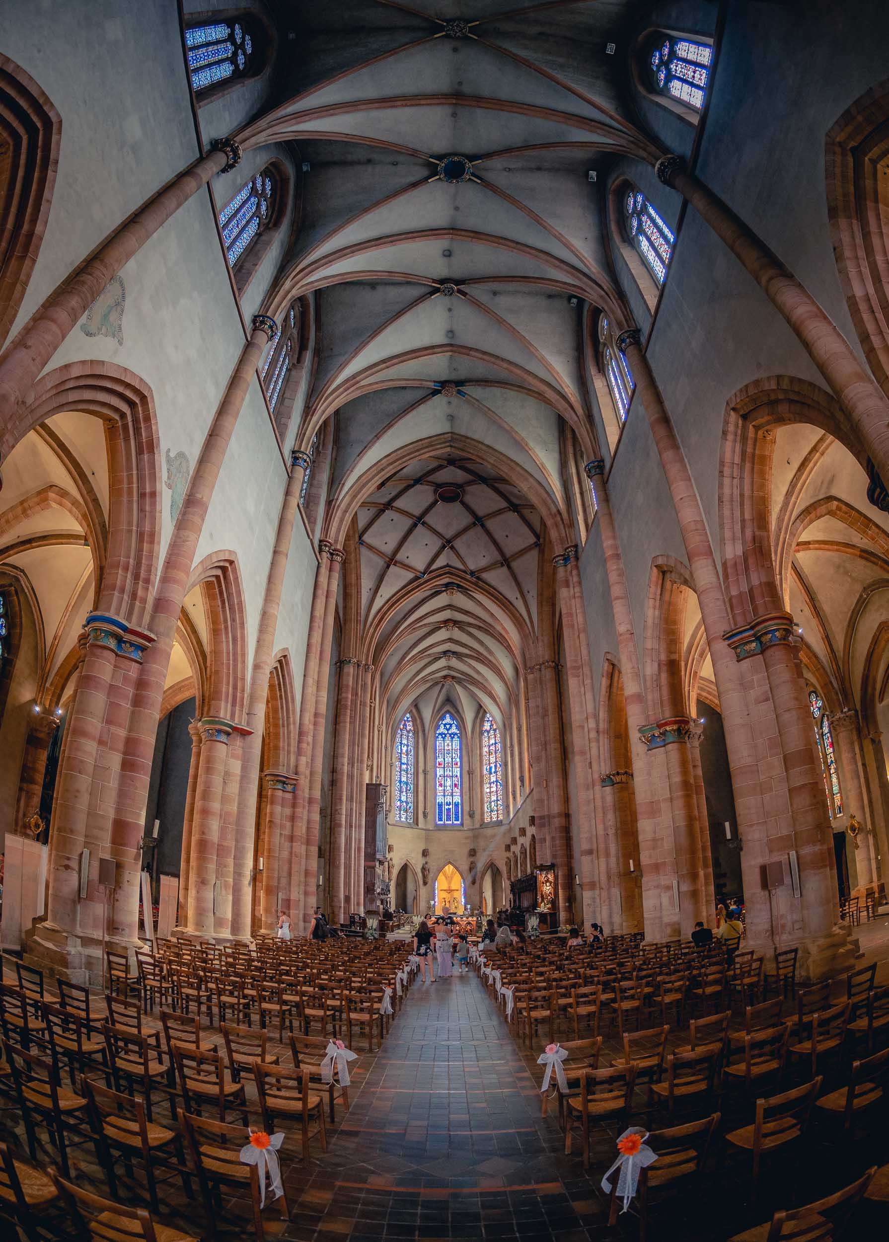
And that was a little excursion to a small corner of south eastern France! As usual, follow along on my Instagram, where I also have a story highlight with some clips from this trip.

🥇 The Epson 2022 Panorama Awards
I woke up to some excellent news a few days ago, telling me that I had won the overall Amateur Award at the 2022 Epson Panorama Awards.

I woke up to some excellent news a few days ago, telling me that I had won the overall Amateur Award at the 2022 Epson Panorama Awards, among 1876 entries, with three images scoring Gold medals, including 1st and 2nd place.
The Winning Image - In Formation 🐘
The dried-up lake bed of Lake Amboseli in Kenya is home to a regular ritual for large elephant families: In the mornings, they cross from the forest areas on one side towards the swamp lands on the other, in search for water. With a bit of patience you can photograph their amazing formations as they walk in line, and if you’re brave enough you might be able to do so from the ground for that extra special perspective. The experience of observing the behavior of these magnificent creatures and how it reflects their social ties and emotions has been very impactful for me, and their plight for survival in a world that continues to hunt them for ivory is a topic that deserves more attention - hopefully this image will help.

The quality of the submissions has been extremely high, as was the case in the previous years. Last year I was able to win the Built Up Environment Amateur category with my “City in the Clouds” panorama (more Dubai fog images here - available as prints!) and in the previous years two of my Timeblend Dubai series collected Silver and Bronze awards, so it’s amazing to see an overall win this year.
Runner Up - The Confrontation
This image is available as a limited edition print of 100 signed editions - contact me for details!

A journey of patience led me to this image, as it took many scouting trips to identify this spot, and even more visits to the location to finally find clear skies adorned by clouds, while a pair of oryx was engaging in their territorial rivalry. The resulting photograph is meant to represent both the confrontation of the animals, but also the contrast of harsh urban shapes of Dubai, with the natural soft outlines of the dunes of the UAE desert.
Sunrise in the Clouds

A panoramic view of Downtown Dubai, Business Bay, and the Sheikh Zayed Road skyline, as the beautiful blue hues of the morning light slowly turn orange and yellow from the rising sun in the east, illuminating the world's tallest building while thick fog rolling in from the desert covers the ground, creating the illusion of a city in the clouds. While many images of this rare phenomenon exist by now, I’ve always been looking for a new angle and composition during my time in Dubai - through persistence and patience I’ve been able to achieve this goal through a panoramic photo from the roof of a skyscraper that’s a little bit set back from the rest of the skyline.
Congratulations to all other winners and listed entries, make sure you check out the full gallery of the Awards here - incredible photography!


Iceland - Documenting the Inferno
August 2022 saw a Volcano erupting on Iceland’s Reykjanes peninsula, and it was an event I could not miss.

While I was hiking glaciers in Alaska, something on the other end of the temperature spectrum happened a few thousand kilometers east: Iceland recorded another Volcano eruption, after last year’s 6 months period of volcano activity on the Reykjanes peninsula not far from Reykjavik. Having missed the previous occasion, I decided to book a flight and car in a 36h window on August 15th, between other trips I had already confirmed. It was a risky plan, given the fact that the activity could slow down or even stop at any moment, and knowing that Iceland’s weather is more than unpredictable. In the end, it was the right move, since I had great weather for most of the trip, and even more so because the eruption has effectively stopped as of August 22nd.
I arrived at the country’s international airport in late afternoon and took a rental car towards the Volcano location, which is just 45min from the airport, only stopping to get some groceries as I planned to stay at the site over night.
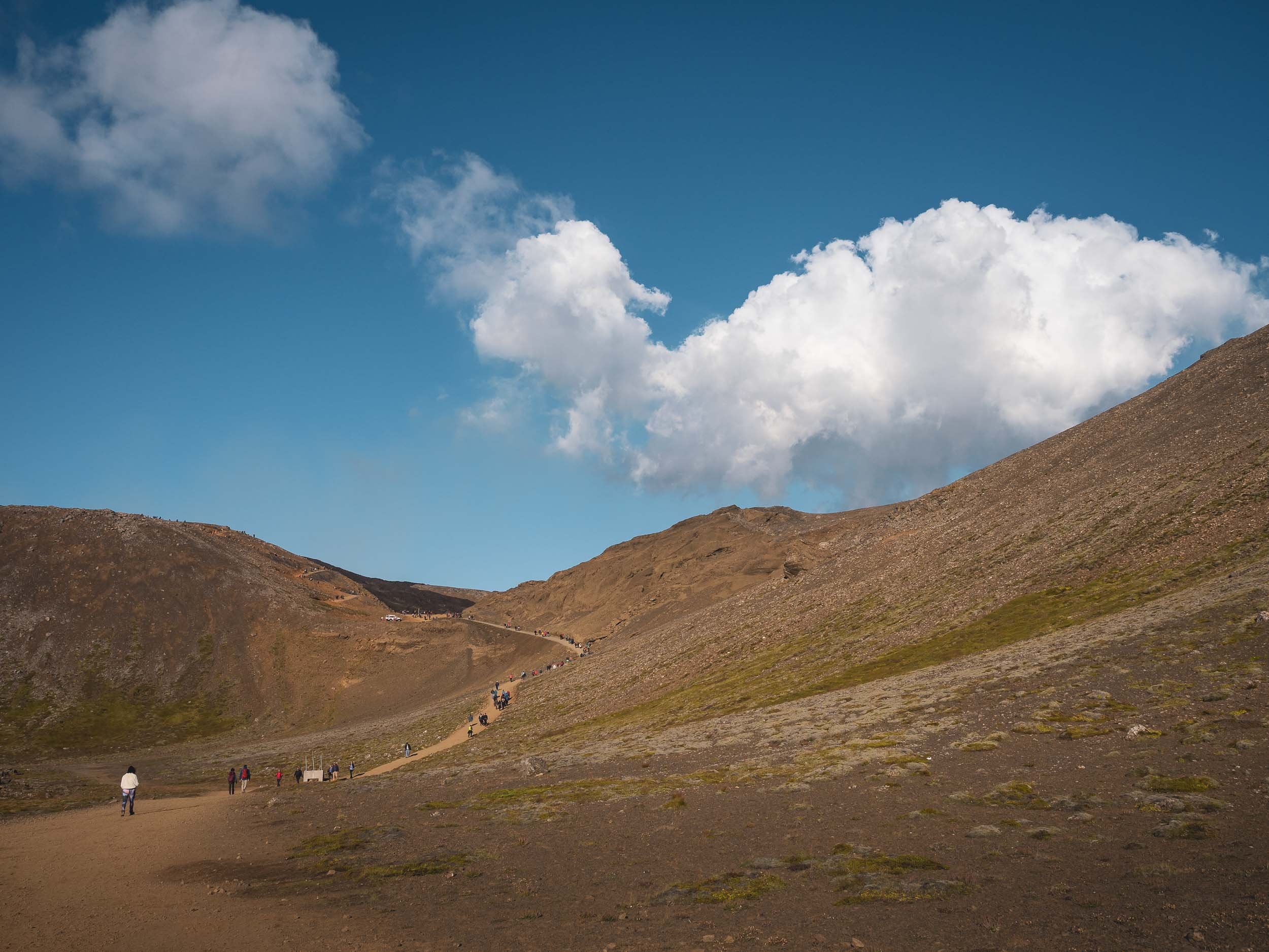

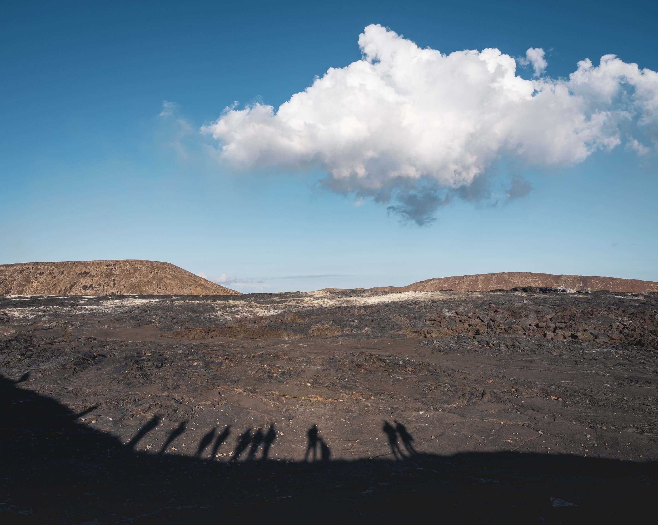
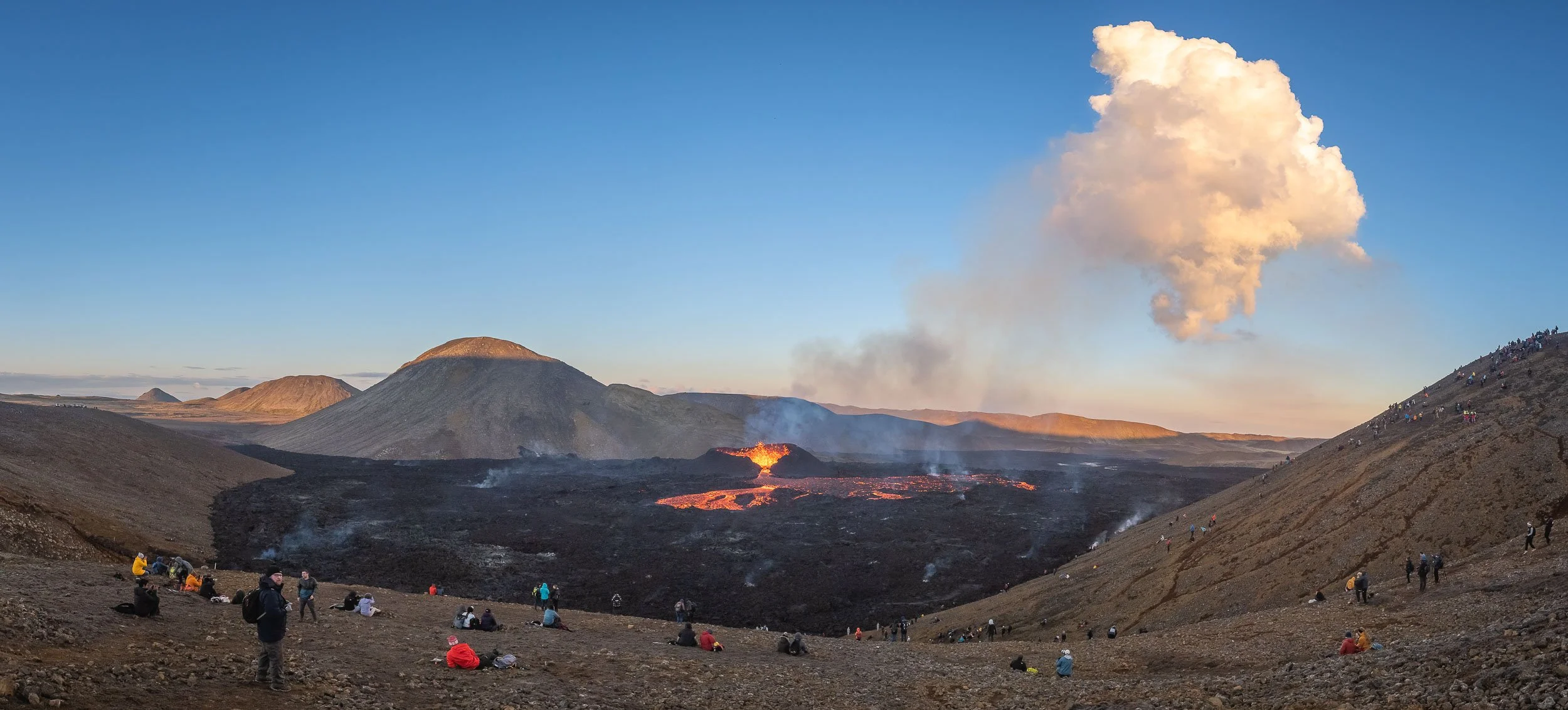
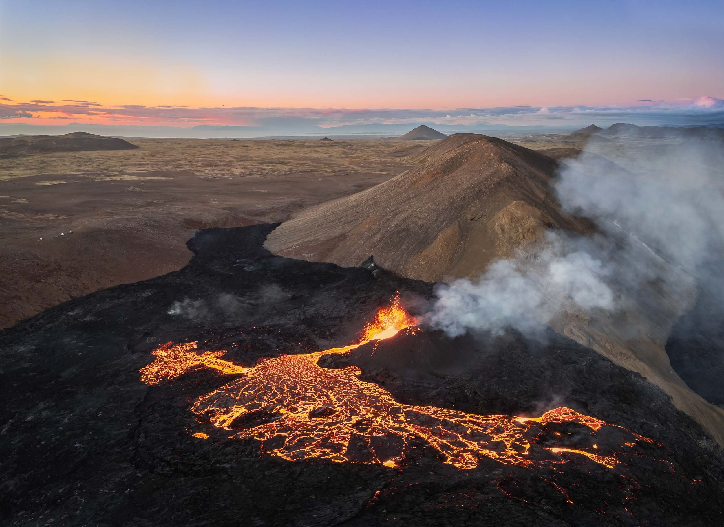
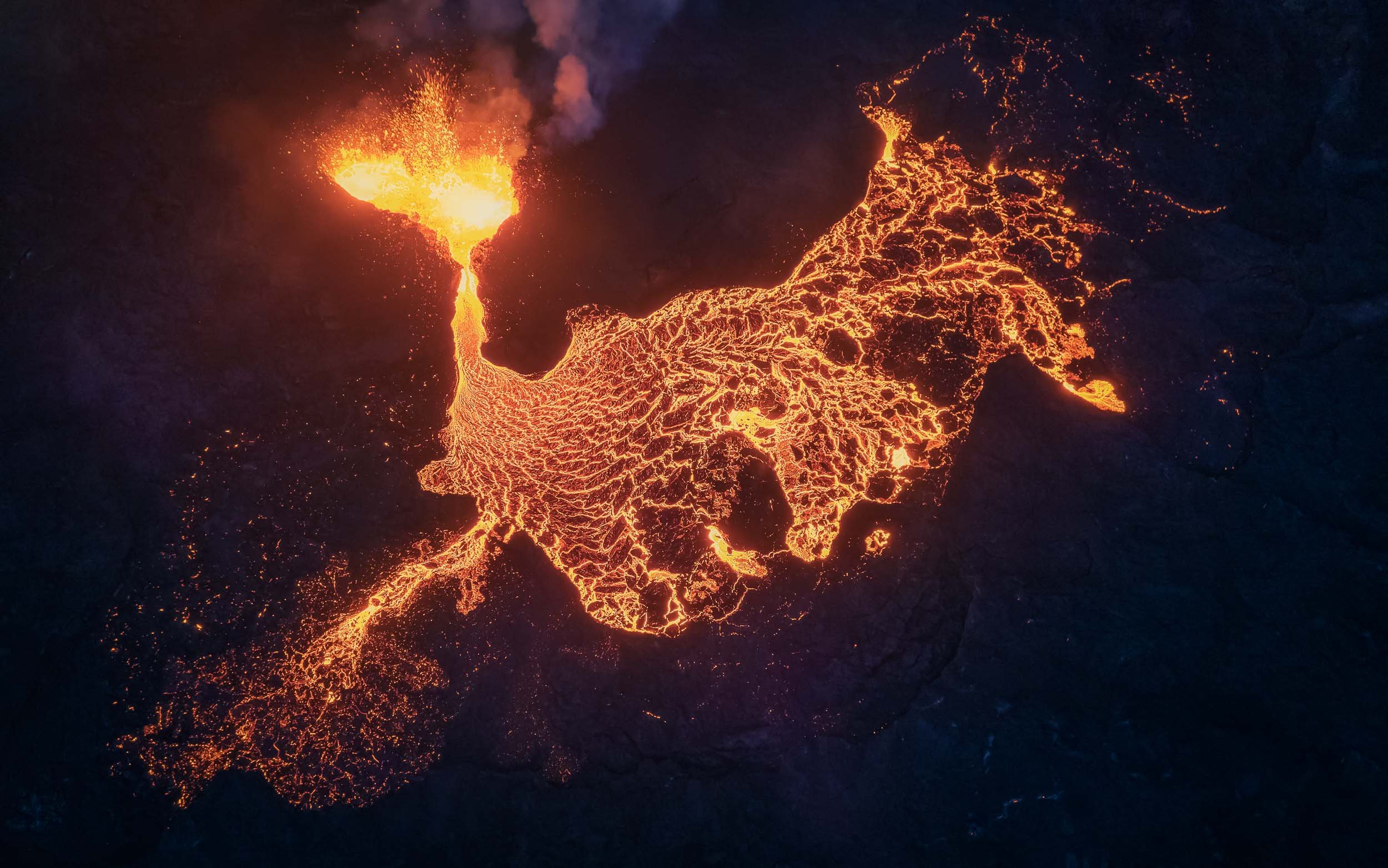
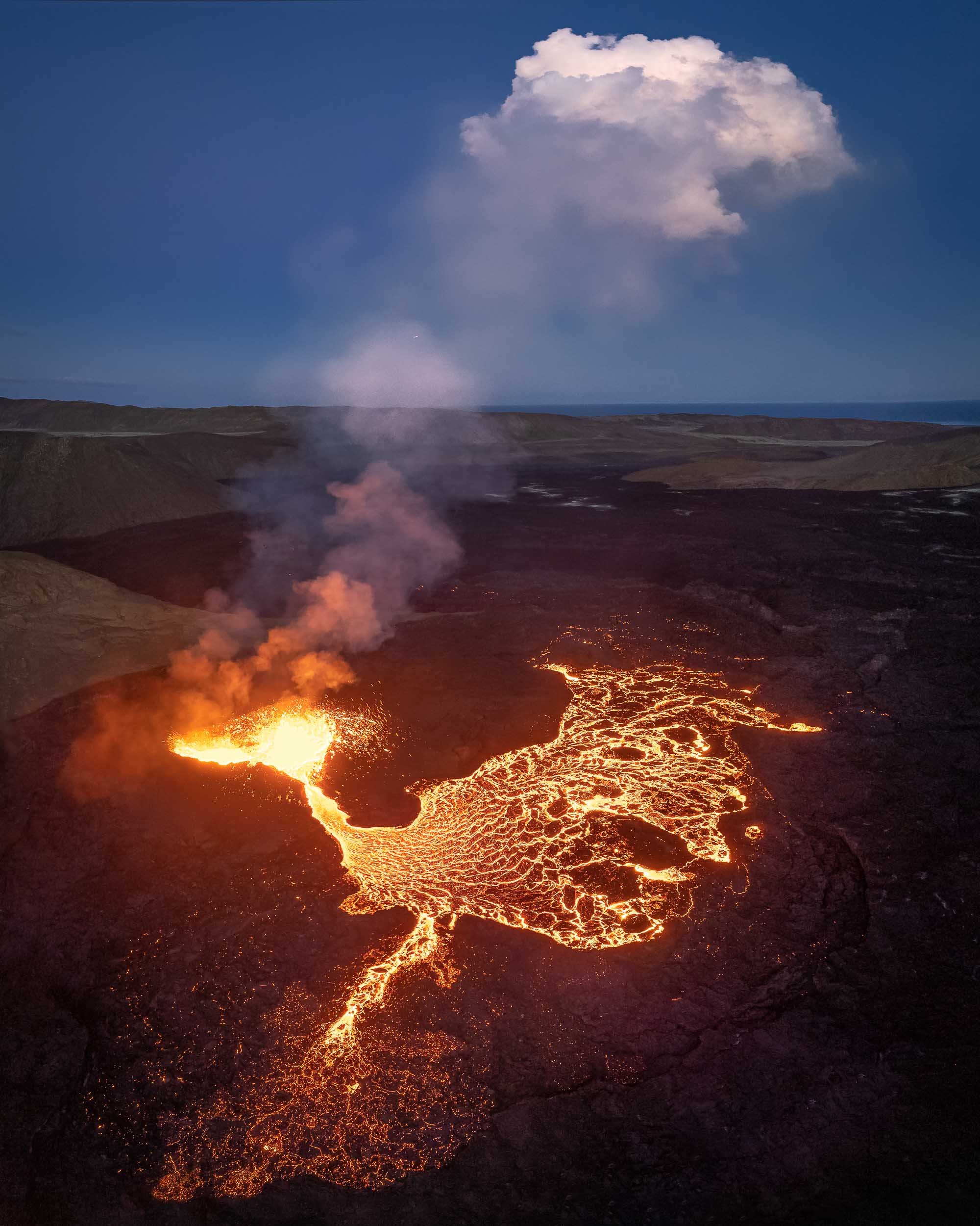


Watching the Inferno
A few images of people hiking along the hills surrounding the volcano at night.


Volcano In Motion - Highlights
If you enjoyed the photos, seeing the spewing lava in motion adds another dimension.
Morning Vibes
I spent over 14h at the site in total on the first day, to catch these views. What made it even more worth it is the fact that I was literally the only one here around 7am, surrounded by nothing but the noise of the volcano.
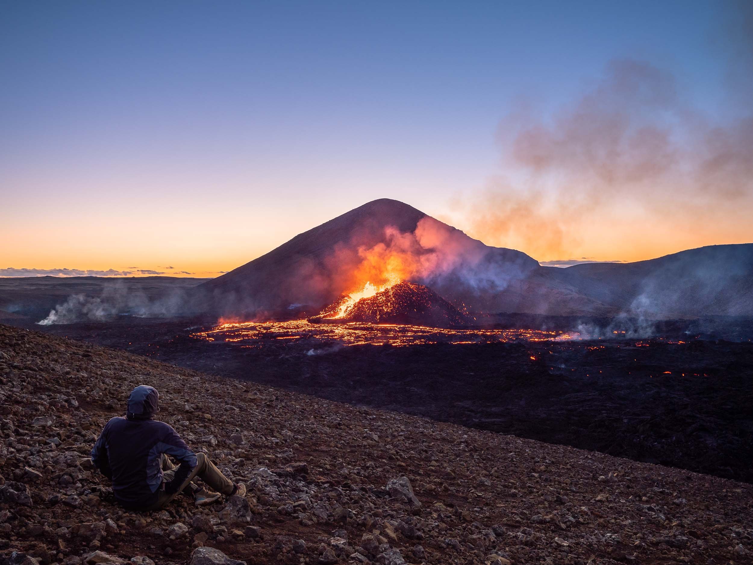
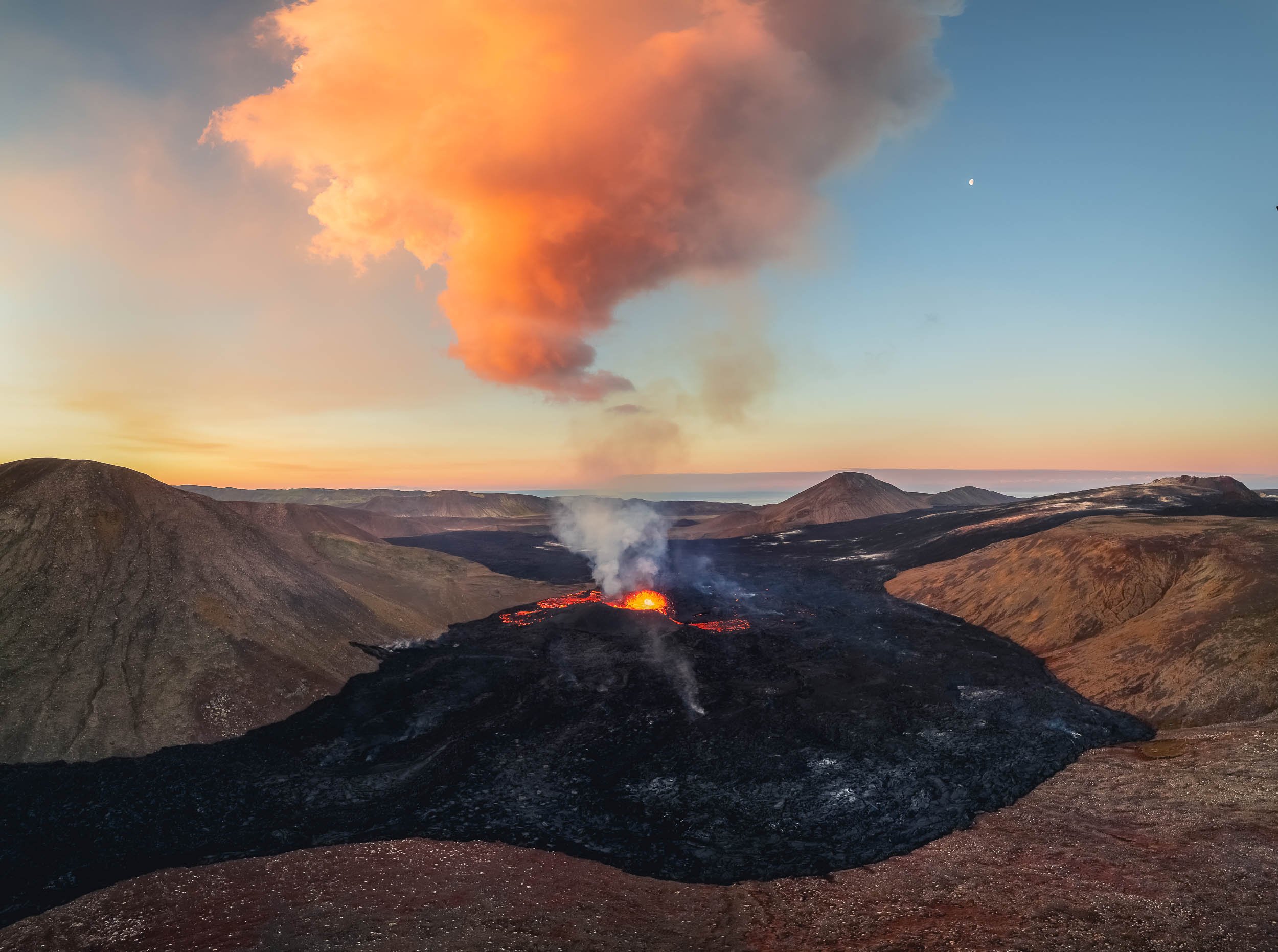
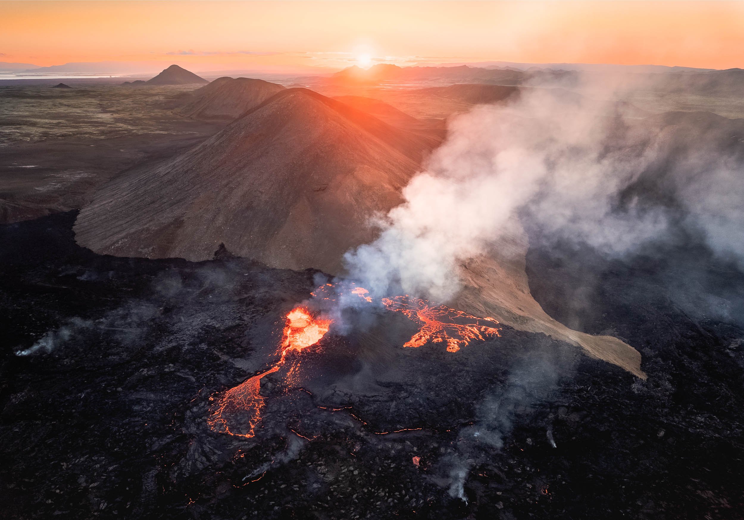


An Aerial View
While flying a drone makes for amazing imagery, your own perception still stays on the ground. Only a helicopter can change that, so after sunrise I went to Reykjavik to take a look from above with my own eyes.

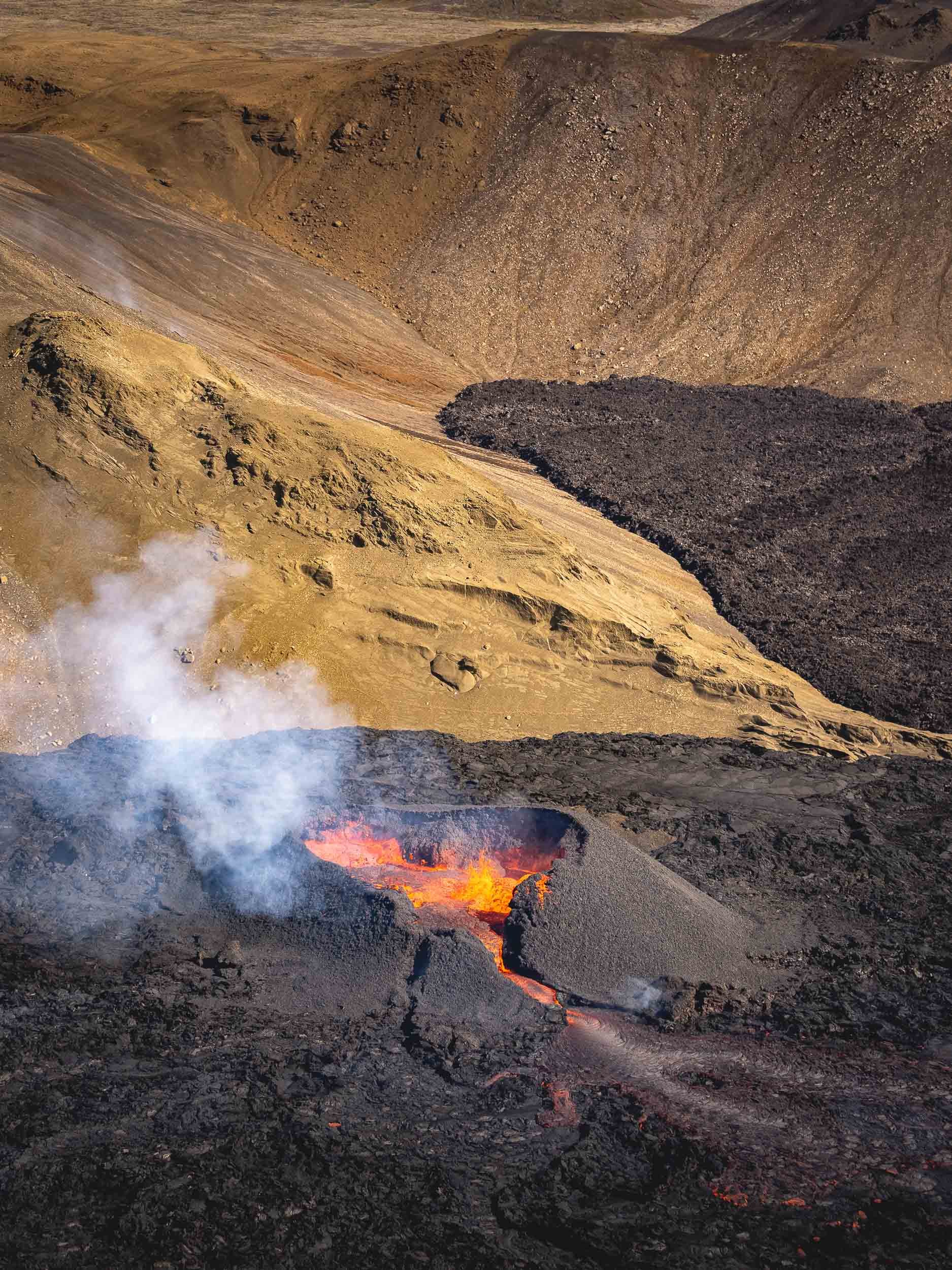
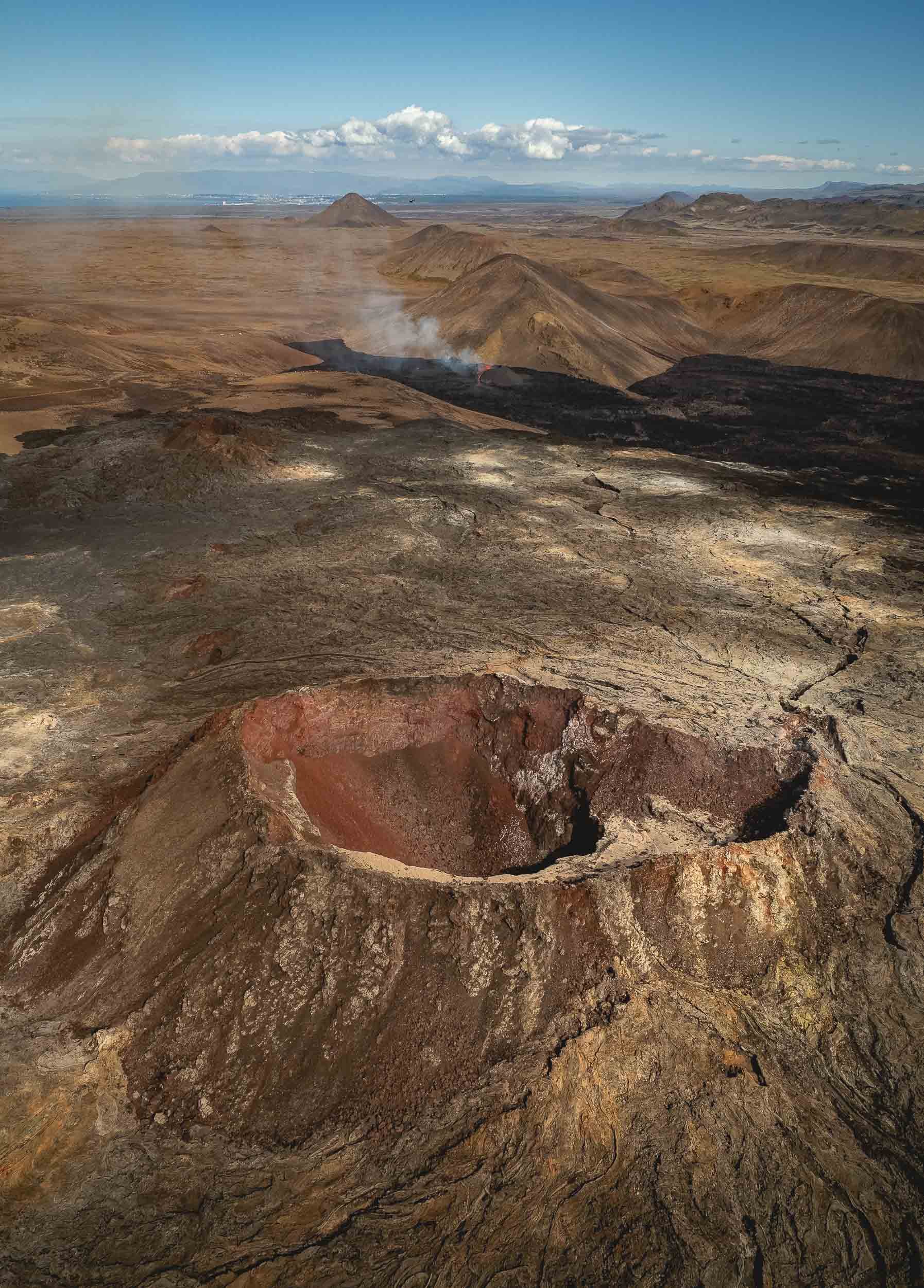
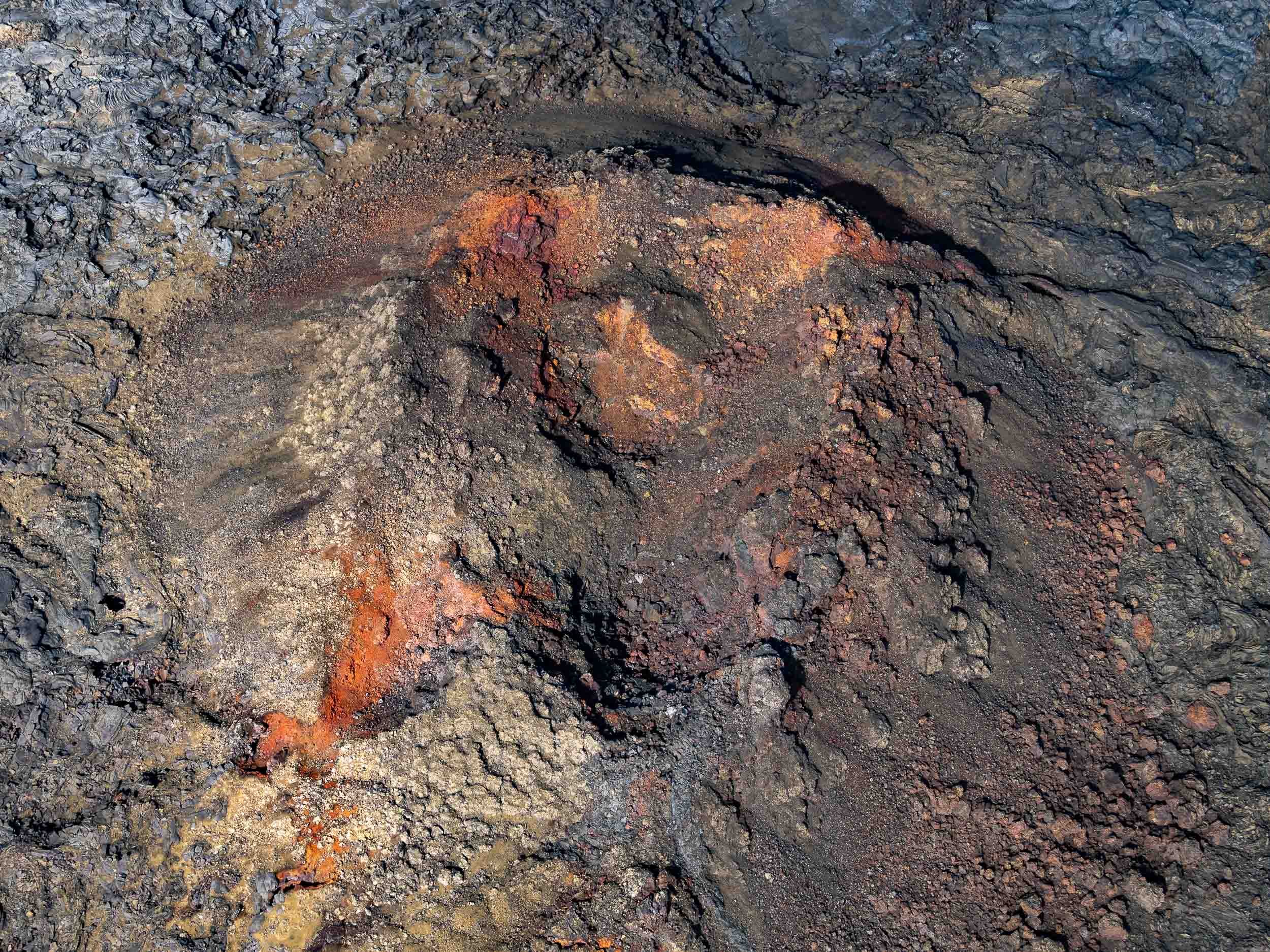
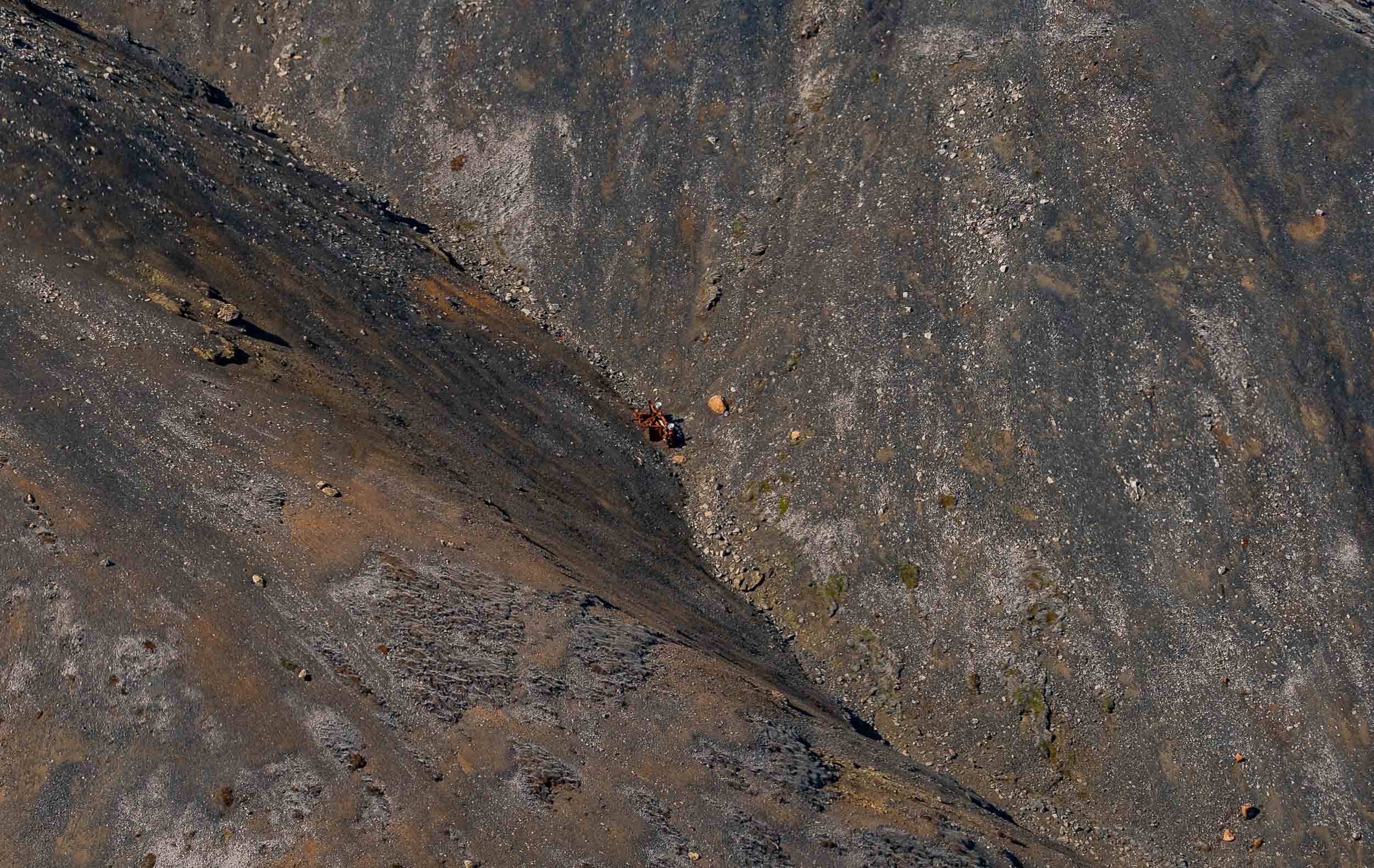
The flight also led us over a few more of Iceland’s beautiful landscapes.


The Last Attempt
After the helicopter flight I had planned to come back for another night before my 7am return flight, and started my trek before sunset in reasonably good weather. This was when I got to experience when they say that Icelandic weather conditions are unpredictable. 90min later, when I was just settling down at the volcano site, clouds, wind, and rain took over, making the experience of sitting on the hill completely unprotected a rather miserable one.
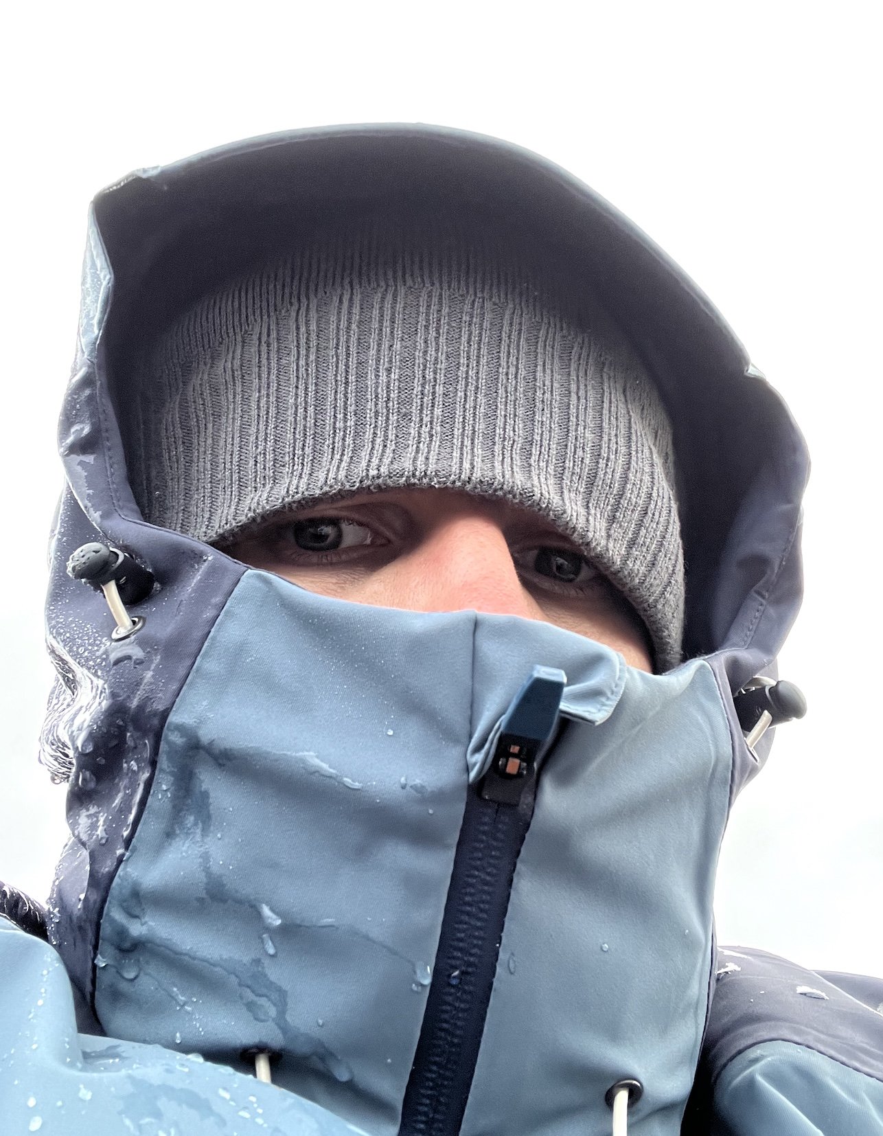
Since I really wanted to get a few more aerial shots, I held on for another 2h, catching a small break in the rain where I - despite heavy wind gusts - felt the drone would survive a short flight, before heading back to the car in the pouring rain for a few hours of sleep. I’d say it was worth it.
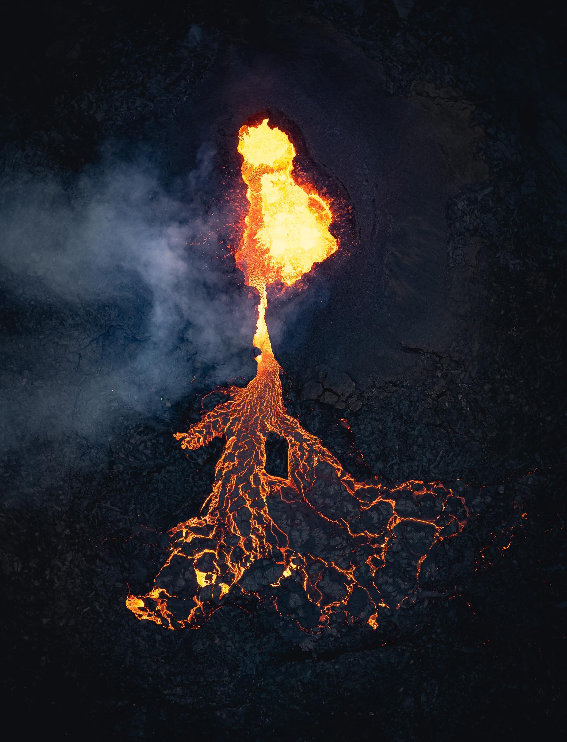
A Recap
Here is a timelapse sequence of the the evening , moonrise, and next day’s sunrise.
And that was 36h in Iceland - it was an expensive and tough journey, but I wouldn’t have had it any other way.

Alaska - The Last (and Vast) Frontier
Alaska - endless wilderness, bear country, the largest state, home to the tallest mountain in North America.

Alaska - endless wilderness, bear country, the largest state, home to the tallest mountain in North America, and a few random surprises. There’s a lot of beauty to be discovered here, as I learnt during my trip with Capture The Atlas.
From Anchorage to Kenai Fjords
Day 1 took us along a few interesting sights on the road from the state’s largest city (which is not its capital) to Seward, gateway to Kenai fjords, a National Park.
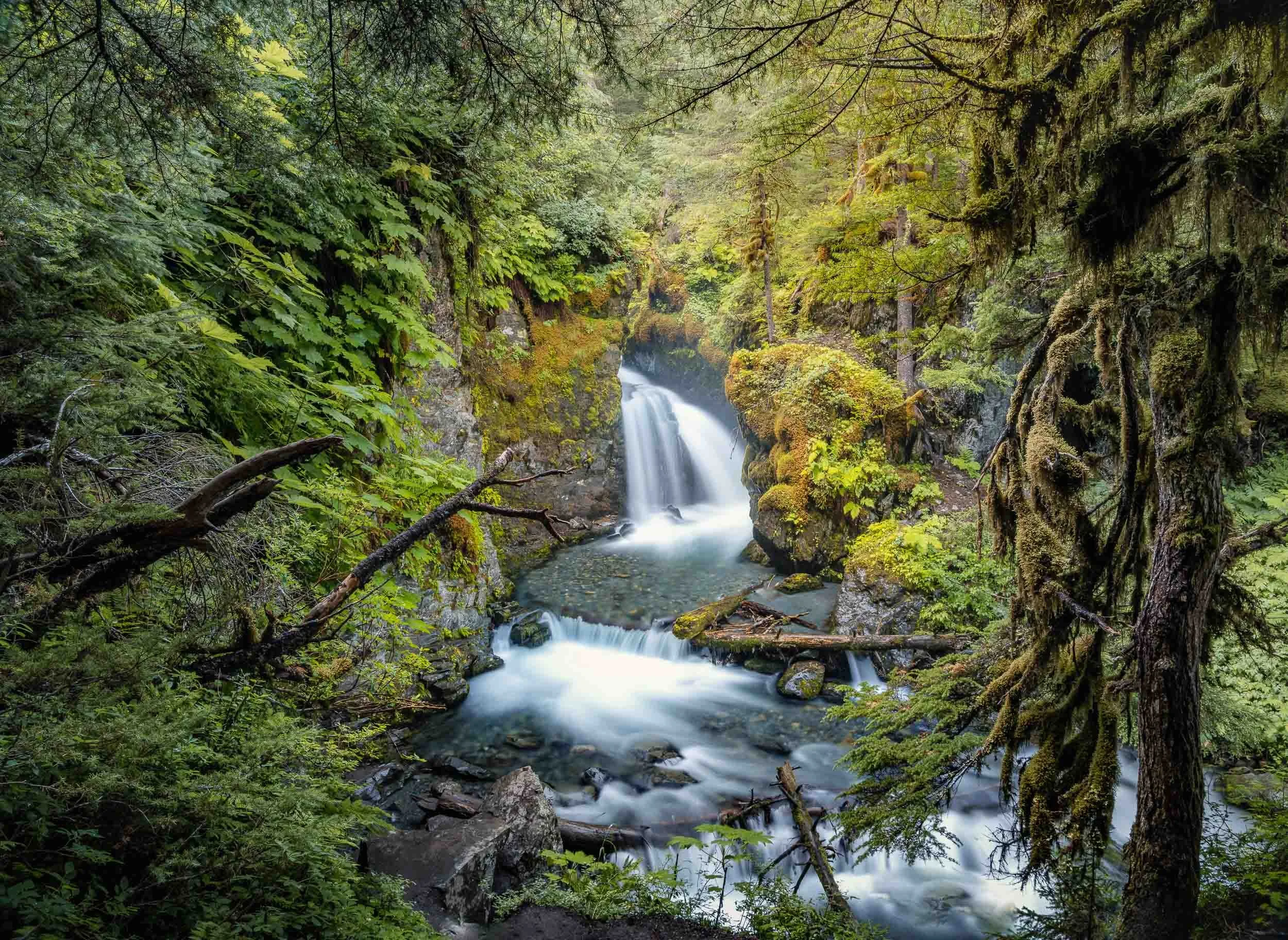

Byron Glacier
The second stop was Byron Glacier, an easily accessible glacier with a small ice cave, visible at the bottom of the aerial photo.


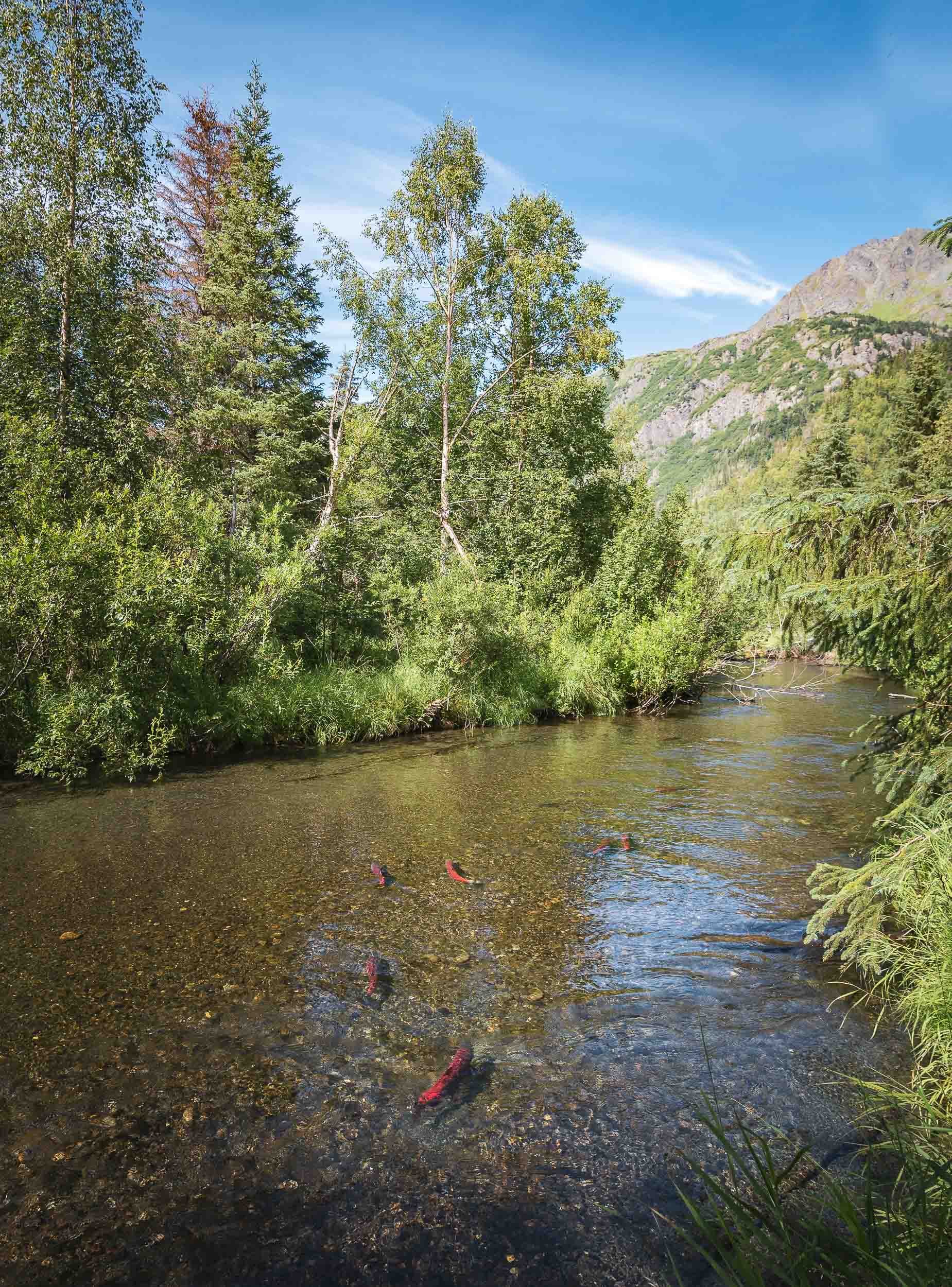
Exit Glacier
We had one more stop on the way to Seward, which was the aptly named “Exit Glacier” - it’s literally receding so quickly, it may be gone within our lifetime. Signs along the trail show how its terminus moved over the last 200 years, and the speed by which it does can hardly be described as glacial - up to 100m a year.


The Kenai Fjords
A boat cruise into the smallest national park of Alaska was next on the agenda. While the size of the park may not compare to others in the state, it does contain the largest ice field in the US at almost 2000 sqkm, with almost 40 glaciers feeding from it.
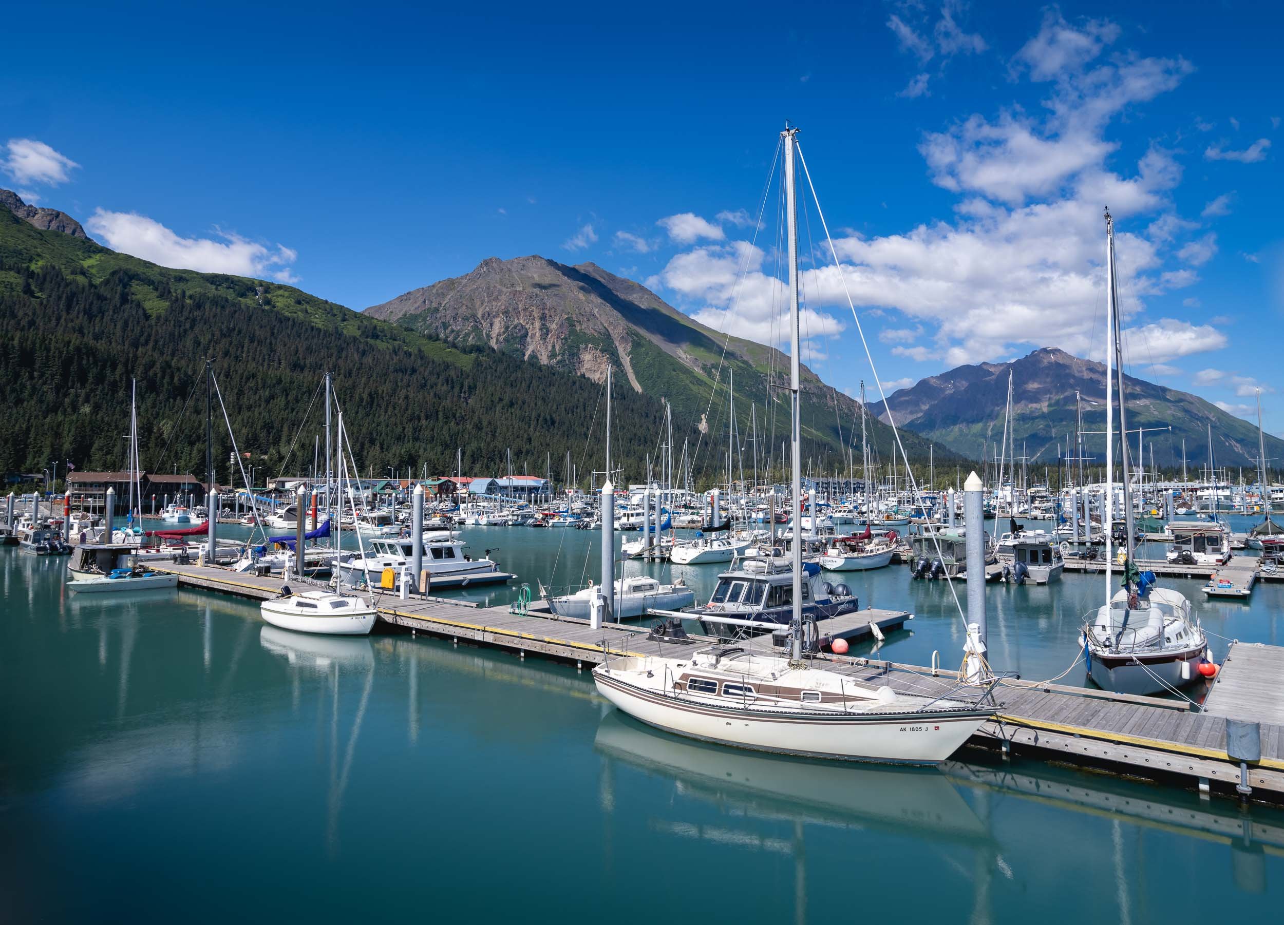
Wildlife Sightings
The area is home to varied wildlife, and we spotted puffins, sea otters, harbor seals, and a humpback whale.


Our destination was Aialik Glacier in the namesake bay.


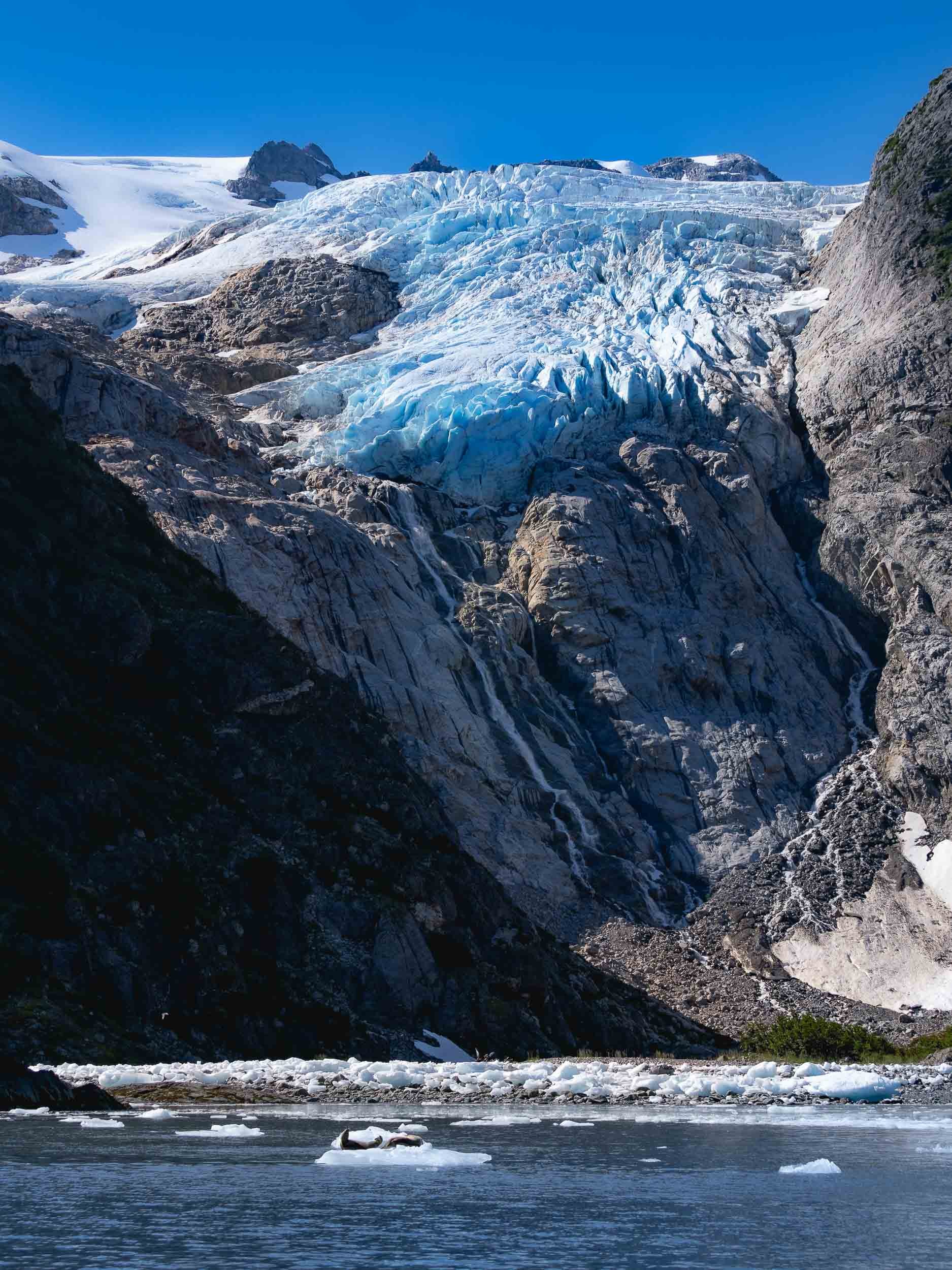
Bears of Crescent Lake
From Kenai we took a flight over the beautiful landscapes (more on that later) towards a turquoise lake across the Cook Inlet, with the goal to find and photograph brown bears. In fact, three of them acted as our greeting committee, sitting by the shorelines while the floatplane approached the lake, but quickly hiding in the bushes as we landed on the water.
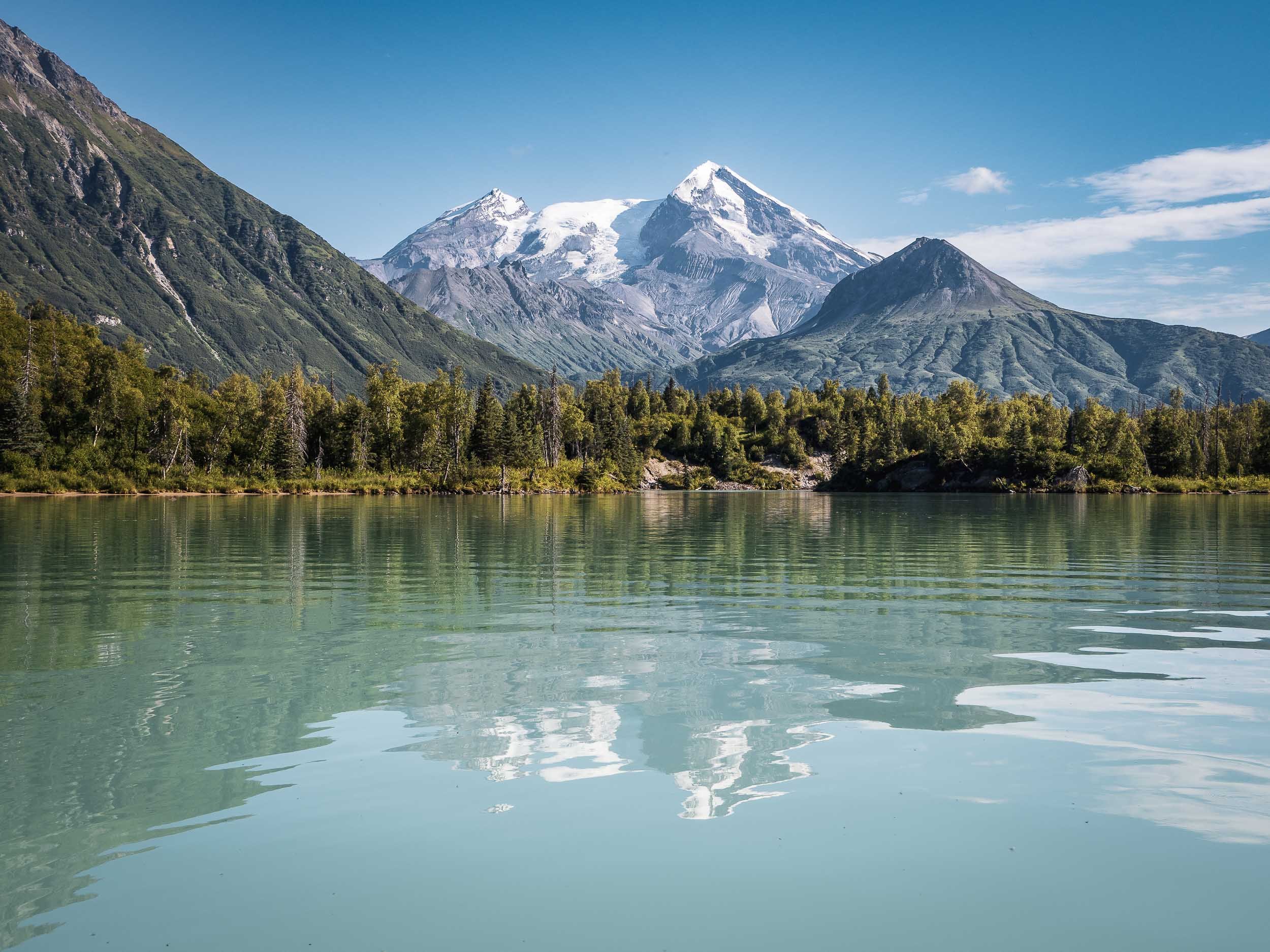
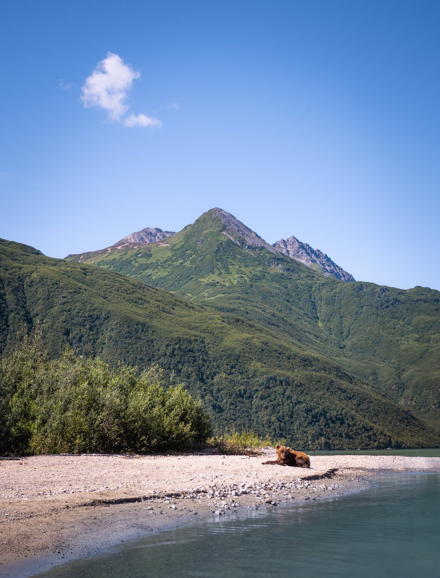


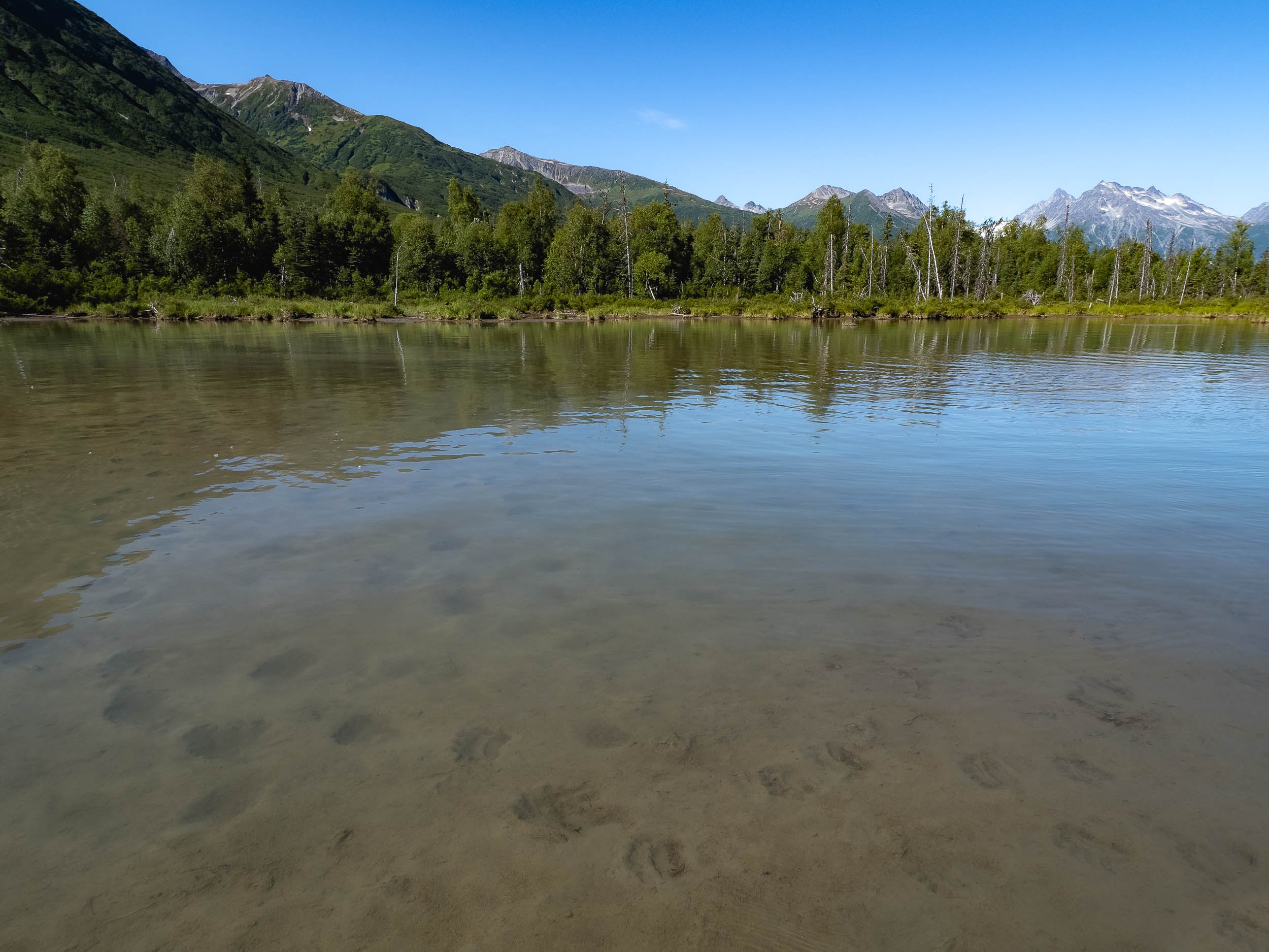
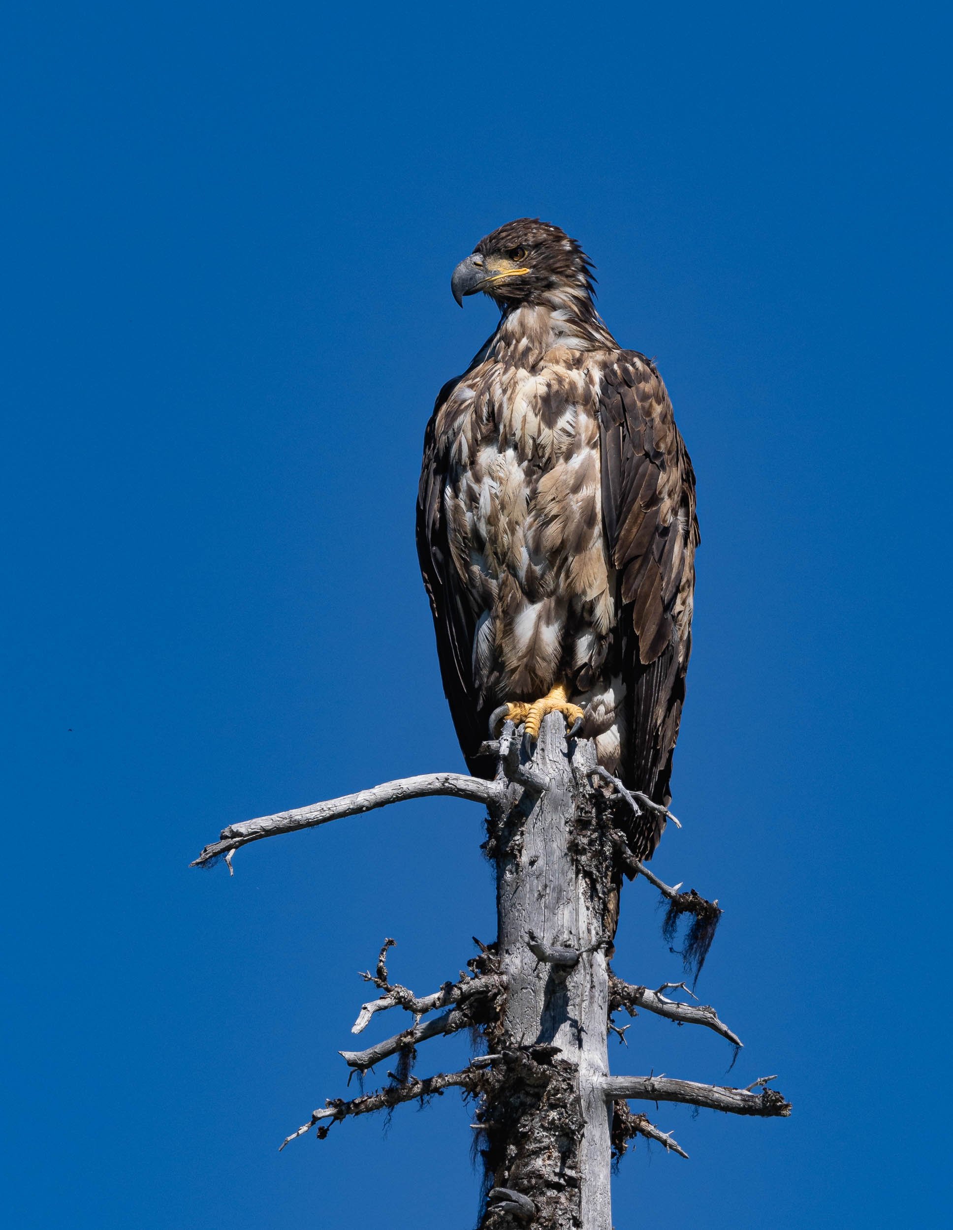
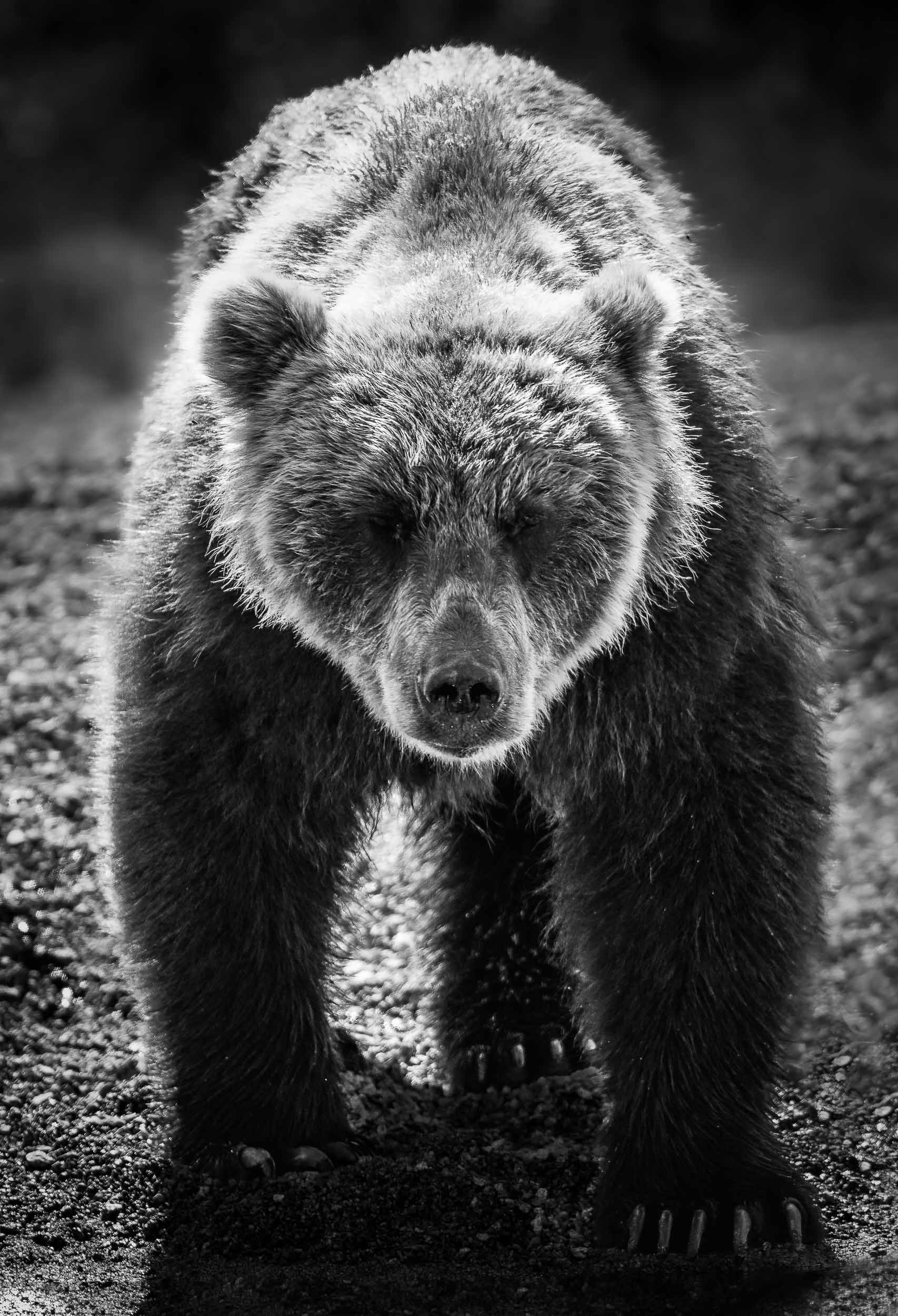
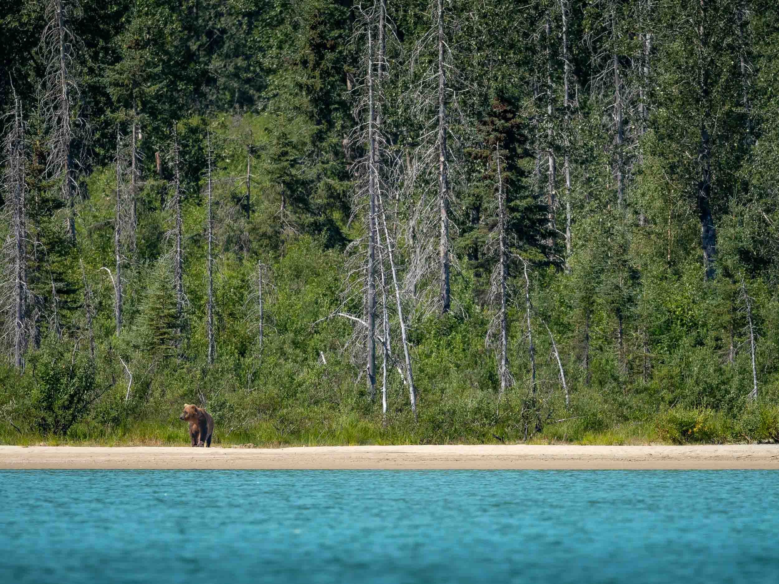
Back in Anchorage, a scenic Flight, and another (attempted) Bear Tour
From Anchorage we took a flight to Chinitna Bay for another bear tour in a different environment.
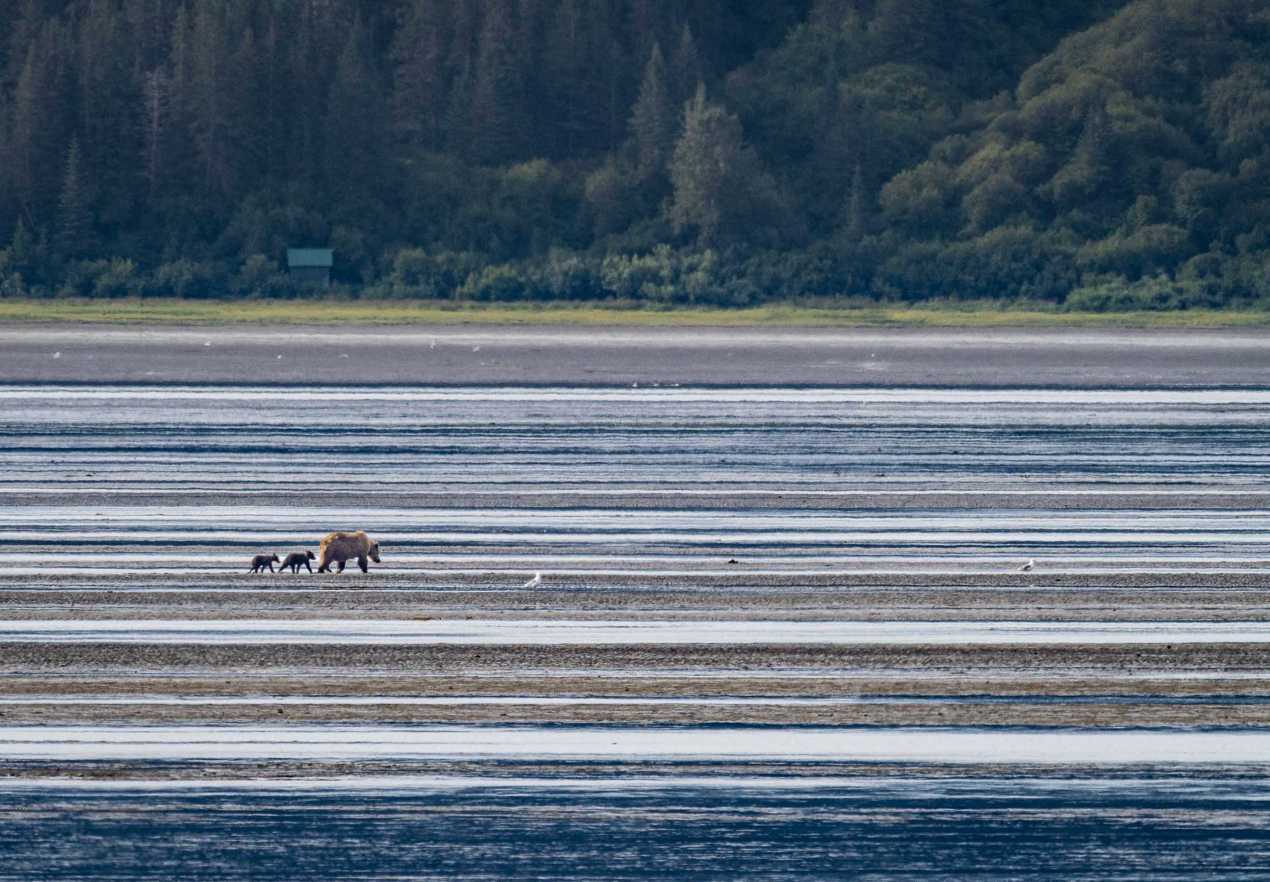
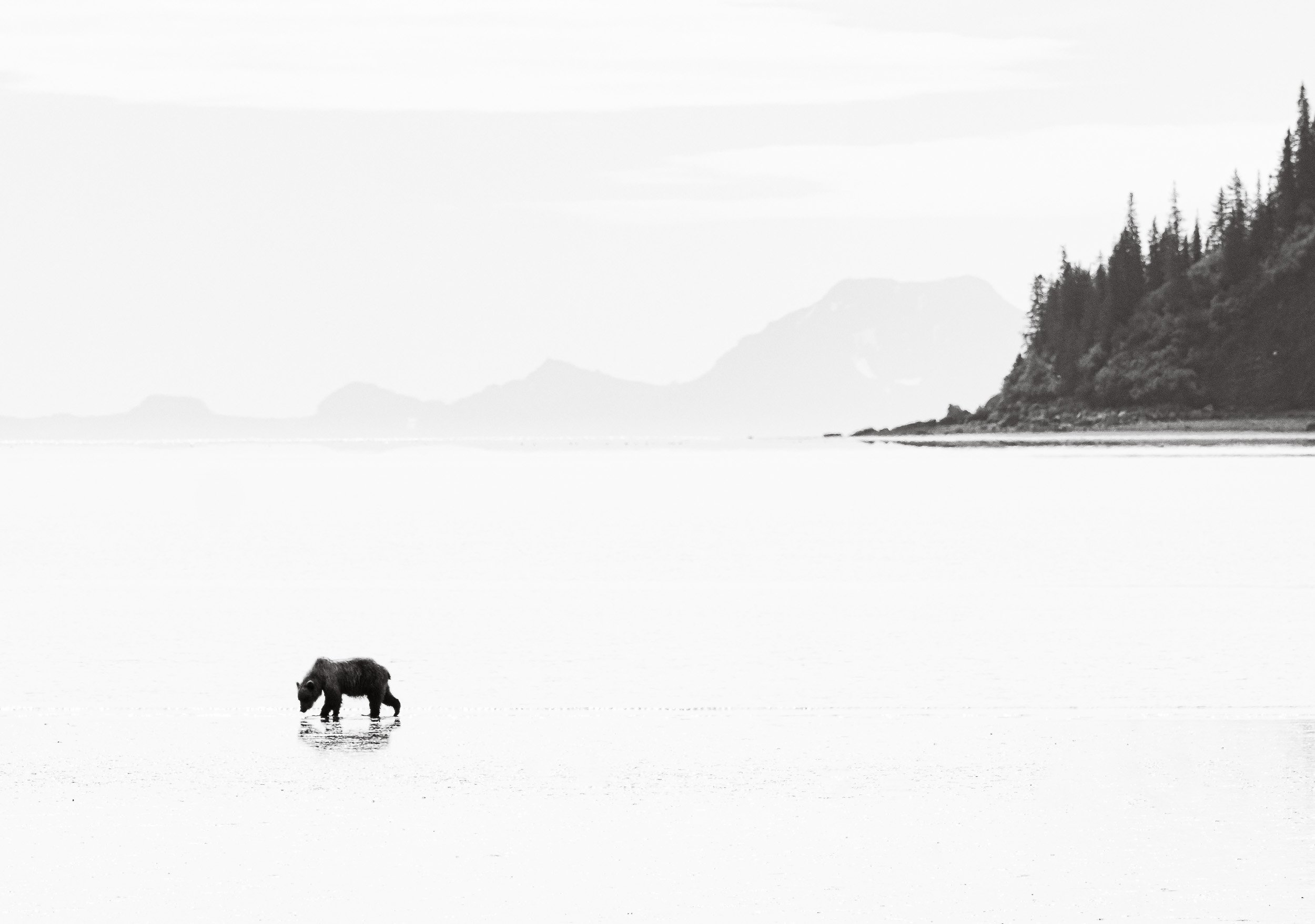
Shapes & Colours
The flight to and from the location partly made up for this disappointment though, as the views of the Alaskan landscapes, volcanoes, mountains, and ground patters were incredible.


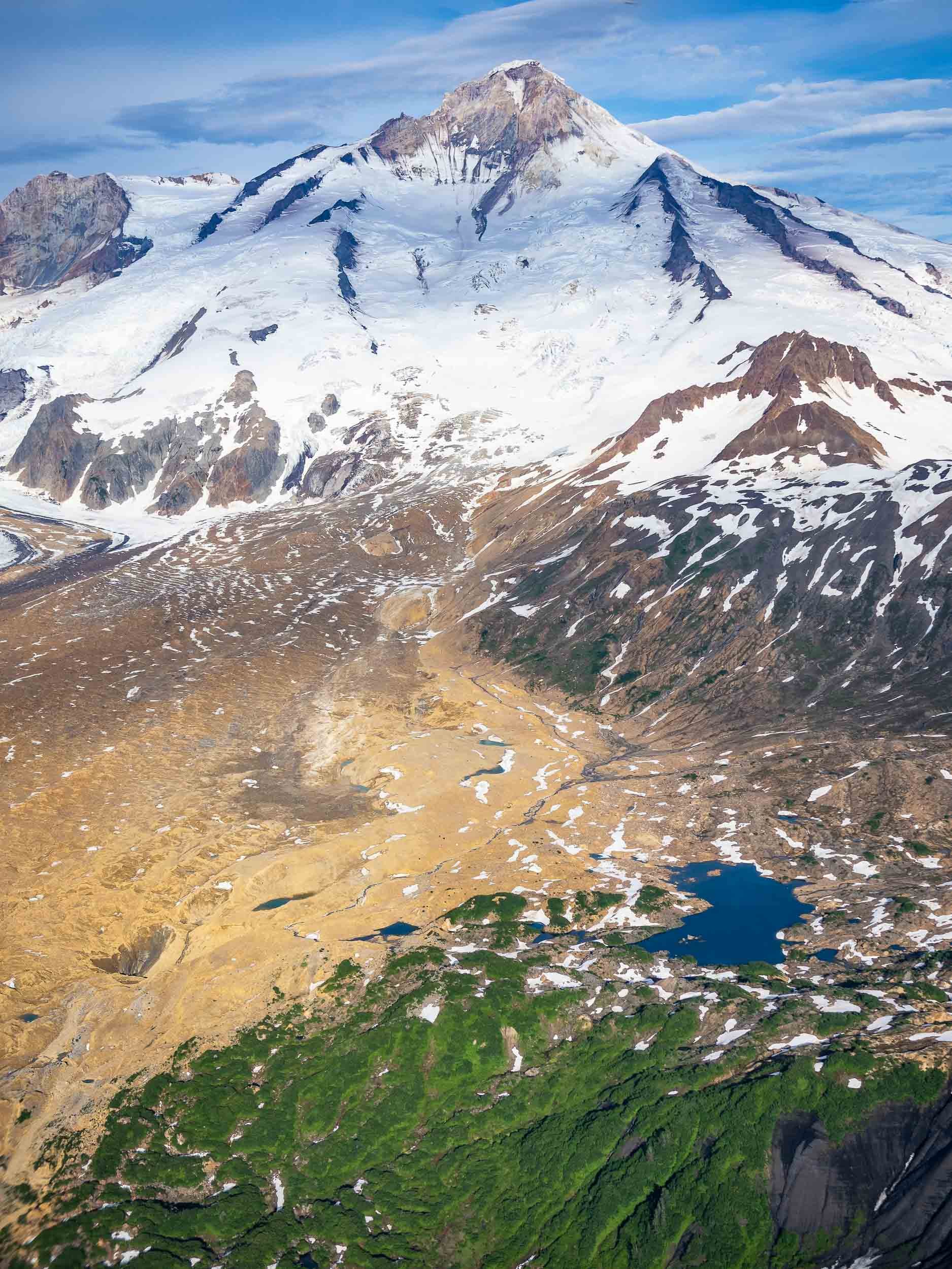
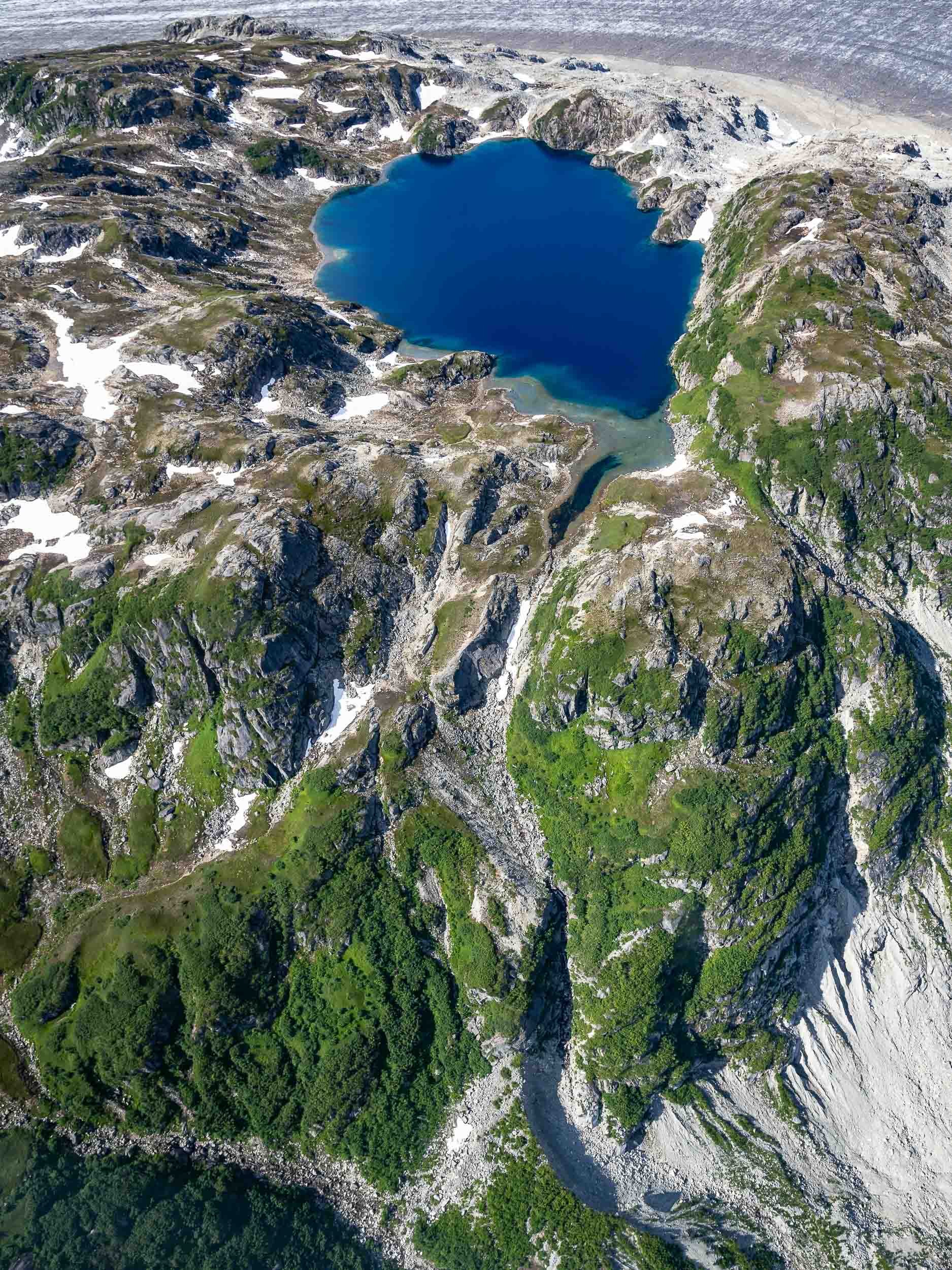
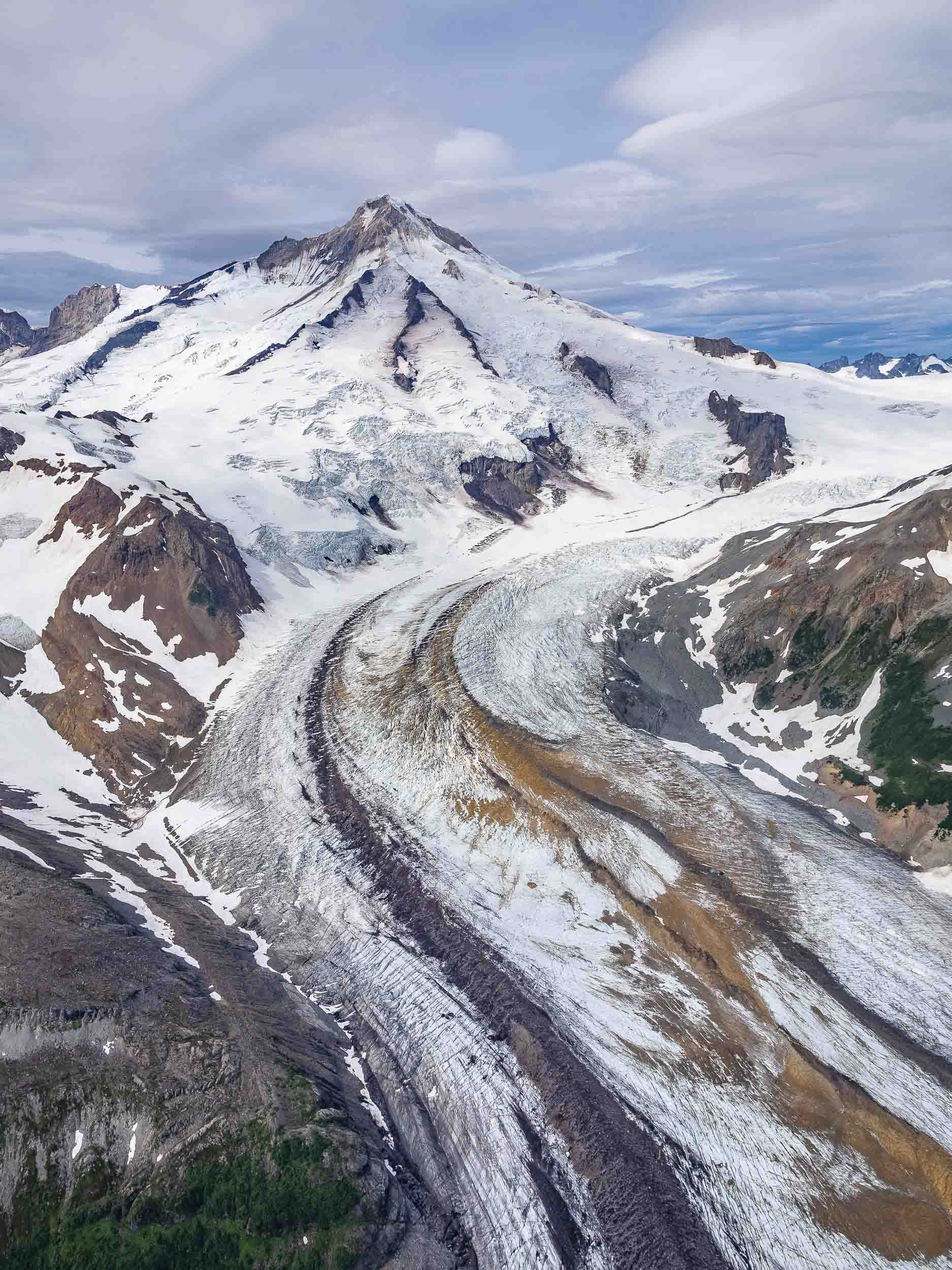
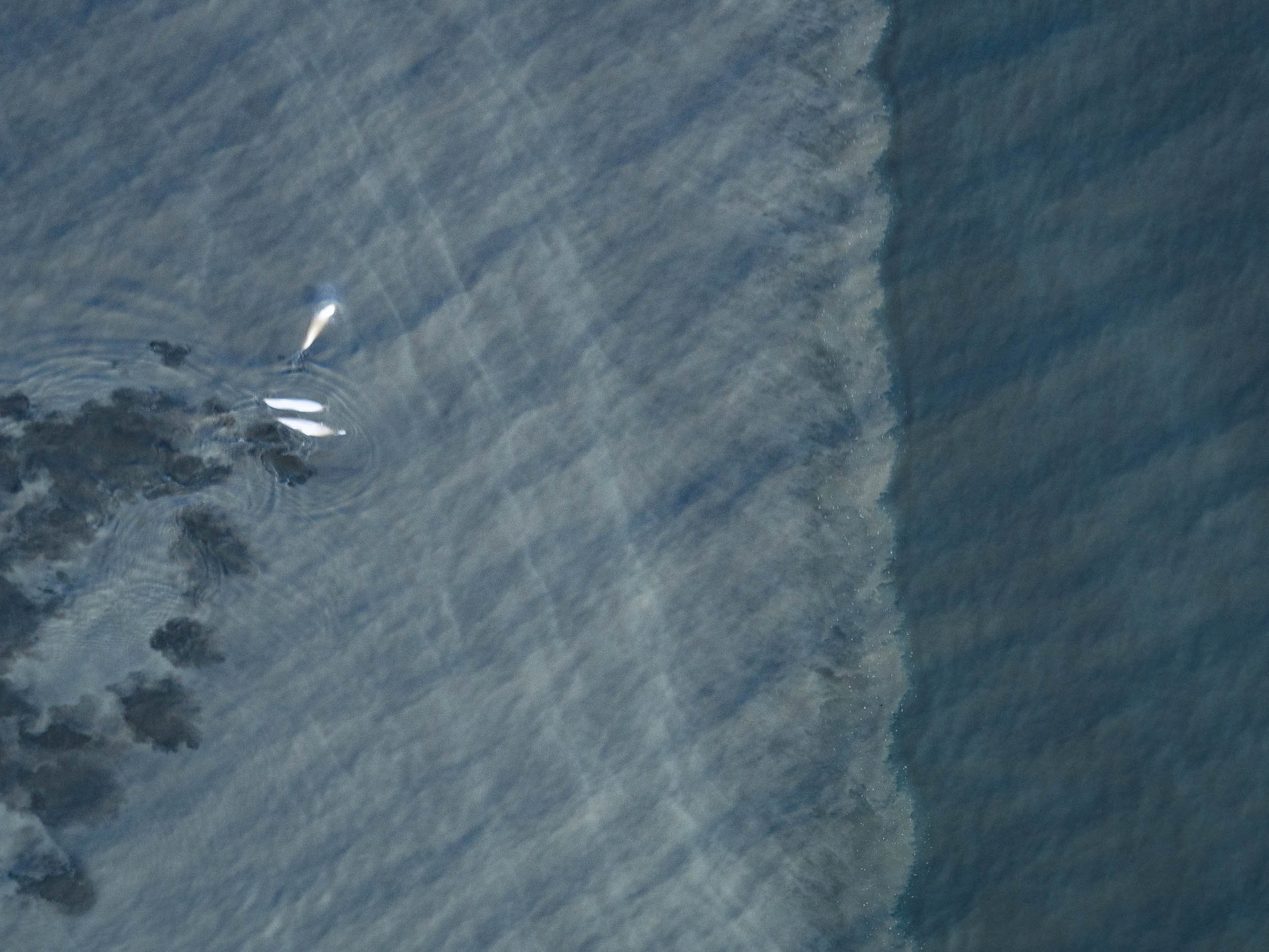
Valdez - Waterfalls and Kayaks
The next drive took us the small town of Valdez, at the head of a deep fjord in Prince William Sound. The journey is a beautiful one, past several glaciers and into canyons where one waterfalls follows the next.


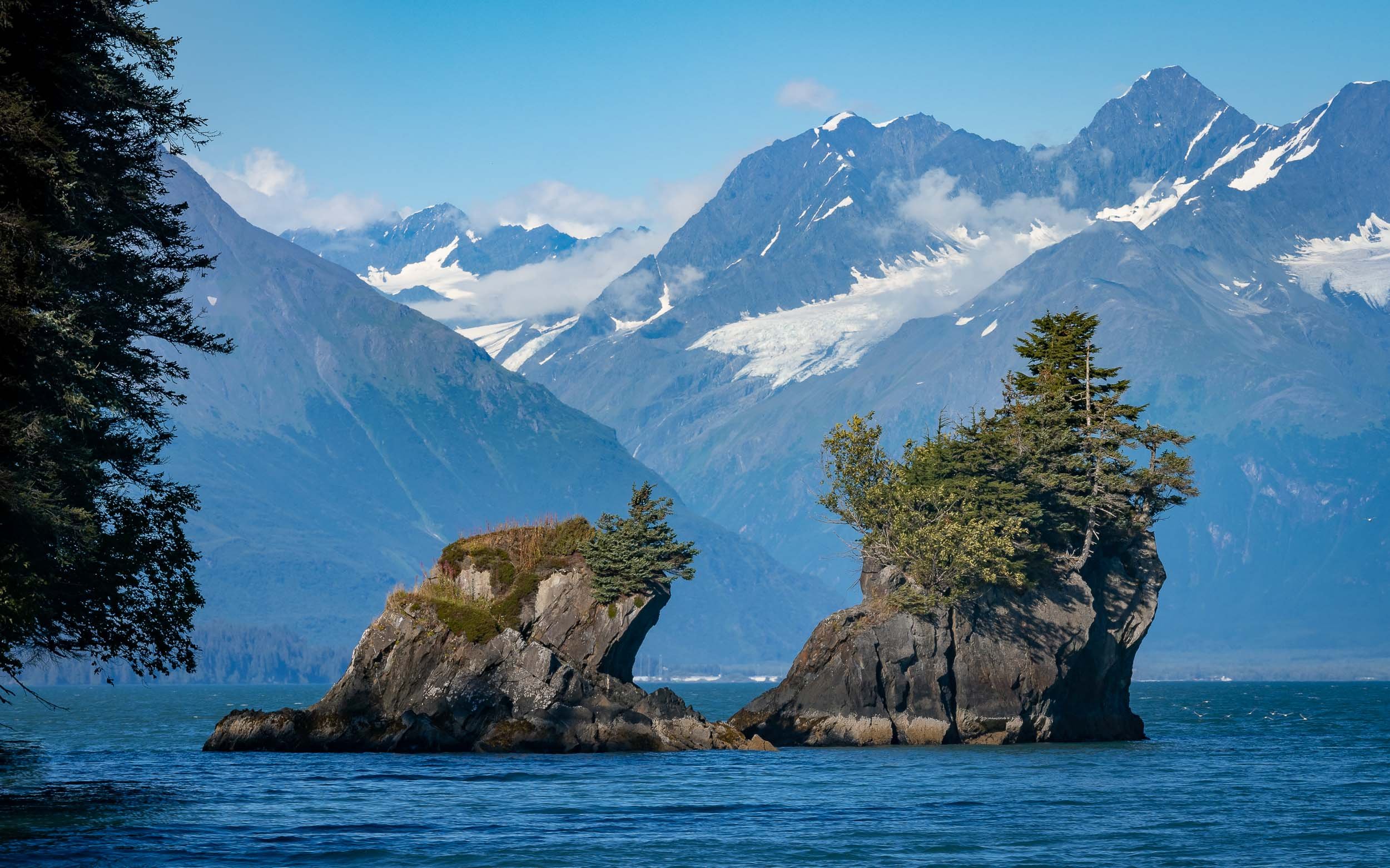
Next was a full day boat trip towards the end of the Valdez arm into the Columbia bay, home to one of the fastest moving glaciers in the world.

What was very special here is the fact we switched to a smaller and more manual method of transport once we reached the glacier - a Kayak. Moving through the ice like this was a very unique way to experience and explore the tidal glacier and the many icebergs originating from the calving of its terminus.
From Above
We had the chance to fly our drone from a small beach, providing some spectacular views of the landscape - and its inhabitants.


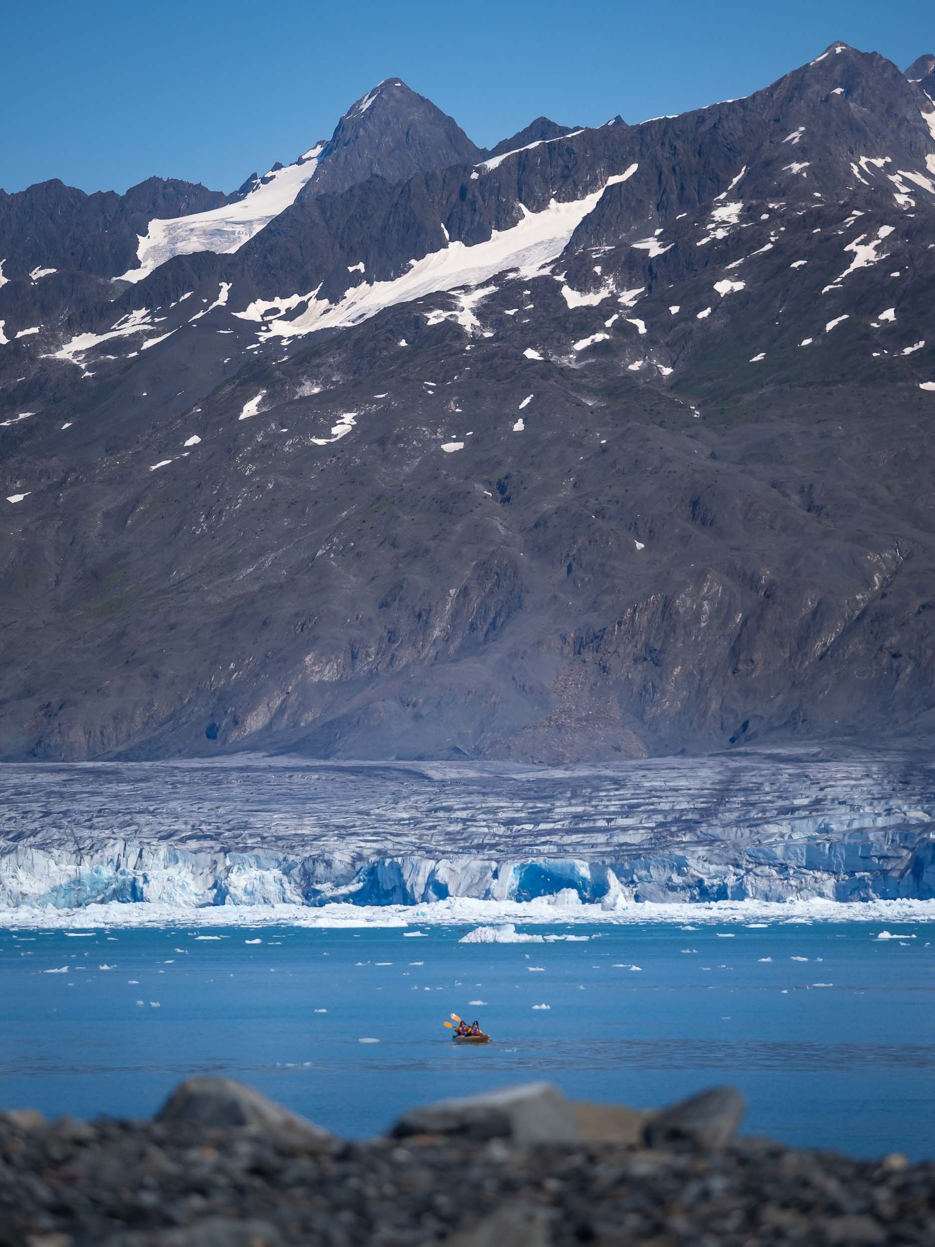


Sea Life
Aside from some chilled otters, we also spotted Steller sea lions, a near threatened species that had significantly declined since the 1970s but is slowly making a comeback, as well as porpoises, although getting a photo of them proved to be tricky.
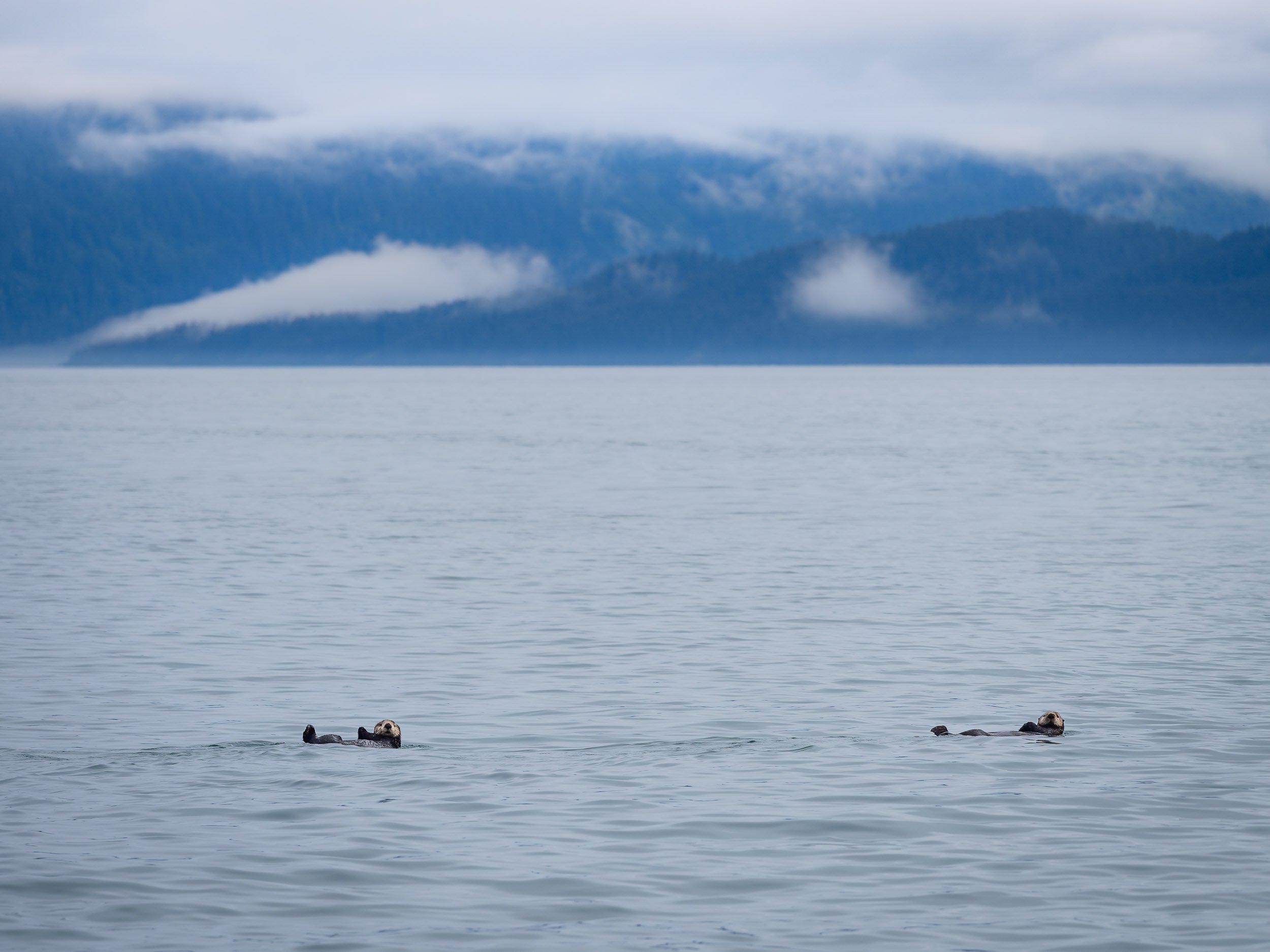


The Matanuska Glacier
On our way back from Valdez we crossed the Thompson pass, and on the next morning Alaska had one more glacier experience to offer: This time, we got even closer than in the kayak, since it is possible to hike on this icey giant.
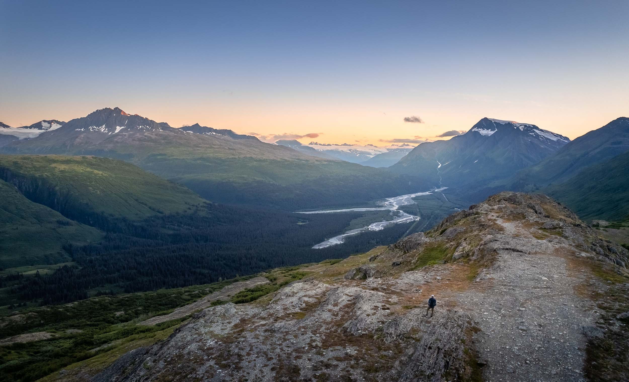
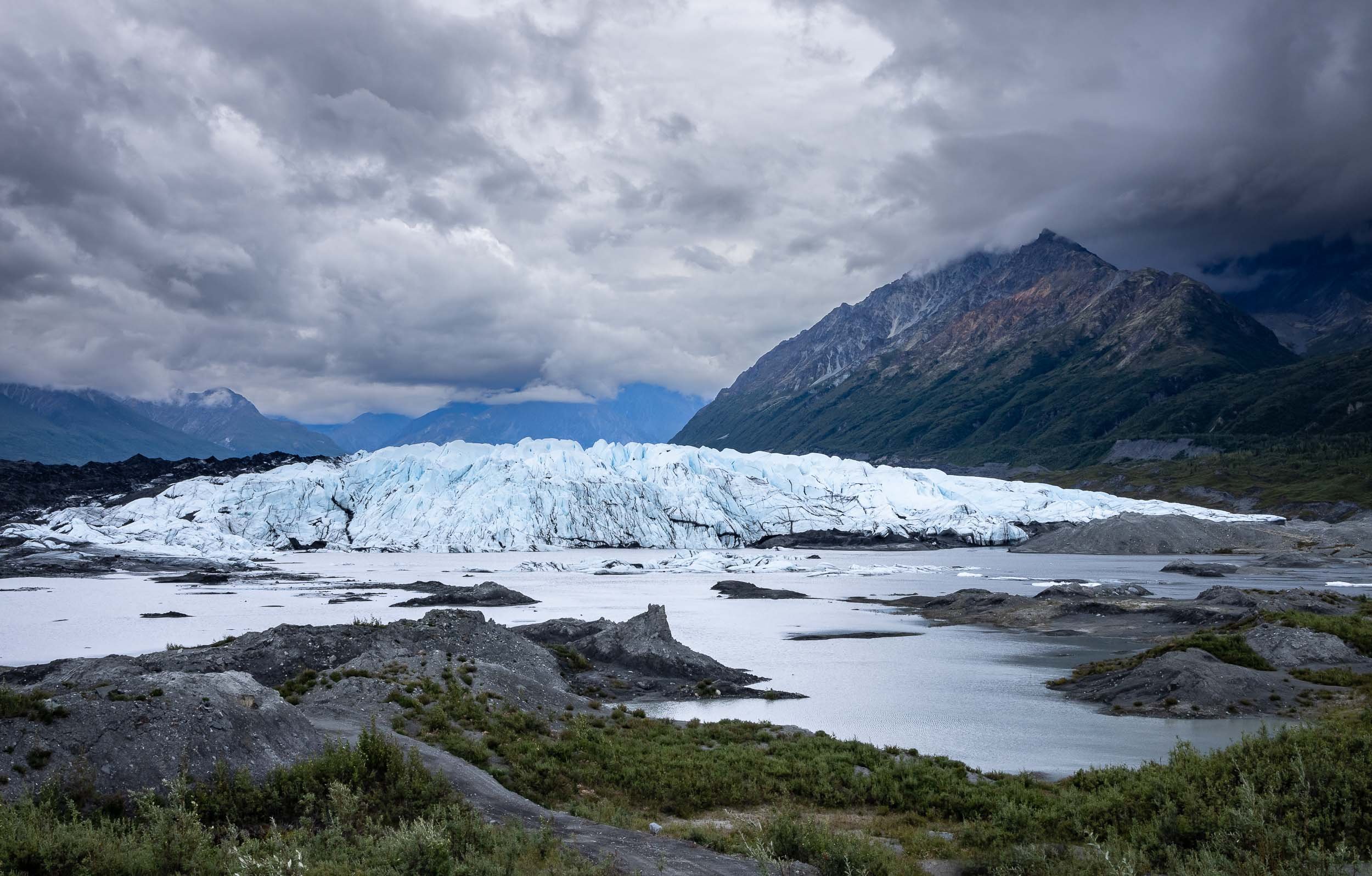
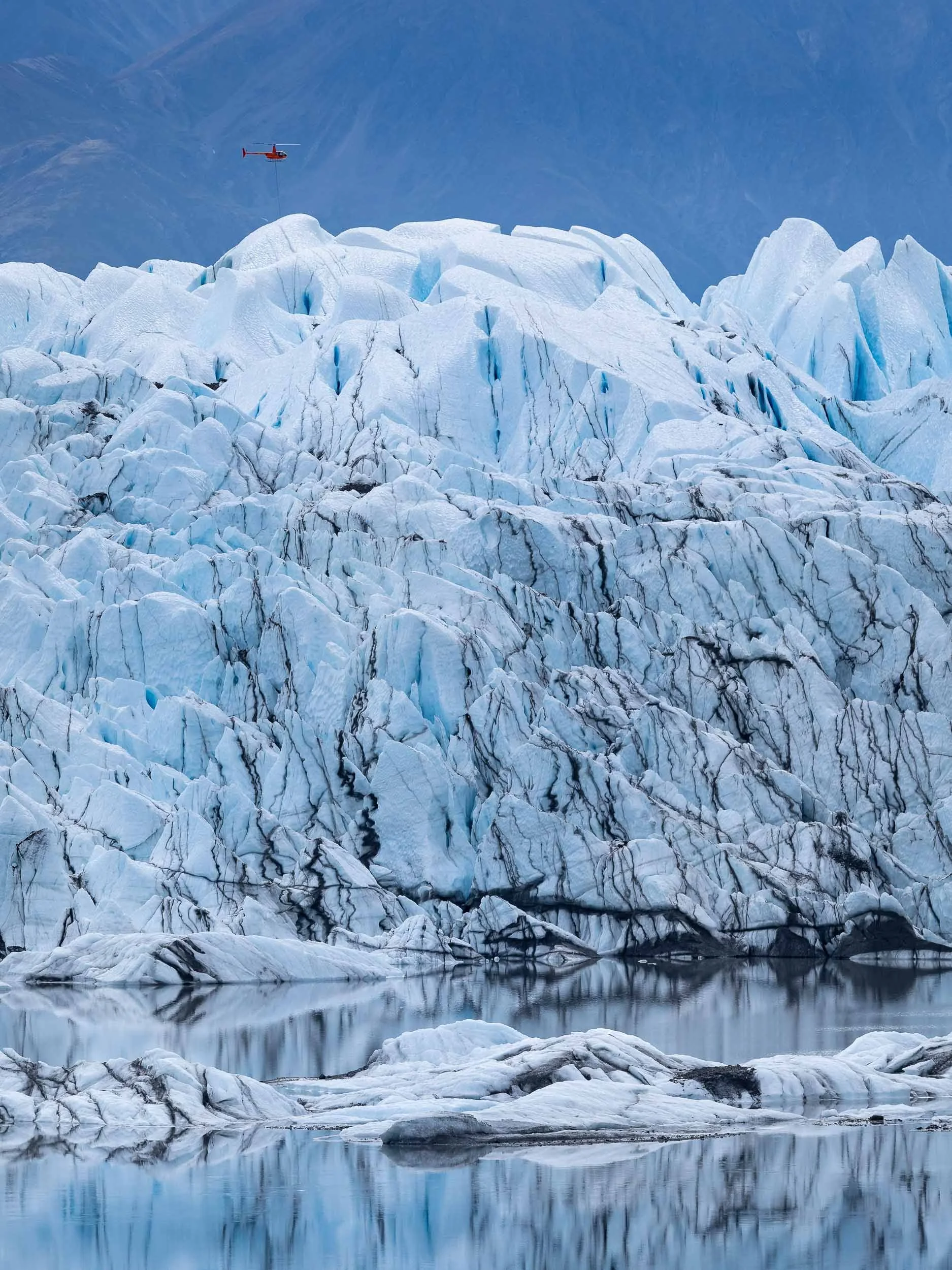
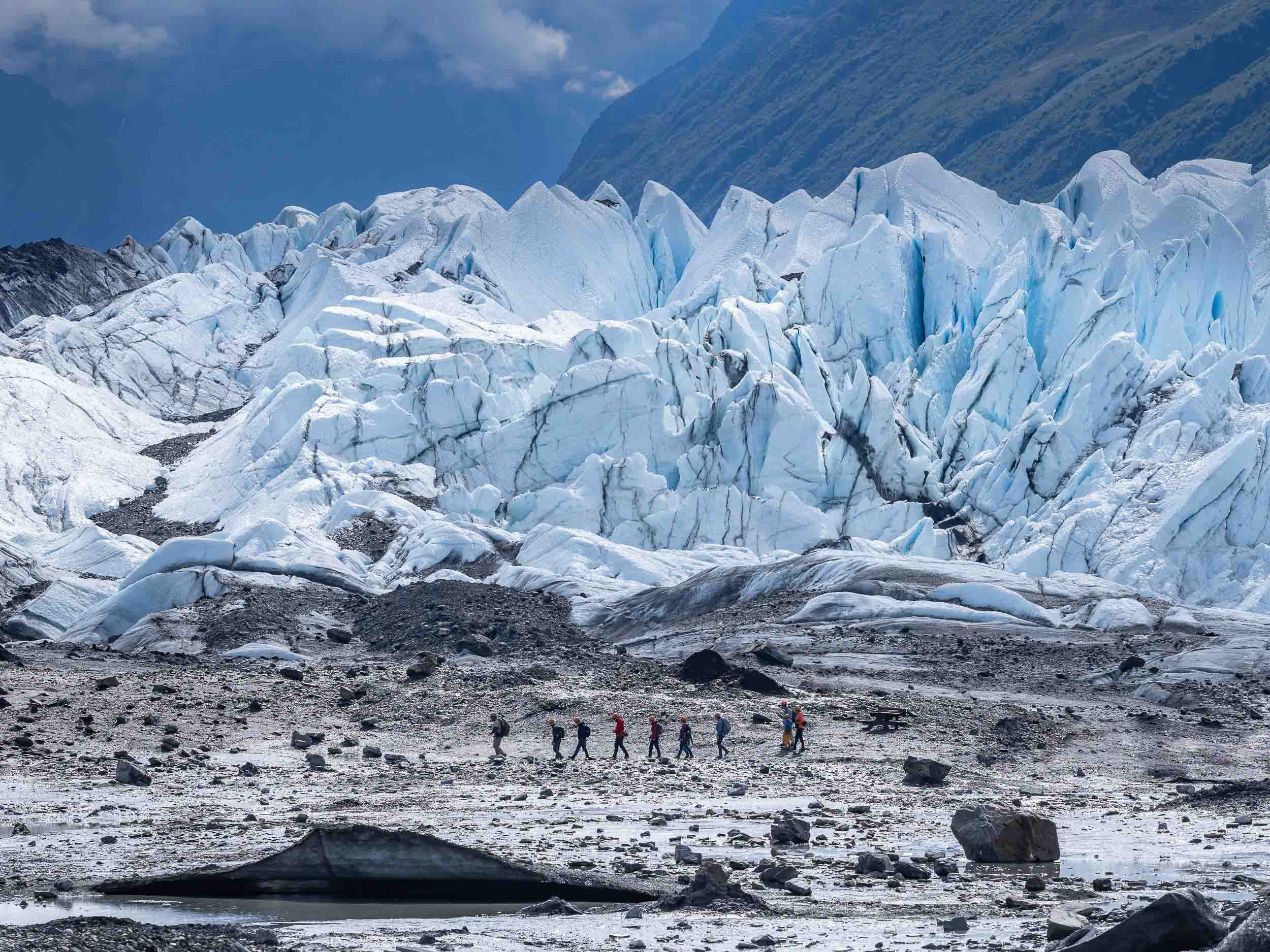


Alaska’s Most Unique House
The next destination was Denali National Park, and the road northwards also leads to a rather peculiar building better seen from the air: Goose Creek Tower, or colloquially “Dr Seuss House”.
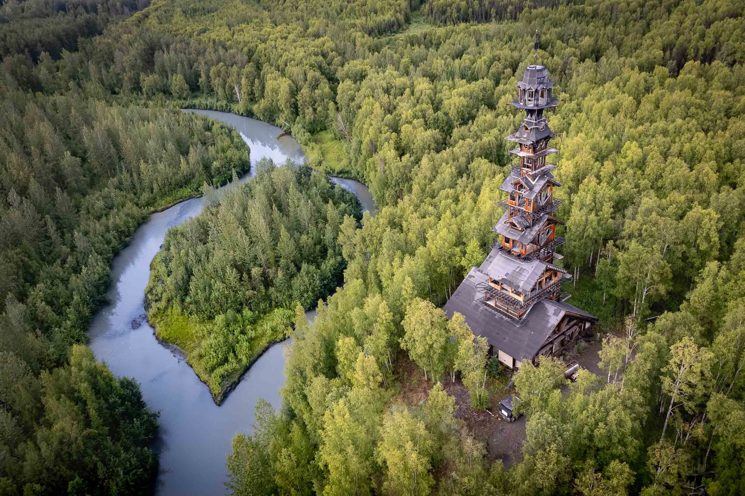
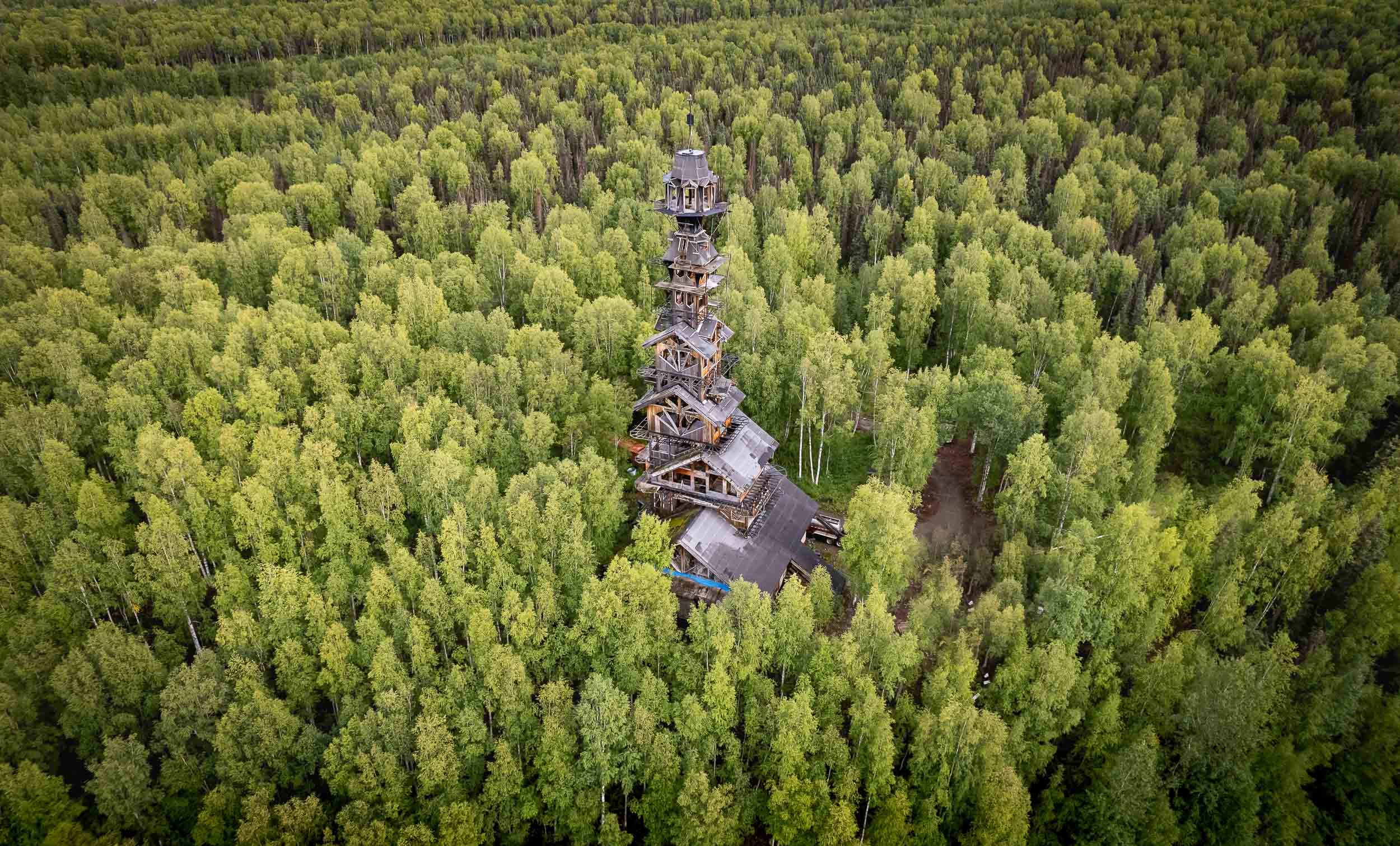
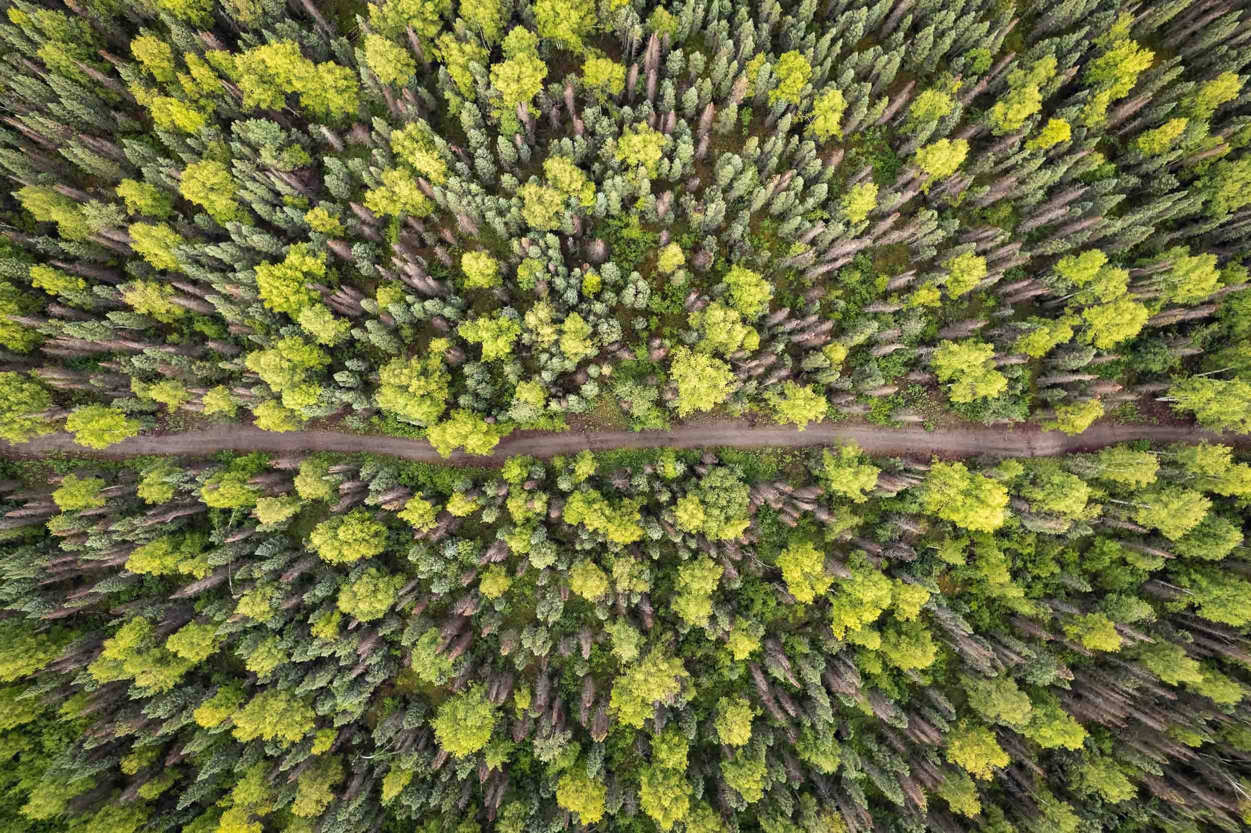
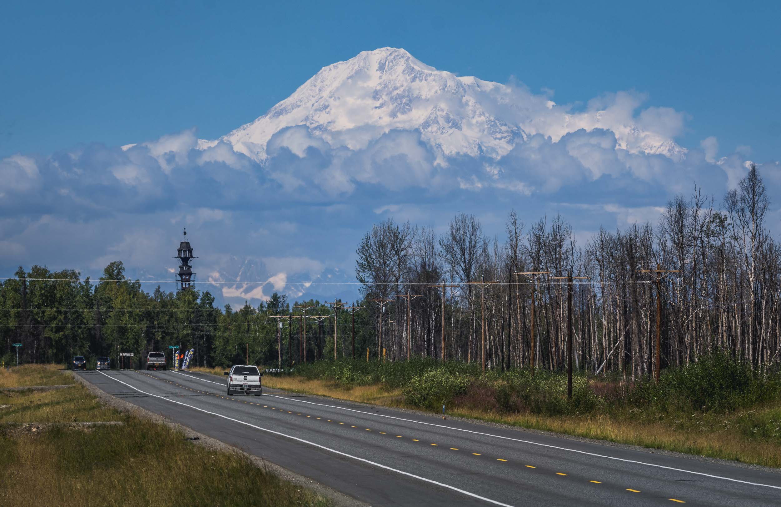
Denali - a National Park and North America’s tallest Mountain
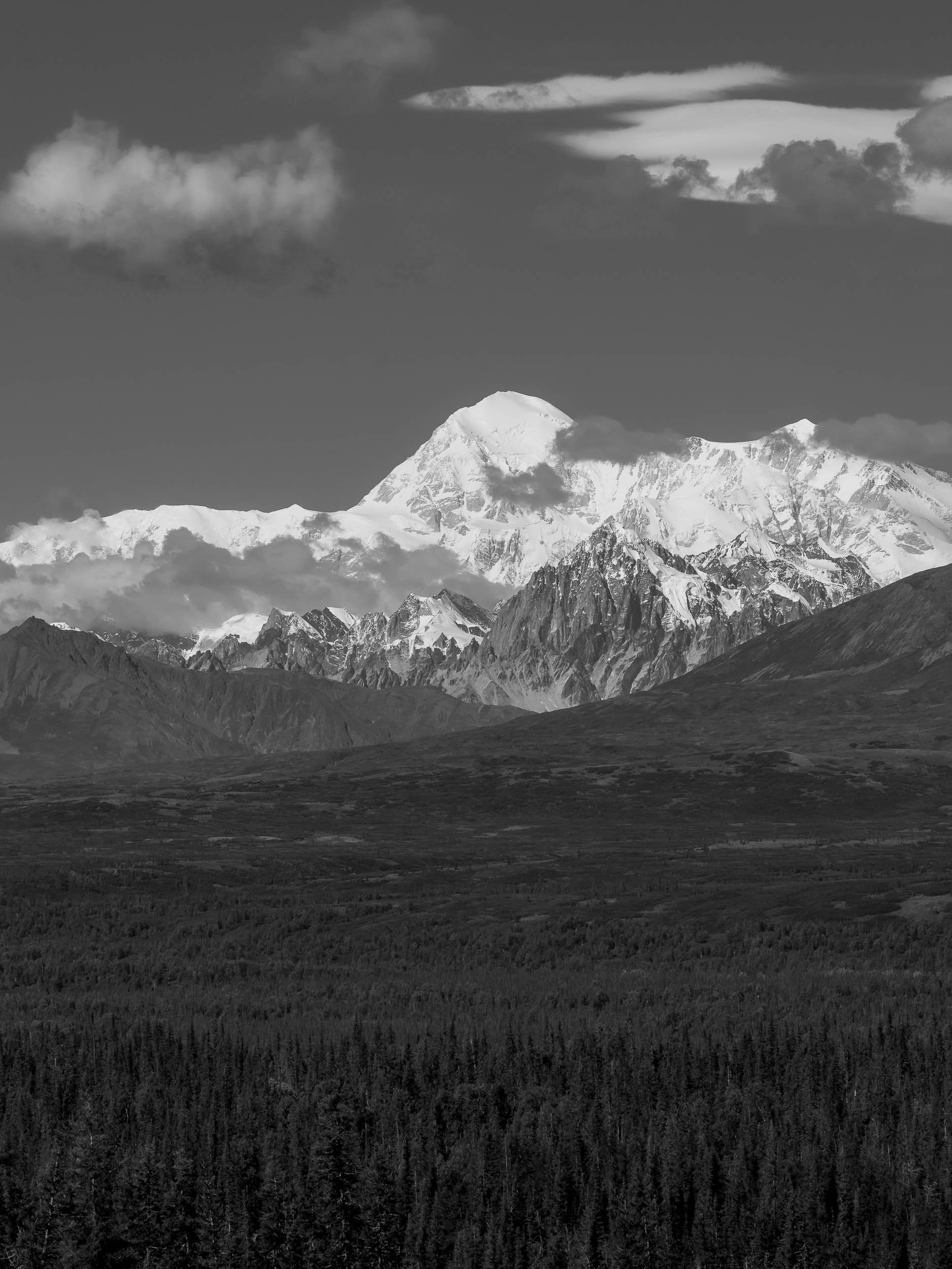
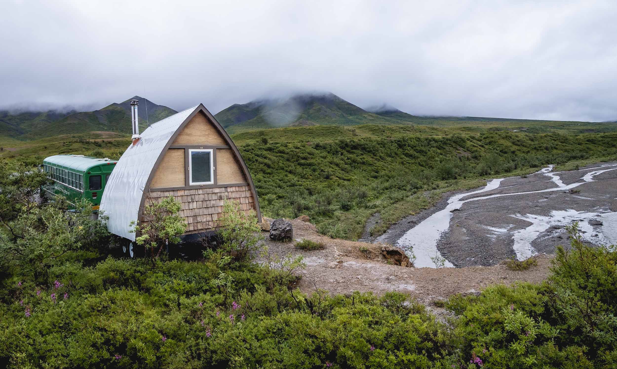
However, the next morning we had the chance to take a (dry) walk around Horseshoe lake, which features beautiful scenery reflected in the still lake waters, and a few beaver architectural masterpieces.
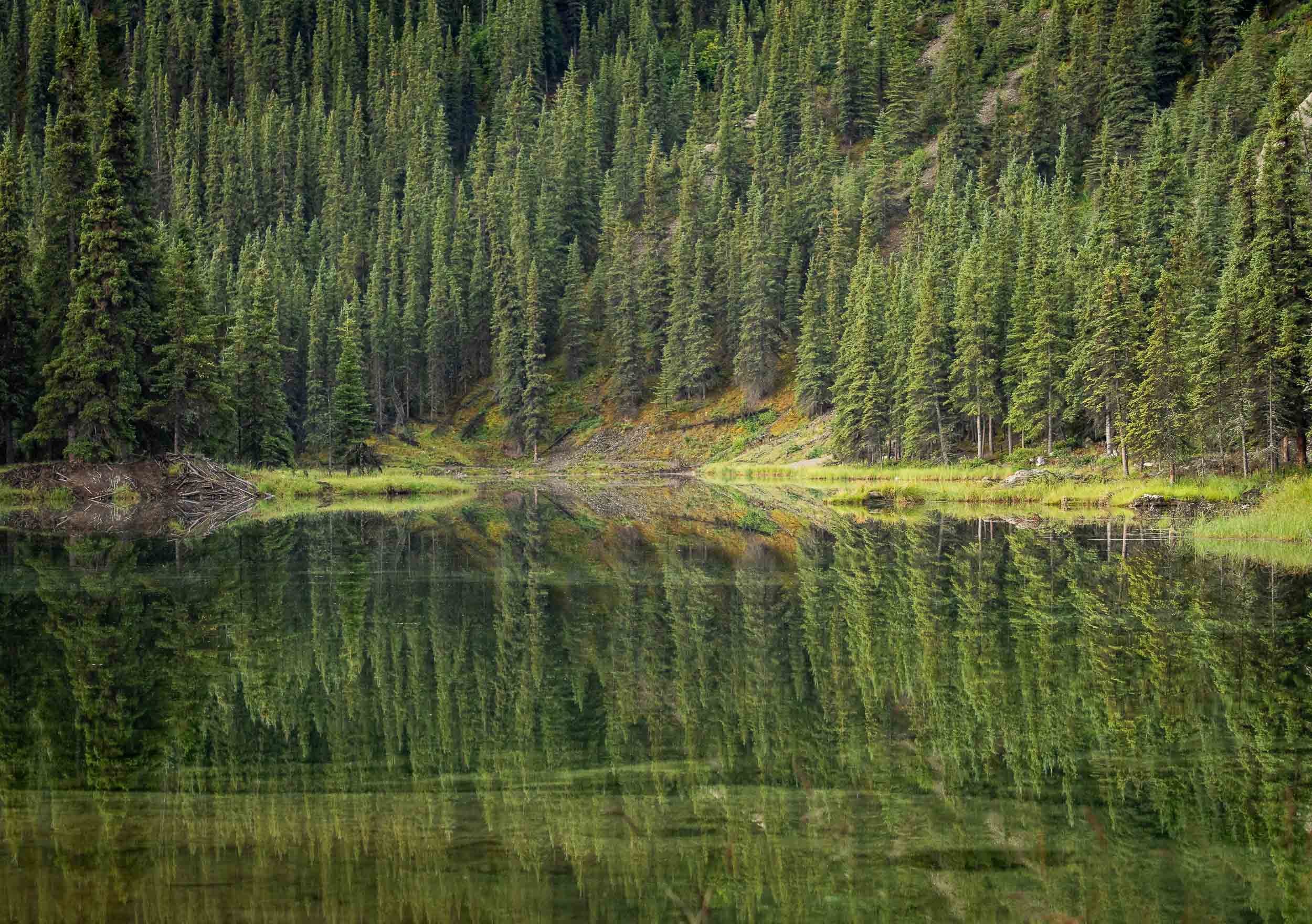


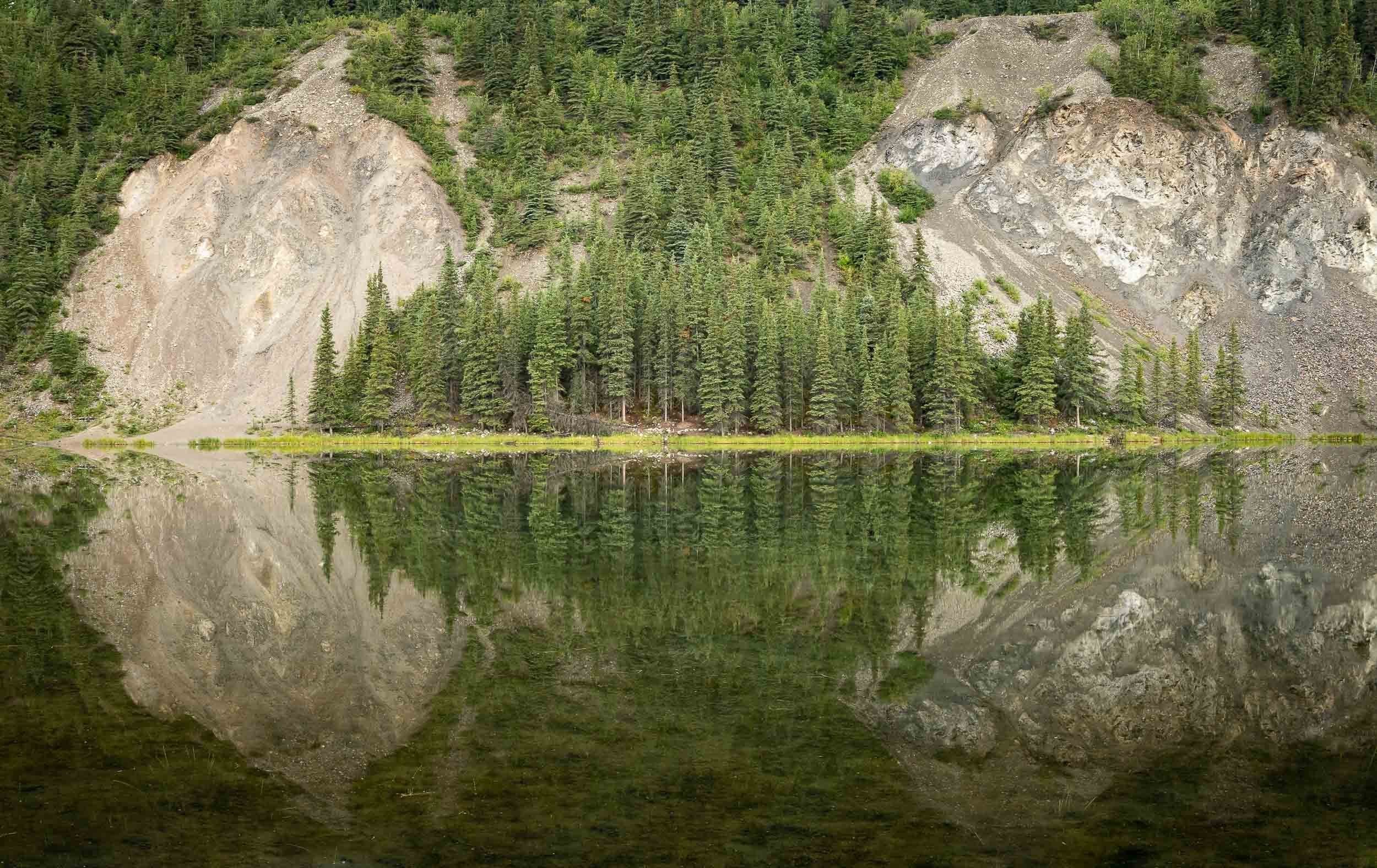
Denali also had a bit more wildlife in store for us, including Moose and Caribou, commonly known as their domesticated version - Reindeers.


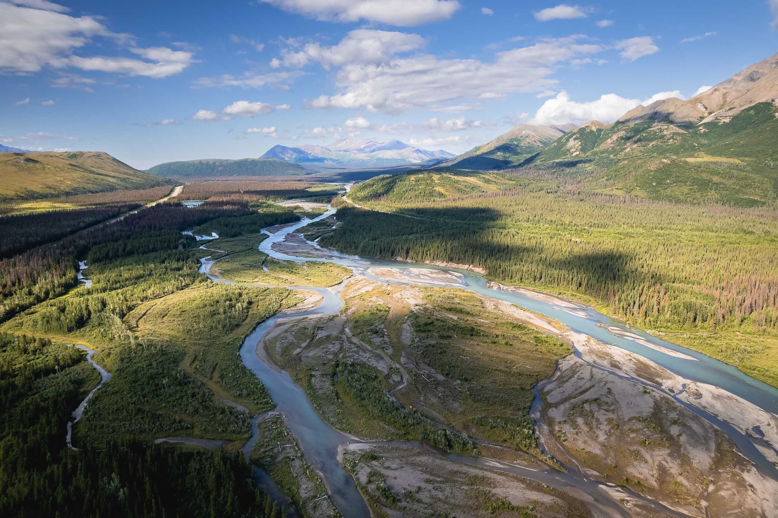
Watch more of Alaska’s landscapes from the air.
Thanks for making it until the end!